Sedimentation Survey of Lago Loíza, Puerto Rico ... - Caribbean
Sedimentation Survey of Lago Loíza, Puerto Rico ... - Caribbean
Sedimentation Survey of Lago Loíza, Puerto Rico ... - Caribbean

You also want an ePaper? Increase the reach of your titles
YUMPU automatically turns print PDFs into web optimized ePapers that Google loves.
5.0<br />
15.0<br />
14.0<br />
7.0<br />
Prepared in cooperation with the<br />
<strong>Puerto</strong> <strong>Rico</strong> Aqueduct and Sewer Authority<br />
1.0<br />
4.0<br />
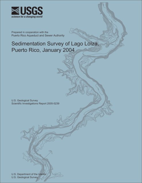
<strong>Sedimentation</strong> <strong>Survey</strong> <strong>of</strong> <strong>Lago</strong> <strong>Loíza</strong>,<br />
<strong>Puerto</strong> <strong>Rico</strong>, January 2004<br />
14.0<br />
6.0<br />
7.0<br />
9.0<br />
6.0<br />
14.0<br />
2.0<br />
12.0<br />
3.0<br />
4.0<br />
8.0<br />
5.0<br />
6.0<br />
7.0<br />
1.0<br />
14.0<br />
3.0<br />
U.S. Geological <strong>Survey</strong><br />
Scientific Investigations Report 2005-5239<br />
5.0<br />
4.0<br />
5.0<br />
3.0<br />
13.0<br />
2.0<br />
13.0<br />
3.0<br />
14.0<br />
11.0<br />
11.0<br />
13.0<br />
U.S. Department <strong>of</strong> the Interior<br />
U.S. Geological <strong>Survey</strong><br />
11.0<br />
12.0<br />
1.0
<strong>Sedimentation</strong> <strong>Survey</strong> <strong>of</strong> <strong>Lago</strong> <strong>Loíza</strong>,<br />
<strong>Puerto</strong> <strong>Rico</strong>, January 2004<br />
By Luis R. Soler-López and Fernando Gómez-Gómez<br />
Prepared in cooperation with the<br />
PUERTO RICO AQUEDUCT AND SEWER AUTHORITY<br />
Scientific Investigations Report 2005-5239<br />
U.S. Department <strong>of</strong> the Interior<br />
U.S. Geological <strong>Survey</strong>
U.S. Department <strong>of</strong> the Interior<br />
Gale A. Norton, Secretary<br />
U.S. Geological <strong>Survey</strong><br />
P. Patrick Leahy, Acting Director<br />
U.S. Geological <strong>Survey</strong>, Reston, Virginia: 2005<br />
For sale by U.S. Geological <strong>Survey</strong>, Information Services<br />
Box 25286, Denver Federal Center<br />
Denver, CO 80225<br />
For more information about the USGS and its products:<br />
Telephone: 1-888-ASK-USGS<br />
World Wide Web: http://www.usgs.gov/<br />
Any use <strong>of</strong> trade, product, or firm names in this publication is for descriptive purposes only and does not imply <br />
endorsement by the U.S. Government.<br />
Although this report is in the public domain, permission must be secured from the individual copyright owners to<br />
reproduce any copyrighted materials contained within this report.<br />
Suggested citation:<br />
Soler-López, L.R., and Gómez-Gómez, Fernando, 2005, <strong>Sedimentation</strong> survey <strong>of</strong> <strong>Lago</strong> <strong>Loíza</strong>, <strong>Puerto</strong> <strong>Rico</strong>, January 2004:<br />
U.S. Geological <strong>Survey</strong> Scientific Investigations Report 2005-5239, 26 p., 2 pls.
iii<br />
Contents<br />
Abstract. . . . . . . . . . . . . . . . . . . . . . . . . . . . . . . . . . . . . . . . . . . . . . . . . . . . . . . . . . . . . . . . . . . . . . . . . . . . . . . . . . . . . . . . . . . . . . . . . . . . . 1<br />
Introduction . . . . . . . . . . . . . . . . . . . . . . . . . . . . . . . . . . . . . . . . . . . . . . . . . . . . . . . . . . . . . . . . . . . . . . . . . . . . . . . . . . . . . . . . . . . . . . . . . 1<br />
Dam, Reservoir, and Basin Characteristics . . . . . . . . . . . . . . . . . . . . . . . . . . . . . . . . . . . . . . . . . . . . . . . . . . . . . . . . . . . . . . . . . . 2<br />
Method <strong>of</strong> <strong>Survey</strong> . . . . . . . . . . . . . . . . . . . . . . . . . . . . . . . . . . . . . . . . . . . . . . . . . . . . . . . . . . . . . . . . . . . . . . . . . . . . . . . . . . . . . . . . . . . 2<br />
Field Techniques . . . . . . . . . . . . . . . . . . . . . . . . . . . . . . . . . . . . . . . . . . . . . . . . . . . . . . . . . . . . . . . . . . . . . . . . . . . . . . . . . . . . . . 7<br />
Data Processing . . . . . . . . . . . . . . . . . . . . . . . . . . . . . . . . . . . . . . . . . . . . . . . . . . . . . . . . . . . . . . . . . . . . . . . . . . . . . . . . . . . . . . 7<br />
Historical Sediment Accumulation and Effect on Reservoir Storage. . . . . . . . . . . . . . . . . . . . . . . . . . . . . . . . . . . . . . . . . 19<br />
Sediment Trapping Efficiency. . . . . . . . . . . . . . . . . . . . . . . . . . . . . . . . . . . . . . . . . . . . . . . . . . . . . . . . . . . . . . . . . . . . . . . . . . . . . . . 22<br />
Sediment Yield and Reservoir Life Expectancy. . . . . . . . . . . . . . . . . . . . . . . . . . . . . . . . . . . . . . . . . . . . . . . . . . . . . . . . . . . . . . 22<br />
Summary and Conclusions . . . . . . . . . . . . . . . . . . . . . . . . . . . . . . . . . . . . . . . . . . . . . . . . . . . . . . . . . . . . . . . . . . . . . . . . . . . . . . . . . 24<br />
Cited References. . . . . . . . . . . . . . . . . . . . . . . . . . . . . . . . . . . . . . . . . . . . . . . . . . . . . . . . . . . . . . . . . . . . . . . . . . . . . . . . . . . . . . . . . . . 25<br />
Plates<br />
[Plates are in pocket]<br />
1. <strong>Lago</strong> <strong>Loíza</strong>, <strong>Puerto</strong> <strong>Rico</strong>, Bathymetry, January 2004, Northern Section<br />
2. <strong>Lago</strong> <strong>Loíza</strong>, <strong>Puerto</strong> <strong>Rico</strong>, Bathymetry, January 2004, Southern Section
iv<br />
Figures<br />
1–6. Maps showing:<br />
1. Location <strong>of</strong> <strong>Lago</strong> <strong>Loíza</strong> in the Río Grande de <strong>Loíza</strong> Basin, <strong>Puerto</strong> <strong>Rico</strong>. . . . . . . . . . . . . . . . . . . . . . . . . .3<br />
2. Mean annual rainfall distribution in <strong>Puerto</strong> <strong>Rico</strong>. . . . . . . . . . . . . . . . . . . . . . . . . . . . . . . . . . . . . . . . . . . . . . .5<br />
3. Planned cross-section locations for the January 2004 bathymetric survey <strong>of</strong> <br />
<strong>Lago</strong> <strong>Loíza</strong>, <strong>Puerto</strong> <strong>Rico</strong>. . . . . . . . . . . . . . . . . . . . . . . . . . . . . . . . . . . . . . . . . . . . . . . . . . . . . . . . . . . . . . . . . . . . . . .6<br />
4. Actual track lines <strong>of</strong> the January 2004 bathymetric survey <strong>of</strong> <strong>Lago</strong> <strong>Loíza</strong>,<br />
<strong>Puerto</strong> <strong>Rico</strong>. . . . . . . . . . . . . . . . . . . . . . . . . . . . . . . . . . . . . . . . . . . . . . . . . . . . . . . . . . . . . . . . . . . . . . . . . . . . . . . . . . .8<br />
5. Triangulated irregular network surface model <strong>of</strong> <strong>Lago</strong> <strong>Loíza</strong>, <strong>Puerto</strong> <strong>Rico</strong>, <br />
for January 2004. . . . . . . . . . . . . . . . . . . . . . . . . . . . . . . . . . . . . . . . . . . . . . . . . . . . . . . . . . . . . . . . . . . . . . . . . . . . . .9<br />
6. Reference longitudinal distance along the thalweg <strong>of</strong> <strong>Lago</strong> <strong>Loíza</strong>, <strong>Puerto</strong> <strong>Rico</strong>. . . . . . . . . . . . . . . 10<br />
7–11. Graphs showing:<br />
7. Relation between water-storage capacity and pool elevation <strong>of</strong> <strong>Lago</strong> <strong>Loíza</strong>, <br />
<strong>Puerto</strong> <strong>Rico</strong>, for 1994, 1999, and 2004 . . . . . . . . . . . . . . . . . . . . . . . . . . . . . . . . . . . . . . . . . . . . . . . . . . . . . . . . 11<br />
8. Selected cross sections generated from the TIN surface models <strong>of</strong> <strong>Lago</strong> <strong>Loíza</strong>, <br />
<strong>Puerto</strong> <strong>Rico</strong>, for 1994, 1999, and 2004 . . . . . . . . . . . . . . . . . . . . . . . . . . . . . . . . . . . . . . . . . . . . . . . . . . . . . . . . 12<br />
9. Longitudinal pr<strong>of</strong>iles along the thalweg <strong>of</strong> <strong>Lago</strong> <strong>Loíza</strong>, <strong>Puerto</strong> <strong>Rico</strong>, generated <br />
from the TIN surface models for 1994, 1999, and 2004. . . . . . . . . . . . . . . . . . . . . . . . . . . . . . . . . . . . . . . . 18<br />
10. <strong>Lago</strong> <strong>Loíza</strong> storage capacities and sediment accumulation rates from 1953 <br />
to 2004. . . . . . . . . . . . . . . . . . . . . . . . . . . . . . . . . . . . . . . . . . . . . . . . . . . . . . . . . . . . . . . . . . . . . . . . . . . . . . . . . . . . . . 21<br />
11. Reservoir trapping efficiency as a function <strong>of</strong> the ratio between water-storage <br />
capacity and annual water inflow volume. . . . . . . . . . . . . . . . . . . . . . . . . . . . . . . . . . . . . . . . . . . . . . . . . . . 23<br />
Tables<br />
1. Principal characteristics <strong>of</strong> <strong>Lago</strong> <strong>Loíza</strong> and structures . . . . . . . . . . . . . . . . . . . . . . . . . . . . . . . . . . . . . . . . . . . . . .4<br />
2. Comparison between the 1994, 1999, and 2004 sedimentation surveys <strong>of</strong> <strong>Lago</strong> <strong>Loíza</strong>, <br />
<strong>Puerto</strong> <strong>Rico</strong> . . . . . . . . . . . . . . . . . . . . . . . . . . . . . . . . . . . . . . . . . . . . . . . . . . . . . . . . . . . . . . . . . . . . . . . . . . . . . . . . . . . . . . 19<br />
3. Storage capacity for <strong>Lago</strong> <strong>Loíza</strong>, <strong>Puerto</strong> <strong>Rico</strong>, January 2004. . . . . . . . . . . . . . . . . . . . . . . . . . . . . . . . . . . . . . . 22<br />
4. Suspended-sediment loads at tributary streams to <strong>Lago</strong> <strong>Loíza</strong> for water years <br />
1996 to 2002 . . . . . . . . . . . . . . . . . . . . . . . . . . . . . . . . . . . . . . . . . . . . . . . . . . . . . . . . . . . . . . . . . . . . . . . . . . . . . . . . . . . . . . 23
v<br />
Conversion Factors and Datum, Acronyms, and Translations<br />
Multiply By To obtain<br />
Length<br />
centimeter (cm) 0.3937 inch (in.)<br />
millimeter (mm) 0.03937 inch (in.)<br />
meter (m) 3.281 foot (ft)<br />
kilometer (km) 0.6214 mile (mi)<br />
Area<br />
square meter (m 2 ) 0.0002471 acre<br />
square kilometer (km 2 ) 247.1 acre<br />
square meter (m 2 ) 10.76 square foot (ft 2 )<br />
Volume<br />
cubic meter (m 3 ) 35.31 cubic foot (ft 3 )<br />
cubic meter (m 3 ) 0.0008107 acre-foot (acre-ft)<br />
Flow rate<br />
cubic meter per year (m 3 /yr) 0.000811 acre-foot per year (acre-ft/yr)<br />
cubic meter per day (m 3 /d) 35.31 cubic foot per day (ft 3 /d)<br />
millimeter per year (mm/yr) 0.03937 inch per year (in/yr)<br />
Mass<br />
gram (g) 0.03527 ounce, avoirdupois (oz)<br />
megagram (Mg) 1.102 ton, short (2,000 lb)<br />
megagram (Mg) 0.9842 ton, long (2,240 lb)<br />
metric ton per day 1.102 ton per day (ton/d)<br />
Datum:<br />
Temperature in degrees Celsius (°C) may be converted to degrees Fahrenheit (°F) as follows:<br />
°F = (1.8 x °C) + 32<br />
Horizontal Datum - <strong>Puerto</strong> <strong>Rico</strong> Datum, 1940 Adjustment<br />
Sea level: In this report, "sea level" refers to the National Geodetic Vertical Datum <strong>of</strong> 1929 (NGVD <strong>of</strong> 1929) -<br />
a geodetic datum derived from a general adjustment <strong>of</strong> the first-order level nets <strong>of</strong> the United States and Canada,<br />
formerly called "Sea Level Datum <strong>of</strong> 1929".<br />
Acronyms used in this report:<br />
BLASS Bathymetric/Land <strong>Survey</strong> System<br />
DGPS Differential Global Positioning System<br />
GIS<br />
Geographic Information System<br />
GPS Global Positioning System<br />
PRASA <strong>Puerto</strong> <strong>Rico</strong> Aqueduct and Sewer Authority<br />
PRIFA <strong>Puerto</strong> <strong>Rico</strong> Infrastructure Financing Authority<br />
TIN<br />
Triangulated Irregular Network<br />
USGS U.S. Geological <strong>Survey</strong><br />
Translations:<br />
Spanish<br />
<strong>Lago</strong><br />
Río<br />
municipio<br />
English<br />
Lake (in <strong>Puerto</strong> <strong>Rico</strong>, also reservoir)<br />
River<br />
municipality
<strong>Sedimentation</strong> <strong>Survey</strong> <strong>of</strong> <strong>Lago</strong> <strong>Loíza</strong>, <strong>Puerto</strong> <strong>Rico</strong>, <br />
January 2004<br />
By Luis R. Soler-López and Fernando Gómez-Gómez<br />
Abstract<br />
A sedimentation survey <strong>of</strong> <strong>Lago</strong> <strong>Loíza</strong> reservoir was<br />
conducted during January 2004 to determine the reservoir<br />
water-storage capacity. After a bathymetric survey performed<br />
on November 1994, the drainage basin was impacted by<br />
Hurricanes Hortense on September 10, 1996, and Georges on<br />
September 21, 1998. In addition, dredging was conducted<br />
between 1997 and 1999 to increase the storage capacity by<br />
about 5.8 million cubic meters to increase the public-supply<br />
water safe yield at the Sergio Cuevas Filtration Plant.<br />
The results <strong>of</strong> the 2004 bathymetric survey indicate that<br />
the storage capacity <strong>of</strong> <strong>Lago</strong> <strong>Loíza</strong> reservoir was 17.53 million<br />
cubic meters or 3.34 million cubic meters greater than the<br />
November 1994 capacity. The long-term reservoir<br />
sedimentation rate is about 310,000 cubic meters per year;<br />
however, higher annual rates have occurred since the reservoir<br />
construction, but these rates are considered short-term, low<br />
occurrence, and principally associated with land-use<br />
disturbances and extreme run<strong>of</strong>f events.<br />
The estimated sediment trapping efficiency <strong>of</strong> <strong>Lago</strong> <strong>Loíza</strong><br />
was as follows: 72 percent in 1994, 78 percent in 1999, and 76<br />
percent in 2004. The <strong>Lago</strong> <strong>Loíza</strong> drainage area sediment yield<br />
for the period 1994 to 2004 was 859 cubic meters per square<br />
kilometer per year, about one-and-a-half times higher than the<br />
previously (1990-1994) estimated value <strong>of</strong> 600 cubic meters per<br />
square kilometer per year.<br />
Based on the 2004 bathymetric survey, the continued<br />
utility <strong>of</strong> <strong>Lago</strong> <strong>Loíza</strong> as a water-supply reservoir is about 56<br />
more years. Based on the average long-term reservoir<br />
sedimentation rate <strong>of</strong> 310,000 cubic meters per year, however,<br />
the storage added by the dredging, which was conducted from<br />
1997 to 1999, will be lost by 2018.<br />
Introduction<br />
The <strong>Lago</strong> <strong>Loíza</strong> reservoir has a drainage area <strong>of</strong> 538 square<br />
kilometers (km 2 ) and constitutes the principal source <strong>of</strong> public<br />
water supply to the eastern part <strong>of</strong> the San Juan metropolitan<br />
area. During 2003, the reservoir supplied an average <strong>of</strong> 394,000<br />
cubic meters per day (m 3 /d) to the <strong>Puerto</strong> <strong>Rico</strong> Aqueduct and<br />
Sewer Authority (PRASA) Sergio Cuevas Filtration Plant<br />
(W. Molina, U.S. Geological <strong>Survey</strong>, written commun., 2004).<br />
The ability to maintain this draft rate, however, is determined<br />
primarily by the available storage, which by 1994 on a longterm<br />
basis (1953-1994) was reduced, on average, by about<br />
337,000 cubic meters per year (m 3 /yr) by sedimentation, based<br />
on several sedimentation surveys conducted in the past (Webb<br />
and Soler-López, 1997). The effect <strong>of</strong> sedimentation became<br />
evident during the drought <strong>of</strong> 1994, when rainfall in<br />
northwestern <strong>Puerto</strong> <strong>Rico</strong> was about 30 percent below normal<br />
between August 1993 and September 1994. At the time <strong>of</strong> the<br />
drought, the available storage capacity in <strong>Lago</strong> <strong>Loíza</strong> was about<br />
14.2 million m 3 , which was about 7 million m 3 below the<br />
required storage capacity to have sustained a draft rate <strong>of</strong> about<br />
360,000 m 3 /d (Rodríguez-Martínez and others, 2002). In order<br />
to alleviate a future water supply short-fall, the <strong>Puerto</strong> <strong>Rico</strong><br />
Infrastructure Financing Authority (PRIFA) authorized the<br />
dredging <strong>of</strong> <strong>Lago</strong> <strong>Loíza</strong> between 1997 and 1999, to increase the<br />
reservoir storage capacity by about 5.8 million m 3 .<br />
Between the drought <strong>of</strong> 1994 and the completion <strong>of</strong> the<br />
dredging in 1999, two hurricanes affected the island (Hurricane<br />
Hortense on September 10, 1996, and Hurricane Georges on<br />
September 21, 1998). Because <strong>of</strong> the high sediment loads<br />
associated with hurricanes (Gellis, 1993), Hurricanes Hortense<br />
and Georges negatively impacted the reservoir by<br />
sedimentation. <strong>Sedimentation</strong> surveys conducted at other<br />
reservoirs in <strong>Puerto</strong> <strong>Rico</strong> indicated that these hurricanes<br />
reduced the water-storage capacities <strong>of</strong> the reservoirs in excess<br />
<strong>of</strong> 10 percent <strong>of</strong> their original volumes (Soler-López, 2001a,<br />
2001b). In order to determine the available storage in <strong>Lago</strong><br />
<strong>Loíza</strong>, the PRASA requested the USGS to conduct a<br />
bathymetric survey. The purpose <strong>of</strong> this report is to document<br />
the results <strong>of</strong> the bathymetric survey and to provide the PRASA<br />
<strong>of</strong>ficials with the necessary information to effectively manage<br />
the reservoir.<br />
The bathymetric survey was conducted using a global<br />
positioning system (GPS) interfaced to a depth sounder. The<br />
field data were then transferred into a geographic information<br />
system (GIS), which was used to determine the existing storage<br />
capacity, the sedimentation rates, sediment distribution, and to<br />
anticipate the useful life <strong>of</strong> the reservoir as a major public<br />
water-supply source. Data from the 2004 bathymetric survey<br />
were compared with the 1999 post-dredge storage capacity <strong>of</strong><br />
<strong>Lago</strong> <strong>Loíza</strong> derived from information provided by the PRIFA,<br />
and with the previous USGS 1994 bathymetric survey <strong>of</strong> <strong>Lago</strong><br />
<strong>Loíza</strong>.
2 <strong>Sedimentation</strong> <strong>Survey</strong> <strong>of</strong> <strong>Lago</strong> <strong>Loíza</strong>, <strong>Puerto</strong> <strong>Rico</strong>, January 2004<br />
From the 1994, 1999, and 2004 data sets, longitudinal<br />
bottom pr<strong>of</strong>iles along the central portion <strong>of</strong> <strong>Lago</strong> <strong>Loíza</strong>, as well<br />
as transverse cross sections representing the reservoir’s bottom<br />
from shore to shore, were generated and overlaid to locate areas<br />
<strong>of</strong> sediment accumulation from 1999 to 2004. In addition, the<br />
reservoir pool elevation and storage capacity relation were<br />
generated at 1-meter (m) elevation intervals for each year to<br />
generate a graph representing the reservoir volume at different<br />
elevations and to show the volume variations during these<br />
surveys.<br />
Dam, Reservoir, and Basin Characteristics<br />
The Río Grande de <strong>Loíza</strong> was impounded in March 1953<br />
with the completion <strong>of</strong> the Carraízo Dam, 21.7 kilometers (km)<br />
upstream from the river’s outlet to the Atlantic Ocean. The<br />
reservoir is located between the municipios <strong>of</strong> Caguas , Gurabo,<br />
and Trujillo Alto in northeastern <strong>Puerto</strong> <strong>Rico</strong>, and the dam<br />
structure is about 10 km north <strong>of</strong> Caguas, about 9 km northwest<br />
<strong>of</strong> Gurabo, and about 3 km south <strong>of</strong> Trujillo Alto (fig. 1).<br />
The dam is a concrete gravity structure located in a shallow<br />
valley with a gently sloping left abutment and a steep right<br />
abutment. Non-overflow sections flank the spillway section.<br />
Waterways include an intake structure for the pumping station<br />
and power plant, sluiceways, a trash sluice, and a spillway.<br />
The dam was modified in 1977 with eight radial gates<br />
installed above the spillway, each 11.88 m wide by 9.14 m high.<br />
The gates had a 10.67-m radius skinplate <strong>of</strong> riveted fabrication<br />
with upper and lower arms at each side supported by pin<br />
bearings on the downstream portion <strong>of</strong> the piers. In 1977, flash<br />
boards were added to raise the maximum pool elevation from<br />
40.14 to 41.14 m above mean sea level. The additional storage<br />
capacity provided by the flash boards was in the range <strong>of</strong><br />
about 2.7 million m 3 (Webb and Soler-López, 1997). Recently<br />
(2001-2002), as part <strong>of</strong> a major maintenance and safety<br />
overhaul, all radial gates were replaced with new structures<br />
having the same dimensions. The principal dam and reservoir<br />
characteristics are given on table 1.<br />
The reservoir was built to provide a storage capacity <strong>of</strong><br />
26.80 million m 3 <strong>of</strong> water at an elevation <strong>of</strong> 41.14 m above<br />
mean sea level for the Sergio Cuevas Filtration Plant, serving<br />
the San Juan metropolitan area. Although penstocks and<br />
turbines for power generation were originally included to<br />
provide an independent source <strong>of</strong> power for dam operations,<br />
hydroelectric power generation was later abandoned due to the<br />
infrequency <strong>of</strong> reservoir water releases (Ivari, 1981).<br />
The reservoir has a drainage area <strong>of</strong> 538 km 2 making it the<br />
largest drainage basin <strong>of</strong> any reservoir in <strong>Puerto</strong> <strong>Rico</strong>. Mean<br />
annual rainfall in the <strong>Lago</strong> <strong>Loíza</strong> Basin ranges from 1,600<br />
millimeters (mm) in Juncos and Caguas (which lie in the rain<br />
shadow <strong>of</strong> the mountain range) to as much as 5,000 millimeters<br />
per year (mm/yr) on the slopes <strong>of</strong> the Sierra de Luquillo<br />
mountains (Calvesbert, 1970) (fig. 2). The principal streams<br />
draining into <strong>Lago</strong> <strong>Loíza</strong> are the Río Grande de <strong>Loíza</strong>, Río<br />
Gurabo, and Río Cañas. Two other rivers, the Río Bairoa and<br />
Río Cagüitas discharge into the Río Grande de <strong>Loíza</strong> just before<br />
it enters the reservoir. The combined mean annual run<strong>of</strong>f <strong>of</strong> the<br />
Río Grande de <strong>Loíza</strong> and the Río Gurabo for the period <strong>of</strong><br />
record from 1960 to 2002 is 305 million m 3 . Flow from these<br />
streams constitute about 84 percent <strong>of</strong> the total mean annual<br />
inflow <strong>of</strong> 363 million m 3 to the reservoir (Díaz and others,<br />
2002).<br />
The <strong>Lago</strong> <strong>Loíza</strong> basin is underlain primarily by<br />
granodiorite <strong>of</strong> the San Lorenzo Batholith, volcanic rocks, and<br />
alluvium (Briggs and Akers 1965; Cox and Briggs, 1973;<br />
Bawiec, 2001; Gellis and others, 1999). The basin is composed<br />
mainly <strong>of</strong> the Mucara-Caguabo soils series, followed by the<br />
Mabi-Río Arriba soil series, and <strong>of</strong> the Pandura-Lirios soil<br />
series. These soils have slopes that range from 0 to 60 percent<br />
with the flat lands containing the Mabi-Río Arriba series, which<br />
is the portion <strong>of</strong> the Río Gurabo valley (Boccheciamp, 1978).<br />
The 1987 land use within the basin was classified as<br />
pasture (50 percent), forested areas (20 percent), rural areas (11<br />
percent), croplands (10 percent), and urban areas (6 percent).<br />
The rest <strong>of</strong> the areas (constituting about 3 percent) were<br />
classified as disturbed ground and other uses (Birdsey and<br />
Weaver, 1987). These land-use classifications and percentages<br />
could have changed as a result <strong>of</strong> new urban developments that<br />
have taken place during the past 17 to 18 years.<br />
Method <strong>of</strong> <strong>Survey</strong><br />
The 2004 bathymetric survey <strong>of</strong> <strong>Lago</strong> <strong>Loíza</strong> involved<br />
planning, data collection, data processing, and analysis. An<br />
Arc/Info GIS was used to establish the survey lines and to<br />
analyze the collected data. The survey lines were planned at a<br />
spacing <strong>of</strong> 50 m, starting at the dam and continuing upstream<br />
along the two branches <strong>of</strong> <strong>Lago</strong> <strong>Loíza</strong> (fig. 3). The bathymetric<br />
data were collected during January 26 to 28, 2004, using a depth<br />
sounder coupled to a GPS that recorded the horizontal position<br />
<strong>of</strong> the survey boat. A geo-referenced digital map <strong>of</strong> the reservoir<br />
shoreline and planned survey lines were loaded into a portable<br />
computer and served as a guide for the bathymetric data<br />
collection.<br />
The reservoir pool elevation was monitored at the<br />
continuous recording USGS lake-elevation station <strong>Lago</strong> <strong>Loíza</strong><br />
at damsite near Trujillo Alto, <strong>Puerto</strong> <strong>Rico</strong> (station number<br />
50059000, fig. 1). The pool elevation <strong>of</strong> <strong>Lago</strong> <strong>Loíza</strong> was not at<br />
the crest top <strong>of</strong> the gates, therefore, the depth sounding data<br />
were adjusted using a time-elevation correction factor to<br />
represent depths at maximum pool elevation <strong>of</strong> 41.14 m above<br />
mean sea level.
Method <strong>of</strong> <strong>Survey</strong><br />
3<br />
Figure 1. Location <strong>of</strong> <strong>Lago</strong> <strong>Loíza</strong> in the Río Grande de <strong>Loíza</strong> Basin, <strong>Puerto</strong> <strong>Rico</strong>.
4 <strong>Sedimentation</strong> <strong>Survey</strong> <strong>of</strong> <strong>Lago</strong> <strong>Loíza</strong>, <strong>Puerto</strong> <strong>Rico</strong>, January 2004<br />
Table 1. Principal characteristics <strong>of</strong> <strong>Lago</strong> <strong>Loíza</strong> and structures (modified from Sheda and Legas, 1968; <strong>Puerto</strong> <strong>Rico</strong> Electric Power<br />
Authority, 1980).<br />
[amsl, above mean sea level; TIN, Triangulated Irregular Network; GIS, Geographic Information System]<br />
Total length <strong>of</strong> dam at top (spillway and non-overflow sections)<br />
Length <strong>of</strong> spillway section<br />
210 meters<br />
95.1 meters<br />
Elevations (above mean sea level):<br />
Top <strong>of</strong> dam (maximum flooded elevation)<br />
Top <strong>of</strong> gates (maximum pool elevation)<br />
Spillway crest<br />
Crown <strong>of</strong> water intake<br />
Invert <strong>of</strong> water intake<br />
Maximum width at base<br />
Diameter <strong>of</strong> penstocks<br />
Installed power-generating capacity<br />
44.0 meters<br />
41.14 meters<br />
31.0 meters<br />
30.0 meters<br />
28.0 meters<br />
30.0 meters<br />
1.67 meters<br />
3,000 kilowatts<br />
Discharges with gates completely open<br />
Maximum pool elevation (41.14 meters amsl)<br />
Maximum design elevation (43.0 meters amsl)<br />
Top <strong>of</strong> dam (44.0 meters amsl)<br />
Maximum discharge recorded at dam site (September 10, 1996)<br />
Original storage at pool elevation <strong>of</strong> 41.14 meters amsl from the 1947 TIN<br />
Surcharge storage for flood control (from 41.14 to 43.0 meters amsl)<br />
Drainage area at dam site<br />
Flooded area at elevation <strong>of</strong> 41.14 meters (derived from GIS)<br />
Maximum original depth at pool elevation <strong>of</strong> 41.14 meters amsl<br />
Maximum depth during 1999 post-dredge survey<br />
Maximum depth during 2004 survey<br />
Maximum length <strong>of</strong> normal pool (to the confluence <strong>of</strong> the Río Grande de <strong>Loíza</strong><br />
and the Río Gurabo)<br />
6,590 cubic meters per second<br />
8,835 cubic meters per second<br />
9,970 cubic meters per second<br />
6,314 cubic meters per second<br />
26.80 million cubic meters<br />
8.0 million cubic meters<br />
538 square kilometers<br />
2.67 square kilometers<br />
25 meters<br />
18 meters<br />
15 meters<br />
10 kilometers
Figure 2. Mean annual rainfall distribution in <strong>Puerto</strong> <strong>Rico</strong> (modified from Calvesbert, 1970).<br />
Method <strong>of</strong> <strong>Survey</strong><br />
5
6 <strong>Sedimentation</strong> <strong>Survey</strong> <strong>of</strong> <strong>Lago</strong> <strong>Loíza</strong>, <strong>Puerto</strong> <strong>Rico</strong>, January 2004<br />
Figure 3. Planned cross-section locations for the January 2004 bathymetric survey <strong>of</strong> <strong>Lago</strong> <strong>Loíza</strong>, <strong>Puerto</strong> <strong>Rico</strong>.
Method <strong>of</strong> <strong>Survey</strong><br />
7<br />
A total <strong>of</strong> 19,442 data points (depth soundings) were<br />
collected over the entire reservoir, while navigating along the<br />
planned survey lines (fig. 4, track lines). The depths along the<br />
cross sections were plotted and 1-m-interval contour lines <strong>of</strong><br />
equal depth were drawn from the shoreline to the deepest parts<br />
<strong>of</strong> the reservoir (plates 1 and 2). The procedure used to contour<br />
the reservoir’s bottom is explained in the data processing<br />
section <strong>of</strong> this report. These contour lines were then converted<br />
into a triangulated irregular network (TIN) describing the<br />
reservoir’s bottom (fig. 5). The TIN represents the reservoir<br />
bottom surface model as thousands <strong>of</strong> adjoining triangles with<br />
x, y, and z coordinates assigned to all vertices (Environmental<br />
Systems Research Institute, Inc., 1992). The longitudinal<br />
distance <strong>of</strong> the reservoir along the thalweg is shown on figure 6.<br />
The GIS uses the TIN to calculate the storage capacity and<br />
thickness <strong>of</strong> sediment accumulation.<br />
To obtain an estimate <strong>of</strong> the sediment accumulation rate<br />
between 1999 and 2004, and to estimate the useful life <strong>of</strong> the<br />
reservoir based on current data, the 1999 post-dredge storage<br />
capacity <strong>of</strong> <strong>Lago</strong> <strong>Loíza</strong> provided by the PRIFA was compared<br />
with the 2004 calculated storage capacity.<br />
Selected cross sections depicting the reservoir’s bottom<br />
from shore to shore, as well as longitudinal pr<strong>of</strong>iles <strong>of</strong> the<br />
reservoir’s bottom along the thalweg <strong>of</strong> <strong>Lago</strong> <strong>Loíza</strong> were<br />
generated for 1994, 1999, and 2004 from their TIN surface<br />
models. The relation between pool elevation and water-storage<br />
capacity for 1994, 1999, and 2004 was generated by calculating<br />
the reservoir volume at 1-m elevation intervals and is shown in<br />
graphical form on figure 7.<br />
Field Techniques<br />
The bathymetric survey <strong>of</strong> <strong>Lago</strong> <strong>Loíza</strong> was conducted<br />
during January 26 to 28, 2004. Data were collected using the<br />
bathymetric/land survey system (BLASS) developed by<br />
Specialty Devices, Inc. Previous bathymetric surveys<br />
conducted by the USGS used a differential global positioning<br />
system (DGPS), which consisted <strong>of</strong> two GPS receivers that<br />
operated simultaneously in order to maintain the positional data<br />
accuracy within 2 m. For the bathymetric survey <strong>of</strong> <strong>Lago</strong> <strong>Loíza</strong>,<br />
however, the BLASS system was upgraded from a 12-channel<br />
satellite receiver to a 24-channel satellite receiver, which<br />
enabled for one stand-alone GPS unit to maintain the 2-m<br />
positional data accuracy. The system consists <strong>of</strong> a Novatel<br />
global GPS receiver coupled to a Depth Sounder model<br />
SDI-IDS Intelligent. The depth sounder vertical accuracy is<br />
2 centimeters (cm) more or less 1 percent <strong>of</strong> the measured<br />
depth. The GPS receiver monitors the horizontal position <strong>of</strong> the<br />
survey boat, whereas the depth sounder measures water depths.<br />
To verify the accuracy <strong>of</strong> the system upgrade, the stand-alone<br />
GPS unit was placed at the known benchmark, USGS ro<strong>of</strong><br />
(latitude 18°25’N, longitude 66°06’W), which was calculated<br />
using the post-processing s<strong>of</strong>tware, CENTIPOINT, giving a<br />
maximum error <strong>of</strong> 10 cm. The positional data were collected<br />
with the upgraded system for about 5 minutes and a total <strong>of</strong><br />
1,049 positional data points were analyzed and the standard<br />
deviation was determined. The resulting data were compared<br />
with the post-processed position coordinates and the outcome<br />
indicated that the minimum latitude difference was 1.65 m and<br />
the maximum difference was 2.05 m, for an average <strong>of</strong> 1.85 m.<br />
The minimum longitude difference was 2.11 m and the<br />
maximum difference was 2.48 m, averaging 2.29 m. The overall<br />
positional difference between the post-processed coordinates<br />
and the stand-alone coordinates average was 2.07 m, which is in<br />
very close agreement with the positional accuracy obtained<br />
using the DGPS.<br />
The system upgrade resulted in a more effective data<br />
collection process, because it eliminated the need to have a base<br />
or reference GPS station deployed at several sites overlooking<br />
the reservoir. The reservoir water level varied less because <strong>of</strong><br />
the reduced data collection time, therefore, the time spent<br />
collecting data was less and the time spent post-processing data<br />
was reduced.<br />
The bathymetric survey s<strong>of</strong>tware HYPACK was used to<br />
navigate and to collect data. The s<strong>of</strong>tware integrates the position<br />
and depth data, storing the x, y (geographic locations), and z<br />
(depths) coordinates in a portable computer.<br />
A total <strong>of</strong> 221 survey sounding lines were originally<br />
planned using the GIS (fig. 3); however, vegetation growth and<br />
water hyacinths (Eichornia crassipes) in some areas limited the<br />
data collection to only 118 cross sections (fig. 4). Nonetheless,<br />
the vast majority <strong>of</strong> the unsurveyed lines were located in areas<br />
where run<strong>of</strong>f is negligible, thus sediment influx is also minimal.<br />
It is reasonable to conclude that the bottom topography in these<br />
areas has changed little, if any, over the years. The bottom<br />
features at these areas were estimated by using previous surveys<br />
and the original <strong>Lago</strong> <strong>Loíza</strong> pre-impounded topography.<br />
Data Processing<br />
The initial editing <strong>of</strong> the 2004 data was performed using<br />
the HYPACK s<strong>of</strong>tware. The positions were corrected to<br />
eliminate anomalies that occur when the satellite signal is lost,<br />
because <strong>of</strong> local topographic features or electromagnetic<br />
interference. The position errors were corrected by<br />
interpolating back to the middle point between the correct<br />
preceding and posterior position. The depth data were also<br />
corrected to eliminate incorrect depth readings that can result<br />
from insufficient signal gain or when floating debris interferes<br />
with the transducer face. Incorrect depth readings were<br />
interpolated between the correct preceding and posterior depth<br />
readings. The edited data were then transferred into the Arc/Info<br />
GIS database for further processing. The Arc/Info s<strong>of</strong>tware was<br />
customized to produce color-coded depth data, according to<br />
different depth values. The data points <strong>of</strong> the same color were<br />
connected by adding a line between them, and a contour map <strong>of</strong><br />
the reservoir’s bottom depth was generated (plates 1 and 2).
8 <strong>Sedimentation</strong> <strong>Survey</strong> <strong>of</strong> <strong>Lago</strong> <strong>Loíza</strong>, <strong>Puerto</strong> <strong>Rico</strong>, January 2004<br />
Figure 4. Actual track lines <strong>of</strong> the January 2004 bathymetric survey <strong>of</strong> <strong>Lago</strong> <strong>Loíza</strong>, <strong>Puerto</strong> <strong>Rico</strong>.
Method <strong>of</strong> <strong>Survey</strong><br />
9<br />
Figure 5. Triangulated irregular network surface model <strong>of</strong> <strong>Lago</strong> <strong>Loíza</strong>, <strong>Puerto</strong> <strong>Rico</strong>, for January 2004.
10 <strong>Sedimentation</strong> <strong>Survey</strong> <strong>of</strong> <strong>Lago</strong> <strong>Loíza</strong>, <strong>Puerto</strong> <strong>Rico</strong>, January 2004<br />
Figure 6. Reference longitudinal distance along the thalweg <strong>of</strong> <strong>Lago</strong> <strong>Loíza</strong>, <strong>Puerto</strong> <strong>Rico</strong>.
Method <strong>of</strong> <strong>Survey</strong> 11<br />
Figure 7. Relation between water-storage capacity and pool elevation <strong>of</strong> <strong>Lago</strong> <strong>Loíza</strong>, <strong>Puerto</strong> <strong>Rico</strong>, for 1994, 1999, and 2004.<br />
The bathymetric contour map was used to create the TIN<br />
surface model <strong>of</strong> the reservoir bottom for 2004 (fig. 5). In<br />
addition, the 1994, 1999, and 2004 TIN surface models <strong>of</strong> <strong>Lago</strong><br />
<strong>Loíza</strong> were used to generate transverse cross sections and<br />
longitudinal pr<strong>of</strong>iles <strong>of</strong> the reservoir’s bottom. Sampling the<br />
TIN every 5 m along selected cross sections generated<br />
transverse cross sections representing the reservoir’s bottom<br />
from shore to shore for 1994, 1999, and 2004 (fig. 8). The same<br />
procedure used in generating the selected cross sections was<br />
employed to generate the longitudinal pr<strong>of</strong>ile along the thalweg<br />
<strong>of</strong> <strong>Lago</strong> <strong>Loíza</strong> for the same years (fig. 9). The selected cross<br />
sections were located to represent flooded areas <strong>of</strong> the reservoir,<br />
whereas the longitudinal pr<strong>of</strong>iles were located at the deepest<br />
part <strong>of</strong> the reservoir’s bottom from the dam upstream to the<br />
confluence <strong>of</strong> the reservoir tributaries (Río Grande de <strong>Loíza</strong> and<br />
Río Gurabo).
12 <strong>Sedimentation</strong> <strong>Survey</strong> <strong>of</strong> <strong>Lago</strong> <strong>Loíza</strong>, <strong>Puerto</strong> <strong>Rico</strong>, January 2004<br />
Figure 8. Selected cross sections generated from the TIN surface models <strong>of</strong> <strong>Lago</strong> <strong>Loíza</strong>, <strong>Puerto</strong> <strong>Rico</strong>, for 1994, 1999, and 2004. Refer to <br />
figure 3 for cross-section locations.
Method <strong>of</strong> <strong>Survey</strong> 13<br />
Figure 8. Selected cross sections generated from the TIN surface models <strong>of</strong> <strong>Lago</strong> <strong>Loíza</strong>, <strong>Puerto</strong> <strong>Rico</strong>, for 1994, 1999, and 2004. Refer to <br />
figure 3 for cross-section locations.—Continued
14 <strong>Sedimentation</strong> <strong>Survey</strong> <strong>of</strong> <strong>Lago</strong> <strong>Loíza</strong>, <strong>Puerto</strong> <strong>Rico</strong>, January 2004<br />
Figure 8. Selected cross sections generated from the TIN surface models <strong>of</strong> <strong>Lago</strong> <strong>Loíza</strong>, <strong>Puerto</strong> <strong>Rico</strong>, for 1994, 1999, and 2004. Refer to <br />
figure 3 for cross-section locations.—Continued
Method <strong>of</strong> <strong>Survey</strong> 15<br />
Figure 8. Selected cross sections generated from the TIN surface models <strong>of</strong> <strong>Lago</strong> <strong>Loíza</strong>, <strong>Puerto</strong> <strong>Rico</strong>, for 1994, 1999, and 2004. Refer to <br />
figure 3 for cross-section locations.—Continued
16 <strong>Sedimentation</strong> <strong>Survey</strong> <strong>of</strong> <strong>Lago</strong> <strong>Loíza</strong>, <strong>Puerto</strong> <strong>Rico</strong>, January 2004<br />
Figure 8. Selected cross sections generated from the TIN surface models <strong>of</strong> <strong>Lago</strong> <strong>Loíza</strong>, <strong>Puerto</strong> <strong>Rico</strong>, for 1994, 1999, and 2004. Refer to <br />
figure 3 for cross-section locations.—Continued
Method <strong>of</strong> <strong>Survey</strong> 17<br />
Figure 8. Selected cross sections generated from the TIN surface models <strong>of</strong> <strong>Lago</strong> <strong>Loíza</strong>, <strong>Puerto</strong> <strong>Rico</strong>, for 1994, 1999, and 2004. Refer to <br />
figure 3 for cross-section locations.—Continued
Figure 9. Longitudinal pr<strong>of</strong>iles along the thalweg <strong>of</strong> <strong>Lago</strong> <strong>Loíza</strong>, <strong>Puerto</strong> <strong>Rico</strong>, generated from the TIN surface models for 1994, 1999, and 2004.<br />
18 <strong>Sedimentation</strong> <strong>Survey</strong> <strong>of</strong> <strong>Lago</strong> <strong>Loíza</strong>, <strong>Puerto</strong> <strong>Rico</strong>, January 2004
Historical Sediment Accumulation and Effect on Reservoir Storage 19<br />
Historical Sediment Accumulation and<br />
Effect on Reservoir Storage<br />
The <strong>Lago</strong> <strong>Loíza</strong> reservoir has been affected by a relatively<br />
high sedimentation rate (compared to regional rates, Soler-<br />
López, 2001b), and the resulting storage-capacity loss since its<br />
construction in 1953. The original installed storage capacity<br />
was 26.80 million m 3 at 41.14 m above mean sea level in 1953,<br />
decreasing to 23.41 million m 3 by 1963 and to 20.00 million m 3<br />
by 1971. The storage capacity continued decreasing to 16.38<br />
million cubic meters in 1979, 15.20 million cubic meters in<br />
1990, and to 14.19 million cubic meters in 1994 (Webb and<br />
Soler-López, 1997). The reservoir was dredged between 1997<br />
and 1999 to augment the water-storage capacity, as a result <strong>of</strong><br />
the reduced storage capacity <strong>of</strong> the reservoir, increase in draft<br />
rate to supply the Sergio Cuevas Filtration Plant and the drought<br />
<strong>of</strong> 1994, which led to water rationing during a 136-day period.<br />
The storage capacity <strong>of</strong> <strong>Lago</strong> <strong>Loíza</strong> before the dredging<br />
started in 1997, was estimated by applying the 1953-1997<br />
sedimentation rate <strong>of</strong> about 310,000 m 3 for the period <strong>of</strong><br />
1994 to 1997, resulting in an estimated volume <strong>of</strong> about<br />
13.26 million m 3 .<br />
The 1999 PRIFA reservoir storage capacity after dredging<br />
was reported as 19.35 million m 3 (<strong>Puerto</strong> <strong>Rico</strong> Infrastructure<br />
Financing Authority, written commun., 2004) or an increase <strong>of</strong><br />
36 percent compared with the 1994 storage capacity. Detailed<br />
information on the historical sedimentation trends <strong>of</strong> <strong>Lago</strong><br />
<strong>Loíza</strong> from 1953 to 1994 was published in Webb and Soler-<br />
López (1997). Table 2 summarizes the 1994, 1999, and 2004<br />
results <strong>of</strong> the respective sedimentation surveys <strong>of</strong> <strong>Lago</strong> <strong>Loíza</strong>.<br />
The <strong>Lago</strong> <strong>Loíza</strong> storage capacity was increased by<br />
dredging from 14.19 million m 3 in 1994 to 19.35 million m 3 in<br />
1999, for an increase <strong>of</strong> 36 percent compared with the 1994<br />
volume. This 1999 storage capacity <strong>of</strong> <strong>Lago</strong> <strong>Loíza</strong> is about<br />
72 percent <strong>of</strong> the original 1953 volume <strong>of</strong> 26.80 million m 3 .<br />
Based on these values, the actual dredged-volume loss after the<br />
hurricanes is about 31 percent (1.82 out <strong>of</strong> 5.78 million m 3 ).<br />
Table 2. Comparison between the 1994, 1999, and 2004 sedimentation surveys <strong>of</strong> <strong>Lago</strong> <strong>Loíza</strong>, <strong>Puerto</strong> <strong>Rico</strong>. All the 1994 data are<br />
derived from Webb and Soler-López (1997).<br />
[---, undetermined or unavailable]<br />
Year 1994 1999 2004<br />
Reservoir surface area, in square kilometers 2.67 2.67 2.67<br />
Storage capacity, in million cubic meters 14.19 19.35 1 17.53<br />
Live storage, in million cubic meters 14.15 17.80 17.28<br />
Dead storage, in million cubic meters 0.04 1.55 0.25<br />
Years since construction 41 46 51<br />
Sediment accumulation since construction, in million cubic meters 12.61 14.30 2 16.12 3<br />
Inter-survey sediment accumulation, in million cubic meters 1.01 1.69 1.82<br />
Long-term storage capacity loss, in percent 47 53 60<br />
Long-term annual storage capacity loss, in cubic meters 303,000 310,870 316,078<br />
Inter-survey storage capacity loss, in percent 3.8 6 7<br />
Inter-survey annual storage capacity loss, in percent 1.0 1.2 1.4<br />
Inter-survey annual storage capacity loss, in cubic meters 242,000 338,000 364,000<br />
Storage capacity added by dredging, in million cubic meters --- 5.78 4 ---<br />
Dredged volume loss, in million cubic meters --- --- 1.82<br />
Percent <strong>of</strong> dredged volume loss --- --- 31<br />
Percent <strong>of</strong> annual dredge volume loss from 1999 to 2004 --- 0 6.2<br />
1 Reported in storage-capacity table provided by the <strong>Puerto</strong> <strong>Rico</strong> Infrastructure Financing Authority.<br />
2 Sediment accumulation by 1994 (12.61 million cubic meters) plus the average annual sedimentation rate <strong>of</strong> about 337,000 cubic meters<br />
(as reported in Webb and Soler-López, 1997) applied from 1994 to 1999 (1.69 million cubic meters).<br />
3 Sediment accumulation by 1999 (14.30 million cubic meters) plus the loss between 1999 and 2004 (1.82 million cubic meters).<br />
4 Reported by the <strong>Puerto</strong> <strong>Rico</strong> Infrastructure Financing Authority.
20 <strong>Sedimentation</strong> <strong>Survey</strong> <strong>of</strong> <strong>Lago</strong> <strong>Loíza</strong>, <strong>Puerto</strong> <strong>Rico</strong>, January 2004<br />
This represents a dredged-volume loss <strong>of</strong> about 364,000 m 3 /yr<br />
(6.2 percent per year) between 1999 and 2004. Figure 10<br />
summarizes the <strong>Lago</strong> <strong>Loíza</strong> storage capacity variations and<br />
sedimentation rates from 1953 to 2004. As indicated by figure<br />
10, high sedimentation rates occurred for the period <strong>of</strong> 1971 to<br />
1979. This particularly high sedimentation rate <strong>of</strong> about<br />
452,000 m 3 /yr occurred during the construction <strong>of</strong> Highway<br />
PR-52 and the subsequent passage <strong>of</strong> Hurricane David and<br />
Tropical Storm Frederic in 1979. These high sedimentation<br />
rates, however, are considered to be short-term, low-occurrence<br />
events associated with land-use disturbances and extreme<br />
run<strong>of</strong>f events.<br />
The sedimentation rate between 1999 and 2004 <strong>of</strong> 364,000<br />
m 3 /yr is 17 percent higher than the average long-term rate <strong>of</strong><br />
about 310,000 m 3 /yr, indicating that dredging activities alone<br />
may not be sufficient to increase substantially the life<br />
expectancy <strong>of</strong> <strong>Lago</strong> <strong>Loíza</strong>. Gellis (1991) documented the<br />
importance <strong>of</strong> land use in delivering sediment to <strong>Lago</strong> <strong>Loíza</strong><br />
and, therefore, another alternative to reducing the sediment<br />
transport to <strong>Lago</strong> <strong>Loíza</strong> is upland erosion-control strategies.<br />
Based on the data presented, it is uncertain that the existing<br />
sedimentation rate <strong>of</strong> <strong>Lago</strong> <strong>Loíza</strong> can be reduced substantially<br />
in the foreseeable future. The increased sedimentation rate after<br />
1999 (0.36 million m 3 /yr) probably reflects the sediment load<br />
transported into <strong>Lago</strong> <strong>Loíza</strong> by the flooding caused by<br />
Hurricane Georges on September 21, 1998. It is important to<br />
understand that the net effect <strong>of</strong> major floods may not be<br />
completely observed at the reservoirs until several years after<br />
the event occurred, as soil eroded by these extreme events tends<br />
to remain stored in the river channels upstream from the<br />
reservoir with the potential <strong>of</strong> rapid mobilization even with<br />
run<strong>of</strong>f events <strong>of</strong> minor intensity (Soler-López, 2001a, 2001b).<br />
The greater mass <strong>of</strong> sediment mobilization and deposition<br />
occurs primarily during rainfall-run<strong>of</strong>f events <strong>of</strong> substantial<br />
magnitude capable <strong>of</strong> mobilizing sand and coarse-grained<br />
streambed sediments, which make up the bed material in all<br />
inflowing tributaries. In the <strong>Lago</strong> <strong>Loíza</strong> basin, the source <strong>of</strong><br />
sand and coarse material is the extensive granodiorite intrusive<br />
rock outcrop, which covers about 50 percent <strong>of</strong> the basin<br />
(Gellis, 1991).<br />
It is reasonable to conclude that sediment accumulation in<br />
<strong>Lago</strong> <strong>Loíza</strong> tends towards an equilibrium state in which the<br />
reservoir loses storage capacity to a rate close to the historical<br />
long-term average sedimentation rate <strong>of</strong> about 310,000 m 3 /yr.<br />
Higher sedimentation rates, however, can be induced by<br />
extreme rainfall-run<strong>of</strong>f events and land-use disturbances as<br />
shown on figure 10.<br />
The <strong>Lago</strong> <strong>Loíza</strong> reservoir water-intake structure used for<br />
public-supply water withdrawals is located at an invert<br />
elevation <strong>of</strong> 28.0 m above mean sea level. The volume <strong>of</strong> water<br />
contained above the elevation <strong>of</strong> the intake structure is referred<br />
to as the live (useful) storage, and the volume below it is<br />
referred to as the dead storage (the dead storage is designed to<br />
accommodate sediment without disabling reservoir structures).<br />
The 2004 bathymetric data indicate that the reservoir’s bottom<br />
in the vicinity <strong>of</strong> the water intake tower was at an approximate<br />
elevation <strong>of</strong> 26.0 m above mean sea level. This indicates that the<br />
reservoir’s bottom is about 2 m below the invert (lower)<br />
elevation <strong>of</strong> the structure. Using the intake structure invert<br />
elevation <strong>of</strong> 28.0 m above mean sea level, the 2004 live storage<br />
<strong>of</strong> <strong>Lago</strong> <strong>Loíza</strong> is about 17.28 million m 3 and the dead storage is<br />
about 0.25 million m 3 . The 2004 storage capacity <strong>of</strong> <strong>Lago</strong> <strong>Loíza</strong><br />
at 1-m elevation intervals is listed on table 3.<br />
The sediment deposition and distribution pattern in <strong>Lago</strong><br />
<strong>Loíza</strong>, although appreciable in selected cross sections (fig. 8), is<br />
more distinguishable in the longitudinal bottom pr<strong>of</strong>iles <strong>of</strong> the<br />
reservoir (fig. 9). Sediment accumulation along the thalweg<br />
from the dam to the Río Grande de <strong>Loíza</strong> and Río Gurabo<br />
confluence since 1999 can be summarized as follows: a<br />
1-m-thick layer <strong>of</strong> sediment has accumulated in the immediate<br />
vicinity <strong>of</strong> the dam; a 2-m-thick layer <strong>of</strong> sediment has<br />
accumulated slightly upstream from the dam to about 1,250 m<br />
upstream; a more uniform (overall elevation) sediment layer<br />
ranging from 3.5 to 4.0 m thick extends from about 1,750 to<br />
about 5,000 m upstream from the dam; and, a sediment layer <strong>of</strong><br />
2.5 m thick extends from about 6,500 to 7,000 m upstream from<br />
the dam. The sediment deposition rates in these specific areas<br />
from 1999 to 2004 are equivalent to 20, 40, 70, 80, and 50<br />
centimeters per year (cm/yr), respectively. Sediment deposition<br />
rates increase with distance from the dam because coarse<br />
sediment settles in the bottom faster than finer sediment as<br />
sediment-laden water loses velocity. The relatively lower<br />
deposition rate <strong>of</strong> 50 cm/yr for the portion, about 7,000 m<br />
upstream from the dam, could be the effect <strong>of</strong> the narrow,<br />
relatively shallow reservoir morphology, which tends to<br />
maintain water velocities similar to the tributary rivers during<br />
high run<strong>of</strong>f events. It is precisely at about 5,000 to 6,000 m<br />
upstream from the dam that deposition rates are higher, where<br />
the reservoir morphology transforms from a narrow, relatively<br />
shallow channel to a wider, deeper channel.<br />
Based on the sediment deposition rate <strong>of</strong> 20 cm/yr near the<br />
dam, the reservoir’s bottom <strong>of</strong> <strong>Lago</strong> <strong>Loíza</strong> could reach the<br />
public-supply water intake structure in about 10 years, thus<br />
affecting the normal water withdrawals. The inflow towards the<br />
intake structure <strong>of</strong> about 4.38 cubic meters per second (m 3 /s),<br />
however, makes the sediment deposition and settling<br />
improbable.<br />
Based on the mean annual inflow to <strong>Lago</strong> <strong>Loíza</strong> <strong>of</strong><br />
363 million cubic meters and the 2004 water-storage capacity<br />
<strong>of</strong> 17.53 million m 3 , the <strong>Lago</strong> <strong>Loíza</strong> drainage area provides<br />
enough water to completely fill the reservoir about 21 times per<br />
year. Therefore, <strong>Lago</strong> <strong>Loíza</strong> can store only about 5 percent <strong>of</strong><br />
the mean annual inflow, and the percentage <strong>of</strong> basin run<strong>of</strong>f<br />
storage will continue to decrease as the water-storage capacity<br />
decreases, owing to sedimentation.
Historical Sediment Accumulation and Effect on Reservoir Storage<br />
21<br />
Figure 10. <strong>Lago</strong> <strong>Loíza</strong> storage capacities and sediment accumulation rates from 1953 to 2004.
22 <strong>Sedimentation</strong> <strong>Survey</strong> <strong>of</strong> <strong>Lago</strong> <strong>Loíza</strong>, <strong>Puerto</strong> <strong>Rico</strong>, January 2004<br />
Table 3. Storage capacity for <strong>Lago</strong> <strong>Loíza</strong>, <strong>Puerto</strong> <strong>Rico</strong>,<br />
January 2004.<br />
Pool elevation, in meters<br />
above mean sea level<br />
Storage capacity,<br />
in million cubic meters<br />
41.14 17.53<br />
40.14 15.07<br />
39.14 12.84<br />
38.14 10.80<br />
37.14 9.95<br />
36.14 7.31<br />
35.14 5.90<br />
34.14 4.76<br />
33.14 3.78<br />
32.14 2.91<br />
31.14 2.12<br />
30.14 1.41<br />
29.14 0.76<br />
28.14 0.25<br />
27.14 0.03<br />
26.14 0.00<br />
Sediment Trapping Efficiency<br />
Heinemann (1981) considered trapping efficiency to be the<br />
most informative descriptor <strong>of</strong> a reservoir, because it basically<br />
provides information on the useful life <strong>of</strong> a reservoir based on<br />
the mean annual sediment influx and the amount that is actually<br />
deposited in the reservoir. This value is the proportion <strong>of</strong> the<br />
incoming sediment that is deposited or trapped in a pond,<br />
reservoir, or lake. The trapping efficiency is dependent on<br />
several properties, including sediment particle-size distribution,<br />
the time and rate <strong>of</strong> water inflow to the reservoir, the reservoir<br />
size and shape, the location <strong>of</strong> the outlet structure, and the<br />
location and discharge schedules (Verstraeten and Poesen,<br />
2000).<br />
Many empirical studies showing the relation between<br />
reservoir storage capacity, water inflow, and trapping efficiency<br />
have been conducted in the past, <strong>of</strong> which Brune’s (1953) is the<br />
most widely used and accepted. Brune developed a curve<br />
(fig. 11) that estimates the trapping efficiency <strong>of</strong> a reservoir<br />
based on the ratio <strong>of</strong> storage capacity to annual water inflow<br />
volume. The trapping efficiency <strong>of</strong> <strong>Lago</strong> <strong>Loíza</strong> was estimated<br />
using the relation established by Brune (1953). In addition, a<br />
suspended-sediment budget for <strong>Lago</strong> <strong>Loíza</strong> was estimated for<br />
the period <strong>of</strong> 1996 to 2002, using the USGS suspendedsediment<br />
stations network and compared with the estimate<br />
derived from Brune’s curve.<br />
Based on historical data, the estimated long-term mean<br />
annual run<strong>of</strong>f for the entire <strong>Lago</strong> <strong>Loíza</strong> drainage area is<br />
363 million m 3 , and the 2004 reservoir storage capacity is<br />
17.53 million m 3 . Therefore, the ratio <strong>of</strong> capacity to inflow<br />
(C/I) <strong>of</strong> <strong>Lago</strong> <strong>Loíza</strong> is 0.048 (17.53/363). Using the median<br />
curve <strong>of</strong> Brune’s relation, the <strong>Lago</strong> <strong>Loíza</strong> sediment trapping<br />
efficiency was estimated to be 72 percent for 1994, 78 percent<br />
for 1999, and 76 percent for 2004. The increase in sediment<br />
trapping efficiency recorded from 1994 and 1999 is the result <strong>of</strong><br />
the increased reservoir storage resulting from reservoir<br />
dredging operations between 1997 and 1999. Conversely, the<br />
sediment trapping efficiency decreased from 1999 to 2004, as a<br />
result <strong>of</strong> the reservoir storage-capacity decrease.<br />
Streamflow and suspended sediment have been monitored<br />
at each <strong>of</strong> the five tributaries draining into the reservoir. Table<br />
4 summarizes the total suspended-sediment load for each water<br />
year from 1996 to 2002.<br />
The data presented on table 4 indicate that two major<br />
suspended-sediment loads entered the reservoir, when<br />
Hurricanes Hortense (1996) and Georges (1998) made landfall<br />
in <strong>Puerto</strong> <strong>Rico</strong>. For water year 1996, about 78 percent<br />
(753,508 metric tons) <strong>of</strong> the total suspended-sediment load <strong>of</strong><br />
all tributaries were generated during the passage <strong>of</strong> Hurricane<br />
Hortense on September 10, 1996 (Díaz and others, 1996-2002).<br />
For water year 1998, about 61 percent (512,523 metric tons) <strong>of</strong><br />
the total suspended-sediment load was generated during the<br />
passage <strong>of</strong> Hurricane Georges on September 20-21, 1998 (Díaz<br />
and others, 1997-2004). These suspended sediment loads<br />
represent 144 and 98 percent, respectively, <strong>of</strong> the average<br />
suspended-sediment load <strong>of</strong> 524,585 metric tons for a 5-year<br />
period (1996-2000).<br />
Sediment Yield and Reservoir Life<br />
Expectancy<br />
Sediment yield has been defined by the American Society<br />
<strong>of</strong> Civil Engineers as the total sediment outflow measurable at<br />
a point <strong>of</strong> reference, for a specified period <strong>of</strong> time, per unit <strong>of</strong><br />
surface area contributing to the point <strong>of</strong> reference (McManus<br />
and Duck, 1993). For the period <strong>of</strong> 1994 to 1999, the total<br />
estimated volume <strong>of</strong> sediment contributed to <strong>Lago</strong> <strong>Loíza</strong> from<br />
a drainage area <strong>of</strong> 538 km 2 is estimated at 2.17 million cubic<br />
meters. This volume is estimated by dividing 1.69 million cubic<br />
meters <strong>of</strong> sediment accumulation from 1994 to 1999 (table 2) by<br />
the estimated sediment trapping efficiency <strong>of</strong> 78 percent for<br />
1999. This estimated rate <strong>of</strong> sediment influx (2.17 million cubic<br />
meters) divided by the number <strong>of</strong> years between 1994 and 1999<br />
(5 years), results in an average <strong>of</strong> about 434,000 cubic meters<br />
per year. This sediment volume eroded from the <strong>Lago</strong> <strong>Loíza</strong><br />
drainage area divided by the net sediment contributing area<br />
<strong>of</strong> 535 km 2 , (the total drainage area <strong>of</strong> 538 km 2 minus the 2.67<br />
km 2 surface area <strong>of</strong> the reservoir) results in an average basin<br />
sediment yield, or area-normalized reservoir storage loss <strong>of</strong> 811<br />
cubic meters per square kilometer per year (m 3 /km 2 /yr). The<br />
sediment yield from 1999 to 2004 is about 907 m 3 /km 2 /yr. The<br />
average drainage area sediment yield for the period 1994-2004<br />
is about 859 m 3 /km 2 /yr.
Sediment Yield and Reservoir Life Expectancy 23<br />
Figure 11. Reservoir trapping efficiency as a function <strong>of</strong> the ratio between water-storage capacity and annual water inflow volume<br />
(Brune, 1953).<br />
Table 4. Suspended-sediment loads at tributary streams to <strong>Lago</strong> <strong>Loíza</strong> for water years 1996 to 2002, in metric tons per year (Díaz and<br />
others, 1997-2004).<br />
[---, no data available; N/A, not applicable]<br />
Total for<br />
Tributary 1996 1997 1998 1999 2000 2001 2002 the period<br />
1996-2000<br />
Río Grande de <strong>Loíza</strong> 494,992 68,745 548,820 159,086 131,140 87,124 71,567 1,402,783<br />
Río Gurabo 276,172 23,215 182,983 100,431 64,236 37,274 7,201 647,037<br />
Río Cagüitas 38,801 3,625 68,262 49,537 114,326 --- --- 274,551<br />
Río Bairoa 36,720 358 5,475 19,459 13,807 1,887 --- 75,819<br />
Río Cañas 116,414 9,193 33,731 31,496 31,902 6,676 --- 222,736<br />
Total for the year 963,099 105,136 839,271 360,009 355,411 N/A N/A Average 524,585
24 <strong>Sedimentation</strong> <strong>Survey</strong> <strong>of</strong> <strong>Lago</strong> <strong>Loíza</strong>, <strong>Puerto</strong> <strong>Rico</strong>, January 2004<br />
These sediment yields are about one-and-a-half times<br />
higher than the value <strong>of</strong> 600 m 3 /km 2 /yr reported for the period<br />
from 1990 to 1994, possibly reflecting the impact <strong>of</strong> Hurricanes<br />
Hortense in 1996 and Georges in 1998 as evidenced by the<br />
suspended-sediment loads calculated for these years.<br />
Sediment cores <strong>of</strong> about 2 m in depth were collected from<br />
four locations in <strong>Lago</strong> <strong>Loíza</strong> in December 1990, as part <strong>of</strong> a<br />
study conducted by the USGS on the effects <strong>of</strong> land use in the<br />
<strong>Lago</strong> <strong>Loíza</strong> basin on upland erosion, sediment transport, and<br />
reservoir sedimentation (Gellis and others, 1999). These cores<br />
were taken for the determination <strong>of</strong> many properties and<br />
characteristics, but for the published report, the sediment drybulk<br />
density data were not published. The average dry-bulk<br />
density <strong>of</strong> the cores was roughly 1 gram per cubic centimeter.<br />
Therefore, an estimate <strong>of</strong> the sediment yield from the drainage<br />
area <strong>of</strong> <strong>Lago</strong> <strong>Loíza</strong> on a mass basis was estimated by using the<br />
sediment dry-bulk density <strong>of</strong> 1 gram per cubic centimeter<br />
determined for that study. Thus, the <strong>Lago</strong> <strong>Loíza</strong> sediment yield<br />
on a mass basis is equivalent to 859 and 907 megagrams per<br />
square kilometer per year for 1994-2004, and 1999-2004,<br />
respectively. These drainage area-normalized storagecapacity<br />
loses <strong>of</strong> <strong>Lago</strong> <strong>Loíza</strong> are about half the average <strong>of</strong><br />
1,578 m 3 /km 2 /yr for14 reservoirs studied in <strong>Puerto</strong> <strong>Rico</strong><br />
(Soler-López, 2001b).<br />
The life expectancy <strong>of</strong> <strong>Lago</strong> <strong>Loíza</strong> or any other reservoir<br />
can be estimated by dividing the remaining storage capacity by<br />
the annual storage-capacity loss. Using the average long-term<br />
(1953-1997) reservoir storage loss rate <strong>of</strong> 310,000 m 3 /yr as<br />
previously indicated, the reservoir would completely fill in<br />
about 56 years or by the year 2060. More important, however,<br />
is the fact that the gain in storage remaining from the dredging<br />
operations between 1997 and 1999 could be lost to<br />
sedimentation in about 13 years (3.96 million m 3 [amount <strong>of</strong><br />
remaining water storage] divided by 0.31 million m 3 [the longterm<br />
sedimentation rate]). This dredging operation was<br />
conducted to augment the “safe yield” <strong>of</strong> <strong>Lago</strong> <strong>Loíza</strong> as the<br />
public-water supply source <strong>of</strong> the Sergio Cuevas Filtration<br />
Plant serving the eastern part <strong>of</strong> the San Juan metropolitan area.<br />
At the time <strong>of</strong> the drought in 1994, the filtration plant was<br />
unable to maintain a production rate <strong>of</strong> 340,000 m 3 /d (90<br />
million gallons per day) leading to water rationing during a<br />
136-day period (Rodríguez-Martínez and others, 2002).<br />
Summary and Conclusions<br />
The Carraízo Dam was constructed in 1953 and constitutes<br />
a major public-supply water source for the San Juan<br />
metropolitan area. In 1977, as a result <strong>of</strong> loss to sediment<br />
accumulation, flash boards were installed to increase the<br />
storage capacity to about 2.7 million cubic meters and increase<br />
the “safe yield” <strong>of</strong> the reservoir. The reservoir storage capacity,<br />
however, continued to decrease as documented by several<br />
subsequent sedimentation surveys. The consequences <strong>of</strong> lost<br />
storage became evident during 1994, when a major drought<br />
resulting from a rainfall deficit <strong>of</strong> about 30 percent between<br />
August 1993 and September 1994 led to a 136-day water<br />
rationing schedule affecting the eastern part <strong>of</strong> the San Juan<br />
metropolitan area.<br />
Prompted by this water-supply shortfall, the reservoir was<br />
dredged between 1997 and 1999, to increase the storage<br />
capacity by about 5.8 million cubic meters. Prior to initiating<br />
the dredging project, however, Hurricane Hortense impacted<br />
the <strong>Lago</strong> <strong>Loíza</strong> watershed in 1996 and Hurricane Georges in<br />
1998. Both <strong>of</strong> these hurricanes caused major flooding in the<br />
basin and undoubtedly contributed to reservoir storage<br />
depletion through sedimentation.<br />
During January 2004, the U.S. Geological <strong>Survey</strong> in<br />
cooperation with the <strong>Puerto</strong> <strong>Rico</strong> Aqueduct and Sewer<br />
Authority conducted a bathymetric survey <strong>of</strong> <strong>Lago</strong> <strong>Loíza</strong><br />
reservoir to assess the impact <strong>of</strong> these two storms on the waterstorage<br />
capacity <strong>of</strong> the reservoir and to investigate the possible<br />
impact on dredging performed from 1997 to 1999.<br />
The bathymetric survey results indicate that (1) the storage<br />
capacity <strong>of</strong> <strong>Lago</strong> <strong>Loíza</strong> in 2004 was 17.53 or 3.34 million cubic<br />
meters greater than that calculated in 1994 (14.19 million cubic<br />
meters); (2) the sedimentation rate <strong>of</strong> the reservoir on a longterm<br />
basis (1953-1997) is about 310,000 cubic meters per year,<br />
(3) the sedimentation rate between 1999 and 2004 was<br />
estimated at about 364,000 cubic meters per year, and (4) based<br />
on this sedimentation rate, the reservoir storage could reach the<br />
volume <strong>of</strong> 1994 by about the year 2015 and to pre-dredge<br />
conditions (1997) by the year 2018.<br />
The long-term sedimentation rate <strong>of</strong> <strong>Lago</strong> <strong>Loíza</strong> <strong>of</strong> about<br />
310,000 cubic meters per year may be increased by major landuse<br />
changes and rainfall-run<strong>of</strong>f events <strong>of</strong> the magnitudes<br />
generated by hurricanes. Between 1994 and 1999, the<br />
sedimentation rate was estimated at 338,000 cubic meters per<br />
year and it is likely that this sediment loading rate increased as<br />
a result <strong>of</strong> the impact <strong>of</strong> Hurricane Hortense in 1996 and<br />
Georges in 1998. Also the high rate <strong>of</strong> 364,000 cubic meters per<br />
year from 1999 to 2004 could be the repercussion <strong>of</strong> these<br />
storms. Considering that about 50 percent <strong>of</strong> the drainage basin<br />
lies within a granodiorite intrusive rock outcrop, the sand<br />
portion <strong>of</strong> the sediment eroded from the stream banks or land<br />
surface by major storm events can remain stored longer than<br />
finer sediment in the river channels upstream from the reservoir<br />
with the potential <strong>of</strong> being mobilized by subsequent high run<strong>of</strong>f<br />
events. Therefore, the full impact <strong>of</strong> a major storm on the<br />
reservoir may not be completely observed until a few years<br />
after. As an example, the 1990 to 1994 drainage area sediment<br />
yield was in the range <strong>of</strong> 600 cubic meters per square kilometer<br />
per year. The yield increased, however, to about 811 cubic<br />
meters per square kilometer per year during the period from<br />
1994 to 1999, and to 907 cubic meters per square kilometer per<br />
year for the period from 1999 to 2004, possibly reflecting the<br />
impact <strong>of</strong> Hurricanes Hortense and Georges. Other possible<br />
causes that could contribute to the increase in annual sediment<br />
yields could be land-use disturbances.
Cited References 25<br />
According to the 2004 bathymetric survey, <strong>Lago</strong> <strong>Loíza</strong><br />
would be completely silted by the year 2060. The life<br />
expectancy <strong>of</strong> <strong>Lago</strong> <strong>Loíza</strong> was about 50 years, based on the<br />
1994 sedimentation survey, and continues to be close to that<br />
(56 years) according to recent data. Dredging had the net effect<br />
<strong>of</strong> providing additional water for periods <strong>of</strong> low run<strong>of</strong>f and<br />
increased the reservoir life expectancy by about 18 years;<br />
however, the fact remains that the reservoir storage will likely<br />
reach the 1994 volume (when water rationing plans were<br />
implemented) by about 2015, cancelling out the safe-yield<br />
increase resulting from the dredging operations between 1997<br />
and 1999.<br />
Cited References<br />
Bawiec, W.J., 2001, Geology, geochemistry, geophysics,<br />
mineral occurrences and mineral resource assessment for the<br />
Commonwealth <strong>of</strong> <strong>Puerto</strong> <strong>Rico</strong>: U.S. Geological <strong>Survey</strong><br />
Open-File Report 98-38, CD-ROM.<br />
Birdsey, R.A., and Weaver, P.L., 1987, Forest area trends in<br />
<strong>Puerto</strong> <strong>Rico</strong>: U.S. Department <strong>of</strong> Agriculture, Forest Service<br />
Research Note SO-331, New Orleans, Southern Forest<br />
Experiment Station, 5 p.<br />
Boccheciamp, R.A., 1978, Soil survey <strong>of</strong> San Juan area <strong>of</strong><br />
<strong>Puerto</strong> <strong>Rico</strong>: U.S. Department <strong>of</strong> Agriculture, Soil<br />
Conservation Service, p. 4-6.<br />
Briggs, R.P., and Akers, J.P., 1965, Hydrogeologic map <strong>of</strong><br />
<strong>Puerto</strong> <strong>Rico</strong> and adjacent islands: U.S. Geological <strong>Survey</strong><br />
Hydrologic Investigations Atlas HA-197, 1 sheet.<br />
Brune, G.M., 1953, Trap efficiency <strong>of</strong> reservoirs: Transactions<br />
<strong>of</strong> the American Geophysical Union, v. 34, no. 3, p. 407-418.<br />
Calvesbert, R.J., 1970, Climate <strong>of</strong> <strong>Puerto</strong> <strong>Rico</strong> and the U.S.<br />
Virgin Islands: U.S. Department <strong>of</strong> Commerce,<br />
Environmental Science Services Administration, 29 p.<br />
Cox, D.P., and Briggs, R.P., 1973, Metallogenic map <strong>of</strong> <strong>Puerto</strong><br />
<strong>Rico</strong>: U.S. Geological <strong>Survey</strong> Miscellaneous Geologic<br />
Investigations Map I-721, 1 sheet.<br />
Díaz, P.L., Aquino, Zaida, Figueroa-Alamo, Carlos, García,<br />
René, and Sánchez, A.V., 2002, Water Resources Data,<br />
<strong>Puerto</strong> <strong>Rico</strong> and the U. S. Virgin Islands, Water Year 2001:<br />
U. S. Geological <strong>Survey</strong> Water-Data Report PR-01-1, 621 p.<br />
Díaz, P.L., Aquino, Zaida, Figueroa-Alamo, Carlos, García,<br />
René, and Sánchez, A.V., 2004, Water Resources Data,<br />
<strong>Puerto</strong> <strong>Rico</strong> and the U. S. Virgin Islands, Water Year 2002:<br />
U. S. Geological <strong>Survey</strong> Water-Data Report PR-02-1, 652 p.<br />
Díaz, P.L., Aquino, Zaida, Figueroa-Alamo, Carlos, Vachier,<br />
R.J., and Sánchez, A.V., 1997, Water resources data <strong>Puerto</strong><br />
<strong>Rico</strong> and the U.S. Virgin Islands, Water Year 1996: U.S. <br />
Geological <strong>Survey</strong> Water-Data Report PR-96-1, 548 p.<br />
Díaz, P.L., Aquino, Zaida, Figueroa-Alamo, Carlos, Vachier,<br />
R.J., and Sánchez, A.V., 1998, Water resources data <strong>Puerto</strong><br />
<strong>Rico</strong> and the U.S. Virgin Islands, Water Year 1997: U.S.<br />
Geological <strong>Survey</strong> Water-Data Report PR-97-1, 548 p.<br />
Díaz, P.L., Aquino, Zaida, Figueroa-Alamo, Carlos, Vachier,<br />
R.J., and Sánchez, A.V., 1999, Water resources data <strong>Puerto</strong><br />
<strong>Rico</strong> and the U.S. Virgin Islands, Water Year 1998: U.S.<br />
Geological <strong>Survey</strong> Water-Data Report PR-98-1, 629 p.<br />
Díaz, P.L., Aquino, Zaida, Figueroa-Alamo, Carlos, Vachier,<br />
R.J., and Sánchez, A.V., 2000, Water resources data <strong>Puerto</strong><br />
<strong>Rico</strong> and the U.S. Virgin Islands, Water Year 1999: U.S.<br />
Geological <strong>Survey</strong> Water-Data Report PR-99-1, 599 p.<br />
Díaz, P.L., Aquino, Zaida, Figueroa-Alamo, Carlos, Vachier,<br />
R.J., and Sánchez, A.V., 2001, Water resources data <strong>Puerto</strong><br />
<strong>Rico</strong> and the U.S. Virgin Islands, Water Year 2000: U.S.<br />
Geological <strong>Survey</strong> Water-Data Report PR-00-1, 678 p.<br />
Environmental Systems Research Institute, Inc., 1992, Surface<br />
modeling with TIN, surface analysis and display:<br />
Environmental Systems Research Institute, Inc., Redlands,<br />
California, p. 4-1, 6-1.<br />
Gellis, A.C., 1991, Construction effects on sediment for two<br />
basins, <strong>Puerto</strong> <strong>Rico</strong>: Proceedings <strong>of</strong> the Fifth Interagency<br />
<strong>Sedimentation</strong> Conference, Las Vegas, Nevada, chap. 4,<br />
p. 72-78.<br />
Gellis, A.C., 1993, The effects <strong>of</strong> Hurricane Hugo on<br />
suspended-sediment loads, <strong>Lago</strong> <strong>Loíza</strong> basin, <strong>Puerto</strong> <strong>Rico</strong>:<br />
Earth Surface Processes and Landforms, v. 18, no. 5,<br />
p. 505-517.<br />
Gellis, A.C., Webb, R.M.T., Wolfe, W.J., and McIntyre, C.I.,<br />
1999, Effects <strong>of</strong> land use on upland erosion, sediment<br />
transport, and reservoir sedimentation, <strong>Lago</strong> <strong>Loíza</strong> basin,<br />
<strong>Puerto</strong> <strong>Rico</strong>: U.S. Geological <strong>Survey</strong> Water-Resources<br />
Investigations Report 99-4010, 60 p., 1 pl.<br />
Heinemann, H.G., 1981, New sediment trap efficiency<br />
curve for small reservoirs: Water Resources Bulletin, v. 7,<br />
p. 825 - 830.<br />
Ivari, T.A., 1981, A resurvey <strong>of</strong> sediment deposits in <strong>Lago</strong><br />
<strong>Loíza</strong> reservoir, <strong>Puerto</strong> <strong>Rico</strong>: Prepared for the <strong>Puerto</strong> <strong>Rico</strong><br />
Aqueduct and Sewer Authority by the U.S. Department <strong>of</strong><br />
Agriculture, Soil Conservation Service, June 1981, 22 p.<br />
McManus, J., and Duck, R.W., eds., 1993, Geomorphology and<br />
sedimentology <strong>of</strong> lakes and reservoirs, in Chapter 6,<br />
Reservoir sedimentation rates in the Southern Pennine<br />
Region, UK: John Wiley & Sons, New York, p. 73-92.<br />
<strong>Puerto</strong> <strong>Rico</strong> Electric Power Authority, 1980, Phase I Inspection<br />
Report: National Dam Safety Program, 1978-79.<br />
Rodríguez-Martínez, Jesús, Gómez-Gómez, Fernando,<br />
Santiago-Rivera, Luis, and Oliveras-Feliciano, M.L., 2002,<br />
Surface-water, water-quality, and ground-water assessment<br />
<strong>of</strong> the municipio <strong>of</strong> Carolina, <strong>Puerto</strong> <strong>Rico</strong>, 1997-99: U.S.<br />
Geological <strong>Survey</strong> Water-Resources Investigations Report<br />
01-4267, 45 p., 2 pls.
26 <strong>Sedimentation</strong> <strong>Survey</strong> <strong>of</strong> <strong>Lago</strong> <strong>Loíza</strong>, <strong>Puerto</strong> <strong>Rico</strong>, January 2004<br />
Sheda, H.E., and Legas, James, 1968, Condition <strong>of</strong> concrete<br />
dams in <strong>Puerto</strong> <strong>Rico</strong>; Section 15, Condition <strong>of</strong> <strong>Lago</strong> <strong>Loíza</strong><br />
dam, <strong>Puerto</strong> <strong>Rico</strong>: Prepared for <strong>Puerto</strong> <strong>Rico</strong> Water Resources<br />
Authority, <strong>Puerto</strong> Aqueduct and Sewer Authority by the U.S.<br />
Department <strong>of</strong> the Interior, Bureau <strong>of</strong> Reclamation, 14 p.,<br />
11 pls.<br />
Soler-López, L.R., 2001a, <strong>Sedimentation</strong> survey <strong>of</strong> <strong>Lago</strong><br />
Caonillas, <strong>Puerto</strong> <strong>Rico</strong>, February 2000: U.S. Geological<br />
<strong>Survey</strong> Water-Resources Investigations Report 01-4043,<br />
25 p., 1 pl.<br />
Soler-López, L.R., 2001b, <strong>Sedimentation</strong> survey results <strong>of</strong> the<br />
principal water supply reservoirs <strong>of</strong> <strong>Puerto</strong> <strong>Rico</strong>, in Sylva,<br />
W.F., ed., Proceedings <strong>of</strong> the Sixth <strong>Caribbean</strong> Islands Water<br />
Resources Congress: Mayagüez, <strong>Puerto</strong> <strong>Rico</strong>, February 22<br />
and 23, 2001, unpaginated CD.<br />
Verstraeten, G., and Poesen, J., 2000, Estimated trap efficiency<br />
<strong>of</strong> small reservoirs and ponds: Methods and implications for<br />
the assessment <strong>of</strong> sediment yield: Progress in Physical<br />
Geography, v. 24, no. 2, p. 219-251.<br />
Webb, R.M.T., and Soler-López, L.R., 1997, <strong>Sedimentation</strong><br />
history <strong>of</strong> <strong>Lago</strong> <strong>Loíza</strong>, <strong>Puerto</strong> <strong>Rico</strong>, 1953-1994: U. S.<br />
Geological <strong>Survey</strong> Water-Resources Investigations Report<br />
97-4108, 18 p., 9 pls.