NSG Strategy - National Geospatial-Intelligence Agency
NSG Strategy - National Geospatial-Intelligence Agency
NSG Strategy - National Geospatial-Intelligence Agency

Create successful ePaper yourself
Turn your PDF publications into a flip-book with our unique Google optimized e-Paper software.
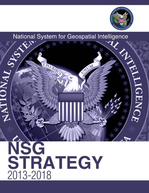
2013–2018<br />
<strong>NSG</strong> <strong>Strategy</strong><br />
I am pleased to release the 2013–2018 <strong>National</strong> System for <strong>Geospatial</strong> <strong>Intelligence</strong><br />
(<strong>NSG</strong>) <strong>Strategy</strong>. This is our roadmap to a fully integrated geospatial intelligence<br />
(GEOINT) enterprise. Built by the <strong>NSG</strong> for the <strong>NSG</strong>, this strategy establishes six<br />
objectives which will advance GEOINT integration. We will achieve these objectives<br />
by utilizing the diverse and unique capabilities that the <strong>NSG</strong> brings to provide superior<br />
GEOINT to those who need it.<br />
Today, we are in an environment that requires transformation and focus to strengthen<br />
GEOINT’s support to national security and domestic priorities. Our updated mission<br />
and vision statements reflect the importance of working together, adaptability, and<br />
resource stewardship. The priorities and strategic objectives identified by the Director<br />
of <strong>National</strong> <strong>Intelligence</strong> (DNI) and the Under Secretary of Defense for <strong>Intelligence</strong><br />
(USD(I)) serve as the foundation of our strategy.<br />
The <strong>NSG</strong> <strong>Strategy</strong> addresses key areas that will transform the way we conduct<br />
business. It is meant to be fluid and proactive to address the ever-changing security<br />
environment. The goal of advancing GEOINT integration will serve as our beacon as<br />
we work together to implement the strategy. The objectives will be the areas of focus<br />
and will help drive resource allocation. Some of these objectives represent current<br />
strengths of the <strong>NSG</strong>, while others identify new directions for the community that will<br />
guide us to be more efficient and effective. Each of these objectives is interconnected<br />
and interdependent; each enhances the efforts of others to accomplish our goal.<br />
In May 2012, I introduced the 2013–2017 NGA <strong>Strategy</strong>, which paved a pathway<br />
to accomplish NGA’s vision of Putting the Power of GEOINT in Your Hands and the<br />
goals of providing online, on-demand access to our GEOINT knowledge and to create<br />
new value by broadening and deepening our analytic expertise. The <strong>NSG</strong> is a critical<br />
component in transforming the GEOINT experience by becoming more federated in<br />
our approach to GEOINT plans and operations. We cannot accomplish either strategy<br />
without advancing GEOINT integration. I see the two strategies as complementary<br />
and leading us into a new environment by 2018, where we are leveraging each<br />
other’s strengths, operating in a common analytic environment, and jointly<br />
incorporating new advances in technology.<br />
<strong>NSG</strong> Mission: Integrate <strong>NSG</strong><br />
operations, partnerships,<br />
and innovations to efficiently<br />
deliver and effectively utilize<br />
GEOINT<br />
<strong>NSG</strong> Vision: Bringing the Power<br />
of the GEOINT Community —<br />
When, Where, and How it’s<br />
Needed<br />
Goal: Advance GEOINT<br />
Integration<br />
The success of the <strong>NSG</strong> <strong>Strategy</strong> is dependent on keeping focused attention on our<br />
shared mission and commitment to continuously improve the efficient delivery and<br />
effective use of GEOINT. It points to the importance of transparency and evolving our<br />
relationships to achieve our full potential. Thank you for your dedication in taking<br />
GEOINT to the next level; I look forward to the advancements we will make utilizing<br />
the far-reaching power of the GEOINT community.<br />
Letitia A. Long<br />
GEOINT Functional Manager<br />
ii<br />
Bringing the Power of the GEOINT Community – When, Where, and How it’s Needed
Mission<br />
Integrate <strong>NSG</strong> operations, partnerships, and innovations to efficiently deliver<br />
and effectively utilize GEOINT<br />
Vision<br />
Bringing the Power of the GEOINT Community – When, Where, and<br />
How it’s Needed<br />
<strong>NSG</strong> Strategic Goal<br />
Advance GEOINT Integration: Advance the GEOINT enterprise to make the<br />
best GEOINT available to partners, customers, and decision makers through<br />
better-informed decisions, improved alignment, and harmonized efforts<br />
across the <strong>NSG</strong>. Through increased GEOINT integration, the <strong>NSG</strong> will<br />
exercise better stewardship of <strong>NSG</strong> resources, improve coordination, and,<br />
where appropriate, apply unified solutions to increase the scope and<br />
effectiveness of GEOINT.
2013–2018<br />
<strong>NSG</strong> <strong>Strategy</strong><br />
Introduction<br />
The reliance on geospatial capabilities continues to evolve with the exponential growth<br />
of information and technology. The diverse and complex nature of multi-intelligence and<br />
geospatial data requires data fusion and visualization to expedite intelligence support to<br />
policymakers, warfighters, first responders, the <strong>Intelligence</strong> Community (IC), and coalition<br />
partners. <strong>NSG</strong> success is measured by our integration efforts to ensure that the timeliest<br />
information gets into the hands of those who need it. <strong>Intelligence</strong> integration is at the heart<br />
of what the <strong>NSG</strong> does, and the <strong>NSG</strong> <strong>Strategy</strong> is our blueprint for solving future challenges to<br />
advance GEOINT together, as a community.<br />
Advancing GEOINT through integration ensures consistency of GEOINT capabilities, resources,<br />
and activities through openness and transparency. The <strong>NSG</strong> looks beyond organizational<br />
interests to the larger enterprise to leverage collection, processing, exploitation,<br />
dissemination, storage, and research and technology investments. Today’s constrained<br />
resource environment demands effective functional cooperation to address ever-increasing,<br />
global mission challenges. The <strong>NSG</strong> must optimize every resource in the enterprise, driving<br />
members to be transparent and willing to leverage GEOINT tools and capabilities that already<br />
exist across the <strong>NSG</strong>, rather than building their own.<br />
The <strong>NSG</strong> has made significant strides toward advancing GEOINT. The 2009 <strong>NSG</strong> Statement of<br />
Strategic Intent laid the foundation for us to take the next step as a GEOINT community. This<br />
strategy promotes operational agility and flexibility throughout the GEOINT community by<br />
continuously improving and adapting our practices, focusing on the diversity and value that<br />
each <strong>NSG</strong> partner brings, and promoting burden sharing and responsible investments.<br />
The <strong>NSG</strong> <strong>Strategy</strong> aligns with the nation’s strategic priorities, goals, and objectives as outlined<br />
in the <strong>National</strong> <strong>Intelligence</strong> <strong>Strategy</strong>, the Defense <strong>Intelligence</strong> <strong>Strategy</strong>, and the Secretary<br />
of Defense strategic guidance: Sustaining U.S. Global Leadership: Priorities for 21st Century<br />
Defense. The strategy takes into account the multiple mission areas and strategic priorities<br />
that we face today — including military and intelligence operations, intelligence analysis,<br />
homeland defense, and humanitarian and disaster relief. The Vision of Bringing the Power of<br />
the GEOINT Community – When, Where, and How it’s Needed allows the <strong>NSG</strong> to contribute,<br />
to the greatest extent, to meeting DNI and USD(I) priorities.<br />
Integration: Uniting<br />
analysis, collection, plans,<br />
and operations across<br />
intelligence disciplines<br />
and functions.<br />
Partnerships:<br />
Relationships with<br />
organizations and<br />
entities inside and<br />
outside the federal<br />
government that<br />
improve access to<br />
sources of information<br />
and intelligence and<br />
ensure appropriate<br />
dissemination of<br />
GEOINT products and<br />
services.<br />
Customers:<br />
Consumers of<br />
geospatial intelligence<br />
and information,<br />
including the<br />
president, Congress,<br />
policymakers,<br />
diplomats, Department<br />
of Homeland<br />
Security, federal and<br />
civil agencies, law<br />
enforcement, military<br />
units, and coalition<br />
partners.<br />
iv<br />
Bringing the Power of the GEOINT Community – When, Where, and How it’s Needed
<strong>National</strong> System for <strong>Geospatial</strong> <strong>Intelligence</strong><br />
<strong>Strategy</strong><br />
Table of Contents<br />
pg 5<br />
pg 2<br />
GEOINT State of the<br />
Function Report<br />
Program Management<br />
Reviews<br />
<strong>NSG</strong> Strategic Management Cycle<br />
Annual Cycle<br />
<strong>NSG</strong><br />
<strong>Strategy</strong><br />
Capabilities<br />
Documentation<br />
<strong>NSG</strong><br />
Annual<br />
Assessment<br />
Implementation<br />
and Actions<br />
<strong>NSG</strong><br />
Planning<br />
Guidance<br />
pg 7<br />
Programming<br />
Guidance<br />
pg 8 pg 13 pg 10<br />
Introduction<br />
iv<br />
Objective 1: <strong>NSG</strong>-Wide Solutions 2<br />
Objective 2: Professional Development 5<br />
Objective 3: Governance 6<br />
Objective 4: Accessibility 8<br />
Objective 5: Research and Development/Science and Technology (R&D/S&T) 11<br />
Objective 6: Integrated Operations 12<br />
Conclusion 14<br />
The <strong>NSG</strong> through the years 14<br />
Objective Accomplishments in 2018 16<br />
<strong>Strategy</strong> Slick Sheet 17<br />
Optimizing the Power of GEOINT through an Integrated GEOINT Community<br />
1
2013–2018<br />
<strong>NSG</strong> <strong>Strategy</strong><br />
Objective 1<br />
<strong>NSG</strong>-Wide Solutions<br />
Employ unified solutions to GEOINT challenges and maximize partnerships, resulting<br />
in better-informed <strong>NSG</strong> decisions<br />
Department of Defense photo<br />
Partnerships: Strengthen, expand, and leverage<br />
partnerships to synchronize efforts and synergize<br />
capabilities that enhance <strong>NSG</strong> mission accomplishment.<br />
The <strong>NSG</strong> will foster and sustain cooperative relationships with<br />
partners and customers with the goal of raising the impact<br />
and utility of GEOINT. Through these partnerships, we will<br />
bring value to the <strong>NSG</strong> by deepening our ability to share and<br />
collaborate. We will implement cross–disciplinary approaches<br />
that support responsible and secure information sharing to<br />
operate efficiently when pursuing common objectives. We will<br />
form new partnerships and enhance current ones to augment<br />
existing capacity for GEOINT operations. We will take advantage<br />
of the sources, services, and expertise of our partners.<br />
Resources: Reduce unnecessary redundancies and gaps<br />
in GEOINT programs to optimize resources and address<br />
<strong>NSG</strong> priorities. The <strong>NSG</strong> will formalize processes to assess<br />
GEOINT-related programs and capabilities to synchronize<br />
intelligence and defense GEOINT investments to better<br />
meet national security priorities. We will openly share our<br />
common interests and capabilities to reduce duplication<br />
and efficiently allocate resources against mission areas. We<br />
will improve transparency through coordination and burden<br />
sharing to be more efficient and effective stewards of GEOINT<br />
resources. We will identify and prioritize capability gaps and<br />
work collaboratively to address issues with a community-first<br />
mentality.<br />
Forecasting: Implement a collaborative approach to forecast<br />
evolving challenges facing the <strong>NSG</strong>. The <strong>National</strong> <strong>Geospatial</strong><br />
<strong>Intelligence</strong> Committee (GEOCOM) will establish a forecasting<br />
committee where GEOINT professionals will make better<br />
decisions by estimating and prioritizing short-, mid-, and longterm<br />
GEOINT challenges. Through awareness and forecasting<br />
of potential world events, technology developments, and<br />
other factors affecting GEOINT, the <strong>NSG</strong> can create a common<br />
understanding of future scenarios from which to plan and<br />
allocate resources appropriately. Forecasting will allow the <strong>NSG</strong><br />
to assess impacts of current research and technology and to<br />
ascertain new needs and new possibilities.<br />
2<br />
Bringing the Power of the GEOINT Community – When, Where, and How it’s Needed
<strong>National</strong> System for <strong>Geospatial</strong> <strong>Intelligence</strong><br />
<strong>Strategy</strong><br />
<strong>NSG</strong> Culture: Achieve unified <strong>NSG</strong> solutions by increasing<br />
transparency, information sharing, and operational agility and<br />
flexibility. The <strong>NSG</strong> will increase transparency by breaking down<br />
barriers to address GEOINT issues as an enterprise. We will<br />
promote responsible and secure information sharing and seek<br />
innovative ways to communicate. We will develop and refine<br />
mechanisms to coordinate, improve, and focus <strong>NSG</strong> activities<br />
at all levels. Finally, we will promote operational agility and<br />
flexibility throughout the GEOINT community by continuously<br />
improving and adapting tradecraft practices, by offering training<br />
opportunities that anticipate future needs and challenges, and<br />
by forming day-to-day partnerships with system developers<br />
to transition cutting-edge technologies and applications to<br />
operations.<br />
Objective 1: Major outcomes<br />
2013<br />
2014<br />
2015<br />
2016<br />
2017<br />
2018<br />
The <strong>NSG</strong> has established a common set<br />
of planning and resource processes that<br />
enable the free flow of information on<br />
GEOINT-related programs.<br />
The <strong>NSG</strong> has developed a baseline repository of all<br />
GEOINT-related programs that drive our acquisition<br />
planning.<br />
The <strong>NSG</strong> has stood up a community of interest<br />
to forecast geospatial trends and challenges that<br />
drive planning and investments.<br />
The <strong>NSG</strong> has been fully synchronized with the<br />
ASG through joint business processes and planning.<br />
The <strong>NSG</strong> has synchronized its intelligence<br />
and defense investments to eliminate<br />
unnecessary redundancies and fill capability gaps.<br />
The <strong>NSG</strong> has reduced redundancies, fully<br />
incorporated the diverse strengths of the<br />
community, and anticipated future needs to<br />
efficiently, effectively, and collectively address<br />
GEOINT challenges.
2013–2018<br />
<strong>NSG</strong> <strong>Strategy</strong><br />
Thinkstock photo
Objective 2<br />
<strong>National</strong> System for <strong>Geospatial</strong> <strong>Intelligence</strong><br />
Professional Development<br />
Advance education, training, and skill development to broaden the utility and<br />
value of GEOINT<br />
<strong>Strategy</strong><br />
Learning Solutions: Create and implement learning solutions<br />
that are innovative, agile, and tailored to the needs of the<br />
GEOINT professional. The <strong>NSG</strong> will adapt its educational<br />
programs and their delivery to meet rapidly evolving GEOINT<br />
needs. We will leverage innovative means to deliver training,<br />
including distance learning, online, on-demand course access,<br />
and other means best suited for the community. The <strong>NSG</strong><br />
will leverage key relationships across the IC, Department of<br />
Defense (DoD), federal and civil agencies, allies, academia,<br />
and industry to integrate new learning techniques and<br />
cutting-edge GEOINT technology and applications into its<br />
learning programs.<br />
Training and Tradecraft Standards: Develop and implement<br />
standards for GEOINT training and competencies,<br />
certification, and accreditation. The <strong>NSG</strong> will establish<br />
common training standards for GEOINT-specific technical<br />
competencies at the beginner, intermediate, and advanced<br />
levels. We will implement standards for an accredited<br />
GEOINT professional certification program that enable<br />
the transfer and fine-tuning of common skills across the<br />
community. The <strong>NSG</strong> will structure GEOINT education and<br />
professional development activities to meet both IC and<br />
defense accreditation and certification standards. The<br />
GEOINT certification program will be a national, DoD, and,<br />
where applicable, “Five Eyes” (FVEY) activity for intelligence<br />
professionals. We will practice certification reciprocity to<br />
eliminate redundancies in training programs. We will leverage<br />
and integrate current community professional development,<br />
certification, and career management programs into an IC–<br />
DoD-wide program.<br />
Objective 2: Major outcomes<br />
2013<br />
2014<br />
2015<br />
2016<br />
2017<br />
2018<br />
The <strong>NSG</strong> has identified core competencies and<br />
training gaps that will enable GEOINT analyst<br />
certification.<br />
Through the continuous collaboration of the<br />
Community <strong>Geospatial</strong> <strong>Intelligence</strong> Training<br />
Council, the <strong>NSG</strong> has developed common training<br />
courses and formalized career fields that enable<br />
work role reciprocity.<br />
Assessments for all analytic tradecrafts at all levels<br />
are developed. <strong>NSG</strong> training sites are accredited for<br />
general proficiency for all tradecrafts.<br />
The <strong>NSG</strong> has implemented full spectrum learning<br />
solutions for current and emerging geospatial<br />
technology and applications.<br />
An <strong>NSG</strong> geospatial training catalogue is accessible<br />
online, to include enrollment procedures, on the<br />
appropriate security domains. All available<br />
online GEOINT training is accessible, on demand, in<br />
a central storefront on the appropriate security<br />
domains.<br />
The <strong>NSG</strong> has a common curriculum for GEOINT<br />
training, tradecraft development, and skill<br />
certification, with programs that are flexible and<br />
adaptable to changing environments.<br />
Community of Practice: Develop and share tradecraft<br />
resources and techniques to achieve a common level of<br />
practice across the <strong>NSG</strong>. The <strong>NSG</strong> will optimize the use<br />
of communities of practice to identify and institute best<br />
practices in training and educational development in order to<br />
implement standardized curriculum that supports personal<br />
and professional growth. We will create and host training<br />
courses, share curricula, and establish partnerships with<br />
industry and academic institutions, particularly when quality,<br />
efficient, and cost–effective training is not readily available.<br />
Optimizing the Power of GEOINT through an Integrated GEOINT Community<br />
5
2013–2018<br />
<strong>NSG</strong> <strong>Strategy</strong><br />
Objective 3<br />
Governance<br />
Apply <strong>NSG</strong> fora and community-adopted doctrine, policies, and standards to advance<br />
the integrated GEOINT enterprise<br />
<strong>NSG</strong> Fora: Develop and implement objective, decision-focused<br />
governance processes and framework to identify and address<br />
GEOINT equities across the <strong>NSG</strong>. The <strong>NSG</strong> will establish open and<br />
transparent procedures to enable greater awareness, collaboration,<br />
and community-wide coordination of GEOINT-related issues,<br />
opportunities, and concerns. We will identify opportunities<br />
that focus on results, increase information sharing, enable<br />
informed decision making, and resolve cross-community issues.<br />
We will evolve our governance framework through community<br />
involvement in implementing the strategy. <strong>NSG</strong> fora will develop<br />
implementation plans and annual reports that identify key<br />
priorities, accomplishments, and challenges.<br />
<strong>Strategy</strong> Management: Measure and evaluate <strong>NSG</strong> <strong>Strategy</strong><br />
implementation and report progress and performance to the<br />
<strong>NSG</strong> Senior Management Council (NSMC) and other appropriate<br />
fora. To ensure that we achieve the goal and objectives outlined<br />
in this strategy, the <strong>NSG</strong> will create performance measures using<br />
both qualitative and quantitative methods. We will adopt the<br />
<strong>NSG</strong> Strategic Management Cycle to enable the execution and<br />
evaluation of the strategy. This effort will drive investments<br />
through annual planning guidance and will evaluate strategy<br />
execution through <strong>NSG</strong> program management reviews and the<br />
GEOINT Functional Manager’s Annual Report. By establishing<br />
an assessment program as part of the cycle, we will be able to<br />
demonstrate institutional effectiveness and the value we provide to<br />
GEOINT stakeholders.<br />
Standards: Develop, adopt, and ensure adherence to information<br />
technology (IT) and content standards to maximize GEOINT<br />
interoperability and cost savings. The <strong>NSG</strong> will adopt current<br />
GEOINT systems and advocate for future systems that advance<br />
interoperability and promote adherence to applicable standards.<br />
We will design, plan, and establish an <strong>NSG</strong>-wide GEOINT standards<br />
compliance metric program that facilitates the interoperability<br />
of GEOINT across the <strong>NSG</strong> enterprise. We will implement the<br />
GEOINT Functional Manager Seal Of Approval (GFMSA) to ensure<br />
standards compliance for those systems required to use GEOINT<br />
standards during their acquisition cycle. This will ensure that<br />
GEOINT components have been tested and evaluated by a credible,<br />
independent organization and found to meet the standards<br />
compliance and interoperability qualification criteria set by the<br />
GEOINT Functional Manager.<br />
Security: Integrate security and counterintelligence (CI) into <strong>NSG</strong><br />
business processes to protect GEOINT sources and methods.<br />
The <strong>NSG</strong> will leverage community-wide security mechanisms<br />
to promote interoperability whenever possible. We will use the<br />
principal GEOINT-sensitive control system to protect the <strong>NSG</strong>’s most<br />
sensitive sources and methods. We will incorporate security, CI, and<br />
cyber threat assessments at all stages of GEOINT development and<br />
operations. We will work with appropriate security and CI entities<br />
to identify and secure GEOINT-related critical program information<br />
and continuously monitor for vulnerabilities.<br />
Policy: Implement <strong>NSG</strong> policies and GEOINT doctrine to achieve<br />
community-wide solutions. The <strong>NSG</strong> will implement policies that<br />
provide direction, set common practices, and enable flexibility<br />
and sustainability. We will review and revise policies needed to<br />
address dynamic risks, new or shifting paradigms, and changes<br />
in programmatic alignment and transition. We will oversee the<br />
implementation of GEOINT IC–DoD policies and doctrine. To further<br />
enable community-wide solutions, the <strong>NSG</strong> will establish processes<br />
to develop, coordinate, and promulgate <strong>NSG</strong>-wide positions on key<br />
issues, priorities, and future programs.<br />
<strong>NSG</strong> Fora:<br />
A series of planned meetings, events, and working groups<br />
that take place in a formal setting to achieve a common<br />
goal. These fora work within the <strong>NSG</strong> governance structure.<br />
6<br />
Bringing the Power of the GEOINT Community – When, Where, and How it’s Needed
<strong>National</strong> System for <strong>Geospatial</strong> <strong>Intelligence</strong><br />
<strong>Strategy</strong><br />
<strong>NSG</strong> Strategic Management Cycle<br />
Annual Cycle<br />
Capabilities<br />
Documentation<br />
GEOINT State of the<br />
Function Report<br />
Program Management<br />
Reviews<br />
<strong>NSG</strong><br />
<strong>Strategy</strong><br />
<strong>NSG</strong><br />
Annual<br />
Assessment<br />
Implementation<br />
and Actions<br />
<strong>NSG</strong><br />
Planning<br />
Guidance<br />
Programming<br />
Guidance<br />
Objective 3: Major outcomes<br />
2013<br />
2014<br />
2015<br />
2016<br />
2017<br />
2018<br />
The GEOCOM has aligned its subcommittees and working groups to best implement and execute the strategy.<br />
The GEOCOM provides quarterly assessments on the progress of the <strong>NSG</strong> <strong>Strategy</strong> and provides recommendations to<br />
strengthen implementation.<br />
New systems that use or produce GEOINT are interoperable and in conformance with the appropriate GEOINT standards.<br />
The <strong>NSG</strong> has developed an <strong>NSG</strong> CONOPS for GEOINT that provides an operational description against which to define<br />
needed capabilities, manage operations, modify business practices, and support planning and programming activities.<br />
The <strong>NSG</strong> makes better informed decisions through developing and promulgating <strong>NSG</strong> positions on key issues, priorities,<br />
and future programs.<br />
The <strong>NSG</strong> has fully integrated member and partner activities through effective governance, adherence to standards, and<br />
implementation of shared policies and streamlined business practices.<br />
Optimizing the Power of GEOINT through an Integrated GEOINT Community<br />
7
2013–2018<br />
<strong>NSG</strong> <strong>Strategy</strong><br />
Objective 4<br />
Accessibility<br />
Make GEOINT content discoverable, accessible, timely, and relevant in a<br />
multimedia, multidomain environment<br />
Open IT Environment: Maintain and operate a safe, secure,<br />
reliable, and responsive enterprise architecture. The <strong>NSG</strong> will<br />
establish a dynamic and agile enterprise architecture that enables<br />
the optimized use of GEOINT through interoperable processing,<br />
exploitation, and dissemination capabilities. The <strong>NSG</strong> will support<br />
a GEOINT environment that ensures the appropriate balance<br />
between security and open accessibility, while ensuring resilience<br />
against the threats of a determined adversary. We will promote<br />
the interoperability and fusion of data and information systems to<br />
ensure compatibility and applicability across the community. The<br />
<strong>NSG</strong> will integrate GEOINT systems and programs into the common<br />
<strong>Intelligence</strong> Community Information Technology Environment (IC<br />
ITE) and DoD Joint Information Environment (JIE) to reduce costs and<br />
eliminate redundancies while enabling safe information sharing.<br />
Multi-Domain Access: Enable the seamless discovery, exchange,<br />
and dissemination of GEOINT across multiple security domains<br />
while maintaining robust information assurance. The <strong>NSG</strong> will<br />
Photo by Kevin Clark, OCC<br />
Content:<br />
GEOINT data, products, and knowledge.<br />
Department of Defense photo<br />
Department of Defense photo<br />
8<br />
Bringing the Power of the GEOINT Community – When, Where, and How it’s Needed
<strong>National</strong> System for <strong>Geospatial</strong> <strong>Intelligence</strong><br />
<strong>Strategy</strong><br />
continue to develop and field a GEOINT IT environment that enables<br />
the timely exchange of GEOINT and enhances the ability of users<br />
and producers to manipulate content within each domain. We will<br />
ensure all GEOINT content is integrated, managed, and exposed to<br />
all GEOINT users on all domains. The <strong>NSG</strong> will continue to support<br />
timely GEOINT dissemination online, to the field, and other locations<br />
outside the <strong>NSG</strong> architecture.<br />
Tools: Seek, develop, and deploy applications and tools that<br />
enhance the utility of GEOINT. The <strong>NSG</strong> will leverage best practices<br />
from partners, academia, and industry to understand current trends<br />
in information management and apply innovative methods to<br />
create intuitive applications and tools. We will develop and deploy<br />
applications and tools that optimize the use of GEOINT capabilities,<br />
allowing the GEOINT user to be flexible and agile with spatial and<br />
temporal data in creating tailored geospatial products. Finally, we will<br />
enhance tools to improve collaboration between users, consumers,<br />
and partners.<br />
Data Compliance: Ensure that all geospatial content is accurate,<br />
complete, and compliant with standards set by the <strong>Geospatial</strong><br />
<strong>Intelligence</strong> Standards Working Group (GWG) to enhance the<br />
discoverability and interoperability of data. The <strong>NSG</strong> will focus<br />
on content management to organize, tag, store, and catalog all<br />
geospatial data. We will be responsible stewards throughout the<br />
data life cycle to ensure that the information is accurate, complete,<br />
and interoperable. We will implement data strategies and policies<br />
for prioritizing, acquiring, organizing, storing, using, and distributing<br />
data. We will establish and implement tools to measure and report<br />
data quality and assess compliance to improve data usability.<br />
GEOINT Utility: Develop functional geospatial capabilities that are<br />
intuitive and offer the ability to perform tailored GEOINT analysis<br />
from novice to expert. The <strong>NSG</strong> will provide GEOINT users with the<br />
ability to visualize and interact with all available data, content, and<br />
products in a virtual environment. We will accomplish this by creating<br />
a central repository of best available geospatial content within<br />
an enterprise data store. We will promote an integrated analytic<br />
environment that makes access to content, workflows, and tradecraft<br />
easy and intuitive while broadening their understanding. We will<br />
implement processes and tools that allow the easy transition of<br />
content to any multimedia format. We will ensure that easy, intuitive<br />
application development is available to manipulate data and products.<br />
Objective 4: Major outcomes<br />
2013<br />
2014<br />
2015<br />
2016<br />
2017<br />
2018<br />
The <strong>NSG</strong> has implemented the Smart<br />
Data Framework for all geospatial data,<br />
enabling GEOINT content to be discoverable and<br />
usable through standards compliance.<br />
The GEOINT App Store is available to users to<br />
create and consume GEOINT content anytime, on<br />
the device and domain of their choice.<br />
<strong>NSG</strong> systems involved in collecting, processing,<br />
exploiting, or disseminating GEOINT content meet<br />
the GEOINT Functional Manager Seal of Approval<br />
(GFMSA). Prioritized regions of the <strong>NSG</strong> Map of the<br />
World are available to consumers as a foundation<br />
GEOINT baseline.<br />
The <strong>NSG</strong> has fully transitioned to an integrated<br />
analytic environment and decommissioned<br />
legacy exploitation systems.<br />
GEOINT content, applications, and<br />
services are available on the IC ITE and JIE.<br />
The <strong>NSG</strong> has amplified the power of GEOINT by<br />
improving access to content and commuitydeveloped<br />
applications, tailoring online services on<br />
all security domains, and expanding its ability to<br />
contribute content to the global GEOINT base.<br />
Optimizing the Power of GEOINT through an Integrated GEOINT Community<br />
9
2013–2018<br />
<strong>NSG</strong> <strong>Strategy</strong>
Objective 5<br />
<strong>National</strong> System for <strong>Geospatial</strong> <strong>Intelligence</strong> <strong>Strategy</strong><br />
Research and Development/<br />
Science and Technology<br />
Identify and advance cutting-edge GEOINT R&D/S&T solutions to maintain and<br />
improve our strategic and technical advantage<br />
Future Capabilities: Discover and pursue global<br />
R&D/S&T trends and breakthrough technologies and<br />
phenomenologies. The <strong>NSG</strong> will actively pursue emerging<br />
technologies and phenomenologies to anticipate and<br />
prepare for future GEOINT and other intelligence needs. We<br />
will work closely with government, international, industry,<br />
and academic partners to identify and assess innovative<br />
and emerging developments in locational, spectral, and<br />
spatiotemporal capabilities. We will actively promote crosscommunity<br />
technology awareness and the exchange of<br />
GEOINT-related R&D/S&T.<br />
Investment Synchronization: Address gaps and redundancies<br />
in GEOINT R&D/S&T to achieve balance and economy<br />
across future technology investments. The <strong>NSG</strong> will baseline<br />
R&D/S&T activities across the community and identify gaps,<br />
redundancies, and opportunities to collaborate and leverage<br />
resources, ensuring more efficient and effective technology<br />
development. We will balance technology investments to<br />
emphasize high return and rapid transition from research<br />
to operations. We will use the GEOINT R&D Subcommittee<br />
(GRAND) to coordinate, inform, encourage, and leverage<br />
R&D/S&T investments across the community. Through this<br />
forum, we will institutionalize, rationalize, and prioritize<br />
developing capabilities across the <strong>NSG</strong>.<br />
Transition to Operations: Develop and rapidly field new<br />
technologies and techniques into operational systems and<br />
applications. The <strong>NSG</strong> will identify and address technological,<br />
policy, organizational, and cultural barriers to effectively<br />
integrate GEOINT. We will streamline processes to enable<br />
rapid transition of technologies, phenomenologies, and<br />
methods from R&D to operations while effectively assessing<br />
and mitigating transition risks. We will focus on transitions<br />
that support priority mission needs. We will assess the impact<br />
and effectiveness derived from new technology investments<br />
through capability-based assessments, utility studies, and user<br />
feedback.<br />
Objective 5: Major outcomes<br />
2013<br />
2014<br />
2015<br />
2016<br />
2017<br />
2018<br />
The <strong>NSG</strong> has established practices<br />
to collaboratively identify, prioritize, and<br />
coordinate GEOINT-related R&D/S&T gaps,<br />
redundancies, and opportunities.<br />
The <strong>NSG</strong> has identified<br />
opportunities to discover and leverage<br />
geolocation, spectral, and spatiotemporal<br />
capabilities and apply emerging GEOINTrelated<br />
R&D/S&T trends in innovative ways.<br />
The <strong>NSG</strong> characterizes and leverages<br />
GEOINT-related R&D/S&T focus areas and<br />
emerging trends, taking advantage of<br />
community experience and expertise.<br />
The <strong>NSG</strong> has established streamlined<br />
processes to rapidly identify and<br />
operationalize GEOINT-related<br />
R&D/S&T capabilities by prioritizing<br />
requirements and operating under an<br />
innovative technology investment approach.<br />
The <strong>NSG</strong> is significantly partnered<br />
with industry, academia, and international<br />
R&D/S&T activities and is working<br />
collaboratively across community, agency, and<br />
mission boundaries.<br />
The <strong>NSG</strong> improves efficiency<br />
and reduces redundancy of GEOINT-related<br />
R&D/S&T investments through increased<br />
transparency and effective leveraging.<br />
Optimizing the Power of GEOINT through an Integrated GEOINT Community<br />
11
2013–2018<br />
<strong>NSG</strong> <strong>Strategy</strong><br />
Objective 6<br />
Integrated Operations<br />
Integrate <strong>NSG</strong> plans, collection, and analysis to optimize GEOINT’s value and<br />
contribution to key intelligence issues<br />
Plans: Develop and implement unified GEOINT strategies to maximize<br />
support to Unifying <strong>Intelligence</strong> Strategies (UIS). The <strong>NSG</strong> will capture and<br />
align GEOINT efforts that support UIS to drive intelligence integration. We<br />
will assess our responsiveness to UIS priorities, gaps, and challenges. We<br />
will collaborate with other functional disciplines to strengthen collection<br />
strategies and eliminate unintended duplication.<br />
Unity of Effort: Optimize resource utilization by integrating collection and<br />
analytic efforts. The <strong>NSG</strong> will develop and implement an <strong>NSG</strong> Program<br />
of Analysis (POA). The POA will enable full transparency into mission<br />
production, resources, and capabilities. We will maximize our use of Unified<br />
GEOINT Operations (UGO) to identify, leverage, and optimize collection,<br />
analysis, and production capabilities. We will emphasize cross-functional,<br />
multi-intelligence approaches to synchronize and balance activities to<br />
improve the efficiency and effectiveness of GEOINT operations.<br />
Sources and Methods: Leverage traditional, non-traditional, and future<br />
capabilities to enhance intelligence operations. The <strong>NSG</strong> will actively<br />
discover and share innovative and emerging capabilities to enhance multi-<br />
INT fusion, data integration, and the ability to provide anticipatory analysis.<br />
We will move toward an activity-based intelligence model that allows users<br />
to discover, visualize, and analyze all available information. We will explore<br />
new methods of collection and analysis through innovative thinking. We<br />
will implement processes to make traditional and non-traditional sources<br />
available, navigable, and understandable to ensure that GEOINT users have<br />
access to an open geospatial information environment. We will accomplish<br />
this by actively pursuing available technologies from partners, customers,<br />
industry, and academia to fill capability gaps by incorporating best practices<br />
to enhance our collection and analytic capabilities.<br />
International Partnerships: Enhance existing and build new international<br />
partnerships to add value to the <strong>NSG</strong> and capitalize on efficiencies.<br />
International GEOINT partnerships are a critical component for enabling<br />
the <strong>NSG</strong>’s operations in a cost-effective manner. We will leverage programs<br />
and resources from our foreign partnerships to access GEOINT data and<br />
information, implementing collaborative production and source acquisition<br />
to populate GEOINT databases. The <strong>NSG</strong> will focus outwardly, building and<br />
enhancing international partnerships to promote strong cooperation and<br />
ensure the availability and use of foreign GEOINT. We will align analytic<br />
efforts with our foreign partners, relying on burden sharing and source<br />
acquisition to help drive efficiencies. We will leverage new foreign sources,<br />
methods, services, and expertise. We will increase our focus on assessing<br />
and acquiring valuable foreign source materials and geospatial production<br />
through new or existing partnerships. The <strong>NSG</strong> will seek to deepen<br />
relationships with key strategic partners to yield even greater analytic and<br />
burden sharing benefits.<br />
Department of Defense photo<br />
Thinkstock photo<br />
12<br />
Bringing the Power of the GEOINT Community – When, Where, and How it’s Needed
<strong>National</strong> System for <strong>Geospatial</strong> <strong>Intelligence</strong><br />
<strong>Strategy</strong><br />
Unifying <strong>Intelligence</strong> <strong>Strategy</strong>:<br />
The <strong>National</strong> <strong>Intelligence</strong> Manager’s expression of the top priorities for a given mission area, the key analytic and<br />
collection gaps, and the most important enterprise and mission challenges.<br />
Objective 6: Major outcomes<br />
2013 The <strong>NSG</strong> established a POA that begins to align Community priorities and analytic efforts,<br />
federates GEOINT production, and distributes content and services in a consistent manner.<br />
2014<br />
2015<br />
2016<br />
2017<br />
2018<br />
The <strong>NSG</strong> has gained efficiencies through a federated UGO production environment and the execution<br />
of the three-tiered service model.<br />
The <strong>NSG</strong> publishes annual strategies and evaluations to support DNI UIS.<br />
All GEOINT collection is integrated into one central collection management system.<br />
Multi-INT analysis through Activity and Object Based <strong>Intelligence</strong> is universal throughout<br />
the <strong>NSG</strong>, resulting in enhanced analytic methods.<br />
The <strong>NSG</strong> has optimized planning, collection, and analysis through the pursuit and execution of<br />
continual improvement, enhanced intelligence integration, and UGO.<br />
Program of Analysis:<br />
A comprehensive and dynamic system for planning, tracking, and evaluating analysis to support<br />
management of the GEOINT analytic mission and ensure alignment with national and military<br />
intelligence priorities.<br />
Department of Defense photo<br />
Optimizing the Power of GEOINT through an Integrated GEOINT Community<br />
13
2013–2018<br />
<strong>NSG</strong> <strong>Strategy</strong><br />
Conclusion<br />
The <strong>NSG</strong> <strong>Strategy</strong> presents a way ahead for the <strong>NSG</strong> to advance GEOINT integration. We must now transform this<br />
strategy into action through initiatives, plans, and capabilities. All <strong>NSG</strong> decisions will reflect the contents of this<br />
document. We will incorporate the strategy’s objectives into the <strong>NSG</strong> Strategic Management Cycle, which will<br />
inform <strong>NSG</strong> planning guidance, program management reviews, and the GEOINT Functional Manager’s Annual Report.<br />
Performance measures will ensure that we can assess our progress to adapt our methods appropriately. Success of<br />
this strategy relies on the strength and rigor of its implementation and how we work together to optimize the Power<br />
of GEOINT.<br />
The <strong>NSG</strong> through the years...<br />
2013<br />
By the end of 2013, the <strong>NSG</strong> is operating through the development of common processes, collaborative tools, and innovative<br />
approaches that improve the ability to discover relevant intelligence and to foster timely horizontal and vertical information sharing<br />
and dissemination. The <strong>NSG</strong> adopted and began implementing a common set of objectives through the <strong>NSG</strong> <strong>Strategy</strong> and Strategic<br />
Management Cycle. To best achieve the strategy, the GEOCOM restructured its governing fora to execute and measure the initiatives<br />
outlined by <strong>NSG</strong> <strong>Strategy</strong> Implementation Plan. The <strong>NSG</strong> has expanded the GEOINT App Store, introduced a GEOINT app catalog, and<br />
established an enterprise environment that improves integration of new app developments, infrastructure, and services that allow<br />
users to operate at a self-service level. The <strong>NSG</strong> has created the foundation for a POA to identify core mission areas and capabilities<br />
that would support maximum versatility and efficiencies to accomplish priority intelligence needs. The <strong>NSG</strong> R&D/S&T community has<br />
improved investment decisions by coordinating GEOINT-related R&D/S&T initiatives across the <strong>NSG</strong>.<br />
2014<br />
By the end of 2014, the <strong>NSG</strong> adopted a common business model that enables increased transparency in GEOINT-related mission<br />
activities and resource allocation. The <strong>NSG</strong> is using and consuming content, apps, and services available through the GEOINT App<br />
Store, <strong>NSG</strong> Map of the World, and other sources to meet mission needs. The <strong>NSG</strong> is exposed to community and international content<br />
while exposing <strong>NSG</strong> content for community use to support comprehensive intelligence. Advancements in UGO enable production<br />
agility to optimize resources to emerging strategic priorities. <strong>NSG</strong> training needs, curricula, and career fields are developed to<br />
maximize UGO effectiveness. The <strong>NSG</strong> has institutionalized Proficiency Level 1 certification for GEOINT analysts and introduced<br />
Proficiency Level 2 for Imagery, <strong>Geospatial</strong>, and Collection analysts. The <strong>NSG</strong> has fostered an environment that supports taking<br />
risks, experimentation, and the rapid transition of R&D/S&T activities to advance the GEOINT mission. The <strong>NSG</strong> has clear, published<br />
policies and procedures that enable the enhanced integration of our ASG partners in a GEOINT business model.<br />
2015<br />
By the end of 2015, <strong>NSG</strong> systems using or producing GEOINT are interoperable and in conformance with the appropriate geospatial<br />
standards. A variety of sources flow through the <strong>NSG</strong> providing increased persistence and unique sensor capabilities. <strong>NSG</strong> content<br />
is exposed on security domains, making it accessible, discoverable, and usable via an online web presence. Development and<br />
implementation of GEOINT certification for all <strong>NSG</strong> analysts up to the advanced and expert proficiency levels are available, creating<br />
a cadre of interoperable professionals with the expertise to work across organizational boundaries. The <strong>NSG</strong> is advancing ODNI<br />
intelligence integration efforts through GEOINT UIS and annual assessments. The <strong>NSG</strong> POA development continues evolving to a<br />
higher degree of maturity.<br />
2016<br />
By the end of 2016, the <strong>NSG</strong> has incorporated the ASG across all aspects of the <strong>NSG</strong> business model. The ASG continues to be an<br />
integrated partner and a trusted UGO contributor. This increased division of labor and FVEY sharing allows <strong>NSG</strong> members to be<br />
more anticipatory while focusing on providing unique value to customers. A single GEOINT collection management system has been<br />
developed to optimize source integration and provides efficient tasking across mission areas and sources. The <strong>NSG</strong> has migrated fully<br />
to an integrated analytic environment, which provides seamless access to content, robust analytic tools, and services in a multidomain<br />
environment.<br />
14<br />
Bringing the Power of the GEOINT Community – When, Where, and How it’s Needed
<strong>National</strong> System for <strong>Geospatial</strong> <strong>Intelligence</strong><br />
<strong>Strategy</strong><br />
2017<br />
By the end of 2017, the <strong>NSG</strong> operates in a persistent multi-INT environment. This expands and matures the <strong>NSG</strong>’s ability to conduct more<br />
anticipatory analysis through fused multi-INT. Analysts work from a single, digital, online, on-demand, seamless, and dynamic <strong>NSG</strong> Map of<br />
the World. The <strong>NSG</strong>, through transparent business processes, coordinates programs to ensure strategic and tactical relevance and redirect<br />
savings to higher performing programs to reinforce key GEOINT efforts. Manual and automated metadata-tagging processes enable all<br />
GEOINT content to be fully discoverable, accessible, and<br />
usable within the IC ITE. GEOINT professionals enhance<br />
their tradecraft and expertise through a suite of online<br />
geospatial training programs.<br />
2018<br />
By the end of 2018, the <strong>NSG</strong> has increased the scope<br />
and effectiveness of the GEOINT enterprise by exercising<br />
superior stewardship of GEOINT resources through<br />
common business processes, infrastructures, technical<br />
standards, and investments. The <strong>NSG</strong> has become<br />
the benchmark for intelligence integration by making<br />
shared decisions on programs and resources. Improved<br />
information sharing enables the <strong>NSG</strong> to address the<br />
challenges of today and tomorrow, where high quality<br />
and added value are realized through integration and<br />
accessibility. The <strong>NSG</strong> looks beyond organizational<br />
boundaries to discover and adopt solutions that are efficient and beneficial to the widest extent of GEOINT stakeholders. This allows<br />
for maximum interoperability of resources and the effective reallocation of savings, taking full advantage of the diverse talents of the<br />
community.<br />
Department of Defense photo<br />
The <strong>NSG</strong> is regularly exercising collaborative intelligence analysis and sharing new approaches to the GEOINT tradecraft. Through the<br />
efforts of increased partnerships, new capabilities and phenomenologies are routinely transitioned to operations with little to no risk,<br />
despite a wide variety of distinct user missions. <strong>NSG</strong> members and FVEY partners have adopted a common operating environment which<br />
has simplified the transition process and given the <strong>NSG</strong> universal access to hundreds of GEOINT apps – built to standards and validated by<br />
<strong>NSG</strong> governance fora.<br />
Efficiency initiatives have resulted in the elimination of several legacy systems and programs; more importantly, the corresponding ability<br />
to rapidly process and synthesize information is now making anticipatory intelligence the “new normal.” The routine monitoring of UGO<br />
through business analytics is providing real-time feedback on GEOINT patterns throughout the network. These, in turn, have created a<br />
new source of intelligence information by allowing synoptic visualization of intelligence trends. The <strong>NSG</strong> is also realizing new infrastructure<br />
benefits with the ability to “push” application updates to customers whose access to specific content is managed through personalized,<br />
tailored interfaces. This has opened the door to broader foreign and domestic contributions to GEOINT content while maintaining secure,<br />
multi-level access to GEOINT holdings for those with the proper credentials.<br />
At the heart of the revolution are the analysts. GEOINT professionals are trained and certified alongside their <strong>NSG</strong>/ASG colleagues through<br />
well-established courseware and a modernized, virtual schoolhouse. While on the job, analysts are creating new analytic techniques in<br />
response to global security and disaster events. These techniques are quickly evaluated, certified for operational use, and promulgated<br />
to the <strong>NSG</strong>. Dynamic adaptions to training and tradecraft make <strong>NSG</strong> analysts, collectively, the most proficient in the world. No other<br />
GEOINT entity has the <strong>NSG</strong>’s global reach and the wherewithal to exploit global crises to advance the GEOINT discipline. This fosters an<br />
atmosphere that promotes balanced risk while maintaining our technical advantage to enable the full spectrum of geospatial analysis in a<br />
multi-INT environment.<br />
Optimizing the Power of GEOINT through an Integrated GEOINT Community 15
2013–2018<br />
<strong>NSG</strong> <strong>Strategy</strong><br />
Objective Accomplishments in 2018<br />
<strong>NSG</strong>-Wide Solutions<br />
The <strong>NSG</strong> optimizes every resource in the enterprise, driving members to be transparent and willing to leverage GEOINT tools and<br />
capabilities that already exist across the <strong>NSG</strong>, rather than building their own. The <strong>NSG</strong> will be prepared for future challenges and<br />
requirements through a common understanding of future scenarios and technical trends that will impact the GEOINT discipline. We<br />
will define and prioritize requirements to create capabilities that provide the GEOINT-required meeting customer needs.<br />
Professional Development<br />
The <strong>NSG</strong> is a highly diverse, unified analytic community that can respond to evolving technical capabilities and dynamic mission<br />
needs. Certification ensures that analysts have met minimum standards, and this provides managers across the enterprise with an<br />
ability to develop diverse interoperable teams. Analysts will have a mechanism that allows for building technical depth and breadth<br />
that enhances both personal development and the overall mission.<br />
Governance<br />
The <strong>NSG</strong> has a consistent set of business processes that enable us to become more efficient and effective, while being both<br />
responsive and accountable to expectations and mission responsibilities. Developing GEOINT systems adheres to standards that<br />
ensure data interoperability and discoverability. The <strong>NSG</strong> implements policies and doctrine that ensure the appropriate balance<br />
between security and open accessibility.<br />
Accessibility<br />
The <strong>NSG</strong> operates in an open collaborative environment where GEOINT content is readily available to those who need it and on the<br />
security domain of their choice. The <strong>NSG</strong> has custom cohesive access to all geospatial content through a common desktop and map<br />
of the world. Applications and digital experiences are more personal and allow <strong>NSG</strong> users to tailor content, alerts, and interfaces.<br />
R&D/S&T<br />
The <strong>NSG</strong> crafts new ways to discover, create, share, and move knowledge and data, and seeks to enhance the capability to anticipate<br />
and answer priority issues through R&D/S&T innovation. The <strong>NSG</strong> leverages the diverse talent across the interagency, industry,<br />
academia, and international partners to accelerate the awareness, understanding, and use of scientific advancements, new and<br />
innovative capabilities, and emerging trends.<br />
Integrated Operations<br />
The <strong>NSG</strong> produces fused multi-INT anticipatory content in a virtual environment that provides the best value to our stakeholders. The <strong>NSG</strong><br />
POA, through UGO, allows producers to maximize efficiencies by leveraging partner content and services. Analysts seek out opportunities to<br />
collaborate and enhance intelligence assessments in an integrated analytic environment. The analytical community is prepared to integrate<br />
and take advantage of the full spectrum of GEOINT phenomenology. GEOINT users at all levels work together, creating an environment for a<br />
synthesis of information that provides the best GEOINT to meet priority mission needs.<br />
16<br />
Bringing the Power of the GEOINT Community – When, Where, and How it’s Needed
<strong>NSG</strong> <strong>Strategy</strong> 2013 – 2018 <strong>Strategy</strong> Slick Sheet<br />
Mission<br />
Integrate <strong>NSG</strong> operations, partnerships,<br />
and innovations to efficiently deliver and<br />
effectively utilize GEOINT<br />
Vision<br />
Bringing the Power of the GEOINT<br />
Community - When, Where, and How it’s<br />
Needed<br />
<strong>NSG</strong> STRATEGIC GOAL<br />
Advance GEOINT Integration<br />
Advance the GEOINT enterprise to make the best GEOINT available to partners, customers, and decision makers through betterinformed<br />
decisions, improved alignment, and harmonized efforts across the <strong>NSG</strong>. Through increased GEOINT integration, the <strong>NSG</strong> will<br />
exercise better stewardship of <strong>NSG</strong> resources, improve coordination, and, where appropriate, apply unified solutions to increase the scope<br />
and effectiveness of GEOINT.
<strong>NSG</strong> Stategy 2013 – 2018<br />
<strong>NSG</strong> Strategic Management Cycle: The <strong>NSG</strong> Strategic Management<br />
Cycle enables the execution and evaluation of the <strong>NSG</strong> <strong>Strategy</strong>.<br />
This cycle drives program investments through annual planning<br />
guidance to ensure that the <strong>NSG</strong> is optimizing every resource in<br />
the enterprise. <strong>NSG</strong> progress is evaluated through <strong>NSG</strong> program<br />
management reviews and the GEOINT Functional Manager’s<br />
Annual Report. Assessments allow the GEOINT Functional<br />
Manager to demonstrate institutional effectiveness and the<br />
value the <strong>NSG</strong> provides to GEOINT stakeholders. Through the<br />
Strategic Management Cycle we will be able to adapt, exploit, and<br />
create new and different opportunities to advance the GEOINT<br />
community.<br />
GEOINT State of the<br />
Function Report<br />
Program Management<br />
Reviews<br />
<strong>NSG</strong> Strategic Management Cycle<br />
Annual Cycle<br />
<strong>NSG</strong><br />
<strong>Strategy</strong><br />
Capabilities<br />
Documentation<br />
<strong>NSG</strong> Planning Guidance: Provides the GEOINT Functional<br />
Manager’s view on implementing higher level guidance and<br />
identifying strategic priorities to enable the <strong>NSG</strong> to achieve the<br />
<strong>NSG</strong> Strategic Goal and objectives outlined in the <strong>NSG</strong> <strong>Strategy</strong>.<br />
The guidance, which is developed annually as the first phase of<br />
the planning, programming, budgeting, and evaluation cycle of<br />
the next budget, helps fulfill the Functional Manager’s <strong>Intelligence</strong><br />
Community Directive 113 responsibility regarding “advising on<br />
resource allocations.” The document provides an opportunity to<br />
generate awareness for critical GEOINT issues and identify topics<br />
that allow for greater <strong>NSG</strong> unity of effort.<br />
<strong>NSG</strong><br />
Annual<br />
Assessment<br />
Implementation<br />
and Actions<br />
Programming<br />
Guidance<br />
<strong>NSG</strong><br />
Planning<br />
Guidance<br />
<strong>NSG</strong> Program Management Reviews: The purpose of program<br />
management reviews with selected <strong>NSG</strong> partners is to assess a<br />
partner’s GEOINT organization, people, plans, policies, programs,<br />
and initiatives. The partner has the opportunity to provide the<br />
status of its GEOINT program directly to the GEOINT Functional<br />
Manager. This information will then inform the <strong>NSG</strong> Strategic<br />
Management Cycle to build a more efficient and effective GEOINT<br />
community by planning how the <strong>NSG</strong> can leverage each partner’s<br />
unique GEOINT capabilities and find areas to increase integration.<br />
Through the review process, the partner gains insight into how the<br />
rest of the community is contributing to the <strong>NSG</strong> via current and<br />
planned GEOINT priorities.
<strong>National</strong> System for <strong>Geospatial</strong> <strong>Intelligence</strong><br />
<strong>Strategy</strong><br />
Optimizing the Power of GEOINT through an Integrated GEOINT Community 19