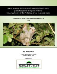
final report - People's Trust for Endangered Species
final report - People's Trust for Endangered Species
final report - People's Trust for Endangered Species

You also want an ePaper? Increase the reach of your titles
YUMPU automatically turns print PDFs into web optimized ePapers that Google loves.
The survey<br />
Survey methodology<br />
Study area<br />
Initially the study area encompassed 18 Kilometres of the Llangollen Canal although after<br />
consultation with a sympathetic landowner, the area was expanded and included a network of<br />
ditches and pools adjacent to the canal.<br />
Desktop study<br />
The Desktop survey involved collecting records of water vole, mink and otter obtained from the<br />
county / local recording centres and from the Canal and Rivers <strong>Trust</strong> GIS data base. This in<strong>for</strong>mation<br />
would identify and locate potential or possible suitable water vole habitats. This was then checked<br />
by a walkthrough survey.<br />
Walkthrough Survey<br />
Due to the amount of concrete and metal piling rein<strong>for</strong>cing the bank of the canal, a walkthrough<br />
survey was carried out, this would identify suitable soft bank which is preferred water vole habitat.<br />
This in<strong>for</strong>mation was recorded on planning maps (size 1:1783) which were generated during the<br />
desktop survey and would support more the detailed field surveys.<br />
Detailed field surveys<br />
Three surveys were undertaken at each site between June 2011 and September 2012 using standard<br />
Water Vole Survey Methodology as recommended within Water Vole Conservation Handbook<br />
(Strachan and Moorhouse, 2006). The presence of any water vole signs which included sightings,<br />
latrines, burrows, footprints, runs, feeding remains, lawns was recorded along with signs of otter or<br />
American mink. To avoid confusion other small mammal’s signs were recorded too.<br />
Two approaches where used to survey the banks; from the water, wading along the canal and from<br />
the bankside.<br />
This in<strong>for</strong>mation was recorded on a standard water vole recording <strong>for</strong>m which is recommended by<br />
the Water Vole Conservation handbook (Strachan and Moorhouse 2006).<br />
The habitat characteristics in<strong>for</strong>mation was recorded once the survey had been carried out and<br />
included the following;<br />
Bordering Land Use - grazed, woodland, bank fenced, urban, and industrial.<br />
Bank Profile - flat 45°, Vertical / undercut.<br />
Vegetation - recording the presence and absence of trees, bushes, herbs, submerged plants, reeds<br />
and sedges, tall grass and short grass.<br />
Disturbance – boat accessibility, human accessibility, signs of erosion, grazing or mowed to within<br />
the water margins.