Craig and Joan Inciardi - Town of East Hampton
Craig and Joan Inciardi - Town of East Hampton
Craig and Joan Inciardi - Town of East Hampton
You also want an ePaper? Increase the reach of your titles
YUMPU automatically turns print PDFs into web optimized ePapers that Google loves.
<strong>Town</strong> <strong>of</strong> <strong>East</strong> <strong>Hampton</strong><br />
300 Pantigo Place – Suite 105<br />
<strong>East</strong> <strong>Hampton</strong>, New York 11937-2684<br />
Planning Department Telephone (631) 324-2178<br />
Marguerite Wolffsohn Fax (631) 324-1476<br />
Director<br />
Technical Analysis Memo<br />
Lead Agency: (not applicable)<br />
Planner: Tyler Borsack<br />
Date completed: October 26 th , 2011 Site Plan<br />
SEQRA class: Type II Sub Waiver<br />
Physical Location:97 Louse Point Rd. Subdivision<br />
School District: Springs Special Permit<br />
Zoning District: A5 Residence Zone Change<br />
Overlay District: Harbor Protection Overlay District (HPOD) Variance XX<br />
Tax Map Number: 300-083-03-05 Natural Resources<br />
Applicant: <strong>Craig</strong> <strong>and</strong> <strong>Joan</strong> <strong>Inciardi</strong> Special Permit XX<br />
C/O L<strong>and</strong> Planning Services Other:<br />
P.O. Box 1313<br />
<strong>East</strong> <strong>Hampton</strong>, NY 11937<br />
Telephone: 631-537-8500<br />
FEMA ZONE: AE 8 Flood Zone<br />
Soil Type: Dune l<strong>and</strong> (Du)<br />
Map <strong>of</strong> Property: N/A<br />
Size <strong>of</strong> Parcel: 5,442 sq. ft. (total)<br />
Project Description:<br />
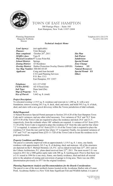
To relocated existing 1,119.5 sq. ft. residence <strong>and</strong> renovate to 1,280 sq. ft. with a new<br />
foundation; remove existing 241.5 sq. ft. deck, shed, <strong>and</strong> stairs, <strong>and</strong> build 393.5 sq. ft. <strong>of</strong> deck,<br />
shed, <strong>and</strong> stairs with a new gravel driveway within the <strong>Town</strong>s jurisdiction <strong>of</strong> tidal wetl<strong>and</strong>s.<br />
Relief Requested:<br />
A Natural Resources Special Permit pursuant to Section 255-4-20 <strong>of</strong> the <strong>East</strong> <strong>Hampton</strong> <strong>Town</strong><br />
Code <strong>and</strong> 6 variances, <strong>and</strong> any other relief necessary. Two variances <strong>of</strong> 70.4’ <strong>and</strong> 78.5’ from<br />
§255-4-30 <strong>of</strong> the <strong>Town</strong> Code are required to place the residence <strong>and</strong> deck 29.6’ <strong>and</strong> 21.5’,<br />
respectively, from the wetl<strong>and</strong>s where 100’ setbacks are required. A variance <strong>of</strong> 0.4’ from §255-<br />
11-10 <strong>of</strong> the <strong>Town</strong> Code is required to place the residence 6.8’ from the side yard lot line where<br />
7.2’ is required. A variance <strong>of</strong> 9.4’ from §255-11-10 <strong>of</strong> the <strong>Town</strong> Code is required to place the<br />
residence 5.6’ from the rear yard lot line where 15’ is required. Finally, two pyramid variances <strong>of</strong><br />
5’8” <strong>and</strong> 7’4.5” are required from §255-11-72D <strong>of</strong> the <strong>Town</strong> Code to locate the residence in its<br />
proposed location.<br />
Property Conditions <strong>and</strong> History:<br />
The parcel is currently improved with an approximately 1,119.5 sq. ft. 1 story, one family<br />
residence with approximately 241.5 sq. ft. <strong>of</strong> decking, shed, <strong>and</strong> staircase. All <strong>of</strong> the structures<br />
are depicted on the F. Michael Hemmer, LS, P.C. survey dated revised June 22 nd , 2011 <strong>and</strong> on<br />
the Coburn Architecture, P.C. plans dated received June 22 nd , 2011. The most recent C.O. was<br />
issued in 2011 for a 1000 gallon septic tank with 300 sq. ft. leaching pool. Prior to that there was<br />
a C.O. issued in 1994 for a one story, frame, one-family residence, shed <strong>and</strong> deck all erected<br />
prior to the adoption <strong>of</strong> zoning <strong>and</strong> conversion <strong>of</strong> garage to living area. There was one ZBA<br />
determination previously in 1977 for the original residence.<br />
Planning Department Analysis <strong>and</strong> Recommendations for the Boards Consideration:<br />
The parcel is one <strong>of</strong> the most northerly homes located on the Accabonac Harbor side <strong>of</strong> Louse<br />
Point. Accabonac Harbor is a New York State Significant Fish <strong>and</strong> Wildlife habitat; it is part <strong>of</strong><br />
<strong>Inciardi</strong> NRSP <strong>and</strong> Variance<br />
App. ID #: A1220110040<br />
Page 1 <strong>of</strong> 3
the Peconic Estuary Critical Environmental Area <strong>and</strong> is also located within the Accabonac<br />
Harbor subunit <strong>of</strong> the Accabonac Harbor Scenic Area <strong>of</strong> Statewide Significance (SASS)<br />
boundary, identified in the <strong>Town</strong>’s Scenic Resources Protection Plan. The SASS plan is a part <strong>of</strong><br />
the <strong>Town</strong>’s Comprehensive Plan, which documents areas within the <strong>Town</strong> <strong>of</strong> <strong>East</strong> <strong>Hampton</strong><br />
having aesthetic values that were identified as significant by <strong>East</strong> <strong>Hampton</strong> <strong>Town</strong> residents. The<br />
harbor is a productive area for marine finfish <strong>and</strong> shellfish <strong>and</strong> also contributes to the biological<br />
productivity <strong>of</strong> Gardiner’s Bay, as it serves as a nursery for estuarine fish species. This parcel is<br />
also within the <strong>East</strong> <strong>Hampton</strong> Critical Environmental Area for Accabonac Harbor. The wetl<strong>and</strong><br />
can be expected to provide the benefits typically associated with high quality wetl<strong>and</strong>s such as<br />
retention <strong>of</strong> flood waters <strong>and</strong> wildlife habitat. Its shoreline <strong>and</strong> surface waters provide all <strong>of</strong> the<br />
benefits typically associated with high quality wetl<strong>and</strong>s.<br />
The applicant is currently before the board for approval to move the existing residence to a more<br />
centered location on the property <strong>and</strong> renovate the building as well as add a deck <strong>and</strong> shed. The<br />
residence is increasing in size by approximately 160 sq. ft. from 1,119.5 sq. ft. to 1,280 sq. ft.;<br />
the decking, shed, <strong>and</strong> stairs are increasing by 152 sq. ft. The proposed project will be slightly<br />
more conforming to wetl<strong>and</strong> setbacks than what currently exists. The distance to the wetl<strong>and</strong> is<br />
being increased slightly from the house, 1.5’ further, <strong>and</strong> deck, 0.4’ further from the wetl<strong>and</strong>s.<br />
Also becoming more conforming is the distance <strong>of</strong> the residence to the northern side yard lot<br />
line, the distance to the lot line is increasing from 6.5” to 7.2’. Also becoming more conforming<br />
is the north side pyramid which is decreasing by approximately 1.46’. The southern pyramid<br />
nonconformity is proposed to be removed all together. However, there is a proposed increase in<br />
the pyramid nonconformity on the rear, western, lot line by 6”. Also, although not requiring<br />
variances, the residence <strong>and</strong> the decking are moving further from the southern lot line by<br />
approximately 5’ <strong>and</strong> 8’ respectively.<br />
The lot is severely nonconforming in regards to lot size, the area is zoned A5 residential with a<br />
lot size <strong>of</strong> 5,442 sq. ft. As an undersized lot <strong>and</strong> one that is nonconforming to lot width it is given<br />
relief under the 4/10s rule, §255-1-43D <strong>of</strong> the <strong>Town</strong> Code. Taking into consideration the 4/10ths<br />
rule, the house has a required setback <strong>of</strong> 7.2’; the deck has the same 7.2’ setback requirement.<br />
With the deck having a proposed setback <strong>of</strong> 7.8’, no side yard lot line variance is required for it.<br />
Also, because the lot is so small, the lot coverage is over the allowable by 271 sq. ft.; however,<br />
according to conversations with the Senior Building Inspector, the coverage is allowed because<br />
no change is proposed in coverage <strong>and</strong> is “gr<strong>and</strong>fathered” from the existing residence. It is also<br />
worth noting that the proposed total lot coverage is increasing from 1,605 sq. ft. to 2,079 sq. ft,<br />
with allowed total lot coverage <strong>of</strong> 2,173 sq. ft.<br />
The application makes reference to moving the existing residence <strong>and</strong> making renovations to it,<br />
but the applicant should make clear at the public hearing that the existing residence is being used<br />
<strong>and</strong> the project will not be a complete demolition <strong>and</strong> a rebuild. An assessment <strong>of</strong> the structural<br />
integrity <strong>of</strong> the residence by a licensed contractor or architect to ensure that a demolition <strong>and</strong><br />
rebuild will not be necessary may be appropriate, if that is the case.<br />
There was an upgrade to the sanitary system in 2003 that included a 1,000 gallon septic tank with<br />
a 300 sq. ft. leaching pool according to the Building Permit. However, the survey appears to<br />
show a septic tank with three leaching pools. The Board may wish the applicant to provide more<br />
information regarding the sanitary system <strong>and</strong> what components exist, <strong>and</strong> may also want an<br />
upgrade to the sanitary system; if it does not meet Harbor Protection Overlay District <strong>and</strong><br />
Suffolk County Department <strong>of</strong> Health Services st<strong>and</strong>ards for 1 to 4 bedroom residences. The<br />
applicants may want to depict a proposed upgraded sanitary system on the survey prior to the<br />
public hearing if the current system does not meet HPOD or SCDH st<strong>and</strong>ards. Up to date<br />
sanitary systems are important to maintaining high water quality, especially when located this<br />
close to the water <strong>and</strong> in an area <strong>of</strong> Accabonac Harbor which is subject to shellfish closures.<br />
While the residence is only slightly increasing in size, the Board should examine the necessity <strong>of</strong><br />
the increase in size <strong>and</strong> intensity <strong>of</strong> use on the property. The Board should also consider a no<br />
mow zone seaward <strong>of</strong> the wetl<strong>and</strong> line, which the clearing currently extends beyond, as part <strong>of</strong><br />
the mitigation. A no mow zone would allow the regrowth <strong>of</strong> wetl<strong>and</strong> <strong>and</strong> wetl<strong>and</strong> buffer<br />
vegetation which was previously removed. Just as the development <strong>of</strong> residential parcels<br />
surrounding the harbor has incrementally contributed to deterioration in water quality <strong>and</strong> habitat<br />
incremental restoration <strong>of</strong> this vegetation will help toward improving the harbor to its previous<br />
healthy condition. The Board needs to determine if the increase in size is <strong>of</strong>fset by the more<br />
<strong>Inciardi</strong> NRSP <strong>and</strong> Variance<br />
App. ID #: A1220110040<br />
Page 2 <strong>of</strong> 3
conforming location <strong>and</strong> the recommended mitigation. The applicants need to show that the<br />
project meets the variance st<strong>and</strong>ards in §255-8-50 <strong>of</strong> the <strong>Town</strong> Code.<br />
Recommended Project Conditions:<br />
1. Project limiting fencing with staked straw bales should be erected to limit l<strong>and</strong> disturbance<br />
<strong>and</strong> prevent sedimentation <strong>of</strong> the wetl<strong>and</strong>s in the location depicted on the F. Michael<br />
Hemmer, LS, P.C. survey dated revived June 22 nd , 2011 prior to the commencement <strong>and</strong> for<br />
the duration <strong>of</strong> construction activities.<br />
2. The Board, or their delegate, prior to the issuance <strong>of</strong> a building permit, should inspect the<br />
project limiting fencing <strong>and</strong> straw bales for adequacy.<br />
3. All ro<strong>of</strong> run<strong>of</strong>f should be directed by leaders <strong>and</strong> gutters into subsurface drywells to insure<br />
the return <strong>of</strong> clean water to the ground.<br />
4. The driveway composition <strong>and</strong> any drainage structures should be reviewed <strong>and</strong> approved by<br />
the <strong>Town</strong> Engineer prior to the issuance <strong>of</strong> a building permit. The completed driveway <strong>and</strong><br />
drainage structures should be inspected by the <strong>Town</strong> Engineer prior to the issuance <strong>of</strong> a<br />
Certificate <strong>of</strong> Occupancy.<br />
5. A “no mow” zone should be established seaward <strong>of</strong> the wetl<strong>and</strong> line shown on the F. Michael<br />
Hemmer survey dated revised June 22 nd , 2011.<br />
6. All structures should be situated at least 2’ above the seasonal high groundwater table.<br />
7. A copy <strong>of</strong> the Natural Resources Special Permit <strong>and</strong> the approved survey <strong>and</strong> building plans<br />
shall be available on the parcel at all times.<br />
<strong>Inciardi</strong> NRSP <strong>and</strong> Variance<br />
App. ID #: A1220110040<br />
Page 3 <strong>of</strong> 3


