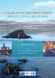
download - SCAPE
download - SCAPE
download - SCAPE

Create successful ePaper yourself
Turn your PDF publications into a flip-book with our unique Google optimized e-Paper software.
3. THE PHYSICAL ENVIRONMENT OF THE STUDY AREA<br />
3.1 Late Quaternary landforms and environments on North Uist<br />
3.1.1 Most of the island of North Uist is made up of undifferentiated Lewisian<br />
Gneiss which is a hard rock that is not easily weathered. Stretching from Loch<br />
nam Madadh on the east coast to the island of Baleshare on the west, is a band<br />
of metasediment including metavolcanic rock including pink granites. In the<br />
Balranald area, a suite of metabasic rocks forming linear dykes are present and<br />
represent a later intrusion. Glacial activity has resulted in the distribution of<br />
till which gives rise to shallow acidic poorly drained podsols and extensive<br />
peat development away from the calcareous machair plains on the east coast.<br />
Large deposits of off-shore sand and boulders were deposited by the ice-sheets<br />
onto a shallow, gently sloping continental; shelf which extends westwards<br />
from the Uists and Barra. The sands and boulders of the ice-sheet moraines<br />
were re-worked landwards by onshore coastal processes and a rising sea level<br />
in post glacial times (Ritchie 1966). This produced the vast quantities of sand<br />
and shingle used in the construction of the beaches and machair of the Atlantic<br />
coastal plains. Low altitude sandy plains are a common feature, situated<br />
immediately behind high sand dunes along the coastal edge of north Uists.<br />
3.1.2 The Atlantic coast has a variety of landforms which have been affected by<br />
continued coastal erosion and, importantly, submergence as the coastal<br />
landscape drowned following increases in sea levels during the Holocene.<br />
Analyses of inter- and sub-tidal organic deposits are widely distributed along<br />
the Atlantic coast of Uist (Ritchie 1985). Radiocarbon dating of the organic<br />
deposits indicated that sea level was 3-5m lower between 8800 BP and 5164<br />
BP than at present. Optically stimulated luminescence dating of Aeolian sands<br />
by Gilbertson et al (1999) indicates that carbonate sand of the Benbecula and<br />
North Uist machairs began to arrive off-shore at about 8700 BP which is in<br />
broad agreement with a rise in sea level and dune development. In a study at<br />
Cladach Mor, North Uist, Ritchie and Whittington (1994) obtained<br />
radiocarbon dates from an infilled peat basin. This work showed that the site<br />
was first affected by a major sand blow around 7810 BP. It was concluded<br />
that machair formation was not a synchronous event and that local topography<br />
and, importantly, the nature and altitude of coastline and its relative position to<br />
off-shore sediment supplies, were seen as crucial factors in the episodic<br />
formation of dunes.<br />
3.1.3 Research carried out by Whittington and Edwards (1997) on a series of intertidal<br />
peat sites located on a beach platform at Borve, island of Benbecula,<br />
provided both spatial and chronological evidence for sand movement as well<br />
as furnishing data on the vegetational and environmental history of the area.<br />
Pollen diagrams show that Calluna vulgaris (heather) and Poaceae (grass) are<br />
frequent dominants, while trees such as Betula (birch) and Corylus avellanatype<br />
(hazel) are notable. The existence of birch-hazel woodland for the period<br />
c. 8885-6190 BP may have had a retarding effect on sand movement.<br />
Anthropogenic clearance by fire is seen as a major mechanism for<br />
exacerbating the movement of sand with further increases in sand movement<br />
by c. 5990 BP. Sea-level changes, substantial coastal erosion, and numerous<br />
UISN/1051/0<br />
10<br />
CFA