COASTAL ZONE ASSESSMENT SURVEY - SCAPE
COASTAL ZONE ASSESSMENT SURVEY - SCAPE
COASTAL ZONE ASSESSMENT SURVEY - SCAPE

Create successful ePaper yourself
Turn your PDF publications into a flip-book with our unique Google optimized e-Paper software.
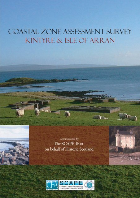
<strong>COASTAL</strong> <strong>ZONE</strong> <strong>ASSESSMENT</strong> <strong>SURVEY</strong><br />
KINTYRE & iSLE OF ARRAN<br />
Commissioned by<br />
The <strong>SCAPE</strong> Trust<br />
on behalf of Historic Scotland<br />
<strong>SCAPE</strong><br />
Scottish Coastal Archaeology<br />
and the Problem of Erosion
CFA ARCHAEOLOGY LTD<br />
January 2005<br />
Commissioned by The <strong>SCAPE</strong> Trust and Firth of Clyde Forum on behalf of Historic<br />
Scotland<br />
This document has been prepared in accordance with CFA standard operating procedures.<br />
Author:<br />
Approved by:<br />
Draft/Final Report Stage:<br />
Date<br />
Date<br />
FINAL<br />
Authors: Michael Cressey HND BA MSc PhD FSA Scot MIFA<br />
Samantha Badger MA PIFA FSA Scot<br />
Illustration/GIS: Karen Clarke BA MA Msc<br />
Editor: Sue Anderson BA MPhil MIFA<br />
CFA ARCHAEOLOGY LTD<br />
The Old Engine House<br />
Eskmills Business Park<br />
Musselburgh EH21 7PQ<br />
Tel: 0131-273 4380<br />
Fax: 0131-273 4381<br />
email: cfa@cfa-archaeology.co.uk<br />
Coastal Zone Assessment Survey Phase III<br />
Kintyre and Isle of Arran<br />
Report No. 997
CONTENTS<br />
1. Introduction 4<br />
2. Methodology 6<br />
3. The physical environment of the study areas 11<br />
4. Archaeological background of the study areas 17<br />
5. Survey maps of the East Coast of Kintyre 19<br />
6. Survey maps of the Southern Coast of Arran 107<br />
7. Survey results for Kintyre 167<br />
8. Survey results for the Isle of Arran 172<br />
9. Summary and recommendations 177<br />
10. Bibliography 179<br />
Appendices<br />
Appendix 1 – Kintyre: Built Heritage and Archaeology 183<br />
Appendix 2 - Arran: Built Heritage and Archaeology 190<br />
List of Tables<br />
Table 1 Predicted tidal ranges at the main ports close to the study areas 14<br />
Table 2 Summary statistics of the erosion class lengths of Kintyre 167<br />
Table 3 Summary statistics of the erosion class lengths of the Arran 172<br />
Table 4 Kintyre Sites recommended for immediate examination by Shorewatch 177<br />
Table 5 Arran Sites recommended for immediate examination by Shorewatch 178<br />
List of Figures (not including gazetteer maps)<br />
Figure 1 Location plan outlining the Kintyre and Arran study area 10<br />
Figure 2 Kintyre distance versus erosion/stability classification 169<br />
Figure 3 Kintyre percentage frequency of distance versus erosion/stability class 169<br />
Figure 4 Kintyre period categories of all sites and monuments 170<br />
Figure 5 Kintyre percentage frequency period categories of sites and monuments 170<br />
Figure 6 Kintyre frequency and condition of all archaeological sites 171<br />
Figure 7 Kintyre percentage frequency and condition of archaeological sites 171<br />
Figure 8 Arran distance versus erosion/stability classification 174<br />
Figure 9 Arran percentage frequency of distance versus erosion/stability class 174<br />
Figure 10 Arran period categories of all sites and monuments 175<br />
Figure 11 Arran percentage frequency period categories of sites and monuments 175<br />
Figure 12 Arran frequency and condition of all archaeological sites 176<br />
Figure 13 Arran percentage frequency and condition of archaeological sites 176<br />
KACL/997/0<br />
2<br />
CFA
List of Plates<br />
Plate 1 General view of Kintyre coastline form Sgier na h-Ighian 197<br />
Plate 2 View of Saddell Castle from Saddell Bay, Kintyre 197<br />
Plate 3 View of Island Muller with causeway visible to right of picture, Kintyre 198<br />
Plate 4 Stone Jetty in Ardnacross Bay, Peninver, Kintyre 198<br />
Plate 5 Quarries or structures below the fort at Kildonald Point, Kintyre 199<br />
Plate 6 Anti Aircraft Battery, Kintyre 199<br />
Plate 7 View of the Arran coastline around Kingscross Point 200<br />
Plate 8 Erosion section at mouth of Slidderywater Foot, Arran 200<br />
Plate 9 Close up of watch tower at Kildonan, Arran 201<br />
Plate 10 The Dun at Kingscross Point, Arran 201<br />
Plate 11 Possible remains of an anchor on Drumadoon Bay, Arran 202<br />
Plate 12 Drilled stones along coastline, Arran 202<br />
KACL/997/0<br />
3<br />
CFA
1. INTRODUCTION<br />
1.1 Background<br />
1.1.1 This report is one of several similar studies that have been produced to<br />
investigate and characterise the state of coastal erosion and the threat this<br />
poses to the cultural heritage sites along the coastline of Scotland. The results<br />
presented here are based on the results of two coastal assessment surveys<br />
carried out in October 2004 within the Firth of Clyde by CFA Archaeology<br />
Ltd. The study area (Fig. 1) includes the east coast of Kintyre from Tarbert to<br />
Campbeltown and the southern coast of Arran from Drumadoon Point to<br />
Clauchlands Point.<br />
1.1.2 Previous coastal surveys carried out by Glasgow University Archaeological<br />
Research Division (GUARD) in 2002 in three areas of the Firth of Clyde<br />
included areas of the Ayrshire coastline, parts of the Cowal Peninsula and the<br />
whole of Cumbrae Island. CFA also carried out coastal surveys of Bute and<br />
the Inner Clyde as part of the Phase II works. These programmes of work<br />
stemmed from the earlier recognition of the importance of the coastal zone to<br />
Scottish archaeology and the need for information to allow Historic Scotland<br />
to determine the nature of specific threats to archaeology and formulate<br />
solutions for specific areas (Ashmore 1994). More recent coastal zone<br />
assessments have secured external funding from other parties and as a result<br />
greater public involvement is now required. The <strong>SCAPE</strong> Trust (The Scottish<br />
Coastal Archaeology and the Problem of Erosion) has overseen the<br />
establishment of newly formed Shorewatch groups within each of the<br />
aforementioned study areas. Local involvement is now seen as a crucial way<br />
of allowing locally interested parties to become actively involved in coastal<br />
archaeology and in the long term monitoring of the coastline in their<br />
respective areas (Fraser et al. 2003).<br />
1.1.3 In addition to the archaeological dimension, these surveys have been<br />
conducted against a broader regional interest in the management of the Firth of<br />
Clyde. The Firth of Clyde Forum (FCF) has generated a large corpus of<br />
information designed to promote management objectives for the area centred<br />
on a cultural and environmental perspective. The FCF has been established to<br />
promote integrated approaches to managing the environmental, economic and<br />
community resources of the Firth of Clyde. The Forum's area extends from<br />
the tidal limit of the river in Glasgow's City Centre, westwards along the sea<br />
lochs to the Mull of Kintyre, and southwards down the Ayrshire Coast to Loch<br />
Ryan, taking in the islands of Arran, Bute and Cumbrae Island.<br />
1.2 Project aims<br />
1.2.1 The objectives of this project were:<br />
• to conduct coastal survey along specific sections of the Firth of Clyde in<br />
order to increase our knowledge of coastal archaeological sites in the Firth<br />
of Clyde;<br />
KACL/997/0<br />
4<br />
CFA
• to identify which particular sites are presently at risk from active coastal<br />
erosion and to predict which sites are likely to be at risk in the future;<br />
• to train and encourage newly established Shorewatch groups in line with<br />
the <strong>SCAPE</strong> Trust procedures.<br />
1.3 Acknowledgements<br />
Tom Dawson (<strong>SCAPE</strong>) provided advice during the early stages of the survey.<br />
Kintyre and Arran sector coastguards (Ian Plater and Bill Currie) provided<br />
health and safety information during the surveys. Fiona Davidson at the<br />
Council for Scottish Archaeology supplied information on potential<br />
Shorewatch members. Mrs Francis Hood (Kintyre Shorewatch) and Mrs<br />
Margaret Bruce (Arran Shorewatch) are warmly thanked for agreeing to coordinate<br />
the Shorewatch teams within their respective areas. Rod McCullagh<br />
at Historic Scotland agreed to changes in the report format. Richard Strachan<br />
at Historic Scotland for his GIS technical assistance.<br />
KACL/997/0<br />
5<br />
CFA
2. METHODOLOGY<br />
2.1 Introduction<br />
2.1.1 The methodology used during the study was based on that set out in Historic<br />
Scotland’s Procedure Paper 4: Coastal Zone Assessment (1996), and<br />
discussions in Archaeology and the Coastal Erosion Zone: Towards a Historic<br />
Scotland Policy (Ashmore 1994). With the permission of Historic Scotland,<br />
alterations have been made in the layout of the data sets to make these more<br />
user friendly for Geographical Information System (GIS) integration. During<br />
this project a staged approach was adopted and included the following<br />
elements:<br />
• Phase 1 - Preliminary desk-based survey. CFA conducted a rapid scan<br />
assessment to identify archaeological and geomorphological zones along<br />
the full length of the coastal units cited above.<br />
• Phase 2 - Comprehensive desk based assessment. CFA carried out a full<br />
desk-based assessment in accordance with Historic Scotland procedures.<br />
• Phase 3 - Coastal geomorphological assessment and ground-truth and<br />
setting up of Shorewatch groups on Kintyre and Arran.<br />
• Phase 4 - Report Compilation. The compilation of the report involved the<br />
creation of a Geographical Information System that amalgamated all<br />
respective data sets.<br />
2.2 Preliminary desk-based survey<br />
2.2.1 During this initial stage, contact was made with the relevant bodies listed in<br />
Historic Scotland’s procedure document and CFA’s Project Outline. It was at<br />
this stage that contact was made with all relevant bodies involved in coastal<br />
issues associated with the Firth of Clyde coastline. Information on the coastal<br />
geomorphology and geology was amalgamated at this stage.<br />
2.3 Desk-based assessment<br />
2.3.1 West of Scotland Archaeology Service (WoSAS) provided GIS information.<br />
This consisted of a Microsoft Access database of all known sites and<br />
monuments within the survey areas extracted from the local Sites and<br />
Monuments Record (SMR). Map-based information of the survey areas was<br />
provided in ArcView and consisted of 1:10,000 and 1:50,000 scale maps and<br />
digitised Ordnance Survey First Edition 6 inch to 1 mile maps.<br />
2.3.2 Historic Scotland provided information on all the Listed Buildings within the<br />
coastal survey transects. This information was provided in an Excel<br />
spreadsheet and added to the database of known archaeological sites and<br />
monuments.<br />
KACL/997/0<br />
6<br />
CFA
2.3.3 The desk-based assessment involved an examination of material from various<br />
sources and included the following information:<br />
• Examination of documentary sources held in various libraries, including<br />
the National Library of Scotland (NLS) and the University of Edinburgh<br />
Library.<br />
• Examination of the National Monuments Record of Scotland (NMRS)<br />
held at the Royal Commission on the Ancient and Historical Monuments<br />
of Scotland (RCAHMS) which contains a record of all known sites and<br />
monuments in Scotland.<br />
• An examination of available cartographic sources held at the NLS map<br />
library including First Edition Ordnance Survey maps, historical maps<br />
dating from the 18 th -19 th centuries, Admiralty Charts and other historical<br />
maps.<br />
2.4 Coastal assessment survey parameters<br />
2.4.1 The coastal survey area included three specific zones. The first zone is the<br />
intertidal zone including the area between the Mean High Water Spring Tide<br />
(MHWST) and the Mean Low Water Spring Tide (MLWST). The second<br />
zone was the shoreline. This zone included the immediate area behind the<br />
MHWST line. The third zone included the hinterland, varying between 50m<br />
and 100m from the edge of the coastal edge.<br />
2.4.2 The following areas were surveyed:<br />
• Kintyre coastline (estimated survey length - 78km): Tarbert (NR 865 685)<br />
to Trench Point (NR 735 203)<br />
• South Arran (estimated survey length - 40km): Drumadoon Point (NR 881<br />
287) to Clauchlands Point (NS 057 328).<br />
2.4.3 The archaeological surveys were undertaken following procedures outlined in<br />
Historic Scotland’s Procedure document. Two teams of archaeologists<br />
working in pairs surveyed the study areas described above. The island of<br />
Arran presented no problems in terms of access. Health and safety<br />
considerations restricted access along the shoreline between Tarbert and<br />
Skipness and again from south of Grogport to north of Carradale on Kintyre.<br />
2.4.4 Information on the general condition of existing and newly recorded<br />
archaeological sites was recorded onto coastal zone assessment sheets. Each<br />
site was allocated an identifying location number. The location of each site<br />
was established using a hand-held Global Positioning System (GPS)<br />
instrument that provided a ten-figure grid reference with 5-10m accuracy.<br />
Information on the character of the coastline was also collected during the<br />
survey and this information was fed back to the project geomorphologist for<br />
checking during targeted site visits. Known archaeological sites and<br />
monuments within the survey transect were visited wherever possible. On the<br />
KACL/997/0<br />
7<br />
CFA
advice of the Tarbert Coastguard the section of coastline to the south of<br />
Tarbert to the north of Pier House (NGR NR 880 686 to NR 922 609),<br />
presented a health and safety hazard owing to the precipitous nature of the<br />
steep sloping cliffs, therefore no survey work was carried out on this particular<br />
section of coast.<br />
2.5 Coastal geology and geomorphology<br />
2.5.1 A comprehensive review of the available documentary and cartographic<br />
sources covering the coastal geology/geomorphology and erosion criteria<br />
within the study area was undertaken by Dr Michael Cressey, CFA’s<br />
Environmental Scientist. Targeted site visits were carried out for field<br />
inspection following the walkover survey. Field notes, digital photographs<br />
and other topographical information were added to the coastal geomorphology<br />
maps.<br />
2.6 Shorewatch group training<br />
2.6.1 Two Shorewatch Groups were established during the early stages of this study.<br />
The Argyll group, working out of Campbeltown, are currently monitoring<br />
coastal cells on the east of Kintyre. The Arran Shorewatch group are<br />
monitoring sites along the south coast of Arran.<br />
2.6.2 The <strong>SCAPE</strong> Trust provided a new Shorewatch Information Pack which<br />
includes a revised set of recording and monitoring forms along with detailed<br />
information explaining how to use them.<br />
2.7 Report Format<br />
2.7.1 In this report we use the term shoreline to refer to the distinct boundary<br />
between land and sea that changes with the tides. A coastal unit defines the<br />
areas between numbered cut-off points that demarcate individual sections of<br />
coastline which has been classified according to its eroding, stable or accreting<br />
status.<br />
2.7.2 The results are presented in two sections. Section 1 (chapters 5 and 7) deals<br />
with Kintyre. Section 2 (chapters 6 and 8) deals with the Isle of Arran. The<br />
results are presented sequentially for each coastal unit and follow the standard<br />
format (Ashmore 1994). Elements include an introductory section followed<br />
by sections detailing the coastal geology/morphology, coastal erosion and<br />
archaeological gazetteer and maps. These are followed by a section<br />
incorporating results and observations. This is followed by a list of references<br />
and appendices.<br />
2.7.3 Each survey area is accompanied by three individual maps. These maps<br />
contain data on the Built Heritage and Archaeology and Erosion Class. The<br />
gazetteer entries include the following categories:<br />
KACL/997/0<br />
8<br />
CFA
Hinterland Geology and Coastal Geomorphology<br />
Identification number and name of coastal section<br />
National grid reference<br />
Distance of coastal section<br />
Typical deposit type on the foreshore<br />
Height of cliff<br />
Hinterland geomorphology<br />
Description<br />
Erosion<br />
Identification number and name of coastal section<br />
National grid reference<br />
Distance of coastal section<br />
Type of erosion present<br />
Description<br />
Built Heritage and Archaeology<br />
Identification number and coastal section<br />
National grid reference<br />
National Sites and Monument Record Number<br />
Site name or type<br />
Condition<br />
Period/date<br />
Recommendation<br />
KACL/997/0<br />
9<br />
CFA
180000m<br />
NR NS<br />
200000m<br />
220000m<br />
Point<br />
Of Knap<br />
KYLES OF BUTE<br />
660000m<br />
Kilberry<br />
Head<br />
Ardpatrick<br />
Point<br />
WEST LOCH TARBERT<br />
Mealderroch<br />
Point<br />
Skipness Point<br />
Ardlamont<br />
Point<br />
ISLE<br />
Ardscalpsie<br />
Point<br />
OF<br />
BUTE<br />
ROTHESAY<br />
Kingarth<br />
GREAT<br />
CUMBRIE<br />
ISLAND<br />
Skelmorlie<br />
LARGS<br />
660000m<br />
640000m<br />
Cara<br />
Island<br />
ISLE OF<br />
GIGHA<br />
SOUND OF GIGHA<br />
K I N T Y R E<br />
Bridgend<br />
Drumadoon<br />
Point<br />
K I L B R A N N A N S O U N D<br />
Lochranza<br />
ISLE<br />
OF<br />
ARRAN<br />
Millstone Point<br />
Brodick<br />
SOUND OF BUTE<br />
Sannox<br />
Whiting Bay<br />
Clauchlands<br />
Point<br />
Garroch<br />
Head<br />
Holy<br />
Island<br />
MILLPORT<br />
Little<br />
Cumbrie<br />
Island<br />
F I R T H O F C L Y D E<br />
A78<br />
ARDROSSAN<br />
West<br />
Kilbride<br />
SALTCOATS<br />
Dalry<br />
A737<br />
IRVINE<br />
TROON<br />
PRESTWICK<br />
640000m<br />
AYR<br />
620000m<br />
CAMPBELTOWN<br />
Bennan<br />
Head<br />
620000m<br />
180000m<br />
200000m<br />
220000m<br />
STUDY AREAS<br />
© Crown Copyright. All rights reserved [Historic Scotland] [100017509][2005]<br />
NR NS<br />
0 5 10<br />
20<br />
30km<br />
Fig.1 - Location plan outlining the Kintyre and Arran study areas.<br />
KACL/997/0 10 CFA
3. THE PHYSICAL ENVIRONMENT OF THE STUDY AREAS<br />
3.1 Late Quaternary landforms and environments on Kintyre<br />
3.1.1 In general there is great uniformity in the geological formations along the east<br />
Kintyre coastline, and this has had an important role in shaping the character<br />
of this coastline, which is of notable outstanding scenic beauty. The geology<br />
within the study area is mainly dominated by Precambrian age metamorphose<br />
schists associated with the Dalradian Metamorphic Assemblage (Macgregor<br />
1965). These rocks are mainly metamorphosed marine sediments that produce<br />
a rugged coastline with often steep coastal gradients. At various points along<br />
the coastline, igneous dykes outcrop at the shore. The dykes are<br />
predominantly composed of basaltic olivine-dollerite and are of Tertiary age.<br />
These features are very resilient to coastal erosion and in general they vary in<br />
height from between 0.5-3m and extend well beyond the mean low water<br />
spring tide (MLWST).<br />
3.1.2 At the risk of oversimplification, the internal structural weaknesses within the<br />
schists, typically areas such as joints, fractures and faults, exert a primary<br />
control on both the morphology and rate of cliff erosion in many areas. These<br />
zones of weakness provide areas where accelerated wave erosion has formed<br />
embayments, arches and sea-caves as well as smaller irregularities in the<br />
coastline within the study region (cf Steers 1973). In general terms the rate of<br />
cliff erosion and the resulting landforms are related to both cliff-forming<br />
materials and the physical processes to which they are exposed. Although the<br />
study area lies in a reasonably sheltered sea-loch environment within the<br />
Kilbrannan Sound, storm surges and dominant south westerly wind-driven<br />
wave action continue to shape this area of coastline.<br />
Raised marine shorelines<br />
3.1.3 As with much of the Clyde region, a rock platform occurs above the present<br />
tidal limit along much of the Kintyre coast. The relict shorelines have been<br />
mapped extensively and are depicted on the modern solid and drift edition<br />
1:50 000 produced by the British Geological Survey (BGS). The older 1 inch<br />
seventh series maps also produced by BGS depict the three main raised<br />
shorelines, namely the low, medium and high raised beach. Isostatic recovery<br />
has altered the altitude at which these features now rest. Between Skipness<br />
and Claonaig, a former intertidal platform up to 150m wide is visible and is<br />
largely covered by Juncus wetland (Firth and Collins 2002). Typically these<br />
platforms are backed by relict cliff lines (e.g. Smerby Rocks NR 760 232). In<br />
other areas, the intertidal platform is less well defined (e.g. Port Righ NR 8170<br />
3795) but is better preserved at the sheltered heads of small embayments.<br />
Other platforms possibly attributable to the Loch Lomond Re-advance and<br />
more recent Holocene age storm levels are more common above the mean high<br />
water spring tide (MHWST) and the backshore area. These are often more<br />
pronounced in areas where softer marine sediments have been redeposited or<br />
where areas of Devensian age till have been remodelled as a result of higher<br />
sea levels during the Maximum Marine Transgression.<br />
KACL/997/0<br />
11<br />
CFA
Sand dunes<br />
3.1.4 Sand dunes are not extensive within the study area and are mainly confined at<br />
the head of bays or small embayments. More significant accumulations of<br />
beach sediment occur at the mouths of a number of rivers and streams,<br />
representing both local sediment supply and in places, slightly more sheltered<br />
positions resulting from low off shore gradients. The main area of dunes is at<br />
Carradale Bay at the head of a wide open beach.<br />
Coastal wetlands and mudflats<br />
3.1.5 The development of saltmarshes is very limited along the Kintyre east coast,<br />
reflecting the limited supply of fine sediment and energy conditions that are<br />
generally too high for these sediments to be deposited (Firth and Collins<br />
2002). The are a few rare examples where saltmarsh is present, for example to<br />
the south of Skipness. Here the intertidal rock platform is irregular, producing<br />
small sheltered narrow embayments penetrating a short distance inland. Thin<br />
formations of sand, silt and clay have been deposited at Port an Leinibh (NR<br />
895 570), Auchameanach Farm (NR 885 565) and Island Muller (NR 755<br />
2240). Such formations act as a buffer for wave action at the MHWST and as<br />
such are prone to undercutting and slope failure where erosion is well<br />
established. As these formations are relatively young (mid-late Holocene) it is<br />
conceivable that they could mask hitherto unrecorded archaeological features.<br />
Sea defences<br />
3.1.6 The seafronts of Campbeltown and Tarbert are defended by concrete sea walls<br />
and other defensive works. In other parts boulder dump sea defences are also<br />
common, for instance Port Righ (NR 817 378) where a boulder dump protects<br />
a cliff comprised of glacial till.<br />
Sites of Special Scientific Interest (SSSI)<br />
3.1.7 The section of coastline between Tarbert and Skipness includes an area<br />
comprising 592.3ha of ancient broad-leaved woodland with altitude zonation<br />
and a variety of vascular plants. This is the only designated SSSI within the<br />
survey area on Kintyre.<br />
3.2 Late Quaternary landforms and environments of the Isle of Arran<br />
3.2.1 The isle of Arran is situated between the Kilbrannan Sound and the Main Firth<br />
of Clyde (Figure 1). Arran's geology is famous for its complexity and variety.<br />
The island is divided into two zones by the Highland Boundary Fault and the<br />
northern part exhibits the characteristics of the Highlands of Scotland while<br />
the southern part mirrors those of the Lowlands. In the north, the main coastal<br />
outcrops of bedrock consist of schistose grit with less extensive outcrops of<br />
slates, Devonian, Carboniferous and Permian sandstone. The southern coast is<br />
dominated by Triasic marls, Permian sandstone and Tertiary intrusive dykes<br />
and sills. A particular characteristic of the southern coastline is the large<br />
number of dykes, which extend out from the modern shore to the sub-tidal<br />
KACL/997/0<br />
12<br />
CFA
zone. A sloping platform cut into bedrock and generally backed by a steep<br />
relict cliff extends as an almost continuous feature round the island (Firth and<br />
Collins 2002). It reaches its maximum on the southern coast where a platform<br />
extends up to 250m wide. Where valleys have formed, the rock platform<br />
merges into raised beach deposits. These types of raised platforms were<br />
originally considered to be abrasion platforms cut by wave action at a time of<br />
higher relative sea level. However work by Dawson et al (1987), has shown<br />
that freeze thaw activity and periglacial weathering along ice-sheet margins<br />
are largely responsible for this type of coastal geomorphology.<br />
Raised marine shorelines<br />
3.2.2 Numerous raised surfaces occur around the southern coast of Arran. These<br />
deposits are well represented at Drumadoon Bay (NR 891 283) and along the<br />
coastline between Aird nan Ron to Porta Leacach. Raised shorelines are also<br />
present from Kingscross Point, in the south, to north of Dippin Head.<br />
Commonly these deposits can be differentiated by the high quantity of marine<br />
derived gravel and sand. Lower terraces may be rich in marine shells. Where<br />
these are exposed their inherent structural weakness makes them prone to<br />
erosion.<br />
Sand dunes<br />
3.2.3 Several small dune fields are present, usually at the mouths of valleys. The<br />
low frequency of well established dune formation is extricably linked to the<br />
low offshore nutrient supply. The sandy beaches along the south coast have<br />
been classified by Ritchie (1975). The main areas of blown sand are at<br />
Blackwaterfoot (NR 885 287) and Lenamhor Farm (NR 960 205).<br />
Coastal wetlands and mudflats<br />
3.2.4 Owing to the absence of low energy wave activity and the lack of sediments<br />
that allow the formation of coastal wetlands, salt marsh is absent within the<br />
study area. However where conditions are damp enough, particularly at the<br />
base of cliffs were seepage is held behind a natural or man-made barrier, then<br />
wetland plants will flourish. A good example of the effect of soligenous bog<br />
formation and emergent wetland habitat is at the site of a large field enclosure<br />
near Auchenhew (NR 0038 2104). Here common reed (Phragmites<br />
communis) and sedges (Carex undiff) is well established behind the<br />
upstanding field walls.<br />
Sea defence works<br />
3.2.5 Sea defence works occupy the coastline at all the major settlements along the<br />
south coast. At Blackwater Foot, boulder dump protection is extensive. The<br />
mouth of the river that outfalls within the bay has been protected by a series of<br />
boulder dump breakwaters in 2003. The coastal track leading from Whiting<br />
Bay to Kingscross Point has also been heavily defended by boulder sea<br />
defences.<br />
KACL/997/0<br />
13<br />
CFA
Sites of Special Scientific Interest (SSSI)<br />
3.2.6 The south coast of Arran has an area encompassing 218.3ha and is designated<br />
a SSSI because of the main Arran Dyke swarm (NS 042 213 and NR 951 208).<br />
3.3 Wave climate in the Firth of Clyde<br />
3.3.1 The Firth of Clyde has been classified as a mesotidal area, with tides at the<br />
head of the Firth being described as semi-diurnal, meaning there is a high tide<br />
every 12 hours. Table 1 shows the normal tidal ranges at key points within the<br />
Firth of Clyde. Within the study area these results show that there is no<br />
significant difference between the spring tidal ranges. However, local<br />
topography and the limit of exposure to direct wave impact will have a bearing<br />
on the potential impacts of erosion at the HWMST area.<br />
Site MHWST MLWST Spring<br />
Tidal<br />
Range<br />
MHW<br />
NT<br />
MLWNT<br />
Campbeltown 1.61 -0.99 2.6 1.11 -0.49 1.6<br />
E. Loch Tarbert 1.58 -1.12 2.7 1.18 -0.62 1.8<br />
Millport 1.78 -1.12 2.9 1.18 -0.62 1.8<br />
Rothesay 1.78 -1.22 3.0 1.28 -0.62 1.9<br />
Inveraray 1.68 -1.42 3.1 1.38 -1.12 2.5<br />
Greenock 1.78 -1.22 3.0 1.28 -0.62 1.9<br />
Neap Tidal<br />
Range<br />
Table 1: Predicted tidal ranges at the main ports close to the study areas with values in metres<br />
OD. (MHWST=Mean high water spring tides, MLWST = Mean low water spring tides,<br />
MHWNT= Mean high water neap tides, and MLWNT = Mean low water neap tides) Data<br />
derived from 1994 Admiralty, after Firth and Collins (2002, Table 2.1)<br />
Patterns and predictive rates of sea level rise in the Firth of Clyde.<br />
3.3.2 The predictive rates of sea level rise and its effect on the intertidal areas within<br />
the study area have recently been well documented (Dawson et al 2001, Firth<br />
and Collins 2002). A critical factor in evaluating future sea level changes is<br />
the importance of natural vertical land movements. These are the rates at<br />
which the coastline is rising or falling as a result of isostatic adjustments. By<br />
combining the proposed rates of uplift with the patterns associated with the<br />
Main Postglacial Shoreline, maps illustrating the maximum and minimum<br />
rates of crustal movement can be produced. Firth and Collins (2002, Illus.<br />
11.2 & 11.3) propose that within the Clyde region, the minimum rates of uplift<br />
are estimated to range from 0.6-0.95 mm/yr., whilst the maximum rates lie<br />
between 2.0-2.3mm/yr. The lower estimates are considered by these<br />
researchers to be a better approximation since they closely correlate with the<br />
uplift rates identified from the most recent geological evidence. The impact of<br />
patterns of relative sea level change around Scotland at the present time will<br />
vary according to a number of different parameters. Dawson et al. (2001)<br />
considered the following factors in their examination on the likely impact<br />
resulting from a future rise in sea level:<br />
KACL/997/0<br />
14<br />
CFA
• Areas experiencing relative sea level rise are becoming progressively<br />
more susceptible to the effects of storm surge activity. However it is<br />
noted that this will vary according to exposure.<br />
• The impact of sea surface rise will be less noticeable in areas with a strong<br />
sediment supply and where coastal progradation is taking place, for<br />
example the Moray Firth coastline, parts of the north east and east of<br />
Scotland, parts of northern Scotland and parts of south-west Scotland. In<br />
areas where sediment supply is scarce, the effect of a sea surface rise will<br />
be more noticeable.<br />
• In areas where the coastal features are easily eroded, the impact of sea<br />
level rise will have greater effect than in other, more resistant areas.<br />
3.3.3 The results of Dawson et al. (2001) were based on the uplift data of Shennan<br />
(1989) together with the UK Climate Impacts Programme (UKCIP) emissions<br />
scenario that envisages that most of the projected sea level rise in the next<br />
century will be as a result of thermal expansion. Their data shows that the<br />
study area lies within Zone B where intermediate rates of uplift are predicted<br />
at c. 0.5-1.00mm per annum (Figure 2). Their “best estimate” for the next 50<br />
years is a predicted rise of around 16cm, and by the year 2100 a rise of 31.5cm<br />
is predicted. However they provide a cautionary statement that their sea level<br />
return period analyses are not linked to patterns of storminess change derived<br />
from the analyses of the North Atlantic Oscillation Index and other empirical<br />
storm data. These authors rightly note that storm frequency will be a major<br />
causative factor in relative sea level change in the short term.<br />
3.3.4 Increases in recent storm frequency have been a central point in assessing the<br />
vulnerability of the Scottish coastline, particularly where ‘softer’ sediment<br />
forms a main component of a given coastal cell. Its location in relation to<br />
direct wave impact during the tidal cycle will have a bearing on the relative<br />
rates of recession and in some cases, if conditions are right, on accretion.<br />
Previous coastal zone assessment surveys already undertaken on behalf of<br />
Historic Scotland have highlighted the vulnerability of the softer regions of the<br />
Scottish coastline and the effects of storm activity that has, and continues to<br />
have, an effect on coastal archaeology. Cressey and Toolis 1997and Cressey<br />
et al 2001 showed that within parts of the Solway Firth, cliffs containing softer<br />
sediment, including marine clay and loosely consolidated materials such as<br />
shingle and sand, were extremely vulnerable to rapid coastal erosion. This<br />
was especially bad in areas where building refuse had been dumped in<br />
attempts to slow down cliff recession. It was found that during high spring<br />
tides these areas were badly affected by excessive scouring and abrasion as the<br />
dump material was hammered against the base of the soft cliffs.<br />
3.3.5 The enclosed nature of the Firth of Clyde with its narrow system of fjords<br />
severely limits the wave field affecting the coastline of this area. As a result<br />
the height and direction of waves reaching the coast are highly dependent on<br />
the wind direction (Firth and Collins 2002). Both sections of coastline within<br />
the study area display the effect of wind direction. The south coast of Arran is<br />
directly affected by winds derived from the south-west sector. Although<br />
KACL/997/0<br />
15<br />
CFA
sheltered by the west coast of Arran, the east side of Kintyre appears to be<br />
equally exposed, with a tendency for exposure to south-south-easterly gales.<br />
A good example of the effect of this activity can be found in Skipness Bay<br />
were a series of shingle storm ridges have been formed at the east end of the<br />
south-facing bay. The ridges decline in altitude towards the west end of the<br />
bay, thus demonstrating that the south-south-westerly storms register the<br />
greatest impact along this particular section of coastline.<br />
KACL/997/0<br />
16<br />
CFA
4. ARCHAEOLOGICAL BACKGROUND OF THE STUDY AREAS<br />
4.1 Kintyre<br />
Prehistoric<br />
4.1.1 There are several prehistoric archaeological sites and monuments on Kintyre.<br />
These include numerous duns, castles and forts occupying exposed<br />
promontories. The so-called promontory forts are widely distributed and have<br />
been occupied from prehistory through into the medieval period. Typical<br />
examples of these are the forts at Carradale Point and Kildonan Point.<br />
4.1.2 Cist burials and cairns are also documented but sadly few of these features<br />
survive today. There are at least three cists recorded at Trench Point that have<br />
been fully excavated and of which nothing now remains. There are also<br />
several cairns recorded, mostly at Kildonan Point, that have been attributed a<br />
prehistoric date though this has not been established through excavation.<br />
Medieval<br />
4.1.3 There are several sites of medieval date along the east coast of Kintyre. These<br />
include castles, a burgh, churches or chapels, bloomery mounds and a well.<br />
The east coast of Kintyre is very rugged and rocky which means that it is idea<br />
for locating defensive structures as the coastline itself provides a defence<br />
against attack from the sea. Two examples of these can be seen at Tarbert<br />
Castle and Airds Castle. The natural harbour of Tarbert, although it is now<br />
enclosed, is an ideal place to settle with direct protected access to the sea and<br />
an easily accessible hinterland. The identification of a medieval burgh around<br />
the castle suggests that this area was settled from at least this time if not<br />
before.<br />
Post-Medieval<br />
4.1.4 There are numerous post-medieval sites along the east coast of Kintyre. These<br />
comprise mostly of buildings and tend to concentrate within existing towns or<br />
clusters forming smaller settlements, such as at Grogport. The other main<br />
types of sites associated with the post-medieval period are boathouses and<br />
piers, which given that this is a coastal survey are not unexpected. Other sites<br />
such as stone walls may be linked to land improvements during this time.<br />
Industrial Period<br />
4.1.5 Sites dated to the industrial period are common. Many of these sites are<br />
associated with shipping, including shipwrecks carrying industrial products<br />
such as coal or lime. In and around Campbeltown the shipping industry is<br />
very obvious, even today. There are the remains of warehouses and shipyards<br />
that echo back to the golden age of the shipping industry during the period of<br />
industrialisation in the 1800s. The number of shipwrecks noted in the small<br />
wayleave of the survey area suggests that shipping was a hazardous<br />
occupation, especially along this coast.<br />
KACL/997/0<br />
17<br />
CFA
4.2 Isle of Arran<br />
Prehistoric and Early Historic periods<br />
4.2.1 Very few sites from this period have been identified along the southern coast<br />
of Arran. There are two defensive structures, Dippen Promontory Fort and<br />
Kingscross Dun. The low number of such sites in comparison to those found<br />
on Kintyre may be due to the nature of the coastline, which appears to be one<br />
of extremes between high cliffs and flat bay areas. It appears that the majority<br />
of prehistoric sites are concentrated on the east side of Arran at such places as<br />
Kingscross Point, where there is a standing stone and various sites associated<br />
with the Vikings.<br />
Medieval<br />
4.2.2 There are only two known medieval sites within this portion of Arran’s<br />
coastline. These are a bloomery mound at Kilpatrick, and Kildonan Castle. It<br />
appears that this area was not extensively used during this period or that later<br />
settlement has destroyed any trace of earlier sites.<br />
Post Medieval and Industrial Period<br />
4.2.3 As seen on Kintyre, there are numerous shipwrecks littering the southern coast<br />
of Arran. This is a very ragged and rocky coastline and shipwrecks tend to be<br />
common around such shores. The majority of these shipwrecks date from the<br />
1800s and appear to be linked to industrial activities as they tended to carry<br />
cargoes of coal or lime, two resources in high demand at this time.<br />
4.2.4 Most of the other sites along this coastline date to the 19 th or 20 th century and<br />
are mostly buildings, either residential or commercial, concentrated in and<br />
around the main towns on the island such as Whiting Bay or Lamlash. Other<br />
features such as stone walls may be associated with land improvements in the<br />
1800s when a lot of the crofting communities were cleared off the land to<br />
make way for improved land use. A Clearances Monument dedicated to the<br />
people who were evicted can be seen in the centre of Lamlash.<br />
Military<br />
4.2.5 There are several sites linked to military activity on Arran, mostly dateable to<br />
the Second World War. Several observation posts are located around the east<br />
coast of Arran from Kildonan to at least Clauchlands Point where the survey<br />
area ends. There is also evidence of a barrier which once stretched from<br />
Kingscross Point to Holy Island.<br />
KACL/997/0<br />
18<br />
CFA
5. <strong>SURVEY</strong> MAPS OF THE EAST COAST OF KINTYRE<br />
MAP 1: TARBERT TO FIONN PHORT<br />
Hinterland Geology and Coastal Geomorphology: The hinterland geology along<br />
this very uniform coastal cell is dominated by Dalradian schist (greywacke). The<br />
coastal edge is generally not highly indented and the intertidal area is narrow. There<br />
are no major embayments apart from East Loch Tarbert which lies on a major fault<br />
line forming a boundary between an area of basalt and the schist formations.<br />
Outcropping Tertiary dykes are rare along this section of coastline. The shoreline<br />
gradient is steep and there is very little in terms of backshore area due to the steepness<br />
of the cliffs. Access is very limited owing to the narrowness of the shoreline, which is<br />
normally inundated at MHWST. The hinterland rises steeply from the shoreline and<br />
is dominated by broadleaf cover.<br />
Erosion Class: The resilient nature of the cliffs and the lack of beaches in the strictest<br />
sense assign this area of coastline to mostly stable. There is some erosion and<br />
accretion around Tarbert itself though the sea walls protect the natural coastline.<br />
Although this area could not be surveyed by the field teams, a good length of this cell<br />
was observed from the ferry crossing from Tarbert to Arran.<br />
Built Heritage & Archaeology: The majority of the archaeology in this area is<br />
centred in and around Tarbert, although this may be a biased view as access to much<br />
of this area was restricted. The town of Tarbert appears to have medieval origins<br />
centred on the castle which stands on a prominent hill to the east of the present town.<br />
There is a suggestion of a burgh surrounding the castle though there is little known<br />
about it. The town of Tarbert contains several Listed Buildings within the survey<br />
area, most of which date to the 19 th or 20 th century. Other archaeological sites relate<br />
to the use of the sea, such as piers and Tarbert harbour, which also appears to date<br />
from the 19 th century.<br />
KACL/997/0<br />
19<br />
CFA
KINTYRE MAP 1: HINTERLAND GEOLOGY AND <strong>COASTAL</strong> GEOMORPHOLOGY<br />
ID Name of section NGR Length Typical deposit type on the foreshore Height of cliff Hinterland geomorphology Description<br />
1 TARBERT TO SGEIR BHUIDHE NR 8650 6860<br />
to<br />
NR 9230 5940<br />
12.5km Man made defence at Tarbert, mainly<br />
rock platform.<br />
Low edge (
KINTYRE MAP 1 -HINTERLAND GEOLOGY AND FORESHORE GEOMORPHOLOGY<br />
Tarbert to Fionn Phort<br />
1<br />
0 0.5<br />
1km<br />
Scale 1:25,000<br />
LARGS<br />
LEGEND<br />
K I N T Y R E<br />
ISLE<br />
OF<br />
ARRAN<br />
Brodick<br />
ARDROSSAN<br />
TROON<br />
AYR<br />
CAMPBELTOWN<br />
© Crown Copyright. All rights reserved [Historic Scotland] [100017509][2005]<br />
KACL/997/0 21 CFA
KINTYRE MAP 1: EROSION<br />
ID Name of coastal section NGR Length of coastal section Type of erosion present Description<br />
1 Tarbert to Rubha Loisgte NR 864 686 to NR 879 686 1.6km Eroding and accreting. Shingle and sand is accreting with some local scouring at base of sea walls.<br />
2 Rubha Loisgte to Cnoc a' Bharr<br />
Shoulusaich<br />
NR 879 686 to NR 922 597 10km Unknown. Not surveyed.<br />
KACL/997/0<br />
22<br />
CFA
KINTYRE MAP 1 - EROSION CLASS<br />
Tarbert to Fionn Phort<br />
1<br />
2<br />
0 0.5<br />
1km<br />
Scale 1:25,000<br />
LARGS<br />
LEGEND<br />
K I N T Y R E<br />
ISLE<br />
OF<br />
ARRAN<br />
Brodick<br />
ARDROSSAN<br />
TROON<br />
AYR<br />
CAMPBELTOWN<br />
© Crown Copyright. All rights reserved [Historic Scotland] [100017509][2005]<br />
KACL/997/0 23 CFA
KINTYRE MAP 1: BUILT HERITAGE AND ARCHAEOLOGY<br />
Sites on the Coast Edge and Foreshore<br />
ID Name NMRS Source WoSAS NGR Status Type Condition Date Recommendation<br />
Pin<br />
2 Tarbert NR86NE 14 NMRS 3911 NR 864 686 Scheduled Burgh; Village Unknown 14th C Nil<br />
3410<br />
4 Harbour Walls NR86NE 18.02 NMRS NR 8643 6864 Listed B Wall Good 19th C Nil<br />
HBNum<br />
48935<br />
7 Tarbert Harbour NR86NE 18.0 NMRS 3915 NR 866 687 Harbour Good 18th-20th C Nil<br />
14 Pier NR86NE 52 NMRS 45765 NR 8752 6881 Pier Good 18th-20th C Nil<br />
15 Old Pier OS 2nd ed. NR 8793 6861 Pier Eroding 18th-20th C Survey<br />
Sites in the Hinterland<br />
ID Name NMRS Source WoSAS NGR Status Type Condition Date Recommendation<br />
Pin<br />
1 Shop, Main Street NR86NE 51 NMRS NR 8635 6864 Commercial Good 18th-20th C Nil<br />
3 Tarbert Hotel NR86NE 47 NMRS NR 8644 6861 Listed C(s) Residential; Good 19th C Nil<br />
HBNum<br />
12030<br />
Commercial<br />
5 Cottage NR86NE 43 NMRS NR 8651 6858 Residential Unknown 18th-20th C Nil<br />
6 Harbour Street NR86NE 57 NMRS NR 8659 6868 Street Good 18th-20th C Nil<br />
8 Ice Factory NR86NE 18.1 NMRS 46009 NR 8671 6879 Commercial Good 18th-20th C Nil<br />
9 Tarbert Castle NR86NE 1 NMRS 3906 NR 8677 6873 Listed B<br />
HBNum<br />
12031<br />
Defence Poor 11th-15th C Nil<br />
Scheduled 276<br />
10 Queen’s Gate NR86NE 54 NMRS NR 8696 6877 Listed C(s) Residential Good 19th C Nil<br />
HBNum<br />
12032<br />
11 House and Gear Store NR86NE 56 NMRS 43849 NR 871 688 Residential; Store Unknown 18th-20th C Nil<br />
12 Columba Hotel NR86NE 45 NMRS NR 8736 6880 Listed C(s)<br />
HBNum<br />
12033<br />
Residential;<br />
Commercial<br />
Good 19th C Nil<br />
KACL/997/0<br />
24<br />
CFA
13 Pier House NR86NE 53 NMRS NR 8748 6880 Listed C(s)<br />
HBNum<br />
12034<br />
Residential Good 19th C Nil<br />
KACL/997/0<br />
25<br />
CFA
KINTYRE MAP 1 - BUILT HERITAGE AND ARCHAEOLOGY<br />
Tarbert to Fionn Phort<br />
0 0.5<br />
1km<br />
Scale 1:25,000<br />
LARGS<br />
LEGEND<br />
Protected Ancient Monument,<br />
or area of designated wreck<br />
Listed Historic Building<br />
Other known Ancient Monuments,<br />
or Undesignated wreck<br />
K I N T Y R E<br />
ISLE<br />
OF<br />
ARRAN<br />
Brodick<br />
ARDROSSAN<br />
TROON<br />
AYR<br />
CAMPBELTOWN<br />
© Crown Copyright. All rights reserved [Historic Scotland] [100017509][2005]<br />
KACL/997/0 26 CFA
MAP 2: FIONN PHORT TO TOBAR A’ GHAILL<br />
Hinterland Geology and Coastal Geomorphology: The hinterland geology along<br />
this very uniform coastal cell is dominated by Dalradian schist (greywacke). The<br />
coastal edge is generally not highly indented and the intertidal area is narrow. There<br />
are no major embayments. The shoreline gradient is steep and there is very little in<br />
terms of backshore area due to the steepness of the cliffs. Access is very limited<br />
owing to the narrowness of the shoreline, which is normally inundated at MHWST.<br />
The hinterland rises steeply from the shoreline and is dominated by broadleaf cover.<br />
Erosion Class: This area could not be surveyed by the field team although most of<br />
this length of coastline was visible from the ferry crossing.<br />
Built Heritage & Archaeology: There are several sites recorded within this area<br />
including platforms, a whisky still and a pier, all of which appear to date between<br />
18 th -20 th century. However, it was not possible to visit these sites during the survey<br />
due to the nature of this stretch of coastline.<br />
KACL/997/0<br />
27<br />
CFA
KINTYRE MAP 2: HINTERLAND GEOLOGY AND <strong>COASTAL</strong> GEOMORPHOLOGY<br />
ID Name of section NGR Length Typical deposit type on the foreshore Height of cliff Hinterland geomorphology Description<br />
1 TARBERT TO SGEIR BHUIDHE NR 8650 6860<br />
to<br />
NR 9230 5940<br />
12.5km Man made defence at Tarbert, mainly<br />
rock platform.<br />
Low edge (
KINTYRE MAP 2 -HINTERLAND GEOLOGY AND FORESHORE GEOMORPHOLOGY<br />
Fionn Phort to Tobar A' Ghaill<br />
SEE MAP 1<br />
0 0.5<br />
1km<br />
LEGEND<br />
Scale 1:25,000<br />
K I N T Y R E<br />
ISLE<br />
OF<br />
ARRAN<br />
Brodick<br />
LARGS<br />
ARDROSSAN<br />
TROON<br />
AYR<br />
CAMPBELTOWN<br />
© Crown Copyright. All rights reserved [Historic Scotland] [100017509][2005]<br />
KACL/997/0 29 CFA
KINTYRE MAP 2: EROSION<br />
ID Name of coastal section NGR Length of coastal section Type of erosion present Description<br />
NOT <strong>SURVEY</strong>ED<br />
KACL/997/0<br />
30<br />
CFA
KINTYRE MAP 2 - EROSION CLASS<br />
Fionn Phort to Tobar A' Ghaill<br />
SEE MAP 1<br />
0 0.5<br />
1km<br />
LEGEND<br />
Scale 1:25,000<br />
K I N T Y R E<br />
ISLE<br />
OF<br />
ARRAN<br />
Brodick<br />
LARGS<br />
ARDROSSAN<br />
TROON<br />
AYR<br />
CAMPBELTOWN<br />
© Crown Copyright. All rights reserved [Historic Scotland] [100017509][2005]<br />
KACL/997/0 31 CFA
KINTYRE MAP 2: BUILT HERITAGE AND ARCHAEOLOGY<br />
Sites on the Coast Edge and Foreshore<br />
ID Name NMRS Source WoSAS NGR Status Type Condition Date Recommendation<br />
Pin<br />
16 Tobar A’ Ghail NR96SW 4 NMRS 4441 NR 919 605 Platforms Unknown Unknown Nil<br />
17 Tobar A’ Ghail NR96SW 6 NMRS NR 919 602 Platform Unknown Unknown Nil<br />
18 Allt Na L’Uinnisinn NR95NW 13 NMRS 4376 NR 9210 5994 Whisky Still Unknown Unknown Nil<br />
19 Skipness Pier OS 2nd ed. NR 9223 5981 Pier Fair 18th-20th C Nil<br />
Sites in the Hinterland<br />
ID Name NMRS Source WoSAS<br />
Pin<br />
NONE<br />
NGR Status Type Condition Date Recommendation<br />
KACL/997/0<br />
32<br />
CFA
KINTYRE MAP 2 - BUILT HERITAGE AND ARCHAEOLOGY<br />
Fionn Phort to Tobar A' Ghaill<br />
0 0.5<br />
1km<br />
Scale 1:25,000<br />
LARGS<br />
LEGEND<br />
Protected Ancient Monument,<br />
or area of designated wreck<br />
Listed Historic Building<br />
Other known Ancient Monuments,<br />
or Undesignated wreck<br />
K I N T Y R E<br />
ISLE<br />
OF<br />
ARRAN<br />
Brodick<br />
ARDROSSAN<br />
TROON<br />
AYR<br />
CAMPBELTOWN<br />
© Crown Copyright. All rights reserved [Historic Scotland] [100017509][2005]<br />
KACL/997/0 33 CFA
MAP 3: SGEIR BHUIDE TO SGEIR NA LUING<br />
Hinterland Geology and Coastal Geomorphology: North of Skipness Bay, Beinn<br />
Bheula schists continue to dominate this coastal region. Much of this area has<br />
superficial deposits of glacial till providing a mantle of mixed clay, rock and boulders.<br />
The coastal edge is exposed producing wide rock platforms at Skipness Point. The<br />
coastal edge is slightly indented. Skipness Bay is backed by a series of raised beach<br />
terraces of shingle and gravel. The top of the beach is dominated by shingle storm<br />
ridges, which are up to 2m high towards the northern end. There is a noticeable falloff<br />
in the gradient towards the southern end of the beach. Towards the low water<br />
mark, the beach is mainly coarse sand with gravel and cobbles. The coastline from<br />
Skipness Bay is mainly exposed rock platform with a steep gradient falling of to the<br />
MHWST area. In parts, deep skerries have been formed along weaker faults within<br />
these formations.<br />
Erosion Class: The Beinn Bheula schists are eroding at a very slow rate although the<br />
area has abrasion platforms and deep gullies. Parts of Skipness bay display good<br />
evidence of accretion at the northern end where shingle has been dumped in a series<br />
of terraces. East of the Skipness River, a c.400m stretch of the beach-head has a low<br />
erosion cliff (c.0.5m high) that runs parallel with a fence-line. South of Skipness Bay<br />
the coastline is both stable and eroding.<br />
Built Heritage & Archaeology: Most sites identified within this area date to between<br />
the 18 th and 20 th centuries, several of which are associated with seafaring. One of the<br />
most outstanding sites in this section is that of Skipness Chapel, which is medieval in<br />
date. Only one site, that of a pier (site 22), is currently at risk though given its natural<br />
location this is not surprising.<br />
KACL/997/0<br />
34<br />
CFA
KINTYRE MAP 3: HINTERLAND GEOLOGY AND <strong>COASTAL</strong> GEOMORPHOLOGY<br />
ID Name of section NGR Length Typical deposit type on the foreshore Height of cliff Hinterland geomorphology Description<br />
2 NORTH OF SKIPNESS POINT NR 922 595 to<br />
NR 913 573<br />
2.6km Mainly rock platform. Cliff (
KINTYRE MAP 3 -HINTERLAND GEOLOGY AND FORESHORE GEOMORPHOLOGY<br />
Sgeir Bhuide to Sgeir Na Luing<br />
SEE MAP 2<br />
2<br />
3<br />
4<br />
0 0.5<br />
1km<br />
LEGEND<br />
Scale 1:25,000<br />
K I N T Y R E<br />
ISLE<br />
OF<br />
ARRAN<br />
Brodick<br />
LARGS<br />
ARDROSSAN<br />
TROON<br />
AYR<br />
CAMPBELTOWN<br />
© Crown Copyright. All rights reserved [Historic Scotland] [100017509][2005]<br />
KACL/997/0 36 CFA
KINTYRE MAP 3: EROSION<br />
ID Name of coastal section NGR Length of coastal section Type of erosion present Description<br />
3 Cnoc a' Bharr Shoulusaich to<br />
Crossaig<br />
NR 922 597 to NR 836 517 13.1km Eroding and accreting. Port a’ Chruidh – sand blown erosion, possible sand extraction also (NR<br />
9133 5744).<br />
Skipness Bay - Sandy beach with pebbles. Mostly eroding along stream<br />
channels, and short section of low cliff, accreting on beach itself.<br />
Gortaneorn - Rock abrasion platforms eroding and shingle accretion.<br />
KACL/997/0<br />
37<br />
CFA
KINTYRE MAP 3 - EROSION CLASS<br />
Sgeir Bhuide to Sgeir Na Luing<br />
3<br />
0 0.5<br />
1km<br />
LEGEND<br />
Scale 1:25,000<br />
K I N T Y R E<br />
ISLE<br />
OF<br />
ARRAN<br />
Brodick<br />
LARGS<br />
ARDROSSAN<br />
TROON<br />
AYR<br />
CAMPBELTOWN<br />
© Crown Copyright. All rights reserved [Historic Scotland] [100017509][2005]<br />
KACL/997/0 38 CFA
KINTYRE MAP 3: BUILT HERITAGE AND ARCHAEOLOGY<br />
Sites on the Coast Edge and Foreshore<br />
ID Name NMRS Source WoSAS NGR Status Type Condition Date Recommendation<br />
Pin<br />
22 Old Pier NR95NW 15 NMRS 4378 NR 920 589 Pier Eroding 18th-20th C Monitor<br />
23 Port a’ Chruidh Fieldwalking NR 9207 5865 Cairn Fair Unknown Monitor<br />
24 Port A’ Chruidh NR95NW 16 NMRS 4379 NR 9208 5858 Landing-place Fair Unknown Monitor<br />
25 Port a’ Chruidh Fieldwalking NR 9193 5826 Enclosure Poor Unknown Nil<br />
26 Brann A’ Phuirt NR95NW 17 NMRS 4380 NR 914 574 Landing-place Fair Unknown Nil<br />
27 Bee Orchis: Skipness Point NR95NW 8004 NMRS NR 912 572 Shipwreck Unknown 18th-20th C Nil<br />
28 Port Ban Fieldwalking NR 9114 5743 Boat mooring Poor Unknown Nil<br />
31 Skipness OS 2nd ed. NR 9075 5757 Boat House Fair 19th C Nil<br />
Sites in the Hinterland<br />
ID Name NMRS Source WoSAS NGR Status Type Condition Date Recommendation<br />
Pin<br />
20 Port a’ Chruidh Fieldwalking NR 9211 5921 Building/ enclosure Fair Unknown Nil<br />
21 Port a’ Chruidh OS 2nd ed. NR 9200 5895 Building; Enclosure Good 18th-20th C Nil<br />
29 Skipness Fieldwalking NR 9109 5743 Structure Fair Unknown Nil<br />
30 Skipness Chapel NR95NW 6 NMRS 4386 NR 9103 5752 Listed A Chapel; Burial Good 11th-15th C Nil<br />
HBNum<br />
18409<br />
Scheduled<br />
90279<br />
Ground<br />
32 Tigh na Craoibhe OS 1st ed. NR 8979 5752 Buildings; Enclosures Unknown Unknown Nil<br />
33 Creag Aoranaigh OS 2nd ed. NR 8975 5737 Quarry Unknown 18th-20th C Nil<br />
34 Creag Aoranaigh OS 2nd ed. NR 8975 5731 Mile post Unknown 18th-20th C Nil<br />
35 Araneigh NR85NE 70 NMRS 50383 NR 8974 5731 Observation Post Good 20th C Nil<br />
36 Creag Aoranaigh Fieldwalking NR 8957 5712 Cave Good Unknown Nil<br />
37 Auchameanach Farm OS 2nd ed NR 8849 5650 Mile post Fair 18th-20th C Monitor<br />
KACL/997/0<br />
39<br />
CFA
KINTYRE MAP 3 - BUILT HERITAGE AND ARCHAEOLOGY<br />
Sgeir Bhuide to Sgeir Na Luing<br />
0 0.5<br />
1km<br />
Scale 1:25,000<br />
LARGS<br />
LEGEND<br />
Protected Ancient Monument,<br />
or area of designated wreck<br />
Listed Historic Building<br />
Other known Ancient Monuments,<br />
or Undesignated wreck<br />
K I N T Y R E<br />
ISLE<br />
OF<br />
ARRAN<br />
Brodick<br />
ARDROSSAN<br />
TROON<br />
AYR<br />
CAMPBELTOWN<br />
© Crown Copyright. All rights reserved [Historic Scotland] [100017509][2005]<br />
KACL/997/0 40 CFA
MAP 4: SGEIR NA LUING TO PORT CHUILE<br />
Hinterland Geology and Coastal Geomorphology: The coastline between Skipness<br />
Bay and Claonaig Bay is mainly exposed rock platform with a steep gradient falling of<br />
to the MHWST area. In parts, deep skerries have been formed along weaker faults<br />
within these formations. Claonaig Bay has formed in a south-facing embayment<br />
flanked by rocky outcrops. A high raised marine platform has been dissected by the<br />
Claonaig Water. A wide river terrace has formed along the eastern bank of the<br />
stream. Fluvial deposits have been deposited at the mouth of the stream. South of<br />
Claonaig Bay, the shoreline continues to be dominated by Beinn Bheula schists of<br />
Dalradian age. The shoreline is indented and comprises mainly of exposed abrasion<br />
rock platforms. Tertiary dykes and sills are exposed at the coastline running into the<br />
narrow intertidal area. At Port Fada (NR 8555 5420) the beaches are dominated by<br />
storm derived gravel deposited at the MHWMST. The hinterland is dominated by<br />
raised beach deposits.<br />
Erosion Class: Erosion was recorded along the edge of Claonaig Bay where a low<br />
marine cliff is eroding at the MHWST area. The rest of this section is mostly eroding<br />
and accreting where there are exposed abrasion platforms with pockets of boulders,<br />
sand and shingle.<br />
Built Heritage & Archaeology: There are only two sites on the foreshore in this<br />
section. These are field boundary walls, which possibly date to the 19 th century and<br />
the times of land improvement. The majority of the sites within the hinterland are of<br />
unknown date except for a medieval bloomery mound and a prehistoric Dun at<br />
Escairt. The majority of sites are associated with land use, farming in particular.<br />
KACL/997/0<br />
41<br />
CFA
KINTYRE MAP 4: HINTERLAND GEOLOGY AND <strong>COASTAL</strong> GEOMORPHOLOGY<br />
ID Name of section NGR Length Typical deposit type on the foreshore Height of cliff Hinterland geomorphology Description<br />
5 SGEIR NA LUING TO CLAONAIG<br />
BAY<br />
NR 886 565 to<br />
NR 875 560<br />
1.2km Narrow rock platform. Low edge (
KINTYRE MAP 4 -HINTERLAND GEOLOGY AND FORESHORE GEOMORPHOLOGY<br />
Sgeir Na Luing to Port Chuile<br />
5<br />
6<br />
7<br />
0 0.5<br />
1km<br />
LEGEND<br />
Scale 1:25,000<br />
K I N T Y R E<br />
ISLE<br />
OF<br />
ARRAN<br />
Brodick<br />
LARGS<br />
ARDROSSAN<br />
TROON<br />
AYR<br />
CAMPBELTOWN<br />
© Crown Copyright. All rights reserved [Historic Scotland] [100017509][2005]<br />
KACL/997/0 43 CFA
KINTYRE MAP 4: EROSION<br />
ID Name of coastal section NGR Length of coastal section Type of erosion present Description<br />
3 Cnoc a' Bharr Shoulusaich to<br />
Crossaig<br />
NR 922 597 to NR 836 517 13.1km Eroding and accreting Claonaig Bay - Accreting shingle beach with extensive erosion along the<br />
bank and mouth of Claonaig Water.<br />
Claonaig Bay to Sgeir Bheathaig - Exposed abrasion platforms affected by<br />
erosion with accretion boulders, sand and shingle in between.<br />
KACL/997/0<br />
44<br />
CFA
KINTYRE MAP 4 - EROSION CLASS<br />
Sgeir Na Luing to Port Chuile<br />
SEE MAP 3<br />
0 0.5<br />
1km<br />
Scale 1:25,000<br />
LARGS<br />
LEGEND<br />
K I N T Y R E<br />
ISLE<br />
OF<br />
ARRAN<br />
Brodick<br />
ARDROSSAN<br />
TROON<br />
AYR<br />
CAMPBELTOWN<br />
© Crown Copyright. All rights reserved [Historic Scotland] [100017509][2005]<br />
KACL/997/0 45 CFA
KINTYRE MAP 4: BUILT HERITAGE AND ARCHAEOLOGY<br />
Sites on the Coast Edge and Foreshore<br />
ID Name NMRS Source WoSAS NGR Status Type Condition Date Recommendation<br />
Pin<br />
43 Port Fada Fieldwalking NR 8574 5429 Wall Poor Unknown Nil<br />
49 Allt Romain Fieldwalking NR 8435 5289 Walls Fair Unknown Nil<br />
Sites in the Hinterland<br />
ID Name NMRS Source WoSAS NGR Status Type Condition Date Recommendation<br />
Pin<br />
38 Rockfield OS 1st ed NR 8700 5598 Structure Fair Unknown Nil<br />
39 Cnocan Biorach NR85NE 44 NMRS NR 866 557 Bloomery Mound Unknown 11th-15th C Nil<br />
40 Rubha na h-Airde Baine Fieldwalking NR 8596 5456 Enclosure; field Poor Unknown Nil<br />
system<br />
41 Rubha na h-Airde Baine Fieldwalking NR 8590 5446 Clearance Cairn Good Unknown Nil<br />
42 Rubha na h-Airde Baine Fieldwalking NR 8584 5441 Clearance Cairns Good Unknown Nil<br />
44 Brian Phort Fieldwalking NR 8497 5372 Walls Poor Unknown Nil<br />
45 Brian Phort Fieldwalking NR 8494 5366 Structure Poor Unknown Nil<br />
46 Eascairt NR85SW 1 NMRS 3902 NR 8487 5366 Dun Fair 1st mill BC-5th C Nil<br />
AD<br />
47 Allt Romain Fieldwalking NR 8462 5316 Wall Poor Unknown Nil<br />
48 Allt Romain Fieldwalking NR 8440 5301 Possible kiln Poor Unknown Nil<br />
KACL/997/0<br />
46<br />
CFA
KINTYRE MAP 4 - BUILT HERITAGE AND ARCHAEOLOGY<br />
Sgeir Na Luing to Port Chuille<br />
SEE MAP 3<br />
0 0.5<br />
1km<br />
Scale 1:25,000<br />
LARGS<br />
LEGEND<br />
Protected Ancient Monument,<br />
or area of designated wreck<br />
Listed Historic Building<br />
Other known Ancient Monuments,<br />
or Undesignated wreck<br />
K I N T Y R E<br />
ISLE<br />
OF<br />
ARRAN<br />
Brodick<br />
ARDROSSAN<br />
TROON<br />
AYR<br />
CAMPBELTOWN<br />
© Crown Copyright. All rights reserved [Historic Scotland] [100017509][2005]<br />
KACL/997/0 47 CFA
MAP 5: SGEIR NA H-INGHINN TO COUR BAY<br />
Hinterland Geology and Coastal Geomorphology: The hinterland and coastal<br />
geology is dominated by Dalradian age schists with undifferentiated overlying till.<br />
Tertiary activity is also present along this section of coastline. The hinterland rises<br />
steeply and is well wooded with deciduous trees. The coastal edge is indented with<br />
wide expanses of intertidal platforms. At Crossaig and Cour Bay these small<br />
embayments are backed by marine deposits with shingle and sand beaches.<br />
Erosion Class: The majority of this coastline is eroding albeit at a very slow rate.<br />
Erosion was noted at Crossaig where slight erosion is affecting some 30m of low cliff<br />
at NR 83465 51609 and also at the Crossaig Burn (NR 83340 51376) where modern<br />
glass shards were found to be eroding from a low cliff, 0.5m high. Coastal recession<br />
is mainly confined to small embayments where marine sand and shingle is prone to<br />
wave impact at the MHWMST. At Cour Bay the beach is both eroding and accreting.<br />
Sediment supply is sufficient here to form shingle banks but loss sediment is<br />
occurring from the back-shore area.<br />
Built Heritage & Archaeology: There is a concentration of sites around Crossaig in<br />
this section, many of which are associated with waterborne activities. Most also<br />
appear to date to the 18 th -20 th century though it is possible that there are earlier origins<br />
especially for the buildings. There is also evidence for more recent activities within<br />
this area in the form of an observation post, which probably dates to the Second<br />
World War.<br />
KACL/997/0<br />
48<br />
CFA
KINTYRE MAP 5: HINTERLAND GEOLOGY AND <strong>COASTAL</strong> GEOMORPHOLOGY<br />
ID Name of section NGR Length Typical deposit type on the foreshore Height of cliff Hinterland geomorphology Description<br />
8 CROSSAIG NR 835 517 to<br />
NR 833 512<br />
0.6km Marine deposits. Low edge (10m) Mainly rock abrasion<br />
platforms.<br />
outfalls onto sand and shingle beach.<br />
Steeply rising hinterland dominated by<br />
Dalradian schists covered with a thin<br />
mantle of cover soils (mainly till). The<br />
coastal edge is highly indented with<br />
exposed rock platforms down to the<br />
LWM.<br />
0.4km Sand. Cliff (>5m) Marine deposits. Undifferentiated raised marine deposits<br />
within a sheltered bay area. Beach sand<br />
and shingle.<br />
KACL/997/0<br />
49<br />
CFA
KINTYRE MAP 5 -HINTERLAND GEOLOGY AND FORESHORE GEOMORPHOLOGY<br />
Sgeir Na H-Inghinn to Cour Bay<br />
SEE MAP 4<br />
8<br />
9<br />
10<br />
SEE MAP 6<br />
0 0.5<br />
1km<br />
Scale 1:25,000<br />
LARGS<br />
LEGEND<br />
K I N T Y R E<br />
ISLE<br />
OF<br />
ARRAN<br />
Brodick<br />
ARDROSSAN<br />
TROON<br />
AYR<br />
CAMPBELTOWN<br />
© Crown Copyright. All rights reserved [Historic Scotland] [100017509][2005]<br />
KACL/997/0 50 CFA
KINTYRE MAP 5: EROSION<br />
ID Name of coastal section NGR Length of coastal section Type of erosion present Description<br />
4 Crossaig NR 836 517 to NR 834 512 0.6km Definitely eroding Slight erosion evident along the shoreline and mouth of Crossaig Burn.<br />
5 Crossaig to Grogport NR 834 512 to NR 811 445 7.4km Eroding and accreting Crossaig Bay to Cour Bay - Erosion on exposed platforms with marine<br />
sediment trapped at the MHWM.<br />
Cour Bay - Erosion and accretion at Cour Bay, most erosion evident at<br />
mouths of the burns that flow into the bay.<br />
KACL/997/0<br />
51<br />
CFA
KINTYRE MAP 5 - EROSION CLASS<br />
Sgeir Na H-Inghinn to Cour Bay<br />
SEE MAP 4<br />
4<br />
5<br />
0 0.5<br />
1km<br />
LEGEND<br />
Scale 1:25,000<br />
K I N T Y R E<br />
ISLE<br />
OF<br />
ARRAN<br />
Brodick<br />
LARGS<br />
ARDROSSAN<br />
TROON<br />
AYR<br />
CAMPBELTOWN<br />
© Crown Copyright. All rights reserved [Historic Scotland] [100017509][2005]<br />
KACL/997/0 52 CFA
KINTYRE MAP 5: BUILT HERITAGE AND ARCHAEOLOGY<br />
Sites on the Coast Edge and Foreshore<br />
ID Name NMRS Source WoSAS NGR Status Type Condition Date Recommendation<br />
Pin<br />
52 Port Alasdair Ruaidh Fieldwalking NR 8382 5203 Walls Fair Unknown Nil<br />
53 Ravens Bay Fieldwalking NR 8373 5189 Wall Fair Unknown Nil<br />
55 Crossaig Fieldwalking NR 8366 5184 Bridge Good Unknown Monitor<br />
56 Crossaig Fieldwalking NR 8332 5132 Possible Old Jetty Eroding Unknown Monitor<br />
60 Port na Crossaig Fieldwalking NR 8337 5107 Boathouse; shed Fair 18th-20th C AD Nil<br />
62 South Crossaig Fieldwalking NR 8345 5078 Boathouse; slipway Good 18th-20th C Nil<br />
65 Cour Bay Fieldwalking NR 8265 4844 Landing place Eroding Unknown Survey<br />
66 Boathouse NR84NW 7.01 NMRS 42826 NR 8264 4843 Boathouse Good 18th-20th C Nil<br />
Sites in the Hinterland<br />
ID Name NMRS Source WoSAS NGR Status Type Condition Date Recommendation<br />
Pin<br />
50 Sgeir na h-Inghinn Fieldwalking NR 8420 5253 Wall Good Unknown Nil<br />
51 Eascairt Fieldwalking NR 8377 5215 Observation post Good 18th-20th C Nil<br />
54 Ravens Bay Fieldwalking NR 8366 5188 Wall Poor Unknown Nil<br />
57 Crossaig Fieldwalking NR 8319 5137 Wall; possible cairn Eroding Unknown Monitor<br />
58 Crossaig OS 1st ed NR 8331 5122 Well Unknown 18th-20th C Nil<br />
59 Crossaig OS 1st ed NR 8334 5117 Building Poor 18th-20th C Nil<br />
61 Port na Crossaig Fieldwalking NR 8349 5095 Building Poor 18th-20th C Nil<br />
63 South Crossaig NR85SW 13 NMRS 44952 NR 8337 5076 Farmstead Poor Unknown Nil<br />
64 Cour Bay Fieldwalking NR 8264 4879 Buildings Poor Unknown Nil<br />
67 Cour Fieldwalking NR 8269 4819 Promontory Fair Unknown Survey<br />
KACL/997/0<br />
53<br />
CFA
KINTYRE MAP 5 - BUILT HERITAGE AND ARCHAEOLOGY<br />
Sgeir Na H-Inghinn to Cour Bay<br />
SEE MAP 4<br />
0 0.5<br />
1km<br />
Scale 1:25,000<br />
LARGS<br />
LEGEND<br />
Protected Ancient Monument,<br />
or area of designated wreck<br />
Listed Historic Building<br />
Other known Ancient Monuments,<br />
or Undesignated wreck<br />
K I N T Y R E<br />
ISLE<br />
OF<br />
ARRAN<br />
Brodick<br />
ARDROSSAN<br />
TROON<br />
AYR<br />
CAMPBELTOWN<br />
© Crown Copyright. All rights reserved [Historic Scotland] [100017509][2005]<br />
KACL/997/0 54 CFA
MAP 6: COUR BAY TO GROGPORT<br />
Hinterland Geology and Coastal Geomorphology: The coastline within this section<br />
continues to be dominated throughout by Dalradian schists. There are exposed rock<br />
platforms with occasional gullies filled with boulders and sand. The hinterland is<br />
backed by undifferentiated marine deposits overlying superficial deposits of glacial<br />
till.<br />
Erosion Class: At the Sunadale area (NR 8118 4470), erosion and accretion is<br />
occurring similar to that at Cour Bay. Much of the geology in this area comprises<br />
exposed rock platforms. This gives rise to pockets of accreting sand and shingle. The<br />
beach at Grogport is mostly stable as it is protected by a sea wall.<br />
Built Heritage & Archaeology: The majority of sites within this area date to<br />
between the 18 th and 20 th centuries. Only three of the sites, the stone walls, were<br />
identified during the field survey. The only site of great interest within this section is<br />
that of Sunadale Dun though this is now buried under very thick undergrowth.<br />
KACL/997/0<br />
55<br />
CFA
KINTYRE MAP 6: HINTERLAND GEOLOGY AND <strong>COASTAL</strong> GEOMORPHOLOGY<br />
ID Name of section NGR Length Typical deposit type on the foreshore Height of cliff Hinterland geomorphology Description<br />
11 PORT BAN NR 827 484 to<br />
NR 811 446<br />
4.4km Undifferentiated till over exposed rock. Cliff (
KINTYRE MAP 6 -HINTERLAND GEOLOGY AND FORESHORE GEOMORPHOLOGY<br />
Cour Bay to Grogport<br />
11<br />
12<br />
SEE MAP 7<br />
0 0.5<br />
1km<br />
Scale 1:25,000<br />
LARGS<br />
LEGEND<br />
K I N T Y R E<br />
ISLE<br />
OF<br />
ARRAN<br />
Brodick<br />
ARDROSSAN<br />
TROON<br />
AYR<br />
CAMPBELTOWN<br />
© Crown Copyright. All rights reserved [Historic Scotland] [100017509][2005]<br />
KACL/997/0 57 CFA
KINTYRE MAP 6: EROSION<br />
ID Name of coastal section NGR Length of coastal section Type of erosion present Description<br />
5 Crossaig to Grogport NR 834 512 to NR 811 445 7.4km Eroding and accreting South of Cour Island - Exposed rock platform giving rise to channels<br />
where sand and shingle is trapped, main accretion is shingle banking at<br />
MHWM.<br />
6 Grogport NR 811 445 to NR 810 443 0.4km Accreting or stable This short stretch of beach is stable protected by sea defence works.<br />
KACL/997/0<br />
58<br />
CFA
KINTYRE MAP 6 - EROSION CLASS<br />
Cour Bay to Grogport<br />
SEE MAP 5<br />
6<br />
0 0.5<br />
1km<br />
Scale 1:25,000<br />
LARGS<br />
LEGEND<br />
K I N T Y R E<br />
ISLE<br />
OF<br />
ARRAN<br />
Brodick<br />
ARDROSSAN<br />
TROON<br />
AYR<br />
CAMPBELTOWN<br />
© Crown Copyright. All rights reserved [Historic Scotland] [100017509][2005]<br />
KACL/997/0 59 CFA
KINTYRE MAP 6: BUILT HERITAGE AND ARCHAEOLOGY<br />
Sites on the Coast Edge and Foreshore<br />
ID Name NMRS Source WoSAS NGR Status Type Condition Date Recommendation<br />
Pin<br />
71 Sunadale OS 1st ed NR 8116 4473 Well Unknown 18th-20th C Nil<br />
Sites in the Hinterland<br />
ID Name NMRS Source WoSAS NGR Status Type Condition Date Recommendation<br />
Pin<br />
68 Cour Fieldwalking NR 8247 4780 Stone wall Fair 18th-20th C Nil<br />
69 Sunadale NR84NW 2 NMRS 3855 NR 8144 4502 Scheduled Dun Unknown 1st mill BC-5th C Nil<br />
3643<br />
AD<br />
70 Sunadale Inn OS 1st ed NR 8122 4487 Public House Good 18th-20th C Nil<br />
72 Acra OS 1st ed NR 8100 4459 Building Fair 18th-20th C Nil<br />
73 Grogport OS 1st ed NR 8095 4448 Milestone Unknown 18th-20th C Nil<br />
74 Grogport Fieldwalking NR 8128 4393 Stone wall Fair 18th-20th C Nil<br />
75 Grogport Fieldwalking NR 8108 4359 Stone wall Fair 18th-20th C Nil<br />
KACL/997/0<br />
60<br />
CFA
KINTYRE MAP 6 - BUILT HERITAGE AND ARCHAEOLOGY<br />
Cour Bay to Grogport<br />
SEE MAP 5<br />
0 0.5<br />
1km<br />
Scale 1:25,000<br />
LARGS<br />
LEGEND<br />
Protected Ancient Monument,<br />
or area of designated wreck<br />
Listed Historic Building<br />
Other known Ancient Monuments,<br />
or Undesignated wreck<br />
K I N T Y R E<br />
ISLE<br />
OF<br />
ARRAN<br />
Brodick<br />
ARDROSSAN<br />
TROON<br />
AYR<br />
CAMPBELTOWN<br />
© Crown Copyright. All rights reserved [Historic Scotland] [100017509][2005]<br />
KACL/997/0 61 CFA
MAP 7: GROGPORT TO TORR MOR<br />
Hinterland Geology and Coastal Geomorphology: Towards Eilean Grianain (NR<br />
8140 4200) the coastline is inaccessible for most part, being very rocky with dense<br />
forest above. The shoreline is highly indented with erosion platforms and boulder<br />
gullies. The hinterland rises steeply with a thin soil cover which supports the<br />
coniferous woodland which dominates this section.<br />
Erosion Class: Part of this section was not surveyed during the fieldwork due to the<br />
nature of the terrain. However, the areas that were accessible were assessed as<br />
eroding and accreting. This was mostly around the area of Grogport old Manse where<br />
there are sections of exposed abrasion platforms which attract shingle and boulder<br />
accretion.<br />
Built Heritage & Archaeology: The sites within this area appear to concentrate<br />
around Grogport and are associated with settlement in this area. The prehistoric Dun<br />
at Grogport Old Manse is potentially at risk as it sits on top of a knoll on the<br />
foreshore. However, given the height at which it sits there is no immediate threat.<br />
KACL/997/0<br />
62<br />
CFA
KINTYRE MAP 7: HINTERLAND GEOLOGY AND <strong>COASTAL</strong> GEOMORPHOLOGY<br />
ID Name of section NGR Length Typical deposit type on the foreshore Height of cliff Hinterland geomorphology Description<br />
13 EILEAN GRIANAIN NR 809 443 to<br />
NR 818 387<br />
5.5km Mainly rock. Low cliff (
KINTYRE MAP 7 -HINTERLAND GEOLOGY AND FORESHORE GEOMORPHOLOGY<br />
Grogport to Torr Mor<br />
13<br />
0 0.5<br />
1km<br />
Scale 1:25,000<br />
LARGS<br />
LEGEND<br />
K I N T Y R E<br />
ISLE<br />
OF<br />
ARRAN<br />
Brodick<br />
ARDROSSAN<br />
TROON<br />
AYR<br />
CAMPBELTOWN<br />
© Crown Copyright. All rights reserved [Historic Scotland] [100017509][2005]<br />
KACL/997/0 64 CFA
KINTYRE MAP 7: EROSION<br />
ID Name of coastal section NGR Length of coastal section Type of erosion present Description<br />
7 Grogport to Barr na Buinneig NR 810 443 to NR 812 428 1.6km Eroding and accreting. Grogport Old Manse - Exposed section of abrasion platform with boulders<br />
and shingle banking at MHWS.<br />
8 Barr na Buinneig to Port na Cuile NR 812 428 to NR 814 392 3.5km Unknown. Not surveyed.<br />
KACL/997/0<br />
65<br />
CFA
KINTYRE MAP 7 - EROSION CLASS<br />
Grogport to Torr Mor<br />
7<br />
8<br />
0 0.5<br />
1km<br />
LEGEND<br />
Scale 1:25,000<br />
K I N T Y R E<br />
ISLE<br />
OF<br />
ARRAN<br />
Brodick<br />
LARGS<br />
ARDROSSAN<br />
TROON<br />
AYR<br />
CAMPBELTOWN<br />
© Crown Copyright. All rights reserved [Historic Scotland] [100017509][2005]<br />
KACL/997/0 66 CFA
KINTYRE MAP 7: BUILT HERITAGE AND ARCHAEOLOGY<br />
Sites on the Coast Edge and Foreshore<br />
ID Name NMRS Source WoSAS NGR Status Type Condition Date Recommendation<br />
Pin<br />
78 Grogport Fieldwalking NR 8118 4343 Stone wall Fair 18th-20th C Nil<br />
79 Grogport Old Manse NR84SW 4 NMRS 3865 NR 8118 4344 Scheduled Dun Poor 1st mill BC-5th C Nil<br />
3649<br />
AD<br />
80 Grianain NR84SW 7 NMRS 44961 NR 8107 4165 Building Unknown Unknown Nil<br />
81 Grianan OS 1st ed NR 8118 4128 Building Unknown Unknown Nil<br />
Sites in the Hinterland<br />
ID Name NMRS Source WoSAS NGR Status Type Condition Date Recommendation<br />
Pin<br />
76 Grogport Fieldwalking NR 8109 4352 Boathouse Fair 18th-20th C Nil<br />
77 Grogport Fieldwalking NR 8115 4349 Stone wall Fair 18th-20th C Nil<br />
82 Allt An Torra NR84SW 5 NMRS 3866 NR 8111 4052 Platform Unknown Unknown Nil<br />
83 Carradale NR83NW 4 NMRS 3815 NR 8115 3993 Platforms Unknown 18th-20th C Nil<br />
KACL/997/0<br />
67<br />
CFA
KINTYRE MAP 7 - BUILT HERITAGE AND ARCHAEOLOGY<br />
Grogport to Torr Mor<br />
SEE MAP 6<br />
0 0.5<br />
1km<br />
Scale 1:25,000<br />
LARGS<br />
LEGEND<br />
Protected Ancient Monument,<br />
or area of designated wreck<br />
Listed Historic Building<br />
Other known Ancient Monuments,<br />
or Undesignated wreck<br />
K I N T Y R E<br />
ISLE<br />
OF<br />
ARRAN<br />
Brodick<br />
ARDROSSAN<br />
TROON<br />
AYR<br />
CAMPBELTOWN<br />
© Crown Copyright. All rights reserved [Historic Scotland] [100017509][2005]<br />
KACL/997/0 68 CFA
MAP 8: PORT NA CHUILE TO GREENHILL<br />
Hinterland Geology and Coastal Geomorphology: This section of coastline<br />
includes Carradale Point and Carradale Bay and a fairly sinuous rocky coastline to the<br />
south. Carradale Point including Port Righ and the immediate hinterland is dominated<br />
by the Beinn Bheula schist formations of Dalradian age. At the head of Carradale<br />
Bay raised marine deposits are well represented for well over 2km to the north and<br />
outcrop at Port Righ. Basalt dykes cross the promontory. Within Carradale Bay,<br />
dune sand formation extends inland. At the east end of the bay freshwater alluvium is<br />
confined to the outfall of the River Carradale. Raised beach deposits surround a<br />
pocket of alluvium at the head of Torrisdale Bay (NR 7980 3582). South of<br />
Torrisdale Bay the hinterland geology is dominated by schist covered by<br />
undifferentiated deposits of glacial till. Tertiary activity is represented by occasional<br />
NNW trending olivine-basalt dykes.<br />
Erosion Class: The main areas of erosion recorded during the survey are at Port Righ,<br />
Carradale Bay and Torrisdale Bay. At Port Righ boulder dump sea defence works are<br />
offering some protection at the MHWMST area but slope failure of the cliff above is<br />
occurring. These cliffs, being dominated by marine sediment and slope-wash are<br />
highly exposed to rill-erosion. At Carradale Bay visitor erosion of the dune cliff is the<br />
main problem. At least 30-40m of exposed cliff is actively eroding. Elsewhere along<br />
the bay, local pathways cut through the dune sands have been formed, providing areas<br />
where erosion has got a foothold. At Torrisdale Bay and Dippen Bay to the north,<br />
active erosion was noted. Here wave hammer action is affecting the structurally weak<br />
cliff. A pier is severely eroding here and the remains of a 19 th century house are<br />
falling into the sea.<br />
Built Heritage & Archaeology: There are numerous sites within this section which<br />
perhaps suggest a long history of settlement within this area. Several shipwrecks have<br />
been identified off this section of coast, mostly dating to between the 18 th and 19 th<br />
centuries. There are also many sites associated with seafaring along this section such<br />
as the pier in Torrisdale Bay. Most of the sites lie either on the coast edge or the<br />
foreshore making them more susceptible to erosion. This may explain why there are<br />
several sites that have been identified as being at risk and many more that have been<br />
recommended for monitoring.<br />
KACL/997/0<br />
69<br />
CFA
KINTYRE MAP 8: HINTERLAND GEOLOGY AND <strong>COASTAL</strong> GEOMORPHOLOGY<br />
ID Name of section NGR Length Typical deposit type on the foreshore Height of cliff Hinterland geomorphology Description<br />
14 CARRADALE POINT NR 818 387 to 3.7km Marine deposits. Cliff (
KINTYRE MAP 8 -HINTERLAND GEOLOGY AND FORESHORE GEOMORPHOLOGY<br />
Port Na Chuile to Greenhill<br />
SEE MAP 7<br />
15<br />
14<br />
16<br />
17<br />
0 0.5<br />
1km<br />
Scale 1:25,000<br />
LARGS<br />
LEGEND<br />
K I N T Y R E<br />
ISLE<br />
OF<br />
ARRAN<br />
Brodick<br />
ARDROSSAN<br />
TROON<br />
AYR<br />
CAMPBELTOWN<br />
© Crown Copyright. All rights reserved [Historic Scotland] [100017509][2005]<br />
KACL/997/0 71 CFA
KINTYRE MAP 8: EROSION<br />
ID Name of coastal section NGR Length of coastal section Type of erosion present Description<br />
9 Port na Cuile to Port Righ NR 814 392 to NR 818 379 1.9km Definitely eroding Erosion on shore platforms with boulders and sand in more sheltered areas.<br />
10 Port Righ NR 818 379 to NR 818 398 0.2km Eroding and accreting 1m high erosion section exposed.<br />
11 Port Righ to Carradale Bay NR 818 398 to NR 814 372 2.2km Definitely eroding Carradale Point - Exposed promontory receiving direct wave impact,<br />
eroding albeit slowly.<br />
12 Carradale Bay NR 814 372 to NR 804 370 1.8km Eroding and accreting Erosion evident along length of beach, especially at mouths of burns and<br />
Carradale Water which flow into the bay.<br />
13 Carradale Bay to Dippen Bay NR 804 370 to NR 802 365 0.6km Definitely eroding Scouring at MHWM, mainly accreting shingle<br />
14 Dippen Bay to Ugadale Point NR 802 365 to NR 784 284 9.1km Eroding and accreting Both natural and animal erosion evident at Dippin Bay. Severe erosion at<br />
Torrisdale Bay, especially at site 100.<br />
Torrisdale Bay to Saddell Bay - Exposed abrasion platforms with deep<br />
gullies filled with boulders, shingle and sand.<br />
Shingle present at the MHWM.<br />
KACL/997/0<br />
72<br />
CFA
KINTYRE MAP 8 - EROSION CLASS<br />
Port Na Chuile to Greenhill<br />
9<br />
10<br />
12<br />
13<br />
11<br />
14<br />
0 0.5<br />
1km<br />
Scale 1:25,000<br />
LARGS<br />
LEGEND<br />
K I N T Y R E<br />
ISLE<br />
OF<br />
ARRAN<br />
Brodick<br />
ARDROSSAN<br />
TROON<br />
AYR<br />
CAMPBELTOWN<br />
© Crown Copyright. All rights reserved [Historic Scotland] [100017509][2005]<br />
KACL/997/0 73 CFA
KINTYRE MAP 8: BUILT HERITAGE AND ARCHAEOLOGY<br />
Sites on the Coast Edge and Foreshore<br />
ID Name NMRS Source WoSAS NGR Status Type Condition Date Recommendation<br />
Pin<br />
84 Sgeir a’ Bhogha Fieldwalking NR 8151 3905 Pier Eroding 18th-20th C Monitor<br />
85 Mary McColl: Carradale Pier NR83NW 8009 NMRS NR 818 387 Shipwreck Unknown 1882 Nil<br />
90 Port Righ Fieldwalking NR 8186 3803 Platform Good Unknown Nil<br />
91 Port Righ Fieldwalking NR 8201 3749 Possible Boathouse Poor 18th-20th C Nil<br />
93 Carradale Point Fieldwalking NR 8150 3670 Causeway Fair Unknown Survey<br />
96 Carradale Bay Fieldwalking NR 8143 3737 Building; Wall Fair 18th-20th C Survey<br />
97 Carradale Bay OS 2nd ed NR 8020 3722 Jetty Eroding 18th-20th C Survey<br />
99 Dippen Bay NR83NW 8 NMRS NR 801 364 Stone Good 20th C Nil<br />
100 Springwell Cottage Fieldwalking NR 7980 3616 Cottage Eroding 18th-20th C Survey<br />
101 Torrisdale Bay Fieldwalking NR 7979 3602 Pier Eroding 18th-20th C Survey<br />
105 Priscilla: Torrisdale Bay NR83SW 8001 NMRS NR 801 358 Shipwreck Unknown 18th-20th C Nil<br />
106 Jane Taylor: Torrisdale Bay NR83SW 8004 NMRS NR 801 358 Shipwreck Unknown 18th-20th C Nil<br />
107 Torrisdale Bay Fieldwalking NR 7982 3580 Rock shelter Good Unknown Monitor<br />
108 Torrisdale Bay Fieldwalking NR 7990 3571 Boathouse Fair 18th-20th C Monitor<br />
109 Torrisdale Bay Fieldwalking NR 7996 3568 Jetty Fair 18th-20th C Monitor<br />
110 Greenhill Fieldwalking NR 7981 3467 Rock shelter; Potato Good Unknown Monitor<br />
House<br />
111 Greenhill Fieldwalking NR 7974 3452 Rock shelter; Potato<br />
House<br />
Good Unknown Monitor<br />
Sites in the Hinterland<br />
ID Name NMRS Source WoSAS NGR Status Type Condition Date Recommendation<br />
Pin<br />
86 Port Crannaich NR83NW 6 NMRS 3817 NR 819 386 Bloomery Mound Unknown 11th-15th C Nil<br />
87 Carradale OS 1st ed NR 8190 3858 Milestone Good 18th-20th C Nil<br />
88 Aird’s Castle NR83NW 2 NMRS 3813 NR 8203 3831 Scheduled Defence; Residential Poor 11th-15th C Nil<br />
3177<br />
89 Aird’s Castle Fieldwalking NR 8206 3809 Wall Fair Unknown Nil<br />
KACL/997/0<br />
74<br />
CFA
92 Carradale Point NR83NW 1 NMRS 3812 NR 8151 3649 Scheduled Fort Fair 1st Mill BC-5th C Monitor<br />
2180<br />
AD<br />
94 Carradale Fieldwalking NR 8152 3676 Building Good 18th-20th C Nil<br />
95 Carradale Fieldwalking NR 8148 3715 Enclosure Fair Unknown Nil<br />
98 Dippen Bay Fieldwalking NR 8016 3655 Stone wall Good 18th-20th C Nil<br />
102 Torrisdale Bridge NR73NE 23 NMRS NR 7968 3585 Listed B Road Bridge Good 1840 Nil<br />
HBNum<br />
18401<br />
103 Gate Lodge NR73NE 8.01 NMRS NR 7965 3582 Listed B Residential Good 19th C Nil<br />
HBNum<br />
18400<br />
104 Torrisdale Bay OS 1st ed NR 7977 3578 Building Good 18th-20th C Nil<br />
KACL/997/0<br />
75<br />
CFA
KINTYRE MAP 8 - BUILT HERITAGE AND ARCHAEOLOGY<br />
Port Na Chuile to Greenhill<br />
0 0.5<br />
1km<br />
Scale 1:25,000<br />
LARGS<br />
LEGEND<br />
Protected Ancient Monument,<br />
or area of designated wreck<br />
Listed Historic Building<br />
Other known Ancient Monuments,<br />
or Undesignated wreck<br />
K I N T Y R E<br />
ISLE<br />
OF<br />
ARRAN<br />
Brodick<br />
ARDROSSAN<br />
TROON<br />
AYR<br />
CAMPBELTOWN<br />
© Crown Copyright. All rights reserved [Historic Scotland] [100017509][2005]<br />
KACL/997/0 76 CFA
MAP 9: RUBHA NAN SGARBH TO UGADALE<br />
Hinterland Geology and Coastal Geomorphology: Saddell Bay has at least two<br />
sequences of marine sediment surrounding a deposit of freshwater alluvium derived<br />
from the Saddell Water. The shoreline itself is dominated by sand and shingle.<br />
Towards Ugadale, to the south, the hinterland rises steeply and the shoreline is<br />
dominated by rock platforms.<br />
Erosion Class: the whole of this section has been classed as eroding and accreting.<br />
The rocky platforms, which are prominent in areas, are prone to accretion by sand,<br />
shingle or even boulders. Saddell Bay is also prone to erosion and accretion as is<br />
usual on sandy bays.<br />
Built Heritage & Archaeology: There are few sites within this area though there is a<br />
variety of periods represented. The prehistoric Dun at Rubha nan Sgarbh lies slightly<br />
in land and is quite a prominent feature in the landscape. Saddell Castle dates to the<br />
medieval period and appears to be well protected from the sea by modern defences.<br />
There are several shipwrecks noted within this section though the precise locations of<br />
such features are often unknown due to the nature of the sites.<br />
KACL/997/0<br />
77<br />
CFA
KINTYRE MAP 9: HINTERLAND GEOLOGY AND <strong>COASTAL</strong> GEOMORPHOLOGY<br />
ID Name of section NGR Length Typical deposit type on the foreshore Height of cliff Hinterland geomorphology Description<br />
18 SADDELL BAY NR 796 318 to<br />
NR 790 314<br />
0.7km Marine deposits. Low edge (
KINTYRE MAP 9 -HINTERLAND GEOLOGY AND FORESHORE GEOMORPHOLOGY<br />
Rubha Nan Sgarbh to Ugadale<br />
SEE MAP 8<br />
18<br />
17<br />
0 0.5<br />
1km<br />
Scale 1:25,000<br />
LARGS<br />
LEGEND<br />
K I N T Y R E<br />
ISLE<br />
OF<br />
ARRAN<br />
Brodick<br />
ARDROSSAN<br />
TROON<br />
AYR<br />
CAMPBELTOWN<br />
© Crown Copyright. All rights reserved [Historic Scotland] [100017509][2005]<br />
KACL/997/0 79 CFA
KINTYRE MAP 9: EROSION<br />
ID Name of coastal section NGR Length of coastal section Type of erosion present Description<br />
14 Dippen Bay to Ugadale Point NR 802 365 to NR 784 284 9.1km Eroding and accreting Saddell Bay - Sand and shingle build up MHWM, erosion on the edge of<br />
riverlets, wind blown sand nourishment derived from the wide beach.<br />
South of Saddell Bay to Ugadale Point - Exposed in parts with sheltered<br />
embayments with boulders and shingle.<br />
KACL/997/0<br />
80<br />
CFA
KINTYRE MAP 9 - EROSION CLASS<br />
Rubha nan Sgarbh to Ugadale<br />
SEE MAP 8<br />
0 0.5<br />
1km<br />
LEGEND<br />
Scale 1:25,000<br />
K I N T Y R E<br />
ISLE<br />
OF<br />
ARRAN<br />
Brodick<br />
LARGS<br />
ARDROSSAN<br />
TROON<br />
AYR<br />
CAMPBELTOWN<br />
© Crown Copyright. All rights reserved [Historic Scotland] [100017509][2005]<br />
KACL/997/0 81 CFA
KINTYRE MAP 9: BUILT HERITAGE AND ARCHAEOLOGY<br />
Sites on the Coast Edge and Foreshore<br />
ID Name NMRS Source WoSAS NGR Status Type Condition Date Recommendation<br />
Pin<br />
113 Pluck OS 1st ed NR 7968 3330 Building Fair 18th-20th C Survey<br />
114 Leo: Pluck Point NR73SE 8001 NMRS NR 797 316 Shipwreck Unknown 1890 Nil<br />
115 Golden Fleece: Pluck Point NR73SE 8003 NMRS NR 797 316 Shipwreck Unknown 18th-20th C Nil<br />
116 Victoria: Pluck Point NR73SE 8004 NMRS NR 797 316 Shipwreck Unknown 1894 Nil<br />
118 Jane: Saddell castle NR73SE 8005 NMRS NR 789 315 Shipwreck Unknown 18th-20th C Nil<br />
120 High Ugadale Fieldwalking NR 7869 2995 Trackway Good 18th-20th C Nil<br />
121 High Ugadale Fieldwalking NR 7857 2958 Wall Poor Unknown Nil<br />
Sites in the Hinterland<br />
ID Name NMRS Source WoSAS NGR Status Type Condition Date Recommendation<br />
Pin<br />
112 Rubha Nan Sgarbh NR73SE 4 NMRS NR 7975 3402 Scheduled Dun Fair 1st mill BC-5th C Nil<br />
3100<br />
AD<br />
117 Saddell Castle NR73SE 2 NMRS 3459 NR 7890 3154 Listed A Defence Good 1500s Nil<br />
HBNum<br />
18403<br />
119 Lady Mary’s Well NR73SE 3 NMRS 3460 NR 7890 3117 Well Good 16th C Nil<br />
KACL/997/0<br />
82<br />
CFA
KINTYRE MAP 9 - BUILT HERITAGE AND ARCHAEOLOGY<br />
Rubha Nan Sgarbh to Ugadale<br />
0 0.5<br />
1km<br />
Scale 1:25,000<br />
LARGS<br />
LEGEND<br />
Protected Ancient Monument,<br />
or area of designated wreck<br />
Listed Historic Building<br />
Other known Ancient Monuments,<br />
or Undesignated wreck<br />
K I N T Y R E<br />
ISLE<br />
OF<br />
ARRAN<br />
Brodick<br />
ARDROSSAN<br />
TROON<br />
AYR<br />
CAMPBELTOWN<br />
© Crown Copyright. All rights reserved [Historic Scotland] [100017509][2005]<br />
KACL/997/0 83 CFA
MAP 10: UGADALE TO CARRICK POINT<br />
Hinterland Geology and Coastal Geomorphology: The hinterland along this section<br />
is uniform with mainly schist until Kildonald Point, which lies on a major fault line<br />
called the Kildonald Slide (BGS 1996a). Quartz schists become the dominant type<br />
within this fault area along with massive formations of intrusive hornblende schists of<br />
Tertiary age. At Kildonald Bay marine sands extend landwards. The coastline is<br />
highly fragmented, backed by impressive high rock platforms. At Seal Rock (NR<br />
7677 2700) a series of sea stacks are present and fairly precipitous bluffs overlooking<br />
abraded rock platforms.<br />
Erosion Class: The highly indented coastline with a fairly resilient outcropping<br />
lithology would suggest that this area is a fairly stable section of coastline and erosion<br />
is occurring at a very slow rate. The small embayments and gullies making up the<br />
indentations within this sector are recipients of shingle towards the back-shore. Here<br />
these deposits are vegetated and therefore stable to some extent. However when<br />
exposed to wave hammer action during the spring tides these areas can recede fairly<br />
rapidly, particularly when salt-marsh cover is removed. A section of this type of<br />
shoreline was found to be eroding to the north of Kildonald Bay (NR 7820 2820).<br />
Built Heritage & Archaeology: There are numerous sites located close to the coastal<br />
edge within this section. The majority of these appear to be relatively modern in date,<br />
between 18 th and 20 th century. The identification of a shell midden within this section<br />
is a rarity on Kintyre as there is only one other recorded shell midden, located close to<br />
the shores of West Loch Tarbert (NMRS no. NR75NE 17).<br />
KACL/997/0<br />
84<br />
CFA
KINTYRE MAP 10: HINTERLAND GEOLOGY AND <strong>COASTAL</strong> GEOMORPHOLOGY<br />
ID Name of section NGR Length Typical deposit type on the foreshore Height of cliff Hinterland geomorphology Description<br />
20 KILDONAN NR 784 284 to<br />
NR 781 282<br />
0.4km Alluvium. Low edge (
KINTYRE MAP 10 -HINTERLAND GEOLOGY AND FORESHORE GEOMORPHOLOGY<br />
Ugadale to Carrick Point<br />
SEE MAP 9<br />
20<br />
21<br />
22<br />
SEE MAP 10<br />
0 0.5<br />
1km<br />
Scale 1:25,000<br />
LARGS<br />
LEGEND<br />
K I N T Y R E<br />
ISLE<br />
OF<br />
ARRAN<br />
Brodick<br />
ARDROSSAN<br />
TROON<br />
AYR<br />
CAMPBELTOWN<br />
© Crown Copyright. All rights reserved [Historic Scotland] [100017509][2005]<br />
KACL/997/0 86 CFA
KINTYRE MAP 10: EROSION<br />
ID Name of coastal section NGR Length of coastal section Type of erosion present Description<br />
15 Ugadale Point to Kildonan NR 784 284 to NR 782 279 0.7km Definitely eroding Erosion in bay area.<br />
16 Kildonan to Kildonald Bay NR 782 279 to NR 781 274 0.6km Accreting or stable Scouring and loss of softer saltwater marsh at MHWM, shingle and<br />
boulders filling in the erosion gullies.<br />
17 Kildonald Bay to Ardnacross Bay NR 781 274 to NR 760 244 4.1km Eroding and accreting Shelter derived from Kildonald Point is leading to accretion of sand and<br />
shingle at the MHWM. Marine shell is eroding out of the low cliffs in<br />
parts.<br />
Kildonald Point to Ardnacross Bay - Highly indented shoreline with<br />
scouring at MHWM, shingle also forming banks in sheltered sections.<br />
KACL/997/0<br />
87<br />
CFA
KINTYRE MAP 10 - EROSION CLASS<br />
Ugadale to Carrick Point<br />
SEE MAP 9<br />
15<br />
16<br />
17<br />
0 0.5<br />
1km<br />
LEGEND<br />
Scale 1:25,000<br />
K I N T Y R E<br />
ISLE<br />
OF<br />
ARRAN<br />
Brodick<br />
LARGS<br />
ARDROSSAN<br />
TROON<br />
AYR<br />
CAMPBELTOWN<br />
© Crown Copyright. All rights reserved [Historic Scotland] [100017509][2005]<br />
KACL/997/0 88 CFA
KINTYRE MAP 10: BUILT HERITAGE AND ARCHAEOLOGY<br />
Sites on the Coast Edge and Foreshore<br />
ID Name NMRS Source WoSAS NGR Status Type Condition Date Recommendation<br />
Pin<br />
122 High Ugadale Fieldwalking NR 7835 2902 Wall Eroding Unknown Nil<br />
124 Brucefield Fieldwalking NR 7844 2875 Sheds Good 18th-20th C Nil<br />
129 Ugadale Fieldwalking NR 7811 2825 Wall Good 18th-20th C Nil<br />
130 Kildonan Fieldwalking NR 7811 2793 Wall Good Unknown Nil<br />
133 Kildonald Bay Fieldwalking NR 7807 2770 Wall Fair Unknown Nil<br />
134 Kildonald Bay Fieldwalking NR 7804 2727 Structure Fair 18th-20th C Nil<br />
135 Kildonald Point Fieldwalking NR 7822 2722 Shell midden Poor unknown <strong>SURVEY</strong><br />
136 Robert and Christian: Island Ross NR72NE 8003 NMRS NR 785 273 Shipwreck Unknown 1820 Nil<br />
137 Kildonald Bay Fieldwalking NR 7812 2719 Quarry scoops Good Unknown Nil<br />
143 Kildonald Point Fieldwalking NR 7795 2714 Wall Fair Unknown Survey<br />
145 Kildonald point Fieldwalking NR 7790 2700 Wall Fair Unknown Nil<br />
146 Glenhead Pier NR72NE 36 NMRS NR 7781 2680 Shipwreck; pier Poor 20th C survey<br />
147 Colonial: Black Bay NR72NE 8001 NMRS NR 7781 2680 Shipwreck Unknown 18th-20th C Nil<br />
148 Black Bay Fieldwalking NR 7759 2679 Gravel pit Good 18th-20th C Monitor<br />
150 Bisco 9: Black Bay NR72NE 8002 NMRS NR 7776 2674 Shipwreck Unknown 18th-20th C Nil<br />
151 Black Bay OS 2nd ed NR 7745 2664 Cave Fair Unknown Nil<br />
154 Shore cottage Fieldwalking NR 7675 2573 Stone wall Fair 18th-20th C Nil<br />
Sites in the Hinterland<br />
ID Name NMRS Source WoSAS NGR Status Type Condition Date Recommendation<br />
Pin<br />
123 Brucefield NR72NE 35 NMRS 46521 NR 784 287 Findspot Unknown Unknown Nil<br />
125 Ugadale Point NR72NE 9 NMRS 3352 NR 7851 2851 Scheduled Dun Fair 1st Mill BC-5th C Nil<br />
3225<br />
AD<br />
126 Ugadale Point Fieldwalking NR 7842 2849 Wall Poor Unknown Nil<br />
127 Ugadale NR72NE 30 NMRS 45063 NR 7835 2848 Building Fair 18th-20th C Survey<br />
128 Ugadale Fieldwalking NR 7832 2846 Possible Kiln Poor Unknown Survey<br />
KACL/997/0<br />
89<br />
CFA
131 Kildonald Bay NR72NE 5 NMRS 3348 NR 7806 2778 Scheduled 243 Dun Good 1st Mill BC-5th C Nil<br />
AD<br />
132 Kildonald Bay OS 1st ed NR 7796 2777 Milestone Good 18th-20th C Nil<br />
138 Kildonald Point NR72NE 12 NMRS 3332 NR 7824 2715 Scheduled Fort Fair 1st Mill BC-5th C Survey<br />
3110<br />
AD<br />
139 Kildonald Point Fieldwalking NR 7817 2713 Banks Poor Unknown Nil<br />
140 Kildonald Point Fieldwalking NR 7813 2713 Enclosure Poor Unknown Nil<br />
141 Kildonald Point Fieldwalking NR 7814 2712 Kiln Good Unknown Nil<br />
142 Kildonan Point NR72NE 11 NMRS 3331 NR 7812 2714 Scheduled Cairns Fair 1st Mill BC-5th C Survey<br />
3110 (with<br />
above)<br />
AD<br />
144 Kildonan Point NR72NE 20 NMRS 3341 NR 7801 2712 ‘Dyke’ Fair 18th-20th C Nil<br />
149 Black Bay Fieldwalking NR 7753 2677 Bank Poor Unknown Nil<br />
151 Black Bay OS 2nd ed NR 7745 2664 Cave Fair Unknown Nil<br />
152 Ardnacross Bay NR72NE 6 NMRS NR 7680 2598 Scheduled Chambered Cairn; Unknown Unknown Nil<br />
3646 Cairn<br />
153 Shore Cottage NR72NE 32 NMRS 45115 NR 7676 2589 Farmstead (possible) Good 18th-20th C Nil<br />
155 Ardnacross Bay NR72NE 23 NMRS NR 766 256 Enclosure Unknown Unknown Nil<br />
156 Peninver Beach NR72NE 25 NMRS 15555 NR 763 252 Findspot Unknown Unknown Nil<br />
KACL/997/0<br />
90<br />
CFA
KINTYRE MAP 10 - BUILT HERITAGE AND ARCHAEOLOGY<br />
Ugadale to Carrick Point<br />
0 0.5<br />
1km<br />
Scale 1:25,000<br />
LARGS<br />
LEGEND<br />
Protected Ancient Monument,<br />
or area of designated wreck<br />
Listed Historic Building<br />
Other known Ancient Monuments,<br />
or Undesignated wreck<br />
K I N T Y R E<br />
ISLE<br />
OF<br />
ARRAN<br />
Brodick<br />
ARDROSSAN<br />
TROON<br />
AYR<br />
CAMPBELTOWN<br />
© Crown Copyright. All rights reserved [Historic Scotland] [100017509][2005]<br />
KACL/997/0 91 CFA
MAP 11: CARRICK POINT TO KILCHOUSLAND<br />
Hinterland Geology and Coastal Geomorphology: This section of coastline is the<br />
most complex in terms of geological background and is criss-crossed by a series of<br />
anticlines. The dominant lithology is schist with subordinate quartz with associated<br />
limestones of Dalradian age. The region is further complicated by intrusive Tertiary<br />
activity in the form of a major basalt field that is bounded by carboniferous deposits<br />
towards Macringan’s Point. Tertiary dykes outcrop at the shoreline. A mantle of<br />
glacial till and marine deposits are also present along the coast.<br />
Erosion Class: The intertidal area is considered to be eroding or stable in parts, with<br />
more extreme erosion occurring at other parts. Ardnacross Bay and a smaller bay<br />
situated immediately north is undergoing erosion at the MHWMST. In terms of<br />
impact on archaeological sites, the causeway leading to Castle Muller (NR 7564<br />
2244) is situated at the MHWMST area and is now is truncated mid-way along its<br />
length. A small embayment to the south of Castle Muller is eroding at the MHWMST<br />
and well established saltmarsh is currently being cut back and undermined.<br />
Built Heritage & Archaeology: There are several sites of interest within this section<br />
of coastline. Many of these sites date to between 18 th and 20 th centuries though there<br />
are a few anomalies. There is a tower house located on Island Muller dated to the<br />
medieval period. The causeway leading up to this site is currently suffering the<br />
effects of the sea and has been truncated, as mentioned above. Close to the farm of<br />
Lower Smerby lie several cairns which have been dated to the prehistoric period.<br />
Kilchousland Church and burial ground date to between 11 th and 15 th centuries and<br />
command a good vantage point from the top of the cliffs.<br />
KACL/997/0<br />
92<br />
CFA
KINTYRE MAP 11: HINTERLAND GEOLOGY AND <strong>COASTAL</strong> GEOMORPHOLOGY<br />
ID Name of section NGR Length Typical deposit type on the foreshore Height of cliff Hinterland geomorphology Description<br />
23 ARDNACROSS BAY NR 766 255 to<br />
NR 760 245<br />
1.2km Mainly sand. Low edge (10m) Rock. The hinterland is very convoluted with<br />
several geological types present.<br />
Dollerite intrusions, schist and freshwater<br />
alluvium are represented. A cliff<br />
overlooks a very rocky coastline that is<br />
incised with gullies.<br />
1.2km Raised marine deposits. Low edge (
KINTYRE MAP 11 -HINTERLAND GEOLOGY AND FORESHORE GEOMORPHOLOGY<br />
Carrick Point to Kilchousland<br />
SEE MAP 10<br />
23<br />
24<br />
25<br />
SEE MAP 12<br />
0 0.5<br />
1km<br />
Scale 1:25,000<br />
LARGS<br />
LEGEND<br />
K I N T Y R E<br />
ISLE<br />
OF<br />
ARRAN<br />
Brodick<br />
ARDROSSAN<br />
TROON<br />
AYR<br />
CAMPBELTOWN<br />
© Crown Copyright. All rights reserved [Historic Scotland] [100017509][2005]<br />
KACL/997/0 94 CFA
KINTYRE MAP 11: EROSION<br />
ID Name of coastal section NGR Length of coastal section Type of erosion present Description<br />
17 Kildonald Bay to Ardnacross Bay NR 781 274 to NR 760 244 4.1km Eroding and accreting Ardnacross Bay - Sediment building up at MHWM along with local<br />
erosion on softer back shore areas.<br />
18 Ardnacross Bay to Island Muller NR 760 244 to NR 757 225 2.1km Definitely eroding Highly abraded platforms eroding at a slow rate.<br />
19 Island Muller to Kilchousland NR 757 225 to NR 753 217 1.1km Eroding and accreting Marine sediment is focused at the MHW, salt marsh areas effected by local<br />
erosion.<br />
KACL/997/0<br />
95<br />
CFA
KINTYRE MAP 11 - EROSION CLASS<br />
Carrick Point to Kilchousland<br />
SEE MAP 10<br />
18<br />
19<br />
0 0.5<br />
1km<br />
LEGEND<br />
Scale 1:25,000<br />
K I N T Y R E<br />
ISLE<br />
OF<br />
ARRAN<br />
Brodick<br />
LARGS<br />
ARDROSSAN<br />
TROON<br />
AYR<br />
CAMPBELTOWN<br />
© Crown Copyright. All rights reserved [Historic Scotland] [100017509][2005]<br />
KACL/997/0 96 CFA
KINTYRE MAP 11: BUILT HERITAGE AND ARCHAEOLOGY<br />
Sites on the Coast Edge and Foreshore<br />
ID Name NMRS Source WoSAS NGR Status Type Condition Date Recommendation<br />
Pin<br />
158 Peninver Fieldwalking NR 7595 2452 Harbour Fair 18th-20th C Monitor<br />
159 Peninver OS 2nd ed NR 7595 2456 Jetty Unknown 19th C Nil<br />
161 Peninver Fieldwalking NR 7599 2411 Slipway Poor Unknown Nil<br />
162 Ben My Chree: Peninver NR72SE 8032 NMRS NR 76 24 Shipwreck Unknown 1883 Nil<br />
164 Smerby Rocks Fieldwalking NR 7590 2353 Cave Fair Unknown Nil<br />
165 Grace Wallace: Smerby Rocks NR72SE 8025 NMRS NR 762 233 Shipwreck Unknown 1877 Nil<br />
166 Victor: Smerby NR72SE 8029 NMRS NR 762 233 Shipwreck Unknown 18th-20th C Nil<br />
167 Reserve: Smerby Rocks NR72SE 8030 NMRS NR 762 233 Shipwreck Unknown 18th-20th C Nil<br />
168 Low Smerby Fieldwalking NR 7584 2306 Quay/jetty Eroding 18th-20th C Survey<br />
169 Helena: Smerby Rocks NR72SE 8005 NMRS NR 76 23 Shipwreck Unknown 1877 Nil<br />
172 Island Muller Fieldwalking NR 7553 2250 Wall Fair Unknown Nil<br />
175 Kilchousland Fieldwalking NR 7527 2222 Wall Fair Unknown Nil<br />
Sites in the Hinterland<br />
ID Name NMRS Source WoSAS NGR Status Type Condition Date Recommendation<br />
Pin<br />
157 Peninver NR72SE 11 NMRS NR 7590 2474 Buildings; Enclosure Unknown 18th-20th C Nil<br />
160 Greenrigs OS 1st ed NR 7585 2415 Buildings Good 18th-20th C Nil<br />
163 Peninver NR72SE 7 NMRS 12923 NR 759 239 Pit Unknown Unknown Nil<br />
170 Lower Smerby NR72SE 5 NMRS 3380 NR 7568 2266 Scheduled Cairn; Field Good Prehistoric Nil<br />
3637 Clearance Cairn<br />
171 Low Smerby NR72SE 8 NMRS NR 755 226 Findspot Unknown Unknown Nil<br />
173 Island Muller NR72SE 4 NMRS 3379 NR 7564 2244 Scheduled Tower-house Fair 11th-15th C Monitor<br />
3222<br />
174 Ballymenach NR72SE 15 NMRS NR 7525 2234 Anti-Aircraft Battery Good 18th-20th C Monitor<br />
176 Kilchousland NR72SE 1 NMRS 3376 NR 7517 2204 Listed B<br />
HBNum 4915<br />
Scheduled<br />
Church; Burial<br />
ground<br />
Fair 11 th -15 th C Nil<br />
KACL/997/0<br />
97<br />
CFA
3042<br />
177 Kilchousland OS 1st ed NR 7511 2202 Well Unknown Unknown Nil<br />
KACL/997/0<br />
98<br />
CFA
KINTYRE MAP 11 - BUILT HERITAGE AND ARCHAEOLOGY<br />
Carrick Point to Kilchousland<br />
SEE MAP 10<br />
0 0.5<br />
1km<br />
Scale 1:25,000<br />
LARGS<br />
LEGEND<br />
Protected Ancient Monument,<br />
or area of designated wreck<br />
Listed Historic Building<br />
Other known Ancient Monuments,<br />
or Undesignated wreck<br />
K I N T Y R E<br />
ISLE<br />
OF<br />
ARRAN<br />
Brodick<br />
ARDROSSAN<br />
TROON<br />
AYR<br />
CAMPBELTOWN<br />
© Crown Copyright. All rights reserved [Historic Scotland] [100017509][2005]<br />
KACL/997/0 99 CFA
MAP 12: KILCHOUSLAND TO TRENCH POINT<br />
Hinterland Geology and Coastal Geomorphology: This coastal unit is situated on<br />
the northern shore of Campbeltown Loch. The local geology is the same as that<br />
described for the previous coastal cells in Map 11. The anticlines of the basalt masses<br />
terminate at the coastline. Interestingly the geology is radically different on the south<br />
side of the loch where Dalradian schists are the dominant lithology. Within the<br />
survey area, well-defined high raised rock platform is present, overlooking a lower<br />
former wave cut platform composed of marine deposits. The character of the<br />
shoreline is typically a sea-loch environment with a more define sub-tidal zone<br />
comprising of mainly sand, shingle and boulders, the latter are the dominant type.<br />
The sub-tidal area is narrow.<br />
Erosion Class: Campbeltown Loch is affected by wave fetch from the south-easterly<br />
quadrant and is leading to erosion of soft marine sediment at the MHWMST area.<br />
Scouring and recession is ongoing albeit at a slow rate.<br />
Built Heritage & Archaeology: There are many relatively modern sites located along<br />
this stretch, several of which are connected to the shipping trade. Trench Point itself<br />
has changed even in recent times. It was noted during the survey that there are now<br />
the remnants of demolished warehouses on this site. The history of Trench Point,<br />
however, extends back much further to the prehistoric. During construction works on<br />
the site in the 19 th century, several cists were discovered and excavated.<br />
KACL/997/0<br />
100<br />
CFA
KINTYRE MAP 12: HINTERLAND GEOLOGY AND <strong>COASTAL</strong> GEOMORPHOLOGY<br />
ID Name of section NGR Length Typical deposit type on the foreshore Height of cliff Hinterland geomorphology Description<br />
26 MACRINGAN’S POINT TO<br />
TRENCH POINT<br />
NR 753 221 to<br />
NR 735 203<br />
3.1km Rock and raised marine deposits. Cliff (
KINTYRE MAP 12 -HINTERLAND GEOLOGY AND FORESHORE GEOMORPHOLOGY<br />
Kilchousland to Trench Point<br />
SEE MAP 11<br />
26<br />
0 0.5<br />
1km<br />
LEGEND<br />
Scale 1:25,000<br />
K I N T Y R E<br />
ISLE<br />
OF<br />
ARRAN<br />
Brodick<br />
LARGS<br />
ARDROSSAN<br />
TROON<br />
AYR<br />
CAMPBELTOWN<br />
© Crown Copyright. All rights reserved [Historic Scotland] [100017509][2005]<br />
KACL/997/0 102 CFA
KINTYRE MAP 12: EROSION<br />
ID Name of coastal section NGR Length of coastal section Type of erosion present Description<br />
20 Kilchousland to Slaty Farlan NR 753 217 to NR 741 206 2km Definitely eroding Erosion is occurring at an unknown rate around Black Rock.<br />
21 Slaty Farlan to Trench Point NR 741 206 to NR 735 203 0.7km Accreting or stable Sea defences are lending stability to this section around Trench Point.<br />
Natural and animal erosion particularly from Macringan's Point to Black<br />
Rock where there is pasture. Erosion very clear along coast from this point<br />
though there are sea defences towards Trench Point.<br />
KACL/997/0<br />
103<br />
CFA
KINTYRE MAP 12 - EROSION CLASS<br />
Kilchousland to Trench Point<br />
SEE MAP 11<br />
19<br />
20<br />
21<br />
0 0.5<br />
1km<br />
Scale 1:25,000<br />
LARGS<br />
LEGEND<br />
K I N T Y R E<br />
ISLE<br />
OF<br />
ARRAN<br />
Brodick<br />
ARDROSSAN<br />
TROON<br />
AYR<br />
CAMPBELTOWN<br />
© Crown Copyright. All rights reserved [Historic Scotland] [100017509][2005]<br />
KACL/997/0 104 CFA
KINTYRE MAP 12: BUILT HERITAGE AND ARCHAEOLOGY<br />
Sites on the Coast Edge and Foreshore<br />
ID Name NMRS Source WoSAS NGR Status Type Condition Date Recommendation<br />
Pin<br />
178 Catherine: Macringan’s Point NR72SE 8031 NMRS NR 755 213 Shipwreck Unknown 18th-20th C Nil<br />
181 Slaty Farlan Fieldwalking NR 7416 2064 Stone structure Eroding 18th-20th C Survey<br />
186 Warehouses NR72SW 161 NMRS 44003 NR 7351 2044 Industrial Unknown 18th-20th C Nil<br />
187 The Trench NR72SW 20 NMRS 3394 NR 7353 2041 Civil War Battery Unknown 18th-20th C Nil<br />
188 Trench Point NR72SW 21 NMRS 3395 NR 735 204 Cist Unknown Prehistoric Nil<br />
189 Trench Point NR72SW 23 NMRS 3397 NR 735 204 Cist Unknown Prehistoric Nil<br />
190 Trench Point NR72SW 40 NMRS 3416 NR 734 204 Findspot Unknown 9th-4th Mill BC Nil<br />
191 Campbeltown Shipyard NR72SW 166 NMRS 44239 NR 7350 2045 Boatyard Unknown 18th-20th C Nil<br />
Sites in the Hinterland<br />
ID Name NMRS Source WoSAS NGR Status Type Condition Date Recommendation<br />
Pin<br />
179 Glenbeg NR72SW 69 NMRS 43373 NR 749 214 Mound Unknown Unknown Nil<br />
180 Glenbeg NR72SW 70 NMRS 43372 NR 748 213 Quarry Scoop Unknown Unknown Nil<br />
182 Baraskomill OS 1st ed NR 7408 2066 Target Unknown 18th-20th C Nil<br />
183 Baraskomill NR72SW 72 NMRS 43370 NR 739 206 Structure Unknown Post-medieval Nil<br />
184 Fort Argyll NR72SW 73 NMRS 43369 NR 737 206 Mound Unknown Unknown Nil<br />
185 Trench Point NR72SW 19 NMRS 3392 NR 7354 2047 Cairn; Cists Unknown Prehistoric Nil<br />
KACL/997/0<br />
105<br />
CFA
KINTYRE MAP 12 - BUILT HERITAGE AND ARCHAEOLOGY<br />
Kilchousland to Trench Point<br />
SEE MAP 11<br />
0 0.5<br />
1km<br />
Scale 1:25,000<br />
LARGS<br />
LEGEND<br />
Protected Ancient Monument,<br />
or area of designated wreck<br />
Listed Historic Building<br />
Other known Ancient Monuments,<br />
or Undesignated wreck<br />
K I N T Y R E<br />
ISLE<br />
OF<br />
ARRAN<br />
Brodick<br />
ARDROSSAN<br />
TROON<br />
AYR<br />
CAMPBELTOWN<br />
© Crown Copyright. All rights reserved [Historic Scotland] [100017509][2005]<br />
KACL/997/0 106 CFA
6. <strong>SURVEY</strong> MAPS OF THE ISLE OF ARRAN<br />
MAP 1: DRUMADOON POINT TO AIRD NAN RON<br />
Hinterland Geology and Coastal Geomorphology: Both Permian sandstone and<br />
Triassic mudstones are represented in this coastal section. Tertiary basalt dykes also<br />
outcrop along the inter-tidal zone. An area of marine sand is present towards<br />
Drumadoon Point. The dune area is bounded by impressive sequences of raised<br />
marine platforms that occur as far as Kilpatrick Point. Freshwater alluvium is present<br />
at the outfall of the River Black Water. The beach morphology at Kilpatrick Point<br />
becomes very irregular with wide exposed abrasion platforms. South of this area a<br />
series of sea caves within the former shoreline are present and these features<br />
demonstrate how the area has been effected by isostatic uplift. Towards Aird nan Ron<br />
the shoreline is mainly boulders backed by a high raised marine shoreline.<br />
Erosion Class: Coastal erosion was noted from Drumadoon Point to Blackwater Foot.<br />
The sandy beach along this length of coast has been protected by gabion sea defence<br />
works at the border between the beach and the hinterland. At Blackwater Foot sea<br />
defence works have been established along the foreshore and around the small<br />
harbour. Two boulder dump breakwaters have been built down to the MLWMST area<br />
in an attempt to protect the navigable river channel leading into the harbour.<br />
Built Heritage & Archaeology: The majority of the archaeology within this area is<br />
dated to between the 18 th and 20 th centuries. There is one prehistoric site comprising<br />
a cist, discovered at Broombrae in 1924, though there is no other information<br />
available for them. There is one site dated to the medieval period, that of a bloomery<br />
mound. Most of the other sites are of buildings which are either still standing today or<br />
successive buildings have been built on the same location. These sites concentrate<br />
around Blackwaterfoot. Most sites are set back from the shoreline and therefore are<br />
not in imminent danger of erosion from tidal action.<br />
KACL/997/0<br />
107<br />
CFA
ARRAN MAP 1: HINTERLAND GEOLOGY AND <strong>COASTAL</strong> GEOMORPHOLOGY<br />
ID Name of section NGR Length Typical deposit type on the foreshore Height of cliff Hinterland geomorphology Description<br />
1 DRUMADOON POINT NR 882 287 to<br />
NR 883 287<br />
0.1km Mainly rock platform. Low edge (
ARRAN MAP 1 -HINTERLAND GEOLOGY AND FORESHORE GEOMORPHOLOGY<br />
Drumadoon Point to Aird nan Ron<br />
1<br />
2<br />
3<br />
4<br />
5<br />
0 0.5<br />
1km<br />
LEGEND<br />
Scale 1:25,000<br />
K I N T Y R E<br />
ISLE<br />
OF<br />
ARRAN<br />
Brodick<br />
LARGS<br />
ARDROSSAN<br />
TROON<br />
AYR<br />
CAMPBELTOWN<br />
© Crown Copyright. All rights reserved [Historic Scotland] [100017509][2005]<br />
KACL/997/0 109 CFA
ARRAN MAP 1: EROSION<br />
ID Name of coastal section NGR Length of coastal section Type of erosion present Description<br />
1 Drumadoon Point to Blackwaterfoot NR 882 287 to NR 892 284 1.1km Definitely eroding Sandy beach along this length of coast with gambions evident on border<br />
between the beach and hinterland.<br />
2 Blackwaterfoot to Aird nan Ron NR 892 284 to NR 904 245 4.4km Eroding and accreting Pebble beaches with sea defences particularly along the road and around<br />
the small harbour at the mouth of the Black Water.<br />
KACL/997/0<br />
110<br />
CFA
ARRAN MAP 1 - EROSION CLASS<br />
Drumadoon Point to Aird nan Ron<br />
1<br />
2<br />
SEE MAP 2<br />
0 0.5<br />
1km<br />
LEGEND<br />
Scale 1:25,000<br />
K I N T Y R E<br />
ISLE<br />
OF<br />
ARRAN<br />
Brodick<br />
LARGS<br />
ARDROSSAN<br />
TROON<br />
AYR<br />
CAMPBELTOWN<br />
© Crown Copyright. All rights reserved [Historic Scotland] [100017509][2005]<br />
KACL/997/0 111 CFA
ARRAN MAP 1: BUILT HERITAGE AND ARCHAEOLOGY<br />
Sites on the Coast Edge and Foreshore<br />
ID Name NMRS Source WoSAS NGR Status Type Condition Date Recommendation<br />
Pin<br />
1 Annie: Drumadoon Point NR82NE 8001 NMRS NR 882 288 Shipwreck Unknown 1877 Nil<br />
2 Drumadoon Point Field walking NR 8835 2880 Anchor Fair 18th-20th C Monitor<br />
7 Blackwaterfoot OS 1st ed NR 8960 2818 Footbridge Unknown Unknown Nil<br />
8 Mary: Blackwaterfoot NR82NE 8003 NMRS NR 895 282 Shipwreck Unknown 1897 Nil<br />
9 Blackwaterfoot NR82NE 16 NMRS NR 8968 2816 Village Good Unknown Nil<br />
15 Kilpatrick Point OS 1st ed NR 8998 2659 Preaching Cave Good Unknown Nil<br />
16 Brown Head Field walking NR 9003 2577 Stones Good Unknown Survey<br />
Sites in the Hinterland<br />
ID Name NMRS Source WoSAS NGR Status Type Condition Date Recommendation<br />
Pin<br />
3 Blackwaterfoot, Club House NR82NE 18 NMRS NR 8919 2854 Club House Good 18th-20th C Nil<br />
4 Blackwaterfoot OS 1st ed NR 8922 2834 Building Good 18th-20th C Nil<br />
5 Blackwaterfoot OS 1st ed NR 8933 2832 Building; Enclosure Unknown Unknown Nil<br />
6 Blackwaterfoot OS 2nd ed NR 8945 2843 Milestone Good 18th-20th C Nil<br />
10 Blackwaterfoot OS 1st ed NR 9002 2757 Building Good 18th-20th C Nil<br />
11 Blackwaterfoot OS 1st ed NR 9013 2730 Well Unknown Unknown Nil<br />
12 Broombrae NR92NW 7 NMRS NR 9015 2731 Cist Unknown Prehistoric Nil<br />
13 Kilpatrick Moor NR92NW 14 NMRS NR 90 27 Findspot Unknown Unknown Nil<br />
14 Kilpatrick NR92NW 15 NMRS NR 90 27 Bloomery Unknown 11th-15th C Nil<br />
17 Leacach Bhreac OS 2nd ed NR 9053 2455 Milestone Good 18th-20th C Nil<br />
18 Leacach Bhreac NR92SW 1 NMRS NR 9057 2448 Cairn Good Unknown Nil<br />
19 Leacach Bhreac OS 1st ed NR 9047 2445 Enclosures Good Unknown Survey<br />
KACL/997/0<br />
112<br />
CFA
ARRAN MAP 1 - BUILT HERITAGE AND ARCHAEOLOGY<br />
Drumadoon Point to Aird nan Ron<br />
0 0.5<br />
1km<br />
Scale 1:25,000<br />
LARGS<br />
LEGEND<br />
Protected Ancient Monument,<br />
or area of designated wreck<br />
Listed Historic Building<br />
Other known Ancient Monuments,<br />
or Undesignated wreck<br />
K I N T Y R E<br />
ISLE<br />
OF<br />
ARRAN<br />
Brodick<br />
ARDROSSAN<br />
TROON<br />
AYR<br />
CAMPBELTOWN<br />
© Crown Copyright. All rights reserved [Historic Scotland] [100017509][2005]<br />
KACL/997/0 113 CFA
MAP 2: AIRD NAN RON TO PORT MOR<br />
Hinterland Geology and Coastal Geomorphology: The basal geology is Triassic<br />
mudstones with extensive basalt dykes and sills that swarm along the south coast of<br />
Arran. High rock platforms and marine terraces are also a dominant feature along this<br />
section of coast. A wide intertidal abrasion platform is present throughout this section<br />
with boulder storm beaches present at the MHWMST zone.<br />
Erosion Class: There are areas of erosion present between Aird nan Ron and<br />
Slidderywater Foot especially where water channels are present running down<br />
towards the sea. Around the mouth of Slidderywater Foot there is an area of definite<br />
accretion.<br />
Built Heritage & Archaeology: Most sites within this section are associated with<br />
agriculture with several walls, a cairn and sheepfolds. There are no towns or<br />
collections of buildings within the 100m wayleave of this section, which may explain<br />
the lack of designated sites, although the majority of sites that were identified were<br />
dateable to between the 18 th and 20 th centuries.<br />
KACL/997/0<br />
114<br />
CFA
ARRAN MAP 2: HINTERLAND GEOLOGY AND <strong>COASTAL</strong> GEOMORPHOLOGY<br />
ID Name of section NGR Length Typical deposit type on the foreshore Height of cliff Hinterland geomorphology Description<br />
6 PORT NA FEANNAICHE NR 904 246 to<br />
NR 934 220<br />
4km Marine deposits. Low edge (
ARRAN MAP 2 -HINTERLAND GEOLOGY AND FORESHORE GEOMORPHOLOGY<br />
Aird nan Ron to Port Mor<br />
6<br />
7<br />
0 0.5<br />
1km<br />
Scale 1:25,000<br />
LARGS<br />
LEGEND<br />
K I N T Y R E<br />
ISLE<br />
OF<br />
ARRAN<br />
Brodick<br />
ARDROSSAN<br />
TROON<br />
AYR<br />
CAMPBELTOWN<br />
© Crown Copyright. All rights reserved [Historic Scotland] [100017509][2005]<br />
KACL/997/0 116 CFA
ARRAN MAP 2: EROSION<br />
ID Name of coastal section NGR Length of coastal section Type of erosion present Description<br />
3 Aird nan Ron to Slidderywater Foot NR 904 245 to NR 933 220 4km Definitely eroding Accreting pebble beaches with recent water channels eroding through.<br />
Dumping of modern material close to Kelpie Cottage, at NR 9300 2222.<br />
Corriecravie - Accreting shingle and boulders forming noticeable berm at<br />
MHWM.<br />
4 Slidderywater Foot NR 933 220 to NR 936 218 0.4km Definitely accreting Alluvial sand and marine gravel focusing at the mouth of the Sidderywater<br />
Foot Burn.<br />
KACL/997/0<br />
117<br />
CFA
ARRAN MAP 2 - EROSION CLASS<br />
Aird nan Ron to Port Mor<br />
SEE MAP 1<br />
3<br />
4<br />
SEE MAP 3<br />
0 0.5<br />
1km<br />
Scale 1:25,000<br />
LARGS<br />
LEGEND<br />
K I N T Y R E<br />
ISLE<br />
OF<br />
ARRAN<br />
Brodick<br />
ARDROSSAN<br />
TROON<br />
AYR<br />
CAMPBELTOWN<br />
© Crown Copyright. All rights reserved [Historic Scotland] [100017509][2005]<br />
KACL/997/0 118 CFA
ARRAN MAP 2: BUILT HERITAGE AND ARCHAEOLOGY<br />
Sites on the Coast Edge and Foreshore<br />
ID Name NMRS Source WoSAS NGR Status Type Condition Date Recommendation<br />
Pin<br />
25 Rinn a’ Chrubain Field walking NR 9130 2358 Barrier Good 20th C Nil<br />
26 Port na Feannaiche Field walking NR 9164 2317 Breakwater/slipway Fair Unknown Nil<br />
29 Port na Feannaiche Field walking NR 9201 2291 Harbour Good Unknown Survey<br />
30 Port na Feannaiche Field walking NR 9206 2273 Wall Eroding 18th-20th C Nil<br />
31 Cleiteadh Dubh Field walking NR 9303 2218 Wall Eroding Unknown Monitor<br />
32 Cnocan Ceusaidh OS 1st ed NR 9352 2197 Sheepfold Poor Unknown Survey<br />
Sites in the Hinterland<br />
ID Name NMRS Source WoSAS NGR Status Type Condition Date Recommendation<br />
Pin<br />
20 Leacach Bhreac Field walking NR 9053 2423 Wall Fair Unknown Nil<br />
21 Leacach Bhreac Field walking NR 9058 2414 Wall Poor Unknown Nil<br />
22 Leacach Bhreac Field walking NR 9066 2408 Cairn Poor Unknown Survey<br />
23 Leacach Bhreac OS 1st ed NR 9067 2404 Sheepfold Fair Unknown Nil<br />
24 Rinn a’ Chrubain Field walking NR 9111 2371 Bank Poor Unknown Nil<br />
27 Corriecravie NR92SW 13 NMRS NR 92 23 Battle Site (possible); Unknown Unknown Nil<br />
Burials (possible)<br />
28 Corriecravie NR92SW 16 NMRS NR 92 23 Findspot Unknown Unknown Nil<br />
KACL/997/0<br />
119<br />
CFA
ARRAN MAP 2 - BUILT HERITAGE AND ARCHAEOLOGY<br />
Aird nan Ron to Port Mor<br />
SEE MAP 1<br />
0 0.5<br />
1km<br />
Scale 1:25,000<br />
LARGS<br />
LEGEND<br />
Protected Ancient Monument,<br />
or area of designated wreck<br />
Listed Historic Building<br />
Other known Ancient Monuments,<br />
or Undesignated wreck<br />
K I N T Y R E<br />
ISLE<br />
OF<br />
ARRAN<br />
Brodick<br />
ARDROSSAN<br />
TROON<br />
AYR<br />
CAMPBELTOWN<br />
© Crown Copyright. All rights reserved [Historic Scotland] [100017509][2005]<br />
KACL/997/0 120 CFA
MAP 3: PORT MOR TO TORR NAN UAIN<br />
Hinterland Geology and Coastal Geomorphology: Triassic mudstones continue to<br />
be the main lithology with basalt dykes and sills extending well out into the sub-tidal<br />
zone. The hinterland is dominated by high rock platform that overlooks a very flat<br />
back shore area. The steepness of the cliff is lessened by large tallus slope formations<br />
and have been cut in parts by waterfalls. The dykes extend into the intertidal area and<br />
act as traps for boulders and sand. Large boulders are also present and are probably<br />
the result of glacial deposition.<br />
Erosion Class: Along Cleats Shore, erosion is active between NR 9400 2160 and NR<br />
9403 2156 with some accretion of sand in the vicinity of Torylinnwater Foot. The<br />
intertidal area is undergoing erosion and the multivalleted nature of the boulder storm<br />
beaches along this section of coastline demonstrate the power of the sea and exposure<br />
to SW gales. At Eilean Mairi (NR 9640 2050) active erosion is being exacerbated by<br />
cattle.<br />
Built Heritage & Archaeology: The majority of sites identified on the coastal edge<br />
comprised of shipwrecks dating to between the 18 th and 20 th centuries. The exact<br />
locations of these wrecks, if they still exist, is unknown as is the nature of such sites.<br />
Other sites identified within this section mostly comprise elements of the farming<br />
landscape, such as walls and small buildings.<br />
KACL/997/0<br />
121<br />
CFA
ARRAN MAP 3: HINTERLAND GEOLOGY AND <strong>COASTAL</strong> GEOMORPHOLOGY<br />
ID Name of section NGR Length Typical deposit type on the foreshore Height of cliff Hinterland geomorphology Description<br />
8 CLEATS SHORE NR 936 219 to 1.2km Marine deposits. Low edge (
ARRAN MAP 3-HINTERLAND GEOLOGY AND FORESHORE GEOMORPHOLOGY<br />
Port Mor to Torr nan Uain<br />
8<br />
9<br />
10<br />
SEE MAP 4<br />
0 0.5<br />
1km<br />
LEGEND<br />
Scale 1:25,000<br />
K I N T Y R E<br />
ISLE<br />
OF<br />
ARRAN<br />
Brodick<br />
LARGS<br />
ARDROSSAN<br />
TROON<br />
AYR<br />
CAMPBELTOWN<br />
© Crown Copyright. All rights reserved [Historic Scotland] [100017509][2005]<br />
KACL/997/0 123 CFA
ARRAN MAP 3: EROSION<br />
ID Name of coastal section NGR Length of coastal section Type of erosion present Description<br />
5 Slidderywater Foot to Cleats Shore NR 936 218 to NR 944 210 1.2km Definitely eroding Wide intertidal area of abraison platforms and intervening dykes.<br />
6 Cleats Shore to Eilean Mairi NR 944 210 to NR 972 203 3km Eroding and accreting Active erosion from NR 9400 2160 to 9403 2156, erosion and accretion<br />
along sand beach from Torrylinnwater Foot. Large erosion face on E side<br />
of river continuing upstream to bridge.<br />
KACL/997/0<br />
124<br />
CFA
ARRAN MAP 3 - EROSION CLASS<br />
Port Mor to Torr nan Uain<br />
5<br />
6<br />
SEE MAP 4<br />
0 0.5<br />
1km<br />
LEGEND<br />
Scale 1:25,000<br />
K I N T Y R E<br />
ISLE<br />
OF<br />
ARRAN<br />
Brodick<br />
LARGS<br />
ARDROSSAN<br />
TROON<br />
AYR<br />
CAMPBELTOWN<br />
© Crown Copyright. All rights reserved [Historic Scotland] [100017509][2005]<br />
KACL/997/0 125 CFA
ARRAN MAP 3: BUILT HERITAGE AND ARCHAEOLOGY<br />
Sites on the Coast Edge and Foreshore<br />
ID Name NMRS Source WoSAS NGR Status Type Condition Date Recommendation<br />
Pin<br />
33 Cleiteadh Field walking NR 9413 2142 Wall Fair 18th-20th C Monitor<br />
34 Clachaig Field walking NR 9431 2129 Slipway Fair 18th-20th C Nil<br />
36 Unknown: Cleats Shore NR92SW 8002 NMRS NR 9420 2090 Shipwreck Unknown 18th-20th C Nil<br />
37 Happy Return: Cleats Shore NR92SW 8012 NMRS NR 942 208 Shipwreck Unknown 1896 Nil<br />
38 Kyle Skye: Cleats Shore NR92SW 8003 NMRS NR 9416 2068 Shipwreck Unknown 1940 Nil<br />
40 Glen Arran: Torrylinnwater Foot NR92SE 8011 NMRS NR 953 206 Shipwreck Unknown 18th-20th C Nil<br />
42 Torrylinnwater Foot Field walking NR 9580 2070 Building Poor Unknown Survey<br />
44 Glenann: Cleiteadh Buidhe NR92SE 8008 NMRS NR 9610 2046 Shipwreck Unknown 1976 Nil<br />
Sites in the Hinterland<br />
ID Name NMRS Source WoSAS NGR Status Type Condition Date Recommendation<br />
Pin<br />
35 Cleiteadh Field walking NR 9440 2114 Enclosures Fair Unknown Survey<br />
39 Cleiteadh OS 1st ed NR 9440 2107 Building Fair 18th-20th C Nil<br />
41 Torrylinnwater Foot OS 1st ed NR 9543 2086 Building; Enclosure Poor Unknown Nil<br />
43 Torrylinnwater Foot OS 1st ed NR 9592 2070 Building Good 20th C Nil<br />
45 Cleiteadh Buidhe OS 1st ed NR 9628 2062 Sand pits Unknown Unknown Nil<br />
46 Cleiteadh Buidhe OS 1st ed NR 9677 2052 Cave Good Unknown Nil<br />
47 Torr nan Uain Field walking NR 9781 2026 Wall Fair Unknown Nil<br />
KACL/997/0<br />
126<br />
CFA
ARRAN MAP 3 - BUILT HERITAGE AND ARCHAEOLOGY<br />
Port Mor to Torr nan Uain<br />
SEE MAP 2<br />
0 0.5<br />
1km<br />
Scale 1:25,000<br />
LARGS<br />
LEGEND<br />
Protected Ancient Monument,<br />
or area of designated wreck<br />
Listed Historic Building<br />
Other known Ancient Monuments,<br />
or Undesignated wreck<br />
K I N T Y R E<br />
ISLE<br />
OF<br />
ARRAN<br />
Brodick<br />
ARDROSSAN<br />
TROON<br />
AYR<br />
CAMPBELTOWN<br />
© Crown Copyright. All rights reserved [Historic Scotland] [100017509][2005]<br />
KACL/997/0 127 CFA
MAP 4: TORR NAN UAIN TO PORT A’ GHILLE GHLAIS<br />
Hinterland Geology and Coastal Geomorphology: As in the previous section,<br />
Triassic mudstones continue to be the main lithology with basalt dykes and sills<br />
extending well out into the sub-tidal zone. The hinterland is dominated by high rock<br />
platforms that overlook a very flat back shore area. The steepness of the cliff is<br />
lessened by large tallus slope formations which have been cut in parts by waterfalls.<br />
The dykes extend into the intertidal area and act as traps for boulders and sand. Large<br />
boulders are also present and are probably the result of glacial deposition.<br />
Erosion Class: At Auchenhew a 4.8km stretch of coastline is definitely eroding with<br />
animal grazing along the shore greatly effecting this particular area. Coastal<br />
saltmarsh grasslands are grazed and susceptible to erosion where cattle keep to regular<br />
routes.<br />
Built Heritage & Archaeology: There are relatively few sites identified along this<br />
section. As before, there are several shipwrecks located off this section of coastline<br />
though the exact locations are unknown. A small harbour was noted which makes use<br />
of the natural surroundings. A small area of boulders had been cleared in order to<br />
construct a small inlet for small boats. Several of these features have been identified<br />
along the whole length of the survey area.<br />
KACL/997/0<br />
128<br />
CFA
ARRAN MAP 4: HINTERLAND GEOLOGY AND <strong>COASTAL</strong> GEOMORPHOLOGY<br />
ID Name of section NGR Length Typical deposit type on the foreshore Height of cliff Hinterland geomorphology Description<br />
11 TORR NAN UAIN NR 966 204 to<br />
NR 990 202<br />
2.3km Exposed rock with sand behind. Cliff (>10m) Marine deposits/Artificial<br />
Ground.<br />
Low marine terrace below 10m OD<br />
backed by steep cliffs. Shoreline<br />
dominated by exposed abrasion<br />
platforms and skerries. Locally<br />
12 BENNAN HEAD NR 990 202 to<br />
NR 996 204<br />
outcropping Tertiary dykes.<br />
0.6km Exposed rock. Cliff (>10m) Rock abrasion platform. Exposed area of coastline dominated by<br />
steep cliffs with sea cave/marine<br />
shoreline overlooking wave cut platform<br />
(lower marine terrace). The shoreline is<br />
dominated by abrasion platforms and<br />
Tertiary dykes with boulders and shingle<br />
at lower terrace margins.<br />
KACL/997/0<br />
129<br />
CFA
ARRAN MAP 4 -HINTERLAND GEOLOGY AND FORESHORE GEOMORPHOLOGY<br />
Torr nan Uain to Port A' Ghille Ghlais<br />
SEE MAP 5<br />
SEE MAP 3<br />
11<br />
12<br />
0 0.5<br />
1km<br />
Scale 1:25,000<br />
LARGS<br />
LEGEND<br />
K I N T Y R E<br />
ISLE<br />
OF<br />
ARRAN<br />
Brodick<br />
ARDROSSAN<br />
TROON<br />
AYR<br />
CAMPBELTOWN<br />
© Crown Copyright. All rights reserved [Historic Scotland] [100017509][2005]<br />
KACL/997/0 130 CFA
ARRAN MAP 4: EROSION<br />
ID Name of coastal section NGR Length of coastal section Type of erosion present Description<br />
7 Eilean Mairi to Auchenhew NR 972 203 to NS 017 211 4.8km Definitely eroding Bennan Head - Erosion platforms and scoured areas. Animal erosion on<br />
immediate hinterland.<br />
Erosion along sandy beach accelerated by animal movement, sea defences<br />
at Auchenhew.<br />
KACL/997/0<br />
131<br />
CFA
ARRAN MAP 4 - EROSION CLASS<br />
Torr nan Uain to Port A' Ghille Ghlais<br />
SEE MAP 3<br />
7<br />
0 0.5<br />
1km<br />
Scale 1:25,000<br />
LARGS<br />
LEGEND<br />
K I N T Y R E<br />
ISLE<br />
OF<br />
ARRAN<br />
Brodick<br />
ARDROSSAN<br />
TROON<br />
AYR<br />
CAMPBELTOWN<br />
© Crown Copyright. All rights reserved [Historic Scotland] [100017509][2005]<br />
KACL/997/0 132 CFA
ARRAN MAP 4: BUILT HERITAGE AND ARCHAEOLOGY<br />
Sites on the Coast Edge and Foreshore<br />
ID Name NMRS Source WoSAS NGR Status Type Condition Date Recommendation<br />
Pin<br />
48 Bennan Head Field walking NR 9836 2026 Harbour Fair Unknown Survey<br />
49 Betsey: Bennan Head NR92SE 8010 NMRS NR 99 20 Shipwreck Unknown 1892 Nil<br />
50 Margaret McColl NR92SE 8013 NMRS NR 99 20 Shipwreck Unknown 1876 Nil<br />
51 Glenlivet: Bennan Head NR92SE 8004 NMRS NR 991 201 Shipwreck Unknown 1891 Nil<br />
52 Black Cave NR92SE 9 NMRS 4251 NR 9930 2027 Cave; Flints Fair Unknown Nil<br />
53 Auchenhew Field walking NS 0006 2076 Harbour Fair Unknown Survey<br />
55 Auchenhew Field walking NS 0038 2104 Enclosure Fair Unknown Survey<br />
Sites in the Hinterland<br />
ID Name NMRS Source WoSAS NGR Status Type Condition Date Recommendation<br />
Pin<br />
54 Auchenhew Field walking NS 0006 2086 Wall Fair 18th-20th C Nil<br />
KACL/997/0<br />
133<br />
CFA
ARRAN MAP 4 - BUILT HERITAGE AND ARCHAEOLOGY<br />
Torr nan Uain to Port A' Ghille Ghlais<br />
SEE MAP 3<br />
0 0.5<br />
1km<br />
Scale 1:25,000<br />
LARGS<br />
LEGEND<br />
Protected Ancient Monument,<br />
or area of designated wreck<br />
Listed Historic Building<br />
Other known Ancient Monuments,<br />
or Undesignated wreck<br />
K I N T Y R E<br />
ISLE<br />
OF<br />
ARRAN<br />
Brodick<br />
ARDROSSAN<br />
TROON<br />
AYR<br />
CAMPBELTOWN<br />
© Crown Copyright. All rights reserved [Historic Scotland] [100017509][2005]<br />
KACL/997/0 134 CFA
MAP 5: PORT A’ GHILLE GHLAIS TO KILDONAN<br />
Hinterland Geology and Coastal Geomorphology: Triassic mudstones continue to<br />
be the main lithology with basalt dykes and sills extending well out into the sub-tidal<br />
zone. The hinterland is dominated by a raised marine shoreline. The foreshore is<br />
wide with dyke swarms visible well into the LWMST zone. Shingle beach and sea<br />
caves are evident.<br />
Erosion Class: This area has been classed as eroding and accreting. The rock<br />
platforms allow the accretion of sand and shingle in natural pockets of the rock. The<br />
rock platforms act as natural sea defences to some extent.<br />
Built Heritage & Archaeology: There are several designated sites within this<br />
relatively short stretch of coastline. They are mostly concentrated around Drimla and<br />
Kildonan. Kildonan Castle, a scheduled site dating to between the 11 th to 15 th<br />
centuries, takes a prominent position on top of the cliffs overlooking the sea. Two of<br />
the sites identified are currently being eroded and will require further work.<br />
KACL/997/0<br />
135<br />
CFA
ARRAN MAP 5: HINTERLAND GEOLOGY AND <strong>COASTAL</strong> GEOMORPHOLOGY<br />
ID Name of section NGR Length Typical deposit type on the foreshore Height of cliff Hinterland geomorphology Description<br />
13 STRUEY ROCKS TO PORTA<br />
LEACACH<br />
NR 996 204 to<br />
NS 044 217<br />
5.5km Exposed Rock Cliff (>10m) Marine deposits Postglacial raised beach overlooks lower<br />
marine cut platform comprising shingle<br />
and gravel. Intertidal area dominated by<br />
abrasion platforms and locally<br />
outcropping Tertiary dykes that form<br />
deep gullies filled with boulder sized<br />
rock. Shingle beach and sea cave present<br />
towards Struey Rocks.<br />
KACL/997/0<br />
136<br />
CFA
ARRAN MAP 5 -HINTERLAND GEOLOGY AND FORESHORE GEOMORPHOLOGY<br />
Port A' Ghille Ghlais to Kildonan<br />
13<br />
0 0.5<br />
1km<br />
LEGEND<br />
Scale 1:25,000<br />
K I N T Y R E<br />
ISLE<br />
OF<br />
ARRAN<br />
Brodick<br />
LARGS<br />
ARDROSSAN<br />
TROON<br />
AYR<br />
CAMPBELTOWN<br />
© Crown Copyright. All rights reserved [Historic Scotland] [100017509][2005]<br />
KACL/997/0 137 CFA
ARRAN MAP 5: EROSION<br />
ID Name of coastal section NGR Length of coastal section Type of erosion present Description<br />
8 Auchenhew to Port Dearg NS 017 211 to NS 033 207 1.7km Eroding and accreting Wide intertidal area with rocky outcrops, boulder and sand dominate with<br />
erosion platforms evident, boulders dominate with sand and shingle at the<br />
MHWM.<br />
KACL/997/0<br />
138<br />
CFA
ARRAN MAP 5 - EROSION CLASS<br />
Buttock Point to Shalunt<br />
SEE MAP 4<br />
8<br />
0 0.5<br />
1km<br />
LEGEND<br />
Scale 1:25,000<br />
K I N T Y R E<br />
ISLE<br />
OF<br />
ARRAN<br />
Brodick<br />
LARGS<br />
ARDROSSAN<br />
TROON<br />
AYR<br />
CAMPBELTOWN<br />
© Crown Copyright. All rights reserved [Historic Scotland] [100017509][2005]<br />
KACL/997/0 139 CFA
ARRAN MAP 5: BUILT HERITAGE AND ARCHAEOLOGY<br />
Sites on the Coast Edge and Foreshore<br />
ID Name NMRS Source WoSAS NGR Status Type Condition Date Recommendation<br />
Pin<br />
57 Auchenhew OS 1st ed NS 0186 2112 Building Good Unknown Nil<br />
60 Breadalbane Field walking NS 0227 2099 Platform Eroding Unknown Monitor<br />
64 Kildonan OS 2nd ed NS 0319 2070 Lifeboat station Good 18th-20th C Nil<br />
66 Kildonan Field walking NS 0353 2087 Observation post Eroding 20th C <strong>SURVEY</strong><br />
67 Gloriana: Kildonan NS02SW 8001 NMRS NS 036 207 Shipwreck Unknown 1882 Nil<br />
68 Falco: Kildonan NS02SW 8002 NMRS NS 036 207 Shipwreck Unknown 1887 Nil<br />
69 Essex: Kildonan NS02SW 8003 NMRS NS 036 207 Shipwreck Unknown 1893 Nil<br />
72 Kildonan OS 1st ed NS 0380 2088 Boat House Unknown Unknown Nil<br />
Sites in the Hinterland<br />
ID Name NMRS Source WoSAS NGR Status Type Condition Date Recommendation<br />
Pin<br />
56 Auchenhew OS 1st ed NS 0170 2120 Building; Enclosure Good 18th-20th C Nil<br />
58 Mansfield, Kildonan NS02SW 46 NMRS NS 0202 2114 Listed C(s) Residential Good 19th C Nil<br />
HBNum<br />
13455<br />
59 Mansefield OS 1st ed NS 0225 2106 Building; Enclosures Good 18th-20th C Nil<br />
61 Drimla Cottage NS02SW 43 NMRS NS 0243 2107 Listed C(s) Residential Good 1896 Nil<br />
HBNum<br />
13453<br />
62 Drimla Lodge NS02SW 42 NMRS NS 0246 2105 Listed B Residential/Lodge Good 1896 Nil<br />
HBNum<br />
13454<br />
63 Kildonan Hotel NS02SW 41 NMRS NS 0305 2074 Residential/Hotel Good 18th-20th C Nil<br />
65 Kildonan NS02SW 40 NMRS NS 0347 2089 Village Good Unknown Nil<br />
70 Kildonan Field walking NS 0361 2086 Ponds Good 20th C Nil<br />
71 Kildonan Castle NS02SW 10 NMRS 4695 NS 0363 2091 Scheduled<br />
5156<br />
Castle Good 11th-15th C Nil<br />
KACL/997/0<br />
140<br />
CFA
ARRAN MAP 5 - BUILT HERITAGE AND ARCHAEOLOGY<br />
Port A' Ghille Ghlais to Kildonan<br />
SEE MAP 4<br />
0 0.5<br />
1km<br />
Scale 1:25,000<br />
LARGS<br />
LEGEND<br />
Protected Ancient Monument,<br />
or area of designated wreck<br />
Listed Historic Building<br />
Other known Ancient Monuments,<br />
or Undesignated wreck<br />
K I N T Y R E<br />
ISLE<br />
OF<br />
ARRAN<br />
Brodick<br />
ARDROSSAN<br />
TROON<br />
AYR<br />
CAMPBELTOWN<br />
© Crown Copyright. All rights reserved [Historic Scotland] [100017509][2005]<br />
KACL/997/0 141 CFA
MAP 6: PORT LEACACH TO WHITING BAY<br />
Hinterland Geology and Coastal Geomorphology: A large mass of olivine basalt<br />
dominates the Dippen Head area. The hinterland is dominated by a raised marine<br />
shoreline. The foreshore is wide with dyke swarms visible well into the LWMST<br />
zone. Sand, boulders and shingle are present for much of this sector. Towards<br />
Largybeg Point, there is a well pronounced promontory which is bounded by small<br />
stretches of sand. At Whiting Bay the coastal edge is defended by a promenade. The<br />
foreshore here is mainly sand and shingle with intertidal platforms and exposed<br />
Tertiary dyke outcrops on the beach.<br />
Erosion Class: This is classed as definitely eroding especially around Largybeg and<br />
Trareoch where there are softer marine deposits. In the Largymeanoch area rock<br />
platforms mean this area is more prone to erosion and accretion within the natural<br />
pockets of the rock.<br />
Built Heritage & Archaeology: Most of the sites within the coast edge area are<br />
shipwrecks with the exception of two walls and a building. Within the hinterland the<br />
majority of sites are associated with the town of Whiting Bay and are well protected<br />
by the urban sea defences.<br />
KACL/997/0<br />
142<br />
CFA
ARRAN MAP 6: HINTERLAND GEOLOGY AND <strong>COASTAL</strong> GEOMORPHOLOGY<br />
ID Name of section NGR Length Typical deposit type on the foreshore Height of cliff Hinterland geomorphology Description<br />
14 DIPPIN HEAD NS 044 217 to<br />
NS 052 226<br />
1.2km Mainly exposed rock. Cliff (>10m) Mainly rock platform. This area is dominated by Tertiary basalt<br />
rock outcropping to near surfaceoverlain<br />
by superficial till. Marine<br />
influence absent. Coastal edge rocky<br />
with intertidal abrasion rock platforms,<br />
15 LARGYBEG POINT NS 052 226 to<br />
NS 054 234<br />
16 WHITING BAY NS 054 234 to<br />
NS 054 277<br />
exposed Tertiary dykes.<br />
0.7 km Sands and gravel. Low edge (
ARRAN MAP 6 -HINTERLAND GEOLOGY AND FORESHORE GEOMORPHOLOGY<br />
Port Leacach to Whiting Bay<br />
16<br />
15<br />
14<br />
SEE MAP 5<br />
0 0.5<br />
1km<br />
LEGEND<br />
Scale 1:25,000<br />
K I N T Y R E<br />
ISLE<br />
OF<br />
ARRAN<br />
Brodick<br />
LARGS<br />
ARDROSSAN<br />
TROON<br />
AYR<br />
CAMPBELTOWN<br />
© Crown Copyright. All rights reserved [Historic Scotland] [100017509][2005]<br />
KACL/997/0 144 CFA
ARRAN MAP 6: EROSION<br />
ID Name of coastal section NGR Length of coastal section Type of erosion present Description<br />
9 Port Dearg to Largybeg Point NS 033 207 to NS 054 234 3.5km Definitely eroding Dippen Head - Boulders dominate the foreshore, forming banks at<br />
MHWM.<br />
Eroding sections of softer marine deposits at Largybeg and Trareoch.<br />
10 Largybeg Point to Kingscross NS 054 234 to NS 052 276 4.9km Eroding and accreting Largymeanoch - Shingle and boulders dominate the foreshore, scouring on<br />
abrasion platforms at MLWM.<br />
KACL/997/0<br />
145<br />
CFA
ARRAN MAP 6 - EROSION CLASS<br />
Port Leacach to Whiting Bay<br />
10<br />
9<br />
0 0.5<br />
1km<br />
LEGEND<br />
Scale 1:25,000<br />
K I N T Y R E<br />
ISLE<br />
OF<br />
ARRAN<br />
Brodick<br />
LARGS<br />
ARDROSSAN<br />
TROON<br />
AYR<br />
CAMPBELTOWN<br />
© Crown Copyright. All rights reserved [Historic Scotland] [100017509][2005]<br />
KACL/997/0 146 CFA
ARRAN MAP 6: BUILT HERITAGE AND ARCHAEOLOGY<br />
Sites on the Coast Edge and Foreshore<br />
ID Name NMRS Source WoSAS NGR Status Type Condition Date Recommendation<br />
Pin<br />
77 Princess Patricia: Dippin Head NS02SE 8003 NMRS NS 050 221 Shipwreck Unknown 1911 Nil<br />
78 Ellen Ann: Dippin Head NS02SE 8004 NMRS NS 050 221 Shipwreck Unknown 18th-20th C Nil<br />
84 Largybeg OS 1st ed NS 0534 2367 Building Eroding 18th-20th C Monitor<br />
86 Branch: Largybeg Point NS02SE 8001 NMRS NS 054 233 Shipwreck Unknown 1878 Nil<br />
87 Eliza Ann: Porta Leacach NS02SE 8006 NMRS NS 05 24 Shipwreck Unknown 1883 Nil<br />
90 Largymeanoch Field walking NS 0504 2436 Wall Fair 18th-20th C Nil<br />
92 Largymeanoch Field walking NS 0500 2459 Wall Good 18th-20th C Nil<br />
Sites in the Hinterland<br />
ID Name NMRS Source WoSAS NGR Status Type Condition Date Recommendation<br />
Pin<br />
73 Porta Leacach OS 1st ed NS 0403 2130 Building; Enclosures Poor Unknown Nil<br />
74 Kildonan NS02SW 33 NMRS 41636 NS 0408 2142 Farmstead Good 18th-20th C Nil<br />
75 Porta Leacach NS02SW 24 NMRS 13951 NS 041 214 Mound; Flint Unknown Unknown Nil<br />
Working Site<br />
76 Dippin NS02SW 34 NMRS 41635 NS 0453 2182 Enclosure Fair Unknown Nil<br />
79 Dippen NS02SE 2 NMRS 4692 NS 0507 2240 Promontory Fort Unknown 1st Mill BC-5th C Nil<br />
AD<br />
80 Trareoch OS 1st ed NS 0517 2290 Building; Enclosures Good 18th-20th C Nil<br />
81 Trareoch Field walking NS 0520 2292 Banks Poor Unknown Nil<br />
82 Largybeg OS 1st ed NS 0515 2317 Building; Enclosure Poor 18th-20th C Nil<br />
83 Largybeg NS02SE 3 NMRS 4693 NS 0533 2330 Cairn (possible) Fair Unknown Nil<br />
85 Largybeg NS02SE 1 NMRS 4691 NS 0537 2332 Stone Setting; Cists Fair Unknown Nil<br />
88 Largymeanoch OS 1st ed NS 0490 2431 Buildings; Enclosures Good 18th-20th C Nil<br />
89 Largymeanoch OS 1st ed NS 0493 2436 Malt Kiln Poor Unknown Survey<br />
91 Largymeanoch OS 1st ed NS 0486 2445 Buildings; Enclosures Good 18th-20th C Nil<br />
93 Largymeanoch OS 2nd ed NS 0490 2468 Quarry Unknown Unknown Nil<br />
KACL/997/0<br />
147<br />
CFA
94 Largymore OS 1st ed NS 0467 2510 Well Unknown Unknown Nil<br />
95 Glenashdale Burn NS02NW 24 NMRS 12694 NS 047 253 Findspot Unknown Unknown Nil<br />
96 Whiting Bay NS02NW 8 NMRS NS 0456 2542 Findspot Unknown Unknown Nil<br />
97 Silverbank NS02NW 50 NMRS NS 0455 2546 Listed C(s) Residential Good 19th C Nil<br />
HBNum 6791<br />
98 Watts Hotel NS02NW 54 NMRS NS 0451 2570 Residential Good 18th-20th C Nil<br />
99 Whiting Bay OS 2nd ed NS 0457 2576 Milestone Fair 18th-20th C Nil<br />
KACL/997/0<br />
148<br />
CFA
ARRAN MAP 6 - BUILT HERITAGE AND ARCHAEOLOGY<br />
Port Leacach to Whiting Bay<br />
0 0.5<br />
1km<br />
Scale 1:25,000<br />
LARGS<br />
LEGEND<br />
Protected Ancient Monument,<br />
or area of designated wreck<br />
Listed Historic Building<br />
Other known Ancient Monuments,<br />
or Undesignated wreck<br />
K I N T Y R E<br />
ISLE<br />
OF<br />
ARRAN<br />
Brodick<br />
ARDROSSAN<br />
TROON<br />
AYR<br />
CAMPBELTOWN<br />
© Crown Copyright. All rights reserved [Historic Scotland] [100017509][2005]<br />
KACL/997/0 149 CFA
MAP 7: WHITING BAY TO GORTONALLISTER<br />
Hinterland Geology and Coastal Geomorphology: From Kingscross Point along to<br />
Lamlash Bay, a series of Tertiary Dykes, which are mainly dollerite and theolite,<br />
outcrop at the coastal edge. The basal lithology is dominated by Permian sandstone of<br />
the upper series (Lamlash Beds) consisting of breccia and dune-bedded sandstone.<br />
The shoreline comprises low cliffs which overlook intertidal abrasion platforms.<br />
Erosion Class: Erosion is confined mainly along the Whiting Bay stretch with<br />
scouring of sand and shingle evident at the HWMST area. Some accretion of marine<br />
deposits is occurring but this is likely to be cyclical in nature and easily replenished<br />
according to the frequency of storm activity. Most of the shoreline is eroding and<br />
accreting along this section due to the abrasion platforms which are visible for the<br />
most part.<br />
Built Heritage & Archaeology: Many shipwrecks have been allocated a location for<br />
Kingscross Point, suggesting that this was a particularly treacherous area to navigate.<br />
The majority of the sites along the shoreline are associated with seafaring and are<br />
relatively modern in date. There are many designated sites within this area also, but<br />
mostly confined to Whiting Bay where there are numerous listed buildings. There is a<br />
scheduled monument on Kingscross Point comprising a Dun, standing stone and<br />
Viking burial with associated features. This suggests that Kingscross Point has<br />
provided a focal point in the past as well as today, especially with the proximity to<br />
Holy Island.<br />
KACL/997/0<br />
150<br />
CFA
ARRAN MAP 7: HINTERLAND GEOLOGY AND <strong>COASTAL</strong> GEOMORPHOLOGY<br />
ID Name of section NGR Length Typical deposit type on the foreshore Height of cliff Hinterland geomorphology Description<br />
17 KINGSCROSS POINT NS 054 277 to<br />
NS 057 283<br />
0.7km Mainly exposed Tertiary basalt rock. Low edge (
ARRAN MAP 7 -HINTERLAND GEOLOGY AND FORESHORE GEOMORPHOLOGY<br />
Whiting Bay to Gortonallister<br />
18<br />
17<br />
SEE MAP 6<br />
0 0.5<br />
1km<br />
Scale 1:25,000<br />
LARGS<br />
LEGEND<br />
K I N T Y R E<br />
ISLE<br />
OF<br />
ARRAN<br />
Brodick<br />
ARDROSSAN<br />
TROON<br />
AYR<br />
CAMPBELTOWN<br />
© Crown Copyright. All rights reserved [Historic Scotland] [100017509][2005]<br />
KACL/997/0 152 CFA
ARRAN MAP 7: EROSION<br />
ID Name of coastal section NGR Length of coastal section Type of erosion present Description<br />
10 Largybeg Point to Kingscross NS 054 234 to NS 052 276 4.9km Eroding and accreting Largymeanoch - Shingle and boulders dominate the foreshore, scouring on<br />
abrasion platforms at MLWM.<br />
Whiting Bay - sandy beaches broken by rock outcrops. Substantial<br />
promenade sea defences along length of the town. Sand gives way to<br />
shingle to north of town were there is evidence of more accretion due to<br />
north-trending longshore drift.<br />
11 Kingscross Point NS 052 276 to NS 057 283 0.7km Definitely eroding Exposed area with rock and boulders on the foreshore, scouring at<br />
MHWM.<br />
12 Kingscross Point to Lamlash Bay NS 057 283 to NS 033 298 2.8km Eroding and accreting Exposed shoreline with boulder and rock abrasion platforms, some<br />
scouring at MHWM.<br />
KACL/997/0<br />
153<br />
CFA
ARRAN MAP 7 - EROSION CLASS<br />
Whiting Bay to Gortonallister<br />
12<br />
11<br />
SEE MAP 6<br />
0 0.5<br />
1km<br />
LEGEND<br />
Scale 1:25,000<br />
K I N T Y R E<br />
ISLE<br />
OF<br />
ARRAN<br />
Brodick<br />
LARGS<br />
ARDROSSAN<br />
TROON<br />
AYR<br />
CAMPBELTOWN<br />
© Crown Copyright. All rights reserved [Historic Scotland] [100017509][2005]<br />
KACL/997/0 154 CFA
ARRAN MAP 7: BUILT HERITAGE AND ARCHAEOLOGY<br />
Sites on the Coast Edge and Foreshore<br />
ID Name NMRS Source WoSAS NGR Status Type Condition Date Recommendation<br />
Pin<br />
126 Acorn: Kingscross Point NS02NE 8006 NMRS NS 056 283 Shipwreck Unknown 1889 Nil<br />
127 Kestrel: Kingscross Point NS02NE 8010 NMRS NS 056 283 Shipwreck Unknown 1886 Nil<br />
128 Lady Mary: Kingscross Point NS02NE 8011 NMRS NS 056 283 Shipwreck Unknown 1880 Nil<br />
129 Jean: Kingscross Point NS02NE 8022 NMRS NS 056 283 Shipwreck Unknown 1887 Nil<br />
130 Baltic: Kingscross Point NS02NE 8030 NMRS NS 056 283 Shipwreck Unknown 1876 Nil<br />
131 Lucy: Kingscross Point NS02NW 8003 NMRS NS 056 283 Shipwreck Unknown 1891 Nil<br />
132 William Hill: Kingscross Point NS02NW 8005 NMRS NS 056 283 Shipwreck Unknown 1878 Nil<br />
133 Dundyvan: Kingscross Point NS02NW 8006 NMRS NS 056 283 Shipwreck Unknown 1873 Nil<br />
134 William Hill: Kingscross Point NS02NW 8005 NMRS NS 056 283 Shipwreck Unknown 1878 Nil<br />
136 Kingscross Point Field walking NS 0544 2833 Boathouse Fair 18th-20th C Nil<br />
137 Point House Field walking NS 0523 2847 Boathouse Fair 18th-20th C Nil<br />
138 Kingscross Field walking NS 0508 2846 Jetty/slipway Fair 18th-20th C Nil<br />
139 Kingscross Field walking NS 0492 2853 Slipway Eroding Unknown Monitor<br />
140 Kingscross OS 2nd ed NS 0475 2867 Jetty Fair 18th-20th C Nil<br />
141 Kingscross Field walking NS 0464 2874 Trackway Eroding Unknown Monitor<br />
142 Kingscross Field walking NS 0443 2888 Slipway Fair Unknown Nil<br />
143 Unknown: Lamlash Bay NS02NW 8001 NMRS NS 0454 2887 Shipwreck Unknown 18th-20th C Nil<br />
144 Gortonallister Field walking NS 0407 2923 Breakwater Poor Unknown Nil<br />
145 Gortonallister Field walking NS 0355 2963 Breakwater/ Quay Fair Unknown Nil<br />
Sites in the Hinterland<br />
ID Name NMRS Source WoSAS NGR Status Type Condition Date Recommendation<br />
Pin<br />
101 Post Office, Whiting Bay NS02NW 52 NMRS NS 0452 2612 Commercial Good 18th-20th C Nil<br />
102 Village Hall, Whiting Bay NS02NW 51 NMRS NS 0448 2612 Listed C(s) Recreation Good 20th C Nil<br />
HBNum 6789<br />
103 Whiting Bay NS02NW 41 NMRS NS 0456 2617 Village Good Unknown Nil<br />
KACL/997/0<br />
155<br />
CFA
104 Arnhall Lodge NS02NW 42.01 NMRS NS 0460 2653 Listed C(s) Residential Good 19th C Nil<br />
HBNum 6772<br />
105 Arnhall NS02NW 42.00 NMRS NS 0456 2658 Listed B Residential Good 19th C Nil<br />
HBNum<br />
12887<br />
106 St Columbas NS02NW 49 NMRS NS 0462 2666 Listed B Residential Good 19th C Nil<br />
HBNum 6790<br />
107 Former Parish Church, Whiting Bay NS02NW 48 NMRS NS 0464 2671 Listed C(s) Church Good 1873 Nil<br />
HBNum 6787<br />
108 Magdala NS02NW 58 NMRS NS 0456 2675 Residential Unknown 18th-20th C Nil<br />
109 Grange House Hotel NS02NW 46 NMRS NS 0464 2682 Listed B Residential Good 1896 Nil<br />
HBNum 6785<br />
110 Cameronia Hotel NS02NW 45 NMRS NS 0463 2692 Listed C(s) Residential Good 1900s Nil<br />
HBNum 6784<br />
111 Burlington House NS02NW 44 NMRS NS 0463 2694 Listed C(s) Residential Good 1900s Nil<br />
HBNum 6774<br />
112 Invermay Hotel NS02NW 47 NMRS NS 0464 2697 Listed C(s) Residential Good 1903 Nil<br />
HBNum 6786<br />
113 Knockankelly NS02NW 6 NMRS NS 0472 2728 Cist; Urn Unknown Unknown Nil<br />
114 War Memorial, Whiting Bay NS02NW 57 NMRS NS 0472 2727 Listed C(s) War Memorial Good 1920s Nil<br />
Church<br />
HBNum 6788<br />
115 Whiting Bay Church NS02NW 56 NMRS NS 0473 2728 Listed B Church Good 20th C Nil<br />
HBNum 6792<br />
116 Whiting Bay Church Manse NS02NW 55 NMRS NS 0476 2728 Listed C(s) Residential/Manse Good 20th C Nil<br />
HBNum 6793<br />
117 Knockankelly OS 1st ed NS 0486 2737 Ford Unknown Unknown Nil<br />
118 Knockankelly OS 1st ed NS 0497 2745 Building; Enclosure Unknown Unknown Nil<br />
119 Knockankelly OS 1st ed NS 0502 2749 Well Unknown Unknown Nil<br />
120 Knockankelly OS 1st ed NS 0505 2750 Building; Enclosure Unknown Unknown Nil<br />
122 Kingscross NS02NE 1 NMRS 4658 NS 0560 2827 Scheduled Dun Fair 1st Mill BC-5th C Nil<br />
3379<br />
AD<br />
123 Kingscross Point NS02NE 2 NMRS 4660 NS 0561 2828 Scheduled Standing Stone Fair 4th-3rd Mill BC Nil<br />
3379 (with<br />
above)<br />
124 Kingscross Point NS02NE 3 NMRS 4661 NS 0559 2825 Scheduled<br />
3379 (with<br />
above)<br />
Cairn; Viking Burial;<br />
Coin<br />
Fair 800s Nil<br />
KACL/997/0<br />
156<br />
CFA
125 Kingscross Point Field walking NS 0562 2830 Observation post Poor 20th C Nil<br />
134 Kingscross Point Field walking NS 0562 2831 Defences Good 20th C Survey<br />
135 Kingscross Point Field walking NS 0558 2832 Wall Fair Unknown Nil<br />
KACL/997/0<br />
157<br />
CFA
ARRAN MAP 7 - BUILT HERITAGE AND ARCHAEOLOGY<br />
Whiting Bay to Gortonallister<br />
SEE MAP 6<br />
0 0.5<br />
1km<br />
Scale 1:25,000<br />
LARGS<br />
LEGEND<br />
Protected Ancient Monument,<br />
or area of designated wreck<br />
Listed Historic Building<br />
Other known Ancient Monuments,<br />
or Undesignated wreck<br />
K I N T Y R E<br />
ISLE<br />
OF<br />
ARRAN<br />
Brodick<br />
ARDROSSAN<br />
TROON<br />
AYR<br />
CAMPBELTOWN<br />
© Crown Copyright. All rights reserved [Historic Scotland] [100017509][2005]<br />
KACL/997/0 158 CFA
MAP 8: LAMLASH BAY TO CLAUCHLANDS POINT<br />
Hinterland Geology and Coastal Geomorphology: The shoreline is dominated by<br />
sand within Lamlash Bay but becomes increasingly rockier towards Clauchlands<br />
Point. At Kerr’s Point, the boulder beach has larger boulders in excess of 1m high<br />
and these were, in all probability, deposited by the last major ice sheet that covered<br />
this region (circa 18000 BP).<br />
Erosion Class: Coastal erosion within this unit is mainly confined to the area towards<br />
Clauchlands Point. The track leading to the point is very close to a track, the edge of<br />
which is being cut by wave action. The coastline to the south of this area is<br />
dominated by sand and shingle which appears to be well nourished by long-shore drift<br />
from a northerly direction (Firth and Collins 2002, Fig 6.2).<br />
Built Heritage & Archaeology: By far the main focus for this section is the large<br />
group of Listed Buildings within Lamlash. These are all located within the hinterland<br />
and are therefore well protected from any erosion that could be caused by the sea. At<br />
Clauchlands Point there are several Observation Posts which date to the 20 th century<br />
which indicate that this area is potentially a good strategic location and not necessarily<br />
just in recent times.<br />
KACL/997/0<br />
159<br />
CFA
ARRAN MAP 8: HINTERLAND GEOLOGY AND <strong>COASTAL</strong> GEOMORPHOLOGY<br />
ID Name of section NGR Length Typical deposit type on the foreshore Height of cliff Hinterland geomorphology Description<br />
19 LAMLASH BAY NS 033 298 to<br />
NS 026 307<br />
0.8km Sand, gravel and freshwater alluvium. Low edge (
ARRAN MAP 8 -HINTERLAND GEOLOGY AND FORESHORE GEOMORPHOLOGY<br />
Lamlash Bay to Clauchlands Point<br />
21<br />
20<br />
19<br />
SEE MAP 7<br />
0 0.5<br />
1km<br />
Scale 1:25,000<br />
LARGS<br />
LEGEND<br />
K I N T Y R E<br />
ISLE<br />
OF<br />
ARRAN<br />
Brodick<br />
ARDROSSAN<br />
TROON<br />
AYR<br />
CAMPBELTOWN<br />
© Crown Copyright. All rights reserved [Historic Scotland] [100017509][2005]<br />
KACL/997/0 161 CFA
ARRAN MAP 8: EROSION<br />
ID Name of coastal section NGR Length of coastal section Type of erosion present Description<br />
13 Lamlash Bay NS 033 298 to NS 037 320 2.9km Definitely eroding Erosion evident around the mouth of the Benlister Burn, though sea<br />
defences protect much of this coastal cell. The hinterland is low at the<br />
head of the bay.<br />
14 Lamlash Bay to Clauchlands Point NS 037 320 to NS 057 330 2.2km Eroding and accreting Boulders dominate the foreshore leading to wave hammer action at the<br />
MHWM where sand and shingle forms a low berm along the length of<br />
coast which is mostly protected by sea defences. A lot of construction<br />
work was being carried out along this stretch at the time of this survey,<br />
apparently for a new water treatment system.<br />
KACL/997/0<br />
162<br />
CFA
ARRAN MAP 8 - EROSION CLASS<br />
Lamlash Bay to Clauchlands Point<br />
14<br />
13<br />
SEE MAP 7<br />
0 0.5<br />
1km<br />
LEGEND<br />
Scale 1:25,000<br />
K I N T Y R E<br />
ISLE<br />
OF<br />
ARRAN<br />
Brodick<br />
LARGS<br />
ARDROSSAN<br />
TROON<br />
AYR<br />
CAMPBELTOWN<br />
© Crown Copyright. All rights reserved [Historic Scotland] [100017509][2005]<br />
KACL/997/0 163 CFA
ARRAN MAP 8: BUILT HERITAGE AND ARCHAEOLOGY<br />
Sites on the Coast Edge and Foreshore<br />
ID Name NMRS Source WoSAS NGR Status Type Condition Date Recommendation<br />
Pin<br />
154 Lamlash Pier NS03SW 61 NMRS 42921 NS 0296 3122 Listed B Pier Good 19th C Nil<br />
HBNum<br />
13449<br />
170 Harriet Julia: Clauchlands Point NS03SE 8011 NMRS NS 056 327 Shipwreck Unknown 1891 Nil<br />
171 Choice: Clauchlands Point NS03SE 8023 NMRS NS 056 327 Shipwreck Unknown 1889 Nil<br />
172 Elizabeth: Hamilton Isle NS03SE 8025 NMRS NS 056 327 Shipwreck Unknown 18th-20th C Nil<br />
173 Oimara: Clauchlands Point NS03SE 8026 NMRS NS 056 327 Shipwreck Unknown 18th-20th C Nil<br />
174 Elizabeth McClure: Hamilton Isle NS03SE 8008 NMRS NS 057 327 Shipwreck Unknown 1891 Nil<br />
Sites in the Hinterland<br />
ID Name NMRS Source WoSAS NGR Status Type Condition Date Recommendation<br />
Pin<br />
146 Whitehouse Lodge NS03SW 74 NMRS NS 0258 3090 Listed C(s) Residential Good 19th C Nil<br />
HBNum<br />
13451<br />
147 Lamlash NS03SW 41 NMRS NS 0256 3093 Cross Fair Unknown Nil<br />
148 Lamlash and Kilbride Parish<br />
Church<br />
NS03SW 50 NMRS NS 0256 3093 Listed A<br />
HBNum<br />
Church Good 1886 Nil<br />
149 Lamlash and Kilbride Parish<br />
Church Hall<br />
13441<br />
NS03SW 75 NMRS NS 0254 3096 Listed B<br />
HBNum<br />
13447<br />
150 Bellhaven NS03SW 77 NMRS NS 0257 3096 Listed C(s)<br />
HBNum<br />
12885<br />
151 1-27 Hamilton Terrace NS03SW 51<br />
NS03SW 103-<br />
128<br />
NMRS<br />
NS 0265 3109 Listed A<br />
HBNum<br />
13234<br />
Hall Good 1880s Nil<br />
Residential Good 1808 Nil<br />
Residential Good 19th C Nil<br />
152 Clearances Monument NS03SW 62 NMRS NS 0267 3107 Monument Good 18th-20th C Nil<br />
153 Lilybank NS03SW 70 NMRS NS 0274 3114 Commercial Good 18th-20th C Nil<br />
KACL/997/0<br />
164<br />
CFA
155 Craft Shop NS03SW 80 NMRS NS 0289 3129<br />
(0283 3122)<br />
Listed B<br />
HBNum<br />
13310<br />
156 The Lookout NS03SW 63 NMRS NS 0286 3130 Listed C(s)<br />
HBNum<br />
49200<br />
Commercial Good 19th C Nil<br />
Residential;<br />
Commercial<br />
Good 19th C Nil<br />
157 Lamlash NS03SW 57 NMRS 42924 NS 0287 3131 Village Good Unknown Nil<br />
158 Sea Gate NS03SW 73 NMRS NS 0304 3137 Listed C(s)<br />
HBNum<br />
13450<br />
Residential Good 1902 Nil<br />
159 Former Pier House and Clock<br />
Tower<br />
NS03SW 76 NMRS NS 0304 3140 Listed B<br />
HBNum<br />
13439<br />
Residential Good 1885 Nil<br />
160 Marine House Hotel NS03SW 60 NMRS NS 0313 3166 Residential; Good 18th-20th C Nil<br />
Commercial<br />
161 Arts Centre NS03SW 78 NMRS NS 0322 3176 Listed B<br />
HBNum<br />
12994<br />
Recreation/Church Fair 1885 Nil<br />
162 Manse NS03SW 71 NMRS NS 0323 3178 Listed B<br />
HBNum<br />
13438<br />
Residential Good 1898 Nil<br />
163 Lamlash NS03SW 43 NMRS NS 032 318 Findspot Unknown Unknown Nil<br />
164 Lamlash OS 1st ed NS 0331 3191 Well Unknown Unknown Nil<br />
165 Lamlash NS03SW 6 NMRS NS 0335 3189 Viking Burial Unknown 8th C Nil<br />
166 Lamlash OS 1st ed NS 0335 3193 Footbridge Unknown Unknown Nil<br />
167 St Brides NS03SW 66 NMRS NS 0345 3197 Residential Good 18th-20th C Nil<br />
168 Seafield NS03SW 52 NMRS NS 0347 3198 Listed B Residential Good 18th-20th C Nil<br />
HBNum<br />
12886<br />
169 Clauchlands Point Field walking NS 0525 3287 Enclosure Fair 18th-20th C Survey<br />
175 Clauchlands Point Field walking NS 0556 3287 Observation Post Good 20th C Survey<br />
176 Clauchlands Point Field walking NS 0560 3287 Plinth Fair 18th-20th C Survey<br />
177 Clauchlands Point NS03SE 4 NMRS 4745 NS 056 329 Fort (possible) Unknown Unknown Nil<br />
178 Clauchlands Point Field walking NS 0560 3292 Observation Post Good 20th C Survey<br />
179 Clauchlands Point Field walking NS 0556 3292 Quarry Good 20th C Nil<br />
180 Clauchlands Point NS03SE 10 NMRS 50760 NS 0557 3293 Observation Post Unknown 20th C Nil<br />
KACL/997/0<br />
165<br />
CFA
ARRAN MAP 8 - BUILT HERITAGE AND ARCHAEOLOGY<br />
Lamlash Bay to Clauchlands Point<br />
SEE MAP 7<br />
0 0.5<br />
1km<br />
Scale 1:25,000<br />
LARGS<br />
LEGEND<br />
Protected Ancient Monument,<br />
or area of designated wreck<br />
Listed Historic Building<br />
Other known Ancient Monuments,<br />
or Undesignated wreck<br />
K I N T Y R E<br />
ISLE<br />
OF<br />
ARRAN<br />
Brodick<br />
ARDROSSAN<br />
TROON<br />
AYR<br />
CAMPBELTOWN<br />
© Crown Copyright. All rights reserved [Historic Scotland] [100017509][2005]<br />
KACL/997/0 166 CFA
7. <strong>SURVEY</strong> RESULTS FOR KINTYRE<br />
7.1 Based on the results of the field survey this section examines the findings<br />
relating to the erosion record of the east coast of Kintyre.<br />
7.2 The total length of the coastline is based on the digital measurement of each<br />
coastal unit mapped on each of the coloured 1:25000 map sheets (Kintyre Maps<br />
1-12 above). The combined length of all units is 65.3km. This figure was used<br />
to establish the percentage frequency of each erosion class.<br />
Erosion Classifications (Fig 2 & 3)<br />
7.3 Erosion classes used are as defined in the Historic Scotland procedure document.<br />
Analysis of the results are shown in a series of histograms and summarised in<br />
Table 2 below.<br />
Erosion Class Number of units Total length (km) Total length (%)<br />
Definitely Eroding 7 10.1 15.5<br />
Eroding and Accreting 9 40.0 61.3<br />
Accreting or Stable 3 1.7 2.6<br />
Unknown 2 13.5 20.7<br />
Table 2: Summary statistics of the erosion class lengths of Kintyre<br />
7.4 The Eroding and Accreting classification attained a combined length of 40km<br />
representing 61.3% of the survey area. The Definitely Eroding class attained a<br />
combined length of 10.1km, representing 15.5% of the survey area. The<br />
Accreting or Stable classification has the shortest combined distance at 1.7km,<br />
representing 2.6% of the survey area. The Unknown classification has a<br />
combined distance of 13.5km, representing 20.7% of the survey area.<br />
Period categories of archaeological sites and monuments (Figs 4 & 5)<br />
7.5 The results for the period categories for all the 191 sites and monuments<br />
examined show that the majority of sites identified date to between the 18 th and<br />
20 th centuries with 90 sites assigned to this period (47%). Typical sites which<br />
were assigned to this category include buildings, both listed and undesignated,<br />
and shipwrecks. Seventy-one sites (37%) were assigned to the unknown<br />
category which covers a wide range of sites over the whole of the survey area.<br />
A findspot of several flint implements is the only site dated to between the 9 th<br />
and 4 th millennium BC. Four sites representing 2% of the total number of sites<br />
are dated to the 4 th -3 rd millennium BC, including cairns and cists with a<br />
significant concentration at Trench Point where several such sites were<br />
uncovered during building works. There are nine sites which are dated to the<br />
period from the 1st millennium BC to 5th C AD which are all scheduled and<br />
include several duns, forts and cairns. Seven sites, representing approximately<br />
4% of the total number of sites, were identified dating to the medieval period<br />
(11 th -15 th centuries), which include the burgh at Tarbert, Tarbert Castle, Airds<br />
Castle, the tower house at Island Muller, Skipness Chapel and two bloomery<br />
mounds.<br />
KACL/997/0<br />
167<br />
CFA
7.6 There are no sites dating to between 5 th and 11 th centuries within the study area.<br />
The survey recorded only four World War II sites and these are represented by<br />
two observation posts, an anti-aircraft battery at Ballymenach and a target at<br />
Baraskomill. All of these sites appear to be in good condition except the target<br />
as nothing could be found of it.<br />
Condition classifications of all sites and monuments (Figs 6 & 7)<br />
7.5 The classifications Good, Fair, Poor and Eroding have been assigned to the<br />
general condition of all sites and monuments seen within the study area. The<br />
data shows that 48 sites and monuments were observed as good (25%). An<br />
equal number of sites were found to be in a fair condition. The other two<br />
condition classes attained 14% and 6% of the total number of archaeological<br />
sites recorded respectively. The remainder were unknown as their condition<br />
could not be ascertained.<br />
KACL/997/0<br />
168<br />
CFA
Kintyre Erosion Class<br />
45<br />
40<br />
35<br />
30<br />
Kilometres<br />
25<br />
20<br />
15<br />
10<br />
5<br />
0<br />
Definitely Eroding<br />
Eroding and<br />
Accreting<br />
Accreting or Stable<br />
Unknown<br />
Figure 2: Kintyre distance versus erosion/stability classification<br />
Kintyre Erosion Class (% frequency)<br />
70<br />
60<br />
50<br />
40<br />
%<br />
30<br />
20<br />
10<br />
0<br />
Definitely<br />
Eroding<br />
Eroding and<br />
Accreting<br />
Accreting or<br />
Stable<br />
Unknown<br />
Figure 3: Kintyre percentage frequency of distance versus erosion/stability classification<br />
KACL/997/0<br />
169<br />
CFA
Kintyre Period Categories<br />
WWII<br />
18th-20th C<br />
16th-17th C<br />
11th-15th C<br />
5th C-11th C<br />
1st Mill BC-5th C AD<br />
4th-3rd Mill BC<br />
Pre 4th Mill BC<br />
Unknown<br />
0 20 40 60 80 100<br />
Figure 4: Kintyre period categories of all sites and monuments<br />
Kintyre Period Categories (% frequency)<br />
WWII<br />
18th-20th C<br />
16th-17th C<br />
11th-15th C<br />
5th C-11th C<br />
1st Mill BC-5th C AD<br />
4th-3rd Mill BC<br />
Pre 4th Mill BC<br />
Unknown<br />
0 10 20 30 40 50<br />
%<br />
Figure 5: Kintyre percentage frequency period categories of all sites and monuments<br />
KACL/997/0<br />
170<br />
CFA
Kintyre Site Condition<br />
60<br />
50<br />
40<br />
30<br />
20<br />
10<br />
0<br />
Good Fair Poor Eroding Unknown<br />
Figure 6: Kintyre frequency and condition of all archaeological sites<br />
Kintyre Site Condition (% frequency)<br />
35<br />
30<br />
25<br />
%<br />
20<br />
15<br />
10<br />
5<br />
0<br />
Good Fair Poor Eroding Unknown<br />
Figure 7: Kintyre percentage frequency and condition of all archaeological sites<br />
KACL/997/0<br />
171<br />
CFA
8. <strong>SURVEY</strong> RESULTS FOR THE ISLE OF ARRAN<br />
8.1 Based on the results of the field survey this section examines the findings<br />
relating to the erosion record of the southern coast of Arran.<br />
8.2 The total length of the coastline is based on the digital measurement of each<br />
coastal unit mapped on each of the coloured 1:25000 map sheets (Arran Maps 1-<br />
8 above). The combined length of all units is 37.6km. This figure was used to<br />
establish the percentage frequency of each erosion class.<br />
Erosion Classes for the Clyde (Figs 8 & 9)<br />
8.3 The River Clyde survey area has produced three types of erosion class. These<br />
are Eroding and Accreting, Definitely Eroding and Definitely Accreting. Those<br />
areas classed as Definitely Eroding cover 18.2km of the coastline, 48.4% of the<br />
total length. The Eroding and Accreting class represents 19km or 50.5% of the<br />
survey area. The Definitely Accreting category is by far the smallest covering<br />
only 0.4km or 1.1%.<br />
Erosion Class Number of units Total length (km) Total length (%)<br />
Definitely eroding 7 18.2 48.4<br />
Eroding and accreting 6 19 50.5<br />
Definitely accreting 1 0.4 1.1<br />
Table 3: Summary statistics of the erosion class lengths of Arran<br />
8.4 The results demonstrate that there is an almost equal split between areas that are<br />
definitely eroding and those that are eroding and accreting. Most of the active<br />
erosion appears to be confined to the bay areas and only a very small proportion<br />
of the coastline is actively accreting.<br />
Period categories of archaeological sites and monuments (Figs 10 & 11)<br />
8.5 The results for the period categories for all the 180 sites and monuments<br />
examined shows that the majority of sites identified date to between the 18 th and<br />
20 th centuries with 101 sites assigned to this period (56%). Typically sites<br />
which were assigned to this category include buildings, both listed and<br />
undesignated, and shipwrecks. Sixty-four sites (35%) were assigned to the<br />
unknown category which covers a wide range of sites over the whole of the<br />
survey area. Two sites representing 1% of the total number of sites are dated to<br />
the 4 th -3 rd millennium BC, including the standing stone at Kingscross Point and<br />
a cist at Broombrae. There are also two sites dating to the period from the 1st<br />
millennium BC to 5th C AD, which include the promontory fort at Dippen and<br />
the Dun at Kingscross Point. Two Viking burials, one at Kingscross Point with<br />
associated finds, and the other at Lamlash, date to between the 5 th and 11 th<br />
centuries. Only two sites were identified dating to the medieval period (11 th -15 th<br />
centuries), which comprised a bloomery at Kilpatrick and Kildonan Castle.<br />
8.6 There are no pre-4 th millennium BC sites within the study area. The survey<br />
recorded seven World War II sites and these are represented by observation<br />
posts, a plinth at Clauchlands Point and the remains of what appears to be a<br />
barrier which would have extended between Kingscross Point and Holy Island.<br />
KACL/997/0<br />
172<br />
CFA
The remains of the majority of these are very poor, with at least one of the<br />
observation posts apparently destroyed by a quarry. It is possible that the<br />
original number of World War II sites may have been greater, especially given<br />
the strategic importance of the Firth of Clyde during this.<br />
Condition classifications of all sites and monuments (Figs 12 & 13)<br />
8.7 The results for the condition category of sites and monuments show that the<br />
majority of the sites (37%) recorded are in a good condition. Approximately<br />
19% of sites were in a fair condition, 7% were in a poor condition and 4% were<br />
actively eroding. The consideration of the condition of the sites has potentially<br />
been skewed by the number of sites whose condition was unknown which<br />
constituted about 33% on the total number of sites.<br />
KACL/997/0<br />
173<br />
CFA
Arran Erosion Class<br />
20<br />
18<br />
16<br />
14<br />
Kilometres<br />
12<br />
10<br />
8<br />
6<br />
4<br />
2<br />
0<br />
Definitely eroding Eroding and accreting Definitely Accreting<br />
Figure 8: Arran distance versus erosion/stability classification.<br />
Arran Erosion Class (%frequency)<br />
60<br />
50<br />
40<br />
%<br />
30<br />
20<br />
10<br />
0<br />
Definitely eroding Eroding and accreting Definitely accreting<br />
Figure 9: Arran percentage frequency of distance versus erosion/stability classification.<br />
KACL/997/0<br />
174<br />
CFA
Arran Period Categories<br />
WW2<br />
18th-20thC<br />
11th-15th C AD<br />
5th-11th C<br />
1st Mill BC-5th C AD<br />
4th Mill BC-3rd Mill BC<br />
Pre 4th MIll BC<br />
Unknown<br />
0 20 40 60 80 100 120<br />
Figure 10: Arran period categories of all sites and monuments.<br />
Arran Period Categories (% frequency)<br />
WW2<br />
18th-20thC<br />
11th-15th C AD<br />
5th-11th C<br />
1st Mill BC-5th C AD<br />
4th Mill BC-3rd Mill BC<br />
Pre 4th MIll BC<br />
Unknown<br />
0 10 20 30 40 50 60<br />
%<br />
Figure 11: Arran percentage frequency period categories of all sites and monuments.<br />
KACL/997/0<br />
175<br />
CFA
Arran Site Condition<br />
80<br />
70<br />
60<br />
50<br />
40<br />
30<br />
20<br />
10<br />
0<br />
Good Fair Poor Eroding Unknown<br />
Figure 12: Arran condition of all archaeological sites.<br />
Arran Site Condition (% frequency)<br />
%<br />
40<br />
35<br />
30<br />
25<br />
20<br />
15<br />
10<br />
5<br />
0<br />
Good Fair Poor Eroding Unknown<br />
Figure 13: Arran percentage frequency and condition of all archaeological sites.<br />
KACL/997/0<br />
176<br />
CFA
9. SUMMARY AND RECOMMENDATIONS<br />
9.1 Summary<br />
9.1.1 Three hundred and seventy-one sites and monuments have been subjected to<br />
analyses during the rapid coastal assessment on the east coast of Kintyre and the<br />
southern coast of Arran. Of these, 121 were newly discovered sites. It has been<br />
demonstrated that a range of archaeological sites within the intertidal areas are<br />
being affected by various coastal erosion processes. The impact of this can be<br />
seen generally to correspond to different groups of chronologically distinct<br />
archaeological sites and monuments and remains, within varying topographical<br />
locations. Briefly the results have revealed that on the east coast of Kintyre,<br />
14% of all the sites examined are in a poor state. On the southern coast of<br />
Arran, a slightly different picture emerges with only 7% of the sites classified as<br />
in a poor state of preservation.<br />
9.1.2 This survey represents a snapshot of the condition of the archaeological remains<br />
that were visible in late 2004. It is clear, that in addition to the rapid nature of<br />
the survey, there are a number of other biases inherent in the results. Chief<br />
amongst these is the large number of listed buildings and shipwrecks, which<br />
tend to fall within the 18 th -20 th centuries.<br />
9.2 Recommendations<br />
9.2.1 The following recommendations are proposed and all should involve the<br />
Shorewatch teams. Tables 4 and 5 list the sites and monuments that should be<br />
investigated as a matter of urgency owing to the nature of the erosion processes<br />
that have been identified at the respective sites. These sites have can be<br />
classified according to the severity scale of High, Medium and Low:<br />
• High - Important archaeological and/or palaeoenvironmental material is<br />
being lost. Severely affected during spring tide cycle and recent winter<br />
storms.<br />
• Medium - Archaeological loss is caused by other factors such as quarrying,<br />
visitor and cattle erosion and/or natural weathering processes other than<br />
wave action.<br />
• Low - Archaeological information is exposed but not at serious risk of loss in<br />
the short term.<br />
Name Gazetteer No NGR No Site Type Severity of erosion<br />
Kildonald Bay 135 NR 7812 2719 Shell midden High<br />
Island Muller 172 NR 7525 2234 Tower house High<br />
Carradale bay 97 NR 8020 3722 Wooden pier High<br />
Springwell Cottage 100 NR 7980 3616 Pier and house platform High<br />
Carradale Point 93 NR 8151 3649 Vitrified fort and causeway Medium<br />
Table 4: Kintyre - suggested sites for immediate examination by Shorewatch<br />
KACL/997/0<br />
177<br />
CFA
Name Gazetteer No NGR No Site Type Severity of erosion<br />
Clachaig 34 NR 9440 2114 Enclosures Low<br />
Auchenhew 55 NS 0038 2104 Enclosure High<br />
Kildonan 66 NS 0353 2087 Observation post High<br />
Kingscross 122 NS 0560 2827 Dun Medium<br />
Clauchlands Point 178 NS 0560 3292 WWII Lookout Medium<br />
Table 5: Arran - suggested sites for immediate examination by Shorewatch<br />
9.2.2 In consultation with Historic Scotland A programme of archaeological survey is<br />
recommended for the above sites. This would involve measuring and<br />
photographing the monuments with the help of the shorewatch teams, at this<br />
stage.<br />
KACL/997/0<br />
178<br />
CFA
10. BIBLIOGRAPHY<br />
10.1 References<br />
Ashmore, P.J. 1994 Archaeology and the Coastal Erosion Zone: Towards a Historic<br />
Scotland Policy, Historic Scotland.<br />
Cressey, M. Bunting, M.J., Dawson, A., Dawson, S., Long, D. and Milburn, P 2001<br />
‘Relative sea-level changes at Newbie Cottages, near Annan, Upper Solway<br />
Firth, SW Scotland’ in Raftery, B. and Hickey, J. 2001 (eds.) Recent<br />
Developments in Wetland Research WARP (Wetland Archaeology Research<br />
Project) Occasional Paper 14 Vol. 2.23, 257-270.<br />
Cressey, M. and Toolis, R. 1997 Solway Coastal Assessment: Solway North Coast. CFA<br />
Report 312, commissioned by Historic Scotland.<br />
Dawson, A.G., Matthews J.A. & Shakesby R.A. 1987 Rock Platform erosion on<br />
periglacial shores: a modern analogue for Pleistocene rock platforms in Britain.<br />
In Boardman J. (ed.) Periglacial processes and landforms in Britain and<br />
Ireland, 173-182.<br />
Dawson, A.G., Smith D.E. & Dawson S. 2001 Potential impacts of climate change on<br />
sea levels around Scotland. Scottish Natural Heritage: Research, Survey and<br />
Monitoring Report No. 178.<br />
Firth, C. R. and Collins, P.E.F. 2002 Coastal Processes and management of Scottish<br />
estuaries Vol. 1 The Firth of Clyde. Scottish Natural Heritage Review No. 108.<br />
Fraser, M., Gilmore, S. and Dawson, T. 2003 ‘Shorewatch: Monitoring Scotland’s<br />
Coastal Archaeology’, 21, 197-202 in Dawson (ed) Coastal Archaeology and<br />
Erosion in Scotland. Historic Scotland Conference Proceedings Publication.<br />
Historic Scotland 1996 Coastal Zone Assessment. Historic Scotland Archaeological<br />
Procedure Paper 4.<br />
Macgregor, M. 1965 Excursion Guide to the Geology of Arran. Geological Society of<br />
Glasgow.<br />
Ritchie, W. 1975 Beaches of Cowal, Bute and Arran. Report commissioned by the<br />
Countryside Commission for Scotland, University of Aberdeen, Aberdeen.<br />
Shennan, I. 1989 Holocene crustal movements and sea-level changes in Great Britain.<br />
Journal of Quaternary Science, Vol. 4, 77-89.<br />
Steers, J.A. 1973 The Coastline of Scotland, CUP.<br />
KACL/997/0<br />
179<br />
CFA
10.2 Cartographic sources<br />
British Geological Survey 1971 Rothsay Sheet 29 Solid and Drift Geology. 1” Series.<br />
British Geological Survey 1987 Arran. Solid Edition 1:50 000<br />
British Geological Survey (BGS) 1996a Campbeltown, Scotland Sheet 12 Solid and<br />
Drift Geology. 1:50 000<br />
British Geological Survey 1996b Sound of Gigha. Scotland. Sheet 20 and part of 21W.<br />
Solid and Drift Geology. 1:50 000<br />
1866 First Edition Ordnance Survey Argyllshire Sheet 192, 6” to 1 mile<br />
1866 First Edition Ordnance Survey Argyllshire Sheet 202, 6” to 1 mile<br />
1866 First Edition Ordnance Survey Argyllshire Sheet 213, 6” to 1 mile<br />
1866 First Edition Ordnance Survey Argyllshire Sheet 224, 6” to 1 mile<br />
1866 First Edition Ordnance Survey Argyllshire Sheet 225, 6” to 1 mile<br />
1866 First Edition Ordnance Survey Argyllshire Sheet 236, 6” to 1 mile<br />
1866 First Edition Ordnance Survey Argyllshire Sheet 242, 6” to 1 mile<br />
1866 First Edition Ordnance Survey Argyllshire Sheet 247, 6” to 1 mile<br />
1866 First Edition Ordnance Survey Argyllshire Sheet 252, 6” to 1 mile<br />
1866 First Edition Ordnance Survey Argyllshire Sheet 258, 6” to 1 mile<br />
1864 First Edition Ordnance Survey Buteshire (Island of Arran) Sheet 250, 6” to 1 mile<br />
1864 First Edition Ordnance Survey Buteshire (Island of Arran) Sheet 253, 6” to 1 mile<br />
1864 First Edition Ordnance Survey Buteshire (Island of Arran) Sheet 255, 6” to 1 mile<br />
1864 First Edition Ordnance Survey Buteshire (Island of Arran) Sheet 259, 6” to 1 mile<br />
KACL/997/0<br />
180<br />
CFA
10.3 Historical maps<br />
Admiralty Chart 1886 Scotland; West Coast: Hydrographic Office London<br />
Admiralty Chart 1856 Loch Gilp; Sketch of Millport; East Loch Tarbert: Hydrographic<br />
Office London<br />
Admiralty Chart 1856 The Clyde and Loch Fyne: Hydrographic Office London<br />
Admiralty Chart 1848 Campbelltown Harbour: Hydrographic Office London<br />
Blaeu, J. 1654 Knapdalia - Knapdale<br />
Blaeu, J. 1654 Cantyra - Kintyre<br />
Cowley, J. 1734 A map of such parts of His Grace the Duke of Argyle’s heritable<br />
dukedom…<br />
Gordon ca. 1636-1652 39: Cantyre<br />
Langland, G. 1801 This map of Argyllshire<br />
Thomson, J. 1824 Northern Part of Argyll Shire. Southern Part<br />
KACL/997/0<br />
181<br />
CFA
10.4 Aerial Photographic Record<br />
Kintyre<br />
Sortie Frames Date Scale<br />
106G/Scot/UK46 3007-3008 04/05/46 1:10000<br />
106G/Scot/UK46 3017-3021 04/05/46 1:10000<br />
106G/Scot/UK46 3032-3036 04/05/46 1:10000<br />
106G/Scot/UK46 3050-3065 04/05/46 1:10000<br />
106G/Scot/UK46 3105-3108 04/05/46 1:10000<br />
106G/Scot/UK46 4035-4040 04/05/46 1:10000<br />
106G/Scot/UK46 4143-4158 04/05/46 1:10000<br />
106G/Scot/UK46 4177-4196 04/05/46 1:10000<br />
106G/Scot/UK46 3202-3204 04/05/46 1:10000<br />
106G/Scot/UK46 3267-3269 04/05/46 1:10000<br />
106G/Scot/UK46 4001-4015 04/05/46 1:10000<br />
106G/Scot/UK46 4017-4020 04/05/46 1:10000<br />
106G/Scot/UK46 4022-4024 04/05/46 1:10000<br />
106G/Scot/UK46 4056-4104 04/05/46 1:10000<br />
106G/Scot/UK46 4168-4171 04/05/46 1:10000<br />
106G/Scot/UK46 4220-4222 04/05/46 1:10000<br />
Isle of Arran<br />
Sortie Frames Date Scale<br />
106G/Scot/UK47 3058-3062 04/05/1946 1:10000<br />
106G/Scot/UK47 3019-3021 04/05/1946 1:10000<br />
106G/Scot/UK47 3023-3036 04/05/1946 1:10000<br />
106G/Scot/UK47 3040-3042 04/05/1946 1:10000<br />
106G/Scot/UK47 3045-3047 04/05/1946 1:10000<br />
106G/Scot/UK47 3058-3062 04/05/1946 1:10000<br />
106G/Scot/UK47 3139-3141 04/05/1946 1:10000<br />
106G/Scot/UK47 3144 04/05/1946 1:10000<br />
106G/Scot/UK47 4022-4027 04/05/1946 1:10000<br />
106G/Scot/UK47 4030-4033 04/05/1946 1:10000<br />
106G/Scot/UK47 4035-4038 04/05/1946 1:10000<br />
106G/Scot/UK47 4045-4047 04/05/1946 1:10000<br />
106G/Scot/UK47 4052-4068 04/05/1946 1:10000<br />
106G/Scot/UK47 4142-4143 04/05/1946 1:10000<br />
106G/Scot/UK47 4237-4240 04/05/1946 1:10000<br />
106G/Scot/UK47 4318-4329 04/05/1946 1:10000<br />
58/980 3013-3016 17/11/1952 1:10000<br />
58/980 3037-3045 17/11/1952 1:10000<br />
58/980 3120-3121 17/11/1952 1:10000<br />
KACL/997/0<br />
182<br />
CFA
APPENDIX 1 - KINTYRE: BUILT HERITAGE AND ARCHAEOLOGY<br />
ID Name NMRS Source WoSAS NGR Status Type Condition Date Recommendation<br />
Pin<br />
1 Shop, Main Street NR86NE 51 NMRS NR 8635 6864 Commercial Good 18th-20th C Nil<br />
2 Tarbert NR86NE 14 NMRS 3911 NR 864 686 Scheduled Burgh; Village Unknown 14th C Nil<br />
3410<br />
3 Tarbert Hotel NR86NE 47 NMRS NR 8644 6861 Listed C(s) Residential; Good 19th C Nil<br />
HBNum<br />
12030<br />
Commercial<br />
4 Harbour Walls NR86NE 18.02 NMRS NR 8643 6864 Listed B Wall Good 19th C Nil<br />
HBNum<br />
48935<br />
5 Cottage NR86NE 43 NMRS NR 8651 6858 Residential Unknown 18th-20th C AD Nil<br />
6 Harbour Street NR86NE 57 NMRS NR 8659 6868 Street Good 18th-20th C AD Nil<br />
7 Tarbert Harbour NR86NE 18.0 NMRS 3915 NR 866 687 Harbour Good 18th-20th C AD Nil<br />
8 Ice Factory NR86NE 18.1 NMRS 46009 NR 8671 6879 Commercial Good 18th-20th C AD Nil<br />
9 Tarbert Castle NR86NE 1 NMRS 3906 NR 8677 6873 Listed B<br />
HBNum<br />
12031<br />
Defence Poor 11th-15th C AD Nil<br />
Scheduled 276<br />
10 Queen’s Gate NR86NE 54 NMRS NR 8696 6877 Listed C(s) Residential Good 19th C Nil<br />
HBNum<br />
12032<br />
11 House and Gear Store NR86NE 56 NMRS 43849 NR 871 688 Residential; Store Unknown 18th-20th C AD Nil<br />
12 Columba Hotel NR86NE 45 NMRS NR 8736 6880 Listed C(s)<br />
HBNum<br />
12033<br />
13 Pier House NR86NE 53 NMRS NR 8748 6880 Listed C(s)<br />
HBNum<br />
Residential;<br />
Commercial<br />
Good 19th C Nil<br />
Residential Good 19th C Nil<br />
12034<br />
14 Pier NR86NE 52 NMRS 45765 NR 8752 6881 Pier Good 18th-20th C AD Nil<br />
15 Old Pier OS 2nd ed NR 8793 6861 Pier Eroding 18th-20th C AD Survey<br />
16 Tobar A‘Ghail NR96SW 4 NMRS 4441 NR 919 605 Platforms Unknown Unknown Nil<br />
17 Tobar A’Ghail NR96SW 6 NMRS NR 919 602 Platform Unknown Unknown Nil<br />
18 Allt Na L’Uinnisinn NR95NW 13 NMRS 4376 NR 9210 5994 Whisky Still Unknown Unknown Nil<br />
KACL/997/0<br />
183<br />
CFA
19 Skipness Pier OS 2nd ed NR 9223 5981 Pier Fair 18th-20th C AD Nil<br />
20 Port a’ Chruidh Fieldwalking NR 9211 5921 Building/ enclosure Fair Unknown Nil<br />
21 Port a’ Chruidh OS 2nd ed NR 9200 5895 Building; Enclosure Good 18th-20th C AD Nil<br />
22 Old Pier NR95NW 15 NMRS 4378 NR 920 589 Pier Eroding 18th-20th C AD Monitor<br />
23 Fieldwalking NR 9207 5865 Cairn Fair Unknown Monitor<br />
24 Port A’ Chruidh NR95NW 16 NMRS 4379 NR 9208 5858 Landing-place Fair Unknown Monitor<br />
25 Port a’ Chruidh Fieldwalking NR 9193 5826 Enclosure Poor Unknown Nil<br />
26 Brann A’ Phuirt NR95NW 17 NMRS 4380 NR 914 574 Landing-place Fair Unknown Nil<br />
27 Bee Orchis: Skipness Point NR95NW 8004 NMRS NR 912 572 Shipwreck Unknown 18th-20th C AD Nil<br />
28 Port Ban Fieldwalking NR 9114 5743 Boat mooring Poor Unknown Nil<br />
29 Skipness Fieldwalking NR 9109 5743 Structure Fair Unknown Nil<br />
30 Skipness Chapel NR95NW 6 NMRS 4386 NR 9103 5752 Listed A<br />
HBNum<br />
18409<br />
Scheduled<br />
90279<br />
Chapel; Burial<br />
Ground<br />
Good 11th-15th C AD Nil<br />
31 Skipness OS 2nd ed NR 9075 5757 Boat House Fair 19th C AD Nil<br />
32 Tigh na Craoibhe OS 1st ed NR 8979 5752 Buildings; Enclosures Unknown Unknown Nil<br />
33 Creag Aoranaigh OS 2nd ed NR 8975 5737 Quarry Unknown 18th-20th C AD Nil<br />
34 Creag Aoranaigh OS 2nd ed NR 8975 5731 Mile post Unknown 18th-20th C AD Nil<br />
35 Araneigh NR85NE 70 NMRS 50383 NR 8974 5731 Observation post Good 20th C AD Nil<br />
36 Creag Aoranaigh Fieldwalking NR 8957 5712 Cave Good Unknown Nil<br />
37 Auchameanach Farm OS 2nd ed NR 8849 5650 Mile post Fair 18th-20th C AD Monitor<br />
38 Rockfield OS 1st ed NR 8700 5598 Structure Fair Unknown Nil<br />
39 Cnocan Biorach NR85NE 44 NMRS NR 866 557 Bloomery Mound Unknown 11th-15th C AD Nil<br />
40 Rubha na h-Airde Baine Fieldwalking NR 8596 5456 Enclosure; field Poor Unknown Nil<br />
system<br />
41 Rubha na h-Airde Baine Fieldwalking NR 8590 5446 Clearance Cairn Good Unknown Nil<br />
42 Rubha na h-Airde Baine Fieldwalking NR 8584 5441 Clearance Cairns Good Unknown Nil<br />
43 Port Fada Fieldwalking NR 8574 5429 Wall Poor Unknown Nil<br />
44 Brian Phort Fieldwalking NR 8497 5372 Walls Poor Unknown Nil<br />
45 Brian Phort Fieldwalking NR 8494 5366 Structure Poor Unknown Nil<br />
46 Eascairt NR85SW 1 NMRS 3902 NR 8487 5366 Dun Fair 1st mill BC-5th C Nil<br />
AD<br />
47 Allt Romain Fieldwalking NR 8462 5316 Wall Poor Unknown Nil<br />
KACL/997/0<br />
184<br />
CFA
48 Allt Romain Fieldwalking NR 8440 5301 Possible kiln Poor Unknown Nil<br />
49 Allt Romain Fieldwalking NR 8435 5289 Walls Fair Unknown Nil<br />
50 Sgeir na h-Inghinn Fieldwalking NR 8420 5253 Wall Good Unknown Nil<br />
51 Eascairt Fieldwalking NR 8377 5215 Observation post Good 18th-20th C AD Nil<br />
52 Port Alasdair Ruaidh Fieldwalking NR 8382 5203 Walls Fair Unknown Nil<br />
53 Ravens Bay Fieldwalking NR 8373 5189 Wall Fair Unknown Nil<br />
54 Ravens Bay Fieldwalking NR 8366 5188 Wall Poor Unknown Nil<br />
55 Crossaig Fieldwalking NR 8366 5184 Bridge Good Unknown Monitor<br />
56 Crossaig Fieldwalking NR 8332 5132 Possible Old Jetty Eroding Unknown Monitor<br />
57 Crossaig Fieldwalking NR 8319 5137 Wall; possible cairn Eroding Unknown Monitor<br />
58 Crossaig OS 1st ed NR 8331 5122 Well Unknown 18th-20th C AD Nil<br />
59 Crossaig OS 1st ed NR 8334 5117 Building Poor 18th-20th C AD Nil<br />
60 Port na Crossaig Fieldwalking NR 8337 5107 Boathouse; shed Fair 18th-20th C AD Nil<br />
61 Port na Crossaig Fieldwalking NR 8349 5095 Building Poor 18th-20th C AD Nil<br />
62 South Crossaig Fieldwalking NR 8345 5078 Boathouse; slipway Good 18th-20th C AD Nil<br />
63 South Crossaig NR85SW 13 NMRS 44952 NR 8337 5076 Farmstead Poor Unknown Nil<br />
64 Cour Bay Fieldwalking NR 8264 4879 Buildings Poor Unknown Nil<br />
65 Cour Bay Fieldwalking NR 8265 4844 Landing place Eroding Unknown Survey<br />
66 Boathouse NR84NW 7.01 NMRS 42826 NR 8264 4843 Boathouse Good 18th-20th C AD Nil<br />
67 Cour Fieldwalking NR 8269 4819 Promontory Fair Unknown Survey<br />
68 Cour Fieldwalking NR 8247 4780 Stone wall Fair 18th-20th C AD Nil<br />
69 Sunadale NR84NW 2 NMRS 3855 NR 8144 4502 Scheduled Dun Unknown 1st mill BC-5th C Nil<br />
3643<br />
AD<br />
70 Sunadale Inn OS 1st ed NR 8122 4487 Public House Good 18th-20th C AD Nil<br />
71 Sunadale OS 1st ed NR 8116 4473 Well Unknown 18th-20th C AD Nil<br />
72 Acra OS 1st ed NR 8100 4459 Building Fair 18th-20th C AD Nil<br />
73 Grogport OS 1st ed NR 8095 4448 Milestone Unknown 18th-20th C AD Nil<br />
74 Grogport Fieldwalking NR 8128 4393 Stone wall Fair 18th-20th C AD Nil<br />
75 Grogport Fieldwalking NR 8108 4359 Stone wall Fair 18th-20th C AD Nil<br />
76 Grogport Fieldwalking NR 8109 4352 Boathouse Fair 18th-20th C AD Nil<br />
77 Grogport Fieldwalking NR 8115 4349 Stone wall Fair 18th-20th C AD Nil<br />
78 Grogport Fieldwalking NR 8118 4343 Stone wall Fair 18th-20th C AD Nil<br />
79 Grogport Old Manse NR84SW 4 NMRS 3865 NR 8118 4344 Scheduled<br />
3649<br />
Dun Poor 1st mill BC-5th C<br />
AD<br />
Nil<br />
KACL/997/0<br />
185<br />
CFA
80 Grianain NR84SW 7 NMRS 44961 NR 8107 4165 Building Unknown Unknown Nil<br />
81 Grianan OS 1st ed NR 8118 4128 Building Unknown Unknown Nil<br />
82 Allt An Torra NR84SW 5 NMRS 3866 NR 8111 4052 Platform Unknown Unknown Nil<br />
83 Carradale NR83NW 4 NMRS 3815 NR 8115 3993 Platforms Unknown 18th-20th C AD Nil<br />
84 Sgeir a’ Bhogha Fieldwalking NR 8151 3905 Pier Eroding 18th-20th C AD Monitor<br />
85 Mary McColl: Carradale Pier NR83NW 8009 NMRS NR 818 387 Shipwreck Unknown 1882 Nil<br />
86 Port Crannaich NR83NW 6 NMRS 3817 NR 819 386 Bloomery Mound Unknown 11th-15th C AD Nil<br />
87 Carradale OS 1st ed NR 8190 3858 Milestone Good 18th-20th C AD Nil<br />
88 Aird’s Castle NR83NW 2 NMRS 3813 NR 8203 3831 Scheduled Defence; Residential Poor 11th-15th C AD Nil<br />
3177<br />
89 Aird’s Castle Fieldwalking NR 8206 3809 Wall Fair Unknown Nil<br />
90 Port Righ Fieldwalking NR 8186 3803 Platform Good Unknown Nil<br />
91 Port Righ Fieldwalking NR 8201 3749 Possible Boathouse Poor 18th-20th C AD Nil<br />
92 Carradale Point NR83NW 1 NMRS 3812 NR 8151 3649 Scheduled Fort Fair 1st Mill BC-5th C Monitor<br />
2180<br />
AD<br />
93 Carradale Point Fieldwalking NR 8150 3670 Causeway Fair Unknown Survey<br />
94 Carradale Fieldwalking NR 8152 3676 Building Good 18th-20th C AD Nil<br />
95 Carradale Fieldwalking NR 8148 3715 Enclosure Fair Unknown Nil<br />
96 Carradale Bay Fieldwalking NR 8143 3737 Building; Wall Fair 18th-20th C AD Survey<br />
97 Carradale Bay OS 2nd ed NR 8020 3722 Jetty Eroding 18th-20th C AD Survey<br />
98 Dippen Bay Fieldwalking NR 8016 3655 Stone wall Good 18th-20th C AD Nil<br />
99 Dippen Bay NR83NW 8 NMRS NR 801 364 Stone Good 20th C AD Nil<br />
100 Springwell Cottage Fieldwalking NR 7980 3616 Cottage Eroding 18th-20th C AD Survey<br />
101 Torrisdale Bay Fieldwalking NR 7979 3602 Pier Eroding 18th-20th C AD Survey<br />
102 Torrisdale Bridge NR73NE 23 NMRS NR 7968 3585 Listed B Road Bridge Good 1840 Nil<br />
HBNum<br />
18401<br />
103 Gate Lodge NR73NE 8.01 NMRS NR 7965 3582 Listed B Residential Good 19th C Nil<br />
HBNum<br />
18400<br />
104 Torrisdale Bay OS 1st ed NR 7977 3578 Building Good 18th-20th C AD Nil<br />
105 Priscilla: Torrisdale Bay NR83SW 8001 NMRS NR 801 358 Shipwreck Unknown 18th-20th C AD Nil<br />
106 Jane Taylor: Torrisdale Bay NR83SW 8004 NMRS NR 801 358 Shipwreck Unknown 18th-20th C AD Nil<br />
107 Torrisdale Bay Fieldwalking NR 7982 3580 Rock shelter Good Unknown Monitor<br />
108 Torrisdale Bay Fieldwalking NR 7990 3571 Boathouse Fair 18th-20th C AD Monitor<br />
KACL/997/0<br />
186<br />
CFA
109 Torrisdale Bay Fieldwalking NR 7996 3568 Jetty Fair 18th-20th C AD Monitor<br />
110 Greenhill Fieldwalking NR 7981 3467 Rock shelter; Potato Good Unknown Monitor<br />
House<br />
111 Greenhill Fieldwalking NR 7974 3452 Rock shelter; Potato Good Unknown Monitor<br />
House<br />
112 Rubha Nan Sgarbh NR73SE 4 NMRS NR 7975 3402 Scheduled Dun Fair 1st mill BC-5th C Nil<br />
3100<br />
AD<br />
113 Pluck OS 1st ed NR 7968 3330 Building Fair 18th-20th C AD Survey<br />
114 Leo: Pluck Point NR73SE 8001 NMRS NR 797 316 Shipwreck Unknown 1890 Nil<br />
115 Golden Fleece: Pluck Point NR73SE 8003 NMRS NR 797 316 Shipwreck Unknown 18th-20th C AD Nil<br />
116 Victoria: Pluck Point NR73SE 8004 NMRS NR 797 316 Shipwreck Unknown 1894 Nil<br />
117 Saddell Castle NR73SE 2 NMRS 3459 NR 7890 3154 Listed A Defence Good 1500s Nil<br />
HBNum<br />
18403<br />
118 Jane: Saddell castle NR73SE 8005 NMRS NR 789 315 Shipwreck Unknown 18th-20th C AD Nil<br />
119 Lady Mary’s Well NR73SE 3 NMRS 3460 NR 7890 3117 Well Good 16th C AD Nil<br />
120 High Ugadale Fieldwalking NR 7869 2995 Trackway Good 18th-20th C AD Nil<br />
121 High Ugadale Fieldwalking NR 7857 2958 Wall Poor Unknown Nil<br />
122 High Ugadale Fieldwalking NR 7835 2902 Wall Eroding Unknown Nil<br />
123 Brucefield NR72NE 35 NMRS 46521 NR 784 287 Findspot Unknown Unknown Nil<br />
124 Brucefield Fieldwalking NR 7844 2875 Sheds Good 18th-20th C AD Nil<br />
125 Ugadale Point NR72NE 9 NMRS 3352 NR 7851 2851 Scheduled Dun Fair 1st Mill BC-5th C Nil<br />
3225<br />
AD<br />
126 Ugadale Point Fieldwalking NR 7842 2849 Wall Poor Unknown Nil<br />
127 Ugadale NR72NE 30 NMRS 45063 NR 7835 2848 Building Fair 18th-20th C AD Survey<br />
128 Ugadale Fieldwalking NR 7832 2846 Possible Kiln Poor Unknown Survey<br />
129 Ugadale Fieldwalking NR 7811 2825 Wall Good 18th-20th C AD Nil<br />
130 Kildonan Fieldwalking NR 7811 2793 Wall Good Unknown Nil<br />
131 Kildonald Bay NR72NE 5 NMRS 3348 NR 7806 2778 Scheduled 243 Dun Good 1st Mill BC-5th C Nil<br />
AD<br />
132 Kildonald Bay OS 1st ed NR 7796 2777 Milestone Good 18th-20th C AD Nil<br />
133 Kildonald Bay Fieldwalking NR 7807 2770 Wall Fair Unknown Nil<br />
134 Kildonald Bay Fieldwalking NR 7804 2727 Structure Fair 18th-20th C AD Nil<br />
135 Kildonald Point Fieldwalking NR 7822 2722 Shell midden Poor Unknown <strong>SURVEY</strong><br />
136 Robert and Christian: Island Ross NR72NE 8003 NMRS NR 785 273 Shipwreck Unknown 1820 Nil<br />
KACL/997/0<br />
187<br />
CFA
137 Kildonald Bay Fieldwalking NR 7812 2719 Quarry scoops Good Unknown Nil<br />
138 Kildonan Point NR72NE 12 NMRS 3332 NR 7824 2715 Scheduled Fort Fair 1st Mill BC-5th C Survey<br />
3110<br />
AD<br />
139 Kildonald Point Fieldwalking NR 7817 2713 Banks Poor Unknown Nil<br />
140 Kildonald Point Fieldwalking NR 7813 2713 Enclosure Poor Unknown Nil<br />
141 Kildonald Point Fieldwalking NR 7814 2712 Kiln Good Unknown Nil<br />
142 Kildonald Point NR72NE 11 NMRS 3331 NR 7812 2714 Scheduled Cairns Fair 1st Mill BC-5th C Survey<br />
3110 (with<br />
above)<br />
AD<br />
143 Kildonald Point Fieldwalking NR 7795 2714 Wall Fair Unknown Survey<br />
144 Kildonald Point NR72NE 20 NMRS 3341 NR 7801 2712 ‘Dyke’ Fair 18th-20th C AD Nil<br />
145 Kildonald Point Fieldwalking NR 7790 2700 Wall Fair Unknown Nil<br />
146 Glenhead Pier NR72NE 36 NMRS NR 7781 2680 Shipwreck; pier Poor 20th C AD Survey<br />
147 Colonial: Black Bay NR72NE 8001 NMRS NR 7781 2680 Shipwreck Unknown 18th-20th C AD Nil<br />
148 Black Bay Fieldwalking NR 7759 2679 Gravel pit Good 18th-20th C AD Monitor<br />
149 Black Bay Fieldwalking NR 7753 2677 Bank Poor Unknown Nil<br />
150 Bisco 9: Black Bay NR72NE 8002 NMRS NR 7776 2674 Shipwreck Unknown 18th-20th C AD Nil<br />
151 Black Bay OS 2nd ed NR 7745 2664 Cave Fair Unknown Nil<br />
152 Ardnacross Bay NR72NE 6 NMRS NR 7680 2598 Scheduled Chambered Cairn; Unknown Unknown Nil<br />
3646 Cairn<br />
153 Shore Cottage NR72NE 32 NMRS 45115 NR 7676 2589 Farmstead (possible) Good 18th-20th C AD Nil<br />
154 Shore cottage Fieldwalking NR 7675 2573 Stone wall Fair 18th-20th C AD Nil<br />
155 Ardnacross Bay NR72NE 23 NMRS NR 766 256 Enclosure Unknown Unknown Nil<br />
156 Peninver Beach NR72NE 25 NMRS 15555 NR 763 252 Findspot Unknown Unknown Nil<br />
157 Peninver NR72SE 11 NMRS NR 7590 2474 Buildings; Enclosure Unknown 18th-20th C AD Nil<br />
158 Peninver Fieldwalking NR 7595 2452 Harbour Fair 18th-20th C AD Monitor<br />
159 Peninver OS 2nd ed NR 7595 2456 Jetty Unknown 19th C Nil<br />
160 Greenrigs OS 1st ed NR 7585 2415 Buildings Good 18th-20th C AD Nil<br />
161 Peninver Fieldwalking NR 7599 2411 Slipway Poor Unknown Nil<br />
162 Ben My Chree: Peninver NR72SE 8032 NMRS NR 76 24 Shipwreck Unknown 1883 Nil<br />
163 Peninver NR72SE 7 NMRS 12923 NR 759 239 Pit Unknown Unknown Nil<br />
164 Smerby Rocks Fieldwalking NR 7590 2353 Cave Fair Unknown Nil<br />
165 Grace Wallace: Smerby Rocks NR72SE 8025 NMRS NR 762 233 Shipwreck Unknown 1877 Nil<br />
166 Victor: Smerby NR72SE 8029 NMRS NR 762 233 Shipwreck Unknown 18th-20th C AD Nil<br />
167 Reserve: Smerby Rocks NR72SE 8030 NMRS NR 762 233 Shipwreck Unknown 18th-20th C AD Nil<br />
KACL/997/0<br />
188<br />
CFA
168 Low Smerby Fieldwalking NR 7584 2306 Quay/jetty Eroding 18th-20th C AD Survey<br />
169 Helena: Smerby Rocks NR72SE 8005 NMRS NR 76 23 Shipwreck Unknown 1877 Nil<br />
170 Lower Smerby NR72SE 5 NMRS 3380 NR 7568 2266 Scheduled Cairn; Field Good Prehistoric Nil<br />
3637 Clearance Cairn<br />
171 Low Smerby NR72SE 8 NMRS NR 755 226 Findspot Unknown Unknown Nil<br />
172 Island Muller Fieldwalking NR 7553 2250 Wall Fair Unknown Nil<br />
173 Island Muller NR72SE 4 NMRS 3379 NR 7564 2244 Scheduled Tower-house Fair 11th-15th C AD Monitor<br />
3222<br />
174 Ballymenach NR72SE 15 NMRS NR 7525 2234 Anti-Aircraft Battery Good 18th-20th C AD Monitor<br />
175 Kilchousland Fieldwalking NR 7527 2222 Wall Fair Unknown Nil<br />
176 Kilchousland NR72SE 1 NMRS 3376 NR 7517 2204 Listed B Church; Burial- Fair 11th-15th C AD Nil<br />
HBNum 4915<br />
Scheduled<br />
3042<br />
Ground<br />
177 Kilchousland OS 1st ed NR 7511 2202 Well Unknown Unknown Nil<br />
178 Catherine: Macringan’s Point NR72SE 8031 NMRS NR 755 213 Shipwreck Unknown 18th-20th C AD Nil<br />
179 Glenbeg NR72SW 69 NMRS 43373 NR 749 214 Mound Unknown Unknown Nil<br />
180 Glenbeg NR72SW 70 NMRS 43372 NR 748 213 Quarry Scoop Unknown Unknown Nil<br />
181 Slaty Farlan Fieldwalking NR 7416 2064 Stone structure Eroding 18th-20th C AD Survey<br />
182 Baraskomill OS 1st ed NR 7408 2066 Target Unknown 18th-20th C AD Nil<br />
183 Baraskomill NR72SW 72 NMRS 43370 NR 739 206 Structure Unknown Post-medieval Nil<br />
184 Fort Argyll NR72SW 73 NMRS 43369 NR 737 206 Mound Unknown Unknown Nil<br />
185 Trench Point NR72SW 19 NMRS 3392 NR 7354 2047 Cairn; Cists Unknown Prehistoric Nil<br />
186 Warehouses NR72SW 161 NMRS 44003 NR 7351 2044 Industrial Unknown 18th-20th C AD Nil<br />
187 The Trench NR72SW 20 NMRS 3394 NR 7353 2041 Civil War Battery Unknown 18th-20th C AD Nil<br />
188 Trench Point NR72SW 21 NMRS 3395 NR 735 204 Cist Unknown Prehistoric Nil<br />
189 Trench Point NR72SW 23 NMRS 3397 NR 735 204 Cist Unknown Prehistoric Nil<br />
190 Trench Point NR72SW 40 NMRS 3416 NR 734 204 Findspot Unknown 9th-4th Mill BC Nil<br />
191 Campbeltown Shipyard NR72SW 166 NMRS 44239 NR 7350 2045 Boatyard Unknown 18th-20th C AD Nil<br />
KACL/997/0<br />
189<br />
CFA
APPENDIX 2 - ARRAN: BUILT HERITAGE AND ARCHAEOLOGY<br />
ID Name NMRS Source WoSAS NGR Status Type Condition Date Recommendation<br />
Pin<br />
1 Annie: Drumadoon Point NR82NE 8001 NMRS NR 882 288 Shipwreck Unknown 1877 Nil<br />
2 Drumadoon Point Field walking NR 8835 2880 Anchor Fair 18th-20th C Monitor<br />
3 Blackwaterfoot, Club House NR82NE 18 NMRS NR 8919 2854 Club House Good 18th-20th C Nil<br />
4 Blackwaterfoot OS 1st ed NR 8922 2834 Building Good 18th-20th C Nil<br />
5 Blackwaterfoot OS 1st ed NR 8933 2832 Building; Enclosure Unknown Unknown Nil<br />
6 Blackwaterfoot OS 2nd ed NR 8945 2843 Milestone Good 18th-20th C Nil<br />
7 Blackwaterfoot OS 1st ed NR 8960 2818 Footbridge Unknown Unknown Nil<br />
8 Mary: Blackwaterfoot NR82NE 8003 NMRS NR 895 282 Shipwreck Unknown 1897 Nil<br />
9 Blackwaterfoot NR82NE 16 NMRS NR 8968 2816 Village Good Unknown Nil<br />
10 Blackwaterfoot OS 1st ed NR 9002 2757 Building Good 18th-20th C Nil<br />
11 Blackwaterfoot OS 1st ed NR 9013 2730 Well Unknown Unknown Nil<br />
12 Broombrae NR92NW 7 NMRS NR 9015 2731 Cist Unknown Prehistoric Nil<br />
13 Kilpatrick Moor NR92NW 14 NMRS NR 90 27 Findspot Unknown Unknown Nil<br />
14 Kilpatrick NR92NW 15 NMRS NR 90 27 Bloomery Unknown 11th-15th C AD Nil<br />
15 Kilpatrick Point OS 1st ed NR 8998 2659 Preaching Cave Good Unknown Nil<br />
16 Brown Head Field walking NR 9003 2577 Stones Good Unknown Survey<br />
17 Leacach Bhreac OS 2nd ed NR 9053 2455 Milestone Good 18th-20th C Nil<br />
18 Leacach Bhreac NR92SW 1 NMRS NR 9057 2448 Cairn Good Unknown Nil<br />
19 Leacach Bhreac OS 1st ed NR 9047 2445 Enclosures Good Unknown Survey<br />
20 Leacach Bhreac Field walking NR 9053 2423 Wall Fair Unknown Nil<br />
21 Leacach Bhreac Field walking NR 9058 2414 Wall Poor Unknown Nil<br />
22 Leacach Bhreac Field walking NR 9066 2408 Cairn Poor Unknown Survey<br />
23 Leacach Bhreac OS 1st ed NR 9067 2404 Sheepfold Fair Unknown Nil<br />
24 Rinn a’ Chrubain Field walking NR 9111 2371 Bank Poor Unknown Nil<br />
25 Rinn a’ Chrubain Field walking NR 9130 2358 Barrier Good 20th C Nil<br />
26 Port na Feannaiche Field walking NR 9164 2317 Breakwater/slipway Fair Unknown Nil<br />
27 Corriecravie NR92SW 13 NMRS NR 92 23 Battle Site (possible); Unknown Unknown Nil<br />
Burials (possible)<br />
28 Corriecravie NR92SW 16 NMRS NR 92 23 Findspot Unknown Unknown Nil<br />
29 Port na Feannaiche Field walking NR 9201 2291 Harbour Good Unknown Survey<br />
KACL/997/0<br />
190<br />
CFA
30 Port na Feannaiche Field walking NR 9206 2273 Wall Eroding 18th-20th C Nil<br />
31 Cleiteadh Dubh Field walking NR 9303 2218 Wall Eroding Unknown Monitor<br />
32 Cnocan Ceusaidh OS 1st ed NR 9352 2197 Sheepfold Poor Unknown Survey<br />
33 Cleiteadh Field walking NR 9413 2142 Wall Fair 18th-20th C Monitor<br />
34 Clachaig Field walking NR 9431 2129 Slipway Fair 18th-20th C Nil<br />
35 Cleiteadh Field walking NR 9440 2114 Enclosures Fair Unknown Survey<br />
36 Unknown: Cleats Shore NR92SW 8002 NMRS NR 9420 2090 Shipwreck Unknown 18th-20th C Nil<br />
37 Happy Return: Cleats Shore NR92SW 8012 NMRS NR 942 208 Shipwreck Unknown 1896 Nil<br />
38 Kyle Skye: Cleats Shore NR92SW 8003 NMRS NR 9416 2068 Shipwreck Unknown 1940 Nil<br />
39 Cleiteadh OS 1st ed NR 9440 2107 Building Fair 18th-20th C Nil<br />
40 Glen Arran: Torrylinnwater Foot NR92SE 8011 NMRS NR 953 206 Shipwreck Unknown 18th-20th C Nil<br />
41 Torrylinnwater Foot OS 1st ed NR 9543 2086 Building; Enclosure Poor Unknown Nil<br />
42 Torrylinnwater Foot Field walking NR 9580 2070 Building Poor Unknown Survey<br />
43 Torrylinnwater Foot OS 1st ed NR 9592 2070 Building Good 20th C Nil<br />
44 Glenann: Cleiteadh Buidhe NR92SE 8008 NMRS NR 9610 2046 Shipwreck Unknown 1976 Nil<br />
45 Cleiteadh Buidhe OS 1st ed NR 9628 2062 Sand pits Unknown Unknown Nil<br />
46 Cleiteadh Buidhe OS 1st ed NR 9677 2052 Cave Good Unknown Nil<br />
47 Torr nan Uain Field walking NR 9781 2026 Wall Fair Unknown Nil<br />
48 Bennan Head Field walking NR 9836 2026 Harbour Fair Unknown Survey<br />
49 Betsey: Bennan Head NR92SE 8010 NMRS NR 99 20 Shipwreck Unknown 1892 Nil<br />
50 Margaret McColl NR92SE 8013 NMRS NR 99 20 Shipwreck Unknown 1876 Nil<br />
51 Glenlivet: Bennan Head NR92SE 8004 NMRS NR 991 201 Shipwreck Unknown 1891 Nil<br />
52 Black Cave NR92SE 9 NMRS 4251 NR 9930 2027 Cave; Flints Fair Unknown Nil<br />
53 Auchenhew Field walking NS 0006 2076 Harbour Fair Unknown Survey<br />
54 Auchenhew Field walking NS 0006 2086 Wall Fair 18th-20th C Nil<br />
55 Auchenhew Field walking NS 0038 2104 Enclosure Fair Unknown Survey<br />
56 Auchenhew OS 1st ed NS 0170 2120 Building; Enclosure Good 18th-20th C Nil<br />
57 Auchenhew OS 1st ed NS 0186 2112 Building Good Unknown Nil<br />
58 Mansfield, Kildonan NS02SW 46 NMRS NS 0202 2114 Listed C(s) Residential Good 19th C Nil<br />
HBNum<br />
13455<br />
59 Mansefield OS 1st ed NS 0225 2106 Building; Enclosures Good 18th-20th C Nil<br />
60 Breadalbane Field walking NS 0227 2099 Platform Eroding Unknown Monitor<br />
61 Drimla Cottage NS02SW 43 NMRS NS 0243 2107 Listed C(s)<br />
HBNum<br />
Residential Good 1896 Nil<br />
KACL/997/0<br />
191<br />
CFA
13453<br />
62 Drimla Lodge NS02SW 42 NMRS NS 0246 2105 Listed B Residential/Lodge Good 1896 Nil<br />
HBNum<br />
13454<br />
63 Kildonan Hotel NS02SW 41 NMRS NS 0305 2074 Residential/Hotel Good 18th-20th C Nil<br />
64 Kildonan OS 2nd ed NS 0319 2070 Lifeboat station Good 18th-20th C Nil<br />
65 Kildonan NS02SW 40 NMRS NS 0347 2089 Village Good Unknown Nil<br />
66 Kildonan Field walking NS 0353 2087 Observation post Eroding 20th C <strong>SURVEY</strong><br />
67 Gloriana: Kildonan NS02SW 8001 NMRS NS 036 207 Shipwreck Unknown 1882 Nil<br />
68 Falco: Kildonan NS02SW 8002 NMRS NS 036 207 Shipwreck Unknown 1887 Nil<br />
69 Essex: Kildonan NS02SW 8003 NMRS NS 036 207 Shipwreck Unknown 1893 Nil<br />
70 Kildonan Field walking NS 0361 2086 Ponds Good 20th C Nil<br />
71 Kildonan Castle NS02SW 10 NMRS 4695 NS 0363 2091 Scheduled Castle Good 11th-15th C AD Nil<br />
5156<br />
72 Kildonan OS 1st ed NS 0380 2088 Boat House Unknown Unknown Nil<br />
73 Porta Leacach OS 1st ed NS 0403 2130 Building; Enclosures Poor Unknown Nil<br />
74 Kildonan NS02SW 33 NMRS 41636 NS 0408 2142 Farmstead Good 18th-20th C Nil<br />
75 Porta Leacach NS02SW 24 NMRS 13951 NS 041 214 Mound; Flint Unknown Unknown Nil<br />
Working Site<br />
76 Dippin NS02SW 34 NMRS 41635 NS 0453 2182 Enclosure Fair Unknown Nil<br />
77 Princess Patricia: Dippin Head NS02SE 8003 NMRS NS 050 221 Shipwreck Unknown 1911 Nil<br />
78 Ellen Ann: Dippin Head NS02SE 8004 NMRS NS 050 221 Shipwreck Unknown 18th-20th C Nil<br />
79 Dippen NS02SE 2 NMRS 4692 NS 0507 2240 Promontory Fort Unknown 1st Mill BC-5th C Nil<br />
AD<br />
80 Trareoch OS 1st ed NS 0517 2290 Building; Enclosures Good 18th-20th C Nil<br />
81 Trareoch Field walking NS 0520 2292 Banks Poor Unknown Nil<br />
82 Largybeg OS 1st ed NS 0515 2317 Building; Enclosure Poor 18th-20th C Nil<br />
83 Largybeg NS02SE 3 NMRS 4693 NS 0533 2330 Cairn (possible) Fair Unknown Nil<br />
84 Largybeg OS 1st ed NS 0534 2367 Building Eroding 18th-20th C Monitor<br />
85 Largybeg NS02SE 1 NMRS 4691 NS 0537 2332 Stone Setting; Cists Fair Unknown Nil<br />
86 Branch: Largybeg Point NS02SE 8001 NMRS NS 054 233 Shipwreck Unknown 1878 Nil<br />
87 Eliza Ann: Porta Leacach NS02SE 8006 NMRS NS 05 24 Shipwreck Unknown 1883 Nil<br />
88 Largymeanoch OS 1st ed NS 0490 2431 Buildings; Enclosures Good 18th-20th C Nil<br />
89 Largymeanoch OS 1st ed NS 0493 2436 Malt Kiln Poor Unknown Survey<br />
90 Largymeanoch Field walking NS 0504 2436 Wall Fair 18th-20th C Nil<br />
KACL/997/0<br />
192<br />
CFA
91 Largymeanoch OS 1st ed NS 0486 2445 Buildings; Enclosures Good 18th-20th C Nil<br />
92 Largymeanoch Field walking NS 0500 2459 Wall Good 18th-20th C Nil<br />
93 Largymeanoch OS 2nd ed NS 0490 2468 Quarry Unknown Unknown Nil<br />
94 Largymore OS 1st ed NS 0467 2510 Well Unknown Unknown Nil<br />
95 Glenashdale Burn NS02NW 24 NMRS 12694 NS 047 253 Findspot Unknown Unknown Nil<br />
96 Whiting Bay NS02NW 8 NMRS NS 0456 2542 Findspot Unknown Unknown Nil<br />
97 Silverbank NS02NW 50 NMRS NS 0455 2546 Listed C(s) Residential Good 19th C Nil<br />
HBNum 6791<br />
98 Watts Hotel NS02NW 54 NMRS NS 0451 2570 Residential Good 18th-20th C Nil<br />
99 Whiting Bay OS 2nd ed NS 0457 2576 Milestone Fair 18th-20th C Nil<br />
100 Atalanta: Whiting Bay Pier NS02NW 8004 NMRS NS 046 260 Shipwreck Unknown 18th-20th C Nil<br />
101 Post Office, Whiting Bay NS02NW 52 NMRS NS 0452 2612 Commercial Good 18th-20th C Nil<br />
102 Village Hall, Whiting Bay NS02NW 51 NMRS NS 0448 2612 Listed C(s) Recreation Good 20th C Nil<br />
HBNum 6789<br />
103 Whiting Bay NS02NW 41 NMRS NS 0456 2617 Village Good Unknown Nil<br />
104 Arnhall Lodge NS02NW 42.01 NMRS NS 0460 2653 Listed C(s) Residential Good 19th C Nil<br />
HBNum 6772<br />
105 Arnhall NS02NW 42.00 NMRS NS 0456 2658 Listed B Residential Good 19th C Nil<br />
HBNum<br />
12887<br />
106 St Columbas NS02NW 49 NMRS NS 0462 2666 Listed B Residential Good 19th C Nil<br />
HBNum 6790<br />
107 Former Parish Church, Whiting Bay NS02NW 48 NMRS NS 0464 2671 Listed C(s) Church Good 1873 Nil<br />
HBNum 6787<br />
108 Magdala NS02NW 58 NMRS NS 0456 2675 Residential Unknown 18th-20th C Nil<br />
109 Grange House Hotel NS02NW 46 NMRS NS 0464 2682 Listed B Residential Good 1896 Nil<br />
HBNum 6785<br />
110 Cameronia Hotel NS02NW 45 NMRS NS 0463 2692 Listed C(s) Residential Good 1900s Nil<br />
HBNum 6784<br />
111 Burlington House NS02NW 44 NMRS NS 0463 2694 Listed C(s) Residential Good 1900s Nil<br />
HBNum 6774<br />
112 Invermay Hotel NS02NW 47 NMRS NS 0464 2697 Listed C(s) Residential Good 1903 Nil<br />
HBNum 6786<br />
113 Knockankelly NS02NW 6 NMRS NS 0472 2728 Cist; Urn Unknown Unknown Nil<br />
114 War Memorial, Whiting Bay<br />
Church<br />
NS02NW 57 NMRS NS 0472 2727 Listed C(s)<br />
HBNum 6788<br />
War Memorial Good 1920s Nil<br />
KACL/997/0<br />
193<br />
CFA
115 Whiting Bay Church NS02NW 56 NMRS NS 0473 2728 Listed B Church Good 20th C Nil<br />
HBNum 6792<br />
116 Whiting Bay Church Manse NS02NW 55 NMRS NS 0476 2728 Listed C(s) Residential/Manse Good 20th C Nil<br />
HBNum 6793<br />
117 Knockankelly OS 1st ed NS 0486 2737 Ford Unknown Unknown Nil<br />
118 Knockankelly OS 1st ed NS 0497 2745 Building; Enclosure Unknown Unknown Nil<br />
119 Knockankelly OS 1st ed NS 0502 2749 Well Unknown Unknown Nil<br />
120 Knockankelly OS 1st ed NS 0505 2750 Building; Enclosure Unknown Unknown Nil<br />
121 Kingscross Field walking NS 0548 2779 Wall Fair Unknown Monitor<br />
122 Kingscross NS02NE 1 NMRS 4658 NS 0560 2827 Scheduled Dun Fair 1st Mill BC-5th C Nil<br />
3379<br />
AD<br />
123 Kingscross Point NS02NE 2 NMRS 4660 NS 0561 2828 Scheduled Standing Stone Fair 4th-3rd Mill BC Nil<br />
3379 (with<br />
above)<br />
124 Kingscross Point NS02NE 3 NMRS 4661 NS 0559 2825 Scheduled Cairn; Viking Burial; Fair 800s Nil<br />
3379 (with<br />
above)<br />
Coin<br />
125 Kingscross Point Field walking NS 0562 2830 Observation post Poor 20th C Nil<br />
126 Acorn: Kingscross Point NS02NE 8006 NMRS NS 056 283 Shipwreck Unknown 1889 Nil<br />
127 Kestrel: Kingscross Point NS02NE 8010 NMRS NS 056 283 Shipwreck Unknown 1886 Nil<br />
128 Lady Mary: Kingscross Point NS02NE 8011 NMRS NS 056 283 Shipwreck Unknown 1880 Nil<br />
129 Jean: Kingscross Point NS02NE 8022 NMRS NS 056 283 Shipwreck Unknown 1887 Nil<br />
130 Baltic: Kingscross Point NS02NE 8030 NMRS NS 056 283 Shipwreck Unknown 1876 Nil<br />
131 Lucy: Kingscross Point NS02NW 8003 NMRS NS 056 283 Shipwreck Unknown 1891 Nil<br />
132 William Hill: Kingscross Point NS02NW 8005 NMRS NS 056 283 Shipwreck Unknown 1878 Nil<br />
133 Dundyvan: Kingscross Point NS02NW 8006 NMRS NS 056 283 Shipwreck Unknown 1873 Nil<br />
134 Kingscross Point Field walking NS 0562 2831 Defences Good 20th C Survey<br />
135 Kingscross Point Field walking NS 0558 2832 Wall Fair Unknown Nil<br />
136 Kingscross Point Field walking NS 0544 2833 Boathouse Fair 18th-20th C Nil<br />
137 Point House Field walking NS 0523 2847 Boathouse Fair 18th-20th C Nil<br />
138 Kingscross Field walking NS 0508 2846 Jetty/slipway Fair 18th-20th C Nil<br />
139 Kingscross Field walking NS 0492 2853 Slipway Eroding Unknown Monitor<br />
140 Kingscross OS 2nd ed NS 0475 2867 Jetty Fair 18th-20th C Nil<br />
141 Kingscross Field walking NS 0464 2874 Trackway Eroding Unknown Monitor<br />
142 Kingscross Field walking NS 0443 2888 Slipway Fair Unknown Nil<br />
KACL/997/0<br />
194<br />
CFA
143 Unknown: Lamlash Bay NS02NW 8001 NMRS NS 0454 2887 Shipwreck Unknown 18th-20th C Nil<br />
144 Gortonallister Field walking NS 0407 2923 Breakwater Poor Unknown Nil<br />
145 Gortonallister Field walking NS 0355 2963 Breakwater/ Quay Fair Unknown Nil<br />
146 Whitehouse Lodge NS03SW 74 NMRS NS 0258 3090 Listed C(s) Residential Good 19th C Nil<br />
HBNum<br />
13451<br />
147 Lamlash NS03SW 41 NMRS NS 0256 3093 Cross Fair Unknown Nil<br />
148 Lamlash and Kilbride Parish<br />
Church<br />
149 Lamlash and Kilbride Parish<br />
Church Hall<br />
NS03SW 50 NMRS NS 0256 3093 Listed A<br />
HBNum<br />
13441<br />
NS03SW 75 NMRS NS 0254 3096 Listed B<br />
HBNum<br />
13447<br />
150 Bellhaven NS03SW 77 NMRS NS 0257 3096 Listed C(s)<br />
HBNum<br />
12885<br />
151 1-27 Hamilton Terrace NS03SW 51<br />
NS03SW 103-<br />
128<br />
NMRS<br />
NS 0265 3109 Listed A<br />
HBNum<br />
13234<br />
Church Good 1886 Nil<br />
Hall Good 1880s Nil<br />
Residential Good 1808 Nil<br />
Residential Good 19th C Nil<br />
152 Clearances Monument NS03SW 62 NMRS NS 0267 3107 Monument Good 18th-20th C Nil<br />
153 Lilybank NS03SW 70 NMRS NS 0274 3114 Commercial Good 18th-20th C Nil<br />
154 Lamlash Pier NS03SW 61 NMRS 42921 NS 0296 3122 Listed B<br />
HBNum<br />
13449<br />
Pier Good 19th C Nil<br />
155 Craft Shop NS03SW 80 NMRS NS 0289 3129<br />
(0283 3122)<br />
Listed B<br />
HBNum<br />
13310<br />
156 The Lookout NS03SW 63 NMRS NS 0286 3130 Listed C(s)<br />
HBNum<br />
49200<br />
Commercial Good 19th C Nil<br />
Residential;<br />
Commercial<br />
Good 19th C Nil<br />
157 Lamlash NS03SW 57 NMRS 42924 NS 0287 3131 Village Good Unknown Nil<br />
158 Sea Gate NS03SW 73 NMRS NS 0304 3137 Listed C(s)<br />
HBNum<br />
13450<br />
Residential Good 1902 Nil<br />
159 Former Pier House and Clock<br />
Tower<br />
NS03SW 76 NMRS NS 0304 3140 Listed B<br />
HBNum<br />
13439<br />
Residential Good 1885 Nil<br />
KACL/997/0<br />
195<br />
CFA
160 Marine House Hotel NS03SW 60 NMRS NS 0313 3166 Residential; Good 18th-20th C Nil<br />
Commercial<br />
161 Arts Centre NS03SW 78 NMRS NS 0322 3176 Listed B Recreation/Church Fair 1885 Nil<br />
HBNum<br />
12994<br />
162 Manse NS03SW 71 NMRS NS 0323 3178 Listed B Residential Good 1898 Nil<br />
HBNum<br />
13438<br />
163 Lamlash NS03SW 43 NMRS NS 032 318 Findspot Unknown Unknown Nil<br />
164 Lamlash OS 1st ed NS 0331 3191 Well Unknown Unknown Nil<br />
165 Lamlash NS03SW 6 NMRS NS 0335 3189 Viking Burial Unknown 8th C Nil<br />
166 Lamlash OS 1st ed NS 0335 3193 Footbridge Unknown Unknown Nil<br />
167 St Brides NS03SW 66 NMRS NS 0345 3197 Residential Good 18th-20th C Nil<br />
168 Seafield NS03SW 52 NMRS NS 0347 3198 Listed B Residential Good 18th-20th C Nil<br />
HBNum<br />
12886<br />
169 Clauchlands Point Field walking NS 0525 3287 Enclosure Fair 18th-20th C Survey<br />
170 Harriet Julia: Clauchlands Point NS03SE 8011 NMRS NS 056 327 Shipwreck Unknown 1891 Nil<br />
171 Choice: Clauchlands Point NS03SE 8023 NMRS NS 056 327 Shipwreck Unknown 1889 Nil<br />
172 Elizabeth: Hamilton Isle NS03SE 8025 NMRS NS 056 327 Shipwreck Unknown 18th-20th C Nil<br />
173 Oimara: Clauchlands Point NS03SE 8026 NMRS NS 056 327 Shipwreck Unknown 18th-20th C Nil<br />
174 Elizabeth McClure: Hamilton Isle NS03SE 8008 NMRS NS 057 327 Shipwreck Unknown 1891 Nil<br />
175 Clauchlands Point Field walking NS 0556 3287 Observation Post Good 20th C Survey<br />
176 Clauchlands Point Field walking NS 0560 3287 Plinth Fair 18th-20th C Survey<br />
177 Clauchlands Point NS03SE 4 NMRS 4745 NS 056 329 Fort (possible) Unknown Unknown Nil<br />
178 Clauchlands Point Field walking NS 0560 3292 Observation Post Good 20th C Survey<br />
179 Clauchlands Point Field walking NS 0556 3292 Quarry Good 20th C Nil<br />
180 Clauchlands Point NS03SE 10 NMRS 50760 NS 0557 3293 Observation Post Unknown 20th C Nil<br />
KACL/997/0<br />
196<br />
CFA
Plate 1 - General view of Kintyre coastline from Sgier na h-Ighiam.<br />
Plate 2 - View of Saddell Castle from Saddell Bay, Kintyre.<br />
(Site 117, Map 9)<br />
KACL/997/0 197 CFA
Plate 3 - View of Island Muller with causeway visible to right of picture, Kintyre.<br />
(Site 173, Map 11)<br />
Plate 4 - Stone Jetty in Ardnacross Bay, Peninver, Kintyre.<br />
(Site 159, Map 11)<br />
KACL/997/0 198 CFA
Plate 5 - Quarries or structures below the fort at Kildonald Point, Kintyre.<br />
(Site 137, Map 10)<br />
Plate 6 - Anti Aircraft Battery, Kintyre.<br />
(Site 174, Map 11)<br />
KACL/997/0 199 CFA
Plate 7 - View of the Arran coastline around Kingscross Point.<br />
Plate 8 - Erosion section at mouth of<br />
Slidderywater Foot, Arran.<br />
KACL/997/0 200 CFA
Plate 9 - Close up of watch tower at Kildonan, Arran<br />
(Site 66, Map 5) .<br />
Plate 10 - The Dun at Kingscross Point, Arran.<br />
(Site 122, Map 7)<br />
KACL/997/0 201 CFA
Plate 11 - Possible remains of an anchor on Drumadoon Bay, Arran.<br />
(Site 2, Map 1) .<br />
Plate 12 - Drilled stones along coastline, Arran.<br />
(Site 16, Map 1)<br />
KACL/997/0 202 CFA