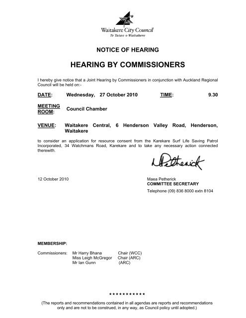
Hearing by Commissioners Wednesday, 27 ... - Auckland Council
Hearing by Commissioners Wednesday, 27 ... - Auckland Council
Hearing by Commissioners Wednesday, 27 ... - Auckland Council

You also want an ePaper? Increase the reach of your titles
YUMPU automatically turns print PDFs into web optimized ePapers that Google loves.
NOTICE OF HEARING<br />
HEARING BY COMMISSIONERS<br />
I here<strong>by</strong> give notice that a Joint <strong>Hearing</strong> <strong>by</strong> <strong>Commissioners</strong> in conjunction with <strong>Auckland</strong> Regional<br />
<strong>Council</strong> will be held on:-<br />
DATE: <strong>Wednesday</strong>, <strong>27</strong> October 2010 TIME: 9.30<br />
MEETING<br />
ROOM:<br />
VENUE:<br />
<strong>Council</strong> Chamber<br />
Waitakere Central, 6 Henderson Valley Road, Henderson,<br />
Waitakere<br />
to consider an application for resource consent from the Karekare Surf Life Saving Patrol<br />
Incorporated, 34 Watchmans Road, Karekare and to take any necessary action connected<br />
therewith.<br />
12 October 2010 Maea Petherick<br />
COMMITTEE SECRETARY<br />
Telephone (09) 836 8000 extn 8104<br />
MEMBERSHIP:<br />
<strong>Commissioners</strong>: Mr Harry Bhana Chair (WCC)<br />
Miss Leigh McGregor Chair (ARC)<br />
Mr Ian Gunn<br />
(ARC)<br />
<br />
(The reports and recommendations contained in all agendas are reports and recommendations<br />
only and are not to be construed, in any way, as <strong>Council</strong> policy until adopted.)
W A I T A K E R E C I T Y C O U N C I L<br />
AGENDA FOR A HEARING BY COMMISSIONERS TO BE HELD IN THE COUNCIL<br />
CHAMBER AT WAITAKERE CENTRAL, 6 HENDERSON VALLEY ROAD,<br />
HENDERSON, WAITAKERE, ON WEDNESDAY, <strong>27</strong> OCTOBER 2010<br />
COMMENCING AT 9.30 AM<br />
TABLE OF CONTENTS<br />
ITEM<br />
PAGE NO<br />
1 NOTIFIED APPLICATION FOR RESOURCE CONSENT UNDER<br />
SECTION 88 OF THE RESOURCE MANAGEMENT ACT 1991 BY<br />
KAREKARE SURF LIFE SAVING PATROL TO DEMOLISH AND<br />
REPLACE THE EXISTING LIFESAVING CLUBHOUSE WITH A<br />
PURPOSE-BUILT BUILDING AT 34 WATCHMANS ROAD AND AN<br />
ADJACENT AREA OF WAITAKERE RANGES REGIONAL PARKLAND 1
W A I T A K E R E C I T Y C O U N C I L<br />
AGENDA FOR A HEARING BY COMMISSIONERS TO BE HELD IN THE COUNCIL<br />
CHAMBER AT WAITAKERE CENTRAL, 6 HENDERSON VALLEY ROAD,<br />
HENDERSON, WAITAKERE, ON WEDNESDAY, <strong>27</strong> OCTOBER 2010<br />
COMMENCING AT 9.30 AM<br />
APPENDIX<br />
PAGE NO<br />
APPENDIX I WRITTEN S92 RESPONSE FROM APPLICANT A1 - A28<br />
APPENDIX II SUMMARY OF SUBMISSIONS A29 - A36<br />
APPENDIX III SUBMISSIONS A37 - A137<br />
APPENDIX IV<br />
SPECIALIST REPORT: ECOWATER DRAINAGE<br />
MR MOHAMMAD RAHMAN<br />
A138 - A140<br />
APPENDIX V<br />
SPECIALIST REPORT: VEGETATION<br />
MS NATALIE MARSDEN<br />
A141 - A145<br />
APPENDIX VI<br />
SPECIALIST REPORT: VISUAL & LANDSCAPE<br />
MR GORDON GRIFFIN<br />
A146 - A153<br />
APPENDIX VII<br />
SPECIALIST REPORT: HERITAGE<br />
MS ALINA WIMMER<br />
A154 - A156<br />
APPENDIX VIII SPECIALIST REPORT: PLAN CHANGES 35 & 36<br />
MR MARK TOLLEMACHE<br />
A157 - A160<br />
APPENDIX IX POLICIES AND OBJECTIVES A161 - A174<br />
A FULL COPY OF THE APPLICATION IS ALSO AVALIABLE AT:<br />
HTTP://WWW.WAITAKERE.GOVT.NZ/ABTCNL/PN/CONSENTS.ASP
W A I T A K E R E C I T Y C O U N C I L<br />
AGENDA FOR A HEARING BY COMMISSIONERS TO BE HELD IN THE COUNCIL<br />
CHAMBER AT WAITAKERE CENTRAL, 6 HENDERSON VALLEY ROAD,<br />
HENDERSON, WAITAKERE, ON WEDNESDAY, <strong>27</strong> OCTOBER 2010,<br />
COMMENCING AT 9.30 AM<br />
1 NOTIFIED APPLICATION FOR RESOURCE CONSENT UNDER SECTION 88 OF THE<br />
RESOURCE MANAGEMENT ACT 1991 BY KAREKARE SURF LIFE SAVING<br />
PATROL TO DEMOLISH AND REPLACE THE EXISTING LIFESAVING CLUBHOUSE<br />
WITH A PURPOSE-BUILT BUILDING AT 34 WATCHMANS ROAD AND AN<br />
ADJACENT AREA OF WAITAKERE RANGES REGIONAL PARKLAND<br />
LUC 2005-1381<br />
WARD: Waitakere<br />
N.B. This report sets out the advice of Consent Services to the <strong>Hearing</strong><br />
<strong>Commissioners</strong> on the environmental issues raised <strong>by</strong> the application for<br />
resource consent. It is not the decision of the <strong>Council</strong>. The decision will<br />
be made after consideration of the application <strong>by</strong> the <strong>Hearing</strong><br />
<strong>Commissioners</strong>.<br />
APPLICATION DETAILS<br />
Planner:<br />
Site Address:<br />
Applicant:<br />
Nicholas Lau<br />
34 Watchmans Road<br />
Waitakere Ranges Regional Parks Land<br />
Karekare Surf Life Saving Patrol Inc<br />
Date Received: 8 August 2005<br />
Resource Consent No: LUC 2005-1381<br />
Legal Description: Lot 1 Deposited Plan 28335<br />
Pt Allotment SE45 PSH OF Karangahape<br />
Address for Service:<br />
Site Area:<br />
C/- Craig Magee<br />
Resource Management Solutions Ltd<br />
P O Box 68 954<br />
Newton<br />
<strong>Auckland</strong><br />
Lot 1 Deposited Plan 28335- 0.3873 hectares<br />
Pt Allotment SE45 PSH OF Karangahape- 33.5864<br />
hectares<br />
Operative Plan<br />
Human Environment<br />
Natural Area:<br />
Designation:<br />
Landscape Elements:<br />
Coastal Villages Environment<br />
Open Spaces Environment<br />
Protected Natural Area<br />
Riparian Margins Natural Area (20 metres)<br />
(ARC 1) Waitakere Ranges Regional Parkland<br />
Outstanding (Natural Character) Coastal Area (Map<br />
3.5C)
Agenda -<br />
<strong>Hearing</strong> By <strong>Commissioners</strong> 2 <strong>27</strong> October 2010<br />
Hazards:<br />
Roading Hierarchy:<br />
Outstanding Native Vegetation (Map 3.5A)<br />
Outstanding Natural Feature (Map 3.5) Ref no 33-<br />
Watchman<br />
West Coast Coastal Landscape (Map 3.6A)<br />
None known<br />
Local Road<br />
Proposed Plan Changes: Plan Changes 35 and 36<br />
Further<br />
Requested<br />
Information<br />
Yes<br />
Date Requested: 17 July 2009<br />
Date Received: 18 April 2010<br />
Site Visit: 13 July 2009<br />
1.0 INTRODUCTION AND RECOMMENDATION<br />
1.1 Nature of the Application<br />
On the 8 August 2005, a resource consent was received (with the applicant<br />
subsequently requesting that the application be publicly notified) to demolish and<br />
replace the existing lifesaving clubhouse with a purpose-built building and associated<br />
on-site infrastructure which will be accessed <strong>by</strong> a new hardstand area, and to extend the<br />
existing rock wall adjacent to the Karekare Stream.<br />
The proposal requires resource consent in relation to earthworks, vegetation alteration,<br />
construction of a new clubhouse building, on-site infrastructure and adjoining access<br />
area accommodating vehicle movements across the Karekare Stream and extending the<br />
adjacent rock wall.<br />
Overall, the application is considered to be a Non-Complying Activity.<br />
1.2 Resource Management Issues Raised<br />
The Resource Management Act 1991 requires that, when considering an application for<br />
resource consent, a consent authority shall have regard to the environmental effects of<br />
the proposed activity, together with any relevant objectives and policies of the District<br />
Plan.<br />
The primary resource management issues associated with this proposal are:<br />
• The impact of development on the natural character of the coastline which is<br />
identified as an Outstanding Natural Landscape;<br />
• The amenity, social and visual effects associated with structures and activities<br />
proposed, once established;<br />
• The amenity and visual effects associated with the proposed development during the<br />
construction period;<br />
• Increased wastewater generation and stormwater runoff;<br />
• The amenity and physical effects of development upon the adjoining coastline; and<br />
• The amenity and physical effects on the Karekare Stream resulting from extending<br />
the existing rock wall and undertaking vehicle movements across the Stream.
Agenda -<br />
<strong>Hearing</strong> By <strong>Commissioners</strong> 3 <strong>27</strong> October 2010<br />
1.3 Planner’s Recommendation<br />
The planner who has prepared this report recommends that, subject to any contrary or<br />
additional evidence submitted at the <strong>Hearing</strong>, consent be granted to this application.<br />
In this regard, it is considered that the proposal satisfies both gateway tests described in<br />
Section 104D in that the adverse effects that may be generated <strong>by</strong> the activity will be no<br />
more than minor and the proposal is not contrary to the objectives and policies of the<br />
District Plan.<br />
2.0 LOCATION PLAN<br />
Figure 1: Proposed area of works<br />
3.0 PROPOSAL<br />
The applicant seeks resource consent to demolish the existing lifesaving clubhouse and<br />
replace this facility with a purpose-built building and associated infrastructure.<br />
The proposed works will involve the following activities and structures:<br />
• The staged demolition of the existing lifesaving clubhouse and adjoining hardstand<br />
areas, to be undertaken in accordance with the Construction Management Plan<br />
submitted with the application;<br />
• The construction of a purpose built building which will be located a further 5m back<br />
from the Karekare Steam edge, and generally situated within the existing building<br />
platform;<br />
• The formation of a new hardstand/access area to the south-west of the proposed<br />
building platform; and<br />
• The installation of infrastructure for the disposal/treatment of stormwater &<br />
wastewater generated <strong>by</strong> future activities and structures, which includes:<br />
o A stormwater tank and associated underground filter outlet to appropriately<br />
capture and discharge run-off from the roof of the proposed clubhouse building;<br />
and
Agenda -<br />
<strong>Hearing</strong> By <strong>Commissioners</strong> 4 <strong>27</strong> October 2010<br />
o An underground wastewater treatment plant and associated dispersal field which<br />
would be located up-slope of the replacement clubhouse and located over 5m<br />
away from the eastern site boundary.<br />
• The above l necessitates the removal of several juvenile coastal plants & shrubs<br />
immediately adjoining the existing building; and<br />
• The establishment of landscape planting upon the existing dune formation to the<br />
west of the proposed building platform.<br />
The following features of the above are noted:<br />
• The construction of a 7.1m high (max height), 286m 2 three-level replacement<br />
clubhouse building which will be entirely contained within the subject property, and<br />
have its foundations set-back over 10m from the Karekare Steam edge, with the<br />
south-eastern corner of the proposed roof-line coming within 2.3m of the southern<br />
boundary at its closest point;<br />
• The replacement building’s footprint will measure approximately 20m in length, 15m<br />
in width and like the present building, would be constructed upon the lower slopes of<br />
the site, with the building’s roofline being split into three separate components and<br />
gradually steeped down to mimic the sloping nature of the Watchman rock formation;<br />
• The formation of an irregularly shaped, 10m long, 84m 2 concrete hardstand/access<br />
area abutting the replacement building’s south-east corner, which will be viewed in<br />
conjunction with a 1.5m wide timber boardwalk adjoining it’s northern edge and<br />
providing pedestrian access into the ground-floor of the building;<br />
• The western and eastern triangular-shaped roof overhangs (max width 2.5m) have<br />
been designed to minimise glare upon horizontally positioned glazing present along<br />
the ground and first-floor facades of the building, with aluminium joinery being<br />
utilised due to its relatively dull appearance;<br />
• The exterior of the replacement building’s basement and ground-floor levels will be<br />
largely composed of charcoal block, while the remaining external portions of the<br />
building’s ground and first-floor levels would comprise of dark timber cladding;<br />
• The metal roof of the replacement building will have a grey finish and vertical profile<br />
which is consistent with similar patternation along the building’s exterior;<br />
• The replacement building will be composed as follows:<br />
o The basement level will encompass an upgraded first aid room and increased<br />
storage area for lifesaving equipment which would be easily accessible through<br />
the provision of a roller-door adjoining the proposed hardstand/access area to<br />
the south-east;<br />
o The ground-floor will consist of a recreational area, dining/kitchen facilities and<br />
adjoining meeting space, with a balcony and watch tower being located at the<br />
western end of the floor; and<br />
o The first-floor will contain separate male/female toilets and adjoining bunk rooms<br />
which are able to accommodate a total of 32 people.<br />
• With the exception of quad bike movements when surf patrols are in operation, it is<br />
anticipated that the use of the building would generate no more than 12 vehicle<br />
movements on and off-site per day, which is consistent with the number of traffic<br />
movements associated with operations undertaken from the existing activity.<br />
To facilitate the construction of the replacement building and associated installation of<br />
infrastructure on-site, the following vegetation alteration works are proposed:<br />
• The removal of a Cabbage Tree, flax, Pohutukawa Tree, Agapanthus and two<br />
Kawakawa Trees;
Agenda -<br />
<strong>Hearing</strong> By <strong>Commissioners</strong> 5 <strong>27</strong> October 2010<br />
• Works within the dripline of a Pohutukawa Tree; and<br />
• Pruning of three Pohutukawa Trees, which includes the pruning of a Pohutukawa<br />
Tree adjoining the vehicle entrance located to the east of the subject property<br />
(adjoining the public car park) leading onto the adjacent area of Waitakere Ranges<br />
Regional Parks Land to the south.<br />
Both weed management and appropriate replacement planting will be undertaken to<br />
mitigate the loss of the aforementioned native vegetation.<br />
Earthworks, both within and outside the building platform are in the order of 800m 3 of cut<br />
within an earthworks area of 400m 2 .<br />
The development will cover the site with a total impermeable surface area of 4<strong>27</strong>m 2 ,<br />
which is consistent with the present 425m 2 cumulative area of impermeable surfaces<br />
onsite, as detailed below:<br />
Building Paving Total<br />
Existing 244m 2 181m 2 425m 2<br />
Proposed 286m 2 141m 2 4<strong>27</strong>m 2<br />
The following activities and structures would be located upon the adjacent Waitakere<br />
Ranges Regional Parks Land (“Regional Park”):<br />
• The extension of the existing foreshore wall for a distance of 6m along the Karekare<br />
Steam edge which will block-off the present concrete access ramp adjoining the<br />
clubhouse;<br />
• The formation of a landscape bund behind the existing foreshore wall;<br />
• The formation of a new hardstand/access area to the south-west of the subject site;<br />
• The establishment of landscape planting adjoining the proposed hardstand/access<br />
area and Karekare Stream edge; and<br />
• The continued use of Regional Parks Land for vehicle access both onto the subject<br />
site, and across existing vehicle access points intersecting the Karekare Steam.<br />
3.1 Information Received<br />
The following information has been provided and was included in the application as<br />
publicly notified on the 17 June 2010:<br />
o Application Form, Assessment of Environmental Effects, including further information<br />
prepared <strong>by</strong> Resource Management Solutions Ltd;<br />
o Land Registrations (Certificate of Titles);<br />
o Architectural Drawings- Hillery Priest Architecture Ltd, 22 Feb 2008;<br />
o Landscape Concept- <strong>Auckland</strong> Regional <strong>Council</strong>, Revision A,04-2010;<br />
o Planting & Landscape Management Plan- <strong>Auckland</strong> Regional <strong>Council</strong>, April 2009;<br />
o Vegetation Assessment-Chris Hinton of Katsura Tree Consultancy,<strong>27</strong> September<br />
2009;<br />
o Visual & Landscape Assessments- Sally Peake of Peake Design Ltd, dated<br />
06.06.09;<br />
o Geotechnical Assessment- Peter Quilter of Tonkin & Taylor Ltd, dated October 2007,<br />
including supplementary Geotechnical Assessment, dated 10 March 2010;<br />
o Wastewater and Stormwater Details- Wastewater System Design for Karekare Surf<br />
Club, dated 9 April 2010 and Hynds Up-Flo Filter for Karekae Surf Club<br />
Development, dated 24 April 2009;<br />
o Construction Management Plan- Tonkin & Taylor Ltd, dated April 2010; and
Agenda -<br />
<strong>Hearing</strong> By <strong>Commissioners</strong> 6 <strong>27</strong> October 2010<br />
o Archaeology Assessment- Opus International Consultants Ltd, dated 10 April 2009.<br />
A1-A28<br />
Following the close of submissions, the following information was provided, and can be<br />
found attached at pages A1 to A28 as Appendix I.<br />
o Additional Geotechnical Investigations Report, 31 August 2010, prepared <strong>by</strong> Tonkin<br />
& Taylor;<br />
o Karekare Surf Lifesaving Club Wastewater Treatment Plant- Site Plan 1 & Site Plan<br />
2, prepared <strong>by</strong> Hynds Environmental, 29/9/10; and<br />
o Proposed Wastewater Treatment and Disposal Peer Review, 6 October 2010,<br />
prepared <strong>by</strong> Andrew Stewart.<br />
A138-A140<br />
The application, including submissions received has been reviewed <strong>by</strong> the following<br />
persons (copies of all Specialist Reports are attached at pages A138 to A140 as<br />
Appendices IV to VIII) :<br />
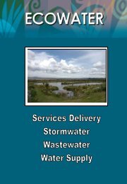
• Mr Mohammad Rahman – Subdivision and Consents Engineer (refer Appendix IV);<br />
• Ms Natalie Marsden – Ecologist/Arborist (refer Appendix V);<br />
• Mr Gordon Griffin– <strong>Council</strong>’s Landscape Architect (refer Appendix VI);<br />
• Ms Alina Wimmer – Principal Advisor, Heritage (refer Appendix VII); and<br />
• Mr Mark Tollemache- <strong>Council</strong>’s Strategic Advisor - Waitakere Ranges (refer<br />
Appendix VIII).<br />
4.0 REASONS FOR THE APPLICATION<br />
Consent is required under the Waitakere Operative District Plan 2003 for the following<br />
reasons:<br />
• 34 Watchmans Road<br />
Protected Natural Area<br />
Under Rule 2.5 (Vegetation Alteration), consent is required as a Non-Complying Activity<br />
for removal of native and exotic vegetation which will increase the cleared area of the<br />
site to more than 500m 2 of the net site area. Works within the dripline of protected<br />
vegetation, and associated pruning of selected remaining vegetation is also proposed.<br />
Under Rule 3.4 (Earthworks), consent is required as a Non-Complying Activity for<br />
earthworks (outside the building platform) equating to 100m³ over a plan area of 79m².<br />
Note: Works required to install effluent systems do not constitute earthworks under the<br />
District Plan.<br />
Under Rule 4.2 (Impermeable Surfaces), consent is required as a Non-Complying<br />
Activity for approximately 11% impermeable surface coverage of the site.<br />
Riparian Margins Natural Area<br />
Under Rule 2.5 (Vegetation Alteration), consent is required as a Non-Complying Activity<br />
for the removal of native vegetation to accommodate an extension to the existing<br />
building platform on-site. Works within the dripline of protected vegetation, and<br />
associated pruning of selected remaining vegetation is also proposed.<br />
Under Rule 3.4 (Earthworks), consent is required as a Non-Complying Activity to<br />
undertake earthworks over a plan area of 286m² for the purpose of creating a building<br />
platform to accommodate the replacement clubhouse on-site.
Agenda -<br />
<strong>Hearing</strong> By <strong>Commissioners</strong> 7 <strong>27</strong> October 2010<br />
Under Rule 4.2 (Impermeable Surfaces), consent is required as a Non-Complying<br />
Activity for approximately 50% impermeable surface coverage of the riparian margin<br />
zoning on-site.<br />
Under Rule 7.3 (Buildings), consent is required as a Discretionary Activity to construct a<br />
new building.<br />
Coastal Villages Environment<br />
Under Rule 4.3 (Building Height), consent is required as a Discretionary Activity due to<br />
the replacement clubhouse building exceeding the permitted 6.0m height limit <strong>by</strong> a<br />
maximum of 1.1m over a length of 12m.<br />
Under Rule 5.2 (Height-in-Relation to Boundaries), consent is required as a<br />
Discretionary Activity due to the replacement clubhouse building infringing the southern<br />
recession plane <strong>by</strong> a maximum of 0.3m over a length of 5.48m<br />
Under Rule 6.2 (Yards), consent is required as a Discretionary Activity due to the<br />
replacement clubhouse building infringing the permitted 3.0m setback <strong>by</strong> a maximum of<br />
0.7m over a length of 5.48m<br />
Under Rule 7.2 (Building Coverage), consent is required as a Limited Discretionary<br />
Activity due to the replacement clubhouse building exceeding a 200m 2 area on-site, with<br />
the proposed building footprint equating to 286.05m 2 .<br />
Under Rule 8.3 (Non-Residential Activities), consent is required as a Non-Complying<br />
Activity to construct a replacement clubhouse building which will accommodate a nonresidential<br />
activity.<br />
Under Rule 9.2 (Traffic Generation-(Non-Residential Activities)), consent is required as<br />
a Non-Complying Activity to accommodate a non-residential activity which will generate<br />
more than 20 vehicle (quad bike) movements per day when surf patrols are in operation.<br />
Under Rule 10.2 (Car Parking and Driveways), consent is required as a Controlled<br />
Activity to construct a concrete vehicle access area which will need exceed a gradient of<br />
1 in 5.<br />
Note: Subsequent to the provision of application documentation, the above-ground<br />
stormwater detention tank has been classified as a ‘Connection’ under the District Plan,<br />
and therefore its installation on-site would constitute a Permitted Activity under Rule<br />
15.1 of the Infrastructure Rules.<br />
• Waitakere Ranges Regional Parks Land<br />
Protected Natural Area<br />
Riparian Margins Natural Area<br />
Under Rule 3.4 (Earthworks), consent is required as a Limited Discretionary Activity to<br />
undertake earthworks for the purpose of constructing a 5m long extension to the existing<br />
rock wall, and forming a 35m 2 concrete hardstand/vehicle access area which will result<br />
in approximately 3m 3 of excavated material being taken off-site.<br />
Note: Works required to cultivate plants for landscaping purposes do not constitute<br />
earthworks under the District Plan.<br />
Also, subsequent to the provision of application documentation, the rock wall has been<br />
classified as ‘Parks Infrastructure’ under the District Plan. The proposed extension<br />
complies with all relevant rules applicable within the Open Space Environment.<br />
Overall, the application is considered to be a Non-Complying Activity.
Agenda -<br />
<strong>Hearing</strong> By <strong>Commissioners</strong> 8 <strong>27</strong> October 2010<br />
Note: Under Rule 1.2 (Temporary Activities) of the City-Wide Rules consent, it is<br />
considered that the proposal falls within the perimeters of 1.1 Construction, Maintenance<br />
and Demolition Noise. As such, this aspect is considered a Permitted Activity.<br />
Plan Changes<br />
The resource consent application was lodged prior to the notification of Plan Changes<br />
35 and 36 and no council decision has been made. Plan Change 35 introduces the<br />
objectives of the Waitakere Ranges Heritage Act into the District Plan, pursuant to<br />
Objective 5B.1.2, while Plan Change 36 seeks to provide for the social, cultural and<br />
economic wellbeing of people, communities and visitors to the Heritage Area, and<br />
includes recognition of existing activities that support wellbeing, as detailed under<br />
Objective 5B.4.2. The application will be processed, considered, and decided as an<br />
application at the time the application was first lodged. Rules associated with the Plan<br />
Changes do not have legal effect pursuant to Section 86G of the RMA 2009.<br />
Note: Under Plan Changes 35 and 36 as notified, the overall activity status would<br />
remain as Non-Complying Activity for matters beyond the scope of these plan changes<br />
which mainly deal with the status of non-residential activities within the Foothills and<br />
Waitakere Ranges Environments.<br />
5.0 THE SITE AND NEIGHBOURHOOD DESCRIPTION<br />
The application site encompasses the 3873m 2 rectangular shaped property at 34<br />
Watchmans Road (Lot 1 Deposited Plan 28335) which is owned <strong>by</strong> Karekare Surf<br />
Lifesaving Club incorporated who occupy the present clubhouse on-site, and an<br />
adjacent section of Waitakere Ranges Regional Parks Land (Pt Allotment SE45 PSH OF<br />
Karangahape) which is owned <strong>by</strong> the <strong>Auckland</strong> Regional <strong>Council</strong>. The site adjoins the<br />
Karekare Stream to the south and falls under designation (ARC 1) with the designated<br />
purpose being the Waitakere Ranges Regional Parkland<br />
The subject property is located at the end of Watchmans Road, and is surrounded <strong>by</strong><br />
the Regional Park to the north and west. The wider character of the area at present is<br />
largely defined <strong>by</strong> a rugged coastal landscape that is dominated <strong>by</strong> the pohutukawa clad<br />
Watchman rock formation which dictates the steep topography of both the subject site<br />
and surrounding coastal environment.<br />
Apart from being characterised <strong>by</strong> Pohutukawa covered slopes and gullies, the wetland<br />
areas and dune formations surrounding the Karekare Stream to the south provide for<br />
low-lying coastal vegetation which predominantly consists of native reed, sedge and flax<br />
species.<br />
The presence of residential development in the area is subservient to the natural<br />
character of the surrounding coastal landscape, which is characterised <strong>by</strong> a sparse<br />
scattering of single-storey dwellings adjoining the southern edge of Watchmans Road,<br />
with the road being situated along the top of the Watchman rock formation. It is noted<br />
that the property immediately east of the subject site which adjoins the Karekare Stream<br />
remains undeveloped, with the nearest residential dwelling being located over 80m to<br />
the north-east of the clubhouse.<br />
Since 1962, the primary use of the subject property has been for the purpose of<br />
undertaking surf lifesaving activities along Karekare Beach, with the original building<br />
being built in 1980 to accommodate the present 7.0m high, 244m 2 clubhouse building<br />
which consists of a concrete-block basement and timber-clad ground-floor (both painted<br />
pale green) which is covered <strong>by</strong> a grey corrugated iron roof.
Agenda -<br />
<strong>Hearing</strong> By <strong>Commissioners</strong> 9 <strong>27</strong> October 2010<br />
The basement level is used as a storage area for lifesaving equipment which is<br />
accessible through the provision of a roller-door adjoining the existing concrete ramp<br />
and hardstand area located next to the building’s south-eastern corner.<br />
Access into the building’s ground-floor is provided <strong>by</strong> a set of timber stairs which have<br />
been constructed upon an existing 10m long rock wall which abuts the hardstand area to<br />
the south.<br />
The ground-floor entry immediately adjoins the clubroom’s main lounge room, with<br />
separate male/female toilets and adjoining bunk rooms being located within the northern<br />
half of the floor which accommodate a total of 38 people. A balcony and watch tower<br />
facility is also provided for along the ground-floor’s western facade.<br />
The Surf Club currently has a membership of 186, which includes 118 seniors, 47<br />
juniors and 21 supporters.<br />
It is noted that the present clubhouse building straddles the southern site boundary, with<br />
an 11m long, 2.0m wide portion of the building’s southern edge, along with most of the<br />
associated access/hardstand area being located within the Regional Park that adjoins<br />
the Karekare Stream. This also provides vehicle access to the clubhouse from the east<br />
that passes along a sheltered wetland area to the north of the stream.<br />
Surf patrol vehicles presently access the beach <strong>by</strong> utilising approved crossing points at<br />
various locations along the Karekare Stream, although it should be noted that with the<br />
exception of quad bike movements during summer months, vehicle movements<br />
generated <strong>by</strong> the use of the clubhouse buildings exceed no more than 12 on any given<br />
day (vehicle access enabled under existing licence agreement with the <strong>Auckland</strong><br />
Regional <strong>Council</strong>).<br />
Within the Regional Park, there is a stone wall situated alongside gabion baskets<br />
adjoining the foreshore, and which is intersected <strong>by</strong> a concrete ramp providing access<br />
for lifesaving boats entering/exiting the subject property.<br />
It is noted that the application documentation, including attached specialist reports<br />
provides a more detailed site description and surrounds. A number of <strong>Council</strong><br />
Specialist(s), with particular regard to the assessment <strong>by</strong> Mr.Griffin has also provided a<br />
description of the site and surrounds.<br />
6.0 ISSUES IDENTIFIED THROUGH THE SUBMISSION PROCESS<br />
The application was publicly notified on the 17 June 2010 with the period of submissions<br />
closing on the 15 July 2010.<br />
A37-A137 In total, 39 submissions were received, 37 submissions supported the application, 1<br />
submission opposed the application, and 1 which supported the application with<br />
concerns. Copies of these submissions are attached at pages A37 to A137 as<br />
Appendix III.<br />
Further to the above, three additional submissions were received from the following<br />
persons on the 16 of July 2010:<br />
John McLarin<br />
John Linderman & Stephanie Overton<br />
NZ Historic Places Trust<br />
Support<br />
Oppose<br />
Neutral
Agenda -<br />
<strong>Hearing</strong> By <strong>Commissioners</strong> 10 <strong>27</strong> October 2010<br />
Section 37 Assessment<br />
The <strong>Hearing</strong> <strong>Commissioners</strong> needs to resolve whether to accept these late submissions,<br />
pursuant to Section 37 of the Act. In making this decision, the <strong>Council</strong> is required to<br />
consider the provisions set out in Section 37A(1), being:<br />
(a)<br />
(b)<br />
(c)<br />
The interests of any person who, in its opinion, maybe directly affected <strong>by</strong> the<br />
extension or waiver, and<br />
The interests of the community in achieving adequate assessment of the effects<br />
on any proposal, policy statement , or plan, and<br />
Its duty under Section 21 of the Act, to avoid unreasonable delay.<br />
Section 37A(2)(a) also requires that the extension of time shall not have the effect of<br />
exceeding twice the maximum period specified in the Act. It is noted that the late<br />
submissions from John McLarin, John Linderman & Stephanie Overton and the NZ<br />
Historic Places Trust were received 1 working day after submissions closed.<br />
In accordance with Section 37A(1), the acceptance of the submissions has not resulted<br />
in unreasonable delay, and their acceptance will ensure the interests of the community<br />
are met No one is considered would be unduly prejudiced <strong>by</strong> its acceptance. It is<br />
therefore recommended that these late submissions be received.<br />
A37-A137<br />
A29-A36<br />
Copies of the above submissions are attached at pages A37 to A137 as Appendix III.<br />
A summary of all submissions can be found at pages A29 to A36 as Appendix II.<br />
6.1 Submissions<br />
6.1.1 Summary of Submissions<br />
The submissions in support of the application raised the following matters:<br />
• Provision and enhancement of Community facilities/services;<br />
- The development will support the continuation and enhancement of an essential<br />
surf lifesaving service which benefits both the local community and greater<br />
<strong>Auckland</strong> Region;<br />
- The development will allow for the continued provision and augmentation of<br />
recreational benefits to the families of local residents; and<br />
- The proposed clubhouse building will provide a much-needed venue for local<br />
community activities and functions.<br />
• Present state of existing clubhouse building;<br />
- The present clubhouse is deteriorating and does not adequately provide for the<br />
storage of vital lifesaving equipment.<br />
• Design and locality of proposed clubhouse building & associated landscape<br />
planting;<br />
- When compared to the existing clubhouse, the proposed clubhouse will be<br />
setback further from the Karekare Stream, and shall be adequately screened <strong>by</strong><br />
the provision of landscape planting along the foreshore.<br />
• Consultation;<br />
- Over the last five (5) years, the applicant has consulted the local community<br />
regarding the proposed development.
Agenda -<br />
<strong>Hearing</strong> By <strong>Commissioners</strong> 11 <strong>27</strong> October 2010<br />
• General;<br />
- General support subject to further geotechnical investigation confirming suitability<br />
of proposed on-site wastewater system, and imposition of conditions requiring<br />
remediation works at either end of existing foreshore wall to prevent scouring,<br />
and provision of sand ladders along stream crossing points during construction<br />
period.<br />
The submissions that are neutral to the application raised the following matters<br />
(in summary):<br />
• Heritage;<br />
- Provision of advice note detailing the appropriate protocols to be implemented<br />
on-site if archaeological remains are discovered during the construction period<br />
(NZ Historic Places Trust).<br />
The submissions in opposition to the application raised the following matters (in<br />
summary):<br />
• Discharges/Contamination;<br />
- Discharge of effluent onto adjacent properties.<br />
• Vehicle Access across stream;<br />
- Wet vehicle crossings across stream are inappropriate and it is preferred that<br />
they are replaced <strong>by</strong> dry crossings.<br />
• Built form;<br />
- Proposed lifesaving clubhouse building should be entirely constructed of timber<br />
to cope with changes to the surrounding landform;<br />
- Rear wall of proposed clubhouse building is too high and should be reduced.<br />
6.2 Organisations<br />
• <strong>Auckland</strong> Regional <strong>Council</strong>;<br />
• Department of Conservation;<br />
• Karekare Resident and Ratepayers Association;<br />
• New Zealand Historic Places Trust*; and<br />
• Waitakere Ranges Protection Society*.<br />
The above organisations were notified of this application. The ones which have been<br />
denoted with an * made a submission with regard to the proposed development.<br />
6.3 Iwi<br />
• Te Kawerau A Maki; and<br />
• Ngati Whatua O Orakei Corporate Ltd.<br />
The above iwi groups were notified of this application and did not make a submission.
Agenda -<br />
<strong>Hearing</strong> By <strong>Commissioners</strong> 12 <strong>27</strong> October 2010<br />
7.0 STATUTORY REQUIREMENTS<br />
7.1 Non-Complying Activities<br />
A161-A174 The relevant policies and objectives which apply under the District Plan and the<br />
Resource Management Act 1991 are set out in more detail attached at pages A161 to<br />
A174 as Appendix IX. This should be referred to as the legal framework within which<br />
the application should be addressed.<br />
The matters to be considered when assessing an application for resource consent are<br />
set out in Section 104 of the Resource Management Act 1991. Amongst other things,<br />
these matters require consideration of any actual and potential effects on the<br />
environment arising from the proposal, together with an assessment as to whether the<br />
application is consistent with relevant objectives, policies and rules of the District Plan.<br />
All considerations are subject to the provisions of Part II of the Resource Management<br />
Act 1991, which sets out the purpose and principles that guide this legislation.<br />
As the proposal requires consideration as a non-complying activity under the provisions<br />
of the Resource Management Act 1991. Section 104D of the Resource Management<br />
Act 1991 sets a threshold test which all resource consent applications for non-complying<br />
activities must pass before a consent authority has jurisdiction to grant consent, having<br />
regard to the matters specified in Section 104. In short, the proposal must be able to<br />
establish and operate without generating more than minor adverse effects on the<br />
environment, or must not be contrary to the relevant objectives and policies of the<br />
Operative District Plan. <strong>Council</strong> may disregard an adverse effect of an activity on the<br />
environment if the Plan permits an activity with that effect. Furthermore, no regard to<br />
any person who has provided their written approval to the proposed activity.<br />
8.0 Evaluation In Accordance With Section 104 Of The RESOURCE<br />
MANAGEMENT ACT 1991<br />
In order to make a decision in terms of Section 104B of the Act it is necessary to<br />
undertake an analysis and assessment to determine whether the purpose and principles<br />
of the Act are being met (Part II) having regard to the matters set out in Sections 104,<br />
104B and 104D as relevant, the Fourth Schedule and any other statutory<br />
considerations.<br />
Section 104(1) of the Act requires that <strong>Council</strong> have regard to any actual or potential<br />
effects on the environment, any relevant objectives, policies, rules or other provisions of<br />
a plan or proposed plan and any relevant regional policy statement and regional plan or<br />
proposed plan, and any other matters the consent authority considers relevant and<br />
reasonably necessary to determine the application.<br />
When considering an application <strong>Council</strong> must not have regard to any effect on a person<br />
who has given their written approval to the application (section 104 (3)(b)) and may<br />
disregard an adverse effect of an activity on the environment if the Plan permits an<br />
activity with that effect (section 104(2)).<br />
8.1 Assessment of Environmental Effects (104(1)(a)): Actual and Potential<br />
Effects on the Environment.<br />
Effects permitted <strong>by</strong> the Plan<br />
Pursuant to Section 104(2), <strong>Council</strong> may disregard an adverse effect on the<br />
environment if the plan permits an activity with that effect.
Agenda -<br />
<strong>Hearing</strong> By <strong>Commissioners</strong> 13 <strong>27</strong> October 2010<br />
In terms of No.34 Watchmans Road, an underlying Coastal Villages Environment<br />
applies in terms of the Human Environment. Non-residential activities, as permitted,<br />
allows for home occupations although any traffic generated <strong>by</strong> the non-residential<br />
activity requires consent.<br />
In terms of the Natural Area, the southern portion of the site is zoned Riparian Margin<br />
Natural Area. As such, any buildings / earthworks requires consent. Any removal and<br />
/or works within the dripline(s) of native vegetation also requires consent. Where the<br />
Protected Natural Area rules apply, earthworks within an approved building platform are<br />
permitted.<br />
In terms of the Regional Park, any earthworks requires consent (unless for Parks<br />
Furniture) then resource consent is required.<br />
Given the nature of the activity, the adverse effects sit noticeably above those adverse<br />
effects permitted <strong>by</strong> the Plan.<br />
Receiving Environment<br />
The receiving environment for the purposes of s104(1)(a) includes existing permitted<br />
activities, activities that have existing use rights, existing activities expressly authorised<br />
<strong>by</strong> resource consent, and unimplemented resource consents (where likely to be<br />
implemented).<br />
The adverse effects of a proposed activity, at this point in the analysis, will be those<br />
effects that are not already impacting upon the receiving environment.<br />
The present building and associated use of the adjoining Regional Park to provide<br />
vehicle access from the foreshore onto 34 Watchmans Road forms an established and<br />
integral part of the existing environment. The existing environment and its surrounds<br />
has been extensively covered in the application documentation and referred to in<br />
Section 5 of this report.<br />
In terms of the subject site and immediate surrounds, there are no known<br />
unimplemented resource consents.<br />
The proposal, however, does introduce effects over and above that which already<br />
impact upon the receiving environment.<br />
8.1.1 Construction (Temporary) Effects<br />
o<br />
Sediment Loss / Runoff<br />
Earthworks are proposed as follows:<br />
• The erection of the building, associated infrastructure and adjoining<br />
hardstand/access area on-site would involve approximately 800m³ of earthworks<br />
over an estimated area of 500m², with half of this area and 700m 3 of excavated<br />
material being generated <strong>by</strong> the undertaking of earthworks within the existing<br />
building platform.<br />
The application is supported <strong>by</strong> a Construction Management Plan that includes the<br />
erection of sediment control fences, monitoring of vehicle movements <strong>by</strong> Regional<br />
<strong>Council</strong> Officers and the formation of cleanwater runoff diversion channels to ensure that<br />
adverse effects are adequately mitigated.
Agenda -<br />
<strong>Hearing</strong> By <strong>Commissioners</strong> 14 <strong>27</strong> October 2010<br />
I agree with the measures being proposed and subject to the implementation of<br />
measures as stated in the Construction Management Plan it is considered that any<br />
adverse effects associated with the earthworks proposed, would be no more than minor<br />
in nature and will be temporary and localised.<br />
o<br />
Construction Traffic / Generation<br />
The Construction Management Plan, in particular Section 6 of the Plan, details the<br />
anticipated type and number of traffic movements which would be generated during the<br />
six-month construction period. Given the number of traffic movements which are<br />
predicted to occur on-site during this time, both the Plan and any associated temporary<br />
licence to occupy the Regional Park would be subject to various land use controls so as<br />
to ensure that such vehicle movements do not detract from the water quality or natural<br />
landforms which shape the Karekare Stream. The implementation of such controls will<br />
be regularly monitored <strong>by</strong> <strong>Council</strong> Officers during the six-month construction period, and<br />
where necessary, specific monitoring visits will be undertaken in response to complaints<br />
raised <strong>by</strong> neighbouring residents, as detailed under Section 7 of the Construction<br />
Management Plan.<br />
I agree with the land use controls being proposed, and subject to such measures being<br />
appropriately implemented and monitored <strong>by</strong> <strong>Council</strong> Officers, consider that traffic<br />
movements undertaken during the construction period on-site would have no more than<br />
a minor adverse effect on the water quality and natural landforms which characterise the<br />
Karekare Stream.<br />
o<br />
Construction Noise / Dust<br />
The development has the potential to generate noise and dust effects during the<br />
construction phase of the development, particularly as a number of vehicles and<br />
machines will be required at the site in order to carry out site works. The proposed area<br />
of works will be located over 80m away from the nearest residential dwelling, and when<br />
combined with the steep topography separating the subject site from dwellings along the<br />
top of Watchmans Road, it is considered that noise and dust effects generated <strong>by</strong> the<br />
proposal would have a no more than a minor adverse effect on the residential amenities<br />
of surrounding properties. This outcome will be further ensured <strong>by</strong> limiting the permitted<br />
hours for undertaking construction works on-site to times which generally correspond<br />
with daylight hours, as detailed under Section 3.2 of the Construction Management Plan.<br />
Notwithstanding the above determination, it is noted that noise and dust levels will be<br />
regularly monitored <strong>by</strong> <strong>Council</strong> Officers during the six-month construction period, and<br />
where necessary, specific monitoring visits will be undertaken in response to complaints<br />
raised <strong>by</strong> neighbouring residents, as detailed under Section 7 of the Construction<br />
Management Plan.<br />
o<br />
Health and Safety<br />
The development has the potential to impact upon public health and safety due to the<br />
recreational nature of the subject site which is readily accessible for public use from<br />
Karekare Road. The Construction Management Plan details the erection of fences<br />
where possible around the proposed works area and ‘approved contractor’s area’ onsite<br />
so as to ensure that the public is excluded from accessing such areas for the<br />
duration of the construction period.<br />
In summary the overall effects of proposed construction will be localised and temporary<br />
in nature. Any effects generated <strong>by</strong> the construction can be mitigated <strong>by</strong> recommended<br />
conditions of consent including the implementation of working methodologies detailed<br />
within the Construction Management Plan submitted in support of the application.
Agenda -<br />
<strong>Hearing</strong> By <strong>Commissioners</strong> 15 <strong>27</strong> October 2010<br />
It is therefore considered that surrounding amenities will be adequately protected for the<br />
duration of the construction period and any effects would be no more than minor in<br />
nature.<br />
8.1.2 Water Quality and Quantity<br />
The subject site lies within a particularly sensitive receiving environment, and will result<br />
in increased stormwater runoff and generation. The majority of the proposed<br />
development will occur upon existing and modified portions of the site. As a<br />
consequence, impermeable surfaces will only increase <strong>by</strong> 2m 2 .<br />
As part of the application, the following reports were provided:<br />
• Wastewater and Stormwater Details- Wasterwater System Design for Karekare Surf<br />
Club, dated 9 April 2010 and Hynds Up-Flo Filter for Karekare Surf Club<br />
Development, dated 24 April 2009.<br />
A138-A140<br />
The application documentation has been reviewed <strong>by</strong> Mohammad Rahman, <strong>Council</strong>’s<br />
Drainage Engineer (the report is attached at pages A138 to A140 as Appendix IV) who<br />
notes that wastewater disposal (including quality treatment) is dependent on systems<br />
subject to the discharge consent being considered <strong>by</strong> the <strong>Auckland</strong> Regional <strong>Council</strong>.<br />
The minimal increase in the total area of impermeable surfaces on-site, Mr Rahman has<br />
concluded that the proposed stormwater treatment and disposal system, which consists<br />
of a stormwater tank and associated underground filter outlet will, appropriately capture<br />
and discharge run-off from the roof of the proposed building, there<strong>by</strong> ensuring that the<br />
activity does not have a detrimental effects on stormwater runoff and generation into the<br />
wider receiving environment<br />
I concur with this finding, and subject to the required infrastructure being appropriately<br />
installed on-site, consider that the replacement building would have no more than a<br />
minor adverse effect on stormwater runoff and generation into the wider receiving<br />
environment.<br />
8.1.3 Native Vegetation, Vegetation and Fauna Habitat<br />
The subject site and the immediate surroundings is identified in the District Plan as<br />
follows:<br />
• Outstanding Fauna Habitat (Map 3.5B); and<br />
• Significant Vegetation (Map 3.5A).<br />
The Green Network relates to the overall healthiness of the Network’s constituent parts<br />
and their ability to survive. Biodiversity relates to the overall diversity of genes species<br />
of vegetation and fauna and biological communities that exist within the City, the Green<br />
Network or an ecosystem. This diversity, which is best served <strong>by</strong> maintaining the range<br />
of native species and genetic stock in the City, contributes to the stability and resilience<br />
of the City’s environment.<br />
The application has been supported <strong>by</strong> an Arboricultural Assessment undertaken <strong>by</strong> Mr<br />
Chris Hinton of Katsura Tree Consultancy Ltd, dated <strong>27</strong> September 2009, which<br />
describes the terrestrial vegetation affected <strong>by</strong> the construction of the replacement<br />
clubhouse and installation of associated on-site infrastructure, as detailed on pg’s 9 & 10<br />
of the aforementioned report.
Agenda -<br />
<strong>Hearing</strong> By <strong>Commissioners</strong> 16 <strong>27</strong> October 2010<br />
The following salient points were made:<br />
• The affected forms of vegetation are not considered to be significant examples of<br />
their species or contribute significantly to the coastal character of the site as<br />
individuals or as a group;<br />
• The removal of a Cabbage Tree, flax, Pohutukawa Tree, Agapanthus and two<br />
Kawakawa Trees;<br />
• Works within the dripline of a Pohutukawa Tree; and<br />
• Pruning of three Pohutukawa Trees, which includes the pruning of a Pohutukawa<br />
Tree adjoining the vehicle entrance located to the east of the subject property<br />
(adjoining the public car park) leading onto the adjacent area of Waitakere Ranges<br />
Regional Parks Land to the south.<br />
A141-A145<br />
The application has been assessed <strong>by</strong> <strong>Council</strong>’s Ecologist Ms Natalie Marsden (the<br />
report is attached at pages A141 to A145 as Appendix V) who concurs with the<br />
description; quality and extent of vegetation affected.<br />
Vegetation to be removed is not considered to be significant examples of their species<br />
or contribute significantly to the coastal character of the site as individuals or as a group.<br />
This view is affirmed <strong>by</strong> the juvenile nature of the vegetation to be removed, with all but<br />
one of the trees identified for removal exceeding an above-ground height of 1.5m.<br />
The removal of such juvenile vegetation is therefore considered to have a negligible<br />
adverse effect on the visual amenity of the subject site and wider coastal landscape. In<br />
addition, appropriate replanting and weed management upon the adjacent strip of the<br />
Regional Park adjoining the Karekare Stream would contribute to improving the overall<br />
visual amenity of the subject property and surrounding foreshore area over time.<br />
It is noted that small-scale excavation works will need to be undertaken within the<br />
driplines of various coastal shrubs and a protected Pohutukawa Tree to accommodate<br />
the construction of a timber boardwalk along the top of existing rock wall on-site.<br />
Furthermore, the installation of an above-ground wastewater dispersal field will require<br />
minor works within the driplines of several protected Pohutukawa Trees located upslope<br />
of the building. Due to the sensitive nature of such works, significant care will be<br />
required during construction/installation phase to ensure that existing vegetation to be<br />
retained on-site is adequately protected. Ms Marsden recommends conditions of<br />
consent which reflect construction methodology to ensure the health of the vegetation is<br />
maintained during that period.<br />
In light of the nature and extent of the clearance and associated works within the<br />
driplines of protected vegetation on-site, any adverse effects are considered to be no<br />
more than minor in nature and will noticeably diminish over time.<br />
The proposal does not impact upon any notable vegetation, and weed clearance is<br />
considered to enhance the biodiversity and resilience of the Green Network. Proposed<br />
re-planting in the long-term utilising native species will improve its integrity.<br />
Ms Marsden has recommended conditions of consent relating to the implementation of<br />
appropriate replanting, weed management and the utilisation of appropriate<br />
arboricultural methodologies when working in the vicinity of protected retained<br />
vegetation.<br />
Subject to the implementation of Ms Marsden’s recommended consent conditions, I<br />
consider that the adverse effects of the proposal on protected vegetation would be no<br />
more than minor, with such effects noticeably diminishing over time.
Agenda -<br />
<strong>Hearing</strong> By <strong>Commissioners</strong> 17 <strong>27</strong> October 2010<br />
8.1.4 Site Stability<br />
The application is supported <strong>by</strong> a Geotechnical Investigation Report prepared <strong>by</strong> Tonkin<br />
& Taylor Ltd (dated October 2007) and supplementary Geotechnical Assessment<br />
prepared <strong>by</strong> Peter Quilter of Tonkin & Taylor Ltd (dated 10 March 2010).<br />
Mr Quilton has stated that although the development will require significant retention<br />
works to maintain the stability of the sand slope behind the existing building platform onsite,<br />
he is satisfied that foundation conditions are adequate, subject to appropriately<br />
retaining the sand slope <strong>by</strong> utilising permanent ground anchors into the underlying Piha<br />
rock formation.<br />
For the reasons stated above, I consider that any adverse effects would be no more<br />
than minor, subject to undertaking the proposed works in accordance with the<br />
recommendations detailed in the aforementioned Geotechnical Investigation Report and<br />
supplementary Geotechnical Assessment.<br />
8.1.5 Amenity Values - Health and Safety, Landscapes, Local Areas and<br />
Neighbourhood Character<br />
Amenity Values is defined in the Resource Management Act as:<br />
“Those natural or physical qualities and characteristics of an area that<br />
contribute to people's appreciation of its pleasantness, aesthetic<br />
coherence, and cultural and recreational attribute”.<br />
The District Plan has also defines Amenity Values as follows:<br />
“These are those natural and physical characteristics of an area that<br />
contribute to people’s enjoyment of it …”<br />
The District Plan also provides a definition of Neighbourhood Character:<br />
“Neighbourhood is that small local area, usually the same number of<br />
streets around a dwelling or workplace that a person identifies with and<br />
knows most thoroughly of all parts of the City. Usually people have strong<br />
sense of belonging and place associated with a neighbourhood. It is the<br />
most localised, personal and intense expression of the relationship of<br />
people with their environment.<br />
Such neighbourhoods reflect the general amenity values of the surrounding<br />
landscape or local area but have distinctive versions of those general<br />
features that allow inhabitants to see them as unique and special. This is a<br />
neighbourhood character that defines a neighbourhood as unique. Often<br />
the particular streetscape contributes strongly to the local neighbourhood,<br />
although it is personal perceptions of residents that ultimately define the<br />
nature of that neighbourhood”.<br />
The existing neighbourhood character of the immediately surrounding coastal area can<br />
be described as comprising of a relatively quiet coastal settlement that is largely defined<br />
<strong>by</strong> a sparse scattering of single-storey dwellings adjoining the southern end of<br />
Watchmans Road & Karekare Road respectively, with the existing building upon the<br />
subject site being the only community facility in the neighbourhood.<br />
The subject site and the immediate surroundings are identified in the District Plan has<br />
follows:<br />
• Outstanding (Natural Character) Coastal Area;<br />
• Outstanding Natural Features - The Watchman dacite dome and crater;
Agenda -<br />
<strong>Hearing</strong> By <strong>Commissioners</strong> 18 <strong>27</strong> October 2010<br />
• Sensitive Ridgeline, this extends across the northern portion of the site. No works<br />
are proposed within this notation;<br />
• Natural Landscape Element -1 Native Vegetation;<br />
• Natural Landscape Elements 2;<br />
o H2- Farley Point; and<br />
o D1- Karekare sand dunes.<br />
• Outstanding Landscape identified in Map 3.6(B).<br />
In terms of Regional Documents, the following is noted:<br />
• <strong>Auckland</strong> Regional Plan: Coastal- Outstanding Landscape (Karekare Coastal Edge)<br />
The subject site lies immediately adjacent to the coast adjoining the Tasman Sea to the<br />
west, and comes within a coastal strip area, extending from Te Henga to Huia, which is<br />
identified as an Outstanding Coastal Area within Waitakere City, and in particular, West<br />
Coast Coastal.<br />
The District Plan described an Outstanding Coastal Area as being:<br />
“These are areas where the natural landscapes and landforms are largely<br />
intact, some or all of the native coastal vegetation remains and the coastal<br />
water quality is generally of better quality than the coastal waters<br />
elsewhere around the City.”<br />
The existing building and activities is an established and unique feature in the<br />
landscape. The immediate surroundings support the use of the site for this purpose,<br />
with the adjoining foreshore wall having been constructed along the Karekare Steam to<br />
ensure that the structural integrity of the existing building would not be compromised <strong>by</strong><br />
coastal erosion processes.<br />
• Visual Effects and Landscape Character<br />
The proposed activity would result in a change to both amenity values and landscape<br />
character.<br />
Landscape and visual impacts result from natural or induced change in the components,<br />
character and quality of landscape. Usually these are a result of landform or vegetation<br />
modification or the introduction of new structures, activities or facilities into the<br />
landscape. Changes in a landscape does not of itself, constitute an adverse landscape<br />
or visual effect.<br />
In support of the application, a visual and landscape assessment has been undertaken<br />
<strong>by</strong> Sally Peake of Peake Design Ltd (dated 06.06.09) with regard to the proposed<br />
development. A further assessment undertaken <strong>by</strong> Rob Pryor of LA4 (dated February<br />
2009) was also included in the application documentation.<br />
Below is a summary of Ms Peake’s comments, <strong>by</strong> identifying key public viewpoints<br />
along the coastline from which the proposed development would be visible.<br />
The main viewing audience comprises visitors and residents walking along<br />
the stream and through the dunes to the beach. In addition, there are brief<br />
views available from Lone Kauri Road on the descent towards the bay, and<br />
potential views from houses overlooking the bay. There are also views<br />
from the beach and on the return journey. Representative photographs of<br />
these views are attached.
Agenda -<br />
<strong>Hearing</strong> By <strong>Commissioners</strong> 19 <strong>27</strong> October 2010<br />
Views of the development for drivers on Lone Kauri Road will be brief and<br />
part of a sequence of contained views that include the natural scenery and<br />
other buildings in the settlement. The surf club will an incidental feature of<br />
available views and will not be a prominent feature within those views. The<br />
proposal will therefore have no or low impact and effects will be benign.<br />
Views from the car park are limited <strong>by</strong> surrounding landform and<br />
vegetation, and it is difficult to discern the surf club from this location so<br />
that again there will be no-low effects.<br />
Primary views are from the main approach to the beach along the stream,<br />
and clearly for many people appreciation of the natural character and<br />
values on the approach to the beach are important. A building in this<br />
location is therefore, necessarily, incongruous. At the same time, the<br />
activity has a visual connection with the beach and sea (more particularly in<br />
summer), and the new building will not be dissimilar from the existing.<br />
In these views where the focus of view is toward the bay, the building and<br />
associated activities (including car parking) form a prominent feature of the<br />
view and large numbers of visitors will experience the view. The proposal<br />
has a number of improvements over the existing development, however,<br />
including the fact that it is set back farther from the stream and access, and<br />
nestled into the base of the vegetated talus slopes of the Watchman.<br />
Ms Peake goes onto state that the built form of proposed building will be subservient to<br />
the natural character of the surrounding coastal landscape, and that the scale and visual<br />
impact of the building would be mitigated through a variety of measures, including:<br />
• Extending the dune system and vegetation from the west in front of the<br />
building so that it is integrated into the landscape and separated from<br />
the stream environment physically and visually;<br />
• Defining and reducing the hardstand and access areas to the east of<br />
the building;<br />
• The use of low horizontal patterns and elements with dark colours to<br />
‘ground’ the building and integrate it into the landscape; and<br />
• Screen planting and other planting that enhances the natural landscape<br />
over the manmade.<br />
Ms Peake concludes that:<br />
“…although the building has the potential to have a high impact, the actual<br />
visual impact, when comparing the existing and new from available<br />
viewpoints, will be moderate and result in positive effects once construction<br />
is completed.”<br />
A146-A153<br />
This assessment has been peer-reviewed <strong>by</strong> <strong>Council</strong>’s Landscape Architect, Gordon<br />
Griffin (the report is attached at pages A146 to A153 as Appendix VI), who concurs with<br />
the conclusions detailed in the assessment, and considers that the design parameters of<br />
the proposed buildings and its surrounds will allow for its effective integration into the<br />
surrounding coastal landscape. These design parameters include the use of cladding<br />
materials which would fit the location, discrete signage, and landscape treatment that<br />
would screen the lower floor of the proposed clubhouse building.<br />
When compared to the existing environment, the proposed activity will be of a similar<br />
scale and height. Furthermore, the exterior of the building will be comprised of charcoal<br />
block work, dark timber cladding and a profiled metal roof with grey finish which shall<br />
assist in terms of integrating the clubhouse into the wider vegetated landscape.
Agenda -<br />
<strong>Hearing</strong> By <strong>Commissioners</strong> 20 <strong>27</strong> October 2010<br />
The integration of the building into the surrounding coastal landscape will be further<br />
enhanced <strong>by</strong> the provision of a landscape bund in front of the building (located on the<br />
Regional Park) would screen the basement level of the proposed building from public<br />
vantage points along the stream edge and surrounding beach land to the south, while<br />
landscape planting upon the bund will ensure that built development on-site blends in<br />
with the backdrop of surrounding dune formations.<br />
To accommodate the creation of a landscape bund in front of the proposed clubhouse<br />
building, the existing concrete access ramp/hardstand area adjoining the southern site<br />
boundary will be planted over, with the adjoining foreshore wall along the Karekare<br />
Steam edge being extended to block-off vehicle access from the ramp onto the subject<br />
property.<br />
The removal and replacement of present concrete areas with landscape planting along<br />
the southern site boundary will serve to further integrate the proposed development into<br />
the surrounding coastal landscape, while it is also considered that the extension to the<br />
existing foreshore wall would effectively blend in with neighbouring dune formations<br />
when viewed against the proposed landscape bund.<br />
Views will undoubtedly change, but the proposal, having regard to the existing<br />
environment, will not introduce a building that is obtrusive nor does it compromise the<br />
visual landscape qualities of the immediate locality.<br />
In light of the above comments, I consider that the adverse effects on the natural<br />
character of the subject coastal strip and the greater West Coast Coastal Area would be<br />
no more than minor because the location, scale and form of the proposed building and<br />
associated development will assist in integrating its built form into the wider coastal<br />
landscape, with the provision of a landscape bund in front of the proposed building<br />
ensuring that it blends in with neighbouring dune formations.<br />
In summary, the proposed development would not result in a notable change, in terms of<br />
adverse effects, to both amenity values and neighbourhood character.<br />
• Scale of Non-Residential Activities (including Noise)<br />
The scale and intensity of non-residential activities to be undertaken is considered to be<br />
consistent with the existing activity.<br />
The present activity currently provides sleeping accommodation for 38 people. In<br />
comparison, the replacement building would provide sleeping accommodation for 32<br />
people within separate male/female bunk rooms, while the proposed use of the<br />
basement level, apart from incorporating a new first aid facility, would be consistent with<br />
the current use of the present clubhouse’s basement level which encompasses a<br />
storage area for surf lifesaving equipment/vehicles. The provision of<br />
meeting/recreational rooms and adjacent outdoor deck area within the replacement<br />
building’s ground-floor would also be similar to the existing use of the present<br />
clubhouse’s upper floor which encompasses a sizeable lounge room and adjoining<br />
outdoor deck area.<br />
• Adjacent and Near<strong>by</strong> Amenities<br />
The replacement building will be generally situated within the building platform currently<br />
occupied <strong>by</strong> the present clubhouse, and would therefore maintain a 20m separation<br />
distance from the adjacent eastern site at 30 Watchmans Road which is presently<br />
vacant. The nearest residential dwelling would be located over 80m to the north-east of<br />
the clubhouse, with the building not being visible to dwellings along the top of<br />
Watchmans Road due to the steeply rising topography of the Watchman rock formation.
Agenda -<br />
<strong>Hearing</strong> By <strong>Commissioners</strong> 21 <strong>27</strong> October 2010<br />
The replacement building would be of a similar scale and height to the present building,<br />
there is a greater degree of physical separation between the building and the Karekare<br />
Stream, with it’s foundations to be located over 10m away from the active stream edge.<br />
This would therefore ensure that any adverse overshadowing or physical dominance<br />
effects resulting from the presence of the building would be of a lesser scale to those<br />
generated <strong>by</strong> the present building.<br />
When combined with the replacement building’s external appearance, and the provision<br />
of landscape bund along the southern site boundary (to be formed over the existing<br />
concrete vehicle ramp and adjoining hardstand area serving the present clubhouse), it is<br />
considered that the replacement building will have a no more than minor adverse<br />
physical dominance effects on the adjacent Regional Park, and would not be visually<br />
obtrusive when viewed against the landscape qualities of adjacent localities.<br />
• Traffic Generation, Vehicle Access and Parking<br />
Traffic generated <strong>by</strong> the proposed activity will be comparable with that which presently<br />
exists.<br />
Vehicle access and the parking of vehicles outside the clubhouse can only be achieved<br />
on the Regional Park.<br />
As a consequence, vehicle access and parking arrangements outside the clubhouse are<br />
subject to a licence to occupy agreement with the <strong>Auckland</strong> Regional <strong>Council</strong> which<br />
presently restricts the number of vehicle movements on-site to no more than twelve in<br />
any one day.<br />
Although the applicant is currently in the process of renewing the licence agreement with<br />
the <strong>Auckland</strong> Regional <strong>Council</strong>, it is anticipated that the new agreement will not<br />
materially alter or increase the number of daily vehicle movements from that which<br />
presently exists.<br />
8.1.6 Archaeological, Heritage and Cultural Values<br />
A154-A156<br />
In support of the application, an archaeological assessment has been undertaken <strong>by</strong><br />
Opus International Consultants Ltd (dated 10 April 2009) with regard to the proposed<br />
development (attached as Appendix 11 to the application), which has also been<br />
reviewed <strong>by</strong> <strong>Council</strong>’s Principal Heritage Advisor, Alina Wimmer (the report is attached<br />
at pages A154 to A156 as Appendix VII).<br />
The archaeological assessment identifies two recorded archaeological sites which come<br />
within the vicinity of the proposed area of works; Te Kaka Pa (ref: Q11/62) which is<br />
located along the top of the Watchman rock formation, approximately 120m to the east<br />
of the present clubhouse, and the Karekau Tramline Extension (ref: Q11/369), also<br />
recorded as an archaeological site under the Waitakere City District Plan (ref: 1533),<br />
which is situated circa 100m to the east of the clubhouse. Ms Wimmer concurs with<br />
these findings, but in addition has noted that the Karekau Mill Tip (ref: Q11/366) appears<br />
to come within the vicinity of the proposed works due to its proximate location upon<br />
dune areas to the east.
Agenda -<br />
<strong>Hearing</strong> By <strong>Commissioners</strong> 22 <strong>27</strong> October 2010<br />
The archaeological assessment has concluded that there is a low likelihood of any subsurface<br />
archaeology being uncovered during the course of physical works based on a<br />
field inspection of the site, a review of historical photographs and a desk-top<br />
assessment. Notwithstanding this determination, it is acknowledged that there is a<br />
possibility that earthworks undertaken as part of the proposed development may expose<br />
archaeological sites which extend beyond the recorded scope of remains detailed under<br />
existing archaeological records. As a consequence, the assessment recommends that<br />
where earthworks expose evidence of archaeological remains, Accidental Discovery<br />
Protocol shall be immediately employed and the New Zealand Historic Places Trust<br />
contacted for the purpose of securing the site for further investigation. Ms Wimmer<br />
concurs with this recommendation and has provided an Accidental Discovery Protocol to<br />
be employed on-site if necessary which will form a condition of consent, and it is<br />
therefore considered that the proposed development would have no more than a minor<br />
adverse effect on the archaeological aspects of the site. It is therefore considered that<br />
the proposal would have generated adverse effects on the heritage and cultural aspects<br />
of the site.<br />
8.1.7 Positive Effects<br />
The proposed activity is considered to generate a number of positive effects and in<br />
particular the following is noted:<br />
• When compared to the existing clubhouse, the proposed clubhouse will be setback<br />
further from the Karekare Stream, and incorporate a step-level design which will<br />
ensure that its profile is consistent with the sloping nature of the Watchman rock<br />
formation, and therefore allow for the building to be effectively integrated into the<br />
surrounding coastal landscape. This outcome will be further ensured <strong>by</strong> the<br />
appropriate use of recessively coloured building materials, and the provision of<br />
native replanting in front of the replacement building which would cover the existing<br />
concrete ramp and adjoining hardstand area on-site;<br />
• The provision of a landscape bund along the southern site boundary will strengthen<br />
ecological linkages between native vegetation present within neighbouring dune<br />
systems and riparian wetland areas along Karekare Stream;<br />
• The replacement building will provide for modern surf lifesaving requirements, and in<br />
turn, enhance the standard of lifesaving service available to recreational users of the<br />
Karekare Beach <strong>by</strong> encompassing an increased storage area for surf lifesaving<br />
equipment/vehicles, and containing a new first aid facility to deal with emergency<br />
situations. As a consequence; and<br />
• Given that the present clubhouse is in a state of disrepair and showing signs of<br />
stress, the structural integrity of the replacement building will ensure that the health<br />
and safety of surf life saving club members is protected on-site.<br />
8.1.8 Summary<br />
In accordance with Section 104(1)(a) of the Act, it is considered that overall and subject<br />
to the recommended conditions, any adverse effects of the proposed development on<br />
the environment will be no more than minor.<br />
The proposed activity does not compromise people’s appreciation of the pleasantness,<br />
aesthetic, coherence and cultural and recreational attributes of the subject coastal<br />
environment.
Agenda -<br />
<strong>Hearing</strong> By <strong>Commissioners</strong> 23 <strong>27</strong> October 2010<br />
It is considered that the use and perimeters of the activities proposed have been<br />
appropriately designed and located. Of particular note is the following:<br />
• The built form maintains the characteristic components of the surrounding<br />
environment and does not introduce an activity which could be considered to be<br />
incongruous within the established neighbourhood fabric;<br />
• The proposal avoids significant indigenous vegetation and replanting to be<br />
undertaken on-site will improve the biodiversity and resilience of the Green Network,<br />
and enhance the ecological integrity of the surrounding coastal environment;<br />
• The size and scale of earthworks associated with the proposal is deemed necessary<br />
and consistent with the development being undertaken;<br />
• The replacement building, which will be of a similar scale to the present clubhouse<br />
and generally situated within the existing building platform on-site, would incorporate<br />
a step-level design which will ensure that its built form further enhances the sloping<br />
nature of the surrounding landform;<br />
• The replacement building will be composed of appropriate building materials which<br />
blend in with the vegetated slopes of the Watchman, there<strong>by</strong> ensuring that its<br />
presence on-site remains subservient to the natural character of the surrounding<br />
coastal environment and shall be appropriately designed to ensure that it does not<br />
undermine the amenities and landscape qualities associated with this identified<br />
outstanding natural landscape;<br />
• The proposal would be adequately accommodated <strong>by</strong> infrastructure provided on site;<br />
with stormwater runoff and generation not causing detriment to the wider receiving<br />
environment;<br />
• Construction will be managed through the implementation of a Construction<br />
Management Plan that will not unduly affect near<strong>by</strong> amenities <strong>by</strong> residents, workers,<br />
the operation of non-residential activities and visitors. These effects are temporary<br />
in nature and will be of a limited duration; and<br />
• The proposal is of a scale, intensity and character appropriate to ensure that the<br />
proposal did not compromise people’s appreciation of the pleasantness, aesthetic,<br />
coherence and cultural and recreational attributes of this coastal environment.<br />
It should be noted that the assessment above considers the effects in isolation;<br />
however, the definition of effect within Section 3(d) of the Act also refers to:<br />
“Any cumulative effect which arises over time or in combination with other<br />
effects – regardless of scale, intensity, duration or frequency of the<br />
effect…”<br />
All of the effects above are intrinsically linked, and on reflection in this instance the<br />
effects of the proposal are cumulatively considered to have no more than minor.<br />
The proposal will not detract from the outstanding character of the surrounding<br />
environment.<br />
The size and scale of the activity has regard to its surroundings, and responds<br />
accordingly.<br />
The conditions of consent would further control aspects such as temporary construction<br />
effects, earthworks and vegetation alteration, and ensure that other mitigation measures<br />
would be appropriately undertaken and maintained.<br />
It is considered that the actual and potential adverse effects of the proposed activity are<br />
no more than minor or can be adequately mitigated through appropriate conditions of<br />
consent.
Agenda -<br />
<strong>Hearing</strong> By <strong>Commissioners</strong> 24 <strong>27</strong> October 2010<br />
8.2 Any Relevant Provisions of the District Plan 104(1)(b))(iv)<br />
Part 5 of the District Plan contains the objectives, policies and methods <strong>by</strong> which the<br />
effects of activities on natural and physical resources are to be managed. The majority<br />
of the objectives and policies are concerned with managing the effects of activities on<br />
the natural environment including water, native vegetation and air. The objectives and<br />
policies that relate to the built environment focus on the effects of activities on amenity<br />
values.<br />
Part 6 of the District Plan contains an explanation of the strategic direction of the District<br />
Plan.<br />
A161-A174<br />
Comments are provided below in relation to the relevant provisions under the headings<br />
which they appear in Part 5 of the Plan. Full copies of the relevant plan provisions<br />
(where not referred to in full) are attached at pages A161 to A174 as Appendix IX.<br />
Plan Weighting<br />
Before a Proposed Plan Change becomes operative, any resource consent application<br />
is considered in terms of the provisions of both the Operative Plan and the Proposed<br />
Plan Change.<br />
Based on case law, more weight should be placed on the provisions of the Operative<br />
District Plan until such time as the Proposed Plan Change has made sufficient advances<br />
through the public notification and hearing process that a governing degree of weight<br />
can be placed on its controls.<br />
Of particular relevance is Plan Change 35 & 36 as this directly impacts upon the subject<br />
site and the wider surrounds.<br />
Plan Changes 35 & 36 were publicly notified on <strong>Wednesday</strong>, 10 February 2010.<br />
Submissions closed on Friday, 12 March 2010.<br />
The Further Submission period was publicly notified on <strong>Wednesday</strong>, 28 April 2010.<br />
Submissions were due to close on <strong>Wednesday</strong>, 12 May 2010 but were extended to<br />
Friday, 4 June 2010 at 5.00pm.<br />
In light of its timing, significant weight remains with the Operative District Plan.<br />
8.2.1 District Plan Objectives and Policies<br />
The relevant objectives and policies in relation to this proposal are discussed below:<br />
OBJECTIVE<br />
1 – Managing effects on water quality and<br />
quantity<br />
POLICIES 1.5, 1.6, 1.7, 1.8, 1.9, 1.10, 1.11, 1.14, 1.19.<br />
Objective 1 is concerned with the life-supporting capacity of the City’s water resource<br />
being safeguarded. The great emphasis placed <strong>by</strong> the City’s residents on the City’s<br />
waterways and coastal waters, and the strong role that the streams play in shaping the<br />
eastern part of the City are highly valued.<br />
The proposal will not present a flooding hazard as the majority of the proposed<br />
development will occur upon existing impermeable areas within the subject property,<br />
there<strong>by</strong> ensuring that current levels of stormwater run-off from the property will not be<br />
materially altered <strong>by</strong> the proposed activity.
Agenda -<br />
<strong>Hearing</strong> By <strong>Commissioners</strong> 25 <strong>27</strong> October 2010<br />
To ensure appropriate stormwater treatment and disposal, a stormwater tank and<br />
associated underground filter outlet will be installed on-site to appropriately capture and<br />
gradually discharge run-off from the roof of the proposed clubhouse building, with the<br />
installation of the filter ensuring that any potential contaminants contained in run-off are<br />
prevented from entering the Karekare Stream.<br />
Whilst there may be some potentially adverse effects on the quality of the coastal water<br />
whilst construction is occurring, it is noted that the applicant has submitted a<br />
Construction Management Plan in support of the proposal which details the erection of<br />
sediment control fences, monitoring of vehicle movements <strong>by</strong> Regional <strong>Council</strong> Officers<br />
and formation of cleanwater runoff diversion channels to ensure that potential silt and<br />
sediment runoff created <strong>by</strong> the proposed construction works is adequately mitigated.<br />
By constructing the replacement building within the existing building platform, minimal<br />
vegetation clearance is required to undertake the proposed building development. The<br />
retention of existing vegetation together with proposed planting along the edge of<br />
Karekare Stream would ensure the role of vegetation in assisting the control of<br />
stormwater runoff.<br />
I therefore consider that the proposed development would not be contrary to the forementioned<br />
objective and associated policies.<br />
OBJECTIVE<br />
2 – Protecting the City’s native vegetation and<br />
fauna habitat<br />
POLICIES 2.4, 2.12<br />
Karekare has significant native vegetation and fauna habitat which forms part of the<br />
integral character of the area. Both of the subject sites contain vegetation that provides<br />
both onsite amenity and landscape character.<br />
Vegetation will be required to be removed to facilitate the proposed development. The<br />
area and level of clearance proposed has been kept to a minimum and thus helps<br />
maintain the integrity of remaining vegetation.<br />
Re-placement planting and weed management of the sites has been proposed which<br />
will mitigate the loss of vegetation while enabling remaining vegetation to regenerate in<br />
a more sustainable manner. It is considered that the level of removal will not undermine<br />
the prominent natural character of Karekare.<br />
I therefore consider that the proposed development would not be contrary to Objective 2<br />
and associated Policies, subject to the imposition of consent conditions such as<br />
appropriate replanting and tree work methodologies.<br />
OBJECTIVE<br />
3 – Management of land as a resource<br />
POLICIES 3.2, 3.4<br />
A geotechnical report supports the application and confirms that subject to specific<br />
design, including the use of ground anchors underneath the replacement clubhouse’s<br />
basement wall which would retain existing dune formations on-site, the potential effects<br />
of land instability can be satisfactorily mitigated.
Agenda -<br />
<strong>Hearing</strong> By <strong>Commissioners</strong> 26 <strong>27</strong> October 2010<br />
Given the site’s proximity to the coast, there is the potential for sediment runoff to enter<br />
the sea while construction works are taken place for the duration of the proposed<br />
building development. The application is supported <strong>by</strong> a Construction Management<br />
Plan prepared <strong>by</strong> Tonkin & Taylor Ltd (dated April 2010, ref: 25398) which recommends<br />
measures for mitigating any potential silt and sediment runoff. I consider that the<br />
implementation of such measures would prevent any silt and sediment runoff from<br />
entering Karekare Stream.<br />
In addition, it is noted that the works involved in forming a landscape bund adjacent to<br />
the proposed building, and extending the adjoining foreshore wall along the Karekare<br />
Steam edge will generate minimal sediment runoff. This is because such development<br />
will be undertaken upon existing concrete access ramp/hardstand areas which shall be<br />
retained on-site, there<strong>by</strong> ensuring that minimal excavation works would be required to<br />
accommodate the proposed landscape bund and adjoining wall extension.<br />
I therefore consider that subject to the imposition of appropriate conditions relating to the<br />
implementation of appropriate silt and sediment control measures and other specified<br />
methodologies contained within the submitted Construction Management Plan would<br />
ensure that any adverse effects would be no more than minor.<br />
I consider that the proposed development is not contrary to Objective 3 or the<br />
associated Policies.<br />
OBJECTIVE<br />
5 – Effects on ecosystem stability<br />
POLICIES 5.3, 5.4, 5.6, 5.7,<br />
The subject site is zoned ‘Protected Natural Area’ which is over-laid <strong>by</strong> a 20m Riparian<br />
Margin zoning which covers the existing building. Existing activities has resulted in a<br />
degree of fragmentation between the Pohutukawa covered slopes and gullies to the<br />
north, and low-lying coastal dune vegetation to the south.<br />
Notwithstanding the present degree of vegetation fragmentation on-site, it is proposed to<br />
undertake landscape planting utilising native species in front of the replacement<br />
building. It is deemed that such planting will improve the biodiversity and resilience of<br />
the Green Network and enhance the ecological integrity of the surrounding coastal<br />
environment.<br />
I therefore consider that subject to the imposition of appropriate consent conditions<br />
detailing landscape planting and weed management to be carried out on-site.<br />
The proposed development would not be contrary to Objective 5 and its associated<br />
policies.<br />
OBJECTIVE<br />
6 – Effects on outstanding natural features<br />
POLICIES 6.2<br />
The wider character of the area is largely defined <strong>by</strong> a rugged coastal landscape that is<br />
dominated <strong>by</strong> the pohutukawa clad Watchman rock formation which dictates the steep<br />
topography of both the subject site and surrounding coastal environment. It is noted that<br />
the Watchman’s volcanic rock formations are identified as being of both regional and<br />
national significance, and it is therefore classified as an outstanding natural feature<br />
under the Waitakere District Plan.
Agenda -<br />
<strong>Hearing</strong> By <strong>Commissioners</strong> <strong>27</strong> <strong>27</strong> October 2010<br />
In comparison to the existing building, the replacement building will be of a similar scale<br />
and height and generally situated within the existing building platform currently.<br />
Furthermore, the exterior of the building will be comprised of charcoal block work and<br />
dark timber cladding, with slots and openings being incorporated into the building’s<br />
facade to reflect the rock-forms and crevasses contained within the Watchman rock<br />
formation.<br />
In light of the scale, locality and design for the replacement building, I therefore consider<br />
that the proposed development would not be contrary to Objective 6 and associated<br />
Policies.<br />
OBJECTIVE<br />
7 – Effects on natural character of<br />
coast, wetlands, lakes and rivers<br />
9 – Effects on Outstanding<br />
Landscapes<br />
POLICIES 7.2, 7.3, 7.4, 7.5, 7.6<br />
9.3, 9.4, 9.5, 9.8, 9.9, 9.10, 9.11, 9.12<br />
It is acknowledged that the presence of built development in the area is subservient to<br />
the natural character of the surrounding coastal landscape, with the present<br />
neighbourhood within the immediately surrounding coastal area being comprised of a<br />
relatively quiet coastal settlement that is largely defined <strong>by</strong> a sparse scattering of singlestorey<br />
dwellings adjoining the southern end of Watchmans Road & Karekare Road<br />
respectively.<br />
The existing building has been on-site since 1962 and is the only community facility in<br />
the neighbourhood.<br />
In comparison to the existing building, the proposed building will be located a further 5m<br />
back from the Karekare Steam edge, and generally situated within the existing building<br />
platform, there<strong>by</strong> minimising the clearance of coastal vegetation and ensuring that built<br />
development on-site does not interfere with natural coastal processes along the<br />
foreshore. A similar outcome will be achieved in regards to the installation of the<br />
underground wastewater treatment system, with only a small area of low-lying dune<br />
vegetation needing to be removed to accommodate the system on-site.<br />
The integration and visual enhancement of the proposed building when viewed against<br />
built residential development along the top of Watchmans Road and wider coastal<br />
landscape will be achieved <strong>by</strong> the use of appropriate building materials which blend in<br />
with the vegetated slopes of the Watchman, while the provision of a landscape bund in<br />
front of the building will ensure that built development is visually consistent with the<br />
backdrop of surrounding dune formations.<br />
The presence of the landscape bund will be accompanied <strong>by</strong> an extension to the<br />
adjoining foreshore wall along Karekare Steam, which will result in the present vehicle<br />
access onto the subject property being blocked-off from the stream. It is considered that<br />
such works would provide for the structural integrity of built development on-site <strong>by</strong><br />
providing added protection against coastal erosion processes, while also ensuring that<br />
such development effectively blends in with neighbouring dune formations when viewed<br />
against the proposed landscape bund.<br />
The only signage associated with the replacement building will be limited to identifying<br />
the Karekare Surf Club in copper or steel lettering on the eastern side of the building,<br />
there<strong>by</strong> ensuring that such signage is visually discrete when viewed in the context of the<br />
surrounding coastal landscape.
Agenda -<br />
<strong>Hearing</strong> By <strong>Commissioners</strong> 28 <strong>27</strong> October 2010<br />
The scale and nature of lifesaving activities generated <strong>by</strong> the proposal will be consistent<br />
with present lifesaving operations, and it is therefore anticipated that the proposed<br />
building development would not materially alter current vehicle movements to and from<br />
the subject site, which are presently limited to a relatively small number.<br />
I therefore consider that subject to the imposition of appropriate consent conditions<br />
regarding the design, scale and locality of the replacement building and associated<br />
landscape planting to be undertaken on-site the proposed development would not be<br />
contrary to Objectives 7 & 9 and associated Policies.<br />
OBJECTIVE<br />
8 – Effects on Mauri<br />
POLICIES 8.1, 8.4<br />
The application is supported <strong>by</strong> a Construction Management Plan prepared <strong>by</strong> Tonkin &<br />
Taylor Ltd (dated April 2010, ref: 25398) which recommends measures for mitigating<br />
any potential silt and sediment runoff, with adherence to the details of the plan being<br />
included as a condition of consent. I consider that the implementation of such measures,<br />
when combined with the monitoring of vehicle movements <strong>by</strong> Regional <strong>Council</strong> Officers<br />
and formation of cleanwater runoff diversion channels, as required under the<br />
Construction Management Plan, will ensure that potential silt and sediment runoff<br />
created <strong>by</strong> the proposed construction works is adequately mitigated.<br />
In light of the above comments, it is considered that any adverse effects on the mauri of<br />
the coastal area where the development is proposed would be no more than minor, and<br />
therefore the proposed development is deemed to be consistent with Objective 8 and<br />
associated policies.<br />
OBJECTIVE<br />
10 – Effects on Amenity Values: Health and<br />
Safety<br />
POLICIES 10.6, 10.10, 10.13, 10.14<br />
Objective 10 relates to the maintenance and enhancement of amenity values which<br />
contribute to the wellbeing of residents and workers.<br />
The development has the potential to generate noise and dust effects during the<br />
construction phase of the development, particularly as a number of vehicles and<br />
machines will be required at the site in order to carry out site works. The proposed area<br />
of works will be located over 80m away from the nearest residential dwelling, and when<br />
combined with the steep topography separating the subject site from dwellings along the<br />
top of Watchmans Road, it is considered that noise and dust effects generated <strong>by</strong> the<br />
proposal would have no more than a minor adverse effect on the residential amenities of<br />
surrounding properties. This outcome will be further ensured <strong>by</strong> undertaking<br />
construction works in accordance with the Construction Management Plan submitted in<br />
support of the application, which places limits on the permitted hours for undertaking<br />
works on-site, and provides a schedule for regularly monitoring construction noise and<br />
dust levels for the purpose of confirming compliance with permitted standards under the<br />
District Plan.<br />
The development also has the potential to impact upon public health and safety due to<br />
the recreational nature of the subject site which is readily accessible for public use from<br />
Karekare Road. The Construction Management Plan details the erection of fences<br />
where possible around the proposed works area and ‘approved contractor’s area’ onsite<br />
so as to ensure that the public is excluded from accessing such areas for the<br />
duration of the construction period.
Agenda -<br />
<strong>Hearing</strong> By <strong>Commissioners</strong> 29 <strong>27</strong> October 2010<br />
The replacement clubhouse, which will be the subject of specific geotechnical design,<br />
would be located 10m back from the Karekare Steam edge and constructed upon<br />
existing impermeable areas within the subject property, there<strong>by</strong> ensuring that its<br />
presence on-site does not create a flooding hazard or exacerbate land instability within<br />
the surrounding coastal environment. The adjoining foreshore wall extension will be<br />
limited to blocking-off vehicle access from the existing concrete access ramp onto the<br />
subject property, and would not alter the present flow of water along Karekare Stream.<br />
I therefore consider that subject to the imposition of appropriate consent conditions<br />
regarding the design and locality of the replacement clubhouse building and associated<br />
structures on-site, the proposed development would not be contrary to Objective 10 and<br />
associated Policies.<br />
OBJECTIVE<br />
11 – Effects on Amenity Values- landscapes,<br />
local areas and neighbourhood character<br />
POLICIES 11.7, 11.8, 11.9, 11.10, 11.11, 11.12<br />
Human communities, and individuals that make up these communities, are defined<br />
under the Resource Management Act as being an integral part of the environment. As<br />
such, the effects of activities on those elements, and characteristics of the environment<br />
that contribute to human enjoyment of it, are a concern under the Act.<br />
The separation of activities has occurred largely because of past planning controls and<br />
because the resulting amenity of these areas is the result of regulation. Allowing a<br />
greater mix of activities at local level would contribute to a reduction of vehicle trips and<br />
associated adverse affects on amenity. However, such a change must be carefully<br />
managed so that the mix of activities contributes to the enhancement of local<br />
neighbourhoods, and does not undermine their amenities.<br />
Objectives and Policies seek to protect those aspects that are particularly valued <strong>by</strong> the<br />
community, but that does not mean that change cannot occur in that there is an<br />
opportunity for flexibility and change that allows an area to evolve and respond to<br />
changing circumstances.<br />
Objective 11 is concerned about the quality and nature of the change, within a<br />
framework of commonly accepted values about what contributes to the amenity of an<br />
area to ensure the maintaining and enhancing particular elements and characteristics<br />
that define various neighbourhoods.<br />
Adverse effects can be tangible or intangible and both are valid resource management<br />
considerations. Tangible adverse effects often associated with non-residential<br />
developments can include: increased noise and traffic generation, traffic generation,<br />
dust and fumes. Intangible adverse effects can include a perception that the character<br />
of the neighbourhood is changing.<br />
As already discussed in Section 8.1.5, non-residential activities (namely the existing<br />
activity) forms part of the established ‘visual’ character of the area and an integral part of<br />
the neighbourhood character. The proposal, whilst changing the visual appearance of<br />
the non-residential activity, it will still be of a size, scale, intensity and character that will<br />
not further erode the prevailing character of the area to the extent that the safety of<br />
residents or the overarching neighbourhood character is undermined.
Agenda -<br />
<strong>Hearing</strong> By <strong>Commissioners</strong> 30 <strong>27</strong> October 2010<br />
The proposal, therefore, will not be contrary to the fore-mentioned objectives and<br />
policies.<br />
OBJECTIVE<br />
12 – Effects on heritage<br />
POLICIES 12.5, 12.8, 12.9<br />
A154-A156<br />
In support of the application, an archaeological assessment has been undertaken <strong>by</strong><br />
Opus International Consultants Ltd (dated 10 April 2009), which has also been reviewed<br />
<strong>by</strong> <strong>Council</strong>’s Principal Heritage Advisor, Alina Wimmer (attached at pages A154 to A156<br />
as Appendix VII).<br />
The archaeological assessment identifies two recorded archaeological sites which come<br />
within the vicinity of the proposed area of works; Te Kaka Pa (ref: Q11/62) which is<br />
located along the top of the Watchman rock formation, approximately 120m to the east<br />
of the present clubhouse, and the Karekau Tramline Extension (ref: Q11/369), also<br />
recorded as an archaeological site under the Waitakere City District Plan (ref: 1533),<br />
which is situated circa 100m to the east of the clubhouse. Ms Wimmer concurs with<br />
these findings, but in addition has noted that the Karekau Mill Tip (ref: Q11/366) appears<br />
to come within the vicinity of the proposed works due to its proximate location upon<br />
dune areas to the east. If earthworks undertaken as part of the proposed development<br />
happen to expose archaeological sites, accidental discovery protocols will be<br />
immediately implemented on-site which shall form a condition of consent.<br />
I therefore consider that subject to the imposition of appropriate consent conditions, the<br />
proposed development would not be contrary to Objective 12 and associated Policies.<br />
8.2.2 Proposed District Plan Policies and Objectives<br />
8.2.3.1 Plan Changes 35 & 36<br />
OBJECTIVE<br />
POLICIES<br />
5B.1.2- Waitakere Ranges Heritage Area<br />
5B.4.2- Wellbeing of People & Communities in<br />
the Waitakere Ranges Heritage Area<br />
5B.4.3<br />
<strong>Council</strong>’s Strategic Advisor - Waitakere Ranges, Mark Tollemache, who has been<br />
involved with the development and implementation of the WRHAA and therefore has an<br />
intimate knowledge of its interpretation, has assessed the proposal and confirmed that<br />
the relevant objectives and polices of Plan Changes 35 & 36 illustrate a paradigm shift in<br />
the manner in which wellbeing is balanced with the imperatives of protecting the natural<br />
environment from inappropriate use and development. Mr Tollemache goes onto state<br />
that “If these Plan Changes were more significantly advanced, they would in my opinion<br />
directly support the intent of the application. They would also place a significant onus on<br />
the application to protect, restore and enhance the significant natural and physical<br />
features of the Heritage Area”.<br />
A157-A160<br />
I agree with the assessment provided <strong>by</strong> Mr Tollemache (the report is attached at pages<br />
A157 to A160 as Appendix VIII) and consider that the proposed development would not<br />
be contrary to Objectives 5B.1.2 & 5B.4.2 and its associated policies.<br />
8.2.3.2 Assessment Criteria<br />
The District Plan Assessment Criteria have been developed to address the issues<br />
covered in the objectives and policies and are a useful guide in assessing the effect of<br />
an activity. The proposal has been assessed comprehensively against the relevant<br />
objectives and policies and as discussed in Section 8.2.1. It is considered that the<br />
relevant Assessment Criteria has been addressed accordingly.
Agenda -<br />
<strong>Hearing</strong> By <strong>Commissioners</strong> 31 <strong>27</strong> October 2010<br />
8.3 <strong>Auckland</strong> Regional Policy Statement, Plan or Proposed Regional Plan<br />
(104(1)(b)(iii) and (iv))<br />
8.3.1 <strong>Auckland</strong> Regional Policy Statement<br />
The <strong>Auckland</strong> Regional Policy Statement (ARPS) sets out the broad resource<br />
management issues, objectives, policies for the <strong>Auckland</strong> Region to achieve the<br />
integrated management of its natural and physical resources. The Policy Statement<br />
functions as an umbrella policy document for environmental planning and policy<br />
development within the region under which the Waitakere District Plan has been<br />
prepared. The focus is on major natural and physical resources and regionally<br />
significant activities. The ARPS became operative in 1999.<br />
The ARC released decisions with respect to Proposed Change 6 and matters now lie<br />
within the appeal processGiven the stage in the statutory process that Proposed<br />
Change 6 is at, it is considered that some weighting should be given to the decision<br />
version of Plan Change 6 although the proposal must also be assessed against the<br />
operative policy statement. Plan Change 6 incorporates references to the Waitakere<br />
Ranges Heritage Area. Outstanding Appeals to Plan Change 10 relating to Natural<br />
Hazards do not materially affect the Decision associated with this Plan Change and<br />
significant weight is afforded to this aspect.<br />
The assessment undertaken as part of the AEE is generally concurred with.<br />
Of relevance to this site are the objectives and supporting policies listed under Sections<br />
7.3 & 7.4 of the ARPS which discusses the Coastal Environment and acknowledges that<br />
“…the greatest pressure on coastal resources is concentrated in a relatively narrow<br />
band of land and water either side of Mean High Water Springs (MHWS).” This has<br />
particular relevance given the characteristics of the development proposed under this<br />
application. The ARPS recognises that <strong>Auckland</strong>’s coastal environment is diverse and<br />
covers a broad spectrum of characteristics from the rugged and isolated West Coast<br />
beaches to the extensively modified beaches found in <strong>Auckland</strong> City. In addition, the<br />
ARPS recognises that there are a number of regionally significant activities which<br />
support the social, cultural and economic wellbeing of communities that are dependent<br />
on a coastal location for their ongoing operation. The ARPS supports the ongoing<br />
operation of such activities on the premise that they allow for the sustainable<br />
management of the coastal environment’s natural and physical resources.<br />
The replacement building will support the continuation and enhancement of an essential<br />
surf lifesaving service which benefits both the local community and greater <strong>Auckland</strong><br />
Region.<br />
In comparison to the existing building, the proposed building will be located further back<br />
from the Karekare Steam edge, and generally situated within the building platform<br />
currently occupied <strong>by</strong> the present clubhouse, there<strong>by</strong> minimising the clearance of<br />
coastal vegetation and ensuring that built development on-site does not interfere with<br />
natural coastal processes along the foreshore.<br />
In light of the above comments, it is considered that the proposed building development<br />
will be consistent with the relevant objectives and policies outlined in the <strong>Auckland</strong><br />
Regional Policy Statement.
Agenda -<br />
<strong>Hearing</strong> By <strong>Commissioners</strong> 32 <strong>27</strong> October 2010<br />
8.3.2 Proposed <strong>Auckland</strong> Regional Plan: Air, Land and Water<br />
The Proposed <strong>Auckland</strong> Regional Plan: Air, Land and Water (PARP: ALW) applies to<br />
the ARC’s management of air, land and water resources in the <strong>Auckland</strong> Region, in<br />
terms of its functions under Sections 30 (1) (c), (e), (f) and (g) of the RMA. The<br />
<strong>Auckland</strong> Regional Plan: Coastal (ARP: C) establishes the boundaries between the<br />
coastal marine area and land and freshwater areas. The PARP: ALW relates to the land<br />
and freshwater areas upstream of these boundaries and landward of MHWS and was<br />
prepared to enable the ARC to implement ARPS policy through its statutory<br />
responsibilities under Section 30 of the RMA.<br />
The PARP: ALW sets out the Objectives, Policies and Rules governing development on<br />
a “macro” scale which includes bulk earthworks, discharges to air, land and water and<br />
integrated catchment management plans associated with the disposal of wastewater<br />
and stormwater. This is distinguished from District Plans which is the governing<br />
framework for development on a more “micro” scale and involves smaller scale<br />
earthworks, vegetation alteration and bulk and location controls for example which<br />
require resource (either land use or subdivision) consent from territorial authorities. Any<br />
non-compliances relating to the PARP: ALW will be addressed <strong>by</strong> the ARC.<br />
Note: The ARP:C, which governs those activities which take place within the coastal<br />
marine area, will not be addressed under this report as the proposed building<br />
development is outside the coastal marine area.<br />
8.4 National Policy Statement (104(1)(b)(i)(ii))<br />
8.4.1 New Zealand Coastal Policy Statement (NZCPS)<br />
The purpose of the NZCPS is set out in Section 56 of the RMA which states:<br />
“The purpose of a New Zealand coastal policy statement is to state policies<br />
in order to achieve the purpose of this Act in relation to the coastal<br />
environment of New Zealand.”<br />
Policy 1.1.1 of the NZCPS states that:<br />
“it is the national priority to preserve the natural character of the coastal<br />
environment <strong>by</strong>:<br />
a) Encouraging appropriate subdivision, use and development in areas<br />
where the Natural Character has already been compromised and<br />
avoiding sprawling or sporadic subdivision, use or development in<br />
the coastal environment.<br />
b) Taking into account the potential effects of subdivision, use or<br />
development on the values relating to the natural character of the<br />
coastal environment, both within and outside of the immediate<br />
location.<br />
c) Avoiding cumulative adverse effects of subdivision, use and<br />
development in the coastal environment.<br />
The intention of the NZCPS is that development in the coastal environment should be<br />
located in areas where the natural character has already been compromised to some<br />
degree. Development should therefore be located in coastal settlements or other areas<br />
where there will be no more than minor adverse effects. As referred to in Policy 3.2.2 of<br />
the NZCPS, plans should define what form of development would be appropriate in<br />
these areas.
Agenda -<br />
<strong>Hearing</strong> By <strong>Commissioners</strong> 33 <strong>27</strong> October 2010<br />
With regard to the proposed development, the replacement building will be of a similar<br />
scale and height to the existing clubhouse, and generally situated within the same<br />
building platform on-site.<br />
The integration and visual enhancement of the proposed building when viewed against<br />
the wider coastal landscape will be achieved <strong>by</strong> the use of appropriate building materials<br />
which blend in with the vegetated slopes of the Watchman, while the provision of a<br />
landscape bund in front of the clubhouse will ensure that built development on-site is<br />
visually consistent with the backdrop of surrounding dune formations.<br />
In addition, the adverse effects associated with the proposed development are able to<br />
be appropriately avoided, remedied or mitigated <strong>by</strong> the imposition of consent conditions.<br />
In light of the above comments, it is considered that the proposed building development<br />
will be consistent with the relevant policies of the National Coastal Policy Statement.<br />
8.5 Any Other Matters the Consent Authority considers relevant and<br />
reasonably necessary to determine the Application (104(1))(c))<br />
8.5.1 The West Coast Plan<br />
The West Coast Plan evolved from a <strong>Council</strong>-community initiative and is a strategic plan<br />
for the West Coast beaches and Waitakere Ranges. It sets out what people want the<br />
West Coast to be like in the future and although a non-statutory document, it is a<br />
relevant consideration with regards to this resource consent application.<br />
Goal Two of the West Coast Plan (‘WCP’) relates to the built environment, and seeks to<br />
ensure that human activities and structures are in keeping with the local character of<br />
each community and the parkland. Actions 7.1 of this goal read as follows:<br />
“7.3 Encourage innovative designs that ensure buildings fit in with the<br />
surrounding environment.”<br />
The integration and visual enhancement of the replacement clubhouse when viewed<br />
against the wider coastal landscape will be achieved <strong>by</strong> the use of appropriate building<br />
materials which blend in with the vegetated slopes of the Watchman, while the provision<br />
of a landscape bund in front of the clubhouse will ensure that built development on-site<br />
is visually consistent with the backdrop of surrounding dune formations.<br />
Goal Sixteen of the West Coast Plan (‘WCP’) deals with ensuring that the lifesaving,<br />
ranger and emergency service needs of communities are effectively address through<br />
adequate resourcing, with Actions 16.6 & 16.7 of this goal reading as follows:<br />
“16.6 Ensure the needs of the surf lifesaving clubs are being met to the<br />
extent where they are always able to provide the level of service<br />
needed to run effective patrols, e.g. adequate funding and meeting<br />
places.<br />
16.7 Increase recognition of surf lifesaving as an emergency service and<br />
resource it accordingly.”<br />
Given that the present clubhouse building is deteriorating and does not adequately<br />
provide for the storage of vital lifesaving equipment, it is proposed to construct a<br />
replacement building which will accommodate modern surf lifesaving requirements, such<br />
as the presence of a modern medical facility on-site and increased storage room for a<br />
greater range of lifesaving equipment.
Agenda -<br />
<strong>Hearing</strong> By <strong>Commissioners</strong> 34 <strong>27</strong> October 2010<br />
Other targets contained within the WCP that have indirect implications for the proposed<br />
building development include the following:<br />
• Target Two: Water quality in streams, lakes, lagoons and the sea is good enough to<br />
support the local ecosystems;<br />
• Target Three: Diverse native flora and fauna are supported <strong>by</strong> healthy ecosystems;<br />
• Target Five: Restore native ecosystems; and<br />
• Target Eleven: Communities have a place to gather.<br />
Overall and for the reasons stated above, it is considered that the proposal is consistent<br />
with the intent and targets of the West Coast Plan.<br />
8.5.2 Precedent Effect<br />
The proposed activity is non-complying for a number of aspects and includes:<br />
• Construction of a replacement clubhouse building to accommodate the continuation<br />
of an existing non-residential activity on-site which would generate more than 20<br />
vehicle movements per day from the subject site when the full surf patrol is operating<br />
during summer months; and<br />
• Vegetation alteration, earthworks and the creation of impermeable surfaces<br />
associated with the construction of a replacement clubhouse building and adjoining<br />
hardstand/access area on-site.<br />
For a consent authority to grant consent to a non-complying activity there should<br />
generally be some unusual element to the proposal. If such unusual circumstances do<br />
not exist, then the proposal could potentially compromise the integrity of the District<br />
Plan, and public confidence in the consistent administration of the Plan may be<br />
undermined.<br />
It is not considered that this proposal is necessary unusual as the proposed activities<br />
and structures are those which are normally associated with the coastal environment<br />
although acknowledgment of the existing environment is integral to the assessment of<br />
this application.<br />
In terms of vegetation being removed, the planned building development does not<br />
impact upon any notable vegetation, while replanting to be undertaken on-site will<br />
improve the biodiversity and resilience of the Green Network, and enhance the<br />
ecological integrity of the surrounding coastal environment<br />
As such, the proposal is not considered in this instance to give rise to matters of District<br />
Plan integrity or generate an unwelcome precedent effect.<br />
8.6 Other Issues Raised <strong>by</strong> Submitters Not Covered Elsewhere in Report<br />
Some submitters have raised concerns with regard to the suitability of present stream<br />
crossings for vehicles accessing the clubhouse from adjoining Regional Parkland, and<br />
the need to ensure that such crossings are adequately protected throughout the<br />
construction period for the proposed building development. These matters are the<br />
subject of separate consent and licence applications to the <strong>Auckland</strong> Regional <strong>Council</strong><br />
which have been publicly notified, with similar issues of concern being raised <strong>by</strong><br />
submitters. In this respect, it is considered that the aforementioned concerns regarding<br />
the present stream crossings upon Regional Parkland will be separately addressed <strong>by</strong><br />
the <strong>Auckland</strong> Regional <strong>Council</strong> during the relevant hearings processes.
Agenda -<br />
<strong>Hearing</strong> By <strong>Commissioners</strong> 35 <strong>27</strong> October 2010<br />
8.7 Bonds/Reserve Contributions/Development Levy/Financial Contributions<br />
Under the Local Government Act 2002, <strong>Council</strong>’s were permitted to take development<br />
contributions towards the costs that capital growth imposes on the community. The<br />
financial contribution policy of the Waitakere City <strong>Council</strong>’s Long Term <strong>Council</strong><br />
Community Plan incorporates a development contribution based on the City’s capital<br />
expenditure for infrastructure and community facilities for that ten year period. The<br />
development contribution estimated for this proposal is $1,573.37 (incl. GST).<br />
The development contribution will be calculated at the time of payment and will be<br />
payable upon issue of building consent.<br />
8.8 Monitoring<br />
The performance of the activities under this consent will be subject to <strong>Council</strong>’s standard<br />
monitoring procedures. These procedures include scheduled inspections to ascertain<br />
compliance with conditions of consent, together with periodic inspections as and when<br />
required to establish whether conditions are being complied with on an ongoing basis.<br />
In particular, attention is likely to be directed toward the implementation of conditions<br />
relating to vegetation alteration, earthworks and the provision of plans as required for<br />
site management during the construction period for the proposed building development.<br />
8.9 Lapsing of Consent<br />
Under Section 125 of the Act, unless given effect to earlier, a consent lapses either on<br />
the date that is specified within the consent or, if no date is specified, five (5) years after<br />
the date of commencement of the consent.<br />
There is no known reason to either decrease or increase the timeframe.<br />
9.0 PART II OF THE RESOURCE MANAGEMENT ACT 1991<br />
The purpose and principles of the Resource Management Act 1991 have primacy over<br />
all other considerations that are set out in section 104 of the legislation.<br />
Section 5 in Part II of the Act identifies the purpose of the Act as being the sustainable<br />
management of natural and physical resources. This means managing the use of<br />
natural and physical resources in a way that enables people and communities to provide<br />
for their social, cultural and economic well-being whilst: sustaining those resources for<br />
future generations; protecting the life supporting capacity of ecosystems; and avoiding,<br />
remedying or mitigating adverse environmental effects.<br />
The proposal, primarily <strong>by</strong> its location needs to be considered having regard to the<br />
following matters of natural importance (Section 6) which are impacted upon to varying<br />
degrees:<br />
(a)<br />
(b)<br />
(c)<br />
(e)<br />
the preservation of the natural character of the coastal environment (including<br />
the coastal marine area), wetlands, and lakes and rivers and their margins, and<br />
the protection of them from inappropriate subdivision, use, and development;<br />
the protection of outstanding natural features and landscapes from inappropriate<br />
subdivision, use, and development;<br />
the protection of areas of significant indigenous vegetation and significant<br />
habitats of indigenous fauna; and<br />
the relationship of Maori and their culture and traditions with their ancestral<br />
lands, water, sites, waahi tapu, and other taonga.
Agenda -<br />
<strong>Hearing</strong> By <strong>Commissioners</strong> 36 <strong>27</strong> October 2010<br />
In this regard the following points are made:<br />
• The proposal avoids significant indigenous vegetation and replanting to be<br />
undertaken on-site will improve the biodiversity and resilience of the Green Network,<br />
and enhance the ecological integrity of the surrounding coastal environment;<br />
• Since 1962, the primary use of the subject property has been for the purpose of<br />
undertaking surf lifesaving activities along Karekare Beach. The proposal seeks to<br />
continue such activities <strong>by</strong> replacing the existing building with a similarly sized<br />
building, and has been appropriately designed to ensure that it does not undermine<br />
the amenities and landscape qualities associated with this identified outstanding<br />
natural landscape; and<br />
• The applicant has undertaken consultation with local iwi, Te Kawerau a Maki, who<br />
have not expressed any concerns regarding the proposal. The applicant has stated<br />
that consultation with local iwi will be ongoing as development progresses, with the<br />
possibility of a sculpture commissioned <strong>by</strong> Te Kawerau a Maki being placed on-site<br />
at a later stage.<br />
It is considered that the proposed development is consistent with sustainable resource<br />
management. The replacement lifesaving clubhouse building will enable people to<br />
provide for their social, cultural and economic well-being whilst also protecting the<br />
community’s health and safety.<br />
Section 7 of the Act identifies “other matters” to be given particular regard <strong>by</strong> <strong>Council</strong> in<br />
the consideration of any assessment for resource consent, and includes the efficient use<br />
of natural and physical resources, and the maintenance and enhancement of amenity<br />
values.<br />
With the imposition of the recommended conditions it is considered that any adverse<br />
effects of the proposal on the environment can be avoided, remedied and mitigated.<br />
Sections 7(c) and (f) require that particular regard be had to the maintenance and<br />
enhancement of amenity values and the quality of the environment. As discussed<br />
extensively in this report, it is considered that the proposal would not adversely affect<br />
amenity values associated with this neighbourhood.<br />
The proposed development does not raise any section 8 (Treaty of Waitangi) issues<br />
Overall, it is considered that the granting of this application would not be contrary to the<br />
purpose of the Act. The proposal will enable people and communities to provide for<br />
their economic, social and cultural well-being and their health and safety without<br />
significantly compromising the needs of future generations or the life supporting capacity<br />
of natural resources such as air, water and soils. Through the imposition of appropriate<br />
conditions of consent, it is considered that the proposed activity can sufficiently avoid,<br />
remedy or mitigate any adverse effects on the environment.<br />
It is concluded that the granting of this consent would promote the sustainable<br />
management of natural and physical resources and would achieve the purpose of the<br />
Act.<br />
10.0 EVALUATION IN ACCORDANCE WITH SECTION 104D OF THE RESOURCE<br />
MANAGEMENT ACT 1991<br />
The threshold test in Section 104D of the Resource Management Act 1991 states that a<br />
consent authority must not grant consent to a non-complying activity unless it is satisfied<br />
that the adverse effects on the environment will be minor (104D (a)) or the activity will<br />
not be contrary to the objectives and policies of a plan or proposed plan (104D(b)).
Agenda -<br />
<strong>Hearing</strong> By <strong>Commissioners</strong> 37 <strong>27</strong> October 2010<br />
It is considered that the threshold test for a non-complying activity has been met as the<br />
proposal satisfies section 104D(a), in that subject to appropriate conditions of consent<br />
requiring mitigation the adverse effects on the environment of the proposal will be no<br />
more than minor.<br />
The ability to grant consent has therefore been established.<br />
11.0 CONCLUSION<br />
It is considered that the proposal meets the criteria for granting consent as the potential<br />
adverse environmental effects are no more than minor and can adequately be mitigated<br />
through the imposition of appropriate conditions of consent. The proposal also<br />
introduces a number of positive effects.<br />
In summary, the proposal:<br />
• Maintains and enhances those natural and physical characteristics (amenity values)<br />
that contribute to the wellbeing of residents;<br />
• Provides for built development and associated activities within each of the City’s<br />
Human Environments which are sympathetic to, and protect and enhance, the<br />
dominant natural and physical features which contribute to the amenity value and the<br />
neighbourhood character of the area;<br />
• Manage the effects of land use on the environment and in particular avoid, remedy<br />
or mitigate effects on the quantity and quality of the City’s water resources;<br />
• Protect and enhance the amenity of the local coastal settlement <strong>by</strong> providing for built<br />
development which does not detract from the single-storey form of adjoining<br />
residential dwellings, and enables communities to provide for their social well-being<br />
through the ongoing operation of surf lifesaving activities on-site;<br />
• Protect the City’s native vegetation and fauna habitat;<br />
• Protect processes of natural regeneration within the City, and promote and maintain<br />
links between areas if significant and outstanding native vegetation and fauna<br />
habitat, so that their resilience is protected and enhanced and;<br />
• Protection of the environment for the long term benefit of future generations.<br />
The proposal is consistent with a range of statutory documents, including the Objectives<br />
and Policies of both the Operative and Proposed Plan, but also the Regional Policy<br />
Statement.<br />
The proposal is considered to promote sustainable management of natural and physical<br />
resources, and is not contrary with Part II of the Act.<br />
It is considered that the issues raised <strong>by</strong> the submitters can be adequately addressed<br />
through the imposition of appropriate conditions.<br />
Subject to any additional or contrary evidence being presented at the hearing, it is<br />
concluded that the application merits consent in accordance with Section 104 of the<br />
Resource Management Act 1991.<br />
12.0 RECOMMENDATION<br />
A. That pursuant to Section 37 of the Resource Management Act 1991, and subject<br />
to additional or contrary information being presented at <strong>Hearing</strong>, the following<br />
late submissions be accepted:<br />
- John McLarin;<br />
- John Linderman & Stephanie Overton; and
Agenda -<br />
<strong>Hearing</strong> By <strong>Commissioners</strong> 38 <strong>27</strong> October 2010<br />
- NZ Historic Places Trust.<br />
As no persons will be prejudiced <strong>by</strong> the acceptance of these submissions, nor will<br />
acceptance result in unreasonable delay.<br />
B. That pursuant to Sections 104,104B, 104D, 108 and 113 of the Resource<br />
Management Act 1991, and subject to additional or contrary information being<br />
presented at the hearing, consent be granted to the application <strong>by</strong> Karekare Surf<br />
Life Saving Patrol Inc to demolish and replace the existing lifesaving clubhouse<br />
with a purpose-built building and associated on-site infrastructure which will be<br />
accessed <strong>by</strong> a new hardstand area, and to extend the existing rock wall adjacent<br />
to the Karekare Stream at 34 Watchmans Road (Lot 1 Deposited Plan 28335)<br />
and adjacent area of Waitakere Ranges Regional Parks Land (Pt Allotment<br />
SE45 PSH OF Karangahape) for the following reasons:<br />
(i) Any actual and potential effects on the environment <strong>by</strong> the proposal are<br />
considered to be no more than minor and will be adequately avoided,<br />
remedied or mitigated <strong>by</strong> appropriate conditions of consent;<br />
(ii) The proposed earthworks would be consistent with the level of<br />
development being undertaken, will be temporary in duration, and are able<br />
to be controlled <strong>by</strong> the imposition of appropriate consent conditions;<br />
(iii) The proposal represents a continuation of the historical use of the site for<br />
undertaking surf lifesaving activities through the replacement of the present<br />
building with a similar building in terms of scale height, and locality, there<strong>by</strong><br />
ensuring that the visual appearance of the surrounding coastal landscape<br />
would remain largely unchanged once construction of the replacement<br />
clubhouse building has been completed on-site;<br />
(iv) The proposed development would be generally consistent with the amenity<br />
and character of the existing modified coastal environment;<br />
(v) The natural character of the locality would not be compromised <strong>by</strong> the<br />
proposed development, subject to the imposition of appropriate consent<br />
conditions;<br />
(vi) The proposal avoids significant indigenous vegetation and replanting to be<br />
undertaken on-site will improve the biodiversity and resilience of the Green<br />
Network, and enhance the ecological integrity of the surrounding coastal<br />
environment;<br />
(vii) The site can be sufficiently serviced from an infrastructural perspective and<br />
proposed re-use, detention and treatment measures are proposed to treat<br />
all stormwater runoff from the site;<br />
(viii) The implementation of a Construction Management Plan will ensure that<br />
any adverse effects will be adequately avoided, remedied or mitigated and<br />
will not unduly affect near<strong>by</strong> amenities <strong>by</strong> residents, workers, the operation<br />
of non-residential activities and visitors. These effects are temporary in<br />
nature and will be of a limited duration;<br />
(ix) The profile of the replacement building maintains the characteristic<br />
components of the surrounding environment and does not introduce an<br />
activity which could be considered to be incongruous within the established<br />
neighbourhood fabric; and<br />
(x) The proposal would not be contrary to the relevant Objectives and Policies<br />
of the Waitakere District Plan;<br />
(xi) The proposal would not be contrary to the relevant provisions of the New<br />
Zealand Coastal Policy Statement, <strong>Auckland</strong> Regional Policy Statement or<br />
Regional Plans;
Agenda -<br />
<strong>Hearing</strong> By <strong>Commissioners</strong> 39 <strong>27</strong> October 2010<br />
(xii) The proposal would be consistent with the relevant objectives and policies<br />
of Plan Changes 36 and 37, although little weight can be attached to these<br />
Plan Changes; and<br />
(xiii) The proposal would not be contrary to Part II of the Resource Management<br />
Act 1991.<br />
Consent shall be subject to the following conditions:<br />
GENERAL<br />
1. The development shall proceed in accordance with the following plans and<br />
information:<br />
The proposal shall proceed in accordance with the application and information, including<br />
further information submitted to <strong>Council</strong> and referenced as LUC 2005-1381. A full copy<br />
of the application is available at http://www.waitakere.govt.nz/abtcnl/pn/consents.asp<br />
and the plans as listed below.<br />
Prepared <strong>by</strong> Hillery Priest Architecture Ltd, issued 22 Feb 2008 unless otherwise stated:<br />
Site Plans:<br />
• Site Plans, RC01/D;<br />
• Landscape Context, Revision A, Prepared <strong>by</strong> <strong>Auckland</strong> Regional <strong>Council</strong>;<br />
• Landscape Concept Plan, Revision A, Prepared <strong>by</strong> <strong>Auckland</strong> Regional <strong>Council</strong>; and<br />
• Landscape Planting Plan, Revision A, Prepared <strong>by</strong> <strong>Auckland</strong> Regional <strong>Council</strong>.<br />
Plans:<br />
• Basement Floor Plan, RC02/A;<br />
• Ground Floor Plan, RC03/A;<br />
• First Floor Plan, RC04; and<br />
• Roof Plan, RC 05/B.<br />
Elevations:<br />
• Elevations, RC06/C.<br />
Sections:<br />
• Cross Sections, Revision A, Prepared <strong>by</strong> <strong>Auckland</strong> Regional <strong>Council</strong>.<br />
Perspectives:<br />
• Panoramas, Revision A, Prepared <strong>by</strong> <strong>Auckland</strong> Regional <strong>Council</strong>.<br />
MONITORING CONDITIONS<br />
2. A consent compliance monitoring fee of $1,459.00 (inclusive of G.S.T.) shall be<br />
paid to the <strong>Council</strong>. This fee is to recover the actual and reasonable costs<br />
incurred ensuring compliance with the conditions of this consent. If, on<br />
inspection all conditions have not been satisfactorily met, a re-inspection shall be<br />
required at the relevant hourly rate applicable at the time the re-inspection is<br />
carried out.
Agenda -<br />
<strong>Hearing</strong> By <strong>Commissioners</strong> 40 <strong>27</strong> October 2010<br />
The $1,459.00 fee shall be paid as part of the resource consent and the resource<br />
consent holder shall be advised of any further monitoring fees if they are required.<br />
PRE-START CONDITIONS<br />
3. Prior to the commencement of any works on site, the consent holder shall<br />
organise a pre-start meeting with <strong>Council</strong>’s Environmental Monitoring Officer<br />
(EMO), appointed Arborist with suitable qualifications and experience (the<br />
‘Works Arborist’) and Engineer, and all site works contractors to discuss the<br />
conditions of consent onsite. The consent holder shall ensure that their<br />
representative and all contractors’ representatives are present at this meeting.<br />
The Consent Holder’s representative shall also minute the meeting and circulate<br />
those minutes to all in attendance.<br />
Inspections must be requested <strong>by</strong> calling <strong>Council</strong>’s Call Centre (09 839-0400) and<br />
requesting a Monitoring Inspection. <strong>Council</strong>’s response time can be up to five (5)<br />
working days.<br />
Note: If a pre-construction meeting is required <strong>by</strong> any ARC consent, this should be<br />
timed to coincide with that meeting as well for convenience.<br />
The Pre-Start Meeting shall address the following:<br />
• Tree protection measures and the proposed works procedures relating to retained<br />
vegetation can be explained <strong>by</strong> the Consent Holder and their appointed Works<br />
Arborist to the work site supervisory staff of all contractors and sub-contractors<br />
engaged to carry out any works associated with this consent;<br />
• The extent of the vegetation clearance (as approved <strong>by</strong> this consent) shall be agreed<br />
at this meeting and this shall be marked out on site using warning tape or equivalent;<br />
• Ensuring the final location and design of the sediment and erosion control measures<br />
are constructed in accordance with <strong>Auckland</strong> Regional <strong>Council</strong> Technical Publication<br />
No.90 “Erosion and Sediment Control Guideline for Earthworks;” and<br />
• The Construction Management Plan associated with the earthworks shall be<br />
provided for the approval of <strong>Council</strong>’s Environmental Monitoring Officer.<br />
EARTHWORKS<br />
4. Before the commencement of any works and until completion of exposed site<br />
works, adequate sediment and erosion control measures discussed in the<br />
Construction Management Plan prepared <strong>by</strong> Tonkin & Taylor Ltd (dated April<br />
2010), Ref: 25398 shall be constructed and maintained <strong>by</strong> the consent holder.<br />
The consent holder shall notify <strong>Council</strong>’s Environmental Monitoring Officer<br />
when controls are in place <strong>by</strong> calling 09 839-0400. Work shall not<br />
commence until approval has been gained in writing from the Manager,<br />
Resource Consents. The control measures must be maintained until the site<br />
has been adequately stabilised against erosion and sediment laden runoff. The<br />
construction and maintenance shall be in accordance with <strong>Auckland</strong> Regional<br />
<strong>Council</strong> Technical Publication No.90 “Erosion and Sediment Control Guideline<br />
for Earthworks.”<br />
5. All development works on the site involving earthworks and the use of<br />
associated heavy machinery shall be undertaken between the following hours<br />
only:<br />
Monday to Friday:<br />
7.30 am to 7.00 pm<br />
Saturday:<br />
8.00 am to 5.30 pm<br />
Sunday and Public Holidays: No work
Agenda -<br />
<strong>Hearing</strong> By <strong>Commissioners</strong> 41 <strong>27</strong> October 2010<br />
6. All dirt tracked onto the surrounding roads as a result of the earthworks<br />
associated with this consent shall be cleaned <strong>by</strong> sweeping on a daily basis at the<br />
expense of the consent holder. In cases of repeated non-compliance with this<br />
condition, <strong>Council</strong> may engage the road cleaning contractor nominated <strong>by</strong> the<br />
applicant to carry out the road cleaning. <strong>Council</strong>’s Environmental Monitoring<br />
Officer may engage the road sweeping contractor to carry out road cleaning if it<br />
is the monitoring officer’s opinion that the dirt on roads and/or footpath is creating<br />
an adverse effect on the environment. The road cleaning contractor shall be<br />
engaged at the cost of the consent holder.<br />
VEGETATION ALTERATION<br />
7. Subject to the conditions outlined below, the vegetation alteration shall proceed<br />
in accordance with the information submitted with the application referenced <strong>by</strong><br />
<strong>Council</strong> as LUC 2005-1381. Vegetation alteration shall be limited to work within<br />
the dripline, vegetation removal and pruning as referenced and outlined within<br />
the Arboricultural Report <strong>by</strong> Chris Hinton for Katsura Tree Consultancy, dated<br />
September 2009.<br />
8. All works pertaining to this resource consent shall be executed in accordance<br />
with the submitted information described in the above Condition, except where<br />
superseded <strong>by</strong> the following Vegetation Alteration Conditions:<br />
9. Any pruning or works within the dripline of all protected vegetation within and<br />
alongside the site is to be monitored, directed and supervised <strong>by</strong> the Works<br />
Arborist, for the duration of works. Pruning shall be carried out in accordance<br />
with the principles of natural target pruning and all works shall be undertaken in<br />
the best interest of the physiological and structural welfare of protected<br />
vegetation.<br />
10. The Works Arborist shall submit a final completion report to the Manager,<br />
Resource Consents within one month of completion of works. The Arboricultural<br />
Report will include a statement on effects of the development on the trees; that<br />
works were carried out in accordance with the provided methodology, including<br />
photographic evidence, and recommendations for any further remedial work to<br />
remedy any detrimental effects.<br />
11. No storage of materials, cement/concrete washings and leaching of chemicals,<br />
tracking of any machinery, stockpiling of spoil, trenching or alteration of soil<br />
grade, or other contamination shall occur within any protected vegetation dripline<br />
areas.<br />
12. If during excavations and/or activities within or adjacent to the dripline of<br />
protected vegetation which in the opinion of the Works Arborist may generate<br />
more than minor adverse effects to the health and well being of vegetation, all<br />
work shall cease and <strong>Council</strong>’s Environmental Monitoring Officer shall be<br />
contacted immediately.<br />
WEED REMOVAL, LANDSCAPING AND MANAGEMENT<br />
13. Subsequent to the removal of weeds on-site, planting shall be undertaken in the<br />
first planting season (May until June preferred, and <strong>by</strong> 7 September at latest)<br />
immediately following completion of the proposed construction works, as per the<br />
submitted Landscape Planting Plan and in general accordance with the planting<br />
parameters detailed in the submitted Plant Species List (Revision A, dated 04-<br />
2010) and Planting & Landscape Management Plan (dated April 2009) created<br />
<strong>by</strong> the <strong>Auckland</strong> Regional <strong>Council</strong>, to the satisfaction of the Manager Resource<br />
Consents.
Agenda -<br />
<strong>Hearing</strong> By <strong>Commissioners</strong> 42 <strong>27</strong> October 2010<br />
14. The planting shall be maintained for four years following the initial planting with<br />
all environmentally damaging species removed and plants watered as necessary<br />
in the first two summers, as per the submitted Planting & Landscape<br />
Management Plan. Any plant that dies is removed or otherwise fails to establish<br />
shall be replaced the following planting season and maintained for a further four<br />
years, all to the satisfaction of the Manager Resource Consents.<br />
GEOTECHNICAL<br />
15. All development shall be undertaken in accordance with the recommendations of<br />
the Geotechnical Investigation Report prepared <strong>by</strong> Tonkin & Taylor Ltd (dated<br />
October 2007) and supplementary Geotechnical Assessment prepared <strong>by</strong> Peter<br />
Quilton of Tonkin & Taylor Ltd (dated 10 March 2010), or any subsequent<br />
information as approved as part of the associated building consent processes<br />
16. A report undertaken <strong>by</strong> a Chartered Professional Engineer (with experience of<br />
geotechnics) shall provide written confirmation that Condition 16 has been met to<br />
the satisfaction of the Manager, Resource Consents.<br />
NOISE<br />
17. All noise generated <strong>by</strong> construction works associated with this consent shall<br />
comply with, and be measured and assessed in accordance with NZS6803:1999,<br />
Acoustics – Construction Noise.<br />
HERITAGE<br />
18. If any archaeological sites are uncovered during physical works the Project<br />
Manager will require the contractor to adopt the following Accidental Discovery<br />
Protocol:<br />
a. Work shall cease immediately at that place;<br />
b. The contractor must shut down all machinery, secure the area and advise<br />
the Site Manager;<br />
c. The Site Manager shall notify the Project Archaeologist (if one has been<br />
appointed), the New Zealand Historic Places Trust Regional<br />
Archaeologist Bev Parslow 307 0413 and if necessary the appropriate<br />
consent process shall be initiated;<br />
d. If the site is of Maori origin the Site Manager shall also notify the<br />
appropriate iwi group(s) to determine what further actions are appropriate<br />
to safeguard the site or its contents;<br />
e. If skeletal remains are uncovered the Site Manager shall advise the<br />
Police;<br />
f. Works affecting the archaeological site shall not resume until the New<br />
Zealand Historic Places Trust has given the appropriate approval for work<br />
to continue.<br />
Report prepared <strong>by</strong>: Nicholas Lau- Resource Planner.