Background Document and Initial Masterplan - Lichfield District ...
Background Document and Initial Masterplan - Lichfield District ...
Background Document and Initial Masterplan - Lichfield District ...

Create successful ePaper yourself
Turn your PDF publications into a flip-book with our unique Google optimized e-Paper software.
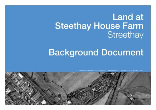
L<strong>and</strong> at Streethay House Farm, Burton Road, Streethay<br />
L<strong>and</strong> at<br />
Steethay House Farm<br />
Streethay<br />
<strong>Background</strong> <strong>Document</strong><br />
Prepared by Pegasus Planning Group | Miller Homes | January 2009 | Bir.2007_04_1<br />
1
L<strong>and</strong> at Streethay House Farm, Burton Road, Streethay<br />
2
L<strong>and</strong> at Streethay House Farm, Burton Road, Streethay<br />
Introduction<br />
• This document has been produced for<br />
information to assist the preparation of<br />
<strong>Lichfield</strong> <strong>District</strong> Council’s Local Development<br />
Framework <strong>and</strong> to respond to the Preferred<br />
Options Consultation of the Core Strategy.<br />
• It has been produced in order to illustrate<br />
how l<strong>and</strong> at Streethay House Farm can meet<br />
key objectives of sustainable development<br />
whilst meeting the needs <strong>and</strong> aspirations of<br />
<strong>Lichfield</strong>’s population.<br />
• This document provides a summary of<br />
environmental information regarding the site at<br />
Streethay House Farm. This information has<br />
enabled the major environmental constraints<br />
<strong>and</strong> opportunities of the site to be identified<br />
which in turn has helped formulate potential<br />
development proposals <strong>and</strong> the production of<br />
an Illustrative Development Framework Plan for<br />
the site at Streethay House Farm.<br />
Site Context Plan<br />
3
Track<br />
ROMAN ROAD<br />
1<br />
3<br />
1<br />
9<br />
9<br />
2<br />
6<br />
CLOSE<br />
12<br />
3<br />
8<br />
15<br />
1<br />
CROFT<br />
12<br />
4<br />
7<br />
2<br />
MEADOW<br />
1<br />
11<br />
11<br />
2<br />
19<br />
16<br />
16<br />
1<br />
61<br />
15<br />
F<br />
(course of)<br />
Und<br />
L<strong>and</strong> at Streethay House Farm, Burton Road, Streethay<br />
4<br />
development<br />
currently under<br />
construction<br />
Site Location Plan<br />
BM 75.17m<br />
Streethay Lodge<br />
MP<br />
LB<br />
Tank<br />
SL<br />
SP<br />
SP<br />
24<br />
ED <strong>and</strong> Ward Bdy<br />
CROSSFIELD ROAD<br />
Industrial Estate<br />
<strong>Lichfield</strong> (Trent Valley) Station<br />
76.0m<br />
Trent<br />
Valley<br />
CR<br />
LC<br />
19<br />
18<br />
STATION APPROACH<br />
25 to 26<br />
Friary<br />
House<br />
Works<br />
SL<br />
SL<br />
SB<br />
SB<br />
Tank<br />
8<br />
4<br />
1<br />
Works<br />
76.9m<br />
Spinney View<br />
The Anchor<br />
(PH)<br />
The Cedars<br />
Cedar<br />
Cottage<br />
Pond<br />
Laburnum<br />
Cottage<br />
Rose<br />
Cottage<br />
Elverceter<br />
Pond<br />
SP<br />
SP<br />
23<br />
35<br />
Yew Tree<br />
House<br />
45<br />
55<br />
70<br />
1<br />
4<br />
3<br />
7<br />
F<br />
72.5m<br />
Holl<strong>and</strong>s<br />
Crossing<br />
The Poplars<br />
LANE<br />
Streethay<br />
House<br />
Laburnum<br />
GP<br />
Streethay<br />
Cottage<br />
BM 73.62m<br />
BM 74.94m<br />
BURTON OLD ROAD<br />
HOLLAND<br />
CLOSE<br />
DYOTT<br />
73.6m<br />
Garage<br />
73.2m<br />
TCB<br />
74.5m<br />
MP.25<br />
Level<br />
Crossing<br />
Pond<br />
A 5127<br />
MP 18.75<br />
Level Crossing<br />
BURTON ROAD<br />
A 5127<br />
BURTON OLD ROAD<br />
STATION APPROACH<br />
STATION APPROACH<br />
Howarth House<br />
Ward Bdy<br />
Ridware<br />
House<br />
Bowling Green<br />
Ppg Sta<br />
Depot<br />
The Trent<br />
Valley<br />
(Hotel)<br />
Anchor Side<br />
Bungalows<br />
Leysters<br />
BM 67.68m<br />
El<br />
Sub<br />
Sta<br />
El Sub Sta<br />
Warehouse<br />
Pond<br />
73.9m<br />
Field Cottage<br />
LB<br />
26<br />
Ryknild<br />
TREE<br />
75.9m<br />
The Cottage<br />
The Manor House<br />
Def<br />
Street<br />
ASH<br />
ROMAN ROAD<br />
Depot<br />
Pumping station<br />
SB<br />
LB<br />
Def<br />
9<br />
F<br />
61<br />
SLs<br />
18<br />
Def<br />
Und<br />
45<br />
17<br />
5<br />
31<br />
25<br />
6<br />
12<br />
79<br />
BAILYE CLOSE<br />
Trent Vale House<br />
Works<br />
Depot<br />
Cottage<br />
Tank<br />
2<br />
El Sub Sta<br />
Und<br />
Def<br />
Def<br />
Issues<br />
BM 75.30m<br />
74.4m<br />
WB<br />
25<br />
1<br />
1<br />
7<br />
SLs<br />
60<br />
Und<br />
Warehouse<br />
74.1m<br />
Depot<br />
Playground<br />
Garage<br />
TRENT VALLEY ROAD<br />
ED & Ward Bdy<br />
VULCAN ROAD<br />
Depot<br />
Depot<br />
76.6m<br />
Chimney<br />
76.0m<br />
Tank<br />
9<br />
10<br />
PO<br />
14<br />
18<br />
41<br />
35<br />
20<br />
2<br />
8<br />
F<br />
Tank<br />
11<br />
63<br />
CR<br />
Def<br />
FF<br />
Ryknild Str et<br />
1<br />
Und<br />
Def<br />
BEXMORE DRIVE<br />
Trent Valley Co tages<br />
BURTON ROAD<br />
BURTON ROAD<br />
79.7m<br />
El<br />
9 to 10<br />
16<br />
BM 79.96m<br />
Cro sfield House<br />
Depot<br />
Factory<br />
Works<br />
Works<br />
Warehouse<br />
Streethay<br />
El Sub Sta<br />
ED Bdy<br />
EASTERN AVENUE<br />
Trave ling Crane<br />
Pavilion<br />
Sub Sta<br />
Pond<br />
19<br />
71<br />
LC<br />
11 to 15<br />
VA LEY<br />
LANE<br />
TRENT VALLEY ROAD<br />
Depot Works<br />
2 to 3
L<strong>and</strong> at Streethay House Farm, Burton Road, Streethay<br />
Site Context <strong>and</strong> Description<br />
The site is located at Streethay House Farm, Burton Road, Streethay adjoining<br />
<strong>Lichfield</strong> City to the east. Streethay is situated along the A5127 Burton Road, on<br />
the north east side of <strong>Lichfield</strong> adjacent to the A38 Trunk road, as illustrated in the<br />
site context plan on page 3.<br />
The site comprises agricultural l<strong>and</strong> <strong>and</strong> is a typical urban fringe site lying adjacent<br />
to residential development, an industrial site <strong>and</strong> further agricultural l<strong>and</strong>. The<br />
southern boundary of the site adjoins the rear gardens of a ribbon of residential<br />
dwellings parallel to Burton Road (A5127). To the west of the site lies the London<br />
to North Western railway line (with <strong>Lichfield</strong> Trent Valley railway Station being approximately<br />
300m southwest from the site) <strong>and</strong> beyond the railway line an industrial<br />
estate. The north <strong>and</strong> north-eastern boundaries adjoin existing agricultural l<strong>and</strong><br />
<strong>and</strong> the A38 road lies further to the east of the site.<br />
The site is part of a network of agricultural fields <strong>and</strong> the majority is used for arable<br />
production, although the eastern portion of the site houses residential properties,<br />
tarmac tracks <strong>and</strong> farm buildings associated with Streethay House Farm. The farm<br />
buildings include poultry-rearing sheds, small scale slaughterhouse, refrigeration<br />
units <strong>and</strong> agricultural storage units. There are derelict former military barracks on<br />
the site close to Streethay House Farm.<br />
Vegetation is generally limited to field hedgerow boundaries <strong>and</strong> the site boundaries<br />
with only a few hedgerows <strong>and</strong> large individual trees. A tarmac track however<br />
is lined with a single row of prominent trees; aside from this the area is predominately<br />
open. The topography of the site is dome-like <strong>and</strong> generally rises from<br />
the south <strong>and</strong> Burton Road to a ridge in the central area of the site with a height<br />
change of approximately 12m between the sites lowest (70m) <strong>and</strong> highest point<br />
(82m).<br />
5
19<br />
PO<br />
17<br />
LB<br />
Depot<br />
Sta<br />
Factory<br />
Friary<br />
House<br />
Trent Vale House<br />
Works<br />
Def<br />
Depot<br />
CR<br />
WB<br />
Tank<br />
Ridware<br />
House<br />
1<br />
4<br />
3<br />
7<br />
2<br />
VA LEY<br />
LANE<br />
1<br />
Def<br />
Def<br />
Works<br />
Depot<br />
Und<br />
Und<br />
SLs<br />
Ppg Sta<br />
Depot<br />
Depot<br />
F<br />
Pavilion<br />
Bowling Green<br />
The Trent<br />
Valley<br />
(Hotel)<br />
MP<br />
Tank<br />
9 to 10<br />
8<br />
4<br />
2 to 3<br />
1<br />
Def<br />
Works<br />
LANE<br />
19<br />
18<br />
LB<br />
Industrial Estate<br />
16<br />
El<br />
Sub Sta<br />
24<br />
76.6m<br />
25 to 26<br />
1 to 15<br />
F<br />
SLs<br />
Works<br />
Warehouse<br />
STATION A PROACH<br />
Works<br />
Pond<br />
Howarth House<br />
Tank<br />
Def<br />
Warehouse<br />
F<br />
Works<br />
Pond<br />
SL<br />
FF<br />
ACH<br />
Und<br />
Und<br />
Def<br />
SB<br />
F<br />
Tank<br />
Depot<br />
SL<br />
Depot<br />
74.1m<br />
<strong>Lichfield</strong> (Trent Valley) Station<br />
Def<br />
SL<br />
Depot<br />
25<br />
Und<br />
El Sub Sta<br />
Tank<br />
Lodge<br />
Streethay<br />
SP<br />
SP<br />
35<br />
Pumping station<br />
1<br />
41<br />
6<br />
45<br />
Chimney<br />
12<br />
BM 75.30m<br />
El Sub Sta<br />
19<br />
31<br />
26<br />
Trent<br />
Valley<br />
Cottage<br />
LC<br />
LC<br />
15<br />
75.9m<br />
SB<br />
76.0m<br />
18<br />
SB<br />
61<br />
25<br />
20<br />
70<br />
1<br />
16<br />
74.4m<br />
7<br />
8<br />
79<br />
9<br />
5<br />
1<br />
60<br />
71<br />
BAILYE CLOSE<br />
1<br />
18<br />
14<br />
76.0m<br />
63<br />
1<br />
61<br />
9<br />
Garage<br />
10<br />
2<br />
7<br />
Garage<br />
55<br />
23<br />
CROFT<br />
76.9m<br />
The Cottage<br />
SP<br />
12<br />
45<br />
16<br />
11<br />
1<br />
9<br />
TT<br />
CL<br />
2<br />
35<br />
15<br />
1<br />
4<br />
2<br />
74.5m<br />
Bungalows<br />
Spinney View<br />
73.9m<br />
TCB<br />
SP<br />
1<br />
GP<br />
The Cedars<br />
1<br />
Cedar<br />
Cottage<br />
3<br />
73.2m<br />
(PH)<br />
LB<br />
2<br />
8<br />
Leysters<br />
6<br />
MP.25<br />
12<br />
Rose<br />
Cottage<br />
Laburnum<br />
Cottage<br />
Holl<strong>and</strong>s<br />
Crossing<br />
The Poplars<br />
© Copyright Pegasus Planning Group llp. © Crown copyright. All rights reserved. Ordnance Survey Copyright Licence number 100042093 I Promap Licence number 100020449 . Drawings prepared for planning application purposes <strong>and</strong> can be scaled (drawings are not to be used for construction or sales documents).<br />
Please refer to (client) for development design risk assessment documents. Pegasus Urban Design is part of Pegasus Planning Group LLP. Any queries to be reported to Pegasus for clarification.<br />
Level<br />
Crossing<br />
Pond<br />
9<br />
The<br />
Pond<br />
Pond<br />
Track<br />
Field Cottage<br />
Elverceter<br />
BM 67.68m<br />
Streethay<br />
Cottage<br />
Level Crossing<br />
MP 18.75<br />
1<br />
ew<br />
rks<br />
25<br />
Warehouse<br />
The<br />
25<br />
L<strong>and</strong> at Streethay House Farm, Burton Road, Streethay<br />
KEY<br />
Existing l<strong>and</strong>scape features<br />
Country Park<br />
Bus route / bus stops<br />
Existing bridleway<br />
70m<br />
H8<br />
Existing footpath<br />
H4<br />
Streethay<br />
House<br />
th<br />
Farm<br />
Listed Buildings<br />
75m<br />
80m<br />
Playing Fields<br />
H9<br />
A 5127<br />
ethay<br />
Stre<br />
Existing residential<br />
(on site)<br />
Proposed<br />
woodl<strong>and</strong><br />
H5<br />
H7<br />
Streethay<br />
BM 73.62m<br />
Ryknild Street<br />
ROAD<br />
Existing employment<br />
(on site) (1.91ha)<br />
Proposed residential<br />
(24.3 ha gross)<br />
Indicative residential capacity<br />
of 850 dwellings @ 35 dph<br />
H2<br />
H6<br />
Public House<br />
Laburnum<br />
House<br />
ASH<br />
TREE<br />
Proposed public open space<br />
(15 ha)<br />
HOLLAND<br />
CLOSE<br />
BURTON ROAD<br />
LANE<br />
Indicative proposed access<br />
ED & Ward Bdy<br />
VULCAN ROAD<br />
H1<br />
H3<br />
BM 75.17m<br />
A 5127<br />
Yew Tree<br />
House<br />
MEADOW<br />
73.6m<br />
DYOTT<br />
BS<br />
CLOSE<br />
BM 74.94m<br />
BURTON OLD ROAD<br />
development<br />
currently under<br />
construction<br />
Proposed l<strong>and</strong>scaping<br />
Proposed footpath/cycleway<br />
ED Bdy<br />
BURTON ROAD<br />
Trent Valley Co tages<br />
BEXMORE DRIVE<br />
Link to Railway station<br />
EASTERN AVENUE<br />
Trave ling Crane<br />
Gateway<br />
ED <strong>and</strong> Ward Bdy<br />
BURTON OLD ROAD<br />
Ryknild Str et<br />
ROMAN ROAD<br />
(course of)<br />
Community hub<br />
(1.5 ha)<br />
TRENT VA LEY ROAD<br />
Feature square<br />
CROSSFIELD ROAD<br />
STATION APPROACH<br />
<strong>Lichfield</strong><br />
(Trent Valley)<br />
Railway Station<br />
Scheduled ancient<br />
monument<br />
Cro sfield House<br />
CAPPERS LANE<br />
north<br />
0 50 100<br />
200m<br />
| T 01285 888084 | F 01285 885115 | www.ppg-llp.co.uk |<br />
L<strong>and</strong> at Streethay House Farm, <strong>Lichfield</strong> - Illustrative Development Framework<br />
Illustrative Development Framework Plan<br />
| Team MC/JA | January 2009 | 1:2500 @A1 | Pegasus Urban Design | drwg.BIR.2007_02-6 | Miller Homes<br />
6
L<strong>and</strong> at Streethay House Farm, Burton Road, Streethay<br />
Proposed Development <strong>and</strong> Accessibility<br />
Proposed Development<br />
Although proposals are at an early stage, the Illustrative Development Framework<br />
Plan ensures the built form responds to the existing l<strong>and</strong>scape <strong>and</strong> topography on<br />
the site whilst integrating with the existing built form of the City of <strong>Lichfield</strong> <strong>and</strong> its<br />
immediate surroundings at Streethay. Development in this location can respond to<br />
the existing built form of Streethay <strong>and</strong> pay particular regard to the Listed Buildings<br />
<strong>and</strong> character of the area in the vicinity of the site. Areas of public open space including<br />
formal playing fields <strong>and</strong> informal recreation are shown on the highest part<br />
of the site to ensure the development does not intrude into the open countryside<br />
to the north.<br />
Existing l<strong>and</strong>scape features across the site can be retained wherever possible, in<br />
order to provide a level of maturity to the development from an early stage. Existing<br />
hedgerows <strong>and</strong> l<strong>and</strong>scape features can be strengthened <strong>and</strong> new planting can<br />
occur where suitable in order to provide a buffer between the built form <strong>and</strong> the<br />
open countryside. This will also assist in creating new habitats for wildlife <strong>and</strong> help<br />
to create a green infrastructure network on what is currently an open <strong>and</strong> sparse<br />
l<strong>and</strong>scape. Planting can also be used throughout the development in order to<br />
soften the built form.<br />
Walking <strong>and</strong> cycling will be promoted throughout the development through the<br />
provision of new linkages to the existing network of public footpaths <strong>and</strong> bridleways.<br />
All roadside footways can be designed to ensure safe <strong>and</strong> convenient use<br />
by the disabled whilst the proposed road network will have consideration to the<br />
cyclist’s safely.<br />
Within the residential development, a range of house types, sizes <strong>and</strong> tenures can<br />
be proposed in order to assist the creation of a balanced community with a variety<br />
of households thereby minimising social exclusion. This also ensures that a range<br />
of densities can be achieved across the development.<br />
Taking into account these issues, specifically the topographic <strong>and</strong> l<strong>and</strong>scape constraints<br />
which affect the site, we foresee the potential for the creation of a development<br />
which could accommodate the amount of development envisaged in the<br />
Core Strategy Preferred Options, as demonstrated on the Illustrative Development<br />
Framework Plan on pg 6;<br />
•<br />
•<br />
•<br />
Approximately 24 ha of residential development (equivalent to approximately<br />
850 dwellings at 35 dph);<br />
Community facilities contained within a community hub area;<br />
The potential to provide a large area of open space in the form of natural<br />
parkl<strong>and</strong> <strong>and</strong> formal playing space where necessary.<br />
7
L<strong>and</strong> at Streethay House Farm, Burton Road, Streethay<br />
As the proposals progress, the development design can ensure the creation of<br />
a safe <strong>and</strong> secure neighbourhood through the use of the following;<br />
•<br />
•<br />
•<br />
•<br />
•<br />
Well defined routes, spaces <strong>and</strong> entrances that provide for convenient<br />
movement without compromising security;<br />
Clearly structured distribution of uses to avoid conflict;<br />
Promotion of a sense of ownership, respect, territorial responsibility <strong>and</strong><br />
community;<br />
Inclusion of necessary physical protection <strong>and</strong> security features; <strong>and</strong><br />
Encouragement of a variety of human activities in appropriate locations.<br />
8
L<strong>and</strong> at Streethay House Farm, Burton Road, Streethay<br />
Sustainability <strong>and</strong> Accessibility to Existing Facilities<br />
The site is situated in a sustainable location on the edge of the urban development<br />
of <strong>Lichfield</strong> City. Future residents could therefore take advantage of the nearby<br />
amenities <strong>and</strong> infrastructure accessible to them, encouraging the use of more sustainable<br />
means of transport rather than the reliance on long private car journeys.<br />
In addition, the proposed development can provide further facilities for future <strong>and</strong><br />
existing residents. For example;<br />
• The site is close to the existing main employment areas <strong>and</strong> to those which<br />
are proposed as part of the Core Strategy Preferred Options around Trent<br />
Valley.<br />
• The site is served by existing bus routes on Burton Road, with frequent<br />
services throughout the day <strong>and</strong> evening. The proposed development could<br />
enhance these public transport services, particularly by encouraging a more<br />
frequent bus service which would penetrate the site. This would encourage<br />
the use of more sustainable means of transport, as opposed to the reliance<br />
on the private car. If deemed appropriate, the bus service could route via<br />
<strong>Lichfield</strong> Trent Valley Station.<br />
• Public transport facilities could be further enhanced by the provision of clean<br />
<strong>and</strong> well lit bus shelters with real time bus information displayed.<br />
• The site is within walking distance of <strong>Lichfield</strong> Trent Valley Station which<br />
provides local Central services to <strong>Lichfield</strong> <strong>and</strong> Birmingham New Street on<br />
the <strong>Lichfield</strong> to Redditch line. Virgin trains also use this line to provide longer<br />
distance services to Birmingham International Airport, Rugby <strong>and</strong> London<br />
amongst other destinations.<br />
• The site lies within cycling distance of <strong>Lichfield</strong> but no local dedicated cycling<br />
facilities exist. As part of the development proposals, appropriate cycling facilities<br />
could be introduced to encourage more sustainable means of transport<br />
<strong>and</strong> these would be discussed <strong>and</strong> agreed with the Local Highway Authority.<br />
• The development will provide accessible open space to future <strong>and</strong> existing<br />
residents with the provision of the country park <strong>and</strong> other open space areas,<br />
encouraging outdoor activities which are accessible on foot.<br />
Conclusion<br />
The site provides an excellent opportunity to provide sustainable development<br />
with a distinctive character <strong>and</strong> strong sense of place in a location which is easily<br />
accessible from <strong>and</strong> to the existing built area of <strong>Lichfield</strong>. There is sufficient l<strong>and</strong><br />
area to provide housing numbers sufficient to meet the Local Development Framework<br />
requirements for the site <strong>and</strong> supporting infrastructure in terms of community<br />
facilities <strong>and</strong> new connections. The accompanying Illustrative Development<br />
Framework Plan provides a graphic representation of some initial ideas on how<br />
development could be accomodated on l<strong>and</strong> at Streethay. Our clients look forward<br />
to working with <strong>Lichfield</strong> <strong>District</strong> Council to develop these proposals further.<br />
9
L<strong>and</strong> at Streethay House Farm, Burton Road, Streethay<br />
10
L<strong>and</strong> at Streethay House Farm, Burton Road, Streethay<br />
L<strong>and</strong>scape<br />
An initial l<strong>and</strong>scape <strong>and</strong> visual appraisal has been conducted to identify the opportunities<br />
<strong>and</strong> constraints of the site with regard to its future development. The<br />
appraisal considers l<strong>and</strong>scape resources, l<strong>and</strong>scape character <strong>and</strong> general visual<br />
amenity.<br />
Assessment<br />
Desktop studies <strong>and</strong> site surveys during 2006, 2007 <strong>and</strong> 2008 have been undertaken<br />
to provide the baseline data on which an appraisal can be based. This stage<br />
involves recording <strong>and</strong> analysing information about the site <strong>and</strong> its surroundings<br />
<strong>and</strong> the identification of important l<strong>and</strong>scape features <strong>and</strong> their ability to accommodate<br />
future development.<br />
L<strong>and</strong>scape Site Description <strong>and</strong> Context<br />
The site predominantly comprises agricultural l<strong>and</strong> <strong>and</strong>, as is typical of urban fringe<br />
sites, lies adjacent to residential development, an industrial site <strong>and</strong> further agricultural<br />
l<strong>and</strong>. The south east edge of the site adjoins the rear gardens of a ribbon<br />
of recent housing parallel to Burton Road (A5127). The site is part of a network<br />
of agricultural fields <strong>and</strong> on its northern edge has views over the open l<strong>and</strong>scape<br />
towards Curborough, Fradley <strong>and</strong> Burton. The western boundary adjoins an<br />
industrial estate <strong>and</strong> a mainline railway. The eastern portion of the site houses<br />
buildings associated with Streethay House Farm including the listed farm house.<br />
The buildings include poultry-rearing sheds <strong>and</strong> agricultural storage units. There<br />
are derelict former military barracks on the site close to Streethay House Farm.<br />
In brief, the majority of the site is used for arable production, although there are<br />
also farm buildings on the site, with associated tarmac tracks. The tracks are<br />
lined with single rows of trees <strong>and</strong> there are a couple of hedgerows <strong>and</strong> large individual<br />
trees at the boundaries of the site, although the area is predominately open.<br />
The topography of the site is dome-like with a height change of approximately<br />
12m between the site’s lowest (70m AOD) <strong>and</strong> highest point (82m AOD).<br />
L<strong>and</strong>scape Resources<br />
There are no l<strong>and</strong>scape designations covering the site. There are a number of<br />
listed buildings adjacent to the site <strong>and</strong> one, Streethay House Farm, within the site<br />
which can be retained within any proposals.<br />
The surrounding l<strong>and</strong>use is typical of an urban fringe site <strong>and</strong> encompasses<br />
industrial (on western boundary), transport (on western <strong>and</strong> southern boundaries),<br />
residential (on southern boundary) <strong>and</strong> agricultural uses (on north <strong>and</strong> eastern<br />
boundaries). Streethay itself lies off the southern boundaries <strong>and</strong> contains a core<br />
of older pre-20th century properties <strong>and</strong> more recent housing dating from the latter<br />
20th century <strong>and</strong> dwellings constructed in the past few years. There is a small<br />
park located between Burton Road <strong>and</strong> the southern boundary of the site which<br />
contains grass <strong>and</strong> children’s play equipment.<br />
With regards to the site itself, the majority of the l<strong>and</strong> is used for arable <strong>and</strong> agricultural<br />
purposes. Vegetation is largely limited to field boundaries or the borders of<br />
the site, apart from a cluster of young to early mature trees to the east of Streethay<br />
House Farm. Also, leading out from Streethay, <strong>and</strong> crossing the site are a<br />
number of prominent tree lines, each formed by a single species namely: Lombardy<br />
poplar, white poplar <strong>and</strong> birch. These lines of trees are prominent features<br />
in an otherwise open <strong>and</strong> sparsely vegetated l<strong>and</strong>scape <strong>and</strong> therefore will be<br />
retained where possible within any proposals.<br />
11
L<strong>and</strong> at Streethay House Farm, Burton Road, Streethay<br />
<br />
<br />
<br />
<br />
<br />
<br />
<br />
<br />
<br />
<br />
<br />
<br />
<br />
<br />
<br />
<br />
<br />
<br />
<br />
<br />
L<strong>and</strong>scape Visual Analysis Plan<br />
12
L<strong>and</strong> at Streethay House Farm, Burton Road, Streethay<br />
The site also contains a public right of way which emerges from the houses on<br />
Burton Road <strong>and</strong> runs north-west across the site. In addition a bridleway branches<br />
off in a north-easterly direction before heading back towards Burton Road.<br />
L<strong>and</strong>scape Character<br />
Identified as part of the Countryside Agency’s L<strong>and</strong>scape Character Area 67 Cannock<br />
Chase <strong>and</strong> Cank Wood, the site exhibits the following key characteristics<br />
listed for the area:<br />
•<br />
•<br />
•<br />
•<br />
•<br />
a very varied l<strong>and</strong>scape with a range of industrial, residential, agricultural <strong>and</strong><br />
recreational l<strong>and</strong> uses<br />
an extensive urban fringe<br />
open arable areas with low hedges<br />
the l<strong>and</strong>scape towards <strong>Lichfield</strong> becomes gently rolling with large arable fields,<br />
coverts <strong>and</strong> belts of trees<br />
hedges have often been reduced or removed <strong>and</strong> some areas have an almost<br />
arable prairie quality in which hedgerow trees too have disappeared.<br />
Negative characteristics are described as:<br />
•<br />
•<br />
the deterioration of hedges<br />
many of the new employment sites lack appropriate l<strong>and</strong>scape treatments.<br />
The exposed urban/industrial edge, particularly along Eastern Avenue is a raw,<br />
unattractive l<strong>and</strong>scape element <strong>and</strong> is a detractor on the open countryside.<br />
Visual Amenity<br />
A visual analysis of the site is presented in plan form on page 12.<br />
Close range views into the site from the south are generally limited by the houses<br />
along Burton Road. There are views into the site from the children’s play area,<br />
although these are then constrained by the area of higher l<strong>and</strong> towards the centre<br />
of the site. There are glimpsed views over the site, with Streethay in the foreground,<br />
from the A38 trunk road as it passes to the south of Streethay on a raised<br />
embankment.<br />
There are also limited views from the west due to the industrial built form along<br />
Eastern Avenue which prevents all but glimpsed views between buildings. Intervening<br />
l<strong>and</strong> form prevents views from further west.<br />
From the east of the site, there are limited publicly accessible places which give<br />
rise to views into the site. From the Fradley Business Park, Industrial Estates <strong>and</strong><br />
A38 (travelling south-west) there are distant <strong>and</strong> sometimes intermittent views<br />
which set the site in the context of the urban fringe, as <strong>Lichfield</strong> stretches out in<br />
the far distance.<br />
From the north, longer range views into the site are prevented by intervening l<strong>and</strong>form.<br />
Close range views from the PROW are, at times, constrained by the higher<br />
l<strong>and</strong> <strong>and</strong> channelled towards the industrial estate.<br />
13
L<strong>and</strong> at Streethay House Farm, Burton Road, Streethay<br />
14
L<strong>and</strong> at Streethay House Farm, Burton Road, Streethay<br />
L<strong>and</strong>scape <strong>and</strong> Visual Constraints <strong>and</strong> Opportunities <strong>and</strong><br />
Rationale of Proposed Development<br />
The baseline information developed from the desk study <strong>and</strong> site survey enables<br />
the identification of the opportunities <strong>and</strong> constraints of the site to accommodate<br />
development. The Illustrative Development Framework Plan given on page 6 has<br />
been informed by this appraisal.<br />
The topography of the site would enable development on the lower lying l<strong>and</strong> to<br />
be screened from the open countryside <strong>and</strong> strategic l<strong>and</strong>scape infrastructure<br />
proposed as part of the site development can be designed to soften <strong>and</strong> filter<br />
views of the development from sensitive locations. The area of highest sensitivity<br />
to development, i.e. the most elevated <strong>and</strong> exposed areas of the site can be<br />
designated as areas of open space as shown on the Illustrative Development<br />
Framework Plan <strong>and</strong> there would be the opportunity for vegetated buffer strips<br />
<strong>and</strong> areas of woodl<strong>and</strong> to soften the influence of the urban edge.<br />
Conclusion<br />
The site is typical <strong>and</strong> characteristic of the urban fringe, <strong>and</strong> is influenced by<br />
residential, industrial <strong>and</strong> agricultural l<strong>and</strong>use. It has few l<strong>and</strong>scape features of<br />
value <strong>and</strong> vegetation is largely confined to field boundaries or the boundaries of<br />
the actual site.<br />
Development could be accommodated within the site without adverse effects on<br />
the open countryside <strong>and</strong> indeed could bring about a beneficial effect by improving<br />
the transition from the urban to the rural l<strong>and</strong>scape through a carefully designed<br />
proposal which fully embraces the need for l<strong>and</strong>scape infrastructure <strong>and</strong><br />
open space provision.<br />
The proposal would provide the opportunity to introduce l<strong>and</strong>scape infrastructure<br />
to this denuded site by areas of open space, woodl<strong>and</strong> <strong>and</strong> a strong l<strong>and</strong>scape<br />
structure throughout the built-up areas of the proposal. The location of an area<br />
of public open space on the highest ground would give residents of the proposed<br />
development <strong>and</strong> existing residents in Streethay the opportunity to enjoy long<br />
range views of the countryside.<br />
Looking towards the site from the north, <strong>and</strong> east, the site is seen in the context of<br />
the existing industrial <strong>and</strong> urban edge <strong>and</strong> this is a detracting influence. The urban<br />
fringe does not have to be fully screened to prevent adverse effects on the open<br />
countryside: views of built-up areas are characteristic in the area; however, they<br />
can be enhanced by presenting a strong <strong>and</strong> well designed edge, with l<strong>and</strong>scape<br />
infrastructure planting to soften the influence. For example, views of the upper<br />
storeys/ rooflines of attractive buildings <strong>and</strong>, in appropriate locations fuller views of<br />
l<strong>and</strong>mark buildings, with the street level comings-<strong>and</strong>-goings (domestic influences/<br />
industrial activity/traffic movements) screened from the inactive countryside would<br />
enhance this degraded <strong>and</strong> exposed transition zone.<br />
15
L<strong>and</strong> at Streethay House Farm, Burton Road, Streethay<br />
16
L<strong>and</strong> at Streethay House Farm, Burton Road, Streethay<br />
Ecology<br />
The majority of the site has been subject to an initial Phase One Habitat survey<br />
<strong>and</strong> some preliminary protected species surveys during 2006 <strong>and</strong> 2008. Alongside<br />
a desk based study, this has enabled an initial assessment of the potential ecological<br />
constraints <strong>and</strong> opportunities available at the site, which has helped <strong>and</strong><br />
will continue to inform, development proposals.<br />
Designations<br />
There are no statutory national, county or district level designated ecological sites<br />
within the development area or within close proximity of the site boundaries.<br />
Flora<br />
The site was subject to on-site surveys during 2006 <strong>and</strong> 2008 <strong>and</strong> the following<br />
habitat / vegetation types were identified within the site:<br />
Arable: the majority of the site consists of open arable l<strong>and</strong> which is considered<br />
to be of low value in ecological terms. These areas are low in floral diversity due<br />
to the associated high input of fertiliser, pesticide <strong>and</strong> herbicide. No uncommon<br />
species associated with arable l<strong>and</strong> were recorded. This habitat is considered to<br />
be of low ecological <strong>and</strong> wildlife conservation value <strong>and</strong> is replicated elsewhere in<br />
abundance within the wider l<strong>and</strong>scape. It is therefore considered the loss of this<br />
habitat should not present any major constraint to development.<br />
Improved grassl<strong>and</strong>: identified within the site’s western areas. In common with<br />
most improved grassl<strong>and</strong>s, herb diversity was low <strong>and</strong> those species observed<br />
were typically the more locally abundant competitive species. Some of the improved<br />
grassl<strong>and</strong> was redundant arable l<strong>and</strong>. This habitat is considered to be<br />
of low ecological <strong>and</strong> wildlife conservation value <strong>and</strong> is replicated elsewhere in<br />
abundance within the wider l<strong>and</strong>scape. It is therefore considered the loss of this<br />
habitat should not present any major constraint to development, particularly as the<br />
proposals include large areas of managed open space/ a county park <strong>and</strong> strategic<br />
green infrastructure which will help improve nature conservation value according<br />
to local BAP initiatives where applicable.<br />
Semi-improved grassl<strong>and</strong>: identified particularly within the south <strong>and</strong> south east<br />
of the site. Areas are typical of ab<strong>and</strong>oned pasture <strong>and</strong> consist of rank unmanaged<br />
swards <strong>and</strong> dominated by a limited number of grass species. This habitat is<br />
considered to be of low ecological <strong>and</strong> wildlife conservation value <strong>and</strong> is replicated<br />
elsewhere in abundance within the wider l<strong>and</strong>scape. It is therefore considered<br />
the loss of this habitat should not present any major constraint to development,<br />
particularly as the proposals include large areas of managed open space.<br />
Scrub: some areas of scrub are present within the site which includes areas of<br />
dense hawthorn <strong>and</strong> outgrown hedgerows. As the species diversity is relatively<br />
low <strong>and</strong> such habitats are also replicated elsewhere within the wider l<strong>and</strong>scape, it<br />
is therefore considered the loss of these features presents no restraint to development.<br />
Hedgerows <strong>and</strong> Trees: the presence of hedgerows are generally confined to the<br />
boundaries of the site, specifically the western <strong>and</strong> eastern extents of the site, or<br />
field boundaries. Hedgerows are absent from a large part of the central area due<br />
to the intensively managed agricultural nature of the l<strong>and</strong>scape. The hedgerows<br />
located in the western site area are managed <strong>and</strong> relatively species-rich comprising<br />
abundant hawthorn with frequent elder <strong>and</strong> locally abundant elm Ulmus sp.<br />
Hedgerows located within the eastern extent are, outgrown <strong>and</strong> unmanaged <strong>and</strong><br />
slightly less species-rich, being dominated by hawthorn with locally dominant<br />
blackthorn. None of the hedgerows are species rich, however they do provide<br />
nest <strong>and</strong> forage habitat for a wide range of animals including birds, insects, small<br />
terrestrial mammals <strong>and</strong> provide some limited habitat linkage in an area lacking in<br />
17
L<strong>and</strong> at Streethay House Farm, Burton Road, Streethay<br />
connectivity as a result of sympathetic l<strong>and</strong> use practices. A number of mature<br />
trees were also recorded within the survey area, many of which are confined to<br />
hedgerows. The development provides the opportunity to, not only retain these<br />
features where possible, but also to increase planting across the site <strong>and</strong> improve<br />
the current ecological habitats by providing foraging/nesting resource for birds<br />
<strong>and</strong> small mammals. Additional strategic planting <strong>and</strong> areas of open space will<br />
help create a linked network of green infrastructure on site, enabling the movement<br />
of animals across an otherwise unsuitable, intensively managed habitat<br />
thereby increasing the benefit to the local wildlife population. The open space<br />
areas will also be appropriately managed to help maintain these positive benefits.<br />
Watercourses: a dry ditch / ephemeral stream is situated at the southern end of<br />
the site, surrounded by bankside vegetation. Further streams/ditches are also<br />
present within the north east/east of the site, which contained water at the time<br />
of surveys. Currently the ecological values of these features are relatively low <strong>and</strong><br />
therefore present no restraint to development. As part of the proposals however,<br />
consideration will be given to the potential retention <strong>and</strong> enhancement of this feature<br />
which could act as a habitat <strong>and</strong> a corridor for wildlife movement, alongside<br />
providing amenity benefits.<br />
Fauna<br />
Preliminary protected species surveys were undertaken in 2006 <strong>and</strong> 2008 of the<br />
following species:<br />
Bats: three transect activity surveys were undertaken during the summer of 2008<br />
to assess the level of activity <strong>and</strong> species using the site. Overall activity levels<br />
were low with only a small number of common species recorded. The majority of<br />
activity was recorded along the tree lines near Streethay House Farm, most probably<br />
due to the fact these are the only features in a l<strong>and</strong>scape otherwise dominated<br />
by arable farml<strong>and</strong>. Where possible these tree lines will be retained within the<br />
proposals, however given the small number of common bats using them they are<br />
not considered to be a significant constraint to development. The mature trees on<br />
site which may provide roost potential will also be maintained where possible. The<br />
development <strong>and</strong> additional planting, including the green open spaces/country<br />
park could indeed increase bat activity by providing favourable habitats for roosting<br />
<strong>and</strong> foraging.<br />
Badgers: a badger survey was undertaken on the site in 2008, however no evidence<br />
of use by badgers was found anywhere on site. Badgers therefore do not<br />
pose any significant constraints to development.<br />
Reptiles: seven presence/absence surveys were completed during the summer of<br />
2008 focusing on suitable habitat which was restricted to field margins. No reptiles<br />
were found during any of the surveys, therefore it can be concluded they do not<br />
pose any constraints to development.<br />
Great Crested Newts: there are no ponds within the site area, however a number<br />
of ponds exist just within 500m of the site boundaries. Investigations in 2006 considered<br />
the potential for GCN within these ponds as low-moderate, however our<br />
clients are happy to work with the <strong>District</strong> Council <strong>and</strong> other stakeholders to carry<br />
out further work <strong>and</strong>/or consider suitable mitigation measures where necessary to<br />
ensure there is no unacceptable adverse effects to such species.<br />
Farml<strong>and</strong> Birds: some hedgerows, scrub <strong>and</strong> a number of mature <strong>and</strong> semi-mature<br />
trees occur within the survey site boundary, which provide good opportunities<br />
for foraging <strong>and</strong> nesting farml<strong>and</strong> birds. Some field margins also present a<br />
potentially valuable resource for both ground, <strong>and</strong> tree nesting birds. However, the<br />
site provides only a small percentage of the available bird habitat within the area,<br />
most of which is very similar in characteristics to the site. It is therefore considered<br />
the loss of this l<strong>and</strong> is not a constraint to development. In addition, the numerous<br />
areas of managed open spaces, including the large country park, proposed in the<br />
development, alongside additional strategic planting of hedgerows <strong>and</strong> trees, is<br />
likely to provide good opportunities for foraging <strong>and</strong> nesting farml<strong>and</strong> birds.<br />
18
L<strong>and</strong> at Streethay House Farm, Burton Road, Streethay<br />
Conclusion<br />
The majority of the site consists of species-poor arable l<strong>and</strong> with small areas of<br />
relatively species-poor improved <strong>and</strong> semi-improved grassl<strong>and</strong>. These are considered<br />
to be of low ecological <strong>and</strong> wildlife conservation value <strong>and</strong> are replicated<br />
elsewhere in abundance within the wider l<strong>and</strong>scape. Trees <strong>and</strong> hedgerows are<br />
relatively minimal across the site, <strong>and</strong> are generally confined to field/site boundaries.<br />
None of the hedgerows are species rich, however these, <strong>and</strong> existing trees,<br />
will be maintained where possible to help provide corridors across the otherwise<br />
open habitats. These, in addition to new planting across the site, will also provide<br />
foraging/nesting resource for birds <strong>and</strong> small mammals. It is therefore considered<br />
the loss of the existing habitats should not present any major constraint to<br />
development, particularly as the proposals include large areas of managed open<br />
space/county park <strong>and</strong> strategic green infrastructure which will help improve nature<br />
conservation value according to local BAP initiatives.<br />
Protected species surveys indicate there are no signs of badgers or reptiles on the<br />
site <strong>and</strong> bat activity levels are low with only a small number of common species<br />
recorded, mainly along the tree lines near Streethay House Farm. These tree lines<br />
will be retained within the proposals where possible. As a result it can be concluded<br />
these species are not considered to be a significant constraint to development,<br />
<strong>and</strong> the proposals may in fact encourage species by providing suitable foraging,<br />
nesting <strong>and</strong> roosting habitats within the areas of open space/county park, resulting<br />
in beneficial ecological effects.<br />
19
L<strong>and</strong> at Streethay House Farm, Burton Road, Streethay<br />
20
L<strong>and</strong> at Streethay House Farm, Burton Road, Streethay<br />
Archaeology<br />
A preliminary Archaeological Appraisal of the site has been undertaken in 2006<br />
to identify the nature <strong>and</strong> extent of the recorded below-ground archaeological<br />
resources <strong>and</strong> built heritage remains (collectively known as the ‘cultural heritage<br />
resource’) within both the site <strong>and</strong> its immediate environs <strong>and</strong> determine whether<br />
cultural heritage would be a constraint to development.<br />
There are no international World Heritage Sites present within, or in the vicinity of,<br />
the site. There are also no national Grade I or Grade II* Listed buildings, Grade I or<br />
II* Registered Parks or Gardens, or Registered Battlefields which lie within the site<br />
or surrounding vicinity. One Grade II Listed building, Streethay House Farmhouse,<br />
is present within the site. This building will be retained in the proposed scheme<br />
<strong>and</strong> its setting within the development given careful consideration. Six other Grade<br />
II Listed buildings are present in the vicinity, however it is not anticipated the development<br />
will unacceptably affect these properties. One Scheduled Monument, a<br />
moated site, lies to the east of the site <strong>and</strong> twenty-six sites locally recorded on the<br />
Staffordshire Historic Environments Record are present in the vicinity of the site.<br />
The proposed development will give consideration to these resources <strong>and</strong> careful<br />
design will ensure none of these are unacceptably adversely affected.<br />
planning system following the advice in PPG16.<br />
Following the preliminary archaeological appraisal it can therefore be concluded<br />
that there are no major issues identified which are likely to preclude development.<br />
This was also recognised in an Assessment of Historic L<strong>and</strong>scape Character<br />
completed on behalf of the council which scored relatively low in terms of the<br />
significance of the historic l<strong>and</strong>scape, <strong>and</strong> concluded that the area could accommodate<br />
medium to large scale development, potentially with appropriate mitigation<br />
strategies.<br />
Our clients would be happy to liaise with the <strong>District</strong> <strong>and</strong> County Council to agree<br />
further archaeological investigations where deemed necessary, the scope of<br />
which would be agreed with Staffordshire County Council Archaeology Service.<br />
This will help inform <strong>and</strong> progress the design of any proposals, in addition to allowing<br />
any necessary mitigation measures to be devised in line with PPG 16 so to<br />
ensure there are no unacceptable adverse effects to cultural heritage as a result of<br />
the proposed development.<br />
Not surprisingly given the size of the site, there are small areas of archaeological<br />
potential within the site. However, there is currently no evidence to suggest that<br />
archaeological remains of national importance, which would form a constraint to<br />
development, are present within the site. Any remains are unlikely to be of sufficient<br />
importance to preclude development, <strong>and</strong> given the arable l<strong>and</strong> use of the<br />
site, could well have been destroyed or truncated by agricultural practices. It is<br />
therefore anticipated any remains can be dealt with in the normal way through the<br />
21
L<strong>and</strong> at Streethay House Farm, Burton Road, Streethay<br />
22
L<strong>and</strong> at Streethay House Farm, Burton Road, Streethay<br />
Conclusions<br />
We trust the information contained within this document<br />
is of use to the council in the production of<br />
the <strong>Lichfield</strong> Local Development Framework <strong>and</strong><br />
Core Strategy.<br />
We are aware the development of proposals is<br />
an iterative process <strong>and</strong> our clients look forward<br />
to working with <strong>Lichfield</strong> <strong>District</strong> Council <strong>and</strong><br />
other relevant stakeholders in taking these ideas<br />
forward.<br />
23
L<strong>and</strong> at Streethay House Farm, Burton Road, Streethay<br />
Prepared by Pegasus Pegasus Planning Group LLP | Planning I Environmental I Urban Design<br />
5 The Priory<br />
Old London Road<br />
Canwell<br />
Sutton Coldfield<br />
B75 5SH<br />
T 0121 308 9570 F 0121 323 2215 www.ppg-llp.co.uk<br />
COPYRIGHT The contents of this document must not be copied or reproduced<br />
in whole or in part without the written consent of Pegasus Planning Group LLP<br />
Crown copyright. All rights reserved, Licence number 100042093<br />
24