

Delhi_Ridge_Book-Sinha,+G.N.+(Ed.)+(2014
Delhi_Ridge_Book-Sinha,+G.N.+(Ed.)+(2014
Delhi_Ridge_Book-Sinha,+G.N.+(Ed.)+(2014

Create successful ePaper yourself
Turn your PDF publications into a flip-book with our unique Google optimized e-Paper software.
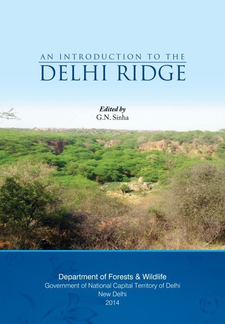
An Introduction to the<br />
<strong>Delhi</strong> <strong>Ridge</strong><br />
<strong>Ed</strong>ited by<br />
G.N. <strong>Sinha</strong><br />
Department of Forests & Wildlife<br />
Government of National Capital Territory of <strong>Delhi</strong><br />
New <strong>Delhi</strong><br />
<strong>2014</strong>
An Introduction to the <strong>Delhi</strong> <strong>Ridge</strong><br />
©<strong>2014</strong>, Department of Forests & Wildlife<br />
First published <strong>2014</strong><br />
Citation:<br />
<strong>Sinha</strong>, G.N. (<strong>Ed</strong>.) (<strong>2014</strong>). An Introduction to the <strong>Delhi</strong> <strong>Ridge</strong>. Department of Forests & Wildlife,<br />
Govt. of NCT of <strong>Delhi</strong>, New <strong>Delhi</strong>. xxiv+154 pp.<br />
Citation of Chapter (e.g.):<br />
Shukla, A.K., Basu, Arnab., Singh, Nitisha. (<strong>2014</strong>). Flora and Fauna of <strong>Delhi</strong> <strong>Ridge</strong>. In:<br />
<strong>Sinha</strong>, G.N. (<strong>Ed</strong>.), An Introduction to the <strong>Delhi</strong> <strong>Ridge</strong>. Department of Forests and Wildlife,<br />
Govt. of NCT of <strong>Delhi</strong>, New <strong>Delhi</strong>, pp. 97-104.<br />
All rights reserved. No part of this publication may be reproduced, stored in a<br />
retrieval system or transmitted in any form or by any means, electronic, mechanical,<br />
photocopying, recording or otherwise, without the prior written consent of the<br />
copyright owners.<br />
The information contained in this book is intended only to educate and spread awareness<br />
about the necessity to protect the <strong>Delhi</strong> <strong>Ridge</strong>. The editor, authors & publisher shall<br />
have no liability to any person or entity regarding any loss or damage incurred, or<br />
alleged to have incurred, directly or indirectly, by the information contained in this<br />
book.<br />
Published by<br />
Department of Forests & Wildlife<br />
Government of NCT of <strong>Delhi</strong><br />
A-Block, 2 nd Floor, Vikas Bhawan, I.P. Estate<br />
New <strong>Delhi</strong> – 110002<br />
Telefax: 011-23378513
EDITOR<br />
G.N. <strong>Sinha</strong>, IFS<br />
Additional Principal Chief Conservator of Forests<br />
& Head, Department of Forests & Wildlife,<br />
Govt. of NCT of <strong>Delhi</strong><br />
ADVISORY TEAM<br />
A.K. Shukla, IFS, CCF & CWLW<br />
Dr. Suneesh Buxy, IFS, CF<br />
Tarun Johri, IFS, DCF (Headquarters)<br />
AUTHORS<br />
G.N. <strong>Sinha</strong>, IFS, APCCF<br />
Prologue<br />
Varsha, Project Associate (<strong>Ridge</strong>) The <strong>Delhi</strong> <strong>Ridge</strong><br />
Srishti Solanki, Project Associate (Land) Evolution of Statutory and Management<br />
Framework<br />
Nitisha Singh, Project Associate<br />
(Forestry)<br />
Arnab Basu, Project Associate (Wildlife)<br />
A.K. Shukla, IFS, CCF, Arnab Basu,<br />
Project Associate (Wildlife), Nitisha<br />
Singh, Project Associate (Forestry)<br />
Bhavna Sharma, Project Associate<br />
(<strong>Ridge</strong>)<br />
A.K. Shukla, IFS, CCF<br />
Conservation of <strong>Delhi</strong> <strong>Ridge</strong> Forest<br />
Asola Bhatti Wildlife Sanctuary<br />
Flora and Fauna of <strong>Delhi</strong> <strong>Ridge</strong><br />
Technological Intervention for Protection<br />
of <strong>Delhi</strong> <strong>Ridge</strong><br />
Epilogue<br />
DESIGNED & PRINTED BY<br />
M/s Bishen Singh Mahendra Pal Singh<br />
23-A, New Connaught Place, Dehradun, India<br />
PUBLISHED BY<br />
Department of Forests & Wildlife<br />
Government of NCT of <strong>Delhi</strong><br />
A-Block, 2 nd Floor, Vikas Bhawan, I.P. Estate<br />
New <strong>Delhi</strong> – 110002<br />
Telefax: 011-23378513<br />
E-mail: apccfgnctd@gmail.com
| ... ||<br />
| ||<br />
-Rig Veda, <strong>Book</strong> 10 Hymn 146
Goddess of wild and forest who seemest to vanish from the sight.<br />
How is it that thou seekest not the village Art thou not afraid<br />
…..Now have I praised the Forest Queen, sweet-scented, redolent of balm,<br />
The Mother of all sylvan things, who tills not but hath stores of food.<br />
-Rig Veda, <strong>Book</strong> 10 Hymn 146, tr. By Ralph T.H. Griffith [1896]
Prologue<br />
The importance of the <strong>Ridge</strong> for the ecological security of the capital city of<br />
<strong>Delhi</strong> can hardly be overemphasized. There are records that the <strong>Ridge</strong> was<br />
accorded some degree of protection during the later period of the Mughal<br />
rule in India. The British India’s Gazetteer of <strong>Delhi</strong> 1883-84 records the<br />
presence of a vast faunal diversity in <strong>Delhi</strong>. The British Indian Government<br />
had also put in place robust statutory framework by way of notifications in<br />
1913, declaring an area of 796.25 ha in 8 villages of <strong>Delhi</strong> as a Reserved<br />
Forest under the provisions of Indian Forest Act, 1878. Later on, some more<br />
notifications were issued which provided protection to the <strong>Ridge</strong> in <strong>Delhi</strong>.<br />
Serious initiatives to protect the <strong>Ridge</strong> started in the mid-1980s by a couple<br />
of Non-Governmental Organizations under the banner of Joint NGO<br />
Forum to Save the <strong>Delhi</strong> <strong>Ridge</strong> Forest, with prominent NGOs like WWF-<br />
India, Kalpvriksha, Srishti, People’s Commission on the Environment and<br />
Development of India, Conservation Society of <strong>Delhi</strong>, Drag and Kare. In the<br />
aftermath of spirited action by the NGOs and intervention by Prime Minister<br />
Indira Gandhi, a roadmap for protection of the <strong>Ridge</strong> started unfolding. This<br />
led to the Government of <strong>Delhi</strong> appointing a Committee to recommend the<br />
pattern of management of the <strong>Delhi</strong> <strong>Ridge</strong> under the Chairmanship of Mr.<br />
Lovraj Kumar. The Lovraj Committee submitted its report in 1993, which<br />
was welcomed by the members of Joint NGO Forum to Save the <strong>Delhi</strong> <strong>Ridge</strong><br />
Forest.<br />
The Supreme Court further directed the <strong>Delhi</strong> Government to issue the<br />
process for constitution of Reserved Forests of the area under the <strong>Ridge</strong>.<br />
As a result, the Government issued two notifications, one in 1994 and the<br />
other in 1996. These notifications were issued without a prior assessment<br />
of the availability of the <strong>Ridge</strong> land free from encumbrances. The <strong>Delhi</strong><br />
Government also appointed Forest Settlement Officers to conduct the<br />
proceedings of constitution of Reserved Forests as per the provisions of the<br />
Indian Forest Act, 1927.<br />
The imperatives of protecting the <strong>Ridge</strong> were further amplified by the<br />
Supreme Court of India in Writ Petition No. 4677/1985 in the matter of
viii<br />
An Introduction to the <strong>Delhi</strong> <strong>Ridge</strong><br />
M.C. Mehta vs. Union of India and others. The Supreme Court also cajoled the<br />
<strong>Delhi</strong> Government to constitute a <strong>Ridge</strong> Management Board for protection<br />
of the <strong>Delhi</strong> <strong>Ridge</strong> through their orders on 1 st September 1995 in the M.C.<br />
Mehta case. The M.C. Mehta case directions led to the constitution of the<br />
<strong>Ridge</strong> Management Board on 6 th October 1995 under the Chairmanship of<br />
the Chief Secretary with Head of the Forest Department of <strong>Delhi</strong> Government<br />
as its Member Secretary. This Board had members from Government and<br />
NGOs. The <strong>Ridge</strong> Management Board, on its own volition, took a series of<br />
measures not only to carry out the directions of the Supreme Court, but also<br />
for the protection of the <strong>Ridge</strong>.<br />
There is a possibility that the <strong>Ridge</strong> was at one time continuous, but due<br />
to developmental expansion of the city and anthropogenic pressures, the<br />
continuity of the <strong>Ridge</strong> got wiped out intermittently. Today, it comprises of<br />
the Northern <strong>Ridge</strong>, Central <strong>Ridge</strong>, South-Central Ride and Southern <strong>Ridge</strong>.<br />
The rights of the claimants could not be settled in their entirety. Due to recent<br />
interventions by the National Green Tribunal, Forest Settlement Officers<br />
have expedited the process of settlement of the rights of the claimants, and<br />
it is hoped that the entire process of constitution of Reserved Forests will be<br />
completed soon.<br />
I joined the Government of <strong>Delhi</strong> in February 2012, without a formal taking<br />
over of charge. This was because my predecessor in the Department had<br />
retired three months prior to my arrival. I was, therefore, deprived of the<br />
briefings about the ongoing works in the Department. The records and works<br />
in this Department were scattered in various places, and there was nobody<br />
to apprise me of the availability of basic documents of the Department. This<br />
was coupled with a big fire which broke out in the Department on 20 th<br />
April 2012 bringing to ashes all furniture, fixtures and records. This further<br />
brought down the departmental memory, which was already negligible, to<br />
ground zero.<br />
For better management of the <strong>Delhi</strong> <strong>Ridge</strong>, as also to attend to various<br />
Court’s interventions, I thought it desirable to first put together all the<br />
previous minutes of the <strong>Ridge</strong> Management Board, so that a consistent view<br />
may be taken for protection and conservation of <strong>Ridge</strong>. These minutes were
Prologue ix<br />
also required by the <strong>Ridge</strong> Management Board in its normal transactions<br />
of business. I, therefore, started collecting previous minutes of the <strong>Ridge</strong><br />
Management Board from countless files.<br />
Ms. Varsha, Project Associate (<strong>Ridge</strong>) under the <strong>Ridge</strong> Management Board,<br />
Mr. Rohit Kumar, Data Entry Operator and my support staff assisted me<br />
in the task of compilation of previous <strong>Ridge</strong> Management Board minutes.<br />
While looking for the minutes of the previous Board meetings in files which<br />
were spread in the Department, I came across a wealth of information not<br />
only about the <strong>Ridge</strong> matters, but also about the Department as a whole<br />
lying buried in files gathering dust. It struck me that the information buried<br />
in files may be of use to interested persons. The idea to bring out this book<br />
was born at that time. But executing this plan alone was a difficult task for<br />
me, due to my cumbersome and at times distressing and annoying nature of<br />
duty under the <strong>Delhi</strong> Government compared to my previous assignments.<br />
There was, however, a silver lining to the cloud. And this was the presence<br />
of five Project Associates under the <strong>Ridge</strong> Management Board engaged by<br />
me after a fair and competitive written test and interview. I, therefore,<br />
decided to entrust the responsibility of preparation of the manuscript into<br />
the competent hands of Ms. Varsha, Project Associate (<strong>Ridge</strong>), Ms. Srishti<br />
Solanki, Project Associate (Land Management), Ms. Nitisha Singh, Project<br />
Associate (Forestry), Mr. Arnab Basu, Project Associate (Wildlife) and Ms.<br />
Bhavna Sharma, Project Associate (<strong>Ridge</strong>) under my direct supervision. The<br />
Epilogue has been very ably written by my colleague Mr. A.K. Shukla, Chief<br />
Conservator of Forests & Chief Wildlife Warden in the Department. He was<br />
eminently suited for this, as he has distinction of organizing the work of<br />
the Department during 2000-2003. The manuscript was also reviewed by a<br />
team of officers comprising of Mr. A.K. Shukla, CCF, Dr. Suneesh Buxy, CF<br />
and Mr. Tarun Johri, DCF (HQ).<br />
Much of my service career was spent in Arunachal Pradesh before coming<br />
to <strong>Delhi</strong>, except for 4 years spent at the Indira Gandhi National Forest<br />
Academy, Dehradun from 1993-1997 as a faculty member. Due to my being<br />
a member of Indian Forest Service for three decades, I developed an interest<br />
in exploring the history of British India’s forestry and the evolution of forest
x<br />
An Introduction to the <strong>Delhi</strong> <strong>Ridge</strong><br />
laws prior to independence. This passion still continues. I liberally spread<br />
my ideas in these areas among my colleagues. As a result, much of the text<br />
of this book will show influence of my findings on the subject.<br />
This book positions the <strong>Delhi</strong> <strong>Ridge</strong> in the broader context of the evolution<br />
of statutory framework and management interventions for conservation of<br />
natural resources initiated during the British regime, and traces the same<br />
afterwards. I have planned it deliberately. This is because I wanted the story<br />
of conservation to reach the hands of school students who are spread in more<br />
than 2000 Eco-clubs being supported by the Department of Environment<br />
and Forests, Government of NCT of <strong>Delhi</strong>. Therefore, a small book on the<br />
<strong>Delhi</strong> <strong>Ridge</strong> with a background of conservation initiated in Colonial times<br />
was found appropriate for school students for easy and fast dissemination of<br />
the story of forest conservation in context of the <strong>Delhi</strong> <strong>Ridge</strong>. I would now<br />
like to state the rationale of how the chapters have been divided.<br />
Chapter 1 introduces the subject of the <strong>Delhi</strong> <strong>Ridge</strong> from its ancient past and<br />
traverses the journey of its protection passing through the Mughal era, the<br />
British India and culminating in the constitution of the <strong>Ridge</strong> Management<br />
Board and their interventions in protection of the <strong>Ridge</strong>. It touches upon the<br />
meaning of the <strong>Delhi</strong> <strong>Ridge</strong> as per the stand taken by the Department in the<br />
Supreme Court in the case of DDA vs. Kenneth Builders Pvt. Ltd. in the SLP<br />
(Civil) No. 35374 of 2010. The <strong>Delhi</strong> Government treats the morphological<br />
<strong>Ridge</strong> as per Geological Survey of India Map, Gair Mumkin Pahar as per revenue<br />
records, area notified as forest and area included in the Regional Park under<br />
Master Plan of <strong>Delhi</strong>-2001 to be covered under the description of <strong>Delhi</strong><br />
<strong>Ridge</strong>. This chapter brings out recognition of the morphological <strong>Ridge</strong> in<br />
the category of <strong>Ridge</strong> as ruled by <strong>Delhi</strong> High Court in Ashok Tanwar vs.<br />
Union of India Writ Petition (Civil) 3339/2011 and CM No. 12417/2011<br />
and further earmarking of 5% of the project cost of developmental project<br />
to <strong>Ridge</strong> Management Board as ruled in the case of National Highway<br />
Authority of India in the matter of T.N. Godavarman vs. Union of India and<br />
others. The chapter highlights role of the Central Empowered Committee<br />
(CEC) which acts as an adjunct to the Supreme Court. Therefore, clearance<br />
from the <strong>Ridge</strong> Management Board or the Supreme Court through the<br />
Central Empowered Committee is to be obtained before carrying out any
Prologue xi<br />
construction. Such permission is a pre-requisite in view of directions of the<br />
Supreme Court.<br />
Chapter 2 traces the evolution of a statutory and management framework<br />
which influenced protection of the <strong>Delhi</strong> <strong>Ridge</strong> from the early part of the<br />
British rule in India. It mentions all the statutes issued from 1913 onwards<br />
which were vital to the <strong>Ridge</strong> protection. There are multiplicities of agencies<br />
which own the <strong>Ridge</strong> areas, and are also responsible for their protection.<br />
In addition to these, there are a number of agencies which have been<br />
permitted to continue their activities in the <strong>Ridge</strong> land. All these facets find<br />
mention. This chapter also illustrates progressive increase in green cover<br />
in the capital city, and touches upon the endeavors of the Department in<br />
sustaining growth in green cover through its various afforestation drives.<br />
The Department has also completed the second phase of a 8-year project on<br />
Conservation <strong>Ed</strong>ucation Centre in Asola Bhatti Wildlife Sanctuary through<br />
the Bombay Natural History Society (BNHS). The Department has embarked<br />
upon the third phase of the Conservation <strong>Ed</strong>ucation Centre initiated in Asola<br />
Bhatti Wildlife Sanctuary in 2013 for 5 years. The plans and strategies in<br />
respect to the Conservation <strong>Ed</strong>ucation Centre find mention in this chapter.<br />
Chapter 3 puts the <strong>Delhi</strong> <strong>Ridge</strong> in the centre of the forest conservation<br />
initiative of the Department. A detailed statement on the core forestry<br />
principles, and ecological significance of the <strong>Delhi</strong> <strong>Ridge</strong> find mention in this<br />
chapter. Snapshots of management strategies conceived by the Department<br />
for conservation of the <strong>Ridge</strong> forests are highlighted. This chapter highlights<br />
concrete steps taken by the Department in consolidation and protection of<br />
the <strong>Delhi</strong> <strong>Ridge</strong>, following interventions by the National Green Tribunal.<br />
It also highlights the lone Clean Development Mechanism (CDM) project<br />
initiated by the Department in Dera Mandi in 2008.<br />
Chapter 4 highlights the historical background and present state of the Asola<br />
Bhatti Wildlife Sanctuary. It then discusses the initiative of the Department<br />
in deploying 132 Battalion of Eco Task Force for eco-rehabilitation of about<br />
2100 acres of Bhatti mines, about 1400 acres of Dera Mandi and about 1500<br />
acres of Asola. Noticeable improvements achieved in eco-restoration of the<br />
habitat find proud mention in the achievements of the 132 Eco Task Force.
xii<br />
An Introduction to the <strong>Delhi</strong> <strong>Ridge</strong><br />
This chapter touches upon the work done for improvement of habitat for<br />
wildlife in the sanctuary under the State Compensatory Afforestation Fund<br />
Management & Planning Authority (State CAMPA). The chapter also deals<br />
with relocation of monkeys to the sanctuary following directions of the<br />
<strong>Delhi</strong> High Court in 2007, and concludes with a statement of the activities<br />
of the wildlife enforcement wing, touching upon issues like importance<br />
of spread of conservation awareness and initiative of <strong>Delhi</strong> Government in<br />
declaring an Eco Sensitive Zone around the sanctuary.<br />
Chapter 5 deals with flora and fauna of the <strong>Delhi</strong> <strong>Ridge</strong> which is unique and<br />
displays characteristics of ecological changes due to being part of a transition<br />
zone of two contrasting ecosystems. This transition zone is significant due to<br />
confluence of semi-arid and arid desert of the west and the fertile Gangetic<br />
plains of the east. Therefore, the <strong>Delhi</strong> <strong>Ridge</strong> possesses flora and fauna of<br />
both these biogeographic zones.<br />
Chapter 6 deals with the impact of technology on improvement in<br />
management of the <strong>Delhi</strong> <strong>Ridge</strong> and its protection. The Department initiated<br />
the work of geo-referencing of forest areas in 21 villages of the Southern<br />
<strong>Ridge</strong> through a Special Task Force (STF) in February 2012.<br />
This was following the order dated 06.07.2011 by the Supreme Court of<br />
India in IA No. 1868 of 2007 in W.P. (Civil) No. 202 of 1995 asking the<br />
State/ UT Government to identify forest areas, irrespective of whether they<br />
are notified, recognized or classified under any law, and irrespective of<br />
the land of such forests and the areas which were earlier forests but stand<br />
degraded, denuded and cleared, shall be culminated in preparation of georeferenced<br />
district forest maps containing the details of the location and<br />
boundary of each plot of land that may be defined as forest for the purpose<br />
of Forest (Conservation) Act, 1980.<br />
The STF comprised of Forest and Revenue officials. The STF was charged<br />
with the responsibility of geo-referencing forest boundary in 21 villages<br />
of the Southern <strong>Ridge</strong>. The STF had to take into account the masavis of<br />
these villages dating back to between 2008 and 2012, and also collected<br />
basic revenue records like field books, khasra, girdwari, khatuani, jamabandi, sizra
Prologue xiii<br />
and all the notifications relating to constitution of Reserved Forests and the<br />
Asola Bhatti Wildlife Sanctuary. The STF was supported with Total Station<br />
Method of survey in their attempt to geo-reference the forest boundaries of<br />
the <strong>Ridge</strong> area.<br />
The Nodal Officer of the STF was Conservator of Forests who, with the<br />
help of Revenue and Forest officials and STM service providers, developed<br />
a unique methodology for geo-referencing the forest boundary of the<br />
Southern <strong>Ridge</strong>. This is an inspiring story initiated and completed during<br />
my time. I will soon be demitting my office under the <strong>Delhi</strong> Government<br />
consequent to my promotion to the level of Principal Chief Conservator of<br />
Forests. But I wish that the story of development of methodology of georeferencing<br />
of forest boundary in the Southern <strong>Ridge</strong> be recorded and told<br />
some day for posterity.<br />
The Department has completed preparation of geo-referenced maps for<br />
21 villages, and 15 such maps have been validated by the <strong>Delhi</strong> Geospatial<br />
Ltd. (GSDL), a public undertaking under the <strong>Delhi</strong> Government. These georeferenced<br />
maps of 15 villages have also been uploaded on the website of<br />
the Forest Department. Remaining geo-referenced maps of 7 villages in<br />
Southern <strong>Ridge</strong> will be uploaded on the website of the Forest Department<br />
after their validation by the GSDL. The geo-referenced data will help in<br />
detection of encroachment and their removal. This Department has already<br />
started work of identification of encroachment and has initiated steps for<br />
their removal.<br />
This chapter highlights the efforts of the Department in formulating a<br />
proposal of ground-truthing the geo-referenced data as well as to develop<br />
a <strong>Ridge</strong> Protection Management System. After the ground-truthing is<br />
completed, the Department contemplates to erect munara/ boundary pillars<br />
around the <strong>Ridge</strong> forest areas.<br />
The Department is also in the process of tweaking the design of the boundary<br />
wall around the <strong>Ridge</strong> area, as the boundary wall in some areas appears<br />
quite monolithic, and as a result acts as an obstruction to the movement of<br />
small animals, besides obstructing vision of passersby. It is expected that
xiv<br />
An Introduction to the <strong>Delhi</strong> <strong>Ridge</strong><br />
improved design of the boundary wall will make the <strong>Ridge</strong> forest friendlier<br />
to the smaller animals, and at the same time people may also enjoy the sight<br />
of the greens in the heart of the capital city.<br />
The last chapter, under the title Epilogue, traces the trajectory of the <strong>Delhi</strong><br />
<strong>Ridge</strong> and highlights problems of its protection and management. It<br />
mentions the initiative of the Department in using the Total Station Method<br />
of survey of the Southern <strong>Ridge</strong> for geo-referencing their forest boundary,<br />
and the achievements of the Eco Task Force in eco-rehabilitation. This<br />
chapter concludes with a roadmap for the <strong>Delhi</strong> <strong>Ridge</strong> on the principles<br />
of conservancy, initiated and perfected in India in the late 19 th century. It<br />
also deals with the contribution of the NGOs for protecting the <strong>Ridge</strong> on<br />
the principles of conservancy, instead of developing it as parks and gardens<br />
for the city dwellers. The role of the Conservation <strong>Ed</strong>ucation Centre, a joint<br />
venture of BNHS and the Department of Forests & Wildlife towards imparting<br />
in situ environmental education to the citizens of <strong>Delhi</strong> finds special mention.<br />
I have benefitted much from the records left by Mr. Tarun Coomar and<br />
Mr. D.C. Khanduri, both former DCFs in the <strong>Delhi</strong> Government and their<br />
notable contributions in establishing the Department as well as organizing<br />
the activities under the umbrella of the <strong>Ridge</strong> Management Board.<br />
I would like to record my thanks to Mr. S.K. Srivastava, Chief Secretary<br />
and Chairman, <strong>Ridge</strong> Management Board, Mr. Sanjiv Kumar, Secretary<br />
(Environment & Forests) and other members of the Board for their words<br />
of encouragement to the works of the Department. I have great appreciation<br />
for Ms. Sunita Narain, Member, RMB, for her keen interest in initiating steps<br />
for consolidation and protection of the <strong>Ridge</strong>. My special thanks go to Mr.<br />
Tarun Johri, DCF (HQ) for going through the entire manuscript and for<br />
offering intelligent remarks for its improvement.<br />
I also take this opportunity to extend my thanks to my colleagues in the<br />
Department namely, Dr. Suneesh Buxy, CF, Mr. Nisheeth Saxena, DCF<br />
(South), Mr. Prashant Rajagopal, DCF (West) and Dr. R. Gopinath, DCF<br />
(Protection and Monitoring). I also thank countless authors and NGOs<br />
whose works have been quoted in this book. My special thanks go to the
Prologue xv<br />
individuals and NGOs who initiated steps for protection of the <strong>Delhi</strong> <strong>Ridge</strong><br />
in the early 1990s. I thank senior officers of the Irrigation and Flood Control<br />
Department (I & FCD) for the Total Station Method (TSM) survey conducted<br />
for geo-referencing of the forest areas in <strong>Delhi</strong>. I also express gratitude to<br />
Geo-Spatial <strong>Delhi</strong> Limited (GSDL) for providing geo-spatial support to the<br />
work done by the Special Task Force (STF) of this Department, responsible<br />
for geo-referencing of forest boundaries in <strong>Delhi</strong>.<br />
I thank Col. Pradeep Sandhir, 132, ETF for providing necessary information<br />
required in preparation of this book. I am especially grateful to Mr. Ravi<br />
Agarwal, Director, Toxic Link and former member of the <strong>Ridge</strong> Management<br />
Board for going through the manuscript of this book and for offering<br />
critical and useful comments for its further refinement. <strong>Ed</strong>itorial suggestions<br />
provided by Dr. (Ms.) Nima Manjrekar and printing of the book by Bishen<br />
Singh Mahendra Pal Singh, Dehradun are gratefully acknowledged.<br />
And finally, I have no words of praise for the above named five Project<br />
Associates and Mr. A.K. Shukla, CCF who toiled with me over the last six<br />
weeks, which has borne fruit in the form of this book. I commend their<br />
efforts and this book is theirs.<br />
Finally, those associated with the preparation of the manuscript are not full<br />
time authors. The entire writing has been done under my overall supervision.<br />
It is possible that some errors might have crept in the book. I own them all<br />
up and would request the readers to enlighten us about the same for further<br />
improvement of the book.<br />
Date: 28 April <strong>2014</strong><br />
Place: New <strong>Delhi</strong><br />
G.N. <strong>Sinha</strong><br />
APCCF and Head,<br />
Forests and Wildlife Department and<br />
Member Secretary, RMB<br />
Email: gnsinhauk@yahoo.co.uk
Authors’ Note<br />
The “Introduction to the <strong>Delhi</strong> <strong>Ridge</strong>” wasn’t the book which we had<br />
set out to write, neither was it the book we had planned. A major part of<br />
<strong>Delhi</strong>’s forests deal with the <strong>Ridge</strong>. For daily administration work we always<br />
resorted to records maintained by the Forest Department. The search for a<br />
particular query from the enormous amount of information was a hectic<br />
task everyday. So a need was felt for the consolidation of matters related to<br />
the <strong>Ridge</strong> – its administration, legal as well as ecological aspects.<br />
Thus it was thought to compile various documents that will help as reference<br />
for daily administrative work, making the process less tedious. Through<br />
this process we came across a wealth of information concerning the <strong>Ridge</strong>,<br />
which we thought should be made available in the public domain as our<br />
responsibility towards the citizens of <strong>Delhi</strong>. As we indulged in this process,<br />
an idea fell upon us all of a sudden creating a ‘eureka’ moment. It was as<br />
if on the spur of the moment that idea for transforming the compilation of<br />
records into a book was declared, and everyone agreed to it without any<br />
hesitation. Now came the task of giving this ‘enthusiastically-thought’ book,<br />
a definite shape. But executing this task was a difficult one.<br />
Individual responsibilities were assigned to respective associates of the<br />
Department under the guidance of their supervisors. The daily quest gave<br />
birth to new curiosities, and encouragement was provided at every step to<br />
view all matters with liberty of thought. Questions were asked not only to<br />
others but also to one’s ownself which rarely led to answers, but more often<br />
to other questions, making us dig deeper and deeper on our quest. It would<br />
be right to say, that the process gave us greater insights to our <strong>Ridge</strong> – we<br />
surfaced upon various aspects which were hidden from our view so far.<br />
That's how things became clear. All of a sudden, but driven by a persistent<br />
need. And then we realized how obvious they've been all along. It would<br />
be worthwhile to mention that during the preparation of the manuscript<br />
for this book under the guidance of our esteemed seniors, we experienced<br />
a great feeling of camaraderie amongst us, the authors, which we shall<br />
treasure for years to come. It would not be an overstatement, if we say that
xviii<br />
An Introduction to the <strong>Delhi</strong> <strong>Ridge</strong><br />
the experience we gained from this is only because of the blessings of our<br />
supervisors and the trust they put into us.<br />
This book is written to be used as a road map and portable tool for lovers of<br />
the environment; it requires no special knowledge, mental abilities or prior<br />
training beyond basic curiosity and intuitiveness. This book will take you<br />
on an unfolding journey of how our <strong>Delhi</strong>’s pride – the <strong>Ridge</strong> – was born,<br />
how it was nourished, how it is taken care of and how it will grow in future<br />
to become a jewel in the heart of India. As is said that one has to set the<br />
chess board much earlier, we hope that this book may be a small step, but<br />
it will lead the posterity to better understand our <strong>Ridge</strong> and be motivated to<br />
conserve it.<br />
Although persons mentioned in this book are few, it would not have taken<br />
its present shape without the help of many. This book belongs as much<br />
to them as to us, the authors. First and foremost we are indebted to Mr.<br />
G.N. <strong>Sinha</strong>, APCCF & Head, for entrusting us and giving us this golden<br />
opportunity. We would also like to thank him for introducing us to various<br />
aspects of historical knowledge pertaining to the <strong>Ridge</strong> forest land and laws<br />
governing it. It helped us in shaping many of our ideas. The research and<br />
writing of this book was aided by Mr. A.K. Shukla, CCF & CWLW, giving<br />
his objective analysis on various aspects of forestry and wildlife. It is his<br />
humble nature that inspite of such a busy schedule, he was always there<br />
to guide us whenever we approached him for help. We would also like to<br />
record our thanks to Dr. Suneesh Buxy, CF for enriching us with aspects of<br />
modern technology that could be used for the conservation of the <strong>Ridge</strong>. We<br />
owe a special debt to Mr. Tarun Johri, DCF (HQ) for giving his generous<br />
comments and criticism. He was there to patiently read our manuscript and<br />
made many valuable suggestions for which we are grateful. We take this<br />
opportunity to thank Dr. R. Gopinath (P & M), Mr. Nisheeth Saxena, DCF<br />
(South) and Mr. Prashant Rajagopal, DCF (West) for providing all necessary<br />
information and guiding us throughout the endeavor and standing by us<br />
through thick and thin. Their encouraging words always acted as a boost to<br />
lift up the working environment. Without the guidance and persistent help<br />
of our supervisors, this book would not have been possible.
Authors’ note xix<br />
We appreciate help from Mr. Paramvir Singh, Wildlife Inspector, who<br />
provided details on wildlife issues and previous records, as well as for his<br />
subjective analysis. We also extend our thanks to departmental record keepers<br />
for providing us previous records, without which the various subjects could<br />
not be dealt upon precisely. Special thanks to Mr. Rohit Kumar for providing<br />
help in segregating the records and typing of notifications. Lastly, we would<br />
also like to thank our office staff namely Mr. Rajender Singh, Mr. Bharat<br />
Singh, Mr. Gangacharan and Mr. Sahindar Pal for retrieval of old files and<br />
photocopying of necessary documents.<br />
We all like to thank our families for their patience, love and support that<br />
helped in completing this project. Their contribution has been extensive and<br />
acted as a pillar of strength through the entire journey.<br />
Ms. Varsha<br />
Ms. Srishti Solanki<br />
Ms. Nitisha Singh<br />
Mr. Arnab Basu<br />
Ms. Bhavna Sharma<br />
Project Associates, RMB
Table of Contents<br />
Topic<br />
Page No.<br />
Prologue<br />
vii<br />
Authors’ note<br />
xvii<br />
Chapter 1: The <strong>Delhi</strong> <strong>Ridge</strong><br />
1.1 HISTORICAL SIGNIFICANCE OF THE RIDGE 1<br />
1.2 GENESIS OF MANAGEMENT OF RIDGE 3<br />
1.2.1 <strong>Ridge</strong> management during British period 3<br />
1.2.2 <strong>Ridge</strong> management after independence 5<br />
1.3 THE LOVRAJ COMMITTEE 7<br />
1.4 JUDICIAL INTERVENTION TO PROTECT INTEGRITY OF 11<br />
RIDGE<br />
1.4.1 Provisions contained in MPD 2001 11<br />
1.4.2 Provisions contained in MPD 2021 12<br />
1.4.3 Supreme Court orders 13<br />
1.4.4 Position taken by the Department of Environment & 14<br />
Forests, NCT of <strong>Delhi</strong><br />
1.4.5 Legal protection to morphological <strong>Ridge</strong> 15<br />
1.4.6 User agency to contribute to compensatory<br />
15<br />
afforestation<br />
1.5 CENTRAL EMPOWERED COMMITTEE 16<br />
1.6 BIRTH OF RIDGE MANAGEMENT BOARD 17<br />
1.7 CHANGING STRUCTURE OF RIDGE MANAGEMENT 19<br />
BOARD<br />
1.8 MAIN DECISIONS OF RIDGE MANAGEMENT BOARD 19<br />
1.8.1 Decisions of the <strong>Ridge</strong> Management Board till 2012 19<br />
1.8.2 Decisions of the RMB after its re-constitution in 21<br />
2013<br />
1.9 STATUS OF RIDGE MANAGEMENT BOARD 26<br />
Chapter 2: Evolution of statutory and management framework<br />
2.1 A BRIEF RECAP OF LAW AND POLICY ON FORESTS 29<br />
2.2 THE INDIAN FOREST ACT, 1927 31<br />
2.3 STATUTORY INSTRUMENTS ON FORESTS 32<br />
2.4 RIDGE AS A NATURAL FEATURE 35<br />
2.4.1 Geology of the <strong>Ridge</strong> 35<br />
2.4.2 Morphological <strong>Ridge</strong> 37
xxii<br />
An Introduction to the <strong>Delhi</strong> <strong>Ridge</strong><br />
2.4.3 <strong>Ridge</strong> management by various agencies 37<br />
2.5 GREEN COVER STATISTICS OF DELHI 40<br />
2.5.1 Forest and tree cover in <strong>Delhi</strong> 42<br />
2.5.2 District-wise green cover 43<br />
2.6 REGIONAL PARK/ RECREATIONAL FORESTRY 43<br />
2.7 CONSERVATION EDUCATION CENTRE (CEC) 44<br />
2.7.1 Major activities conducted by CEC, BNHS 45<br />
Chapter 3: Conservation of <strong>Delhi</strong> <strong>Ridge</strong> forests<br />
3.1 FOREST CONSERVANCY PRINCIPLES IN BRITISH ERA 48<br />
3.2 ADVENT OF FORESTRY PRINCIPLES IN INDIA 50<br />
3.3 PROVISION IN CONSTITUTION OF INDIA FOR 52<br />
ENVIRONMENTAL PROTECTION<br />
3.4 CONSERVATION INITIATIVES AFTER INDEPENDENCE 53<br />
3.5 ECOLOGICAL IMPORTANCE OF DELHI RIDGE 55<br />
3.6 ECOLOGY OF DELHI 56<br />
3.6.1 Climate 56<br />
3.6.2 Rainfall 57<br />
3.6.3 Relative humidity 57<br />
3.6.4 Wind 57<br />
3.6.5 Soils 58<br />
3.7 Prosopis juliflora 58<br />
3.8 MANAGEMENT OF RIDGE - STRATEGIES 61<br />
3.8.1 Protection of forest area 62<br />
3.8.2 Urban plantation 62<br />
3.8.3 Proper development of nursery 64<br />
3.8.4 Soil and moisture conservation works 64<br />
3.8.5 Protection and improvement of vegetation cover 65<br />
3.8.5.1 Transplantation of trees 65<br />
3.8.5.2 Replacement of old/over mature trees 66<br />
3.8.5.3 Removal of tiling/black topping and embedded tree 66<br />
guards around trees<br />
3.8.5.4 Compensatory afforestation 67<br />
3.8.6 Herbal gardens 67<br />
3.8.7 Rejuvenation of degraded areas 67<br />
3.9 NATIONAL GREEN TRIBUNAL ACT, 2010 – FOUNDATION<br />
STONE TO GREEN LAW<br />
68
An Introduction to the <strong>Delhi</strong> <strong>Ridge</strong> xxiii<br />
3.9.1 Concrete steps of NGT in <strong>Delhi</strong> 70<br />
3.10 GREENING ACTION PLAN – DELHI 71<br />
3.10.1 Objectives 72<br />
3.10.2 Awareness activities 73<br />
3.10.3 Targets and achievements 73<br />
3.11 CDM PROJECT – DEPARTMENT OF FORESTS & WILDLIFE 74<br />
3.12 CONCLUDING REMARKS 75<br />
Chapter 4: Asola Bhatti Wildlife Sanctuary<br />
4.1 HISTORY 78<br />
4.2 LOCATION 78<br />
4.3 ECOLOGICAL SIGNIFICANCE 79<br />
4.4 FLORA AND FAUNA 80<br />
4.5 MONKEY MENACE 81<br />
4.6 ECO-RESTORATION THROUGH ECO TASK FORCE 82<br />
4.7 COMPENSATORY AFFORESTATION UNDER DELHI CAMPA 86<br />
4.8 RELOCATION OF COLONIES 88<br />
4.9 ILLEGAL TRADE IN WILDLIFE 90<br />
4.10 CONSERVATION AWARENESS 93<br />
4.11 ECO-SENSITIVE ZONE AROUND ASOLA BHATTI WILDLIFE 94<br />
SANCTUARY<br />
4.12 CONCLUDING REMARKS 96<br />
Chapter 5: Flora and Fauna of <strong>Delhi</strong> <strong>Ridge</strong><br />
5.1 FLORA 97<br />
5.2 FAUNA 102<br />
Chapter 6: Technological intervention for protection of <strong>Delhi</strong> <strong>Ridge</strong><br />
6.1 GEOGRAPHIC INFORMATION SYSTEM 108<br />
6.2 GIS SOFTWARE 109<br />
6.3 NEED FOR SURVEY 109<br />
6.4 SPECIAL TASK FORCE 111<br />
6.4.1 Methodology adopted 112<br />
6.5 INTERFACE WITH GSDL 115<br />
6.6 ESTABLISHMENT OF GIS CELL 115<br />
6.7 RIDGE PROTECTION MANAGEMENT SYSTEM 116<br />
6.8 CONCLUSION 118<br />
Epilogue 119
xxiv<br />
An Introduction to the <strong>Delhi</strong> <strong>Ridge</strong><br />
Annexures<br />
Annexure 1: Notification of 1913 131<br />
Annexure 2: Notification of 1915 132<br />
Annexure 3: Notification of 1942 133<br />
Annexure 4: Notification of 1944 134<br />
Annexure 5: Notification of 1958 136<br />
Annexure 6: Notification of 1965 137<br />
Annexure 7: Notification of 1980 138<br />
Annexure 8: Notification of 1986 141<br />
Annexure 9: Notification of 1991 142<br />
Annexure 10: Notification of 1994 143<br />
Annexure 11: Notification of 1996 145<br />
Annexure 12: Notification of 2006 147<br />
Annexure 13: List of indigenous species 148<br />
Annexure 14: Targets and achievements of plantation under 149<br />
Greening <strong>Delhi</strong> Action Plan 2012-13<br />
Annexure 15: Targets and achievements of plantation under 150<br />
Greening <strong>Delhi</strong> Action Plan 2013-14<br />
Bibliography 151
Chapter-1<br />
The <strong>Delhi</strong> <strong>Ridge</strong><br />
“Thus speaks the Beloved of the Gods, the king Piyadassi: when I<br />
had been consecrated for twenty-six years I forbade the killing of<br />
the following species of animals, namely: parrots, mainas, redheaded<br />
ducks, cakravaka-gees…...forests must not be burned in<br />
order to kill living things or without any good reason. An animal<br />
must not be fed with another animal.”<br />
-The 5 th pillar edict of King Asoka 1<br />
<strong>Delhi</strong> is an ancient as well as historical city of India. <strong>Delhi</strong>, which is located<br />
in a cusp formed by the tail end of the Aravalli Mountain Range which is<br />
800 km long (elevation: 1700 meters) and 1.5 billion years old (even more<br />
ancient than the young 50 million year old Himalayas), as it culminates at<br />
the river Yamuna, is the aspirational capital of over 15 million people 2 . The<br />
hilly spurs in <strong>Delhi</strong> are known as the <strong>Delhi</strong> <strong>Ridge</strong> sometimes called “The<br />
<strong>Ridge</strong>” which once occupied almost 15% of the city’s land.<br />
A <strong>Ridge</strong> is a geological aspect that features a continuous elevational crest<br />
for some distance. The <strong>Delhi</strong> <strong>Ridge</strong> is a northern extension of the old and<br />
ancient hill ranges of India called the ‘Aravalli Hill Ranges’ which extend<br />
from Gujarat through Rajasthan to Haryana–<strong>Delhi</strong>. The <strong>Delhi</strong> <strong>Ridge</strong> stretches<br />
over a distance of 35 km, from Bhatti Mines to southeast of the 700 year old<br />
Tughlaqabad, branching in different directions, and finally tapering towards<br />
the northern end near Wazirabad on the western banks of Yamuna river.<br />
1.1 HISTORICAL SIGNIFICANCE OF THE RIDGE<br />
The <strong>Ridge</strong> has played an important role in <strong>Delhi</strong>’s history, and even its<br />
prehistory. The <strong>Delhi</strong> <strong>Ridge</strong> is made of quartzite rocks, of which Stone Age<br />
tribes used to make tools. In fact, archeologists have discovered Stone Age<br />
1<br />
Divan, S. and Rosencranz, A. (2001) Environmental Law and Policy in India: Cases, Materials and<br />
Statutes, Second <strong>Ed</strong>ition, Oxford University Press, p. 25.<br />
2<br />
Agarwal, Ravi. (2010) Fight for a Forest, Seminar Magazine, September 613, available<br />
online at http://www.india-seminar.com/2010/613/613_ravi_agarwal.htm (visited<br />
10 March <strong>2014</strong>).
2 An Introduction to the <strong>Delhi</strong> <strong>Ridge</strong><br />
‘factories’ along the <strong>Delhi</strong> <strong>Ridge</strong>, evidence of the widespread production<br />
of tools. Stone Age tribes were also drawn to the dense forest cover of the<br />
<strong>Ridge</strong>, which provided food (both plant and animal) and shelter. Further,<br />
there was plentiful water, a point still relevant today.<br />
The <strong>Ridge</strong> has been the topographic feature that attracted settlers to the<br />
area for thousands of years. From the eighth-century Lal Kot fort and 12 th<br />
century Qutub Minar, to Shah Jahan’s 17 th century walled city and Lutyens’<br />
20 th century <strong>Delhi</strong>, much of the Capital’s historical architecture is found in<br />
and around the <strong>Ridge</strong>.<br />
<strong>Delhi</strong> has witnessed the rise and fall of seven cities namely Qila Rai Pithora,<br />
Lal Kot, Mehrauli, Siri, Tughlaqabad, Firojabad and the Mughal city of<br />
Shajahanabad, now known as Old <strong>Delhi</strong> which came under the sway of the<br />
British. During the medieval period, the first four of these cities were located<br />
directly on the <strong>Ridge</strong> for ecological reasons as well as the military security<br />
afforded by the hills. By the late Mughal period, the <strong>Ridge</strong> had been largely<br />
deforested because the city had moved towards the banks of the Yamuna<br />
river. However, it still served an important role as a ground water source<br />
and the grazing ground for local pastoralists 3 .<br />
In the more recent history of <strong>Delhi</strong>, the <strong>Ridge</strong> has been critical. During<br />
British period, the <strong>Ridge</strong> became exceptionally significant for a variety of<br />
reasons. The first significant event was the First War of Independence of<br />
1857, in which revolt against the British rule was witnessed. Although the<br />
whole northern India took part in the revolt against the British, the riot was<br />
intense in <strong>Delhi</strong> as the rebels rallied around the Mughal “emperor” who was<br />
under close watch of the British. The British troops stationed themselves<br />
on the northern portion of the <strong>Ridge</strong> to gain advantage of its height; after<br />
that, the <strong>Ridge</strong> got the status of sacred monument when the rebels suffered<br />
martyrdom.<br />
3<br />
Crowley, Thomas. (2011) Save the <strong>Ridge</strong>: the Fight to Preserve <strong>Delhi</strong>’s Urban Forest,<br />
available online at http://base.d-p-h.info/pt/fiches/dph/fiche-dph-8894.html (visited<br />
14 March <strong>2014</strong>).
The <strong>Delhi</strong> <strong>Ridge</strong> 3<br />
Over the years, the pressures of an increasing population, excessive resource<br />
extraction, construction of landscaped public parks, public housing, dumping<br />
of construction waste, etc. have posed a serious threat and caused shrinkage<br />
of the <strong>Ridge</strong>. Once contiguous, it is now divided into five fragmented zones<br />
namely, Northern <strong>Ridge</strong>, Central <strong>Ridge</strong>, South Central <strong>Ridge</strong>, Southern<br />
<strong>Ridge</strong> and Nanakpura South Central <strong>Ridge</strong>.<br />
<br />
The Northern <strong>Ridge</strong> (also called Old <strong>Delhi</strong>) comprises of the hilly area<br />
near <strong>Delhi</strong> University. It is approximately 87 Hectares.<br />
<br />
The Central <strong>Ridge</strong> (also called New <strong>Delhi</strong>) consists of around 864<br />
Hectares of forested area, from south of Sadar Bazaar to Dhaula Kuan,<br />
but some bits of the Central <strong>Ridge</strong> have been nibbled away.<br />
<br />
The South-Central <strong>Ridge</strong> (also called Mehrauli) consists of 626 Hectares<br />
of forested land around the Sanjay Vana area, near Jawaharlal Nehru<br />
University (JNU).<br />
<br />
The Southern <strong>Ridge</strong> (also called Tughlaqabad) consisting of 6200<br />
Hectares is the biggest area of the <strong>Delhi</strong> <strong>Ridge</strong>.<br />
<br />
The Nanakpura South Central <strong>Ridge</strong> has an area of 7 Hectares.<br />
All the 5 Zones make up for a total area of 7,784 Hectares spread over the<br />
entire city in different patches.<br />
1.2 GENESIS OF MANAGEMENT OF RIDGE<br />
<strong>Delhi</strong> is one of the most historic capitals in the world, finding mention in<br />
the ancient epic Mahabharata. Two natural features of the city – the <strong>Ridge</strong><br />
and river Yamuna, have made it a protected and favourite place for rulers<br />
over the ages. Therefore, the battle for protecting <strong>Delhi</strong>’s “Green Lungs”<br />
started long ago.<br />
In the 14 th century, the <strong>Ridge</strong> forest was covered with thorny scrubs with<br />
very little green cover. Emperor Feroze Tughlaq, who was very fond of<br />
hunting, afforested the rocky southern part of the <strong>Ridge</strong> on which Ghiyasud-Din<br />
Tughlaq built the fort city of Tughlaqabad.<br />
1.2.1 <strong>Ridge</strong> management during British period<br />
The massive afforestation of the <strong>Ridge</strong> forest was started by the British in<br />
the 19th century. The British map of 1807 shows the <strong>Ridge</strong> extending from
4 An Introduction to the <strong>Delhi</strong> <strong>Ridge</strong><br />
north to south continuously unlike the present day scattered <strong>Ridge</strong> forests.<br />
In the early 1900s, the British began restoring some of the Mughal gardens,<br />
and when their Imperial capital shifted from Calcutta (now Kolkata) to<br />
<strong>Delhi</strong>, the British focused on the development of the new city in the form<br />
of impressive buildings, wide and well-ordered roads, etc. that still get<br />
attention today.<br />
They envisioned the <strong>Ridge</strong> as an appropriately majestic backdrop to the new<br />
city and thus, the <strong>Ridge</strong> again became the focus of attention, and afforestation<br />
work began in full swing. The idea was that the new Imperial capital would be<br />
“a sea of foliage”. Various exotic species were introduced, including Prosopis<br />
juliflora, a Mexican mesquite tree now known in India as vilayati (foreign)<br />
kikar, which created extensive monocultures on the <strong>Ridge</strong>. While this greatly<br />
increased <strong>Delhi</strong>’s green cover, it was not an entirely positive development.<br />
More aspects of Prosopis juliflora will be discussed in Chapter 3.<br />
Afforestation of the <strong>Delhi</strong> <strong>Ridge</strong> by the British shows the exclusivity and<br />
colonial nature of British forestry. People living in villages near the <strong>Ridge</strong><br />
were displaced, and locals who depended on the <strong>Ridge</strong> for fuel and fodder<br />
were kept out by fences and guards. In 1913, the British rulers decided<br />
to preserve the natural wealth of the Central <strong>Ridge</strong> by protecting it under<br />
Section 4 of Act VII of the Indian Forest Act, 1878. The Chief Commissioner<br />
of <strong>Delhi</strong> declared an area of 796.25 ha. in 8 villages namely, Dasghara,<br />
Khanpur, Shadipur, Band Shikar Khatun, Alipur Pilanji, Malcha and Narhaula<br />
as Reserved Forest vide notification dated 6 th December 1913, and appointed<br />
Mr. Vincent Connolly, ICS, Additional District Magistrate, <strong>Delhi</strong>, as Forest<br />
Settlement Officer, thus placing it under more stringent British control.<br />
Then again in 1915, the Chief Commissioner of <strong>Delhi</strong> declared part of the<br />
land under Patti Chandrawal village as Reserved Forest under Section 19<br />
of Indian Forest Act VII, 1878 vide notification no. 5911-R & A, dated 7 th<br />
September 1915, placed these forests under the charge of CPWD ‘Notified<br />
Area Committee’ and declared the Secretary of the Notified Area Committee<br />
as Forest Officer under Section 2 of Act VII of 1878 vide notification no.<br />
5913-R & A, dated 7 th September 1915.
The <strong>Delhi</strong> <strong>Ridge</strong> 5<br />
But due to rapid urbanisation, pressure on the land increased, and during<br />
1920-30, a major portion of the <strong>Ridge</strong> near <strong>Delhi</strong> University was blasted<br />
to provide access to the residential colonies and business premises and the<br />
new colony of Karol Bagh. Therefore, vide notification no. F. 14(122)/41-<br />
LSG dated 16 th September 1942, which superseded and replaced Chief<br />
Commissioner's notification No. 59 11-R & A dated 7 th September 1915,<br />
part of the land under the Patti Chandrawal Mahel village was declared as<br />
Reserved Forest under Section 4 of the Indian Forest Act, 1927 and Secretary<br />
of the Civil Station Notified Area Committee was appointed as Forest Officer<br />
vide notification No. F. 14 (122)/41-L. S. G. dated 10 th April 1944. Thus, it<br />
shows that British employed a model of imperial forestry that still has some<br />
echoes in the modern environmental policy.<br />
1.2.2 <strong>Ridge</strong> management after independence<br />
After India’s Independence in 1947, <strong>Delhi</strong> exploded into the megacity it is<br />
today, and the stress on the natural resources of the city increased manifold<br />
as a series of intrusions, legal and illegal, have devoured more and more<br />
area. The <strong>Ridge</strong> became prey to rampant ‘urbanization’ and ‘development’<br />
which included construction work, road widening, quarrying, garbage<br />
dumping and encroachments, and this led to swallowing up of large chunks<br />
of the <strong>Ridge</strong> by the city.<br />
Refugees were given land in the Central and Southern <strong>Ridge</strong>s, causing severe<br />
damage to the natural flora and fauna, consequent ecological disruption<br />
through erosion caused due to the indiscriminate and unscientific denudation<br />
of forests. With the immigration increasing with time, the plateau-like arms<br />
that bounded the various cities over time were blasted to provide the area to<br />
accommodate thousands of new migrants.<br />
With the birth of the forest wing in 1950, the Administration had taken up<br />
the planned work of managing the <strong>Ridge</strong>s through norms of forestry. The<br />
<strong>Delhi</strong> Administration vide their notification dated 19.11.1958 appointed<br />
the Soil Conservation Officer (SCO) as Forest Officer and under his able<br />
auspices, the charge of management of both the <strong>Ridge</strong>s was given to<br />
Development Department to maintain the <strong>Ridge</strong> with its natural status and<br />
keep encroachers at bay. Both the <strong>Ridge</strong>s were fenced up, encroachments
6 An Introduction to the <strong>Delhi</strong> <strong>Ridge</strong><br />
were removed and work of plantation was initiated. The power of the Forest<br />
Officer to deal with forest offences was given by notification to the SCO.<br />
The Chief Commissioner of <strong>Delhi</strong> decided to hand over the Southern <strong>Ridge</strong>,<br />
for its maintenance, to CPWD in the year 1962, and the Southern <strong>Ridge</strong><br />
was transferred to CPWD on 01.04.63, for its beautification as parks and<br />
gardens. Further the Hon’ble Lt. Governor of <strong>Delhi</strong> ordered the transfer of the<br />
Northern <strong>Ridge</strong> to DDA in the year 1968, which was done on 30.11.1968,<br />
for maintenance and beautification. However, with the efforts of the then<br />
Development Commissioner, two nurseries namely Birla Temple and Kamla<br />
Nehru <strong>Ridge</strong> remained with the Forest Department, <strong>Delhi</strong> Administration.<br />
However, some encroachments were still occurring, so to preserve the <strong>Ridge</strong><br />
as forest land, some non-profit organizations and citizen’s groups working<br />
on environmental issues started protesting in 1979 against encroachments<br />
and destruction of the <strong>Ridge</strong>. In response to these efforts, Lt. Governor of<br />
<strong>Delhi</strong> declared 25 sites in the Northern, Central and South-Central <strong>Ridge</strong> as<br />
Protected Forests under the Indian Forest Act, 1927 on 10 th April, 1980.<br />
In 1982, it was stated in a note of the Town and Country Planning<br />
Organization (TCPO) that 40% of the <strong>Ridge</strong> had already been destroyed 4<br />
(found in a study done by <strong>Delhi</strong> School of Planning and Architecture) due<br />
to a large number of encroachments and use of the <strong>Ridge</strong> land for non-forest<br />
purposes, which led the <strong>Ridge</strong> to be left with only a few, lone kikar trees<br />
and a closely cropped rocky mound, a pathetic vestige of what once was a<br />
flourishing ecosystem.<br />
The Hon’ble Lt. Governor vide 1986 notification declared 1880 ha. in the<br />
Southern <strong>Ridge</strong> as Wildlife Sanctuary (the Asola Wildlife Sanctuary) which<br />
includes, through another notification in April 1991, 840 ha. of the Bhatti<br />
mines, which will be discussed in detail in Chapter 4.<br />
However, while some parts of the <strong>Ridge</strong> were given legal protection, the<br />
other <strong>Ridge</strong> areas unfortunately did not receive protection under forest laws,<br />
4<br />
See generally, Kalpavriksha. (1991) The <strong>Delhi</strong> <strong>Ridge</strong> Forest: Decline and Conservation, New<br />
<strong>Delhi</strong>.
The <strong>Delhi</strong> <strong>Ridge</strong> 7<br />
and by the 1990s, less than 5% of the city had green cover, and the Yamuna<br />
became little more than a sewage canal for industrial effluents, leading to<br />
many conflicts. So in the early 1990s, various voluntary organizations,<br />
citizens’ groups, NGOs (like WWF, Kalpavriksh, Srishti, Development<br />
Alternatives, Conservation Society, etc.) and activists working on the issue<br />
banded together under the banner of the “Joint NGO Forum to Save the<br />
<strong>Delhi</strong> <strong>Ridge</strong>” to save the <strong>Ridge</strong>’s forests from encroachment and widespread<br />
destruction. The Forum helped mobilize school and neighborhood<br />
organizations, and publicized the cause in various media outlets.<br />
Given the public outcry and the complexity of the issues involved, the<br />
<strong>Delhi</strong> government appointed a 10 member committee (popularly known<br />
as Lovraj Committee) headed by Mr. Lovraj Kumar (then member Planning<br />
Commission) in 1993 to frame a management plan for the <strong>Delhi</strong> <strong>Ridge</strong> 5 .<br />
1.3 THE LOVRAJ COMMITTEE<br />
The Lt. Governor of <strong>Delhi</strong>, vide Notification No.F.2 (11)/DCF/1990-91<br />
dated April 24 1993, constituted a Committee, namely Lovraj Committee,<br />
to suggest a management pattern for the <strong>Delhi</strong> <strong>Ridge</strong>. The Committee was<br />
chaired by Mr. Lovraj Kumar and had the Development Commissioner as<br />
its Member Secretary, and had representatives from various Governmental<br />
and Non-Governmental Organizations (Indian National Trust for Arts and<br />
Cultural Heritage – INTACH, Kalpavriksh, Srishti, World Wide Fund for<br />
Nature – WWF) as members.<br />
The primary objective of the Lovraj Committee was to protect as much of<br />
the <strong>Delhi</strong> <strong>Ridge</strong> as possible. Despite an 80-year-old intention to conserve the<br />
<strong>Ridge</strong>, no substantive efforts were undertaken to formulate or implement<br />
legal, administrative, managerial or scientific measures that would have<br />
helped in the conservation of the <strong>Ridge</strong>. And as the <strong>Ridge</strong> is said to be<br />
the Green Lung of the city and has its distinct biodiversity, its conservation<br />
was vital to any attempts at improving the environment of the city. The<br />
Committee held a number of meetings that were supplemented by a number<br />
of discussions and consultations with experts and NGOs, and recommended<br />
5<br />
See note 2.
8 An Introduction to the <strong>Delhi</strong> <strong>Ridge</strong><br />
a management pattern for the <strong>Delhi</strong> <strong>Ridge</strong>. The recommendations are as<br />
follows 6 :<br />
1. A <strong>Ridge</strong> Management Supervisory Committee should be set up under<br />
the chairmanship of Chief Secretary to consider all land-use matters and<br />
legal issues regarding the environmental conservation of the <strong>Ridge</strong>.<br />
2. All areas of the <strong>Ridge</strong> should be declared as Reserved Forest under<br />
Section 4 of the Indian Forest Act, 1927. This declaration should be<br />
accompanied by the immediate erection of pillars along the boundary<br />
of the area. Settlement Officers should be immediately appointed and<br />
directed to complete their work under the Indian Forest Act, 1927.<br />
3. The expertise of the Centre for Environmental Law of WWF- India<br />
should be utilized for proper adherence to the Indian Forest Act, 1927<br />
and to avoid any legal errors.<br />
4. Guidelines should be formulated to determine which areas, if any,<br />
should be excluded from the final notification that constitutes the <strong>Ridge</strong><br />
as a Reserved Forest.<br />
5. The Environmental (Protection) Act, 1986, should be invoked at the<br />
time of notification of the area as a Reserved Forest.<br />
6. Application of the Wildlife (Protection) Act, 1972, should be planned<br />
when the <strong>Ridge</strong>’s conservation has reached a level that would warrant<br />
its application. At present, the situation is not appropriate for the Act’s<br />
application.<br />
7. The Master Plan of <strong>Delhi</strong> 2001 (MPD 2001) should be amended to<br />
designate the <strong>Ridge</strong> as a Reserved Forest as defined in the Indian Forest<br />
Act, 1927.<br />
8. The <strong>Delhi</strong> Development Act, 1957, should be amended to provide for a<br />
“Forest Area.” The powers available to the <strong>Delhi</strong> Development Authority<br />
under this Act (for the removal of encroachments and unauthorized<br />
buildings, etc.) should be extended to cover such forest areas, and by<br />
consequence, the entire <strong>Ridge</strong>.<br />
6<br />
Jain, A.K. (2009) Low Carbon City: Policy Planning and Practice, Discovery Publishing House<br />
Pvt. Ltd. New <strong>Delhi</strong> and Lovraj Committee Report.
The <strong>Delhi</strong> <strong>Ridge</strong> 9<br />
9. The construction or widening of new roads should be prohibited. This<br />
will be a natural consequence of declaring the <strong>Ridge</strong> a Reserved Forest<br />
under the Indian Forest Act, 1927.<br />
10. Roads whose construction has led to the destruction of the <strong>Ridge</strong>’s<br />
environment, and whose continued use damages the <strong>Ridge</strong>, should be<br />
closed. This decision should be promptly taken by the proposed <strong>Ridge</strong><br />
Management Supervisory Committee. The roads that are allowed to<br />
remain should be converted into toll roads to discourage traffic. The<br />
tolls will also generate revenue for the <strong>Ridge</strong>’s conservation.<br />
11. The legal status of the <strong>Ridge</strong>’s present occupants and resource use should<br />
be determined by Settlements Officers appointed under the Indian Forest<br />
Act, 1927.<br />
12. The management of the <strong>Ridge</strong> (except the Asola Wildlife Sanctuary)<br />
should be entrusted to the DDA. For this purpose, the DDA should set<br />
up a separate <strong>Ridge</strong> Management Division under a Senior Forest Officer<br />
of minimum rank of Conservator of Forests, who will act as Member<br />
Secretary of the <strong>Ridge</strong> Management Supervisory Committee.<br />
13. Efforts to conserve the <strong>Ridge</strong> should become central to the functioning<br />
of the DDA when planning neighbourhood schools, places of religious<br />
worship, parks, recreation centres, etc., so that activities can be relocated<br />
from the <strong>Ridge</strong> to the neighbourhood areas as planned.<br />
14. The <strong>Ridge</strong> Management Division in the DDA should seek the advice of<br />
ecologists (especially those with knowledge of the <strong>Ridge</strong>), and involve<br />
them on a long term basis to plan and manage the conservation and<br />
restoration of the <strong>Ridge</strong>.<br />
15. Transfer of ownership of land on the <strong>Ridge</strong> presently vested with<br />
the Union government should be considered only when the <strong>Ridge</strong><br />
Management Supervisory Committee feels that the proposed DDA<br />
agency has demonstrated its capability to conserve the <strong>Ridge</strong>. In the<br />
meantime, the Union Government must not allot any land of its own<br />
for any purpose unless in accordance with the Indian Forest Act, 1927,<br />
the Forest (Conservation) Act, 1980, the Environmental (Protection)<br />
Act, 1986, and unless it is recommended by the <strong>Ridge</strong> Management<br />
Supervisory Committee.
10 An Introduction to the <strong>Delhi</strong> <strong>Ridge</strong><br />
16. Active cooperation of all sections of society should be sought to<br />
coordinate and enhance the efforts of the government and citizens<br />
groups to conserve the <strong>Ridge</strong>. The following steps are recommended to<br />
involve citizens in the conservation of the <strong>Ridge</strong>:<br />
<br />
Approximately 20 honorary wardens should be appointed from<br />
NGOs active in environmental conservation. These wardens must<br />
possess the required knowledge and expertise to monitor the ecology<br />
of the <strong>Ridge</strong>, prevent the felling of trees, report on encroachments<br />
and unauthorized activities, etc., and help create environmental<br />
awareness in the public through discussions, meetings, etc. They<br />
should be appointed for a minimum period of two years, and their<br />
tenure should be renewable based on their performance.<br />
<br />
Numerous <strong>Ridge</strong> monitoring volunteers should be selected with a<br />
demonstrated ability in environmental conservation from citizen/<br />
resident associations and schools and colleges (preferably those in<br />
close vicinity of the <strong>Ridge</strong>). These volunteers could assist the wardens<br />
in their tasks and carry out regular patrols to continue conservation<br />
attempts.<br />
<br />
The <strong>Ridge</strong> Management Division should provide modest financial<br />
assistance to the wardens and volunteers to assist their conservation<br />
efforts.<br />
17. A Scientific Advisory Committee should be established to advise the<br />
<strong>Ridge</strong> Management Division in all technical issues of conservation and<br />
biodiversity, and to assist the management of the <strong>Ridge</strong> based on sound<br />
scientific principles. This plan and progress reports on its implementation<br />
should be reviewed periodically by the <strong>Ridge</strong> Management Supervisory<br />
Committee.<br />
18. The DDA should avoid public pressure on the <strong>Ridge</strong> for recreational<br />
landscaping and horticultural uses by publicizing the presence of<br />
alternative parks and recreation centers in the vicinity. Pathways for the<br />
joggers and walkers on the periphery of the <strong>Ridge</strong> will not conflict with<br />
conservation efforts and should be promoted in the <strong>Ridge</strong>’s management<br />
plan.<br />
19. Some slopes and deep pits created from past mining operations in<br />
the Asola Wildlife Sanctuary might need reshaping, this must first be
The <strong>Delhi</strong> <strong>Ridge</strong> 11<br />
studied in greater depth by wildlife experts and ecologists to determine<br />
acceptable reclamation and reshaping methods. The Wildlife Institute of<br />
India in Dehradun should be consulted on this matter.<br />
20. Management of the Asola Wildlife Sanctuary should remain with the<br />
Department of Forests and Environment, <strong>Delhi</strong> Administration, since the<br />
management systems required for its development are different from<br />
those necessary for the <strong>Ridge</strong>’s conservation.<br />
As recommended by the Committee, the Government notified about 7,777<br />
ha. of the <strong>Ridge</strong> as Reserved Forest on 24 th May 1994; the MPD 2001 and NCR<br />
plan designated the <strong>Ridge</strong> as Reserved Forest and emphasized that the <strong>Ridge</strong><br />
forest and sanctuaries should be conserved with utmost care and should be<br />
afforested with indigenous species with a minimum of artificial landscaping.<br />
Further, in 1996, the <strong>Delhi</strong> Administration declared uncultivated surplus<br />
land of 14 Gaon Sabhas along the <strong>Ridge</strong> as Reserved Forests under the Indian<br />
Forest Act, 1927.<br />
1.4 JUDICIAL INTERVENTION TO PROTECT INTEGRITY OF RIDGE<br />
Judicial intervention to protect the <strong>Ridge</strong> was initiated with a case filed by<br />
environmental lawyer Mr. M.C. Mehta in 1985. Mr. Mehta contended that<br />
since the <strong>Ridge</strong> was notified as a Reserved Forest (RF) under the Indian Forest<br />
Act (IFA), 1927, all encroachments on it in violation of the IFA provisions<br />
would be ‘illegal’ – irrespective of the government’s permission.<br />
The Hon’ble Supreme Court has directed through various orders that the<br />
<strong>Ridge</strong> should be protected and no further infringement of it should be<br />
permitted. The word “<strong>Ridge</strong>” has not been specifically defined anywhere.<br />
Its meaning may, however, be inferred from the provisions contained in the<br />
MPD 2001 and MPD 2021, as well as the order dated 09.05.1996 passed by<br />
the Supreme Court in Writ Petition (Civil) No.4677/1985.<br />
1.4.1 Provisions contained in MPD 2001<br />
Master Plan for <strong>Delhi</strong> Perspective 2001, as notified on 1.8.1990, contains<br />
the following provisions regarding <strong>Ridge</strong>:<br />
(i) The preamble of the MPD 2001 states:
12 An Introduction to the <strong>Delhi</strong> <strong>Ridge</strong><br />
“Ecological balance to be maintained. <strong>Delhi</strong> has two distinct natural features – The <strong>Ridge</strong> which<br />
is the rocky outcrop of Aravalli hills and the river Yamuna. Some parts of the <strong>Ridge</strong> have been<br />
erased in the Central City Area. No further infringement of the <strong>Ridge</strong> is to be permitted; it should<br />
be maintained in its pristine glory”<br />
(ii) In the section for Environment, the provisions relating to the natural<br />
features prescribed as follows:<br />
“ENVIRONMENT………… NATURAL FEATURES<br />
Conservation of major natural features in a settlement is of utmost importance to sustain the<br />
natural eco-system. Two major natural features in <strong>Delhi</strong> are the <strong>Ridge</strong> and the Yamuna river. The<br />
<strong>Ridge</strong> in <strong>Delhi</strong> is defined as a rocky outcrop of the Aravalli range stretching from the University<br />
in the North of the Union Territory boundary to the South and beyond..............<br />
The <strong>Ridge</strong> thus identified should be conserved with utmost care and should be afforested with<br />
indigenous species with minimum of artificial landscape.”<br />
1.4.2 Provisions contained in MPD 2021<br />
“INTRODUCTION:<br />
Major Highlights of the Plan:<br />
…..<br />
20(f) Environment:<br />
(a) Special emphasis on conservation of the <strong>Ridge</strong>….”<br />
9.2 NATURAL FEATURES<br />
The major natural features and eco-systems of <strong>Delhi</strong> are the river Yamuna, together with a<br />
network of streams/drains that empty into the river, and the Aravalli Range. Both of these are in<br />
a state of considerable degradation, and it is of vital importance to conserve and rejuvenate these<br />
ecosystems. This has regional bearing, and therefore, surrounding states also have to contribute<br />
towards their conservation and rejuvenation.<br />
…………….<br />
…………….<br />
9.2.2 REGIONAL PARK<br />
The Aravalli Range in the NCT of <strong>Delhi</strong> comprises of the rocky outcrop stretching from the<br />
University in the North to the NCT Border in the south and beyond, and sizeable areas of the
The <strong>Delhi</strong> <strong>Ridge</strong> 13<br />
same have been designated as the <strong>Ridge</strong>. This is not a continuum as various intervening stretches<br />
have, over a period of time, been brought under urbanisation – for example, the Central <strong>Ridge</strong><br />
area was planned as an integral part of New <strong>Delhi</strong> as the Capital in the early part of the twentieth<br />
century. The Master Plan of <strong>Delhi</strong> 2001 identified the Regional Park into four parts as below:<br />
1. Northern <strong>Ridge</strong> : 87 ha.<br />
2. Central <strong>Ridge</strong> : 864 ha.<br />
3. South Central <strong>Ridge</strong> (Mehrauli) : 626 ha.<br />
4. Southern <strong>Ridge</strong> : 6200 ha.<br />
Subject to verification, the area of the Regional Park is 7777 hectares. Part of this has been notified<br />
as Reserved Forest under the Indian Forest Act, 1927 vide Notification dated 24.05.1994 and<br />
02.04.1996. There are discrepancies between the area notified and the physical boundaries of<br />
the total are owned by various agencies – DDA, CPWD, NDMC, MCD, Forest Department, and<br />
the Ministry of Defence. Till the exact boundaries are identified by the Forest Department, the<br />
boundary indicated in the Master Plan for <strong>Delhi</strong> (land use plan) as Regional Park shall continue.”<br />
1.4.3 Supreme Court orders<br />
Order dated 09.05.1996 in Writ Petition (Civil) No.4677/1985:<br />
In the above mentioned order, the Supreme Court inter alia directed as<br />
follows:<br />
“.. It would be useful to refer to the statutory Master Plan for <strong>Delhi</strong> Perspective<br />
2001 which provides as under:-<br />
“2. ECOLOGICAL BALANCE TO BE MAINTAINED. <strong>Delhi</strong> has two distinct natural features.<br />
The <strong>Ridge</strong> which is the rocky outcrop of Aravalli Hills and the river Yamuna. Some parts of the<br />
<strong>Ridge</strong> have been erased in the Central city area. No further infringement of the <strong>Ridge</strong> is to be<br />
permitted; it should be maintained in its pristine glory.<br />
River Yamuna is to be made pollution free through various measures. On the vast expanse of its<br />
banks, large recreational areas to be developed and to be integrated with other urban developments<br />
so that the river is an integral part of the city physically and visually.”<br />
Provisions of the Master Plan makes it mandatory that the <strong>Ridge</strong> is to be<br />
kept free from encroachers and its pristine glory must be maintained for all
14 An Introduction to the <strong>Delhi</strong> <strong>Ridge</strong><br />
times. It is a pity that neither the Central Government nor the NCT, <strong>Delhi</strong><br />
Administration has ever applied its mind towards maintaining the <strong>Ridge</strong> and<br />
river Yamuna, which is necessary to maintain the ecological balance of the<br />
city.”<br />
1.4.4 Position taken by the Department of Environment & Forests,<br />
NCT of <strong>Delhi</strong><br />
The above mentioned provisions of the Master Plan and the order passed<br />
by the Supreme Court describe the <strong>Ridge</strong> as a natural feature distinct from<br />
a planned land use viz. “Regional Park”. As is provided in the MPD 2021,<br />
Forest Department has undertaken the task for identification and demarcation<br />
of the <strong>Ridge</strong>, and the work is going on. This aspect will be covered in more<br />
detail in Chapter 6.<br />
Based upon involved deliberations in the State Government, the following<br />
features have been identified as being relevant for classification of any area<br />
as “<strong>Ridge</strong>”:<br />
i. Morphological <strong>Ridge</strong> as per Geological Survey of India Map.<br />
ii. Land recorded as “Gair Mumkin Pahar” in Revenue Record.<br />
iii. Area notified as “Forest”.<br />
iv. Area included in the “Regional Park” in existing Land Use Plan contained<br />
in MPD 2021.<br />
The stand to conserve the morphological <strong>Ridge</strong> was taken in the case of<br />
DDA Vs. M/s Kenneth Builders Pvt. Ltd. in the SLP (Civil) No.35374 of<br />
2010. Forest Department of <strong>Delhi</strong> Government filed an affidavit in the<br />
Supreme Court on 4 th March 2011 after obtaining approval from the <strong>Delhi</strong><br />
Government, which stated the classification of the <strong>Ridge</strong> into the above<br />
mentioned four categories. Therefore, the Department of Environment &<br />
Forests has taken the position that prior approval of the Supreme Court will<br />
be required for undertaking any construction activity in these areas and thus<br />
morphological <strong>Ridge</strong> has also been provided legal protection.<br />
Morphological <strong>Ridge</strong> may be defined as that part of <strong>Ridge</strong> area which is<br />
not falling under any notifications, but have similar features as the <strong>Ridge</strong>,<br />
and form part of the extension of the Aravallis. The practical implications
The <strong>Delhi</strong> <strong>Ridge</strong> 15<br />
to protect the morphological <strong>Ridge</strong> can be drawn from the case of Ashok<br />
Tanwar Vs. Union of India W.P. (C) 3339/2011 and T.N. Godavarman<br />
Thirumulpad Vs. Union of India and others, I. A. Nos. 2899, 2897 in which<br />
the Central Empowered Committee was acting as an interface between the<br />
Supreme Court of India and the State Government of <strong>Delhi</strong>.<br />
1.4.5 Legal protection to morphological <strong>Ridge</strong><br />
The matter of Ashok Tanwar Vs. Union of India W.P. (C) 3339/2011 &<br />
CM No. 12417/2011 holds importance for the management and protection<br />
of the geological / morphological <strong>Ridge</strong> as in this matter the High Court<br />
ordered that permission of <strong>Ridge</strong> Management Board (RMB) or the Supreme<br />
Court through the Central Empowered Committee (CEC) is required to carry<br />
out any construction on the morphological <strong>Ridge</strong>.<br />
In this case the petitioner alleged unauthorized construction known as<br />
OTM accommodation for Supervisors/ORs of HQ DGBR at Naraina, New<br />
<strong>Delhi</strong> which is a part of Central <strong>Ridge</strong> and therefore, as per the orders of<br />
the Supreme Court, no construction is permissible there upon. As per the<br />
Government of NCT of <strong>Delhi</strong>, though it is not exactly the <strong>Ridge</strong> area, it is<br />
part of the geologically extended <strong>Ridge</strong> area. And therefore, permission of<br />
RMB and Supreme Court through CEC is required before carrying out any<br />
construction in such area.<br />
It was also mentioned that DMRC and NHAI had taken permission of the<br />
RMB in the non-forest land having morphological features of the <strong>Ridge</strong>.<br />
Admittedly, no such permission was sought by BRO. Therefore, the<br />
High Court in its order dated 30.11.2011 mentioned that the land under<br />
question has the character of the ‘Geological <strong>Ridge</strong>’ though falling outside<br />
the notified forest <strong>Ridge</strong> land, and permission of <strong>Ridge</strong> Management Board<br />
or the Supreme Court through the Central Empowered Committee is to<br />
be obtained before carrying out any construction on such land. BRO was<br />
restrained from carrying out any further construction works till it obtains<br />
necessary clearance from the RMB and the SC through CEC.<br />
1.4.6 User agency to contribute to compensatory afforestation<br />
In the matter of T.N. Godavarman Thirumulpad Vs. Union of India and others<br />
(Forest Conservation Case), I. A. Nos. 2899, 2897, the National Highway
16 An Introduction to the <strong>Delhi</strong> <strong>Ridge</strong><br />
Authority of India was seeking permission of the Central Empowered<br />
Committee for the use of 2.8 ha of forest land of the Southern <strong>Ridge</strong> for the<br />
upgradation of NH-236 between Andheria More and <strong>Delhi</strong>-Haryana Border.<br />
The NHAI was taking up the upgradation and maintenance of NH-236,<br />
which included realignment of the road for smoothening of a sharp curve<br />
near the Indian Air Force (IAF) Station, Arjangarh at village Ayanagar. A<br />
Memorandum of Understanding (MOU) was signed between the NHAI and<br />
IAF whereby the latter agreed the use of the land of IAF station involved in<br />
the said project with certain terms and conditions. This project also involved<br />
the use of 2.8 ha of forest land and 1.041 ha. of non-forest land falling<br />
within the <strong>Ridge</strong>, which involved felling of 400 trees. The permission of<br />
RMB was sought for the use of the above said <strong>Ridge</strong> land.<br />
After attaining approval of CEC in its report dated 21.07.2010 in application<br />
no. 1290, the Supreme Court in its order dated 30 th August 2010 gave<br />
approval with the conditions suggested by Central Empowered Committee<br />
namely, approval of Forest (Conservation) Act, 1980, transplanting trees<br />
instead of felling wherever possible, the maximum area of the handed over<br />
land be maintained as green area / <strong>Ridge</strong> except the minimum area required<br />
for the security services of IAF and 5% of the project cost will be given<br />
by the user agency for Compensatory Afforestation Fund for undertaking<br />
conservation and protection of <strong>Ridge</strong> areas.<br />
1.5 CENTRAL EMPOWERED COMMITTEE (CEC)<br />
The Godavarman case (1995), ongoing before the Hon’ble Supreme<br />
Court with over a few thousand applications of intervention from various<br />
stakeholders, is one of the most prominent examples of judicial activism<br />
in the sphere of forests and wildlife. The case has emerged as the largest<br />
judicial forum on all aspects of forest management, and led to the creation of<br />
unique institutions for dispute resolution. In this regard, the role of National<br />
Level Committee on Forestry, popularly known as the Central Empowered<br />
Committee (CEC) constituted in pursuance of the Supreme Court order in<br />
the ongoing Godavarman Case has added a whole new dimension to forestry<br />
jurisprudence and hence merits a closer look.<br />
The CEC was constituted on 17 th September 2002 through a Gazette<br />
Notification issued by the Ministry of Environment and Forests under the
The <strong>Delhi</strong> <strong>Ridge</strong> 17<br />
provisions of sub-section (3) of Section 3 of the Environment (Protection)<br />
Act, 1986 for a period of five years with effect from 9 th May 2002 in<br />
pursuance of the order of the Supreme Court dated 9-5-2002 and 9-9-2002<br />
in W.P. 202/95 and 171/96, to look into violations of the Forest Act and to<br />
monitor the implementation of the Supreme Court orders and to place the<br />
non-compliance cases before it. The need for a Committee was mentioned<br />
in I. A. No. 295, in which the Central Government admitted in principal that<br />
it is necessary and desirable that a National Empowered Committee should<br />
be constituted.<br />
The CEC was, further, reconstituted vide Supreme Court order dated<br />
14.12.2007 in I. A. No. 2016. After the expiry of the term of CEC, it had been<br />
directed to constitute CEC as a Court appointed committee, instead of the<br />
MoEF constituting it under the provision of the Environment (Protection)<br />
Act, 1986.<br />
The CEC has played an important role for the management, protection<br />
and conservation of the <strong>Ridge</strong>. In its report dated 21.07.2010, CEC gave<br />
recommendations in application no. 1290 filed before it by the National<br />
Highway Authority of India seeking permission for the use of 2.8 ha. of<br />
forest land falling in the Southern <strong>Ridge</strong> for the upgradation of the NH-<br />
236 between Andheria More to <strong>Delhi</strong>- Haryana Border. The proposal was<br />
approved by RMB and then CEC permitted the use of the above said Southern<br />
<strong>Ridge</strong> land subject to some conditions like approval of Forest (Conservation)<br />
Act, 1980, transplanting trees instead of felling wherever possible, that<br />
the maximum area of the handed over land be maintained as green area/<br />
<strong>Ridge</strong> except the minimum area required for non-forest purposes, and that<br />
5% of the project cost will be given by the user agency for Compensatory<br />
Afforestation Fund for undertaking conservation and protection of <strong>Ridge</strong><br />
areas. Using this Compensatory Afforestation Fund, the task of plantation of<br />
saplings was carried out, which, to some extent, helped in maintaining the<br />
green cover of <strong>Delhi</strong>.<br />
1.6 BIRTH OF RIDGE MANAGEMENT BOARD<br />
One of the bodies formed to protect and restore the <strong>Ridge</strong> forest is the<br />
<strong>Ridge</strong> Management Board (RMB), constituted vide Lieutenant Governor’s<br />
order dated 6 th October 1995. It was constituted following directions of the
18 An Introduction to the <strong>Delhi</strong> <strong>Ridge</strong><br />
Hon’ble Supreme Court in the M.C. Mehta case. It is a seven-member nonstatutory<br />
body consisting of representatives from the Government, DDA and<br />
Non-Government Organizations, supposed to protect the <strong>Ridge</strong>.<br />
The Board was chaired by the Chief Secretary of <strong>Delhi</strong> with Vice-Chairman,<br />
DDA, Secretary (Environment and Forests), <strong>Delhi</strong>, Secretary (Finance),<br />
<strong>Delhi</strong>, Conservator of Forests, <strong>Delhi</strong> and representatives from two NGOs<br />
namely, Indian Society of Environmental Management and Prakriti-Centre<br />
for Environmental Protection and Development as Members; and Deputy<br />
Conservator of Forests, <strong>Delhi</strong> as Member Secretary.<br />
The <strong>Ridge</strong> Management Board is a high powered body which exists to<br />
protect the <strong>Delhi</strong> <strong>Ridge</strong>. Along with the Central Empowered Committee<br />
(CEC), appointed by the Supreme Court, the Board has become the nodal<br />
body for allowing any diversion of land for non-forest use on the <strong>Ridge</strong>.<br />
Its domain extends to the morphological <strong>Ridge</strong> also, which has <strong>Ridge</strong> like<br />
features but is not part of notified forests.<br />
Functions of the RMB, as mentioned in its order of constitution, are as<br />
follows:<br />
1. Execution of the management scheme for the <strong>Ridge</strong> Forests as the green<br />
lungs of <strong>Delhi</strong>.<br />
2. Protection of the boundary and boundary fences of the <strong>Ridge</strong>.<br />
3. Preparation and execution of detailed plans for upgradation of the <strong>Ridge</strong><br />
in accordance with sound silvicultural practices applicable to city forests.<br />
4. Control of the usage by the public of areas of the <strong>Ridge</strong> forests as may be<br />
declared as “open”, by the Board.<br />
5. Ensuring that there are no encroachments in excess of the areas allotted<br />
to the lawful allottees, till they are shifted from the <strong>Ridge</strong> forest under<br />
appropriate orders.<br />
6. Any other functions ancillary to the above purposes.<br />
7. The Board may co-opt for any of its meetings being attended by not<br />
more than two persons having special knowledge of forestry, regional<br />
ecology, nature conservation and related subjects.
The <strong>Delhi</strong> <strong>Ridge</strong> 19<br />
1.7 CHANGING STRUCTURE OF RIDGE MANAGEMENT BOARD<br />
At the outset, in 1995, the <strong>Ridge</strong> Management Board included representatives<br />
from Indian Society of Environmental Management (NGO) and Prakriti –<br />
Centre for Environmental Protection and Development (NGO) as members.<br />
Then, in 2002, with the approval of the Chief Secretary, Dr. Ravi Agarwal<br />
from ‘Srishti’/Toxic Link and Mr. Ajay Mahajan from ‘Kalpavriksh’ were<br />
co-opted as members of the <strong>Ridge</strong> Management Board vide order dated 28 th<br />
June 2002. The <strong>Ridge</strong> Management Board was re-constituted vide Lieutenant<br />
Governor’s order dated 30 th April 2013. Now the Board comprises of Chief<br />
Secretary as Chairman; Vice-Chairman, DDA, Secretary (Environment and<br />
Forests), <strong>Delhi</strong>, Secretary (Finance), <strong>Delhi</strong>, Director, Centre for Science and<br />
Environment (NGO), CEO, WWF- India and Chief Conservator of Forests as<br />
Members; and Additional Principal Chief Conservator of Forests as HOD of<br />
Forest and Wildlife Department, <strong>Delhi</strong> as Member Secretary.<br />
1.8 MAIN DECISIONS OF RIDGE MANAGEMENT BOARD<br />
Since 1995, the <strong>Ridge</strong> Management Board has taken some important decisions<br />
in various meetings for the protection, conservation and consolidation of<br />
the <strong>Delhi</strong> <strong>Ridge</strong>. Some of the important ones are mentioned below:<br />
1.8.1 Decisions of the <strong>Ridge</strong> Management Board till 2012<br />
The <strong>Ridge</strong> Management Board (RMB), after its constitution in 1995,<br />
was entrusted with the responsibility of protecting the <strong>Ridge</strong>, removing<br />
encroachments and taking up regeneration of the <strong>Ridge</strong> area by following<br />
robust principles of silviculture. As far as protection of the <strong>Ridge</strong> was<br />
concerned, the RMB decided fixing of boundary pillars or durable fencing<br />
around the <strong>Ridge</strong> area. In course of time, masonry wall was constructed<br />
around <strong>Ridge</strong> not only for its protection but also to prevent dumping of<br />
malba in the <strong>Ridge</strong> forests. In a series of meetings, the Board monitored<br />
the removal of encroachments and handing over of the vacated land to the<br />
<strong>Ridge</strong> land owning agencies.<br />
Dumping of malba on the <strong>Ridge</strong> land had been a recurrent problem. This<br />
issue was deliberated upon by the RMB, and decisions were taken for<br />
their removal from time to time. The RMB decided that concerted action<br />
by Departments like Forest, Police, CPWD and MCD should be taken to<br />
prevent malba dumping on the <strong>Ridge</strong> land. It also directed that PCR vans
20 An Introduction to the <strong>Delhi</strong> <strong>Ridge</strong><br />
should be deployed for patrolling the <strong>Ridge</strong> area at odd hours for detecting<br />
offences relating to malba dumping which was damaging the already fragile<br />
ecosystem of the <strong>Delhi</strong> <strong>Ridge</strong>.<br />
The RMB decided to prepare a conservation and management plan with<br />
support from experts. The Forest Research Institute (FRI), Dehradun was<br />
assigned the task of surveying the <strong>Ridge</strong> flora and suggesting ways and<br />
means for its improvement. The FRI completed their study of the <strong>Ridge</strong><br />
flora in 2003.<br />
The RMB took cognizance of the presence of three unauthorized colonies<br />
in the Asola Bhatti Wildlife Sanctuary. These colonies were Indira Nagar,<br />
Balbir Nagar and Sanjay Nagar. It deliberated upon the necessity to shift<br />
these colonies from the Sanctuary, pursuant to the order of the Supreme<br />
Court in the M.C. Mehta case. Two colonies namely, Indira Nagar and Balbir<br />
Nagar, have been relocated while Sanjay Nagar colony will be relocated<br />
soon. The RMB expressed its concern over the increase in encroachment<br />
on the Southern <strong>Ridge</strong> since 2001, and decided that the entire Southern<br />
<strong>Ridge</strong> should be surveyed, demarcated, secured by durable fencing and<br />
encroachments removed. A detailed survey was conducted intermittently<br />
before 2012, but was never completed. A systematic survey of the Southern<br />
<strong>Ridge</strong> began in April 2012, and has been discussed under Section 1.8.2.<br />
The Supreme Court, in the M.C. Mehta case, allowed 63 institutions to<br />
continue their presence on the <strong>Ridge</strong> land, subject to the condition that they<br />
do not expand their occupation of the <strong>Ridge</strong> land. The RMB took note of the<br />
infraction of the orders of the Court by sub-allottee institutions, and decided<br />
that these organisations should be vacated from unauthorized occupation<br />
of the <strong>Ridge</strong> land, and the same handed over to the <strong>Ridge</strong> land owning<br />
agencies. The Board also took note of non-forest activities in Sanjay Vana<br />
and issues related to protection of the Central <strong>Ridge</strong>.<br />
The RMB reviewed progress of the settlement of rights by claimants of the<br />
<strong>Ridge</strong> land by the Forest Settlement Officer, and took a series of decisions<br />
for its early completion, as well as to complete the process of notification of<br />
Reserved Forests under Section 20 of the Indian Forest Act, 1927.
The <strong>Delhi</strong> <strong>Ridge</strong> 21<br />
The Lieutenant Governor also monitored the implementation of the<br />
directions of the Supreme Court in the M.C. Mehta case a number of times.<br />
The matter reviewed by him included progress of fencing of <strong>Ridge</strong> land,<br />
removal of encroachments, shifting of unauthorized colonies from Asola<br />
Bhatti Wildlife Sanctuary, and development and conservation plan of the<br />
<strong>Ridge</strong> land.<br />
1.8.2 Decisions of the RMB after its re-constitution in 2013<br />
As already mentioned, the <strong>Ridge</strong> Management Board was constituted vide Lt.<br />
Governor’s order dated 06.10.1995 for the protection and conservation of<br />
the <strong>Delhi</strong> <strong>Ridge</strong> as green lungs of the city. Since 1995, the <strong>Ridge</strong> Management<br />
Board has worked with great vigour and enthusiasm and played a vital role<br />
by taking important and far reaching decisions which are part of the minutes<br />
of the meeting of the <strong>Ridge</strong> Management Board.<br />
A few years ago, the Government desired to complete the survey of the<br />
<strong>Ridge</strong> by Total Station Method, but somehow it could not progress. The<br />
matter of survey of the forest area on the Southern <strong>Ridge</strong> was taken up by<br />
the Forest Department in right earnest in April 2012. Substantial progress<br />
has been made in this regard. Newly inducted members, namely Ms. Sunita<br />
Narain, Director General, Centre for Science and Environment and Mr. Ravi<br />
Singh, CEO, WWF- India have taken keen interest in geo-referencing of the<br />
<strong>Ridge</strong> forests and their protection.<br />
The main decisions taken after the reconstitution of the <strong>Ridge</strong> Management<br />
Board during 2012-2013 and 2013-<strong>2014</strong> are reproduced below:<br />
1. To prepare a detailed action plan for conservation and enrichment<br />
of the <strong>Ridge</strong> forest land on priority before the next Board meeting<br />
(20.05.2013).<br />
2. The Special Task Force (STF) was constituted for the purpose of<br />
identification and demarcation of the notified forest land in South and<br />
South-West Revenue Districts vide order No. F. 8 (328)/Forest Land/<br />
Plg.2011-12/1204-25 dated 16.02.2012. The STF has to identify<br />
the notified forest land (WLS, RF, PF), as well as land allotted to the<br />
Forest Department by various authorities for the purpose of plantation<br />
and recreation of Reserved Forests (1996 Notification). The Task
22 An Introduction to the <strong>Delhi</strong> <strong>Ridge</strong><br />
Force has already finalized the assigned job in the following villages:<br />
Chattarpur, Satbari, Rajokri, Rangpuri, Neb Sarai, Devli, Jonnapur,<br />
Sahurpur, Mehrauli, Ghitorni, Dera Mandi, Rajpur Khurd, Ayanagar<br />
and Pulpehladpur. The progress in remaining 6 villages could not be<br />
completed due to their mutilated masavis. This table top exercise is<br />
being finalized by ground truthing through TSM.<br />
The conservation action plan for the <strong>Ridge</strong> area requires following steps to<br />
be taken:<br />
<br />
The process of settlement of rights and claims to declare the area as<br />
forest area must be expedited and carefully monitored for progress.<br />
<br />
The process of demarcation of ‘<strong>Ridge</strong>’ area, proposed under Section<br />
4 will require all the land owning agencies to submit land records,<br />
with khasra number of the <strong>Ridge</strong> area under their management. The<br />
area must be demarcated and physical boundary made.<br />
<br />
The exact boundaries as identified will be put with lat-long and all<br />
other data on map and will be publicly available.<br />
<br />
There must be conformity between the master plan, which<br />
categorizes <strong>Ridge</strong> land as Regional Park, and the <strong>Ridge</strong> conservation<br />
plan, which categorizes area as forest land. The list of permissible<br />
activities must be harmonized.<br />
<br />
Once the <strong>Ridge</strong> map is delineated, all land controlling agencies will<br />
be required to submit an action plan for its protection, rejuvenation<br />
and management to the RMB.<br />
<br />
The land falling under morphological <strong>Ridge</strong> will also be identified<br />
in consultation with Geological Survey of India and <strong>Delhi</strong> State<br />
Geospatial Data Infrastructure. The current confusion on the extent<br />
of this land is adding to the problem of encroachment as well as<br />
harassment of land owners.<br />
<br />
The RMB will do annual surveys, using remote sensing and spatial<br />
technologies, to assess tree cover under each agency. Any evidence<br />
of encroachment or degradation from the baseline will be severely<br />
penalized, including the takeover of <strong>Ridge</strong>/Reserved Forests from<br />
the management agencies to the Government of NCT of <strong>Delhi</strong>.
The <strong>Delhi</strong> <strong>Ridge</strong> 23<br />
<br />
It was also agreed that the RMB should take steps on the above<br />
mentioned lines. RMB agreed that to begin with the demarcation<br />
of the Southern <strong>Ridge</strong> be carried out on priority on the basis of the<br />
1996 notification. This work can be used as a template to extend<br />
and further cover the entire <strong>Ridge</strong> Area. The Forest Department<br />
and DDA need to submit the Khasra Nos. of the Southern <strong>Ridge</strong><br />
under their jurisdiction to Geospatial <strong>Delhi</strong> Limited (GSDL) at<br />
the earliest to facilitate the demarcation process. Once the area is<br />
demarcated on the map, it will clarify the specific problem areas,<br />
which require resolution on ground. It was agreed that this work<br />
would be undertaken in the following 15 days, and the map would<br />
be presented at the next meeting of RMB (18.07.2013).<br />
3. Demarcation and mapping of the <strong>Ridge</strong> area<br />
The conservation plan should ascertain the area under the <strong>Ridge</strong> on ground,<br />
and envisage steps to protect and manage the same. However, the first<br />
precursor to the preparation of such a plan requires ascertaining the exact<br />
extent of area under the <strong>Ridge</strong> and the present status of actual possession of<br />
such land by different agencies.<br />
The task of preparation and validation of maps of the <strong>Ridge</strong> area as per<br />
the notifications of 1994 and 1996 had been entrusted to STF and GSDL.<br />
They have completed most of the maps showing details of area, boundaries,<br />
latitude, longitude and thematic details in compliance with the NGT order<br />
also. The STF, constituted in February 2012, have completed the georeferenced<br />
maps for 15 villages of the Southern <strong>Ridge</strong>, while those of the<br />
remaining 5 villages could not be completed due to their mutilated masavis.<br />
Ground truthing of the completed maps is being finalized. It was decided<br />
that the remaining 5 villages should not be generalized, and the villages<br />
where the maps had been finalized should be taken on record so that their<br />
areas can be worked out for preparation of boundary wall.<br />
There were 4 notified <strong>Ridge</strong> areas under GNCTD, with a total area of about<br />
7,784 ha as per notification. The management of different <strong>Ridge</strong> areas has<br />
been vested with different agencies including the Forest Department, DDA,<br />
MCD, SAI and others, so the extent of area may be clarified to the Board by<br />
all agencies in the next meeting of RMB. Amongst all four notified <strong>Ridge</strong>s,
24 An Introduction to the <strong>Delhi</strong> <strong>Ridge</strong><br />
the Southern <strong>Ridge</strong> has the maximum area of 6,200 ha, so it may be worked<br />
out first.<br />
Of the 6,200 ha of the Southern <strong>Ridge</strong>, approximately 1,938 ha is under the<br />
management of the Forest Department (Asola and Bhatti Wildlife Sanctuary<br />
- ABWL). Apart from that, another 4,207 ha of uncultivated Gram Sabha<br />
land forms part of Southern <strong>Ridge</strong> as per the notification of 1996. Of this,<br />
3,200 ha was handed over to the Forest Department as per the records. It<br />
was also stated that an area of 32 ha and 120 ha of the Southern <strong>Ridge</strong> is<br />
under the management of the Sports Authority of India (SAI) and <strong>Delhi</strong><br />
Development authority (DDA) respectively.<br />
The Board enquired the area of the <strong>Ridge</strong> under encroachment, and requested<br />
that each agency should categorically give a figure of encroachment in <strong>Ridge</strong><br />
land under their possession.<br />
It was stated that before the encroachment figures are brought on record, the<br />
exact area from all the land owning agencies of the <strong>Ridge</strong> and its compilation<br />
is necessary to avoid any duplication. It may be placed before the RMB in its<br />
next meeting.<br />
In the Southern <strong>Ridge</strong>, as per records, the DDA has 125.38 ha under their<br />
management/control. It was decided that DDA will provide complete details<br />
of <strong>Ridge</strong> land under possession of DDA in the next meeting of RMB.<br />
The Board expressed concern about the respective areas under the control of<br />
different agencies, specially the Forest Department and DDA, its jurisdiction<br />
and encroachments (if any) on it. The identification of the Southern<br />
<strong>Ridge</strong> area may involve the following three logical steps which need to be<br />
completed on top priority by each of the stakeholders, to enable the RMB to<br />
obtain authentic and conclusive data.<br />
<br />
Geo-referenced mapping of the area under possession.<br />
<br />
Ground truthing (done in the field).<br />
<br />
Assessment of encroachments and actual possession of land in the field.
The <strong>Delhi</strong> <strong>Ridge</strong> 25<br />
It was concluded that all the agencies owning the <strong>Ridge</strong> should furnish details<br />
of the area under them as per notification, area under actual possession, steps<br />
taken to take over remaining area, area under encroachments, and provide<br />
protection to the <strong>Ridge</strong> in the form of construction of wall or fencing, etc.<br />
It was decided that complete details of the <strong>Ridge</strong> land under the 1994 and<br />
1996 notifications, and those of the morphological <strong>Ridge</strong> be provided in the<br />
next meeting of RMB (10.09.2013).<br />
4. The proposal for the Conservation Action Plan for the <strong>Ridge</strong> area was<br />
approved for four years by the RMB for the amount of Rs. 3.34 crore,<br />
which included various activities like plantation works, engagement of<br />
staff and procurement of infrastructure. The amount of Rs. 58.40 lakhs<br />
on sparrow conservation activities (annually) will be approved after<br />
modifications based on consultation with WWF-India (10.09.2013).<br />
5. Demarcation and consolidation of <strong>Ridge</strong> land<br />
It was decided by the Board that the consolidation of <strong>Ridge</strong> land has to be<br />
done in stipulated time. For that matter all the agencies have to conduct TSM<br />
and GPS survey and place the report before the Board prior to the next RMB<br />
meeting.<br />
A. Northern <strong>Ridge</strong>: It was informed that in the Northern <strong>Ridge</strong> the area<br />
under the Forest Department is 3 ha. which is already geo-referenced.<br />
However, the 73 ha of DDA and 11 ha of MCD still need to be<br />
geo-referenced, and it was agreed that this would be done at the<br />
earliest and would be presented to the RMB in its next meeting. The<br />
DDA officials have been asked to provide necessary geo-coordinates<br />
and map of the <strong>Ridge</strong> area under their possession with suitable<br />
mechanism to close the traverse as per the 1994 notification.<br />
B. Central <strong>Ridge</strong>: Of the 864 ha of the Central <strong>Ridge</strong>, 423 ha has been<br />
demarcated and geo-referenced. The remaining area with DDA and<br />
the Army needs to be demarcated and geo-referenced. It was agreed<br />
that the DDA and Army would be requested to provide information<br />
so that this could be done at the earliest.<br />
C. South Central <strong>Ridge</strong>: This is totally under DDA as Sanjay Van.<br />
However, reconciliation on the data is required, as according to<br />
DDA officials present at the meeting, the boundary of the area has<br />
been changed and modified. Status on this would be provided at the<br />
next meeting of the RMB.
26 An Introduction to the <strong>Delhi</strong> <strong>Ridge</strong><br />
D. Southern <strong>Ridge</strong>: The Board was informed that the Forest Department<br />
has completed delineation of boundaries of 21 villages of the<br />
Southern <strong>Ridge</strong> through its Special Task Force. The mosaicing of<br />
21 villages, which will provide the exact area of the Southern <strong>Ridge</strong><br />
is under way. With the help of Quick Bird Satellite Imagery, the<br />
Forest Department is also doing an exercise with GSDL to detect<br />
encroachment areas village wise. After completion of the details of<br />
encroachment, it will be placed before the Board for taking a further<br />
view of the matter.<br />
The progress by the Forest Settlement Officer was also discussed. Of 45<br />
cases, the FSO has already settled 43 cases. The progress was found to be<br />
satisfactory. It was informed that 11 maps of the Southern <strong>Ridge</strong> have been<br />
uploaded on the Forest Department’s website and the remaining maps of 10<br />
villages will be uploaded soon.<br />
The status of the Southern <strong>Ridge</strong> is as follows: 4,022 ha with the Forest<br />
Department to be finally demarcated after detection of encroachments; 1,957<br />
ha with the Forest Department under Asola-Bhatti already demarcated; 42 ha<br />
with Sports Authority to be demarcated; 120 ha with DDA to be demarcated<br />
(as of 07.02.<strong>2014</strong>).<br />
1.9 STATUS OF RIDGE MANAGEMENT BOARD<br />
The Board was constituted by the Government of NCT of <strong>Delhi</strong> following<br />
directions of the Supreme Court contained in the M. C. Mehta case discussed<br />
above. Therefore, it can be said that the Board is a Court appointed body<br />
to fulfill the mandate of protection of the <strong>Ridge</strong> in all its descriptions. The<br />
overall objective with which the Board functions is preserving the habitat<br />
and ecology of the <strong>Delhi</strong> <strong>Ridge</strong>.<br />
The Board communicates some of its decisions to the CEC, which also<br />
came into being following directions of the Supreme Court in 2002. For<br />
many years, the CEC is functioning as an adjunct to the Supreme Court.<br />
Therefore, in all cases of clearances accorded by the Board, it is the CEC<br />
which communicates the decision of the Supreme Court to the Government<br />
of <strong>Delhi</strong> and the Board. Therefore, the decisions of the Board have to fall
The <strong>Delhi</strong> <strong>Ridge</strong> 27<br />
within the broad framework of the orders issued in M.C. Mehta case, and as<br />
in other cases by the <strong>Delhi</strong> High Court on the subject.<br />
A closer examination of the first order constituting the <strong>Ridge</strong> Management<br />
Board reveals that it has members from the Government and NGOs. It<br />
further adds that the Board may co-opt for any of its meetings not more<br />
than two persons having special knowledge of forestry, regional ecology,<br />
nature conservation and related subjects.<br />
The above provisions in the composition of the Board implies that the Board<br />
should endeavour to promote ecology and forests of the <strong>Ridge</strong> in addition to<br />
initiating measures of conservation of forests of the area. Though the order<br />
of the constitution of the Board is administrative in nature, it is heavily tilted<br />
in favour of habitat conservation of the <strong>Ridge</strong> due to presence of domain<br />
experts by way of NGOs and co-opted members. Therefore, the Board plays<br />
developmental, regulatory and advisory roles in respect of <strong>Delhi</strong> <strong>Ridge</strong>.<br />
The normal channel through which RMB operates is through CEC in respect<br />
of some of the decisions taken by the Board, particularly with regard to<br />
clearance of public interest oriented developmental projects from the <strong>Ridge</strong>/<br />
morphological <strong>Ridge</strong>.<br />
The CEC came into existence in 2002 by way of the orders of Supreme<br />
Court in the famous Forest Conservation case, and this institution is also<br />
acting as an adjunct to the Supreme Court. Therefore, it is the CEC which<br />
communicates final clearance of the Supreme Court to the Board and the<br />
Government of NCT of <strong>Delhi</strong>.<br />
In sum and substance, <strong>Delhi</strong> has two natural features namely, the <strong>Ridge</strong><br />
and river Yamuna. If the Yamuna is the heart of <strong>Delhi</strong>, the <strong>Ridge</strong>, which<br />
overlooks the teeming city like a Giant sentinel, is its crowning glory.<br />
The <strong>Ridge</strong> Management Board, since its inception in 1995, has taken concrete<br />
steps in consolidating the <strong>Delhi</strong> <strong>Ridge</strong>. In recent years, its activities have<br />
increased qualitatively in supervising the geo-referencing of notified forest<br />
areas in <strong>Delhi</strong>. The work of STF and GSDL in geo-referencing the <strong>Ridge</strong> areas
28 An Introduction to the <strong>Delhi</strong> <strong>Ridge</strong><br />
is proving to be of great help in not only protecting the <strong>Ridge</strong> forest, but also<br />
in taking adequate measures to prevent further encroachment of the <strong>Ridge</strong>.<br />
Recent interventions by the National Green Tribunal has energised various<br />
arms of Government of <strong>Delhi</strong> to comply with the mandate of conservation<br />
of the <strong>Ridge</strong> in substantial measure. A number of initiatives are also<br />
being undertaken by the Government to remove pollution from the river<br />
Yamuna.<br />
Determined action by various wings of the Government of <strong>Delhi</strong> in protecting<br />
the <strong>Ridge</strong> and cleaning up the Yamuna will one day, it is hoped, fructify the<br />
vedic and Athenian wisdom to the capital city of <strong>Delhi</strong>.
Chapter-2<br />
Evolution of Statutory<br />
and Management<br />
Framework<br />
"We will never bring disgrace on this our City by an act of<br />
dishonesty or cowardice. We will fight for the ideals and Sacred<br />
Things of the City both alone and with many. We will revere and<br />
obey the City's laws, and will do our best to incite a like reverence<br />
and respect in those above us who are prone to annul them or set<br />
them at naught. We will strive unceasingly to quicken the public's<br />
sense of civic duty. Thus, in all these ways, we will transmit this<br />
City, not only, not less, but greater and more beautiful than it was<br />
transmitted to us." 1<br />
- The Athenian Oath<br />
2.1 A BRIEF RECAP OF LAW AND POLICY ON FORESTS<br />
Till the early part of 19 th Century, forestry as a profession was non-existent<br />
in India. The British required teak timber for ship building as well as surplus<br />
profit for supporting the expansion of the British Empire. This led to large<br />
scale extraction of trees for economic value like sal, teak and sandalwood in<br />
India. The value of conservation was not thought of in those days. By the<br />
middle of the 19 th century, the depletion of forests began to assume serious<br />
proportions in India and the British Government was forced to recognize<br />
that the forests in India were, after all, not inexhaustible.<br />
In 1847, Gibson was appointed Conservator of Forests in Bombay who<br />
played a major part in creation of the Bombay Forest Conservancy, which<br />
was the first case of State Management of Forests in the World. In 1855,<br />
Lord Dalhousie issued the Forest Charter in India, which decisively changed<br />
the status of wasteland into government property. In 1864, Dr. Dietrich<br />
Brandis in association with B.H. Baden-Powell, drafted the first Forest Act,<br />
1<br />
Available online at http://www.nlc.org/build-skills-and-networks/resources/<br />
cities-101/city-factoids/the-athenian-oath (visited 12 March <strong>2014</strong>).
30 An Introduction to the <strong>Delhi</strong> <strong>Ridge</strong><br />
which was notified as the Government Forest Act, 1865. This Act was<br />
aimed at stopping the destruction of forests and to protect the resources<br />
on a sustainable basis for future needs. It was amended in 1878 when a<br />
comprehensive law, The Indian Forest Act, 1878 (Act No. VII) came into<br />
force. The provision of this Act established a virtual State monopoly over<br />
the forests in a legal sense on one hand, and attempted to establish, on the<br />
other, that the customary use of the forests by the villagers was not a ‘right’,<br />
but a ‘privilege’ that could be withdrawn at will. This Act led to constitution<br />
of Reserved Forests under scientific management of timber harvesting and<br />
tree plantation based on silvicultural principles. These Reserved Forests in<br />
India, till today, house large biodiversity despite extraction of timber as per<br />
working plans for more than a century. This Act provided for three classes of<br />
forests- Reserved Forests, Protected Forests and Village Forests. It was finally<br />
amended in 1927, and continues to be the present law on forests in India.<br />
The Forest Charter of 1855 and the Indian Forest Act of 1878 put Indian<br />
forestry on a solid scientific base. Lord Dalhousie introduced new<br />
environmental interventions that were paternalistic, radical and previously<br />
untried. The wisdom of Lord Dalhousie prevailed in appointment of Dr.<br />
Dietrich Brandis, a German, when he appointed him Inspector General of<br />
Forests to the Government of India in larger interest of Forests. These new<br />
forest policy interventions greatly expanded British authority over the land<br />
and people of India 2 .<br />
The last quarter of the 19 th century British India is also known for recurrence<br />
of famines in erstwhile Bengal and other parts of the British India Territory.<br />
Famine Commissioners used to be appointed who were duty bound to<br />
transmit their report and recommendations to the Government. Because of<br />
the fact that the continuing process of reservation of forests in India was<br />
putting restrictions on the rights of indigenous people to clear forests and<br />
also due to heavy taxation and absolute poverty, people were finding it<br />
difficult to take up cultivation. The report of the famine commissioner was<br />
available in the 1880s, and it made many recommendations for improvement<br />
of agriculture.<br />
2<br />
<strong>Sinha</strong> G.N. (2006) British India’s forestry and Modern Environmentalism, 29<br />
September, Arunachal Times, Itanagar.
Evolution of Statutory and Management Framework 31<br />
It was in this background that the government of India appointed<br />
Dr. Voelcker, Imperial Chemist, to investigate the pattern of Indian<br />
agriculture. Dr. Voelcker submitted his report in 1893 which formed the<br />
basis of the first forest policy issued in 1894. This policy supported clearing<br />
of forest for cultivation purposes to address the persistent problem of<br />
famines in India. This policy aimed at more custodial and timber-oriented<br />
management, which was later revised in 1952 and again in 1988.<br />
An independent & democratic India saw a lot of new political initiatives.<br />
The Forest Policy of 1952 recommended that 33% of the total land area<br />
of the country should be brought under forest or tree cover. It provided<br />
detailed guidelines for management and protection of forests and wildlife.<br />
The first policy decision for people's involvement in forest protection and<br />
management was taken in the resolution passed by the Central Board of<br />
Forestry in 1987. 3 In 1988, the National Forest Policy was revised, which<br />
aimed at maintenance of environmental and ecological stability and the<br />
participation of the people to increase and protect forests.<br />
In 1976, by 42 nd amendment in the constitution, ‘Forest’ was brought under<br />
concurrent list from state subject followed by the enactment of the Forest<br />
(Conservation) Act in 1980. The Act made it mandatory for the states to take<br />
prior approval of the Central Government before diversion of any forest land<br />
for non-forestry purpose with a provision for compensatory afforestation<br />
preferably on non-forest area. It immediately withdrew the power of the<br />
State Governments to de-reserve the forests that have been reserved earlier.<br />
2.2 THE INDIAN FOREST ACT, 1927<br />
The Indian Forest Act, 1927, largely based on the previous Indian Forest<br />
Act of 1878, was implemented in British India. This Act embodied all the<br />
major provisions of the earlier one, extending it to include those relating<br />
to the duty on timber. The Act sought to consolidate and reserve the areas<br />
having forest cover, or significant wildlife, to regulate movement and transit<br />
of forest produce, and duty leviable on timber and other forest produce. As<br />
per section 41 of the Act, the control of all timber and other forest-produce<br />
3<br />
Mukerji, A.K. (2003) Forest policy reforms in India - Evolution of the Joint Forest Management<br />
Approach, paper presented at The XII World Forestry Congress, Quebec City, Canada.
32 An Introduction to the <strong>Delhi</strong> <strong>Ridge</strong><br />
in transit by land or water is vested in the State Government, and it may<br />
make rules to regulate the transit of all timber and other forest-produce.<br />
It defined, in detail, a forest offence, the acts prohibited inside a Reserved<br />
Forest, and penalties leviable on violation of the provisions of the Act.<br />
Reserved Forests: The State Government was empowered to constitute any<br />
forest or waste land of public importance as Reserved Forests. All activities<br />
in Reserved Forests are prohibited unless permitted. Under section 4 of<br />
the Act, a preliminary notification is issued by the State Government to<br />
declare an area as Reserved Forest and a Forest Settlement Officer (FSO) is<br />
appointed to settle all the rights either by admitting or rejecting them, as<br />
per the provisions of the Act. Thereafter, the State Government issues final<br />
notification under section 20 of the Indian Forest Act, 1927, declaring that<br />
piece of land to be a Reserved Forest.<br />
Protected Forests: The State Government retains the power to restrict<br />
some rights and privileges in larger public interest regarding the use of<br />
such forests, whereas, most practices are allowed. Further, in a Protected<br />
Forest, the Government may issue notifications declaring certain trees to be<br />
reserved, suspend private rights, if any, for a period not exceeding 30 years.<br />
Village Forest: It is also controlled by the State Government, which may<br />
assign to any village community the rights over a land which for use of one/<br />
more communities residing in the surrounding area. The State Government<br />
may also make rules for regulating the management of such forests.<br />
2.3 STATUTORY INSTRUMENTS ON FORESTS<br />
When the British shifted their imperial capital from Calcutta (now Kolkata)<br />
to <strong>Delhi</strong> – a decision announced in 1911 – the <strong>Ridge</strong> became the focus of<br />
attention. The British wanted their new capital to show the majestic grandeur<br />
and order of the empire, especially given India’s status as the “jewel in the<br />
crown” of British power. This could have been the reason for the issue of<br />
notifications by the British in the early part of 20 th century, declaring the<br />
constitution of Reserved and Protected Forests in <strong>Delhi</strong>, being the capital<br />
city, as was done in the rest of British India. In the backdrop of the above, it<br />
is worthwhile to categorise attempts of the Govt. in notifying forest areas in<br />
<strong>Delhi</strong> in the following three phases:
Evolution of Statutory and Management Framework 33<br />
I. Phase I: 1913-1947 (prior to independence)<br />
Year<br />
Brief Information<br />
1913 Parts of <strong>Ridge</strong> were proposed as Reserved Forests in 1913 and placed<br />
under the charge of CPWD ‘Notified Area Committee’. Under section 4<br />
of the Indian Forest Act, the then Additional District Magistrate (ADM),<br />
<strong>Delhi</strong>, was appointed as Forest Settlement Officer to enquire into and<br />
determine the existence, nature and extent of any rights alleged to exist<br />
in favour of any person. (Annexure 1)<br />
1915 Patti Chandrawal Mahal (~395 acres) deemed to be Reserved Forest<br />
(under section 19 of Indian Forest Act, 1878) from 01.10.1915 and<br />
placed under the charge of CPWD ‘Notified Area Committee’ and the<br />
Secretary of the committee was declared as Forest Officer in 1915.<br />
(Annexure 2)<br />
1942 Under section 4 of the Indian Forest Act, 1878, the Chief Commissioner,<br />
<strong>Delhi</strong>, declared part of village Patti Chandrawal Mahal to be Reserved<br />
Forest. This notification supersedes and replaces the Chief Commissioner<br />
notification No. 5911- R & A, dated the 7 th September, 1915.<br />
(Annexure 3)<br />
1944 Under sub-section (2) of section 2 of the Indian Forest Act 1927, the<br />
Chief Commissioner appointed the Secretary, Civil Station Notified Area<br />
committee, <strong>Delhi</strong>, to be a Forest Officer for all the purposes of the said<br />
Act, for the area specified in this 1942 notification. (Annexure 4)<br />
II. Phase II: 1947 - 1980<br />
Year<br />
Brief Information<br />
1958 Under sub-section (2) of section 2 of the Indian Forest Act, 1927, the<br />
Chief Commissioner, <strong>Delhi</strong> appointed the Soil Conservation Officer,<br />
<strong>Delhi</strong>, to be a Forest Officer to carry out all the purposes of the said Act<br />
for the areas specified in the 1942 and 1913 notifications, under the<br />
Indian Forest Act, 1878. (Annexure 5)<br />
1965 Under clause (2) of section 2 of the Indian Forest Act, 1927 and in partial<br />
modification of the 1958 notification, the Chief Commissioner, <strong>Delhi</strong>,<br />
appointed the Assistant Director Incharge of Southern <strong>Ridge</strong>, CPWD,<br />
Horticultural Directorate, New <strong>Delhi</strong> to be a Forest Officer to carry out all<br />
the purposes of the said Act. (Annexure 6)<br />
1980 Under section 29 of the Indian Forest Act, 1927, 25 forest areas (natural/<br />
manmade) were declared as Protected Forests. (Annexure 7)
34 An Introduction to the <strong>Delhi</strong> <strong>Ridge</strong><br />
III. Phase III: 1980- till date<br />
Year<br />
Brief Information<br />
1986 For the purpose of protecting, propagating or developing of Wildlife or<br />
its environment, the Administrator <strong>Delhi</strong> declared Wildlife Sanctuary in<br />
parts of Gaon Sabha land of villages Asola, Sahurpur and Maidan Garhi,<br />
under section 18 of the Wildlife (Protection) Act, 1972. (Annexure 8)<br />
1991 In continuation of the 1986 notification, under the section 18 of the<br />
Wildlife (Protection) Act, 1972, an area of 2166.28 acres of Bhatti village<br />
was declared as Wildlife Sanctuary, considering the ecological, geological,<br />
faunal, floral, geomorphological and natural significance of the area, for<br />
the purpose of propagating and or developing of Wildlife and / or its<br />
environment. (Annexure 9)<br />
1994 According to the notification issued in 1994, all forest lands and<br />
wastelands, which are the property of the government, and over which<br />
the government has propriety rights, were considered as <strong>Ridge</strong> and the<br />
<strong>Ridge</strong>, i.e., Northern, Southern, Central and South Central <strong>Ridge</strong> were<br />
declared as Reserved Forest, in pursuance of the provisions of section 4<br />
of the Indian Forest Act, 1927.<br />
Under the section 4 of the Indian Forest Act, 1927 ADM (Revenue) was<br />
appointed as FSO to enquire into and determine the existence, nature and<br />
extent of any rights alleged to exist in favour of any person in or over any<br />
land comprised within such limits. (Annexure 10)<br />
1996 Notification issued in 1996 directed that uncultivated surplus land of<br />
Gaon Sabha falling under the <strong>Ridge</strong> may be excluded from vesting the<br />
Gaon Sabha under section 154 of <strong>Delhi</strong> Land Reforms Act, 1954 and made<br />
available for the purpose of creation of <strong>Ridge</strong> forests. (Annexure 11)<br />
2006 After the 1996 notification, more land was declared as Reserved Forests,<br />
which demanded the appointment of more Forest Settlement Officers for<br />
settlement of rights. Therefore, in 2006, as per the clause (c) of subsection<br />
(1) and sub-section (3) of section 4 of the Indian Forest Act,<br />
1927 (16 of 1927), Lt. Governor, <strong>Delhi</strong>, appointed ADM (HQ), ADM<br />
(South), ADM (South District) and ADM (South-West District) to be the<br />
FSOs to enquire into and determine the existence, nature and extent of<br />
any right alleged to exist in favour of any person in or over any land<br />
comprised within such limits, as notified notifications issued in 1994 and<br />
1996. (Annexure 12)<br />
The above classification concerning the <strong>Delhi</strong> <strong>Ridge</strong> is for the preindependence<br />
era, where the policies were framed by the British;
Evolution of Statutory and Management Framework 35<br />
notifications post- independence but prior to the commencement of the<br />
Forest (Conservation) Act, 1980; and notifications after the commencement<br />
of Forest (Conservation) Act, 1980, which envisaged protection to forests in<br />
a much more holistic approach and prevented de-reservation of forests and<br />
use of forest land for non-forestry purposes, without the prior approval of<br />
the Government of India.<br />
2.4 RIDGE AS A NATURAL FEATURE<br />
The oldest Fold Mountains in India, the Aravallis, rose in a Precambian<br />
event called the Aravalli-<strong>Delhi</strong> orogen. Old Fold Mountains are characterised<br />
by not growing any further due to cessation of upward thrust caused by<br />
stopping of the movement of tectonic plates in the Earth's crust under that<br />
region. The Aravallis stretch about 800 km in north-eastern direction across<br />
the states of Gujarat, Rajasthan, Haryana and <strong>Delhi</strong>. It covers an area of about<br />
50,000 km 2 and acts as a barrier against advancement of desert to the east,<br />
thereby protecting the indo-gangetic plains. The northern end of the range,<br />
which is the Mewat branch of the Aravallis, continues as an isolated hill and<br />
rocky <strong>Ridge</strong>s towards Haryana state, ending in <strong>Delhi</strong>, where these rocky<br />
outcrops get designated as the <strong>Delhi</strong> <strong>Ridge</strong>.<br />
The geography of <strong>Delhi</strong> can be physically divided into three segments:<br />
the <strong>Ridge</strong>, the Yamuna flood plains and the plains. Much of the <strong>Delhi</strong> area<br />
is plains. The <strong>Delhi</strong> <strong>Ridge</strong>, being the most dominating feature of <strong>Delhi</strong>’s<br />
physiography, apart from other physical features like the Yamuna flood<br />
plains, represents an ecosystem with its own distinct biodiversity. It stretches<br />
from <strong>Delhi</strong> University in the north towards Jawaharlal Nehru University in<br />
the south and beyond, covering a distance of about 35 km.<br />
2.4.1 Geology of the <strong>Ridge</strong><br />
Entire area of NCT of <strong>Delhi</strong> is grouped into three broad geomorphic units:<br />
Rocky surface (the ‘<strong>Ridge</strong>’), Older Alluvial Plain– gently undulating surface<br />
with rolling topography and flood plains of Yamuna river– low lying surface.<br />
The area immediately south of <strong>Delhi</strong>, which includes the <strong>Ridge</strong>, is rocky and<br />
undulating. This low plateau consists mainly of bare, unconsolidated rocks.<br />
The rocky surface represents structurally controlled relict linear <strong>Ridge</strong>s and<br />
isolated hillocks comprising of rocks of <strong>Delhi</strong> Supergroup and isolated hills
36 An Introduction to the <strong>Delhi</strong> <strong>Ridge</strong><br />
Geological Survey of India<br />
Geological and Geomorphological<br />
Map of NCT of <strong>Delhi</strong><br />
Rocky Surface<br />
Figure 1: Map showing various geomorphological features of <strong>Delhi</strong>.<br />
Source: Geological Survey of India (GSI), 2011<br />
mostly occurring in the south-central part, and extending from Mahipalpur<br />
to Wazirabad in the north. This is one of the oldest geological units<br />
comprising rocks of <strong>Delhi</strong> Supergroup of Middle to Upper Proterozoic age.<br />
The <strong>Delhi</strong> Supergroup comprises quartzite, gritty quartzite, arkosic grit with<br />
thin intercalations of micaceous schist. The micaceous schist occasionally<br />
contains crystals of garnet, andalusite and staurolite.<br />
South of Mahipalpur, the <strong>Ridge</strong> gets bifurcated, one arm extending<br />
towards Mandi and further south, while the other arm takes a turn towards<br />
southeast up to Tughlakabad-Greater Kailash-Nehru Place and Okhla. It lies<br />
at an elevation of 305-335 m above mean sea level or about 90 m above<br />
the alluvial plains of the Yamuna, gradually diminishing towards the north<br />
where rocks are exposed on the western bank of Yamuna near Wazirabad. 4<br />
The northernmost end of the <strong>Ridge</strong> is only 2.5 m above the plains.<br />
4<br />
GSI (2011) Geological and Geomorphological Mapping of parts of NCT <strong>Delhi</strong> for Seismic Microzonation,<br />
Geological Survey of India, Ministry of Mines, India.
Evolution of Statutory and Management Framework 37<br />
2.4.2 Morphological <strong>Ridge</strong><br />
Of <strong>Delhi</strong>’s total area, 10.9% is in the very high seismic risk zone (Zone-V)<br />
while 17.3% of the area falls under high risk zone (Zone-IV). As per the<br />
prerequisite, the Geological Survey of India (GSI) carried out geological and<br />
geomorphological mapping of about 1482 km 2 on a 1:10,000 scale in <strong>Delhi</strong><br />
area, to provide a base map for the seismic micro zonation of <strong>Delhi</strong>.<br />
The morphological <strong>Ridge</strong> is described on the basis of seismic zonation<br />
provided by Geological Survey of India Map of <strong>Delhi</strong> of 2006. Though falling<br />
outside the notified <strong>Ridge</strong> forest land, it has <strong>Ridge</strong> like features in respect of<br />
Aravalli outcrop and vegetative cover. Morphological <strong>Ridge</strong>, having similar<br />
features to the notified <strong>Ridge</strong>, is of immense ecological importance, and<br />
should also be conserved and kept free from unrestricted and unplanned<br />
development. It should work as a buffer zone to protect the core forest area<br />
of the <strong>Ridge</strong>.<br />
Also, morphological <strong>Ridge</strong> area comes under high risk zone; so, construction<br />
of high-rise buildings in the morphological <strong>Ridge</strong> area may be dangerous.<br />
The State Government identified morphological characteristics, land<br />
recorded as ‘Gair Mumkin Pahar’ in Revenue records and area notified as <strong>Ridge</strong><br />
forests as part of the <strong>Delhi</strong> <strong>Ridge</strong>. In view of this, the Department of Forests<br />
and Wildlife took the position that any land falling under the category<br />
of morphological <strong>Ridge</strong> will be considered as part of the <strong>Delhi</strong> <strong>Ridge</strong><br />
and clearance of <strong>Ridge</strong> Management Board (RMB) & Central Empowered<br />
Committee (CEC) constituted by the Hon’ble Supreme Court of India will be<br />
required for undertaking any developmental activities in that area (as per the<br />
order of the <strong>Delhi</strong> High Court dated 30.11.2011 in the case of Ashok Kumar<br />
Tanwar Vs. UOI & Ors. in WP(C) no. 3339/2011).<br />
2.4.3 <strong>Ridge</strong> management by various agencies<br />
The Hon’ble Supreme Court of India, in its order dated 09.05.1996 in the<br />
matter of M.C. Mehta Vs. UOI & Ors. in WP (C) 4677/85, had directed that<br />
the <strong>Ridge</strong> be maintained in its pristine glory. The operative part of the order<br />
read as under:<br />
“<strong>Delhi</strong> has two distinct natural features. The <strong>Ridge</strong>, which is the rocky outcrop of Aravalli<br />
Hills and the river Yamuna. Some parts of the <strong>Ridge</strong> have been erased in the central city area.
38 An Introduction to the <strong>Delhi</strong> <strong>Ridge</strong><br />
No further infringement of the <strong>Ridge</strong> is to be permitted; it should be maintained in its pristine<br />
glory.”<br />
Subsequently, the Government of NCT of <strong>Delhi</strong> constituted the <strong>Ridge</strong><br />
Management Board, with the Chief Secretary as its Chairman, to ensure<br />
that <strong>Delhi</strong>’s <strong>Ridge</strong> is protected and conserved with the best management<br />
practices.<br />
The <strong>Ridge</strong> forest land in <strong>Delhi</strong> was notified under section 4 of the Indian<br />
Forest Act, 1927 by Government Notification issued in 1994. Later on, a<br />
notification issued in 1996 directed that uncultivated surplus land of Gaon<br />
Sabha falling under the <strong>Ridge</strong> may be excluded from vesting of the Gaon<br />
Sabha under section 154 of <strong>Delhi</strong> Land Reforms Act, 1954 and made available<br />
for the purpose of creation of <strong>Ridge</strong> forests. The notification under section<br />
20 is to be issued after settlement of rights, claims and objections by the<br />
Forest Settlement Officers, the process for which is underway. Moreover,<br />
the Government also notified other areas with natural/manmade forests as<br />
Protected Forests.<br />
The <strong>Ridge</strong> in <strong>Delhi</strong> is comprised of the following, break up of which is given<br />
in the table below:<br />
S. No. <strong>Ridge</strong> Area Proportion in Managing agencies<br />
(in ha.) percentage (%)<br />
1 Northern 87 1.12 DDA, MCD & Forest<br />
Deptt<br />
2 Central 864 11.1 Forest Deptt, DDA,<br />
Army, CPWD,<br />
NDMC, MCD.<br />
3 South Central 626 8.04 DDA<br />
4 Southern 6200 79.65 Forest Deptt, DDA,<br />
Sports<br />
Authority of India,<br />
Revenue Deptt.<br />
5 Nanakpura South 7 0.09 DDA<br />
Central<br />
Total 7784 100
Evolution of Statutory and Management Framework 39<br />
The position of different parts of the <strong>Ridge</strong> and their present status of<br />
management is given below:<br />
A. Northern <strong>Ridge</strong>: Northern <strong>Ridge</strong>, located near <strong>Delhi</strong> University, has<br />
an area of 87 ha and is under the control and management of various<br />
agencies, which are mentioned below.<br />
Managing agency<br />
Area<br />
DDA (Jahanuma Park)<br />
73.00 ha.<br />
MCD (Hindu Rao Hospital)<br />
11.00 ha.<br />
Forest Department<br />
03.00 ha.<br />
Total<br />
87.00 ha.<br />
Management status: Whole of Northern <strong>Ridge</strong> is secured through boundary<br />
wall. There is no encroachment in Northern <strong>Ridge</strong> and the area is well<br />
demarcated. However, the area is deficient in tree species native to the <strong>Ridge</strong><br />
ecosystem, which needs to be introduced to create natural food base for<br />
various species of fauna existing in the forest area.<br />
B. Central <strong>Ridge</strong>: Central <strong>Ridge</strong> has an area of 864 ha and is under the<br />
control and management of various agencies which are mentioned below.<br />
Managing agency<br />
Area<br />
Forest Department<br />
423.00 ha.<br />
Army (Signal Regiment) B/W<br />
202.00 ha.<br />
DDA (Bhuli Bhatiyari Park, R Block Rajender Nagar)<br />
85.00 ha.<br />
CPWD (Buddha Jayanti Park, Mahavir Vanasthali)<br />
37.00 ha.<br />
NDMC (Talkatora Garden)<br />
25.00 ha.<br />
MHA (Wireless Stn.)<br />
06.00 ha.<br />
MCD (Nursery)<br />
03.00 ha.<br />
Railways (Sardar Patel Rs)<br />
11.00 ha.<br />
Areas Allotted By L & DO<br />
70.00 ha.<br />
Total<br />
864.00 ha.<br />
Management status: Out of the total area, 423 ha have been accredited by<br />
CPWD to Forest Department. Whole of Central <strong>Ridge</strong> is secured through<br />
boundary wall. No encroachment so far has been reported in Central <strong>Ridge</strong>.<br />
C. South-Central <strong>Ridge</strong>: South Central <strong>Ridge</strong> has an area of 626 ha including<br />
Sanjay Van and is located near Mehrauli. The whole of this <strong>Ridge</strong> is<br />
under the control & management of <strong>Delhi</strong> Development Authority.
40 An Introduction to the <strong>Delhi</strong> <strong>Ridge</strong><br />
D. Southern <strong>Ridge</strong>: The Southern <strong>Ridge</strong> has an area of approximately 6200<br />
ha, the agency-wise details of which are as under:<br />
Managing agency<br />
Forest Department<br />
DDA<br />
Sports Authority of India<br />
Gaon Sabha & Ors.<br />
Total<br />
Area<br />
1938.00 ha.<br />
120.00 ha.<br />
32.00 ha.<br />
4207.00 ha.<br />
6200.00 ha.<br />
Management status: The Forest Department is undertaking surveys and<br />
demarcation of the Southern <strong>Ridge</strong> and South-Central <strong>Ridge</strong> by Total Station<br />
Method. Uncultivated surplus Gaon Sabha lands of the Southern <strong>Ridge</strong> have<br />
been excluded from vesting of the Gaon Sabha and transferred to the Forest<br />
Department for afforestation vide notification dated 02.04.1996 under<br />
Section 154 of the <strong>Delhi</strong> Land Reforms Act, 1954. Out of the total 4207 ha.<br />
of Gaon Sabha lands so notified, approximately 3200 ha. have already been<br />
handed over to the Forest Department, which is maintained as forests.<br />
E. Nanakpura South-Central <strong>Ridge</strong>: Nanakpura South-Central <strong>Ridge</strong><br />
has an area of 7 ha. The whole of this <strong>Ridge</strong> is under the control &<br />
management of <strong>Delhi</strong> Development Authority.<br />
2.5 GREEN COVER STATISTICS OF DELHI<br />
With a population of 16.75 million i.e. 1.38% of the country’s population,<br />
development has always been a dynamic process in <strong>Delhi</strong>. However,<br />
activities carried out by the State Government, Forest Department and<br />
greening agencies have helped a lot in striking a balance between ecology<br />
and development. The vegetation of <strong>Delhi</strong> is thorny scrub, which is found in<br />
arid and semi-arid zone. As per classification of Champion and Seth (1968),<br />
the <strong>Ridge</strong> forest falls in the category of ‘Tropical Thorn Forest’ and more<br />
especially as ‘Semi-Arid Open Scrub’.<br />
The National Forest Policy, 1988 provides that a minimum of 1/3 rd of the<br />
total land area of the country should be under forest or tree cover. Taking<br />
the above in view, the Govt. of NCT of <strong>Delhi</strong> is making all endeavours to<br />
meet the national goal as set by the Central Govt. and is constantly adding<br />
to the green cover of the State which is reflected in the change in forest and<br />
tree cover given in next page:
Evolution of Statutory and Management Framework 41<br />
S. No. State of Forest Report Forest & tree cover<br />
(in sq. km.)<br />
Percentage of<br />
geographic area<br />
1 1993 22 1.48<br />
2 1995 26 1.75<br />
3 1997 26 1.75<br />
4 1999 88 5.93<br />
5 2001 151 10.2<br />
6 2003 268 18.07<br />
7 2005 283 19.09<br />
8 2009 299.58 20.20<br />
9 2011 296.20 19.97<br />
Source: Forest Survey of India, Ministry of Environment and Forests, G.O.I.<br />
The Forest Survey of India (FSI) is responsible for monitoring the forest and<br />
tree cover of India. FSI has been regularly assessing the forest cover of the<br />
country every two years using satellite data with reference to Champion and<br />
Seth classification.<br />
According to the FSI State of Forest Report, a reduction in green cover of<br />
<strong>Delhi</strong> may be due to the spatial resolution of LISS-III sensor data which<br />
cannot capture the imageries of linear strips of tree plantation along roads,<br />
bunds, etc., which are less than 23.5 m in width. Likewise, young plantation<br />
and small trees with less chlorophyll content and poor foliage are also not<br />
decipherable in satellite image. Such small patches are left unrecorded. Due<br />
to these reasons, young plantations undertaken in the recent past are not<br />
reflected in the imageries till they form canopy enough to send reflectance.<br />
With such limitations, the report of FSI may be considered as indicative<br />
only. It is also crucial to mention that, the plantations of at least 5 to 7 years<br />
are remotely sensed on satellite imageries. Surely, plantation drives carried<br />
out by the Forest Department in collaboration with other agencies has had a<br />
definite positive impact on the green cover of the city.<br />
The Indian State of Forest Report, 2011, published by FSI records a total of<br />
296.20 km 2 of forest and tree cover in <strong>Delhi</strong>, which accounts to 19.97% of<br />
its geographical area. This depicts a marked increase in <strong>Delhi</strong>’s forest and<br />
tree cover from 22 km 2 i.e. 1.5% of its geographical area in 1993. Various<br />
plantation activities carried out by the Forest Department has resulted in a
42 An Introduction to the <strong>Delhi</strong> <strong>Ridge</strong><br />
dense stock of trees on the available land, which shows an increase in the<br />
dense forest cover from 38.02 km 2 in 2001 to 56.24 km 2 in 2011. The area<br />
under open forest has also increased from 73.31 km 2 in 2001 to 119.96 km 2<br />
in 2011 (State of Forest Report, 2011).<br />
Figure 2: Graphical representation of change in dense and open forest cover in<br />
<strong>Delhi</strong>.<br />
2.5.1 Forest and tree cover in <strong>Delhi</strong><br />
Tree Cover of the state has been estimated using Tree Outside Forest (TOF)<br />
inventory data collected over a period of six years (2004-10). The estimated<br />
tree cover in the state is 120 km 2 , which is 8.09% of the geographical area<br />
of the state. The forest and tree cover of NCT of <strong>Delhi</strong> is presented in the<br />
table given below:<br />
Category<br />
India SFR-<br />
2003 (area in<br />
sq. km. /% of<br />
geographic<br />
area)<br />
India SFR-<br />
2005 (area in<br />
sq. km. /% of<br />
geographic<br />
area)<br />
India SFR-<br />
2009 (area in<br />
sq. km. /% of<br />
geographic<br />
area)<br />
Tree Cover 98 (6.61%) 107 (7.22%) 123<br />
(8.29%)<br />
India SFR-<br />
2011 (area in<br />
sq. km. /% of<br />
geographic<br />
area)<br />
120<br />
(8.09%)<br />
Forest Cover 170 (11.46%) 176 (11.87%) 176.58<br />
(11.91%)<br />
Total 268 (18.07%) 283 (19.09%) 299.58<br />
(20.20%)<br />
176.20<br />
(11.88%)<br />
296.20<br />
(19.97 %)<br />
Source: Forest Survey of India, Ministry of Environment and Forests, G.O.I.
Evolution of Statutory and Management Framework 43<br />
2.5.2 District-wise green cover<br />
The extent of division-wise and district-wise forest cover of <strong>Delhi</strong> as per the<br />
latest satellite imageries is as under:<br />
Forest Division-wise forest cover in <strong>Delhi</strong><br />
Forest<br />
Division<br />
South Forest<br />
Division<br />
North Forest<br />
Division<br />
West Forest<br />
Division<br />
Revenue<br />
District<br />
Geographical<br />
area<br />
(in Sq. Km.)<br />
Forest cover<br />
(in Sq. Km.)<br />
% of<br />
geographical<br />
area<br />
Central <strong>Delhi</strong> 25 5.05 20.20<br />
New <strong>Delhi</strong> 35 16.31 46.60<br />
South <strong>Delhi</strong> 250 78.32 31.33<br />
East <strong>Delhi</strong> 64 2.99 4.67<br />
N-East <strong>Delhi</strong> 60 4.10 6.83<br />
North <strong>Delhi</strong> 59 4.81 8.15<br />
N-West <strong>Delhi</strong> 440 16.49 3.75<br />
S-West <strong>Delhi</strong> 421 41.80 9.93<br />
West <strong>Delhi</strong> 129 6.33 4.91<br />
Total 1,483 176.20 11.88<br />
Source: State of Forest Report 2011, Forest Survey of India, MoEF, G.O.I, Dehradun.<br />
South <strong>Delhi</strong> district of the South Forest Division bears the maximum area of<br />
forest cover in the city.<br />
2.6 REGIONAL PARK/ RECREATIONAL FORESTRY<br />
<strong>Delhi</strong> has a much larger green cover than any other metropolitan city in the<br />
country, and could well be called a “Green City”. The green / recreational<br />
use constitutes 8,722 ha of land as per MPD 2001, which is around 19% of<br />
the total urban land area of 44,777 ha. 5 This also includes the area under the<br />
<strong>Ridge</strong>. The remaining area is under recreational/green uses i.e. 7,145 ha is<br />
in the form of district parks, city parks, community parks etc. comprising<br />
around 15% of the total urban land area. The system of district parks enables<br />
people of all age groups to enjoy recreational activities. In addition to this,<br />
a large chunk of green area is provided in the form of neighbourhood<br />
parks/ tot lots in the gross residential use zones, plantations/greens in large<br />
5<br />
See generally, Jain, A.K. (2009) Low Carbon City: Policy, Planning and Practice, Discovery<br />
Publishing House Pvt. Ltd, New <strong>Delhi</strong>.
44 An Introduction to the <strong>Delhi</strong> <strong>Ridge</strong><br />
campuses like President's Estate, JNU, IARI, <strong>Delhi</strong> University, plantations<br />
along drains and roadside plantations. There are 42 City Forests in <strong>Delhi</strong><br />
(12 old + 30 new) under DDA and the Department of Forests and Wildlife,<br />
GNCTD, comprising an area of 1,443.66 ha. In addition to the above, two<br />
Biodiversity Parks, i.e., Aravalli and Yamuna Biodiversity Parks are under<br />
development by the DDA.<br />
Regional Park is a term used for an area of land preserved on account of its<br />
natural beauty, historic interest, recreational use or other reason, and under<br />
the administration of a form of local government. As per the MPD 2001,<br />
the <strong>Delhi</strong> <strong>Ridge</strong> as a whole is regarded as Regional Park. The MPD 2001<br />
identified the Regional Park into four parts, i.e., Northern <strong>Ridge</strong>, Central<br />
<strong>Ridge</strong>, South Central <strong>Ridge</strong> (Mehrauli), Southern <strong>Ridge</strong>. But it has been<br />
suggested by the Forest Department that since the scope and extent of the<br />
Regional Park and forest areas are entirely different, the <strong>Ridge</strong> forest should<br />
be mentioned as a separate section in the Master Plan of <strong>Delhi</strong> 2021. This is<br />
because <strong>Delhi</strong> <strong>Ridge</strong> forest is constituted under the Indian Forest Act, 1927,<br />
where the land use is regulated as per the procedures established by the<br />
Forest (Conservation) Act, 1980, whereas for the Regional Park, land use<br />
is regulated under the <strong>Delhi</strong> Development Authority Act, 1957 under the<br />
Master Plan of <strong>Delhi</strong>, which is basically a document on urban planning.<br />
2.7 CONSERVATION EDUCATION CENTRE (CEC)<br />
The Government had approved the setting up of a Conservation <strong>Ed</strong>ucation<br />
Centre at Asola-Bhatti Wildlife Sanctuary in association with Bombay<br />
Natural History Society (BNHS) in the year 2004, to impart education in<br />
nature and wildlife conservation to sensitize students, teachers and citizens<br />
of <strong>Delhi</strong> about the issues related to conservation of nature, natural resources,<br />
biodiversity, etc. The main purpose of establishment of the CEC was to create<br />
awareness about conservation of biodiversity among children and adults<br />
through field based educational programmes. Various academic institutions,<br />
nature lovers, corporations and government agencies have been making<br />
good use of the CEC and its resources for the cause of nature conservation.<br />
The initial project period, i.e., Phase I of the CEC Project at Asola-Bhatti<br />
Sanctuary was for three years, which was later extended till 2008. Phase<br />
II of the project was from the year 2009 to 2013. The project activities of
Evolution of Statutory and Management Framework 45<br />
CEC were further extended for the third (III) Phase for a period of five years<br />
w.e.f. Aug 2013 to March 2018. Since its inception, almost 49,000 visitors<br />
participated in various activities conducted at the CEC. The performance of<br />
the centre in Phase I and II since inception is as follows:<br />
Number of visitors: As per information provided by BNHS, the details of<br />
the total number of visitors to the Centre are given below:<br />
S. No. Financial Year No. of Visitors<br />
1 2005-06 8,251<br />
2 2006-07 5,692<br />
3 2007-08 7,967<br />
4 2008-09 7,473<br />
5 2009-10 2,897<br />
6 2010-11 3,745<br />
7 2011-12 6,444<br />
8 2012-13 6,284<br />
Total 48, 733<br />
Though the agreement was entered into on 18.06.04, the Centre had to face<br />
some startup delays and therefore, could be operational only with the effect<br />
from March 2005. The main target group of CEC programmes is school and<br />
college students, teachers, government employees, corporate groups, citizen<br />
groups and tourists. The visitors to the Sanctuary mostly included students<br />
and teachers from various schools and colleges, bird watchers, and citizens<br />
of <strong>Delhi</strong> who were keen on gaining knowledge about the importance and<br />
conservation of nature, natural resources and the wildlife around them.<br />
2.7.1 Major activities conducted by CEC, BNHS<br />
CEC organizes nature trails, workshops and school and college programs<br />
like ‘walk in woods’, ‘be a scientist for a day’, nature walks in green zones<br />
of <strong>Delhi</strong>, etc., exposing the participants to the wilderness and giving them<br />
firsthand experience of the dynamics of nature. Audio-visuals and film<br />
shows on conservation of wildlife and protection of their habitats including<br />
climate change are also being regularly arranged in a makeshift auditorium<br />
in the office complex of the DCF (South) at Tughlakabad for the students<br />
and other stake holders. In addition to the on-going activities, BNHS has<br />
prepared handbooks/ field booklets for the teachers for de-centralization
46 An Introduction to the <strong>Delhi</strong> <strong>Ridge</strong><br />
Figure 3: Conservation awareness programmes for children<br />
of conservation education. Besides, the Centre, with the support of the<br />
Department of Forests and Wildlife, also organizes quiz, painting, clay<br />
modeling and face painting competitions for a large number of school<br />
children.<br />
The performance of the CEC has been satisfactory, and has reached a stage<br />
where a new and diverse range of activities has been proposed. Accordingly,<br />
a range of educational installations and new nature trails will be developed<br />
for CEC. A systematic biodiversity survey of Asola-Bhatti Wildlife Sanctuary<br />
is also included in the activities. BNHS is an NGO of repute and has done<br />
commendable and unparalleled work in this field.
Chapter-3<br />
Conservation of <strong>Delhi</strong><br />
<strong>Ridge</strong> Forests<br />
“What we are doing to the forests of the world is but a mirror<br />
reflection of what we are doing to ourselves and to one another.”<br />
- Mahatma Gandhi<br />
Protection of the environment has been getting attention from the ancient<br />
times. In vedic times, nature was worshipped and protected. Sacred groves<br />
were kept protected and undisturbed, and harming these was believed to<br />
offend forest deities and spirits. Trees were worshipped in the past, rivers<br />
were considered goddesses. Rishis were against deforestation as it would<br />
result in poor rainfall. To purify the surrounding air, yagnas were performed<br />
in vedic societies 1 .<br />
During the Aryan civilization, forests were exploited to meet the needs<br />
(such as building carts, chariots and cottages built of wood) of the people.<br />
Kautilya, who was the prime minister of the Magadh Empire during the reign<br />
of Chandragupta Maurya, envisaged a systematic management of forests in<br />
Arthashastra’s (which was written between 321 and 300 BC) <strong>Book</strong> Two<br />
(some shlokas are found elsewhere in the work of Kautilya), which included<br />
principal provisions dealing with the environment. It also included laws for<br />
protecting the forests. The laws regarding forest protection included 2 :<br />
<br />
State to maintain forests: Protection to produce-forest and elephant<br />
forests was given and constitution of new ones was promoted.<br />
<br />
Selling of trees: For uprooting or cutting parts of the trees in the city<br />
parks, in places of pilgrimage, cremation grounds or in the sanctuaries,<br />
fine was levied.<br />
<br />
Damaging forests: Forest based industries were promoted, and fines<br />
and compensations were levied on those who caused any damage to<br />
productive forests.<br />
1<br />
Leelakrishnan, P. (1999) Environmental Law in India, Butter worths India, New <strong>Delhi</strong>, p.6.<br />
2<br />
Divan, S. and Rosencranz, A. (2001) Environmental Law and Policy in India: Cases, Materials and<br />
Statutes, Second <strong>Ed</strong>ition, Oxford University Press, pp. 23-25.
48 An Introduction to the <strong>Delhi</strong> <strong>Ridge</strong><br />
<br />
Forest produce: Forest based industries to increase goods were<br />
promoted.<br />
<br />
Forest reserves for wild animals: Full protection was given to animals,<br />
and establishment of animal forests was promoted.<br />
<br />
Protection of wildlife: Entrapping, killing or injuring wild animals was<br />
prohibited, and persons involved in such activities were punished.<br />
<br />
Fee for hunting: Of those whose killing was permitted and who were<br />
not protected in enclosures, the superintendent of slaughter-house<br />
received one-sixth share of fishes and birds, one-tenth share of deer and<br />
beasts, in addition to a duty.<br />
The importance of forest protection is also mentioned in the edicts inscribed<br />
on the pillar of King Asoka.<br />
Emperor Firoz Tughlaq made an attempt to maintain the green cover by<br />
planting a number of trees and building hunting lodges in a park called<br />
Kushak-i-Shikar 3 . In 1526, after defeating Ibrahim Lodi in the Battle of<br />
Panipat, Babur laid the foundation of Mughal rule in India. He established a<br />
chain of gardens (like Shalimar Bagh, Nishat Gardens, Yadavindra Gardens,<br />
Khusro Bagh, Roshanara Bagh, Brindavan Gardens, Ram Bagh, Mehtab Bagh,<br />
etc.), parks and fruit orchards, and earmarked hunting grounds as he was<br />
very fond of nature and hunting. To protect <strong>Delhi</strong> from the harsh desert<br />
sands of Rajasthan, green belts were created by Mughal rulers in India.<br />
3.1 FOREST CONSERVANCY PRINCIPLES IN BRITISH ERA<br />
The art and science of forestry aimed at conserving natural resources was<br />
initiated and perfected by the British in the second half of the 19 th Century<br />
in India. Their experience shaped the course of formulation of forest policies<br />
and laws in India.<br />
From the mid-eighteenth century onwards, the Indian subcontinent was<br />
convulsed by political and economic upheaval as the British East India<br />
Company extended its influence over territories and kingdoms. Beginning<br />
as a successor state among others, the East India Company had by 1818<br />
3<br />
See generally, Kalpavriksha. (1991) The <strong>Delhi</strong> <strong>Ridge</strong> Forest: Decline and Conservation, New<br />
<strong>Delhi</strong>.
Conservation of <strong>Delhi</strong> <strong>Ridge</strong> Forests 49<br />
succeeded in assuming and consolidating political leadership of the Indian<br />
sub-continent. The fact of company success and the assertion of British<br />
corporate and private commercial interests generated important and<br />
identifiable changes in the Indian economy. However, the ecological impact<br />
which the British rule produced has not received same attention.<br />
The British period is still remembered for marked deforestation because of<br />
limited and patchy foresight in the first crucial decades of colonial rule.<br />
However, those studies of deforestation that do exist for the period 500 BC<br />
to AD 1760 indicate that periods of relatively rapid change did take place<br />
in pre-colonial times, particularly in connection with periods of military<br />
expansion by aspiring new state builders.<br />
A growing awareness of such pronounced pre-colonial deforestation<br />
episodes leads one to seriously question the objectivity of some recent<br />
historical essays that have tended to characterize the pre-British period as<br />
an ecological and pre-capitalist golden age of common property rights and<br />
sustainable resource use. In fact, far from being a paradise of so-called<br />
common property, the non-arable Indian environment has, from a very<br />
early date, been subject to attempts at management and control by both<br />
states and dominant groups, some of a geographically very extensive<br />
nature. 4<br />
Thus, the perspective of the British rule over forest management can be<br />
understood by the stand taken by various government bodies and officers<br />
such as the Public Works Department, which held that forests were to be<br />
regulated in a manner that ensured long-term and steady supplies of timber<br />
for infrastructure projects. 5 The Revenue Officials used to regulate extraction<br />
of forest resources for increasing the income for the company. The East India<br />
Company's scientists and medical officers argued that watershed protection<br />
was paramount, and urged the government to restrict forest extraction so<br />
as to prevent diseases that might spread as a consequence of deforestation. 6<br />
4<br />
Grove, Richard. (1995) Green Imperialism, Cambridge University Press, p. 386.<br />
5<br />
See generally, Cleghorn, H., Royle, F., Smith, H.B. and Strachey, R. (1851) To Consider<br />
the Probable Effects in an Economical and Physical Point of View of the Destruction of Tropical Forests.<br />
<strong>Ed</strong>inburgh: British Association Report.<br />
6<br />
See generally, Mc Clelland, John. (1835) Some Inquiries in the Province of Kemaon Relative to
50 An Introduction to the <strong>Delhi</strong> <strong>Ridge</strong><br />
Therefore, State intervention in forestry in colonial India was a product of<br />
four competing perspectives and concerns: (1) the need to ensure steady<br />
supplies of timber for public works and infrastructure activities; (2)<br />
managing forests for sustained yield of commercially valuable resources to<br />
meet the demands of a growing internal economy; (3) increasing revenues<br />
by regulating and taxing a lucrative and burgeoning sector of economic<br />
activity; and (4) ensuring stability of regional climatic conditions, water<br />
supply, and soil fertility for the social and economic welfare of the populace. 7<br />
Thus, the conservation of our forest resources were and are necessary<br />
and will always be. It is well known that the urban green cover makes a<br />
quantifiable contribution to the long-term livability of a city. With <strong>Delhi</strong><br />
being an urban conglomeration with the highest population density in the<br />
country, it becomes all the more imperative to maintain a sizeable green<br />
cover in order to maintain a healthy environment.<br />
3.2 ADVENT OF FORESTRY PRINCIPLES IN INDIA<br />
Lord Dalhousie’s new forest policies greatly expanded British authority<br />
over the land and people of India. British India’s forest administrators<br />
had feared the potential long-term environmental effects of deforestation<br />
caused by indiscriminate logging. Mr. J.D. Hooker, director of the Royal<br />
Botanical Garden at Kew in London, also alerted Dalhousie to the potential<br />
economic and climatic effects of deforestation. This had convinced<br />
Dalhousie to support modern scientific forestry methods and conservation.<br />
Thus environmentalism and British imperialism have a shared past and the<br />
newly created reserved forests marked a symbiotic alliance of environmental<br />
concern with expansion of state power in India.<br />
Scientific forestry was first transported to India from continental Europe<br />
because of a lack of expertise in the British Empire. In the late eighteenth<br />
century Scottish botanists and scientists helped to transmit climatic, botanical<br />
and forestry ideas to India. The forestry principles in India have influence<br />
from German, French and Scottish Forestry traditions.<br />
Geology, and Other Branches of Natural Science. Calcutta: Baptist Mission Press.<br />
7<br />
Rangan, Haripriya. (1997) Property vs. Control: The State and Forest Management in<br />
the Indian Himalaya, Development & Change, Blackwell Publishers, UK, Vol. 28, p. 77.
Conservation of <strong>Delhi</strong> <strong>Ridge</strong> Forests 51<br />
By the early nineteenth century, German forestry had developed into a<br />
systematic science of measuring, predicting and controlling the growth of<br />
forests and the production of wood mass in order to secure resources for<br />
the future and extract a maximum sustainable yield and profit. The German<br />
forestry tradition was a centralized scientific enterprise based on statistical<br />
models of tree growth and the creation of single-species, even-aged forest<br />
plantations. The second important continental influence on forestry in<br />
India was the French forestry tradition. French forestry was characterized<br />
by a more flexible approach with attention being given to broad leaves,<br />
coppices and mixed stands, as well as to the natural regeneration of forests<br />
and traditional user rights. Scotland played a founding role in modern<br />
forestry because of the availability of ‘wilderness’ for afforestation and the<br />
presence of landowners who wanted to ‘improve’ their privately-owned<br />
estates. Scottish enlightment traditions in turn encouraged experimentation<br />
with plantation forestry and the introduction of exotic tree species, and the<br />
combination of these factors created a decentralized and adaptive forestry<br />
tradition in Scotland. 8<br />
Environmentalism thus did not arrive in the early 20 th century from the USA<br />
as most people believe. It was infact born in India in the form of forestry<br />
policies of Lord Dalhousie and Lord Canning. India is still relying on the<br />
laws enacted by the government of British India in the matter of abatement<br />
of environmental pollution and forest conservation. British imperialism<br />
therefore mothered environmentalism and gave environmentalism all the<br />
nourishment it required to grow, namely rule of law, absolute property<br />
rights (for individuals and government), police action, romantic concern<br />
for nature, concern for global climatic stability and great amount of fair play<br />
to settle the conflicting land claims 9 .<br />
Thus, with these various schools of thoughts growing and developing in<br />
the mainland of India, it influenced scientific forestry tradition in India,<br />
extracting the good out of every tradition and managing the forests of<br />
India.<br />
8<br />
Oosthoek, Jan (2010) Worlds Apart The Scottish Forestry Tradition and the<br />
Development of Forestry in India, Journal of Irish and Scottish Studies, 3:1, pp. 69-82.<br />
9<br />
<strong>Sinha</strong>, G.N. (2006) British India's Forestry and Modern Environmentalism, 29<br />
September, Arunachal Times, Itanagar.
52 An Introduction to the <strong>Delhi</strong> <strong>Ridge</strong><br />
3.3 PROVISION IN CONSTITUTION OF INDIA FOR<br />
ENVIRONMENTAL PROTECTION<br />
In context of our country, forestry by the time of partition in 1947 showed<br />
evidence of solid progress. A complicated science, developed in temperate<br />
Europe, had been adapted to the sub-tropics and tropics. Indian forestry was<br />
influential in transmitting the science of forestry to underdeveloped parts<br />
of the world. During the more than two decades following the partition of<br />
India, international technical aid, through bilateral programs and projects of<br />
the Food and Agriculture Organization of the United Nations, strengthened<br />
forestry in many parts of the world, mostly in the tropics and sub-tropics. 10<br />
The Constitution of any country is the fountain head of all laws. All the laws<br />
and policies in all the sectors of governance have to conform to the broad<br />
framework of the Constitution. The Indian Constitution is amongst the few<br />
in the world that contains specific provisions for environmental protection.<br />
The national commitment to protect and improve the environment can be<br />
seen in the chapters of directive principles of state policy and fundamental<br />
duties.<br />
Environmental protection and improvement were explicitly incorporated<br />
into the constitution by the 42 nd amendment in 1976. The forty-second<br />
amendment added to the Constitution of India had certain significant<br />
provisions relating to environment. It is mentioned in the new provision<br />
as added to the body of directive principles of state policy (Article 48 A)<br />
that the state shall endeavour to protect and improve the environment and<br />
to safeguard the forest and wildlife of the country. The Indian Constitution<br />
even went one step ahead by inserting Article 51 A (g), which states that<br />
every citizen shall have a fundamental duty to protect and improve the<br />
natural environment including forests, lakes, rivers and wildlife and to have<br />
compassion for living creatures. The judicial interpretation of Article 21 has<br />
empowered Article 48 A and Article 51 A (g) by including the right to a<br />
wholesome environment too 11 .<br />
10<br />
Winters, R.K. (1975) Forestry Beginnings in India, Journal of Forest History, 19:2.<br />
11<br />
<strong>Sinha</strong>, G.N. (2010) Strengthening Indian Environmental Laws: New Lessons and Approaches, Bishen<br />
Singh Mahendra Pal Singh Publishers, Dehradun, India, pp. 21-23.
Conservation of <strong>Delhi</strong> <strong>Ridge</strong> Forests 53<br />
Forests were declared as State subject at the time of independence, thus<br />
having exclusive power to make laws. In the forty-second amendment of<br />
the Constitution in 1976, the subject of forests was moved to Concurrent<br />
List from State List. So now, Concurrent List enables both the Centre and the<br />
States to make laws in these areas.<br />
3.4 CONSERVATION INITIATIVES AFTER INDEPENDENCE<br />
After independence, the concern for wildlife preservation and environmental<br />
conservation was initiated in India when Indira Gandhi was Prime Minister.<br />
She was Prime Minister of the India for two terms that totalled fifteen years.<br />
During these years, her engagement with environmental issues was strongly<br />
evident. Even her biography provides a good vantage point to examine the<br />
broader issues of conservation as these issues held a special place throughout<br />
her political career at the top. In 1971, when the war with Pakistan had<br />
begun, the first meeting of the newly created Committee on Environmental<br />
Planning and Coordination (NCEPC) was held on 6 December.<br />
At the Stockholm Conference in June 1972, her speech led her to the zenith of<br />
her political career. The speech was marked by an awareness of the inequities<br />
across nation states, which could be a barrier to joint action to keep the earth<br />
habitable. Nations could not be 'preserved as museum pieces' in the name of<br />
diversity. 'One Earth' could work as a concept only if the ideals of humanity<br />
faced up to the inequities of access to wealth and knowledge.<br />
During her political career, the Wildlife Protection Act, 1972 came into<br />
existence,giving wildlife legal protection that was previously ignored.<br />
Wildlife was left to sustain at its own risk after independence when food<br />
security for population, industrialization and developmental activities<br />
were the main focus. In 1973, the launch of Project Tiger shows the<br />
work of conservation of forests and wildlife. Valmik Thapar, famous tiger<br />
conservationist and photographer, asserts that, “if we have any ecological<br />
security left, it is due to Indira Gandhi” 12 . In 1980, a keystone Act was<br />
made, namely, Forest (Conservation) Act of 1980 which is one of the most<br />
landmark Acts in India after independence, in her regime. This Act halted<br />
12<br />
Rangarajan, Mahesh. (2009) Striving for a Balance: Nature, Power, Science and India’s<br />
Indira Gandhi, 1917-1984, Conservation and Society, 7:4, pp. 299-312.
54 An Introduction to the <strong>Delhi</strong> <strong>Ridge</strong><br />
the forest degradation in the country. Also, she took steps to protect the<br />
<strong>Delhi</strong> <strong>Ridge</strong> greenery in the summer of 1980, when petitioned by a student<br />
group.<br />
Her contributions to the protection and conservation of forests have<br />
been enormous. And therefore, every year Indian nationals or any Indian<br />
organizations are awarded with Indira Priyadarshini Vriksha Mitra Award<br />
as a tribute to her, by the Ministry of Environment and Forests for doing<br />
pioneering and extraordinary work in the field of afforestation and wasteland<br />
development, which has a measurable impact on the protection/overall<br />
improvement of the environment. In 2008, the Department of Forests and<br />
Wildlife, Govt. of NCT of <strong>Delhi</strong> was honoured with this award for providing<br />
outstanding contributions made towards the increase in forest and tree<br />
cover, along with Lakshadweep.<br />
Thus, the development of Indian forestry was a significant factor in the<br />
development of world forestry. It constituted the first major emigration<br />
of professional forestry from its birthplace in western Europe. From India<br />
professional forestry spread to many parts of the British Empire and to other<br />
nations as well.<br />
In the present scenario, forest management has a wider scope and<br />
application. It requires holistic, generalist’s understanding of the issues<br />
involved. Forest management is not so much a subject or a science as it<br />
is a process. It is development and execution of a plan integrating all of<br />
the principles, practices, and techniques necessary to care properly for the<br />
forest. Conservation of floral wealth and improvement of wildlife habitat are<br />
the two cardinal principles of the art and science of forestry.<br />
Forestry in India needs awareness from all sectors of our society. Every<br />
citizen can contribute toward the cultivation of trees, which would improve<br />
and protect the environment and provide many direct benefits. What we<br />
need at the moment is an all-out effort on conservation and improvement<br />
of existing forest lands. And that is the motive of our Forest Department,<br />
Government of NCT of <strong>Delhi</strong>.
Conservation of <strong>Delhi</strong> <strong>Ridge</strong> Forests 55<br />
The further sections of the chapter deal with the importance of the ‘green<br />
jewel’ of <strong>Delhi</strong>, its management strategies and achievements of the Forest<br />
Department, Government of NCT of <strong>Delhi</strong>.<br />
3.5 ECOLOGICAL IMPORTANCE OF DELHI RIDGE<br />
<strong>Delhi</strong> state stretches along the western bank of the Yamuna river between<br />
28 o 12’ and 28 o 53’ north latitude and 76 o 50’ and 77 o 23’ east longitude. It<br />
is surrounded on the south-east by Thar Desert, on the north-east by the<br />
Indo-Gangetic plains and in the south by the Aravallis. Due to its location,<br />
the State, which is 58.3 km in length and 48 km in width, has a diversity of<br />
physiographic features as well as vegetation. The 32 km long <strong>Delhi</strong> ridge is<br />
an inseparable part of <strong>Delhi</strong> City.<br />
The <strong>Ridge</strong> has played an important role in <strong>Delhi</strong>’s history, and will continue<br />
to do so. The forest of <strong>Delhi</strong> is being maintained for the environmental and<br />
ecosystem services being imparted by these forests, and production forestry<br />
is not the aim.<br />
It serves many valuable ecological functions, protecting <strong>Delhi</strong> from westerly<br />
winds loaded with sand from desert areas of Rajasthan, lowering the<br />
ambient temperature, pollution absorption, cleaning the air, sheltering<br />
flora and fauna, and – perhaps most importantly – filtering and preserving<br />
groundwater in a parched city, amelioration of environment. Providing<br />
recreational spots and a calming soothing green look to the other-wise<br />
concrete city of high skyscrapers are just to name a few of the objectives met<br />
by these forests.<br />
It is a well-known fact that vegetation/ forests play a key role in ameliorating<br />
pollution and maintaining healthy environment. Having said this, the<br />
importance of the <strong>Ridge</strong> increases manifold as it harbors many such species<br />
which help in amelioration of pollution. The compact branching and<br />
arrangement of leaves increases dust collecting ability of trees. Some of the<br />
tree species suitable for the purpose are Ficus religiosa (Pipal), Albizzia lebbek<br />
(Siris), Cassia fistula (Amaltas), Zizyphus jujube (Ber), Azadirachta indica (Neem),<br />
Dalbergia sissoo (Shisham), Butea monosperma (Dhak), Ficus glomerata (its broad<br />
leaves collect highest rate of dust fall due to its simple, elliptical and hairy<br />
structure), Ficus infectoria (Pilkhan), Alstonia scholaris (Chitvan/ Chattaun), Acacia
56 An Introduction to the <strong>Delhi</strong> <strong>Ridge</strong><br />
nilotica (Desi kikar). These species are also helpful in reducing noise pollution<br />
by absorption, deflection, reflection, refraction and masking.<br />
Apart from performing various useful environmental functions, the <strong>Ridge</strong><br />
of <strong>Delhi</strong> is also rich in medicinal plants. Out of 31 plant species, which are<br />
in high demand both in domestic and international markets, 11 species are<br />
found in <strong>Delhi</strong>, which is dealt in detail in section 3.8.6.<br />
The importance of <strong>Ridge</strong> can be well understood from the lines quoted from<br />
the book ‘The <strong>Delhi</strong> <strong>Ridge</strong> Forest – Decline & Conservation’ published by<br />
Kalpavriksh.<br />
“….it serves as a sort of giant central air-conditioning plant – enter its<br />
precincts on even the hottest of summer days and you will immediately<br />
experience a perceptible drop in temperature. Further it provides the<br />
increasingly polluted capital with oxygen, as well as absorption of pollutants;<br />
it blocks the dust and tames the hot dusky ‘loos’ that sweep across the city in<br />
summer; it acts as a massive sound insulator, absorbing some of the hubbub<br />
of the city. And finally of course it gives the jaded city-dweller a taste of<br />
nature, at the doorstep, a place where one can jog, walk or exercise, and<br />
replenish one’s aesthetically battered senses.” 13<br />
3.6 ECOLOGY OF DELHI<br />
<strong>Delhi</strong> lies in the landlocked northern Plains of the Indian Subcontinent.<br />
Its climate is greatly influenced by its proximity to the Himalayas and the<br />
Thar Desert, causing it to experience both weather extremes. <strong>Delhi</strong> has 5<br />
distinct seasons, viz. summer, rainy, autumn, winter and spring. Broadly<br />
speaking, <strong>Delhi</strong> has long and scorching summers – sub-divided into summer<br />
and monsoon seasons, short and cold winters, and two bouts of pleasant<br />
transition seasons. Two important occurrences influencing <strong>Delhi</strong>'s climate<br />
are Western Disturbances and South-West Winds.<br />
3.6.1 Climate<br />
The climate of <strong>Delhi</strong> is mainly influenced by its remote inland position and<br />
prevalence of air of continental character, which is characterized by extreme<br />
13<br />
See note 3.
Conservation of <strong>Delhi</strong> <strong>Ridge</strong> Forests 57<br />
summer heat alternating with great winter cold. Such type of climate is<br />
unfavorable for the growth of luxuriant vegetation. The climate is of semiarid<br />
nature due to marked diurnal differences of temperature, high saturation<br />
deficit and moderately low rainfall. The desert area of Rajasthan in the west<br />
and south-west and the Gangetic plains of Uttar Pradesh to east, across<br />
which the monsoon air travels and reaches <strong>Delhi</strong>, have their respective share<br />
in affecting the climate of this region.<br />
The climate is markedly periodic and is characterized by a dry and increasingly<br />
hot season from March to June, a dry and cold winter from October to<br />
February and acute warm, monsoon period from July to September.<br />
3.6.2 Rainfall<br />
A study of the meteorological events of <strong>Delhi</strong> reveals that maximum onset of<br />
monsoon occurs in the first week of July and last week of June. The normal<br />
annual rainfall at <strong>Delhi</strong> is 66.6 cm of which nearly 80% is recorded from the<br />
middle of June to the middle of September. Annually, 90% of the days are<br />
rainless, the monthly distribution varying from the maximum number in<br />
October and November to the minimum number in July and August.<br />
As a result of uncontrolled grazing and deforestation, rain has caused<br />
extensive soil erosion. Depressions and deep ravines have been formed on<br />
the hill slopes of the Aravallis.<br />
3.6.3 Relative humidity<br />
Relative humidity is minimum during the dry weather months i.e., April<br />
and May, and maximum during the monsoon months i.e., July, August and<br />
September. It is to be noted that the periods of high relative humidity are<br />
optimum for plant growth, but as <strong>Delhi</strong> endures high temperature and low<br />
humidity, the situation is not that favorable. Thus, a rise in temperature coupled<br />
with decrease in humidity favors the growth of xerophytic plant species.<br />
3.6.4 Wind<br />
Wind is an important climatic factor for <strong>Delhi</strong>. For most of the year, wind<br />
is mild with a mean velocity of 0.9-2 mph. The prevailing direction of<br />
wind during September to May is west to north-west. Winds are strongest<br />
in June and lightest in November. In the summer months, hot and dust-
58 An Introduction to the <strong>Delhi</strong> <strong>Ridge</strong><br />
raising winds, popularly known as ‘loo’ are experienced, and may result in<br />
thunder-storms or dust-storms (aandhi).<br />
3.6.5 Soils<br />
<strong>Delhi</strong> can be divided into four well-defined physiographic divisions. These<br />
are:<br />
1. Khadar (Riverine zone)<br />
2. Bangar (Area irrigated by wells and canals)<br />
3. Dabar (Low-lying, rain-fed areas)<br />
4. Kohi or Pahari (Hillsides)<br />
The first three physiographic divisions, the Khadar, Dabar and Bangar, are<br />
part of the plains of the region, and are now the centre of various human<br />
activities like housing and agriculture.<br />
The Kohi or Pahari includes the <strong>Ridge</strong>, Tughlaqabad, Mehrauli, Fatehpur<br />
Beri and Dera Mandi, all of these being highly rocky and undulating areas.<br />
This low plateau is mostly composed of bare and unconsolidated micaceous<br />
rocks. Its soil is mainly dry and sandy, lacking humus, and supporting sparse<br />
vegetation.<br />
3.7 Prosopis juliflora<br />
Drylands are resilient ecosystems and capable of returning to their natural<br />
balance as soon as the disturbances are controlled (ecology similar to that<br />
of <strong>Delhi</strong>). The first introductions of Prosopis juliflora into India took place in<br />
1877, with seeds from Jamaica that arrived in the country one year earlier.<br />
The seeds were first sown in various arid areas around Kamalapuram, in<br />
the Cuddapah District of Andhra Pradesh, in south India. At the time of its<br />
introduction, the plant was named “the exotic lady of South America”. In<br />
the same year (1877), P. juliflora was sown in Sindh (Pakistan) to prevent<br />
sand dune encroachments. P. juliflora was introduced in Jodhpur (Rajasthan)<br />
in 1913 and in 1940 it was named a “Royal Plant”, by the ruler of the<br />
state at that time, because of the excellent growth-rates of the plant. Further<br />
introductions followed gradually into the states of Haryana, Punjab, Uttar<br />
Pradesh, Madhya Pradesh, Maharashtra and Tamil Nadu. Although the initial<br />
plantations in India were mainly established for the purpose of conservation,
Conservation of <strong>Delhi</strong> <strong>Ridge</strong> Forests 59<br />
Prosopis has become the main source of fuel in rural areas and today, also to a<br />
large extent, in urban and semi urban areas. 14<br />
Due to their broad ecological amplitude, Prosopis trees have adapted to a<br />
wide range of different types of soil and sites and are able to survive on the<br />
poorest lands which are unsuitable for many other tree species. The tree can<br />
be found on various soil types from pure sandy soils to heavy clay and stony<br />
soils. Prosopis trees are able to out-compete the indigenous vegetation and<br />
spread rapidly, in the worst case becoming agricultural weeds. The woody<br />
legumes of Prosopis species have a competitive advantage on soils with low<br />
levels of nitrogen, creating islands of fertility through nitrogen fixation.<br />
Thus, for instance, under the influence of overgrazing, eroded and degraded<br />
poor nitrogen-deficient soils give Prosopis seedlings a competitive advantage.<br />
The ecological advantages of Prosopis compared with many native species and<br />
the resulting invasion of the tree causes a reduction in biodiversity of the<br />
native flora.<br />
Research has revealed that underneath Prosopis canopies, the number of<br />
species and the evenness, frequency and density of indigenous species are<br />
significantly lower compared to the situation in open space. 15<br />
But, before coming to any conclusion, it is necessary to understand various<br />
aspects of this species, as it cannot be outrightly termed to be a menace for<br />
<strong>Delhi</strong>.<br />
The positive aspects of Prosopis can be summed as follows:<br />
<br />
P. juliflora is playing a vital role in sustaining the livelihoods of the rural<br />
poor, including the landless, small farmers and artisans.<br />
<br />
The leguminous tree P. juliflora due to is useful qualities can be termed as<br />
ideal crop for minimal energy input agriculture.<br />
<br />
P. juliflora wood burns evenly and hot. The wood has a high calorific<br />
value, estimated at 4216 kcal/kg by Khan et al. (1986). The positive<br />
qualities as firewood are present even in juvenile wood, and P. juliflora<br />
14<br />
Walter, Kurt. (2011) Prosopis, an Alien among the Sacred Trees of South India, Faculty of<br />
Agriculture and Forestry, Department of Forest Sciences, University of Helsinki,p. 26.<br />
15<br />
See note 14.
60 An Introduction to the <strong>Delhi</strong> <strong>Ridge</strong><br />
wood burns well even when green. This is a benefit as firewood does not<br />
require storage and drying, avoiding losses from theft and decay.<br />
<br />
Prosopis makes excellent charcoal.<br />
<br />
Its popularity is linked to its ubiquity, i.e. that where trees are present<br />
they are generally present in large numbers and are often found on<br />
common land and are, thus, freely available to all sections of society.<br />
<br />
Large branches and trunks yield a high quality timber, comparable in<br />
colour, finish and physical attributes to Indian rosewood and other<br />
commercial hardwoods. Also used for posts and poles, the wood is also<br />
called ‘wooden anthracite’ in some areas.<br />
<br />
Fruit pods are high in protein and sugar, easy to digest, and are a rich<br />
food source for livestock like sheep, goats and cattle.<br />
<br />
When planted in earlier times, it has served its due function, by combating<br />
desertification of <strong>Delhi</strong> from the incoming westerly winds and was able<br />
to grow in nutrient deficient soil thus increasing greenery of <strong>Delhi</strong>.<br />
In recent decades, however, and with evolution in perceptions and scientific<br />
knowledge about the practice of introducing exotic species, some drawbacks<br />
have become apparent. Some of the negative impacts of P. juliflora can be<br />
summed up as:<br />
<br />
Prohibits grazing and farming.<br />
<br />
Has formed thick monospecific scrub.<br />
<br />
Depletes soil nutrients.<br />
<br />
Have poisonous spines, harmful to livestock and people.<br />
<br />
Impairs the growth of forage (grasses).<br />
<br />
Reduces total biodiversity of area by reducing their abundance,<br />
distribution and ecosystem function.<br />
However, the poor man’s timber has provided enormous help to the ecology<br />
of <strong>Delhi</strong>. The <strong>Ridge</strong> as we see it today – a purifier of air, a sink for pollution,<br />
a replenisher of oxygen, a barrier against desertification, a natural sound<br />
insulator – can be attributed to the afforestation practices undertaken in the<br />
British era. It has duly served the purpose for which it was planted in earlier<br />
times.
Conservation of <strong>Delhi</strong> <strong>Ridge</strong> Forests 61<br />
Local people, policy-makers, scientists and technicians have to be aware of<br />
all aspects. Prosopis trees and shrubs have become naturalized constituents<br />
of many natural and cultivated ecosystems; their total eradication is not<br />
only ecologically risky but in many areas technically and economically<br />
impossible. There needs to be a well-designed plan for the future. Thus,<br />
future efforts must be concentrated on integrated management, i.e.<br />
far-sighted and sustainable control of the species, while its potential to<br />
fight desertification and to provide fuelwood, good-quality fodder and<br />
sometimes even human food should be respected. The management of<br />
Prosopis should include arrest of its regeneration. Another possible option is<br />
to plant indigenous species on the open patches. The shade that is cast by<br />
the new seedlings would give them an advantage and hinder the growth<br />
of new Prosopis seedlings. The Department of Forests, Government of NCT<br />
of <strong>Delhi</strong> is aware of all the aspects, and has always encouraged the growth<br />
of native species through its various plantation programs. The task of<br />
management of P. juliflora, effectively and efficiently, has been entrusted<br />
to Eco Task Force, keeping in mind that the greenery of <strong>Delhi</strong> should<br />
not be put at stake. Thus the best option might be to adopt land use<br />
management, as in using open patches to plant native trees and reduce<br />
stocking rates which can encourage good grass cover and prevent seedling<br />
establishment.<br />
The Forest Department as a part of management has already undertaken<br />
plantation of various indigenous species, the list of which can be seen in<br />
Annexure 13.<br />
3.8 MANAGEMENT OF RIDGE - STRATEGIES<br />
There has been a paradigm shift in the outlook about the priorities of<br />
forest management. The environmental, social and ecological values of<br />
forest wealth are now being recognized. Forests are no longer seen as an<br />
isolated entity but in relation to the other constituents of our ecosystem<br />
like the quality and quantity of our water resources, the purity of the air<br />
we breathe and fertility of farmlands. These issues should be kept in mind<br />
while formulating the management objectives of the forests of <strong>Delhi</strong>. Thus<br />
the general objectives of management can be summed up as:
62 An Introduction to the <strong>Delhi</strong> <strong>Ridge</strong><br />
i. To improve the environment and to reduce the ill-effects of pollution by<br />
preserving existing vegetation and through plantations of suitable local<br />
species as per the site conditions.<br />
ii. To increase the green cover of the area.<br />
iii. To gradually suppress the monoculture plantations of exotic species by<br />
raising mixed plantations of local species.<br />
iv. To protect the forests from encroachment.<br />
v. To create favourable conditions for protection and development of<br />
wildlife.<br />
vi. To enhance aesthetic beauty of the forest, provide shade along the length<br />
of strips passing through the city and to create recreational centers.<br />
vii. To ensure people’s participation in the conservation program by<br />
involving NGOs, voluntary agencies and educational institutions.<br />
3.8.1 Protection of forest area<br />
There is a tendency of the people, especially migrants living around the<br />
forest to encroach upon the forest area. They tend to dump their domestic<br />
waste inside the forests, thus polluting it. There are many workshops, small<br />
industrial units near the boundary of the forests. They not only pollute<br />
the water sources inside the forests due to their toxic discharges, but they<br />
also tend to dump their wastes inside the forests. To stop these menaces,<br />
it is imperative to undertake fencing of the areas that are in the vicinity<br />
of the industries, workshops, housing estates, slums, etc. Live hedges in<br />
combination with barbed wire fence can be very effective. It increases the<br />
stability of the main fence. They also act as soil binders. A species chosen for<br />
live hedge should be fast growing with long and stout spines or horns, thick<br />
and bushy in form. Apart from this, the Forest Department has developed a<br />
<strong>Ridge</strong> Protection Management System to deal with the issue of encroachment,<br />
which will be dealt with in later chapters.<br />
3.8.2 Urban plantation<br />
The objectives of management of urban forestry in <strong>Delhi</strong> are as follows:<br />
i. Enrichment plantation of indigenous species in vacant gaps inside the<br />
reserved/protected forests besides Gaon Sabha lands vested with forest<br />
department.
Conservation of <strong>Delhi</strong> <strong>Ridge</strong> Forests 63<br />
ii. To enhance the aesthetic appeal of the city and arrest vehicular pollution.<br />
iii. Establishment of avenue plantations and tree parks in new layouts<br />
iv. Distribution of free tall seedlings to the general public to drive home the<br />
need for planting in urban areas, on all available vacant patches.<br />
The Forest Department acts more like a facilitator to motivate the general<br />
public to take up planting works, by providing required technical knowledge<br />
and high quality seedlings. The following criteria may be kept in mind while<br />
choosing the appropriate species for roadside plantations:<br />
i. Seasonal changes of foliage-color which will impart distinct character<br />
and individuality to a section of landscape at different times of the<br />
year.<br />
ii. Plants resistant to air pollution and able to grow in such environment.<br />
iii. Trees with dense foliage to reduce noise pollution.<br />
iv. Shape of their crowns are regular and geometrical.<br />
v. Hardy enough to withstand the extreme environmental conditions of<br />
the urban area.<br />
vi. Have already been used in roadside plantations and their nursery<br />
techniques are known.<br />
Thus, some of the examples of different avenue trees planted in <strong>Delhi</strong> are:<br />
<br />
Jamun, Syzygium cumini (on Rajpath, Tughlak Road, Rajaji Marg, Tyagraj<br />
Marg, Motilal Nehru Marg, Ferozeshah Marg, SunheriBagh Road, etc.)<br />
by far the commonest avenue tree of all.<br />
<br />
Neem, Azadirachta indica (Safdarjung Road, Lodi Road, Prithviraj Road,<br />
Ashok Road, etc.)<br />
<br />
Arjun, Terminalia arjuna (Janpath, Teen Murti Marg, Baba Kharak Singh<br />
Marg)<br />
<br />
Pipal, Ficus religiosa (Baba Kharak Singh Marg, Mandir Marg)<br />
<br />
Paakad, Ficus virens (Zakir Hussain Marg, Dalhousie Road)<br />
<br />
Imli, Tamarindus indica (Akbar Road, Tilak Marg, and (mixed) along one<br />
stretch of Baba Kharak Singh Marg).
64 An Introduction to the <strong>Delhi</strong> <strong>Ridge</strong><br />
The less common ones, confined mostly to single avenue are:<br />
<br />
Putranjiva, Putranjiva roxburghii (Racecourse Road, Hukumi Mai Marg)<br />
<br />
Jadi, Ficus amplissima (Krishna MenonMarg)<br />
<br />
Khirni, Manilkara hexandra (Maulana Azad Marg, Man Singh Road)<br />
<br />
Maharukh, Ailanthus excelsa (only (mixed) on Copernicus Marg).<br />
3.8.3 Proper development of nursery<br />
The site for a new nursery should be selected so as to minimize the cost of<br />
transportation of plants to the plantation site. The quality and quantity of<br />
water availability must be ensured before finalizing the site. The terrain that<br />
best suits a nursery is gently sloping terrain followed by flat terrain. Species<br />
which are naturally suitable with respect to the climatic conditions of <strong>Delhi</strong><br />
– Khair, Kikar, Neem, Pipal, Papri, Jungli jalebi, Jamun, Gullar, Sheesham,<br />
etc, should be raised. In addition to this, sound selection of seeds should<br />
also be a criteria.<br />
3.8.4 Soil and moisture conservation works<br />
To stop further deterioration of forest and degradation of ecosystem, soil<br />
and moisture conservation measures are of utmost importance. These vary<br />
from site to site and therefore each site should include in its treatment plan<br />
carefully designed site-specific soil and moisture conservation measures,<br />
however certain standardization of such structures will help in the advance<br />
planning process.<br />
Harvesting of rainwater and reduction of runoff is of critical importance.<br />
Various measures for in situ moisture harvesting and conservation include<br />
contour trenches, contour-V ditches, bench terraces, and contour furrows.<br />
Species like Dendrocalamus strictus have been found suitable for afforestation of<br />
gully beds, whereas Dalbergia sissoo and Acacia catechu come up very well on river<br />
beds, gully slopes and humps. Other plant species suitable for restoration<br />
of gullied lands are Acacia nilotica, Azadirachta indica, Albizia lebbeck. The soil and<br />
moisture conservation works carried out by the <strong>Delhi</strong> Forest Department for<br />
eco-restoration have been addressed in Chapter 4.
Conservation of <strong>Delhi</strong> <strong>Ridge</strong> Forests 65<br />
3.8.5 Protection and improvement of vegetation cover<br />
The NCT of <strong>Delhi</strong> bears a total of 19.97% of its geographical area under<br />
Forest and Tree cover (State of Forest Report, 2011). This needs to be further<br />
augmented to achieve more area under greenery in <strong>Delhi</strong>. Afforestation,<br />
enrichment and maintenance of existing forest areas under the management<br />
of the Forest Department are carried out along with co-operation of the<br />
citizens of <strong>Delhi</strong> to achieve the desired goals.<br />
Under this plan the Department has proposed plantations on vacant forest/<br />
non forest land available/to be made available, their maintenance, planting<br />
and development of existing nurseries, development and maintenance of City<br />
Forests, development of new City Forests, regular survey and monitoring,<br />
consolidation of forest land and mapping, development and maintenance of<br />
water bodies, providing adequate protection through fencing and boundary<br />
wall creation, eco-restoration of riverine areas, etc.<br />
3.8.5.1 Transplantation of trees<br />
The transplantation of young trees of suitable species may be done to<br />
inculcate a new lease of life to such trees, which would have been felled<br />
otherwise. This would ensure that environmental services would continue<br />
to be received from these trees when fully grown.<br />
The following considerations are to be made for transplantation of trees.<br />
<br />
Before preparation of a project, the environmental and forestry aspects<br />
should be properly studied.<br />
<br />
Provisions for transplantation of trees should be kept in the project<br />
estimates and adequate funds should be kept for this purpose.<br />
<br />
Process for removal/transplantation of trees should be initiated by<br />
applying to the concerned Tree Officer designated by the Forest<br />
Department, well in advance before actual start of work.<br />
<br />
Proper transplantation site should be selected before removal of tree and<br />
kept in readiness.<br />
<br />
The tree species should be suitable for plantation.<br />
<br />
Transplantation should be done in the rainy season. The roots of tree<br />
should be carefully lifted without causing damage. The pit should be<br />
ready before the tree is transported for transplantation.
66 An Introduction to the <strong>Delhi</strong> <strong>Ridge</strong><br />
3.8.5.2 Replacement of old/over mature trees<br />
The old, dried, dead and over matured trees should be replaced. Proper<br />
replacement plan should be made after thorough assessment. The steps<br />
involved are as follows:<br />
<br />
Identification of trees likely to be replaced in the next ten years.<br />
<br />
Replacement planting should be scheduled in such a manner that at the<br />
time of removal of old tree, new crop of trees is at least 10 years old or<br />
crown of tree is developed enough to provide shade and mature enough<br />
to withstand various climatic and biotic pressures.<br />
<br />
Emphasis should be given to species like Neem, Pipal, Jamun, Pilkhan,<br />
etc. at the time of replacement planting or in accordance with landscape<br />
planning. Replacement planting should be done with the same species<br />
to be replaced so as to maintain symmetry.<br />
<br />
Along the roadside where miscellaneous avenue plantations was done<br />
in the past, replacement should be done with indigenous species for<br />
ensuring better survival.<br />
<br />
While doing replacement planting of tall saplings of six feet and above<br />
should be used so as to reduce establishment period and maintenance<br />
cost.<br />
<br />
At the time of replacement planting it should be ensured that saplings of<br />
same age group and same height are planted for maintaining symmetry.<br />
Sufficient protection measures should be taken to avoid casualties, which<br />
normally results in gaps giving an unequal look to the avenues.<br />
3.8.5.3 Removal of tiling/black topping and embedded tree guards around trees<br />
Concretizing, tiling and black topping close to the tree stem checks<br />
percolation of ground water and proper aeration of roots and suffocates the<br />
trees, adversely affecting their growth and at times resulting in dying of the<br />
tree. Tiling/concretizing around trees should be discouraged and a space of<br />
6 feet × 6 feet around the tree should be maintained. Old and embedded<br />
tree guard should be removed. It would be worth mentioning here, that<br />
the Department is already engaged in such activities with National Green<br />
Tribunal providing further legal support.
Conservation of <strong>Delhi</strong> <strong>Ridge</strong> Forests 67<br />
3.8.5.4 Compensatory afforestation<br />
The <strong>Delhi</strong> Preservation of Trees Act, 1994 has been an effective tool for the<br />
conservation and increase of green cover in <strong>Delhi</strong>. Any individual or user<br />
agency who wants to cut a tree needs prior permission from the Forest<br />
Department by approaching the concerned Tree Officer and fulfilling the<br />
required formalities under the <strong>Delhi</strong> Preservation of Trees Act, 1994. It<br />
should be ensured that for every single tree felled, a total of 10 saplings<br />
are planted and maintained by the Forest Department as well as the user<br />
agencies. This has not only resulted in the area under green cover, but has<br />
also ensured densification of the existing forest patch.<br />
3.8.6 Herbal gardens<br />
NCT of <strong>Delhi</strong> has a good variety of medicinal plants. Of 31 plant species,<br />
which are in high demand both in domestic and international markets, 11<br />
species are found in <strong>Delhi</strong>. These are: Emblica officinalis, Saraca asoka, Withania<br />
somnifera, Aegle marmelos, Phyllanthus amarus, Tinospora cordifolia, Andrographis paniculata,<br />
Solanum nigrum, Rauwolfia serpentina, Asparagus racemosus and Ocimum sanctum. The<br />
National Medicinal Plant Board, Government of India has recommended<br />
that these species be cultivated, as these constitute a bulk of the ingredients<br />
used in the preparation of ISM & H and herbal products. The demand of<br />
raw material is increasing day by day in local as well as in global markets.<br />
Therefore, cultivation of selected species should be promoted in a big way.<br />
The National Medicinal Plant Board has developed a medicinal Herbal<br />
Garden in the Rashtrapati Bhavan, where about 200 species have been<br />
planted. The garden is elliptical in shape, divided into 8 sectors; each sector<br />
dedicated to specific therapeutic category. These sectors represent eight<br />
organ systems, viz., digestive system, blood and circulatory system, skeleto<br />
muscular system, skin care system, urinogenital system, respiratory system,<br />
inflammations and fevers and nervous system. The State Government should<br />
develop a few such gardens at appropriate places to create awareness among<br />
the society.<br />
3.8.7 Rejuvenation of degraded areas<br />
The ecologically and environmentally sensitive sites need to be specially<br />
examined, and suitable provisions be made for them in the prospective<br />
plans. The reclamation of the degraded Bhatti area through afforestation
68 An Introduction to the <strong>Delhi</strong> <strong>Ridge</strong><br />
and grassland development being undertaken by Eco-Task Force for last<br />
few years, has been a success and needs to be replicated. For other degraded<br />
areas or areas which require densification in relatively short time period,<br />
plantation of bamboo is also an option. Bamboo is a cultural feature of<br />
south-east Asia. No country in the region is without an indigenous bamboo<br />
flora. Its plethora of essential uses has led to the use of terms such as<br />
‘bamboo culture’, ‘green gold’, ‘poor man’s timber’ and ‘bamboo friend<br />
of the people’. It is the fastest growing plant amongst the woody species,<br />
attaining harvestable maturity in less than five years. India has 120 bamboo<br />
species belonging to 23 genera (Naithani, 1993). Dendrocalamus strictus and<br />
Bambusa bambos (B. arundinaecea) are the most common bamboo species in the<br />
country.<br />
Recently aerial seeding was done in the Palani Reserve forest in Dindigul<br />
Forest Division, Tamil Nadu. This area is classified as a degraded, dry<br />
deciduous and thorny forest. Of the species selected for seeding, Acacia<br />
ferruginea, A. leucophloea, A. planifrons and D. strictus are recognized for their ability<br />
to better withstand adverse conditions, and for the presence of rhizomes<br />
that facilitate recovery and reestablishment.<br />
As the conditions of <strong>Delhi</strong> are similar to Palni, the introduction of D. strictus<br />
may be quite useful in restoring the green cover in the degraded area. 16 The<br />
Forest Department of <strong>Delhi</strong> has already understood the importance of this<br />
fact and was engaged in plantation of bamboo in the year 2009-10 and<br />
2010-11 in Garhi Mandu and area near ITO Chungi respectively.<br />
3.9 NATIONAL GREEN TRIBUNAL ACT, 2010 – FOUNDATION<br />
STONE TO GREEN LAW<br />
"It is a multi-faceted, multi-skilled body which would combine the services<br />
provided by the existing courts, tribunals, and inspectors in the environmental<br />
field. It would be a ‘one-stop shop’ which should lead to faster, cheaper, and<br />
more effective resolution of disputes in the environmental area."<br />
-Lord Harry Woolf,<br />
Lord Chief Justice of England & Wales (2000-2005)<br />
16<br />
<strong>Delhi</strong> Development Report (2009) Planning Commission, Govt. of India, Academic<br />
Foundation, New <strong>Delhi</strong>.
Conservation of <strong>Delhi</strong> <strong>Ridge</strong> Forests 69<br />
The Indian Constitution, as a part of its Directive Principles of State Policy,<br />
states that “The State shall endeavor to protect and improve the environment<br />
and to safeguard the forests and wildlife of the country,” and bestows upon<br />
the citizens the duty to protect the environment, “it shall be the duty of<br />
every citizen of India … to protect and improve the natural environment<br />
including forests, lakes, rivers and wildlife, and to have compassion for<br />
living creatures.” While these words might be an integral part of our<br />
Constitution, environmental degradation is one of the most visible and<br />
threatening realities that we face at the present.<br />
While we have stringent laws in place, the Supreme Court itself highlighted<br />
the difficulty faced by judges in adjudicating on complex environmental cases<br />
and laid emphasis on the need to set up a specialized environmental court.<br />
In the M.C Mehta Vs. Union of India case in 1986, the Supreme Court observed<br />
that environmental cases involve assessment of scientific data. Setting up of<br />
environmental courts on a regional basis would require professional judges<br />
and experts, keeping in view the expertise required for such adjudication.<br />
In an another judgment, Indian Council for Enviro-Legal Action vs. Union<br />
of India in 1996, the Supreme Court observed that Environmental Courts<br />
having civil and criminal jurisdiction must be established to deal with<br />
environmental issues in a speedy manner.<br />
Supreme Court of India in A.P. Pollution Control Board Vs. M.V. Nayudu<br />
in 1999 referred to the need for establishing Environmental Courts which<br />
would have the benefit of expert advice from environmental scientists/<br />
technically qualified persons, as a part of the judicial process, after an<br />
elaborate discussion of the views of jurists of various countries.<br />
The 186 th Report of Law Commission of India on the Proposal to Constitute<br />
Environmental Courts in September 2003, stated that the “National<br />
Environmental Appellate Authority constituted under the National<br />
Environmental Appellate Authority Act, 1997, for the limited purpose of<br />
providing a forum to review the administrative decisions on Environment<br />
Impact Assessment, had very little work. It appears that since the year 2000,<br />
no judicial member has been appointed. So far as the National Environmental<br />
Tribunal Act 1995, the legislation is yet to be notified after eight years of
70 An Introduction to the <strong>Delhi</strong> <strong>Ridge</strong><br />
enactment. Since it was enacted by Parliament, the tribunal under the Act<br />
is yet to be constituted. Thus, these two tribunals are non-functional and<br />
exist only on paper”. In its recommendation, the Commission proposed<br />
the setting up of environmental courts with judicial members and technical<br />
experts.<br />
After years of deliberation, the National Green Tribunal Bill was introduced in<br />
the Indian Parliament on July 29, 2009. The bill provides for the establishment<br />
of a National Green Tribunal (NGT), which will offer effective and fast<br />
redressal of cases related to environmental protection and conservation of<br />
natural resources and forests. National Green Tribunal Act is a path breaking<br />
legislation which is unique in many ways. It will provide a new dimension<br />
to environment adjudication by curtailing delays and imparting objectivity.<br />
The Tribunal, given its composition and jurisdiction, including wide powers<br />
to settle environment dispute and providing relief, compensation including<br />
restitution of environment, is envisaged to be a specialized environmental<br />
adjudicatory body having both original as well as appellate jurisdiction.<br />
Thus came into being NGT for effective and expeditious disposal of cases<br />
relating to environmental protection, conservation of forests and other<br />
natural resources.<br />
The term "tribunal" denotes a body that has quasi-judicial function with the<br />
authority to pronounce judgment on matters based on evidence. The green<br />
tribunal comprises a chairperson, judicial officers and environmental expert<br />
members who will hear the cases regarding infringement of environmental<br />
protection and rights around the country, and have the powers to decide<br />
and dispense compensations.<br />
3.9.1 Concrete steps of NGT in <strong>Delhi</strong><br />
The NGT has fulfilled its due function by protecting the green cover of<br />
<strong>Delhi</strong>. One such case is of NGT case no. 58 of 2013 in the matter of Amicus<br />
Curiae - Three Illegal Roads cut through forest Vs. Govt. of NCT of <strong>Delhi</strong><br />
& Ors. It issued comprehensive directions for consolidation of the <strong>Ridge</strong>,<br />
prevention of encroachment and improvement of staff strength. It also<br />
directed the settlement of rights and deterred malba dumping in <strong>Ridge</strong><br />
forest land with imposition of fine on doing so. Due to the dedicated work<br />
of the Forest Department and orders of NGT, commendable work has been
Conservation of <strong>Delhi</strong> <strong>Ridge</strong> Forests 71<br />
done. The department has developed a unique approach termed <strong>Ridge</strong><br />
Protection Management System which will help in locating forest offences<br />
in case of encroachment, and help in generating change data analysis<br />
through satellite imageries. Financial sanctions for those works have been<br />
obtained by the Department from the Government of NCT of <strong>Delhi</strong> and the<br />
<strong>Ridge</strong> Management Board. Now the department is endeavoring to develop<br />
a mosaic of forest areas on geo-portal. This will help in identification of the<br />
<strong>Ridge</strong> on ground as well as encroachment.<br />
Another such case is 82 of 2013 in the matter of Aditya N. Prasad Vs. Union<br />
of India & Ors. wherein the court has ordered for de-concretization around<br />
trees. Such an action has resulted in various de-concretization activities<br />
taking place in different parts of <strong>Delhi</strong>, thus saving <strong>Delhi</strong>’s greenery.<br />
Appreciably, the NGT taking a practical stand, has tried to make a balance<br />
between development and conservation which can be inferred from case<br />
no. 149 of 2013 in the matter of Dr. P.C. Prasad & Ors. Vs. Govt. of NCT of<br />
<strong>Delhi</strong> & Ors., wherein NGT has implied that development is necessary but<br />
not at the cost of environment, thus giving orders for plantation of ten times<br />
the number of trees that are felled for construction of flyover on Vikaspuri<br />
to Meerabagh road.<br />
3.10 GREENING ACTION PLAN – DELHI<br />
With the postulation of the National Forest Policy, 1988 and the more recent<br />
Green India Mission, there has been a shift in the principles of management<br />
of forests, laying greater stress on the maintenance of environmental stability<br />
through preservation and where necessary, restoration of ecological balance<br />
that has been adversely disturbed by serious depletion of forests. Another<br />
aim is increasing substantially the forest/tree cover in the country through<br />
massive afforestation and looking at conservation with a much more holistic<br />
approach, so as to ensure livelihood security to at least one-fifth of the poor<br />
population of the country.<br />
A rapid rate of urbanization in the last few decades has put an immense<br />
pressure on the green cover of <strong>Delhi</strong>. With increasing human population,<br />
there has also been an increase in the number of vehicles plying in the<br />
city. Though the introduction of CNG has seen a significant reduction in<br />
air pollution, there is no better alternative to green cover for combating
72 An Introduction to the <strong>Delhi</strong> <strong>Ridge</strong><br />
air pollution. It is good to see a spark of realization amongst the citizens of<br />
<strong>Delhi</strong> to strengthen measures for protection of trees and forests, and hence<br />
enhance the green cover of <strong>Delhi</strong>.<br />
The Government of NCT of <strong>Delhi</strong> has laid great emphasis on the protection of<br />
trees and afforestation at a large scale. Plantations have been raised wherever<br />
suitable land has been found available, such as Gaon Sabha lands, Yamuna<br />
banks, etc., and even densification of forest lands have been undertaken.<br />
However, the Government is of the view that people’s active participation<br />
in afforestation programmes is essential for rapid success of greening <strong>Delhi</strong>.<br />
The Department of Forests and Wildlife, Govt. of NCT of <strong>Delhi</strong>, is one<br />
of the main greening agencies in <strong>Delhi</strong>. The activities of the Department<br />
include development, protection and conservation of forests and trees,<br />
enhancing the functions of carbon sinks. The Department ensures the<br />
enforcement of the Forest Conservation Act, 1980, Indian Forest Act, 1927,<br />
Wild Life (Protection) Act, 1972, the <strong>Delhi</strong> Preservation of Trees Act, 1994<br />
and the Rules made there under for protection of forests and wildlife in the<br />
territory. The Tree Authority, constituted by the Department, oversees the<br />
implementation of the <strong>Delhi</strong> Preservation of Trees Act, 1994 and includes<br />
representatives of Government, Non-Government Organizations, eminent<br />
scientists and environmentalists as its members for preserving and further<br />
increasing the greenery of <strong>Delhi</strong>. More than 1200 Eco-Clubs have been<br />
established in various schools/colleges of <strong>Delhi</strong>, which include more than<br />
50% Government schools. These Eco-clubs conduct various environmental<br />
activities throughout the year. At the end of every year, Annual Eco Meet and<br />
environmental exhibitions are organized wherein the representatives from<br />
all the Eco-club schools participate and exhibit various eco-friendly products.<br />
3.10.1 Objectives<br />
A major section of the works carried out under the ‘Greening <strong>Delhi</strong> Action<br />
Plan’ involves generation of public awareness to create a safer, cleaner and<br />
healthier <strong>Delhi</strong>. The major objectives of creating public awareness are:<br />
1. Motivating people to plant trees.<br />
2. Inculcating a sense of responsibility towards trees in particular and<br />
nature in general.
Conservation of <strong>Delhi</strong> <strong>Ridge</strong> Forests 73<br />
3. Increasing awareness among the citizens of <strong>Delhi</strong> about the protection<br />
of trees.<br />
4. Motivating students and hence the youth to actively participate in<br />
combating pollution at a local level and hence, be a part of the State’s<br />
resolve to improve the environment of <strong>Delhi</strong>.<br />
3.10.2 Awareness activities<br />
Various kinds of activities are undertaken by the Government of NCT of<br />
<strong>Delhi</strong> to create awareness amongst the commons of <strong>Delhi</strong>. They include<br />
spreading awareness through audio visual, print and electronic media as<br />
well as organizing plantation activities on various auspicious occasions.<br />
i. Radio: A short message to be delivered on air is proposed.<br />
ii. Newspaper: Advertisements through English and Hindi newspapers are<br />
proposed to be published in public interest.<br />
iii. Posters, Kiosks and panels on buses and bus shelters: Messages both<br />
in English and Hindi are placed at different places, and the Government<br />
plans to increase its impact through publicizing the same.<br />
iv. Non Governmental Organizations and voluntary bodies: Various<br />
NGOs, such as Kalpvriksh, Srishti, BNHS, ATREE, Development<br />
Alternatives, educational groups, Rotary Clubs, Lions Cub etc. are<br />
involved in motivating people, students and RWAs. The department of<br />
Forests & Wildlife, Government of NCT of <strong>Delhi</strong>, intends to involve<br />
more and more agencies to make it a peoples’ movement.<br />
5. Residents Welfare Associations: Various Residents Welfare Associations<br />
(RWAs) are involved as a co-ordinating unit in plantation programmes.<br />
A pilot tree census programme has also been launched by the Forest<br />
Department along with the co-operation of the RWAs.<br />
vi. Role of Corporate Sector: The corporate sector can play a major<br />
role in the awareness programmes for greening <strong>Delhi</strong> by providing<br />
sponsorships.<br />
3.10.3 Targets and achievements<br />
Under the Greening <strong>Delhi</strong> Action Plan 2012-13, targets were set, and<br />
achievements recorded for the Forest Department and other Greening<br />
agencies can be seen in Annexure 14. The Department of Forests & Wildlife,
74 An Introduction to the <strong>Delhi</strong> <strong>Ridge</strong><br />
Government of NCT of <strong>Delhi</strong> intends to take up plantation of 2.5 lakh<br />
saplings in areas available under its jurisdiction, namely Gaon Sabha lands,<br />
City Forests, <strong>Ridge</strong>, Asola Bhatti Wildlife Sanctuary, Protected Forests, etc.<br />
The Department is encouraging natural regeneration in the <strong>Ridge</strong> area<br />
through enrichment plantation of indigenous species and supplementing<br />
it with soil and moisture conservation techniques. In the year 2013-14 the<br />
Department will also distribute 6 lakh saplings completely free of cost. The<br />
details of plantation by different agencies till February <strong>2014</strong> are given in<br />
Annexure 15.<br />
The Planning Commission in a recent communication has appreciated the<br />
efforts of the Department of Forests & Wildlife of <strong>Delhi</strong> Government for<br />
maintaining its tree/green cover despite multiple pressures of developmental<br />
projects on the land resources of <strong>Delhi</strong><br />
3.11 CDM PROJECT – DEPARTMENT OF FORESTS & WILDLIFE<br />
The purpose of the Clean Development Mechanism (CDM) is defined<br />
in Article 12 of the Kyoto Protocol to the United Nations Framework<br />
Convention on Climate Change. The CDM has a two-fold purpose: (a) to<br />
assist developing country Parties in achieving sustainable development,<br />
thereby contributing to the ultimate objective of the Convention, and (b) to<br />
assist developed country Parties in achieving compliance with part of their<br />
quantified emission limitation and reduction commitments under Article 3.<br />
Each CDM project activity should meet the above two-fold purpose. India<br />
is one of the world's largest hosts of such clean development projects. From<br />
2003 to 2011, a total of 2,295 projects – around one-quarter of the global<br />
total – had been registered with India's Designated National Authority for<br />
the Clean Development Mechanism.<br />
<strong>Delhi</strong> is one of the cities that had been worst affected by pollution and<br />
natural resource degradation due to urban pressures. Urbanization and<br />
decrease in plant cover made <strong>Delhi</strong> an urban heat island, and the plant<br />
cover in the <strong>Ridge</strong> areas proved to be ineffective in providing relief to<br />
people.<br />
The project “Rehabilitation of Degraded Wastelands at Dera Mandi in<br />
Southern District of National Capital territory of <strong>Delhi</strong> through Reforestation”
Conservation of <strong>Delhi</strong> <strong>Ridge</strong> Forests 75<br />
is being implemented by the Department of Environment, Forests & Wildlife,<br />
Government of NCT of <strong>Delhi</strong>, by specially engaging Eco-Task Force of Indian<br />
Territorial Army for reforestation of the erstwhile-degraded grasslands in<br />
the project area. The project boundary is comprised of degraded grasslands<br />
in Dera Mandi with a geographic spread of 365.7 hectares. The project<br />
in its mission envisages demonstrated and credible carbon sequestration<br />
through reforestation forestry and in meeting the objectives of Sustainable<br />
Development.<br />
The main aims of the CDM project activity is to achieve the following<br />
objectives:<br />
a. To earn carbon credits from the growth of trees considered in the project<br />
area under the CDM provisions of Kyoto Protocol.<br />
b. To provide climate change mitigation services by planting trees.<br />
c. Eco-restoration of the degraded land areas falling in the Southern District<br />
of New <strong>Delhi</strong>, and biodiversity conservation.<br />
d. To improve the soil and land productivity.<br />
e. To provide critical environmental sustenance to the megapolis of <strong>Delhi</strong>.<br />
f. Generation of economic, social and educational options to the direct and<br />
indirect stakeholders, protection of plantation area with fencing of the<br />
site and social fencing involving local people.<br />
The proposed small scale A/R CDM project activity and its crediting period<br />
started from 01.07.2008. The project is funded through the allocation made<br />
by the Department based on the cost estimate proposals submitted by the<br />
ETF annually. Presently, the project has been registered with UNFCC.<br />
3.12 CONCLUDING REMARKS<br />
<strong>Delhi</strong> has been termed as the greenest capital. This has been possible because<br />
of the dedication over these years by various departments of the Government<br />
of NCT of <strong>Delhi</strong>. The Department of Forests, GNCTD has worked dedicatedly<br />
to attain and maintain this goal. The conservation of our resources can only<br />
be possible by enthusiastic participation of its people, thus the department<br />
ensures the same by conducting various awareness programs. Moreover,<br />
it works in collaboration with different departments such as Public Works
76 An Introduction to the <strong>Delhi</strong> <strong>Ridge</strong><br />
Department, Land & Development Office, NDMC and CPWD, to conserve the<br />
pride of <strong>Delhi</strong> – its <strong>Ridge</strong>. The National Green Tribunal has given additional<br />
legal strength to this cause and the department tries to fulfill its various<br />
orders, as the prime objective of the Forest Department has been and will be<br />
to protect, conserve and glorify the green resource of <strong>Delhi</strong>.
Chapter-4<br />
Asola Bhatti<br />
Wildlife Sanctuary<br />
- An escape to solace…<br />
Being the National Capital Territory, <strong>Delhi</strong> harbours a wide variety of<br />
opportunities for livelihood and related facilities both in the public and<br />
private sectors. This leads to an influx of people from all over the country,<br />
leading to a considerable rise in <strong>Delhi</strong>’s population reflected in every census<br />
report. By 2015, <strong>Delhi</strong> is expected to be the third-largest metropolis in the<br />
world after Tokyo and Mumbai.<br />
The Asola Bhatti Wildlife Sanctuary is unique in being the only Sanctuary<br />
in the urban conglomeration of NCT of <strong>Delhi</strong>, harbouring flora and fauna<br />
indigenous to oldest Indian Aravalli hills.<br />
180<br />
160<br />
167.53<br />
Population in lakhs<br />
140<br />
120<br />
100<br />
80<br />
60<br />
40<br />
20<br />
0<br />
4.06 4.14 4.88 6.36 9.18<br />
17.44 26.59 40.66<br />
62.2<br />
94.2<br />
137.83<br />
1901 1911 1921 1931 1941 1951 1961 1971 1981 1991 2001 2011<br />
Year<br />
Figure 4: Population growth trend of <strong>Delhi</strong>.<br />
Source: Census of India reports
78 An Introduction to the <strong>Delhi</strong> <strong>Ridge</strong><br />
4.1 HISTORY<br />
The <strong>Ridge</strong> acts as a barrier to the sand laden westerlies from the deserts of<br />
Rajasthan, thereby protecting <strong>Delhi</strong> from the harmful effects of desertification.<br />
With varied elevation from 2.5 metres to 90 metres above the plains, the<br />
<strong>Ridge</strong> has been put to various landuse practices from time immemorial.<br />
The active mining of quartzite, commonly known as ‘Badarpur’ had heavily<br />
seared and severely degraded the Southern <strong>Ridge</strong>. The area also used to act<br />
as a cattle/goat resting and grazing site for herds coming from Rajasthan and<br />
nearby areas, severely affecting the vegetation of the region. To safeguard<br />
the potential biological values and ecological functions by providing<br />
sufficient protection, and to put a check on any further degradation of the<br />
impoverished land, the mining activity was stopped and Asola and Bhatti<br />
areas were notified as Wildlife Sanctuary.<br />
In order to preserve the sanctity of the area, 12,860 Bigha and 12 biswa<br />
(2,679.29 acres) of land was carved out from the community land of three<br />
villages namely Asola, Sahurpur and Maidan Garhi and notified as Asola<br />
Wildlife Sanctuary under the Wildlife (Protection) Act, 1972 vide notification<br />
No. F.3(116)/CWLW/84/897/to 906 dated 09.10.1986 (Annexure8).<br />
After imposing a ban on the mining of Badarpur, and in the larger interest to<br />
protect the ecology of the area, 2,166.28 acres of village Bhatti was notified<br />
under section 18 of the Wildlife (Protection) Act, 1972 vide notification<br />
No. F.2(19)/DCF/90-91/1382-91 dated 15.04.1991 (Annexure9)as the<br />
Asola Bhatti Wildlife Sanctuary (4,845.57 acres).<br />
4.2 LOCATION<br />
Geographically, the sanctuary is located in the Southern <strong>Ridge</strong> and<br />
extends from 28°30’15.454”N 77°15’35.514”E to 28°24’42.147”N<br />
77°13’2.181”E and 28°29’17.408”N 77°16’19.757”E to 28°29’11.876”N<br />
77°12’18.407”E. The sanctuary has the following boundaries:<br />
North - Sangam Vihar and Durga Vihar colonies bordering Mehrauli -<br />
Badarpur Road.<br />
South - Inter - state border with Haryana.
Asola Bhatti Wildlife Sanctuary 79<br />
East - Haryana interstate border and road from Tughlaqabad Fort to Suraj<br />
Kund.<br />
West - Asola, Fatehpur Beri and some other villages of <strong>Delhi</strong> and Haryana State<br />
Figure 5: Map of Asola Bhatti Wildlife Sanctuary<br />
4.3 ECOLOGICAL SIGNIFICANCE<br />
Situated on the western edge of the Indo-Gangetic plain, the Asola Bhatti<br />
Wildlife Sanctuary is the transition zone between the semi arid physiographic<br />
zone and the northern plains physiographic zone. It is the only Protected<br />
Area bordering the <strong>Delhi</strong>-Gurgaon – Faridabad urban conglomeration and<br />
serves as a potential carbon sink, literally symbolizing the ‘green lungs’ of<br />
the densely populated <strong>Delhi</strong> and adjoining areas of Haryana.<br />
The sanctuary not only acts as a barrier against the advancing aridity from the<br />
southwest direction, but its good soil porosity also helps to act as an aquifer
80 An Introduction to the <strong>Delhi</strong> <strong>Ridge</strong><br />
from where <strong>Delhi</strong>’s ground water gets recharged with good quality water<br />
and plays a major role in the overall control of the water regime. It further<br />
functions as a thermo regulator by creating its own evapo-transpiration<br />
regime.<br />
4.4 FLORA AND FAUNA<br />
The vegetation of the Sanctuary falls under 6B/C Tropical Dry Thorn Forest<br />
type as per Champion and Seth (1968).The area is mainly dominated by<br />
sparsed middle storied thorny trees with open patches.<br />
Today large parts of the sanctuary are covered with Prosopis juliflora. Wherever<br />
the soil profile and moisture regime are found to be good, the Forest<br />
Department is undertaking plantation of indigenous species to prevent any<br />
further invasion of P. juliflora. The department is also taking up artificial<br />
plantation of indigenous species through improvement of soil profile and<br />
irrigation facility augmentation to contain the expansion of P. juliflora region.<br />
The sanctuary area is home to the major wildlife population of the <strong>Ridge</strong>.<br />
Adequate conservation and protection activities are undertaken by the Forest<br />
Department to conserve the wildlife population of the sanctuary. The number<br />
of individuals of all species has seen marked increase in the last decade.<br />
Figure 6: Striped Hyena captured during camera trapping in Asola Bhatti Wildlife<br />
Sanctuary.
Asola Bhatti Wildlife Sanctuary 81<br />
The floral and faunal compositions have been dealt with in detail in<br />
Chapter 6.<br />
4.5 MONKEY MENACE<br />
To redress the problem of monkey menace in the inhabited areas of<br />
<strong>Delhi</strong>, the Hon’ble High Court of <strong>Delhi</strong> passed a milestone judgement on<br />
14.03.2007 in WP (C) 2600/2001 in the matter of New Friends Colony<br />
Residents Welfare Association Vs. Union of India and others.<br />
The civic agencies were directed to trap the problematic monkeys from their<br />
respective jurisdiction with the help of cages to be provided by Forests &<br />
Wildlife Department and translocate them to Asola Bhatti Wildlife Sanctuary.<br />
The whole process was directed to be carried out within a period of 3<br />
months. This decision highlighted the wisdom behind the judgement as<br />
it would prevent the further growth of monkey population in residential<br />
areas. However, the work was not carried out in a time bound manner<br />
which resulted into partial removal with simultaneous addition to monkey<br />
population in the residential areas of <strong>Delhi</strong>.<br />
As the sanctuary is deficient in fruit bearing trees, and new trees proposed to<br />
be planted will take several years to bear fruits, the relocated monkeys need<br />
to be fed in the Forest. Since the Court banned feeding of monkeys in public<br />
places, it was hoped that food offered as religious offering may be collected<br />
by civic agencies in various food collection centres and sent to the forest area<br />
to be fed to monkeys. No provision for collection of cooked food was made<br />
as it might aid in population growth or epidemic in translocated monkeys.<br />
The Court had, however, ordered that in case food collected as religious<br />
offering is not sufficient, Forest Department should make arrangements for<br />
rehabilitation of the translocated monkeys:<br />
“It will be obligatory upon the Government of NCT of <strong>Delhi</strong> to<br />
provide food and water to these rehabilitated monkeys” and “…<br />
principally it would be the obligation of the <strong>Delhi</strong> Administration<br />
and the Chief Wildlife Officer to ensure that the food is provided to<br />
the monkeys who are shifted to the Bhatti Mines”.
82 An Introduction to the <strong>Delhi</strong> <strong>Ridge</strong><br />
At present, monkeys are being trapped by the Municipal Corporations of<br />
<strong>Delhi</strong> (MCDs) and New <strong>Delhi</strong> Municipal Corporation (NDMC) and released<br />
into forest area since the second week of March 2007, and till 28.02.<strong>2014</strong>,<br />
a total of 17,138 monkeys had been released. In turn, the Forests & Wildlife<br />
Department, Govt. of NCT of <strong>Delhi</strong> rehabilitates the translocated monkeys<br />
by providing supplementary food to them at 20 feeding platforms in the<br />
Sanctuary every day. The whole process of supply and feed to monkeys is<br />
meticulously monitored with in built checks. The translocated monkeys are<br />
also seen to feed on the pods of P. juliflora and fruits of other fruit bearing<br />
trees. The monkeys are also responsible for large scale damage to the young<br />
saplings of the Protected Area.<br />
The members of the Enforcement Committee formed by the Hon’ble High<br />
Court periodically visit the area where the translocated monkeys are being<br />
rehabilitated, to see that they are adapting to the changed habitat. With a<br />
view to prevent the translocated monkeys from going back to residential<br />
colonies, the boundary wall has been raised upto 15 feet along a stretch of<br />
1500 m facing the residential areas. Further, people are also advised through<br />
leading dailies of <strong>Delhi</strong> to stop feeding monkeys in public places, instead<br />
their feed can be handed over to collection centres set up by MCDs and<br />
NDMC. It will be a better strategy if a periodic drive is conducted in a time<br />
bound manner in the National Capital Region (NCR) to save the area from<br />
Monkey Menace. Any delay in such a drive may lead to the possibility that<br />
the monkey problem may co-exist with the people in this area.<br />
4.6 ECO-RESTORATION THROUGH ECO TASK FORCE<br />
Extensive mining of Badarpur had left the Bhatti mines devoid of natural<br />
vegetation with heavily leached and eroded top soil, fragmented land and<br />
relegated moisture regime. As discussed earlier, the area was also used as<br />
livestock resting site for the nomadic herders from Rajasthan and nearby<br />
areas. This further degraded the ecology of the area denying even a blade of<br />
grass the chance to regenerate on its own.<br />
Reclamation of the area all by itself was always a major challenge for the<br />
Forest Department as it falls in the rain shadow area. Various environmental<br />
organizations and institutions were approached to assist the department in
Asola Bhatti Wildlife Sanctuary 83<br />
restoring the ecology of the region. In most cases the proposal could not get<br />
fruitful results due to the vastness of the area.<br />
Finally, the Forest Department, Government of NCT of <strong>Delhi</strong> undertook a<br />
project on eco-rehabilitation of about 2,100 acres of Bhatti Mines area since<br />
2000, about 1,400 acres of Dera Mandi area since 2006 and about 1,500<br />
acres of Asola area since 2011 through 132 Infantry Batallion (TA) ECO<br />
Rajput (Eco-Task Force - ETF).<br />
The project aimed at mitigating the adverse effects of extreme climatic<br />
conditions such as drought and desertification for the overall improvement<br />
of the ecology. The intention was to restore the ecological balance by<br />
harnessing, conserving and developing natural resources i.e. land, water,<br />
vegetative cover.<br />
The eco-rehabilitation of degraded forests and abandoned mine pits of Bhatti<br />
in the Southern <strong>Ridge</strong> through plantation and soil conservation measures<br />
was implemented in the year 2000 for an initial period of five years with the<br />
following objectives:<br />
1. Reclamation of Bhatti areas through afforestation.<br />
2. Protection and development of biodiversity of the Aravalli ecosystem.<br />
3. Restoration of habitat for indigenous wildlife of <strong>Delhi</strong>.<br />
4. Improvement of groundwater regime of the area.<br />
5. Improvement of the soil fertility in the area and adjoining areas as well.<br />
Since the inception of the project there has been significant improvement<br />
in the ecology of the area. The protection accorded by ETF has resulted<br />
in considerable natural regeneration in the degraded habitat, resulting in<br />
increase in green cover of the area, further complementing the wildlife<br />
habitat. The evident success resulted in subsequent extensions of the project<br />
and incorporation of areas of Asola and Dera Mandi under the umbrella of<br />
the project.<br />
Land Development activities including in-situ soil and moisture conservation<br />
measures like contour and graded bunding fortified by plantations,
84 An Introduction to the <strong>Delhi</strong> <strong>Ridge</strong><br />
and bench terracing have been undertaken. Afforestation activities like<br />
block plantations are complemented with drainage line treatment and a<br />
combination of vegetative and engineering structures for soil improvement.<br />
The development of small and large water harvesting structures such as<br />
low-cost ponds, nalla bunds, check-dams, contour bunds and other ground<br />
water recharge measures have been carried out to improve the soil moisture<br />
regime.<br />
Pasture development and creation of forage patches have also been<br />
undertaken in conjunction with plantations to support the increasing<br />
wildlife population.<br />
The ETF, along with the Forest Department, encourages growth of<br />
indigenous species to restore and conserve the ecology of the region, and<br />
also undertakes plantation of fruit bearing trees to support the population of<br />
translocated monkeys. The details of plantations raised under this project up<br />
to 2012-13 are as follows:<br />
S. No. Years Plantation Raised<br />
(Number of trees)<br />
1. 2001-02 58,800<br />
2. 2002-03 92,400<br />
3. 2003-04 1,51,500<br />
4. 2004-05 1,26,000<br />
5. 2005-06 1,30,267<br />
6. 2006-07 1,40,000<br />
7. 2007-08 2,00,000<br />
8. 2008-09 1,67,000<br />
9. 2009-10 1,50,000<br />
10 2010-11 1,50,000<br />
11. 2011-12 1,84,017<br />
12. 2012-13 1,54,144<br />
Total 17,04,128<br />
During the initial years the survival rate of saplings was very poor, at times<br />
even less than 20%. However, with improvement of soil profile and soil
Asola Bhatti Wildlife Sanctuary 85<br />
moisture regime by undertaking various measures like addition of humus,<br />
etc., the regeneration has improved resulting in far better survival rates.<br />
In addition to plantation works and inherent protection to forest land, the<br />
ETF has also undertaken various soil and moisture conservation works to<br />
improve the groundwater regime of the area. Seven mines in Bhatti area<br />
were chosen to retain rain water for maximum period during a year. All<br />
these seven mines were developed into water bodies, which retain water<br />
throughout the year. A total of 17 large water bodies have been developed in<br />
Asola, Bhatti and Dera Mandi areas. In addition to this, 32 small water holes<br />
have been created to provide water for the increasing wildlife. In addition<br />
Figure 7: Jitsinghwala waterbody at Asola Bhatti Wildlife Sanctuary<br />
After digging<br />
Figure 8: 10 km long trenching done to check rainwater runoff.<br />
After rainfall
86 An Introduction to the <strong>Delhi</strong> <strong>Ridge</strong><br />
to contour trenching, 5 check dams have also been constructed and 6 more<br />
are under construction to check rainwater runoff. Further soil and moisture<br />
conservation activities are also planned to be implemented in near future in<br />
the sanctuary area under this project.<br />
The activities undertaken have already shown its positive impact in the<br />
following ways:<br />
<br />
Rainfall: There has been a vast improvement in the number of rainy days<br />
in the area. The change is depicted in the following chart:<br />
S. No. Year Remarks<br />
1. 2000-04 No Rainfall<br />
2. 2005 Rained for 05 days<br />
3. 2006 No Rainfall<br />
4. 2007 Rained for 12 days<br />
5. 2008 Rained for 45 days<br />
6. 2009 Rained for 33 days<br />
7. 2010 Rained for 58 days<br />
8. 2011 Rained for 47 days<br />
9. 2012 Rained for 46 days<br />
<br />
Natural regeneration: The area has seen improvement in its ecology<br />
in the form of augmentation of natural regeneration reflected in the<br />
following chart:<br />
S. No. Year Remarks<br />
1. Till 2004 Nil<br />
2. As on date Species regenerating on their own<br />
a) Trees 09 species<br />
b) Shrubs 11 species<br />
c) Herbs 23 species<br />
d) Grasses 07 species<br />
e) Climbers 05 species<br />
4.7 COMPENSATORY AFFORESTATION UNDER DELHI CAMPA<br />
Development is a country’s basic need. However, in lieu of long term benefits<br />
for the human race, there is an inherent need to maintain a balance between
Asola Bhatti Wildlife Sanctuary 87<br />
development and the environment surrounding it. Thus, development and<br />
conservation should go hand in hand for the betterment of a society.<br />
The Forest (Conservation) Act, 1980 provides the provision for diversion<br />
of forest land for non-forestry purposes for public utility projects in<br />
exchange of compensatory afforestation on double the area of diverted<br />
land and realization of Net Present Value (NPV) of the forest land being<br />
diverted. The approval to carry out these developmental activities is duly<br />
accorded by the Ministry of Environment & Forests, Government of India,<br />
on recommendation of the State Government.<br />
To efficiently undertake the works of compensatory afforestation, a State<br />
specific authority, known as the “State Compensatory Afforestation Fund<br />
Management and Planning Authority” (State CAMPA) was formed to<br />
accelerate activities for preservation of natural forests, management of<br />
wildlife, infrastructure development in the sector and other allied works.<br />
The State CAMPA receives money collected from user agencies towards<br />
compensatory afforestation, additional compensatory afforestation, penal<br />
compensatory afforestation, NPV and all other amounts recovered from<br />
such agencies under the Forest (Conservation) Act, 1980 and presently lying<br />
with the Adhoc CAMPA, Ministry of Environment & Forests, Government of<br />
India.<br />
The State CAMPA is entrusted to utilize the amount received from the Adhoc<br />
CAMPA for undertaking activities of compensatory afforestation, assisted<br />
natural regeneration, conservation and protection of forests, infrastructure<br />
development, wildlife conservation and protection and other related<br />
activities. It deploys funds as per guidelines governing the use of funds for<br />
conservation, protection and management of forests. The amounts are also to<br />
be deployed for wildlife preservation and enhancement of wildlife habitats.<br />
As per guidelines furnished by the MoEF, Govt. of India, <strong>Delhi</strong> CAMPA was<br />
formed on 05.10.2009 vide notification No. F.1/CF/FCA/07-08/Part-<br />
II/3517-3540 (http://www.delhi.gov.in/wps/wcm/connect/2c09e8004<br />
51988f4bdeffd985fe6f3a9/NOTIFICATIONCAMPA.pdfMOD=AJPERES&l<br />
mod=1390740818).
88 An Introduction to the <strong>Delhi</strong> <strong>Ridge</strong><br />
The abandoned open pits and degraded habitat resulting from illegal cattle<br />
grazing by nomadic tribes in Asola Bhatti Wildlife Sanctuary demanded special<br />
attention and judicious undertaking of activities to improve the wildlife<br />
habitat of the region. Hence the sanctuary was covered under activities<br />
of CAMPA with an aim to improve natural regeneration, conservation,<br />
protection and development of wildlife and its habitat.<br />
Compensatory afforestation and its allied activities have been undertaken<br />
in the sanctuary against 11 (eleven) developmental projects. A total of 1<br />
(one) lac saplings have been planted under this scheme of compensatory<br />
plantation. An additional 1 (one) lac saplings have also been planted utilizing<br />
the money realized as NPV from the user agencies.<br />
The plantations are regularly maintained and inspected by officials deployed<br />
by the department. Proper irrigation system and trenching are also facilitated<br />
to support the plantations raised. Various allied activities have also been<br />
undertaken to improve the overall habitat. Forage patches and various large<br />
and small water bodies have been developed to support and improve the<br />
wild herbivore population of the sanctuary. Activities are also undertaken to<br />
improve the soil and moisture regime of the area.<br />
The success is reflected in an increase in the wildlife population of the<br />
sanctuary. Several species which had almost got erased from <strong>Delhi</strong> have<br />
started re-establishing here, indicating an improvement in their habitat. The<br />
area also acts as a resting site for various species of migratory birds. Many<br />
of the water bodies are holding water throughout the year, which indicates<br />
an improvement in the moisture regime. The number of rainy days in the<br />
region has also increased considerably. Today the erstwhile impoverished<br />
sanctuary reports natural regeneration of trees, herbs, shrubs, grasses and<br />
climbers.<br />
4.8 RELOCATION OF COLONIES<br />
The Hon’ble Supreme Court in its order dated 03.01.1996 in WP(C) No.<br />
4677/1985 in the matter of M.C. Mehta Vs. UOI & Others showed its<br />
concern about the encroachments of the <strong>Ridge</strong> area of <strong>Delhi</strong> and identified<br />
three clusters, namely Sanjay Nagar, Balbir Nagar and Indira Nagar as<br />
encroachments. Together they occupied an area of approximately 93 ha.
Asola Bhatti Wildlife Sanctuary 89<br />
Further, the Supreme Court in its order dated 09.04.1996 directed the<br />
relocation of these three villages.<br />
In its order dated 07.02.2006 the Supreme Court added that the shifting<br />
would clear the <strong>Ridge</strong> area and directed that since the infrastructure and<br />
development work at Bawana and Holambi Kalan were complete,shifting<br />
was to commence within four weeks and be completed within 8 weeks. The<br />
remaining families were to be shifted by 31.05.2006.<br />
Indira Nagar and Balbir Nagar were relocated in the year 2006 whereas<br />
the relocation of Sanjay Nagar was stayed by the High Court of <strong>Delhi</strong> vide<br />
its order dated 30.05.2007 in the matter of Nav Yuwak Gram Vikas Samiti<br />
Vs. Govt. of NCT of <strong>Delhi</strong> & Others in WP(C) No. 4362/2007. The High<br />
Court later dismissed the matter and asked the respondents to comply with<br />
the orders of the Supreme Court. Nav Yuwak Gram Samiti had further filed<br />
applications no. 579 in CM APPL NO. 10851 of 2009 which was finally<br />
disposed off on 14.12.2009.<br />
The <strong>Ridge</strong> Management Board had been pursuing the matter of relocation<br />
with MCD since 1996. The Slum and JJ Wing of MCD had taken up a<br />
biometric survey of Sanjay Nagar with the officials of Department of Forests<br />
& Wildlife, GNCTD on 04.06.2008 for relocation. The officials were forcibly<br />
prevented by the illegal occupants from undertaking the exercise, whose<br />
formal complaint was also lodged. The matter was again taken up with MCD<br />
and the joint biometric survey was arranged on 12.11.2009, but the same<br />
could not be carried out due to stiff resistance of the illegal occupants of<br />
Sanjay Nagar.<br />
It was decided by the concerned authorities that the <strong>Delhi</strong> Urban Slum<br />
Improvement Board shall take all measures necessary for the relocation<br />
of Sanjay Nagar slum & JJ clusters to Sawda Ghera and comply with the<br />
directions of the Supreme Court of India in a time bound manner as no<br />
human habitation is permissible in the Wildlife Sanctuary.<br />
It was further decided that all necessary measures will be taken up by the<br />
DUSIB for early relocation of Sanjay Nagar outside the Wildlife Sanctuary<br />
in a planned and coordinated manner with full government support and
90 An Introduction to the <strong>Delhi</strong> <strong>Ridge</strong><br />
commitment, in faithful compliance of the directions of the Hon’ble<br />
Supreme Court.<br />
4.9 ILLEGAL TRADE IN WILDLIFE<br />
The trade of wild flora and fauna has severe ramifications on the survival<br />
of endangered species and sustenance of the ecosystem as a whole. While<br />
many a time the limelight is caught by large charismatic species like tigers,<br />
lions, rhinoceros, etc. there is also a major threat posed for numerous other<br />
wild floral and faunal species as well. Due to its accessibility and excellent<br />
transport facility, <strong>Delhi</strong> is often recognized as a major hub for the illegal trade<br />
in such species and their products. The Department of Forests & Wildlife is<br />
entrusted with implementing the provisions of the Wildlife (Protection)<br />
Act, 1972 for regulation of hunting and trade of wild flora, fauna and its<br />
products.<br />
Hunting and trade of wild animals, specified plants and its parts are prohibited<br />
under the aforesaid Act. The Department of Forests & Wildlife, Government<br />
of NCT of <strong>Delhi</strong> enforces the provisions of the Act through its Wildlife<br />
Enforcement Wing comprising of officials like the Chief Wildlife Warden,<br />
Wildlife Officers, Wildlife Inspectors, Forest Guards, Wildlife Guards, etc.<br />
The Wildlife Enforcement Wing of the Department, in the process of its<br />
tirade against poachers, has made record seizures of wild animals/products<br />
in <strong>Delhi</strong> since the commencement in 1973 of the Wildlife (Protection) Act,<br />
1972. A few of numerous raids/seizures conducted by Wildlife Inspectors<br />
may be taken note of, where seized goods amounted to truckloads.<br />
Date Name of person/firm Property seized Remarks<br />
recovery made from<br />
09.02.1976 Susheel Trading Co. 4279 Red fox skins Then biggest ever<br />
19.02.1979 Srinagar Golden 4298 wild animal Then biggest ever<br />
Transport Company<br />
Limited<br />
skins<br />
01.03.1983 Khurana Goods Carriers 4727 wild animal Then biggest ever<br />
skins<br />
26.10.1983 Jaswinder Singh 30600 wild animal<br />
skins<br />
Then biggest ever
Asola Bhatti Wildlife Sanctuary 91<br />
25.03.1988 Sansar Chand & others 29162 wild animal Then biggest ever<br />
skins<br />
30.03.1988 Jaipur Golden Transport 5266 wild animal Then biggest ever<br />
Co.<br />
skins<br />
05.09.1990 Sh. Satpal (seizure from 2850 prohibited birds Then biggest ever<br />
IGI Airport)<br />
27.10.1992 Sansar Chand & others 81 Tiger, Leopard & Then biggest ever<br />
other skins<br />
06.04.2003 Inder Singh & others 11 big bundles Then biggest ever<br />
containing Shatoosh<br />
wool<br />
24.11.2007 Manoj Kumar Pandey 293 marine animal<br />
articles<br />
Then biggest ever<br />
The impact of the relentless crusade conducted by the Wildlife Enforcement<br />
Wing is that the poachers and traders have by and large shifted their<br />
infamous activities to areas outside the NCT of <strong>Delhi</strong>. As regards the number<br />
of wildlife offence cases filed by the Department in the Court of law, the<br />
details are as follows:<br />
Year<br />
Total no.<br />
of cases<br />
filed in<br />
court<br />
Convicted Acquitted Closed due to<br />
accused being<br />
declared<br />
proclaimed offender<br />
or dead<br />
Pending<br />
1980 27 18 3 6 0<br />
1981 38 21 2 15 0<br />
1982 14 10 1 3 0<br />
1983 11 10 0 1 0<br />
1984 6 4 2 0 0<br />
1985 4 3 1 0 0<br />
1986 0 0 0 0 0<br />
1987 3 1 1 1 0<br />
1988 24 19 2 3 0<br />
1989 22 17 2 3 0<br />
1990 63 49 6 8 0<br />
1991 26 21 1 4 0<br />
1992 59 34 13 11 1<br />
1993 42 24 6 11 1
92 An Introduction to the <strong>Delhi</strong> <strong>Ridge</strong><br />
1994 9 5 1 3 0<br />
1995 32 14 7 11 0<br />
1996 37 18 7 12 0<br />
1997 22 10 6 5 1<br />
1998 14 6 0 6 2<br />
1999 16 10 1 3 2<br />
2000 24 8 9 3 4<br />
2001 16 5 4 6 1<br />
2002 18 7 2 4 5<br />
2003 6 2 2 1 1<br />
2004 11 7 3 0 0<br />
2005 7 4 0 2 1<br />
2006 35 22 4 5 4<br />
2007 11 6 2 0 3<br />
2008 43 32 6 0 5<br />
2009 20 11 3 3 3<br />
2010 23 14 0 4 5<br />
2011 12 7 0 1 4<br />
2012 6 3 0 0 3<br />
2013 29 12 0 0 17<br />
Total 730 434 97 135 63<br />
Total Cases Decided 531<br />
Total Cases Convicted 434 81.73%<br />
Total Cases Acquitted 97 18.27%<br />
The Wildlife Enforcement Wing of the Department has till date filed 730<br />
cases in the Court of law, and a conviction rate of 81.73% of the decided<br />
cases is certainly encouraging. A total of 63 cases are pending in the courts.<br />
Significant reduction in wildlife crimes is a result of effective enforcement of<br />
the provisions of the law. Raids and seizures are planned and co-ordinated<br />
among the Wildlife Enforcement Wing of the department and Police<br />
Officials. A host of NGOs also work in tandem in intelligence gathering<br />
and play a key role in helping the department to keep a check on illegal<br />
trade of wildlife and its products. In addition, various activities are also<br />
undertaken on occasions like Wildlife Week, World Forestry Day etc. to<br />
spread the awareness amongst the citizens of <strong>Delhi</strong>, to discourage trade
Asola Bhatti Wildlife Sanctuary 93<br />
and consumption of wildlife and its products, thereby extending the due<br />
protection for wild flora and fauna.<br />
4.10 CONSERVATION AWARENESS<br />
The Department of Forests & Wildlife has been successful to a great extent<br />
in enlisting the support of the masses through Bhagidari, Eco-clubs, Health<br />
Melas, Awareness camps, rallies etc. in creating awareness about the<br />
importance of trees, forests and wildlife, as also the role played by them<br />
in improving the environment. Every year a large number of students<br />
from government and private schools voluntarily participate in the massive<br />
afforestation and awareness programmes undertaken by the department.<br />
Besides, the department, through banners, hoardings, electronic and print<br />
media, has enlisted the willing support of citizens of <strong>Delhi</strong> for conserving<br />
the green cover, wildlife and ecology of <strong>Delhi</strong> as a whole.<br />
The Forest Department undertakes awareness activities targeting a wide<br />
section of the society including school and college students, their parents,<br />
market associations, resident welfare associations, etc. The publicity efforts<br />
are carried via radio, newspapers, posters, kiosks, panels on bus shelters<br />
and animated display systems. Every month public notice is advertised in<br />
the leading dailies of <strong>Delhi</strong>, advising the citizens to stop feeding monkeys at<br />
public places to keep a check on their uncontrolled population expansion.<br />
Various other activities are also undertaken on occasions like World Forestry<br />
Day, World Environment Day, Van Mahotsav, Wildlife Week, etc., aimed<br />
at spreading conservation awareness amongst the masses. The activities<br />
include organization of rallies, planting and distribution of saplings, poster<br />
painting, photography competition, birding, etc.<br />
As discussed earlier in this book, the Department of Forests & Wildlife has<br />
also established a Conservation <strong>Ed</strong>ucation Centre at Asola-Bhatti Wildlife<br />
Sanctuary in collaboration with the Bombay Natural History Society for<br />
imparting education in nature and wildlife conservation to students,<br />
teachers and citizens of <strong>Delhi</strong>. It also organizes nature trails and workshops<br />
exposing the participants to the wilderness and providing them with firsthand<br />
experience of the dynamics of nature. Audio-visuals and film shows on<br />
conservation of wildlife and protection of their habitats including climate
94 An Introduction to the <strong>Delhi</strong> <strong>Ridge</strong><br />
change are also being regularly arranged in a makeshift auditorium in the<br />
office complex of the DCF (South) at Tughlaqabad for students and other<br />
stakeholders.<br />
From 2004 to 2013, around 48,390 people visited the Centre and benefited<br />
from the environmental education programme. Besides, with the support<br />
of the Department of Forests and Wildlife, the Centre also organizes quiz,<br />
painting, clay modelling and face painting competitions for a large number<br />
of school children.<br />
(A) Face painting<br />
(B) Painting competition<br />
Figure 9: Activities organized during Wildlife Week.<br />
4.11 ECO-SENSITIVE ZONE AROUND ASOLA BHATTI WILDLIFE<br />
SANCTUARY<br />
In the XXI meeting of the Indian Board for Wildlife held on 21 st January<br />
2002, a ‘Wildlife Conservation Strategy-2002’ was adopted wherein point<br />
no. 9 envisaged that land falling within 10 km of boundaries of National<br />
Parks and Wildlife Sanctuaries should be notified as Eco-Fragile Zones under<br />
section 3(v) of the Environment (Protection) Act, 1986 and rule 5 subrule<br />
(viii) & (x) of the Environment (Protection) Rules, 1986.<br />
The purpose for declaration of Eco Fragile Zone or Eco-sensitive Zones (ESZ)<br />
around National Parks and Sanctuaries was to create some sort of ‘Shock<br />
Absorber’ for Protected Areas, and would also act as a transition zone from<br />
areas of high protection to areas receiving a lower level of protection.<br />
According to the National Wildlife Action Plan (NWAP) 2002-2016, “Areas<br />
outside the protected area network are often vital ecological corridor links and must be protected
Asola Bhatti Wildlife Sanctuary 95<br />
to prevent isolation of fragments of biodiversity which will not survive in the long run. Land<br />
and water use policies will need to accept the imperative of strictly protecting ecologically fragile<br />
habitats and regulating use elsewhere.”<br />
The Additional Director General of Forests (WL), had requested all the Chief<br />
Wildlife Wardens to list out such areas within 10 km of the boundaries of<br />
National Parks and Wildlife Sanctuaries and furnish detailed proposals for<br />
their notification as eco-sensitive areas under the Environment (Protection)<br />
Act, 1986.<br />
But considering the constraints communicated by the States, the proposal<br />
was re-examined by the National Board for Wildlife (NBWL) wherein it<br />
was decided and communicated that the delineation of ESZ would have to<br />
be site specific and relate to regulation, rather than prohibition, of specific<br />
activities.<br />
The Hon’ble Supreme Court in Writ Petition 460/2004 vide its order dated<br />
04.12.2006 had directed the Ministry of Environment & Forests (MoEF)<br />
to give a final opportunity to all States/UTs to respond to the Ministry’s<br />
directions, and that the State Governments shall send their proposals<br />
within four weeks to the Ministry. It was also directed that all cases where<br />
environmental clearances were granted where activities are within 10 km<br />
zone, be referred to the Standing Committee of NBWL.<br />
The MoEF was of the view that the State/UT Governments be given one last<br />
opportunity to submit site specific proposal for declaration of ESZ around<br />
National Parks and Wildlife Sanctuaries within an extended time till 15 th July<br />
2013.<br />
As per the ‘Guidelines for declaration of Eco Sensitive Zone’ issued by the<br />
MoEF, a committee comprising of Mr. Nisheeth Saxena, IFS, DCF (South),<br />
Dr. Prodyut Bhattacharya, Dean Department of Environmental Management,<br />
IP University, <strong>Delhi</strong>, Mr. Mohd. Arif, SEE (CMC-III) DPCC and Mr. K.P.<br />
Suhag, SDM Saket was formed which studied the ecology, land use pattern<br />
and activities of the areas surrounding the Asola Bhatti Wildlife Sanctuary.<br />
The committee suggested regulation of various activities in the surrounding<br />
areas within 1 (one) km around the Asola Bhatti Wildlife Sanctuary, <strong>Delhi</strong>.
96 An Introduction to the <strong>Delhi</strong> <strong>Ridge</strong><br />
It was further acknowledged that the southern and western sides of the<br />
Sanctuary are along the interstate border with Haryana. This matter was<br />
brought to the notice of the MoEF. In response, the MoEF stated that in<br />
cases where the boundary of a Protected Area abuts the boundary of another<br />
State/UT it shall be the endeavour of both the State/UT Governments to<br />
have a mutual consultation and decide upon the width of the eco-sensitive<br />
zone around the Protected Area in question.<br />
In the last meeting held at MoEF, the matter was discussed with the officials<br />
of Forest Department of Haryana who had a positive approach towards<br />
considering Eco-sensitive Zone for Asola Bhatti Wildlife Sanctuary towards<br />
the boundary of the sanctuary abutting the inter-state border of <strong>Delhi</strong> with<br />
Haryana. Presently, the Department of Forests & Wildlife, Government<br />
of NCT of <strong>Delhi</strong> is also considering some permanent features for easy<br />
demarcation of the zone,to facilitate proper identification by the people<br />
residing in this area. The matter is also being taken up with the Haryana<br />
Forest Department to facilitate complete demarcation of the Eco-sensitive<br />
Zone of Asola Bhatti Wildlife Sanctuary.<br />
4.12 CONCLUDING REMARKS<br />
The aesthetic, ecological and societal significance of the lone Wildlife<br />
Sanctuary of <strong>Delhi</strong> is beyond imagination. The Forest Department,<br />
Government of NCT of <strong>Delhi</strong> is dedicated to take every possible measure<br />
to conserve and improve the habitat of Asola Bhatti Wildlife Sanctuary.<br />
Conservation efforts aimed for a better tomorrow is not one man’s job. The<br />
realization and responsibility should be imbibed in the Society as a whole.<br />
Keeping this in mind, the Forest Department tries to involve the citizens of<br />
<strong>Delhi</strong> in every possible way towards conservation and awareness activities.<br />
Various activities are also undertaken to discourage the citizens from using<br />
wildlife products thereby aiming at conservation in a holistic way with a<br />
national or global approach.
Chapter-5<br />
Flora and Fauna of<br />
<strong>Delhi</strong> <strong>Ridge</strong><br />
The Aravallis and river Yamuna, prominent physical features, play a<br />
dominant role in shaping an array of ecological variations in <strong>Delhi</strong>. The<br />
National Capital Territory of <strong>Delhi</strong> acts as a transition zone between two<br />
contrasting ecosystems. It is influenced by the semi-arid and arid desert of<br />
the west, and the fertile Gangetic Plains of the east. Thus, it harbors features<br />
of both these biogeographic zones.<br />
The northernmost spur of the Aravallis, the <strong>Delhi</strong> <strong>Ridge</strong> provides a natural<br />
treasure for millions of people in <strong>Delhi</strong>, and harbors a bountiful variety of<br />
flora and fauna.<br />
5.1 FLORA<br />
The <strong>Ridge</strong> of <strong>Delhi</strong> represents a tropical dry thorn forest characterized by<br />
the presence of scattered trees and thorny shrubs. The native plants exhibit<br />
xerophytic adaptations such as stunted growth, thorny appendages, wax<br />
coated, succulent and tomentose leaves. Where the soil profile is good,<br />
accompanied by an adequate soil moisture regime and sufficient humus<br />
content, broad-leaved tree species like Dhak (Butea monosperma), Kaniar<br />
(Bauhinia purpurea), Pilu (Salvadora persica), etc. also thrive well. The native Dhak<br />
or Palas, commonly known as the ‘flame of the forest’, acts as an indicator<br />
of the clayey nature of the soil (Foundation for Ecological Security 2008).<br />
It also plays a major role in changing the look of the <strong>Ridge</strong> from season to<br />
season. When in bloom it gives an elegant look to its surrounding – patches<br />
of the <strong>Ridge</strong> are covered with a red hue in the flowering season and actually<br />
appear to be aflame. On the other hand, in the monsoon months of July-<br />
September, the broad, deep-green leaves of the species display a lush green<br />
cover. The plant remains in foliage for a major part of the year, thereby<br />
indicating exuberant growth due to availability of soil moisture.<br />
The vegetation presents two distinct, seasonal aspects on the <strong>Ridge</strong>:
98 An Introduction to the <strong>Delhi</strong> <strong>Ridge</strong><br />
a. In summer and winter, most of the trees and some of the shrubs<br />
bloom,while the ground layer is devoid of vegetation.<br />
b. The vegetation cover during the rainy season is at its best. The first rains,<br />
absorbed by the dry soil, bring the return of green to the landscape.<br />
The soil gets covered with vivid green carpet of vegetation, which was<br />
dormant in the hot summer season, but is re-invigorated by the favorable<br />
rain. Flowering and fruiting sets in, and continues until the surface layer<br />
of soil dries up and winter sets in.<br />
The vegetation of the <strong>Ridge</strong> can be generalized into native and exotic trees<br />
with beneficial and vividly colored herbs, shrubs and grasses. Amongst the<br />
most common native trees is the Babul (Acacia nilotica) with its delicatelyleafed<br />
branches containing deadly long thorns. Three other species of this<br />
genus native to the <strong>Ridge</strong> are Phulahi (Acacia modesta), Katha (Acacia catechu) and<br />
Acacia senegal. Another native species is Ronjh (Acacia leucophloea), characteristic<br />
of the hilly tracts in and around <strong>Delhi</strong>. The leaves of this tree are eaten by<br />
goats, and its pale yellow flowers emanate a fragrance at dusk.<br />
Pilu (Salvadora persica) has glossy oval leaves and greenish-yellow flowers. The<br />
leaves, when crushed, give out a sweet smell. Another commonly sighted<br />
native species is Wrightia tinctoria,which one normally recognizes by its large,<br />
shrub-like appearance, greenish-yellow leaves, white flowers and long, joint<br />
pods. Ber (Ziziphus mauritiana), indigenous to the <strong>Ridge</strong>, is a small thorny tree<br />
with greenish-yellow flowers. It bears yellowish-red fruits, a very popular<br />
edible item. Another native tree with commercially viable fruit is Hingot<br />
(Balanites aegyptiaca). A number of other colorful and useful trees are found<br />
on the <strong>Ridge</strong>, such as Amaltash (Cassia fistula), Siris (Albizia lebbeck), Coral tree<br />
(Erythrina indica), Pongam (Derris indica) etc.<br />
One of the noteworthy examples of introduced tree species is Prosopis juliflora<br />
(Vilayati Babul) which is a native of Mexico and was introduced to the <strong>Ridge</strong><br />
in the early 20 th century. It is a small, evergreen, spiny tree, which has<br />
the capacity to survive in harsh environments, but is a colonizer by nature.<br />
Presently it appears to have established on barren, devegetated areas. Today<br />
large parts of the <strong>Ridge</strong> are covered by this species. Other exotics include<br />
Neem (Azadirachta indica), Kadam (Neolamarckia cadamba), Churel Papri (Holoptelea
Flora And Fauna of <strong>Delhi</strong> <strong>Ridge</strong> 99<br />
integrifolia), etc. All these species are very common on the <strong>Ridge</strong> and have<br />
established as native flora.<br />
Trees like Diospyros cordifolia (Bistendu), a drought resistant and frost resistant<br />
species, which forms single-storeyed thorn forests and Dhau (Anogeissus<br />
pendula), which is able to thrive on hot dry slopes and rocky soil, form an<br />
integral part of <strong>Ridge</strong>.<br />
Some other tree species found in the <strong>Ridge</strong> area worth mentioning are Morus<br />
alba, Acacia tortilis, Alstonia scholaris, Balanites roxburghii, Acacia auriculiformis, Erythrina<br />
variegata, Euphorbia neriifolia, Jacaranda mimosifolia, Maytenus senegalensis, Delonix<br />
regia, Fernando aadenophyllun, Capparis decidua, Ficus virens, Pongamia pinnata, Syzygium<br />
cumini,etc.<br />
Apart from the trees, shrubs also play a major role in shaping the forest<br />
ecosystem. The common shrubs are Bansa (Adhatoda vasica) and Heens (Capparis<br />
sepiaria). It bears white flowers, and berries which are sweet when ripe. Grewia<br />
tenax, a native shrub, is highly branched, with irregularly-shaped leaves,<br />
which are rough to touch, with edible fruits. Jangli karaunda (Carissa spinarum)<br />
is often seen on the <strong>Ridge</strong>, and is a bushy evergreen shrub, with white,<br />
scented flowers and dark purple berries. A very common and gregarious<br />
undershrub Adhatoda zeylanica, grows as a co-dominant species with Capparis<br />
sepiaria. It flowers from December to March and adds to the winter aspect of<br />
the <strong>Ridge</strong>. A thorny shrub Dichrostachys cinerea bursts into refreshing blooms<br />
of pink and yellow adding to the magic of monsoon. Among the shrubs,<br />
Jatropha gossypifolia, native of Brazil, and Opuntia dillenii, native of South America,<br />
have become naturalized on the <strong>Ridge</strong>.<br />
Some other species of shrubs found in the <strong>Ridge</strong> forest are Abrus precatorius,<br />
Asparagus racemosus, Datura netel, Ipomea carnea, Lantana camara, Oxystelama esculentum,<br />
Plumbago zeylanica, Solanum xanthocarpum, Tabernaemontana divaricata, Withania somnifera,<br />
etc.<br />
As the monsoon arrives, a large number of annuals sprout up, carpeting the<br />
<strong>Ridge</strong> forest floor. The whole ground is carpeted with a variety of herbs,<br />
with a vivid green color. These plants complete their life cycle in three<br />
to four months after the rains i.e., by January. The commonest and most
100 An Introduction to the <strong>Delhi</strong> <strong>Ridge</strong><br />
successful annuals are: Chiriyari (Triumfetta rhomboidea) with yellow flowers<br />
and round, spiny fruits, Missi (Peristrophe bicalyculata), which has pink flowers<br />
and capsular fruits narrowed into a stalk, Portulaca grandiflora, Glinus lotoides,<br />
Boerhavia diffusa, Calotropis procera, Whitania somnifera, Achyranthes aspera, Aerva scandens,<br />
Tridax procumbens, Euphorbia hirta, Solanum suratens, Xanthium strumarium, and others<br />
constitute the common herbaceous flora of the region. Besides, a number<br />
of annual and perennial twiners and climbers, including Ipomoea pilosa, Rivea<br />
hyprocrateriformis, Coccinia cordifolia, Mukia maderaspatana and Telosma pallida add to the<br />
monsoon aspect of the <strong>Ridge</strong>.<br />
The soil supports a number of grass species like Cynodon dactylon, Dicanthium<br />
annulatum, Eragrostis poaeoides, Saccharum spontaneum, Sporobolus diander, Setaria verticella,<br />
Paspalum distichum, Melanocenchrus ciliaris, Desmostachys bipinnata,etc.<br />
When studied with a critical mind frame, various micro habitats are found<br />
to thrive along the <strong>Ridge</strong> forest land of <strong>Delhi</strong>. This has led to diversity in<br />
the floristic composition of the <strong>Ridge</strong>. These attributes are mainly due to<br />
following reasons:<br />
1. Proximity to river Yamuna<br />
The Northern and Central <strong>Ridge</strong> are much closer to the Yamuna flood<br />
plains, giving them a somewhat thick soil structure with adequate humus<br />
content, whereas the Southern <strong>Ridge</strong> is comparatively less fertile with poor<br />
soil structure and high porosity. From north to south the texture of the soil<br />
varies from clayey to coarse sandy, affecting the vegetation accordingly. The<br />
Southern <strong>Ridge</strong> predominantly consists of a thinner soil layer with exposed<br />
quartzites, grits and schistose rocks. Thus, trees with greater water demand<br />
survive better on the Northern and Central <strong>Ridge</strong>s,whereas drought resistant<br />
trees seem to survive better on the Southern <strong>Ridge</strong>.<br />
2. Impact of urbanization<br />
With the sprawling urban conglomeration in the vicinity, the ecology<br />
of the Northern and Central <strong>Ridge</strong>s is bound to be different from the<br />
comparatively less disturbed patches of Southern <strong>Ridge</strong>. The Northern parts<br />
of the <strong>Ridge</strong> are more prone to human induced effects like pollution, malba<br />
dumping, dumping of household/kitchen wastes, feeding of monkeys, etc.<br />
Even plantations carried out around the <strong>Ridge</strong> vary. Plantation of ornamental
Flora And Fauna of <strong>Delhi</strong> <strong>Ridge</strong> 101<br />
tree species is encouraged around the Northern <strong>Ridge</strong>, whereas plantation<br />
activities on the Southern <strong>Ridge</strong> are focused more on ecological aspects.<br />
A gradual rise in elevation is also found from north to south, resulting in the<br />
rocky, undulating terrain of the Southern <strong>Ridge</strong>.<br />
Due to the aforesaid reasons, trees with a greater soil moisture demand,<br />
thick soil profile and suited to plain areas have established themselves on<br />
the Northern <strong>Ridge</strong>, as evident in the presence of trees like Ehretia laevis (Desi<br />
Papdi), Acacia leucophloea, Azadirachta indica, Diospyros montana, Ficus religiosa, Holoptelea<br />
integrifolia, Millettia peguensis, Murraya paniculata, Pongamia pinnata,etc. Subabool<br />
(Leucaena leucocephala), a thornless tree species with high water demand, having<br />
tiny white or cream-colored flowers in clusters is also seen in abundance.<br />
Other species like Crateva adansonii subsp. odora, which prefers deep alluvial soil<br />
with undulating terrain, is strikingly beautiful in full bloom in late April.<br />
Melia azedarach (Bakain), a long limbed quick-growing but short lived tree<br />
with a dense, spreading crown, and Bombax ceiba (Semal) are abundantly<br />
found on the Northern <strong>Ridge</strong>.<br />
Trees which require well-drained, deep, sandy soils and sufficient annual<br />
rainfall grow well on the Northern <strong>Ridge</strong> as well as on the Central <strong>Ridge</strong>.<br />
Azadirachta indica (Neem), Acacia leucophloea (Ronjh), Diospyros montana, Ficus<br />
religiosa, Millettia peguensis, Murraya paniculata,Pongamia pinnata,etc. are found on<br />
the Northern <strong>Ridge</strong>. A tree species comparatively exclusive to the Northern<br />
<strong>Ridge</strong> and not found on the South and Central <strong>Ridge</strong>sis Schleichera oleosa<br />
(Kosam) which prefers light, well-drained soils; its young leaves emerge a<br />
startling shade of red.<br />
The southern part of the Central <strong>Ridge</strong>, however, forms a transition zone,<br />
harboring species being both drought-resistant and suited to the plains,e.g.,<br />
Dichrostachys cinerea, which is a small multi-stemmed tree with striking pink<br />
and yellow flower and is exclusive to the Central <strong>Ridge</strong>. Other species include<br />
Coccinia grandis, Opuntia elatior, Lactuca dissecta, Albizia lebbeck,etc.<br />
Thus, the <strong>Ridge</strong> harbors bountiful beauty in itself. Every season brings a new<br />
combination of colors, scents and foliage on the <strong>Ridge</strong>.
102 An Introduction to the <strong>Delhi</strong> <strong>Ridge</strong><br />
5.2 FAUNA<br />
In the beginning of the 20 th century, the <strong>Ridge</strong> forests of <strong>Delhi</strong> had reported<br />
sightings of Wolf, Hyena, Leopard, Blackbuck and Chinkara. By 1908,<br />
Blackbuck had become rare and Wolf, Leopard and Chinkara were not seen<br />
in the wild after 1940 1 .<br />
Rapid urbanization and pressure on land due to human population expansion<br />
has isolated the <strong>Ridge</strong> forests from the forested areas of the neighbouring<br />
States. Even the <strong>Delhi</strong> <strong>Ridge</strong> is not a contiguous stretch in itself, but exists<br />
as disjointed fragments. This has led to fragmentation of the wild animal<br />
populations along the <strong>Ridge</strong>.<br />
Located in a human dominated matrix, the Northern, Central and Western<br />
<strong>Ridge</strong>s are characterized by the presence of small mammals like Common<br />
Mongoose, Small Indian Mongoose, Palm Squirrel, Rufous Tailed Hare,<br />
Rhesus Monkey, etc. Occasional sightings of Small Indian Civet or that of a<br />
Jackal in these parts may also occur. Isolation from other parts of the <strong>Ridge</strong><br />
prevents the free movement of these animals, thereby confining them to<br />
these microhabitats.<br />
Historically these areas used to harbor agricultural fields due to its fertility<br />
rendered by the Yamuna belt. This has helped the peafowl establish itself as<br />
a major ground bird of the region. Though these areas harbor a few species<br />
of amphibians, birds and reptiles, they have not yet made a noteworthy<br />
impression on the citizens of <strong>Delhi</strong>.<br />
The Southern <strong>Ridge</strong> portrays a better scenario as far as the faunal composition<br />
of the <strong>Ridge</strong> is concerned. Being comparatively isolated, it bears a greater<br />
sanctity in terms of the forest ecosystem. It also holds the capability to<br />
sustain mammals of greater body weight like the Nilgai. The Asola Bhatti<br />
Wildlife Sanctuary, being a major part of the Southern <strong>Ridge</strong>, has played a<br />
major role in bestowing adequate management and conservation practices<br />
over the entire Southern <strong>Ridge</strong>.<br />
1<br />
A Gazetteer of <strong>Delhi</strong> (1912). Aryan Publishing House.
Flora And Fauna of <strong>Delhi</strong> <strong>Ridge</strong> 103<br />
Adequate conservation and protection activities undertaken by the Forest<br />
Department have given a boost to the wildlife of the region, which is<br />
reflected by the sighting of five species of vultures, including red-headed<br />
vultures after 27 years in <strong>Delhi</strong>. A pack of Striped Hyenas is also spotted<br />
occasionally in the Bhatti area. The number of individuals of all other species<br />
has increased in the last decade.<br />
Some other mammals found in the area include Jungle Cat, Palm civet,<br />
Flying Fox, Porcupine, Indian Pipistrelle, Fulvous Fruitbat, Bush Rat, Ship<br />
Rat, Grey Musk Shrew, Lesser Bandicoot Rat, Little Indian Mouse, etc.<br />
The area also harbours a variety of reptiles like Common Skink, Monitor<br />
Lizard, Garden Lizard, Fan-throated Lizard, Yellow bellied House Gecko,<br />
Spectacled Cobra, Common Krait, Wolf Snake, Rat Snake, Common Sandboa,<br />
Saw-scaled Viper, etc.<br />
Amphibians like the Common Toad, Bullfrog, Indian Skipper Frog, Marbled<br />
Toad, Micro hyalid, etc. are also reported on the <strong>Delhi</strong> <strong>Ridge</strong>. The area also<br />
harbors a large number of butterflies such as Common Banded Awl, Small<br />
Grass Yellow, Salmon Arab, Tailless Lime Blue, Plain Tiger, Blue Pansy, etc.<br />
and dragonflies like Common Clubtail, Pied Paddy Skimmer, Crimson Marsh<br />
Glider, Ground Skimmer, etc.<br />
Records indicate that around 110 species of resident birds and 200 species of<br />
migratory birds can be seen on the <strong>Delhi</strong> <strong>Ridge</strong>. These include Little Grebe,<br />
Little Cormorant, Cattle Egret, Peregrine Falcon, Grey Fancolin, Brownheaded<br />
Barbet, Coppersmith Barbet, Alexandrine Parakeet, Spotted Owlet,<br />
Spotted Dove, Jungle Prinia, Red Whiskered Bulbul, Oriental Magpie Robin,<br />
Pied Bushchat, Orange-headed Thrush, among others.<br />
The presence of wetlands, artificial water bodies and seasonal ponds on the<br />
Southern <strong>Ridge</strong> has resulted in its preferential selection by the migratory<br />
waterbirds over the Northern parts of the <strong>Ridge</strong>. Other than the regular<br />
migratory visitors arriving in <strong>Delhi</strong>, there have been some eye-catching<br />
sightings of migratory birds in <strong>Delhi</strong>. The Indian Pitta, mostly found in the<br />
Himalayan foothills and Western Ghats, has been spotted in <strong>Delhi</strong> in recent
104 An Introduction to the <strong>Delhi</strong> <strong>Ridge</strong><br />
times after 60 years. Other such rare sightings in the year 2013 include<br />
White-capped Buntings, Marbled Teal and Black Stork.<br />
Some other noteworthy sightings of the year 2013 include that of Verditer<br />
Flycatcher, Greater Adjutant Stork, Brahminy Kite, Upland Buzzard, Imperial<br />
Eagle, Green Sandpiper, Red Shank, Scops Owl, Red-breasted Flycatcher,<br />
Orphean Warbler, Common Chiffchaff, Yellow-browed Warbler, Brook’s<br />
Leaf Warbler, Greenish Warbler, Western Crowned Leaf Warbler, Bluethroat,<br />
Black Redstart, Blue-capped Rock Thrush, Dark-throated Thrush and Greynecked<br />
Bunting.
Chapter-6<br />
Technological<br />
Intervention for<br />
Protection of <strong>Delhi</strong> <strong>Ridge</strong><br />
This one is a relative; other one is a stranger” for the mean<br />
minded. For those who are known as magnanimous, the entire<br />
world constitute as a family.<br />
- V.3. 37 of Panchatantra in Hitopadesha<br />
The above statement is not just about peace and harmony among the societies<br />
in the world, but also about a truth that somehow the whole world has to live<br />
together. A feeling of seeing the entire world with one’s own eyes is possible<br />
through space-based technology known as Geospatial technology. With its<br />
unique ability for acquisition, integration and analysis of geographically<br />
referenced information, this technology is being recognized as an effective<br />
tool for planning, management and decision making locally and globally.<br />
In the present-day scenario, Geospatial technology has evolved and<br />
generated new tools for managing spatial data. In particular, the evolution<br />
of Geographic Information Systems (GIS), the Global Positioning System<br />
(GPS), and Remote Sensing (RS) technologies has enabled the collection<br />
and analysis of field data in ways that were not possible before the advent<br />
of the computer. With Google Earth, observation of earth surface from<br />
aerospace media has been made available at the click of a button. It has<br />
gained significant importance due to the ever increasing demand for most<br />
authentic, timely and uniform information of the earth’s surface features<br />
and simple processes involved. In this technology, large numbers of sensors<br />
are used to get information from broad satellite spectrum revolving around<br />
the earth and providing precise geographical information of a required<br />
point. With the broad application of remote sensing for natural resource<br />
management, the definition used by the Indian Institute of Remote Sensing,<br />
Dehradun seems to be more appropriate.
106 An Introduction to the <strong>Delhi</strong> <strong>Ridge</strong><br />
“Remote sensing is the science of acquiring information about the Earth’s surface without actually<br />
being in contact with it. This is done by sensing and recording reflected or emitted energy and<br />
processing, analyzing, and applying that information”. 1<br />
The Remote Sensing technology is used to gather information about objects or<br />
area on the earth’s surface, by making use of the properties of electromagnetic<br />
radiation without coming in physical contact with the object or area under<br />
investigation. The basic components of an ideal remote sensing system are<br />
shown in Figure 10, and include the following components:<br />
1. Emission of Electromagnetic radiation (EMR)<br />
2. Transmission of energy from the source to the surface of the earth, as<br />
well as absorption and scattering.<br />
3. Interaction of EMR with the earth’s surface: reflection and emission<br />
4. Transfer of energy from the surface to the remote sensor<br />
5. Sensor data acquisition<br />
6. Data transmission, processing and analysis<br />
Figure 10: Stages in remote Sensing.<br />
Source: Google Image<br />
1<br />
Indian Institute of Remote Sensing (2012) Applications of Remote Sensing and GIS in Forestry,<br />
Ministry of Environment & Forests, Govt. of India, New <strong>Delhi</strong>, p. 1.
Technological Intervention for Protection of <strong>Delhi</strong> <strong>Ridge</strong> 107<br />
Nowadays a large number of earth observation satellites provide imagery<br />
that can be used to derive thematic information on various natural resources<br />
and environment. The type and level of information extracted depends on<br />
the expertise of the analyst and what he is ‘looking for’ in the data. For<br />
example, the remote sensing image of land can be used to derive information<br />
on vegetation cover, water bodies, land use pattern, geological features, etc.<br />
In developed Countries, it is used in all the sectors of society providing data<br />
of environment, education, housing, civic utilities, traffic, municipalities,<br />
policing and vigilance, security, nuclear securities, etc.<br />
Satellite remote sensing has emerged as an effective option for spatial analysis<br />
of changes in the environment; its capability to provide real time data with<br />
synoptic and repetitive coverage is a significant advantage over traditional<br />
methods. Through ground surveys, the whole area can’t be traversed in one<br />
instance and information collected may not be adequate and accurate. Remote<br />
Sensing is an effective tool to supplement or reduce tedious ground survey<br />
methods. It offers benefits in the field of land use/land cover mapping and<br />
change detection. The temporal images captured by satellite help in monitoring<br />
all back processes of a landscape in given time. Remote Sensing data coupled<br />
with GIS and GPS together provides the capabilities to acquire, analyze<br />
and interpret wildlife habitat information on various-time scales with cost<br />
effectiveness. Both visual and digital interpretation is used for interpretations<br />
in forestry and wildlife surveys. The broad areas in forestry for which remote<br />
sensing techniques can be used are shown systematically in Figure 11.<br />
Application of remote sensing in forestry<br />
Mapping/statistics<br />
Change Detection<br />
Modeling<br />
Encroachment Deforestation Afforestation<br />
Type<br />
Biodiversity<br />
Density<br />
Jhum Cultivation<br />
Fire Damage<br />
Timber<br />
Volume<br />
Habitat<br />
Suitability<br />
Figure 11: The indicative diagram represents the possible application of remote<br />
sensing in the forestry sector.<br />
Source: Joseph (2009)
108 An Introduction to the <strong>Delhi</strong> <strong>Ridge</strong><br />
With the advent of space-based remote sensing, traditional aerial<br />
photographs are being replaced by satellite imagery. For example several<br />
satellites launched by India including earlier generation IRS 1A, IRS 1B, IRS<br />
1C, IRS 1D IRS P2, IRS P3, IRS P4, IRS P6 and Cartosat series, and the latest<br />
Resourcesat 2, while other global satellites include LANDSAT, SPOT, ASTER,<br />
MODIS, IKONOS, QUICK BIRD for different applications.<br />
6.1 GEOGRAPHIC INFORMATION SYSTEM<br />
One of the common forms of representing remote sensing data in the form<br />
of information is thematic maps. Organizing the remote sensing data in<br />
the environment of Geographic Information System makes data integration<br />
and manipulation very convenient. GIS can be thought of as a system of hardware and<br />
software wherein geographically referenced spatial data and non-spatial data (attributes) can<br />
be captured for manipulation, analysis and modeling to solve management of decision making<br />
tasks. 2 Geographic Information System comprises of two types of data i.e.<br />
Spatial Data and Non-spatial data. Spatial Data describes the location: where<br />
is it i.e., specifies location; generally in terms of latitude and longitude,<br />
while attribute data or non-spatial data specifies the characteristics at that<br />
location: what (how much) is it i.e., characteristic at that location, natural and<br />
man-made.<br />
GIS plays an important role in creation of geospatial information from vast<br />
sources such as analog and digital domains, and aids the decision maker at<br />
various junctures of resource identification, assessment and management.<br />
It acts as an important tool for viewing broad scale patterns of spatial data<br />
and organizing and integrating information about an area. It provides<br />
the users with the ability to store, manipulate and display information<br />
about a region. A few internet sites for viewing all forms of geographical<br />
information in the form of satellite pictures/maps in 2D/3D, have made<br />
Geographic Information Systems quite popular in the recent past: Bhuvan<br />
(http://bhuvan.nrsc.gov.in), Google Earth (http://earth.google.com),<br />
Microsoft’s Virtual Earth (http://www.microsoft.com/virtualearth/) and<br />
NASA’s Worldwind (http://Worldwind.arc.nasa.gov). Several tools used to<br />
carry out these tasks are part of GIS with the background of satellite images.<br />
2<br />
Joseph, G. (2009) Fundamentals of Remote Sensing. University Press, India, p.390.
Technological Intervention for Protection of <strong>Delhi</strong> <strong>Ridge</strong> 109<br />
By using GIS, people can find their location, assess the present situation,<br />
find the route to reach a destination, overlay a new surveyed routes and<br />
other information. The use of GIS is rapidly increasing, as city, regional and<br />
environmental planners, resource managers and the scientific communities<br />
become aware of the capabilities that these systems have to offer.<br />
6.2 GIS SOFTWARE<br />
All the above mentioned information can be accessed through the use of<br />
GIS software. There are many new and open/free software available in the<br />
market. Table below provides the list of some of commercial, open and free<br />
GIS software.<br />
List of GIS software available commercially/ open source/freely to the user.<br />
S. No. Software<br />
Commercial Software<br />
1. ArcGIS<br />
2. Geomedia<br />
3. MapInfo<br />
4. AutoCAD Map<br />
5. JTMaps (India)<br />
Open Source<br />
5. GRASS GIS<br />
6. Quantum GIS<br />
7. JUMP<br />
8. ILWIS<br />
9. POSTGIS<br />
10. Mapserver<br />
Free Software<br />
11. ArcView<br />
12. TNTMIPS<br />
Source: Indian Institute of Remote Sensing Faculty/Application of RS and GIS in Forestry<br />
6.3 NEED FOR SURVEY<br />
The method used for surveying and navigation purposes in earlier times was<br />
tedious for deriving positional and directional information. Diverse field<br />
conditions, seasonal variation and many unavoidable circumstances always<br />
bias the traditional field approach. With the advent of Industrial Revolution
110 An Introduction to the <strong>Delhi</strong> <strong>Ridge</strong><br />
(around 1800 BC), the importance of “exact boundaries” and the need for<br />
public improvements (i.e. railroad, canals, and roads) led surveying into a<br />
prominent position. Highly accurate equipment was developed. Surveying<br />
is now being used to prepare navigational maps (land, air and sea), to<br />
determine the boundaries of public and private lands, to create databases<br />
for natural resource management, bridge construction, roads, buildings and<br />
land developments, etc.<br />
Due to rapid advancement in electronics, field surveying and navigation has<br />
benefited. Many of the critical situations in surveying/navigation are now<br />
easily and precisely solved in short periods of time with the advent of new<br />
instruments which being used for surveying the land i.e. GPS, Total Station,<br />
Laser Beam Range finder, etc. The NAVSTAR GPS (Navigation System with Time<br />
and Ranging Global Positioning System) is a satellite - and ground-based radio<br />
navigation system that enables the user to determine their three-dimensional<br />
position, course and time information on the surface of the Earth. GPS<br />
system measurements are taken by receiving signals from satellites. Total<br />
Station Method (TSM)has gained significant attention in modern surveying<br />
techniques because the data generated by this instrument is highly accurate.<br />
Using this electronic system, multiple surveys can be performed at one setup<br />
location and daily survey information can be quickly downloaded using<br />
software.<br />
A total station is an electro-optical instrument used in modern surveying. It is a combination of<br />
an electronic theodolite (transit), an electronic distance measuring device (EDM) and software<br />
running on an external computer. 3<br />
The primary function of Total Station Method is to measure distance,<br />
angle and height from the instrument to points to be surveyed. With the<br />
assistance of trigonometry, the angles and distances may be used to calculate<br />
the coordinates of actual positions (X, Y, and Z or northing, easting and<br />
elevation) of surveyed points, or the position of the instrument from known<br />
points, in absolute terms. The data may be downloaded from the theodolite<br />
to a computer and application software will generate a map of the surveyed<br />
3<br />
See generally, JNNURM Rapid Training Programme. Survey and Investigation. CEPT,<br />
Ahmedabad, p. 13.
Technological Intervention for Protection of <strong>Delhi</strong> <strong>Ridge</strong> 111<br />
area. It is used to carry out detailed survey (data collection), contour survey,<br />
height measurement, fixing of missing pillars, resection, area calculation,<br />
Remote Distance Measurement (RDM) or Missing Line Measurement (MLM).<br />
The Department of Forests & Wildlife, Government of NCT of <strong>Delhi</strong>, used<br />
Total Station Method for identification and demarcation of notified forest<br />
lands in the Southern <strong>Ridge</strong>, by taking reference points in the process of<br />
geo-referencing. Special Task Force (STF) was engaged for carrying out<br />
demarcation of notified forest lands jointly with the revenue authorities<br />
for the purpose of delineation, demarcation and identification of forest<br />
boundaries of notified forests and handing over the land to the Forest<br />
Department.<br />
6.4 SPECIAL TASK FORCE<br />
A great effort has been made by the Department of Forests & Wildlife,<br />
GNCTD; by constituting a Special Task Force vide order no. F.8 (118)/PA/<br />
CF/RUC/Pt.IV/7709-7723 dated 28.02.2012. The Special Task Force was<br />
constituted for the purpose of identification & TSM Survey and demarcation<br />
of notified forest lands in the Southern <strong>Ridge</strong> which include Wildlife<br />
Sanctuary, Reserved Forest, Protected Forest, land allotted to the Forests<br />
Department by various authorities for the purpose of plantation and creation<br />
of Reserved Forests (1994 & 1996 notifications), Morphological <strong>Ridge</strong>, and<br />
the land under non-forestry use within the confines of the above categories<br />
of lands in South and South West Revenue Districts in NCT of <strong>Delhi</strong>, based<br />
on relevant official records, notifications and administrative orders, etc.<br />
Duties and responsibilities of the STF were outlined in the above order<br />
dated 28 th February 2012. The team of STF comprises one Kanoongo, two<br />
Patwaris, TSM survey team and a representative from Forest Department,<br />
Survey of India (DSSDI), for survey and demarcation of notified forests land<br />
in the Southern <strong>Ridge</strong> through TSM and delineation of its boundary on the<br />
map including validation of the information available with the Survey of<br />
India (DSSDI) in digitized form. The Conservator of Forest is the Nodal<br />
Officer for STF (Special Task Force), and the Deputy Commissioner along<br />
with DCF (South) and DCF (West) are Reviewing Officers. In Hauzrani City<br />
Forests, Saket, a hub has been created from where STF is operating. 60-70%
112 An Introduction to the <strong>Delhi</strong> <strong>Ridge</strong><br />
of the related revenue records required for survey and demarcation has been<br />
obtained by STF.<br />
After basic examination of the records of Forest Department and Revenue<br />
Department by the STF, they planned to carry out survey and demarcation<br />
using Total Station Method in villages of South District and South West<br />
District as per the 1994 & 1996 notification of Reserve Forest. The villages<br />
are as follows: Nebsarai, Chattarpur, Dera Mandi, Rajokri, Ghitorni,<br />
Mahipalpur, Rangpuri, Pulpehladpur, Devli, Aayanagar, Jaunapur,<br />
Ladhosarai, Rajpurkhurd, Satbari, Asola, Bhatti, Siadulajab, Maidangarhi,<br />
Tughlaqabad, Sahurpur and FatehpurBeri.<br />
6.4.1 Methodology adopted<br />
i. In the first phase, a copy of Masavi of each village of South and South<br />
West District has been collected by STF from Revenue Department at<br />
Tis Hazari.<br />
ii. Field book, Khasra/Khatauni, Jamabandi and other relevant records<br />
of the Revenue Department for each village of South and South West<br />
district has been collected by STF.<br />
iii. Information relating to Forests Land as per the Notifications for Protected<br />
Forests, Reserve Forests and other relating orders and Notification from<br />
the revenue records for each village were segregated at one place by the<br />
revenue officials of STF.<br />
iv. With the help of TSM survey team, the Masavi was digitized by revenue<br />
officials of the STF.<br />
v. After digitization of the Masavis for all the concerned villages, Georeferencing<br />
and Field verification was done by TSM team with the help<br />
of Revenue officials. For the same purpose the Kanoongo and Patwaris<br />
of STF visited the field along with TSM survey team and Forest officials.<br />
They identified the physical locations of reference points with their<br />
boundaries of khasras on the field. TSM team then picked up those<br />
reference points through differential DGPS and TSM instruments.<br />
vi. The STF after picking up of reference point of all the 21 villages and<br />
their verification on the basis of field book of Revenue Department<br />
confirmed the location with permanent features by taking their GPS
Technological Intervention for Protection of <strong>Delhi</strong> <strong>Ridge</strong> 113<br />
readings, latitude and longitude, for fixing pillars on the ground with<br />
proper marking in future course of action.<br />
vii. These identified points have been marked on the Revenue map showing<br />
their latitude, longitude and GPS reading through survey by Total Station<br />
Method. The TSM team prepared the map of the survey undertaken by<br />
them of the area and submitted the same duly verified by concerned<br />
authorities of the task force.<br />
viii. The detailed report of the survey demarcation work of all the 21 villages<br />
has been completed by STF. The digitized map of all the villages of<br />
Southern <strong>Ridge</strong> with forest area is finalized and authenticated by District<br />
Revenue Officials and concerned DCF.<br />
ix. The Department of I & FCD (Irrigation and Flood Control Department),<br />
Government of NCT of <strong>Delhi</strong>, which is also the part of the STF, was<br />
appointed for the purpose of all civil work in the Forest Department<br />
including fixing of boundary pillars, and construction of boundary<br />
walls around the notified forests area.<br />
x. The process of ground-truthing and fixing of forest boundaries by DGPS<br />
and TSM method has been assigned to I & FCD, Government of NCT of<br />
<strong>Delhi</strong>, and is under process.<br />
xi. In order to consolidate and protect the demarcated forests lands,<br />
proposed “Munara”/ boundary pillar (trapezoid structure as shown in<br />
Figure 12) at intervals of 50 meters is in the process of implementation<br />
with ground-truthing in consultation with I&FCD. On the dorsal surface<br />
of this boundary pillar, GPS coordinates will be embossed in red color.<br />
This process will strengthen the boundary demarcation of forest areas<br />
in particular villages and Reserved Forest as whole.<br />
In summary, it is stated that the Forest Department has done substantial<br />
work through STF. Till date the Department of Forests & Wildlife, through<br />
its STF has digitized and geo-referenced 21 villages in Southern <strong>Ridge</strong> as<br />
per the 1994 & 1996 notification, with the application of GIS technology to<br />
consolidate the forest areas in <strong>Delhi</strong>. Out of 21 villages, maps of 14 villages<br />
in the Southern <strong>Ridge</strong> are uploaded on the website of the Department of<br />
Forests & Wildlife, GNCTD, which is now in public domain. (www.forest.<br />
delhigovt.nic.in).
114 An Introduction to the <strong>Delhi</strong> <strong>Ridge</strong><br />
Figure 12: Munara/boundary pillar<br />
List of maps in public domain<br />
S. No. Name of villages S. No. Name of villages<br />
1. Aayanagar 8. Nebsarai<br />
2. Chhatarpur 9. Ghitorni<br />
3. Deramandi 10. Rajokri<br />
4. Devli 11. Rangpuri<br />
5. Jaunapur 12. Mahipalpur<br />
6. Satbari 13. Rajpurkhurd<br />
7. Pulpehladpur 14. Sahoorpur<br />
After this exercise, the Department of Forests & Wildlife, GNCTD, will be<br />
able to delineate the boundary of Reserved Forests as per Notification No.<br />
F.10 (42)-I/PA/DCF/93/2012-17(1), dated 24 th May 1994 and No. F1<br />
(29)/PA/DC/95, dated 2 nd April 1996. The data of forest land consolidation<br />
will subsequently be uploaded on the departmental website. It will be a<br />
very effective tool in terms of protection and monitoring of the <strong>Ridge</strong> in<br />
compliance to the order of NGT & the Hon’ble Supreme Court. The Supreme<br />
Court in its case M.C. Mehta Vs. Union of India & others, states that there are<br />
two natural features in the <strong>Delhi</strong> i.e. <strong>Delhi</strong> <strong>Ridge</strong> and River Yamuna. These<br />
should be protected in their pristine glory.
Technological Intervention for Protection of <strong>Delhi</strong> <strong>Ridge</strong> 115<br />
6.5 INTERFACE WITH GSDL<br />
The Special Task Force has submitted their detailed report in regards to survey<br />
and demarcation of 21 villages of the Southern <strong>Ridge</strong> to the Department<br />
of Forests & Wildlife, GNCTD. In the first phase of this exercise, data of<br />
STF was sent to GSDL (Geospatial <strong>Delhi</strong> Limited) for validation purpose. A<br />
representative from the Forest Department (i.e. Kanoongo), went to GSDL<br />
and on the basis of STF report and 1996 notification, GSDL has completed<br />
validation process, and maps were generated for each village. After providing<br />
data for all the 21 villages to GSDL, the Forest Department requested GSDL to<br />
mosaic all the villages of the Southern <strong>Ridge</strong>, so that it will be of help to the<br />
department to take decisions for construction of “Munara”/boundary wall<br />
around the forests area.<br />
The Forest Department has already taken the initiative to tap the facility by<br />
taking connection from GSDL to access their database, and efforts were made<br />
to operationalize the mini GIS lab. To understand the economic and technical<br />
feasibility for setting up this lab, the Forest Department has requested GSDL<br />
for their valuable guidance. Technical experts from GSDL have prepared<br />
hardware and software requirement along with financial quotation on each<br />
component for setting up of GIS lab.<br />
6.6 ESTABLISHMENT OF GIS CELL<br />
Establishment of GIS cell is under process to create a database of all the<br />
forest areas falling under the <strong>Ridge</strong> for regular monitoring. Updating data<br />
in a GIS is much more cost effective and less time consuming than having<br />
to manually redraw maps. This would give “up to date” information,<br />
which can be used by environmental planners during planning and<br />
policy formulation. The Department of Forests & Wildlife, GNCTD, is<br />
in the process of making online monitoring system for protection and<br />
management of <strong>Ridge</strong> Reserved Forest as per the notification of 24 th May<br />
1994 vide notification no. F10 (42)-I/PA/DCF/93/2012-17. <strong>Ridge</strong><br />
Protection Management System may be the most ambitious technological<br />
application which is based on GIS applications to keep vigil and online<br />
monitoring of <strong>Ridge</strong> Reserved Forest, its protection, management and<br />
planning with high degree of accuracy.
116 An Introduction to the <strong>Delhi</strong> <strong>Ridge</strong><br />
6.7 RIDGE PROTECTION MANAGEMENT SYSTEM<br />
This application combines Personal Digitized Application (PDA)/mobile<br />
with camera, date and GPS can be used at the location of forest offence in<br />
case of encroachment /offence under Indian Forest Act, 1927 or the DPTA,<br />
1994. PDA facilitates the collection of continuous GPS data for charting out<br />
areas. On activating the charting service within PDA, the device begins to<br />
continuously gather and upload GPS data to the server. In the presence of<br />
data connectivity such as GPRS or 3G on the device, the GPS uploads data<br />
almost in real-time. The data collected from all the mobile devices PDA will<br />
be available to the Department of Forests & Wildlife, GNCTD through a<br />
data portal. The data portal enables the Department to view the data being<br />
uploaded in real time.<br />
PDA records and provides the following information to the organization:<br />
a) Time of data input<br />
b) Location (Geo-tagging) of data input<br />
c) User information<br />
d) Type of data inputs<br />
e) The time spent filling in the form<br />
In the PDAs given to the field surveyor, the digitized map of the <strong>Ridge</strong> under<br />
respective Forest Division will be uploaded. The field surveyor, with the help<br />
of PDA, will capture the forest offences by camera. The data of offence will<br />
be recorded with PDA and transferred to the main server at GIS cell in the<br />
Headquarters through GPRS (General Packet Radio Service) connectivity. It<br />
is a packet-switching technology that enables data transfers through cellular<br />
networks. In this process, the photograph of encroachment along with its<br />
geo-coordinates, date and place will reach the main server at Headquarters,<br />
and also the concerned DCF office computer. The information received in<br />
the GIS cell at Headquarters, will be processed by Google Earth Pro software<br />
and will be further confirmed by Quick Bird satellite imagery in GSDL about<br />
fresh encroachment in the <strong>Ridge</strong> Reserved Forest.<br />
Fire Information Resource Management System (FIRMS) was developed and<br />
maintained by University of Maryland. It provides fire location information
Technological Intervention for Protection of <strong>Delhi</strong> <strong>Ridge</strong> 117<br />
to resource managers. The Fire Alert Managing System (FAMS) developed<br />
by MPFD (Madhya Pradesh Forest Department) uses this information and<br />
identifies the concerned active fire locations which are within administrative<br />
units of Forest Department. Then it automatically sends SMS to concerned<br />
field staff and monitoring officers. The field officers can see these fire<br />
locations on Google maps on their computers. After adequate planning to<br />
take control measures, the field staff gives feedback online about the location<br />
and action taken and the area burnt and monetary loss if any. Almost all the<br />
states of India are following FAMS.<br />
In a same way, Forest Offence Alert Messaging System technology will be<br />
incorporated in Department of Forests and Wildlife, Government of NCT of<br />
<strong>Delhi</strong>, which provides SMS and e-mail in case of any fresh encroachment<br />
detected in the <strong>Ridge</strong> in real time. Periodic report from field staff based<br />
on ground-truthing will be taken up through PDA in the form of digital<br />
signature which gives geo-coordinates of the already existing/detected<br />
encroachment, and any change noticed in the form of geo-coordinates<br />
will provide information of fresh encroachment. The applications in this<br />
system would be interphase and integrated by GSDL to meet the needs of<br />
Department for protection and management of the <strong>Ridge</strong> Reserved Forest. It<br />
has mainly three technological interventions.<br />
1. GIS application interphase which includes uploading of geo-referenced<br />
maps of all <strong>Ridge</strong>s in PDA. It also includes the current status of<br />
encroachment, which will be uploaded on the departmental web portal<br />
for public domain.<br />
2. Location based tracking and monitoring by using GPS technology.<br />
3. Mobile application interphase to capture data at source.<br />
Most of these applications are in the primary stages of development. The<br />
Department of Forests and Wildlife, GNCTD, will adopt client server<br />
architecture to operate the above said web based applications which will<br />
be connected to Headquarters with remote users, i.e. Divisional Offices,<br />
for critical monitoring of various functions accessed anytime, anywhere on<br />
this multiple device. This technology will be useful to manage the <strong>Ridge</strong><br />
Reserved Forest with the minimum scaling of the present man power and<br />
the skill set available in the Department.
118 An Introduction to the <strong>Delhi</strong> <strong>Ridge</strong><br />
6.8 CONCLUSION<br />
GIS can be used in various applications by empowering field personnel<br />
with the responsibility of data acquisition, editing and verification. GIS<br />
has the capability of bringing field and office activities into a collaborative<br />
environment that can further improve productivity, reduce costs and<br />
minimize project completion time frames. The use of modern electronic<br />
instrument in forestry has tremendous potential advantages over traditional<br />
methods of data collection, including the speed at which measurements,<br />
particularly over long distances, can be taken. In addition, the accuracy and<br />
precision of measurements taken by digital instruments can be superior to<br />
those captured by manual tools. With digital data collection, databases can<br />
be created rapidly and can be transferred to a GIS for inspection, analysis,<br />
and mapping. 4 In a similar way, these GIS tools and techniques will help the<br />
Department of Forests & Wildlife, GNCTD, to take quick decisions on various<br />
matters related to forestry. It will also help the Department in assessment<br />
of the status of unauthorized colonies on forest land, identification of the<br />
level of encroachment on forest land, assessment of existing built up area<br />
on notified forest land, protection against encroachment of forest land,<br />
forest land consolidation as per the notifications and orders, maintenance of<br />
consolidated report and easy retrieval of data on maps.<br />
4<br />
Wing, M. and Kellogg, L. (2004)Digital Data Collection and Analysis Techniques for Forestry<br />
Applications. Geospatial Information Research,University of Gavle, Sweden, p. 82.
Epilogue<br />
The Aravalli mountain range of India is the site of the oldest geological<br />
formations in the world. The Aravalli range is a worn away stub of stretch of<br />
historical folded mountains. In ancient times they were extremely high but<br />
over a period of time, they have worn down almost completely by millions<br />
of years of weathering.<br />
The Aravallis are rich in variety of minerals, including large amounts of<br />
quartzite. A few decades back, the Aravalli hills were densely forested and<br />
rich in wildlife. However, due to excessive felling of trees to meet the<br />
increasing demand for fuel, fodder and sporadic growth of industry to meet<br />
the construction needs and industrial demand for minerals, the ecosystem<br />
of the region has come under severe stress. The unprecedented deforestation<br />
has reportedly resulted into degradation/ decline in the forest cover. It<br />
has also affected monsoon rains alarmingly. The entire Aravalli range has<br />
become ecologically sensitive and critically fragile, at present.<br />
An extension of the Aravalli hills enters <strong>Delhi</strong> from Gurgaon on the southern<br />
border and immediately spreads in a north-eastern direction nearly crossing<br />
the district. Around 16-17 km towards the south, the range divides into<br />
two halves, one of these branching halves turns sharply to the south-west<br />
and re-enters the borders of Gurgaon. The other fork continues its northerly<br />
course as a low narrow range of sandstones passing west of New <strong>Delhi</strong><br />
city where it forms the historic ‘<strong>Ridge</strong>’ and finally terminates through the<br />
modified area on the right bank of Yamuna river at Wazirabad. The <strong>Ridge</strong><br />
area in South <strong>Delhi</strong> includes Mehrauli, Tughlakabad, Fatehpur Beri, Dera<br />
Mandi and other neighbouring urbans, which is rocky and undulating. This<br />
low plateau, known as Kohi, consists mainly of bare, unconsolidated rocks.<br />
The area attains a height of 305-335 m above mean sea level, which is 90<br />
m above the alluvial plains of the river Yamuna. Northwards, its height<br />
gradually falls to only 2.5 m above the plains.<br />
The <strong>Delhi</strong> <strong>Ridge</strong> was once a continuous stretch but due to the increasing<br />
population, and demand of housing as well as other developmental projects,<br />
the <strong>Ridge</strong> got fragmented into patches. Presently, the <strong>Delhi</strong> <strong>Ridge</strong> is divided
120 An Introduction to the <strong>Delhi</strong> <strong>Ridge</strong><br />
into four parts, namely Northern <strong>Ridge</strong> (87 ha), Central <strong>Ridge</strong> (864 ha),<br />
South-Central <strong>Ridge</strong> (633 ha, including the Nanakpura area of 7 ha), and<br />
Southern <strong>Ridge</strong> (6200 ha).<br />
The <strong>Delhi</strong> <strong>Ridge</strong> is an integral and one of the most important parts of NCT of<br />
<strong>Delhi</strong>. With the shifting of capital from Calcutta (now Kolkata) to <strong>Delhi</strong>, the<br />
British rulers decided to preserve this natural wealth by protecting it as per<br />
the Indian Forest Act, 1878. They declared parts of these <strong>Ridge</strong>s as Reserved<br />
Forests in 1913 & 1915 and placed them under the charge of CPWD ‘Notified<br />
Area Committee’ (NAC) and declared them Reserved Forests again in the year<br />
1942 as per Indian Forest Act, 1927. With the birth of the Forest wing in<br />
1950, the <strong>Delhi</strong> Administration had taken up the planned work of managing<br />
the <strong>Ridge</strong>s through norms of forestry. A great chunk of the <strong>Ridge</strong> area was<br />
cleared during 1947 for the resettlement of refugees; this caused severe<br />
damage to the natural flora and fauna, and consequent ecological disruption<br />
through erosion was caused due to indiscriminate, unscientific denudation<br />
of forests. The charge of <strong>Delhi</strong> <strong>Ridge</strong> was subsequently transferred to <strong>Delhi</strong><br />
administration because the CPWD/NAC failed to maintain the <strong>Ridge</strong> in its<br />
natural status and keep encroachers at bay.<br />
Later on, maybe due to a lack of proper management support, the Southern<br />
<strong>Ridge</strong> was handed over to CPWD for its maintenance and for its beautification<br />
as parks and gardens, in 1963. Further, the Hon’ble Lt. Governor, <strong>Delhi</strong><br />
ordered the transfer of the Northern <strong>Ridge</strong> to DDA in the year 1968<br />
for maintenance and beautification. However, with the efforts of the<br />
Development Commissioner, two nurseries, namely Birla Temple and Kamla<br />
Nehru <strong>Ridge</strong> remained with the Forest Department, <strong>Delhi</strong> Administration.<br />
This decision of transfer of <strong>Delhi</strong> <strong>Ridge</strong> to different departments with little<br />
or no knowledge of the forest management principles was taken, most<br />
probably, arbitrarily, without indulging in a proper thrashing out of the pros<br />
& cons, and unfortunately, without understanding the gravity of the status<br />
of Reserve Forests. Irreversible damages were incurred on the natural state<br />
of the <strong>Delhi</strong> <strong>Ridge</strong> because of the multiplicity of organisations controlling<br />
the <strong>Ridge</strong>. The consequences were dramatic in the form of encroachments,<br />
shrinkage of effective green area, illegal allowance of diversion of forest land<br />
for absolutely non-forestry purposes.
Epilogue 121<br />
Indiscriminate violations further contracted the <strong>Ridge</strong> land due to allowing<br />
construction of schools and offices, making amusement parks with its<br />
consequent damaging activities, and in general, grossly mismanaging the<br />
areas so sensitive, even though the <strong>Delhi</strong> Urban Arts Commission had<br />
emphasised very strongly in its report in 1987-88, that the <strong>Ridge</strong> should<br />
be preserved at all costs. This utter disregard for the norms of scientific<br />
management of natural resources, and the perpetual need to protect it,<br />
by arbitrary destruction for short sighted urban needs has resulted in the<br />
drastically shrunk forest area of the <strong>Ridge</strong>. The gloomy picture presented by<br />
these sensitive green areas very clearly depicts the inefficiency of managing<br />
such areas by horticultural agencies with very little or no knowledge of the<br />
forest management practices and wisely enacted laws for their protection.<br />
The very fact that the Government had decided to declare these areas as<br />
Reserved Forests implicates the understanding of its ecology and the<br />
contingent requirement for preservation of its natural beauty and extent<br />
through scientific and appropriate norms of forest management principles.<br />
The pressure on the use of the <strong>Ridge</strong> for developmental purposes is<br />
contradictory to conservancy principles of forestry; but it is so large and<br />
also increasing continuously that no agency of the Government can by itself<br />
ensure success in conservation. It is therefore essential to enlist the active<br />
cooperation of all sections of society in such a manner that the effects of the<br />
Government and citizens groups are mutually reinforcing.<br />
The people’s movement to save the <strong>Ridge</strong> appeared in the early 90s when<br />
it was decided by the Administration to transfer the management of the<br />
<strong>Ridge</strong> area held by different agencies to <strong>Delhi</strong> Development Authority.<br />
Various environmental groups like Srishti, Kalpvriksh, WWF-India as well<br />
as motivated school children were responsible for review of the decision<br />
and constitution of Lovraj Committee under the chairmanship of Mr.<br />
Lovraj Kumar. This committee was also of the view to protect the <strong>Ridge</strong><br />
on conservancy principles as forests. The citizens of <strong>Delhi</strong> are ecologically<br />
conscious and express their concern from time to time on diversion of<br />
forest land for non-forest purposes and their long term ecological viability.<br />
Their interests are expressed through press clippings, media reports, etc.<br />
Fortunately, the list of such groups fighting for the protection of the <strong>Ridge</strong><br />
is rapidly growing in NCT of <strong>Delhi</strong>.
122 An Introduction to the <strong>Delhi</strong> <strong>Ridge</strong><br />
The most important administrative work that would significantly contribute<br />
to the preservation of the <strong>Ridge</strong> would be to hand over control of the entire<br />
<strong>Ridge</strong> Reserved Forest area to the Forest Department, Government of NCT<br />
of <strong>Delhi</strong>. Today, the DDA, NDMC, CPWD, Sports Authority of India (SAI)<br />
and Ministry of Defence also control different parts of the <strong>Ridge</strong> to perform<br />
different functions on the <strong>Ridge</strong>. Different agencies, incharge of various<br />
parts of the <strong>Ridge</strong>, have, bit by bit, allocated large parts of the forest for some<br />
kind of non-forest activity. The multiplicity of organisations controlling the<br />
<strong>Ridge</strong> has led to a number of problems. Each organisation has its own plans<br />
and norms for the <strong>Ridge</strong>, and there is no final authority to take and approve<br />
decisions concerning regular management practices followed on the <strong>Ridge</strong><br />
forest land in their possession. No plan for integrated development of the<br />
<strong>Ridge</strong>, with conservation as the focus, has ever evolved due to this confusing<br />
situation.<br />
The Hon’ble Supreme Court of India, in its order dated 09.05.1996 in the<br />
matter of M.C. Mehta Vs. UOI & Ors. in WP (C) 4677/85, had directed<br />
that the <strong>Ridge</strong> should be maintained in its pristine glory and no further<br />
infringement of the <strong>Ridge</strong> is to be permitted. Following the directions of<br />
the Hon’ble Supreme Court, the <strong>Ridge</strong> Management Board (RMB) was<br />
constituted in the year 1995, for effective conservation and management of<br />
the <strong>Ridge</strong>. Therefore, now for undertaking any developmental activities in<br />
the <strong>Ridge</strong> area, clearance of the <strong>Ridge</strong> Management Board (RMB) is required.<br />
Its domain also extends to the morphological <strong>Ridge</strong>, which shows <strong>Ridge</strong><br />
like features. However, it is not part of the notified forest land. In the last<br />
two years, RMB has given due attention to restoration of territorial sanctity<br />
of the <strong>Ridge</strong> forest land. The Forest Department, GNCTD has initiated due<br />
efforts for regeneration of indigenous vegetation supported with artificial<br />
plantation of indigenous saplings in the <strong>Ridge</strong> forest land.<br />
The rocky area surrounding the <strong>Ridge</strong> Reserved Forests, which is geomorphologically<br />
similar to the rocky outcrops of the Aravalli range, has been<br />
identified as ‘morphological <strong>Ridge</strong>’ by the State Government. Morphological<br />
<strong>Ridge</strong> is defined on the basis of the Geological Survey of India map (2011),<br />
which was developed for the second stage seismic microzonation of NCT of<br />
<strong>Delhi</strong>. Considering the importance of the morphological <strong>Ridge</strong> in protection<br />
of the <strong>Ridge</strong> Reserved Forests, its management is as important as that of
Epilogue 123<br />
the notified <strong>Ridge</strong> forest land. Knowing which part of the morphological<br />
<strong>Ridge</strong> has vegetation cover, which part is barren and which part has urban<br />
structures will be really helpful in developing strategies for its management.<br />
Conservancy principles of forestry demands that areas having <strong>Ridge</strong> like<br />
vegetation cover falling under the morphological <strong>Ridge</strong> area, should also be<br />
preserved in its original state.<br />
<strong>Delhi</strong> <strong>Ridge</strong> – declared via 1994 and 1996 notifications<br />
Due to the continuously increasing population of the metro city of <strong>Delhi</strong>, it<br />
became more crucial to preserve the forests of <strong>Delhi</strong> than ever before. The<br />
Government of NCT of <strong>Delhi</strong>, vide notification dated 24 th May 1994 had<br />
declared “All forest lands and waste lands which is the property of the government or over<br />
which government has proprietary rights” as Reserved Forests under section 4 of the<br />
Indian Forest Act (IFA) 1927. Later on, notification issued in 1996 directed<br />
that uncultivated surplus land of Gaon Sabha falling in the <strong>Ridge</strong> area may<br />
be excluded from vesting the Gaon Sabha under section 154 of <strong>Delhi</strong> Land<br />
Reforms Act, 1954 and made available for the purpose of creation of <strong>Ridge</strong><br />
forests.<br />
However, a few limitations of the 1994 & 1996 notifications came to notice<br />
afterwards. First of all, for the gazette notification during 1994, map and<br />
field book with area statement were not available to ascertain actual area of<br />
notified Reserved Forests under IFA, 1927. Secondly, the boundaries in the<br />
1994 notification were not precise and surveyed; apart from the government<br />
and waste land, it had other areas also. Thirdly, the area of 7777 ha (approx.)<br />
in the original notification is exactly the same as the area of the Regional<br />
Park provided in DDA’s Master Plan 2001. It seems that the area given under<br />
four <strong>Ridge</strong>s was not actually surveyed or estimated. Lastly, doubling errors<br />
exist in a few khasras of the notification of 1996 due to notification of those<br />
khasras as Asola-Bhatti Wildlife Sanctuary in 1986 & 1991 under section 18<br />
of the Wildlife (Protection) Act, 1972.<br />
Since the exact area and boundary of the notified <strong>Ridge</strong> land was not clear in<br />
the notification, the Department of Forests and Wildlife, GNCTD undertook<br />
the task of demarcation of <strong>Ridge</strong> forest land by constituting the Special<br />
Task Force (STF). STF was constituted vide order dated 28 th February 2012<br />
for survey and demarcation of notified forest land in the Southern <strong>Ridge</strong>
124 An Introduction to the <strong>Delhi</strong> <strong>Ridge</strong><br />
through ‘Total Station Method’ (TSM) and delineation of its boundary on<br />
the map including validation of the information available with Survey of<br />
India (DSSDI) in digitized form. After the STF work, it appears that the<br />
boundaries of Regional Park and Notified <strong>Ridge</strong> are not coterminous.<br />
Establishment of GIS cell<br />
GSDL (Geospatial <strong>Delhi</strong> Limited), an undertaking of the <strong>Delhi</strong> Government,<br />
has been assisting the Forest Department in validation of the data collected<br />
by STF and other GIS related works. However, an independent GIS cell is<br />
an essentiality in the Department of Forests and Wildlife, GNCTD. GSDL is<br />
providing assistance in setting up a GIS lab to create an in-house database of<br />
all the forest areas falling under the <strong>Ridge</strong> for regular monitoring. It would<br />
provide more “up to date” information, will be more cost effective and less<br />
time consuming than current strategies followed. The efficient use of this lab<br />
will facilitate the quick decision making in important works like survey and<br />
demarcation of forests land, assessing the status of unauthorized colonies<br />
on forest land and also assessing the level of encroachment on forest land.<br />
The Department is also establishing an online monitoring system, called the<br />
‘<strong>Ridge</strong> Protection Management System’, which is based on GIS applications<br />
to keep vigil through online monitoring of the <strong>Ridge</strong> Reserved Forests, its<br />
protection, management and planning with high degree of accuracy.<br />
In order to consolidate and protect the demarcated forest lands, proposed<br />
“Munara”/boundary pillars (marked with GPS coordinates) at intervals of<br />
50 m is in the process with ground-truthing in consultation with I&FCD.<br />
This process will restore/strengthen the boundary demarcation of forest<br />
areas in Reserved Forests.<br />
The Asola Bhatti Wildlife Sanctuary<br />
The active mining of quartzite, commonly known as ‘Badarpur’ had<br />
heavily seared and severely degraded the Southern <strong>Ridge</strong>. Considering the<br />
ecological, faunal, floral and geomorphological significance of this land, and<br />
with the aim of protecting it from further degradation, Asola and Bhatti<br />
areas were notified as Wildlife Sanctuary. In 1986, a total of 12860 Bigha<br />
and 12 biswa (2679.29 acres) of land was carved out from the community<br />
land of three villages namely Asola, Sahurpur and Maidan Garhi and notified<br />
as Asola Wildlife Sanctuary under section 18 of the Wildlife (Protection)
Epilogue 125<br />
Act, 1972. Later on, imposing a ban on the mining of Badarpur and in the<br />
larger interest to protect the ecology of the area, 2166.28 acres of village<br />
Bhatti was notified in 1991 to complete the process of establishing Asola<br />
Bhatti Wildlife Sanctuary (4845.57 acres), the only sanctuary in NCT of<br />
<strong>Delhi</strong> to preserve the flora and fauna in its natural ecosystem.<br />
Extensive mining of Badarpur had left the Bhatti mines devoid of natural<br />
vegetation with heavily leached and eroded top soil and relegated moisture<br />
regime. Finally, the Forest Department, GNCTD undertook a project on<br />
eco-rehabilitation of about 2100 acres of Bhatti Mines area since 2004-<br />
05, about 1400 acres of Dera Mandi area since 2006 and about 1500 acres<br />
of Asola area since 2011 through 132 Infantry Battalion (TA) ECO Rajput<br />
(Eco- Task Force – ETF). The major aim of the project was to restore the<br />
ecological balance by harnessing, conserving and developing natural<br />
resources i.e. land, water and vegetative cover. Afforestation activities like<br />
block plantations are complemented with drainage line treatment and a<br />
combination of vegetative and engineering structures for improvement in<br />
water regime. ETF along with the Forest Department encourages growth of<br />
indigenous species to restore and conserve the ecology of the region and<br />
also undertakes plantation of fruit bearing trees to support the population of<br />
translocated monkeys.<br />
The <strong>Delhi</strong> <strong>Ridge</strong>, in general, has fresh ground water at all explored depths.<br />
The adjacent areas receive continuous recharge from the <strong>Delhi</strong> <strong>Ridge</strong>, and<br />
have high lateral permeability on account of faults and the coarser nature of<br />
sediment (weathered quartzite). A number of micro watersheds originate<br />
from the Southern <strong>Ridge</strong>. The drainage on the east of the <strong>Ridge</strong> enters<br />
river Yamuna, whereas on the west, it enters natural depressions located in<br />
Najafgarh Tehsil of South-West district. The depth of ground water in NCT<br />
of <strong>Delhi</strong> varies greatly from 1.2 m (in the Yamuna flood plains) to more<br />
than 64 m (in the southern part of the <strong>Delhi</strong> <strong>Ridge</strong>) below ground level. The<br />
average depth of water level in the Bhatti mines area is 40-45 m.<br />
Due to extensive mining, the water levels of Bhatti mines area have been<br />
seriously affected. Deep digging for minerals in the quartzite ridge has<br />
ruptured many aquifers in this region. While mining, the water is pumped<br />
out of these pits to dig as deep as possible (sometimes deeper down to the
126 An Introduction to the <strong>Delhi</strong> <strong>Ridge</strong><br />
water table). This may be the reason why some of these deep depressions<br />
retain water throughout the year. Beneath the rocks lies red Badarpur sand,<br />
which has a tendency to retain water. Removal of this layer of sand exposes<br />
the groundwater. Due to this, a fall of 10-20 m in the ground water level<br />
was observed in the Bhatti mines area of the Southern <strong>Ridge</strong>, from 1999<br />
to 2009. However from the year 2010, a rise in water level of 2-4 m, even<br />
more than 4 m in some parts of the Bhatti mines has been observed.<br />
The normal annual rainfall of NCT <strong>Delhi</strong> is 611.8 mm, and the <strong>Ridge</strong><br />
recharges 60% of this from the rain falling on it. All rain fed aquifers<br />
surrounding the <strong>Ridge</strong> are an incredible resource for pure water and must<br />
be preserved by protecting their recharge zones. There are around 300<br />
abandoned mine pits in Bhatti area, of which 4 pits are sizable. If proper<br />
steps are taken for rainwater harvesting in these abandoned mine pits, an<br />
amount of 2.3 MCM of rainfall will be recharged in the adjoining areas.<br />
The abandoned Bhatti mines resemble a barren land with open pits but were<br />
seen to hold good potential as an aquifer due to the presence of loose and<br />
porous Schistose/quartzite rocks. The Forest Department has undertaken<br />
various soil and moisture conservation works under watershed management<br />
principles of ridge to valley approach to improve the groundwater regime<br />
of the area. Today, the Asola Bhatti Wildlife Sanctuary as a whole along<br />
with its surrounding areas act as a major groundwater recharge zone for the<br />
surroundings, which may have an impact up to North <strong>Delhi</strong> through aquifer<br />
linkages. Contour bunds, bench terracing, dry stone check dams, gabion<br />
structures in large channels carrying rainwater and other such structures<br />
are being constructed on a requirement basis to prevent soil erosion<br />
and conserve the soil moisture regime. Watershed structures along with<br />
catchment area plantations of indigenous species will restore the pristine<br />
glory of the <strong>Ridge</strong> land, once known for its wildlife habitat. The principles<br />
of watershed management in drought prone areas like Bhatti mines (rainshadow<br />
area) must be framed with an approach to harvest each drop of<br />
rainwater to the fullest of its potential.<br />
Apart from the Eco Task Force, the Bombay Natural History Society (BNHS)<br />
is also working in collaboration with the Forest Department to aid in better<br />
management of Asola Bhatti Wildlife Sanctuary. BNHS set up a Conservation
Epilogue 127<br />
<strong>Ed</strong>ucation Centre (CEC) in <strong>Delhi</strong> in 2004 to create environmental awareness<br />
amongst the citizens of <strong>Delhi</strong>, particularly through Eco-clubs of school<br />
children, teachers, teacher trainers, etc. The project aimed at developing<br />
and delivering environment education programs to raise visitors’ awareness<br />
about nature conservation. Currently, CEC is functioning in project mode,<br />
a joint venture of the Government of NCT of <strong>Delhi</strong> and BNHS, and serving<br />
as an important link between the Government and students/public for<br />
disseminating information/education on wildlife, environment and forestry<br />
ecosystem.<br />
Enrichment of <strong>Ridge</strong> and its management on conservancy principles<br />
A forest may be viewed as an assemblage of ecosystems dominated by trees<br />
and other woody vegetation. It is a dynamic complex web of plant, animal<br />
and micro-organism communities and their abiotic environment interacting<br />
with each other as a functional unit on its own. Humans, with their cultural,<br />
economic and environmental needs form an integral part of various forest<br />
ecosystems. Starting from the micro-organisms to the tallest of trees, from<br />
the minute termites to the large mammals, from the living component<br />
to the abiotic environment, all complement each other making the forest<br />
ecosystem a self-sufficient entity. The flow of energy and nutrients from one<br />
tier of the ecosystem to another and finally back to the source (autotrophs)<br />
through the detritivores, forms a complete energy and geo-chemical cycle.<br />
Through evolution, floral and faunal species have inherited characteristic<br />
modifications to establish themselves in their respective forest types/<br />
ecosystems. The characteristic traits of these species are habitat specific<br />
and act as an integral part for the survival of other species of that region.<br />
Thus, to ensure continued sustenance of a forest ecosystem, the growth of<br />
its indigenous species should always be encouraged. This will in turn help<br />
complete the energy and chemical cycle of the habitat, making it a selfsustaining<br />
and self-regenerating one.<br />
Considering the sanctity of the <strong>Ridge</strong> ecosystem, the entire <strong>Ridge</strong> area should<br />
be managed by all the agencies with a common goal under a common<br />
management strategy. Most of the areas of the <strong>Ridge</strong> have to be maintained<br />
as ‘sanctum sanctorum’ and usage of <strong>Ridge</strong> land as parks and gardens should<br />
be discouraged. This will help encourage the growth of indigenous species
128 An Introduction to the <strong>Delhi</strong> <strong>Ridge</strong><br />
of the Aravalli ecosystem. Several activities, individually small, like malba<br />
dumping, but cumulatively adding to the damage, have plagued the <strong>Ridge</strong>.<br />
Developmental and construction activities in areas adjacent to the <strong>Delhi</strong><br />
<strong>Ridge</strong> sometimes result in the problem of malba dumping in drainage lines<br />
in the <strong>Ridge</strong> areas.<br />
Although different agencies are in possession of different <strong>Ridge</strong> land, these<br />
agencies may take a lesson from forest land and watershed management<br />
practices undertaken in the US. United States of America initiated upgradation<br />
of its infrastructure a long time ago, but also incorporated ecological and<br />
environmental principles in civic planning. Along with the creation of<br />
massive infrastructure, the United States also established and promoted<br />
forests and nature preserves catering to various ecological and human needs.<br />
Two specific instances may be highlighted displaying American wisdom in<br />
protecting natural resources on a long term basis for sustaining future needs<br />
of the cities on a sustainable basis.<br />
Belt woods, in Prince George’s County, Maryland, is a nature reserve<br />
(containing South Woods) which spreads along 43-acre (1,74,015 m 2 ) and<br />
constitutes one of the last stands of virgin hardwood forest on the Atlantic<br />
coastal plain. It is a mere 8 miles (13 km) east of Washington, D.C. In 1984,<br />
the state of Maryland, with partners, purchased this area and designated<br />
them as Belt Woods Natural Environment Area and these are under the<br />
protection of the Maryland Department of Natural Resources.<br />
The Catskill/Delaware watershed system is one of the two watershed systems<br />
(second is Croton watershed) in New York which is responsible for providing<br />
90% water supply and cover 1,600 square miles. The two New York City<br />
watersheds cover some 1,900 square miles in the Catskill Mountains and the<br />
Hudson River Valley. These two systems deliver approximately 1.4 billion<br />
gallons of water each day to nearly 9 million people.<br />
Besides the <strong>Delhi</strong> <strong>Ridge</strong>, woodlots and other such green spaces may be<br />
developed on other areas of the city, by undertaking plantation activities.<br />
In 1878-79, the British undertook an ambitious afforestation program on<br />
<strong>Delhi</strong> <strong>Ridge</strong>. Afforestation began in 1913 on the Northern <strong>Ridge</strong>, and later<br />
commenced on the Central <strong>Ridge</strong>. Initially, the plantation was confined
Epilogue 129<br />
to indigenous species like Prosopis cineraria, Acacia noilotica, Salvadora oleoides and<br />
Salvadora persica but most of the species could not survive <strong>Delhi</strong>’s harsh and<br />
dry climate. Later, Prosopis juliflora, a Mexican mesquite tree now known in<br />
India as vilayati (foreign) kikar, with drought resistant characteristics, was<br />
introduced. The vilayati kikar thrived in <strong>Delhi</strong>, and gradually the <strong>Ridge</strong> was<br />
covered with this species. While this increased <strong>Delhi</strong>’s green cover, it was<br />
not an entirely positive development. Apart from being an invasive species,<br />
its leaves do not decompose and discourage all of the undergrowth below<br />
it. However, the Forest Department is taking all measures to prevent the<br />
invasion of P. juliflora on the <strong>Delhi</strong> <strong>Ridge</strong> and encourage the growth of<br />
indigenous species.<br />
With globalization and increase in human population, urbanization and<br />
developmental activities become inevitable. However, development in <strong>Delhi</strong><br />
has always been aimed in consonance with ecology. Apart from the provisions<br />
of compensatory afforestation under <strong>Delhi</strong> CAMPA, the <strong>Delhi</strong> Preservation<br />
of Trees Act, 1996 also has the provision for plantation of 10 saplings in lieu<br />
of felling of 1 tree for developmental activities. With the highest population<br />
density in the country, availability and identification of land for compensatory<br />
afforestation and/or plantation activities becomes a major challenge. Often<br />
it poses a major threat to the sanction of developmental projects for public<br />
utility. To overcome this problem a mechanism of ‘land bank’ needs to be<br />
developed. Proper and updated records of available and uncultivated land<br />
should be maintained and made available. It should include:<br />
<br />
Uncultivated Gaon Sabha land.<br />
<br />
Vacant land adjoining industrial pockets: Plantation activities on these<br />
lands will also help in abating the industrial pollution.<br />
<br />
Pockets near high rises and residential complexes: Like some other cities,<br />
<strong>Delhi</strong> has also seen the establishment of some ‘zero waste generating’<br />
residential complexes. Attempts may be taken to carry out plantation<br />
activities in pockets in close proximity to official/residential complexes,<br />
and the solid waste generated from them may be used as humus to<br />
improve the soil fertility of these plantation areas. They should be<br />
maintained as woodlots. This can turn out to be a revolutionary concept<br />
where even the refused waste can be used for environmental protection.
130 An Introduction to the <strong>Delhi</strong> <strong>Ridge</strong><br />
<br />
Vacant patches/ barren land coming under the morphological <strong>Ridge</strong><br />
land (if any).<br />
The Forest Department will resort to undertake plantation activities on these<br />
lands in lieu of developmental projects for public utility. These areas will be<br />
maintained as woodlots. A mechanism of this sort will obviously be helpful<br />
in the developmental scenario of <strong>Delhi</strong>, and prevent our long search for<br />
vacant land. For an endeavour like this, the Forest Department and other<br />
land owning agencies must work in consonance with each other in a holistic<br />
manner to conserve the <strong>Ridge</strong> ecosystem and help it serve its ecological<br />
services to the fullest of its potential.<br />
A.K. Shukla<br />
CCF and CWLW
Annexures<br />
ANNEXURE - 1<br />
No. 8734h-R. & A. dated 6 th December, 1913. Under Section 4 of Act VII of 1878 (the Indian Forest Act. 1878), the Chief<br />
Commissioner, <strong>Delhi</strong>, is pleased to declare that it is proposed to constitute the land described in the following schedule to<br />
be a reserved forest.<br />
District Tehsil Name of Approximate Boundaries Remarks<br />
Village Area in Acres<br />
North South East West<br />
<strong>Delhi</strong>. <strong>Delhi</strong> Dasghara 1948 Acre <strong>Delhi</strong> Narhaula <strong>Delhi</strong> Shadipur The plan may be<br />
inspected in the<br />
office of the Chief<br />
Commissioner,<br />
<strong>Delhi</strong>.<br />
Khanpur Chauki Malcha, Panskauli Khanpur Raya<br />
Shadipur Mubarakbad Shadipur Malcha Basai Darapur<br />
Banskauli Naraiana Todapur<br />
Dasghara Sadhora Khurd Dasghara Arakpur Bagh Naraiana<br />
Sherpur Kalan Mochi<br />
Band Shikar Shadipur Band Shikar Jor Bagh Band Shikar<br />
Khatun Khatun Khatun<br />
Alipur Dasghara Jawahirpur Bibipur Dasghara<br />
Pilanji Malcha Raisina<br />
Malcha Naraiana Arakpur Khanpur Raisina<br />
Khusak Pagh<br />
Narhaula Mochi<br />
Narhaula Khandrat Kalan Majahadpur Indrapat Malcha<br />
Kangam Serai<br />
Alipur Pilanji<br />
Baburpur<br />
Bazidpur<br />
Under Section 4 of Act VII of 1878 (the Indian Forest Act), the Chief Commissioner is pleased to appoint Mr. Vincent Connolly, I.C.S,<br />
Additional District Magistrate, <strong>Delhi</strong>, to be a forest Settlement Officer to enquire into and determine the existence, nature and extent of<br />
any rights alleged to exist in favour of any person in provided in chapter Ii of Act VII of 1878 (The Indian Forest Act 1878).
132 An Introduction to the <strong>Delhi</strong> <strong>Ridge</strong><br />
ANNEXURE - 2<br />
No.: 5911-R & A. dated 7 th September, 1915.<br />
With reference to notification No:6143 R & A. dated the 13 st August 1914, the<br />
Chief Commissioner of <strong>Delhi</strong> is hereby pleased to declare, under the Provision of<br />
section 19 of the Indian Forest Act VII of 1878, that the area specified below shall<br />
be deemed to be a reserved forest from the 1 st October 1915.<br />
Specification of Land<br />
<strong>Delhi</strong>.<br />
District.<br />
<strong>Delhi</strong>.<br />
Tehsil<br />
Patti Chandrawal Mahal <strong>Delhi</strong>.<br />
Name of Village.<br />
395 Approximate area in acres.<br />
Boundaries<br />
Alipur Road.<br />
Boulevard Road and boundaries of Patti Chandrawal and Jahan Numa.<br />
Alipur Road, Rajpur Road, Chord Road, Fields Nos. 173 min, 174<br />
min, East 175 min, 176 min, 177, 179, 153 min, 184 min, 185 min<br />
and 151 min of Chandrawal.<br />
Circuit House Road from Khyber Pass to its junction with Roshanara<br />
Road fields Nos. 96 min, 127 min, 126 min, 125 min, 134-136, 145,<br />
146, 148 min, 119, 118, 117 of Chandrawal & malkagang Road.<br />
North<br />
South<br />
East<br />
West<br />
REMARKS<br />
The plan may be inspected in the office of the Chief Commissioner, <strong>Delhi</strong>.<br />
S.N.T. 12/8 I C.<br />
No. 5913-R & A dated 7 th September, 1915<br />
Under the provisions of Section 2 of Act VII of 1873, the Indian Forest Act, the Chief<br />
Commissioner is pleased to appoint the Secretary, Notified Area Committee, <strong>Delhi</strong>,<br />
as Forest Officer for all purposes of the Act, for the Area specified in Notification<br />
No. 5911-R & A., dated the 7 th September, 1915.
Annexures 133<br />
ANNEXURE- 3<br />
OFFICE OF THE CHIEF COMMISSIONER, DELHI<br />
NOTIFICATION<br />
Dated <strong>Delhi</strong> the 16 th September, 1942.<br />
No.F.F. 14(122)/41-LSB-In exercise of the powers conferred by Section 4 of the<br />
Indian Forest Act 1927, the Chief Commissioner is pleased to declare the area<br />
specified in the annexed schedule to be a reserved forest.<br />
This notification supersedes and replaces the Chief Commissioner notification<br />
No. 5911-R & A dated the 7 th September, 1915.<br />
SCHEDULE<br />
Distt: Tehsil Village Approximate Boundaries Remarks<br />
area in acre.<br />
<strong>Delhi</strong> <strong>Delhi</strong> Patti 372.7 North: Alipur Rd. A plan<br />
Chaudrawal South: Bouleward may be<br />
Mahel <strong>Delhi</strong>. Road & Boundaries inspired<br />
Of Patti Chaudrawal & in the<br />
Jabau Nurua.<br />
Chief<br />
East: Alipur Rd. Commi-<br />
Rajpur Road Chord ssioner<br />
Road Fields Nos. office,<br />
173-77 Min, 179 Min <strong>Delhi</strong><br />
153 Min, 184-185 Min,<br />
and 151 Min of<br />
Chaudrawal<br />
West: Cercuit House<br />
Road from Khyber Pass<br />
to its junction with<br />
Roshanara Road. Fields<br />
Nos. 96 Min, 125-27<br />
Min, 134-36 Min,<br />
145-46 Min of<br />
Chaudrawal &<br />
Malkaganj Road.<br />
Sd/- A.V. Askaith,<br />
Chief Commissioner, <strong>Delhi</strong>
134 An Introduction to the <strong>Delhi</strong> <strong>Ridge</strong><br />
ANNEXURE - 4<br />
NOTIFICATION<br />
Dated <strong>Delhi</strong>, the 10th April, 1944.<br />
No.F.14(80)/44-L.S.G. : In exercise of the powers conferred by sub-section (2)<br />
of section 2 of the Indian Forest Act 1927, the Chief Commissioner is pleased to<br />
appoint the Secretary, Civil Station Notified Area committee, <strong>Delhi</strong>, to be a forest<br />
officer for all the purposes of the said Act, for the area specified in his notification<br />
No. F.14(122)/41-LSG, dated the 16 th September, 1942.<br />
This notification supersedes and replaces the Chief Commissioner’s notification<br />
No. 5913-R&A dated the 7 th September, 1915.<br />
A.V. Askwith,<br />
Chief Commissioner, <strong>Delhi</strong><br />
No.F.14(80)/44-L. S. G<br />
Copy forwarded to the Deputy Commissioner, <strong>Delhi</strong>, for information.<br />
By order,<br />
Sd/- J.V. David<br />
Registrar to the Chief<br />
Commissioner, <strong>Delhi</strong>.<br />
No.F.14(80)/44-L.S.G.<br />
Copy with a copy of notification No.F.14(122)/41-L.S.G. dated the 18 th September,<br />
1942, forwarded for information to the Secretary, Civil Station Notified Area<br />
Committee, <strong>Delhi</strong><br />
Under section 24 of the General Clause Act 1897 the Secretary continues as Forest<br />
Officer until reappointed as such under the Indian Forest Act 1927.<br />
By order<br />
(SD) J.A. David,<br />
Registrar to the Chief<br />
Commissioner, <strong>Delhi</strong>.
Annexures 135<br />
NOTIFICATION<br />
Dated <strong>Delhi</strong>, the 10 th April, 1944.<br />
No.F.24(80)/44-L.S.G.: In exercise of the powers conforred by subsection (2) of<br />
section 2 of the Indian Forest Act, 1927, the Chief Commissioner is pleased to<br />
appoint the Secretary of the Civil Station Notified Area Committee, <strong>Delhi</strong>, to be<br />
a Forest Officer to all the purposes of the said Act, for the area specified in his<br />
Notification No. F.24(122)/41-L.S.G., dated the 18 th September, 1943.<br />
This Notification supersedes and replaces the Chief Commissioner’s Notification<br />
No. 5913-R&A, dated the 7 th September, 1915.<br />
Sd/- A.V. Ask with,<br />
Chief Commissioner, <strong>Delhi</strong>.<br />
Copy of an endorsement No. 5912 R&A, dated 7 th September, 1915 by the Personal<br />
Assistant to the Chief Commissioner, <strong>Delhi</strong>.<br />
Copy forwarded to the Deputy Commissioner, <strong>Delhi</strong>, for information, with<br />
reference to his letter No. 1668, dated the 15 th June, 1915.<br />
Attention is invited to the procedure for the completion of the final record<br />
and its deposit in the record room enjoined in Appendix II to the Punjab Land<br />
Administration Manual.<br />
The area referred to is included in the Notified Area, <strong>Delhi</strong> and for practical<br />
purposes is in charge of the Secretary, Notified Area Committee, and the Chief<br />
Commissioner has accordingly decided to appoint him as forest Officer of the area.<br />
He is being address separately about Forest Officer’s duties.<br />
The Forest Settlement Officer should be directed to supply the Forest Officer with<br />
a map of the area in question.<br />
No. 2447<br />
Deputy Commissioner’s Office, <strong>Delhi</strong><br />
Dated, <strong>Delhi</strong> the 10 th Sept., 1915<br />
Copy of the above forwarded to the Secretary, Notified Area Committee, <strong>Delhi</strong>, for<br />
information.<br />
Sd/- Head Clerk<br />
For Deputy Commissioner, <strong>Delhi</strong>.
136 An Introduction to the <strong>Delhi</strong> <strong>Ridge</strong><br />
ANNEXURE - 5<br />
(To be published in Part I of the <strong>Delhi</strong> Gazette)<br />
DELHI ADMINISTRATION: DELHI.<br />
NOTIFICATION<br />
Dated the 19 th November, 1958<br />
No. F.8(1)/58-Dev:-In exercise of the powers conferred by Sub-Section (2) of<br />
section 2 of the Indian Forest Act, 1927, the Chief Commissioner, <strong>Delhi</strong> is pleased<br />
to appoint the Soil Conservation Officer, <strong>Delhi</strong> to be a Forest Officer to carry<br />
out all the purposes of the said Act for the areas specified in his notification No.<br />
F.14(122)/41-LSG, dated the 16 th September, 1942 and No. 873A-R&A dated the<br />
24 th November 1913 under the Indian Forest Act, 1878 (VII of 1878).<br />
This notification shall be deemed to have come into force on the 12 th July, 1957,<br />
from which date the Chief Commissioner’s Notification No. F.14 (80) 44-LSG,<br />
dated the 10 th April, 1944, shall be deemed to have been cancelled.<br />
By order,<br />
Sd/-(NAR NARAIN SINGH)<br />
UNDER SECRETARY (DEVELOPMENT) DELHI ADMN: DELHI<br />
NO. F.8(1)/58-Dev. Dated the November, 1958<br />
Copy forwarded for information to:-<br />
1. The Development Commissioner, <strong>Delhi</strong> with reference to his letter No. SPD.<br />
111(4) /69/56, dated the 17 th January, 1958<br />
2. The Soil Conservation Officer, <strong>Delhi</strong> with reference to his letter No. SCO-<br />
58/1459 the 7 th July, 1958<br />
3. Recruitment and Services Deptt: <strong>Delhi</strong> Administration, <strong>Delhi</strong> (in duplicate) for<br />
publication in the Gazette.<br />
Sd/-(NAR NARAIN SINGH)<br />
UNDER SECRETARY (DEVELOPMENT) DELHI ADMN: DELHI.
Annexures 137<br />
ANNEXURE - 6<br />
DELHI ADMINISTRATION, DELHI.<br />
(DEVELOPMENT DEPARTMENT)<br />
Dated the 15.03.1965<br />
NOTIFICATION<br />
N.F.1(1)/64-65/SCO- In exercise of the powers conferred by clause (2) of section<br />
2 of the Indian Forest Act, 1927 and in partial modification of his notification<br />
No.F.8(1)/58-Dev. Dated 19.11.1958 the Chief Commissioner, <strong>Delhi</strong>, is pleased<br />
to appoint the Assistant Director Incharge of Southern <strong>Ridge</strong>, CPWD, Horticultural<br />
Directorate, New <strong>Delhi</strong> to be a forest officer to carry out all the purpose of the said<br />
Act for the area bounded as below :<br />
OLD BOUNDARY<br />
North. Banskauli.<br />
South. Band Shikar Khatun, Alipur, Pilanji.<br />
East. Banskauli, Narbaula, Maloha, Alipur, Pilanji.<br />
West. Banskauli, Khanpur, Shadipur, Dasghara & Band Shikar-Khatun.<br />
NEW BOUNDARY<br />
North South East West<br />
Storm water Marked with Forest area Purvi Marg Road.<br />
Drain. Fencing President Estate New Rajinder Nagar<br />
Reservoir Road Domestic Water Talkatora Wireless Station<br />
Reservoir Garden<br />
D.A.V. School.<br />
Storm water drain<br />
Bal Bharti School etc.<br />
By order,<br />
SD/- (L.S. TITUS)<br />
DEVELOPMENT COMMISSIONER, DELHI.<br />
No. F.8(1)/58-Dev. Dated the 15 th March, 1965<br />
Copy forwarded to:-<br />
1. The Project Officer (I.A.D.P), <strong>Delhi</strong>.<br />
2. The Soil Conservation Officer, <strong>Delhi</strong><br />
3. The Appointment (A) Department, <strong>Delhi</strong> Administration, <strong>Delhi</strong>(in duplicate)<br />
for publication in the Gazette.<br />
4. The Asstt. Development Commissioner (PL), <strong>Delhi</strong>.<br />
5. Unit-IV, Dev. Deptt. <strong>Delhi</strong>.<br />
6. Guard-file (Notifications).<br />
(L.S. TITUS)<br />
DEVELOPMENT COMMISSIONER, DELHI.
138 An Introduction to the <strong>Delhi</strong> <strong>Ridge</strong><br />
ANNEXURE - 7<br />
NOTIFICATION<br />
<strong>Delhi</strong>, the 10 th April, 1980.<br />
No.F. SCO 32(c) Noti – 80-81.- In exercise of the powers conferred by Section 29<br />
the Indian Forest Act, 1927, read with the Government of India, Ministry of Home,<br />
notification No. 104 J and No. 146-J dated 24.8.50 and 6.12.50, the Lt. Governor<br />
of <strong>Delhi</strong> is pleased to declare as protected forest the areas specified in the schedule<br />
hereto annexed.<br />
By order,<br />
M.W.K. YUSUFZAI, Secretary
S. Name of work<br />
No.<br />
1. Distt. Park i/c Hauz<br />
Khas picnic hut,<br />
Lake, Rose Garden<br />
etc.<br />
2. Jahan Panah City<br />
Forest<br />
3. Basant Nagar<br />
Moradabad Pahari<br />
area<br />
4. Vasant Vihar Distt.<br />
Park<br />
Annexures 139<br />
SCHEDULE<br />
Protected Forest Area, 1980<br />
Zone<br />
ownership<br />
F.-4<br />
DDA<br />
F.-9, 17<br />
DDA<br />
F-12- DDA<br />
Land<br />
except<br />
Monument<br />
F-12 DDA<br />
L & DO<br />
except<br />
Monument<br />
F-6 Defence<br />
5. Dhaula Kuan<br />
Complex<br />
Land<br />
6. Southern <strong>Ridge</strong> Area G-5. D-10<br />
L & DO<br />
Land<br />
7. Nehru University<br />
Afforestation<br />
F-12<br />
D.D.A. Land<br />
Distt. Tehsil Village Area<br />
<strong>Delhi</strong> Mehrauli Hauz Khas<br />
Humayonpur<br />
Jeya Sarai<br />
<strong>Delhi</strong> Mehrauli Tughlakabad,<br />
Khirki, Chirag<br />
<strong>Delhi</strong>, Madan<br />
Gir.<br />
<strong>Delhi</strong> Mehrauli Besant Ngr.<br />
Kasumpur<br />
Moradabad<br />
Pahari area<br />
<strong>Delhi</strong> Mehrauli Mohd. Pur<br />
Munirka<br />
400<br />
Acres<br />
800<br />
Acres<br />
200<br />
Acres<br />
20<br />
Acres<br />
<strong>Delhi</strong> Mehrauli Cantt. Area 200<br />
Acres<br />
<strong>Delhi</strong> Mehrauli Nazul Estate 2022<br />
Acres<br />
<strong>Delhi</strong> Mehrauli Katwaria Sarai<br />
Ber Sarai<br />
Masood Pur<br />
200<br />
Acres<br />
8. V.R. Block Rajender<br />
Nagar<br />
B-7<br />
D.D.A. Land<br />
<strong>Delhi</strong> <strong>Delhi</strong> Nazul Estate 205<br />
Acres<br />
9. Bhuli Bhatyari area B-3<br />
DDA Land<br />
<strong>Delhi</strong> <strong>Delhi</strong> Nazul Estate 40<br />
Acres<br />
10. Distt. Park Gokul<br />
Puri<br />
E-14, E-15,<br />
E-16,<br />
<strong>Delhi</strong> <strong>Delhi</strong> Gokul Puri<br />
and Mehrauli<br />
7.5<br />
Acres<br />
11. Distt Park Jhilmil<br />
Taharpur<br />
12. Zonal green area<br />
Kalyan Puri,<br />
Trilokpuri,<br />
Khicharipur,<br />
Ghaziabad etc. Rd.<br />
No. 56, Dilshad<br />
Garden<br />
DDA Land<br />
F-6,<br />
DDA Land<br />
E-16<br />
DDA Land<br />
<strong>Delhi</strong> <strong>Delhi</strong> Jhilmil,<br />
Taharpur,<br />
<strong>Delhi</strong> <strong>Delhi</strong> Kotla<br />
Patpar Ganj<br />
Khichripur<br />
Gazipuri<br />
Mandoli,<br />
Fazalpur,<br />
20<br />
Acres<br />
373<br />
Acres
140 An Introduction to the <strong>Delhi</strong> <strong>Ridge</strong><br />
13. Northern <strong>Ridge</strong> Area C-11<br />
DDA Land<br />
14. Archara between<br />
Sadhora Kalan,<br />
Nemri, Gulabi Bagh<br />
& Darbar Khan<br />
Nursery and other<br />
areas.<br />
15. Area between hill<br />
Road & Ludlo Castle<br />
Road.<br />
16. Orchard in Wazirpur<br />
near Bharat Nagar &<br />
Neemri Colony,<br />
H-3<br />
DDA Land<br />
C-11<br />
L & D.O.<br />
Land<br />
H-3<br />
DDA Land<br />
17. Maya Puri green belt G-8<br />
DDA Land<br />
18. Hastsal Afforestation G-16<br />
DDA Land<br />
19. Area between Inder<br />
Puri, Naraina, J.J.<br />
Colony<br />
20. Afforestation Maya<br />
Puri Green area<br />
Tagore<br />
Garden<br />
21. Orchard Nangloi<br />
Sayed<br />
22. District Park,<br />
Rohtak Road,<br />
Cooperative Society<br />
23. Afforestation Maya<br />
Puri Green G-8<br />
24. Afforestation Maya<br />
Puri Green area<br />
Najafgarh Drain<br />
25. District Park in<br />
between Pitam<br />
Pura Co-operative<br />
Housing Society.<br />
G-5<br />
DDA Land<br />
<strong>Delhi</strong> <strong>Delhi</strong> Civil Station 400<br />
Acrea<br />
App<br />
<strong>Delhi</strong> <strong>Delhi</strong> Sadhora Kalan,<br />
Neemri,<br />
Sadhora<br />
Kkhurd<br />
100<br />
Acres<br />
<strong>Delhi</strong> <strong>Delhi</strong> Civil Station 17<br />
Acres<br />
<strong>Delhi</strong> <strong>Delhi</strong> Sadhora Kalan,<br />
Wazirpur<br />
120<br />
Acres<br />
<strong>Delhi</strong> Mehrauli Naraina Tehar 5 Acres<br />
<strong>Delhi</strong> Mehrauli Poshangirpur<br />
Hastsal<br />
Pudhela<br />
40<br />
Acres<br />
appx.<br />
<strong>Delhi</strong> Mehrauli Naraina 32<br />
Acres<br />
G-9 <strong>Delhi</strong> Mehrauli Talarpur 55.26<br />
Acres<br />
DDA Land<br />
G-17<br />
DDA Land<br />
G-17<br />
DDA Land<br />
G-18<br />
DDA Land<br />
G-17<br />
DDA Land<br />
except<br />
Village<br />
Khyala.<br />
H-4<br />
DDA Land<br />
<strong>Delhi</strong> Mehrauli Nangloi Sayed 257.56<br />
Acres<br />
<strong>Delhi</strong> Mehrauli Jawala Heri 35<br />
Acres<br />
<strong>Delhi</strong> Mehrauli Tihar 65<br />
Acres<br />
<strong>Delhi</strong> Mahrauli Basai Darapur 54.58<br />
Khiala Acres<br />
Keshopuri<br />
Chowkhandi<br />
Buddela<br />
Nangloi Sayed<br />
Jawala Heri<br />
<strong>Delhi</strong> Mehrauli Sultan Pur<br />
Nazea Madipur<br />
Shakurpur,<br />
Peer Garhi<br />
185<br />
Acres.
Annexures 141<br />
ANNEXURE - 8<br />
DELHI ADMINISTRATION : DELHI<br />
No. F.3(116)/CWLW/84/897/ to 906<br />
NOTIFICATION<br />
Dated : 9.10.1986<br />
In exercise of the powers conferred by section 18 of the Wildlife (Protection) Act,<br />
1972, the Administrator <strong>Delhi</strong>, is pleased to declare the Wildlife Sanctuary in 7827<br />
Bighas 17 Biswas of Gaon Sabha land of village Asola, 2845 Bighas 17 Biswas of<br />
Gaon Sabha land of village Sahurpur and 2186 Bighas 18 Biswas of Gaon Sabha<br />
Land of village Maidan Garhi considering that the said are is of adequate ecological,<br />
faunal, floral, geomorphological, natural or zoological significance, for the purpose<br />
of protecting, propagating or developing of Wildlife or its environment. For the<br />
purpose of situation and limits of the area of the village wise Khasra numbers are<br />
as under:<br />
VILLAGE ASOLA<br />
1667, 1668, 1673, 1728, 1738, 1744 TO 1746, 1750, 1752, 1754 to 1787.<br />
VILLAGE SARURPUR<br />
488, 490 TO 493, 510 to 515, 516/1, 516/2, 517 to 542,<br />
VILLAGE MAIDAN GARHI<br />
658, 659, 661, 663, 665 to 668, 670 to 672.<br />
By order,<br />
Sd/- S.S. HARIT<br />
DEPUTY SECRETARY (DEVELOPMENT)<br />
DELHI ADMINISTRATION, DELHI
142 An Introduction to the <strong>Delhi</strong> <strong>Ridge</strong><br />
ANNEXURE - 9<br />
No.F2(19)/DCF/90-91/1302-91<br />
NOTIFICATION<br />
(To be published in Gazette of <strong>Delhi</strong>)<br />
Dated : 15.04.91<br />
In continuation of Notification No.3(116)/CWLW/84/89/906 dated 9.10.86. In<br />
exercise of the powers conferred by Section 18 of the Wildlife (Protection) Act,<br />
1972. The Lt. Governor, (Administrator), <strong>Delhi</strong> is pleased to declare the areas in the<br />
schedule below as Wildlife Sanctuary in Bhatti Village. Total Areas 2166.28 acres;<br />
considering that the said area is of adequate ecological, geological, faunal, floral,<br />
geomorphological and natural significance for the purpose of propagating and or<br />
developing of Wildlife and / or its environment.<br />
SCHEDULE<br />
Village (Khasra Nos.) Area<br />
Bhatti 708, 712, 713, 715 2166.28 Acres.<br />
1895 to 1900,<br />
1903 to 1938,<br />
1940 to 1942<br />
By Order<br />
DY. SECRETARY (FORESTS)<br />
DELHI ADMINISTRATION: DELHI<br />
Copy to:<br />
1. A.D.M(R), for physical demarcation.<br />
2. Development commissioner, <strong>Delhi</strong><br />
3. CWLW, <strong>Delhi</strong><br />
4. Dy. Conservator of Forests, <strong>Delhi</strong><br />
5. Director, Wildlife, Preservation, GOI, Bikaner House.<br />
6. Law & Jud. Deptt., <strong>Delhi</strong> Admn.<br />
7. Director, A.R. Deptt., <strong>Delhi</strong> Admn.<br />
8. Members, <strong>Delhi</strong> W.L. Adv. Board.<br />
9. Director, <strong>Delhi</strong> Gazetteer with request to publish in <strong>Delhi</strong> Gazette.<br />
DY. SECRETARY (FORESTS)<br />
DELHI ADMINISTRATION: DELHI
Annexures 143<br />
ANNEXURE - 10<br />
NOTIFICATION DECLARING<br />
RESERVED FORESTS<br />
DEVELOPMENT DEPARTMENT<br />
NOTIFICATION<br />
<strong>Delhi</strong>, the 24 th May, 1994<br />
No.F.10(42)-1/PA/DCF/93/2012-17(1) – In pursuance of the provisions of Section<br />
-4 of the Indian Forest Act, 1927 (Act No. 16 of 1927) the Lt. Governor, of National<br />
Capital Territory of <strong>Delhi</strong> hereby declares the lands mentioned in Schedule ‘A’ below<br />
as reserved forest.<br />
SCHEDULE ‘A’<br />
All forest lands and wastelands which is the property of the government, or over which<br />
government has proprietary rights in:<br />
1. Northern <strong>Ridge</strong> in National Capital<br />
Territory of <strong>Delhi</strong>, surrounded on<br />
II. Central <strong>Ridge</strong> in NCT of <strong>Delhi</strong>,<br />
Surrounded on<br />
III. South Central <strong>Ridge</strong> in NCT of<br />
<strong>Delhi</strong>, Surrounded on<br />
North by Jubilee Hall, Government Petro<br />
Pump, Masjid Mall Road.<br />
South by Crossing of Old G.T. Road and<br />
Rani Jhansi marg, Old Subzi Mandi.<br />
East by Mall Road, Rajpur Road, Behind<br />
MCD Office<br />
West by Ice Factory, Malka Ganj,<br />
Dhobighat, And University Road<br />
(Approximate area 87 ha.)<br />
North by Link Road along Institutional<br />
area.<br />
South by Dhaula Kuan, Military Farm,<br />
Sardar Patel Marg<br />
East by Mandir Marg, Institutional area<br />
and Willingdon Crecent.<br />
West by Inderpuri Road and Naraina<br />
Industrial area<br />
(Approximate area 864 ha.)<br />
North by Qutab Institutional area.<br />
South by Vasant Kunk, Kishan Ganj,
144 An Introduction to the <strong>Delhi</strong> <strong>Ridge</strong><br />
IV. Southern <strong>Ridge</strong> in NCT of <strong>Delhi</strong><br />
Surrounded on<br />
East by Aurobindo Marg, Nazarika Bagh.<br />
West by Jawahar Lal University Road,<br />
Vasant Kunj, Mehrauli<br />
(Approximate area 626 ha.)<br />
North by Power line from Mahipalpur to<br />
Sultan Gauri Tomb, Telephone Line from<br />
Sultan Pur Gauri Tomb to crossing o Main<br />
Power Line & Road, Western Boundary of<br />
Ghatorni, Western boundary of Aya Nagar,<br />
Southern Boundary of Jaunapur, Southern<br />
boundary of Fatehpur Beri, Eastern<br />
Boundary of Asola Village, Eastern<br />
Boundary of Shahpur, Eastern Boundary<br />
of Chandanhola, Eartern boundary of<br />
Satbari, Eastern Boundary of Maidan Garhi,<br />
Southern Boundary of Naib Sarai, South<br />
Eastern Boundary of Deoli and Adilabad<br />
ruins.<br />
South by State of Haryana.<br />
East by Surajkund Road and State of<br />
Haryana.<br />
West by State of Haryana, Eastern Boundary<br />
of Rajokari, Eastern Boundary of Malikpur,<br />
Kohi & Rangpuri.<br />
(Approximate area 6200 ha.)<br />
No.F.10(42)-I/PA/DCF/93/2018-23 (ii).- In pursuance of the provision of clause<br />
(c) of sub-section (1) of section 4 of the Indian Forest Act, 1927 (Act No. 16 of<br />
1927), the Lt. Governor of National Capital Territory of <strong>Delhi</strong> is pleased to appoint<br />
A.D.M. (revenue) to be the Forest Settlement Officer to enquire into and determine the<br />
existence, nature and extent of any rights alleged to exist in favour of any person in or<br />
over any land comprised within such limits, as notified vide Notification No. 10(42)-<br />
IPA/DCF/93(I) dated 24 th May, 1994 or in or over any forest produce and to deal with<br />
the same as provided in Chapter II of the Indian Forest Act, 1927.<br />
By order and in the name of the<br />
Lt. Governor of National<br />
Capital Territory of <strong>Delhi</strong>,<br />
G.C. Joshi, Dy. Secy.
Annexures 145<br />
ANNEXURE - 11<br />
NOTIFICATION DECLARING<br />
RESERVED FORESTS<br />
REVENUE DEPARTMENT<br />
NOTIFICATION<br />
<strong>Delhi</strong>, the 2 nd April, 1996<br />
No.F.1(29)/PA/DC/95.-Whereas the Supreme Court of India in I.A. No. 18 and<br />
22 in Writ Petition (Civil) No. 4677/85 M.C. Mehta V/s Union of India & Others<br />
in their orders dated 25-1-96 and 13-3-96 have directed that uncultivated surplus<br />
land of Gaon Sabha falling in “<strong>Ridge</strong>” may be excluded from vesting in Gaon Sabha<br />
u/s 154 of the <strong>Delhi</strong> Land Reforms Act, 1954 and made available for the purpose<br />
of creation of Reserved Forest.<br />
Now, therefore, in exercise of powers conferred u/s 154 of the <strong>Delhi</strong> Land Reforms<br />
Act, 1954 (8 of 1954), the Lt. Governor of National Capital Territory of <strong>Delhi</strong>,<br />
hereby declares the uncultivated land of Gaon Sabha specified in Column ‘III’ and<br />
Annexure ‘A’ to ‘N’, situated in Southern <strong>Ridge</strong> in respect of Villages mentioned in<br />
Column ‘II’ of table given below as surplus land and lands at the disposal of Forest<br />
Department of Government of National Capital Territory of <strong>Delhi</strong>.<br />
S. No. Name of Village Quantum of Gaon Sabha land Covered in ridge<br />
as declared under notified <strong>Ridge</strong> and proposed by<br />
Forest Deptt. for afforestation.<br />
I II III (Bigha-Biswa)<br />
1. Nebsarai 466-10<br />
2. Chatterpur 225-10<br />
3. Maidangarhi 4263-02<br />
4. Dera Mandi 9412-05<br />
5. Asola 8387-06<br />
6. Pulpehlad 99-04<br />
7. Devli 5175-06<br />
8. Rangpuri 1365-05<br />
9. Ayanagar 4121-02<br />
10. Rajokri 3106-01<br />
11. Bhatti 11101-19
146 An Introduction to the <strong>Delhi</strong> <strong>Ridge</strong><br />
12. Ghitorni 732-14<br />
13. Saidulazab 65-19<br />
14. Jonapur 1979-13<br />
Total in Bighas 50,480-16<br />
Or<br />
Total in Acres 10517.10<br />
By order and in the name of<br />
The Lt. Governor of the<br />
National Capital Territory of <strong>Delhi</strong>.<br />
G.S. PATNAIK, Secy.
Annexures 147<br />
ANNEXURE - 12<br />
DEPARTMENT OF ENVIRONMENT, FORESTS AND WILDLIFE<br />
NOTIFICATION<br />
<strong>Delhi</strong>, the 10 th May, 2006<br />
No.F.10(42)-1/PA/DCF/93/II/181-198. – In supersession of all the previous<br />
notifications on the subject (except in respect of things done or omitted to be done<br />
before such supersession) and in exercise of the powers conferred by clause (c)<br />
of sub-section (1) and sub-section (3) of Section 4 of the Indian Forest Act, 1927<br />
(16 of 1927) read with State Ministry’s notification No. 104-J dated 24 th August,<br />
1950 as amended by their notification No. 146-J dated the 6 th December, 1950,<br />
the Lt. Governor of the National Capital Territory of <strong>Delhi</strong> is pleases to appoint<br />
Additional District Magistrate (HQ), Additional District Magistrate (South District)<br />
and Additional District Magistrate (South-West District) to be the Forest Settlement<br />
Officer to enquire into and determine the existence, nature and extent of any right<br />
alleged to exist in favour of any person in or over any land comprised within<br />
such limits, as notified vide notification No. F.10(42)-1/PA/DCF/93/2012-17<br />
dated the 24 th May, 1994 and notification No. F.11(40)/PA/DCF/96(I) dated the<br />
19 th March, 1996, or in or over any forest produce and to deal with the same as<br />
provided in Chapter-II of the said Act.<br />
By Order and in the Name of the<br />
Lt. Governor of the National Capital<br />
Territory of <strong>Delhi</strong>,<br />
NAINI JAYASEELAN, Secy.
148 An Introduction to the <strong>Delhi</strong> <strong>Ridge</strong><br />
ANNEXURE - 13<br />
List of Indigenous Species:<br />
1. Shisham (Dalbergia sissoo)<br />
2. Bakayan (Melia azaderach)<br />
3. Neem (Azadirachta indica)<br />
4. Kikar (Acacia nilotica)<br />
5. Kachnar (Bauhinia variegata)<br />
6. Imli (Tamarindus indica)<br />
7. Pilkhan (Ficus infectoria)<br />
8. Gular (Ficus glomerata)<br />
9. Pahadi Papri (Holoptelia integrefolia)<br />
10. Amaltas (Cassia fistula)<br />
11. Balam Kheera (Kigelia pinnata)<br />
12. Peepal (Ficus religiosa)<br />
13. Kadam (Anthocephalus chinensis)<br />
14. Semal (Bombax ceiba)<br />
15. Lagestromia speciosa<br />
16. Bael Patra (Aegle marmelos)<br />
17. Mulbery (Morus alba)<br />
18. Ber (Zizyphus jujube)<br />
19. Khairi (Acacia senegal)<br />
20. Dhuak (Annogeissus pendula)<br />
21. Sharifa (Annona squomosa)<br />
22. Jamun (Syzygium cumini)<br />
23. Guava (Psidium guajava)<br />
24. Maulsari (Mimosops elengi)<br />
25. Harsringar (Nyctanthes arbor-tristis)<br />
26. Bahera (Terminalia bellerica)<br />
27. Lesu (Cordia dichotoma)<br />
28. Mango (Mangifera indica)<br />
29. Siris (Albizia lebbeck) & A. procera<br />
30. Bargad (Ficus benghalensis)<br />
31. Dhak (Butea monosperma)<br />
32. Ronj (Acacia leucophloea)<br />
33. Amla (Embilica officinalis)<br />
34. Khezari (Prosopis cineraria)<br />
35. Katahai (Artocarpus integrifolia)<br />
36. Rohida (Tecomela undulate)<br />
37. Gundani (Cordia gharaf)<br />
38. Karonda (Carissa karonda)<br />
39. Pasendu (Diospyros montana)<br />
40. Mahua (Meduca indica)<br />
41. Phalsa (Grewia asiatica)<br />
42. Hardwickia binnata<br />
43. Khair (Acacia catechu)<br />
44. Arjun (Termnalia arjuna)<br />
45. Harad (Terminalia chebula)<br />
46. Khirni (Manilkara hexandra)
Annexures 149<br />
ANNEXURE - 14<br />
Targets and achievements of plantation under Greening <strong>Delhi</strong> Action Plan<br />
2012-13<br />
Sl.<br />
No.<br />
Greening agency<br />
Target for<br />
2012-13<br />
Achievement upto<br />
January, 2013<br />
1 BSES 2000 Nil<br />
2 C.P.W.D. 25000 27556<br />
3 DDA 150000 139282<br />
4 <strong>Delhi</strong> Cantonment Board 10600 Nil<br />
5 <strong>Delhi</strong> Jal Board 15000 7750<br />
6 <strong>Delhi</strong> Metro Rail Corporation 5000 4697<br />
7 Dev .Deptt.&IFCD/DPGS 100000 10270<br />
8 DSIIDC 50000 Nil<br />
9 DTC 500 275<br />
10 <strong>Ed</strong>ucation Department 20000 25000<br />
11 Health Department 4000 976<br />
12 IPGCL 500 Nil<br />
13 MCD 150000 133554<br />
14 N.D.M.C. 5100 5849<br />
15 NDPL 5000 Nil<br />
18 Northern Railways 20000 Nil<br />
19 P.W.D. (Hort.) 8000 Nil<br />
Sub-total 570700 355209<br />
20 Forest Department 250000 412180<br />
Total 820700 767389<br />
Free Distribution of seedlings 600000 783745<br />
Grand Total 1420700 1551134
150 An Introduction to the <strong>Delhi</strong> <strong>Ridge</strong><br />
ANNEXURE - 15<br />
Targets and achievements of plantation under Greening <strong>Delhi</strong> Action Plan<br />
2013-14<br />
GREENING DELHI ACTION PLAN 2013-14 FOR THE MONTH OF FEBRUARY, <strong>2014</strong><br />
Sl. Greening Agency<br />
No.<br />
Target for<br />
Plantation<br />
in<br />
2013-14<br />
Total<br />
achievement<br />
upto<br />
January,<br />
<strong>2014</strong><br />
Total<br />
achievement<br />
during<br />
February,<br />
<strong>2014</strong><br />
Total<br />
achievement<br />
upto<br />
February,<br />
<strong>2014</strong><br />
1 Airport Authority of 1000 Nil Nil Nil<br />
India<br />
2 BSES 2000 Nil Nil Nil<br />
3 C.P.W.D. 25000 7668 12314 19982<br />
4 DDA 150000 115980 Nil 115980<br />
5 <strong>Delhi</strong> Cantonment 10600 Nil Nil Nil<br />
Board<br />
6 <strong>Delhi</strong> Jal Board 15000 7300 Nil 7300<br />
7 <strong>Delhi</strong> Metro Rail 2500 1893 Nil 1893<br />
Corporation<br />
8 Dev. Deptt. & IFCD/ 100000 10176 Nil 10176<br />
DPGS<br />
9 DSIIDC 50000 12900 Nil 12900<br />
10 DTC 500 Nil Nil Nil<br />
11 <strong>Ed</strong>ucation<br />
20000 19000 6000 25000<br />
Department<br />
12 Health Department 4000 2726 240 2966<br />
13 IPGCL 500 Nil Nil Nil<br />
14 MCD 150000 147369 Nil 147369<br />
15 N.D.M.C. 2719 3257 Nil 3257<br />
16 NDPL 5000 Nil Nil Nil<br />
17 Northern Railways 20000 26000 Nil 26000<br />
18 P.W.D. (Hort.) 800 5843 Nil 5843<br />
Sub-total 559619 360112 18554 378666<br />
19 Forest Department* 250000 117822 5200 123022<br />
Total 809619 477934 23754 501688<br />
Free Distribution of 600000 427309 13274 440583<br />
seedlings<br />
Grand Total 1409619 905243 37028 942271
BIBLIOGRAPHY<br />
A Gazetteer of <strong>Delhi</strong> (1912). Aryan Publishing House.<br />
Agarwal, Ravi. (2010). Fight for a Forest, Seminar Magazine, September 613. Available<br />
at http://www.india-seminar.com/2010/613/613_ravi_agarwal.htm.<br />
CGWB (2012). Ground Water Year <strong>Book</strong> 2011-12, National Capital Territory <strong>Delhi</strong>,<br />
Central Ground Water Board, Ministry of Water Resources, Govt. of India.<br />
Champion, H.G. and Seth, S.K. (1968). A Revised Survey of the Forest types of India,<br />
Government of India Press.<br />
Chattopadhyay, S., Ramanathan, A.L. and Singh, S.S. (2007). <strong>Delhi</strong> <strong>Ridge</strong>: Invaded,<br />
Geography and You, July – August.<br />
Cleghorn, H., Royle, F., Smith, H.B. and Strachey, R. (1851). To Consider the Probable<br />
Effects in an Economical and Physical Point of View of the Destruction of Tropical Forests.<br />
<strong>Ed</strong>inburgh: British Association Report.<br />
Crowley, Thomas. (2011). Save the <strong>Ridge</strong>: the Fight to Preserve <strong>Delhi</strong>’s Urban Forest. Available<br />
at http://base.d-p-h.info/pt/fiches/dph/fiche-dph-8894.html.<br />
Cruikshank, Kenneth. Use of the Electronic Total Station Introduction and Basic Techniques.<br />
Department of Geology, Portland State University. Available at http://<br />
geomechanics.geol.pdx.edu/Surveying/Handouts/JGE%20Paper%201%20<br />
-%20Introduction.pdf<br />
<strong>Delhi</strong> Development Authority (2010). Master Plan for <strong>Delhi</strong> -2021. <strong>Delhi</strong> Development<br />
Authority, New <strong>Delhi</strong>.<br />
<strong>Delhi</strong> Development Report (2009). Planning Commission, Govt. of India, Academic<br />
Foundation, New <strong>Delhi</strong>.<br />
Divan, S. and Rosencranz, A. (2001). Environmental Law and Policy in India: Cases, Materials<br />
and Statutes, Second <strong>Ed</strong>ition, Oxford University Press.<br />
Forest Survey of India (2011). India State of Forests Report. Forest Survey of India.<br />
Ministry of Environment and Forests, Govt. of India.<br />
Foundation for Ecological Security (2008). Ecological Restoration, FES Internal Source<br />
<strong>Book</strong>, August.<br />
Geological Survey of India (2011). Geological and Geomorphological Mapping of Part of NCT<br />
of <strong>Delhi</strong> for Seismic Microzonation. Geological Survey of India. Ministry of Mines,<br />
Govt. of India.<br />
Grove, Richard. (1995). Green Imperialism, Cambridge University Press.
152 An Introduction to the <strong>Delhi</strong> <strong>Ridge</strong><br />
Indian Institute of Remote Sensing (2012). Application of Remote Sensing and GIS in Forestry.<br />
Ministry of Environment & Forests, Govt. of India, New <strong>Delhi</strong>.<br />
Jain, A.K. (2009). Low Carbon City: Policy, Planning and Practice. Discovery Publishing<br />
House Pvt. Ltd, New <strong>Delhi</strong>.<br />
JNNURM Rapid Training Programme. Module 2.5: Survey and Investigation. Ahmedabad:<br />
CEPT. Available at http://jnnurm.nic.in/wp-content/uploads/2011/01/<br />
RTP_MOD-2.5.pdf<br />
Joseph, G. (2009). Fundamentals of Remote Sensing. University Press (India) Private<br />
Limited, Himayatnagar, Hyderabad.<br />
Kalpavriksh (1991). The <strong>Delhi</strong> <strong>Ridge</strong> Forest - Decline and Conservation, New <strong>Delhi</strong>.<br />
Leelakrishnan, P. (1999). Environmental Law in India, Butterworths India, New <strong>Delhi</strong>.<br />
Lovraj Committee Report submitted to the <strong>Delhi</strong> Government. Available with the<br />
Department of Forests & Wildlife, Government of NCT of <strong>Delhi</strong>.<br />
Maheshwari, J.K. (1963). The Flora of <strong>Delhi</strong>, C.S.I.R., New <strong>Delhi</strong>.<br />
McClelland, John. (1835). Some Inquiries in the Province of Kemaon relative to Geology, and other<br />
branches of Natural Science. Calcutta: Baptist Mission Press.<br />
Mckendry, E.J. and Eastman, R.J. (1991). Applications of GIS in Forestry: A Review. Available<br />
at www.nrac.wvu.edu/classes/for326/GISInForestryReviewPaper.pdf.<br />
Mukerji, A.K. (2003). Forest Policy Reforms in India - Evolution of the Joint Forest Management<br />
Approach, paper presented at The XII World Forestry Congress, Quebec City,<br />
Canada.<br />
Naithani, H.B., Negi, S.S., Pal, M., Chandra, S. and Khanduri, V.P. (2007). Vegetational<br />
Survey and Inventorisation of Species in the <strong>Ridge</strong> Forest of <strong>Delhi</strong>, Forest Research Institute,<br />
Indian Council of Forestry Research and <strong>Ed</strong>ucation, Dehradun.<br />
Nandy, S., Kushwaha, S.P.S. and Mukhopadhyay, S. (2007). Monitoring the<br />
Chilla-Motichur Wildlife Corridor Using Geospatial Tools. Journal for nature<br />
conservation,15:4.<br />
Oosthoek, Jan. (2010). Worlds Apart The Scottish Forestry Tradition and the<br />
development of Forestry in India, Journal of Irish and Scottish Studies, 3:1.<br />
Pasiecznik, N.M., Felker, P., Harris, P.J.C., Harsh, L.N., Cruz, G., Tewari, J.C.,<br />
Cadoret, K. and Maldonado, L.J. (2001). The Prosopis juliflora - Prosopis pallida<br />
Complex: A Monograph. HDRA Coventry, UK.<br />
Rangan, Haripriya. (1997). Property vs. Control: The State and Forest Management<br />
in the Indian Himalaya, Development & Change, Blackwell Publishers, Vol. 28.
Bibliography 153<br />
Rangarajan, Mahesh. (2009). Striving for a Balance: Nature, Power, Science and<br />
India’s Indira Gandhi, 1917-1984, Conservation and Society, 7:4.<br />
Reddy, C.V.K. (1978). Prosopis juliflora, The Precocious Child of the Plant World,<br />
Indian Forester, 104:1.<br />
Sajeev, T.K. (2013). A Field Guide to the Asola Bhatti Wildlife Sanctuary. Bombay Natural History<br />
Society and Department of Forests & Wildlife, Government of NCT of <strong>Delhi</strong>.<br />
Sengupta, Rudraneil. (2013). <strong>Delhi</strong>: The Forest City. Live Mint and the Wall Street Journal.<br />
Available at http://www.livemint.com/Leisure/jAA8rxF4YtE99J60S5qkSM/<br />
<strong>Delhi</strong>--The-forest-city.html<br />
Shekhar, S., Purohit, R.R. and Kaushik, Y.B. (2009). Groundwater Management in<br />
NCT <strong>Delhi</strong>, In proceedings 5 th Asian Regional Conference of Indian National<br />
Committee on Irrigation and Drainage (INCID), Vigyan Bhawan, New <strong>Delhi</strong>,<br />
December 9:11.<br />
<strong>Sinha</strong>, G.N. (2010). Strengthening Indian Environmental Laws: New Lessons and Approaches,<br />
Bishen Singh Mahendra Pal Singh Publishers, Dehradun, India.<br />
<strong>Sinha</strong>, G.N. (2006). British India's Forestry and Modern Environmentalism, 29<br />
September, Arunachal Times, Itanagar.<br />
Tewari, J.C., Mathur, B.K., Tewari, P., Singh, Y., Singh, M., Ram, M. and Sharma,<br />
A. (2013). Prosopis juliflora: A Miracle Species of Hot Arid and Semi-Arid Regions<br />
of India, Popular Kheti, 1:2.<br />
Tewari, J.C., Harris, P.J.C., Harsh, L.N., Cadoret, K. and Pasiecznik, N.M. (2000).<br />
Managing Prosopis juliflora (Vilayati Babool) – A Technical Manual. CAZRI, Jodhpur and<br />
H. D. R. A., Coventry, UK.<br />
Turk, T. and Hastaoglu, O. (2007). Mobile GIS Application in Urban Areas and Forest<br />
Boundaries: A Case Study. Yildiz Technical University, Civil Engineering Faculty,<br />
Department of Geodetic and Photogrammetric Engineering. The 5th<br />
International Symposium on Mobile Mapping Technology, Padua, Italy, 29:31.<br />
Vaidya, Archana. (2011). A History of Forest Regulations. Infochange News & Features.<br />
August. http://infochangeindia.org/environment/backgrounder/a-historyof-forest-regulations.html<br />
Walter, Kurt. (2011). Prosopis, an Alien among the Sacred Trees of South India, Faculty of<br />
Agriculture and Forestry, Department of Forest Sciences, University of Helsinki.<br />
Wing, G.M. and Kellogg, D.L. (2004). Digital Data Collection and Analysis Techniques for<br />
Forestry Applications. Geospatial Information Research: Bridging the Pacific and<br />
Atlantic University of Gävle, Sweden.<br />
Winters, K.R. (1975). Forestry Beginnings in India, Journal of Forest History, 19:2.
154 An Introduction to the <strong>Delhi</strong> <strong>Ridge</strong><br />
KEY CONTACTS<br />
S. Name Designation Contact no. E-mail address<br />
No.<br />
1. Sanjiv Kumar, Secretary (E 23392108 senv@nic.in<br />
IAS<br />
& F)<br />
2. G.N. <strong>Sinha</strong>, APCCF & 23378513 apccfgnctd@gmail.com<br />
IFS<br />
Head, Forests<br />
and Wildlife<br />
Department<br />
3. A.K. Shukla, CCF & CWLW 23379629 ak.shukla@nic.in<br />
IFS<br />
4. Dr. Suneesh Buxy CF 23370506 cfgnctd@gmail.com<br />
5. Tarun Johri, DCF 23361879 dcfhqgnctd@gmail.com<br />
IFS<br />
(Headquarters)<br />
6. Nisheeth Saxena, DCF (South) 9968312090 dcfsouthdelhi@gmail.com<br />
IFS<br />
7. Rajgopal DCF (West) 9868948319 dcfwestgnctd@gmail.com<br />
Prashant,<br />
IFS<br />
8. Dr. R. Gopinath DCF (P & M) 7838598570 dcfpmgnctd@gmail.com
About the Authors<br />
Varsha graduated in Life Sciences from Sri Venkateswara College, <strong>Delhi</strong> University. Having<br />
developed an interest in Conservation Biology, she pursued her Master’s in Biodiversity<br />
and Conservation from Guru Gobind Singh Indraprastha University, New <strong>Delhi</strong>. At present,<br />
she is working as Project Associate (<strong>Ridge</strong>) under RMB in the Department of Forests<br />
and Wildlife, GNCTD. Of late, she has developed keen interest in the history of British<br />
India’s forestry and environmentalism. She intends to continue her education in the field<br />
of Conservation. She reads novels and spends time in nature photography for recreation.<br />
Srishti Solanki has done her Master’s in Biodiversity and Conservation from Guru Gobind<br />
Singh Indraprastha University. She is currently working as Project Associate (Land<br />
Management) under RMB in the Department of Forests and Wildlife, GNCTD. Not having<br />
much prior exposure to the wild makes her all the more interested in studying nature<br />
and its components. She is concerned about the effects of habitat fragmentation on<br />
biodiversity and would like to find ways to address this problem. Besides this, she also<br />
likes to spend time bird-watching, visiting and exploring new & interesting places. She<br />
recently published a book titled ‘Wings of Dwarka’.<br />
Nitisha Singh graduated with Honors in Biotechnology from the Amity University, and<br />
obtained a Master’s degree in Environment Management from Guru Gobind Singh<br />
Indraprastha University, New <strong>Delhi</strong>. Presently she is working as Project Associate (Forestry)<br />
under RMB in the Department of Forests and Wildlife, GNCTD. Further during the time<br />
working in the Department of Forests and Wildlife, she was introduced to the subject<br />
of forestry in British and post-British era and management techniques accompanying<br />
various forest laws. This again has become a subject of interest for her, in addition to<br />
climate change and EIA. She intends to further her career in this field. Additionally, apart<br />
from being a numismatist, she enjoys reading books giving historical background of India.<br />
Arnab Basu graduated with Honors in Zoology from the Calcutta University and obtained<br />
his Master’s degree in Forestry from the Forest Research Institute, Dehradun. Presently<br />
he is working as Project Associate (Wildlife) under RMB in the Department of Forests<br />
and Wildlife, GNCTD. He has research interests in Conservation Biology and conflict<br />
modeling. He intends to pursue further education in these fields. Experimental dramatics,<br />
photography and composing running verses are his favorite pastimes. He enjoys spending<br />
time inside forests and intends to spend a major part of his life camping and trekking.<br />
Bhavna Sharma completed her M.Sc. in Biodiversity and Conservation from Guru Gobind<br />
Singh Indraprastha University in the year 2013. Presently, she is working as Project<br />
Associate (<strong>Ridge</strong>) under RMB in the Department of Forests and Wildlife, GNCTD. She<br />
has a keen interest in learning Geospatial technology and wants to pursue her studies in<br />
the same field. For her Master’s project, she worked on wildlife corridors in Central and<br />
North-East India using Geospatial techniques. Besides this, she likes to spend time in<br />
nature photography.