2009 ERWSA Annual Report Final.pub - Sherburne Soil & Water ...
2009 ERWSA Annual Report Final.pub - Sherburne Soil & Water ...
2009 ERWSA Annual Report Final.pub - Sherburne Soil & Water ...
You also want an ePaper? Increase the reach of your titles
YUMPU automatically turns print PDFs into web optimized ePapers that Google loves.
<strong>2009</strong> ANNUAL ELK RIVER WATERSHED<br />
A SSOCIATION REPORT<br />
<strong>ERWSA</strong> <strong>2009</strong><br />
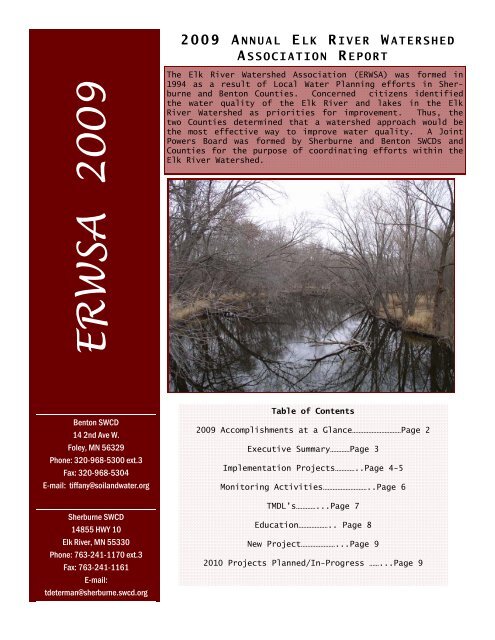
The Elk River <strong>Water</strong>shed Association (<strong>ERWSA</strong>) was formed in<br />
1994 as a result of Local <strong>Water</strong> Planning efforts in <strong>Sherburne</strong><br />
and Benton Counties. Concerned citizens identified<br />
the water quality of the Elk River and lakes in the Elk<br />
River <strong>Water</strong>shed as priorities for improvement. Thus, the<br />
two Counties determined that a watershed approach would be<br />
the most effective way to improve water quality. A Joint<br />
Powers Board was formed by <strong>Sherburne</strong> and Benton SWCDs and<br />
Counties for the purpose of coordinating efforts within the<br />
Elk River <strong>Water</strong>shed.<br />
Benton SWCD<br />
14 2nd Ave W.<br />
Foley, MN 56329<br />
Phone: 320-968-5300 ext.3<br />
Fax: 320-968-5304<br />
E-mail: tiffany@soilandwater.org<br />
<strong>Sherburne</strong> SWCD<br />
14855 HWY 10<br />
Elk River, MN 55330<br />
Phone: 763-241-1170 ext.3<br />
Fax: 763-241-1161<br />
E-mail:<br />
tdeterman@sherburne.swcd.org<br />
Table of Contents<br />
<strong>2009</strong> Accomplishments at a Glance…………………………Page 2<br />
Executive Summary…………Page 3<br />
Implementation Projects…………..Page 4-5<br />
Monitoring Activities………………………..Page 6<br />
TMDL’s…………...Page 7<br />
Education……………….. Page 8<br />
New Project…………………...Page 9<br />
2010 Projects Planned/In-Progress ……...Page 9
<strong>ERWSA</strong> BMP Projects Installed 1995-<strong>2009</strong><br />
BMPs<br />
Nutrient Management Test<br />
Plots<br />
6 in-progress<br />
<strong>2009</strong> Accomplishments at a Glance<br />
BMPs Continued<br />
Shoreland revegetation<br />
5 complete<br />
3 in-progress<br />
Education/Information<br />
Elk River <strong>Water</strong>shed<br />
Currents– <strong>Water</strong>shed Wide<br />
Wetland Restoration<br />
1 complete<br />
1 in-progress<br />
Riparian Pasture Buffer<br />
1 complete<br />
1 in-progress<br />
Rain Garden<br />
2 complete<br />
Monitoring<br />
E.coli Monitoring, 2 sites<br />
TMDL Monitoring, 24 sites<br />
2nd <strong>Annual</strong> Elk River<br />
Cleanup<br />
Other<br />
Elk River <strong>Water</strong>shed TMDLs<br />
2
<strong>2009</strong> Executive Summary<br />
The Elk River <strong>Water</strong>shed <strong>2009</strong> <strong>Annual</strong> <strong>Report</strong> is prepared to inform counties, board<br />
members, elected officials and watershed stakeholders of the projects that took<br />
place within the watershed over the previous year.<br />
The objectives of this report are to:<br />
<br />
<br />
<br />
Provide an easily accessible summary of the projects completed in <strong>2009</strong> for<br />
board members, counties, elected officials and watershed stakeholders.<br />
Provide a brief description of the projects that were most closely focused on<br />
over the previous year.<br />
Introduce projects that are planned for the current year.<br />
The goals of the programs implemented in the ERWS are to improve water quality<br />
to levels that are within the typical range for the ecoregion and delist impaired<br />
waters in the Elk River, its tributaries, and lakes within the Elk River<br />
<strong>Water</strong>shed.<br />
In <strong>2009</strong> the <strong>ERWSA</strong> continued on their mission to improve water quality to levels<br />
that are within the typical range for the ecoregion and de-list impaired waters<br />
in the Elk River, its tributaries and lakes within the Elk River <strong>Water</strong>shed. To<br />
accomplish this mission, the Joint Powers Board utilized two grants including a<br />
federal 319 grant and a TMDL grant in addition to County funding and to a lesser<br />
extent donations.<br />
<strong>2009</strong> Joint Powers Board<br />
From Left: John Riebel, <strong>Sherburne</strong><br />
County Commissioner; Mike Hayes,<br />
alternate member at large; Leander<br />
Schlosser, <strong>Sherburne</strong> <strong>Soil</strong> & <strong>Water</strong><br />
Conservation District Supervisor;<br />
Terry Polsfuss, <strong>Sherburne</strong> County<br />
member at large; Brian Kaschmitter,<br />
Benton County member at large; Leonard<br />
Popp, Benton County member at large;<br />
Doug Manthei, alternate member at<br />
large; Joe Jordan, Benton <strong>Soil</strong> & <strong>Water</strong><br />
Conservation District Supervisor. Not<br />
pictured: Joe Wollak, Benton County<br />
Commissioner and Jim Stahlmann,<br />
<strong>Sherburne</strong> County member at large.<br />
The Elk River <strong>Water</strong>shed covers approximately 613 square miles of <strong>Sherburne</strong><br />
County, Benton County, Mille Lacs County, and Morrison County. The Elk River<br />
and the St. Francis River are the major streams and hydrologic features of the<br />
watershed. Elk River’s headwaters are located in northern Benton County and the<br />
river outlets to the Mississippi River in <strong>Sherburne</strong> County.<br />
3
Implementation Projects<br />
Elk River <strong>Water</strong>shed Priority Lakes II<br />
The Elk River <strong>Water</strong>shed Priority Lakes II project provides financial incentives<br />
to landowners for establishing conservation practices on riparian land. Project<br />
funds are used to offer assistance to install best management practices that<br />
will improve water quality in the Elk River <strong>Water</strong>shed where other assistance is<br />
not available. Money is also used to dedicate existing SWCD staff to offer<br />
technical assistance to landowners who are installing the BMPs.<br />
Eligible BMPs include: 1) Establishment of small nutrient management Best Management<br />
Practice (BMP) test plots; 2) Restoration, enhancement and creation of<br />
wetlands by creating impoundments; 3) Encouragement of farmers to install buffer<br />
strips along pasture ditches; and 4) Continuation of re-establishment of natural<br />
shoreline vegetation and installation of filter strips, rain gardens, and infiltration<br />
ponds. This grant will sunset on August 31st, 2010.<br />
<strong>2009</strong> Completed Projects<br />
<strong>2009</strong>/2010 Projects in-progress<br />
<br />
<br />
<br />
<br />
1 Wetland restoration/creation<br />
project complete<br />
1 riparian pasture buffer<br />
5 Shoreland revegetation projects<br />
2 storm water BMPs installed<br />
<br />
<br />
<br />
<br />
1 Filter Strip<br />
1 Riparian pasture buffer<br />
6 Nutrient Management Test Plots<br />
3 Shoreland revegetation projects<br />
Fitzpatrick Wetland Restoration<br />
The Fitzpatrick project included the creation of a 10.4 acre wetland and an<br />
adjacent 12.5 acre buffered area. Construction for the wetland creation began<br />
in in the fall of 2008 and was complete in the fall of <strong>2009</strong>; the buffer will be<br />
planted in the spring of 2010. This project was completed in cooperation with<br />
Benton SWCD, NRCS and West Central Technical Service Area engineers. The project<br />
is located in Benton County just north of Foley off of MN State Highway 25.<br />
Because this project is located in a highly visible location, two large<br />
educational signs will be installed along the highway in spring 2010.<br />
Riparian Pasture Buffer<br />
This pasture is normally stocked with 100 dairy<br />
cows throughout the grazing season. Pasture land<br />
in this project was retired from livestock use<br />
by enrolling the land into the <strong>ERWSA</strong> Riparian<br />
Pasture Buffer Program.<br />
This pasture contains two wetlands and one ditch<br />
that was buffered to approximately 120 feet.<br />
Livestock were excluded from the wetland areas<br />
by installing fence. The total area of pasture<br />
enrolled was 18.4 acres and the contract length<br />
is 10 years.<br />
4<br />
Pictured above: Wetland livestock<br />
exclusion boundaries.
Implementation Projects<br />
Washington Ave. Shoreline Revegetation<br />
In <strong>2009</strong> the City of Big Lake continued to work<br />
with <strong>Sherburne</strong> SWCD staff to identify City<br />
owned greenways which were in need of<br />
revegetation. <strong>Soil</strong> erosion from storm water<br />
runoff, foot traffic and waves were the main<br />
problems on this site which is located on<br />
Washington Avenue on Big Lake. 1,630 square<br />
feet of shoreline was re-vegetated along with<br />
the installation of a concrete spillway.<br />
Installation of brush bundle wave breaks was<br />
done by the Minnesota Conservation Corps (MCC)<br />
and the site was planted by volunteers from<br />
Cargill.<br />
Pictured top right: Washington<br />
Ave. shoreline before.<br />
Bottom right: Washington Ave.<br />
shoreline after.<br />
Becker Fairway Circle<br />
The Fairway Circle project includes a 416<br />
square foot raingarden; overflow from the raingarden flows into an inlet<br />
connected to a six inch perforated tile embedded in a 140’L x 3’W x 2’D<br />
infiltration trench. The trench was covered with sod and blended into the<br />
original lawn. The raingarden was planted with native plants from Hayland Woods<br />
and Prairie Restorations, Inc. The City of Becker Public Works staff, <strong>Sherburne</strong><br />
SWCD and the Becker School District Service Learning Student Group helped to<br />
install the plant materials and<br />
mulch while learning about<br />
raingarden function and design<br />
and the advantages of using<br />
native plants.<br />
Pictured Left:<br />
Becker<br />
raingarden and<br />
infiltration<br />
trench. This<br />
project was<br />
designed with<br />
engineering<br />
assistance.<br />
5
Monitoring Activities<br />
<strong>2009</strong> surface water sampling was conducted for a number of projects including:<br />
Priority Lakes II, <strong>ERWSA</strong> TMDLs, and citizen stream/lake monitoring.<br />
Priority Lakes II Bacteria Assessment<br />
E.Coli Geomeans <strong>2009</strong><br />
In <strong>2009</strong> the <strong>ERWSA</strong> continued to collect<br />
350<br />
300 Upstream Orono<br />
bacteria samples within the watershed to<br />
250 ER 44.5<br />
determine if stream reaches upstream from<br />
200<br />
Lake Orono meet the bacteria criteria for<br />
150 State Standard<br />
placement of the 303(d) impaired watershed 100<br />
list. High levels of bacteria in water from 50<br />
human or animal fecal material can cause<br />
0<br />
illness in humans if ingested. Historically<br />
the <strong>ERWSA</strong> monitored for Fecal Coliform<br />
Bacteria in streams; because the MPCA recently<br />
switched its standards to include<br />
Escherichia coli (E.coli), a better indicator of harmful bacteria, sampling<br />
conducted in <strong>2009</strong> was analyzed for E.coli.<br />
Samples were collected on a weekly basis from April 1st through October 31st.<br />
Results indicate that both sites monitored exceed standards at some point over<br />
the applicable season.<br />
E.coli CFU's<br />
Citizen Stream Monitoring Program<br />
<strong>2009</strong> Monitoring Site Locations<br />
In <strong>2009</strong> volunteers monitored 8 stream and<br />
river sites throughout the <strong>Water</strong>shed. The<br />
volunteers collect transparency and rain<br />
fall information on the stream sites that<br />
they have selected. Volunteers typically<br />
take readings once a week from April though<br />
October. The Citizen Stream Monitoring<br />
Program is part of the Minnesota Pollution<br />
Control Agency’s (MPCA) Statewide monitoring<br />
program. The <strong>ERWSA</strong> uses the volunteer<br />
data to assess which streams are in need of<br />
additional data collection and in assessment<br />
of the health of the surface water.<br />
Citizen Lake Monitoring Program<br />
In <strong>2009</strong> volunteers monitored 18 lake sites<br />
throughout the <strong>Water</strong>shed. This volunteer<br />
program greatly multiplies the <strong>ERWSA</strong>’s<br />
water quality sampling capabilities, while<br />
volunteers learn about the water quality of<br />
lakes in their region and the causes and<br />
effects of lake pollution. CLMP volunteers<br />
collect water transparency data using a<br />
Secchi disk about once a week during the<br />
summer months. The <strong>ERWSA</strong> uses the volunteer<br />
data to assess which lakes are in need of<br />
additional data collection and in assessment<br />
of the health of the surface water.<br />
6
Total Maximum Daily Load Projects<br />
The TMDL program was initiated by the <strong>ERWSA</strong> and was developed in order to<br />
address impaired water bodies located within the ERWS. This program goes<br />
hand-in-hand with the 319 program goals in that the end result will be improved<br />
water quality. This TMDL project focuses on the impairments in the Elk River<br />
from the outlet of Big Elk Lake to the confluence with the St. Francis River<br />
(fecal coliform bacteria and turbidity),<br />
Mayhew Lake (excessive nutrients) and Big Elk<br />
Lake (excessive nutrients).<br />
In March <strong>2009</strong> the first <strong>pub</strong>lic stakeholder<br />
meeting was held; this meeting closed out the<br />
first phase of the project. The second phase<br />
began in the spring of <strong>2009</strong> with the<br />
collection of water quality samples. Samples<br />
were collected on a bi-weekly schedule to<br />
capture a range of conditions. The data<br />
collected over the season has been submitted<br />
to Wenck (Project Consultant) to be analyzed.<br />
A stakeholder Committee has been formed and<br />
consists of members of the Benton <strong>Water</strong><br />
Resources Advisory Committee (WRAC) and<br />
members of the <strong>Sherburne</strong> <strong>Water</strong> Plan Advisory Committee. This committee will be<br />
relied upon for input at stakeholder meetings; However, all stakeholders are<br />
welcome and encouraged to attend meetings and submit comments. The next steps in<br />
the process will include collection of sediment cores from Mayhew and Big Elk<br />
Lake; this data will help determine the amount of internal phosphorus loading in<br />
each lake thereby reducing the final margin of safety.<br />
Sediment Quantification Survey<br />
<strong>Water</strong>shed Coordinator, Tiffany<br />
Determan, collecting water sample<br />
on Big Elk Lake.<br />
As part of the TMDL data collection process, a bank erosion survey was completed<br />
on the Elk River for the portions listed as impaired for turbidity. The survey<br />
was completed to assist in determining whether or not sediment plays a role in<br />
the turbidity impairment on the Elk River. To complete the survey we floated<br />
the Elk River by canoe from Big Elk Lake to County Road 5 near the confluence of<br />
the Elk with the St. Francis River. Along the float, areas of bank erosion were<br />
identified and measurements of the erosion were recorded. Preliminary results<br />
from the survey indicate that bank erosion does not currently play a significant<br />
role in turbidity levels; at least in this reach of the Elk River.<br />
7
Education Activities<br />
2nd <strong>Annual</strong> Elk River <strong>Water</strong>shed Cleanup<br />
The second annual Elk River <strong>Water</strong>shed Cleanup attracted volunteers such as<br />
residents of Wapiti Park Campground, the Elk River Knights of Columbus, a County<br />
Commissioner and several other committed individuals.<br />
Cleanup areas were situated along the Elk River near Becker, Big Lake and Elk<br />
River. 26 volunteers worked from approximately 9am until 11am picking up nearly<br />
830 pounds of trash (estimated) on nearly 6 miles of stream. Trash collected<br />
included items such as hunting decoys, a life jacket, bicycles, tires, a realtor<br />
sign, a metal chair, winter gloves, metal car parts, a couch, sleeping bags,<br />
shoes, magazines, fast food wrappers, cigarette filters, glass bottles,<br />
Styrofoam, aluminum cans, and various plastic pieces.<br />
Thanks to the many generous donations, volunteers were provided with a light<br />
breakfast and coffee. Donations also helped to remove and recycle the debris<br />
removed by volunteers.<br />
The 2010 Elk River <strong>Water</strong>shed Cleanup is scheduled to take place on October 16th,<br />
2010. Volunteers are needed, please contact <strong>Sherburne</strong> SWCD if you are<br />
interested.<br />
8<br />
Elk River <strong>Water</strong>shed Currents Newsletter<br />
The <strong>ERWSA</strong> teamed up with the Upper Mississippi River Source <strong>Water</strong> Protection<br />
Project team in an effort to disseminate a four page tabloid newsletter which<br />
was mailed out to 23,000 households in the watershed. The first Currents<br />
newsletter was mailed out to watershed residents in the <strong>Sherburne</strong> County portion<br />
of the Elk River <strong>Water</strong>shed in fall 2007. In<br />
the fall of 2008 Benton County residents received<br />
a mailer. Thanks to a new partnership<br />
formed with the Upper Mississippi river Source<br />
<strong>Water</strong> Protection Project team, the third version<br />
of the newsletter was mailed to 23,000<br />
households watershed wide. The mailer plays a<br />
major role in education for residents and assists<br />
with promotion of the Joint Powers<br />
board. We received many positive comments<br />
regarding the mailer.
9<br />
New Project<br />
The 10 year watershed cycle for<br />
Intensive <strong>Water</strong>shed Monitoring (IWM)<br />
Phase I began in the spring of <strong>2009</strong> for<br />
the Mississippi River St. Cloud (8 digit<br />
HUC) watershed; the Elk River <strong>Water</strong>shed<br />
comprises approximately 60 percent of<br />
this area. Monitoring and field data<br />
collected during the Phase I assessment<br />
is in the process of being compiled and<br />
in the summer of 2010 the work will<br />
begin to conduct a watershed wide<br />
assessment and monitoring effort that<br />
will result in the final deliverable of<br />
a implementation plan that will<br />
prescribe restoration and protection<br />
strategies for the surface water<br />
resources within the Mississippi River<br />
(St. Cloud) watershed.<br />
Work is underway to conduct the Project<br />
Planning and Coordination portion of the<br />
Mississippi St. Cloud Major <strong>Water</strong>shed<br />
project. This effort will focus towards<br />
the development of project teams,<br />
identifying stakeholders, reviewing<br />
current and past watershed project data<br />
and initial strategic planning among the<br />
various project Local Government Units (LGU) on how to most effectively<br />
accomplish the overall watershed wide assessment.<br />
2010 Projects Planned/In-Progress<br />
The <strong>ERWSA</strong> will continue to work towards the completion of the 319 grant<br />
by completing the projects listed as “in progress” in this report, as<br />
well as seek out additional priority BMPs as listed in this report.<br />
Other projects in the queue for <strong>2009</strong> include:<br />
3nd <strong>Annual</strong> Elk River <strong>Water</strong>shed Cleanup: scheduled for October 16, 2010.<br />
Continue to purse a major role in the MPCA’s Targeted <strong>Water</strong>shed<br />
Planning process.<br />
Agricultural BMPs: Complete Fitzpatrick filter strips (a component of<br />
the wetland project), completion of 1 wetland restoration, complete one<br />
riparian pasture buffer and completion of 6 nutrient management test<br />
plots.<br />
Urban and Residential BMPs: Complete 3 Shoreland revegetation projects.<br />
Continue to pursue relationships/partnerships with organizations that<br />
have similar goals.<br />
Pursue opportunities to develop a regular newsletter.


