LR706 East African Flood Model_ Fiddes - Transport for Development
LR706 East African Flood Model_ Fiddes - Transport for Development
LR706 East African Flood Model_ Fiddes - Transport for Development

Create successful ePaper yourself
Turn your PDF publications into a flip-book with our unique Google optimized e-Paper software.
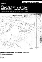
THE TRRL EAST AFRICAN FLOOD MODEL<br />
ABSTRACT<br />
Four years ofdata from 13small representative rural catchmentsin<br />
Kenya and Uganda were analysed to develop improved methods of<br />
flood estimation <strong>for</strong>highway bridges and culverts. Dueto the short<br />
period of record and the very quick response time of the catchments,<br />
Unit Hydrography techniques were found inappropriate. A technique<br />
which made better use of limited data, there<strong>for</strong>e, had to be<br />
developed. Rainfall and runoff were fitted to a simple three parameter<br />
conceptual catchment model. The model was then used to<br />
predict the 10 year flood using a 10 year design storm. A simple<br />
technique is then developed <strong>for</strong> predicting the peak flow and base<br />
time of design hydrography <strong>for</strong> ungauged catchments.<br />
1. INTRODUCTION<br />
A large proportion of the total cost of building a road in <strong>East</strong> Africa is <strong>for</strong> the construction of bridges and<br />
culverts to cross streams from small catchmentsl. Wereas most of the larger rivers in <strong>East</strong> Africa have flow<br />
measuring stations, very few smaller streams are so equipped. Design methods must there<strong>for</strong>e be based on<br />
rainfall-runoff models.<br />
Very few data are available <strong>for</strong> the development of suitable flood models. In 1966 the Kenya and Uganda<br />
Governments and the UK <strong>Transport</strong> and Road Research bboratory co-operated in a project to instrument 12<br />
representative catchrnents, results from which could be used to develop improved flood design methods. The<br />
choice of location and instrumentation of these catchments is described elsewhere 2. This report describes the<br />
programme of analysis of results and the design method that was developed. It was presented as a paper to a<br />
Hood Hydrology Symposium in Nairobi, Kenya in October 1975 which was jointly sponsored by the Economic<br />
Commission <strong>for</strong> Africa, the <strong>East</strong> <strong>African</strong> Community and the <strong>Transport</strong> and Road Research bboratory.<br />
2. CATCHMENT MODELS<br />
A number of possible rainfall-runoff models were considered,<br />
2.1 The unit hydrography<br />
A unit hydrography is a hydrography of unit volume resulting from a rainstorm of unit duration and<br />
specified areal pattern. Hydrography <strong>for</strong> other storms of similar areal pattern can be constructed by superimposing<br />
hydrography, suitably offset in time with ordinates proportional to the flow assumed to result from<br />
the rainfall in each unit time period.<br />
It will be seen that the unit hydrography simply distributes the runoff in time. The volume of runoff must<br />
be estimated separately and this generally involves deriving a rainfall-runoff correlation.