Cookham Gas Holder Station - The Royal Borough of Windsor and ...
Cookham Gas Holder Station - The Royal Borough of Windsor and ...
Cookham Gas Holder Station - The Royal Borough of Windsor and ...

You also want an ePaper? Increase the reach of your titles
YUMPU automatically turns print PDFs into web optimized ePapers that Google loves.
<strong>Royal</strong> <strong>Borough</strong> <strong>of</strong> <strong>Windsor</strong> <strong>and</strong> Maidenhead<br />
Local Plan Adopted July 1999<br />
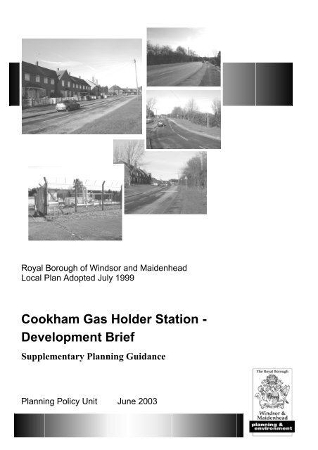
<strong>Cookham</strong> <strong>Gas</strong> <strong>Holder</strong> <strong>Station</strong> -<br />
Development Brief<br />
Supplementary Planning Guidance<br />
Planning Policy Unit June 2003
Q:\FPLAN\GEN\2449.doc -2-
CONTENTS<br />
Introduction:.......................................................................................................................... 3<br />
<strong>The</strong> Site <strong>and</strong> its Surroundings: .............................................................................................. 3<br />
Planning Policy Context:....................................................................................................... 4<br />
Development Proposal: ......................................................................................................... 4<br />
Suggested Form <strong>of</strong> Development; ............................................................................... 4<br />
Design Matters;............................................................................................................ 4<br />
Trees <strong>and</strong> Hedgerows; ................................................................................................. 5<br />
Secure by Design; ........................................................................................................ 6<br />
Access <strong>and</strong> Parking;..................................................................................................... 6<br />
Affordable Housing; .................................................................................................... 7<br />
Public Open Space;...................................................................................................... 7<br />
Education; .................................................................................................................... 7<br />
Utilities; ....................................................................................................................... 7<br />
Contaminated L<strong>and</strong>;..................................................................................................... 8<br />
Groundwater Source Protection Zones;....................................................................... 8<br />
Environmental Impact Assessment.............................................................................. 8<br />
Archaeology................................................................................................................. 9<br />
Planning Applications: ..........................................................................................................9<br />
Contacts:................................................................................................................................ 9<br />
Appendices:<br />
Appendix 1: Site Plan Including Ownership; .............................................................. 11<br />
Appendix 2: Design Statements;.................................................................................. 12<br />
Appendix 3: Public Open Space Provision;................................................................. 14<br />
Appendix 4: Investigating Contaminated L<strong>and</strong>........................................................... 16<br />
Q:\FPLAN\GEN\2449.doc -3-
INTRODUCTION<br />
This development brief is intended to give prospective purchasers <strong>and</strong> developers planning<br />
guidance on the future development <strong>of</strong> the <strong>Cookham</strong> <strong>Gas</strong> <strong>Holder</strong> <strong>Station</strong>, Whyteladyes Lane,<br />
<strong>Cookham</strong>. <strong>The</strong> proposal is for a residential redevelopment. Part <strong>of</strong> the site is likely to be<br />
retained for operational purposes by Transco. This development brief was adopted as<br />
Supplementary Planning Guidance on 26 th June 2003. It has been subject to the procedural<br />
requirements <strong>of</strong> Planning Policy Guidance Note 12: Development Plans. A consultation<br />
statement has been prepared to accompany this development brief.<br />
THE SITE AND ITS SURROUNDINGS<br />
<strong>The</strong> site is located in the south west corner<br />
<strong>of</strong> <strong>Cookham</strong> Rise (see Appendix 1). <strong>The</strong><br />
total site size is approximately 1.15<br />
hectares (2.85 acres). Site ownership is<br />
split between SecondSite Property <strong>and</strong><br />
Transco, both <strong>of</strong> which are subsidiaries <strong>of</strong><br />
National Grid Transco. SecondSite<br />
Property is responsible for the<br />
management <strong>and</strong> disposal <strong>of</strong> surplus l<strong>and</strong> /<br />
properties <strong>and</strong> advises Transco on its<br />
l<strong>and</strong>holdings.<br />
<strong>The</strong> site is currently utilised by Transco<br />
although the gasholders have been<br />
removed. <strong>The</strong> extent <strong>of</strong> the developable<br />
area is likely to be reduced by the wish <strong>of</strong><br />
Transco to retain part <strong>of</strong> the site as an<br />
active facility.<br />
<strong>The</strong> site enjoys a significant tree <strong>and</strong><br />
hedgerow screening around its perimeter<br />
<strong>and</strong> there is a notable fall in ground level overall from north to south. <strong>The</strong> central area <strong>of</strong> the<br />
site is at a lower level from that <strong>of</strong> the surrounding l<strong>and</strong>. None <strong>of</strong> the current buildings found<br />
on the site are worthy <strong>of</strong> retention.<br />
<strong>The</strong>re are two existing vehicular access points onto the site, both located centrally on<br />
Whyteladyes Lane. Bus routes between <strong>Cookham</strong> area, Maidenhead <strong>and</strong> High Wycombe run<br />
along Whyteladyes Lane <strong>and</strong> two request bus stops are in proximity to the site. <strong>Cookham</strong><br />
Railway <strong>Station</strong> is located 10 minutes walk to the north <strong>of</strong> the site <strong>and</strong> provides a service<br />
between Marlow <strong>and</strong> Maidenhead.<br />
<strong>The</strong> area is located on the urban / rural fringe with farml<strong>and</strong> behind the houses on the opposite<br />
<strong>of</strong> Whyteladyes Lane. <strong>The</strong> surrounding built form is strongly residential comprising a<br />
mixture <strong>of</strong> mainly two-storey semi-detached, terraced <strong>and</strong> flatted dwellinghouses. Located<br />
five minutes walk to the north east <strong>of</strong> the gas holder station site is the Alfred Major<br />
Recreation Ground.<br />
Q:\FPLAN\GEN\2449.doc -4-
PLANNING POLICY CONTEXT<br />
<strong>The</strong> adopted development plan comprises the Berkshire Structure Plan 2001-2006 (adopted<br />
1995, modified 1997) <strong>and</strong> the <strong>Royal</strong> <strong>Borough</strong> <strong>of</strong> <strong>Windsor</strong> <strong>and</strong> Maidenhead Local Plan<br />
(adopted 1999). <strong>The</strong> Deposit Draft Berkshire Structure Plan 2001-2016 was placed on first<br />
deposit in March 2002. Reference to individual policies is made when appropriate within the<br />
main text in this document.<br />
Planning Policy Guidance notes (PPG) <strong>of</strong> particular relevance include PPG1: General Policy<br />
<strong>and</strong> Principles, PPG3: Housing, PPG9: Nature Conservation, PPG13: Transport, PPG 23:<br />
Planning <strong>and</strong> Pollution Control.<br />
DEVELOPMENT PROPOSAL<br />
Suggested Form <strong>of</strong> Development<br />
<strong>The</strong> site, which falls within the settlement area <strong>of</strong> <strong>Cookham</strong>, is not specifically designated<br />
within the RBWM Local Plan for any particular purpose. Given the character <strong>of</strong> the<br />
surrounding area, the proximity <strong>of</strong> existing housing <strong>and</strong> the nature <strong>of</strong> the local road network, a<br />
residential redevelopment is the preferred option.<br />
Design Matters<br />
“Good design should be the aim <strong>of</strong> all those involved in the development process” (Planning<br />
Policy Guidance Note 1: General Policy <strong>and</strong> Principles, 1997). Applicants seeking planning<br />
permission should be able to demonstrate how they have taken account <strong>of</strong> the need for good<br />
design in their proposal. Given the sensitive nature <strong>of</strong> the <strong>Cookham</strong> <strong>Gas</strong> <strong>Holder</strong> site, any<br />
developer should submit a design statement to support their planning application. General<br />
advice on design statements can be found in Appendix 2 <strong>of</strong> this report.<br />
Planning Policy Guidance Note 3: Housing, encourages the efficient use <strong>of</strong> l<strong>and</strong> by<br />
advocating residential densities <strong>of</strong> between 30 <strong>and</strong> 50 dwellings per hectare. RBWM Local<br />
Plan Policy H11 states that in established residential areas, planning permission will not be<br />
granted for schemes which<br />
introduce a scale or density<br />
which would be incompatible<br />
with, or cause damage to, the<br />
character <strong>and</strong> amenity <strong>of</strong> the<br />
area. <strong>The</strong> surrounding area<br />
contains a mix <strong>of</strong> dwelling<br />
types <strong>and</strong> density <strong>and</strong> the<br />
Council considers that a<br />
residential density <strong>of</strong> 40<br />
dwellings per hectare can be<br />
successfully achieved on the<br />
site. RBWM Local Plan<br />
Policies H8 <strong>and</strong> H9 encourage<br />
developments which include<br />
dwellings for smaller<br />
households <strong>and</strong> those with<br />
Q:\FPLAN\GEN\2449.doc -5-
special needs. A proportion <strong>of</strong> the dwellings should be accessible to the disabled <strong>and</strong> be<br />
capable <strong>of</strong> adaptation to residents’ changing needs, i.e. ‘lifetime homes’.<br />
<strong>The</strong> design <strong>and</strong> scale <strong>of</strong> any new buildings should have regard to the character <strong>of</strong> the adjacent<br />
areas, but there may be some scope for increased height away from the periphery <strong>of</strong> the site<br />
either in the form <strong>of</strong> a localised raising <strong>of</strong> ro<strong>of</strong> lines or through the utilisation <strong>of</strong> ro<strong>of</strong> spaces.<br />
<strong>The</strong> layout <strong>of</strong> flatted dwellings should allow for a dedicated bin storage area within the<br />
vicinity <strong>of</strong> each building.<br />
<strong>The</strong> garages on Windmill Road, to the east <strong>of</strong> the <strong>Cookham</strong> <strong>Gas</strong> <strong>Holder</strong> site have been<br />
identified as a possible future development site. Any scheme should take account <strong>of</strong> this<br />
further opportunity by allowing for a pedestrian / bicycle link within any proposed layout.<br />
<strong>The</strong> garage site is owned by the Maidenhead <strong>and</strong> District Housing Association.<br />
Trees <strong>and</strong> Hedgerows<br />
<strong>The</strong> site benefits from hedgerow <strong>and</strong> tree screening, particularly the extensive native<br />
hedgerow fronting onto Whyteladyes Lane. This hedgerow is an important <strong>and</strong> pleasing<br />
natural feature, providing a link to the rural aspects <strong>of</strong> the locality <strong>and</strong> is supplemented by half<br />
a dozen or so trees which provide structure <strong>and</strong> variation. Along the northern <strong>and</strong> eastern<br />
boundaries <strong>of</strong> the site are other trees, many <strong>of</strong> which are small <strong>and</strong> are <strong>of</strong> varying quality but<br />
due to their position they could be useful to providing some screening to a new development<br />
from the neighbouring private residential properties <strong>and</strong> nearby roads. Any planning<br />
application must be supported by a detailed tree survey, in accordance with British St<strong>and</strong>ards<br />
5837:1991 ‘Trees in Relation to Construction’. Wherever practicable any redevelopment<br />
scheme should allow for the retention <strong>of</strong> existing suitable trees <strong>and</strong> include proposals for<br />
further s<strong>of</strong>t l<strong>and</strong>scaping including tree planting. <strong>The</strong> hedgerow fronting Whyteladyes Lane<br />
is an important local feature <strong>and</strong> provides a valuable habitat. Any development should retain<br />
<strong>and</strong> improve this hedgerow. A l<strong>and</strong>scaping strategy should be considered as part <strong>of</strong> the<br />
design process with appropriate details outlined within the design statement. L<strong>and</strong>scaping<br />
should be high quality <strong>and</strong> will require the approval <strong>of</strong> the Council.<br />
<strong>The</strong> north western<br />
sector <strong>of</strong> the site<br />
appears as a natural<br />
area, which is<br />
comprised <strong>of</strong> a grass<br />
sward<br />
with<br />
interspersed scrub.<br />
Large diameter<br />
deadwood is present<br />
on the site boundaries.<br />
This sector especially<br />
may provide a habitat<br />
for protected <strong>and</strong><br />
locally significant<br />
species, including butterflies <strong>and</strong> other insects, grasses <strong>and</strong> fungi. Any planning application<br />
should be supported by an ecological survey to ascertain the biological importance <strong>of</strong> the<br />
whole development site, <strong>and</strong> include a consideration <strong>of</strong> the wider area.<br />
Q:\FPLAN\GEN\2449.doc -6-
Secure by Design<br />
In order to ensure that new development meets with ‘Secure by Design’ st<strong>and</strong>ards, developers<br />
will be required to consult with the Crime Prevention Design Advisor for Berkshire <strong>and</strong><br />
demonstrate that proposals comply with the Department <strong>of</strong> the Environment Circular 4/94<br />
‘Planning Out Crime’.<br />
Access <strong>and</strong> Parking<br />
RBWM Local Plan Policy T5 states that all new development proposals will be expected to<br />
comply with the Council’s highway st<strong>and</strong>ards. While many highway requirements are<br />
dependent upon the form <strong>of</strong> a proposed development, applicants are advised to pay regard to<br />
the following general advice.<br />
In providing the principal access from Whyteladyes Lane, applicants are advised to provide<br />
visibility splays <strong>of</strong> 4.590 metres in each direction <strong>and</strong> an internal carriageway width <strong>of</strong> 4.8<br />
metres. Any layout should provide refuse <strong>and</strong> pantechnicon turning heads. Should vehicle<br />
ramps be utilised for any aspect <strong>of</strong> the development these should not exceed a gradient <strong>of</strong> 1:8.<br />
<strong>The</strong> availability <strong>of</strong> car parking can have a major influence on the choice <strong>of</strong> means <strong>of</strong> travel<br />
<strong>and</strong> can take up considerable space within a development site. While there is no defined<br />
minimum requirement for car parking, the identified needs for car parking should be met<br />
within the site boundaries. Any lack <strong>of</strong> provision does not necessarily mean that future<br />
residents will not be car owners. Residential car parking requirements vary according to the<br />
size <strong>and</strong> form <strong>of</strong> the dwellings to be provided. Applicants should have regard to advice<br />
contained within Planning Policy Guidance Note 3: Housing, that developments should not<br />
provide more than 1.5 <strong>of</strong>f-street car parking spaces per dwelling. More detailed advice on<br />
parking should be sought by contacting the Council’s Highway Officer prior to the<br />
submission <strong>of</strong> a planning application.<br />
<strong>The</strong> <strong>Cookham</strong> <strong>Gas</strong> <strong>Holder</strong> <strong>Station</strong> is located near the cycle network linking to the Maidenhead<br />
town centre. Government transport policy is focused towards providing alternative means to<br />
travel other than the private car. To encourage the use <strong>of</strong> bicycles, any development should<br />
provide the opportunity for secure bicycle storage, for example through facilities internal to<br />
any flatted development or in the form <strong>of</strong> small sheds for each dwelling. RBWM Local Plan<br />
Policy T7 supports the consideration <strong>of</strong> cycling in new developments.<br />
Developers preparing a planning application should contact the Council’s Transport Unit to<br />
discuss whether a Transport Impact Assessment would be required.<br />
Should the proposed development be judged to generate additional traffic or safety concerns<br />
to the extent that the development cannot proceed without physical improvements to the road<br />
infrastructure, the developer will be expected to implement such improvements that would<br />
mitigate the effects or, should the Council undertake the work, meet the full cost <strong>of</strong> the<br />
improvements.<br />
Developers when preparing a planning application should contact Transco over their<br />
operational requirements, including whether a dedicated access is required for any retained<br />
facility.<br />
Q:\FPLAN\GEN\2449.doc -7-
Affordable Housing<br />
Berkshire Structure Plan Policy H7 <strong>and</strong> RBWM Local Plan Policy H3 (supported by<br />
Supplementary Planning Guidance) require the provision <strong>of</strong> affordable housing on sites over<br />
0.5ha or schemes providing an increase <strong>of</strong> 15 or more net additional dwellings. <strong>The</strong><br />
Council’s Housing Needs Survey (1998) identified 169 households in need <strong>and</strong> a further 324<br />
are on the Council’s housing waiting list requesting the <strong>Cookham</strong> Area. <strong>The</strong> Council believes<br />
the situation is unlikely to have improved since 1998. Given the identified need <strong>and</strong> the site’s<br />
benefits <strong>of</strong> good public transport links <strong>and</strong> local services the Council will seek the provision<br />
<strong>of</strong> 40% <strong>of</strong> the total units provided on the site for affordable housing. In final negotiations the<br />
Council will have regard to the advice <strong>of</strong> the Department <strong>of</strong> the Environment, Transport <strong>and</strong><br />
the Regions Circular 06/98 ‘Planning <strong>and</strong> Affordable Housing’ to consider any particular<br />
costs associated with the development <strong>of</strong> the site.<br />
Public Open Space<br />
Policy R3 <strong>of</strong> the RBWM Local Plan requires that all residential developments should make<br />
provision for public open space in accordance with the minimum st<strong>and</strong>ard <strong>of</strong> 4.3ha per 1,000<br />
population. Policies R4 <strong>and</strong> R5 set out the minimum requirement for on-site public open<br />
space provision including the potential need for a Local Area for Play (LAP) or Local<br />
Equipped Area for Play (LEAP). When found to be acceptable, any shortfall in on-site<br />
provision must be accounted for by a pro rata financial contribution towards <strong>of</strong>f-site provision<br />
by the Council. Development plan policy is currently supported by a Supplementary Planning<br />
Guidance. Further policy details can be found in Appendix 3.<br />
Education<br />
Where a new development generates additional nursery, primary or secondary school places<br />
which cannot be met by the existing schools most likely to serve that development, the<br />
developer will be expected to meet the full costs <strong>of</strong> any additional accommodation required.<br />
When preparing their plans developers are encouraged to contact the Council’s Education<br />
Department, who will be able to advise on the current capacity <strong>of</strong> the schools in the vicinity <strong>of</strong><br />
the <strong>of</strong> the project <strong>and</strong> the extent to which any additional capacity or facilities may be required.<br />
At September 2002 both the local primary <strong>and</strong> secondary schools were operating near or at<br />
capacity.<br />
Utilities<br />
Thames Water has advised the Council that the sewerage system in proximity to the gas<br />
holder station site is operating close to capacity. Developers will be required to demonstrate<br />
that adequate provision is made for foul drainage both on <strong>and</strong> <strong>of</strong>f site, <strong>and</strong> will be expected to<br />
fund any necessary investigations <strong>and</strong> works including the upgrading <strong>and</strong> relocation <strong>of</strong><br />
facilities should this be necessary.<br />
In the disposal <strong>of</strong> surface water, Thames Water requires the separation <strong>of</strong> foul <strong>and</strong> surface<br />
water sewerage on new developments. It is the responsibility <strong>of</strong> a developer to make proper<br />
provision. Surface water must not be allowed to drain into the foul sewer as this is a major<br />
contributor to sewer flooding.<br />
Q:\FPLAN\GEN\2449.doc -8-
Developers should ensure that up-to-date information is obtained to support any development<br />
proposal.<br />
Contaminated L<strong>and</strong><br />
<strong>The</strong> activities associated with the holding <strong>of</strong> gas are likely to have resulted in ground<br />
contamination. Prospective purchasers <strong>and</strong> developers are encouraged to investigate fully the<br />
issue <strong>of</strong> contaminated l<strong>and</strong> prior to submitting a planning application. Applicants should<br />
submit a desk study report documenting the site history, a site investigation report<br />
documenting the ground conditions <strong>of</strong> the site, <strong>and</strong> a detailed scheme for remedial works <strong>and</strong><br />
measures to be taken to avoid risk from contaminants/or gases when the site is developed.<br />
Developers should contact the Council’s Environmental Health Service to agree the scope <strong>of</strong><br />
a contamination investigation.<br />
<strong>The</strong> results <strong>of</strong> the soil, gas <strong>and</strong> ground water investigation will be used to determine what<br />
remediation measures might be required, although this will also be dependent on the final<br />
proposed l<strong>and</strong> uses. Any remedial design measures will have to be approved by the Council<br />
before development commences. Further advice on investigating contaminated l<strong>and</strong> is<br />
attached in Appendix 4.<br />
Groundwater Source Protection Zone<br />
<strong>The</strong> Environment Agency has defined a number <strong>of</strong> Source Protection Zones (SPZ)<br />
surrounding wells, boreholes <strong>and</strong> springs which help in indicating the risk to groundwater<br />
supplies from potentially polluting activities. Developers are advised that the site falls within<br />
the ‘inner protection zone’ <strong>of</strong> the SPZ at <strong>Cookham</strong>. Under Berkshire Structure Plan 1991-<br />
2006 Policy EN2 <strong>and</strong> the RBWM Local Plan Policy NAP4, planning permission will not be<br />
granted for developments which might pose an unacceptable risk to the quality <strong>of</strong><br />
groundwater or surface water. Applicants will be required to submit details <strong>of</strong> measures<br />
designed to ensure no detrimental effect on surface <strong>and</strong> ground waters. <strong>The</strong> Council will<br />
liaise with the Environment Agency in respect to such measures. <strong>The</strong> Council has produced<br />
detailed Supplementary Planning Guidance on pollution <strong>of</strong> groundwater <strong>and</strong> surface water.<br />
Environmental Impact Assessment<br />
Environmental Impact Assessment (EIA) is an important procedure for ensuring that the<br />
likely effects <strong>of</strong> new development on the environment are fully understood <strong>and</strong> taken into<br />
account. <strong>The</strong> Department <strong>of</strong> the Environment, Transport <strong>and</strong> the Regions publication<br />
‘Environmental Impact Assessment: a guide to procedures’ advises that where there is a high<br />
level <strong>of</strong> contamination an EIA may be required should the proposed development be judged<br />
likely to give rise to significant environmental effects. <strong>The</strong> submission <strong>of</strong> an EIA, <strong>and</strong> its<br />
findings, does not indicate the acceptability <strong>of</strong> any planning application.<br />
<strong>The</strong> current nature <strong>and</strong> extent <strong>of</strong> ground contamination is presently unknown. Any developer<br />
should provide information, preferably before the submission <strong>of</strong> a planning application, to<br />
allow the Council to make a screening opinion as to whether an EIA is required.<br />
Q:\FPLAN\GEN\2449.doc -9-
Archaeology<br />
Planning Policy Guidance Note 16: Archaeology <strong>and</strong> Planning, advises that developers should<br />
undertake an initial assessment <strong>of</strong> whether a site is known or likely to contain archaeological<br />
remains. <strong>The</strong> Council’s archaeological consultant advises that there are no records <strong>of</strong><br />
archaeological finds in this area <strong>of</strong> <strong>Cookham</strong>.<br />
PLANNING APPLICATIONS<br />
A comprehensive scheme for the whole site is required, which should provide details <strong>of</strong> the<br />
area <strong>of</strong> the site to be retained for operational purposes <strong>and</strong> the position <strong>of</strong> the high-pressure<br />
gas pipeline <strong>and</strong> any other significant apparatus which serves the site. A piecemeal approach<br />
to development would be inappropriate given the site context <strong>and</strong> any planning applications<br />
for individual portions <strong>of</strong> the site are likely to be refused.<br />
CONTACTS<br />
Planning Policy<br />
Development Control<br />
Highway Authority<br />
Environmental Health<br />
Housing Unit<br />
Tree Unit<br />
L<strong>and</strong>scape<br />
Community Partnerships:<br />
Recreation<br />
Education Department<br />
Other useful contacts:<br />
Ian Bellinger<br />
Planning Officer<br />
Peter Carey<br />
Principal DC Officer<br />
James Turner<br />
Assistant Highway Officer<br />
Paul Burns<br />
Environmental Protection Officer<br />
Chris Thomas<br />
Head <strong>of</strong> Housing Policy<br />
Helen Leonard<br />
Arboricultural Coordinator<br />
Glenn Satterthwaite<br />
L<strong>and</strong>scape Officer<br />
Kate Dagnall<br />
Environment Officer<br />
Deborah Clark<br />
Education Officer<br />
01628 796634<br />
01628 796000<br />
01628 796160<br />
01628 683602<br />
01628 796091<br />
01628 796094<br />
01628 796048<br />
01628 796093<br />
01628 796961<br />
SecondSite Property:<br />
Aviary Court, Wade Road, Basingstoke, Hampshire, RG24 8GZ.<br />
Tel: 01256 308803.<br />
Q:\FPLAN\GEN\2449.doc -10-
Maidenhead <strong>and</strong> District Housing Association:<br />
Crown House, Waldeck Road, Maidenhead, Berkshire, SL6 8BY.<br />
Tel: 01628 543167.<br />
Crime Prevention Design Advisor:<br />
Thatcham Police <strong>Station</strong>, 20 Chapel Street, Thatcham, Berkshire, RG18 4QL.<br />
Tel: 01635 295156.<br />
Thames Water Utilities:<br />
Kew Business Centre, London.<br />
Tel: 0207 713 3877.<br />
Q:\FPLAN\GEN\2449.doc -11-
APPENDIX 1: SITE PLAN INCLUDING OWNERSHIP<br />
Q:\FPLAN\GEN\2449.doc -12-
APPENDIX 2: DESIGN STATEMENTS<br />
A design statement is a method by which developers can show how they have taken into<br />
account good design in their development proposals. It should include the relationship<br />
between buildings, between buildings <strong>and</strong> streets, water <strong>and</strong> open spaces. It should<br />
demonstrate how the proposal fits into the context <strong>of</strong> the site <strong>and</strong> its local distinctiveness, how<br />
it relates to its immediate surroundings <strong>and</strong>, if appropriate to wider parts <strong>of</strong> the area. Design<br />
statements are a requirement <strong>of</strong> Planning Policy Guidance Note 1 (Annex A) issued by the<br />
Department <strong>of</strong> the Environment in 1997.<br />
A design statement would generally be required when seeking planning permission for a<br />
major development or even for smaller developments in sensitive locations, such as<br />
conservation areas or prominent sites.<br />
A design statement helps the local planning authority, councillors <strong>and</strong> the public both to<br />
underst<strong>and</strong> fully the proposal <strong>and</strong> the principles <strong>of</strong> the design, <strong>and</strong> be able to consider the<br />
proposal against the design policies <strong>of</strong> the development plan.<br />
<strong>The</strong>re are three essential steps to producing a design statement:<br />
• Site analysis <strong>and</strong> evaluation;<br />
• Establishing design principles;<br />
• Creating design solutions.<br />
Step 1 – Site Analysis <strong>and</strong> Evaluation<br />
This is a factual account either in writing <strong>and</strong>/or with drawings explaining the site within its<br />
context, for example conservation area, employment area, rural character etc. This can only<br />
be done by an examination <strong>of</strong> the site <strong>and</strong> its surroundings <strong>and</strong> cannot be done as a desktop<br />
exercise. It is important that this analysis has its basis in fact <strong>and</strong> reason rather than opinion<br />
<strong>and</strong> should include:<br />
• An explanation <strong>of</strong> the constraints <strong>and</strong> opportunities the site has in terms <strong>of</strong> its context,<br />
for example local buildings styles, street patterns, the nature <strong>of</strong> spaces between<br />
buildings <strong>and</strong> their uses, the character <strong>of</strong> the areas, proximity to listed buildings etc.<br />
• An explanation <strong>of</strong> the constraints <strong>and</strong> its opportunities the site has in terms <strong>of</strong> its<br />
design, for example important views, features which are detrimental <strong>and</strong> need to be<br />
addressed, changes <strong>of</strong> levels, physical features such as underground services,<br />
drainage systems etc.<br />
Step 2 – Establishing Design Principles<br />
<strong>The</strong>se should be the main criteria which the design needs to achieve. <strong>The</strong>se principles should<br />
be so important that they are not easily changed. <strong>The</strong>y should not be listed as preferences but<br />
a clear statement <strong>of</strong> what needs to be included in the design <strong>and</strong> should remain consistent<br />
irrespective <strong>of</strong> any approach taken. <strong>The</strong>se principles may also include critical constraints to<br />
the developer such as the minimum floorspace to be achieved, the importance <strong>of</strong> signs to a<br />
commercial proposal, or financial constraints, etc. Principles that are a requirement <strong>of</strong> the<br />
local planning authority as set down in the development plan <strong>and</strong> supplementary documents<br />
should also be included.<br />
Q:\FPLAN\GEN\2449.doc -13-
It is important to underst<strong>and</strong> that each site <strong>and</strong> proposal is unique <strong>and</strong> there is not a right or<br />
wrong set <strong>of</strong> design principles. <strong>The</strong> important point to remember is that design principles<br />
should be able to be justified against the site analysis <strong>and</strong> evaluation.<br />
<strong>The</strong> design principles should be clearly related to the site analysis <strong>and</strong> evaluation findings,<br />
<strong>and</strong> will vary in number <strong>and</strong> complexity from proposal to proposal (for extensions or<br />
alterations to dwellings it is likely there may be only one or two principles, for example the<br />
extension should be designed not to cause harm to the neighbour). In more complex<br />
proposals, design principles may include the retention <strong>of</strong> important public views, mass <strong>and</strong><br />
scale <strong>of</strong> buildings should be similar to those in the street or conversely a new building ought<br />
to be larger because <strong>of</strong> the site’s relationship to neighbouring buildings. Important trees may<br />
need to be kept or the buildings may need to face a particular way or be in specific positions<br />
to meet the needs <strong>of</strong> industrial activities, etc.<br />
Step 3 – Creating the Design Solution<br />
<strong>The</strong> third stage is to produce the design solution. <strong>The</strong>re may <strong>of</strong> course be several design<br />
options. Council <strong>of</strong>ficers will be pleased to discuss any options prior to a planning<br />
application being submitted. <strong>The</strong> important factor is that the design solution should<br />
incorporate the design principles, which in turn can be justified against the site analysis <strong>and</strong><br />
evaluation. <strong>The</strong> design statement should not simply seek to defend a design solution; without<br />
proper site analysis <strong>and</strong> design principles the design is likely to be flawed.<br />
<strong>The</strong>re are no sets <strong>of</strong> rules that dictate in what form a design statement should be presented. It<br />
is likely to include a short written statement setting out the constraints, opportunities <strong>and</strong><br />
design principles together with illustrative materials in plan <strong>and</strong> elevations as appropriate.<br />
<strong>The</strong> design statement should relate to the wider context <strong>of</strong> the site <strong>and</strong> not be restricted to the<br />
application site itself. Plans <strong>and</strong> drawings do not necessarily need to be precise <strong>and</strong> could<br />
take the form <strong>of</strong> sketches or artist illustrations.<br />
Q:\FPLAN\GEN\2449.doc -14-
APPENDIX 3: PUBLIC OPEN SPACE PROVISION<br />
Berkshire Structure Plan 1991-2006 Policy R5:<br />
“Provision should be made in association with new development for facilities for sport <strong>and</strong><br />
recreation, including public open space, on a scale which reflects the needs arising from the<br />
development <strong>and</strong> in a form which complements the existing provision.”<br />
RBWM Local Plan Policy R3:<br />
“<strong>The</strong> borough council will require new housing developments to make appropriate provision<br />
for public open space in accordance with a minimum st<strong>and</strong>ard <strong>of</strong> 4.3ha per 1,000 population.”<br />
RBWM Local Plan Policy R4:<br />
“<strong>The</strong> borough council will require new housing developments to allocate a minimum<br />
provision <strong>of</strong> public open space on site in accordance with the following st<strong>and</strong>ards:<br />
Size <strong>of</strong> site 1.0ha<br />
Minimum % <strong>of</strong> gross site<br />
area to be public open space<br />
None Childrens play space only (Policy R5) 15%<br />
<strong>The</strong> provision <strong>of</strong> public open space should be contained within one area <strong>and</strong> not be spread<br />
throughout the site.<br />
<strong>The</strong> borough council will seek a capitalised maintenance payment for the future management<br />
<strong>of</strong> public open space.”<br />
RBWM Local Plan Policy R5:<br />
“Within new housing developments <strong>of</strong> family houses on sites larger than 0.4ha or 15 units<br />
(whichever is the smallest), the borough council will require, in appropriate locations, a Local<br />
Area for Play (LAP).<br />
Within new developments <strong>of</strong> family houses on sites larger than 0.8ha or 50 units (whichever<br />
is the smallest), the borough council will require, in appropriate locations, in addition to on<br />
site local areas for play, a Local Equipped Area for Play (LEAP).<br />
<strong>The</strong> st<strong>and</strong>ards set out in appendix 2 (<strong>of</strong> the RBWM Local Plan) will be applied but this<br />
provision may form part <strong>of</strong> the public open space provision required by Policy R4.”<br />
Off-site financial contribution (2001/2)<br />
<strong>The</strong> provision on site to the full st<strong>and</strong>ard <strong>of</strong> 4.3ha per 1,000 population is only likely to be<br />
practical on very large sites. This is recognised by the RBWM Local Plan. All new housing<br />
developments are however expected to contribute to the provision <strong>of</strong> open space which is<br />
required to meet the needs <strong>of</strong> that development. Where it is not practical to provide to the full<br />
open space st<strong>and</strong>ard on site any shortfall can be made up by means <strong>of</strong> a pro rata financial<br />
Q:\FPLAN\GEN\2449.doc -15-
contribution towards <strong>of</strong>f-site provision, or improvements to existing facilities, by the Council.<br />
Developers are advised that the Council will only consider a financial contribution when it is<br />
acceptable in planning terms.<br />
<strong>The</strong> below table can be used to calculate the level <strong>of</strong> direct public open space provision or any<br />
financial contribution. Any financial contribution will be secured by use <strong>of</strong> a Section 106<br />
planning agreement. <strong>The</strong> agreement will identify where <strong>and</strong> how the contribution will be<br />
spent.<br />
Type<br />
<strong>of</strong> Unit<br />
Number<br />
<strong>of</strong><br />
Persons<br />
Open Space<br />
Requirement<br />
(sq.m.)<br />
Total<br />
Financial<br />
Contribution<br />
Formal<br />
L<strong>and</strong><br />
Purchase<br />
Formal<br />
Development<br />
Informal<br />
L<strong>and</strong><br />
Purchase<br />
Informal<br />
Development<br />
Studio/ 1 43 £1,040 £73 £551 £104 £312<br />
bedsits<br />
1 bed 2 86 £2.080 £146 £1,102 £208 £624<br />
2 bed 3 129 £3,120 £219 £1,653 £312 £936<br />
3 bed 4 172 £4,160 £292 £2,204 £416 £1,248<br />
4+ bed 5 215 £5,200 £365 £2,755 £520 £1,560<br />
Q:\FPLAN\GEN\2449.doc -16-
APPENDIX 4: INVESTIGATING CONTAMINATED LAND<br />
Government guidance recognises that potential contamination is a material planning<br />
consideration <strong>and</strong> that the development phase is the most cost-effective time to deal with<br />
problems associated with a past industrial use. <strong>The</strong> onus is placed on the developer to acquire<br />
<strong>and</strong> disclose all relevant information to provide a scheme for remediation to a st<strong>and</strong>ard<br />
appropriate to the proposed use.<br />
Site History<br />
When an application for planning permission is made the applicant is required to provide the<br />
local planning authority with details <strong>of</strong> the history <strong>of</strong> the application site. <strong>The</strong> information<br />
should include a list <strong>of</strong> existing <strong>and</strong> previous l<strong>and</strong> uses which have taken place at the site,<br />
back to when the l<strong>and</strong> was a ‘greenfield’, i.e. undeveloped, site. Applicants may gain helpful<br />
information from local records <strong>of</strong>fice, the l<strong>and</strong> registry, property deeds, any current / previous<br />
occupier <strong>of</strong> the l<strong>and</strong>. Documents <strong>and</strong> plans which indicate the location <strong>and</strong> condition <strong>of</strong> any<br />
old tanks, pits, fuel or chemical storage areas should be included within any application<br />
submission.<br />
Desk Study Report<br />
When developing a site considered as possibly being contaminated, an applicant should<br />
submit a comprehensive desk study report. This report formally documents the site history in<br />
accordance with DETR guidelines, Contaminated l<strong>and</strong> research Reports 2 ‘Guidance on<br />
preliminary site inspection <strong>of</strong> contaminated l<strong>and</strong>’ <strong>and</strong> 3 ‘Documentary Research on Industrial<br />
Sites’ <strong>and</strong> ‘Investigation <strong>of</strong> potentially contaminated sites code <strong>of</strong> practice’ BS10175:2001.<br />
<strong>The</strong> applicant will need to demonstrate in the report a comprehensive search <strong>of</strong> historic maps,<br />
trade directories, deeds <strong>and</strong> any other relevant sources. All relevant maps <strong>and</strong> drawings<br />
should be enclosed along with the full site history including the location <strong>of</strong> existing/former<br />
pits, tanks, fuel / chemical storage <strong>and</strong> waste disposal facilities. This will enable the applicant<br />
<strong>and</strong> the local planning authority to determine the need, if any, for a site investigation.<br />
Carrying out a site investigation<br />
Developers may choose to progress the investigation work before receiving planning<br />
permission. This is strongly encouraged as it will speed up the planning application process<br />
<strong>and</strong> may indicate that further work is not required. However, any such investigation works<br />
must be targeted to examine potential problem areas identified by the desk study research. It<br />
is recommended that the extent <strong>of</strong> such work be agreed with the local planning authority in<br />
advance.<br />
It is important that developers realise that investigation works are undertaken at the earliest<br />
opportunity as the findings <strong>of</strong> the investigation can have material cost <strong>and</strong> time implications.<br />
A schedule <strong>and</strong> programme for the remediation work must be provided to the local planning<br />
authority as soon as practicable after conditional planning permission is granted. This is<br />
especially important where the generation or migration <strong>of</strong> ground gases is, or may be, a<br />
problem. Where historical maps or existing investigation data indicate such a problem the<br />
developer should appoint a competent consultant to investigate in order to determine with<br />
Q:\FPLAN\GEN\2449.doc -17-
confidence the extent to which gas is an issue. <strong>The</strong> local planning authority will expect to<br />
receive gas monitoring data collected from appropriate locations on at least six separate<br />
occasions over a minimum period <strong>of</strong> twelve months.<br />
Monitoring should be targeted to days when the atmospheric pressure is low <strong>and</strong> falling, as<br />
these are the optimal conditions for gas migration. Further guidance on site investigation can<br />
be obtained from the documents listed at the end <strong>of</strong> this appendix.<br />
Cleaning up contamination (Remediation)<br />
Where the investigation phase indicates no significant contamination or gas problem in<br />
relation to the proposed end use, the developer will not be required to undertake remedial<br />
works. This is consistent with the UK Government's "suitable for use" approach to cleaning<br />
up historic pollution.<br />
However, the developer will need to have a contingency plan should the construction phase<br />
reveal any contamination, which must be immediately reported to the Council’s<br />
Environmental Health service on 01628 683516.<br />
Where the investigation reveals contamination <strong>and</strong>/or gas, the developer must develop a<br />
detailed scheme <strong>of</strong> remedial works to be taken to avoid any risk arising when the site is<br />
developed or occupied. Where ground gases are an issue the scheme must detail the precise<br />
methods proposed to prevent the build up <strong>of</strong> gaseous material within the proposed buildings<br />
<strong>and</strong> under car park areas, arising from the site or adjacent l<strong>and</strong>.<br />
<strong>The</strong> development shall only be constructed in accordance with the agreed scheme. Any<br />
equipment to prevent the build up <strong>of</strong> gaseous conditions must be fully installed <strong>and</strong> operating<br />
prior to occupation <strong>of</strong> the development, <strong>and</strong> thereafter shall be maintained in use at all times<br />
<strong>and</strong> monitored. <strong>The</strong> Council may require a programme <strong>of</strong> further monitoring to be<br />
undertaken. On completion <strong>of</strong> the works the developer must provide written confirmation<br />
that all the remedial works were completed in accordance with the scheme.<br />
Further Guidance<br />
Further guidance on contaminated l<strong>and</strong> issues can be obtained by reference to the documents<br />
listed below. Further information is also available from the Department for the Environment,<br />
Food <strong>and</strong> Rural Affairs website (www.defra.gov.uk).<br />
Department <strong>of</strong> the Environment, Contaminated L<strong>and</strong> Research Report;<br />
• CLR1: A framework for assessing the impact <strong>of</strong> contaminated l<strong>and</strong> on groundwater<br />
<strong>and</strong> surface water;<br />
• CLR 2: Guidance on preliminary site inspection <strong>of</strong> contaminated l<strong>and</strong>;<br />
• CLR3: Documentary Research on Industrial Sites;<br />
• CLR4: Sampling Strategies for Contaminated L<strong>and</strong>.<br />
Inter-Departmental Committee on the Redevelopment <strong>of</strong> Contaminated L<strong>and</strong>;<br />
• ICRCL 59/83: Guidance on the assessment <strong>and</strong> redevelopment <strong>of</strong> contaminated l<strong>and</strong>;<br />
• ICRCL 18/79: Notes on the redevelopment <strong>of</strong> gasworks sites.<br />
Investigation <strong>of</strong> potentially contaminated sites code <strong>of</strong> practice, BS10175:2001.<br />
Q:\FPLAN\GEN\2449.doc -18-
Classification <strong>and</strong> selection <strong>of</strong> Remedial Methods, CIRIA, Volume IV, 1995 (SP104).<br />
Guidance for the sate development <strong>of</strong> housing on l<strong>and</strong> affected by contamination (EA/NHBC<br />
R <strong>and</strong> D Pub 66).<br />
Site investigation <strong>and</strong> Assessment, CIRIA Special Publication, Volume IV, 1995.<br />
Construction <strong>of</strong> new buildings on gas contaminated l<strong>and</strong>, Building Research Establishment,<br />
1991.<br />
Q:\FPLAN\GEN\2449.doc -19-