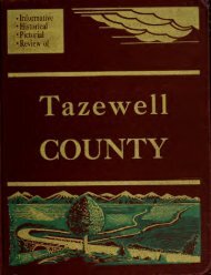
American aerial county history series : - Illinois Ancestors
American aerial county history series : - Illinois Ancestors
American aerial county history series : - Illinois Ancestors

Create successful ePaper yourself
Turn your PDF publications into a flip-book with our unique Google optimized e-Paper software.
I<br />
Informative<br />
Historical<br />
Pictorial<br />
Review of<br />
i'l'vs^sfflifri-if'ra;!<br />
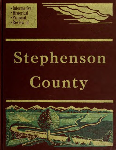
Stephenson<br />
KaaS-JaSSS^JMilJIil<br />
.\<br />
J.*rf*«,««„^
U N I<br />
or<br />
BRA RY<br />
OF THE.<br />
VERS ITY<br />
ILLINOIS<br />
91773<br />
AmSc<br />
V.27<br />
ininnls Bistflfiial Sani!|
1^1,0-1096
THE AMERICAN AERIAL COUNTY HISTORY SERIES, NO. 27<br />
Stephenson County, <strong>Illinois</strong><br />
An Up-To-Date Historical Narrative with County and<br />
Township Maps and Many Unique Aerial Photographs<br />
of Cities, Towns, Villages and Farmsteads<br />
By<br />
JOHN DRURY<br />
Author Old <strong>Illinois</strong> Houses, Historic Midwest Houses,<br />
Midwest Heritage, etc., and member of <strong>American</strong><br />
Association for State and Local History<br />
1955<br />
PUBLISHED BY<br />
THE LOREE COMPANY<br />
3094 Milwaukee Avenue Chicago 10, <strong>Illinois</strong><br />
COPRIGHT 1955 BY THE LOREE CO. All RIGHTS RESERVED. PRINTED IN U.S.A.
The <strong>American</strong> Aerial County History Series<br />
<strong>Illinois</strong>, No. 27<br />
Counties already published for <strong>Illinois</strong>:<br />
Macon<br />
Ful ton<br />
Champ ai gn<br />
Verrai 1 ion<br />
Tazewel<br />
Pike<br />
McDonough<br />
Logan<br />
De<br />
Witt<br />
Cas s<br />
Brown<br />
Mason<br />
Pi att<br />
Menard<br />
I roquo i s<br />
Hancock<br />
Schuyl er<br />
St ark<br />
Knox<br />
Adams<br />
Bu reau<br />
Me rcer<br />
Woodford<br />
Henry<br />
Rank ak ee<br />
Will<br />
Counties already published<br />
for<br />
Indi ana<br />
Newt on<br />
Printed in offset lithography<br />
by The Loree Company,<br />
Chicago, <strong>Illinois</strong>, 1955<br />
II
ACKNOWLEDGMENTS<br />
This is the twenty-seventh of a <strong>series</strong> of new-style <strong>county</strong> histories which<br />
will include all of the 102 counties of <strong>Illinois</strong>, and, ultimately, all of the 3,103<br />
counties of the United States. The project, specializing in low-altitude <strong>aerial</strong><br />
photographs of cities, towns, villages and farmsteads and with brief historical<br />
narratives added, is known as The <strong>American</strong> Aerial County History Series. For a<br />
list of already-published volumes in <strong>Illinois</strong>, see back of title page of this book.<br />
Each of the volumes is being written by John Drury, author of Old <strong>Illinois</strong> Houses,<br />
Historic Midwest Houses, Miduesi H eritage, etc., and member of the <strong>American</strong><br />
Association for State and Local History and the <strong>Illinois</strong> State Historical Society.<br />
In the preparation of this work on Stephenson County, <strong>Illinois</strong>, the writer and<br />
publisher hereby acknowledge their gratitude, for advice and assistance generously<br />
given them, to Mr. Joseph C. Wolf and Mrs. Ellen Chase of the Newberry Library,<br />
Chicago; to Mr. Herbert H. Hewitt, Mrs. Roberta Sutton and Miss Winifred Baum,<br />
all of the Chicago Public Library, Chicago; and to various librarians, public officials,<br />
business executives and private citizens of the city of Freeport and the<br />
<strong>county</strong> of Stephenson, <strong>Illinois</strong>. The author also wishes to express special acknowledgment<br />
to his wife, Marion Neville Drury, for research, editorial and proof-reading<br />
assistance.<br />
Grateful appreciation is also shown here to officials of the Bureau of Public<br />
Roads of the United States Department of Commerce and to officials of the Department<br />
of Public Roads & Planning of the State of <strong>Illinois</strong> (in particular to those in<br />
cha ge of that department's Bureau of Research and Planning in the Highway Department),<br />
for permission to use the Stephenson County maps included in this book.<br />
Sources used by the author in preparing this volume were: History of Stephenson<br />
County, <strong>Illinois</strong>, by Addison L. Fulwider (two volumes, the S. J. Clarke Publishing<br />
Cqmpany, Chicago, 1910); Inventory of the County Archives of <strong>Illinois</strong>:<br />
No. 89, Stephenson County (The Historical Records Survey, Chicago, 1938); The<br />
History of Stephenson County, <strong>Illinois</strong>, by M. H. Tilden (Western Historical Company,<br />
Chicago, 1880); <strong>Illinois</strong>: A Descriptive and Historical Guide, The <strong>American</strong><br />
Guide Series (A. C. McClurg & Company, Chicago, 1939); County and City Data<br />
Book, 1952 (United States Bureau of the Census, Washington, 1952); The Editor<br />
and P ublisher Market Guide for 1955 (The Editor and Publisher Company, New<br />
York, 1955); and The Rand McNally Commercial Atlas for 1955 (Rand McNally<br />
Company, 1955)-<br />
III
TABLE OF CONTENTS<br />
MAP OF STEPHENSON COUNTY VI<br />
STORY OF STEPHENSON COUNTY 1<br />
CITY OF FREEPORT 13<br />
Buckeye Township ( Cedarvi 1 i ,<br />
e Red Oak.Buena Vista) . 15<br />
Dakota Township (Dakota, Afolkey) 47<br />
Erin Township (Eieroy) 67<br />
Florence Township (Florence, Bolton) 81<br />
Freeport Township (Freeport City ) 109<br />
Harlem Township (Scioto Mills, Cedarville) . . . 117'<br />
Jefferson Township (Loran ) . . 147<br />
Kent Township (Kent ) 163<br />
Lancaster Township (Cedarville) 189<br />
Loran Township (Pearl City) 217<br />
Oneco Township (Orangevi 1 1 e , Oneco)<br />
243<br />
Ridott Township (German Val ley , Ri do tt , Evart s) . . 269<br />
Rock Grove Township (Rock Grove) 309<br />
Rock Run Township (Davis, Rock City) 331<br />
Silver Creek Township (South Freeport) 367<br />
Waddams Township (McConnell) 393<br />
West Point Township (Lena, Waddams Grove) . . . .425<br />
Winslow Township (Winslow) 453
VI<br />
GENERAL HIGHWAY MAP<br />
STEPHENSON COUNTY<br />
ILLINOIS
STORY OF STEPHENSON COUNTY, ILLINOIS<br />
If Stephenson County, in the northwest corner of <strong>Illinois</strong>, is today a peaceful,<br />
flourishing<br />
locality of farms and pastures and site of the important industrial city<br />
of Freeport, it was not so calm and orderly in its beginning days more than a hundred<br />
years ago. In the period just before the <strong>county</strong> was born, and for several decades<br />
afterwards, this region was the scene of numerous historic conflicts and<br />
struggles, among them the Black Hawk War, the Wisconsin territorial dispute and<br />
the great Lincoln-Douglas debates.<br />
But Stephenson County early settled down to a routine existence and in time<br />
its <strong>county</strong> seat, Freeport, emerged as a leading manufacturing center of the northern<br />
<strong>Illinois</strong> area. And in time, too, the <strong>county</strong> was producing a number of men and<br />
women who became renowned beyond its borders. Among the foremost of these was<br />
the late Jane Addams, now regarded as one of the greatest of <strong>American</strong> social<br />
workers. Another outstanding social worker of the <strong>county</strong> was Mrs. Oscar Taylor.<br />
It was Stephenson County, also, that nurtured Horatio Chapin Burchard, one-time<br />
Director of the United States Mint, and Major General Smith D. Atkins, noted Civil<br />
War commander.<br />
In recent years the <strong>county</strong>'s principal city, Freeport, has won national attention<br />
for its many fine iris gardens, in some of which are grown rare varieties of the<br />
flower. The National Iris Society has twice held its annual show in Freeport, and<br />
during the blooming season in May and June the city is crowded with visitors to<br />
the Quality Gardens and other showplaces maintained by the Freeport Garden<br />
Club. On their way to and from Freeport, these visitors observe a <strong>county</strong> spread<br />
out on both sides of the winding and attractive Pecatonica River— a <strong>county</strong> about<br />
equally productive as a manufacturing and agricultural locality.<br />
INDIAN OCCUPATION<br />
When <strong>American</strong>s first appeared in the region that now is Stephenson County,<br />
they found it largely in the hands of the Sauks and Foxes, tribes that had long<br />
hunted and fished in the woods and on the waters of the Pecatonica and other tributaries<br />
of the Rock River. Also to be seen in the region were a few Winnebagoes<br />
who had wandered down from Wisconsin. By the late 1820's, when white men first<br />
began crossing future Stephenson County on their way to the Galena lead mines<br />
(in Jo Daviess County), the Sauks and Foxes of the region were formed into a<br />
close alliance by Chief Black Hawk, whose principal village was at the mouth of<br />
the Rock River, near present Rock Island city. In forming this alliance. Black<br />
Hawk thought he might successfully resist the inrush of white settlers into his<br />
region.
KELLOG'S TRAIL<br />
It was in 1827, during the height of the "Lead Rush" to<br />
Galena, that O. W. Kellog<br />
appeared in the area later to become Stephenson County and blazed a trail<br />
through it that came to be known as Kellog's TraiL Although not recorded as the<br />
first permanent settler of the <strong>county</strong>, Kellog not only laid out a road but constructed<br />
several log cabins at a point near the present village of Kent and this place<br />
soon was being called Kellog's Grove .sfrirwards it<br />
was named Timm's Grove).<br />
What caused Kellog to build hir cabins here was its suitability as a "halfway<br />
station" on the Kellog Trail; a load that led from Dixon to Galena. This trail<br />
was part of a longer route from Peoria to Galena— the route most favored by men<br />
from the South and East who were then rushing to the rich lead mines in and about<br />
Galena.<br />
BLACK HAWK WAR<br />
After the Black Hawk War of 1832 opened, future Stephenson County became<br />
the scene of an important and decisive battle in that conflict. This was the Battle<br />
of Kellog's Grove. Realizing the strategic value of the grove, ambitious to take it<br />
over so that he could control the trail between Dixon and Galena, Chief Black<br />
Hawk sent a sizable icrce of Indians to attack the place. But in the battle that<br />
followed, fought here on June 25, 1832, the Indians were repulsed by the forces of<br />
Colonel John Dement. A monument erected here in 1886 contains the names of<br />
twenty-five Stephenson County volunteers who were killed at this and other battles<br />
in the Black Hawk War.<br />
FIRST SETTLER<br />
At the end of the Black Hawk War, a conflict which resulted in the permanent<br />
removal of the Indians from <strong>Illinois</strong> to reservations west of the Mississippi River,<br />
what is now Stephenson County began to fill rapidly with settlers. Instead of<br />
coming from the East, however, many of these early settlers came from the West —<br />
from the Galena lead mines. A goodly portion were unsuccessful miners who decided<br />
to take up farming on the fertile lands bordering the Pecatonica River.<br />
Among these were numerous Pennsylvania Germans.<br />
On record as the first permanent settler of Stephenson County is William<br />
Waddams, after whom the present village of Waddams Grove is named. A native of<br />
New York state, William Waddams came west with his family, and, like so many of<br />
his contemporaries, took part in the "Lead Rush" to Galena. Then, just after the<br />
close of the Black Hawk War, he gathered up his family (Mrs. Waddams was a<br />
native of Vermont) and settled at the place now called Waddams Grove in Stephenson<br />
County.<br />
Referring to this first settler of the <strong>county</strong>, Addison L. Fulwider, in his<br />
History of Stephenson County, <strong>Illinois</strong>, has this to say: "The first permanent
settlement in Stephenson County was made by William Waddams, in West Point<br />
Township, at Waddams Grove, in the summer of 1833. • • • There were no schools<br />
in the first years of Mr. Waddams life here but, being interested in the education<br />
of his children, he procured the services of a private teacher for his children."<br />
The description continues: "He was forty-seven years old when he built his<br />
first permanent residence in this <strong>county</strong> on Section 13, in West Point Township.<br />
He was a man of decided opinions and in politics was at first a Whig and then a<br />
Republican. Mr. Waddams was the pilot who led the way for many a family into<br />
Stephenson County. Many a settler partook of his hospitality while selecting a<br />
claim here. Frequently he hitched his team to the end of the newcomer's wagon<br />
tongue and pulled him through mud holes or across the fords on the Pecatonica. He<br />
was for a long time justice of the peace, and earned the title of Squire Waddams."<br />
SOME EARLY SETTLERS<br />
Soon after William Waddams built his first log cabin home in the summer of<br />
1833, other newcomers began to arrive and settle in the area. In the spring of 1834,<br />
we are told, Lyman Brewster came and established Brewster's Ferry on the Pecatonica<br />
River near present-day Winslow village. A year later, James Timms arrived<br />
with his family and settled in the cabins at Kellog's Grove, after which the place<br />
became known as Timm's Grove.<br />
Then came Miller Preston (1835), who brought with him a drove of cattle from<br />
Ohio and who settled in present-day Harlem Township near the then Galena stagecoach<br />
road. That same year, Benjamin Goddard and family arrived and staked out<br />
a claim in the region between the present communities of Freeport and Cedarville.<br />
Another who appeared in 1835 was William "Tutty" Baker, who set up a log<br />
trading post and wayside inn that became the nucleus of the present city of Freeport.<br />
But there were numerous others who came in 1835, too, among them William<br />
Robey and his sons, Levi, John, William W., and Thomas, and three daughters,<br />
Frances, Elizabeth and Mary.<br />
FREEPORT FOUNDED<br />
As more and more settlers came to the region in 1835 (it was then partly in<br />
Jo Daviess County and partly in Winnebago County), William "Tutty" Baker prospered<br />
at his wayside inn and trading post on the Pecatonica River. It was this<br />
wayside inn, built early in 1835, that marked the beginning of Freeport city. In<br />
addition to his tavern and trading post, Baker established a ferry service across<br />
the river here and soon a settlement grew up about the Baker place.<br />
At first, this settlement was called Winnesheik, so-named after a local Winnebago<br />
chief who had earlier lived nearby on the banks of the Pecatonica. But<br />
about 1837 (the same year in which Stephenson County was formed) the Baker
settlement acquired a new name "Freeport." But how did such a land-locked community<br />
receive such a maritime name In answer to that question, so often asked,<br />
there is a local legend to the effect that Mrs. Baker was responsible for the name.<br />
It seems that Mr. Baker was something of an over-generous host. When he<br />
decided to lay out a city here, Mr. Baker served free meals to numerous prospective<br />
lot-buyers, all of which meant extra cooking for Mrs. Baker. So one day she became<br />
impatient of the whole thing and announced to her husband: "Look here, this place<br />
is getting to be a regular free port for everybody coming along the trail. You'd<br />
better call your new town 'Freeport,' because that's what it will be if you run it."<br />
STEPHENSON COUNTY IS<br />
BORN<br />
By the year 1837 there were several hundred settlers in the countryside bordering<br />
the western reaches of the Pecatonica River—enough to form a new <strong>county</strong>.<br />
As it was a rapidly growing period in which new counties were being formed almost<br />
yearly, the people of Freeport, Waddams Grove, Rock Creek and other settlements<br />
on both sides of the Pecatonica began talking of a <strong>county</strong> of their own; one that<br />
could be organized out of the western portion of Winnebago County and the eastern<br />
portion of Jo Daviess County.<br />
This talk soon enough crystalized into action. A meeting was held, petitions<br />
were circulated, and finally the matter was brought before the <strong>Illinois</strong> state legislature<br />
at Vandalia (which then was the capitol of the state). There followed the<br />
passage of an act on March 4, 1837, creating a new <strong>county</strong> "to be called Stephenson,<br />
as a tribute of respect to the late Colonel Benjamin Stephenson." The act<br />
was signed into law a few days later by Governor Joseph Duncan.<br />
COLONEL BENJAMIN STEPHENSON<br />
When the new <strong>county</strong> on the northern border of <strong>Illinois</strong> was named "Stephenson,"<br />
it honored the memory of one of the founding fathers of the Prairie State. It<br />
was during the War of 1812 that Benjamin Stephenson was commissioned a colonel<br />
of <strong>Illinois</strong> Militia. Later he was appointed Adjutant General of <strong>Illinois</strong> Territory.<br />
Then, from 1814 to 1816, Colonel Stephenson represented <strong>Illinois</strong> Territory as a<br />
delegate in Congress. As a member of the Constitutional Convention of 1818,<br />
Colonel Stephenson played an important part in the drafting of the first constitution<br />
of <strong>Illinois</strong>.<br />
FREEPORT BECOMES COUNTY SEAT<br />
Although the then new village of Cedarville made a strong bid to become seat<br />
of justice of the new <strong>county</strong>, emphasizing the desirability of its central location,<br />
it was Freeport that won the title. When the state legislature appointed three men<br />
from outside the new <strong>county</strong> to serve on a commission for the selection of a <strong>county</strong><br />
seat site, it ordered that they should meet for this purpose at the home of William
Baker in Freeport. Apparently the commissioners were well fed by the generoushearted<br />
Mr. Baker— and not only that but Mr. Baker and other citizens offered a<br />
contribution of J6,500 in cash to the new <strong>county</strong>, as well as a donation of land for<br />
the court house square, if Freeport were chosen as <strong>county</strong> seat. Impelled by such<br />
inducements, the three commissioners voted in favor of Mr. Baker's new town.<br />
FIRST COUNTY ELECTION<br />
It was also at the home of William "Tutty" Baker that Stephenson County<br />
held its first election. This was on the first Monday in May, 1837. The number of<br />
votes cast was 121. Serving as judges at that election were Orleans Daggett,<br />
James W. Fowler and Thomas J. Turner; the clerks were Benjamin Goddard and<br />
John C. Wickham. When the votes were counted it was found that the following<br />
early settlers were elected the <strong>county</strong>'s first officers: Lemuel W. Streator, Isaac S.<br />
Forbes and Julius Smith, commissioners; William Kirkpatrick, sheriff; Lorenzo Lee,<br />
coroner; Orestes H. Wright, recorder; and Frederick D. Bulkley, surveyor.<br />
ELECTION PRECINCTS<br />
As its first order of business, the commissioners' courtfas it was then called)<br />
of the new <strong>county</strong>, meeting at the home of Orestes H. Wright (who had been elected<br />
recorder), created six election precincts and appointed judges of election for each.<br />
The six, and their judges of election, were: Freeport precinct, Seth Scott, A. 0.<br />
Preston and L. O. Crocker; Central precinct, Ira Jones, Levi Lucas and Alpheus<br />
Goddard; Brewster precinct, L. R. Hull, John M. Curtiss and N. E. Ransom; Rock<br />
Grove precinct, J. R. Blackmore, Jonathan Cora and Eli Frankenberger; Waddams<br />
precinct, William Waddams, Othmiel Preston and John Garner; Silver Creek precinct,<br />
names of judges not ascertained.<br />
WISCONSIN BOUNDARY DISPUTE<br />
If a majority of the early citizens of the <strong>county</strong> coUld have had their way,<br />
Stephenson today would be in the State of Wisconsin instead of the State of <strong>Illinois</strong>.<br />
Also, the great city of Chicago would be in the Badger State instead of the<br />
Prairie State. Although occupying a new <strong>Illinois</strong> <strong>county</strong> formed on their own initiative,<br />
the early residents of Stephenson— as well as of eight other counties in northern<br />
<strong>Illinois</strong>— voted overwhelmingly, at a convention held in Rockford in 1840, in<br />
favor of Wisconsin's claim that its southern boundary should be fixed on a line<br />
runaing due west of the southern tip of Lake Michigan.<br />
This was the original boundary line set up in the Ordinance of 1787 which<br />
created the Northwest Territory, so-called because it lay northwest of the Ohio<br />
River. When <strong>Illinois</strong> became a state in 1818, however, she succeeded in having<br />
this ordinance amended so that her northern boundary would be some sixty miles<br />
north of the foot of Lake Michigan, thus giving her a waterway outlet and the port<br />
of Chicago.
Discussing this matter, the Stephenson County volume of the Inventory of the<br />
County Archives of <strong>Illinois</strong> says: "The year 1840 witnessed the greatest activity<br />
on the part of citizens of Stephenson County in support of Wisconsin's claim. . . .<br />
As a result of a meeting of the citizens of Stephenson County, February 19, an<br />
election was actually held throughout the disputed tract on the 5th of March, at<br />
which, of five hundred and seventy votes cast, all but one were in favor of uniting<br />
with Wisconsin."<br />
The volume continues: "On May 2!^, 1840, there was presented to the United<br />
States Senate a petition signed by sixty-two citizens of Stephenson County, asking<br />
that 'Wiskonsin' be given those 'ancient rights secured to them by the ordinance<br />
(of 1787) aforesaid, through the repeal of so much of the act for the admission of<br />
<strong>Illinois</strong> as conflicts with the ordinance referred to.'<br />
"On July 6, 1840, representatives from Stephenson, and from eight other of<br />
the fourteen counties in the disputed area, met in convention at Rockford. The<br />
convention formally declared that Wisconsin was entitled to the fourteen northern<br />
counties as claimed, and the citizens were recommended to elect delegates to a<br />
convention to be held at Madison, on the third Monday in November, 'for the purpose<br />
of adopting such lawful and constitutional measures as may seem to be necessary<br />
and proper for the early adjustment of the southern boundary.' "<br />
Strong as this movement was, however, it did not succeed in attaining its<br />
objective. When Congress, in 1848, passed an enabling act for the admission of<br />
Wisconsin Territory into statehood, it fixed the new state's southern boundary<br />
about sixty miles north of the tip of Lake Michigan. Thus was Stephenson and its<br />
neighboring counties — as well as Chicago— retained in the State of <strong>Illinois</strong>.<br />
FIRST COURTHOUSE<br />
Although Stephenson County was organized in 1837, it was not until 1840<br />
that its first permanent courthouse was completed at Fre^port. It was built by<br />
Thomas J. Turner, later to become a prominent lawyer, congressman and first mayor<br />
of Freeport after its incorporation as a city. The <strong>county</strong>'s first courthouse was a<br />
two-story frame structure described as something of "a marvel of architecture"<br />
and considered as surpassing in size and elegance any other courthouse west of<br />
Detroit and north of St. Louis.<br />
i<br />
"During the early days," says Fulwider's <strong>history</strong> of the <strong>county</strong>, "the old<br />
courthouse served as a meeting place for new congregations before they could<br />
build churches. It was there, too, that mass meetings were held, as well as conventions<br />
and railroad gatherings, but as early as 1850 citizens and the newspapers<br />
began to complain that the old courthouse was not in keeping with the progress of<br />
the <strong>county</strong>. It was argued that a community would be known by its public buildings,<br />
and Freeport should have a more modern structure as a means of attracting settlers<br />
and building up the town."
TOWNSHIP ORGANIZATION<br />
Until 1850, Stephenson was governed by a "<strong>county</strong> court" composed of three<br />
elected commissioners. In that year, the citizens of the <strong>county</strong> voted in favor of<br />
adopting the township form of government, which meant that a supervisor would be<br />
elected from each township and these would form the County Board of Supervisors,<br />
governing body of the <strong>county</strong>.<br />
As a result of this change, fifteen townships were created. These original<br />
fifteen townships, and their first elected supervisors, were: Lancaster, Johnston<br />
Reitzell; Rock Run, C. G. Epiey; Rock Grove, James J. Rogers; Oneco, George<br />
Cadwell; Winslow, Cornelius Judson; Waddams, Michael Lawyer; Buckeye, John<br />
Montebus; West Point, Daniel Wilson; Harlem, William M. Buckley; Erin, John I. F.<br />
Harman; Florence, Conrad von Brocklin; Ridott, Gustavus A. Farwell; Silver Creek,<br />
Samuel McAfee; Loran, Hiram Hart; and Freeport, E. S. Hanchett. Since 1850, three<br />
new townships were created— Jefferson, Kent and Dakota.<br />
ARRIVAL OF THE "CARS"<br />
An event of major importance in the <strong>history</strong> of Stephenson County was the<br />
building of the first railroad through it in 1853- This was the Galena and Chicago<br />
Union, which not only was the first "steam line" to be constructed in Stephenson<br />
County but was the first railroad to be built in Chicago, now the railroad capital<br />
of the world. Today, the old Galena and Chicago Union is part of the Chicago and<br />
North Western System. The one hundredth anniversary of the North Western was<br />
observed in 1948 bymanypublic events and by the publication of Pioneer Railroad,<br />
a <strong>history</strong> of the system by Robert J. Casey and the late W. A. S. Douglas.<br />
After the Galena and Chicago Union was completed to Freeport in 1853, the<br />
Freeport Journal commented: "Finally, after all the disappointments and difficulties<br />
of reaching us, the cars have at last come. We have seen and heard the<br />
panting of the iron horse and heard the shrill whistle of the Jocomotive for the first<br />
time in Freeport. Yesterday, the construction train crossed the bridge over the<br />
Pecatonica and today will probably reach the depot grounds at the lower end of<br />
town. Our farmers, merchants and business men will rejoice over this event heartily<br />
and hail with delight this new advance of wealth into our midst."<br />
Almost immediately after the arrival of this first railroad, both the population<br />
and the productivity of Stephenson County increased to an unprecedented degree.<br />
The <strong>county</strong> had now come to the end of its pioneer period and had entered its<br />
modern phase. In 1859 the Chicago, Milwaukee, St. Paul & Pacific Railroad was<br />
completed to Freeport, and soon the towns of Davis, Rock City, Dakota and Florence<br />
were built along its right-of-way. Then came the Chicago & Great Western in<br />
1889- Soon after the turn of the century (1904) the Rockford & Interurban Railroad<br />
was built, an electric line that provided fast service between Rockford and Freeport.
LINCOLN-DOUGLAS DEBATE<br />
At North State Avenue and East Douglas Street, in Freeport, may be found<br />
today a memorial boulder marking the site of the second of the <strong>series</strong> of debates<br />
between Abraham Lincoln and Senator Stephen A. Douglas— a <strong>series</strong> of debates on<br />
the slavery question now considered to be the greatest in <strong>American</strong> <strong>history</strong>. The<br />
Freeport debate was held on August 27, IP^S, before a crowd estimated at between<br />
12,000 and 15,000.<br />
Then known mostly as a leadini; Springfield lawyer, Abraham Lincoln, tall,<br />
smooth-shaven, dressed in a black frock coat, arrived in Freeport on a special<br />
train at 10 o'clock in the morning on the day of the debate. He was greeted by a<br />
crowd of 5,000 and escorted to the new Brewster House. There, on the balcony of<br />
the hotel, Lincoln delivered a brief reply to a speech of welcome from Thomas J.<br />
Turner, a leading Freeport lawyer of the period.<br />
In the meantime. Senator Douglas, a short, stocky, dynamic individual known<br />
familiarly as the "Little Giant," was in his room at the Brewster House. He had<br />
arrived the night before and had been escorted to the hotel by a large torchlight<br />
procession.<br />
On the day of the debate, crowds began gathering early at the site chosen<br />
for it. Although it was a cold, damp day, there was great enthusiasm in the crowd<br />
for the forthcoming event. Just before 2 o'clock in the afternoon. Senator Douglas,<br />
with a group of friends, walked from the Brewster House to the debating stand two<br />
blocks away. Lincoln, however, arrived at the stand in a Conestoga wagon drawn<br />
by six horses.<br />
As we have said, a crowd of between 12,000 and 15,000 listened to the two<br />
speakers. This second of the <strong>series</strong> of Great Debates, staged during the <strong>Illinois</strong><br />
senatorial campaign of 1858, was important because of its famous "Freeport Question."<br />
Lincoln addressed this question to Douglas on that afternoon: "Can the<br />
people of a United States Territory, in any lawful way, against the wish of any<br />
citizen of the United States, exclude slavery from its limits prior to the formation<br />
of a State Constitution"<br />
Although the "Little Giant's" affirmative answer made him the winner of the<br />
senatorial race that year, it proved fatal to his presidential prospects two years<br />
later. And although Lincoln lost the senatorial race, the Great Debates brought<br />
him forward as a national figure; as a presidential possibility in I860.<br />
BIRTH OF JANE ADDAMS<br />
Perhaps the foremost of all of Stephenson County's native sons and daughters<br />
was the late Miss Jane Addams, founder of Hull House in Chicago and one of the<br />
greatest of <strong>American</strong> social workers. She was born in the village of Cedarville,
just north of Freeport, on September 6, 1860, one year before the outbreak of the<br />
Civil War.<br />
Her father was John H. Addams, early Stephenson County settler, gristmill<br />
owner, state legislator, friend of Lincoln's, organizer of the "Addams Guards" in<br />
the Civil War, and one of the founders of the Galena and Chicago Union Railroad<br />
(now part of the Chicago and North Western System). It was in her parent's house<br />
at Cedarville that Jane Addams spent her childhood and young womanhood.<br />
After her father died in 1881, young Jane Addams went to Chicago, became a<br />
social worker, and established Hull House in 1889. She subsequently made this<br />
institution into one of America's most famous social settlements. Since the death<br />
of Jane Addams in 1935, the Cedarville house in which she was born and reared<br />
has become something of an historic shrine, although privately owned.<br />
THE CIVIL<br />
WAR<br />
When President Lincoln sent out his urgent call for 75,000 volunteers at the<br />
opening of the Civil War in 1861, Stephenson County quickly responded with more<br />
than its quota of men and money for the Union cause. At the end of the conflict in<br />
1865, it was found that 542 men of Stephenson County had either been killed in<br />
action or died of illness while in the service of their country. On the courthouse<br />
lawn in Freeport today stands the tall stone Civil War Monument, erected in 1869.<br />
On the four corners of its base are life-size figures of a Civil War sailor, militiaman,<br />
cavalryman and artilleryman. The names of Stephenson County men who fell<br />
in the Civil War are engraved on a bronze plaque at the base of the monument.<br />
SECOND COURTHOUSE<br />
If Stephenson County residents began to clamor for a new, and more modern,<br />
courthouse as early as 1850, it was not until 1873 that the type of building they<br />
sought was completed. When the new edifice was finished in that year, citizens of<br />
the <strong>county</strong> beheld an imposing structure of white limestone,- four stories high and<br />
surmounted by an ornate tower. In the tower was hung a bell weighing 1,850<br />
pounds, and here also was installed a large Seth Thomas clock weighing 2,000<br />
pounds. The new courthouse was completed at a total cost of $130,413.56. Several<br />
years after this courthouse was built, the <strong>county</strong> erected a new jail at a cost of<br />
135,000.<br />
IRIS<br />
CAPITAL OF THE MIDWEST<br />
In the past fifty years, Stephenson County's principal city and seat of justice,<br />
Freeport, has not only emerged as an important manufacturing place but as a leading<br />
iris-growing center. It is often called the Iris Capital of the Midwest. During<br />
the blooming season in the latter part of May and early June, many visitors from<br />
<strong>Illinois</strong>, Wisconsin and Iowa arrive in Freeport to view both familiar and rare iris
plants in the Quality and other gardens of the city. These showplaces are sponsored<br />
by the Garden Club of Freeport. The National Iris Society has twice held its<br />
annual show in Freeport.<br />
STEPHENSON COUNTY TODAY<br />
On the basis of latest United State; census figures, a statistical profile may<br />
be drawn of Stephenson County as ir was in 1950. This will show that it then had<br />
a total population of 41,595— an increase of 2.3 per cent over its 1940 figure. Its<br />
largest city and <strong>county</strong> seat, Freeprvrt. nad a population of 22,467.<br />
With a land area of 568 square miles, the <strong>county</strong>'s density of population was<br />
73 inhabitants per square mile. Of the <strong>county</strong>'s total population, 22,467 were<br />
classified as urban (all of whom lived in Freeport), 10,055 as rural farm dwellers<br />
and 9,073 as rural non-farm residents. There were 3,998 infants under five years<br />
of age in the <strong>county</strong> in 1950, and 4,805 persons sixty-five years old and over. The<br />
median age was given as 33-6 years. The number of potential voters then was<br />
27,774.<br />
Under the heading of vital statistics, Stephenson County in<br />
births, 464 deaths (including 23 infants), and 393 marriages.<br />
1950 had 850 live<br />
There 'vere 11,120 tamiIies(two or more persons related by marriage or blood)<br />
in the <strong>county</strong> then, and the median income of all of these families was given as<br />
$3,231. Slightly more than 24 per cent of these families had incomes of less than<br />
12,000, while 19.4 per cent had incomes of $5,000 or more.<br />
In the field of education, the <strong>county</strong> had a total of 6,830 young persons between<br />
the ages of seven and seventeen years (school age). There were 4,370 between<br />
the ages of seven and thirteen years (primary school age), and 95-0 per cent<br />
of these were enrolled in primary schools. The figures also showed there were<br />
1,885 between the ages of fourteen and seventeen (high school age), and 84.5 per<br />
cent of these were enrolled in high schools.<br />
In 1950 the <strong>county</strong> had a total potential labor force of 31,810 (persons fourteen<br />
years old and over). Actually employed, however, were 17,794, of which 83.1<br />
per cent were males and 31.2 per cent females. The labor figures revealed further<br />
that 4,292 were employed in manufacturing, 3,731 in agriculture, 2,960 in retail<br />
and wholesale trade, 1,347 in professional and related services, 1,294 in transportation,<br />
communication and other public utilities, 837 in business and personal<br />
services, 787 in construction, 736 in finance, insurance and real estate, and 29 in<br />
mining. The labor figures were concluded by showing that 25.0 per cent of the<br />
total employed in Stephenson County during 1950 were engaged in manufacturing,<br />
while 21.7 per cent were engaged in agriculture.<br />
With reference to housing, the <strong>county</strong> had a total of 13,120 dwelling units in<br />
1950 (in 1940 its total was 12,036). The median number of rooms per unit was<br />
10
given as 5.8. Slightly more than 76 per cent were one-dwelling unit detached structures<br />
(including occupied trailers), 7.0 per cent were built in 1940 or later, and<br />
53.7 per cent had hot running water with private toilet and bath. The housing figures<br />
showed further that 58.3 per cent were owner-occupied, 1.7 per cent were<br />
occupied by non-white households, 73.9 per cent had central heating, 89.1 per<br />
cent had mechanical refrigerators, and 98.1 per cent had radios. There were 10,287<br />
houses classified as non-farm dwelling units, and the median value of these was<br />
given as $7,047. The median gross monthly rental of renter-occupied houses was<br />
given as $46.76.<br />
In 1948, when the last United States business census was taken, there were<br />
547 retail stores in the <strong>county</strong> which employed 2,162 persons and which grossed<br />
$44,923,000 in sales. Largest group in the retail field were food stores, which<br />
numbered 129 and which grossed $9,927,000 in sales. The next largest group were<br />
eating and drinking places, which numbered 107 and which grossed $3,257,000.<br />
There were 73 wholesale establishments in the <strong>county</strong> then and total sales of<br />
these amounted to $27,084,000.<br />
As we have already noted, Stephenson is about equally productive as a manufacturing<br />
and as an agricultural <strong>county</strong>. In 1947, when such figures were last obtained,<br />
the <strong>county</strong> had 80 manufacturing establishments which employed 4,686<br />
persons and which produced goods and materials in the amount of $18,846,000.<br />
In 1950 the <strong>county</strong> had a total of 2,534 farms, of which 2,396 were classified<br />
as commercial farms. Of all of the farms in the <strong>county</strong>, 41.8 per cent were operated<br />
by tenants. The average value of land and buildings per farm for all farms was<br />
given as $22,971. The value of all farm products (crops, livestock, poultry, dairy<br />
products) sold in 1949, four years after the close of World War II, was given as<br />
$20,167,000. Farm expenditures in that same year amounted to $2,552,000 for livestock<br />
and poultry feed and $1,164,000 for hired labor.<br />
Total bank deposits (of individuals, partnerships and corporations) in Stephenson<br />
County on December 30, 1950, amounted to $37,113,000. On that same date<br />
the <strong>county</strong>'s three savings and loan associations had savings capital totaling<br />
$4,473,000, with $3,754,000 in first mortgage loans outstanding.<br />
11
CITY OF FREEPORT<br />
As the story of Stephenson County is largely the story of Freeport, details of<br />
the city's past will be found in the opening historical narrative of the present<br />
work. An important manufacturing center of the northern <strong>Illinois</strong> area, Freeport in<br />
1950 had a total population of 22,467, which placed it 31st in population rank<br />
among the cities of the Prairie State.<br />
Freeport is located 115 miles northwest of Chicago and serves as a gateway<br />
to Apple River Canyon State Park (in Jo Daviess County) and the scenic Mississippi<br />
River bluffs region. The city is situated on US 20 and on state highways 75<br />
and 26. It is also on the <strong>Illinois</strong> Central, Chicago and North Western, Chicago and<br />
Great Western and Chicago, Milwaukee, St. Paul and Pacific railroads.<br />
Among leading manufacturing plants in Freeport are the Micro Switch Company<br />
(electrical switches). Burgess Battery Company (electric batteries), W. T.<br />
Rawleigh Company (proprietary products), Fairbanks-Morse Company (electrical<br />
machinery), Strucko Manufacturing Company (toys), Stover Steel Tank Company<br />
(steel tanks), Hoefer Manufacturing Company (heavy machinery) and the Freeport<br />
Manufacturing Company (mops and brooms).<br />
It was in Freeport that the second debate between Lincoln and Douglas was<br />
staged on August 27, 1858. A memorial boulder at North State Avenue and East<br />
Douglas Street marks the site of the debate.<br />
13
)<br />
;ji^^i^DjT/<br />
^JiD^<br />
LASTING<br />
CONCRETE<br />
'<br />
^^^—yata.wii—<br />
with<br />
the<br />
EXCLUSIVE<br />
CORRUGATED<br />
STA VE<br />
WET CAST<br />
VIBRATED<br />
CONVEX EXTERIOR<br />
Monufactured and Built by<br />
THE FREEPORT SILO CO., Freeport, <strong>Illinois</strong><br />
ORLAN and LEE THERRIEN, Owners Office and Plant, 22 No. Commercial<br />
Phone Main 3640<br />
14
BUCKEYE TOWNSHIP<br />
CEDARVILLE<br />
RED OAK<br />
BUENA VISTA<br />
15
CEDAR VILLE<br />
Some six miles north of Freeport, on State 26, lies the incorporated village<br />
of Cedarville, with a population of 466. Still standing in the village is the house<br />
in which the late Miss Jane Addams, one of the greatest of <strong>American</strong> social workers,<br />
was born and reared. Her father, John H. Addams, was an early Stephenson<br />
County settler, state legislator, friend of Lincoln's and one of the organizers of<br />
the Galena and Chicago Union Railroad, first "steam road" to be built in the<br />
<strong>county</strong>. Cedarville village is the principal community of Buckeye Township, which<br />
has a total population of 1,304. First settler of the township is believed to have<br />
been John Goddard, who came in 1835 and settled near the site of Cedarville.<br />
17
RED OAK<br />
Another community of Buckeye Township is the small village of Red Oak,<br />
with a population of 95. It is located on the <strong>Illinois</strong> Central Railroad just northwest<br />
of Cedarville. The village was founded in 1888 by W. R. Bender, who also<br />
opened the first general store.<br />
18
BUENA VISTA<br />
Also in Buckeye Township is Buena Vista, which has a present population<br />
of 45. It is served by the postoffice at Red Oak. Buena Vista was platted in 1852<br />
by Marcus Montelius and Philip Reitzell.<br />
19
BELLEVUE LUTHERN CHURCH<br />
Last used in 1951<br />
Sermon by Rev. Roy Berg<br />
Buckeye<br />
CEDARVILLE METHODIST CHURCH<br />
Rev. Mills Minister<br />
Cedarville<br />
2U
RED OAK METHODIST CHURCH<br />
Red Oak<br />
Erected 1891<br />
Rev. Seth Bower<br />
There are aproximately 50 members<br />
RICHLAND METHODIST CHURCH<br />
Rev. Seth Bowers<br />
Sec. 22 Rt. 1<br />
Red<br />
Oak<br />
21
e<br />
BELLEVUE CEMETARY<br />
BELLEVUE SCHOOL (Disc. 1951-1952)<br />
Buckeye Town sh i p<br />
e<br />
p<br />
SOUTH AFOLKEY SCHOOL (Disc. 1952;<br />
Robert Dalton. Last Teacher<br />
Buckeye Town sn I<br />
BUENA VISTA SCHOOL (Disc. 1953)<br />
Ruth LInderman, Last Teacher<br />
Martha Uttecht, Present Owner<br />
.4bi6«.:'^<br />
CEDARVILLE<br />
Cedarv i 1 1<br />
CEMETERY<br />
vMb4Mr
e<br />
CEDARVILLE COMMUNITY HOUSE<br />
Cedarvi 1 1<br />
AMANS, HARRI E<br />
Orangev i 1 1 e<br />
C.<br />
Sec. 6<br />
BABLER, WM.<br />
He rm an R. Bu sj ah n<br />
rangevi 1 1 e Sec. I<br />
ANGLE RALPH R. Sec. 33 Rt. 3<br />
Freeport John C. » ilton Ten. 290 acres<br />
BARDELL ELMER P. Sec. 33<br />
Freeport<br />
Rt. 3<br />
80 acres<br />
23
BARMORE, MARGARET<br />
range VI I ) e Sec. I<br />
Rt. I<br />
80 acres<br />
BELL E. L. Sec. 20 Rt. I<br />
Dakota John Enzinger Tenant 168 acres<br />
BENDER KENNETH & CLIFFORD Sec. 28 Rt. I<br />
Red Oak 120 acres<br />
BEAR, FLOYD<br />
Russell Bawi nke V<br />
Freeport Sec. 29<br />
BEHHEHOFF MARTHA, Sec. 26^ ^^<br />
Rt. I<br />
Orangey i lie Charles Bennehoff 160 acres<br />
Tenant<br />
BECK. EBER H.<br />
Dakota Sec. 16<br />
24<br />
Rt. I<br />
80 acres<br />
BENNETHUM ROY M. Sec. 13 Rt. 3<br />
Freeport Frederick W.<br />
Tenant<br />
Overt<br />
><br />
;0 acres
I<br />
BENNETHUM ROY M. Sec. |i| Rt. 3<br />
Freeport John Strawser Tenant 3^8 acres<br />
aOtENDER GUY L. Sec. 19 Rt. 3<br />
Freeoort 107 acres<br />
BERG ROY REV. Sec. 12 Rt. 3<br />
Freeoort Russell K. Mills Ten. 96 acres<br />
H. C. BOLENDER EETATE Sec. 19 Rt. 3<br />
FrecRort Ray C. Bolender Ten. 106 acres<br />
BIKE, LLOYD<br />
Fred B. White<br />
Red Oak Sec. 23<br />
BORDNER CURENCE Sec. 16-17 Rt. I<br />
Dakota |60 acres<br />
BOALS ROY Sec. 21 Rt. I<br />
Dakota Carl W. Folgate Tenant 170 acres<br />
BOWLLMAN R; Sec. 28<br />
Red Oak Bill Pieper Tenant<br />
Rt.<br />
1 1*7 acres<br />
25
i<br />
^ssa^'i<br />
BRUSH CREEK CHEESE FACTORY Rt. I<br />
M i 1 D i etme i er, op r.<br />
Orange ville Sec. 5<br />
CARTER, ALFRED L.<br />
Red Oak Sec. 22<br />
Rt. I<br />
69 acres<br />
BUCKEYE CHEESE CO.<br />
Cec i ) C. Zen tner, Mgr.<br />
Dakota Sec. 29<br />
Rt.<br />
CARTER ARTHUR W. Sec. 27 Rt. I<br />
Red Oak iq acre*<br />
BUSKER, JOHN A.<br />
Red Oak Sec, 2!<br />
Rt. I<br />
3. I acres<br />
CARTEK MARY MRS. Sec. 30 Rt. 3<br />
Freeport Leo L. Rackow Mr. & Mr:;, S90 acres<br />
Tenant<br />
26
I<br />
CUY ARTHUR L. Sec. 33<br />
Rock City<br />
Rt. I<br />
120 acres<br />
CRUMMER MERLE Sec. 10 Rt. I<br />
Dakota Raymond W. Fehr Tenant 120 acres<br />
lii^^^r^Ji!^^'^^^.<br />
DAHMS, EDGAR<br />
rangev i I 1 e Sec. 2<br />
Rt.<br />
160 acres<br />
, 4<br />
DAUGHENBAUGH ESTATE, EDWIN Rt. I<br />
Orangeville Sec. 2 70 acres<br />
CRAWFORD JOHN A. Sec. 30<br />
Freeporl Runkle Fred Ten.<br />
DAVIS, DELTON W.<br />
Freeport Sec. 23<br />
Rt. 3<br />
175 acres<br />
27
OELOACH, MRS. ALICE Rt. 3<br />
Gerald E. Bessert<br />
Freeport Sec. 36 220 acres<br />
DIETMEIER GLENN D. Sec. 25 RT. 3<br />
Freeport 88 acres<br />
DICKSON SELMA MRS. Sec. 33 Rt. 3<br />
Freeport John Remmere Tenant 130 acres<br />
DIETMEIR, RAY<br />
rangev i I 1 e Sec. 3<br />
Rt. I<br />
KB acres<br />
DIEMER LUTHER<br />
Freeport<br />
Sec. 2^ OONKER, JOHN D.<br />
Freeport Sec. I<br />
28
I<br />
ENGLEMAN ESTATE Sec. ER Rt. I<br />
Red Oak Kenneth T. Klentz Tenant 95 acres,<br />
ENZINGER JOHN Sec. 18 Rt. I<br />
Dakota Victor Aebly ©perator 80 acres<br />
FOLGATE RAY Sec. 20<br />
Dakota Donald Folgate Ten.<br />
Rt.<br />
I<br />
160 acres<br />
FEHR HOMER K. Sec. |7<br />
Dakota<br />
Rt.<br />
80 acres<br />
FOLGATE RAY J. Sec. 18 Rt. 3<br />
Freeport Harold F. FogateTen. I60 acres<br />
29
FRANK, JOHN<br />
Harold B. White<br />
Red Oak Sec. 26<br />
FRANK LEROY Sec. 2 1 Rt. |<br />
Dakota Allen Miller Tenant 80 acres<br />
FRANK, LEROY B.<br />
Dakota Sec. 21<br />
FRYER CLINT<br />
Freeport<br />
30
.<br />
I<br />
'h<br />
i'<br />
FRYER, WILLIAM F.<br />
Freeport Sec. 25<br />
Rt. 3<br />
120 acres<br />
GEORGE AOCLPH & SON Sec. 28 Rt. |<br />
Dakota 320 acres<br />
FULLMER, FRANCES<br />
Ada Gannon<br />
Red Oak Sec. 23<br />
GOETZ, HENRY Rt. I<br />
Orangevilje Sec. 2 26 acres<br />
GEARHART FLOYD 0. Sec. 16<br />
Dakota<br />
Rt.<br />
80 acres<br />
GOODMAN JESS Sec. 12 Rt. 3<br />
Freeport Harold Ayen Tenant 194 acres<br />
31
Rt.<br />
GROSS, KENNETH<br />
rangevi ) I e Sec. 3<br />
Rt.<br />
I<br />
GRIFFEN WILL A. Sec. 21 Rt. |<br />
Dakota Walter H. Schmerse Ten. 130 acres<br />
GROSS, KENNETH<br />
rangev i 1 1 e Sec. 3<br />
I<br />
GROSS, DALE D. ,<br />
Orangeville Sec. 3 1 6 2i acres<br />
HARTMAN HEIRS R t. 3<br />
Dale D. Fryer<br />
Freeport Sec. II & m 195 acres<br />
Mervin Brinkner<br />
Oranaevi 1 1 e Sec. 2<br />
HARTMAN, R.<br />
Dakota Sec. 19<br />
32
HOOT CHARLES Sec. |3 Rt 9<br />
Freeport Stanley Upward Tenant 120 acVes<br />
HECK, ELMER C.<br />
Dakota Sec. 5<br />
HULBERT, STANLEY L.<br />
El der J. Hul bert<br />
rangevi 1 1 e Sec. 6<br />
HOMAN, MRS. ANNA Rt. I<br />
Orangeville Sec. 6 11 acres<br />
HOMAN, MRS. EMMA<br />
Emanuel Miller<br />
Orangev i 1 1 e Sec. 3 I<br />
HUTMACHER FRANK Sec. 3i*<br />
Red Oak<br />
Rt. I<br />
,<br />
iti acres<br />
33
HUTMACHER, HAKOLD<br />
Red Oak Sec. 34<br />
Rt. I<br />
115 acres<br />
JULIUS HENRY Sec. 36<br />
Cedarvi 1 le<br />
Jane Adams Homestead<br />
Rt.<br />
I I acres<br />
HUTMACHER L. Sec. 25 RT. RH3<br />
Freeport UNK acres<br />
KAISER C. F. Sec. |i|<br />
Red Oak Guy Thorne Manager<br />
H25<br />
Rt. I<br />
acres<br />
JANICKE VERNON Sec. !5<br />
Red Oak<br />
Rt.<br />
I<br />
73 acres<br />
KAISER, C. F.<br />
Guy Thorn<br />
Rpd Cfek Sec. I'i-<br />
Rt.<br />
I<br />
34
I<br />
KLOEPPING, FRED W.<br />
Del bert K 1 oepp i ng<br />
Dakota Sec. 17<br />
Rt.<br />
180 acres<br />
KOPPIN KEITH Sec. 32 Rt. 3<br />
Freeport Merrle Pals Tenant 195 acres<br />
K^'^^^t^i':.'.<br />
KNELLER, CARL & ELMER<br />
Dakota Sec. H<br />
Rt. I<br />
KRATZER & ZIPSE FARM Sec. 35 Rt. I<br />
Red Oak |8I acres<br />
KHOTTS, H. G. Rt. I<br />
Carl Maxwell<br />
Orangeville Sec. 2 2^0 acres<br />
KRYOER C. W. Sec. 29<br />
Freeport<br />
35
KRYDER CLARENCE W. Sec. 39 Rt. 3<br />
Freeport Nevin Kryder Tenant 80 acres<br />
KUEHL, HARRY W.<br />
Orangeville Sec, I<br />
LIED FRANK Sec. 35 Rt. I<br />
Red Oak Merrill W. Heitz Tenant 105 acres
S«<br />
^Vf- i^t-'-;.<br />
LINDEMAN, MRS. ANNIE (ESTATE)Rt. |<br />
Wood row L i ndeman<br />
Red Oak Sec. 22<br />
MEADS HAROLD Sec. 8 Rt. I<br />
Dakota Lcyal W. Andrews Tenant 100 acres<br />
MARVIN MAT Sec. 27 Rt. |<br />
Red Oak Elmar Kuhlemeier Ten. |i+3 acres<br />
^-<br />
-Sis,<br />
MEADS, HAROLD<br />
Wi I 1 ard H. Monte<br />
Dakota Sec. 8<br />
***^^i^*««»w.^^~<br />
MATTER, MRS. IDA<br />
Freeport Sec. 13<br />
Rt. 3<br />
13 acres<br />
MEYERS BROS. COAL & LUMBER YARD<br />
Buena Vista Rt. j<br />
MATTER, MISS ESTELLA Rt. I<br />
Wavne C. Miller<br />
Dakota Sec. 18 20 5 acres<br />
MEYERS J. J. Sec. 27 Rt. I<br />
Red Oak Felix Dassing Tenant 137 acres<br />
37
\ \<br />
"^z.^-<br />
^^v- ^^iiiJ^-<br />
I<br />
MILLER, DAVID & SON<br />
r an ge V i 1 I e Sec.<br />
MILLER, JESSE K.<br />
Red Oak Sec. 15<br />
Rt. I<br />
12.2 acres<br />
MOLL SARA MRS. Sec. 35 Rt. |<br />
Dakota Raymond Hoefer Tenant 82 acres<br />
OBERT GEORGE Sec. 7 Rt. 1<br />
Dakota Curtis L. Diemer Tenant 154 acres<br />
MOLTER, CLARENCE S.<br />
Paul H. Molter<br />
Dakota Sec. 8<br />
3»<br />
Rt.<br />
80 acres<br />
I<br />
OBERT, GEORGE E.<br />
Dakota Sec. 8
e<br />
I -x<br />
.<br />
.,<br />
Rl CE,<br />
^ • I
I<br />
I 30<br />
i^ic^^:^^<br />
SCHEIDER, KENNETH<br />
Red Oak Sec. 22<br />
Rt. I<br />
190 acres<br />
SCHULZ, EDWARD<br />
Alfred Schuiz<br />
ran gev i 1 1 e Sec. 2<br />
".^k^^^-<br />
>i<br />
-. V<br />
SCHLUETER, H. C.<br />
Davis Sec. 10<br />
Rt. I<br />
80 acres<br />
SCHULZ, EDWARD H.<br />
F r 8 e p o r t<br />
' e c<br />
HO<br />
Rt. 3<br />
acres<br />
SCHUBERT LINCOLN G. Sec. ao Rt. I<br />
Dakota<br />
80 acres<br />
SCHWARZE HARRIS C. Sec. 3^ Rt. I<br />
Red Oak 78 acres<br />
r*, . '^yf'i'v^r-ijuiSt^-'^--"<br />
SCHULTZ, CHESTER<br />
rangev 1 1 t e Sec. 2<br />
Rt.<br />
160 acres<br />
SEIDEL, MYRON L.<br />
Freeport Sec. 19<br />
Kt. 3<br />
acres<br />
41
SNYDER, HAZEL MAY & ROY W. Rt. I<br />
Dakota Sec. 17 160 acres<br />
Michael Emerson<br />
STEES JENNIE MRS. Sec. 2^ Rt. 3<br />
FreeDort Dietmeier Virgil Ten. IHO acres<br />
SOLGERBER, FREO<br />
George M. Shippy<br />
Orangev i 1 I e Sec.<br />
42<br />
Rt.<br />
312 acres<br />
I<br />
STUBBE C. L, Sec. 20 Rt. |<br />
Dakota Charles A. Wang Tenant 160 acres
I<br />
STUBBE" C. L. Sec. 29<br />
Dakota Laverne Stubbe Ten.<br />
Rt.<br />
120 acres<br />
VESCH MARTIN L. Sec. 12 Rt. 3<br />
Freeport Dale L. Veach Tenant 106 acres<br />
TILKEMIER<br />
Dakota<br />
LLOYD
WALKER, MRS. HARRY<br />
Dakota Sec. 4<br />
w
Dakota<br />
160 acres<br />
WILSON Rt. I<br />
CLARE E. Sec. 28<br />
^p^
I<br />
-^,<br />
YEAGLE THERON V. Sec.<br />
Dakota<br />
;i. ZUNKER, MRS. EMMA<br />
i<br />
Dakota Sec. 17<br />
Rt.<br />
100 acres<br />
^3il<br />
ZIPEE LOUIS A. Sec. 26 Rt. |<br />
Red Oak Jesse Coomber Tenant 122 acres<br />
ZUNKER, LLOYD B.<br />
Freeport Sec. 25<br />
ZUMOAHL RAYMOND Sec. 25<br />
Freeport<br />
Rt. 3<br />
120 acres<br />
46<br />
i<br />
_.
DAKOTA TOWNSHIP<br />
DAKOTA<br />
AFOLKEY<br />
47
SEE<br />
COUNTY<br />
fOR OAIES<br />
or REVISIONS<br />
ON ROAO TYPE<br />
AND CULTURAL<br />
FEATURES.<br />
DAKOTA TOWNSHIP<br />
GENERAL HIGHWAY MAP<br />
BUREAU or RESEARCH AND PLANNING<br />
DIVISION OF HIGHWAYS<br />
OtPARTMCNT OF PUBLIC WORKS & BUILDINGS<br />
SCALE OF ENLARGEMENTS<br />
'^2<br />
POLYGON IC PROJECTION<br />
ROCK OiOVE TOWNSHIP<br />
48
DAKOTA<br />
Principal community of Dakota Township is the incorporated village of Dakota,<br />
with a population of 318. It is located on the Chicago, Milwaukee, St. Paul<br />
& Pacific Railroad and on State 75. The Dakota School for Boys is situated here.<br />
The village was founded in 1857 when the Western Union Railroad (now part of the<br />
Milwaukee road) was first built through the <strong>county</strong>. Founders of the village were<br />
Ludwig Stanton and S. J. Davis, early settlers. The township in which it is located<br />
has a total population of 734. It was in 1860 that Dakota Township was formed out<br />
of a portion of Buckeye Township.<br />
49
AFOLKEY<br />
Another community of Dakota Township is the small village of Afolkey, with<br />
a present population of thirty-eight. It is served by the postoffice at nearby Dakota.<br />
This village stands in the midst of a fertile agricultural region.<br />
50
BETHAL CHURCH<br />
Afolkey<br />
Built 1878<br />
This Church originally designated to the<br />
Cedarville Circuit Then Rock River circuit<br />
& Cedar Creek Circuit. It was built in 1878<br />
at a cost of $4,400.00<br />
Rev. Milford Best is present pastor<br />
Resides in Orangeville, <strong>Illinois</strong><br />
THE COMMUNITY CHURCH<br />
Leo Jeambey Pastor<br />
Dako t a<br />
51
'y^. ''^^.<br />
DAKOTA METHODIST<br />
Dako t a<br />
Rev. Lowell Allen Rt. 1<br />
GRACE CHURCH<br />
Erected 1895<br />
Afolkey<br />
By United Evangelical Congregation in 1923<br />
A merger of the two churches in Afolkey<br />
was undertaken but failed. Present Paster<br />
is Rev. Loy Mills who residsfs in<br />
Cedarvi lie, 111.<br />
52
"•^U^- • - •J
I<br />
I<br />
BOLENDER, GUY<br />
Don a1 d Krahmer<br />
Dakota Sec. 26<br />
BRI GGS, GRANT C.<br />
Dakota Sec. 10<br />
BORDNER, MRS. INA<br />
Earl Bordner<br />
Dakota Sec. 15<br />
Rt.<br />
90 acres<br />
COLEMAN, MRS. AMY<br />
Al vi n Toel ke<br />
Dakota Sec. 12 150 acres<br />
m -^<br />
BOKNMOtt-f, JOHN<br />
Be rnard Hur 1 ess<br />
Dakota Sec. 2<br />
54<br />
nt.<br />
150 acres<br />
CRUMMER MERLE A. Se-. 22 Kt. I<br />
Dakota Ravmcnd L. St-^bfiiow Ten. t 'U acres
OIEMER, W. £.<br />
H arol d Bo rdne r<br />
Dakota Sec. 27<br />
FEHR, RAYMOND E.<br />
Dakota Sec. I 80 acres<br />
FLUEGEL, CLYDE M<br />
Wm. L. Folk<br />
Dakota Sec. 14<br />
EMRICH, BOYOE<br />
Dakota Sec. 3<br />
Rt. I<br />
153 acres<br />
FLUEGEL, CLYDE M.<br />
Dakota Sec. 12<br />
Rt. I<br />
150 acres<br />
FEHR, MRS. LIZZIE<br />
Robert Hi Iton<br />
Dakota Sec. 12<br />
FLUEGEL, GORDON F.<br />
Dakota Sec. I I<br />
,<br />
10 2^<br />
I<br />
acres<br />
Rt.<br />
55
FOSS, JOHN E.<br />
Edgar C. Foss<br />
Dakota Sec. 22<br />
Rt.<br />
169 acres<br />
I<br />
HANNAH GOEKE ESTATE<br />
Reg in al d Goeke<br />
Dakota Sec. 25<br />
FREY, MYRTLE<br />
Lei and Nyman<br />
Dakota Sec<br />
HEIBEL, ADAM<br />
Dakota Sec. I<br />
56
i<br />
HENZE, MRS. ALBERT<br />
Noble Henze<br />
Dakota Sec. I I<br />
Kl.<br />
120 acres<br />
I<br />
HENZE, MELVIN P. Rt. I<br />
Rock City Sec. I 162 acres<br />
HENZE, MRS. LULA<br />
Robert Wise<br />
Dakota Sec. 2H<br />
**i»tt<br />
HENZE, MELVIN D.<br />
Dakota Sec. 12<br />
Rt. I<br />
80 acres<br />
HOEFLE LORAN Sec. 36<br />
,<br />
Dakota Art Lincoln Tenanc<br />
Rt.<br />
1 12 acres<br />
57
"<br />
HOLSTE. Wl LLI AM<br />
Wayne Sh i<br />
ppy<br />
Dakota Sec. 13<br />
Rt.<br />
160 acres<br />
I<br />
%!i^m^^^<br />
KAISER, RAYMOND'<br />
Fred W. " Kloepping<br />
Dakota Sec. lb<br />
Rt.<br />
I<br />
acre<br />
HOMAN, RUSSELL E.<br />
Dakota Sec. 15<br />
KRAMER, ALFRED B.<br />
Dakota Sec. 10<br />
58
w- -"«esv-*<br />
KRAMER, ALFRED B<br />
GI en Yoem an<br />
Dakota Sec. 2<br />
MARIAN. JOHN<br />
A] V i n R. Wagne r<br />
Dakota Sec. 15<br />
KUHLMEIER ARTHUR W. Sec. 35 Rt. |<br />
Dakota Howard Kuhlmeier Ten. 78 acres<br />
McCAULEY, LOY L.<br />
Dakota Sec. I<br />
Rt. I<br />
130 acres<br />
LINCOLN, LYLE F.<br />
Dakota Sec. 22<br />
MEI ER, CLARENCE W.<br />
St an ley C. Meier<br />
Dakota Sec. m<br />
Rt.<br />
120 acres<br />
59<br />
I
,<br />
Rt.<br />
MEIER, CLARENCE W<br />
Bruce Meier<br />
Dakota Sec. 13<br />
MEINERT, MRS. MAUDE<br />
Frank Meinert<br />
Dakota Sec. 24<br />
Rt.<br />
80 acres<br />
I<br />
MITCHELL ROY N. Sec. 35<br />
Dakota<br />
98i<br />
I<br />
acres<br />
\\;^,
I<br />
JAMES NEUSCHWANDER ESTATE Rt. I<br />
Arthur CI ay, J r,<br />
Dakota Sec. 35 80 acres<br />
^iSh<br />
NOTT, FRANK E.<br />
Dakota Sec. I<br />
Rt. I<br />
10 acres<br />
REETER, JOHN Rt. I<br />
Em i I Rupnow<br />
Dakota Sec. 22 80 acres<br />
REED, RUSSELL D.<br />
Lyle Reed<br />
Dakota Sec. 10<br />
Rt.<br />
107 acres<br />
I<br />
REETER, JOHN<br />
Charles Buss<br />
Dakota Sec. 26<br />
61
I<br />
RIEMER CLARENCE MRS. Sec. 35 Rt. I<br />
Dakota Fehr Charles Tenant 96 acres<br />
ROTE, MIN ARD R.<br />
Dakota Sec. 3<br />
Rt. I<br />
80 acres<br />
SCHONG, KENNETH 0.<br />
John 0. Holverson<br />
Dakota Sec. I I<br />
Rt.<br />
105 acres<br />
I<br />
SCHOHG, KENNETH 0,<br />
Dakota Sec. 35<br />
Rt.<br />
200 acres<br />
SCHAUER, OLVIER<br />
Dakota S(:;c. 25<br />
SCHONG, KENNETH 0.<br />
Roy Ear i en baugh<br />
Dakota Sec. 35<br />
62
STEES, VERNETT<br />
Dakota Sec. I I<br />
Rt. I<br />
80 acres<br />
TRUESSEL, ERNEST<br />
Merl e Wi se<br />
Dakota Sec. 35<br />
mo<br />
Rt.<br />
I<br />
acres<br />
UHTERSEE,<br />
Verlen J.<br />
Dakota<br />
JOHN
V<br />
WELLING, MRS. LOUlSli<br />
H. D. Koch<br />
Dakota Sec. 13<br />
WIRTH, LESTER L.<br />
Stanley Wi rth<br />
Dakota Sec. 34<br />
Rt.<br />
200 acres<br />
I<br />
WELLS,<br />
BYRON
ZIMMERMAN, E.<br />
Dakota Sec.<br />
6.<br />
12<br />
Rt. I<br />
80 acres<br />
YEOMAN, ELMER L.<br />
Dakota Sec. 10<br />
Rt.<br />
I<br />
acres<br />
66
tjtj
ERIN<br />
TOWNSHIP<br />
ELEROy<br />
67
SEE<br />
COUBH<br />
HAP<br />
FOB DATES<br />
OF REVISIOKS<br />
IIOAO TVPE<br />
AND CULTUBAL<br />
FEATUIItS.<br />
ERIN TOWNSH I P<br />
GENERAL HIGHWAY MAP<br />
BUREAU OF RESEARCH AND PLANNING<br />
DCFARTMENT Of PUBLIC WORrtS A BULDtNCS<br />
SCALE OF ENLARGEMENTS<br />
V2<br />
POLYCONIC PROJECTION<br />
68
ELEROY<br />
69
ELEROY SCHOOL<br />
Mrs. Bruce Marcum, Teacher<br />
El eroy<br />
GREENWOOD CEMETERY<br />
Lena Sec. I<br />
Rt. 2 BIESEMEIER, ERVIN<br />
Lena Sec. 15<br />
Rt, 2<br />
138 acres<br />
AURANO, RUSSEL L.<br />
Pearl City Sec. 22<br />
BAKER, MRS. WILLIAM F.<br />
Harol d Be rgman<br />
Lena Sec. I |<br />
70<br />
Rt. 2<br />
80 acres<br />
BINKLEY, HODGE J.<br />
Pearl City Sec. 26
I<br />
I<br />
BOEDIKER SI STERS<br />
Wilbur Koertn er<br />
Pearl C i t v Sec. 34<br />
Rt.<br />
300 acres<br />
BOEKE, WILL L.<br />
Lena Sec. 3<br />
Rt. 2<br />
97 acres<br />
CAUDLE, ROY W.<br />
Lena Sec. 3<br />
BRADY, MRS. HENRY<br />
Pearl City Sec. 31<br />
Rt.<br />
162 acres<br />
BRANDT, MRS. JOHN<br />
Harvey Ei senhower<br />
Lena Stc. m<br />
Rt. 2<br />
I itO acres<br />
OEUTH, MRS. FRED<br />
L i I as Hoi man<br />
Eleroy Sec. 21*<br />
71
DEUTH, MRS. FRED<br />
Raymond Maaske<br />
Lena Sec. 2i* 2H0 acres<br />
Dl ESTELMEIER, BEN J.<br />
Eleroy 'rr.. 23<br />
Box 55<br />
30 acres<br />
GLAMAN, HENRY<br />
Eleroy Sec. IH<br />
70 acres<br />
^1^1^<br />
^^^j:^im<br />
OUETH, ALVIN<br />
Curt i s Srai th<br />
1 1 eroy Sec. I<br />
3 175 acres<br />
HEILER, BERTO W.<br />
Lena Sec. 2<br />
FLUEGEL, NEL3EN Rt. I<br />
Clarence Schirenberg<br />
Pear' C-ty Sf
I H6<br />
KEMPEL, NELSON<br />
Don aid Br i nkme i er<br />
Freeport Sec. 36<br />
Rt. 4<br />
154 acres<br />
HIELER, BERTO<br />
Raymond Ferguson<br />
Lena Sec. 2<br />
Rt. 2<br />
80 acres<br />
KEMPERT, EUGENE W.<br />
Freeport Sec. 36<br />
Rt. 1<br />
acres<br />
HOLMES, FRANCI S J,<br />
Lena Sec. I<br />
Rt. 2<br />
1 80 acres<br />
KLAAS, HERBERT<br />
El eroy Sec. I 2<br />
I 36 ac res<br />
JOHNSON BROS.<br />
Eleroy Sec. 24<br />
KLATT, RAYMOND<br />
Pearl City Sec. 27<br />
73
KLUCK, MRS. VIRGINIA & SONS Rt. 2<br />
Lena Sec. I<br />
185 acres<br />
LEOWITH, EDWARD<br />
Howard Voss<br />
Pearl City Sec. 27<br />
KNI SS, ELMER G.<br />
Freeport Sec. 36<br />
Rt. 1+<br />
120 acres<br />
LEWEKE, ELIZABETH<br />
Lena Sec. 15<br />
Rt. 2<br />
69 acres<br />
WJ'5*!gr." '•'*---<br />
KUHLEMEYER, HAROLD<br />
Mayard Jordan<br />
Lena Sec. 10<br />
74<br />
MENLOVE, MISS ELENOR Rt. I<br />
Lewis E. Newton<br />
Pearl City Sec. 31 238 acres
1<br />
lM<br />
.m.<br />
:^.<br />
n<br />
"535<br />
S^%<br />
07TE BROS. Sec. 24<br />
Freeport<br />
MUSSER, CARL R.<br />
Pearl City Sec. 35<br />
OTTE, CHESTER<br />
Lena Sec .<br />
Rt. 2<br />
90 acres<br />
NEWTON. J. T. Rt. I<br />
Pearl City Sec. 35 120 acres
^d.
I<br />
JT^^y^<br />
REITER, CLYDE R.<br />
Rodney Reiter<br />
Poarl ('. i + V Spr. 36<br />
iO<br />
Rt.<br />
ac r es<br />
ROHDE ESTATE<br />
W. H. Rohde<br />
Lena Sec. 3
I<br />
H<br />
•-,»*'<br />
SCHERMERHORN, LOU I<br />
Mau r i ce Holmes<br />
Lena Sec ,<br />
S L.<br />
SCHULZ, ALVIN W<br />
Lena Sec. 2<br />
SCHLEGEL, MRS. WILLIAM<br />
Art Schl egel<br />
Lena Sec. 14<br />
Rt. 2<br />
92 acres<br />
SHAPLIN, WAYNE<br />
Bert Fl i ck i nger<br />
Lena Sec. 3<br />
•''^i*^::'<br />
STADERMAN, WILLARD W.<br />
Eleroy Sec, I<br />
112 acres<br />
SCHULLER CARL Sec. 26 Rt. I<br />
Pearl City Arn dd CKatzenberger 120 acres<br />
Tenant<br />
STATE GARAGE<br />
Eleroy Sec. 2 I acre<br />
78
STEPHAN, PAUL P.<br />
Pearl Citv Sec. 27<br />
TOBLER, RALPH S. Rt. I<br />
Pearl City Sec. 23 10 acres<br />
STOUT, MELFORT<br />
Leroy Brun ing<br />
Freeport Sec. 25<br />
TROST, HOWARD<br />
Marval Schrader<br />
Lena Sec. 15<br />
THOMAS, EMERY E. Rt. I<br />
Pearl City Sec. 27 321 acres<br />
VANDELIHDER, CHARLES<br />
Pearl Citv Sec. 35<br />
Rt.<br />
I<br />
TIMM, ALVIN<br />
f reepor t Sec. i<br />
3<br />
VEHMEIER, CHARLES H.<br />
Lena Sec. 12<br />
79
FLORENCE TOWNSHIP<br />
FLORENCE<br />
BOLTON<br />
81
REVISIONS 1
FLORENCE<br />
South of Freeport, on the Chicago, Milwaukee, St. Paul & Pacific Railroad,<br />
may be found the village of Florence, with a population of 100. It is served by the<br />
postoffice at Freeport. This village is the principal community of Florence Township,<br />
which has a total population of 1,177. The township contains Krape Park,<br />
located near Freeport and named after W. W. Krape, founder of the Order of the<br />
Knights of the Globe. First settler of the township was Conrad Van Brocklin, who<br />
came in 1836.<br />
83
fct<br />
BOLTON<br />
Another community of Florence Township is the small village of Bolton, with<br />
a population of thirty. It is served by the postoffice at Freeport. Through it runs<br />
the Chicago & Great Western Railroad. Platted in 1887, Bolton stands near the<br />
site of an earlier village called Van Brocklin aftt^r the first settler of Florence<br />
Township.<br />
84
-'^
CHAPEL HILL MEMORIAL PARK Rt. 2<br />
Thomas Moll<br />
Freeport Sec. 12 80 acres<br />
ALBERTUS BROTHERS<br />
George Meyer<br />
Freeport Sec. 5<br />
KRAPE, PARK<br />
Freeport Sec. 2<br />
Rt. 2<br />
ALBERT, MERRILL<br />
Carl Cahdon<br />
Freeport Sec. 23<br />
m<br />
ASPINWALL, MRS. LUCIA Rt. 2<br />
Herbert Walsh<br />
Freeport Sec. 6 240 acres
ASPINWALL, MILO<br />
Keith Wise<br />
Freeport Sec. 20<br />
BANGASSER, WILLIAM<br />
Homer Vanmatre, Jr.<br />
Freeport Sec. 12
i<br />
BLOCK, EDWARD W.<br />
Keith Stu rtavan t<br />
Shannon Sec. 29<br />
Rt.<br />
80 acres<br />
I<br />
BRECHTEL CARL A, Sec. 9 Rt. 2<br />
Freeport 5 8 acres<br />
'ill<br />
lii<br />
';ii'i<br />
r -.*,<br />
BRICK, ALBERT C.<br />
Freeport Sec. 9<br />
Rt. 2<br />
79 acres<br />
^<br />
'""... J mmmiiMmim^-xi^<br />
BORDNER, VERNIA<br />
Harry Boelkes<br />
Freeport Sec. 7<br />
BRILHART HARRY Sec. 6 Rt. 2<br />
Freeport Elwt-n Scheider Tenant 160 acres<br />
BOSLOWGH, CLIFFORD<br />
Barney P eper<br />
Shannon Sec. 28<br />
88<br />
Rt.<br />
80 acres<br />
I<br />
BROOKS, MRS. WILBUR<br />
Freeport Sec. 17
BRUCE, GEORGE W. Rt. 2<br />
J atnes J. Bru ce<br />
Freeport Sec. 13 76 acres<br />
BUSS, JOHN G.<br />
Chester Gantz<br />
Freeport Sec. 22<br />
CRIPPENDALE FARM<br />
Oval R i tter<br />
Freeport Sec. 2<br />
Rt. 2<br />
200 acres<br />
CAIN JOHN<br />
Freeport<br />
Sec. 8<br />
DECK, MRS. W. B.<br />
Kerm I t Asp i nwal 1<br />
Freeoort Sec. 12<br />
Rt. 2<br />
120 acres<br />
89
W^<br />
•-frj!^j<br />
FLACK, LEONARD<br />
Leroy J an ssen<br />
Shannon Sec. 32<br />
Rt.<br />
280 acres<br />
FOWLER, ROBERT<br />
Freeport Sec. 35<br />
^<br />
Rt. 2<br />
acres<br />
FLOREMCE VOTING PRECIMCT<br />
Freeport Sec. 15<br />
;t. 2 FOX, FRANK<br />
Wayne Swalve<br />
Shannon Sec. 20<br />
Rt.<br />
80 acres<br />
I<br />
FOUST, DAVID<br />
Bai 1 eyvi 1 1 e Sec. 35<br />
Rt. I<br />
158 acres<br />
FREEPORT COUNTRY CLUB Sec. 2 Rt. 2<br />
Freeport 120 acres<br />
91
»5^ ^V<br />
GEMPELER, ALFRED H.<br />
Freeport Sec. 10<br />
GITZ, JOHN<br />
Freeport Sec. I ^<br />
92
HEEREH, ED Rt. I<br />
Shannon Sec. 33 2^0 acres<br />
HEITZ, CHARLES J.<br />
Robert Heitz<br />
Freeport Sec. 2t<br />
HALLER<br />
ESTATE
e<br />
JANSSEN, MRS. ALICE<br />
Freeport Sec. 26<br />
HILL, ROBERT<br />
Bai 1 eyvi 1 1<br />
Sec. 35<br />
I<br />
Rt. I<br />
acre<br />
JANSSEN, BENA<br />
Wi I I i am J an s sen<br />
Bai leyvi 1 t e Sec. 26<br />
Rt.<br />
160 acres<br />
I<br />
HULS, MRS. GEORGE<br />
Porter Byers<br />
Shannon Sec. 19<br />
JANSSEN AKO<br />
Shannon Walter<br />
94<br />
E<br />
SCHNEIDER, MRS ELS IE JANSSEN Rt. I<br />
Leonard Fl ack<br />
Shannon Sec. 33<br />
180 acres
I<br />
JUNGKUNZ, L. F.<br />
rv i 1 1 e Bark 1 ow<br />
Freeport Sec. 7<br />
JANSSEK, JOSEPH<br />
CI a rk Wi chman<br />
Shannon Sec. 19<br />
Rt.<br />
146 acres<br />
I<br />
JORDAN, ROY<br />
Freeport Sec. 16<br />
KANEY, HAROLD L.<br />
Bai 1 eyvi 1 I e Sec. 26<br />
Rt. I<br />
acre<br />
95
i<br />
KOENING, ROBERT<br />
Freeport Sec, i<br />
Rt. 2<br />
KEELER L. F. Sec. ^ Rt. 2<br />
Freeport Robert Keeler Tenant 160 acres<br />
KOENING ROBERT Sec. II Rt. 2<br />
Freeport Walter Phillips Ten. 105 acres<br />
KURTZ WILLIAM<br />
Sec. 12 Rt. 2<br />
Freeport Donald Kurtz Tenant 5 acres<br />
KIELMAN, MRS. GEORGE Rt. I<br />
Leste r Kiel man<br />
Baileyville Sec. 36 80 acres<br />
96<br />
KYLE, MRS. AODIE<br />
Freeport Sec. 17<br />
Rt. 2
LAIN, EMERSON<br />
Robert Cain<br />
Freeport Sec. 8<br />
LEARY, LLOYD<br />
Freeport Sec. 20<br />
.*-•
Slw<br />
LUDWIG, MRS. MARY Rt. ,<br />
Wilbur Palmer<br />
Baileyville Sec. 2^ 160 acres<br />
MACK, WARREN C.<br />
Freeport Sec. 5<br />
LUEHIG AUGIXT<br />
Freeport<br />
Sec.<br />
m<br />
MALONE, HARTLEY Rt. 2<br />
Freeport Sec. 17 I 16 acres<br />
MACK, WALTER<br />
Freeport Sec. 8<br />
98
Si<br />
MARVIN, MAT A.<br />
Tom Kohl baue<br />
Sec. 12<br />
Rt. 2<br />
108 acres<br />
MAYER ESTATE Rt. 2<br />
Lavere Hasselman<br />
Freeport Sec. I j 160 acres<br />
MILLER, THERON<br />
Harold Albright<br />
Freeport Sec. 8<br />
Rt. 2<br />
135 acres<br />
MclLNAY, CLIFFORD<br />
Freeport Sec. 20<br />
MOWERY, CHARLES<br />
Rt. I<br />
John Manning Sec. 32 197 acres<br />
99
1<br />
1<br />
WUHLEHHOFF, FRED Rt. 2<br />
Jack Kerkhoff<br />
Freeport Sec. 16 210 acres<br />
NESEMYER,<br />
F reeport<br />
ELMER<br />
Sec.<br />
F.<br />
1<br />
Rt. 2<br />
Wi acres<br />
MYERS, ALBERT J.<br />
Freeport Sec. 16<br />
Rt. 2<br />
39 acres<br />
NESEMEIER. FRED<br />
Al 1 en Ch ri sten sen<br />
Shannon Sec. 34<br />
Rt.<br />
I 4 I acres<br />
I<br />
NEIMYER, MRS. AGNUS Rt. 2<br />
CI awren ce Mor i no<br />
Freeport Sec. 1<br />
160 acres<br />
NESEMEYER, WILL<br />
Wal ter Nffsemeye r<br />
Freeport Sec. 21<br />
Rt. 2<br />
73 acres<br />
NESEMYER, ELMER F.<br />
Freeport Sec. m<br />
Rt. 2<br />
16 ac res<br />
OLTHOFF GRANT S<br />
Freeport<br />
Sec.<br />
H<br />
100
ORTMEIR, GEORGE<br />
Walter Wesemeyer<br />
Freeport Sec. 15<br />
OTTO, FLOYD A.<br />
Bai 1 ey V i I I e Sec. 35<br />
Rt. I<br />
220 acres<br />
TAYLOR VERNON Sec, 10<br />
Freeport E.Ray Bokerainer Ten.<br />
Rt. 2<br />
67 acres<br />
RAWLEIGH PAUL<br />
Freeport<br />
Sec.<br />
i; Rt. 2<br />
b acres<br />
103.
REISS, MRS. KATHERINE<br />
Freeport Sec. 7<br />
Rt. 2<br />
88 acres<br />
SCHLAFER FLOYD Sec. 5 Rt. 2<br />
Freeport Gaylord Schlafer Ten. 190 acres
SWALVE, HENRY<br />
Shannon Sec. 27<br />
Rt.<br />
I<br />
STUCKENBURG, MRS. KATHRYN Rt. 2<br />
Al 1 en P. J anssen<br />
Freeport Sec. 18 152 acres<br />
SWALVE, HEHRY<br />
Clarence Swalve<br />
Shannon Sec. 19<br />
VAH DYKE, WILL<br />
Di ck Van Dyke<br />
Freeport Sec. 3<br />
SWALVE, HENRY<br />
Kussel I Swal ve<br />
Shannon Sec. 27<br />
104<br />
VAN RADEN, RAYMOND H.<br />
Freeport Sec. (4<br />
Rt. 2<br />
160 acres
e<br />
WICHMAN, FRANK E<br />
Freeport Sec.<br />
VOSS, JOHN Rt. I<br />
Kenneth R. Voss<br />
Pearl City Sec. 18 67 acres<br />
Wl LHELMS, HENRY 0. Rt. 2<br />
Oliver Wi I helms<br />
Freeport Sec. 23 240 acres<br />
MAUBBENA,<br />
John Sm i th<br />
Bai 1 e V vi 1 I<br />
MAURICE<br />
Rt.<br />
Sec. 36 160 acres<br />
I<br />
Wl LHELMS, 0. C.<br />
Earl Wi 1 helms<br />
Freeport Sec. 26<br />
WEST, LAVERN<br />
Freeport Sec. 26<br />
l3<br />
Rt. 2<br />
acres<br />
WILHEMS, 0. C.<br />
Shannon Sec. 33<br />
105
':<br />
WILHELM, S. C.<br />
L 1 oyd Edl er<br />
Shannon Sec. 3i><br />
2^0<br />
Rt.<br />
I<br />
acres<br />
WILSEY, ALTA L.<br />
Freeport Sec. 26<br />
I<br />
Rt. 2<br />
acre<br />
WILHELMS, S. C.<br />
Harold Albert<br />
Freeport Sec. 13<br />
WILHELMS, S. C.<br />
Eugene F i scher<br />
Freeport Sec. 2!
WIRTJES, WALTER<br />
Margaret Daley<br />
Freeport Sec. 34<br />
WAUBBENA, MAURI CE<br />
Bai ley vi I le Sec. 36<br />
Rt. I<br />
80 acres<br />
WUBBENA, RICHARD L<br />
Freeport Sec. 20<br />
WITTE & MRS. SOLT ESTATE Rt. 2<br />
Harold Decknadel<br />
Freeport Sec. 5 210 acres<br />
r<br />
ZUMDAHL, LORA<br />
Lester Zumdahl<br />
Bai I ey vi 1 le Sec
108
FREEPORT TOWNSHIP<br />
FREEPORTCITY<br />
109
SEE<br />
cou«n<br />
FOB DATES<br />
OF REVISIONS<br />
OH R0*0 TYPE<br />
AND CULTURAL<br />
FEATURES.<br />
FREEPORT TOWNSH I P<br />
GENERAL HIGHWAY MAP<br />
BUREAU OF RESEARCH AND PLANNING<br />
OtVlSION OF HIGHWAYS<br />
OtPAHTMENT OF PUBLIC WOftK<br />
E=H I—I HE<br />
SCALE OF ENLARGEMENTS<br />
POLYGON IC PROJECTWN<br />
HARLEM Tall^6HIP<br />
LANCASTER TOUNSHIP<br />
'n-.<br />
FLORENCE TOPINSHIP<br />
SILVER CHEEK TOK^HIP<br />
110
CITY OF FREEPORT<br />
As the story of Stephenson County is largely the story of Freeport, details of<br />
the city's past will be found in the opening historical narrative of the present<br />
work. An important manufacturing center of the northern <strong>Illinois</strong> area, Freeport in<br />
1950 had a total population of 22,467, which placed it 31st in population rank<br />
among the cities of the Prairie State.<br />
Freeport is located 115 miles northwest of Chicago and serves as a gateway<br />
to Apple River Canyon State Park (in Jo Daviess County) and the scenic Mississippi<br />
River bluffs region. The city is situated on US 20 and on state highways 75<br />
and 26. It is also on the <strong>Illinois</strong> Central, Chicago and North Western, Chicago and<br />
Great Western and Chicago, Milwaukee, St. Paul and Pacific railroads.<br />
Among leading manufacturing plants in Freeport are the Micro Switch Company<br />
(electrical switches). Burgess Battery Company (electric batteries), W. T.<br />
Rawleigh Company (proprietary products), Fairbanks-Morse Company (electrical<br />
machinery), Strucko Manufacturing Company (toys). Stover Steel Tank Company<br />
(steel tanks), Hoefer Manufacturing Company (heavy machinery) and the Freeport<br />
Manufacturing Company (mops and brooms).<br />
It was in Freeport that the second debate between Lincoln and Douglas was<br />
staged on August 27, 1858. A memorial boulder at North State Avenue and East<br />
Douglas Street marks the site of the debate.<br />
Ill
S^tate (I5ank of ^teeport<br />
FREEPORT,<br />
ILLINOIS<br />
ESTABLISHED IN 1891<br />
COMMERCIAL ACCOUNTS<br />
SAVINGS ACCOUNTS<br />
SAFETY DEPOSIT BOXES<br />
COMMERCIAL AND PERSONAL LOANS<br />
TRAVELERS CHEQUES<br />
NIGHT DEPOSITORY<br />
INTEREST PAID ON SAVINGS AND TIME DEPOSITS<br />
PHONE MAIN 13<br />
Member<br />
Federal Deposit Insurance Corporation<br />
Member<br />
Federal Reserve Syste<br />
112
CHING<br />
Stephenson County's<br />
Longest Established,<br />
Most Popular Drive-ln<br />
COFFEE BAR . . . DINING ROOM<br />
Curb Service All Year<br />
REGULAR NOON LUNCHEONS • EVENING DINNERS<br />
Short Orders — Sandwiches — Fountain<br />
— All Hours to Midnite —<br />
Service<br />
1 234 E. Stephenson Road<br />
HIGHWAY 75<br />
FREEPORT, ILLINOIS<br />
ROPER<br />
VDEFINITE FEEDS FOR DEFINITE NEEDS<br />
BEEF<br />
REZNOR<br />
V-A<br />
SWINE<br />
DAIRY<br />
POULTRY<br />
mMASTER<br />
BRYANT ^^t<br />
SERVEL<br />
^/y. :f^<br />
RABBIT<br />
GRINDING<br />
CENTURY<br />
'/^^<br />
MIXING<br />
Pioneers in Freeport J><br />
SERVICE<br />
FOR PROPANE GAS<br />
FOR HOME HEATING<br />
'^^<br />
113
Trucking<br />
SAND • GRAVEL • FILL DIRT<br />
BLACK DIRT • CRUSHED ROCK<br />
GENERAL TRUCKING<br />
U-Call ... We Haul<br />
NATHAN M. SWEET<br />
1 Mile East of Route 75 on River Road<br />
Freeport, <strong>Illinois</strong><br />
Phone<br />
State 3735<br />
Complete Fleet of Equipped Trucks<br />
QUALITY LIQUOR<br />
I<br />
THE H. A. HILLMER COMPANY<br />
Established 1903<br />
21 1 WEST MAIN STREET<br />
MAIN 3224<br />
When in<br />
Freeport Visit<br />
HERMY'S QUALITY LIQUOR STORE<br />
Liquor by the BoH/e or Drink<br />
Coal • Fuel Oil • Heating Equipment<br />
Feeds • Seeds • Grain<br />
Lumber • Building Material<br />
Branches in<br />
RIDOTT • DAKOTA • DAVIS<br />
PHONE MAIN 43<br />
LOWEST PRICES • FRIENDLY SERVICE<br />
220 E. Exchange St. — Freeporr 111.<br />
114
ST. THOMAS AQUINAS<br />
Erected 1921<br />
Freepo rt<br />
EVANGELICAL DEACONESS<br />
Preeport<br />
HOSPITAL<br />
HARLEM ELEMENTARY SCHOOL<br />
Thomas Kelly, Principal<br />
Freeport<br />
FREEPORT AIRPORT<br />
LINCOLN ELEMENTARY SCHOOL<br />
C. Robert Brew, Principal<br />
Freeport<br />
115
MRS. FLOYD E. GUENTNER<br />
Peart City<br />
STATE BANK OF<br />
Freeoort<br />
FREEPORT<br />
THE H. A. HILLMER CO.<br />
Freeport<br />
HOWARDS SCOV ILL'S GROCERY<br />
Freeport<br />
HARRY SCHRADER<br />
Freeport<br />
THE<br />
Freeport<br />
HITCHING POST<br />
ji<br />
116
HARLEM TOWNSHIP<br />
SCIOTO MILLS<br />
CEDARVILLE<br />
117
SCIOTO MILLS<br />
Located on Richland Creek, just northwest of Freeport, the incorporated village<br />
of Scioto Mills has a present population of sixty-five. It is served by the<br />
<strong>Illinois</strong> Central Railroad. Scioto Mills is the outgrowth of an early settlement here<br />
established by Thompson Cockrell, a pioneer of Harlem Township, who came in<br />
1839. He later built the first of a <strong>series</strong> of mills on Richland Creek in this vicinity.<br />
Scioto Mills is the principal community of Harlem Township, which has a total<br />
population of 1,182. Believed to have been the first settler of the township was<br />
Miller Preston, who arrived in 1833.<br />
U9
CEDARVILLE<br />
Part of the village of Cedarville, numbering forty-nine inhabitants, lies in<br />
Harlem Township. As its main part is located in Buckeye Township, a detailed<br />
description of the village will be found in the chapter on Buckeye Township.<br />
12U
v<br />
FLORENCE EVANGELICAL Florence<br />
United Brethern Church<br />
Sec. 35 Rt. 1<br />
Rev. V. L. Rothweil Pastor It is the Lane<br />
Ceme t ar<br />
f^<br />
» "'v^'i^^siii:-"'*<br />
U. B. EVANGELICAL REFORM CHURCH Eleroy<br />
121
VANBROCKLIN METHODIST CHURCH Freeport<br />
Ray Ditsworth Tenant<br />
Sec. 17 Rt. 1 2 acres<br />
The Church has been here for 100 years.<br />
The Pastor is Rev. Sheppard<br />
FAI RVIEW SCHOOL 01 ST. 89<br />
Kathron Col 1 i ns, I n str.<br />
Freeport<br />
HARLEM CENTER SCHOOL Rt. U<br />
Freoport Mrs. Roy Darridot Teacher<br />
FLANSBURG SCHOOL<br />
Thelma Richard, Teacher<br />
Freeport<br />
Rt.<br />
MILLERBURG SCHOOL DIST. 98<br />
Freeport Sec. 33<br />
Rt.<br />
It<br />
122
I<br />
- SCHOOL DIST. 67<br />
.i Bennett, Inst.<br />
^ i s Sec. I I<br />
AMAOIE, ROBERT<br />
George L. Kuntz<br />
Red Oak Sec. 10<br />
Rt.<br />
10 acres<br />
SCHOFI ELD SCHOOL Dl ST. 99<br />
Anna Gassmann, Instr.<br />
Freeport Sec. 32<br />
Rt. H AMENDT, WALTER H.<br />
Lena Sec. 7<br />
Rt. 2<br />
20 5 acres<br />
W. T. RAWLEIGH ESTATE<br />
Freeport Sec. 26<br />
Rt. 3<br />
•n^i^r<br />
au<br />
AMENOT, WILLIAM<br />
Owen Werkhei ser<br />
Lena Sec. 12<br />
Rt. 2<br />
160 acres<br />
WESTVIEW HOMES<br />
Freeport The Hcusing Auth
BLUM, RAYMOND J.<br />
Freeport Sec. m<br />
BITTNEP, 'Z''.'» 'i" Cz<br />
Free;- - , t «e<br />
BOKEMEIER, VERNOK Rt. 2<br />
ac r- o<br />
124
..-.5<br />
BROWN, MRS. MAUDE<br />
Freeport Sec. 2<br />
f* /^<br />
BRIHKMEIER, AUGUST<br />
Freeport Sec. 35<br />
Rt. ^<br />
158 acres<br />
BUSEKROS, CARL F.<br />
Freeport Sec. 30<br />
BRINKMEI ER, RAY E.<br />
Freeport Sec. 2M<br />
905 Waddel<br />
i;25 acres<br />
CABOT BEN J.<br />
Freeport<br />
Sec. 23 Rt. 3<br />
50 acres<br />
125
lumiiiil'i-<br />
CABOT ESTATE<br />
John Hark in<br />
Freeport Sec. 22<br />
DETWILER JONAS W. Sec. I<br />
Cedarvi lie<br />
80 acres<br />
CARTER, FLOYD D.<br />
Donald Jepsen<br />
Freeoort Sec. 15<br />
Rt. 3<br />
200 acres<br />
DEVRIES FORBES S. Sec. 10 Rt.<br />
Scioto Mills 232 acres<br />
OESUTTER REMY B. Sec. 19<br />
Freeport<br />
126<br />
Rt. ^<br />
100 acres<br />
DEZELL, GEORGE<br />
Freeport Sec. 15
EISEMAN, WALTER Rt. 3<br />
Freeport Sec. 13 76 acres<br />
FAIRBAUGH MORRIS J. Sec. 27 Rt. H<br />
Freeport |00 acres<br />
ERDMAN, LEO Kt. H<br />
Freeport Sec. 33 70 acres<br />
ERMOLD ESTATE Sec. 12 Rt. 3<br />
Freeport 20U acres<br />
FIREBAUGH MORRIS J. MR.& MRS. Rt. if<br />
Freeport Sec. 27 100 acres<br />
FAIR DALE R. Sec. 15 Rt. H<br />
Freeport 220 acres<br />
FISCHER, L. F.<br />
Freeport Sec. 26<br />
127
FLEGAL, ELLSWORTH<br />
Lena Sec. 6<br />
Gl enn H i 1 I e, tenant<br />
sT^"''^^^"^!^<br />
FLUEGEL, OLI VER<br />
H aro Id Fl uegel<br />
Freeport Sec. 17<br />
GASSMAN. GRACE<br />
Aubrey Gassman<br />
Lena Sec. 5<br />
hLUEGEL. OLI VER<br />
Robert F 1 uegel<br />
Freeport<br />
128<br />
GASSMAN, SAMUAL<br />
Al 1 an Wi nn ina<br />
Freeport Sec. 30<br />
Rt.<br />
i»<br />
100 acres
I<br />
HART,
2<br />
HULL DAVID Sec. 29 Rt. i»<br />
Freeport James Hull Tenant 160 acres<br />
HUBER, CLARENCE C.<br />
Freeport Sec. 29<br />
""wsm<br />
Rt. ij<br />
280 acres<br />
HULL, DAVID<br />
Richard Slaght<br />
Lena Sec. 8<br />
MIJipiii Mggfc. f*^<br />
^ s«*Atf4i-*»-'^hit2«*:<br />
HUBER MYRTLE Sec. i* Rt. H<br />
Freeport Euaene Saar Tenent 87 acre;<br />
HUTMACHER, CLIFFORD S.<br />
Freeport Sec. 33<br />
HULL, DAVID<br />
Red Oak Ssc, 10<br />
HUTMACHER, ELMAR<br />
Freeport Sec. !<br />
Rt. 3<br />
131
HUTMACHER, ELMAR Rt. 3<br />
F reeport Sec. I I 168 acres<br />
HUTMACHER, ELMER<br />
Joe H. Knel 1 er<br />
Red Oak Sec. 12<br />
Rt.<br />
217 acres<br />
I<br />
JEBSON, DON<br />
Dewayne R. Moss<br />
Red Oak Sec. 2<br />
HUTMACHER, MRS. GEORGE<br />
Freeport Sec. If<br />
JOHANSEH, MARTIN<br />
Henry Sager<br />
Freeport Sec. 3t<br />
Rt.<br />
^<br />
160 acres<br />
\<br />
HUTMACHER, MRS. GEORGE Rt. 4<br />
Allen Bonebright<br />
Freeport Sec. |8 156 acres<br />
Sec. 12 Rt. 3<br />
1 18 1/3 acres<br />
132
,<br />
- if**
KLOEPPING, £D K.<br />
Ray Di es tel me i er<br />
Lena Sec. 18<br />
Rt. 2<br />
228 acres<br />
KRAFT, SPENCER<br />
Freeport Sec. 16<br />
Rt. n<br />
117 acres<br />
f<br />
. 1---^^-.<br />
KOSTENBADER, WILLIAM<br />
Red Oak Sec. 3<br />
Rt.<br />
,<br />
I<br />
117 acres<br />
KRAHMER, EMERSON H,<br />
Perry Koppei n<br />
Freeport Sec. 31<br />
2H8<br />
Rt.<br />
H<br />
acres<br />
KRATZER. CHARLES & GOLDIE<br />
Cedarvllle Sec. I 43<br />
acres<br />
KRAFT GLENN 0.<br />
Red Oak<br />
Sec. 3<br />
Rt.<br />
I<br />
I 18 acres<br />
KRATZER, JOHN<br />
Harry Kratzer<br />
Freeport Sec. 17<br />
134
KRATZER, AMANDA M.<br />
Scioto Mills Sec. M 80 acres<br />
LAUSCH. HOWARD ESTATE Sec. | Rt. 23<br />
Cedarville Leona Lausch Occ'nt 23 acres<br />
LACHER, CECIL<br />
Freeport Sec. I6<br />
-••..•I-, v;. .>>4'.<br />
LAMM, CARL A.<br />
Freeport Sec. 23<br />
LEVERTOH LYLE Sec. 27<br />
Freeport<br />
Rt. i|<br />
97 acres<br />
135
LIED FEED AHD SUPPLIES<br />
Frank Lied & Austin Borchardt, own.<br />
Cedar V i I I e<br />
In- —-1 (-'HI<br />
mamiM<br />
MACOMBER, VERNON<br />
Merlen Ferns taed t<br />
Lena Sec. 6<br />
LOBOELL, GEORGE W.<br />
Wi 1 I i am Lobdel 1<br />
Lena Sec. 6<br />
"nil ifniTi'i I<br />
ml ~riii<br />
Rt. 2<br />
173 acres<br />
MEIER, AFERD W.<br />
Freeport Sec. 30<br />
LOTTA FRANCIS<br />
Freeport<br />
Sec. 12 MEIER, CHESTER<br />
Freeport Sec. 31<br />
M|HH<br />
Rt. 4<br />
76 acres<br />
-^<br />
i,<br />
^<br />
MAC ADAM, GEORGE M.<br />
Freeport Sec. 26<br />
Rt. 1<br />
80 acres
MEiNDERS, JANES W.<br />
Scioto Mills Sec. II I0>4 acres<br />
MEYERS, JOHN R. Box 190 Rt. 4<br />
Freeport Sec. 28 80 acres<br />
'>mlm^^M:<br />
MEYERS BROS. COAL S LUMBERYARD<br />
Scioto Mills<br />
MILLER, AMOS<br />
Freeport Sec. 19<br />
Rt. ^<br />
I 57 acres<br />
MtYhKS, JAMES<br />
Freeport ec. 15 MILLER, DARREL H.<br />
Freeoort Sec. 28<br />
137
NOI RMONT KENNELS<br />
Freeport Sec. 13<br />
Rt. 3<br />
NATH R. R. Sec. 12 Rt. 3<br />
Freeport Frank Sturtevant Ten. 86 acres<br />
OPPOLD, ALBERT S JOE Rt. 3<br />
Freeport Sec. IH 103 acres<br />
NATH. R. R.<br />
Red 6ak Sec.<br />
i(<br />
Rt. I<br />
90 acres<br />
OTTE BROS.<br />
Freeport Sec. 19<br />
Rt.<br />
i:<br />
100 acres<br />
NESEMEIR, FRANK<br />
Freeport Sec. 21<br />
Rt. 4<br />
15 acres<br />
OTTE BROS. Sec. 19<br />
Freeport<br />
I<br />
138
OTTE, LEONARD Rt. I<br />
Freeport Sec. 19 I5H acres<br />
PFEIFFER, ANTHANY C.<br />
F reeport Sec. I 3<br />
OTTE, ORVILLE<br />
Lei and Otte<br />
Freeport Sec. 17<br />
Its<br />
Rt.<br />
^<br />
acres<br />
PHILLIPS, CHARLES A.<br />
Frank Siepschlag<br />
Red Oak Sec. <br />
l'^0<br />
Rt.<br />
I<br />
acres<br />
ORTMEIER ESTATE Sec. 2"+ Rt. 3<br />
Freeport Merrell Ortmeier Opr. 250 acres<br />
PHILLIPS, J. A.<br />
Omer Kraft<br />
Red Oak Sec. 5<br />
PARRIOTT, FLOYD A.<br />
Floyd E. Kleckler<br />
Scioto Mills Sec. | I 265 acres<br />
POHL CHARLES JR. Sec. 30<br />
Freeport<br />
Rt. 4<br />
85 acres<br />
lyy
PRASSE, MRS. EMMA<br />
Leonard Clark<br />
Freeport Sec. 34<br />
Rt. 4<br />
160 acres<br />
RALEIGH COMPANY FARM<br />
Freeport Sec. 23<br />
Rt.<br />
H<br />
PRASSE CSCAR W. Sec. 20 Rt. 4<br />
Freeoort I RO acres<br />
kJtf'<br />
RAWLEIGH FARMS<br />
Freeport Sec. 26<br />
-mr^<br />
I<br />
Rt. 3<br />
954 acres<br />
/<br />
OUDEKERK, JOHN<br />
FreeP'^r^ S^-. 23<br />
RICHARDS. DELBERT V<br />
L»n;, T.c.C. 17<br />
140
t<br />
SMITH, ROBERT Rt. 3<br />
Wi 1 1 i am J. Boelk<br />
Frpeoort Sec. 10 1 60 acres<br />
SMI TH, ROBERT J. Rt. 3<br />
Freeport Sec. 13 160 acres<br />
SHOWERS, WILLIAM<br />
P au 1 Gravenste in<br />
Freeoort Sec. 22<br />
SHEETZ WARREN A. Sec. U<br />
Freeport<br />
ISR<br />
Rt. 3<br />
acres<br />
SOLACE, KENNETH S.<br />
Lena Sec. 8 120 acres<br />
142
SPRINGMAN, CLARENCE G. Rt. I<br />
Arnold W. A i senbruey<br />
Red Oak Sec. 2 120 acres<br />
SULLIVAN HAROLD A. Sec. 21 Rt. H<br />
Freennrt 83 acres<br />
SULLIVAN, MRS. ED<br />
Wendel 1 Sargen t<br />
Lena Sec . 5<br />
Rt. 2<br />
200 acres<br />
THOMPSON, DALE<br />
Arlyn Thompson<br />
Freeoort Sec. 35<br />
Rt.<br />
H<br />
I >l I acres<br />
TRUNCK, MRS. JOSEPHINE<br />
Emi 1 Mel I en tine<br />
Lena Sec. 7<br />
STAUFFACHER E. R. MRS. Sec. 22 Rt. H<br />
,<br />
Freeport I5 acres<br />
TRUNK CHARLES Sec. 3<br />
Red Oak<br />
Rt.<br />
I<br />
137 acres<br />
143
WATSON CLARENCE L. Sec.<br />
Freep crt<br />
^.i^<br />
KAVitfi^diif<br />
YOUNGBLUT, RUSSELL<br />
Richard Youngblut<br />
Freeport Sec. 21<br />
Rt.<br />
^<br />
14 3 acres
Wl LK E, H EN RY C. Rt. H<br />
Carl Wi Ike<br />
Freeport Sec. 16 80 acres<br />
KALLBAUM FLOYD E. Sec. 32 Rt. 2<br />
Freeport 120 acres<br />
ZIPSE, CLARK E.<br />
Red Oak Sec. 2<br />
Rt. I<br />
112 acres<br />
145
146
JEFFERSON<br />
LORAN<br />
TOWNSHIP<br />
147
j^.wiiaiiiiifrii^ii6a>-u- -^er^^'^<br />
LORAN<br />
In the southwest corner of Stephenson County, on Plum Creek, is located the<br />
small village of Loran, with a population of fifty. It is served by the postoffice at<br />
nearby Pearl City. Loran was founded in 1854 by George Lashell, early settler. It<br />
is the only community in Jefferson Township, which has a total population of 291-<br />
The township was organized in 1859 from a part of Loran Township. Believed to<br />
have been the first settler of the area that now is Jefferson Township was Hector<br />
C. Haight, who arrived with his family in 1837 and built a log cabin near the present<br />
village of Loran.<br />
149
150<br />
HARRY SCHRADER<br />
Livestock Purchaser<br />
Consignment Sale Every Tuesday<br />
Phones Dakato 27 or 3409<br />
DAKATO, ILLINOIS<br />
i^<br />
ms.<br />
^r<br />
Howards<br />
GROCERY<br />
BOLTON, ILL.<br />
Scovill's<br />
PHONE RURAL 3832<br />
(Freeporf Phone)<br />
Complete Line of<br />
• FEEDS<br />
• SALTS<br />
ONE SACK OR A CARLOAD<br />
GREEN MARKED AND<br />
GLEN ROGERS POCAHONTAS COAL<br />
GENERAL FARM STORE<br />
EDWARD W. GITZ<br />
AGENCY<br />
Real Estate Listings of Farms and City Homes<br />
INSURANCE TO COVER ANYTHING<br />
Specialize in Low-Cost Automobile and Truck Insurance for Farmers<br />
405 Smith Building • Freeport, llinois<br />
K & S FEEDS<br />
HOGS -<br />
POULTRY - CATTLE<br />
Freeport, <strong>Illinois</strong><br />
JOHN KNOBEL AND SON<br />
115 East Spring Street<br />
Phone Main 766
EBENZER EVANGELICAL & REFORMED CHURCH<br />
Erected 1866 Pearl City<br />
Sec. 25 Rt. 2<br />
SALEM EVANGELICAL & REFORMED CHURCH<br />
Rev. Janssen Minister<br />
L cran<br />
Rt. 2<br />
151
EBENEZER EVANGELICAL REFORMED<br />
CHURCH CEMETERY Rt. 2<br />
Pearl City Sec. 25<br />
ASCHE, ROBERT C. Rt. 3<br />
Pearl City Sec. 23 118 acres<br />
ALBRIGHT JACOB<br />
Pearl City<br />
Sec. m Rt. 3<br />
160 acres<br />
AURANO, JOHN Rt. 3<br />
Glenn Bicker<br />
Pearl City Sec. II 200 acres<br />
ALTHOFF, ROLLEN<br />
Arthur Hoef er<br />
Pearl City Sec. 36 160 acres<br />
BALOAUF, LENA Rt. 2<br />
Gl en Morh ard t<br />
Pearl Citv Sec. 25 155 acres<br />
ASCHE, ALBERT<br />
Pearl City Sec. 24<br />
Rt. 3<br />
100 acres<br />
BLACKMORE, JIM<br />
Pearl City Sec. 3<br />
Rt. 3<br />
152
15.S<br />
•s-^'^<br />
BRINKMEIER, LLOYD<br />
Charles Good rich<br />
l^eart City Sec. 24<br />
Rt. 3<br />
BR INKMEI ER, LLOYD J.<br />
Pearl City Sec. 21<br />
BOOP,<br />
Pearl<br />
RAYMOND A.<br />
City Sec.<br />
Rt. 3<br />
163 acres<br />
BRINKMEI ER, MARTIN S.<br />
Pearl City Sec. 36<br />
Rt. 2<br />
280 acres<br />
BRINKMEI ER, HENRY F.<br />
Rt. 3<br />
Pearl City Sec, 2 '4 9 3 ac res<br />
BRINKMEIER, PAUL<br />
Pearl City Sec
'<br />
BRIMKMEIER, PETER<br />
Pearl City Sec. 36<br />
2^5<br />
Rt. 2<br />
acres<br />
COLLIN. ELLIS<br />
Pearl City Sec. 35<br />
Rt. 2<br />
120 acres<br />
BUSCH, LAWRENCE<br />
Charl es Broge<br />
Pearl City Sec. 26<br />
COREY, KID<br />
Pearl City Sec. 26<br />
a*Xpka.«^-<br />
CROFFOOT, FRANK<br />
Pearl City Sec. 35<br />
Rt. 2<br />
mo acres<br />
CLARK, HAZEL M.<br />
Pearl City Sec<br />
DE V IRIES, EI LERT<br />
Pearl City Sec. 36<br />
Rt. 2<br />
135 acres<br />
154
.<br />
DEVRIES, EILERT<br />
Pearl City Sec. 13<br />
^^^.<br />
ERBSON ESTATE<br />
Wm. Sunderman<br />
Pearl City Sec. 35<br />
^•""fmrnm<br />
DITZLER, E. MORRELL Rt. 3<br />
Pearl City Sec. 12 120 acres<br />
FLICKINGER, MRS. LOUISA Rt. 2<br />
Kenneth FI ickinger<br />
Pearl City Sec. 29 |00 acres<br />
DRENHER, WESLEY WM<br />
Pearl City Sec. 35<br />
Rt. 2<br />
274 acres<br />
ERBSEN, ALVIN 0. Kt. 2<br />
Pear! City Sec. 36 60 acres<br />
GAUMER, SAM<br />
Pearl City Sec. 10<br />
155
I<br />
GERKE, MRS. HENRY Rt. 3<br />
Harold C. Myers<br />
Pearl City Sec. Ht 2^0 acres<br />
HAMMER, CARL<br />
Harold Koel 1 er<br />
Pearl City Sec. 26<br />
GERKE, MRS. HENRY<br />
Pearl City Sec. lU<br />
Rt. 3 HARDACRE, ROSCOE<br />
Pearl City Sec. 22<br />
Rt. 2<br />
acre<br />
^""^^^.^<br />
GOTHARD, VERN<br />
Pearl City Sec. 3H<br />
Rt. 2<br />
9 1 acres<br />
6UENTNER, JACOB Rt. 3<br />
Hen ry Rammers, Sr.<br />
Pearl City Sec. 13 171 acres<br />
CRI SSI E HOEFER ESTATE<br />
Pearl Citv Sec 2<br />
iO<br />
Rt. 3<br />
acres<br />
156
K ATZENBERGER, ANDREW J. Rt. 2<br />
Charles E. Hill<br />
Pearl City Sec. SH 130 acres<br />
KOCH, HARRY L.<br />
Pearl City Sec. n<br />
KATZENBERGER, HAROLD 0. Rt. 3<br />
Pearl City Sec. 23 15 acres<br />
KOELI^ER, GLENN<br />
Pearl Ci ty Sec. 3<br />
KEMPLE, FRED L. Rt. 2<br />
Pearl City Sec. 22 128 acres<br />
KOELLER, LAWRENCE F.<br />
Pearl City Sec. 23<br />
Rt. 3<br />
20 5 acres<br />
KLECKNER, R. R. Rt. 3<br />
Pearl City Sec. 1 160 acres<br />
KOPEIN, KEITH<br />
Ralph Kness<br />
Pearl City Sec. 12 180 acres<br />
157
LOTT, CHARLES J.<br />
Pearl City Sec. 23<br />
MYERS, FRANK H.<br />
Pearl City Sec. m
NEEBEL. H. ALBERT<br />
Pearl City Sec. 2<br />
I2<br />
Rt. 3<br />
acres<br />
PICKER, LAWERNCE<br />
Pearl City Sec. 2<br />
OFFENHI SER, REYNOLD C.<br />
Pearl Ci ty Sec. 2<br />
Rt. 3<br />
2 10 ac res<br />
RIEMER, WILLI E Rt. 2<br />
Pearl City Sec. 27 188 acres<br />
ORTH, FRANK H.<br />
Pearl City Sec. 13<br />
SCHOESTER, JOHN Rt. 2<br />
Pearl City Sec. 25 171 acres<br />
PAPP, HARRY H.<br />
Pearl City Sec. 24<br />
Rt. 2<br />
110 acres<br />
SNAPP, ADAM H.<br />
Wm. Berchin<br />
Pearl City Sec. 25<br />
Rt. 2<br />
100 acres<br />
159
SNAPP, EDWARD WM.<br />
Pearl City Sec. 25<br />
I 18 acres<br />
WEBER, ALPHONS F.<br />
Pearl City Sec. 24<br />
STURTEVANT, LAVERHE<br />
Pearl City Sec. 10<br />
WIN6ERT, BURRELL Rt. 3<br />
El 1 wood Wi ngert<br />
Pearl City Sec. I I I60 acres<br />
TOEPFER, A. G. Rt. 3<br />
Pearl City Sec. 15 110 acres<br />
WOKER, MR. i MRS. NORMAN Rt. 3<br />
Pearl City Sec. 2 202 acres<br />
ULLOM, LAVERNE D.<br />
Pearl City Sec. 36<br />
YEOMAN EDWIN SR. Sec. 10<br />
-<br />
^ Rt. 3<br />
Pearl City |20^acres<br />
Ye onan Edwin Sr. Tenant<br />
160
161<br />
JEFFERSON TOWNSHIP HALL Sec. 22 Rt. 2<br />
Pearl City<br />
YEOMAN. FRANK<br />
Pearl City Sec. 10<br />
Rt. 3<br />
80 acres
162
KENT TOWNSHIP<br />
KENT<br />
163
KENT TOWNSH I<br />
P<br />
REVISIONS
KENT<br />
It was near the present village of Kent, in the western part of the <strong>county</strong>,<br />
that O. W. Kellog, as early as 1827, built a half-way station on what came to be<br />
known as Kellog's Trail; a wagon route from Dixon to the lead mines at Galena.<br />
And it was at Kellog's Grove, as the half-way station was later called, that an<br />
important battle took place in the Black Hawk War of 1832. Today, Kent village<br />
has a population of ninety. It is located on the Chicago Great Western Railroad.<br />
The village was Idtd out soon after the railroad was built through this section in<br />
1887. It is the only community in Kent Township, with a total population of 759-<br />
First permanent settler of the township was James Timms, who purchased the old<br />
Kellog's Grove place, which afterwards came to be known as Timm's Grove.<br />
165
CHURCH OF THE BRETHREN<br />
yd i ow Creek<br />
J, E. Piesen Pastor<br />
Sec. 30 Rt. 1<br />
Pearl<br />
City<br />
FREEPORT<br />
LINCOLN-MERCURY COMPANY<br />
State and Main • Freeport, <strong>Illinois</strong><br />
Phone Main 5066<br />
"Move With Mercury"<br />
GLEN CROFFOOT<br />
Complete Une of<br />
Nutrena Feeds - Seeds<br />
Fertilizer - Farm Supplies<br />
RETAIL AND WHOLESALE<br />
Sanford & Zartman Lumber Co.<br />
Lumber and Building Material<br />
102 East Exchange Street<br />
Phone Main 7 • freeport, <strong>Illinois</strong><br />
KENT,<br />
lUINOIS<br />
166
KENT METHODIST CHURCH<br />
Rev. R. T. Stump<br />
Kent<br />
ST. PAULS LUTHERAN CHURCH<br />
Kent<br />
Sec. 22 Rt. 1<br />
167
DUBLIH SCHOOL Sec. 28<br />
Pearl City Built 1895<br />
School District 101<br />
Rt.<br />
I<br />
REES SCHOOL<br />
Mrs. Edith Meyers, Teacher<br />
Lena Sec. 9<br />
GODDARO SCHOOL<br />
Wi t son<br />
Lena<br />
Res.<br />
Rt. 2<br />
KENT LUTHERAN CEMETERY<br />
Kent Sec. 14<br />
Rt.<br />
I<br />
ml<br />
GREENBUSH SCHOOL DIST, 202 Rt.<br />
Mrs. Judith Boham, Teacher<br />
K en t Town ship<br />
ST. MARY' S CEMETERY<br />
Pearl City Sec. 28<br />
Rt.<br />
I<br />
KENT SCHOOL<br />
Mrs. Eleanor Thompson, Teacher<br />
Kent Sec. 26<br />
KENT TOWN HALL (POLLING PLACE)<br />
Kent Township Sec. 18<br />
168
BLACKHAWK MONUMENT<br />
Kent Sec. 35<br />
Rt. I<br />
BALDAUF,<br />
ALVIN A<br />
Lena Sec. 6<br />
^j^«cl<br />
A3CHER. HENRY Rt. I<br />
Pearl City Sec. 30 113 acres<br />
BAUMGARTNER, NELSON W. Rt. I<br />
Kent Sec. 7 136 acres<br />
AURAND, 0. C.<br />
Kent Sec, 27<br />
BECKE, HENRY F<br />
Kent Sec. 12<br />
169
aiA<br />
xv<br />
%'>k£r.<br />
BIESEMEIER, MRS. MINNIE Rt. I<br />
Reuben B i eseme le r<br />
Kent Sec. 32 160 acres<br />
BOEDEKER, MRS. EMMA Rt. I<br />
GI enn E. End ress<br />
Pearl C ; Sec. 20 120 acres<br />
BIESEMEIER, ALLEN J,<br />
Lena Sec. i6<br />
BOEDEKER SISTERS Rt. 3<br />
Schofield, Jack tenant<br />
Pearl City Sec. 31 138 acres<br />
K^S
I<br />
BORCHARDT, IRA G.<br />
Kent Sec. 16<br />
Rt.<br />
160 acres<br />
BUSCH, HOWARD Rt. 3<br />
Pearl City Sec. 36 114 acres<br />
BUSCH, HOWARD Rt. 3<br />
Pearl Sec. 26 53 acres<br />
BRIMKMEIER, FRANK A. Rt. I<br />
M i 1 f red Kempel<br />
Pearl City Sec. 20 ISO acres<br />
BROWN, G. RENOLD<br />
Pearl City Sec. 29<br />
Rt. I<br />
160 acres<br />
BOYER, PAUL<br />
Kent Sec. 24<br />
171
172<br />
BRANDT MRS. LYDIA<br />
Lena Robert Brandt Tenant<br />
OAMEIER, R. F.<br />
El V i n & Mel vin Oamei er<br />
Kent Sec. 7<br />
Rt.<br />
I<br />
BhOt^N i-iARK L.<br />
Lena<br />
Sec, 27 Rt. 2<br />
167 acres<br />
CLAIR, C. B.<br />
Dean Clair<br />
Kent Sec. 18<br />
DEUTH, MRS. FRED<br />
CI e tu s Mart in<br />
Lena Sec. 4<br />
CROSS, KENNETH L. Rt. 1 163 acres<br />
Davis Reg. Hoi steins sirce !5a5<br />
PIEHL, MERRILL Sec. 3<br />
, ,<br />
Lena A16ei-t (jaker T'^r.ant
• -<br />
"^^-•''
.t)MK»-- ^^.^itfUbn«KK;^l.'<<br />
FLUEGEL, EMMERSON L.<br />
Pearl City Sec. 21<br />
Rt. I<br />
80 acres<br />
FLACK LESTER Sec. 31<br />
Pear! City<br />
FOX,<br />
PETE<br />
FLACK, MILTON<br />
Harold Koch<br />
Pearl City Sec, 32<br />
FLICKINGER, LAWRENCE W. Rt. |<br />
Kent Sec. 26 5i acres<br />
174
:<br />
GASSMAN PAUL A. Sec. 32 Rt. 3<br />
Pearl Citv 80 acres<br />
GUTHRI E, "CHESTER<br />
Donald Kaney<br />
Pear 1 Citv Spc. 9 60 acres<br />
GILLETTE, KEITH E.<br />
Kent Sec. 13<br />
Rt. I<br />
137 acres<br />
3LASSER, EARL Rt. I<br />
Wenzel, Lei and tenant<br />
Kent Sec. 22 270 acres<br />
u K c<br />
^ i
I<br />
HERRING, GERALD L.<br />
Lena Sec. 3<br />
Rt.<br />
TINGLE,<br />
JOHN<br />
HUNEKE, HENRY E.<br />
Kent Sec. 8
KENT CHEESE CO.<br />
Christian Pieper, Mqr.<br />
Kent<br />
KINSELLA, JOHN N. Rt. I<br />
Pearl City Sec. 28 142 acres<br />
^i||||ik|^jm»^|j^j|MM^^<br />
KEMPEL, PRESTON K.<br />
Pearl City Sec. 30<br />
Rt. 3<br />
230 acres<br />
KLAAS, WESLEY<br />
AI bert Klaas<br />
Kent Sec. 15<br />
Rt. 1<br />
200 acres<br />
177
KLEARER, ROLE
KRAPF, 6USTAV Rt. I<br />
Hilton, Joe V. tenant<br />
Kent Sec. 27 150 acres<br />
KURTH, WILLIAM<br />
Harold Hurth<br />
Lena Sec. 9<br />
Rt. 2<br />
138 acres<br />
LIEBENSTIEN BROS. Rt. I<br />
Enno L. Remmers ^__<br />
Pearl City Sec. 33 200 acres<br />
LANTZER M06EN Sec. 12 Rt. I<br />
Kent Richard Baysinger Tenant 227 acres<br />
LIEBERGSELL WM.<br />
Lena<br />
Sec. 2<br />
120 acres<br />
LYONS, GEORGE<br />
H I ram Fran sen can<br />
Kent Sec. I I<br />
Rt.<br />
120 acres<br />
I<br />
179
180<br />
I<br />
MEDEKE, TOM & EDWIN<br />
Kent Zee 17<br />
Rt.<br />
320 acres<br />
MILLER, WALLACE C.<br />
Kent 5b r., 25
I<br />
'^****'**-^Mr-'<br />
OTTE, CHESTER A<br />
Donald Otte<br />
Kent Sec. 13<br />
OTTE, FLOYO R.<br />
Pearl Ci ty Sec. 28<br />
Rt.<br />
ac re<br />
OTTE, ORI E H.<br />
Kent Sec. 19 160 acres<br />
OLTHOFF, FRANK H. Rt. 3<br />
Hecker, Leon tenant<br />
Pearl City Sec. 31 163 acres<br />
OFFENHEISER<br />
Kent<br />
D (NALD<br />
181
v<br />
OFFENHIESER,<br />
MRS.
I<br />
RAOERS. HAROLD<br />
Pearl City Sec. 20<br />
Rt.<br />
I 20 acres<br />
RADERS. JOE<br />
Al ton £ox<br />
Pearl City Sec. 19<br />
RICHTEMEYER, ED<br />
James Meighan<br />
Kent Sec. 15<br />
RADERS, WILLIAM C.<br />
Joe E. Raders<br />
Pearl City Sec. 20<br />
Kt.<br />
368 acres<br />
RICHTEMEYER, WALTER Rt. I<br />
Richtemeyer, Bob tenant<br />
Kent Sec. 15 160 acres<br />
183
ROMTVEDT, £RIC Rt. I<br />
Pearl City Sec. 16 160 acres<br />
SCHLACHTER, MURL H.<br />
Kent Sec. 13<br />
Rt. I<br />
173 acres<br />
SCHUBERT, 0. R. Rt. I<br />
Schubert, Gailen tenant<br />
Kent Sec. 22 160 acres<br />
SCHNEIDER, W. J.<br />
Pearl City Sec. 29<br />
Rt. I<br />
133 acres<br />
SCHOOHHOVEH, RAYMOND E. Rt. I<br />
Ra-Flo Acres<br />
Lena Sec. 10 UO acres<br />
SHUMAKER, ROBERT<br />
Lena Sec. 9<br />
184
I<br />
SOLT, ARCHIE<br />
Cramer, Bruce G.<br />
Kent Sec. 27<br />
tenant<br />
Rt.<br />
7^ acres<br />
STURTEVANT, ALBERT H.<br />
Pearl City Sec. 36<br />
Rt. 3<br />
194 acres<br />
SOLT. ..T ARCHIE H. Sec. 33 Rt. . I.<br />
Pearl City Janes C. Soil Ten. 163 acres<br />
^m^^
I<br />
I<br />
STEES W, M. Sec. 2<br />
Lena Orlo Kaufman Tenant<br />
Rt.<br />
130 acres<br />
WINGERT, BURRELL<br />
Winqert, Dale tenant<br />
Kent Sec. 26<br />
WELKER. KENNETH R.<br />
Pear] City Sec. 21<br />
Rt.<br />
120 acres<br />
WINGERT, EDWARD<br />
Wi 1 1 i am Herm an<br />
Kent Sec. 25<br />
Rt.<br />
1 1 6 acres<br />
I<br />
WINGERT, JOHN<br />
Ethridge, Alden<br />
Kent Sec. 23<br />
tenant<br />
Rt.<br />
160 acres<br />
I<br />
WILSON, J. E.<br />
Harkness, Edward<br />
Kent Sec. 22<br />
lOb<br />
tenant<br />
WINNING. JOHN C.<br />
Harold Winning<br />
Pearl City Sec. 21
,««';--;-••<br />
-**•<br />
:S'S^t*''''ifeSSe>'<br />
L''.iriii«»"s>-";ii"«>-es>)<br />
KAMPENTHAL JOHN SR. Sec. 4 Rt. 2<br />
Lena Orville Rampenthal Tenant 33 acres<br />
WINGERT MALVIN Sec. 5<br />
Lena Harold Christ Tenant<br />
Rt. 2<br />
91 acres<br />
STAUFFER GERTRUDE MRS. Sec. ij Rt. |<br />
Lena Vernon Kacomber Tenant 23 acres<br />
WITSON, WALTER A<br />
Wi tson Bros.<br />
Kent Sec. U<br />
WHITE, LQLITA MISS. Sec. 23 Rt. I<br />
Kent Albert Fuchs Jr. Tenant 260 acres<br />
WOKER, WARREN Rt- 3<br />
Wybourn, Wm. Jr. tenant<br />
Pearl City Sec. 36 118 acres<br />
^^V^^9<br />
WILLIAMS J.<br />
Lena
188
LANCASTER TOWNSHIP<br />
CEDARVILLE<br />
189
—<br />
fOR DATES<br />
OF REVISIONS<br />
ON BO»D TYPE<br />
AND CULTURAL<br />
LANCASTER TOWNSHIP<br />
GENERAL HIGHWAY MAP<br />
BUREAU OF RESEARCH AND PLANNING<br />
DCPARTMCNT OF PUBLIC »<br />
Hh<br />
p—I<br />
I—I<br />
1=<br />
SCALE OF ENLARGEMENTS<br />
V2 3/4<br />
POLYCONIC PROJECTION<br />
FLCRENCE TOW^eHIP ,<br />
190
CEDARVILLE<br />
Only community in Lancaster Township, northeast of Freeport, is part of the<br />
incorporated village of Cedarville, which lies mainly in Buckeye Township. That<br />
portion of Cedarville situated in Lancaster Township has a population of fifty-five.<br />
In the southeast corner of the township is located Hillcrest Airport, which serves<br />
Freeport city. Lancaster Township has a total population of 2,183. First settlers<br />
of the township were Benjamin Goddard, John Goddard and John Jewell, all of<br />
whom arrived in 1835.<br />
191
m<br />
:rraid.T:.S:^:^^':'.-'<br />
FREEPORT MENNONITE<br />
gichard Yordy Pastor<br />
ec. 2 Rt. 3<br />
Freepo r t<br />
MENNONITE CHURCH<br />
Rev. Richard Yordy Tenant<br />
Sec . 16 Rt Acres 20<br />
Freepo rt<br />
192
WINNESHIEK CHURCH<br />
\e V. Fred Slimline<br />
!ec. 12 t. 3<br />
Freeport<br />
BELL SCHOOL<br />
Loi s Dagel , Teacher<br />
Ridott Sec. 26<br />
Rt.<br />
WINNESHIEK<br />
Freeport<br />
SCHOOL<br />
Rt. 3<br />
RAWLE 1<br />
GH<br />
SILVER SPRINGS SCHOOL Rt.<br />
Mrs. Marie R. Sweet, T'Jrcher<br />
'4<br />
Freeijr.r t riec', !
.*><br />
LANCASTER CEMETERY<br />
Freeport Sec. 12<br />
Rt. 3<br />
ARTHUR, JESSE C.<br />
Ridott Sec. 25<br />
LANCASTER TOWN HALL Sec. I5 Rt. H<br />
Freeifort<br />
BABCOCK, ELTA P.<br />
Ridott Sec. 36<br />
ADAMS, JOHN H.<br />
Freeport Sec. 10<br />
kt. 3<br />
116 acres<br />
BALDWIN, MRS. VAIlLc<br />
Harn t K 1 i nger<br />
Freeport Sec. 9<br />
mmr^mll0^i<br />
ACKERMAN, ALBERT J.<br />
Freeport Sec. 30<br />
194<br />
BELL E. L. Sec. 5<br />
Freeport Dale Bell Tenant
I<br />
Sec. 20 Rt. 3<br />
I 10 acres<br />
BOKEHEI ER, FORREST R.<br />
Freeport Sec. 23<br />
BOWERS, ROY S.<br />
Dakota Sec. I<br />
Kt.<br />
80 acres<br />
BYLER, ELMER W.<br />
Freeport Sec. 8<br />
Rt. 3<br />
I I 25 acres<br />
BOWERS, ROY S.<br />
Dakota Sec. 2<br />
CASFORD, GEORGE<br />
Freeport Sec. 27<br />
195
CERRONI . ANDREW<br />
Mervin Cerroni<br />
Freeoort Sec. 12<br />
Rt. 3<br />
I I H acres<br />
COOMBER, MALCOLM L.<br />
Freeport Sec. It<br />
Rt. 4<br />
109 acres<br />
CRAWFORD, JOHN A. Rt. 3<br />
Freeport Sec. 19 177 acres<br />
COOLEY, PETE^.<br />
Harold Christim<br />
Dakota Sec. 2<br />
Rt.<br />
203 acres<br />
I<br />
COOMBER, LOWELL B,<br />
Evert Huenefeld<br />
Freeport Sec. 9<br />
196<br />
Rt. 3 CRIDOLE FREO G.<br />
Freeport<br />
Sec. 19 Rt. 3<br />
39 acres
5<br />
DIETLIEN, ROSE<br />
Wi 1 I i am L. Heath<br />
Ridott Sec. 26<br />
OIETLEIN, ROSE<br />
Lloyd D. Gitchel<br />
Ridott Sec. 35<br />
DAGEL, ROBERT & DONALD<br />
Ridott Sec. 36<br />
CHAS. Dlf^lICK Sec. 6<br />
Freeport 111. 40<br />
Rt. RRS<br />
acres<br />
BESTES, NICK<br />
Freepor t Sec. '<br />
I<br />
Rt. 4<br />
acre<br />
DOOYEN, LAWRENCE<br />
Ridott Sec. 36<br />
19V
OORNINK aiEN J. Sec. 3<br />
Freeport<br />
Rt. 3<br />
235 acres<br />
FALK, KARL F. Rt. I<br />
Township Road Commissioner<br />
Kidott Sec. 25 5 acres<br />
DORNINK HOWARD Sec. 10 Rt. 3<br />
Freeport " •': ,r r^'-; T--ant 80 acres<br />
FAWVER, TOM<br />
Ridott Sec. 25<br />
^^<br />
Rt. I<br />
acres<br />
f-^:^t:Ty^:^^!^r^m^i^2^,<br />
DORNINK, HOWARD C.<br />
Freeport Sec. 3<br />
Rt. 3<br />
153 acres<br />
ENNENGA, EDWIN<br />
Hyron Ross<br />
Cedarvi I I e Sec. 6<br />
198<br />
FINK, DONALD<br />
Cedarv 1 1 I e Sec.<br />
Box 96<br />
575 acres
HUTCHISON, FLORENCE & PLATT, RUTH<br />
Frank Kneller, Tenant Rt. 4<br />
Freeport Sec. 15 141 acres<br />
GERLOFF HSROLD W. Sec. 6 Rt. 3<br />
Freeport F.W. Niemeyer Owner 162 acres<br />
HUTCHISON, FLORENCE & PLATT, RUTH<br />
Frank Kneller, Tenant Rt. 4<br />
Freeport Sec. 16 136 acres<br />
GRAYBILL,<br />
Freeport<br />
PAUL W.<br />
Sec. I I<br />
a
I<br />
GREI OER, MRS. I DA<br />
Harry Sch rader<br />
Freeport Sec. I<br />
5 1 acre<br />
Rt. 3<br />
s<br />
HENEY, TRUST FARMS<br />
Gi I bert Ross<br />
Freeport Sec. 21<br />
Rt.<br />
H<br />
HARRIS ARTHUR B.<br />
Freeoort<br />
Sec. 19 Rt. 3<br />
52 acres<br />
HENNEY TRUST FARMS Sec. 21 Rt. ^<br />
Freeport Qnlbert Ross Tenant 200 acres<br />
HAUGHER, WiL'-IAM Rt. 3<br />
Ermine Kinney<br />
Freeport SeCc 16 177 acres<br />
HERBIG, FRAHCI S G.<br />
Freeport Sec. 2S<br />
200
ngs<br />
^:"^'":.}'<br />
MRS. A. J. HILL ESTATE Rt. 4<br />
Jenn i Moy e r<br />
Freeoort Sec. 27 180 acres<br />
HOFFMAN, MRS. FRANK<br />
Ridott Sec. 36<br />
Rt. I<br />
33 acres<br />
HILL, MRS. A. J.<br />
Robert W. Russel<br />
Freeport Sec. 26<br />
HILL, ELMER J.<br />
Freeport Sec. 23<br />
HUENEFELD, JEROME<br />
Freeport Sec. 17<br />
201
2n9<br />
HURLEY, JOHN<br />
Freeport Sec. 76J<br />
Rt. 3<br />
acres<br />
HUTCHISON, J. 0,<br />
J. L. Hutchison<br />
Freeport Sec.<br />
Rt. 3<br />
110 acre s<br />
ISERMAN, GEORGE<br />
FreeDori Sec. t<br />
Rt. 3<br />
180 acres<br />
JOHANSEN, CHARLES<br />
Ridott Sec. 23
KAISER, C. F.<br />
Stanley Martin<br />
Freeport Sec. 22<br />
Rt. !»<br />
165 acres<br />
KAISER C. F. Sec. 22 Rt. U<br />
Freeport Dwight Reed Tenant 70 acres<br />
KAISER, PAUL E.<br />
Marvin Koch<br />
Freeport Sec<br />
KAI SER, PAUL<br />
Jesse Bolen<br />
Freeport Sec<br />
KOTTMAN. MARTIN F.<br />
Al f red Schumacher<br />
Lena Sec. 3<br />
Rt.<br />
160 acres<br />
203<br />
I
I<br />
KAISER, R. C.<br />
M i 1 ton Schei der<br />
Freeport Sec. 17<br />
KASTEN, DELBERT<br />
Freeport Sec. 17<br />
Rt. 3<br />
acre<br />
KLINGER BEN H<br />
Freeport<br />
204<br />
KORTEMEIER, ALBERT A.<br />
Freeport Sec. 16<br />
Rt. It<br />
157 acres
KORTEMEIER, HENRY Rt. 3<br />
Freeport Sec. 15 182 acres<br />
KORTEMEIR, RUTH<br />
Leowen Rackow<br />
Dakota Sec. I<br />
KURTZ GEORGE W. Sec. 7 Rt. 3<br />
Freeport Fred Panska Tenant 8H acres<br />
LABUDDE KARL E.<br />
Freeport<br />
Sec. 20 Rt. e<br />
167 acres<br />
KRAMMER. MRS. ALICE Rt, j<br />
Martin Snyder<br />
Freeport Sec. 20 80 acres<br />
LA BUDOE, PAUL<br />
Freeport Sec. 15<br />
205
^.^
MALLORY, RUSSELL<br />
M i I 1 ard Raf ferty<br />
Freeport Sec. 21<br />
MAIZE, LAWRENCE L.<br />
Fre eport Sec. I I<br />
Rt. 3<br />
144 acres<br />
MAIZE, STERLL S.<br />
Ridott Sec. 13<br />
Mcculloch, howaro<br />
Ridott Sec. 25<br />
207
I<br />
3<br />
I<br />
Mcculloch, roger h.<br />
Ridott Sec. 25<br />
Rt.<br />
145 acres<br />
MEINERT, CHARLES R.<br />
Ridott Sec. 24<br />
i+O<br />
Rt.<br />
acres<br />
Mcculloch, roger h<br />
Harvey B. Sheetz<br />
Ridotl Sec. 25<br />
MEADS, CHARLES G.<br />
Roger Heitkam<br />
Freeport Sec. 10<br />
MITCHELL, ROSCOE<br />
Hugh Rogers<br />
Freeport Sec. 1<br />
Rt. 3<br />
111 acres<br />
MEIER, ARTHUR<br />
Ridott Sec. 36<br />
208<br />
NANNINGA FRED<br />
Freeport
NEHUS, WM.<br />
Freeport Sec. 30
.<br />
PHI LLIPS, RALPH W. I<br />
Freeport Sec. 6 4 7<br />
Rt. 3<br />
210 acres<br />
SANDERS, RUSSELL<br />
Dakota Sec. 1<br />
^{jgMi»»Mk<br />
RUTHERFORD, T. H.<br />
Freeport Sec.<br />
i|<br />
SCHAUER, OLIVER E.<br />
CI i fford R. Pontnack<br />
Freeport Sec. 22<br />
233^<br />
Rt. 4<br />
acres<br />
210
SCHOENHARDT, CHARLES E. Rt. I<br />
Ridott Sec. 25 45 acres<br />
f-.V-. • "*4<br />
SECHART WILLIAM MRS. Sec. 6 Rt. 3<br />
Freeport 30 acres<br />
SEEFELDT GUST Sec. 21 Rt. 3<br />
Freeport Arthur D. Seefeldt 80 acres<br />
SHELLY, DONALD L.<br />
Freeport Sec. m<br />
SMITH ROBERT J. Sec. 9<br />
Freeport Mervin Hornung Ten.<br />
211
SMITH ROBERT J, Sec. 3 Rt. 3<br />
Freeport Harry Bardell Tenant 160 acres<br />
SMITHE MARY HENNY Sec. 27<br />
Freeport Henney Farms<br />
Rt. 4<br />
SMITH, ROBERT J.<br />
Hurbert Kraft<br />
Freeport Sec. 3<br />
SMITHE MARY HENNEY Sec. 27<br />
Freeport Henney Farms<br />
SMITHE, J. A.<br />
Clayton Pickelt<br />
Freeport Sec. /6<br />
212<br />
SNYDER, CLARENCE n<br />
Freeport Sec. i
SNYDER, HARRY<br />
Freeport Sec. 22<br />
li<br />
Rt. 3<br />
acres<br />
STRONG, CLARK F., SR.<br />
Freeport Sec. 18<br />
Jtf<br />
SWEET, NATHAN M.<br />
Freeport Sec. 26<br />
Rt. 4<br />
60 acres<br />
TELLING, ROY<br />
Freeport Sec. 2<br />
Rt. 3<br />
SPELLMAN, HARRY<br />
Freeport Sec. 22<br />
TERHARK,<br />
F reepor t<br />
HENRY<br />
Sec.<br />
T.<br />
I 5<br />
213
TIMMS, CHARLES F.<br />
Alden Stewart<br />
Freeport Sec. 27<br />
m2<br />
Rt. 3<br />
acres<br />
WAIT, CLYDE<br />
Freeport Sec.<br />
Rt. 3<br />
1635 acres<br />
WIECK,<br />
Gusti e<br />
HAITI E<br />
Miller<br />
Freeport Sec. I<br />
M^-^. .;.-;3^<br />
VOSS HENRY W<br />
Freeport<br />
WIEGMANN, PAUL E.<br />
Ridott Sec. 36<br />
214
WOLF, PAUL F.<br />
Freeport Sec. 12<br />
Rt. 3<br />
141 acres<br />
WIHTERLAfJ,D, RALPH<br />
Harry Trimble<br />
Freeport Sec, 9<br />
ZIPSI E, FLOYD H. Rt. 3<br />
Freeport Sec. 15 97 acres<br />
WOLF MILTON I<br />
Freeport<br />
Sec. 12<br />
215
216
LORAN TOWNSHIP<br />
PEARL CITY<br />
217
SEE<br />
I<br />
I<br />
COUNTY<br />
ON R0*0 TYPE<br />
ND CULTURAL<br />
F[A TUBES.<br />
lORan township<br />
general highway map<br />
8ure;au of research and planning<br />
DIVISION OF HIGHWAYS<br />
OePARTIvCNT or PUBLIC WORKS & BUILDINCS<br />
US DEPARTMENT Of COMMERCE<br />
BURLAU OF PU8UC ROADS<br />
SCALE<br />
J 2<br />
HI-<br />
SCALE OF ENLARGEMENTS<br />
V2 3/4<br />
POLrCONIC PROJECTK3N<br />
CARROLL COUFTY<br />
R e E<br />
218
PEARL CITY<br />
The incorporated village of Pearl City, with a population of 491, is located<br />
in the fertile farming area west of Freeport. Some forty years ago, it was described<br />
thus: "While it is a village in point of organization and number of inhabitants,<br />
Pearl City, as its name rightly indicates, has many of the qualities of a miniature<br />
city." This village had its origin in an earlier settlement here called Yellow<br />
Creek. Today, Pearl City, situated on the Chicago Great Western Railroad and on<br />
State 73, finds itself the only community in Loran Township, which has a total<br />
population of 1,135- First settler of the township was William Kirkpatrick, who<br />
came in 1836 and who later built a gristmill. He was elected Stephenson County's<br />
first sheriff.<br />
iil9
METHODIST' CHURCH<br />
Rev. Stump<br />
Pea rl<br />
Rt. 2<br />
Ci ty<br />
BUSCH<br />
PEARL CITY FEED STORE<br />
Full-O-Pep and Quaker Feeds—Oak Brand<br />
Buttermilk—Full Line Field Fencing<br />
Super Phosphate and Rock-Spread<br />
Full Line Farm Seeds<br />
PHONE 77<br />
GENERAL LINE OF ANTIQUES<br />
BUY AND SELL<br />
PHONE PEARL CITY 115-11<br />
On Rt. 73, 4 miles south of<br />
Pearl City, then Vt mile west<br />
PEARL CITY,<br />
ILLINOIS<br />
Peqrl City, tBIinois<br />
220
I<br />
BABBS GKOVE CEMETERY<br />
Pearl City<br />
Rt.<br />
BALDAUF, ALBERT<br />
Pearl City Sec. 26<br />
Rt. 2<br />
ac re<br />
ALBRIGHT, V*l . E.<br />
Geo. Earlenbaugh<br />
Pearl City Sec. 34<br />
Rt. 2<br />
80 acres<br />
AUMAN, ALBERT Rt. 3<br />
Dtkkers, Ray tenant<br />
Pearl City Sec. 6 103 acres<br />
BARKLOW, GLENN R. Rt. 2<br />
CI i nton B. BarkI ow<br />
Pearl City Sec. 17 160 acres<br />
^-^PSP^<br />
BALDAUF, ALBERT Rt. 2<br />
Pearl City Sec, 33 160 acres<br />
BARKLOW, NEWELL<br />
Pearl City Sec. 26<br />
221
BARNHART, ROBERT d.<br />
Pearl City Sec. 5<br />
ISO<br />
Rt. 3<br />
acres<br />
P" ... -•.•---••*!'SW»sa»-SE*i-5---'^'.;-S3BSE£-.»-- -^aagj^gjaWi
I<br />
BOEGER, HARVEY H<br />
Pearl City Sec<br />
BLOCK, C4RL SR.<br />
Eugene Block<br />
Pearl City Sec. 15<br />
Rt.<br />
212 acres<br />
I<br />
BRANDT, EVAN A.<br />
Pearl City Sec. 36<br />
Rt. 2<br />
22 5 acres<br />
BLOCK, CARL, SR,<br />
Rt.<br />
Martin C. Katzenberger<br />
Katzer<br />
Pearl City Sec. 15 120 acres<br />
BRANDT, MORRIS F.<br />
Pearl City Sec.<br />
Rt. 2<br />
100 acres<br />
223
I<br />
BRICK, ALBERT Rt. I<br />
Pearl Ci ty Sec. 13 135 acres<br />
BRYAN, PHILIPS<br />
Pearl City Sec. I<br />
Rt.<br />
100 acres<br />
BRIHKMEIER, ORIN Rt. I<br />
Pearl City Sec. 16 130 acres<br />
BREED, LYLE E. „ Rt. 2<br />
Pearl City Sec. 23 120 acres<br />
BRINKMEIER, REUBEN<br />
Pearl City Sec. 16 80 acres<br />
BRINKMEIER, WM.<br />
Pearl City Sec. 16<br />
224<br />
BUTZ, PAUL & HERBERT<br />
Pearl City Sec. 34<br />
Rt. 2<br />
200 acres
BYINGTON, MRS. IRA<br />
Loral By i nqton<br />
Shannon Sec. 36<br />
Rt.<br />
120 acres<br />
I<br />
DORTY WALTER<br />
Shann en<br />
CORBETT, MRS. WILLIAM<br />
Pearl City Sec. 31<br />
Rt. 2<br />
I 58 acres<br />
EDLER, EARL F., SR.<br />
James Edier<br />
Pearl City Sec. 26<br />
DOLE. ORVILLE<br />
Pearl Gity Sec<br />
EDLER ED. F.<br />
Shannon<br />
225
EDLER, EDWARD
GAHH, LAVERNE A.<br />
Pearl City Sec. 22<br />
Rt. 2<br />
80 acres<br />
GAHM. MERRILL C.<br />
Pearl Ci ty Sec. 28<br />
GRAY, MRS. PAULINE<br />
A. L. Waterman<br />
Pearl City Sec, 135 acre-<br />
V<br />
GARHER, MRS. ELIZABETH Rt. I<br />
Pearl CI ty Sec. 13 115 acres<br />
GUHL, ROY H.<br />
J. V. Mclntyre<br />
Pearl City Sec. 32<br />
Rt. 2<br />
197 acres<br />
GARNER, MARY C.<br />
Pearl city Sec. 7<br />
GUENTNER, FLOYD E. & DOROTHY A.<br />
Pearl City Sec. 7 Rt. 3<br />
100.8 acres<br />
227
GUENTNER, FLOYD E. & DOROTHY A.<br />
Pearl City Sec. 29 Rt.<br />
I<br />
120 acres
I 20<br />
I<br />
HASSELMANN, MRS. EMME Rt.<br />
I<br />
Pearl Ci ty Sec. 1 1 60 ac res<br />
HOEFFER, SAM<br />
Pearl City Sec. 6<br />
Rt. 3<br />
ac re s<br />
HOUSEL. WM. H.<br />
Pearl Ci ty Sec. 19<br />
HERSHEY, BEN<br />
Pearl City Sec. 33<br />
HUMMERMEI ER, OSCAR E.<br />
Pearl City Sec. 3<br />
Rt.<br />
92 acres<br />
HOEFER, NORMAN R. Rt. I<br />
Walter E. Fuchs<br />
Pearl City Sec, ^ |9i acres
HUMMERMEIER, OSCAR E.<br />
Pearl City Sec. 3<br />
Rt. I<br />
192 acres<br />
JOHNSON, ALBERT Rt. I<br />
Creston H. Mclntyre<br />
Pearl City Sec. 2^ 285 acres<br />
JACOBS, WILLIAM A.<br />
Elroy Sec, 23<br />
3ox 52<br />
acres<br />
JOHNSON ALBERT A. Sec. 36 Rt. I<br />
Shannon Keith Sturtevant Opr. 80 acres<br />
JANSSEN, AKO<br />
Lewie R. Bower<br />
Pearl Citv Sec. 24<br />
JOHNSON JOHN J. Sec. 22<br />
Pearl City<br />
Rt. 2<br />
320 acres<br />
JANSSEN<br />
Shannon<br />
230<br />
DQtALD<br />
JOHNSON, JOHN J. Rt. 2<br />
Morrel 1 Johnson<br />
Pearl Citv Sec. 36 160 acres
KAMPMEIER WM. A. Sec. 25<br />
Pearl City<br />
Rt. 2<br />
170 acres<br />
KOCH, MRS. LENORE Rt. 2<br />
Don F. Edler<br />
Pearl City Sec. 18 80 acres<br />
^^^^^^^P' f.<br />
'^»;
KOERTNER, SOPHI A<br />
Frances Edier<br />
Pearl City Sec. 35<br />
Rt. 2<br />
160 acres<br />
KOPPEIN, PERRY 6<br />
Mi 1 ford J. Voss<br />
Freeport Sec.<br />
KORTEMEIER, AUGUST Rt. 2<br />
Andy Schild<br />
Pearl City Sec. 23 80 acres<br />
KOERTNER, KARL H.<br />
Pearl City Sec. 29<br />
39i<br />
Rt. 2<br />
acres<br />
KORTEMEI ER, MRS. EMMA Rt. 2<br />
Lavere T. Snetcher<br />
Pearl City Sec. 27 80 acres<br />
232
KORTNER, HARRY F.<br />
Pearl City Sec.<br />
Rt. I<br />
,<br />
8 li acres<br />
KOSER, MRS. CHARLES<br />
Edgar R. Musser<br />
Pearl City Sec. 19<br />
KUHLMEYER, ALBERT E. Rt. 2<br />
Floyd W. Kuhlmeyer<br />
Pearl City Sec. 17 100 acres<br />
KRAHMER, LEROY E.<br />
Pearl City Sec. 9<br />
Rt. I<br />
103 acres<br />
KUHLEMEIER<br />
Pearl City<br />
CLEMENS<br />
Sec. 26 Rt. I<br />
80 acres<br />
KRAMMER IRVIN<br />
Pearl City<br />
KUHLMEYER EDWIN A. Sec. 21 Rt. 2<br />
Pearl City Diane E. Kuhlmeyer 40 acres<br />
Occupant<br />
233
KUHLEMGER EDEIN A. Sec. 21<br />
Pearl City<br />
Rt. 2<br />
120 acres<br />
KUHLMYER, MRS. H. H. Rt. 2<br />
Denn i s E. End ress<br />
Pearl City Sec. 20 161 acres<br />
KUHLMYER, MERVIH Rt. 2<br />
Dale Phillips<br />
Pearl City Sec. 20 80 acres<br />
KUHLMEYER, KENNETH F.<br />
Pearl City Sec. 29<br />
Rt. 2<br />
120 acres<br />
KUHLMYER, MERVIN<br />
Pearl City Sec. 16<br />
Rt. 2<br />
80 acres<br />
^!SiM»^
KUHLMYER RAY Sec. 20 Rt. 2<br />
Pearl City Ralph H.Luke Tenant 80 acres<br />
LARTZ, ERNIE<br />
Pearl City Sec. 33<br />
Rt. 2<br />
1 18 acres<br />
KUHLMYER, RAY R.<br />
Lei and W. Bremmer<br />
Pearl City Sec. 20<br />
LIPHART MILTCN L. Sec. 29<br />
Pearl City<br />
KLOEr ,N _.hM H<br />
Pearl City<br />
MACK ROBERT H.<br />
Pearl City<br />
Sec. 27<br />
235
MARKS, PHILIP H.<br />
Pearl City Sec. 8<br />
MICHE BROS. „„ It. i<br />
Pearl CI ty Sec. I I 102 acres<br />
MASTER MIX FARMERS GRAIN & COAL CO.<br />
Pearl City Kenneth Werkhelser<br />
MICHE, GERTRUDE<br />
Erv in M ich e<br />
Pearl City Sec. 9<br />
MAYER, HELEN<br />
Paul Jan I eke<br />
Pearl City Sec. 16<br />
MICHE OSCAR<br />
MEIER, HARRY<br />
Meron Block<br />
Pearl City Sec. 8
MITCHELL JAY 0.<br />
Pearl City<br />
Sec. 16 Rt.<br />
I<br />
110 acres<br />
0. p. MILLER ESTATE<br />
Pearl City Sec. 5<br />
I<br />
Rt. I<br />
acre<br />
MITCHELL, L. D. Rt. 3<br />
L. E. Thomas<br />
Pearl City Sec. 18 203 acres<br />
MITCHELL, DOT<br />
CI awrence Filer<br />
Pearl City Sec. 9<br />
MITCHELL,<br />
Pearl P. it> Sec. 19<br />
t. 2<br />
100 acrf^s<br />
MOLL SARAH MRS. Sec. 7 t. I<br />
Pearl City Karl W.Johnson T^r.. I3C acres<br />
237
MUSSER, EDGAR R. Rt. 2<br />
Kenneth L. Musser<br />
Pearl City Sec. 19 132 acres<br />
PETERS, MRS. EUNICE Rt. 2<br />
John H. Johnson<br />
Pear) City Sec. 36 120 acres<br />
NIEMEIER, EDWIN C.<br />
Pearl CI ty Sec. 2<br />
Rt. I<br />
60 acres<br />
PETERSON, JOHN<br />
Pearl City Sec. 32<br />
Rt. 2<br />
V^^T^<br />
IN<br />
OFFENHEISER MYRTLE MRS. Sec. I9 Rt. 2<br />
Pearl City 80 acres<br />
PHILLIPS JAKE Sec. 7<br />
Pearl City<br />
Rt. 3<br />
210 acres<br />
PARKINSON, BURDTTE S.<br />
Pearl City Sec. 31<br />
238<br />
Rt. 2<br />
178 acres<br />
PLAGER CLARK F. Sec. 27 Rt. 2<br />
Pearl City L. Mohrman (ecu pant 80 acres
I<br />
PLAGER. CLARK F.<br />
Pearl City Sec. 22<br />
PULS, MRS. ROSA Rt. 2<br />
Pearl City Sec. 29 80 acres<br />
SCHUBERT, WALTER N.<br />
Pearl City Sec. 26<br />
Rt. 2<br />
acre<br />
RICHTEMYER EMMERT V. Sec. 8<br />
Pearl City<br />
SCHUMAN, ELMAR A.<br />
Pearl City Sec. 31<br />
Rt. 2<br />
160 acres<br />
SAXEY, DICK<br />
Pearl City Sec. 8<br />
.^'i-i<br />
SCHUMAN GEORGE D. Sec. 21 Rt. 2<br />
Pearl City acres<br />
j |6<br />
239
I<br />
SNITCHER. MRS. BLANCHE Rt. 2<br />
Raymond L. Volkers<br />
Pearl City Sec. 16 80 acres<br />
SHEFFEY, HARRY N. Rt. I<br />
Pearl City Sec. 10 160 acres<br />
SNYDER ADA MRS. Sec. 21<br />
Pearl City W. T. Fl ickinger<br />
Tenant<br />
Rt. 2<br />
100 acres<br />
friitf'^miBi^-m<br />
>n^.i»*n.<br />
SIMLER. FRED Rt. I<br />
Pearl City Sec. 2 37^ acres<br />
SMITZER, LAVERT<br />
George Sch rade r<br />
Shannon Sec. 36<br />
240<br />
Rt.<br />
160 acres<br />
SOLT, ARCHIE Kt.<br />
. 3<br />
Pearl City Sec. 7 Is acres
I<br />
STARLIPER, WILLIAM L.<br />
Pearl City Sec. 2<br />
Rt.<br />
65 acres<br />
STEDENBURG, HARRY A.<br />
Pearl City Sec. 7<br />
Rt. 3<br />
10 acres<br />
VOLKERS RANDALL C. Sec. 26 Rt. I<br />
Shannon 159 acres<br />
THOMAS. MRS. NORA & MELVIN Rt. 2<br />
Pearl City Sec. 18 80 acres<br />
VOSS, GEORGE Rt. I<br />
Pearl City Sec. 2 62 acres<br />
VAN BROCKLIK, WALTER Rt. 2<br />
Arthur Lott<br />
Pearl Ci+y Sec. 32 120 acres<br />
VOSS, JOHN A.<br />
Pearl City Sec. 13<br />
241
WARNEKE, N. W.<br />
.<br />
Or in A. Bri nkme i er<br />
Pearl City Sec. I I<br />
WATERMAHS, ART<br />
Wesley Block<br />
Pearl City Sec. lU<br />
.^IBh
ONECO TOWNSHIP<br />
ORANGEVILLE<br />
ONECO<br />
343
i 5<br />
,5 I;<br />
244
ORANGEVILLE<br />
It was about 1846 that John Bowers came to Stephenson County and laid out<br />
the village of Orangeville in the north part of the <strong>county</strong>. At first it was called<br />
Bowersville. When the <strong>Illinois</strong> Central Railroad was built through Orangeville in<br />
1888, it rapidly increased in population and acquired quite a few German families.<br />
Today, Orangeville is an incorporated village of 460 inhabitants. Through it runs<br />
State 26. It is the principal community of Oneco Township, which has a total population<br />
of 1,175- According to local tradition, the first settler of the township was<br />
one Simon Davis, who arrived in 1833- He was followed several months later by<br />
Andrew Clarno and John M. Curtis.<br />
345
ONECO<br />
Another community in Oneco Township is the small village of Oneco, with a<br />
population of fifty. It is located northwest of Orangeville on State 26. This village<br />
is one of the oldest in the <strong>county</strong>, having been laid out as early as 1840. It was<br />
platted by Henry Corwith, a pioneer of the area.<br />
i<br />
246
BASSWOOD CHURCH<br />
Rev. John W. Bruce<br />
Sec. 32 Rt. 2<br />
Oneco<br />
ORANGEVILLE REFORMED CHURCH<br />
Rev. Felps Pastor<br />
Orange villa<br />
247
e<br />
ORANGEVILLE METHODIST CHURCH<br />
Rev. Olson Minister<br />
Oneco<br />
ORANGEVILLE HIGH SCHOOL<br />
Mr. Janson, Supt.<br />
Oneco Town sh in<br />
ELDORADO SCHOOL<br />
Last used In 1951<br />
Now residence at Lyie Schultz<br />
ORANGEVILLE<br />
rangev i 1 1<br />
GRADE SCHOOL<br />
£248<br />
MT. PLEASANT SCHOOL Sec. 20<br />
Mt. Pleasant cemetery DIst. 7<br />
Winslow<br />
Rt. 2
I<br />
J19<br />
CMRRIER SCHOOL<br />
Miss Mildred Schnieder<br />
Mrs. Cora Roberts<br />
ELDORADO<br />
Orangey i<br />
CEMETERY<br />
I e Sec. I 2<br />
Rt.<br />
I<br />
PLEASANT HILL SCHOOL<br />
District 8 Sec. 20<br />
Wins low<br />
Rt. 2<br />
OHECO CEMETERY<br />
Oneco Sec. 23<br />
Rt.<br />
i<br />
FormerlyONECO GRADE SCHOOL Rt. I<br />
Oneco Sec. 26<br />
ORANGEVILLE CEMETERY<br />
rangevi 1 1 e Sec. 36<br />
Rt.<br />
WALSMIT GRDVI-: CChOCL (C:., !953) OAKDALE PARK<br />
2^9
ABRAHAM, A. F.<br />
:SS^"^-:- ^- •::
BALSINGER, JACOB Rt. I<br />
Wj 1 bur Bal singer<br />
Orangeville Sec. 31 110 acres<br />
BARTELT, CLIFTON<br />
Herman Grabow<br />
Winslow Sec. 19<br />
BANKERT, ROBERT Rt. I<br />
Wal ter Bl as i ng<br />
OrangevMle Sec. 28 183 acres<br />
BARTELT CLIFTON E.<br />
Winslow<br />
Sec. 19 Rt. 2<br />
320 acres<br />
*^#^i-!,-;-<br />
BARKER DONALD L. Sec. 29<br />
Winslow<br />
BARTELT ELBY MRS, Sec. 20 Rt. 2<br />
Winslow Bartlet, Roger Tenant 120 acres<br />
BARMORE, MRS. RAY<br />
Orangevi i 1 e Sec. 36<br />
BAYNE W<br />
Winslow<br />
251
I<br />
I<br />
BEAR, KENNETH<br />
Oran gev i 1 1 e<br />
E.<br />
Sec. 25<br />
BEYER, ALBERT Rt. 2<br />
Orangeville Sec. 20 131^ acres<br />
BILGRI, JOSEPH Rt. 2<br />
Oranaeville Sec. 36 133 acres<br />
"mw^W'^rmrTf'-^<br />
'"'m<br />
BERGEMANN, ALBERT J.<br />
ran gevi 1 1 e Sec. 26<br />
BITTNER, B. E.<br />
Freeport Sec. 12<br />
Rt.<br />
5 acre<br />
BERTAM, WILLIAM<br />
OrangevI I 1 e Sec. 33<br />
252<br />
Rt.<br />
70 acres<br />
BLUNT, CYRUS D.<br />
McConn el I Sec. 3 I
I<br />
I<br />
BOWER, WARD<br />
rangev i 1 1 e Sec. 35<br />
Rt.<br />
20 acres<br />
BROWER V. A.<br />
Orangevi lie<br />
Sec. 26 Rt. I<br />
"MJi^n<br />
BRIDGE C, B. Sec. 32 Rt. 2<br />
Orangeville Clifford Rabe Ten. 21^0 acres<br />
BUEHLER, FRED W. . Rt. I<br />
Orangeville Sec. 27 140 acres<br />
BRIDGE, C. B.<br />
rangevi lie Sec. 32<br />
Rt.<br />
BU RN I NGTON, CHARLES Rt. I<br />
Bob Watson<br />
Orangeville Sec. 29 80 acres<br />
BRINKMF.IER, Wf.l.OOH Rt. I<br />
ran^a /! ; i .; Sec. 2! i 3 acas<br />
BURNINGTON, CHARLES Kt. i<br />
Orangeville S>iC. 28<br />
' fiO acres<br />
253
BUSJAHN FRANK W. Sec. 21<br />
Orangevi \ le<br />
BUSJAHN, HERMAN Rt. I<br />
Harol d Bu sj ahn<br />
OranqevMle Sec. 35 97 acres<br />
CLINE WILBUR C. Sec. 29 Rt. 2<br />
Winslow 65 acres<br />
^^<br />
BURINGTON, KENNETH Rt. I<br />
Orangeville Sec. 28 115 acres<br />
DAUGHENBAUGH, EVA Rt. I<br />
Orangeville Sec. 36 6 acres<br />
CAMPBELL ESTATE Sec. 19 Rt. 2<br />
Winslow Campbell Lester Tenant 57 acres<br />
DENNEY, QUENTIN Rt. I<br />
Ernest Kummer<br />
Orangeville Sec. 24 175 acres<br />
254
I<br />
^M<br />
DIETMEIER JUSTIN Sec. 31 Rt. |<br />
McConnell Tessendorf Will. 95 acres<br />
Tenant<br />
DIETMEIER, MELVIH Sec. 32. 120 ac.Rt. I<br />
Orangeville Melvin Dietmeier Tenant<br />
EBERHAROT, FRED<br />
'^t. I<br />
Junior Eberhardt<br />
Orangeville Sec. 33 100 acres<br />
wtwr: :mw(/^i^m:fTi:"!';!im<br />
DIM6ES, CLEVE h.<br />
Tom C. Rodebaugh<br />
Oranqev i I I e Sec. 29<br />
Rt.<br />
183 ac res<br />
I<br />
FOLGATE,<br />
Orangev i<br />
OTTO<br />
1 e<br />
L.<br />
Sec. 1 36<br />
DITTMER,<br />
ran gev i<br />
ROBERT<br />
1 e Sec. 1 19<br />
Rt.<br />
60 acres<br />
FRAUrSCHY CHESTER Sec. 20 Rt. 2<br />
Wins low Thomas Stanley Tenant I31+ acres<br />
255
I<br />
M^<br />
HAIDTKE LOUISE MRS. Sec. 31 Rt. 2<br />
Winslow 56.5 acres<br />
HOLMES, LAVERHE Rt. I<br />
Orangeville Sec. 28 108 acres<br />
HAIDTKE, WILLIAM<br />
winslow Sec. 30<br />
Wan<br />
.^<br />
=.-.<br />
Tenant<br />
Rt. 2<br />
90 acres<br />
HULL STANLEY Sec. 35 Rt. |<br />
Orangey it le i;5 acres<br />
HALE, MRS. ANNA Rt. I<br />
Eugene R i nehar t<br />
OrangevMIe Sec. 28 160 acres<br />
HULL, WESLEY<br />
Orangey I 1 1 e<br />
W.<br />
Sec. 23<br />
HAUPT WILLIAM A. Sec. 22<br />
Orangey i1 1e<br />
Rt.<br />
120 acres<br />
IMOBERSTEG, MRS. ANNA<br />
rangey i 1 I e Sec. 23<br />
iMilil<br />
Rt. !<br />
257
IMOBERSTEG, MRS. ANNA Rt. I<br />
Arnol d Imooers teg<br />
Orangeville Sec. 2t 307 acres<br />
KOCH, BRYAN A.<br />
Orangevi 1 le Sec. 33<br />
KARLEN, FRED SR.<br />
Ralph Zettle<br />
Orangevi I le Sec. 2 I<br />
KOHN, JOSEPH W. Sec. 29 Rt. 2<br />
V/ in slow 300 acres<br />
In Family Three Generations<br />
itt^
Rt.<br />
LANCASTER HOWARD C. Sec. 32 Rt. 2<br />
Winslow 3 acres<br />
LEHMAN JOHN F<br />
Qrangevil le<br />
Sec. 28<br />
rra^gevinr Sec. 19 15 1<br />
acres<br />
LEVERTON, MERL R. 2<br />
,<br />
Orangeville Sec. 20 163^ acres<br />
MATTER CHARLES C<br />
Wins low<br />
V<br />
^-t^<br />
^^ / -^"!^<br />
MAASS, RAY W. Rt. t<br />
OrangeviMe Sec. 23 96 acres<br />
MAIZKt JtSSE ,<br />
.<br />
bee. 29 Rt. I<br />
Orangeville Alvin Glenn Ten. 160 acres<br />
259
mmrw<br />
^i^je<br />
MAUER W. J. Sec. |7 Rt. |<br />
McConnell Lolling Bros. Ten. 313 acres<br />
MAYS, ADAM P. Rt. I<br />
Merri 11 May s<br />
OrangevMle Sec. 32 160 acres
MOEST, ALOIS Rt. I<br />
OrangeviHe Sec. 34 130 acres<br />
PALMER, MRS. RAMONA Rt. I<br />
Joe Fu ch s<br />
OrangeviMe Sec. 31 100 acres<br />
MOREY, MRS. M.<br />
Elmer Busiahn<br />
ran ge v lie i Sec. 2i<br />
Rt.<br />
00 acres<br />
I<br />
PHILLIPS, OSCAR<br />
Glen Doubler<br />
Oranaevi I 1 e Sec.<br />
Rt.<br />
40 acres<br />
I<br />
NEUENSCHWANDER, FRED W. Rt. I<br />
Orangeville Sec. 23 80 acres<br />
PHILLIPS, OSCAR<br />
ran gev I I 1 e Sec. 27<br />
Rt. I<br />
80 acres<br />
OBERT, ORVILLE Rt. j<br />
Orangeville Sec. 2S ! 60 acras<br />
PINNOW WALTER<br />
Orangevi 1 le<br />
Sec. 26<br />
261
%fe-.<br />
PLEASANT VIEW CHEESE FACTORY Rt.<br />
range vi 1 I e Sec. 2 I<br />
^^^r<br />
^^
;|a^|feiife<br />
RABE MILTOH B. Sec. 30 Rt. 2<br />
Winslow Eldon W. Rabe Tenant 98 acres<br />
ROBS, GEORGE S. Sec. 29 R L. 2<br />
Winslow Milford Price Tenant 60 acres<br />
BEESER GLADYS MRS. Sec. 35<br />
Orangey I lie<br />
,<br />
I acre<br />
I Rt.
SALBERGER. ARTHUR<br />
Lloyd Koenner<br />
rangevi 1 1 e Sec. 28<br />
Rt.<br />
160 acres<br />
I<br />
SCHULTHESS, ROBERT<br />
Charles Lawson<br />
ranqev i 1 1 e Sec. 3 3<br />
e 34<br />
SCHINOLER, WM. W.<br />
ran gev i 1 I Sec.<br />
Rt. I<br />
W acres<br />
SCHULZ, HOMER Rt. I<br />
Orangeville Sec. 35 575 acres<br />
SCHRAMM FRANK R. Sec. 30 Rt. 2<br />
Winslow Orville Boeck Tenant 125 acres<br />
SCHULZ, VERNON<br />
Orangey i I I e<br />
E.<br />
Sec. 3 I<br />
k^..<br />
*^;:<br />
flfe<br />
SCHRAMM, LAVERNE<br />
Orange"! I !f> "c^c, Zi'<br />
Rt. I<br />
:0 acres
SCHWITZ, LESLIE Rt. 2<br />
James Koch<br />
Orangeville Sec. 31 5 acres<br />
SEIOEL, FRANK Rt. I<br />
Orangeville Sec. 27 151 acres<br />
SHOWERS, FRANK<br />
El wood Shows rs<br />
rangevi 1 le Sec. SH<br />
m-'<br />
Rt.<br />
I 35 acres<br />
^<br />
I<br />
SEIDEL, HARRY Rt. I<br />
Orangeville Sec. 34 63 acres<br />
SHOWERS, OLEN Rt.<br />
|<br />
Ralph Showers<br />
Orangeville Sec. 27 80 acres<br />
SHERBONOY, GEORGE C.<br />
rangevi 1 I e Sec. 2i<br />
Rt. I<br />
210 acres<br />
SMITH, REUBEN A.<br />
Monroe Sec. 19<br />
265
SNYDER, HAROLD T. Rt. 2<br />
V i ctor Fol gate<br />
Orangeville Sec. 19 150 acres<br />
SOLBERGER, FRED<br />
Harold Sibley<br />
ranaev i 11 e Sec. 29<br />
TAFT, CLAYTON<br />
Charles Mover<br />
Winslow Sec. 29<br />
SPLINTER, WALTER E.<br />
Winslow Sec. 32<br />
Rt. 2<br />
170 acres<br />
TAFT REN Sec. 20 Rt. 2<br />
Winslow Barker Lowell Tenant 130 acres<br />
STITES, J. E.<br />
L. C. Stites<br />
Orangeville Sec. SH 10 acres<br />
THORP, STANLEY ^<br />
Orangevi 1 le Sec. 28<br />
266
VALESKE, LAWRENCE Rt. I<br />
Orangeville Sec. 35 80 acres<br />
WALLMANN, EMIL A.<br />
Orangey i 11 e Sec. 23<br />
Rt. I<br />
95 acres<br />
VAN MATRE, CLARANCE Rt. I<br />
Orangeville Sec. 28 77 acres
^^^'i'0
RIDOTT TOWNSHIP<br />
GERMAN VALLEY<br />
RIDOTT<br />
EVARTS<br />
26b
OF<br />
DOT<br />
'<br />
R I T TOWNSH 1 P<br />
GENERAL HIGHWAY MAP<br />
BUREAU OF RESEARCH AND PLANNING<br />
RtVISIOI*:<br />
DCPAfiTMENT OF PUBLIC<br />
S DEPARrtwENT or COMMERCE<br />
BUREAU OF PUBLIC ROADS<br />
SCALE OF ENLARGEMENTS<br />
TO t>OCKFOKD<br />
270
GERMAN VALLEY<br />
In<br />
the southeast corner of the <strong>county</strong>, on the Chicago Great Western Railroad,<br />
lies the incorporated village of German Valley, with a population of 206. In addition<br />
to a number of retail stores and service establishments, the village contains<br />
Pleasant Prairie Academy, with a present enrollment of sixty students. The village<br />
had its origin in an early German settlement here known as Baalton. It did not<br />
grow very rapidly, however, until the Chicago Great Western Railroad was built<br />
through the area in 1887. Today, German Valley is the principal community of<br />
Ridott Township, with a total population of 1,378. First settlers of the township<br />
were Andrew Jackson and Jefferson Niles, who came in 1836. About 1850 the township<br />
was largely settled by German farmers.<br />
271
RIDOTT<br />
Also in Ridott Township is the incorporated village of Ridott, with a population<br />
of 187. It is located on the scenic Pecatonica River and on the Chicago<br />
Great Western Railroad. The village was founded in i860. It was originally called<br />
Cochranville after J. S. Cochran, early land developer of the area.<br />
272
EVARTS<br />
Still another community of Ridott Township is the hamlet of Evarts, with a<br />
population of eighteen. It is served by the postoffi^e at nearby Ridott village. The<br />
hamlet was founded after the <strong>Illinois</strong> Central Railroad was built through the area.<br />
273
EVANGELICAL UNITED BRETHREN CHURCH<br />
Rev. Edward Biimline Sec. 32<br />
Ridott<br />
SUNNY HILL CHEESE CO.<br />
cfDauiA<br />
(^filckeried<br />
LELAND DIETMEIER<br />
Prop.<br />
Honegger Associcde Hofchery<br />
PHONE 70<br />
ROUTE 1<br />
RIDOn, ILLINOIS<br />
DAVIS, ILUNOIS<br />
:r4
METHODIST CHURCH<br />
Rev. Wm . Cooper<br />
Sec. 32<br />
Ge rman<br />
Valley<br />
RIDOTT CHRISTIAN REFORMED German Valley<br />
Rev. Abbas Attendance of 200<br />
Erected 1868<br />
Rt. 1 f> acres<br />
275
CHERRY HILL SCHOOL Kt. I<br />
Mrs. Helen Kennedy, Teacher<br />
Freeport Sec. 7<br />
POPLAR GROVE SCHOOL Sec. I I<br />
Pecat en ica Dist. I8<br />
I<br />
Rt.<br />
m<br />
iitaB<br />
GERMAN VALLEY SCHOOL Sec. 29 Rt. |<br />
German Val ley Dist. |5|<br />
RIDOTT CENTER Sec. H<br />
Ridott Bist. 116 18 Pupils<br />
Mrs. Clifford Wilson Teacher<br />
Rt.<br />
I<br />
GERMAN VALLEY GRADE SCHOOL Rt. I<br />
Rev:Ralph Frey, Principal<br />
Ridott Sec. 29 2 acres<br />
RIDOTT GRADE SCHOOL SEC 32 Rt. I<br />
Ridott<br />
NORTH RIDOTT SCHOOL DAKOTA UNIT<br />
Mrs. Evertye Dittman, Teacher<br />
Ridott Sec. 20 Rt. I<br />
THE PLEASANT PRAIRIE ACADEMY<br />
Silver Creek Reformed Church, owner<br />
German Valley Sec. 32 8 acres<br />
276
ca<br />
PEARL CITY COMMUNITY SCHOOL<br />
W. R. Brach, Supt.<br />
Pearl City Sec. 8<br />
WAGNER SCHOOL DISTRICT 32 Rt. I<br />
Miss Erna Meyers, Teacher<br />
Pecatonica Sec. 35 3 acres<br />
SILVER CREEK CEMETERY<br />
Rt. I<br />
German Val ley Sec. 32<br />
(fSIP*'' ' .|(<br />
WESSELS SCHOOL Sec. 20 Rt. |<br />
German Valley Neisemeyer Edith Mrs.<br />
Dist. 119 U acres<br />
WAGNER CEMETERY<br />
Pecaton i Sec. 35<br />
Rt. I<br />
2 acres<br />
GRACE METHODIST CEMETFRY Rt. I<br />
Pearl City Sec. II<br />
GERMAN VALLEY FIRE DEPT. Sec. 32<br />
German Val lev Chief: John Greve<br />
277
ST. JOHNS LUTHERAN CHURCH<br />
Erected 1949<br />
Sec. 8<br />
Pearl<br />
City<br />
-iK-dsiL^<br />
ZION EVANGELICAL UNITED BRETHERN CHURCH<br />
Rev. Charles R. Gatty Minister Pearl City<br />
Organized March 7, 1864<br />
278
k«
ANDERSON, N, HOWARD<br />
Ridott Sec. 3H<br />
Rt. I<br />
120 acres<br />
ARENDS, REVEREND<br />
John Meyers<br />
Pecatonica Sec. 2<br />
AMMERMAN GRACE MRS. Sec. 12 Rt. |<br />
Pecatonica R
1<br />
AUKUS, HARRY E.<br />
German Valley Sec. 32<br />
BAMBERG, SIMON B.<br />
P au 1 Tarn<br />
Ridott<br />
i n g<br />
Sec. 99<br />
1<br />
Rt.<br />
I<br />
BAHTER, V. J.<br />
Mrs. Jennie Freese<br />
Ririott Sec. 33<br />
BAAL, GEORGE Rt. I<br />
German Valley Sec. 33 187 acres<br />
BAWINKEL, JOHN<br />
German Valley Sec. 3<br />
BAMBERG, BEH 2.<br />
Ridc + t o;;. 19<br />
BEARD, GEORGE 0.<br />
i'iidntt Sec. 36<br />
M7<br />
Rt. I<br />
acres<br />
281
I<br />
I<br />
B^RG, WARREN T. Sec. 22<br />
Ridott HoTroyc [royd, Adam W.<br />
Tenant<br />
Rt. 1<br />
169 acres<br />
BORCHERS, ORVI LLE J.<br />
Melville D. Aukes<br />
Egan Sec. 35<br />
Rt.<br />
60 acres<br />
BOOMGARDEN, WM. Rt. I<br />
German Valley Sec. ! I<br />
U9 acres<br />
BORCHERS, WILLIAM<br />
A. C. Meyers<br />
Freeport Sec. 17<br />
BORCHERS, WILLIAM J. Rt. I<br />
Roy B. Myers<br />
German Valley Sec. 26 200 acres<br />
JAMES BORCHERT ESTATE Rt. I<br />
Donald Breed<br />
Ridott Sec. 5 80 acres<br />
282<br />
BOYER, ARTHUR M.<br />
Ridott Sec. 21<br />
Rt.<br />
30 acres
ca<br />
I<br />
BROWN, ROBERT L<br />
Egan Sec. 36<br />
---<<br />
^'<br />
BRINKMAN, WILLIAM F. Sec.26 Rt. 1<br />
Pecatonica i^OO acres<br />
BUSS MRS. JOHN HIRAM S MAE Sec. 36 Rt.<br />
Pecat mica 152 acres<br />
BRINKMAN WILLIAM F. Sec. 26 Rt. I<br />
Pecatonica 200 acres<br />
BRACE, RALPH<br />
J acob N I eman<br />
Ridott Sec. 31<br />
BROOKMAN EDNA MRS. Sec. 8 Rt. |<br />
Freepprt<br />
HO acres<br />
BRUNING,. HIRAM I.<br />
Pecaton i Sec. I 2<br />
283
BUTTEL, H. E. Rt. I<br />
Thomas Wi 1 1 i amson<br />
German Valley Sec. 36 140 acres<br />
BUTTEL, HEIKO J. Rt. I<br />
Heye Buttel<br />
German Valley Sec. 25 240 acres<br />
BUTTEL, JOHN H. Rt. I<br />
Cal V i n Buttel<br />
^<br />
German Vallev Sec. 25 120 acres
—
FAIRBAIRN, HENRY G<br />
Ridott Sec. 33<br />
FAWVER, TOM<br />
Raymond C. Squ i res<br />
Ridott Sec. 30<br />
*%,<br />
i ^- m<br />
FAIRBAIRH, WILLIAM R.<br />
Ridott Sec. 31 3 20 acres<br />
FAWVER, TOM<br />
Ridott Sec. 5<br />
Rt.<br />
I<br />
FAIRBAIRN, WILLIAM R.<br />
Ridott Sec. 5<br />
PAWVER, THOMAS<br />
Willis Vie tmeye r, I<br />
Ridott Sec. 3(J<br />
286<br />
FISCHER, EMMA<br />
Vernon Kuhlemeier<br />
Ridott Sec. 6<br />
Rt.<br />
200 acres<br />
I
FISCHER, WARD C. Rt. I<br />
Freeport Sec. 18 120 acres<br />
GARST ROSWELL Sec. m Rt. |<br />
Pecatanica William Hotter Ten. 323 acres<br />
FLUECHTLING, FRANK<br />
Ridott Sec. 30<br />
GEIST, ROY<br />
Rudolph Peterson<br />
Pecaton I ca Sec. 36<br />
GIBLER, ROBERT S. Rt. I<br />
Robert J. Gl bier<br />
Pecatonica Sec. 35 120 acres<br />
FOELSKE RICHARD Sec. m<br />
German Valtey<br />
I<br />
Rt.<br />
acre<br />
I<br />
GITCHEL, LLOYD B.<br />
Lloyd L. Gitchel<br />
Ridott Sec. 31<br />
Rt.<br />
137 acres<br />
I<br />
287
d<br />
GOETHE, ELMER E.<br />
Lowel 1 Goethe<br />
RiHntt Sec. 5<br />
GRAM, WALTER Sec. 22 Rt. 1<br />
Ridott Bardell, Wm. H. Tenant 139 acres<br />
GREENFIELD, BENJAMIN J. Rt. I<br />
Kenneth Greenf i el<br />
German Valley Sec. 30 152 acres<br />
GREENFIELD, GEORIE<br />
Pecatonica Sec. 12<br />
288<br />
Rt. i<br />
120 acres<br />
GUTH, EUGENE C.<br />
^er^aJ Salley Sec. 23 2H0 acres
***uiirtiiiiiT»>'f«e»2<br />
HAGEHANN, ERNEST F.<br />
Egan Sec. 35<br />
ms<br />
Rt. I<br />
acres<br />
HASSELMANN, HENRY F.<br />
Ridott Sec. 4<br />
HANSEN HUBERT J.<br />
Pecatonica<br />
Sec. 25 Rt. I<br />
40 acres<br />
HAYUNGA, BENJAMIN B.<br />
Ge rm an Valley Sec. 20<br />
HARBERS, MRS. RAYMOND Rt. I<br />
Serman Valley Sec. 27 80 acres<br />
HAYUNGA. BENJAMIN B. Rt. I<br />
Harold Oenekas<br />
German Valley Sec. 20 160 acres<br />
HARBERS ESTATE, R. W. Rt. I<br />
Al V i n Kempe r<br />
German Valley Sec. 30 20 acres<br />
HAYUNGA, BENJAMIN B. Rt. I<br />
Robert Winche<br />
German Valley Sec. 29 120 acres<br />
289
HAYUNGA, HERBERT G. Rt. I<br />
German Valley Sec. 33 160 acres<br />
HENNING, HARM K. Rt. I<br />
Pecatonica Sec. II 195 acres<br />
HAYUNGA. MRS. J. R. Rt. I<br />
George P. Hayunga<br />
German Valley Sec. 29 108 acres<br />
HOUSER, GEORGE S.<br />
Ridott Sec. 20<br />
mJffx.<br />
Rt. I<br />
160 acres<br />
\<br />
•' "% .ffSjB'a»» *fc s-afe-<br />
\<br />
HEEREN, JOHN E. Rt. I<br />
Robert Schn ei derman<br />
German Valley Sec. 28 153 acres<br />
HUNTER LEOLAT. MRS. Sec. {^ Rt. I<br />
German Valley R cyal C. Hunter 200 acres<br />
Tenant<br />
HEERKES, CHRISTOPHER C.<br />
Ridott Sec. 21<br />
290<br />
Rt. I<br />
83 acres<br />
HUNZIKER, FRITZ<br />
Ridott Sec. 17
JUERGENS, HENRY V. Rt. |<br />
German Valley Sec. 20 160 acres<br />
ILS, CONRAD Rt. I<br />
German Valley Sec. 35 I 59i acres<br />
KARCHER, MARY<br />
Simon Nieman<br />
Ridott Sec. 6<br />
Rt.<br />
113 acres<br />
I<br />
JANSSEN, GEORGE W. Rt, I<br />
German Valley Sec. 23 159 acres<br />
KARSK BROTHERS Sec. 25<br />
Pecatonica<br />
J (HNSON EINAR D. Sec. 35 Rt. I<br />
Pecatonica ||5 acres<br />
KLEVER, CLARENCE<br />
Freeport Sec. I<br />
291
ca<br />
/<br />
'^<br />
Wjr-""4 /<br />
KLINGER, R. G.<br />
P ecaton I Sec. I<br />
^JiSiju^^'^v:<br />
KLINGER, GEORGE S HELEH Rt. I<br />
Pecatonica Sec. 14 138 acres<br />
KLOOSTER, JAKE<br />
Ridott Sec. 22<br />
Rt. I<br />
120 acres<br />
KLINGER, JAMES W. Rt. I<br />
German Valley Sec. 3! 20 acres<br />
KLINGER, JOHN H. Rt. I<br />
German Valley Sec. 24 i 60 acres<br />
29<br />
KOYM, ART<br />
Maynard Cornel i us<br />
Ridott Sec. 6 720 acres
KRIENKE, CHARLES H.<br />
Ridott Sec. 21<br />
Rt. I<br />
50 acres<br />
KRUSE, CONRAD J. Rt. I<br />
German Valley Sec. 26 79 acres<br />
KRIENS HERMAN & LUCILE Sec. 24 Rt. I<br />
Pecatonica 154 acres<br />
KRUSE, Dl CK & HARM Rt. I<br />
German Valley Sec. 25 220 acres<br />
i<br />
KRUSE, ALFRED J. Rt.<br />
I<br />
German Valley Sec. 26 140 acres<br />
KRUSE, WALTER C. Rt. I<br />
Pecatonica Sec. 24 240 acres<br />
KRUSE, CONRAD J. Rt. I<br />
Wi 1 1 i am Dooyen<br />
German Valley Sec. 25 160 acres<br />
KUBATZKE FLOYD F. Sec. 12<br />
Pecatomca 110 acres<br />
293
KUBATZKE, WALTER<br />
German Val 1 ey Sec. 31<br />
Rt. LAMEYER, GEORGE H<br />
Ridott Sec. 36<br />
KUHLEMEYER, LOUIS C, JR. Rt. I<br />
Ridott Sec. 19 100 acres<br />
LAMM, WILLIAM F. Rt. I<br />
Freeport Sec. 7 177 acres<br />
KURTZ, MARY<br />
Howard Sch 1 el ch<br />
Ridott Sec. 32<br />
LANE, OSCAR W.<br />
Ridott Sec. 21<br />
LAMB, MRS. CHARLES T. Rt. I<br />
Roger Dorn i nk<br />
> Sec. t 210 acres<br />
LARSON, HARRY C.<br />
Ridott Sec. 33<br />
294
ca<br />
I<br />
LAST, MARTIN L.<br />
Pecaton i Sec. 13<br />
Rt.<br />
170 acres<br />
LINNEMANN, MRS. MAYME Rt. I<br />
Harley H. Bolen<br />
German Valley Sec. 30 112 acres<br />
LAWVER, S. H. Sec. 22 Rt. I<br />
Ridott Leslie B. Visger Tenantl60 acres<br />
LEERHOFF, Wl LLI AM Rt I<br />
German Valley Sec. 16 10 acres<br />
^^'<br />
L INCOLN, ALBERT C<br />
Ridott Sec. 31^<br />
MARKS<br />
BROS.
MARVIN, MATT A.<br />
Henry A. Kuhlemeyer<br />
MAIHIOT. CLARK<br />
Harold Mathiot<br />
Pecaton i ca Sec. I 5<br />
MEIERS ANNA MRS. Sec. 36 Rt. I<br />
Pecaton ica Hitchcock Bugene M. 160 acres<br />
"^i^,, iv>s:t<br />
MEI ERS, FRED F.<br />
Home r F. Meiers,<br />
Pecatonica Sec. 36<br />
i^<br />
.-a^^^-<br />
MATTER, MR. i MRS. LESTER Rt. I<br />
James F. Kraus<br />
Ridott Sec. 2| 50 acres<br />
MELOORF, MRS. ESTHER Rt. I<br />
Floyd & Do ran Mel'Jorf<br />
Pecatonica Sec. I !H0 acres<br />
296
ca<br />
I<br />
MENDEN, MRS. ETHEL C. Rt. I<br />
Pecatonica Sec. 26 190 acres<br />
MENNENGA, JAMES M.<br />
Pecaton i Sec. I 3<br />
MEYERS, AMBERT<br />
German Val ley Sec.<br />
Rt.<br />
29 80 acres<br />
MENNENGA, Tl TU S J. Rt. I<br />
Ed Mennenga<br />
German Valley Sec. 22 160 acres<br />
MEYERS, MRS. MURI EL Rt. I<br />
Don aid L. Meyers<br />
Pecatonica Sec. 36 92 acres<br />
MENNENGA, TITUS J. Rt. I<br />
Ed Mennenga<br />
German Valley Spc. 16 UC acres<br />
MILLER, EVERETT Rt. I<br />
Donald Boien - „,<br />
German Valley Sec. ! -. 95 acres<br />
297
\ jfi&r<br />
MILLER, HENRY J.<br />
German Valley Sec. 32<br />
Rt. i<br />
56 acres<br />
mUER SISTERS ESTATE Sec. 28 Rt. 1<br />
Ridott M(ring, Lloyd W. Tenant 300 acres<br />
MILLER, HERMAN 0. Rt. I<br />
German Valley Sec. 26 200 acres<br />
MILLER, W. F. „^ Rt. I<br />
Pecatonica Sec. 35 35 acres<br />
^m^m'<br />
MILLER, MRS. MARY Rt. I<br />
Henry Wi 1 ken<br />
German Valley Sec. 28 160 acres<br />
MILLER, W. L. Rt.<br />
I<br />
German Valley Sec. 27 50 acres<br />
-Iwj<br />
MILLER, MENNO ^^ .^^ Rt. I<br />
German Valley Sec. 35 180 acres<br />
MILLER, WILLIAM Rt. I<br />
Robert Klipping<br />
German Valley Sec. 22 160 acres<br />
29b
1<br />
MILLER, WM. L. Rt. I<br />
German Valley Sec. 33 120 acres<br />
MOORE, CHARLES<br />
Vernon Eichme ie r<br />
Ridott Sec. 30<br />
4H<br />
Rt.<br />
I<br />
acres<br />
MULLER, LOUl S P.<br />
German Valley Sec. 32<br />
MINKIE, HERMAN<br />
Ridott Sec. 9<br />
=^«jh.^<br />
MUSTERT, LEWIS W.<br />
Gi bert Crul 1<br />
Ridott Sec. 3<br />
Rt.<br />
160 acres<br />
I<br />
MOLDER, GILBERT<br />
Ridott Sec. 13<br />
MUSTERT, 0. H.<br />
Lewis W. Mustert<br />
Pecaton i ca Sec. 2<br />
299
I<br />
MYERS, MRS. LOTTIE<br />
Don al d Run te<br />
Ridott Sec. 35<br />
Rt.<br />
162 acres<br />
I<br />
KOELLAR EDWIN H. Sec. 6 Rt. I<br />
Ridott Lewis Aisenbrey Tenant 160 acres<br />
NOLTEHEIER, WILLIAM P.<br />
Warren Reuber,<br />
Ridott Sec. 5<br />
NEUBERGER, WILLIAM<br />
Bern ard Man n In g<br />
Ridott Sec. t<br />
R t.<br />
328 acres<br />
OSTENDORF, H. F.<br />
Donald Wichtnan<br />
Ridott Sec. 16<br />
NIEMAN, MRS. HENRIETTA<br />
Marvin Harin stein<br />
Freeport S^c. jH<br />
300<br />
Rt.<br />
20 acres<br />
I<br />
OSTERLOO, J. W. Rt. i<br />
German V.'^icy Sf. 32 i5r< acreo
I<br />
OWENS, HENRY<br />
German Val 1 ey Sec. 3 I<br />
^^<br />
Rt.<br />
acres<br />
POPPEN, MRS. J. P. Rt. I<br />
German Valley Sec. 27 200 acres<br />
RADEMAKER, ROY I. Kt. I<br />
German Valley Sec. 25 2ii0 acres<br />
PETERSOH RUDOLPH E. Sec. 35 Rt. I<br />
Pecatonica 120 acres<br />
RAMPENTHAL, SAM<br />
Freeport Sec. M<br />
Rt. 1<br />
1 12 acres<br />
POPPEN, MRS. GLADYS Rt. I<br />
German Valley Sec. 23 80 acres<br />
REEDY HARLAN 0. Sec. 23<br />
Ridott<br />
Rt. 1<br />
128 acres<br />
301
175<br />
I<br />
REEMTSMA, WALTER G.<br />
German Valley Sec. 27<br />
Rt.<br />
80 acres<br />
ROSS, FRANKLIN<br />
Egan Sec. 35<br />
RIMINGTON, ROBERT J. Rt. I<br />
Vel bu r Li nco I n<br />
Pecatonica Sec. acres<br />
1<br />
ROLANDER, RAY A.<br />
John S. Wells<br />
Egan Sec. 36<br />
Rt.<br />
120 acres<br />
I<br />
ROSS, WILLIAM N. Box 3<br />
German Valley Sec. 33 152 acres<br />
^*-<br />
ROSS, ANDY E. Rt. |<br />
German Valley Sec. 25 80 acres<br />
kui, huL, OR.G.D. Rt.<br />
I<br />
Henry Buttel<br />
German Valley Sec. 22 100 acres<br />
302
.<br />
i<br />
SAAIJENGA, FOLKRT Rt. I<br />
German Valley Sec. 27 80 acres<br />
SCHMITT MRS. ELLA<br />
Joe A. wi 1 I i ams<br />
Ridott Sec.<br />
i|<br />
Rt.<br />
194 acres<br />
SCHEFFNER, MRS. GEORGE Rt. I<br />
Ridott Sec. 5 160 acres<br />
SCHMITT, JOHN 6. Rt.<br />
I<br />
Russell Schmitt<br />
Pecatonica Sec. 12 120 acres<br />
SCHEFFNER WILLIAM H. Sec. II Rt. I<br />
Freeport 230 acres<br />
SCHNELLB.C. DR. SR. Sec. 25 Rt. !<br />
pecatonica Kraut Fred L. Tenn.285 acres<br />
SCHMITT, ALBERT .:•<br />
Wale S. W. Woodruff<br />
Ridott Sec. 3<br />
Rt.<br />
206 acres<br />
i<br />
SCHNULLE, GUSTAV<br />
F rank 1 i n Ross<br />
German Valley Sec. 34 155 acres<br />
303
""^^nr:<br />
Rt. I<br />
SCHOENY, EARL<br />
Pau 1 Mulder<br />
German Valley Sec. 33 160 acres<br />
s-.-j-W'^-asf^--<br />
SCHRADER, LLOYD Sec. 10 Rt. I<br />
pecatonica Grant Moore Tenant 120 acres<br />
''^'<br />
*'.'^^'^^l(S5P'^''^'Vc<br />
N.<br />
ii^iJ-<br />
SMITH, RUSSELL E. Rt. I<br />
Ral ph H. John son<br />
Pecatonica Sec. I 240 acres<br />
SHAFER, EDWARD<br />
Paul 0. Fry<br />
Ge rman Valley Sec. 3 1<br />
'MiM<br />
Rt.<br />
100 acres<br />
I<br />
SNEEK, THEODORE Rt. I<br />
German Valley Sec. 24 160 acres<br />
SHOCKEY, GUY<br />
Donald L. Shockey<br />
Ridott Sec. 20<br />
SOEHNE REMMER Sec. 20 Rt. |<br />
German Vasley Rust Ge.;rge Ten, !55 acres<br />
:j04
SOEHNE REMMER<br />
German Val ley<br />
Sec. 20 Rt. 2<br />
5 acres<br />
SPAHGLER. W. W.<br />
Ridott Sec. 30<br />
TAGGART, ETHEL<br />
Wilhelms Marsden<br />
Ridott Sec. 9<br />
Rt.<br />
160 acres<br />
Sf<br />
I<br />
STRATMANN, JOHN F. Rt. I<br />
German Valley Sec. 27 80 acres<br />
UBBEN, LIZZIE<br />
Claude A. Mills<br />
Ridott Sec. 21<br />
d" 4<br />
i<br />
SUNNY HILL CHEESE CO.<br />
Ridotte<br />
VAN LOH, CLARENCE G.<br />
Robert W. Beach<br />
German Val 1 ey Sec. If<br />
305
HAKO WESSELS ESTATE Rt. I<br />
Bob R. Wessel s<br />
German Valley Sec. 21 240 acres<br />
*r ^<br />
WEBER, MRS. SARAH<br />
CI ay ton Weber<br />
Ridott Sec. 2<br />
Rt.<br />
80 acres<br />
I<br />
WESSELS ESTATE, MAKO Rt. I<br />
German Valley Sec. 20 3 acres<br />
HtLL5 CLYDE Sec. 22 Rt. |<br />
Ridott Alvin Kerchner, Tenant 247 acres<br />
WESSELS, W. D. & H. W.<br />
German Valley Sec. 30<br />
WERNICKE SAM L. Sec. 21 Rt. I<br />
Rido + * V'-irr f'.reni» E. 'jnir;'- 1 7«; acrP'i<br />
WILLHELMS, EAM<br />
Harold Suess<br />
Ridott 3oo.<br />
306
ca<br />
f<br />
'H<br />
WILLIAMS, ALFRED G. Rt. I<br />
German Valley Sec. 3t 175 acres<br />
ZIMMERMAN, CLARENCE Rt. I<br />
Cec II L. Rosen be rge r<br />
Ridott Sec. 19 100 acres<br />
WOLF. PAUL Sec. 23 Rt. 1<br />
Ridott Shoemaker, Kenneth Tenant<br />
3ifi acres<br />
ZIMMERMAN, CLARENCE Rt. I<br />
Hugh Schoeny<br />
Ridott Sec. 29 160 acres<br />
WOODRUFF ESTATE<br />
Owl ght Woodru f<br />
Pecaton i Sec. 2<br />
ZIMMERMAN, JOHN Rt. i<br />
Tom Singer<br />
Orangeville Sec. 32 210 acres<br />
YOUNG, MR. & MRS. NORMAN Rt. I<br />
Freepor'^ Sec. ! ^crts<br />
ZWEIFEL,<br />
Orangev i<br />
ADAM<br />
! e<br />
F.<br />
Sec<br />
1<br />
307
308
ROCK GROVE TOWNSHIP<br />
ROCK GROVE<br />
309
fJHStO 00Va3NNIM<br />
I<br />
i<br />
310
ROCK GROVE<br />
In the northeast corner of the <strong>county</strong> is located Rock Grove, one of the oldest<br />
villages of Stephenson County. It has a present population of 150 and is served by<br />
the postoffice at nearby Rock City. It was as early as 1835 that the first permanent<br />
settlers came and staked out farms near the site of Rock Grove village. These<br />
first pioneers were Albert Albertson, Jonathan Corey and Eli Frankeberger. It was<br />
not until 1850, however, that Rock Grove was formally platted as a village by<br />
Samuel Guyer. The township in which it is located, bearing the same name, today<br />
has a total population of 696.<br />
311
ROCKGROVE E. U. B. CHURCH Ro ck Grove<br />
Th e present Pax to r Rev. William Seith<br />
At th< le present there is 100 members<br />
ST. PAULS LUTHERN CHURCH Rock City<br />
312
TRINITY LUTHERAN CHURCH<br />
Davis Raymond Ottsmeier<br />
Rt. 1<br />
Sec. 24<br />
'*«. •--£¥.*'i^-';.if.O,y<br />
•/-•;<br />
EGGERT SCHOOL DAKOTA UNIT<br />
Mrs. Roy Baker (Inst.)<br />
Rock City Sec. H Rt. I<br />
FELTS SCHOOL Sec. 35<br />
Davis Oist. 26 Unit 7.01<br />
Rt. I<br />
ROCK GROVE SCHOOL<br />
Rock CityDis. 201<br />
Mrs. Anna Garrow<br />
Dak da Dis.<br />
PLEASANT HILL SCHOOL Sec. 27<br />
Orangevi lie<br />
Not in use since 1953<br />
Rt.<br />
I<br />
3W
SYLVAN SCHOOL Sec. 26<br />
Orangeville Dist. 203 Unit<br />
Erected 1937<br />
Rt. 1<br />
ALLISON, C. H. Rt. 2<br />
Stephen Swi tzer<br />
Orangeville Sec. 22,27 121 acres<br />
BETHLEHEM CEMETERY<br />
Rock City Sec. 3<br />
Rt. I<br />
ALTENBERN, FRED<br />
Rock City Sec. 31<br />
FRANK BURGER CEMETERY<br />
Davis Sec. 29<br />
Rt.<br />
I<br />
ALTENBERN, STANLEY<br />
rangevi I le Sec. 31<br />
ROCKGROVE UNION CEMETERY Rt. I<br />
Rock City Sec, 36 I5 acres<br />
ALTENBERN. STANLEY Rt. I<br />
Orangeville Sec, 36 »6 acres<br />
314
AKUtN, KLAUS<br />
Earl Eggemeier<br />
Davi s Sec. I<br />
BENNEHOFF, HAROLD Rt. I<br />
Robert Peterson<br />
Rock City Sec. 5 168 acres<br />
BINGHER ESTATE<br />
A1 ber t B i ngn er<br />
Davis Sec. 27<br />
BENHEHOFF, CLAIRL Rt. I<br />
Dale Bennehoff „^,<br />
Rock City Sec. 5 277 acres<br />
BLUNT, DALE<br />
Eu gen e Bu s j ahn<br />
Rock City Sec. 6<br />
^nf -*<br />
BEHNOHOFF, CLARA<br />
Leo Elgin<br />
Rock City Sec.<br />
BROBST, DANIEL<br />
Wal ter L. Meiers<br />
Orangevi I I e Sec. 2H<br />
Rt.<br />
;2 acres<br />
315<br />
I
«*.•
FIENE. WALTER<br />
Kenn i th F i ene<br />
Davi s Sec. 34<br />
Rt.<br />
180 acres<br />
I<br />
EARLEYWINE, GLEH 0. Kt. I<br />
Judd Earl eywine<br />
Juda, Wise. Sec. 21 180 acres<br />
FEHELER, HERMAN Rt. I<br />
Lee P i epe r<br />
Orangeville Sec. 2H 110 acres<br />
FIENE,<br />
LESTER<br />
nillV.UVr' sec. 36 .06 acres<br />
FISCHER, W. C. Rt. I<br />
Elvin Fisher<br />
Orangeville Sec. 34 160 acres<br />
FIENE, MERRI LL<br />
Rock City Sec. 33<br />
GEBHARDT, GEORGE<br />
Orangeville Sec. 30<br />
Kt. I<br />
70 acres<br />
317
1<br />
,<br />
Rt.<br />
GEITER, GLENN H.<br />
Ray H. Geiter<br />
Dakota Sec. 34<br />
GOEKE, CLARENCE Rt. I<br />
Davis Sec. I jOG acres<br />
GOEKE, GAIL<br />
Davis Sec. 34<br />
I<br />
1982 acres<br />
GILL, MRS. ROSIE R t. I<br />
Lester Gi II<br />
OrangeviUe Sec. 30 100 acres<br />
BRAND, FRANZ<br />
Herman Bruegger<br />
Rock City Sec. 28 212 acres<br />
60EBLE, ERNEST<br />
rangevi 1 e Sec. 22<br />
GROSSMAN, FRED<br />
Leroy Trumpy<br />
rangev i 1 le Sec. 20<br />
318
HIRSBUNNER, CHARLES<br />
Paul Matcke<br />
Davis Sec. 24<br />
HORSTMEI ER, HENRY Rt. I<br />
Rock City Sec. 29 60 acres<br />
HORSTMEIER, KENNETH W.<br />
Dav 1 3 Sec. 25<br />
Rt. I<br />
160 acres<br />
ISERMAN, WALTER<br />
Merle I serman<br />
Rock City Sec. 6<br />
Rt.<br />
228 acres<br />
I<br />
JESCHKE, REINHARD<br />
Rock City Sec. 31<br />
319
&<br />
JOHNSON,<br />
ENOS
KUHLMEI R-TOELKE, FLORENCE Rt. I<br />
Rock City Sec. 31 138 acres<br />
LOHMEIER. GEORGE<br />
Darrel 1 Ti el keme i er<br />
Dav i s Sec. 35<br />
LOHMEIER, GEORGE<br />
Davis Sec. 2<br />
Rt. I<br />
5 acres<br />
LfLJE'^'Jl ST, JOSIE<br />
Ralph Anderson<br />
Davis Sec. 24<br />
Rt.<br />
208 acres<br />
I<br />
LOHMEIER, MILTON J. W.<br />
Davis Sec. 36<br />
Rt. I<br />
30 acres<br />
321
I<br />
LOHMEIER, WALTER F.<br />
Davis Sec. 27<br />
Rt.<br />
250 acres<br />
MANI BROTHERS Rt. I<br />
Orangeville Sec. 23 130 acres<br />
MOLLENBERNOT, WALLACE R. Rt. 2<br />
Juda, Wise. Sec. 23 260 acres<br />
MEIER, MRS. JULIA Rt. I<br />
Mrs. Meier Rest Home<br />
Rock City Sec. 6 5 acres<br />
LOSS, CLAYTON<br />
Orangey i M 3 Sec. 30<br />
>ib<br />
Rt. I<br />
acres<br />
MEINERT, ALBERT Rt. I<br />
Lester Melnert<br />
Rock City Sec. 3 20 5 acres<br />
•Jan
ne<br />
MEINERT, ANNA S.<br />
Earl Me I rt<br />
Davis Sec. 34<br />
MEINERT, HARRY<br />
Dav i s Sec. 27<br />
,<br />
Rt. I<br />
I I85 acres<br />
MEINERT, HARRISON K<br />
Rock City Sec. 2!<br />
MESSMAN, HARRY S.<br />
Rock City Sec. 6<br />
Kt. I<br />
115 acres<br />
323
e<br />
^=fr<br />
MYERS, CLARK<br />
Me) V i n Rackow<br />
Orangev i 1 1 e Sec<br />
MYERS, G. A.<br />
CI ark Myers<br />
Rock City Sec. 6<br />
MYERS. CLARK<br />
Lowell Myers<br />
Orangev i 1 I<br />
324<br />
OLSON,<br />
Davis<br />
JOHN<br />
Sec
ULOOH, MELVIN<br />
Orangevi I le Sec. 9<br />
Rt. Q<br />
62 acres<br />
OTTER CREEK CHEESE CO.<br />
F ranc is Meier, Mg r.<br />
Davi s Sec. 2<br />
I<br />
Rt. I<br />
acre<br />
PHILLIPS, DALE Rt. I<br />
Orangeville Sec. 22 130 acres<br />
PASSET, L0UI6<br />
ran gevi 1 I e Sec. 35<br />
PEHL, ARTHUR H.<br />
Davis Sftc. 27<br />
PIEPER, MARTHA<br />
Alvin Pieper<br />
Davis Sec. 3<br />
Rt.<br />
!<br />
I 19 acres<br />
325
PIEPER. MRS. MARTHA<br />
Henry Peiper<br />
Davis Sec. 2<br />
ROLRY, TED<br />
Rock City Sec. 36<br />
REES, WILLIAM Rt. I<br />
Alferd Zweifel<br />
Juda, Wise. Sec. 22 183 acres<br />
RIEMER, GLEH Rt. I<br />
Orangevllle Sec. 25 176 acres<br />
RUF, LENA ,„ «t- '<br />
Orangeville Sec. 30 60 acres<br />
RINEHART,<br />
LYLE
-•r^0^<br />
^".Jt<br />
RUF, WALTER Rt. I<br />
Rock City Sec. 29 128 acres<br />
SCHRADERMEI ER, ALFERO Rt. I<br />
Davis Sec. 3 150 acres<br />
SCHEIDEGER, MRS. EMMA Rt. I<br />
Davi s Sec. 22 I 20 acres<br />
SCHURCH, ERNEST<br />
Orangeville Sec. 30 152 acres<br />
SCHIRHER. ELMER H. Rt. I<br />
Franc! s Ti el kemeier<br />
Rock City Sec. 6 200 acres<br />
SCHNEEBERGER, WALTER<br />
Oavi s Sec. 36<br />
SHIPPY, ROBERT E.<br />
rangevi 1 1 e Sec. 26<br />
mi<br />
Rt. I<br />
acres<br />
327
z<br />
i<br />
SI EDSCHLAG, MYRON H t. I<br />
Rock City Sec. 33 153 acres<br />
STAMPFLI ESTATE, FRED<br />
Herman Stampf 1<br />
Rock City Sec. 33<br />
SOLBERGER, ARTHUR<br />
Lester Scnu 1<br />
rangev i 1 1 e Sec. 23<br />
SPRING BROOK CHEESE FACTORY Rt. I<br />
Davis Sec. 27 I acre<br />
328<br />
THOREN, CHARLES S.<br />
Rock City Sec. i; Rt. I<br />
160 acres
Tl ELKEMEIER,
WILSON, MRS. SARAH<br />
L. J. Wi I son<br />
Orangeville Sec. 34 300 acres<br />
ZETTLE, OLI VER Rt. |<br />
Boyd Pre i bel bi s<br />
Orangeville Sec. 23 40 acres<br />
YOUNG, BILL Rt I<br />
M i<br />
1 ton Fri edri chs<br />
Orangeville Sec. 27 120 acres<br />
ZIMMERMAN, CLAY J. ^t. I<br />
Darel 1 Zimmerman<br />
Orangevi 1 le Sec. 20 142 acres<br />
ZEE, CHARLES<br />
Forrest Zee<br />
Monroe Sec. 23<br />
ZIMMERMAN, IRA
ROCK RUN TOWNSHIP<br />
DAVIS<br />
ROCK CITY<br />
331
'<br />
ROCK RUN TOWNSHIP<br />
GENERAL HIGHWAY MAP<br />
BUREAU Of RESEARCH AND PLANNING<br />
FOR D4TES<br />
Of REVISIONS<br />
OH ROAD TYPE<br />
AND CULTURAL<br />
FEATURES.<br />
DCPAHTMENT OF PUBLIC<br />
SCALE OF ENLARGEMENTS<br />
V2_<br />
-* TO ROCKTON<br />
332
ROCK CITY<br />
Another community of Rock Run Township is the incorporated village of<br />
Rock City, with a population of 157. It is situated on the Chicago, Milwaukee,<br />
St. Paul & Pacific Railroad and on State 75- The village was platted in 1859 by<br />
George Raymer on the site of an earlier settlement called Rock Run Mills. The<br />
latter was established by H. G. Davis as early as 1841.<br />
DAVIS<br />
With a present population of 348 and with numerous retail<br />
stores and service<br />
establishments, the incorporated village of Davis serves as the principal trading<br />
center of Rock Run Township, northeast of Freeport. It is situated on the Chicago,<br />
Milwaukee, St. Paul & Pacific Railroad and on State 75- The village was founded<br />
in 1857 after the Western Union Railroad (now part of the Milwaukee road) was<br />
built through the area. Its founders were Samuel Davis, John A. Davis, Thomas J.<br />
Turner and Ludwig Stanton. The township in which Davis is located has a total<br />
population of 1,377. First permanent settler of the township was a Mrs. Swanson,<br />
a widow with a large family of children, who arrived in 1835- Her children helped<br />
her in running a farm here.<br />
333
1<br />
,^,„,,l^si^':^'**»:<br />
ST. PATRICKS OF IRISH GROVE<br />
Sec. 36 Rt. 1<br />
Bnilt 1864<br />
Rev. J A. Dri scol .<br />
Its a mission of Durand<br />
Davi s<br />
ROCK CITY CHEESE CO.<br />
ALVIN and BETTY MANN<br />
Cheese /Makers<br />
A GOOD MARKET FOR YOUR MILK<br />
PHONE DAKOTA 212<br />
ROCK CITY, ILLINOIS<br />
ROCK CITY<br />
ROCK CITY,<br />
ILirNOIS<br />
BANK<br />
"Prompt and Confidential Loan Service"<br />
Your Business Solicited, Appreciated,<br />
and Protected<br />
Phones<br />
DAKOTA 226<br />
DAVIS 5310<br />
ROCK GROVE 2110<br />
Member of<br />
Federal Deposit Insurance Corporation<br />
334
CALVARY CHURCH<br />
Evangelical United Brethren<br />
Warren R, Ebinger Pastor<br />
Sec. 14<br />
Dav;<br />
EVANGELICAL UNITED BRETHERN CHURCH<br />
Rev. Ebinger Minister Rock City<br />
335
THE METHODIST CHURCH<br />
Lowell D. Allen Pastor<br />
Sec. 13<br />
Da VI s<br />
(<br />
ST. PAUL'S EVANGELICAL & REFORMED CHURCH<br />
Qrgani zed June 21, 1847 Davis<br />
Rev. Re. Schwarze<br />
336
ca<br />
I<br />
AVEY SCHOOL<br />
Pecaton i Sec. 19<br />
Rt. 2 DAVIS GRADE SCHOOL DAKOTA UNIT 20 1<br />
Glenn Wise, Principal<br />
Davis Sec. 2H<br />
BERLIN SCHOOL DAKOTA UNIT 20 1<br />
Mrs. Mavis Cooper. Teacher<br />
Rock City Sec. 7 Rt. I<br />
HENZI E SCHOOL Dl ST. 28 ( Disc<br />
Dav i s Sec. 2 Rl. I<br />
CENTENNIAL SCHOOL<br />
Davis Sec. 2<br />
Rt.<br />
ROCK CITY GRADE SCHOOL DAKOTA UNIT<br />
First Six Grades<br />
Rock City Sec. 20<br />
COLLEGE SCHOOL DISTRICT 321<br />
Rock City Sec. 15 Rt. I<br />
FELTS CEMETERY<br />
Davis Sec. 35<br />
Rt. 2<br />
337
^S£^J&,^<br />
v-i.<br />
J^«fe^<br />
PIONEERS CEMETERY<br />
Dakota Sec. 29<br />
#,*^^.A'<br />
ROCK CITY CEMETERY ASS'N. Rt. I<br />
Rock Ci ty Sec. 23<br />
ANDERSEN, MRS. BELLE Rt. I<br />
Rock City Sec. 23 50 acres<br />
ROCK CITY BALL DIAMOND<br />
ANDERSEN ESTATE R*'<br />
'<br />
Abner Andersen ,^ro
,<br />
Rt.<br />
BAMBERG, BEN S. Rt. I<br />
61 en Bamberg<br />
Rock City Sec. 20 80 acres<br />
BAMBERG, SIMON B.<br />
Paul Bamberg<br />
Ridott Sec. 17<br />
Rt.<br />
90 acres<br />
I<br />
BEHNING, MRS. CHARLES<br />
Dakota Sec. 30<br />
2i<br />
I<br />
acres<br />
.».tfa»«fa 'j«i i'*><<br />
BARKAU. JOHN H.<br />
F rank Pomme ren i ng<br />
Rock City Sec. 19 10 I acres<br />
BENNING, DAVID W.<br />
Rock City Sec. 20<br />
I<br />
Rt. I<br />
acre<br />
BECHTOLD, EARL R.<br />
Oavi s Sec. 25<br />
Rt. I<br />
50 acres<br />
BENNING, MILTON H.<br />
Rock City Sec. 22<br />
IbS<br />
Rt. I<br />
acres<br />
339
I<br />
BOURAY. LOUIS F.<br />
Rock City Sec. 4<br />
BORAY. CHESTER<br />
Rock City Sec. H<br />
340<br />
BOWERS, FRANK J.<br />
Dakota Sec. 6<br />
Rt.<br />
156 acres
BRI6GS, ROBERT G.<br />
Jerry Harn i sh<br />
Rock City Sec. I<br />
BUSS, ERVIN K.<br />
Dav is Sec.<br />
Rt. I<br />
120 acres<br />
CRAWFORD, JOHN<br />
Paul Rose<br />
Davis Sec. 36<br />
341
I<br />
I<br />
DAUGHEN8AUGH, SCHUMAN J. Rt. I<br />
Ridott Sec. 17 20 acres<br />
DE GROFF, HAROLD G.<br />
Ridott Sec. 16<br />
Rt.<br />
80 acres<br />
DITZLER, M. W. & RUTH<br />
Dav i s Sec. >^ I 29 acres<br />
I<br />
DEAN, FRANK<br />
Rock City Sec. 15<br />
Rt.<br />
105 ac res<br />
DEGNER, WILLIAM R.<br />
Rock City Sec. I I<br />
Rt. I<br />
160 acres<br />
OREWELOW 0. H.<br />
Rock City<br />
Sec. 33 Rt. i<br />
85 acres<br />
342
ENGEL,
I<br />
I<br />
I<br />
I<br />
FULTON, JOE<br />
Rock City Sec. 17<br />
Rt.<br />
80 acres<br />
GERMAIN, MARVIN<br />
Rock City Sec. 10<br />
Kt.<br />
160 acres<br />
F U L TO N , JOE<br />
Del bert Fehr<br />
Rock City Sec. 16<br />
GERMAIN, 0. L.<br />
Rock City Sec. 5<br />
*ii.<br />
FULTOH, JOE<br />
Rock City Sec. 17<br />
—<br />
Rt.<br />
80 acres<br />
GILFORD, HOWARD H.<br />
Joseph Lesher<br />
r<br />
Ridott Sec. 13<br />
Rt.<br />
210 acres
^^^f^M^-^^-'-^-'t^^'.
I<br />
Rt.<br />
HERBIG, OSCAR<br />
Ridott Sec. 9<br />
Rt.<br />
90 acre!<br />
HOLSTE, HAKRY W. Rt. I<br />
Orvi lie Wenger<br />
Rock City Sec. 20 87 acres<br />
HERMAN ED. Sec. 6<br />
Rock City Fay Kruse<br />
Rt. I<br />
80 acres<br />
HORSTMEIER, CLAYTON W. I<br />
,<br />
Rock City Sec. 21 1575 acres<br />
HORSTMEIER, RAYMOND H. Box 121<br />
Davis Sec. 13 I7H acres<br />
HOLb It, JIAKKY W.<br />
Rock City Sec. 17<br />
346<br />
HORSTMEIER, W. K,<br />
Ray Schlueter<br />
Davis Sec. \H<br />
Rt.<br />
i 60 acres<br />
I
I 60<br />
HOWARTH, MRS. HARRIET<br />
Mrs. Quentin Howarth<br />
Cedarvi 1 1 e Sec. 36<br />
JESCHKE, CLI FFORD A.<br />
Rock City Sec. 7<br />
Rt. I<br />
ac re s<br />
HYSLOP, DR. R. J.<br />
Robert W. Heilman<br />
Davis Sec. 23<br />
JOHNSON, BERNARD H.<br />
Rock City Sec. 10<br />
Rt. I<br />
80 acres<br />
ISERMAN, HENRY<br />
Lowe 1 I Th oraao<br />
Dakota Sec. 3!<br />
JONAS CAPITOU MISS Sec. 27 Rt. I<br />
Rock City Nelson Rubendall Ten. 176 acre<br />
347
I<br />
JONAS, SALOME<br />
Martin Burn ham<br />
Davi s Sec. 35<br />
JONES, FRANK<br />
Rock City Sec. 6<br />
JULIUS, ROY H.<br />
Red Oak Sec. 3>l<br />
Rt. I<br />
10 acres<br />
KEEHNEH, CLARENCE J,<br />
Rock Citv Sec. 10<br />
KLITZ, SAMUEL J.<br />
Rock City Sec. 2<br />
I<br />
Rt.<br />
ac re<br />
349
I<br />
KOCIj HENRY ESTATE<br />
Davis Dan Koch<br />
Sec.<br />
Tenant<br />
I I<br />
KORTEDICK, LORETTA<br />
James B. Bradley<br />
Rock City Sec. i I<br />
:4^:<br />
KNOUP, MRS. CLARA<br />
Rock City Sec. 28<br />
Rt.<br />
!8 acres<br />
KOYM, ARTHUR F,<br />
Lloyd E. Walton<br />
Rock City Sec. 22<br />
KNOUP. HAROLD<br />
Rock City Sec. 34<br />
350<br />
KRAFT, LEWIS T.<br />
Dakota Sec. 29
KUNDERT, ROY F.<br />
Homer Ostby<br />
Rock City Sec. 8<br />
LAST, GRACE A.<br />
Ridott Sec. 15<br />
Rt. I<br />
70 acres<br />
LAWVER
^1<br />
MATZKE, C, W.<br />
Davis Sec. 13 12 acres<br />
LUDEKING, PAUL<br />
Dakota Sec. 18<br />
MAY, ALBIN L.<br />
Dakota Sec. 30 10 acres<br />
MARKEL, FLORENCE M<br />
Ridott Sec. 17<br />
MCDONALD, LLOYD Rt. I<br />
Rock City Sec. 7 30 acres<br />
3Si
60<br />
MEIER OAKIAL J. ESTATE sec. 10-15 Rt. I<br />
Davis Ralph Meier Tenant 1765 acres<br />
MEIER, WARREN L.<br />
Ridott Sec. 16<br />
l"-^ 'mKJSStS:<br />
MEIER, LENA<br />
El 1 a J. Raker<br />
Rock C i ty Sec. I<br />
5<br />
Rt.<br />
9 1 acres<br />
MEINERT, LEE F. Rt. I<br />
Rock City Sec. 20 136 acres<br />
MEIER, LOUl S 0.<br />
Davis Sec. 13<br />
Rt. I<br />
MEINERT, MYRON F<br />
Davi s "Sec. 23 I<br />
acre s<br />
MEIER, RALPH<br />
Nathan Kubly<br />
MILEY, C. D.<br />
Rock City Sec. 7 Rock City Sec. 23<br />
353
MILEY. CALVIN D.<br />
Rock Ci ty Sec. 17<br />
Rt. I<br />
120 acres<br />
MILLER, HENRY Rt. I<br />
Ouane Townsend<br />
Rock City Sec. 32 300 acres<br />
i^LtU<br />
MILLER, ANDY Box mt<br />
Rock City Sec. 19 80 acres<br />
MILLER HENRY A. Sec. I I<br />
Davis Harold pfund Tenant<br />
Rt.<br />
I<br />
120 acres<br />
L. MILLER ESTATE<br />
Lloyd Miller<br />
Rock City Sec. 15<br />
Rt.<br />
100 acres<br />
I<br />
MILLER, KENNETH 0.<br />
Rock Ci ty Sec. 6<br />
Rt.<br />
I<br />
MILLER, HAROLD P<br />
Davis Sec. 21<br />
MILLER, tilw. .iARY<br />
Chester Miller<br />
Dakota Sec. 30<br />
354
MILLER, MRS. MARY<br />
Dakota Sec. 30<br />
Rt.<br />
I<br />
NATH, DAVID<br />
Earl LaFurge<br />
Rock City Sec. 26<br />
MORRIS, ROY E.<br />
Marion Moore<br />
Davis Sec. 24 I<br />
//<br />
60 acres<br />
-r^<br />
MM:<br />
NATH, R. R.<br />
Cal vin M. Saxby<br />
Red Oak Sec. 34<br />
MULLIGAN, GLEN E.<br />
Rock City Sec. 27<br />
Rt.<br />
74 acres<br />
I<br />
MULLARKY, LORETTA<br />
Myron Lentz<br />
Davi s Sec. 25<br />
NEl DERMEI ER BROS.<br />
Don aid He! tkam<br />
Rock City Sec. 35
I<br />
i>.^R*^^^<br />
NlEDERMEItK DAN Sec. 33<br />
Rock City<br />
Kl.<br />
20 acres<br />
HIEDERMEIER, WALTER E.<br />
Ral ph Hi I Imans<br />
Rock City Sec. 21<br />
Rt.<br />
m2 acres<br />
I<br />
HIEDERMEIER, HAZEL<br />
Don N i ede rm e i e<br />
Rock City Sec. 21<br />
Box 106<br />
1225 acres<br />
NItDERMEIER, WILLIAM<br />
Raymond Niedermeier<br />
Dav i s Sec. I I<br />
Rt.<br />
80 acres<br />
I<br />
NIEDERMIER, JOHN<br />
Lei and Lawver<br />
Rock City Sec. 29<br />
NIEDtKMtlER, WM.<br />
Melvin Niedermeier<br />
Davi s Sec. I I<br />
Nl EDERMEI ER, MERL E.<br />
Rock Ci ty Sec. I 5<br />
Rt. I<br />
80 acres<br />
NOTT, MRS. BLANCHE<br />
Robert Nott<br />
Dakota Sec. 7<br />
356
PIEPER, ELMER & GETZ, DORA<br />
Rock City Sec. 28 80 acres<br />
OTTE, MILTON<br />
Marv I n N i ederme i er<br />
Rock City Sec. 9<br />
Rt.<br />
)5 acres<br />
I<br />
atatiJ'kH «»^&gaR!'<br />
'<br />
A'y!;i^tJV'tt;^<br />
PLACE, MAURI CE G.<br />
H a1 dean Kampme I er<br />
Davis Sec. 36<br />
Rt.<br />
255 acres<br />
I<br />
RAETZ, CARL H.<br />
Rock City Sec. 27<br />
Rt. I<br />
25 acres<br />
OTTERSTEIN, ROYAL W. „^^ Rt. I<br />
Rock City Sec. 20 200 acres<br />
REEDY, RUSSELL<br />
Ridott Sec. 16<br />
Rt. I<br />
18 acres<br />
357
.^lEMER, CLARENCE F.<br />
Freeport Sec. 18<br />
Rt. 3<br />
108 acres<br />
ROUSH, FLOYD<br />
Davis Sec. 14<br />
1^<br />
ROCK CITY BANK<br />
Reek City
SCHLUETER H. C. Sec. |0 Rt. I<br />
Davis \H0 acres<br />
SCHLUETER, JOHN W. Rt. I<br />
Ralph Elinar<br />
Rock City Sec. 9 213 acres<br />
SCHLUETER, HAROLD E.<br />
Golden Meadow Farm No. I<br />
Rock City Sec. 9 & 10 120 acres<br />
SCRAEDMEIER, VERNON<br />
Davis Sec. 10<br />
SCHLUETER, HENRY Rt. I<br />
Rock City Sec. 18 176 acres<br />
SHELTON, JOHN S.<br />
Rock City Sec. 21 80 acres<br />
SCHLUETER, HENRY G. Rt. I<br />
Rock Ci^^y Sec IB 80 acres<br />
SHIPPY, GROVER C<br />
RIdott S»c. 16<br />
359
SMITH, CLARE V. Rt. I<br />
Floyd K ampme i er<br />
Rock City Sec. 6 197 acres<br />
bHUEMAKER, EUGENE E.<br />
Ridott Sec. 15<br />
SMITH, FRAKK E.<br />
Davis Sec. 13 20 acres<br />
SIMMER, VERNON<br />
WesI e y L awve r<br />
Rock City Sec. 33<br />
360<br />
SNIVELEY, CLIFFORD<br />
Kenneth He i se<br />
Rock City Sec. 10<br />
Rt.<br />
200 acres<br />
I
3<br />
I<br />
HARRY C. SNYDER ESTATE<br />
Russell E. Rutter<br />
Dav i s Sec. 1<br />
240 acres<br />
SPELLMAN, CLEM<br />
Arthur Herman<br />
Dav i s Sec. 35<br />
Rt.<br />
40 acres<br />
I<br />
SPELMAN, LERNON<br />
Davis Sec. 36<br />
Rt. I<br />
120 acres<br />
SPHAK, LESLIE<br />
Lavere Al thaf er<br />
Davis ec. 24<br />
Rt.<br />
80 acres<br />
STSCHTER, FRANK E.<br />
Rock City Sec. 16<br />
361
.*•«—— iKtr " f<br />
SUTTER, WALTEk<br />
George Zimmerman<br />
Rock Ci ty Sec. 26<br />
SUESS, EDMUND<br />
Ridott Sec. 16<br />
SUGHROWE, JAMES<br />
Eugene Sughrowe<br />
Rock City Sec. I<br />
TERHARK rKtO A.<br />
Don al d 0. Te rhark<br />
Ridott Sec. 17<br />
SU6HR0UE, JOHN F.<br />
Dona:c! Sughroue<br />
Ridott Sec. m<br />
Rt.<br />
120 acres<br />
I<br />
THOREN, UAROLD L.<br />
Rock C- tv Sec. ;<br />
ttO<br />
Rt. I<br />
acres<br />
362
TIELKEMEIER, MRS. AMEILE Rt. I<br />
Edwi n Ti el keme i er<br />
Rock City Sec. 20 145 acres<br />
TOELKE, VERNON Rt. I<br />
Rock City Sec. 20 117^ acres<br />
TIELKEMEIER, GEORGE Rt. I<br />
F rank T ie 1 kernel e r<br />
Rock City Sec. 15 96 acres<br />
TOELKE, WILLIAM Rt. I<br />
Don A) I eman<br />
Rock City Sec. 8 120 acres<br />
TILKEIMEIER, CONEY<br />
Ross Zimmerman<br />
Rock City Sec. 8<br />
ZIMMERMAN, HANNA<br />
Edgar Leather<br />
Rock Citv Sec. 17<br />
TOELKE, RALPH K.<br />
Rock City Sec. 17<br />
VAN MATRE, HENRY<br />
Dakota Sec. 6<br />
Rt. I<br />
36 acres<br />
363
I<br />
I<br />
VEHMEIER, ELOON R<br />
Dakota Sec. 30<br />
WEHRENBERG, FRED W.<br />
Rock City Sec. 8<br />
Rt.<br />
160 acres<br />
VOSS, KENNETH L.<br />
Rock City Sec. 9<br />
Rt. I<br />
16 5 acres<br />
WEIMER, MRS. ANNA Rt. I<br />
Serai d Wise<br />
Rock City Sec. 20 137 acres<br />
WALTERS, ERNEST<br />
Paul Walters<br />
Rock City Sec. 28<br />
WALTERS, ERNEST R.<br />
Rock Citv Sflo. 28<br />
364<br />
Rt.<br />
! 30 acres<br />
WELLING, MERRILL F<br />
Dakota Sec. I"
I<br />
WOODRUFF, CHARLES J.<br />
Davis Sec. m<br />
WHEELAND, HARRY<br />
Fred Knoi 1<br />
Davis Sec. 36<br />
Kt.<br />
180 acres<br />
I<br />
WYSS, CHESTER W. Rt. I<br />
Rock City Sec. 16 125 acres<br />
WOLF, MILES J.<br />
Rock City Sec. 3<br />
Rt.<br />
160 acres<br />
365
366
SILVER CREEK TOWNSHIP<br />
SOUTH FREEPORT<br />
367
S£E<br />
P<br />
COUNTY<br />
SILVER CREEK TOWNSH I<br />
GENERAL HIGHWAY MAP<br />
BUREAU OF RESEARCH AND PLANNING<br />
DIVISION OF HIOTMAYS<br />
OePART1«NT Of PUBUC WORK<br />
ON RO*0 TYPt<br />
AND CULTURAL<br />
FEATURES.<br />
US DEPABTMENT Of COMMERCE<br />
BUREAU OF PUBUC ROADS<br />
F—i<br />
1—IIIE<br />
.,<br />
=^<br />
^^--^ z<br />
I<br />
SCALE OF ENLARGEMENTS<br />
V2<br />
POLYCONIC PROJECTION<br />
0*"^<br />
r-Y-vA<br />
368
SOUTH FREEPORT<br />
Just southeast of Albertus Airport, which serves Freeport city, lies the hamlet<br />
of South Freeport, with a population of twelve. It is situated near the Chicago<br />
Great Western and the <strong>Illinois</strong> Central railroads. The hamlet "was founded just after<br />
the Great Western road was built through the area and was originally called Dunbar.<br />
Today, South Freeport exists as the only community in Silver Creek Township,<br />
which has a total population of 1,451. First permanent settler of the township<br />
was Thomas Craine, who arrived with his family in 1835.<br />
369
I<br />
e<br />
I<br />
BLANCHARO SCHOOL (Disc. 1945)<br />
Freeport Sec. 12 Rt.<br />
LLMWOOO SCHOOL Rt. |<br />
Miss Helen Coomer, Teacher<br />
Freeport Sec. 17<br />
COLLMAN SCHOOL<br />
Freeport Sec. 35<br />
Rt.<br />
I<br />
PRAIRIE HILL SCHOOL Sec. 32<br />
Freeport Brboks, Leonor Miss<br />
I<br />
Rt.<br />
acre<br />
CRANES<br />
CLARICE<br />
GROVE<br />
SITES<br />
Dl ST. I 39<br />
Bai 1 ey V I 1 1 e<br />
SILVER CliEEK SCHOOL<br />
Freeport Sec. I<br />
Rt.<br />
I<br />
EDER SCHOOL<br />
Freeport .''ec. 9<br />
Rt.<br />
SILVER CREEK SCHOOL Dist. 122<br />
Bai 1 ey V ' !<br />
37U
I<br />
ACKERMAN ANNA ESTATE Sec. 13 Rt.<br />
Freeport Voss Albert Ten. 80 acres<br />
6UND CEMETERY<br />
Freeport Sec. I<br />
Rt.<br />
I<br />
ACKERMAN, BERNARD<br />
Freeport Sec. I4<br />
-^f^t^-<br />
^•SJ^<br />
;r-<br />
CRANE'S GROVE Louis Hes sen i u s, Own.<br />
Formerly SCOTT'S CEMETERY<br />
R ;» i I p V u I I I «><br />
ALBERTUS BROS.<br />
J ack Kerr<br />
Freeport Sec. 17<br />
Rt.<br />
l-REtfQKI IJUN CLUB<br />
Freeport<br />
Rt.<br />
I<br />
ANN I E ALBERTUS ESTATE Rt. I<br />
Willi am Julius<br />
Freeport Sec. 16 120 acres<br />
•J71
ALBERTUS BROS.<br />
Freeport Sec. 7<br />
Rt. 1<br />
65 acres<br />
ALBERTUS<br />
F re eoor t<br />
BROS.<br />
Rt.<br />
I
I<br />
I<br />
y^ ^ ._<br />
BAUMAN, CALVIN Rt. I<br />
Baileyville Sec. 28 I'tO acres<br />
BIRKHOLZ, JOHN<br />
Floyd Weber<br />
Ba il eyvi 1 I e Sec. 28<br />
Rt.<br />
I<br />
BAWINKEL, GEORGE<br />
Freeport Sec. 25<br />
Rt.<br />
157 acres<br />
1 Sec. 28<br />
BIRKHOLZ,<br />
Bai 1 eyv i 1<br />
JOHN<br />
e<br />
Rt.<br />
13 1 acres<br />
BESLEY, G. B. Rt. ,<br />
Fred Kerkhoff<br />
Silvercreek Sec, 33 160 acres<br />
BOOMGARDEN, VERHON<br />
Freeport Sec. 13<br />
Rt. .<br />
80 acres<br />
.,^jf**aMNI<br />
BIRKHOLZ, ALBERT<br />
Baileyville Sec 32 13 acres<br />
BORCHER WILLIAM J. Sec. in<br />
Freeport Mowrer Wallace<br />
'<br />
Rt. !<br />
133 acres<br />
373
Rt.<br />
I<br />
BORCHERS, MRS. ANNA & NORMAN I<br />
,<br />
Freeport Sec. 20 Hts Acres<br />
Breeders of pure bred Hampshire Sheep<br />
BURKHARDT, ALLEN J.<br />
Freeport Sec. 3<br />
Rt. I<br />
72 acres<br />
BORCHERS, HERMAN<br />
Bai I ey vi 11 e Sec. 33<br />
Rt.<br />
10 acres<br />
BURCKHAROT, FRED H.<br />
Robert F. Burckhardt<br />
Freeport Sec. 9<br />
Rt.<br />
160 acres<br />
I<br />
- >:^-.<br />
BROWNS MILL ( Bu i 1 t 1857) Rt. I<br />
Freeport Sec. I 9 acres<br />
BUKCKHAROT. MRS. FRED Rt. I<br />
Marv in E. Trimble<br />
Freeport Sec. 15 160 acres<br />
374
BURCKHARD, JAQQB Sec. 9 ^ Rt. 1<br />
Freeport Cyril OeVnes tenant 180 acres<br />
DANIELS, HAROLD A.<br />
Freeport Sec. 26<br />
m
I<br />
-"^.rt*.* A^-tt. i-<br />
. 1,1—^I'l ijagitt<br />
OECKNADEL, MRS. EMILY<br />
Robert Koen i ng<br />
F reepo rt Sec. 13<br />
Rt.<br />
160 acres<br />
DIDDEHS ESTATE<br />
Herman KruH<br />
Freeport Sec. 3H<br />
Rt.<br />
I<br />
DE MEESTER, C. , FLORI ST Rt. I<br />
Freeport Sec. 5 3 acres<br />
DIDDENS, MRS. IDA<br />
Alvln Diddens<br />
Freeport Sec. 25<br />
Rt.<br />
152 acres<br />
GEORGE A. 01 DOENS ESTAT;<br />
Laverne D idden s<br />
Freeport Sec. 23 155 acres<br />
DE WALL, MYRON<br />
Freeport Sec. 15<br />
DITSWORTH, DONALD<br />
Freeport Sec. I<br />
376
m^mi^. 'imi<br />
DOWNING, DONALD H.<br />
Freeport Sec. 17<br />
EDER, RALPH H.<br />
Freeport Sec. 16<br />
DRAKE, WEBSTER<br />
Rt. I<br />
Bai I eyv i I 1 e Sec. 3 I 208 acres<br />
ELGIN, EMERY F. & ROBERT R. Rt. I<br />
Freeport Sec. 18 207 acres<br />
DRAKE, WEBSTER<br />
Duane Drake<br />
Bai leyvi 1 1 e Sec. 31<br />
EDER, EDWIN M.<br />
Donald J, Edar<br />
Freepoi t Sec, 23<br />
Rt.<br />
83 acres<br />
I<br />
FA! ST, CLEM A.<br />
Freeport Sec. 31<br />
377
I<br />
1 '^' FISCHER, ALBERT G.<br />
Kenneth Moyer<br />
Freeport Sec. 6<br />
FAI ST, ROSE 4 M. W. Rt. I<br />
F'-cpr^-'- Sec. 18 l'46 acres<br />
Ft SCHER, WILLIAM C.<br />
Myron C. Babler<br />
Freeport Sec. 2<br />
Rt.<br />
222 acres<br />
I<br />
FILER, LLOYD<br />
Freeport Sec. 23<br />
Kt.<br />
78 acres<br />
FINKBEINER, EDWARD Rt. I<br />
Arthur Drew<br />
Freeport Sec. 12 IH acres<br />
FOSHA, MRS. RENA Rt. I<br />
I rvi n Van Raden<br />
Freepcrt Sec. 35 160 acres<br />
378
FRANZMEIER, HAROLD Rt. I<br />
Freeport Sec. 3 & 10 150 acres<br />
PREY, MRS. WINNIE Sec. 22 Rt. I<br />
Freeport Ralph Houser, Tenant 151* acres<br />
!»> ---*^»«^<br />
PREY, ELMER Rt. I<br />
BaileyvMIe Sec. 29 116 acres<br />
-RICKE JOHN H. Sec. m Rt. I<br />
Freeport<br />
80 acres<br />
PREY, GEORGE W. Rt. I<br />
Preeport Sec. 12 159 acres<br />
PULS, GRACE Sec. 26 Rt.<br />
preeport Albert Puis. Tenant 160 acr<br />
PREY, LEWI S P. Rt. I<br />
Freeport Sec. 13 80 acres<br />
PUNK, LEE<br />
Baileyvllle Sec. 35<br />
379
.<br />
GREEN, KENNETH J. Rt. I<br />
Freeport Sec. 15 200 acres<br />
GIMPLE, EDWARD C.<br />
Freeport Sec. I<br />
GREENFIELD, HENRY<br />
Freeport Sec. 3t<br />
Rt. I<br />
100 acres<br />
GLASTETTER, CLETUS B. Rt. I<br />
Freeport Sec. 34 80 acres<br />
GROSS, TED R.<br />
•as'.'aif<br />
-<br />
' ^' -k .f;^-^iMus»^s.uaL^»..iS£
HENNEY ESTATE sec. 2U Rt. I<br />
Freeport Williams Robert R. Ten. (50 acres<br />
HARTOG, CLAUS<br />
Wi 1 1 i am Har tog<br />
Freeport Sec. I 5<br />
HENNEY, JOHN W. Kt. 1<br />
Fred ri ck C. Ross<br />
German Val ley Sec. 25 W acres<br />
HAYUHGA, HENRY Rt. I<br />
Baileyville Sec. 28 2W acres<br />
HAYUNGA, JF.LDERK<br />
Freeport or. 2C<br />
2'^0<br />
Rt. I<br />
acres<br />
HINDERS, MRS. BEN<br />
German Valley Sec. 25<br />
381
HlNUtRS, URBAN B. Kt. I<br />
Freeport Sec. 25 160 acres<br />
HOEBEL, ALFERD Rt. I<br />
Freeport Sec. 13 154 acres<br />
JANSHEH, MRS. GERTI E Rt. I<br />
J oe J an shen<br />
Freeoort Sec. 13 120 acres
e<br />
KANEY, FRED<br />
Ral ph Bol en<br />
Bai 1 eyvi 1 1
LUDKE, FRED C.<br />
Bai ley V i 11 e Sec. 31<br />
Rt. I<br />
160 acres<br />
umMM, -rank ri.
I<br />
MEYER, HAROLD K.<br />
Bai I eyvi 1 1 e Sec. 32<br />
MEYEY, ALFERD<br />
Sam Sieber<br />
Freeport Sec. 29<br />
MEYER, LEWIS A. Rt. I<br />
Freeport Sec. 19 & 20 80 acres<br />
MEYER, MRS. NELLIE<br />
Al f red Mey e r<br />
Freeoort Sec. 32<br />
Rt.<br />
53 acres<br />
MEYERS, MISS VIOLA<br />
Bailyville Sec. 2!<br />
MITCHELL, MRS. FANNY<br />
Freeport Sec. 5<br />
385
^<br />
MUMPER,<br />
Freeport<br />
WILLIAM<br />
Sec. I<br />
Rt. I<br />
2 acres<br />
NESEMEYER, ELMER<br />
Paul Nesemeyer<br />
Bai I eyvi 1 1 e Sec. 34<br />
Rt.<br />
180 acres<br />
I<br />
MYERS, EDWIH<br />
Bai 1 eyvi 1 1 e Sec, 35<br />
Rt. 1<br />
50 acres<br />
NOTT MABLE Sec. 5<br />
Rock City Kenneth Nott Tenant<br />
Rt. I<br />
80 acres<br />
MYERS, KENNETH G<br />
F reepor t Sec.<br />
OTTE EDWIN Sec. 4<br />
Rock City Thomas Mel v in Tenant<br />
Rt. I<br />
mS acres<br />
MYERS, ROY<br />
Eugene Bol en<br />
Bai 1 eyvi ) J s "t c. 3f<br />
REED, RAY G.<br />
Freeport<br />
Sec.<br />
386
REISENBERG, EO Rt. |<br />
Baileyville Sec. 28 140 acres<br />
ROSENSTIEL, DR. MARY<br />
Alvin Kaiser<br />
Freeport Sec. 19<br />
I3l2<br />
Rt. 2<br />
acres<br />
RIGGLE, MARLAN S.<br />
Freeport Sec. 34<br />
ROSS, FRED A.<br />
Freeport Sec. 15<br />
^.^3v<br />
RIMINGTON, ROBERT J. .< i . 1<br />
Austin Hammer<br />
Freeport Sec. I 165 acres
SCHMITT, FRED<br />
John E. Babler<br />
Freeport Sec. 2<br />
Rt.<br />
220 acres<br />
I<br />
RUNTE, I. E. Rt. I<br />
Freeport Sec. 26 I6>^ acres<br />
SCHOPF, CLARENCE J,<br />
freeport<br />
Rt. I<br />
70 acres<br />
RUTER, JOHN E.<br />
Bai 1 eyvi lie Sec. 32 160 acres<br />
SEUKING, RICHARD A. Rt. I<br />
I rv i n Seu r i ng<br />
Baileyville Sec. 32 272 acres<br />
SHERIDAN, EMMA Rt. I<br />
SCHEFFNER, ALBERT J. Sec. II Rt. ErnstKaderely<br />
|<br />
,„„<br />
Freeport Robert Scheffner tenant 160 Bai leyville Sec. 29 140 acres<br />
388
I<br />
SITES, MRS. MARY<br />
Freeport Sec. j<br />
Rt.<br />
70 acres<br />
STEBBINS, FRANK<br />
Edgar S tebb i ns<br />
Freeport Sec. 35<br />
SCHOONHOVEN, ANDREW Rt. I<br />
Clawrence Schoonhoven<br />
BaileyvMIe Sec. 28 160 acres<br />
STEPHENSON COUNTY HOME Rt. I<br />
Freeport Sec. 7 280 acres<br />
SLUITcR, RONALD P.<br />
Freeport Sec. 13<br />
STOKOFH ESTATE Sec. m<br />
Ereeport<br />
389
STOSKOPF ESTATE<br />
Edwin Ackerman<br />
Freeport Sec. I<br />
Rt.<br />
137 acres<br />
I<br />
TRAMPEL, HENRY<br />
Freeport Sec. 19<br />
Rt. 1<br />
40 acres<br />
STOOK, AL<br />
Emmert Haugh<br />
Bai I ey vi lie Sec. 35<br />
ULIN, ANNA<br />
Freeport Sec. H<br />
ST. VINCENTS FARM Rt. I<br />
Wll 1 i am McGurk, Mgr.<br />
Freeport Sec. 5 160 acres<br />
TOELKE FLOR€NCE MRS. Sec. i»<br />
Rock City<br />
390<br />
Rt. I<br />
91 acres<br />
VANLOH, FLORA<br />
Howard Jensen<br />
Bai 1 ey vi I I e Sec
sbi<br />
VI ETMEI R, OSCAR<br />
M i 1 f or d Stamm<br />
Bai 1 ey vi I 1 e Sec. 32<br />
Rt.<br />
160 acres<br />
I<br />
Wl CHMAN. GEORGE F.<br />
Ba i I ey vi 1 I e Sec. 22<br />
Rt. I<br />
71* acres<br />
WESSEL, HARRY H.<br />
La Verne Koester<br />
Freeport Sec. 8<br />
Rt.<br />
I 57 acres<br />
I<br />
WICHMAN, GEORGE W. Rt. I<br />
Baileyville Sec. 21 2il0 acres<br />
WE<br />
Emerson Poffenberger<br />
F reeport Sec. 22<br />
2t0<br />
K 1 . ]<br />
acres<br />
WICHMAH, GEORGE W.<br />
Paul Wichman<br />
Baileyville Sec. 21<br />
Rt.<br />
I<br />
WICHMAN, ANDREW<br />
Baileyvills Sec. 32<br />
Rt. I<br />
92 acres<br />
FRISBIE, MRS. WILLIAM Rt. I<br />
Oav id & Ted Fr i e<br />
Freeport Sec. 31 8t acres<br />
391
392<br />
WILLMS, HENRY<br />
Wayne Shel 1<br />
y<br />
F r eepo rt Sec. 29<br />
h',<br />
.»-<br />
Rt.<br />
15 acres<br />
I<br />
.•vf:j;ii;:ii!"!';-;'i't/<br />
!Hr;!!ii.r,.:n\'<br />
WHEELAND, HARRY C.<br />
Kenneth Amendt<br />
Kent Sec. \ \<br />
jO<br />
Rt.<br />
I<br />
acres<br />
ZWYGART, MRS. OTTO<br />
Gorden Hel 1 and<br />
Davis Sec. 23
WADDAMS TOWNSHIP<br />
McCONNELL<br />
39r
McCONNELL<br />
A village of 225 population, McConnell derives its name from Robert McConnell,<br />
who in 1838 established a settlement here called McConnell's Grove. The<br />
village is located on the Pecatonica River and is the only community of Waddams<br />
Township, which has a total population of 965. The township is named after William<br />
Waddams, first permanent settler of Stephenson County. It is believed that the<br />
township was originally surveyed by William Hamilton, son of the <strong>American</strong> statesman,<br />
Alexander Hamilton. At that time William Hamilton was residing in the lead<br />
mining region about Galena. The first settler of Waddams Township was Levi<br />
Robey, who came in 1835- At that period William Waddams was living seven miles<br />
away, in what is now West Point Township.<br />
395
—<br />
1<br />
COMMUNITY METHODIST CHURCH<br />
Organized 1865<br />
Erected 1928<br />
Rev. John Bruce Waddams<br />
McConnel<br />
EXXRA PERFORMANCE IN<br />
A ONE-MAN SAIW<br />
model<br />
4-30A<br />
McCULLOCH CHAIN SAW SALES<br />
PARTS AND SERVICE<br />
CHAIN GRINDING & REPAIRING<br />
Chains<br />
Bars— Sprockets for All<br />
Makes of Sows<br />
FRANKLIN L. LEVERTON<br />
ROUTE 1 • PHONE 818<br />
McCONNELL, ILLINOIS<br />
RAYHORN AND RAYHORN<br />
Livestock Hauling<br />
ROUTE 1<br />
McCONNELL, ILLINOIS<br />
396
McCONNELL EVANGELICAL UNITED BRETHREN CHURCH<br />
Rev. Kenneth Vaught<br />
RICHLAND SALEM LUTHERN CHURCH & CEMETERY<br />
Rev. R. F. Bittorf McConneil<br />
Sec. 16 Rt. 1<br />
397
SALEM LUTHERAN CHURCH and CEMETERY Sec. 8<br />
Rev. Christian Pieper McConnell<br />
McCONNELL GRADE SCHOOL<br />
M i 1 dred Stamm, Gr. 5-8;<br />
M i I dred Au rand, Gr. 1-4. Waddams Tp.<br />
SILENT HILL CEMETERY<br />
McConnel 1 Sec. 8<br />
McCONNELL FEED MILL<br />
HULLING<br />
GRINDING - SHEUING<br />
COMMERCIAL FEEDS<br />
Phone 206 -:- McConnell, <strong>Illinois</strong><br />
MAHNY CEMETERY<br />
Waddams Town sh i<br />
p<br />
398
I<br />
I<br />
ST. JAMES CEMETERY<br />
Orangev i PI e Sec. t<br />
Rt.<br />
I<br />
AMERICAN LEGION RECREATION PARK<br />
McConnel 1<br />
ALBER, WILLY K.<br />
Red Oak Sec. 3H<br />
Rt.<br />
ALBER, WILLY K.<br />
Red Oak Sec. 33<br />
*SS^<br />
BATES EDWARD MRS. Sec. 12 Rt. I<br />
McConnel<br />
30 acres<br />
399
BECHTOLD GEORGE Sec. 17 Rt. |<br />
McConnel IKI ortemeier Virgil 80 acres<br />
BIASING HAROLD T. Sec.23<br />
Lena<br />
Rt. 2<br />
160 acres<br />
BENDER, MRS.<br />
Glen Stamm<br />
ETTA<br />
ran ae vi 1 1 e Sec. ^<br />
Rt.<br />
185 acres<br />
BLAZING, GEORGE D<br />
Lena Sec. IH<br />
BESSERT, W. A.<br />
McConnel 1 Sec. 8<br />
400<br />
BOEKE, BURTON H<br />
Lena Sec. 3t
BRI CKMEI ER, LAVERN J.<br />
Winslow Sec. I i<br />
W''
AM,<br />
r-<br />
•" *<br />
r<br />
^<br />
MILLIKAN DONALD JIM Sec. 12 ,<br />
Rt. I<br />
McConnell Former Defiance School I<br />
acre<br />
EPERHART, BERT<br />
Winslow Sec. 13<br />
DERR, Wl LL I SR.<br />
Wi 1 1 I am Derr, Sr.<br />
Lena Sec. 15<br />
Its<br />
Rt. 2<br />
acres<br />
FAIRBAIRN, HENRY<br />
David benchai n<br />
Lena Sec. 19<br />
Rt. 2<br />
373 acres<br />
EBERHART ENGLEBERT Sec, II Rt. I<br />
Winslow John Bonjour Jr. Mr. & 100 acres<br />
Mrs. Tenant<br />
4U2<br />
FAIRBRAIN> HENRY<br />
Lena Sec. 19<br />
Rt. 2
FOGEL, GRACE<br />
She! don R. Toe 1 k e<br />
Lena Sec. 35<br />
GERLOFF nKihui\ m. Sec. 35<br />
Freeport<br />
Rt. 3<br />
83 acres
GRIFFIN RAYMOND L. Sec. 13 ,.t. 2<br />
Lena Harold Griffin Tenant 220 acres<br />
,i«KulL, CHARLES C.<br />
Len a<br />
Rt. 2<br />
HAROEL, CHARLES G.<br />
Lena Sec. 19
I<br />
HEET, JOHN F.<br />
Wal do Rei ter<br />
Lena Sec. 15<br />
Left-HOLMES FARM SUPPLY<br />
Ri ght-ZIMMERMAN IMPLEMENT DEALER<br />
McConnel 1 Sec. 8<br />
"--'i^.<br />
HOLZNAGEL MARTHA Sec. 3 Rt. 2<br />
Winslow Nathan Hale Tenant mo acres<br />
HE ID RALPH G. Sec S<br />
McConnel<br />
HOMAN, JOHN<br />
McConnel 1 Sec. 16<br />
4U5
HYATT, MRS. R. W.<br />
Leo Dor si<br />
Sec. 26<br />
Rt. 2<br />
100 acres<br />
HOWE, CHESTER<br />
Lena Sec. 25<br />
HULBERT, JESSIE Sec. 5 Rt. I<br />
SCHEIDER, DONALD McConnell mo acres<br />
ISBELL DONALD L. Sec. 3<br />
Wins low<br />
Rt. 2<br />
160 acres<br />
ILGEN, RALPH R.<br />
Red Oak Sec. 33<br />
406<br />
JACOBS, RUSSELL<br />
McConnell Sec. 17
.tfftti^<br />
KEENE WAREHOUSE FARMHOUSE NO. 2<br />
Lena Sec. 25 Rt. 2 I acre<br />
JB vVil&t s atYf^MMBKlML^<br />
KEENE WAREHOUSE FARM Rt. 2<br />
Wilbur Jone s<br />
Lena Sec. 30 235 acres<br />
KELLER WALTER<br />
W i ns 1 ow<br />
Sec. 10 Rt. 2<br />
100 acres<br />
KLECKLER, RALEIGH<br />
Le roy Rei del baugh<br />
Lena Sec. 13<br />
407
«i(-^.<br />
KOPPEIN, KEITH<br />
Red Oak Sec. 20<br />
Rt. I<br />
2 acres<br />
KOPPEINi KEITH<br />
M i 1 o S i<br />
J afu s<br />
"3d Oak Sec. 20<br />
KUHLEMEIER KENNETH Sec. 21<br />
Red Oak<br />
Rt. 21<br />
173 acres<br />
KYLER MARTHA MRS. Sec. 17 Rt. I<br />
McConnell Kyler Rcyal Tenant 125 acres<br />
KRAFT EARL R.<br />
Red Oak<br />
KYLER ELMER Sec. 17 Rt. I<br />
McConnell Kyler Harold Tenurit (I acres<br />
408
LEISNER, FRANK<br />
Ral ph Kahl y<br />
McConnel 1 Sec. 8<br />
Rt.<br />
32 acres<br />
I
t<br />
L080ELL. JOHN F<br />
Robert Lobdel 1<br />
Lena Sec. 32<br />
LOBDELL, LESTER<br />
Nellie Murphy<br />
Lena Sec, 36<br />
Rt. 2<br />
160 acres<br />
MAU, TED<br />
E) ston Wei<br />
McConnel 1 Sec. 12<br />
LOBDELL, VERNON K.<br />
Lena Sec. 31<br />
Rt. 2<br />
153 acres<br />
MAU TED<br />
McConnel \<br />
Sec. 12 Rt. I<br />
1 10 acres<br />
410
MERICLE LILLIAN MRS. Sec. 3<br />
Wins low John Rockow Tenant<br />
Rt. 2<br />
80 acres<br />
Mccormick, dr. Robert d. Rt. 2<br />
A) V i n Amendt<br />
Lena Sec. 26 119 acres<br />
MEDLEY, HERBURT<br />
Boyd Bawden<br />
Lena Sec. 35<br />
MEYERS, WEABER<br />
Lioy d Hard ing<br />
Lena Sec. 2H<br />
Rt. 2<br />
I UO acres<br />
MURPHY, NELLIE<br />
Paul Lobdell<br />
Lena Sec. 36
I<br />
MYERS, WEBER<br />
Lewis St aben ow<br />
Lena Sec. 30<br />
Rt. 2 PHILLIPS GENERAL STORE<br />
Red Oak<br />
Rt.<br />
.^'^•'O.<br />
:'>t^. ."*.; iX<br />
NIEMEIER, MRS. KATHRYN Rt. 2<br />
Lena Sec. 36 8 2 acres<br />
PHILLIPS, HUGH<br />
Lena Sec. 32<br />
Rt. 2<br />
120 acres<br />
PHILLIPS, CLYDE A<br />
Lena Sec. 30<br />
PHILLIPS, MR. & MRS. ROBERT R.<br />
Lena Sec. 30 Rt, 2 89 acres<br />
412
I<br />
PRICE, FRED Rt. I<br />
McConnell Sec. 16 97 acres<br />
PRICE CLARENCE E. Sec. 2H Rt. 2<br />
Lena Ver1 Price Tenant 168 acres<br />
PRICE, GLENN M.<br />
Robert Eager<br />
McConne 1 1 Sec. 9<br />
Rt.<br />
140 acres<br />
PRICE FRANK L. Sec. 18 Rt.<br />
|<br />
McConnel Elwyn Price Tenant 60 acres<br />
PRICE, MERLE Rt. I<br />
McConnell Sec. 12 119 acres<br />
PRICE FRANK L. Sec- ;.^ Rt. I<br />
McConn^;! Day 1 or. Price T'n:>t 100 acres<br />
PRICE, STANLEY<br />
Russel 1 Rockey<br />
McConnel 1 Sec. 16<br />
413
RABE. ARTHUR T.<br />
CI i f ford L. B) ack<br />
McConnel ! Sec. ^<br />
RABE, ARTHUR T.<br />
McConnel I Sec. 16<br />
Rt. I<br />
9 4^ acres<br />
RAKOWSKA, WILLIAM Sec I Rt. I<br />
McConnel! William Wire Tenant \2^ acres<br />
RAMPENTHAL, MRS. LYDIA Rt. 2<br />
Afrer Rampenthal<br />
Lena Sec. 35 80 acres<br />
RACKOW, LESTER<br />
El don Rackow<br />
Red Oak Sec. 16<br />
414<br />
Rt.<br />
95 acres<br />
I<br />
RIESS, GEORGE<br />
McConnel I Sec. 17<br />
I acre
ROCKOW FRAND T. Sec. 2<br />
McConnel 1<br />
Rt. I<br />
( acres<br />
ROYER. JOHN<br />
Eber Rover<br />
McConnel 1 Sec. |7<br />
J. D. ROSZELL<br />
McConne i 1 Sec.<br />
COMPANY<br />
8<br />
{ SEALTEST)<br />
Rt. I<br />
RUSS, FRED H.<br />
Lena Sec. 30<br />
Rt. 2<br />
72.6 acres<br />
ROTE, MRS. W. HARRIS Rt. I<br />
Orangeville Sec. 4 135 acres<br />
RUSS, WILL F.<br />
Lena S^ec. 36<br />
415
SCHEIDER, HARVEY Rt. I<br />
Keith Sche i der<br />
McConnel 1 Sec. 17 75 acres<br />
SCHEIDER CLARENCE P. Sec. 28<br />
Red Oak Virgil Scheider Ten.<br />
Rt.<br />
I<br />
100 acres<br />
SCHEI DER, HENRY & LEAH<br />
Red Oak Sec. 28<br />
SCHEIDER, CLIFFORD<br />
Norman Scheider<br />
Red Oak Sec. 16<br />
'<br />
3 ;<br />
SCHEI DLR, KRS. ELIZAPETK<br />
Robert Scheider<br />
ena 8=0.<br />
Rt. 2<br />
i<br />
17 acres<br />
SCHEIDER, ROY<br />
Wal ter Knutti<br />
Red Oak Soc. 2K<br />
Rt.<br />
I<br />
416
I<br />
I<br />
SCHEIDER ROYAL H. Sec. 21 Rt. I<br />
Red Oak 117.5 acres<br />
SCHOENY, CHARLES N,<br />
Lena Sec. 31<br />
SCHIDER CLINTON Sec. 28<br />
Red Oak Delbert Schejded<br />
Rt.<br />
160 acres<br />
SCHONEY, HARRY A<br />
Lena Sec. 36<br />
SCHEIDER i.MAGEE Sec. 28 Rt. |<br />
Red OaR Lyie Scneider Operator I jQ acres<br />
SCHRAMM,<br />
ran gev i<br />
FRANK<br />
I e I Sec. 3<br />
Rt.<br />
10 acres<br />
SCHNITZLER, MRS. GLENN Rt. 2<br />
Donald Meyers<br />
Lena Sec. 25 I "^4 acres SCHRAMM, LEROY<br />
Lena Sec. 18<br />
417
SOLACE, JOSEPH<br />
Earl Ferguson<br />
Wi nsl ow Sec. I<br />
5<br />
SHIPPEE, MRS. G. G.<br />
McConn el 1 Sec. 9
STABENOW, MR. 4 MRS. HOWARD Rt. 2<br />
Mr. & Mrs. Jack Stabenow<br />
WinsI ow Sec. i I | 20 acres<br />
STABENOW, FRANCIS M<br />
NcConnell Sec. 18<br />
STABENOW LEE D. Sec. | Rt. l<br />
McConnell Francis Etabenow Jr. me acres<br />
Tenant<br />
STABENOW, FRANCIS M. SR.<br />
Rice, Harold tenant<br />
STABENOW RALPH MR. & >f S. Sec. 23 Rt. 2<br />
McConnel Sec. 18<br />
Lena |20 acres<br />
STABENOW, HENRY A.<br />
Lerov Stabenow STALDER ADOLPH Sec. 2 Rt. 2<br />
Sec. 8 Winslow Ad, Iph Stalder Jr. Ten. 80 acres<br />
419
STALDER ADOLPH Sec. 3 Rt. 2<br />
Winslow Fred Stalder Tenant 120 acres<br />
STALDER<br />
Winslow<br />
ALFRED<br />
Sec. 3 Rt. 2<br />
40 acres<br />
STAMM MURL MR. & MRS. Sec. 20 Rt. |<br />
Red Oak 81 acres<br />
m^'
1<br />
w^-<br />
STOEHR WILLIAM Sec. 5 Rt. I<br />
McConnel<br />
126 acres<br />
UHE, HARRY<br />
Gl en Stu rtevan t<br />
Winslow Sec. 10<br />
UHE, HERMAN<br />
Lena Sec. 34<br />
Rt. 2<br />
m2 acres<br />
TOM CROSS ESTATE<br />
Les ter Cross<br />
McConn ell Sec. 6<br />
UHE, JOHN<br />
Stees, Roger tenant<br />
Lena Sec. 27<br />
TREE, LEWIS Rt. !<br />
McConnell Sec, \1 100 acres<br />
UHE. JOHN<br />
Al Curtis<br />
Lena Sec. 22<br />
421
VAN SYCLE, RALPH<br />
WAIT CYRUS Sec. I Rt. |<br />
flcConnell Ralph L. Wait Tenant \^H acres
I<br />
WHITE, MANLEY<br />
Eugene CI ark<br />
Lena Sec. 2H<br />
WICHMAN CHARLES 0. Sec. 29<br />
Red Oak<br />
Rt.<br />
1 19 acres<br />
:>^<br />
-^•''^<br />
YEAGER, MRS. OLIVER<br />
Lena Sec. 25 160 acres<br />
WINTERS, ROSS<br />
Winslow Sec. 10<br />
YEAGLE, THERON<br />
George Lawver<br />
Lena Sec. 25<br />
Rt. 2<br />
190 acres<br />
423
424
WEST POINT TOWNSHIP<br />
LENA<br />
WADDAMS GROVE<br />
425
«v,s,
-^<br />
*> ^i_^ft-'5|E"*<br />
'l5<br />
LENA<br />
Second largest community of Stephenson County is the incorporated town of<br />
Lena, with a population of 1,227. It is located northwest of Freeport on the <strong>Illinois</strong><br />
Central Railroad and on State 73' In addition to numerous retail stores and service<br />
establishments, the town contains several cheese factories which produce, among<br />
other kinds, such foreign types of cheese as Camembert and Brie. Here, also, are<br />
many chicken hatcheries.<br />
The town of Lena was platted in<br />
1854 by Samuel F. Dodds. The local historian,<br />
Ful wider, wrote of it: "The location proved to be a good one, for here grew up<br />
the largest town in the <strong>county</strong> outside of Freeport." Lena is today the principal<br />
community of West Point Township, with a total population of 1,986. First settler<br />
of the township was William Waddams, who also was the first settler of Stephenson<br />
County. He arrived here in 1833 and staked out a claim near, the present village of<br />
Waddams Grove.<br />
427
WADDAMS GROVE<br />
Oldest village of Stephenson County is Waddams Grove, which today has a<br />
population of 100. It is located northwest of Lena on the <strong>Illinois</strong> Central Railroad.<br />
The village had its beginnings in 1833 when Villiam Waddams arrived and became<br />
the first permanent settler of the <strong>county</strong>.<br />
428
HOLLY GROVE CEMETERY<br />
Lena Sec. 36<br />
I<br />
Rt. I<br />
acre<br />
y'^<br />
'^>
e<br />
ALFONSO HOWARD ESTATE<br />
Boger, Howard tenant<br />
Lena Sec. 31 80 acres<br />
AURAND, CHARLES E.<br />
Elwood Koch<br />
Lena Sec. 3<br />
2tO<br />
Rt.<br />
I<br />
acres<br />
ALTENBERN, MARVIN C.<br />
Lena Sec. 27<br />
AURAND, LEE<br />
John J. Yeak I<br />
Lena Sec. 22<br />
AURAND, ALVIN<br />
Lena Sec. 36<br />
BAKER, EDWARD<br />
laker, Walter tenant<br />
Lena Sec. 26<br />
430
BAUMGARTER, GUS<br />
Buss Barton<br />
Lena Sec. 15<br />
Rt.<br />
120 acres<br />
BRECHTEL, CARL<br />
Dwain L. Brechtel<br />
Waddams Grove Sec. 13<br />
ik^<br />
BAYSINGER, RALPH A<br />
Lena Sec. 19<br />
BRECHTEL, FRANK<br />
Orvi lie Nol an<br />
Lena Sec. 7
..J&,<br />
^uiBBBS^i<br />
BRINKlix, n^, . Rt. I<br />
Waddams Grove Sec. 13 I acre<br />
BUNKER, BEERI A<br />
Oelbert Bunker<br />
Lena Sec. 28<br />
BUCHENAU, ARTHUR L. Rt. I<br />
Lena Sec. 26 130 acres<br />
BUCHENAU. BEN<br />
Lena Sec. 23<br />
Rt, I<br />
120 acres<br />
432
I 24<br />
CUSTER, KELLIE<br />
Ed Orth<br />
Winslow Sec. 6<br />
Rt.<br />
acres<br />
I<br />
^^<br />
CLOCK, MRS. E. A.<br />
Charl es Mar tin, Jr.<br />
Winslow Sec. I<br />
mw:"<br />
Rt.<br />
I 60 a c res<br />
t'*^f-r-::^.-*-^<br />
I<br />
DAWS, GEORGE<br />
Harl en Miller<br />
Lena Sec. 31<br />
COOMBER, MERLE B<br />
Lena Ssc, 26<br />
433
i>«i;.V^<br />
DAWS, GEORGE W.<br />
Lena Sec. 25<br />
Rt. I<br />
20 acres<br />
OOBLER, HERST<br />
Hers tie Oobler<br />
Lena Sec. 27<br />
DOLL, ALBERT A. Sec. 28<br />
Lena Jesse F. Loomis Tenant<br />
Dl ESTELMEIER, ARTHUR A. Rt. I<br />
Alvin Richtemeyer<br />
Lena Sec. 36 80 acres<br />
DOLL, H. C.<br />
Lena Sec. 3 243 acres<br />
DISTELMEIER, ALBERT C<br />
Lena Sec. 25<br />
DOLL, J. C.<br />
Paul Werkhe i ser<br />
Lena Seo. 30 & 3 i<br />
434
H<br />
I<br />
OUFT, WM. i STAUB, JOE Rt. I<br />
Harold R. Hel ler<br />
Lena Sfic. II 1 60 acres<br />
FEkGUSON ELMER<br />
John Sh i bl ey<br />
Lena Sec. I I<br />
FAHR, MRS. R. W.<br />
Edgar Fahr<br />
Winslow Sec. 5<br />
Rt.<br />
80 acres<br />
I<br />
FERGUSON,<br />
Dona ] d 0.<br />
ELMER<br />
Lacher<br />
L en a Sec. I<br />
FERGUSON, ELMER<br />
Earl Schoney<br />
Len a Sec. I I 160 acres<br />
FALKENBURG, LLOYO A.<br />
Lena Sec. 20<br />
FERGUSON, MRS. ELMER<br />
Earl Ph i 1 1 i ps<br />
Lena Sec. 18<br />
Rt.<br />
I<br />
acres<br />
435
FLUEGEL, ELLSWORTH<br />
Lawrence Buss<br />
Lena Sec. 18<br />
FRANZMEIR, WILLIAM H.<br />
Lena Sec. IT<br />
FRITZ FLOSSIE Sec. H Rt. 1<br />
Winslow Darrell Hudson Tenant 160 acres<br />
GALLAGHER, ELMER<br />
Lena Sec. 21<br />
436<br />
GERBICK, J. E.<br />
Robert Gerbi ck<br />
Lena Sec. 36<br />
Rt.<br />
I 10 acres<br />
I
GERBICK, J. E.<br />
Allen Gergick<br />
Lena Sec. 17<br />
Rt.<br />
I 25 acres<br />
I<br />
GOEBEL,
I ZERMAN.<br />
.<br />
HINTZ, FRANK<br />
Vernon Saxby<br />
Lena Sec. 21<br />
HOWARD. FREDRICK<br />
El wyn Bonebr i gh t<br />
Lena Sec. 36<br />
HUDSON, HAROLD H.<br />
Lena Sec. 29<br />
,<br />
Rt. 2<br />
103 1/2 acres<br />
HOWARD, MRS. MARY J,<br />
John McPhi Hips<br />
Lena Sec. 35<br />
GERALD I<br />
Lena Sec. 26<br />
Rt. I<br />
120 acres<br />
HUB, HiLE<br />
Clarence J. Becke<br />
Lena Spc. 22<br />
438<br />
JACOBS, CLIFFORD E.<br />
Lena Sec. 28<br />
Rt. 2<br />
2W acres
I<br />
-M^mai^^'<br />
JOHNSON, DANA<br />
El don Magee<br />
Lena Sec. 2<br />
JONAS, HOMER & ANNA Rt. I<br />
Winslow Sec. 5 200 acres<br />
KEENE, A. L.<br />
,<br />
Harol d Russel I<br />
Winslow Sec. I<br />
KAHLEY, LOGAN<br />
Lena Sec. 19<br />
KIGHT, WILLIAM E.<br />
Lena Sec. 20<br />
Rt.<br />
74 acres<br />
439
I<br />
KOPPEAM, ALBERT F.<br />
Lena Sec . 35 60 acres<br />
KRUSEY, ERNEST H.<br />
Lena Sec. 35<br />
iU.<br />
10 5 ac res<br />
KOPPEAN, LLOYD H.<br />
Weaver, Donald tenant<br />
Lena Sec. 26<br />
KORTH, WM.<br />
Kenneth Rosenst i e<br />
Lena Sec. 13<br />
KRUPKE, HENRY A.<br />
Lena Sec 35<br />
440<br />
Rt, I<br />
79 acres<br />
LAPP, RAYMOND E<br />
Lena Sro, 8
I<br />
X<br />
LAWVER, STERMAN H.<br />
Lena Sec. 19<br />
Rt.<br />
176 acres<br />
LINDERMAN, JESSE<br />
Lena Sec. 2^<br />
LUBOLD, ALVIN 0.<br />
Handel, Theodore<br />
Lena Sec. 32<br />
441
e<br />
I<br />
LUTZ, MYRON<br />
Lena Sec. 21<br />
:u. 2<br />
160 acres<br />
MAHON, UEORGE A.<br />
Me I V i n E. Town send<br />
Lena Sec. 3<br />
Rt.<br />
160 acres<br />
LYTLE, JAMES C.<br />
Glenn Ly tl<br />
Lena Sec. 15 & 22<br />
Rt.<br />
100 acres<br />
I<br />
MAHON, JOHN H.<br />
Lester Mahon<br />
Lena Sec. 2<br />
MACKLER, JOHN, JR<br />
Joe Sneck<br />
Lena Sec. 18<br />
MAHOHEY, MR. S MRS. F. J. Rt. I<br />
Lena Sec. I I 253 acres<br />
MAHON, CLINTON J.<br />
Win si ow Sec. 3<br />
MANTZKE. CARL F<br />
Lena Sec. 29<br />
442
McPHILLIPS, GLGriGE<br />
Lena Sec. 29 t acres<br />
MAb, ;%,*'; MO Ml;<br />
Winslow Sec. 9<br />
Rt. I<br />
80 acres<br />
MEYER, RAY F.<br />
Lena Sec. 3 i<br />
Rt. I<br />
85 acres<br />
MAYER, VERNA<br />
Paul Trappen
MOKROS, ALBERT F<br />
J ames Hok ros<br />
Lena Sec. 25<br />
POLKER, CHARLES<br />
R. G. Engel<br />
Lena Sec. 33<br />
mo E.<br />
Lenast<br />
20 acres<br />
NICKEL, ROGER<br />
Lena Sec. 13<br />
444<br />
POLHILL, DONALD<br />
Lena Sec. 25
RENTER, KARL<br />
POLHILL, DONALD M.<br />
Rt. I<br />
Edward G. Meier<br />
Lena Sec. 32<br />
70 acres<br />
Lena Sec. 13<br />
m<br />
PRICE, LESLIE E.<br />
Rt. I<br />
Lena Sec. 32<br />
3 acres<br />
i«« iiiy,Ljriiyj-;;-w»isisBSM«*«msuwg<br />
177 acres<br />
ROBINSON, GEORGE P.<br />
Lena Sec. 13<br />
I<br />
Rt. I<br />
acre<br />
REEL, FLMER<br />
Lena Sec. 3<br />
SAGER, LIZZIE<br />
Lena Sec. 19<br />
445
SCHADEWALT, ALLEN<br />
Edgar Fahr<br />
Winslow Sec. 6<br />
fc%-: .^<br />
SCHERER. FRANK<br />
Lena Sec. 23<br />
SCHNEIDER, AGATHA<br />
Norman Hendrickson<br />
Sec. I I<br />
SCHAMBERGER, CLARENCE L. Rt. i<br />
C. C. Frazier<br />
Lena Sec. 34 100 acres<br />
SCHNEIDER, CLEMENS E.<br />
Lena Sec. 31<br />
Rt. I<br />
95 acres<br />
SCHEjDER CHARLES J. Sec. 4<br />
Minslow toyal Held Tenant<br />
446<br />
:i;,i^<br />
Rt. I<br />
40 acres<br />
SCHNEI DER, MRS. JULIA &<br />
COLLINS, ANN Dan SchneiderRt.<br />
I<br />
Lena Sec. 10 200 acres
SCHEIDER CHARLES J. Sec. 5 Rt. I<br />
Wins low 157 acres<br />
SCHNEIDER<br />
ESTATE
SHADLE, MRS. LORA J<br />
Lena Sec. 18<br />
Rt.<br />
I
V. H. STIEH<br />
Lena<br />
SPRA6UE,<br />
ERNEST
I<br />
STOUFFER, THAD<br />
Elmer K. K rupke<br />
Lena Sec. I 2<br />
TESSENOORF, FRED<br />
Lena Sec. 27<br />
Box 78<br />
IHOMPSUN AUNUii :>t(;. z<br />
Lena Joe E. Brown Tenant<br />
STOUFFER' S, AVERY<br />
Waddams Grove Sec. 11<br />
Rt. I<br />
acre<br />
TAMLING, CHARLES E.<br />
Lena Sec. 17<br />
Rt. I<br />
73 acres<br />
STOUFFER'S, CLARENCE<br />
Lena Sec. m<br />
UECKER, A. W.<br />
Lena Sec. 24<br />
450
-«i<br />
WERKHEISER, SHELDON Rt. I<br />
Arnold Katzenberger<br />
Lena Sec. 7 160 acres<br />
UHE, IRVIN W. i EUGENE Rt. I<br />
Lena Sec. 25 95 acres<br />
WERNICKE, HENRY<br />
Lou is Wern icke<br />
Lena Sec. 5<br />
WERNICKLE WILLIAM C. Sec. 6 Rt. I<br />
Lena Merle Shultz Tenant 80 acres<br />
WERKHEISER, RALPH<br />
Lena Sec. 3^^<br />
WERNICKE, WILLIAM C.<br />
Lena Sec. 5<br />
451
WHITE, C. J.<br />
John Schwoob<br />
Lena Sec. 24<br />
*">-2;*.<br />
WILLIAMS, ERNEST<br />
Hinslow Sec. 9<br />
WIHGERT, FLOYD<br />
Arnold Wingert<br />
Lena Se'-, 34<br />
Rt,<br />
112 acres<br />
I<br />
YORK, ELLIOT E.<br />
Lena Sec. 12<br />
f13<br />
Rt. I<br />
acres<br />
452
WINSLOW TOWNSHIP<br />
WINSLOW<br />
453
Nmoj.NmotiB oi *-<br />
J<br />
u&tva ssaiAva or<br />
454
h<br />
WINSLOW<br />
At the northwest corner of the <strong>county</strong>, on the Pecatonica River,<br />
lies the old<br />
incorporated village of Winslow, with a present population of 355- Through it runs<br />
State 73. The village contains a number of retail stores, service establishments,<br />
banking facilities and a postoffice. Winslow was platted in 1844 by Cyrus Woodman,<br />
agent of the Boston Land Company. The company had acquired extensive land<br />
holdings in the vicinity. Winslow was named after Governor Winslow, one of the<br />
colonial governors of Massachusetts. Today, Winslow is the only community of<br />
Winslow Township, with a total population of 853- First settler of the township<br />
was William or Lyman Brewster, who came in 1834 and established Brewster's<br />
Ferry on the Pecatonica River here.<br />
455
EVANGELICAL UNITED BRETHREN CHURCH<br />
Rev. Kenneth Vaught<br />
Winslow<br />
WINSLOW<br />
CO-OPERATIVE ASSOCIATION<br />
DWIGHT LEVERTON, Manager<br />
COAL, FEED, SEED AND SALT<br />
VALLEY VIEW FARM<br />
PURE BRED KOLSTEINS<br />
PABST AND RAG APPLE BREEDING<br />
100% CALFHOOD VACCINATION<br />
Phone 105-0<br />
J. ROY KUNDERT<br />
Phone 87 • Winslow, III.<br />
Route 2 • Winslow, III.<br />
456
THE METHODIST CHURCH<br />
Erected 1897<br />
\e v. John Bruce Minister<br />
Jec, :c. 22<br />
Winslo w<br />
AMMON'S TURKEY FARM<br />
Wholesale & Retail<br />
PHONES 79B or 79Y<br />
WINSLOW, ILL.<br />
LINCOLN SCHOOL<br />
Winslow Morgan Craig Teacher<br />
PRIEWE'S FLOWER SHOP<br />
Elmer C. Priewe<br />
PHONE 71 or 455<br />
STOCKTON, ILLINOIS<br />
WINSLOW TOWNSHIP Hlliii SCHOOL<br />
Don C. Likeman, Principal<br />
457
CENTRAL SCHOOL Sec. 36<br />
West Point Discontinued 195!<br />
CROSSROADS SCHOOL DIST. 202 Rt. I<br />
Lena Sec. 2<br />
EXCELSIOR SCHOOL<br />
Mrs. Norman Leek, Teacher<br />
Lena & Winslow Com. 20 2<br />
FAIRVIEW GRADE SCHOOL Dist. H2<br />
Winslow Sec. |0 Rt. 2<br />
458<br />
p<br />
KERLIN SCHOOL (Built I86>()<br />
Mrs. Laverna Slms^ Teacher<br />
West Point Town sh i<br />
Rt. 2<br />
'-<br />
^*^^<br />
HOWAROSVILLE SCHOOL<br />
Mrs. Josephine Clancy,<br />
West Point<br />
Teacher<br />
5.:/:-<br />
KENNEDY<br />
Winslow<br />
SCHOOL (Disc. I9it7)<br />
-<br />
I yr.<br />
Rt. I<br />
GAGE SCHOOL<br />
Winslow Sec. 25
1<br />
LENA HIGH SCHOOL SALEM SCHOOL 4 CEMETARY Dist. 38<br />
Now AMERICAN LEGION HOM E. McConne 1<br />
'&<br />
'^^:}i\}}'.'!t^h^^<br />
LOUIZA SCHOOL DIST. 72<br />
Len a Rt. 2<br />
WADDAMS CENTER SCHOOL<br />
Mrs. Dorothy Boyer<br />
Lena<br />
Rt. 2<br />
'^l^-^^j<br />
•<br />
^''\^-'v':r{: .•^, yv":;^>^ ;.!:;, i>,i^<br />
PLEASANT HILL SCHOOL OIST. NO. 70<br />
Lena Sec. 36 Rt. 2<br />
WADDAMS GROVE SCHOOL UNIT 202<br />
Mrs. Lucille Reel, Teacher<br />
West Point Town sh i p<br />
RICHLAND EMPIRE SCHOOL Dist, 39<br />
McConnel! Sec. 17 Rt.<br />
CHRISTIAN HOLLOW CEMETERY Rt. I<br />
Wi n si ow<br />
459
HIGHLAND^CEMETERY<br />
AMMON JOHN Sec. 27 Rt.<br />
Winslow 60 acres<br />
ROCK LILLY CEMETERY<br />
Wi n si ow<br />
AMMON JOHN Sec. 27<br />
Winslo.- 33 acres<br />
CHRISTIAN HALL COMMUNITY HOUSE<br />
Winslow Rt. I<br />
AMMON. JOHN SR.<br />
John Ammon, J r.<br />
Winslow Sec. 27 173 acres<br />
ZUNKER, JOHN A<br />
Lawence Hayes<br />
Lena Sec. 9<br />
460<br />
ARMSTRONG, JOE F.<br />
Wi n si ow Sec. 23<br />
Rt. 2<br />
20 acres
1<br />
BENFER ALTON Sec. 19 Rt. |<br />
Winslow Benzil Bunker Tenant 177 acres<br />
8ARTELT DONALD H. Sec. 26 Rt. 2<br />
Winslow Ralph E. Bartelt Ten. 80 acres<br />
BARTELT LAURENCE F. Sec. 25 Rt. 2<br />
Winslow 135 acres<br />
BITZ, CAITL<br />
Harol d He i nke<br />
Winslow Sec. 32<br />
BECK, ALLEN<br />
Winslow Sec. 3"<br />
Rt. 2<br />
80 acres<br />
BITZ, FRED<br />
Winslow Sec. 29<br />
Rt. 1<br />
273 acres<br />
461
on<br />
BITZ, FRED<br />
Dal e Schu 1 tz<br />
Wi n si ow Sec. 6<br />
BLUNT LOUIS Sec. 27<br />
Winslow<br />
Rt.<br />
BITZ, FRED Rt. 2<br />
Winslow Sec. 28 120 acres<br />
BLAI SDELL, CHARLES W. Rt. 2<br />
Mar i W. Sch 1 i em<br />
Winslow Sec. 23 12 acres<br />
BOYER HOWARD Sec. 3 1 Rt. I<br />
Winslow "Robert ftoyer Tenant 160 acres
e<br />
BySJAHN MILTON Sec. 26 Rt. 2<br />
Wins low<br />
I 10 acres<br />
BUSS, ALLEN<br />
Mel VI n Lutz<br />
Wl n s I ow Sec. 35<br />
DIETMEIER JUSTIN Sec. 25 Rt. 2<br />
Wins low Ben A. Stubbe Sr. 100 acres<br />
Tenant<br />
CAROLL MARCUS Sec. 23<br />
Warren<br />
Rt. I<br />
80 acres<br />
EELLS WM. HENRY SR. Sec. 35 Rt. 2<br />
WinsI (w Jacob A. Youtzy Ten. 72 acres<br />
CLOCK, MRS. E. A.<br />
Robert Haff el<br />
Win slow -ICC. 36<br />
ELLIS ARTHUR Sec. 19 Kt. I<br />
Wins low Lawrence Meier Tenant 230 acres<br />
463
EJZLER FRANK Sec. 30 Rt. I<br />
Winslow Robert Crouse Tenant 218 acres<br />
EELLS EDGAR C. Sec. 34 Rt. 2<br />
Winslow Donald Bunker Tenant 340 acres<br />
FERGUSON WILLSOH Sec. 24<br />
Winslow<br />
•T'-'-Ji''<br />
EHRLER, JOHN C. Rt. I<br />
Winslow Sec. 35 120 acres<br />
FERGUSON, WILSON<br />
David Brown<br />
Winslow Sec. 24<br />
Rt.<br />
I<br />
ERNEST ARN Sec. 23 Rt. I<br />
Winslow 200 acres<br />
Arnalo Neuenschwander Tenant<br />
FEST, THORREL<br />
Glen Bioge<br />
Winslow Sec. 29<br />
ZQti<br />
Rt.<br />
I<br />
acres<br />
464
GOBELI ERNEST W. Sec. 3H Rt. 2<br />
Winslow 80 acres<br />
URINEY GOLDWYN Sec. 2 Rt. I<br />
Winslow Leonard Fieldstad Ten. 341 acres<br />
FERGUSON CLARK Sec. 20 Rt. 1<br />
Winslow lUn lUO arroc acres<br />
HASTINGS S GORE FARM Sec. 26 Rt. 2<br />
Winslow Donald H. Bartlet Ten. 120 acres<br />
FERGUSON CLARK SflC. 20 Rt. j<br />
Winslow ^'eith Fero'.non Tenant PU-C acres<br />
HAUBACH FLOYDE Sec. ]<br />
Winslow ,lc»hn Kelling Ter,"!-!<br />
l'^p,<br />
Rt. I<br />
acres<br />
465
"^^gF"^
LEVERINGTON HEVIN Sec. 18 Rt. I<br />
Winslow 250 acres<br />
LEVERTON LOR IS Sec.36 Rt. 2<br />
Winslow Bernard Schafer Ten. IU2.5 acres<br />
LEVERTON, ARTHUR J.<br />
Franklin Lever ton<br />
Winslow Sec. 34<br />
Rt.<br />
231* acres<br />
LEVERTON LOR IS Sec. 25 Rt. 2<br />
Winslow 146 3/H acres<br />
LEVERTON GLEN Sec. 22 Rt. I<br />
Warren 111. (Donald Eckerman 208 Acres<br />
Tenant
469<br />
WILLIAM NIEMEIER Sec. 20 Rt. 2<br />
Wins low 80 acres<br />
.^^t^H^f- *yT»»<br />
MANN, RALPH<br />
Wi nsl ow Sec. 24<br />
Rt.<br />
I<br />
160 acres<br />
MILLER, AUGUST<br />
Roger Miller<br />
Winslow Sec. 27<br />
PLEASANT VALLEY CHEESE CO. Rt. 2<br />
Ernest 0. Stelnmann, Mgr.<br />
Winslow Sec. 35<br />
NEESEMAN, OTTO<br />
Warren Sec. 23<br />
Rt. I<br />
70 acres<br />
RABB FRANK Sec. 24 Rt. 2<br />
Winslow Koepnick Herman Ten. 60 acres
RABE MILTON B. Sec. 25 Rt. 2<br />
Winslow 5 acres<br />
RACKOW, RALPH<br />
Winslow Sec. 25<br />
^0<br />
Rt. 2<br />
acres<br />
*«3fSSS^^'<br />
RECH, MR. & MRS. FRED Rt.<br />
I<br />
Winslow Sec. 33 160 acres<br />
^c:'<br />
RECK RUBY & ROSAIND Sec. 35 Rt. 2<br />
Winsl w 107 acres<br />
RIVERSIDE CHEESE FACTORY<br />
August Lehr & Sons<br />
Winslow Sec. 7
I<br />
ROWLAND, MRS. FLOSSIE Rt. I<br />
Winslow Sec. 3
e<br />
I 20<br />
,<br />
Rt.<br />
SOLACE ELWYN Sec. 35 Rt. 2<br />
Wins low Bernell V. Johnson Ten. 80 acres<br />
STABENCW CLARENCE Sec. 21 Rt. I<br />
Winslow 135 acres<br />
SPAHN & ROSE LUMBER CO.<br />
E. A. Man i , Mgr.<br />
Winslow<br />
STACKPOLE AUSTIN A. Sec. 27 Rt. 2<br />
Winslow 75 acres<br />
SPEI SER, ALBERT<br />
Leo Deter 1<br />
Winslow Sec. 36<br />
Rt.<br />
acres<br />
I<br />
STAVER, BERTHA<br />
Raymond Kent<br />
Winslow Sec. 25<br />
SPLINTER, JULIUS F.<br />
WinsI ow Sjc. ".9<br />
iu8i<br />
I<br />
acres<br />
STAVER. LETTIE<br />
August Kumse<br />
Winslow Sec. 3C<br />
JS}0<br />
Rt.<br />
I<br />
acres<br />
472
STEWART OLIVER W. Sec. U Rt. 2<br />
Wins low 93 acres<br />
SrUBBE CARL H. Sec. 35 Rt. 2<br />
Winslow 137 acres<br />
TRUMPY, HAROLD<br />
Winslow Sec. 23<br />
Rt, 2<br />
220 acres<br />
STUBBE CARL H, Sec. 26 Rt. 2<br />
Winslow Ted Stubbe Tenant 154 acres<br />
VALLEY VIEW FARM<br />
Winslow<br />
STUBBE WM. Sec. 34 Rt. 2<br />
Winslow George S. M^Minn Ten, 120 acrfis<br />
VICKERS M. D. Sec. 26<br />
WinsI cw<br />
473
WATSON GEORGE W. Sec. 25<br />
Wins! ow<br />
^*M»r^<br />
Rt. 2<br />
40 acres<br />
WIRE ELBERT M. Sec. 32 Rt. I<br />
Winslow Glenn E. Wire Tenant 196 acres<br />
; .J- v;V;7r;-;^;-^i;i_'<br />
WENZEL, BENJAMIN W<br />
Wi n si ow Sec. 32<br />
WIRE ELBERT M. .Sec. 33 ^ __ Rt. I<br />
Winslow Ira A. Wire Tenant 196 acres<br />
WINTER BEN Sec. 30 Rt. I<br />
Winslow Orville Winter Tenant 240 acres<br />
WINSLOW SALES CO.<br />
L. C. Crandall<br />
474
DAMEIER, R. F.<br />
El V i n & Mel V in<br />
Kent Sec. 7<br />
PETRI<br />
Lena<br />
HAHS<br />
Sec. 3 Rt. I<br />
80 acres<br />
^^Pmmi^^^<br />
'''-'m<br />
Dl ESTELMEIER, OR. EDWARD Rt. 2<br />
Leonard Schu 1 tz<br />
Lena Sec. 4 60 acres<br />
YOUTZY, GEORGE<br />
Ben Knutti<br />
Winslow Sec. 23<br />
FERRIHGER. ROY<br />
Clarence Stafe<br />
Lena Sec. 5<br />
Rt. 2 ZIPSE. WEHDELL<br />
John Gerber<br />
Winslow Sec. 6<br />
HICKORY GROVE SCHOOL Dakota<br />
GEORGE ZIPSE ESTATE Rt. I<br />
Martin Zipse<br />
Winslow Sec. 35 100 acres<br />
475
1<br />
AIRPORTS<br />
Hillcrest Airport<br />
2 miles east of Freeport and 1 mile north. State Route 75<br />
Albertus Airport<br />
2 miles south of Freeport and /4 mile east. State Route SA 1<br />
PICNIC GROUNDS AND ROADSIDE TABLES<br />
Municipal Park<br />
2 miles south of Freeport. State Aid Route 11<br />
County Forest Preserve<br />
1 mile south of McConnell. State Aid Route 5A<br />
Krape Park<br />
/^ mile southwest of Freeport. State Route 26<br />
Municipal Park<br />
% mile east of Freeport. State Route 75<br />
1 mile northwest of Eleroy, US 20<br />
1 mile east of Rock City, State Route 75<br />
476
477
THE ILLINOIS<br />
STATE FLAG<br />
478
STATE FLAG OF ILLINOIS<br />
Xllinois' State Flag was officially adopted on July 6, 1915, after a vigorous<br />
campaign by Mrs. Ella Park Lawrence, State Regent of the Daughters of the <strong>American</strong><br />
Revolution.<br />
Early in 1912, Mrs. Lawrence began visiting local D. A. R. chapters throughout<br />
<strong>Illinois</strong> seeking cooperation in promoting selection of an official State banner to<br />
place in the Continental Memorial Hall m Washington, D. C. In 1913, Mrs.<br />
Lawrence offered a prize of $25.00 to the <strong>Illinois</strong> D. A. R. chapter submitting the<br />
best design for the banner. She also wrote to members of the General Assembly<br />
seeking their cooperation.<br />
Four judges were then selected to choose the winning design. Thirty-five<br />
designs were submitted and the Rockford Chapter entry was chosen as <strong>Illinois</strong>'<br />
future emblem.<br />
State Senator Raymond D. Meeker introduced the bill which was to legalize<br />
the flag. After passage in the Senate it was pushed through the House of Representatives,<br />
despite an overcrowded calendar.<br />
The measure automatically became a law July 6, 1915, when the Governor<br />
failed to affix his signature to the bill.<br />
The first official flag, made in Washington, D. C, was three by live feet in<br />
of white silk. Flags were given by Mrs. Lawrence to Secretary of State;,<br />
size,<br />
Daughters of the <strong>American</strong> Revolution in <strong>Illinois</strong>; National Society Daughters of<br />
the <strong>American</strong> Revolution in <strong>Illinois</strong>; National Society Daughters of the <strong>American</strong><br />
Revolution (to hang in Memorial Continental Hall, Washington, D. C); Rebecca<br />
Parke Chapter, Galesburg and the <strong>Illinois</strong> State Historical Society.<br />
Visitors to Springfield cannot fail to notice the State Banner flanking the<br />
Stars and Stripes in the Rotunda at the State House. In the same juxtaposition it<br />
appears in the office of the Secretary of State. It is flown on ceremonial days by<br />
numerous patriotic bodie'. throughout the State. For officials and the public alike<br />
it stands as a reminder of our greatness as a State and our pride in our membership<br />
in the United States of America.<br />
479
,<br />
.<br />
.<br />
WILLIAM G. STRATTON<br />
Governor<br />
Born at Ingelside in Lake County<br />
on February 25, 1914<br />
PAST GOVERNORS OF ILLINOIS<br />
From what<br />
<strong>county</strong><br />
Place of death<br />
Shadrach Bond, Dem<br />
Edward Coles, Dem _-.<br />
Ninian Edwards, Dem*<br />
John lleynolds. Dem^<br />
William L. D. Ewing, Dem^<br />
Joseph Duncan, Dem<br />
Thomas Carlin. Dem<br />
Thomas Ford, Dem<br />
Augustus C. French, Dem*.<br />
Joel Aldrich Matteson, Dem.<br />
William H. Bissell, RepS<br />
John Wood. Rep<br />
Richard Yates, Rep<br />
Richard J. Oglesby, Rep<br />
Jolin M. Palmer. Rep<br />
Richard J. Oglcsby, Rep»...<br />
John L. Beveridge, Rep<br />
Shelby Moore CuUom, Rep^.<br />
John M. Hamilton, Rep<br />
Richard J. Oglesby, Rep<br />
Joseph W. Fifer. Rep<br />
John P. Altgeld, Dem<br />
John R. Tanner. Rep .,<br />
Richard Yates, Rep<br />
Charles S. Deneen, Rep<br />
Edward F. Dunne. Dem<br />
Frank O. Lowden, Rep<br />
I,*n Small. Rep.<br />
I,.ouis L. Emmerson. Rep<br />
Henry Horner. Dem*<br />
John H. St«lle. Dem.<br />
Dwight H. Green, Rep<br />
Adlai E. Stevenson, Dem<br />
Ma 17,<br />
Feb. 26.<br />
Aug. 31.<br />
Feb. 22.<br />
July 18,<br />
Dec. 5,<br />
Aug. 2,<br />
Aug. 8,<br />
Apr. 25.<br />
Dec. 20.<br />
Jan. 18.<br />
July 25.<br />
Sept. 13.<br />
July 25,<br />
July 6,<br />
Nov. 22,<br />
May 28,<br />
July 25,<br />
Oct. 28.<br />
Dec. 30.<br />
Apr. 4.<br />
Dec. 12.<br />
May 4<br />
Oct. 12,<br />
Jan. 26,<br />
June 16,<br />
Dec. 27.<br />
Nov. 30,<br />
Aug. 10.<br />
Jan. 9,<br />
Feb. 5,<br />
Fredcrickstown, Md<br />
Albermarle County, Va...<br />
Montgomery County, Md<br />
Montgomery County, Pa.<br />
Logan County, Ky<br />
Paris, Ky<br />
Fayette County. Ky<br />
Uniontown. Pa<br />
HiU. N. H-...,.:<br />
Watertown, N. Y<br />
Painted Post. N. Y<br />
Moravia, N. Y<br />
Warsaw. Ky<br />
Oldham County, Ky<br />
Eagle Creek. Ky<br />
Oldham County, Ky<br />
Greenwich, N. Y<br />
Wayne County, Ky<br />
Union County, Ohio<br />
Oldham County, Ky<br />
Staunton, Va<br />
Felters, Germany<br />
Warrick, County, Ind<br />
Jacksonville<br />
Edwardsville<br />
Waterville, Conn<br />
Sunrise, Minn ..<br />
Kankakee.<br />
Albion<br />
Chicago<br />
McLeansboro<br />
Ligonier, Ind<br />
Los Angeles, Calif<br />
Oct.<br />
Dec.<br />
Dec.<br />
Dec.<br />
Nov.<br />
Dec.<br />
Dec.<br />
Deo.<br />
fDec.<br />
\Jan.<br />
Jan.<br />
Jan.<br />
Mar.<br />
Jan.<br />
Jan.<br />
Jan.<br />
Jan.<br />
Jan.<br />
fjan.<br />
tjan.<br />
Feb.<br />
Jan.<br />
Jan.<br />
Jan.<br />
Jan.<br />
Jan.<br />
/Jan.<br />
(Jan.<br />
Feb.<br />
Jan.<br />
/Jan.<br />
\jan.<br />
Jan.<br />
/Jan.<br />
\Jan.<br />
Oct.<br />
/Jan.<br />
\Jan.<br />
Jan.<br />
1813<br />
1822<br />
1826<br />
1830<br />
1834<br />
1834<br />
1838<br />
1842<br />
18461<br />
1849/<br />
1853<br />
1857<br />
1860<br />
1861<br />
1865<br />
1869<br />
1873<br />
1873<br />
18771<br />
1881/<br />
1883<br />
1885<br />
1889<br />
1893<br />
1897<br />
1901<br />
19051<br />
1909/<br />
1913<br />
1917<br />
19211<br />
1925/<br />
1929<br />
St. Clair.<br />
Madison..<br />
Madison..<br />
St. Clair.<br />
Fayette .<br />
Morgan.<br />
Ogle<br />
Crawford.<br />
Will.<br />
Monroe<br />
Ada<br />
Morgan<br />
Macon<br />
Macoupin.<br />
Cook<br />
S.-ingamon.<br />
McLean<br />
Ma<br />
McLean<br />
Cook<br />
Clay<br />
Morgan—<br />
Conk<br />
Cook<br />
Ogle.......<br />
Kankakee.<br />
Jeffereon.<br />
19331<br />
Cook<br />
1937/<br />
1940 Hamilton..<br />
19411<br />
Cook<br />
1945/<br />
1949 Lake<br />
Apr. 12, 1832<br />
July 7, 1868<br />
July 20, 1833<br />
8. 1865<br />
25, 1846<br />
Jan. 15, 1844<br />
Feb. 14, 1852<br />
Nov. 3, 1850<br />
Sept.<br />
Jan. 31, 1873<br />
18, I860<br />
11, 1880<br />
Nov. 27, 1873<br />
Apr. 24, 1899<br />
Sept. 25, 1900<br />
24, 1899<br />
3, 1910<br />
Jan.<br />
Sept. 23, 1905<br />
Apr. 24, 1899<br />
Aug. 6, 1938<br />
Mar. 12, 1902<br />
May 23. 1901<br />
Apr. 11. 1936<br />
Feb.<br />
May<br />
Feb.<br />
Oct.<br />
4, 1864<br />
28, 1914<br />
5, 1940<br />
17. 1936<br />
4. 1941<br />
Kaskaskia<br />
Philadelphia<br />
Belleville<br />
Belleville<br />
Springfield<br />
Jacksonville<br />
Carroll ton<br />
Peoria<br />
Lebanon<br />
Chicago<br />
Springfield<br />
Quincy<br />
St. Louis, Mo.<br />
Elkhart<br />
Springfield<br />
Elkhart<br />
Hollywood, Calif.<br />
Washington<br />
Chicago<br />
Elkhart<br />
Bloomington<br />
Joliet<br />
Springfield<br />
Springfield<br />
Chicago<br />
Chicago<br />
Tucson. Ariz.<br />
Kankakee<br />
Mt. Vernon<br />
Winnetka<br />
1 Territorial governor, 1809-1818. 2 Governor Reynolds resigned November 17, 1834, to become representative in Congress: succeeded by William L. D. Ewing.<br />
' VV. L. D. Ewing was acting Lieutenent Governor and became Governor during the interim between Governor John Reynold's resignation and election to Congress and<br />
the election of Governor Joseph Duncan. * Governor French was re-elected under the Constitution of 1848. * Governor Bissell dies March 18. 1860; succeeded by John<br />
Wood. Lieutenant Governor. « Governor Oglesby resigned January 23. 1S73. to become U.S. Senator; succeeded by John L. Beveridge. Lieutenant Governor. ^ Governor<br />
CuUom resigned February 8. 1883. to become U.S. Senator; succeeded by John M. Hamilton, Lieutenant Governor. * Governor Horner died October 6, 1940;<br />
succeeded by John H. Stelle, Lieutenant Governor.<br />
480 I
Roster of State Officers<br />
UNITED STATES SENATORS FROM ILLINOIS<br />
Name
.<br />
.<br />
..<br />
. . .<br />
.<br />
.<br />
. .<br />
.<br />
.<br />
.<br />
.<br />
.<br />
.<br />
.<br />
SEED PLANTING TABLES<br />
(Com])iled from Reports of the U. S. Department of Agriculture)<br />
Kind of Crop<br />
Corn<br />
Wheat<br />
Oats<br />
Barley<br />
Rye<br />
Buckwheat .<br />
White Beans<br />
Potatoes<br />
Turnips<br />
Mangels<br />
Tobacco<br />
Hay<br />
Corn<br />
Wheat<br />
Oats<br />
Barley<br />
Rye<br />
Buckwheat . . . .<br />
White Beans. . ,<br />
Potatoes<br />
Sweet Potatoes.<br />
Cabbage<br />
Turnips<br />
Mangels<br />
Flax<br />
Tobacco<br />
Hay, timothy . .<br />
Hay, clover. . . .<br />
Date of Planting<br />
May 10 to 30<br />
Tall or Spring<br />
April to May<br />
April to June 20<br />
April to May, Sept.<br />
June 1 to 20<br />
May to June<br />
April 15 to May 1. .<br />
July 1 to August 3.,<br />
April 15 to May 5. .<br />
Seed bed April<br />
.\pril 20 to May 30.<br />
Sept. 20 to Oct. 20.<br />
March to May<br />
March to May<br />
Sept. 1 to Oct. 1 . . .<br />
June to July<br />
May to June<br />
March to May<br />
May to June<br />
March to July<br />
July<br />
May<br />
May<br />
Seed bed March .<br />
.'Vug. to Oct<br />
Feb. to April<br />
NEW ENGLAND<br />
Best Soil<br />
Sand;' or clay loam.<br />
Clay ioam<br />
Strong loam<br />
Strong loam<br />
Medium loam<br />
Light loam<br />
Sandy loam<br />
Rich loam<br />
Sandy loam<br />
Strong, heavy loam.<br />
Sandy loam<br />
MIDDLE STATES<br />
Medium loam<br />
Loam<br />
Moist clay loam ....<br />
Clay loam<br />
Sand or gravel loam .<br />
Loam<br />
Sandy loam<br />
Loam<br />
Sandy loam<br />
Clay or sandy loam.<br />
Loam<br />
Loam<br />
Limestone loam ....<br />
Sandy loam<br />
Clay loam ,<br />
Clay loam<br />
Amount of Seed<br />
per Acre<br />
8 to 12 qts<br />
2 bush<br />
2 to 3 bush . .<br />
2 to 3 bush . .<br />
5 to 6 pecks .<br />
1 to 1J4 bush.<br />
8 to 16 qts<br />
8 to 20 bush. .<br />
1 lb<br />
4 to 6 lbs<br />
6 to 8 qts<br />
2 bush<br />
2 to 2 ;.2 bush . .<br />
2 to 2 >2 bush . .<br />
1 3-^ bush<br />
H to 1 '-2 bush .<br />
1 Vi bush<br />
8 to 15 bush. . .<br />
10 to 12 bush. .<br />
4 to 8 oz<br />
2 to 5 lbs<br />
10 to 15 bush. .<br />
20 qts<br />
6 to 8 qts.<br />
6 qts<br />
CENTRAL AND WESTERN STATES<br />
Kind of Crop Date of Planting Best Soil<br />
Com<br />
Wheat<br />
Oats<br />
Barley ,<br />
Rye<br />
Buckwheat<br />
White Beans .<br />
Potatoes<br />
Turnips<br />
Mangels<br />
Flax<br />
Tobacco<br />
Hay<br />
Cotton<br />
Corn<br />
Wheat<br />
Oats<br />
Barley<br />
Rye<br />
White Beans. .<br />
Cabbage<br />
Watermelons .<br />
Onions<br />
Potatoes<br />
Sweet Potatoes<br />
Pumpkins<br />
Tomatoes<br />
Turnips<br />
Tobacco<br />
Cow Peas<br />
.\pril 1 to June 1<br />
Fall or Spring<br />
April 1 to May 1. . . . ,<br />
Fall or Spring<br />
Sept. 1 to 30 ,<br />
June<br />
May 10 to June 10. .<br />
Mar. IS to June 1 . . . ,<br />
July 15 to Aug. 30. . .<br />
April 1 to May 15. . .<br />
Mar. 15 to May 15. .<br />
Seed bed March<br />
April to May<br />
Feb. to May 15<br />
Feb. to June<br />
Sept. to Nov<br />
Feb., May, Sept<br />
April to May<br />
Sept. to Oct<br />
March to May<br />
Oct., Mar. to May . .<br />
Mar. 1 to May 10<br />
Feb. 1 to Apr. 10.. . .<br />
Jan., Feb. to April . . .<br />
May to June<br />
April 1 to May 1<br />
Jan. 1 to Feb. 19<br />
Feb., Aug., April<br />
Seed bed March<br />
May 1 to July 15<br />
Black or sandy loam.<br />
Strong loam<br />
Clay loam<br />
Clay loam<br />
Light loam<br />
Clay loam<br />
Clay loam<br />
Sandy loam<br />
Loam or muck<br />
Sandy loam<br />
Loam<br />
Sandy loam<br />
Clay loam<br />
SOUTHERN STATES<br />
Sandy loam<br />
Rich loam<br />
Clay loam<br />
Clay loam<br />
Clay loam<br />
Clay loam<br />
Light loam<br />
Ligtit loam<br />
Rich, light loam..<br />
Loam or muck .<br />
Light, loose loam.<br />
Sandy loam<br />
Rich, light loam.<br />
Rich, sandy loam.<br />
Rich, light loam.<br />
Sandy loam<br />
Sandy loam<br />
Amount of Seed<br />
per Acre<br />
6 qts<br />
2 bush<br />
2 to 3 bush<br />
2 bush<br />
1 to 2 bush<br />
1 to 2 bush<br />
1 J-2 bush<br />
5 to 10 bush<br />
1 to 6 lbs<br />
6 to 8 lbs<br />
2 to 3 pecks . . . .<br />
Oz. to 6 sq. rd . .<br />
8 to IS lbs<br />
1 to 3 bush .<br />
8 qts<br />
2 bush<br />
2 J/2 bush . .<br />
2 Vi bush . .<br />
1 V2 bush .<br />
1 to 2 bush.<br />
4 to 8 oz . . .<br />
2 to 7 lbs...<br />
8 to 10 bush . .<br />
10 to 12 bush. .<br />
4 to 7 lbs<br />
4 to 9 oz<br />
2 to 6 lbs<br />
Oz. to 6 sq. rd.<br />
2 to 5 pecks . . . .<br />
Wks. to<br />
Mature<br />
14-17<br />
20<br />
11-15<br />
10-15<br />
40<br />
10-15<br />
8-14<br />
12-20<br />
10<br />
17-22<br />
9-12<br />
16-18<br />
41-43<br />
16-17<br />
13-16<br />
40-43<br />
8-10<br />
13-14<br />
14-22<br />
10-15<br />
8-15<br />
10-12<br />
15-18<br />
8-10<br />
15-20<br />
Wks. to<br />
Mature<br />
16-20<br />
40-42<br />
12-14<br />
11-13<br />
35-40<br />
10-12<br />
n<br />
10-20<br />
10-16<br />
22-24<br />
15-20<br />
15-18<br />
20-30<br />
18-20<br />
43<br />
17<br />
17<br />
43<br />
7-8<br />
14<br />
16-20<br />
16-24<br />
11-15<br />
12-15<br />
17-20<br />
14-20<br />
8-12<br />
18-20<br />
6-8<br />
482
BREEDING TABLES<br />
INCUBATION AND GESTATION<br />
PERIODS<br />
INCUBATION<br />
Canaries<br />
14 Days<br />
Chickens 21 Days<br />
Ducks<br />
30 Days<br />
Guineas<br />
28 Days<br />
Geese<br />
30 Days<br />
©striches<br />
41 Days<br />
Pheasants<br />
25 Days<br />
Pigeons<br />
21 Days<br />
Parrots<br />
40 Days<br />
Swan<br />
42 Days<br />
Turkeys<br />
28 Days<br />
GESTATION TABLE<br />
Averase Gestati<br />
GESTATION<br />
Ass<br />
12 Months<br />
Bear<br />
6 Months<br />
Bitch<br />
9 Weeks<br />
Camel<br />
11-12 Months<br />
Cow<br />
9 Months<br />
Cat<br />
8 Weeks<br />
Deer<br />
8 Months<br />
Dromedary<br />
12 Months<br />
Dormouse<br />
31 Days<br />
Elephant 2 1 Months<br />
Goat<br />
5 Months<br />
Guinea Pig 21 Days<br />
Giraffe<br />
14 Months<br />
Lion<br />
108 Days<br />
Mare 11 Months<br />
Monkey<br />
7 Months<br />
Opossum<br />
26 Days<br />
Rabbit<br />
30 Days<br />
Sheep<br />
5 Months<br />
Sow<br />
16 Weeks<br />
Squirrels and Rats<br />
28 Days<br />
Wolf and Fox<br />
62 Days
FARMING FIGURES<br />
NUMBER OF SHRUBS OR PLANTS<br />
FOR AN ACRE<br />
Uis-
485
NUMBER OF CHICKENS - DAIRY CATTLE - ALL CATTLE - HOGS<br />
ILLINOIS - 102 Counties<br />
Source: Based on 1953 Data<br />
USDA<br />
County<br />
Adams<br />
Alexander<br />
Bond<br />
Boone<br />
Brown<br />
Bureau<br />
Calhoun<br />
Carroll<br />
Cass<br />
Champaign<br />
Christian<br />
Clark<br />
Clay<br />
Clinton<br />
Coles<br />
Cook<br />
Crawford<br />
Cunberland<br />
DeKalb<br />
DeWitt<br />
Douglas<br />
DuPage<br />
Edgar<br />
Edwards<br />
Effingham<br />
Fayette<br />
Ford<br />
Franklin<br />
Fulton<br />
Gallatin<br />
Greene<br />
Grundy<br />
Hamil ton<br />
Hancock<br />
Hardin<br />
Henderson<br />
Henry<br />
Iroquois<br />
Jackson<br />
Jasper<br />
Jef ferso<br />
Jersey<br />
Jo Daviess<br />
Johnson<br />
Kane<br />
Ka akee<br />
Kei.dall<br />
Knox<br />
Number<br />
Chickens<br />
243,700<br />
34,900<br />
192,000<br />
117,300<br />
86,900<br />
296,300<br />
89,900<br />
185,200<br />
89,900<br />
292,200<br />
201,700<br />
230,100<br />
290,300<br />
339,900<br />
159,300<br />
234,600 '<br />
191,200<br />
201,800<br />
236,900<br />
105,600<br />
138,100<br />
171,300<br />
162,800<br />
148,800<br />
332,800<br />
385,800<br />
226,000<br />
156,900<br />
209, 500<br />
116,600<br />
131,200<br />
136,100<br />
263,400<br />
237,900<br />
44,300<br />
7 4, 100<br />
353, 300<br />
534,200<br />
172,100<br />
385,800<br />
311,700<br />
121,500<br />
247,800<br />
102,400<br />
192,400<br />
258,000<br />
138,400<br />
203,800<br />
Number<br />
Dai ry Cattle<br />
15,700<br />
1,100<br />
7,800<br />
19,800<br />
2,700<br />
13,700<br />
2,800<br />
13,900<br />
3,600<br />
11,400<br />
7,000<br />
6, 500<br />
5, 300<br />
13,200<br />
5,200<br />
12,500<br />
4,800<br />
5,800<br />
13,600<br />
4,100<br />
3,200<br />
8,300<br />
7,400<br />
2,100<br />
12,100<br />
11,500<br />
5,300<br />
4,600<br />
9,600<br />
2,000<br />
6,400<br />
4,900<br />
4,700<br />
12,100<br />
1,900<br />
3,800<br />
13,900<br />
13,500<br />
7,600<br />
6,000<br />
7,200<br />
5, 500<br />
97, 100<br />
3,500<br />
27,500<br />
9,900<br />
4,600<br />
9,600<br />
Number<br />
All Cattle<br />
57,800<br />
4,300<br />
23,900<br />
45,900<br />
16,300<br />
92,800<br />
11,100<br />
67,900<br />
18,000<br />
53,900<br />
37 300<br />
,<br />
23, 20<br />
20,800<br />
2 7,800<br />
23,600<br />
27,700<br />
21,500<br />
16,900<br />
93,600<br />
26,400<br />
16,900<br />
21,700<br />
33,100<br />
12,900<br />
28,200<br />
32,400<br />
31,100<br />
14,900<br />
64,800<br />
10,660<br />
36,800<br />
26,000<br />
14,600<br />
64,800<br />
8,700<br />
30,900<br />
101,400<br />
61,500<br />
22,100<br />
23,90j<br />
24,000<br />
22,600<br />
69 , 600<br />
16,700<br />
83,900<br />
34,900<br />
31,400<br />
70,200<br />
Number<br />
Hogs<br />
140,200<br />
5,700<br />
40,000<br />
32,100<br />
58,000<br />
187,500<br />
31,000<br />
100,600<br />
34,000<br />
60, 500<br />
79,100<br />
36,800<br />
19,700<br />
26,100<br />
46,600<br />
42,400<br />
31,700<br />
19,300<br />
163,400<br />
41,900<br />
22, 300<br />
24,200<br />
59,900<br />
31,500<br />
17,500<br />
25,300<br />
46,400<br />
15,800<br />
149,500<br />
19,600<br />
24, 100<br />
18,100<br />
18,600<br />
149,500<br />
5,600<br />
91,600<br />
288,000<br />
71,000<br />
23,200<br />
33,400<br />
28,200<br />
47 , 000<br />
83,800<br />
11,300<br />
59,900<br />
35,500<br />
52,600<br />
165,700<br />
486
BANKING TABLES<br />
RULES FOR COMPUTING INTEREST<br />
The following is an approximate way to estimati* the interest on any principal for any number<br />
of days. When the principal contains cents, mark off four places from the right of the result to<br />
express the interest in dollars and cents. \Vhe:i the principal contains dollars only, mark off<br />
two places.<br />
2%— Multiply the principal by the number<br />
of days to run, and divide by 180.<br />
4%— Multiply the principal by the number<br />
of days to run and divide by 90.<br />
5%—Multiply by number of days and divide<br />
by 72.<br />
6%—Multiply by number of days and divide<br />
by 60.<br />
7%— Multiply by number of days and divide<br />
by 52.<br />
8%— Multiply by number of days and divide<br />
by 45.<br />
9%—Multiply by number of days and divide<br />
by 40.<br />
10%—Multiply by number of days and divide<br />
by 36.<br />
12%— Multiply by number of days and divide<br />
by 30.<br />
15%— Multiply by number of days and divide<br />
by 24.<br />
NUMBER OF DAYS BETWEEN TWO DATES
.<br />
1<br />
.1<br />
WEIGHTS AND MEASURES<br />
APOTHECARIES' WEIGHT<br />
20 gn-.ins 1 scruple 8 drams 1<br />
ruplLs. 1 dram 12 ounces .... 1 pound<br />
Ounce and pound are tlie same as i Troy Weight.<br />
AVOIRDUPOIS WEIGHT<br />
27 11/32 grains 1 dram 25 pounds. . quarter<br />
10 drams I ounce 4 quarters. . . 1 cwt<br />
16 ounces 1 pound 2.000 lbs.. . 1 short ton<br />
2,240 pounds Long Ton<br />
TROY WEIGHT<br />
24 grains 1 p„t.<br />
20 pwt 1 ounce 12 ouncos .... 1 pound<br />
Used for weishing gold, silver and jewels.<br />
CLOTH MEASURE<br />
2 yi inches 1 nail 4 nails 1 quarter<br />
4 quarters 1 yard<br />
CUBIC MEASURE<br />
1 .728 cutjic inches 1 cubic foot<br />
f 4 cubic feet i cubic yard<br />
128 cubtc feet 1 cord (wood)<br />
3° S^bic feet, ... 1 ton (shipping)<br />
2.150.42 cubic inches 1 standard bushel<br />
231 cubic inches 1 U. S. standard gallon<br />
1 cubic foot about 4 /5 of a bushel<br />
2 pints 1 quart<br />
8 quarts 1 peck<br />
DRY MEASURE<br />
LIQUID MEASURE<br />
4 pecks 1 bushel<br />
36 bushels. . 1 chaldron<br />
gi'ls<br />
f<br />
1 pint 4 quarts 1 gallon<br />
i P'nts 1 quart 31 >i gallons . . 1 barrel<br />
2 barrels 1 hogshead<br />
LONG MEASURE<br />
12 inches 1 foot 40 rods 1 furlong<br />
iif^^- : 1 yard 8 furlongs. .1 sta. mile<br />
5H yards 1 rod 3 mUes. . 1 leagne<br />
MARINERS' MEASURE<br />
6 feet. .1 fathom 120 fathoms.<br />
. 1 cable length<br />
7H cable lengths<br />
S.28- '<br />
K'ntc i^^l'-' ' ' - '.'.. '•<br />
•<br />
.'.'..1<br />
statute I^'e<br />
6.085 feet i nautical mile<br />
PAPER MEASURE<br />
24 sheets, 1 quire; 20 quires, 1 ream (480 sheets)<br />
2 reams 1 bundle 5 bundles . . . 1 bale<br />
SQUARE MEASURE<br />
144 sq. inches ! sq. ft 40 sq. rods.<br />
<br />
s- ft 1 sq. yd 4 roods . .<br />
JOK sq. yds..l sq. rod 640 acres<br />
. sq.<br />
7 92 inches<br />
SURVEYOR'S MEASURE<br />
25 links .... 1 I<br />
4 rods. ....... ........'... .".... ".•• icha^n<br />
10 ^q- chains or 160 sq. rods ".'.'..'. 1 acre<br />
640 acres isa mile<br />
36 sq. miles (6 miles sq.) '.'.:: A township<br />
TIME MEASURE<br />
, ,i„k<br />
60 seconds 1 minute 24 hours .<br />
1<br />
60 minutes<br />
dav<br />
.1 hour 7 days ... . ; i week<br />
°^<br />
30'rt=.J ^} •'"'^'^i.<br />
' calendar month<br />
3*^ *<br />
5« month in computing interest<br />
JOS days 1 year 366 days. . . 1 leap year<br />
MISCELLANEOUS<br />
3 inches I palm 6 inches 1 span<br />
4 inches 1 hand 18 inches 1 cubit<br />
21 « 'nchcs 1 Bible cubit<br />
2 K feet 1 military pace<br />
METRIC EQUIVALENTS<br />
Linear Measure<br />
1 centimeter 0.3937 inch<br />
'"cli 2.54 centimeters<br />
J<br />
1 decimeter 3.937 inches 0.328 foot<br />
1 'oo' 3.048 decimeters<br />
1 meter 39.37 inches 1.0936 yards<br />
1 yaj-d 0.9144 meter<br />
1 dekameter<br />
i .9884 rods<br />
1 rod 0.5020 dekameter<br />
1 kilometer 0.02137 mile<br />
1 mUe<br />
1 .6093 kilometers<br />
Square Measure<br />
1 square centimeter 0.1S50 square inch<br />
1 square inch 6.452 3uare centimeters<br />
1 square decimeter 0.1076 square foot<br />
1 square foot 9.2903 square decimeters<br />
1 square meter 1.196 square yards<br />
1 square yard 0.8361 square meter<br />
1 a
PRINCIPAL HOUDAYS<br />
January 1. New Year's Day.<br />
January 8. Anniversary of the Battle of New<br />
Orleans: In Louisiana.<br />
January 19. Lee's Birthday: In Fla., Ga.,<br />
N. C. S. C. Va., Ala.. Miss, and Ark.<br />
February 12.<br />
Georgia Day: In Georgia.<br />
February 12. Lincoln's Birthday: In Calit..<br />
Colo.. Cl.. Del.. 111., la.. Ind.. Kansas. Kentucky.<br />
Mich.. Minn.. Mon.. Nebraska. Nevada. N. j..<br />
N. Y.. N. Dakota. Oregon, I'enn.. S. Dakota.<br />
Utah, Wash.. W. Va.. Wyo.<br />
February 14.<br />
February 22.<br />
Admission Day: In Arizona.<br />
Wasliiaglon's Birthday.<br />
March 2. .Anniversary of Texan Independence:<br />
In Texas.<br />
March 17. St. Patrick's Day.<br />
March 25.<br />
March 30.<br />
Maryland Day: In Maryland.<br />
Seward Day: In Alaska.<br />
April (First Monday). Annual Spring Election:<br />
In Michigan.<br />
April 12. Halifax Independence Resolutions:<br />
In North Carolina.<br />
AprU 13. Thomas Jefferson's Birthday: In<br />
Alabama.<br />
April 19.<br />
achuselts.<br />
Patriot's Day: In Maine and Mass-<br />
April 21. .Anniversary oi the Battle of San<br />
Jacinto: In Texas.<br />
April 26. Confederate Memorial Day: In<br />
.Mabama. Florida. Georgia. Mississippi and<br />
Virginia.<br />
May 10. Confederate Memorial Day: In<br />
North Carolina and South Carolina.<br />
May (Second Friday). Confederate Day: In<br />
Tennessee.<br />
May 24. Victoria Day: In Canada.<br />
May 20. Anniversary of the Signing of the<br />
Mecklenburg Declaration of Independence: In<br />
North Carolina and Kentucky.<br />
May 30. Decoration Day: In all the States<br />
(D. of C. Puerto Rico. Hawaii), except Alaska.<br />
.\rkansas. Florida. Louisiana. Mississippi. North<br />
Carolina. South Carolina and Texas.<br />
Jane 3. Jefferson Davis's Birthday: In Arkartsas.<br />
Fla., Ga., Ala., Miss., Texas. S. C. and<br />
Virginia. In La., known as "Confederate Memorial<br />
Day".<br />
June (Last Wednesday). Primary Election<br />
Day: In North Dakota.<br />
July 1.<br />
July 4.<br />
July 10.<br />
July 24.<br />
Dominion Day: In Canada.<br />
Independence Day.<br />
Admission Day: In Wyoming.<br />
Pioneers' Day: In Utah.<br />
Jtjly (Fourth Saturday). Primary Election<br />
Day: In Texas.<br />
August. Primary Election Day: In Missouri.<br />
In Michigan (last Tuesday in August preceding<br />
every general November election.<br />
August 1.<br />
Bennington Battle Day: In Ver-<br />
August 16.<br />
mont.<br />
Colorado Day: In Colorado.<br />
1 St Monday in Sept. Labor Day.<br />
September. Primary Election Day: In Nevada.<br />
Wisconsin. First "Tuesday.<br />
Sept. 9. Admission Day: In California.<br />
September 12. "Old Defenders' Day: In<br />
Baltimore. Md.<br />
October 12. Columbus Day: In Alabama.<br />
Arizona., .^rk.. Calif.. Colo.. Conn.. Del.. Idaho.<br />
111.. Ind.. Kansas. Ky., Maryland. Mass., Mich..<br />
Mo.. Montana, Nebraska, Nevada. New Hampshire.<br />
N. J.. New Mexico. N. Y.. Ohio. Okla.,<br />
Oregon. Penn.. Puerto Rico, R. I., Texas. Vt.,<br />
Wash., West Virginia.<br />
October 31.<br />
Nov. 1.<br />
Admission Day: In Nevada.<br />
All Saints' Day: In Louisiana.<br />
November. General Election Day: In Alabama.<br />
Alaska. Arizona. California. Colorado.<br />
Delaware. Florida. Idaho. <strong>Illinois</strong>. Indiana. Iowa,<br />
L(5uisiar»a. Maryland. Michigan. Minnesota, Missonri,<br />
Montana. Nevada. New Hampshire. New<br />
JpTsev. New Mexico. New York. Nerth Carclina,<br />
North Dakota. Ohio (from 12 M. to 5.30 P. M.<br />
only). Oklahoma. Oregon. Pennsylvania. Pcrto<br />
Rico, Rhode Island, South Carolina, South<br />
Dakota. Tennessee, "Texas, Virginia. W c.-^t Virginia.<br />
Washington. Wisconsin and Wyoming, in<br />
the years when elections are held therein. First<br />
Tuesday after First Monday.<br />
November. Thanksgiving Day: (usually the<br />
last Thursday in November): Is observed in all<br />
the States, and in the District of Columbia,<br />
Puerto Rico. Hawaii and Alaska.<br />
December 25.<br />
Christmas Day.<br />
There are no-statutory holidays in Mississippi,<br />
but by Common consent the Fourth of July,<br />
Thanksgiving and Christmas are observed. In<br />
New Mexico. Washington's Birthday. Decoration<br />
Day. Labor Day. Flag Day (June 14). and<br />
.•\rbor Day are holidays, when so designated by<br />
the Governor. In South Carolina. Thursday of<br />
Fair Week is a legal holiday.<br />
Arbor Day is observed by the States on different<br />
days, usually in the Spring; in Georgia, in<br />
December. The dates in the same States often<br />
vary from year to year by proclamation.<br />
Mother's Day is observed on the second Sunday<br />
in May.<br />
Father's Bay is observed on the third Sunday<br />
in June.<br />
Saturday Afternoon is a holiday in many of<br />
the Slates and Cities and in the District of<br />
Columbia. Sundays are statutory holidays in<br />
Canada.<br />
When a Legal Holiday falls on a Sunday, the<br />
following day is generally observed.<br />
490