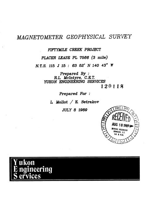
MAGNETOMETER GEOPHYSICAL SURVEY
MAGNETOMETER GEOPHYSICAL SURVEY
MAGNETOMETER GEOPHYSICAL SURVEY
You also want an ePaper? Increase the reach of your titles
YUMPU automatically turns print PDFs into web optimized ePapers that Google loves.
<strong>MAGNETOMETER</strong> <strong>GEOPHYSICAL</strong> <strong>SURVEY</strong><br />
PLACER LEASE PL 7566 (3 mile)<br />
Prepared By :<br />
RL Mchtpre, CET.<br />
YUKON 6NGIIWETUNG SERVICES<br />
120118'<br />
Prepared For :<br />
L MoUot / E Setrakov<br />
JULY 8 1989
,"!is report has been examined bj<br />
:he Geological Evaluation Unit under<br />
Section 41 Yukon Placer Mining Act<br />
-nd is recommended as allowable<br />
representation work in the amount<br />
of S ......,. 34f =L,. $if ....<br />
bhief ~aolo~irt. ~xKration and<br />
:sological Services Division, Northern
TABLE OF CONTENTS<br />
Location Map ......................................... (1)<br />
Claim Map and Grid ....................................<br />
Summary ................................................ 1<br />
Property Location and Access ........................... 1<br />
Equipment and Survey Procedures ........................ 2<br />
Geophysical Grid Parameters ............................ 3<br />
Regional Geophysics and Geology ........................ 3<br />
Results and Recommendations ............................ 4<br />
References ............................................. 5<br />
Certificate ............................................ 6<br />
tii)<br />
APPENDICES<br />
Magnetic Total Field Contour Map. ...................... A<br />
Cross Sections ......................................... B
Figure 1.<br />
Location Map<br />
SCALE 1:5,000,000<br />
0 7 7 144<br />
I t 1 MILES
SCALE 1:30,000<br />
1 .-<br />
i METRES<br />
I<br />
1000 0 1000 2 0 0 0<br />
1 METRES -<br />
PLACER C.LAIM SHEET 115.5 15<br />
LOCATION OF <strong>GEOPHYSICAL</strong> GRID
M-AGNETOMETER <strong>GEOPHYSICAL</strong> <strong>SURVEY</strong>:<br />
50 MILE CREEK, YUKON TERRITORY 115 J 15<br />
1. SUMMARY:<br />
This report presents the methods, results, and exploration<br />
implications of a total field magnetometer ground geophysical<br />
survey conducted on the upper left limit headwaters of 50 Mile<br />
Creek, Sixtymile area, Yukon Territory. The survey was<br />
conducted by R.L. McIntyre, C.E.T., and D. Holcombe,<br />
Geophysicist, of Yukon Engineering Services.<br />
The survey was performed to estend information obtained from a<br />
previous gradiometer survey (M. Mollot, 1988), in order to<br />
determine first order priorities for follow up physical testing.<br />
Magnetic anomalies, that can be interpreted as local<br />
concentrations of unconsolidated magnetite in the stream gravels,<br />
were detected on this grid. Exploration implications are<br />
discussed on page 4 of this report.<br />
It is important to note that the magnetometer method gives<br />
broadly interpreted qualitative information for magnetic<br />
minerals located in the stream bed gravels, that may or may not<br />
bear a direct relationship to placer gold content. It is<br />
therefore recommended that the results of this, and previous<br />
surveys, be used to indicate locations for quantitative testing.<br />
The entire premise of the program is based on the assumptions that;<br />
1. - regionally and locally, (within the area influenced<br />
by this creek drainage) the host rocks for gold<br />
mineralization, and/or the associated rock types, also<br />
bear magnetic mineralization;<br />
2. - the stream sedimentation processes that controlled<br />
alluvial gold deposition also controlled deposition of<br />
other heavy minerals to roughly the same degree;<br />
3. - old stream channels, presently buried by alluvium,<br />
exist in the valley at varying displacements from<br />
the present stream channel.<br />
The above assumptions have been made for this creek.<br />
2. Property Location and Access<br />
The T50 Grid is located on Placer Lease P17566 ( 3 mile),<br />
situated on the upper left limit headwater tributary of<br />
50 Mjle Creek, approximately fifty miles west-southwest<br />
of Dawson City, Yukon. The property is at 63 52'N, 140 43'W,<br />
on NTS map sheet 115-N-15, and is eight miles east of the Alaska<br />
Border. Access is by helicopter aircraft from Dawson City.
3. Equipment and Survey Procedures<br />
The survey was conducted using an EDA Instruments (now Scintrex)<br />
OMNI IV proton precession magnetometer, operated in the Total<br />
Field mode, with an EDA OMNI IV Base Station Magnetometer for<br />
correction of the diurnal drift. Due to the expected high<br />
occurance of solar influenced "magnetic storms" in the summer<br />
of 1989, operation in the Tie Line mode was not considered an option.<br />
The Base Station was programmed to take total field readings at<br />
twenty second intervals to ensure accurate corrections for the<br />
rapidly collected field survey data. The severity of the<br />
magnetic storm event that occured on 89.06.29 (200 gammas total<br />
fluctuation, with maximum 20 second drift of 49.6 gammas)<br />
prevented any field data collection that day. The instrument is<br />
sensitive to 0.1 nano-Teslas (1 nT=l gamma), necessitating<br />
diurnal drift and micropulsation correction to survey data to<br />
discern true anomalies.<br />
The grid parameters and direction of travel are programmed into<br />
the OMNI IV by the operator and are automatically updated at<br />
each position increment. The position information, sensor decay<br />
rate and sensitivity, total magnetic field and statistical error<br />
are displayed to the operator, who then stores the information in<br />
the 48k memory of the magnetometer. This system enables the<br />
operator to assess measurement quality, and take repeat readings<br />
if necessary.<br />
The daily survey information is manipulated in the following<br />
procedures:<br />
a) - field mag unit connected to base station;<br />
data transferred and corrected;<br />
b) - base station unit connected to laptop computer;<br />
corrected field data, as well as base station<br />
readings, dumped to gwbasic software;<br />
c) - both data files transferred to EMXS software for<br />
review and preliminary data manipulation.<br />
The final review, interpretation and presentation of results is<br />
performed in the Whitehorse office of Yukon Engineering Services.<br />
This involves the computer generation of a three dimensional<br />
digital terrain model, and extraction of cross sections of each<br />
grid line. The corrected total field magnetic values are<br />
presented in this report as both cross sections and planimetric<br />
contour maps.<br />
The data is interpreted and geophysical anomalies are discussed<br />
later in this report.
4. Geophysical Grid Parameters<br />
The grid was established adjoining the 1988 magnetometer grid<br />
prepared by M. Mollot (DIAND assessment report).<br />
The baseline was cut out and carried 430 metres north of the<br />
creek crossing (at BL 1+00 N, 1988 grid):<br />
Baseline<br />
: 430 metres<br />
Crosslines (stationing) : at twenty metre intervals<br />
Offsets<br />
: at five metre intervals<br />
Line length (max. offset) : 60m El 60m W<br />
5. Regional Geophysics and Geology : Magnetic Implications<br />
I<br />
The 1:63,360 scale aeromagnetic map (GSC Map 4268G) in the<br />
immediate area of the grid shows low magnetic relief, with a<br />
slight northwest-southeast grain. The high magnetic relief<br />
of the Cretaceous syenite unit approximately six kilometres to<br />
the north would not affect this grid, therefore allowing the<br />
ability to discern the magnetic response from the Quaternary<br />
deposits.<br />
The T50 Grid area is entirely underlain by the Paleozoic age Pelly<br />
Gneiss unit, a foliated to gneissic granodiorite; the sparse<br />
outcrop exposure indicates a generally shallow ((20 )dipping,<br />
W-N-W strike of the unit in this area. This headwaters tributary<br />
to Fiftymile Creek has relatively thin surficial deposits; bedrock<br />
exposures at the creek level were noted during the survey, and<br />
magnetic response checked for correlation.
6. Results and Recommendations<br />
As previously discussed in this report, the results are<br />
indicative of magnetic mineralization, rather than gold.<br />
The geophysical data for most of this grid area indicate a<br />
fairly strong bedrock response, overprinting the surficial<br />
deposits of alluvial magnetite. From station 240 to 430,<br />
the magnetic signature displays a marked Northwest-trending<br />
grain, thought to be concordant with the geologic strike of the<br />
bedrock. This area of the grid, (the upstream extent of the<br />
survey) may have a thinner blanket of surficial material than<br />
that covering the lower portions of the creek.<br />
It is important to note, however, that the magnetic anomalies<br />
in this area, as well as those in the downtsream portions, are<br />
of a magnitude and shape indicative of expected placer<br />
responses. Therefore, the anomalies in the upstream areas may<br />
be centred on magnetite concentrations, but their contoured<br />
signatures show an alignment that is normal to the underlying<br />
bedrock structure.<br />
In the downstream grid area, the good anomalies centred on;<br />
- Station 80 N / 20 E;<br />
- Station 60 N / Baseline, and<br />
- Station 20 N / 60 W;<br />
should be tested for coincident placer gold concentrations.<br />
Information gained from testing in those areas will give<br />
important insights into the interpretation of the other<br />
anomalous locations.
7. References<br />
Geological Survey of Canada, Geophysics Paper 4268<br />
Crag Mountain (115 N 15) Aeromagnetic Series 1966;<br />
1:50,000 Scale map.<br />
Breiner, S. , 1973 "Applications manual for Portable<br />
Magnetometers", GeoMetrics, Sunnyvale California.<br />
Hood, P.J., 1977 "Geophysics and Geochemistry in the<br />
Search for Metallic Ores", G.S.C. Economic Geology<br />
Report 31.<br />
Mollot, M. 1988, Fiftymile Creek Gradiometer Survey,<br />
unpublished report submitted to D.1.A.N.D for<br />
assessment credit.
CERTIFICATE<br />
I, Robert L. McIntyre, C.E.T., of Whitehorse,<br />
Yukon Territory, do hereby certify that;<br />
1. I hold a Geological Technician Diploma from<br />
Sir Sandford Fleming College, Lindsay, Ontario,<br />
and I have been practising continuously since<br />
graduation in 1979;<br />
2. I am a Certified Engineering Technician (Geology)<br />
for Alberta and Yukon, by the Alberta Society of<br />
Engineering Technologists.<br />
3. The geophysical field work, and report preparation<br />
was performed by me personally, with the assisstance<br />
of Mr. D. J. Holcombe, B.Eng. .<br />
4. I have based conclusions and recommendations<br />
contained in this report on my knowledge of<br />
geophysics, my previous experience, and on the<br />
results of field work conducted on the property.<br />
5. I hold no interest, directly or indirectly, in<br />
this property other than professional fees, nor do I<br />
expect any interest in the property, or any other of<br />
Mr. Mollots' holdings.<br />
loration Division<br />
Whitehorse, Yukon Territory<br />
July, 1989


