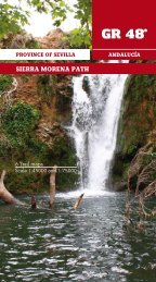
SIERRA MORENA PATH - GR-48: Sendero de Sierra Morena
SIERRA MORENA PATH - GR-48: Sendero de Sierra Morena
SIERRA MORENA PATH - GR-48: Sendero de Sierra Morena

Create successful ePaper yourself
Turn your PDF publications into a flip-book with our unique Google optimized e-Paper software.
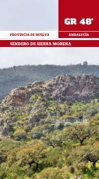
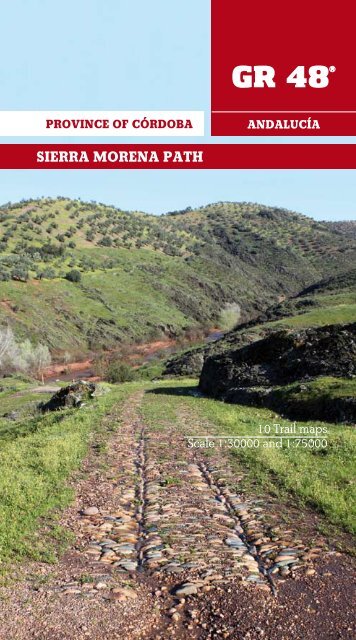
PROVINCE OF CÓRDOBA<br />
ANDALUCÍA<br />
<strong>SIERRA</strong> <strong>MORENA</strong> <strong>PATH</strong><br />
1<br />
<strong>GR</strong>-<strong>48</strong>Córdoba<br />
10 Trail maps<br />
Scale 1:30000 and 1:75000
2<br />
<strong>GR</strong>-<strong>48</strong>Córdoba<br />
Commissioned by and Copyright:<br />
ADIT <strong>Sierra</strong> <strong>Morena</strong><br />
Calle Retama, 1 14350<br />
Cerro Muriano-Obejo (Córdoba)<br />
957350273<br />
www.sen<strong>de</strong>rogr<strong>48</strong>.com<br />
gr<strong>48</strong>@sierramorena.com<br />
Produced by:<br />
Zumaya Ambiente Creativo<br />
Juan Relaño Moyano<br />
Gloria Pareja Cano<br />
Stela María Alcántara Guerrero (cartography)<br />
Pedro Peinado (graphic <strong>de</strong>sign & ilustration)<br />
Karmen Domínguez (translation)<br />
Illustrations:<br />
ADIT <strong>Sierra</strong> <strong>Morena</strong>; pages 22, 27, 60, 61 and 68.<br />
Juan Manuel Delgado Marzo; pages 15, 34, 37, 44, 45,<br />
<strong>48</strong>, 49, 60, 82, 83, 92, 94, 95, 106 and 118.<br />
Hornachuelos Council; page 17.<br />
Posadas Council; page 18.<br />
Almodóvar <strong>de</strong>l Río Council; page 19 and 43.<br />
Obejo Council; page 21.<br />
Adamuz Council; page 24.<br />
Miguel Carrasco Casaut; page 63.<br />
Zumaya Ambiente Creativo<br />
Grupo <strong>de</strong> Desarrollo Rural <strong>Sierra</strong> <strong>Morena</strong> Cordobesa<br />
Abén Aljama Martínez<br />
National Book Catalogue Number: XXXXXXXX
PROVINCE OF CÓRDOBA<br />
ANDALUCÍA<br />
<strong>SIERRA</strong> <strong>MORENA</strong> <strong>PATH</strong><br />
List of Contents<br />
Introduction ……………………………………………………………..... 4<br />
Presentation ……………………………………………………………..... 6<br />
Towns and Villages ………………………………………………..... 17<br />
Stage 1. Hornachuelos-Posadas ………………….………....... 28<br />
Stage 2. Posadas-Almodóvar <strong>de</strong>l Río ………............…...... 36<br />
Stage 3. Almodóvar <strong>de</strong>l Río- S. Mª <strong>de</strong> Trassierra........... 41<br />
Stage 4. S. Mª <strong>de</strong> Trassierra-Cerro Muriano...………….... 53<br />
Stage 5. Cerro Muriano-Villaharta …..……………………..... 64<br />
Stage 6. Villaharta-Obejo...........……………………………...... 72<br />
Stage 7. Obejo-Guadalmellato River Dam ...…………...... 80<br />
Stage 8. Guadalmellato River Dam-Adamuz………..….... 90<br />
Stage 9. Adamuz-Montoro .........……………………………...... 98<br />
Stage 10. Montoro-Marmolejo ……………………………...... 109<br />
Useful Information ............…………………………................. 127<br />
List of Species ................................................................... 143<br />
3<br />
<strong>GR</strong>-<strong>48</strong>Córdoba
INTRODUCTION<br />
4<br />
<strong>GR</strong>-<strong>48</strong>Córdoba<br />
The Asociación para el Desarrollo Integral <strong>de</strong>l Territorio <strong>de</strong> <strong>Sierra</strong> <strong>Morena</strong>,<br />
ADIT <strong>Sierra</strong> <strong>Morena</strong>, (Association for an Integral Development of <strong>Sierra</strong><br />
<strong>Morena</strong> Territory) is a non profit organization established by the following<br />
bodies: Asociación Grupo <strong>de</strong> Desarrollo Rural <strong>Sierra</strong> <strong>de</strong> Aracena y<br />
Picos <strong>de</strong> Aroche; Asociación Grupo <strong>de</strong> Desarrollo Rural <strong>Sierra</strong> <strong>Morena</strong> Sevillana;<br />
Asociación para el Desarrollo Rural <strong>de</strong> <strong>Sierra</strong> <strong>Morena</strong> Cordobesa and the<br />
Asociación para el Desarrollo Rural <strong>de</strong> la Campiña Norte <strong>de</strong> Jaén. The group<br />
also inclu<strong>de</strong>s other public and private institutions from Huelva, Sevilla,<br />
Córdoba and Jaén provinces.<br />
ADIT <strong>Sierra</strong> <strong>Morena</strong> is supporting many activities and projects around hiking.<br />
From an environmental and healthy position, this outdoor activity<br />
appears to be an important tool for introducing the highland regions to<br />
visitors. At the same time, hiking is seen as the fundamental outdoor activity<br />
on which many others are based and that will reinforce a proper<br />
growth of the region without compromising its cultural and environmental<br />
values.<br />
The <strong>GR</strong>-<strong>48</strong> ‘<strong>Sierra</strong> <strong>Morena</strong> Track’ is a 590 kilometres of way marked route<br />
through the provinces of Huelva, Sevilla, Córdoba and Jaén in Andalusia.<br />
The starting point is Barrancos, a village located in Portugal at the bor<strong>de</strong>r<br />
with Huelva province. The journey, <strong>de</strong>scribed here from west to east,<br />
embraces an astonishing territory worthy of visiting or living in it.<br />
This is a full colour essential hiking topo-gui<strong>de</strong> to some of the blissfully<br />
undiscovered walks in southern Andalusia. It has been <strong>de</strong>signed for better<br />
appreciate the natural beauty and cultural aspects exhibited throughout<br />
the walk. The gui<strong>de</strong> provi<strong>de</strong>s texts, pictures, sketches and relevant maps<br />
in or<strong>de</strong>r to facilitate the walking. It also features information on estimated<br />
times, distances, route and elevation profile, and difficulty of the walk as<br />
well as on the most interesting historical, cultural and ethnographical features<br />
located on the route. The reading will help the walkers to pay atten-
tion to different ways of countrysi<strong>de</strong> labour; to discover singular natural<br />
features; to perceive the footprint left on the natural environment; and<br />
to appreciate the many environmental features they may come across<br />
with at any season of the year. In addition, rea<strong>de</strong>rs will find easier to<br />
un<strong>de</strong>rstand the many sha<strong>de</strong>s between the provinces and regions where<br />
the trail goes through. This hiking topo-gui<strong>de</strong> will certainly enhance the<br />
walkers’ vision of the track as well as providing a complete picture of the<br />
journey.<br />
Every section of the route is introduced with some general information<br />
about the natural world and how human beings have traditionally related<br />
to it in each province. Also inclu<strong>de</strong>d are <strong>de</strong>tailed overviews of each the<br />
sites the walkers will find on their journey. We do believe that hiking stirs<br />
up complicity between the walker and the environment while uplifting<br />
the walker’s interest and curiosity about the reality around them. The walk<br />
itself evi<strong>de</strong>nces the harmonious relation established through centuries<br />
between human beings and the land. It is an amazing way to discover<br />
how much tradition is still rooted in the small towns located along way.<br />
Moreover, it will give the walker the chance to find out about natural resources<br />
uses and costumes as well as other activities around those.<br />
5<br />
<strong>GR</strong>-<strong>48</strong>Córdoba<br />
In general, this is an easy to follow route. Each section of the trial is suitable<br />
for mountain biking, horse riding or just walking. The technical difficulty<br />
of each section <strong>de</strong>termines its length. Every stage of the route starts<br />
off and most finishes in a well-equipped small town, village or settlement<br />
where the hiker may find supplies such as food, drinks and accommodation<br />
for at least one night.<br />
Certainly this is a much essential gui<strong>de</strong> which cannot be missing from the<br />
backpack of those of culture and nature lovers.
PRESENTATION<br />
HIKING<br />
6<br />
<strong>GR</strong>-<strong>48</strong>Córdoba<br />
Hiking is a non-competitive sporting activity which takes place on rural<br />
tracks and paths. These paths are mainly endorsed by the different national<br />
Mountaineering Fe<strong>de</strong>rations. In Spain, vías pecuarias, local paths<br />
and riversi<strong>de</strong> paths -all they of public uses- are preferably <strong>de</strong>signated<br />
for hiking. This recently <strong>de</strong>veloped outdoor activity is becoming very<br />
popular since ramblers not only enjoy outdoor walking but also achieve<br />
a much <strong>de</strong>eply knowledge of the social, cultural, ethnographic and<br />
historical heritage of the places located throughout the trial.<br />
Hiking is an activity which posses low impact onto the environment.<br />
In or<strong>de</strong>r to sustain the environmental conditions and natural heritage<br />
of the areas covered by the trail, a thoughtful system of regulated signs<br />
and marks is posed on countrysi<strong>de</strong> paths, animal tracks, rivers alleyways<br />
and rural roads. This system also facilitates and ensures walkers<br />
safety. So far, it could be said that hiking is a most engaging and harmless<br />
way to discover both the environmental wealth of a country and<br />
the peculiarities of the people living in.<br />
A BRIEF NOTE ABOUT HIKING<br />
It seems to be in France where hiking was consi<strong>de</strong>red as an activity for visiting<br />
places. Shortly after the World War II, the FFRP (Fédération Française<br />
<strong>de</strong> la Randonnée Pe<strong>de</strong>stre) was established and soon other countries<br />
as Germany, Netherland, Belgium and Switzerland starting to promote<br />
hiking as a way for sporting and doing tourism up in the mountains.<br />
In Spain, this outdoor activity is managed by the FEDME (Fe<strong>de</strong>ración Es-
pañola <strong>de</strong> Deportes <strong>de</strong> Montaña y Escalada) the body in charge for the<br />
management of this outdoor activity. Hiking is seen as directly related to<br />
mountaineering at the time it does require of regulation about waymarked<br />
trails.<br />
<strong>PATH</strong>S HOMOLOGATION AND SIGN POSTING<br />
7<br />
The FEDME is the body responsible for a footpath homologation. This<br />
means that the route are in place well marked and a system of registered<br />
tra<strong>de</strong> mark signs. It does also mean that there is a writing topogui<strong>de</strong> where<br />
the route is thoughtfully <strong>de</strong>scribed and that there is a legal body fully<br />
compromised to the path maintenance and care.<br />
Wherever possible, a homologated path will avoid crossing or using tarmacs<br />
and traffic roads. It is a pe<strong>de</strong>strian path well equipped with direction<br />
signs such milestones or mileposts, direction arrows, paint marks<br />
and interpretation boards. Most footpaths are suitable for cycling and<br />
horse riding.<br />
In Spain, footpaths are classified into S<strong>GR</strong> (long distance paths), SPR (short<br />
distance paths) and SL (local paths).<br />
<strong>GR</strong>-<strong>48</strong>Córdoba<br />
• S<strong>GR</strong>s. Those are tracks that run over 50 kilometres and link countries,<br />
regions or single sites really far away from each other. A S<strong>GR</strong> route is<br />
usually split into several sections for a much affordable journey. S<strong>GR</strong><br />
routes that run through more than three European countries are classified<br />
as European International Path (E).<br />
• SPRs. Half-day or one-day walks that cover any distance between 10<br />
and 50 kilometres. These short journeys are <strong>de</strong>signed for visiting specific<br />
and singular natural sites or for taking the walkers up to a location of<br />
interest.<br />
• SLs. Those are easy walks which cover less than 10 kilometres.
• Waymarking<br />
Finger pointer<br />
Milestone or Milepost<br />
8<br />
<strong>GR</strong>-<strong>48</strong>Córdoba<br />
Continue<br />
straight<br />
Trail turn<br />
Wrong<br />
direction<br />
RECOMENDATIONS<br />
To maximize your enjoyment and minimize problems on the trail, before starting<br />
any outdoor activity, we need to carefully pon<strong>de</strong>r over the stuff and equipment<br />
we are going to take with us. It is also worthy to give lengthy thought to<br />
prevent any unforeseen inci<strong>de</strong>nts they may occur along the route.<br />
BEFORE THE WALK<br />
Gather information and use accurate maps for planning on the route. Work<br />
out your time realistically. Take the advice culled by other hikers and ask to<br />
local people since they best know the area. Ramblers’ experience enhances<br />
through vivid conversation with locals.<br />
Get updated permissions from the environment <strong>de</strong>partment if you might<br />
trespass restricted areas. You may need to get especial permits for walking<br />
on restricted areas; certain protected sites of a natural park; for using coo-
king <strong>de</strong>vices or lit a fire; and for using a mountain refuge or accommodation<br />
within the limits of protected areas.<br />
Make sure your equipment is the right one. Boots are perhaps the most<br />
important tool when hiking. Get a pair of lightweight, over-the-ankle boots<br />
with a Gore-Tex lining that keeps rainwater from seeping in yet allows your<br />
feet to breathe. Your ankles will suffer a lot if your boots do not provi<strong>de</strong><br />
enough support and you may experience internal injuries such sprains. Remember<br />
to break in your boots thoroughly before <strong>de</strong>parture. Lightweight<br />
polyester hiking pants are preferable to jeans or heavy cottons, which can<br />
be uncomfortable in wet or warm weather.<br />
Get a good quality daypack with enough capacity to tote your personal<br />
items. Better if it has bottle hol<strong>de</strong>rs that keep precious water within easy<br />
reach. The following items are essential in your pack: a water bottle, the<br />
topogui<strong>de</strong> and useful maps, sunglasses, sun cream and lips moist, a brimmed<br />
hat, some energetic food, a Swiss Army knife, a hiking lantern or a<br />
mountaineering one and a basic first aid kit equipped for topical injuries.<br />
Take a mobile phone with you even you might find yourself walking in<br />
low or no-signal areas. Remember the Spanish number for emergency<br />
calls: 112<br />
ALONG THE WALK<br />
9<br />
Hiking may produce threats to personal safety.<br />
Even if you are in top condition, it is a<br />
good i<strong>de</strong>a to combine techniques for hiking<br />
to your physical potential in or<strong>de</strong>r to minimize<br />
strenuous exercising.<br />
<strong>GR</strong>-<strong>48</strong>Córdoba<br />
It is important to start your walk to a slower<br />
pace and progressively increase your speed<br />
until you find yourself walking steadily. Matching<br />
your walking pace to the breathing<br />
will keep you better oxygenated. Avoid prolonged<br />
stops to prevent muscles cooling. A<br />
walking pace of 3 to 4 km per hour on flat<br />
appears to be a right walking rhythm.<br />
Keep yourself well hydrated. Drink water<br />
frequently and, every now and then have an<br />
isotonic drink in or<strong>de</strong>r to prevent metabolic<br />
imbalances.<br />
OUR RELATIONSHIP WITH NATURE<br />
• Fire is perhaps nature worst enemy. Along the walk, surely there will<br />
be <strong>de</strong>signates areas where you are allow to lit a fire. Obeying area regulations<br />
about seasonal restrictions on fire will reduce the risk of wildfire.
• Human waste is often a major source of environmental impact from<br />
hiking. A responsible hiker will take out their garbage and dispose it properly.<br />
When getting ready for the walk, it is important to think ahead<br />
about the amount of garbage you may finish your walk with.<br />
• Just like the unwritten standards established in the cities, a logical and<br />
soun<strong>de</strong>d relationship is set up between nature and hiking. An emphatic<br />
relationship is often established among hikers and local people in the<br />
villages.<br />
• Collecting living plants, animals or stones will have an adverse impact<br />
on the ecosystem. A picture will make an everlasting souvenir though.<br />
• A good practice is keep country gates and railings closed behind us to<br />
avoid cattle and wild animals entering fenced-off areas.<br />
• Personal pets should always go by our si<strong>de</strong> and supervised.<br />
10<br />
• Dangerous hiking circumstances inclu<strong>de</strong> losing the way. It is paramount<br />
to keep walking on the path and always keep an eye on it when<br />
we walk somewhere else. Missing the way may put at risk our safety and<br />
turn a joyful experience into a proper mare.<br />
<strong>GR</strong>-<strong>48</strong>Córdoba<br />
MIDE.<br />
METHOD<br />
FOR APPRISING HIKERS<br />
What is MIDE<br />
MIDE is a communication system between hikers which inform about the<br />
technical and physical characteristics of a trail. It is aimed to evaluate and<br />
unify the findings hiking trails allowing each practitioner to make a better<br />
choice.<br />
The MIDE system uses a scale <strong>de</strong>signed to gra<strong>de</strong> the difficulty of a specific<br />
hiking trip. By doing so, hiking trips are classified according to their difficulty<br />
and hikers will have a much accurate knowledge about the route.<br />
This tool has been <strong>de</strong>signed by experienced hikers so other hikers may
find the route that better suits to their physical condition and motivation.<br />
It is not all about information as the MIDE is also a tool for preventing<br />
acci<strong>de</strong>nts up in the mountains. The i<strong>de</strong>a is that well informed walkers are<br />
likely of suffering less harm. (Information = safety).<br />
When MIDE was created<br />
MIDE is a relatively recent tool. It was <strong>de</strong>veloped in 2002 within the framework<br />
of the programme ‘Montañas Para Vivirlas Seguro’. Three years<br />
after the project started, some of the programme sponsors (Gobierno <strong>de</strong><br />
Aragón -Protección Civil-, Obra Social y Cultural <strong>de</strong> Ibercaja y la Fe<strong>de</strong>ración<br />
Aragonesa <strong>de</strong> Montañismo) pon<strong>de</strong>red over the need for expert information<br />
to be put in Procedures Manual in or<strong>de</strong>r to prevent acci<strong>de</strong>nts in the<br />
mountain. In 2003, the MIDE Handbook is introduced to the public and<br />
therefore the MIDE method begins to be used.<br />
What sort of information does MIDE provi<strong>de</strong><br />
The MIDE contains background information and assessment information.<br />
Background information is about informing on general aspects of a<br />
rated route. It gives information about where the track starts and finishes;<br />
about places where the track passes by; about both positive cumulative<br />
slope and negative cumulative drop for the whole route; horizontal<br />
distance for the entire route; and weather conditions for which the assessment<br />
applies.<br />
Assessment information is about rating the following topics:<br />
• Severity of the natural environment<br />
• Guidance on the route about choosing and keeping good<br />
orientation.<br />
• Difficulty in walking along the track (type of path, slopes, etc)<br />
• Struggle required for accomplishing the route.<br />
11<br />
<strong>GR</strong>-<strong>48</strong>Córdoba<br />
A numerical value (1 to 5) is given to the above topics in or<strong>de</strong>r to set<br />
down the <strong>de</strong>gree of difficulty posses on the route.<br />
Environment<br />
1- The environment holds low risk<br />
2- There is more than one factor of risk<br />
3- There are several factors of risk<br />
4- There are enough factors of risk<br />
5- There are many factors of risk<br />
Orientation<br />
1- Well <strong>de</strong>fined tracks and junctions<br />
2- Paths or signposting showing the way<br />
3- It requires precise i<strong>de</strong>ntification of geographical<br />
features and of compass points<br />
4- It requires walking out the track tracing<br />
5- The track is obstructed by unavoidable obstacles<br />
–a river, a reservoir, etc, which must be skirted along.
Track features<br />
1- The track runs on smooth surface<br />
2- The track runs on bridle paths<br />
3- The track runs on irregular surface and staggered paths<br />
4- The use of hands and even jumping over obstacles<br />
is required to negotiate the track<br />
5- The use of hands is required to progress<br />
Struggle<br />
1- Up to 1 hour walk<br />
2- From 1 to 3 hours walk<br />
3- From 3 to 6 hours walk<br />
4- From 6 to 10 hours walk<br />
5- More than 10 hours walk<br />
Calculations ma<strong>de</strong> according to MIDE criteria for an average and slightly<br />
loa<strong>de</strong>d hiker.<br />
Hiking rated according to MIDE criteria for summers without snow.<br />
12<br />
Sample of a MIDE route rating:<br />
<strong>GR</strong>-<strong>48</strong>Córdoba<br />
More information:<br />
www.euromi<strong>de</strong>.info<br />
www.fam.es<br />
THE NATURAL WORLD<br />
The <strong>GR</strong>-<strong>48</strong> along the <strong>Sierra</strong> <strong>Morena</strong> Mountains in Córdoba appears to<br />
be an almost uninterrupted space that inescapably comprises nature,<br />
history, cultural heritage and population. Walkers will find themselves<br />
walking in a region which is a faithful reproduction of the natural<br />
environment.
Geology<br />
Through the province of Córdoba, the route skirts along the mountains<br />
and occasionally drops down to the River Vega. Slates, greywacke, quartzite,<br />
and granite batholiths all they from the Palaeozoic Era are the type<br />
of rocks in the area.<br />
On the initial stages of the walk and just at the edges of the <strong>Sierra</strong> <strong>de</strong> Hornachuelos<br />
Mountains, we will walk on calcareous remnants rich on marine<br />
fossils of the Miocene epoch. The following sections of the route, up<br />
to Almodóvar <strong>de</strong>l Río, will run along the Guadalquivir River with younger<br />
beds containing an important metal <strong>de</strong>posit. The route will take us again<br />
upwards and toward the Santa María <strong>de</strong> Trassiera district where <strong>de</strong>posits<br />
from the Palaeozoic Era such slates and quartzite rocks are predominant.<br />
Granite rocks and masses cover the surrounding areas of the Guadalbarbo<br />
Valley becoming the main geological feature of the Pedroches granitic<br />
batholiths.<br />
At the final stage of the trail, we will find the most singular geological<br />
feature in the province: red sandstones of the Triassic age. In Montoro<br />
municipality the rocks are known as ‘piedra molinaza’. They have traditionally<br />
been used for the particular style of building in the region.<br />
13<br />
Flora. The plants world<br />
The omnipresent Mediterranean woods comprise a large scope of lush<br />
vegetation shaped by Holm-Oak groves and Mediterranean un<strong>de</strong>rgrowth<br />
of Rockroses, Mastic Thyme bushes, Wild Olive Trees and many others<br />
examples of Mediterranean scrub.<br />
<strong>GR</strong>-<strong>48</strong>Córdoba<br />
Iris flower<br />
In the most western region Palmettos are very present thanks to the thermo-<br />
Mediterranean ground. Palmettos can be found even in Almodóvar<br />
<strong>de</strong>l Río surrounding areas where they share land with Orange groves.
As we enter the sierra of Córdoba, the Mediterranean wood occurs with<br />
large pastures of Holm-Oaks and Cork Oaks, where livestock rearing is a<br />
very common activity.<br />
There is also <strong>de</strong>nse vegetation along the river banks in the mountains.<br />
There, permanent water courses such as the Baños <strong>de</strong> Popea and the Bejarano<br />
Brook irrigate the ever fresh gallery forests of al<strong>de</strong>r and chestnut<br />
Trees.<br />
The Guadiato River region to the north of Cerro Muriano district is the<br />
area of the most ancient <strong>de</strong>hesas of Ilex which alternates with Mediterranean<br />
shrub and mount Olive Tree groves at the surrounding areas of the<br />
Guadalbarbo River.<br />
Fauna. The animal world<br />
14<br />
Those <strong>de</strong>voted to studying the biology of amphibians and reptiles and<br />
amateur herpetologists will find a large range of amphibian all along the<br />
<strong>GR</strong>-<strong>48</strong> route through Córdoba province. This area is home to some species<br />
which can be found only in the Iberian Peninsula. Among others, they are<br />
the Iberian Painted Frog, the Bosca´s Newt, the Southern Marbled Newt, the<br />
Iberian Midwife Toad, the Iberian Water Frog and the Spa<strong>de</strong>foot Toad.<br />
<strong>GR</strong>-<strong>48</strong>Córdoba<br />
Tela <strong>de</strong> araña<br />
Common frog<br />
ICommunities of (damselflies and dragonflies) are quite remarkable at some<br />
river banks such as the Bejarano Brook, the Yeguas River and the Guadiato<br />
River. Those communities have been exhaustively researched by various<br />
entomologists in the last twenty five years. Research shows the importance<br />
of some endangered species such as the Macromia splen<strong>de</strong>ns, the Gomphus<br />
graslinii and the Oxygastra curtisii which can be found in this area even<br />
they are quite rare species.
A quite relatively large number of carnivorous mammals live in<br />
the area yet they are very difficult to spot. We will be very lucky<br />
if we see any Fox, any Egyptian Mongoose or even the Otters.<br />
We may spot some Deer as they are very abundant and extent<br />
through most areas in the <strong>Sierra</strong> <strong>Morena</strong> mountain range. The<br />
Iberian Lynx, one of the jewels of the Iberian wild animal<br />
world, moves freely in some remote natural sites<br />
in the <strong>Sierra</strong> <strong>de</strong> Car<strong>de</strong>ña y Montoro Natural<br />
Park. Recently, a controlled number<br />
of Iberian Lynx specimens have been<br />
released in the Guadalmellato Valley<br />
located in Adamuz municipality.<br />
Nevertheless, birds will be the most<br />
easily spotted animal species along<br />
this route. In fact, the track passes<br />
through some natural sites<br />
which are exclusively aimed to<br />
conservation and birdwatching.<br />
Griffon Vulture<br />
Moreover, some sections of the<br />
<strong>GR</strong>-<strong>48</strong> partially match some other<br />
routes especially <strong>de</strong>signed for wildlife watching, those inclu<strong>de</strong>d in the<br />
book Birding and Nature Trails in <strong>Sierra</strong> <strong>Morena</strong> Cordobesa.<br />
15<br />
Big eagles such as Spanish Imperial Eagles, Bonelli’s Eagles and the Gol<strong>de</strong>n<br />
Eagles are located in the most abrupt Mediterranean woods and mounts<br />
of the <strong>Sierra</strong> <strong>Morena</strong> mountain range. Goshawks, Short-Toed Eagles and<br />
Booted Eagles are very common in Pine woods, Holm-Oak groves and<br />
cork Oak groves. In open areas such as rain fed crops and fertile plain<br />
fields can be seen other common bird species like the Buzzard, the Kestrel<br />
and the Black-Winged Kite which is very rare in this area. Black and Griffon<br />
Vultures breeding colonies are also located in specific areas of the region<br />
which are perfect sites for Vultures watching all year around.<br />
<strong>GR</strong>-<strong>48</strong>Córdoba<br />
Large patches of Mediterranean un<strong>de</strong>rgrowth and scrub are home to Subalpine<br />
Warblers, Dartford Warblers, Sardinian warblers, Turtle Doves, Melodious<br />
Warblers, Red-legged partridges, Nightingales and Thekla Larks.<br />
The Blue Rock Thrush, the Eurasian Crag Martin, the Rock Bunting, the<br />
Eurasian Eagle-Owl, the Black-Eared Wheatear and the Kestrel are some<br />
of the bird species which can be watched in rocky ravines and on the<br />
sharpest crests of the mountains. We will be lucky if we watch the shiest<br />
White-Rumped Swift and the Black Wheatear flying over those areas.<br />
River beds and river banks are home to colourful birds such as the Common<br />
Kingfisher, the Oriole, the European Bee-Eater and the Grey Wagtail. They<br />
are also perfect habitats for other birds like the Grey Heron, the Little egret,<br />
the Mallard, The Common Moorhen, the Snipe and the Cirl Bunting or even<br />
for scarce seasonal birds such as the shy Wryneck and the Black Stork.<br />
Finally, Hoopoes, Azure-Winged magpies, Greenfinches and Little owls
Pebble paving on a traditional path<br />
will be with us when passing through Olive groves and through crop<br />
fields and vegetable gar<strong>de</strong>ns.<br />
the Human footprint<br />
16<br />
<strong>GR</strong>-<strong>48</strong>Córdoba<br />
As most stages of the <strong>GR</strong>-<strong>48</strong> track uses of ancient paths and traditional cattle<br />
tracks, it is clear to what extent human beings have interacted with the<br />
natural environment. Dry stone walls are the physical bor<strong>de</strong>rs of most of<br />
the footpaths and even walkers may find themselves walking on ancient<br />
Roman paved paths as in the surroundings of Montoro town.<br />
We also need to keep in mind that the track runs through an area which<br />
other time used to be the bor<strong>de</strong>r between the Christian and Muslim kingdoms.<br />
Bastions, castles, watchtowers and all sort of medieval military buildings<br />
will be common hallmarks on the region. Excellent examples of this<br />
historical heritage are the Cabrilla Watchtower and the Almódovar and<br />
Obejo castles.<br />
Both water and olive oil mills will be very much present in many sections<br />
of the trail. The Cambuco Water Mill and the Molino <strong>de</strong>l Rey one stand out<br />
among the many water mills found respectively in Hornachuelos and Posadas<br />
environs. Other significant water mills in the area are: the Martinete Mill<br />
by the Bejarano Brook and off to Santa María <strong>de</strong> Trasierra village; the Molino<br />
<strong>de</strong>l Gollizno in Adamuz town and the water mills over the Guadalquivir<br />
River in Montoro town. Of significant ethnological importance are the oil<br />
mills on the Montoro highlands. Some of those still keep the remains of<br />
the former system for pressing the olives and the counterweight tower. La<br />
Palmilla Oil Mill and San Camilo <strong>de</strong> Lelis (17th century) are good examples<br />
of those traditional buildings.<br />
Villaharta’s sour water fountains and spas are the magnificent legacy from<br />
a past clearly based on healing waters and health costume.<br />
In addition, the subsoil on the area has traditionally been an important<br />
source for human <strong>de</strong>velopment. The Cerro Muriano Mining Sites are a clear<br />
illustration of the area cultural and historical heritage.
TOWNS AND VILLAGES<br />
Hornachuelos<br />
17<br />
Altitu<strong>de</strong>: 185 m<br />
Population: 4.684 (2009)<br />
Hornachuelos is the second largest<br />
municipality of the province, only<br />
the capital Córdoba surpasses this<br />
district. The town is situated in the<br />
western region of the province<br />
and the huge municipal district<br />
stretches an important section of<br />
the <strong>Sierra</strong> <strong>de</strong> Hornachuelos Natural<br />
Park, named after the town.<br />
At hand from Córdoba, Écija and<br />
Sevilla -three of the most unique<br />
cities in Andalusía- Hornachuelos<br />
stands atop of one hill. This natural<br />
balcony, perched on the slopes<br />
of two gullies, is facing the source<br />
of the Bembézar River Reservoir,<br />
one of the most breathtaking<br />
landscapes of the <strong>Sierra</strong> <strong>Morena</strong><br />
Mountains covered with Cork<br />
Oaks, Holm-Oaks and Willows,<br />
Ash Trees and Al<strong>de</strong>rs by the riversi<strong>de</strong>.<br />
The relationship established<br />
from centuries between human<br />
beings and nature in this region<br />
is the base for the economy. Cow<br />
and pig livestock, hunting industry<br />
and beekeeping have traditionally<br />
been the main activities although a<br />
flourishing industry related to rural<br />
tourism and outdoor activities is<br />
becoming an important source of<br />
incoming.<br />
Hornachuelos rich architectonic<br />
heritage talks about the time when<br />
the town grew up around fortress<br />
like churches, abbeys or hilltop<br />
castles and bridges built to <strong>de</strong>fend<br />
from the Portuguese. Whitewash<br />
Moorish resembled houses gather<br />
around the Castle, the Armas<br />
square and the Old Wall, all they<br />
<strong>GR</strong>-<strong>48</strong>Córdoba
18<br />
<strong>GR</strong>-<strong>48</strong>Córdoba<br />
from the 8th and 9th centuries. It<br />
is worthy a walk to the Monasterio<br />
<strong>de</strong> Santa María <strong>de</strong> los Ángeles. This<br />
today abandoned convent used to<br />
be a famous centre for religious<br />
communities spiritual seclusion.<br />
Its dramatic position on the steep<br />
hillsi<strong>de</strong> overlooking the Bembézar<br />
River is perfectly spotted from the<br />
Bembézar Reservoir.<br />
The most popular events come to<br />
occur in the summer time. On July<br />
11th is the festivity of San Abundio,<br />
saint patron of the municipality.<br />
Then, on August 2nd they joyfully<br />
celebrate Nuestra Señora Reina <strong>de</strong><br />
los Ángeles festivity.<br />
Source:<br />
www.hornachuelosrural.com<br />
Posadas<br />
City Council<br />
Plaza <strong>de</strong> la Constitución, 1<br />
957641051 / 957641052<br />
Tourist Office<br />
Antonio Machado, 6<br />
957640786<br />
Local Police<br />
957641033 / 609602185<br />
Guardia Civil (National Guard)<br />
957640065<br />
Medical centre<br />
957641111<br />
How to get there<br />
• By Bus. Autobuses San Sebastián<br />
Any queries about <strong>de</strong>stinations and<br />
timetables:<br />
957429030 / 957276771<br />
<strong>Sierra</strong> <strong>de</strong> Hornachuelos Nature<br />
Park Visitors’ Centre La Huerta<br />
<strong>de</strong>l Rey.<br />
San Calixto Road km 1,600<br />
957 641 140<br />
Altitu<strong>de</strong>: 88 m<br />
Population: 7.558 (2009)<br />
The ‘malena’ town is located at the<br />
heart of the plain region known as La<br />
Vega <strong>de</strong>l Guadalquivir River in Córdoba<br />
province and off <strong>Sierra</strong> <strong>Morena</strong><br />
Mountains. Posadas is the base of the<br />
administration of the region. The city<br />
centre is about 30 Km. from Córdoba<br />
the capital of the province. Posadas’s<br />
municipal district landscape is a mixture<br />
of sierra (low mountains), vega<br />
(plain irrigated fields) and campiña<br />
(flat stretch of farm-land). The whole<br />
municipality joins the <strong>Sierra</strong> <strong>de</strong> Hornachuelos<br />
Natural Park which, is incorporated<br />
to the World network of<br />
the Biosphere Reserve as ‘Dehesas <strong>de</strong>
<strong>Sierra</strong> <strong>Morena</strong>’. Moreover, nearby the<br />
town and in the buffer zone is ‘La Sierrezuela’,<br />
a very popular park where<br />
outdoors people benefit from the<br />
great historic and natural wealth of<br />
the area. Rivero <strong>de</strong> Posadas is its only<br />
‘al<strong>de</strong>a’ (small village), located just 3<br />
km. away from the district.<br />
Posadas’s economy is mainly sustained<br />
by both the goodness of the irrigated<br />
lands on the municipality and the<br />
Iberian pigs breeding and raising.<br />
Posadas (Inns) name is after a long<br />
tradition of hospitality born from the<br />
village strategic location. The most<br />
singular feature of the district is a<br />
dolmen located in the above mentioned<br />
La Sierrezuela Park. However, a<br />
walk in the city reveals an interesting<br />
cultural heritage ad<strong>de</strong>d to the natural<br />
heritage of this municipality. It is<br />
worthy to pay a visit to Santa María<br />
<strong>de</strong> las Flores Church (16th century),<br />
La Morería Neighbourhood (4th century)<br />
and the Marqueses <strong>de</strong> Villaseca<br />
Palace (16th and 17th centuries).<br />
Almodóvar <strong>de</strong>l Río<br />
Source: www.Posadas.es<br />
City Council<br />
Plaza <strong>de</strong>l Ayuntamiento, 1<br />
957630013<br />
Tourist Office<br />
Plaza <strong>de</strong> los Pósitos, 3<br />
9576303 78<br />
Local Police<br />
957630440 / 605841477<br />
Guardia Civil (National Guard)<br />
957630062<br />
Medical centre<br />
957630936<br />
How to get there<br />
• By Bus, Autobuses San Sebastián<br />
Any queries about <strong>de</strong>stinations and timetables:<br />
957429030 / 957276771<br />
• By train, RENFE. Any queries<br />
about <strong>de</strong>stinations and timetables:<br />
902240202 /www.renfe.es<br />
• Taxi Services:<br />
• Manuel Luján<br />
689058165 / 957631620<br />
• Taxi Cañero<br />
600018094 / 666278052<br />
19<br />
<strong>GR</strong>-<strong>48</strong>Córdoba<br />
Altitu<strong>de</strong>: 121 m<br />
Population: 7.839 (2009)<br />
The breathtaking omnipresent castle<br />
watches over a track of whitewashed<br />
houses that shapes this town.<br />
Only 22 km away from the capital of<br />
the province Córdoba, Almódovar<br />
<strong>de</strong>l Río has an impressive natural he-
20<br />
<strong>GR</strong>-<strong>48</strong>Córdoba<br />
ritage thanks to its location. The municipality<br />
stretches across both the<br />
rich and fertile plain fields irrigated<br />
by the Guadalquivir River and the<br />
wealthy and exuberant woods up<br />
on the hills of <strong>Sierra</strong> <strong>Morena</strong>.<br />
The exceptional ecological values<br />
inhered in the hills and low mountains<br />
of this municipal district are<br />
well preserved as they are an integral<br />
part of the <strong>Sierra</strong> <strong>de</strong> Hornachuelos<br />
Nature Park. Moreover, they are<br />
an important section of the Dehesas<br />
<strong>de</strong> <strong>Sierra</strong> <strong>Morena</strong> area which is incorporated<br />
to the World network of<br />
the Biosphere Reserve. The astonishing<br />
natural value of some riversi<strong>de</strong><br />
woods such as the one alongsi<strong>de</strong><br />
the Guadalora Brook with Willows,<br />
Ash Trees and Al<strong>de</strong>rs and the Mediterranean<br />
woods of Cork and Holm<br />
Oaks and a rich un<strong>de</strong>rgrowth provi<strong>de</strong><br />
home for a fairly large array of<br />
wildlife.<br />
The amazing landscape of this municipality<br />
invite to interesting walks<br />
which can start from some distinct<br />
places no far away the town. Within<br />
a stone’s throw from Almodóvar is<br />
one of these sites, Los Llanos <strong>de</strong> Almodóvar<br />
<strong>de</strong>l Río. Here we can stop at<br />
the Ethnologic Museum where the<br />
visitors may get a <strong>de</strong>eply un<strong>de</strong>rstanding<br />
of the costume and lifestyle of<br />
past generations and the way people<br />
used to benefit from the nearby hills<br />
and mountains.<br />
Atop of the La Floresta hill is the amazing<br />
Almodóvar Castle which is the<br />
most interesting architectonic unit<br />
in this town. The town landmark is<br />
a not to be missed spot in the municipality<br />
as it has great architectonical<br />
features. The castle itself can be seen<br />
from really far way and it is an exceptional<br />
balcony offering a most complete<br />
view of the Guadalquivir River<br />
and its surrounding vega as well as<br />
the <strong>Sierra</strong> <strong>Morena</strong> closer hills.<br />
Source: www.Almodóvar<strong>de</strong>lrio.com<br />
City Council<br />
Plaza <strong>de</strong> la Constitución, 4<br />
957713602 / 957713604<br />
Tourist Office<br />
ABC, 7<br />
957635014<br />
Local Police<br />
957713701 / 610751161<br />
Guardia Civil (National Guard)<br />
957635027<br />
Medical centre<br />
957719576 / 957719577<br />
How to get there<br />
• By Bus, Autobuses San Sebastián<br />
Any queries about <strong>de</strong>stinations<br />
and timetables: 957 429 030<br />
957 27 67 71<br />
• Taxi Services:<br />
• Taxi Rafael Castilla<br />
677411400<br />
• Taxi Sacatacos<br />
957713544 / 636145039<br />
• Taxi Felipe<br />
657715152<br />
Ethnologic Museum<br />
Los Llanos, km. 20,5<br />
957635<strong>48</strong>7 / 649452580 /<br />
www.museoetnologico.com
SANTA MARÍA DE TRAS<strong>SIERRA</strong><br />
This medieval small village is in<br />
fact a Córdoba neighbourhood. In<br />
the village there are some properties<br />
from the 15th century owned<br />
by nobility. In fact, Santa María <strong>de</strong><br />
Trassierra was the resi<strong>de</strong>nce for<br />
some illustrious people. The universal<br />
Christopher Columbus once<br />
lived in this village and walked<br />
on these streets. His lover, Beatríz<br />
Enriquez <strong>de</strong> Arana and their son<br />
Diego Colon lived here too and,<br />
years later the famous writer Luis<br />
Cerro Muriano<br />
<strong>de</strong> Gongora set in here his parish<br />
church leaving behind a bunch of<br />
poems <strong>de</strong>scribing the beauty of<br />
the natural surroundings.<br />
Special mention to the Mu<strong>de</strong>jar<br />
(partly Gothic, partly Islamic style)<br />
and Gothic style church in the village.<br />
It is worthy to stop and visit it<br />
to admire its architectonical features<br />
and the majesty of the altarpiece<br />
from the 16th century that it was<br />
probably brought up to here from<br />
the capital Cathedral.<br />
21<br />
<strong>GR</strong>-<strong>48</strong>Córdoba<br />
Altitu<strong>de</strong>: 693 m<br />
Population: 2.500 (2008)<br />
This small town and its municipal<br />
district are fully integrate in the <strong>Sierra</strong><br />
<strong>Morena</strong> Mountains of Córdoba<br />
just 16 Km far from the capital of<br />
the province. The municipality <strong>de</strong>pends<br />
on two other municipal districts:<br />
Córdoba and Obejo.<br />
Cerro Muriano has traditionally been<br />
connected to copper mining works.
Copper extractions were firstly carried<br />
out by old Romans that used to<br />
manage the many mines in the surrounding<br />
hills. In the 20th century,<br />
when the mining activity came to<br />
an end, Cerro Muriano people massively<br />
moved out. This social situation<br />
turned over when the Spanish<br />
Ministry of Defence set up a military<br />
<strong>de</strong>pot off to this small town which,<br />
brought about a flourishing economy<br />
mainly based upon services.<br />
Cerro Muriano is surroun<strong>de</strong>d by<br />
afforested Pine Trees woods. Those<br />
<strong>de</strong>nse woods are a ‘pulmón ver<strong>de</strong>’<br />
for Córdoba capital city. The term<br />
‘pulmón ver<strong>de</strong>’ (green lung) applies<br />
to an area rich in vegetation which is<br />
close to an urban area.<br />
Old mine site Las Siete Cuevas and<br />
the Cerro <strong>de</strong> la Coja an archaeological<br />
site which be visited. The Cerro<br />
Muriano Copper Museum gives to<br />
the visitors a <strong>de</strong>ep insight through<br />
the history and the traditional ways<br />
of extracting this mineral.<br />
Source: www.obejo.es<br />
Obejo City Council<br />
Iglesia, 16<br />
957369042/ 9573691<br />
Local Police (Córdoba)<br />
957455300<br />
Guardia Civil (National Guard)<br />
957251100<br />
Medical centre (Cerro Muriano)<br />
957354007<br />
22<br />
<strong>GR</strong>-<strong>48</strong>Córdoba<br />
Located on one of the municipality<br />
hills is a marvellous natural balcony<br />
which takes to visitors to the time<br />
when mine workings became a most<br />
important industry. Two other significant<br />
elements of its heritage are the<br />
Villaharta<br />
How to get there<br />
• By Bus, Aucorsa (from Córdoba<br />
city). 957 764 676 / www.aucorsa.es<br />
• Linesur<br />
Any queries about <strong>de</strong>stinations and<br />
timetables:<br />
957 421 585 / www.linesur.com<br />
Altitu<strong>de</strong>: 579 m<br />
Population: 743 (2009)<br />
This small municipality is located 38<br />
Km north from the capital Córdoba.<br />
Villaharta is a charming easy for walking<br />
town perched in <strong>Sierra</strong> <strong>Morena</strong><br />
and surroun<strong>de</strong>d by beautiful Medi-<br />
can terranean woods and olive groves.<br />
The beauty of the town and its<br />
relative closeness to the capital city<br />
are the main reasons why it is very<br />
popular for short break <strong>de</strong>stinations.
A singular feature of this place is<br />
the weather. Villaharta high location<br />
and the many streams that<br />
flow on the municipality allow<br />
the growing of thick woods. This<br />
brings temperatures down and<br />
produces a fresher microclimate<br />
very much welcome by the people<br />
from the warmer Córdoba.<br />
Walking is one of the very best<br />
ways to discover this beautiful municipality.<br />
A network of paths and<br />
trials run through stunning Holm<br />
Oaks and un<strong>de</strong>rgrowth woods.<br />
However, it is water the most significant<br />
element in Villaharta. Rich<br />
in minerals and with well known<br />
healing properties, Villaharta water<br />
streams and springs are said to be<br />
a source for health improving. Santa<br />
Elisa Thermals were the most<br />
popular among the many spas and<br />
thermal resorts in the municipality.<br />
Worthy to pay a visit to this small<br />
town on the Corpus Christy Day<br />
when the streets of the town are covered<br />
with petals and coloured sawdust<br />
to created colourful pictures on<br />
the streets pavement.<br />
Source: www.villaharta.es<br />
City Council<br />
Virgen <strong>de</strong> la Piedad, 1<br />
957367135 / 957367061<br />
Guardia Civil (National Guard)<br />
(Peñarroya – Pueblonuevo)<br />
957635027<br />
Medical centre<br />
957365542 / 670947560<br />
Library<br />
Avenida Andalucía, 2. 957367285<br />
How to get there<br />
By Bus, Linesur<br />
957421585 / www.linesur.com<br />
23<br />
Obejo<br />
<strong>GR</strong>-<strong>48</strong>Córdoba<br />
Altitu<strong>de</strong>: 707 m<br />
Population: 1.872 (2009)<br />
Obejo is a tiny town located in the<br />
<strong>Sierra</strong> <strong>de</strong> los Santos a set of hills<br />
and low mountains in the <strong>Sierra</strong><br />
<strong>Morena</strong> Mountains of Córdoba. It<br />
is 47 Km away from the capital of<br />
the province. Obejo population<br />
shares out in Obejo itself, Cerro<br />
Muriano and La estación <strong>de</strong> Obejo<br />
(Obejo Station) a tiny village nearby<br />
Obejo town.<br />
The economy has traditionally<br />
been related to the mining industry<br />
of copper, lead, silver and gold<br />
and to countrysi<strong>de</strong> activities such<br />
as cattle breeding, vineyards and
24<br />
<strong>GR</strong>-<strong>48</strong>Córdoba<br />
Olive groves, charcoal making<br />
and beekeeping. Today, the main<br />
source of incoming is the olive oil<br />
industry though. The natural heritage<br />
of this municipality has its major<br />
element in the landscape along<br />
the Guadalbarbo River course. The<br />
landscape turned from riversi<strong>de</strong><br />
woods of Olean<strong>de</strong>rs and Tamujos<br />
up stream to Olive groves at the<br />
lower end.<br />
Obejo Moorish origins are clear<br />
just walking around the town<br />
sTreets. A maze of narrow sTreets<br />
lined with whitewash houses that<br />
ends up at the top of the hill where<br />
the remains of the former Arab fortress,<br />
known as La Fortaleza crown<br />
this small town. The most attractive<br />
religious building of the municipality<br />
is San Antonio Abad Parish<br />
church (13th century), <strong>de</strong>clared National<br />
Artistic Historical Monument<br />
in1982. A visit to this small town is<br />
worthy any time of the year. However,<br />
it is especially interesting to<br />
Adamuz<br />
get here on any of the three dates<br />
when they dance La Danza <strong>de</strong> las<br />
Espadas (The Swords Dance). This<br />
dance is quite unique. Thirty two<br />
men wearing a traditional costume<br />
and swords dance around the dance<br />
master. The dance has its pick<br />
moment when the dancers perform<br />
‘el patatú’ (the faint) that finishes<br />
with a mock execution of the<br />
dance master in which the swords<br />
are locked around his neck.<br />
Source: www.obejo.es<br />
Obejo City Council<br />
Iglesia, 16<br />
957369042<br />
Medical Centre<br />
957369016<br />
How to get there<br />
By Bus, Linesur<br />
Any queries about <strong>de</strong>stinations<br />
and timetables:<br />
957421585 | www.linesur.com<br />
Altitu<strong>de</strong>: 240 m<br />
Population: 4.419 (2009)<br />
Northeast from the capital city,<br />
Adamuz is located in the Alto Guadalquivir<br />
region. This is a severe<br />
hill-country region with a sharply<br />
sloping landscape where Olive groves<br />
strongly stick to the ground to<br />
produce a most high quality olive oil.<br />
The cultural heritage has in two elements<br />
its most significant value. One<br />
is the San Andrés Church from the<br />
13th century and then restored and<br />
improved in the 16th century. The
MONTORO<br />
other relevant architectonical element<br />
is La Torre <strong>de</strong>l Reloj (The Clock<br />
Tower). This feature is quite peculiar<br />
as it was partly built in 1556 and then<br />
finished in 1953.<br />
However, it is the natural heritage<br />
of this municipality what makes it<br />
special. The town is surroun<strong>de</strong>d by<br />
a network of sloping streams that<br />
are the main water supply for the<br />
Varas River and the Guadalmellato<br />
River, both flowing through the municipal<br />
district. In addition, there are<br />
many footpaths and trials that can be<br />
used to best appreciate the diversity<br />
and beauty of Adamuz countrysi<strong>de</strong>.<br />
One of the many routes to follow<br />
starts at the Navaluenga track to get<br />
to the Guadalmellato Reservoir. Soon<br />
walkers will find themselves trekking<br />
off into country Olive groves and<br />
thick Mediterranean woods. Then<br />
there is the Montes Comunales which<br />
is a 2,500 hectares public Country<br />
Estate. The almost untouched Mediterranean<br />
woods and mountain forests<br />
in this area are home for a range<br />
of protected wildlife as well as a perfect<br />
scenario for experiencing game<br />
howling. Therefore, game hunting is<br />
a quite important activity in the area.<br />
Finally, special mention to the many<br />
natural caves, another special natural<br />
resource recently turned into rural<br />
accommodations and refuges for<br />
hikers, ramblers and walkers.<br />
Source: www.adamuz.es<br />
Obejo City Council<br />
Fuente, 1. 957166002<br />
Tourist Office<br />
957166496<br />
Local Police<br />
637513290<br />
Guardia Civil (National Guard)<br />
957106001<br />
Medical Centre<br />
957199621<br />
How to get there<br />
• By Bus, Linesur. Any queries<br />
about <strong>de</strong>stinations and timetables:<br />
• Taxi: Francisco Cuadrado Jiménez:<br />
957166354 / 610729926<br />
25<br />
<strong>GR</strong>-<strong>48</strong>Córdoba<br />
Altitu<strong>de</strong>: 195 m<br />
Population: 9.917 (2009)<br />
Talk about Montoro is talk about<br />
the Guadalquivir River. This singular<br />
town is located 40 Km east<br />
from Córdoba and between two<br />
important geographical features:<br />
the mountain range at the north
26<br />
<strong>GR</strong>-<strong>48</strong>Córdoba<br />
and the fertile plain at the south.<br />
Montoro municipal district is completely<br />
insi<strong>de</strong> the limits of the <strong>Sierra</strong><br />
<strong>de</strong> Car<strong>de</strong>ña y Montoro Natural<br />
Park that is partly named after the<br />
town.<br />
Olive groves stretch up to 80% of<br />
the growing fields. Top quality olive<br />
oil production is the base of the<br />
economy. However, recent years<br />
have seen an increasing flourishing<br />
tourism industry set out in the<br />
municipality with some rural accommodations,<br />
hotels, restaurants<br />
and adventure travel agencies.<br />
Montoro is picturesquely located<br />
on a small hill, on the banks of the<br />
Guadalquivir River. In addition to<br />
the natural surroundings, the town<br />
itself is worthy to visit due to its<br />
particular beauty. Declared Historic<br />
and Artistic Site in 1969, Montoro<br />
is a grid of sharply sloping<br />
narrow sTreets where whitewash<br />
houses and ‘molinaza’ (red sandstone)<br />
stone buildings gather together<br />
to confer the town’s exclusive<br />
attractiveness.<br />
Montoro cultural heritage has its<br />
most relevant elements on Nuestra<br />
Señora <strong>de</strong>l Carmen Parish<br />
Church (18th century), San Sebastián<br />
Church (16th century). San<br />
Bartolomé Parish Church (15th<br />
century); the Guadalquivir Bridge;<br />
the remains of La Mota and Julia<br />
castles and the many coats of arms<br />
honouring the faca<strong>de</strong>s of many<br />
buildings.<br />
Other interesting places for the<br />
visitors are the Archaeology Museum<br />
where are exhibited pieces<br />
from the many different groups historically<br />
settled in the municipality<br />
and the Pintor Antonio Rodríguez<br />
Luna Museum.<br />
Source: www.montoro.es<br />
City Council<br />
Iglesia, 16<br />
957160425<br />
Tourist Office<br />
957160089<br />
Medical centre<br />
957199738<br />
Local Police<br />
957161321<br />
Guardia Civil (National Guard)<br />
957160037<br />
How to get there<br />
• By Bus, Autocares Ramírez<br />
957422177<br />
www.autocaresramirez.es<br />
Archaeology Museum<br />
Plaza Santa María <strong>de</strong>l Castillo <strong>de</strong> la<br />
Mota, s/n<br />
957160593
<strong>GR</strong>-<strong>48</strong> PROVINCE OF CÓRDOBA<br />
GENERAL DESCRIPTION<br />
The letters <strong>GR</strong> stand for ‘Gran Recorrido’ (Long Journey). The origins of the<br />
<strong>GR</strong>s come from the time when human beings moved away from the seashores<br />
to explore the inland. The ancient tra<strong>de</strong> routes became the ground for this<br />
type of long footpaths. A <strong>GR</strong> route is <strong>de</strong>signed to avoid traffic roads, whenever<br />
possible. The trail covers some of the most stunning natural sceneries and<br />
many especially attractive country towns, villages and small villages.<br />
27<br />
The <strong>GR</strong>-<strong>48</strong> route covers over 180 kilometres in the province of Córdoba and<br />
through the <strong>Sierra</strong> <strong>Morena</strong> Mountains. Designed to be walked in ten stages,<br />
this <strong>GR</strong> connects both the <strong>Sierra</strong> <strong>de</strong> Hornachuelos Natural Park and the <strong>Sierra</strong><br />
<strong>de</strong> Car<strong>de</strong>ña y Montoro Natural Park.<br />
The trial gets into the province of Córdoba by Hornachuelos town and heads<br />
off to Posadas town. This is the southern area of the <strong>Sierra</strong> <strong>de</strong> Hornachuelos<br />
Nature Park, a section of the park where the mountains meet the fertile plain<br />
areas. Landscape is remarkable for the variety of scenery, a mixture of dry and<br />
irrigated land fields. Orange Trees and Mediterranean un<strong>de</strong>rgrowth mixed<br />
together to frame up the division line which is the track.<br />
<strong>GR</strong>-<strong>48</strong>Córdoba<br />
The Cañada Real Soriana track takes us to Posadas through a stunning natural<br />
strategic enclave. This is an area where many country paths meet. A junction<br />
of traditional paths dotted with watchtowers as La Cabrilla Tower, silent witness<br />
from the past watching over the landscape. This stage of the route comes<br />
to an end in Almodóvar <strong>de</strong>l Rio town where the main attraction is the bulwark<br />
with the Almódovar Castle surmounting a breathtaking hill.<br />
The <strong>GR</strong>-<strong>48</strong> will get back to the roughness of the <strong>Sierra</strong> <strong>Morena</strong> Mountains<br />
towards Santa María <strong>de</strong> Trassierra. Here walkers will submerge themselves<br />
into sheer Mediterranean woods spattered with Chestnut Trees where livestock<br />
is managed in country states as the Villalobos and the Porrada Country<br />
States. Moreover, this is an area with high level of rainfalls where we will<br />
eventually come across to areas of special natural and historical value as the
old roman Popea Baths and the surroundings of the Bejarano Brook. The walk<br />
follows through <strong>de</strong>nse Pine woods and takes us to Los Villares Periurbano<br />
Park where we walk up to Torreárboles geo<strong>de</strong>sic top. From here walkers will<br />
have a most impressive view.<br />
On the 4th stage of the trial, we will head up north to get to Cerro Muriano<br />
village walking on a section of the Cañada Real Soriana which goes across<br />
a land of ever green Oak woodlands and that passes through El Vacar village<br />
and Villaharta small town. The later is well known because of the many<br />
healing thermals and spas in the municipality. The walk finishes in Obejo<br />
highland. Rough ecological Olive groves are the main natural feature alongsi<strong>de</strong><br />
the Guadalbarbo River (the Berbers River). From the highlands we will<br />
go down into the Guadalmellato River Valley to walk through the reservoir<br />
where the endangered species the Iberian Lynx is recently being freed in.<br />
28<br />
<strong>GR</strong>-<strong>48</strong>Córdoba<br />
Heading to Adamuz small town, we will walk on the roughness of the Mediterranean<br />
woods. The landscape will eventually turn into fickle rocky crests as<br />
we pass by San Francisco <strong>de</strong> los Conventos. As the walk progresses, the path<br />
will go down towards the Guadalquivir vega leaving behind Algallarin small<br />
village. Footpaths, dirt roads and even a section of a former roman road take<br />
us to Montoro. The outstanding monumental town is strategically built atop a<br />
hill on one of the most winding mean<strong>de</strong>rs of the Guadalquivir River.<br />
The last stage of the trial across Córdoba province will go through the rolling<br />
hills of the mountain range off to the <strong>Sierra</strong> <strong>de</strong> Car<strong>de</strong>ña y Montoro Natural<br />
Park southern limits. The path links farmlands where still remain some old<br />
Olive Oil Mills. The route most time follows the Cor<strong>de</strong>l <strong>de</strong> las Vacas Bravas<br />
footpath. This historical path surroun<strong>de</strong>d by an impressive environment will<br />
take us to the Yeguas River riverbanks which are the geographical limits to<br />
the province of Jaen. We will get to the end of the route in Marmolejo (Jaen<br />
province) a very popular town thanks to the healing properties of its waters<br />
and the famous thermal spa.<br />
STAGE 1:<br />
HORNACHUELOS-Posadas<br />
On this first stage, we will get insi<strong>de</strong> Córdoba province through the southernmost<br />
limit of the <strong>Sierra</strong> <strong>de</strong> Hornachuelos Natural Park. The trial follows on<br />
from an old path that links both Hornachuelos and Posadas towns and that<br />
skirts alongsi<strong>de</strong> the rolling hills drawing a dividing line between the vega<br />
growing fields and the rough Mediterranean woodlands of Ilex, Wild Olive<br />
Trees and Palmetto.<br />
There is a theory which tries to explain the origins of Hornachuelos toponym.<br />
It is to be said to come from the Mozarabic word ‘fornix-icis’ which has three<br />
meanings: ‘un<strong>de</strong>rground dome’, ‘tunnel’ or ‘hollow rock’. All those meanings
share also the same root ‘fornax’ which was the name given by Mozarabs to<br />
a dome shaped pottery. The Spanish word ‘hornacho’, quite close to the toponym<br />
Hornachuelos, is used to i<strong>de</strong>ntify the huge hole ma<strong>de</strong> in a mountain<br />
for minerals extracting. This theory makes sense with just a glimpse to the<br />
massive hollowed limestone rock where the town is settled.<br />
The trial connects at some points with the Cañada Real Soriana. A ‘cañada’<br />
is a network of paths and trails used historically to transport livestock to and<br />
from pasturelands to market. These paths were traditionally used twice a year<br />
when the animals were taken to both the summer grasslands and the winter<br />
ones. The Cañada Real Soriana network stretches from the Spanish northwest<br />
to the south-western areas of the country. The footprint on this path is a network<br />
of structures for livestock rearing left behind by human beings across<br />
the centuries. We will come across with the remains of water mills, roman<br />
bridges –as the one over the Guadalcarejo River-, dry stone walls, stone farmyards,<br />
and farmhouses.<br />
In addition, we would like to recall of the marine fossils on the limestone rocks<br />
that can be spot along the walk. They are mainly Pecten benedictus mollusks<br />
from the later Miocene, a time when the area was covered by the sea.<br />
Start: Hornachuelos town<br />
Finish: Posadas town. A bridge<br />
un<strong>de</strong>r the AVE<br />
Distance: 14 km<br />
Time: 3 hours 40 minutes<br />
Difficulty: MIDE evaluation<br />
Enviroment:<br />
Severity of the natural<br />
environment.<br />
Track Features:<br />
Difficulty in following<br />
the track.<br />
1<br />
2<br />
Suitability:<br />
Orientation:<br />
Guidance on the route directions.<br />
Struggle:<br />
Struggle required for accomplishing<br />
the route.<br />
2<br />
3<br />
29<br />
<strong>GR</strong>-<strong>48</strong>Córdoba<br />
Hornachuelos - Posadas<br />
400<br />
Altitu<strong>de</strong> (m)<br />
300<br />
200<br />
100<br />
0<br />
0 5 10<br />
Distance (Km)
ROUTE DESCRIPTION<br />
The walk starts at the 0 km on the CO-5314 road and at the Hornachuelos<br />
suburbs. From here we will walk 200 metres down towards the Bembézar<br />
Diversion Dam at the Bembézar Reservoir.<br />
••• Km 0.2. The Bembézar Diversion Dam<br />
30<br />
<strong>GR</strong>-<strong>48</strong>Córdoba<br />
The Bembézar River Diversion Dam<br />
The Bembézar River spring locates in Extremadura territory and from there<br />
it flows north-south in the heart of the <strong>Sierra</strong> <strong>de</strong> Hornachuelos Natural Park.<br />
Many are the animal species that come to drink of the river waters and, on<br />
the riverbanks is easy to spot some of the most representative mammals of<br />
the park as red <strong>de</strong>er. In addition, migrant birds and seasonal birds can be<br />
watched on the Bembézar waters all year around. It is especially significant<br />
the number of birds that choose this natural enclave to pass the winter in, as<br />
it is the case of Cormorants. They migrate from Scandinavian countries to the<br />
southern Iberian waters in winter.<br />
The <strong>Sierra</strong> <strong>de</strong> Hornachuelos Natural Park is one of the three natural parks located<br />
within the province of Córdoba boundaries. The park extends for over 60,000<br />
hectares and is part of the Unesco Biosphere Reserve for the <strong>Sierra</strong> <strong>Morena</strong><br />
mountain range. The park also inclu<strong>de</strong>s some areas of the following municipalities:<br />
Almodóvar <strong>de</strong>l Río, Hornachuelos, Posadas, Villaviciosa <strong>de</strong> Córdoba<br />
and a small area of Córdoba municipal district. In addition, the Huerta <strong>de</strong>l Rey<br />
Visitors Centre is located in the park and quite close to Hornachuelos town.<br />
Some different routes, starting off at the Visitor’s Centre, have been <strong>de</strong>signed<br />
to show the beauty and magnitu<strong>de</strong> of the Mediterranean woods. In Hornachuelos<br />
surrounding areas is possible to walk through different landscapes.<br />
From the rich biologically diverse of the evergreen Oaks groves and of some<br />
healthy patches of Cork Oaks groves to the splendid Guadalora River riversi<strong>de</strong>
Watching wildlife in Hornachuelos<br />
31<br />
which supports one of the best European Nettle Tree patch in the province.<br />
On route, we will leave behind us the Bembézar Diversion Dam to connect<br />
with the <strong>Sen<strong>de</strong>ro</strong> <strong>de</strong>l Bembézar Path. As we walk on the path, we can have<br />
a look to the limestone slope on the right si<strong>de</strong> of the path. This is the Natural<br />
Park limit and is mainly covered in moss and plants likely of growing on limestone<br />
grounds such the Common Mai<strong>de</strong>nhair Fern, also known as Cabello<br />
<strong>de</strong> Venus (Venus’ hair). This plant is popular as it has certain therapeutic<br />
properties and reported benefits when treating a variety of health problems,<br />
including <strong>de</strong>toxifying the liver and help with jaundice, easing kidney stones<br />
as well as shortness of breath.<br />
<strong>GR</strong>-<strong>48</strong>Córdoba<br />
The path becomes a soft slope and will take us to a junction. There we will<br />
take the road to the right which is the one that links Hornachuelos and Posadas<br />
towns. This countrysi<strong>de</strong> road goes through Orange groves and on its right<br />
si<strong>de</strong> is the Los Corrales Country State. In here we could turn around and have<br />
a moment to enjoy a most beautiful view of Hornachuelos, the whitewash<br />
town firmly anchored to the massive limestone rock on which is stood.<br />
••• Km 2. The Bridge over Guadalcarejo (or Guadalvacarejo) River<br />
Next point of interest on our route is the bridge over Guadalvacarejo River.<br />
Downstream and on one si<strong>de</strong> of the bridge there are the remains of an old<br />
roman bridge and on the other si<strong>de</strong> the remains of the Cambuco Mill.
The mill was originally built in one of the many cavities of the ground<br />
caused as the result of limestone being diluted by the river waters. The<br />
stream has also carved the limy soil creating an intricate maze of caves<br />
and potholes. It is hard to spot the mill as its entrance is covered by rough<br />
Blackberry bushes. Insi<strong>de</strong> it still remain two original millstones.<br />
32<br />
<strong>GR</strong>-<strong>48</strong>Córdoba<br />
Olive orange groves near Nublos<br />
••• Km 3.75. Atalaya <strong>de</strong> Nublos Track<br />
At this point we will leave the countrysi<strong>de</strong> road and we will take the path<br />
to the left. This is Nublos Watchtower track and we walk on it most of the<br />
route. The track is the division line between the hills and the growing<br />
fields on the left. We will carry on walking on this path until we leave<br />
behind us the Nublos Watchtower farmhouses and its Palm Trees. Then<br />
the path winds through Wild Olive Trees, Carob Trees and Palmettos. We<br />
will have the impression that we walk on a path pitted of bedrock. Showy<br />
Thyme scrubs grow from within the many cracks on the limy soil stirring<br />
the walker’s senses up.<br />
••• Km 6. The Arbón Farmhouse<br />
We will get to the Cortijo <strong>de</strong>l Arbón Farmlands after leaving on our right<br />
an old well with two basins carved in limestone rock. On one of the basins<br />
si<strong>de</strong> still can be seen the ramp used in the past as washing place. The<br />
farmhouse is surroun<strong>de</strong>d by Hackberry Trees and an impressive ancient<br />
Fig Tree. The remains of the limestone rough dry stone wall which can<br />
be seen on one si<strong>de</strong> of the farmhouse used to be a livestock yard as the<br />
‘cortijo’ is quite close to the Cañada Real Soriana trail. Shortly after passing<br />
by the farmhouse we will connect to this track.
Arbón Well<br />
We will walk on the Cañada Real Soriana path that comes from the vega<br />
fields on its way to Sevilla. This section of the path is a natural limit between<br />
the mountains and the vega fertile fields. On both si<strong>de</strong>s of the path<br />
we can see the dry stone walls that mark off the legal width of the path.<br />
As we walk we get in Posadas municipality and the number of Ilex Trees<br />
increases. Most of the farmhouses that we will see alongsi<strong>de</strong> the path<br />
have been restored yet in some of them still can be spotted the remains<br />
of some hallmarks such sheep-fold, watering places and dry stone walls<br />
which were very useful in the past when sheep livestock rearing was the<br />
most significant activity in the area.<br />
••• Km 8.2. Los Rubios <strong>de</strong> Paterna Private Country Estate<br />
We carry on walking on the path which skirts along the sierra. At his point,<br />
we will come across to some important country estates such ‘La Dehesa<br />
<strong>de</strong> los Rubios <strong>de</strong> Paterna’. Vegetation increases and becomes a lush<br />
woodland of wild olive Trees and hundreds years old Holm Oaks. We<br />
may be tempted to have a rest in the sha<strong>de</strong> of one of those ancient Trees.<br />
The landscape takes us back into time when un<strong>de</strong>r those impressive Tree<br />
33<br />
<strong>GR</strong>-<strong>48</strong>Córdoba<br />
Watch for fossils along the path
tops transhumant herds and men used to take shelter from the suffocating<br />
heat. In addition, we may have a glimpse to the many prehistoric marine<br />
fossils spattering the limestone rocks formation that appears at the surface<br />
of the ground.<br />
This is an area of great biodiversity as it is where two well distinguishable<br />
ecosystems converge on: the mountain and the rain fed crops. Hereby,<br />
the area is home for species from mountain habitats such Wild Boars,<br />
Common Genets and Egyptian Mongooses as well as for other species<br />
proper of cultures of dryness such Stone Curlews and Corn Buntings.<br />
In fact, the electrical line of low voltage that runs along the path acts as<br />
an exceptional watchtower where birds of prey as Kestrels and Shrikes<br />
perch.The path is becoming more passable in this section and it leads to<br />
some smallholdings. Ahead we can see now the Pine groves of La Sierrezuela<br />
Park and Posadas town in the Vega fertile fields.<br />
34<br />
<strong>GR</strong>-<strong>48</strong>Córdoba<br />
Woodchat Shrike<br />
As the walk progresses, we will pass near some limestone quarries that<br />
have traditionally been used as provisional shelter for sheep and goats<br />
herds. To the right of the path the wavy agricultural lands bring to the<br />
walkers’ mind a colourful palette, especially in the spring time.<br />
••• Km 10.2. The tarmac path<br />
As the number of Pine Trees increases on the mountain skirt, the dirt track<br />
becomes a countrysi<strong>de</strong> road while the soil alongsi<strong>de</strong> the track transforms<br />
into brown reddish colours. On both si<strong>de</strong>s of the path can be seen rows<br />
of Olive groves. We have come to an area clearly transformed by human<br />
beings activities. The landscape is now a maze of farmhouses surroun<strong>de</strong>d<br />
by small vegetable gar<strong>de</strong>ns, fruit Trees and familiar cattle <strong>de</strong>velopments.<br />
We will walk across the countrysi<strong>de</strong> road to get to the bridge over the<br />
AVE (Spanish High Speed Train) railings. From the bridge we will take a
dirt road to the left. For about 1.5 kilometres we will walk on this path that<br />
goes alongsi<strong>de</strong> the train railings.<br />
••• Km 12. The AVE service road<br />
The AVE service road takes us to the A-433 junction (Posadas –La Sierrezuela-<br />
Villaviciosa <strong>de</strong> Córdoba). Here, we will take to the right and carry on<br />
walking on this path that takes us to a point un<strong>de</strong>r the AVE Bridge. This is<br />
Posadas’s gateway and the end of the route.<br />
35<br />
Palmetto plant<br />
Cañada Real Soriana<br />
••• A ‘cañada’ is a network of paths<br />
or trails traditionally used to seasonal<br />
mustering livestock, especially sheep<br />
and goats. The ‘cañada’ was a most<br />
distinguishing feature in one’s rural<br />
transhumant life. The paths were<br />
used to move the livestock between<br />
highlands in Castilla and lowland<br />
pastures as meadows and valleys<br />
in the south of Spain where winters<br />
are warmer. The history of ‘cañadas<br />
reales’ goes back to the 13th century.<br />
In 1273 the King Alfonso X the Wise<br />
conferred on those paths royal sole<br />
right and so they were institutionalised<br />
in law and came un<strong>de</strong>r the King’s<br />
protection. Royal regulations about<br />
uses were placed on the ‘cañadas’<br />
and taxes were charged to ‘gana<strong>de</strong>ros’<br />
(livestock raisers) for using paths,<br />
bridges crossing and landowner<br />
states traver- sing. The width of a ca-<br />
ñada real was set on exactly ‘six ropes<br />
of forty five hand spans each’ which is<br />
the equivalent to today 75 metres. Connecting<br />
to the cañada real they were<br />
many other paths as ‘cordales’ and<br />
‘veredas’. The former was a cañada real<br />
half width and the later a quarter.<br />
The origins of sheep livestock migrations<br />
in Spain go back centuries.<br />
Thoroughly research conclu<strong>de</strong>s that<br />
pastoral transhumance, even seasonal<br />
migrations, was commonly carried<br />
out by ancient Iberians. In addition, the<br />
quality of wool from Tur<strong>de</strong>tania and<br />
from Betica (Guadalquivir valley) was<br />
well recor<strong>de</strong>d in old Roman trading<br />
reports.<br />
The Cañada Real Soriana goes from Soria<br />
to Sevilla. It is the longest of the nine<br />
paths that crisscross the Spanish soil. It<br />
links the Sistema Ibérico to Andalusia.<br />
<strong>GR</strong>-<strong>48</strong>Córdoba
STAGE 2:<br />
Posadas-ALMODÓVAR DEL RÍO<br />
This stage is seen as a bridge between the <strong>Sierra</strong> <strong>de</strong> Hornachuelos Mountains<br />
and the <strong>Sierra</strong> <strong>de</strong> Córdoba Mountains. Most time the track runs parallel to<br />
roads and to the AVE railway yet it eventually connects with the Cañada Real<br />
Soriana trail.<br />
Posadas town (Malenia in ancient Roman epoch) is located on the mountain<br />
skirt and close to the Guadalquivir Vega. On this stage we will walk through<br />
two different landscapes to finally get back to the lush rough mountains of<br />
<strong>Sierra</strong> <strong>Morena</strong>.<br />
This is an area mainly altered by human beings activities and with a thick network<br />
of traffic roads and the AVE railway. Nevertheless, the walker may come<br />
across with some interesting culturally distinct units within the territory. This<br />
is the case of the many Moorish watermills and watchtowers, as La Cabrilla<br />
Watchtower. In addition, a most attractive feature is the magnificent landmark<br />
which is the Almodóvar Castle and the hill where it is standing on.<br />
36<br />
As we said above, the track connects to the Cañada Real Soriana and we walk<br />
on this track for a big while. Hereby, we will again bump into the remains of<br />
many features from a rustic past as coarse dry stone walls and resting places<br />
for the livestock.<br />
<strong>GR</strong>-<strong>48</strong>Córdoba<br />
Especial mention in here to two interesting features on this stage. One is an<br />
area of botanical interest where the path goes through ‘Acebuches Centenarios’,<br />
centuries- old Wild Olive Trees. A recognised importance has been<br />
posed on the Trees and they are registered as a singular exceptional natural<br />
feature in the province of Córdoba. Another peculiarity that we will come<br />
across with is the remarkable area shaped by the Cañada Real Soriana Recreation<br />
Area and the path over the Guadiato Old Bridge. The bridge is quite near<br />
the river mouth into the Guadalquivir River. From here we can have a look to<br />
the increasing Breña II reservoir.<br />
Definitively this route will take us down to the Guadalquivir Vega while walking<br />
on one of the most ancient footpaths used historically to travel from Córdoba<br />
to Sevilla.<br />
Starts: Posadas town<br />
Finish: Almodovar <strong>de</strong>l Rio town,<br />
opposite to the football pitch.<br />
Distance: 8 Km<br />
Time: 2 hours and 40 minutes<br />
Suitability:<br />
Difficulty: MIDE evaluation<br />
Enviroment:<br />
Severity of the natural<br />
environment.<br />
Track Features:<br />
Difficulty in following<br />
the track.<br />
1<br />
1<br />
Orientation:<br />
Guidance on the route directions.<br />
Struggle:<br />
Struggle required for accomplishing<br />
the route.<br />
1<br />
1
400<br />
Posadas - Almodóvar<br />
Altitu<strong>de</strong> (m)<br />
300<br />
200<br />
100<br />
0<br />
0 2 4 6 8<br />
Distance (Km)<br />
ROUTE DESCRIPTION<br />
Our walk starts at the exactly point where it finished the previous track.<br />
This is at the junction between the AVE service road and the A-433 road<br />
(Posadas-La Sierrezuela Villaviciosa <strong>de</strong> Córdoba). For about 1 km, we will<br />
head east when walking on the path that runs parallel to the Ave works<br />
path. We will go then across the railway and over the bridge that takes us<br />
down to the Guadalbaida Brook.<br />
37<br />
<strong>GR</strong>-<strong>48</strong>Córdoba<br />
White Storks<br />
••• Km 1.3. Casa <strong>de</strong> los Molinos. Molino <strong>de</strong>l Rey Watermill<br />
At this point, the Cañada Real Soriana path wa<strong>de</strong>s through the Guadalbaida<br />
Brook near where the remains of an old watermill are. This watermill<br />
is known as the Molino <strong>de</strong>l Rey (the King’s Watermill) and today only the<br />
remains of the original tower stay on.<br />
We can walk down to the stream where we may find prehistoric marine<br />
fossils on the limestone rocks.
This area, where many paths come to meet in, appears to have been quite<br />
relevant in past times when sheep herds were brought up to here to rest<br />
and to water. In fact, just a few steps ahead we will bump into a ‘<strong>de</strong>scansa<strong>de</strong>ro’<br />
(resting place) surroun<strong>de</strong>d by centuries-old wild olive trees.<br />
38<br />
<strong>GR</strong>-<strong>48</strong>Córdoba<br />
A centuries-old Wild Olive Tree<br />
Descansa<strong>de</strong>ros<br />
••• In past times, livestock bree<strong>de</strong>rs<br />
used to walk the herds from<br />
the highlands in the north to the<br />
pasturelands in the south. A network<br />
of paths for livestock moving<br />
was put in place and legally<br />
regulated to make easier the seasonal<br />
migrations. Those paths<br />
are known as ‘vías pecuarias’.<br />
similar to the service areas that<br />
today can be found along the<br />
motorways. Today the remains<br />
of some features proper of ‘<strong>de</strong>scansa<strong>de</strong>ros’<br />
areas are revealed<br />
to the walkers as they hike in<br />
the country. Those can be stone<br />
water troughs, wells, fountains,<br />
rustic sheds even stone kilns.<br />
The long transhumant journeys<br />
required some supporting structures<br />
such as resting areas for<br />
both the shepherds and the livestock,<br />
water troughs, and places<br />
where spend the night in. Most<br />
resting areas are called ‘<strong>de</strong>scansa<strong>de</strong>ros’<br />
and they are located<br />
by paths and tracks junctions.<br />
The ‘vías pecuarias’ are legally<br />
regulated as “possessions of public<br />
use”. This also applies to the<br />
many ‘<strong>de</strong>scansa<strong>de</strong>ros’ that can<br />
be found along the path.<br />
So, all along the lineal layout of a<br />
‘vía pecuaria’ people could find a<br />
network of supporting structures<br />
Surely livestock bree<strong>de</strong>rs and<br />
shepherds used to rest their<br />
flocks or herds in the sha<strong>de</strong> of<br />
the many centuries-old Trees that<br />
can be seen along the path. That<br />
is the case of this ‘<strong>de</strong>scansa<strong>de</strong>ro’<br />
where we are now. It appears to<br />
be located in a strategic location,<br />
just at the point where some dirt<br />
paths and tracks from <strong>Sierra</strong> <strong>Morena</strong><br />
Mountains join the Cañada<br />
Real Soriana track. We may also<br />
believe that shepherds could be<br />
likely for resting by the riversi<strong>de</strong>s<br />
of the seasonal stream that flows<br />
through the area while waiting<br />
for the temporal flooding lessen<br />
or livestock watering.
••• Km 2.2. A Bridge over the A-431 road<br />
We can stop by the bridge over the road A-431 and have a look to the<br />
impressive views across the hills. To the east and far away, the silhouette<br />
of the Almodóvar Castle appears against the sky over La Floresta Hill.<br />
The remains of a small watchtower known as La Torre <strong>de</strong> la Cabrilla can<br />
be spotted on the way to the Castle. This Moorish tower is a hallmark for<br />
walkers to clearly read the path direction.<br />
We carry on en route. This section of path drops down and at a junction<br />
it meets a former countrysi<strong>de</strong> road and the AVE railway. We will pick up<br />
the AVE works path and continue on this track for almost the rest of the<br />
journey.<br />
••• Km 3.8. La Cabrilla Tower<br />
The AVE works path continues parallel to the actual train railway. We<br />
will pass by The Cabrilla Watchtower strikingly standing on a hillock to<br />
the left. The origins of this tower are back to 1267 when another tower<br />
known as La Atalayuela used to be located in here. As the time passed<br />
by, the original tower <strong>de</strong>teriorated. Between 1403 and 1406, the second<br />
chief magistrate of Córdoba, Doctor Luís Sánchez, got a new tower built<br />
to ‘safeguard the road to Sevilla’. Today it is <strong>de</strong>clared of Cultural Interest.<br />
39<br />
La Cabrilla Watch-tower<br />
<strong>GR</strong>-<strong>48</strong>Córdoba
After having a glimpse to the tower, we will carry on walking on the path<br />
for a big while. On one si<strong>de</strong> it is the railway and on the other fields of<br />
orange groves. Eventually, we will get to a point where the path meets<br />
the Guadiato River. Then we will pass a metal fence that we should shut<br />
behind us. We carry on walking on this si<strong>de</strong> of the river and short after,<br />
we will get to the bridge over the Guadiato River which is where the<br />
Cañada Real Soriana path crosses over the river.<br />
••• Km 6. Bridge over Guadiato River<br />
After we have crossed over the river, we will be entering the Breña II<br />
Reservoir buffer area. Up to the north we can see the dam lower area. As<br />
we walk on the path we will get to a resting area where are displayed<br />
some stone sculptures spattering the area. This artistic work is a tribute<br />
to traditional transhumance un<strong>de</strong>rtaken by the stu<strong>de</strong>nts from the Dionisio<br />
Ortiz Art School in Córdoba. The stone ma<strong>de</strong> figures feature a sheep flock<br />
with some sheep and a ram.<br />
40<br />
<strong>GR</strong>-<strong>48</strong>Córdoba<br />
Sculpture representing transhumant cattle<br />
From this point the path ascends and ends up running parallel to the<br />
A-431 road. At a point, we will pass by a pe<strong>de</strong>strian path bridge over<br />
the road. This pe<strong>de</strong>strian path connects to a footpath that gets to the La<br />
Caballera Recreation Area. It is up to the walker to spend some time in this<br />
area and then get back to our original footpath. The path we follow is the<br />
former C-431 road today not in use. When we get to the Km 26, we will<br />
leave this countrysi<strong>de</strong> road to follow a footpath between the A-432 road<br />
and the limit of the Peña <strong>de</strong>l Águila Country State.<br />
This last section of the track appears to be less attractive. Nevertheless,
we still can find some interesting vegetation, especially shrub species<br />
such Palmetto, Jerusalem Sage and Yellow Broom. In the distance, now<br />
we can clearly spot the Almódovar Castle and the impressive Peña <strong>de</strong>l<br />
Águila country state standing on a hill and surroun<strong>de</strong>d by healthy conifer<br />
woods. About 30 years ago the top of the hill was a granite outcrop<br />
and massive rocks and Spheroidal weathering of granite spattered the hill<br />
slopes. Today this area has been transformed into a resi<strong>de</strong>ntial resort for<br />
monastic life.<br />
Eventually, we will get off to the Almodóvar F.C football pitch where our<br />
journey comes to an end.<br />
STAGE 3:<br />
ALMODÓVAR DEL RÍO-<br />
SANTA MARÍA DE TRAS<strong>SIERRA</strong><br />
On this stage the track will take us from the plain fertile fields down in the<br />
vega to Santa María <strong>de</strong> Trassierra village, a neighbourhood of Córdoba<br />
located in the heart of <strong>Sierra</strong> <strong>Morena</strong> Mountains. This will be an ascendant<br />
walk where different landscapes follow one another.<br />
41<br />
It will get our attention the many areas for cattle rearing. We will walk<br />
across huge meadows and pasture lands where we may find scatterings<br />
of different Spanish breed of beef cattle –Retinta, Avileña and Parda-Alpina,<br />
grazing around in colourful and bucolic landscapes.<br />
<strong>GR</strong>-<strong>48</strong>Córdoba<br />
Cork oak tree
Most part of the route happens together with the ‘Vereda <strong>de</strong> la Porrada’<br />
path, one of the traditional paths for livestock transhumance in the area.<br />
The path winds through a public Country State and it is well <strong>de</strong>fined by<br />
dry stone walls on both si<strong>de</strong>s. Nevertheless, we need to be alert to the<br />
turns and crosses that we passed by.<br />
The ascending cross-section of the track is the transition between a<br />
warmer Mediterranean area and another one which is much humid. Palmettos<br />
and carob Trees will give pass to evergreen shrubs such Durum<br />
and Strawberry Trees (Arbutus unedo) and meadows of Holm Oaks will<br />
be replaced by ancient Cork Oak woods. The limy lands on the mountains<br />
skirts will turn into darker slabs of slate and quartzite from the Palaeozoic<br />
era.<br />
Certainly, this path acts as both the link and the transition between the<br />
vega fields and the foothills of <strong>Sierra</strong> <strong>Morena</strong> Mountains. The many sha<strong>de</strong>s<br />
that the walker will come across with in such environment will make<br />
up for the roughness and difficulties of this upward walking.<br />
42<br />
Start: Almodóvar <strong>de</strong>l Río<br />
Finish: Santa María <strong>de</strong> Trassierra<br />
Distance: 22 Km<br />
Time: 6 hours and 30 minutes<br />
Suitability:<br />
<strong>GR</strong>-<strong>48</strong>Córdoba<br />
Difficulty: MIDE evaluation<br />
Enviroment:<br />
Severity of the natural<br />
environment.<br />
Track Features:<br />
Difficulty in following<br />
the track.<br />
1<br />
1<br />
Orientation:<br />
Guidance on the route directions.<br />
Struggle:<br />
Struggle required for accomplishing<br />
the route.<br />
1<br />
3<br />
Altitu<strong>de</strong> (m)<br />
700<br />
600<br />
500<br />
400<br />
300<br />
200<br />
100<br />
0<br />
Almodóvar - Santa María <strong>de</strong> Trasierra<br />
0 5 10 15 20<br />
Distance (km)
ROUTE DESCRIPTION<br />
We will start this route in Almodóvar <strong>de</strong>l Rio town. We need to look back<br />
to the Ancient Roman Epoch to find the origins of this town. The town<br />
most attractive feature is the medieval castle standing on the Floresta<br />
hill.<br />
Most of the route goes on the Vereda <strong>de</strong>l Chifle footpath which will later<br />
become the Vereda <strong>de</strong> la Porrada path that connects to the Cañada Real<br />
Soriana track. At some point of the walk, the Vereda <strong>de</strong>l Chifle path matches<br />
the Camino <strong>de</strong> los Toros path.<br />
The dirt road is the former CP-159 road to Alisne. We will follow this<br />
dirt road leaving behind the motocross circuit that winds up toward the<br />
Alisne hill.<br />
Almodóvar Castle<br />
••• This castle is protected by<br />
the Act on Spanish National<br />
Historic Heritage (Declaración<br />
Genérica <strong>de</strong>l<br />
Decreto <strong>de</strong> 22 <strong>de</strong><br />
abril <strong>de</strong> 1949 and<br />
the Ley 16/1985<br />
sobre el Patrimonio<br />
Histórico Español).<br />
In 1993,<br />
the Andalusia<br />
Government posed<br />
special recognition<br />
on to every<br />
castle in the Andalusia<br />
territory and therefore on to the<br />
Almodóvar one.<br />
This castle has a great importance<br />
in the Medieval Age. It is sitting<br />
atop a large hill (200 m high)<br />
called the Cerro <strong>de</strong> la Floresta<br />
along the Guadalquivir River. At<br />
that time the river used to be navigable<br />
and riversi<strong>de</strong> boats used<br />
to sail up to the city. This strategic<br />
position played an important<br />
role when <strong>de</strong>fending the city of<br />
Córdoba.<br />
First thing it gets to the eyes are<br />
the two big towers, one is the<br />
Homenaje Tower and the other<br />
is the Escuela Tower. The set is finished<br />
off by a crenellated structure<br />
with pyramidal forms.<br />
Dens and loopholes<br />
distributed by the<br />
building complete<br />
off the<br />
<strong>de</strong>fensive elements.<br />
In the Caliphal<br />
epoch, the castle<br />
played an important<br />
role during the<br />
Yemeni rebellious<br />
uprising against Ab<strong>de</strong>rramán<br />
I, the first Umayyad Emir of Córdoba.<br />
History tells us that the Islamic<br />
tribes, the Yemeni, started<br />
the rebellion in this castle yet they<br />
were soon after <strong>de</strong>feated nearby<br />
the castle doors.<br />
In 1240 and un<strong>de</strong>r Fernando III<br />
reign, the castle was passed on to<br />
the Christians. During the reigns<br />
of Pedro I and Enrique II the castle<br />
became the Royal Resi<strong>de</strong>nce. Later<br />
it will belong to the Or<strong>de</strong>n <strong>de</strong> Calatrava<br />
which, years later will pass<br />
it on to the Or<strong>de</strong>n <strong>de</strong> Santiago. In<br />
1629, the king Felipe IV sold the<br />
castle to Don Francisco <strong>de</strong> Corral y<br />
43<br />
<strong>GR</strong>-<strong>48</strong>Córdoba
Guzman. Since then it has been<br />
owned by this noble family.<br />
In the early 20th century, the<br />
Count of Torralba, at that time<br />
owner of the castle, commissioned<br />
some restoring works that<br />
lasted up to the Spanish Civil<br />
War. From that time onwards,<br />
the castle has been open to<br />
tourism. Today it is one of the<br />
few castles in Andalusia that can<br />
be visited by tourists.<br />
The importance of this <strong>de</strong>fensive<br />
building is other than the cultural<br />
interest. The castle is itself an<br />
exceptional balcony open up to<br />
landscape interpretation as it gives<br />
the chance to visitors for a<br />
perfect view of the transition between<br />
the campiña, the vega and<br />
the sierra landscapes.<br />
••• Km 3.5. Alisne Alto country estate<br />
After ascending the first steep slope of this track, we will find ourselves<br />
walking through a soft peneplain where the Alisne Alto Country Estate is<br />
located.<br />
44<br />
<strong>GR</strong>-<strong>48</strong>Córdoba<br />
The track physical limits are dry stone walls on both si<strong>de</strong>s. As this is a track<br />
legally measured, the path width is 21 metres (45 sticks). The dirt path is not<br />
even 6 metres width though. We will find that lush vegetation grows wild<br />
on the path and it is occupying those loose metres. A green belt ma<strong>de</strong> of<br />
Oaks, Wild Olive Trees, and allochthonous brushwood that in spring turn<br />
Tree German<strong>de</strong>r flowers (Teucrium fruticans)<br />
into a much colourful landscape when Steppe Rockroses, White Rockroses<br />
and shrubby Tree German<strong>de</strong>r’s bloom out. Walking between these stone<br />
ma<strong>de</strong> bounds gives the walker a pleasant sense of protection.<br />
The Breña II Dam catches our eye towards the Guadiato River slope on our
left si<strong>de</strong>. From there many footpaths and dirt roads branch off towards the<br />
reservoir. Every now and then, in some sections of the path we will encounter<br />
Prickly Pear Cactus which, somehow are functioning as a natural<br />
barrier to the cultivated lands.<br />
The singing of Goldfinches and Greenfinches increases as we walk between<br />
Olive Trees and Orange Tree groves which turned to be a perfect<br />
location for those birds nesting.<br />
••• Km 4.3. Del Sapo Brook<br />
We will wa<strong>de</strong> across this brook over a small bridge. Despite the scanty<br />
flow of this seasonal stream, the watercourse is surroun<strong>de</strong>d by a thick<br />
Bramble patch which is also home to little birds that find on the many<br />
insects and the autumnal fruits their source for food. The Bramble thorny<br />
vine shoots make up an i<strong>de</strong>al refuge for the birds too. No doubt about this<br />
is a perfect site for little birds watching.<br />
45<br />
<strong>GR</strong>-<strong>48</strong>Córdoba<br />
The Subalpine Warbler a bird of dry open country with bushes and low shrub or Gorse<br />
The Subalpine Warbler a bird of dry open country with bushes and low<br />
shrub or Gorse<br />
It is remarkable the landscape transition. From this point onwards, Olive<br />
Tree groves and especially Orange Tree groves will become less visible<br />
to the walkers. Certainly, we will spot no more Orange Tree groves to the<br />
end of the route.<br />
To the north, the ‘Las Malezas <strong>de</strong>l Gato’ Country Estate can be distinguished on<br />
our left si<strong>de</strong> and, looking down to the Guadiato valley, the ‘Casas <strong>de</strong> las Minas<br />
<strong>de</strong> los Cal<strong>de</strong>rones’ one. From here, we will <strong>de</strong>scend towards the streambed<br />
where common rush plants evi<strong>de</strong>nce the nearby groundwater level. With
little luck, the always alert Shrike can be spotted on the wires and telegraphic<br />
posts around us. No doubt about, this section of the path is the most suitable<br />
resi<strong>de</strong>nce for the shrike since the area comprises the improvised look-out<br />
posts, two Shrike specimens of White Hawthorn of great freightage on both<br />
si<strong>de</strong>s of the path and a nearby lush meadow where catch its favourite preys<br />
(grasshopper, small ro<strong>de</strong>nts, snakes, small lizards…). Shrikes are also known as<br />
‘Butcher Bird’. Despite being not bigger than a Common Sparrow, a Shrike is<br />
capable for hunting small birds or mammals of its own size and then impaling<br />
their bodies on thorny stems as the White Hawthorn or the Iberian Pear ones.<br />
Later the meat will be broken up into fragments and serves as a ‘pantry’ to<br />
return later to make use of food portions.<br />
46<br />
<strong>GR</strong>-<strong>48</strong>Córdoba<br />
Cormorán.<br />
Wild natural autumn berries on the Common Hawthorn<br />
••• Km 5.73. Las Cobatillas country estate<br />
The track connects at this point to the CP-242 countrysi<strong>de</strong> road. We will<br />
eventually take on this road to enter the ‘Las Cobatillas’ Country Estate<br />
main gate. On this section of the track and as we carry on walking, it is<br />
easy to distinguish slight changes in the landscape. Still the pasture land is<br />
the most significant feature yet we can advance a ‘different <strong>de</strong>hesa’ ahead.<br />
In here, the track goes through pastures where some specimens of Holm<br />
Oaks intersperse with a much larger number of Wild Olive Trees. Gradually,<br />
the former will gain terrain to and finally will displace the later.<br />
Walkers may be aware of how the uses of the land have changed. These<br />
country estates are mainly for cattle breeding rather than agriculture. Therefore<br />
the path name: ‘Camino <strong>de</strong> los Toros’ (Bulls track). There are many<br />
changes with regard to the vegetation too. As we approach the bridge over<br />
the Baldío Brook, some characteristic Mediterranean un<strong>de</strong>rgrowth are predominant<br />
such Rockroses, Jerusalem Sage and French Laven<strong>de</strong>r. Certainly, we<br />
will see the last specimens of Palmettos as the area is the plant scope limit.
Cattle nearby Villalobillos Country Estate<br />
••• Km 9.4. Access to Villalobillos country estate<br />
47<br />
The entry to Villalobillos Country State leads the walker to huge pastures<br />
lands. The dry stone wall on the left si<strong>de</strong> of the paths marks the right<br />
direction to walkers. At this point, we need to pay attention to the track.<br />
500 metres after crossing the main gate, we will swing left and slightly go<br />
downhill passing beneath the Villalobillos farmhouses. We will not longer<br />
be walking on the countrysi<strong>de</strong> road but onto the open pasture lands.<br />
The cattle, very much used to human beings around, look over the hikers’<br />
walk.<br />
<strong>GR</strong>-<strong>48</strong>Córdoba<br />
A nearby pasture shyly comes into sight to our left. The area is known as<br />
the Huerta <strong>de</strong> los Ídolos since numerous Iberian figurines or ‘idols’ have<br />
been found in here. Glancing at this large fertile meadow make the walker<br />
to fantasize about the earlier ages of humanity and to un<strong>de</strong>rstand why<br />
sites like this where chosen for human settlements in ancient times.<br />
••• Km 11.57. Entering the Porrada country estate<br />
We enter the Porrada Country Estate. At this point, walkers may notice<br />
how the dry stone wall on our si<strong>de</strong> has progressively changed from limestone<br />
rocks to darker layers of slates. Far behind us are now the limy<br />
ground, the Palmettos, Orange groves and the lowlands fertile fields.<br />
Now we will start walking through a different scenario: the sierra. Nevertheless,<br />
still they are some humble Olive groves of a very low production<br />
which much appear to be the i<strong>de</strong>al companion for the cattle. We
The Crested Lark is a bird of open country<br />
<strong>48</strong><br />
<strong>GR</strong>-<strong>48</strong>Córdoba<br />
Corn Bunting<br />
will head on up towards the Porrada Country Estate. The path continues<br />
uphill and we must be likely of cooling our walk pace and enjoy beautiful<br />
views of the young <strong>de</strong>hesa we are entering in. In the distance, down in<br />
the vega remains the silhouette of the Almodóvar Castle atop the hill that<br />
shows between the Oaks.<br />
As the path climbs up, vegetation gains coverage. The Holm Oaks that<br />
risk to the edges of the path give shelter to sunlight bushes as Yellow Broom<br />
and Jerusalem Sage. Also the sense of hearing amplifies and we are
La Porrada Country Estate. Main access<br />
much aware of the birds’ twits around us and the cattle bells harmonising<br />
with the singings of Larks such the Crested Lark.<br />
••• Km 13.9. The Porrada farmhouse<br />
49<br />
At this point we get to the end of the climbing and we may want to turn<br />
around to look at the Vega valley. To the north, other different landscape<br />
unit waits for us to discover it. We are now at the Santa María <strong>de</strong> Trassierra<br />
ridges and by the Artafi Mountain pass.<br />
The Porrada is a group of restored farmhouses. This country state participates<br />
of both cattle breeding and agriculture. Horses, sheep and cows are<br />
gently grazing in the <strong>de</strong>hesa and between Olive Trees. The place appea-<br />
<strong>GR</strong>-<strong>48</strong>Córdoba<br />
foto ratonero<br />
Common Buzzard
ed to be of exceptional importance in past times when livestock was<br />
seasonally taken from the highlands to the vega. The path we are walking<br />
on groves through the Country State and it is named after it. Two ‘leagues<br />
of land’ is the exact distance between this farmhouse and Almodóvar <strong>de</strong>l<br />
Río town.<br />
After reaching the top, the track <strong>de</strong>scends slightly and the walkers may<br />
enjoy the walk through the meadow now dotted with some isolated Pine<br />
groves. As Machado said, ‘these are lands for eagles’. It is remarkable the<br />
amount of birds of prey in the area. The isolated Trees are especially used<br />
as watchtowers by Buzzards that watch from the above the vast ‘nava’<br />
where different races of cattle are fed.<br />
The dry stone walls of the path will indicate the right direction to the<br />
walker, in or<strong>de</strong>r that they should veer right 90 <strong>de</strong>grees. Then we will<br />
climb up a short steep slope fenced off with wires and framed by thick<br />
Mediterranean un<strong>de</strong>rgrowth that takes us to the Matalagartos Brook. As<br />
the path <strong>de</strong>scends, watch out for a fork at the end of it. The correct direction<br />
is marked by a lattice gate that will remain shutting behind us after<br />
we crossed.<br />
50<br />
••• Km 16.4. La Brazona country estate<br />
<strong>GR</strong>-<strong>48</strong>Córdoba<br />
Since we crossed the gate, we have been passing by a series of seasonal<br />
water streams and brooks. All they will water in the Matalagartos Brook.<br />
Every now and then we will spot by the watercourses shy riversi<strong>de</strong> small<br />
Cork Oak woodland in La Brazona Country Estate<br />
well <strong>de</strong>fined patches of Elms and Brambles mixed with Ivy and Rough<br />
Bindweed. On the ground, even those less careful walkers may spot<br />
some clear prints left by Wild Boars in their search for food.<br />
Leaving asi<strong>de</strong> a small reservoir for cattle watering, we will get to a <strong>de</strong>hesa<br />
where Cork Oak Trees are gaining terrain to Holm Oaks. The capricious<br />
forms of the Trees’ partly naked trunks contrast with the green of the pas-
tures. Insectivorous birds like the Hoopoe surely find abundant food in<br />
the cattle droppings.<br />
We will leave the Brazona’s farmhouses standing on a hill to our right. Again<br />
the path drops down toward one of the stream beds that drain off this humid<br />
slope. It is clear that we are close to groundwater levels since the route is<br />
marked out by a series of water troughs for the cattle and even a washing<br />
sink-pile probably in use up to last century. Just a few meters ahead, a showy<br />
Cork Oak with three ‘legs’ will keep the walkers’ attention.<br />
The track appears to be a roller coaster taken the walkers to a trip where<br />
small rills and pastures follow one another. Cork Oak have clearly taken<br />
the place of Holm-Oaks. Beloved of sunny slopes, the specific thermophilous<br />
un<strong>de</strong>rgrowth of Broom, Gorse and the Greasy Rockrose emerge on<br />
those sections where some bedrock rocks show.<br />
••• Km 17.9. La Jarosa junction<br />
At the next junction, we will leave the Porrada footpath which will carry<br />
on ahead. We will then turn around 90 <strong>de</strong>grees and branch off left to<br />
head up north. Walking on a stream bed which is partially floo<strong>de</strong>d in<br />
winter time, we will get to the bor<strong>de</strong>r of the country estate. We will cross<br />
a gate and pass by another one to the left that enters Doña Carmen Lovacas’<br />
Country State. Unusual disparity between these Olive groves and<br />
the cork pastures.<br />
51<br />
<strong>GR</strong>-<strong>48</strong>Córdoba<br />
The Parasol Mushroom<br />
From this point ahead, walkers will find clear differences in the landscape.<br />
We are approaching district Trassierra, one of the most humid places in<br />
the province with high rainfall rates. Therefore, vegetation is that typical<br />
of wet and shady environments and is known as ombrophilous species.<br />
The track goes up and down and somehow becomes narrower as it goes<br />
through a forest that gains on vegetation cover with evergreen shrub of
Larustinus berries<br />
Durillo (Viburnum tinus), Strawberry Trees, Heathers and Butcher’s Broom.<br />
In autumn, eatable mushrooms such the Parasol Mushroom and the<br />
Wood Blewit can be found beneath this <strong>de</strong>nse brushwood.<br />
52<br />
<strong>GR</strong>-<strong>48</strong>Córdoba<br />
This section of the walk is exceptionally beautiful. It will be worthy to<br />
spend a little time walking around to enjoy the sight of this scarcely altered<br />
vegetation. Perhaps, this is one of the most attractive sections of this<br />
track.<br />
••• Km 19.6. La Gamonosa country estate<br />
The dirt track we have been following lately will turn into a countrysi<strong>de</strong><br />
road at the junction by the Gamonosa lodgings. We are actually entering<br />
the surrounding areas of Santa María <strong>de</strong> Trassierra village and some<br />
housing <strong>de</strong>velopments increasingly follow one to another. In fact, this is<br />
not a big issue as we still may enjoy the sight of good specimens of Cork<br />
Trees and the shady Pine groves.<br />
We carry on walking on the countrysi<strong>de</strong> roadup to get to a new junction<br />
where we will turn left. Shortly after, we may want to quench our thirst<br />
at the fountain by the countrysi<strong>de</strong> road. On fully entering the El Salado<br />
housing <strong>de</strong>velopment our journey is almost about to finish. We will<br />
still have an agreeable <strong>de</strong>scent through Pine groves and Mediterranean<br />
un<strong>de</strong>rgrowth of Strawberry Trees, Heathers and Durillo (Viburnum tinus).<br />
Time ago and not far from this point, there was an ancient snow cellar<br />
where snow from the higher areas in the mountains was stored in and<br />
kept for later distribution in the area.<br />
This section of the track will come to an end as soon as we get to Arroyo<br />
Street which is the road that passes through and the access to Santa María<br />
<strong>de</strong> Trassierra village.
STAGE 4:<br />
SANTA MARÍA DE TRAS<strong>SIERRA</strong>-<br />
CERRO MURIANO<br />
This section of the route links two small villages which are at the time<br />
two neighbourhoods of the city. The journey will take us through one of<br />
the sierra best preserved areas yet human actions on the form of housing<br />
<strong>de</strong>velopments and smallholdings break up the traditional sight of the<br />
mountain landscape.<br />
The section goes along almost completely on the cattle route known as<br />
‘Vereda Pasada <strong>de</strong>l Pino’. This traditional path starts off at Santa María <strong>de</strong><br />
Trassierra, cross over the Bejarano Brook and goes through the Baldíos<br />
<strong>de</strong>l Río and Alhondiguilla Country Estates to come to die off to Cerro Torreárboles<br />
at Cerro Muriano village.<br />
Trassierra natural environment has been proposed to be <strong>de</strong>clared as Natural<br />
Monument which is a figure of environmental protection given by the<br />
Governing Council of the Andalusia Government to those natural areas<br />
or natural elements because of their exceptional natural values linked to<br />
other traditional or cultural ones.<br />
Later, once we have accomplished this section of the track, the impressive<br />
gallery forest along the Bejarano Brook, the Cork Oak trees pastures<br />
and the evergreen Pine groves of the Villares Park will long remain in our<br />
retinas.<br />
Cerro <strong>de</strong> Torreárboles is the higher peak (692 m.) of the <strong>Sierra</strong> <strong>de</strong> Córdoba<br />
Mountains. The hill will be an exceptional watchtower for a complete<br />
sight of the Guadalquivir Valley and even the far-off southern Bética<br />
Mountains.<br />
53<br />
<strong>GR</strong>-<strong>48</strong>Córdoba<br />
We will be crossing through municipal areas of Córdoba district. Still<br />
some natural places of the highest ecological value are preserved in these<br />
highlands, in spite of the pressure placed on the natural environment<br />
by human actions as large natural areas have been <strong>de</strong>signate as recreation<br />
and picnic areas.<br />
Start: Santa María <strong>de</strong> Trassiera<br />
Finish: Cerro Muriano<br />
Distance: 1.5 Km. approx<br />
Time: 5 hours<br />
Suitability:<br />
*Horse riding and mountain biking (no recommen<strong>de</strong>d at Torreárboles section)<br />
Difficulty: MIDE evaluation<br />
Enviroment:<br />
Severity of the natural<br />
environment.<br />
Track Features:<br />
Difficulty in following<br />
the track.<br />
1<br />
2<br />
Orientation:<br />
Guidance on the route directions.<br />
Struggle:<br />
Struggle required for accomplishing<br />
the route.<br />
2<br />
3
400<br />
Santa María <strong>de</strong> Trasierra - Cerro Muriano<br />
Altitu<strong>de</strong> (m)<br />
300<br />
200<br />
100<br />
0<br />
0 1 2 3 4 5 6 7 8<br />
Distance (Km)<br />
ROUTE DESCRIPTION<br />
54<br />
<strong>GR</strong>-<strong>48</strong>Córdoba<br />
This stage of the route starts off at Santa María <strong>de</strong> Trassierra, a quite small<br />
village that is also a neighbourhood of the city even it is over 20 Km far<br />
away from Córdoba. Before discovering America, Christopher Columbus<br />
was living in this village. Years later, the illustrious poet Luis <strong>de</strong> Góngora<br />
was the parson of the village parish church and he wrote a famous poem<br />
about the beauty of the place titled ‘Las Flores <strong>de</strong>l Romero’ (‘The Rosemary<br />
Flowers’).<br />
The actual starting point will be at the eastern areas of Trassierra, just at<br />
the beginning of the Pasada <strong>de</strong>l Pino traditional path. A sculpture of the<br />
Sculpture of La Virgen <strong>de</strong> Trassierra. Stage 4 starting point
Virgen <strong>de</strong> Trasierra and a peculiar shop (half groceries, half bar) are two<br />
good milestones to locate the place.<br />
For a while, we will be walking on a countrysi<strong>de</strong> road which eventually<br />
will enter to a relatively fresher area. The walk may be a bit more pleasant<br />
if we opt to walk on a section of the path that goes parallel to the road and<br />
where we will feel nursed by Strawberry Trees and Oaks.<br />
After we men<strong>de</strong>d a water-course, we need to pay attention to the junction<br />
ahead. There we will bend right to take the path towards the Bejarano<br />
Brook. For those in the mood for a longer walk we recommend to carry<br />
on walking on the original path for about 1 kilometre or so. They will get<br />
to the astonishing natural area known as the Baños <strong>de</strong> Popea (Popea Baths).<br />
This breathtaking enclave, one the most representative natural sites of the<br />
<strong>Sierra</strong> <strong>de</strong> Córdoba, comprises some paddles and waterfalls within an excellent<br />
gallery forest in great conservation. After this worthy roundabout,<br />
it is paramount to get back to the junction above mentioned.<br />
Towards the Bejarano Brook, the countrysi<strong>de</strong> road will eventually turn into<br />
a foot-path,remaining the smallholdings at our back. To the right of the path<br />
and no far from it, we may be interesting on pay a short visit to another beautiful<br />
place. It is called Fuente <strong>de</strong>l Elefante. The name of the place takes after an<br />
elephant sculpture from the Caliphal epoch (10th century) which up to 1888<br />
was placed on a foot at the centre of the pond and today it is in the courtyard<br />
of the Museo Diocesano <strong>de</strong> Córdoba. The most peculiar quality of this sculpture<br />
is the actual animal. It is one of the few figurative Islamic statues. It is known<br />
that in the Islamic religion any representation of either human or animal body<br />
is banned. The history of the place also tells about how at that time every<br />
Islamic <strong>de</strong>vout had an obligation to work in the place at least one week a year<br />
to help out with the expenses of the maintenance and works of the Aljama<br />
Mosque of Córdoba.<br />
Back on the track and after crossing through the first gate, the Cork Oak<br />
trees pastures are a clear sign of the type of landscape we will be walking<br />
on. The shrub layer enriches with white leaved Rockroses, Rosemary and<br />
Spurge Flax shrubs. We should give especial attention to the vegetation<br />
about the fresher areas by the small water beds. When walking in au-<br />
55<br />
<strong>GR</strong>-<strong>48</strong>Córdoba<br />
Natural site near the Bejarano River
tumn, we will be able to mo<strong>de</strong>rately eat some red fruits from the Strawberry<br />
Trees. Watch out the amount of those fruits you eat as either it may<br />
produce you drowsiness or you may end up intoxicated.<br />
Almost without noticing, the walk through this flat pastures land will take<br />
us to the Bejarano Brook valley. This is a very popular route for hikers and<br />
lovers of weekly walks up into the sierra. No surprise if you frequently<br />
hear these habitual walkers’ polite greetings.<br />
••• Km 3.2. Bejarano Brook<br />
We come to a most highly interesting place where it is worthy to have a short<br />
break on the route. Just after wading across the brook we will spot two small<br />
gates. If we <strong>de</strong>ci<strong>de</strong> to go across the gate on the left, this is downstream, we<br />
will shortly after bump into the remains of the Martinete Water Mill. Originally<br />
the water mill used to be a Fulling mill for beating and grinding the minerals<br />
First source of the Bejarano Brook<br />
56<br />
<strong>GR</strong>-<strong>48</strong>Córdoba
The remains of the Bejarano Farmhouse<br />
extracted from the nearby mining works. Later on, it was transformed into a<br />
flour mill. The gate on the right open the access to a small waterfall located<br />
about 200 metres upstream and called Primer Venero <strong>de</strong>l Bejarano (Bejarano<br />
Main Spring). Off to the waterfall still can be seen the remains of a stone built<br />
structure which once was the waters hol<strong>de</strong>r.<br />
This spring never has stopped flowing. In the First century A.D. the ancient<br />
Roman built up by the flowing waters an impressive 18 kilometres aqueduct<br />
called Val<strong>de</strong>puentes. For many centuries this spring was the main source for<br />
supplying water to the city of Córdoba. According to Professor Ángel Ventura<br />
calculations, in a daily basis the spring used to pour out from 20.000 to<br />
35.000 m 3 of water. This mega structure and water network also contributed<br />
to a better off on the city sewer system and, therefore the city raised the life<br />
standards compare to other important cities of that time. In the Islamic epoch<br />
the aqueduct was mainly used to supply water to the city palace of Medina<br />
Azahara.<br />
57<br />
<strong>GR</strong>-<strong>48</strong>Córdoba<br />
The gallery forest located all along the Bejarano Brook comprises a rich variety<br />
of Al<strong>de</strong>rs, Elms, Hazels and some Willow Trees. Because of the moist, a range<br />
of climbing vines such Ivy and Rough Bindweed grows in the sha<strong>de</strong> of the<br />
trees and between mosses and lichens which confers a sylvan look to the<br />
site. As it happens around any water course, the Bejarano Brook is also home<br />
for an endless number of birds which can be watched in the trees such as the<br />
Blackbird or the Oriole.<br />
Either we opt to quench our curiosity upstream or downstream, we should<br />
get back to the original track. Then, we will carry on walking ahead leaving<br />
to the left the remains of the Bejarano farmhouses to go <strong>de</strong>ep into a section of<br />
cork trees pastures and pine groves. The walker’s attention will be caught by<br />
the enormous size of some of the trees stems.<br />
As we wa<strong>de</strong> across some of the Bejarano tributary streams, we get closer to<br />
the Alhondiguilla pasture lands. There the track changes course to the left and
Butcher’s broom plant<br />
58<br />
will take us into a much bearable shady si<strong>de</strong> of the mountains where again<br />
we will find some good specimens of humid Mediterranean un<strong>de</strong>rgrowth.<br />
Especial mention to the Butcher’s Broom shrubs that now can be spotted between<br />
Strawberry Trees, Heathers and Durillo (Viburnum tinus) un<strong>de</strong>rgrowth.<br />
The Butcher’s Broom is a low evergreen shrub with flat shoots resembling<br />
stiff, spine-tipped leaves. Small flowers and the showy red berries are borne<br />
singly in the centre of the false ‘leaves’ which is a botanical adaptation to<br />
prevent herbivores predation.<br />
<strong>GR</strong>-<strong>48</strong>Córdoba<br />
••• Km 5.62. La Alhondiguilla country state main entrance<br />
We are now in the sha<strong>de</strong> of huge cork groves and at the Alhondiguilla<br />
Country Estate main gate. The path stretches wi<strong>de</strong>r on the plain land;<br />
however the bor<strong>de</strong>rs are still outlined by a much impressive cover of<br />
humid Mediterranean un<strong>de</strong>rgrowth.<br />
From this point forward smallholdings are spreading fast on both si<strong>de</strong>s of the<br />
path. This is a section of the route where housing <strong>de</strong>velopments are clearly<br />
spreading un<strong>de</strong>r the protection of Pine groves in good shape. After a steep<br />
climb, the path meets a junction where it becomes a countrysi<strong>de</strong> road. We<br />
will carry on walking ahead to the front. The track goes gently uphill and a<br />
few meters after, it joins the Córdoba – Villaviciosa road (CO-110).<br />
.<br />
Natural site nearby La Alhondiguilla Country Estate
••• Km 8.75. Assuan junction. Lagar <strong>de</strong> la Cruz and La Conejera<br />
The PR <strong>Sen<strong>de</strong>ro</strong> Cuesta <strong>de</strong> la Traición meets our track at this junction. This is<br />
a traditional path where both an Ancient Roman Road and a vía pecuaria<br />
(cattle route) run along sections of the track. A ripple mark covers a section<br />
of that vía pecuaria. A ripple mark is a fossil beach. On this one still<br />
can be seen the wavy sand resulting from the sea<br />
waves rolling. Nevertheless, our track winds north<br />
about 100 meters towards Villaviciosa town. We<br />
will get into a dirt road at a flat section which is<br />
the Assuan parking area and the Villares road<br />
(CO-3404) junction. From this point, our track<br />
runs parallel to the right of Villaviciosa <strong>de</strong><br />
Córdoba (CO-110) road.<br />
This is a very popular track for mountain<br />
biking and the <strong>de</strong>ep bike prints on the<br />
ground make the path almost impassable<br />
at some sections.<br />
At the parking area the track is pretty wi<strong>de</strong><br />
yet it narrows and un<strong>de</strong>rgrowth cover increases<br />
on both si<strong>de</strong>s of the track. This is a especially interesting section because of<br />
the rich Mediterranean un<strong>de</strong>rgrowth in the area which comprises large specimens<br />
of Strawbwrry Trees, Rockroses, Laurustinuses (Laurustines), Purple<br />
Phlomis (Phlomis purpurea).<br />
The track goes across the road by the Rozales housing <strong>de</strong>velopments. It will<br />
still run parallel to the road but on the left si<strong>de</strong> now avoiding the many curves<br />
of the road. Shortly before we get to the Chaparral Country Estate, the<br />
track will go across to the opposite si<strong>de</strong> of the road having on the right si<strong>de</strong><br />
the impressive El Cordobés Country Estate. There we need to pay attention<br />
and, soon after crossing the road we will take a path on the right si<strong>de</strong>. This<br />
pitted path will get to the Agua Brook or thalweg. The track then makes a U-<br />
turn to the right and away from the road to get to the Vereda <strong>de</strong> Linares path<br />
that goes parallel along the brook.<br />
59<br />
<strong>GR</strong>-<strong>48</strong>Córdoba<br />
We will see some eucalyptus trees by the brook. However, as the track<br />
progresses and the valley narrows, an impenetrable belt of Brambles and<br />
Olean<strong>de</strong>rs will substitute the Eucalyptus Trees. Still on the right si<strong>de</strong> is the<br />
Cordobés country estate which was also known as La Conejera and that is<br />
completely <strong>de</strong>voted to bull breeding for bullfighting purposes. The track<br />
bears left at the point where the brook, parallel to our track, meets the brook<br />
that drains the Country Estate. At this fluvial junction we will see some specimens<br />
of Black Poplars and Ash Trees.<br />
The track will progressively ascend and the brook will fit into a much more<br />
humid area where the Mediterranean un<strong>de</strong>rgrowth thickens with Brambles,<br />
Olean<strong>de</strong>rs, Strawberry Trees, Larustinus bushes and some Ferns.
From there the track will head off into proper reforested area of Pine groves.<br />
It will turn to the right at the point where another two small brook thalwegs<br />
meet to each other. Then we will walk on a firebreak strip which will take us<br />
to the CO-3404 road bor<strong>de</strong>r. We will follow up until we get to the kilometre<br />
5 where, opposite the road, is the Villares Visitors Centre. At this point, we<br />
will take precaution and go across the road. From now on we will be wal-<br />
60<br />
<strong>GR</strong>-<strong>48</strong>Córdoba<br />
The Saffron milk cap or Red pine mushroom<br />
king parallel to the right si<strong>de</strong> of the road and on a path which is actually a<br />
firebreak strip.<br />
After negotiate a sharp steep climbing we will find ourselves walking on the<br />
surrounding areas of the Villares Periurbano Park. We will enter the reception<br />
area of the Centro Operativo Provincial <strong>de</strong>l INFOCA (INFOCA Regional<br />
Operative Center) which is located between young Pine groves where mushrooms<br />
such Saffron ,Milk Cap are easily found in autumnal months. We<br />
A view of Torreárboles Hill
will pass by the sport pitches to get to a fountain where we may quench our<br />
thirst. Then we will go into the Villares Park former entry.<br />
We will cross through the recreation area always walking on the closer path<br />
to the road. As the walk progresses, we will leave the recreation area behind<br />
us. Here we need to be alert to the track since it will wind left and gradually<br />
climb up to the road bor<strong>de</strong>r to come out through a country gate.<br />
••• Km 15.75. La Calera lime kiln<br />
La Calera is the remains of a former lime kiln where limestone rocks were<br />
melted off to produce lime. Scrub and timber were used to heat the boiler<br />
up. Today this ancient activity is not longer in use and only the remains of<br />
the former stone buildings persist like silent witnesses from the past times.<br />
From this point onward, the geo<strong>de</strong>sic peak of Torreárboles Hill will be our<br />
reference to carry on walking on the right direction. This peak is easily<br />
spotted due to the many telecommunication aerials standing on top of the<br />
hill.<br />
Nevertheless, we may to be alert to signposting along the path since many<br />
footpaths join this one and may invite to confusion. The track will get to an<br />
un<strong>de</strong>rground path below the Córdoba – Badajoz road. Just immediately<br />
after coming out of the un<strong>de</strong>rground path, we branch right and climb steeply<br />
up on a footpath which gets to a small pond with a Fig Tree nearby. We<br />
will look for a fence that sharply climbs up along the edge of the hill and<br />
gets to the top of Torreárboles Hill (692 m).<br />
61<br />
<strong>GR</strong>-<strong>48</strong>Córdoba<br />
Access to a former limekiln
Some snow on Torreárboles Hill summit<br />
••• Km 18.25. Torreárboles geo<strong>de</strong>sic peak<br />
62<br />
<strong>GR</strong>-<strong>48</strong>Córdoba<br />
After climbing up the hill we will find ourselves atop the highest peak of the<br />
<strong>Sierra</strong> of Córdoba and at almost to 700 meters of altitu<strong>de</strong>. We will have a breathtaking<br />
sighting of the Guadalquivir Valley, the Béticas and Jaén Mountain<br />
Range foothills and, in bright clear days the <strong>Sierra</strong> Nevada white summits.<br />
After a well <strong>de</strong>served break, we will go down this time on the opposite si<strong>de</strong> of<br />
the hill and up to the Santa María <strong>de</strong> los Pinares Hermitage. There we will take<br />
a dirt path that will take us to the Muriano road junction and passes by a small<br />
picnic area near to a water well.<br />
From this point onwards, we will carry on walking on the road. We will get<br />
to a roundabout yet we will keep walking abreast to get to Cerro Muriano<br />
village main road which is this stage of the journey finish.<br />
It is really worthy to visit the mining site located off to the village. This area is<br />
<strong>de</strong>clared as ‘Sitio Histórico’ (Historical Site) and is also inclu<strong>de</strong>d in the Catálogo<br />
General Del Patrimonio Histórico Andaluz (Andalusia General Historic Heritage<br />
Catalogue). The whole area was a mining exploitation from the Chalcolithic<br />
period (2800-1500 B.C) becoming an important raw-metal land-based mining<br />
site during the Roman occupation in Hispania. Later, in the 19th and 20th centuries,<br />
different British companies owned the mining sites until they were shut<br />
down in 1918.<br />
This catalogued mining site covers an area of 24.8 hectares although the protected<br />
area around it stretches over 70.36 hectares. The whole site comprises<br />
<strong>de</strong>posits, shafts, mines, forge mills and other buildings where copper was<br />
transformed into different products, several buildings and other structures<br />
related to mineral transportation and the remains of former mining sites and<br />
settlements. There is an information board on this matter by the Museo <strong>de</strong>l<br />
Cobre (Copper Museum) in the village.
Los Villares Periurbano Park<br />
••• Los Villares Periurbano Park is<br />
a <strong>48</strong>5 ha protected area comprising<br />
pine groves and Mediterranean woods.<br />
It is one of the areas inclu<strong>de</strong>d<br />
in the RENPA (Andalusia Natural<br />
Protected Areas Network) and the<br />
second large in the region.<br />
A periurbano park is a figure of protection<br />
given to those natural public<br />
areas which are relatively close to an<br />
urban area and that are for people’s<br />
uses and recreation.<br />
Traditionally, Los Villares has been a<br />
place where people from Córdoba<br />
come to picnic and to enjoy the natural<br />
world. Over half million visitors<br />
come to visit the park every year.<br />
In 1990 was <strong>de</strong>clared as Periurbano<br />
Park and restrictions about uses<br />
were put in place. Nevertheless, the<br />
park picnic areas and recreation area<br />
still serve to those likely for coming<br />
to the countrysi<strong>de</strong> to spend a day<br />
out in the wild or in Saint Lawrence<br />
Night when people come to watch<br />
the Perseidas Falling. But it is in bank<br />
holidays and, especially in Saint<br />
Raphael Day, the patron of the city,<br />
when people traditionally come to<br />
this place to do ‘peroles’ (a day out<br />
with friends and family eating and<br />
drinking and sharing a sort of paella<br />
meal at the end of the day).<br />
The park is well equipped with<br />
some recreation areas, a camping<br />
site and a Visitors Centre. At the<br />
Centre, there is a permanent exhibition<br />
about the natural protected<br />
areas in the province which show<br />
in <strong>de</strong>pth the southern humid areas;<br />
the Subbéticas Mountains, and the<br />
especial natural places of the <strong>Sierra</strong><br />
of Córdoba such as the Hornachuelos<br />
Natural Park and the Car<strong>de</strong>ña–<br />
Montoro Natural Park.<br />
Nearby the Visitors Centre is the<br />
CREA (Centre for the Recovering of<br />
Endangered Species). The uniqueness<br />
of this place is that people can<br />
come to the centre and watch those<br />
animal species which cannot be put<br />
back into the wild world. The place<br />
is aimed to make people aware<br />
of both the actual situation where<br />
the fauna of Andalusia is and the<br />
current problems that wild animals<br />
have to face within the territory.<br />
Wild endangered animals such the<br />
Egyptian Vulture, Gol<strong>de</strong>n Eagles,<br />
Kestrels, Owls and Vultures can be<br />
looked at in the centre.<br />
Another peculiarity of this park is<br />
the Umbría path. This is a footpath<br />
perfectly a<strong>de</strong>quate for people with<br />
physical impairment which goes<br />
through 275 meters of Mediterranean<br />
wood and Pine groves.<br />
63<br />
<strong>GR</strong>-<strong>48</strong>Córdoba
STAGE 5:<br />
CERRO MURIANO-VILLAHARTA<br />
This stage of the journey runs south – north and almost entirely parallel to<br />
the Córdoba – Badajoz national road. This is a section of the track where<br />
different routes have been historically used for livestock moving, and for<br />
commercial and military purposes. Certainly, this section of the itinerary<br />
has been marked by history. We will find ourselves walking on sections<br />
of Ancient Roman roads and onto the Cañada Real Soriana track which<br />
we met in previous stages of the <strong>GR</strong>-<strong>48</strong> route.<br />
This section of our route has an especial recognition as some sections<br />
of the track match to the Camino Mozárabe track. Crossing through Andalusia<br />
from Granada to Badajoz, the Camino Mozárabe is the southern<br />
branch of the Camino <strong>de</strong> Santiago famous route. On this section of our<br />
route we will frequently be following the typical yellow arrows used for<br />
waymarking the compostelanean route.<br />
64<br />
<strong>GR</strong>-<strong>48</strong>Córdoba<br />
The landscape comprises never ending <strong>de</strong>hesas of Holm-Oak trees and<br />
much healthy and varied Mediterranean un<strong>de</strong>rgrowth along the track<br />
bor<strong>de</strong>rs. A vegetation cover is in good conservation conditions <strong>de</strong>spite<br />
the everlasting pressure posed on the environment by the traditional network<br />
of roads and paths.<br />
In addition, all along the track hikers will come across with the remains<br />
of a rich cultural and historic heritage. Remarkable are the remains of the<br />
Vacar Castle. The castle strategic location tells us about the important <strong>de</strong>fensive<br />
role played by the castle in safeguarding this track. Other cultural<br />
features are much related to the traditional relationship established by<br />
locals with the rich un<strong>de</strong>rground of the area. Two good examples of this<br />
are the Cerro Muriano Copper Mining Sites and the healing Spa Baths and<br />
fountains in Villaharta surrounding areas.<br />
Certainly, the walker will easily grasp through all their senses the historical<br />
relevance and especial significance of this thousand-years-old track<br />
since the impression ma<strong>de</strong> by its uses and functions still is clearly perceptible<br />
in the area<br />
Start: Cerro Muriano<br />
Finish: Villaharta<br />
Distance : 21.4 Km<br />
Time: 5 hours<br />
Suitability:<br />
Difficulty: MIDE evaluation<br />
Enviroment:<br />
Severity of the natural<br />
environment.<br />
Track Features:<br />
Difficulty in following<br />
the track.<br />
1<br />
1<br />
Orientation:<br />
Guidance on the route directions.<br />
Struggle:<br />
Struggle required for accomplishing<br />
the route.<br />
2<br />
3
700<br />
Cerro Muriano - Villaharta<br />
Altitu<strong>de</strong> (m)<br />
600<br />
500<br />
400<br />
300<br />
0 5 10 15 20<br />
Distance (Km)<br />
ROUTE DESCRIPTION<br />
Cerro Muriano is a secondary village which municipality is shared by<br />
Obejo and Córdoba administrations. This is a place traditionally <strong>de</strong>voted<br />
to mining works. The mining work tradition wi<strong>de</strong>ns over 5.000 years as<br />
the first copper extractions took place in prehistoric times and the last one<br />
was in 1929 when the Córdoba Copper Company Ltd. <strong>de</strong>ci<strong>de</strong>d to closed<br />
down Cerro Muriano Shafts. The other main activity which has facilitated<br />
this small village enduring is the Euro Army Brimz XXI Military Depot.<br />
This army base occupies a large area within the municipal territory as<br />
they are many military barracks, arsenals and large shooting ranges.<br />
65<br />
This stage of our route starts off at Santa Bárbara <strong>de</strong> Cerro Muriano Parish<br />
Church. We will walk on the pavement at the right si<strong>de</strong> of the N-432 road<br />
towards Badajoz. Just when we are about to leave the village and to our<br />
right is the Centro <strong>de</strong> Desarrollo Rural <strong>de</strong> <strong>Sierra</strong> <strong>Morena</strong> Cordobesa (<strong>Sierra</strong><br />
<strong>Morena</strong> Cordobesa Rural Development Center) where we can get many<br />
information about this <strong>GR</strong>-<strong>48</strong> route.<br />
<strong>GR</strong>-<strong>48</strong>Córdoba<br />
We carry on walking ahead and just opposite to the Guardia Civil quarter<br />
we will leave the road and go across the Córdoba-Almorchón former<br />
railway. Then, we will head up to the neighbourhood locate at the<br />
Camp boundary. From here, our route matches the Cañada Real Soriana<br />
track which in its turn, also matches both the ancient roman original road<br />
known as Iter ab Corduba-emeritam and the <strong>GR</strong>-40 trail. Shortly after, we<br />
will cross over the railings in or<strong>de</strong>r to get back to the track that runs parallel<br />
to the main road and passes in front the Military Depot.<br />
••• Km 3.2. Obejo Rail Station. Guadanuño Reservoir<br />
Approaching to Obejo Old Station houses, the Guadanuño small reservoir<br />
remains to the left of the track. The CV-45 country road branches<br />
from there towards the Villares Periurbano Park. We will cross by the<br />
cluster of scattering houses which is this small village and left them behind<br />
us to keep walking on a footpath that runs left parallel to the road<br />
and through Ilex Trees on soft roun<strong>de</strong>d slopes.
Pasture is a constant of the landscape along this section of the trail<br />
66<br />
Obejo Station is named after the small town located about 20 kilometres<br />
far away. Originally the station was aimed to provi<strong>de</strong> water for the old<br />
locomotives and shunting engines operating in the area.<br />
<strong>GR</strong>-<strong>48</strong>Córdoba<br />
On this section of the track, parallel to the left si<strong>de</strong> of the road, vegetation<br />
appears to be less attractive. However, if we stop and look around we<br />
will find some interesting examples of Mediterranean un<strong>de</strong>rgrowth. In<br />
fact, over a dozen of different scrub can be found within less than 100<br />
meters. The range varies from young pine trees to Holm Oak bushes, white<br />
Rockroses, Spanish Laven<strong>de</strong>r, Spurge Flax bushes, Greasy Rockroses,<br />
Gorses, Mastic shrub steppe rockroses.<br />
To our right we can enjoy an amazing view. Opposite to our path, the<br />
road and the railway and to the east, we can spot an impressive hill<br />
which appears to be draped by the granite boul<strong>de</strong>r cluster that crops out<br />
on the hill outskirt.<br />
Without much noticing, we will leave behind the houses and keep walking<br />
on the left flank of the National Roads Network Vali<strong>de</strong>z Invernal facilities.<br />
The path turns into a pleasant track that winds through hundred<br />
years old Oaks while the sound of Magpies, Blue Tits and Great Tits is<br />
increasingly becoming more perceptible.<br />
••• Km 6. A former level crossing. The Viaduct over the road<br />
At this point of the route, we will reach the old level crossing that we will<br />
not cross. The remains of the level crossing keepers’ former cabin are<br />
perceptible in the sha<strong>de</strong> of some three thorns acacias.
As the former railway does, we will go un<strong>de</strong>r the viaduct over the road<br />
which, from this point ahead, will run next to the road and parallel to our<br />
right. The track will remain between the Dehesa <strong>de</strong>l Campo country state<br />
main gate to the left and the abandoned railway to the right.<br />
It is worthy to look at the <strong>de</strong>relict railings to notice to what extent oak<br />
A bushes former are railway gradually colonizing the railway line. Today shoots of these<br />
67<br />
<strong>GR</strong>-<strong>48</strong>Córdoba
trees occupy what long ago was the ballast base where trains once circulated<br />
on. In the rain season, the area turns into a floo<strong>de</strong>d pasture land<br />
covered with reed so it is paramount to follow the track on the railings.<br />
Anyhow, it is easy to follow the track any time of the year yet we need<br />
to pay attention to the point where the track goes across the railway and<br />
enters the pasture lands.<br />
Towards El Vacar village the track goes onto the road services path and<br />
passes by one of the Dehesa <strong>de</strong>l Campo access gate. On passing by the<br />
local tarmac road that takes to the army arsenal we will get to El Vacar<br />
small village.<br />
••• Km 11.45. El Vacar small village<br />
68<br />
Our path will carry on and get into El Vacar village main road. Three different<br />
municipalities of the province meet at this small village so the village<br />
territory is part of Obejo, Espiel and Villaviciosa <strong>de</strong> Córdoba municipal<br />
districts. This is a good place for breaking since it has good services such<br />
restaurants and toilets and where will be no difficult to find some drinks<br />
and food. In fact, the village is very popular within hunters and travelers<br />
and it has become an essential early stop for those searching for traditionally<br />
baked bread and healthy breakfast.<br />
<strong>GR</strong>-<strong>48</strong>Córdoba<br />
El Vacar Castle<br />
From the top of a hill, the remains of a castle from the Caliphal time keep<br />
our attention. The castle is known by three different names: El Vacar Castle;<br />
Mano <strong>de</strong> Hierro Castle and Dar-Al-Baqar Castle. It used to have an important<br />
function on safeguarding this at that time busy road. Today, only<br />
the rectangular shaped fortress and some of the thick mortar walls remain<br />
standing up. Originally it has eight towers, one at each corner and the<br />
other four at the flanks of which only some trimmed remains stay up.<br />
We will have no other choice that carry on walking off to the main road<br />
until we meet a thalweg covered on un<strong>de</strong>rgrowth. From there the path
will take us to a roundabout at the Villaviciosa (A- 3075) road. From this<br />
point onward, we will walk on the service road that goes ahead and up<br />
to a <strong>de</strong>scending area.<br />
La Matanza Slope<br />
69<br />
••• Km 14.5. La Cuesta <strong>de</strong> la Matanza slope<br />
This slope is popularly known as La Cuesta <strong>de</strong> la Matanza (The Slaughter<br />
slope). The area is located at the left flank of the road and the path goes<br />
through a Mediterranean scrub especially of rock rose shrubs.<br />
We will leave the service road and go to the lower si<strong>de</strong> of the slope<br />
where we will take a post signed path known as La<br />
Fuente <strong>de</strong>l Cor<strong>de</strong>l. We will then slightly turn<br />
to the left from the path to visit this<br />
healing water spring. Close to this<br />
one is La Belleza Fountain, another<br />
spring with the same characteristics<br />
although this one is consi<strong>de</strong>red less<br />
important.<br />
<strong>GR</strong>-<strong>48</strong>Córdoba<br />
Back on the track, the path begins<br />
to <strong>de</strong>scend and it will wa<strong>de</strong> across<br />
different minor water courses where<br />
Reeds and Brambles break the<br />
monotony of the Mediterranean<br />
scrub. At the end of this <strong>de</strong>scending<br />
walk, we will make a U-turn and go<br />
downwards to get across the road.<br />
There we will bump into the Malos<br />
Pasos Fountain shed. Over here our<br />
path still follows the Cañada Real Soriana<br />
and Camino Mozárabe <strong>de</strong> Santiago<br />
tracing.<br />
Trail blazing
Los Malos Pasos Fountain Pavillion<br />
70<br />
<strong>GR</strong>-<strong>48</strong>Córdoba<br />
••• Km 18.7. The Malos Pasos Fountain<br />
The Malos Pasos Fountain is locate within a set of springs known as the<br />
Fuentes <strong>de</strong> Agua Agria (The Sour Water Fountains). The name is given<br />
after the characteristic taste of the waters which also have therapeutic<br />
and healing properties. They are especially suitable for treating diabetes<br />
and renal colic. The main springs and fountains are: La Salud; Malos Pasos;<br />
Fuente Agria; La Boca <strong>de</strong>l Infierno; La Lastrilla; Los Angelitos; Mananial <strong>de</strong>l<br />
Cura; La Fuente <strong>de</strong>l Cor<strong>de</strong>l and La fuente <strong>de</strong> San Rafael.<br />
Los Malos Pasos Fountain
The Malos Pasos Fountain is located by the Cañada Real Soriana. This especial<br />
location makes us to believe that in the past, livestock bree<strong>de</strong>rs and<br />
shepherds not only could have quenched their thirst with this water but<br />
also healed their discomfort.<br />
The path heads towards Villaharta municipality leaving to the right the<br />
Santa Elisa Old Spa Bath which faca<strong>de</strong> is in the sha<strong>de</strong> of some old eucalyptus<br />
trees. After crossing a bridge over the Mimbre Brook, the path<br />
connects to a countrysi<strong>de</strong> road known as Pedrique’s road which will pass<br />
by a granitic cross.<br />
After crossing over another bridge, we need to be alert. 50 meters before<br />
getting to the road we will leave the path to carry on walking on a<br />
footpath to our right. This footpath runs parallel to the road and slightly<br />
climbs up through Oak Trees and Reeds to get to the top where housing<br />
<strong>de</strong>velopments and the village neighbourhoods will welcome us. We will<br />
pass by the football pitch to connect again to the Mimbre path which<br />
turns into a countrysi<strong>de</strong> road that winds left and takes us to Villaharta<br />
village, the end of this stage.<br />
Camino Mozárabe<br />
71<br />
The Camino Mozárabe is<br />
a branch of the Camino<br />
<strong>de</strong> la Plata Jacobin Route<br />
from Mérida town. The<br />
Jacobin Route comprises<br />
many historical paths and<br />
tracks set up in the centre<br />
and southern areas<br />
of the Iberian Peninsula<br />
which were very important<br />
in the Middle Ages.<br />
This network of paths and<br />
tracks connected the big<br />
inner cities and important<br />
towns to the busy commercial<br />
ports located in<br />
Al-Andalus. The Camino<br />
Mozárabe connected Córdoba,<br />
at that time the capital<br />
city of the Caliphate,<br />
to the lands in Extremadura,<br />
herein the especial<br />
relevance of this track.<br />
<strong>GR</strong>-<strong>48</strong>Córdoba
STAGE 6<br />
VILLAHARTA-OBEJO<br />
This section of the route connects two towns which are located at the<br />
heart of the <strong>Sierra</strong> <strong>Morena</strong> Cordobesa Mountains. This is one of the ancient<br />
traditional tracks which at some sections matched the Cañada Real<br />
Soriana. We will be walking in an area where Olive groves <strong>de</strong>velopments<br />
support the traditional livestock rearing on these highlands.<br />
We will wa<strong>de</strong> through the Guadalbarbo River also known as the Berber’s<br />
River because Berber tribes settled by the river shores in the past. It would<br />
be presumptuous to think about how much bovine and ovine cattle breeding<br />
was improved by those Caucasian people who were so much skilled<br />
on livestock rearing and on cattle transhumance.<br />
Along this section we will see how Olive groves and pastures lands follow<br />
one to each other. In fact, those land uses complement each other<br />
in a way that has recently facilitated the <strong>de</strong>velopment of organic farming<br />
and organic livestock breeding in the region.<br />
72<br />
<strong>GR</strong>-<strong>48</strong>Córdoba<br />
Panoramic view at the beginning of the stage 6.<br />
The cross-section of this stage is mainly ma<strong>de</strong> of continuous ups and<br />
downs and most time the track uses good quality paths, dirt paths and<br />
even a not very busy countrysi<strong>de</strong> roads. However, along some sections<br />
–especially from the Cañada Real Soriana <strong>de</strong>scansa<strong>de</strong>ro and by the Monjas<br />
path, the track roughens and it turns to be just a narrow bad-surfaced<br />
cattle path.
The landscape will be a pleasant mixture of Oak groves, Olive groves<br />
coloured by the seasonal blooming and large pasture lands with many<br />
sheep herds grazing about. At the end of the stage will be the mountainous<br />
Obejo town standing atop a prominent slope. This stage of the<br />
route will illustrate the walker on how local people have traditionally<br />
built up their own history in this quarter of the <strong>Sierra</strong> <strong>Morena</strong> Mountains<br />
of Córdoba.<br />
Start: Villaharta<br />
Finish: Obejo<br />
Distance: 18.2 Km<br />
Time: 6 hours and 15 minutes<br />
Suitability:<br />
Difficulty: MIDE evaluation<br />
Enviroment:<br />
Severity of the natural<br />
environment.<br />
Track Features:<br />
Difficulty in following<br />
the track.<br />
1<br />
1<br />
Orientation:<br />
Guidance on the route directions.<br />
Struggle:<br />
Struggle required for accomplishing<br />
the route.<br />
2<br />
3<br />
73<br />
Altitu<strong>de</strong> (m)<br />
800<br />
700<br />
600<br />
500<br />
400<br />
300<br />
200<br />
100<br />
0<br />
Villaharta - Obejo<br />
0 2 4 6 8 10 12 14 16 18<br />
<strong>GR</strong>-<strong>48</strong>Córdoba<br />
Distance (Km)<br />
ROUTE DESCRIPTION<br />
This stage of the route starts off Villaharta village on the Pozoblanco (CO-<br />
6410) road. The tracing of the track will mark the western oriented half<br />
slope and will open a huge views of far away Pine groves and Olive<br />
groves. Before we leave the town we can have some water and even fill<br />
up our water bottles at the fountain that is outsi<strong>de</strong> the village.
La Serrana Recreation Area<br />
74<br />
••• Km 1. Descansa<strong>de</strong>ro <strong>de</strong> La Serrana. The Monjas traditional path<br />
<strong>GR</strong>-<strong>48</strong>Córdoba<br />
Just two kilometres after leaving the village, we will bump into a picnic<br />
area which is located on a former rubbish dump. The place also marks<br />
the beginning of the Monjas track which will take us <strong>de</strong>ep into the <strong>Sierra</strong><br />
<strong>Morena</strong> of Córdoba Mountains. We will walk along the dump perimetral<br />
fence leaving to the left the sealed former dump and carry on walking<br />
towards the tiny brook that comes out from the picnic area. The track<br />
turns into a narrow footpath up to crossing the riverbed by a stony ford.<br />
Here we may spot the polished marks remaining in the stones after centuries<br />
of livestock moving in the area.<br />
After wading across the brook, the path slightly ascends through a thick<br />
patch of Rockroses and connects to a countrysi<strong>de</strong> road that we will follow<br />
to the right. As the walk progresses on the countrysi<strong>de</strong> road, we will get<br />
to the Pavillo farmhouses having on our right the impressive Enjambra<strong>de</strong>ro<br />
Ravine covered by an Oak wood in good conservation and with a lush<br />
vegetation cover. The Pavillo Farmhouses are surroun<strong>de</strong>d by smallholdings<br />
comprising Olive groves and Almond groves and perfectly limited<br />
by dry stone walls. Just passing by the farmhouses we will be alert to the<br />
track and bear left, directly away from the road, and into a dirt path.<br />
Leaving behind the farmhouses, the dirt path skirts along a hill riddled<br />
with bushes and, it slightly drops down. In the distance, it is standing<br />
the chimney of the Chato Factory that indicates us the right direction. Today<br />
the factory is almost <strong>de</strong>molished though. We will carry on walking<br />
on this path until meet with a dirt track in good conditions that we will<br />
follow up for a big while. This dirt path will swing right towards the western<br />
region where the Guadalbarbo Valley is.
El Chato former oil press and mill<br />
••• Km 4.6. The dirt track to Guadalbarbo. Llanos <strong>de</strong> Villaharta<br />
plain lands<br />
75<br />
As the dirt track progresses, we will pass through some low plateaus of<br />
Olive groves and leaving to the right the main access to María Sabina<br />
Farmhouse. The track <strong>de</strong>scends sinuously up to the valley and between<br />
some small water courses covered with Brambles and patches of Poplar<br />
Trees that break the monotony of the Olive groves.<br />
We are now at the bridge over the Guadalbarbo River also known as The<br />
Berbers’ River (wadi-baebar). We will cross over the river again in the<br />
next stage of the route and just before the river gets ‘domesticated’ in the<br />
Guadalmellato Reservoir. But for the present time, these waters continue<br />
<strong>GR</strong>-<strong>48</strong>Córdoba<br />
The Guadalbarbo River
carving granitic and slate materials in a highland valley where riverbank<br />
forests of Poplars, Elms and Willows are the most relevant vegetation.<br />
Even in the summer time, we can see fish in this river waters which is<br />
a sign of a healthy and continuous stream. This is also the reason why<br />
otters have chosen the river banks to live in.<br />
A good section of the river has been protected as Sites of Community<br />
Importance (LIC). This is a legal figure for protecting this natural stream<br />
where endangered fish species (such as Barbus sclateri and the Chondrostoma<br />
lemmingii) can still be found.<br />
76<br />
<strong>GR</strong>-<strong>48</strong>Córdoba<br />
Tracks of otters<br />
On having crossed the bridge, the path will ascend again to gain higher<br />
levels on the hill where open out the staggering views of the valley and<br />
of the Molinillo shady si<strong>de</strong>. Riverbank vegetation winds through olive<br />
groves and Mediterranean shrubby. When the path almost reaches the<br />
top of the hill, we will enter again a poplar grove that gently sha<strong>de</strong>s off<br />
and refreshes the path which now runs parallel to the head of the brook.<br />
To the left, they are the Peliblancos and the Arruzas Farmhouses, both<br />
standing atop the hill.<br />
Panoramic view near ‘Peliblancos’
77<br />
<strong>GR</strong>-<strong>48</strong>Córdoba<br />
Former Treadmill<br />
••• Km 9.7. The blood treadmill and the Arruzas farmhouse<br />
At this point of the track, we are coming to the Arruzas gar<strong>de</strong>ns area where,<br />
at the left edge, an old well is located. Hundreds of years ago, water<br />
was pulled out using an hydraulic mechanism known as ‘blood treadmill’.<br />
The movement of an animal treading an endless belt makes a set of<br />
gears work. This mechanism is linked to a set of buckets which with the<br />
water is pulled out from the well. Next to the place, there is an explanatory<br />
panel showing the functioning of this ingenious tool.<br />
After having for<strong>de</strong>d a hill, the track turns sharply to the left and we will<br />
be getting into the Fontanares Brook valley. This brook supports a small<br />
fertile vega of olive groves and cattle breeding mixed with some gar<strong>de</strong>n
plots. The Avispas Farmhouse<br />
is a good example of the large<br />
country houses that we will<br />
pass by.<br />
A patch of Eucalyptus Trees will<br />
show us where the track meets<br />
the CO-0284 road at about the<br />
kilometre 34. In there we will<br />
bear right and head towards Obejo<br />
town.<br />
Merino sheep: one main feature of this stage<br />
••• Km 12. Obejo – Pozoblanco road<br />
78<br />
This is a section of the track that matches the main road. The number<br />
of smallholdings and countrysi<strong>de</strong> houses increases which indicates that<br />
we are approaching the town. In the past times this track was very busy<br />
as it linked up this highlands region to the Pedroches Valley.<br />
<strong>GR</strong>-<strong>48</strong>Córdoba<br />
Since we got into the Monjas track we have been walking through Pozoblanco<br />
municipal district that we will be leaving now as the walk progresses.<br />
The track winds as the road climbs up a steep slope. From there<br />
we will have good views of the area and even in the distance, we will be<br />
able to i<strong>de</strong>ntify Obejo town standing on a hill to the south.<br />
As the track drops down into a plain land, the walker will find themselves<br />
surroun<strong>de</strong>d by a large <strong>de</strong>hesa which resembles those proper of the<br />
Pedroches region and where large sheep herds broadly graze on the<br />
pastures. La Vega large livestock exploitation is located just in the middle<br />
of the plain land and it is there precisely where we will leave the road to<br />
enter a dirt track that branches to the left si<strong>de</strong>.<br />
••• Km 16. The Vega pasture lands<br />
This <strong>de</strong>hesa we are walking on is totally different to those on the slopes<br />
with olive groves we have previously passed through. Obejo village<br />
marks now the right direction. Soon after we approach the area known<br />
as the Morales gar<strong>de</strong>ns, we will leave this track.<br />
We will then walk on another path that branches to the right and that<br />
begins as a soft slope which eventually will turn into a steep climb by<br />
the end of this stage. Certainly this climb is worthy since we will have a<br />
breathtaking view of the town and its surroundings. We will be already<br />
at Obejo town also known as ‘<strong>Sierra</strong> <strong>Morena</strong> Watchtower’.
Organic Olive groves<br />
••• Since years ago, the largest<br />
area of Organic Olive groves in<br />
Spain is located in the northern<br />
regions of Córdoba province.<br />
This area of <strong>Sierra</strong> <strong>Morena</strong> and<br />
the Pedroches Valley have traditionally<br />
been regions for livestock<br />
rearing and for an extensive<br />
farming of cereals proper of the<br />
pasture lands. In addition, the<br />
Olive groves low performance<br />
provi<strong>de</strong>d a high quality product<br />
though.<br />
excellent opportunity for walkers<br />
to know better the landscape characteristics<br />
of these organic olive<br />
groves. On those slopes that drain<br />
into the Guadalbarbo River, a <strong>de</strong>nse<br />
herbaceous cover is supported<br />
by extensive hillocks of Olive trees.<br />
We want to believe that thanks to<br />
the Berbers civilization this singular<br />
use of the land combining cattle<br />
breading and farming has come to<br />
our time and still remains as the<br />
best of the land uses in the region.<br />
The transition from traditional<br />
Olive groves to organic ones<br />
was not a big <strong>de</strong>al because it has<br />
always been the less the possible<br />
use of chemical synthesis<br />
products in or<strong>de</strong>r to accomplish<br />
with the needs of the livestock<br />
breeding.<br />
The section of the walk that goes<br />
from Villarharta to Obejo it is an<br />
The Organic Olive Oil produced in<br />
these highland valleys preserves<br />
some organoleptin characteristics<br />
which makes the oil to be distinguished<br />
as a great quality mark<br />
within the region. This peculiar<br />
communion between nature and<br />
traditional ways of land exploitation<br />
results into a sustainable and<br />
long-term viable scheme for the<br />
people living in these highlands.<br />
79<br />
<strong>GR</strong>-<strong>48</strong>Córdoba<br />
Organic olive groves and horse breeding exist well together in the region
STAGE 7<br />
OBEJO-<br />
GUADALMELLATO DAM<br />
This stage of the route goes all along the Obejo Mountains outskirts. At<br />
some points, the track runs across <strong>de</strong>ep valleys and matches ancient<br />
tracks and paths which linked the village to the Guadalquivir Valley. We<br />
will walk into the very complex geography of <strong>de</strong>ep ravines and sharp<br />
gradients to which Olive groves stick into abrupt slopes that can be only<br />
reached with the help of pack animals.<br />
The track is a north-south <strong>de</strong>scending walk and some sections may present<br />
difficulties to bikers and even to unfitted walkers. But certainly, they<br />
will reward their effort with the breathtaking views of the Guadalbarbo<br />
Valley. The river appears to resists entering the Guadalmellato Reservoir<br />
which also creates a much worthy to contemplate landscape.<br />
80<br />
Besi<strong>de</strong>s the natural and ethnographic features that we will come across<br />
along the track, the most interesting one is the landscape itself. There are<br />
many spots from where we will be able to carefully look at the slopes<br />
powerful eroding activity and at the mountains singular physical geography.<br />
In addition, we will pass by some sections where it is remarkable the<br />
way the scrub have easily recovered from wildfire unfaithful attacks.<br />
<strong>GR</strong>-<strong>48</strong>Córdoba<br />
The memory of these astonishing views will remain in both the retina and<br />
the hiker’s camera time after finishing the trail. We are just about to discover<br />
one of the most stunning areas of this so close yet so much unspoilt<br />
corner of the <strong>Sierra</strong> <strong>Morena</strong> Mountains.<br />
The Guadalmellato River Dam
Start: Obejo<br />
Finish: Guadalmellato dam<br />
Distance: 22,5 km<br />
Time: 6 hours<br />
Suitability:<br />
*Walking, horse riding and biking (suitable only in a few sections)<br />
Difficulty: MIDE evaluation<br />
Enviroment:<br />
Severity of the natural<br />
environment.<br />
Track Features:<br />
Difficulty in following<br />
the track.<br />
1<br />
1<br />
Orientation:<br />
Guidance on the route directions.<br />
Struggle:<br />
Struggle required for accomplishing<br />
the route.<br />
1<br />
4<br />
81<br />
<strong>GR</strong>-<strong>48</strong>Córdoba<br />
ROUTE DESCRIPTION<br />
Obejo is a highland town <strong>de</strong>eply nailed into the mountains of the <strong>Sierra</strong><br />
<strong>Morena</strong> of Córdoba. Its greater attraction is the landscape itself. A flat<br />
track will take us to Castillo Street in the village where many staggered<br />
white houses mark the road to San Antonio Abad Church, a 13th century<br />
monument <strong>de</strong>clared of historic and artistic interest.<br />
Among other features, the most peculiar one is the San Benito pilgrimage.<br />
This is a most popular festival hold in the village -and very famous within<br />
the region- featuring the San Benito dancers who performance an ancestral<br />
dance with swords which is popularly known as the ‘bachimachía’<br />
and that ends up with the mocking execution of the ‘patatú’ master.<br />
Our track starts off at the paved street that takes to the cementery. This<br />
street goes between the Council Sport Center and the ‘Vía Augusta’ ru-
Almond flower<br />
82<br />
<strong>GR</strong>-<strong>48</strong>Córdoba<br />
ral school to gently climb a soft slope leaving behind the town’s white<br />
houses and the terrace gar<strong>de</strong>ns. There are some benches along both si<strong>de</strong>s<br />
of the track. It will keep our attention some Junipers mixed with some<br />
Pine Trees, Rockroses and daffodils blooming in spring. Juniper is rare<br />
coniferous species which grows in sunny rocky hillsi<strong>de</strong>s but which is<br />
quite unusual within this region.<br />
••• Km 1. Obejo cemetery<br />
On having come to Obejo cemetery, we will go all around its oriental flank<br />
to get to a dirt path which goes up to an open space covered with Rockroses<br />
scrub and some dispersed Junipers. In winter time the patches of<br />
blooming almond groves paint on white the shrubby Mediterranean un<strong>de</strong>rgrowth.<br />
These fruit trees are laboriously located on terraces which have<br />
been cut into the hillsi<strong>de</strong> where every single span of fertile land is used.<br />
The track drops down on one slope between two ravines, the Gato Brook<br />
and the Guadalbarbo River one. The two rivers course flow down towards<br />
the valley where both will come to die into the reservoir. ‘Rasos’ is the<br />
name given to the area on the surroundings of the Cerro <strong>de</strong>l Conjuro Hill<br />
where young pasture lands with no trees are predominant. Magpies are<br />
growing in number as the walk progresses which tell us about the presence<br />
of livestock in the area. As we said before, stock farming is so much<br />
rooted in the region, though hunting activity is also very important in the<br />
area where Partridges and Wild Boars tracks are easily spotted.<br />
We will come to a junction where we will bear right to take the path that<br />
goes into a bit more humid area by a small stream where bovine cattle can<br />
be seen pleasantly grazing between massive Oak trees.
Wild boar<br />
The path <strong>de</strong>scends the small stream and on one si<strong>de</strong> we will have the<br />
Cerro <strong>de</strong>l Conjuro Hill and on the other the tiny Del Viejo Brook covered of<br />
Brambles and Olean<strong>de</strong>rs. This small stream starts flowing in here, between<br />
stony areas and hills.<br />
83<br />
At the lower section of the path, this will turn to the left and soon after we<br />
will meet a new junction where we will take the branch to the right. This<br />
appears to be a good place for breaking. Behind us there are the Conjuro<br />
slopes packed with a lush Mediterranean scrub of wild Olive Trees, Oaks<br />
and Rockroses bushes. Opposite to the small stream and scattering down<br />
the hillsi<strong>de</strong>, they are heaps of stones placed by farmers which shape the<br />
landscape into terraces and piles of stones.<br />
<strong>GR</strong>-<strong>48</strong>Córdoba<br />
This is also a good place for birdwatching. The physical geography of the<br />
valley suits birds of prey such the Buzzard that takes advantage<br />
of the currents of warm ascending air to rise with the<br />
minimal effort.<br />
Back to the path, we will shortly meet another<br />
junction where we will not take the path that drops<br />
down but the one branching off to the left. The path<br />
Griffon Vulture
will carry on skirting up to the gate of a private hunting land which is open<br />
most times and then climbs up to the Jabalíes Hill Farmhouse. On the hills<br />
to our left, we will spot in the distance the La Majada <strong>de</strong> la Vieja cluster of<br />
farmhouses surroun<strong>de</strong>d by remnants of Olive trees stuck to surviving between<br />
the scrub and the Mediterranean un<strong>de</strong>rgrowth.<br />
•••Km 5.4. Los Jabalies Hill small farmhouse and Cabeza Chica Hil<br />
84<br />
<strong>GR</strong>-<strong>48</strong>Córdoba<br />
De los Jabalies Hill Farmhouse<br />
Los Jabalies is a small traditional farmhouse hundreds of years <strong>de</strong>voted<br />
to sheep stock farming. From this place, we will head down<br />
and towards the Guadalbarbo Ravine which is clearly spotted in the<br />
distance and show us the right direction.<br />
Two pyramidal shaped hills will merge at the end of this <strong>de</strong>scending<br />
track. The one to the right is known as Cabeza Chica Hill and is totally<br />
covered with olive groves on this facing slope. On getting to the<br />
bottom of this hill, it is easy to turn asi<strong>de</strong> the route so we need to pay<br />
attention to the following directions.<br />
We will look for a gate enclosing a smallholding committed to horse<br />
breeding. There, we will come out of the path and enter the smallholding<br />
to walk between the stables and pass opposite to the chicken<br />
coop. Then be ready for a not very easy walk. We will take the path<br />
that goes up to the half of the hill outskirt. This path is not in good<br />
conditions and it is hard to follow. We will find ourselves walking on<br />
a sharp steep slope that goes along the north-western hillsi<strong>de</strong> of the<br />
Cabeza Chica Hill where we will find an olive grove spattered with<br />
almond groves that cover this abrupt slope. Then we will come out<br />
of the smallholding by going across the gate again. There we will<br />
connect with another path with a better surface <strong>de</strong>spite the bad con-
ditions of the track. This section of the track is not so much suitable<br />
for biking on due to the abruptness of the slopes and hillsi<strong>de</strong>s.<br />
The new path will drop down and after crossing another gate, we will<br />
get to the back of the Americano Farmhouse.<br />
••• Km 7.45. The Americano farmhouse<br />
85<br />
<strong>GR</strong>-<strong>48</strong>Córdoba<br />
Del Americano Farmhouse<br />
There are a few good reasons for stopping at the Americano Farmhouse.<br />
One is the landscape. The Guadalbarbo’s back hillsi<strong>de</strong>s (the Cal<strong>de</strong>ras<br />
shady) are fully covered by excellent vegetation. Some of them support a<br />
Mediterranean wood in great conditions of conservation.<br />
Another reason is to take the path that goes down towards a countrysi<strong>de</strong><br />
road that connects Obejo town to the Guadalmellato River Dam.<br />
Pasture lands and Mediterranean shrub are clearly gain terrain to Olive<br />
groves on slopes. We will pass across a gate to get to the countrysi<strong>de</strong><br />
road which we will follow up until the end of this stage of the route.<br />
Feeling much easy on the flat valley and once we get to a most comfortable<br />
road surface, we may turn around and look at the impressive hills we<br />
have already negotiated: Cabeza Chica to the left and Cabeza Gorda to the<br />
right. One covered on sloping Olive groves and in contrast the other one<br />
totally draped with Mediterranean scrub and shrubs. Between these two
hills is the Del Viejo Brook supporting a quite shy riversi<strong>de</strong> vegetation<br />
of Tamujos (Flueggea tinctorea). Far away in the distance and between<br />
those two hills is the Majada <strong>de</strong> la Vieja Farmhouse.<br />
••• Km 9.6. Bridge over the Guadalbarbo River and Guadalmellato<br />
reservoir tail ends<br />
This will be no the first time that we wa<strong>de</strong> the river since we did it on the<br />
previous stage from Villaharta to Obejo. However, this time, the so called<br />
‘the Berbers’ River’ presents a much larger current. A massive flooding<br />
stony plain inclu<strong>de</strong>s most of the pasture land and a reckless wi<strong>de</strong>r flow<br />
speeds up towards the tail ends of the reservoir.<br />
86<br />
<strong>GR</strong>-<strong>48</strong>Córdoba<br />
The Guadalbarbo River<br />
The countrysi<strong>de</strong> road follows up on a false plain inner area surroun<strong>de</strong>d by<br />
mountains. The hills on the right si<strong>de</strong> support Los Puntales Hill shady si<strong>de</strong><br />
and a landscape which got on wild fire years ago. Later on, we will see to<br />
what extend the natural environment worsens because of the wild fire.<br />
We will see some patches of Pine Trees and Eucalyptus Trees forestry<br />
by the surrounding areas of the Guadalmellato Reservoir tail ends. It will<br />
keep our attention the water sheet that spreads over the southern slopes<br />
of these mountains.<br />
The countrysi<strong>de</strong> road will bear to the left and sinuously will move away<br />
from the reservoir tails. Then it will wa<strong>de</strong> across brooks and a small brook<br />
that drops down Los Puntales Hill. From the top of this hill we will have<br />
an astonishing view of the reservoir. On the opposite shores of the reservoir,<br />
the quartzite crests of the Cuchillares Hill named after the many<br />
sharp edges of its summits.
••• Km 15.70. The forest shed with a control barrier<br />
The Guadalmellato Reservoir<br />
Just after reaching the top of the hill, the path starts to drop down and<br />
we will bump into a former forest shed by a barrier used in the past for<br />
traffic control. Pine and Eucalyptus forest is increasing as it is the number<br />
of animal species associated to this type of woods, especially birds such<br />
Eurasian Jays and Chaffinchs.<br />
These semi artificial masses of wood provi<strong>de</strong> sha<strong>de</strong> for the walker until<br />
we get to a fountain by the right si<strong>de</strong> of the track. This is a rough stone<br />
built fountain over a rustic set of steps that lead us to the water source.<br />
This appears to be a good place for a short break. There is a stone ma<strong>de</strong><br />
bench on each si<strong>de</strong> of the fountain frontal where we may get some rest<br />
protected by the sha<strong>de</strong> of some carob trees which are very common on<br />
this shady place.<br />
87<br />
<strong>GR</strong>-<strong>48</strong>Córdoba<br />
Perhaps the most remarkable natural feature in this section of the route<br />
is the way the Mediterranean scrub and woods is gaining ground to the<br />
wild fire holocaust. It is easy to see how Strawberry Trees, Rockroses and<br />
Durillo (Viburnum tinus) shrubs are beginning to live in this place again.<br />
Views open out across the reservoir at the highest top of our ascending<br />
path. The surrounding areas enclosing the reservoir are a mixture of woods<br />
and noble shrubby woods with some Olive groves scattering over<br />
the place. On the opposite hillsi<strong>de</strong> will keep our attention Peñas Rubias,<br />
an impressive vertical quartz rock wall proudly standing between the<br />
mass of vegetation.<br />
Still <strong>de</strong>scending, new and amazing sceneries hint at the terrible spectacle<br />
that took place on the area due to wildfire. Where the track meets Los
Tracks of a former wild fire at Los Puntales<br />
Puntales path, our track will make a U-turn to the left and head towards<br />
the Dam.<br />
88<br />
<strong>GR</strong>-<strong>48</strong>Córdoba<br />
Just a bit before the end of this stage, we will pass by the Los Puntales Bajos<br />
Farmhouse. This maybe is the last chance to look at the reservoir from<br />
above. Certainly, the site is a remarkable site from where we will have a<br />
most privileged sight of the reservoir. This <strong>de</strong>scending track comes to die<br />
by the Guadalmellato Dam which is also the end of this stage.<br />
In addition, we will love to mention here a singular action that has to<br />
come to occur on the Guadalmellato surrounding areas. From 2009 some<br />
specimens of Iberian Lynx were released in this area, where many of those<br />
singular animals used to live in a very far past. The specimens have<br />
been released within an enclosure for controlling their adaptation to a<br />
new environment before they are placed into the open wild. This has<br />
been possible thanks to the LIFE programme for the conservation of the<br />
Iberian Lynx. The LIFE programme is fully fun<strong>de</strong>d by the UE and managed<br />
by the Junta <strong>de</strong> Andalucía (Andalusia Government).<br />
Mediterranean woods and wildfire<br />
••• Wood fires are a sort of habitual<br />
news in Mediterranean<br />
countries and in summer time.<br />
For thousands of years, wildfire<br />
has been an attached factor to<br />
Mediterranean natural environments.<br />
However, the way Mediterranean<br />
vegetation relates to<br />
the natural world has facilitated<br />
the <strong>de</strong>velopment of a range of<br />
plants adaptations in or<strong>de</strong>r to preserve<br />
vegetation and to speed up<br />
woods regeneration soon after a<br />
wildfire event.<br />
Most Mediterranean plants possess<br />
a great capacity for sprouting<br />
again after being un<strong>de</strong>r harsh<br />
stress. Some of them have really<br />
<strong>de</strong>ep roots where the plant sto-
es the nutrients; they have also<br />
the roots well protected by thick<br />
structures as it happens to strawberry<br />
trees and heathers. For<br />
example, Mastic trees and Italian<br />
buckthorns are able for sprouting<br />
again on an isolated land just a<br />
few months after wildfire.<br />
Leafy species such oak and carob<br />
trees have a quite much thicker<br />
stem covered by a hard bark. The<br />
most significant adaptation within<br />
these species is the cork oak tree.<br />
Cork oak trees have their stem<br />
wrapped with a suberin <strong>de</strong>nse<br />
bark (cork) which protects the tree<br />
from fire.<br />
disperse out after a wildfire. Clear<br />
examples are bushes from the Cistus<br />
family (rockroses) which fire<br />
resistant seeds (pirophyte seeds)<br />
can easily sprout after a wildfire.<br />
A wildfire might <strong>de</strong>stroy completely<br />
the woods yet these natural<br />
strategies above mentioned are<br />
put in place by the plants soon<br />
after a wildfire event and vegetation<br />
appear to rise from the ashes.<br />
This natural strategy is also a good<br />
example of how to overcome difficulty<br />
while fighting for surviving.<br />
One of the many lessons freely<br />
given to us by nature and that we<br />
should try not to forget.<br />
Other plants have <strong>de</strong>veloped inner<br />
systems which confer to the plant<br />
a much prodigious capability to<br />
89<br />
<strong>GR</strong>-<strong>48</strong>Córdoba<br />
Foto corcho<br />
White Rockroses are especially efficient at colonizing burned sites
STAGE 8<br />
GUADALMELLATO DAM -<br />
ADAMUZ<br />
This stage of the track matches almost completely with an ancient track<br />
known as Vereda <strong>de</strong> Obejo- Pedro Abad which connected Obejo town<br />
to the High Guadalquivir of Córdoba region. This is an i<strong>de</strong>al track for<br />
hiking or mountain biking since the area is pleasantly quite and the road<br />
supports very low traffic.<br />
On the first section of the track, we will still have the chance to enjoy the<br />
views over the Guadalmellato reservoir, at the heart of <strong>Sierra</strong> <strong>Morena</strong> of<br />
Córdoba Mountains. Olive groves cover up the fertile lower lands crowned<br />
by the rocky crests of the mountains which become really impressive<br />
at Los Conventos Country Estate.<br />
Getting close to Adamuz village, the landscape starts to change and Olive<br />
groves cultures mix with <strong>de</strong>nse Mediterranean shrub until transforming<br />
90<br />
The Guadalmellato Dam and Peñas Rubias Hills at the background<br />
<strong>GR</strong>-<strong>48</strong>Córdoba
into ancient pastures. We will come across with some excellent cultural<br />
features which tell us about the importance of this path for people in the<br />
past moving from a place to another on this steeply and isolated area.<br />
This is also a place of peace and privacy especially for hermits retreat and<br />
for any one on soul-searching.<br />
Start: Guadalmellato Dam<br />
Finish: Adamuz<br />
Distance: 14,8 km<br />
Time: 4 hours<br />
Suitability:<br />
Difficulty: MIDE evaluation<br />
Enviroment:<br />
Severity of the natural<br />
environment.<br />
Track Features:<br />
Difficulty in following<br />
the track.<br />
1<br />
1<br />
Orientation:<br />
Guidance on the route directions.<br />
Struggle:<br />
Struggle required for accomplishing<br />
the route.<br />
1<br />
2<br />
500<br />
Presa <strong>de</strong>l Guadalmellato - Adamuz<br />
91<br />
Altitu<strong>de</strong> (m)<br />
400<br />
300<br />
200<br />
100<br />
0<br />
0 5 10<br />
<strong>GR</strong>-<strong>48</strong>Córdoba<br />
Distance (Km)<br />
ROUTE DESCRIPTION<br />
In 1911 the Guadalmellato Reservoir was built over the river of the same<br />
name. In 1925, Alfonso XII, King of Spain, visited the place and the remains<br />
of a viewpoint place known as ‘El Meren<strong>de</strong>ro <strong>de</strong> Alfonso XII’ (Alfonso<br />
XII’s meren<strong>de</strong>ro) still can be seen yet the place is almost covered<br />
by the waters. Encircling the waters is a thick area of pine and eucalyptus<br />
forestry which is pretty much appreciated by many fishermen that come<br />
to fish by the shores and in the sha<strong>de</strong> of the trees.<br />
This section of the path will star off at the edge of the dam. We will take<br />
a tarmac path having the reservoir waters to our left. On this first stage<br />
of the track we will still enjoy the relaxing views of the water sheet<br />
surroun<strong>de</strong>d by mount steep slopes and Olive groves. Cormorants and<br />
Herons are easily located at the tail ends of the reservoir.
Grey Heron<br />
On the slopes to the right, the<br />
Olive groves extend up to the<br />
highest areas of the mount<br />
where quartzite rocky crests<br />
are predominant. Scattering Almond<br />
groves spatter the steep<br />
olive groves given to the slopes<br />
a sha<strong>de</strong> of whites and soft pink<br />
colours in winter time. At the<br />
talus by the road can be seen<br />
layers of strata clearly marked<br />
on the rock and nearby a continuous<br />
shrubby Mediterranean<br />
un<strong>de</strong>rgrowth of Rockroses, gorse<br />
bushes and heathers.<br />
••• Km 3.8. Alto <strong>de</strong> los Morenos and the Retamarejo Country Estate gate<br />
92<br />
<strong>GR</strong>-<strong>48</strong>Córdoba<br />
The route continues on up and away from the reservoir. The Doña Loba<br />
Alta House at the left edge is a place to enjoy the views. As we get <strong>de</strong>eper<br />
into this natural environment, different sha<strong>de</strong>s and colours imposed by the<br />
substratum become evi<strong>de</strong>nt. On the highest areas of the mount, the scarce<br />
vegetation finds difficult to nail into the ground because of the quartzite<br />
rocky crests. Some foothills follow the sharply summits where a much fertile<br />
soil ma<strong>de</strong> up of red sands supporting some Olive groves on.<br />
Jesús Rock at Los Conventos Country Estate
Some rocks dark texture is difficult to see due to the thick scrub stuck to<br />
the rock. Despite of being a type of rock from the Primary Age (350 millions<br />
of year ago), quartzite rocks are located at the highest areas of the<br />
mount showing a high resistance to erosion. This is because of the quartz,<br />
one of the har<strong>de</strong>r minerals, contained in the rock. The landscape resulting<br />
from this type of rocks is that of irregularly shaped and impressive rocky<br />
walls and crests.<br />
The track reaches its utmost point at Los Morenos Pass from where the<br />
Mediterranean wood starts gaining ground to the rocky areas promising<br />
broad pastures ahead.<br />
••• Km 3.9. La Roca <strong>de</strong> Jesús rock and Los Conventos rocks<br />
The track slightly <strong>de</strong>scends and, en route, we will bump into Los Conventos<br />
Rocks. These are three impressive masses of rock standing on the<br />
Prados <strong>de</strong> la Nava meadow. The rock in the middle is called La Roca <strong>de</strong><br />
Jesús. Between the rocks still remain the ruins of a former Abby known<br />
as San Francisco <strong>de</strong>l Monte Convent. On the other si<strong>de</strong> of the road are the<br />
lands of the Garcimén<strong>de</strong>z Country Estate, very popular among hunters<br />
and fully committed to hunting purposes.<br />
93<br />
The history of the convent is totally attached to the Mozarabic people in the<br />
XV century. The place was fully active over five centuries and closed down<br />
in 1838. Well protected in this isolated natural enclave, the convent housed<br />
respectable monks such San Francisco Solano and even the catholic king of<br />
<strong>GR</strong>-<strong>48</strong>Córdoba
The Kestrel is a bird of open country and rocky sites<br />
Spain Felipe V lodged at the Abby in 1624. The monks arduously carved a<br />
stairway on the rock that gets up to the pinnacle of the mount where originally<br />
the monastery was located. A work of bricks on semicircular arches<br />
<strong>de</strong>fying the height is the only remaining feature of the building.<br />
94<br />
<strong>GR</strong>-<strong>48</strong>Córdoba<br />
Birds of prey are probably the only animals living in these rocky scarps.<br />
Among others is the White-Rumped Swift. This is a quite peculiar bird<br />
that passes winters in the sub Saharan areas and that can be spotted in<br />
the fewer places within the Spanish territory. The most remarkable about<br />
this bird is its singular behaviour since it is very skilled on ‘stealing’ the<br />
Swallows’ nests. In fact, this bird moves into the Swallows’ adobe ma<strong>de</strong><br />
nest leaving at the entry an unmistakable sign, some white feathers.<br />
••• Km 7.7. San Francisco <strong>de</strong>l Monte <strong>de</strong> los Conventos country estate<br />
main gate<br />
As our walk progresses, we will see the continuous fence ma<strong>de</strong> of prickly<br />
Three Thorns Acacia shrubs which is the bor<strong>de</strong>r between the San Francisco<br />
Wild Asparagus plant
<strong>de</strong>l Monte <strong>de</strong> los Conventos Country Estate and the road. Again, new olive<br />
groves gaining ground to the <strong>de</strong>hesa where we will see some horses of the<br />
Spanish-Arabic race. We have already left behind and to the left si<strong>de</strong> of the<br />
track a former shed with a water-well which resembles a typical country<br />
inn which still has the hoops where horses used to be fastened on the front<br />
walls.<br />
We will pass by the entry of the country estate which is also the main access<br />
to Los Conventos rural accommodation named after the country estate.<br />
As we said above, Olive groves become the most important landscape<br />
feature. The track wi<strong>de</strong>ns and alongsi<strong>de</strong> the track we will have patches of<br />
Mediterranean un<strong>de</strong>rgrowth comprising a good range of species proper of<br />
the sunny hillsi<strong>de</strong> such Mastic Tree (Pistacia lentiscus) bushes, Gorses and<br />
Spanish Laven<strong>de</strong>rs. This is a good place for collecting Wild Asparagus, but<br />
only if we are hiking on this area in spring time.<br />
The track sud<strong>de</strong>nly winds down and the un<strong>de</strong>rgrowth will be enriched<br />
with species of ‘noble un<strong>de</strong>rgrowth’ such beautiful Strawberry Trees, Myrtle<br />
and Terebinth Trees to which Honeysuckles get entangled. This slight<br />
change in the vegetation is just a sight of another landscape ahead.<br />
95<br />
<strong>GR</strong>-<strong>48</strong>Córdoba<br />
A bird of Mediterranean shrubs: the Great Spotted Cuckoo<br />
••• Km 10.6. La Meca country estate access, Tamujoso Brook<br />
At this point, the vía pecuaria known as ‘Cor<strong>de</strong>l <strong>de</strong> Córdoba a Villlanueva’<br />
joints and matches up our track for almost two kilometres.<br />
The natural environment is totally different now. We will see in front<br />
of us a sea of Eucalyptus and Pine groves spattering the Mediterranean<br />
shrubby wood. A light green mantle of Black Pine groves spreads to the
ight towards the Sierrezuela Spurs. Another route that leads up to Villafranca<br />
<strong>de</strong> Córdoba town and that occasionally run parallel to the AVE<br />
railings starts in this area. We will avoid it though.<br />
The lower area of the mountains skirt is known as La Puente fertile plain<br />
where the Tamujoso Brook flows through. The name of the brook evokes<br />
the riverbank shrubby vegetation comprising Tamujos and Tamarix bushes<br />
located all along the brook riversi<strong>de</strong>s. In addition, Reeds spattering<br />
the entire plain indicate the proximity of groundwater level.<br />
This is a good section for birdwatching, especially forest birds which<br />
probably are nesting in the nearby masses of coniferous. We may watch<br />
or, at least, listen to the Eurasian Jay or to the Chaffinch. But no doubt,<br />
at night we will clearly listen to the creepy hoot of the Tawny Owl. The<br />
track continues <strong>de</strong>scending and passes beneath the AVE railings to get<br />
to another <strong>de</strong>hesa of similar characteristics as the one before. Here the<br />
Tamujosillo Brook flows through the plain and downstream will join up<br />
its big brother, the Tamujo Brook.<br />
••• Km 12.2. Junction at the Descansa<strong>de</strong>ro <strong>de</strong> la Dehesa Vieja<br />
96<br />
<strong>GR</strong>-<strong>48</strong>Córdoba<br />
This junction of different paths, tracks and ancient roads is a clear example<br />
of the relevance of those in the past. Here we must be clear about<br />
the direction of our walk. The Vereda Obejo – Pedro Abad, which is the<br />
track that we have been following the last two sections, continues away<br />
to the right leading down towards the Guadalquivir vega. We will leave<br />
the countrysi<strong>de</strong> road, which will make a U-turn to the left, and carry on<br />
walking up to the front on a dirt path that matches the ‘cor<strong>de</strong>l’ path that<br />
goes from Córdoba town to Villanueva <strong>de</strong> Córdoba.<br />
As the track follows up, we will get into a most beautiful and ancient<br />
<strong>de</strong>hesa cover by bushes of Moorish laven<strong>de</strong>r. This is a natural area very<br />
popular for recreation, especially the weekends when locals come over.<br />
It is not rare to watch large flocks of Azure-Winged Magpies searching<br />
for the rest of food left behind by weeken<strong>de</strong>rs. This pasture land is also<br />
known as Dehesa <strong>de</strong>l Pavo <strong>de</strong> la Viña because of the many vineyards that<br />
covered the area in the past.<br />
Immediately after wading across the Parrosillo Brook, the track climbs up<br />
a soft slope where the pasture land of Oaks Trees is replaced by scattering<br />
country houses on farming fields. In front of us and in the no so far<br />
distance, the beautiful sight of Adamuz town indicates that this section<br />
of the route is about to end. However, we will pay close attention to the<br />
direction signs that show the way up to an area of gar<strong>de</strong>ns surrounding<br />
the Concejo Brook. By the brook still lasting the remains of a former water<br />
powered flour mill known as the Gollizno Mill. This mill has cleverly<br />
been inclu<strong>de</strong>d in a thematic route managed and <strong>de</strong>signed by the Adamuz<br />
Town Council aimed to enhance the village cultural and anthropological<br />
heritage.<br />
Nevertheless, this used to be a very popular area among the Adamuceños<br />
(people from Adamuz) because of the beauty of the place but also<br />
because it was a place for collecting fresh water. In the past, a small dam
or ‘azuda’ was built in a point of the water course in or<strong>de</strong>r to divert the<br />
water to another flour mill. The remains of this mill still stand up in the<br />
area and are very interesting from an anthropologic point of view.<br />
After crossing over the Concejo Brook, we will bear left and onto a paved<br />
track that will take us to the junction of Obejo road and Córdoba Street<br />
that is into the village. This stage of the route finishes at the Plaza, the<br />
village main square.<br />
Concejo Brook and the Water mill<br />
••• The Gollizno Mill was a<br />
water-powered flour mill located<br />
in Adamuz. It is just one of the<br />
many water structures located by<br />
water courses in <strong>Sierra</strong> <strong>Morena</strong>.<br />
Recently, Adamuz Town Council<br />
was consi<strong>de</strong>ring adding this type<br />
of water related structures to the<br />
town cultural heritage. They are<br />
not just old water mills but also<br />
all sort of supporting structures<br />
such irrigation ditches, water<br />
wheels and old stone sinks. All<br />
they can be found along the<br />
Concejo Brook riversi<strong>de</strong>s.<br />
Gollizno Mill is structured in the<br />
following sections:<br />
• The gristmill room: Located<br />
on the upper floor, this was<br />
the room where the grain was<br />
ground to get flour. The mechanism<br />
comprised two big millstones<br />
and an axle. The bed stone,<br />
called the ‘solera’, was fixed to<br />
the floor, while the runner stone,<br />
the ‘volan<strong>de</strong>ra’, was mounted on<br />
a separate spindle, driven by the<br />
main shaft. Actually, the runner<br />
stone did the grinding.<br />
• The carcavo: This was a dome shaped<br />
room located on the lower floor<br />
of the building. The water from the<br />
buckets built into the wheel came<br />
into this room where was led to the<br />
shaft broad bla<strong>de</strong>s known as ‘álabes’.<br />
The turning force produced by<br />
the water on the paddle wheel was<br />
transferred directly to the shaft and<br />
then to the runner stone, causing it<br />
to grind. The passage of water was<br />
controlled by a system of sluice<br />
gates that allow maintenance and<br />
some measure of flood control.<br />
In the proximity of this mill there<br />
are other interesting features. One<br />
of them is a traditional well and its<br />
wheel which still keeps part of the<br />
original structure. Another one is<br />
a red sandstone stone sink where<br />
women from the surrounding villages<br />
used to sluice the clothes until<br />
quite recently. There are others minor<br />
features such an irrigation ditch<br />
and a sluice gate which were built<br />
in recent years and therefore might<br />
be less interesting to the walkers.<br />
97<br />
<strong>GR</strong>-<strong>48</strong>Córdoba<br />
A former millstone used for grinding grain
STAGE 9<br />
ADAMUZ-MONTORO<br />
This stage of the route will take us closer to the Guadalquivir fertile plain<br />
lands. In fact, the stage finishes in Montoro where the river, fitted into a<br />
large mean<strong>de</strong>r, seems to shake hands with the <strong>Sierra</strong> <strong>Morena</strong> mountain<br />
range.<br />
Most time the track will run through fertile plains where olive groves<br />
and irrigate fields are the landscape main features. Nevertheless, we will<br />
also pass by some remnants of oaks pastures also known as ‘manchones’<br />
which are located by a small stream and where cattle and pigs stock farming<br />
still is an important activity.<br />
98<br />
<strong>GR</strong>-<strong>48</strong>Córdoba<br />
The first section of the track matches a path that in the past connected<br />
Adamuz and Algallarin municipalities. The latter is one of the many new<br />
settlement that were brought into place in the first half of the 20th century<br />
after the putting into irrigation the Guadalquivir basin. Those new settlements<br />
were established for housing the many seasonal labourers likely of<br />
being temporarily employed in the fields.<br />
On this stage we will go across to the Guadalquivir River opposite bank.<br />
We will also walk on ancient Roman paved roads which tracing is somehow<br />
still in good conditions and that are partially used in Montoro<br />
surrounding areas.<br />
Sunflower crops are very common in the vega areas
This section of the route will <strong>de</strong>finitively take us back to the vega fertile<br />
fields with the inducement of the always inspiring company of the Guadalquivir<br />
River.<br />
Start: Adamuz<br />
Finish: Montoro<br />
Distance: 15,6 km<br />
Time: 4 hours and 30 minutes<br />
Suitability:<br />
Difficulty: MIDE evaluation<br />
Enviroment:<br />
Severity of the natural<br />
environment.<br />
Track Features:<br />
Difficulty in following<br />
the track.<br />
1<br />
1<br />
Orientation:<br />
Guidance on the route directions.<br />
Struggle:<br />
Struggle required for accomplishing<br />
the route.<br />
1<br />
2<br />
500<br />
Adamuz - Montoro<br />
99<br />
Altitu<strong>de</strong> (m)<br />
400<br />
300<br />
200<br />
100<br />
0<br />
0 5 10 15<br />
<strong>GR</strong>-<strong>48</strong>Córdoba<br />
Distance (Km)<br />
ROUTE DESCRIPTION<br />
This section of the track starts off at Adamuz eastern area and by the<br />
CO-3102 road. This is a former track that connected to Algallarin pasture<br />
lands. Even Adamuz origins go back to prehistoric times, it is in the<br />
Middle Ages when the place becomes a relative important site due to its<br />
strategic location as one of the many country inns on the route that connected<br />
the capital cities of Córdoba and Toledo and then to Madrid on the<br />
Via <strong>de</strong> la Plata main track.
Dry stone wall of red sandstones known as ‘piedra molinaza’ in the region<br />
100<br />
<strong>GR</strong>-<strong>48</strong>Córdoba<br />
At the very beginning of this section, we will find ourselves walking on<br />
the countrysi<strong>de</strong> road and so we will have a chance to carefully looking<br />
at the stone walls parapet on the left which is a good example of the area<br />
rock formations where limestone rocks mix with red sandstones called<br />
‘molinazas’ in this region. Those manma<strong>de</strong> structures bounding the road<br />
and the pasture lands are consi<strong>de</strong>red first rank rural wealth assets.<br />
On wading across the Caño Brook, the track will climb up a slope to get<br />
to a junction on the top. There we will leave the road and carry on walking<br />
on the dirt path to the right that gets into pasture lands.<br />
••• Km 1.4. La Mina Brook pasture land<br />
The path we are walking on matches a former track that connected Adamuz<br />
and Algallarín towns. We will go through pleasant evergreen Oaks<br />
pasture lands, mainly pig stock farming orientated, which edges are colonized<br />
by some Steppe Rockroses, Asparagus and Rue bushes (Ruta graveolens).<br />
This area is home for corvids such Magpies and Jackdaws. We will see<br />
flocks of those birds looking for food in the oak pastures and above the<br />
cattle. Birds of prey such Black Kites are also quite familiar to this environment<br />
where small leafy riversi<strong>de</strong> woods appear to be good for these<br />
birds preying.
White Poplar leave in close <strong>de</strong>tail<br />
101<br />
It is not a big task to wa<strong>de</strong> through the Mina Brook, especially in the dry<br />
season. The brook supports a small area of riparian vegetation of Brambles<br />
patches crowned by Poplar Trees and where Blackbirds and Nightingales<br />
spread their resonant singing over the seasonal stream.<br />
After climbing up another slope, the landscape opens out extensive olive<br />
groves. We will keep walking on the main track that goes down up to<br />
another small brook where the Pedro Gil Brook flows through. Again, the<br />
picture of ancient Oaks pasture lands fully committed to cattle breeding.<br />
A productive fertile plain of cereals and Alfalfa (Medicago sativa) spreads<br />
over the riverbanks though. This brook supports a quite substantial flow<br />
which makes har<strong>de</strong>r wading across, especially in the rain season.<br />
<strong>GR</strong>-<strong>48</strong>Córdoba<br />
Several ancient paths and tracks come and join together at this ford.<br />
One of them is the track known as Cor<strong>de</strong>l <strong>de</strong> las Veredas which runs northsouth<br />
and joins La Barca Track to cross over the Guadalquivir River.<br />
Then it heads towards Alcurrucéna and later to Pedro Abad town where<br />
it dies. Nevertheless, we will carry on towards Algallarín village and on a<br />
path ma<strong>de</strong> of pebbles. After a soft climbing the path will take us closer to<br />
some rain fed crops nearby the vega.<br />
••• Km 4.5. Algallarín fertile plain land<br />
A singular mosaic ma<strong>de</strong> of Olive groves and cultures of cereal such as<br />
wheat is the most significant landscape feature of this section. These
102<br />
Irrigated fields along both si<strong>de</strong>s of the Guadalquivir River<br />
lands became irrigated fertile fields by the middle of the 20th century<br />
and still lasting are ditches and canals for irrigation. The path becomes a<br />
countrysi<strong>de</strong> road as we get close to Algallarin village where the proximity<br />
to the river becomes imminent.<br />
<strong>GR</strong>-<strong>48</strong>Córdoba<br />
The path will meet with the road at the village’s suburbs. We will continue<br />
on the road for about 300 meters then we will turn to the left to get<br />
to a dirt path that makes a <strong>de</strong>tour by the village southern area and leads<br />
to the Guadalquivir mean<strong>de</strong>r. To follow the right direction we will look<br />
for a line of Pine and Eucalyptus Trees to the left of the path and then, at<br />
the lowest areas of this section, an irrigation ditch which is visible throughout<br />
most sections of the track.<br />
The remains of the former barge used to go across the river
We will go across a small road and continue parallel to the irrigation<br />
ditch, leaving asi<strong>de</strong> the Junta <strong>de</strong> Andalucia Weather Forecasting Station.<br />
From this point forward we will get closer to the Guadalquivir River shores<br />
and then we will get to a place known as El Barco.<br />
Up to the 1950s, a barge used to cross the river from this place to the<br />
opposite shore. This was the easier way for communicating between<br />
shores. Still here can be seen the remains of the boat framework and the<br />
tackle’s wire.<br />
We will get back to Algallarín road walking between gar<strong>de</strong>ns and fruit<br />
trees. After passing the roundabout we will bear right and towards the<br />
bridge over the river.<br />
••• Km 9.7. The bridge over the Guadalquivir River<br />
This will be the first time during the entire route that our trail –the <strong>GR</strong>-<strong>48</strong> track,<br />
crosses to the Guadalquivir River opposite shore. In fact, this bridge exemplifies<br />
the recent connection between both shores in this section of the river.<br />
103<br />
<strong>GR</strong>-<strong>48</strong>Córdoba<br />
A blooming Willow
We should make a short break just in the middle of the bridge and, leaning<br />
on the bridge rail, spend some time interpreting the environment. Upstream,<br />
flowing down from the north is the Arenoso River joining up the Guadalquivir<br />
riverbed and the wall of the dam can be spotted on a second plane. In spite<br />
of the reservoir works, the river sustains some patches of in-line riversi<strong>de</strong> forest,<br />
especially by the river’s mouth. However, all along the flow, the Guadalquivir<br />
River does support a riversi<strong>de</strong> wood in quite acceptable conservation.<br />
In swampiest areas Poplar Trees and Willows are the best examples of this<br />
wood.<br />
In the distance, where the hills’ slopes steepen and stretch down into the river,<br />
two big country houses standing out in the landscape are clearly spotted. One<br />
is the Loma <strong>de</strong>l Barco and the other one is the Atalayuelas Mill.<br />
Just after crossing the bridge, the road drops and we will swing to the left<br />
on a path that runs alongsi<strong>de</strong> the Olive groves boundaries. The track goes<br />
through an area partly occupied by a quarry until it meets with the Capillas<br />
former track.<br />
••• Km 10.6. Capillas traditional path<br />
104<br />
Our path meets the Capillas Traditional Path by a gate to our left. We will<br />
go on this new track following upwards a small stream direction which<br />
will practically occupy this section of our route.<br />
<strong>GR</strong>-<strong>48</strong>Córdoba<br />
Limestone rocks outcrop on the slopes and spread over onto the very<br />
riverbed. The petrified remains of marine organisms such as shells and<br />
sea urchins can be spotted on the rocks surface. On the other hand, the<br />
Lime rock outcroppings
calcareous dilution produced by the running waters creates oddly shaped<br />
holes and small basins along the river bed.<br />
This cattle track brings some diversity to the monotonous Olive grove<br />
environment. Many birds such Lesser Whitethroats, Olivaceous Warblers<br />
and Redwings find protection and make their nests into the shrub on both<br />
si<strong>de</strong>s of the track. The most important scrub on this section is Broom bus-<br />
105<br />
<strong>GR</strong>-<strong>48</strong>Córdoba<br />
San José <strong>de</strong> Capillas Manor
hes spreading all over the climb and by the rill which leads us to the<br />
Capillas Hill highest area.<br />
The track winds up through the hill and sometimes it becomes har<strong>de</strong>r to<br />
follow the tracing. We will carry on walking by the row of Broom bushes<br />
until the top of the hill where to the right is the San Jose <strong>de</strong> Capillas Country<br />
House guar<strong>de</strong>d by two Palm Trees and a set of Orange Trees behind<br />
the latticework on the front court.<br />
In this section the track it is where the former stone pavement remains in<br />
better condition. Pebbles and boul<strong>de</strong>rs manage to draw a well <strong>de</strong>fined<br />
106<br />
<strong>GR</strong>-<strong>48</strong>Córdoba<br />
Stone walls are home to many invertebrates which are i<strong>de</strong>al food for birds such as<br />
the Lesser Kestrel<br />
pavement. In many occasions these paved tracks have a Roman origin.<br />
We must not forget that we are approaching Montoro (former Epora),<br />
which became a fe<strong>de</strong>rated city of the Rome Empire acquiring great significance<br />
at that time.
107<br />
Perfectly <strong>de</strong>signed paving on a traditional path<br />
<strong>GR</strong>-<strong>48</strong>Córdoba<br />
••• Km 13.18. Los Bermejales path<br />
At this point, we will close to the end of this stage of the route. Here we<br />
will bear left leaving both the Capillas track and the Cantora Country<br />
Estate to take on a less busy track. This new track follows a small bridge<br />
and then rises up on a hillsi<strong>de</strong> and between dry stone walls plentifully covered<br />
with Mediterranean un<strong>de</strong>rgrowth and oaks. This is a very quiet and<br />
pleasant path which, at the end, will open to the walker a beautiful sight<br />
of the town. We will take <strong>de</strong>light in the track ancient stone pavement<br />
before it gets to the lower section where we will go back on a countrysi<strong>de</strong><br />
road by La Huerta Mayor parking area. From there, we will take on<br />
the road that enters Montoro town, near the bullfighting arena which is<br />
where this stage finishes.<br />
Even the stage has come to an end, you may chose to spend some time<br />
walking in this town, since there are many interesting historical monuments<br />
to see and the whole town has been <strong>de</strong>clared a Historical and<br />
Artistic Site. The red sandstone (piedra molinaza) mixed with whitewash
walls gives character to the town centre. They are many sharply steep<br />
narrow streets that will take the walker up to many vantage-points that<br />
afford a clear view of the Guadalquivir River fitted mean<strong>de</strong>r circling the<br />
town.<br />
Because of its particular beauty and singularity, this picture of the river<br />
embracing the town has become the municipality best visiting card. Moreover,<br />
the river proximity to the town facilitates a range of sport and free<br />
time activities including sailing up the Guadalquivir River and gui<strong>de</strong>d<br />
walks between water wheels and dams.<br />
Ancient Roman roads<br />
108<br />
<strong>GR</strong>-<strong>48</strong>Córdoba<br />
••• Ancient Roman roads spread<br />
all over the Iberian territory. The<br />
first roads built in Andalusia<br />
by the Romans were for strategic<br />
purposes and they were to<br />
allow an army to occupy the<br />
area. For ease they ten<strong>de</strong>d to follow<br />
existing unpaved tracks. It<br />
was only later in the occupation<br />
that the rest of the network of<br />
paved roads was built and these<br />
were primarily for commercial<br />
purposes and for transporting<br />
huge masses of minerals. Today<br />
still remain few sections of some<br />
Roman roads and, it is in Montoro<br />
surroundings where we can<br />
take the pleasure of even walking<br />
onto those paved roads.<br />
Most times Roman roads were<br />
paved using local materials. Hereby,<br />
the sections of roman paths in<br />
the area are paved of the characteristic<br />
red sandstones known as<br />
‘piedra molinaza’ in Montoro municipality.<br />
In the Middle Ages, most of those<br />
ancient roman roads were used<br />
for cattle moving and so they have<br />
come to us as tracks of public uses.<br />
The regular moving of livestock<br />
transformed those hundreds years<br />
old roads bor<strong>de</strong>rs into stone ma<strong>de</strong><br />
parapets to prevent animals trespassing<br />
the nearby cultures. Today,<br />
those stones ma<strong>de</strong> walls are<br />
the platform where lush Mediterranean<br />
un<strong>de</strong>rgrowth nails into becoming<br />
home for many animal species<br />
from insects and myriapods to<br />
many insect-eating birds.
STAGE 10<br />
MONTORO-MARMOLEJO<br />
This stage is the last of our route in Córdoba province and the one that<br />
connects the provinces of Córdoba and Jaen. The Track matches almost<br />
completely another famous track known as Cor<strong>de</strong>l <strong>de</strong> las Vacas Bravas.<br />
This is the traditional road that connected both towns, Montoro and Marmolejo,<br />
not only for cattle moving purposes but also as pilgrimage route<br />
to get to the Virgen <strong>de</strong> la Cabeza Sanctuary located in the <strong>Sierra</strong> <strong>de</strong> Andujar<br />
Mountains.<br />
The skirt of Montoro Mountains is characterized by the reddish sha<strong>de</strong>s of<br />
the red sandstones (piedra molinaza) display not only in the landscape<br />
but also in many wealth assets such as bridges, stone fences, farmhouses,<br />
mills, wells, etc.<br />
An ad<strong>de</strong>d value that enriches the many interesting features on this stage<br />
of the route are the fluvial streams such as the Martín Gonzalo and Corcomé<br />
brooks and the Yeguas River all they flowing down in the area from<br />
the <strong>Sierra</strong> <strong>de</strong> Car<strong>de</strong>ña y Montoro Natural Park.<br />
109<br />
<strong>GR</strong>-<strong>48</strong>Córdoba
Even the Cor<strong>de</strong>l <strong>de</strong> las Vacas Track has its limits perfectly fix, it is sometimes<br />
hard to <strong>de</strong>termine exactly the path tracing as it may disappear or<br />
remains partially hid<strong>de</strong>n un<strong>de</strong>r the <strong>de</strong>nse shrub. Despite its length, this<br />
is a relative easy track with many variations of the cross-section, ups and<br />
downs, raising and <strong>de</strong>scending slopes and sometimes, a rocky surface.<br />
Nevertheless, the trail is suitable for walking, horse riding and on some<br />
sections, for mountain biking.<br />
We hope you enjoy this pleasant walk on this last stage through the province<br />
of Córdoba and, at the end of the route, find yourself imbued of the<br />
peculiarities of these hundred years old paths, tracks and ancient roads<br />
on the <strong>Sierra</strong> <strong>Morena</strong> Mountains.<br />
Start: Las Donadas Bridge, Montoro<br />
Finish: Renaissance Bridge and<br />
Spa Bath, Marmolejo<br />
Distance: 23 km<br />
Time: 6 hours<br />
Suitability:<br />
*Biking (no suitable on every section)<br />
110<br />
Difficulty: MIDE evaluation<br />
<strong>GR</strong>-<strong>48</strong>Córdoba<br />
Enviroment:<br />
Severity of the natural<br />
environment.<br />
Track Features:<br />
Difficulty in following<br />
the track.<br />
2<br />
2<br />
Enviroment:<br />
Severity of the natural<br />
environment.<br />
Track Features:<br />
Difficulty in following<br />
the track.<br />
2<br />
3<br />
Altitu<strong>de</strong> (m)<br />
600<br />
500<br />
400<br />
300<br />
200<br />
100<br />
0<br />
Montoro - Marmolejo<br />
0 5 10 15 20<br />
Distance (Km)
ROUTE DESCRIPTION<br />
This stage of the route starts off at La Donadas Bridge in Montoro. We<br />
will get to the Villa <strong>de</strong>l Rio (A-3102) road from the Retamar neighbourhood<br />
located on the opposite shores to the town. On this first stage, the<br />
rout matches the A-3102 road. The track ascends between the shooting<br />
range Pine groves and the tracks ma<strong>de</strong> by temporary water courses on<br />
the dark quartzite rock. Far behind us it remains the picturesque town of<br />
Montoro.<br />
Traditional paved path near the Martín Gonzalo Brook<br />
111<br />
<strong>GR</strong>-<strong>48</strong>Córdoba
After passing un<strong>de</strong>r the N-420 road, the Guadalquivir valley opens to us<br />
as a blurred picture of gar<strong>de</strong>ns and smallholdings. The track continues<br />
<strong>de</strong>scending until reaching the bridge over the Martín Gonzalo Brook.<br />
112<br />
••• Km 1.350. Bridge over the Martín Gonzalo Brook<br />
This is a one only arch beautiful bridge built with red sandstone ashlar<br />
masonry. This is the point where the track moves away from the road and<br />
takes on a paved track that climbs up to the left.<br />
The Martín Gonzalo is a seasonal brook which springs up at the heart of<br />
the <strong>Sierra</strong> <strong>de</strong> Car<strong>de</strong>ña y Montoro Natural Park and at the Venta <strong>de</strong>l Charco<br />
small village. As many other brooks in the area, this one supports some<br />
scarce riversi<strong>de</strong> vegetation well adapted to flow variations comprising<br />
scattering Poplar Trees, spiky Tamujos and Olean<strong>de</strong>rs.<br />
This ancient roman road is a proper masterpiece. The entire track is carved<br />
on the rock and a hard work of pebbles traces off the road on which<br />
many cavalries and carriages once travelled by. Certainly, it is a shame<br />
the missing or <strong>de</strong>stroyed pieces of the track on some sections.<br />
<strong>GR</strong>-<strong>48</strong>Córdoba<br />
The Ventorrillo <strong>de</strong> Chiriqui Country house
The paved track carries on ascending between Broom and Thyme bushes<br />
and some country houses. One of those buildings stands out because of<br />
the stone ma<strong>de</strong> threshold and ashlars. The building used to be a former<br />
country inn known as Ventorrillo <strong>de</strong> Chiriqui.<br />
On reaching the top of the hillsi<strong>de</strong>, to the right of the path is one of the<br />
water mills located within the Palmilla Baja Country Estate limits. The mill<br />
has been recently restored though only the buttress and the red sandstone<br />
counterweight tower remain. Looking carefully at the tower joints we<br />
will see honey dripping down the dry stone wall from the honeycombs<br />
located insi<strong>de</strong> the tower.<br />
After passing the Palmilla Mill, we will bear left and walk some 50 meters<br />
on a road known as the Encarná that leads to the Palmilla Alta. Then we<br />
will go on a path that branches off right. The electricity tower and wires<br />
113<br />
<strong>GR</strong>-<strong>48</strong>Córdoba<br />
The Rosines Brook Ford<br />
makes a good hallmark to follow the right direction. Again the walker will<br />
find themselves <strong>de</strong>lightfully walking on the pebbles paved road and on<br />
the dry stone walls on both si<strong>de</strong>s of the track we will see some specimens<br />
of Kermes Oaks, Italian Buckthorns (Rhannus alaternus) and Myrtle bushes.<br />
A patch of Eucalyptus trees circling a small pond scarcely fulfil their original<br />
function and so, on every rainy winter, all sort of amphibians and<br />
toads choose this place for laying their eggs in the pool.<br />
The track slightly drops through a thicker and <strong>de</strong>nse Mediterranean un<strong>de</strong>rgrowth<br />
to finally get to wa<strong>de</strong> across the Rosines Brook. The site is worthy<br />
for a short stop to contemplate the way the track fords the brook. This<br />
is an astonishing masterpiece of road engineering from the past: a set of
ocky slabs perfectly anchored in the riverbed and semi hid<strong>de</strong>n between<br />
natural rows of Tamujos.<br />
Just after wading across the Rosines Brook, the track continues until it<br />
meets with the A-3102 road at the kilometre 9. Sadly, we will leave behind<br />
the ancient paved road yet on both si<strong>de</strong>s of the track still prevail the<br />
dry stone walls which mark the right direction. The track will follow up<br />
parallel to the main road until it gets to the Simona country house.<br />
••• Km 4. La Simona country house<br />
114<br />
<strong>GR</strong>-<strong>48</strong>Córdoba<br />
On a si<strong>de</strong> of the road will keep our attention the impressive La Simona<br />
Country House. The building is easily spotted from the distance thanks to<br />
some high Washingtonians Palm Trees located at the front of the house<br />
and on a gar<strong>de</strong>n area well <strong>de</strong>limited by a beautiful latticework grating. In<br />
the gar<strong>de</strong>n and un<strong>de</strong>r the two lines of Palm Trees they are good examples<br />
of Iris flowers and Bamboo Canes. The Simona faca<strong>de</strong> stands out because<br />
of its beautiful and elegant red sandstone masonry. It will keep our attention<br />
the mill’s beam counterweight tower which once was enabled as a<br />
viewing-point with artistic hand-railings.<br />
As the walk progresses, we will get into a plateau of Olive groves fully integrated<br />
In El Pago <strong>de</strong> la Nava. ‘Pagos’ are the rural districts in which Montoro<br />
Mountains are divi<strong>de</strong>d. El Pago <strong>de</strong> la Nava extends over a large plain land of<br />
Olive groves and contains many of the traditional mill for pressing olives,<br />
some of them turned into rural accommodations nowadays. We will come<br />
across to many signs indicating where those accommodations are.<br />
A restored former mill
Eventually, we will get to a cross where many of those indications are<br />
placed and we will take on the asphalted path that takes to the rural accommodations<br />
Molino La Nava. The track, surroun<strong>de</strong>d with scrub, will<br />
take us to Puertas Nuevas, a small cluster of country houses where once<br />
was a famous traditional country inn. In front of the San Juan <strong>de</strong> Puertas<br />
Nuevas Mill and <strong>de</strong>corating the site are two bulky millstones.<br />
The countrysi<strong>de</strong> road track now heads on up towards Molino <strong>de</strong> la Nava.<br />
This cottage is classified as top category. One of the reasons why is such<br />
a quality place is that the building was restored yet it kept the original<br />
traditional features of the buildings in this region.<br />
•••Km 7. Jarruña vegetable gar<strong>de</strong>ns<br />
After passing by the Molino <strong>de</strong> la Nava, the tarmac track starts <strong>de</strong>scending<br />
through thicker and lush un<strong>de</strong>rgrowth. Ahead are the La Roza Alta slopes<br />
and the track makes a 90 <strong>de</strong>grees turn to the right, leaving asi<strong>de</strong> the remains<br />
of the Jarruña Gar<strong>de</strong>ns to run parallel to the Membrillo Brook.<br />
115<br />
<strong>GR</strong>-<strong>48</strong>Córdoba<br />
Strange shapes carved into the Triassic ‘Bunter’ conglomerates
Soon Rockroses and Wild Olive Trees will be covering up the slopes by<br />
the stream and we will find ourselves <strong>de</strong>scending between rocky walls<br />
emerging from beneath the bushes. They are the conglomerates of the<br />
Bunter. Those bulky rocks, formed by a type of stony concrete, will keep<br />
the walker’s attention no just because of their outstanding size and odd<br />
shapes but also because of the yellowish colour of the lichens stuck to<br />
the rocks. This is also a good section for watching birds that live in rocky<br />
areas such the Eagle-Owl.<br />
116<br />
<strong>GR</strong>-<strong>48</strong>Córdoba<br />
Nuestra Señora <strong>de</strong> la Fuensanta Hermitage<br />
Just when the track is about to end, we will bump into the Corcomé Brook<br />
Valley and its fertile plain land. Again the track will make a U-turn<br />
towards the Fuensanta hermitage. The last Sunday of April, people from<br />
the region, especially from Montoro, come to worship one of the two<br />
saint fun<strong>de</strong>rs of the town celebrating the pilgrimage in the Corcomé Valley.<br />
If we want to visit this hermitage, we will have to walk about 600<br />
meters ahead and then come back to the tarmac track to finally get to<br />
a concrete path that will drop down toward the vega through country<br />
houses and gar<strong>de</strong>ns.<br />
••• Km 8.7. Sevilla Gar<strong>de</strong>ns entry<br />
The track continues on the opposite direction against the Fuensanta hermitage<br />
and goes upstream running parallel to the Corcome Brook. We<br />
will cross some country gates that will remain closed behind us.<br />
We may want to have a look to the brook which turns into a set of isolated<br />
ponds in summer time that appear to be an oasis for aquatic wild<br />
animals. In addition, large flocks of noisy Azure-Winged Magpies pleased<br />
themselves in this area where they have water and many fruit trees, a<br />
perfect complement to their food habits.
The Corcomé Brook springs out at the Alto <strong>de</strong> Españares, at the heart of<br />
the <strong>Sierra</strong> <strong>de</strong> Car<strong>de</strong>ña y Montoro Natural Park, which are registered the<br />
province’s highest rain indicators. The brook’s flow comes and goes at<br />
intervals; it brings life into the valley and relieves summer’s dryness. The<br />
riversi<strong>de</strong> vegetation comprises Tamujos, Olean<strong>de</strong>rs, Osiers and Poplar<br />
Trees on those areas where the flow wi<strong>de</strong>n. On the river bed, reddish<br />
rocks tell us about the erosive function on the red sandstone.<br />
We will soon get to a ford where it will be easier wa<strong>de</strong> across the brook.<br />
Even it is not very usual; sometimes the flow levels up, especially on a<br />
long period of heavy rains. If that is the case, we will have to look for<br />
another better area to wa<strong>de</strong> across the brook or even get back to the<br />
117<br />
<strong>GR</strong>-<strong>48</strong>Córdoba<br />
A prickly spiny bush: the Tamujo (Flueggea tinctoria)<br />
Once on the opposite shore, we will be alert to the indications at a crossroad.<br />
The area has traditionally been used for shepherds and livestock<br />
resting and it is known as the Misto. We will take on the main track to
the right opposite to the brook so we will back again on the Cor<strong>de</strong>l <strong>de</strong> las<br />
Vacas Bravas Track. We will continue on that track for another 500 meters,<br />
and then bear left into a concrete path. This way we will enter the Charco<br />
<strong>de</strong>l Novillo, another pago of Montoro Mountains.<br />
118<br />
••• Km 10.69. Blanco Hermoso ravine<br />
Again we will find ourselves walking between dry stone walls and on a<br />
concrete path. On both si<strong>de</strong>s of the path we will have Wild Olive Trees<br />
and young Oaks, and in winter time a startled of fluttering Thrushes. This<br />
humid environment favours the growing of Moss and Ferns on the rocks,<br />
giving a sensation of freshness to this section.<br />
As the track climbs up, the Blanco Hermoso Valley opens in front of us<br />
with the country house of the same name on the right hills. To the north,<br />
on the opposite slopes are the blurred remnants of the Escalera Vieja Mill<br />
which are a perfect site for birds such Kestrels and the Jackdaws that use<br />
the hollows and fissures of the walls for nesting.<br />
The path bears right yet we will continue ahead up to the front. The remnants<br />
of dry stone walls that follow up the thalweg tracing are a good<br />
<strong>GR</strong>-<strong>48</strong>Córdoba<br />
Corvids preferred habitat inclu<strong>de</strong>s open fields<br />
referent for us to get into the right direction. The road surface becomes<br />
stony and it is har<strong>de</strong>r to walk on it due to the many cracks scarved on<br />
the land by water erosion. At some sections of this track, the path turns<br />
difficult to follow because of the <strong>de</strong>nse un<strong>de</strong>rgrowth covering the tracing<br />
and we will have to walk on the nearby olive grove.<br />
Soon we will reach the top of the hill where the path meets with Mataperros<br />
Track shortly before joining the A-3101 road at the kilometre 4.
119<br />
<strong>GR</strong>-<strong>48</strong>Córdoba<br />
A Finger Pointer at the end of the Mataperros Path<br />
••• Km 12. El Jondillo country state<br />
On getting to the A-3101 road, the track bears right and matches<br />
the road until we get to a large parking area which is very popular<br />
among lovers of wild asparagus collection. There we will go across<br />
the road.<br />
The path starts to <strong>de</strong>scend towards the Guadalquivir River surrounding<br />
areas. This section of the route is only suitable for hiking as the<br />
path abruptly drops and winds sharply first one way and then another.<br />
Along both si<strong>de</strong>s of the path there is a lushly un<strong>de</strong>rgrowth of<br />
broom and Mastic Tree (Pistacia lentiscus).
120<br />
<strong>GR</strong>-<strong>48</strong>Córdoba<br />
Blooming Rough Bindweed plant<br />
The views from here are breathtaking. The Guadalquivir River works<br />
a <strong>de</strong>ep and fitted mean<strong>de</strong>r, clearly marking out the lands of Córdoba<br />
and Jaen. The steepest hills scarcely support a most resistant scrub.<br />
To the right, on the reddish ground and between Olive groves, the<br />
San Camilo <strong>de</strong> Lelis impressive manor can hardly be spotted. This is<br />
a 18th century building in which still prevail the remains of both the<br />
original mill and the church yet both are totally abandoned today.<br />
After negotiating this abrupt <strong>de</strong>scending route, between huge blocks<br />
of red sandstone rocks, we will reach the river surrounding areas.<br />
Here the vegetation comprises patches of Poplar and Ash- Trees with<br />
fresh Ivy climbing on them. Nightingales, so abundant in these riversi<strong>de</strong><br />
groves, can be heard in the spring nights.
Once we get to the boundaries of the fluvial fertile plain land, we will<br />
look for a former irrigation ditch which is located parallel to the riverbed<br />
and that makes the limits with the nearby Olive groves.<br />
••• Km 14.55. The Yeguas River mouth<br />
We have already come to the point where e Yeguas River meets with<br />
the Guadalquivir River. We can see from the path where the two rivers’<br />
waters mix together producing a range of different waters sha<strong>de</strong>s that<br />
soon will be fused.<br />
A precious natural feature on this site cannot be overlooked. Some scattered<br />
specimens of Juniper can be spotted on this slimy plain. Junipers<br />
are trees or shrubs of pyramidal freightage which are no very frequent<br />
on southern regions as their normal distribution areas are those up in the<br />
north.<br />
121<br />
<strong>GR</strong>-<strong>48</strong>Córdoba<br />
The Prickly Juniper
We will leave the Guadalquivir River companion by now to go upstream<br />
on a path that bears left and runs parallel to the Yeguas River. In the river<br />
bed and emerging from beyond the water sheet they are some big blocks<br />
of slate that appear to be polished by the action of the water flow. The<br />
river shores are packed up with exuberant vegetation comprising Tamarisk,<br />
Olean<strong>de</strong>rs and Ash-Trees.<br />
122<br />
<strong>GR</strong>-<strong>48</strong>Córdoba<br />
Olean<strong>de</strong>r flowers<br />
A few kilometres upstream it is the Yeguas Dam to adjust the flow level.<br />
In winter time, the river scarcely carries any water. However, water is<br />
released for irrigation purposes in summer which increases the river flow<br />
but also makes the water temperature to drop down some 5ºC. This is<br />
a factor to bear in mind on the following section when we will wa<strong>de</strong><br />
through the river
••• Km 16.38. La Charca Gran<strong>de</strong> ford<br />
This is the point of the route where after fording the Yeguas River we will<br />
get into Jaen territory. If we were unable for fording the river because of<br />
the high flow, we should carry on walking upstream another 3 kilometres<br />
further on by the river si<strong>de</strong> to get to the road by the dam that go across<br />
the river and towards Marmolejo town.<br />
If we wa<strong>de</strong> through the river at this point, we will find ourselves into<br />
Jaen province. The track makes its way through a patch of White Poplar<br />
trees heading uphill towards the valley on the left. There it will climb up<br />
parallel to the Cañuelo Brook Valley.<br />
This is a thalweg with <strong>de</strong>nse un<strong>de</strong>rgrowth of Lentisco and Kermes Oaks<br />
and excellent vegetation covering both si<strong>de</strong>s of the path. This is a pleasant<br />
climbing through this green oasis where flocks of little birds whirl<br />
around the walker. Some Sarsaparillas climb up some White Poplar Trees<br />
located on the riverbank. The place is so humid that some vegetation and<br />
Poplar Trees are growing in the hillsi<strong>de</strong>. By the track bor<strong>de</strong>rs are some<br />
fragrant plants such rosemary and Mastic Thyme bushes.<br />
On reaching the top of the hill, a new large plain land of Olive groves<br />
opens up in front of the track.<br />
123<br />
<strong>GR</strong>-<strong>48</strong>Córdoba<br />
Great quantity of aromatic plants and herbs along the path<br />
••• Km 17.60. Connection to the A-420 road<br />
At this point the track connects to the countrysi<strong>de</strong> road. We have come<br />
to this point after a beautiful climbing which allows the walker enjoying<br />
a breathtaking sight of the Yeguas Reservoir water sheet and the foothills<br />
of the <strong>Sierra</strong> <strong>de</strong> Car<strong>de</strong>ña y Montoro Natural Park in the background. This
The Yeguas Reservoir and the <strong>Sierra</strong> <strong>de</strong> Car<strong>de</strong>ña y Montoro Natural Park in the<br />
background<br />
124<br />
<strong>GR</strong>-<strong>48</strong>Córdoba<br />
Natural Park of some 40.000 hectares symbolizes one of the best conservation<br />
areas in <strong>Sierra</strong> <strong>Morena</strong> Mountains. The Pyrenean Oak or ‘rebollo’<br />
(Quercus pyrenaica) is without doubt the jewel of the park. This leafy<br />
especies grow in a small section of the Natural Park which supports the<br />
single patch of Pyrenean Oaks within the province of Córdoba. The Yeguas<br />
Valley is the preferred habitat for some endangered animal species<br />
such the Iberian Lynx, the Iberian Wolf and the Spanish Imperial Eagle.<br />
This protected natural area stretches within the limits of two different municipalities<br />
located in two different regions: Los Pedroches and <strong>Sierra</strong> <strong>Morena</strong><br />
Cordobesa. This peculiarity enhances the natural and cultural values<br />
of the park. On one hand it is the granite landscape comprising paddocks<br />
and large pastures where traditional stock farming brings about the taste<br />
of one of the most historically and geographically acknowledged regions<br />
in the province. On the other hand, they are the red sandstone and the<br />
Olive groves which produce worldwi<strong>de</strong> recognised top quality oil.<br />
Our track continues to the right and parallel to the road towards Marmolejo<br />
town. To avoid walking on the road si<strong>de</strong>, we can walk on the olive<br />
groves bor<strong>de</strong>r. Nevertheless, this last section of the track is a very easy<br />
one since the track <strong>de</strong>scends down to the Guadalquivir Vega lands.<br />
As the walk progresses, the walker will soon spot Marmolejo town in<br />
the distance and the town’s white houses standing out in the landscape.<br />
The Ecijano Country Estate and the farmhouse will keep our interest on<br />
the left si<strong>de</strong> of the road. This is a farm exclusively committed to horse<br />
breading and olive groves management. La Paz water spring is located by<br />
this Country Estate boundary and it is very famous because of its water<br />
commercialization.<br />
The Guadalquivir Vega is on the sight again at the end of this serpentine<br />
road. This is an area with many water springs and fountains on both si<strong>de</strong>s
of the river and where many recreation and picnic areas are located. Los<br />
Socialistas fountain is a very popular one.<br />
This stage comes to an end at the gorgeous Renaissance Bridge located<br />
by the famous Marmolejo spa bath.<br />
125<br />
Renaissance Bridge in Marmolejo town<br />
Olive Oil Mills in <strong>Sierra</strong> <strong>de</strong> Montoro<br />
<strong>GR</strong>-<strong>48</strong>Córdoba<br />
••• Olive Oil Mills are one of the<br />
most singular landscape features<br />
in Montoro country region.<br />
Olive groves are <strong>de</strong>eply rooted<br />
in the area. Therefore this type<br />
of countrysi<strong>de</strong> building has for<br />
many centuries been consi<strong>de</strong>red<br />
the first element for rural <strong>de</strong>velopment.<br />
Those peculiar structures were<br />
built on red sandstone ashlars<br />
and many of them still keep their<br />
original and singular architectonic<br />
features. Most of these mills<br />
have kept the mechanism and<br />
equipment yet they are not longer<br />
in use. A few olive oil mills<br />
were working until quite recently<br />
though. Around the olive oil mill<br />
there was a cluster of different<br />
buildings such the store room, the<br />
warehouse, an oil cellar, the workers’<br />
house and the owners’ rich<br />
manor.<br />
An Olive Press works by applying<br />
pressure to the olives to separate<br />
the liquid oil and vegetation water<br />
from the solid material. The type of<br />
pressing technique employed in<br />
these ‘factories’ was quite traditional.<br />
The building consisted of the<br />
nut mill or crusher, and the press.<br />
The equipment comprised two<br />
massive millstones; one of them
Foto prensa molino<br />
San Camilo <strong>de</strong> Lelis Mill<br />
126<br />
<strong>GR</strong>-<strong>48</strong>Córdoba<br />
was a cone shaped mobile stone<br />
working with animal traction.<br />
First the olives were ground in the<br />
bed (‘empiedro’ or molino) into an<br />
olive paste using large millstones.<br />
The resulting paste was spread on<br />
layers of hemp fiber disks (capachos)<br />
which were stacked on top<br />
of each other, then placed into<br />
the press and pressed down. To<br />
increase the speed of percolation,<br />
water was run down the si<strong>de</strong>s of<br />
the disks.<br />
There are two different types of<br />
olive oil mill according to the<br />
shaft position: the lever press mill<br />
and the tower press mill.<br />
Archime<strong>de</strong>s is said to have remarked<br />
of the lever: ‘Give me a place<br />
to stand, and I will move the earth’.<br />
That is exactly the i<strong>de</strong>a from which<br />
the counterweight tower makes<br />
sense. This rectangular solid stout<br />
tower forms a right angle with the<br />
pressing room and projects out of<br />
the building.<br />
The walker will come across to<br />
some of those counterweight<br />
towers on the last section of the <strong>GR</strong>-<br />
<strong>48</strong> route. Some good examples are<br />
the Palmilla Baja Mill; the Casería<br />
<strong>de</strong> la Simona country house which<br />
upper floor has been converted into<br />
a vantage point; and San Camilo <strong>de</strong><br />
Lelis manor.<br />
• Lever press mill<br />
This is the most ancient type of<br />
mill. The mechanism is based on<br />
the principle of the second grinding<br />
<strong>de</strong>gree. This is a long woo<strong>de</strong>n<br />
shaft fitted into one of the<br />
tower counterweight walls. The<br />
tower is the axis that offsets the<br />
opposing force from the ‘quintal’,<br />
a 2000 kilos massive stone. With<br />
the ‘husillo’, a sort of helical nut,<br />
effective power is applied to the<br />
end of the ‘quintal’ and, then the<br />
lever resistance is used for pressing<br />
down the fiber disks called<br />
‘capachos’.<br />
• Tower mill<br />
By the middle of the 19th century a<br />
new and innovative pressing system<br />
became very popular. This new<br />
mechanism used to locate a heaviest<br />
weight on top of a pile ma<strong>de</strong><br />
with layers of ‘capachos’. This type<br />
of mill soon spread over in Montoro<br />
Mountain area where they became<br />
very popular.
USEFUL INFORMATION<br />
ADAMUZ<br />
••• Accommodation<br />
• APARTAMENTOS RURALES MOLINO ALMONA (Rural Apartments)<br />
C/ Almona, 3<br />
14430 Adamuz<br />
957 167 174<br />
• CASA RURAL LAS ADELFAS (Cottage)<br />
Montes Comunales<br />
14430 Adamuz<br />
957 166 002<br />
• CASA RURAL LAS RATOSILLAS (Cottage)<br />
Montes Comunales<br />
14430 Adamuz<br />
957 166 002<br />
127<br />
• CASA RURAL EL MADROÑO (Cottage)<br />
Montes Comunales<br />
14430 Adamuz<br />
957 166 002<br />
• CASA RURAL EL QUEJIGO (Cottage)<br />
Montes Comunales<br />
14430 Adamuz<br />
957 166 002<br />
<strong>GR</strong>-<strong>48</strong>Córdoba<br />
• CASA RURAL EL ROMERO (Cottage)<br />
Montes Comunales<br />
14430 Adamuz<br />
957 166 002<br />
• HOSTAL SAN ANDRÉS (Guesthouse Hostel)<br />
C/ Concejo, 4 y 6<br />
14330 Adamuz<br />
957 166 238<br />
• HOTEL CORTIJO LOS CONVENTOS (Rural Hotel)<br />
Paraje Los Conventos (camino Adamuz a Obejo)<br />
14430 Adamuz<br />
957 630 286
••• Tourist office<br />
OFICINA TURISMO<br />
Plaza <strong>de</strong> la Constitución, 3<br />
14430 Adamuz<br />
957 166 002<br />
••• Restaurants<br />
RESTAURANTE EL CHAPARRO<br />
C/ San Andrés, 10<br />
14430 Adamuz<br />
957 167 143<br />
ALMODÓVAR DEL RÍO<br />
••• Accommodation<br />
128<br />
CAMPING MUNICIPAL LA BREÑA (Camping Site)<br />
Finca La Breña<br />
14720 Almodóvar <strong>de</strong>l Río<br />
957 338 333<br />
<strong>GR</strong>-<strong>48</strong>Córdoba<br />
AL-MUDAWAR<br />
La Barca, 18<br />
14720 Almodóvar <strong>de</strong>l Río<br />
605 085 616<br />
HOTEL SAN LUIS (Rural Hotel)<br />
Ctra. Palma <strong>de</strong>l Río Córdoba, km. 21<br />
14720 Almodóvar <strong>de</strong>l Río<br />
957 635 421<br />
••• Restaurants<br />
CUEVAS BAJAS<br />
Camino <strong>de</strong> las Cuevas <strong>de</strong>l Guerra, s/n<br />
14720 Almodóvar <strong>de</strong>l Río<br />
957 715 256<br />
LA TABERNA<br />
LOS MOCHOS<br />
Antonio Machado, nº 24<br />
14720 Almodóvar <strong>de</strong>l Río<br />
957 713 684<br />
Ctra. Palma <strong>de</strong>l Río, Km. 17<br />
14720 Almodóvar <strong>de</strong>l Río
PEPE LUIS<br />
Vicente Aleixandre, nº 3<br />
14720 Almodóvar <strong>de</strong>l Río<br />
957 713 616<br />
RESTAURANTE EL CASTILLO<br />
Paraje Las Palvas<br />
14720 Almodóvar <strong>de</strong>l Río<br />
RESTAURANTE VICTORIA<br />
Ctra. Estación, km. <strong>48</strong><br />
14720 Almodóvar <strong>de</strong>l Río<br />
957 713 363<br />
SAN LUIS<br />
Ctra. Palma <strong>de</strong>l Río, Km. 21<br />
14720 Almodóvar <strong>de</strong>l Río<br />
957635421<br />
TABERNA DEL CASTILLO<br />
Castillo <strong>de</strong> Almodóvar, s/n<br />
14720 Almodóvar <strong>de</strong>l Río<br />
957 634 055<br />
129<br />
LOS LLANOS<br />
Ctra. Palma <strong>de</strong>l Río, Km. 21<br />
14720 Almodóvar <strong>de</strong>l Río<br />
PARQUE ACUÁTICO (aquatic park)<br />
Ctra. Almodóvar <strong>de</strong>l Río, Km. 23<br />
14720 Almodóvar <strong>de</strong>l Río<br />
957 635 558<br />
<strong>GR</strong>-<strong>48</strong>Córdoba<br />
••• Tourist office<br />
OFICINA MUNICIPAL DE TURISMO DE ALMODÓVAR DEL RÍO<br />
ABC, 7<br />
14720 Almodóvar <strong>de</strong>l Río<br />
957 635 014<br />
••• Travel agency<br />
VIAJES DESKONEKTA.COM<br />
Carretera <strong>de</strong> la Estación, 5<br />
14720 Almodóvar <strong>de</strong>l Río<br />
957 635 <strong>48</strong>0
••• Active Tourism<br />
ACTIVE ANDALUCÍA<br />
Rosario, 5<br />
14720 Almodóvar <strong>de</strong>l Río<br />
957635 008<br />
ANTALA GESTIÓN DEPORTIVA<br />
14720 Almodóvar <strong>de</strong>l Río<br />
635421334<br />
XTREME<br />
Rosario, 5<br />
14720 Almodóvar <strong>de</strong>l Río<br />
957 635 437<br />
ESPIEL<br />
••• Accommodation<br />
130<br />
<strong>GR</strong>-<strong>48</strong>Córdoba<br />
HOSTAL EL CRUCE (Guesthouse Hostel)<br />
Ctra. Badajoz-Granada, Km. 240.<br />
14220 Espiel<br />
957 367 233<br />
HOSTAL ANDALUCÍA<br />
C/ Ramón y Cajal, 9<br />
14220 Espiel<br />
957 736 098<br />
ALBERGUE RURAL ESTACIÓN DE ESPIEL (Rural Hostel)<br />
Ctra. <strong>de</strong> la Estación, Km. 3.<br />
14220 Espiel<br />
HOSTAL JUAN CARLOS I (Guesthouse Hostel)<br />
C/ Juan Carlos I, 2<br />
14220 Espiel<br />
957 363 277<br />
••• Restaurants<br />
RESTAURANTE ANDALUCÍA<br />
C/ Ramón y Cajal, 4<br />
14220 Espiel<br />
957 363 288
RESTAURANTE EL MESÓN<br />
Ctra. Badajoz-Granada Km. 240<br />
14220 Espiel<br />
957 367 000<br />
RESTAURANTE EL BODEGÓN<br />
Polígono Industrial El Caño I, 17<br />
14220 Espiel<br />
957 363 589<br />
RESTAURANTE EL CRUCE<br />
Ctra. Córdoba-Almadén, Km 39<br />
14220 Espiel<br />
957 367 075<br />
••• Active Tourism<br />
Active Tourism INTERNATURA<br />
Ctra. <strong>de</strong> la Estación, Km. 3<br />
14220 Espiel<br />
606 321 990<br />
HORNACHUELOS<br />
131<br />
••• Accommodation<br />
CASA RURAL EL ÁLAMO (Cottage)<br />
Ctra. Comarcal, 141, Km 7,5.<br />
14740 Hornachuelos<br />
957 640 147<br />
<strong>GR</strong>-<strong>48</strong>Córdoba<br />
CASA RURAL EL MELOJO I (Cottage)<br />
Plza. <strong>de</strong> la Constitución, 15<br />
14740 Hornachuelos<br />
957 640 629<br />
CASA RURAL EL REFUGIO (Cottage)<br />
C/ El Cantueso, 1<br />
14740 Hornachuelos<br />
957 714 640<br />
CASA RURAL LAS PIEDRECITAS (Cottage)<br />
Avd. <strong>de</strong>l Guadalquivir, 44<br />
14740 Hornachuelos<br />
957 640 178
CASA RURAL CASA DE LAS CADENAS (Cottage)<br />
C/ Pío XII, 1<br />
14740 Hornachuelos<br />
676 001 412<br />
CASA RURAL CASA RETAMALES (Cottage)<br />
Ampliación <strong>de</strong> Retamales, Parcela 17-C<br />
14740 Hornachuelos<br />
957 640 327<br />
CASA RURAL EL BOSQUE (Cottage)<br />
Finca Baltaures<br />
14740 La Almarja (Hornachuelos)<br />
957 640 593<br />
CASA RURAL EL PINAR (Cottage)<br />
C/ Diagonal, 1<br />
14740 Mesas <strong>de</strong>l Guadalora (Hornachuelos)<br />
957 714 586<br />
132<br />
CASA RURAL HUERTA DE LAS MAYAS (Cottage)<br />
Pasaje Huerta <strong>de</strong> las Mayas, s/n<br />
14740 Hornachuelos<br />
629 509 079<br />
<strong>GR</strong>-<strong>48</strong>Córdoba<br />
CASA RURAL LA ALMARJA (Cottage)<br />
Ctra. Palma <strong>de</strong>l Río, s/n<br />
14740 Hornachuelos<br />
616 418 772<br />
CASA RURAL LA <strong>SIERRA</strong> (Cottage)<br />
C/ La Higuera, 4<br />
14740 Hornachuelos<br />
957 640 661<br />
CASA RURAL LA TORRE (Cottage)<br />
C/ Camino San Bernardo, 21<br />
14740 Hornachuelos<br />
957 640 677<br />
CASA RURAL MAJADA ALTA (Cottage)<br />
Ctra. Palma <strong>de</strong>l Río, Km. 2<br />
14740 Hornachuelos<br />
957 640 303<br />
CASA RURAL MATÍAS (Cottage)<br />
C/ Escalonias, s/n<br />
14740 Hornachuelos<br />
957 640 752
CASA RURAL MIRADOR DE LA ALAIDIA (Cottage)<br />
Crta. San Calixto. Km. 1<br />
14740 Hornachuelos<br />
957 640 039<br />
CASA RURAL PUERTA DE LA VILLA (Cottage)<br />
C/ Doctor Fleming, 12<br />
14740 Hornachuelos<br />
645 537 075<br />
CASA RURAL VILLA MÓNICA (Cottage)<br />
C/ La Almarja, 1<br />
14740 La Almarja (Hornachuelos)<br />
626 409 937<br />
HOSTAL EL ÁLAMO (Rural Hostel)<br />
Ctra. Comarcal, 141, Km. 7,5<br />
14740 Hornachuelos<br />
957 640 476<br />
PENSIÓN EMI (Rural Lodging)<br />
Avd. Guadalquivir, 4<br />
14740 Hornachuelos<br />
957 640 098<br />
133<br />
PENSIÓN EL KIOSCO DE LOS ÁNGELES (Rural Lodging)<br />
Explanada El Kiosco s/n (Ctra. San Calixto)<br />
14740 Hornachuelos<br />
957 640 430<br />
PENSIÓN LAS ESCALONIAS (Rural Lodging)<br />
Las Escalonias<br />
14740 Hornachuelos<br />
957 714 578<br />
<strong>GR</strong>-<strong>48</strong>Córdoba<br />
•••Travel agency<br />
AGENCIA DE VIAJES HORNACHUELOS TRAVEL<br />
C/ Castillo, 97 Bajo Derecha<br />
14740 Hornachuelos<br />
957 641 258<br />
•••Tourist office<br />
OFICINA MUNICIPAL DE TURISMO DE HORNACHUELOS<br />
Ctra. San Calixto, s/n<br />
14740 Hornachuelos<br />
957 640 786
MONTORO<br />
•••Accommodation<br />
HOTEL MIRADOR DE MONTORO (Hotel)<br />
Cerro <strong>de</strong> la Muela.<br />
14600 Montoro<br />
957 165 105<br />
HOTEL MOLINA PLAZA (Hotel)<br />
Cta. N-420, km 56.4.<br />
14600 Montoro<br />
957 336 090<br />
HOSTAL RESTAURANTE MONTORO (Hostel)<br />
Ctra. Madrid-Cádiz, km 358.<br />
14600 Montoro<br />
957 160 792<br />
134<br />
<strong>GR</strong>-<strong>48</strong>Córdoba<br />
CORTIJO LA COLORÁ (Cottage)<br />
Ctra. Adamuz Montoro, km 9.<br />
14600 Montoro<br />
957 336 077<br />
MOLINO DE VIENTO (Mill Cottage)<br />
Fuensanta <strong>de</strong> Montoro<br />
14600 Montoro<br />
957 336 386<br />
MOLINO SAN JUAN (Mill Cottage)<br />
Paraje La Torrecilla, s/n.<br />
14600 Montoro<br />
957 176 246<br />
CASA MAIKA (Cottage)<br />
Salazar, 21.<br />
14600 Montoro<br />
957 160 273 / 636 035 552<br />
MOLINO LA NAVA (Mill Cottage)<br />
Camino <strong>de</strong>l Membrillo, s/n.<br />
14600 Montoro<br />
957 336 041<br />
MOLINA DE MESÍAS (Cottage)<br />
Ctra. antigua Montoro-Car<strong>de</strong>ña, km 12.<br />
14600. Montoro<br />
957 160 802
•••Restaurants<br />
EL RISQUILLO<br />
N-420, Car<strong>de</strong>ña-Montoro km 52<br />
14600 Montoro<br />
957 160 626<br />
RESTAURANTE BELSAY<br />
Plaza <strong>de</strong>l Charco, 20<br />
14600 Montoro<br />
957 162 591<br />
RESTAURANTE CORTIJO LA COLORÁ<br />
Ctra. Adamuz - Montoro km 9<br />
14600 Montoro<br />
957 336 077<br />
EL CAMIONERO<br />
Crta.Madrid - Cádiz, km 357<br />
14600 Montoro<br />
957 160 324<br />
LA PRIMERA<br />
•••Tourist office<br />
Avda. Doctor Fleming, s/n<br />
Montoro<br />
957 160 223<br />
CENTRO DE INICIATIVAS TURÍSTICAS DE LA COMARCA CORDO-<br />
BESA DEL ALTO GUADALQUIVIR<br />
Plaza <strong>de</strong> Jesús, 11<br />
14600 Montoro<br />
957 161 <strong>48</strong>4 / 957 160 500<br />
135<br />
<strong>GR</strong>-<strong>48</strong>Córdoba<br />
OFICINA MUNICIPAL DE TURISMO DE MONTORO<br />
Corre<strong>de</strong>ra, 25<br />
14600 Montoro<br />
957 160 089<br />
•••Travel agencies<br />
VIAJES HALCÓN<br />
Cervantes, 54<br />
14600 Montoro<br />
957 160 276
•••Active Tourism<br />
LYNXAIA<br />
QUIVIROCIO<br />
Corre<strong>de</strong>ra, 35.<br />
14600. Montoro<br />
957 335 301<br />
Cañete <strong>de</strong> las Torres, 2.<br />
14600. Montoro.<br />
620 536 416<br />
<strong>SIERRA</strong> <strong>MORENA</strong> ECUESTRE<br />
Huerta <strong>de</strong>l zorro s/n<br />
14600. Montoro<br />
607 435 578<br />
OBEJO<br />
136<br />
<strong>GR</strong>-<strong>48</strong>Córdoba<br />
•••Accommodation<br />
CASA RURAL LAS TINAJAS (Cottage)<br />
C/ Cerrillo, 52<br />
14310 Obejo<br />
957 472 185<br />
CASA RURAL EL MÉDICO (Cottage)<br />
C/ Almocara, 11 y 13<br />
14310 Obejo<br />
686 892 064<br />
•••Restaurants<br />
RESTAURANTE LA X<br />
C/ Carretera, 29<br />
14310 Obejo<br />
957 350 188<br />
POSADAS<br />
•••Accommodation<br />
EL OLMO (Cottage)<br />
Diseminado 521, comunidad Morales<br />
14730 Posadas<br />
957 630 233
EL PINAR (Cottage)<br />
Camino Campillos, s/n<br />
14730 Posadas<br />
957 631 198<br />
HACIENDA LA TORRE (Cottage)<br />
Carretera Posadas a Villaviciosa, km. 10<br />
14730 Posadas<br />
957 338 082<br />
LA ALAMEDA (Cottage)<br />
Camino Campillos, s/n<br />
14730 Posadas<br />
957631198<br />
LA SALUD (Cottage)<br />
Finca La Salud<br />
14730 Posadas<br />
629 638 670<br />
LA SIERREZUELA (Cottage)<br />
Polígono 17 parcela 91<br />
14730 Posadas<br />
957 101 630<br />
137<br />
MANOLÍN (Cottage)<br />
Paraje Murales, 2<br />
14730 Posadas<br />
667 258 408<br />
RIVERO RURAL (Cottage)<br />
La Salud, 20<br />
14730 Posadas<br />
<strong>GR</strong>-<strong>48</strong>Córdoba<br />
AZAIT (Cottage)<br />
Plaza <strong>de</strong> la Constitución, 7<br />
14730 Posadas<br />
629 846 652<br />
HOTEL MARÍA<br />
Ctra. Palma <strong>de</strong>l Río, km. 31,5<br />
14730 Posadas<br />
957 630 000<br />
HOTEL LA MELCHORA<br />
María Auxiliadora, nº 2<br />
14730 Posadas<br />
957 630 173
•••Restaurants<br />
ALBAIDA<br />
LA ESQUINA<br />
Avda. Andalucía, s/n<br />
14730 Posadas<br />
957 630 965<br />
Fernán<strong>de</strong>z Santiago, 53<br />
14730 Posadas<br />
957 630 720<br />
LAS POSADAS DEL REY (MESON RURAL)<br />
Mesones, 4<br />
14730 Posadas<br />
957 630 925<br />
ROGELIO<br />
Avda. María Auxiliadora, S/Nº<br />
14730 Posadas<br />
957 630 015<br />
138<br />
<strong>GR</strong>-<strong>48</strong>Córdoba<br />
<strong>SIERRA</strong> NEVADA<br />
Avda. María Auxiliadora, nº 2<br />
14730 Posadas<br />
957 631 904<br />
•••Tourist office<br />
Tourist office DE POSADAS<br />
Plaza <strong>de</strong> los Pósitos, nº 3<br />
14730 Posadas<br />
957 630 378<br />
•••Travel agencies<br />
CENTRO INICIATIVAS TURÍSTICAS VEGA DEL GUADALQUIVIR<br />
Plaza <strong>de</strong> los Pósitos, 1<br />
14730 Posadas<br />
957 630 877<br />
NATURA <strong>SIERRA</strong><br />
Las Mohedas s/n<br />
14730 Posadas<br />
957 630 947<br />
YAMUZA TRAVEL<br />
Hernán<strong>de</strong>z <strong>de</strong> Santiago, 55<br />
14730 Posadas<br />
618 194 603
VIAJES GALACOR<br />
Avda. Sol<strong>de</strong>villa Vázquez, 11 Bajo<br />
14730 Posadas<br />
SANTA MARÍA DE TRAS<strong>SIERRA</strong><br />
•••Accommodation<br />
HACIENDA LAS GAMONOSAS (Cottage)<br />
Ctra. Córdoba-Villaviciosa, s/nº<br />
14011 Córdoba<br />
957 330 800<br />
LA JAROSA (Cottage)<br />
Urbanización El Salado<br />
14011 Córdoba<br />
957 330 800<br />
EL QUEJIGO (Cottage)<br />
Ctra. Córdoba-Villaviciosa, km.19<br />
14011 Córdoba<br />
606 126 431<br />
139<br />
HOTEL VILLA DE TRAS<strong>SIERRA</strong><br />
C/ La encina, s/n<br />
14011 Córdoba<br />
957 <strong>48</strong>5 472<br />
•••Restaurants<br />
<strong>GR</strong>-<strong>48</strong>Córdoba<br />
EL CANDIL 2<br />
CASA PEREA<br />
EL CRUCE<br />
LA ENCINA<br />
Avda. Menén<strong>de</strong>z Pidal, s/nº<br />
14011 Córdoba<br />
957 492 125<br />
Córdoba, nº 18<br />
14011 Córdoba<br />
957 411 283<br />
Ctra. Trassierra, km. 9<br />
14011 Córdoba<br />
Ctra. Trassierra, km. 10<br />
14011 Córdoba<br />
957 283 303
LOS ALMENDROS<br />
Ctra. Trassierra, km. 10,700<br />
14011 Córdoba<br />
957 330 000<br />
VILLAHARTA<br />
•••Accommodation<br />
CASA GALA<br />
Avda. <strong>de</strong> Andalucía, nº 24<br />
14210 Villaharta<br />
957 277 060<br />
FUENTE A<strong>GR</strong>IA<br />
Balneario <strong>de</strong> Fuente Agria<br />
14210 Villaharta<br />
600 204 428<br />
140<br />
<strong>GR</strong>-<strong>48</strong>Córdoba<br />
VILLA NEMESIO<br />
Acceso Solana <strong>de</strong>l Peñon,1<br />
14210 Villaharta<br />
957 722 055<br />
•••Restaurants<br />
SANTA ELISA DE VILLAHARTA<br />
Polígono La Nava, parcela 2<br />
14210 Villaharta<br />
605 912 064<br />
VILLANUEVA DEL REY<br />
•••Accommodation<br />
LA LAGUNA (Cottage)<br />
Ctra. provincial 16 km. 1,7<br />
14230 Villanueva <strong>de</strong>l Rey<br />
957 337 011<br />
HUERTA DEL PASIL (Cottage)<br />
Cta. Villanueva <strong>de</strong>l Rey-Fuenteobejuna<br />
14230 Villanueva <strong>de</strong>l Rey<br />
957 589 321
•••Restaurants<br />
CAFE ESPAÑOL<br />
Real, 9<br />
14230 Villanueva <strong>de</strong>l Rey<br />
957 589 077<br />
EL COTO<br />
C/ Moral, 1-3<br />
14230 Villanueva <strong>de</strong>l Rey<br />
957 492 166<br />
RESTAURANTE MUNICIPAL<br />
Carretera provincial, 16<br />
14230 Villanueva <strong>de</strong>l Rey<br />
957 589 001<br />
VILLAVICIOSA DE CÓRDOBA<br />
•••Accommodation<br />
141<br />
<strong>SIERRA</strong> <strong>MORENA</strong> (Cottage)<br />
Ctra. <strong>de</strong> Córdoba, s/n<br />
14300 Villaviciosa <strong>de</strong> Córdoba<br />
957 360 674<br />
EL POLEO (Cottage)<br />
Ctra. CO-110 Villaviciosa-Córdoba, km. 33,5<br />
14300 Villaviciosa <strong>de</strong> Córdoba<br />
957 360 300<br />
<strong>GR</strong>-<strong>48</strong>Córdoba<br />
ABUELO MARTÍN (Cottage)<br />
Córdoba, <strong>48</strong><br />
14300 Villaviciosa <strong>de</strong> Córdoba<br />
654 056 492<br />
EL ROMERITO (Cottage)<br />
Finca La Tejera –Ctra. CO-110, km.22<br />
14300 Villaviciosa <strong>de</strong> Córdoba<br />
957 479 653<br />
LA MOLINA DE LA CAMPANA (Cottage)<br />
Polígono 33, parcela 20<br />
14300 Villaviciosa <strong>de</strong> Córdoba<br />
606 883 192
PUERTO CARRETAS (Cottage)<br />
Paraje Puerto Carretas, s/n<br />
14300 Villaviciosa <strong>de</strong> Córdoba<br />
957 360 760<br />
CASA MIRABUENOS (Cottage)<br />
Finca Mirabuenos<br />
14430 Villaviciosa <strong>de</strong> Córdoba<br />
957 360 434<br />
CORTIJO DE CAMAMA (Cottage)<br />
Polígono 33, parcela 41-d<br />
14300 Villaviciosa <strong>de</strong> Córdoba<br />
616 408 873<br />
PUENTE NUEVO (Cottage)<br />
Parque forestal <strong>de</strong> Puente Nuevo, km. 8,5<br />
14300 Villaviciosa <strong>de</strong> Córdoba<br />
957 360 021<br />
•••Restaurants<br />
142<br />
<strong>GR</strong>-<strong>48</strong>Córdoba<br />
AL-ANDALUS<br />
ILUSIÓN<br />
Tomás Carretero, nº 18<br />
14300 Villaviciosa <strong>de</strong> Córdoba<br />
957 360 002<br />
C/ Tomás Carretero, 9<br />
14300 Villaviciosa <strong>de</strong> Córdoba<br />
957 360 532<br />
•••Active Tourism<br />
AVENTURAS PUENTE NUEVO<br />
Cta. A-433, km. 8,5<br />
14300 Villaviciosa <strong>de</strong> Córdoba<br />
957 360 727
LIST OF SPECIES<br />
FLORA<br />
•••The plants world<br />
Aladierno (Rhannus alaternus)<br />
Alfalfa (Medicago sativa)<br />
Asparagus (Asparagus acutifolia)<br />
Blackberry (Morus sp.)<br />
Bramble (Rubus ulmifolius)<br />
Broom (Retama sphaerocarpa)<br />
Butcher’s broom (Ruscus aculeatus)<br />
Common Hawthorn (Crataegus monogyna Ehr.)<br />
Common Sage (Salvia officinalis)<br />
Daffodil (Narcissus sp.)<br />
Durillo (Viburnum tinus)<br />
Fern<br />
French Laven<strong>de</strong>r (Lavándula multifolia)<br />
German<strong>de</strong>r (Teucrium chamaedrys)<br />
Gorse (Genista irsuta)<br />
Greasy Rockrose (Cistus ladanifer)<br />
Hawthorn (Crataegus monogyna)<br />
Heather (Erica arbórea)<br />
Honeysuckle (Lonicera implexa)<br />
Ivy (He<strong>de</strong>ra hélix)<br />
Jerusalem Sage (Phlomis purpurea)<br />
Juniper (Juniperus oxicedrus)<br />
Lily / Iris<br />
Lychen<br />
Mastic thyme (Thymus mastichina)<br />
Mastic tree (Pistacea lentiscus)<br />
Montpelier Rockrose (Cistus monspeliensis)<br />
Moss<br />
Myrtle (Mirtus communis)<br />
Olean<strong>de</strong>r (Nerium olean<strong>de</strong>r)<br />
Osier (Salyx purpurea)<br />
Palmetto (Chamaelop humilis)<br />
Portuguese or Spike Laven<strong>de</strong>r (Lavandula latifolia Medicus)<br />
Prickly Pear cactus (Opuntia ficus-carica)<br />
Reed (Juncus sp.)<br />
Rockrose (Cistus ladanifer)<br />
Rosemary (Rosmarinus officinalis)<br />
Rue (Ruta graveolens)<br />
Sarsaparilla (Smilax aspera)<br />
143<br />
<strong>GR</strong>-<strong>48</strong>Córdoba
Southern Mai<strong>de</strong>nhair fern / Venus Hair Fern (Adiantum capillus-veneris)<br />
Spanish Laven<strong>de</strong>r (Lavandula stoechas)<br />
Spanish Laven<strong>de</strong>r (Cistus salvifolius)<br />
Spurge Flax (Dagne nidium)<br />
Steppe Rockrose (Cistus albidus)<br />
Strawberry tree (Arbutus unedo L.)<br />
Tamarisk (Tamarix africana)<br />
Tamujo (Flueggea tinctorea)<br />
Terebinth / Turpentine tree (Pistacea terebintus)<br />
Thyme (Thymus communis)<br />
White Rockrose (Cistus albidus)<br />
•••Trees<br />
144<br />
<strong>GR</strong>-<strong>48</strong>Córdoba<br />
Al<strong>de</strong>r Tree (Alnus glutinosa)<br />
Almond Tree (Prunus dulcis)<br />
Ash Tree (Fraxinus excelsior)<br />
Black Pine Tree (Pinus nigra)<br />
Black Poplar Tree (Populus alba ‘Bolleana’)<br />
Carob Tree (Ceratonnia silicua)<br />
Chestnut Tree (Castanea sativa)<br />
Cork O ak (Quercus suber)<br />
El<strong>de</strong>r Tree (Sambucus niger)<br />
Elm Tree (Ulmus minor)<br />
Eucalyptus Tree (Fraxinus excelsior)<br />
European Hackberry/ Lote Tree (Celtis australis)<br />
Fig Tree (Ficus carica)<br />
Hazel Tree (Corylus avellana)<br />
Holm Oak (Quercus ilex)<br />
Honeylocust (Gleditsia triacanthos L.)<br />
Kermes Oak (Quercus coccifera)<br />
Oak (Quercus robur L.)<br />
Orange Tree (Citrus sinensis)<br />
Palm Tree (Palm sp.)<br />
Pine Tree (Pinus pinea)<br />
Portuguese Oak (Quercus faginea)<br />
Pyrenean Oak (Quercus pyrenaica)<br />
White Poplar (Populus alba)<br />
Wild Iberian Pear Tree (Pyrus bourgaeana)<br />
Wild Olive Tree (Olea europea silvestris)<br />
Willow Tree (Salix alba)<br />
THE ANIMAL WORLD<br />
•••Mammals<br />
Common Genet (Genetta genetta)<br />
Deer (Cervus elaphus)<br />
Egyptian Mongoose (Herpestes ichneumon)<br />
Fox (Vulpes vulpes)
Iberian Lynx (Lynx pardinus)<br />
Otter (Lutra lutra)<br />
Wild Boar (Sus scrofa)<br />
Wolf (Canis lupus)<br />
•••Birs<br />
Azure-winged Magpie (Cyanopica cyanus)<br />
Bee-Eater (Merops apiaster)<br />
Black-Eared Wheatear (Oenanthe hispanica)<br />
Black Stork (Ciconia nigra)<br />
Black Vulture (Aegypius monachus)<br />
Black-Winged Kite (Elanus caeruleus)<br />
Blackbird (Turdus merula)<br />
Blue Tit (Cyanistes caeruleus)<br />
Blue Rock-Trush (Monticola solitarius)<br />
Bonelli’s Eagle (Hieraaetus fasciatus)<br />
Booted Eagle (Hieraaetus pennatus)<br />
Buzzard (Buteo buteo)<br />
Chaffinch (Fringilla coelebs)<br />
Cirl Bunting (Emberiza cirlus)<br />
Cormorant (Phalacrocorax carbo)<br />
Corn Bunting (Miliaria calandra)<br />
Crag Martin (Ptyonoprogne rupestris)<br />
Dartford Warbler (Sylvia undata)<br />
Eagle-Owl (Bubo bubo)<br />
Egyptian Vulture (Neophron percnopterus)<br />
Gol<strong>de</strong>n Eagle (Aquila chrysaetos)<br />
Gol<strong>de</strong>n Oriole (Oriolus oriolus)<br />
Goldfinch (Carduelis carduelis)<br />
Goshawk (Accipiter gentilis)<br />
Greenfinch (Carduelis chloris)<br />
Grey Heron (Ar<strong>de</strong>a cinerea)<br />
Grey Wagtail (Motacilla cinerea)<br />
Griffon Vulture (Gyps fulvus)<br />
Hoopoe (Upupa epops)<br />
Jackdaw (Corvus monedula)<br />
Jay (Garrulus glandarius)<br />
Kestrel (Falco tinnunculus)<br />
Kingfisher (Alcedo atthis)<br />
Little Egret (Egretta garzetta)<br />
Little Owl (Athene noctua)<br />
Magpie (Pica pica)<br />
Mallard (Anas platyrhynchos)<br />
Melodious Warbler (Hippolais polyglotta)<br />
Nightingale (Luscinia megarhynchos)<br />
Red-Legged Partridge (Alectoris rufa)<br />
Rock Bunting (Emberiza cia)<br />
Sardinian Warbler (Sylvia melanocephala)<br />
Short-Toed Eagle (Circaetus gallicus)<br />
Snipe (Gallinago gallinago)<br />
145<br />
<strong>GR</strong>-<strong>48</strong>Córdoba
Song Thrush (Turdus philomelos)<br />
Southern Grey Shrike (Lanius meridionalis)<br />
Spanish Imperial Eagle (Aquila adalberti)<br />
Stone Curlew (Burhinus oedicnemus)<br />
Subalpine Warbler (Sylvia cantillans)<br />
Tawny Owl (Strix aluco)<br />
Thekla Lark (Galerida theklae)<br />
Turtle Dove (Streptopelia turtur)<br />
White-Rumped Swift (Apus caffer)<br />
White Stork (Ciconia ciconia)<br />
Woodchat Shrike (Lanius senator)<br />
Wryneck (Jynx torquilla)<br />
•••Fish<br />
Barbel (Barbus barbus)<br />
Esclater´s Barbel (Luciobarbus sclateri)<br />
Iberian Nase (Pseudochondrostoma polylepis)<br />
Pardilla (Chondrostoma lemmingii)<br />
Spined Loach (Cobitis taenia)<br />
Wild Common Carp (Cyprinus carpio)<br />
146<br />
•••Amphibians<br />
<strong>GR</strong>-<strong>48</strong>Córdoba<br />
Bosca’s Newt (Triturus boscai)<br />
Iberian Midwife Toad (Alytes cisternasii)<br />
Iberian Water Frog (Pelophylax perezi)<br />
Iberian Painted Frog (Discoglossus galganoi)<br />
Southern Marbled Newt (Triturus pygmaeus)<br />
Western Spa<strong>de</strong>foot (Pelobates cultripes)<br />
•••Reptiles<br />
Eyed Lizard (Lacerta lepida)<br />
Horseshoe Whip Snake (Hemorrhois hippocrepis)<br />
Lad<strong>de</strong>r Snake (Rhinechis scalaris)<br />
Lataste’s Viper (Vipera latastei)<br />
Montpellier Snake (Malpolon monspessulanus)<br />
Viperine Snake (Natrix maura)
147<br />
<strong>GR</strong>-<strong>48</strong>Córdoba
1<strong>48</strong><br />
<strong>GR</strong>-<strong>48</strong>Córdoba<br />
The <strong>GR</strong>-<strong>48</strong> “<strong>Sierra</strong> <strong>Morena</strong> Path” covers some 590 kilometres. Starting off at Barrancos,<br />
a small town in Portugal, the trail goes through the provinces of Huelva, Sevilla,<br />
Córdoba and Jaén in Andalucía. In or<strong>de</strong>r to enhance walkers’ knowledge and interpretation<br />
of the route, four separate gui<strong>de</strong>s have been produced which contain accurate<br />
information about the <strong>Sierra</strong> <strong>Morena</strong> Path through each province.<br />
This rough gui<strong>de</strong> <strong>de</strong>scribes the section of the trail that stretches some 180 kilometres<br />
through the province of Córdoba. This is a ten stages route which covers from the<br />
<strong>Sierra</strong> <strong>de</strong> Hornachuelos Natural Park to the <strong>Sierra</strong> <strong>de</strong> Car<strong>de</strong>ña y Montoro Natural Park<br />
while passing through some sections of the green corridor that connects both protected<br />
areas.<br />
The landscape comprises sections of the purest and lush Mediterranean Forest together<br />
with pastures and olive groves. This is a wild territory which is home to some endangered<br />
animal species like the Iberian lynx, the wolf, the black vulture and the Spanish<br />
Imperial eagle. Along the trail, there are some small towns and villages full of history<br />
and where tradition and nature are inextricably intertwined with the people’s life.<br />
Definitively this is an unforgettable experience that will take hikers along some intricate<br />
and hid<strong>de</strong>n paths in the region of the <strong>Sierra</strong> <strong>Morena</strong> Cordobesa.