ASB-888-ST1-REV1 Transport Statement20796790000.pdf 20/11 ...
ASB-888-ST1-REV1 Transport Statement20796790000.pdf 20/11 ...
ASB-888-ST1-REV1 Transport Statement20796790000.pdf 20/11 ...
- No tags were found...

You also want an ePaper? Increase the reach of your titles
YUMPU automatically turns print PDFs into web optimized ePapers that Google loves.
....................................................................................................................................<br />
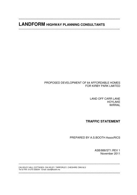
LANDFORM HIGHWAY PLANNING CONSULTANTS<br />
………………………………………………………………………………………………..<br />
PROPOSED DEVELOPMENT OF 64 AFFORDABLE HOMES<br />
FOR KIRBY PARK LIMITED<br />
LAND OFF CARR LANE<br />
HOYLAKE<br />
WIRRAL<br />
TRAFFIC STATEMENT<br />
PREPARED BY A.S.BOOTH AssocRICS<br />
<strong>ASB</strong>/<strong>888</strong>/<strong>ST1</strong>.REV 1<br />
November <strong>20</strong><strong>11</strong><br />
………………………………………………………………………………………………..<br />
CALVELEY HALL COTTAGES, CALVELEY, TARPORLEY, CHESHIRE CW6 9LG<br />
Tel & FAX: 01270 528<strong>20</strong>4 - Email: stan@booth.ms<br />
....................................................................................................................................
CONTENTS<br />
1.0 INTRODUCTION<br />
2.0 SITE LOCATION AND EXISTING HIGHWAY CONDITIONS<br />
3.0 PROPOSED DEVELOPMENT AND TRAFFIC IMPACT<br />
4.0 RAILWAY LEVEL CROSSING<br />
5.0 SITE ACCESS<br />
6.0 PERSONAL INJURY ACCIDENTS<br />
7.0 SUSTAINABLE DEVELOPMENT<br />
8.0 SUMMARY AND CONCLUSION<br />
APPENDICES<br />
APPENDIX A - PROPOSED LAYOUT<br />
APPENDIX B - TRICS DATA FOR RESIDENTIAL DEVELOPMENT<br />
APPENDIX C - SITE ACCESS DRAWING<br />
APPENDIX D - ACCIDENT LOCATION PLAN<br />
APPENDIX E - 3 YEAR ACCIDENT RECORDS
1.0 INTRODUCTION<br />
1.1 This Traffic Statement has been prepared on behalf of Kirby Park Limited to<br />
support a planning application for residential development of 64 affordable<br />
homes comprising apartments, terraced houses and semi-detached houses.<br />
1.2 The report will consider the effect of the development on the existing highway<br />
network and the availability of alternative forms of sustainable transport in line<br />
with the objectives set out in Planning Policy Guidance Note 13 (PPG 13).<br />
1.4. Early discussions have taken place with Keith Rogers of Wirral Borough<br />
Council highways department when the scope of the Traffic Statement was<br />
established and the report is based on that.<br />
2.0 SITE LOCATION AND EXISTING HIGHWAY CONDITIONS<br />
2.1 The application site is located at the eastern end of Carr Lane, Hoylake,<br />
approximately 800m south east of the roundabout junction of the A553 Market<br />
Street and Station Road - see Appendix D. The route to the site from the<br />
roundabout is firstly via Station Road up to the railway level crossing and then<br />
Carr Lane. Both are unclassified roads, subject to a 30 mph speed limit with<br />
street lighting and footways on each side. Carr Lane is a cul-de-sac from the<br />
level crossing onwards and is the only vehicular route to and from the site.<br />
There is a footway and cycle link to Melrose Avenue and Market Street via<br />
Proctor Road.<br />
2.2 Station Road is 125m in length from the roundabout to the level crossing and<br />
serves shops, commercial and residential properties, as well as Hoylake<br />
Railway Station, over that length. The road then continues as Carr Lane<br />
which, for the first 575m of its length to Carsthorne Road, serves mainly<br />
commercial and industrial properties in addition to the Hoylake Station car<br />
park, Proctor Road - a residential road, Hoylake Municipal Golf Course, a<br />
rugby field and a children’s playing field. For the remaining 100m of its length<br />
it only serves residential properties and the agricultural land beyond the end<br />
of the adopted highway. A public footpath continues on along a farm track at<br />
the end of Carr Lane. The centre of the proposed development is some 1<strong>20</strong>m<br />
from the access.<br />
2.3 Station Road has a 8.6m wide carriageway comprising two through lanes<br />
totalling 6.6m wide and a 2m wide delineated parking area on the south west<br />
side. Carr Lane has a 7m wide two lane carriageway for the first 350m of its<br />
length from the level crossing to Proctor Road, which then reduces to 6.3m<br />
wide for the remaining 325m to the site. The carriageway along the entire<br />
route is in excess of the 5.5m width which Manual for Streets demonstrates in<br />
[1]
Figure 7.1, page 79, is of sufficient width to allow two heavy goods vehicles<br />
(HGV’s) to pass.<br />
2.4 Observation indicates that, apart from the level crossing, which will be dealt<br />
with later, there is no evidence of any significant highway safety issues that<br />
need to be addressed.<br />
3.0 PROPOSED DEVELOPMENT AND TRAFFIC IMPACT<br />
3.1 The proposed development will comprise a mix of 64 affordable apartments,<br />
terraced houses and semi-detached houses. The proposed layout is shown<br />
on a reduced scale copy of PDW Design application drawing no.1065L05 as<br />
Appendix - A.<br />
3.2 In order to assess the impact of the additional traffic from the proposal on the<br />
local highway network, the national TRICS traffic database has been<br />
analysed. The trips rates for 9 similar types of edge of town development,<br />
ranging from 40 to 99 units, have been obtained and are set out in Appendix -<br />
B. The peak hour trip rates derived from these shown in Table 3.1. The<br />
TRICS PM peak hour is 19.00 to <strong>20</strong>.00 which is outside the time when there<br />
will be any significant traffic from the commercial uses, so the 17.00 to 18.00<br />
rates, which are the next highest and will coincide with the industrial and<br />
commercial peak, have been chosen as being more appropriate.<br />
Time<br />
period<br />
Arrival<br />
Trip rate<br />
Departure<br />
Trip Rate<br />
Arrival<br />
Nos.<br />
Departure<br />
Nos.<br />
Total trips<br />
2 way<br />
AM peak 0.145 0.410 9 26 31<br />
PM Peak 0.378 0.231 24 15 39<br />
Table 3.1<br />
3.3 The maximum increase in traffic flow resulting from the proposed<br />
development in either direction will be 26 vehicles an hour which represents<br />
an average directional flow of one additional vehicle every 2.3 minutes. The<br />
heaviest peak hour traffic flows from the proposed development will generally<br />
be in the opposite direction to those from the commercial and industrial<br />
development, so the traffic from the proposed development will have an<br />
insignificant effect on existing traffic flows.<br />
3.4 The need to carry out a traffic count to examine vehicular capacity of Carr<br />
Lane has been considered. However, as it’s a cul-de-sac with no through<br />
traffic and observation at peak periods showed there are no existing vehicular<br />
capacity problems, it isn’t considered necessary.<br />
[2]
4.0 RAILWAY LEVEL CROSSING<br />
4.1 Traffic delays due to the closure of the level crossing have been examined,<br />
particularly with regard to its location close to the roundabout. When vehicles<br />
from the south east (outbound) are queued, there is no restriction on the<br />
length of the queue, but when vehicles queue from the north west (inbound),<br />
queues back up towards the roundabout, so the effect of the additional<br />
inbound traffic in that direction needs to be assessed.<br />
4.2 Peak hour traffic delay counts have been carried out and are set out in Tables<br />
4.1 and 4.2.<br />
Time gates<br />
close<br />
Time closed<br />
(minutes)<br />
Queue length<br />
(vehicle nos.)<br />
08.03 5 17*<br />
08.<strong>20</strong> 3 <strong>20</strong>*<br />
08.34 4 26*<br />
08.52 4 17*<br />
Table 4.1<br />
AM peak 08.00 to 09.00 - 2 nd August <strong>20</strong><strong>11</strong><br />
Gates closed for a total of 16 mins.<br />
* Vehicle queue extends onto roundabout<br />
Time gates<br />
close<br />
Time closed<br />
(minutes)<br />
Queue length<br />
(vehicle nos.)<br />
17.06 5 7**<br />
17.<strong>20</strong> 5 8**<br />
17.36 5 7**<br />
17.50 5 4**<br />
Table 4.2<br />
PM peak 17.00 to 18.00 - 26 th July <strong>20</strong><strong>11</strong><br />
Gates closed for a total of <strong>20</strong> mins.<br />
** Vehicle queue at least 4 vehicle lengths clear of roundabout<br />
4.3 The proposed additional peak inbound traffic flows, as shown in Table 3.1 will<br />
be 9 vehicles in the AM peak period and 24 vehicles in the PM peak period.<br />
4.4 In the AM peak period, the gates are closed for a total of 16 minutes or<br />
(16/60x100) 27% of the hour. Therefore, the number of vehicles from the<br />
proposed site joining the queue in the AM peak period will be (9 x 27%) 2.4<br />
vehicles in the 16 minutes or an average of 0.15 vehicles a minute. In the<br />
[3]
longest period of closure - 5 minutes, the maximum number of additional<br />
vehicles queuing will be (0.15 x 5) 0.75 (say 1) vehicle. This 1 additional<br />
vehicle in any queue will not result in a material change to the current<br />
situation where vehicles in the AM peak already queue onto the roundabout.<br />
It should also be note that although the queue lengths extend onto the<br />
roundabout in the AM peak, this is for a short time only, as the queues build<br />
up slowly during the period when the gates are closed. Drivers also try to wait<br />
on or at the roundabout in positions that allow some limited traffic flow in other<br />
directions.<br />
4.5 In the PM peak period, the gates are closed for a total of <strong>20</strong> minutes or<br />
(<strong>20</strong>/60x100) 33% of the hour. Therefore, the number of vehicles from the<br />
proposed site joining the queue in the PM peak period will be (24 x 33%) 7.9<br />
vehicles in the <strong>20</strong> minutes or an average of 0.395 vehicles a minute. In the<br />
longest period of closure - 5 minutes, the maximum number of additional<br />
vehicles queuing will be (0.395 x 5) 1.975 (say 2) vehicles. As there are<br />
currently at least 4 vehicles spaces between the end of any queue and the<br />
roundabout, these 2 additional vehicles can be accommodated without<br />
disruption of the traffic flow on the roundabout.<br />
5.0 SITE ACCESS<br />
5.1 The proposed access to the site shown in Appendix C is a continuation of<br />
Carr Lane and forms a “T” junction with Yeoman Cottages. The highway<br />
authority has advised that the proposed development would be subject to a<br />
<strong>20</strong> mph speed limit in line with the Council’s policy. The surfacing at the<br />
junction will therefore be in contrasting material to the main carriageway and<br />
constructed to provide traffic calming in order to reduce traffic speed.<br />
6.0 PERSONAL INJURY ACCIDENTS<br />
6.1 The latest 3 year personal injury accident records have been obtained from<br />
the Council for the full length of Station Road, including the Station<br />
Road/Market Street roundabout and Carr Lane. The location plan is attached<br />
as Appendix D and the personal injury accident records as Appendix E.<br />
6.2 Personal injury accident statistics are recorded according to severity in three<br />
injury categories - fatal, serious or slight. In the standard 3 year assessment<br />
period, there were no fatal or serious accidents and only 3 slight personal<br />
injury accidents between the site and the roundabout on Market Street. These<br />
were widely spaced and did not involve pedestrians. There is therefore no<br />
pattern or significant numbers to indicate any highway safety issues that need<br />
to be addressed either along the route to the site or at any of the highway<br />
junctions.<br />
[4]
7.0 SUSTAINABLE DEVELOPMENT<br />
7.1 PPG 13 – <strong>Transport</strong> requires the examination of alternative means of<br />
transport other than the private car in order to provide sustainable<br />
accessibility, such as on foot, by cycle, by bus or by rail.<br />
Accessibility on foot<br />
7.2. Hoylake is well served with shops and other services. Most are concentrated<br />
along or close to Market Street which is 9<strong>20</strong>m from the centre of the site via<br />
Carr Lane and Station Road or 8<strong>20</strong>m along a pedestrian and cycle link via<br />
Proctor Street and Melrose Avenue. Even allowing for walking along Market<br />
Street or the side roads, the main services are well within the 2km (1.25<br />
miles) from the site that PPG13 considers as being an acceptable walking<br />
distance.<br />
Accessibility by cycle<br />
7.3 PPG 13 suggests that journeys of up to 5km (3.1 miles) can be carried out by<br />
cycle. This means that, not only are the local services in the Market Street<br />
easily accessed by cycle, but West Kirby and Meols and the sea front in<br />
between, with its recreation facilities, are also all within reach by cycle.<br />
Accessibility by bus<br />
7.4 There are two convenient bus local services that can be used by residents<br />
with stops on Carr Lane and Market Street that allow convenient access to<br />
local services and beyond.<br />
7.5 The no.138 Meols - West Kirby - Newton circular service run by Super Travel<br />
is routed along Carr Lane with a stop near Carsthorne Road, 2<strong>20</strong>m from the<br />
centre of the site. Buses operate on an hourly basis from 09.41 to 15.48 -<br />
Monday to Friday and 08.41 to 17.41 on Saturday. There is no Sunday<br />
service.<br />
7.6 The nos.83 and 83A Birkenhead - West Kirby circular service is run by Avon<br />
Buses and routed along Market Street with stops 1.2km from the centre of the<br />
site and within walking distance. Buses operate on a 30 minute basis in each<br />
direction from 07.47 to 17.47 - Monday to Friday and hourly from 08.41 to<br />
18.35 on Saturday. There is no Sunday service.<br />
Accessibility by rail<br />
7.5 Hoylake Railway Station is 795m from the centre of the site. Services operate<br />
[5]
etween West Kirby, Birkenhead and Liverpool at 15 minute intervals in both<br />
directions from 7.30 am to 8.00 pm reducing to 30 minute intervals in early<br />
morning and late evening. Reduced services operate on Saturdays and<br />
Sundays.<br />
7.6 The station is well within both walking and cycling distance of the site and has<br />
secure cycle parking facilities on the platform.<br />
School accessibility<br />
7.7 There are numerous schools within a reasonable catchment area ranging<br />
from day nurseries to secondary schools that can all be accessed either on<br />
foot, by cycle or by bus.<br />
Sustainability development conclusion<br />
7.8 The site is therefore well served by numerous sustainable means of transport<br />
other than the car and meets the criteria laid down in PPG 13 – <strong>Transport</strong>.<br />
Indeed, the site is so well served that it will be possible to live there without<br />
needing to use a car.<br />
8.0 SUMMARY AND CONCLUSION<br />
8.1 The report is provided to support a planning application for 64 affordable<br />
homes.<br />
8.2 The local highway network has been examined and described in detail and it<br />
is suggested there are currently no highway safety issues that need to be<br />
addressed.<br />
8.3 The proposed development has been described and the potential traffic<br />
generation has been analysed using the national TRICS database which<br />
shows that there will only be a small increase in traffic even in peak periods.<br />
8.4 The operation of the level crossing has been considered with peak hour<br />
counts taken to establish queue length when the gates are closed. These<br />
show that the only time when the queue backs up to the roundabout is<br />
inbound in the morning peak when one additional vehicle will added to the<br />
queue. It is suggest that this will not result in a material change to the current<br />
situation.<br />
8.5 The 3 year personal accident records have been obtained from the Council<br />
and these show that there have been three slight accidents, but no fatal or<br />
[6]
serious accident. There is nothing in the reports to indicate that any<br />
improvements to the local highway network are required.<br />
8.6 The site has been examined for sustainability in terms of alternative forms of<br />
transport to the car and it has been demonstrated that there are a number of<br />
other convenient ways of accessing the site on foot or by cycle, bus or train.<br />
8.7 It is therefore concluded that, as the proposal would not be detrimental to<br />
highway safety and meets the criteria for sustainable development set out in<br />
PPG 13 – <strong>Transport</strong>, there is no highway reason to withhold planning<br />
permission.<br />
Ref: <strong>ASB</strong>/<strong>888</strong>/<strong>ST1</strong>.REV A<br />
November <strong>20</strong><strong>11</strong><br />
[7]
APPENDICES<br />
APPENDIX A - PROPOSED LAYOUT<br />
APPENDIX B - TRICS DATA FOR RESIDENTIAL DEVELOPMENT<br />
APPENDIX C - SITE ACCESS DRAWING<br />
APPENDIX D - ACCIDENT LOCATION PLAN<br />
APPENDIX E - 3 YEAR ACCIDENT RECORDS
APPENDIX - A<br />
PROPOSED LAYOUT
APPENDIX - B<br />
TRICS DATA FOR RESIDENTIAL DEVELOPMENT
APPENDIX - C<br />
SITE ACCESS DRAWING
APPENDIX - D<br />
ACCIDENT LOCATION PLAN
APPENDIX - E<br />
3 YEAR ACCIDENT RECORDS