Untitled - Discover Sinai
Untitled - Discover Sinai
Untitled - Discover Sinai
- No tags were found...

Create successful ePaper yourself
Turn your PDF publications into a flip-book with our unique Google optimized e-Paper software.
All rights reserved. No part of this publication may be reproduced or transmitted<br />
in any form or by any means, or stored in a database or retrieval system,<br />
without the prior written permission of the author.<br />
Copyright © 2011 Zoltan Matrahazi<br />
Index of places and glossary in Arabic:<br />
Mohamed Eid Abu Mudarwash, Suliman Subail el Heneny<br />
No liability is accepted for any loss or damage caused directly or indirectly by<br />
this book or the information contained within this book.<br />
ISBN 1453853480<br />
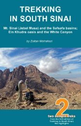
Cover photo: Jebel Umm Shaumar<br />
2
Table of contents<br />
Foreword<br />
The <strong>Sinai</strong> trekking regions<br />
The Bedouin<br />
Organising your trek<br />
Further information<br />
TREKS<br />
I. Around St. Katherine (High Mountain Region)<br />
1. Mt. <strong>Sinai</strong> - Safsafa basins - Wadi Arbain<br />
2. Wadi Arbain - Mt. Katharina - Wadi Mathar<br />
3. Wadi Zawatin - Farsh Abu Mahashur - Jebel Abbas Basha<br />
II. South of St. Katherine<br />
4. Jebel Umm Shaumar - Wadi Rumhan<br />
III. Between St. Katherine, Dahab and Nuweiba<br />
5. Ein Khudra oasis - White Canyon<br />
IV. Inland from the Nuweiba-Taba coast<br />
6. Wadi Milha - Naqb el Kohla - Coloured Canyon<br />
V. Around Wadi Feiran<br />
7. Naqb Shaharani - Jebel Serbal - Wadi Rim<br />
VI. Around Serabit el Khadim<br />
8. Serabit el Khadim - Wadi Sieh - Wadi Maqara - Wadi Mukattab<br />
Index of places<br />
Bedouin-Arabic glossary<br />
3
Foreword<br />
This little book, despite describing only 8 treks, is the first trekking<br />
guide to South <strong>Sinai</strong> as such * . Although it only presents some of the<br />
highlights, it gives a glimpse of all the different regions and shows well<br />
the diversity of the peninsula. An extended version is planned, covering<br />
all the major routes. However, at present the aim is to get the word out<br />
about trekking in <strong>Sinai</strong> – the complete guide is another step.<br />
European tourism has only begun a few decades ago and the <strong>Sinai</strong><br />
interior is very little known, except by Israeli trekkers who used to come<br />
in big numbers until the early 2000s. However, unnecessary ‘security’<br />
measures and biased tourism policies have all but killed trekking in<br />
favour of package tourism in the last decade. I hope in the ‘new’ Egypt<br />
positive changes will happen in tourism as well. Instead of focusing<br />
purely on Red Sea resort holidays, it is an opportunity to promote more<br />
responsible activities, and trekking is one of them. The potential is<br />
there: it is a beautiful land and traditional guiding skills are not yet lost.<br />
Local communities depend a great deal on work as guides and<br />
cameleers, and it is one of those rare cases where tourism can actually<br />
help sustain a traditional way of life – at least to a certain extent.<br />
I have never thought I would write a trekking guide, but having fallen in<br />
love with the country and its people, I felt obliged to give something<br />
back. I have lived in St. Katherine since 2005, being part of the<br />
Bedouin community in different ways and on different levels. I started<br />
discovering the region alone, getting to know more and more people<br />
and places along the way. Later I had the chance to work for an EU<br />
project mapping treks and training local guides. The most important,<br />
however, wasn’t achieved: reaching the international trekking<br />
community. That’s when the idea of writing a trekking guide started<br />
developing. It took some turns and twists, and I have learned some<br />
tough lessons in the process – but finally here it is. I am convinced<br />
there is public interest. But publishers are very cautious, even though it<br />
is a rare opportunity to cover a location which hasn’t been covered<br />
before. I believe in it and will do it alone if necessary, god willing,<br />
although I would prefer it with a respected publisher.<br />
This book is very concise, unedited and sure needs improvements.<br />
Your comments, criticism and suggestions are very welcome to make<br />
the extended version better. Please share your thoughts with me on:<br />
zoltan@discoversinai.net<br />
St. Katherine, South <strong>Sinai</strong> Egypt. 13. May, 2011<br />
* See other trekking resources under ‘Further information’<br />
5
The <strong>Sinai</strong> trekking regions<br />
The only distinctive region – geologically, geographically, historically<br />
and culturally – is the <strong>Sinai</strong> High Mountain Region. The other regions,<br />
although very diverse, are the ‘usual’ desert scenes; sandy plains,<br />
sandstone hills and rock formations, dunes, barren and rugged ranges,<br />
long winding wadis. In this book the trekking regions are defined<br />
according to practicality; areas where sights are concentrated and the<br />
hubs from where treks can be organised to that area. These regions<br />
often correspond to actual tribal territories.<br />
I. Around St. Katherine (High Mountain Region)<br />
II. South of St. Katherine<br />
III. Between St. Katherine, Dahab and Nuweiba<br />
IV. Inland from the Nuweiba-Taba coast<br />
V. Around Wadi Feiran<br />
VI. Around Serabit el Khadim<br />
6
The Bedouin<br />
The traditional inhabitants of the <strong>Sinai</strong> are Bedouin tribes who settled at<br />
different times in the last 1500 years. They are mostly from the Arab<br />
peninsula, with the Jabaleya a unique exception, being the<br />
descendants of people from the Balkan. Traditionally there are seven<br />
Bedouin tribes in South <strong>Sinai</strong> – the Tawara federation – but some other<br />
tribes from the north have moved in more recently. The Bedouin are<br />
pastoralist nomads, although most are now settled in or around towns.<br />
They still maintain a strong link to the desert and mountains, and many<br />
families move out to their campgrounds or gardens at certain times of<br />
the year. The Bedouin way of life is very simple and slow, with a fine<br />
balance of work and leasure time. It is a very welcoming but closed<br />
society, where a complex system of family ties and strong traditions<br />
play the most important roles. It is a real experience to walk with a<br />
Bedouin guide and learn from their age-old survival skills and about<br />
their culture.<br />
The Bedouin tribes in South <strong>Sinai</strong><br />
Note that tribal territories often overlap and there might be little pockets<br />
of land on others’ territory.<br />
7
Organising your trek<br />
In the <strong>Sinai</strong>, as in many developing countries around the world, you<br />
have to have a local guide if you are venturing off to the wilderness. It<br />
is partly for your safety but also to provide work for local communities.<br />
You can organize your program through different operators or<br />
independently – the options are explained below, followed by some<br />
points on other practical issues.<br />
Big international companies usually do not run treks and safaris off<br />
the beaten path – they probably include the Monastery of St. Katherine<br />
and Mt. <strong>Sinai</strong> and possibly a fast 4x4 visit to an oasis or canyon. If they<br />
do <strong>Sinai</strong>, they do it through smaller local operators, so you might as<br />
well go straight to them.<br />
There are smaller operators, based internationally and locally, who<br />
run treks and safaris or specialize in other activities, such as yoga,<br />
meditation, rock climbing, desert mountain-biking as well as aspects of<br />
religious, historical or nature tourism. They usually work closely with<br />
local Bedouin communities but provide their own tour leaders – foreign<br />
or Egyptian – who are in charge of the operations on the ground. These<br />
operators are very specialized in nature and most of them have<br />
websites, so you can easily find someone in your area of interest, who<br />
is based either in your own country or in Egypt. If you are choosing a<br />
locally based operator, the best options are the ones in Dahab,<br />
Nuweiba or St. Katherine. There are several Egyptian- and<br />
Egyptian/foreigner-run companies, as well as a growing number of<br />
Bedouin-run operations. Many of the smaller operations do not have<br />
offices of their own and are located in cheaper hotels and camps.<br />
There are independent Bedouin guides and it is possible to organize<br />
programs straight through them. They are registered as a “Bedouin<br />
guide” and have a photo ID with these words written in English. Some<br />
have other relevant qualifications as well. Hotels and camps which do<br />
not push their own services can put you in contact with the guides and<br />
you can sit down and discuss the details with them in person. The best<br />
places to find a good Bedouin guide who speaks English well, or other<br />
languages, is in Dahab, Nuweiba, the camps on the Nuweiba to Taba<br />
coast and in St. Katherine.<br />
In some places you can organize your trek or safari right on the spot in<br />
the desert, although English communication there might be basic.<br />
There are a number of cafeterias and camel stations along the St.<br />
Katherine to Dahab-Nuweiba road (Wadi Arada, Nawamis settlement,<br />
Ein Khudra pass, Ras Ghazala) which are easy to reach by taxi or<br />
microbus, possibly along a round trip to St. Katherine from the coast.<br />
You can also find guides in Wadi Feiran in the gardens close to the<br />
8
Convent (treks to Jebel Serbal, Wadi Mukattab and Serabit el Khadim)<br />
and possibly in the cafeterias in Abu Zenima (treks or transport to<br />
Serabit el Khadim). Wadi Feiran and Abu Zenima are on the main<br />
Cairo to St. Katherine road serviced by public buses and regular<br />
microbuses. If you can make your own way to the settlement of Serabit<br />
el Khadim, you can arrange a program there; you can visit the<br />
archaeological ruins as well as do longer camel safaris.<br />
In some cases there are tribal laws regarding who you can take as a<br />
guide – most notable is the High Mountain Region, where guides are<br />
allocated by a rotating system managed by the sheikhs. The system,<br />
called el dor, has been set up by the tribe to provide work to every<br />
family. Treks have to be organized through the sheikhs who allocate<br />
the guides and camels and arrange permissions with the authorities. If<br />
you want to use a guide of your choice you still have to pay the one<br />
whose turn it is. In Arada Canyon, the White Canyon and the Coloured<br />
Canyon you also have to take a guide from the local system, unless<br />
you are taking part in a longer trek and already have a Bedouin guide.<br />
To the pharaonic ruins of Serabit el Khadim – and only to the<br />
archaeological site – you have to take a guide from the village,<br />
regardless if you have another Bedouin guide, as is the case with Jebel<br />
Serbal, where only local Qararsha people can work. At the Colured<br />
Canyon a small part of the fee goes to the tribal cooperative which runs<br />
the system. There were also plans to set up a guide association at the<br />
Ein Khudra pass cafeteria and the Nawamis settlement.<br />
Costs<br />
Most operators and many independent guides prefer to offer allinclusive<br />
packages with prices ranging between 25 to 100 euro per<br />
person per day. The price often depends on several factors and/or<br />
minimum group size is required. If you want to organize your trek or<br />
safari independently you might save some money, but it depends<br />
greatly on your bargaining skills. Other factors which affect the price<br />
include group size, who is providing the food, extra equipment, camels,<br />
car or jeep if needed and the itinerary. Bedouin guides and cameleers,<br />
apart from leading you and carrying your stuff, will provide some<br />
cooking equipment and local water, make fire, tea and coffee, cook<br />
meals and bake bread. In case all food is bought by you, expect the<br />
following prices:<br />
• In the desert: guide 80-150 LE a day, each camel extra 80-120 LE<br />
a day. Note: if the guide and camel have to return from a long<br />
way the transport or return time are also to be paid for.<br />
• In the high mountains: guide from the sheikhs 160 LE a day, each<br />
camel extra 80-120 LE a day. Note: Mt. Katherine is double.<br />
• To Jebel Serbal: guide 200 LE a day, each camel extra 200 LE a<br />
day.<br />
9
10<br />
• Short ride in pick-up car: 50-100 LE.<br />
• Pick-up car: 300-400 LE a day.<br />
• Jeep (up to 4 passengers): 400-800 LE a day.<br />
• Landcruiser (up to 8 passengers): 800-1200 LE a day.<br />
• Basic accommodation in garden: 10-20 LE per person per night.<br />
• Fire wood: 40 LE a bag.<br />
Note: These are only indicative prices based on 2011 figures.<br />
On one hand, if you are not into bargaining and logistics and add up<br />
everything, you might as well find that organizing through operators<br />
providing all-inclusive packages is worth it. On the other hand, you<br />
might find it more personal to deal straight with the guide who will be<br />
with you along the way.<br />
Along the way<br />
The Bedouin have their own rhythm and treks are usually moderate; 3-<br />
4 hours walk in the morning with a possible tea break, lunch and rest,<br />
2-3 hours walk in the afternoon, camp. In summer starting time is very<br />
early and the lunch break can be as long as 3-4 hours, while in winter<br />
the start is later and the lunch break is shorter. If you want to cover<br />
bigger distances than the usual, you have to be very specific from the<br />
beginning. Some guides are excellent cooks but all know and can<br />
provide at least the basics: soups, simple rice and pasta dishes,<br />
chicken and vegetables, different types of fresh Bedouin breads,<br />
salads, dips, tuna, cheese, beans, sweets, tea and coffee. If you have<br />
special needs or want to cater for yourself, let it be known beforehand.<br />
In some areas it is possible to carry everything yourself, but camels are<br />
often needed. Camels are usually used for transport, but in the desert,<br />
according to arrangements, you can ride them as well. Often the<br />
camels take different routes so in the morning you should have ready a<br />
“camel pack” with belongings you only need in the evening and a day<br />
pack with items for the day. You should carry some warm clothes and<br />
have always plenty of water. You can safely rely on local water – if<br />
worried, bring water purification tablets and/or a water filter. Make sure<br />
you have bought firewood in town or have a gas cooker to minimize<br />
impact on scarce resources, especially in the case of bigger parties. A<br />
lightweight tent (possibly without the cover) or a mosquito net will come<br />
handy most of the year, but you can get away without one (cover<br />
yourself with a sheet or find a windy spot). In winter good sleeping bags<br />
are important while in warmer seasons a sheet might be enough. Foam<br />
mattresses and blankets are provided on request. Camps are set up<br />
either in Bedouin gardens or in the wilderness. In gardens there might<br />
be a toilet and simple washing facilities – in any case be conscious<br />
about waste and water usage.<br />
When meeting local people you will be offered tea or coffee, possibly<br />
food and, in the gardens, available fresh fruit. It is genuine Bedouin
hospitality: they don’t expect anything for it. It is nice to offer back<br />
something though; biscuits, cigarettes, snacks or other small things. If<br />
you want to contribute, you can buy small handicrafts which most<br />
families sell. However, staying overnight and services provided should<br />
be paid for either by you or the operator. Baksheesh is part of life and<br />
tips are accepted by all providing services – it is not necessary, but<br />
appreciated, especially if you were happy with their work. Useful items<br />
which are difficult to get locally, such as pocket knifes, torches,<br />
sandals, boots and other trekking equipment are also a good idea to<br />
give. Please respect local culture and do not make photos of women.<br />
When to come<br />
If you look at South <strong>Sinai</strong> as a whole, it is easy to organize treks all<br />
year round. When it gets cold in the high mountains, it is still warmer in<br />
the desert – when it is too hot in the desert, it is still more pleasant in<br />
the mountains. Probably the best times are spring and autumn in both<br />
regions, although any time is possible; there are small stone huts and<br />
caves which can provide shelters in winter and the hot mid-day siestas<br />
are spent in shady places in summer.<br />
Dangers and annoyances<br />
Egypt is generally a safe country – it hasn’t changed a bit in this sense<br />
– and the mountains and desert of South <strong>Sinai</strong> are especially so.<br />
Violent crimes are unheard of and theft, even in towns, is very rare.<br />
Religious tolerance dominates rather than extremism.<br />
Dangerous animals do exist in the <strong>Sinai</strong>, especially a couple of snake<br />
species, but they keep away from humans. Along treks the more likely<br />
threats are dehydration, sun stroke and cold. There are dangerous and<br />
difficult paths, but the guide should understand what you want to and<br />
can do. The guides are generally safety-conscious and innovative, but<br />
a first-aid kit is usually not available. Have some important basic<br />
medication and supplies. You should arrange travel insurance before<br />
your trip – check carefully what they offer. When on treks, your<br />
passport or a copy of your passport and visa might have to stay with<br />
the operator. Leave also your insurance details and other relevant<br />
information, in case of emergency.<br />
One annoying thing which often happens is not sticking to plans/route.<br />
Sometimes it is necessary to change the trek for various reasons, but<br />
there are guides who are simply lazy and want to cut corners. That’s<br />
one of the reasons why this guide is needed. Always make sure that<br />
the route and timing are understood by both parties before setting off.<br />
11
Further information<br />
Other trekking resources:<br />
• Guide to the exploration of the <strong>Sinai</strong>, by Alberto Siliotti<br />
This colourful book gives a good general picture of the whole<br />
peninsula with beautiful photos, several good maps and few walking<br />
trails, but mainly focuses on 4x4 travel and the coast.<br />
• <strong>Discover</strong> <strong>Sinai</strong> – a guide to the natural, cultural and historical<br />
faces of South <strong>Sinai</strong><br />
Available as a free pdf publication, it lists all the important sights in<br />
the region with photos and description. However, it doesn’t give any<br />
concrete trekking routes. It also has a comprehensive section on<br />
nature and a dictionary based on the local dialect.<br />
• A walk in <strong>Sinai</strong>: St. Katherine to Al Galt Al-Azraq, by Zalat S. &<br />
Gilbert F.<br />
The little book describes a popular 3-4-day trek in the High Mountain<br />
Region, as well as gives information on flora and fauna.<br />
• Walking Trail Guides, by National Parks of Egypt Protectorates<br />
Development Programmes<br />
Four booklets, each describing an easy-moderate 1-day walk in the<br />
High Mountain Region.<br />
• Lonely Planet Country Guide to Egypt has a small High Mountain<br />
Region trek inset and the Rough Guide to Egypt names a few<br />
trekking destinations in the broader region.<br />
Maps:<br />
Locally there is only one usable<br />
map (pictured). It is based on an<br />
Israeli map and is available from<br />
most bookshops in the <strong>Sinai</strong> or<br />
Cairo. Quality is very low but the<br />
High Mountain Region inset is<br />
really useful. Some camps can<br />
make a photocopy of it. In this book we based the geographical names<br />
mostly on this map. The Royal Geographic Society’s map of <strong>Sinai</strong>,<br />
coming in many separate sheets, is better for the whole region, but not<br />
for the High Mountain Region.<br />
Useful websites:<br />
About St. Katherine and the High Mountains: http://st-katherine.net<br />
About South <strong>Sinai</strong>: http://discoversinai.net<br />
About Egypt: http://alternativeegypt.com<br />
Transport in <strong>Sinai</strong>: http://bedouinbus.com<br />
12
TREKS<br />
The layout of the book is designed in a way that you can have a map<br />
and the corresponding description open at the same time, for easy<br />
reference. The disadvantage is that there is limited space for extra<br />
information related to the treks – and in some cases there is a lot of<br />
interesting info that could be added or extra maps could be useful. Still,<br />
I believe, the essence is there that is needed to plan a trek and<br />
orientate yourself along the trek.<br />
The High Mountain Region is the most diverse area and three treks are<br />
featured there – in the other regions one in each. They are short treks,<br />
lasting 1-3 days, which could be linked up with other treks within the<br />
same region and across regions. However those other treks are not<br />
described in this edition, although they are shown on the maps of each<br />
region and listed in light grey fonts under the featured trek(s). They are<br />
listed in the order of how they connect. On the facing page there is<br />
information about the region.<br />
The duration of each trek is given as well as the difficulty level. The<br />
duration might vary sometimes – an extra night might be added in<br />
some cases if someone wants to take it at an easier pace. The actual<br />
distances are also given, a bit further below with the other details. The<br />
difficulty level is defined either as easy, medium or difficult – or on the<br />
border of two – and the important characteristics of the route are<br />
described in a few words. Then there is a map with numbered<br />
waypoints, with the corresponding details – such as name of location,<br />
coordinates and distance from previous waypoint – written under the<br />
map. The numbers of the waypoints are also included in brackets in the<br />
route description on the facing page, as well as in the trek gallery on<br />
the following two pages.<br />
13
I. Around St. Katherine (High Mountain Region)<br />
14<br />
Featured treks:<br />
1. Safsafa basins - Mt. <strong>Sinai</strong><br />
2. Mt. Katharina - Wadi Shaq<br />
3. Wadi Zawatin - Farsh Abu Mahashur - Jebel Abbas Basha<br />
All connecting treks in the region:<br />
• Safsafa basins - Mt. <strong>Sinai</strong><br />
• Naqb Abu Hamen - Jebel Ahmar<br />
• Mt. Katharina - Wadi Shaq<br />
• Wadi Zawatin - Farsh Abu Mahashur - Jebel Abbas Basha<br />
• Sid Daud - Wadi Itlah - Naqb Abu Seila<br />
• Wadi Jibal - Bab el Donya - Farsh Rummana<br />
• Wadi Talla Kibira - Galt el Azraq - Wadi Abu Tuweita<br />
• Wadi Tinya - Wadi Sagar - Kharazet el Shaq<br />
• Jebel Naja<br />
• Naqb el Hawa - Sheikh Awad<br />
• Wadi Gharba - Sida Nugra - Jebel Banat - Bustan el Birka<br />
• Wadi Sdud - El Frush - Blue Desert
I. Around St. Katherine (High Mountain Region)<br />
Famous for the Monastery of St. Katherine and Mt. <strong>Sinai</strong>, the town of<br />
St. Katherine is on the major tourist path – but the region, apart from<br />
these two sights, is very little visited. From Cairo there is a daily bus<br />
service to St. Katherine – from the resorts on the Red Sea coast it can<br />
be reached by taxi or microbus. There are several camps and hotels in<br />
town, as well as restaurants, cafeterias, shops, bank with ATM,<br />
pharmacies and a hospital. The <strong>Sinai</strong> High Mountain Region, as the<br />
area is known, is very unique geographically as well as culturally. The<br />
town itself is at 1600 metres above sea level, surrounded by dramatic<br />
ranges with many peaks well above 2000 meters, including Mt.<br />
Katherina, the highest in Egypt. Most of the mountains are granite –<br />
this, along with a relatively wetter and cooler climate, makes possible<br />
an orchard gardening tradition which has its root in Byzantine<br />
monasticism. The traditional people of the area are the Jabaleya<br />
Bedouin – the Mountain Bedouin – who have been guarding the<br />
Monastery for more than 1500 years. Unlike Bedouin groups in the<br />
desert they have been practicing agriculture and most families own<br />
gardens in the mountains. It is an ideal trekking region where treks<br />
lasting up to 2 weeks can be organized, staying mostly at these<br />
Bedouin gardens along the way. The area is also perfect for a relaxing<br />
stay and there are different cultural activities and a few eco-lodges.<br />
The highlights of the region:<br />
• The Monastery of St. Katherine and Mt. <strong>Sinai</strong>;<br />
• Mt. Katherina, the highest peak in Egypt;<br />
• the Palace of Abbas Basha;<br />
• the peaks of Bab el Donya, Jebel Naja and Jebel Banat on the<br />
perimeter of the high mountains;<br />
• the secluded basins of Farsh Safsafa and Farsh Abu<br />
Mahashur;<br />
• the granite water pools of Galt el Azraq, Kharazet el Shaq and<br />
Sidda Nogra;<br />
• monasteries and Byzantine ruins in Wadi Arbain, Wadi Shaq,<br />
Wadi Talla and Bustan el Birka;<br />
• the surreal scene at the Blue Desert.<br />
Locally you can organise a trek at the Sheikh Mousa camp, Fox Camp<br />
or with individual guides. Guides and camels have to be from the tribal<br />
rotating system managed by Sheikh Mousa – either if you organize the<br />
trek with the sheikhs or someone else. If you only climb Mt. <strong>Sinai</strong> you<br />
have to take a guide from the Monastery guide association, unless you<br />
already have a guide from the sheikhs. The guides at the Monastery<br />
guide association usually do the summit climb only – if you want more<br />
than that you have to be clear about it and agree on a price.<br />
15
1. Mt. <strong>Sinai</strong> - Safsafa basins - Wadi Arbain<br />
1-2 days. Difficulty level: medium-difficult. Long steep climb, big<br />
steps, good path.<br />
Visitor Centre, St. Katherine The Monastery of St. Katherine <br />
The Stairs of Repentance Elijah’s Basin Mt. <strong>Sinai</strong> (Jebel<br />
Musa) Elijah’s Basin Camel path or Wadi Arbain St.<br />
Katherine<br />
Add-on hike: Elijah’s Basin Farsh Loza Farsh A’rimziya <br />
Farsh Safsafa Kinist el Hmar Elijah’s Basin or Wadi Arbain<br />
1. Visitor Centre (28º34’01” 33º58’06” elev. 1530m); 2. Parking lot/Checkpoint;<br />
3. Monastery of St. Katherine (28º33’20” 33º58’34” elev. 1580m dist.<br />
1.7km); 4. Elijah’s Basin (28º32’40” 33º58’29” elev. 2033m dist. 1.7km); 5.<br />
Summit of Mt. <strong>Sinai</strong> (Jebel Musa) (28º32’20” 33º58’29” elev. 2285m dist.<br />
1.0km); 6. Cutting; 7. Fork; 8. Ramadan’s garden (28º32’03” 33º57’56” elev.<br />
1780m dist. 2.8km); 9. Rock of Moses (Hajar Musa) (28º32’38” 33º57’26”<br />
elev. 1700m dist. 1.5km); 10. El Rasis area (28º33’17” 33º56’55” elev. 1600m<br />
dist. 1.5km); 11. Farsh Loza (28º32’54” 33º58’12” elev. 2015m dist.from 4.<br />
0.7km); 12. Farsh A’rimziya, lookout-point (28º33’00” 33º58’18”); 13. Farsh<br />
Safsafa (28º33’10” 33º57’52” elev. 1990m dist. 0.8km); 14. Lookout-point<br />
(28º33’14” 33º57’58”); 15. Fork; 16. Kinist el Hmar (28º32’50” 33º58’03”).<br />
16
1. Mt. <strong>Sinai</strong> - Safsafa basins - Wadi Arbain<br />
Mt. <strong>Sinai</strong> is visited by up to a thousand people on most nights, but the<br />
crowds can easily be avoided if you go for the sunset and not the<br />
sunrise. The view and colours are just as beautiful – I believe actually<br />
better – and there are only a handful of people, if any. Just a few steps<br />
off from the tourist path, between Mt. <strong>Sinai</strong> and Jebel Safsafa, there are<br />
secluded green basins with ruined and intact chapels, wells, dams and<br />
gardens, as well as stunning views down the gullies to different<br />
directions. First the Mt. <strong>Sinai</strong> sunset hike is described, which can be<br />
extended with the Safsafa basins walk.<br />
It is worth to start early with a quick tour of the Visitor Centre (1) at the<br />
roundabout. It is open from 9 AM till noon, closed on Fridays and<br />
Sundays. On the way to the Monastery at the parking lot and checkpoint<br />
(2) you have to take a local Bedouin guide, unless you have one<br />
already from the sheikhs. The first crowds have left by the time you get<br />
to the Monastery of St. Katherine (3); arrive before 11 AM if you want<br />
to go inside. From the Monastery the faster and more interesting route<br />
is via the Stairs of Repentance. In summer start before noon; it will be<br />
hot already but you could be in shade in Elijah’s Basin (4) in less than<br />
an hour. You could also start 2-3 hours before sunset when the worst<br />
of the heat is over. In winter midday is bearable. Elijah’s Basin is from<br />
where you can visit the Safsafa basins, either before climbing to the<br />
summit of Mt. <strong>Sinai</strong> or the next morning. There is a small campsite<br />
here. Another steep climb follows with more steps to the summit of Mt.<br />
<strong>Sinai</strong> (5). If you descend right after sunset you can get down before<br />
total darkness. You can also sleep on the top or in a cafeteria, but it is<br />
noisy at dawn. Descend the same path you came up but turn into a<br />
small cutting (6) in the rock. At a cafeteria further down there is a fork<br />
(7); to the left is the way to the Monastery, to the right is Wadi Arbain,<br />
where you can stay in Ramadan’s garden (8) or return to town,<br />
passing another monastery and the Rock of Moses (9).<br />
Add-on hike: Starting from Elijah’s Basin (4), there is a good path to<br />
north-west, leading to a little basin, Farsh Loza (11). Off the path to the<br />
north-east is another basin, Farsh A’rimziya (12) with a look-out point<br />
over the Monastery. Back on the path and continuing the walk, you will<br />
cross a big open basin before reaching Farsh Safsafa (13), where<br />
there is a fenced garden. You have to back-track from here – as soon<br />
as you come up from the garden and the path turns right, a gully starts<br />
on your left. It is a look-out point (14) down on the area around the<br />
Visitor Centre. Follow the main path back to the big open basin as you<br />
came, but at a fork (15) turn to south onto a much smaller path. This<br />
will take you to Kinist el Hmar (16), another basin with a chapel and<br />
good views of Mt. Katharina. There is a way over a smooth granite<br />
ridge back to Farsh Loza (11) and then Elijah’s Basin (4). The steep<br />
gully ahead to the south is the short way to Wadi Arbain.<br />
17
1. Mt. <strong>Sinai</strong> - Safsafa basins - Wadi Arbain<br />
Wadi el Deir<br />
The Visitor Centre (1)<br />
The Monastery of St. Katherine (3)<br />
Stairs of Repentance<br />
Elijah’s Basin with Mt. <strong>Sinai</strong> (4)<br />
The summit of Mt. <strong>Sinai</strong> (5)<br />
Camp in Elijah’s Basin<br />
Farsh Loz a (11)<br />
18
1. Mt. <strong>Sinai</strong> - Safsafa basins - Wadi Arbain<br />
Farsh El Rimziya<br />
Look-out point (12)<br />
Frash Safsafa (13)<br />
Look-out point (14)<br />
Kinest el Ahmar (16)<br />
Gully to Wadi Arbain<br />
Monastery of the Forty Martyrs (8)<br />
The Rock of Moses (Hajar Musa) (9)<br />
19
2. Wadi Arbain - Mt. Katharina - Wadi Mathar<br />
2 days. Difficulty level: difficult. Long climb, at times difficult path.<br />
St. Katherine Rock of Moses Monastery of the Forty Martyrs<br />
Farsh Umm Silla Mt. Katharina Farsh Umm Silla Wadi<br />
Ahmar Wadi Mathar Wadi Shaq Abu Jeefa St. Katherine<br />
1. El Rasis area (28º33’17” 33º56’55” elev. 1600m); 2. Rock of Moses (Hajar<br />
Musa); 3. Monastery of the Forty Martyrs; 4. Ramadan’s garden (28º32’03”<br />
33º57’56” elev. 1780m dist. 3km); 5. Spring (Ein Shinaar); 6. Farsh Umm<br />
Silla (28º’31”16 33º57’20” elev. 2300m dist. 2.5km); 7. Mt. Katharina<br />
(28º30’46” 33º57’14” elev. 2642m dist. 2km); 8. Wadi Ahmar (28º31’44”<br />
33º56’52” elev. 2090m dist. from 6. 1.5km); 9. Farhan’s garden (28º31’48”<br />
33º56’16” elev. 1890m dist. 1km); 10. Isbail’s garden; 11. Mulberry and<br />
hermit cell; 12. Canyon and water pools (28º32’02” 33º56’04” elev. 1870m<br />
dist. 0.7km); 13. Oda’s garden (28º32’08” 33º56’00” elev. 1855m dist. 0.3km);<br />
14. Wadi Tubuq junction (28º32’28” 33º55’56” elev. 1825m dist. 0.8km); 15.<br />
Ein Shkaya; 16. Islibet (28º32’42” 33º56’03” elev. 1814m dist. 0.5km); 17. Abu<br />
Jeefa top (28º32’48” 33º56’10” elev. 1850m dist. 0.4km); 18. Ein Tufaha<br />
(28º33’03” 33º56’29” elev. 1630m dist. 1km).<br />
20
2. Wadi Arbain - Mt. Katharina - Wadi Mathar<br />
Wadi Arbain is an alternative way between Mt. <strong>Sinai</strong> and town, and the<br />
main route to Egypt’s highest peak, Mt. Katharina. A big boulder half<br />
way, called Hajar Musa, is believed to be the rock from which Moses<br />
fetched water. The Monastery of the Forty Martyrs, known as Deir<br />
Arbain, is at the upper end in a big walled orchard. The climb to Mt.<br />
Katharina is long and steep, but well worth the effort. There is a little<br />
chapel on the peak. The descent on the other side is tricky; the terrain<br />
is rough and the path at points leads over big boulders blocking the<br />
way. The Wadi Mathar area is a big open plain encircled by impressive<br />
ranges. Some of the most beautiful Bedouin gardens are here, as well<br />
as Byzantine ruins, a little canyon and small water pools.<br />
The path from the El Rasis area (1) of the town is paved with big flat<br />
rocks all the way to the Monastery of the Forty Martyrs (3), where it<br />
splits; to the left is Mt. <strong>Sinai</strong>, to the right is the way to Mt. Katharina.<br />
Just above the monastery Ramadan’s garden (4) is a convenient stop<br />
before the tough climb. The path in Wadi Shaq Musa is good and well<br />
maintained, but long and steep. You will reach a ridge from where the<br />
peak of Mt. Katharina, to the left, becomes visible for the first time. The<br />
area is known as Farsh Umm Silla (6). From here the zigzag path will<br />
take you to a small plateau with two peaks standing above it – the<br />
closer one, with the chapel, is Mt. Katharina (7), the other one is<br />
known as Jebel Zueger and is off limits. Just below the chapel there is<br />
a stone hut for visitors staying for the night. From here you have to<br />
return to Farsh Umm Sila (6) the same way you came up, then carry<br />
on skirting around the ranges ahead through little basins. You will enter<br />
Wadi Ahmar (8), a steep and narrow wadi blocked by huge boulders in<br />
the middle. The path most of the time is up above the wadi on the right<br />
side, but at places you have to climb over the boulders or jump from<br />
one to the other. Towards the end of the descent there are seasonal<br />
water cascades – in the spring there might be a creek running here.<br />
The big plain you enter is Wadi Mathar. There are three good gardens<br />
to stay for the night: in this end the garden of Farhan (9) and the<br />
garden of Isbail (10), and across the plain hidden in Wadi Shaq the<br />
garden of Oda (13). In the middle of the plain there is a mulberry tree<br />
and a hermit cell (11); the first is outside a solitary garden, the later is<br />
over a small ridge under a big boulder. Hidden and not visible from the<br />
main path, there is a small canyon with little granite water pools<br />
(12), known as Kharaza – guides often walk pass it without mentioning<br />
the sight, so look out for it. From Oda’s garden (13) you can join other<br />
treks via Wadi Zawatin, or return to the town via Wadi Tubuq. After<br />
reaching the Wadi Tubuq junction (14), you will pass the spring of Ein<br />
Shkaya (15) and an area called Islibet (16) (way to Sid Daud), before<br />
climbing to the top of the Abu Jeefa pass (17). The town of St.<br />
Katherine becomes visible from here. You will descend the steep path,<br />
returning to town at the Ein Tufaha area (18).<br />
21
2. Wadi Arbain - Mt. Katharina - Wadi Mathar<br />
Hajar Musa, the Rock of Moses. (2)<br />
The Monastery of the<br />
Forty Martyrs. (3)<br />
Ramadan’s garden. (4)<br />
Wadi Shaq Musa leading up to Mt.<br />
Katharina.<br />
Zigzag path in Wadi Shaq Musa.<br />
The peak of Mt. Katharina ahead.<br />
Small plateau just below the peak.<br />
Chapel on the peak. (7)<br />
22
2. Wadi Arbain - Mt. Katharina - Wadi Mathar<br />
Descending to Wadi Mathar - in the<br />
distance Isbail’s garden. (10)<br />
Bedouin garden in Wadi Mathar.<br />
The hermit cell. (11)<br />
The mulberry tree. (11)<br />
The garden of Oda. (14)<br />
The water pools of Kharaza,<br />
just off the main path. (12)<br />
The descent back to town via the<br />
Abu Jeefa pass. (17)<br />
23
3. Wadi Zawatin – Farsh Abu Mahashur - Jebel Abbas<br />
Basha<br />
1-2 days. Difficulty level: medium-difficult. Good path at the<br />
beginning and end, but there is some scramble over loose rocky<br />
terrain in the middle of walk, as well as exposed, sheer drops.<br />
Ein Tufaha, St. Katherine Abu Jeefa Wadi Zawatin Farsh<br />
Abu Mahashur Jebel Abbas Basha Wadi Zawatin St.<br />
Katherine<br />
1. Ein Tufaha (28º33’03” 33º56’29” elev. 1630m); 2. Abu Jeefa top (28º32’48”<br />
33º56’10” elev. 1850m dist. 1km); 3. Islibet (28º32’42” 33º56’03” elev. 1814m<br />
dist. 0.4km); 4. Ein Shkaya; 5. Wadi Shaq junction (28º32’28” 33º55’56” elev.<br />
1825m dist. 0.5km); 6. Mulberry tree; 7. El Ehded Junction (28º32’15”<br />
33º55’45” elev. 1845m dist. 0.5km); 8. Wadi Zawatin (28º32’25” 33º55’27”<br />
elev. 1885m dist. 1.1km); 9. El Ziri (28º32’41” 33º55’16” elev. 1935m dist.<br />
0.6km); 10. Gully (28º33’18” 33º55’24” elev. 2210m dist. 1.7km); 11.<br />
Observation point (28º33’09” 33º55’22” elev. 2215m dist. 0.3km); 12.<br />
Byzantine chapel; 13. Look-out point (28º32’56” 33º55’16” elev. 2080m dist.<br />
0.6km); 14. Junction (28º33’31” 33º55’08” elev. 2280m dist. from 10. 0.8km);<br />
15. Palace of Abbas Basha (28º33’37” 33º55’02” elev. 2380m dist. 0.3km); 16.<br />
Sharafat el Iskikriya (28º33’13” 33º54’50” elev. 2100m dist. 1.8km); 8. Wadi<br />
Zawatin (dist. 2km); 1. Ein Tufaha (dist. 4.1km).<br />
24
3. Wadi Zawatin – Farsh Abu Mahashur - Jebel Abbas Basha<br />
Jebel Abbas Basha is on the main trekking circuits and is easy to<br />
reach, but the secluded basin of Farsh Abu Mahashur is rarely visited.<br />
On the top of Jebel Abbas Basha is an unfinished palace built by<br />
Abbas Pasha. This is one of two peaks from where the town of St.<br />
Katherine and the Mt. <strong>Sinai</strong> are seen together. Farsh Abu Mahashur is<br />
a beautiful example of the granite basins characteristic of the area, a<br />
green oasis with lush vegetation high above the wadis and enclosed by<br />
steep walls. There are Byzantine ruins in the basin.<br />
Starting at Ein Tufaha (1) in the town, you will first climb the zigzag<br />
path of Abu Jeefa. At the top of Abu Jeefa (2) look out for a leopard<br />
trap. On the other side you will descend to an area known as Islibet (3)<br />
– to the right is a steep and tricky gully known as Sid Daud, to the left is<br />
Wadi Tubuq. Take the path in Wadi Tubuq, passing many gardens and<br />
the natural spring of Ein Shkaya (4). Bit further up another wadi joins,<br />
this is the Wadi Shaq junction (5). Another feature further along is an<br />
ancient mulberry tree (6), after which you reach the El Ehded<br />
junction (7). Taking a sharp turn to the right the path becomes<br />
steeper. After a palm tree which almost grows out of the rock face you<br />
will reach Wadi Zawatin (8). There is a simple cafeteria here run by the<br />
last Bedouin woman who still lives in the mountains, Umm Saad. A<br />
steep zigzag path to the south-west would take you to Wadi Jibal, but<br />
you have to carry on to the north-west along the main path. The area at<br />
the last garden is known as El Ziri (9). Ahead the path is supported by<br />
a massive stone wall, built by Abbas Pasha – if you want to skip Farsh<br />
Abu Mahashur this is the way to Jebel Abbas Basha. To the basin turn<br />
right into a wadi below the smooth granite dome of the Jebel Abu<br />
Mahashur massif, skirting around its base. The climb becomes steeper<br />
and there is no proper path over the loose rocky terrain from here. At<br />
one point you will see a gully (10) cutting across the granite massif –<br />
climb up in this. Shortly after the top of the gully you will reach an<br />
observation point (11) onto the basin. You can descend from here to<br />
the basin. Where the trees are there used to be a Byzantine chapel<br />
(12). There is a small crack afterwards, which leads out to a look-out<br />
point (13) high above El Ziri. From here you can go back up the same<br />
way you came down, or climb up the smooth granite massif to reach<br />
the observation point (11). Go back to the mouth of the gully (10) and<br />
continue your climb up. Skirt around the mountain top, with the peak on<br />
your left, until the palace becomes visible. You will get to a junction<br />
(14) where a bigger path joins in – the palace of Abbas Pasha (15) is<br />
only a short distance from here. After coming back from the palace, at<br />
the junction (14) take the main path, zigzagging down to a high saddle<br />
known as Sharafat el Iskikriya (16). From here descend back to Wadi<br />
Zawatin (8), where you can camp for the night or head back to town.<br />
Alternatively you could descend to Wadi Tinya or take a pass to Farsh<br />
Dgemiyet and carry on to Wadi Jibal.<br />
25
3. Wadi Zawatin – Farsh Abu Mahashur - Jebel Abbas Basha<br />
The zigzag path of Abu Jeefa leads<br />
up to the high mountains.<br />
Leopard trap at the top. (2)<br />
The spring of Ein Shkaya. (4)<br />
El Ehded junction. (7)<br />
The kiosk of Umm Saad in Wadi<br />
Zawatin. (8)<br />
The base of the Jebel Abu Mahashur<br />
massif in El Ziri. (9)<br />
The gully into the basin. (10)<br />
Looking down on Farsh Abu<br />
Mahashur from the top. (11)<br />
26
3. Wadi Zawatin – Farsh Abu Mahashur - Jebel Abbas Basha<br />
Look-out point high above the El Ziri<br />
area. (13)<br />
Approaching Jebel Abbas Basha.<br />
The unfinished palace of Abbas<br />
Pasha. (15)<br />
Descent from Jebel Abbas Basha on<br />
the other side.<br />
The high saddle of Sharafat el<br />
Iskikriya. (16)<br />
One way leading back to Wadi<br />
Zawatin…<br />
…another to Wadi Tinya…<br />
…and a third to Wadi Jibal via Farsh<br />
Dgemiyet.<br />
27
II. South of St. Katherine<br />
Featured trek:<br />
4. Jebel Umm Shaumar - Wadi Rumhan<br />
All connecting treks in the region:<br />
• Wadi Sdud - Nasb - Ein Kid<br />
• Ein Kid - Ein Umm Saida - Wadi Rumhan<br />
• Rotok - Wadi Rahaba - Wadi Zawatina<br />
• Jebel Umm Shaumar - Wadi Rumhan<br />
• Wadi Rumhan - Wadi Isla<br />
28
II. South of St. Katherine<br />
This is probably the least visited region, remote and wild. The area is<br />
home mostly to the Ulad Said tribe, with some Muzeina to the east and<br />
far south. There are a number of impressive sights which are well worth<br />
the visit, but they are far from each other and trekking involves long<br />
and not too exciting stretches. The area is best approached from the<br />
town of St. Katherine via Wadi Isbaiya. First there are big open plains<br />
and wide wadis with dirt roads – there are several small settlements in<br />
the area – and you might opt to take a car to skip this stretch. There<br />
are also alternative walking routes – from Mt. Katherine or via Wadi<br />
Abu Khsheib – to avoid the car tracks. Further along there are rugged<br />
mountain ranges and very long winding wadis running towards the<br />
coast to all directions. The ancient caravan route connecting St.<br />
Katherine to El Tur city is to the west; it is one of the main trekking<br />
routes. Another major route runs towards the east, eventually reaching<br />
the Dahab-Sharm el Sheikh road. The two routes can be connected<br />
covering most of the region in one long trek.<br />
The highlights of the region:<br />
• Jebel Umm Shaumar, the second highest mountain in Egypt,<br />
offering stunning views to the coast;<br />
• Wadi Isla, the caravan route to El Tur which goes through a<br />
spectacular gorge with a little creek;<br />
• Ein Kid, a little but picturesque oasis in a beautiful setting.<br />
Only very few operators and guides offer treks to the region and they<br />
are all based in the town of St. Katherine. It can be organized<br />
independently as there is no tribal system in place, but it won’t<br />
necessarily be cheaper than through an operator.<br />
29
4. Jebel Umm Shaumar - Wadi Rumhan<br />
1-2 days. Difficulty level: difficult. Loose rocky terrain, steep and<br />
long climb, scramble in crack of 5-metre almost vertical wall.<br />
Wadi Zawatina Jebel Abu Shajara Jebel Umm Shaumar <br />
Wadi Rumhan Naqb Breqa Wadi Zawatina<br />
1. Wadi Zawatina (28º23’33’ 33º57’11” elev. 1900m); 2. Path (28º23’36’<br />
33º56’57” elev. 1955m dist. 0.7km); 3. Ridge (28º22’36’ 33º55’56” elev. 2280m<br />
dist. 2.8km); 4. Saddle (28º22’13’ 33º55’32” elev. 2050m dist. 1.1km); 5. Top<br />
of gully (28º21’40’ 33º55’03” elev. 2525m dist. 1.6km); 6. Jebel Umm<br />
Shaumar peak (28º21’42’ 33º55’01” elev. 2586m dist. 0.1km); 7. Deir<br />
Rumhan; 8. Path (28º21’48’ 33º56’28” elev. 1620m dist. from 4. 1.9km);<br />
1. Wadi Zawatina (dist. 4.1km).<br />
30
4. Jebel Umm Shaumar - Wadi Rumhan<br />
Jebel Umm Shaumar, the second highest mountain in the <strong>Sinai</strong>, is a<br />
very dramatic looking mountain with amazing views. As only from Jebel<br />
Serbal, you can see down to the coast at El Tur, the Gulf of Suez and<br />
across it to mainland Egypt. On the other side the whole high mountain<br />
region is visible and if the weather is clear you can see the ranges in<br />
Saudi Arabia in the distance to the south. Wadi Rumhan, at its base,<br />
has seen better days: there are many gardens but they are abandoned<br />
and broken. Still it is a convenient place to set up camp as there is<br />
water. The ancient Byzantine monastery, Deir Rumhan, is an important<br />
archaeological site standing above the wadi.<br />
Starting at Wadi Zawatina (1), where there is a small store room and<br />
water in a garden, carry on in the wadi floor. Soon after a sharp turn<br />
you will have to pick a path (2) on your right, heading towards a<br />
mountain, Jebel Abu Shajara, ahead. First you will walk over smaller<br />
hills before reaching higher ground. From here you will have to skirt<br />
around Jebel Abu Shajara on its left. The high peak that becomes<br />
visible is Jebel Rumhan – its shape is similar to Jebel Umm Shaumar,<br />
but that will only be visible, with the sea behind it to the right, once you<br />
reach a ridge (3). From here descend to the saddle (4) that stretches<br />
between Jebel Abu Shajara and Jebel Umm Shaumar. Wadi Rumhan<br />
starts from this saddle to the east and you will come back to this point<br />
after climbing to the peak, so you can leave any bags you don’t on the<br />
top. Looking at Jebel Umm Shaumar you can see a gully running down<br />
in the middle – this is where you will have to climb up. First keep to the<br />
left, then cross over to the other side following the cairns. When you<br />
reach the top of the gully (5) an amazing view opens up on the other<br />
side, with wadis running towards the coast. The climb from here<br />
becomes more difficult, and at one point you have to scramble up in a<br />
crack about 5 metres tall in an almost vertical wall. There is sometimes<br />
a piece of plastic pipe tied to the top of the crack to help you with the<br />
climb, but it’s not always there. After a little more scramble you will<br />
reach a big flat boulder on your right – the peak now is only a few<br />
metres away. From the peak of Jebel Umm Shaumar (6) there are<br />
stunning views to all directions. Descend to the saddle (4) the same<br />
way you came. The shortest route back to Wadi Zawatina would be the<br />
same way you came, but you can continue down to Wadi Rumhan as<br />
well. Once you reach the lower part of the wadi where there are trees<br />
and broken gardens, you will see a big square stone building on your<br />
left a little above the wadi. This is the ancient monastery known as Deir<br />
Rumhan (7), with a newer building standing next to it. You can set up<br />
camp in any convenient place. If you want to head back to Wadi<br />
Zawatina you will have to pick a path (8) after the monastery building,<br />
which leads above a wadi known as Naqb Breqa on its left. Do not try<br />
to climb up in the wadi itself. Further up the path becomes more<br />
obvious and this will take you back to Wadi Zawatina (1).<br />
31
4. Jebel Umm Shaumar - Wadi Rumhan<br />
The Monastery store room in Wadi<br />
Zawatina. (1)<br />
The path starts over smaller hills. (2)<br />
Skirting around Jebel Abu Shajara -<br />
to the left Jebel Rumhan.<br />
The view of Jebel Umm Shaumar and<br />
the sea opens up. (3)<br />
A saddle connects to Jebel Umm<br />
Shaumar.<br />
The saddle. (4)<br />
View down a gully running towards<br />
the sea. (5)<br />
Big flat boulder shortly below the<br />
peak.<br />
32
4. Jebel Umm Shaumar - Wadi Rumhan<br />
Peak of Jebel Umm Shaumar. (6)<br />
Bedouin man checking mobile<br />
reception on the top.<br />
The view down to the plain and sea.<br />
Descending the same way to the<br />
saddle - Wadi Rumhan below.<br />
Gardens in Wadi Rumhan.<br />
The Monastery of Rumhan (Deir<br />
Rumhan). (8)<br />
Wadi Rumhan with Jebel Umm<br />
Shaumar.<br />
33
III. Between St. Katherine, Dahab and Nuweiba<br />
Featured trek:<br />
5. Ein Khudra oasis - White Canyon<br />
All connecting treks in the region:<br />
• Blue Desert to Bier Safra or Shegera<br />
• Shegera - Gunna Plateau<br />
• Canyon Arada<br />
• Nawamis - Jebel Matamir<br />
• Jebel Barqa - Haduda sand dune<br />
• Wadi Rum - Closed Canyon - Ein Khudra<br />
• Ein Khudra oasis - White Canyon<br />
• Jebel Mileihis (1-2 days)<br />
• Wadi Risasa to Ras Abu Gallum<br />
34
III. Between St. Katherine, Dahab and Nuweiba<br />
Located about the same distance from St. Katherine, Dahab and<br />
Nuweiba, this region is a very stunning desert landscape with eroded<br />
sandstone ranges and rocks, canyons and wadis, sand dunes and fine<br />
sandy plains. It is very different from but just as diverse as the High<br />
Mountain Region – it’s another true trekker’s paradise, offering many<br />
shorter and longer treks. The area is also very good for camel safaris<br />
as there are long stretches of wadis and open plains. Some sights are<br />
visited regularly by 4x4 tours, but it is easy to avoid them in most<br />
cases. Only the Muzeina tribe live in the region – they are the biggest<br />
Bedouin tribe in South <strong>Sinai</strong>, their homeland stretching from south<br />
Nuweiba to Sharm el Sheikh and almost to St. Katherine.<br />
The highlights of the region:<br />
• Gunna Plateau, a long flat range;<br />
• Arada Canyon;<br />
• the mystical Nawamis structures;<br />
• Jebel Matamir;<br />
• Ein Khudra oasis and the White Canyon;<br />
• Jebel Barqa and Jebel Makharum;<br />
• Haduda sand dune;<br />
• Jebel Mileihis.<br />
The most convenient places to organise a trek to this region is Dahab,<br />
St. Katherine and Nuweiba, but you could also get a guide and camels<br />
from the cafeterias and settlements along the St. Katherine to Dahab<br />
and Nuweiba road.<br />
35
5. Ein Khudra oasis - White Canyon<br />
1 day. Difficulty level: easy-medium. Little scramble at points.<br />
Cafeteria Joma Rock of Inscriptions (Hajar Maktub) Ein<br />
Khudra pass Ein Khudra White Canyon Cafeteria Joma<br />
1. Cafeteria Joma (28º52’25” 34º24’28” elev. 775m); 2. Rock of Inscriptions<br />
(28º52’46” 34º24’40” elev. 776m dist. 0.7km); 3. Ein Khudra pass (28º53’01”<br />
34º24’52” elev. 795m dist. 0.6km); 4. Cave (28º53’43” 34º25’17” elev. 690m<br />
dist. 1.6km); 5. Fountain (28º53’52” 34º25’22” elev. 685m dist. 0.3km); 6. Gap;<br />
7. Mouth of White Canyon (28º53’41” 34º25’23” elev. 695m dist. 0.4km);<br />
8. Path up (28º53’26” 34º25’31” elev. 710m dist. 0.6km); 9. Path down<br />
(28º53’16” 34º25’34” elev. 730m dist. 0.4km); 10. Ladder; 11. Shelter<br />
(28º52’45” 34º25’47” elev. 780m dist. 1.2km); 1. Cafeteria Joma (dist. 2.4km).<br />
36
5. Ein Khudra oasis - White Canyon<br />
Ein Khudra is a beautiful, lush oasis hidden in a low-lying sandy basin.<br />
The White Canyon is one way connecting it to the plateau above.<br />
Although it is one of the few sights where mainstream operators offer<br />
4x4 excursions, it is still a tranquil place and can easily be done<br />
independently. Cafeteria Joma is right next to the main asphalt road<br />
(the area is also known as Sharafat Ein Khudra or Hajar Maktub) and<br />
you can get a guide right on the spot. If you are coming from Wadi Rum<br />
and the Closed Canyon you would enter the oasis at waypoint # 6.<br />
Starting at Cafeteria Joma (1) you can see a gap in the low range on<br />
the horizon to the north-east – this is the pass where you need to head.<br />
Along the way you will pass the Rock of Inscriptions (Hajar Maktub)<br />
(2). The ruins of an ancient church, known as Deir Khudra, is not much<br />
more than two piles of rocks, but it is still worth to mention. Once you<br />
reach the pass (3) you will have a beautiful view on the oasis down<br />
below. Descend the zigzag path and cross the basin to reach the<br />
gardens. Stop at any of the gardens – you might want to choose one<br />
where you don’t see any 4x4s – and have a tea with your host. Explore<br />
the garden and walk around the oasis. There is a spring in a cave (4)<br />
just outside the first gardens, and another one above ground, dripping<br />
into a fountain (5) at the last gardens. There is a lookout point above<br />
but it is difficult to reach from here. The basin is almost closed, but<br />
there is a narrow gap (6) leading out to a long and wide wadi. This is<br />
Wadi Khudra, from where the 4x4s approach the oasis. The Wadi Rum<br />
- Closed Canyon trek also joins in here. Head back to the oasis. To the<br />
south-east of the gardens is the mouth of the White Canyon (7). Start<br />
walking in the wadi, soon reaching a point where the path goes up (8)<br />
to the right hand side towards a crack in the rock wall. Reaching the top<br />
you can have a last look back on the oasis, before the climb down (9)<br />
on the other side, into the narrow part of the White Canyon. From here<br />
the walk is straight forward. After some very narrow winding part you<br />
will reach the end of the canyon. There is a ladder (10) and ropes to<br />
help you get up to the very same plateau where you started your walk<br />
from. There is a shelter (11) at the top where you can have a rest in<br />
shade. From here you can head back to Cafeteria Joma (1) or<br />
continue on to Jebel Mileihis via Majaza.<br />
37
5. Ein Khudra oasis - White Canyon<br />
Cafeteria Joma on the main road – in the<br />
distance the pass of Ein Khudra. (1)<br />
Looking down on the oasis of Ein Khudra<br />
from the pass. (3)<br />
Approaching the oasis in the sandy basin.<br />
A spring in a cave. (4)<br />
Water overflows from a fountain,<br />
supporting a green line of vegetation. (5)<br />
The mouth of the White Canyon across the<br />
gardens, with a dark hill in the middle. (7)<br />
38
5. Ein Khudra oasis - White Canyon<br />
After a short walk the paths starts up<br />
towards a crack. (8)<br />
Scramble up in the crack.<br />
Straight, sandy stretch.<br />
Narrow, winding part.<br />
The way back up to the plateau. (10)<br />
Shelter at the top on the plateau. (11)<br />
39
IV. Inland from the Nuweiba-Taba coast<br />
Featured trek:<br />
6. Wadi Milha - Naqb el Kohla - Coloured Canyon<br />
All connecting treks in the region:<br />
• Wadi Milha - Naqb el Kohla - Coloured Canyon<br />
• Coloured Canyon<br />
• Coloured Canyon to Rainbow Canyon<br />
• Wadi Agula - Ein Umm Ahmed - Jebel Berqa - El Breqa - Ein<br />
Khudra<br />
40
IV. Inland from the Nuweiba-Taba coast<br />
Home to the Tarabin tribe, this rugged and harsh region is mostly<br />
known for the Coloured Canyon, although there are a few other worthy<br />
sights as well. The Coloured Canyon is probably the most visited sight<br />
in the interior after the Monastery of St. Katherine and Mt. <strong>Sinai</strong>, but<br />
just as there, the groups visit at a certain time and you can avoid them.<br />
Some of the sights, including the Coloured Canyon, are in an area just<br />
off the coast which can be covered in 3-4 days. The oasis of Ein Umm<br />
Ahmed and sights in that area are much further away and either you<br />
take a 4x4 to get there or have to be prepared for a long and uneventful<br />
walk or camel ride. However, it is worth the effort. Although the oasis<br />
itself looks more like an industrial outpost with all the pipes and water<br />
pumps, the area around El Breqa south of it is a stunning desert<br />
landscape. From here you could carry on to Ein Khudra and join treks<br />
in that region.<br />
The highlights of the region:<br />
• Wishwishi Canyon;<br />
• Coloured Canyon;<br />
• Rainbow Canyon;<br />
• Ein Umm Ahmad;<br />
• Jebel Berqa;<br />
• El Breqa.<br />
The best place to organise a trek locally is in Nuweiba or in the camps<br />
and lodges along the coast towards Taba in the north. Many operators<br />
on the coast are not local, even if Bedouin, and might not know the<br />
way. Try to find a Tarabin operator or guide. Those intending only to<br />
visit the Coloured Canyon by 4x4 will have to take a guide from the<br />
guide association at Ein Furtaga – if you do it as part of a tour that<br />
should be included.<br />
41
6. Wadi Milha - Naqb el Kohla - Coloured Canyon<br />
1 day. Difficulty level: medium. It involves one steep climb and<br />
easy scrambles.<br />
Wadi Milha Wishwishi Canyon Moyat el Milha Naqb el<br />
Kohla Closed Canyon Coloured Canyon<br />
1. Wadi Milha mouth (29º08’48” 34º40’47” elev. 45m dist. 2.5km);<br />
2. Narrowing (29º09’21” 34º39’15” elev. 155m dist. 2.8km); 3. Wishwishi<br />
Canyon (29º09’30” 34º38’53” elev. 185m dist. 1km); 4. Moyat el Milha<br />
(29º09’25” 34º37’57” elev. 285m dist. 2.1km); 5. Basin with palms (29º09’37”<br />
34º37’10” elev. 363m dist. 1.9km); 6. Path up (29º09’32” 34º36’52” elev. 397m<br />
dist. 0.6km); 7. Naqb el Kohla (29º09’39” 34º36’39” elev. 540m dist. 0.5km);<br />
8. Wadi (29º09’34” 34º36’26” elev. 505m dist. 0.5km); 9. Junction (29º08’35”<br />
34º36’19” elev. 450m dist. 1.8km); 10. Closed Canyon mouth (29º08’40”<br />
34º36’01” elev. 485m dist. 0.5km); 11. Closed Canyon top (29º09’15”<br />
34º35’35” elev. 555m dist. 1.5km); 12. Coloured Canyon top (29º08’57”<br />
34º35’32” elev. 535m dist. 07km); 13. Cafeteria / Lodge (29º08’48” 34º35’23”<br />
elev. 584m dist. 0.7km); 14. Coloured Canyon mouth (29º08’33” 34º35’53”<br />
elev. 490m dist. from 12. 1.1km); 15. Cafeteria (29º08’16” 34º35’41” elev.<br />
535m dist. 08km);<br />
42
6. Wadi Milha - Naqb el Kohla - Coloured Canyon<br />
The Coloured Canyon is one of the most visited site in the <strong>Sinai</strong>, but<br />
most people get there by 4x4s from Nuveiba via Wadi Watir. It can also<br />
be reached from the coast at Ras Shaitan on foot, visiting other places<br />
of interest along the way, including Wishwishi Canyon and the Closed<br />
Canyon. If you get to the Coloured Canyon in the afternoon, the tourist<br />
groups are likely to be gone and you can have the site for yourself.<br />
From there you can either return by a vehicle (you might even hire one<br />
on the spot) or continue on to the Rainbow Canyon. There is no water<br />
source along the way.<br />
Starting at the mouth of Wadi Milha (1), just opposite a stretch of<br />
hotels and camps on the coast, first you will walk in a straight and<br />
relatively wide wadi until you reach a narrowing (2). From here the<br />
wadi becomes winding, running between steep and tall walls. At one<br />
point, before the wadi opens up a bit again, there is a junction: on your<br />
right is the mouth of Wishwishi Canyon (3). You can leave your bags<br />
here to explore the canyon. It is short and closed at the end, where<br />
there is a now dry pool. After returning carry on in Wadi Milha, until you<br />
reach a cliff with several date palms at its base. This is Moyat el Milha<br />
(4). The wadi carries on to the right, but you have to pick a path going<br />
up on the left. It will take you over a saddle into an open sandy basin.<br />
Cutting across it you will enter a narrower stretch which opens to<br />
another basin with palms (5). Carry on to the left in a narrow wadi a<br />
little bit, until you pick a steep path going up (6) on your right. It is a<br />
long climb, taking you to a pass known as Naqb el Kohla (7). From the<br />
little peak above the pass you can see a sliver of the sea. After<br />
descending on the other side you will enter a big, open wadi (8). Turn<br />
left and continue south, until you reach a junction (9) where another<br />
bigger wadi joins on your right. Turn into this wadi, and after a short<br />
walk you will reach the mouth of the Closed Canyon (10). A little<br />
scramble will follow, at some points you will have to climb through<br />
holes under boulders. From the top of the Closed Canyon (11), taking<br />
a left turn, it is a short distance to the top of the Coloured Canyon<br />
(12). You can make a loop and return the same place: do the loop if<br />
you want to get to the cafeteria and lodge (13) above on the edge of a<br />
plateau, or if you will continue the trek to the Rainbow Canyon. You can<br />
also walk to the mouth of the Coloured Canyon (14), connecting to<br />
the same wadi from where you climbed the Closed Canyon. Turning<br />
right from here across a small basin and climbing a steep path you will<br />
get to a cafeteria (15) on the edge of the same plateau where the other<br />
cafeteria and lodge are located. The two places are connected by a dirt<br />
road.<br />
43
6. Wadi Milha - Naqb el Kohla - Coloured Canyon<br />
Ras Shaitan – the area where Wadi Milha<br />
drains. (1)<br />
Looking back on the sea from Wadi Milha.<br />
Moyat el Milha - date palms at the foot of a<br />
the cliff. The path leads up on the left. (4)<br />
Scramble in Wishwishi Canyon. (3)<br />
Another basin with date palms. (5)<br />
A sandy basin on the other side.<br />
44
6. Wadi Milha - Naqb el Kohla - Coloured Canyon<br />
The steep climb to the pass of Naqb el<br />
Kohla - a sliver of the sea can be seen. (7)<br />
An open wadi on the other side. (8)<br />
Scramble up in Closed Canyon.<br />
Entering the Coloured Canyon.<br />
The path is tricky at points.<br />
The lower part of the Coloured Canyon.<br />
45
V. Around Wadi Feiran<br />
Featured trek:<br />
7. Naqb Shaharani - Jebel Serbal - Wadi Rim<br />
All connecting treks in the region:<br />
• Religious and archaeological sites in Wadi Feiran<br />
• Naqb Shaharani - Jebel Serbal - Wadi Rim<br />
• Wadi Islaf - Abu Taleb - Sheikh Awad<br />
46
V. Around Wadi Feiran<br />
Wadi Feiran is the biggest oasis in South <strong>Sinai</strong>, although not the most<br />
attractive one. It is a very long settlement along the main St. Katherine<br />
road to Cairo-El Tur, with a centre – Markez Feiran – where most of the<br />
shops, bakery, hospital and authorities are located. All the South <strong>Sinai</strong><br />
tribes are represented here, but most of the land is the Quararsha<br />
tribe’s territory. Wadi Feiran’s main attraction is the Orthodox Convent,<br />
visited by tour buses. Close to it there are a few beautiful Bedouin<br />
gardens which cater for visitors. There are a few ruined sites in this<br />
area and pleasant short walks can be made. From a trekker’s<br />
perspective the main attraction is, however, Jebel Serbal; it is arguably<br />
the most impressive mountain in South <strong>Sinai</strong>. Those willing to walk can<br />
connect the area to the High Mountain Region at Sheikh Awad in a<br />
long and not too impressive day. Wadi Feiran is also on the 4x4 routes<br />
to Wadi Mukattab, Serabit el Khadim or Jebel Fuga to the north.<br />
The highlights of the region:<br />
• Wadi Feiran – the convent, Jebel Tahoun and hermitages;<br />
• Jebel Serbal.<br />
You don’t need a guide to wander around Wadi Feiran and visit the<br />
ruins and hermitages, but if you are thinking of climbing Jebel Tahoun,<br />
it is advisable to take someone – this can be any local Bedouin. It<br />
shouldn’t be more than 80 LE. If you want to climb Jebel Serbal you<br />
can only take a Qararsha guide for a non-negotiable 200 LE daily fee.<br />
The best place to organize is in one of the gardens, little further up from<br />
the Convent at a sharp curve in the road. Some operators in Dahab<br />
and St. Katherine also offer this trek.<br />
47
7. Naqb Shaharani - Jebel Serbal - Wadi Rim<br />
2-3 days. Difficulty level: difficult. Loose rocky terrain, steep and<br />
long climb, scramble at points.<br />
Wadi Feiran Wadi Aliyat Naqb Shaharani Jebel Serbal <br />
Tabaga Imbardia Wadi Rim Wadi Feiran<br />
1. Wadi Aliyat mouth, Wadi Feiran (28º42’17” 33º38’12” elev. 645m); 2. Fork<br />
(28º40’44” 33º39’18” elev. 855m dist. 3.8km); 3. Naqb Shaharani bottom<br />
(28º40’10” 33º38’55” elev. 1035m dist. 1.4km); 4. Farsh Loz (28º39’11”<br />
33º38’23” elev. 1830m dist. 2.5km); 5. Jebel Serbal peak (28º39’05” 33º38’42”<br />
elev. 2070m dist. 0.9km); 6. Basin (28º39’06” 33º37’49” elev. 1850m dist. from<br />
4. 1.1km); 7. Path (28º38’44” 33º38’16” elev. 1730m dist. from 4. 1.1km); 8.<br />
Tabaga Imbardia (28º38’03” 33º39’05” elev. 1635m dist. 2.1km); 9. Wadi Rim<br />
turn-off (28º37’51” 33º39’07” elev. 1595m dist. 0.4km); 10. Date palms and<br />
well (28º38’32” 33º40’20” elev. 1178m dist. 2.6km); 11. Pass to Wadi Aliyat<br />
(28º40’01” 33º40’27” elev. 947m dist. 3.4km); 2. Fork (dist. 2.9km); 12. Wadi<br />
Islaf junction (28º40’50” 33º42’08” elev. 790m dist. 4.4km); 13. Road, Wadi<br />
Feiran (28º41’25” 33º41’48” elev. 760m dist. 1.6km).<br />
48
7. Naqb Shaharani - Jebel Serbal - Wadi Rim<br />
Many people consider Jebel Serbal the best mountain in the <strong>Sinai</strong> – it<br />
is also one of the toughest. Although not as high as a few other<br />
mountains, the surrounding area is very low so the climb is actually the<br />
longest, leading up in a very steep gully. There are basins on the top<br />
with gardens, water sources and wild life, and the views down to the<br />
coast on one side and the interior on the other are stunning. Only the<br />
Qararsha tribe in Wadi Feiran is allowed to lead treks to the mountain,<br />
and the non-negotiable 200 LE per day for the guide is quite high<br />
compared to other areas. It is still very worth the money and effort.<br />
Starting at the mouth of Wadi Aliyat (1), next to the Convent of Feiran,<br />
the first stretch is in a wide, long and very rocky wadi dotted with many<br />
acacia trees. After 40-50 minutes of walk there is a fork (2) where<br />
another bigger wadi joins in on your right and Jebel Serbal becomes<br />
fully visible. Continue in this wadi towards Jebel Serbal, steering to the<br />
left at a garden, until you reach the bottom of Naqb Shaharani (3), a<br />
steep and narrow gully. From here it is a tough climb over loose rocky<br />
terrain, until you reach a little basin, Farsh Loz (4), under high peaks.<br />
There is a small garden in the basin with a well and wind shelter – this<br />
is the best place to make a camp. The highest peak is another half an<br />
hour, first heading to the east from the garden then turning right into a<br />
smaller gully. The path is marked with cairns along the way. At the<br />
peak (5) there is a rock shelter (you could actually sleep up here) as<br />
well as Nabatean inscriptions and ruins. Return the same way as you<br />
went up. The following day you could explore the basins a bit, now<br />
heading to the west from the garden. The main basin (6) is surrounded<br />
by several granite peaks and gullies running down between them to all<br />
directions, offering nice views. Go back to the garden the same way<br />
you came and climb the small pass to the south. At one point the path<br />
(7) will leave the wadi floor and carry over smaller hills, until you reach<br />
another, more open basin where a big boulder, known as Tabaga<br />
Imbardia (8) stands above abandoned gardens. A little further you will<br />
reach a pass from where you can see the coast again, then you will<br />
have to turn off to Wadi Rim (9) to the left. From here you will be going<br />
downhill all the way until you reach some tall date palms and a well<br />
(10). If you need to stop for another night this could be a good spot.<br />
After the palms you will enter lower and wider wadis where there are<br />
many ruined gardens. At one point there is a pass back to Wadi<br />
Aliyat (11) on your left, but to the main asphalt road it is closer<br />
continuing in the wadi. Soon you will reach a wide wadi where car<br />
tracks are visible. This is the Wadi Islaf junction (12). Turning right<br />
you could carry on to Sheikh Awad. Turning left it is only a short<br />
distance to the main road at Wadi Feiran (13).<br />
49
7. Naqb Shaharani - Jebel Serbal - Wadi Rim<br />
The mouth of Wadi Aliyat at the<br />
Convent of Wadi Feiran. (1)<br />
Wadi Aliyat.<br />
The fork towards Jebel Serbal. (2)<br />
Entering the gully of Naqb<br />
Shaharani. (3)<br />
Water might be trickling at one point.<br />
The gully opens up where it joins<br />
another gully.<br />
Garden and well in the basin of<br />
Farsh Loz. (4)<br />
The summit of Jebel Serbal. (5)<br />
50
7. Naqb Shaharani - Jebel Serbal - Wadi Rim<br />
View to the coast and main-land<br />
Egypt.<br />
Ancient inscriptions.<br />
A secluded basin. (6)<br />
The shelter of Tabaga Imbardiya. (8)<br />
View at the sea on one side...<br />
…and the mountains on the other at<br />
the top of Wadi Rim. (9)<br />
Date palms and well in Wadi Rim.<br />
(10)<br />
Several gardens in the lower part of<br />
Wadi Rim.<br />
51
VI. Around Serabit el Khadim<br />
Featured trek:<br />
8. Serabit el Khadim - Wadi Sieh - Wadi Maqara - Wadi<br />
Mukattab<br />
All connecting treks in the region:<br />
• The archaeological site of Serabit el Khadim<br />
• Serabit el Khadim - Wadi Sieh - Wadi Maqara - Wadi Mukattab<br />
• Serabit el Khadim - Ramlat Hmeier - Jebel Fuga<br />
52
VI. Around Serabit el Khadim<br />
Serabit el Khadim is an archaeological site where the Pharaohs mined<br />
turquoise, with a little settlement at its base. It is where the sandy<br />
desert belt cutting across the peninsula below the Tih Plateau and the<br />
eroded rocky ranges in the south meet. It is rarely visited – if so,<br />
usually on 4x4s, possibly visiting the other major sights in the area as<br />
well. Serabit el Khadim is a very remote place and getting there is<br />
indeed difficult, as there is no asphalt road to it from the coast – there<br />
are plans to build one and some stretches are done, but it is not likely<br />
that work will be completed in the foreseeable future. From the coastal<br />
town of Abu Zenima it might be possible to get a ride to the settlement,<br />
where there are two simple camps. People from various tribes live in<br />
this area, the most dominant is the Aligat. From Serabit el Khadim<br />
there are two major trekking routes. One cuts across the sandy belt<br />
towards Jebel Fuga, and then continues on either to the High<br />
Mountains, Ein Umm Ahmed or Ein Khudra. These are all very long<br />
walks and riding camels at least at times might be a good idea. The<br />
other route is to the south in the rocky wadis, to Wadi Magara, Wadi<br />
Mukattab and the asphalt road at Wadi Feiran. This trek would also<br />
require at least 2-3 days.<br />
The highlights of the region:<br />
• Serabit el Khadim, turquoise mines and the Temple of Hathor;<br />
• Wadi Magara, turquoise mines;<br />
• Wadi Mukattab, the Valley of Inscription;<br />
• Jebel Fuga, the Forest of Pillars.<br />
It might be possible to organise a trek locally in the settlement of<br />
Serabit el Khadim – if you can get there at all – but there are no<br />
guarantees it will be any cheaper than through an operator. If you try<br />
you should be aware of that no tribe has an exclusive right to the land<br />
and any community can provide a guide and camels. The family of<br />
Sheikh Salim Barakat have an office in Abu Zenima, and there are a<br />
few operators in every resort city who organise programs to the region.<br />
53
8. Serabit el Khadim - Wadi Sieh - Wadi Magara - Wadi<br />
Mukattab<br />
3 days. Difficulty level: easy. One smaller pass, rest is walk in<br />
wadi floor.<br />
Serabit el Khadim (Pharaonic site) Umm Ajraf Wadi Sieh <br />
Wadi Magara (turquoise mines) Wadi Mukattab (inscriptions) <br />
Asphalt road<br />
1. Entrance to the<br />
Pharaonic site<br />
(29º02’43” 33º26’12”<br />
elev. 530m); 2. Umm<br />
Ajraf (29º02’18”<br />
33º28’30” elev. 587m<br />
dist. 4.5km); 3. High<br />
pass (29º01’16”<br />
33º28’51” elev. 725m<br />
dist. 2km); 4. Basin<br />
(29º00’21” 33º28’54”<br />
elev. 671m dist.<br />
1.8km); 5. Junction<br />
(28º55’50” 33º29’32”<br />
elev. 501m dist.<br />
9.9km); 6. Wadi Sieh<br />
mouth (28º52’42”<br />
33º26’13” elev. 369m<br />
dist. 10.6km); 7.<br />
Sheikh Suliman; 8.<br />
Wadi Magara site<br />
(28º53’36” 33º22’15”<br />
elev. 286m dist.<br />
8.3km); 9.<br />
Inscriptions<br />
(28º50’19” 33º25’45”<br />
elev. 388m dist. 9km);<br />
10. Asphalt road<br />
(28º47’44” 33º27’29”<br />
elev. 328m dist.<br />
5.8km).<br />
54
8. Serabit el Khadim - Wadi Sieh - Wadi Magara - Wadi Mukattab<br />
Serabit el Khadim is the only significant Pharaonic site in the <strong>Sinai</strong>, with<br />
a temple dedicated to the Goddess Hathor and turquoise mines atop a<br />
rocky plateau. It is located where a sandy desert and eroded, flat, rocky<br />
ranges meet, offering stunning views. At present there is no continuous<br />
asphalt road to the archaeological site and the little settlement at its<br />
base. Although there are short bits of paved stretches, most of the road<br />
from the coast is only accessible to 4x4s. You might be able to<br />
organize a lift from Abu Zenima. Wadi Magara is another place where<br />
turquoise was mined. It only has one Pharaonic carving, but the mines<br />
are bigger. Wadi Mukattab, also called the Valley of Inscriptions, has<br />
Nabatean and other scripts, including Proto-<strong>Sinai</strong>tic. The three sites<br />
can be connected on foot as part of a long but easy trek. Most of the<br />
walk is along dirt roads and there are occasional cars and water lorries<br />
passing by. Guides and camels can be organized in the settlement.<br />
Start at the main entrance to the Pharaonic site (1). After getting to<br />
the temple of Hathor continue on to the east, descending on the other<br />
side of the plateau to a sandy area known as Umm Ajraf (2). Head to<br />
the south and pick up a steep zigzag path leading to a high pass (3).<br />
On the other side you will enter a basin (4) – the terrain is rocky and<br />
rough, very different from the fine sand of the plain at Umm Ajraf. From<br />
here you will continue on in narrow and long Wadi Sieh. There are<br />
many acacia trees along the way and you will pass a Sheikh’s tomb.<br />
You can set up camp along the way at any suitable location. Wadi Sieh<br />
joins another wadi of the same name at a junction (5). There is water<br />
here and an army check-point. Turning right there are several wells and<br />
small plantations hidden behind piled up sand walls in the winding<br />
wadi. The mouth of Wadi Sieh (6) opens up to a big open plain. Wadi<br />
Mukattab is across the plain, but instead of heading there skirt around<br />
the base of the mountain range to the right, under a solitary army post.<br />
After passing a Bedouin settlement you will enter a somewhat narrower<br />
wadi, where the tomb of Sheikh Suliman (8) is located. The mouth of<br />
Wadi Magara is just off to the right, where an abandoned building<br />
(arisha) provides a good camp site. The Wadi Magara site (8) is a very<br />
short distance from here – there is a path on your left which leads up to<br />
the mines. The Pharaonic symbol is a bit further up above the mines.<br />
After returning to the camp, start back-tracking in the wadi you came<br />
from the previous day, heading towards the big open plain at the mouth<br />
of Wadi Sieh. Keeping to the right you will walk next to a rock wall<br />
which has the curious inscriptions (9) for about a kilometre. The road<br />
further ahead will lead over a long but low pass. On the other side you<br />
will enter a wide, open and long wadi – this is the main wadi that starts<br />
from St. Katherine and goes all the way to the coast, and where the<br />
asphalt road runs. The settlement of Wadi Feiran is some 20 kilometres<br />
to the left, the El Tur-Suez coastal road some 20 kilometres to the right.<br />
55
8. Serabit el Khadim - Wadi Sieh - Wadi Magara - Wadi Mukattab<br />
The temple of Hathor in Serabit el Khadim.<br />
Descent on the other side of the plateau.<br />
The path leads across an area known as<br />
Umm Ajraf. (2)<br />
High pass. (3)<br />
Entering a rocky basin on the other side.<br />
(4)<br />
Sheikh’s tomb in Wadi Sieh.<br />
56
8. Serabit el Khadim - Wadi Sieh - Wadi Magara - Wadi Mukattab<br />
The mouth of Wadi Sieh, draining to the<br />
Wadi Mukattab area. (6)<br />
The tomb of Sheikh Suliman. (7)<br />
There are several caves and shafts used to<br />
mine turquoise in Wadi Magara. (8)<br />
Pharaonic symbol above the mines.<br />
The ancient inscriptions were left by<br />
different cultures.<br />
The inscriptions are on the rock face for<br />
about a kilometre. (9)<br />
57
Index of places<br />
Abu Jeefa<br />
20,21,23-26 ابو جيفه Abu Zenima 9,53,55<br />
ابو زنيمه Arada Canyon 9,35<br />
آانيون عراده Bab el Donya 14,15<br />
باب الدنيا Blue Desert 14,15,34<br />
الجبل الملون Bustan el Birka 14,15<br />
بستان البيرآه Maktub) Cafeteria Joma (Hajar<br />
36-38 آافتريا جمعه Coloured Canyon<br />
40-43,45 الكانيون الملون Convent of Wadi Feiran 9,47,49,50<br />
دير البنات Closed Canyon (at the<br />
Coloured Canyon)<br />
Closed Canyon (at Ein Khudra) 34,37<br />
58<br />
آانيون مسكر 42,43,45<br />
آانيون مسكر<br />
دهب Dahab 8,29,35<br />
Ein Furtaga 41<br />
عين فرطاقه Ein Kid 28,29<br />
عين الكيد Ein Khudra<br />
34-38 عين حضره Ein Shinaar 20<br />
عين الشنار Ein Shkaya<br />
20,21,24-26 عين شكيه Ein Tufaha 20,21,24,25<br />
عين التفاحه Ein Umm Ahmad 41<br />
عين ام احمد El Breqa 40,41<br />
البريقه El Ehded<br />
24-26 الخديد Elijah’s Basin<br />
16-18 فرش الياس El Rasis 16,20,21<br />
الرصيص El Tur 29,31,47,55<br />
الطور El Ziri<br />
24-27 الزيري Farsh Abu Mahashur<br />
14,15,24-26 فرش ابو محشور Farsh Dgemiyet 25,27<br />
فرش الدغيميات Farsh el A'rimziya 25,27<br />
فرش العريمزيه Farsh Loz<br />
48-50 فرش اللوز
Farsh Loza<br />
16-18 فرش لوزه basins) Farsh Safsafa (Safsafa<br />
14-17,19 فرش الصفصافه Farsh Umm Silla 20,21<br />
فرش ام سله Galt el Azraq 12,14,15<br />
الجالت الازرق Gunna Plateau 34,35<br />
جبل قونه الهدوده Haduda sand dune 34,35<br />
Hajar Maktub (Rock of<br />
Inscriptions)<br />
حجر مكتوب 36,37<br />
Moses) Hajar Musa (Rock of<br />
16,19,20-22 حجر موسي High Mountain Region<br />
14-27 وادى جبال اسليبات Islibet 20,21,24,25<br />
Jebel Abbas Basha 14,15,24,25,27<br />
جبل عباس باشا Jebel Abu Shajara<br />
30-32 جبل ابو شجره Jebel Banat 14,15<br />
جبل البنات Jebel Barqa 34,35<br />
جبل البرقا Jebel Berqa 40,41<br />
جب ل البرقا Jebel Fuga 47,52,53<br />
جبل الفوقه Plateau) Jebel Gunna (Gunna<br />
34,35 جبل قونه Jebel Makharum 35<br />
جبل مخروم Jebel Mileihis 34,35,37<br />
جبل مليحس Jebel Naja 14,15<br />
جبل نعجه Jebel Matamir 34,35<br />
جبل مطامير <strong>Sinai</strong>) Jebel Musa (Mt.<br />
8,14-18,21,25 جبل موسي Katharina) Jebel Katharina (Mt.<br />
14,17,20-22 جبل آاترين Jebel Serbal<br />
9,10,46-50 جبل سربال Jebel Tahoun 47<br />
جبل طاحون Jebel Umm Shaumar<br />
28-33 جبل ام شومر Kharaza 21,23<br />
الخرزه Kharazet el Shaq 14,15<br />
خرزه الشق Kinist el Hmar 16,17,19<br />
آنيسه حمار 59
Monastery of St. Katherine<br />
19-22 دير الاربعين Monastery of Rumhan 28,31,33<br />
دير رمحان Monastery of the Forty Martyrs<br />
8,15-18 دير سانت آاترين Moyat el Milha<br />
42-44 ميه المالحه Mt. Katharina<br />
14,17,20-22 جبل آاترين Mt. <strong>Sinai</strong><br />
8,14-18,21,25 جبل موسي Naqb Breqa 30,31<br />
نقب بريقاء Naqb el Kohla<br />
40-43,45 نقب الكحله Naqb Shaharani<br />
46,48-50 نقب الشهراني Nawamis 8,9,34,35<br />
نواميس Nuweiba 8,35,41<br />
نويبع قصر عباس باشا Palace of Abbas Basha 15,24<br />
Rainbow Canyon 40,41,43<br />
آانيون رينبو Rasis) Rasis (El<br />
16,20,21 الرصيص Ras Shaitan 43,44<br />
راس الشيطان Rock of Inscriptions 36,37<br />
حجر مكتوب Rock of Moses<br />
16,19,20-22 حجر موسي Safsafa basins<br />
14-17,19 فرش الصفصافه Serabit el Khadim<br />
9,47,52-56 سرابيط الخادم Sharafat Ein Khudra 37<br />
شرفه عين حضره Sharafat el Iskikriya 24,25,27<br />
شرفه اسكيكريه Sheikh Awad 14,46,47,49<br />
الشيخ عواد Sheikh Suliman 54,55,57<br />
الشيخ سليمان Sidda Nogra 15<br />
سد النقره St. Katherine (St. Catherine) 8,9,12,15,16,<br />
20,24,25,29,35<br />
سانت آاترين<br />
طابا Taba 8,41<br />
Tabaga Imbardia 48,49<br />
طبقه المبارديه Temple of Hathor 53,55,56<br />
معبد حتحور ام جراف 54-56 Umm Ajraf<br />
60
Valley of Inscriptions (Wadi<br />
Mukattab)<br />
وادى مكتب 9,47,52-55,57<br />
مرآز الزوار 16-18 Visitor Centre<br />
Wadi Ahmar 20,21<br />
وادى الاحمر Wadi Aliyat<br />
48-50 وادى عليات Wadi Arbain<br />
15-17,19,20-22 وادى الاربعين Wadi Feiran 8,9,46-50,<br />
53,55<br />
وادى فيران<br />
Wadi Isla 28,29<br />
وادى اسلا Wadi Islaf 46,48,49<br />
وادى اصلاف Wadi Jibal 14,25,27<br />
وادى جبال Wadi Magara<br />
53-55,57 وادى المغاره Wadi Milha<br />
40,42-44 وادى ملحا Wadi Mukattab<br />
9,47,52-55,57 وادى مكتب Wadi Shaq 14,15,20,21,<br />
23-25<br />
وادى الشق<br />
Wadi Shaq Musa 21,22<br />
وادى شق موسي Wadi Sieh<br />
52,54-57 وادى سيح Wadi Rim 46,48,49,51<br />
وادى ريم Wadi Rumhan 28,30,31,33<br />
وادى رمحان Wadi Talla 15<br />
وادى التلعه Wadi Tinya 14,25,27<br />
وادى طينيه Wadi Tubuq 20,21,25<br />
وادى طبوق Wadi Zawatin<br />
14,21,24-27 وادى زواتين Wadi Zawatina<br />
28,30-32 وادى زويتينه Wishwishi Canyon<br />
41-44 آانيون الوشويش White Canyon<br />
9,34-39 آانيون ابيض 61
Bedouin-Arabic glossary<br />
Note that it is very difficult to transliterate Arabic sounds to English.<br />
There are several complex systems used by academic works – our<br />
glossary is only an aid to help you communicate with your guide and is<br />
much simpler. You will not be perfectly accurate, but this is part of the<br />
fun; learning some basics from each other.<br />
The pronunciation of words is based on the local Bedouin dialect,<br />
which is slightly different from the Egyptian. There are sounds in Arabic<br />
which for most Westerners are difficult to pronunciate; the sounds are<br />
explained below. But do not worry too much about mastering them<br />
unless you are taking learning Arabic very seriously – a close enough<br />
attempt will most often do.<br />
a As the vowel in hut or<br />
hat.<br />
aa As the vowel in bar or<br />
bad.<br />
ay As the vowel in name.<br />
ai As the vowel in mine.<br />
’ The famous ayn – a<br />
sound formed deep in the<br />
throat. It usually follows<br />
an a or aa sound,<br />
although is possible with<br />
other vowels.<br />
b As the first sound in bar.<br />
d As the first sound in door.<br />
d An emphatic d sound.<br />
e As the vowel in pet.<br />
ee A long version of the<br />
sound e.<br />
f As the first sound in fit.<br />
g As the first sound in gate.<br />
gh A glottal g, formed deep<br />
in the throat. Sometimes<br />
it even sounds as r,<br />
although usually g, as in<br />
gas, will do.<br />
h As the first sound in<br />
house.<br />
h A h sound, formed deep<br />
in the throat – difficult to<br />
master, but usually a h<br />
will do.<br />
kh A strong h, as in the<br />
Scottish loch.<br />
i As the vowel in tin.<br />
ii As the vowel in feel.<br />
j As the first sound in job.<br />
k As the first sound in<br />
king.<br />
l As the first sound in<br />
look.<br />
m As the first sound in<br />
more.<br />
n As the first sound in<br />
name.<br />
o As the vowel in top.<br />
oo As the vowel in hole.<br />
r A rolled r.<br />
s As the first sound in sit.<br />
s An emphatic s sound.<br />
sh As the first sound in<br />
shop.<br />
t As the first sound in top.<br />
t An emphatic t sound.<br />
th As the first sound in<br />
thin.<br />
u As the vowel in put.<br />
uu As the vowel in loop.<br />
w As the first sound in<br />
what.<br />
y As the first sound in<br />
yellow.<br />
z As the first sound in<br />
zebra.<br />
62
Formalities<br />
Hello!<br />
(Peace upon you)<br />
salaam alaikum<br />
السلام عليكم<br />
وعليكم السلام Answer alaikum salaam<br />
تفضل Please (come in, join) tefaddal<br />
marhabaa, ahlan u<br />
Welcome!<br />
sahlan<br />
مرحبا ,<br />
اهلا وسهلا<br />
اهلا بيك<br />
Answer ahlanbiik marhabiik,<br />
مرحب بيك , How are you haalak kef<br />
آيف حالك Answer kwais, el hamdulillah<br />
آويس الحمد الله Sit! ugo’d<br />
اقعد Recline! kawa<br />
آوّع Tea shai<br />
شاى Coffee gahua<br />
قهوه Herbal tea a'shab<br />
اعشاب Water maya<br />
ميه Will you drink tea shai tishrib<br />
تشرب شاي ايوه , , aywa Yes aa,<br />
No thanks la shukran, shukran<br />
لا شكراً Little sugar shuwaya sukkar<br />
شويه سكر Sugar separately sukkar barra<br />
سكر بري Without sugar biduun sukkar<br />
بدون سكر I want water ana aayez maya<br />
انا عايز ميه Thank you shukran<br />
شكراً You’re welcome aa’fan<br />
عفواً Before leaving<br />
(Instead of good-bye,<br />
one leaving may ask<br />
those staying if they<br />
need anything.)<br />
aayez haja<br />
iiye khodma<br />
نعم<br />
عايز حاجه<br />
اه<br />
اى خدمه<br />
Answer shukran<br />
شكراً Good bye<br />
(Usually said only<br />
when one is going<br />
away for long.)<br />
ma'asalama<br />
,<br />
مع السلامه<br />
63
Relations<br />
Tribe gabiila<br />
قبيله Father abu<br />
اب Mother umm<br />
ام Husband jooz zuuj,<br />
زوج , Wife maraat zooja,<br />
زوجه , 64<br />
جوز<br />
مرات<br />
Son ibn<br />
ابن Daughter bint<br />
بنت Brother akhu<br />
أخ Sister okht<br />
اخت Uncle (paternal /<br />
maternal)<br />
a’mm, khaal<br />
Aunt (paternal /<br />
maternal)<br />
a’mmah, khaalah<br />
Friend sadiik, saheb<br />
صديق , صاحب Man raajl<br />
رجل Woman mara<br />
مره Children atfaal a’yaal ,<br />
عيال , Numbers<br />
خال , عم<br />
خاله ,عمه<br />
اطفال<br />
Zero ziiro safr,<br />
صفر (٠) One<br />
waahid واحد (١) Two<br />
itnayn اثنين (٢) Three<br />
talaata ثلاثه (٣) Four<br />
arbaa’ اربعه (٤) Five<br />
khamsa خمسه (٥) Six<br />
sitta سته (٦) Seven<br />
sabaa’ سبعه (٧) Eight<br />
tamanya ثمانيه (٨) Nine<br />
tisaa’ تسعه (٩) Ten<br />
aa’shara عشره (١٠) Eleven<br />
hadaashar احدعشر , Twelve<br />
itnaashar اثنى عشر , حداشر<br />
اتناشر
Thirteen<br />
talataashar ثلاثه عشر , Twenty a’shriin<br />
عشرين Thirty talatiin<br />
ثلاثين Forty arba’iin<br />
اربعين Fifty khamsiin<br />
خمسين Hundred miyya<br />
ميه Two hundred mitayn<br />
ميتين Three hundred totomiyya<br />
ثلثميه Thousand alf<br />
الف General<br />
ثلاتاشر<br />
I ana<br />
انا You (male / female) enti ente,<br />
انت , We ahna<br />
احنا Yes aywa naa’m,<br />
نعم , انتي<br />
ايوه<br />
No la<br />
لا OK mashi<br />
ماشي Finished, ‘done’ khalaas<br />
خلص God willing inshaallah<br />
ان شاء االله Thanks god el hamdulillah<br />
الحمد الله آويس , helua Good kwais,<br />
Not good<br />
mish kwais, mish<br />
helua<br />
حلو<br />
مش آويس<br />
مش حلو<br />
صحيح<br />
Right (correct) masbuut sah,<br />
صح , Wrong ghalat<br />
غلط Happy mabsuut<br />
مبسو Sad, angry<br />
za’laan زعلان , ط<br />
غضبان<br />
Easy saahal<br />
سهل Difficult saa’b<br />
صعب Big kibiir<br />
آبير Small sughaiyir<br />
قليل Many kitiir<br />
آثير Few, little shuwaya<br />
شويه 65
Hot بارد sokhn<br />
ساخن Cold<br />
bard برد , High aa’li<br />
عالى Low waati<br />
واطى Above, on, up fog<br />
فوق Under, down taht<br />
تحت Open maftuuah<br />
مفتوح Closed وين magfuul<br />
مقفول Where wayn fayn,<br />
فين , Here hina<br />
هنا There henak<br />
هناك There is fii<br />
فى There is not mafiish<br />
ما فيش Time<br />
Time دلوقتى wogt<br />
وقت When imta, mitay<br />
متى , امتى After ba’d<br />
بعد Before gabl<br />
قبل Now hiin delwogti, el<br />
الحين , Hour<br />
saa’ ساعه Minute digiiga<br />
دقيقه Day yom<br />
يوم Week<br />
isbuua’ اسبوع Month shahr<br />
شهر Year sana<br />
سنه Yesterday imbarrah<br />
امبارح Today innaharda, el yom<br />
النهارده , اليوم Tomorrow bukra<br />
بكره Morning sobh<br />
صبح Noon dohr<br />
ظهر Evening bil layl, fil layl<br />
فى الليل 66
Town<br />
دراهم فلوس , daraaham Money filuus,<br />
How much (money) bikam<br />
بكم Cheap rakhiis<br />
رخيص Expensive ghaali<br />
غالى Hotel funduk<br />
فندق Camp mukhaiim<br />
مخيم Restaurant دآان mataa’m<br />
مطعم Shop dukaan mahal,<br />
محل , Taxi taksi<br />
تاآسي Car a’rabiiya<br />
عربيه Microbus mikrobas<br />
ميكروباص Bus otobiis<br />
اتوبيس Airport mataar<br />
مطار Sea port miina<br />
مينا Geography<br />
Desert sahra<br />
صحرا Mountains jibaal<br />
جبال Mountain jebel<br />
جبل Valley waadi<br />
وادى Flashflood, valley’s<br />
mouth (drainage)<br />
sayl<br />
سيل<br />
Gully, pass naqb<br />
نقب Saddle sharafa<br />
شرفه Basin farsh<br />
فرش Peak, summit<br />
gama' قمه Head (of mountain<br />
range)<br />
raas<br />
Rock, boulder hajaar<br />
حجر راس<br />
Cave<br />
tabaga آهف , Canyon sig kanion,<br />
آانيون , Sand ramla<br />
رمل طبقه<br />
سق<br />
67
Fine sand<br />
burqa' برقه Sand dune dyuuna<br />
ديونه Oasis<br />
waha ( واحه ) Spring (water)<br />
ay’n ( عين Pond, water pool kharaza galt,<br />
قلت , Waterfall, water<br />
cascade, dam<br />
sid, shilal<br />
,<br />
Sea bahr<br />
بحر Nature<br />
68<br />
سد<br />
نخيل<br />
(ميه<br />
خرزه<br />
شلال<br />
Tree, shrub (تين shajara<br />
شجره Palm tree nakhl<br />
نخل Fig tree<br />
hamaata ( حماطه Acacia tree siyaal<br />
سيا ل Herbs a’shab<br />
اعشاب Flower ward<br />
ورد Ibex sayd taytel,<br />
تيتل , Fox husayn tha’leb, abu<br />
ثعلب , صيد<br />
ابو حصين<br />
Camel jamal<br />
جمل Donkey homaar<br />
حمار Bird tiir<br />
طير Snake tha’baan, duuda<br />
ثعبان Scorpion a’grab<br />
عقرب Sun shams<br />
شمس Cloud sahaab<br />
سحابه Rain matar<br />
مطر Snow رياح talj<br />
تلج Wind riih hawa,<br />
هواء , Breeze taraawa<br />
طراوه Sunset ghruub<br />
غروب Sunrise shruug<br />
شروق Moon نجوم gamar<br />
قمر Star, stars najuum nijma,<br />
نجم ,
Trekking<br />
Trek rahla<br />
رحله National Park mahmiiya<br />
محميه Guide diliil<br />
دليل Water maya<br />
ميه Bag shanta<br />
شنطه Camel jamal<br />
جمل Let’s go! yella, yella biina<br />
يلا بينا Road, path tariik<br />
طريق Cairns (rock markers) rojom<br />
رجم Slowly-slowly shuwaya shuwaya<br />
شويه شويه Slow batii<br />
بطئ Fast sariiya<br />
سريع Up fog<br />
فوق Down taht<br />
تحت Ascent matlah<br />
مطلع Descent nazuul<br />
نزول Straight a’latuul, doghri<br />
على طول Left shimaal<br />
شمال Right imiin<br />
يمين Back, at the back warra<br />
ورا Ahead, in front gaddaam<br />
قدام Near graiib<br />
قريب Far ba’iid<br />
بعيد How long (time) esh kotr<br />
آثر ايش How long (distance) esh gad<br />
قد ايش Tired قرسان taa’baan<br />
تعبان Cold (feeling cold) garsaan bardaan,<br />
بردان , Rest raaha<br />
راحه To rest istaraiah<br />
يستريح Wait! stanna<br />
يستنى 69
Rest and eating<br />
Shadow dal<br />
ظل Rock giving shadow<br />
tor ( طور Sun-roof ariisha<br />
عريشه Walled garden,<br />
orchard<br />
bustan, karm<br />
Well (water) biir<br />
بير (ظل حجر<br />
آرم , بستان<br />
Bath, bathroom hamaam<br />
حمام Toilet<br />
doraat el maya,<br />
hamaam<br />
Garbage zabayla<br />
زباله حمام , دوره المياه<br />
Soap وآل sabuun<br />
صابون Food<br />
aakal اآل , Fire wood hatab<br />
حطب Fire naar<br />
نار Gas cooker botogaz<br />
بوتجاز Cook tabbaakh<br />
طباخ Breakfast futuur<br />
فطور Lunch<br />
ghada’ غداء Dinner a’sha<br />
عشا Teapot baraad<br />
براد Cup kabaaya<br />
آبايه Spoon maa’laga<br />
معلقه Fork shooka<br />
شوآه Knife khoosa sikiina,<br />
سكينه , Plate, bowl sahan tabag,<br />
طبق , خوسه<br />
صحن<br />
Big round serving tray saniiya<br />
صنيه Carpet/rug mafrash, farsh<br />
مفرش Gather around/come<br />
closer!<br />
After eating Muslims<br />
thank god – you won’t<br />
be offered to eat more<br />
if you say it.<br />
garrab!<br />
elhamdulillah<br />
قرب<br />
الحمد الله<br />
70
Food<br />
عيش خبز , ay’sh Bread khobz,<br />
Bread made in fire libba, libbat naar<br />
لبة نار Bread made on metal farashiih fatiir,<br />
فطير , Soup shorba<br />
شربه Rice ruz<br />
رز Rice with lentils ruz bil ads, maduus<br />
معدوس Pasta makaroona<br />
مكرونه Chicken farkha<br />
فرخه Meat lahma<br />
لحمه Fish samak<br />
سمك Salad salata<br />
سلطه Vegetables khudaar<br />
خضار Fruit faakha<br />
فاآهه Milk laban<br />
لبن Cheese jibna<br />
جبنه فراشيح<br />
Egg bayd<br />
بيض Beans fuul, fasulya<br />
فول - فاصوليا Jam marabba<br />
مربى Honey aa’sal<br />
عسل Salt milh<br />
ملح Pepper filfil<br />
فلفل Cumin kamuun<br />
آمون Sleeping<br />
آرم جنينه , karm Garden jiniina,<br />
House, room bayt, ooda, looda<br />
اوضه ,بيت Tent khayma<br />
خيمه Bedouin tent bayt shaa’r<br />
بيت شعر Mattress martaba<br />
مرتبه Blanket bataniiya<br />
بطانيه Sleeping bag kis nom<br />
آيس نوم 71
Mosquito namuusa, ba’uuda<br />
ناموسه, بعوضه Mosquito net namusiiya<br />
ناموسيه Torch batariiya<br />
بطاريه Candle<br />
shama’ شمعه Late mitaakhr<br />
متأخر Early badri<br />
بدرى Sleepy na’saan<br />
نعسان To sleep inaym<br />
ينام wake-up, Wake up! gom<br />
قم Good night! tasbah a’li khiir<br />
تصبح على خير Answer wa ente min ahlu<br />
وانت من اهله Good morning! sabah el khiir<br />
صباح الخير Health and emergencies<br />
Sick<br />
taa’baan تعبان , Head ache<br />
sudaa’ صداع Stomach ache maghas<br />
مغص Pain aalam waja’,<br />
وجع , Fever sokhoniiya homma,<br />
حمى , Cold (illnes) dishba bard,<br />
برد , Pharmacy sidiliiya<br />
صيدليه Medicine<br />
dawa’ دواء , Accident hadza<br />
حادثه Help masaa’da<br />
مساعده Cut (injury)<br />
jarah تعويره , Bruise khabta kadma,<br />
آدمه , مريض<br />
الم<br />
سخونيه<br />
دشبه<br />
علاج<br />
جرح<br />
خبطه<br />
Broken maksuur<br />
مكسور Doctor doktor<br />
دآتور Hospital mustashfa<br />
مستشفى Aeroplane, helicopter tiyaara<br />
طياره Insurance ta'amiin<br />
تامين Embassy safaara<br />
سفاره 72
Notes<br />
73
Notes<br />
74
Notes<br />
75
Notes<br />
76
Notes<br />
77
Notes<br />
78
You might also be interested in the following title:<br />
Despite its religious importance the <strong>Sinai</strong> High Mountain Region in Egypt<br />
remains largely unknown to the general public. This concise book gives<br />
background info on the unique orchard farming tradition which lives on from<br />
Byzantine times; practical info on how to visit the region and the gardens; two<br />
case studies about simple sustainable development models; a map of the<br />
region with a list of gardens; and a gallery of 40 full-page images with rare<br />
glimpses of snow, spring, gardens and Bedouin life.<br />
The aim of this book is to promote the region and responsible tourism, as well<br />
as to raise funds to support gardeners to improve their gardens. Royalties from<br />
the sale of this book are automatically transferred to the South <strong>Sinai</strong><br />
Foundation and are used in full to support gardeners to improve their gardens.<br />
Available on the www.discoversinai.net website.<br />
79