2 - Town of Colchester
2 - Town of Colchester
2 - Town of Colchester
- No tags were found...

Create successful ePaper yourself
Turn your PDF publications into a flip-book with our unique Google optimized e-Paper software.
COLCHESTER
2001 PLAN OF CONSERVATION &<br />
DEVELOPMENT
2001 <strong>Colchester</strong> Plan <strong>of</strong> Conservation & Development<br />
Acknowledgments<br />
The Residents <strong>of</strong> <strong>Colchester</strong> and the<br />
Zoning & Planning Commission (ZPC) Plan <strong>of</strong> Conservation & Development Sub-Committee<br />
Robert Weeks, Ph.D. Chair Robert Weeks, Ph.D. Zoning & Planning Commission, Chair<br />
James Ford Vice-Chair John Mahoney Zoning & Planning Commission, Vice-Chair (to 9/00)<br />
Ronald Vasquez Secretary Michael Ciccone Zoning & Planning Commission, Member<br />
Michel Ciccone Jenny Contois First Selectman<br />
John Gagnon Jim Sinclair Selectman<br />
Linda Kieft-Robitaille Nick Norton Conservation Commission, Chair<br />
Joseph Mathieu Bruce Goldstein Economic Development Commission, Chair<br />
James D. McNair, III Paul Maxwell Board <strong>of</strong> Finance, Member<br />
Mark Noniewicz<br />
Jenny Contois First Selectman, Ex-Officio<br />
John McHugh Selectman, Ex-Officio<br />
Technical and Administrative Assistance Provided By:<br />
Larry L. Dunkin, AICP Director <strong>of</strong> Planning to 11/00<br />
Liz Rasmussen, CZEO Zoning Enforcement Officer<br />
Lisa M. Smith Recording Clerk<br />
Glenn Chalder, AICP Planimetrics, LLP<br />
Arroll Borden Planimetrics, LLP
January 3, 2001<br />
To <strong>Colchester</strong> Residents,<br />
This document is the 2001 Plan <strong>of</strong> Conservation and Development for <strong>Colchester</strong>, Connecticut. The effective date is<br />
February 1, 2001.<br />
The Plan is the product <strong>of</strong> many meetings and discussions among <strong>Colchester</strong> residents, a Plan <strong>of</strong> Conservation &<br />
Development Subcommittee and the Zoning & Planning Commission. As we have all worked together to develop the<br />
Plan, many recommendations have been included that are designed to:<br />
• improve and maintain the overall quality <strong>of</strong> life in <strong>Colchester</strong>, and<br />
• preserve and promote the rural character <strong>of</strong> <strong>Colchester</strong>.<br />
It is the Commission’s belief that this Plan <strong>of</strong> Conservation & Development establishes a working blueprint for the future<br />
<strong>of</strong> <strong>Colchester</strong>.<br />
Sincerely,<br />
ZONING & PLANNING COMMISSION<br />
Robert Weeks, Ph.D., Chairman
2001 <strong>Colchester</strong> Plan <strong>of</strong> Conservation & Development<br />
Photographs<br />
Photographs in the Plan <strong>of</strong> Conservation & Development<br />
were submitted by <strong>Colchester</strong> residents and by Planimetrics.<br />
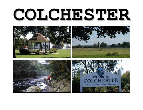
The cover pictures on the Plan are:<br />
Gazebo on the <strong>Town</strong> Green<br />
Farming On McDonald Road<br />
Fishing in the Salmon River<br />
“Welcome to <strong>Colchester</strong>” Sign
2001 <strong>Colchester</strong> Plan <strong>of</strong> Conservation & Development<br />
Table <strong>of</strong> Contents<br />
INTRODUCTION<br />
INFRASTRUCTURE & OTHER STRATEGIES<br />
1 Introduction 1 12 Transportation 91<br />
2 Executive Summary 5 13 Utilities 101<br />
3 Conditions & Trends 7 14 Special Issues 105<br />
CONSERVATION STRATEGIES<br />
FUTURE LAND USE PLAN<br />
4 Community Character 23 15 Future Land Use Plan 106<br />
.<br />
5 Natural Resources 27<br />
6 Open Space 33<br />
7 Historic Resources 41<br />
DEVELOPMENT STRATEGIES<br />
IMPLEMENTATION<br />
8 Community Structure 47 16 Implementation Tools & Priorities 111<br />
9 Housing & Residential Areas 53<br />
10 Business & Economic Development 69 CONCLUSION<br />
11 Community Facilities & Services 79 17 Conclusion 130
<strong>Colchester</strong> Street Map
INTRODUCTION<br />
1<br />
INTRODUCTION TO COLCHESTER<br />
<strong>Colchester</strong> is located in New London County in<br />
southeast Connecticut. The town is bounded by<br />
Marlborough and Hebron to the north, Lebanon<br />
and Bozrah to the east, East Haddam and Salem<br />
to the south, and East Hampton to the west.<br />
<strong>Colchester</strong> is located about 25 miles southeast<br />
<strong>of</strong> Hartford, the State capital.<br />
<strong>Town</strong> Green<br />
According to estimates from the U.S. Census<br />
Bureau, <strong>Colchester</strong> had a 1998 population <strong>of</strong><br />
12,709 people within its land area <strong>of</strong> about 49.6<br />
square miles (31,758 acres). This is an increase<br />
<strong>of</strong> 1,729 people (16 percent) from the 1990<br />
Census.<br />
Since 1980, <strong>Colchester</strong> has been the fastest<br />
growing municipality in Connecticut. In<br />
addition, the surrounding towns have also been<br />
growing faster than the State average.<br />
1
Statutory Reference<br />
Section 8-23 <strong>of</strong> the<br />
Connecticut General Statutes<br />
requires that the Planning<br />
Commission prepare, adopt,<br />
and amend a Plan <strong>of</strong><br />
Conservation<br />
and<br />
Development for <strong>Colchester</strong>.<br />
The requirements for the Plan<br />
are presented on the facing<br />
page.<br />
Plans In <strong>Colchester</strong><br />
• Historical and<br />
Architectural Survey<br />
(1991)<br />
• <strong>Colchester</strong> <strong>Town</strong> Center<br />
Cultural Resource<br />
Development and<br />
Heritage Tourism Plan<br />
(1995)<br />
• <strong>Town</strong> Center<br />
Neighborhood Strategic<br />
Plan (1998)<br />
• <strong>Colchester</strong> Public<br />
Schools Facilities<br />
Studies (1990, 1996,<br />
1997)<br />
ABOUT PLANS OF CONSERVATION AND DEVELOPMENT<br />
A Plan <strong>of</strong> Conservation and Development is a tool for guiding the future <strong>of</strong> a community. The goals and<br />
recommendations <strong>of</strong> this Plan reflect the overall consensus <strong>of</strong> what is best for <strong>Colchester</strong> and its residents in the future.<br />
This Plan was prepared by the <strong>Colchester</strong> Plan <strong>of</strong> Conservation & Development Subcommittee and the Zoning &<br />
Planning Commission with input from <strong>Colchester</strong> residents.<br />
While it is primarily a statement <strong>of</strong> recommendations addressing the conservation and development <strong>of</strong> <strong>Colchester</strong> (the<br />
physical layout), this Plan is also intended to address the social and economic development <strong>of</strong> the community.<br />
History <strong>of</strong> Planning in <strong>Colchester</strong><br />
<strong>Colchester</strong> has prepared other Plans <strong>of</strong> Conservation & Development. The first comprehensive Plan <strong>of</strong> Development was<br />
adopted in 1972 and that Plan was updated in 1990. These plans influenced the current land use regulations and<br />
development patterns in <strong>Colchester</strong> and helped guide the overall conservation and development <strong>of</strong> the community. Other<br />
plans, identified in the sidebar, have also been prepared to address important issues in the community.<br />
Thus, it can be seen that <strong>Colchester</strong> has a history <strong>of</strong> preparing, adopting, and amending Plans to address the appropriate<br />
conservation and development <strong>of</strong> the community. It is in that spirit that this Plan has been prepared.<br />
Use <strong>of</strong> the Plan <strong>of</strong> Conservation and Development<br />
This Plan <strong>of</strong> Conservation and Development is an advisory document, not only to the Zoning & Planning Commission,<br />
but to all other <strong>Town</strong> boards and commissions and <strong>Colchester</strong> residents as well. It is intended to guide local residents and<br />
to provide a framework for consistent decision-making with regard to conservation and development activities in<br />
<strong>Colchester</strong> over the next decade or so.<br />
While the statutory responsibility to adopt the Plan rests with the Zoning & Planning Commission, implementation will<br />
only occur with the diligent efforts <strong>of</strong> the residents and <strong>of</strong>ficials <strong>of</strong> the <strong>Town</strong> <strong>of</strong> <strong>Colchester</strong>.<br />
2
EXCERPTS FROM CONNECTICUT GENERAL STATUTES<br />
8-23 - PLAN OF CONSERVATION AND DEVELOPMENT<br />
The Commission shall:<br />
• prepare, adopt and amend a plan <strong>of</strong> conservation and development ...<br />
• review the plan <strong>of</strong> conservation and development at least once every ten years ...<br />
• adopt such amendments to the plan or parts <strong>of</strong> the plan ... as the commission deems necessary to update the plan.<br />
The Plan shall:<br />
• be a statement <strong>of</strong> policies, goals and standards for the physical and economic development <strong>of</strong> the municipality, ..<br />
• show the commission's recommendation for the most desirable use <strong>of</strong> land within the municipality for residential, recreational, commercial,<br />
industrial and other purposes and for the most desirable density <strong>of</strong> population in the ... parts <strong>of</strong> the municipality.<br />
• be designed to promote with the greatest efficiency and economy the coordinated development <strong>of</strong> the municipality and the general welfare and<br />
prosperity <strong>of</strong> its people.<br />
• be made with reasonable consideration for restoration and protection <strong>of</strong> the ecosystem and habitat <strong>of</strong> Long Island Sound ...<br />
• make provision for the development <strong>of</strong> housing opportunities, including opportunities for multifamily dwellings consistent with soil types,<br />
terrain and infrastructure capacity, for all residents <strong>of</strong> the municipality and the planning region ...<br />
• promote housing choice and economic diversity in housing, including housing for both low and moderate income households, and encourage<br />
the development <strong>of</strong> housing which will meet the housing needs ...<br />
• take into account the state plan <strong>of</strong> conservation and development ... and note any inconsistencies it may have with said state plan.<br />
• consider the use <strong>of</strong> cluster development to the extent consistent with soil types, terrain, and infrastructure capacity.<br />
The Plan may:<br />
• show the commission's recommendation for a system <strong>of</strong> principal thoroughfares, parkways, bridges, streets and other public ways; for airports,<br />
parks, playgrounds and other public grounds; for general location, relocation and improvement <strong>of</strong> public buildings; for the general location and<br />
extent <strong>of</strong> public utilities and terminals, whether publicly or privately owned for water, sewerage, light, power, transit and other purposes; and for<br />
the extent and location <strong>of</strong> public housing projects.<br />
• include recommended programs for the implementation <strong>of</strong> the plan ...<br />
• (include) such other recommendations ... in the plan as will ... be beneficial to the municipality.<br />
3
The Planning Process<br />
WHERE<br />
WE ARE<br />
WHERE WE<br />
WANT TO GO<br />
The Planning Process<br />
The process used to prepare the Plan is illustrated by the adjacent flowchart. Following a comprehensive inventory and<br />
assessment <strong>of</strong> <strong>Colchester</strong>, a consensus was established on important issues through a number <strong>of</strong> public meetings, surveys<br />
and other exercises. Various recommendations were discussed and refined as the Plan was finalized. Implementation<br />
takes place after the Plan is adopted and the various recommendations are put into action and evaluated.<br />
Committee Meeting Public Meeting<br />
HOW WE WILL<br />
GET THERE<br />
IMPLEMENTATION<br />
Other Relevant Information<br />
In addition to this Plan, other relevant information has included workbooks (booklets on different topical issues) prepared<br />
during the process for participants, previously adopted plans, and materials such as resident surveys. The workbooks<br />
were placed at <strong>Town</strong> Hall and the Cragin Memorial Library for residents to review during the process.<br />
In the case <strong>of</strong> conflict between this Plan and such other information, the recommendations <strong>of</strong> the adopted Plan take<br />
precedence.<br />
Many people were involved in the preparation <strong>of</strong> the Plan over a two-year period. While it is not possible to name them<br />
all, the major participants are listed on the inside front cover <strong>of</strong> the Plan.<br />
4
EXECUTIVE SUMMARY<br />
2<br />
OVERALL PLAN PHILOSOPHY<br />
During the process <strong>of</strong> preparing the Plan, the following philosophy emerged as the foundation for this Plan <strong>of</strong><br />
Conservation and Development:<br />
Promote an appropriate balance <strong>of</strong> conservation and<br />
development in <strong>Colchester</strong> in order to:<br />
• meet community needs,<br />
• preserve community character, and<br />
• enhance the overall quality <strong>of</strong> life.<br />
While there may be refinements in the goals and strategies <strong>of</strong> this Plan over time, it is anticipated that this philosophy<br />
will remain relevant during the anticipated ten-year life <strong>of</strong> this Plan <strong>of</strong> Conservation and Development.<br />
5
PRIORITY ISSUES<br />
Many issues that are important to <strong>Colchester</strong> and its future are addressed in the Plan. However, the following<br />
recommendations are considered the most significant:<br />
CONSERVATION<br />
Reference<br />
• Protect natural resources Chapter 5 - Natural Resources<br />
• Preserve water quality Chapter 5 - Natural Resources<br />
• Preserve open space Chapter 6 - Open Space<br />
DEVELOPMENT<br />
• Manage residential growth by:<br />
• adopting a buildable land regulation,<br />
• adopting a residential density regulation, and<br />
• promoting open space development patterns<br />
• Encourage appropriate economic development in<br />
accordance with the Plan<br />
• Acquire sites for schools, recreation facilities, and<br />
other community facility needs<br />
Chapter 9 - Housing & Residential Areas<br />
Chapter 10 - Business & Economic Development<br />
Chapter 11 - Community Facilities & Services<br />
INFRASTRUCTURE<br />
• Develop additional public water supply sources Chapter 13 - Utilities<br />
6
CONDITIONS & TRENDS<br />
3<br />
HISTORY OF COLCHESTER<br />
The landscape <strong>of</strong> the area we know as <strong>Colchester</strong> was formed over millions <strong>of</strong> years by massive geological forces and<br />
processes. While human settlement is believed to have occurred within the past 10,000 years, written history is only<br />
available for the past 350 years or so.<br />
No permanent Native American settlements are known to have been located in what is now <strong>Colchester</strong>. However,<br />
temporary or seasonal settlements may have occurred in the area and trails connecting settlements near the Thames River<br />
(east) to those near the Connecticut River (west) may have passed through the area. A Golden Hill Paugussett reservation<br />
is now located in southeastern <strong>Colchester</strong>.<br />
<strong>Colchester</strong> Facts<br />
<strong>Colchester</strong> was named in<br />
1699. The name is believed<br />
to come from the ancestral<br />
home in England <strong>of</strong> the<br />
County Magistrate.<br />
<strong>Colchester</strong> celebrated its<br />
300th anniversary in 1998<br />
with a variety <strong>of</strong> events.<br />
Settlement <strong>of</strong> <strong>Colchester</strong><br />
While European settlement <strong>of</strong> Connecticut began about 1630, trading disagreements and skirmishes between Dutch and<br />
English settlers and the Mohegan or Pequot natives made many areas unsafe for settlement until after the Pequot War in<br />
1637. It was not until 1662 that Jeremiah Adams, a Hartford innkeeper, became the first settler known to locate in the<br />
<strong>Colchester</strong> area. Adams obtained permission from Mohegan leaders to winter cattle along the Salmon River and the<br />
General Court <strong>of</strong> Connecticut later formalized the agreement.<br />
Other settlers followed and, in 1698, the General Court granted plantation rights to a group <strong>of</strong> Hartford County investors.<br />
The area was to be bounded by Lyme on the south, Middletown and Haddam on the west, Norwich on the east, and<br />
Glastonbury and Lebanon on the north. The area was formally named <strong>Colchester</strong> in 1699 and was designated as part <strong>of</strong><br />
New London County.<br />
The original proprietors quickly set out lots and encouraged settlers, especially those with needed skills, to move to the<br />
area. Availability <strong>of</strong> large tracts <strong>of</strong> land attracted people from more populated areas such as Hartford and Wethersfield.<br />
7
Congregational Church<br />
As population grew, efforts were devoted to establishing a church and securing a minister. In 1703, the General Court<br />
authorized the organization <strong>of</strong> a church and, by 1706, the early settlers had built the <strong>Town</strong>’s first meetinghouse at the<br />
upper end <strong>of</strong> modern day Old Hebron Road. By 1716, a decision was made to build a new meetinghouse more central to<br />
the expanding village and closer to a better water supply.<br />
As settlement grew and dispersed throughout <strong>Colchester</strong>, outlying areas established their own parishes or ecclesiastical<br />
societies in order to avoid the lengthy trip to the central meetinghouse, especially in the winter. The New Salem Society<br />
was formed in 1725 and the Marlborough Society was formed in 1747. Eventually, the Salem and Marlborough societies<br />
formally split <strong>of</strong>f and were <strong>of</strong>ficially organized as separate <strong>Town</strong>s.<br />
Industrial Growth & Decline<br />
<strong>Colchester</strong> was at the center <strong>of</strong> a well-established road network and, by<br />
the mid-18th century, a thriving agricultural community and the center<br />
<strong>of</strong> regional trade. Small shops, local mills and other enterprises served<br />
<strong>Colchester</strong> and the surrounding areas and made <strong>Colchester</strong> the social and<br />
economic center in the region.<br />
Early Mercantile Activity<br />
Railroad Service<br />
Tina Lyman<br />
In 1847, the Hayward Rubber Company was established. The success <strong>of</strong><br />
the rubber plant spurred overall economic prosperity in <strong>Colchester</strong>. The<br />
demand for employees brought a more diverse population to <strong>Colchester</strong>,<br />
caused rapid growth, and resulted in the founding <strong>of</strong> local banks, a<br />
railroad, and the volunteer fire department. The company constructed<br />
boarding houses and tenements for its employees, sidewalks were built,<br />
a <strong>Town</strong> park was laid out, a library association was formed, and the<br />
streets were fitted with gas lamps.<br />
<strong>Colchester</strong> Historical Society<br />
In 1877, a group <strong>of</strong> local<br />
investors created the<br />
<strong>Colchester</strong> Railroad<br />
Company. Passenger and<br />
freight service was provided<br />
on a rail spur from the New<br />
York and Boston Air Line<br />
Railroad to the Hayward<br />
Rubber Factory and the<br />
village.<br />
However, the rubber plant was taken over in 1890 and closed in 1893. During the economic decline that followed,<br />
<strong>Colchester</strong>’s population shrunk from about 3,000 people in 1890 to about 2,000 people by 1900.<br />
Many <strong>of</strong> the farms in <strong>Colchester</strong> were vacated after the closing <strong>of</strong> the rubber mill. Some farms were purchased by the<br />
Hirsch Foundation as places for Jewish immigrants to settle. As a result, by 1915, about 50% <strong>of</strong> the local population was<br />
Jewish. The “resettlement” <strong>of</strong> <strong>Colchester</strong> prompted a return to agriculture supported by Jewish and then Slavic<br />
immigrants.<br />
8
Resort Period<br />
Historical Marker<br />
While agriculture was the dominant economic activity in <strong>Colchester</strong> in the early 1900’s, it was not a viable way <strong>of</strong> life for<br />
some <strong>of</strong> the immigrants. Instead, they opened businesses in the central village, worked in the few remaining small<br />
factories, went into the hotel business, or operated rooming houses in the village.<br />
The hospitality opportunities resulted in a resort trade that attracted vacationers, many <strong>of</strong> them Jewish, to <strong>Colchester</strong>.<br />
During the 1920s, seven major hotels or resorts operated in town and some farmers opened their homes to summer<br />
boarders. At its peak, local resorts attracted about 4,000 people annually. The resort trade was a major component <strong>of</strong> the<br />
local economy during this period.<br />
The Depression <strong>of</strong> 1930’s brought a decline to the resort industry. Many hotels closed during this time or became private<br />
homes or apartments. After the Depression, the resort business moved to lake areas in other towns.<br />
Suburbanization<br />
<strong>Colchester</strong> has experienced explosive growth since 1950. There are three reasons for this.<br />
1. Strategic Location<br />
While <strong>Colchester</strong> has always been strategically located in relation to other parts <strong>of</strong> Connecticut, this location has<br />
become even more convenient with the development <strong>of</strong> state and federal highways in the past 50 years. Today,<br />
<strong>Colchester</strong> is within easy commuting distance <strong>of</strong> major employment centers in Hartford, Norwich, New London and<br />
Middletown by Routes 2, 11, and 16. With the post-war “baby boom” and the trend toward suburbanization, it<br />
should come as no surprise that <strong>Colchester</strong> experienced growth as did many other communities.<br />
2. Land Availability<br />
The availability <strong>of</strong> residential land in <strong>Colchester</strong>, coupled with a convenient location and affordable prices, has made<br />
it a focal point for growth. New homes have been built at a brisk rate to accommodate the demand.<br />
Locational Considerations<br />
Factors that can affect<br />
locational decisions <strong>of</strong> new<br />
residents include:<br />
• job location,<br />
• population density,<br />
• housing prices,<br />
• socio-economic status,<br />
• educational quality,<br />
• tax rates, and<br />
• other factors (amenities,<br />
resale values, etc.).<br />
3. Community Character<br />
Finally, the community character and amenities that are available to residents have attracted new home buyers.<br />
For these reasons, <strong>Colchester</strong> will be increasingly sought out by new residents, both for its rural character and its<br />
proximity to employment sources.<br />
9
Reasons For Moving To<br />
<strong>Colchester</strong><br />
At several public<br />
informational meetings,<br />
<strong>Colchester</strong> residents gave the<br />
following reasons for moving<br />
to <strong>Colchester</strong>.<br />
Affordable home 42%<br />
Convenient location 34%<br />
Nice neighborhood 32%<br />
Low crime rate 29%<br />
Educational quality 26%<br />
Community feeling 24%<br />
Reasonable taxes 18%<br />
Close to family 16%<br />
Available land 13%<br />
Community status 5%<br />
Recreation facilities 3%<br />
Local shopping 3%<br />
Up to three responses were permitted<br />
REGIONAL ROLES & IMPLICATIONS<br />
<strong>Colchester</strong> has two regional roles:<br />
• a residential suburb for the Hartford, Norwich, New London, and Middletown metropolitan areas, and<br />
• a sub-regional center <strong>of</strong>fering businesses and employment for the residents <strong>of</strong> surrounding communities.<br />
These roles are supported by <strong>Colchester</strong>’s strategic location at the confluence <strong>of</strong> several major in-state travel routes.<br />
Downtown Hartford is located about 25 miles to the northwest along Route 2 (a limited access highway), Norwich is<br />
located about 15 miles east along Route 2, and New London is located about 20 miles southeast along Route 11 (a limited<br />
access highway) and Route 85.<br />
Future growth is expected to continue<br />
and it is anticipated that this growth<br />
will reinforce <strong>Colchester</strong>’s regional<br />
roles. Since housing prices in<br />
<strong>Colchester</strong> are more affordable than in<br />
communities located closer to<br />
Hartford, people are expected to<br />
continue to move to <strong>Colchester</strong> and<br />
residential growth will continue.<br />
As population grows in <strong>Colchester</strong><br />
and surrounding communities,<br />
<strong>Colchester</strong>’s role as a sub-regional<br />
“hub” will continue to expand.<br />
10
PEOPLE OF COLCHESTER<br />
The U.S. Census Bureau estimated <strong>Colchester</strong>’s 1998 population to be 12,709 persons. This represents an increase <strong>of</strong><br />
1,729 persons from the 10,980 persons reported in the 1990 Census. The following chart shows population growth in<br />
<strong>Colchester</strong> since the 1800 Census with a range <strong>of</strong> population projections through to the year 2020.<br />
Over the last thirty years, <strong>Colchester</strong> has experienced significant population growth. In fact, <strong>Colchester</strong> was the fastest<br />
growing town in Connecticut between 1980 and 1998. If recent growth continues, <strong>Colchester</strong> may have a population <strong>of</strong><br />
13,140 people in the year 2000.<br />
Still, due to the large land area (48 square miles), <strong>Colchester</strong> has a low overall population density and this has helped the<br />
community retain its rural character.<br />
<strong>Colchester</strong> Population<br />
Population<br />
1920 2,050<br />
1930 2,134<br />
1940 2,338<br />
1950 3,007<br />
1960 4,648<br />
1970 6,603<br />
1980 7,761<br />
1990 10,980<br />
2000 13,140<br />
2010 15,201<br />
2020 16,801<br />
US Census with year 2000 projections based<br />
on 1990-96 trends in italics.<br />
20,000<br />
15,000<br />
10,000<br />
5,000<br />
0<br />
<strong>Colchester</strong>'s Population (1800 - 2020)<br />
High Projection<br />
Low Projection<br />
Historic Population<br />
1800 1820 1840 1860 1880 1900 1920 1940 1960 1980 2000 2020<br />
Growth Comparison<br />
1980-90<br />
<strong>Colchester</strong> 42%<br />
Salem 42%<br />
Hebron 30%<br />
Lebanon 27%<br />
East Hampton 22%<br />
East Haddam 19%<br />
Marlborough 17%<br />
State <strong>of</strong> CT. 6%<br />
1980-90 US Census<br />
Growth Comparison<br />
1990-98<br />
<strong>Colchester</strong> 16%<br />
Hebron 14%<br />
East Haddam 12%<br />
East Hampton 6%<br />
Salem 6%<br />
Marlborough 4%<br />
Lebanon 4%<br />
State <strong>of</strong> CT. -0.5%<br />
US Bureau <strong>of</strong> the Census<br />
11
Migration Statistics<br />
Year Householder<br />
Moved Into Unit<br />
<strong>Town</strong> State<br />
1985-90 56% 46%<br />
1980-84 15 14<br />
1970-79 16 18<br />
1960-69 7 11<br />
Pre 1960 6 12<br />
Total 100% 100%<br />
Dynamics <strong>of</strong> Population Change<br />
Most growth that occurred in <strong>Colchester</strong> in the 1950s, 1960s, and 1980s was due to in-migration. On the other hand,<br />
most growth in the 1970s and 1990s was due to natural increase. With an affordable housing stock, <strong>Colchester</strong> will<br />
continue to attract young families who will have children.<br />
Components <strong>of</strong> Population Change<br />
1950s 1960s 1970s 1980s Trend 1990s<br />
Total Change +1,641 +1,955 +1,158 +3,219 +2,160<br />
Change Due To Natural Increase +465 +907 +701 +986 +1,566<br />
Births 825 1,281 1,215 1,687 2,250<br />
Deaths 360 374 514 701 684<br />
Change Due To Net Migration +1,176 +1,048 +457 +2,233 +594<br />
US Census, Connecticut Health Department reports, 1990s trend is 1990 to 1996 data extrapolated to a ten-year period.<br />
Overall, the effects <strong>of</strong> migration are difficult to estimate in <strong>Colchester</strong> since there are no procedures to determine the<br />
composition <strong>of</strong> those who move out versus those who move in. The potential impact from migration may best be<br />
appreciated by considering the following:<br />
• while an average <strong>of</strong> about 125 new homes were built annually in town from 1977 to 1996, as many as 200<br />
homes sell each year,<br />
• 56 percent <strong>of</strong> all households in <strong>Colchester</strong> in 1990 had moved to their home since 1985,<br />
• about 71 percent <strong>of</strong> all households in <strong>Colchester</strong> in 1990 had moved to their 1990 home since 1980, and<br />
• only 13 percent <strong>of</strong> all 1990 households had lived in <strong>Colchester</strong> since 1970.<br />
New residents are also changing the socio-economic composition <strong>of</strong> <strong>Colchester</strong>. In <strong>Colchester</strong>, the net in-migration<br />
probably reflects young families moving to a community that they like and can afford. Recent growth has attracted young<br />
families who typically commute to executive and pr<strong>of</strong>essional jobs in the Hartford area. A declining percentage <strong>of</strong><br />
residents work in manufacturing occupations or industries or commute to jobs in the New London area.<br />
Changing Age Composition<br />
Changes are also occurring due to the changing age distribution <strong>of</strong> residents. Population projections prepared by the<br />
Connecticut Census Data Center estimate age grouping and these estimates can help assess the implications <strong>of</strong><br />
demographic changes on municipal services and housing types. Of course, it must be remembered that these are<br />
projections and variations can occur, especially further into the future.<br />
12
Children (ages 0-19)<br />
Available data suggest that younger people are moving to <strong>Colchester</strong> to raise families and that families with school age<br />
children are also moving to <strong>Colchester</strong>. As a result, school enrollments are expected to increase until the year 2010.<br />
Scout Project Youthful Exuberance<br />
6,000<br />
4,000<br />
Children (ages 0-19)<br />
0-4 '5-19<br />
2,000<br />
0<br />
1970 2000<br />
Eleanor Ball<br />
Eleanor Ball<br />
Description Age Range Population Projection Percent Projection Needs<br />
Infants 0 to 4 Stay fairly constant through to the year Slight decline as percent <strong>of</strong> population Child care<br />
2020<br />
School-Age 5 to 19 Peak near 2010 at about 850 more people<br />
than in 1990<br />
Share <strong>of</strong> population will decline after<br />
year 2000<br />
School facilities and<br />
recreation programs<br />
Population Percent<br />
Actual Projected Actual Projected<br />
Ages 1960 1970 1980 1990 2000 2010 2020 1960 1970 1980 1990 2000 2010 2020<br />
0-4 654 692 605 1,009 1,013 914 1,071 14% 10% 8% 9% 7% 6% 6%<br />
5-19 1,160 1,988 1,962 2,082 2,851 2,934 2,781 25% 30% 25% 19% 21% 19% 17%<br />
Source: 1970-90 Census, Projections by Connecticut Census Data Center (1995.1)<br />
13
Adults (ages 20-54)<br />
Adults (ages 20-54)<br />
6,000<br />
4,000<br />
2,000<br />
While the number <strong>of</strong> young adults (ages 20 to 34) is expected to decline during the 1990s, the number <strong>of</strong> middle-aged<br />
residents (ages 35 to 54) is expected to grow until the year 2010. Since these are the typical families with school-age<br />
children, this helps explain the increase in school enrollments being experienced in <strong>Colchester</strong>.<br />
Participating in Public Policy Participating in Recreation<br />
20-34 35-54<br />
0<br />
1970 1990 2010<br />
Description Age Range Population Projection Percent Projection Needs<br />
Young Adults 20 to 34 Decline during the 1990s and increase<br />
thereafter<br />
Share <strong>of</strong> population expected to be much<br />
lower due to “baby bust”<br />
Rental housing and<br />
starter homes<br />
Middle Age 35 to 54 Peak around the year 2010 and then<br />
decline<br />
Major increase as percent <strong>of</strong> population<br />
due to the aging <strong>of</strong> the “baby boom”<br />
Family programs and<br />
trade-up homes<br />
Population Percent<br />
Actual Projected Actual Projected<br />
Ages 1960 1970 1980 1990 2000 2010 2020 1960 1970 1980 1990 2000 2010 2020<br />
20-34 930 1,404 2,127 3,148 2,301 2,665 3,235 20% 21% 27% 29% 17% 18% 19%<br />
35-54 1,053 1,399 1,707 2,889 5,008 5,321 4,601 23% 21% 22% 26% 37% 35% 27%<br />
Source: 1970-90 Census, Projections by Connecticut Census Data Center (1995.1)<br />
14
Residents Aged 55 and over<br />
The number <strong>of</strong> residents aged 55 and over is expected to continue to increase in <strong>Colchester</strong> as the “baby boom” ages and<br />
people live longer. In the year 2020, these residents are expected to represent over 30 percent <strong>of</strong> <strong>Colchester</strong>’s population<br />
(roughly double the population share in 1990).<br />
Generations at Play Senior Center Activities<br />
Older Adults (ages 55+)<br />
6,000<br />
55-64 65+<br />
4,000<br />
2,000<br />
0<br />
1970 1990 2010<br />
<strong>Colchester</strong> Park & Recreation Department<br />
Description Age Range Population Projection Percent Projection Needs<br />
Residents Aged 55 and over Grow significantly through the planning Share <strong>of</strong> population expected to increase Smaller homes and<br />
55 and Over<br />
period<br />
significantly<br />
elderly programs<br />
Population Percent<br />
Actual Projected Actual Projected<br />
Ages 1960 1970 1980 1990 2000 2010 2020 1960 1970 1980 1990 2000 2010 2020<br />
55-64 293 489 651 752 962 1,611 2,625 6% 7% 8% 7% 7% 11% 16%<br />
65 + 558 631 709 1,100 1,463 1,756 2,488 12% 10% 9% 10% 11% 12% 15%<br />
Source: 1970-90 Census, Projections by Connecticut Census Data Center (1995.1)<br />
15
Use Versus Zoning<br />
The table on this page and<br />
the map on the facing page<br />
show land uses within<br />
<strong>Colchester</strong>, not zoning. In<br />
other words, the map shows<br />
which properties were being<br />
used for which purposes in<br />
1998 when the land use<br />
survey was done.<br />
1970 Land Use Data<br />
For comparison, the 1972<br />
Plan estimated that about<br />
6,500 acres <strong>of</strong> land were<br />
occupied for or dedicated to<br />
the following uses in 1970:<br />
Use<br />
Acres<br />
Residential 1,291<br />
Open Space 3,754<br />
Business 186<br />
Pub/Inst. 110<br />
Transp/Other 1,174<br />
Total 6,515<br />
In other words, about 8,000<br />
acres <strong>of</strong> land have been<br />
developed or committed in<br />
28 years.<br />
LAND USE IN COLCHESTER<br />
<strong>Colchester</strong> contains approximately 31,500 acres. The 1998 land use survey found that about 46 percent <strong>of</strong> the community<br />
(14,507 acres) is occupied for residential, commercial, or institutional use or is dedicated to a specific purpose such as<br />
public land or protected open space.<br />
Conversely, about 54 percent <strong>of</strong> the land in town (16,975 acres) is vacant or uncommitted to a specific use. The amount<br />
<strong>of</strong> uncommitted land helps explain the rural character that people perceive in <strong>Colchester</strong>.<br />
Use<br />
1998 COLCHESTER LAND USE SUMMARY<br />
Acres<br />
Percent <strong>of</strong><br />
Developed Land<br />
Percent <strong>of</strong><br />
Total Land<br />
Residential 7,011 48% 22%<br />
Single-family 6,669<br />
Multi-family 342<br />
Open Space 4,801 33% 15%<br />
Land Dedicated For Open Space Uses 3,541<br />
Land Managed For Open Space Purposes 1,280<br />
Business 407 3% 1%<br />
Commercial 312<br />
Industrial 53<br />
Mixed Use 42<br />
Public & Institutional Uses 482 3% 2%<br />
Transportation / Other 1,806 12% 6%<br />
Transportation 1,750<br />
Public Utility 56<br />
Developed / Committed 14,507 100% 46%<br />
Vacant/Potentially Developable 16,975 54%<br />
Total Land Area 31,482 100%<br />
Source: Planimetrics. Totals may not add due to rounding.<br />
16
1998 Land Use Map<br />
17
Definitions<br />
Developed Land - land that<br />
has buildings or<br />
improvements used for a<br />
particular economic or social<br />
purpose (such as residential<br />
or institutional).<br />
Committed Land - land that<br />
is used for a particular<br />
economic or social purpose<br />
(including open space).<br />
Vacant Land - land that is<br />
not developed or committed.<br />
Under-Developed Land -<br />
developed land that is not<br />
used to its full potential (such<br />
as a 50-acre parcel with one<br />
house in a one-acre<br />
residential zone).<br />
DEVELOPMENT POTENTIAL<br />
The 1998 land use survey found that there are about 16,975 acres <strong>of</strong> land in <strong>Colchester</strong> that are currently vacant or underdeveloped<br />
and may be capable <strong>of</strong> supporting additional development in the future. The Plan estimates the future<br />
development potential <strong>of</strong> <strong>Colchester</strong>, given environmental constraints and current regulatory standards, in order to<br />
evaluate whether:<br />
• this amount <strong>of</strong> development is appropriate,<br />
• adequate facilities exist or can be provided to support this level <strong>of</strong> development, and<br />
• to help guide future conservation and development programs.<br />
One <strong>of</strong> the major purposes <strong>of</strong> the Plan <strong>of</strong> Conservation and Development is to manage the conservation and development<br />
<strong>of</strong> the 16,975 acres <strong>of</strong> potentially developable property and the redevelopment <strong>of</strong> any existing properties.<br />
Residential Development Potential<br />
After considering physical and environmental constraints on the vacant and under-developed land, it is estimated that<br />
<strong>Colchester</strong> could eventually contain as many as 15,000 total housing units if fully developed under existing zoning.<br />
Thus, based on typical 1990 household sizes, <strong>Colchester</strong> could eventually be a community <strong>of</strong> about 40,000 people.<br />
Interestingly, the 1972 <strong>Colchester</strong> Plan estimated the future development potential at up to 60,000 people. Regulatory<br />
changes, development patterns, and better knowledge <strong>of</strong> environmental and other constraints has refined the estimate<br />
since that time. The estimate <strong>of</strong> about 40,000 people is also consistent with the findings <strong>of</strong> the 1990 Plan.<br />
Business Development Potential<br />
Based on appropriate yield factors and the land constraints, it is estimated that the business zones (B, C) in <strong>Colchester</strong><br />
could result in an additional 1,100,000 square feet <strong>of</strong> commercial floor space under existing zoning. This is in addition to<br />
the existing business development in <strong>Colchester</strong>.<br />
The Industrial zone (I) could result in an additional 7,500,000 square feet <strong>of</strong> industrial floor space under existing zoning,<br />
based on the yield factor and the land constraints. Again, this is in addition to existing industrial development in<br />
<strong>Colchester</strong>.<br />
18
RESIDENT SURVEYS<br />
Public Meeting Surveys<br />
Several informational meetings were held as part <strong>of</strong> the planning process in order to inform <strong>Colchester</strong> residents about<br />
the update <strong>of</strong> the Plan, encourage public input and participation, and involve <strong>Colchester</strong> residents in the formulation <strong>of</strong><br />
the Plan <strong>of</strong> Conservation & Development. This information helped guide the planning process.<br />
“Planning Points” - One exercise asked residents to vote with coupons <strong>of</strong> different values to identify the issues that were<br />
most important to them as part <strong>of</strong> the planning process. The following priorities were identified:<br />
Topic Topic<br />
Conservation <strong>of</strong> Natural Resources 15% Improvement <strong>of</strong> Utilities 8%<br />
Expansion <strong>of</strong> Business and Industry 15% Preservation <strong>of</strong> Open Space 6%<br />
Improvement <strong>of</strong> Community Facilities 12% Improvement <strong>of</strong> Community Centers 6%<br />
Protection <strong>of</strong> Community Character 11% Housing and Residential Areas 6%<br />
Preservation <strong>of</strong> Historic Resources 9% Improvement <strong>of</strong> Transportation 4%<br />
Improvement <strong>of</strong> Land Use Regulation 8% Other Issues 0%<br />
Survey Results<br />
As with most any survey, the<br />
results are indicative <strong>of</strong> issues<br />
that existed in the community<br />
at the time the survey was<br />
done.<br />
While some responses reflect<br />
long-term and continuing<br />
perspectives in <strong>Colchester</strong>,<br />
some other issues (such as<br />
the proposed asphalt plant)<br />
were temporary and have<br />
been resolved.<br />
“Prouds & Sorrys” - Another exercise asked residents to identify areas <strong>of</strong> the community they were particularly proud<br />
<strong>of</strong> or particularly sorry about. Major prouds and sorrys are listed below.<br />
Prouds Total Sorrys Total<br />
<strong>Town</strong> Green 24 Asphalt plant 20<br />
Bacon Academy High School 11 McDonald’s Restaurant 7<br />
<strong>Town</strong> Recreation Area 11 Sand pit 5<br />
<strong>Town</strong> Hall 7 Merchants Row 3<br />
Old Bacon Academy 6 Jack Jackter School 3<br />
Public Discussion - At each public meeting, a public discussion was organized around the topics that received the most<br />
planning points. The major points raised by residents are presented in the appropriate following chapters.<br />
19
Sampling & Variation<br />
The sample size was 400<br />
residents. Telephone<br />
numbers were generated<br />
through random-digit dialing<br />
to ensure that each residential<br />
telephone number had an<br />
equal probability <strong>of</strong> selection.<br />
Within each household one<br />
adult was randomly selected<br />
to complete the interview.<br />
The sampling error for the<br />
400 interviews in <strong>Colchester</strong><br />
is + 4.5 percentage points at<br />
the 95 percent level <strong>of</strong><br />
confidence. The sampling<br />
error is larger for sub-groups.<br />
This means that there is less<br />
than one chance in twenty<br />
that the results <strong>of</strong> a survey <strong>of</strong><br />
this size and methodology<br />
differs by more than five<br />
percentage points in either<br />
direction from the results<br />
which would be obtained if<br />
all adults in <strong>Colchester</strong> had<br />
been interviewed.<br />
Telephone Survey<br />
As part <strong>of</strong> the process <strong>of</strong> preparing the Plan <strong>of</strong> Conservation and Development, a random sample telephone survey <strong>of</strong><br />
<strong>Colchester</strong> residents was conducted. The questions were designed to address issues identified as part <strong>of</strong> the planning<br />
process and to generate responses that would help guide policy makers, both now and in the future.<br />
• Residents Generally Satisfied - A majority <strong>of</strong> <strong>Colchester</strong> residents felt that the overall quality <strong>of</strong> life in town was<br />
excellent (18%) or good (68%) and felt that the quality <strong>of</strong> life in <strong>Colchester</strong> had remained about the same (44%) or<br />
had gotten better (36%) in the past few years.<br />
• Want To Protect Character - <strong>Town</strong> residents said that <strong>Colchester</strong>’s rural setting (23%) and small town atmosphere<br />
(21%) make it a special place to live. Most residents (53%) wanted the <strong>Town</strong> to do more to protect the rural setting,<br />
small town setting, and other special characteristics.<br />
• Education and Growth Are Main Issues - Residents felt that the most important issues facing <strong>Colchester</strong> were<br />
education (34%), town growth (17%), taxes (6%), and the lack <strong>of</strong> business and industry in town (7%).<br />
• Preserve Natural Features and Open Space - <strong>Colchester</strong> residents wanted the town’s natural resources and open<br />
space protected and felt that the <strong>Town</strong> was doing enough (41%) or needed to do more (48%) in this area. Only a few<br />
town residents (6%) felt the <strong>Town</strong> had done enough to acquire more land for parks and open space and most residents<br />
(66%) were willing to see their taxes raised to pay for it.<br />
• Attract More Business - Most residents (56%) thought that attracting more business and industry to town would<br />
make <strong>Colchester</strong> a better place to live. Most residents (53%) also wanted the town to do more to expand tax revenues<br />
from business and industry. While there was no clear consensus on whether the town should encourage business<br />
growth in and near the town center and discourage it in outlying areas, a majority <strong>of</strong> town residents (72%) wanted<br />
more retail development in Westchester.<br />
• Community Facilities - Most <strong>Colchester</strong> residents gave the public schools high grades and were supportive <strong>of</strong><br />
education programs. A majority <strong>of</strong> residents favored building a community center (68%) and developing more<br />
recreation fields (62%).<br />
• Taxes Are Reasonable - Most <strong>Colchester</strong> residents (56%) believed that the amount they paid in taxes was about<br />
right considering the level and quality <strong>of</strong> services they received from the town.<br />
20
FISCAL ISSUES<br />
Expenditures<br />
<strong>Colchester</strong> spends about $30 million in order to provide services to residents and property. Expenditures in <strong>Colchester</strong><br />
are slightly lower than the state average on a per capita basis. Local expenditures are clearly focused on education and<br />
about six <strong>of</strong> every ten dollars spent by the <strong>Town</strong> <strong>of</strong> <strong>Colchester</strong> goes to education.<br />
Rationale<br />
Fiscal issues are an important<br />
consideration as part <strong>of</strong> the<br />
Plan since implementation <strong>of</strong><br />
Plan recommendations may<br />
involve the expenditure <strong>of</strong><br />
municipal funds.<br />
1997-98 Per Capita Expenditures 1997-98 Per Capita Expenditure Comparison<br />
<strong>Colchester</strong> Connecticut Population Expenditure Per Capita<br />
Education $1,379 64% $1,245 56% Salem 3,557 $ 8.4M $2,372<br />
Public Works 135 6% 186 8% Lebanon 6,392 $14.0M $2,185<br />
Debt Service 339 17% 156 7% Hebron 7,789 $17.0M $2,180<br />
Police 37 2% 148 7% <strong>Colchester</strong> 12,732 $27.5M $2,162<br />
Fire 31 1% 85 4% East Haddam 7,347 $15.7M $2,132<br />
Other 241 10% 420 18% Bozrah 2,356 $ 4.9M $2,080<br />
Total $2,162 100%0 $2,240 100% Marlborough 5,623 $11.5M $2,042<br />
“Other” includes general government, finance, recreation, library, land use, building, and other programs.<br />
East Hampton 10,994 $20.0M $2,021<br />
Connecticut Policy & Economic Council Connecticut Policy & Economic Council<br />
Revenues<br />
While the <strong>Town</strong> generates most <strong>of</strong> its revenue from local property taxes, <strong>Colchester</strong> is fortunate to receive a larger than<br />
average amount <strong>of</strong> state aid and other intergovernmental revenue. As a result, the amount <strong>of</strong> money to be raised from<br />
current taxes is less than the state average.<br />
1997-98 Per Capita Revenues 1997-98 Per Capita Revenue Comparison<br />
<strong>Colchester</strong> Connecticut Taxes State Aid Total<br />
Current Taxes $1,189 55% $1,449 65% East Haddam $1,427 $532 $2,132<br />
State Aid 807 37% 573 26% Marlborough $1,377 $552 $2,042<br />
Surplus 29 1% 37 2% Salem $1,355 $866 $2,372<br />
Fines & Fees 48 2% 77 3% Hebron $1,337 $716 $2,180<br />
Other 89 4% 104 5% East Hampton $1,227 $723 $2,159<br />
Total Revenue $2,162 100% $2,240 100% <strong>Colchester</strong> $1,189 $807 $2,162<br />
“Other” revenue includes reimbursements, payments in lieu <strong>of</strong> taxes, grants, and other sources.<br />
Bozrah $1,174 $847 $2,080<br />
Connecticut Policy & Economic Council<br />
Lebanon $1,001 $910 $2,185<br />
Connecticut Policy & Economic Council<br />
21
Tax Base Composition<br />
Percent<br />
Business<br />
State <strong>of</strong> CT. 20%<br />
Bozrah 15%<br />
<strong>Colchester</strong> 12%<br />
East Haddam 9%<br />
Marlborough 9%<br />
East Hampton 7%<br />
Salem 7%<br />
Hebron 5%<br />
Lebanon 3%<br />
Tax Base<br />
<strong>Colchester</strong> is not considered to have a wealthy tax base since it has less property wealth (measured by Equalized Net<br />
Grand List) than the state average. This makes <strong>Colchester</strong> eligible for more state aid under current state formulas. While<br />
<strong>Colchester</strong> has a higher business tax base than many surrounding communities, it is still lower than the state average.<br />
Taxation<br />
In the telephone survey, more than half <strong>of</strong> <strong>Colchester</strong> residents felt that the amount they pay in taxes is about right for the<br />
level and quality <strong>of</strong> the services they receive. In addition, almost half <strong>of</strong> <strong>Colchester</strong> residents think that taxes in<br />
<strong>Colchester</strong> are about the same as they are in other towns.<br />
SUMMARY OF CONDITIONS & TRENDS<br />
Taxes Relative to the Level and<br />
Quality <strong>of</strong> Services<br />
<strong>Colchester</strong> Taxes Compared to Other<br />
<strong>Town</strong>s in the Area<br />
Too High 40% Higher 28%<br />
About Right 56% About the Same 45%<br />
Too Low 2% Lower 9%<br />
Don’t Know 3% Don’t Know 18%<br />
<strong>Colchester</strong> has attracted new residents due to the rural character and the perception <strong>of</strong> the overall quality <strong>of</strong> life in the<br />
community. Continued residential and business growth is expected during the planning period due to <strong>Colchester</strong>’s<br />
strategic location, affordable housing, potentially available land, and overall quality <strong>of</strong> life.<br />
The challenge <strong>of</strong> this Plan is to carefully manage <strong>Colchester</strong>’s future conservation and development in order to:<br />
• protect the essential elements <strong>of</strong> the character that residents most cherish,<br />
• establish appropriate development patterns, and<br />
• conserve the resources and areas that are most important to residents.<br />
22
COMMUNITY CHARACTER<br />
4<br />
OVERVIEW<br />
<strong>Colchester</strong>’s population grew substantially from approximately 3,000 residents in 1950 to over 12,000 residents by the<br />
year 2000. While <strong>Colchester</strong> has managed to retain much <strong>of</strong> its rural character, this character is threatened by future<br />
activities. In order to retain <strong>Colchester</strong>’s special characteristics, efforts to preserve community character must continue.<br />
Protect and preserve<br />
physical character . . .<br />
Promote community<br />
spirit . . .<br />
INVENTORY<br />
While the elements <strong>of</strong> what comprises community character are different for each person, there are some common<br />
elements. In surveys conducted as part <strong>of</strong> the process <strong>of</strong> preparing the Plan, residents indicated that the rural setting and<br />
small town atmosphere make the town a special place to live.<br />
Rural Character on River Road Community Character on Bull Hill Road<br />
23
Telephone Survey<br />
What Makes <strong>Colchester</strong><br />
Special<br />
Rural Setting 23%<br />
Small <strong>Town</strong> 21%<br />
Atmosphere<br />
Nice <strong>Town</strong> 8%<br />
Quiet Place 6%<br />
to Live<br />
Convenient 6%<br />
Location<br />
Other 36%<br />
Scenic Road Designation<br />
State statutes (CGS Section<br />
13b-31) allow the<br />
Department <strong>of</strong> Transportation<br />
to designate State Scenic<br />
Roads if they meet certain<br />
criteria.<br />
<strong>Town</strong>s can also adopt an<br />
ordinance and designate local<br />
roads as scenic if they meet<br />
statutory criteria (CGS 7-<br />
149a).<br />
ASSESSMENT<br />
Physical attributes and community spirit are important issues in terms <strong>of</strong> defining community character. In surveys and<br />
meetings for the Plan, residents consistently indicated that the <strong>Town</strong> should continue to be concerned about the issue <strong>of</strong><br />
community character.<br />
PROGRAM<br />
Physical Character<br />
Elements that contribute to the physical character <strong>of</strong> <strong>Colchester</strong> include:<br />
• The <strong>Town</strong> Center / <strong>Town</strong> Green - the <strong>Town</strong> Center and the <strong>Town</strong> Green are a source <strong>of</strong> pride for local<br />
residents. The local stores and village setting attract people and create community pride and spirit.<br />
• Local Facilities - Community character is also enhanced by local facilities such as the <strong>Town</strong> Hall, the Recreation<br />
Complex, and the Library.<br />
• State Facilities – Such as Day Pond State Park, Salmon Brook State Forest, and other State facilities.<br />
• Agricultural and Rural Features - <strong>Colchester</strong> contains numerous stone walls, barns, significant trees, and other<br />
features that contribute to community character.<br />
• Natural Resources & Open Space - Natural features and open space contribute to community character and<br />
strategies related to preservation <strong>of</strong> these resources are identified in chapters <strong>of</strong> the Plan.<br />
• Ridgelines and Scenic Views - Ridgelines and panoramic views enhance the rural and scenic character <strong>of</strong><br />
<strong>Colchester</strong> and development in these areas could threaten these resources.<br />
• Vegetation – Vegetation is another important aspect <strong>of</strong> community character.<br />
• Scenic Roads - Scenic roads are another element that significantly contribute to <strong>Colchester</strong>’s character.<br />
Designation <strong>of</strong> scenic roads is intended to ensure that any alteration maintains the essential character <strong>of</strong> the road.<br />
• Architectural Characteristics - The architecture <strong>of</strong> buildings in <strong>Colchester</strong>, especially in the <strong>Town</strong> Center,<br />
significantly contribute to overall community character.<br />
• Historic Resources - Local historical and archeological features contribute to community character and<br />
strategies related to the preservation <strong>of</strong> these resources are identified in a special chapter <strong>of</strong> the Plan.<br />
24
Community Spirit<br />
Elements that contribute to community spirit in <strong>Colchester</strong> include:<br />
• Local Programs Or Events - Events (such as community festivals, art or antique shows, fireworks displays, and<br />
community concerts) raise a community’s visibility as a special place and add to community spirit and character.<br />
• Local Organizations - Local organizations also build community spirit. These include religious institutions,<br />
charitable organizations, sports leagues, and other organizations where people help each other and their<br />
community accomplish important priorities.<br />
• Volunteer Contributions - Volunteer contributions have a lot to do with what makes <strong>Colchester</strong> special. Over<br />
the years, it is the tireless devotion <strong>of</strong> residents to making <strong>Colchester</strong> a better place that has helped preserve<br />
community character, built community spirit and made <strong>Colchester</strong> the place that it is today. It is simply not<br />
possible here to recognize everyone that has contributed to <strong>Colchester</strong>’s evolution over the years.<br />
• Local Recognition - Community spirit and pride is enhanced by positive publicity <strong>of</strong> local events and activities.<br />
This includes those things important to residents such as educational quality, community appearance, local<br />
excellence, and other factors.<br />
Community Parade Local Sports Programs<br />
Lisa M. Smith<br />
Local Organizations<br />
Local organizations that<br />
contribute to community<br />
activities and community<br />
spirit include:<br />
• <strong>Colchester</strong>-Hayward<br />
Volunteer Fire<br />
Department,<br />
• <strong>Colchester</strong> Lions Club,<br />
• <strong>Colchester</strong> Rotary Club,<br />
• <strong>Colchester</strong> Fish & Game<br />
Club,<br />
• <strong>Colchester</strong> Business<br />
Association,<br />
• <strong>Colchester</strong> Arts<br />
Commission,<br />
• Historical Society.<br />
Local Events<br />
Local events that contribute<br />
to community character,<br />
pride, and spirit include:<br />
• Ice cream socials,<br />
• Golf tournaments,<br />
• Cruise nights,<br />
• Memorial Day Parade,<br />
• Carnival on the <strong>Town</strong><br />
Green,<br />
• Craft sales,<br />
• Community dances,<br />
• Community concerts,<br />
• Country fairs,<br />
• Dinner auctions,<br />
• Halloween parties,<br />
• Haunted House,<br />
• Music concerts,<br />
• Awards dinners,<br />
• Candle-Walk.<br />
25
Implementation<br />
See the implementation chart<br />
on page 114 for the priority<br />
and the assignment <strong>of</strong><br />
responsibility<br />
for<br />
implementation <strong>of</strong> these<br />
community character<br />
strategies.<br />
COMMUNITY CHARACTER STRATEGIES<br />
Protect and Preserve Physical Character<br />
1. Identify scenic views and scenic areas and amend local regulations to protect them.<br />
2. Identify important ridgelines, steeply sloping hillsides, and rock outcrops and amend local regulations to protect<br />
them.<br />
3. When appropriate, retain stone walls, barns, significant trees, and other buildings and features in new development.<br />
4. Encourage the Department <strong>of</strong> Transportation to designate State highways in <strong>Colchester</strong> as scenic roads.<br />
5. Adopt a local scenic road ordinance and designate scenic roads while retaining the ability to make emergency repairs<br />
and public safety improvements.<br />
6. Continue to ensure that new buildings (except single-family dwellings) are compatible in scale and materials with<br />
neighboring buildings, especially in the <strong>Town</strong> Center, by:<br />
• establishing additional design review criteria or guidelines,<br />
• enhancing and streamlining current design review procedures, or<br />
• possibly establishing a Design Review Committee.<br />
7. Protect and enhance other natural resources, open space, historic resources, the <strong>Town</strong> Center, and local facilities in<br />
order to promote community character.<br />
8. Investigate ways to bury utility cables in the <strong>Town</strong> Center and strive to accomplish this strategy over the long term.<br />
9. Continue to encourage businesses, especially in the <strong>Town</strong> Center, to maintain the streetscape around their facilities<br />
and provide facilities for litter.<br />
10. Continue to encourage property maintenance, especially in the <strong>Town</strong> Center.<br />
Promote Community Spirit<br />
11. Continue to encourage local recognition, volunteer contributions, and local organizations, programs, and events in<br />
order to promote community spirit.<br />
12. Continue using the Park and Recreation Department to coordinate and schedule community social events, especially<br />
on the <strong>Town</strong> Green, in order to build and maintain community pride and spirit.<br />
13. Consider a program <strong>of</strong> recognizing:<br />
• volunteers through an annual picnic, and<br />
• other “hometown heroes” through a plaque at the <strong>Town</strong> Hall.<br />
14. Encourage increased coordination among community groups to coordinate local events and enhance community<br />
spirit.<br />
26
NATURAL RESOURCES<br />
5<br />
OVERVIEW<br />
Conservation <strong>of</strong> natural resources is important in terms <strong>of</strong> preserving environmental functions and protecting community<br />
character. Environmentally sound planning helps to find an appropriate balance between conservation and development<br />
and to improve the quality <strong>of</strong> life for existing and future generations.<br />
<strong>Colchester</strong>’s development pattern has always been strongly influenced by natural resources. From the first settlement<br />
over 300 years ago to more recent activities, natural resources have been, and should remain, one <strong>of</strong> the formative<br />
elements <strong>of</strong> <strong>Colchester</strong>’s character. A primary objective <strong>of</strong> current and future residents should be to preserve those<br />
natural features that contribute to <strong>Colchester</strong>’s character and quality <strong>of</strong> life.<br />
Preserve Water<br />
Quality . . .<br />
Protect Water<br />
Resources . . .<br />
Protect Other Natural<br />
Resources . . .<br />
Blackledge River Deep River Reservoir<br />
27
<strong>Town</strong> Efforts At Protecting<br />
Natural Resources<br />
Telephone Survey<br />
Should Do More 48%<br />
Done Enough 41%<br />
Done Too Much 2%<br />
Don’t Know 9%<br />
Public Meeting Survey<br />
Too Little 59%<br />
Just Right 35%<br />
Too Much 5%<br />
INVENTORY<br />
Significant natural resources in <strong>Colchester</strong> and the rationale for their consideration in the Plan include:<br />
Summary <strong>of</strong> Resources Affecting Conservation and Development<br />
Category Resource Category Rationale for Conservation<br />
Land Steep Slopes • 15 % or more • Potential for erosion, structural concerns<br />
Soils • Wetlands • Habitat, water quality, and flood storage<br />
• Hardpan • Hinders septic functions and buildings<br />
• Shallow/ Rocky • Hinders septic function and construction<br />
• Excessively Drained • Susceptible to contamination<br />
Water Watercourses • Watercourses and waterbodies • Habitat, water quality, and flood storage<br />
Floodplains • Watercourse • Periodic flooding, threat to life and property<br />
Water Quality • Surface/Ground • Protect supply sources, prevent pollution<br />
Air Air • Air Quality • Provides healthy environment<br />
Biology Flora / Fauna • Diversity • Plant and animal habitat<br />
ASSESSMENT<br />
<strong>Colchester</strong> residents want the town’s natural resources protected and feel<br />
that the <strong>Town</strong> could and should be doing more to protect them. Resources<br />
considered to be a priority for conservation are discussed below.<br />
Appreciation <strong>of</strong> Water Resources<br />
The most important issue with regard to natural resource protection in<br />
<strong>Colchester</strong> is the protection <strong>of</strong> water quality. Since most <strong>of</strong> the <strong>Town</strong>’s<br />
residents obtain their potable water from local groundwater sources,<br />
maintaining the quality <strong>of</strong> this supply will be the most precious legacy that<br />
current residents can leave for future generations.<br />
Lisa M. Smith<br />
28
PROGRAM<br />
The most important natural resources in <strong>Colchester</strong> are water related. These areas are the principal elements in any effort<br />
to maintain an ecological balance because <strong>of</strong> the essential role and function they play in:<br />
• maintaining and improving water quality and maintaining the water supply,<br />
• providing extraordinary scenic value,<br />
• supporting wildlife, and<br />
• controlling drainage and flooding.<br />
Water Features<br />
Water features in <strong>Colchester</strong> include rivers, streams, lakes, ponds, wetlands, swamps, vernal pools, and floodplains.<br />
Activities in these areas are generally regulated by the Inland Wetlands Commission and/or the Zoning & Planning<br />
Commission. The <strong>Town</strong> should continue to assure that these areas within <strong>Colchester</strong> are maintained in their natural state.<br />
Water Quality / Water Supply Sources<br />
Water quality is the most important natural resource issue in <strong>Colchester</strong> since most residents rely on groundwater from<br />
private or public supply wells. Public water supply sources in <strong>Colchester</strong> include the Deep River Reservoir (that supplies<br />
water to Norwich) and areas <strong>of</strong> high groundwater availability (aquifers) that supply water to local residents.<br />
To help protect water quality in these areas, it is recommended that the current aquifer protection zone regulations be<br />
reviewed on a regular basis to ensure the highest degree <strong>of</strong> water quality protection for designated aquifers, areas <strong>of</strong> high<br />
groundwater availability, and areas within public water supply watersheds. These areas should continue to be protected<br />
from land uses that could hinder their use as public water supply sources. Zoning designations should be evaluated<br />
(especially in the Deep River watershed) to protect water supply sources. In addition, <strong>Colchester</strong> should adopt a<br />
residential fuel tank ordinance requiring the replacement <strong>of</strong> underground fuel storage tanks which are more than 20 years<br />
old.<br />
Aquifer Protection<br />
Stratified drift aquifers are<br />
geologic formations or<br />
deposits (generally sands and<br />
gravels) which store large<br />
quantities <strong>of</strong> groundwater and<br />
through which groundwater<br />
may be retrieved in quantities<br />
sufficient for public drinking<br />
supplies.<br />
Bedrock aquifers include<br />
fractures or faults in<br />
underlying rock formations<br />
that typically yield small<br />
amounts <strong>of</strong> groundwater.<br />
Aquifer protection can be<br />
enhanced by regulating land<br />
uses and activities that may<br />
threaten water quality. The<br />
Connecticut Department <strong>of</strong><br />
Environmental Protection is<br />
in the process <strong>of</strong> developing<br />
aquifer protection regulations<br />
and these should be<br />
consulted for guidelines on<br />
how to address aquifer<br />
protection in <strong>Colchester</strong>.<br />
Flood Plains<br />
There are many places in <strong>Colchester</strong> where the land is subject to flooding. Land use in these areas should continue to be<br />
strictly controlled in order to minimize potential flood hazards and the damage which can occur, maximize water storage,<br />
maintain normal flood channels, and protect wildlife habitat.<br />
29
Natural Diversity Database<br />
The Connecticut Department<br />
<strong>of</strong> Environmental Protection<br />
maintains a Natural Diversity<br />
Database (NDD) which<br />
includes information on:<br />
• rare and endangered<br />
species,<br />
• species <strong>of</strong> special<br />
concern, and<br />
• sites with unique<br />
natural areas and other<br />
non-biologic resources<br />
(such as scenic<br />
resources).<br />
The NDD sites in <strong>Colchester</strong><br />
are identified on the overlay<br />
on the map on the facing<br />
page.<br />
For more information on<br />
NDD resources, contact the<br />
Natural Diversity Database<br />
<strong>of</strong>fice at the Connecticut<br />
Department <strong>of</strong> Environmental<br />
Protection.<br />
Plant & Animal Habitat<br />
<strong>Colchester</strong> contains habitat for a wide variety <strong>of</strong> plant and animal species. Efforts should continue to protect local plants<br />
and animals and their habitats and to diminish the presence <strong>of</strong> invasive species in order to encourage biological diversity.<br />
Agricultural Uses and Soils<br />
While <strong>Colchester</strong> has a rich agricultural heritage, farming operations are less commercially viable than before and farms<br />
have been converted to residential development. <strong>Colchester</strong> should, to the extent feasible, strive to preserve agricultural<br />
uses and prime agricultural soils.<br />
Steep Slopes<br />
The terrain in <strong>Colchester</strong> includes steeply sloping hillsides and rock outcrops. Development should continue to be<br />
limited in areas <strong>of</strong> steep slopes (25 percent or greater), especially in areas with erodible soils. Such areas may best be<br />
preserved as open space in new developments.<br />
Summary<br />
The following table and the map on the facing page identify the environmental resources where conservation efforts<br />
should be focused in order to sustain <strong>Colchester</strong>’s environmental quality and help contribute to the overall quality <strong>of</strong> life.<br />
Conservation Summary Table<br />
Category Definition Proposed Criteria<br />
Significant Conservation Areas Very sensitive lands worthy • Watercourses and waterbodies<br />
<strong>of</strong> preservation<br />
• Poorly drained soils (wetlands)<br />
• Floodplain (100-year, 1.0% probability)<br />
Important Conservation Areas<br />
Sensitive lands worthy <strong>of</strong><br />
conservation<br />
• Public water supply watershed areas<br />
• Areas <strong>of</strong> high groundwater availability<br />
• Identified aquifers and recharge areas<br />
• Unique or special habitat areas<br />
• Any slope in excess <strong>of</strong> 25%<br />
• Floodplain (500-year, 0.2% probability)<br />
30
Conservation Plan<br />
31
Implementation<br />
See the implementation chart<br />
on page 115 for the priority<br />
and the assignment <strong>of</strong><br />
responsibility<br />
for<br />
implementation <strong>of</strong> these<br />
natural resource conservation<br />
strategies.<br />
NATURAL RESOURCE CONSERVATION STRATEGIES<br />
Preserve Water Quality<br />
1. Continue to protect the major aquifers and public water supply watershed areas in <strong>Colchester</strong> from impacts <strong>of</strong><br />
development.<br />
2. Review the current aquifer protection zone regulations on a regular basis to ensure the highest degree <strong>of</strong> water quality<br />
protection for aquifers, areas <strong>of</strong> high groundwater availability, and areas within public water supply watersheds.<br />
3. Continue to protect water supply areas from land uses that could hinder their use as public water supply sources.<br />
4. Adopt a residential fuel tank ordinance requiring the replacement <strong>of</strong> underground fuel storage tanks which are more<br />
than 20 years old.<br />
5. Continue to acquire land around aquifers and in public water supply watersheds in order to aid in their protection.<br />
6. Continue to study local aquifers and adopt specific land development controls, as appropriate.<br />
Protect Water Resources<br />
7. Continue to protect watercourses, waterbodies, wetlands, floodplains, vernal pools, and other important water<br />
resources in order to maintain water quality, wildlife habitat, water supply, and ecological balance.<br />
8. Continue to require appropriate buffer zones for important water resources.<br />
Protect Other Natural Resources<br />
9. Protect local plants and animals and their habitats.<br />
10. Strive to preserve agricultural uses and prime agricultural soils.<br />
11. Continue to fully consider natural resource issues at the time <strong>of</strong> development.<br />
12. Continue to discourage building and road development on steep slopes.<br />
32
OPEN SPACE<br />
6<br />
OVERVIEW<br />
Open space, in adequate quantities and appropriate locations, can help:<br />
• conserve important natural resources,<br />
• protect community character,<br />
• provide fiscal and economic benefits,<br />
• enhance the quality <strong>of</strong> life, and<br />
• shape development patterns.<br />
Preserve More<br />
Open Space . . .<br />
Create A Greenbelt<br />
System With Trails . . .<br />
Retain Perceived Open<br />
Space . . .<br />
Recent Cohen Acquisition Day Pond State Park<br />
Lisa M. Smith<br />
33
Open Space in <strong>Colchester</strong><br />
Perceived<br />
16,317 acres<br />
(52 percent <strong>of</strong> <strong>Colchester</strong>)<br />
Type<br />
Area<br />
State <strong>of</strong> Connecticut 3,497<br />
City <strong>of</strong> Norwich 1,052<br />
<strong>Town</strong> <strong>of</strong> <strong>Colchester</strong> 44<br />
Golf Course 90<br />
Cemetery 51<br />
Public Facility 399<br />
Other 66<br />
Vacant and<br />
11,118<br />
Uncommitted Land<br />
Total 16,317<br />
acres<br />
Preserved<br />
3,592 acres<br />
(11 percent <strong>of</strong> <strong>Colchester</strong>)<br />
Type<br />
Area<br />
State <strong>of</strong> Connecticut 3,497<br />
<strong>Town</strong> <strong>of</strong> <strong>Colchester</strong> 44<br />
Other Properties 51<br />
Total 3,592<br />
acres<br />
INVENTORY<br />
Most people tend to think <strong>of</strong> “open space” as land that is not built upon. However, this definition includes land that is in<br />
private ownership and may be developed in the future. In fact, while over 16,000 acres <strong>of</strong> land in <strong>Colchester</strong> is perceived<br />
as “open space” at the present time, about 75 percent <strong>of</strong> this is privately-owned vacant and under-developed land that<br />
could be developed at some time in the future.<br />
For purposes <strong>of</strong> the Plan <strong>of</strong> Conservation & Development, open space is defined as land that is preserved or dedicated to<br />
open space uses (about 4,800 acres in 1998). Open space in <strong>Colchester</strong> can be further classified as dedicated open space<br />
and managed open space.<br />
Dedicated open space includes all land that is permanently preserved as open space either for public access, such as<br />
parks, recreation areas, or for natural or scenic values. The bulk <strong>of</strong> the dedicated open space is State <strong>of</strong> Connecticut<br />
lands (about 3,500 acres) located in western <strong>Colchester</strong> at Salmon River State Forest, Day Pond State Park, and Babcock<br />
Pond Wildlife Management Area. It also includes land owned by the <strong>Town</strong> <strong>of</strong> <strong>Colchester</strong>.<br />
Managed open space includes land that is used or preserved for some purpose other than open space but that provides<br />
open space characteristics. In <strong>Colchester</strong>, this includes City <strong>of</strong> Norwich water supply land, cemeteries, and golf courses.<br />
Existing <strong>Colchester</strong> Open Space<br />
Preserved<br />
Total Area<br />
(acres)<br />
Dedicated Open Space 3,540<br />
<strong>Town</strong> <strong>of</strong> <strong>Colchester</strong> Yes 44<br />
State <strong>of</strong> Connecticut Yes 3,497<br />
Managed Open Space 1,260<br />
City <strong>of</strong> Norwich Probably 1,052<br />
Golf Courses Probably 90<br />
Hayward VFD Possibly 66<br />
Other Yes 51<br />
TOTAL 4,800<br />
Sources: <strong>Town</strong> <strong>of</strong> <strong>Colchester</strong>, Tax Assessor Records, Planimetrics<br />
Parcels classified as open space typically allow for passive recreation activities (walking, bicycling, sight-seeing). More<br />
active recreational activities (organized field sports, recreation fields, and supervised recreation activities) are also<br />
considered under the Community Facilities element <strong>of</strong> this Plan.<br />
34
ASSESSMENT<br />
According to the Statewide Comprehensive Outdoor Recreation Plan (SCORP), due to the amount <strong>of</strong> State-owned open<br />
space lands in town, <strong>Colchester</strong> has slightly more total open space than other towns in Connecticut. However, <strong>Colchester</strong><br />
has much less <strong>Town</strong>-owned open space than the state average. Thus, <strong>Colchester</strong> compares favorably with other areas in<br />
relation to the total amount <strong>of</strong> open space, but not in terms <strong>of</strong> town-owned open space.<br />
Until recently, the <strong>Town</strong> <strong>of</strong> <strong>Colchester</strong> did not acquire or accept much open space. This was due to concerns about<br />
liability, an unwillingness to be responsible for a number <strong>of</strong> small pieces in different locations, lack <strong>of</strong> acquisition funds,<br />
or the lack <strong>of</strong> an overall open space plan. However, this philosophy has changed and the <strong>Town</strong> is presently more<br />
interested in preserving open space.<br />
Surveys during the planning process revealed that <strong>Colchester</strong> residents want to protect and acquire open space. In fact,<br />
about three <strong>of</strong> five residents believe that more parks and open space would make <strong>Colchester</strong> a better place to live and<br />
more than two-thirds <strong>of</strong> town residents think that the <strong>Town</strong> should acquire more land for parks and open space.<br />
According to the telephone survey, a majority <strong>of</strong> those who agree with acquiring more parks and open space are willing<br />
to see their taxes increase in order to pay for it.<br />
<strong>Colchester</strong> Should Acquire More Parks and<br />
Open Space . . .<br />
. . . Even If Taxes Are Raised To Pay For It<br />
Strongly Agree 41% Strongly Agree 43%<br />
Mildly Agree 26% Mildly Agree 43%<br />
Mildly Disagree 17%<br />
Strongly Disagree 15%<br />
Don’t Know 2%<br />
Mildly Disagree 23%<br />
Strongly Disagree 8%<br />
Don’t Know 2%<br />
Telephone Survey<br />
How Are <strong>Town</strong> Efforts At<br />
Protecting Open Space<br />
Should Do More 51%<br />
Done Enough 36%<br />
Done Too Much 6%<br />
Don’t Know 8%<br />
Would More Parks and Open<br />
Space Make <strong>Colchester</strong> . . . <br />
A Better Place 60%<br />
No Difference 37%<br />
A Worse Place 2%<br />
Don’t Know 1%<br />
Meeting Surveys<br />
<strong>Town</strong> Efforts At Increasing<br />
The Amount Of Open Space<br />
Too Little 62%<br />
Just Right 32%<br />
Too Much 5%<br />
Efforts At Protecting<br />
Important Open Space<br />
(Location)<br />
Too Little 46%<br />
Just Right 41%<br />
Too Much 5%<br />
Open space preservation efforts must be targeted towards protecting important resources and maximizing open space<br />
benefits to the community. In particular, efforts should be directed towards:<br />
• providing for contiguous open space in order to enhance the overall open space system,<br />
• protecting important natural resources,<br />
• protecting open space that is either not publicly owned or not permanently committed to open space use, and<br />
• providing greater public access to open space, where appropriate.<br />
35
Land Acquisition Fund<br />
Section 7-131r <strong>of</strong> the<br />
Connecticut General Statutes<br />
allows a municipality to<br />
establish a Land Acquisition<br />
Fund, funded up to two mills<br />
annually, to be used for the<br />
acquisition <strong>of</strong> land for open<br />
space, recreation, or housing.<br />
Greenbelts and Greenways<br />
A greenbelt is another word<br />
for a greenway. A greenway<br />
is a corridor <strong>of</strong> open space<br />
that:<br />
• may protect natural<br />
resources, preserve<br />
scenic landscapes and<br />
historical resources or<br />
<strong>of</strong>fer opportunities for<br />
recreation or nonmotorized<br />
transportation,<br />
• may connect existing<br />
protected areas and<br />
provide access to the<br />
outdoors,<br />
• may be located along a<br />
defining natural feature,<br />
such as a waterway,<br />
along a man-made<br />
corridor, including an<br />
unused right-<strong>of</strong>-way,<br />
traditional trail routes or<br />
historic barge canals, or<br />
• may be a green space<br />
along a highway or<br />
around a village.<br />
Connecticut General Assembly<br />
Public Act 95-335<br />
PROGRAM<br />
Preserve More Open Space<br />
Dedicated open space can be preserved in a number <strong>of</strong> ways. Some basic tools that are used by most towns in<br />
Connecticut and are available to permanently preserve open space in <strong>Colchester</strong> (ranked in order <strong>of</strong> public cost) are:<br />
1. Donations by property owners.<br />
2. Land purchases by a <strong>Colchester</strong> Land Trust or other conservation organizations.<br />
3. Land use regulations or approvals that require open space as part <strong>of</strong> development approvals.<br />
4. Land purchases by the <strong>Town</strong> <strong>of</strong> <strong>Colchester</strong>.<br />
Whatever means are chosen, the preservation <strong>of</strong> open space will be the most significant means <strong>of</strong> preserving the rural<br />
character <strong>of</strong> <strong>Colchester</strong>.<br />
Greenbelts & Greenways<br />
The configuration <strong>of</strong> the open space system in <strong>Colchester</strong> is as important as the amount <strong>of</strong> open space. If parcels <strong>of</strong> open<br />
space can be interconnected into a cohesive overall system, the value <strong>of</strong> the open space to residents and the impact on<br />
community character grows exponentially.<br />
The major coordinating element in the future conservation and development <strong>of</strong> <strong>Colchester</strong> should be a comprehensive<br />
greenbelt system which interconnects conservation, open space and recreation areas. Such system should follow the<br />
town’s major streams and brooks to serve to protect these sensitive areas from future development pressures and provide<br />
a linkage between important resources. In addition to protecting <strong>Colchester</strong>’s character, such an open space system will:<br />
• protect important natural, scenic, or other resources,<br />
• enhance the value <strong>of</strong> existing open space areas,<br />
• provide new opportunities for recreational use,<br />
• allow for a trail system that interconnects different areas,<br />
• contribute to the enjoyment and quality <strong>of</strong> life for residents, and<br />
• provide for contiguous wildlife habitat.<br />
Greenbelts can use existing recreation facilities, institutional uses, and other facilities to create connections. The overall<br />
goal is to create opportunities for interconnection for trails, wildlife, and community character.<br />
36
Open Space Plan<br />
37
Trails<br />
The Open Space Plan on<br />
page 37 shows how trails<br />
could be laid out to create an<br />
overall<br />
system<br />
interconnecting areas <strong>of</strong><br />
<strong>Colchester</strong>.<br />
These might be considered<br />
major trails with smaller<br />
trails (not shown) connecting<br />
to individual neighborhoods<br />
and areas.<br />
The conceptual trail locations<br />
shown on the map on page 37<br />
are for schematic planning<br />
purposes only and are subject<br />
to considerable modification<br />
based on additional review.<br />
Trails & Bikeways<br />
Connecting open space areas with trails will greatly enhance the value <strong>of</strong> the open space to all <strong>Colchester</strong> residents. In<br />
addition, connections to open space lands in adjacent communities will create opportunities to establish a greenbelt <strong>of</strong><br />
regional or even state-wide significance.<br />
A key element in tying open space and recreation areas into an integrated system is the establishment <strong>of</strong> a series <strong>of</strong> trails<br />
which connect open space areas. These paths (for walking, cycling, cross-county skiing, and horseback riding, where<br />
appropriate) increase the accessibility <strong>of</strong> the entire open space system to the town's residents and greatly add to its<br />
potential recreation use. Improving the Air Line Railroad spur as a trail to connect with other trails is a good example <strong>of</strong><br />
such a project. The development <strong>of</strong> a trail network should receive high priority since the amount <strong>of</strong> land which needs to<br />
be reserved is relatively small compared to the benefits that will be gained.<br />
Airline Trail Pathway at the <strong>Town</strong> Green<br />
38
Perceived Open Space<br />
The PA-490 program (CGS 12-107) allows a <strong>Town</strong> to assess land as farm, forest, or open space, reducing the tax burden<br />
on those parcels. While the program does not permanently preserve open space, the program removes the local property<br />
tax burden as a reason that property might be developed and, in that way, it can spread development out over time and<br />
maintain the perception <strong>of</strong> open space in <strong>Colchester</strong>. The program can also provide additional time to find ways to<br />
preserve the property as dedicated open space.<br />
About 45 percent <strong>of</strong> all land in <strong>Colchester</strong> currently participates in the farm and forest components <strong>of</strong> the PA-490<br />
program. While farm or forest land is designated by the assessor, only land holdings that exceed 25 acres in size are<br />
eligible. On the other hand, the open space component <strong>of</strong> PA-490 can be applied to parcels <strong>of</strong> any size provided:<br />
• the eligible land is identified in the Plan <strong>of</strong> Conservation & Development, and<br />
• an Open Space Plan has been adopted by the legislative body (<strong>Town</strong> Meeting in <strong>Colchester</strong>).<br />
Properties that are converted out <strong>of</strong> the PA-490 program within ten years <strong>of</strong> designation pay a “recapture” fee for the<br />
reduced assessment.<br />
Some communities recommend that any portion <strong>of</strong> a residential parcel that exceeds the minimum lot size for the zone is<br />
eligible for the open space assessment provided that the area that receives the assessment is greater than the minimum lot<br />
size for the zone. Land that is used for business or utility purposes is typically excluded. Some communities require reapplication<br />
for PA-490 designation as part <strong>of</strong> any revaluation (thereby restarting the ten-year recapture provision) while<br />
other communities allow the designation to continue once granted.<br />
39
Implementation<br />
See the implementation chart<br />
on page 116 for the priority<br />
and the assignment <strong>of</strong><br />
responsibility<br />
for<br />
implementation <strong>of</strong> these open<br />
space strategies.<br />
OPEN SPACE PRESERVATION STRATEGIES<br />
Preserve More Open Space<br />
1. Encourage the Board <strong>of</strong> Selectmen to establish an Open Space Committee for (or charge the Conservation<br />
Commission with) developing an open space action plan.<br />
2. Assist in efforts to establish a <strong>Colchester</strong> Land Trust and encourage:<br />
• open space donations to the Land Trust (or other conservation organizations), and<br />
• actions <strong>of</strong> the Land Trust to raise funds and purchase open space.<br />
3. Increase the percentage <strong>of</strong> open space preserved as part <strong>of</strong> new residential developments.<br />
4. Continue to budget municipal funds to acquire open space.<br />
5. Establish a Land Acquisition Fund as authorized by Section 7-131r <strong>of</strong> the Connecticut General Statutes.<br />
6. Consider adopting a “fee-in-lieu-<strong>of</strong> open space” provision in the subdivision regulations as authorized by CGS 8-25<br />
in order to generate revenue to acquire the most meaningful open space.<br />
7. Continue to pursue other open space preservation techniques such as “rights <strong>of</strong> first refusal” for significant parcels,<br />
purchase <strong>of</strong> development rights (especially for agricultural uses), and cooperative efforts with other organizations.<br />
Create A Greenbelt System with Trails<br />
8. Tie both existing and new open space and recreation areas together into an integrated greenbelt or buffer system<br />
which:<br />
• breaks up a continuous pattern <strong>of</strong> development, and<br />
• provides a greater variety <strong>of</strong> active and passive use opportunities for the <strong>Town</strong>'s residents.<br />
9. Consider allowing open space dedication elsewhere in <strong>Colchester</strong> to meet the open space requirements <strong>of</strong> a<br />
development if the <strong>of</strong>fered open space makes an important contribution to the overall open space greenbelt or trail<br />
system.<br />
10. Establish a series <strong>of</strong> trails as a key element in connecting open space and recreation areas into an integrated system.<br />
11. Continue to work with the State <strong>of</strong> Connecticut to develop public trails on their lands in <strong>Colchester</strong>.<br />
12. Continue to work with the Norwich Water Department to develop public trails on their lands in <strong>Colchester</strong>.<br />
Retain Perceived Open Space<br />
13. Establish and implement a PA-490 open space policy in order to maintain and enhance the amount <strong>of</strong> “perceived”<br />
open space in <strong>Colchester</strong>.<br />
40
HISTORIC RESOURCES<br />
7<br />
HISTORIC RESOURCES OVERVIEW<br />
Since historic resources significantly contribute to community character and quality <strong>of</strong> life, their<br />
identification and preservation is an important component <strong>of</strong> the Plan.<br />
INVENTORY<br />
Protect Historic<br />
Resources . . .<br />
Maintain Appropriate<br />
Regulations . . .<br />
Promote Historic<br />
Preservation Efforts . .<br />
Historic District Sign Day Hall<br />
42
For many years, <strong>Colchester</strong> has had a<br />
historical society that has been very<br />
active in preservation activities. The<br />
Society has been a pioneer in historic<br />
preservation efforts, both locally and<br />
state-wide.<br />
Historic District Sign Day Hall<br />
At a <strong>Town</strong> Meeting in 1984, residents<br />
<strong>of</strong> <strong>Colchester</strong> enacted an ordinance<br />
establishing the <strong>Colchester</strong> Historic<br />
District and the Historic District<br />
Commission. The purpose <strong>of</strong> the<br />
ordinance was to “promote the ...<br />
preservation and protection <strong>of</strong><br />
distinctive characteristics <strong>of</strong> buildings<br />
and places associated with the history <strong>of</strong><br />
the <strong>Town</strong> <strong>of</strong> <strong>Colchester</strong>.”<br />
43
Much has happened since that time. The <strong>Town</strong> funded an Historic Resources Study in 1991 to identify important historic<br />
resources. <strong>Colchester</strong> was recognized by the United States Department <strong>of</strong> the Interior in 1992 as a Certified Local<br />
Government engaged in historic preservation, thus becoming eligible for funding assistance for local programs. In 1994,<br />
much <strong>of</strong> the <strong>Town</strong> Center area was designated a National Historic District and was listed on the National Register Of<br />
Historic Places. A <strong>Colchester</strong> <strong>Town</strong> Center Plan (1995) identified processes to preserve and enhance historic resources<br />
in the <strong>Town</strong> Center. The Zoning & Planning Commission adopted an Historic Preservation Overlay Zone in 1996. In<br />
1998, the Connecticut Historical Commission awarded the <strong>Town</strong> <strong>of</strong> <strong>Colchester</strong> the first “Connecticut Local Government<br />
Achievement Award for Historic Preservation.” Also in 1998, a <strong>Town</strong> Center Neighborhood Strategic Plan was prepared<br />
by a Neighborhood Revitalization Committee with the assistance <strong>of</strong> <strong>Town</strong> staff.<br />
All <strong>of</strong> these activities and efforts are evidence <strong>of</strong> <strong>Colchester</strong>’s continuing commitment to historic preservation.<br />
At this time, <strong>Colchester</strong> has two historic districts (one national and one local) and seven State-recognized historic places.<br />
The <strong>Town</strong> also has the Historic Preservation Overlay Zone in the <strong>Town</strong> Center area to protect the number <strong>of</strong> resources<br />
that exist in this vicinity.<br />
EXISTING HISTORIC DISTRICTS Description SRHP NRHP<br />
A. <strong>Colchester</strong> Village National Historic District and<br />
Local Historic Preservation Overlay Zone<br />
National Register Historic District around the <strong>Town</strong><br />
Green and adjacent areas and coterminous with a local<br />
zoning overlay district<br />
1967 1994<br />
B. <strong>Colchester</strong> Historic District Local Historic District overseen by the <strong>Colchester</strong><br />
Historic District Commission.<br />
EXISTING HISTORIC PLACES<br />
1. Bacon Academy South Main Street Historic school built in 1803 and Day Hall, built in 1858 1975 1982<br />
2. Hayward House 9 Hayward Avenue Built in 1775 1975 1972<br />
3. Wheeler Block 40 Norwich Avenue Built in 1872. Wheeler Block was the Old <strong>Town</strong> Hall. 1992 1992<br />
4. Lyman Viaduct Bridge over Dickinson Creek. Built in 1873 1986 1986<br />
5. Stone Arch Railroad Bridge River Road Bridge over River Road. Built in 1887. 1986 1986<br />
6. Blackledge River Railroad Bridge Bridge over the Blackledge River. Built in 1912. 1986 1986<br />
7. Henry Champion House Westchester Road 1972 1972<br />
The National Register <strong>of</strong> Historic Places (NRHP) recognizes places that have national significance in architecture,<br />
archaeology, culture, and American history. The State Register <strong>of</strong> Historic Places (SRHP) recognizes places significant<br />
to the history <strong>of</strong> Connecticut. Properties on the National Register are now automatically listed on the State Register.<br />
44
Historic Resources Map<br />
45
In terms <strong>of</strong> historic districts, it is important to realize that National and State historic districts are established by federal<br />
and state agencies based only on historic significance and such designation provides little regulation or protection. In<br />
fact, such designation has the most influence on state or federal projects proposed in that district.<br />
On the other hand, local historic districts are established by municipal ordinance to protect designated areas. A local<br />
district is established by a the legislative body (such as a <strong>Town</strong> Meeting) after a public hearing and a two-thirds<br />
affirmative vote by affected property owners. The local ordinance also establishes a local Historic District Commission<br />
to implement regulations. Regulations for the <strong>Colchester</strong> Historic District (which became effective on June 15, 1999)<br />
regulate activities in the local historic district.<br />
Prior to commencing a regulated activity (such as exterior renovations), a Certificate <strong>of</strong> Appropriateness must be<br />
obtained from the Historic District Commission. <strong>Colchester</strong> is in the process <strong>of</strong> preparing a Historic District Handbook<br />
to provide guidelines and other pertinent information for reference when an owner or resident is considering a change to a<br />
property in the local historic district.<br />
In addition, the 1991 Historical and Architectural Survey <strong>of</strong> <strong>Colchester</strong> identified the following additional districts and<br />
properties as being “potentially eligible” for listing on the National Register <strong>of</strong> Historic Places:<br />
POTENTIALLY ELIGIBLE HISTORIC AREAS<br />
C. North Westchester Small concentration <strong>of</strong> mill-related structures<br />
D. Lebanon / Windham Avenues Worker-housing area along Lebanon and Windham<br />
Avenues and including the railroad depot area<br />
SRHP<br />
NRHP<br />
POTENTIALLY ELIGIBLE HISTORIC SITES<br />
Street Address Street Address Street Address<br />
Broadway 12, 24, 119, 191 Levy Road 5 Prospect Hill Road 192<br />
Buckley Hill Road 12 Linwood Avenue 8 School Road 43<br />
Cato Corner Road 8 McDonald Road 235 South Main Street 60, 156, 187, 196,<br />
Chestnut Hill Road 220 Marvin Road 91 208, 219, & 239<br />
Comstock Bridge Rd. 8 Norwich Avenue 48 Westchester Road 118, 148, 416, 449,<br />
Dickinson Road 17 Oberg Road 16 462, & 612<br />
Halls Hill Road 156 Old Hebron Road 288 Windham Avenue 165<br />
Hayward Avenue 11 Parum Road 398<br />
46
ASSESSMENT<br />
For many years, <strong>Colchester</strong> residents have recognized the value and importance <strong>of</strong> historic resources and much has<br />
already been accomplished in terms <strong>of</strong> identifying and protecting historic resources in <strong>Colchester</strong>. Residents have<br />
indicated support for continuing these efforts:<br />
• Identification - Historic resource surveys have been completed for <strong>Colchester</strong> and several properties have been<br />
listed on the National Register <strong>of</strong> Historic Places. <strong>Colchester</strong> has good and recent information on which to base<br />
historic preservation efforts.<br />
• Resources - Local individuals and organizations are important resources involved in historic preservation.<br />
<strong>Colchester</strong> has a local Historical Society and a local Historic District Commission to govern activities in local<br />
historic districts and a Municipal Historian to coordinate historical documentation efforts.<br />
• Programs - <strong>Colchester</strong> has a Cultural Resource Preservation Plan that identifies specific actions for preserving<br />
identified historic resources and the community is in the process <strong>of</strong> implementing its recommendations.<br />
<strong>Colchester</strong> is doing a good job <strong>of</strong> protecting historic resources in the community. These efforts should continue and,<br />
where appropriate, be enhanced.<br />
PROGRAM<br />
<strong>Colchester</strong> has a rich variety <strong>of</strong> historic resources that are worthy <strong>of</strong> preservation. In addition, these resources contribute<br />
to the overall character <strong>of</strong> <strong>Colchester</strong>. While much has been done already, the next step is to maintain appropriate<br />
regulations to assist in the preservation <strong>of</strong> these resources. In addition, the community should work towards encouraging<br />
cooperative efforts on the part <strong>of</strong> many people to preserve historic resources.<br />
Three options are available to help preserve historic resources:<br />
1. keep the existing Historic Preservation Overlay Zone (HPOZ) and enhance it as necessary,<br />
2. readopt the HPOZ as a village district with additional provisions as authorized by Public Act 00-145, or<br />
3. adopt new village districts (such as a Village Residential and a Village Business zone) as authorized by<br />
Public Act 00-145.<br />
These options should be evaluated and the selected method implemented in the near future.<br />
47
Implementation<br />
See the implementation chart<br />
on page 117 for the priority<br />
and the assignment <strong>of</strong><br />
responsibility<br />
for<br />
implementation <strong>of</strong> these<br />
cultural resource preservation<br />
strategies.<br />
HISTORIC RESOURCE PRESERVATION STRATEGIES<br />
Protect Historic Resources<br />
1. Continue to implement the 1995 and 1998 Plans for the <strong>Colchester</strong> Village Historic District (<strong>Town</strong> Center).<br />
2. Continue to nominate districts, buildings, and sites to the National Register <strong>of</strong> Historic Places.<br />
3. Establish additional local historic districts that protect community character and are supported by residents.<br />
4. Maintain the demolition delay ordinance to allow time for the identification and preservation <strong>of</strong> historical structures.<br />
Maintain Appropriate Regulations<br />
5. Evaluate the Historic Preservation Overlay Zone and consider replacing it with Village Residential and Village<br />
Business zones, taking advantage <strong>of</strong> the Village District provisions authorized by Public Act 00-145.<br />
6. In the new village residential zone, continue to allow adaptive reuse <strong>of</strong> historic buildings (such as for low-intensity<br />
<strong>of</strong>fice or institutional use) when the proposed use will aid in the preservation <strong>of</strong> the historic structure and provided<br />
the proposed use is appropriate given the location <strong>of</strong> the site.<br />
7. In the new village zones, adopt revised parking requirements that allow the Zoning & Planning Commission to waive<br />
up to 25 percent <strong>of</strong> the required parking spaces provided that documentation can be provided that such spaces will not<br />
be needed and provided that there is excellence in site and building design.<br />
8. Review the zoning and subdivision regulations to ensure:<br />
• preservation, renovation, and reuse <strong>of</strong> historically significant structures is encouraged,<br />
• there is flexibility and incentive to preserve historic properties, and<br />
• historical factors will be a consideration in land use decisions.<br />
9. Consider the adoption <strong>of</strong> an assessment deferral ordinances (CGS 12-65c-f) for the preservation <strong>of</strong> historic structures.<br />
Promote Historic Preservation Efforts<br />
10. Encourage property owners to preserve cultural, archaeological and historical resources.<br />
11. Establish educational programs to promote awareness <strong>of</strong> historical and cultural resources.<br />
12. Encourage awareness <strong>of</strong> historic buildings and districts through the use <strong>of</strong> appropriate signage and displays.<br />
13. Promote awareness <strong>of</strong> state and federal programs which provide tax credits and incentives for the rehabilitation <strong>of</strong><br />
historic buildings and provide code relief for historically significant buildings.<br />
48
COMMUNITY STRUCTURE<br />
8<br />
OVERVIEW<br />
Community structure addresses the overall organization <strong>of</strong> <strong>Colchester</strong>. Structure is an important consideration in the Plan<br />
since it addresses how people, both residents and visitors, perceive and understand the community. As a result, it is also<br />
strongly correlated with community character. The establishment and maintenance <strong>of</strong> community structure can be an<br />
important legacy <strong>of</strong> the planning process. For these reasons, overall structure is an important consideration in the Plan.<br />
INVENTORY<br />
Reinforce <strong>Colchester</strong>’s<br />
Overall Structure . . .<br />
Protect and Enhance<br />
the <strong>Town</strong> Center . . .<br />
Promote Westchester<br />
As A Secondary Focal<br />
Point . . .<br />
<strong>Colchester</strong>’s community structure consists <strong>of</strong>:<br />
• a major community focal point in the <strong>Town</strong> Center, and<br />
• a secondary focal point in Westchester.<br />
These major elements can be traced backed to <strong>Colchester</strong>’s early roots. The town was first settled in and near the area we<br />
now know as the <strong>Town</strong> Center. Westchester evolved later as <strong>Colchester</strong> grew.<br />
ASSESSMENT<br />
Due to the location <strong>of</strong> business, institutional, community, and cultural facilities, the <strong>Town</strong> Center is clearly the major<br />
community focal point. However, due to the geographic size <strong>of</strong> <strong>Colchester</strong> and its ultimate development potential, a<br />
secondary center is warranted. While Westchester contains some business and institutional facilities, its role can be<br />
strengthened to be a secondary focal point in <strong>Colchester</strong>. The fact that both areas are surrounded by lower intensity areas<br />
and open space also helps to define their location and role in <strong>Colchester</strong>. These determining elements <strong>of</strong> <strong>Colchester</strong>’s<br />
community structure should be enhanced in order to help define the community and enhance community character.<br />
49
Center Definitions<br />
The Plan talks about three<br />
different community centers.<br />
These areas are generally<br />
defined as follows:<br />
Village Center<br />
A compact area bounded by<br />
the <strong>Town</strong> Green, Lebanon<br />
Avenue, Mill Street, and<br />
Norwich Avenue and<br />
extending:<br />
• northerly along<br />
Broadway to Jaffe<br />
Terrace,<br />
• southerly along South<br />
Main Street to Tavern<br />
Lane, and<br />
• westerly along Linwood<br />
Avenue to Stop & Shop.<br />
Structure is also an important guide for land use regulations and decisions. Regulations can be designed and<br />
implemented to reinforce the community structure and enhance community character. One only need look at<br />
communities with no discernible structure to realize that community character has been adversely affected.<br />
At meetings conducted during the planning process, residents indicated that they were very supportive and protective <strong>of</strong><br />
these “centers”. In the <strong>Town</strong> Center, residents were strident about:<br />
• preserving “the <strong>Town</strong> Green” since it is the character <strong>of</strong> <strong>Colchester</strong>, even though the <strong>Town</strong> does not own the<br />
entire Green (the southern part is owned by the Bacon Academy Trustees),<br />
• improving the character <strong>of</strong> the area through new sidewalks, façade improvements, reducing pavement (at Old<br />
Bacon Academy),<br />
• making the <strong>Town</strong> Center more pedestrian friendly and encouraging pedestrian use and activity, and<br />
• re-using existing structures for new uses and maintaining the scale <strong>of</strong> buildings.<br />
For Westchester, residents were concerned that this area was being adversely affected, possibly by inadequate demand,<br />
too much competition, poor economics, absentee owners, or some combination <strong>of</strong> factors. Residents were concerned that<br />
Westchester had changed over last 25 years and that the area needed attention.<br />
<strong>Town</strong> Center Westchester Center<br />
<strong>Town</strong> Center<br />
A larger area on the north<br />
and east side <strong>of</strong> Route 2<br />
extending from:<br />
• Exit 17 easterly to<br />
include the recreation<br />
area,<br />
• over to Windham<br />
Avenue to the west <strong>of</strong><br />
Highwood Drive,<br />
• continuing southerly to<br />
the east <strong>of</strong> Elm Street<br />
and Westerly Terrace to<br />
Route 2.<br />
Westchester Center<br />
The area within about a onequarter<br />
mile radius <strong>of</strong> the<br />
intersection <strong>of</strong> Route 16 and<br />
Route 149.<br />
50
Map defining Centers<br />
51
PROGRAM<br />
Over the years, the <strong>Town</strong> Center has always been the focal point <strong>of</strong> the community and it is the business, government,<br />
civic, institutional, and cultural center <strong>of</strong> the town. While this has helped enhance community character, it has also<br />
created issues. In <strong>Colchester</strong>, “all roads lead to the Center” and there can be traffic congestion and bypass traffic on<br />
adjacent local streets due to traffic volumes, signalized intersections, pedestrian activity, on-street parking, and curb cuts.<br />
While the Westchester area, located at the intersection <strong>of</strong> Routes 16 and 149, has not developed as a village to the same<br />
extent that the <strong>Town</strong> Center has, Westchester has the potential to have a stronger village character.<br />
<strong>Town</strong> Center Streetscape Westchester Center Streetscape<br />
52
During the planning period, detailed study <strong>of</strong> the <strong>Town</strong> Center, Westchester, and the surrounding areas should be<br />
undertaken in order to:<br />
• reinforce the village center characteristics unique to each area,<br />
• maintain an appropriate balance among different uses,<br />
• avoid “strip” type development,<br />
• enhance the overall pedestrian and vehicular circulation pattern,<br />
• address parking and circulation issues, and<br />
• promote the compatible development <strong>of</strong> these areas.<br />
The studies should evaluate the residential and business zoning and consider alternative zoning patterns. Certain areas<br />
might be considered for rezoning based on the prevailing lot sizes and adjustments to some zoning designations and/or<br />
boundaries could be considered so that zoning boundaries follow property lines wherever possible. A detailed sidewalk<br />
inventory and Plan should be included. The studies should also review and take appropriate advantage <strong>of</strong> P.A. 00-145<br />
authorizing the creation <strong>of</strong> village districts.<br />
These recommendations are consistent with the 1995 <strong>Town</strong> Center Cultural Resource Development and Heritage Plan<br />
which recommended, in part;<br />
1. Adopt a town center growth policy to better enhance the town center area and preserve the historic character.<br />
2. Develop a dynamic town center with the appropriate use <strong>of</strong> historic buildings as the center piece <strong>of</strong> these efforts.<br />
3. Improve the town centers appearance by better integrating parking and developing a streetscape plan.<br />
4. Provide incentives for property owners to preserve and maintain their properties (such as tax, loan/grant, and<br />
code incentives).<br />
5. Increase marketing and tourism for the town center area through public awareness, education, and the creation <strong>of</strong><br />
tourism amenities.<br />
Strip-Type Development<br />
Strip-type development<br />
typically refers to nonresidential<br />
development that<br />
occurs along major roads in a<br />
linear fashion and is<br />
generally characterized as:<br />
• having wide and shallow<br />
lots,<br />
• individual or strips <strong>of</strong><br />
stores that orient<br />
towards parking areas<br />
between the building(s)<br />
and the street,<br />
• having one-story<br />
buildings with very<br />
simple architectural<br />
features,<br />
• multiple curb cuts,<br />
• limited pedestrian<br />
interconnections<br />
between sites, and<br />
• uncoordinated signage.<br />
Overall, it is important to stress that the level <strong>of</strong> future development in Westchester is anticipated to be much less intense<br />
than that expected in the <strong>Town</strong> Center. Westchester is intended to be more <strong>of</strong> a rural center with a village flavor. As a<br />
result, it is considered unlikely that water service or sewer service will be necessary or desirable in the foreseeable future.<br />
53
Implementation<br />
See the implementation chart<br />
on page 118 for the priority<br />
and the assignment <strong>of</strong><br />
responsibility<br />
for<br />
implementation <strong>of</strong> these<br />
community structure<br />
strategies.<br />
COMMUNITY STRUCTURE STRATEGIES<br />
Reinforce <strong>Colchester</strong>’s Overall Structure<br />
1. Reinforce the defining elements <strong>of</strong> <strong>Colchester</strong>’s community structure:<br />
• the <strong>Town</strong> Center as the major community focal point, and<br />
• a secondary focal point in Westchester, and<br />
• low intensity areas that provide a greenbelt around developed areas.<br />
2. Maintain the prevailing pattern <strong>of</strong> higher density residential uses near the <strong>Town</strong> Center with a density reduction away<br />
from the Center.<br />
Protect and Enhance the <strong>Town</strong> Center<br />
3. To protect the <strong>Town</strong> Center, convert the Historic Preservation Overlay Zone to village residential and village<br />
business districts, taking advantage <strong>of</strong> P.A. 00-145 authorizing the creation <strong>of</strong> village districts.<br />
4. Maintain and enhance the <strong>Town</strong> Center as the business, government, civic, institutional, and cultural center <strong>of</strong> the<br />
<strong>Town</strong>.<br />
5. Undertake a detailed study <strong>of</strong> the <strong>Town</strong> Center during the planning period to address land use, circulation, parking,<br />
and pedestrian issues and, as part <strong>of</strong> the study, consider zoning changes that may be desirable to implement the study<br />
recommendations.<br />
6. Allow a variety <strong>of</strong> residential types and densities in the <strong>Town</strong> Center and encourage mixed uses that complement<br />
community character and add activity and stability to the <strong>Town</strong> Center.<br />
7. Adjust zone boundaries in the <strong>Town</strong> Center so that, to the extent practical, individual parcels are located in one zone<br />
(or zone boundaries follow property lines).<br />
Promote Westchester As A Secondary Focal Point<br />
8. Pursue efforts to establish a “village green” in Westchester.<br />
9. Undertake a Westchester Area Study to address zoning, land use, transition, circulation, and parking issues and, as<br />
part <strong>of</strong> the study, consider zoning changes that may be desirable to implement the study recommendations.<br />
10. To the extent feasible, avoid “strip” type development in Westchester and encourage creation <strong>of</strong> a village center.<br />
54
HOUSING &<br />
RESIDENTIAL AREAS<br />
9<br />
OVERVIEW<br />
About 89 percent <strong>of</strong> <strong>Colchester</strong> is zoned for residential purposes. As a result, housing and residential areas are important<br />
topics in the Plan since residential development patterns have the greatest potential impact on community character and<br />
people’s overall perception <strong>of</strong> <strong>Colchester</strong> and its quality <strong>of</strong> life. In addition, identified housing needs must be considered.<br />
Single-Family Subdivision Multi-Family Development<br />
Support community<br />
structure . . .<br />
Carefully manage<br />
residential<br />
development . . .<br />
Promote open<br />
space development<br />
patterns . . .<br />
Encourage housing<br />
diversity . . .<br />
55
Median Sales Prices<br />
1997<br />
Hebron $157,000<br />
Marlborough $156,000<br />
Salem $146,000<br />
State $140,000<br />
East Haddam $139,950<br />
Bozrah $134,750<br />
E. Hampton $130,000<br />
<strong>Colchester</strong> $128,000<br />
Lebanon $117,500<br />
CT Policy & Economic Council<br />
‘Affordable Housing’<br />
Percent<br />
<strong>Colchester</strong> 11%<br />
State 11%<br />
Source: CT Department <strong>of</strong> Economic &<br />
Community Development<br />
INVENTORY<br />
<strong>Colchester</strong> is one <strong>of</strong> the fastest growing communities in Connecticut at the present time. During the 1980s, <strong>Colchester</strong><br />
added 1,421 housing units. To put this in perspective, the 1,421 units added in the 1980s was more than was added in the<br />
1960s (521 units) and 1970s (783 units) combined. By 1990, over two-thirds <strong>of</strong> <strong>Colchester</strong>’s housing stock had been<br />
constructed since 1960. In the 1990s, housing growth continued at a pace that will equal or exceed that experienced<br />
during the 1980s.<br />
<strong>Colchester</strong> Housing Growth Comparison<br />
Units 1980s<br />
1960 1,425 <strong>Colchester</strong> 52%<br />
1970 1,946 Salem 42%<br />
1980 2,729 Hebron 37%<br />
1990 4,150 East Hampton 28%<br />
2000 proj. 5,530 Lebanon 27%<br />
Source: U.S. Census, Planimetrics<br />
East Haddam 24%<br />
Projections in italics.<br />
Marlborough 23%<br />
Bozrah 18%<br />
State <strong>of</strong> CT. 14%<br />
Source: U.S. Census<br />
Compared to some other areas closer to Hartford, housing in<br />
<strong>Colchester</strong> would be considered more affordable. As a result, it<br />
has become a location desired by young families.<br />
Since over 11 percent <strong>of</strong> the housing units in <strong>Colchester</strong> are<br />
assisted housing, financed by CHFA mortgages, or sale price<br />
restricted by deed, <strong>Colchester</strong>:<br />
• has a higher proportion <strong>of</strong> “affordable housing” units<br />
than do surrounding towns or the state as a whole, and<br />
• is currently exempt from the “affordable housing<br />
appeals statute” (CGS 8-30g).<br />
New Housing Construction Two-Family House<br />
56
ASSESSMENT<br />
Issues related to residential development were regular topics <strong>of</strong> discussion during the process <strong>of</strong> preparing the Plan. In<br />
the telephone survey, <strong>Colchester</strong> residents indicated that town growth was one <strong>of</strong> the most important issues at the present<br />
time. At public meetings, residents indicated that the <strong>Town</strong> was doing too little to limit the amount <strong>of</strong> development.<br />
Topic Too Little Just Right Too Much<br />
Limiting the amount <strong>of</strong> residential development 51% 43% 5%<br />
Controlling the pace <strong>of</strong> residential development 49% 49% 3%<br />
Expanding the variety <strong>of</strong> housing types available 30% 65% 3%<br />
Providing for affordable housing 12% 56% 32%<br />
Some residents favored slowing the rate <strong>of</strong> growth or stopping development altogether. There are several reasons why<br />
these policy options are difficult or impossible to accomplish. First, our form <strong>of</strong> government and system <strong>of</strong> constitutional<br />
rights guarantee people a reasonable right to use (and develop) property. The <strong>Town</strong> has an ability to regulate (but not<br />
prohibit) land use and development activities in order to protect the public health, safety, and general welfare.<br />
Second, we need to recognize that resistance to change reflects that people may not be happy with what is happening<br />
when development occurs. Either they did not anticipate development occurring at all on a particular property or<br />
development patterns are not preserving <strong>Colchester</strong>’s character or protecting important features. The challenge <strong>of</strong> the<br />
Plan is to identify the appropriate amount and patterns <strong>of</strong> residential development in <strong>Colchester</strong> to help address these<br />
issues.<br />
In terms <strong>of</strong> housing types, <strong>Colchester</strong> residents generally indicated that the current mix <strong>of</strong> housing types was about right.<br />
Some people were inclined to indicate that there were too few elderly housing units and apartments and too many<br />
condominiums.<br />
Elderly Housing<br />
Units<br />
Rental<br />
Apartments<br />
Single Family<br />
Homes Condominiums<br />
Too Few 42% 26% 14% 13%<br />
About Right 41% 44% 68% 56%<br />
Too Many 3% 16% 11% 25%<br />
Don’t Know 15% 15% 7% 7%<br />
Overall, the issues related to residential development in <strong>Colchester</strong> are primarily associated with the patterns <strong>of</strong><br />
development. Due to the desire to conserve important natural resources and preserve open space, changes are<br />
recommended in land use regulations in order to protect these resources and improve residential development patterns.<br />
57
Multi-Family Locational<br />
Criteria<br />
1. Multi-family<br />
developments should:<br />
• be located in or near<br />
the <strong>Town</strong> Center.<br />
• be served by <strong>Town</strong><br />
water and sewer.<br />
• be located to provide<br />
a gradual transition in<br />
density or use to<br />
adjoining areas.<br />
• be designed to be<br />
compatible with the<br />
area proposed.<br />
• use appropriate<br />
topographic,<br />
vegetative, or other<br />
transitions to provide<br />
a buffer to adjacent<br />
uses and streets.<br />
2. Roadways serving the<br />
site should be capable <strong>of</strong><br />
safely and conveniently<br />
handling traffic<br />
generated by the<br />
development as well as<br />
provide easy and direct<br />
access to major<br />
thoroughfares serving<br />
<strong>Colchester</strong>.<br />
3. The site should be <strong>of</strong><br />
suitable size and terrain<br />
to establish an attractive<br />
and functional layout <strong>of</strong><br />
buildings and site<br />
improvements .<br />
PROGRAM<br />
Support Community Structure<br />
Although <strong>Colchester</strong> is not fully developed, the residential character <strong>of</strong> the community has clearly been established.<br />
<strong>Colchester</strong>’s residential zoning scheme should continue to recognize the prevailing development pattern <strong>of</strong>:<br />
• higher densities and diverse housing types in and near the <strong>Town</strong> Center where water and sewer are available,<br />
• predominantly single-family development in outlying areas, and<br />
• a reduction <strong>of</strong> density as the distance from the <strong>Town</strong> Center increases.<br />
For the most part, boundaries <strong>of</strong> the residential zoning districts appear generally reasonable given the soil types, terrain,<br />
infrastructure availability, and patterns <strong>of</strong> development. However, some changes are recommended in the watershed <strong>of</strong><br />
the Deep River Reservoir, a water supply source for Norwich and in the area <strong>of</strong> the outlying R-40 zones.<br />
Guide Multi-Family Development<br />
In terms <strong>of</strong> multi-family development, the Plan suggests that sites in and near the <strong>Town</strong> Center and serviced by public<br />
water and public sewer system are the best sites for multi-family development. However, not all multi-family<br />
developments are appropriate in <strong>Colchester</strong> and the Plan suggests that the most appropriate types <strong>of</strong> multi-family units for<br />
<strong>Colchester</strong> are moderate density developments in smaller scale projects.<br />
Apartments on Norwich Avenue Country Place<br />
58
Such developments can:<br />
• help maintain <strong>Colchester</strong>’s single-family appearance and character,<br />
• blend more effectively with nearby single-family residential areas,<br />
• be more consistent with the level <strong>of</strong> services available in town, and<br />
• be preferred by those seeking multi-family housing in the area.<br />
Overall, it will be in <strong>Colchester</strong>’s best interests to strongly guide multi-family developments to appropriate sites where<br />
they can serve as a transition between business and industrial uses (or major travel routes) and adjacent single-family<br />
neighborhoods.<br />
Carefully Manage Residential Development<br />
The Plan also recommends possible changes related to managing residential development in <strong>Colchester</strong>. First, the Zoning<br />
& Planning Commission has indicated some interest in reviewing “divisions” <strong>of</strong> property (also known as the “first cut”)<br />
in order to ensure that regulations are complied with and future conservation and development occurs with reasonable<br />
efficiency and economy. In addition, the Commission has indicated an interest in considering a requirements that any<br />
soil testing be done on the basis <strong>of</strong> the indigenous soil (not using fill or underdrains).<br />
New Housing Construction Housing in the <strong>Town</strong> Center<br />
59
Single Family Development<br />
Patterns<br />
Conventional<br />
A parcel <strong>of</strong> land is divided<br />
into residential lots with little<br />
or no dedicated open space.<br />
Open Space<br />
A parcel <strong>of</strong> land is divided<br />
into roughly the same number<br />
<strong>of</strong> residential lots that are<br />
smaller in area than in a<br />
conventional development<br />
and the remaining area is<br />
preserved or dedicated as<br />
open space.<br />
Promote Open Space Development Patterns<br />
<strong>Colchester</strong>’s current zoning and subdivision regulations promote a pattern <strong>of</strong> residential development that, in the long<br />
run, will likely detract from the rural character that residents <strong>of</strong> the community have indicated is important to them. In<br />
other words, current regulations are creating the types <strong>of</strong> development patterns that residents see elsewhere and have<br />
indicated they do not want in <strong>Colchester</strong>.<br />
For example, many subdivisions result in homes strung out along existing roads or in conventional subdivisions with very<br />
little preserved open space or with undeveloped lands isolated away from the road. This pattern results from a “cookie<br />
cutter” approach to subdivision design that is determined more by the dimensional standards in the regulations than by<br />
the natural capabilities <strong>of</strong> the parcel being developed.<br />
There are several reasons for this. <strong>Colchester</strong> defines buildable land in the zoning regulations as “contiguous land<br />
exclusive <strong>of</strong> wetlands, watercourses, waterbodies, ledge outcrops, and slopes greater than 25 percent.” Each zoning<br />
district requires that each lot have a minimum lot area, each lot have a minimum buildable area, and that a square <strong>of</strong> a<br />
certain dimension in the lot contain the building site. For example, the R-60 District requires a minimum <strong>of</strong> 60,000<br />
square feet <strong>of</strong> total lot area, a minimum <strong>of</strong> 45,000 square feet <strong>of</strong> buildable area, a 150 foot square building site, and a<br />
minimum <strong>of</strong> 200 feet <strong>of</strong> frontage on collector or arterial roads or 150 feet <strong>of</strong> frontage on local roads. While these<br />
regulations are designed to ensure that building lots contain adequate areas for the provision <strong>of</strong> septic systems and usable<br />
areas for home sites, they result in a mechanical approach to subdivision design.<br />
In addition, a corollary effect <strong>of</strong> this requirement has been for developers to “lot <strong>of</strong>f” sites along existing roads in<br />
<strong>Colchester</strong> since it may not be cost-effective to build a new road to serve only a few lots in the interior <strong>of</strong> a parcel. In<br />
fact, examination <strong>of</strong> the land use map will reveal several locations where this type <strong>of</strong> development pattern has emerged.<br />
<strong>Colchester</strong> can do better. The Plan recommends that <strong>Colchester</strong> consider modifying local regulations to encourage what<br />
are known as open space development patterns. The graphic on the facing page illustrates the difference between<br />
“conventional” development patterns and “open space” development patterns.<br />
60
Conventional Subdivision Design Open Space Subdivision Design<br />
32 lots on 82 acre parcel (77 acres in lot areas) with 32 lots on 82 acre parcel (29 acres in lot areas) with<br />
10% preserved open space (8 acre conservation easement) 65% preserved open space (50 acres preserved)<br />
Source: Conservation Design For Subdivisions: A Practical Guide To Creating Open Space Networks, Randall G. Arendt, Published by Island Press, Washington, DC.<br />
61
<strong>Colchester</strong> residents surely realize that additional residential<br />
development will occur in the future.<br />
If “conventional” development patterns continue, <strong>Colchester</strong><br />
will have more houses and subdivisions along existing roads<br />
with lot configurations that pay little attention to protecting<br />
natural resources, preserving open space, or protecting<br />
community character. This will happen since existing<br />
regulations encourage a layout <strong>of</strong> lots based on geometric<br />
standards rather than the natural capability <strong>of</strong> each parcel. In<br />
other words, residential development will occur in ways that<br />
provide few benefits to existing residents.<br />
On the other hand, open space development patterns can help<br />
ensure that important natural resources and features are<br />
protected, open spaces are preserved for public use and<br />
enjoyment, and community character is preserved. As a result,<br />
important objectives <strong>of</strong> the Plan can be realized even though<br />
parcels are being developed for residential use.<br />
The graphics on this and the facing page illustrate how a<br />
conceptual site might be developed with a conventional<br />
subdivision and with an open space subdivision.<br />
The major advantages <strong>of</strong> the open space development are:<br />
• Significant public open space with potential for<br />
trails and greenbelt establishment,<br />
• Preservation <strong>of</strong> the open field and rural character<br />
along the roads,<br />
• New homes nestled in the trees,<br />
• Preservation <strong>of</strong> stone walls and significant<br />
vegetation,<br />
• Fewer wetland crossings and impacts, and<br />
• Less pavement (roads and driveways).<br />
62
Density Definition<br />
Residential density is simply<br />
another way <strong>of</strong> looking at<br />
development yield. For<br />
example, seven lots on a 20-<br />
acre parcel is the same as a<br />
density <strong>of</strong> 0.35 units per acre.<br />
Density is used to regulate<br />
development yield from a<br />
piece <strong>of</strong> property.<br />
Density Standards<br />
Prior to adoption, density<br />
standards should be:<br />
• compared to actual<br />
development experience<br />
in <strong>Colchester</strong>, and<br />
• be reviewed to ensure<br />
design flexibility.<br />
It will be important to:<br />
• place a note on<br />
approved subdivisions<br />
that certain oversize lots<br />
cannot be further<br />
subdivided if the<br />
maximum density for<br />
the parcel has been<br />
reached, and<br />
• preserve a set <strong>of</strong><br />
assessor maps that show<br />
the configuration <strong>of</strong><br />
property at the time the<br />
residential density<br />
regulation was adopted.<br />
The recommended program for encouraging open space development patterns includes:<br />
• modifying the definition <strong>of</strong> buildable land to delete the word “contiguous” but to include floodplain areas,<br />
• using a density regulation rather than a minimum lot area requirement to regulate development yield (limit<br />
the total number <strong>of</strong> lots on a parcel being subdivided),<br />
• maintaining the requirement for a certain shape and minimum area <strong>of</strong> contiguous buildable land on a lot but<br />
reducing the minimum lot area requirements,<br />
• requiring a specific percentage <strong>of</strong> the parcel area be preserved as open space, and<br />
• providing flexibility in minimum lot size requirements within acceptable Health Code standards.<br />
Since the maximum yield (number <strong>of</strong> lots) is determined by the density regulation, the regulatory review process then<br />
focuses on determining the best overall plan for the development and conservation <strong>of</strong> the parcel. The resulting<br />
development pattern will help preserve natural resources, be compatible with the neighborhood, promote an open space<br />
system, and protect the character <strong>of</strong> the community.<br />
By using residential density to regulate the number <strong>of</strong> lots and by allowing smaller lot sizes, more <strong>of</strong> a parcel can be<br />
preserved as open space. This open space can be located on a parcel to conserve sensitive natural resources, buffer<br />
adjacent uses, protect scenic views, and contribute to the overall open space pattern in <strong>Colchester</strong>.<br />
In addition, the residential density regulation can be used to “tune” the amount <strong>of</strong> future residential development in<br />
<strong>Colchester</strong>.<br />
An open space development program will not result in any additional lots being built on a particular parcel, but it will<br />
encourage development patterns that are more in keeping with people’s perception <strong>of</strong>, and desires for, <strong>Colchester</strong>. The<br />
Commission should also consider allowing other flexible development types that preserve meaningful open space.<br />
Possible regulatory language could be as indicated on the facing page.<br />
64
POSSIBLE REGULATORY LANGUAGE – OPEN SPACE RESIDENTIAL DEVELOPMENT<br />
Buildable Area – Land exclusive <strong>of</strong> wetlands, watercourses or waterbodies, 100-year floodplain, ledge outcrops, and slopes greater than<br />
25%.<br />
a. Land not classified as buildable area shall not be used to calculate density for any residential use.<br />
b. Any parcel developed for single-family residential use shall observe the following regulations:<br />
Maximum Density Buildable<br />
Single-Family (units/acre <strong>of</strong> Square Minimum Contiguous Minimum Frontage<br />
Zone buildable land) (feet) Buildable Area Per Lot Arterial/Collector Roads On Local Streets<br />
R-80 0.35 - 0.40 150 50,000 square feet 400 200<br />
R-60 0.50 – 0.60 150 40,000 square feet 300 150<br />
R-40 0.70 - 0.80 150 30,000 square feet 250 125<br />
R-30 1.10 – 1.20 100 22,500 square feet 250 125<br />
R-30A 1.10 – 1.20 100 22,500 square feet 200 100<br />
R-15 2.20 – 2.30 100 15,000 square feet 150 100<br />
c. In residential subdivisions <strong>of</strong> four lots or less, the Zoning & Planning Commission may modify the density requirements by rounding up<br />
fractions greater than 0.50 to the next integer. This provision shall not apply to resubdivisions.<br />
d<br />
Any lot developed for any use shall obtain a certification by the <strong>Town</strong> Health Officer that the proposed use will be connected to a public<br />
sewer or that a functioning septic system can be provided in accordance with the requirements <strong>of</strong> the State Health Code, as amended.<br />
Maximizing Open Space<br />
A subdivision regulation<br />
allowing the Commission to<br />
require that any area over the<br />
minimum lot size<br />
requirement for the zone be<br />
deeded to the <strong>Town</strong> or a land<br />
trust for open space would<br />
maximize the open space<br />
preserved as part <strong>of</strong> a<br />
subdivision. It could be<br />
required <strong>of</strong> any individual lot<br />
or <strong>of</strong> multiple lots in a<br />
subdivision.<br />
This option could be<br />
considered in the future if<br />
<strong>Colchester</strong> desires to<br />
maximize the amount <strong>of</strong> open<br />
space provided in a<br />
subdivision.<br />
e. Every subdivision shall preserve a minimum <strong>of</strong> twenty percent (20%) <strong>of</strong> the parcel areas as open space that is deeded to the <strong>Town</strong> <strong>of</strong><br />
<strong>Colchester</strong>, a recognized Land Trust, or a homeowner’s association.<br />
f. The Zoning & Planning Commission may reduce the minimum lot area and/or minimum lot frontage requirements for lots in a subdivision<br />
in proportion to the amount <strong>of</strong> open space that is preserved in perpetuity on the parcel in excess <strong>of</strong> the minimum requirement. (For<br />
example, if 30 percent <strong>of</strong> the parcel is preserved as open space, the minimum contiguous buildable area per lot may be reduced by up to 20<br />
percent). Prior to modifying any such requirement, the Commission shall make findings on the record that:<br />
• there will be a significant or community benefit resulting from the open space that is being preserved in perpetuity, such as:<br />
• protection <strong>of</strong> important natural resources,<br />
• protection <strong>of</strong> scenic resources,<br />
• preservation <strong>of</strong> a sizable area <strong>of</strong> open space,<br />
• preservation <strong>of</strong> areas along <strong>Town</strong> or State roads that will protect rural appearance or character,<br />
• establishment <strong>of</strong> an open space corridor or greenway or interconnection <strong>of</strong> existing open spaces, and/or<br />
• provision for public access.<br />
• that the open space will not result in small or fragmented open space parcels that do not provide community benefits.<br />
65
Elderly Housing Options<br />
1. Remain in current home.<br />
2. Move to smaller home.<br />
3. Move to condominium<br />
with<br />
exterior<br />
maintenance provided.<br />
4. Retain day-time help.<br />
5. Remain in home with an<br />
accessory apartment for<br />
caretaker, caregiver,<br />
and/or income.<br />
6. Move in with family in<br />
their home or accessory<br />
apartment.<br />
7. Move to congregate or<br />
assisted living complex.<br />
8. Move to subsidized<br />
elderly housing<br />
development.<br />
9. Move to nursing or<br />
convalescent home.<br />
Encourage Housing Diversity<br />
In addition to development densities and patterns, provisions also need to be made for housing needs. About ten percent<br />
<strong>of</strong> the housing units in <strong>Colchester</strong> are non-single-family housing types. These housing types can help meet the diverse<br />
housing needs <strong>of</strong> the elderly, the disabled, moderate income families, ‘empty-nesters’, and people relocating to this area.<br />
While <strong>Colchester</strong> already has a reasonable share <strong>of</strong> “affordable housing”, appropriate opportunities to enhance housing<br />
diversity should be considered. Opportunities to be explored include:<br />
• requiring a certain percentage <strong>of</strong> all developments (subdivision lots or multi-family units) to meet<br />
affordability criteria,<br />
• creation <strong>of</strong> affordable rental units by churches or other local organizations, and<br />
• development <strong>of</strong> housing opportunities with state and federal grants or subsidies.<br />
In addition, the zoning regulations should continue to allow residential units in non-residential buildings in the village<br />
areas.<br />
In addition, there is expected to be a need during the planning period for additional housing units in <strong>Colchester</strong> that are<br />
suitable for the elderly and/or the disabled. Some senior and disabled persons will want to remain in their own homes as<br />
long as possible. This can be facilitated through such local policies as tax “circuit breakers” and the availability <strong>of</strong> local<br />
assistance such as dial-a-ride, meals-on-wheels, senior activities, and home health services.<br />
In a single-family home, an accessory apartment (a secondary dwelling unit located in the home) may be established by a<br />
homeowner in order to accommodate an elderly or disabled family member, allow an on-premises caretaker or caregiver<br />
for an elderly or disabled person, or to generate additional rental income. <strong>Colchester</strong> allows accessory apartments in<br />
residential zones with Special Exception approval. These provisions should be maintained, with appropriate controls, to<br />
help meet the housing needs <strong>of</strong> <strong>Colchester</strong> residents and provide housing opportunities with minimal community impact.<br />
Other senior or disabled persons will look forward to moving to congregate and assisted living developments that provide<br />
some services (such as meals, recreation, and minor assistance with daily living). While some <strong>of</strong> these types <strong>of</strong><br />
developments are being undertaken by the private sector, there is still a need for housing developments for elderly and<br />
disabled persons <strong>of</strong> limited means.<br />
Nursing and convalescent homes provide services for the elderly and disabled who need significant assistance with daily<br />
living. At this time, these types <strong>of</strong> developments are also being undertaken by the private sector.<br />
66
Map <strong>of</strong> Residential Densities<br />
67
Implementation<br />
See the implementation chart<br />
on pages 119-20 for the<br />
priority and the assignment <strong>of</strong><br />
responsibility<br />
for<br />
implementation <strong>of</strong> these<br />
housing and residential areas<br />
strategies.<br />
Statutory Reference<br />
“The Plan shall show the<br />
commission's<br />
recommendation for the most<br />
desirable use <strong>of</strong> land within<br />
the municipality for<br />
residential ... purposes and<br />
for the most desirable density<br />
<strong>of</strong> population in the ... parts<br />
<strong>of</strong> the municipality.”<br />
“The Plan shall make<br />
provision for the<br />
development <strong>of</strong> housing<br />
opportunities, including<br />
opportunities for multifamily<br />
dwellings consistent with soil<br />
types, terrain and infrastructure<br />
capacity, for all<br />
residents <strong>of</strong> the municipality<br />
and the planning region.”<br />
“The Plan shall promote<br />
housing choice and economic<br />
diversity in housing,<br />
including housing for both<br />
low and moderate income<br />
house-holds, and encourage<br />
the development <strong>of</strong> housing<br />
which will meet the housing<br />
needs.”<br />
CGS 8-23<br />
HOUSING & RESIDENTIAL AREAS STRATEGIES<br />
Support Community Structure<br />
1. Continue to recognize the prevailing development pattern <strong>of</strong>:<br />
• higher densities and diverse housing types in and near the <strong>Town</strong> Center where water and sewer are available,<br />
• predominantly single-family development in outlying areas, and<br />
• a reduction <strong>of</strong> density as the distance from the <strong>Town</strong> Center increases.<br />
2. To protect water quality and water supplies:<br />
• reduce the residential density permitted in the Deep River watershed, and<br />
• rezone certain outlying areas from the R-40 designation.<br />
Guide Multi-Family Development<br />
3. For proposed multi-family developments, utilize the criteria discussed in the Plan to:<br />
• evaluate the proposed location,<br />
• guide the proposed design, and<br />
• review the proposed density.<br />
4. Discourage multi-family developments that:<br />
• are large-scale in terms <strong>of</strong> the number <strong>of</strong> units, have a high density, or are not consistent with the level <strong>of</strong> services<br />
available in town,<br />
• do not meet local housing needs,<br />
• are not compatible with town character or do not help maintain <strong>Colchester</strong>’s single-family appearance,<br />
• do not blend effectively with nearby single-family residential areas,<br />
• are not located on sites in or near the <strong>Town</strong> Center, or<br />
• are not serviced by public water and public sewer system.<br />
68
Carefully Manage Residential Development<br />
5. Consider adopting regulations to review “divisions” <strong>of</strong> property (also known as the “first cut” <strong>of</strong> a subdivision) in<br />
order to ensure that regulations are complied with and future conservation and development occurs with reasonable<br />
efficiency and economy.<br />
6. Consider adopting new regulations requiring that any soil testing be done on the basis <strong>of</strong> the indigenous soil (not<br />
using fill or underdrains).<br />
Interior Lots<br />
An interior lot is a lot without<br />
the required frontage on a<br />
public street. It is also called<br />
a rear lot or a flag lot due to<br />
its typical location and shape.<br />
Promote Open Space Development Patterns<br />
7. Modify local regulations to provide for open space development patterns by:<br />
• using a density regulation rather than a minimum area requirement to regulate development yield,<br />
• modifying the definition <strong>of</strong> buildable land to delete the word contiguous and include floodplain areas,<br />
• requiring a specific percentage <strong>of</strong> the parcel area be preserved as open space, and<br />
• providing flexibility in minimum lot size requirements.<br />
8. Consider increasing the lot area and frontage requirements on existing streets, especially arterial and collector streets,<br />
in order to maintain community character by encouraging lots to be developed on new roads.<br />
9. To minimize curb cuts, consider prohibiting rear lots (also called interior lots or flag lots) on arterial roads and<br />
requiring a special permit for rear lots on other roads.<br />
10. Allow other flexible residential developments that enhance the preservation <strong>of</strong> large areas <strong>of</strong> meaningful open space<br />
while maintaining a similar density to that currently permitted.<br />
Such lots can inhibit overall<br />
road circulation patterns,<br />
increase the number <strong>of</strong> curb<br />
cuts (an important issue on<br />
collector and arterial roads),<br />
and detract from other lots<br />
around them.<br />
69
Encourage Housing Diversity<br />
11. Continue to explore appropriate opportunities to enhance housing diversity.<br />
12. Consider requiring that a certain percentage <strong>of</strong> all housing developments meet affordability criteria.<br />
13. Continue to allow residential units in non-residential buildings.<br />
14. Maintain programs that allow elderly and disabled persons to remain in their own homes as long as possible.<br />
15. Continue to permit accessory apartments.<br />
16. Continue to allow for the development <strong>of</strong> congregate and assisted living development for the elderly and/or disabled.<br />
17. Provide additional elderly housing units, such as at “Dublin” and “Ponemah”, to meet local needs.<br />
Ga-Na-Den Dublin Elderly Housing<br />
70
BUSINESS &<br />
ECONOMIC DEVELOPMENT<br />
10<br />
OVERVIEW<br />
This section <strong>of</strong> the Plan looks at the location and type <strong>of</strong> retail, <strong>of</strong>fice, and industrial development and other activities in<br />
the <strong>Town</strong> <strong>of</strong> <strong>Colchester</strong> that provide:<br />
• goods and services for residents,<br />
• job opportunities, and/or<br />
• a balanced tax base.<br />
S&S Worldwide <strong>Colchester</strong> Bakery<br />
Establish<br />
development<br />
points . . .<br />
economic<br />
focal<br />
Provide for existing<br />
uses in areas to be<br />
rezoned . . .<br />
Consider other areas<br />
for future business<br />
development . . .<br />
Promote appropriate<br />
site design . . .<br />
Allow adaptive<br />
reuse . . .<br />
Continue to allow<br />
home occupations . . .<br />
71
Employment Trends<br />
Employment<br />
1960 963<br />
1970 1,520<br />
1980 1,700<br />
1990 3,050<br />
2000 3,450<br />
2010 4,150<br />
2020 4,850<br />
Source: CT Labor Department, projections<br />
by Department <strong>of</strong> Transportation in italics.<br />
INVENTORY & ASSESSMENT<br />
<strong>Colchester</strong> is a sub-regional center as evidenced by the fact that <strong>Colchester</strong> has more jobs than any <strong>of</strong> the surrounding<br />
towns and higher retail sales and economic output than any <strong>of</strong> the surrounding towns. While most business uses are<br />
concentrated in the <strong>Town</strong> Center and in the Westchester area, some uses are also spread out along major arterial roads<br />
where business or industrial zones have existed.<br />
In the telephone survey, <strong>Colchester</strong> residents generally agreed that:<br />
• attracting more business and industry would make the town a better place to live,<br />
• the town should do more to attract business and industry to town, and<br />
• the town should be doing more to expand tax revenues from business and industry.<br />
Would More Business Make <strong>Colchester</strong> a<br />
Better Place<br />
Should <strong>Colchester</strong> Attract New Business<br />
and Industry<br />
Should <strong>Colchester</strong> Expand Tax Revenue<br />
from Business and Industry<br />
A Better Place 56% Should Do More 59% Should Do More 53%<br />
Depends 7% Done Enough 32% Done Enough 29%<br />
No Difference 18% Done Too Much 8% Done Too Much 5%<br />
A Worse Place 18% Don’t Know 2% Don’t Know 13%<br />
Don’t Know 1%<br />
Should <strong>Colchester</strong> Encourage Business Should <strong>Colchester</strong> Encourage More<br />
Growth Only Near The <strong>Town</strong> Center Retail Development in Westchester<br />
Strongly Agree 26% Strongly Agree 41%<br />
Mildly Agree 23% Mildly Agree 31%<br />
Mildly Disagree 20% Mildly Disagree 13%<br />
Strongly Disagree 29% Strongly Disagree 10%<br />
Don’t Know 3% Don’t Know 6%<br />
Overall, there appears to be a demand in the <strong>Colchester</strong> area for additional retail and service businesses to serve the needs<br />
<strong>of</strong> residents <strong>of</strong> <strong>Colchester</strong> and surrounding communities. In addition, <strong>Colchester</strong>, due to its strategic location and well<br />
qualified labor force, has the potential to establish a high-quality business park for <strong>of</strong>fice, research, and light industrial<br />
uses.<br />
Thus, <strong>Colchester</strong> has an opportunity to promote appropriate economic development through:<br />
• development <strong>of</strong> business parks, and<br />
• appropriate siting <strong>of</strong> retail and service uses to meet local and regional needs.<br />
72
While many comments during the planning process advocated economic growth in order to reduce taxes, other comments<br />
were directed towards carefully managing such development and preserving community character (minimize strip<br />
development, protecting the <strong>Town</strong> Center). With careful planning and regulation, it should be possible to have both.<br />
In terms <strong>of</strong> the locations for business growth, <strong>Town</strong> residents were divided about encouraging business growth in and<br />
near the <strong>Town</strong> Center while discouraging it in outlying areas. However, residents were very supportive <strong>of</strong> encouraging<br />
more retail development in Westchester.<br />
The main issue in <strong>Colchester</strong> is the unorganized distribution <strong>of</strong> commercial and industrial zones in the community. In<br />
order to promote economic development and provide appropriate locations and services (water, sewer, and roads), the<br />
location <strong>of</strong> business and industrial zones needs to be modified.<br />
PROGRAM<br />
Establish Economic Development Focal Points in Village Centers<br />
Business uses should continue to be located in the <strong>Town</strong> Center and Westchester Village Center in order to most<br />
efficiently meet the needs <strong>of</strong> residents. The role <strong>of</strong> the <strong>Town</strong> Center as the business, government, and cultural center <strong>of</strong><br />
the <strong>Town</strong> should be maintained and enhanced. Westchester is a secondary focal point in <strong>Colchester</strong> that has potential for<br />
creation and enhancement <strong>of</strong> a village center. In order to maintain and enhance community character, village district<br />
zoning (as allowed in Public Act 00-145) could be considered for one or both <strong>of</strong> these areas.<br />
People’s Bank <strong>Town</strong> Center Businesses<br />
Village Centers<br />
Since the village centers are<br />
such an important component<br />
<strong>of</strong> <strong>Colchester</strong>’s community<br />
structure and character, these<br />
areas need to be kept healthy<br />
and vital by focusing<br />
economic development in<br />
these areas.<br />
73
Establish Economic Development Focal Points in Other Appropriate Locations<br />
Due to the roadway and utility infrastructure, <strong>Colchester</strong> has several areas where economic development focal points<br />
could be established to meet community needs for employment, goods and services, and tax base.<br />
The area near the confluence <strong>of</strong> Routes 2 and 11 would appear to hold a lot <strong>of</strong> potential for the development <strong>of</strong> some<br />
commercial uses and a business park containing <strong>of</strong>fice, warehouse, light industry, assembly, distribution, research,<br />
development, and other functions. Adjacent areas could also provide for lower intensity or transitional uses (such as<br />
lodging facilities, small <strong>of</strong>fices, institutions, or other uses) that would provide for transition to adjacent residential areas.<br />
Since the park type arrangement for the business park area is a key component, overall planning for this area should be<br />
coordinated with other appropriate agencies (such as the Economic Development and Conservation Commissions).<br />
Another area with potential for development <strong>of</strong> an economic focal point is located at Exit 17 <strong>of</strong> Route 2. While land<br />
along Old Hartford Road may be appropriate for retail or commercial development, areas to the east (extending up to the<br />
wetlands area near Old Hebron Road) will be more appropriate for business park and similar uses.<br />
Both <strong>of</strong> these areas would provide for community needs while being efficiently served by road, water, sewer, and other<br />
utility infrastructure.<br />
Consider Eliminating Some Other Business & Industrial Zones<br />
At the present time, <strong>Colchester</strong> has a disorganized arrangement <strong>of</strong> business and industrial zones. For example, there are<br />
too many industrial zones encompassing too much area in too many locations to bear any reasonable relationship to<br />
<strong>Colchester</strong>’s present or future needs. In addition, some areas are poorly located to <strong>of</strong>fer much prospect for meaningful<br />
economic development or are likely to have adverse impacts on surrounding areas.<br />
Many <strong>of</strong> these industrial zones were established when <strong>Colchester</strong> first adopted zoning and have never been used for<br />
industrial purposes. Some areas have little prospect for desired economic development since they are far removed from<br />
centers <strong>of</strong> activity or main roads (typically important considerations for business uses). In fact, some areas have been<br />
proposed for uses (like an asphalt plant) that caused considerable community opposition.<br />
There is little doubt that <strong>Colchester</strong> would not identify these areas as being the most appropriate for economic<br />
development if zoning were being established today. In the long run, <strong>Colchester</strong> will benefit from an overall business and<br />
industrial zoning pattern that meets community needs and responds to the overall community structure. In addition to<br />
establishing the desired economic development focal points, <strong>Colchester</strong> should eliminate unnecessary or redundant<br />
business and industrial zones.<br />
74
During the planning period, business and industrial zones outside <strong>of</strong> the desired economic development focal points in<br />
village centers and business parks should be considered for rezoning to other uses. This will help avoid situations in the<br />
future where uses are proposed in the industrial zones that are incompatible with the adjacent areas or that will have a<br />
negative impact on community character.<br />
Provide For Existing Uses In Areas To Be Rezoned<br />
If and when existing business and industrial zones are being considered for a change to another zone, there is the<br />
possibility that some existing uses in those areas may become non-conforming (meaning they may no longer comply with<br />
the new regulations). Although one <strong>of</strong> the historic concepts in zoning is to eliminate non-conforming uses over time,<br />
there was a sentiment in the community to take a gentler approach.<br />
This sentiment reflects that some <strong>of</strong> these businesses have been in <strong>Colchester</strong> for some time and that the present owners<br />
have made investment decisions on the basis <strong>of</strong> current zoning and the perception that non-conforming status may affect<br />
property sales and financing <strong>of</strong> these businesses.<br />
Option Business Impacts Community Impacts<br />
1. Leave existing zones intact. Existing businesses not affected. May get expansion <strong>of</strong> business or<br />
industrial uses in inappropriate areas.<br />
2. Leave zoning on properties with existing businesses intact.<br />
Only eliminate those areas <strong>of</strong> business and industrial zones<br />
that are not presently used for business or industrial purposes.<br />
Existing uses can remain without<br />
restrictions associated with becoming<br />
non-conforming.<br />
Reduce inappropriate locations. New<br />
uses may locate in areas that may not<br />
be appropriate.<br />
3. Leave zoning on properties with existing businesses intact and<br />
limit the uses allowed in these zones to present uses only.<br />
Existing uses can remain without<br />
restrictions associated with becoming<br />
non-conforming.<br />
Limit extent and type <strong>of</strong> use to those<br />
presently existing.<br />
4. Eliminating all <strong>of</strong> the zone except that portion defined by the<br />
existing foundations <strong>of</strong> current buildings and allowing<br />
accessory uses on the site.<br />
Use <strong>of</strong> existing buildings is continued<br />
with some restrictions on use <strong>of</strong> the<br />
site.<br />
Reduce inappropriate locations. New<br />
uses may be located in existing<br />
buildings.<br />
5. Change zone and allow expansion <strong>of</strong> existing non-conforming<br />
uses or change between non-conforming uses by Special<br />
Permit under certain conditions (such as architectural<br />
enhancement, economic development, adequate buffering).<br />
Allows for expansion under certain<br />
conditions.<br />
Can closely monitor and manage<br />
existing uses.<br />
6. Eliminate existing zones. Uses become non-conforming. May lead to elimination <strong>of</strong> existing<br />
uses over time.<br />
75
Development Types<br />
Village Business – small<br />
scale businesses (such as<br />
retail shops, small restaurant,<br />
<strong>of</strong>fice, and personal service<br />
uses) in buildings that<br />
enhance the village centers.<br />
General Business – larger<br />
scale business uses (such as<br />
shopping center, retail,<br />
restaurant, <strong>of</strong>fice, light<br />
industrial, and similar uses)<br />
intended to serve community<br />
and regional needs.<br />
Business Park – larger scale<br />
business uses (such as <strong>of</strong>fice,<br />
warehouse,<br />
light<br />
manufacturing, assembly,<br />
research and development,<br />
and similar uses). Such uses<br />
could be organized in a parktype<br />
setting or occur in areas<br />
<strong>of</strong> pre-existing uses. Retail<br />
or other commercial uses<br />
could be considered on and<br />
near major roads by special<br />
permit.<br />
Transitional Area – areas<br />
adjacent to business parks or<br />
other commercial areas where<br />
lower intensity uses (such as<br />
lodging facilities, small scale<br />
<strong>of</strong>fices, day care centers,<br />
institutional uses) would<br />
provide for an orderly<br />
transition to less intensive<br />
residential uses.<br />
Consider Other Areas For Future Business Development<br />
As <strong>Colchester</strong> grows in the future, there may be additional demand for commercial uses. While this Plan anticipates that<br />
the areas identified will be adequate to meet community needs for the potential buildout <strong>of</strong> the community, it also<br />
recognizes that changes in <strong>of</strong>fice, retail, service, and industrial business trends may result in other needs that this Plan<br />
cannot anticipate.<br />
The primary locational determinants used in this Plan for business and industrial uses include:<br />
• proximity to the <strong>Town</strong> Center or Westchester Center,<br />
• adjacency to major regional and local travel routes, especially interchanges,<br />
• availability <strong>of</strong> water and sewer utilities,<br />
• reasonable transitions to adjacent residential uses,<br />
• consolidated areas to meet community needs while avoiding “strip development”, and<br />
• contribution to community character.<br />
Other business zoning regulations or business zone locations may become desirable in the future and this Plan believes<br />
that they could be appropriate if they are located in accordance with the above criteria.<br />
Promote Appropriate Site Design<br />
Efforts need to continue to ensure adequate transitions from businesses to adjacent residential uses. While <strong>Colchester</strong> has<br />
already done a great deal in terms <strong>of</strong> promoting consolidated development (fewer curb cuts, more cross-connections),<br />
these efforts need to be continued and expanded.<br />
The Commission should continue to explore ways to provide for more flexible parking requirements in the Historic<br />
Preservation Overlay Zone when sites are interconnected and/or parking is available nearby. This will help to promote<br />
compatible development in the Center, recognize the multi-purpose nature <strong>of</strong> trips to the Center, and promote community<br />
character. Shared parking like that behind Merchants Row could be a good example, although such parking could be<br />
publicly or privately developed.<br />
Continue to Allow Home Occupations<br />
Home occupations (persons who work at home) are a growing trend in <strong>Colchester</strong> and elsewhere. Some such uses are<br />
permitted at the present time in residential zones provided that approval is obtained from Planning & Zoning Staff. As<br />
home occupations continue to evolve, additional provisions should be considered.<br />
76
Business Plan<br />
77
Implementation<br />
See the implementation chart<br />
on pages 121-2 for the<br />
priority and the assignment <strong>of</strong><br />
responsibility<br />
for<br />
implementation <strong>of</strong> these<br />
business and economic<br />
development strategies.<br />
BUSINESS & ECONOMIC DEVELOPMENT STRATEGIES<br />
Establish Economic Development Focal Points in Village Centers<br />
1. Maintain and enhance the role <strong>of</strong> the <strong>Town</strong> Center as the business, government, and cultural center <strong>of</strong> the <strong>Town</strong>.<br />
2. Establish Westchester as a village center and a secondary focal point in <strong>Colchester</strong>.<br />
3. Continue to encourage mixed uses that complement community character and add activity and stability to each<br />
village center.<br />
4. Consider village district zoning (as allowed in Public Act 00-145) for one or both <strong>of</strong> these areas.<br />
Establish Economic Development Focal Points in Other Appropriate Locations<br />
5. Establish an economic development focal point near the confluence <strong>of</strong> Routes 2 and 11 for the development <strong>of</strong> some<br />
commercial uses and a business park containing <strong>of</strong>fice, warehouse, light industry, assembly, distribution, research,<br />
development, and other functions.<br />
6. Consider establishing an economic development focal point at Exit 17 <strong>of</strong> Route 2.<br />
7. Create a Business Park zone to encourage development <strong>of</strong> high quality campus-style developments that will help<br />
diversify the <strong>Town</strong>’s economic base.<br />
8. Establish a Business Park zone:<br />
• near the junction <strong>of</strong> Routes 2 and 11, and<br />
• near exit 17 <strong>of</strong> Route 2.<br />
9. For each zoning district, consider requiring a Special Exception for larger developments to ensure community<br />
impacts are adequately considered.<br />
78
Consider Eliminating Some Other Business & Industrial Zones<br />
10. Modify the business and industrial zoning pattern to meet community needs and be compatible with the desired<br />
overall community structure.<br />
11. During the planning period, consider rezoning business and industrial zones outside <strong>of</strong> the desired economic<br />
development focal points in village centers and business parks to other uses.<br />
Provide For Existing Uses In Areas To Be Rezoned<br />
12. If and when existing business and industrial zones are rezoned to other zones, consider ways to address the unique<br />
situations created for existing businesses in these areas.<br />
Consider Other Areas For Future Business Development<br />
13. If necessary, consider establishing appropriate new business zoning regulations or business zone locations that are in<br />
accordance with the criteria indicated in the Plan.<br />
Upton Road Business North Westchester Area<br />
79
Promote Appropriate Site Design<br />
14. Consider requiring a Special Exception permit for large buildings or uses that may have an adverse impact on<br />
community character.<br />
15. Continue to provide for adequate transitions between business or industrial uses and adjacent residential uses.<br />
16. Continue to encourage site design that minimizes curb cuts, creates cross-connections, shares parking, and<br />
encourages pedestrian use.<br />
17. Continue to explore ways to provide for more flexible parking requirements in the Historic Preservation Overlay<br />
Zone when sites are interconnected and/or parking is available nearby.<br />
Continue to Allow Appropriate Home Occupations<br />
18. Continue to allow reasonable home occupation uses in <strong>Colchester</strong>.<br />
19. Modify home occupation regulations to adapt to changing circumstances.<br />
Adaptive Re-Use <strong>of</strong> Historic Building Former Train Station<br />
80
COMMUNITY FACILITIES<br />
11<br />
OVERVIEW<br />
Community services and facilities include such governmental functions as education, public works, public safety, and<br />
recreational services. Such services contribute significantly to the character <strong>of</strong> a community and its quality <strong>of</strong> life.<br />
The Plan <strong>of</strong> Conservation & Development reviews the physical aspects <strong>of</strong> such services and facilities to ensure they are<br />
appropriately located and sized to meet community needs during the planning period and beyond. The Plan is not<br />
intended to address the management, operations, or programs <strong>of</strong> individual departments or facilities.<br />
<strong>Colchester</strong> <strong>Town</strong> Green Bacon Academy<br />
Address current<br />
needs . . .<br />
Prepare for future<br />
needs . . .<br />
Aim for efficiency and<br />
economy . .<br />
Undertake other<br />
important programs . .<br />
.<br />
81
INVENTORY & ASSESSMENT<br />
<strong>Town</strong> Hall<br />
Most <strong>of</strong> <strong>Colchester</strong>’s general government functions are located in the <strong>Town</strong> Hall at 127 Norwich Avenue. This building<br />
was built in 1990 to meet the growing needs <strong>of</strong> the town and it is the location <strong>of</strong> most municipal departments. This<br />
concentration <strong>of</strong> services is a benefit to residents and allows for close communication and coordination between<br />
departments due to their close proximity.<br />
Due to community growth, the <strong>Town</strong> Hall is already showing space constraints and additional space will be needed to<br />
address the space needs <strong>of</strong> various departments. Fortunately, the building was designed to accommodate expansion and<br />
the currently unfinished third floor can provide for future space.<br />
In the short term, this space could be configured to accommodate the Board <strong>of</strong> Education and provide storage space. In<br />
the more distant future, the Board <strong>of</strong> Education or the Police Department could be relocated to another facility elsewhere<br />
with minimal impact due to their more limited interaction with some other departments. Eventually, future additions to<br />
the <strong>Town</strong> Hall for <strong>of</strong>fice space or records storage might be desirable to allow department consolidation.<br />
<strong>Colchester</strong> <strong>Town</strong> Hall<br />
82
Public Safety<br />
<strong>Colchester</strong> participates in the Resident State Trooper Program where <strong>Town</strong>s utilize state police (from the Troop K<br />
barracks in <strong>Colchester</strong>) for local law enforcement. In addition, <strong>Colchester</strong> has six full-time <strong>of</strong>ficers with another<br />
currently in training. This arrangement appears capable <strong>of</strong> meeting <strong>Colchester</strong>’s needs during the planning period and the<br />
<strong>of</strong>fice and administrative space at the <strong>Town</strong> Hall is expected to be adequate.<br />
Fire protection and emergency medical services (EMS) in <strong>Colchester</strong> are provided by the <strong>Colchester</strong>-Hayward Volunteer<br />
Fire Department. <strong>Colchester</strong> has two stations, the main station in the village and a satellite station in Westchester.<br />
Services are provided by a combination <strong>of</strong> paid and volunteer staff with paid staff on duty at the main station during the<br />
day when volunteer response is most difficult. Attracting and retaining volunteer staff is becoming more difficult due to<br />
increased training requirements. <strong>Colchester</strong> has already started the transition to paid staffing and programs to encourage<br />
volunteer participation or improve daytime response should be considered. Traffic congestion is likely to always be an<br />
issue unless additional road connections are made.<br />
Meeting Survey<br />
How are <strong>Town</strong> efforts at<br />
providing public safety<br />
services<br />
Too Little 17%<br />
Just Right 83%<br />
Too Much 0%<br />
While current public safety facilities appear adequate, the need for more public safety personnel and equipment will<br />
become apparent as the community grows. At some time during the planning period, it may make sense to investigate the<br />
establishment <strong>of</strong> a public safety complex at an appropriate location.<br />
Main Fire Station Westchester Fire Station<br />
83
Public Works<br />
Public Works Garage - The Garage on Old Hartford Road is used to store public works equipment and materials and<br />
maintain public works, parks and recreation, police, fire, senior services vehicles and equipment. Due to site and<br />
building constraints, a larger facility is needed during the planning period. While expansion at the existing site would be<br />
the preferred option, the <strong>Town</strong> could acquire a site elsewhere for development <strong>of</strong> a new facility served by public water<br />
and public sewer. In addition, a satellite salt/sand and fuel storage facility should be considered for the Westchester area.<br />
Solid Waste - Solid waste collection is provided by private vendors who contract directly with residents and businesses.<br />
Some residents elect to dispose <strong>of</strong> the solid waste themselves at the transfer station. Solid waste is presently transported<br />
to the resource recovery facility in Lisbon and bulky waste is taken to Manchester. Recyclable materials are collected at<br />
the transfer station and then sold to recyclers. These arrangements are expected to be adequate for the planning period.<br />
Road Maintenance - Road maintenance is undertaken by Public Works staff and/or private contractors as conditions and<br />
priorities warrant. While a pavement management system would help the department prioritize improvement projects,<br />
additional inspectors are also desired for inspection <strong>of</strong> new road construction.<br />
Public Works Facility <strong>Colchester</strong> Transfer Station<br />
84
Recreation Facilities<br />
The main Parks and Recreation complex, containing 54 acres, is located on Old Hebron Road. Except for the school sites<br />
and the <strong>Town</strong> Green, this facility is the only site used for active recreation in <strong>Colchester</strong>. While residents feel that the<br />
<strong>Town</strong> has done a good job at providing for Park and Recreation facilities and programs, they feel that additional facilities<br />
are needed. In the near future and as the community grows, additional facilities will be required.<br />
The 1998 Park & Recreation Master Plan identified the need for a field house, field lighting, relocation <strong>of</strong> playing courts,<br />
and a parking redesign at the main facility. Other identified recreation needs include soccer fields, indoor and outdoor<br />
aquatic facilities, bikeways, picnic areas, and playgrounds. Interest has also been expressed in a nature center. Residents<br />
especially seem to be supportive <strong>of</strong> a pool and a community center (possibly combined in one facility).<br />
While some expansion has taken place at the existing recreation facility, adjacent land area will need to be added or<br />
another facility will need to be established. At some time in the future, it may also be beneficial to locate recreation<br />
facilities at other locations, such as west <strong>of</strong> Route 2 or in the in Westchester area.<br />
During the planning period, consideration should be given to the desirable location <strong>of</strong> other recreation sites. Since<br />
<strong>Colchester</strong> may eventually be a community <strong>of</strong> about 40,000 people, consideration must be given for the configuration <strong>of</strong><br />
Park and Recreation facilities for this future population. Desirable sites should be acquired as soon as possible.<br />
Main Recreation Facility Recreation Activities<br />
Meeting Surveys<br />
How are <strong>Town</strong> efforts at<br />
providing recreational<br />
facilities<br />
Too Little 33%<br />
Just Right 67%<br />
Too Much 0%<br />
How are <strong>Town</strong> efforts at<br />
providing recreational<br />
programs<br />
Too Little 22%<br />
Just Right 78%<br />
Too Much 0%<br />
Telephone Survey<br />
Should the <strong>Town</strong> develop<br />
more recreation fields<br />
Favor 62%<br />
Oppose 33%<br />
Need More Info 4%<br />
Don’t Know 1%<br />
<strong>Colchester</strong> Park & Recreation Department<br />
85
Telephone Survey<br />
Should the <strong>Town</strong> Build a<br />
Community Center<br />
Favor 68%<br />
Oppose 28%<br />
Need More Info 4%<br />
Don’t Know 1%<br />
Community Center<br />
There is strong interest in <strong>Colchester</strong> for establishing a community center. In addition to being a top priority for the<br />
Parks and Recreation Department, Senior Services, and Youth Services, over two-thirds <strong>of</strong> <strong>Colchester</strong> residents supported<br />
the idea <strong>of</strong> the <strong>Town</strong> building a community center for <strong>Colchester</strong> residents <strong>of</strong> all ages. Specific amenities could include<br />
community rooms, indoor pool, stage, meeting space, and a dining/banquet area. This facility could also serve as a<br />
community shelter or accommodate compatible municipal departments.<br />
Library<br />
Cragin Memorial Library<br />
The Cragin Memorial Library is<br />
located at 8 Linwood Avenue in the<br />
<strong>Town</strong> Center. For many years, the<br />
existing library was inadequate in<br />
terms <strong>of</strong> space and programs. The<br />
<strong>Town</strong> and the library trustees are<br />
currently expanding the library to<br />
address this deficiency.<br />
With a larger library, additional staff<br />
will be required to provide programs<br />
and services. At some time, it may<br />
make sense to revisit the relationship<br />
between the <strong>Town</strong> and the Board <strong>of</strong><br />
Trustees. With these improvements,<br />
the library should meet community<br />
needs through the planning period.<br />
Youth Services<br />
The old <strong>Town</strong> Hall building on Norwich Avenue was recently renovated for use as a Youth Center. While this space will<br />
help to meet the needs <strong>of</strong> <strong>Colchester</strong>’s youth population in the short term, additional space will be needed in the future as<br />
such programs grow. Program usage should be monitored to anticipate future needs, including possible youth<br />
transportation services after school and vacation periods (possibly through sharing <strong>of</strong> senior citizens buses).<br />
86
Senior Citizens Programs<br />
The <strong>Colchester</strong> Senior Center is located at 95 Norwich Avenue. The building, which is leased from Bacon Academy<br />
Trustees, has been adapted to provide many services for the senior population. Attendance is high and there is inadequate<br />
activity and storage space in the facility. The current senior center is lacking space to accommodate the growing senior<br />
population and their needs. This situation is expected to get worse over time due to the anticipated increase in<br />
<strong>Colchester</strong>’s senior population. During the planning period, expansion or relocation <strong>of</strong> this facility should be considered.<br />
Construction <strong>of</strong> the community center with special facilities for senior citizens would be the most efficient solution.<br />
The staff also coordinate the use <strong>of</strong> the Senior buses which provide about 17,000 trips a year for the elderly. While they<br />
are able to meet the demand for trips within town, there is an unmet need for medical trips to nearby communities. This<br />
is considered to be a major issue by the Senior Services staff.<br />
Housing Facilities<br />
The <strong>Colchester</strong> Housing Authority currently<br />
operates and maintains 70 units <strong>of</strong> elderly<br />
housing in <strong>Colchester</strong> in two projects. Both<br />
projects are fully occupied at the present time.<br />
While there is turnover in the units, tenants are<br />
readily available. In fact, the 16 units that were<br />
recently completed at Dublin have proven to be<br />
very popular and have about a two year waiting<br />
period to enter. As the elderly population in<br />
<strong>Colchester</strong> continues to grow, additional elderly<br />
units will be necessary in the future.<br />
Ponemah Village Elderly Housing<br />
87
Education Facilities<br />
<strong>Colchester</strong> has four school facilities and uses a combination <strong>of</strong> buildings and modular classrooms to accommodate<br />
current enrollments. Schools enrollments are increasing and this is expected to continue through the planning period. In<br />
fact, the current capacity <strong>of</strong> the existing facilities may be exceeded by the 2001-02 school year.<br />
Jackter Elementary School <strong>Colchester</strong> Intermediate School<br />
Johnston Memorial School Bacon Academy<br />
88
<strong>Colchester</strong> School Facilities<br />
Type School Grades 99-00 Enrolled Building Module Capacity Ratio<br />
Elementary Jack Jackter<br />
PK - 3 1,042 885 176 1,061 98%<br />
315 Hall Hill Road<br />
Intermediate <strong>Colchester</strong> Intermediate 4 –5 499 410 88 498 100%<br />
380 Norwich Avenue<br />
Middle W. J. Johnston Memorial 6 – 8 658 570 132 702 94%<br />
360 Norwich Avenue<br />
High School Bacon Academy<br />
611 Norwich Avenue<br />
9 – 12 692 824 0 824 84%<br />
Subtotal 2,689 396<br />
Total PK-12 2,891 3,085 94%<br />
Note: The capacity estimates presented in this table estimate full capacity <strong>of</strong> school classrooms and modular classrooms. In practice, maximum operational capacity is about 85 percent <strong>of</strong> full<br />
capacity. Modular capacity includes eight modular rooms expected to be added to the system for the 1998-99 school year (one at Jack Jackter, four at <strong>Colchester</strong> Intermediate, and three at W.J.<br />
Johnston). The capacity <strong>of</strong> a classroom (building or modular) is 20 to 22 students.<br />
Meeting Surveys<br />
How are <strong>Town</strong> efforts at<br />
providing local educational<br />
facilities<br />
Too Little 49%<br />
Just Right 49%<br />
Too Much 2%<br />
How are <strong>Town</strong> efforts at<br />
providing local educational<br />
quality<br />
Too Little 35%<br />
Just Right 65%<br />
Too Much 0%<br />
Historic & Projected Total School Enrollments (Grades PK-12)<br />
3,500<br />
3,000<br />
Grades K-12<br />
2,500<br />
Capacity<br />
2,000<br />
1,500<br />
1,000<br />
500<br />
0<br />
1975 1980 1985 1990 1995 2000 2005 2010<br />
Historic & Projected School Enrollments by Grade<br />
1,200<br />
1,000<br />
800<br />
600<br />
400<br />
200<br />
PK-3 Grades 4-5<br />
Grades 6-8 Grades 9-12<br />
0<br />
1985 1990 1995 2000 2005 2010<br />
Telephone Survey<br />
In the telephone survey,<br />
<strong>Colchester</strong> residents surveyed<br />
indicate that education was<br />
one <strong>of</strong> the most important<br />
issues facing the community.<br />
What Grade Would You Give<br />
<strong>Colchester</strong> Public Schools<br />
A 13%<br />
B 44%<br />
C 20%<br />
D 6%<br />
F 3%<br />
Don’t Know 15%<br />
Spending on Education<br />
Increased 57%<br />
About the Same 34%<br />
Decreased 6%<br />
Don’t Know 3%<br />
89
School Enrollment Ratios<br />
Year <strong>Town</strong> State<br />
1970 27% 22%<br />
1980 20% 17%<br />
1990 17% 14%<br />
2000 22% 16%<br />
2010 25% n/a<br />
2020 22% n/a<br />
Projections in italics<br />
School Sites<br />
While the Plan recognizes<br />
that <strong>Colchester</strong> will need<br />
additional school facilities in<br />
the near future, it does not<br />
make recommendations with<br />
regard to specific sites.<br />
Such a decision will need to<br />
be made by the community<br />
once overall school<br />
organization<br />
and<br />
configuration issues (such as<br />
community versus<br />
neighborhood schools or<br />
such as different grade<br />
groupings) are decided.<br />
However, since enrollments<br />
will soon exceed capacity,<br />
the time for making those<br />
decisions is imminent.<br />
Implementation<br />
See the implementation chart<br />
on pages 123-4 for the<br />
priority and the assignment <strong>of</strong><br />
responsibility<br />
for<br />
implementation <strong>of</strong> these<br />
community facility strategies.<br />
Projections indicate that additional classroom space will be needed at most grade levels in the very near future.<br />
Discussions have centered around a new K-2 school with Jackter becoming a grade 3-5 school. While modular<br />
classrooms may be able to accommodate some <strong>of</strong> the enrollment increase, the projected increase is expected to persist for<br />
some time.<br />
<strong>Colchester</strong>'s enrollment ratio (pupils/population) declined from 1970 to 1990 and is now increasing again due to the<br />
“baby boom echo.” If the enrollment ratio peaks around the year 2010 at 25 percent, <strong>Colchester</strong>’s school system may<br />
need enrollment capacity for about 3,800 students. The enrollment peak in this scenario is 50 percent higher than current<br />
enrollments and cannot be accommodated by existing buildings. Such enrollments will best be met by physical<br />
construction <strong>of</strong> permanent classrooms or addition <strong>of</strong> another school facility.<br />
In the longer term, additional school capacity will be required. If <strong>Colchester</strong> becomes a community <strong>of</strong> about 40,000<br />
people, the school system may need to educate between 7,000 and 10,000 students. Desirable future school sites should<br />
be identified and acquired as soon as possible.<br />
PROGRAM<br />
There are a number <strong>of</strong> issues related to community facilities that can be directly related to the growth <strong>of</strong> the community.<br />
It is reasonable to expect that community growth will increase the need for community facilities and the challenge will be<br />
to prioritize and phase these improvements over time.<br />
An issue that the community will need to address is the concentration <strong>of</strong> community facilities in <strong>Colchester</strong>. While the<br />
historic concentration <strong>of</strong> facilities in the <strong>Town</strong> Center is appropriate due to the availability <strong>of</strong> water and sewer, it<br />
contributes to traffic congestion and leaves large areas <strong>of</strong> <strong>Colchester</strong> remotely located relative to these facilities.<br />
COMMUNITY FACILITY STRATEGIES<br />
Address Current Needs<br />
1. Plan for school expansion or new construction during the planning period.<br />
2. Acquire adequate sites for the school expansion or construction to accommodate future enrollment increases.<br />
3. Expand the library.<br />
4. Establish a Planning Committee for a community/aquatics center (recreation, senior center, teen center).<br />
5. Expand the finished floor space in the <strong>Town</strong> Hall by completing the third floor.<br />
6. Consider expanding dial-a-ride and other transportation services for community needs.<br />
90
7. Consider the possible future need for another fire station in the southeast part <strong>of</strong> town.<br />
91
Map <strong>of</strong> Community Facilities<br />
92
Prepare For Future Needs<br />
8. Consider how demographic changes will affect future school enrollments.<br />
9. Expand the public works garage site or acquire a new site.<br />
10. Provide additional fields and outdoor recreation facilities as needs dictate and evaluate the distribution <strong>of</strong> recreation<br />
facilities in the community.<br />
11. Study the need for a satellite public works storage facility in the Westchester area.<br />
12. Monitor the need for elderly housing developments to meet community needs.<br />
13. Monitor solid waste arrangements during the planning period to ensure that <strong>Colchester</strong> residents and businesses<br />
receive the most cost-effective services.<br />
Aim For Efficiency & Economy<br />
14. Plan and maintain flexibility in school facilities in order to accommodate enrollment “waves.”<br />
15. Continue arrangements between the School Department and the Recreation Department for use <strong>of</strong> facilities (such as<br />
gymnasiums) at existing schools and encourage inclusion <strong>of</strong> recreational facilities in new school projects.<br />
16. Continue to maintain facilities in good condition.<br />
Undertake Other Important Strategies<br />
17. Provide programs to attract and retain the volunteer component <strong>of</strong> the Fire/EMS department.<br />
18. Encourage the creation <strong>of</strong> fire ponds, dry hydrants, and storage tank installations where needed in the community.<br />
19. Study ways to improve traffic circulation in the <strong>Town</strong> Center for emergency response (such as emergency signal preemption<br />
that would stop eastbound traffic on Route 16 and northbound traffic on Route 85 while providing a green<br />
signal for southbound traffic on Route 85).<br />
20. Consider the need for additional bypass roads around the center to help emergency access and provide for traffic<br />
circulation needs.<br />
21. Consider automating the pavement management system in the Public Works Department for road and sidewalk<br />
maintenance.<br />
22. Undertake a master drainage study.<br />
23. Identify and pursue water-based recreation sites.<br />
93
TRANSPORTATION<br />
1<br />
OVERVIEW<br />
The transportation system in a community is an important factor in its growth and development.<br />
This element <strong>of</strong> the Plan <strong>of</strong> Conservation and Development is concerned with the means by which<br />
people and goods are moved from one place to another. It is designed to encourage, support, and<br />
serve the current and desired future land use pattern for <strong>Colchester</strong>.<br />
INVENTORY & ASSESSMENT<br />
<strong>Colchester</strong>'s transportation system includes roadway circulation on a variety or road types, transit<br />
services, pedestrian sidewalks and trails and bicycle routes.<br />
Improve Roadway<br />
Circulation . . .<br />
Improve Transit<br />
Services . . .<br />
Enhance Pedestrian<br />
And Bicycle Travel . . .<br />
Pursue Transportation<br />
Coordination . . .<br />
Route 2 in <strong>Colchester</strong><br />
94
Limited Access Highways<br />
Route 2 in <strong>Colchester</strong><br />
<strong>Colchester</strong> is served by Routes 2 and 11, limited access highways that<br />
connect Hartford to the New London and Norwich areas. Limited access<br />
highways are intended to move large volumes <strong>of</strong> traffic between major<br />
regional activity centers and such roads are maintained by the State <strong>of</strong><br />
Connecticut Department <strong>of</strong> Transportation (CTDOT). <strong>Colchester</strong> is served<br />
by six exits on Route 2 (exits 16 through 21) and one exit on Route 11 (exit<br />
6).<br />
These limited access highways improve <strong>Colchester</strong>’s accessibility to and<br />
from other areas. However, there are only a few locations where people can<br />
travel from one side <strong>of</strong> the highway to the other. In addition, the<br />
configuration <strong>of</strong> entrance and exit ramps limits the utility <strong>of</strong> the road for local<br />
trips.<br />
95
<strong>Colchester</strong> Road Classes<br />
Class<br />
Through Traffic/<br />
Property Access<br />
Lim. Acc. Hwy 100% 0%<br />
Arterial 75% 25%<br />
Collector 50% 50%<br />
Local 25% 75%<br />
Limited Local 0% 100%<br />
Arterial Roads (State Highways)<br />
Arterial roads, also maintained by the CTDOT, are intended to move a large number <strong>of</strong> vehicles from town to town and<br />
provide good accessibility to surrounding communities. In <strong>Colchester</strong>, this includes:<br />
• Route 16 Middletown Rd., Linwood Ave., Lebanon Ave. • Route 149 Westchester Road<br />
• Route 85 New London Rd., Main St., Broadway, and Amston Rd. • Route 354 Parum Rd., Deep River Rd.<br />
• Route 615 Old Hartford Road to exit 17 <strong>of</strong> Route 2 • Route 616 Norwich Avenue<br />
However, congestion results from the fact that “all roads lead to the Center.” With the increase in traffic volumes, this<br />
radial road pattern is ill-equipped to accommodate traffic demands and congestion is apparent. As <strong>Colchester</strong> and<br />
surrounding communities continue to grow, it can be expected that congestion will continue to increase.<br />
Collector Roads<br />
Cul-De-Sacs<br />
It is apparent from the road<br />
map <strong>of</strong> <strong>Colchester</strong> that there<br />
are a number <strong>of</strong> dead-end<br />
streets in the community.<br />
While some people favor culde-sacs,<br />
these dead end<br />
streets are sometimes<br />
criticized for increasing<br />
traffic and congestion on<br />
arterial and collector streets,<br />
delaying emergency access<br />
and response, and<br />
complicating the provision <strong>of</strong><br />
municipal services (snow<br />
plowing and school bus<br />
routes).<br />
The <strong>Colchester</strong> circulation system also includes a network <strong>of</strong> collector roads that are intended to collect traffic from local<br />
streets and abutting properties and direct it to arterial roads. These <strong>Town</strong> maintained roads include:<br />
• Buckley Hill Road • Halls Hill Road • Nelkin Road • Standish Road<br />
• Bull Hill Road • Hayward Avenue • Old Hebron Road • Stollman Road<br />
• Cabin Road (part) • Lake Hayward Road • Old Hartford Rd. (part) • Wall Street<br />
• Cato Corner Road • Linwood Cemetery Rd. • Pleasant Street • Waterhole Road<br />
• Cemetery Road • Marvin Road • Prospect Hill Road • West Road<br />
• Chestnut Hill Road • McDonald Road • River Road (part) • Williams Road<br />
• Clark Road • Mill Hill Road • School Road • Windham Avenue<br />
• Doctor Foote Road • Mill Street • South Road (part)<br />
• Elm Street • Miller Road • Stanavage Road<br />
Local Roads<br />
All <strong>of</strong> the other streets in <strong>Colchester</strong> would essentially fall into the classification <strong>of</strong> local roads and limited local roads.<br />
Local roads are intended to provide access to abutting properties with minor through traffic and limited local roads (dead<br />
end streets) are essentially dedicated to property access.<br />
In <strong>Colchester</strong>, these designations also include some unpaved roads. Unpaved roads can be a long-term maintenance issue<br />
and the <strong>Town</strong> should review each <strong>of</strong> these roads in terms <strong>of</strong> its contribution to overall circulation. While some roads may<br />
warrant improvement, other roads may be recommended for abandonment or discontinuance.<br />
96
Transit Services<br />
Except for commuter buses to Hartford, <strong>Colchester</strong> is not served by regularly scheduled bus services. Weekday dial-aride<br />
service for the elderly and disabled is provided by a Senior Services bus which provides door-to-door service. This<br />
service is flexible helps meet the needs <strong>of</strong> those who use it.<br />
Sidewalks & Trails<br />
The greatest concentration <strong>of</strong> sidewalks in <strong>Colchester</strong> is in the <strong>Town</strong> Center. Due to the dispersed development and low<br />
density, there are few sidewalks in outlying areas <strong>of</strong> <strong>Colchester</strong> at the present time. Zoning and subdivision regulations<br />
require sidewalks be provided in the following situations:<br />
• within one mile <strong>of</strong> a public school, and<br />
• where pedestrian and/or vehicular traffic from a specific use is expected to be high.<br />
<strong>Colchester</strong> has two trails established within the community, the Salmon River hiking trail (part <strong>of</strong> the 55-mile Blue-<br />
Blazed hiking trail system) and the Air Line trail (a rail-to-trail project).<br />
Meeting Surveys<br />
How are <strong>Town</strong> efforts at<br />
meeting commuter needs<br />
Too Little 43%<br />
Just Right 54%<br />
Too Much 3%<br />
How are <strong>Town</strong> efforts at<br />
providing trails, bikeways,<br />
and sidewalks<br />
Too Little 49%<br />
Just Right 49%<br />
Too Much 3%<br />
Sidewalks in the Center<br />
Pedestrian trails and bikeways should be considered in other areas <strong>of</strong> <strong>Colchester</strong> to provide alternative means <strong>of</strong> travel<br />
and exercise. During the planning period, it will be desirable to evaluate the possibility <strong>of</strong> establishing trails on open<br />
space “greenways” in <strong>Colchester</strong>. Where such trails have been established, they have proven to be very popular with<br />
residents and provide an important recreation and transportation amenity.<br />
Bicycles<br />
Bicycle routes in <strong>Colchester</strong> at the present time rely predominantly on roads and streets. With increasing traffic volumes<br />
and narrow or irregular road shoulders, conflicts will arise between bicycle and vehicular use. This Plan aims to:<br />
• encourage safe, convenient, comfortable, and secure bicycle-riding environments, and<br />
• create a series <strong>of</strong> interconnected bicycle routes in the community, especially near centers <strong>of</strong> local activity<br />
(business areas, schools, parks, etc.).<br />
The eventual development <strong>of</strong> a system <strong>of</strong> bicycle routes appropriately designed, signed and marked to ensure the safety<br />
and enjoyment <strong>of</strong> <strong>Colchester</strong> residents will be facilitated by the preparation <strong>of</strong> an overall concept plan as soon as<br />
possible.<br />
97
Telephone Survey<br />
The <strong>Town</strong> Should Build<br />
Connecting Roads,<br />
Especially Around The <strong>Town</strong><br />
Center<br />
Strongly Agree 22%<br />
Mildly Agree 16%<br />
Mildly Disagree 26%<br />
Strongly Disagree 36%<br />
Don’t Know 1%<br />
Conceptual Ring Roads<br />
The conceptual ring road<br />
locations shown on the map<br />
on this page and the<br />
Transportation Plan map are<br />
schematic only and are for<br />
conceptual planning<br />
purposes.<br />
At the appropriate time, more<br />
detailed planning <strong>of</strong> routes<br />
and alignments can be<br />
conducted.<br />
PROGRAM<br />
Improve Roadway Circulation<br />
Traffic volumes in <strong>Colchester</strong> are growing faster than the population <strong>of</strong> the town, the region, or the state. In fact,<br />
research as part <strong>of</strong> the Plan found that traffic volumes on some major roads had increased by almost 40 percent between<br />
1985 and 1996. As a result, road capacity, congestion, and safety issues have become more prominent.<br />
The most vexing problem with the current road system in <strong>Colchester</strong> is that “all roads lead to the Center.” The resulting<br />
traffic volumes create congestion and this creates additional issues such as driver frustration and difficulty in emergency<br />
fire and ambulance response. Since the character and vitality <strong>of</strong> the <strong>Town</strong> Center make it a special place in the<br />
community, finding an appropriate balance between traffic circulation needs and the character <strong>of</strong> the <strong>Town</strong> Center will<br />
not be easy.<br />
The Plan recommends the consideration, during<br />
the planning period, <strong>of</strong> creating two alternate<br />
routes around the <strong>Town</strong> Center. An “inner route”<br />
is shown on the map on this page. An “outer<br />
route” is shown on the Transportation Plan map.<br />
The “inner route” should be initiated first. These<br />
alternate routes have been discussed in every Plan<br />
in <strong>Colchester</strong> over the past 30 years.<br />
While the telephone survey indicated that a<br />
number <strong>of</strong> <strong>Colchester</strong> residents are not enthused<br />
by the idea <strong>of</strong> road construction in and around<br />
town, there are few other options for addressing<br />
increasing congestion in the <strong>Town</strong> Center.<br />
Inner Route Map<br />
Even if these routes are not built during the<br />
planning period, the <strong>Town</strong> should ensure that the<br />
right-<strong>of</strong>-way that may be needed for the different<br />
routes is preserved and dedicated to the <strong>Town</strong> so<br />
that the routes can be implemented at the<br />
appropriate time in the future.<br />
98
In addition, the <strong>Town</strong> will need to carefully review new development plans in order to provide for appropriate connecting<br />
roads in <strong>Colchester</strong>. While developers and home-owners prefer cul-de-sacs for privacy, such roads can also increase<br />
congestion on major roads that must carry a higher burden <strong>of</strong> through traffic. Some possible desirable connections to be<br />
implemented as part <strong>of</strong> development plans in specific areas are shown on the Transportation Plan map.<br />
During public meetings on the Plan, residents expressed a desire to expand Exit 17 on Route 2 to a full interchange.<br />
However, when this question was asked in the telephone survey, residents were nearly evenly divided about whether this<br />
strategy should be pursued. Creating a full interchange (installing an east-bound on ramp and a west-bound <strong>of</strong>f ramp) at<br />
Exit 17 will provide an opportunity to relieve congestion in the <strong>Town</strong> Center and better serve development on Old<br />
Hartford Road. The Plan recommends that this interchange improvement be pursued. It is also a long-term goal <strong>of</strong> the<br />
<strong>Town</strong> to align Mill Hill Road and Miller Road in this area.<br />
Telephone Survey<br />
<strong>Colchester</strong> should have more<br />
ramps from Route 2,<br />
especially at Exit 17<br />
Strongly Agree 33%<br />
Mildly Agree 14%<br />
Mildly Disagree 25%<br />
Strongly Disagree 25%<br />
Don’t Know 3%<br />
In order to maximize the capacity and the efficiency <strong>of</strong> the existing circulation system, the <strong>Town</strong> should continue to<br />
implement access management techniques along arterial and collector roads. Such strategies include minimizing curb<br />
cuts, spacing road and driveway intersections, interconnecting commercial developments, and other techniques that<br />
minimize access locations on major roads.<br />
In addition, the <strong>Town</strong> should make intersection improvements along the proposed inner and outer routes in order to<br />
improve traffic flow. The need for these alternate routes is expected to increase as <strong>Colchester</strong> grows. While such<br />
improvements may not be required in the near future, any opportunity to acquire the necessary right-<strong>of</strong>-way should be<br />
taken advantage <strong>of</strong>.<br />
Locations with accident concentrations in <strong>Colchester</strong> should be addressed. While CTDOT monitors accident<br />
concentrations on State highways, there is no corresponding information available for <strong>Town</strong> roads. Locations with<br />
noticeable accident concentrations or occurrences should be reviewed for desirable improvements.<br />
During the planning period, the <strong>Town</strong> should continue to review unpaved roads and improve, abandon, or discontinue<br />
each road segment, as appropriate.<br />
99
Landscape Center Islands<br />
While road standards in <strong>Colchester</strong> are fairly reasonable, some changes are recommended (additional classifications,<br />
reduced paved width). Since some existing roads do not comply with these criteria yet exhibit high scenic value, the need<br />
for roadway improvements should always be balanced with scenic character. The intent should be to provide for safe<br />
roads that are the scenic roads <strong>of</strong> the future.<br />
Proposed Road Design Criteria<br />
Criteria<br />
Limited Access<br />
Highway<br />
Major<br />
Arterial Collector Local<br />
Limited<br />
Local<br />
Village Street<br />
(R-30 / R-15)<br />
Design speed (mph) In accordance In accordance 30 mph 25 mph 20 mph 20 mph<br />
with CTDOT with CTDOT<br />
ROW width criteria criteria 60’ 50’ 50’ 50’<br />
Pavement width 28’ 24’ 22’ 24’<br />
Max. street grade 8% 10% 10% 8%<br />
Min. street grade 1% 1% 1% 1%<br />
The <strong>Town</strong> may also wish to consider allowing landscaped center islands in cul-de-sacs in order to minimize the amount<br />
<strong>of</strong> paved areas, provide additional snow storage area, and provide an amenity in the roadway. Design standards for<br />
landscaped islands should be coordinated with the public works and public safety departments in <strong>Colchester</strong>.<br />
In addition, the <strong>Town</strong> should continue to investigate the potential for “traffic calming” and “character enhancing”<br />
transportation improvements. Such techniques can include narrower roads, <strong>of</strong>fsetting intersections, curvilinear streets,<br />
and amenities (sidewalks, street trees, and street furniture) closer to the travel way.<br />
Improve Transit Service<br />
The demand for transit services (especially dial-a-ride) is expected to increase as the population ages. Utilization <strong>of</strong> such<br />
services should be monitored so that needs can be effectively met. An increase in regional mass transit should be<br />
seriously considered in cooperation with other nearby communities, especially since transit services can help achieve<br />
<strong>Colchester</strong>’s housing, employment, and economic development objectives.<br />
There are some deficiencies in the current dial-a-ride service and improvements are needed. This need will become even<br />
more pronounced as the age composition in <strong>Colchester</strong> changes during the planning period.<br />
100
Enhance Pedestrian and Bicycle Travel<br />
The sidewalks in the <strong>Town</strong> Center add to the character and charm <strong>of</strong> <strong>Colchester</strong> and this network should be maintained<br />
and expanded. Sidewalks should be extended throughout the <strong>Town</strong> Center and certain outlying areas (including<br />
Westchester Village) in order to emphasize pedestrian scale, provide for transportation and recreation, help meet the<br />
needs <strong>of</strong> the disabled, and enhance <strong>Colchester</strong>’s character. Rather than defining by a certain distance, the requirements<br />
for sidewalk installation should be based on an overall map that designates desirable sidewalk areas (such as proposed in<br />
this Plan). A detailed sidewalk inventory and Plan should be prepared to monitor sidewalk installation and maintenance.<br />
Pedestrian trails should be considered in other areas <strong>of</strong> <strong>Colchester</strong> to provide alternative means <strong>of</strong> travel and exercise.<br />
During the planning period, it will be desirable to evaluate the possibility <strong>of</strong> establishing trails on open space<br />
“greenways” that exist (or will be established) in <strong>Colchester</strong>. Where such trails have been established, they have proven<br />
to be very popular with residents and provide an important recreation and transportation amenity.<br />
Bicycle Routes<br />
The types <strong>of</strong> bicycle facilities<br />
that may be appropriate in<br />
<strong>Colchester</strong> include:<br />
• shared roadway,<br />
• wide curb lane,<br />
• shoulder bikeway,<br />
• bike lanes, or<br />
• multi-use path.<br />
Bikeways should also be established throughout the <strong>Town</strong> Center and certain outlying areas for transportation and<br />
recreation. A bikeway inventory and Plan should be prepared to guide bikeway installation and maintenance. It is the<br />
aim <strong>of</strong> this Plan to encourage safe, convenient, comfortable, and secure bicycle-riding environments and encourage<br />
bicycle transportation as an important transportation mode and recreation activity.<br />
Each and every time road improvement work is undertaken or a new road is built, bicycle use and needs should be<br />
considered and the suitable type <strong>of</strong> bicycle facility (as indicated in the sidebar) provided, where appropriate, in order to<br />
create a series <strong>of</strong> interconnected bicycle routes in the community. Priority consideration should be given to establishing<br />
bike trails along roads which connect higher density residential areas with centers <strong>of</strong> local activity (business areas,<br />
schools, parks, etc.).<br />
Better signage and marking <strong>of</strong> bicycle routes is another important step towards reducing conflicts and encouraging more<br />
bicycle use throughout <strong>Colchester</strong>. In addition, greenways can provide another alternative for bicycle use and<br />
interconnect different parts <strong>of</strong> town. The eventual development <strong>of</strong> a system <strong>of</strong> bicycle routes appropriately designed,<br />
signed and marked to ensure the safety and enjoyment <strong>of</strong> <strong>Colchester</strong> residents will be facilitated by the preparation <strong>of</strong> an<br />
overall concept plan as soon as possible.<br />
101
Implementation<br />
See the implementation chart<br />
on pages 125-6 for the<br />
priority and the assignment <strong>of</strong><br />
responsibility<br />
for<br />
implementation <strong>of</strong> these<br />
transportation strategies.<br />
Conceptual Ring Road<br />
The route for the conceptual<br />
ring road shown on the map<br />
on the facing page is<br />
illustrative only and is<br />
subject to change.<br />
The intent <strong>of</strong> the map is to<br />
show general routes rather<br />
than specific locations.<br />
TRANSPORTATION STRATEGIES<br />
Improve Roadway Circulation<br />
1. Implement circulation alternatives that will help serve the <strong>Town</strong> Center area and relieve some <strong>of</strong> the traffic issues on<br />
major roads, such as possible “ring roads” around the Center.<br />
2. Update road standards in local regulations to provide for vehicular circulation while preserving community character.<br />
3. Continue to reduce curb cuts, interconnect parking areas, and implement other access management strategies along<br />
arterial roads.<br />
4. Require road connections in new developments to provide for overall traffic circulation in the community, while<br />
recognizing that cul-de-sac streets are desired by developers and homeowners.<br />
5. Evaluate unpaved roads for improvement, abandonment, or discontinuance.<br />
6. Consider allowing landscaped center islands in permanent cul-de-sacs with appropriate design standards.<br />
7. Encourage creation and enhancement <strong>of</strong> scenic roads.<br />
8. Consider reclassifying roads, when appropriate.<br />
9. Continue to maintain and upgrade local roads.<br />
10. Implement the recommendations from the study <strong>of</strong> the <strong>Town</strong> Center and continue to make improvements in the <strong>Town</strong><br />
Center such as driveway and parking interconnections.<br />
11. Pursue interchange improvements at exit 17 <strong>of</strong> Route 2.<br />
12. Request that ConnDOT review traffic signal sequencing annually to avoid creating undue traffic congestion.<br />
Arterial Road Sidewalk<br />
102
Transportation Plan<br />
Map shows new road classifications<br />
103
Improve Transit Services<br />
13. Increase regional mass transit services in cooperation with other nearby communities.<br />
14. Expand dial-a-ride service to meet the needs <strong>of</strong> elderly, disabled, and other <strong>Colchester</strong> residents.<br />
Enhance Pedestrian & Bicycle Travel<br />
15. Expand and maintain sidewalks in the <strong>Town</strong> Center and adjacent areas.<br />
16. Establish pedestrian trails (and bicycle trails) in open space areas <strong>of</strong> <strong>Colchester</strong> and on open space “greenways.”<br />
17. Encourage safe, convenient, comfortable, and secure pedestrian and bicycle-riding environments.<br />
18. Encourage pedestrian and bicycle transportation as important transportation modes and recreation activities.<br />
19. Consider bicycle and pedestrian use and needs whenever road improvement work is undertaken in <strong>Colchester</strong>.<br />
20. Provide the suitable type <strong>of</strong> pedestrian and bicycle facility as part <strong>of</strong> road improvements, when appropriate, in order<br />
to create a series <strong>of</strong> interconnected pedestrian and bicycle routes.<br />
Pursue Transportation Coordination<br />
21. Work closely with SCCOG and ConnDOT regarding transportation issues and proposed improvements in <strong>Colchester</strong>.<br />
22. Encourage DOT to undertake spot improvements on State highways in <strong>Colchester</strong> where there are specific needs that<br />
can be addressed.<br />
104
UTILITIES<br />
13<br />
OVERVIEW<br />
Utility infrastructure includes piped utilities (public water, public sewer, natural gas), wired utilities (electric, telephone,<br />
and cable television), and other utilities (cellular communications). The location and capacity <strong>of</strong> infrastructure is<br />
important to the future growth and development <strong>of</strong> <strong>Colchester</strong> since it can direct growth towards or away from certain<br />
areas.<br />
INVENTORY & ASSESSMENT<br />
Public Water Service<br />
The <strong>Colchester</strong> Sewer and Water Commission and the Public Works Department manage the public water system in<br />
<strong>Colchester</strong>. Public water is derived exclusively from public wells and service is essentially limited to the center <strong>of</strong><br />
<strong>Colchester</strong> where the majority <strong>of</strong> the commercial and community facilities (schools, <strong>Town</strong> Hall) in town are located.<br />
Improve public water<br />
supply and sewer<br />
service . . .<br />
Encourage<br />
improvements to other<br />
utility services . . .<br />
Address other<br />
infrastructure issues . .<br />
.<br />
While <strong>Colchester</strong> has adequate water supply sources to meet current demand, water consumption is expected to increase<br />
and additional water supplies will be needed during the planning period. A number <strong>of</strong> groundwater options are under<br />
consideration. In addition, the possibility for an emergency or permanent interconnection with the Norwich Water<br />
Department (who use the Deep River Reservoir in <strong>Colchester</strong>) is being explored. In the meantime, efforts are continuing<br />
to minimize water loss from the system and to encourage water conservation.<br />
Protection <strong>of</strong> water quality is a continuing concern due to the well locations and such efforts will continue. <strong>Colchester</strong><br />
should identify and develop new water supply sources to provide an adequate supply <strong>of</strong> potable water for future residents<br />
and businesses.<br />
105
Wired Utilities<br />
Wired utilities in new<br />
developments are placed<br />
underground. In addition to<br />
improving overall reliability<br />
<strong>of</strong> service, this enhances<br />
overall community character.<br />
However, this typically<br />
occurs in the most rural parts<br />
<strong>of</strong> the community while the<br />
most visible wires and the<br />
most visited area <strong>of</strong><br />
<strong>Colchester</strong> is the <strong>Town</strong><br />
Center area.<br />
Whenever opportunities<br />
present themselves, existing<br />
above-ground utilities should<br />
be relocated underground.<br />
This should be a high priority<br />
in the downtown area.<br />
Communities like New<br />
Milford are obtaining grants<br />
and appropriating funds to<br />
bury overhead wires in their<br />
downtown area.<br />
Over the next several<br />
decades, attention and efforts<br />
should be directed towards<br />
relocating utilities<br />
underground, especially in<br />
the <strong>Town</strong> Center.<br />
Public Sewer Service<br />
Public sewer service in <strong>Colchester</strong> is also managed by the Sewer and Water Commission and the Public Works<br />
Department. Sewer service is essentially limited to the center <strong>of</strong> <strong>Colchester</strong> where the majority <strong>of</strong> the commercial and<br />
community facilities are located.<br />
For sewage treatment, <strong>Colchester</strong> and East Hampton jointly own and operate a sewage treatment facility that is located in<br />
East Hampton. That facility is approved to accept about 4.0 million gallons per day (MGD) <strong>of</strong> sewage split about equally<br />
between <strong>Colchester</strong> and East Hampton. Current sewage flows from <strong>Colchester</strong> are about 0.45 MGD, including some<br />
sewage flows from Hebron. As a result, the facility is expected to have adequate sewage treatment capacity for<br />
<strong>Colchester</strong>’s needs during the planning period.<br />
The major sewer issue during the planning period will be addressing unauthorized flows from ro<strong>of</strong> leaders or drainage<br />
pipes (inflow) or infiltration to the system from manhole covers, pipe joints, or other areas.<br />
Cable Infrastructure<br />
Electric service in <strong>Colchester</strong> is provided by Connecticut Light & Power. Their service network consists <strong>of</strong> all or part <strong>of</strong><br />
eight different circuits. Reliability issues (frequency and duration <strong>of</strong> outages) are being monitored and addressed.<br />
Telephone service is available to serve new development as it is proposed and developed in <strong>Colchester</strong>. Service is being<br />
updated as needed with fiber optic cabling being installed along major roads and digital switching equipment being<br />
provided at central hubs.<br />
Cable communication (television) service is available to serve new development as it is proposed and developed in<br />
<strong>Colchester</strong>.<br />
Other Infrastructure<br />
The management <strong>of</strong> storm drainage is important in <strong>Colchester</strong> in order to address the quantity <strong>of</strong> run<strong>of</strong>f and the quality <strong>of</strong><br />
run<strong>of</strong>f. During the planning period, a storm drainage facility inventory and plan should be undertaken in order to help<br />
prioritize existing improvement needs and guide the design <strong>of</strong> new drainage structures in specific watersheds.<br />
Wireless communication services are expanding in the region and additional facilities can be expected in <strong>Colchester</strong> as<br />
the technology evolves and the demand increases.<br />
106
Infrastructure Map<br />
107
Implementation<br />
See the implementation chart<br />
on page 127 for the priority<br />
and the assignment <strong>of</strong><br />
responsibility<br />
for<br />
implementation <strong>of</strong> these<br />
infrastructure strategies.<br />
INFRASTRUCTURE STRATEGIES<br />
Improve Public Water Supply And Sewer Service<br />
1. Continue efforts to identify and develop water supply sources in a timely fashion.<br />
2. Continue efforts to protect water quality in the system.<br />
3. Pursue an emergency water supply interconnection with the City <strong>of</strong> Norwich from the Deep River Reservoir.<br />
4. Address and monitor sewer inflow and infiltration issues in order to preserve treatment capacity for local needs.<br />
Encourage Improvements To Other Utility Services<br />
5. Work with electricity providers in their efforts to improve electrical service in <strong>Colchester</strong>.<br />
6. Consider converting overhead to underground service where the costs <strong>of</strong> such conversion will be shared by adjacent<br />
property owners and others.<br />
7. Develop a <strong>Town</strong> policy on the location and frequency <strong>of</strong> street lights, especially in the <strong>Town</strong> Center.<br />
8. Work with SNET and other communication service providers in their efforts to expand and improve their service<br />
(quality and reliability) in <strong>Colchester</strong>.<br />
9. Encourage expanded telephone services to meet the needs <strong>of</strong> residents and businesses.<br />
10. Encourage expanded cable services in order to meet the needs <strong>of</strong> residents and businesses in <strong>Colchester</strong>.<br />
11. Direct efforts towards relocating above-ground wired utilities underground, especially in the <strong>Town</strong> Center.<br />
Address Other Infrastructure Issues<br />
12. Conduct a <strong>Town</strong>-wide drainage study in order to provide a comprehensive evaluation <strong>of</strong> drainage needs and issues.<br />
13. Monitor state and federal legislation and regulations that influence the provision and/or regulation <strong>of</strong> wireless<br />
services.<br />
108
SPECIAL ISSUES<br />
14<br />
REGULATORY FRAMEWORK<br />
Local land use regulations (particularly zoning and subdivision regulations) are the primary tool for implementing the<br />
recommendations <strong>of</strong> the Plan. If the many recommendations <strong>of</strong> the Plan are to be implemented, then these regulations<br />
must be updated and maintained.<br />
Recommendations<br />
1. Maintain a combined Zoning & Planning Commission in order to most efficiently administer land use policies <strong>of</strong> the<br />
<strong>Town</strong>.<br />
2. Update local regulations to implement the Plan <strong>of</strong> Conservation & Development.<br />
3. Maintain regulations that are easy to understand and use, yet are effective in guiding development.<br />
REGIONAL COORDINATION<br />
<strong>Colchester</strong> should continue to work with other towns in the region and with the State <strong>of</strong> Connecticut and other agencies<br />
to explore opportunities where common interests coincide.<br />
Recommendations<br />
1. Continue to work cooperatively with other municipalities in areas <strong>of</strong> common interest (such as water supply, sewage<br />
disposal, watershed protection, and open space).<br />
2. Coordinate with programs and efforts <strong>of</strong> regional planning agencies.<br />
109
15<br />
FUTURE LAND USE PLAN<br />
OVERVIEW<br />
The recommendations <strong>of</strong> each <strong>of</strong> the preceding chapters can be combined to present an overall Future Land Use Plan for<br />
<strong>Colchester</strong>. The Future Land Use Plan is a reflection <strong>of</strong> the stated goals, objectives, and recommendations <strong>of</strong> the Plan as<br />
well as an integration <strong>of</strong> the preceding elements <strong>of</strong> the Plan <strong>of</strong> Conservation & Development. In essence, the Future Land<br />
Use Plan is a statement <strong>of</strong> what the <strong>Colchester</strong> <strong>of</strong> tomorrow should look like.<br />
Conservation Areas Development Areas<br />
110
DESCRIPTIONS OF FUTURE LAND USE CATEGORIES<br />
Open Space<br />
Existing Open Space<br />
Desirable Open Space<br />
Natural Resources<br />
Areas that are currently preserved or used for open space purposes.<br />
Areas that would make a significant contribution to <strong>Colchester</strong>’s open space network and greenbelt system.<br />
Areas with significant environmental constraints that represent the highest priorities for conservation.<br />
Residential Areas<br />
Rural Density<br />
Low Density<br />
Medium Density<br />
Village Residential<br />
Areas where density less than one unit per two acres would be expected due to sensitive natural resources,<br />
infrastructure limitations, or desirable patterns <strong>of</strong> development.<br />
Areas where density less than one unit per acre would be expected due to sensitive natural resources,<br />
infrastructure limitations, or desirable patterns <strong>of</strong> development.<br />
Areas in and near the <strong>Town</strong> Center with adequate infrastructure where residential development is expected<br />
to occur at a density near one unit per acre.<br />
Areas in the <strong>Town</strong> Center where the density <strong>of</strong> development may exceed two units per acre.<br />
Business Areas<br />
Village Business<br />
General Business<br />
Business Park<br />
Transitional Areas<br />
Other Areas<br />
Community Facilities<br />
Areas in the <strong>Town</strong> Center and Westchester that are intended to develop with small scale business uses that<br />
help meet the needs <strong>of</strong> residents and the community and promote and enhance community character.<br />
Areas that have developed with small-scale business facilities along major roads.<br />
Areas that have developed or are intended to be developed with larger scale business uses (such as <strong>of</strong>fice,<br />
warehouse, light manufacturing, assembly, research and development, and similar uses). Such uses could<br />
be organized in a park-type setting or occur in areas <strong>of</strong> pre-existing uses. Retail or other commercial uses<br />
could be considered on and near major roads by special permit.<br />
Areas adjacent to Business Parks that may be suitable for the development <strong>of</strong> lodging and other low<br />
intensity facilities that meet the needs <strong>of</strong> residents and businesses in the community.<br />
Areas that have developed or are intended to develop with community facilities.<br />
111
Future Land Use Plan Center Detail<br />
112
Future Land Use Plan<br />
113
PLAN CONSISTENCY<br />
This Plan was compared with the Locational Guide Map in the 1998-2003 State Plan <strong>of</strong> Conservation & Development<br />
and found to be generally consistent with that Plan. In addition, this Plan was compared with the 1997 Regional Plan <strong>of</strong><br />
Development for the Southeast Connecticut Council <strong>of</strong> Governments and found to be generally consistent with that Plan.<br />
Any inconsistencies can be generally attributed to:<br />
• differences in definitions <strong>of</strong> desirable uses or development densities,<br />
• local (as opposed to State or regional) desires about how <strong>Colchester</strong> should grow and change in the coming<br />
years, or<br />
• the fact that the State Plan and the Regional Plan make policy recommendations for relative intensity and<br />
environmental sensitivity while this Plan suggests specific land use types.<br />
Liverant & Son Antique Shop Blackledge River<br />
“Shop at Twilight” by Gigi Horr Liverant<br />
“Trestle Over the Blackledge” by Lynn Brylone<br />
114
IMPLEMENTATION<br />
TOOLS & PRIORITIES<br />
16<br />
OVERVIEW<br />
Many <strong>of</strong> the recommendations in the Plan <strong>of</strong> Conservation and Development can be implemented by the Zoning &<br />
Planning Commission through zoning amendments, application reviews, and other means. The Commission has the<br />
primary responsibility <strong>of</strong> implementing the Plan's recommendations.<br />
Other recommendations require the cooperation <strong>of</strong>, and actions by, other local boards and commissions such as the Board<br />
<strong>of</strong> Selectmen, Board <strong>of</strong> Finance, and similar agencies. However, if the Plan is to be successfully realized, it must serve as<br />
a guide to all residents, applicants, agencies, and individuals interested in the orderly growth <strong>of</strong> <strong>Colchester</strong>.<br />
TOOLS<br />
There are several tools that are available to implement the Plan's recommendations. These tools can influence the<br />
pattern, character, and timing <strong>of</strong> future development in <strong>Colchester</strong> - either public or private - so that it is consistent with<br />
and promotes the goals, objectives, policies, and recommendations <strong>of</strong> the Plan <strong>of</strong> Conservation and Development. The<br />
tools available to the Commission include:<br />
• an annual work program, • Capital Improvements Program, and<br />
• the Plan <strong>of</strong> Conservation and Development, • Referral <strong>of</strong> Municipal Improvements (CGS 8-24).<br />
• Zoning and Subdivision Regulations,<br />
Annual Work Program<br />
The implementation schedules that follow can be used by the Zoning & Planning Commission to develop an annual work<br />
program, both for itself and other boards and commissions.<br />
115
Plan <strong>of</strong> Conservation & Development<br />
Using the Plan <strong>of</strong> Conservation & Development as a basis for land use decisions by the Zoning & Planning Commission<br />
will help accomplish the goals and objectives <strong>of</strong> the Plan. All land use proposals should be measured and evaluated in<br />
terms <strong>of</strong> the Plan and its various elements.<br />
Zoning and Subdivision Regulations<br />
The Zoning and the Subdivision Regulations provide specific criteria for land development at the time <strong>of</strong> applications.<br />
As a result, these regulations are important tools to implement the recommendations <strong>of</strong> the Plan. However, this is only<br />
true if the regulations reflect the recommendations <strong>of</strong> the Plan.<br />
In the near future, the Zoning & Planning Commission should undertake a comprehensive review <strong>of</strong> the zoning<br />
regulations, zoning map, and subdivision regulations and make whatever revisions are necessary to:<br />
• make the regulations more user-friendly,<br />
• implement Plan recommendations, and<br />
• promote consistency between the Plan and the regulations.<br />
Capital Budget<br />
The Capital Budget (or Capital Improvement Program) is a tool for planning major capital expenditures <strong>of</strong> a municipality<br />
so that local needs can be identified and prioritized within local fiscal constraints that may exist.<br />
The Plan contains several proposals (such as land acquisition or community facility development) whose implementation<br />
may require the expenditure <strong>of</strong> town funds. The Plan recommends that these (and other) items be included in the town's<br />
Capital Improvements Program and that funding for them be included as part <strong>of</strong> the Capital Budget.<br />
Referral <strong>of</strong> Municipal Improvements<br />
Section 8-24 <strong>of</strong> the Connecticut General Statutes requires that municipal improvements (defined in the statute) be<br />
referred to the Planning & Zoning Commission for a report before any local action is taken. A proposal disapproved by<br />
the Commission can only be implemented after a two-thirds vote by <strong>Town</strong> Meeting. All local boards and agencies should<br />
be notified <strong>of</strong> Section 8-24 and its mandatory nature so that proposals can be considered and prepared in compliance with<br />
its requirements.<br />
116
IMPLEMENTATION PRIORITIES<br />
Implementation <strong>of</strong> the Plan is a gradual and continual process. While some recommendations can be carried out in a<br />
relatively short period <strong>of</strong> time, others may only be realized towards the end <strong>of</strong> the planning period, and some may be even<br />
more long-term in nature. Further, since some recommendations may involve additional study or a commitment <strong>of</strong> fiscal<br />
resources, their implementation may take place over several years or occur in stages.<br />
The charts on the following pages assign primary responsibilities and preliminary priorities to the Plan recommendations.<br />
In many instances, the responsibilities are shared by a number <strong>of</strong> entities.<br />
In addition, the charts identify both strategies and tasks. Strategies are long-term and continuing policies that do not<br />
readily lend themselves to a specific schedule or measurement. A shaded box indicates those entities that share<br />
responsibility for implementation. Tasks, on the other hand, are specific actions that can typically be scheduled and<br />
measured and their implementation can be readily identified. The numbers represent the overall priority.<br />
Strategy<br />
* Task<br />
Page ZPC IWC CC BOS <strong>Town</strong> Other<br />
1<br />
2<br />
117
Legend<br />
ID<br />
ZPC<br />
CC<br />
BOS<br />
<strong>Town</strong><br />
Other<br />
BOE<br />
BOF<br />
BWC<br />
EDC<br />
HDC<br />
PRC<br />
Res.<br />
VFD<br />
1<br />
2<br />
3<br />
Reference<br />
Zoning & Planning<br />
Commission<br />
Conservation<br />
Commission<br />
Board <strong>of</strong> Selectmen<br />
<strong>Town</strong> Departments,<br />
Officials and Staff<br />
Other Boards,<br />
Agencies, or Persons<br />
Board <strong>of</strong> Education<br />
Board <strong>of</strong> Finance<br />
Water Commission<br />
Economic Devel.<br />
Historic District<br />
Parks & Recreation<br />
Residents<br />
Volunteer Fire Dept.<br />
Definition<br />
Highest Priority<br />
Important Priority<br />
Important<br />
COMMUNITY CHARACTER STRATEGIES<br />
Page ZPC CC BOS <strong>Town</strong> Other<br />
Protect and Preserve Physical Character<br />
1. Identify scenic views and scenic areas and amend local regulations to protect<br />
them.<br />
2. Identify important ridgelines, steeply sloping hillsides, and rock outcrops<br />
and amend local regulations to protect them.<br />
3. When appropriate, retain stone walls, barns, significant trees, and other<br />
buildings and features in new development.<br />
4. Encourage the Department <strong>of</strong> Transportation to designate State highways in<br />
<strong>Colchester</strong> as scenic roads.<br />
26<br />
26<br />
26<br />
2 2<br />
2 2<br />
26<br />
3<br />
5. Adopt a local scenic road ordinance and designate scenic roads. 26 2<br />
6. Continue to ensure that new buildings are compatible in scale and materials 26<br />
with neighboring buildings, especially in the <strong>Town</strong> Center.<br />
7. Protect and enhance other natural resources and cultural resources that 26<br />
promote community character.<br />
8. Investigate ways to bury utility cables in the <strong>Town</strong> Center and strive to 26<br />
accomplish this strategy over the long term.<br />
9. Continue to encourage businesses, especially in the <strong>Town</strong> Center, to<br />
26<br />
maintain the streetscape around their facilities and provide facilities for<br />
litter.<br />
10. Continue to encourage property maintenance, especially in the <strong>Town</strong> Center. 26<br />
2<br />
Res.<br />
Promote Community Spirit<br />
11. Continue to encourage local recognition, volunteer contributions, and local<br />
<br />
organizations, programs, and events in order to promote community spirit.<br />
12. Continue using the Park and Recreation Department to coordinate and<br />
schedule community social events.<br />
13. Consider a program <strong>of</strong> recognizing volunteers through an annual picnic, and<br />
other “hometown heroes” through a plaque at the <strong>Town</strong> Hall.<br />
14. Encourage increased coordination among community groups to coordinate<br />
local events and enhance community spirit.<br />
26<br />
26 PRC<br />
26<br />
26<br />
1<br />
118
NATURAL RESOURCE CONSERVATION STRATEGIES<br />
Page ZPC CC BOS <strong>Town</strong> Other<br />
Preserve Water Quality<br />
1. Continue to protect the major aquifers and public water supply watershed<br />
areas in <strong>Colchester</strong> from impacts <strong>of</strong> development.<br />
2. Review the current aquifer protection zone regulations on a regular basis to<br />
ensure the highest degree <strong>of</strong> water quality protection.<br />
3. Continue to protect water supply areas from land uses that could hinder their<br />
use as public water supply sources.<br />
4. Adopt a residential fuel tank ordinance requiring the replacement <strong>of</strong><br />
underground fuel storage tanks which are more than 20 years old.<br />
5. Continue to acquire land around aquifers and in public water supply<br />
watersheds in order to aid in their protection.<br />
6. Continue to study local aquifers and adopt specific land development<br />
controls, as appropriate.<br />
32<br />
32<br />
32<br />
32<br />
32<br />
32<br />
1<br />
1<br />
Protect Water Resources<br />
7. Continue to protect important water resources in order to maintain water<br />
32<br />
quality, wildlife habitat, water supply, and ecological balance.<br />
8. Continue to require appropriate buffer zones for important water resources. 32<br />
Protect Other Natural Resources<br />
9. Protect local plants and animals and their habitats. 32<br />
10. Strive to preserve agricultural uses and prime agricultural soils. 32<br />
11. Continue to fully consider natural resource issues at the time <strong>of</strong><br />
32<br />
development.<br />
12. Continue to discourage building and road development on steep slopes. 32<br />
119
Legend<br />
ID<br />
ZPC<br />
CC<br />
BOS<br />
<strong>Town</strong><br />
Other<br />
BOE<br />
BOF<br />
BWC<br />
EDC<br />
HDC<br />
PRC<br />
Res.<br />
VFD<br />
Reference<br />
Zoning & Planning<br />
Commission<br />
Conservation<br />
Commission<br />
Board <strong>of</strong> Selectmen<br />
<strong>Town</strong> Departments,<br />
Officials and Staff<br />
Other Boards,<br />
Agencies, or Persons<br />
Board <strong>of</strong> Education<br />
Board <strong>of</strong> Finance<br />
Water Commission<br />
Economic Devel.<br />
Historic District<br />
Parks & Recreation<br />
Residents<br />
Volunteer Fire Dept.<br />
OPEN SPACE PRESERVATION STRATEGIES<br />
Page ZPC CC BOS <strong>Town</strong> Other<br />
Preserve More Open Space<br />
1.<br />
Encourage the Board <strong>of</strong> Selectmen to establish an Open Space Committee 40<br />
for developing an open space action plan.<br />
1<br />
2. Assist in efforts to establish a <strong>Colchester</strong> Land Trust. 40 2<br />
3. Increase the percentage <strong>of</strong> open space preserved as part <strong>of</strong> new residential 40<br />
1<br />
5.<br />
6.<br />
developments.<br />
4. Continue to budget municipal funds to acquire open space. 40<br />
Establish a Land Acquisition Fund as authorized by Section 7-131r <strong>of</strong> the<br />
Connecticut General Statutes.<br />
Consider adopting a “fee-in-lieu-<strong>of</strong> open space” provision in the subdivision<br />
regulations to generate revenue to acquire the most meaningful open space.<br />
7. Continue to pursue other open space preservation techniques. 40<br />
40<br />
40<br />
1<br />
1<br />
1<br />
2<br />
3<br />
Definition<br />
Highest Priority<br />
Important Priority<br />
Important<br />
Create A Greenbelt System with Trails<br />
8. Tie both existing and new open space and recreation areas together into an<br />
integrated greenbelt or buffer system.<br />
9. Consider allowing open space dedication elsewhere in <strong>Colchester</strong> to meet<br />
the open space requirements <strong>of</strong> a development.<br />
10. Establish a series <strong>of</strong> trails as a key element in connecting open space and<br />
<br />
recreation areas into an integrated system.<br />
11. Continue to work with the State <strong>of</strong> Connecticut to develop public trails on<br />
their lands in <strong>Colchester</strong>.<br />
12. Continue to work with the Norwich Water Department to develop public<br />
trails on their lands in <strong>Colchester</strong>.<br />
40<br />
40<br />
40<br />
40<br />
40<br />
1 1<br />
2 2<br />
Retain Perceived Open Space<br />
<br />
13. Establish and implement a PA-490 open space policy in order to maintain<br />
and enhance the amount <strong>of</strong> “perceived” open space in <strong>Colchester</strong>.<br />
40<br />
2<br />
120
HISTORIC RESOURCE PRESERVATION STRATEGIES<br />
Page ZPC CC BOS <strong>Town</strong> Other<br />
Protect Historic Resources<br />
1. Continue to implement the 1995 and 1998 Plans for the <strong>Colchester</strong> Village<br />
Historic District (<strong>Town</strong> Center).<br />
2. Continue to nominate districts, buildings, and sites to the National Register<br />
<strong>of</strong> Historic Places.<br />
3. Establish additional local historic districts that protect community character<br />
and are supported by residents.<br />
4. Maintain the demolition delay ordinance to allow time for the identification<br />
and preservation <strong>of</strong> historical structures.<br />
46 HDC<br />
46 HDC<br />
46 HDC<br />
46<br />
Maintain Appropriate Regulations<br />
5. Evaluate the Historic Preservation Overlay Zone and consider taking<br />
advantage <strong>of</strong> the Village District provisions authorized by Public Act 00-<br />
145.<br />
6. In the new Village Residential zone, continue to allow adaptive reuse <strong>of</strong><br />
historic buildings to aid in the preservation <strong>of</strong> the historic structure.<br />
7. In the new village zones, allow parking waivers provided that such spaces<br />
will not be needed and there is excellence in site and building design.<br />
8. Review the zoning and subdivision regulations to ensure preservation,<br />
renovation, and reuse <strong>of</strong> historically significant structures is encouraged.<br />
9. Consider the adoption <strong>of</strong> an assessment deferral ordinances (CGS 12-65c-f)<br />
for the preservation <strong>of</strong> historic structures.<br />
46<br />
46<br />
46<br />
46<br />
46<br />
2<br />
2<br />
2<br />
3<br />
Promote Historic Preservation Efforts<br />
10. Encourage property owners to preserve cultural, archaeological and<br />
<br />
historical resources.<br />
11. Establish educational programs to promote awareness <strong>of</strong> historical and<br />
cultural resources.<br />
12. Encourage awareness <strong>of</strong> historic buildings and districts through the use <strong>of</strong><br />
appropriate signage and displays.<br />
13. Promote awareness <strong>of</strong> state and federal programs which provide incentives<br />
and relief for the rehabilitation <strong>of</strong> historic buildings.<br />
46 HDC<br />
46<br />
3<br />
HDC<br />
46 HDC<br />
46 HDC<br />
121
Legend<br />
ID<br />
ZPC<br />
CC<br />
BOS<br />
<strong>Town</strong><br />
Other<br />
BOE<br />
BOF<br />
BWC<br />
EDC<br />
HDC<br />
PRC<br />
Res.<br />
VFD<br />
1<br />
2<br />
3<br />
Reference<br />
Zoning & Planning<br />
Commission<br />
Conservation<br />
Commission<br />
Board <strong>of</strong> Selectmen<br />
<strong>Town</strong> Departments,<br />
Officials and Staff<br />
Other Boards,<br />
Agencies, or Persons<br />
Board <strong>of</strong> Education<br />
Board <strong>of</strong> Finance<br />
Water Commission<br />
Economic Devel.<br />
Historic District<br />
Parks & Recreation<br />
Residents<br />
Volunteer Fire Dept.<br />
Definition<br />
Highest Priority<br />
Important Priority<br />
Important<br />
COMMUNITY STRUCTURE STRATEGIES<br />
Page ZPC CC BOS <strong>Town</strong> Other<br />
Reinforce <strong>Colchester</strong>’s Overall Structure<br />
1. Reinforce the defining elements <strong>of</strong> <strong>Colchester</strong>’s community structure with<br />
strong focal points surrounded by greenbelts.<br />
2. Maintain the prevailing pattern <strong>of</strong> higher density residential uses near the<br />
<strong>Town</strong> Center with a density reduction away from the Center.<br />
Protect and Enhance the <strong>Town</strong> Center<br />
3. Convert the Historic Preservation Overlay Zone to village residential and<br />
village business districts, using the provisions <strong>of</strong> P.A. 00-145.<br />
4. Maintain and enhance the <strong>Town</strong> Center as the business, government, civic,<br />
institutional, and cultural center <strong>of</strong> the <strong>Town</strong>.<br />
5. Undertake a detailed study <strong>of</strong> the <strong>Town</strong> Center during the planning period to<br />
address issues and consider desirable zoning changes.<br />
6. Allow a variety <strong>of</strong> residential and mixed uses in the <strong>Town</strong> Center that<br />
complement community character and add activity and stability to the area.<br />
7. Adjust zone boundaries in the <strong>Town</strong> Center so that, to the extent practical,<br />
zone boundaries follow property lines.<br />
Promote Westchester As A Secondary Focal Point<br />
8. Pursue efforts to establish a “village green” in Westchester. 52<br />
9. Undertake a Westchester Area Study to address issues and consider<br />
desirable zoning changes.<br />
10. To the extent feasible, avoid “strip” type development in Westchester and<br />
encourage creation <strong>of</strong> a village center.<br />
52<br />
52<br />
52<br />
52<br />
52<br />
52<br />
52<br />
52<br />
52<br />
2<br />
1<br />
2<br />
1<br />
122
HOUSING & RESIDENTIAL AREA STRATEGIES<br />
Page ZPC CC BOS <strong>Town</strong> Other<br />
Support Community Structure<br />
1. Continue to recognize and support the prevailing development pattern in<br />
2.<br />
<strong>Colchester</strong>.<br />
Modify residential zones, where desirable, to protect water quality and water<br />
supplies.<br />
Guide Multi-Family Development<br />
3. Use the criteria discussed in the Plan to guide proposed multi-family<br />
developments.<br />
4. Discourage multi-family developments that are not consistent with<br />
locational and design guidelines discussed in the Plan.<br />
66<br />
66<br />
66<br />
66<br />
1<br />
Carefully Manage Residential Development<br />
5. Consider adopting regulations to review “divisions” <strong>of</strong> property. 67<br />
6. Consider adopting new regulations requiring that any soil testing be done on 67<br />
the basis <strong>of</strong> the indigenous soil (not using fill or underdrains).<br />
2<br />
2<br />
Promote Open Space Development Patterns<br />
7. Modify local regulations to provide for open space development patterns. 67 1<br />
8. Consider increasing the lot area and frontage requirements, especially 67<br />
arterial and collector streets, in order to maintain community character. 2<br />
9. Discourage interior lots (also called rear lots or flag lots) by making them a 67<br />
Special Exception request.<br />
2<br />
10. Allow other flexible residential developments that preserve large areas <strong>of</strong><br />
open space while maintaining a similar density to that currently permitted.<br />
67<br />
123
Legend<br />
ID<br />
ZPC<br />
CC<br />
BOS<br />
<strong>Town</strong><br />
Other<br />
BOE<br />
BOF<br />
BWC<br />
EDC<br />
HDC<br />
PRC<br />
Res.<br />
VFD<br />
1<br />
2<br />
3<br />
Reference<br />
Zoning & Planning<br />
Commission<br />
Conservation<br />
Commission<br />
Board <strong>of</strong> Selectmen<br />
<strong>Town</strong> Departments,<br />
Officials and Staff<br />
Other Boards,<br />
Agencies, or Persons<br />
Board <strong>of</strong> Education<br />
Board <strong>of</strong> Finance<br />
Water Commission<br />
Economic Devel.<br />
Historic District<br />
Parks & Recreation<br />
Residents<br />
Volunteer Fire Dept.<br />
Definition<br />
Highest Priority<br />
Important Priority<br />
Important<br />
HOUSING & RESIDENTIAL AREA STRATEGIES (cont.)<br />
Page ZPC CC BOS <strong>Town</strong> Other<br />
Encourage Housing Diversity<br />
11. Continue to explore appropriate opportunities to enhance housing diversity. 68<br />
<br />
<br />
12. Consider requiring that a certain percentage <strong>of</strong> all housing developments 68<br />
meet affordability criteria.<br />
13. Continue to allow residential units in non-residential buildings. 68<br />
14. Maintain programs that allow elderly and disabled persons to remain in their 68<br />
own homes as long as possible.<br />
15. Continue to permit accessory apartments. 68<br />
16. Continue to allow for the development <strong>of</strong> congregate and assisted living<br />
development for the elderly and/or disabled.<br />
17. Provide additional elderly housing units, such as at “Dublin” and<br />
“Ponemah”, to meet local needs.<br />
68<br />
68<br />
3<br />
3<br />
124
BUSINESS & ECONOMIC DEVELOPMENT STRATEGIES<br />
Page ZPC CC BOS <strong>Town</strong> Other<br />
Establish Economic Development Focal Points in Village Centers<br />
1. Maintain and enhance the role <strong>of</strong> the <strong>Town</strong> Center as the business,<br />
government, and cultural center <strong>of</strong> the <strong>Town</strong>.<br />
2. Establish Westchester as a village center and a secondary focal point in<br />
<strong>Colchester</strong>.<br />
3. Continue to encourage mixed uses that complement community character<br />
and add activity and stability to each village center.<br />
4. Consider village district zoning (as allowed in Public Act 00-145) for one or<br />
both <strong>of</strong> these areas.<br />
76 EDC<br />
76<br />
76<br />
76<br />
2<br />
Establish Economic Development Focal Points in Other Appropriate Locations<br />
5. Establish an economic development focal point near the confluence <strong>of</strong> 76<br />
Routes 2 and 11.<br />
6. Consider establishing an economic development focal point at Exit 17 <strong>of</strong> 76<br />
Route 2.<br />
7. Create a Business Park zone to encourage development <strong>of</strong> high quality 76<br />
campus-style developments that will help diversify the <strong>Town</strong>’s economic<br />
base.<br />
8. Establish a Business Park zone near the junction <strong>of</strong> Routes 2 and 11, and at 76<br />
exit 17 <strong>of</strong> Route 2.<br />
9. For each zoning district, consider requiring a Special Exception for larger 76<br />
developments to ensure community impacts are adequately considered.<br />
1<br />
1<br />
1<br />
Consider Eliminating Some Other Business & Industrial Zones<br />
<br />
<br />
10. Modify the business and industrial zoning pattern to meet community needs<br />
and be compatible with the desired overall community structure.<br />
11. Consider rezoning business and industrial zones outside <strong>of</strong> the areas<br />
recommended in the Plan to other uses.<br />
77<br />
77<br />
2<br />
2<br />
125
Legend<br />
ID<br />
ZPC<br />
CC<br />
BOS<br />
<strong>Town</strong><br />
Other<br />
BOE<br />
BOF<br />
BWC<br />
EDC<br />
HDC<br />
PRC<br />
Res.<br />
VFD<br />
1<br />
2<br />
3<br />
Reference<br />
Zoning & Planning<br />
Commission<br />
Conservation<br />
Commission<br />
Board <strong>of</strong> Selectmen<br />
<strong>Town</strong> Departments,<br />
Officials and Staff<br />
Other Boards,<br />
Agencies, or Persons<br />
Board <strong>of</strong> Education<br />
Board <strong>of</strong> Finance<br />
Water Commission<br />
Economic Devel.<br />
Historic District<br />
Parks & Recreation<br />
Residents<br />
Volunteer Fire Dept.<br />
Definition<br />
Highest Priority<br />
Important Priority<br />
Important<br />
BUSINESS / ECONOMIC DEVELOPMENT STRATEGIES (cont.)<br />
Page ZPC CC BOS <strong>Town</strong> Other<br />
Provide For Existing Uses In Areas To Be Rezoned<br />
<br />
12. Consider ways to address the unique situations created for existing<br />
businesses in areas rezoned from business and industrial zones.<br />
Consider Other Areas For Future Business Development<br />
13. If necessary, consider establishing appropriate new business regulations or<br />
zone locations that are in accordance with the criteria indicated in the Plan.<br />
Promote Appropriate Site Design<br />
<br />
14. Consider requiring a Special Exception permit for large buildings or uses<br />
that may have an adverse impact on community character.<br />
15. Continue to provide for adequate transitions between business or industrial<br />
uses and adjacent residential uses.<br />
16. Continue to encourage site design that minimizes curb cuts, creates crossconnections,<br />
shares parking, and encourages pedestrian use.<br />
17. Continue to explore ways to provide for more flexible parking requirements<br />
in the Historic Preservation Overlay Zone.<br />
Continue to Allow Appropriate Home Occupations<br />
18. Continue to allow reasonable home occupation uses in <strong>Colchester</strong>. 78<br />
19. Modify home occupation regulations to adapt to changing circumstances. 78 3<br />
77<br />
2<br />
EDC<br />
77 EDC<br />
78<br />
78<br />
78<br />
78<br />
1<br />
126
COMMUNITY FACILITY STRATEGIES<br />
Page ZPC CC BOS <strong>Town</strong> Other<br />
Address Current Community Facility Needs<br />
1. Plan for school expansion or new construction during the planning period. 88 BOE<br />
2. Acquire adequate sites for the school expansion or construction to 88<br />
accommodate future enrollment increases.<br />
3. Expand the library. 88<br />
<br />
4.<br />
5.<br />
Establish a Planning Committee for a community/aquatics center<br />
(recreation, senior center, teen center).<br />
Expand the finished floor space in the <strong>Town</strong> Hall by completing the third<br />
floor.<br />
6. Consider expanding dial-a-ride and other transportation services for<br />
community needs.<br />
7. Consider the possible future need for another fire station in the southeast<br />
part <strong>of</strong> town.<br />
88<br />
88<br />
88<br />
2<br />
2<br />
3<br />
BOE<br />
88 VFD<br />
Prepare For Future Needs<br />
8. Consider how demographic changes will affect future school enrollments. 90 BOE<br />
9. Expand the public works garage site or acquire a new site. 90 2<br />
10. Provide additional fields and outdoor recreation facilities as needs dictate 90<br />
<br />
and evaluate the distribution <strong>of</strong> recreation facilities in the community.<br />
2<br />
11. Study the need for a satellite public works storage facility in the Westchester 90<br />
<br />
area.<br />
3<br />
12. Monitor the need for elderly housing developments to meet community<br />
needs.<br />
13. Monitor solid waste arrangements during the planning period to ensure that<br />
<strong>Colchester</strong> residents and businesses receive the most cost-effective services.<br />
90<br />
90<br />
PRC<br />
127
Legend<br />
ID<br />
ZPC<br />
CC<br />
BOS<br />
<strong>Town</strong><br />
Other<br />
BOE<br />
BOF<br />
BWC<br />
EDC<br />
HDC<br />
PRC<br />
Res.<br />
VFD<br />
1<br />
2<br />
3<br />
Reference<br />
Zoning & Planning<br />
Commission<br />
Conservation<br />
Commission<br />
Board <strong>of</strong> Selectmen<br />
<strong>Town</strong> Departments,<br />
Officials and Staff<br />
Other Boards,<br />
Agencies, or Persons<br />
Board <strong>of</strong> Education<br />
Board <strong>of</strong> Finance<br />
Water Commission<br />
Economic Devel.<br />
Historic District<br />
Parks & Recreation<br />
Residents<br />
Volunteer Fire Dept.<br />
Definition<br />
Highest Priority<br />
Important Priority<br />
Important<br />
COMMUNITY FACILITY STRATEGIES (cont.)<br />
Page ZPC CC BOS <strong>Town</strong> Other<br />
Aim For Efficiency & Economy<br />
14. Plan and maintain flexibility in school facilities in order to accommodate<br />
90 BOE<br />
enrollment “waves.”<br />
15. Continue arrangements between the School Department and the Recreation<br />
Department for use <strong>of</strong> facilities at existing and possible future schools.<br />
90 BOE<br />
PRC<br />
16. Continue to maintain facilities in good condition. 90<br />
Undertake Other Important Strategies<br />
<br />
<br />
17. Provide programs to attract and retain the volunteer component <strong>of</strong> the<br />
Fire/EMS department.<br />
18. Encourage the creation <strong>of</strong> fire ponds, dry hydrants, and storage tank<br />
installations where needed in the community.<br />
19. Study ways to improve traffic circulation in the <strong>Town</strong> Center for emergency<br />
response.<br />
20. Consider the need for additional bypass roads around the center to help<br />
emergency access and provide for traffic circulation needs.<br />
21. Consider automating the pavement management system in the Public Works<br />
Department for road and sidewalk maintenance.<br />
90<br />
1<br />
VFD<br />
90 VFD<br />
<br />
90<br />
3<br />
22. Undertake a master drainage study. 90 3<br />
23. Identify and pursue water-based recreation sites. 90 3<br />
90<br />
90<br />
2<br />
VFD<br />
PRC<br />
128
TRANSPORTATION STRATEGIES<br />
Page ZPC CC BOS <strong>Town</strong> Other<br />
Improve Roadway Circulation<br />
1. Implement circulation alternatives that serve the <strong>Town</strong> Center area and<br />
relieve traffic on major roads, such as possible “ring roads” around the<br />
Center.<br />
2. Update road standards in local regulations to provide for vehicular<br />
circulation while preserving community character.<br />
3. Continue to reduce curb cuts, interconnect parking areas, and implement<br />
other access management strategies along arterial roads.<br />
4. Require road connections in new developments while recognizing that culde-sac<br />
streets are desired by developers and homeowners.<br />
98<br />
2<br />
5. Evaluate unpaved roads for improvement, abandonment, or discontinuance. 98 3<br />
6. Consider allowing landscaped center islands in permanent cul-de-sacs with 98<br />
appropriate design standards.<br />
7. Encourage creation and enhancement <strong>of</strong> scenic roads. 98<br />
8. Consider reclassifying roads, when appropriate. 98<br />
9. Continue to maintain and upgrade local roads. 98<br />
10. Implement the recommendations from the study <strong>of</strong> the <strong>Town</strong> Center and 98<br />
<br />
continue to make improvements in the <strong>Town</strong> Center.<br />
2<br />
11. Pursue interchange improvements at exit 17 <strong>of</strong> Route 2. 98 2<br />
12. Request that ConnDOT review traffic signal sequencing annually at a 98<br />
<br />
minimum to avoid creating undue traffic congestion.<br />
2<br />
98<br />
98<br />
98<br />
2<br />
2<br />
Improve Transit Services<br />
13. Increase regional mass transit services in cooperation with other nearby<br />
<br />
communities.<br />
14. Expand dial-a-ride service to meet the needs <strong>of</strong> elderly, disabled, and other<br />
<strong>Colchester</strong> residents.<br />
100<br />
100<br />
2<br />
129
Legend<br />
ID<br />
ZPC<br />
CC<br />
BOS<br />
<strong>Town</strong><br />
Other<br />
BOE<br />
BOF<br />
BWC<br />
EDC<br />
HDC<br />
PRC<br />
Res.<br />
VFD<br />
1<br />
2<br />
3<br />
Reference<br />
Zoning & Planning<br />
Commission<br />
Conservation<br />
Commission<br />
Board <strong>of</strong> Selectmen<br />
<strong>Town</strong> Departments,<br />
Officials and Staff<br />
Other Boards,<br />
Agencies, or Persons<br />
Board <strong>of</strong> Education<br />
Board <strong>of</strong> Finance<br />
Water Commission<br />
Economic Devel.<br />
Historic District<br />
Parks & Recreation<br />
Residents<br />
Volunteer Fire Dept.<br />
Definition<br />
Highest Priority<br />
Important Priority<br />
Important<br />
TRANSPORTATION STRATEGIES (cont.)<br />
Page ZPC CC BOS <strong>Town</strong> Other<br />
Enhance Pedestrian & Bicycle Travel<br />
15. Expand and maintain sidewalks in the <strong>Town</strong> Center and adjacent areas. 100<br />
<br />
16. Establish pedestrian trails (and bicycle trails) in open space areas <strong>of</strong><br />
<strong>Colchester</strong> and on open space “greenways.”<br />
17. Encourage safe, convenient, comfortable, and secure pedestrian and bicycleriding<br />
environments.<br />
18. Encourage pedestrian and bicycle transportation as important transportation<br />
modes and recreation activities.<br />
19. Consider bicycle and pedestrian use and needs whenever road improvement<br />
work is undertaken in <strong>Colchester</strong>.<br />
20. Provide the suitable type <strong>of</strong> pedestrian and bicycle facility as part <strong>of</strong> road<br />
improvements, when appropriate.<br />
Pursue Transportation Coordination<br />
21. Work closely with SCCOG and ConnDOT regarding transportation issues<br />
and proposed improvements in <strong>Colchester</strong>.<br />
22. Encourage DOT to undertake spot improvements on State highways in<br />
<strong>Colchester</strong> where there are specific needs that can be addressed.<br />
100<br />
100<br />
100<br />
100<br />
100<br />
100<br />
100<br />
2<br />
2<br />
130
INFRASTRUCTURE STRATEGIES<br />
Page ZPC CC BOS <strong>Town</strong> Other<br />
Improve Public Water Supply And Sewer Service<br />
1. Continue efforts to identify and develop water supply sources in a timely 104<br />
BWC<br />
fashion.<br />
2<br />
2. Continue efforts to protect water quality in the system. 104 BWC<br />
3.<br />
4.<br />
Pursue an emergency water supply interconnection with the City <strong>of</strong> Norwich<br />
from the Deep River Reservoir.<br />
Address and monitor sewer inflow and infiltration issues in order to preserve<br />
treatment capacity for local needs.<br />
104<br />
104<br />
2<br />
2<br />
BWC<br />
Encourage Improvements To Other Utility Services<br />
5. Work with electricity providers in their efforts to improve electrical service<br />
in <strong>Colchester</strong>.<br />
6. Consider converting overhead to underground service where the costs <strong>of</strong><br />
such conversion will be shared by adjacent property owners and others.<br />
7. Develop a <strong>Town</strong> policy on the location and frequency <strong>of</strong> street lights,<br />
especially in the <strong>Town</strong> Center.<br />
8. Work with SNET and other communication service providers in their efforts<br />
to expand and improve their service (quality and reliability) in <strong>Colchester</strong>.<br />
9. Encourage expanded telephone services to meet the needs <strong>of</strong> residents and<br />
businesses.<br />
10. Encourage expanded cable services in order to meet the needs <strong>of</strong> residents<br />
and businesses in <strong>Colchester</strong>.<br />
11. Direct efforts towards relocating above-ground wired utilities underground,<br />
<br />
especially in the <strong>Town</strong> Center.<br />
104<br />
104<br />
104<br />
104<br />
104<br />
104<br />
104<br />
3<br />
3<br />
3<br />
Address Other Infrastructure Issues<br />
<br />
12. Conduct a <strong>Town</strong>-wide drainage study in order to provide a comprehensive<br />
evaluation <strong>of</strong> drainage needs and issues.<br />
13. Monitor state and federal legislation and regulations that influence the<br />
provision and/or regulation <strong>of</strong> wireless services.<br />
104<br />
104<br />
2<br />
131
Legend<br />
ID<br />
ZPC<br />
CC<br />
BOS<br />
<strong>Town</strong><br />
Other<br />
BOE<br />
BOF<br />
BWC<br />
EDC<br />
HDC<br />
PRC<br />
Res.<br />
VFD<br />
Reference<br />
Zoning & Planning<br />
Commission<br />
Conservation<br />
Commission<br />
Board <strong>of</strong> Selectmen<br />
<strong>Town</strong> Departments,<br />
Officials and Staff<br />
Other Boards,<br />
Agencies, or Persons<br />
Board <strong>of</strong> Education<br />
Board <strong>of</strong> Finance<br />
Water Commission<br />
Economic Devel.<br />
Historic District<br />
Parks & Recreation<br />
Residents<br />
Volunteer Fire Dept.<br />
SPECIAL ISSUE STRATEGIES<br />
Regulatory Framework<br />
1. Maintain a combined Zoning & Planning Commission in order to most<br />
2.<br />
efficiently administer land use policies <strong>of</strong> the <strong>Town</strong>.<br />
Update local regulations to implement the Plan <strong>of</strong> Conservation &<br />
Development.<br />
3. Maintain regulations that are easy to understand and use, yet are effective in<br />
guiding development.<br />
Regional Coordination<br />
4. Continue to work cooperatively with other municipalities in areas <strong>of</strong><br />
105<br />
common interest<br />
5. Coordinate with programs and efforts <strong>of</strong> regional planning agencies. 105<br />
Page ZPC CC BOS <strong>Town</strong> Other<br />
105<br />
105<br />
105<br />
1 2<br />
1<br />
2<br />
3<br />
Definition<br />
Highest Priority<br />
Important Priority<br />
Important<br />
132
IMPLEMENTATION STRATEGIES<br />
Page ZPC CC BOS <strong>Town</strong> Other<br />
Annual Work Program<br />
1. Develop and implement an annual work program. 111 1<br />
Plan <strong>of</strong> Conservation & Development<br />
2.<br />
Use the Plan <strong>of</strong> Conservation & Development as a basis for land use<br />
decisions by the Zoning & Planning Commission.<br />
Zoning and Subdivision Regulations<br />
3.<br />
4.<br />
Undertake a comprehensive review <strong>of</strong> the zoning regulations, zoning map,<br />
and subdivision regulations.<br />
Update land use regulations and maps to implement recommendations <strong>of</strong> the<br />
Plan.<br />
112<br />
112<br />
112<br />
1<br />
1<br />
1<br />
Capital Budget<br />
5.<br />
6.<br />
Include important projects identified in the Plan in the town's Capital<br />
Improvements Program.<br />
Fund important projects identified in the Plan as part <strong>of</strong> the town's Capital<br />
Improvements Budget.<br />
112<br />
112<br />
1<br />
1<br />
Referral <strong>of</strong> Municipal Improvements<br />
7.<br />
Notify all local boards and agencies <strong>of</strong> CGS Section 8-24 so that proposals<br />
can be considered and prepared in compliance with its requirements.<br />
Implementation Priorities<br />
8.<br />
Use the implementation schedules contained in the Plan to organize and<br />
prioritize the recommendations<br />
112<br />
113<br />
2<br />
1 1 1 1<br />
133
17 CONCLUSION<br />
The Plan <strong>of</strong> Conservation & Development has been prepared to meet the challenges that will confront the <strong>Town</strong> <strong>of</strong><br />
<strong>Colchester</strong> in the future.<br />
The first step in the planning process was to find out where we are. A great deal <strong>of</strong> information was collected, presented,<br />
reviewed, and discussed as part <strong>of</strong> the process <strong>of</strong> assembling this Plan. The second step was to determine where we want<br />
to go. Many meetings were held to assess issues in <strong>Colchester</strong> and discuss alternative strategies. Through this work,<br />
general goals and policies were developed and a vision for the future <strong>of</strong> <strong>Colchester</strong> was confirmed. The third step was to<br />
lay out specific actions that will help us remember how we will get there. These specific strategies are detailed<br />
throughout the Plan and summarized in the implementation tables.<br />
However, the most important step <strong>of</strong> the planning process will be implementation <strong>of</strong> the recommendations. While the<br />
task <strong>of</strong> implementation rests with all <strong>Colchester</strong> residents, the realization <strong>of</strong> the Plan is orchestrated by the Zoning and<br />
Planning Commission and other <strong>Town</strong> agencies and <strong>of</strong>ficials.<br />
The Plan is intended as a guide to be followed in order to enhance the quality <strong>of</strong> life and the community character <strong>of</strong><br />
<strong>Colchester</strong>. It is intended to be flexible in order to allow adjustments in the manner that specific goals and objectives are<br />
achieved while maintaining stability in the long-term goals <strong>of</strong> the community.<br />
During the next few years, some <strong>of</strong> the goals will hopefully be achieved, some circumstances will undoubtedly change,<br />
and some conditions will certainly arise that will suggest that it is time to reconsider the Plan or some <strong>of</strong> its elements.<br />
Such situations are to be welcomed since it will mean that the Plan is being used as a beacon by residents. Programs that<br />
help achieve community consensus, establish community goals, and promote community welfare will all turn out to be<br />
positive steps in the history <strong>of</strong> <strong>Colchester</strong>.<br />
By preparing this Plan <strong>of</strong> Conservation & Development, that process has already begun.<br />
134
2001 <strong>Colchester</strong> Plan <strong>of</strong> Conservation & Development<br />
References<br />
While many documents were reviewed in the preparation <strong>of</strong> this Plan <strong>of</strong> Conservation & Development, the following<br />
documents are considered the most significant and should be consulted for additional information:<br />
Booklets Other Information<br />
1 Planning Primer / Prior Plan Review <strong>Colchester</strong> Recreation Master Plan, 1997<br />
2 History <strong>of</strong> <strong>Colchester</strong> Sidewalk Inventory, 1997<br />
3 Regional Factors Educational Facility Studies, 1996 - 1997<br />
4 Natural Resources <strong>of</strong> <strong>Colchester</strong> Water Supply Plan, 1994<br />
5 People <strong>of</strong> <strong>Colchester</strong> <strong>Colchester</strong> <strong>Town</strong> Center, 1995<br />
6 Housing in <strong>Colchester</strong> <strong>Town</strong> Center Neighborhood Strategic Plan, 1998<br />
7 <strong>Colchester</strong>’s Economy<br />
8 Fiscal Considerations Plan <strong>of</strong> Development, 1972<br />
9 Transportation & Circulation <strong>Town</strong> Plan Update, 1990<br />
10 Regulatory Review Plan <strong>of</strong> Development, 1990<br />
11 Community Services & Facilities<br />
12 Infrastructure Zoning Regulations<br />
13 Land Use & Development Potential Subdivision Regulations<br />
14 Open Space Inland Wetland & Watercourses Regulations<br />
15 Public Meeting #2 <strong>Colchester</strong> Ordinances<br />
16 Community Survey <strong>Colchester</strong> Annual Reports<br />
These documents can be found at the <strong>Colchester</strong> <strong>Town</strong> Hall and/or the Cragin Memorial Library. In addition, each <strong>of</strong><br />
these reference materials has other reference materials that may provide relevant information with regard to a particular<br />
topic.