1. Sea breeze - cosee now
1. Sea breeze - cosee now
1. Sea breeze - cosee now

You also want an ePaper? Increase the reach of your titles
YUMPU automatically turns print PDFs into web optimized ePapers that Google loves.
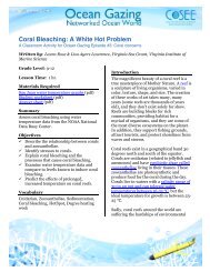
<strong>Sea</strong> Breeze<br />
A Classroom Activity for Ocean Gazing Episode #12: Gust of energy<br />
Written by: Christopher J. Petrone, Delaware <strong>Sea</strong> Grant, University of Delaware College of<br />
Earth, Ocean, and Environment<br />
In cooperation with: Dr. Dana Veron and Christopher Hughes, University of Delaware<br />
College of Earth, Ocean, and Environment<br />
Grade Level: 6-12<br />
Lesson Time: 45 min<br />
Materials Required<br />
Air temperature graph, Relative humidity<br />
graph, Wind speed graph, Wind direction<br />
graph, Computer access, Internet access,<br />
Student worksheet<br />
Summary<br />
<strong>Sea</strong> <strong>breeze</strong>s can provide a welcome break<br />
from summertime temperatures and spark<br />
afternoon thunderstorms; however, their<br />
formation and strength are greatly affected<br />
by changes in land-use. Students will<br />
examine environmental observing system<br />
data and a radar loop to identify sea <strong>breeze</strong><br />
fronts and discuss the implications of<br />
ongoing sea <strong>breeze</strong> research.<br />
Objectives<br />
ü Describe the formation of sea <strong>breeze</strong><br />
and land <strong>breeze</strong> and their effects<br />
ü Analyze line graphs of air temperature,<br />
humidity, wind speed, and wind<br />
direction<br />
ü Identify sea <strong>breeze</strong> fronts via line graph<br />
and radar loop<br />
ü Discuss the impacts of urbanization/<br />
land-use change on sea <strong>breeze</strong><br />
Activity Use<br />
This activity can be used as part of a:<br />
ü Meteorology unit in earth science<br />
ü Human impact unit in ecology or<br />
environmental science<br />
ü Density unit<br />
Vocabulary<br />
<strong>Sea</strong> <strong>breeze</strong>, land <strong>breeze</strong>, land use,<br />
urbanization, differential heating, gradient,<br />
frontogenesis, front<br />
Invitation<br />
It’s a toasty July day. You’ve just finished<br />
riding some great waves at one of<br />
Delaware’s award-winning beaches<br />
(http://www.nrdc.org/water/oceans/ttw/2<br />
00beaches.asp) and you’re <strong>now</strong> enjoying an<br />
early afternoon snack. All of a sudden you<br />
realize that the air temperature has<br />
dropped, the humidity seems to be<br />
increasing, and the wind is <strong>now</strong> not only<br />
stronger than it was, but <strong>now</strong> it’s coming off<br />
the water. So you sit back and enjoy the cool
eeze.<br />
Later in the afternoon, just when you are<br />
ready to pack up your things and leave this<br />
epic beach day behind, you notice that the<br />
wind has shifted again, and though it is a<br />
little less humid, the temperature has<br />
climbed back up, leaving you wishing for<br />
another quick swim in the surf.<br />
What in the world is happening And how<br />
could you investigate what is happening<br />
Introduction<br />
<strong>Sea</strong> Breeze: Water has higher heat capacity<br />
(www2.vims.edu/bridge/DATA.cfmBridge<br />
_Location=archive0909.html) than land,<br />
meaning it takes more energy to raise the<br />
temperature of water than it does to raise<br />
the temperature of land. On hot summer<br />
days along the Delaware coast, the land<br />
heats up much faster than the waters of the<br />
Delaware Bay and Atlantic Ocean, which,<br />
for the most part, stay the same<br />
temperature throughout the day.<br />
Because the air is in direct contact with<br />
these two surfaces, the land and the water,<br />
it also heats up at different rates. The air<br />
over water will heat and cool slower than<br />
the air over land. This is k<strong>now</strong>n as<br />
differential heating and results in a<br />
pressure and density gradient<br />
(http://ww2010.atmos.uiuc.edu/%28Gh%2<br />
9/guides/mtr/fw/sea/crc.rxml). This<br />
pressure gradient allows for<br />
frontogenesis, or the formation of a<br />
front. As the air over land heats, it rises<br />
into the atmosphere and is replaced at the<br />
surface by cooler air that moves in from<br />
over the cooler water. The leading edge of<br />
this moving air mass is k<strong>now</strong>n as a sea<br />
<strong>breeze</strong> front<br />
(http://oceanservice.noaa.gov/education/y<br />
os/resource/JetStream/ocean/sb_circ.htm)<br />
and the cooler, moister air that we feel is<br />
k<strong>now</strong>n as, you guessed it, the sea <strong>breeze</strong>.<br />
That rising warm air from the land spreads<br />
out in the atmosphere and eventually moves<br />
out over the water, where it cools and sinks<br />
back towards the surface completing the<br />
circulation pattern<br />
(http://i.usatoday.net/weather/photos/bre<br />
ez2.jpg).<br />
The sea <strong>breeze</strong> brings cooler air<br />
temperatures inland, which drop air<br />
temperatures anywhere from 5-20˚F, and<br />
also raises the relative humidity because the<br />
air mass is moving in from over water. <strong>Sea</strong><br />
<strong>breeze</strong> can last anywhere from an hour to<br />
several hours, and will add an easterly<br />
component to the wind direction, changing<br />
the direction to northeasterly, easterly, or<br />
southeasterly. (*Remember that winds are<br />
named by the direction from which they<br />
originate, so an easterly wind is moving<br />
from the east to the west.) In southern<br />
Delaware, sea <strong>breeze</strong>s occur 63 percent of<br />
the time in the summer along the coast, and<br />
only 20% of the time inland. A stronger<br />
Delaware sea <strong>breeze</strong> can penetrate inland to<br />
about 30-40 miles.<br />
<strong>Sea</strong> <strong>breeze</strong> is important to coastal<br />
communities because it relieves hot<br />
summertime temperatures, and under<br />
certain circumstances, can also provide<br />
crucial rain to Delaware’s coastal farms<br />
during dry summer seasons. As the warm<br />
air over land rises, it can spark brief, strong<br />
thunderstorms capable of producing heavy<br />
rain. The daily afternoon thunderstorms<br />
experienced in Florida are an example of<br />
storms caused by sea <strong>breeze</strong> fronts.<br />
On the other side of the sea <strong>breeze</strong> coin,<br />
coastal Delaware can also experience land<br />
<strong>breeze</strong>s. These typically occur after sunset,<br />
when the land cools faster than the water<br />
and the warmer air over the water rises and<br />
is replaced by cooler air from land<br />
(http://bentsci.edublogs.org/files/2009/11/<br />
sea-land-<strong>breeze</strong>.gif). In over-developed<br />
<strong>Sea</strong> Breeze Page 2
coastal areas, where the sea <strong>breeze</strong> helps to<br />
dissipate smog and other airborne<br />
contaminants, the land <strong>breeze</strong> can help<br />
move pollutants out to sea.<br />
Land Use: Delaware’s landscape has<br />
undergone many changes throughout its<br />
long history—it has transitioned from<br />
forests to farms, back to forests, and then in<br />
many cases, particularly in the northern<br />
and southeastern portions of the state, from<br />
forests to residential and even urban areas.<br />
From 1992 to 1997 developed land<br />
(residential, commercial, transportation,<br />
etc.) in Sussex County, Del. increased by<br />
over 46 percent, while agricultural and<br />
forested land decreased by over 9 percen<br />
(Delaware Office of State Planning<br />
Coordination 1999).<br />
Changes in land use<br />
(http://www.eoearth.org/article/Landuse_and_land-cover_change)<br />
can have a<br />
profound effect on the soil, water, animals,<br />
and certainly the air.<br />
With urbanization comes an increase in<br />
impervious surfaces such as roads,<br />
driveways, building roofs, and parking lots.<br />
These surfaces, which are often dark in<br />
color, trap heat and contribute to a heat<br />
island effect<br />
(http://www.epa.gov/heatisld/), in which<br />
the developed region becomes much<br />
warmer than the surrounding area.<br />
There are many negative effects of heat<br />
islands, including increased energy<br />
consumption and air pollution, but near the<br />
coast, this increase in heat also has an effect<br />
on the sea <strong>breeze</strong>. Instead of moving<br />
through an area, the sea <strong>breeze</strong> front can be<br />
slowed or even held in place by the heat<br />
island effect. This can cause pollutants to<br />
become more concentrated in the urban<br />
area and prevent the formation of afternoon<br />
thunderstorms.<br />
Current <strong>Sea</strong> Breeze Research: Tourism is a<br />
major component of southern Delaware’s<br />
economy. As mentioned above, the number<br />
of seasonal and permanent residents is<br />
growing at an escalating rate in eastern<br />
Sussex County. This rapid growth, and the<br />
increased infrastructure needed to support<br />
it, is drastically changing local land use,<br />
which will have an impact on the coastal<br />
system, including the very important sea<br />
<strong>breeze</strong>.<br />
Dr. Dana Veron<br />
(http://www.ceoe.udel.edu/people/profile.<br />
aspxdveron) of the University of Delaware<br />
College of Earth, Ocean, and Environment,<br />
and her graduate student Christopher<br />
Hughes, are working to better understand<br />
sea and bay <strong>breeze</strong>s in Delaware. They are<br />
also working to identify the physical<br />
changes to the landscape that most affect<br />
sea <strong>breeze</strong>, predict how land use will change<br />
over the next 30 years, and use models to<br />
predict how the changing land use and<br />
population growth will impact the sea and<br />
bay <strong>breeze</strong>s and Delaware’s climate.<br />
The results of their work will help inform<br />
local decision makers about some of the<br />
impacts of continued development in the<br />
fragile coastal zone. The project is three<br />
years in length and funded by Delaware <strong>Sea</strong><br />
Grant<br />
(http://www.deseagrant.org/seagrant/rese<br />
arch/development/ETE-16).<br />
Data Analysis: Identifying a <strong>Sea</strong><br />
Breeze Front<br />
Data for this activity came from the<br />
Delaware Environmental Observing System<br />
(DEOS). DEOS provides real-time and<br />
archived data from 48 stations located<br />
throughout Delaware and southeastern<br />
Pennsylvania, available 24 hours a day at<br />
www.deos.udel.edu.<br />
<strong>Sea</strong> Breeze Page 3
Applying the information you have learned<br />
above, you will <strong>now</strong> explore real data<br />
recorded by two DEOS stations, one coastal<br />
and one further inland, from August 21,<br />
2009. The coastal station, DBBB, is found<br />
on the Bethany Beach Boardwalk, roughly<br />
200 feet from the Atlantic Ocean. The<br />
inland station, DLAU, is located at the<br />
airport in Laurel, Del., and is approximately<br />
29 miles from the coast.<br />
You will use several forms of archived data<br />
to identify sea <strong>breeze</strong> fronts. Then, you will<br />
explore real time data to determine if a sea<br />
<strong>breeze</strong> front has occurred within the last 24<br />
hours.<br />
Note: If students need additional work<br />
creating their own graphs, either by hand or<br />
using graphing software, please see Table 1<br />
for all of the data.<br />
A. K<strong>now</strong>ing the effects of a sea <strong>breeze</strong><br />
front on air temperature, relative<br />
humidity, wind speed, and wind<br />
direction, fill in the missing portions<br />
(10AM-3PM) of Figures 1 through<br />
4—line graphs of these parameters.<br />
The coastal station, DBBB, is in blue,<br />
and the inland station, DLAU, is in<br />
green.<br />
Note: Part A can also be used as an<br />
Invitation/Engagement activity prior<br />
to receiving any introductory<br />
material.<br />
B. Using Figures 5 and 6, answer the<br />
following questions.<br />
<strong>1.</strong> What differences do you notice<br />
between the two profiles<br />
2. When did the sea <strong>breeze</strong> front<br />
begin<br />
3. How long did the front have an<br />
effect<br />
4. How much did air temperature<br />
change during this time<br />
a. At DBBB<br />
b. At DLAU<br />
5. How much did the relative<br />
humidity change<br />
a. At DBBB<br />
b. At DLAU<br />
C. A sea <strong>breeze</strong> front is also<br />
characterized by an increase in wind<br />
speed and a shift in wind direction to<br />
include an easterly component.<br />
Using Figures 7 and 8—line graphs of<br />
wind speed and direction—answer<br />
the following questions.<br />
6. Based on your observation in Part<br />
A, locate the wind speed and<br />
wind direction data during the<br />
period of sea <strong>breeze</strong>:<br />
i. By approximately how<br />
much did the wind<br />
speed increase at<br />
DBBB<br />
ii. From what direction<br />
did the wind shift<br />
iii. To what direction did<br />
the wind shift<br />
iv. How long did the<br />
increased wind speed<br />
and direction shift last<br />
7. Were there any other drastic<br />
shifts in wind direction during<br />
the 24 hour period<br />
8. Based on the data from Figures 1-<br />
4, did the DLAU station<br />
experience the sea <strong>breeze</strong><br />
Provide evidence for your answer.<br />
D. We are very familiar with radar maps<br />
shown by our local weather<br />
personalities. In precipitation mode,<br />
the radar produces visualizations<br />
which show precipitation that has<br />
been recorded through the use of<br />
electromagnetic waves being<br />
broadcast and returned via antennas.<br />
In clear-air mode, the radar is able to<br />
<strong>Sea</strong> Breeze Page 4
detect much smaller objects like dust<br />
and particulate matter.<br />
View the clear-air mode radar loop<br />
from September 4, 2008 from Dover<br />
Air Force Base. The sea <strong>breeze</strong> front<br />
is shown as a line of red/purple<br />
moving east to west extending from<br />
the top of the state to the bottom.<br />
9. Does the front cross the entire<br />
state of Delaware<br />
10. Using the time stamps in the<br />
upper right corner, determine<br />
how long it takes for the front to<br />
move from the coast to the<br />
furthest point inland. (*Note: The<br />
time stamp is in GMT, or<br />
Greenwich Mean Time, which is 5<br />
hours ahead of Eastern Standard<br />
Time and 4 hours ahead of<br />
Eastern Daylight Time. So 16:00<br />
GMT = 4:00PM GMT = 12:00PM<br />
EDT = 11:00AM EST)<br />
E. You will <strong>now</strong> evaluate real-time data<br />
from several DEOS stations to<br />
determine if a sea <strong>breeze</strong> front has<br />
occurred in the last 24 hours.<br />
Visit www.deos.udel.edu and click on<br />
the DOES GeoBrowser. A second<br />
window will open. Mouse over the<br />
southern-most coastal station, which<br />
should be the Bethany Beach<br />
Boardwalk station, DBBB, and click<br />
on it. A dialogue balloon will open<br />
with the most recent observations.<br />
Record the following:<br />
1<strong>1.</strong> The date and time of the current<br />
observations<br />
12. Current air temperature<br />
13. Current relative humidity<br />
14. Current wind speed<br />
15. Current wind direction<br />
Now click on the View Last 24 Hours link.<br />
Another new window will open.<br />
16. By looking at the plots of air<br />
temperature and relative<br />
humidity, is there evidence of a<br />
sea <strong>breeze</strong> front taking place in<br />
the last 24 hours<br />
Now view the 24 hour record of two other<br />
DEOS stations.<br />
17. Is there evidence of a sea <strong>breeze</strong><br />
front in other areas Describe the<br />
evidence for or against the<br />
presence of a sea <strong>breeze</strong> front.<br />
Discussion Questions<br />
<strong>1.</strong> How might the following affect the<br />
formation and characteristics of a sea<br />
<strong>breeze</strong> front<br />
a. A cloudy day<br />
b. A brief, but strong thunderstorm<br />
moving west to east over the area<br />
c. A northeaster<br />
d. An intense heat wave, with<br />
temperatures exceeding 100˚F,<br />
for a week straight<br />
e. Increased development of the<br />
coastal area, including wider<br />
road, more impervious surface,<br />
and large skyscraper hotels.<br />
2. The radar loop definitively shows the<br />
movement of the sea <strong>breeze</strong> front. If you<br />
were a meteorologist on the news, what<br />
would be the advantages and<br />
disadvantages of showing a modeled or<br />
predicted loop as opposed to an actual<br />
radar loop<br />
3. In the radar loop, we can see what<br />
appears to be a slow moving sea <strong>breeze</strong><br />
moving northeast from Delaware Bay<br />
into New Jersey. Why do you think there<br />
is not a sea <strong>breeze</strong> front moving west to<br />
east from Chesapeake Bay onto<br />
Maryland’s Eastern Shore<br />
<strong>Sea</strong> Breeze Page 5
a. If there was a Chesapeake Bay sea<br />
<strong>breeze</strong> front, what would be the<br />
result of the two fronts<br />
converging<br />
4. Discuss the advantages and<br />
disadvantages of environmental<br />
observing system data.<br />
5. If you were city manager, how could you<br />
use the data and models presented in<br />
this activity to guide future development<br />
in your city<br />
6. Describe other methods of determining<br />
the impact of urbanization on sea <strong>breeze</strong><br />
fronts.<br />
Assessment<br />
ü Performance: Did student actively<br />
participate in the discussion portions of<br />
the activity Was student engaged<br />
during activity<br />
ü Product: Did student answer the data<br />
analysis questions coherently and<br />
provide evidence for their answer<br />
Extensions<br />
ü Discuss the role of the Coriolis effect on<br />
the direction the sea <strong>breeze</strong> blows.<br />
ü View archived and real-time data from<br />
other DEOS and NOAA National Data<br />
Buoy Center<br />
(http://www.ndbc.noaa.gov) stations<br />
and determine the frequency, strength,<br />
and duration of sea <strong>breeze</strong> fronts from<br />
other sites in Delaware, the East Coast,<br />
the Gulf of Mexico, West Coast, and the<br />
Great Lakes.<br />
ü Use Google Earth to explore the areas<br />
where DEOS sensors are found. Identify<br />
the land use (agricultural, residential,<br />
highway, etc.) and formulate a<br />
hypothesis about how the land use<br />
might affect the data measurements.<br />
ü If your school or home is located near<br />
the coast (less than 50 miles) measure<br />
air temperature, wind speed and<br />
direction, and humidity, to explore if<br />
you experience sea <strong>breeze</strong>s. You can<br />
make several of the instruments needed<br />
to measure these parameters from<br />
items around the house.<br />
Additional Resources<br />
ü Coastal Carolina University data activity<br />
Coastal Weather and <strong>Sea</strong> Breezes:<br />
http://kingfish.coastal.edu/marine/risi<br />
ngtide/<strong>breeze</strong>/classroom.html<br />
ü University of California data activity:<br />
http://earthguide.ucsd.edu/weather/te<br />
achers/teachers_wind.html<br />
ü Rutgers University sea <strong>breeze</strong> tutorial:<br />
http://marine.rutgers.edu/cool/seabree<br />
ze/tutorial.html<br />
ü NOAA National Ocean Service sea<br />
<strong>breeze</strong> tutorial:<br />
http://oceanservice.noaa.gov/educatio<br />
n/pd/oceans_weather_climate/media/<br />
sea_and_land_<strong>breeze</strong>.swf<br />
ü Bridge DATA: Can’t Take the Heat:<br />
http://www2.vims.edu/bridge/DATA.cf<br />
mBridge_Location=archive0909.html<br />
References<br />
Delaware Office of State Planning Coordination.<br />
(1999). Gross Land Use Changes in Delaware<br />
1992 to 1997.<br />
http://www.stateplanning.delaware.gov/info/lu<br />
lcdata/grsschng.pdf . Accessed 5 October 201<strong>1.</strong><br />
Hughes, Christopher. (2011). The Climatology<br />
of the Delaware Bay/<strong>Sea</strong> Breeze (Master’s<br />
thesis, University of Delaware, 2011).<br />
Veron, Dana. (2009). Local Urban Growth and<br />
Climate Change Impacts on the Delaware Bay<br />
<strong>Sea</strong> Breeze. Delaware <strong>Sea</strong> Grant Research<br />
Proposal.<br />
Sources<br />
To access an online version of this activity,<br />
you can go to the following URL:<br />
http://www.deseagrant.org/sites/deseagra<br />
nt.org/files/attachments/<strong>Sea</strong>Breeze_Activit<br />
y_final.pdf<br />
<strong>Sea</strong> Breeze Page 6
The related podcast episode for this activity<br />
can be found by going to the podcast section<br />
of www.oceangazing.org<br />
<strong>Sea</strong> Breeze Page 7