Public Spaces | Public Life for Seattle's South Downtown
Public Spaces | Public Life for Seattle's South Downtown
Public Spaces | Public Life for Seattle's South Downtown

Create successful ePaper yourself
Turn your PDF publications into a flip-book with our unique Google optimized e-Paper software.
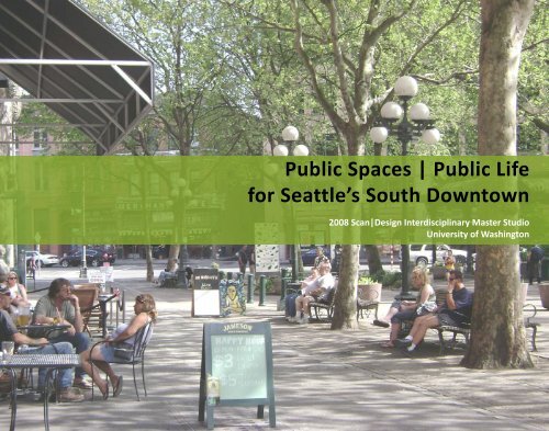
<strong>Public</strong> <strong>Spaces</strong> | <strong>Public</strong> <strong>Life</strong><br />
<strong>for</strong> Seattle’s <strong>South</strong> <strong>Downtown</strong><br />
2008 Scan|Design Interdisciplinary Master Studio<br />
University of Washington
Introduction Page 1<br />
Analysis Page 5<br />
Design Page 17<br />
Connections<br />
Alleys<br />
Alleyways<br />
Stations<br />
Lidded<br />
Studio Participants<br />
Landscape Architecture Architecture<br />
Erin Berg<br />
Jonathan Bahe<br />
Benn Engelhard<br />
Claire Gear<br />
Brian Fabella<br />
Julia Lindgren<br />
Sarah Ferreter<br />
Will Payne<br />
Tori Halligan<br />
Amanda Reed<br />
Ro Hohlfeld<br />
Rie Shintani<br />
Erica Huang<br />
Megan Schoch<br />
Selina Hunstiger<br />
Michael Lewis<br />
Urban Planning<br />
Heide Martin<br />
Seth Geiser<br />
Jason Medeiros<br />
Rachel Miller<br />
Bradley Pavlik<br />
Mike Pick<strong>for</strong>d<br />
Katy Saunders<br />
Orion Stewart<br />
Eric Scharnhorst<br />
Chilan Ta<br />
Josho Somine<br />
Corinna Welzenbach<br />
Katherine Wimble<br />
Gilbert Wong<br />
Bo Zhang<br />
Nancy Rottle, Associate Professor Landscape Architecture<br />
Kathryn Merlino, Assistant Professor Architecture<br />
Liz Stenning, Teaching Assistant Urban Planning<br />
Louise Grassov, Master Teacher, Gehl Architects<br />
Acknowledgements<br />
Scan|Design by Inger & Jens Bruun Foundation<br />
Gehl Architects<br />
Todd Vogel, International Sustainablilty Institute<br />
Seattle Department of Transportation<br />
Seattle Department of Planning and Development<br />
U.W. College of Architecture and Urban Planning (College of Built Environments)<br />
Scan|Design Master Studio 2008
Foreword<br />
Through the generous sponsorship of the ScanlDesign Foundation, our<br />
graduate planning, architecture and landscape architecture students at<br />
the University of Washington have experienced a rare opportunity to<br />
work together in an interdisciplinary design studio environment. The<br />
class was able to travel together to Denmark and Sweden, work with the<br />
internationally renowned Copenhagen firm of Gehl Architects, and apply<br />
the lessons and inspirations of human-oriented design to Seattle’s <strong>South</strong><br />
<strong>Downtown</strong>. Together we walked Copenhagen’s pedestrian network,<br />
sketched and analyzed the city’s public spaces and traveled on the city’s<br />
separated bicycle tracks to experience its renewed neighborhoods,<br />
innovative architecture, repurposed waterfront and restorative parks<br />
and gardens. The class toured a variety of unique housing projects in<br />
Denmark and Sweden—historic, new and planned—with a focus on<br />
understanding sustainable practices, and examined the design treatment<br />
of space that contributes to urban conviviality and civic sensibility.<br />
Guided by the staff of Gehl Architects, Copenhagen’s bicycle planners,<br />
and Malmö’s Mayor and Western Harbor designers, the class gained<br />
insight into these cities’ historical development and contemporary<br />
planning issues, design approaches to successful projects, and personal<br />
Danish perspectives.<br />
We brought these collective experiences back to Seattle, to consider<br />
how Seattle’s pedestrian spaces can create a better and more ecological<br />
urban environment <strong>for</strong> the city. Working with data generated through<br />
Gehl Architects’ <strong>Public</strong> <strong>Spaces</strong> <strong>Public</strong> <strong>Life</strong> project <strong>for</strong> the City of Seattle,<br />
along with additional analyses and recently completed plans <strong>for</strong><br />
Seattle’s <strong>South</strong> <strong>Downtown</strong>, the design studio focused on five study<br />
areas at different scales in the south downtown area of the city. The<br />
sites ranged from the entire Pioneer Square district between the transit<br />
hubs at Union/King Stations and Coleman Ferry Dock, to the alleys of<br />
the district, to the two-block area over the rail tracks north of the train<br />
station, to the station area itself. Students from all three departments<br />
worked together as interdisciplinary student groups, and created both<br />
group contextual plans <strong>for</strong> their large sites as well as designed<br />
individual projects <strong>for</strong> individual sites. The students developed and<br />
re-examined their work through several cycles over the course of ten<br />
weeks, interacting with Louise Grassov of Gehl Architects and outside<br />
professional reviewers as well as through faculty and peer review. Their<br />
final proposals are represented on the pages within this document. We<br />
sincerely hope that it will suggest new ideas and possibilities <strong>for</strong> the<br />
City of Seattle, and that it might be useful in illustrating Gehl Architects’<br />
recommendations <strong>for</strong> cultivating “life between buildings” in the city’s<br />
downtown.<br />
We have many people to thank <strong>for</strong> this remarkable opportunity. Without<br />
the support of the ScanlDesign Foundation, this rich set of shared<br />
experiences could not have reciprocated, and we are sincerely grateful<br />
<strong>for</strong> this solid pedagogical opportunity <strong>for</strong> our students. We are deeply<br />
appreciative of Louise Grassov’s clear teaching and helpful critique--and<br />
her ability to adapt so easily to UW ways and Seattle times--and to Helle,<br />
Lars, Lærke and Kristian at Gehl Architects <strong>for</strong> the fantastic lectures and<br />
tours in Copenhagen. Todd Vogel has been a fountain of encouragement,<br />
coordinating with Gehl’s project <strong>for</strong> Seattle and contributing his<br />
understanding of Gehl’s methods and the needs and opportunities of<br />
the neighborhood. We also very much appreciate the City of Seattle’s<br />
interest and support, including Barbara Gray, Gary Johnson and Robert<br />
Scully. Finally, we couldn’t have done it without our tireless and able<br />
teaching assistant, Liz Stenning, who has kept us on track <strong>for</strong> the last<br />
many months, in Copenhagen and in Seattle.<br />
We thank you all, and hope that this work will make a difference<br />
not only in the education of our students, but also in the positive,<br />
sustainable evolution of our city’s public realm.<br />
Nancy Rottle, Associate Professor, Landscape Architecture<br />
Kathryn Merlino, Assistant Professor, Architecture<br />
Introduction<br />
<strong>Public</strong> <strong>Spaces</strong> | <strong>Public</strong> <strong>Life</strong> <strong>for</strong> Seattle’s <strong>South</strong> <strong>Downtown</strong><br />
Pg 1
<strong>Downtown</strong> Seattle Pedestrian Study<br />
Green Futures Lab Data Collection<br />
Be<strong>for</strong>e our studies began, the Copenhagen firm of Gehl Architects initiated their <strong>Public</strong> Space l <strong>Public</strong> <strong>Life</strong> project <strong>for</strong> the City of Seattle to improve the city’s <strong>Downtown</strong><br />
pedestrian realm. As part of this work, the University of Washington’s Green Futures Lab (GFL) conducted extensive baseline surveys on the physical qualities of the<br />
<strong>Downtown</strong> environment, and the human uses of it. For one week in July 2008, a large corps of University of Washington students counted, observed, mapped, and<br />
interviewed pedestrians throughout downtown Seattle.<br />
In addition, over the course of several months<br />
two Scan|Design interns in the GFL thoroughly<br />
mapped the experiential qualities of the 100+<br />
block district. This data contributed not only to<br />
the studio’s work, but also to Gehl Architects’<br />
final recommendations and report. The 40 +<br />
maps they generate will establish a baseline<br />
snapshot <strong>for</strong> the city against which the results of<br />
new design interventions may be measured.<br />
1st Ave S and Main St.<br />
February<br />
‘08<br />
• moving pedestrian counts<br />
July<br />
‘08<br />
• moving pedestrian counts<br />
• survey of stationary pedestrian<br />
activities in urban open spaces<br />
• demographic interviews<br />
January<br />
‘09<br />
pedestrian data collection<br />
Gehl final report and<br />
recommendations<br />
July ‘08 Pedestrian Counts<br />
July ‘08 Demographic Interviews<br />
<strong>Downtown</strong> Seattle urban quality and conditions mapping: GFL<br />
Lab interns created over 40 maps.<br />
Left map: Canopies on Buildings<br />
(from field data collection and mapping)<br />
Scan|Design Master Studio 2008
Copenhagen Study Tour<br />
September 7-21: Scan|Design Master Studio Study Tour<br />
Masters students from the University of Washington’s College of Architecture and Urban<br />
Planning traveled to Copenhagen, Denmark in September 2008. Students were immersed<br />
<strong>for</strong> two weeks in the city’s and region’s design and planning strategies, absorbing the famous<br />
Danish networks of public space and the culture’s emphasis on bicycle and pedestrian<br />
planning. The trip to Copenhagen was generously supported by the ScanIDesign Foundation.<br />
Students came from three disciplines: Architecture, Landscape Architecture, and Urban<br />
Planning & Design. In Copenhagen, these students were led by the renowned urban planning<br />
consultants Gehl Architects, who introduced the group to their working methods. Other<br />
highlights included tours of redeveloped neighborhoods, the waterfront, plazas, and parks.<br />
After returning from the trip, the group continued working in our Scan|Design Master Studio<br />
course to study and design public spaces in Seattle’s <strong>South</strong> <strong>Downtown</strong>, with the goal of<br />
creating a socially vibrant, ecologically healthy public realm.<br />
Scan|Design Master Studio Group at Amager Strand<br />
Introduction<br />
Gehls’ working methods exercise sketching waterfront bicycle tour<br />
<strong>Public</strong> <strong>Spaces</strong> | <strong>Public</strong> <strong>Life</strong> <strong>for</strong> Seattle’s <strong>South</strong> <strong>Downtown</strong><br />
Pg 3
Studio Project<br />
The project area <strong>for</strong> the UW Master Studio consists of the southern portion of Gehl<br />
Architects’ project area, denoted in green on the map below. This area was selected due<br />
to its significance as a transportation hub and its potential <strong>for</strong> quality pedestrian space.<br />
Project Area<br />
Seattle<br />
Master Studio Project Area<br />
Lake Washington<br />
Elliot Bay<br />
Gehl Architects Project Area<br />
SEATTLE<br />
Master Studio Project Area<br />
Project Boundaries:<br />
West - Waterfront<br />
East - 5th Avenue<br />
North - James Street<br />
<strong>South</strong> - King Street<br />
Miles<br />
Scan|Design Master Studio 2008
Past + Future<br />
Early <strong>South</strong> Seattle<br />
Long be<strong>for</strong>e the Euro-American settlers arrived in the Pacific Northwest, the Coastal Salish<br />
people had developed a complex culture based on fishing, hunting and gathering around<br />
the area of present day Seattle. In 1853, the south downtown area saw the beginning of the<br />
Northwest’s first commercial enterprise, Henry Yesler’s sawmill, which was constructed on the<br />
downtown waterfront in 1853. The first transcontinental railroad was completed in 1869 and<br />
in 1883 the city finally achieved connection to national rail lines at the south end of the city.<br />
Thereafter the surrounding area slowly grew to serve as the city’s center of commerce and<br />
industry.<br />
In the mid 1960s, the preservation movement began to take hold, and the first historic district<br />
in the city was created in Pioneer Square. In the 1970s, this set up regional guidelines <strong>for</strong> the<br />
preservation, rehabilitation and conservation <strong>for</strong> development around historic districts, and the<br />
area became a popular region <strong>for</strong> tourism and entertainment. Now, with the additions of the<br />
sports stadiums, rehabilitation of two train stations and light rail station, and new residential<br />
developments, this district in <strong>South</strong> <strong>Downtown</strong> is seeing a resurgence of population and activity.<br />
With careful attention to its rich natural, cultural and architectural history alongside sustainable<br />
urban growth, the area can be a place thriving with public spaces <strong>for</strong> a rich public life.<br />
On June 6, 1889, Seattle’s commercial district burned to the ground. In place of the two and<br />
three-story wood buildings, a four to six story city was constructed over the old city, and was<br />
created in fire-resistant stone, brick, and heavy timber with cast iron and terra cotta detail to<br />
match current architectural trends. In addition to the architectural upgrades, streets were<br />
widened and paved. A thorough regrade of the<br />
downtown area made an interesting temporary<br />
underground area from the old street grade, but<br />
also built functional water and sewer systems. In<br />
certain areas, the first floor of the old city was<br />
placed directly underneath the new modern city,<br />
creating an ‘underground Seattle’ that stayed in<br />
use <strong>for</strong> years as a shopping area and additional<br />
commercial space. Soils from the regrade provided<br />
Aftermath 1889 Fire<br />
fill to trans<strong>for</strong>m the expansive tidelands into<br />
source: University of Washington Special Collections<br />
buildable spaces.<br />
Underground Seattle<br />
The new and improved city benefited greatly at the turn of the century<br />
from the Alaska Klondike gold rush. Prospectors were outfitted from<br />
sellers in the city, and prosperity and population continued to grow.<br />
With new steel framed buildings and elevators, the commercial district<br />
moved both upward and northward, beginning in 1914 with the Smith<br />
Tower on the northeastern edge of our site on Yesler Avenue. It<br />
remained the tallest building in the city until 1969 when new, taller<br />
buildings began to rise in the new commercial district north of Pioneer<br />
Square.<br />
Future Plans<br />
Planning ef<strong>for</strong>ts in the Pioneer Square neighborhood stem from the <strong>South</strong> <strong>Downtown</strong> Study,<br />
a project of the Mayor’s Center City Seattle strategy. The Center City strategy focuses on the<br />
Seattle downtown and the surrounding nine neighborhoods. The Livable<br />
<strong>South</strong> <strong>Downtown</strong> Plan, May 2008 focuses on Pioneer Square, Chinatown/<br />
International District, Little Saigon, the stadium area, and the predominantly<br />
industrial area south of Chinatown. The primary goals <strong>for</strong> the Livable <strong>South</strong><br />
<strong>Downtown</strong> plan include:<br />
• Housing and job stimulation through zoning and land use decisions<br />
• Respect neighborhood character and plans<br />
• Promote integrated mixed-use development<br />
• Enhance quality connections between neighborhoods and downtown<br />
Dumpster Free Alley<br />
• Encourage economic vitality<br />
• Promote environmental sustainability<br />
• Support regional services while maintaining community goals<br />
Future Developments<br />
The following developments are in the development phase or recently implemented.<br />
• Housing: North Lot, Yesler Terrace, Goodwill site developments<br />
• Transportation: King Street Station restoration, Light Rail<br />
• Streets: Waterfront connection improvements, Dumpster-Free Alley Initiative<br />
• <strong>Public</strong> Realm: Sidewalk Cafe permit expedition, Busker program<br />
ANALYSIS<br />
King Street Station<br />
<strong>Public</strong> <strong>Spaces</strong> | <strong>Public</strong> <strong>Life</strong> <strong>for</strong> Seattle’s <strong>South</strong> <strong>Downtown</strong><br />
Pg 5
Open Space, Vegetation, Habitat<br />
Existing Vegetation and Habitat<br />
• Street trees comprise the majority of vegetation<br />
Potential<br />
• Green development may provide additional<br />
vegetation due to LEED or Seattle Green Factor<br />
landscape requirements.<br />
• Green roofs and courtyards<br />
• Shoreline habitat restoration at Pier 48<br />
Existing Open Space<br />
• Private and <strong>Public</strong> Plazas<br />
• Streets and Alleys<br />
Potential<br />
• Parking lots and unbuilt spaces<br />
• Redesigned streets and alleys with dumpster removal<br />
• Lids over rail tracks<br />
Occidental Mall: London Plane tree canopy<br />
Occidental Park: vertical vegetation on building façade<br />
Potential Shoreline<br />
Habitat<br />
Potential Shoreline<br />
Habitat<br />
Tree Canopy<br />
Ground Plane not<br />
Maintained<br />
Ground Plane Maintained<br />
Open to Tracks<br />
Vertical Vegetation<br />
ECOLOGY- Site Vegetation<br />
London Plane Tree (Platanus x acerifolia)<br />
Sycamore Maple (Acer pseudoplatanus)<br />
Linden Tree (Tilia cordata)<br />
Red Oak (Quercus rubra)<br />
Honey Locust (Gleditsia triacanthos)<br />
Tulip Tree (Liriodendron tulipfera)<br />
ECOLOGY- Tree Canopy Species<br />
Scan|Design Master Studio 2008
Topography + Hydrology<br />
Conditions<br />
Seattle’s downtown is largely built<br />
upon deposits from glacial outwash<br />
from the late Pleistocene and<br />
subsequent riverine deposits from the<br />
Duwamish River. The original shoreline<br />
is outlined in the map below, indicating<br />
that much of the southern portion of<br />
Pioneer Square is built up fill.<br />
Stormwater Control<br />
Under normal conditions, all runoff water in the site area falls into<br />
catchbasins. Much of it joins combined sewers and heads north to<br />
the West Point treatment plant. In heavy storm events, these pipes<br />
empty sewer and stormwater from the shaded area directly into<br />
Elliot Bay via the combined sewers outfall (CSO) beneath Pier 48.<br />
Some of the area regularly drains polluted stormwater into Elliot<br />
Bay through stormwater-only outfalls.<br />
Continued regrades of the city, filling<br />
in the south downtown tidal flats,<br />
supported a steady outward growth of<br />
the city.<br />
Beacon and First Hill from Tideflats<br />
source: University of Washington Special Collections<br />
2’ contours<br />
main drainpipes<br />
catchbasins<br />
outfalls<br />
regulated outfalls<br />
combined sewer outfall<br />
historical<br />
shoreline<br />
DRAINAGE AND STORMWATER<br />
Underground Infrastructure<br />
During the rebuilding of Seattle, the<br />
2 ft. Contour<br />
Elliot Bay<br />
Original Shoreline<br />
Mixed Fill<br />
TOPOGRAPHY<br />
streets were filled and underground<br />
sidewalks were left open and accessible<br />
<strong>for</strong> occupants. Now used primarily <strong>for</strong><br />
underground tours, the city below is a<br />
complex system of underground spaces.<br />
These areas, spread throughout the<br />
district, do not leave room <strong>for</strong> stormwater<br />
infiltration.<br />
Underground Seattle<br />
source: City of Seattle<br />
ANALYSIS<br />
<strong>Public</strong> <strong>Spaces</strong> | <strong>Public</strong> <strong>Life</strong> <strong>for</strong> Seattle’s <strong>South</strong> <strong>Downtown</strong><br />
Pg 7
Transportation and Circulation<br />
The Pioneer Square neighborhood currently hosts several<br />
transportation systems. The site has the potential to act as a major<br />
transportation hub <strong>for</strong> the entire city. Coordinated ticketing and<br />
wayfinding would enable tourists and residents to easily navigate from<br />
one system to another.<br />
Automobile: The site is surrounded by two major freeways,<br />
Interstate 5 and the Alaska Way Viaduct. They serve as the two major<br />
north/south highways <strong>for</strong> automobiles and busses.<br />
Bus: Numerous bus stops are located throughout the neighborhood<br />
with local and regional service. Additionally, two underground bus<br />
tunnel access locations easily connect the International District and<br />
Pioneer Square to the center of downtown.<br />
Ferry Terminal<br />
Bus Tunnel<br />
Light Rail: Light rail serving Seattle will be accessed through the<br />
International District/Union Station bus tunnel, beginning in early 2009.<br />
Train: Long distance train travel is served by Amtrak located in King<br />
Street Station, which is currently being remodeled and restored to its<br />
original grandeur. Commuter train travel is served by Sound Transit<br />
accessed just north of King Street Station.<br />
bus stop bike lane Alaskan Way Viaduct<br />
King Street<br />
Station<br />
Commuter<br />
Train<br />
pedestrian-only street<br />
Union Station<br />
Bus Tunnel +<br />
Light Rail<br />
Ferry: The Colman dock located at Alaskan Way and Marion is<br />
the ferry terminal <strong>for</strong> service to Bainbridge Island and Bremerton.<br />
Thousands of commuters arrive at and depart from the city daily.<br />
Bike: Designated bike lanes run along 2nd Ave S and Alaskan Way.<br />
The Bike Station, a bike repair and storage facility, is located on 3rd Ave<br />
S, north of S. Jackson St. With the 2007 Bicycle Master Plan, further<br />
improvements are planned <strong>for</strong> bike facilities throughout the entire city,<br />
including the bike trail south of the study area.<br />
Union Station Plaza: Bus Stop<br />
Waterfront bike path: cyclist<br />
Scan|Design Masters Studio 2008
Pedestrian Circulation<br />
Pedestrian Counts<br />
Results from the summer 2008 pedestrian counts (see p. 2) indicate that downtown’s pedestrian network is<br />
fragile, but has excellent potential. Counts tend to be lower in the southern portion of downtown. The number of<br />
pedestrians ebb and flow significantly, due to stadium events.<br />
Summer Weekday 8 am - 6 pm<br />
Tuesday, July 8, 2008<br />
Weather: clear sky/sunny 80 F<br />
Ferry Terminal pedestrian bridge<br />
Summer Weekday 8 am - 6 pm<br />
Tuesday, July 8, 2008<br />
Weather: clear sky/sunny 80 F<br />
A<br />
B<br />
C<br />
D<br />
E<br />
Summer Weekend 8 am - 6 pm<br />
Saturday, July 12, 2008<br />
Weather: clear sky/sunny 75 F<br />
A<br />
B<br />
C<br />
D<br />
E<br />
A. 1st (btw. Marion & Columbia) B. King Street (btw. 1st & Occidental C. 2nd (btw. Jackson & King) D. Jackson (btw. 2nd and 3rd) E. 4th (at pedestrian bridge)<br />
Stationary Mapping<br />
Pedestrians at parks and plazas throughout the downtown<br />
were observed and mapped to determine the predominant<br />
activities in the park. The following results show trends in<br />
usage at 8 parks and plazas in Pioneer Square on a summer<br />
weekday with warm temperatures and clear sky.<br />
Further analysis can be found in Gehl Architects’ <strong>Public</strong><br />
Space|<strong>Public</strong> <strong>Life</strong> report <strong>for</strong> <strong>Downtown</strong> Seattle.<br />
Park/Plaza predominant activities sample times totals (10 am - 8 pm) peak usage hours<br />
City Hall Park + Prefontaine Place lying down 178 2 pm<br />
Union Station Plaza - north sitting on benches 39 8 pm<br />
Union Station Plaza - east sitting on benches 122 12 pm and 8 pm<br />
King County Plaza sitting on cafe chairs 21 12 pm<br />
Pioneer Square Park standing 168 10 am and 8 pm<br />
Occidental Park sitting on cafe chairs 217 12 pm<br />
Occidental Mall sitting on cafe chairs 72 12 pm<br />
Waterfall Park sitting on cafe chairs 40 12 pm<br />
ANALYSIS<br />
<strong>Public</strong> <strong>Spaces</strong> | <strong>Public</strong> <strong>Life</strong> <strong>for</strong> Seattle’s <strong>South</strong> <strong>Downtown</strong><br />
Pg 9
The Pedestrian Environment<br />
Building Stock, Facade Quality<br />
The Pioneer Square neighborhood has numerous historic buildings, most of which were constructed<br />
in the post-fire era. Most are four to six stories in height, constructed of stone or brick and decorated<br />
with terra cotta and cast iron detailing, typical of the end of the century. Much of the ground floor is<br />
activated with retail and restaurants. The following is a sample of students’ assessments of building<br />
PROTECTION<br />
AGAINST CRIME AND VIOLENCE: transparency allows passive surveillance.<br />
AGAINST UNPLEASANT SENSORY EXPERIENCE : canopy provides a shelter from<br />
weather.<br />
façades using Gehl Architects’ 12 Quality Criteria (see p. 14 <strong>for</strong> explanation of the 12 Quality Criteria).<br />
INVITATION<br />
FOR WALKING : Interesting facade, quality surfaces, no obstacles<br />
FOR STANDING AND STANDING: attractive and functional edges,<br />
defined spots <strong>for</strong> staying<br />
4TH FLOOR<br />
3RD FLOOR<br />
FOR SITTING: defined zones <strong>for</strong> sitting<br />
FOR VISUAL CONTACT: unhindered views<br />
2ND FLOOR<br />
1st Ave S<br />
DELIGHT<br />
EXPERIENTIAL<br />
DIMENSIONED AT HUMAN SCALE<br />
AESTHETIC & SENSORY: quality design, robust materials, rich<br />
sensory experience.<br />
The quality of the brick and stone material of the facade and<br />
active ground floor provide stimuli <strong>for</strong> the pedestrian.<br />
CANOPY<br />
GROUND LEVEL<br />
TRANSPARENCY<br />
PROTECTION<br />
AGAINST CRIME AND VIOLENCE: transparency allows passive surveillance.<br />
AGAINST UNPLEASANT SENSORY EXPERIENCE : canopy provides a<br />
shelter from the weather.<br />
4TH FLOOR<br />
INVITATIONS<br />
FOR WALKING : Interesting facade, quality surfaces, no obstacles<br />
3RD FLOOR<br />
FOR STANDING AND STANDING: attractive and functional edges,<br />
defined spots <strong>for</strong> staying<br />
Zeitgeist Coffee<br />
DELIGHT<br />
FOR SITTING: defined zones <strong>for</strong> sitting<br />
FOR VISUAL CONTACT: unhindered views<br />
DIMENSIONED AT HUMAN SCALE<br />
2ND FLOOR<br />
TRANSOM<br />
WINDOWS<br />
CANOPY<br />
AESTHETIC & SENSORY: quality design, robust materials, rich sensory<br />
experience.<br />
GROUND LEVEL<br />
TRANSPARENCY<br />
SEATING<br />
EXPERIENTIAL<br />
Awning provides protection <strong>for</strong> sitting while still allowing sunlight <strong>for</strong> the rest of the<br />
sidewalk. Transom windows above the awnings allow interior lights to further activate<br />
the street at night.<br />
PROTECTION<br />
AGAINST CRIME AND VIOLENCE: transparency allows passive surveillance.<br />
AGAINST UNPLEASANT SENSORY EXPERIENCE : canopy<br />
provides a shelter from the weather.<br />
4TH FLOOR<br />
Occidental<br />
Square<br />
INVITATIONS<br />
FOR WALKING : Interesting facade, quality surfaces, no<br />
obstacles<br />
FOR STANDING AND STANDING: attractive and functional<br />
edges, defined spots <strong>for</strong> staying<br />
3RD FLOOR<br />
FOR SITTING: defined zones <strong>for</strong> sitting<br />
2ND FLOOR<br />
FOR VISUAL CONTACT: unhindered views<br />
DELIGHT<br />
DIMENSIONED AT HUMAN SCALE<br />
AESTHETIC & SENSORY: quality design, robust materials,<br />
rich sensory experience.<br />
GROUND LEVEL<br />
TRANSPARENCY<br />
EXPERIENTIAL<br />
This facade defines Occidental Square on the west side.<br />
The vines covering the entire surface provides a humane contrast to the<br />
hardscaping of the square.<br />
Scan|Design Master Studio 2008
PROTECTION from Vehicular Traffic:<br />
• Railings, green buffers, bollards, and parked cars<br />
• Signalized crosswalks<br />
INVITATION <strong>for</strong> Walking:<br />
• Wide sidewalks on all streets (4-7 feet)<br />
• Pedestrian-only street along Occidental Ave.<br />
• Accessible to two major transport hubs, stadiums,<br />
and waterfront<br />
• Few obstacles inhibit pedestrian circulation<br />
• Sidewalk quality normal with occasional uneven<br />
surfaces<br />
INVITATION <strong>for</strong> Sitting<br />
• Benches and cafe seating generally found in parks<br />
and bus stops<br />
• Variety of people lend to people watching<br />
5th Ave S<br />
PROTECTION from Crime & Violence:<br />
• Many street lamps present, but often lighting too<br />
high<br />
• Tree canopy blocks light to street<br />
• Passive surveillance: active ground floors<br />
• Overlap in functions: offices, cafes restaurants,<br />
bars, and night clubs<br />
Occidental Ave S.<br />
INVITATION <strong>for</strong> Standing and Staying<br />
• Objects to lean against: Street furniture, railings,<br />
and ledges throughout the district<br />
Occidental Park<br />
INVITATION <strong>for</strong> Visual Contact:<br />
• Stadiums, tall buildings, and waterfront create<br />
visual wayfinding landmarks; however, the Viaduct<br />
inhibits clear views of the waterfront<br />
• Few maps<br />
• Abundant street signs<br />
1st Ave S<br />
S Jackson St. above train tracks<br />
3rd Ave S view south<br />
ANALYSIS<br />
<strong>Public</strong> <strong>Spaces</strong> | <strong>Public</strong> <strong>Life</strong> <strong>for</strong> Seattle’s <strong>South</strong> <strong>Downtown</strong><br />
Pg 11
Precedent Studies<br />
During the initial stage of site analysis, students researched relevant precedent studies. Below is a list of the students’ research in the categories of Alleys,<br />
Plazas, Transportation Hubs, Lidded Tracks, Green Infrastructure, and Waterfront Connection. The following pages highlight four case studies. Further detail<br />
can be found on the Master Studio website (http://courses.washington.edu/gehlstud).<br />
STREETS & ALLEYS:<br />
Melbourne Lanes<br />
Melbourne, Australia<br />
source: Melbourne Today<br />
Post Alley<br />
Seattle, USA<br />
source: UW Master Studio<br />
Pirate Alley<br />
New Orleans, USA<br />
source: www.inetours.com<br />
Chicago Green Alley<br />
Chicago, USA<br />
source: City of Chicago<br />
Cat Street<br />
Tokyo, Japan<br />
source: www.flickr.com<br />
GREEN INFRASTRUCTURE:<br />
Green Streets<br />
Portland, USA<br />
source: City of Portland<br />
Urban Food Chain Project<br />
Los Angeles, USA<br />
source: www.worldchanging.com<br />
SEA Street<br />
Seattle, USA<br />
source: UW Master Studio<br />
Musée du Quai Branly<br />
Paris, France<br />
source: www.greenroofs.com<br />
Scan|Design Master Studio 2008
PLAZAS & TRANSPORTATION HUBS<br />
Pioneer Square Courthouse<br />
Portland, USA<br />
source: Portland Development Commission<br />
Potsdamer Platz<br />
Berlin, Germany<br />
source: www.uploadwikimedia.org<br />
Kogod Courtyard<br />
Washington D.C., USA<br />
source: David S. Holloway/Getty Images<br />
Place de l’Homme de Fer<br />
Strasbourg, France<br />
source: Ben on picasa.google.com<br />
LIDDED TRAIN TRACKS:<br />
WATERFRONT CONNECTIONS:<br />
Atlantic Yards<br />
Brooklyn, USA<br />
source: www.nolandgrab.org<br />
Federation Square<br />
Melbourne, Australia<br />
source: Bates Smart<br />
Embarcadero<br />
San Fransisco, USA<br />
source: www.preservenet.com<br />
ANALYSIS<br />
<strong>Public</strong> <strong>Spaces</strong> | <strong>Public</strong> <strong>Life</strong> <strong>for</strong> Seattle’s <strong>South</strong> <strong>Downtown</strong><br />
Pg 13
Precedent Studies<br />
Chicago Green Alleys Chicago, USA<br />
Federation Square Melbourne Australia<br />
The City of Chicago started the Green Alley program in year 2006. Since this<br />
time, more than 80 Green Alleys have been installed. One of the most significant<br />
driving factors in motivating the city to give attention to their alley system was<br />
stormwater management. Chicago’s alleys are paved in asphalt or concrete<br />
that doesn’t allow <strong>for</strong> stormwater to filter back into the ground and flooding is a<br />
frequent occurence in the city’s alleys.<br />
In 1996, the Federation Square Management Pty Ltd, the State Government of<br />
Victoria, and the City of Melbourne held an international design competition<br />
<strong>for</strong> a new civic square capable of accommodating up to 20,000 people in an<br />
open-air amphitheater to be built above the Jolimont railyards. The site was<br />
completed in 2002 with a total budget of $440 million, entirely publicly funded.<br />
It is colloquially known as “Fed Square.”<br />
Green Alley features include:<br />
• permeable pavement (asphalt, concrete or pavers) used the full alley width<br />
or in a center trench<br />
• open bottom catch basins to capture water and filter into ground<br />
• high-albedo pavement to reflect sunlight, reducing the urban heat island<br />
effect<br />
• recycled materials (concrete aggregate, slag, and recycled tire rubber)<br />
The deck over the railways is supported by over 3,000 tonnes of steel beams,<br />
1.4 km of concrete ‘crash walls’ and over 4,000 vibration-absorbing spring<br />
coils and rubber padding. It was designed to support sensitive uses, such<br />
as galleries, cinemas, and radio and television studios, which needed to be<br />
isolated from vibration and noise.<br />
The site functions as a street-like space with flexible uses, which attracts a<br />
broad range of civic, cultural and commercial activities. The flow of the site<br />
creates a series of exciting and varied experiences that encourage public<br />
interactions and promote spontaneous activities.<br />
Chicago Green Alley - be<strong>for</strong>e<br />
source: City of Chicago<br />
Chicago Green Alley - after<br />
source: City of Chicago<br />
Federation Square<br />
source: Bates Smart<br />
Scan|Design Master Studio 2008
Place de l’Homme de Fer Strasbourg, France<br />
Pioneer Courthouse Square Portland, Oregon<br />
Place de l’Homme de Fer is located in the city center and serves four of the five<br />
existing tram lines. It is sited in the middle of a triangular shaped, pedestrianoriented<br />
square, the design of which was left to a competition designed and<br />
constructed by architect Guy Clapot in 1994.<br />
The circular glass roof rises above a pedestrian plaza and defines the public<br />
space, while serving as a tram stop <strong>for</strong> north-south and east-west lines. The<br />
roof also helps to lower the scale of the square, acting as a canopy amidst the<br />
surrounding six-story buildings.<br />
The square provides a mix of public and café seating. Furniture and paving<br />
on the square are pink, white, and gray to coordinate with the façades of<br />
surrounding buildings.<br />
The plaza encourages gathering or hosting impromptu celebrations following<br />
some sporting events. There is also plenty of foot traffic on the plaza, even in<br />
the rain. However, while the plaza seems to be a perfect venue <strong>for</strong> impromptu<br />
or scheduled per<strong>for</strong>mances, it does not seem to host buskers or similar<br />
activities. More could be done to encourage passive street life like sitting and<br />
watching, aside from the sidewalk cafés in one corner.<br />
Place de l’Homme de Fer<br />
source: Ben on picasa.google.com<br />
The Square, often cited as Portland’s Living Room, is a downtown focal point,<br />
host to major civic events, and a lively meeting and gathering place with a<br />
variety of users. It is cited as Portland’s most visited site with 26,000 visitors<br />
daily and over 300 yearly events. The decision to develop a public square of<br />
one city block marked the beginning of a more vibrant and active downtown.<br />
Formerly the site of the Portland Hotel then converted to a 2-story parking<br />
garage by landowners Julius Meier and<br />
Aaron Frank (owners of Meier and Frank<br />
Department Store), the Square was<br />
redeveloped in 1984, in close relation to<br />
the opening of the MAX Light Rail system.<br />
Since the Courthouse Square and MAX<br />
Light Rail system openings, Portland<br />
has become a well recognized site <strong>for</strong><br />
successful transportation improvement<br />
projects.<br />
Site features:<br />
• <strong>Public</strong> art displays, flowers, trees,<br />
Pioneer Courthouse Square<br />
source: Portland Development Commission<br />
walls, and stairs that allow people to<br />
engage and use the space.<br />
• Frequent public events<br />
• Coffee shop and food vendors<br />
• Visitors Center<br />
• Small ampitheater<br />
• Keystone lectern: focal speaking point <strong>for</strong> public gatherings<br />
• Weather machine with daily weather <strong>for</strong>ecasts<br />
• Seward Johnson’s Allow Me aka Umbrella Man statue<br />
• Large chessboard<br />
ANALYSIS<br />
<strong>Public</strong> <strong>Spaces</strong> | <strong>Public</strong> <strong>Life</strong> <strong>for</strong> Seattle’s <strong>South</strong> <strong>Downtown</strong><br />
Pg 15
Design Methodology<br />
12 Quality Criteria<br />
During site analysis, students used Gehl Architects’ 12 Quality Criteria approach <strong>for</strong> observing and<br />
assessing sites <strong>for</strong> their pedestrian quality. This qualitative approach complemented the project’s<br />
quantitative analysis, allowing <strong>for</strong> students to further understand how pedestrians experience<br />
the neighborhood. For examples of how students incorporated this approach, see The Pedestrian<br />
Environment on pages 10-11.<br />
PROTECTION AGAINST<br />
VEHICULAR TRAFFIC<br />
• Traffic accidents<br />
• Pollution, fumes, noise<br />
• Visibility<br />
INVITATIONS FOR<br />
WALKING<br />
• Room <strong>for</strong> walking<br />
• Accesibility to key areas<br />
• Interesting facades<br />
• No obstacles<br />
• Quality surfaces<br />
PROTECTION AGAINST<br />
CRIME & VIOLENCE<br />
• Well lit<br />
• Allow <strong>for</strong> passive surveillance<br />
• Overlap functions in<br />
space and time<br />
INVITATIONS FOR<br />
STANDING AND STAYING<br />
• Attractive and functional<br />
edges<br />
• Defined spots <strong>for</strong> staying<br />
• Objects to lean against<br />
or stand next to<br />
PROTECTION AGAINST<br />
UNPLEASANT<br />
SENSORY EXPERIENCES<br />
• Wind / Draft<br />
• Rain / Snow<br />
• Cold / Heat<br />
• Pollution<br />
• Dust, Glare, Noise<br />
INVITATIONS FOR<br />
SITTING<br />
• Defined zones <strong>for</strong><br />
sitting<br />
• Maximize advantages<br />
• pleasant views,<br />
people watching<br />
• Good mix of public and<br />
café seating<br />
• Resting opportunities<br />
Sustainability Metrics<br />
In addition, each team chose a set of metrics to guide and evaluate their overall plans. Students<br />
were asked to use or modify an established system to assess the sustainability of their proposals.<br />
These assessments can be found with each team’s plan description later in the document.<br />
Metrics employed included:<br />
• The Seattle Green Factor<br />
• LEED ND (LEED <strong>for</strong> Neighborhood Development)<br />
• The Living Site Challenge<br />
• Gehl Architects’ 12 Quality Criteria (to which the team added 12 Environmental Criteria)<br />
INVITATIONS FOR<br />
VISUAL CONTACT<br />
• Coherent way-finding<br />
• Unhindered views<br />
• Interesting views<br />
• Lighting (when dark)<br />
AUDIO & VERBAL<br />
CONTACT<br />
• Low ambient noise level<br />
• <strong>Public</strong> seating arrangements<br />
condusive to<br />
communicating<br />
PLAY, RECREATION &<br />
INTERACTION<br />
• Allow <strong>for</strong> physical<br />
activity, play, interaction<br />
and entertainment<br />
• Temporary activities<br />
(markets, festivals,<br />
exhibitions etc.)<br />
• Optional activities<br />
(resting, meeting, social<br />
interaction)<br />
• Create opportunities <strong>for</strong><br />
people to interact in the<br />
public realm<br />
DAY / EVENING / NIGHT<br />
ACTIVITY<br />
• 24 hour city<br />
• Variety of functions<br />
throughout the day<br />
• Light in the windows<br />
• Mixed-use<br />
• Lighting in human scale<br />
VARYING SEASONAL<br />
ACTIVITY<br />
• seasonal activities.<br />
(skating, christmas<br />
markets,)<br />
• extra protection from<br />
unpleasant climatic<br />
conditions<br />
• Lighting<br />
DIMENSIONED AT<br />
HUMAN SCALE<br />
POSITIVE ASPECTS OF<br />
CLIMATE<br />
AESTHETIC &<br />
SENSORY<br />
• Dimensions af buildings<br />
& spaces in observance<br />
of the important human<br />
dimensions in related to<br />
sences, movements,<br />
size & behavior<br />
• Sun / shade<br />
• Warmth / coolness<br />
• Breeze / ventilation<br />
• Quality design, fine<br />
detailing, robust<br />
materials<br />
• Views / vistas<br />
• Rich sensory experiences<br />
Signa colunm Black, sort 100%<br />
Scan|Design Master Studio 2008<br />
12 Quality Criteria<br />
source: Gehl Architects<br />
GEHL ARCHITECTS<br />
URBAN QUALITY CONSULTANTS<br />
Signa colunm
Studio<br />
During the 10-week studio, students added to the site<br />
analysis and researched pedestrian-use, employing Gehl<br />
Architects’ working methods. In addition to using the<br />
12 Quality Criteria, in one exercise called “<strong>Life</strong> Space<br />
Building” students took on different roles: student,<br />
artist, business woman, clubber, etc. to establish the<br />
required program elements needed to create vital public<br />
space that is inviting to all.<br />
<strong>Life</strong><br />
Space<br />
Over the course of the terms, students continually<br />
refined their initial group and individual design<br />
proposals, working between districts and site scales and<br />
responding to feedback from guests, peers, faculty, and<br />
Louise Grassov of Gehl Architects.<br />
Buildings<br />
Students using Gehl Architects’ working methods exercise<br />
source: Gehl Architects<br />
UW Masters students working in Studio<br />
Louise Grassov working with students<br />
Louise Grassov first introduced students to<br />
Gehl Architects’ working methods while in<br />
Copenhagen. Students benefitted from an<br />
additional two weeks working with her in<br />
Seattle, during the middle and end points of the<br />
studio. She provide valuable feedback to guide<br />
the development of students’ designs <strong>for</strong> the<br />
pedestrian realm.<br />
Design<br />
MIdterm Review<br />
<strong>Public</strong> <strong>Spaces</strong> | <strong>Public</strong> <strong>Life</strong> <strong>for</strong> Seattle’s <strong>South</strong> <strong>Downtown</strong><br />
Pg 17
Introduction Page 1<br />
Analysis Page 5<br />
Design Page 17<br />
Connections<br />
Alleys<br />
Alleyways<br />
Stations<br />
Lidded<br />
Scan|Design Master Studio 2008
CONNECTIONS<br />
Integrated Networks<br />
Students: Brian Fabella | Claire Gear| Seth Geiser | Tori Halligan | Eric Scharnhorst<br />
Orion Stewart| Corinna Welzenbach | Gilbert Wong<br />
<strong>Public</strong> <strong>Spaces</strong> | <strong>Public</strong> <strong>Life</strong> <strong>for</strong> Seattle’s <strong>South</strong> <strong>Downtown</strong><br />
Pg 19
Connections: Integrated Networks<br />
Pedestrian Network: Be<strong>for</strong>e<br />
Project areas<br />
60<br />
50<br />
40<br />
30<br />
Pedestrian Network: After<br />
Ecological Network<br />
Feet<br />
N 0 100<br />
ALASKAN E RDWY WAY<br />
Habitat Restoration<br />
Green Streets proposal /natural drainage<br />
systems<br />
New Green Infrastructure<br />
Scan|Design Master Studio 2008<br />
ALASKAN WY VI NB<br />
1ST AVE<br />
YESLER WAY<br />
MAIN ST<br />
S KING ST<br />
JAMES ST<br />
OCCIDENTAL AVE S<br />
S JACKSON ST<br />
2ND AVE<br />
2ND AVE S<br />
2ND AV ET S<br />
3RD AVE S<br />
S WASHINGTON ST<br />
Ecological solutions: Remove areas of sea wall and create intertidal habitat;network of natural drainage systems to<br />
capture rainwater; build Green Streets and Green Roofs.<br />
NP RR<br />
4TH AVE S<br />
5TH AVE<br />
TERRACE ST<br />
5TH AVE S<br />
S KING ST<br />
Integrated Networks<br />
The scope of this master plan is the<br />
entire study area in the <strong>South</strong><br />
<strong>Downtown</strong>/Pioneer Square historic<br />
district. The neighborhood can be<br />
seen as a incomplete network—a<br />
series of disconnected nodes and<br />
paths—each with varying<br />
characteristics that are often not<br />
complementary. Our initial goal to<br />
develop a pedestrian connection<br />
between the Coleman Ferry Terminal<br />
and King Street Station grew into a<br />
master plan to fill the gaps between<br />
existing nodes and paths,<br />
creating a complete pedestrian<br />
network.<br />
Our proposal also aims to energize the<br />
site as a whole by adding<br />
housing units to the neighborhood.<br />
Census data and walking audits<br />
revealed a relative lack of housing in<br />
our study area compared to<br />
other neighborhoods in Seattle. Wellused<br />
urban spaces contain a<br />
mixture of functions that is inclusive of<br />
housing, a 24/7 land use.<br />
Some of our individual schemes<br />
explicitly address this goal.<br />
Central to the plan is regeneration of the<br />
waterfront. This would be possible with<br />
the removal of the Alaskan Way Viaduct.<br />
The removal of the Viaduct will result in a<br />
vast space of underutilized urban fabric<br />
that can be used to tie the neighborhood<br />
back together and to the waterfront.<br />
Many of the projects presented here take<br />
advantage of this opportunity.<br />
All schemes aim to knit together the<br />
physical pedestrian environment with<br />
transit, cyclist circulation, and ecological<br />
patterns. Green infrastructure and<br />
pedestrian priority circulation paths<br />
connect and integrate the individual<br />
schemes, both with one another and<br />
the existing fabric of Pioneer Square.<br />
Integral to all targeted sites is a focus on<br />
the physical pedestrian environment. This<br />
includes all urban open space: circulation,<br />
façade quality, climatic com<strong>for</strong>t,<br />
safety and beauty. The result is a<br />
more than a pedestrian network, it is<br />
a comprehensive series of integrated<br />
networks.<br />
20<br />
10<br />
0<br />
21<br />
61<br />
Existing Proposed<br />
(2000 U.S. Census)<br />
Parcels With Housing<br />
LEED <strong>for</strong> Neighborhood<br />
Development:<br />
• Reduce Urban Sprawl<br />
• Encourage healthy living<br />
• Protect Threatened Species<br />
• Focus on locations that are closer<br />
to existing town and city centers<br />
• Focus on areas with good transit<br />
access<br />
• Focus on Infill sites<br />
• Focus on Previously developed<br />
sites<br />
• Focus on sites adjacent to existing<br />
development
5TH<br />
Project Locator<br />
ALASKAN E RDWY WAY<br />
1ST AVE<br />
JAMES ST<br />
2ND AVE<br />
TERRA<br />
Orion Stewart<br />
Feet<br />
N 0 100<br />
Tori Halligan<br />
Eric Scharnhorst<br />
NB<br />
ALASKAN WY VI<br />
Brian Fabella<br />
Seth Geiser<br />
YESLER WAY<br />
MAIN ST<br />
Corinna Welzenbach<br />
S KING ST<br />
OCCIDENTAL AVE S<br />
S JACKSON ST<br />
Claire Gear<br />
2ND AVE S<br />
Gilbert Wong<br />
2ND AV ET S<br />
3RD AVE S<br />
S WASHINGTON ST<br />
NP RR<br />
4TH AVE S<br />
CONNECTIONS: Integrated Networks<br />
<strong>Public</strong> <strong>Spaces</strong> | <strong>Public</strong> <strong>Life</strong> <strong>for</strong> Seattle’s <strong>South</strong> <strong>Downtown</strong><br />
Pg 21
Yesler Way Plaza: reConnected<br />
Weekday<br />
Lunch<br />
Hour<br />
Views<br />
Family Gathering<br />
Low Volume<br />
Spray/Mist<br />
Emitters<br />
Mist provides relief on hot days and a place<br />
<strong>for</strong> children and adults to play and immerse<br />
themselves in water.<br />
Pier and Plaza become can became an extension of<br />
1st Thursday Night Art Walk as well as a space <strong>for</strong><br />
unscheduled per<strong>for</strong>mance art.<br />
Translucent Pier Edges<br />
Wharf Window Cutouts<br />
Windows in the decking allow essential light to permeate<br />
through the structure and reach the shoreline below<br />
and facilitate ecological processes (in particular, native<br />
eelgrass and juvenile salmon).<br />
This spot could be used <strong>for</strong> on-going research at the<br />
university level or with local grade schools.<br />
N<br />
Water<br />
Stop<br />
Intersection<br />
Fountain<br />
Alaska Way<br />
Pedestrian Priority Intersection:<br />
an All Way- Walkway<br />
The carefully timed Water Stop<br />
Fountain creates a temporary physical<br />
and visual aquatic barrier to cars,<br />
allowing pedestrians to safely cross.<br />
Yesler Way<br />
Aerial View of Pier+Plaza<br />
Covered Log Bench Seating provides<br />
gathering space in rain.<br />
Artful Rain<br />
Drain<br />
Water’s<br />
Edge<br />
Fountain<br />
The Edge Fountain is<br />
where you can safely<br />
touch the water <strong>for</strong> the<br />
first time—like the very<br />
edge of the ocean.<br />
Rain<br />
Garden<br />
Plaza<br />
The Tree Ring Timeline<br />
reminds us of the history<br />
of both people and place.<br />
The beginning.<br />
Plaza functions as a place <strong>for</strong><br />
gathering. (Art Walk, educationecology<br />
and history) during nice<br />
weather.<br />
Plaza is also a great outdoor<br />
theater. Boardwalk can be used<br />
as a stage and green space and<br />
streets <strong>for</strong> audience.<br />
CONCEPT<br />
People<br />
Water<br />
Immersion<br />
SUBTIDAL<br />
ZONE<br />
Section View of Pier+Plaza<br />
Observation Transition Interaction Gathering<br />
INTERTIDAL ZONE<br />
Gathering Restoration Movement<br />
Edge<br />
Water in the <strong>for</strong>m of mist disperses into the<br />
atmosphere, continuing on in the hydrologic cycle.<br />
Water also condenses onto surfaces and into puddles, again<br />
revealing its unique characteristics.<br />
The constant cycle of water supports people’s activity. The<br />
constant use and care by people will support the hydrological<br />
cycles present on site and in the area.<br />
This new relationship reveals how place and people have<br />
become reConnected.<br />
Water cleaned from soil infiltration and sufficient<br />
light allows eelgrass beds to develop and salmon<br />
populations to return, and, there<strong>for</strong>e, a healthier<br />
ecosystem has been developed.<br />
Urban Re<strong>for</strong>estation brings the landscape closer to<br />
its natural <strong>for</strong>ested state, prior to dense settlement<br />
of the late 1800’s.<br />
It also provides urban habitat opportunities <strong>for</strong><br />
various species pushed out of developed areas.<br />
Water constantly cycles throughout the<br />
site, in and out of the ground. For some,<br />
this is a problem. Here, it is demonstrated<br />
as an opportunity.<br />
Water used onsite gets recycled and<br />
filtered back into Rain Garden.<br />
The core of this site is an intersection of<br />
cars, people, art, ecology, history-- plenty<br />
of opportunity <strong>for</strong> reConnection.<br />
Like the shoreline, the edge of water<br />
acts as a guide <strong>for</strong> paths and gathering<br />
areas-- it defines spaces.<br />
Living<br />
Wall<br />
RIPARIAN<br />
ZONE<br />
Infiltration<br />
Green Roof runoff ultimately<br />
filters through building facade<br />
and into rain garden<br />
Infiltration Storage Tank<br />
Runoff from<br />
Streets<br />
and Linked<br />
People experience delight in<br />
water.<br />
Salmon can swim safely along<br />
shoreline.<br />
Underneath pier, light reaches<br />
shoreline through windows.<br />
Water Stop Fountain in<br />
intersection stops auto traffic.<br />
Edge fountain in plaza<br />
offers first interaction.<br />
In Rain Garden Plaza, where<br />
building meets ground and water.<br />
On building facade, between<br />
windows..<br />
More than just<br />
Visual cues of<br />
water process.<br />
Wading Pool, Toronto, CA<br />
Source: www.dufferinpark.ca<br />
Scan|Design Master Studio 2008<br />
Juvenile Salmon<br />
Source: www.normandyparkwa.govoffice2.com<br />
Eelgrass meadow<br />
Source: www.habitat.adfg.state.ak.us<br />
Random Unknown Fountain<br />
Source: www.Images.Google.com<br />
Random Unknown Fountain<br />
Source: www.Images.Google.com<br />
Stephen Epler Hall, Portland, OR<br />
Source: www.ArtfulRainWaterDesign.net<br />
Growing Vine, Seattle, WA<br />
Source: www.DJC.com
Pedestrian<br />
Movement<br />
Most auto traffic runs<br />
North and <strong>South</strong>.<br />
This design assumes<br />
Viaduct removed and<br />
majority of Auto Traffic<br />
runs underneath in<br />
tunnel.<br />
Ferry Terminal Auto access<br />
is ONLY FROM the <strong>South</strong>.<br />
NO Access from Yesler.<br />
To Archipelago site<br />
Spray/Mist Emitters<br />
Moveable<br />
Seating and<br />
Cover<br />
Pedestrians<br />
Ferry Terminal<br />
Plaza<br />
Observation<br />
Windows<br />
eelgrass beds<br />
Yesler Wharf - reBuilt<br />
The reBuilt Yesler Wharf and Plaza is located on the shoreline at the intersection of Yesler and Alaska Way, where the historic Yesler<br />
Mill and Wharf once stood more than 150 years ago. These were some of the first structures ever built in Seattle by early settlers.<br />
This marked a great historical achievement as well as the beginning of radical change in the landscape—from massive de<strong>for</strong>estation to<br />
changing the path of the shoreline. This site has endured severe ecological stress since settlement began.<br />
Inspiration was drawn from the historic structure, its interaction with the shoreline, and the need to manage urban runoff. The overall<br />
layout of the pier follows the narrative of how water moves on land, as it returns to the ocean, completing part of the hydrologic cycle.<br />
Amenities <strong>for</strong> com<strong>for</strong>t, education, safety, play, and socializing are spatially arranged to allow the user to metaphorically explore the<br />
different ecological zones of a natural shoreline: Riparian, Intertidal, and Subtidal. The treatment of runoff follows this concept and<br />
rein<strong>for</strong>ces these activities and amenities. By reBuilding an ecologically sensitive Wharf and Plaza, this site will “reConnect” people to<br />
one of our most important natural resources and create a new sense of place built upon history.<br />
Alaska Way<br />
Highly Visible<br />
Pedestrian Crossing Safe<br />
Zones<br />
Intimate<br />
Gathering<br />
Spots<br />
restored shorline<br />
To <strong>Downtown</strong><br />
Fountains<br />
Beach<br />
Path<br />
Green Roofs<br />
Bike<br />
Lane<br />
Turn Only Lane<br />
To Pioneer Square<br />
Yesler Way<br />
Viaduct Relic<br />
Wider Sidewalks<br />
throughout entire site<br />
Linked Bioswales<br />
connect to Rain Garden<br />
Brown Paving indicates<br />
Pedestrian Priority.<br />
Light Tan Paving indicates<br />
Pedestrian ONLY.<br />
N<br />
Multifunctional Rain<br />
Garden Plaza is main<br />
place where people<br />
and water gather.<br />
When dry, it functions<br />
as a useable green<br />
space.<br />
When it rains, primary<br />
infiltration takes<br />
place here. There is a<br />
massive storage tank<br />
underneath.<br />
Decreased Road Width and<br />
Fewer Auto Lanes<br />
0 300 600 Feet<br />
Bike Lane<br />
To Pioneer<br />
Square<br />
<strong>Public</strong> <strong>Spaces</strong> | <strong>Public</strong> <strong>Life</strong> <strong>for</strong> Seattle’s <strong>South</strong> <strong>Downtown</strong><br />
Brian Fabella<br />
Yesler Way Plaza: reConnected<br />
CONNECTIONS:<br />
Pg 23
Neighborhood Network & Node<br />
[ incorporating the human dimension at King Street, Seattle WA ]<br />
_site identification<br />
At the master planning level, King Street was identified as a corridor of particular importance<br />
within the context of Pioneer Square. King Street is located between Qwest Stadium and<br />
the pedestrian street Occidental Ave, and links the industrial waterfront and King Street<br />
Station. Currently, a strong disconnection exists between the lower level of King Street Station<br />
and any <strong>for</strong>m of pedestrian environment, particularly the connection to Occidental Ave.<br />
Occidental Ave<br />
pedestrian street &<br />
park<br />
Proposed North Lot<br />
development<br />
_stormwater<br />
A sustainable stormwater management plan is integrated into the building and site<br />
development to reduce the damaging effects of urbanization on surrounding bodies of<br />
water and disconnect the flow from storm sewers. By mimicking the natural process of<br />
King Street<br />
Station<br />
Integrated Network diagram<br />
The current condition as a pedestrian, looking west<br />
to King Street Station at intersection of King Street &<br />
Occidental Ave.<br />
infiltration through landscaped planters, swales, and ecoroofs, stormwater infiltrates the soil,<br />
replenishes groundwater and assists in creating a beautiful, cohesive character on King Street.<br />
65’<br />
Proposed North<br />
Lot development<br />
35’<br />
King Street<br />
Sidewalk<br />
Bike lane<br />
Planter<br />
Park<br />
Drivelane<br />
Drivelane<br />
Park<br />
Bike lane<br />
Planter<br />
Sidewalk<br />
Planter<br />
Section A, looking East at King Street<br />
1”=32’-0”<br />
Alaskan Way [surface<br />
option]<br />
Plan of King Street 1:3000<br />
1st Ave<br />
King Street<br />
Occidental<br />
Ave<br />
Occidental Ave<br />
section a<br />
Proposed North<br />
Lot development<br />
2nd Ave<br />
King Street<br />
Station<br />
1st Ave<br />
life space building_gehl architects model<br />
The vision <strong>for</strong> King Street keeps both travelers from King Street Station<br />
and residents of the neighborhood in mind. Pioneer Square, although rich<br />
historically and architecturally, suffers from a lack of diverse users, activities<br />
and 24 hour “eyes on the street,” stemming mainly from a lack of residential<br />
units. This scheme proposes restricting the height limit of the North Lot<br />
development along King Street to 65’ (in contrast to the 150’ proposed)<br />
<strong>for</strong> light, harmony with the existing fabric, and pedestrian experience.<br />
Scan|Design Master Studio 2008
Protection<br />
Protection against crime &<br />
violence through passive<br />
surveillance and overlapping<br />
functions in space & time<br />
Protection against vehicular traffic<br />
through bioswale planters and<br />
change in paving, <strong>for</strong> both cyclists<br />
and pedestrians<br />
A 3.5 acre parking lot now occupies the site at the<br />
intersection of King Street and Occidental Ave.<br />
Invitation<br />
Invitation <strong>for</strong> visual contact<br />
Invitation <strong>for</strong> walking<br />
Invitations <strong>for</strong> sitting<br />
Day/evening/night activity<br />
life space building<br />
The buildings framing King Street currently do not contribute to the public realm at the<br />
ground level, lacking uses that engage pedestrians. The proposal includes activation and<br />
engagement in the facades, mainly through introducing diverse public uses on the ground<br />
level and features speaking to the human scale (awnings, benches, texture of materials).<br />
The introduction of residential units, a neighborhood grocery store and daycare<br />
facilities will provide the life and vibrancy of truly pedestrian space along King Street.<br />
life space building<br />
The scheme aspires to create a node within the Pioneer Square neighborhood that is<br />
lively, diverse and distinctively pedestrian. This public space embraces the qualities of<br />
Pioneer Square and creates an open, flexible, inviting neighborhood node at the important<br />
intersection of Occidental Ave S and King Street. Multiplicity and diversity is encouraged<br />
in the flexible space: an area is provided <strong>for</strong> a local grocery store, urban gardening, seating,<br />
bicycle parking, and an integrated system <strong>for</strong> stormwater collection and management.<br />
Plan at King Street & Occidental intersection<br />
1”=64’-0”<br />
Occidental Ave<br />
King Street<br />
Activation and engagement<br />
in the facades along<br />
King Street, through<br />
the introduction of<br />
diverse public uses and<br />
pedestrian scaled canopies,<br />
transparency, seating.<br />
Green Street<br />
stormwater planters<br />
Occidental Ave<br />
Seating at<br />
bioswale<br />
planters<br />
King Street Station<br />
Green roofs, water conveyance to Green Street planters<br />
Occidental Ave<br />
King Street<br />
Bike parking<br />
Vertical gardening<br />
North Lot Development Program:<br />
Local grocery store, daycare, bars,<br />
visitor in<strong>for</strong>mation, residential unit<br />
access.<br />
N<br />
0 300 600 Feet<br />
Occidental: Pedestrian<br />
priority indicated through<br />
paving pattern.<br />
Bike lanes<br />
Visual stimulation through<br />
10 meter spacing of uses<br />
<strong>Public</strong> <strong>Spaces</strong> | <strong>Public</strong> <strong>Life</strong> <strong>for</strong> Seattle’s <strong>South</strong> <strong>Downtown</strong><br />
Connections: Neighborhood Network & Node Claire E. Gear<br />
Pg 25
The Viaduct Relic<br />
Project Site<br />
Yesler Way<br />
Reimagining the Viaduct<br />
In order <strong>for</strong> Seattle to reconnect to its waterfront, the Alaskan Way Viaduct must come down. But as a lasting memory of the<br />
past, a portion of the Viaduct should be retained and repurposed as a multi-functional public space.<br />
Situated at the intersection point of <strong>Downtown</strong>, Pioneer Square and the Waterfront, the Viaduct Relic could enliven and<br />
activate the pedestrian environment by providing Seattle with a new elevated park and a flexible public plaza. Envisioning<br />
more than just the movement of cars, the Viaduct Relic would provide Seattle with an iconic landmark that would celebrate<br />
the importance of public space and life.<br />
S Washington St<br />
Alaskan Way<br />
S Main St<br />
1st Ave S<br />
Elevated View From Viaduct Park<br />
S Jackson St<br />
Residential Addition<br />
Scan|Design Master Studio 2008<br />
Green Enhancement<br />
Viaduct Relic at Night
Viaduct Plaza - By routing the Alaskan Boulevard around<br />
the Viaduct Relic, a unique urban space is created. Partially open and<br />
partially covered, the Viaduct Plaza is a flexible space <strong>for</strong> a variety of<br />
active, public functions. Ground-floor uses in the adjacent buildings<br />
spill out onto the plaza, further expanding the pedestrian realm.<br />
Viaduct Relic and Street Section<br />
Viaduct Shops - In addition to the possibility<br />
of a public market underneath the Viaduct Relic, the<br />
1st level provides additional space <strong>for</strong> commercial uses<br />
which help to activate the site at all times of the day. By<br />
benefiting from the special location and vibrant streetlife<br />
below, businesses here can attain iconic stature and<br />
draw more visitors to the site.<br />
Viaduct View Park - Unlike any other park in<br />
Seattle, the Viaduct View Park gives visitors and residents<br />
an opportunity to experience scenic views into<br />
<strong>Downtown</strong> and across the Sound. The elevated park<br />
provides a relaxing space to meet friends and reflect on<br />
the beauty of Seattle.<br />
Connections: The Viaduct Relic Seth Geiser<br />
Waterfront Boulevard Viaduct Relic and View Park Viaduct Plaza<br />
N<br />
0 300 600 Feet<br />
<strong>Public</strong> <strong>Spaces</strong> | <strong>Public</strong> <strong>Life</strong> <strong>for</strong> Seattle’s <strong>South</strong> <strong>Downtown</strong><br />
Pg 27
Waterfront: Tidalscape Park<br />
Duwamish 1909<br />
Duwamish Current<br />
Birdseye View of Archipelago<br />
PARAMETERS: This project focuses<br />
on the removal of the existing seawall<br />
and re-grading of shoreline to provide<br />
<strong>for</strong> pre-existing estuarine habitat and<br />
to restore flow patterns from the<br />
Duwamish River into Elliot Bay.<br />
STRATEGY: This is accomplished<br />
through the creation of a self sustaining<br />
offshore archipelago connected to the<br />
city network by two pedestrian trestle<br />
bridges terminating in piers off of S.<br />
Main and S. Jackson (mirroring the<br />
railroad trestles that existed in the late<br />
1800’s). A third bridge extends along the<br />
existing Vashon Pedestrian Ferry Pier.<br />
These islands are structurally sustained<br />
via the construction of intersecting<br />
tapered jetties made from recycled<br />
pier rubble and viaduct remains. The<br />
jetties are placed in succession, like<br />
catches; open to the flow and natural<br />
sedimentation build up from the<br />
Duwamish outflow and wave action from<br />
the Sound. The shapes of the islands are<br />
designed to fluctuate with the process of<br />
sedimentation and aggradations.<br />
RESTORED HABITAT: The archipelago<br />
creates a protected and nonuni<strong>for</strong>m<br />
habitat which varies from<br />
shoreline to bluff to lagoon to inner<br />
urban shoreline. At each trestle the<br />
shoreline is cut back to provide <strong>for</strong><br />
tide pools coupled with floating docks<br />
<strong>for</strong> recreational purposes.<br />
CULTURAL ENGAGEMENT:<br />
The archipelago incorporates a 700<br />
meter pedestrian loop to symbolize<br />
the cycle of the Salish Medicine<br />
wheel. This cycle is evidenced through<br />
the color, stone, season of life and<br />
the spiritual significance each cardinal<br />
direction represented within the<br />
Looking across inner lagoon and through to “portals”<br />
Looking East across pedestrian trestle, intersecting<br />
small island and continuing through to S. King Street<br />
0 12 36 72<br />
Plan of Tidepools and Pedestrian Trestle at Intersection of S. King & Alakan Way.<br />
0 12 24 48<br />
Scan|Design Master Studio 2008
Salish Nation. These directions are<br />
brought to life in strategically placed<br />
portals set within the bluffs looking<br />
west, and framing the Sound and the<br />
Olympics, signifying transcendence<br />
and the unconscious. The paving<br />
consists of embedded railway ties<br />
that provide directionality and flow<br />
like logs down a stream. The stream<br />
Plan of Archipelago spanning between Yestler and S. King Streets<br />
is represented in a mosaic of red and<br />
gold glass, expressing the sunrise<br />
colors of the East, to Blue and Black<br />
signifying the colors of the west;<br />
Likewise Alabaster and Serpentine are<br />
incorporated into the paving pattern<br />
running north to south. These four<br />
qualities intersect at key moments<br />
where the trestles meet the islands.<br />
Yestler<br />
S. Main St<br />
S. King St<br />
Maritime Youth Center: Material Language of Portals at trestle intersection<br />
with the island<br />
Igualada Cemetery: Language of gathering spaces,<br />
openings along the path<br />
Paving Language<br />
at gathering<br />
space when<br />
paths intersect<br />
Feet<br />
N 0 100<br />
ALASKAN E RDWY WAY<br />
ALASKAN WY VI NB<br />
Serial Sections looking north showing topographical changes through archipelago<br />
and waterfront from Yestler to S. King.<br />
S. King St<br />
Section of Waterfront at the Intersection of S. King and Alaska Way; showing the path<br />
of storm water runoff remediated through planters and outletted into the sound. Also<br />
shown is a modified Sea Wall with Tide Pool ledges and Pedestrian Trestle beyond..<br />
0 12 36 72<br />
1ST AVE<br />
YESLER WAY<br />
MAIN ST<br />
S KING ST<br />
JAMES ST<br />
OCCIDENTAL AVE S<br />
S JACKSON ST<br />
2ND AVE<br />
2ND AVE S<br />
2ND AV ET S<br />
3RD AVE S<br />
S WASHINGTON ST<br />
NP RR<br />
4TH AVE S<br />
N<br />
<strong>Public</strong> <strong>Spaces</strong> | <strong>Public</strong> <strong>Life</strong> <strong>for</strong> Seattle’s <strong>South</strong> <strong>Downtown</strong><br />
5TH AVE<br />
TERRACE ST<br />
5TH AVE S<br />
S KING ST<br />
connections: Tidalscape Park Tori Halligan<br />
Pg 29
Pier 48<br />
The Problem<br />
Pier 48 is a dead node within Seattle’s integrated ecological,<br />
pedestrian, and economic networks. It extends the western axis<br />
of Main Street over Puget Sound. The ferry terminal lies to the<br />
north. <strong>South</strong> of Pier 48 is an active industrial area where shipping<br />
containers are loaded onto freighters. The views from the pier are<br />
breathtaking. Today the pier is rotting. It is locked and wrapped by a<br />
chain link fence. A dusty orange sign warns trespassers that they will<br />
probably fall through the floor.<br />
fill<br />
low tide<br />
Re-grading will increase lateral tidal range<br />
high tide<br />
Solutions<br />
<strong>Life</strong><br />
The proposal on this spread aims to energize the site and stimulate<br />
the networks. A walkable, highly residential mixed use framework<br />
will replace the current structure and activate the pier 24 hours a<br />
day, seven days a week. This pedestrian hub will be nested within<br />
its own network of beautiful water-focused public spaces. The<br />
development will extend east into today’s parking lot where it will<br />
trans<strong>for</strong>m the concrete and strengthen the site’s neighborhood<br />
connectivity.<br />
Looking down at the tide today<br />
Environment<br />
This new human habitat will be engineered in response to the<br />
site’s ecological functions. Prior to construction, the shore will be<br />
re-graded to accommodate better intertidal habitat. The defunct<br />
structure is to be rebuilt as two parallel piers, doubling the potential<br />
<strong>for</strong> promenading while allowing sunlight to reach the water through<br />
the open axis. Shared green roofs will be engineered to support<br />
enough soil <strong>for</strong> gardening.<br />
Exposed pilings are integrated with seats<br />
& lamps modeled after Pioneer Square<br />
A re-engineered split pier allows more sunlight through<br />
Space<br />
Almost two acres of useful new public space will be created. The<br />
varied architecture of Pier 48’s new buildings will contribute a<br />
texturally delightful frame without compromising the space’s new<br />
<strong>for</strong>m & functionality.<br />
Proposed<br />
Private (9%)<br />
Existing<br />
10 24<br />
<strong>Public</strong> (91%)<br />
Scan|Design Master Studio 2008<br />
Looking west to pier 48<br />
Hours of Use<br />
Proposed On-Grade Distribution
N<br />
0 50<br />
Feet<br />
100<br />
provide public seating<br />
that highlights views<br />
differentiate spaces with decking:<br />
private public<br />
open up southern exposure to<br />
typical parcel distribution:<br />
create some larger public spaces residential mixed use<br />
re-grade shallows<br />
<strong>for</strong> intertidal habitat<br />
Eric Scharnhorst<br />
Buildings<br />
Many vibrant and scenic places are functionally broken into<br />
smaller pieces. The new pier’s integrated public spaces will create<br />
the frame <strong>for</strong> 102,000 square feet of new real estate, packaged<br />
into 35 buildings.<br />
• Define building footprints with smaller parcels<br />
• Enable greater flexibility of use with unique zoning that<br />
af<strong>for</strong>ds an elastic response to market conditions<br />
• Provide 102 new housing units<br />
• Integrate the site into the existing and proposed neighborhood<br />
networks<br />
• Measure the design & construction using LEED <strong>for</strong><br />
Neighborhood Development - Platinum<br />
• Design spaces & buildings <strong>for</strong> people<br />
35 feet<br />
72 degrees<br />
daylight Main St. axis<br />
<strong>for</strong> people & salmon<br />
Looking west from the parking lot (proposed)<br />
reveal & settle<br />
stormwater<br />
Pedestrian Interest Human Scale Regular Variety <strong>Public</strong> Safety<br />
integrate<br />
bicycle<br />
network<br />
Looking west from the parking lot (existing)<br />
Connections Pier 48<br />
. . . . about four<br />
seconds of walking<br />
. . . the average<br />
field of view<br />
can keeps things<br />
interesting<br />
planning <strong>for</strong> 24/7 land use<br />
can make streets feel safer<br />
N<br />
0 300 600 Feet<br />
<strong>Public</strong> <strong>Spaces</strong> | <strong>Public</strong> <strong>Life</strong> <strong>for</strong> Seattle’s <strong>South</strong> <strong>Downtown</strong><br />
Pg 31
Aerial view from Elliott Bay looking east toward downtown. Scenarios A and B -- surface boulevard -- appear<br />
Ferry Terminal: Colman Transit Plaza<br />
Unrealized potential<br />
The Colman Ferry Terminal is one of three major transit hubs in <strong>Downtown</strong> Seattle. Annual ferry<br />
ridership out of the terminal is more than 8.7 million. Yet the streetscape outside the terminal<br />
belies the activity within. A 2008 Gehl stationary survey found a total of only 26 people using<br />
the space throughout a warm, sunny day in July. Poor-quality edges, noise from the Alaskan<br />
Way Viaduct, little space to wait <strong>for</strong> buses and taxis, and a skybridge that connects pedestrians<br />
directly to downtown Seattle all likely contribute to this low number. The eventual removal of the<br />
viaduct will provide the opportunity to recreate the streetscape as a welcoming, human-scale<br />
environment. The Colman Transit Plaza offers such a vision.<br />
Streetcar line<br />
Bike lane<br />
Bike Station<br />
Marion St<br />
Alaskan Way<br />
New mixed use<br />
seattlepi.com - Print a photo<br />
http://seattlepi.nwsource.com/photos/print.aspphotoID=231201<br />
Streetscape outside Colman Ferry Terminal. Source: Orion Stewart<br />
Kiss & ride<br />
Columbia St<br />
Alaskan Way<br />
Marion St<br />
Primary Pedestrian Routes<br />
Seattle waterfront post-viaduct.<br />
identical in this view. Scenario A combines lower cost investments in new roads or transit service with a maximum<br />
ef<strong>for</strong>t to manage transportation demand. Alaskan Way would be two lanes in each direction north of Yesler Way,<br />
with bike lanes and parking. There would be signalized intersections on the waterfront. This scenario would also<br />
reconnect Source: the east/west Seattle street grid north P-I of the Battery Street Tunnel with new signalized intersections on Aurora<br />
Avenue North. Scenario B is similar to Scenario A, but it has more capital investments and more aggressive transit<br />
improvements. (Washington State Department of Transportation )<br />
Tiered ledges<br />
Ferry Traffic<br />
Ferry Traffic<br />
Transit Station<br />
Columbia St<br />
Yesler Way<br />
Foot traffic<br />
1 of 1 11/16/2008 12:20 PM<br />
Walk-on ferry terminal traffic activates the<br />
Colman Transit Plaza. The pedestrian skybridge<br />
is removed so that all walk-on traffic is at street<br />
level. With only 44% of passengers accessing or<br />
departing the terminal by car, this is a significant<br />
amount of foot traffic. Walk-on ferry passengers<br />
access the upper level of the terminal via a ramp<br />
aligned with Columbia St, now a pedestrianpriority<br />
street. This arrangement also provides<br />
better access to the waterfront and the Pioneer<br />
Square historic district.<br />
Marion St<br />
Waiting <strong>for</strong> transit<br />
Outdoor, covered transit waiting areas <strong>for</strong>malize the<br />
space as a true transportation hub and create the sense<br />
of a coherent multi-modal system. These stations would<br />
likely reduce the number of vehicle ferry passengers.<br />
A 2006 survey found that better transit at the origin/<br />
destination is the improvement most likely to cause ferry<br />
riders to leave their car at home.<br />
Ferry Traffic<br />
Alaskan Way<br />
Primary Pedestrian Route<br />
Gathering area<br />
Food service<br />
Cafe<br />
N<br />
Clock tower<br />
Access ramp<br />
100 feet<br />
Bus stop<br />
Streetcar station<br />
Taxi stand<br />
Standing and sitting<br />
Passengers are encouraged to stay and enjoy the plaza.<br />
It offers numerous com<strong>for</strong>table and interesting seating<br />
opportunities that are well-buffered from traffic. <strong>Spaces</strong> <strong>for</strong><br />
food vendors with outdoor seating act as a further invitation<br />
<strong>for</strong> pedestrians to sit and eat. Ample space is provided <strong>for</strong><br />
street per<strong>for</strong>mance, seasonal markets, or other special<br />
events.<br />
Yesler Way<br />
Scan|Design Master Studio 2008
Orion Stewart<br />
sidewalk<br />
9’ 13’ 5’ 9.5’ 19’ 9.5’ 8’ 20’ 5’ 10’ 5’ 3’ 94’<br />
25’<br />
14’<br />
local access lane<br />
bioswale buffer<br />
S. lane<br />
N. lanes<br />
drop off zone<br />
Alaskan Way (38’)<br />
Tiered ledges and movable<br />
tables and chairs provide seating<br />
options. A ramp leads travellers<br />
to the terminal and a green wall<br />
with a trellis structure acts as a<br />
buffer to the adjacent parking<br />
area while permitting views across<br />
the sound.<br />
Influences: Pioneer Courthouse<br />
Square, Portland; Harbor Steps,<br />
Seattle<br />
Section: Alaskan Way and central plaza facing southeast<br />
waiting area<br />
streetcar line<br />
bioswale buffer<br />
bicycle path<br />
bioswale buffer<br />
ledge<br />
Source: HistoryLink.org<br />
253’<br />
A New Colman Clock Tower serves<br />
as a landmark and wayfinding<br />
device. It displays the time of the<br />
next ferry departure, allowing<br />
passengers to linger in the plaza<br />
until the last minute.<br />
Influence: old clock tower that<br />
once stood on site<br />
plaza<br />
tiered ledges<br />
Bioswale buffers separate<br />
modes of traffic and provide<br />
stormwater management <strong>for</strong><br />
the site.<br />
Influence: SEA Streets, Seattle<br />
drainage to sewer<br />
modified soil<br />
liner<br />
ferry terminal<br />
access ramp<br />
N<br />
0 300 600 Feet<br />
Local access lanes separate<br />
drivers seeking parking spaces<br />
from through traffic. Local traffic<br />
uses a narrow one-way lane<br />
with textured paving materials.<br />
This encourages drivers to travel<br />
slowly and makes it safe and<br />
com<strong>for</strong>table <strong>for</strong> pedestrians.<br />
Influence: Sonder Boulevard,<br />
Copenhagen<br />
<strong>Public</strong> <strong>Spaces</strong> | <strong>Public</strong> <strong>Life</strong> <strong>for</strong> Seattle’s <strong>South</strong> <strong>Downtown</strong><br />
Colman Transit Plaza<br />
Connections:<br />
Pg 33
Washington: City to Sound Pedestrian Street<br />
Inspiration<br />
Site Conditions<br />
Pedestrian Only Streets are designated on Washington Street from Alaska Way to Occidental.<br />
The Occidental Mall is extended one block to the North and <strong>South</strong> to extend from Yesler to King. Washington<br />
Street’s prime location leads people from the historic Pioneer Square neighborhood to the Sound and draws<br />
tourists and ferry users on the waterfront into the city. Washington’s 60’ width provides the perfect scale to<br />
create an enjoyable pedestrian park.<br />
Washington Street<br />
1st Avenue<br />
Copenhagen, Denver, Tokyo, Paris.....Seattle! Many cities throughout the world are reaping the<br />
benefits of pedestrian streets. Pedestrian streets provide: Safety (40% of Seattle Streets lack full sidewalks on<br />
both sides of the road), Invitation to visitors (Denver’s 16th Street Mall rated #1 visitor attraction in the metro<br />
area), and an increase in Character, Community and Health. By acting now Seattle can trans<strong>for</strong>m into a world<br />
class pedestrian city.<br />
Pedestrian Flow<br />
concrete chair cobble water brick cobble tree concrete<br />
Stormwater System<br />
The Emerald City. . . Swales on the site<br />
capture street and roof runoff. The water is<br />
cleaned in settling tanks and by aquatic plants<br />
and sand filters. The clean water is used in the<br />
Compass Center Building <strong>for</strong> flushing toilets,<br />
feeds the cisterns that water green walls, and<br />
flows into the sound. Lush vegetation is planted<br />
in the swales and throughout Washington St.<br />
from 1st Ave to Alaska Way.<br />
settle<br />
capture<br />
use<br />
Scan|Design Master Studio 2008
Alaskan<br />
Way<br />
1st Ave<br />
Corinna Corinna Welzenbach Welzenbach<br />
c.<br />
d. e. j.<br />
a. f. g. h. i.<br />
b.<br />
1.<br />
concrete brick cobble plants water plants cobble tree concrete<br />
1. Steel Runnel<br />
2. Water’s Edge<br />
2.<br />
Brick<br />
Steel Runnel Cover<br />
Sand<br />
Concrete Runnel Base<br />
Gravel<br />
Compacted Subgrade<br />
Amended soil<br />
Gravel<br />
Recycled Concrete<br />
Cobbles<br />
Sand<br />
N<br />
0 300 600 Feet<br />
Washington St.<br />
N 0 5 10 20<br />
KEY<br />
a. Settling pond: underground outlets<br />
b. Cobble plaza<br />
c. Sand filter weir<br />
d. Stacked recycled concrete seat<br />
e. Runnel catching roof and street run-off<br />
f. Steel grate pedestrian bridge<br />
g. Recycled concrete mosaic paving<br />
h. Settling pond w/ biofiltration<br />
i. Extend pedestrian realm to 1st Ave<br />
bollards and paving narrows street<br />
j. Benches throughout<br />
<strong>Public</strong> <strong>Spaces</strong> | <strong>Public</strong> <strong>Life</strong> <strong>for</strong> Seattle’s <strong>South</strong> <strong>Downtown</strong><br />
Washington Street<br />
Connections:<br />
Pg 35
The Ship Sails On......<br />
to a more vibrant and cleaner environment<br />
Goals:<br />
• Revitalize the “Sinking Ship”<br />
• Preserve the history and culture<br />
of Pioneer Square<br />
• Create a user friendly site<br />
<strong>for</strong> pedestrian, cyclists and<br />
commuters<br />
• Serve as an integral part of the<br />
communty networks<br />
• Mitigate urban stormwater<br />
runoff<br />
• Provide green corridors <strong>for</strong><br />
biodiversity<br />
Yesler Way<br />
Rooftop<br />
garden/plaza<br />
2 nd Ave. S.<br />
Occidental Ave.<br />
James Street Plaza looking north<br />
Scan|Design Master Studio 2008
pedestrian streets<br />
James Street Plaza<br />
Enhancing life between buildings:<br />
• Pedestrian streets<br />
• Narrow 2nd Ave. S. and Yesler Way to reduce vehicle traffic<br />
• New bicycle tracks<br />
• New Green Streets<br />
• Green corridors <strong>for</strong> birds and insects<br />
• Rooftop garden/plaza<br />
• James Street Plaza<br />
• Video art wall<br />
• Diner, coffee house, deli<br />
• Farmers market<br />
• Outdoor movies<br />
Seattle Hotel replaced with parking<br />
garage in 1970s<br />
source: www.skyscraper.com<br />
Coffee shop <strong>for</strong> gathering<br />
Current site of parking garage<br />
source: Fred Chabot, www.panoramio.com<br />
Connections: The Ship Sails On<br />
Gilbert Wong<br />
Mural <strong>for</strong> local artists<br />
N<br />
0 300 600 Feet<br />
Yesler Way looking east<br />
Pg 37<br />
<strong>Public</strong> <strong>Spaces</strong> | <strong>Public</strong> <strong>Life</strong> <strong>for</strong> Seattle’s <strong>South</strong> <strong>Downtown</strong>
Introduction Page 1<br />
Analysis Page 5<br />
Design Page 17<br />
Connections<br />
Alleys<br />
Alleyways<br />
Stations<br />
Lidded<br />
Scan|Design Master Studio 2008
ALLEYS<br />
Connecting the Dots<br />
Students: Sarah Ferreter | Ro Hohlfeld | Selina Hunstiger | Michael Lewis | Heide Martin<br />
William Payne | Bradley Pavlik | Megan Schoch<br />
<strong>Public</strong> <strong>Spaces</strong> | <strong>Public</strong> <strong>Life</strong> <strong>for</strong> Seattle’s <strong>South</strong> <strong>Downtown</strong><br />
Pg 39
Connecting the Dots<br />
CONNECT<br />
T E<br />
DOTS<br />
Alleys as the new pedestrian network<br />
Discovering the layers of Pioneer Square<br />
through the network of alleyways.<br />
The Pedestrian Network<br />
Typical Alley Condition<br />
Source: William Payne<br />
Changes to downtown Seattle’s transportation network, including<br />
increased mass transit opportunities with the proposed light rail<br />
additions and the impending changes to the Alaskan Way Viaduct,<br />
will have a direct impact upon how downtown functions, and how<br />
public life will be affected. This neighborhood will face two major<br />
changes with regards to circulation. First, it will be better served by<br />
mass transit which will eliminate the need <strong>for</strong> some parking spaces<br />
because fewer people who work downtown will need to drive<br />
there. Second, changes to the Alaskan Way Viaduct will disperse<br />
more vehicular traffic that is not stopping in downtown throughout<br />
its grid which will have a negative impact upon the pedestrian<br />
network, making it less pleasant and safe to move about on foot.<br />
The proposed North Lot development will also contribute more<br />
pedestrians to the neighborhood, further highlighting the need to<br />
create safe and pleasant spaces <strong>for</strong> people.<br />
Materials<br />
water light glass<br />
In response to these challenges the following projects seek<br />
to engage the existing network of alleys as a new network of<br />
pedestrian passageways. Some projects seek to address the alleys<br />
through programming and in changes to the spaces themselves,<br />
while others seek to address spaces and open lots that directly<br />
border an alley. All projects respond to a pedestrian promenade<br />
along Main Street that is anchored at its center where it intersects<br />
with the existing pedestrian-oriented Occidental Avenue.<br />
Pedestrian Alley with Services Alley Node/Destination Main Pedestrian Street Pedestrian Street<br />
Proposed Transit Network<br />
Proposed Auto Street Network<br />
Pedestrian Alley with Services Alley Node/Destination Main Pedestrian Street Pedestrian Stree<br />
Proposed Green Network and Water Route<br />
Proposed Green Network and Water Route<br />
Transit Nodes<br />
Trolley<br />
Bus<br />
Pedestrian Focus Area<br />
25,000 Cars/Day<br />
Scan|Design Master Studio 2008
12 Pedestrian Criteria:*<br />
12 Environmental Criteria:<br />
Project Location Map<br />
Project Locations:<br />
PG. 57<br />
PG. 45<br />
PG. 41<br />
PG. 53<br />
PG. 45<br />
PG. 51 PG. 47<br />
DELIGHT INVITATION PROTECTION<br />
vehicular traffic<br />
crime & violence<br />
unpleasant sensory experiences<br />
walking<br />
standing and staying<br />
sitting<br />
visual, audio & verbal contact<br />
varying seasonal/24 hr activity<br />
play, recreation & interaction<br />
dimensioned at human scale<br />
positive aspects of climate<br />
aesthetic & sensory<br />
* Gehl Architects<br />
BIOTA RESOURCES ATMOSPHERE<br />
greenhouse gas emissions<br />
air pollution<br />
heat island effect<br />
water quality and quantity<br />
recharge & replenishment<br />
conservation & reuse<br />
non-hazardous materials<br />
locally available<br />
vertical & horizontal structure<br />
microclimates & niches<br />
food/nest/rest sites & materials<br />
connectivity/corridors<br />
Incorporating the Underground<br />
PG. 43<br />
Proposed Bicycle Network<br />
Programming<br />
Strengthen the Pedestrian Network<br />
Connect major destinations throughout the site<br />
Utilize alleys and improve East/West connections<br />
as pedestrian ways<br />
Design inviting, human scale pedestrian routes<br />
Increase public transit use and bicycling<br />
Activate the Neighborhood<br />
Improve safety with lighting and nightlife opportunities<br />
Encourage unique shops, services, restaurants<br />
and entertainment<br />
Provide a variety of com<strong>for</strong>table, human scale<br />
spaces <strong>for</strong> different users<br />
Trans<strong>for</strong>m alleys and parking lots into new<br />
pedestrian spaces<br />
Incorporate Green Infrastructure<br />
Emphasize and celebrate hydrological processes<br />
Treat, store, and reuse stormwater and greywater<br />
Improve local biodiversity and mitigate climate<br />
change<br />
Create com<strong>for</strong>table microclimates<br />
Reveal Site Histories and Celebrate Local Culture<br />
Reveal the underground with lighting, glass and<br />
water<br />
Emphasize historic materials, details and textures<br />
Highlight local artists and galleries<br />
Integrate and provide opportunities <strong>for</strong> the homeless<br />
community<br />
Residential Buildout Opportunities<br />
Alleys:<br />
Connecting the Dots<br />
Known Underground Passageways<br />
New Residential_Infill<br />
Design Referencing Underground<br />
Alleys with Bike Priority<br />
Bike Parking<br />
New Residential_Replacing Existing Low Rise<br />
Bike Lanes<br />
Regional Bike Route<br />
Major Bike Parking Center<br />
<strong>Public</strong> <strong>Spaces</strong> | <strong>Public</strong> <strong>Life</strong> <strong>for</strong> Seattle’s <strong>South</strong> <strong>Downtown</strong><br />
Pg 41
ALLEYS: Step in Time<br />
A A’<br />
B B’<br />
The alley between Pioneer Square and<br />
Occidental Park is currently uninviting by<br />
day and dangerous by night. However,<br />
given the proximity to two public open<br />
spaces and the adjacent nightlife venues,<br />
the potential <strong>for</strong> this alley is great.<br />
A<br />
Access to the adjacent green roof and<br />
a underground sub-alley, with possible<br />
connections to other underground nightlife<br />
B<br />
step to a beat<br />
N<br />
Daylife<br />
Nightlife<br />
A’<br />
pause at a meter<br />
The proposed design entices pedestrians to use the alley throughout the day. As someone<br />
walks through, all senses engage in a pattern analogous to a musical composition. This<br />
experience provides an exploration of the alley (including an adjacent green roof) that would<br />
otherwise be limited to the sight at the end of the alley.<br />
The design also offers an intriguing place <strong>for</strong> restaurant, cafe, art gallery and dance club<br />
patrons to linger throughout the evening and night. Auxiliary entrances to adjacent nightlife<br />
venues in the alley and spilling of these uses into the alley increase the number of people<br />
occupying the space at night. Also accessed from the alley is an adjacent underground suballey<br />
proposed <strong>for</strong> use as an additional dance club/bar. Exciting features of water, light and<br />
fire frame history and ecology and create a place worthy of staying.<br />
N<br />
vegetation installed<br />
asphalt removed every 15 ft<br />
buried brick revealed every 15 ft<br />
stormwater collected and occasionally exposed<br />
The paving pattern engages feet to a beat.<br />
On the right, three fire<br />
features are occasionally<br />
extinguished by collected<br />
stormwater<br />
Scan|Design Master Studio 2008
Erin Berg<br />
D D’<br />
A glass roof intensifies dissonance<br />
C C’<br />
area, covers users, permits views<br />
and creates sheet walls of water<br />
during a rain event.<br />
C<br />
E<br />
turn to a harmony<br />
B’<br />
F F’<br />
Light from the adjacent<br />
underound dance club emitted<br />
through red, orange and<br />
yellow acrylic blocks in a<br />
steel frame that functions as<br />
a bench during the day.<br />
move to the melody<br />
C’<br />
D’<br />
dance to dissonance<br />
E’<br />
step to the coda<br />
F’<br />
People gather<br />
here at night<br />
Step in Time<br />
Both walls of the alley are<br />
covered in fire-resistant<br />
echevaria plants interspersed<br />
with light bulbs that softly<br />
twinkle at night.<br />
A tall fire feature set into a wall marks the<br />
beginning of dissonance, references the Great<br />
Fire, welcomes those coming from the<br />
underground sub-alley and keeps users warm.<br />
E E’<br />
N<br />
0 300 600 Feet<br />
<strong>Public</strong> <strong>Spaces</strong> | <strong>Public</strong> <strong>Life</strong> <strong>for</strong> Seattle’s <strong>South</strong> <strong>Downtown</strong><br />
ALLEYs:<br />
Pg 43
Alleys: The Radiance Within<br />
Concept Diagrams<br />
The alleys of Pioneer Square hold great potential <strong>for</strong> the development of unique public spaces.<br />
As they are now, the alleys of this neighborhood are uninviting <strong>for</strong> pedestrian use. The design of<br />
these alleys seeks to utilize light and transparency to create intriguing passageways and stopping<br />
places <strong>for</strong> pedestrians, while still accommodating <strong>for</strong> typical alley services like trash collection and<br />
building access:<br />
• At ground level, the existing facades are retrofitted with windows to reveal the internal functions<br />
of the building and to make the space feel more open and accessible. Live-in artist studios and<br />
galleries are proposed on site, as well as new mixed-use retail and office spaces.<br />
• Various lighting features throughout the alley highlight historic site features and create a safe and<br />
inviting atmosphere <strong>for</strong> visitors.<br />
• Stormwater is collected and reused on site as irrigation <strong>for</strong> green roofs, while grey water is<br />
cleaned then channeled through exposed pathways be<strong>for</strong>e leaving the site.<br />
• Green roofs and vegetated walls clean the greywater collected on site and improve local<br />
biodiversity.<br />
• These elements could be applied to other alleys within the neighborhood to create a network of<br />
safe and pleasant pedestrian corridors.<br />
North Lot development<br />
Connecting to alleys within the group that have similar characteristics.<br />
glass paving exposes<br />
underground<br />
false window<br />
light boxes<br />
collected water is pumped to<br />
green roof <strong>for</strong> irrigation<br />
stormwater storage<br />
cistern<br />
ground-level windows<br />
lighting highlights<br />
historic arches<br />
glass-bottomed<br />
vegetated awnings<br />
pervious<br />
paving<br />
Precedents<br />
Materials<br />
Scan|Design Master Studio 2008
East alley showing ground-level windows and entrances to artist studios, retail, and offices<br />
raised cafe<br />
seating<br />
lighting along historic trolley<br />
tracks<br />
glass-bottomed<br />
vegetated awnings<br />
glass-covered water<br />
channel<br />
lit pavers<br />
ground-level windows and<br />
entrances to artist studios,<br />
retail, and offices<br />
N<br />
<strong>South</strong> alley showing glass-bottomed vegetated awnings<br />
N<br />
North alley showing glass-covered water channel and lit pavers<br />
N<br />
Alleys: The Radiance Within Sarah Ferreter<br />
N<br />
0 300 600 Feet<br />
0 10 20 50 100 Circulation and Movement Diagram<br />
N<br />
Pg 45<br />
<strong>Public</strong> <strong>Spaces</strong> | <strong>Public</strong> <strong>Life</strong> <strong>for</strong> Seattle’s <strong>South</strong> <strong>Downtown</strong>
Alleys: A New Main Street<br />
Main Street acts as a spine <strong>for</strong> the pedestrian network, connecting alleyways<br />
and vibrant public spaces including a youth center, green roof park, outdoor<br />
theater space, and café plaza. The street car connects visitors from adjacent<br />
neighborhoods to this special pedestrian center. Main Street is also the primary<br />
site <strong>for</strong> stormwater and greywater treatment, featuring a series of bioswales and<br />
a living machine that cleanse water be<strong>for</strong>e it reaches the Puget Sound, and a living<br />
sidewalk system that allows <strong>for</strong> infiltration and flood control.<br />
A Green Infrastructure: stormwater management<br />
Reveal and celebrate hydrological processes<br />
Collect, cleanse and reuse street and roof runoff<br />
Incorporate green roofs and walls into stormwater infrastructure<br />
An Urban Open Space: green spaces<br />
Create habitat <strong>for</strong> urban wildlife, pollinators and plants<br />
Utilize horizontal and vertical layers <strong>for</strong> ecological functions<br />
Mitigate heat island effects and respond to climate change issues<br />
Provide com<strong>for</strong>table microclimates <strong>for</strong> pedestrians<br />
Post Alley Plaza<br />
1<br />
Occidental Square<br />
4<br />
An Alternative Transit Corridor: walkable streets<br />
Establish primary east/west connection to waterfront<br />
Link pedestrians to network of north/south allies<br />
Reduce automobile use in the neighborhood<br />
A Pedestrian Experience: vibrant public life<br />
Convert adjacent open spaces and brownfields into new destinations<br />
Create spaces <strong>for</strong> outdoor entertainment and dining<br />
Invite a diversity of users to use pubic spaces in the neighborhood<br />
Incorporate materials that highlight the site’s history<br />
Viaduct Park<br />
Viaduct Promenade<br />
Live Art Per<strong>for</strong>mance Square<br />
Post Alley<br />
1st Avenue<br />
Front Alley<br />
1. Post Alley Plaza at Sunset<br />
Remnants of the viaduct freeway frame a view of the Puget Sound and Olympic Mountains at sunset.<br />
A pocket plaza edged with vegetated green walls provides fresh herbs and a com<strong>for</strong>table outdoor<br />
dining and entertainment space. The living sidewalk connects Post Alley as it bridges the vegetated<br />
swale on Main Street.<br />
2. Urban Hillside Roof Park<br />
An angular extensive green roof on a modern building touches down on Main Street, creating a sunny, sloping park and a<br />
strong edge <strong>for</strong> Occidental Square. Rainwater zigzags down the rooftop over a series of cascades, providing irrigation <strong>for</strong><br />
vegetation, habitat <strong>for</strong> birds and invertebrates, and opportunities <strong>for</strong> water play and exploration.<br />
Scan|Design Master Studio 2008
Occidental Anenue<br />
Urban Hillside Park<br />
2<br />
Commericial Alley<br />
UPS Waterfall Park<br />
N<br />
3. Second Avenue Living Machine<br />
Water passing through a series of swales on Main Street spills into shallow runnels that<br />
calm auto traffic on Second Avenue. These runnels trans<strong>for</strong>m into linear planters in the<br />
center of the intersection, further slowing traffic, defining pedestrian crossings, and<br />
cleansing stormwater as it infiltrates into an underground cistern. Vertical pipes emerge<br />
from the planters, re-circulating water through the living machine and celebrating the<br />
cleansing process.<br />
3<br />
2nd Avenue<br />
1 inch = 80 feet<br />
5<br />
Skid Alley Skate Park<br />
Skid Alley<br />
2nd Ave. Ex.<br />
5. Nightlife at Skid Alley Skate Park and Youth Center<br />
Stormwater entering Main Street passes through a concrete wetland adjacent<br />
to a new skate park. Warm light shines up from the wetland and the historic<br />
underground, projecting upon a translucent fabric canopy. The canopy is<br />
stretched over an in<strong>for</strong>mal seating area, offering a shelter where pedestrians<br />
can relax, watch skaters, or view an outdoor movie.<br />
4. Living Sidewalk<br />
The living sidewalk provides ADA access while allowing water to permeate and vegetation<br />
to grow underfoot, creating a space <strong>for</strong> soil invertebrates and root structures.<br />
The panels can be manufactured locally from common construction waste products<br />
with minimal technical equipment or expertise. Each panel is manufactured and<br />
installed individually, allowing <strong>for</strong> custom panels and easy replacement or access to<br />
the space below the walkway.<br />
N<br />
0 300 600 Feet<br />
<strong>Public</strong> <strong>Spaces</strong> | <strong>Public</strong> <strong>Life</strong> <strong>for</strong> Seattle’s <strong>South</strong> <strong>Downtown</strong><br />
ALLeyS: A New Main Street Ro Hohlfeld<br />
Pg 47
Alleys : Metabolize<br />
the process of changing energy sources into energy<br />
Encourage Ecological Processes<br />
• Improve local biodiversity and mitigate climate change<br />
• Establish green vertical and horizontal layers<br />
• Collect, direct and filter stormwater<br />
• Emphasize and celebrate hydrological processes<br />
Celebrate <strong>Public</strong> <strong>Life</strong><br />
• Provide a variety of pedestrian spaces both active and passive<br />
• Create a fun, joyful, safe space<br />
• Accommodate the growing downtown residential population<br />
• Encourage multifunctional use of spaces<br />
• Reveal the underground with lighting, glass and water<br />
• Emphasize historic materials, details and textures<br />
Noise<br />
Transportation nodes<br />
Active Space<br />
Throughway<br />
Passive Space<br />
Existing unique retail/cafes<br />
Opportunities Circulation Water Flow<br />
Filtering<br />
Flowing<br />
Filtering greenroof<br />
Scan|Design Master Studio 2008
Greenhouse Sidewalk<br />
Glass panels interspersed between concrete sidewalk<br />
slabs offer a view down to an underground greenhouse.<br />
Skatepark / Outdoor Movie Theater/ Water Feature<br />
The skid alley skatepark is connected to the new youth arts and<br />
community center. During summer evenings the skatepark functions<br />
as an outdoor movie theater, offering seating on the green<br />
roof above the youth center, stacked slabs adjacent the sidewalk,<br />
and in the skate bowl. On rainy days water is highlighted by creating<br />
pools in the skate <strong>for</strong>ms as it is aerated though the park flowing<br />
into the concrete wetland and main street swale.<br />
Covered Walkway<br />
An illuminated orange glowing glass covered walkway invites<br />
pedestrians to enter. The series of tilted glass panels lead storm<br />
water to rain cables, directing water flow to vegetated walls.<br />
0<br />
8<br />
0 20 40<br />
N<br />
Concrete Wetland<br />
Wetland plants appear to break through pieces<br />
of recycled concrete creating an urban nature<br />
area. This concrete wetland collects and filters<br />
stormwater and with a tilted ground plane it<br />
slows down the pedestrian experience catering<br />
to exploration and peaking curiosity.<br />
N<br />
0 300 600 Feet<br />
<strong>Public</strong> <strong>Spaces</strong> | <strong>Public</strong> <strong>Life</strong> <strong>for</strong> Seattle’s <strong>South</strong> <strong>Downtown</strong><br />
Alleys: Metabolize Selina Hunstiger<br />
Pg 49
Alleys: Built Apparition<br />
A new haunt <strong>for</strong> an old space<br />
This alley functions as a vibrant gateway into the alley<br />
network. It is primarily <strong>for</strong> budding artists and young adults<br />
to socialize in and around studios, cafes, clubs, and shops.<br />
Built Apparition resurrects the intimacy of the alleyway,<br />
while providing a vertical infill park structure. It is a space<br />
where urban <strong>for</strong>m, natural function, and artistic expression<br />
mix in a youthful environment unique to the city. Site<br />
obstacles have been framed as opportunities <strong>for</strong> an<br />
adaptive and changing canvas of urban <strong>for</strong>m and function.<br />
• The introduction of lighting and ground floor windows<br />
invite users and provide safety.<br />
• Art installations of glass, water, light, and steel unify the<br />
space and frame the presentation of progressive art.<br />
• Built Apparition functions as a park space and provides<br />
a vertical framework <strong>for</strong> vegetation.<br />
• Greenroofs, downspouts, and rain gardens treat runoff<br />
and greywater.<br />
Massing and flow of visitors.<br />
Yesler Way<br />
B<br />
A<br />
B<br />
Green Roof<br />
Art Installation<br />
Urban Tree<br />
Water channel<br />
Entrance<br />
Art Walk<br />
Rain Garden<br />
Alaskan Way<br />
Urban Tree, also shown on the left side of section<br />
BB, functions as a self contained green wall.<br />
The trees are confined within the steel frame to<br />
reference the tight urban space and link to the<br />
<strong>for</strong>m of the Built Apparition.<br />
A<br />
Roof Bridge<br />
Scaffold Park<br />
Scan|Design Master Studio 2008
Art Walk<br />
Raingarden<br />
Built<br />
Apparition<br />
Section AA: Separate paths <strong>for</strong> public and private<br />
use. The public is invited to explore the scaffold<br />
structure and discover views. Residents can<br />
access the building and greenroof though a<br />
separate path system. The framing references the<br />
previous building and creates a vertical structure<br />
<strong>for</strong> vegetation.<br />
Michael Lewis<br />
Alley entrance from Yesler. Fire Escape art installation<br />
functions as resident balconies, and creates an intimate<br />
entrance and gateway.<br />
Viewing East from the waterfront entrance. Built Apparition<br />
functions as a public park and private terrace. The Art Walk, on<br />
the left with its Light Trellis and Sound Spouts, creates a rhythm<br />
of light, sound, and texture. The space is flanked by retail and<br />
artist studios. The structures create a variety of spaces to walk,<br />
sit, lean, and interact.<br />
Though the space is catered to a particular user group,<br />
this core will attract a variety of visitors and curious users.<br />
Focus has been made on creating intimate spaces, and an<br />
interesting vertical plane <strong>for</strong> discovery.<br />
Built Apparition<br />
Bike Racks<br />
Urban Tree<br />
Fire Escape<br />
Raingardens<br />
Sound Spout<br />
Runoff Planter<br />
Artcade<br />
Movable Seating<br />
Light Trellis<br />
Art Walk<br />
Runoff Channel<br />
Ground Plane<br />
Canopy Plane<br />
Looking West from the Built Apparition toward<br />
Elliot Bay.<br />
Alleys:<br />
Section BB looking North. The ground, wall, and canopy planes create a rhythm <strong>for</strong> the senses. The experience is unified by light, water, glass, and steel.<br />
The Soundspouts, during storms produce an audio experience of splashing and pulsing. The Raingardens capture runoff from the Art Walks Light Trellis<br />
and the surrounding hardscape. Steel fire escapes play off historical reference and frame views. The Artcade provides studio space. The greenroof is a<br />
private retreat <strong>for</strong> residents of the north and south buildings.<br />
N<br />
0 300 600 Feet<br />
<strong>Public</strong> <strong>Spaces</strong> | <strong>Public</strong> <strong>Life</strong> <strong>for</strong> Seattle’s <strong>South</strong> <strong>Downtown</strong><br />
Pg 51
Alleys: Live Art Studio<br />
Drawing in the energy of Post Alley...<br />
and [dreaming past] current site conditions...<br />
Pike Place Market per<strong>for</strong>mer<br />
Pike Place to Pioneer Square:<br />
making the Post Alley link<br />
“That parking lot really hurts businesses on this side of First. Do you know<br />
the foot traffic ratio It must be 5 to 1.”<br />
--Pioneer Square Merchant<br />
“The city likes per<strong>for</strong>mers in the streets. We are free security <strong>for</strong> them, in<br />
a way. A per<strong>for</strong>mer changes a space, changes the way people feel in it.”<br />
--Pike Place Busker<br />
...to re-discover Pioneer Square<br />
Site Proposal<br />
The proposal <strong>for</strong> this site is to create a small public park in the space<br />
light stage<br />
gathering stage<br />
meeting stage<br />
now occupied by a parking lot, and to open a view from First Ave to<br />
the waterfront by a restructuring of the current warehouse building.<br />
To enhance the safety and vitality of the site and of Pioneer Square,<br />
the intent of the design elements and the site program are to<br />
draw street per<strong>for</strong>mers and artists into the area. The flexibility of<br />
the design will allow the space to be used on a daily basis by local<br />
residents and visitors, as well as facilitating intimate public events,<br />
passage to waterfront<br />
First Ave<br />
concerts, and outdoor movie screenings.<br />
water stage<br />
water entrance<br />
green lantern<br />
rescaling the [parking] void<br />
opening to the waterfront<br />
PLAN: PRIMARY SITE AXIS BETWEEN MAIN AND JACKSON<br />
2.5<br />
5<br />
10<br />
Materials + Forms<br />
Dramatic Elements<br />
• unexpected vegetated <strong>for</strong>ms<br />
• unique lighting elements<br />
• “stages” <strong>for</strong> meeting and per<strong>for</strong>mance<br />
• water flow and cleansing<br />
• topographic shifts<br />
Historic Materiality<br />
• wooden planks<br />
• bricks<br />
• rough hewn granite<br />
• [immediate past] reclaimed asphalt<br />
Scan|Design Master Studio 2008<br />
water walking stage<br />
GGN<br />
backlit gabion<br />
Steven Wooster<br />
lit patio “stage”<br />
Alles Wird Gut<br />
water benches<br />
Dieter Kienast<br />
roof collection system<br />
Nigel Dunnett<br />
steel gravel line<br />
Dieter Kienast
Alaskan Way<br />
SECTION AA’<br />
[looking from the street into the space]<br />
Main Street<br />
Jackson Street<br />
OVERVIEW PLAN: MOVEMENTS AND CONCENTRATIONS<br />
water, vegetation, people<br />
D’<br />
E’<br />
E<br />
D<br />
C’ B<br />
C<br />
B’<br />
2.5 5 10<br />
2.5 5 10<br />
2.5 5 10<br />
A<br />
‘A<br />
First Ave<br />
SECTION BB’<br />
[looking from the center of the space to the street]<br />
POST ALLEY AND MAIN STREET<br />
[passing the green curtain]<br />
SECTION CC’<br />
[looking from the center of the space to the water]<br />
2.5<br />
SECTION DD’<br />
[a walk in the alley]<br />
5<br />
10<br />
ALLEYS: Live Art Studio Heide Martin<br />
SECTION EE’<br />
[post alley section, facing west to water]<br />
5<br />
10 20<br />
N<br />
0 300 600 Feet<br />
<strong>Public</strong> <strong>Spaces</strong> | <strong>Public</strong> <strong>Life</strong> <strong>for</strong> Seattle’s <strong>South</strong> <strong>Downtown</strong><br />
Pg 53
Alleys: The Urban Hillside<br />
1<br />
<strong>Public</strong> space providing access to<br />
the sun and habitat<br />
Delft Library<br />
Source: www.floornature.com<br />
2<br />
Create active edges<br />
Amageltorv, Copenhagen<br />
Source: Gehl<br />
3<br />
Utilize green infrastructure <strong>for</strong><br />
stormwater filtration, control<br />
and reuse<br />
Stephen Epler Hall, PSU<br />
Source: Bradley Pavlik<br />
4<br />
Create an active family<br />
destination<br />
5<br />
25 50 100<br />
N<br />
Pfarzheim Water Playground<br />
Source: Dreiseitl<br />
<strong>Public</strong> <strong>Spaces</strong> Diagram<br />
Water Diagram<br />
5<br />
Develop a hierarchy of public<br />
spaces<br />
2<br />
6<br />
Montreal<br />
Source: www.pps.org<br />
3<br />
1<br />
5<br />
1. Active Edge to Occidental Square (1-4 Floors of Commercial and Office)<br />
2. In<strong>for</strong>mative Green Infrastructure<br />
3. Family Destination - Water Playground<br />
4. Elevated <strong>Public</strong> Green Space and Habitat<br />
4<br />
5. Elevated Commercial Space<br />
6. Revealing the Historic Underground<br />
6<br />
Reveal the underground<br />
7. Pedestrian Courtyard - Intimate <strong>Public</strong> Space<br />
Seattle Underground<br />
Source: Bradley Pavlik<br />
Scan|Design Master Studio 2008<br />
Surface Flow<br />
Below Grade Flow<br />
Water Re-use (Toilets & Irrigation)<br />
Stormwater Filtration/Collection<br />
Cistern
Alleys:<br />
The Urban Hillside<br />
William Payne<br />
Bradley Pavlik<br />
The Urban Hillside building provides an activated edge and a sunny outdoor counterpoint<br />
to Occidental Square. Water is captured and recycled in the building and fountains.<br />
N<br />
0 300 600 Feet<br />
<strong>Public</strong> <strong>Spaces</strong> | <strong>Public</strong> <strong>Life</strong> <strong>for</strong> Seattle’s <strong>South</strong> <strong>Downtown</strong><br />
Pg 55
Alleys: The Urban Hillside<br />
B<br />
Ground Level Programing and Circulation Diagram<br />
Commercial w/ Residential<br />
Above<br />
Commercial w/ Residential<br />
Above<br />
Washington St.<br />
Retail<br />
Retail<br />
Retail<br />
Revealed<br />
Underground<br />
Below<br />
Aerial perspective looking west showing courtyard<br />
and through way to Occidental Square.<br />
Service Core<br />
Office/Residential<br />
Lobby & Offices<br />
C<br />
Occidental Square<br />
Cafe<br />
Commercial Alley<br />
Square<br />
Commercial w/<br />
Residential Above<br />
Bicycle Shop & Rental<br />
C<br />
B<br />
Existing Residential<br />
Night Club<br />
Waterfall Park<br />
Ground level perspective looking north/east toward<br />
the exposed underground layer.<br />
Water Playground
William Payne<br />
Bradley Pavlik<br />
Stormwater from Roof<br />
Spring (water pumped from cistern)<br />
Hand Powered Archimedes Screw<br />
Hand Powered Force Pump<br />
Water Wheel<br />
Families and children are an important user group to create a<br />
more vibrant pedestrian district <strong>for</strong> Pioneer Square. A water<br />
playground can function as a family destination year round.<br />
During the winter ample stormwater is filtered through wetlands,<br />
stored in a large cistern, reused <strong>for</strong> toilets in the building,<br />
and recirculated during summer months.<br />
A<br />
Flow of Water<br />
Filtration Wetland and Underground Cistern<br />
Sand Runnel<br />
5<br />
25 50 100<br />
Flow Forms<br />
A<br />
Spring<br />
Building Re-Use<br />
Pump Station<br />
Filtered Stormwater<br />
From Occidental<br />
Force Pump<br />
5<br />
Overflow to Main St<br />
25 50<br />
THe Urban Hillside<br />
<strong>Public</strong> Gathering<br />
Commercial Offices<br />
Retail<br />
Vertical<br />
Connection<br />
Alleys:<br />
Underground<br />
Pg 57
Alleys: Carving <strong>Public</strong> Space<br />
Conceptual Sketches<br />
Section<br />
Problem<br />
The alleys in Pioneer Square are unsafe and unpleasant to use as a<br />
pedestrian. Many existing windows are boarded up and impair public<br />
interaction at the ground level. Standing water disrupts pedestrian<br />
movement through the alley. Furthermore, the ravine-like nature of<br />
the alley walls to the alley floor is without regard to human scale.<br />
Opportunity<br />
Use the alleys to create a vibrant pedestrian atmosphere. Express and<br />
respect the historical character of Pioneer Square, and denote new<br />
layers of development in the alleys with glazing and green space.<br />
Pilot Site<br />
The intersection of Yesler Way and Post Alley is a favorable site to<br />
enhance alleys. The alley at this intersection will be referred to as Lower<br />
Post Alley. As a crossroads between Pioneer Square to the East and the<br />
Waterfront to the West, this intersection will serve as a neighborhood<br />
connector through pedestrian and bicycle routes.<br />
1’<br />
5’<br />
15’<br />
Concept<br />
Lower Post Alley is a significant entry point into the neighborhood and,<br />
importantly, into the alley network. Due to the historical nature of<br />
the neighborhood, the streetwall should be left physically unaltered.<br />
However, the alley wall can be seen as an adaptable entity so that the<br />
alleys foster their own identity as a vital component of urban life in<br />
Pioneer Square.<br />
The allley wall can be a malleable entity. Subtractions will be done<br />
with respect to the structural bays of the buildings. To distinguish these<br />
carved spaces as a new layer of development, glazing and green space<br />
will be integrated into the existing built fabric. The specific carved areas<br />
enhance the public realm in several significant ways. The colonnade<br />
at the street level creates needed shelter from the rain and provides<br />
’ places to sit, stay, and stand, essentially places to meet. Furthermore,<br />
the colonnade is especially strategic because of its relationship with the<br />
open space to the south. The southern open lot creates visible daylight<br />
at the end of the colonnade.<br />
With the colonnade at the ground level and the setbacks at the<br />
sky level, the intimate nature of the alley is maintained and built<br />
upon with both vertical and lateral layering. Inserting green roofs<br />
and storing grey water to use <strong>for</strong> building systems will significantly<br />
reduce the amount of stormwater in the alley. Permeable alley<br />
paving will absorb additional water.. The setbacks of the wall<br />
are proportioned in respect to not only human scale, but to the<br />
maximum allotment <strong>for</strong> vegetated walls according the to Green<br />
Factor.<br />
Conclusions<br />
Strategically carving space from the alleys creates a safe and<br />
sustainable public environment. Controlling stormwater and<br />
greening the city with vegetated walls and roofs, and adding first<br />
floor glazing allows a historic neighborhood to adapt to changing<br />
urban demands. This strategy could be applied to other areas of<br />
the neighborhood as well, where opportunities to create better<br />
public space exist.<br />
Scan|Design Master Studio 2008
Site Plan<br />
Western<br />
Avenue<br />
Post<br />
Alley<br />
Megan K Schoch<br />
Waterfront<br />
Yesler Way<br />
Pioneer Square<br />
N<br />
5’ 15’ 30’<br />
Washington Avenue<br />
1st Avenue<br />
Carving <strong>Public</strong> Space<br />
Materiality<br />
Seattle Green Factor Data<br />
Parcel Size<br />
Max Green Roof<br />
Max Vegetated Wall<br />
Green Factor<br />
Parcel Size<br />
Max Green Roof<br />
Max Vegetated Wall<br />
7000 sq. ft.<br />
1200 sq. ft.<br />
5400 sq. ft.<br />
1.1<br />
14,000 sq. ft.<br />
1050 sq. ft.<br />
3240 sq. ft.<br />
Alleys:<br />
Green Factor<br />
0.38<br />
N<br />
0 300 600 Feet<br />
<strong>Public</strong> <strong>Spaces</strong> | <strong>Public</strong> <strong>Life</strong> <strong>for</strong> Seattle’s <strong>South</strong> <strong>Downtown</strong><br />
Pg 59
Introduction Page 1<br />
Analysis Page 5<br />
Design Page 17<br />
Connections<br />
Alleys<br />
Alleyways<br />
Stations<br />
Lidded<br />
Scan|Design Master Studio 2008
ALLEYWAYS<br />
Connecting the Dots<br />
Students: Jonathan Bahe | Benn Engelhard | Jason Medeiros | Michael Pick<strong>for</strong>d | Josho Somine<br />
<strong>Public</strong> <strong>Spaces</strong> | <strong>Public</strong> <strong>Life</strong> <strong>for</strong> Seattle’s <strong>South</strong> <strong>Downtown</strong><br />
Pg 61
Alleyways: To Permeate and Saturate<br />
Focus of Alleyway<br />
Enhancements<br />
Arts<br />
Food/Nightlife<br />
Bicycle Services<br />
Human Services<br />
Natural Drainage System<br />
Neighborhood Gateways<br />
Site Boundary<br />
North Lot Development<br />
N<br />
200 ft.<br />
“<strong>Public</strong> <strong>Spaces</strong> in Pioneer Square - the streets, parks and alleys - serve many functions. They are places <strong>for</strong> pedestrians to walk and linger, places <strong>for</strong> visitors to sit and watch the world go by, routes <strong>for</strong><br />
sports fans, places <strong>for</strong> festivals and events, even the front porches and backyards of residents. The City’s designation of Pioneer Square as a pedestrian-oriented urban village is already a real and apt description.”<br />
“The network of alleys is critical to Pioneer Square’s urban identity and provides routes <strong>for</strong> pedestrians and service vehicles. Brick and granite paving in the<br />
alleys shall be maintained and, where feasible, restored. In specified locations, alleys shall be graded and repaved to improve drainage and maintainability.”<br />
Pioneer Square Neighborhood Plan, 1998<br />
These words are more true now than ever with residential development of the North Lot and Yesler Terrace expected to greatly increase the density and pressure in the public spaces of Pioneer Square.<br />
Improved and enhanced alley spaces will be needed as a secondary pedestrian network, and can provide a unique array of services and functions. They also represent a distinctive way to explore the historical<br />
architectural character of the district. As the neighborhood becomes saturated with new residents and tourists, the alleyways will become saturated with life!<br />
Pioneer Square Alley Conditions<br />
Scan|Design Master Studio 2008
Program Elements<br />
• Create inviting and exciting spaces<br />
<strong>for</strong> exploration by visitors<br />
• Create secondary and tertiary<br />
paths of travel <strong>for</strong> neighborhood<br />
residents<br />
• Enrich Pioneer Square through the<br />
creation of places and spaces <strong>for</strong><br />
24 hour activity<br />
• Capture and treat stormwater runoff<br />
• Repave alleyways with traditional<br />
brick pavers on pervious base<br />
Future Functions<br />
All alleyways will be programed <strong>for</strong><br />
pedestrian activity while preserving priority<br />
<strong>for</strong> service and ecological function (habitat<br />
and hydrology) where necessary.<br />
Fully Pedestrian<br />
Weekend Pedestrian<br />
Ped. & Service<br />
Ped. & Eco-Services<br />
Future Bicycle Movement<br />
New bicycle opportunities including<br />
recreation, delivery service<br />
and trash collection<br />
Natural Drainage<br />
System<br />
Former Shoreline (pre-1900)<br />
Proposed NDS to N. Lot<br />
NDS to Waterfront<br />
GUIDING METRIC: LEED <strong>for</strong> Neighborhood Development<br />
Shared Stormwater Detention<br />
with North Lot<br />
As a LEED <strong>for</strong> Neighborhood Development community, Pioneer Square will become a compact<br />
and liveable neighborhood model. Using LEED-ND as a metric, our goals included healthy living,<br />
protecting biodiversity and promoting alternative transportation.<br />
Our design proposals alone will generate at least the 40 points required to certify Pioneer Square<br />
as Certified LEED-ND. The most significant contributions will be in the categories of Reduced<br />
Automobile Dependence, Walkable Streets, Access to <strong>Public</strong> Space, Certified Green Buildings and<br />
Stormwater Management.<br />
Alleyway by alleyway, our proposals work from in between the buildings in underutilized spaces to<br />
meet LEED-ND standards and make Pioneer Square a more vibrant, liveable and sustainable place.<br />
Recreation<br />
Service<br />
Major offsite contributions<br />
Future Pedestrian Activity<br />
Nodes of increased pedestrian counts<br />
given new development and increased<br />
train, light rail and ferry ridership<br />
CSO outfall<br />
Storm Drain<br />
<strong>Public</strong> <strong>Spaces</strong> | <strong>Public</strong> <strong>Life</strong> <strong>for</strong> Seattle’s <strong>South</strong> <strong>Downtown</strong><br />
To Permeate and Saturate<br />
Alleyways:<br />
Pg 63
Alleyways: Infill and Renewal<br />
The alleyways of Pioneer Square present a unique opportunity to create public spaces within a neighborhood which is once again<br />
becoming appreciated <strong>for</strong> its walkability, sustainability, and the beauty of its historic fabric. These alleyways are currently drastically<br />
underutilized as public spaces, and in most cases actually detract from the potential of Pioneer Square. As highlighted in orange on<br />
the diagram to the left, there are opportunities <strong>for</strong> intervention at specific nodes throughout the alleyway system. These points are<br />
created when the existing alleys, which are sixteen feet across, widen to create spaces which are twenty-five to thirty feet across.<br />
While in most cases, it is unrealistic <strong>for</strong> entire block-long alleyways to be reclaimed <strong>for</strong> public use, the nodes hold tremendous<br />
potential <strong>for</strong> fostering unique public spaces within the alleyway system. By utilizing the additional width of the alleyway <strong>for</strong> cafe<br />
spaces, outdoor gallery/sculpture space or gathering space, the neighborhood will become renewed with spaces which draw<br />
residents and visitors into the alleyway.<br />
N<br />
Alley Node Diagram<br />
In some areas of Pioneer Square, building lots remain which are currently open parking space or otherwise abandoned space.<br />
These parcels allow <strong>for</strong> the insertion of new infill development which will compliment the beauty of the Richardsonian Romanesque<br />
architecture which exists through much of the neighborhood, in addition to the other historic buildings. By drawing inspiration<br />
from points on the existing facades, the new infill projects establish contextual relationship within the historic fabric. In many<br />
areas, the infill projects also coincide with opportunities to create nodes within the alleyways. Utilizing these infill and alleyway<br />
node spaces creates a dense, mixed-use neighborhood which blends modern use and interventions with the historic beauty which<br />
defines Pioneer Square.<br />
Scan|Design Master Studio 2008<br />
1st Avenue <strong>South</strong> Elevation Looking West
Alley Node Renewal<br />
Housing<br />
Housing<br />
Housing<br />
Housing<br />
Services + Training<br />
Dining<br />
East-West section looking north along 1st Avenue <strong>South</strong><br />
Pioneer Square is today home to many social services, which serve Seattle’s homeless<br />
population. This project proposes the creation of a modern architectural intervention<br />
within the historic fabric of the Pioneer Square neighborhood to serve this community.<br />
Programmatically, the project builds on the success of FareStart (www.farestart.org),<br />
an organization which provides job training in the food service industry to homeless<br />
and disadvantaged individuals, and operates a highly successful restaurant which<br />
allows the public to interface with the program as the participants prepare and serve<br />
their meal. This building is envisioned as an expansion of the FareStart program,<br />
while also providing additional services to the program’s students. Most importantly,<br />
the building creates housing <strong>for</strong> the program’s students to allow them to rebuild their<br />
lives in a clean, safe, and highly sustainable setting.<br />
1<br />
2 3<br />
6<br />
4<br />
6<br />
Key<br />
1-Storage; 2-Walk-in Freezer; 3-Kitchen; 4-Dining; 5-Circulation + Display Space; 6-Outdoor Dining<br />
5<br />
1st Avenue <strong>South</strong><br />
Streetscape<br />
N<br />
Site Plan<br />
The proposed infill project is the first of several projects within the neighborhood which utilizes an<br />
open lot adjoining an alley to create both a unique streetfront and alleyway node. This node serves<br />
as an example of the opportunity within the alleys to create new public spaces from <strong>for</strong>gotten ones,<br />
as shown in the upper left section. Additionally, the project proposes a new street condition <strong>for</strong> 1st<br />
Avenue <strong>South</strong> through the elimination of street parking, which allows <strong>for</strong> dedicated bike lanes to<br />
be installed in each direction as well as the widening of the sidewalks. These wider sidewalks allow<br />
<strong>for</strong> dedicated cafe or commercial space, pedestrian walking space, and spaces <strong>for</strong> seating, lighting,<br />
street trees and bike parking. This renewed streetscape is shown in the upper right.<br />
<strong>Public</strong> <strong>Spaces</strong> | <strong>Public</strong> <strong>Life</strong> <strong>for</strong> Seattle’s <strong>South</strong> <strong>Downtown</strong><br />
Alleyways: Infill and Renewal Jonathan Bahe<br />
Pg 65
Alleyways: Bicycle Village<br />
Vision<br />
Why Here<br />
An urban bicycle alley village that invites and engages the public, expands<br />
the role bikes play in city utility services and advances a more sustainable<br />
Seattle.<br />
Mission<br />
To expose bike infrastructure and grow a diverse population of bike users.<br />
Waterfront<br />
View<br />
Bicycle Traffic<br />
Stormwater<br />
Topography<br />
• Flat neighborhood, site and waterfront<br />
Connectivity<br />
• Easy access to alleys, bike routes, transit hubs and<br />
waterfront<br />
Location<br />
• In the heart of historic Pioneer Square<br />
• A live/learn/work/play neighborhood<br />
• Waterfront views<br />
N<br />
0 300 600 Feet<br />
Site Context<br />
• Diverse and growing population of commuters, tourists,<br />
residents, work<strong>for</strong>ce, volunteers<br />
Goals<br />
Activities/Facilities<br />
• Provide bike trash and alley services<br />
• Bike parking & storage<br />
• Reduce auto traffic<br />
• City tours & rentals<br />
• Maintain clean and safe alleys<br />
• Community workshop<br />
• Create precedent <strong>for</strong> others<br />
• Afterschool mentorship<br />
• Increase bike presence<br />
• “Green collar” training<br />
• Decrease accidents<br />
• Offices, Cafe & Info kiosk<br />
• Create active public space<br />
• Restrooms & lockers<br />
• Demo & Gathering space<br />
section A<br />
Bike Routes<br />
Bike Hub<br />
Bike Services<br />
Transit Hubs<br />
Transfer Station<br />
N<br />
Scan|Design Master Studio 2008<br />
Permeable Brick<br />
Cobble Edge<br />
Filter Fabric<br />
Crushed Gravel<br />
Large Aggregate/<br />
Storage Void<br />
Filter Fabric<br />
Paving Detail<br />
Subgrade<br />
Soil/Fill
Bicycle Service<br />
In Action<br />
Postal Workers<br />
Copenhagen, Denmark<br />
Cascadia Cabs<br />
Seattle, Washington<br />
Bike Messenger<br />
Seattle, Washington<br />
Trash & Recycling Service<br />
Northampton, Massachusetts<br />
Sol Pops<br />
Portland, Oregon<br />
Be<strong>for</strong>e/After<br />
Why Now<br />
http://www.copenhagenize.com<br />
Culture<br />
Bike Messenger<br />
Seattle, Washington<br />
• Vibrant and growing cycling population<br />
Cascadia Cabs<br />
Seattle, Washington<br />
city<br />
• Leading model of Sustainability<br />
http://www.copenhagenize.com<br />
• Committment to being bike-friendly<br />
http://www.cascadiacabs.com<br />
Mike Kane, Seattle Post-Intelligencer<br />
infrastructure<br />
• Firmly rooted bike services, businesses<br />
and work<strong>for</strong>ce<br />
buy<br />
refresh<br />
work<br />
orient/<br />
gather<br />
store<br />
Postal Workers<br />
Copenhagen, Denmark<br />
repair<br />
Cascadia Cabs<br />
Seattle, Washington<br />
• Capacity and energy to expand<br />
park<br />
teach/<br />
learn<br />
relax<br />
http://www.copenhagenize.com<br />
Cascadia Cabs<br />
Seattle, Washington<br />
http://www.cascadiacabs.com<br />
http://www.cascadiacabs.com<br />
Bicycle Service<br />
http://www.pedalpeople.com<br />
In Action<br />
Sol Pops http://www.cascadiacabs.com<br />
Portland, Oregon<br />
Bike Messenger<br />
Seattle, Washington<br />
gisarah@flickr.com<br />
www.flickr.com<br />
Mike Kane, Seattle PI<br />
Mike Kane, Seattle Post-Intelligencer<br />
Bicycle Service<br />
In Action<br />
Bike Messenger<br />
Seattle, Washington<br />
Mike Kane, Seattle Post-Intelligencer<br />
Why This<br />
Sustainability<br />
• Support Seattle’s committment to sustainable<br />
Mike Kane, Seattle Post-Intelligencer<br />
development<br />
• Provide carbon neutral and energy-efficient alternatives<br />
http://www.pedalpeople.com<br />
• Shift away from an auto-dominated culture<br />
• Build on city’s national and International standing<br />
• Capitalize Sol Pops on citizen support and energy<br />
Portland, Oregon<br />
• Expand and bolster bike infrastructure and advocacy<br />
Utility alley<br />
• Grow a local economy<br />
Village scene<br />
Trash & Recycling Service<br />
gisarah@flickr.com<br />
Northampton, Massachusetts<br />
Sol Pops<br />
Portland, Oregon<br />
www.pedalpeople.com<br />
http://www.pedalpeople.com<br />
gisarah@flickr.com<br />
gisarah@flickr.com<br />
Postal Workers<br />
Copenhagen, Denmark<br />
http://www.copenhagenize.com<br />
Cascadia Cabs<br />
Seattle, Washington<br />
http://www.cascadiacabs.com<br />
Bicycle Service<br />
In Action<br />
Bike Messenger<br />
Seattle, Washington<br />
Mike Kane, Seattle Post-Intelligencer<br />
Active cafe<br />
Trash & Recycling Service<br />
Northampton, Massachusetts<br />
Sol Pops<br />
Portland, Oregon<br />
http://www.pedalpeople.com<br />
gisarah@flickr.com<br />
Alleyways: Bicycle Village Benn Engelhard<br />
Section A: Facing East<br />
Section B: Facing North<br />
<strong>Public</strong> <strong>Spaces</strong> | <strong>Public</strong> <strong>Life</strong> <strong>for</strong> Seattle’s <strong>South</strong> <strong>Downtown</strong><br />
Pg 67
Potlatch Alley: Welcome to the New Pioneer Square<br />
Between King<br />
and Jackson off of<br />
Occidental Avenue<br />
Water Sculpture<br />
in Gummersback<br />
H. Dreiseitl<br />
Main Market<br />
Eau Claire, WI<br />
occidental avenue<br />
jackson street<br />
Artwalk Pirate Alley,<br />
New Orleans, LA<br />
occidental<br />
swale<br />
street<br />
tree<br />
OFFICE<br />
Functions<br />
1st<br />
ave.<br />
RETAIL<br />
GALLERY<br />
BASEMENT GENERAL STORE<br />
stone<br />
benches<br />
central natural<br />
drainage system<br />
lantern<br />
canoe<br />
pedestals <strong>for</strong><br />
outdoor art<br />
vertical<br />
cistern<br />
SHORT ORDER<br />
BICYCLE DELIVERY<br />
DINING<br />
lantern<br />
canoes<br />
DINING<br />
underground club<br />
vertical<br />
cistern<br />
pergola<br />
stage<br />
vertical<br />
cistern<br />
RETAIL<br />
stone flood plains<br />
water feature<br />
GALLERY<br />
pergola<br />
OPEN AIR MARKET<br />
coffee<br />
window<br />
lantern<br />
canoe<br />
FX McRORY’S<br />
vertical<br />
cistern<br />
occidental<br />
swale<br />
CAFE<br />
the<br />
gyre<br />
water<br />
feature<br />
street<br />
tree<br />
stone<br />
benches<br />
OFFICE<br />
Inspirations<br />
20 ft<br />
N<br />
king street<br />
Scan|Design Master Studio 2008
Stored rainwater from rooftops and glass canopies power low flow water<br />
features which never need to run dry.....<br />
Jason Medeiros<br />
stone floodplains vertical cisterns the gyres<br />
Today, looking west<br />
from Occidental<br />
New Functions<br />
<strong>for</strong> the<br />
Old Shoreline<br />
Shoreline<br />
pre-1900<br />
occidental<br />
square<br />
Potlatch Alleyway looking west from Occidental Ave. Lantern canoes, Pergola and Vertical Cisterns<br />
The Sea<br />
New Nightlife<br />
The Intertidal<br />
Occidental Swale<br />
The Beach<br />
Bustling Marketplace<br />
The River<br />
Expanded Art Space and<br />
Retail<br />
North Lot<br />
Development<br />
N<br />
500 ft<br />
Potlatch Alley sits upon the <strong>for</strong>mer tidelands that separated Puget Sound from original Seattle. Here,<br />
the beach once welcomed the tides twice a day, as it welcomed the canoes of the coastal Salish and<br />
eventually the Dennys, Yeslers and other white settlers to the region. Always a gateway, the mudflats and<br />
sandbars allowed the flow and exchange of salt water from the sea and fresh water from the land. This<br />
alleyway now has the potential to <strong>for</strong>m the southern gateway <strong>for</strong> the new Pioneer Square, welcoming<br />
neighbors from the North Lot Development and all visitors entering the city from the south.<br />
This proposal extends the Occidental walking mall to King Street, limiting car access and opening swales<br />
and rain gardens between street trees all the way to Occidental Square. Twice as wide as other alleys,<br />
Potlatch Alley has space <strong>for</strong> dancing, <strong>for</strong> shopping at an open air market, sitting at cafe tables and<br />
perusing outdoor artwork. Underground you will find a much needed general store and overhead,<br />
suspended ‘Lantern Canoes’ light the way, casting patterns and shadows reminiscent of watery<br />
landscapes.<br />
The Gyre<br />
Potlatch Alley<br />
Alleyways:<br />
500ft<br />
Potlatch Alley west of Occidental: Dancefloor, Stage, ‘Runnel Bench’, Step Seating and low flow water sculpture<br />
N<br />
20 ft<br />
Potlatch Alley west of Occidental looking <strong>South</strong>: Underground Club, Lantern<br />
Canoes, and Vertical Cisterns<br />
<strong>Public</strong> <strong>Spaces</strong> | <strong>Public</strong> <strong>Life</strong> <strong>for</strong> Seattle’s <strong>South</strong> <strong>Downtown</strong><br />
20 ft<br />
Pg 69
Art Walk Alley<br />
Concept:<br />
Art Walk Alley is designed to trans<strong>for</strong>m<br />
an alleyway currently devoted to<br />
cars and refuse into an appealing place<br />
<strong>for</strong> people, without displacing service<br />
functions or altering the historic character<br />
of adjacent buildings.<br />
S. Washington St.<br />
Occidental Ave. S.<br />
Source: Pioneer Square Community Association<br />
The alley would serve as a<br />
linear gallery <strong>for</strong> the existing<br />
First Thursday art walk<br />
and could help Seattleites to<br />
see the potential <strong>for</strong> alleys<br />
to be more than just places<br />
<strong>for</strong> trash.<br />
1st Ave. S.<br />
Stormwater runoff.<br />
Rain water is slowed<br />
by the lightweight<br />
greenroofs, be<strong>for</strong>e<br />
travelling to the<br />
ground via a series of<br />
planter boxes filled<br />
with native ferns.<br />
Alley Entrance Elements. Welcoming gestures, including lighting,<br />
special paving and canopies draw attention and link alley segments<br />
together.<br />
Greenroof break-area <strong>for</strong> abutting offices. The small bridge across the<br />
alley creates tension between public and private space, adding to the<br />
sense of liveliness in the alley.<br />
Scan|Design Master Studio 2008
S. Main St.<br />
S. Jackson St.<br />
Precedents:<br />
Laneway, Melbourne, Australia<br />
Source: Flickr user, coloursofbohemia<br />
Kerouac Alley, San Francisco<br />
Source: About.com contributor, hallamon7<br />
Alleyways: Art Walk Alley Michael Pick<strong>for</strong>d<br />
Increased density of function. Artworks would be designed<br />
to accomodate the service functions of the alley.<br />
<strong>Public</strong> <strong>Spaces</strong> | <strong>Public</strong> <strong>Life</strong> <strong>for</strong> Seattle’s <strong>South</strong> <strong>Downtown</strong><br />
Pg 71
STORM<br />
WATER<br />
ALLEYS<br />
: Saturate the web of life<br />
Currently, runoff water from streets combines with sewer effluent during storm events and<br />
overflows into Puget Sound under Pier 44. This rare shallow location would serve much<br />
better <strong>for</strong> salmon habitat and public access were it not subject to such pollution. This<br />
plan proposes to remove district stormwater from sewer pipes and treat it in a network of<br />
planted runnels within the pedestrian alley spaces.<br />
Precedents:<br />
Seattle has a rich vocabulary of urban greening, but most of<br />
it serves no ecological function. With a few adjustments, and<br />
inspiration from some European cities, our greened alleys could<br />
also clean and store runoff water and provide native habitat.<br />
Occidental Square<br />
“Court in the Square”<br />
Occidental Square<br />
Belltown<br />
Scan|Design Master Studio 2008<br />
Freiburg, Germany<br />
Zurich, Switzerland<br />
Paris, France<br />
Malmo, Sweden<br />
Photo: wikimedia<br />
Photo: wikimedia<br />
Photo: The Vertical Garden<br />
Green<br />
Alley<br />
BMPs:<br />
5.<br />
6.<br />
8.<br />
2.<br />
4.<br />
Specific alleys will have differing intensities of pedestrian, vehicular, and ecological functions.<br />
A varied and flexible palette of green infrastructure techniques will be required to<br />
comprehensively address the district’s stormwater issues. In return, this water can enrich the<br />
pedestrian experience of the Northwest’s unique biodiversity and vitality.<br />
3.<br />
7.<br />
9.<br />
1.<br />
1. Green roofs -<br />
extensive<br />
Water<br />
Runnel<br />
Profiles:<br />
2. Native vines<br />
on fire escapes<br />
3. Downspout<br />
plantings<br />
4. Trellis wires<br />
or arches<br />
5. Green roofs -<br />
semi-intensive<br />
6. Native green walls -<br />
semi-intensive<br />
7. Native vines<br />
climbing facades<br />
8. Vegetated runnels<br />
(size & location<br />
variable)<br />
9. Pervious brick paving<br />
= Stormwater benefit<br />
= Native habitat benefit<br />
= Building per<strong>for</strong>mance<br />
benefit<br />
•<br />
service access<br />
•<br />
•<br />
minimal impact<br />
full service access<br />
•<br />
more capacity<br />
•<br />
•<br />
•<br />
increased capacity, slowing, storage<br />
restrictred service access<br />
naturalistic pattern<br />
•<br />
•<br />
•<br />
maximal capacity, slowing, storage<br />
variable service access<br />
clearly designed pattern<br />
Option 1: Minimal runnel<br />
with pervious paving<br />
Alley Capacity: 7,800 Gallons<br />
Option 2: Large runnel<br />
with pervious paving<br />
Alley Capacity: 22,400 Gallons<br />
Option 3: Soil Infill<br />
with Vegetated Swale<br />
Alley Capacity: 20-80,000 Gallons<br />
Option 4: Trolley Runnel<br />
with Pervious Street Paving<br />
Block Capacity: 37,500 Gallons
e<strong>for</strong>e<br />
Open up<br />
existing<br />
archways<br />
<strong>for</strong> small<br />
interactive<br />
shops<br />
Green walls<br />
clean air and<br />
graywater<br />
Small water<br />
runnels planted<br />
with horsetail<br />
Pervious<br />
brick paving<br />
eliminates<br />
puddles<br />
Alley 1:<br />
• primary pedestrian<br />
throughfare<br />
• full service vehicle access<br />
• dramatic but low-impact<br />
greening<br />
Semi-intensive green roof provides<br />
semi-private open space <strong>for</strong><br />
residents<br />
Walking south from Pioneer Square Park<br />
Stormwater capacity: 11,000+ Gallons<br />
Greened fire<br />
escapes become<br />
aerial walkways<br />
Blue lights highlight<br />
watercourse<br />
at night<br />
Awnings mark<br />
walk-in shops<br />
Tables and chairs<br />
<strong>for</strong> existing<br />
restaurant liven<br />
alley courtyard<br />
Rainwater cycling works better at a city-block scale, where rooftop<br />
water tanks can collect the water cleaned by adjoining green roofs.<br />
This water can then be used in toilets, sinks, or even <strong>for</strong> drinking.<br />
Graywater from sinks and showers can then be returned to lower green<br />
roofs or green walls. The roofs also provide native habitat islands and<br />
semi-private open spaces <strong>for</strong> building residents and workers.<br />
Brick crosswalks at the edges of the district lead strollers and stormwater<br />
into the alleyway passages<br />
be<strong>for</strong>e<br />
Blue bricks mark edge of historical<br />
shoreline throughout neighborhood<br />
Alley 2:<br />
• primary stormwater passage<br />
• partial service access<br />
• unique pedestrian amenities<br />
Walking north from Jackson St.<br />
Stormwater capacity: 50,000+ Gallons<br />
Street facades<br />
are echoed in<br />
alley openings<br />
Vertical cisterns<br />
hold 4,000<br />
gallons each<br />
Runnel space<br />
is maximized<br />
while preserving<br />
service access to<br />
parking garage<br />
Where facades<br />
are inviting,<br />
pedestrian space<br />
is enhanced<br />
Where facades<br />
are blank,<br />
stormwater<br />
infiltration is<br />
maximized<br />
<strong>Public</strong> <strong>Spaces</strong> | <strong>Public</strong> <strong>Life</strong> <strong>for</strong> Seattle’s <strong>South</strong> <strong>Downtown</strong><br />
ALLEYWAYS: Saturate the web of life Josho Somine<br />
Pg 73
Introduction Page 1<br />
Analysis Page 5<br />
Design Page 17<br />
Connections<br />
Alleys<br />
Alleyways<br />
Stations<br />
Lidded<br />
Scan|Design Master Studio 2008
STATIONS<br />
Connecting the Dots<br />
Students: Erica Huang | Rie Shintani | Chilan Ta | Bo Zhang<br />
<strong>Public</strong> <strong>Spaces</strong> | <strong>Public</strong> <strong>Life</strong> <strong>for</strong> Seattle’s <strong>South</strong> <strong>Downtown</strong><br />
Pg 75
Stations: Next Stop! Seattle<br />
Micro-Ecology<br />
1b<br />
Uninfiltrated<br />
stormwater<br />
from King<br />
Street Station<br />
is transported<br />
to wetland on<br />
“railroad track”<br />
runnels<br />
1a 2<br />
Elliott Bay Interceptor<br />
Sewage Mainline<br />
Street<br />
stormwater<br />
cascades<br />
down steps,<br />
filtering<br />
through<br />
planter<br />
boxes<br />
Pilot algae<br />
cultivation<br />
program by<br />
King County<br />
Wastewater<br />
Treatment<br />
generates<br />
biodiesel<br />
Kinetic energy from<br />
pedestrian traffic<br />
is converted to<br />
electricity<br />
2nd Ave. Ext.<br />
Sculpture from old<br />
site materials<br />
4th Avenue<br />
3<br />
Bioswales<br />
capture<br />
street<br />
stormwater<br />
and sink CO2<br />
throughout<br />
site<br />
Vegetation processes<br />
water first. Plaza’s<br />
sunken space converts<br />
to fountain when<br />
water enters backup<br />
cistern. Fountain runs<br />
until all cistern water is<br />
evaporated.<br />
Winter Stripe: Jackson Street Blue Ring<br />
Cascades are necessary here <strong>for</strong><br />
swales to function. Falling water<br />
generates electricity.<br />
Vegetation replaces<br />
hardscape. Old<br />
paving materials are<br />
reused <strong>for</strong> a unified<br />
pedestrian feel<br />
across Jackson St.<br />
5th Avenue<br />
Spring Stripe: King Street Cherries<br />
Summer Stripe: Weller Designated Green Street<br />
4<br />
Metrics:<br />
In addition to using Gehl’s Quality Criteria, we<br />
strove to design a site that could win Living Site<br />
certification.<br />
Ultimately, this site could be certified in five of the<br />
six Living Site Challenge “petals”: Site Selection,<br />
Water, Energy, Beauty & Inspiration, and Culture.<br />
While we were unable to satisfy the Materials<br />
petal, our site would gain nearly maximum credit<br />
<strong>for</strong> material use under the Sustainable Sites<br />
Initiative guidelines.<br />
2<br />
Source. Blue: stormwater<br />
Sink. Orange: electricity<br />
Brown: wastewater<br />
Lavender: carbon dioxide<br />
Green: material reuse<br />
Basin / site I.D. number<br />
We strove <strong>for</strong> net-zero water run-off over the<br />
extent of the Stations site, i.e. 2nd Ave S to the<br />
West, S Weller St to the <strong>South</strong>, 5th Ave S to the<br />
East, and S. Jackson St to the North. To achieve<br />
our goal a combination of bioswales, fountain<br />
amenities, cisterns, and wetland habitat create the<br />
on-site water management system.<br />
Bikes rolling<br />
down ramp<br />
generate<br />
electricity<br />
Wetland<br />
Timber<br />
bamboo will<br />
become site<br />
furniture<br />
Scan|Design Master Studio 2008<br />
MICRO DRAINAGE BASINS<br />
Landscapes capture wasted stormwater from surrounding sites.<br />
All water is retained, used, evaporated, or transpired within each basin.<br />
N<br />
0 20 40<br />
Feet<br />
80<br />
Removed structures from the International<br />
District/Chinatown Bus Station will be re-used in<br />
new design.<br />
Carbon reduction strategies take the <strong>for</strong>m of<br />
local energy generation from pedestrian and<br />
bike activities combined with the capturing and<br />
conversion of non-traditional <strong>for</strong>ms of energy (e.g.<br />
the rolling of bicycle tires, heel clicks, cascading<br />
water falls).
game days:<br />
40 - 70,000<br />
people<br />
close<br />
2nd Ave.<br />
to traffic<br />
open-air<br />
stairway<br />
with seating<br />
ledges<br />
<br />
<br />
<br />
bamboo<br />
frames view<br />
from Weller<br />
Baggage claim<br />
<br />
Amtrak<br />
<br />
Amtrak & Sounder<br />
pedestrian-oriented<br />
traffic circle<br />
Sounder<br />
<br />
public<br />
art<br />
<br />
Christmas<br />
tree blocks<br />
stadium view<br />
inviting sidewalk<br />
encourages permeable<br />
access, not fence<br />
cafe<br />
CIVIC SPACE<br />
cafe<br />
cafe<br />
<br />
<br />
International District / Chinatown Bus Station<br />
<br />
<br />
<br />
Light Rail<br />
“Seasonal stripes” tie<br />
sidewalks together<br />
NEIGHBORHOOD SPACES<br />
Pedestrian Eventscape<br />
Transit hubs are like Rube Goldberg machines. A<br />
train pulls in; people spill out like pinballs onto<br />
the sidewalk, responding to environmental cues<br />
to stop, go, and turn.<br />
<br />
<br />
Pedestrians: fast movement<br />
Windy location<br />
Noisy location<br />
Heavily trafficked edge<br />
Pedestrians: meandering movement<br />
Pedestrians: stopped<br />
Sunny location<br />
Meeting / rest point<br />
Existing Opportunities & Constraints:<br />
Vehicular protection and human-scale delight:<br />
Scale of roads and <strong>for</strong>ms must be more humanfriendly.<br />
Pedestrian Amenities:<br />
• Upper and lower KSS disconnected (Basin #1a)<br />
• Lack of awnings, Human-scale<br />
• Changes in environment (e.g. seasonal, weather<br />
related, time of day)<br />
• No resting opportunities (Basin #1b)<br />
• Lack meaning in structures<br />
• (International District/ Chinatown Bus Station)<br />
<strong>Public</strong> <strong>Spaces</strong> | <strong>Public</strong> <strong>Life</strong> <strong>for</strong> Seattle’s <strong>South</strong><br />
<strong>Downtown</strong><br />
Next Stop! Seattle!<br />
Stations:<br />
Pg 77
King Street Station: Connecting<br />
Introduction>><br />
King Street Station is a historical building built in 1906; it is<br />
identified as one of three important downtown transportation<br />
hubs. For years, the station has been poorly maintained and<br />
greatly deteriorated during a period of declining rail travel. It<br />
has been unable to accommodate the demands of a growing<br />
number of commuters and travelers. Along with the King Street<br />
Station Renovation Plan, this project aims to regenerate the<br />
space by enhancing the pedestrian environment, rearranging<br />
the stormwater system, and emphasizing the aesthetic value<br />
of the historical building and its surrounding environment.<br />
Problems>><br />
• Lack of connection between upper and lower levels<br />
• No inviting point<br />
• Dominated by vehicles<br />
• Looks plain with a huge concrete wall on west side<br />
• No place <strong>for</strong> staying<br />
Walkable<br />
Bikable<br />
Seatable<br />
Main Goals>><br />
Transit<br />
• Connecting two levels<br />
• Providing clear way finding/ time/ in<strong>for</strong>mation/ services<br />
• Concentrating traffic lane, leaving space <strong>for</strong> pedestrian<br />
and bikes<br />
Ecology<br />
• Permeable paving<br />
• Stormwater system<br />
• Vegetation<br />
Program>><br />
Inviting Point/<br />
Kiosk<br />
Waiting Area/<br />
Plaza<br />
Restaurant<br />
Waiting Area<br />
Baggage<br />
Auto Control<br />
Pedestrian Environment<br />
• Protection against vehicular traffic<br />
• Invitation <strong>for</strong> sitting/ amenable waiting area<br />
• Providing bike lane/ bike parking<br />
Aesthetic<br />
• Rich sensory experiences- lighting/ water/ plants’ season change<br />
• Invitation <strong>for</strong> visual contact- tower/ direction to waterfront<br />
Ecology>><br />
Section A>><br />
Green Space<br />
Permeable<br />
Paving Waiting Area/<br />
Plaza<br />
In<strong>for</strong>mation Board/<br />
Green Wall<br />
Pedestrian/Bike Lane<br />
N<br />
Stairs<br />
Entrance<br />
N<br />
Green Space<br />
Scan|Design Master Studio 2008<br />
Seating Area/ Water Feature<br />
Main Entrance<br />
Seating Area<br />
Stiars<br />
Stormwater System Vine Planting Area
North Plaza>><br />
• Water Feature- reflects light to historical building’s facade<br />
• Little Tower- kiosk/ clock<br />
• Seating Area<br />
B<br />
• Bicycle Parking<br />
A<br />
A’<br />
Station Cafe’>><br />
• Outdoor Dining Area<br />
• Stormwater System<br />
• Vegetate concrete wall- vine planting/ digital in<strong>for</strong>mation board<br />
• Seating Area<br />
• Transparent Canopy<br />
Section B>><br />
Waiting Area>><br />
• Taxi Drop-off Area<br />
• Water Feature- reflects<br />
light to historical building’s<br />
facade<br />
• Seating Area<br />
• Baggage Area<br />
Detail- Stormwater System>><br />
This site is integrated with a stormwater<br />
N<br />
10<br />
Pg 73<br />
5<br />
B’<br />
Pedestrian Movement<br />
Traffic Flow<br />
0<br />
20 40<br />
system. The water on the site is collected in<br />
a pond on the north part of upper level, and<br />
goes down to the planters on the lower level.<br />
Also the whole lower level is covered with<br />
permeable paving. The water will permeate<br />
through the paving and then go down to<br />
the south. The train tracks are covered with<br />
wooden decks that function as pathways at<br />
grade and provide drain underneath. It also<br />
directs water <strong>for</strong> the use of each planter.<br />
STATIONs: KIng Street Station Erica Huang<br />
N<br />
Stormwater System Stairs Station Cafe’/ Outdoor Dining Area Main Entrance Waiting Area Baggage Area<br />
0 300 600 Feet<br />
<strong>Public</strong> <strong>Spaces</strong> | <strong>Public</strong> <strong>Life</strong> <strong>for</strong> Seattle’s <strong>South</strong> <strong>Downtown</strong><br />
Pg 79
International District Bus Station Plaza: Green Up and Connect<br />
The Challenge<br />
The existing International Bus Station Plaza is not a friendly environment <strong>for</strong><br />
the public. Oversized openings to the tunnel level blocks circulation, and too<br />
many existing structures are underutilized. As a result, most people use the<br />
sidewalks instead of the center area. There is also a missed opportunity to<br />
connect to the International District.<br />
oversized<br />
opening<br />
S. Jackson St.<br />
underutilized<br />
structures<br />
oversized<br />
opening<br />
Time Lapse, Autumn Weekday Lunch Time<br />
Underutilized Structures Cluttering the Plaza<br />
N<br />
0 32 64<br />
128<br />
Feet<br />
S. King St.<br />
Chinatown Gate<br />
5th Avenue S<br />
N<br />
Plan<br />
N<br />
0 16 32<br />
64<br />
Feet<br />
Proposed Seating/Occupiable Green Space - Autumn Day<br />
Scan|Design Master Studio 2008<br />
Cross Section<br />
0 8 16<br />
Feet<br />
32
Protection<br />
• Street Tree buffers vehicular traffic<br />
• Greenery offsets air pollution<br />
• Canopy on selected seating areas<br />
• Well Lit<br />
Invitation<br />
• Improved circulation space<br />
• Defined Seating Areas<br />
• Seasonal activities on King Street can<br />
spill to the plaza area<br />
Delight<br />
• Human scale seating areas with<br />
board games imbedded on seating<br />
• Greenery visually pleasing, seasonal<br />
(Maple and Cherries)<br />
Ecology<br />
• Energy Generating Floor to take<br />
advantage of foot traffic<br />
• Greenery uses rainwater<br />
• Permeable paving at intersection<br />
to prevent further run off<br />
Vine Maple © Clay Antieau<br />
The Proposal<br />
The design proposal is to improve<br />
circulation by removing all of underutilized<br />
structures except <strong>for</strong> the four main<br />
staircase/elevator canopy structures. The<br />
proposal is to also lid over the oversized<br />
openings and cover them with drought<br />
tolerant native plants. Connection to the<br />
tunnel level is maintained by new skylights<br />
that offers daylighting to the level below.<br />
Connection to the International District is<br />
emphasized by continuous pavement to the<br />
Chinatown Gate on the King Street.<br />
Oak Fern © Clay Antieau<br />
Thick Headed Hedge © Clay Antieau<br />
Dewey’s Hedge © Clay Antieau<br />
stations: Green Up and Connect Rie Shintani<br />
Feet<br />
Proposed Pavement Connection to Chinatown Gate - Spring Day<br />
N<br />
Pg 81<br />
0 300 600<br />
Bitter Cherry © Clay Antieau<br />
<strong>Public</strong> <strong>Spaces</strong> | <strong>Public</strong> <strong>Life</strong> <strong>for</strong> Seattle’s <strong>South</strong> <strong>Downtown</strong>
4th Ave S. & S. Jackson St: Flows, Fluidity<br />
Evidence <strong>for</strong> high intensity transit hub development:<br />
Seatle Comprehensive Plan<br />
• 2010: 42% increase of non-SOV commute trips and 55% of<br />
all trips are non-SOV<br />
• 2020: 60% of all trips are non-SOV<br />
PSRC Vision 2040<br />
• 6 million people, 3 million jobs<br />
• Seattle Central City identified to accommodate 32%<br />
population growth, 42% employment growth<br />
Washington State Legislature 2050<br />
• Desire 50% below 1990 GHG levels, where 50% GHG<br />
emissions are transportation-related<br />
Existing Condition<br />
• Lacks human scale &<br />
visual interest<br />
• Missed opportunity<br />
to highlight variety<br />
of transit and transportation<br />
modes (e.g.<br />
trains)<br />
• 4th Ave S. intersection<br />
extremely wide<br />
• High traffic volumes<br />
4th Ave S. inhibit E-W<br />
pedestrian flows<br />
Pedestrian Movements Across Site<br />
Roundabout design integrates East-West pedestrian and bicycle movements, while facilitating smooth traffic flows at safe<br />
speeds (15mph). Projected numbers are calculated based on 60% reduction in auto use, assuming a 60% increase in transit use<br />
and pedestrian activities.<br />
• Landscape supports<br />
free movement.<br />
• Everchanging space.<br />
• Still water pools<br />
activated by train<br />
vibrations.<br />
• Organic grating<br />
pattern over surpluswater-triggered<br />
verticle fountains.<br />
Above: grating detail.<br />
Signal timing conceptual scheme with pedestrian, bicycle,<br />
and vehicular infrastucture.<br />
Scan|Design Master Studio 2008<br />
Plan view: Pedestrian plaza in roundabout.<br />
Perspective: Pedestrian Plaza in Roundabout.
Sample Roundabout Section<br />
Pedestrians<br />
Plantings<br />
12’-18’<br />
Buses<br />
Autos<br />
12’<br />
Roundabout Pedestrian Plaza<br />
120’<br />
Buses<br />
Autos<br />
12’<br />
Pedestrians<br />
Plantings<br />
12’-18’<br />
Chilan Ta<br />
Recycled Materials Inventory <strong>for</strong> 4th Ave S. Sculpture Focal Point - Small Wind & Interactive Gantry Crane<br />
x110<br />
Net-Zero Water Run-off Concept<br />
x110<br />
x120<br />
x24,000 pavers<br />
The net-zero water run-off scheme<br />
utilizes ‘surprise’ fountains in the<br />
roundabout pedestrian plaza. Only<br />
when there is surplus water are the<br />
fountains activated, thus adding spontenaity<br />
and supporting the feel of an<br />
everchanging space. Under worstcase<br />
scenario conditions of a ‘100<br />
year’ storm, one hour yields 1 and 1/3<br />
inch of rain.<br />
x25<br />
x10<br />
x180 ft<br />
x50<br />
N<br />
Recycled materials from the<br />
International District station<br />
area will be used to create a<br />
visual focal point at the <strong>South</strong><br />
edge of the roundabout and <strong>for</strong><br />
those entering the CBD via 4th<br />
Ave S.<br />
An interactive gantry crane<br />
sculpture (Schouwburgplein,<br />
Rotterdam, Netherlands) that<br />
harkens to Seattle’s industrial<br />
waterfront and industrial<br />
past will frame a small will<br />
generator, a symbol <strong>for</strong> nontraditional<br />
energy sources and<br />
sustainability.<br />
0 300 600 Feet<br />
<strong>Public</strong> <strong>Spaces</strong> | <strong>Public</strong> <strong>Life</strong> <strong>for</strong> Seattle’s <strong>South</strong> <strong>Downtown</strong><br />
Stations: 4th Ave S. & S. Jackson St<br />
Pg 83
Station Ecology: Microbes at Work<br />
Adroit Algae<br />
<strong>South</strong> of King Street Station was once tideland. Water<br />
N<br />
North Lot<br />
0 25 50<br />
A<br />
100<br />
Feet<br />
reappears here in the <strong>for</strong>m of a wetland and a<br />
glass-encased algae pond. The algae takes nutrients<br />
from train emissions and wastewater. Trains carry<br />
dried algae off site <strong>for</strong> processing into biodiesel.<br />
algae circulation<br />
paddle wheel<br />
The wetland is sited outside of frequent pedestrian<br />
runnel<br />
continued<br />
from King<br />
Street Station<br />
Odor Control<br />
Facility access<br />
glass mosaic<br />
lid of algae<br />
pond reflects<br />
Fiber optic thread in permeable edging breaks up<br />
the Qwest Field parking lot’s otherwise<br />
impermeable asphalt. Strips of parking spaces<br />
are embellished into fish skeletons to remind us<br />
these once were tidelands.<br />
traffic, allowing it to remain productive while easily<br />
adapting into a neighborhood park <strong>for</strong> eventual North<br />
Lot residents. A permeable “petri dish” in the wetland<br />
creates a warmer microclimate underneath, allowing<br />
the wetland’s planting palette to evolve in the face of<br />
climate change.<br />
King Street<br />
Station detail<br />
Weller pedestrian bridge<br />
Section B-B’<br />
0 10 20<br />
40<br />
Feet<br />
1<br />
3<br />
8<br />
6<br />
7<br />
bicycle parking<br />
4<br />
B<br />
intensive algae cultivation<br />
bioreactor<br />
B’<br />
wetland<br />
2<br />
1<br />
4<br />
7<br />
Bike ramp generates 1kW<br />
electricity needs<br />
Drying racks prepare algae<br />
<strong>for</strong> off-site processing<br />
CO 2<br />
from train exhaust<br />
provides additional carbon<br />
2<br />
5<br />
8<br />
Reclaimed water to North Lot<br />
Wastewater from Elliott Bay<br />
Interceptor provides C:N:P<br />
ratio of 20:8:1<br />
Green and clear recycled<br />
glass facade allows in the<br />
light spectrum necessary <strong>for</strong><br />
photosynthesis<br />
5<br />
3<br />
6<br />
Haematococcus pluvialis<br />
bioreactor requires C:N:P ratio<br />
of 50:8:1<br />
Stormwater cools exhaust,<br />
enters bioreactor<br />
10<br />
Qwest Field<br />
parking<br />
microclimate<br />
algae pond with seatable ledge<br />
16<br />
“petri dish”<br />
Section A-A’<br />
5 Sewage 7 Carbon Dioxide 3 Algae Ponds & High Density Vertical Bioreactor 1 Bicycle Kinetic Energy Capture 4 Biodiesel 2 Reclaimed Water<br />
16<br />
timber<br />
bamboo<br />
grove<br />
A’<br />
Scan|Design Master Studio 2008<br />
flickr.com/kateshanley<br />
flickr.com/cklx<br />
www.valcent.net/s/Ecotech.asp<br />
hughesresearch.co.uk<br />
flickr.com/mrbula<br />
flickr.com/timthetrumpetguy
16<br />
94<br />
60<br />
44<br />
110<br />
8<br />
14 12<br />
16<br />
4th Avenue S.<br />
N<br />
Section C-C’<br />
18<br />
16<br />
C C’<br />
18<br />
Speed Bump and Bollards<br />
flickr.com/luminopolis<br />
0 25 50<br />
0 10 20<br />
0 10 20<br />
18<br />
18<br />
intensive algae cultivation bioreactor<br />
Retractable bollards allow street to be<br />
resized <strong>for</strong> events, and look towards a<br />
pedestrian-dominated future<br />
After heavy storm events,<br />
this entire sunken space<br />
fills with water from the<br />
saturated swale, pumped<br />
up via the fountain.<br />
16<br />
16<br />
16<br />
16<br />
40<br />
40<br />
Greyhound Station<br />
Feet<br />
<br />
100<br />
Permeable Pavers<br />
Feet<br />
Turbines generate<br />
energy when played<br />
with and reclaim<br />
some energy from<br />
pumping water<br />
Feet<br />
ramp (5% slope) from Weller pedestrian bridge connects to stair landings<br />
<br />
flickr.com/30704149@N08/<br />
Metro bus stop<br />
16<br />
S. Jackson Street<br />
Metro bus stop<br />
Pavement Lighting<br />
lunabrite.com<br />
backup rainwater<br />
cistern and<br />
amphitheater<br />
<br />
Bus Tunnel<br />
Phyllostachys bambusoides timber<br />
bamboo grove grows material <strong>for</strong> site<br />
furniture and creates permeable,<br />
quiet nook <strong>for</strong> North Lot residents<br />
18<br />
56<br />
54<br />
raised glass “petri dish” creates warmer<br />
wetland microclimate underneath <strong>for</strong><br />
nurturing a succession of climatechange-ready<br />
wetland vegetation<br />
Thuja plicata<br />
Christmas tree<br />
62<br />
48 50<br />
Ecological Awareness<br />
flickr.com/swissgoldfish<br />
cascading<br />
bioswales<br />
64<br />
72<br />
5th Avenue S.<br />
74<br />
30<br />
68<br />
16<br />
66<br />
16<br />
80<br />
68<br />
82<br />
26 28<br />
22 32 24<br />
20<br />
18<br />
Historical Shoreline Awareness<br />
76<br />
52<br />
104<br />
94<br />
100<br />
86 92<br />
96<br />
84<br />
106<br />
106<br />
102<br />
78<br />
70<br />
104<br />
34 36 38<br />
42<br />
46<br />
40<br />
44<br />
88<br />
Active Amoebae<br />
Without soil microbes, bioswales wouldn’t function.<br />
Our streets highlight that fact with supersized<br />
microbes that span the street. Stormwater is<br />
processed within these microbes via permeable<br />
pavers, bioswales, and finally a fountain.<br />
The edges of the giant microbes light up at night <strong>for</strong><br />
24-hour unified pedestrian spaces. These edges are<br />
also extended speed bumps: streets ramp up to<br />
sidewalk level within each microbe. Retractable<br />
bollards allow the streets to be narrowed <strong>for</strong> events,<br />
easily adapting to a future with fewer cars. Streets<br />
maintain unity with the International District through<br />
details such as suikinkutsu rain bells, drawn below.<br />
Upside-down porcelain<br />
bowl with hole on top<br />
holds a small puddle of<br />
water.<br />
112<br />
104<br />
108<br />
102<br />
82<br />
128<br />
80<br />
58<br />
120 126<br />
116 114<br />
90<br />
138<br />
98<br />
140<br />
116<br />
Cascading water drips<br />
inside and echoes in<br />
ringing sounds.<br />
<strong>Public</strong> <strong>Spaces</strong> | <strong>Public</strong> <strong>Life</strong> <strong>for</strong> Seattle’s <strong>South</strong> <strong>Downtown</strong><br />
Boting Zhang<br />
Stations: Station Ecology<br />
Pg 85
Introduction Page 1<br />
Analysis Page 5<br />
Design Page 17<br />
Connections<br />
Alleys<br />
Alleyways<br />
Stations<br />
Lidded<br />
Scan|Design Master Studio 2008
LIDDED<br />
From Void Space to Green Place<br />
Students: Julia Lindgren | Rachel Miller | Amanda Reed | Katy Saunders | Katherine Wimble<br />
<strong>Public</strong> <strong>Spaces</strong> | <strong>Public</strong> <strong>Life</strong> <strong>for</strong> Seattle’s <strong>South</strong> <strong>Downtown</strong><br />
Pg 87
Lidded: From Void Space to Green Place<br />
Site Identity and Character Guiding Design<br />
• currently under-utilized, poor quality public space<br />
• site of interaction with trains (sensorial experience)<br />
• gateway to the city/ views of the city<br />
• connection to history (site as palimpsest)<br />
Activities Supported by the Site<br />
• eat/drink/shop/attend cultural event<br />
• meet/gather in large and small groups<br />
• learn about ecological processes<br />
• play/per<strong>for</strong>m/watch people<br />
Lidded Area<br />
4 train lines<br />
Amtrak (passengers)<br />
BNSF (freight)<br />
Sounder (commuters)<br />
Light Rail (passengers)<br />
Metrics:<br />
The City of Seattle’s Green Factor is a system <strong>for</strong><br />
rating the quantity and quality of landscaping in new<br />
developments. A score of .3 is required in applicable<br />
zones and is determined by planting in<strong>for</strong>mation<br />
such as the number of trees and shrubs and the<br />
square feet of permeable paving, green roofs, and<br />
rain gardens.<br />
Site<br />
North Block .355<br />
<strong>South</strong> Block 1 .361<br />
Green Factor Score<br />
• pause or pass through<br />
• relax<br />
N<br />
<strong>South</strong> Block 2 .334<br />
<strong>South</strong> Block 3 .359<br />
Scan|Design Master Studio 2008
S WASHINGTON STREET<br />
S WASHINGTON STREET<br />
3<br />
R<br />
D<br />
3<br />
R<br />
D<br />
A<br />
V<br />
E<br />
N<br />
U<br />
E<br />
S<br />
4<br />
T<br />
H<br />
A<br />
V<br />
E<br />
N<br />
U<br />
E<br />
A<br />
V<br />
E<br />
N<br />
U<br />
E<br />
S<br />
4<br />
T<br />
H<br />
A<br />
V<br />
E<br />
N<br />
U<br />
E<br />
3<br />
S<br />
S<br />
S MAIN STREET<br />
S MAIN STREET<br />
1 2 4 5<br />
Existing trees<br />
Tall Street Lamp<br />
3-Lamp Street Lamp<br />
Fire Hydrant<br />
Trash Can<br />
Bldg Entry<br />
Covered Bus Stops<br />
Bike street<br />
Motor vehicle traffic<br />
Principal Arterial Minor Arterial<br />
2<br />
N<br />
D<br />
A<br />
V<br />
E<br />
N<br />
U<br />
E<br />
Access Street<br />
Current conditions and facilities<br />
S<br />
S JACKSON STREET<br />
Existing trees<br />
Proposed new trees<br />
Tall Street Lamp<br />
3-Lamp Street Lamp<br />
Fire Hydrant<br />
Trash Can<br />
Building Entry<br />
Covered Bus Stops<br />
2<br />
N<br />
D<br />
A<br />
V<br />
E<br />
N<br />
U<br />
E<br />
Site areas with new lidding<br />
Proposed new brick pattern<br />
Proposed new building<br />
Proposed new crosswalk<br />
Proposed design and new facilities<br />
S<br />
S JACKSON STREET<br />
6 7 8<br />
1 ipê<br />
2 cor-ten steel<br />
3 stone<br />
4 stainless steel<br />
5 concrete<br />
6 brick<br />
7 water<br />
8 glass<br />
Proposed design: site-unifying material palette<br />
Proposed design: site-unifying brick pattern<br />
From Void Space to Green Place<br />
Design Goals<br />
• promote economic, social, and environmental sustainability<br />
• provide ecological services through ecorevelatory, green infrastructure<br />
• prioritize pedestrians, bicyclists, and public transportation over private motor vehicles<br />
• create a multi-layered, multi-functioning, multi-textured site<br />
• activate/energize and calm/quiet <strong>for</strong> different functions in different areas<br />
• integrate buildings and landscape as functioning whole<br />
• meet all 12 Gehl quality criteria<br />
<strong>Public</strong> <strong>Spaces</strong> | <strong>Public</strong> <strong>Life</strong> <strong>for</strong> Seattle’s <strong>South</strong> <strong>Downtown</strong><br />
LIDDED:<br />
Pg 89
Lidded: Growing Grid<br />
Lidding of Tracks: A Transit Focus<br />
Due to its adjacency to King Street Station this design proposal<br />
caters to the traveler. ‘Growing Grid’ provides the necessary<br />
amenities needed <strong>for</strong> com<strong>for</strong>table transit while establishing<br />
connections between the station and its surrounding<br />
neighborhoods. The site is divided up into three sections:<br />
1 - landscape (southernmost portion): gathering space<br />
suitable <strong>for</strong> both large and intimate gatherings<br />
2 - exposure to tracks (middle portion): public viewing<br />
area/ main pedestrian walkway<br />
3 - building (northernmost portion): mixed-use commercial<br />
Circulation Activity Zones Water Circulation<br />
Main circulation path: pedestrian ‘alleyway’<br />
connection between Station, North Lid,<br />
<strong>Downtown</strong>, Pioneer Square<br />
Secondary circulation path: site perimeter<br />
In<strong>for</strong>mal path through site<br />
Retail<br />
High activity: site entrances, ‘alley’<br />
Medium activity: larger gathering areas<br />
Low activity: intimate places to sit, gather<br />
Restaurant<br />
<strong>South</strong> Main Street<br />
Newsstand<br />
Cafe<br />
Roof collection: storm water funnels into gutters<br />
Gutters: water is distributed through grid <strong>for</strong> use<br />
by vegetation<br />
Cistern: excess water is stored <strong>for</strong> building uses<br />
Restaurant<br />
N<br />
Snacks<br />
Deli<br />
Gallery<br />
Tickets<br />
Coffee Shop<br />
Fresh Produce Market<br />
Fourth Avenue<br />
Second Avenue<br />
Third Avenue<br />
Below: Be<strong>for</strong>e and after perspectives of site looking north from 4th Avenue<br />
Site Plan<br />
<strong>South</strong> Jackson Street<br />
N<br />
Scan|Design Master Studio 2008
Julia Lindgren<br />
Site Connections<br />
The site’s three sections are unified aesthetically and functionally by a<br />
boardwalk and an overhead grid system.<br />
Above: Daytime perspective of site looking south towards King Street Station along Fourth Avenue.<br />
Upper right: Nighttime perspective of site looking north along the pedestrian ‘alleyway’<br />
- The boardwalk functions as a pedestrian alleyway providing direct<br />
access from King Street Station to Seattle’s city center. The boardwalk is<br />
a highly activated place with outdoor restaurants, artists, and frequent<br />
train watching opportunities.<br />
- The grid functions as a water collector, an armature <strong>for</strong> plant growth,<br />
and a structural system used to support the building’s south-facing wall<br />
of garage doors. Storm water is captured off the building’s roof, funneled<br />
into a gutter system (integrated with the grid), and released into planters<br />
on the southern portion of the site where the water is theatrically<br />
released and then either filtered or funneled into a cistern.<br />
Growing Grid<br />
LIDDED:<br />
North - <strong>South</strong> section cut through site looking west<br />
N<br />
0 300 600 Feet<br />
<strong>Public</strong> <strong>Spaces</strong> | <strong>Public</strong> <strong>Life</strong> <strong>for</strong> Seattle’s <strong>South</strong> <strong>Downtown</strong><br />
Pg 91
Lidded: The Stop! and the Settling In<br />
PEOPLE HOTSPOTS<br />
PEDESTRIAN CIRCULATION<br />
BUFFERS<br />
THE ACTIVE STOP!<br />
AND THE ROOMS FOR SETTLING IN<br />
WATER FLOW<br />
AND PHYTOREMEDIATION<br />
REVELATION OF<br />
PATHS AND TRACKS BELOW<br />
This proposal bolsters the newly lidded area as a lively urban<br />
transit hub. Little, quick cafés and shops activate the space<br />
surrounding the train plat<strong>for</strong>m entry. Quieter outdoor rooms<br />
provide “settling in” places and allow children and elderly to<br />
interact. Residences on the upper floors extend the hours of life<br />
in the space. Landscaping, buildings, and a water fountain buffer<br />
the traffic noise and enclose the space. All stormwater flows<br />
through a series of retention ponds, directed to the fountain<br />
or the cistern <strong>for</strong> onsite use, while plants phytoremediate train<br />
smoke. Peephole mounds, a water fountain, and ground lighting<br />
playfully expose the passing trains and the history of the site.<br />
Scan|Design Master Studio 2008<br />
N
Private roof gardens <strong>for</strong> residents.<br />
Glass blocks<br />
suggest the train tracks<br />
below and playfully glow as<br />
train passes.<br />
Space <strong>for</strong> children and elderly to<br />
interact.<br />
The smoke and noise<br />
of passing trains are<br />
experienced at the peephole<br />
mounds.<br />
Flexible gym floor is used<br />
by daycares during the day<br />
and dance or fitness classes in<br />
evenings.<br />
Prime afternoon sun seating.<br />
A lively market provides the<br />
sounds, smells, and colors<br />
of a true transit hub.<br />
Rachel Miller<br />
Water drains to cistern.<br />
Slits in the boardwalk<br />
allow natural light to the<br />
service road below and glimmer<br />
at night.<br />
Attractive bicycle parking is<br />
convenient to train riders.<br />
The fountain is a play area<br />
<strong>for</strong> children while masking<br />
traffic noise and revealing<br />
movement of train.<br />
Piece of existing plat<strong>for</strong>m<br />
entry remains, and glass<br />
floor gives views below.<br />
Stormwater retention and<br />
filtration throughout site.<br />
View looking south from the peephole mounds.<br />
View looking east across the boardwalk path to the fountain.<br />
The Stop! and the Settling In<br />
LIDDED:<br />
10 20 40 ft<br />
Section detail of peephole and filtration.<br />
<strong>Public</strong> <strong>Spaces</strong> | <strong>Public</strong> <strong>Life</strong> <strong>for</strong> Seattle’s <strong>South</strong> <strong>Downtown</strong><br />
N<br />
0 300 600 Feet<br />
Pg 93
Transpose<br />
FACILITATING TRANSITION AND CELEBRATING MOVEMENT IN A GREEN TRANSIT SQUARE<br />
Meeting the Gehl Criteria<br />
Drawing on the site’s location next to two<br />
The closure of 3rd Ave. S. to car traffic offers<br />
The vegetation and water systems integrate<br />
transit hubs, Transpose facilitates circulation<br />
a protected pedestrian area, with options<br />
to channel and store water on-site. Moving<br />
via pathways that visually evoke the rhythm<br />
<strong>for</strong> shopping and dining. The relocation of<br />
from tall marsh grasses in the south to<br />
of a train. A central fountain, activated by<br />
Bike Station to a larger space on the central<br />
upland plantings in the north, the plants<br />
the rails below, further reveals the site’s<br />
square provides essential services <strong>for</strong> bike<br />
illustrate the site’s history as a salt marsh<br />
industrial context. Dance and yoga classes<br />
commuters. Transitional housing center<br />
and create a visual juxtaposition against the<br />
offered at the Transpose Center continue<br />
provides services and stability <strong>for</strong> low-<br />
Seattle skyline.<br />
the celebration of movement into the<br />
income population.<br />
interior space.<br />
Roof with open southern exposure<br />
offers an opportunity <strong>for</strong><br />
S. Main St.<br />
Street run-off is cleansed by<br />
tree planters<br />
Upland<br />
Rain Gardens<br />
Climate: Covered walk<br />
protection<br />
Air Pollution: Filter<br />
on-site solar power generation<br />
Noise & Climate: Trees<br />
H20 Pollution: Swales<br />
Transitional<br />
Housing and<br />
Services<br />
Transpose Center <strong>for</strong><br />
Creative Arts<br />
& Movement<br />
2nd Ave Ext.<br />
Salumi<br />
Bike Station<br />
invitation<br />
Walking: Pathway<br />
Play- Fountain<br />
Upland<br />
B<br />
B<br />
Seating<br />
Active facades- Entrances<br />
Active facades - Windows<br />
Lighting<br />
invitation<br />
Rain Garden<br />
Walking: Planted path<br />
Seating<br />
Police<br />
Facades: Entrances<br />
Play: Fountain<br />
Museum<br />
Facades: Transparant<br />
Lighting<br />
Gallery<br />
Grocery /<br />
Market<br />
Paving connects central<br />
plaza to pedestrian street<br />
Marsh Grasses<br />
Scan|Design Master Studio 2008<br />
Rhythm of paving and<br />
planters evokes the<br />
sound of the train<br />
S. Jackson St<br />
Marsh Grasses<br />
1” = 40’<br />
N<br />
Aesthetic: Fountain<br />
Aesthetic:: Planters<br />
Sensory: Paving rhythm<br />
Scale: Pedestrian Street<br />
Vegetation<br />
delight
Section B-B: Central Plaza and Fountain<br />
TRANSPOSE<br />
View south of proposed 3rd Avenue pedestrian street<br />
TRANSPOSE<br />
Derailleur Cafe<br />
Fountain is fed by<br />
water collected on site<br />
Cisterns store water <strong>for</strong><br />
central fountain and use in<br />
adjacent buildings<br />
Trench drain network filters<br />
water through planters and<br />
into swales<br />
Surface flow<br />
Cisturn<br />
Trench drain<br />
Catch basin<br />
Subsurface flow Building catchment<br />
Rain garden/Detention zone<br />
TRANSPOSE<br />
GRASSES historic salt marsh RAIN GARDENS upland <strong>for</strong>est URBAN COLLAGE built landscape<br />
Amenities placed near<br />
transportation hubs increase the<br />
appeal of public transit<br />
Vines climb up steel structure,<br />
providing buffer from the busy<br />
street<br />
Openings through to the tracks<br />
below vent train exhaust through<br />
the planted structures<br />
Section A-A : Sounder Access and Planted Filter Features<br />
N<br />
0 300 600 Feet<br />
water and vegetation<br />
<strong>Public</strong> <strong>Spaces</strong> | <strong>Public</strong> <strong>Life</strong> <strong>for</strong> Seattle’s <strong>South</strong> <strong>Downtown</strong><br />
LIDDED: Transpose Katy Saunders<br />
Pg 95
North Lid: SOFTCITY<br />
S Washington Street<br />
Entrances to public spaces from the street.<br />
Conceptual Framework<br />
Current conditions - looking north<br />
Entrances to buildings activate both the<br />
street and plaza sides of each building.<br />
Retail / Theater /<br />
Residential<br />
Cities are inherently theatrical, functioning as lit stages on<br />
which people, spaces, buildings, water, and plants per<strong>for</strong>m<br />
meaningful acts. In SOFTCITY, the north lid becomes a<br />
stage <strong>for</strong> a per<strong>for</strong>mative network of human interaction—<br />
the soft infrastructure that maximizes the flow of ideas,<br />
connects people to place, and keeps the city alive.<br />
SOFTCITY provides ecological services, safety, com<strong>for</strong>t, and<br />
choice with distinct-but-connected “stages” <strong>for</strong> watching<br />
people, viewing films, gathering in groups, observing the<br />
city, playing, and witnessing natural processes.<br />
3rd Ave S<br />
Rain garden planted with pacific willow<br />
(Salix lasiandra) trees.<br />
White poplar (Populus alba) trees and<br />
dunegrass (Elymus mollis) grow in the<br />
plaza planters.<br />
Ipê covers the plaza. Glass tiles are inlaid<br />
with lights along an implied path across<br />
the space.<br />
Brick pavers reference the historic brick<br />
common to the neighborhood.<br />
Pool has a stone bottom on the western<br />
half and is planted with Corkscrew rush<br />
(Juncus effusus) on the eastern half.<br />
4th Ave S<br />
Vegetation<br />
Above: Longitudinal section<br />
of path and pool<br />
Right: Cross-section of path<br />
Water<br />
Cafe<br />
cistern<br />
Circulation<br />
S Main Street<br />
0<br />
5<br />
10<br />
20<br />
ft<br />
Above: Existing to proposed site conditions<br />
Scan|Design Master Studio 2008
Views of train tunnel<br />
and city maintained<br />
Multi-use building populates the<br />
public space with people at all<br />
hours of the day and night.<br />
Varied surface invites play,<br />
discovery, and architectural<br />
interest.<br />
Seating placed on the edges of<br />
plaza invites rest and people<br />
watching.<br />
Translucent outdoor roof provides protection<br />
from the rain and filtered shade.<br />
Open plaza invites large<br />
gathering and provides seating<br />
<strong>for</strong> an outdoor cinema.<br />
Green roof provides habitat and captures stormwater.<br />
Cafe activates corner and plaza with food and drink.<br />
Channels clean and collect<br />
stormwater throughout site.<br />
Planters contain trees and<br />
grasses.<br />
Water feature invites play.<br />
Water feature collects and<br />
recycles stormwater.<br />
Outdoor cafe seating allows all weather<br />
gathering and recreation.<br />
12 QUALITY<br />
CRITERIA<br />
Increased tree canopy provides both<br />
environmental remediation and a<br />
physical buffer between cars and<br />
pedestrians.<br />
Protection<br />
Com<strong>for</strong>t<br />
Enjoyment<br />
Ecology<br />
LIDDED: SOFTCITY Amanda Reed &<br />
Katherine Wimble<br />
N<br />
Feet<br />
0 300 600<br />
Longitudinal Site Section<br />
North to <strong>South</strong> looking West<br />
Scale: 1”:40’<br />
<strong>Public</strong> <strong>Spaces</strong> | <strong>Public</strong> <strong>Life</strong> <strong>for</strong> Seattle’s <strong>South</strong> <strong>Downtown</strong><br />
Pg 97
North Lid: SOFTCITY<br />
SUMMER<br />
WINTER<br />
8AM<br />
12PM<br />
Be<strong>for</strong>e<br />
After<br />
4PM<br />
10PM<br />
<strong>Life</strong><br />
• The ‘life’ of the new lidded space inspired the de-<br />
sign of three distinct plaza areas as well as two new<br />
buildings that accommodate year-round, all-weather<br />
activities.<br />
• The buildings provide boundaries to the public<br />
spaces, and programmatically support continual<br />
activity outside.<br />
• Each public plaza is uniquely designed to<br />
facilitate different activities: the flat large space is<br />
best <strong>for</strong> large gatherings, the mostly sheltered brick<br />
plaza is best <strong>for</strong> small gatherings, and the smallest<br />
plaza has a varied surface that invites play.<br />
Scan|Design Master Studio 2008<br />
Children play on gently undulating decking.
Above: A birds-eye view of the main public plaza on a summer night with<br />
people gathered to enjoy the outdoor cinema on the new theater building.<br />
Left: Looking southeast towards the new cafe from the edge of the bridge<br />
over the water. People are sheltered from the rain under the overhang and<br />
the cafe glows warmly.<br />
LIDDED: SOFTCITY Amanda Reed &<br />
Katherine Wimble<br />
N<br />
0 300 600 Feet<br />
<strong>Public</strong> <strong>Spaces</strong> | <strong>Public</strong> <strong>Life</strong> <strong>for</strong> Seattle’s <strong>South</strong> <strong>Downtown</strong><br />
Pg 99
<strong>Public</strong> <strong>Spaces</strong> | <strong>Public</strong> <strong>Life</strong> <strong>for</strong> Seattle’s <strong>South</strong> <strong>Downtown</strong><br />
2008 Scan|Design Interdisciplinary Master Studio<br />
University of Washington
“To be able to move about easily and confidently, to be able to linger in<br />
cities and residential areas, to be able to take pleasure in spaces, buildings, and<br />
city life, and to be able to meet and get together with other people - in<strong>for</strong>mally<br />
or in more organized fashion - these are fundamental to good cities and good<br />
building projects today, as in the past.”<br />
-Jan Gehl, <strong>Life</strong> Between Buildings
<strong>Public</strong> <strong>Spaces</strong> | <strong>Public</strong> <strong>Life</strong> <strong>for</strong> Seattle’s <strong>South</strong> <strong>Downtown</strong> 2008 Scan|Design Interdisciplinary Master Studio University of Washington