Quarry Rehabilitation and Biodiversity - Wildlife Habitat Council
Quarry Rehabilitation and Biodiversity - Wildlife Habitat Council
Quarry Rehabilitation and Biodiversity - Wildlife Habitat Council

Create successful ePaper yourself
Turn your PDF publications into a flip-book with our unique Google optimized e-Paper software.
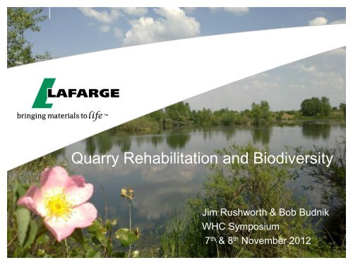
<strong>Quarry</strong> <strong>Rehabilitation</strong> <strong>and</strong> <strong>Biodiversity</strong><br />
Jim Rushworth & Bob Budnik<br />
WHC Symposium<br />
7 th & 8 th November 2012
A Pioneer in <strong>Rehabilitation</strong> <strong>and</strong> Partnerships<br />
Nov 2012 2
Life of a <strong>Quarry</strong> – A Chance to Create New <strong>Habitat</strong>s<br />
Before Mining During Extraction After Restoration<br />
Nov 2012 3
<strong>Biodiversity</strong> Management <strong>and</strong> Current Targets<br />
• Lafarge Environmental Policy set Targets in 2003 for:<br />
• Environmental impact assessment (including social)<br />
• L<strong>and</strong>scape <strong>and</strong> biological diversity shall be preserved<br />
• <strong>Rehabilitation</strong> plan shall include wildlife <strong>and</strong> habitat conservation<br />
• WWF Partnership has progressively helped develop a Structured<br />
Management System for <strong>Biodiversity</strong>:<br />
• Use of IBAT <strong>and</strong> checklists to assess the sensitivity of our environment<br />
• Development of guidance <strong>and</strong> management plan tools<br />
• Development of a toolbox of methods for measurement of progress<br />
• Sustainability Ambitions 2012 include 3 <strong>Biodiversity</strong> Targets:<br />
• <strong>Biodiversity</strong> checks to assess the local sensitivity – 100% by 2010<br />
(2011 – 97% completed)<br />
• <strong>Biodiversity</strong> management programs to manage <strong>and</strong> monitor sensitive<br />
sites – 100% by 2012 (2011 - 49% completed)<br />
• <strong>Quarry</strong> rehabilitation plans on all active quarries – 85% by 2010<br />
(2011 – 86% completed)<br />
Nov 2012 4
<strong>Biodiversity</strong> is Integrated into our <strong>Rehabilitation</strong><br />
Plan which links to the <strong>Quarry</strong> Mining Plan<br />
• <strong>Quarry</strong> operations are developed using a mining<br />
plan to ensure safe <strong>and</strong> optimum extraction of raw<br />
materials. This is typically reviewed annually.<br />
• Incorporated in the mining plan is a rehabilitation<br />
plan which indicates the final layout <strong>and</strong> use of the<br />
restored quarry. This will include progressive<br />
steps for the restoration process.<br />
A rehabilitation plan for a quarry in the Philippines<br />
which includes a nature area <strong>and</strong> housing estate<br />
Mining plan for Nilai <strong>Quarry</strong>, Malaysia<br />
• Incorporated within the rehabilitation plan is a<br />
biodiversity management plan (BMP) for sensitive<br />
sites <strong>and</strong> information of the fauna/flora to be used<br />
<strong>and</strong> invasive species for less sensitive sites.<br />
• When developing BMP’s we try <strong>and</strong> involve local<br />
experts such as nature trusts, universities <strong>and</strong><br />
NGOs who help recommend types of habitats that<br />
should be created <strong>and</strong> the flora to be used in the<br />
rehabilitation which is native to the area.<br />
Nov 2012 5
Lafarge <strong>Biodiversity</strong> Management Tools<br />
Date :<br />
Author :<br />
BU :<br />
Site name :<br />
<strong>Biodiversity</strong> Management Plan<br />
Quick Access Box:<br />
1. Site Facts<br />
2. <strong>Biodiversity</strong> context<br />
3. Regulatory context<br />
4. Actual impacts <strong>and</strong> actions<br />
5. <strong>Biodiversity</strong> issues - summary<br />
HELP<br />
6. Objectives<br />
7. Action plan<br />
Advice:<br />
Before beginning the <strong>Biodiversity</strong> Management Plan, we advise you to read the Lafarge <strong>Biodiversity</strong><br />
Guidance which will help you underst<strong>and</strong> the purpose of this work <strong>and</strong> also give you very good examples<br />
of risks, opportunities <strong>and</strong> actions on <strong>Biodiversity</strong> lead by Lafarge.<br />
The national/regional biodiversity plan/strategy may also save you a lot of time. In fact, the species of<br />
interest, the invasive species, the impacts, the habitats may already be listed in these sort of documents.<br />
Purpose:<br />
The BMP serves a number of purposes:<br />
It facilitates the approval of future site permits, by showing how a site plans to avoid <strong>and</strong> minimize its<br />
impacts upon important habitats <strong>and</strong> species.<br />
It serves as an excellent tool <strong>and</strong> point of reference for future or existing biodiversity projects, such<br />
as rehabilitation plans, calculation of biodiversity indices, etc.<br />
BMPs are of implicit value when approaching prospective partners, such as NGOs, or community<br />
organisations, as they allows sites to demonstrate, both in qualitative <strong>and</strong> quantitative terms, the<br />
biodiversity measures it plans to take.<br />
It allows the Group to show biodiversity competency at site level, which has the effect of improving our<br />
relationships with stakeholders both on a global <strong>and</strong> a local level.<br />
Objectives:<br />
The BMP consists of two sections:<br />
Section 1: Assessment of biodiversity (1-5)<br />
This first section will be an assessment of the past, present <strong>and</strong> future biodiversity of the<br />
site. This includes <strong>and</strong> biodiversity inventory of the site, past impacts or improvements, current worksin-progress,<br />
partnerships with local stakeholders/NGOs, the regulator context of the site etc.<br />
Section 2: Objective <strong>and</strong> Action plan (6-7)<br />
This step identifies objectives based on the comprehensive biodiversity assessment that<br />
was completed in Section 1. Tasks will be listed, <strong>and</strong> given a priority according to urgency <strong>and</strong> who<br />
proposed them.<br />
The combined results of these steps will be the creation of an extremely comprehensive<br />
<strong>and</strong> coherent biodiversity management plan, which acts as a 'vision' for the site, <strong>and</strong> addresses the risks<br />
<strong>and</strong> opportunities created by the site.<br />
How should you use this spreadsheet<br />
The main purpose of the BMP is to help your team with biodiversity management.<br />
You should put explicit reference as often as you can to other existing documents <strong>and</strong> systems at<br />
the quarry, including the ESIA, EMS, Mining Plan <strong>and</strong> <strong>Rehabilitation</strong> Plan. Please feel also free to add<br />
any relevant worksheets to this file you wish. This could include l<strong>and</strong> data, maps, tabulated data from the<br />
assessment phase of the BMP, etc.<br />
In summary, personalise this spreadsheet, <strong>and</strong> make it work for you. However, we ask that you complete<br />
, at a minimum, the pre-existing sheets 1-7. for sensitive sites by the end of 2012.<br />
You do not need to complete all the data in one sitting; within the deadline, please take your time to ensure<br />
the data you enter is as accurate <strong>and</strong> comprehensive as possible.<br />
How will we use this spreadsheet<br />
At Group level, this data will be used to assess our biodiversity management processes, <strong>and</strong> to share<br />
advice based on best-practices that we find at site level. As such, aggregated data may be used <strong>and</strong><br />
shared internally. For instance, if a site has an excellent protocol for the inventory of nocturnal mammals,<br />
we may share those practices with sites with a similar biodiversity context.<br />
In cases where data could be made available to stakeholders or our partners., sites will not be named or<br />
be personally-identifiable.<br />
Technical Help<br />
You should activate the macro to enable all the features of this excel file. If not already the case, please<br />
click on Help at the top of this page for instructions on enabling Macros.<br />
Customization: This document is an internal document which exist to help you.You can add rows<br />
everywhere (to do it, please go on the middle of the table <strong>and</strong> insert lines), add sheets (eg. add the<br />
mining plan) <strong>and</strong> change the format of each cell (eg. colors). You can't add columns <strong>and</strong> the cells that<br />
you don't have to fill are blocked. This will enable us to compile all the data centrally <strong>and</strong> justify our<br />
actions on biodiversity at the world level. If you need help, please contact your BU env. manager.<br />
The drop-down menus are highlighted in green. They should help you to complete this fact sheet.<br />
You will find a definition for each item by putting the cursor on cells with a red corner. If something is<br />
unclear, don't hesitate to contact : your environmental BU manager or Jim Rushworth<br />
Nov 2012<br />
6
Lafarge <strong>Biodiversity</strong> Guidance<br />
• <strong>Biodiversity</strong> Guidance – Issued internally in 2011,<br />
Released publically today.<br />
• This guidance document in addition to explaining<br />
biodiversity makes recommendations on identifying<br />
the biodiversity goals at site level <strong>and</strong> describes<br />
the steps to achieve them. The guidance includes<br />
Lafarge case studies to demonstrate examples of<br />
the goals <strong>and</strong> steps.<br />
The document will be available to downloaded from the Lafarge website:<br />
http://www.lafarge.com/wps/portal/2_8_1-Ambitions-2020-Ressources-naturelles<br />
Case Study 6: Yepes-Ciruelos <strong>Quarry</strong>, central Spain<br />
The rehabilitation of the Yepes-Ciruelos quarry in Castilla-La<br />
Mancha, Spain has involved the planting of local native species<br />
(including an IUCN Red List species) appropriate for the local<br />
semi-arid environment <strong>and</strong> limestone soils. Appropriate species <strong>and</strong><br />
planting methods were identified <strong>and</strong> implemented through a<br />
partnership with the botanical department of the University of<br />
Castilla-La Mancha, <strong>and</strong> local native species planted on-site have<br />
been showcased in a visitor garden as well as in other educational<br />
<strong>and</strong> communication activities. The plantings themselves have<br />
involved research <strong>and</strong> experimentation culminating in an innovative<br />
automatic watering technique which, along with protection from<br />
rabbit grazing, has drastically increased the survivability of new<br />
seedlings. Extensive monitoring of the site – including the Long<br />
Term <strong>Biodiversity</strong> Index – has been used to help establish<br />
management strategies as well as to assess the ongoing performance<br />
of the restoration project. Finally, plants already present on site,<br />
including some rescued during operations, were used as sources of<br />
seeds <strong>and</strong> seedlings.<br />
Nov 2012 7
<strong>Biodiversity</strong> Screening Tools<br />
• <strong>Biodiversity</strong> Screening Tools – First issued in 2007<br />
<strong>Biodiversity</strong> screening checklist for sites under operation (V4.3)<br />
This check-list is designed to evaluate biodiversity stakes in the area around the quarry or on the quarry<br />
itself to decide the level of biodiversity management required<br />
SITE IDENTIFICATION<br />
Division :<br />
Region :<br />
Business Unit:<br />
Location:<br />
Activity :<br />
1. BIODIVERSITY KNOWLEDGE<br />
1.1. The site has been subject to an Environmental Impact Assesment which included fauna <strong>and</strong> flora detailed identification<br />
1.2. There has been a fauna <strong>and</strong> flora survey covering the quarry after EIA<br />
1.3. The grounds (quarry <strong>and</strong>/or surroundings) are regularly monitored for biodiversity issues<br />
1.4. Date of the last fauna <strong>and</strong> flora survey covering the site (year)<br />
2. SENSITIVITY, DESIGNATION OR PROTECTION STATUS<br />
2.1 Protection status or designation covering the site itself<br />
2.1.1 Is the quarry itself included in a designated perimeter for biodiversity conservation <br />
2.1.2 Have threatened or vulnerable species or rare species been identified on the site or using it (sp on a red list or a protection list)<br />
2.2. Designation or protection status around the site<br />
Is the site adjacent to/or close to or having a potential impact on an area officially designated of ecological interest <br />
2.2.1 Sites designated according to a local / state / national regulation<br />
this would include local nature reserves, national inventories (SSSI, ZNIEFF…), wetl<strong>and</strong> area, National parks<br />
2.2.2 Sites designated according to an international regulation or agreement<br />
RAMSAR convention, Man & Biosphere reserves (UNESCO), World Heritage Sites, Natura 2000, Important bird area<br />
2.2.3 Sites adjacent to places hosting species listed under a Red List (IUCN or local or national protected species list)<br />
• Lafarge first developed a biodiversity screening tool<br />
(checklist) together with WWF <strong>and</strong> its’ international<br />
biodiversity panel in 2007. This was revised several<br />
times up until 2010.<br />
• The tool is still used to collect primary information on<br />
a site but the high level screening is now done using<br />
IBAT <strong>and</strong> ArcGIS.<br />
2.3 No official protection/designation but sensitive surroundings<br />
2.3.1 Are there any projects to designate areas in one or another status listed above <br />
2.3.2 Are the surroundings a general zone of conservation value (KBI, IBA, Area for Zero Extinction)<br />
2.3.3 Other areas of ecological interest which has not been already officially identified<br />
(wetl<strong>and</strong> <strong>and</strong> aquatic habitat, woodl<strong>and</strong>, grass l<strong>and</strong>, rocks <strong>and</strong> rubble, cliff face)<br />
2.4 Value for local communities<br />
2.4.1 Is the site providing services or amenities valued by the local communities <br />
(water supply, flood control, breeding, grounds for game, pollinators, recreation <strong>and</strong> l<strong>and</strong>scape…)<br />
2.4.2 <strong>Habitat</strong>s on the quarry or its immediate surroundings are providing local communities a source of livelihood / subsistence<br />
(such as cattle grazing, fishing, hunting, harvesting of firewood, foodstuff or medicinal plants)<br />
2.4.3 Is the site home to features that have a spiritual or cultural value for the local community <br />
(streams, lakes, caves, woodl<strong>and</strong>, totem species, mountain top,…)<br />
3. BIODIVERSITY OPPORTUNITIES<br />
3.1. <strong>Biodiversity</strong> enhancement/habitat creation<br />
3.1.1 Does the site contain a parcel of l<strong>and</strong> (any size) that could benefit locally to some valuable habitat component<br />
(food, water, cover, soil, space, specie) required by locally threatened or vulnerable wildlife or flora.<br />
3.1.2 Is the site located near key ecosystem services/functions Examples would include breeding, feeding<br />
<strong>and</strong> stopover areas along major migratory routes for birds, mamals <strong>and</strong>/or butterflies.<br />
3.2. Projects on biodiversity<br />
3.2.1 Are there likely opportunities for the site to serve as ecological research area or promote environmental education efforts<br />
3.2.2 Does the site currently engage in environmental initiatives or habitat enhancement planning as part of the rehabilitation process <br />
3.2.3 Has an ecological survey been conducted on the rehabilitated l<strong>and</strong> of the quarry (at least for one group : birds, plants, habitats...)<br />
3.2.4 Is the site restoration regularly monitored on biodiversity (at least for one group : birds, mammals, plants…)<br />
3.2.5 Does the site have a close relationship with an environmental/conservation group<br />
4. COMMENTS<br />
Level 1 sites in priority terms will be the sites for which the 2.1.2 answer is ticked or which are in a protected area classified IUCN I<br />
to VI according to the IBAT<br />
Level 2 sites include the sites where the 2.2.3 answer is ticked or which are near a protected area classified IUCN I to VI according<br />
to the IBAT (less than 2km)<br />
Level 3 includes any other<br />
Any comment on the level that should be attributed to the site <strong>and</strong> the present<br />
5. SIGN OFF<br />
Name :<br />
Proposed by :<br />
Accepted by :<br />
Date :<br />
Signature :<br />
Nov 2012 8
<strong>Biodiversity</strong> Management Planning Tool<br />
Quick Access Box:<br />
1. Site Facts<br />
2. <strong>Biodiversity</strong> context<br />
3. Regulatory context<br />
Date :<br />
Author :<br />
BU :<br />
4. Actual impacts <strong>and</strong> actions<br />
5. <strong>Biodiversity</strong> issues - summary<br />
HELP<br />
Site name :<br />
<strong>Biodiversity</strong> Management Plan<br />
6. Objectives<br />
7. Action plan<br />
• <strong>Biodiversity</strong> Management Plan (BMP) – New format<br />
Advice:<br />
Before beginning the <strong>Biodiversity</strong> Management Plan, we advise you to read the Lafarge <strong>Biodiversity</strong><br />
Guidance which will help you underst<strong>and</strong> the purpose of this work <strong>and</strong> also give you very good examples<br />
of risks, opportunities <strong>and</strong> actions on <strong>Biodiversity</strong> lead by Lafarge.<br />
The national/regional biodiversity plan/strategy may also save you a lot of time. In fact, the species of<br />
interest, the invasive species, the impacts, the habitats may already be listed in these sort of documents.<br />
Purpose:<br />
The BMP serves a number of purposes:<br />
It facilitates the approval of future site permits, by showing how a site plans to avoid <strong>and</strong> minimize its<br />
impacts upon important habitats <strong>and</strong> species.<br />
It serves as an excellent tool <strong>and</strong> point of reference for future or existing biodiversity projects, such<br />
as rehabilitation plans, calculation of biodiversity indices, etc.<br />
BMPs are of implicit value when approaching prospective partners, such as NGOs, or community<br />
organisations, as they allows sites to demonstrate, both in qualitative <strong>and</strong> quantitative terms, the<br />
biodiversity measures it plans to take.<br />
It allows the Group to show biodiversity competency at site level, which has the effect of improving our<br />
relationships with stakeholders both on a global <strong>and</strong> a local level.<br />
Objectives:<br />
The BMP consists of two sections:<br />
Section 1: Assessment of biodiversity (1-5)<br />
This first section will be an assessment of the past, present <strong>and</strong> future biodiversity of the<br />
site. This includes <strong>and</strong> biodiversity inventory of the site, past impacts or improvements, current worksin-progress,<br />
partnerships with local stakeholders/NGOs, the regulator context of the site etc.<br />
Section 2: Objective <strong>and</strong> Action plan (6-7)<br />
This step identifies objectives based on the comprehensive biodiversity assessment that<br />
was completed in Section 1. Tasks will be listed, <strong>and</strong> given a priority according to urgency <strong>and</strong> who<br />
proposed them.<br />
The combined results of these steps will be the creation of an extremely comprehensive<br />
<strong>and</strong> coherent biodiversity management plan, which acts as a 'vision' for the site, <strong>and</strong> addresses the risks<br />
<strong>and</strong> opportunities created by the site.<br />
• The first tools were introduced in 2010 <strong>and</strong> have been<br />
completely redeveloped over the last year to produce a<br />
st<strong>and</strong>ard Excel format. This will be developed with WWF into<br />
a generic template for all industries in 2013.<br />
• The BMP consists of two parts, an assessment of biodiversity<br />
<strong>and</strong> objectives/action plan.<br />
How should you use this spreadsheet<br />
The main purpose of the BMP is to help your team with biodiversity management.<br />
You should put explicit reference as often as you can to other existing documents <strong>and</strong> systems at<br />
the quarry, including the ESIA, EMS, Mining Plan <strong>and</strong> <strong>Rehabilitation</strong> Plan. Please feel also free to add<br />
any relevant worksheets to this file you wish. This could include l<strong>and</strong> data, maps, tabulated data from the<br />
assessment phase of the BMP, etc.<br />
In summary, personalise this spreadsheet, <strong>and</strong> make it work for you. However, we ask that you complete<br />
, at a minimum, the pre-existing sheets 1-7. for sensitive sites by the end of 2012.<br />
You do not need to complete all the data in one sitting; within the deadline, please take your time to ensure<br />
the data you enter is as accurate <strong>and</strong> comprehensive as possible.<br />
How will we use this spreadsheet<br />
At Group level, this data will be used to assess our biodiversity management processes, <strong>and</strong> to share<br />
advice based on best-practices that we find at site level. As such, aggregated data may be used <strong>and</strong><br />
shared internally. For instance, if a site has an excellent protocol for the inventory of nocturnal mammals,<br />
we may share those practices with sites with a similar biodiversity context.<br />
In cases where data could be made available to stakeholders or our partners., sites will not be named or<br />
be personally-identifiable.<br />
Technical Help<br />
You should activate the macro to enable all the features of this excel file. If not already the case, please<br />
click on Help at the top of this page for instructions on enabling Macros.<br />
Customization: This document is an internal document which exist to help you.You can add rows<br />
everywhere (to do it, please go on the middle of the table <strong>and</strong> insert lines), add sheets (eg. add the<br />
mining plan) <strong>and</strong> change the format of each cell (eg. colors). You can't add columns <strong>and</strong> the cells that<br />
you don't have to fill are blocked. This will enable us to compile all the data centrally <strong>and</strong> justify our<br />
actions on biodiversity at the world level. If you need help, please contact your BU env. manager.<br />
The drop-down menus are highlighted in green. They should help you to complete this fact sheet.<br />
You will find a definition for each item by putting the cursor on cells with a red corner. If something is<br />
unclear, don't hesitate to contact : your environmental BU manager or Jim Rushworth<br />
Nov 2012<br />
9
Toolbox to Measure <strong>Biodiversity</strong> Performance over Time<br />
• <strong>Biodiversity</strong> Toolbox – Issues in 2012<br />
• LBI – Long Term <strong>Biodiversity</strong> Index was first developed in 2004 as a<br />
way of measuring improvement in biodiversity through restoration.<br />
• In 2011 we decided to update this tool <strong>and</strong> develop 6 other tools to<br />
cater for the different levels of expertise on a particular site <strong>and</strong> to cater<br />
for budget constraints.<br />
• Other tools include photographic, Threat reduction Assessment, Expert<br />
Reviews, Surveys of 1 to 4 species/taxonomic groups, ESIA.<br />
Nov 2012 10
Global Examples of <strong>Quarry</strong> <strong>Rehabilitation</strong> - Romania<br />
.<br />
• Lafarge st<strong>and</strong>ard on rehabilitation ensures<br />
the correct process is followed, funds are<br />
accrued for rehabilitation <strong>and</strong> the correct<br />
consultation is conducted.<br />
• <strong>Rehabilitation</strong> takes into account:<br />
• <strong>Biodiversity</strong> <strong>and</strong> ecosystems<br />
• L<strong>and</strong>scape<br />
• Future l<strong>and</strong> use, etc<br />
Before 2010<br />
2011<br />
2012<br />
tion<br />
2012 Fusea after Restoration<br />
Nov 2012<br />
11
Global Example of Educational Programs for Schools,<br />
Universities <strong>and</strong> Local Industry - Romania<br />
Local Schools - Vadu Pasii<br />
Local schools - Suseni Harghita<br />
University Students<br />
Aggregates Producers <strong>and</strong> Local<br />
Authorities<br />
Nov 2012<br />
12
Global Examples of <strong>Quarry</strong> <strong>Rehabilitation</strong> - Kenya<br />
Vision: Recreation of coastal ecosystems of forests, lakes <strong>and</strong> grassl<strong>and</strong>s<br />
Achievements: >300ha rehabilitated<br />
> 400 species of indigenous coastal vegetation reintroduced<br />
> 51 of these are listed on the IUCN red list.<br />
Fauna created supports: 180 species of birds, 15 species of large mammals,<br />
93 species of butterflies & 8 species of amphibians<br />
Method: Enhance <strong>and</strong> support the natural process through pollination, seed<br />
dispersion <strong>and</strong> nutrient recycling.<br />
Nov 2012<br />
13
Global Examples of Education Programs <strong>and</strong> Job<br />
Creation – Bamburi, Kenya<br />
Utilization:<br />
Rehabilitated quarries are utilised sustainably for:<br />
Recreation <strong>and</strong> Tourism (169,000 visitors/yr – 50%<br />
from schools <strong>and</strong> universities ).<br />
Education Facility on site.<br />
Fish, plant nursery <strong>and</strong> biomass fuels production<br />
Community benefits: Direct employment of 180 persons plus seedling<br />
programs in local communities <strong>and</strong> out-grower<br />
schemes.<br />
Nov 2012<br />
14
Group 2020 Ambitions for <strong>Biodiversity</strong> & Water<br />
3 new SD Pillars Building Sustainability, Building Communities, <strong>and</strong> Building the Circular Economy<br />
BUILDING THE CIRCULAR ECONOMY<br />
NATURAL RESOURCES<br />
Our operations both affect ecosystems <strong>and</strong> rely on their regulatory services (such as<br />
climate, flood control, waste treatment) <strong>and</strong> provisioning services (such as freshwater, food<br />
<strong>and</strong> fiber). The deterioration of ecosystems comes with a great cost to society. It is incumbent<br />
on companies like Lafarge to take the lead in protecting <strong>and</strong> developing biodiversity <strong>and</strong><br />
therefore contributing to the enhancement of ecosystems.<br />
Enhance <strong>Biodiversity</strong> <strong>and</strong> Raw<br />
material conservation<br />
Enhance local watershed<br />
sustainability<br />
<br />
<br />
<br />
<br />
100% of quarries implementing rehabilitation plans in<br />
line with Lafarge criteria by 2015.<br />
100% of quarries <strong>and</strong> cement plants implementing<br />
<strong>Biodiversity</strong> Management Plans in line with Lafarge<br />
criteria<br />
100% areas with local biodiversity sensitivity by 2015.<br />
100% of quarries <strong>and</strong> cement plants by 2020.<br />
100% of cement <strong>and</strong> aggregate operations completing<br />
water risk assessments in 2014<br />
100% of operations in water impacted areas to engage<br />
local stakeholders in developing a local watershed<br />
sustainability plan <strong>and</strong> reduce water impact<br />
Nov 2012 15
Paxton <strong>Quarry</strong> Restoration <strong>and</strong> Pollinator Garden<br />
Bob Budnik<br />
WHC Symposium<br />
7 th & 8 th November 2012
Paxton Shale <strong>Quarry</strong> 1999/2000<br />
In 1994, Lafarge North America, Alpena Plant stopped mining shale<br />
from the quarry, <strong>and</strong> restoration efforts began in the area. Water<br />
continued to be pumped out of the quarry until 2001 while machines,<br />
structures, <strong>and</strong> rail lines were being removed. Then, the lake was<br />
allowed to fill by way of natural springs <strong>and</strong> precipitation. In 2003,<br />
Lafarge began stocking the lake with fish <strong>and</strong> planting trees, bushes<br />
<strong>and</strong> wildflowers. The Paxton <strong>Quarry</strong> Lake reached its desired water<br />
level in 2009, at which point a drain culvert was installed to control the<br />
lake’s water level.<br />
Nov 2012 17
Projects - Paxton <strong>Quarry</strong> Lake – 2001 to 2011<br />
To be Revised<br />
Nov 2012<br />
18
Paxton <strong>Quarry</strong> – Educational Programs<br />
Students Making Mallard Nesting Tubes in Their Classrooms<br />
Wilson School Students Planting Trees with the Help of a Parent<br />
Volunteer.<br />
Building<br />
Wood Duck<br />
Boxes<br />
Science Field Trips – Students from Wilson <strong>and</strong> Long Rapids Schools<br />
Studied Water Quality, Insects, Soil Quality <strong>and</strong> Bird Identification.<br />
Nov 2012<br />
19
Alpena Pollinator Garden<br />
We created our Pollinator Garden to realize 3 Objectives:<br />
• Improve conditions for Pollinator Species that contribute to the<br />
Alpena site’s biodiversity<br />
• Easy access for the community<br />
• Not necessary to contact plant to visit<br />
• ADA Accessibility<br />
• Educational Opportunity<br />
• Improve aesthetics on approach to the plant<br />
• Visual appeal from the roadway<br />
• Give back to Alpena <strong>and</strong> North-End Community<br />
How we got Started:<br />
•Developed a pollinator garden plan to provide an active<br />
educational biodiversity/wildlife area near the plant.<br />
•The garden space selected was a grassy, flat area surrounded by<br />
trees <strong>and</strong> a small natural meadow.<br />
•The garden boxes <strong>and</strong> other plantings provide a more diversified<br />
habitat in the former grass/lawn area approach to the Alpena Plant.<br />
•Provide the Alpena Community <strong>and</strong> our North-End neighborhood<br />
with an educational, easy access facility to learn about pollinator<br />
species <strong>and</strong> plants that contribute to biodiversity<br />
•Developed a partnership with the Monarch Watch to design a<br />
habitat conducive to promoting the Monarch Butterfly species<br />
In the beginning<br />
Nov 2012<br />
20
The Pollinator Garden…<br />
• Provides an educational<br />
opportunity for local residents <strong>and</strong><br />
school children to learn about<br />
pollinators <strong>and</strong> their role in<br />
biodiversity.<br />
• Help to sustain our native flora<br />
<strong>and</strong> fauna.<br />
• Provides a pollinator biodiversity<br />
enhancement to the Alpena<br />
plant’s ongoing WHC Corporate<br />
L<strong>and</strong>s for Learning Certification<br />
projects <strong>and</strong> initiatives.<br />
• The garden improves<br />
neighborhood aesthetics <strong>and</strong><br />
provides a green, relaxing,<br />
contemplative oasis in the city’s<br />
industrial corridor while enhancing<br />
the habitat for pollinators <strong>and</strong><br />
other species.<br />
Nov 2012<br />
21
Thank you for your attention<br />
Any Questions