Local Notice To Mariners Week #19 - Dana Point Boaters Association
Local Notice To Mariners Week #19 - Dana Point Boaters Association
Local Notice To Mariners Week #19 - Dana Point Boaters Association

Create successful ePaper yourself
Turn your PDF publications into a flip-book with our unique Google optimized e-Paper software.
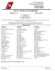
U.S. Department<br />
of Homeland Security<br />
United States<br />
Coast Guard<br />
LOCAL NOTICE TO MARINERS<br />
District: 11 <strong>Week</strong>: 19/11<br />
SEND CORRESPONDENCE TO:<br />
COMMANDER<br />
DISTRICT ELEVEN (DPW)<br />
COAST GUARD ISLAND BUILDING 50-2<br />
ALAMEDA, CA 94501-5100<br />
BROADCAST NOTICE TO MARINERS - Information concerning aids to navigation and waterway management<br />
promulgated by BNM 0286-11 to BNM 0306-11 has been incorporated in this notice if still significant.<br />
SECTION I - SPECIAL NOTICES<br />
This section contains information of special concern to the Mariner.<br />
SUBMITTING INFORMATION FOR PUBLICATION IN THE LOCAL NOTICE TO MARINERS<br />
A complete set of guidelines with examples and contact information can be found at http://www.uscg.mil/D11/DP/LnmRequest.asp or call BM1<br />
John D. Hinson at 510-437-2980 or e-mail D11LNM@uscg.mil. Please provide all <strong>Local</strong> <strong>Notice</strong> to <strong>Mariners</strong> submissions 14 days prior to the start of<br />
operations.<br />
BRIDGE INFORMATION-DISCREPANCIES AND CORRECTIONS<br />
For bridge related issues during normal working hours Monday through Friday, contact the Coast Guard Eleventh District Bridge Section, Coast<br />
Guard Island, Building 50-2, Alameda, CA 94501-5100, telephone: 510-437-3516 Office; 510-219-4366 Cell. For emergencies or discrepancies<br />
during nights, weekends and holidays, immediately notify the nearest Coast Guard Sector Command via VHF-FM chan. 16 or via telephone: San<br />
Diego & Colorado River 619-278-7031, Los Angeles 310-521-3800, San Francisco 415-399-3547, Eureka 707-839-6113. Flotsam may<br />
accumulate on and near bridge piers and abutments. <strong>Mariners</strong> should approach all bridges with caution.<br />
*<strong>To</strong> REPORT A DELAY AT A DRAWBRIDGE A report form is included in the Enclosures section of this <strong>Local</strong> <strong>Notice</strong> to <strong>Mariners</strong>.*<br />
DGPS<br />
For information regarding the DGPS system, or to report GPS, DGPS, or AIS problems, mariners are advised to contact:<br />
http://www.navcen.uscg.gov, email: nisws@navcen.uscg.gov, or the USCG Navigation Center at 703-313-5900.<br />
ELECTRONIC NAVIGATION CHARTS<br />
"RANGE STRUCTURES: The U.S. Coast Guard has become aware that Coast Guard information used to depict a range line on NOAA Electronic<br />
Navigational Charts (ENC) may not be of sufficient accuracy to accurately portray the range line on the ENC. <strong>Mariners</strong> are cautioned that the<br />
position of a range line as shown on an ENC may not reflect its true position."<br />
SOUTHERN CALIFORNIA-MARINE SAFETY INFORMATION BULLETIN<br />
LNM: 03/11<br />
There has been a recent trend in traffic patterns where some vessel operators are choosing to depart the Traffic Separation Scheme (TSS)<br />
established in the Santa Barbara Channel and transit through an area to the south of San Miguel, Santa Rosa and Santa Cruz Islands<br />
(referenced herein as “south of the Channel Islands”). As such, the Los Angeles / Long Beach Harbor Safety Committee has published voluntary<br />
western traffic lanes for vessels approaching and departing the Ports of Los Angeles and Long Beach.<br />
<strong>Mariners</strong> transiting through the western and northern approaches to and from the Ports of Los Angeles and Long Beach (LA/LB) are advised the<br />
established TSS through the Santa Barbara Channel as shown on NOAA and Admiralty charts is the only International Maritime Organization<br />
(IMO) approved routing measure in this area. An IMO approved TSS reduces the risk of collision by providing for the separation of arriving and<br />
departing traffic and minimizing potentially hazardous crossing situations. <strong>Mariners</strong>, who have traditionally used this approved TSS, are<br />
encouraged to continue to do so.<br />
Page 1 of 12<br />
Coast Guard District<br />
11<br />
LNM: 19/11<br />
10 May 2011
For additional information please see the Enclosures Section.<br />
SECTION II - DISCREPANCIES<br />
This section lists all reported and corrected discrepancies related to Aids to Navigation in this edition. A discrepancy is a change in the status of<br />
an aid to navigation that differs from what is published or charted.<br />
DISCREPANCIES (FEDERAL AIDS)<br />
LLNR<br />
198<br />
200<br />
445<br />
1571<br />
2585<br />
2615<br />
3118<br />
3840<br />
4340<br />
6105<br />
7220<br />
Aid Name<br />
NOAA Environmental Lighted Buoy<br />
46054<br />
<strong>Point</strong> Conception Light<br />
NOAA Environmental Lighted Buoy<br />
46014<br />
Ballast <strong>Point</strong> Shoal Buoy<br />
San Nicolas Island East End Lighted Bell<br />
Buoy 3<br />
Avalon Bay Light 1<br />
Los Angeles Main Channel Lighted Buoy<br />
10<br />
Morro Bay Approach Lighted Whistle<br />
Buoy MB<br />
Raccoon Strait Lighted Buoy 1<br />
Mare Island Strait Light 4<br />
Sacramento River Deep Water Ship<br />
Channel Light 12<br />
Status<br />
LT EXT<br />
SS INOP<br />
MISSING<br />
MISSING<br />
REDUCED INT<br />
REDUCED INT<br />
REDUCED INT<br />
OFF STA<br />
REDUCED INT<br />
TRLB/STRUCT DEST<br />
TRLB/STRUCT DEST<br />
Chart No. BNM Ref.<br />
18721 0843-10<br />
18721 0075-11-01<br />
18600 0154-11<br />
18773 0157/11<br />
18755 0130-11<br />
18757 0112-11<br />
18751<br />
18703 0188-11<br />
18650 0131-11<br />
18655 0445-10<br />
18660 0282-11<br />
LNM St<br />
48/10<br />
06/11<br />
10/11<br />
10/11<br />
09/11<br />
08/11<br />
51/10<br />
11/11<br />
09/11<br />
26/10<br />
18/11<br />
LNM End<br />
DISCREPANCIES (FEDERAL AIDS) CORRECTED<br />
LLNR<br />
5<br />
3750<br />
6690<br />
6767<br />
Aid Name<br />
<strong>Point</strong> Loma Light<br />
Santa Barbara Harbor Breakwater Light<br />
San Joaquin River Light 7<br />
San Joaquin River Light 27<br />
Status<br />
WATCHING PROPERLY<br />
WATCHING PROPERLY<br />
WATCHING PROPERLY<br />
WATCHING PROPERLY<br />
Chart No. BNM Ref.<br />
18773 0303-11<br />
18725 0299-11<br />
18659 0290-11<br />
18660 0291-11<br />
LNM St<br />
19/11<br />
19/11<br />
19/11<br />
19/11<br />
LNM End<br />
19/11<br />
19/11<br />
20/11<br />
20/11<br />
DISCREPANCIES (PRIVATE AIDS)<br />
LLNR<br />
2215<br />
6252<br />
6253<br />
6645.5<br />
Aid Name<br />
Chula Vista Channel Light 13<br />
Ozol Pier West Light<br />
Ozol Pier East Light<br />
Delta Diablo Outfall Lighted Buoy<br />
Status<br />
TRLB/STRUCT DEST<br />
LT EXT<br />
LT EXT<br />
LT EXT<br />
Chart No. BNM Ref.<br />
18773 0056-11<br />
18657 0289-11<br />
18657 0289-11<br />
18659 0264-11<br />
LNM St<br />
05/11<br />
18/11<br />
18/11<br />
17/11<br />
LNM End<br />
DISCREPANCIES (PRIVATE AIDS) CORRECTED<br />
LLNR<br />
Aid Name<br />
Status<br />
Chart No.<br />
BNM Ref.<br />
LNM St<br />
LNM End<br />
None<br />
PLATFORM DISCREPANCIES<br />
Name<br />
Status<br />
Position<br />
BNM Ref.<br />
LNM St<br />
LNM End<br />
None<br />
PLATFORM DISCREPANCIES CORRECTED<br />
Name<br />
Status<br />
Position<br />
BNM Ref.<br />
LNM St<br />
LNM End<br />
Page 2 of 12<br />
Coast Guard District<br />
11<br />
LNM: 19/11<br />
10 May 2011
None<br />
SECTION III - TEMPORARY CHANGES and TEMPORARY CHANGES CORRECTED<br />
This section contains temporary changes and corrections to Aids to Navigation for this edition. When charted aids are temporarily<br />
relocated for dredging, testing, evaluation, or marking an obstruction, a temporary correction shall be listed in Section IV giving the<br />
new position.<br />
TEMPORARY CHANGES<br />
LLNR<br />
1571<br />
Aid Name<br />
Ballast <strong>Point</strong> Shoal Buoy<br />
Status<br />
DISCONTINUED FOR<br />
DREDGING<br />
Chart No.<br />
18773<br />
BNM Ref.<br />
0157-11<br />
LNM St<br />
10/11<br />
LNM End<br />
3270<br />
San Pedro West Channel Buoy 1<br />
DISCONTINUED FOR<br />
DREDGING<br />
18751<br />
0808-10<br />
46/10<br />
3275<br />
San Pedro West Channel Lighted Buoy 3<br />
DISCONTINUED FOR<br />
DREDGING<br />
18751<br />
0808-10<br />
46/10<br />
8135<br />
Humboldt Bay Lighted Bell Buoy 2<br />
RELOCATED FOR DREDGING<br />
18622<br />
0072-11<br />
06/11<br />
8195<br />
Humboldt Bay Lighted Buoy 9<br />
RELOCATED FOR DREDGING<br />
18622<br />
0072-11<br />
06/11<br />
TEMPORARY CHANGES CORRECTED<br />
LLNR<br />
Aid Name<br />
Status<br />
Chart No.<br />
BNM Ref.<br />
LNM St<br />
LNM End<br />
None<br />
PLATFORM TEMPORARY CHANGES<br />
None<br />
Name<br />
Status<br />
Position<br />
BNM Ref.<br />
LNM St<br />
LNM End<br />
PLATFORM TEMPORARY CHANGES CORRECTED<br />
None<br />
Name<br />
Status<br />
Position<br />
BNM Ref.<br />
LNM St<br />
LNM End<br />
SECTION IV - CHART CORRECTIONS<br />
. This section contains corrections to federally and privately maintained Aids to Navigation, as well as NOS corrections.<br />
This section contains corrective actions affecting chart(s). Corrections appear numerically by chart number, and pertain to that chart only. It is up to<br />
the mariner to decide which chart(s) are to be corrected. The following example explains individual elements of a typical chart correction._<br />
Chart Chart Edition Last <strong>Local</strong> <strong>Notice</strong> Horizontal Source of Current <strong>Local</strong><br />
Number Edition Date to <strong>Mariners</strong> Datum Reference Correction <strong>Notice</strong> to <strong>Mariners</strong><br />
l . . l . . l . . . . l . . . . l . . . . l . . . . . l . . .<br />
12327 91st Ed. 19-APR-97 Last LNM: 26/97 NAD 83 27/97<br />
Chart Title: NY-NJ-NEW YORK HARBOR - RARITAN RIVER<br />
Main Panel 2245 NEW YORK HARBOR<br />
CGD01<br />
(Temp) ADD NATIONAL DOCK CHANNEL BUOY 3 at 40-41-09.001N 074-02-48.001W<br />
. . l . Green can . l . . . . . . . . . . . . . . l . . . .<br />
Corrective Object of Corrective Position<br />
Action<br />
Action<br />
(Temp) indicates that the chart correction action is temporary in nature. Courses and bearings are given in degrees clockwise from 000 true.<br />
Bearings of light sectors are toward the light from seaward. The nominal range of lights is expressed in nautical miles (NM) unless otherwise noted.<br />
18022<br />
35th Ed. 01-AUG-05<br />
ChartTitle: San Diego to San Francisco Bay<br />
Last LNM: 22/09<br />
NAD 83<br />
Main Panel 1655 SAN DIEGO TO SAN FRANCISCO BAY. Page/Side: N/A<br />
DELETE<br />
Paltform Harvest Mooring Buoy.<br />
CGD11<br />
34-28-23.000N<br />
19/11<br />
120-40-40.000W<br />
18649<br />
67th Ed. 01-DEC-09<br />
ChartTitle: Entrance to San Francisco Bay<br />
Last LNM: 24/09<br />
NAD 83<br />
19/11<br />
Page 3 of 12<br />
Coast Guard District<br />
11<br />
LNM: 19/11<br />
10 May 2011
Main Panel 1823 SAN FRANCISCO ENTRANCE. Page/Side: N/A<br />
CHANGE<br />
CHANGE<br />
ADD<br />
ADD<br />
ADD<br />
ADD<br />
Depth Note - SAN RAFAEL CREEK; The controlling depth was 3 feet for a<br />
mid-width of 50 feet from the channel entrance 37°57'30"N,<br />
122°27'34"W, to the mouth of San Rafael Creek; thence 2 feet for a<br />
mid-width of 30 feet to the turning basin, 2 feet in the turning basin<br />
centered at 37°58'09.4"N 122°31'04.9"W, thence 1 foot for a width of<br />
60 feet to the Grand Ave. Bridge, except for shoal to bare for last 125<br />
feet. Feb 2011 (NOS NW-20360)<br />
Tabulation - Richmond Harbor and Southampton Shoal Channel Depths<br />
http://ocsdata.ncd.noaa.gov/ntm/SupportImage.aspxItemID=205166;<br />
Tabulation - Richmond Harbor and Southampton Shoal Channel Depths<br />
(NOS NW-20362)<br />
Low Water Area A PT 1 OF 4 (NOS NW-20360)<br />
Low Water Area A PT 2 OF 4 (NOS NW-20360)<br />
Low Water Area A PT 3 OF 4 (NOS NW-20360)<br />
Low Water Area A PT 4 OF 4 (NOS NW-20360)<br />
NOS<br />
37-59-05.600N<br />
NOS<br />
37-56-07.000N<br />
NOS<br />
37-58-01.500N<br />
NOS<br />
37-58-01.000N<br />
NOS<br />
37-58-01.900N<br />
NOS<br />
37-58-02.500N<br />
122-30-50.100W<br />
122-15-59.000W<br />
122-29-05.200W<br />
122-29-01.900W<br />
122-29-01.700W<br />
122-29-04.000W<br />
18652<br />
36th Ed. 01-FEB-11<br />
ChartTitle: San Francisco Bay to Antioch<br />
Last LNM: 24/09<br />
CHART CA - SAN FRANCISCO BAY TO ANTIOCH. Page/Side: N/A<br />
CHANGE<br />
CHANGE<br />
Inset 1832 SAN FRANCISCO BAY TO ANTIOCH. Page/Side: b<br />
CHANGE<br />
Vallejo Yacht Club Light 1<br />
F G Light to Fl G 4s.<br />
Vallejo Yacht Club Light 2<br />
F R Light to Fl R 4s.<br />
NAD 83<br />
Depth Note - Richmond Harbor; RICHMOND HARBOR CHANNEL DEPTHS<br />
Controlling depths for project widths in feet at MLLW: Sep 2009 - Jan<br />
2011 Entrance Channel 36 (NOS NW-20365)<br />
CGD11<br />
at 38-06-17.640N<br />
CGD11<br />
at 38-06-17.300N<br />
NOS<br />
37-55-10.000N<br />
19/11<br />
122-16-03.110W<br />
122-16-02.880W<br />
122-18-54.000W<br />
Inset 1840 SAN FRANCISCO BAY TO ANTIOCH SAN RAFAEL CREEK. Page/Side: b<br />
NOS<br />
DELETE Sounding in Feet; 1 (NOS NW-20360)<br />
37-58-01.700N<br />
NOS<br />
DELETE Sounding in Feet; 4 (NOS NW-20360)<br />
37-58-08.700N<br />
NOS<br />
CHANGE Depth Legend - San Rafael Creek Channel; 2 FT FOR A MID-WIDTH OF 37-58-05.000N<br />
30 FT FEB 2011 (NOS NW-20360)<br />
NOS<br />
CHANGE Depth Legend - San Rafael Creek Upstream; 1 FT FOR A WIDTH OF 60 37-58-09.600N<br />
FT FEB 2011 (NOS NW-20360)<br />
NOS<br />
ADD<br />
Low Water Area C PT 1 OF 4 (NOS NW-20360)<br />
37-58-01.500N<br />
NOS<br />
ADD<br />
Low Water Area C PT 2 OF 4 (NOS NW-20360)<br />
37-58-01.000N<br />
NOS<br />
ADD<br />
Low Water Area C PT 3 OF 4 (NOS NW-20360)<br />
37-58-01.900N<br />
NOS<br />
ADD<br />
Low Water Area C PT 4 OF 4 (NOS NW-20360)<br />
37-58-02.500N<br />
122-29-03.900W<br />
122-31-04.000W<br />
122-30-13.000W<br />
122-31-05.700W<br />
122-29-05.200W<br />
122-29-01.900W<br />
122-29-01.700W<br />
122-29-04.000W<br />
Main Panel 1833 SAN FRANCISCO BAY TO SAN PABLO BAY. Page/Side: a<br />
ADD<br />
Low Water Area B PT 1 OF 4 (NOS NW-20360)<br />
ADD<br />
Low Water Area B PT 2 OF 4 (NOS NW-20360)<br />
ADD<br />
Low Water Area B PT 3 OF 4 (NOS NW-20360)<br />
ADD<br />
Low Water Area B PT 4 OF 4 (NOS NW-20360)<br />
NOS<br />
37-58-01.500N<br />
NOS<br />
37-58-01.000N<br />
NOS<br />
37-58-01.900N<br />
NOS<br />
37-58-02.500N<br />
122-29-05.200W<br />
122-29-01.900W<br />
122-29-01.700W<br />
122-29-04.000W<br />
18653<br />
11th Ed. 01-OCT-09 Last LNM: 24/09<br />
ChartTitle: San Francisco Bay-Angel Island to <strong>Point</strong> San Pedro<br />
NAD 83<br />
19/11<br />
Page 4 of 12<br />
Coast Guard District<br />
11<br />
LNM: 19/11<br />
10 May 2011
Main Panel 1939 SAN FRANCISCO BAY ANGEL ISLAND TO POINT SAN PEDRO. Page/Side: N/A<br />
NOS<br />
DELETE Sounding in Feet; 1 (NOS NW-20360)<br />
37-58-01.700N<br />
NOS<br />
DELETE Sounding in Feet; 4 (NOS NW-20360)<br />
37-58-08.700N<br />
NOS<br />
CHANGE Depth Note -SAN RAFAEL CREEK; The controlling depth was 3 feet for a 37-57-42.000N<br />
mid-width of 50 feet from the channel entrance 37°57'30"N,<br />
122°27'34"W, to the mouth of San Rafael Creek; thence 2 feet for a<br />
mid-width of 30 feet to the turning basin, 2 feet in the turning basin<br />
centered at 37°58'09.4"N 122°31'04.9"W, thence 1 foot for a width of<br />
60 feet to the Grand Ave. Bridge, except for shoal to bare for last 125<br />
feet. Feb 2011 (NOS NW-20360)<br />
NOS<br />
CHANGE Tabulation - Richmond Harbor and Southampton Shoal Channel Depths 37-57-23.000N<br />
http://ocsdata.ncd.noaa.gov/ntm/SupportImage.aspxItemID=205167;<br />
Tabulation - Richmond Harbor and Southampton Shoal Channel Depths<br />
(NOS NW-20362)<br />
NOS<br />
ADD<br />
Low Water Area D PT 1 OF 4 (NOS NW-20360)<br />
37-58-01.500N<br />
NOS<br />
ADD<br />
Low Water Area D PT 2 OF 4 (NOS NW-20360)<br />
37-58-01.000N<br />
NOS<br />
ADD<br />
Low Water Area D PT 3 OF 4 (NOS NW-20360)<br />
37-58-01.900N<br />
NOS<br />
ADD<br />
Low Water Area D PT 4 OF 4 (NOS NW-20360)<br />
37-58-02.500N<br />
122-29-03.900W<br />
122-31-04.000W<br />
122-30-20.400W<br />
122-18-23.000W<br />
122-29-05.200W<br />
122-29-01.900W<br />
122-29-01.700W<br />
122-29-04.000W<br />
18654<br />
45th Ed.<br />
ChartTitle: San Pablo Bay<br />
01-JAN-11<br />
Last LNM: 22/09<br />
NAD 83<br />
19/11<br />
CHART CA - SAN PABLO BAY. Page/Side: N/A<br />
CHANGE Vallejo Yacht Club Light 1<br />
F G Light to Fl G 4s.<br />
CHANGE Vallejo Yacht Club Light 2<br />
F R Light to Fl R 4s.<br />
CGD11<br />
at 38-06-17.640N<br />
CGD11<br />
at 38-06-17.300N<br />
122-16-03.110W<br />
122-16-02.880W<br />
Main Panel 1846 SAN PABLO BAY. Page/Side: N/A<br />
CHANGE<br />
ADD<br />
ADD<br />
ADD<br />
ADD<br />
Depth Note - SAN RAFAEL CREEK; The controlling depth was 3 feet for a<br />
mid-width of 50 feet from the channel entrance 37°57'30"N,<br />
122°27'34"W, to the mouth of San Rafael Creek; thence 2 feet for a<br />
mid-width of 30 feet to the turning basin, 2 feet in the turning basin<br />
centered at 37°58'09.4"N 122°31'04.9"W, thence 1 foot for a width of<br />
60 feet to the Grand Ave. Bridge, except for shoal to bare for last 125<br />
feet. Feb 2011 (NOS NW-20360)<br />
Low Water Area E PT 1 OF 4 (NOS NW-20360)<br />
Low Water Area E PT 2 OF 4 (NOS NW-20360)<br />
Low Water Area E PT 3 OF 4 (NOS NW-20360)<br />
Low Water Area E PT 4 OF 4 (NOS NW-20360)<br />
NOS<br />
37-57-29.500N<br />
NOS<br />
37-58-01.500N<br />
NOS<br />
37-58-01.000N<br />
NOS<br />
37-58-01.900N<br />
NOS<br />
37-58-02.500N<br />
122-31-25.200W<br />
122-29-05.200W<br />
122-29-01.900W<br />
122-29-01.700W<br />
122-29-04.000W<br />
18655<br />
59th Ed.<br />
ChartTitle: Mare Island Strait<br />
01-OCT-06<br />
Last LNM: 22/09<br />
NAD 83<br />
19/11<br />
Inset 2909 MARE ISLAND STRAIT EXTENSION. Page/Side: N/A<br />
CHANGE Vallejo Yacht Club Light 1<br />
F G Light to Fl G 4s.<br />
CHANGE Vallejo Yacht Club Light 2<br />
F R Light to Fl R 4s.<br />
CGD11<br />
at 38-06-17.640N<br />
CGD11<br />
at 38-06-17.300N<br />
122-16-03.110W<br />
122-16-02.880W<br />
Main Panel 2914 MARE ISLAND STRAIT. Page/Side: N/A<br />
CHANGE Vallejo Yacht Club Light 1<br />
F G Light to Fl G 4s.<br />
CGD11<br />
at 38-06-17.640N<br />
CGD11<br />
122-16-03.110W<br />
Page 5 of 12<br />
Coast Guard District<br />
11<br />
LNM: 19/11<br />
10 May 2011
CHANGE<br />
Vallejo Yacht Club Light 2<br />
F R Light to Fl R 4s.<br />
at 38-06-17.300N<br />
122-16-02.880W<br />
18721<br />
12th Ed. 01-DEC-09<br />
ChartTitle: Santa Cruz Island to Purisima <strong>Point</strong><br />
Last LNM: 21/09 NAD 83<br />
Main Panel 1881 SANTA CRUZ ISLAND TO PURISIM POINT. Page/Side: N/A<br />
DELETE Paltform Harvest Mooring Buoy.<br />
CGD11<br />
34-28-23.000N<br />
19/11<br />
120-40-40.000W<br />
18748<br />
1st Ed. 01-JUN-07 Last LNM: 51/08 NAD 83<br />
ChartTitle: El Segundo and Approaches<br />
Main Panel 1901 EL SEGUNDO AND APPROACHES. Page/Side: N/A<br />
DELETE El Segundo Hyperion Buoy "A", W C "A"<br />
DELETE El Segundo Hyperion Buoy "B", W C "B".<br />
DELETE El Segundo Hyperion Buoy "C", W Or "C".<br />
CGD11<br />
33-55-20.000N<br />
CGD11<br />
33-55-20.000N<br />
CGD11<br />
33-55-15.000N<br />
19/11<br />
118-26-10.000W<br />
118-26-03.000W<br />
118-26-18.000W<br />
SECTION V - ADVANCE NOTICES<br />
This section contains advance notice of approved projects, changes to aids to navigation, or upcoming temporary changes such as dredging, etc.<br />
<strong>Mariners</strong> are advised to use caution while transiting these areas.<br />
SUMMARY OF ADVANCED APPROVED PROJECTS<br />
Approved Project(s) Project Date Ref. LNM<br />
None<br />
Advance <strong>Notice</strong>(s)<br />
NORTHERN CALIFORNIA-MARINER RADIO ACTIVATED SOUND SIGNAL CHANGE-ALBION RIVER<br />
The Mariner Radio Activated Sound Signal (MRASS) at Albion River Light 1 (LLNR 8080) will be shifting to frequency 81A during the week of May 23,<br />
2011. Direct any questions, comments, or feedback to LT Melissa Smith at 510-437-5984 or Melissa.A.Smith@uscg.mil<br />
Chart 18626<br />
LNM: 16/11<br />
SOUTHERN CALIFORNIA-MARINER RADIO ACTIVATED SOUND SIGNAL CHANGE-MISSION BAY<br />
The Mariner Radio Activated Sound Signal (MRASS) at Mission Bay North Jetty Light 1 (LLNR 2280) will be shifting to frequency 81A during the week<br />
of May 23, 2011. Direct any questions, comments, or feedback to LT Melissa Smith at 510-437-5984 or Melissa.A.Smith@uscg.mil.<br />
Chart 18765<br />
LNM: 19/11<br />
SECTION VI - PROPOSED CHANGES<br />
Periodically, the Coast Guard evaluates its system of aids to navigation to determine whether the conditions for which the aids to navigation were<br />
established have changed. When changes occur, the feasibility of improving, relocating, replacing, or discontinuing aids are considered. This section<br />
contains notice(s) of non-approved, proposed projects open for comment. SPECIAL NOTE: <strong>Mariners</strong> are requested to respond in writing to the District<br />
office unless otherwise noted (see banner page for address).<br />
PROPOSED WATERWAY PROJECTS OPEN FOR PUBLIC COMMENT<br />
Proposed Project(s) Closing Docket No. Ref. LNM<br />
None<br />
Proposed Change <strong>Notice</strong>(s)<br />
NORTHERN CALIFORNIA-SAN FRANCISCO BAY - REALIGNMENT OF FEDERALLY MAINTAINED CHANNEL AND CHANGE IN<br />
BUOY FUNCTION<br />
The U.S. Army Corps of Engineers has proposed a plan to shift the federally maintained channel in an effort to reduce maintenance dredging.<br />
The U.S. Coast Guard is proposing a change to San Francisco Bay North Channel Lighted Buoys B and C (LLNRs 5495 and 5510) and San Pablo<br />
Bay Channel Lighted Buoy E (LLNR 5890) from lighted mid channel markers to preferred channel markers to provide a more accurate marking<br />
system for deep draft vessels using the waterway. This proposal would include:<br />
-Relocating San Francisco Bay North Channel Lighted Buoy B to 37-54-13.972N 122-26-40.812W, changing buoy to a green/red/green preferred<br />
channel marker and changing the light characteristic to FL G (2+1) 6s.<br />
-Relocating San Francisco Bay North Channel Lighted Buoy C to 37-54-52.920N 122-26-52.318W, changing buoy to a green/red/green<br />
preferred channel marker and changing the light characteristic to FL G (2+1) 6s.<br />
-Relocating San Pablo Bay Channel Lighted Buoy C to 38-00-35.464N 122-24-16.018W, changing buoy to a Red/green/red preferred channel<br />
Page 6 of 12<br />
Coast Guard District<br />
11<br />
LNM: 19/11<br />
10 May 2011
marker and changing the light characteristic to FL R (2+1) 6s.<br />
Direct any questions, comments, or feedback to LT Dan Twomey at 510-437-2982 or Daniel.j.twomey@uscg.mil by May 17, 2011.<br />
Charts:<br />
18653 18654<br />
LNM:<br />
16/11<br />
NORTHERN CALIFORNIA-WAMS ANNOUNCEMENT- RICHMOND HARBOR CHANNEL<br />
The Coast Guard is conducting a Waterways Analysis and Management System (WAMS) study of the Richmond Harbor Channel. The study<br />
focuses on the area’s aids to navigation system, waterborne commerce, marine casualty information, port/harbor resources, emergency<br />
response plans, routing and emergency communication capabilities, and future development projects. Any interested company or individual<br />
wishing to provide comments or participate in a user survey should contact no later than November of 2011:<br />
Commanding Officer<br />
USCGC ASPEN (WLB-208)<br />
Yerba Buena Island<br />
San Francisco, CA 94130-5013<br />
Attn: WAMS Officer<br />
Andres.A.Ayure@uscg.mil<br />
(415) 399-3590<br />
SOUTHERN CALIFORNIA-REDUCTION OF NOMINAL RANGE<br />
The U.S. Coast Guard proposes to reduce the nominal range of <strong>Dana</strong> <strong>Point</strong> Jetty Light 4 (LLNR 2400) from 6 nautical miles to 5 nautical miles.<br />
Any questions or comments please submit to LT Melissa Smith at 510-437-5984 or Melissa.A.Smith@uscg.mil by May 30, 2011.<br />
Charts:<br />
18744 18746<br />
LNM:<br />
LNM:<br />
19/11<br />
19/11<br />
SECTION VII - GENERAL<br />
This section contains information of general concern to the <strong>Mariners</strong>. <strong>Mariners</strong> are advised to use caution while transiting these areas.<br />
ARIZONA-BRIDGE-COLORADO RIVER<br />
RIVER QUEEN ISLAND BRIDGE AT BULLHEAD CITY, AZ - A crane is removing each of the 4 spans and all pilings, as part of the demolition of the<br />
bridge at Seventh Street, during daylight hours through 15 Jun 2011. <strong>Mariners</strong> are advised to stay away from the area.<br />
ARIZONA-BRIDGE-COLORADO RIVER<br />
Highway 62 Bridge at Parker, AZ. Temporary trestles on both sides of the existing Highway 62 Bridge have been installed for the bridge<br />
replacement project. The trestles allow 50 feet horizontal clearance and 13 feet vertical clearance over High Water at the main navigational<br />
channel. The trestles will be marked with red lights at night. The bridge replacement project will be in progress until late 2013.<br />
NEVADA-CONSTRUCTION-LAKE MEAD<br />
Vegas Tunnel Constructors will be constructing intake #3 on Lake Mead, NV. The construction will take place until 30 Jun 2011 from sunrise to<br />
sunset using explosives to blast the tunnel for the intake. There is a safety zone established for the duration of the event. The limits of the safety<br />
zone are 1300 foot radius around the construction vessels during transit and while blasting in approximate position: 36°05’23.67”N,<br />
114°45’59.92”W <strong>Mariners</strong> are advised to use due caution when transiting the area. For more details or comments contact BG Kunz at 702-791-<br />
7740. See Enclosures section for SZ Flyer Lake Mead.<br />
Chart 18687<br />
NORTHERN CALIFORNIA-BRIDGE-CHINA BASIN<br />
THIRD STREET DRAWBRIDGE- A 36'X10' barge will be located below the drawbridge for emergency deck repairs during daylight hours, periodically,<br />
until 1 Aug 2011. The barge will be moved out of the channel when not engaged in repair work. During repairs the drawspan will continue to be<br />
operated normally, with 1 hour advance notice, and can open for emergencies if bridgetender is given 30 minutes advance notice.<br />
Chart 18650<br />
NORTHERN CALIFORNIA-BRIDGE-FEATHER RIVER<br />
HIGHWAY 99 COMPANION BRIDGE-Construction of a new highway bridge, immediately adjacent to the existing bridge, is in progress near<br />
Nicolaus, CA. All mariners are urged to use caution while transiting the area of construction. For more details or comments contact the Eleventh<br />
Coast Guard District Bridge Office at 510-437-3515.<br />
NORTHERN CALIFORNIA-BRIDGE-NAPA RIVER Updated 28 Jun 2010<br />
LAWRENCE STREET RAILROAD BRIDGE-Construction on a new railroad bridge, immediately adjacent to the existing wine train bridge is in<br />
progress, in downtown Napa. A temporary bridge provides 11 feet of vertical clearance at Mean High Water and 30 feet of horizontal clearance<br />
between piers. All mariners are urged to use caution while transiting the area of construction. For more details or comments contact the Eleventh<br />
Coast Guard District Bridge Office at 510-437-3515.<br />
LNM:<br />
LNM:<br />
LNM:<br />
LNM:<br />
LNM:<br />
19/11<br />
18/11<br />
01/11<br />
17/11<br />
18/11<br />
Page 7 of 12<br />
Coast Guard District<br />
11<br />
LNM: 19/11<br />
10 May 2011
NORTHERN CALIFORNIA-BRIDGE-NAPA RIVER Updated 28 Jun 2010<br />
Chart 18654<br />
NORTHERN CALIFORNIA-BRIDGE-NAPA RIVER/SAN FRANCISCO BAY<br />
Caltrans will be conducting dive operations, during daylight hours, on the following bridges:<br />
17-19 May 2011<br />
San Mateo/Hayward Highway Bridge, San Francisco Bay<br />
LNM:<br />
20/10<br />
The dive vessel is an 10' by 32' aluminum, mid-house, fast landing craft. Diver's umbilical hose may be floating on the surface adjacent to the<br />
vessel.<br />
All vessels are requested to contact the vessel, “Official Business”, on VHF-FM CH 14/16 or by cell 916-708-7210, approximately 30 minutes before<br />
transiting the bridge dive sites. All vessels are requested to use extreme caution while transiting the dive sites.<br />
17-21 May 2011<br />
Mare Island “G” St, Drawbridge, Napa River<br />
22-26 May 2011<br />
State Route 37 Highway Bridge, Napa River<br />
The dive vessel is a 29’ blue and gray aluminum vessel with an outboard motor. Diver's umbilical hose may be floating on the surface adjacent to<br />
the vessel.<br />
All vessels are requested to contact the vessel, “Infrastructure Engineers”, on VHF-FM CH 16/14/09 or by cell 843-329-9776, approximately 30<br />
minutes before transiting the bridge dive sites. All vessels are requested to use extreme caution while transiting the dive sites.<br />
For further information, mariners can contact the Coast Guard Bridge Office at 510 437-3515.<br />
Chart 18654<br />
LNM:<br />
18/11<br />
NORTHERN CALIFORNIA-BRIDGE-SACRAMENTO RIVER Updated 26 Apr 11<br />
TOWER DRAWBRIDGE- The drawspan will be secured in the closed-to-navigation from 1000 to 1100 on 21 May 11 and 0800 until 1100 on 29 May<br />
11 in support of community events. The bridge provides 30 feet vertical clearance above Mean High Water when closed. Vessels that can safely<br />
pass through the bridge in the closed position may continue to do so at any time. For more details or comments contact the Coast Guard Bridge<br />
Office at 510-437-3516.<br />
Chart 18664<br />
NORTHERN CALIFORNIA-BRIDGE-SAN FRANCISCO BAY-Updated 09 May 11<br />
DUMBARTON HIGHWAY BRIDGE RETROFIT-Caltrans’ contractor will be installing falsework and platforms on the following piers on the following<br />
dates and times. 5th and 6th piers east of the main ship channel through 13 May 2011, and the 6th and 7th piers east of the main ship channel<br />
16 - 20 May 2011. The main navigation channel span remains unaffected. Work hours are Monday through Thursday from 2000T to 0500T and<br />
Fridays from 2300T to 0800T. During installation a crane on the bridge deck will be used to lower the platform over the side and into place,<br />
temporarily obstructing navigational clearances in the above mentioned span. No in-water equipment is planned during the installation. For<br />
conditions at the bridge mariners can contact the contractor, Shimmick at Dumbarton Bridge Retrofit, on marine radio VHF-FM Ch 14/16 or contact<br />
Ben Gordon 510-760-0152. For further information, contact the Coast Guard Bridge Office at 510-437-3516.<br />
Chart 18651<br />
NORTHERN CALIFORNIA-BRIDGE-SAN FRANCISCO BAY-Updated 26 Apr 10<br />
SAN FRANCISCO-OAKLAND BAY BRIDGE REPLACEMENT-EAST OF YERBA BUENA ISLAND (YBI)-<strong>Mariners</strong> are advised to avoid the construction area<br />
by using the main navigational channel west of YBI or the alternate channel, piers I-J (existing bridge) and piers E-3 E-4 (new bridge), east of the<br />
construction site. Clearances for alternate channel are; 442 feet of horizontal clearance and 112 feet of vertical clearance at Mean High Water.<br />
<strong>Mariners</strong> transiting the area should proceed with caution to avoid creating unstable conditions for on-site workers. Temporary falsework is now in<br />
place and is lit at night with quick flashing red lights. See the Enclosure Section of this <strong>Local</strong> <strong>Notice</strong> to <strong>Mariners</strong> for the Alternate Channel Marking<br />
and falsework diagram. <strong>Mariners</strong> may contact American Bridge/Fluor VHF-FM Chan. 73, or by telephone at 510-759-1325 (American Bridge/Fluor),<br />
to determine conditions at the bridge. The green center span lights have been temporarily extinguished in the three spans east of the main<br />
channel span. A large crane barge and material barges are anchored approximately 350 feet ENE of the YBI shoreline. Anchor lines extend<br />
approximately 1500 ft north and south of the barges, anchor buoys are lighted at night with quick flashing white lights. A crane barge and<br />
associated material barges are anchored approximately 600 feet ENE of the YBI shoreline to assist in the construction of the overall bridge. Anchor<br />
lines extend approximately 800 feet north and south of the barges, anchor buoys are lighted at night with quick flashing white lights. Barges are<br />
lighted at night with steady burning red lights. See the Enclosure Section of this <strong>Local</strong> <strong>Notice</strong> to <strong>Mariners</strong> for the Barge Anchor Diagrams. For more<br />
details or comments contact the Eleventh Coast Guard District Bridge Office at 510-437-3461.<br />
Chart 18650<br />
NORTHERN CALIFORNIA-BRIDGE-SAN JOAQUIN RIVER-Updated 28 Apr 2011<br />
ANTIOCH HIGHWAY BRIDGE – Crewboats will be conveying workers to and from various bridge piers Monday through Friday during daylight<br />
hours. 24-HR contact numbers; Caltrans 510-385-7084, California Engineering Contractors; 925-250-1298, 925-354-3770, 925-519-5197.<br />
Chart 18660<br />
LNM:<br />
LNM:<br />
LNM:<br />
LNM:<br />
14/11<br />
05/11<br />
50/05<br />
42/10<br />
Page 8 of 12<br />
Coast Guard District<br />
11<br />
LNM: 19/11<br />
10 May 2011
NORTHERN CALIFORNIA-COMMERCIAL POWER OUTAGE-ALCATRAZ LIGHT Updated 10 May 11<br />
NPS will be securing commercial power to Alcatraz Light (LLNR-4315) from 0500 to 0900 local on 16, 23, 30 May 11. During periods of unavailable<br />
commercial power, Alcatraz Light will automatically shift to emergency light operating at a reduced intensity of 09 NM nominal range. In addition,<br />
Alcatraz North fog signal(LLNR-4325) will begin operating continuously sounding 2 blasts every 30 seconds. Upon restoration of commercial power,<br />
affected aids will resume normal operations. For more details or comments contact U.S. Coast Guard Aids to Navigation Team at 415-399-3515.<br />
Chart 18650<br />
NORTHERN CALIFORNIA-DREDGING-CRESCENT CITY<br />
Camenzind Dredging Inc. will commence continuous dredging operations of the Inner Harbor Channels until 15 Jun 11 at Crescent City in position:<br />
41-45-00N 124-11-15W. Dredge PAUL VINCENT and work boat FESTER will monitor VHF-FM Chan. 16 and 67. Floating submerged pipline will be<br />
marked with yellow floats and anchors marked with white buoys. <strong>Mariners</strong> are advised to transit the area with caution. For more details or<br />
comments contact Kurt Camenzind at 650-424-0367.<br />
Chart 18603<br />
NORTHERN CALIFORNIA-DREDGING-HUMBOLDT HARBOR AND BAY<br />
The Corps of Engineers will be conducting continuous dredging operations until 12 May 11. H/D ESSAYONS will be performing annual maintenance<br />
dredging on the Bar, Entrance and Middle Ground Channels. The YAQUINA will be working the Bar and Entrance and Interior Channels, which<br />
include North Bay, Somoa, Eureka, and Fields Landing. All vessels will monitor VHF-FM Chan.16. Disposal will be at the designated offshore<br />
Humboldt Open Ocean Disposal Site (HOODS). <strong>Mariners</strong> are advised to use caution when transiting the area. For more details or comments<br />
contact the ESSAYONS Master at 703 -709-8459 or 503-804-5546 or the YAQUINA's Master at 541-974-7596 or 541-974-4418.<br />
Chart 18622<br />
NORTHERN CALIFORNIA-GEOPHYSICAL SURVEY-MONTEREY BAY TO POINT SUR<br />
The R/V SNAVELY will conduct a geophysical surveys during daylight hours from 16 May 11 through 27 May 11 in an area bounded by the following<br />
coordinates:<br />
36-19-34N 122-03-57W<br />
39-49-48N 121-47-33W<br />
The R/V SNAVELY will monitor VHF-FM Chan. 13 and 16. <strong>Mariners</strong> are advised to use caution while transiting the area and requested to stay 500<br />
yds from the survey vessel. For more details or comments contact Jamie Grover at 831-206-7807. See Enclosures Section for survey map<br />
chart.pdf.<br />
Chart 18680<br />
NORTHERN CALIFORNIA-INSTALLATION OF AGRICULTURAL BARRIERS-MIDDLE RIVER, OLD RIVER<br />
The Department of Water Resources will install two Agricultural barriers on 13 May 11 through 01 Nov 11 in the following positions:<br />
Middle River Barrier 37-53-08N 121-28-56W<br />
Old River Tracy Barrier 37-48-36N 121-32-35W<br />
For more details or comments contact Mike Abiouli at 916-653-6027. See Enclosures section for Middle River and Old River Near Tracy pdf.<br />
LNM:<br />
LNM:<br />
LNM:<br />
LNM:<br />
18/11<br />
17/11<br />
11/11<br />
19/11<br />
Chart 18661<br />
LNM:<br />
19/11<br />
NORTHERN CALIFORNIA-MARINE EVENT-SAN FRANCISCO BAY<br />
Swim Art will sponsor two swimming events involving 20 participants swimming from the Golden Gate Bridge to the Bay Bridge to the Golden Gate<br />
Bridge in San Francisco Bay from 0800 to 0900 on 14 May 11 and Saint Francis Yacht Club near Stone <strong>To</strong>wer to Aquatic Park in San Francisco Bay<br />
from 0800 to 0900 on 15 May 11. All mariners are advised to exercise caution when transiting this area. For more details or comments contact<br />
MST1 J. Clark at 415-399-7440.<br />
Chart 18650<br />
NORTHERN CALIFORNIA-MARINE EVENT-SAN FRANCISCO BAY<br />
South End Rowing Club will sponsor a swimming event involving 100 participants swimming from Crissy Field near Anita Rock to Aquatic Park in San<br />
Francisco Bay from 0830 to 0945 on 15 May 11. All mariners are advised to exercise caution when transiting this area. For more details or<br />
comments contact MST1 J. Clark at 415-399-7440.<br />
Chart 18650<br />
NORTHERN CALIFORNIA-NON PHYSICAL BARRIER-OLD RIVER/SAN JOAQUIN RIVER Updated 02 May 11<br />
The Department of Water Resources requests mariners not to anchor near the head of Old River confluence with the San Joaquin River until 30<br />
Jun 11 in position: 37-48-27.45N 121-19-40.09W. There are underwater cables and hydrophones in the area. For more details or comments<br />
contact Jacob McQuirk at 916-425-6857.<br />
Chart 18661<br />
NORTHERN CALIFORNIA-SALINITY CONTROL STRUCTURE-MONTEZUMA SLOUGH<br />
The Department of Water Resources plans to operate the control structure until 31 May 11, in position 38-05-36N 121-53-07W. The boat lock has<br />
a standard traffic light. Whistle signals to request opening are two prolonged blasts followed by two short. The operator will monitor VHF-FM Chan.<br />
13 and a emergency phone number is posted onsite. The boat lock is located on the east side of the channel and provides the following<br />
clearances; 16 ft horizontally; 9 ft over the sill at MLLW; 70 ft in length between sector gates; and no vertical impairment. The piers are marked by<br />
fixed red lights and parts of the structure by fixed yellow lights. <strong>Mariners</strong> should be aware of a shoal area along the east bank on both sides of the<br />
structure extending 50 ft out from the levee. <strong>Mariners</strong> are advised to transit the area with caution. For more details or comments contact John<br />
Moe at 209-833-2082 or Rhett Cotter at 209-833-2077.<br />
LNM:<br />
LNM:<br />
LNM:<br />
19/11<br />
19/11<br />
13/11<br />
Page 9 of 12<br />
Coast Guard District<br />
11<br />
LNM: 19/11<br />
10 May 2011
NORTHERN CALIFORNIA-SALINITY CONTROL STRUCTURE-MONTEZUMA SLOUGH<br />
Chart 18652<br />
LNM:<br />
42/10<br />
SOUTHERN CALIFORNIA-BRIDGE-ALAMITOS BAY<br />
APPIAN WAY BRIDGE - Maintenance work will be conduted below low steel of the bridge, Monday thru Friday, during daylight hours, from 16 May<br />
2011 through 02 Sep 2011. Scaffolding will be erected from low steel of the bridge reducing vertical clearance by approximately 5 feet in each<br />
span where positioned. The scaffolding will be lit at night with steady burning red lights. The main navigation span, 4th span from the west<br />
abutment, will remain clear of scaffolding during 80% of the work schedule. When scaffolding is erected in the main navigation span, the adjacient<br />
span west of the main navigation span will be clear of all obstructions. No in-water equipment will be used during the work. <strong>Mariners</strong> are urged to<br />
use caution while transiting the worksite. In the event of an emergency, mariners can contact the City of Long Beach Police Department at (562)<br />
435-6711. For conditions at the bridge mariners can contact the City of Long Beach DPW at (562) 577-6336 or the contractor at (714) 863-1754.<br />
Chart 18749<br />
SOUTHERN CALIFORNIA-CONSTRUCTION-LOS ANGELES-Updated 10 May 11<br />
Manson Construction will be conducting demolition and construction operations until 02 Feb 2013 in the vicinity of Piers D, E, and F, Berths d28-<br />
D31, E11-E27 and F1-F6 in position 33-45-46N 118-12-49W. D/B LOS ANGELES, D/B LONG BEACH, D/B VAHALLA, VALKYRIE, NORSEMAN with tugs<br />
PATCONA, LARCONA, ELMER M amd JEFFERY M will monitor VHF-FM Chan. 13, 66, and 79A. <strong>Mariners</strong> are advised to use caution when transiting<br />
the area due to derrick barge anchor spread areas. For more details or comments contact Luis Camacho at 562-577-0718.<br />
Chart 18751<br />
SOUTHERN CALIFORNIA-CONSTRUCTION-SAN PEDRO CHANNEL<br />
Connolly Pacific Co. is conducting continuous removal, repair and reinstallation of the THUMS Long Beach Company boat dock until 11 Jul 11. There<br />
is a flashing 15 per minute white light to mark the outboard end pile. <strong>Mariners</strong> are advised to use caution while transiting the area. For more details<br />
or commments contact Earle Newman at 562-437-2831 ext 7.<br />
Chart 18746<br />
SOUTHERN CALIFORNIA-DREDGING-PORT OF LONG BEACH<br />
Manson Construction Corp. will conduct continuous dredging operations through 14 Jul 11 in the Middle Harbor turning basin in the Long Beach<br />
Main Ship Channel. Dredge H.R. MORRIS, Dredge Tender PUP, CUB, Survey boat RENEGADE and D/B FREYA will monitor VHF-FM chan. 13 and<br />
67. <strong>Mariners</strong> are advised to transit the area with caution and make passing arrangements with Dredge HR MORRIS. For more details or comments<br />
contact Frank Bechtolt at 562-762-5367.<br />
Chart 18751<br />
SOUTHERN CALIFORNIA-DREDGING/CONSTRUCTION-PORT OF LOS ANGELES Updated 10 May 11<br />
Manson Construction Co. is conducting construction and dredging operations until 31 Dec 13 in the construction zone from the northwest slip to<br />
Cabrillo Shallow Water Habitat. D/B VULCAN and tug JEFFREY will monitor VHF-FM CHan 16, 66 and 67. D/B LOS ANGELES and tug DURANGO will<br />
continue rock placement on the submerged QR dike at the Northwest slip and will monitor VHF-FM Chan. 16 and 79A. <strong>Mariners</strong> are advised to use<br />
caution when transiting the area. For details or comments contact Brad Hunter at 562-762-5241 or Ron Allard at 562-577-0814. See Enclosures<br />
Section for 2011 05 10 construction zones.pdf.<br />
Chart 18751<br />
SOUTHERN CALIFORNIA-GPS TESTING-RANCHO BERNARDO,CA<br />
The GPS navigation signal may be unreliable until 02 Apr 12 due to interference testing on GPS frequencies used in shipboard navigation and<br />
handheld systems. Electronic systems that rely on GPS, such as E-911, AIS, and DSC, may be affected within a 34 nm radius of position 33-01-<br />
04N, 117-05-45W. During this period, GPS users are encouraged to report any service outages by calling 703-313-5900 or by using the GPS<br />
Report a Problem Worksheet at www.navcen.uscg.gov.<br />
SOUTHERN CALIFORNIA-HAZARDOUS OPERATIONS<br />
The U.S. Navy will conduct continuous operations until 31 May 11, in an area bounded by the following coordinates:<br />
32-33-00N 118-25-00W<br />
32-35-00N 118-16-00W<br />
32-35-00N 117-40-00W<br />
31-55-00N 117-40-00W<br />
31-55-00N 118-25-00W<br />
32-33-00N 118-25-00W<br />
Thence to the point of origin.<br />
<strong>Mariners</strong> are advised to avoid this area and use due caution when transiting outside of this area. For more details or comments contact Darrel<br />
Rumsey at 619-545-1757.<br />
Chart 18740<br />
SOUTHERN CALIFORNIA-MILITARY OPERATIONS-OCEANSIDE Updated 04 Jan 11<br />
The U.S. Marine Corps will conduct testing of the Expeditionary Fighting Vehicle (EFV) through 01 Jul 11 from Camp Pendelton and Oceanside<br />
Harbor up to 25 miles offshore in an area bounded by the following coordinates:<br />
33-14-51N 117-25-33W<br />
32-56-53N 117-46-21W<br />
33-06-53N 117-58-01W<br />
LNM:<br />
LNM:<br />
LNM:<br />
LNM:<br />
LNM:<br />
LNM:<br />
LNM:<br />
19/11<br />
15/11<br />
15/11<br />
15/11<br />
44/10<br />
23/10<br />
17/11<br />
Page 10 of 12<br />
Coast Guard District<br />
11<br />
LNM: 19/11<br />
10 May 2011
SOUTHERN CALIFORNIA-MILITARY OPERATIONS-OCEANSIDE Updated 04 Jan 11<br />
33-24-49N 117-34-08W<br />
The EFV is a prototype vehicle capable of 30 knot speeds with manueuverability limitations and a substantial wake. There may be as many as four<br />
EFV's testing at the same time with several support vessels. There maybe times when spot lights and or strobe lights will be visible in the test area.<br />
All mariners are requested to use extreme caution when transiting the area. The water safety Officer and all support vessels will monitor VHF-FM<br />
Chan. 81A. For more details or comments contact the Operations Officer at 760-763-4428.<br />
Chart 18774<br />
SOUTHERN CALIFORNIA-PIER CONSTRUCTION-SANTA ROSA ISLAND<br />
John S. Meek Company, Inc. will be constructing a new pier until 31 Jul 11 in place of the demolished pier in position 34-00-29N 120-02-<br />
46W.<strong>Mariners</strong> are advised to transit the area with caution. For more details or comments contact Jeremiah Jilk at 310-505-7515.<br />
Chart 18720<br />
SOUTHERN CALIFORNIA-UNDERWATER SURVEY-SANTA BARBARA<br />
Fugro West Inc. will conduct underwater seafloor mapping surveys through 15 May 11 during daylight hours in the following positions:<br />
34-20-24N 119-37-39W<br />
34-19-31N 119-37-50W<br />
34-19-27N 119-35-25W<br />
34-20-18N 119-35-27W<br />
M/V DANNY C and M/V JAB will monitor VHF-FM chan. 16. M/V DANNY C has limited maneuverability and will be towing up to 600 ft of cable during<br />
mapping operations. <strong>Mariners</strong> are requested to transit the area with caution. For more details or comments contact Eddie Stutts or Jeff Carothers<br />
at 805-650-7000.<br />
Chart 18725<br />
LNM:<br />
LNM:<br />
LNM:<br />
36/10<br />
39/10<br />
15/11<br />
(1)<br />
No.<br />
6110<br />
(2)<br />
Name and Location<br />
VALLEJO YACHT CLUB<br />
LIGHT 1<br />
SECTION VIII - LIGHT LIST CORRECTIONS<br />
An Asterisk *, indicates the column in which a correction has been made to new information<br />
(3)<br />
Position<br />
(4)<br />
Characteristic<br />
38-06-17.640N Fl G 4s<br />
122-16-03.110W<br />
(5)<br />
Height<br />
5<br />
(6)<br />
Range<br />
Pile.<br />
(7)<br />
Structure<br />
Private aid.<br />
(8)<br />
Remarks<br />
19/11<br />
6115<br />
VALLEJO YACHT CLUB<br />
LIGHT 2<br />
38-06-17.300N<br />
122-16-02.880W<br />
*<br />
Fl R 4s<br />
5<br />
Pile.<br />
Private aid.<br />
19/11<br />
*<br />
PUBLICATION CORRECTIONS<br />
None<br />
ENCLOSURES<br />
SOUTHERN CALIFORNIA-MARINE SAFETY INFORMATION BULLETIN<br />
MSIB Voluntary Traffic Lane 11-09.pdf<br />
See link above.<br />
LNM:<br />
09/10<br />
REPORT OF DELAY AT DRAWBRIDGE<br />
DelayRept0207.pdf<br />
Use link above to Report a Delay at a Drawbridge.<br />
LNM:<br />
06/07<br />
NORTHERN CALIFORNIA-BRIDGE-SAN FRANCISCO/OAKLAND BAY BRIDGE REPLACEMENT Updated 29 Dec 2009<br />
042210BargeDiagram.pdf 04222010_AlternateChannel.pdf 2009_Falsework.pdf<br />
See link above to view anchor diagram for work area, alternate channel marking diagram and falsework lighting.<br />
LNM: 43/08<br />
Page 11 of 12<br />
Coast Guard District<br />
11<br />
LNM: 19/11<br />
10 May 2011
NORTHERN CALIFORNIA-GEOPHYSICAL SURVEY-MONTEREY BAY TO POINT SUR<br />
survey_map_chart.pdf<br />
See link above.<br />
LNM:<br />
19/11<br />
NEVADA-CONSTRUCTION-LAKE MEAD<br />
SZ Flyer Lake Mead (2).pdf<br />
See link above.<br />
LNM:<br />
01/11<br />
SOUTHERN CALIFORNIA-DREDGING/CONSTRUCTION-PORT OF LOS ANGELES<br />
05 03 2011 LNTM.pdf<br />
See link above.<br />
LNM:<br />
44/10<br />
NORTHERN CALIFORNIA-INSTALLATION OF AGRICULTURAL BARRIERS-MIDDLE RIVER, OLD RIVER<br />
Old River near Tracy barrier.pdf Middle River .pdf<br />
See link above.<br />
LNM:<br />
19/11<br />
THE LOCAL NOTICE TO MARINERS IS AVAILABLE ON THE WORLD WIDE WEB AT WWW.NAVCEN.USCG.GOV/.<br />
D. K. Steadman, LCDR<br />
U.S. Coast Guard<br />
Chief, Waterways Management Branch<br />
Page 12 of 12<br />
Coast Guard District<br />
11<br />
LNM: 19/11<br />
10 May 2011
U. S. Coast Guard<br />
Sector Los Angeles – Long Beach<br />
MARINE SAFETY INFORMATION BULLETIN 11-09<br />
Los Angeles / Long Beach Harbor Safety Committee<br />
Voluntary Western Traffic Lanes<br />
There has been a recent trend in traffic patterns where some vessel operators are choosing to depart<br />
the Traffic Separation Scheme (TSS) established in the Santa Barbara Channel and transit through<br />
an area to the south of San Miguel, Santa Rosa and Santa Cruz Islands (referenced herein as “south<br />
of the Channel Islands”). As such, the Los Angeles / Long Beach Harbor Safety Committee has<br />
published voluntary western traffic lanes for vessels approaching and departing the Ports of Los<br />
Angeles and Long Beach.<br />
<strong>Mariners</strong> transiting through the western and northern approaches to and from the Ports of Los<br />
Angeles and Long Beach (LA/LB) are advised the established TSS through the Santa Barbara<br />
Channel as shown on NOAA and Admiralty charts is the only International Maritime Organization<br />
(IMO) approved routing measure in this area. An IMO approved TSS reduces the risk of collision<br />
by providing for the separation of arriving and departing traffic and minimizing potentially<br />
hazardous crossing situations. <strong>Mariners</strong>, who have traditionally used this approved TSS, are<br />
encouraged to continue to do so.<br />
Voluntary Western Traffic Lanes<br />
<strong>To</strong> address the safety concerns created by increased traffic south of the Channel Islands, on October<br />
6, 2009, the Los Angeles/Long Beach Harbor Safety Committee (LA/LB HSC) endorsed voluntary<br />
traffic lanes in the area south of the Channel Islands (referenced herein as “voluntary western traffic<br />
lanes.”). The LA/LB HSC developed theses lanes as a voluntary measure to promote vessel safety.<br />
The voluntary western traffic lanes were not developed using processes established under U.S.<br />
federal law or by the IMO. As such, these lanes have not been reviewed nor approved by any U.S.<br />
federal authority, including the U.S. Coast Guard, or the IMO. The Coast Guard is taking separate<br />
action to study the increased traffic in this area, which will include an opportunity for the public to<br />
comment.<br />
The geographical coordinates for the voluntary western traffic lanes are published by the LA/LB<br />
H SC secretary at http://www.mxsocal.org/Blogs/24/Voluntary-Routing-Zones.aspx<br />
Since the new voluntary western traffic lanes are not an IMO approved traffic separation scheme,<br />
the International Regulations for Avoiding Collisions at Sea (COLREGS) Rule 10 does not apply.
<strong>Mariners</strong> should exercise due caution when choosing to operate south of the Channel Islands and<br />
within the voluntary western traffic lanes.<br />
Pacific Missile Test Range, <strong>Point</strong> Magu<br />
Departing the IMO approved TSS and transiting south of the Channel Islands may result in delays<br />
and diversions, as this transit will take vessels through the Pacific Missile Test Range, <strong>Point</strong> Mugu,<br />
California. The U.S. Navy advises that hazardous operations may take place within the test<br />
range. The test range extends for 180 miles in a South West direction from <strong>Point</strong> Mugu and is up<br />
to 210 miles wide. The specific hazardous areas within the range are broadcast by the Navy daily<br />
Monday through Friday at 0900 and 1200 on 2638 kHz and 2738 kHz. When notified by the Navy,<br />
the Coast Guard also broadcasts this information on VHF-FM channel 16.<br />
When transiting south of the Channel Islands (inbound or outbound to the Ports of Los Angeles and<br />
Long Beach), all mariners should communicate with Navy PLEAD CONTROL in a timely manner<br />
so that early decisions can be made regarding safe routing. Every effort should be made to comply<br />
fully with any instructions received from the Navy. For information regarding the status of current<br />
hazardous operations contact “PLEAD CONTROL” on VHF Marine channel 11 or 16, or at (805)<br />
989-8841/8843 from 0600-1800, and at (805) 816-0792 after 1800. If you are unable to contact<br />
“ PLEAD CONTROL”, contact “SAN PEDRO TRAFFIC” on VHF-FM channel 14 or (310) 832<br />
6411 for the most recent information regarding hazardous military operations.<br />
The Navy requests all vessels transiting the range to submit a notification to PLEAD CONTROL<br />
indicating the vessel name, destination, and estimated time of entry into, and departure from, the<br />
test range. Notifications can be faxed to (805) 989-0102.<br />
Whales<br />
<strong>Mariners</strong> are further reminded that large whales, including Blue, Gray, Humpback, and Fin whales,<br />
as well as other marine mammals, have been sighted in and around the Channel Islands, both within<br />
the TSS established in the Santa Barbara Channel as well as in the area south of the Channel<br />
Islands. These whales are all protected under federal law and some are listed as endangered<br />
species. Please report any collisions with whales or any observed live, injured, or dead whales,<br />
including time and position, to the National Oceanographic and Atmospheric Administration<br />
(NOAA) at 877-SOS-WHALe ( 877-767-9425) or the Coast Guard.<br />
Recreational and Fishing Vessels<br />
The area to the south of the Channel Islands is also used by both commercial fishing vessels and<br />
recreational vessels, whose operators may not be aware of the new voluntary western traffic lanes or<br />
that ship traffic has recently increased in this area.<br />
Questions<br />
Questions relating to the voluntary western traffic lanes should be directed to the LA/LB HSC<br />
Secretary at (310) 832-6411.<br />
2
U.S. COAST GUARD<br />
REPORT OF DELAY AT DRAWBRIDGE<br />
PER 33 CFR 117.5<br />
BRIDGE NAME___________________________________________________ DATE __________________________<br />
MILE __________________ WATERWAY ____________________________________________________________<br />
1. Name/ Type of Vessel _____________________________________ Direction of Travel ______________________<br />
2. Vessel Owner (Name) ____________________________________________________________________________<br />
(Address) _____________________________________________________________________________<br />
3. Name of Pilot (if applicable) _______________________________________________________________________<br />
(Address) _____________________________________________________________________________<br />
4. Time vessel signaled for bridge opening ______________________________________________________________<br />
5. Location of vessel when signal was given _____________________________________________________________<br />
6. Time and location of vessel when delay began _________________________________________________________<br />
7. Method of signal for bridge opening ( ) Radio ( ) Sound ( ) Visual<br />
(If sound or visual signal was used, specify ___________________________________________________________)<br />
8. Time bridge operator acknowledged signal ___________________________________________________________<br />
9. Method of bridge operator acknowledgement ( ) Radio ( ) Sound ( ) Visual<br />
(If sound or visual signal was used, specify ___________________________________________________________)<br />
10. Did bridge operator acknowledgement indicate the bridge<br />
( ) Could be opened immediately<br />
( ) Could not be opened immediately<br />
11. If land traffic crossed the bridge:<br />
Time land traffic started across the bridge ___________________________________________________________<br />
Time land traffic stopped crossing the bridge ________________________________________________________<br />
Did land traffic stop on the bridge ________________________________________________________________<br />
Duration land traffic stopped on the bridge __________________________________________________________<br />
12. Time drawbridge opened for navigation ____________________________________________________________<br />
14. Additional comments ___________________________________________________________________________<br />
________________________________________________________________________________________________<br />
________________________________________________________________________________________________<br />
________________________________________________________________________________________________<br />
I certify the above information is true to the best of my knowledge and understand this statement may be used by the U.S. Coast Guard<br />
in levying fines against the bridge owner.<br />
Signature ______________________________________________<br />
Telephone _____________________________________________<br />
<strong>Mariners</strong> may complete and send via fax or mail to:<br />
USCG D11(dpw) Bridge Administration<br />
Building 50-2<br />
Coast Guard Island<br />
Alameda, CA 94501-5100<br />
Cellular: (510) 219-4366, Work Phone: (510) 437-3516<br />
Work Fax: (510) 437-5836<br />
<strong>Mariners</strong> are reminded not to require bridge openings for appurtenances nonessential to navigation, per 33 CFR 117.11
II<br />
Cf.<br />
T1<br />
E<br />
0..'<br />
ID :<br />
-or '-"<br />
on z_<br />
~<br />
i<br />
Cf. E2<br />
:_ fill _<br />
,------------j-ll ----<br />
I 1\ \<br />
FULLY<br />
OBSTRUCTED<br />
CHANNEL<br />
PARTIALLY<br />
OBSTRUCTED<br />
CHANNEL<br />
-j<br />
FULLY<br />
OBSTRUCTED<br />
CHANNEL<br />
1<br />
,<br />
';~~\I~, '! ;itz;j7<br />
--.... I)<br />
1<br />
.=;SS'i-<br />
I ,<br />
II<br />
MIN<br />
BO,OOm<br />
CLEAR<br />
II<br />
I<br />
·w' LINE OF<br />
PROPOSED<br />
I<br />
-',+-.;<br />
'-GJ- l2J --<br />
_ltY --<br />
SFOB8\<br />
Q--o----<br />
.I~i:: ;UNE OF /<br />
PROPOSED
122°10'0"W<br />
122°0'0"W<br />
121°50'0"W<br />
36°20'0"N<br />
36°20'0"N<br />
36°30'0"N<br />
36°30'0"N<br />
36°40'0"N<br />
36°40'0"N<br />
36°50'0"N<br />
36°50'0"N<br />
122°10'0"W<br />
122°0'0"W<br />
121°50'0"W
Commander<br />
2710 N. Harbor Drive<br />
United States Coast Guard San Diego, CA 92101-1064<br />
Sector San Diego Phone: (619) 278-7262<br />
Fax: (619) 278-7235<br />
SAFETY ZONE<br />
THE U. S. COAST GUARD CAPTAIN OF THE PORT SAN DIEGO,<br />
CALIFORNIA HAS ESTABLISHED A SAFETY ZONE FOR THE<br />
BLASTING FOR INTAKE #3 AT IN LAKE MEAD, NEVADA, BOULDER<br />
CITY, NV.<br />
The Captain of the Port San Diego has established a safety zone for the Lake Mead. A safety<br />
zone has been established around the blasting area and construction vessels carring explosives.<br />
The safety zone will encompass all navigable waters within a 1300 foot radius around the<br />
construction vessels during transit and while at blast site located at approximately<br />
36°05’23.677501” N, 114°45’59.925819” W. The safety zone will be enforced only during<br />
construction operations..<br />
The safety zone will remain in effect from on Saturday, January 1, 2011 through Thursday, June<br />
30, 2011. Persons and vessels are prohibited from entering into, transiting through, or anchoring<br />
within the safety zone unless authorized by the Captain of the Port San Diego or his designated<br />
representative.<br />
The safety zone that will be enforced intermittently from January 1, 2011 through June 30, 2011.<br />
The safety zone and any required revisions will be broadcast on event dates over VHF Marine<br />
Channel 16.<br />
ANY DIRECTIONS GIVEN BY THE CAPTAIN OF THE PORT SAN DIEGO, LAW<br />
ENFORCEMENT, OR DESIGNATED PATROL CRAFT SHALL BE OBEYED. IN THE<br />
EVENT OF AN EMERGENCY CONTACT COAST GUARD SECTOR SAN DIEGO AT<br />
(619) 278-7033 OR VHF MARINE CHANNEL 16.<br />
33 CFR PART 165 AUTHORIZES THE COAST GUARD TO ESTABLISH AND ENFORCE SAFETY<br />
ZONES IN REGULATED NAVIGATION AREAS AND LIMITED ACCESS AREAS<br />
FAILURE TO COMPLY COULD RESULT IN CRIMINAL PENALTIES OF<br />
UP TO $10,000/10 YEARS<br />
1 Enclosure (Click here to enter number.)
2 Enclosure (Click here to enter number.)
NOTIFICATION OF VESSEL OPERATIONS<br />
Date: May 03, 2011<br />
<strong>To</strong>:<br />
Attn:<br />
U.S. Coast Guard, Marine Safety Group<br />
BM2 Guy Langman<br />
1001 Seaside Ave., Bldg 20<br />
San Pedro, CA 90731<br />
(310) 521-3867<br />
From: LA Deepening Constructors<br />
772 Tuna Street<br />
San Pedro, CA 9023<br />
(310) 521-1300 Phone<br />
(310) 833-5657 Fax<br />
COMMENTS:<br />
The DB Long Beach will continue placing rock on the submerged QR dike at the Northwest Slip.<br />
The rig starts working at 0700 hrs and shuts down at 1530 hrs. The rig uses channel 79A and monitors channel 16.<br />
Attached is a graphic outlining the Northwest Slip Construction Zone.<br />
For questions, please call Ron Allard at (562) 577-0814<br />
The following contacts may be called in case of emergency:<br />
Ron Allard, Project Superintendent (562) 577-0814<br />
Chanh Phan, Project Engineer (562) 577-0717<br />
<strong>To</strong>ny Chemali, Project Manager (562) 577-0720<br />
Steve Schryver, Project Overview (562) 577-0721<br />
The DB Norseman will continue demolition operations at the Southwest Marine.<br />
Please be aware of the submerged piles in the Southwest Marine Construction Zone.<br />
The rig uses channels 65 and 67. The rig starts working at 0700 hrs and shuts down at 1530 hrs. Attached is a graphic<br />
outlining the Southwest Marine Construction Zone.<br />
For questions, please call Jim Davis at (562) 822-1367<br />
The following contacts may be called in case of emergency:<br />
Kris Ahrens, Field Engineer (562) 577-0735<br />
Jim Davis, Project Manager (562) 822-1367<br />
Our Nation is still at war. Report suspicious activity to the National Response Center<br />
1-800-424-8802 or USCG MARINE TERMINAL SECURITY 703-313-5800
The DB Vulcan along with the tugboat Jeffrey and the scows Eastport and Rockport will continue dredging in the East<br />
Basin. The tugboat Jeffrey will tow hopper barges, Eastport and Rockport, from the East Basin to the Cabrillo Shallow<br />
Water Habitat Construction Zone frequently during this operation. The DB Vulcan will work a continuous 24 hr shift.<br />
The rigs use Channel 67 and monitor channels 66 & 16. The DB Vulcan will be working on electric powered by a cable<br />
from the substation at Berth 173 laid at the channel bottom. Attached is a graphic outlining the East Basin Dredge Area<br />
and the Cabrillo Shallow Water Habitat Construction Zone.<br />
For questions, please call Brad Hunter at (562) 762-5241<br />
The following contacts may be called in case of emergency:<br />
Brad Hunter, Project Engineer (562) 762-5241<br />
Eric Faria, Dredge Captain (562) 762-5396<br />
Tim O’Neil, Field Engineer (310) 762-5724<br />
DB Vulcan (562) 762-5259<br />
Our Nation is still at war. Report suspicious activity to the National Response Center<br />
1-800-424-8802 or USCG MARINE TERMINAL SECURITY 703-313-5800