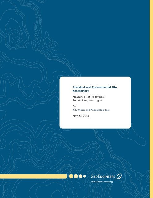
Corridor-Level Environmental Site Assessment - City of Port Orchard
Corridor-Level Environmental Site Assessment - City of Port Orchard
Corridor-Level Environmental Site Assessment - City of Port Orchard

You also want an ePaper? Increase the reach of your titles
YUMPU automatically turns print PDFs into web optimized ePapers that Google loves.
<strong>Corridor</strong>-<strong>Level</strong> <strong>Environmental</strong> <strong>Site</strong><br />
<strong>Assessment</strong><br />
Mosquito Fleet Trail Project<br />
<strong>Port</strong> <strong>Orchard</strong>, Washington<br />
for<br />
N.L. Olson and Associates, Inc.<br />
May 23, 2011<br />
Earth Science + Technology
<strong>Corridor</strong>-<strong>Level</strong> <strong>Environmental</strong> <strong>Site</strong><br />
<strong>Assessment</strong><br />
Mosquito Fleet Trail Project<br />
<strong>Port</strong> <strong>Orchard</strong>, Washington<br />
File No. 12309-009-00<br />
May 23, 2011<br />
Prepared for:<br />
N.L. Olson and Associates, Inc.<br />
P.O. Box 637<br />
<strong>Port</strong> <strong>Orchard</strong>, Washington 98366<br />
Attention: Norman Olson<br />
Prepared by:<br />
GeoEngineers, Inc.<br />
1101 South Fawcett Avenue, Suite 200<br />
Tacoma, Washington 98402<br />
253.383.4940<br />
Tricia S. DeOme, LG<br />
<strong>Environmental</strong> Scientist<br />
Michael E. Hutchinson, LG, LHG<br />
Associate<br />
TSD:MEH:cn<br />
Disclaimer: Any electronic form, facsimile or hard copy <strong>of</strong> the original document (email, text, table, and/or figure), if provided, and any attachments are<br />
only a copy <strong>of</strong> the original document. The original document is stored by GeoEngineers, Inc. and will serve as the <strong>of</strong>ficial document <strong>of</strong> record.<br />
Copyright© 2011 by GeoEngineers, Inc. All rights reserved.
Table <strong>of</strong> Contents<br />
INTRODUCTION .............................................................................................................................................. 1<br />
METHODOLOGY – SCOPE OF SERVICES ..................................................................................................... 1<br />
PROJECT AREA CONDITIONS ....................................................................................................................... 2<br />
Project Location and Setting ................................................................................................................. 2<br />
Project Description ................................................................................................................................. 2<br />
Subsurface Conditions .......................................................................................................................... 3<br />
EXISTING CONDITIONS ................................................................................................................................. 4<br />
<strong>Site</strong>s <strong>of</strong> Concern ..................................................................................................................................... 4<br />
General <strong>Corridor</strong>-Specific Contamination ............................................................................................. 7<br />
CONCLUSIONS AND RECOMMENDATIONS ................................................................................................ 7<br />
LIMITATIONS .................................................................................................................................................. 8<br />
LIST OF FIGURES<br />
Figure 1. Vicinity Map<br />
Figure 2. Geology With Proposed Alignment<br />
Figures 3 through 7. <strong>Site</strong>s <strong>of</strong> Concern<br />
APPENDICES<br />
Appendix A. References<br />
Appendix B. Parcel Insight (PI) Report<br />
Appendix C. Report Limitations and Guidelines for Use<br />
May 23, 2011 | Page i<br />
File No. 12309-009-00
MOSQUITO FLEET TRAIL PROJECT • <strong>Port</strong> <strong>Orchard</strong>, Washington<br />
INTRODUCTION<br />
This report presents the results <strong>of</strong> our <strong>Corridor</strong>-<strong>Level</strong> <strong>Environmental</strong> <strong>Site</strong> <strong>Assessment</strong> (ESA) in<br />
support <strong>of</strong> the Mosquito Fleet Trail Project located in <strong>Port</strong> <strong>Orchard</strong>, Washington. The <strong>City</strong> <strong>of</strong> <strong>Port</strong><br />
<strong>Orchard</strong> Public Works Department is planning to construct a new waterfront multi-use trail in <strong>Port</strong><br />
<strong>Orchard</strong> generally following Bay Street. The new trail will accommodate bicycle and pedestrian<br />
traffic along the waterfront between ferry terminals located in Annapolis and downtown <strong>Port</strong><br />
<strong>Orchard</strong>. It will also provide recreational opportunities along the waterfront for residents and<br />
visitors to the community.<br />
A preferred alignment has been chosen for the project as shown in Figure 2. This <strong>Corridor</strong>-<strong>Level</strong><br />
ESA is a portion <strong>of</strong> Phase 1 <strong>of</strong> the design process. Phase 1 includes the analysis <strong>of</strong> existing<br />
environmental conditions, development <strong>of</strong> preliminary design, analysis <strong>of</strong> special benefits,<br />
comprehensive cost estimating and value engineering. Future phases will entail environmental<br />
review, permitting, final design and construction.<br />
The purpose <strong>of</strong> the <strong>Corridor</strong>-<strong>Level</strong> ESA is to assist N.L. Olson and Associates, Inc. (Olson) with the<br />
following: 1) evaluate the presence or likely presence <strong>of</strong> potential hazardous substances at the<br />
parcels within and near the <strong>Corridor</strong>; 2) provide recommendations for additional hazardous<br />
material investigations (such as a site-specific Phase I ESA or Phase II ESA); 3) provide information<br />
on nearby sites, based on readily available information, to support future estimates <strong>of</strong> site cleanup<br />
and construction costs; and 4) assess the liability associated with project development in or near<br />
potentially contaminated sites. References reviewed for this <strong>Corridor</strong>-<strong>Level</strong> ESA are included as<br />
Appendix A.<br />
METHODOLOGY – SCOPE OF SERVICES<br />
The following tasks were performed as part <strong>of</strong> the <strong>Corridor</strong>-<strong>Level</strong> ESA:<br />
1. Reviewed the results <strong>of</strong> a federal, state and local environmental database search (Parcel<br />
Insight [PI] Report) for listings <strong>of</strong> known or suspected environmental concerns at sites adjacent<br />
to or within 1 mile <strong>of</strong> the <strong>Corridor</strong>. The PI Report is provided in Appendix B.<br />
2. Conducted a windshield survey <strong>of</strong> the <strong>Corridor</strong> along Bay Street from <strong>Orchard</strong> Avenue to Retsil<br />
Road East on December 17, 2009. We did not enter or view conditions within buildings. We<br />
entered the following parcels that could pose an environmental concern to the <strong>Corridor</strong> based<br />
on a review <strong>of</strong> the database and observations during the windshield survey:<br />
• Bay Ford – Kitsap County Parcel No. 252401-2-020-2000.<br />
• <strong>Port</strong> <strong>of</strong> Bremerton – Kitsap County Parcel No. 262401-1-007-2008.<br />
• Westbay Center – Kitsap County Parcel No. 252401-2-001-2003.<br />
3. Reviewed historical aerial photographs to identify past development history on and adjacent to<br />
the <strong>Corridor</strong> relative to the possible use, generation, storage, release or disposal <strong>of</strong> hazardous<br />
substances.<br />
May 23, 2011 | Page 1<br />
File No. 12309-009-00
MOSQUITO FLEET TRAIL PROJECT • <strong>Port</strong> <strong>Orchard</strong>, Washington<br />
4. Reviewed current United States Geological Survey (USGS) topographic maps and applicable<br />
groundwater occurrence maps to identify the physiographic setting <strong>of</strong> the corridor. Provided a<br />
statement on the local geologic, soil and groundwater conditions based on our general<br />
experience and sources such as readily available geologic maps, groundwater data and soil<br />
surveys.<br />
5. Evaluated and screened sites based on information compiled from the environmental<br />
database search, windshield survey, historical aerial photographs, fire insurance maps, city<br />
directories, tax assessor records, and topographic and groundwater occurrence maps. <strong>Site</strong>s<br />
included in the database search were eliminated from further study if the sites met the<br />
following criteria: 1) located downgradient or at such a distance away from the <strong>Corridor</strong> that<br />
they are not anticipated to impact the project and/or if 2) there were no environmental<br />
concerns that could affect construction activities or associated liability.<br />
6. Reviewed the current preferred alignment for Mosquito Fleet Trail provided by Olson in May<br />
2011 and evaluated the sites <strong>of</strong> concern.<br />
7. Provided this report summarizing the results <strong>of</strong> the study. This report includes a table ranking<br />
the sites by their potential for contamination (low, moderate or high) from either on-site or <strong>of</strong>fsite<br />
sources and recommendations for additional studies.<br />
PROJECT AREA CONDITIONS<br />
Project Location and Setting<br />
The <strong>Corridor</strong> is located in the <strong>City</strong> <strong>of</strong> <strong>Port</strong> <strong>Orchard</strong>, Kitsap County, Washington. The proposed trail<br />
generally follows the shoreline <strong>of</strong> Sinclair Inlet in the Puget Sound, from the intersection <strong>of</strong> Bay<br />
Street and Arnold Avenue southwest to the <strong>Port</strong> <strong>Orchard</strong> Ferry Dock at Sidney Avenue (Figure 1). In<br />
some locations, the trail would be immediately adjacent to Bay Street while in other locations it<br />
would follow the shoreline. A general route map is presented in Figure 2 and a detailed route map<br />
is presented in Figures 3 through 7.<br />
The project will be generally located within an existing and proposed right-<strong>of</strong>-way (ROW) associated<br />
with Bay Street. The Bay Street ROW contains a two-lane roadway, overhead utilities (telephone,<br />
electricity, cable) and underground utilities (sanitary sewer, storm sewer and water). We<br />
understand additional easements are planned where the trail diverges from the Bay Street ROW on<br />
parcels not currently owned by the <strong>City</strong> in areas. These areas are primarily located in the central<br />
segment <strong>of</strong> the project, between Blackjack Creek/Etta Turner Park and Waterfront Park. Adjacent<br />
properties consist <strong>of</strong> single-family residences, multi-family residential buildings and<br />
retail/commercial space.<br />
Project Description<br />
The proposed project will create a multi-use trail along the waterfront in <strong>Port</strong> <strong>Orchard</strong>, extending<br />
from the <strong>Port</strong> <strong>Orchard</strong> Ferry Terminal to the Annapolis Ferry Dock. The proposed alignment<br />
proceeds east from the <strong>Port</strong> <strong>Orchard</strong> Ferry Terminal along an existing boardwalk (the “marina<br />
boardwalk”) toward Waterfront Park. The trail traverses this park and then continues up the slope<br />
to the east to join the Bay Street ROW for a short distance before descending back down (north)<br />
towards the waterfront/shoreline in acquired ROW associated with Rockwell Avenue. The trail<br />
Page 2 | May 23, 2011 | GeoEngineers, Inc.<br />
File No. 12309-009-00
MOSQUITO FLEET TRAIL PROJECT • <strong>Port</strong> <strong>Orchard</strong>, Washington<br />
follows the shoreline around the Westbay Shopping Center and then spans the mouth <strong>of</strong> Blackjack<br />
Creek via a bridge approximately 125 feet in length (<strong>of</strong> which 100 feet will be over water). From<br />
Etta Turner Park on the east side <strong>of</strong> Blackjack Creek, the trail will primarily be located adjacent to<br />
the shoreline all the way to its eastern terminus at the Annapolis Ferry Dock. Exceptions will occur<br />
in some places where existing residences built on overwater structures extend waterward beyond<br />
the ordinary high water mark/mean higher high water (OHWM/MHHW). At these locations, the trail<br />
will remain adjacent to Bay Street. Due to spatial constraints between Bay Street and the<br />
shoreline, much <strong>of</strong> the eastern length <strong>of</strong> the trail will need to be cantilevered over water and<br />
support piles will be required in a few places.<br />
Property acquisition for the project consists <strong>of</strong> the following:<br />
■ ROW acquisition between Station 18+90 and 20+80.<br />
■ ROW acquisition between Station 65+50 and 69+80.<br />
A property easement will be acquired for the remainder <strong>of</strong> the trail that is not located along the<br />
existing ROW.<br />
General construction activities consist <strong>of</strong> the following:<br />
■ Surface grading and paving throughout the corridor except as noted below.<br />
■ Repair and replacement <strong>of</strong> existing deck and boardwalk surfacing near stations 9+00 and<br />
11+00.<br />
■ Fill placed beneath trail near Station 25+82.<br />
■ Bridge foundation over Blackjack Creek consisting <strong>of</strong> four 16-inch-diameter steel piles (two<br />
each side) placed in upland locations, with a concrete foundation. In addition, a utility pole and<br />
two guy anchors will be relocated and replaced in-kind.<br />
■ Pile installation and removal is necessary for renovation <strong>of</strong> an existing deck that will support<br />
the trail.<br />
• Approximately 21 existing wooden and concrete piles <strong>of</strong> varying sizes (ranging from 8<br />
inches to 15 inches in diameter) that will be removed at trail station 62+40 to 63+00.<br />
These piles will be replaced with 10-inch-diameter steel piles and a more efficient<br />
support structure resulting in fewer piles needed in the final construction (up to five<br />
replacement piles).<br />
• Approximately eight new piles will be placed below OHWM/MHHW for trail support at<br />
trail station 63+10 to 64+70.<br />
• Three additional new piles are proposed for trail support between two residential<br />
structures at trail station 54+70 to 55+10. There is also potential to relocate an<br />
existing deck (currently supported by three timber piles) that would require two<br />
additional steel piles.<br />
Subsurface Conditions<br />
The geologic information reviewed within the project vicinity includes Department <strong>of</strong> Natural<br />
Resources 100,000 scale surface geology electronic data. The <strong>Corridor</strong> is composed <strong>of</strong> artificial<br />
fill, nonglacial continental sedimentary deposits and glacial deposits (see Figure 2).<br />
May 23, 2011 | Page 3<br />
File No. 12309-009-00
MOSQUITO FLEET TRAIL PROJECT • <strong>Port</strong> <strong>Orchard</strong>, Washington<br />
The western portion <strong>of</strong> the corridor is identified as artificial man-made fill (Qf). The fill appears to<br />
extend from the western extent <strong>of</strong> the corridor to approximately 900 feet east <strong>of</strong> Blackjack Creek.<br />
The composition <strong>of</strong> the fill is unknown. The central portion <strong>of</strong> the corridor is identified as nonglacial<br />
continental sedimentary deposits (Qc). The Qc deposits extend east <strong>of</strong> the Qf deposits to the<br />
northern extent <strong>of</strong> the corridor. The Qc deposits typically consist <strong>of</strong> stratified clay, silty sand, gravel,<br />
and peat <strong>of</strong> fluvial, deltaic, lacustrine or estuarine in origin. The eastern portion <strong>of</strong> the corridor is<br />
identified as undifferentiated drift (Qgu) and glacial advance outwash (Qga). The Qgu unit typically<br />
consists <strong>of</strong> till and outwash sands and gravels. Till is unsorted highly compacted mixture <strong>of</strong> clay,<br />
silt, sand and gravel that has been overridden by a glacier. Outwash consists <strong>of</strong> compacted<br />
(advance - Qga) and non-compacted (recessional) glacial fluvial sand and gravel and lacustrine<br />
clay, silt and sand.<br />
Based on the topography <strong>of</strong> the area, groundwater likely flows towards the Bay with a slight<br />
variation in the vicinity <strong>of</strong> Blackjack Creek where groundwater is expected to flow towards the<br />
creek.<br />
EXISTING CONDITIONS<br />
<strong>Site</strong>s <strong>of</strong> Concern<br />
Hazardous material sites <strong>of</strong> concern are located adjacent to the project area. The following section<br />
provides more information on sites identified that pose a risk to the project area. Of the sites<br />
retained for in-depth analysis, the probability <strong>of</strong> contamination was assessed to evaluate whether<br />
the site would be “low risk,” “moderate risk” or “high risk” with respect to the presence <strong>of</strong><br />
contamination potentially impacting the construction and increasing the liability associated with<br />
ownership. Risk was determined using best pr<strong>of</strong>essional judgment while taking into consideration<br />
each sites distance from the project area, impacted media, suspected chemicals <strong>of</strong> concern and<br />
hydraulic gradient. <strong>Site</strong>s were determined to be “low risk” if a potential concern exists because <strong>of</strong><br />
historical activities, but either the site will not likely impact the project or the contamination was<br />
previously remediated. <strong>Site</strong>s were determined to be “moderate risk” if a concern exists because <strong>of</strong><br />
historical activities, and/or the site may likely impact the project but sufficient evidence is not<br />
available. <strong>Site</strong>s were determined to be “high risk” if a known concern exists because <strong>of</strong> historical<br />
activities, contamination is known and extensive and/or the site will likely impact the project.<br />
Four low-risk sites, two moderate-risk sites and no high-risk sites were identified during our study.<br />
A brief description <strong>of</strong> each site is outlined in Table 1. The locations <strong>of</strong> the sites are shown in<br />
Figures 3 through 7.<br />
Page 4 | May 23, 2011 | GeoEngineers, Inc.<br />
File No. 12309-009-00
MOSQUITO FLEET TRAIL PROJECT • <strong>Port</strong> <strong>Orchard</strong>, Washington<br />
TABLE 1. SITES OF CONCERN<br />
Map ID<br />
Proximity to<br />
<strong>Corridor</strong><br />
1 Within<br />
2 Within<br />
3 Within<br />
Listed Business -<br />
Address Kitsap<br />
County Parcel and<br />
APN Lot<br />
Identification<br />
Comfort Inn (aka<br />
Former Shell Station<br />
and Holiday Inn<br />
Express) – 1109 and<br />
1121 Bay Street<br />
4063-001-001-<br />
0102/4053-015-<br />
012-0002 and<br />
2311884/ 1509363<br />
Bay Ford – 1215 Bay<br />
Street<br />
252401-2-020-2000<br />
and 1161454<br />
Westbay Center –<br />
Various addresses<br />
1301 through 1371<br />
Bay Street<br />
252401-2-001-2003<br />
and 1967330<br />
Historical Information Likelihood to Impact Project Historical Sources<br />
PI Report Database Listing: UST and CSCSL NFA<br />
Three gasoline USTs <strong>of</strong> unspecified capacity were removed from this site according to the PI report. The site is listed on<br />
the CSCSL list with a “No Further Action” granted in October 1998. The nature <strong>of</strong> the contamination is not specified in the<br />
PI report.<br />
The site appears as a lumber yard in the 1914 and 1942 Sanborn maps. The lumber yard is visible in aerial photographs<br />
through the 1960s. In the 1972 aerial photograph, the lumber yard has been removed but several small buildings are<br />
visible on the property, including a likely fueling station with pump island near Bay Street. The fueling station remains<br />
visible in the 1981 aerial photograph. In the 1995 aerial photograph, the site appears cleared with the existing motel<br />
building under construction. The site fueling station is listed as “Pritchard Shell Service” in 1960 through 1975 city<br />
directories. The fueling station is listed as “<strong>Port</strong> <strong>Orchard</strong> Shell” in the 1980 city directory. The fueling station is not listed<br />
in the subsequent reviewed directories.<br />
The portion <strong>of</strong> the site that formerly contained the fueling station was observed to be a grassy vacant lot during the<br />
windshield survey and is in the area <strong>of</strong> the proposed alignment and ROW acquisition.<br />
PI Report Database Listing: RCRA CESQG<br />
The site is listed in the PI report as a small quantity waste generator for 2003, 2005 and 2007.<br />
The site is an auto sales and service facility that was constructed in 1948. The site is listed as both “Howe Motors” and<br />
“Howe Oil” in reviewed city directories dated 1954 through 1975. In 1980 and 1985, the site is listed only as “Howe<br />
Motors.” The site is first listed as Bay Ford in 1990.<br />
The existing building is visible in all reviewed aerial photographs, however, the scale <strong>of</strong> the available photographs does not<br />
allow for detailed examination and identification <strong>of</strong> on-site fuel tanks. In the 1972 aerial photograph, an area <strong>of</strong> staining<br />
north <strong>of</strong> the building is visible. This area appears in its current paved configuration as <strong>of</strong> the 1995 aerial photograph.<br />
We conducted an on-site reconnaissance <strong>of</strong> exterior areas <strong>of</strong> the Bay Ford facility. Waste oil storage areas were observed<br />
at the north end <strong>of</strong> the building. Batteries and tires were observed on the asphalt at the rear <strong>of</strong> the building without<br />
secondary containment. Staining and oil sheening were observed on the asphalt surface in some areas near observed<br />
waste oil and auto parts storage areas at the time <strong>of</strong> our site reconnaissance. Sheen was also observed at the shoreline<br />
near the site stormwater outlet at Blackjack Creek east <strong>of</strong> the site, adjacent proposed alignment.<br />
We understand the <strong>City</strong> owns the eastern portion <strong>of</strong> the site (parking lot) and a private partnership owns the western<br />
portion <strong>of</strong> the site (building).<br />
PI Report Database Listing: None<br />
The existing shopping center at this location was constructed in 1960; tenant spaces in this building have a variety <strong>of</strong> oddnumbered<br />
street addresses between 1301 and 1371. Shopping center tenants were primarily retail and restaurants,<br />
however, medical <strong>of</strong>fices and dry cleaners have also been located in the building. A self-service laundry “Whirlomat” was<br />
located in the building between at least 1960 and 1975, according to the reviewed city directories. Possible dry cleaners<br />
in the building have included “Morgan’s Cleaners” (city directories 1965 and 1970) and “Norge Dry Cleaning” (1965). A<br />
photo processor “Developing Fotomat” is also listed at Westbay Center in the 1980 and 1985 city directories.<br />
Moderate<br />
The site is considered an environmental concern<br />
because <strong>of</strong> the potential for petroleum products,<br />
wood waste and other hazardous materials used<br />
during lumberyard and fueling station activities<br />
in the soil and groundwater. “No Further Action”<br />
was granted in 1998 based on the PI report;<br />
however, the details <strong>of</strong> the NFA are not known.<br />
ROW acquisition is planned on the western<br />
portion <strong>of</strong> the site. Minor excavation for paving is<br />
planned during construction. The site is<br />
considered a moderate environmental concern<br />
because ROW acquisition <strong>of</strong> the site is planned<br />
and may pose a risk to the <strong>City</strong>’s liability.<br />
Low<br />
The site is considered an environmental concern<br />
because <strong>of</strong> the potential for petroleum products<br />
in soil and groundwater. An easement is<br />
planned to be acquired on the northern portion<br />
<strong>of</strong> the site. The <strong>City</strong> <strong>of</strong> <strong>Port</strong> <strong>Orchard</strong> is the<br />
property owner on the eastern portion <strong>of</strong> the site.<br />
Construction activities consist <strong>of</strong> minor<br />
excavation for paving and for the foundation <strong>of</strong><br />
the Blackjack Creek Bridge. The site is<br />
considered to have a low likelihood to impact the<br />
project because the construction activities are<br />
not located in the area <strong>of</strong> the building and USTs<br />
(potential source <strong>of</strong> contamination).<br />
Low<br />
The site is considered an environmental concern<br />
because <strong>of</strong> the potential for dry cleaning solvents<br />
in the soil and groundwater. The site is<br />
considered to have a low likelihood to impact the<br />
project because there has not been a<br />
documented release; however, excavation is<br />
planned for the Blackjack Creek bridge<br />
foundation northwest <strong>of</strong> the existing building.<br />
PI database listing, Sanborn<br />
maps, aerial photographs, city<br />
directories, windshield<br />
reconnaissance, County Assessor<br />
information.<br />
PI database listing, aerial<br />
photographs, city directories, site<br />
reconnaissance, County Assessor<br />
information.<br />
Aerial photographs, city<br />
directories, windshield<br />
reconnaissance, County Assessor<br />
information.<br />
May 23, 2011 | Page 5<br />
File No. 12309-009-00
MOSQUITO FLEET TRAIL PROJECT • <strong>Port</strong> <strong>Orchard</strong>, Washington<br />
Map ID<br />
4<br />
5<br />
Proximity to<br />
<strong>Corridor</strong><br />
6 Within<br />
Notes:<br />
Adjacent<br />
Approximately<br />
50 feet<br />
southeast<br />
(upgradient)<br />
Adjacent<br />
Approximately<br />
60 feet south<br />
(upgradient)<br />
ID = Identification<br />
PI = Parcel Insight, Inc.<br />
UST = underground storage tank<br />
AST = above-ground storage tank<br />
Listed Business -<br />
Address Kitsap<br />
County Parcel and<br />
APN Lot<br />
Identification<br />
One Stop Cleaning --<br />
1610 Bay Street<br />
4027-003-003-0002<br />
and 1501295<br />
<strong>City</strong> <strong>of</strong> <strong>Port</strong> <strong>Orchard</strong> –<br />
1962 Bay Street<br />
4027-028-006-0006<br />
and 1503325<br />
Undeveloped<br />
Campbell Parcels –<br />
Approximately 2001<br />
Bay Street<br />
4027-035-004-<br />
0003/4689-004-<br />
001-0001 and<br />
1503614/1746239<br />
Historical Information Likelihood to Impact Project Historical Sources<br />
PI Report Database Listing: RCRA CESQG<br />
The site is listed in the PI report as a small quantity waste generator in 2003 and 2004.<br />
The existing strip mall at this location was constructed in 1967 through 1968. Shopping center tenants have included<br />
retail and restaurants; however, a dry cleaner has been located in the building from at least 1970 (according to reviewed<br />
city directories) through the present day (based on our windshield reconnaissance). The site address is listed as “One<br />
Stop Economy Dry Cleaning Center” or “One Stop Cleaning” in all reviewed city directories between 1970 and 1990.<br />
PI Report Database Listing: None<br />
This parcel is currently vacant and undeveloped. A possible fueling station is visible on this property in 1972 and 1981<br />
aerial photographs. The site is not listed in any <strong>of</strong> the reviewed city directories and the site vicinity is not included in<br />
Sanborn maps. The site appears in the current configuration, cleared and vacant, in the 1995 aerial photograph.<br />
PI Report Database Listing: None<br />
CSCSL NFA = Confirmed or Suspected Contaminated <strong>Site</strong> List - No Further Action<br />
RCRA = Resource Conservation and Recovery Act<br />
CESQG = Conditionally Exempt Small Quantity Generator<br />
The site is currently vacant and undeveloped. A monitoring well was observed in the asphalt driveway in the proposed<br />
alignment during our windshield reconnaissance. Monitoring wells are typically installed to monitor contaminants in the<br />
groundwater.<br />
The site is not listed in any <strong>of</strong> the reviewed city directories and the site vicinity is not included in Sanborn maps. While the<br />
1944 aerial photograph does not show detail in the vicinity <strong>of</strong> the site, the 1965 and 1972 aerial photographs show three<br />
buildings on the site, along with four ASTs near the shoreline and a dock. The buildings and tanks remain visible in the<br />
1981 aerial photograph. The site appears in the current configuration, cleared and vacant, in the 1995 aerial photograph.<br />
Low<br />
The site is considered an environmental concern<br />
because <strong>of</strong> the potential for dry cleaning solvents<br />
in the soil and groundwater. The site is<br />
considered to have a low likelihood to impact the<br />
project because minimal excavation and no<br />
dewatering activities are planned in the area<br />
during construction and the planned ROW<br />
acquisition is not located in the area <strong>of</strong> the site<br />
(potential source).<br />
Low<br />
The site is considered an environmental concern<br />
because <strong>of</strong> the potential for petroleum products<br />
in the soil and groundwater. The site is<br />
considered to have a low likelihood to impact the<br />
project because minimal excavation for paving<br />
and no dewatering activities are planned in the<br />
area during construction and the planned ROW<br />
acquisition is not located in the area <strong>of</strong> site<br />
(potential source).<br />
Moderate<br />
The site is considered an environmental concern<br />
because <strong>of</strong> the potential for contaminated soil<br />
and groundwater based on the presence <strong>of</strong> the<br />
existing monitoring well and tanks observed in<br />
the aerial photographs. The site is considered to<br />
have a moderate likelihood to impact the project<br />
because the ROW is planned to be acquired on<br />
the southern portion <strong>of</strong> the site in the area <strong>of</strong> the<br />
observed monitoring well. Minimal excavation<br />
for paving and no dewatering activities are<br />
planned in the area during construction.<br />
Aerial photographs, city<br />
directories, windshield<br />
reconnaissance, County Assessor<br />
information.<br />
Aerial photographs, city<br />
directories, windshield<br />
reconnaissance, County Assessor<br />
information.<br />
Aerial photographs, city<br />
directories, windshield<br />
reconnaissance, County Assessor<br />
information.<br />
Page 6 | May 23, 2011 | GeoEngineers, Inc.<br />
File No. 12309-009-00
MOSQUITO FLEET TRAIL PROJECT • <strong>Port</strong> <strong>Orchard</strong>, Washington<br />
General <strong>Corridor</strong>-Specific Contamination<br />
The <strong>Corridor</strong> is located in a commercial and residential area. There is the potential to encounter<br />
contamination in the soil and groundwater due to the use <strong>of</strong> petroleum hydrocarbons and/or dry<br />
cleaning solvents from past use <strong>of</strong> these materials in the area.<br />
The western portion <strong>of</strong> the <strong>Corridor</strong> was filled between 1965 and 1980 based on the geologic map,<br />
Sanborn maps and aerial photographs. The source <strong>of</strong> the fill is unknown and may contain<br />
contaminated soils.<br />
We understand several houses on the east end <strong>of</strong> the <strong>Corridor</strong> will be directly impacted by<br />
construction activities in the <strong>Corridor</strong>. The Kitsap County Assessors website indicates the<br />
residences were built between the 1910s and 1950s with heating systems listed as forced air.<br />
Heating oil storage tanks can be associated with residences and commercial structures <strong>of</strong> this age<br />
and type <strong>of</strong> heating. We understand the houses will not be demolished but that minor grading and<br />
sidewalk construction is planned for the <strong>Corridor</strong> in this area. Managing potential contamination<br />
associated with heating oil tanks will likely be the responsibility <strong>of</strong> the <strong>City</strong> <strong>of</strong> <strong>Port</strong> <strong>Orchard</strong>.<br />
Blackjack Creek crosses the central portion <strong>of</strong> the <strong>Corridor</strong>. The Creek receives stormwater from<br />
areas that contain undeveloped, residential and commercial properties. There is the potential for<br />
low concentrations <strong>of</strong> contaminants to be present in stormwater run<strong>of</strong>f.<br />
Contamination from heating oil tanks and stormwater run<strong>of</strong>f are all considered low environmental<br />
concerns with respect to the project.<br />
CONCLUSIONS AND RECOMMENDATIONS<br />
Six properties were identified as environmental sites <strong>of</strong> concern. ROW acquisition is planned<br />
where the proposed alignment is located adjacent to an existing <strong>City</strong> <strong>of</strong> <strong>Port</strong> <strong>Orchard</strong> ROW. The <strong>City</strong><br />
<strong>of</strong> <strong>Port</strong> <strong>Orchard</strong> plans to acquire easements where the proposed alignment is not located adjacent<br />
to existing ROW. Risks <strong>of</strong> encountering contamination were evaluated based on readily available<br />
information and this report does not constitute a Phase I ESA per ASTM International (ASTM) 1527-<br />
05. Four low-risk sites, two moderate-risk sites and no high-risk sites were identified during our<br />
study. A brief description <strong>of</strong> each site is outlined in Table 1. The locations <strong>of</strong> the sites are shown in<br />
Figures 3 through 7.<br />
Our recommendations for further action to mitigate potential impacts are as follows:<br />
■ ROW acquisition is planned as part <strong>of</strong> the project within <strong>Site</strong>s 1 and 6. A Phase I ESA per ASTM<br />
Standard E 1527-05 on <strong>Site</strong>s 1 and 6 prior to ROW acquisition is recommended. A Phase II<br />
ESA including subsurface investigation may be recommended based on the findings <strong>of</strong> the<br />
Phase I ESA.<br />
■ Contaminated media, hazardous wastes and/or USTs encountered during construction<br />
activities should be managed in accordance with environmental regulations. The bid<br />
documents should require the earthwork contractor and other personnel that could potentially<br />
contact contaminated materials comply with training requirements for handling contaminated<br />
May 23, 2011 | Page 7<br />
File No. 12309-009-00
MOSQUITO FLEET TRAIL PROJECT • <strong>Port</strong> <strong>Orchard</strong>, Washington<br />
material. Our recommendation is consistent with the WAC 296-843-100, Hazardous Waste<br />
Operations, which indicates that on-site personnel are required to have current health and<br />
safety training in accordance with Hazardous Waste Operations and Emergency Response<br />
requirements in Occupational Safety and Health Administration (OSHA) 29 CFR 1910.1.20.<br />
■ The contract should also require adherence to the WSDOT General Specification 1-07.15(1)<br />
Spill Prevention, Control and Countermeasures Plan during construction.<br />
This report is based upon our understanding <strong>of</strong> the corridor alignment at the time this report was<br />
written. Changes to the alignment will likely affect the conclusions and recommendations <strong>of</strong> this<br />
report. We recommend updating this report if the corridor is modified or adjusted.<br />
LIMITATIONS<br />
This report has been prepared for use by N.L. Olson and Associates, Inc. GeoEngineers has<br />
performed the <strong>Corridor</strong>-<strong>Level</strong> <strong>Environmental</strong> <strong>Site</strong> <strong>Assessment</strong> <strong>of</strong> the Mosquito Fleet Trail Project in<br />
<strong>Port</strong> <strong>Orchard</strong>, Washington, in general accordance with the scope and limitations <strong>of</strong> our consultant<br />
agreement dated October 27, 2009.<br />
Within the limitations <strong>of</strong> scope, schedule and budget, our services have been executed in<br />
accordance with the generally accepted environmental science practices for this report in this area<br />
at the time this report was prepared. No warranty or other conditions, express or implied, should<br />
be understood.<br />
Please refer to Appendix C titled “Report Limitations and Guidelines for Use” for additional<br />
information pertaining to use <strong>of</strong> this report.<br />
Page 8 | May 23, 2011 | GeoEngineers, Inc.<br />
File No. 12309-009-00
Pottery Ave<br />
Palmer Ave SE<br />
S Cambrian Ave<br />
1St St<br />
S U St<br />
Farragut Ave<br />
2Nd St<br />
UV 304<br />
UV 166 UV 304<br />
Coontz St<br />
U St<br />
Doyen St<br />
Ambler Dr<br />
Farragut Ave<br />
Bremerton<br />
Wyc<strong>of</strong>f Way<br />
Path: \\tac\Projects\12\12309009\GIS\1230900900_F1.mxd Map Revised: 05/17/2011, dbc, kks, mlt, tsd<br />
Eagle Crest Pl<br />
Hill Ave<br />
Short Ave<br />
Sherman Ave<br />
Grant Ave<br />
Hull Ave<br />
W a s h i n g t o n<br />
Flower Ave<br />
Garrison Ave<br />
<strong>Port</strong> <strong>Orchard</strong> Blvd<br />
High St<br />
West Ave<br />
South St<br />
Cline Ave<br />
Sroufe St<br />
Radey St<br />
Jones Dr<br />
Division St<br />
Melcher St<br />
Sidney Pky<br />
Kendall St<br />
Kitsap St<br />
Dekalb St<br />
Dwight St<br />
Seattle<br />
Ada St<br />
jack C rreek<br />
j<br />
lack<br />
Bl<br />
Coles Ln<br />
Notes:<br />
1. The locations <strong>of</strong> all features shown are approximate.<br />
2. This drawing is for infomation purposes. It is intended to assist<br />
in showing features discussed in an attached document.<br />
GeoEngineers, Inc. cannot guarantee the accuracy and content<br />
<strong>of</strong> electronic files. The master file is stored by GeoEngineers,<br />
Inc. and will serve as the <strong>of</strong>ficial record <strong>of</strong> this communication.<br />
Reference: ESRI Data & Maps, Street Maps 2005.<br />
Seattle Ave<br />
Bethel Rd SE<br />
Project<br />
Mitchell Rd SE<br />
Maple Ave<br />
Mitchell Ave<br />
Bay St<br />
<strong>Port</strong> <strong>Orchard</strong><br />
Jefferson Ave SE<br />
Dwight St<br />
UV 160<br />
Melcher St<br />
Tracy Ave<br />
Perry Ave N<br />
Farragut Ave N<br />
Farragut Ave<br />
Plisko Ln SE<br />
Tracy Ave N<br />
Evergreen Ave SE<br />
Lincoln Ave SE<br />
Lawrence St<br />
Arnold Ave E<br />
UV 160<br />
Retsil Rd E<br />
Edwards Ct E<br />
Retsil Rd SE<br />
Karcher Rd SE<br />
Park Ave E<br />
Olney St SE<br />
Olney Ave SE<br />
SE Maple St<br />
SE Fir St<br />
µ<br />
SE Horstman Rd<br />
Olney Ave E<br />
Jackson Ave SE<br />
Pine Tree Dr SE<br />
SE Pine Tree Dr<br />
Madrona Dr SE<br />
2,000 0<br />
2,000<br />
Feet<br />
Vicinity Map<br />
Mosquito Fleet Trail<br />
<strong>Port</strong> <strong>Orchard</strong>, Washington<br />
Beach Dr E<br />
E Lidstrom Hill Rd<br />
Russell Ave SE<br />
Whittier Ave SE<br />
Holmes Ave SE<br />
Figure 1<br />
Tidepool Pl E<br />
Lidstrom Rd E<br />
Fircrest Dr SE
Geologic Units<br />
Qa<br />
Qc<br />
Qc(w)<br />
alluvium<br />
continental sedimentary deposits or rocks<br />
continental sedimentary deposits or rocks<br />
(Whidbey Formation)<br />
Qf<br />
artificial fill, including modified land<br />
Path: \\tac\Projects\12\12309009\GIS\1230900900_F2_Geology_final.mxd Map Revised: 5/17/2011 KKS:TDEOME<br />
Qga<br />
Qgt<br />
Qgu<br />
advance continental glacial outwash<br />
(Fraser-age)<br />
continental glacial till<br />
(Fraser-age)<br />
glacial drift, undivided<br />
Proposed Alignment<br />
Qf<br />
Qc(w)<br />
Notes:<br />
1. The locations <strong>of</strong> all features shown are approximate.<br />
2. This drawing is for infomation purposes. It is intended to assist in showing features<br />
discussed in an attached document. GeoEngineers, Inc. cannot guarantee the accuracy<br />
and content <strong>of</strong> electronic files. The master file is stored by GeoEngineers, Inc. and will<br />
serve as the <strong>of</strong>ficial record <strong>of</strong> this communication.<br />
Reference: Geology from the Department <strong>of</strong> Natural Resources (2008).<br />
<strong>Corridor</strong> data from Olson & Associates. Aerial photograph from ESRI (2007).<br />
Projection: NAD 1983 Washington North (ft)<br />
Qgt<br />
Qc<br />
Qga<br />
Qa<br />
Qga<br />
Qc<br />
Qgt<br />
µ<br />
400 0 400<br />
Feet<br />
Qgu<br />
Qgt<br />
Geology With Proposed Alignment<br />
Mosquito Fleet Trail<br />
<strong>Corridor</strong> <strong>Environmental</strong> <strong>Site</strong> <strong>Assessment</strong><br />
<strong>Port</strong> <strong>Orchard</strong>, Washington<br />
Figure 2
6+60<br />
Path: \\tac\Projects\12\12309009\GIS\1230900900_Phase1_<strong>Site</strong>sOfConcern_final_alignment.mxd Map Revised: 5/16/2011 TDeOme<br />
FREDERICK AVE<br />
PROSPECT ST<br />
SIDNEY PKWY<br />
Notes:<br />
1. The locations <strong>of</strong> all features shown are approximate.<br />
2. This drawing is for infomation purposes. It is intended to assist in showing features<br />
discussed in an attached document. GeoEngineers, Inc. cannot guarantee the accuracy<br />
and content <strong>of</strong> electronic files. The master file is stored by GeoEngineers, Inc. and will<br />
serve as the <strong>of</strong>ficial record <strong>of</strong> this communication.<br />
Reference: Aerial photograph (2006) from ESRI I3 Imagery. Parcel data from Kitsap County (2003).<br />
<strong>Corridor</strong> data from Olson & Associates. Projection: NAD 1983 Washington North (ft)<br />
SIDNEY AVE<br />
7+00<br />
Approximate Locations <strong>of</strong><br />
<strong>Site</strong>s <strong>of</strong> Concern and ID<br />
Low Risk<br />
Moderate Risk<br />
8+00<br />
HARRISON AVE<br />
9+00<br />
Proposed Alignment<br />
10+00<br />
BAY ST<br />
11+00<br />
µ<br />
100 0 100<br />
Feet<br />
12+00<br />
Water Front<br />
Park<br />
13+00<br />
14+00<br />
SEATTLE AVE<br />
15+00<br />
<strong>Site</strong>s <strong>of</strong> Concern<br />
Mosquito Fleet Trail<br />
<strong>Corridor</strong> <strong>Environmental</strong> <strong>Site</strong> <strong>Assessment</strong><br />
<strong>Port</strong> <strong>Orchard</strong>, Washington<br />
Proposed Contours Figure 3<br />
16+00
26+00<br />
24+00<br />
25+00<br />
27+00<br />
23+00<br />
28+00<br />
22+00<br />
33+00<br />
34+00<br />
35+00<br />
32+00<br />
21+00<br />
29+00<br />
31+00<br />
Path: \\tac\Projects\12\12309009\GIS\1230900900_Phase1_<strong>Site</strong>sOfConcern_final_alignment.mxd Map Revised: 5/16/2011 TDeOme<br />
17+00<br />
18+00<br />
COLES LN<br />
1<br />
ROCKWELL AVE<br />
19+00<br />
20+00<br />
MORTON ST<br />
Notes:<br />
1. The locations <strong>of</strong> all features shown are approximate.<br />
2. This drawing is for infomation purposes. It is intended to assist in showing features<br />
discussed in an attached document. GeoEngineers, Inc. cannot guarantee the accuracy<br />
and content <strong>of</strong> electronic files. The master file is stored by GeoEngineers, Inc. and will<br />
serve as the <strong>of</strong>ficial record <strong>of</strong> this communication.<br />
Reference: Aerial photograph (2006) from ESRI I3 Imagery. Parcel data from Kitsap County (2003).<br />
<strong>Corridor</strong> data from Olson & Associates. Projection: NAD 1983 Washington North (ft)<br />
Approximate Locations <strong>of</strong><br />
<strong>Site</strong>s <strong>of</strong> Concern and ID<br />
Low Risk<br />
Moderate Risk<br />
Proposed Alignment<br />
2<br />
µ<br />
100 0 100<br />
Feet<br />
30+00<br />
Blackjack Creek<br />
MAPLE AVE<br />
Etta Turner<br />
Park<br />
BETHEL AVE<br />
3<br />
BAY ST<br />
<strong>Site</strong>s <strong>of</strong> Concern<br />
Mosquito Fleet Trail<br />
<strong>Corridor</strong> <strong>Environmental</strong> <strong>Site</strong> <strong>Assessment</strong><br />
<strong>Port</strong> <strong>Orchard</strong>, Washington<br />
Proposed Contours Figure 4
42+00<br />
43+00<br />
44+00<br />
Path: \\tac\Projects\12\12309009\GIS\1230900900_Phase1_<strong>Site</strong>sOfConcern_final_alignment.mxd Map Revised: 5/16/2011 TDeOme<br />
32+00<br />
Etta Turner<br />
Park<br />
33+00<br />
34+00<br />
3<br />
Notes:<br />
1. The locations <strong>of</strong> all features shown are approximate.<br />
2. This drawing is for infomation purposes. It is intended to assist in showing features<br />
discussed in an attached document. GeoEngineers, Inc. cannot guarantee the accuracy<br />
and content <strong>of</strong> electronic files. The master file is stored by GeoEngineers, Inc. and will<br />
serve as the <strong>of</strong>ficial record <strong>of</strong> this communication.<br />
Reference: Aerial photograph (2006) from ESRI I3 Imagery. Parcel data from Kitsap County (2003).<br />
<strong>Corridor</strong> data from Olson & Associates. Projection: NAD 1983 Washington North (ft)<br />
35+00<br />
36+00<br />
37+00<br />
38+00<br />
4<br />
39+00<br />
40+00<br />
Approximate Locations <strong>of</strong><br />
<strong>Site</strong>s <strong>of</strong> Concern and ID<br />
Low Risk<br />
Moderate Risk<br />
41+00<br />
BAY ST<br />
PERRY AVE N<br />
Proposed Alignment<br />
STOCKTON ST<br />
µ<br />
100 0 100<br />
Feet<br />
FARRAGUT AVE N<br />
MAHAN ST<br />
TRACY AVE N<br />
<strong>Site</strong>s <strong>of</strong> Concern<br />
DECATUR AVE<br />
Mosquito Fleet Trail<br />
<strong>Corridor</strong> <strong>Environmental</strong> <strong>Site</strong> <strong>Assessment</strong><br />
<strong>Port</strong> <strong>Orchard</strong>, Washington<br />
Proposed Contours Figure 5
52+00<br />
53+00<br />
54+00<br />
LAWRENCE ST<br />
Path: \\tac\Projects\12\12309009\GIS\1230900900_Phase1_<strong>Site</strong>sOfConcern_final_alignment.mxd Map Revised: 5/16/2011 TDeOme<br />
Notes:<br />
1. The locations <strong>of</strong> all features shown are approximate.<br />
2. This drawing is for infomation purposes. It is intended to assist in showing features<br />
discussed in an attached document. GeoEngineers, Inc. cannot guarantee the accuracy<br />
and content <strong>of</strong> electronic files. The master file is stored by GeoEngineers, Inc. and will<br />
serve as the <strong>of</strong>ficial record <strong>of</strong> this communication.<br />
Reference: Aerial photograph (2006) from ESRI I3 Imagery. Parcel data from Kitsap County (2003).<br />
<strong>Corridor</strong> data from Olson & Associates. Projection: NAD 1983 Washington North (ft)<br />
44+00<br />
Approximate Locations <strong>of</strong><br />
<strong>Site</strong>s <strong>of</strong> Concern and ID<br />
Low Risk<br />
Moderate Risk<br />
45+00<br />
BAY ST<br />
46+00<br />
47+00<br />
48+00<br />
Proposed Alignment<br />
49+00<br />
50+00<br />
51+00<br />
PERRY AVE N<br />
µ<br />
100 0 100<br />
Feet<br />
FARRAGUT AVE N<br />
CHESTER ST<br />
<strong>Site</strong>s <strong>of</strong> Concern<br />
TRACY AVE N<br />
Mosquito Fleet Trail<br />
<strong>Corridor</strong> <strong>Environmental</strong> <strong>Site</strong> <strong>Assessment</strong><br />
<strong>Port</strong> <strong>Orchard</strong>, Washington<br />
Proposed Contours Figure 6
57+00<br />
Path: \\tac\Projects\12\12309009\GIS\1230900900_Phase1_<strong>Site</strong>sOfConcern_final_alignment.mxd Map Revised: 5/16/2011 TDeOme<br />
53+00<br />
54+00<br />
55+00<br />
PERRY AVE N<br />
56+00<br />
58+00<br />
FARRAGUT AVE N<br />
Notes:<br />
1. The locations <strong>of</strong> all features shown are approximate.<br />
2. This drawing is for infomation purposes. It is intended to assist in showing features<br />
discussed in an attached document. GeoEngineers, Inc. cannot guarantee the accuracy<br />
and content <strong>of</strong> electronic files. The master file is stored by GeoEngineers, Inc. and will<br />
serve as the <strong>of</strong>ficial record <strong>of</strong> this communication.<br />
Reference: Aerial photograph (2006) from ESRI I3 Imagery. Parcel data from Kitsap County (2003).<br />
<strong>Corridor</strong> data from Olson & Associates. Projection: NAD 1983 Washington North (ft)<br />
59+00<br />
60+00<br />
BAY ST<br />
LAWRENCE ST<br />
61+00<br />
62+00<br />
TRACY AVE N<br />
Approximate Locations <strong>of</strong><br />
<strong>Site</strong>s <strong>of</strong> Concern and ID<br />
Low Risk<br />
Moderate Risk<br />
63+00<br />
64+00<br />
Proposed Alignment<br />
65+00<br />
5<br />
ARNOLD AVE E<br />
66+00<br />
µ<br />
100 0 100<br />
Feet<br />
6<br />
67+00<br />
RETSIL RD E<br />
68+00<br />
69+00<br />
69+12<br />
<strong>Site</strong>s <strong>of</strong> Concern<br />
BEACH DR E<br />
Mosquito Fleet Trail<br />
<strong>Corridor</strong> <strong>Environmental</strong> <strong>Site</strong> <strong>Assessment</strong><br />
<strong>Port</strong> <strong>Orchard</strong>, Washington<br />
Proposed Contours Figure 7
APPENDIX A<br />
References
MOSQUITO FLEET TRAIL PROJECT • <strong>Port</strong> <strong>Orchard</strong>, Washington<br />
APPENDIX A<br />
REFERENCES<br />
Kitsap County Assessor Website. Various Electronic Property Information Pr<strong>of</strong>iles. Accessed<br />
December 14, 2009 to December 22, 2009. http://www.kitsapgov.com/assr/.<br />
Parcel Insight. Aerial Photographs dated 1944, 1965, 1972, 1981, 1995, 2003. Obtained<br />
December 14, 2009.<br />
Parcel Insight. Parcel Insight Radius Map Report for Mosquito Fleet Trail, dated December 10,<br />
2009.<br />
Polk <strong>City</strong> Directories for Bremerton, Including <strong>Port</strong> <strong>Orchard</strong> and Vicinity, dated 1954, 1960, 1965,<br />
1970, 1975, 1980, 1985, and 1990. Reviewed at <strong>Port</strong> <strong>Orchard</strong> branch <strong>of</strong> Kitsap Regional<br />
Library on December 17, 2009.<br />
Sanborn Fire Insurance Maps for <strong>Port</strong> <strong>Orchard</strong> dated 1914 and 1942, provided by <strong>Environmental</strong><br />
Data Resources on December 14, 2009.<br />
Washington Division <strong>of</strong> Geology and Earth Resources. 2002. 1:100,000 Scale Geology <strong>of</strong><br />
Washington State – Electronic version. http://www.dnr.wa.gov/Publications/<br />
ger_data_100k_gunitp.htm#Identification_Information<br />
May 23, 2011 | Page A-1<br />
File No. 12309-009-00
APPENDIX B<br />
Parcel Insight (PI) Report
Parcel Insight Radius Map Report<br />
Report ID: 965<br />
Date: 12/10/2009<br />
Mosquito Fleet Trail<br />
1305 BAY ST<br />
PORT ORCHARD, WA 98366
TABLE OF CONTENTS<br />
1/4 Mile Detail Map 1<br />
Overview Map 2<br />
Non-Exact Match Map 3<br />
Tabular Summary <strong>of</strong> Findings 4<br />
Exact Match Summary 5<br />
Non-Exact Match Summary 15<br />
Exact Match Details 17<br />
Non-Exact Match Details 134<br />
Disclaimer 151<br />
Government Record Tracking 152<br />
Report 965<br />
page i
1/4 Mile Detail Map<br />
Report 965 page 1
Overview Map<br />
Report 965 page 2
Non-Exact Match Map<br />
Report 965 page 3
Tabular Summary <strong>of</strong> Findings<br />
RELEASE<br />
USE<br />
USE RESTRICTION<br />
A site listed in a database that documents a release <strong>of</strong> hazardous material(s).<br />
A site listed in a database that documents the use <strong>of</strong> hazardous material(s),<br />
but not a release <strong>of</strong> hazardous material(s).<br />
A site listed in a database that documents a restriction on the use <strong>of</strong> the site<br />
related to a release <strong>of</strong> a hazardous material(s) or a formal oversight decision<br />
from a government agency.<br />
Distance<br />
Map Class<br />
Subject<br />
Property<br />
0.00 to 0.25 M<br />
0.25 to 0.50 M<br />
0.50 to 0.75 M<br />
0.75 to 1.00 M<br />
1.00+ M<br />
Total by<br />
Map<br />
Class<br />
RELEASE 2 2 12 1 66 83<br />
USE 7 2 13 3 29 54<br />
USE RESTRICTION<br />
Distance<br />
Database<br />
Search<br />
Radius<br />
Subject<br />
Property<br />
0.00 to 0.25 M<br />
0.25 to 0.50 M<br />
0.50 to 0.75 M<br />
0.75 to 1.00 M<br />
1.00+ M<br />
Total by<br />
Database<br />
Type<br />
NPL 2.50 M 1 1<br />
RCRA CORRACTS 2.50 M 1 1<br />
RCRA TSD 2.00 M 1 1<br />
CERCLIS 2.00 M 2 2<br />
CERCLIS NFRAP<br />
2.00 M<br />
ERNS 1.50 M 1 5 6<br />
RCRA LQG 1.75 M 2 2<br />
RCRA SQG 1.75 M 4 4<br />
RCRA CESQG 1.75 M 4 1 4 2 13 24<br />
LUST ACTIVE TRIBAL<br />
2.00 M<br />
LUST INACTIVE TRIBAL<br />
2.00 M<br />
BROWNFIELDS<br />
2.00 M<br />
INST ENG CONTROLS<br />
2.00 M<br />
HMIRS<br />
1.75 M<br />
TRIS 1.75 M 1 1<br />
CSCSL 2.00 M 1 3 28 32<br />
CSCSL HSL 2.50 M 1 2 15 18<br />
CSCSL NFA 2.00 M 1 1 3 1 14 20<br />
SWLF STATE<br />
2.00 M<br />
LUST 2.00 M 1 7 1 24 33<br />
UST 1.75 M 3 14 2 47 66<br />
SWLF STATE<br />
2.00 M<br />
DECISIONS 2.00 M 1 1<br />
INST ENG CONTROLS<br />
2.00 M<br />
RCRA ND 1.50 M 2 1 7 9 19<br />
Totals by Distance 0 9 4 25 4 95 137<br />
Report 965 page 4
Exact Match Summary<br />
MAP CLASS<br />
MAP ID<br />
GRID<br />
SITE NAME ADDRESS PI ID # DATABASES<br />
RELEASE<br />
USE<br />
USE RESTRICTION<br />
3<br />
E6<br />
4<br />
E6<br />
5<br />
E5<br />
6<br />
F5<br />
7<br />
E5<br />
8<br />
E6<br />
9<br />
E5<br />
10<br />
E5<br />
11<br />
F7<br />
12<br />
D6<br />
13<br />
E8<br />
14<br />
F8<br />
15<br />
F8<br />
16<br />
C5<br />
CONOCOPHILLIPS SITE 2705402<br />
1350 BAY ST, PORT ORCHARD<br />
SULDAN BOAT WORKS INC<br />
1343 SW STATE HWY #160, PORT ORCHARD<br />
MANSKER TIRE CENTERS INC<br />
1216 BAY ST, PORT ORCHARD<br />
ONE STOP CLEANING<br />
1610 BAY ST, PORT ORCHARD<br />
BAY FORD<br />
1215 BAY ST, PORT ORCHARD<br />
BUDGET AUTO REPAIR<br />
250 BETHEL AVE, PORT ORCHARD<br />
HOLIDAY INN EXPRESS<br />
1121 BAY ST, PORT ORCHARD<br />
FORMER SHELL GAS STATION<br />
1109 BAY ST, PORT ORCHARD<br />
SOUTH KITSAP HIGH SCHOOL<br />
425 MITCHELL AVE, PORT ORCHARD<br />
GRAND AUTO INC PORT ORCHARD<br />
839 BAY ST, PORT ORCHARD<br />
LARSON GLASS TECHNOLOGY INC<br />
851 BETHEL AVE, PORT ORCHARD<br />
900 MITCHELL AVE<br />
900 MITCHELL AVE, PORT ORCHARD<br />
MITCHELL AVE PROJECT<br />
920 MITCHELL AVE, PORT ORCHARD<br />
PORT OF BREMERTON<br />
SIDNEY PKWY, PORT ORCHARD<br />
53005333<br />
0.02580<br />
SW<br />
53005325<br />
0.05861<br />
SW<br />
53005304<br />
0.06574<br />
NW<br />
53005386<br />
0.10579<br />
NE<br />
53005291<br />
0.10929<br />
NW<br />
53005316<br />
0.14319<br />
SW<br />
53005214<br />
0.19209<br />
NW<br />
53005210<br />
0.20076<br />
NW<br />
53005364<br />
0.24059<br />
S<br />
53005145<br />
0.42212<br />
W<br />
53005319<br />
0.45353<br />
S<br />
53005363<br />
0.47632<br />
S<br />
53005362<br />
0.49745<br />
S<br />
53005108<br />
0.50461<br />
W<br />
RCRA ND<br />
LUST<br />
UST<br />
UST<br />
RCRA CESQG<br />
RCRA CESQG<br />
RCRA CESQG<br />
RCRA ND<br />
CSCSL NFA<br />
UST<br />
RCRA CESQG<br />
RCRA ND<br />
RCRA CESQG<br />
CSCSL NFA<br />
CSCSL HSL<br />
CSCSL<br />
CSCSL NFA<br />
UST X X<br />
X<br />
X<br />
X<br />
X<br />
X<br />
X<br />
X<br />
X<br />
X<br />
X<br />
X<br />
X<br />
X<br />
X<br />
Report 965 page 5
Exact Match Summary<br />
MAP CLASS<br />
MAP ID<br />
GRID<br />
SITE NAME ADDRESS PI ID # DATABASES<br />
RELEASE<br />
USE<br />
USE RESTRICTION<br />
17<br />
C5<br />
18<br />
C5<br />
19<br />
E8<br />
20<br />
C7<br />
21<br />
C6<br />
22<br />
E8<br />
23<br />
E8<br />
24<br />
C6<br />
25<br />
C6<br />
26<br />
G8<br />
28<br />
C7<br />
29<br />
C7<br />
30<br />
C7<br />
31<br />
C6<br />
PORT ORCHARD MARINA<br />
707 SIDNEY PKWY, PORT ORCHARD<br />
MARINA PUMP STATION<br />
ORCHARD ST, PORT ORCHARD<br />
SUNSET-LANE CEMETERY, INC<br />
1000 BETHEL AVE, PORT ORCHARD<br />
KITSAP CNTY PUBLIC WORKS MATERIALS LAB<br />
507 AUSTIN AVE, PORT ORCHARD<br />
<strong>Port</strong> <strong>Orchard</strong> <strong>City</strong> Retail Building<br />
624 & 626 BAY ST, PORT ORCHARD<br />
PORT ORCHARD MALL UST<br />
1035 BETHEL AVE, PORT ORCHARD<br />
SUNSHINE CLEANERS PORT ORCHARD<br />
1037 BETHEL RD SE, PORT ORCHARD<br />
CHEVRON USA INC SS 91253<br />
620 BAY ST, PORT ORCHARD<br />
COOKSON'S TEXACO<br />
545 BAY ST, PORT ORCHARD<br />
PSE PT ORCHARD SVC<br />
1430 RETSIL RD SE, PORT ORCHARD<br />
KITSAP CNTY DEPT OF ADMIN SVC<br />
614 DIVISION ST, PORT ORCHARD<br />
KITSAP CNTY PUBLIC WORKS<br />
614 DIVISION ST, PORT ORCHARD<br />
KITSAP CNTY PUBLIC WORKS DEPT WATER LAB<br />
614 DIVISION ST BLDG M, PORT ORCHARD<br />
MARINA MART BLANDUNN CORP<br />
528 BAY ST, PORT ORCHARD<br />
53033044<br />
0.50461<br />
W<br />
53005080<br />
0.55998<br />
W<br />
53005301<br />
0.56005<br />
S<br />
53005104<br />
0.57116<br />
SW<br />
53005076<br />
0.57885<br />
W<br />
53035027<br />
0.57970<br />
S<br />
53005299<br />
0.58009<br />
S<br />
53005074<br />
0.58250<br />
W<br />
53005069<br />
0.60180<br />
W<br />
53005468<br />
0.61402<br />
SE<br />
53005093<br />
0.61904<br />
SW<br />
53005092<br />
0.61904<br />
SW<br />
53005091<br />
0.61904<br />
SW<br />
53005065<br />
0.62229<br />
W<br />
ERNS<br />
UST<br />
UST<br />
RCRA ND<br />
CSCSL NFA<br />
UST<br />
RCRA CESQG<br />
RCRA ND<br />
LUST<br />
UST<br />
LUST<br />
UST X X<br />
RCRA ND<br />
LUST<br />
UST<br />
RCRA ND<br />
RCRA ND<br />
UST<br />
RCRA CESQG<br />
CSCSL<br />
LUST<br />
UST<br />
X<br />
X<br />
X<br />
X<br />
X<br />
X<br />
X<br />
X<br />
X<br />
X<br />
X<br />
X<br />
X<br />
X<br />
X<br />
X<br />
Report 965 page 6
Exact Match Summary<br />
MAP CLASS<br />
MAP ID<br />
GRID<br />
SITE NAME ADDRESS PI ID # DATABASES<br />
RELEASE<br />
USE<br />
USE RESTRICTION<br />
32<br />
F8<br />
33<br />
G8<br />
34<br />
G8<br />
35<br />
C6<br />
36<br />
I5<br />
37<br />
G8<br />
38<br />
I4<br />
39<br />
H8<br />
40<br />
H8<br />
41<br />
H8<br />
42<br />
B6<br />
43<br />
C9<br />
44<br />
I8<br />
46<br />
A7<br />
OLYMPIC AUTOMOTIVE & WELDING<br />
2735 SR 160 MILE HILL DR, PORT ORCHARD<br />
KENS AUTO BODY INC RETSIL ROAD<br />
1478 RETSIL RD SE, PORT ORCHARD<br />
HUFENG'S QUICK STOP<br />
1981 SE MILE HILL DR, PORT ORCHARD<br />
PORT ORCHARD CITY PUBLIC WKS<br />
514 BAY ST, PORT ORCHARD<br />
WOLF PROPERTY<br />
983 OLNEY AVE, PORT ORCHARD<br />
NATIONAL GUARD ARMORY<br />
1950 SE MILE HILL DR, PORT ORCHARD<br />
JOINT FACILITY TREATMENT PLANT<br />
1165 BEACH DR E, PORT ORCHARD<br />
WESTBAY AUTO PARTS<br />
2610 SE MILE HILL DR, PORT ORCHARD<br />
D & W AUTOMOTIVE<br />
2616 SE MILE HILL DR, PORT ORCHARD<br />
PORT ORCHARD RENTAL<br />
2618 STATE HIGHWAY 160, PORT ORCHARD<br />
PORT ORCHARD MARINE RAILWAY<br />
409 BAY ST, PORT ORCHARD<br />
KITSAP CNTY GIVENS COMMUNITY CTR<br />
1026 SIDNEY AVE, PORT ORCHARD<br />
GOODYEAR TIRE & RUBBER CO PORT ORCHARD<br />
2995 SE MILE HILL DR, PORT ORCHARD<br />
PORT ORCHARD YACHT CLUB<br />
203 BAY ST, PORT ORCHARD<br />
53005429<br />
0.62646<br />
S<br />
53005469<br />
0.62853<br />
SE<br />
53005456<br />
0.65296<br />
SE<br />
53005058<br />
0.65641<br />
W<br />
53005564<br />
0.67272<br />
E<br />
53005458<br />
0.67296<br />
SE<br />
53005559<br />
0.72966<br />
NE<br />
53005484<br />
0.73282<br />
SE<br />
53005487<br />
0.73624<br />
SE<br />
53005492<br />
0.73732<br />
SE<br />
53005011<br />
0.78635<br />
W<br />
53005129<br />
0.81856<br />
SW<br />
53005569<br />
0.89117<br />
SE<br />
53004953<br />
0.97450<br />
RCRA CESQG<br />
RCRA ND<br />
LUST<br />
UST X X<br />
RCRA ND<br />
CSCSL HSL<br />
CSCSL<br />
LUST<br />
UST<br />
CSCSL HSL<br />
CSCSL<br />
LUST<br />
UST X X<br />
UST<br />
CSCSL NFA<br />
RCRA CESQG<br />
UST<br />
UST<br />
RCRA CESQG<br />
RCRA CESQG<br />
CSCSL NFA<br />
LUST<br />
X<br />
X<br />
X<br />
X<br />
X<br />
X<br />
X<br />
X<br />
X<br />
X<br />
X<br />
X<br />
X<br />
X<br />
Report 965 page 7
Exact Match Summary<br />
MAP CLASS<br />
MAP ID<br />
GRID<br />
SITE NAME ADDRESS PI ID # DATABASES<br />
RELEASE<br />
USE<br />
USE RESTRICTION<br />
SW UST<br />
47<br />
A7<br />
PORT ORCHARD YACHT CLUB MARINA<br />
201 BAY ST, PORT ORCHARD<br />
53032667<br />
1.00157<br />
SW<br />
ERNS<br />
X<br />
56<br />
A7<br />
WILKINS DISTRIBUTING CO INC<br />
134 BAY ST W, PORT ORCHARD<br />
53004900<br />
1.08919<br />
SW<br />
CSCSL HSL<br />
CSCSL<br />
LUST<br />
UST<br />
X<br />
X<br />
57<br />
J8<br />
MILE HILL DR CONTAINERS<br />
2700 BLK OF MILE HILL DR, PORT ORCHARD<br />
53005631<br />
1.09323<br />
SE<br />
RCRA CESQG<br />
X<br />
58<br />
A7<br />
DOCKSIDE SALES & SERVICE<br />
53 SW BAY ST, PORT ORCHARD<br />
53004879<br />
1.12525<br />
SW<br />
RCRA CESQG<br />
X<br />
59<br />
A7<br />
BREMERTON KITSAP AIRPORTER, INC.<br />
SW WILKINS DR, PORT ORCHARD<br />
53004882<br />
1.12905<br />
SW<br />
UST<br />
X<br />
60<br />
7<br />
93 SW BAY ST, PORT ORCHARD<br />
53036557<br />
1.16895<br />
S<br />
ERNS<br />
X<br />
61<br />
E<br />
SOUTH KITSAP SD TRANS DEPT<br />
1962 HOOVER AVE SE, PORT ORCHARD<br />
53005324<br />
1.18961<br />
N<br />
RCRA CESQG<br />
CSCSL NFA<br />
UST<br />
X<br />
X<br />
63<br />
B10<br />
DAVID R SELBIG-FOREST PARK GROCERY<br />
500 SOUTH ST, PORT ORCHARD<br />
53005019<br />
1.27839<br />
SW<br />
UST<br />
X<br />
64<br />
2<br />
HASELWOOD MANAGEMENT INC HMI<br />
T24 R1 S 21 OYSTER BAY BLVD, BREMERTON<br />
53004863<br />
1.32323<br />
N<br />
RCRA LQG<br />
X<br />
65<br />
F<br />
ANNAPOLIS WATER DISTRICT<br />
1621 LINCOLN AVE SE, PORT ORCHARD<br />
53005392<br />
1.32772<br />
N<br />
UST<br />
X<br />
66<br />
9<br />
SOUTH KITSAP SD 402 MARCUS WHITMAN JR<br />
HS<br />
1887 MADRONA DR SE, PORT ORCHARD<br />
53005685<br />
1.33522<br />
S<br />
RCRA CESQG<br />
X<br />
67<br />
7<br />
1219 DOGWOOD HILL RD SW, PORT ORCHARD<br />
53036351<br />
1.35058<br />
S<br />
ERNS<br />
X<br />
68<br />
C<br />
US DOD DLA DPDO LEWIS OFFSITE B<br />
PUGET SOUND NAVAL SHIPYARD, BREMERTON<br />
53005051<br />
1.35426<br />
NW<br />
RCRA ND<br />
X<br />
69<br />
F<br />
Kitsap Transit Blackball Transportation<br />
101 1ST ST, BREMERTON<br />
53005384<br />
1.37803<br />
CSCSL NFA<br />
X<br />
Report 965 page 8
Exact Match Summary<br />
MAP CLASS<br />
MAP ID<br />
GRID<br />
70<br />
F<br />
71<br />
F<br />
72<br />
F<br />
73<br />
F<br />
74<br />
A1<br />
75<br />
F<br />
76<br />
F<br />
77<br />
F<br />
78<br />
8<br />
79<br />
F<br />
80<br />
9<br />
81<br />
F<br />
86<br />
F<br />
87<br />
9<br />
SITE NAME ADDRESS PI ID # DATABASES<br />
Kitsap Transit YMCA Building<br />
101 1ST ST, BREMERTON<br />
KITSAP TRANSIT / FORMER AUTO SHOP<br />
BREMERTON FERRY DOCK, BREMERTON<br />
Kitsap Transit Clock Tower Area BTC-2<br />
100 1ST ST, BREMERTON<br />
Kitsap Transit Ford Building<br />
148 1ST ST, BREMERTON<br />
U.S. DEPARTMENT OF NAVY<br />
BLDG 971 X STREET, BREMERTON<br />
Kitsap Transit Grainger Building<br />
102 WASHINGTON AVE, BREMERTON<br />
BREMERTON TRANSPORTATION<br />
10 WASHINGTON AVE, BREMERTON<br />
Kitsap Transit Fitz Bookstore Building<br />
112 WASHINGTON AVE, BREMERTON<br />
PORT ORCHARD GAS & MART<br />
4163 SE MILE HILL DR, PORT ORCHARD<br />
210 1ST ST, BREMERTON<br />
KITSAP CNTY SEWER DIST 5<br />
1826 FIRCREST DR SE, PORT ORCHARD<br />
Kitsap Transit<br />
120 WASHINGTON AVE, BREMERTON<br />
FIRESTONE TIRE&RUBBER CO 31FY<br />
201 2ND ST, BREMERTON<br />
KITSAP CO FIRE DISTRICT NO 7<br />
1974 FIRCREST DR SE # 1517, PORT ORCHARD<br />
N<br />
53005383<br />
1.37803<br />
N<br />
53005366<br />
1.38291<br />
N<br />
53005388<br />
1.38461<br />
N<br />
53005375<br />
1.43340<br />
N<br />
53004894<br />
1.43514<br />
NW<br />
53005368<br />
1.46946<br />
N<br />
53005367<br />
1.46946<br />
N<br />
53005369<br />
1.46946<br />
N<br />
53005764<br />
1.47022<br />
S<br />
53033087<br />
1.47197<br />
N<br />
53005750<br />
1.47391<br />
S<br />
53005373<br />
1.48021<br />
N<br />
53005380<br />
1.50932<br />
N<br />
53034976<br />
1.51124<br />
S<br />
CSCSL NFA<br />
RELEASE<br />
X<br />
USE<br />
LUST<br />
UST X X<br />
CSCSL HSL<br />
CSCSL<br />
CSCSL NFA<br />
UST<br />
CSCSL<br />
CSCSL<br />
CSCSL<br />
UST<br />
ERNS<br />
RCRA ND<br />
CSCSL<br />
LUST<br />
UST X X<br />
CSCSL NFA<br />
UST X X<br />
X<br />
X<br />
X<br />
X<br />
X<br />
X<br />
X<br />
X<br />
X<br />
X<br />
USE RESTRICTION<br />
Report 965 page 9
Exact Match Summary<br />
MAP CLASS<br />
MAP ID<br />
GRID<br />
SITE NAME ADDRESS PI ID # DATABASES<br />
RELEASE<br />
USE<br />
USE RESTRICTION<br />
88<br />
A<br />
89<br />
8<br />
90<br />
F<br />
91<br />
F<br />
92<br />
F<br />
93<br />
E<br />
94<br />
E<br />
95<br />
E<br />
96<br />
97<br />
98<br />
99<br />
100<br />
101<br />
9<br />
Puget Sound Naval Shipyard Complex<br />
, BREMERTON<br />
NOWKAS AUTOMOTIVE INC<br />
4268 SE MILE HILL DR, PORT ORCHARD<br />
Bremerton Waterfront Project<br />
232 WASHINGTON AVE, BREMERTON<br />
KITSAP CNTY CONSOLIDATED HOUSING<br />
AUTHORI<br />
232 WASHINGTON AVE, BREMERTON<br />
Bremerton Waterfront North Parcel 1<br />
NE CORNER BURWELL ST & WASHINGTON AVE,<br />
BREMERTON<br />
SAFEWAY INC. # 1082 FUEL<br />
1942 SE LUND AVE, PORT ORCHARD<br />
WA DOT KITSAP COUNTY PARCEL<br />
3718-014-010<br />
626 BURWELL, Bremerton<br />
US NAVY PSNS PARK PLACE<br />
808 BURWELL ST, BREMERTON<br />
U.S. DEPARTMENT OF NAVY<br />
1400 FARRAGUT AVE, BREMERTON<br />
COMMANDER NAVY REGION NORTHWEST<br />
1400 FARRAGUT AVE, BREMERTON<br />
USN NAVAL SHIPYARD PUGET SOUND<br />
1400 FARRAGUT AVE, BREMERTON<br />
US NAVY PSNS OUB<br />
1400 FARRAGUT AVE, BREMERTON<br />
US NAVY PSNS & IMF - BREMERTON SITE &<br />
NAVAL BASE K<br />
1400 FARRAGUT AVE, BREMERTON<br />
SOUTH PARK CLEANERS<br />
1742 VILLAGE LN SE, PORT ORCHARD<br />
53000075<br />
1.51125<br />
NW<br />
53005771<br />
1.51965<br />
S<br />
53005398<br />
1.55049<br />
N<br />
53036068<br />
1.55049<br />
N<br />
53005406<br />
1.56743<br />
N<br />
53005315<br />
1.58051<br />
N<br />
53036790<br />
1.58079<br />
N<br />
53005216<br />
1.58750<br />
N<br />
53004865<br />
1.59713<br />
E<br />
53004866<br />
1.59713<br />
E<br />
53004867<br />
1.59713<br />
E<br />
53034899<br />
1.59713<br />
E<br />
53036324<br />
1.59713<br />
E<br />
53005786<br />
1.61452<br />
NPL<br />
RCRA CORRACTS<br />
RCRA TSD<br />
CERCLIS<br />
RCRA LQG<br />
RCRA CESQG<br />
CSCSL<br />
RCRA CESQG<br />
CSCSL NFA<br />
UST<br />
UST<br />
RCRA CESQG<br />
UST<br />
LUST<br />
UST X X<br />
UST<br />
ERNS<br />
CSCSL HSL<br />
CSCSL<br />
TRIS<br />
RCRA CESQG<br />
X<br />
X<br />
X<br />
X<br />
X<br />
X<br />
X<br />
X<br />
X<br />
X<br />
X<br />
X<br />
X<br />
X<br />
Report 965 page 10
Exact Match Summary<br />
MAP CLASS<br />
MAP ID<br />
GRID<br />
102<br />
F<br />
103<br />
F<br />
104<br />
E<br />
105<br />
8<br />
106<br />
E<br />
107<br />
D<br />
108<br />
E<br />
110<br />
1<br />
111<br />
E<br />
112<br />
113<br />
2<br />
114<br />
2<br />
115<br />
2<br />
116<br />
SITE NAME ADDRESS PI ID # DATABASES<br />
US NAVY PLANNING YARD CASCADE BLDG<br />
245 4TH ST, BREMERTON<br />
BREMERTON DRUG LAB<br />
239 4TH ST, BREMERTON<br />
BREMMER CONSOLIDATED TRUST<br />
512 4TH ST, BREMERTON<br />
DONS SOUTHPARK<br />
4412 SE MILE HILL DR, PORT ORCHARD<br />
EXXON 7-4082/CLOSED<br />
401 PARK AVE, BREMERTON<br />
CITY HAND LAUNDRY<br />
1002 4TH ST, BREMERTON<br />
PARK AVENUE CLEANERS<br />
421 PARK AVE, BREMERTON<br />
JACKPOT STATION 362<br />
519 S CAMBRIAN AVE, BREMERTON<br />
AMYS CLEANERS<br />
3377 BETHEL RD SE STE 105, PORT ORCHARD<br />
P & R QUICKSTOP<br />
2700 FARRAGUT ST, BREMERTON<br />
PARCELS 3-08376 TO 3-08378<br />
1234-1403 CHARLESTON BEACH RD W,<br />
BREMERTON<br />
TEMPLETON CHARLESTON BEACH<br />
1116 CHARLESTON BEACH RD W, BREMERTON<br />
Robinson Property<br />
1118 CHARLESTON BEACH RD W, BREMERTON<br />
KITSAP AUTO PARTS<br />
330 S CALLOW AVE, BREMERTON<br />
S<br />
53005365<br />
1.62362<br />
N<br />
53005374<br />
1.62395<br />
N<br />
53005323<br />
1.63128<br />
N<br />
53005798<br />
1.63482<br />
S<br />
53005222<br />
1.64118<br />
N<br />
53005168<br />
1.64759<br />
NW<br />
53005223<br />
1.64990<br />
N<br />
53004739<br />
1.68158<br />
N<br />
53005204<br />
1.68365<br />
N<br />
53004794<br />
1.69025<br />
E<br />
53004701<br />
1.69529<br />
N<br />
53004700<br />
1.69891<br />
N<br />
53004699<br />
1.69936<br />
N<br />
53004801<br />
1.70337<br />
RCRA SQG<br />
RCRA CESQG<br />
UST<br />
UST<br />
RELEASE<br />
USE<br />
LUST<br />
UST X X<br />
UST<br />
RCRA ND<br />
CSCSL HSL<br />
CSCSL<br />
RCRA ND<br />
CSCSL HSL<br />
CSCSL<br />
LUST<br />
UST X X<br />
RCRA CESQG<br />
CSCSL NFA X X<br />
LUST<br />
UST X X<br />
CSCSL NFA<br />
RCRA ND<br />
CSCSL<br />
LUST<br />
UST<br />
CSCSL HSL<br />
CSCSL<br />
LUST<br />
UST<br />
X<br />
X<br />
X<br />
X<br />
X<br />
X<br />
X<br />
X<br />
X<br />
X<br />
X<br />
X<br />
X<br />
X<br />
USE RESTRICTION<br />
Report 965 page 11
Exact Match Summary<br />
MAP CLASS<br />
MAP ID<br />
GRID<br />
117<br />
E<br />
118<br />
2<br />
119<br />
10<br />
120<br />
2<br />
121<br />
A<br />
122<br />
1<br />
123<br />
E<br />
124<br />
E<br />
125<br />
E<br />
126<br />
2<br />
127<br />
2<br />
128<br />
2<br />
129<br />
D<br />
130<br />
SITE NAME ADDRESS PI ID # DATABASES<br />
RITE AID CORP 5260<br />
3399 BETHEL RD SE, PORT ORCHARD<br />
FORMER GAS STATION / MARY MORE ESTATE<br />
1127 CHARLESTON BEACH RD W, BREMERTON<br />
VILLAGE GREENS GOLF CLUB<br />
2298 FIRCREST DR SE, PORT ORCHARD<br />
PARCELS 3-08359 O 3-98464<br />
1145 CHARLESTON BEACH RD W, BREMERTON<br />
NEX Navy Exchange<br />
120 S DEWEY ST, BREMERTON<br />
PUMP STATION WB-3<br />
416 S CAMBRIAN AVE, BREMERTON<br />
QWEST BREMERTON ESSEX CO<br />
611 6TH ST, BREMERTON<br />
MCNEILL AUTO REPAIR<br />
815 6TH ST STE B, BREMERTON<br />
LIBERTY BAY TRANSMISSION #2<br />
666 6TH ST, BREMERTON<br />
PARCEL 3-08364<br />
1215 CHARLESTON BEACH RD W, BREMERTON<br />
Bodine Property<br />
1227 CHARLESTON BEACH RD W, BREMERTON<br />
United Rentals<br />
1233 CHARLESTON BEACH RD W, BREMERTON<br />
PORT BLAKELY FOODS<br />
844 6TH ST, BREMERTON<br />
UNOCAL STATION 0606<br />
403 S CAMBRIAN AVE, BREMERTON<br />
E<br />
53005203<br />
1.70378<br />
N<br />
53004697<br />
1.70679<br />
N<br />
53005761<br />
1.71074<br />
S<br />
53004690<br />
1.71733<br />
N<br />
53004955<br />
1.72035<br />
NW<br />
53004748<br />
1.73442<br />
N<br />
53005221<br />
1.73718<br />
N<br />
53005207<br />
1.74084<br />
N<br />
53005241<br />
1.74315<br />
N<br />
53004670<br />
1.74534<br />
N<br />
53004668<br />
1.75013<br />
N<br />
53004666<br />
1.75249<br />
N<br />
53005174<br />
1.75873<br />
NW<br />
53004736<br />
1.76257<br />
E<br />
RCRA SQG<br />
RELEASE<br />
USE<br />
LUST<br />
UST X X<br />
LUST<br />
UST X X<br />
CSCSL NFA<br />
UST<br />
UST<br />
RCRA ND<br />
UST<br />
RCRA ND<br />
UST<br />
UST<br />
CSCSL<br />
CSCSL<br />
CSCSL<br />
LUST<br />
UST X X<br />
CSCSL HSL<br />
CSCSL<br />
LUST<br />
X<br />
X<br />
X<br />
X<br />
X<br />
X<br />
X<br />
X<br />
X<br />
X<br />
X<br />
X<br />
USE RESTRICTION<br />
Report 965 page 12
Exact Match Summary<br />
MAP CLASS<br />
MAP ID<br />
GRID<br />
131<br />
I<br />
132<br />
I<br />
133<br />
E<br />
134<br />
135<br />
136<br />
C<br />
137<br />
E<br />
138<br />
E<br />
139<br />
3<br />
140<br />
A<br />
141<br />
A<br />
142<br />
E<br />
143<br />
B<br />
144<br />
3<br />
SITE NAME ADDRESS PI ID # DATABASES<br />
ARCO 5517 PSI 5525<br />
3231 SE LUND AVE, PORT ORCHARD<br />
7-ELEVEN STORE #2303-25332K<br />
3280 SE LUND AVE, PORT ORCHARD<br />
Bremerton Park Ave Housing Lot 31<br />
816 7TH ST, BREMERTON<br />
LLOYDS BUCKYS OF BREMERTON<br />
251 S WYCOFF AVE, BREMERTON<br />
KITSAP TRANSIT BREMERTON<br />
200 CHARLESTON BLVD, BREMERTON<br />
MIDTOWN MARKET<br />
1534 6TH ST, BREMERTON<br />
HOUSING AUTHORITY OF BREMERTON PLAT 51<br />
816 8TH ST PLAT 51 , BREMERTON<br />
DARIGOLD INC.<br />
811 PARK AVE, BREMERTON<br />
WESTBAY AUTO PARTS INC<br />
1550 NAVY YARD HWY, BREMERTON<br />
CHICOS AUTOMOTIVE<br />
405 NAVAL AVE, BREMERTON<br />
WARD RADIATOR<br />
407 NAVAL AVE, BREMERTON<br />
BREMERTON SERVICE CENTER<br />
840 10TH ST, BREMERTON<br />
NEWMAN'S CHEVRON<br />
2021 6TH ST, BREMERTON<br />
FISCHLER PROPERTY<br />
1666 NAVY YARD HWY, BREMERTON<br />
53005606<br />
1.77510<br />
E<br />
53005609<br />
1.79328<br />
E<br />
53005206<br />
1.81097<br />
N<br />
53004770<br />
1.81309<br />
E<br />
53004767<br />
1.82476<br />
E<br />
53005059<br />
1.84692<br />
NW<br />
53035647<br />
1.87263<br />
N<br />
53005224<br />
1.89222<br />
N<br />
53004531<br />
1.89627<br />
N<br />
53004949<br />
1.90316<br />
NW<br />
53004948<br />
1.90340<br />
NW<br />
53005211<br />
1.93564<br />
N<br />
53004962<br />
1.94103<br />
NW<br />
53004510<br />
1.95963<br />
N<br />
UST<br />
RCRA SQG<br />
CSCSL NFA<br />
UST<br />
RELEASE<br />
X<br />
USE<br />
CSCSL NFA<br />
UST X X<br />
CSCSL<br />
RCRA CESQG<br />
LUST<br />
UST<br />
RCRA CESQG<br />
LUST<br />
UST<br />
LUST<br />
UST X X<br />
CSCSL NFA<br />
LUST<br />
UST X X<br />
RCRA ND<br />
LUST<br />
UST<br />
CSCSL NFA<br />
CSCSL NFA<br />
LUST<br />
UST X X<br />
CSCSL<br />
LUST<br />
UST<br />
CSCSL<br />
UST X X<br />
X<br />
X<br />
X<br />
X<br />
X<br />
X<br />
X<br />
X<br />
X<br />
X<br />
X<br />
X<br />
X<br />
USE RESTRICTION<br />
Report 965 page 13
Exact Match Summary<br />
MAP CLASS<br />
MAP ID<br />
GRID<br />
SITE NAME ADDRESS PI ID # DATABASES<br />
RELEASE<br />
USE<br />
USE RESTRICTION<br />
145<br />
A<br />
146<br />
H<br />
147<br />
E<br />
148<br />
E<br />
149<br />
E<br />
150<br />
F<br />
151<br />
8<br />
152<br />
E<br />
153<br />
154<br />
155<br />
ARCO 5810 PSI 5229<br />
2101 6TH ST, BREMERTON<br />
MANETTE BLDG<br />
112 SHORE DR, BREMERTON<br />
BAXTER FARMS<br />
3855 BETHEL RD SE, PORT ORCHARD<br />
LOFTHUS BULK PLANT<br />
510 SHELDON BLVD, BREMERTON<br />
BREM AIR DISPOSAL INC<br />
512 SHELDON BLVD, BREMERTON<br />
CHEVRON TANK FARM PORT WA NAR<br />
1310 HIGHLAND AVE, BREMERTON<br />
COUNTRY JUNCTION STORE<br />
5310 STATE HIGHWAY 160, PORT ORCHARD<br />
EVERGREEN PARK BREMERTON<br />
14TH ST & SHELDON BLVD, BREMERTON<br />
PORT ORCHARD LANDFILL<br />
CLIFTON RD SW & OLD CLIFTON RD SW, PORT<br />
ORCHARD<br />
VOCKRODT DUMP<br />
W COLUMBIA WAY & NATIONAL AVE,<br />
BREMERTON<br />
CONSTITUTION AVE LANDFILL<br />
CONSTITUTION AVE, BREMERTON<br />
53004947<br />
1.96267<br />
NW<br />
53005489<br />
1.98421<br />
E<br />
53005197<br />
1.99096<br />
N<br />
53005328<br />
2.09202<br />
N<br />
53005322<br />
2.09212<br />
N<br />
53005358<br />
2.11327<br />
N<br />
53005902<br />
2.14260<br />
S<br />
53005237<br />
2.19122<br />
N<br />
53004569<br />
2.24135<br />
E<br />
53004495<br />
2.34563<br />
E<br />
53004616<br />
2.47428<br />
E<br />
RCRA CESQG<br />
LUST<br />
UST<br />
LUST<br />
UST X X<br />
CSCSL<br />
UST X X<br />
CSCSL HSL<br />
CSCSL<br />
CERCLIS<br />
RCRA SQG<br />
CSCSL HSL<br />
CSCSL<br />
LUST<br />
UST<br />
RCRA ND<br />
CSCSL HSL<br />
CSCSL<br />
CSCSL HSL<br />
CSCSL<br />
LUST<br />
UST<br />
DECISIONS<br />
CSCSL HSL<br />
CSCSL<br />
CSCSL HSL<br />
CSCSL<br />
CSCSL HSL<br />
CSCSL<br />
CSCSL HSL<br />
CSCSL<br />
X<br />
X<br />
X<br />
X<br />
X<br />
X<br />
X<br />
X X X<br />
X<br />
X<br />
X<br />
X<br />
Report 965 page 14
Non-Exact Match Summary<br />
MAP CLASS<br />
MAP ID<br />
GRID<br />
SITE NAME ADDRESS PI ID # DATABASES<br />
RELEASE<br />
USE<br />
USE RESTRICTION<br />
1<br />
2<br />
27<br />
H4<br />
45<br />
I8<br />
48<br />
3<br />
49<br />
3<br />
50<br />
3<br />
51<br />
3<br />
52<br />
3<br />
53<br />
3<br />
54<br />
3<br />
55<br />
3<br />
62<br />
8<br />
82<br />
A<br />
Olalla Drop Box<br />
2850 SE OLALLA BURLEY RD, PORT ORCHARD<br />
NORSELAND MOBILE ESTATES<br />
8651 STATE HIGHWAY 3 SW, PORT ORCHARD<br />
VETERANS HOME<br />
1141 BEACH DR E, PORT ORCHARD<br />
ALBERTSONS 475<br />
1434 OLNEY AVE SE, PORT ORCHARD<br />
WM DICKSON CO<br />
T24N R1E S22, BREMERTON<br />
USNAVY DRMO YARD BREMERTON SHIPYARD<br />
N OF WYCOFF ST BETW X & Y STS, BREMERTON<br />
WA DOT BREMERTON TUNNEL<br />
SR 304 MP 2.57 TO MP 3.51 IN K, BREMERTON<br />
KITSAP CO - VIP LDFL<br />
KITSAP WAY & OYSTER BAY AV, BREMERTON<br />
USNAVY CAMP WESLEY HARRIS MARINE FAC<br />
SEABECK HWY 3 MI W OF CY, BREMERTON<br />
GORST CREEK-BREMERTON AUTO WRECKING<br />
LANDFILL<br />
4275 STATE ROUTE 3 SW, BREMERTON<br />
PIONEER QUARRY SITE - PROPOSED<br />
SEC 20, T 24N, R 1E, BREMERTON<br />
KITSAP CO - CONSTITUTION AV LDFL<br />
CONSTITUTION AV & PORTER AV, BREMERTON<br />
259 CASECO LN, PORT ORCHARD<br />
US NAVY PSNS OUB IA106<br />
1ST ST , BREMERTON<br />
53032092<br />
0.00000<br />
E<br />
53031629<br />
0.00000<br />
E<br />
53005505<br />
0.61546<br />
NE<br />
53035920<br />
0.91680<br />
SE<br />
53035794<br />
1.04722<br />
N<br />
53031519<br />
1.04722<br />
N<br />
53036046<br />
1.04722<br />
N<br />
53031718<br />
1.04722<br />
N<br />
53031650<br />
1.04722<br />
N<br />
53031556<br />
1.04722<br />
N<br />
53031763<br />
1.04722<br />
N<br />
53031715<br />
1.06697<br />
N<br />
53036680<br />
1.23085<br />
S<br />
53035263<br />
1.50234<br />
SWLF STATE<br />
CERCLIS<br />
RCRA ND<br />
CSCSL HSL<br />
CSCSL<br />
LUST<br />
UST<br />
RCRA CESQG<br />
RCRA LQG<br />
CERCLIS<br />
DECISIONS X X<br />
RCRA ND<br />
CERCLIS NFRAP<br />
CERCLIS NFRAP<br />
CERCLIS<br />
CERCLIS NFRAP<br />
CERCLIS NFRAP<br />
ERNS<br />
CSCSL HSL<br />
CSCSL<br />
X<br />
X<br />
X<br />
X<br />
X<br />
X<br />
X<br />
X<br />
X<br />
X<br />
X<br />
X<br />
X<br />
X<br />
Report 965 page 15
Non-Exact Match Summary<br />
MAP CLASS<br />
MAP ID<br />
GRID<br />
SITE NAME ADDRESS PI ID # DATABASES<br />
RELEASE<br />
USE<br />
USE RESTRICTION<br />
NW<br />
83<br />
A<br />
US NAVY PSNS OUC<br />
1ST ST , BREMERTON<br />
53035262<br />
1.50234<br />
NW<br />
CSCSL HSL<br />
CSCSL<br />
X<br />
84<br />
A<br />
US NAVY PSNS OUA<br />
1ST ST , BREMERTON<br />
53035261<br />
1.50234<br />
NW<br />
CSCSL HSL<br />
CSCSL<br />
X<br />
85<br />
A<br />
US NAVY PSNS<br />
1ST ST , BREMERTON<br />
53035260<br />
1.50234<br />
NW<br />
CSCSL HSL<br />
CSCSL<br />
DECISIONS<br />
X<br />
X<br />
109<br />
1<br />
WA MILITARY DEPT BREMERTON<br />
1211 CARVER ST, BREMERTON<br />
53035898<br />
1.65779<br />
N<br />
RCRA SQG<br />
X<br />
Report 965 page 16
Exact Match Details<br />
Map ID<br />
3<br />
0.026 M<br />
SW<br />
RCRA ND<br />
GRID E6 PI ID # 53005333 LAT: 47.54194 LON: -122.62685 RELEASE<br />
<strong>Site</strong> Name CONOCOPHILLIPS SITE 2705402<br />
Address<br />
RCRA No Designation<br />
1350 BAY ST<br />
PORT ORCHARD, WA 983665106<br />
Databases:<br />
RCRA ND UST LUST<br />
<strong>Site</strong>: CONOCOPHILLIPS SITE 2705402 1350 BAY ST PORT ORCHARD, WA 98366<br />
HANDLER ID: WAD988488615<br />
NAICS DESC: Gasoline Stations with Convenience Stores<br />
CONTACT NAME: TIANA ANDRIAMANARIVO<br />
FOUND VIOLATION: N<br />
TSD ACTIVITY: N<br />
Report Submission History<br />
Category<br />
LQG<br />
SQG<br />
Report Date<br />
CESQG 12/31/2003<br />
RCRA ND 12/31/2005, 12/31/2007, 02/07/2008<br />
Last Report Details:<br />
<strong>Site</strong> Name: CONOCOPHILLIPS SITE 2705402<br />
Seq Number: 15<br />
Received Date: 02/07/2008<br />
Transfer Facility:<br />
Federal Waste Generator: N<br />
State Waste Generator: N<br />
UST<br />
Underground Storage Tanks<br />
<strong>Site</strong>: CONVENIENCE RETAILERS 2705402 1350 BAY STREET PORT ORCHARD, WA 98366<br />
Facility <strong>Site</strong> Id: 85753551<br />
County: Kitsap<br />
Unit: NORTHWEST<br />
Report 965 page 17
Exact Match Details<br />
Map ID<br />
3<br />
0.026 M<br />
SW<br />
GRID E6 PI ID # 53005333 LAT: 47.54194 LON: -122.62685 RELEASE<br />
<strong>Site</strong> Name CONOCOPHILLIPS SITE 2705402<br />
Address<br />
1350 BAY ST<br />
PORT ORCHARD, WA 983665106<br />
Databases:<br />
RCRA ND UST LUST<br />
Tank ID Tank Name Status Inst. Date Capacity Cmpt./ID Substance<br />
18409 10 Removed 12/31/1964 1/18687 Used<br />
Oil/Waste Oil<br />
18600 11 Closed in<br />
Place<br />
12/31/1964 111 TO<br />
1,100 Gallons<br />
1/18878<br />
14207 5 Removed 12/31/1964 1/14425 Unleaded<br />
Gasoline<br />
14440 6 Removed 12/31/1964 1/14663 Unleaded<br />
Gasoline<br />
14294 7 Removed 12/31/1964 1/14513 Unleaded<br />
Gasoline<br />
14493 8 Removed 12/31/1964 1/14717 Leaded<br />
Gasoline<br />
14179 9 Removed 12/31/1964 111 TO<br />
1,100 Gallons<br />
14386 2 Operational 01/01/1989 10,000 to<br />
19,999<br />
Gallons<br />
14319 3 Operational 01/01/1989 10,000 to<br />
19,999<br />
Gallons<br />
14525 4 Operational 01/01/1989 111 TO<br />
1,100 Gallons<br />
14148 1 Operational 01/01/1989 10,000 to<br />
19,999<br />
Gallons<br />
1/14397 Heating Fuel<br />
1/14607 Unleaded<br />
Gasoline<br />
1/14540 Unleaded<br />
Gasoline<br />
1/14749 Used<br />
Oil/Waste Oil<br />
1/14366 Leaded<br />
Gasoline<br />
LUST<br />
Leaking Underground Storage Tanks<br />
<strong>Site</strong>: CONVENIENCE RETAILERS 2705402 1350 BAY STREET <strong>Port</strong> <strong>Orchard</strong>, WA 98366<br />
Facility <strong>Site</strong> Id: 85753551<br />
Alternate Name: EXXON STATION # 7-2800<br />
County: Kitsap<br />
Unit: NORTHWEST<br />
Release ID<br />
Release Notification<br />
Date<br />
Release Status<br />
Change Date<br />
Release Status<br />
Media Affected<br />
1643 12/11/1989 05/31/1995 Monitoring Ground Water<br />
1643 12/11/1989 05/31/1995 Monitoring Soil<br />
1643 12/11/1989 06/01/1995 Cleanup Started Ground Water<br />
1643 12/11/1989 06/01/1995 Cleanup Started Soil<br />
UST<br />
Map ID<br />
4<br />
0.059 M<br />
SW<br />
GRID E6 PI ID # 53005325 LAT: 47.54149 LON: -122.62708 USE<br />
<strong>Site</strong> Name<br />
SULDAN BOAT WORKS INC<br />
Address 1343 SW STATE HWY #160<br />
PORT ORCHARD, WA 98366<br />
Underground Storage Tanks<br />
Databases:<br />
UST<br />
<strong>Site</strong>: SULDAN BOAT WORKS INC 1343 SW STATE HWY #160 PORT ORCHARD, WA 98366<br />
Report 965 page 18
Exact Match Details<br />
Map ID<br />
4<br />
0.059 M<br />
SW<br />
GRID E6 PI ID # 53005325 LAT: 47.54149 LON: -122.62708 USE<br />
<strong>Site</strong> Name<br />
SULDAN BOAT WORKS INC<br />
Address 1343 SW STATE HWY #160<br />
PORT ORCHARD, WA 98366<br />
Databases:<br />
UST<br />
Facility <strong>Site</strong> Id: 16161864<br />
County: Kitsap<br />
Unit: NORTHWEST<br />
Tank ID Tank Name Status Inst. Date Capacity Cmpt./ID Substance<br />
2887 1 Closed in<br />
Place<br />
12/31/1964 1/2936 Leaded<br />
Gasoline<br />
Map ID<br />
5<br />
0.066 M<br />
NW<br />
GRID E5 PI ID # 53005304 LAT: 47.54244 LON: -122.62800 USE<br />
<strong>Site</strong> Name<br />
Address<br />
MANSKER TIRE CENTERS INC<br />
1216 BAY ST<br />
PORT ORCHARD, WA 983665214<br />
Databases:<br />
RCRA CESQG<br />
RCRA CESQG RCRA Conditionally Exempt Small Quantity Generator<br />
<strong>Site</strong>: MANSKER TIRE CENTERS INC 1216 E BAY ST PORT ORCHARD, WA 98366<br />
HANDLER ID: WAD053807301<br />
NAICS DESC: Tire Manufacturing (except Retreading)<br />
CONTACT NAME: GARY MANSKER<br />
TSD ACTIVITY: N<br />
Report Submission History<br />
Category<br />
LQG<br />
SQG<br />
Report Date<br />
CESQG 10/08/1996<br />
RCRA ND<br />
Last Report Details:<br />
<strong>Site</strong> Name:<br />
MANSKER TIRE CENTERS INC<br />
Seq Number: 2<br />
Received Date: 10/08/1996<br />
Transfer Facility:<br />
Federal Waste Generator: Conditionally Exempt Small Quantity Generator<br />
State Waste Generator: Small Quantity Generator<br />
Map ID<br />
6<br />
0.106 M<br />
NE<br />
GRID F5 PI ID # 53005386 LAT: 47.54328 LON: -122.62490 USE<br />
<strong>Site</strong> Name<br />
Address<br />
ONE STOP CLEANING<br />
1610 BAY ST<br />
PORT ORCHARD, WA 983665108<br />
Databases:<br />
RCRA CESQG<br />
RCRA CESQG RCRA Conditionally Exempt Small Quantity Generator<br />
<strong>Site</strong>: ONE STOP CLEANING 1610 BAY ST PORT ORCHARD, WA 98366<br />
HANDLER ID: WAD988478921<br />
NAICS DESC: Other Personal and Household Goods Repair and Maintenance<br />
CONTACT NAME: PAULINE ALEXANDER<br />
TSD ACTIVITY: N<br />
Report Submission History<br />
Report 965 page 19
Exact Match Details<br />
Map ID<br />
6<br />
0.106 M<br />
NE<br />
GRID F5 PI ID # 53005386 LAT: 47.54328 LON: -122.62490 USE<br />
<strong>Site</strong> Name<br />
Address<br />
ONE STOP CLEANING<br />
1610 BAY ST<br />
PORT ORCHARD, WA 983665108<br />
Databases:<br />
RCRA CESQG<br />
Category<br />
LQG<br />
SQG<br />
Report Date<br />
CESQG 06/30/2003, 06/21/2004<br />
RCRA ND<br />
Last Report Details:<br />
<strong>Site</strong> Name:<br />
ONE STOP CLEANING<br />
Seq Number: 10<br />
Received Date: 06/21/2004<br />
Transfer Facility:<br />
Federal Waste Generator: Conditionally Exempt Small Quantity Generator<br />
State Waste Generator: Small Quantity Generator<br />
Map ID<br />
7<br />
0.109 M<br />
NW<br />
GRID E5 PI ID # 53005291 LAT: 47.54284 LON: -122.62880 USE<br />
<strong>Site</strong> Name<br />
Address<br />
BAY FORD<br />
1215 BAY ST<br />
PORT ORCHARD, WA 983665213<br />
Databases:<br />
RCRA CESQG<br />
RCRA CESQG RCRA Conditionally Exempt Small Quantity Generator<br />
<strong>Site</strong>: BAY FORD 1215 E BAY ST PORT ORCHARD, WA 98366<br />
HANDLER ID: WAD981768641<br />
NAICS DESC: New Car Dealers<br />
CONTACT NAME: JOHN DOMBROCK<br />
TSD ACTIVITY: N<br />
Report Submission History<br />
Category<br />
LQG<br />
SQG<br />
Report Date<br />
CESQG 12/31/2003, 12/31/2005, 03/05/2007<br />
RCRA ND<br />
Last Report Details:<br />
<strong>Site</strong> Name:<br />
BAY FORD<br />
Seq Number: 15<br />
Received Date: 03/05/2007<br />
Transfer Facility:<br />
Federal Waste Generator: Conditionally Exempt Small Quantity Generator<br />
State Waste Generator: Small Quantity Generator<br />
Report 965 page 20
Exact Match Details<br />
Map ID<br />
8<br />
0.143 M<br />
SW<br />
RCRA ND<br />
GRID E6 PI ID # 53005316 LAT: 47.54028 LON: -122.62740 USE<br />
<strong>Site</strong> Name<br />
Address<br />
RCRA No Designation<br />
BUDGET AUTO REPAIR<br />
250 BETHEL AVE<br />
PORT ORCHARD, WA 983665216<br />
Databases:<br />
RCRA ND<br />
<strong>Site</strong>: BUDGET AUTO REPAIR 250 BETHEL AVE PORT ORCHARD, WA 983665216<br />
HANDLER ID: WAD988518304<br />
NAICS DESC: General Automotive Repair<br />
CONTACT NAME: ROBBY GRAVES<br />
TSD ACTIVITY: N<br />
Report Submission History<br />
Category<br />
LQG<br />
SQG<br />
CESQG<br />
Report Date<br />
RCRA ND 12/31/1998<br />
Last Report Details:<br />
<strong>Site</strong> Name:<br />
BUDGET AUTO REPAIR<br />
Seq Number: 4<br />
Received Date: 12/31/1998<br />
Transfer Facility:<br />
Federal Waste Generator: N<br />
State Waste Generator: N<br />
Map ID<br />
9<br />
0.192 M<br />
NW<br />
CSCSL NFA<br />
GRID E5 PI ID # 53005214 LAT: 47.54281 LON: -122.63066 RELEASE<br />
<strong>Site</strong> Name<br />
Address<br />
HOLIDAY INN EXPRESS<br />
1121 BAY ST<br />
PORT ORCHARD, WA 98366<br />
Databases:<br />
CSCSL NFA<br />
Confirmed and Suspected Contaminated <strong>Site</strong>s List No Further Action<br />
<strong>Site</strong>: HOLIDAY INN EXPRESS 1121 BAY ST PORT ORCHARD, WA 98366<br />
Facility <strong>Site</strong> ID: 98681266<br />
County Name: Kitsap COUNTY<br />
No Further Action Code: NFA after assessment, IRAP, or VCP<br />
No Further Action Date: 10/12/1998<br />
UST<br />
Map ID<br />
10<br />
0.201 M<br />
NW<br />
GRID E5 PI ID # 53005210 LAT: 47.54281 LON: -122.63085 USE<br />
<strong>Site</strong> Name<br />
Address<br />
FORMER SHELL GAS STATION<br />
1109 BAY ST<br />
PORT ORCHARD, WA 98366<br />
Underground Storage Tanks<br />
Databases:<br />
UST<br />
<strong>Site</strong>: SHELL BAY ST PORT ORCHARD 1109 BAY ST PORT ORCHARD, WA 98366<br />
Facility <strong>Site</strong> Id: 14333444<br />
County: Kitsap<br />
Unit: NORTHWEST<br />
Report 965 page 21
Exact Match Details<br />
Map ID<br />
10<br />
0.201 M<br />
NW<br />
GRID E5 PI ID # 53005210 LAT: 47.54281 LON: -122.63085 USE<br />
<strong>Site</strong> Name<br />
Address<br />
FORMER SHELL GAS STATION<br />
1109 BAY ST<br />
PORT ORCHARD, WA 98366<br />
Databases:<br />
UST<br />
Tank ID Tank Name Status Inst. Date Capacity Cmpt./ID Substance<br />
17363 1 Removed 12/31/1964 1/17617 Leaded<br />
Gasoline<br />
17516 2 Removed 12/31/1964 1/17770 Leaded<br />
Gasoline<br />
17268 3 Removed 12/31/1964 1/17522 Leaded<br />
Gasoline<br />
Map ID<br />
11<br />
0.241 M<br />
S<br />
GRID F7 PI ID # 53005364 LAT: 47.53886 LON: -122.62565 USE<br />
<strong>Site</strong> Name<br />
Address<br />
SOUTH KITSAP HIGH SCHOOL<br />
425 MITCHELL AVE<br />
PORT ORCHARD, WA 983664114<br />
Databases:<br />
RCRA CESQG<br />
RCRA CESQG RCRA Conditionally Exempt Small Quantity Generator<br />
<strong>Site</strong>: SOUTH KITSAP HIGH SCHOOL 425 MITCHELL AVE PORT ORCHARD, WA 98366<br />
HANDLER ID: WAD100569706<br />
NAICS DESC: Elementary and Secondary Schools<br />
CONTACT NAME: DAVE DYESS<br />
TSD ACTIVITY: N<br />
Report Submission History<br />
Category<br />
LQG<br />
SQG<br />
Report Date<br />
CESQG 12/31/2003, 12/31/2005, 12/31/2007, 02/29/2008<br />
RCRA ND<br />
Last Report Details:<br />
<strong>Site</strong> Name:<br />
SOUTH KITSAP HIGH SCHOOL<br />
Seq Number: 15<br />
Received Date: 02/29/2008<br />
Transfer Facility:<br />
Federal Waste Generator: Conditionally Exempt Small Quantity Generator<br />
State Waste Generator: Small Quantity Generator<br />
Map ID<br />
12<br />
0.422 M<br />
W<br />
RCRA ND<br />
GRID D6 PI ID # 53005145 LAT: 47.54161 LON: -122.63561 USE<br />
<strong>Site</strong> Name<br />
Address<br />
RCRA No Designation<br />
GRAND AUTO INC PORT ORCHARD<br />
839 BAY ST<br />
PORT ORCHARD, WA 983665205<br />
Databases:<br />
RCRA ND<br />
<strong>Site</strong>: GRAND AUTO INC PORT ORCHARD 839 BAY ST PORT ORCHARD, WA 98366<br />
HANDLER ID: WAD980983282<br />
NAICS DESC: All Other General Merchandise Stores<br />
CONTACT NAME: JOHN GOODSELL<br />
TSD ACTIVITY: N<br />
Report 965 page 22
Exact Match Details<br />
Map ID<br />
12<br />
0.422 M<br />
W<br />
GRID D6 PI ID # 53005145 LAT: 47.54161 LON: -122.63561 USE<br />
<strong>Site</strong> Name<br />
Address<br />
GRAND AUTO INC PORT ORCHARD<br />
839 BAY ST<br />
PORT ORCHARD, WA 983665205<br />
Databases:<br />
RCRA ND<br />
Report Submission History<br />
Category<br />
LQG<br />
SQG<br />
CESQG<br />
Report Date<br />
RCRA ND 05/19/1986<br />
Last Report Details:<br />
<strong>Site</strong> Name:<br />
GRAND AUTO INC PORT ORCHARD<br />
Seq Number: 1<br />
Received Date: 05/19/1986<br />
Transfer Facility:<br />
Federal Waste Generator: N<br />
State Waste Generator: N<br />
Map ID<br />
13<br />
0.454 M<br />
S<br />
GRID E8 PI ID # 53005319 LAT: 47.53573 LON: -122.62727 USE<br />
<strong>Site</strong> Name<br />
Address<br />
LARSON GLASS TECHNOLOGY INC<br />
851 BETHEL AVE<br />
PORT ORCHARD, WA 983664229<br />
Databases:<br />
RCRA CESQG<br />
RCRA CESQG RCRA Conditionally Exempt Small Quantity Generator<br />
<strong>Site</strong>: LARSON GLASS TECHNOLOGY INC 851 BETHEL AVE PORT ORCHARD, WA 98366<br />
HANDLER ID: WAH000028679<br />
NAICS DESC: Automotive Body, Paint, Interior, and Glass Repair<br />
CONTACT NAME: CHERYL SONNEMAN<br />
TSD ACTIVITY: N<br />
Report Submission History<br />
Category<br />
LQG<br />
SQG<br />
Report Date<br />
CESQG 12/31/2007, 02/27/2008<br />
RCRA ND<br />
Last Report Details:<br />
<strong>Site</strong> Name:<br />
LARSON GLASS TECHNOLOGY INC<br />
Seq Number: 3<br />
Received Date: 02/27/2008<br />
Waste Activity Type: TRANSPORTER ACTIVITY<br />
Transfer Facility:<br />
Federal Waste Generator: Conditionally Exempt Small Quantity Generator<br />
State Waste Generator: Small Quantity Generator<br />
Report 965 page 23
Exact Match Details<br />
Map ID<br />
14<br />
0.476 M<br />
S<br />
CSCSL NFA<br />
GRID F8 PI ID # 53005363 LAT: 47.53541 LON: -122.62573 RELEASE<br />
<strong>Site</strong> Name<br />
Address<br />
900 MITCHELL AVE<br />
900 MITCHELL AVE<br />
PORT ORCHARD, WA 98366<br />
Databases:<br />
CSCSL NFA<br />
Confirmed and Suspected Contaminated <strong>Site</strong>s List No Further Action<br />
<strong>Site</strong>: 900 MITCHELL AVE 900 MITCHELL AVE PORT ORCHARD, WA 98366<br />
Facility <strong>Site</strong> ID: 2714611<br />
County Name: Kitsap COUNTY<br />
No Further Action Code: NFA after assessment, IRAP, or VCP<br />
No Further Action Date: 11/25/2003<br />
Map ID<br />
15<br />
0.497 M<br />
S<br />
CSCSL HSL<br />
GRID F8 PI ID # 53005362 LAT: 47.53510 LON: -122.62575 RELEASE<br />
<strong>Site</strong> Name<br />
Address<br />
MITCHELL AVE PROJECT<br />
920 MITCHELL AVE<br />
PORT ORCHARD, WA 98366<br />
Databases:<br />
CSCSL HSL<br />
Confirmed and Suspected Contaminated <strong>Site</strong>s List Hazardous <strong>Site</strong> List<br />
CSCSL<br />
<strong>Site</strong>: MITCHELL AVE PROJECT 920 MITCHELL AVE PORT ORCHARD, WA 98366<br />
Facility <strong>Site</strong> Id: 3675862<br />
County Name: Kitsap<br />
Responsible Unit: NORTHWEST<br />
Ecology Status Code: Ranked, Awaiting RA<br />
Program Plan Code: Program Plan <strong>Site</strong><br />
Independent Status Code: Release report received, awaiting assessment by PLP (Potentially Liable Person)<br />
WARM Bin Number: 3<br />
EPA Priority Pollutants - Metals and Cyanide: C<br />
Metals - Other: S<br />
Petroleum Products: S<br />
Non-Halogenated Solvents: C<br />
Polynuclear Aromatic Hydrocarbons (PAH): C<br />
EPA Priority Pollutants - Metals and Cyanide: S<br />
Petroleum Products: S<br />
Non-Halogenated Solvents: S<br />
Polynuclear Aromatic Hydrocarbons (PAH): S<br />
CSCSL<br />
EPA Priority Pollutants - Metals and Cyanide: S<br />
Petroleum Products: S<br />
Non-Halogenated Solvents: S<br />
Polynuclear Aromatic Hydrocarbons (PAH): S<br />
Confirmed and Suspected Contaminated <strong>Site</strong>s List<br />
<strong>Site</strong>: MITCHELL AVE PROJECT 920 MITCHELL AVE PORT ORCHARD, WA 98366<br />
Facility <strong>Site</strong> Id: 3675862<br />
County Name: Kitsap<br />
Responsible Unit: NORTHWEST<br />
Ecology Status Code: Ranked, Awaiting RA<br />
Program Plan Code: Program Plan <strong>Site</strong><br />
Independent Status Code: Release report received, awaiting assessment by PLP (Potentially Liable Person)<br />
WARM Bin Number: 3<br />
Affected Id: ( Soil / Confirmed )<br />
Confirmed Contaminates<br />
EPA Priority Pollutants - Metals and Cyanide<br />
Non-Halogenated Solvents<br />
Polynuclear Aromatic Hydrocarbons (PAH)<br />
Suspected Contaminates<br />
Metals - Other<br />
Petroleum Products<br />
Report 965 page 24
Exact Match Details<br />
Map ID<br />
15<br />
0.497 M<br />
S<br />
GRID F8 PI ID # 53005362 LAT: 47.53510 LON: -122.62575 RELEASE<br />
<strong>Site</strong> Name<br />
Address<br />
MITCHELL AVE PROJECT<br />
920 MITCHELL AVE<br />
PORT ORCHARD, WA 98366<br />
Databases:<br />
CSCSL HSL<br />
CSCSL<br />
Affected Id: ( Air / Suspected )<br />
Confirmed Contaminates<br />
Suspected Contaminates<br />
EPA Priority Pollutants - Metals and Cyanide<br />
Petroleum Products<br />
Non-Halogenated Solvents<br />
Polynuclear Aromatic Hydrocarbons (PAH)<br />
Affected Id: ( Groundwater / Suspected )<br />
Confirmed Contaminates<br />
Suspected Contaminates<br />
EPA Priority Pollutants - Metals and Cyanide<br />
Petroleum Products<br />
Non-Halogenated Solvents<br />
Polynuclear Aromatic Hydrocarbons (PAH)<br />
UST<br />
Map ID<br />
16<br />
0.505 M<br />
W<br />
GRID C5 PI ID # 53005108 LAT: 47.54259 LON: -122.63742 RELEASE<br />
<strong>Site</strong> Name<br />
Address<br />
PORT OF BREMERTON<br />
SIDNEY PKWY<br />
PORT ORCHARD, WA 98366<br />
Underground Storage Tanks<br />
Databases:<br />
UST<br />
CSCSL NFA<br />
<strong>Site</strong>: PORT OF BREMERTON 707 SIDNEY PKWY PORT ORCHARD, WA 98366<br />
Facility <strong>Site</strong> Id: 6692717<br />
County: Kitsap<br />
Unit: NORTHWEST<br />
Tank ID Tank Name Status Inst. Date Capacity Cmpt./ID Substance<br />
8273 1 Removed 08/18/1994 10,000 to<br />
19,999<br />
Gallons<br />
8347 2 Removed 08/18/1994 1/8493<br />
8279 3 Temporarily<br />
Closed<br />
08/18/1994 10,000 to<br />
19,999<br />
Gallons<br />
8371 4 Removed 08/18/1994 10,000 to<br />
19,999<br />
Gallons<br />
1/8417 Unleaded<br />
Gasoline<br />
1/8423 Unleaded<br />
Gasoline<br />
1/8517 Leaded<br />
Gasoline<br />
619897 5 Operational 09/10/2008 1/594264 Diesel<br />
CSCSL NFA<br />
Confirmed and Suspected Contaminated <strong>Site</strong>s List No Further Action<br />
<strong>Site</strong>: BREMERTON PORT OF SIDNEY PKWY 707 SIDNEY PKWY PORT ORCHARD, WA 98366<br />
Facility <strong>Site</strong> ID: 6692717<br />
County Name: Kitsap COUNTY<br />
No Further Action Code: NFA after assessment, IRAP, or VCP<br />
No Further Action Date: 08/06/1998<br />
Report 965 page 25
Exact Match Details<br />
Map ID<br />
17<br />
0.505 M<br />
W<br />
ERNS<br />
UST<br />
Map ID<br />
18<br />
0.560 M<br />
W<br />
GRID C5 PI ID # 53033044 LAT: 47.54259 LON: -122.63742 RELEASE<br />
<strong>Site</strong> Name<br />
Address<br />
PORT ORCHARD MARINA<br />
707 SIDNEY PKWY<br />
PORT ORCHARD, WA 98366<br />
Emergency Response Notification System<br />
Databases:<br />
ERNS<br />
SEQNOS: 2281<br />
DESCRIPTION_OF_INCIDENT: REPORTING A RELEASE OF MATERIALS INTO PORT ORCHARD MARINA FROM A<br />
VESSEL DUE TO THE VESSEL SINKING,<br />
TYPE_OF_INCIDENT: VESSEL<br />
INCIDENT_CAUSE: VESSEL SINKING<br />
INCIDENT_DATE_TIME: 2006-06-17T07:30:00<br />
INCIDENT_DTG: OCCURRED<br />
INCIDENT_LOCATION: PORT ORCHARD MARINA<br />
LOCATION_ADDRESS: 707 SIDNEY PKWY<br />
LOCATION_NEAREST_CITY: PORT ORCHARD<br />
LOCATION_COUNTY: KITSAP<br />
LOCATION_STATE: WA<br />
LOCATION_ZIP: 98366<br />
GRID C5 PI ID # 53005080 LAT: 47.54239 LON: -122.63862 USE<br />
<strong>Site</strong> Name<br />
Address<br />
MARINA PUMP STATION<br />
ORCHARD ST<br />
PORT ORCHARD, WA 98366<br />
Underground Storage Tanks<br />
Databases:<br />
UST<br />
<strong>Site</strong>: MARINA PUMP STATION ORCHARD STREET PORT ORCHARD, WA 98366<br />
Facility <strong>Site</strong> Id: 91836622<br />
County: Kitsap<br />
Unit: NORTHWEST<br />
Tank ID Tank Name Status Inst. Date Capacity Cmpt./ID Substance<br />
511378 1 Unknown 01/01/1900 1/511379 Diesel<br />
UST<br />
Map ID<br />
19<br />
0.560 M<br />
S<br />
GRID E8 PI ID # 53005301 LAT: 47.53425 LON: -122.62822 USE<br />
<strong>Site</strong> Name<br />
Address<br />
SUNSET-LANE CEMETERY, INC<br />
1000 BETHEL AVE<br />
PORT ORCHARD, WA 98366<br />
Underground Storage Tanks<br />
Databases:<br />
UST<br />
<strong>Site</strong>: SUNSET LANE CEMETERY INC 1000 BETHEL AVE SE PORT ORCHARD, WA 98366<br />
Facility <strong>Site</strong> Id: 67451785<br />
County: Kitsap<br />
Unit: NORTHWEST<br />
Tank ID Tank Name Status Inst. Date Capacity Cmpt./ID Substance<br />
42789 2 Removed 12/31/1964 1/43392 Leaded<br />
Gasoline<br />
42688 1 Removed 03/01/1984 111 TO<br />
1,100 Gallons<br />
1/43290<br />
Leaded<br />
Gasoline<br />
Report 965 page 26
Exact Match Details<br />
Map ID<br />
20<br />
0.571 M<br />
SW<br />
RCRA ND<br />
GRID C7 PI ID # 53005104 LAT: 47.53874 LON: -122.63768 USE<br />
<strong>Site</strong> Name<br />
Address<br />
RCRA No Designation<br />
KITSAP CNTY PUBLIC WORKS MATERIALS<br />
LAB<br />
507 AUSTIN AVE<br />
PORT ORCHARD, WA 98366<br />
Databases:<br />
RCRA ND<br />
<strong>Site</strong>: KITSAP CNTY PUBLIC WORKS MATERIALS LAB 507 AUSTIN PORT ORCHARD, WA 983664699<br />
HANDLER ID: WAD988494670<br />
NAICS DESC: Testing Laboratories<br />
CONTACT NAME: JERRY JENSEN<br />
TSD ACTIVITY: N<br />
Report Submission History<br />
Category<br />
LQG<br />
SQG<br />
CESQG<br />
Report Date<br />
RCRA ND 03/01/2004<br />
Last Report Details:<br />
<strong>Site</strong> Name:<br />
KITSAP CNTY PUBLIC WORKS MATERIALS LAB<br />
Seq Number: 10<br />
Received Date: 03/01/2004<br />
Transfer Facility:<br />
Federal Waste Generator: N<br />
State Waste Generator: N<br />
Map ID<br />
21<br />
0.579 M<br />
W<br />
CSCSL NFA<br />
GRID C6 PI ID # 53005076 LAT: 47.54150 LON: -122.63897 RELEASE<br />
<strong>Site</strong> Name<br />
Address<br />
<strong>Port</strong> <strong>Orchard</strong> <strong>City</strong> Retail Building<br />
624 & 626 BAY ST<br />
PORT ORCHARD, WA 98366<br />
Databases:<br />
CSCSL NFA<br />
Confirmed and Suspected Contaminated <strong>Site</strong>s List No Further Action<br />
<strong>Site</strong>: PORT ORCHARD CITY RETAIL BUILDING 624 & 626 BAY ST PORT ORCHARD, WA 98366<br />
Facility <strong>Site</strong> ID: 991692<br />
County Name: Kitsap COUNTY<br />
No Further Action Code: Restrictive Covenant, Istitutional Controls<br />
No Further Action Date: 06/06/2003<br />
UST<br />
Map ID<br />
22<br />
0.580 M<br />
S<br />
GRID E8 PI ID # 53035027 LAT: 47.53397 LON: -122.62837 USE<br />
<strong>Site</strong> Name<br />
Address<br />
PORT ORCHARD MALL UST<br />
1035 BETHEL AVE<br />
PORT ORCHARD, WA 98366<br />
Underground Storage Tanks<br />
Databases:<br />
UST<br />
<strong>Site</strong>: PORT ORCHARD MALL UST 1035 BETHEL AVE PORT ORCHARD, WA 98366<br />
Facility <strong>Site</strong> Id: 9077829<br />
County: Kitsap<br />
Unit: NORTHWEST<br />
Report 965 page 27
Exact Match Details<br />
Map ID<br />
22<br />
0.580 M<br />
S<br />
GRID E8 PI ID # 53035027 LAT: 47.53397 LON: -122.62837 USE<br />
<strong>Site</strong> Name<br />
Address<br />
PORT ORCHARD MALL UST<br />
1035 BETHEL AVE<br />
PORT ORCHARD, WA 98366<br />
Databases:<br />
UST<br />
Tank ID Tank Name Status Inst. Date Capacity Cmpt./ID Substance<br />
619631 1 Abandoned 01/01/1900<br />
Map ID<br />
23<br />
0.580 M<br />
S<br />
GRID E8 PI ID # 53005299 LAT: 47.53397 LON: -122.62838 USE<br />
<strong>Site</strong> Name<br />
Address<br />
SUNSHINE CLEANERS PORT ORCHARD<br />
1037 BETHEL RD SE<br />
PORT ORCHARD, WA 98366<br />
Databases:<br />
RCRA CESQG<br />
RCRA CESQG RCRA Conditionally Exempt Small Quantity Generator<br />
<strong>Site</strong>: SUNSHINE CLEANERS PORT ORCHARD 1037 BETHEL RD PORT ORCHARD, WA 98366<br />
HANDLER ID: WAD981766025<br />
NAICS DESC: Drycleaning and Laundry Services (except Coin-Operated)<br />
CONTACT NAME: ELENA MURPHY<br />
TSD ACTIVITY: N<br />
Report Submission History<br />
Category<br />
LQG<br />
SQG<br />
Report Date<br />
CESQG 08/21/1996<br />
RCRA ND<br />
Last Report Details:<br />
<strong>Site</strong> Name:<br />
SUNSHINE CLEANERS PORT ORCHARD<br />
Seq Number: 2<br />
Received Date: 08/21/1996<br />
Transfer Facility:<br />
Federal Waste Generator: Conditionally Exempt Small Quantity Generator<br />
State Waste Generator: Small Quantity Generator<br />
Map ID<br />
24<br />
0.583 M<br />
W<br />
RCRA ND<br />
GRID C6 PI ID # 53005074 LAT: 47.54200 LON: -122.63910 RELEASE<br />
<strong>Site</strong> Name CHEVRON USA INC SS 91253<br />
Address<br />
RCRA No Designation<br />
620 BAY ST<br />
PORT ORCHARD, WA 983665308<br />
Databases:<br />
RCRA ND UST LUST<br />
<strong>Site</strong>: CHEVRON USA INC SS 91253 620 BAY ST PORT ORCHARD, WA 98366<br />
HANDLER ID: WAD988485603<br />
NAICS DESC: Gasoline Stations with Convenience Stores<br />
CONTACT NAME: STEPHEN PISTORIUS<br />
TSD ACTIVITY: N<br />
Report Submission History<br />
Category<br />
LQG<br />
Report Date<br />
Report 965 page 28
Exact Match Details<br />
Map ID<br />
24<br />
0.583 M<br />
W<br />
GRID C6 PI ID # 53005074 LAT: 47.54200 LON: -122.63910 RELEASE<br />
<strong>Site</strong> Name CHEVRON USA INC SS 91253<br />
Address<br />
620 BAY ST<br />
PORT ORCHARD, WA 983665308<br />
Databases:<br />
RCRA ND UST LUST<br />
SQG<br />
CESQG<br />
RCRA ND 04/06/1993<br />
Last Report Details:<br />
<strong>Site</strong> Name: CHEVRON USA INC SS 91253<br />
Seq Number: 1<br />
Received Date: 04/06/1993<br />
Transfer Facility:<br />
Federal Waste Generator: N<br />
State Waste Generator: N<br />
UST<br />
Underground Storage Tanks<br />
<strong>Site</strong>: CHEVRON 91253 620 BAY ST PORT ORCHARD, WA 98366<br />
Facility <strong>Site</strong> Id: 82612478<br />
County: Kitsap<br />
Unit: NORTHWEST<br />
Tank ID Tank Name Status Inst. Date Capacity Cmpt./ID Substance<br />
35849 1 Removed 12/31/1964 1/36359 Unleaded<br />
Gasoline<br />
41357 10 Removed 12/31/1964 111 TO<br />
1,100 Gallons<br />
1/41939<br />
35939 2 Removed 12/31/1964 1/36451 Leaded<br />
Gasoline<br />
35866 3 Removed 12/31/1964 1/36377 Unleaded<br />
Gasoline<br />
35954 4 Removed 12/31/1964 111 TO<br />
1,100 Gallons<br />
35821 5 Removed 12/31/1964 111 TO<br />
1,100 Gallons<br />
1/36466<br />
35917 6 Removed 12/31/1964 1/36428<br />
35886 7 Removed 12/31/1964 1/36397<br />
35974 8 Removed 12/31/1964 1/36486<br />
35841 9 Removed 12/31/1964 111 TO<br />
1,100 Gallons<br />
1/36331 Used<br />
Oil/Waste Oil<br />
1/36351<br />
LUST<br />
Leaking Underground Storage Tanks<br />
<strong>Site</strong>: CHEVRON 91253 620 BAY ST <strong>Port</strong> <strong>Orchard</strong>, WA 98366<br />
Facility <strong>Site</strong> Id: 82612478<br />
Alternate Name: CHEVRON STATION # 9-1253<br />
County: Kitsap<br />
Unit: NORTHWEST<br />
Report 965 page 29
Exact Match Details<br />
Map ID<br />
24<br />
0.583 M<br />
W<br />
GRID C6 PI ID # 53005074 LAT: 47.54200 LON: -122.63910 RELEASE<br />
<strong>Site</strong> Name CHEVRON USA INC SS 91253<br />
Address<br />
620 BAY ST<br />
PORT ORCHARD, WA 983665308<br />
Databases:<br />
RCRA ND UST LUST<br />
Release ID<br />
Release Notification<br />
Date<br />
Release Status<br />
Change Date<br />
Release Status<br />
2065 03/18/1991 03/18/1991 Cleanup Started Soil<br />
Media Affected<br />
2065 03/18/1991 03/18/1991 Cleanup Started Ground Water<br />
2065 03/18/1991 06/01/1995 Reported Cleaned<br />
Up<br />
2065 03/18/1991 06/01/1995 Reported Cleaned<br />
Up<br />
Soil<br />
Ground Water<br />
Map ID<br />
25<br />
0.602 M<br />
W<br />
LUST<br />
GRID C6 PI ID # 53005069 LAT: 47.54098 LON: -122.63937 RELEASE<br />
<strong>Site</strong> Name<br />
Address<br />
COOKSON'S TEXACO<br />
545 BAY ST<br />
PORT ORCHARD, WA 98366<br />
Leaking Underground Storage Tanks<br />
Databases:<br />
LUST<br />
<strong>Site</strong>: COOKSONS TEXACO 545 BAY ST <strong>Port</strong> <strong>Orchard</strong>, WA 98366<br />
Facility <strong>Site</strong> Id: 5589952<br />
Alternate Name: COOKSON'S TEXACO<br />
County: Kitsap<br />
Unit: NORTHWEST<br />
UST<br />
Release ID<br />
Release Notification<br />
Date<br />
Release Status<br />
Change Date<br />
Release Status<br />
396387 10/09/1996 07/02/1996 Cleanup Started Soil<br />
396387 10/09/1996 10/09/1996 Reported Cleaned<br />
Up<br />
Media Affected<br />
Soil<br />
UST<br />
Underground Storage Tanks<br />
<strong>Site</strong>: COOKSONS TEXACO 545 BAY ST PORT ORCHARD, WA 98366<br />
Facility <strong>Site</strong> Id: 5589952<br />
County: Kitsap<br />
Unit: NORTHWEST<br />
Tank ID Tank Name Status Inst. Date Capacity Cmpt./ID Substance<br />
30374 1R Removed 01/01/1966 2,001 to<br />
4,999 Gallons<br />
28236 2R Removed 01/01/1966 2,001 to<br />
4,999 Gallons<br />
36619 3UL Removed 01/01/1966 2,001 to<br />
4,999 Gallons<br />
11496 4UL Removed 01/01/1966 2,001 to<br />
4,999 Gallons<br />
5053 5SUL Removed 01/01/1971 5,000 to<br />
9,999 Gallons<br />
1/30801 Leaded<br />
Gasoline<br />
1/28621 Leaded<br />
Gasoline<br />
1/37141 Unleaded<br />
Gasoline<br />
1/11679 Unleaded<br />
Gasoline<br />
1/5153<br />
Unleaded<br />
Gasoline<br />
Report 965 page 30
Exact Match Details<br />
UST<br />
Map ID<br />
26<br />
0.614 M<br />
SE<br />
GRID G8 PI ID # 53005468 LAT: 47.53577 LON: -122.61765 RELEASE<br />
<strong>Site</strong> Name<br />
Address<br />
PSE PT ORCHARD SVC<br />
1430 RETSIL RD SE<br />
PORT ORCHARD, WA 983664158<br />
Underground Storage Tanks<br />
Databases:<br />
UST LUST RCRA ND<br />
<strong>Site</strong>: PORT ORCHARD SERVICE CENTER 1430 RETSIL RD SE PORT ORCHARD, WA 98366<br />
Facility <strong>Site</strong> Id: 8659677<br />
County: Kitsap<br />
Unit: NORTHWEST<br />
Tank ID Tank Name Status Inst. Date Capacity Cmpt./ID Substance<br />
38873 122 Removed 05/01/1968 111 TO<br />
1,100 Gallons<br />
38729 123 Removed 05/01/1973 10,000 to<br />
19,999<br />
Gallons<br />
1/39419 Unleaded<br />
Gasoline<br />
1/39269 Diesel<br />
LUST<br />
Leaking Underground Storage Tanks<br />
<strong>Site</strong>: PORT ORCHARD SERVICE CENTER 1430 RETSIL RD SE <strong>Port</strong> <strong>Orchard</strong>, WA 98366<br />
Facility <strong>Site</strong> Id: 8659677<br />
Alternate Name: PUGET POWER PORT ORCHARD<br />
County: Kitsap<br />
Unit: NORTHWEST<br />
Release ID<br />
Release Notification<br />
Date<br />
Release Status<br />
Change Date<br />
Release Status<br />
4404 03/10/1993 06/01/1995 Cleanup Started Soil<br />
Media Affected<br />
4404 03/10/1993 06/01/1995 Cleanup Started Ground Water<br />
4404 03/10/1993 12/14/1998 Reported Cleaned<br />
Up<br />
4404 03/10/1993 12/14/1998 Reported Cleaned<br />
Up<br />
Soil<br />
Ground Water<br />
RCRA ND<br />
RCRA No Designation<br />
<strong>Site</strong>: PSE PT ORCHARD SVC 1430 RETSIL RD SE PORT ORCHARD, WA 98366<br />
HANDLER ID: WAR000006528<br />
NAICS DESC: Other Electric Power Generation<br />
CONTACT NAME: LEA BOYLE<br />
TSD ACTIVITY: N<br />
Report Submission History<br />
Category<br />
LQG<br />
SQG<br />
CESQG<br />
RCRA ND<br />
Report Date<br />
03/21/2000<br />
Last Report Details:<br />
<strong>Site</strong> Name:<br />
PSE PT ORCHARD SVC<br />
Seq Number: 8<br />
Received Date: 03/21/2000<br />
Transfer Facility:<br />
Federal Waste Generator: N<br />
State Waste Generator: N<br />
Report 965 page 31
Exact Match Details<br />
Map ID<br />
26<br />
0.614 M<br />
SE<br />
GRID G8 PI ID # 53005468 LAT: 47.53577 LON: -122.61765 RELEASE<br />
<strong>Site</strong> Name<br />
Address<br />
PSE PT ORCHARD SVC<br />
1430 RETSIL RD SE<br />
PORT ORCHARD, WA 983664158<br />
Databases:<br />
UST LUST RCRA ND<br />
Map ID<br />
28<br />
0.619 M<br />
SW<br />
RCRA ND<br />
GRID C7 PI ID # 53005093 LAT: 47.53794 LON: -122.63823 USE<br />
<strong>Site</strong> Name<br />
Address<br />
RCRA No Designation<br />
KITSAP CNTY DEPT OF ADMIN SVC<br />
614 DIVISION ST<br />
PORT ORCHARD, WA 983664677<br />
Databases:<br />
RCRA ND<br />
<strong>Site</strong>: KITSAP CNTY DEPT OF ADMIN SVC 614 DIVISION ST COURTHOUSE BLD PORT ORCHARD, WA 98366<br />
HANDLER ID: WAR000008201<br />
NAICS DESC: Other General Government Support<br />
CONTACT NAME: MARK ABERNATHY<br />
TSD ACTIVITY: N<br />
Report Submission History<br />
Category<br />
LQG<br />
SQG<br />
CESQG<br />
Report Date<br />
RCRA ND 03/01/2004<br />
Last Report Details:<br />
<strong>Site</strong> Name:<br />
KITSAP CNTY DEPT OF ADMIN SVC<br />
Seq Number: 9<br />
Received Date: 03/01/2004<br />
Transfer Facility:<br />
Federal Waste Generator: N<br />
State Waste Generator: N<br />
Map ID<br />
29<br />
0.619 M<br />
SW<br />
RCRA ND<br />
GRID C7 PI ID # 53005092 LAT: 47.53794 LON: -122.63823 USE<br />
<strong>Site</strong> Name<br />
Address<br />
RCRA No Designation<br />
KITSAP CNTY PUBLIC WORKS<br />
614 DIVISION ST<br />
PORT ORCHARD, WA 983664699<br />
Databases:<br />
RCRA ND<br />
<strong>Site</strong>: KITSAP CNTY PUBLIC WORKS 614 DIVISION ST SITE B PORT ORCHARD, WA 983664699<br />
HANDLER ID: WAD988468112<br />
NAICS DESC: Other General Government Support<br />
CONTACT NAME: JOSEPH ZUKAUSKAS<br />
TSD ACTIVITY: N<br />
UST<br />
Report Submission History<br />
Category<br />
LQG<br />
SQG<br />
CESQG<br />
RCRA ND<br />
Report Date<br />
07/16/1991<br />
Report 965 page 32
Exact Match Details<br />
Map ID<br />
29<br />
0.619 M<br />
SW<br />
GRID C7 PI ID # 53005092 LAT: 47.53794 LON: -122.63823 USE<br />
<strong>Site</strong> Name<br />
Address<br />
KITSAP CNTY PUBLIC WORKS<br />
614 DIVISION ST<br />
PORT ORCHARD, WA 983664699<br />
Databases:<br />
RCRA ND<br />
UST<br />
Last Report Details:<br />
<strong>Site</strong> Name:<br />
KITSAP CNTY PUBLIC WORKS<br />
Seq Number: 1<br />
Received Date: 07/16/1991<br />
Transfer Facility:<br />
Federal Waste Generator: N<br />
State Waste Generator: N<br />
UST<br />
Underground Storage Tanks<br />
<strong>Site</strong>: KITSAP COUNTY PUBLIC WORKS DEPT - MS 26 PORT ORCHARD, WA 98366<br />
Facility <strong>Site</strong> Id: 46417994<br />
County: Kitsap<br />
Unit: NORTHWEST<br />
Tank ID Tank Name Status Inst. Date Capacity Cmpt./ID Substance<br />
31471 D-CH Operational 06/27/1986 10,000 to<br />
19,999<br />
Gallons<br />
425828 CORRECTION<br />
S<br />
Operational 06/01/1987 10,000 to<br />
19,999<br />
Gallons<br />
1/31923 Unleaded<br />
Gasoline<br />
1/432604 Diesel<br />
Map ID<br />
30<br />
0.619 M<br />
SW<br />
GRID C7 PI ID # 53005091 LAT: 47.53794 LON: -122.63823 USE<br />
<strong>Site</strong> Name<br />
Address<br />
KITSAP CNTY PUBLIC WORKS DEPT<br />
WATER LAB<br />
614 DIVISION ST BLDG M<br />
PORT ORCHARD, WA 983664699<br />
Databases:<br />
RCRA CESQG<br />
RCRA CESQG RCRA Conditionally Exempt Small Quantity Generator<br />
<strong>Site</strong>: KITSAP CNTY PUBLIC WORKS DEPT WATER LAB 614 DIVISION ST BULLARD BLDG M PORT ORCHARD,<br />
WA 983664699<br />
HANDLER ID: WAD981770290<br />
NAICS DESC: Administration <strong>of</strong> Air and Water Resource and Solid Waste Management Programs<br />
CONTACT NAME: JOE ZUKAUSKAS<br />
FOUND VIOLATION: N<br />
TSD ACTIVITY: N<br />
Report Submission History<br />
Category<br />
LQG<br />
SQG<br />
Report Date<br />
CESQG 12/20/1996<br />
RCRA ND<br />
Last Report Details:<br />
<strong>Site</strong> Name:<br />
KITSAP CNTY PUBLIC WORKS DEPT WATER LAB<br />
Seq Number: 3<br />
Received Date: 12/20/1996<br />
Transfer Facility:<br />
Report 965 page 33
Exact Match Details<br />
Map ID<br />
30<br />
0.619 M<br />
SW<br />
GRID C7 PI ID # 53005091 LAT: 47.53794 LON: -122.63823 USE<br />
<strong>Site</strong> Name<br />
Address<br />
KITSAP CNTY PUBLIC WORKS DEPT<br />
WATER LAB<br />
614 DIVISION ST BLDG M<br />
PORT ORCHARD, WA 983664699<br />
Databases:<br />
RCRA CESQG<br />
Federal Waste Generator:<br />
State Waste Generator:<br />
Conditionally Exempt Small Quantity Generator<br />
Small Quantity Generator<br />
UST<br />
Map ID<br />
31<br />
0.622 M<br />
W<br />
GRID C6 PI ID # 53005065 LAT: 47.54059 LON: -122.63972 RELEASE<br />
<strong>Site</strong> Name<br />
Address<br />
MARINA MART BLANDUNN CORP<br />
528 BAY ST<br />
PORT ORCHARD, WA 98366<br />
Underground Storage Tanks<br />
<strong>Site</strong>: MARINA MART 528 BAY ST PORT ORCHARD, WA 98366<br />
Facility <strong>Site</strong> Id: 55113332<br />
County: Kitsap<br />
Unit: NORTHWEST<br />
Databases:<br />
UST LUST CSCSL<br />
Tank ID Tank Name Status Inst. Date Capacity Cmpt./ID Substance<br />
6411 1 Removed 01/01/1955 1/6523 Leaded<br />
Gasoline<br />
6378 2 Removed 01/01/1955 1/6489 Unleaded<br />
Gasoline<br />
6446 3 Removed 01/01/1955 111 TO<br />
1,100 Gallons<br />
1/6558 Leaded<br />
Gasoline<br />
LUST<br />
Leaking Underground Storage Tanks<br />
<strong>Site</strong>: MARINA MART 528 BAY ST <strong>Port</strong> <strong>Orchard</strong>, WA 98366<br />
Facility <strong>Site</strong> Id: 55113332<br />
Alternate Name: MARINA MART<br />
County: Kitsap<br />
Unit: NORTHWEST<br />
Release ID<br />
Release Notification<br />
Date<br />
Release Status<br />
Change Date<br />
Release Status<br />
3268 04/23/1992 06/01/1995 Cleanup Started Soil<br />
Media Affected<br />
3268 04/23/1992 06/01/1995 Cleanup Started Ground Water<br />
CSCSL<br />
Confirmed and Suspected Contaminated <strong>Site</strong>s List<br />
<strong>Site</strong>: MARINA MART BLANDUNN CORP 528 BAY ST PORT ORCHARD, WA 98366-5306<br />
Facility <strong>Site</strong> Id: 55113332<br />
County Name: Kitsap<br />
Responsible Unit: NORTHWEST<br />
Ecology Status Code: RA in Progress<br />
Program Plan Code: IRAP <strong>Site</strong><br />
Independent Status Code: 0<br />
Affected Id: 1 ( Groundwater / Confirmed )<br />
Confirmed Contaminates<br />
Petroleum Products<br />
Suspected Contaminates<br />
Affected Id: 1 ( Soil / Confirmed )<br />
Confirmed Contaminates<br />
Suspected Contaminates<br />
Report 965 page 34
Exact Match Details<br />
Map ID<br />
31<br />
0.622 M<br />
W<br />
GRID C6 PI ID # 53005065 LAT: 47.54059 LON: -122.63972 RELEASE<br />
<strong>Site</strong> Name<br />
Address<br />
MARINA MART BLANDUNN CORP<br />
528 BAY ST<br />
PORT ORCHARD, WA 98366<br />
Databases:<br />
UST LUST CSCSL<br />
Petroleum Products<br />
Map ID<br />
32<br />
0.626 M<br />
S<br />
GRID F8 PI ID # 53005429 LAT: 47.53363 LON: -122.62258 USE<br />
<strong>Site</strong> Name<br />
Address<br />
OLYMPIC AUTOMOTIVE & WELDING<br />
2735 SR 160 MILE HILL DR<br />
PORT ORCHARD, WA 98366<br />
Databases:<br />
RCRA CESQG<br />
RCRA CESQG RCRA Conditionally Exempt Small Quantity Generator<br />
<strong>Site</strong>: OLYMPIC AUTOMOTIVE & WELDING 2735 SR 160 MILE HILL DR PORT ORCHARD, WA 98366<br />
HANDLER ID: WAD988507778<br />
NAICS DESC: General Automotive Repair<br />
CONTACT NAME: DAVID CHRISTENSEN<br />
FOUND VIOLATION: N<br />
TSD ACTIVITY: N<br />
Report Submission History<br />
Category<br />
LQG<br />
SQG<br />
Report Date<br />
CESQG 10/15/1996<br />
RCRA ND<br />
Last Report Details:<br />
<strong>Site</strong> Name:<br />
OLYMPIC AUTOMOTIVE & WELDING<br />
Seq Number: 4<br />
Received Date: 10/15/1996<br />
Transfer Facility:<br />
Federal Waste Generator: Conditionally Exempt Small Quantity Generator<br />
State Waste Generator: Small Quantity Generator<br />
Map ID<br />
33<br />
0.629 M<br />
SE<br />
RCRA ND<br />
GRID G8 PI ID # 53005469 LAT: 47.53549 LON: -122.61765 USE<br />
<strong>Site</strong> Name<br />
Address<br />
RCRA No Designation<br />
KENS AUTO BODY INC RETSIL ROAD<br />
1478 RETSIL RD SE<br />
PORT ORCHARD, WA 983664158<br />
Databases:<br />
RCRA ND<br />
<strong>Site</strong>: KENS AUTO BODY INC RETSIL ROAD 1478 RETSIL RD SE PORT ORCHARD, WA 98366<br />
HANDLER ID: WAD161475363<br />
NAICS DESC: General Automotive Repair<br />
CONTACT NAME: AUDREY DAVIS<br />
TSD ACTIVITY: N<br />
Report Submission History<br />
Category<br />
LQG<br />
Report Date<br />
Report 965 page 35
Exact Match Details<br />
Map ID<br />
33<br />
0.629 M<br />
SE<br />
GRID G8 PI ID # 53005469 LAT: 47.53549 LON: -122.61765 USE<br />
<strong>Site</strong> Name<br />
Address<br />
KENS AUTO BODY INC RETSIL ROAD<br />
1478 RETSIL RD SE<br />
PORT ORCHARD, WA 983664158<br />
Databases:<br />
RCRA ND<br />
SQG<br />
CESQG<br />
RCRA ND 01/26/1989<br />
Last Report Details:<br />
<strong>Site</strong> Name:<br />
KENS AUTO BODY INC RETSIL ROAD<br />
Seq Number: 1<br />
Received Date: 01/26/1989<br />
Transfer Facility:<br />
Federal Waste Generator: N<br />
State Waste Generator: N<br />
Map ID<br />
34<br />
0.653 M<br />
SE<br />
LUST<br />
GRID G8 PI ID # 53005456 LAT: 47.53409 LON: -122.61964 RELEASE<br />
<strong>Site</strong> Name<br />
Address<br />
HUFENG'S QUICK STOP<br />
1981 SE MILE HILL DR<br />
PORT ORCHARD, WA 98366<br />
Leaking Underground Storage Tanks<br />
Databases:<br />
LUST<br />
UST<br />
<strong>Site</strong>: HUFENGS QUICK STOP 1981 SE MILE HILL DR <strong>Port</strong> <strong>Orchard</strong>, WA 98366<br />
Facility <strong>Site</strong> Id: 18937294<br />
Alternate Name: CHOICE TEXACO AND MINI MART<br />
County: Kitsap<br />
Unit: NORTHWEST<br />
Release ID<br />
Release Notification<br />
Date<br />
Release Status<br />
Change Date<br />
Release Status<br />
Media Affected<br />
523039 01/21/2000 01/21/2000 Awaiting Cleanup Ground Water<br />
523039 01/21/2000 01/21/2000 Awaiting Cleanup Soil<br />
523039 01/21/2000 01/21/2000 Cleanup Started Ground Water<br />
523039 01/21/2000 01/21/2000 Cleanup Started Soil<br />
523039 01/21/2000 04/24/2006 Cleanup Started Ground Water<br />
523039 01/21/2000 04/24/2006 Cleanup Started Soil<br />
UST<br />
Underground Storage Tanks<br />
<strong>Site</strong>: HUFENGS QUICK STOP 1981 SE MILE HILL DR PORT ORCHARD, WA 98366<br />
Facility <strong>Site</strong> Id: 18937294<br />
County: Kitsap<br />
Unit: NORTHWEST<br />
Tank ID Tank Name Status Inst. Date Capacity Cmpt./ID Substance<br />
15644 2R Operational 01/01/1958 2,001 to<br />
4,999 Gallons<br />
44563 3SUL Operational 01/01/1958 2,001 to<br />
4,999 Gallons<br />
28833 4UL Operational 10/10/1958 2,001 to<br />
4,999 Gallons<br />
18676 1R Operational 01/01/1971 5,000 to<br />
9,999 Gallons<br />
1/15877 Unleaded<br />
Gasoline<br />
1/45182 Unleaded<br />
Gasoline<br />
1/29231 Leaded<br />
Gasoline<br />
1/18954<br />
Unleaded<br />
Gasoline<br />
Report 965 page 36
Exact Match Details<br />
Map ID<br />
34<br />
0.653 M<br />
SE<br />
GRID G8 PI ID # 53005456 LAT: 47.53409 LON: -122.61964 RELEASE<br />
<strong>Site</strong> Name<br />
Address<br />
HUFENG'S QUICK STOP<br />
1981 SE MILE HILL DR<br />
PORT ORCHARD, WA 98366<br />
Databases:<br />
LUST<br />
UST<br />
Map ID<br />
35<br />
0.656 M<br />
W<br />
CSCSL HSL<br />
GRID C6 PI ID # 53005058 LAT: 47.54025 LON: -122.64036 RELEASE<br />
<strong>Site</strong> Name<br />
Address<br />
PORT ORCHARD CITY PUBLIC WKS<br />
514 BAY ST<br />
PORT ORCHARD, WA 983665306<br />
Databases:<br />
CSCSL HSL UST LUST<br />
CSCSL<br />
Confirmed and Suspected Contaminated <strong>Site</strong>s List Hazardous <strong>Site</strong> List<br />
RCRA ND<br />
<strong>Site</strong>: <strong>Port</strong> <strong>Orchard</strong> <strong>City</strong> Public Wks 514 BAY ST PUBLIC WKS SHOP PORT ORCHARD, WA 98366<br />
Facility <strong>Site</strong> Id: 18424111<br />
County Name: Kitsap<br />
Responsible Unit: NORTHWEST<br />
Ecology Status Code: Ranked, Awaiting RA<br />
Program Plan Code: Program Plan <strong>Site</strong><br />
Independent Status Code: 0<br />
WARM Bin Number: 3<br />
Petroleum Products: C<br />
UST<br />
Petroleum Products: C<br />
Underground Storage Tanks<br />
<strong>Site</strong>: PUBLIC WORKS 514 BAY ST PORT ORCHARD, WA 98366<br />
Facility <strong>Site</strong> Id: 18424111<br />
County: Kitsap<br />
Unit: NORTHWEST<br />
Tank ID Tank Name Status Inst. Date Capacity Cmpt./ID Substance<br />
12098 1 Removed 12/31/1964 111 TO<br />
1,100 Gallons<br />
12280 2 Removed 12/31/1964 111 TO<br />
1,100 Gallons<br />
12214 3 Removed 12/31/1964 111 TO<br />
1,100 Gallons<br />
1/12287 Unleaded<br />
Gasoline<br />
1/12470 Leaded<br />
Gasoline<br />
1/12403<br />
LUST<br />
Leaking Underground Storage Tanks<br />
<strong>Site</strong>: PUBLIC WORKS 514 BAY ST <strong>Port</strong> <strong>Orchard</strong>, WA 98366<br />
Facility <strong>Site</strong> Id: 18424111<br />
Alternate Name: PORT ORCHARD CITY OF PUBLIC WORKS<br />
County: Kitsap<br />
Unit: NORTHWEST<br />
Release ID<br />
Release Notification<br />
Date<br />
Release Status<br />
Change Date<br />
Release Status<br />
Media Affected<br />
494071 12/09/1998 11/09/1998 Cleanup Started Ground Water<br />
494071 12/09/1998 11/09/1998 Cleanup Started<br />
Soil<br />
CSCSL<br />
Confirmed and Suspected Contaminated <strong>Site</strong>s List<br />
<strong>Site</strong>: <strong>Port</strong> <strong>Orchard</strong> <strong>City</strong> Public Wks 514 BAY ST PUBLIC WKS SHOP PORT ORCHARD, WA 98366<br />
Facility <strong>Site</strong> Id: 18424111<br />
County Name: Kitsap<br />
Responsible Unit: NORTHWEST<br />
Ecology Status Code: Ranked, Awaiting RA<br />
Program Plan Code: Program Plan <strong>Site</strong><br />
Independent Status Code: 0<br />
Report 965 page 37
Exact Match Details<br />
Map ID<br />
35<br />
0.656 M<br />
W<br />
GRID C6 PI ID # 53005058 LAT: 47.54025 LON: -122.64036 RELEASE<br />
<strong>Site</strong> Name<br />
Address<br />
PORT ORCHARD CITY PUBLIC WKS<br />
514 BAY ST<br />
PORT ORCHARD, WA 983665306<br />
Databases:<br />
CSCSL HSL UST LUST<br />
CSCSL<br />
RCRA ND<br />
WARM Bin Number: 3<br />
Affected Id: 1 ( Soil / Confirmed )<br />
Confirmed Contaminates<br />
Petroleum Products<br />
Suspected Contaminates<br />
Affected Id: 1 ( Groundwater / Confirmed )<br />
Confirmed Contaminates<br />
Petroleum Products<br />
Suspected Contaminates<br />
RCRA ND<br />
RCRA No Designation<br />
<strong>Site</strong>: PORT ORCHARD CITY PUBLIC WKS 514 BAY ST PUBLIC WKS SHOP PORT ORCHARD, WA 98366<br />
HANDLER ID: WAD982658627<br />
NAICS DESC: Other General Government Support<br />
CONTACT NAME: LAWRENCE CURLES<br />
TSD ACTIVITY: N<br />
Report Submission History<br />
Category<br />
LQG<br />
SQG<br />
CESQG<br />
Report Date<br />
RCRA ND 07/13/1989<br />
Last Report Details:<br />
<strong>Site</strong> Name:<br />
PORT ORCHARD CITY PUBLIC WKS<br />
Seq Number: 1<br />
Received Date: 07/13/1989<br />
Transfer Facility:<br />
Federal Waste Generator: N<br />
State Waste Generator: N<br />
Map ID<br />
36<br />
0.673 M<br />
E<br />
CSCSL HSL<br />
GRID I5 PI ID # 53005564 LAT: 47.54259 LON: -122.61220 RELEASE<br />
<strong>Site</strong> Name<br />
Address<br />
WOLF PROPERTY<br />
983 OLNEY AVE<br />
PORT ORCHARD, WA 98366<br />
Databases:<br />
CSCSL HSL<br />
Confirmed and Suspected Contaminated <strong>Site</strong>s List Hazardous <strong>Site</strong> List<br />
<strong>Site</strong>: WOLF PROPERTY 983 OLNEY AV E PORT ORCHARD, WA 98366<br />
Facility <strong>Site</strong> Id: 2628<br />
County Name: Kitsap<br />
Responsible Unit: NORTHWEST<br />
Ecology Status Code: Ranked, Awaiting RA<br />
Program Plan Code: Program Plan <strong>Site</strong><br />
Independent Status Code: 0<br />
WARM Bin Number: 4<br />
CSCSL<br />
Halogenated Organic Compounds: S<br />
Report 965 page 38
Exact Match Details<br />
Map ID<br />
36<br />
0.673 M<br />
E<br />
GRID I5 PI ID # 53005564 LAT: 47.54259 LON: -122.61220 RELEASE<br />
<strong>Site</strong> Name<br />
Address<br />
WOLF PROPERTY<br />
983 OLNEY AVE<br />
PORT ORCHARD, WA 98366<br />
Databases:<br />
CSCSL HSL<br />
CSCSL<br />
Metals - Other: S<br />
Petroleum Products: C<br />
Non-Halogenated Solvents: S<br />
Conventional Contaminants - Inorganic: S<br />
Halogenated Organic Compounds: S<br />
Metals - Other: S<br />
Petroleum Products: C<br />
Non-Halogenated Solvents: S<br />
Conventional Contaminants - Inorganic: S<br />
Halogenated Organic Compounds: S<br />
Metals - Other: S<br />
Petroleum Products: C<br />
Non-Halogenated Solvents: S<br />
Conventional Contaminants - Inorganic: S<br />
Halogenated Organic Compounds: S<br />
Metals - Other: S<br />
Petroleum Products: S<br />
Non-Halogenated Solvents: S<br />
Conventional Contaminants - Inorganic: S<br />
CSCSL<br />
Halogenated Organic Compounds: S<br />
Metals - Other: S<br />
Petroleum Products: S<br />
Non-Halogenated Solvents: S<br />
Conventional Contaminants - Inorganic: S<br />
Confirmed and Suspected Contaminated <strong>Site</strong>s List<br />
<strong>Site</strong>: WOLF PROPERTY 983 OLNEY AV E PORT ORCHARD, WA 98366<br />
Facility <strong>Site</strong> Id: 2628<br />
County Name: Kitsap<br />
Responsible Unit: NORTHWEST<br />
Ecology Status Code: Ranked, Awaiting RA<br />
Program Plan Code: Program Plan <strong>Site</strong><br />
Independent Status Code: 0<br />
WARM Bin Number: 4<br />
Affected Id: ( Surface Water / Confirmed )<br />
Confirmed Contaminates<br />
Petroleum Products<br />
Suspected Contaminates<br />
Halogenated Organic Compounds<br />
Metals - Other<br />
Non-Halogenated Solvents<br />
Conventional Contaminants - Inorganic<br />
Affected Id: ( Soil / Confirmed )<br />
Confirmed Contaminates<br />
Petroleum Products<br />
Suspected Contaminates<br />
Halogenated Organic Compounds<br />
Metals - Other<br />
Non-Halogenated Solvents<br />
Conventional Contaminants - Inorganic<br />
Affected Id: ( Sediment / Confirmed )<br />
Confirmed Contaminates<br />
Petroleum Products<br />
Suspected Contaminates<br />
Halogenated Organic Compounds<br />
Report 965 page 39
Exact Match Details<br />
Map ID<br />
36<br />
0.673 M<br />
E<br />
GRID I5 PI ID # 53005564 LAT: 47.54259 LON: -122.61220 RELEASE<br />
<strong>Site</strong> Name<br />
Address<br />
WOLF PROPERTY<br />
983 OLNEY AVE<br />
PORT ORCHARD, WA 98366<br />
Databases:<br />
CSCSL HSL<br />
CSCSL<br />
Metals - Other<br />
Non-Halogenated Solvents<br />
Conventional Contaminants - Inorganic<br />
Affected Id: ( Groundwater / Suspected )<br />
Confirmed Contaminates<br />
Suspected Contaminates<br />
Halogenated Organic Compounds<br />
Metals - Other<br />
Petroleum Products<br />
Non-Halogenated Solvents<br />
Conventional Contaminants - Inorganic<br />
Affected Id: ( Air / Suspected )<br />
Confirmed Contaminates<br />
Suspected Contaminates<br />
Halogenated Organic Compounds<br />
Metals - Other<br />
Petroleum Products<br />
Non-Halogenated Solvents<br />
Conventional Contaminants - Inorganic<br />
Map ID<br />
37<br />
0.673 M<br />
SE<br />
LUST<br />
GRID G8 PI ID # 53005458 LAT: 47.53398 LON: -122.61907 RELEASE<br />
<strong>Site</strong> Name<br />
Address<br />
NATIONAL GUARD ARMORY<br />
1950 SE MILE HILL DR<br />
PORT ORCHARD, WA 98366<br />
Leaking Underground Storage Tanks<br />
Databases:<br />
LUST<br />
<strong>Site</strong>: NATIONAL GUARD ARMORY 1950 SE MILE HILL RD <strong>Port</strong> <strong>Orchard</strong>, WA 98366<br />
Facility <strong>Site</strong> Id: 31537239<br />
Alternate Name: WA NATIONAL GUARD ARMORY<br />
County: Kitsap<br />
Unit: HEADQUARTERS<br />
UST<br />
Release ID<br />
Release Notification<br />
Date<br />
Release Status<br />
Change Date<br />
Release Status<br />
590399 11/21/2001 07/13/2001 Cleanup Started Soil<br />
590399 11/21/2001 11/21/2001 Reported Cleaned<br />
Up<br />
Media Affected<br />
Soil<br />
UST<br />
Underground Storage Tanks<br />
<strong>Site</strong>: NATIONAL GUARD ARMORY 1950 SE MILE HILL RD PORT ORCHARD, WA 98366<br />
Facility <strong>Site</strong> Id: 31537239<br />
County: Kitsap<br />
Unit: HEADQUARTERS<br />
Report 965 page 40
Exact Match Details<br />
Map ID<br />
37<br />
0.673 M<br />
SE<br />
GRID G8 PI ID # 53005458 LAT: 47.53398 LON: -122.61907 RELEASE<br />
<strong>Site</strong> Name<br />
Address<br />
NATIONAL GUARD ARMORY<br />
1950 SE MILE HILL DR<br />
PORT ORCHARD, WA 98366<br />
Databases:<br />
LUST<br />
UST<br />
Tank ID Tank Name Status Inst. Date Capacity Cmpt./ID Substance<br />
590435 4 Exempt 01/01/1964 1/590436 Leaded<br />
Gasoline<br />
590441 5 Exempt 01/01/1964 2,001 to<br />
4,999 Gallons<br />
38612 WA100-1 Removed 12/31/1964 1/39151<br />
1/590442 Unleaded<br />
Gasoline<br />
38650 WA100-3 Removed 12/31/1964 1/39189 Heating Fuel<br />
38584 WA100-4 Removed 12/31/1964 1/39123<br />
UST<br />
Map ID<br />
38<br />
0.730 M<br />
NE<br />
GRID I4 PI ID # 53005559 LAT: 47.54667 LON: -122.61239 USE<br />
<strong>Site</strong> Name<br />
Address<br />
JOINT FACILITY TREATMENT PLANT<br />
1165 BEACH DR E<br />
PORT ORCHARD, WA 98366<br />
Underground Storage Tanks<br />
Databases:<br />
UST<br />
<strong>Site</strong>: JOINT FACILITY TREATMENT PLANT 1165 BEACH DRIVE PORT ORCHARD, WA 98366<br />
Facility <strong>Site</strong> Id: 1838635<br />
County: Kitsap<br />
Unit: NORTHWEST<br />
Tank ID Tank Name Status Inst. Date Capacity Cmpt./ID Substance<br />
38668 1 Closed in<br />
Place<br />
12/31/1964 111 TO<br />
1,100 Gallons<br />
1/39207<br />
Map ID<br />
39<br />
0.733 M<br />
SE<br />
CSCSL NFA<br />
GRID H8 PI ID # 53005484 LAT: 47.53396 LON: -122.61686 RELEASE<br />
<strong>Site</strong> Name<br />
Address<br />
WESTBAY AUTO PARTS<br />
2610 SE MILE HILL DR<br />
PORT ORCHARD, WA 98366<br />
Databases:<br />
CSCSL NFA<br />
Confirmed and Suspected Contaminated <strong>Site</strong>s List No Further Action<br />
<strong>Site</strong>: WESTBAY AUTO PARTS 2610 SE MILE HILL DR PORT ORCHARD, WA 98366-2999<br />
Facility <strong>Site</strong> ID: 22626364<br />
County Name: Kitsap COUNTY<br />
No Further Action Code: NFA after assessment, IRAP, or VCP<br />
No Further Action Date: 09/02/2003<br />
Map ID<br />
40<br />
0.736 M<br />
SE<br />
GRID H8 PI ID # 53005487 LAT: 47.53396 LON: -122.61675 USE<br />
<strong>Site</strong> Name<br />
Address<br />
D & W AUTOMOTIVE<br />
2616 SE MILE HILL DR<br />
PORT ORCHARD, WA 983662952<br />
Databases:<br />
RCRA CESQG<br />
RCRA CESQG RCRA Conditionally Exempt Small Quantity Generator<br />
<strong>Site</strong>: D & W AUTOMOTIVE 2616 SE MILE HILL DR PORT ORCHARD, WA 98366<br />
HANDLER ID: WA0000137547<br />
NAICS DESC: General Automotive Repair<br />
CONTACT NAME: MARK SCHUREMAN<br />
Report 965 page 41
Exact Match Details<br />
Map ID<br />
40<br />
0.736 M<br />
SE<br />
GRID H8 PI ID # 53005487 LAT: 47.53396 LON: -122.61675 USE<br />
<strong>Site</strong> Name<br />
Address<br />
D & W AUTOMOTIVE<br />
2616 SE MILE HILL DR<br />
PORT ORCHARD, WA 983662952<br />
Databases:<br />
RCRA CESQG<br />
FOUND VIOLATION: N<br />
TSD ACTIVITY: N<br />
Report Submission History<br />
Category<br />
LQG<br />
SQG<br />
Report Date<br />
CESQG 12/31/2003, 02/24/2004<br />
RCRA ND<br />
Last Report Details:<br />
<strong>Site</strong> Name:<br />
D & W AUTOMOTIVE<br />
Seq Number: 10<br />
Received Date: 02/24/2004<br />
Transfer Facility:<br />
Federal Waste Generator: Conditionally Exempt Small Quantity Generator<br />
State Waste Generator: Small Quantity Generator<br />
UST<br />
Map ID<br />
41<br />
0.737 M<br />
SE<br />
GRID H8 PI ID # 53005492 LAT: 47.53396 LON: -122.61671 USE<br />
<strong>Site</strong> Name<br />
PORT ORCHARD RENTAL<br />
Address 2618 STATE HIGHWAY 160<br />
PORT ORCHARD, WA 98366<br />
Underground Storage Tanks<br />
Databases:<br />
UST<br />
<strong>Site</strong>: PORT ORCHARD RENTAL 2618 SE HIGHWAY 160 PORT ORCHARD, WA 98366<br />
Facility <strong>Site</strong> Id: 71948542<br />
County: Kitsap<br />
Unit: NORTHWEST<br />
Tank ID Tank Name Status Inst. Date Capacity Cmpt./ID Substance<br />
34537 1 Closure in<br />
Process<br />
12/31/1964 111 TO<br />
1,100 Gallons<br />
1/35035 Unleaded<br />
Gasoline<br />
UST<br />
Map ID<br />
42<br />
0.786 M<br />
W<br />
GRID B6 PI ID # 53005011 LAT: 47.53939 LON: -122.64292 USE<br />
<strong>Site</strong> Name<br />
Address<br />
PORT ORCHARD MARINE RAILWAY<br />
409 BAY ST<br />
PORT ORCHARD, WA 98366<br />
Underground Storage Tanks<br />
Databases:<br />
UST<br />
<strong>Site</strong>: PORT ORCHARD MARINE RAILWAY 409 BAY ST PORT ORCHARD, WA 98366<br />
Facility <strong>Site</strong> Id: 31277723<br />
County: Kitsap<br />
Unit: NORTHWEST<br />
Tank ID Tank Name Status Inst. Date Capacity Cmpt./ID Substance<br />
24443 1 Closed in<br />
Place<br />
12/31/1964 1/24777<br />
Report 965 page 42
Exact Match Details<br />
Map ID<br />
42<br />
0.786 M<br />
W<br />
GRID B6 PI ID # 53005011 LAT: 47.53939 LON: -122.64292 USE<br />
<strong>Site</strong> Name<br />
Address<br />
PORT ORCHARD MARINE RAILWAY<br />
409 BAY ST<br />
PORT ORCHARD, WA 98366<br />
Databases:<br />
UST<br />
Map ID<br />
43<br />
0.819 M<br />
SW<br />
GRID C9 PI ID # 53005129 LAT: 47.53249 LON: -122.63649 USE<br />
<strong>Site</strong> Name<br />
Address<br />
KITSAP CNTY GIVENS COMMUNITY CTR<br />
1026 SIDNEY AVE<br />
PORT ORCHARD, WA 983664214<br />
Databases:<br />
RCRA CESQG<br />
RCRA CESQG RCRA Conditionally Exempt Small Quantity Generator<br />
<strong>Site</strong>: KITSAP CNTY GIVENS COMMUNITY CTR 1026 SIDNEY AVE PORT ORCHARD, WA 983664676<br />
HANDLER ID: WAD988513180<br />
NAICS DESC: Other General Government Support<br />
CONTACT NAME: MARK ABERNATHY<br />
TSD ACTIVITY: N<br />
Report Submission History<br />
Category<br />
LQG<br />
SQG<br />
Report Date<br />
CESQG 02/28/1996<br />
RCRA ND<br />
Last Report Details:<br />
<strong>Site</strong> Name:<br />
KITSAP CNTY GIVENS COMMUNITY CTR<br />
Seq Number: 2<br />
Received Date: 02/28/1996<br />
Transfer Facility:<br />
Federal Waste Generator: Conditionally Exempt Small Quantity Generator<br />
State Waste Generator: Small Quantity Generator<br />
Map ID<br />
44<br />
0.891 M<br />
SE<br />
GRID I8 PI ID # 53005569 LAT: 47.53409 LON: -122.61186 USE<br />
<strong>Site</strong> Name<br />
Address<br />
GOODYEAR TIRE & RUBBER CO PORT<br />
ORCHARD<br />
2995 SE MILE HILL DR<br />
PORT ORCHARD, WA 983662959<br />
Databases:<br />
RCRA CESQG<br />
RCRA CESQG RCRA Conditionally Exempt Small Quantity Generator<br />
<strong>Site</strong>: GOODYEAR TIRE & RUBBER CO PORT ORCHARD 2995 MILE HILL DR PORT ORCHARD, WA 98366<br />
HANDLER ID: WAD988522959<br />
NAICS DESC: Tire Dealers<br />
CONTACT NAME: ANITA STUART<br />
FOUND VIOLATION: N<br />
TSD ACTIVITY: N<br />
Report Submission History<br />
Category<br />
LQG<br />
SQG<br />
Report Date<br />
Report 965 page 43
Exact Match Details<br />
Map ID<br />
44<br />
0.891 M<br />
SE<br />
GRID I8 PI ID # 53005569 LAT: 47.53409 LON: -122.61186 USE<br />
<strong>Site</strong> Name<br />
Address<br />
GOODYEAR TIRE & RUBBER CO PORT<br />
ORCHARD<br />
2995 SE MILE HILL DR<br />
PORT ORCHARD, WA 983662959<br />
Databases:<br />
RCRA CESQG<br />
CESQG 12/31/2003, 12/31/2005, 08/03/2007<br />
RCRA ND<br />
Last Report Details:<br />
<strong>Site</strong> Name:<br />
GOODYEAR TIRE & RUBBER CO PORT ORCHARD<br />
Seq Number: 12<br />
Received Date: 08/03/2007<br />
Transfer Facility:<br />
Federal Waste Generator: Conditionally Exempt Small Quantity Generator<br />
State Waste Generator: Small Quantity Generator<br />
Map ID<br />
46<br />
0.975 M<br />
SW<br />
CSCSL NFA<br />
LUST<br />
GRID A7 PI ID # 53004953 LAT: 47.53742 LON: -122.64623 RELEASE<br />
<strong>Site</strong> Name<br />
Address<br />
PORT ORCHARD YACHT CLUB<br />
203 BAY ST<br />
PORT ORCHARD, WA 98366<br />
Confirmed and Suspected Contaminated <strong>Site</strong>s List No Further Action<br />
Databases:<br />
CSCSL NFA LUST UST<br />
<strong>Site</strong>: PORT ORCHARD YACHT CLUB 203 BAY ST PORT ORCHARD, WA 98366<br />
Facility <strong>Site</strong> ID: 6241366<br />
County Name: Kitsap COUNTY<br />
No Further Action Code: Restrictive Covenant, Istitutional Controls<br />
No Further Action Date: 10/24/2001<br />
Leaking Underground Storage Tanks<br />
<strong>Site</strong>: PORT ORCHARD YACHT CLUB 203 BAY ST <strong>Port</strong> <strong>Orchard</strong>, WA 98366<br />
Facility <strong>Site</strong> Id: 6241366<br />
Alternate Name: PORT ORCHARD YACHT CLUB<br />
County: Kitsap<br />
Unit: NORTHWEST<br />
Release ID<br />
Release Notification<br />
Date<br />
Release Status<br />
Change Date<br />
Release Status<br />
4112 12/16/1992 09/02/1992 Cleanup Started Soil<br />
Media Affected<br />
4112 12/16/1992 09/02/1992 Cleanup Started Ground Water<br />
4112 12/16/1992 06/06/2001 Reported Cleaned<br />
Up<br />
4112 12/16/1992 06/06/2001 Reported Cleaned<br />
Up<br />
Soil<br />
Ground Water<br />
UST<br />
Underground Storage Tanks<br />
<strong>Site</strong>: PORT ORCHARD YACHT CLUB 203 BAY ST PORT ORCHARD, WA 98366<br />
Facility <strong>Site</strong> Id: 6241366<br />
County: Kitsap<br />
Unit: NORTHWEST<br />
Report 965 page 44
Exact Match Details<br />
Map ID<br />
46<br />
0.975 M<br />
SW<br />
GRID A7 PI ID # 53004953 LAT: 47.53742 LON: -122.64623 RELEASE<br />
<strong>Site</strong> Name<br />
Address<br />
PORT ORCHARD YACHT CLUB<br />
203 BAY ST<br />
PORT ORCHARD, WA 98366<br />
Databases:<br />
CSCSL NFA LUST UST<br />
Tank ID Tank Name Status Inst. Date Capacity Cmpt./ID Substance<br />
43919 2 Removed 12/31/1964 111 TO<br />
1,100 Gallons<br />
44046 3 Removed 12/31/1964 111 TO<br />
1,100 Gallons<br />
1/44536 Used<br />
Oil/Waste Oil<br />
1/44663 Used<br />
Oil/Waste Oil<br />
43975 1 Removed 01/01/1972 1/44592 Leaded<br />
Gasoline<br />
Map ID<br />
47<br />
1.002 M<br />
SW<br />
ERNS<br />
Map ID<br />
56<br />
1.089 M<br />
SW<br />
CSCSL HSL<br />
GRID A7 PI ID # 53032667 LAT: 47.53723 LON: -122.64675 RELEASE<br />
<strong>Site</strong> Name<br />
Address<br />
PORT ORCHARD YACHT CLUB MARINA<br />
201 BAY ST<br />
PORT ORCHARD, WA 98366<br />
Emergency Response Notification System<br />
Databases:<br />
ERNS<br />
SEQNOS: 862<br />
DESCRIPTION_OF_INCIDENT: THE CALLER REPORTED THAT THERE WAS RELEASE OF MATERIAL AT THE<br />
MARINA. THE CALLER DOES NOT KNOW HOW THE OIL GOT THERE BUT THE OIL HAS NOT BEEN CLEANED<br />
UP BY THE MARINA. THE OIL HAS BEEN THERE FOR A FEW DAYS NOW. THERE ARE DEAD BIRDS IN THE<br />
VICINITY OF T<br />
TYPE_OF_INCIDENT: FIXED<br />
INCIDENT_CAUSE: UNKNOWN<br />
INCIDENT_DATE_TIME: 2007-08-23T15:00:00<br />
INCIDENT_DTG: DISCOVERED<br />
INCIDENT_LOCATION: PORT ORCHARD YACHT CLUB MARINA<br />
LOCATION_ADDRESS: 201 BAY STREET<br />
LOCATION_NEAREST_CITY: PORT ORCHARD<br />
LOCATION_COUNTY: KITSAP<br />
LOCATION_STATE: WA<br />
LOCATION_ZIP: 98366<br />
GRID A7 PI ID # 53004900 LAT: 47.53689 LON: -122.64856 RELEASE<br />
<strong>Site</strong> Name<br />
Address<br />
WILKINS DISTRIBUTING CO INC<br />
134 BAY ST W<br />
PORT ORCHARD, WA<br />
Databases:<br />
CSCSL HSL UST LUST<br />
CSCSL<br />
Confirmed and Suspected Contaminated <strong>Site</strong>s List Hazardous <strong>Site</strong> List<br />
<strong>Site</strong>: WILKINS DISTRIBUTING CO INC 134 BAY ST PORT ORCHARD, WA 98366-4702<br />
Facility <strong>Site</strong> Id: 26185147<br />
County Name: Kitsap<br />
Responsible Unit: NORTHWEST<br />
Ecology Status Code: RA in Progress<br />
Program Plan Code: IRAP <strong>Site</strong><br />
Independent Status Code: 0<br />
WARM Bin Number: 4<br />
Petroleum Products: S<br />
Non-Halogenated Solvents: S<br />
Petroleum Products: S<br />
Non-Halogenated Solvents: C<br />
Petroleum Products: S<br />
Report 965 page 45
Exact Match Details<br />
Map ID<br />
56<br />
1.089 M<br />
SW<br />
GRID A7 PI ID # 53004900 LAT: 47.53689 LON: -122.64856 RELEASE<br />
<strong>Site</strong> Name<br />
Address<br />
WILKINS DISTRIBUTING CO INC<br />
134 BAY ST W<br />
PORT ORCHARD, WA<br />
Databases:<br />
CSCSL HSL UST LUST<br />
CSCSL<br />
Petroleum Products: S<br />
UST<br />
Petroleum Products: C<br />
Non-Halogenated Solvents: C<br />
Underground Storage Tanks<br />
<strong>Site</strong>: WILKINS DISTRIBUTING CO 1319 134 BAY ST W PORT ORCHARD, WA 98366<br />
Facility <strong>Site</strong> Id: 26185147<br />
County: Kitsap<br />
Unit: NORTHWEST<br />
Tank ID Tank Name Status Inst. Date Capacity Cmpt./ID Substance<br />
18592 1 Temporarily<br />
Closed<br />
18316 2 Temporarily<br />
Closed<br />
18540 3 Temporarily<br />
Closed<br />
18456 4 Temporarily<br />
Closed<br />
18580 5 Temporarily<br />
Closed<br />
5117 SS1 Closed in<br />
Place<br />
5048 SS2 Closed in<br />
Place<br />
5184 SS3 Closed in<br />
Place<br />
01/01/1948 20,000 to<br />
29,999<br />
Gallons<br />
01/01/1948 30,000 to<br />
49,999<br />
Gallons<br />
01/01/1948 20,000 to<br />
29,999<br />
Gallons<br />
01/01/1948 20,000 to<br />
29,999<br />
Gallons<br />
01/01/1948 20,000 to<br />
29,999<br />
Gallons<br />
12/31/1964 2,001 to<br />
4,999 Gallons<br />
12/31/1964 2,001 to<br />
4,999 Gallons<br />
12/31/1964 111 TO<br />
1,100 Gallons<br />
41413 W-1 Exempt 12/31/1964 1/41995<br />
1/18870 Leaded<br />
Gasoline<br />
1/18593 Leaded<br />
Gasoline<br />
1/18818 Leaded<br />
Gasoline<br />
1/18734 Unleaded<br />
Gasoline<br />
1/18858 Unleaded<br />
Gasoline<br />
1/5218 Leaded<br />
Gasoline<br />
1/5148 Unleaded<br />
Gasoline<br />
1/5286 Unleaded<br />
Gasoline<br />
LUST<br />
Leaking Underground Storage Tanks<br />
<strong>Site</strong>: WILKINS DISTRIBUTING CO 1319 134 BAY ST W <strong>Port</strong> <strong>Orchard</strong>, WA 98366<br />
Facility <strong>Site</strong> Id: 26185147<br />
Alternate Name: WILKINS DISTRIBUTING CO<br />
County: Kitsap<br />
Unit: NORTHWEST<br />
Release ID<br />
Release Notification<br />
Date<br />
Release Status<br />
Change Date<br />
Release Status<br />
4185 11/30/1992 11/30/1992 Awaiting Cleanup Soil<br />
4185 11/30/1992 11/30/1992 Awaiting Cleanup<br />
Media Affected<br />
Ground Water<br />
CSCSL<br />
Confirmed and Suspected Contaminated <strong>Site</strong>s List<br />
<strong>Site</strong>: WILKINS DISTRIBUTING CO INC 134 BAY ST PORT ORCHARD, WA 98366-4702<br />
Facility <strong>Site</strong> Id: 26185147<br />
County Name: Kitsap<br />
Responsible Unit: NORTHWEST<br />
Ecology Status Code: RA in Progress<br />
Report 965 page 46
Exact Match Details<br />
Map ID<br />
56<br />
1.089 M<br />
SW<br />
GRID A7 PI ID # 53004900 LAT: 47.53689 LON: -122.64856 RELEASE<br />
<strong>Site</strong> Name<br />
Address<br />
WILKINS DISTRIBUTING CO INC<br />
134 BAY ST W<br />
PORT ORCHARD, WA<br />
Databases:<br />
CSCSL HSL UST LUST<br />
CSCSL<br />
Program Plan Code: IRAP <strong>Site</strong><br />
Independent Status Code: 0<br />
WARM Bin Number: 4<br />
Affected Id: 1 ( Air / Suspected )<br />
Confirmed Contaminates<br />
Suspected Contaminates<br />
Petroleum Products<br />
Non-Halogenated Solvents<br />
Affected Id: 1 ( Groundwater / Confirmed )<br />
Confirmed Contaminates<br />
Non-Halogenated Solvents<br />
Suspected Contaminates<br />
Petroleum Products<br />
Affected Id: 1 ( Sediment / Suspected )<br />
Confirmed Contaminates<br />
Suspected Contaminates<br />
Petroleum Products<br />
Affected Id: 1 ( Surface Water / Suspected )<br />
Confirmed Contaminates<br />
Suspected Contaminates<br />
Petroleum Products<br />
Affected Id: 1 ( Soil / Confirmed )<br />
Confirmed Contaminates<br />
Petroleum Products<br />
Non-Halogenated Solvents<br />
Suspected Contaminates<br />
Map ID<br />
57<br />
1.093 M<br />
SE<br />
GRID J8 PI ID # 53005631 LAT: 47.53368 LON: -122.60694 USE<br />
<strong>Site</strong> Name<br />
Address<br />
MILE HILL DR CONTAINERS<br />
2700 BLK OF MILE HILL DR<br />
PORT ORCHARD, WA 98366<br />
Databases:<br />
RCRA CESQG<br />
RCRA CESQG RCRA Conditionally Exempt Small Quantity Generator<br />
<strong>Site</strong>: MILE HILL DR CONTAINERS 2700 BLK OF MILE HILL DR PORT ORCHARD, WA 98366<br />
HANDLER ID: WAR000008383<br />
NAICS DESC: Administration <strong>of</strong> Air and Water Resource and Solid Waste Management Programs<br />
CONTACT NAME: SUSANNE WINTER<br />
TSD ACTIVITY: N<br />
Report Submission History<br />
Category<br />
LQG<br />
SQG<br />
Report Date<br />
CESQG 04/16/1996<br />
RCRA ND<br />
Report 965 page 47
Exact Match Details<br />
Map ID<br />
57<br />
1.093 M<br />
SE<br />
GRID J8 PI ID # 53005631 LAT: 47.53368 LON: -122.60694 USE<br />
<strong>Site</strong> Name<br />
Address<br />
MILE HILL DR CONTAINERS<br />
2700 BLK OF MILE HILL DR<br />
PORT ORCHARD, WA 98366<br />
Databases:<br />
RCRA CESQG<br />
Last Report Details:<br />
<strong>Site</strong> Name:<br />
MILE HILL DR CONTAINERS<br />
Seq Number: 1<br />
Received Date: 04/16/1996<br />
Transfer Facility:<br />
Federal Waste Generator: Conditionally Exempt Small Quantity Generator<br />
State Waste Generator: Small Quantity Generator<br />
Map ID<br />
58<br />
1.125 M<br />
SW<br />
GRID A7 PI ID # 53004879 LAT: 47.53718 LON: -122.64953 USE<br />
<strong>Site</strong> Name<br />
Address<br />
DOCKSIDE SALES & SERVICE<br />
53 SW BAY ST<br />
PORT ORCHARD, WA 983665401<br />
Databases:<br />
RCRA CESQG<br />
RCRA CESQG RCRA Conditionally Exempt Small Quantity Generator<br />
<strong>Site</strong>: DOCKSIDE SALES & SERVICE 53 BAY ST W PORT ORCHARD, WA 98366<br />
HANDLER ID: WAD988516597<br />
NAICS DESC: Marinas<br />
CONTACT NAME: GARY JOHNSON<br />
FOUND VIOLATION: N<br />
TSD ACTIVITY: N<br />
Report Submission History<br />
Category<br />
LQG<br />
SQG<br />
Report Date<br />
CESQG 12/31/2003, 02/15/2005<br />
RCRA ND<br />
Last Report Details:<br />
<strong>Site</strong> Name:<br />
DOCKSIDE SALES & SERVICE<br />
Seq Number: 10<br />
Received Date: 02/15/2005<br />
Transfer Facility:<br />
Federal Waste Generator: Conditionally Exempt Small Quantity Generator<br />
State Waste Generator: Small Quantity Generator<br />
UST<br />
Map ID<br />
59<br />
1.129 M<br />
SW<br />
GRID A7 PI ID # 53004882 LAT: 47.53666 LON: -122.64935 USE<br />
<strong>Site</strong> Name<br />
Address<br />
BREMERTON KITSAP AIRPORTER, INC.<br />
SW WILKINS DR<br />
PORT ORCHARD, WA 98366<br />
Underground Storage Tanks<br />
Databases:<br />
UST<br />
<strong>Site</strong>: BREMERTON KITSAP AIRPORTER INC WILKINS DRIVE PORT ORCHARD, WA 98366<br />
Facility <strong>Site</strong> Id: 2716261<br />
County: Kitsap<br />
Unit: NORTHWEST<br />
Report 965 page 48
Exact Match Details<br />
Map ID<br />
59<br />
1.129 M<br />
SW<br />
GRID A7 PI ID # 53004882 LAT: 47.53666 LON: -122.64935 USE<br />
<strong>Site</strong> Name<br />
Address<br />
BREMERTON KITSAP AIRPORTER, INC.<br />
SW WILKINS DR<br />
PORT ORCHARD, WA 98366<br />
Databases:<br />
UST<br />
Tank ID Tank Name Status Inst. Date Capacity Cmpt./ID Substance<br />
30017 1 Removed 12/31/1964 111 TO<br />
1,100 Gallons<br />
1/30439 Leaded<br />
Gasoline<br />
Map ID<br />
60<br />
1.169 M<br />
S<br />
ERNS<br />
UST<br />
Map ID<br />
61<br />
1.190 M<br />
N<br />
GRID 7 PI ID # 53036557 LAT: 47.53746 LON: -122.65064 RELEASE<br />
<strong>Site</strong> Name<br />
Address<br />
93 SW BAY ST<br />
PORT ORCHARD, WA 98366<br />
Emergency Response Notification System<br />
Databases:<br />
ERNS<br />
SEQNOS: 2521<br />
DESCRIPTION_OF_INCIDENT: THE CALLER IS REPORTING A RELEASE OF MATERIALS INTO THE ST. CLAIR<br />
INLET FROM A VESSEL DUE TO THE VESSEL SINKING.<br />
TYPE_OF_INCIDENT: VESSEL<br />
INCIDENT_CAUSE: VESSEL SINKING<br />
INCIDENT_DATE_TIME: 2007-01-03T17:00:00<br />
INCIDENT_DTG: DISCOVERED<br />
INCIDENT_LOCATION: IN FRONT OF DOCKSIDE MARINE SERVICE<br />
LOCATION_ADDRESS: 93 BAY STREET<br />
LOCATION_NEAREST_CITY: PORT ORCHARD<br />
LOCATION_COUNTY: KITSAP<br />
LOCATION_STATE: WA<br />
GRID E PI ID # 53005324 LAT: 47.52506 LON: -122.62713 RELEASE<br />
<strong>Site</strong> Name<br />
Address<br />
SOUTH KITSAP SD TRANS DEPT<br />
1962 HOOVER AVE SE<br />
PORT ORCHARD, WA 983663098<br />
Underground Storage Tanks<br />
Databases:<br />
UST CSCSL NFA RCRA CESQG<br />
<strong>Site</strong>: SOUTH KITSAP SCHOOL DIST. #402 1962 HOOVER AVE SE PORT ORCHARD, WA 98366<br />
Facility <strong>Site</strong> Id: 80637945<br />
County: Kitsap<br />
Unit: NORTHWEST<br />
Report 965 page 49
Exact Match Details<br />
Map ID<br />
61<br />
1.190 M<br />
N<br />
GRID E PI ID # 53005324 LAT: 47.52506 LON: -122.62713 RELEASE<br />
<strong>Site</strong> Name<br />
Address<br />
SOUTH KITSAP SD TRANS DEPT<br />
1962 HOOVER AVE SE<br />
PORT ORCHARD, WA 983663098<br />
Databases:<br />
UST CSCSL NFA RCRA CESQG<br />
Tank ID Tank Name Status Inst. Date Capacity Cmpt./ID Substance<br />
36610 7 Removed 01/01/1964 111 TO<br />
1,100 Gallons<br />
36567 1 Closed in<br />
Place<br />
36645 2 Closed in<br />
Place<br />
1/37132 Used<br />
Oil/Waste Oil<br />
12/31/1964 1/37089 Leaded<br />
Gasoline<br />
12/31/1964 1/37167 Leaded<br />
Gasoline<br />
36640 3 Operational 01/01/1966 2,001 to<br />
4,999 Gallons<br />
36724 4 Operational 01/01/1976 2,001 to<br />
4,999 Gallons<br />
36596 5 Operational 01/01/1976 10,000 to<br />
19,999<br />
Gallons<br />
36678 6 Operational 01/01/1976 10,000 to<br />
19,999<br />
Gallons<br />
1/37162 Unleaded<br />
Gasoline<br />
1/37246 Unleaded<br />
Gasoline<br />
1/37118 Diesel<br />
1/37200 Diesel<br />
CSCSL NFA<br />
Confirmed and Suspected Contaminated <strong>Site</strong>s List No Further Action<br />
<strong>Site</strong>: SOUTH KITSAP SD TRANS DEPT 1962 HOOVER AVE SE PORT ORCHARD, WA 98366<br />
Facility <strong>Site</strong> ID: 80637945<br />
County Name: Kitsap COUNTY<br />
No Further Action Code: Restrictive Covenant, Istitutional Controls<br />
No Further Action Date: 11/03/2003<br />
RCRA CESQG RCRA Conditionally Exempt Small Quantity Generator<br />
<strong>Site</strong>: SOUTH KITSAP SD TRANS DEPT 1962 HOOVER AVE SE PORT ORCHARD, WA 98366<br />
HANDLER ID: WAD070971916<br />
NAICS DESC: General Automotive Repair<br />
CONTACT NAME: DAVE DYESS<br />
FOUND VIOLATION: N<br />
TSD ACTIVITY: N<br />
Report Submission History<br />
Category<br />
LQG<br />
SQG<br />
Report Date<br />
CESQG 12/31/2003, 12/31/2005, 12/31/2007, 02/29/2008<br />
RCRA ND<br />
Last Report Details:<br />
<strong>Site</strong> Name:<br />
SOUTH KITSAP SD TRANS DEPT<br />
Seq Number: 16<br />
Received Date: 02/29/2008<br />
Transfer Facility:<br />
Federal Waste Generator: Conditionally Exempt Small Quantity Generator<br />
State Waste Generator: Small Quantity Generator<br />
Report 965 page 50
Exact Match Details<br />
UST<br />
Map ID<br />
63<br />
1.278 M<br />
SW<br />
GRID B10 PI ID # 53005019 LAT: 47.52713 LON: -122.64236 USE<br />
<strong>Site</strong> Name<br />
Address<br />
DAVID R SELBIG-FOREST PARK GROCERY<br />
500 SOUTH ST<br />
PORT ORCHARD, WA 98366<br />
Underground Storage Tanks<br />
Databases:<br />
UST<br />
<strong>Site</strong>: DAVID R SELBIG-FOREST PARK GROCERY 500 SOUTH ST PORT ORCHARD, WA 98366<br />
Facility <strong>Site</strong> Id: 58327115<br />
County: Kitsap<br />
Unit: NORTHWEST<br />
Tank ID Tank Name Status Inst. Date Capacity Cmpt./ID Substance<br />
30351 #1 Closed in<br />
Place<br />
30584 #2 Closed in<br />
Place<br />
30287 #3 Closed in<br />
Place<br />
01/01/1978 1/30778 Leaded<br />
Gasoline<br />
01/01/1978 1/31018 Unleaded<br />
Gasoline<br />
01/01/1982 1/30714<br />
Map ID<br />
64<br />
1.323 M<br />
N<br />
RCRA LQG<br />
GRID 2 PI ID # 53004863 LAT: 47.55279 LON: -122.65033 USE<br />
<strong>Site</strong> Name<br />
Address<br />
HASELWOOD MANAGEMENT INC HMI<br />
T24 R1 S 21 OYSTER BAY BLVD<br />
BREMERTON, WA 98312<br />
RCRA Large Quantity Generator<br />
Databases:<br />
RCRA LQG<br />
<strong>Site</strong>: HASELWOOD MANAGEMENT INC HMI T24 R1 S 21 OYSTER BAY BLVD BREMERTON, WA 98312<br />
HANDLER ID: WAH000019448<br />
NAICS DESC: Automobile and Other Motor Vehicle Merchant Wholesalers<br />
CONTACT NAME: FRED NUTI<br />
TSD ACTIVITY: N<br />
Report Submission History<br />
Category<br />
Report Date<br />
LQG 01/13/2003<br />
SQG<br />
CESQG<br />
RCRA ND<br />
Last Report Details:<br />
<strong>Site</strong> Name:<br />
HASELWOOD MANAGEMENT INC HMI<br />
Seq Number: 3<br />
Received Date: 01/13/2003<br />
Transfer Facility:<br />
Federal Waste Generator: Large Quantity Generator<br />
State Waste Generator: Large Quantity Generator<br />
UST<br />
Map ID<br />
65<br />
1.328 M<br />
N<br />
GRID F PI ID # 53005392 LAT: 47.52310 LON: -122.62475 USE<br />
<strong>Site</strong> Name<br />
Address<br />
ANNAPOLIS WATER DISTRICT<br />
1621 LINCOLN AVE SE<br />
PORT ORCHARD, WA 98366<br />
Underground Storage Tanks<br />
Databases:<br />
UST<br />
Report 965 page 51
Exact Match Details<br />
Map ID<br />
65<br />
1.328 M<br />
N<br />
GRID F PI ID # 53005392 LAT: 47.52310 LON: -122.62475 USE<br />
<strong>Site</strong> Name<br />
Address<br />
ANNAPOLIS WATER DISTRICT<br />
1621 LINCOLN AVE SE<br />
PORT ORCHARD, WA 98366<br />
Databases:<br />
UST<br />
<strong>Site</strong>: ANNAPOLIS WATER DISTRICT 1621 LINCOLN AVE PORT ORCHARD, WA 98366<br />
Facility <strong>Site</strong> Id: 81497624<br />
County: Kitsap<br />
Unit: NORTHWEST<br />
Tank ID Tank Name Status Inst. Date Capacity Cmpt./ID Substance<br />
39264 1 Removed 01/01/1973 111 TO<br />
1,100 Gallons<br />
1/39811 Unleaded<br />
Gasoline<br />
Map ID<br />
66<br />
1.335 M<br />
S<br />
GRID 9 PI ID # 53005685 LAT: 47.53144 LON: -122.60292 USE<br />
<strong>Site</strong> Name<br />
Address<br />
SOUTH KITSAP SD 402 MARCUS<br />
WHITMAN JR HS<br />
1887 MADRONA DR SE<br />
PORT ORCHARD, WA 983662799<br />
Databases:<br />
RCRA CESQG<br />
RCRA CESQG RCRA Conditionally Exempt Small Quantity Generator<br />
<strong>Site</strong>: SOUTH KITSAP SD 402 MARCUS WHITMAN JR HS 1887 MADRONA DR SE PORT ORCHARD, WA 98366<br />
HANDLER ID: WAD982656860<br />
NAICS DESC: Elementary and Secondary Schools<br />
CONTACT NAME: DAVE DYESS<br />
FOUND VIOLATION: N<br />
TSD ACTIVITY: N<br />
Report Submission History<br />
Category<br />
LQG<br />
SQG<br />
Report Date<br />
CESQG 12/31/2003, 12/31/2005, 12/31/2007, 02/29/2008<br />
RCRA ND<br />
Last Report Details:<br />
<strong>Site</strong> Name:<br />
SOUTH KITSAP SD 402 MARCUS WHITMAN JR HS<br />
Seq Number: 15<br />
Received Date: 02/29/2008<br />
Transfer Facility:<br />
Federal Waste Generator: Conditionally Exempt Small Quantity Generator<br />
State Waste Generator: Small Quantity Generator<br />
Map ID<br />
67<br />
1.351 M<br />
S<br />
ERNS<br />
GRID 7 PI ID # 53036351 LAT: 47.53726 LON: -122.65460 RELEASE<br />
<strong>Site</strong> Name<br />
Address<br />
1219 DOGWOOD HILL RD SW<br />
PORT ORCHARD, WA 98366<br />
Emergency Response Notification System<br />
Databases:<br />
ERNS<br />
SEQNOS: 250<br />
DESCRIPTION_OF_INCIDENT: CALLER IS REPORTING A POTENTIAL MATERIAL RELEASE DISCOVERY FROM A<br />
PARTIALLY SUNKEN VESSEL. A LOCAL PRIVATE CITIZEN AT THE ADDRESS LOCATION DISCOVERED THE<br />
Report 965 page 52
Exact Match Details<br />
Map ID<br />
67<br />
1.351 M<br />
S<br />
GRID 7 PI ID # 53036351 LAT: 47.53726 LON: -122.65460 RELEASE<br />
<strong>Site</strong> Name<br />
Address<br />
1219 DOGWOOD HILL RD SW<br />
PORT ORCHARD, WA 98366<br />
Databases:<br />
ERNS<br />
PARTIALLY SUNKEN VESSEL AND NOTIFIED THE DNR AT 1630. THERE HAS NOT BEEN A SHEEN OBSERVED<br />
AT THIS T<br />
TYPE_OF_INCIDENT: VESSEL<br />
INCIDENT_CAUSE: VESSEL SINKING<br />
INCIDENT_DATE_TIME: 2007-01-10T16:30:00<br />
INCIDENT_DTG: DISCOVERED<br />
INCIDENT_LOCATION: PRIVATE RESIDENCE, ON THE SINCLAIR INLET<br />
LOCATION_ADDRESS: 1219 DOGWOOD HILL RD<br />
LOCATION_NEAREST_CITY: PORT ORCHARD<br />
LOCATION_COUNTY: KITSAP<br />
LOCATION_STATE: WA<br />
Map ID<br />
68<br />
1.354 M<br />
NW<br />
RCRA ND<br />
GRID C PI ID # 53005051 LAT: 47.55943 LON: -122.64067 USE<br />
<strong>Site</strong> Name<br />
Address<br />
RCRA No Designation<br />
US DOD DLA DPDO LEWIS OFFSITE B<br />
PUGET SOUND NAVAL SHIPYARD<br />
BREMERTON, WA 98314<br />
Databases:<br />
RCRA ND<br />
<strong>Site</strong>: US DOD DLA DPDO LEWIS OFFSITE B PUGET SOUND NAVAL SHIPYARD BREMERTON, WA 98314<br />
HANDLER ID: WA3971590002<br />
NAICS DESC: Other General Government Support<br />
CONTACT NAME: JACK DUNCAN<br />
TSD ACTIVITY: N<br />
Report Submission History<br />
Category<br />
LQG<br />
SQG<br />
CESQG<br />
Report Date<br />
RCRA ND 11/21/1997<br />
Last Report Details:<br />
<strong>Site</strong> Name:<br />
US DOD DLA DPDO LEWIS OFFSITE B<br />
Seq Number: 1<br />
Received Date: 11/21/1997<br />
Transfer Facility:<br />
Federal Waste Generator: N<br />
State Waste Generator: N<br />
Map ID<br />
69<br />
1.378 M<br />
N<br />
CSCSL NFA<br />
GRID F PI ID # 53005384 LAT: 47.56219 LON: -122.62496 RELEASE<br />
<strong>Site</strong> Name<br />
Address<br />
Kitsap Transit Blackball Transportation<br />
101 1ST ST<br />
BREMERTON, WA 98337<br />
Databases:<br />
CSCSL NFA<br />
Confirmed and Suspected Contaminated <strong>Site</strong>s List No Further Action<br />
<strong>Site</strong>: KITSAP TRANSIT BLACKBALL TRANSPORTATION 101 1ST ST BREMERTON, WA 98337<br />
Facility <strong>Site</strong> ID: 3024370<br />
County Name: Kitsap COUNTY<br />
Report 965 page 53
Exact Match Details<br />
Map ID<br />
69<br />
1.378 M<br />
N<br />
GRID F PI ID # 53005384 LAT: 47.56219 LON: -122.62496 RELEASE<br />
<strong>Site</strong> Name<br />
Address<br />
Kitsap Transit Blackball Transportation<br />
101 1ST ST<br />
BREMERTON, WA 98337<br />
Databases:<br />
CSCSL NFA<br />
No Further Action Code: NFA after assessment, IRAP, or VCP<br />
No Further Action Date: 04/19/2005<br />
Map ID<br />
70<br />
1.378 M<br />
N<br />
CSCSL NFA<br />
GRID F PI ID # 53005383 LAT: 47.56219 LON: -122.62496 RELEASE<br />
<strong>Site</strong> Name<br />
Address<br />
Kitsap Transit YMCA Building<br />
101 1ST ST<br />
BREMERTON, WA 98337<br />
Databases:<br />
CSCSL NFA<br />
Confirmed and Suspected Contaminated <strong>Site</strong>s List No Further Action<br />
<strong>Site</strong>: KITSAP TRANSIT YMCA BUILDING 101 1ST ST BREMERTON, WA 98337<br />
Facility <strong>Site</strong> ID: 950670<br />
County Name: Kitsap COUNTY<br />
No Further Action Code: NFA after assessment, IRAP, or VCP<br />
No Further Action Date: 04/20/2005<br />
Map ID<br />
71<br />
1.383 M<br />
N<br />
LUST<br />
GRID F PI ID # 53005366 LAT: 47.56228 LON: -122.62554 RELEASE<br />
<strong>Site</strong> Name<br />
Address<br />
KITSAP TRANSIT / FORMER AUTO SHOP<br />
BREMERTON FERRY DOCK<br />
BREMERTON, WA 98337<br />
Leaking Underground Storage Tanks<br />
Databases:<br />
LUST<br />
<strong>Site</strong>: KITSAP TRANSIT AUTO SHOP BREMERTON FERRY DOCK Bremerton, WA 98337<br />
Facility <strong>Site</strong> Id: 43275315<br />
Alternate Name: KITSAP TRANSIT AUTO SHOP<br />
County: Kitsap<br />
Unit: NORTHWEST<br />
UST<br />
Release ID<br />
Release Notification<br />
Date<br />
Release Status<br />
Change Date<br />
Release Status<br />
Media Affected<br />
492394 03/16/1999 03/11/1999 Cleanup Started Ground Water<br />
492394 03/16/1999 03/11/1999 Cleanup Started Soil<br />
UST<br />
Underground Storage Tanks<br />
<strong>Site</strong>: KITSAP TRANSIT AUTO SHOP BREMERTON FERRY DOCK BREMERTON, WA 98337<br />
Facility <strong>Site</strong> Id: 43275315<br />
County: Kitsap<br />
Unit: NORTHWEST<br />
Tank ID Tank Name Status Inst. Date Capacity Cmpt./ID Substance<br />
492384 1 Unknown 01/01/1900 1/492385 Unknown<br />
492389 2 Removed 01/01/1964 1/492390 Diesel<br />
Map ID<br />
72<br />
1.385 M<br />
N<br />
CSCSL<br />
GRID F PI ID # 53005388 LAT: 47.56228 LON: -122.62487 RELEASE<br />
<strong>Site</strong> Name<br />
Address<br />
Kitsap Transit Clock Tower Area BTC-2<br />
100 1ST ST<br />
BREMERTON, WA 98337<br />
Confirmed and Suspected Contaminated <strong>Site</strong>s List<br />
Databases:<br />
CSCSL<br />
CSCSL HSL<br />
Report 965 page 54
Exact Match Details<br />
Map ID<br />
72<br />
1.385 M<br />
N<br />
GRID F PI ID # 53005388 LAT: 47.56228 LON: -122.62487 RELEASE<br />
<strong>Site</strong> Name<br />
Address<br />
Kitsap Transit Clock Tower Area BTC-2<br />
100 1ST ST<br />
BREMERTON, WA 98337<br />
Databases:<br />
CSCSL<br />
CSCSL HSL<br />
<strong>Site</strong>: Kitsap Transit Clock Tower Area BTC-2 100 1ST ST BREMERTON, WA 98312<br />
Facility <strong>Site</strong> Id: 9387868<br />
County Name: Kitsap<br />
Responsible Unit: NORTHWEST<br />
Ecology Status Code: Ranked, Awaiting RA<br />
Program Plan Code: Program Plan <strong>Site</strong><br />
Independent Status Code: 0<br />
WARM Bin Number: 5<br />
Affected Id: 1 ( Groundwater / Confirmed )<br />
Confirmed Contaminates<br />
Petroleum Products<br />
Suspected Contaminates<br />
Affected Id: 1 ( Soil / Confirmed )<br />
Confirmed Contaminates<br />
Petroleum Products<br />
Suspected Contaminates<br />
CSCSL HSL<br />
Confirmed and Suspected Contaminated <strong>Site</strong>s List Hazardous <strong>Site</strong> List<br />
<strong>Site</strong>: Kitsap Transit Clock Tower Area BTC-2 100 1ST ST BREMERTON, WA 98312<br />
Facility <strong>Site</strong> Id: 9387868<br />
County Name: Kitsap<br />
Responsible Unit: NORTHWEST<br />
Ecology Status Code: Ranked, Awaiting RA<br />
Program Plan Code: Program Plan <strong>Site</strong><br />
Independent Status Code: 0<br />
WARM Bin Number: 5<br />
Petroleum Products: C<br />
Petroleum Products: C<br />
Map ID<br />
73<br />
1.433 M<br />
N<br />
CSCSL NFA<br />
GRID F PI ID # 53005375 LAT: 47.56300 LON: -122.62524 RELEASE<br />
<strong>Site</strong> Name<br />
Address<br />
Kitsap Transit Ford Building<br />
148 1ST ST<br />
BREMERTON, WA 98337<br />
Databases:<br />
CSCSL NFA<br />
Confirmed and Suspected Contaminated <strong>Site</strong>s List No Further Action<br />
<strong>Site</strong>: KITSAP TRANSIT FORD BUILDING 148 1ST ST BREMERTON, WA 98337<br />
Facility <strong>Site</strong> ID: 2938975<br />
County Name: Kitsap COUNTY<br />
No Further Action Code: NFA after assessment, IRAP, or VCP<br />
No Further Action Date: 11/03/2004<br />
UST<br />
Map ID<br />
74<br />
1.435 M<br />
NW<br />
GRID A1 PI ID # 53004894 LAT: 47.55665 LON: -122.64883 USE<br />
<strong>Site</strong> Name<br />
Address<br />
U.S. DEPARTMENT OF NAVY<br />
BLDG 971 X STREET<br />
BREMERTON, WA 983145001<br />
Underground Storage Tanks<br />
Databases:<br />
UST<br />
<strong>Site</strong>: U.S. DEPARTMENT OF NAVY BLDG 971 X STREET BREMERTON, WA 98314<br />
Report 965 page 55
Exact Match Details<br />
Map ID<br />
74<br />
1.435 M<br />
NW<br />
GRID A1 PI ID # 53004894 LAT: 47.55665 LON: -122.64883 USE<br />
<strong>Site</strong> Name<br />
Address<br />
U.S. DEPARTMENT OF NAVY<br />
BLDG 971 X STREET<br />
BREMERTON, WA 983145001<br />
Databases:<br />
UST<br />
Facility <strong>Site</strong> Id: 35644324<br />
County: Kitsap<br />
Unit: HEADQUARTERS<br />
Tank ID Tank Name Status Inst. Date Capacity Cmpt./ID Substance<br />
10924 1-971 Operational 12/14/1992 1/11098 Diesel<br />
Map ID<br />
75<br />
1.469 M<br />
N<br />
CSCSL<br />
GRID F PI ID # 53005368 LAT: 47.56353 LON: -122.62553 RELEASE<br />
<strong>Site</strong> Name<br />
Address<br />
Kitsap Transit Grainger Building<br />
102 WASHINGTON AVE<br />
BREMERTON, WA 98337<br />
Confirmed and Suspected Contaminated <strong>Site</strong>s List<br />
Databases:<br />
CSCSL<br />
<strong>Site</strong>: Kitsap Transit Grainger Building 102 WASHINGTON AVE BREMERTON, WA 98337<br />
Facility <strong>Site</strong> Id: 7071317<br />
County Name: Kitsap<br />
Responsible Unit: NORTHWEST<br />
Ecology Status Code: Awaiting SHA<br />
Program Plan Code: Pre-Payment <strong>Site</strong><br />
Independent Status Code: 0<br />
Affected Id: 1 ( Soil / Confirmed )<br />
Confirmed Contaminates<br />
Petroleum Products<br />
Suspected Contaminates<br />
Affected Id: 1 ( Groundwater / Confirmed )<br />
Confirmed Contaminates<br />
Petroleum Products<br />
Suspected Contaminates<br />
Map ID<br />
76<br />
1.469 M<br />
N<br />
CSCSL<br />
GRID F PI ID # 53005367 LAT: 47.56353 LON: -122.62553 RELEASE<br />
<strong>Site</strong> Name<br />
Address<br />
BREMERTON TRANSPORTATION<br />
10 WASHINGTON AVE<br />
BREMERTON, WA 98337<br />
Confirmed and Suspected Contaminated <strong>Site</strong>s List<br />
Databases:<br />
CSCSL<br />
<strong>Site</strong>: BREMERTON TRANSPORTATION 10 WASHINGTON AVE BREMERTON, WA 98337<br />
Facility <strong>Site</strong> Id: 1087615<br />
County Name: Kitsap<br />
Responsible Unit: NORTHWEST<br />
Ecology Status Code: Awaiting SHA<br />
Program Plan Code: Pre-Payment <strong>Site</strong><br />
Independent Status Code: 0<br />
Affected Id: 1 ( Groundwater / Confirmed )<br />
Confirmed Contaminates<br />
Petroleum Products<br />
Suspected Contaminates<br />
Report 965 page 56
Exact Match Details<br />
Map ID<br />
76<br />
1.469 M<br />
N<br />
GRID F PI ID # 53005367 LAT: 47.56353 LON: -122.62553 RELEASE<br />
<strong>Site</strong> Name<br />
Address<br />
BREMERTON TRANSPORTATION<br />
10 WASHINGTON AVE<br />
BREMERTON, WA 98337<br />
Databases:<br />
CSCSL<br />
Affected Id: 1 ( Soil / Confirmed )<br />
Confirmed Contaminates<br />
Petroleum Products<br />
Suspected Contaminates<br />
Map ID<br />
77<br />
1.469 M<br />
N<br />
CSCSL<br />
GRID F PI ID # 53005369 LAT: 47.56353 LON: -122.62553 RELEASE<br />
<strong>Site</strong> Name<br />
Address<br />
Kitsap Transit Fitz Bookstore Building<br />
112 WASHINGTON AVE<br />
BREMERTON, WA 98337<br />
Confirmed and Suspected Contaminated <strong>Site</strong>s List<br />
Databases:<br />
CSCSL<br />
<strong>Site</strong>: Kitsap Transit Fitz Bookstore Building 112 WASHINGTON AVE BREMERTON, WA 98337<br />
Facility <strong>Site</strong> Id: 9215822<br />
County Name: Kitsap<br />
Responsible Unit: NORTHWEST<br />
Ecology Status Code: Awaiting SHA<br />
Program Plan Code: Pre-Payment <strong>Site</strong><br />
Independent Status Code: 0<br />
Affected Id: 1 ( Groundwater / Confirmed )<br />
Confirmed Contaminates<br />
Petroleum Products<br />
Suspected Contaminates<br />
Affected Id: 1 ( Soil / Confirmed )<br />
Confirmed Contaminates<br />
Petroleum Products<br />
Suspected Contaminates<br />
UST<br />
Map ID<br />
78<br />
1.470 M<br />
S<br />
GRID 8 PI ID # 53005764 LAT: 47.53407 LON: -122.59754 USE<br />
<strong>Site</strong> Name<br />
Address<br />
PORT ORCHARD GAS & MART<br />
4163 SE MILE HILL DR<br />
PORT ORCHARD, WA 98366<br />
Underground Storage Tanks<br />
Databases:<br />
UST<br />
<strong>Site</strong>: PORT ORCHARD GAS & MART 4163 SE MILE HILL DR PORT ORCHARD, WA 98366<br />
Facility <strong>Site</strong> Id: 6817164<br />
County: Kitsap<br />
Unit: NORTHWEST<br />
Tank ID Tank Name Status Inst. Date Capacity Cmpt./ID Substance<br />
1962 3 Operational 01/01/1976 10,000 to<br />
19,999<br />
Gallons<br />
1956 1 Operational 01/01/1978 10,000 to<br />
19,999<br />
Gallons<br />
1890 2 Operational 01/01/1978 10,000 to<br />
19,999<br />
Gallons<br />
1/2006 Unleaded<br />
Gasoline<br />
1/2000 Leaded<br />
Gasoline<br />
1/1934<br />
Unleaded<br />
Gasoline<br />
Report 965 page 57
Exact Match Details<br />
Map ID<br />
78<br />
1.470 M<br />
S<br />
GRID 8 PI ID # 53005764 LAT: 47.53407 LON: -122.59754 USE<br />
<strong>Site</strong> Name<br />
Address<br />
PORT ORCHARD GAS & MART<br />
4163 SE MILE HILL DR<br />
PORT ORCHARD, WA 98366<br />
Databases:<br />
UST<br />
Map ID<br />
79<br />
1.472 M<br />
N<br />
ERNS<br />
Map ID<br />
80<br />
1.474 M<br />
S<br />
RCRA ND<br />
GRID F PI ID # 53033087 LAT: 47.56358 LON: -122.62580 RELEASE<br />
<strong>Site</strong> Name<br />
Address<br />
210 1ST ST<br />
BREMERTON, WA 98337<br />
Emergency Response Notification System<br />
Databases:<br />
ERNS<br />
SEQNOS: 931<br />
DESCRIPTION_OF_INCIDENT: THE CALLER REPORTED THAT SHEEN WAS DISCOVERED NEXT TO THE<br />
TERMIENAL HYDROULIC ARM.<br />
TYPE_OF_INCIDENT: FIXED<br />
INCIDENT_CAUSE: EQUIPMENT FAILURE<br />
INCIDENT_DATE_TIME: 2006-08-19T18:55:00<br />
INCIDENT_DTG: OCCURRED<br />
LOCATION_ADDRESS: 210 1ST STREET<br />
LOCATION_NEAREST_CITY: BREMERTON<br />
LOCATION_COUNTY: KITSAP<br />
LOCATION_STATE: WA<br />
LOCATION_ZIP: 98337<br />
GRID 9 PI ID # 53005750 LAT: 47.53191 LON: -122.59900 RELEASE<br />
<strong>Site</strong> Name KITSAP CNTY SEWER DIST 5<br />
Address<br />
RCRA No Designation<br />
1826 FIRCREST DR SE<br />
PORT ORCHARD, WA 983662637<br />
Databases:<br />
RCRA ND<br />
<strong>Site</strong>: KITSAP CNTY SEWER DIST 5 1826 FIRCREST DR SE PORT ORCHARD, WA 983662637<br />
HANDLER ID: WAR000001446<br />
NAICS DESC: Administration <strong>of</strong> Air and Water Resource and Solid Waste Management Programs<br />
CONTACT NAME: RICHARD FITZWATER<br />
TSD ACTIVITY: N<br />
Report Submission History<br />
Category<br />
LQG<br />
SQG<br />
CESQG<br />
Report Date<br />
RCRA ND 02/04/2002<br />
Last Report Details:<br />
<strong>Site</strong> Name: KITSAP CNTY SEWER DIST 5<br />
Seq Number: 6<br />
Received Date: 02/04/2002<br />
Transfer Facility:<br />
Federal Waste Generator: N<br />
State Waste Generator: N<br />
Report 965 page 58
Exact Match Details<br />
Map ID<br />
81<br />
1.480 M<br />
N<br />
CSCSL<br />
GRID F PI ID # 53005373 LAT: 47.56369 LON: -122.62538 RELEASE<br />
<strong>Site</strong> Name<br />
Address<br />
Kitsap Transit<br />
120 WASHINGTON AVE<br />
BREMERTON, WA 98337<br />
Confirmed and Suspected Contaminated <strong>Site</strong>s List<br />
Databases:<br />
CSCSL<br />
<strong>Site</strong>: Kitsap Transit 120 WASHINGTON AVE BREMERTON, WA 98337<br />
Facility <strong>Site</strong> Id: 1335864<br />
County Name: Kitsap<br />
Responsible Unit: NORTHWEST<br />
Ecology Status Code: Awaiting SHA<br />
Program Plan Code: Pre-Payment <strong>Site</strong><br />
Independent Status Code: 0<br />
Affected Id: 1 ( Soil / Confirmed )<br />
Confirmed Contaminates<br />
Petroleum Products<br />
Suspected Contaminates<br />
Affected Id: 1 ( Groundwater / Confirmed )<br />
Confirmed Contaminates<br />
Petroleum Products<br />
Suspected Contaminates<br />
UST<br />
Map ID<br />
86<br />
1.509 M<br />
N<br />
GRID F PI ID # 53005380 LAT: 47.56410 LON: -122.62511 RELEASE<br />
<strong>Site</strong> Name<br />
Address<br />
FIRESTONE TIRE&RUBBER CO 31FY<br />
201 2ND ST<br />
BREMERTON, WA 98337<br />
Underground Storage Tanks<br />
Databases:<br />
UST<br />
LUST<br />
<strong>Site</strong>: FIRESTONE TIRE&RUBBER CO 31FY 201 2ND ST BREMERTON, WA 98310<br />
Facility <strong>Site</strong> Id: 2344927<br />
County: Kitsap<br />
Unit: NORTHWEST<br />
Tank ID Tank Name Status Inst. Date Capacity Cmpt./ID Substance<br />
26653 1 Removed 12/31/1964 111 TO<br />
1,100 Gallons<br />
1/27016 Used<br />
Oil/Waste Oil<br />
LUST<br />
Leaking Underground Storage Tanks<br />
<strong>Site</strong>: FIRESTONE TIRE&RUBBER CO 31FY 201 2ND ST Bremerton, WA 98310<br />
Facility <strong>Site</strong> Id: 2344927<br />
Alternate Name: JC PENNEY AUTO<br />
County: Kitsap<br />
Unit: NORTHWEST<br />
Release ID<br />
Release Notification<br />
Date<br />
Release Status<br />
Change Date<br />
Release Status<br />
2189 11/09/1990 06/01/1995 Cleanup Started Soil<br />
2189 11/09/1990 01/26/2001 Reported Cleaned<br />
Up<br />
Media Affected<br />
Soil<br />
Report 965 page 59
Exact Match Details<br />
UST<br />
Map ID<br />
87<br />
1.511 M<br />
S<br />
GRID 9 PI ID # 53034976 LAT: 47.53083 LON: -122.59901 RELEASE<br />
<strong>Site</strong> Name KITSAP CO FIRE DISTRICT NO 7<br />
Address 1974 FIRCREST DR SE # 1517<br />
PORT ORCHARD, WA 98366<br />
Underground Storage Tanks<br />
Databases:<br />
UST<br />
CSCSL NFA<br />
<strong>Site</strong>: KITSAP CO FIRE DISTRICT NO 7 1974 FIRCREST DR SE /PO BOX 1517 PORT ORCHARD, WA 98366<br />
Facility <strong>Site</strong> Id: 5448329<br />
County: Kitsap<br />
Unit: NORTHWEST<br />
Tank ID Tank Name Status Inst. Date Capacity Cmpt./ID Substance<br />
40956 2 Removed 12/31/1964 111 TO<br />
1,100 Gallons<br />
41052 1 Removed 05/01/1981 111 TO<br />
1,100 Gallons<br />
1/41537<br />
1/41633 Unleaded<br />
Gasoline<br />
CSCSL NFA<br />
Confirmed and Suspected Contaminated <strong>Site</strong>s List No Further Action<br />
<strong>Site</strong>: KITSAP CNTY SEWER DIST 5 & 7 1826-1974 FIRCREST DR SE PORT ORCHARD, WA 98366-2637<br />
Facility <strong>Site</strong> ID: 5448329<br />
County Name: Kitsap COUNTY<br />
WARM Bin Number: 2<br />
No Further Action Code: NFA after assessment, IRAP, or VCP<br />
No Further Action Date: 08/13/2008<br />
NPL<br />
Map ID<br />
88<br />
1.511 M<br />
NW<br />
GRID A PI ID # 53000075 LAT: 47.55916 LON: -122.64722 RELEASE<br />
<strong>Site</strong> Name<br />
Puget Sound Naval Shipyard Complex<br />
Address BREMERTON, WA 98310<br />
National Priority List<br />
Databases:<br />
NPL CERCLIS RCRA<br />
CORRACTS<br />
RCRA TSD<br />
RCRA LQG<br />
CERCLIS ID: WA2170023418<br />
Federal Facility Indicator: Y<br />
NPL Status: Currently on the Final NPL<br />
Proposed Listing Date: 05/10/1993<br />
Final Listing Date: 05/31/1994<br />
Construction Completion: N/A<br />
Partial Deletion: N/A<br />
Deletion: N/A<br />
County: KITSAP COUNTY<br />
<strong>Site</strong> Description: The Puget Sound Naval Shipyard Complex site is located in Bremerton, along the Sinclair<br />
Inlet on Puget Sound, about 15 miles west <strong>of</strong> Seattle, Washington. The Navy has owned and operated<br />
facilities at this location since 1891. The complex covers about 350 acres <strong>of</strong> land and an additional 340<br />
acres <strong>of</strong> tidelands along 11,000 feet <strong>of</strong> shoreline. Over 12,000 people are employed at the complex. The<br />
complex contains over 300 buildings and structures, six deep water piers, six dry docks, and numerous<br />
moorings. The Puget Sound Naval Shipyard (PSNS) is responsible for overhaul, maintenance, docking and<br />
decommissioning <strong>of</strong> ships. These activities generate large amounts <strong>of</strong> hazardous waste. The majority <strong>of</strong><br />
the site is industrial and covered by pavement and buildings. Sinclair Inlet provides a habitat for a variety<br />
<strong>of</strong> marine life and is used for commercial fishing and recreational activities.<br />
Affected Media: Groundwater, Soil, Sludges & Sediments<br />
Threats and Contaminants: Petroleum hydrocarbons, heavy metals, semi-volatile organic compounds<br />
(semi-VOCs) and polychlorinated biphenyls (PCBs) have been identified in soil and sediments at a number<br />
<strong>of</strong> areas throughout the complex. Groundwater is contaminated with petroleum hydrocarbons, heavy<br />
metals and, in some locations, volatile organic compounds (VOCs). Groundwater flows into Sinclair Inlet<br />
and is not currently used for drinking water. The primary hazards posed by the site are to tribal<br />
fisherman, marine life and recreational users <strong>of</strong> Sinclair Inlet. People also may be exposed to the<br />
contaminated soils and groundwater during on-site construction activity.<br />
Report 965 page 60
Exact Match Details<br />
Map ID<br />
88<br />
1.511 M<br />
NW<br />
GRID A PI ID # 53000075 LAT: 47.55916 LON: -122.64722 RELEASE<br />
<strong>Site</strong> Name<br />
Puget Sound Naval Shipyard Complex<br />
Address BREMERTON, WA 98310<br />
Databases:<br />
NPL CERCLIS RCRA<br />
CORRACTS<br />
RCRA TSD<br />
RCRA LQG<br />
CERCLIS<br />
Cleanup Progress: The site was divided into three project areas for investigation:Operable Unit NSC: The<br />
Record <strong>of</strong> Decision (ROD) for this area was signed in December, 1996. It is a 28-acre site. The selected<br />
remedy includes upgrading and maintaining the landfill cap, cleaning the storm drains, implementing<br />
institutional controls, and developing excavation management plans. All necessary construction work has<br />
been completed.Operable Unit-A: The ROD was signed in January, 1997. This unit encompasses the<br />
12-acre site at the western boundary <strong>of</strong> the shipyard. The selected remedy includes capping <strong>of</strong> the<br />
unpaved areas, upgrading the rip-rap barrier along Sinclair Inlet, implementing institutional controls,<br />
monitoring groundwater, and enhancing habitat. All necessary construction work has been completed.<br />
Operable Unit-B: This operable unit was divided into OUB Marine and OUB Terrestrial. An Early Action<br />
ROD for the marine portion <strong>of</strong> OUB was signed on June 13, 2000. The selected remedy includes dredging<br />
<strong>of</strong> contaminated sediments with on-site disposal in a large underwater Confined Aquatic Disposal (CAD)<br />
pit, thick and thin-layer capping, and natural recovery. The contaminated sediment cleanup was designed<br />
to coincide with the Navy's planned navigational dredging project which began in June, 2000. All <strong>of</strong> the<br />
required construction, dredging and capping activities were completed in February, 2001. A final cap for<br />
the sediments disposal pit was completed in the October, 2001. Additional contamination associated with<br />
disposal <strong>of</strong> sediments in the CAD pit was discovered and additional thin-layer capping was necessary. This<br />
work was completed in March <strong>of</strong> 2004. The Navy conducted the first round <strong>of</strong> sampling for its long-term<br />
monitoring plan in the fall <strong>of</strong> 2003. A second round <strong>of</strong> sampling took place in June, 2005. Both the 2003<br />
and 2005 monitoring reports have been finalized. A third round <strong>of</strong> sampling is scheduled for the Spring <strong>of</strong><br />
2007.The ROD for OUB Terrestrial was signed in March 2004. The selected remedies include shoreline<br />
stabilization, paving and capping, stormwater facility restoration, and institutional controls. By the end <strong>of</strong><br />
2006, the Navy completed the shoreline stabilization and paving work as well as the assessment, repair<br />
and replacement work in the storm drain system. Operable Unit D (OUD) was created to facilitate the<br />
transfer <strong>of</strong> a portion <strong>of</strong> Navy property to the <strong>City</strong> <strong>of</strong> Bremerton for use as a city park. Even though this<br />
parcel was originally part <strong>of</strong> OUB Terrestrial, the Navy did additional investigation work to determine the<br />
nature and extent <strong>of</strong> contamination and select a remedy prior to transfer. The selected remedy included a<br />
vegetative cap and institutional controls. Most <strong>of</strong> the property was transferred in January, 2006, and a<br />
small parcel will be transferred in 2007.<br />
Comprehensive <strong>Environmental</strong> Response, Compensation, and Liability Information System<br />
<strong>Site</strong>: PUGET SOUND NAVAL SHIPYARD COMPLEX BREMERTON, WA 98310<br />
County: KITSAP<br />
Region: 10<br />
EPA_ID: WA2170023418<br />
FIPS_Code: 53035<br />
Standard_Metropolitan_Statisti: 1150<br />
US_Geological_Survey_Hydrologi: 17110019<br />
Congressional_District: 06<br />
Federal_Facility_Indicator: Y<br />
NPL_Status: F<br />
Ownership_Type: Federally Owned<br />
Federal__Register_Update__Numb: 19<br />
Federal_Register_Action_Code: F<br />
OU_ID: 00<br />
Action_Template_Order: 0<br />
OU_ID: 00<br />
Action_Code: DS<br />
Action_Short_Name: DISCVRY<br />
Action_Code_ID: 001<br />
Action_Lead_Type: EPA Fund<br />
Action_Completion_Date: 8/1/1979 00:00:00<br />
Action_Template_Order: 10<br />
OU_ID: 00<br />
Action_Code: PA<br />
Action_Short_Name: PA<br />
Action_Code_ID: 001<br />
Report 965 page 61
Exact Match Details<br />
Map ID<br />
88<br />
1.511 M<br />
NW<br />
GRID A PI ID # 53000075 LAT: 47.55916 LON: -122.64722 RELEASE<br />
<strong>Site</strong> Name<br />
Puget Sound Naval Shipyard Complex<br />
Address BREMERTON, WA 98310<br />
Databases:<br />
NPL CERCLIS RCRA<br />
CORRACTS<br />
RCRA TSD<br />
RCRA LQG<br />
Action_Lead_Type: Fed Fac<br />
Action_Start_Date: 1990-07-31T00:00:00<br />
Action_Completion_Date: 7/31/1990 00:00:00<br />
Action_Template_Order: 130<br />
OU_ID: 00<br />
Action_Code: HR<br />
Action_Short_Name: HAZRANK<br />
Action_Code_ID: 001<br />
Action_Lead_Type: EPA Fund<br />
Action_Completion_Date: 1/11/1993 00:00:00<br />
Action_Template_Order: 190<br />
OU_ID: 00<br />
Action_Code: NP<br />
Action_Short_Name: PROPOSED<br />
Action_Code_ID: 001<br />
Action_Lead_Type: EPA Fund<br />
Action_Completion_Date: 5/10/1993 00:00:00<br />
Action_Template_Order: 200<br />
OU_ID: 00<br />
Action_Code: NF<br />
Action_Short_Name: NPL FINL<br />
Action_Code_ID: 001<br />
Action_Lead_Type: EPA Fund<br />
Action_Completion_Date: 5/31/1994 00:00:00<br />
Action_Template_Order: 202<br />
OU_ID: 00<br />
Action_Code: CM<br />
Action_Short_Name: PCLOREP<br />
Action_Code_ID: 003<br />
Action_Lead_Type: EPA Fund<br />
Action_Completion_Date: 8/22/2007 00:00:00<br />
Action_Template_Order: 895<br />
OU_ID: 01<br />
Action_Code: LW<br />
Action_Short_Name: FF RI/FS<br />
Action_Code_ID: 002<br />
Action_Lead_Type: Fed Fac<br />
Action_Start_Date: 1992-10-31T00:00:00<br />
Action_Completion_Date: 1/24/1997 00:00:00<br />
Action_Template_Order: 460<br />
OU_ID: 01<br />
Action_Code: RO<br />
Action_Short_Name: ROD<br />
Action_Code_ID: 001<br />
Action_Lead_Type: Fed Fac<br />
Action_Completion_Date: 1/24/1997 00:00:00<br />
Action_Template_Order: 610<br />
OU_ID: 01<br />
Action_Code: LX<br />
Action_Short_Name: FF RD<br />
Action_Code_ID: 001<br />
Action_Lead_Type: Fed Fac<br />
Report 965 page 62
Exact Match Details<br />
Map ID<br />
88<br />
1.511 M<br />
NW<br />
GRID A PI ID # 53000075 LAT: 47.55916 LON: -122.64722 RELEASE<br />
<strong>Site</strong> Name<br />
Puget Sound Naval Shipyard Complex<br />
Address BREMERTON, WA 98310<br />
Databases:<br />
NPL CERCLIS RCRA<br />
CORRACTS<br />
RCRA TSD<br />
RCRA LQG<br />
Action_Start_Date: 1997-04-01T00:00:00<br />
Action_Completion_Date: 12/19/1997 00:00:0<br />
Action_Template_Order: 810<br />
OU_ID: 01<br />
Action_Code: LY<br />
Action_Short_Name: FF RA<br />
Action_Code_ID: 001<br />
Action_Lead_Type: Fed Fac<br />
Action_Start_Date: 1998-01-26T00:00:00<br />
Action_Completion_Date: 12/8/2000 00:00:00<br />
Action_Template_Order: 860<br />
OU_ID: 02<br />
Action_Code: LW<br />
Action_Short_Name: FF RI/FS<br />
Action_Code_ID: 003<br />
Action_Lead_Type: Fed Fac<br />
Action_Start_Date: 1994-01-26T00:00:00<br />
Action_Completion_Date: 6/13/2000 00:00:00<br />
Action_Template_Order: 460<br />
OU_ID: 02<br />
Action_Code: RO<br />
Action_Short_Name: ROD<br />
Action_Code_ID: 004<br />
Action_Lead_Type: Fed Fac<br />
Action_Completion_Date: 6/13/2000 00:00:00<br />
Action_Template_Order: 610<br />
OU_ID: 02<br />
Action_Code: LX<br />
Action_Short_Name: FF RD<br />
Action_Code_ID: 002<br />
Action_Lead_Type: Fed Fac<br />
Action_Start_Date: 2000-02-16T00:00:00<br />
Action_Completion_Date: 6/16/2000 00:00:00<br />
Action_Template_Order: 810<br />
OU_ID: 02<br />
Action_Code: LY<br />
Action_Short_Name: FF RA<br />
Action_Code_ID: 002<br />
Action_Lead_Type: Fed Fac<br />
Action_Start_Date: 2000-06-16T00:00:00<br />
Action_Completion_Date: 9/30/2005 00:00:00<br />
Action_Template_Order: 860<br />
OU_ID: 04<br />
Action_Code: LW<br />
Action_Short_Name: FF RI/FS<br />
Action_Code_ID: 001<br />
Action_Lead_Type: Fed Fac<br />
Action_Start_Date: 1992-10-09T00:00:00<br />
Action_Completion_Date: 12/13/1996 00:00:0<br />
Action_Template_Order: 460<br />
OU_ID: 04<br />
Action_Code: RO<br />
Report 965 page 63
Exact Match Details<br />
Map ID<br />
88<br />
1.511 M<br />
NW<br />
GRID A PI ID # 53000075 LAT: 47.55916 LON: -122.64722 RELEASE<br />
<strong>Site</strong> Name<br />
Puget Sound Naval Shipyard Complex<br />
Address BREMERTON, WA 98310<br />
Databases:<br />
NPL CERCLIS RCRA<br />
CORRACTS<br />
RCRA TSD<br />
RCRA LQG<br />
Action_Short_Name: ROD<br />
Action_Code_ID: 002<br />
Action_Lead_Type: Fed Fac<br />
Action_Completion_Date: 12/13/1996 00:00:0<br />
Action_Template_Order: 610<br />
OU_ID: 04<br />
Action_Code: LX<br />
Action_Short_Name: FF RD<br />
Action_Code_ID: 004<br />
Action_Lead_Type: Fed Fac<br />
Action_Start_Date: 1997-04-01T00:00:00<br />
Action_Completion_Date: 5/23/1997 00:00:00<br />
Action_Template_Order: 810<br />
OU_ID: 04<br />
Action_Code: LY<br />
Action_Short_Name: FF RA<br />
Action_Code_ID: 004<br />
Action_Lead_Type: Fed Fac<br />
Action_Start_Date: 1997-06-18T00:00:00<br />
Action_Completion_Date: 12/1/1999 00:00:00<br />
Action_Template_Order: 860<br />
OU_ID: 05<br />
Action_Code: LV<br />
Action_Short_Name: FF RV<br />
Action_Code_ID: 001<br />
Action_Lead_Type: Fed Fac<br />
Action_Start_Date: 2003-09-17T00:00:00<br />
Action_Completion_Date: 3/8/2004 00:00:00<br />
Action_Template_Order: 80<br />
OU_ID: 05<br />
Action_Code: LW<br />
Action_Short_Name: FF RI/FS<br />
Action_Code_ID: 004<br />
Action_Lead_Type: Fed Fac<br />
Action_Start_Date: 1994-01-26T00:00:00<br />
Action_Completion_Date: 3/8/2004 00:00:00<br />
Action_Template_Order: 460<br />
OU_ID: 05<br />
Action_Code: RO<br />
Action_Short_Name: ROD<br />
Action_Code_ID: 005<br />
Action_Lead_Type: Fed Fac<br />
Action_Completion_Date: 3/8/2004 00:00:00<br />
Action_Template_Order: 610<br />
OU_ID: 05<br />
Action_Code: LX<br />
Action_Short_Name: FF RD<br />
Action_Code_ID: 005<br />
Action_Lead_Type: Fed Fac<br />
Action_Start_Date: 2003-04-01T00:00:00<br />
Action_Completion_Date: 8/29/2003 00:00:00<br />
Action_Template_Order: 810<br />
Report 965 page 64
Exact Match Details<br />
Map ID<br />
88<br />
1.511 M<br />
NW<br />
GRID A PI ID # 53000075 LAT: 47.55916 LON: -122.64722 RELEASE<br />
<strong>Site</strong> Name<br />
Puget Sound Naval Shipyard Complex<br />
Address BREMERTON, WA 98310<br />
Databases:<br />
NPL CERCLIS RCRA<br />
CORRACTS<br />
RCRA TSD<br />
RCRA LQG<br />
OU_ID: 05<br />
Action_Code: LY<br />
Action_Short_Name: FF RA<br />
Action_Code_ID: 005<br />
Action_Lead_Type: Fed Fac<br />
Action_Start_Date: 2004-03-08T00:00:00<br />
Action_Completion_Date: 9/29/2006 00:00:00<br />
Action_Template_Order: 860<br />
OU_ID: 06<br />
Action_Code: LW<br />
Action_Short_Name: FF RI/FS<br />
Action_Code_ID: 005<br />
Action_Lead_Type: Fed Fac<br />
Action_Start_Date: 2004-01-28T00:00:00<br />
Action_Completion_Date: 5/11/2005 00:00:00<br />
Action_Template_Order: 460<br />
OU_ID: 06<br />
Action_Code: RO<br />
Action_Short_Name: ROD<br />
Action_Code_ID: 006<br />
Action_Lead_Type: Fed Fac<br />
Action_Completion_Date: 5/11/2005 00:00:00<br />
Action_Template_Order: 610<br />
OU_ID: 06<br />
Action_Code: LX<br />
Action_Short_Name: FF RD<br />
Action_Code_ID: 006<br />
Action_Lead_Type: Fed Fac<br />
Action_Start_Date: 2005-01-07T00:00:00<br />
Action_Completion_Date: 5/11/2005 00:00:00<br />
Action_Template_Order: 810<br />
RCRA<br />
CORRACTS<br />
OU_ID: 06<br />
Action_Code: LY<br />
Action_Short_Name: FF RA<br />
Action_Code_ID: 006<br />
Action_Lead_Type: Fed Fac<br />
Action_Start_Date: 2005-06-01T00:00:00<br />
Action_Completion_Date: 3/30/2007 00:00:00<br />
Action_Template_Order: 860<br />
RCRA Corrective Action Report<br />
<strong>Site</strong>: US NAVY PSNS & IMF 1400 FARRAGUT AVE CODE 106.3 BREMERTON, WA 983145001<br />
HANDLER ID: WA2170023418<br />
NAICS DESC: National Security<br />
CONTACT NAME: STEVEN RUPP<br />
FOUND VIOLATION: Y<br />
TSD ACTIVITY: Y<br />
Report Submission History<br />
Category Report Date<br />
LQG 02/25/2002, 10/01/2003, 12/31/2005, 12/31/2007, 02/28/2008<br />
SQG<br />
Report 965 page 65
Exact Match Details<br />
Map ID<br />
88<br />
1.511 M<br />
NW<br />
GRID A PI ID # 53000075 LAT: 47.55916 LON: -122.64722 RELEASE<br />
<strong>Site</strong> Name<br />
Puget Sound Naval Shipyard Complex<br />
Address BREMERTON, WA 98310<br />
Databases:<br />
NPL CERCLIS RCRA<br />
CORRACTS<br />
RCRA TSD<br />
RCRA LQG<br />
CESQG<br />
RCRA ND 12/31/1990, 09/01/1993, 03/15/1994, 03/01/1996, 05/04/1998, 03/03/2000<br />
Last Report Details:<br />
<strong>Site</strong> Name:<br />
US NAVY PSNS & IMF<br />
Seq Number: 16<br />
Received Date: 02/28/2008<br />
Waste Activity Type: MIXED WASTE GENERATOR,TRANSPORTER ACTIVITY,TSD ACTIVITY<br />
Transfer Facility:<br />
Federal Waste Generator: Large Quantity Generator<br />
State Waste Generator: Large Quantity Generator<br />
RCRA TSD<br />
RCRA Non Corracts TSD<br />
<strong>Site</strong>: US NAVY PSNS & IMF 1400 FARRAGUT AVE CODE 106.3 BREMERTON, WA 983145001<br />
HANDLER ID: WA2170023418<br />
NAICS DESC: National Security<br />
CONTACT NAME: STEVEN RUPP<br />
FOUND VIOLATION: Y<br />
TSD ACTIVITY: Y<br />
Report Submission History<br />
Category Report Date<br />
LQG 02/25/2002, 10/01/2003, 12/31/2005, 12/31/2007, 02/28/2008<br />
SQG<br />
CESQG<br />
RCRA ND 12/31/1990, 09/01/1993, 03/15/1994, 03/01/1996, 05/04/1998, 03/03/2000<br />
Last Report Details:<br />
<strong>Site</strong> Name:<br />
US NAVY PSNS & IMF<br />
Seq Number: 16<br />
Received Date: 02/28/2008<br />
Waste Activity Type: MIXED WASTE GENERATOR,TRANSPORTER ACTIVITY,TSD ACTIVITY<br />
Transfer Facility:<br />
Federal Waste Generator: Large Quantity Generator<br />
State Waste Generator: Large Quantity Generator<br />
RCRA LQG<br />
RCRA Large Quantity Generator<br />
<strong>Site</strong>: US NAVY PSNS & IMF 1400 FARRAGUT AVE CODE 106.3 BREMERTON, WA 983145001<br />
HANDLER ID: WA2170023418<br />
NAICS DESC: National Security<br />
CONTACT NAME: STEVEN RUPP<br />
FOUND VIOLATION: Y<br />
TSD ACTIVITY: Y<br />
Report Submission History<br />
Category Report Date<br />
LQG 02/25/2002, 10/01/2003, 12/31/2005, 12/31/2007, 02/28/2008<br />
SQG<br />
Report 965 page 66
Exact Match Details<br />
Map ID<br />
88<br />
1.511 M<br />
NW<br />
GRID A PI ID # 53000075 LAT: 47.55916 LON: -122.64722 RELEASE<br />
<strong>Site</strong> Name<br />
Puget Sound Naval Shipyard Complex<br />
Address BREMERTON, WA 98310<br />
Databases:<br />
NPL CERCLIS RCRA<br />
CORRACTS<br />
RCRA TSD<br />
RCRA LQG<br />
CESQG<br />
RCRA ND 12/31/1990, 09/01/1993, 03/15/1994, 03/01/1996, 05/04/1998, 03/03/2000<br />
Last Report Details:<br />
<strong>Site</strong> Name:<br />
US NAVY PSNS & IMF<br />
Seq Number: 16<br />
Received Date: 02/28/2008<br />
Waste Activity Type: MIXED WASTE GENERATOR,TRANSPORTER ACTIVITY,TSD ACTIVITY<br />
Transfer Facility:<br />
Federal Waste Generator: Large Quantity Generator<br />
State Waste Generator: Large Quantity Generator<br />
Map ID<br />
89<br />
1.520 M<br />
S<br />
GRID 8 PI ID # 53005771 LAT: 47.53396 LON: -122.59646 USE<br />
<strong>Site</strong> Name<br />
Address<br />
NOWKAS AUTOMOTIVE INC<br />
4268 SE MILE HILL DR<br />
PORT ORCHARD, WA 983663906<br />
Databases:<br />
RCRA CESQG<br />
RCRA CESQG RCRA Conditionally Exempt Small Quantity Generator<br />
<strong>Site</strong>: NOWKAS AUTOMOTIVE INC 4268 SE MILE HILL DR PORT ORCHARD, WA 98366<br />
HANDLER ID: WAD988514568<br />
NAICS DESC: Other Automotive Mechanical and Electrical Repair and Maintenance<br />
CONTACT NAME: BOB NOWKA<br />
FOUND VIOLATION: N<br />
TSD ACTIVITY: N<br />
Report Submission History<br />
Category<br />
LQG<br />
SQG<br />
Report Date<br />
CESQG 12/31/2003, 02/16/2004<br />
RCRA ND<br />
Last Report Details:<br />
<strong>Site</strong> Name:<br />
NOWKAS AUTOMOTIVE INC<br />
Seq Number: 11<br />
Received Date: 02/16/2004<br />
Transfer Facility:<br />
Federal Waste Generator: Conditionally Exempt Small Quantity Generator<br />
State Waste Generator: Small Quantity Generator<br />
Map ID<br />
90<br />
1.550 M<br />
N<br />
CSCSL<br />
GRID F PI ID # 53005398 LAT: 47.56467 LON: -122.62448 RELEASE<br />
<strong>Site</strong> Name<br />
Address<br />
Bremerton Waterfront Project<br />
232 WASHINGTON AVE<br />
BREMERTON, WA 98337<br />
Confirmed and Suspected Contaminated <strong>Site</strong>s List<br />
Databases:<br />
CSCSL<br />
Report 965 page 67
Exact Match Details<br />
Map ID<br />
90<br />
1.550 M<br />
N<br />
GRID F PI ID # 53005398 LAT: 47.56467 LON: -122.62448 RELEASE<br />
<strong>Site</strong> Name<br />
Address<br />
Bremerton Waterfront Project<br />
232 WASHINGTON AVE<br />
BREMERTON, WA 98337<br />
Databases:<br />
CSCSL<br />
<strong>Site</strong>: KITSAP CO CONSOLIDATED HOUSING AUTHORITY 232 WASHINGTON AVE BREMERTON, WA 98337<br />
Facility <strong>Site</strong> Id: 99437267<br />
County Name: Kitsap<br />
Responsible Unit: NORTHWEST<br />
Ecology Status Code: Awaiting SHA<br />
Program Plan Code: Pre-Payment <strong>Site</strong><br />
Independent Status Code: 0<br />
Affected Id: 1 ( Soil / Confirmed )<br />
Confirmed Contaminates<br />
EPA Priority Pollutants - Metals and Cyanide<br />
Petroleum Products<br />
Suspected Contaminates<br />
Map ID<br />
91<br />
1.550 M<br />
N<br />
GRID F PI ID # 53036068 LAT: 47.56467 LON: -122.62448 USE<br />
<strong>Site</strong> Name<br />
Address<br />
KITSAP CNTY CONSOLIDATED HOUSING<br />
AUTHORI<br />
232 WASHINGTON AVE<br />
BREMERTON, WA 98337<br />
Databases:<br />
RCRA CESQG<br />
RCRA CESQG RCRA Conditionally Exempt Small Quantity Generator<br />
<strong>Site</strong>: KITSAP CNTY CONSOLIDATED HOUSING AUTHORI 232 WASHINGTON AVE BREMERTON, WA 98337<br />
HANDLER ID: WAH000033288<br />
NAICS DESC: Administration <strong>of</strong> Housing Programs<br />
CONTACT NAME: JESSIE PALMER<br />
TSD ACTIVITY: N<br />
Report Submission History<br />
Category<br />
LQG<br />
SQG<br />
Report Date<br />
CESQG 07/14/2008<br />
RCRA ND<br />
Last Report Details:<br />
<strong>Site</strong> Name:<br />
KITSAP CNTY CONSOLIDATED HOUSING AUTHORI<br />
Seq Number: 1<br />
Received Date: 07/14/2008<br />
Transfer Facility:<br />
Federal Waste Generator: Conditionally Exempt Small Quantity Generator<br />
State Waste Generator: Small Quantity Generator<br />
Report 965 page 68
Exact Match Details<br />
Map ID<br />
92<br />
1.567 M<br />
N<br />
CSCSL NFA<br />
GRID F PI ID # 53005406 LAT: 47.56489 LON: -122.62389 RELEASE<br />
<strong>Site</strong> Name Bremerton Waterfront North Parcel 1<br />
Address<br />
NE CORNER BURWELL ST &<br />
WASHINGTON AVE<br />
BREMERTON, WA 98337<br />
Databases:<br />
CSCSL NFA<br />
Confirmed and Suspected Contaminated <strong>Site</strong>s List No Further Action<br />
<strong>Site</strong>: BREMERTON WATERFRONT NORTH PARCEL 1 NE CORNER BURWELL ST & WASHINGTON AVE<br />
BREMERTON, WA 98337<br />
Facility <strong>Site</strong> ID: 1148676<br />
County Name: Kitsap COUNTY<br />
No Further Action Code: NFA after assessment, IRAP, or VCP<br />
No Further Action Date: 03/24/2005<br />
UST<br />
Map ID<br />
93<br />
1.581 M<br />
N<br />
GRID E PI ID # 53005315 LAT: 47.51941 LON: -122.62746 USE<br />
<strong>Site</strong> Name<br />
Address<br />
SAFEWAY INC. # 1082 FUEL<br />
1942 SE LUND AVE<br />
PORT ORCHARD, WA 98366<br />
Underground Storage Tanks<br />
Databases:<br />
UST<br />
<strong>Site</strong>: SAFEWAY FUEL 1082 1942 SE LUND AVE PORT ORCHARD, WA 98366<br />
Facility <strong>Site</strong> Id: 5317807<br />
County: Kitsap<br />
Unit: NORTHWEST<br />
Tank ID Tank Name Status Inst. Date Capacity Cmpt./ID Substance<br />
618158 SUPER/DIESEL Operational 01/13/2003 20,000 to<br />
29,999<br />
Gallons<br />
618158 SUPER/DIESEL Operational 01/13/2003 20,000 to<br />
29,999<br />
Gallons<br />
618157 UNLEADED<br />
REG<br />
Operational 01/13/2003 20,000 to<br />
29,999<br />
Gallons<br />
1/592414 Unleaded<br />
Gasoline<br />
2/592415 Diesel<br />
1/592413 Unleaded<br />
Gasoline<br />
UST<br />
Map ID<br />
94<br />
1.581 M<br />
N<br />
GRID E PI ID # 53036790 LAT: 47.56510 LON: -122.62911 USE<br />
<strong>Site</strong> Name<br />
Address<br />
WA DOT KITSAP COUNTY PARCEL<br />
3718-014-010<br />
626 BURWELL<br />
Bremerton, WA 98337<br />
Underground Storage Tanks<br />
Databases:<br />
UST<br />
<strong>Site</strong>: WA DOT KITSAP COUNTY PARCEL 3718-014-010 626 BURWELL BREMERTON, WA 98337<br />
Facility <strong>Site</strong> Id: 10530<br />
County: Kitsap<br />
Unit: NORTHWEST<br />
Report 965 page 69
Exact Match Details<br />
Map ID<br />
94<br />
1.581 M<br />
N<br />
GRID E PI ID # 53036790 LAT: 47.56510 LON: -122.62911 USE<br />
<strong>Site</strong> Name<br />
Address<br />
WA DOT KITSAP COUNTY PARCEL<br />
3718-014-010<br />
626 BURWELL<br />
Bremerton, WA 98337<br />
Databases:<br />
UST<br />
Tank ID Tank Name Status Inst. Date Capacity Cmpt./ID Substance<br />
620005 1 Removed 01/01/1900 111 TO<br />
1,100 Gallons<br />
620004 2 Removed 01/01/1900 2,001 to<br />
4,999 Gallons<br />
620003 3 Removed 01/01/1900 111 TO<br />
1,100 Gallons<br />
620002 4 Removed 01/01/1900 111 TO<br />
1,100 Gallons<br />
1/594381 Used<br />
Oil/Waste Oil<br />
1/594382<br />
1/594384 Used<br />
Oil/Waste Oil<br />
1/594385 Used<br />
Oil/Waste Oil<br />
Map ID<br />
95<br />
1.588 M<br />
N<br />
GRID E PI ID # 53005216 LAT: 47.56510 LON: -122.63062 USE<br />
<strong>Site</strong> Name<br />
Address<br />
US NAVY PSNS PARK PLACE<br />
808 BURWELL ST<br />
BREMERTON, WA 983371447<br />
Databases:<br />
RCRA CESQG<br />
RCRA CESQG RCRA Conditionally Exempt Small Quantity Generator<br />
<strong>Site</strong>: US NAVY PSNS PARK PLACE 808 BURWELL ST BREMERTON, WA 983105000<br />
HANDLER ID: WA0170090005<br />
NAICS DESC: National Security<br />
CONTACT NAME: BOB CIPRA<br />
TSD ACTIVITY: N<br />
Report Submission History<br />
Category<br />
LQG<br />
SQG<br />
Report Date<br />
CESQG 06/14/1995<br />
RCRA ND<br />
Last Report Details:<br />
<strong>Site</strong> Name:<br />
US NAVY PSNS PARK PLACE<br />
Seq Number: 1<br />
Received Date: 06/14/1995<br />
Transfer Facility:<br />
Federal Waste Generator: Conditionally Exempt Small Quantity Generator<br />
State Waste Generator: Small Quantity Generator<br />
UST<br />
Map ID<br />
96<br />
1.597 M<br />
E<br />
GRID PI ID # 53004865 LAT: 47.55901 LON: -122.65025 USE<br />
<strong>Site</strong> Name<br />
Address<br />
U.S. DEPARTMENT OF NAVY<br />
1400 FARRAGUT AVE<br />
BREMERTON, WA 98314<br />
Underground Storage Tanks<br />
Databases:<br />
UST<br />
<strong>Site</strong>: U.S. DEPARTMENT OF NAVY 1400 FARRAGUT AVE BREMERTON, WA 98314<br />
Facility <strong>Site</strong> Id: 37335343<br />
Report 965 page 70
Exact Match Details<br />
Map ID<br />
96<br />
1.597 M<br />
E<br />
GRID PI ID # 53004865 LAT: 47.55901 LON: -122.65025 USE<br />
<strong>Site</strong> Name<br />
Address<br />
U.S. DEPARTMENT OF NAVY<br />
1400 FARRAGUT AVE<br />
BREMERTON, WA 98314<br />
Databases:<br />
UST<br />
County: Kitsap<br />
Unit: HEADQUARTERS<br />
Tank ID Tank Name Status Inst. Date Capacity Cmpt./ID Substance<br />
523188 880-1 Closed in<br />
Place<br />
07/15/1982 1,101 to<br />
2,000 Gallons<br />
516765 880-3 Operational 08/06/1997 2,001 to<br />
4,999 Gallons<br />
1/523193 Diesel<br />
1/516766 Diesel<br />
UST<br />
Map ID<br />
97<br />
1.597 M<br />
E<br />
GRID PI ID # 53004866 LAT: 47.55901 LON: -122.65025 RELEASE<br />
<strong>Site</strong> Name<br />
Address<br />
COMMANDER NAVY REGION<br />
NORTHWEST<br />
1400 FARRAGUT AVE<br />
BREMERTON, WA 98314<br />
Underground Storage Tanks<br />
Databases:<br />
UST<br />
LUST<br />
<strong>Site</strong>: COMMANDER NAVY REGION NORTHWEST 1400 FARRAGUT AVE BREMERTON, WA 98314<br />
Facility <strong>Site</strong> Id: 51135214<br />
County: Kitsap<br />
Unit: HEADQUARTERS<br />
Report 965 page 71
Exact Match Details<br />
Map ID<br />
97<br />
1.597 M<br />
E<br />
GRID PI ID # 53004866 LAT: 47.55901 LON: -122.65025 RELEASE<br />
<strong>Site</strong> Name<br />
Address<br />
COMMANDER NAVY REGION<br />
NORTHWEST<br />
1400 FARRAGUT AVE<br />
BREMERTON, WA 98314<br />
Databases:<br />
UST<br />
LUST<br />
Tank ID Tank Name Status Inst. Date Capacity Cmpt./ID Substance<br />
8461 438-5 Removed 12/01/1936 111 TO<br />
1,100 Gallons<br />
29236 452-1 Exempt 12/31/1939 111 TO<br />
1,100 Gallons<br />
1/8608<br />
1/29650 Hazardous<br />
Substance<br />
17339 469-1 Removed 12/31/1942 1/17593 Diesel<br />
17465 469-2 Removed 12/31/1942 1/17719 Diesel<br />
2388 817-1 Deferred 11/18/1958 50,000<br />
Gallons or<br />
more<br />
2457 817-2 Deferred 11/18/1958 50,000<br />
Gallons or<br />
more<br />
1/2433 Diesel<br />
1/2502 Diesel<br />
34894 845-1 Removed 12/31/1964 1/35397 Heating Fuel<br />
34942 845-2 Removed 12/31/1964 1/35445 Diesel<br />
1749 846-1 Removed 12/31/1964 1/1790 Diesel<br />
21379 857-1 Exempt 12/31/1964 1/21689 Hazardous<br />
Substance<br />
21108 857-2 Exempt 12/31/1964 1/21415<br />
21242 857-3 Exempt 12/31/1964 111 TO<br />
1,100 Gallons<br />
21195 857-4 Closed in<br />
Place<br />
21061 857-6 Closed in<br />
Place<br />
12/31/1964 111 TO<br />
1,100 Gallons<br />
1/21551 Hazardous<br />
Substance<br />
1/21504 Hazardous<br />
Substance<br />
12/31/1964 1/21367 Hazardous<br />
Substance<br />
16912 859-1 Removed 12/31/1964 1/17158 Unleaded<br />
Gasoline<br />
17090 859-2 Removed 12/31/1964 1/17343 Leaded<br />
Gasoline<br />
16981 859-3 Removed 12/31/1964 1/17228 Unleaded<br />
Gasoline<br />
17179 859-4 Removed 12/31/1964 111 TO<br />
1,100 Gallons<br />
1/17432 Used<br />
Oil/Waste Oil<br />
13164 862-1 Exempt 12/31/1964 1/13365 Hazardous<br />
Substance<br />
28093 865-1 Removed 12/31/1964 1/28476 Heating Fuel<br />
4707 871-02 Exempt 12/31/1964 1/4801<br />
4780 871-03 Exempt 12/31/1964 1,101 to<br />
2,000 Gallons<br />
1/4875 Hazardous<br />
Substance<br />
4750 871-04 Exempt 12/31/1964 1/4845 Hazardous<br />
Substance<br />
4686 871-06 Exempt 12/31/1964 1/4780 Hazardous<br />
Substance<br />
4815 871-07 Exempt 12/31/1964 1/4912<br />
Hazardous<br />
Substance<br />
Report 965 page 72
Exact Match Details<br />
Map ID<br />
97<br />
1.597 M<br />
E<br />
GRID PI ID # 53004866 LAT: 47.55901 LON: -122.65025 RELEASE<br />
<strong>Site</strong> Name<br />
Address<br />
COMMANDER NAVY REGION<br />
NORTHWEST<br />
1400 FARRAGUT AVE<br />
BREMERTON, WA 98314<br />
Databases:<br />
UST<br />
LUST<br />
4727 871-08 Exempt 12/31/1964 1,101 to<br />
2,000 Gallons<br />
4848 871-09 Exempt 12/31/1964 1,101 to<br />
2,000 Gallons<br />
1/4821 Hazardous<br />
Substance<br />
1/4946 Hazardous<br />
Substance<br />
353 871-10 Exempt 12/31/1964 1/364 Hazardous<br />
Substance<br />
419 871-11 Exempt 12/31/1964 1/430 Hazardous<br />
Substance<br />
412 871-12 Exempt 12/31/1964 1/423 Hazardous<br />
Substance<br />
482 871-13 Exempt 12/31/1964 1/493 Hazardous<br />
Substance<br />
8614 438-6 Removed 12/31/1964 111 TO<br />
1,100 Gallons<br />
5443 612-1 Closed in<br />
Place<br />
1/8761<br />
12/31/1964 1/5545 Heating Fuel<br />
32365 794-1 Removed 12/31/1964 111 TO<br />
1,100 Gallons<br />
1/32832 Leaded<br />
Gasoline<br />
25393 592-2 Removed 12/31/1964 1/25736 Leaded<br />
Gasoline<br />
25550 592-3 Removed 12/31/1964 1/25896 Leaded<br />
Gasoline<br />
25456 592-4 Removed 12/31/1964 111 TO<br />
1,100 Gallons<br />
25651 592-5 Removed 12/31/1964 111 TO<br />
1,100 Gallons<br />
25415 592-6 Removed 12/31/1964 111 TO<br />
1,100 Gallons<br />
1/25802 Used<br />
Oil/Waste Oil<br />
1/25997 Used<br />
Oil/Waste Oil<br />
1/25758 Kerosene<br />
25515 592-7 Removed 12/31/1964 1/25861 Hazardous<br />
Substance<br />
12198 872-1 Exempt 12/31/1964 1/12387 Used<br />
Oil/Waste Oil<br />
9020 873-1 Exempt 12/31/1964 111 TO<br />
1,100 Gallons<br />
9148 873-2 Closed in<br />
Place<br />
3690 879-1 Closed in<br />
Place<br />
1/9174 Hazardous<br />
Substance<br />
12/31/1964 1/9303 Hazardous<br />
Substance<br />
12/31/1964 1/3762 Heating Fuel<br />
1425 AL-1 Removed 12/31/1964 1/1450<br />
24629 481-1 Removed 12/31/1964 1/24964 Hazardous<br />
Substance<br />
33816 502-1 Removed 12/31/1964 1/34311 Heating Fuel<br />
1439 530-1 Removed 12/31/1964 1/1464 Leaded<br />
Gasoline<br />
1548 530-2 Removed 12/31/1964 1/1582<br />
Diesel<br />
Report 965 page 73
Exact Match Details<br />
Map ID<br />
97<br />
1.597 M<br />
E<br />
GRID PI ID # 53004866 LAT: 47.55901 LON: -122.65025 RELEASE<br />
<strong>Site</strong> Name<br />
Address<br />
COMMANDER NAVY REGION<br />
NORTHWEST<br />
1400 FARRAGUT AVE<br />
BREMERTON, WA 98314<br />
Databases:<br />
UST<br />
LUST<br />
38452 542-1 Exempt 12/31/1964 111 TO<br />
1,100 Gallons<br />
8001 58-1 Removed 12/31/1964 1/8140<br />
23808 588-1 Closed in<br />
Place<br />
12/31/1964 111 TO<br />
1,100 Gallons<br />
1/38990 Used<br />
Oil/Waste Oil<br />
1/24138 Used<br />
Oil/Waste Oil<br />
25607 592-1 Removed 12/31/1964 1/25953 Unleaded<br />
Gasoline<br />
12514 455-1 Removed 12/31/1964 111 TO<br />
1,100 Gallons<br />
12656 455-2 Removed 12/31/1964 111 TO<br />
1,100 Gallons<br />
1/12707 Leaded<br />
Gasoline<br />
1/12851 Diesel<br />
12579 455-3 Exempt 12/31/1964 1/12774 Hazardous<br />
Substance<br />
12737 455-4 Removed 12/31/1964 111 TO<br />
1,100 Gallons<br />
12453 455-5 Removed 12/31/1964 111 TO<br />
1,100 Gallons<br />
12672 455-6 Removed 12/31/1964 111 TO<br />
1,100 Gallons<br />
12523 455-7 Removed 12/31/1964 111 TO<br />
1,100 Gallons<br />
1/12932 Used<br />
Oil/Waste Oil<br />
1/12645 Leaded<br />
Gasoline<br />
1/12867 Diesel<br />
1/12716 Kerosene<br />
924 457-1 Exempt 12/31/1964 1/941 Hazardous<br />
Substance<br />
1009 457-2 Exempt 12/31/1964 1/1032 Hazardous<br />
Substance<br />
19655 460-1 Closed in<br />
Place<br />
19796 460-2 Closed in<br />
Place<br />
19763 460-3 Closed in<br />
Place<br />
40044 461-1 Closed in<br />
Place<br />
12/31/1964 1/19940 Heating Fuel<br />
12/31/1964 1/20083 Heating Fuel<br />
12/31/1964 1/20048 Hazardous<br />
Substance<br />
12/31/1964 1/40606 Diesel<br />
18072 466-1 Removed 12/31/1964 1/18342 Heating Fuel<br />
20418 106-1 Closed in<br />
Place<br />
20676 106-2 Closed in<br />
Place<br />
20409 106-3 Closed in<br />
Place<br />
12/31/1964 50,000<br />
Gallons or<br />
more<br />
1/20716 Heating Fuel<br />
12/31/1964 1/20981 Heating Fuel<br />
12/31/1964 1/20707<br />
22211 107-1 Removed 12/31/1964 1/22527 Hazardous<br />
Substance<br />
12964 210-1 Closed in<br />
Place<br />
37927 317-1 Closed in<br />
Place<br />
12/31/1964 1/13164 Hazardous<br />
Substance<br />
12/31/1964 1/38457<br />
Heating Fuel<br />
Report 965 page 74
Exact Match Details<br />
Map ID<br />
97<br />
1.597 M<br />
E<br />
GRID PI ID # 53004866 LAT: 47.55901 LON: -122.65025 RELEASE<br />
<strong>Site</strong> Name<br />
Address<br />
COMMANDER NAVY REGION<br />
NORTHWEST<br />
1400 FARRAGUT AVE<br />
BREMERTON, WA 98314<br />
Databases:<br />
UST<br />
LUST<br />
17946 344-1 Removed 12/31/1964 1/18213 Heating Fuel<br />
36387 351-1 Closed in<br />
Place<br />
12/31/1964 1/36904 Heating Fuel<br />
18672 400-1 Removed 12/31/1964 1/18950 Heating Fuel<br />
36968 427-1 Closed in<br />
Place<br />
12/31/1964 1/37491 Hazardous<br />
Substance<br />
19186 431-1 Removed 12/31/1964 1/19469 Aviation Fuel<br />
329 431-10 Closed in<br />
Place<br />
12/31/1964 1/340 Used<br />
Oil/Waste Oil<br />
18937 431-2 Removed 12/31/1964 1/19218 Other<br />
Petroleum<br />
Substance<br />
19156 431-3 Removed 12/31/1964 1/19439 Heating Fuel<br />
19013 431-4 Removed 12/31/1964 1/19294 Heating Fuel<br />
19000 431-6 Exempt 12/31/1964 111 TO<br />
1,100 Gallons<br />
19125 431-7 Exempt 12/31/1964 111 TO<br />
1,100 Gallons<br />
19085 431-8 Closed in<br />
Place<br />
1/19281 Hazardous<br />
Substance<br />
1/19408 Hazardous<br />
Substance<br />
12/31/1964 1/19366 Hazardous<br />
Substance<br />
19197 431-9 Exempt 12/31/1964 111 TO<br />
1,100 Gallons<br />
1/19480 Used<br />
Oil/Waste Oil<br />
11346 434-1 Removed 12/31/1964 1/11527 Heating Fuel<br />
43092 435-1 Removed 12/31/1964 1/43702 Heating Fuel<br />
8496 438-1 Removed 12/31/1964 111 TO<br />
1,100 Gallons<br />
8582 438-2 Removed 12/31/1964 111 TO<br />
1,100 Gallons<br />
8418 438-3 Removed 12/31/1964 111 TO<br />
1,100 Gallons<br />
8541 438-4 Removed 12/31/1964 111 TO<br />
1,100 Gallons<br />
1/8643 Leaded<br />
Gasoline<br />
1/8729 Kerosene<br />
1/8565<br />
1/8688<br />
326 871-14 Exempt 12/31/1974 1/335 Hazardous<br />
Substance<br />
455 431-11 Closed in<br />
Place<br />
01/01/1976 1/466<br />
34930 T-16 Exempt 06/01/1987 111 TO<br />
1,100 Gallons<br />
35332 T-53 Exempt 06/01/1987 111 TO<br />
1,100 Gallons<br />
25605 592-9 Operational 02/20/1990 10,000 to<br />
19,999<br />
Gallons<br />
6170 592-10 Operational 02/20/1990 10,000 to<br />
19,999<br />
Gallons<br />
1/35433 Used<br />
Oil/Waste Oil<br />
1/35836 Used<br />
Oil/Waste Oil<br />
1/25951 Unleaded<br />
Gasoline<br />
1/6278<br />
Unleaded<br />
Gasoline<br />
Report 965 page 75
Exact Match Details<br />
Map ID<br />
97<br />
1.597 M<br />
E<br />
GRID PI ID # 53004866 LAT: 47.55901 LON: -122.65025 RELEASE<br />
<strong>Site</strong> Name<br />
Address<br />
COMMANDER NAVY REGION<br />
NORTHWEST<br />
1400 FARRAGUT AVE<br />
BREMERTON, WA 98314<br />
Databases:<br />
UST<br />
LUST<br />
6260 592-11 Operational 02/20/1990 10,000 to<br />
19,999<br />
Gallons<br />
6128 592-12 Removed 02/23/1990 111 TO<br />
1,100 Gallons<br />
1/6369 Diesel<br />
1/6236 Kerosene<br />
25479 592-8 Removed 02/23/1990 1/25825 Motor Oil<br />
LUST<br />
Leaking Underground Storage Tanks<br />
<strong>Site</strong>: COMMANDER NAVY REGION NORTHWEST 1400 FARRAGUT AVE Bremerton, WA 98314<br />
Facility <strong>Site</strong> Id: 51135214<br />
Alternate Name: NAVAL SHIPYARDS PUGET SOUND<br />
County: Kitsap<br />
Unit: HEADQUARTERS<br />
Release ID<br />
Release Notification<br />
Date<br />
Release Status<br />
Change Date<br />
Release Status<br />
4059 11/30/1992 11/30/1992 Cleanup Started Soil<br />
4059 11/30/1992 11/30/1992 Reported Cleaned<br />
Up<br />
4368 05/04/1993 06/01/1995 Cleanup Started Soil<br />
5464 03/03/1993 06/01/1995 Cleanup Started Soil<br />
2542 08/20/1990 06/01/1995 Cleanup Started Soil<br />
Media Affected<br />
Soil<br />
UST<br />
Map ID<br />
98<br />
1.597 M<br />
E<br />
GRID PI ID # 53004867 LAT: 47.55901 LON: -122.65025 USE<br />
<strong>Site</strong> Name<br />
Address<br />
USN NAVAL SHIPYARD PUGET SOUND<br />
1400 FARRAGUT AVE<br />
BREMERTON, WA 98314<br />
Underground Storage Tanks<br />
Databases:<br />
UST<br />
<strong>Site</strong>: US NAVY NAVAL SHIPYARD PUGET SOUND 1400 FARRAGUT AVE BREMERTON, WA 98314<br />
Facility <strong>Site</strong> Id: 74322344<br />
County: Kitsap<br />
Unit: HEADQUARTERS<br />
Tank ID Tank Name Status Inst. Date Capacity Cmpt./ID Substance<br />
591710 1 Removed 01/01/1900 111 TO<br />
1,100 Gallons<br />
Unknown<br />
Map ID<br />
99<br />
1.597 M<br />
E<br />
ERNS<br />
GRID PI ID # 53034899 LAT: 47.55901 LON: -122.65025 RELEASE<br />
<strong>Site</strong> Name<br />
Address<br />
US NAVY PSNS OUB<br />
1400 FARRAGUT AVE<br />
BREMERTON, WA 98314<br />
Emergency Response Notification System<br />
SEQNOS: 406<br />
Databases:<br />
ERNS CSCSL CSCSL HSL<br />
Report 965 page 76
Exact Match Details<br />
Map ID<br />
99<br />
1.597 M<br />
E<br />
GRID PI ID # 53034899 LAT: 47.55901 LON: -122.65025 RELEASE<br />
<strong>Site</strong> Name<br />
Address<br />
US NAVY PSNS OUB<br />
1400 FARRAGUT AVE<br />
BREMERTON, WA 98314<br />
Databases:<br />
ERNS CSCSL CSCSL HSL<br />
CSCSL<br />
DESCRIPTION_OF_INCIDENT: THE CALLER REPORTED THAT THERE WAS SHEEN IN THE WATER. NO SOURCE<br />
HAS BEEN FOUND AFTER FURTHER INVESTIGATION<br />
TYPE_OF_INCIDENT: UNKNOWN SHEEN<br />
INCIDENT_CAUSE: UNKNOWN<br />
INCIDENT_DATE_TIME: 2007-07-20T16:02:00<br />
INCIDENT_DTG: DISCOVERED<br />
INCIDENT_LOCATION: UNKNOWN SHEEN INCIDENT<br />
LOCATION_ADDRESS: 1400 FARRAGUT AVE<br />
LOCATION_STREET1: PIER C<br />
LOCATION_NEAREST_CITY: BREMERTON<br />
LOCATION_COUNTY: KITSAP<br />
LOCATION_STATE: WA<br />
LOCATION_ZIP: 98314<br />
Confirmed and Suspected Contaminated <strong>Site</strong>s List<br />
<strong>Site</strong>: US NAVY PSNS OUB 1400 FARRAGUT AVE BREMERTON, WA 98314<br />
Facility <strong>Site</strong> Id: 177<br />
County Name: Kitsap<br />
Responsible Unit: HEADQUARTERS<br />
Ecology Status Code: RA in Progress<br />
Program Plan Code: IRAP <strong>Site</strong><br />
Independent Status Code: 0<br />
WARM Bin Number: 0<br />
Affected Id: 1 ( Groundwater / Confirmed )<br />
Confirmed Contaminates<br />
Base, Neutral, and Acid Organics<br />
Halogenated Organic Compounds<br />
EPA Priority Pollutants - Metals and Cyanide<br />
Metals - Other<br />
Polychlorinated biPhenyles (PCBs)<br />
Pesticides<br />
Petroleum Products<br />
Polynuclear Aromatic Hydrocarbons (PAH)<br />
Conventional Contaminants - Organic<br />
Conventional Contaminants - Inorganic<br />
Asbestos<br />
Suspected Contaminates<br />
Phenolic Compounds<br />
Non-Halogenated Solvents<br />
Dioxin<br />
Reactive Wastes<br />
Corrosive Wastes<br />
Radioactive Wastes<br />
Affected Id: 1 ( Soil / Confirmed )<br />
Confirmed Contaminates<br />
Base, Neutral, and Acid Organics<br />
EPA Priority Pollutants - Metals and Cyanide<br />
Metals - Other<br />
Polychlorinated biPhenyles (PCBs)<br />
Pesticides<br />
Petroleum Products<br />
Polynuclear Aromatic Hydrocarbons (PAH)<br />
Conventional Contaminants - Inorganic<br />
Asbestos<br />
Suspected Contaminates<br />
Halogenated Organic Compounds<br />
Phenolic Compounds<br />
Non-Halogenated Solvents<br />
Dioxin<br />
Reactive Wastes<br />
Corrosive Wastes<br />
Radioactive Wastes<br />
Conventional Contaminants - Organic<br />
Affected Id: 1 ( Sediment / Confirmed )<br />
Confirmed Contaminates<br />
EPA Priority Pollutants - Metals and Cyanide<br />
Metals - Other<br />
Polychlorinated biPhenyles (PCBs)<br />
Pesticides<br />
Suspected Contaminates<br />
Phenolic Compounds<br />
Report 965 page 77
Exact Match Details<br />
Map ID<br />
99<br />
1.597 M<br />
E<br />
GRID PI ID # 53034899 LAT: 47.55901 LON: -122.65025 RELEASE<br />
<strong>Site</strong> Name<br />
Address<br />
US NAVY PSNS OUB<br />
1400 FARRAGUT AVE<br />
BREMERTON, WA 98314<br />
Databases:<br />
ERNS CSCSL CSCSL HSL<br />
Petroleum Products<br />
Polynuclear Aromatic Hydrocarbons (PAH)<br />
Conventional Contaminants - Inorganic<br />
CSCSL HSL<br />
Confirmed and Suspected Contaminated <strong>Site</strong>s List Hazardous <strong>Site</strong> List<br />
<strong>Site</strong>: US NAVY PSNS OUB 1400 FARRAGUT AVE BREMERTON, WA 98314<br />
Facility <strong>Site</strong> Id: 177<br />
County Name: Kitsap<br />
Responsible Unit: HEADQUARTERS<br />
Ecology Status Code: RA in Progress<br />
Program Plan Code: IRAP <strong>Site</strong><br />
Independent Status Code: 0<br />
WARM Bin Number: 0<br />
Base, Neutral, and Acid Organics: C<br />
Halogenated Organic Compounds: C<br />
EPA Priority Pollutants - Metals and Cyanide: C<br />
Metals - Other: C<br />
Polychlorinated biPhenyles (PCBs): C<br />
Pesticides: C<br />
Petroleum Products: C<br />
Phenolic Compounds: S<br />
Non-Halogenated Solvents: S<br />
Dioxin: S<br />
Polynuclear Aromatic Hydrocarbons (PAH): C<br />
Reactive Wastes: S<br />
Corrosive Wastes: S<br />
Radioactive Wastes: S<br />
Conventional Contaminants - Organic: C<br />
Conventional Contaminants - Inorganic: C<br />
Asbestos: C<br />
Base, Neutral, and Acid Organics: C<br />
Halogenated Organic Compounds: S<br />
EPA Priority Pollutants - Metals and Cyanide: C<br />
Metals - Other: C<br />
Polychlorinated biPhenyles (PCBs): C<br />
Pesticides: C<br />
Petroleum Products: C<br />
Phenolic Compounds: S<br />
Non-Halogenated Solvents: S<br />
Dioxin: S<br />
Polynuclear Aromatic Hydrocarbons (PAH): C<br />
Reactive Wastes: S<br />
Corrosive Wastes: S<br />
Radioactive Wastes: S<br />
Conventional Contaminants - Organic: S<br />
Conventional Contaminants - Inorganic: C<br />
Asbestos: C<br />
EPA Priority Pollutants - Metals and Cyanide: C<br />
Metals - Other: C<br />
Polychlorinated biPhenyles (PCBs): C<br />
Pesticides: C<br />
Petroleum Products: C<br />
Phenolic Compounds: S<br />
Polynuclear Aromatic Hydrocarbons (PAH): C<br />
Conventional Contaminants - Inorganic: C<br />
Report 965 page 78
Exact Match Details<br />
TRIS<br />
Map ID<br />
100<br />
1.597 M<br />
E<br />
GRID PI ID # 53036324 LAT: 47.55901 LON: -122.65025 RELEASE<br />
<strong>Site</strong> Name<br />
Address<br />
US NAVY PSNS & IMF - BREMERTON SITE<br />
& NAVAL BASE K<br />
1400 FARRAGUT AVE<br />
BREMERTON, WA 983145001<br />
Toxic Chemical Release Inventory<br />
Databases:<br />
TRIS<br />
<strong>Site</strong>: US NAVY PSNS & IMF - BREMERTON SITE & NAVAL BASE KITSAP 1400 FARRAGUT AVE BREMERTON, WA<br />
9.831<br />
Facility <strong>Site</strong> Id: 98314SDDSN1400F<br />
Form Type: R<br />
Name: US NAVY PSNS & IMF - BREMERTON SITE & NAVAL BASE KITSAP<br />
Street: 1400 FARRAGUT AVE<br />
<strong>City</strong>: BREMERTON<br />
County: KITSAP<br />
State: WA<br />
ZIP Code: 983145001<br />
Parent Company: U.S. DOD NAVY<br />
Reporting Years: 2007, 2006, 2005, 2004<br />
Report 965 page 79
Exact Match Details<br />
Map ID<br />
100<br />
1.597 M<br />
E<br />
GRID PI ID # 53036324 LAT: 47.55901 LON: -122.65025 RELEASE<br />
<strong>Site</strong> Name<br />
Address<br />
US NAVY PSNS & IMF - BREMERTON SITE<br />
& NAVAL BASE K<br />
1400 FARRAGUT AVE<br />
BREMERTON, WA 983145001<br />
Databases:<br />
TRIS<br />
Maximum Amount Onsite<br />
Reporting Year CAS Number Chemical Name Classification Amount (Unit <strong>of</strong><br />
Measure)<br />
2007 007440473 CHROMIUM TRI 2 ( Pounds )<br />
2007 007440508 COPPER TRI 2 ( Pounds )<br />
2007 N100 COPPER<br />
COMPOUNDS<br />
TRI 4 ( Pounds )<br />
2007 000107211 ETHYLENE GLYCOL TRI 3 ( Pounds )<br />
2007 007439921 LEAD PBT 1 ( Pounds )<br />
2007 007439965 MANGANESE TRI 3 ( Pounds )<br />
2007 000071363 N-BUTYL ALCOHOL TRI 4 ( Pounds )<br />
2007 007440020 NICKEL TRI 3 ( Pounds )<br />
2007 001330207 XYLENE (MIXED<br />
ISOMERS)<br />
TRI 4 ( Pounds )<br />
2006 007439965 MANGANESE TRI 3 ( Pounds )<br />
2006 007440508 COPPER TRI 2 ( Pounds )<br />
2006 007440473 CHROMIUM TRI 2 ( Pounds )<br />
2006 007440020 NICKEL TRI 3 ( Pounds )<br />
2006 N100 COPPER<br />
COMPOUNDS<br />
2006 001330207 XYLENE (MIXED<br />
ISOMERS)<br />
TRI 4 ( Pounds )<br />
TRI 4 ( Pounds )<br />
2006 000071363 N-BUTYL ALCOHOL TRI 4 ( Pounds )<br />
2006 007439921 LEAD TRI 1 ( Pounds )<br />
2005 N982 ZINC COMPOUNDS TRI 5 ( Pounds )<br />
2005 007439921 LEAD PBT 2 ( Pounds )<br />
2005 007439965 MANGANESE TRI 4 ( Pounds )<br />
2005 007440508 COPPER TRI 3 ( Pounds )<br />
2005 007440020 NICKEL TRI 4 ( Pounds )<br />
2005 007440473 CHROMIUM TRI 4 ( Pounds )<br />
2005 000107211 ETHYLENE GLYCOL TRI 4 ( Pounds )<br />
2005 000075694 TRICHLOROFLUORO<br />
METHANE<br />
2005 001330207 XYLENE (MIXED<br />
ISOMERS)<br />
2005 000095636 1,2,4-TRIMETHYLBE<br />
NZENE<br />
TRI 4 ( Pounds )<br />
TRI 4 ( Pounds )<br />
TRI 4 ( Pounds )<br />
2005 000071363 N-BUTYL ALCOHOL TRI 4 ( Pounds )<br />
2005 N100 COPPER<br />
COMPOUNDS<br />
2005 71363 N-BUTYL ALCOHOL TRI<br />
TRI 4 ( Pounds )<br />
4 ( Pounds )<br />
Report 965 page 80
Exact Match Details<br />
Map ID<br />
100<br />
1.597 M<br />
E<br />
GRID PI ID # 53036324 LAT: 47.55901 LON: -122.65025 RELEASE<br />
<strong>Site</strong> Name<br />
Address<br />
US NAVY PSNS & IMF - BREMERTON SITE<br />
& NAVAL BASE K<br />
1400 FARRAGUT AVE<br />
BREMERTON, WA 983145001<br />
Databases:<br />
TRIS<br />
2005 7440473 CHROMIUM TRI 4 ( Pounds )<br />
2005 7440508 COPPER TRI 3 ( Pounds )<br />
2005 N100 COPPER<br />
COMPOUNDS<br />
TRI 4 ( Pounds )<br />
2005 7439921 LEAD PBT 2 ( Pounds )<br />
2005 7439965 MANGANESE TRI 4 ( Pounds )<br />
2005 7440020 NICKEL TRI 4 ( Pounds )<br />
2005 1330207 XYLENE (MIXED<br />
ISOMERS)<br />
TRI 4 ( Pounds )<br />
2005 N982 ZINC COMPOUNDS TRI 5 ( Pounds )<br />
2005 75694 TRICHLOROFLUORO<br />
METHANE<br />
TRI 4 ( Pounds )<br />
2005 107211 ETHYLENE GLYCOL TRI 4 ( Pounds )<br />
2005 95636 1,2,4-TRIMETHYLBE<br />
NZENE<br />
TRI 4 ( Pounds )<br />
2004 N982 ZINC COMPOUNDS TRI 4 ( Pounds )<br />
2004 7439965 MANGANESE TRI 4 ( Pounds )<br />
2004 7439921 LEAD PBT 4 ( Pounds )<br />
2004 7440473 CHROMIUM TRI 4 ( Pounds )<br />
2004 7440508 COPPER TRI 4 ( Pounds )<br />
2004 N100 COPPER<br />
COMPOUNDS<br />
TRI 4 ( Pounds )<br />
2004 107211 ETHYLENE GLYCOL TRI 4 ( Pounds )<br />
2004 71363 N-BUTYL ALCOHOL TRI 4 ( Pounds )<br />
2004 7440020 NICKEL TRI 4 ( Pounds )<br />
2004 1330207 XYLENE (MIXED<br />
ISOMERS)<br />
TRI 4 ( Pounds )<br />
Total Air Emissions<br />
Reporting Year CAS Number Chemical Name Classification Amount (Unit <strong>of</strong><br />
Measure)<br />
2007 007440473 CHROMIUM TRI 11 ( Pounds )<br />
2007 007440508 COPPER TRI 252 ( Pounds )<br />
2007 N100 COPPER<br />
COMPOUNDS<br />
TRI 3854 ( Pounds )<br />
2007 000107211 ETHYLENE GLYCOL TRI 101 ( Pounds )<br />
2007 007439921 LEAD PBT 49 ( Pounds )<br />
2007 007439965 MANGANESE TRI 43 ( Pounds )<br />
2007 000071363 N-BUTYL ALCOHOL TRI 14638 ( Pounds )<br />
2007 007440020 NICKEL TRI 21 ( Pounds )<br />
2007 001330207 XYLENE (MIXED<br />
ISOMERS)<br />
TRI<br />
11841 ( Pounds )<br />
Report 965 page 81
Exact Match Details<br />
Map ID<br />
100<br />
1.597 M<br />
E<br />
GRID PI ID # 53036324 LAT: 47.55901 LON: -122.65025 RELEASE<br />
<strong>Site</strong> Name<br />
Address<br />
US NAVY PSNS & IMF - BREMERTON SITE<br />
& NAVAL BASE K<br />
1400 FARRAGUT AVE<br />
BREMERTON, WA 983145001<br />
Databases:<br />
TRIS<br />
2006 007439965 MANGANESE TRI 165 ( Pounds )<br />
2006 007440508 COPPER TRI 537 ( Pounds )<br />
2006 007440473 CHROMIUM TRI 46 ( Pounds )<br />
2006 007440020 NICKEL TRI 106 ( Pounds )<br />
2006 N100 COPPER<br />
COMPOUNDS<br />
2006 001330207 XYLENE (MIXED<br />
ISOMERS)<br />
TRI 1727 ( Pounds )<br />
TRI 19015 ( Pounds )<br />
2006 000071363 N-BUTYL ALCOHOL TRI 22945 ( Pounds )<br />
2006 007439921 LEAD TRI 112 ( Pounds )<br />
2005 N982 ZINC COMPOUNDS TRI 6612 ( Pounds )<br />
2005 007439921 LEAD PBT 4 ( Pounds )<br />
2005 007439965 MANGANESE TRI 87 ( Pounds )<br />
2005 007440508 COPPER TRI 53 ( Pounds )<br />
2005 007440020 NICKEL TRI 2 ( Pounds )<br />
2005 007440473 CHROMIUM TRI 1 ( Pounds )<br />
2005 000107211 ETHYLENE GLYCOL TRI 8267 ( Pounds )<br />
2005 000075694 TRICHLOROFLUORO<br />
METHANE<br />
2005 001330207 XYLENE (MIXED<br />
ISOMERS)<br />
2005 000095636 1,2,4-TRIMETHYLBE<br />
NZENE<br />
TRI 959 ( Pounds )<br />
TRI 25800 ( Pounds )<br />
TRI 3483 ( Pounds )<br />
2005 000071363 N-BUTYL ALCOHOL TRI 44695 ( Pounds )<br />
2005 N100 COPPER<br />
COMPOUNDS<br />
TRI 14670 ( Pounds )<br />
2005 71363 N-BUTYL ALCOHOL TRI 44695 ( Pounds )<br />
2005 7440473 CHROMIUM TRI 1 ( Pounds )<br />
2005 7440508 COPPER TRI 53 ( Pounds )<br />
2005 N100 COPPER<br />
COMPOUNDS<br />
TRI 14670 ( Pounds )<br />
2005 7439921 LEAD PBT 4 ( Pounds )<br />
2005 7439965 MANGANESE TRI 87 ( Pounds )<br />
2005 7440020 NICKEL TRI 2 ( Pounds )<br />
2005 1330207 XYLENE (MIXED<br />
ISOMERS)<br />
TRI 25800 ( Pounds )<br />
2005 N982 ZINC COMPOUNDS TRI 6612 ( Pounds )<br />
2005 75694 TRICHLOROFLUORO<br />
METHANE<br />
TRI 959 ( Pounds )<br />
2005 107211 ETHYLENE GLYCOL TRI 8267 ( Pounds )<br />
2005 95636 1,2,4-TRIMETHYLBE<br />
NZENE<br />
TRI<br />
3483 ( Pounds )<br />
Report 965 page 82
Exact Match Details<br />
Map ID<br />
100<br />
1.597 M<br />
E<br />
GRID PI ID # 53036324 LAT: 47.55901 LON: -122.65025 RELEASE<br />
<strong>Site</strong> Name<br />
Address<br />
US NAVY PSNS & IMF - BREMERTON SITE<br />
& NAVAL BASE K<br />
1400 FARRAGUT AVE<br />
BREMERTON, WA 983145001<br />
Databases:<br />
TRIS<br />
2004 N982 ZINC COMPOUNDS TRI 2691 ( Pounds )<br />
2004 7439965 MANGANESE TRI 79 ( Pounds )<br />
2004 7439921 LEAD PBT 6 ( Pounds )<br />
2004 7440473 CHROMIUM TRI 44 ( Pounds )<br />
2004 7440508 COPPER TRI 336 ( Pounds )<br />
2004 N100 COPPER<br />
COMPOUNDS<br />
TRI 7709 ( Pounds )<br />
2004 107211 ETHYLENE GLYCOL TRI 79 ( Pounds )<br />
2004 71363 N-BUTYL ALCOHOL TRI 16050 ( Pounds )<br />
2004 7440020 NICKEL TRI 24 ( Pounds )<br />
2004 1330207 XYLENE (MIXED<br />
ISOMERS)<br />
TRI 13888 ( Pounds )<br />
Total Surface Water Discharge<br />
Reporting Year CAS Number Chemical Name Classification Amount (Unit <strong>of</strong><br />
Measure)<br />
2007 007440473 CHROMIUM TRI 44 ( Pounds )<br />
2007 007440508 COPPER TRI 568 ( Pounds )<br />
2007 N100 COPPER<br />
COMPOUNDS<br />
TRI 568 ( Pounds )<br />
2007 007439921 LEAD PBT 587 ( Pounds )<br />
2007 007439965 MANGANESE TRI 79 ( Pounds )<br />
2007 007440020 NICKEL TRI 668 ( Pounds )<br />
2007 001330207 XYLENE (MIXED<br />
ISOMERS)<br />
TRI 1 ( Pounds )<br />
2006 007439965 MANGANESE TRI 80 ( Pounds )<br />
2006 007440508 COPPER TRI 570 ( Pounds )<br />
2006 007440473 CHROMIUM TRI 49 ( Pounds )<br />
2006 007440020 NICKEL TRI 673 ( Pounds )<br />
2006 N100 COPPER<br />
COMPOUNDS<br />
2006 001330207 XYLENE (MIXED<br />
ISOMERS)<br />
TRI 570 ( Pounds )<br />
TRI 1 ( Pounds )<br />
2006 007439921 LEAD TRI 594 ( Pounds )<br />
2005 N982 ZINC COMPOUNDS TRI 2320 ( Pounds )<br />
2005 007439921 LEAD PBT 589 ( Pounds )<br />
2005 007439965 MANGANESE TRI 63 ( Pounds )<br />
2005 007440508 COPPER TRI 538 ( Pounds )<br />
2005 007440020 NICKEL TRI 671 ( Pounds )<br />
2005 007440473 CHROMIUM TRI 47 ( Pounds )<br />
2005 001330207 XYLENE (MIXED<br />
ISOMERS)<br />
TRI<br />
1 ( Pounds )<br />
Report 965 page 83
Exact Match Details<br />
Map ID<br />
100<br />
1.597 M<br />
E<br />
GRID PI ID # 53036324 LAT: 47.55901 LON: -122.65025 RELEASE<br />
<strong>Site</strong> Name<br />
Address<br />
US NAVY PSNS & IMF - BREMERTON SITE<br />
& NAVAL BASE K<br />
1400 FARRAGUT AVE<br />
BREMERTON, WA 983145001<br />
Databases:<br />
TRIS<br />
2005 N100 COPPER<br />
COMPOUNDS<br />
TRI 538 ( Pounds )<br />
2005 7440473 CHROMIUM TRI 47 ( Pounds )<br />
2005 7440508 COPPER TRI 538 ( Pounds )<br />
2005 N100 COPPER<br />
COMPOUNDS<br />
TRI 538 ( Pounds )<br />
2005 7439921 LEAD PBT 589 ( Pounds )<br />
2005 7439965 MANGANESE TRI 63 ( Pounds )<br />
2005 7440020 NICKEL TRI 671 ( Pounds )<br />
2005 1330207 XYLENE (MIXED<br />
ISOMERS)<br />
TRI 1 ( Pounds )<br />
2005 N982 ZINC COMPOUNDS TRI 2320 ( Pounds )<br />
2004 N982 ZINC COMPOUNDS TRI 2244 ( Pounds )<br />
2004 7439965 MANGANESE TRI 47 ( Pounds )<br />
2004 7439921 LEAD PBT 589 ( Pounds )<br />
2004 7440473 CHROMIUM TRI 52 ( Pounds )<br />
2004 7440508 COPPER TRI 508 ( Pounds )<br />
2004 N100 COPPER<br />
COMPOUNDS<br />
TRI 508 ( Pounds )<br />
2004 7440020 NICKEL TRI 700 ( Pounds )<br />
2004 1330207 XYLENE (MIXED<br />
ISOMERS)<br />
TRI 1 ( Pounds )<br />
Total Transferred Offsite to Disposal<br />
Reporting Year CAS Number Chemical Name Classification Amount (Unit <strong>of</strong><br />
Measure)<br />
2007 007440473 CHROMIUM TRI 3689 ( Pounds )<br />
2007 007440508 COPPER TRI 10537 ( Pounds )<br />
2007 N100 COPPER<br />
COMPOUNDS<br />
TRI 49040 ( Pounds )<br />
2007 000107211 ETHYLENE GLYCOL TRI 7269 ( Pounds )<br />
2007 007439921 LEAD PBT 10282 ( Pounds )<br />
2007 007439965 MANGANESE TRI 616 ( Pounds )<br />
2007 007440020 NICKEL TRI 2120 ( Pounds )<br />
2006 007439965 MANGANESE TRI 909 ( Pounds )<br />
2006 007440508 COPPER TRI 48263 ( Pounds )<br />
2006 007440473 CHROMIUM TRI 7276 ( Pounds )<br />
2006 007440020 NICKEL TRI 8496 ( Pounds )<br />
2006 N100 COPPER<br />
COMPOUNDS<br />
TRI 59947 ( Pounds )<br />
2006 007439921 LEAD TRI 19789 ( Pounds )<br />
2005 N982 ZINC COMPOUNDS TRI<br />
44167 ( Pounds )<br />
Report 965 page 84
Exact Match Details<br />
Map ID<br />
100<br />
1.597 M<br />
E<br />
GRID PI ID # 53036324 LAT: 47.55901 LON: -122.65025 RELEASE<br />
<strong>Site</strong> Name<br />
Address<br />
US NAVY PSNS & IMF - BREMERTON SITE<br />
& NAVAL BASE K<br />
1400 FARRAGUT AVE<br />
BREMERTON, WA 983145001<br />
Databases:<br />
TRIS<br />
2005 007439921 LEAD PBT 9205 ( Pounds )<br />
2005 007439965 MANGANESE TRI 972 ( Pounds )<br />
2005 007440508 COPPER TRI 12314 ( Pounds )<br />
2005 007440020 NICKEL TRI 11968 ( Pounds )<br />
2005 007440473 CHROMIUM TRI 3523 ( Pounds )<br />
2005 000107211 ETHYLENE GLYCOL TRI 18015 ( Pounds )<br />
2005 N100 COPPER<br />
COMPOUNDS<br />
TRI 67738 ( Pounds )<br />
2005 7440473 CHROMIUM TRI 3523 ( Pounds )<br />
2005 7440508 COPPER TRI 12314 ( Pounds )<br />
2005 N100 COPPER<br />
COMPOUNDS<br />
TRI 67738 ( Pounds )<br />
2005 7439921 LEAD PBT 9205 ( Pounds )<br />
2005 7439965 MANGANESE TRI 972 ( Pounds )<br />
2005 7440020 NICKEL TRI 11968 ( Pounds )<br />
2005 N982 ZINC COMPOUNDS TRI 44167 ( Pounds )<br />
2005 107211 ETHYLENE GLYCOL TRI 18015 ( Pounds )<br />
2004 N982 ZINC COMPOUNDS TRI 44981 ( Pounds )<br />
2004 7439965 MANGANESE TRI 1674 ( Pounds )<br />
2004 7439921 LEAD PBT 12681 ( Pounds )<br />
2004 7440473 CHROMIUM TRI 3867 ( Pounds )<br />
2004 7440508 COPPER TRI 24767 ( Pounds )<br />
2004 N100 COPPER<br />
COMPOUNDS<br />
TRI 40366 ( Pounds )<br />
2004 107211 ETHYLENE GLYCOL TRI 11904 ( Pounds )<br />
2004 7440020 NICKEL TRI 20346 ( Pounds )<br />
Total Transferred Offsite for Further Waste Management<br />
Reporting Year CAS Number Chemical Name Classification Amount (Unit <strong>of</strong><br />
Measure)<br />
2007 000107211 ETHYLENE GLYCOL TRI 20062 ( Pounds )<br />
2007 000071363 N-BUTYL ALCOHOL TRI 9759 ( Pounds )<br />
2007 001330207 XYLENE (MIXED<br />
ISOMERS)<br />
2006 001330207 XYLENE (MIXED<br />
ISOMERS)<br />
TRI 7896 ( Pounds )<br />
TRI 138138 ( Pounds )<br />
2006 000071363 N-BUTYL ALCOHOL TRI 74132 ( Pounds )<br />
2005 000107211 ETHYLENE GLYCOL TRI 42978 ( Pounds )<br />
2005 000075694 TRICHLOROFLUORO<br />
METHANE<br />
2005 001330207 XYLENE (MIXED<br />
ISOMERS)<br />
TRI 307 ( Pounds )<br />
TRI<br />
17204 ( Pounds )<br />
Report 965 page 85
Exact Match Details<br />
Map ID<br />
100<br />
1.597 M<br />
E<br />
GRID PI ID # 53036324 LAT: 47.55901 LON: -122.65025 RELEASE<br />
<strong>Site</strong> Name<br />
Address<br />
US NAVY PSNS & IMF - BREMERTON SITE<br />
& NAVAL BASE K<br />
1400 FARRAGUT AVE<br />
BREMERTON, WA 983145001<br />
Databases:<br />
TRIS<br />
2005 000095636 1,2,4-TRIMETHYLBE<br />
NZENE<br />
TRI 9825 ( Pounds )<br />
2005 000071363 N-BUTYL ALCOHOL TRI 29797 ( Pounds )<br />
2005 71363 N-BUTYL ALCOHOL TRI 29797 ( Pounds )<br />
2005 1330207 XYLENE (MIXED<br />
ISOMERS)<br />
2005 75694 TRICHLOROFLUORO<br />
METHANE<br />
TRI 17204 ( Pounds )<br />
TRI 307 ( Pounds )<br />
2005 107211 ETHYLENE GLYCOL TRI 42978 ( Pounds )<br />
2005 95636 1,2,4-TRIMETHYLBE<br />
NZENE<br />
TRI 9825 ( Pounds )<br />
2004 107211 ETHYLENE GLYCOL TRI 52440 ( Pounds )<br />
2004 71363 N-BUTYL ALCOHOL TRI 10700 ( Pounds )<br />
2004 1330207 XYLENE (MIXED<br />
ISOMERS)<br />
TRI 9262 ( Pounds )<br />
Map ID<br />
101<br />
1.615 M<br />
S<br />
GRID 9 PI ID # 53005786 LAT: 47.53247 LON: -122.59520 USE<br />
<strong>Site</strong> Name<br />
Address<br />
SOUTH PARK CLEANERS<br />
1742 VILLAGE LN SE<br />
PORT ORCHARD, WA 983662694<br />
Databases:<br />
RCRA CESQG<br />
RCRA CESQG RCRA Conditionally Exempt Small Quantity Generator<br />
<strong>Site</strong>: SOUTH PARK CLEANERS 1742 VILLAGE LN SE PORT ORCHARD, WA 98366<br />
HANDLER ID: WAD988479739<br />
NAICS DESC: Coin-Operated Laundries and Drycleaners<br />
CONTACT NAME: JOY YOON<br />
FOUND VIOLATION: N<br />
TSD ACTIVITY: N<br />
Report Submission History<br />
Category<br />
LQG<br />
SQG<br />
Report Date<br />
CESQG 08/24/1999<br />
RCRA ND<br />
Last Report Details:<br />
<strong>Site</strong> Name:<br />
SOUTH PARK CLEANERS<br />
Seq Number: 6<br />
Received Date: 08/24/1999<br />
Transfer Facility:<br />
Federal Waste Generator: Conditionally Exempt Small Quantity Generator<br />
State Waste Generator: Small Quantity Generator<br />
Report 965 page 86
Exact Match Details<br />
Map ID<br />
102<br />
1.624 M<br />
N<br />
RCRA SQG<br />
GRID F PI ID # 53005365 LAT: 47.56577 LON: -122.62555 USE<br />
<strong>Site</strong> Name<br />
Address<br />
US NAVY PLANNING YARD CASCADE<br />
BLDG<br />
245 4TH ST<br />
BREMERTON, WA 983375698<br />
RCRA Small Quantity Generator<br />
Databases:<br />
RCRA SQG<br />
<strong>Site</strong>: US NAVY PLANNING YARD CASCADE BLDG 245 4TH ST BREMERTON, WA 98314<br />
HANDLER ID: WA1170090004<br />
NAICS DESC: National Security<br />
CONTACT NAME: BOB CIPRA<br />
TSD ACTIVITY: N<br />
Report Submission History<br />
Category<br />
LQG<br />
Report Date<br />
SQG 01/01/1994<br />
CESQG<br />
RCRA ND<br />
Last Report Details:<br />
<strong>Site</strong> Name:<br />
US NAVY PLANNING YARD CASCADE BLDG<br />
Seq Number: 1<br />
Received Date: 01/01/1994<br />
Transfer Facility:<br />
Federal Waste Generator: Small Quanity Generator<br />
State Waste Generator: Medium Quantity Generator<br />
UST<br />
Map ID<br />
103<br />
1.624 M<br />
N<br />
GRID F PI ID # 53005374 LAT: 47.56577 LON: -122.62530 USE<br />
<strong>Site</strong> Name<br />
Address<br />
BREMERTON DRUG LAB<br />
239 4TH ST<br />
BREMERTON, WA 983371812<br />
Underground Storage Tanks<br />
Databases:<br />
UST<br />
<strong>Site</strong>: BREMERTON CITY OF 239 4TH STREET BREMERTON, WA 98310<br />
Facility <strong>Site</strong> Id: 27872348<br />
County: Kitsap<br />
Unit: NORTHWEST<br />
RCRA CESQG<br />
Tank ID Tank Name Status Inst. Date Capacity Cmpt./ID Substance<br />
43052 1 Removed 01/01/1975 1/43662<br />
43105 2 Removed 01/01/1975 1/43715<br />
RCRA CESQG RCRA Conditionally Exempt Small Quantity Generator<br />
<strong>Site</strong>: BREMERTON DRUG LAB 239 4TH ST BREMERTON, WA 98310<br />
HANDLER ID: WAD982651754<br />
CONTACT NAME: ROBERT NEWMAN<br />
TSD ACTIVITY: N<br />
Report Submission History<br />
Category<br />
LQG<br />
Report Date<br />
Report 965 page 87
Exact Match Details<br />
Map ID<br />
103<br />
1.624 M<br />
N<br />
GRID F PI ID # 53005374 LAT: 47.56577 LON: -122.62530 USE<br />
<strong>Site</strong> Name<br />
Address<br />
BREMERTON DRUG LAB<br />
239 4TH ST<br />
BREMERTON, WA 983371812<br />
Databases:<br />
UST<br />
RCRA CESQG<br />
SQG<br />
CESQG 11/09/1993<br />
RCRA ND<br />
Last Report Details:<br />
<strong>Site</strong> Name:<br />
BREMERTON DRUG LAB<br />
Seq Number: 1<br />
Received Date: 11/09/1993<br />
Transfer Facility:<br />
Federal Waste Generator: Conditionally Exempt Small Quantity Generator<br />
State Waste Generator: Small Quantity Generator<br />
UST<br />
Map ID<br />
104<br />
1.631 M<br />
N<br />
GRID E PI ID # 53005323 LAT: 47.56589 LON: -122.62715 USE<br />
<strong>Site</strong> Name<br />
Address<br />
BREMMER CONSOLIDATED TRUST<br />
512 4TH ST<br />
BREMERTON, WA 98337<br />
Underground Storage Tanks<br />
Databases:<br />
UST<br />
<strong>Site</strong>: BREMMER CONSOLIDATED TRUST 512 4TH ST BREMERTON, WA 98337<br />
Facility <strong>Site</strong> Id: 23493246<br />
County: Kitsap<br />
Unit: NORTHWEST<br />
Tank ID Tank Name Status Inst. Date Capacity Cmpt./ID Substance<br />
484655 1 Removed 01/01/1900 1/484656 Heating Fuel<br />
UST<br />
Map ID<br />
105<br />
1.635 M<br />
S<br />
GRID 8 PI ID # 53005798 LAT: 47.53397 LON: -122.59380 RELEASE<br />
<strong>Site</strong> Name<br />
Address<br />
DONS SOUTHPARK<br />
4412 SE MILE HILL DR<br />
PORT ORCHARD, WA 98366<br />
Underground Storage Tanks<br />
Databases:<br />
UST<br />
LUST<br />
<strong>Site</strong>: DONS SOUTHPARK 4412 SE MILE HIGH DRIVE PORT ORCHARD, WA 98366<br />
Facility <strong>Site</strong> Id: 15611381<br />
County: Kitsap<br />
Unit: NORTHWEST<br />
Report 965 page 88
Exact Match Details<br />
Map ID<br />
105<br />
1.635 M<br />
S<br />
GRID 8 PI ID # 53005798 LAT: 47.53397 LON: -122.59380 RELEASE<br />
<strong>Site</strong> Name<br />
Address<br />
DONS SOUTHPARK<br />
4412 SE MILE HILL DR<br />
PORT ORCHARD, WA 98366<br />
Databases:<br />
UST<br />
LUST<br />
Tank ID Tank Name Status Inst. Date Capacity Cmpt./ID Substance<br />
37874 1 Removed 09/01/1968 1/38403 Unleaded<br />
Gasoline<br />
37955 2 Removed 09/01/1968 1/38488 Unleaded<br />
Gasoline<br />
37834 3 Removed 09/01/1968 1/38363 Leaded<br />
Gasoline<br />
37901 5 Removed 09/01/1968 111 TO<br />
1,100 Gallons<br />
1/38430 Used<br />
Oil/Waste Oil<br />
37907 4 Removed 06/01/1974 1/38436 Unleaded<br />
Gasoline<br />
LUST<br />
Leaking Underground Storage Tanks<br />
<strong>Site</strong>: DONS SOUTHPARK 4412 SE MILE HIGH DRIVE <strong>Port</strong> <strong>Orchard</strong>, WA 98366<br />
Facility <strong>Site</strong> Id: 15611381<br />
Alternate Name: DONS SOUTHPARK<br />
County: Kitsap<br />
Unit: NORTHWEST<br />
Release ID<br />
Release Notification<br />
Date<br />
Release Status<br />
Change Date<br />
Release Status<br />
5150 03/15/1994 03/15/1994 Cleanup Started Soil<br />
5150 03/15/1994 06/01/1995 Reported Cleaned<br />
Up<br />
Media Affected<br />
Soil<br />
UST<br />
Map ID<br />
106<br />
1.641 M<br />
N<br />
GRID E PI ID # 53005222 LAT: 47.56590 LON: -122.63032 USE<br />
<strong>Site</strong> Name<br />
Address<br />
EXXON 7-4082/CLOSED<br />
401 PARK AVE<br />
BREMERTON, WA 98337<br />
Underground Storage Tanks<br />
<strong>Site</strong>: EXXON 7-4082 401 PARK BREMERTON, WA 98310<br />
Facility <strong>Site</strong> Id: 35157162<br />
County: Kitsap<br />
Unit: NORTHWEST<br />
Databases:<br />
UST<br />
Tank ID Tank Name Status Inst. Date Capacity Cmpt./ID Substance<br />
20112 1 Removed 12/31/1964 1/20402 Unleaded<br />
Gasoline<br />
Map ID<br />
107<br />
1.648 M<br />
NW<br />
CSCSL HSL<br />
GRID D PI ID # 53005168 LAT: 47.56573 LON: -122.63301 RELEASE<br />
<strong>Site</strong> Name<br />
Address<br />
CITY HAND LAUNDRY<br />
1002 4TH ST<br />
BREMERTON, WA 98310<br />
Confirmed and Suspected Contaminated <strong>Site</strong>s List Hazardous <strong>Site</strong> List<br />
<strong>Site</strong>: <strong>City</strong> Hand Laundry 1002 4TH ST BREMERTON, WA 98310<br />
Databases:<br />
CSCSL HSL CSCSL RCRA ND<br />
Report 965 page 89
Exact Match Details<br />
Map ID<br />
107<br />
1.648 M<br />
NW<br />
GRID D PI ID # 53005168 LAT: 47.56573 LON: -122.63301 RELEASE<br />
<strong>Site</strong> Name<br />
Address<br />
CITY HAND LAUNDRY<br />
1002 4TH ST<br />
BREMERTON, WA 98310<br />
Databases:<br />
CSCSL HSL CSCSL RCRA ND<br />
Facility <strong>Site</strong> Id: 9475242<br />
County Name: Kitsap<br />
Responsible Unit: NORTHWEST<br />
Ecology Status Code: RA in Progress<br />
Program Plan Code: IRAP <strong>Site</strong><br />
Independent Status Code: 0<br />
WARM Bin Number: 5<br />
Halogenated Organic Compounds: C<br />
CSCSL<br />
Halogenated Organic Compounds: C<br />
Confirmed and Suspected Contaminated <strong>Site</strong>s List<br />
<strong>Site</strong>: <strong>City</strong> Hand Laundry 1002 4TH ST BREMERTON, WA 98310<br />
Facility <strong>Site</strong> Id: 9475242<br />
County Name: Kitsap<br />
Responsible Unit: NORTHWEST<br />
Ecology Status Code: RA in Progress<br />
Program Plan Code: IRAP <strong>Site</strong><br />
Independent Status Code: 0<br />
WARM Bin Number: 5<br />
Affected Id: 1 ( Groundwater / Confirmed )<br />
Confirmed Contaminates<br />
Halogenated Organic Compounds<br />
Suspected Contaminates<br />
Affected Id: 1 ( Soil / Confirmed )<br />
Confirmed Contaminates<br />
Halogenated Organic Compounds<br />
Suspected Contaminates<br />
RCRA ND<br />
RCRA No Designation<br />
<strong>Site</strong>: CITY HAND LAUNDRY 1002 4TH ST BREMERTON, WA 98310<br />
HANDLER ID: WAD980978274<br />
NAICS DESC: Drycleaning and Laundry Services (except Coin-Operated)<br />
CONTACT NAME: STUART MILBRAD<br />
TSD ACTIVITY: N<br />
Report Submission History<br />
Category<br />
Report Date<br />
LQG 06/17/2002, 12/31/2005<br />
SQG<br />
CESQG<br />
RCRA ND<br />
Last Report Details:<br />
12/31/2003, 12/31/2007, 02/29/2008<br />
<strong>Site</strong> Name:<br />
CITY HAND LAUNDRY<br />
Seq Number: 8<br />
Received Date: 02/29/2008<br />
Transfer Facility:<br />
Federal Waste Generator: N<br />
State Waste Generator: N<br />
Report 965 page 90
Exact Match Details<br />
Map ID<br />
107<br />
1.648 M<br />
NW<br />
GRID D PI ID # 53005168 LAT: 47.56573 LON: -122.63301 RELEASE<br />
<strong>Site</strong> Name<br />
Address<br />
CITY HAND LAUNDRY<br />
1002 4TH ST<br />
BREMERTON, WA 98310<br />
Databases:<br />
CSCSL HSL CSCSL RCRA ND<br />
Map ID<br />
108<br />
1.650 M<br />
N<br />
CSCSL HSL<br />
GRID E PI ID # 53005223 LAT: 47.56603 LON: -122.63032 RELEASE<br />
<strong>Site</strong> Name<br />
Address<br />
PARK AVENUE CLEANERS<br />
421 PARK AVE<br />
BREMERTON, WA 983371426<br />
Confirmed and Suspected Contaminated <strong>Site</strong>s List Hazardous <strong>Site</strong> List<br />
<strong>Site</strong>: Park Avenue Cleaners 421 PARK AVE BREMERTON, WA 98337<br />
Facility <strong>Site</strong> Id: 28884893<br />
County Name: Kitsap<br />
Responsible Unit: NORTHWEST<br />
Ecology Status Code: Ranked, Awaiting RA<br />
Program Plan Code: Program Plan <strong>Site</strong><br />
Independent Status Code: 0<br />
WARM Bin Number: 3<br />
Databases:<br />
CSCSL HSL CSCSL RCRA ND<br />
Halogenated Organic Compounds: C<br />
CSCSL<br />
Halogenated Organic Compounds: S<br />
Confirmed and Suspected Contaminated <strong>Site</strong>s List<br />
<strong>Site</strong>: Park Avenue Cleaners 421 PARK AVE BREMERTON, WA 98337<br />
Facility <strong>Site</strong> Id: 28884893<br />
County Name: Kitsap<br />
Responsible Unit: NORTHWEST<br />
Ecology Status Code: Ranked, Awaiting RA<br />
Program Plan Code: Program Plan <strong>Site</strong><br />
Independent Status Code: 0<br />
WARM Bin Number: 3<br />
Affected Id: 1 ( Soil / Confirmed )<br />
Confirmed Contaminates<br />
Halogenated Organic Compounds<br />
Suspected Contaminates<br />
Affected Id: 1 ( Groundwater / Suspected )<br />
Confirmed Contaminates<br />
Suspected Contaminates<br />
Halogenated Organic Compounds<br />
RCRA ND<br />
RCRA No Designation<br />
<strong>Site</strong>: PARK AVENUE CLEANERS 421 PARK AVE BREMERTON, WA 98337<br />
HANDLER ID: WAD027276179<br />
NAICS DESC: Drycleaning and Laundry Services (except Coin-Operated)<br />
CONTACT NAME: TERESA MOSEY<br />
FOUND VIOLATION: N<br />
TSD ACTIVITY: N<br />
Report Submission History<br />
Category<br />
LQG<br />
SQG<br />
CESQG<br />
Report Date<br />
Report 965 page 91
Exact Match Details<br />
Map ID<br />
108<br />
1.650 M<br />
N<br />
GRID E PI ID # 53005223 LAT: 47.56603 LON: -122.63032 RELEASE<br />
<strong>Site</strong> Name<br />
Address<br />
PARK AVENUE CLEANERS<br />
421 PARK AVE<br />
BREMERTON, WA 983371426<br />
Databases:<br />
CSCSL HSL CSCSL RCRA ND<br />
RCRA ND 07/28/2006<br />
Last Report Details:<br />
<strong>Site</strong> Name:<br />
PARK AVENUE CLEANERS<br />
Seq Number: 9<br />
Received Date: 07/28/2006<br />
Transfer Facility:<br />
Federal Waste Generator: N<br />
State Waste Generator: N<br />
UST<br />
Map ID<br />
110<br />
1.682 M<br />
N<br />
GRID 1 PI ID # 53004739 LAT: 47.55671 LON: -122.65565 RELEASE<br />
<strong>Site</strong> Name JACKPOT STATION 362<br />
Address<br />
519 S CAMBRIAN AVE<br />
BREMERTON, WA 98312<br />
Underground Storage Tanks<br />
Databases:<br />
UST<br />
<strong>Site</strong>: JACKPOT STATION 362 519 S CAMBRIAN BREMERTON, WA 98312<br />
Facility <strong>Site</strong> Id: 82734686<br />
County: Kitsap<br />
Unit: NORTHWEST<br />
LUST<br />
Tank ID Tank Name Status Inst. Date Capacity Cmpt./ID Substance<br />
22716 265 Removed 08/01/1974 2,001 to<br />
4,999 Gallons<br />
22469 266 Removed 08/01/1974 5,000 to<br />
9,999 Gallons<br />
14302 276 Removed 08/01/1974 10,000 to<br />
19,999<br />
Gallons<br />
1/23036 Unleaded<br />
Gasoline<br />
1/22789 Unleaded<br />
Gasoline<br />
1/14523 Unleaded<br />
Gasoline<br />
LUST<br />
Leaking Underground Storage Tanks<br />
<strong>Site</strong>: JACKPOT STATION 362 519 S CAMBRIAN Bremerton, WA 98312<br />
Facility <strong>Site</strong> Id: 82734686<br />
Alternate Name: JACKPOT 362/CITY OF BREMERTON<br />
County: Kitsap<br />
Unit: NORTHWEST<br />
Release ID<br />
Release Notification<br />
Date<br />
Release Status<br />
Change Date<br />
Release Status<br />
591611 08/15/2002 03/15/2002 Cleanup Started Soil<br />
Media Affected<br />
Map ID<br />
111<br />
1.684 M<br />
N<br />
GRID E PI ID # 53005204 LAT: 47.51810 LON: -122.63111 RELEASE<br />
<strong>Site</strong> Name<br />
AMYS CLEANERS<br />
Address 3377 BETHEL RD SE STE 105<br />
PORT ORCHARD, WA 983665608<br />
Databases:<br />
RCRA CESQG CSCSL NFA<br />
RCRA CESQG RCRA Conditionally Exempt Small Quantity Generator<br />
<strong>Site</strong>: AMYS CLEANERS 3377 BETHEL RD SE STE 105 PORT ORCHARD, WA 98366<br />
Report 965 page 92
Exact Match Details<br />
Map ID<br />
111<br />
1.684 M<br />
N<br />
GRID E PI ID # 53005204 LAT: 47.51810 LON: -122.63111 RELEASE<br />
<strong>Site</strong> Name<br />
AMYS CLEANERS<br />
Address 3377 BETHEL RD SE STE 105<br />
PORT ORCHARD, WA 983665608<br />
Databases:<br />
RCRA CESQG CSCSL NFA<br />
HANDLER ID: WAD982658239<br />
NAICS DESC: Drycleaning and Laundry Services (except Coin-Operated)<br />
CONTACT NAME: KYE KIM<br />
TSD ACTIVITY: N<br />
Report Submission History<br />
Category<br />
LQG<br />
SQG<br />
Report Date<br />
CESQG 03/01/1996<br />
RCRA ND<br />
Last Report Details:<br />
<strong>Site</strong> Name:<br />
AMYS CLEANERS<br />
Seq Number: 4<br />
Received Date: 03/01/1996<br />
Transfer Facility:<br />
Federal Waste Generator: Conditionally Exempt Small Quantity Generator<br />
State Waste Generator: Small Quantity Generator<br />
CSCSL NFA<br />
Confirmed and Suspected Contaminated <strong>Site</strong>s List No Further Action<br />
<strong>Site</strong>: AMYS CLEANERS 3377 BETHEL RD SE STE 105 PORT ORCHARD, WA 98366<br />
Facility <strong>Site</strong> ID: 28514228<br />
County Name: Kitsap COUNTY<br />
No Further Action Code: Restrictive Covenant, Istitutional Controls<br />
No Further Action Date: 10/19/2005<br />
UST<br />
Map ID<br />
112<br />
1.690 M<br />
E<br />
GRID PI ID # 53004794 LAT: 47.55874 LON: -122.65343 RELEASE<br />
<strong>Site</strong> Name<br />
Address<br />
P & R QUICKSTOP<br />
2700 FARRAGUT ST<br />
BREMERTON, WA 98312<br />
Underground Storage Tanks<br />
Databases:<br />
UST<br />
<strong>Site</strong>: P & R QUICKSTOP 2700 FARRAGUT BREMERTON, WA 98312<br />
Facility <strong>Site</strong> Id: 48252163<br />
County: Kitsap<br />
Unit: NORTHWEST<br />
LUST<br />
Report 965 page 93
Exact Match Details<br />
Map ID<br />
112<br />
1.690 M<br />
E<br />
GRID PI ID # 53004794 LAT: 47.55874 LON: -122.65343 RELEASE<br />
<strong>Site</strong> Name<br />
Address<br />
P & R QUICKSTOP<br />
2700 FARRAGUT ST<br />
BREMERTON, WA 98312<br />
Databases:<br />
UST<br />
LUST<br />
Tank ID Tank Name Status Inst. Date Capacity Cmpt./ID Substance<br />
38855 10 Removed 12/31/1964 111 TO<br />
1,100 Gallons<br />
38706 11 Removed 12/31/1964 111 TO<br />
1,100 Gallons<br />
38827 12 Removed 12/31/1964 111 TO<br />
1,100 Gallons<br />
38747 13 Removed 12/31/1964 111 TO<br />
1,100 Gallons<br />
21717 5 Removed 12/31/1964 111 TO<br />
1,100 Gallons<br />
21539 8 Removed 12/31/1964 111 TO<br />
1,100 Gallons<br />
21653 9 Removed 12/31/1964 111 TO<br />
1,100 Gallons<br />
1/39400 Leaded<br />
Gasoline<br />
1/39245 Used<br />
Oil/Waste Oil<br />
1/39372 Leaded<br />
Gasoline<br />
1/39289 Leaded<br />
Gasoline<br />
1/22028 Used<br />
Oil/Waste Oil<br />
1/21850 Leaded<br />
Gasoline<br />
1/21964 Leaded<br />
Gasoline<br />
31795 1SUL Removed 01/01/1971 1/32251 Unleaded<br />
Gasoline<br />
23734 2R Removed 01/01/1971 1/24064 Leaded<br />
Gasoline<br />
31340 3R Removed 01/01/1971 1/31789 Leaded<br />
Gasoline<br />
5327 4UL Removed 01/01/1971 1/5429 Unleaded<br />
Gasoline<br />
LUST<br />
Leaking Underground Storage Tanks<br />
<strong>Site</strong>: P & R QUICKSTOP 2700 FARRAGUT Bremerton, WA 98312<br />
Facility <strong>Site</strong> Id: 48252163<br />
Alternate Name: P & R QUICK STOP<br />
County: Kitsap<br />
Unit: NORTHWEST<br />
Release ID<br />
Release Notification<br />
Date<br />
Release Status<br />
Change Date<br />
Release Status<br />
Media Affected<br />
4587 07/14/1993 02/01/1995 Cleanup Started Ground Water<br />
4587 07/14/1993 02/01/1995 Cleanup Started Soil<br />
4587 07/14/1993 01/27/1996 Monitoring Ground Water<br />
4587 07/14/1993 01/27/1996 Monitoring Soil<br />
Map ID<br />
113<br />
1.695 M<br />
N<br />
CSCSL NFA<br />
GRID 2 PI ID # 53004701 LAT: 47.55432 LON: -122.65829 RELEASE<br />
<strong>Site</strong> Name PARCELS 3-08376 TO 3-08378<br />
Address<br />
1234-1403 CHARLESTON BEACH RD W<br />
BREMERTON, WA 98312<br />
Databases:<br />
CSCSL NFA<br />
Confirmed and Suspected Contaminated <strong>Site</strong>s List No Further Action<br />
<strong>Site</strong>: PARCELS 3-08376 TO 3-08378 1234-1403 CHARLESTON BEACH RD W BREMERTON, WA 98312<br />
Facility <strong>Site</strong> ID: 1829178<br />
Report 965 page 94
Exact Match Details<br />
Map ID<br />
113<br />
1.695 M<br />
N<br />
GRID 2 PI ID # 53004701 LAT: 47.55432 LON: -122.65829 RELEASE<br />
<strong>Site</strong> Name PARCELS 3-08376 TO 3-08378<br />
Address<br />
1234-1403 CHARLESTON BEACH RD W<br />
BREMERTON, WA 98312<br />
Databases:<br />
CSCSL NFA<br />
County Name: Kitsap COUNTY<br />
No Further Action Code: NFA after assessment, IRAP, or VCP<br />
No Further Action Date: 10/10/2006<br />
UST<br />
Map ID<br />
114<br />
1.699 M<br />
N<br />
GRID 2 PI ID # 53004700 LAT: 47.55436 LON: -122.65835 RELEASE<br />
<strong>Site</strong> Name<br />
Address<br />
TEMPLETON CHARLESTON BEACH<br />
1116 CHARLESTON BEACH RD W<br />
BREMERTON, WA 983124504<br />
Underground Storage Tanks<br />
Databases:<br />
UST CSCSL LUST<br />
RCRA ND<br />
<strong>Site</strong>: CHARLSTON BEACH BP 1116 CHARLESTON BEACH RD BREMERTON, WA 98312<br />
Facility <strong>Site</strong> Id: 28366276<br />
County: Kitsap<br />
Unit: NORTHWEST<br />
Tank ID Tank Name Status Inst. Date Capacity Cmpt./ID Substance<br />
618371 DIESEL Removed 01/01/1900 5,000 to<br />
9,999 Gallons<br />
402607 PREMIUM Removed 10/14/1978 10,000 to<br />
19,999<br />
Gallons<br />
16517 REGULAR Removed 10/14/1978 10,000 to<br />
19,999<br />
Gallons<br />
4917 UNLEADED Removed 10/14/1978 5,000 to<br />
9,999 Gallons<br />
23162 DIESEL Removed 10/14/1978 2,001 to<br />
4,999 Gallons<br />
1/592668 Diesel<br />
1/460928 Unleaded<br />
Gasoline<br />
1/16761 Unleaded<br />
Gasoline<br />
1/5015 Unleaded<br />
Gasoline<br />
1/23485 Diesel<br />
CSCSL<br />
Confirmed and Suspected Contaminated <strong>Site</strong>s List<br />
<strong>Site</strong>: Templeton Charleston Beach 1116 CHARLESTON BEACH DR BREMERTON, WA 98310<br />
Facility <strong>Site</strong> Id: 28366276<br />
County Name: Kitsap<br />
Responsible Unit: NORTHWEST<br />
Ecology Status Code: Awaiting SHA<br />
Program Plan Code: Pre-Payment <strong>Site</strong><br />
Independent Status Code: Release report received, awaiting assessment by PLP (Potentially Liable Person)<br />
Affected Id: 1 ( Soil / Confirmed )<br />
Contaminates Below Cleanup <strong>Level</strong>s<br />
Remediated Contaminates<br />
Petroleum Products<br />
Affected Id: 1 ( Groundwater / Confirmed )<br />
Confirmed Contaminates<br />
Petroleum Products<br />
Suspected Contaminates<br />
LUST<br />
Leaking Underground Storage Tanks<br />
<strong>Site</strong>: CHARLSTON BEACH BP 1116 CHARLESTON BEACH RD Bremerton, WA 98312<br />
Facility <strong>Site</strong> Id: 28366276<br />
Alternate Name: TEMPLETONS GROCERY<br />
Report 965 page 95
Exact Match Details<br />
Map ID<br />
114<br />
1.699 M<br />
N<br />
GRID 2 PI ID # 53004700 LAT: 47.55436 LON: -122.65835 RELEASE<br />
<strong>Site</strong> Name<br />
Address<br />
TEMPLETON CHARLESTON BEACH<br />
1116 CHARLESTON BEACH RD W<br />
BREMERTON, WA 983124504<br />
Databases:<br />
UST CSCSL LUST<br />
RCRA ND<br />
County: Kitsap<br />
Unit: NORTHWEST<br />
Release ID<br />
Release Notification<br />
Date<br />
Release Status<br />
Change Date<br />
Release Status<br />
3846 09/08/1992 09/08/1992 Cleanup Started Soil<br />
Media Affected<br />
3846 09/08/1992 09/08/1992 Cleanup Started Ground Water<br />
3846 09/08/1992 09/08/1992 Cleanup Started Soil<br />
3846 09/08/1992 02/18/1998 Monitoring Soil<br />
3846 09/08/1992 02/18/1998 Monitoring Ground Water<br />
3846 09/08/1992 02/18/1998 Monitoring Soil<br />
RCRA ND<br />
RCRA No Designation<br />
<strong>Site</strong>: TEMPLETON CHARLESTON BEACH 1116 CHARLESTON BEACH DR BREMERTON, WA 98310<br />
HANDLER ID: WAD988518189<br />
NAICS DESC: Gasoline Stations with Convenience Stores<br />
CONTACT NAME: JULIUS TEMPLETON<br />
FOUND VIOLATION: N<br />
TSD ACTIVITY: N<br />
Report Submission History<br />
Category<br />
LQG<br />
SQG<br />
CESQG<br />
Report Date<br />
RCRA ND 09/24/1998<br />
Last Report Details:<br />
<strong>Site</strong> Name:<br />
TEMPLETON CHARLESTON BEACH<br />
Seq Number: 2<br />
Received Date: 09/24/1998<br />
Transfer Facility:<br />
Federal Waste Generator: N<br />
State Waste Generator: N<br />
Map ID<br />
115<br />
1.699 M<br />
N<br />
CSCSL<br />
GRID 2 PI ID # 53004699 LAT: 47.55435 LON: -122.65836 RELEASE<br />
<strong>Site</strong> Name<br />
Address<br />
Robinson Property<br />
1118 CHARLESTON BEACH RD W<br />
BREMERTON, WA 98312<br />
Confirmed and Suspected Contaminated <strong>Site</strong>s List<br />
Databases:<br />
CSCSL<br />
CSCSL HSL<br />
<strong>Site</strong>: Robinson Property 1118 CHARLESTON BEACH RD BREMERTON, WA 98312<br />
Facility <strong>Site</strong> Id: 5011980<br />
County Name: Kitsap<br />
Responsible Unit: NORTHWEST<br />
Ecology Status Code: Ranked, Awaiting RA<br />
Program Plan Code: Program Plan <strong>Site</strong><br />
Independent Status Code: Release report received, awaiting assessment by PLP (Potentially Liable Person)<br />
Report 965 page 96
Exact Match Details<br />
Map ID<br />
115<br />
1.699 M<br />
N<br />
GRID 2 PI ID # 53004699 LAT: 47.55435 LON: -122.65836 RELEASE<br />
<strong>Site</strong> Name<br />
Address<br />
Robinson Property<br />
1118 CHARLESTON BEACH RD W<br />
BREMERTON, WA 98312<br />
Databases:<br />
CSCSL<br />
CSCSL HSL<br />
WARM Bin Number: 5<br />
Affected Id: 1 ( Groundwater / Confirmed )<br />
Confirmed Contaminates<br />
EPA Priority Pollutants - Metals and Cyanide<br />
Petroleum Products<br />
Polynuclear Aromatic Hydrocarbons (PAH)<br />
Suspected Contaminates<br />
Non-Halogenated Solvents<br />
Affected Id: 1 ( Soil / Confirmed )<br />
Confirmed Contaminates<br />
EPA Priority Pollutants - Metals and Cyanide<br />
Petroleum Products<br />
Polynuclear Aromatic Hydrocarbons (PAH)<br />
Suspected Contaminates<br />
Non-Halogenated Solvents<br />
CSCSL HSL<br />
Confirmed and Suspected Contaminated <strong>Site</strong>s List Hazardous <strong>Site</strong> List<br />
<strong>Site</strong>: Robinson Property 1118 CHARLESTON BEACH RD BREMERTON, WA 98312<br />
Facility <strong>Site</strong> Id: 5011980<br />
County Name: Kitsap<br />
Responsible Unit: NORTHWEST<br />
Ecology Status Code: Ranked, Awaiting RA<br />
Program Plan Code: Program Plan <strong>Site</strong><br />
Independent Status Code: Release report received, awaiting assessment by PLP (Potentially Liable Person)<br />
WARM Bin Number: 5<br />
EPA Priority Pollutants - Metals and Cyanide: C<br />
Petroleum Products: C<br />
Non-Halogenated Solvents: S<br />
Polynuclear Aromatic Hydrocarbons (PAH): C<br />
EPA Priority Pollutants - Metals and Cyanide: C<br />
Petroleum Products: C<br />
Non-Halogenated Solvents: S<br />
Polynuclear Aromatic Hydrocarbons (PAH): C<br />
Map ID<br />
116<br />
1.703 M<br />
E<br />
LUST<br />
GRID PI ID # 53004801 LAT: 47.55915 LON: -122.65325 RELEASE<br />
<strong>Site</strong> Name<br />
Address<br />
KITSAP AUTO PARTS<br />
330 S CALLOW AVE<br />
BREMERTON, WA 98312<br />
Leaking Underground Storage Tanks<br />
Databases:<br />
LUST<br />
<strong>Site</strong>: KITSAP AUTO PARTS 330 S CALLOW Bremerton, WA 98312<br />
Facility <strong>Site</strong> Id: 33965265<br />
Alternate Name: KITSAP AUTO PARTS<br />
County: Kitsap<br />
Unit: NORTHWEST<br />
UST<br />
Release ID<br />
Release Notification<br />
Date<br />
Release Status<br />
Change Date<br />
Release Status<br />
3841 09/08/1992 05/21/1995 Cleanup Started Soil<br />
3841 09/08/1992 12/11/2000 Reported Cleaned<br />
Up<br />
Media Affected<br />
Soil<br />
UST<br />
Underground Storage Tanks<br />
Report 965 page 97
Exact Match Details<br />
Map ID<br />
116<br />
1.703 M<br />
E<br />
GRID PI ID # 53004801 LAT: 47.55915 LON: -122.65325 RELEASE<br />
<strong>Site</strong> Name<br />
Address<br />
KITSAP AUTO PARTS<br />
330 S CALLOW AVE<br />
BREMERTON, WA 98312<br />
Databases:<br />
LUST<br />
UST<br />
<strong>Site</strong>: KITSAP AUTO PARTS 330 S CALLOW BREMERTON, WA 98312<br />
Facility <strong>Site</strong> Id: 33965265<br />
County: Kitsap<br />
Unit: NORTHWEST<br />
Tank ID Tank Name Status Inst. Date Capacity Cmpt./ID Substance<br />
554354 Removed 01/01/1900 1,101 to<br />
2,000 Gallons<br />
554359 2 Removed 01/01/1900 1,101 to<br />
2,000 Gallons<br />
1/554355 Leaded<br />
Gasoline<br />
1/554360 Unleaded<br />
Gasoline<br />
Map ID<br />
117<br />
1.704 M<br />
N<br />
RCRA SQG<br />
GRID E PI ID # 53005203 LAT: 47.51781 LON: -122.63112 USE<br />
<strong>Site</strong> Name RITE AID CORP 5260<br />
Address<br />
3399 BETHEL RD SE<br />
PORT ORCHARD, WA 983665635<br />
RCRA Small Quantity Generator<br />
Databases:<br />
RCRA SQG<br />
<strong>Site</strong>: RITE AID CORP 5260 3399 BETHEL RD SE PORT ORCHARD, WA 98366<br />
HANDLER ID: WA0001013523<br />
NAICS DESC: Pharmacies and Drug Stores<br />
CONTACT NAME: MIKE BERGLAND<br />
FOUND VIOLATION: N<br />
TSD ACTIVITY: N<br />
Report Submission History<br />
Category<br />
LQG<br />
Report Date<br />
SQG 02/28/2002<br />
CESQG<br />
RCRA ND<br />
Last Report Details:<br />
<strong>Site</strong> Name: RITE AID CORP 5260<br />
Seq Number: 6<br />
Received Date: 02/28/2002<br />
Transfer Facility:<br />
Federal Waste Generator: Small Quanity Generator<br />
State Waste Generator: Medium Quantity Generator<br />
Map ID<br />
118<br />
1.707 M<br />
N<br />
LUST<br />
GRID 2 PI ID # 53004697 LAT: 47.55443 LON: -122.65848 RELEASE<br />
<strong>Site</strong> Name<br />
Address<br />
FORMER GAS STATION / MARY MORE<br />
ESTATE<br />
1127 CHARLESTON BEACH RD W<br />
BREMERTON, WA 98312<br />
Leaking Underground Storage Tanks<br />
Databases:<br />
LUST<br />
<strong>Site</strong>: MARY MORE ESTATE 1127 CHARLESTON BEACH RD Bremerton, WA 98312<br />
UST<br />
Report 965 page 98
Exact Match Details<br />
Map ID<br />
118<br />
1.707 M<br />
N<br />
GRID 2 PI ID # 53004697 LAT: 47.55443 LON: -122.65848 RELEASE<br />
<strong>Site</strong> Name<br />
Address<br />
FORMER GAS STATION / MARY MORE<br />
ESTATE<br />
1127 CHARLESTON BEACH RD W<br />
BREMERTON, WA 98312<br />
Databases:<br />
LUST<br />
UST<br />
Facility <strong>Site</strong> Id: 79615391<br />
Alternate Name: MARY MORE ESTATE<br />
County: Kitsap<br />
Unit: NORTHWEST<br />
Release ID<br />
Release Notification<br />
Date<br />
Release Status<br />
Change Date<br />
Release Status<br />
549499 06/26/2000 06/16/2000 Cleanup Started Soil<br />
549499 06/26/2000 06/26/2000 Unknown Soil<br />
549499 06/26/2000 03/15/2001 Reported Cleaned<br />
Up<br />
Media Affected<br />
Soil<br />
UST<br />
Underground Storage Tanks<br />
<strong>Site</strong>: MARY MORE ESTATE 1127 CHARLESTON BEACH RD BREMERTON, WA 98312<br />
Facility <strong>Site</strong> Id: 79615391<br />
County: Kitsap<br />
Unit: NORTHWEST<br />
Tank ID Tank Name Status Inst. Date Capacity Cmpt./ID Substance<br />
549494 1 Removed 01/01/1900 2,001 to<br />
4,999 Gallons<br />
562081 2 Removed 01/01/1900 2,001 to<br />
4,999 Gallons<br />
562086 3 Removed 01/01/1900 2,001 to<br />
4,999 Gallons<br />
562091 4 Removed 01/01/1900 2,001 to<br />
4,999 Gallons<br />
562096 5 Closed in<br />
Place<br />
01/01/1900 2,001 to<br />
4,999 Gallons<br />
1/549495 Leaded<br />
Gasoline<br />
1/562082<br />
1/562087<br />
1/562092<br />
1/562097<br />
UST<br />
Map ID<br />
119<br />
1.711 M<br />
S<br />
GRID 10 PI ID # 53005761 LAT: 47.52692 LON: -122.59786 RELEASE<br />
<strong>Site</strong> Name<br />
Address<br />
VILLAGE GREENS GOLF CLUB<br />
2298 FIRCREST DR SE<br />
PORT ORCHARD, WA 98366<br />
Underground Storage Tanks<br />
Databases:<br />
UST<br />
LUST<br />
<strong>Site</strong>: VILLAGE GREENS GOLF CLUB 2298 FIRCREST DR SE PORT ORCHARD, WA 98366<br />
Facility <strong>Site</strong> Id: 72273281<br />
County: Kitsap<br />
Unit: NORTHWEST<br />
Tank ID Tank Name Status Inst. Date Capacity Cmpt./ID Substance<br />
2299 2739394 Removed 03/01/1982 1/2343<br />
Leaded<br />
Gasoline<br />
LUST<br />
Leaking Underground Storage Tanks<br />
<strong>Site</strong>: VILLAGE GREENS GOLF CLUB 2298 FIRCREST DR SE <strong>Port</strong> <strong>Orchard</strong>, WA 98366<br />
Facility <strong>Site</strong> Id: 72273281<br />
County: Kitsap<br />
Report 965 page 99
Exact Match Details<br />
Map ID<br />
119<br />
1.711 M<br />
S<br />
GRID 10 PI ID # 53005761 LAT: 47.52692 LON: -122.59786 RELEASE<br />
<strong>Site</strong> Name<br />
Address<br />
VILLAGE GREENS GOLF CLUB<br />
2298 FIRCREST DR SE<br />
PORT ORCHARD, WA 98366<br />
Databases:<br />
UST<br />
LUST<br />
Unit: NORTHWEST<br />
Release ID<br />
Release Notification<br />
Date<br />
Release Status<br />
Change Date<br />
Release Status<br />
377841 08/09/1996 08/15/1996 Cleanup Started Soil<br />
377841 08/09/1996 12/01/1997 Reported Cleaned<br />
Up<br />
Media Affected<br />
Soil<br />
Map ID<br />
120<br />
1.717 M<br />
N<br />
CSCSL NFA<br />
GRID 2 PI ID # 53004690 LAT: 47.55433 LON: -122.65882 RELEASE<br />
<strong>Site</strong> Name PARCELS 3-08359 O 3-98464<br />
Address<br />
1145 CHARLESTON BEACH RD W<br />
BREMERTON, WA 98312<br />
Databases:<br />
CSCSL NFA<br />
Confirmed and Suspected Contaminated <strong>Site</strong>s List No Further Action<br />
<strong>Site</strong>: PARCELS 3-08359 O 3-98464 1145 CHARLESTON BEACH RD BREMERTON, WA 98312<br />
Facility <strong>Site</strong> ID: 153028<br />
County Name: Kitsap COUNTY<br />
No Further Action Code: NFA after assessment, IRAP, or VCP<br />
No Further Action Date: 10/10/2006<br />
UST<br />
Map ID<br />
121<br />
1.720 M<br />
NW<br />
GRID A PI ID # 53004955 LAT: 47.56342 LON: -122.64610 USE<br />
<strong>Site</strong> Name<br />
Address<br />
NEX Navy Exchange<br />
120 S DEWEY ST<br />
BREMERTON, WA 98314<br />
Underground Storage Tanks<br />
Databases:<br />
UST<br />
<strong>Site</strong>: NEX NAVY EXCHANGE 120 S DEWEY ST BREMERTON, WA 98314<br />
Facility <strong>Site</strong> Id: 9780630<br />
County: Kitsap<br />
Unit: NORTHWEST<br />
Tank ID Tank Name Status Inst. Date Capacity Cmpt./ID Substance<br />
619094 1 Closure in<br />
Process<br />
01/01/1900 2,001 to<br />
4,999 Gallons<br />
1/593437 Unleaded<br />
Gasoline<br />
UST<br />
Map ID<br />
122<br />
1.734 M<br />
N<br />
GRID 1 PI ID # 53004748 LAT: 47.55812 LON: -122.65546 USE<br />
<strong>Site</strong> Name<br />
Address<br />
PUMP STATION WB-3<br />
416 S CAMBRIAN AVE<br />
BREMERTON, WA 98312<br />
Underground Storage Tanks<br />
Databases:<br />
UST<br />
<strong>Site</strong>: PUMP STATION WB-3 416 CAMBRIAN AVE S BREMERTON, WA 98312<br />
Facility <strong>Site</strong> Id: 82978272<br />
County: Kitsap<br />
Unit: NORTHWEST<br />
Report 965 page 100
Exact Match Details<br />
Map ID<br />
122<br />
1.734 M<br />
N<br />
GRID 1 PI ID # 53004748 LAT: 47.55812 LON: -122.65546 USE<br />
<strong>Site</strong> Name<br />
Address<br />
PUMP STATION WB-3<br />
416 S CAMBRIAN AVE<br />
BREMERTON, WA 98312<br />
Databases:<br />
UST<br />
Tank ID Tank Name Status Inst. Date Capacity Cmpt./ID Substance<br />
7972 1 Removed 06/01/1984 111 TO<br />
1,100 Gallons<br />
1/8111 Diesel<br />
Map ID<br />
123<br />
1.737 M<br />
N<br />
RCRA ND<br />
GRID E PI ID # 53005221 LAT: 47.56730 LON: -122.63033 USE<br />
<strong>Site</strong> Name<br />
Address<br />
RCRA No Designation<br />
QWEST BREMERTON ESSEX CO<br />
611 6TH ST<br />
BREMERTON, WA 983371419<br />
Databases:<br />
RCRA ND<br />
UST<br />
<strong>Site</strong>: QWEST BREMERTON ESSEX CO 611 6TH ST BREMERTON, WA 98310<br />
HANDLER ID: WAT540012101<br />
NAICS DESC: Wired Telecommunications Carriers<br />
CONTACT NAME: EMMA HOPE<br />
TSD ACTIVITY: N<br />
Report Submission History<br />
Category<br />
LQG<br />
SQG<br />
CESQG<br />
Report Date<br />
RCRA ND 11/21/1997<br />
Last Report Details:<br />
<strong>Site</strong> Name:<br />
QWEST BREMERTON ESSEX CO<br />
Seq Number: 1<br />
Received Date: 11/21/1997<br />
Transfer Facility:<br />
Federal Waste Generator: N<br />
State Waste Generator: N<br />
UST<br />
Underground Storage Tanks<br />
<strong>Site</strong>: U S WEST COMMUNICATIONS, INC. 611 6TH ST BREMERTON, WA 98337<br />
Facility <strong>Site</strong> Id: 7561393<br />
County: Kitsap<br />
Unit: NORTHWEST<br />
Tank ID Tank Name Status Inst. Date Capacity Cmpt./ID Substance<br />
3044 1HEATING Closed in<br />
Place<br />
27849 2STANDBY Closed in<br />
Place<br />
01/01/1949 1/3093 Heating Fuel<br />
01/01/1949 111 TO<br />
1,100 Gallons<br />
1/28223 Kerosene<br />
26296 3STANDBY Removed 01/01/1968 1/26655 Kerosene<br />
28291 4STANDBY Operational 03/01/1990 2,001 to<br />
4,999 Gallons<br />
1/28678<br />
Diesel<br />
Report 965 page 101
Exact Match Details<br />
UST<br />
Map ID<br />
124<br />
1.741 M<br />
N<br />
GRID E PI ID # 53005207 LAT: 47.56731 LON: -122.63093 USE<br />
<strong>Site</strong> Name<br />
Address<br />
MCNEILL AUTO REPAIR<br />
815 6TH ST STE B<br />
BREMERTON, WA 983371439<br />
Underground Storage Tanks<br />
Databases:<br />
UST<br />
<strong>Site</strong>: MCNEILL ANNNEX 815 6TH ST BREMERTON, WA 98310<br />
Facility <strong>Site</strong> Id: 74569635<br />
County: Kitsap<br />
Unit: NORTHWEST<br />
RCRA ND<br />
Tank ID Tank Name Status Inst. Date Capacity Cmpt./ID Substance<br />
4347 1 Operational 12/31/1964 111 TO<br />
1,100 Gallons<br />
1/4430 Used<br />
Oil/Waste Oil<br />
RCRA ND<br />
RCRA No Designation<br />
<strong>Site</strong>: MCNEILL AUTO REPAIR 815 6TH ST STE B BREMERTON, WA 983101485<br />
HANDLER ID: WAD988503033<br />
NAICS DESC: General Automotive Repair<br />
CONTACT NAME: ROBERT MCNEILL<br />
TSD ACTIVITY: N<br />
Report Submission History<br />
Category<br />
LQG<br />
SQG<br />
CESQG<br />
Report Date<br />
RCRA ND 09/30/1994<br />
Last Report Details:<br />
<strong>Site</strong> Name:<br />
MCNEILL AUTO REPAIR<br />
Seq Number: 1<br />
Received Date: 09/30/1994<br />
Transfer Facility:<br />
Federal Waste Generator: N<br />
State Waste Generator: N<br />
UST<br />
Map ID<br />
125<br />
1.743 M<br />
N<br />
GRID E PI ID # 53005241 LAT: 47.56741 LON: -122.62997 USE<br />
<strong>Site</strong> Name LIBERTY BAY TRANSMISSION #2<br />
Address<br />
666 6TH ST<br />
BREMERTON, WA 98337<br />
Underground Storage Tanks<br />
Databases:<br />
UST<br />
<strong>Site</strong>: LIBERTY BAY TRANSMISSION 2 666 6TH ST BREMERTON, WA 98337<br />
Facility <strong>Site</strong> Id: 82373714<br />
County: Kitsap<br />
Unit: NORTHWEST<br />
Tank ID Tank Name Status Inst. Date Capacity Cmpt./ID Substance<br />
27369 1 Removed 12/31/1964 111 TO<br />
1,100 Gallons<br />
1/27739<br />
Used<br />
Oil/Waste Oil<br />
Report 965 page 102
Exact Match Details<br />
Map ID<br />
126<br />
1.745 M<br />
N<br />
CSCSL<br />
GRID 2 PI ID # 53004670 LAT: 47.55410 LON: -122.65969 RELEASE<br />
<strong>Site</strong> Name PARCEL 3-08364<br />
Address<br />
1215 CHARLESTON BEACH RD W<br />
BREMERTON, WA 98312<br />
Confirmed and Suspected Contaminated <strong>Site</strong>s List<br />
Databases:<br />
CSCSL<br />
<strong>Site</strong>: PARCEL 3-08364 1215 CHARLESTON BEACH RD BREMERTON, WA 98312<br />
Facility <strong>Site</strong> Id: 67862<br />
County Name: Kitsap<br />
Responsible Unit: NORTHWEST<br />
Ecology Status Code: RA in Progress<br />
Program Plan Code: IRAP <strong>Site</strong><br />
Independent Status Code: Release report received, awaiting assessment by PLP (Potentially Liable Person)<br />
Affected Id: 1 ( Groundwater / Suspected )<br />
Confirmed Contaminates<br />
Suspected Contaminates<br />
Polychlorinated biPhenyles (PCBs)<br />
Polynuclear Aromatic Hydrocarbons (PAH)<br />
Affected Id: 1 ( Soil / Confirmed )<br />
Confirmed Contaminates<br />
Polynuclear Aromatic Hydrocarbons (PAH)<br />
Suspected Contaminates<br />
Affected Id: 1 ( Air / Suspected )<br />
Confirmed Contaminates<br />
Suspected Contaminates<br />
EPA Priority Pollutants - Metals and Cyanide<br />
Polychlorinated biPhenyles (PCBs)<br />
Petroleum Products<br />
Non-Halogenated Solvents<br />
Polynuclear Aromatic Hydrocarbons (PAH)<br />
Map ID<br />
127<br />
1.750 M<br />
N<br />
CSCSL<br />
GRID 2 PI ID # 53004668 LAT: 47.55406 LON: -122.65984 RELEASE<br />
<strong>Site</strong> Name<br />
Address<br />
Bodine Property<br />
1227 CHARLESTON BEACH RD W<br />
BREMERTON, WA 98312<br />
Confirmed and Suspected Contaminated <strong>Site</strong>s List<br />
Databases:<br />
CSCSL<br />
<strong>Site</strong>: Bodine Property 1227 CHARLESTON BEACH RD BREMERTON, WA 98312<br />
Facility <strong>Site</strong> Id: 6189085<br />
County Name: Kitsap<br />
Responsible Unit: NORTHWEST<br />
Ecology Status Code: Awaiting SHA<br />
Program Plan Code: Pre-Payment <strong>Site</strong><br />
Independent Status Code: Release report received, awaiting assessment by PLP (Potentially Liable Person)<br />
Affected Id: 1 ( Soil / Confirmed )<br />
Confirmed Contaminates<br />
Petroleum Products<br />
Suspected Contaminates<br />
Affected Id: 1 ( Groundwater / Confirmed )<br />
Confirmed Contaminates<br />
Petroleum Products<br />
Suspected Contaminates<br />
Report 965 page 103
Exact Match Details<br />
Map ID<br />
127<br />
1.750 M<br />
N<br />
GRID 2 PI ID # 53004668 LAT: 47.55406 LON: -122.65984 RELEASE<br />
<strong>Site</strong> Name<br />
Address<br />
Bodine Property<br />
1227 CHARLESTON BEACH RD W<br />
BREMERTON, WA 98312<br />
Databases:<br />
CSCSL<br />
Map ID<br />
128<br />
1.752 M<br />
N<br />
CSCSL<br />
GRID 2 PI ID # 53004666 LAT: 47.55403 LON: -122.65991 RELEASE<br />
<strong>Site</strong> Name<br />
Address<br />
United Rentals<br />
1233 CHARLESTON BEACH RD W<br />
BREMERTON, WA 98312<br />
Confirmed and Suspected Contaminated <strong>Site</strong>s List<br />
Databases:<br />
CSCSL<br />
<strong>Site</strong>: United Rentals 1233 CHARLESTON BEACH RD W BREMERTON, WA 98312<br />
Facility <strong>Site</strong> Id: 8575982<br />
County Name: Kitsap<br />
Responsible Unit: NORTHWEST<br />
Ecology Status Code: Awaiting SHA<br />
Program Plan Code: Pre-Payment <strong>Site</strong><br />
Independent Status Code: 0<br />
Affected Id: 1 ( Soil / Confirmed )<br />
Confirmed Contaminates<br />
Petroleum Products<br />
Suspected Contaminates<br />
Affected Id: 1 ( Groundwater / Confirmed )<br />
Confirmed Contaminates<br />
Petroleum Products<br />
Suspected Contaminates<br />
UST<br />
Map ID<br />
129<br />
1.759 M<br />
NW<br />
GRID D PI ID # 53005174 LAT: 47.56742 LON: -122.63247 RELEASE<br />
<strong>Site</strong> Name<br />
Address<br />
PORT BLAKELY FOODS<br />
844 6TH ST<br />
BREMERTON, WA 98337<br />
Underground Storage Tanks<br />
Databases:<br />
UST<br />
<strong>Site</strong>: PORT BLAKELY FOODS 844 SIXTH BREMERTON, WA 98310<br />
Facility <strong>Site</strong> Id: 15262292<br />
County: Kitsap<br />
Unit: NORTHWEST<br />
LUST<br />
Tank ID Tank Name Status Inst. Date Capacity Cmpt./ID Substance<br />
30133 1 Closed in<br />
Place<br />
4436 1R Closure in<br />
Process<br />
6869 2SUL Closure in<br />
Process<br />
33098 3UL Closure in<br />
Process<br />
12/31/1964 1/30558<br />
12/31/1964 1/4523 Leaded<br />
Gasoline<br />
12/31/1964 1/6990 Unleaded<br />
Gasoline<br />
12/31/1964 1/33580<br />
Unleaded<br />
Gasoline<br />
LUST<br />
Leaking Underground Storage Tanks<br />
<strong>Site</strong>: PORT BLAKELY FOODS 844 SIXTH Bremerton, WA 98310<br />
Facility <strong>Site</strong> Id: 15262292<br />
Alternate Name: HELLER FINANCIAL PROPERTY<br />
Report 965 page 104
Exact Match Details<br />
Map ID<br />
129<br />
1.759 M<br />
NW<br />
GRID D PI ID # 53005174 LAT: 47.56742 LON: -122.63247 RELEASE<br />
<strong>Site</strong> Name<br />
Address<br />
PORT BLAKELY FOODS<br />
844 6TH ST<br />
BREMERTON, WA 98337<br />
Databases:<br />
UST<br />
LUST<br />
County: Kitsap<br />
Unit: NORTHWEST<br />
Release ID<br />
Release Notification<br />
Date<br />
Release Status<br />
Change Date<br />
Release Status<br />
4192 04/22/1992 04/22/1992 Cleanup Started Soil<br />
4192 04/22/1992 06/01/1995 Reported Cleaned<br />
Up<br />
Media Affected<br />
Soil<br />
UST<br />
Map ID<br />
130<br />
1.763 M<br />
E<br />
GRID PI ID # 53004736 LAT: 47.55849 LON: -122.65580 RELEASE<br />
<strong>Site</strong> Name UNOCAL STATION 0606<br />
Address<br />
403 S CAMBRIAN AVE<br />
BREMERTON, WA 98312<br />
Underground Storage Tanks<br />
Databases:<br />
UST CSCSL HSL LUST<br />
CSCSL<br />
<strong>Site</strong>: UNOCAL 0606 403 S CAMBRIAN BREMERTON, WA 98312<br />
Facility <strong>Site</strong> Id: 83695458<br />
County: Kitsap<br />
Unit: NORTHWEST<br />
Tank ID Tank Name Status Inst. Date Capacity Cmpt./ID Substance<br />
3414 1 Removed 12/31/1964 1/3470 Unleaded<br />
Gasoline<br />
3290 2 Removed 12/31/1964 1/3346 Leaded<br />
Gasoline<br />
3311 4 Removed 12/31/1964 1/3367 Used<br />
Oil/Waste Oil<br />
CSCSL HSL<br />
Confirmed and Suspected Contaminated <strong>Site</strong>s List Hazardous <strong>Site</strong> List<br />
<strong>Site</strong>: UNOCAL STATION 0606 403 S CAMBRIAN AVE BREMERTON, WA 98312-4208<br />
Facility <strong>Site</strong> Id: 83695458<br />
County Name: Kitsap<br />
Responsible Unit: NORTHWEST<br />
Ecology Status Code: Ranked, Awaiting RA<br />
Program Plan Code: Program Plan <strong>Site</strong><br />
Independent Status Code: 0<br />
WARM Bin Number: 3<br />
Petroleum Products: C<br />
Non-Halogenated Solvents: C<br />
LUST<br />
Petroleum Products: C<br />
Leaking Underground Storage Tanks<br />
<strong>Site</strong>: UNOCAL 0606 403 S CAMBRIAN Bremerton, WA 98312<br />
Facility <strong>Site</strong> Id: 83695458<br />
Alternate Name: UNOCAL STATION # 0606<br />
County: Kitsap<br />
Unit: NORTHWEST<br />
Report 965 page 105
Exact Match Details<br />
Map ID<br />
130<br />
1.763 M<br />
E<br />
GRID PI ID # 53004736 LAT: 47.55849 LON: -122.65580 RELEASE<br />
<strong>Site</strong> Name UNOCAL STATION 0606<br />
Address<br />
403 S CAMBRIAN AVE<br />
BREMERTON, WA 98312<br />
Databases:<br />
UST CSCSL HSL LUST<br />
CSCSL<br />
Release ID<br />
Release Notification<br />
Date<br />
Release Status<br />
Change Date<br />
Release Status<br />
Media Affected<br />
2717 07/18/1990 11/14/1991 Cleanup Started Ground Water<br />
2717 07/18/1990 11/14/1991 Cleanup Started Soil<br />
CSCSL<br />
Confirmed and Suspected Contaminated <strong>Site</strong>s List<br />
<strong>Site</strong>: UNOCAL STATION 0606 403 S CAMBRIAN AVE BREMERTON, WA 98312-4208<br />
Facility <strong>Site</strong> Id: 83695458<br />
County Name: Kitsap<br />
Responsible Unit: NORTHWEST<br />
Ecology Status Code: Ranked, Awaiting RA<br />
Program Plan Code: Program Plan <strong>Site</strong><br />
Independent Status Code: 0<br />
WARM Bin Number: 3<br />
Affected Id: 1 ( Groundwater / Confirmed )<br />
Confirmed Contaminates<br />
Petroleum Products<br />
Non-Halogenated Solvents<br />
Suspected Contaminates<br />
Affected Id: 1 ( Soil / Confirmed )<br />
Confirmed Contaminates<br />
Petroleum Products<br />
Suspected Contaminates<br />
Map ID<br />
131<br />
1.775 M<br />
E<br />
RCRA SQG<br />
GRID I PI ID # 53005606 LAT: 47.51944 LON: -122.60920 RELEASE<br />
<strong>Site</strong> Name ARCO 5517 PSI 5525<br />
Address<br />
3231 SE LUND AVE<br />
PORT ORCHARD, WA 983662881<br />
RCRA Small Quantity Generator<br />
<strong>Site</strong>: ARCO 5517 3231 SE LUND AVE PORT ORCHARD, WA 98366<br />
HANDLER ID: WAD988517173<br />
NAICS DESC: Gasoline Stations with Convenience Stores<br />
CONTACT NAME: RUTH HA<br />
FOUND VIOLATION: N<br />
TSD ACTIVITY: N<br />
Databases:<br />
RCRA SQG CSCSL NFA UST<br />
Report Submission History<br />
Category Report Date<br />
LQG<br />
SQG 12/31/2005, 12/31/2007, 02/26/2008<br />
CESQG 12/31/2003<br />
RCRA ND<br />
Last Report Details:<br />
<strong>Site</strong> Name: ARCO 5517<br />
Report 965 page 106
Exact Match Details<br />
Map ID<br />
131<br />
1.775 M<br />
E<br />
GRID I PI ID # 53005606 LAT: 47.51944 LON: -122.60920 RELEASE<br />
<strong>Site</strong> Name ARCO 5517 PSI 5525<br />
Address<br />
3231 SE LUND AVE<br />
PORT ORCHARD, WA 983662881<br />
Databases:<br />
RCRA SQG CSCSL NFA UST<br />
Seq Number: 14<br />
Received Date: 02/26/2008<br />
Transfer Facility:<br />
Federal Waste Generator: Small Quanity Generator<br />
State Waste Generator: Medium Quantity Generator<br />
CSCSL NFA<br />
UST<br />
Confirmed and Suspected Contaminated <strong>Site</strong>s List No Further Action<br />
<strong>Site</strong>: ARCO 5517 3231 SE LUND AVE PORT ORCHARD, WA 98366<br />
Facility <strong>Site</strong> ID: 87684525<br />
County Name: Kitsap COUNTY<br />
No Further Action Code: NFA after assessment, IRAP, or VCP<br />
No Further Action Date: 01/16/2004<br />
Underground Storage Tanks<br />
<strong>Site</strong>: SHREE HARI ARCO AMPM 3231 LUND AVE SE PORT ORCHARD, WA 98366<br />
Facility <strong>Site</strong> Id: 87684525<br />
County: Kitsap<br />
Unit: NORTHWEST<br />
Tank ID Tank Name Status Inst. Date Capacity Cmpt./ID Substance<br />
40001 1 Operational 06/01/1988 10,000 to<br />
19,999<br />
Gallons<br />
39950 2 Operational 06/01/1988 10,000 to<br />
19,999<br />
Gallons<br />
40065 3 Operational 06/01/1988 10,000 to<br />
19,999<br />
Gallons<br />
1/40561 Leaded<br />
Gasoline<br />
1/40510 Unleaded<br />
Gasoline<br />
1/40627 Unleaded<br />
Gasoline<br />
UST<br />
Map ID<br />
132<br />
1.793 M<br />
E<br />
GRID I PI ID # 53005609 LAT: 47.51933 LON: -122.60867 RELEASE<br />
<strong>Site</strong> Name<br />
Address<br />
7-ELEVEN STORE #2303-25332K<br />
3280 SE LUND AVE<br />
PORT ORCHARD, WA 98366<br />
Underground Storage Tanks<br />
Databases:<br />
UST<br />
CSCSL NFA<br />
<strong>Site</strong>: 7-ELEVEN 2303-25332K 3280 LUND AVE SE PORT ORCHARD, WA 98366<br />
Facility <strong>Site</strong> Id: 23827872<br />
County: Kitsap<br />
Unit: NORTHWEST<br />
Tank ID Tank Name Status Inst. Date Capacity Cmpt./ID Substance<br />
30590 NOL Operational 08/01/1984 10,000 to<br />
19,999<br />
Gallons<br />
23998 REG Operational 08/01/1984 10,000 to<br />
19,999<br />
Gallons<br />
30647 SNL Operational 08/01/1984 10,000 to<br />
19,999<br />
Gallons<br />
1/31024 Unleaded<br />
Gasoline<br />
1/24330 Unleaded<br />
Gasoline<br />
1/31083<br />
Unleaded<br />
Gasoline<br />
Report 965 page 107
Exact Match Details<br />
Map ID<br />
132<br />
1.793 M<br />
E<br />
CSCSL NFA<br />
GRID I PI ID # 53005609 LAT: 47.51933 LON: -122.60867 RELEASE<br />
<strong>Site</strong> Name<br />
Address<br />
7-ELEVEN STORE #2303-25332K<br />
3280 SE LUND AVE<br />
PORT ORCHARD, WA 98366<br />
Databases:<br />
UST<br />
Confirmed and Suspected Contaminated <strong>Site</strong>s List No Further Action<br />
CSCSL NFA<br />
<strong>Site</strong>: 7 ELEVEN STORE 230325332J 3280 LUND AVE SE PORT ORCHARD, WA 98366<br />
Facility <strong>Site</strong> ID: 23827872<br />
County Name: Kitsap COUNTY<br />
No Further Action Code: NFA after assessment, IRAP, or VCP<br />
No Further Action Date: 08/09/2000<br />
Map ID<br />
133<br />
1.811 M<br />
N<br />
CSCSL<br />
GRID E PI ID # 53005206 LAT: 47.56832 LON: -122.63108 RELEASE<br />
<strong>Site</strong> Name Bremerton Park Ave Housing Lot 31<br />
Address<br />
816 7TH ST<br />
BREMERTON, WA 98337<br />
Confirmed and Suspected Contaminated <strong>Site</strong>s List<br />
Databases:<br />
CSCSL<br />
<strong>Site</strong>: Bremerton Park Ave Housing Lot 31 816 7TH ST BREMERTON, WA 98337<br />
Facility <strong>Site</strong> Id: 6440937<br />
County Name: Kitsap<br />
Responsible Unit: NORTHWEST<br />
Ecology Status Code: RA in Progress<br />
Program Plan Code: IRAP <strong>Site</strong><br />
Independent Status Code: Release report received, awaiting assessment by PLP (Potentially Liable Person)<br />
Affected Id: 1 ( Soil / Confirmed )<br />
Confirmed Contaminates<br />
Petroleum Products<br />
Non-Halogenated Solvents<br />
Suspected Contaminates<br />
Halogenated Organic Compounds<br />
Affected Id: 1 ( Groundwater / Confirmed )<br />
Confirmed Contaminates<br />
Petroleum Products<br />
Non-Halogenated Solvents<br />
Suspected Contaminates<br />
Halogenated Organic Compounds<br />
UST<br />
Map ID<br />
134<br />
1.813 M<br />
E<br />
GRID PI ID # 53004770 LAT: 47.56045 LON: -122.65467 RELEASE<br />
<strong>Site</strong> Name<br />
Address<br />
LLOYDS BUCKYS OF BREMERTON<br />
251 S WYCOFF AVE<br />
BREMERTON, WA 98312<br />
Underground Storage Tanks<br />
<strong>Site</strong>: BUCKYS MUFFLER 251 S WYCOFF BREMERTON, WA 98310<br />
Facility <strong>Site</strong> Id: 22184866<br />
County: Kitsap<br />
Unit: NORTHWEST<br />
Databases:<br />
UST LUST RCRA CESQG<br />
Tank ID Tank Name Status Inst. Date Capacity Cmpt./ID Substance<br />
619708 UNKNOWN Unknown 01/01/1900<br />
LUST<br />
Leaking Underground Storage Tanks<br />
<strong>Site</strong>: BUCKYS MUFFLER 251 S WYCOFF Bremerton, WA 98310<br />
Facility <strong>Site</strong> Id: 22184866<br />
Report 965 page 108
Exact Match Details<br />
Map ID<br />
134<br />
1.813 M<br />
E<br />
GRID PI ID # 53004770 LAT: 47.56045 LON: -122.65467 RELEASE<br />
<strong>Site</strong> Name<br />
Address<br />
LLOYDS BUCKYS OF BREMERTON<br />
251 S WYCOFF AVE<br />
BREMERTON, WA 98312<br />
Databases:<br />
UST LUST RCRA CESQG<br />
Alternate Name: BUCKYS MUFFLER<br />
County: Kitsap<br />
Unit: NORTHWEST<br />
Release ID<br />
Release Notification<br />
Date<br />
Release Status<br />
Change Date<br />
Release Status<br />
Media Affected<br />
543847 04/27/2000 01/04/2000 Cleanup Started Ground Water<br />
543847 04/27/2000 01/04/2000 Cleanup Started Soil<br />
543847 04/27/2000 04/27/2000 Reported Cleaned<br />
Up<br />
543847 04/27/2000 04/27/2000 Reported Cleaned<br />
Up<br />
RCRA CESQG RCRA Conditionally Exempt Small Quantity Generator<br />
<strong>Site</strong>: LLOYDS BUCKYS OF BREMERTON 251 S WYCOFF AVE BREMERTON, WA 983124109<br />
HANDLER ID: WA0000552323<br />
NAICS DESC: General Automotive Repair<br />
CONTACT NAME: CAROL ORTEGA<br />
FOUND VIOLATION: N<br />
TSD ACTIVITY: N<br />
Report Submission History<br />
Category<br />
LQG<br />
SQG<br />
Report Date<br />
CESQG 08/27/1996<br />
RCRA ND<br />
Last Report Details:<br />
<strong>Site</strong> Name:<br />
LLOYDS BUCKYS OF BREMERTON<br />
Seq Number: 2<br />
Received Date: 08/27/1996<br />
Transfer Facility:<br />
Federal Waste Generator: Conditionally Exempt Small Quantity Generator<br />
State Waste Generator: Small Quantity Generator<br />
Ground Water<br />
Soil<br />
UST<br />
Map ID<br />
135<br />
1.825 M<br />
E<br />
GRID PI ID # 53004767 LAT: 47.56057 LON: -122.65484 RELEASE<br />
<strong>Site</strong> Name<br />
Address<br />
KITSAP TRANSIT BREMERTON<br />
200 CHARLESTON BLVD<br />
BREMERTON, WA 983124110<br />
Underground Storage Tanks<br />
<strong>Site</strong>: KITSAP TRANSIT 200 CHARLESTON BLVD BREMERTON, WA 98312<br />
Facility <strong>Site</strong> Id: 62597232<br />
County: Kitsap<br />
Unit: NORTHWEST<br />
Databases:<br />
UST LUST RCRA CESQG<br />
Report 965 page 109
Exact Match Details<br />
Map ID<br />
135<br />
1.825 M<br />
E<br />
GRID PI ID # 53004767 LAT: 47.56057 LON: -122.65484 RELEASE<br />
<strong>Site</strong> Name<br />
Address<br />
KITSAP TRANSIT BREMERTON<br />
200 CHARLESTON BLVD<br />
BREMERTON, WA 983124110<br />
Databases:<br />
UST LUST RCRA CESQG<br />
Tank ID Tank Name Status Inst. Date Capacity Cmpt./ID Substance<br />
16998 2 Removed 12/31/1964 1/17245<br />
17170 3 Removed 12/31/1964 111 TO<br />
1,100 Gallons<br />
16928 4 Closed in<br />
Place<br />
12/31/1964 111 TO<br />
1,100 Gallons<br />
1/17423 Used<br />
Oil/Waste Oil<br />
1/17174<br />
17053 1 Removed 12/31/1964 1/17302<br />
18890 10 Operational 04/28/1989 1,101 to<br />
2,000 Gallons<br />
18673 11 Exempt 04/28/1989 2,001 to<br />
4,999 Gallons<br />
18779 12 Operational 04/28/1989 2,001 to<br />
4,999 Gallons<br />
17098 5 Operational 04/28/1989 20,000 to<br />
29,999<br />
Gallons<br />
17044 6 Operational 04/28/1989 20,000 to<br />
29,999<br />
Gallons<br />
17160 7 Operational 04/28/1989 20,000 to<br />
29,999<br />
Gallons<br />
16973 8 Operational 04/28/1989 2,001 to<br />
4,999 Gallons<br />
17079 9 Operational 04/28/1989 2,001 to<br />
4,999 Gallons<br />
1/19171 Antifreeze<br />
1/18951<br />
1/19057 Used<br />
Oil/Waste Oil<br />
1/17351 Diesel<br />
1/17293 Diesel<br />
1/17413 Diesel<br />
1/17220 Motor Oil<br />
1/17330 Other<br />
Petroleum<br />
Substance<br />
LUST<br />
Leaking Underground Storage Tanks<br />
<strong>Site</strong>: KITSAP TRANSIT 200 CHARLESTON BLVD Bremerton, WA 98312<br />
Facility <strong>Site</strong> Id: 62597232<br />
Alternate Name: KITSAP TRANSIT<br />
County: Kitsap<br />
Unit: NORTHWEST<br />
Release ID<br />
Release Notification<br />
Date<br />
Release Status<br />
Change Date<br />
Release Status<br />
1185 11/04/1988 06/01/1995 Cleanup Started Soil<br />
RCRA CESQG RCRA Conditionally Exempt Small Quantity Generator<br />
<strong>Site</strong>: KITSAP TRANSIT BREMERTON 200 CHARLESTON BLVD BREMERTON, WA 983124110<br />
HANDLER ID: WAD981761372<br />
NAICS DESC: Other Support Activities for Road Transportation<br />
CONTACT NAME: GLENN MULKEY<br />
FOUND VIOLATION: Y<br />
TSD ACTIVITY: N<br />
Report Submission History<br />
Media Affected<br />
Category<br />
Report Date<br />
Report 965 page 110
Exact Match Details<br />
Map ID<br />
135<br />
1.825 M<br />
E<br />
GRID PI ID # 53004767 LAT: 47.56057 LON: -122.65484 RELEASE<br />
<strong>Site</strong> Name<br />
Address<br />
KITSAP TRANSIT BREMERTON<br />
200 CHARLESTON BLVD<br />
BREMERTON, WA 983124110<br />
Databases:<br />
UST LUST RCRA CESQG<br />
LQG<br />
SQG<br />
CESQG 12/31/2003, 12/31/2005, 12/31/2007, 02/27/2008<br />
RCRA ND<br />
Last Report Details:<br />
<strong>Site</strong> Name:<br />
KITSAP TRANSIT BREMERTON<br />
Seq Number: 16<br />
Received Date: 02/27/2008<br />
Transfer Facility:<br />
Federal Waste Generator: Conditionally Exempt Small Quantity Generator<br />
State Waste Generator: Small Quantity Generator<br />
Map ID<br />
136<br />
1.847 M<br />
NW<br />
LUST<br />
GRID C PI ID # 53005059 LAT: 47.56743 LON: -122.64005 RELEASE<br />
<strong>Site</strong> Name<br />
Address<br />
MIDTOWN MARKET<br />
1534 6TH ST<br />
BREMERTON, WA 98337<br />
Leaking Underground Storage Tanks<br />
Databases:<br />
LUST<br />
<strong>Site</strong>: MIDTOWN MARKET 1534 6TH ST Bremerton, WA 98310<br />
Facility <strong>Site</strong> Id: 88127173<br />
Alternate Name: BP STATION REYNOLDS BREMERTON<br />
County: Kitsap<br />
Unit: NORTHWEST<br />
UST<br />
Release ID<br />
Release Notification<br />
Date<br />
Release Status<br />
Change Date<br />
Release Status<br />
2219 05/03/1991 06/01/1995 Cleanup Started Soil<br />
Media Affected<br />
UST<br />
Underground Storage Tanks<br />
<strong>Site</strong>: MIDTOWN MARKET 1534 6TH ST BREMERTON, WA 98310<br />
Facility <strong>Site</strong> Id: 88127173<br />
County: Kitsap<br />
Unit: NORTHWEST<br />
Tank ID Tank Name Status Inst. Date Capacity Cmpt./ID Substance<br />
18092 1 Temporarily<br />
Closed<br />
18019 3 Temporarily<br />
Closed<br />
18176 4 Temporarily<br />
Closed<br />
18051 5 Temporarily<br />
Closed<br />
18290 2 Temporarily<br />
Closed<br />
10/01/1962 5,000 to<br />
9,999 Gallons<br />
10/01/1962 2,001 to<br />
4,999 Gallons<br />
10/01/1962 2,001 to<br />
4,999 Gallons<br />
10/01/1962 111 TO<br />
1,100 Gallons<br />
06/01/1973 5,000 to<br />
9,999 Gallons<br />
1/18362 Leaded<br />
Gasoline<br />
1/18287 Unleaded<br />
Gasoline<br />
1/18447 Unleaded<br />
Gasoline<br />
1/18319 Used<br />
Oil/Waste Oil<br />
1/18567<br />
Unleaded<br />
Gasoline<br />
Report 965 page 111
Exact Match Details<br />
Map ID<br />
137<br />
1.873 M<br />
N<br />
CSCSL NFA<br />
GRID E PI ID # 53035647 LAT: 47.56920 LON: -122.63127 RELEASE<br />
<strong>Site</strong> Name<br />
HOUSING AUTHORITY OF BREMERTON<br />
PLAT 51<br />
Address 816 8TH ST PLAT 51<br />
BREMERTON, WA 98337<br />
Databases:<br />
CSCSL NFA<br />
Confirmed and Suspected Contaminated <strong>Site</strong>s List No Further Action<br />
<strong>Site</strong>: HOUSING AUTHORITY OF BREMERTON PLAT 51 816 8TH ST PLAT 51 BREMERTON, WA 98337<br />
Facility <strong>Site</strong> ID: 2584130<br />
County Name: Kitsap COUNTY<br />
No Further Action Code: NFA after assessment, IRAP, or VCP<br />
No Further Action Date: 06/26/2008<br />
Map ID<br />
138<br />
1.892 M<br />
N<br />
LUST<br />
GRID E PI ID # 53005224 LAT: 47.56955 LON: -122.63032 RELEASE<br />
<strong>Site</strong> Name<br />
Address<br />
DARIGOLD INC.<br />
811 PARK AVE<br />
BREMERTON, WA 98337<br />
Leaking Underground Storage Tanks<br />
Databases:<br />
LUST<br />
<strong>Site</strong>: DARIGOLD INC BREMERTON 811 PARK AVE Bremerton, WA 98310<br />
Facility <strong>Site</strong> Id: 5615467<br />
Alternate Name: DARIGOLD BREMERTON<br />
County: Kitsap<br />
Unit: NORTHWEST<br />
UST<br />
Release ID<br />
Release Notification<br />
Date<br />
Release Status<br />
Change Date<br />
Release Status<br />
3721 07/28/1992 07/28/1992 Cleanup Started Soil<br />
3721 07/28/1992 06/01/1995 Reported Cleaned<br />
Up<br />
Media Affected<br />
Soil<br />
UST<br />
Underground Storage Tanks<br />
<strong>Site</strong>: DARIGOLD INC BREMERTON 811 PARK AVE BREMERTON, WA 98310<br />
Facility <strong>Site</strong> Id: 5615467<br />
County: Kitsap<br />
Unit: NORTHWEST<br />
Tank ID Tank Name Status Inst. Date Capacity Cmpt./ID Substance<br />
41822 1 Removed 12/31/1964 1/42409 Leaded<br />
Gasoline<br />
41913 2 Removed 12/31/1964 111 TO<br />
1,100 Gallons<br />
1/42503 Leaded<br />
Gasoline<br />
41853 3 Removed 12/31/1964 1/42441 Used<br />
Oil/Waste Oil<br />
41934 4 Closed in<br />
Place<br />
12/31/1964 1/42525 Used<br />
Oil/Waste Oil<br />
Map ID<br />
139<br />
1.896 M<br />
N<br />
RCRA ND<br />
GRID 3 PI ID # 53004531 LAT: 47.55011 LON: -122.66558 RELEASE<br />
<strong>Site</strong> Name<br />
Address<br />
RCRA No Designation<br />
WESTBAY AUTO PARTS INC<br />
1550 NAVY YARD HWY<br />
BREMERTON, WA 983124623<br />
Databases:<br />
RCRA ND LUST UST<br />
Report 965 page 112
Exact Match Details<br />
Map ID<br />
139<br />
1.896 M<br />
N<br />
GRID 3 PI ID # 53004531 LAT: 47.55011 LON: -122.66558 RELEASE<br />
<strong>Site</strong> Name<br />
Address<br />
WESTBAY AUTO PARTS INC<br />
1550 NAVY YARD HWY<br />
BREMERTON, WA 983124623<br />
Databases:<br />
RCRA ND LUST UST<br />
<strong>Site</strong>: WESTBAY AUTO PARTS INC 1550 NAVY YARD HWY BREMERTON, WA 98312<br />
HANDLER ID: WAD062753884<br />
NAICS DESC: Automotive Parts and Accessories Stores<br />
CONTACT NAME: JAMES CIVILLA<br />
TSD ACTIVITY: N<br />
Report Submission History<br />
Category<br />
LQG<br />
SQG<br />
CESQG<br />
Report Date<br />
RCRA ND 11/19/1990<br />
Last Report Details:<br />
<strong>Site</strong> Name:<br />
WESTBAY AUTO PARTS INC<br />
Seq Number: 1<br />
Received Date: 11/19/1990<br />
Transfer Facility:<br />
Federal Waste Generator: N<br />
State Waste Generator: N<br />
LUST<br />
Leaking Underground Storage Tanks<br />
<strong>Site</strong>: WA DOT PARCEL 308389 SR 304 1550 NAVY YARD HIGHWAY Bremerton, WA 98312<br />
Facility <strong>Site</strong> Id: 25964287<br />
Alternate Name: WA DOT PARCEL 308389 SR 304<br />
County: Kitsap<br />
Unit: NORTHWEST<br />
Release ID<br />
Release Notification<br />
Date<br />
Release Status<br />
Change Date<br />
Release Status<br />
592183 02/14/2007 05/08/2006 Awaiting Cleanup Soil<br />
Media Affected<br />
592183 02/14/2007 05/08/2006 Awaiting Cleanup Ground Water<br />
592183 02/14/2007 10/23/2006 Cleanup Started Soil<br />
592183 02/14/2007 10/23/2006 Cleanup Started Ground Water<br />
592183 02/14/2007 10/25/2007 Reported Cleaned<br />
Up<br />
592183 02/14/2007 10/25/2007 Reported Cleaned<br />
Up<br />
Soil<br />
Ground Water<br />
UST<br />
Underground Storage Tanks<br />
<strong>Site</strong>: WA DOT PARCEL 308389 SR 304 1550 NAVY YARD HIGHWAY BREMERTON, WA 98312<br />
Facility <strong>Site</strong> Id: 25964287<br />
County: Kitsap<br />
Unit: NORTHWEST<br />
Report 965 page 113
Exact Match Details<br />
Map ID<br />
139<br />
1.896 M<br />
N<br />
GRID 3 PI ID # 53004531 LAT: 47.55011 LON: -122.66558 RELEASE<br />
<strong>Site</strong> Name<br />
Address<br />
WESTBAY AUTO PARTS INC<br />
1550 NAVY YARD HWY<br />
BREMERTON, WA 983124623<br />
Databases:<br />
RCRA ND LUST UST<br />
Tank ID Tank Name Status Inst. Date Capacity Cmpt./ID Substance<br />
619361 1 Removed 01/01/1900 111 TO<br />
1,100 Gallons<br />
619362 2 Removed 01/01/1900 111 TO<br />
1,100 Gallons<br />
1/593716 Unleaded<br />
Gasoline<br />
Map ID<br />
140<br />
1.903 M<br />
NW<br />
CSCSL NFA<br />
GRID A PI ID # 53004949 LAT: 47.56636 LON: -122.64642 RELEASE<br />
<strong>Site</strong> Name<br />
Address<br />
CHICOS AUTOMOTIVE<br />
405 NAVAL AVE<br />
BREMERTON, WA 98312<br />
Databases:<br />
CSCSL NFA<br />
Confirmed and Suspected Contaminated <strong>Site</strong>s List No Further Action<br />
<strong>Site</strong>: CHICOS AUTOMOTIVE 405 NAVAL AVE BREMERTON, WA 98312<br />
Facility <strong>Site</strong> ID: 48677664<br />
County Name: Kitsap COUNTY<br />
No Further Action Code: NFA after assessment, IRAP, or VCP<br />
No Further Action Date: 07/27/2001<br />
Map ID<br />
141<br />
1.903 M<br />
NW<br />
CSCSL NFA<br />
GRID A PI ID # 53004948 LAT: 47.56637 LON: -122.64642 RELEASE<br />
<strong>Site</strong> Name<br />
Address<br />
WARD RADIATOR<br />
407 NAVAL AVE<br />
BREMERTON, WA 98312<br />
Databases:<br />
CSCSL NFA<br />
Confirmed and Suspected Contaminated <strong>Site</strong>s List No Further Action<br />
<strong>Site</strong>: WARD RADIATOR 407 NAVAL AVE BREMERTON, WA 98312-4047<br />
Facility <strong>Site</strong> ID: 2624<br />
County Name: Kitsap COUNTY<br />
No Further Action Code: NFA after assessment, IRAP, or VCP<br />
No Further Action Date: 05/20/2002<br />
UST<br />
Map ID<br />
142<br />
1.936 M<br />
N<br />
GRID E PI ID # 53005211 LAT: 47.57015 LON: -122.63085 RELEASE<br />
<strong>Site</strong> Name<br />
Address<br />
BREMERTON SERVICE CENTER<br />
840 10TH ST<br />
BREMERTON, WA 98337<br />
Underground Storage Tanks<br />
Databases:<br />
UST<br />
LUST<br />
<strong>Site</strong>: BREMERTON SERVICE CENTER 840 10TH ST BREMERTON, WA 98310<br />
Facility <strong>Site</strong> Id: 48525487<br />
County: Kitsap<br />
Unit: NORTHWEST<br />
Report 965 page 114
Exact Match Details<br />
Map ID<br />
142<br />
1.936 M<br />
N<br />
GRID E PI ID # 53005211 LAT: 47.57015 LON: -122.63085 RELEASE<br />
<strong>Site</strong> Name<br />
Address<br />
BREMERTON SERVICE CENTER<br />
840 10TH ST<br />
BREMERTON, WA 98337<br />
Databases:<br />
UST<br />
LUST<br />
Tank ID Tank Name Status Inst. Date Capacity Cmpt./ID Substance<br />
32245 176 Removed 05/01/1961 1,101 to<br />
2,000 Gallons<br />
32118 177 Removed 12/31/1964 111 TO<br />
1,100 Gallons<br />
31995 173 Removed 05/01/1973 10,000 to<br />
19,999<br />
Gallons<br />
1/32711 Diesel<br />
1/32584 Used<br />
Oil/Waste Oil<br />
1/32458 Unleaded<br />
Gasoline<br />
LUST<br />
Leaking Underground Storage Tanks<br />
<strong>Site</strong>: BREMERTON SERVICE CENTER 840 10TH ST Bremerton, WA 98310<br />
Facility <strong>Site</strong> Id: 48525487<br />
Alternate Name: PUGET SOUND ENERGY SERVICE<br />
County: Kitsap<br />
Unit: NORTHWEST<br />
Release ID<br />
Release Notification<br />
Date<br />
Release Status<br />
Change Date<br />
Release Status<br />
1232 04/03/1989 06/01/1995 Cleanup Started Soil<br />
Media Affected<br />
1232 04/03/1989 06/01/1995 Cleanup Started Ground Water<br />
UST<br />
Map ID<br />
143<br />
1.941 M<br />
NW<br />
GRID B PI ID # 53004962 LAT: 47.56734 LON: -122.64544 RELEASE<br />
<strong>Site</strong> Name<br />
Address<br />
NEWMAN'S CHEVRON<br />
2021 6TH ST<br />
BREMERTON, WA 98337<br />
Underground Storage Tanks<br />
<strong>Site</strong>: NEWMANS CHEVRON 2021 6TH ST BREMERTON, WA 98337<br />
Facility <strong>Site</strong> Id: 1436359<br />
County: Kitsap<br />
Unit: NORTHWEST<br />
Databases:<br />
UST CSCSL LUST<br />
Report 965 page 115
Exact Match Details<br />
Map ID<br />
143<br />
1.941 M<br />
NW<br />
GRID B PI ID # 53004962 LAT: 47.56734 LON: -122.64544 RELEASE<br />
<strong>Site</strong> Name<br />
Address<br />
NEWMAN'S CHEVRON<br />
2021 6TH ST<br />
BREMERTON, WA 98337<br />
Databases:<br />
UST CSCSL LUST<br />
Tank ID Tank Name Status Inst. Date Capacity Cmpt./ID Substance<br />
1269 1R Removed 12/31/1964 1/1293 Leaded<br />
Gasoline<br />
3726 2R Removed 12/31/1964 1/3798 Leaded<br />
Gasoline<br />
28442 3UL Removed 12/31/1964 1/28834 Unleaded<br />
Gasoline<br />
12505 4UL Removed 12/31/1964 1/12698 Unleaded<br />
Gasoline<br />
14160 5SUL Removed 12/31/1964 1/14378 Unleaded<br />
Gasoline<br />
6365 1 Operational 10/30/1990 10,000 to<br />
19,999<br />
Gallons<br />
6324 3 Operational 10/30/1990 5,000 to<br />
9,999 Gallons<br />
6466 2 Operational 10/30/1990 5,000 to<br />
9,999 Gallons<br />
1/6476 Unleaded<br />
Gasoline<br />
1/6433 Unleaded<br />
Gasoline<br />
1/6578 Unleaded<br />
Gasoline<br />
CSCSL<br />
Confirmed and Suspected Contaminated <strong>Site</strong>s List<br />
<strong>Site</strong>: NEWMANS CHEVRON 2021 6TH ST BREMERTON, WA 98310-0000<br />
Facility <strong>Site</strong> Id: 1436359<br />
County Name: Kitsap<br />
Responsible Unit: NORTHWEST<br />
Ecology Status Code: Awaiting SHA<br />
Program Plan Code: Pre-Payment <strong>Site</strong><br />
Independent Status Code: 0<br />
Affected Id: ( Soil / Confirmed )<br />
Confirmed Contaminates<br />
Petroleum Products<br />
Suspected Contaminates<br />
LUST<br />
Leaking Underground Storage Tanks<br />
<strong>Site</strong>: NEWMANS CHEVRON 2021 6TH ST Bremerton, WA 98337<br />
Facility <strong>Site</strong> Id: 1436359<br />
Alternate Name: TEXACO - NEWMAN<br />
County: Kitsap<br />
Unit: NORTHWEST<br />
Release ID<br />
Release Notification<br />
Date<br />
Release Status<br />
Change Date<br />
Release Status<br />
2907 08/09/1990 06/01/1995 Cleanup Started Soil<br />
2907 08/09/1990 03/03/2001 Reported Cleaned<br />
Up<br />
Media Affected<br />
Soil<br />
Report 965 page 116
Exact Match Details<br />
Map ID<br />
144<br />
1.960 M<br />
N<br />
CSCSL<br />
GRID 3 PI ID # 53004510 LAT: 47.54924 LON: -122.66735 RELEASE<br />
<strong>Site</strong> Name<br />
Address<br />
FISCHLER PROPERTY<br />
1666 NAVY YARD HWY<br />
BREMERTON, WA 98312<br />
Confirmed and Suspected Contaminated <strong>Site</strong>s List<br />
Databases:<br />
CSCSL<br />
UST<br />
<strong>Site</strong>: FISCHLER PROPERTY 1666 NAVY YARD HWY BREMERTON, WA 98312<br />
Facility <strong>Site</strong> Id: 92368655<br />
County Name: Kitsap<br />
Responsible Unit: NORTHWEST<br />
Ecology Status Code: RA in Progress<br />
Program Plan Code: IRAP <strong>Site</strong><br />
Independent Status Code: 0<br />
Affected Id: 1 ( Groundwater / Confirmed )<br />
Confirmed Contaminates<br />
EPA Priority Pollutants - Metals and Cyanide<br />
Petroleum Products<br />
Suspected Contaminates<br />
Affected Id: 1 ( Soil / Confirmed )<br />
Confirmed Contaminates<br />
Petroleum Products<br />
Polynuclear Aromatic Hydrocarbons (PAH)<br />
Suspected Contaminates<br />
Affected Id: 1 ( Soil / Remediated )<br />
Contaminates Below Cleanup <strong>Level</strong>s<br />
Remediated Contaminates<br />
Petroleum Products<br />
UST<br />
Underground Storage Tanks<br />
<strong>Site</strong>: FISCHLER PROPERTY 1666 NAVY YARD HWY BREMERTON, WA 98312<br />
Facility <strong>Site</strong> Id: 92368655<br />
County: Kitsap<br />
Unit: NORTHWEST<br />
Tank ID Tank Name Status Inst. Date Capacity Cmpt./ID Substance<br />
436272 1 Removed 01/01/1900 1,101 to<br />
2,000 Gallons<br />
436272 1 Removed 01/01/1900 1,101 to<br />
2,000 Gallons<br />
436280 2 Removed 02/04/1998 1,101 to<br />
2,000 Gallons<br />
436280 2 Removed 02/04/1998 1,101 to<br />
2,000 Gallons<br />
1/436273 Leaded<br />
Gasoline<br />
2/436277 Used<br />
Oil/Waste Oil<br />
1/436281 Leaded<br />
Gasoline<br />
2/436285 Used<br />
Oil/Waste Oil<br />
Map ID<br />
145<br />
1.963 M<br />
NW<br />
GRID A PI ID # 53004947 LAT: 47.56734 LON: -122.64644 RELEASE<br />
<strong>Site</strong> Name ARCO 5810 PSI 5229<br />
Address<br />
2101 6TH ST<br />
BREMERTON, WA 983123945<br />
Databases:<br />
RCRA CESQG LUST<br />
UST<br />
RCRA CESQG RCRA Conditionally Exempt Small Quantity Generator<br />
<strong>Site</strong>: CAMERON ENTERPRISES VI 2101 W 6TH ST BREMERTON, WA 98312<br />
HANDLER ID: WAD988517264<br />
NAICS DESC: Gasoline Stations with Convenience Stores<br />
Report 965 page 117
Exact Match Details<br />
Map ID<br />
145<br />
1.963 M<br />
NW<br />
GRID A PI ID # 53004947 LAT: 47.56734 LON: -122.64644 RELEASE<br />
<strong>Site</strong> Name ARCO 5810 PSI 5229<br />
Address<br />
2101 6TH ST<br />
BREMERTON, WA 983123945<br />
Databases:<br />
RCRA CESQG LUST<br />
UST<br />
CONTACT NAME: CAROLYN CHAWLA<br />
FOUND VIOLATION: N<br />
TSD ACTIVITY: N<br />
Report Submission History<br />
Category<br />
Report Date<br />
LQG 12/31/2005<br />
SQG<br />
CESQG 12/31/2003, 12/31/2007, 01/06/2008<br />
RCRA ND<br />
Last Report Details:<br />
<strong>Site</strong> Name:<br />
CAMERON ENTERPRISES VI<br />
Seq Number: 15<br />
Received Date: 01/06/2008<br />
Transfer Facility:<br />
Federal Waste Generator: Conditionally Exempt Small Quantity Generator<br />
State Waste Generator: Small Quantity Generator<br />
LUST<br />
Leaking Underground Storage Tanks<br />
<strong>Site</strong>: CAMERON ENTERPRISES VI 2101 6TH ST Bremerton, WA 98312<br />
Facility <strong>Site</strong> Id: 53813326<br />
Alternate Name: BUDGET RENT A CAR<br />
County: Kitsap<br />
Unit: NORTHWEST<br />
Release ID<br />
Release Notification<br />
Date<br />
Release Status<br />
Change Date<br />
Release Status<br />
2571 07/12/1989 07/12/1989 Cleanup Started Soil<br />
2571 07/12/1989 06/01/1995 Reported Cleaned<br />
Up<br />
351922 10/04/1995 01/30/1996 Cleanup Started<br />
Media Affected<br />
Soil<br />
Soil<br />
UST<br />
Underground Storage Tanks<br />
<strong>Site</strong>: CAMERON ENTERPRISES VI 2101 6TH ST BREMERTON, WA 98312<br />
Facility <strong>Site</strong> Id: 53813326<br />
County: Kitsap<br />
Unit: NORTHWEST<br />
Report 965 page 118
Exact Match Details<br />
Map ID<br />
145<br />
1.963 M<br />
NW<br />
GRID A PI ID # 53004947 LAT: 47.56734 LON: -122.64644 RELEASE<br />
<strong>Site</strong> Name ARCO 5810 PSI 5229<br />
Address<br />
2101 6TH ST<br />
BREMERTON, WA 983123945<br />
Databases:<br />
RCRA CESQG LUST<br />
UST<br />
Tank ID Tank Name Status Inst. Date Capacity Cmpt./ID Substance<br />
16338 1 L Removed 12/31/1964 1/16580 Leaded<br />
Gasoline<br />
3571 2 UNL Removed 12/31/1964 1/3641 Unleaded<br />
Gasoline<br />
8007 3 S Removed 12/31/1964 111 TO<br />
1,100 Gallons<br />
35011 4 F Removed 12/31/1964 111 TO<br />
1,100 Gallons<br />
3831 1 Operational 12/01/1991 10,000 to<br />
19,999<br />
Gallons<br />
3885 4 Operational 12/01/1991 10,000 to<br />
19,999<br />
Gallons<br />
3785 3 Operational 12/01/1991 10,000 to<br />
19,999<br />
Gallons<br />
3917 2 Operational 12/01/1991 10,000 to<br />
19,999<br />
Gallons<br />
1/8146 Used<br />
Oil/Waste Oil<br />
1/35514 Heating Fuel<br />
1/3903 Diesel<br />
1/3957 Unleaded<br />
Gasoline<br />
1/3857 Unleaded<br />
Gasoline<br />
1/3989 Unleaded<br />
Gasoline<br />
UST<br />
Map ID<br />
146<br />
1.984 M<br />
E<br />
GRID H PI ID # 53005489 LAT: 47.57021 LON: -122.61674 RELEASE<br />
<strong>Site</strong> Name<br />
Address<br />
MANETTE BLDG<br />
112 SHORE DR<br />
BREMERTON, WA 98310<br />
Underground Storage Tanks<br />
Databases:<br />
UST<br />
<strong>Site</strong>: MANETTE BLDG 112 SHORE DR BREMERTON, WA 98310<br />
Facility <strong>Site</strong> Id: 99282694<br />
County: Kitsap<br />
Unit: NORTHWEST<br />
LUST<br />
Tank ID Tank Name Status Inst. Date Capacity Cmpt./ID Substance<br />
572484 1 Removed 01/01/1900<br />
LUST<br />
Leaking Underground Storage Tanks<br />
<strong>Site</strong>: MANETTE BLDG 112 SHORE DR Bremerton, WA 98310<br />
Facility <strong>Site</strong> Id: 99282694<br />
County: Kitsap<br />
Unit: NORTHWEST<br />
Report 965 page 119
Exact Match Details<br />
Map ID<br />
146<br />
1.984 M<br />
E<br />
GRID H PI ID # 53005489 LAT: 47.57021 LON: -122.61674 RELEASE<br />
<strong>Site</strong> Name<br />
Address<br />
MANETTE BLDG<br />
112 SHORE DR<br />
BREMERTON, WA 98310<br />
Databases:<br />
UST<br />
LUST<br />
Release ID<br />
Release Notification<br />
Date<br />
Release Status<br />
Change Date<br />
Release Status<br />
Media Affected<br />
448149 05/08/1998 02/27/1997 Cleanup Started Ground Water<br />
448149 05/08/1998 02/27/1997 Cleanup Started Soil<br />
448149 05/08/1998 05/08/1998 Reported Cleaned<br />
Up<br />
448149 05/08/1998 05/08/1998 Reported Cleaned<br />
Up<br />
Ground Water<br />
Soil<br />
UST<br />
Map ID<br />
147<br />
1.991 M<br />
N<br />
GRID E PI ID # 53005197 LAT: 47.51364 LON: -122.63129 USE<br />
<strong>Site</strong> Name<br />
Address<br />
BAXTER FARMS<br />
3855 BETHEL RD SE<br />
PORT ORCHARD, WA 98366<br />
Underground Storage Tanks<br />
Databases:<br />
UST<br />
<strong>Site</strong>: BAXTER FARMS 3855 BETHEL RD SE PORT ORCHARD, WA 98366<br />
Facility <strong>Site</strong> Id: 47873798<br />
County: Kitsap<br />
Unit: NORTHWEST<br />
CSCSL<br />
Tank ID Tank Name Status Inst. Date Capacity Cmpt./ID Substance<br />
11068 1 Removed 12/31/1964 111 TO<br />
1,100 Gallons<br />
11207 2 Removed 12/31/1964 111 TO<br />
1,100 Gallons<br />
1/11244 Leaded<br />
Gasoline<br />
1/11385 Leaded<br />
Gasoline<br />
11198 3 Removed 12/31/1964 1/11376 Unleaded<br />
Gasoline<br />
11336 4 Removed 12/31/1964 1/11517<br />
CSCSL<br />
Confirmed and Suspected Contaminated <strong>Site</strong>s List<br />
<strong>Site</strong>: BAXTER FARMS 3855 BETHEL RD SE PORT ORCHARD, WA 98366-1910<br />
Facility <strong>Site</strong> Id: 47873798<br />
County Name: Kitsap<br />
Responsible Unit: NORTHWEST<br />
Ecology Status Code: RA in Progress<br />
Program Plan Code: IRAP <strong>Site</strong><br />
Independent Status Code: 0<br />
Affected Id: ( Groundwater / Confirmed )<br />
Confirmed Contaminates<br />
Petroleum Products<br />
Suspected Contaminates<br />
Affected Id: ( Soil / Confirmed )<br />
Confirmed Contaminates<br />
Petroleum Products<br />
Suspected Contaminates<br />
Report 965 page 120
Exact Match Details<br />
Map ID<br />
148<br />
2.092 M<br />
N<br />
CSCSL HSL<br />
GRID E PI ID # 53005328 LAT: 47.57256 LON: -122.62701 RELEASE<br />
<strong>Site</strong> Name<br />
Address<br />
LOFTHUS BULK PLANT<br />
510 SHELDON BLVD<br />
BREMERTON, WA 98337<br />
Databases:<br />
CSCSL HSL<br />
Confirmed and Suspected Contaminated <strong>Site</strong>s List Hazardous <strong>Site</strong> List<br />
CSCSL<br />
<strong>Site</strong>: LOFTHUS BULK PLANT 510 SHELDON BLVD BREMERTON, WA 98310-1756<br />
Facility <strong>Site</strong> Id: 2623<br />
County Name: Kitsap<br />
Responsible Unit: NORTHWEST<br />
Ecology Status Code: RA Completed, Confirmational Monitoring Underway<br />
Program Plan Code: 6<br />
Independent Status Code: 0<br />
WARM Bin Number: 1<br />
EPA Priority Pollutants - Metals and Cyanide: C<br />
Petroleum Products: C<br />
EPA Priority Pollutants - Metals and Cyanide: S<br />
Petroleum Products: C<br />
EPA Priority Pollutants - Metals and Cyanide: S<br />
Petroleum Products: S<br />
Non-Halogenated Solvents: S<br />
EPA Priority Pollutants - Metals and Cyanide: S<br />
Petroleum Products: S<br />
Asbestos: S<br />
CSCSL<br />
EPA Priority Pollutants - Metals and Cyanide: S<br />
Petroleum Products: S<br />
Confirmed and Suspected Contaminated <strong>Site</strong>s List<br />
<strong>Site</strong>: LOFTHUS BULK PLANT 510 SHELDON BLVD BREMERTON, WA 98310-1756<br />
Facility <strong>Site</strong> Id: 2623<br />
County Name: Kitsap<br />
Responsible Unit: NORTHWEST<br />
Ecology Status Code: RA Completed, Confirmational Monitoring Underway<br />
Program Plan Code: 6<br />
Independent Status Code: 0<br />
WARM Bin Number: 1<br />
Affected Id: 1 ( Surface Water / Confirmed )<br />
Confirmed Contaminates<br />
EPA Priority Pollutants - Metals and Cyanide<br />
Petroleum Products<br />
Suspected Contaminates<br />
Affected Id: 1 ( Soil / Confirmed )<br />
Confirmed Contaminates<br />
Petroleum Products<br />
Suspected Contaminates<br />
EPA Priority Pollutants - Metals and Cyanide<br />
Affected Id: 1 ( Groundwater / Suspected )<br />
Confirmed Contaminates<br />
Suspected Contaminates<br />
EPA Priority Pollutants - Metals and Cyanide<br />
Petroleum Products<br />
Non-Halogenated Solvents<br />
Affected Id: 1 ( Air / Suspected )<br />
Confirmed Contaminates<br />
Suspected Contaminates<br />
Report 965 page 121
Exact Match Details<br />
Map ID<br />
148<br />
2.092 M<br />
N<br />
GRID E PI ID # 53005328 LAT: 47.57256 LON: -122.62701 RELEASE<br />
<strong>Site</strong> Name<br />
Address<br />
LOFTHUS BULK PLANT<br />
510 SHELDON BLVD<br />
BREMERTON, WA 98337<br />
Databases:<br />
CSCSL HSL<br />
CSCSL<br />
EPA Priority Pollutants - Metals and Cyanide<br />
Petroleum Products<br />
Asbestos<br />
Affected Id: 1 ( Sediment / Suspected )<br />
Confirmed Contaminates<br />
Suspected Contaminates<br />
EPA Priority Pollutants - Metals and Cyanide<br />
Petroleum Products<br />
Map ID<br />
149<br />
2.092 M<br />
N<br />
CSCSL HSL<br />
GRID E PI ID # 53005322 LAT: 47.57256 LON: -122.62721 RELEASE<br />
<strong>Site</strong> Name<br />
Address<br />
BREM AIR DISPOSAL INC<br />
512 SHELDON BLVD<br />
BREMERTON, WA 983371745<br />
Confirmed and Suspected Contaminated <strong>Site</strong>s List Hazardous <strong>Site</strong> List<br />
Databases:<br />
CSCSL HSL UST CSCSL<br />
<strong>Site</strong>: BREM AIR Disposal Inc 512 SHELDON BLVD BREMERTON, WA 98310<br />
Facility <strong>Site</strong> Id: 3812<br />
County Name: Kitsap<br />
Responsible Unit: NORTHWEST<br />
Ecology Status Code: RA in Progress<br />
Program Plan Code: IRAP <strong>Site</strong><br />
Independent Status Code: 0<br />
WARM Bin Number: 1<br />
CERCLIS LUST RCRA SQG<br />
EPA Priority Pollutants - Metals and Cyanide: C<br />
Petroleum Products: C<br />
Non-Halogenated Solvents: C<br />
EPA Priority Pollutants - Metals and Cyanide: S<br />
Petroleum Products: S<br />
Non-Halogenated Solvents: S<br />
EPA Priority Pollutants - Metals and Cyanide: S<br />
Petroleum Products: S<br />
EPA Priority Pollutants - Metals and Cyanide: C<br />
Petroleum Products: C<br />
Non-Halogenated Solvents: C<br />
UST<br />
EPA Priority Pollutants - Metals and Cyanide: C<br />
Petroleum Products: C<br />
Non-Halogenated Solvents: C<br />
Underground Storage Tanks<br />
<strong>Site</strong>: BREM-AIR DISPOSAL INC 512 SHELDON BLVD BREMERTON, WA 98337<br />
Facility <strong>Site</strong> Id: 3812<br />
County: Kitsap<br />
Unit: NORTHWEST<br />
Report 965 page 122
Exact Match Details<br />
Map ID<br />
149<br />
2.092 M<br />
N<br />
GRID E PI ID # 53005322 LAT: 47.57256 LON: -122.62721 RELEASE<br />
<strong>Site</strong> Name<br />
Address<br />
BREM AIR DISPOSAL INC<br />
512 SHELDON BLVD<br />
BREMERTON, WA 983371745<br />
Databases:<br />
CSCSL HSL UST CSCSL<br />
CERCLIS LUST RCRA SQG<br />
Tank ID Tank Name Status Inst. Date Capacity Cmpt./ID Substance<br />
33217 1 Removed 12/31/1964 1/33706 Leaded<br />
Gasoline<br />
33125 2 Removed 12/31/1964 1/33609 Leaded<br />
Gasoline<br />
33345 3 Removed 12/31/1964 1/33837 Leaded<br />
Gasoline<br />
33021 4 Removed 12/31/1964 1/33502 Leaded<br />
Gasoline<br />
33269 5 Removed 12/31/1964 1/33758<br />
CSCSL<br />
Confirmed and Suspected Contaminated <strong>Site</strong>s List<br />
<strong>Site</strong>: BREM AIR Disposal Inc 512 SHELDON BLVD BREMERTON, WA 98310<br />
Facility <strong>Site</strong> Id: 3812<br />
County Name: Kitsap<br />
Responsible Unit: NORTHWEST<br />
Ecology Status Code: RA in Progress<br />
Program Plan Code: IRAP <strong>Site</strong><br />
Independent Status Code: 0<br />
WARM Bin Number: 1<br />
Affected Id: 1 ( Groundwater / Confirmed )<br />
Confirmed Contaminates<br />
EPA Priority Pollutants - Metals and Cyanide<br />
Petroleum Products<br />
Non-Halogenated Solvents<br />
Suspected Contaminates<br />
Affected Id: 1 ( Surface Water / Suspected )<br />
Confirmed Contaminates<br />
Suspected Contaminates<br />
EPA Priority Pollutants - Metals and Cyanide<br />
Petroleum Products<br />
Non-Halogenated Solvents<br />
Affected Id: 1 ( Air / Suspected )<br />
Confirmed Contaminates<br />
Suspected Contaminates<br />
EPA Priority Pollutants - Metals and Cyanide<br />
Petroleum Products<br />
Affected Id: 1 ( Soil / Confirmed )<br />
Confirmed Contaminates<br />
EPA Priority Pollutants - Metals and Cyanide<br />
Petroleum Products<br />
Non-Halogenated Solvents<br />
Suspected Contaminates<br />
Affected Id: 1 ( Sediment / Confirmed )<br />
Confirmed Contaminates<br />
EPA Priority Pollutants - Metals and Cyanide<br />
Petroleum Products<br />
Suspected Contaminates<br />
Report 965 page 123
Exact Match Details<br />
Map ID<br />
149<br />
2.092 M<br />
N<br />
GRID E PI ID # 53005322 LAT: 47.57256 LON: -122.62721 RELEASE<br />
<strong>Site</strong> Name<br />
Address<br />
BREM AIR DISPOSAL INC<br />
512 SHELDON BLVD<br />
BREMERTON, WA 983371745<br />
Databases:<br />
CSCSL HSL UST CSCSL<br />
CERCLIS LUST RCRA SQG<br />
Non-Halogenated Solvents<br />
CERCLIS<br />
Comprehensive <strong>Environmental</strong> Response, Compensation, and Liability Information System<br />
<strong>Site</strong>: OLYMPIC VIEW SANITARY LANDFILL 10015 SW BARNEY WHITE RD. PORT ORCHARD, WA 98310<br />
County: KITSAP<br />
Region: 10<br />
EPA_ID: WAD042804971<br />
FIPS_Code: 53035<br />
Standard_Metropolitan_Statisti: 1150<br />
US_Geological_Survey_Hydrologi: 17110019<br />
Congressional_District: 06<br />
Federal_Facility_Indicator: N<br />
NPL_Status: N<br />
Ownership_Type: Private<br />
OU_ID: 00<br />
Action_Code: SI<br />
Action_Short_Name: SI<br />
Action_Code_ID: 001<br />
Action_Lead_Type: EPA Fund<br />
Action_Start_Date: 1984-09-01T00:00:00<br />
Action_Completion_Date: 1/11/1985 00:00:00<br />
Action_Template_Order: 160<br />
Non_NPL_Status: Other Cleanup Activity: State-Lead Cleanup<br />
OU_ID: 00<br />
Action_Code: SI<br />
Action_Short_Name: SI<br />
Action_Code_ID: 002<br />
Action_Lead_Type: EPA Fund<br />
Action_Start_Date: 1988-08-25T00:00:00<br />
Action_Completion_Date: 8/25/1988 00:00:00<br />
Action_Template_Order: 160<br />
Non_NPL_Status: Other Cleanup Activity: State-Lead Cleanup<br />
OU_ID: 00<br />
Action_Code: SI<br />
Action_Short_Name: SI<br />
Action_Code_ID: 003<br />
Action_Lead_Type: EPA Fund<br />
Action_Start_Date: 1998-05-19T00:00:00<br />
Action_Completion_Date: 5/19/1998 00:00:00<br />
Action_Template_Order: 160<br />
Non_NPL_Status: Other Cleanup Activity: State-Lead Cleanup<br />
OU_ID: 00<br />
Action_Code: VA<br />
Action_Short_Name: OTHERCLEAN<br />
Action_Code_ID: 001<br />
Action_Lead_Type: State (Fund)<br />
Action_Start_Date: 2002-09-27T00:00:00<br />
Action_Template_Order: 185<br />
Non_NPL_Status: Other Cleanup Activity: State-Lead Cleanup<br />
OU_ID: 00<br />
Action_Template_Order: 0<br />
Non_NPL_Status: Other Cleanup Activity: State-Lead Cleanup<br />
OU_ID: 00<br />
Report 965 page 124
Exact Match Details<br />
Map ID<br />
149<br />
2.092 M<br />
N<br />
GRID E PI ID # 53005322 LAT: 47.57256 LON: -122.62721 RELEASE<br />
<strong>Site</strong> Name<br />
Address<br />
BREM AIR DISPOSAL INC<br />
512 SHELDON BLVD<br />
BREMERTON, WA 983371745<br />
Databases:<br />
CSCSL HSL UST CSCSL<br />
CERCLIS LUST RCRA SQG<br />
Action_Code: DS<br />
Action_Short_Name: DISCVRY<br />
Action_Code_ID: 001<br />
Action_Lead_Type: EPA Fund<br />
Action_Completion_Date: 6/1/1980 00:00:00<br />
Action_Template_Order: 10<br />
Non_NPL_Status: Other Cleanup Activity: State-Lead Cleanup<br />
LUST<br />
OU_ID: 00<br />
Action_Code: PA<br />
Action_Short_Name: PA<br />
Action_Code_ID: 001<br />
Action_Lead_Type: State (Fund)<br />
Action_Start_Date: 1984-08-30T00:00:00<br />
Action_Completion_Date: 8/31/1984 00:00:00<br />
Action_Template_Order: 130<br />
Non_NPL_Status: Other Cleanup Activity: State-Lead Cleanup<br />
Leaking Underground Storage Tanks<br />
<strong>Site</strong>: BREM-AIR DISPOSAL INC 512 SHELDON BLVD Bremerton, WA 98337<br />
Facility <strong>Site</strong> Id: 3812<br />
Alternate Name: BREM AIR DISPOSAL<br />
County: Kitsap<br />
Unit: NORTHWEST<br />
Release ID<br />
Release Notification<br />
Date<br />
Release Status<br />
Change Date<br />
Release Status<br />
5588 12/06/1994 06/01/1995 Cleanup Started Soil<br />
Media Affected<br />
RCRA SQG<br />
RCRA Small Quantity Generator<br />
<strong>Site</strong>: BREM AIR DISPOSAL INC 512 SHELDON BLVD BREMERTON, WA 98310<br />
HANDLER ID: WAD042804971<br />
NAICS DESC: Solid Waste Collection<br />
CONTACT NAME: STEVE WALKER<br />
TSD ACTIVITY: N<br />
Report Submission History<br />
Category<br />
LQG<br />
Report Date<br />
SQG 02/13/1998<br />
CESQG<br />
RCRA ND<br />
Last Report Details:<br />
<strong>Site</strong> Name:<br />
BREM AIR DISPOSAL INC<br />
Seq Number: 3<br />
Received Date: 02/13/1998<br />
Transfer Facility:<br />
Federal Waste Generator: Small Quanity Generator<br />
State Waste Generator: Medium Quantity Generator<br />
Report 965 page 125
Exact Match Details<br />
Map ID<br />
150<br />
2.113 M<br />
N<br />
CSCSL HSL<br />
GRID F PI ID # 53005358 LAT: 47.57286 LON: -122.62590 RELEASE<br />
<strong>Site</strong> Name<br />
Address<br />
CHEVRON TANK FARM PORT WA NAR<br />
1310 HIGHLAND AVE<br />
BREMERTON, WA 983371853<br />
Confirmed and Suspected Contaminated <strong>Site</strong>s List Hazardous <strong>Site</strong> List<br />
Databases:<br />
CSCSL HSL CSCSL RCRA ND<br />
<strong>Site</strong>: CHEVRON TANK FARM PORT WA NAR 1310 HIGHLAND AVE BREMERTON, WA 98310-1852<br />
Facility <strong>Site</strong> Id: 2618<br />
County Name: Kitsap<br />
Responsible Unit: HEADQUARTERS<br />
Ecology Status Code: Ranked, Awaiting RA<br />
Program Plan Code: Program Plan <strong>Site</strong><br />
Independent Status Code: 0<br />
WARM Bin Number: 2<br />
EPA Priority Pollutants - Metals and Cyanide: S<br />
Petroleum Products: C<br />
Non-Halogenated Solvents: C<br />
EPA Priority Pollutants - Metals and Cyanide: C<br />
Petroleum Products: C<br />
EPA Priority Pollutants - Metals and Cyanide: S<br />
Petroleum Products: C<br />
CSCSL<br />
EPA Priority Pollutants - Metals and Cyanide: C<br />
Petroleum Products: C<br />
Confirmed and Suspected Contaminated <strong>Site</strong>s List<br />
<strong>Site</strong>: CHEVRON TANK FARM PORT WA NAR 1310 HIGHLAND AVE BREMERTON, WA 98310-1852<br />
Facility <strong>Site</strong> Id: 2618<br />
County Name: Kitsap<br />
Responsible Unit: HEADQUARTERS<br />
Ecology Status Code: Ranked, Awaiting RA<br />
Program Plan Code: Program Plan <strong>Site</strong><br />
Independent Status Code: 0<br />
WARM Bin Number: 2<br />
Affected Id: 1 ( Groundwater / Confirmed )<br />
Confirmed Contaminates<br />
Petroleum Products<br />
Non-Halogenated Solvents<br />
Suspected Contaminates<br />
EPA Priority Pollutants - Metals and Cyanide<br />
Affected Id: 1 ( Surface Water / Confirmed )<br />
Confirmed Contaminates<br />
EPA Priority Pollutants - Metals and Cyanide<br />
Petroleum Products<br />
Suspected Contaminates<br />
Affected Id: 1 ( Soil / Confirmed )<br />
Confirmed Contaminates<br />
Petroleum Products<br />
Suspected Contaminates<br />
EPA Priority Pollutants - Metals and Cyanide<br />
Affected Id: 1 ( Sediment / Confirmed )<br />
Confirmed Contaminates<br />
EPA Priority Pollutants - Metals and Cyanide<br />
Petroleum Products<br />
Suspected Contaminates<br />
RCRA ND<br />
RCRA No Designation<br />
Report 965 page 126
Exact Match Details<br />
Map ID<br />
150<br />
2.113 M<br />
N<br />
GRID F PI ID # 53005358 LAT: 47.57286 LON: -122.62590 RELEASE<br />
<strong>Site</strong> Name<br />
Address<br />
CHEVRON TANK FARM PORT WA NAR<br />
1310 HIGHLAND AVE<br />
BREMERTON, WA 983371853<br />
Databases:<br />
CSCSL HSL CSCSL RCRA ND<br />
<strong>Site</strong>: CHEVRON TANK FARM PORT WA NAR 1310 HIGHLAND AVE BREMERTON, WA 983101852<br />
HANDLER ID: WAD000832642<br />
NAICS DESC: Petroleum Bulk Stations and Terminals<br />
CONTACT NAME: ELAINE ATKINSON<br />
TSD ACTIVITY: N<br />
Report Submission History<br />
Category<br />
LQG<br />
SQG<br />
CESQG<br />
Report Date<br />
RCRA ND 04/13/1992<br />
Last Report Details:<br />
<strong>Site</strong> Name:<br />
CHEVRON TANK FARM PORT WA NAR<br />
Seq Number: 1<br />
Received Date: 04/13/1992<br />
Transfer Facility:<br />
Federal Waste Generator: N<br />
State Waste Generator: N<br />
UST<br />
Map ID<br />
151<br />
2.143 M<br />
S<br />
GRID 8 PI ID # 53005902 LAT: 47.53397 LON: -122.58236 RELEASE<br />
<strong>Site</strong> Name<br />
COUNTRY JUNCTION STORE<br />
Address 5310 STATE HIGHWAY 160<br />
PORT ORCHARD, WA 98366<br />
Underground Storage Tanks<br />
Databases:<br />
UST CSCSL HSL DECISIONS<br />
CSCSL<br />
LUST<br />
<strong>Site</strong>: COUNTRY JUNCTION STORE 5310 SE HWY 160 PORT ORCHARD, WA 98366<br />
Facility <strong>Site</strong> Id: 2610<br />
County: Kitsap<br />
Unit: NORTHWEST<br />
Report 965 page 127
Exact Match Details<br />
Map ID<br />
151<br />
2.143 M<br />
S<br />
GRID 8 PI ID # 53005902 LAT: 47.53397 LON: -122.58236 RELEASE<br />
<strong>Site</strong> Name<br />
COUNTRY JUNCTION STORE<br />
Address 5310 STATE HIGHWAY 160<br />
PORT ORCHARD, WA 98366<br />
Databases:<br />
UST CSCSL HSL DECISIONS<br />
CSCSL<br />
LUST<br />
Tank ID Tank Name Status Inst. Date Capacity Cmpt./ID Substance<br />
14568 4DO Removed 12/31/1964 5,000 to<br />
9,999 Gallons<br />
20551 5 Removed 12/31/1964 1,101 to<br />
2,000 Gallons<br />
1/14792 Diesel<br />
1/20852 Diesel<br />
20419 6 Removed 12/31/1964 1/20717 Diesel<br />
42390 7NOTREGISTE<br />
R<br />
17880 8NOTREGISTE<br />
R<br />
Removed 12/31/1964 1/42986 Used<br />
Oil/Waste Oil<br />
Removed 12/31/1964 111 TO<br />
1,100 Gallons<br />
22749 1R Operational 10/15/1971 10,000 to<br />
19,999<br />
Gallons<br />
12613 2U Operational 10/15/1971 20,000 to<br />
29,999<br />
Gallons<br />
43918 3SU Operational 10/15/1971 10,000 to<br />
19,999<br />
Gallons<br />
1/18145 Heating Fuel<br />
1/23069 Unleaded<br />
Gasoline<br />
1/12808 Diesel<br />
1/44535 Unleaded<br />
Gasoline<br />
CSCSL HSL<br />
DECISIONS<br />
CSCSL<br />
Confirmed and Suspected Contaminated <strong>Site</strong>s List Hazardous <strong>Site</strong> List<br />
<strong>Site</strong>: COUNTRY JUNCTION STORE 5310 SE HWY 160 PORT ORCHARD, WA 98366<br />
Facility <strong>Site</strong> Id: 2610<br />
County Name: Kitsap<br />
Responsible Unit: NORTHWEST<br />
Ecology Status Code: Construction Completed, O & M Underway<br />
Program Plan Code: 5<br />
Independent Status Code: 0<br />
WARM Bin Number: 4<br />
Petroleum Products: C<br />
Ecology Digest 26 (Catalog <strong>of</strong> Formal Oversight Decision Documents, Orders and Decrees)<br />
SIC CODE: J5B30<br />
FACILITY SITE NO: 2610<br />
SITE NAME: COUNTRY JUNCTION<br />
LAT: 47.53377000<br />
LON: 122.58243000<br />
ADDRESS: 5310 SE HWY 160<br />
CITY: PORT ORCHARD<br />
STATE: WA<br />
ZIP: 98366<br />
PROJECT MANAGER: Nye, Roger<br />
REGION: NW<br />
COUNTY: Kitsap<br />
DOCUMENT TYPE: Consent Decree & Amendment<br />
FILING DATE: Aug-90<br />
CAUSE NUMBER: 90-2-01914-6<br />
Confirmed and Suspected Contaminated <strong>Site</strong>s List<br />
<strong>Site</strong>: COUNTRY JUNCTION STORE 5310 SE HWY 160 PORT ORCHARD, WA 98366<br />
Facility <strong>Site</strong> Id: 2610<br />
County Name: Kitsap<br />
Responsible Unit: NORTHWEST<br />
Ecology Status Code: Construction Completed, O & M Underway<br />
Report 965 page 128
Exact Match Details<br />
Map ID<br />
151<br />
2.143 M<br />
S<br />
GRID 8 PI ID # 53005902 LAT: 47.53397 LON: -122.58236 RELEASE<br />
<strong>Site</strong> Name<br />
COUNTRY JUNCTION STORE<br />
Address 5310 STATE HIGHWAY 160<br />
PORT ORCHARD, WA 98366<br />
Databases:<br />
UST CSCSL HSL DECISIONS<br />
CSCSL<br />
LUST<br />
Program Plan Code: 5<br />
Independent Status Code: 0<br />
WARM Bin Number: 4<br />
Affected Id: ( Soil / Confirmed )<br />
Confirmed Contaminates<br />
Petroleum Products<br />
Suspected Contaminates<br />
LUST<br />
Leaking Underground Storage Tanks<br />
<strong>Site</strong>: COUNTRY JUNCTION STORE 5310 SE HWY 160 <strong>Port</strong> <strong>Orchard</strong>, WA 98366<br />
Facility <strong>Site</strong> Id: 2610<br />
Alternate Name: COUNTRY JUNCTION STORE<br />
County: Kitsap<br />
Unit: NORTHWEST<br />
Release ID<br />
Release Notification<br />
Date<br />
Release Status<br />
Change Date<br />
Release Status<br />
1203 01/31/1989 06/01/1995 Cleanup Started Soil<br />
Media Affected<br />
1203 01/31/1989 06/01/1995 Cleanup Started Ground Water<br />
Map ID<br />
152<br />
2.191 M<br />
N<br />
CSCSL HSL<br />
GRID E PI ID # 53005237 LAT: 47.57391 LON: -122.62999 RELEASE<br />
<strong>Site</strong> Name<br />
Address<br />
EVERGREEN PARK BREMERTON<br />
14TH ST & SHELDON BLVD<br />
BREMERTON, WA 98310<br />
Databases:<br />
CSCSL HSL<br />
Confirmed and Suspected Contaminated <strong>Site</strong>s List Hazardous <strong>Site</strong> List<br />
CSCSL<br />
<strong>Site</strong>: EVERGREEN PARK BREMERTON 14TH ST & SHELDON BLVD BREMERTON, WA 98310<br />
Facility <strong>Site</strong> Id: 2645<br />
County Name: Kitsap<br />
Responsible Unit: HEADQUARTERS<br />
Ecology Status Code: Ranked, Awaiting RA<br />
Program Plan Code: Program Plan <strong>Site</strong><br />
Independent Status Code: 0<br />
WARM Bin Number: 5<br />
Halogenated Organic Compounds: S<br />
EPA Priority Pollutants - Metals and Cyanide: S<br />
Petroleum Products: S<br />
Non-Halogenated Solvents: S<br />
Halogenated Organic Compounds: S<br />
EPA Priority Pollutants - Metals and Cyanide: S<br />
Petroleum Products: S<br />
Non-Halogenated Solvents: S<br />
Halogenated Organic Compounds: C<br />
EPA Priority Pollutants - Metals and Cyanide: C<br />
Petroleum Products: C<br />
Non-Halogenated Solvents: C<br />
Conventional Contaminants - Organic: S<br />
Conventional Contaminants - Inorganic: S<br />
Halogenated Organic Compounds: S<br />
Report 965 page 129
Exact Match Details<br />
Map ID<br />
152<br />
2.191 M<br />
N<br />
GRID E PI ID # 53005237 LAT: 47.57391 LON: -122.62999 RELEASE<br />
<strong>Site</strong> Name<br />
Address<br />
EVERGREEN PARK BREMERTON<br />
14TH ST & SHELDON BLVD<br />
BREMERTON, WA 98310<br />
Databases:<br />
CSCSL HSL<br />
CSCSL<br />
CSCSL<br />
EPA Priority Pollutants - Metals and Cyanide: S<br />
Petroleum Products: S<br />
Non-Halogenated Solvents: S<br />
Wood Debris: S<br />
Confirmed and Suspected Contaminated <strong>Site</strong>s List<br />
<strong>Site</strong>: EVERGREEN PARK BREMERTON 14TH ST & SHELDON BLVD BREMERTON, WA 98310<br />
Facility <strong>Site</strong> Id: 2645<br />
County Name: Kitsap<br />
Responsible Unit: HEADQUARTERS<br />
Ecology Status Code: Ranked, Awaiting RA<br />
Program Plan Code: Program Plan <strong>Site</strong><br />
Independent Status Code: 0<br />
WARM Bin Number: 5<br />
Affected Id: 1 ( Groundwater / Suspected )<br />
Confirmed Contaminates<br />
Suspected Contaminates<br />
Halogenated Organic Compounds<br />
EPA Priority Pollutants - Metals and Cyanide<br />
Petroleum Products<br />
Non-Halogenated Solvents<br />
Affected Id: 1 ( Surface Water / Suspected )<br />
Confirmed Contaminates<br />
Suspected Contaminates<br />
Halogenated Organic Compounds<br />
EPA Priority Pollutants - Metals and Cyanide<br />
Petroleum Products<br />
Non-Halogenated Solvents<br />
Affected Id: 1 ( Soil / Confirmed )<br />
Confirmed Contaminates<br />
Halogenated Organic Compounds<br />
EPA Priority Pollutants - Metals and Cyanide<br />
Petroleum Products<br />
Non-Halogenated Solvents<br />
Suspected Contaminates<br />
Conventional Contaminants - Organic<br />
Conventional Contaminants - Inorganic<br />
Affected Id: 1 ( Sediment / Suspected )<br />
Confirmed Contaminates<br />
Suspected Contaminates<br />
Halogenated Organic Compounds<br />
EPA Priority Pollutants - Metals and Cyanide<br />
Petroleum Products<br />
Non-Halogenated Solvents<br />
Wood Debris<br />
Map ID<br />
153<br />
2.241 M<br />
E<br />
CSCSL<br />
GRID PI ID # 53004569 LAT: 47.52149 LON: -122.66349 RELEASE<br />
<strong>Site</strong> Name<br />
Address<br />
PORT ORCHARD LANDFILL<br />
CLIFTON RD SW & OLD CLIFTON RD SW<br />
PORT ORCHARD, WA 98367<br />
Confirmed and Suspected Contaminated <strong>Site</strong>s List<br />
Databases:<br />
CSCSL<br />
CSCSL HSL<br />
<strong>Site</strong>: PORT ORCHARD LANDFILL CLIFTON RD SW & OLD CLIFTON RD SW PORT ORCHARD, WA 98367<br />
Report 965 page 130
Exact Match Details<br />
Map ID<br />
153<br />
2.241 M<br />
E<br />
GRID PI ID # 53004569 LAT: 47.52149 LON: -122.66349 RELEASE<br />
<strong>Site</strong> Name<br />
Address<br />
PORT ORCHARD LANDFILL<br />
CLIFTON RD SW & OLD CLIFTON RD SW<br />
PORT ORCHARD, WA 98367<br />
Databases:<br />
CSCSL<br />
CSCSL HSL<br />
Facility <strong>Site</strong> Id: 91215766<br />
County Name: Kitsap<br />
Responsible Unit: NORTHWEST<br />
Ecology Status Code: Ranked, Awaiting RA<br />
Program Plan Code: Program Plan <strong>Site</strong><br />
Independent Status Code: 0<br />
WARM Bin Number: 4<br />
Affected Id: ( Soil / Confirmed )<br />
Confirmed Contaminates<br />
Halogenated Organic Compounds<br />
EPA Priority Pollutants - Metals and Cyanide<br />
Suspected Contaminates<br />
Metals - Other<br />
Petroleum Products<br />
Polynuclear Aromatic Hydrocarbons (PAH)<br />
Conventional Contaminants - Organic<br />
Affected Id: ( Groundwater / Suspected )<br />
Confirmed Contaminates<br />
Suspected Contaminates<br />
Halogenated Organic Compounds<br />
EPA Priority Pollutants - Metals and Cyanide<br />
Metals - Other<br />
Petroleum Products<br />
Conventional Contaminants - Organic<br />
CSCSL HSL<br />
Confirmed and Suspected Contaminated <strong>Site</strong>s List Hazardous <strong>Site</strong> List<br />
<strong>Site</strong>: PORT ORCHARD LANDFILL CLIFTON RD SW & OLD CLIFTON RD SW PORT ORCHARD, WA 98367<br />
Facility <strong>Site</strong> Id: 91215766<br />
County Name: Kitsap<br />
Responsible Unit: NORTHWEST<br />
Ecology Status Code: Ranked, Awaiting RA<br />
Program Plan Code: Program Plan <strong>Site</strong><br />
Independent Status Code: 0<br />
WARM Bin Number: 4<br />
Halogenated Organic Compounds: C<br />
EPA Priority Pollutants - Metals and Cyanide: C<br />
Metals - Other: S<br />
Petroleum Products: S<br />
Polynuclear Aromatic Hydrocarbons (PAH): S<br />
Conventional Contaminants - Organic: S<br />
Halogenated Organic Compounds: S<br />
EPA Priority Pollutants - Metals and Cyanide: S<br />
Metals - Other: S<br />
Petroleum Products: S<br />
Conventional Contaminants - Organic: S<br />
Map ID<br />
154<br />
2.346 M<br />
E<br />
CSCSL HSL<br />
GRID PI ID # 53004495 LAT: 47.56171 LON: -122.66786 RELEASE<br />
<strong>Site</strong> Name<br />
Address<br />
VOCKRODT DUMP<br />
W COLUMBIA WAY & NATIONAL AVE<br />
BREMERTON, WA 98312<br />
Databases:<br />
CSCSL HSL<br />
Confirmed and Suspected Contaminated <strong>Site</strong>s List Hazardous <strong>Site</strong> List<br />
CSCSL<br />
<strong>Site</strong>: VOCKRODT DUMP W COLUMBIA WAY & NATIONAL AVE BREMERTON, WA 98312<br />
Facility <strong>Site</strong> Id: 25425751<br />
Report 965 page 131
Exact Match Details<br />
Map ID<br />
154<br />
2.346 M<br />
E<br />
GRID PI ID # 53004495 LAT: 47.56171 LON: -122.66786 RELEASE<br />
<strong>Site</strong> Name<br />
Address<br />
VOCKRODT DUMP<br />
W COLUMBIA WAY & NATIONAL AVE<br />
BREMERTON, WA 98312<br />
Databases:<br />
CSCSL HSL<br />
CSCSL<br />
County Name: Kitsap<br />
Responsible Unit: NORTHWEST<br />
Ecology Status Code: RA in Progress<br />
Program Plan Code: IRAP <strong>Site</strong><br />
Independent Status Code: 0<br />
WARM Bin Number: 4<br />
EPA Priority Pollutants - Metals and Cyanide: C<br />
Metals - Other: S<br />
Petroleum Products: S<br />
Polynuclear Aromatic Hydrocarbons (PAH): C<br />
Conventional Contaminants - Organic: S<br />
CSCSL<br />
EPA Priority Pollutants - Metals and Cyanide: S<br />
Metals - Other: S<br />
Petroleum Products: S<br />
Conventional Contaminants - Organic: S<br />
Confirmed and Suspected Contaminated <strong>Site</strong>s List<br />
<strong>Site</strong>: VOCKRODT DUMP W COLUMBIA WAY & NATIONAL AVE BREMERTON, WA 98312<br />
Facility <strong>Site</strong> Id: 25425751<br />
County Name: Kitsap<br />
Responsible Unit: NORTHWEST<br />
Ecology Status Code: RA in Progress<br />
Program Plan Code: IRAP <strong>Site</strong><br />
Independent Status Code: 0<br />
WARM Bin Number: 4<br />
Affected Id: ( Soil / Confirmed )<br />
Confirmed Contaminates<br />
EPA Priority Pollutants - Metals and Cyanide<br />
Polynuclear Aromatic Hydrocarbons (PAH)<br />
Suspected Contaminates<br />
Metals - Other<br />
Petroleum Products<br />
Conventional Contaminants - Organic<br />
Affected Id: ( Groundwater / Suspected )<br />
Confirmed Contaminates<br />
Suspected Contaminates<br />
EPA Priority Pollutants - Metals and Cyanide<br />
Metals - Other<br />
Petroleum Products<br />
Conventional Contaminants - Organic<br />
Map ID<br />
155<br />
2.474 M<br />
E<br />
CSCSL HSL<br />
GRID PI ID # 53004616 LAT: 47.56909 LON: -122.66179 RELEASE<br />
<strong>Site</strong> Name<br />
Address<br />
CONSTITUTION AVE LANDFILL<br />
CONSTITUTION AVE<br />
BREMERTON, WA 98312<br />
Databases:<br />
CSCSL HSL<br />
Confirmed and Suspected Contaminated <strong>Site</strong>s List Hazardous <strong>Site</strong> List<br />
CSCSL<br />
<strong>Site</strong>: CONSTITUTION AVE LANDFILL CONSTITUTION AVE & PORTER BREMERTON, WA 98312<br />
Facility <strong>Site</strong> Id: 2604<br />
County Name: Kitsap<br />
Responsible Unit: NORTHWEST<br />
Ecology Status Code: Ranked, Awaiting RA<br />
Program Plan Code: Program Plan <strong>Site</strong><br />
Independent Status Code: 0<br />
Report 965 page 132
Exact Match Details<br />
Map ID<br />
155<br />
2.474 M<br />
E<br />
GRID PI ID # 53004616 LAT: 47.56909 LON: -122.66179 RELEASE<br />
<strong>Site</strong> Name<br />
Address<br />
CONSTITUTION AVE LANDFILL<br />
CONSTITUTION AVE<br />
BREMERTON, WA 98312<br />
Databases:<br />
CSCSL HSL<br />
CSCSL<br />
WARM Bin Number: 5<br />
Halogenated Organic Compounds: S<br />
EPA Priority Pollutants - Metals and Cyanide: S<br />
Pesticides: S<br />
Non-Halogenated Solvents: S<br />
Halogenated Organic Compounds: C<br />
EPA Priority Pollutants - Metals and Cyanide: S<br />
Pesticides: C<br />
Non-Halogenated Solvents: C<br />
Polynuclear Aromatic Hydrocarbons (PAH): C<br />
CSCSL<br />
EPA Priority Pollutants - Metals and Cyanide: S<br />
Confirmed and Suspected Contaminated <strong>Site</strong>s List<br />
<strong>Site</strong>: CONSTITUTION AVE LANDFILL CONSTITUTION AVE & PORTER BREMERTON, WA 98312<br />
Facility <strong>Site</strong> Id: 2604<br />
County Name: Kitsap<br />
Responsible Unit: NORTHWEST<br />
Ecology Status Code: Ranked, Awaiting RA<br />
Program Plan Code: Program Plan <strong>Site</strong><br />
Independent Status Code: 0<br />
WARM Bin Number: 5<br />
Affected Id: 1 ( Groundwater / Suspected )<br />
Confirmed Contaminates<br />
Suspected Contaminates<br />
Halogenated Organic Compounds<br />
EPA Priority Pollutants - Metals and Cyanide<br />
Pesticides<br />
Non-Halogenated Solvents<br />
Affected Id: 1 ( Soil / Suspected )<br />
Confirmed Contaminates<br />
Halogenated Organic Compounds<br />
Pesticides<br />
Non-Halogenated Solvents<br />
Polynuclear Aromatic Hydrocarbons (PAH)<br />
Suspected Contaminates<br />
EPA Priority Pollutants - Metals and Cyanide<br />
Affected Id: 1 ( Drinking Water / Suspected )<br />
Confirmed Contaminates<br />
Suspected Contaminates<br />
EPA Priority Pollutants - Metals and Cyanide<br />
Report 965 page 133
Non-Exact Match Details<br />
Map ID<br />
1<br />
0.000 M<br />
E<br />
GRID PI ID # 53032092 LAT: 47.43250 LON: -122.57462 RELEASE<br />
<strong>Site</strong> Name<br />
Address<br />
Olalla Drop Box<br />
2850 SE OLALLA BURLEY RD<br />
PORT ORCHARD, WA 98367<br />
Databases:<br />
SWLF STATE<br />
SWLF STATE Solid Waste Facility Database<br />
<strong>Site</strong>: ,<br />
<strong>Site</strong>_ID: NKO1<br />
<strong>Site</strong>_Name: Tolt Backwash Solids Landfill<br />
<strong>Site</strong>_Contact_Phone: (425) 844-1770<br />
<strong>Site</strong>_Contact_Name: Kalouner<br />
<strong>Site</strong>_Address: PO Box 1029<br />
<strong>Site</strong>_<strong>City</strong>: Duvall<br />
<strong>Site</strong>_State: WA<br />
<strong>Site</strong>_Zip: 98019-1029<br />
Name Change: 0<br />
FacilityContactLName: Brower<br />
FacilityContactTitle: Solid and Hazardous Waste<br />
Company: Kitsap County Public Works<br />
Facility Phone: (360) 337-4626<br />
FSA/CI Comments: Waste Management operator - they do annual report<br />
Ownership: Public<br />
Region: NWRO<br />
County: Kitsap<br />
Section/Township/Range: 2850 SE Olalla Burley Rd, Olalla WA 98359<br />
Facility_Type: Intermediate<br />
Facility_Use: Drop Box Facility<br />
Notes: Olympic Veiw TS to Columbia Ridge<br />
Map ID<br />
2<br />
0.000 M<br />
E<br />
CERCLIS<br />
GRID PI ID # 53031629 LAT: 47.50410 LON: -122.71496 RELEASE<br />
<strong>Site</strong> Name<br />
Address<br />
NORSELAND MOBILE ESTATES<br />
8651 STATE HIGHWAY 3 SW<br />
PORT ORCHARD, WA 98367<br />
Databases:<br />
CERCLIS<br />
Comprehensive <strong>Environmental</strong> Response, Compensation, and Liability Information System<br />
<strong>Site</strong>: NORSELAND MOBILE ESTATES 8651 STATE HWY 3 SW PORT ORCHARD, WA 98366<br />
County: KITSAP<br />
Region: 10<br />
EPA_ID: WA0000993139<br />
FIPS_Code: 53035<br />
Report 965 page 134
Non-Exact Match Details<br />
Map ID<br />
2<br />
0.000 M<br />
E<br />
GRID PI ID # 53031629 LAT: 47.50410 LON: -122.71496 RELEASE<br />
<strong>Site</strong> Name<br />
Address<br />
NORSELAND MOBILE ESTATES<br />
8651 STATE HIGHWAY 3 SW<br />
PORT ORCHARD, WA 98367<br />
Databases:<br />
CERCLIS<br />
Standard_Metropolitan_Statisti: 1150<br />
US_Geological_Survey_Hydrologi: 17110019<br />
Congressional_District: 04<br />
Federal_Facility_Indicator: N<br />
NPL_Status: N<br />
Ownership_Type: Unknown<br />
OU_ID: 00<br />
Action_Template_Order: 0<br />
Non_NPL_Status: SI Start Needed<br />
OU_ID: 00<br />
Action_Code: DS<br />
Action_Short_Name: DISCVRY<br />
Action_Code_ID: 001<br />
Action_Lead_Type: EPA Fund<br />
Action_Completion_Date: 12/20/1994 00:00:0<br />
Action_Template_Order: 10<br />
Non_NPL_Status: SI Start Needed<br />
OU_ID: 00<br />
Action_Code: PA<br />
Action_Short_Name: PA<br />
Action_Code_ID: 001<br />
Action_Lead_Type: EPA Fund<br />
Action_Start_Date: 1995-09-20T00:00:00<br />
Action_Completion_Date: 9/20/1995 00:00:00<br />
Action_Template_Order: 130<br />
Non_NPL_Status: SI Start Needed<br />
Map ID<br />
27<br />
0.615 M<br />
NE<br />
RCRA ND<br />
GRID H4 PI ID # 53005505 LAT: 47.54731 LON: -122.61573 RELEASE<br />
<strong>Site</strong> Name<br />
Address<br />
RCRA No Designation<br />
VETERANS HOME<br />
1141 BEACH DR E<br />
PORT ORCHARD, WA 983664922<br />
<strong>Site</strong>: VETERANS HOME 1141 BEACH DR E RETSIL, WA 98378<br />
HANDLER ID: WAD070045414<br />
NAICS DESC: Nursing Care Facilities<br />
CONTACT NAME: FRED BROWNING<br />
FOUND VIOLATION: Y<br />
TSD ACTIVITY: N<br />
Databases:<br />
RCRA ND CSCSL LUST<br />
CSCSL HSL<br />
UST<br />
Report Submission History<br />
Category<br />
LQG<br />
SQG<br />
CESQG<br />
RCRA ND<br />
Report Date<br />
12/31/2003, 02/08/2005<br />
Last Report Details:<br />
<strong>Site</strong> Name:<br />
VETERANS HOME<br />
Seq Number: 12<br />
Report 965 page 135
Non-Exact Match Details<br />
Map ID<br />
27<br />
0.615 M<br />
NE<br />
GRID H4 PI ID # 53005505 LAT: 47.54731 LON: -122.61573 RELEASE<br />
<strong>Site</strong> Name<br />
Address<br />
VETERANS HOME<br />
1141 BEACH DR E<br />
PORT ORCHARD, WA 983664922<br />
Databases:<br />
RCRA ND CSCSL LUST<br />
CSCSL HSL<br />
UST<br />
Received Date: 02/08/2005<br />
Transfer Facility:<br />
Federal Waste Generator: N<br />
State Waste Generator: N<br />
CSCSL<br />
Confirmed and Suspected Contaminated <strong>Site</strong>s List<br />
<strong>Site</strong>: Veterans Home 1141 BEACH DR E RETSIL, WA 98378<br />
Facility <strong>Site</strong> Id: 2635<br />
County Name: Kitsap<br />
Responsible Unit: NORTHWEST<br />
Ecology Status Code: Ranked, Awaiting RA<br />
Program Plan Code: Program Plan <strong>Site</strong><br />
Independent Status Code: 0<br />
WARM Bin Number: 5<br />
Affected Id: 1 ( Groundwater / Confirmed )<br />
Confirmed Contaminates<br />
Petroleum Products<br />
Suspected Contaminates<br />
Affected Id: 1 ( Soil / Confirmed )<br />
Confirmed Contaminates<br />
Petroleum Products<br />
Suspected Contaminates<br />
LUST<br />
Leaking Underground Storage Tanks<br />
<strong>Site</strong>: VETERANS HOME P O BOX 698 Retsil, WA 98378<br />
Facility <strong>Site</strong> Id: 2635<br />
Alternate Name: VETERAN'S HOME RETSIL<br />
County: Kitsap<br />
Unit: NORTHWEST<br />
Release ID<br />
Release Notification<br />
Date<br />
Release Status<br />
Change Date<br />
Release Status<br />
3976 11/04/1992 11/04/1992 Cleanup Started Soil<br />
3976 11/04/1992 06/01/1995 Reported Cleaned<br />
Up<br />
Media Affected<br />
Soil<br />
CSCSL HSL<br />
Confirmed and Suspected Contaminated <strong>Site</strong>s List Hazardous <strong>Site</strong> List<br />
<strong>Site</strong>: Veterans Home 1141 BEACH DR E RETSIL, WA 98378<br />
Facility <strong>Site</strong> Id: 2635<br />
County Name: Kitsap<br />
Responsible Unit: NORTHWEST<br />
Ecology Status Code: Ranked, Awaiting RA<br />
Program Plan Code: Program Plan <strong>Site</strong><br />
Independent Status Code: 0<br />
WARM Bin Number: 5<br />
Petroleum Products: C<br />
UST<br />
Petroleum Products: C<br />
Underground Storage Tanks<br />
<strong>Site</strong>: VETERANS HOME P O BOX 698 RETSIL, WA 98378<br />
Facility <strong>Site</strong> Id: 2635<br />
County: Kitsap<br />
Report 965 page 136
Non-Exact Match Details<br />
Map ID<br />
27<br />
0.615 M<br />
NE<br />
GRID H4 PI ID # 53005505 LAT: 47.54731 LON: -122.61573 RELEASE<br />
<strong>Site</strong> Name<br />
Address<br />
VETERANS HOME<br />
1141 BEACH DR E<br />
PORT ORCHARD, WA 983664922<br />
Databases:<br />
RCRA ND CSCSL LUST<br />
CSCSL HSL<br />
UST<br />
Unit: NORTHWEST<br />
Tank ID Tank Name Status Inst. Date Capacity Cmpt./ID Substance<br />
23774 2 Removed 12/31/1964 1/24104 Unleaded<br />
Gasoline<br />
23986 3 Removed 12/31/1964 111 TO<br />
1,100 Gallons<br />
23896 4 Closed in<br />
Place<br />
12/31/1964 111 TO<br />
1,100 Gallons<br />
24006 5 Exempt 12/31/1964 111 TO<br />
1,100 Gallons<br />
1/24318 Heating Fuel<br />
1/24228 Heating Fuel<br />
1/24338<br />
23820 6 Exempt 12/31/1964 1/24150<br />
24037 1 Removed 10/15/1975 1/24369<br />
Map ID<br />
45<br />
0.917 M<br />
SE<br />
GRID I8 PI ID # 53035920 LAT: 47.53552 LON: -122.60970 USE<br />
<strong>Site</strong> Name ALBERTSONS 475<br />
Address<br />
1434 OLNEY AVE SE<br />
PORT ORCHARD, WA 98366<br />
Databases:<br />
RCRA CESQG<br />
RCRA CESQG RCRA Conditionally Exempt Small Quantity Generator<br />
<strong>Site</strong>: ALBERTSONS 475 1434 OLNEY AVE SE PORT ORCHARD, WA 98366<br />
HANDLER ID: WAH000032552<br />
NAICS DESC: Supermarkets and Other Grocery (except Convenience) Stores<br />
CONTACT NAME: STORE DIRECTOR<br />
TSD ACTIVITY: N<br />
Report Submission History<br />
Category<br />
LQG<br />
SQG<br />
Report Date<br />
CESQG 03/03/2008<br />
RCRA ND<br />
Last Report Details:<br />
<strong>Site</strong> Name: ALBERTSONS 475<br />
Seq Number: 1<br />
Received Date: 03/03/2008<br />
Transfer Facility:<br />
Federal Waste Generator: Conditionally Exempt Small Quantity Generator<br />
State Waste Generator: Small Quantity Generator<br />
Report 965 page 137
Non-Exact Match Details<br />
Map ID<br />
48<br />
1.047 M<br />
N<br />
RCRA LQG<br />
GRID 3 PI ID # 53035794 LAT: NaN LON: NaN USE<br />
<strong>Site</strong> Name<br />
Address<br />
WM DICKSON CO<br />
T24N R1E S22<br />
BREMERTON, WA 98312<br />
RCRA Large Quantity Generator<br />
Databases:<br />
RCRA LQG<br />
<strong>Site</strong>: WM DICKSON CO T24N R1E S22 BREMERTON, WA 98312<br />
HANDLER ID: WAH000031688<br />
NAICS DESC: Solid Waste Landfill<br />
CONTACT NAME: RICHARD DICKSON<br />
FOUND VIOLATION: N<br />
TSD ACTIVITY: N<br />
Report Submission History<br />
Category<br />
Report Date<br />
LQG 08/10/2007<br />
SQG<br />
CESQG<br />
RCRA ND<br />
Last Report Details:<br />
<strong>Site</strong> Name:<br />
WM DICKSON CO<br />
Seq Number: 1<br />
Received Date: 08/10/2007<br />
Transfer Facility:<br />
Federal Waste Generator: Large Quantity Generator<br />
State Waste Generator: Large Quantity Generator<br />
Map ID<br />
49<br />
1.047 M<br />
N<br />
CERCLIS<br />
GRID 3 PI ID # 53031519 LAT: 47.56109 LON: -122.64993 RELEASE<br />
<strong>Site</strong> Name<br />
Address<br />
USNAVY DRMO YARD BREMERTON<br />
SHIPYARD<br />
N OF WYCOFF ST BETW X & Y STS<br />
BREMERTON, WA 98314<br />
Databases:<br />
CERCLIS<br />
DECISIONS<br />
Comprehensive <strong>Environmental</strong> Response, Compensation, and Liability Information System<br />
<strong>Site</strong>: USNAVY DRMO YARD BREMERTON SHIPYARD N OF WYCOFF ST BETW X & Y STS BREMERTON, WA<br />
98314<br />
County: KITSAP<br />
Region: 10<br />
EPA_ID: WA2170090060<br />
FIPS_Code: 53035<br />
Standard_Metropolitan_Statisti: 1150<br />
US_Geological_Survey_Hydrologi: 17110019<br />
Congressional_District: 02<br />
Federal_Facility_Indicator: Y<br />
NPL_Status: A<br />
Ownership_Type: Federally Owned<br />
OU_ID: 00<br />
Action_Template_Order: 0<br />
OU_ID: 00<br />
Action_Code: DS<br />
Action_Short_Name: DISCVRY<br />
Action_Code_ID: 001<br />
Action_Lead_Type: Other<br />
Report 965 page 138
Non-Exact Match Details<br />
Map ID<br />
49<br />
1.047 M<br />
N<br />
GRID 3 PI ID # 53031519 LAT: 47.56109 LON: -122.64993 RELEASE<br />
<strong>Site</strong> Name<br />
Address<br />
USNAVY DRMO YARD BREMERTON<br />
SHIPYARD<br />
N OF WYCOFF ST BETW X & Y STS<br />
BREMERTON, WA 98314<br />
Databases:<br />
CERCLIS<br />
DECISIONS<br />
DECISIONS<br />
Map ID<br />
50<br />
1.047 M<br />
N<br />
RCRA ND<br />
Action_Completion_Date: 5/6/1986 00:00:00<br />
Action_Template_Order: 10<br />
Ecology Digest 26 (Catalog <strong>of</strong> Formal Oversight Decision Documents, Orders and Decrees)<br />
FACILITY SITE NO: 182<br />
SITE NAME: NAVAL SUPPLY CENTER<br />
LAT: 47.70315000<br />
LON: 122.62792000<br />
ADDRESS: N OF WYCOFF ST BETWEEN X & Y<br />
CITY: BREMERTON<br />
STATE: WA<br />
ZIP: 98314<br />
PROJECT MANAGER: Rogowski, Barry<br />
REGION: NW<br />
COUNTY: Kitsap<br />
DOCUMENT TYPE: Enforcement Order<br />
FILING DATE: Mar-92<br />
CAUSE NUMBER: DE-92TC-006<br />
GRID 3 PI ID # 53036046 LAT: NaN LON: NaN USE<br />
<strong>Site</strong> Name<br />
Address<br />
RCRA No Designation<br />
WA DOT BREMERTON TUNNEL<br />
SR 304 MP 2.57 TO MP 3.51 IN K<br />
BREMERTON, WA 98337<br />
Databases:<br />
RCRA ND<br />
<strong>Site</strong>: WA DOT BREMERTON TUNNEL SR 304 MP 2.57 TO MP 3.51 IN K BREMERTON, WA 98337<br />
HANDLER ID: WAH000030399<br />
NAICS DESC: Construction, Transportation, Mining, and Forestry Machinery and Equipment Rental and<br />
Leasing<br />
CONTACT NAME: DAVID MOORE<br />
TSD ACTIVITY: N<br />
Report Submission History<br />
Category<br />
LQG<br />
SQG<br />
CESQG<br />
Report Date<br />
RCRA ND 12/31/2007, 02/21/2008<br />
Last Report Details:<br />
<strong>Site</strong> Name:<br />
WA DOT BREMERTON TUNNEL<br />
Seq Number: 2<br />
Received Date: 02/21/2008<br />
Transfer Facility:<br />
Federal Waste Generator: N<br />
State Waste Generator: N<br />
Report 965 page 139
Non-Exact Match Details<br />
Map ID<br />
51<br />
1.047 M<br />
N<br />
CERCLIS<br />
NFRAP<br />
GRID 3 PI ID # 53031718 LAT: 47.56109 LON: -122.64993 RELEASE<br />
<strong>Site</strong> Name<br />
Address<br />
KITSAP CO - VIP LDFL<br />
KITSAP WAY & OYSTER BAY AV<br />
BREMERTON, WA 98314<br />
CERCLIS No Further Remedial Action Planned<br />
Databases:<br />
CERCLIS<br />
NFRAP<br />
<strong>Site</strong>: KITSAP CO - VIP LDFL KITSAP WAY & OYSTER BAY AV BREMERTON, WA 98314<br />
County: KITSAP<br />
Region: 10<br />
EPA ID: WAD980639892<br />
FIPS Code: 53035<br />
Congressional District: 0<br />
OU ID: 00<br />
Action Code: DS<br />
Action Name: DISCVRY<br />
Action Code ID: 001<br />
Action Lead Type: EPA Fund<br />
Action Completion Date: 1981-06-01T00:00:00<br />
Action_Template_Order: 10<br />
Non_NPL_Status: NFRAP<br />
OU ID: 00<br />
Action Code: PA<br />
Action Name: PA<br />
Action Code ID: 001<br />
Action Lead Type: State (Fund)<br />
Action Start Date: 1985-04-16T00:00:00<br />
Action Completion Date: 1985-05-07T00:00:00<br />
Action_Template_Order: 130<br />
Non_NPL_Status: NFRAP<br />
OU ID: 00<br />
Action Code: SI<br />
Action Name: SI<br />
Action Code ID: 001<br />
Action Lead Type: EPA Fund<br />
Action Start Date: 1987-01-22T00:00:00<br />
Action Completion Date: 1987-02-23T00:00:00<br />
Action_Template_Order: 160<br />
Non_NPL_Status: NFRAP<br />
OU ID: 00<br />
Action Code: SI<br />
Action Name: SI<br />
Action Code ID: 002<br />
Action Lead Type: EPA Fund<br />
Action Start Date: 1988-07-28T00:00:00<br />
Action Completion Date: 1988-07-28T00:00:00<br />
Action_Template_Order: 160<br />
Non_NPL_Status: NFRAP<br />
OU ID: 00<br />
Action Code: VS<br />
Action Name: ARCH SITE<br />
Action Code ID: 001<br />
Action Lead Type: EPA In-House<br />
Action Completion Date: 1988-07-28T00:00:00<br />
Action_Template_Order: 1500<br />
Non_NPL_Status: NFRAP<br />
Report 965 page 140
Non-Exact Match Details<br />
Map ID<br />
52<br />
1.047 M<br />
N<br />
CERCLIS<br />
NFRAP<br />
GRID 3 PI ID # 53031650 LAT: 47.58836 LON: -122.62257 RELEASE<br />
<strong>Site</strong> Name<br />
Address<br />
USNAVY CAMP WESLEY HARRIS MARINE<br />
FAC<br />
SEABECK HWY 3 MI W OF CY<br />
BREMERTON, WA 98310<br />
CERCLIS No Further Remedial Action Planned<br />
Databases:<br />
CERCLIS<br />
NFRAP<br />
<strong>Site</strong>: USNAVY CAMP WESLEY HARRIS MARINE FAC SEABECK HWY 3 MI W OF CY BREMERTON, WA 98310<br />
County: KITSAP<br />
Region: 10<br />
EPA ID: WA1170090061<br />
FIPS Code: 53035<br />
Congressional District: 0<br />
OU ID: 00<br />
Action Code: DS<br />
Action Name: DISCVRY<br />
Action Code ID: 001<br />
Action Lead Type: EPA Fund<br />
Action Completion Date: 1983-04-04T00:00:00<br />
Action_Template_Order: 10<br />
Non_NPL_Status: NFRAP<br />
OU ID: 00<br />
Action Code: PA<br />
Action Name: PA<br />
Action Code ID: 001<br />
Action Lead Type: Fed Fac<br />
Action Start Date: 1989-01-09T00:00:00<br />
Action Completion Date: 1989-01-09T00:00:00<br />
Action_Template_Order: 130<br />
Non_NPL_Status: NFRAP<br />
OU ID: 00<br />
Action Code: VS<br />
Action Name: ARCH SITE<br />
Action Code ID: 001<br />
Action Lead Type: EPA In-House<br />
Action Completion Date: 1989-01-09T00:00:00<br />
Action_Template_Order: 1500<br />
Non_NPL_Status: NFRAP<br />
Map ID<br />
53<br />
1.047 M<br />
N<br />
CERCLIS<br />
GRID 3 PI ID # 53031556 LAT: 47.57105 LON: -122.63830 RELEASE<br />
<strong>Site</strong> Name<br />
Address<br />
GORST CREEK-BREMERTON AUTO<br />
WRECKING LANDFILL<br />
4275 STATE ROUTE 3 SW<br />
BREMERTON, WA 98337<br />
Databases:<br />
CERCLIS<br />
Comprehensive <strong>Environmental</strong> Response, Compensation, and Liability Information System<br />
<strong>Site</strong>: GORST CREEK-BREMERTON AUTO WRECKING LANDFILL 4275 STATE ROUTE 3 SW PORT ORCHARD, WA<br />
98337<br />
County: KITSAP<br />
Region: 10<br />
EPA_ID: WAN001002414<br />
FIPS_Code: 53035<br />
Federal_Facility_Indicator: N<br />
NPL_Status: N<br />
Ownership_Type: Private<br />
OU_ID: 00<br />
Action_Template_Order: 0<br />
Non_NPL_Status: <strong>Assessment</strong> Complete - Decision Needed<br />
Report 965 page 141
Non-Exact Match Details<br />
Map ID<br />
53<br />
1.047 M<br />
N<br />
GRID 3 PI ID # 53031556 LAT: 47.57105 LON: -122.63830 RELEASE<br />
<strong>Site</strong> Name<br />
Address<br />
GORST CREEK-BREMERTON AUTO<br />
WRECKING LANDFILL<br />
4275 STATE ROUTE 3 SW<br />
BREMERTON, WA 98337<br />
Databases:<br />
CERCLIS<br />
OU_ID: 00<br />
Action_Code: DS<br />
Action_Short_Name: DISCVRY<br />
Action_Code_ID: 001<br />
Action_Lead_Type: EPA Fund<br />
Action_Completion_Date: 10/16/2002 00:00:0<br />
Action_Template_Order: 10<br />
Non_NPL_Status: <strong>Assessment</strong> Complete - Decision Needed<br />
OU_ID: 00<br />
Action_Code: PA<br />
Action_Short_Name: PA<br />
Action_Code_ID: 001<br />
Action_Lead_Type: EPA Fund<br />
Action_Start_Date: 2002-11-19T00:00:00<br />
Action_Completion_Date: 7/9/2003 00:00:00<br />
Action_Template_Order: 130<br />
Non_NPL_Status: <strong>Assessment</strong> Complete - Decision Needed<br />
OU_ID: 00<br />
Action_Code: SI<br />
Action_Short_Name: SI<br />
Action_Code_ID: 001<br />
Action_Lead_Type: EPA Fund<br />
Action_Start_Date: 2003-07-24T00:00:00<br />
Action_Completion_Date: 9/9/2004 00:00:00<br />
Action_Template_Order: 160<br />
Non_NPL_Status: <strong>Assessment</strong> Complete - Decision Needed<br />
OU_ID: 00<br />
Action_Code: QJ<br />
Action_Short_Name: INT RVL/SI<br />
Action_Code_ID: 001<br />
Action_Lead_Type: EPA Fund<br />
Action_Start_Date: 2003-07-24T00:00:00<br />
Action_Completion_Date: 9/9/2004 00:00:00<br />
Action_Template_Order: 163<br />
Non_NPL_Status: <strong>Assessment</strong> Complete - Decision Needed<br />
Map ID<br />
54<br />
1.047 M<br />
N<br />
CERCLIS<br />
NFRAP<br />
GRID 3 PI ID # 53031763 LAT: 47.58836 LON: -122.62257 RELEASE<br />
<strong>Site</strong> Name<br />
Address<br />
PIONEER QUARRY SITE - PROPOSED<br />
SEC 20, T 24N, R 1E<br />
BREMERTON, WA 98310<br />
CERCLIS No Further Remedial Action Planned<br />
Databases:<br />
CERCLIS<br />
NFRAP<br />
<strong>Site</strong>: PIONEER QUARRY SITE - PROPOSED SEC 20, T 24N, R 1E BREMERTON, WA 98310<br />
County: KITSAP<br />
Region: 10<br />
EPA ID: WAD980975858<br />
FIPS Code: 53035<br />
Congressional District: 0<br />
OU ID: 00<br />
Action Code: DS<br />
Action Name: DISCVRY<br />
Action Code ID: 001<br />
Action Lead Type: EPA Fund<br />
Report 965 page 142
Non-Exact Match Details<br />
Map ID<br />
54<br />
1.047 M<br />
N<br />
GRID 3 PI ID # 53031763 LAT: 47.58836 LON: -122.62257 RELEASE<br />
<strong>Site</strong> Name<br />
Address<br />
PIONEER QUARRY SITE - PROPOSED<br />
SEC 20, T 24N, R 1E<br />
BREMERTON, WA 98310<br />
Databases:<br />
CERCLIS<br />
NFRAP<br />
Action Completion Date: 1984-10-01T00:00:00<br />
Action_Template_Order: 10<br />
Non_NPL_Status: NFRAP<br />
OU ID: 00<br />
Action Code: PA<br />
Action Name: PA<br />
Action Code ID: 001<br />
Action Lead Type: EPA Fund<br />
Action Start Date: 1984-12-10T00:00:00<br />
Action Completion Date: 1985-01-21T00:00:00<br />
Action_Template_Order: 130<br />
Non_NPL_Status: NFRAP<br />
OU ID: 00<br />
Action Code: SI<br />
Action Name: SI<br />
Action Code ID: 001<br />
Action Lead Type: EPA Fund<br />
Action Start Date: 1988-12-19T00:00:00<br />
Action Completion Date: 1988-12-19T00:00:00<br />
Action_Template_Order: 160<br />
Non_NPL_Status: NFRAP<br />
OU ID: 00<br />
Action Code: VS<br />
Action Name: ARCH SITE<br />
Action Code ID: 001<br />
Action Lead Type: EPA In-House<br />
Action Completion Date: 1988-12-19T00:00:00<br />
Action_Template_Order: 1500<br />
Non_NPL_Status: NFRAP<br />
Map ID<br />
55<br />
1.067 M<br />
N<br />
CERCLIS<br />
NFRAP<br />
GRID 3 PI ID # 53031715 LAT: 47.58836 LON: -122.62257 RELEASE<br />
<strong>Site</strong> Name<br />
Address<br />
KITSAP CO - CONSTITUTION AV LDFL<br />
CONSTITUTION AV & PORTER AV<br />
BREMERTON, WA 98310<br />
CERCLIS No Further Remedial Action Planned<br />
Databases:<br />
CERCLIS<br />
NFRAP<br />
<strong>Site</strong>: KITSAP CO - CONSTITUTION AV LDFL CONSTITUTION AV & PORTER AV BREMERTON, WA 98310<br />
County: KITSAP<br />
Region: 10<br />
EPA ID: WAD980639835<br />
FIPS Code: 53035<br />
Congressional District: 0<br />
OU ID: 00<br />
Action Code: DS<br />
Action Name: DISCVRY<br />
Action Code ID: 001<br />
Action Lead Type: EPA Fund<br />
Action Completion Date: 1981-06-01T00:00:00<br />
Action_Template_Order: 10<br />
Non_NPL_Status: NFRAP<br />
OU ID: 00<br />
Action Code: PA<br />
Action Name: PA<br />
Report 965 page 143
Non-Exact Match Details<br />
Map ID<br />
55<br />
1.067 M<br />
N<br />
GRID 3 PI ID # 53031715 LAT: 47.58836 LON: -122.62257 RELEASE<br />
<strong>Site</strong> Name<br />
Address<br />
KITSAP CO - CONSTITUTION AV LDFL<br />
CONSTITUTION AV & PORTER AV<br />
BREMERTON, WA 98310<br />
Databases:<br />
CERCLIS<br />
NFRAP<br />
Action Code ID: 001<br />
Action Lead Type: State (Fund)<br />
Action Start Date: 1984-12-20T00:00:00<br />
Action Completion Date: 1985-04-30T00:00:00<br />
Action_Template_Order: 130<br />
Non_NPL_Status: NFRAP<br />
OU ID: 00<br />
Action Code: VS<br />
Action Name: ARCH SITE<br />
Action Code ID: 001<br />
Action Lead Type: EPA In-House<br />
Action Completion Date: 1985-04-30T00:00:00<br />
Action_Template_Order: 1500<br />
Non_NPL_Status: NFRAP<br />
Map ID<br />
62<br />
1.231 M<br />
S<br />
ERNS<br />
Map ID<br />
82<br />
1.502 M<br />
NW<br />
CSCSL HSL<br />
GRID 8 PI ID # 53036680 LAT: 47.53512 LON: -122.65078 RELEASE<br />
<strong>Site</strong> Name<br />
Address<br />
259 CASECO LN<br />
PORT ORCHARD, WA 98366<br />
Emergency Response Notification System<br />
Databases:<br />
ERNS<br />
SEQNOS: 1184<br />
DESCRIPTION_OF_INCIDENT: CALLER IS REPORTING A SUNKEN VESSEL IN THE VICINITY OF HIS PROPERTY<br />
EMITTING A SHEEN INTO SINCLAIRE INLET.<br />
TYPE_OF_INCIDENT: VESSEL<br />
INCIDENT_CAUSE: VESSEL SINKING<br />
INCIDENT_DATE_TIME: 2008-10-15T07:15:00<br />
INCIDENT_DTG: DISCOVERED<br />
LOCATION_ADDRESS: 259 CASECO RD<br />
LOCATION_NEAREST_CITY: PORT ORCHARD<br />
LOCATION_COUNTY: KITSAP<br />
LOCATION_STATE: WA<br />
LOCATION_ZIP: 98366<br />
GRID A PI ID # 53035263 LAT: 47.56109 LON: -122.64993 RELEASE<br />
<strong>Site</strong> Name<br />
Address<br />
US NAVY PSNS OUB IA106<br />
1ST ST<br />
BREMERTON , WA 98314<br />
Databases:<br />
CSCSL HSL<br />
Confirmed and Suspected Contaminated <strong>Site</strong>s List Hazardous <strong>Site</strong> List<br />
CSCSL<br />
<strong>Site</strong>: US NAVY PSNS OUB IA106 1ST ST BREMERTON, WA 98314<br />
Facility <strong>Site</strong> Id: 179<br />
County Name: Kitsap<br />
Responsible Unit: HEADQUARTERS<br />
Ecology Status Code: RA Completed, Confirmational Monitoring Underway<br />
Program Plan Code: 6<br />
Independent Status Code: 0<br />
WARM Bin Number: 0<br />
Petroleum Products: C<br />
Petroleum Products: C<br />
Petroleum Products: C<br />
Report 965 page 144
Non-Exact Match Details<br />
Map ID<br />
82<br />
1.502 M<br />
NW<br />
CSCSL<br />
GRID A PI ID # 53035263 LAT: 47.56109 LON: -122.64993 RELEASE<br />
<strong>Site</strong> Name<br />
Address<br />
US NAVY PSNS OUB IA106<br />
1ST ST<br />
BREMERTON , WA 98314<br />
Confirmed and Suspected Contaminated <strong>Site</strong>s List<br />
Databases:<br />
CSCSL HSL<br />
CSCSL<br />
<strong>Site</strong>: US NAVY PSNS OUB IA106 1ST ST BREMERTON, WA 98314<br />
Facility <strong>Site</strong> Id: 179<br />
County Name: Kitsap<br />
Responsible Unit: HEADQUARTERS<br />
Ecology Status Code: RA Completed, Confirmational Monitoring Underway<br />
Program Plan Code: 6<br />
Independent Status Code: 0<br />
WARM Bin Number: 0<br />
Affected Id: ( Groundwater / Confirmed )<br />
Confirmed Contaminates<br />
Petroleum Products<br />
Suspected Contaminates<br />
Affected Id: ( Surface Water / Confirmed )<br />
Confirmed Contaminates<br />
Petroleum Products<br />
Suspected Contaminates<br />
Affected Id: ( Soil / Confirmed )<br />
Confirmed Contaminates<br />
Petroleum Products<br />
Suspected Contaminates<br />
Map ID<br />
83<br />
1.502 M<br />
NW<br />
CSCSL<br />
GRID A PI ID # 53035262 LAT: 47.56109 LON: -122.64993 RELEASE<br />
<strong>Site</strong> Name<br />
Address<br />
US NAVY PSNS OUC<br />
1ST ST<br />
BREMERTON , WA 98314<br />
Confirmed and Suspected Contaminated <strong>Site</strong>s List<br />
Databases:<br />
CSCSL<br />
<strong>Site</strong>: US NAVY PSNS OUC 1ST ST BREMERTON, WA 98314<br />
Facility <strong>Site</strong> Id: 178<br />
County Name: Kitsap<br />
Responsible Unit: HEADQUARTERS<br />
Ecology Status Code: Construction Completed, O & M Underway<br />
Program Plan Code: 5<br />
Independent Status Code: 0<br />
WARM Bin Number: 0<br />
CSCSL HSL<br />
Affected Id: 1 ( Soil / Confirmed )<br />
Confirmed Contaminates<br />
Halogenated Organic Compounds<br />
Petroleum Products<br />
Suspected Contaminates<br />
Affected Id: 1 ( Groundwater / Confirmed )<br />
Confirmed Contaminates<br />
Halogenated Organic Compounds<br />
Petroleum Products<br />
Suspected Contaminates<br />
CSCSL HSL<br />
Confirmed and Suspected Contaminated <strong>Site</strong>s List Hazardous <strong>Site</strong> List<br />
Report 965 page 145
Non-Exact Match Details<br />
Map ID<br />
83<br />
1.502 M<br />
NW<br />
GRID A PI ID # 53035262 LAT: 47.56109 LON: -122.64993 RELEASE<br />
<strong>Site</strong> Name<br />
Address<br />
US NAVY PSNS OUC<br />
1ST ST<br />
BREMERTON , WA 98314<br />
Databases:<br />
CSCSL<br />
CSCSL HSL<br />
<strong>Site</strong>: US NAVY PSNS OUC 1ST ST BREMERTON, WA 98314<br />
Facility <strong>Site</strong> Id: 178<br />
County Name: Kitsap<br />
Responsible Unit: HEADQUARTERS<br />
Ecology Status Code: Construction Completed, O & M Underway<br />
Program Plan Code: 5<br />
Independent Status Code: 0<br />
WARM Bin Number: 0<br />
Halogenated Organic Compounds: C<br />
Petroleum Products: C<br />
Halogenated Organic Compounds: C<br />
Petroleum Products: C<br />
Map ID<br />
84<br />
1.502 M<br />
NW<br />
CSCSL HSL<br />
GRID A PI ID # 53035261 LAT: 47.56109 LON: -122.64993 RELEASE<br />
<strong>Site</strong> Name<br />
Address<br />
US NAVY PSNS OUA<br />
1ST ST<br />
BREMERTON , WA 98314<br />
Databases:<br />
CSCSL HSL<br />
Confirmed and Suspected Contaminated <strong>Site</strong>s List Hazardous <strong>Site</strong> List<br />
<strong>Site</strong>: US NAVY PSNS OUA 1ST ST BREMERTON, WA 98314<br />
Facility <strong>Site</strong> Id: 176<br />
County Name: Kitsap<br />
Responsible Unit: HEADQUARTERS<br />
Ecology Status Code: Construction Completed, O & M Underway<br />
Program Plan Code: 5<br />
Independent Status Code: 0<br />
WARM Bin Number: 0<br />
CSCSL<br />
Base, Neutral, and Acid Organics: C<br />
EPA Priority Pollutants - Metals and Cyanide: C<br />
Metals - Other: C<br />
Polychlorinated biPhenyles (PCBs): C<br />
Pesticides: C<br />
Petroleum Products: C<br />
Phenolic Compounds: S<br />
Non-Halogenated Solvents: S<br />
Polynuclear Aromatic Hydrocarbons (PAH): C<br />
Reactive Wastes: S<br />
Corrosive Wastes: S<br />
Conventional Contaminants - Inorganic: C<br />
Asbestos: S<br />
Report 965 page 146
Non-Exact Match Details<br />
Map ID<br />
84<br />
1.502 M<br />
NW<br />
GRID A PI ID # 53035261 LAT: 47.56109 LON: -122.64993 RELEASE<br />
<strong>Site</strong> Name<br />
Address<br />
US NAVY PSNS OUA<br />
1ST ST<br />
BREMERTON , WA 98314<br />
Databases:<br />
CSCSL HSL<br />
CSCSL<br />
CSCSL<br />
Base, Neutral, and Acid Organics: C<br />
EPA Priority Pollutants - Metals and Cyanide: C<br />
Metals - Other: C<br />
Polychlorinated biPhenyles (PCBs): C<br />
Pesticides: C<br />
Petroleum Products: S<br />
Phenolic Compounds: S<br />
Polynuclear Aromatic Hydrocarbons (PAH): C<br />
Confirmed and Suspected Contaminated <strong>Site</strong>s List<br />
<strong>Site</strong>: US NAVY PSNS OUA 1ST ST BREMERTON, WA 98314<br />
Facility <strong>Site</strong> Id: 176<br />
County Name: Kitsap<br />
Responsible Unit: HEADQUARTERS<br />
Ecology Status Code: Construction Completed, O & M Underway<br />
Program Plan Code: 5<br />
Independent Status Code: 0<br />
WARM Bin Number: 0<br />
Affected Id: 1 ( Groundwater / Confirmed )<br />
Confirmed Contaminates<br />
Base, Neutral, and Acid Organics<br />
EPA Priority Pollutants - Metals and Cyanide<br />
Metals - Other<br />
Polychlorinated biPhenyles (PCBs)<br />
Pesticides<br />
Petroleum Products<br />
Polynuclear Aromatic Hydrocarbons (PAH)<br />
Conventional Contaminants - Inorganic<br />
Suspected Contaminates<br />
Phenolic Compounds<br />
Non-Halogenated Solvents<br />
Reactive Wastes<br />
Corrosive Wastes<br />
Asbestos<br />
Affected Id: 1 ( Soil / Confirmed )<br />
Confirmed Contaminates<br />
Base, Neutral, and Acid Organics<br />
EPA Priority Pollutants - Metals and Cyanide<br />
Metals - Other<br />
Polychlorinated biPhenyles (PCBs)<br />
Pesticides<br />
Petroleum Products<br />
Polynuclear Aromatic Hydrocarbons (PAH)<br />
Conventional Contaminants - Inorganic<br />
Suspected Contaminates<br />
Phenolic Compounds<br />
Non-Halogenated Solvents<br />
Reactive Wastes<br />
Corrosive Wastes<br />
Asbestos<br />
Affected Id: 1 ( Sediment / Confirmed )<br />
Confirmed Contaminates<br />
Base, Neutral, and Acid Organics<br />
EPA Priority Pollutants - Metals and Cyanide<br />
Metals - Other<br />
Polychlorinated biPhenyles (PCBs)<br />
Pesticides<br />
Polynuclear Aromatic Hydrocarbons (PAH)<br />
Suspected Contaminates<br />
Petroleum Products<br />
Phenolic Compounds<br />
Report 965 page 147
Non-Exact Match Details<br />
Map ID<br />
85<br />
1.502 M<br />
NW<br />
CSCSL<br />
GRID A PI ID # 53035260 LAT: 47.56109 LON: -122.64993 RELEASE<br />
<strong>Site</strong> Name<br />
Address<br />
US NAVY PSNS<br />
1ST ST<br />
BREMERTON , WA 98314<br />
Confirmed and Suspected Contaminated <strong>Site</strong>s List<br />
<strong>Site</strong>: US NAVY PSNS 1ST ST BREMERTON, WA 98314<br />
Facility <strong>Site</strong> Id: 175<br />
County Name: Kitsap<br />
Responsible Unit: HEADQUARTERS<br />
Ecology Status Code: RA in Progress<br />
Program Plan Code: IRAP <strong>Site</strong><br />
Independent Status Code: 0<br />
WARM Bin Number: 0<br />
Databases:<br />
CSCSL CSCSL HSL DECISIONS<br />
Affected Id: 1 ( Surface Water / Suspected )<br />
Confirmed Contaminates<br />
Suspected Contaminates<br />
Base, Neutral, and Acid Organics<br />
Halogenated Organic Compounds<br />
EPA Priority Pollutants - Metals and Cyanide<br />
Metals - Other<br />
Petroleum Products<br />
Non-Halogenated Solvents<br />
Polynuclear Aromatic Hydrocarbons (PAH)<br />
Radioactive Wastes<br />
Affected Id: 1 ( Groundwater / Confirmed )<br />
Confirmed Contaminates<br />
Base, Neutral, and Acid Organics<br />
Halogenated Organic Compounds<br />
EPA Priority Pollutants - Metals and Cyanide<br />
Metals - Other<br />
Petroleum Products<br />
Non-Halogenated Solvents<br />
Polynuclear Aromatic Hydrocarbons (PAH)<br />
Suspected Contaminates<br />
Radioactive Wastes<br />
Affected Id: 1 ( Soil / Confirmed )<br />
Confirmed Contaminates<br />
Base, Neutral, and Acid Organics<br />
Halogenated Organic Compounds<br />
EPA Priority Pollutants - Metals and Cyanide<br />
Metals - Other<br />
Polychlorinated biPhenyles (PCBs)<br />
Petroleum Products<br />
Non-Halogenated Solvents<br />
Polynuclear Aromatic Hydrocarbons (PAH)<br />
Asbestos<br />
Suspected Contaminates<br />
Radioactive Wastes<br />
Affected Id: 1 ( Sediment / Confirmed )<br />
Confirmed Contaminates<br />
EPA Priority Pollutants - Metals and Cyanide<br />
Metals - Other<br />
Polynuclear Aromatic Hydrocarbons (PAH)<br />
Suspected Contaminates<br />
Petroleum Products<br />
Radioactive Wastes<br />
Affected Id: 1 ( Sediment / Confirmed )<br />
Confirmed Contaminates<br />
EPA Priority Pollutants - Metals and Cyanide<br />
Suspected Contaminates<br />
Report 965 page 148
Non-Exact Match Details<br />
Map ID<br />
85<br />
1.502 M<br />
NW<br />
GRID A PI ID # 53035260 LAT: 47.56109 LON: -122.64993 RELEASE<br />
<strong>Site</strong> Name<br />
Address<br />
US NAVY PSNS<br />
1ST ST<br />
BREMERTON , WA 98314<br />
Databases:<br />
CSCSL CSCSL HSL DECISIONS<br />
Polychlorinated biPhenyles (PCBs)<br />
Petroleum Products<br />
CSCSL HSL<br />
Confirmed and Suspected Contaminated <strong>Site</strong>s List Hazardous <strong>Site</strong> List<br />
<strong>Site</strong>: US NAVY PSNS 1ST ST BREMERTON, WA 98314<br />
Facility <strong>Site</strong> Id: 175<br />
County Name: Kitsap<br />
Responsible Unit: HEADQUARTERS<br />
Ecology Status Code: RA in Progress<br />
Program Plan Code: IRAP <strong>Site</strong><br />
Independent Status Code: 0<br />
WARM Bin Number: 0<br />
Base, Neutral, and Acid Organics: S<br />
Halogenated Organic Compounds: S<br />
EPA Priority Pollutants - Metals and Cyanide: S<br />
Metals - Other: S<br />
Petroleum Products: S<br />
Non-Halogenated Solvents: S<br />
Polynuclear Aromatic Hydrocarbons (PAH): S<br />
Radioactive Wastes: S<br />
Base, Neutral, and Acid Organics: C<br />
Halogenated Organic Compounds: C<br />
EPA Priority Pollutants - Metals and Cyanide: C<br />
Metals - Other: C<br />
Petroleum Products: C<br />
Non-Halogenated Solvents: C<br />
Polynuclear Aromatic Hydrocarbons (PAH): C<br />
Radioactive Wastes: S<br />
Base, Neutral, and Acid Organics: C<br />
Halogenated Organic Compounds: C<br />
EPA Priority Pollutants - Metals and Cyanide: C<br />
Metals - Other: C<br />
Polychlorinated biPhenyles (PCBs): C<br />
Petroleum Products: C<br />
Non-Halogenated Solvents: C<br />
Polynuclear Aromatic Hydrocarbons (PAH): C<br />
Radioactive Wastes: S<br />
Asbestos: C<br />
EPA Priority Pollutants - Metals and Cyanide: C<br />
Metals - Other: C<br />
Petroleum Products: S<br />
Polynuclear Aromatic Hydrocarbons (PAH): C<br />
Radioactive Wastes: S<br />
DECISIONS<br />
EPA Priority Pollutants - Metals and Cyanide: C<br />
Polychlorinated biPhenyles (PCBs): C<br />
Petroleum Products: C<br />
Ecology Digest 26 (Catalog <strong>of</strong> Formal Oversight Decision Documents, Orders and Decrees)<br />
SIC CODE: J4A47<br />
FACILITY SITE NO: 175<br />
SITE NAME: USN PUGET SOUND SHIPYARD<br />
LAT: 47.55815000<br />
LON: 122.64709000<br />
CITY: BREMERTON<br />
Report 965 page 149
Non-Exact Match Details<br />
Map ID<br />
85<br />
1.502 M<br />
NW<br />
GRID A PI ID # 53035260 LAT: 47.56109 LON: -122.64993 RELEASE<br />
<strong>Site</strong> Name<br />
Address<br />
US NAVY PSNS<br />
1ST ST<br />
BREMERTON , WA 98314<br />
Databases:<br />
CSCSL CSCSL HSL DECISIONS<br />
STATE: WA<br />
ZIP: 98310<br />
PROJECT MANAGER: Rogowski, Barry<br />
REGION: NW<br />
COUNTY: Kitsap<br />
DOCUMENT TYPE: Enforcement Order & Amendment<br />
FILING DATE: May-92<br />
CAUSE NUMBER: DE-92TC-112<br />
Map ID<br />
109<br />
1.658 M<br />
N<br />
RCRA SQG<br />
GRID 1 PI ID # 53035898 LAT: 47.55502 LON: -122.67813 USE<br />
<strong>Site</strong> Name<br />
Address<br />
WA MILITARY DEPT BREMERTON<br />
1211 CARVER ST<br />
BREMERTON, WA 98312<br />
RCRA Small Quantity Generator<br />
Databases:<br />
RCRA SQG<br />
<strong>Site</strong>: WA MILITARY DEPT BREMERTON 1211 CARVER ST BREMERTON, WA 983124357<br />
HANDLER ID: WAH000032903<br />
NAICS DESC: National Security<br />
CONTACT NAME: GRAIG GYLLING<br />
TSD ACTIVITY: N<br />
Report Submission History<br />
Category<br />
LQG<br />
Report Date<br />
SQG 04/21/2008<br />
CESQG<br />
RCRA ND<br />
Last Report Details:<br />
<strong>Site</strong> Name:<br />
WA MILITARY DEPT BREMERTON<br />
Seq Number: 1<br />
Received Date: 04/21/2008<br />
Transfer Facility:<br />
Federal Waste Generator: Small Quanity Generator<br />
State Waste Generator: Medium Quantity Generator<br />
Report 965 page 150
Disclaimer<br />
Information in this Report has been collected and aggregated by Parcel Insight,<br />
Inc. from government agencies and other publicly-available repositories that<br />
likely contain inaccuracies and incomplete data. The purpose <strong>of</strong> the Parcel<br />
Insight, Inc. aggregation is to provide our Customer with information in an easy<br />
to use and understandable format. Parcel Insight, Inc. cannot ensure the<br />
accuracy <strong>of</strong> the data that was aggregated and maintained by others. WE DO<br />
NOT WARRANT THAT THE REPORT WILL BE ERROR-FREE. TO THE EXTENT<br />
PERMITTED BY APPLICABLE LAW, WE DISCLAIM AND EXCLUDE ALL<br />
REPRESENTATIONS, WARRANTIES AND CONDITIONS WITH RESPECT TO THE<br />
INFORMATION IN THE REPORT, WHETHER EXPRESS, IMPLIED OR STATUTORY,<br />
OTHER THAN THOSE EXPRESSLY IDENTIFIED IN THIS AGREEMENT, INCLUDING,<br />
WITHOUT LIMITATION, WARRANTIES OF NON-INFRINGEMENT, TITLE,<br />
SATISFACTORY QUALITY, ACCURACY, RELIABILITY, MERCHANTABILITY, AND<br />
FITNESS FOR A PARTICULAR PURPOSE. TO THE MAXIMUM EXTENT PERMITTED BY<br />
LAW, OUR ENTIRE LIABILITY, AND YOUR ONLY REMEDY, FOR A BREACH OF A<br />
WARRANTY WILL BE EITHER REPLACEMENT OF THE REPORT, OR RETURN OF THE<br />
FEES YOU PAID FOR THE PRODUCT OR SERVICES. PARCEL INSIGHT, INC. AND ITS<br />
THIRD PARTY LICENSORS WILL NOT BE LIABLE IN ANY EVENT TO YOU OR ANY<br />
OTHER PERSON, REGARDLESS OF THE CAUSE, FOR THE EFFECTIVENESS OR<br />
ACCURACY OF THE PRODUCTS, FOR THE COST OF PROCURING REPLACEMENT<br />
GOODS OR SERVICES, OR FOR LOST PROFITS OR LOST SALES, OR FOR ANY<br />
SPECIAL, INDIRECT, INCIDENTAL, PUNITIVE, EXEMPLARY, MULTIPLE OR<br />
CONSEQUENTIAL DAMAGES ARISING FROM OR OCCASIONED BY YOUR USE OF<br />
THE REPORTS, EVEN IF ADVISED OF THE POSSIBILITY OF SUCH DAMAGES. The<br />
information in this report is provided “as is” and is not to be construed as legal<br />
advice. The information in the report is copyrighted by Parcel Insight, Inc.<br />
2007, all rights reserved, and reproduction in any form is prohibited without<br />
prior written permission <strong>of</strong> Parcel Insight, Inc.<br />
Report 965 page 151
Government Record Tracking<br />
Database: Brownfields Grant <strong>Site</strong>s<br />
Map Class: Use Restriction<br />
Contact Number:<br />
Web Page: http://www.epa.gov/brownfields/index.html<br />
Date <strong>of</strong> Database: 2008-04-01T00:00:00<br />
The Brownfields Management System (BMS) is the <strong>of</strong>ficial U.S. <strong>Environmental</strong> Protection Agency (EPA) database <strong>of</strong> the<br />
Brownfields Program. It is designed to assist EPA in collecting, tracking, and updating information, as well as reporting<br />
on the major activities and accomplishments <strong>of</strong> the various Brownfields grant programs. BMS captures data on<br />
grantee activities (assessment, cleanup and redevelopment), funding, job training, and details on cooperative partners<br />
and leveraging efforts - a central objective <strong>of</strong> the Brownfields Program.<br />
Database: CERCLIS No Further Remedial Action Planned<br />
Map Class: Release<br />
Contact Number:<br />
Web Page: http://www.epa.gov/superfund/sites/cursites/index.htm<br />
Date <strong>of</strong> Database: 2009-05-18T00:00:00<br />
The No Further Remedial Action Planned (NFRAP) or "Archived" designation means that, to the best <strong>of</strong> the EPA's<br />
knowledge, Superfund has completed its assessment at a site, and has determined no further steps to list this site on<br />
the NPL will be taken unless information indicating this decision was not appropriate or other considerations make a<br />
recommendation for listing appropriate at a later time. The U.S. <strong>Environmental</strong> Protection Agency (EPA) may perform a<br />
minimal level <strong>of</strong> assessment work at a site while it is archived if site conditions change and/or new information<br />
becomes available and in these cases, the Archive designation is removed and the site is returned to the CERCLIS<br />
inventory if more sustentative assessment and/or any cleanup work is necessary under the Federal Superfund<br />
program. An archive decision does not necessarily mean that there is no hazard associated with a given site; it means<br />
only that based upon available information, the location is not judged to be a potential NPL site. <strong>Site</strong>s are archived as<br />
historical records so EPA does not needlessly repeat the investigations in the future. The States will coordinate with EPA<br />
to determine if any sites should be returned to CERCLIS because <strong>of</strong> newly identified contamination problems at the site.<br />
It is important to note the sites on CERCLIS and the archived list will change as the sites are being investigated or if<br />
new information becomes available.<br />
Database: Comprehensive <strong>Environmental</strong> Response, Compensation,<br />
and Liability Information System<br />
Map Class: Release<br />
Contact Number:<br />
Web Page: http://www.epa.gov/superfund/sites/siteinfo.htm<br />
Date <strong>of</strong> Database: 2009-05-18T00:00:00<br />
The Comprehensive <strong>Environmental</strong> Response, Compensation and Liability Information System (CERCLIS) list contains<br />
information on hazardous waste sites, potentially hazardous waste sites and remedial activities. CERCLIS is a database<br />
used by the U.S. <strong>Environmental</strong> Protection Agency (EPA) to track activities conducted under its Superfund program.<br />
Specific information is tracked for each individual site. The database includes sites that are on the National Priorities<br />
List (NPL) or being considered for the NPL. The CERCLIS Database displays site information for NPL sites (i.e., sites<br />
proposed to the NPL, currently on the final NPL or deleted from the final NPL. NPL <strong>Site</strong>s are listed separately on the<br />
Report 965 page 152
Government Record Tracking<br />
NPL data set. Once a site is added to CERCLIS, the next step in evaluating the potential problem is the completion <strong>of</strong> a<br />
preliminary assessment (PA). The purpose <strong>of</strong> the PA is to determine whether the site warrants further Superfund<br />
investigation. The PA is typically an information gathering phase for which sampling does not take place. A PA is<br />
usually completed within one year <strong>of</strong> a site being listed in CERCLIS. Based on the conclusions <strong>of</strong> the PA, a site could be<br />
recommended for a) no further action under the EPA Superfund program; b) a sampling site investigation to collect<br />
data for further evaluation and possible nomination to the NPL; or c) an emergency or time-critical removal<br />
(short-term cleanup). Active CERCLIS sites are sites at which site assessment, removal, remedial, enforcement, cost<br />
recovery, or oversight activities are being planned or conducted under the Superfund program. CERCLIS excludes sites<br />
which EPA has assessed and designated "No Further Remedial Action Planned", or archive, sites. EPA is aware that the<br />
CERCLIS inventory is <strong>of</strong>ten used as a resource in assessing property. People conducting such assessments should not<br />
misinterpret the meaning <strong>of</strong> a site being contained in CERCLIS. Such sites are not necessarily contaminated, and sites<br />
not in CERCLIS are not necessarily contaminant-free.<br />
Database: Confirmed and Suspected Contaminated <strong>Site</strong>s List No<br />
Further Action<br />
Map Class: Release<br />
Contact Number:<br />
Web Page: http://www.ecy.wa.gov/programs/tcp/sites/<strong>Site</strong>Lists.htm<br />
Date <strong>of</strong> Database: 2009-07-06T00:00:00<br />
No Further Action <strong>Site</strong> List This data set contains information about sites previously on the Confirmed and Suspected<br />
Contaminated <strong>Site</strong>s list (above) that have received a No Further Action (NFA) determination. Because it is necessary to<br />
maintain historical records <strong>of</strong> sites that have been investigated and cleaned up, sites are not deleted from the<br />
database when cleanup activities are completed. Instead, a No Further Action code is entered based upon the type <strong>of</strong><br />
NFA determination the site received. The NFA code lists the basis for the NFA determination.<br />
Database: Confirmed and Suspected Contaminated <strong>Site</strong>s List<br />
Map Class: Release<br />
Contact Number:<br />
Web Page: http://www.ecy.wa.gov/programs/tcp/sites/<strong>Site</strong>Lists.htm<br />
Date <strong>of</strong> Database: 2009-07-06T00:00:00<br />
The data set contains information about sites that are undergoing cleanup and sites that are awaiting further<br />
investigation and/or cleanup by the Department <strong>of</strong> Ecology Toxics Cleanup Program. <strong>Site</strong>s on the Hazardous <strong>Site</strong>s List<br />
(i.e., those that have been ranked using the Washington Ranking Model) are included in this data set. Within 90 days <strong>of</strong><br />
learning <strong>of</strong> a potentially contaminated site, the Department <strong>of</strong> Ecology conducts an initial investigation <strong>of</strong> each site. If<br />
the initial investigation shows that further action is needed, the site will appear in the Confirmed & Suspected<br />
Contaminated <strong>Site</strong>s (CSCS) Report. Once remedial action has been completed, the Toxics Cleanup Program's<br />
management determines the removal <strong>of</strong> a site from the CSCS Report. The Hazardous <strong>Site</strong>s List is a subset <strong>of</strong> the CSCS<br />
Report. It contains those sites that have been ranked using the Washington Ranking Method. <strong>Site</strong> owners and operators<br />
do not necessarily agree with Ecology's determination <strong>of</strong> site status.<br />
Database: Confirmed and Suspected Contaminated <strong>Site</strong>s List<br />
Hazardous <strong>Site</strong> List<br />
Map Class: Release<br />
Contact Number:<br />
Report 965 page 153
Government Record Tracking<br />
Web Page: http://www.ecy.wa.gov/programs/tcp/sites/<strong>Site</strong>Lists.htm<br />
Date <strong>of</strong> Database: 2009-07-06T00:00:00<br />
The Hazardous <strong>Site</strong>s List (HSL) is required by law 173-340-330 WAC. It includes all sites which have been assessed and<br />
ranked using the Washington Ranking Method (WARM). Also listed are National Priorities List (NPL) sites. The<br />
categories <strong>of</strong> evaluation are linear and include several steps. The Initial Investigation (II) is a brief investigation<br />
conducted within 90 days <strong>of</strong> receiving a site discovery report. The II step provides enough information to determine if<br />
the site needs further investigation, emergency cleanup, or no further action. If further action is required, early notice<br />
letters are sent to site owners, operators, etc. inviting them to work cooperatively with us to resolve any contamination<br />
problems, AND the site proceeds to the next step. The <strong>Site</strong> Hazard <strong>Assessment</strong> (SHA) is an assessment to confirm the<br />
presence <strong>of</strong> hazardous substances and to determine the relative risk the site poses to human health and the<br />
environment. (Note: Some SHAs are conducted by Ecology staff while others are conducted by local health districts /<br />
departments.) The Hazard Ranking (WARM Score) includes the results <strong>of</strong> the <strong>Site</strong> Hazard <strong>Assessment</strong> step that are used<br />
in the Washington Ranking Method (WARM) to yield a WARM score. The WARM score is a number between 1 and 5,<br />
where a score <strong>of</strong> 1 represents the highest level <strong>of</strong> risk and 5 indicates the lowest assessed risk. A zero indicates that<br />
the site is either on the federal National Priorities List (NPL) or is a sub-site or operable unit <strong>of</strong> an NPL site. NPL sites<br />
are ranked under the federal Hazard Ranking System (HRS). This WARM score is not removed at the time <strong>of</strong> a No<br />
Further Action determination as it is kept for historical purposes.<br />
Database: Ecology Digest 26 (Catalog <strong>of</strong> Formal Oversight Decision<br />
Documents, Orders and Decrees)<br />
Map Class: Use Restriction<br />
Contact Number:<br />
Web Page: http://www.ecy.wa.gov/programs/tcp/sites/DIGEST%2026.<br />
pdf<br />
Date <strong>of</strong> Database: 2009-02-01T00:00:00<br />
The Toxics Cleanup Program maintains a list <strong>of</strong> all formal oversight decision documents under the Model Toxics<br />
Control Act that have been agreed to and signed by the Program's manager or designee. These decision documents<br />
include all Consent Decrees, Prospective Purchaser Consent Decrees, Agreed Orders, and Enforcement Orders under<br />
the Model Toxics Control Act.<br />
Database: Emergency Response Notification System<br />
Map Class: Release<br />
Contact Number:<br />
Web Page: http://www.nrc.uscg.mil/wdbcgi/wdbcgi.exe/WWWUSER/WE<br />
BDB.foia_query.show_parms<br />
Date <strong>of</strong> Database: 2009-05-18T00:00:00<br />
The Emergency Response Notification System (ERNS) is a national computer data base used to store information on<br />
releases <strong>of</strong> oil and hazardous substances. ERNS supports the Emergency Response and the Title III program. The ERNS<br />
program is a cooperative effort among EPA Headquarters, the Department <strong>of</strong> Transportation (DOT), National<br />
Transportation Systems Center (NTSC), the ten EPA Regions, the U.S. Coast Guard (USCG), and the National Response<br />
Center (NRC). ERNS provides the most comprehensive data compiled on release notifications <strong>of</strong> oil and hazardous<br />
substances in the United States. When a release report is submitted to Federal authorities (e.g., NRC or Regional<br />
<strong>of</strong>fices), the individual reporting is asked a series <strong>of</strong> questions regarding the release (e.g., type, location, volume).<br />
Information concerning all releases originally reported to the NRC or EPA Regional <strong>of</strong>fices is entered into local<br />
Report 965 page 154
Government Record Tracking<br />
computers and transmitted electronically from the NRC or EPA Regional <strong>of</strong>fice to the NTSC, where it becomes part <strong>of</strong><br />
the ERNS national data base. The procedures for maintaining the initial reports differs between the NRC and the EPA<br />
Regions. The NRC maintains electronic copies <strong>of</strong> all spill reports as they were initially received and does not make any<br />
changes to spill reports once they have been entered into the system. Reports received by the NRC contain information<br />
that may be valuable to the on-scene coordinators, as well as to enforcement personnel. The information received by<br />
the NRC is sent to the Regional <strong>of</strong>fices through the Volpe National Transportation Systems Center (VNTSC). Since these<br />
reports may be used in enforcement actions, it is necessary to maintain a copy <strong>of</strong> the spill report as it was originally<br />
reported. Each EPA Region maintains its own Region-specific data base, which is a subset <strong>of</strong> the national data base.<br />
Initial spill reports made directly to an EPA Region are maintained as hard copies and kept in the individual Regional<br />
<strong>of</strong>fice. When additional information on a release notification is obtained, it is also entered at the Regional level and<br />
electronically transmitted to the national system. An initial and modified copy <strong>of</strong> each report is maintained at VNTSC<br />
to preserve data integrity.<br />
Database: Hazardous Materials Information Reporting System<br />
Map Class: Release<br />
Contact Number:<br />
Web Page: http://hazmat.dot.gov/pubs/inc/hmisframe.htm<br />
Date <strong>of</strong> Database: 2009-05-18T00:00:00<br />
The Hazardous Materials Incident Reporting System (HMIRS) contains data on spills, releases, or other incidents<br />
involving hazardous materials during the course <strong>of</strong> transportation. All modes <strong>of</strong> transportation are included except<br />
pipeline and bulk marine transportation. The data set contains the Incident Report Form 5800.1 data submitted under<br />
the requirements <strong>of</strong> Title 49 CFR 171.15 and 171.16. HMIRS <strong>of</strong> the Pipeline and Hazardous Materials Safety<br />
Administration (PHMSA) was established in 1971 to fulfill the requirements <strong>of</strong> the federal hazardous materials<br />
transportation law. Part 171 <strong>of</strong> Title 49, Code <strong>of</strong> Federal Regulations (49 CFR) contains the incident reporting<br />
requirements <strong>of</strong> carriers <strong>of</strong> hazardous materials. An unintentional release <strong>of</strong> hazardous materials meeting the criteria<br />
set forth in Section 171.16, 49 CFR must be reported on U.S. Department <strong>of</strong> Transportation (DOT) Form 5800.1, and<br />
data from the reports received are subsequently entered in the HMIRS database. All spills meeting the following<br />
criteria to be reported to PHMSA: 1) As a direct result <strong>of</strong> hazardous materials a person is killed or receives injuries<br />
requiring hospitalization, estimated property damage exceeds $50,000, an evacuation <strong>of</strong> the general public lasts for<br />
one or more hours, a major transportation artery or facility is closed for one or more hours, or the operational flight<br />
pattern or routing <strong>of</strong> an aircraft is altered, 2) Fire, breakage, spillage, or suspected contamination occurs involving<br />
shipment <strong>of</strong> radioactive materials or infectious substances, 3) There has been a release <strong>of</strong> a marine pollutant<br />
exceeding 450 L or 400 kg, or 4) Any hazardous material is unintentionally released from a package or any quantity<br />
<strong>of</strong> hazardous waste is discharged during transportation.<br />
Database: Institutional and Engineering Controls<br />
Map Class: Use Restriction<br />
Contact Number:<br />
Web Page: http://www.epa.gov/superfund/index.htm<br />
Date <strong>of</strong> Database: 2009-05-18T00:00:00<br />
This data set identifies RCRA and NPL sites with institutional and/or engineering controls in place.<br />
Database: Institutional and Engineering Controls<br />
Map Class: Use Restriction<br />
Contact Number:<br />
Report 965 page 155
Government Record Tracking<br />
Web Page: http://www.ecy.wa.gov/programs/tcp/sites/<strong>Site</strong>Lists.htm<br />
Date <strong>of</strong> Database: 2009-07-06T00:00:00<br />
This data set is a subset <strong>of</strong> CSCSL and identifies sites where a remedial action was conducted, residual contamination<br />
was left on site and on-going institutional controls required.<br />
Database: Leaking Underground Storage Tanks<br />
Map Class: Release<br />
Contact Number:<br />
Web Page: http://www.ecy.wa.gov/programs/tcp/sites/<strong>Site</strong>Lists.htm<br />
Date <strong>of</strong> Database: 2009-07-06T00:00:00<br />
The LUST data file contains information on UST Cleanup sites and cleanup history. <strong>Site</strong>s that have been cleaned up and<br />
sites currently being cleaned up are included in the data set. <strong>Site</strong>s are categorized based on the activities taken.<br />
Awaiting Cleanup means the site has been discovered or reported release, yet no active cleanup measures taken or <strong>Site</strong><br />
check (identified the source) begun or completed, yet no active cleanup measures taken or site characterization begun<br />
or completed, yet no active cleanup measures taken. Cleanup Started means responsible party has initiated physical,<br />
biological, or chemical management <strong>of</strong> release, e.g. soil excavated, groundwater pumped, vapors extracted, free<br />
product removed, oxygen added, etc., site investigations and emergency responses (e.g. venting explosive vapors,<br />
providing bottled water) do not qualify as activities under cleanup started. Monitoring means groundwater monitoring<br />
is the only activity occurring at the site or site has been characterized, only low levels <strong>of</strong> soil and/or groundwater<br />
contamination remain, and natural attenuation is the chosen cleanup method or conformational monitoring following<br />
active cleanup measures. Reported Cleaned Up means owner or consultant reports that contamination has been<br />
cleaned up and/or some soil contamination may remain under existing structures or in otherwise inaccessible areas if<br />
groundwater is not threatened and there has been no migration <strong>of</strong> contamination into the structure and cleanup<br />
report has not been formally reviewed by Ecology. A formal review could determine that the site has not been cleaned<br />
up to MTCA standards. No Further Action means the cleanup report has been formally reviewed by Ecology under the<br />
fee-based Voluntary Cleanup Program and resulted in a No Further Action status and Institutional controls may have<br />
been required due to soil contamination that may remain under existing structures or in otherwise inaccessible areas.<br />
Database: National Priority List<br />
Map Class: Release<br />
Contact Number:<br />
Web Page: http://www.epa.gov/superfund/index.htm<br />
Date <strong>of</strong> Database: 2009-05-18T00:00:00<br />
The National Priorities List (NPL) is an information and management tool that is a part <strong>of</strong> the Superfund cleanup<br />
process. The NPL serves primarily informational purposes, identifying for the States and the public those sites or other<br />
releases that appear to warrant remedial actions. The identification <strong>of</strong> a site for the NPL is intended primarily to guide<br />
the U.S. <strong>Environmental</strong> Protection Agency (EPA) in: determining which sites warrant further investigation to assess the<br />
nature and extent <strong>of</strong> the human health and environmental risks associated with a site; identifying what<br />
Comprehensive <strong>Environmental</strong> Response Compensation and Liability Act (CERCLA)-financed remedial actions may be<br />
appropriate; notifying the public <strong>of</strong> sites EPA believes warrant further investigation; and serving notice to potentially<br />
responsible parties that EPA may initiate CERCLA-financed remedial action. Inclusion <strong>of</strong> a site on the NPL does not in<br />
itself reflect a judgment <strong>of</strong> the activities <strong>of</strong> its owner or operator, it does not require those persons to undertake any<br />
action, nor does it assign liability to any person. Section 105(a)(8)(B) <strong>of</strong> CERCLA, as amended, requires that the<br />
statutory criteria provided by the Hazard Ranking System (HRS) be used to prepare a list <strong>of</strong> national priorities among<br />
the known releases or threatened releases <strong>of</strong> hazardous substances, pollutants, or contaminants throughout the<br />
Report 965 page 156
Government Record Tracking<br />
United States. The NPL list is also known as Appendix B <strong>of</strong> the National Contingency Plan. The Federal Register (FR)<br />
Notices for NPL Updates page provides a list <strong>of</strong> FR Notices for proposed and final NPL Updates. The Superfund cleanup<br />
process begins with site discovery or notification to EPA <strong>of</strong> possible releases <strong>of</strong> hazardous substances. <strong>Site</strong>s are<br />
discovered by various parties, including citizens, State agencies, and EPA Regional <strong>of</strong>fices. Once discovered, sites are<br />
entered into the Comprehensive <strong>Environmental</strong> Response, Compensation, and Liability Information System (CERCLIS),<br />
EPA's computerized inventory <strong>of</strong> potential hazardous substance release sites (view Superfund <strong>Site</strong> Information). EPA<br />
then evaluates the potential for a release <strong>of</strong> hazardous substances from the site through these steps in the Superfund<br />
cleanup process. Superfund was created in 1980 when Congress enacted the Comprehensive <strong>Environmental</strong> Response,<br />
Compensation, and Liability Act (CERCLA) to clean up the nation's uncontrolled hazardous waste sites. Under the<br />
Superfund program, abandoned, accidentally spilled, or illegally dumped hazardous wastes that pose a current or<br />
future threat to human health or the environment are cleaned up. EPA works closely with communities, potentially<br />
responsible parties, scientists, researchers, contractors, and state, local, tribal, and federal authorities on site cleanup.<br />
Together with these groups, EPA identifies hazardous waste sites, tests the conditions <strong>of</strong> the sites, develops cleanup<br />
plans, and cleans up the sites. The site areas depicted in this polygon data set have been developed by EPA solely for<br />
the purpose <strong>of</strong> a modeling exercise being conducted for the Superfund Workload <strong>Assessment</strong> Project. These data are<br />
not intended for and should not be used or refrenced for any other purpose.<br />
Database: RCRA Conditionally Exempt Small Quantity Generator<br />
Map Class: Use<br />
Contact Number:<br />
Web Page: http://www.epa.gov/epaoswer/osw/gen_trans/generate.ht<br />
m#pagecontents<br />
Date <strong>of</strong> Database: 2009-05-18T00:00:00<br />
Conditionally Exempt Small Quantity Generators (CESQG) generate 100 kilograms or less per month <strong>of</strong> hazardous<br />
waste, or 1 kilogram or less per month <strong>of</strong> acutely hazardous waste. Requirements for CESQG's include (see also 40 CFR<br />
261.5 ). CESQG's must identify all the hazardous waste generated. CESQG's may not accumulate more than 1,000<br />
kilograms <strong>of</strong> hazardous waste at any time. CESQG's must ensure that hazardous waste is delivered to a person or<br />
facility who is authorized to manage it.<br />
Database: RCRA Corrective Action Report<br />
Map Class: Release<br />
Contact Number:<br />
Web Page: http://www.epa.gov/epaoswer/hazwaste/ca/index.htm<br />
Date <strong>of</strong> Database: 2009-05-18T00:00:00<br />
The Resource Conservation and Recovery Act (RCRA) Corrective Action (CORRACTS) list is a summary <strong>of</strong> those facilities<br />
where corrective action is occurring. The RCRA Corrective Action Program, run by EPA and 41 authorized states and<br />
territories, compels responsible parties to address the investigation and cleanup <strong>of</strong> hazardous releases themselves.<br />
RCRA Corrective Action differs from Superfund in that Corrective Action sites generally have viable operators and<br />
on-going operations. RCRA grants EPA and authorized states the authority to regulate hazardous waste management<br />
facilities that treat, store, or dispose <strong>of</strong> hazardous waste. Although EPA guidelines are designed to prevent toxic<br />
releases at RCRA facilities, accidents or other activities have sometimes released pollutants into soil, ground water,<br />
surface water and air. By the year 2020, EPA and the authorized states plan to have largely completed the work <strong>of</strong><br />
implementing final remedies at all facilities requiring Corrective Action. (See Goal 3 <strong>of</strong> the Office <strong>of</strong> Solid Waste's 2020<br />
Vision for more details.) While working toward the 2020 goal, EPA decided to ensure that sites presenting the greatest<br />
risk to human health and the environment are dealt with first. Accordingly, the Corrective Action Program has pledged<br />
to select a final remedy at 30% and put a final remedy in place at 20% <strong>of</strong> 1,968 highest-priority sites by 2008.<br />
Database: RCRA Large Quantity Generator<br />
Report 965 page 157
Map Class: Use<br />
Contact Number:<br />
Government Record Tracking<br />
Web Page: http://www.epa.gov/epaoswer/osw/gen_trans/generate.ht<br />
m#pagecontents<br />
Date <strong>of</strong> Database: 2009-05-18T00:00:00<br />
Large Quantity Generators (LQG) generate 1,000 kilograms per month or more <strong>of</strong> hazardous waste, or more than 1<br />
kilogram per month <strong>of</strong> acutely hazardous waste. LQG's may only accumulate waste on site for 90 days, but certain<br />
exceptions apply. LQG's do not have a limit on the amount <strong>of</strong> hazardous waste accumulated on site. There must always<br />
be at least one employee available to respond to an emergency. This employee is the emergency coordinator<br />
responsible for coordinating all emergency response measures. LQG's must have detailed, written contingency plans<br />
for handling emergencies. LQG's must submit a biennial hazardous waste report.<br />
Database: RCRA No Designation<br />
Map Class: Use<br />
Contact Number:<br />
Web Page: http://www.epa.gov/epaoswer/osw/gen_trans/generate.ht<br />
m#pagecontents<br />
Date <strong>of</strong> Database: 2009-05-18T00:00:00<br />
RCRA sites that are identified as having a RCRA generator identified number but that are not identified as a large<br />
quantity generator, small quantity generator, conditionally exempt small quantity generator, treatment storage or<br />
disposal (TSD) facility, or RCRA corrective action sites.<br />
Database: RCRA Non Corracts TSD<br />
Map Class: Use<br />
Contact Number:<br />
Web Page: http://www.epa.gov/epaoswer/osw/tsds.htm<br />
Date <strong>of</strong> Database: 2009-05-18T00:00:00<br />
Through the Resource Conservation and Recovery Act (RCRA), Congress directed EPA to create regulations to manage<br />
hazardous waste from "the cradle to the grave." Under this mandate, EPA developed strict requirements for all aspects<br />
<strong>of</strong> hazardous waste management including the treatment, storage, and disposal (TSD) <strong>of</strong> hazardous waste. TSDS<br />
include those facilities that treat, store, and/or dispose hazardous waste. TSDS are the last link in the cradle to the<br />
grave waste management system. The requirements for TSDS are found in 40 CFR Parts 264 and 265 and are more<br />
extensive than those that apply to hazardous waste generators or transporters.<br />
Database: RCRA Small Quantity Generator<br />
Map Class: Use<br />
Contact Number:<br />
Report 965 page 158
Government Record Tracking<br />
Web Page: http://www.epa.gov/epaoswer/osw/gen_trans/generate.ht<br />
m#pagecontents<br />
Date <strong>of</strong> Database: 2009-05-18T00:00:00<br />
Small Quantity Generators (SQG) generate more than 100 kilograms, but less than 1,000 kilograms, <strong>of</strong> hazardous<br />
waste per month. SQG's may accumulate hazardous waste on site for 180 days without a permit (or 270 days if<br />
shipping a distance greater than 200 miles). The quantity <strong>of</strong> hazardous on site waste must never exceed 6,000<br />
kilograms. There must always be at least one employee available to respond to an emergency. This employee is the<br />
emergency coordinator responsible for coordinating all emergency response measures. SQG's are not required to have<br />
detailed, written contingency plans.<br />
Database: Solid Waste Facility Database<br />
Map Class: Release<br />
Contact Number:<br />
Web Page: http://www.ecy.wa.gov/biblio/0407019.html<br />
Date <strong>of</strong> Database: 2007-01-01T00:00:00<br />
The solid waste facility database contains disposal information for landfills, incinerators, and transfer facilities. The<br />
types <strong>of</strong> facilities included are those that are permitted under chapter 173-350 WAC, Minimum Functional Standards<br />
for Solid Waste Handling and chapter 173-351 WAC, Criteria for Municipal Solid Waste Landfills. Information in the<br />
solid waste facility database is obtained through annual reporting forms sent to all landfill types (municipal,<br />
inert/demolition, limited purpose/special use, and wood waste landfills) and to waste-to-energy/incinerators.<br />
Database: Toxic Chemical Release Inventory<br />
Map Class: Release<br />
Contact Number:<br />
Web Page: http://www.epa.gov/tri/index.htm<br />
Date <strong>of</strong> Database: 2009-05-18T00:00:00<br />
The Toxics Release Inventory (TRI) contains information on releases <strong>of</strong> nearly 650 chemicals and chemical categories<br />
from industries including manufacturing, metal and coal mining, electric utilities, and commercial hazardous waste<br />
treatment, among others. The Emergency Planning and Community Right-to-Know Act (EPCRA) primary purpose is to<br />
inform communities and citizens <strong>of</strong> chemical hazards in their areas. Sections 311 and 312 <strong>of</strong> EPCRA require<br />
businesses to report the locations and quantities <strong>of</strong> chemicals stored on-site to state and local governments in order to<br />
help communities prepare to respond to chemical spills and similar emergencies. EPCRA Section 313 requires EPA and<br />
the States to annually collect data on releases and transfers <strong>of</strong> certain toxic chemicals from industrial facilities, and<br />
make the data available to the public in the Toxics Release Inventory (TRI). In 1990 Congress passed the Pollution<br />
Prevention Act which required that additional data on waste management and source reduction activities be reported<br />
under TRI. The goal <strong>of</strong> TRI is to empower citizens, through information, to hold companies and local governments<br />
accountable in terms <strong>of</strong> how toxic chemicals are managed. EPA compiles the TRI data each year and makes it<br />
available. The TRI program has expanded significantly since its inception in 1987. The Agency has issued rules to<br />
roughly double the number <strong>of</strong> chemicals included in the TRI to approximately 650. Seven new industry sectors have<br />
been added to expand coverage significantly beyond the original covered industries, i.e. manufacturing industries.<br />
Most recently, the Agency has reduced the reporting thresholds for certain persistent, bioaccumulative, and toxic (PBT)<br />
chemicals in order to be able to provide additional information to the public on these chemicals.<br />
Database: Tribal Leaking Underground Storage Tanks Active<br />
Report 965 page 159
Government Record Tracking<br />
Map Class: Release<br />
Contact Number:<br />
Web Page: http://www.epa.gov/oust/directiv/od961015.htm<br />
Date <strong>of</strong> Database: 2006-11-01T00:00:00<br />
The list contains information about "active" leaking underground storage tanks (LUST) sites on federally recognized<br />
Native American tribal lands. The sites are considered active because they are still subject to future investigation<br />
and/or remediation by the U.S. <strong>Environmental</strong> Protection Agency. The tribes are sovereign entities subject to federal<br />
laws. Underground storage tanks located on tribal lands generally are not subject to state laws. As a result, unless a<br />
state acts as a tribe's agent pursuant to a formal agreement with a tribe, EPA and the tribe are responsible for<br />
implementing and enforcing the UST program on tribal lands.<br />
Database: Tribal Leaking Underground Storage Tanks Inactive<br />
Map Class: Release<br />
Contact Number:<br />
Web Page: http://www.epa.gov/OUST/directiv/d961015a.htm<br />
Date <strong>of</strong> Database: 2006-11-01T00:00:00<br />
The list contains information about "inactive" leaking underground storage tanks (LUST) sites on federally recognized<br />
Native American tribal lands. The sites are considered inactive because they have been investigated and/or remediated<br />
and the U.S. <strong>Environmental</strong> Protection Agency has concurred with the inactive status. The tribes are sovereign entities<br />
subject to federal laws. Underground storage tanks located on tribal lands generally are not subject to state laws. As a<br />
result, unless a state acts as a tribe's agent pursuant to a formal agreement with a tribe, EPA and the tribe are<br />
responsible for implementing and enforcing the UST program on tribal lands.<br />
Database: Underground Storage Tanks<br />
Map Class: Use<br />
Contact Number:<br />
Web Page: http://www.ecy.wa.gov/programs/tcp/sites/<strong>Site</strong>Lists.htm<br />
Date <strong>of</strong> Database: 2009-07-06T00:00:00<br />
The UST list contains information for UST sites and tanks in Washington. Both operational and closed USTs are on the<br />
list. USTs that are excluded from the list include those that have not been registered with the Washington Department<br />
<strong>of</strong> Ecology. Non-registered tanks generally include farm or residential tanks <strong>of</strong> 1,100 gallons or less capacity storing<br />
motor fuel for noncommercial purposes; tanks storing heating oil for use on the premises where stored; Septic tanks;<br />
Pipeline facilities (including gathering lines) regulated under the Natural Gas Pipeline Safety Act <strong>of</strong> 1968, or the<br />
Hazardous Liquid Pipeline Safety Act <strong>of</strong> 1979, or which is an intrastate pipeline facility regulated under State laws;<br />
Surface impoundments, pits, ponds, or lagoons; Storm water or waste water collection systems; Flow-through process<br />
tanks; Liquid traps or associated gathering lines directly related to oil or gas production and gathering operations;<br />
Tanks on or above the floor <strong>of</strong> underground areas, such as basements or tunnels; Tanks with a capacity <strong>of</strong> 110 gallons<br />
or less. The substances covered under the notification requirements apply to USTs.<br />
Database: Washington Unauthorized Tire Piles<br />
Map Class: Release<br />
Report 965 page 160
Government Record Tracking<br />
Contact Number:<br />
Web Page: http://www.ecy.wa.gov/biblio/0507043.html<br />
Date <strong>of</strong> Database: 2005-11-15T00:00:00<br />
The Washington Department <strong>of</strong> Ecology (Ecology) conducted a study <strong>of</strong> unauthorized tire piles in Washington. The<br />
legislature required this study to be completed and submitted by Ecology to the appropriate standing committees <strong>of</strong><br />
the legislature by November 15, 2005. The report and appendices present a detailed discussion <strong>of</strong> how this<br />
information was collected and assembled. This study identified 54 sites statewide with unauthorized accumulations <strong>of</strong><br />
scrap tires. <strong>Site</strong> mapping was completed and the number <strong>of</strong> scrap tires was estimated. One site (Goldendale-Tire<br />
Shredders) accounts for more than two-thirds <strong>of</strong> the calculated scrap tires and more than half <strong>of</strong> the total estimated<br />
cleanup costs. Of the 54 sites, only five require more than 10 estimated on-site days to complete the individual<br />
cleanups.<br />
Report 965 page 161
APPENDIX C<br />
Report Limitations and Guidelines for Use
MOSQUITO FLEET TRAIL PROJECT • <strong>Port</strong> <strong>Orchard</strong>, Washington<br />
APPENDIX C<br />
REPORT LIMITATIONS AND GUIDELINES FOR USE 1<br />
This appendix provides information to help you manage your risks with respect to the use <strong>of</strong> this<br />
report.<br />
<strong>Environmental</strong> Services Are Performed For Specific Purposes, Persons and Projects<br />
GeoEngineers has performed this report <strong>of</strong> the Mosquito Fleet Trail Project in <strong>Port</strong> <strong>Orchard</strong>,<br />
Washington in general accordance with the scope and limitations <strong>of</strong> our signed agreement October<br />
27, 2009. This report is not intended for use by others, and the information contained herein is<br />
not applicable to other sites.<br />
GeoEngineers structures our services to meet the specific needs <strong>of</strong> our clients. For example, an<br />
environmental site assessment study conducted for a property owner may not fulfill the needs <strong>of</strong> a<br />
prospective purchaser <strong>of</strong> the same property. Because each environmental study is unique, each<br />
environmental report is unique, prepared solely for the specific client and project site. No one<br />
except N.L. Olson and Associates, Inc. should rely on this environmental report without first<br />
conferring with GeoEngineers. This report should not be applied for any purpose or project except<br />
the one originally contemplated.<br />
This <strong>Environmental</strong> Report is Based on a Unique Set <strong>of</strong> Project-Specific Factors<br />
This report has been prepared for N.L. Olson and Associates, Inc. for the Mosquito Fleet Trail<br />
Project in <strong>Port</strong> <strong>Orchard</strong>, Washington. GeoEngineers considered a number <strong>of</strong> unique, projectspecific<br />
factors when establishing the scope <strong>of</strong> services for this project and report. Unless<br />
GeoEngineers specifically indicates otherwise, do not rely on this report if it was:<br />
■ not prepared for you,<br />
■ not prepared for your project,<br />
■ not prepared for the specific site explored, or<br />
■ completed before important project changes were made.<br />
If important changes are made to the project or site after the date <strong>of</strong> this report, GeoEngineers<br />
should be retained to review our interpretations and recommendations and to provide written<br />
modifications or confirmation, as appropriate.<br />
Reliance Conditions for Third Parties<br />
If a lending agency or other parties intend to place legal reliance on the product <strong>of</strong> our services, we<br />
require that those parties indicate in writing their acknowledgement that the scope <strong>of</strong> services<br />
provided, and the general conditions under which the services were rendered including the<br />
limitation <strong>of</strong> pr<strong>of</strong>essional liability, are understood and accepted by them. This is to provide our firm<br />
with reasonable protection against open-ended liability claims by third parties with whom there<br />
would otherwise be no contractual limits to their actions.<br />
1 Developed based on material provided by ASFE, Pr<strong>of</strong>essional Firms Practicing in the Geosciences; www.asfe.org.<br />
May 23, 2011 | Page C- 1<br />
File No. 12309-009-00
MOSQUITO FLEET TRAIL PROJECT • <strong>Port</strong> <strong>Orchard</strong>, Washington<br />
Historical Information Provided by Others<br />
GeoEngineers makes no warranties or guarantees regarding the accuracy or completeness <strong>of</strong><br />
information provided or compiled by others. The information presented in this report is based on<br />
the above-described research and a recent site visit. GeoEngineers has relied upon information<br />
provided by others in our description <strong>of</strong> historical conditions and in our review <strong>of</strong> regulatory<br />
databases and files. The available data do not provide definitive information with regard to all past<br />
uses, operations or incidents at the site or adjacent properties.<br />
Uncertainty Remains Even After this <strong>Environmental</strong> Practices Study is Completed<br />
No environmental practices study can wholly eliminate uncertainty regarding the potential for<br />
recognized environmental conditions (RECs) in connection with a property. Performance <strong>of</strong> an<br />
environmental practices study is intended to reduce, but not eliminate, uncertainty regarding the<br />
potential for RECs in connection with a property. There is always a potential that areas with<br />
contamination that were not identified during this environmental practices exist at the site or in the<br />
study area. Further evaluation <strong>of</strong> such potential would require additional research, subsurface<br />
exploration, sampling and/or testing.<br />
<strong>Environmental</strong> Regulations are Always Evolving<br />
Some substances may be present in the site vicinity in quantities or under conditions that may<br />
have led, or may lead, to contamination <strong>of</strong> the subject site, but are not included in current local,<br />
state or federal regulatory definitions <strong>of</strong> hazardous substances or do not otherwise present current<br />
potential liability. GeoEngineers cannot be responsible if the standards for appropriate inquiry, or<br />
regulatory definitions <strong>of</strong> hazardous substance, change or if more stringent environmental<br />
standards are developed in the future.<br />
<strong>Site</strong> Conditions Can Change<br />
This environmental report is based on conditions that existed at the time the study was performed.<br />
The findings and conclusions <strong>of</strong> this report may be affected by the passage <strong>of</strong> time (for example, a<br />
Phase I ESA report is typically applicable for 180 days), by events such as a change in property use<br />
or occupancy, or by natural events, such as floods, earthquakes, slope instability or groundwater<br />
fluctuations. Always contact GeoEngineers before applying this report so that GeoEngineers may<br />
evaluate reliability <strong>of</strong> the report to changed conditions.<br />
Read These Provisions Closely<br />
Some clients, design pr<strong>of</strong>essionals and contractors may not recognize that the geoscience<br />
practices (geotechnical engineering, geology and environmental science) are far less exact than<br />
other engineering and natural science disciplines. This lack <strong>of</strong> understanding can create<br />
unrealistic expectations that could lead to disappointments, claims and disputes. GeoEngineers<br />
includes these explanatory “limitations” provisions in our reports to help reduce such risks. Please<br />
confer with GeoEngineers if you are unclear how these “Report Limitations and Guidelines for Use”<br />
apply to your project or site.<br />
Page C-2 | May 23, 2011| GeoEngineers, Inc.<br />
File No. 12309-009-00
MOSQUITO FLEET TRAIL PROJECT • <strong>Port</strong> <strong>Orchard</strong>, Washington<br />
Geotechnical, Geologic and <strong>Environmental</strong> Reports Should not be Interchanged<br />
The equipment, techniques and personnel used to perform an environmental study differ<br />
significantly from those used to perform a geotechnical or geologic study and vice versa. For that<br />
reason, a geotechnical engineering or geologic report does not usually relate any environmental<br />
findings, conclusions or recommendations; e.g., about the likelihood <strong>of</strong> encountering underground<br />
storage tanks or regulated contaminants. Similarly, environmental reports are not used to address<br />
geotechnical or geologic concerns regarding a specific project.<br />
Biological Pollutants<br />
GeoEngineers’ Scope <strong>of</strong> Work specifically excludes the investigation, detection, prevention, or<br />
assessment <strong>of</strong> the presence <strong>of</strong> Biological Pollutants in or around any structure. Accordingly, this<br />
report includes no interpretations, recommendations, findings, or conclusions for the purpose <strong>of</strong><br />
detecting, preventing, assessing, or abating Biological Pollutants. The term “Biological Pollutants”<br />
includes, but is not limited to, molds, fungi, spores, bacteria, and viruses, and/or any <strong>of</strong> their<br />
byproducts.<br />
May 23, 2011 | Page C- 3<br />
File No. 12309-009-00