ACCRINGTON - Lancashire County Council
ACCRINGTON - Lancashire County Council
ACCRINGTON - Lancashire County Council

Create successful ePaper yourself
Turn your PDF publications into a flip-book with our unique Google optimized e-Paper software.
<strong>Lancashire</strong> Historic Town Survey<br />
Accrington<br />
the angle between the two main terraces.<br />
Although the character area lies close to the<br />
historic town centre and a large block of<br />
terraced housing lies nearby to the east, the<br />
terraces on Adelaide Street and Bank<br />
Terrace are immediately adjacent to areas of<br />
twentieth-century development.<br />
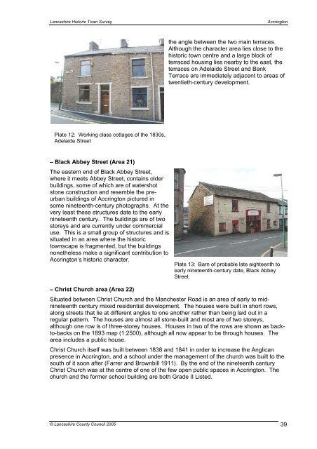
Plate 12: Working class cottages of the 1830s,<br />
Adelaide Street<br />
– Black Abbey Street (Area 21)<br />
The eastern end of Black Abbey Street,<br />
where it meets Abbey Street, contains older<br />
buildings, some of which are of watershot<br />
stone construction and resemble the preurban<br />
buildings of Accrington pictured in<br />
some nineteenth-century photographs. At the<br />
very least these structures date to the early<br />
nineteenth century. The buildings are of two<br />
storeys and are currently under commercial<br />
use. This is a small group of structures and is<br />
situated in an area where the historic<br />
townscape is fragmented, but the buildings<br />
nonetheless make a significant contribution to<br />
Accrington’s historic character.<br />
Plate 13: Barn of probable late eighteenth to<br />
early nineteenth-century date, Black Abbey<br />
Street<br />
– Christ Church area (Area 22)<br />
Situated between Christ Church and the Manchester Road is an area of early to midnineteenth<br />
century mixed residential development. The houses were built in short rows,<br />
along streets that lie at different angles to one another rather than being laid out in a<br />
regular pattern. The houses are almost all stone-built and most are of two storeys,<br />
although one row is of three-storey houses. Houses in two of the rows are shown as backto-backs<br />
on the 1893 map (1:2500), although all now appear to be through houses. The<br />
area includes a public house.<br />
Christ Church itself was built between 1838 and 1841 in order to increase the Anglican<br />
presence in Accrington, and a school under the management of the church was built to the<br />
south of it soon after (Farrer and Brownbill 1911). By the end of the nineteenth century<br />
Christ Church was at the centre of one of the few open public spaces in Accrington. The<br />
church and the former school building are both Grade II Listed.<br />
© <strong>Lancashire</strong> <strong>County</strong> <strong>Council</strong> 2005 39