J - City of New Braunfels
J - City of New Braunfels
J - City of New Braunfels

Create successful ePaper yourself
Turn your PDF publications into a flip-book with our unique Google optimized e-Paper software.
~:_,<strong>City</strong> <strong>of</strong><br />
~~<strong>New</strong> <strong>Braunfels</strong><br />
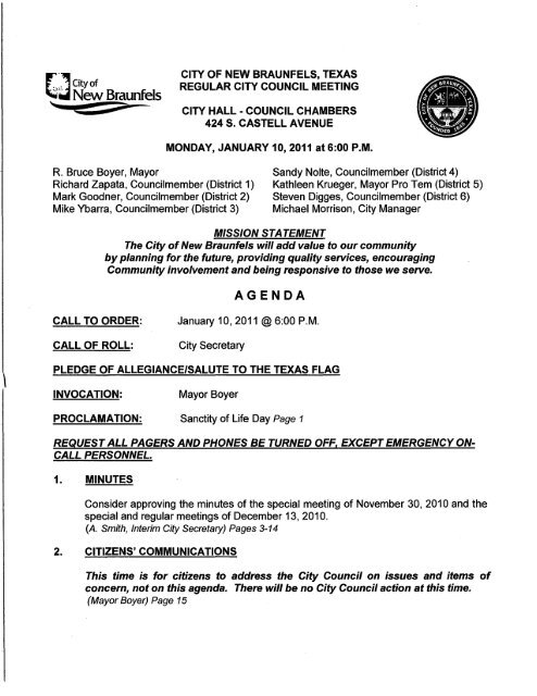
CITY OF NEW BRAUNFELS, TEXAS<br />
REGULAR CITY COUNCIL MEETING<br />
CITY HALL - COUNCIL CHAMBERS<br />
424 S. CASTELL AVENUE<br />
MONDAY, JANUARY 10, 2011 at 6:00P.M.<br />
R. Bruce Boyer, Mayor<br />
Richard Zapata, Councilmember (District 1)<br />
Mark Goodner, Councilmember (District 2)<br />
Mike Ybarra, Councilmember (District 3)<br />
Sandy Nolte, Councilmember (District 4)<br />
Kathleen Krueger, Mayor Pro Tern (District 5)<br />
Steven Digges, Councilmember (District 6)<br />
Michael Morrison, <strong>City</strong> Manager<br />
MISSION STATEMENT<br />
The <strong>City</strong> <strong>of</strong> <strong>New</strong> <strong>Braunfels</strong> will add value to our community<br />
by planning for the future, providing quality services, encouraging<br />
Community involvement and being responsive to those we serve.<br />
AGENDA<br />
CALL TO ORDER:<br />
CALL OF ROLL:<br />
January 10, 2011 @6:00P.M.<br />
<strong>City</strong> Secretary<br />
PLEDGE OF ALLEGIANCE/SALUTE TO THE TEXAS FLAG<br />
INVOCATION:<br />
Mayor Boyer<br />
PROCLAMATION: Sanctity <strong>of</strong> Life Day Page 1<br />
REQUEST ALL PAGERS AND PHONES BE TURNED OFF, EXCEPT EMERGENCY ON<br />
CALL PERSONNEL.<br />
1. MINUTES<br />
Consider approving the minutes <strong>of</strong> the special meeting <strong>of</strong> November 30, 2010 and the<br />
special and regular meetings <strong>of</strong> December 13, 2010.<br />
{A. Smith, Interim <strong>City</strong> Secretary) Pages 3-14<br />
2. CITIZENS' COMMUNICATIONS<br />
This time is for citizens to address the <strong>City</strong> Council on issues and items <strong>of</strong><br />
concern, not on this agenda. There will be no <strong>City</strong> Council action at this time.<br />
(Mayor Boyer) Page 15
<strong>City</strong> Council Agenda<br />
January 10, 2011<br />
Page 2 <strong>of</strong>6<br />
3. CONSENT AGENDA<br />
All items listed below are considered to be routine and non-controversial by the<br />
Council and will be approved by one motion. There will be no separate discussion <strong>of</strong><br />
these items unless a councilmember or citizen so requests, in which case the item will<br />
be removed from the consent agenda and considered as part <strong>of</strong> the normal order <strong>of</strong><br />
business.<br />
Resolutions & Action Items<br />
(A)<br />
(B)<br />
(C)<br />
(D)<br />
Approval <strong>of</strong> the appointment <strong>of</strong> Wayne Clark to the Landa Park Municipal Golf<br />
Course Advisory Board for a term ending December 31, 2013.<br />
(A. Smith, Interim <strong>City</strong> Secretary) Pages 17-20<br />
Approval <strong>of</strong> the purchase <strong>of</strong> accessories for police vehicles from GT<br />
Distributors, Inc and police video systems from Coban through the Buyboard<br />
Cooperative.<br />
(T. Wibert, Chief <strong>of</strong> Police I M. Quinones, Purchasing Manager) Page 21<br />
Approval <strong>of</strong> an interlocal agreement with the <strong>City</strong> <strong>of</strong> Fort Worth, Texas in<br />
accordance with Texas Government Code Chapter 791, Texas lnterlocal<br />
Cooperation Act, initially for credit card processing services.<br />
(M. Quinones, Purchasing Manager) Page 23<br />
Approval <strong>of</strong> purchase <strong>of</strong> supplies for <strong>City</strong>-wide use from Office Depot through<br />
the Texas Cooperative Purchasing Network (TCPN) contract.<br />
(M. Quinones, Purchasing Manager) Page25<br />
Ordinances<br />
(In accordance with Section 3. 10 <strong>of</strong> the <strong>City</strong>'s Charter, a descriptive<br />
caption <strong>of</strong> each ordinance shall be read on two separate days.)<br />
(E) Approval <strong>of</strong> the second and final reading <strong>of</strong> an ordinance abandoning 0.379<br />
acres <strong>of</strong> public right-<strong>of</strong>-way, known as Jean Avenue and Fritz Koepp Street,<br />
located near the northeast terminus <strong>of</strong> McGar Street.<br />
(S. Mattingly, Planning and Community Development Director) Pages 27-40<br />
(F)<br />
Approval <strong>of</strong> the second and final reading <strong>of</strong> an ordinance rezoning 1.977 acres<br />
located at 1720 Gruene Road, from "R-2" Single and Two-Family District to "C-<br />
1A" Neighborhood Business District.<br />
(S. Mattingly, Planning and Community Development Director) Pages 41-70
(G)<br />
<strong>City</strong> Council Agenda<br />
January 10, 2011<br />
Page 3 <strong>of</strong>6<br />
Approval <strong>of</strong> the second and final reading <strong>of</strong> an ordinance amending Section<br />
5.21-10(b), Non-Residential and Multifamily Design Standards Appeal<br />
Procedures, Chapter 144, Zoning Ordinance, establishing an application fee.<br />
(S. Mattingly, Planning and Community Development Director) Pages 71-76<br />
(H) Approval <strong>of</strong> the first reading <strong>of</strong> an ordinance amending Ordinance Number 75-<br />
10 to approve installation <strong>of</strong> four way stop signs at the intersection <strong>of</strong> Hollyhock<br />
Lane at Larkspur and all way stop signs at Pahmeyer Road and Anna Lee<br />
Drive.<br />
(J. Klein, <strong>City</strong> Engineer) Pages 77-79<br />
(I)<br />
(J)<br />
(K)<br />
(L)<br />
Approval <strong>of</strong> the first reading <strong>of</strong> an ordinance amending the code <strong>of</strong> ordinances<br />
<strong>of</strong> the <strong>City</strong> <strong>of</strong> <strong>New</strong> <strong>Braunfels</strong>, Texas by amending section 126-346 (f) to add no<br />
parking zones along the northeast side <strong>of</strong> Stone Gate Drive in the 200 block and<br />
providing an effective date.<br />
(J. Klein, <strong>City</strong> Engineer) Pages 81-83<br />
Approval <strong>of</strong> the first reading <strong>of</strong> an ordinance amending the Code <strong>of</strong> Ordinances<br />
<strong>of</strong> the <strong>City</strong> <strong>of</strong> <strong>New</strong> <strong>Braunfels</strong>, Texas by modifying Section 126 to establish speed<br />
limits on SH 46 from Alves Lane to the <strong>New</strong> <strong>Braunfels</strong> city limits.<br />
( J. Klein, <strong>City</strong> Engineer) Pages 85-90<br />
Authorization for the <strong>City</strong> Manager to approve change order 4 to the contract<br />
with DNT Construction, LLC for construction services on Goodwin Lane as part<br />
<strong>of</strong> the Goodwin Lane Improvements Project.<br />
(J. Klein, <strong>City</strong> Engineer) Pages 91-92<br />
Approval <strong>of</strong> the second and final reading <strong>of</strong> an ordinance amending Ordinance<br />
Number 75-10 to approve installation <strong>of</strong> four way stop signs at the intersection<br />
<strong>of</strong> Divine Way and Angelina/Gaines Drive<br />
( J. Klein, <strong>City</strong> Engineer) Pages 93-95<br />
4. INDIVIDUAL ITEMS FOR CONSIDERATION<br />
(A)<br />
(B)<br />
(C)<br />
Discuss and consider approval <strong>of</strong> a resolution supporting Guadalupe County<br />
Judge Mike Wiggins as representative on the South Central Texas (Region L)<br />
Regional Water Planning Group.<br />
(S. Ramsey, Public Works Director) Pages 97-101<br />
Discuss and consider approval <strong>of</strong> a resolution authorizing the <strong>City</strong> Manager to<br />
support the Guadalupe-Blanco River Authority's application for flood protection<br />
planning grant assistance filed with the Texas Water Development Board.<br />
(Nathan Pence, Watershed Program Manager & Tommy Hill, Guadalupe Blanco River<br />
Authority) Pages 103-109<br />
Discuss and consider the approval <strong>of</strong> locating a statue <strong>of</strong> Prince Carl Solms in<br />
front <strong>of</strong> the Civic/Convention Center.<br />
(S. Mattingly, Planning and Community Development Director) Pages 111-114
<strong>City</strong> Council Agenda<br />
January 10, 2011<br />
Page 4 <strong>of</strong>6<br />
(D)<br />
(E)<br />
(F)<br />
(G)<br />
(H)<br />
(I)<br />
(J)<br />
(K)<br />
Discuss and consider the first reading <strong>of</strong> an ordinance amending Ordinance No.<br />
2009-50, continuing the enforcement <strong>of</strong> the Two Hour Parking Zone in<br />
Downtown <strong>New</strong> <strong>Braunfels</strong>.<br />
(S. Mattingly, Planning and Community Development Director) Pages 115-132<br />
Discuss and consider an appeal to the Non-Residential and Multi-Family Design<br />
Standards Exterior Building Materials requirement for themed lodging and an<br />
additional outbuilding to be located within the Schlitterbahn Water Park.<br />
(S. Mattingly, Planning and Community Development Director) Pages 133-141<br />
Public Hearing and first reading <strong>of</strong> an ordinance rezoning <strong>of</strong> 16.589 acres,<br />
located at 631 Lakeview Boulevard, from "R-3" Multifamily District to "PDD"<br />
Eden Hill Planned Development District.<br />
(S. Mattingly, Planning and Community Development Director) Pages 143-181<br />
Public Hearing and first reading <strong>of</strong> an ordinance rezoning a portion <strong>of</strong> Rivercrest<br />
Heights Subdivision, from "C-1" Local Business District to "R-2A" Single and<br />
Two Family District.<br />
(S. Mattingly, Planning and Community Development Director) Pages 183-200<br />
Discuss and consider a resolution <strong>of</strong> the <strong>City</strong> <strong>of</strong> <strong>New</strong> <strong>Braunfels</strong>, Texas<br />
requesting that State Highway 46 from Interstate Highway 35 to the East <strong>City</strong><br />
Limit <strong>of</strong> <strong>New</strong> <strong>Braunfels</strong> in Guadalupe County be designated as the<br />
"Representative Edmund Kuempel Memorial Highway".<br />
(S. Mattingly, Planning and Community Development Director) Pages 201-202<br />
Discuss and consider the second and final reading <strong>of</strong> an ordinance amending<br />
Chapter 106, Signs, <strong>of</strong> the Code <strong>of</strong> Ordinances, by amending Section 106-3 to<br />
define mobile billboards, parking and twenty-four hour period, amending Section<br />
106-11 to prohibit mobile billboards as <strong>of</strong>f premise signs.<br />
(S. Mattingly, Planning and Community Development Director) Pages 203-207<br />
Discuss and consider the second and final reading <strong>of</strong> an ordinance rezoning<br />
47.97 acres located on the west side <strong>of</strong> Oak Run Parkway, approximately 2,000<br />
feet north <strong>of</strong> Loop 337, from "R-1A-8" Single Family District with Restrictions to<br />
"Enclave at Westpointe Village Planned Development District" with Concept<br />
Plan.<br />
(S. Mattingly, Planning and Community Development Director) Pages 209-254<br />
Public Hearing and first reading <strong>of</strong> an ordinance rezoning a portion <strong>of</strong> Mission<br />
Forest Subdivision from "R-3" Multi-Family District to "R-1A-6.6" Single Family<br />
District.<br />
(S. Mattingly, Planning and Community Development Director) Pages 255-270
(L)<br />
(M)<br />
(N)<br />
<strong>City</strong> Council Agenda<br />
January 10, 2011<br />
Page 5 <strong>of</strong>6<br />
Public Hearing and first reading <strong>of</strong> an ordinance rezoning a portion <strong>of</strong> Gruene<br />
Road Subdivision, from "R-3" Multi-Family District, to "R-1A-8" Single Family<br />
District and "R-2A" Single-Family and Two-Family District.<br />
(S. Mattingly, Planning and Community Development Director) Pages 271-291<br />
Public Hearing and first reading <strong>of</strong> an ordinance rezoning a portion <strong>of</strong> the<br />
Gruene Courtyard Subdivision, from "R-3" Multifamily District, to "R-1A-6.6"<br />
Single Family District and "R-2A" Single and Two Family District.<br />
(S. Mattingly, Planning and Community Development Director) Pages 293-318<br />
Public Hearing and first reading <strong>of</strong> an ordinance rezoning a portion <strong>of</strong> the<br />
Garden Park Subdivision, from "R-1" Single Family District, "R-3" Multi-Family<br />
District, and "C-1" Local Business District to "R-2A" Single Family and Two<br />
Family District.<br />
(S. Mattingly, Planning and Community Development Director) Pages 319-339<br />
(0) First public hearing regarding the annexation <strong>of</strong> 1984.098 acres <strong>of</strong> land on IH 35<br />
North between FM 1101 and FM 1102 adjacent to the existing <strong>City</strong> Limits.<br />
(S. Mattingly, Planning and Community Development Director) Pages 341-348<br />
(P)<br />
(Q)<br />
First public hearing regarding the annexation <strong>of</strong> a 100.007 acre tract <strong>of</strong> land out<br />
<strong>of</strong> Subdivision No. 33 and Subdivision No.58 <strong>of</strong> the A.M. Esnaurizar Eleven<br />
League Grant Survey, and being a portion <strong>of</strong> Tract Three, a 112 acre tract <strong>of</strong><br />
land, all <strong>of</strong> Tract Four, a 1.93 acre tract <strong>of</strong> land and all <strong>of</strong> Tract Five, an 88.5<br />
acre tract <strong>of</strong> land located east <strong>of</strong> FM 1101 and west <strong>of</strong> Westmeyer Road<br />
adjacent to the existing <strong>City</strong> Limits.<br />
(S. Mattingly, Planning and Community Development Director) Pages 349-357<br />
Discuss and consider repealing the moratorium on Short Term Rental Specific<br />
Use Permits and registration <strong>of</strong> non-conforming uses.<br />
(Councilmember Steven Digges, District 6) Pages 359-362<br />
5. EXECUTIVE SESSIONS<br />
In accordance with Texas Government Code, Subchapter D, the <strong>City</strong> Council may<br />
convene in a closed session to discuss any <strong>of</strong> the following items; any final action or<br />
vote taken will be in public.<br />
(A)<br />
(B)<br />
Deliberate and consider the purchase, exchange, lease or value <strong>of</strong> real<br />
property, in accordance with Section 551.072, <strong>of</strong> the Texas Government Code.<br />
(A. Wayland, <strong>City</strong> Attorney) Page 363<br />
Deliberate issues regarding economic development negotiations in accordance<br />
with Section 551.087, <strong>of</strong> the Texas Government Code.<br />
(A. Wayland, <strong>City</strong> Attorney) Page 363
<strong>City</strong> Council Agenda<br />
January 10, 2011<br />
Page 6 <strong>of</strong>6<br />
(C)<br />
Deliberate pending/contemplated litigation, settlement <strong>of</strong>fer(s), and matters<br />
concerning privileged and unprivileged client information deemed confidential<br />
by Rule 1.05 <strong>of</strong> the Texas Disciplinary Rules <strong>of</strong> Pr<strong>of</strong>essional Conduct in<br />
accordance with Section 551.071, <strong>of</strong> the Texas Government Code.<br />
(A. Wayland, <strong>City</strong> Attorney) Page 363<br />
NOTE: The <strong>City</strong> Council reserves the right to retire into executive session concerning any <strong>of</strong><br />
the items listed on this Agenda whenever it is considered necessary and legally justified<br />
under the Open Meetings Act (Chapter 551 <strong>of</strong> the Texas Government Code).<br />
ADJOURNMENT<br />
CERTIFICATION<br />
Ann Smith, lnterifllCitY Secretary<br />
ties who plan to attend this meeting and who may need auxiliary aids or services
.L<br />
<strong>City</strong> <strong>of</strong> !<strong>New</strong> CBraunjefs<br />
Proclallla tion<br />
THE STATE OF TEXAS §<br />
COUNTY OF COMAL §<br />
CITY OF NEW BRAUNFELS §<br />
WHEREAS, Sanctity <strong>of</strong> Life Day, which began in 1984, was first proclaimed by President<br />
Ronald Reagan to remind us to build a culture <strong>of</strong> 'life'; and<br />
)<br />
WHEREAS, the citizens <strong>of</strong> <strong>New</strong> <strong>Braunfels</strong> and our community acknowledge that every<br />
human life has value; and<br />
WHEREAS, the value <strong>of</strong> an individual life as the primary source <strong>of</strong> love, identity, self-esteem<br />
and support leads to the very foundation <strong>of</strong> our community; and<br />
WHEREAS, for the last 26 years, Options for Women has been serving as <strong>New</strong> <strong>Braunfels</strong><br />
Crisis Pregnancy Center.<br />
NOW, THEREFORE, I, R. BRUCE BOYER, by virtue <strong>of</strong> the authority vested in me as<br />
Mayor <strong>of</strong> the <strong>City</strong> <strong>of</strong> <strong>New</strong> <strong>Braunfels</strong>, Texas, do hereby proclaim, January 24th, 2011 as:<br />
Sanctity <strong>of</strong> Life Day<br />
In <strong>New</strong> <strong>Braunfels</strong> and urge all citizens to observe this day by focusing on sanctity - the very<br />
preciousness <strong>of</strong> life -young and old alike.<br />
IN WITNESS WHEREOF, I have hereunto set my hand and caused the seal <strong>of</strong> the <strong>City</strong> <strong>of</strong><br />
<strong>New</strong> <strong>Braunfels</strong> to be affixed this 10th day <strong>of</strong> January, 2011.<br />
CITY OF NEW BRAUNFELS, TEXAS<br />
R. BRUCE BOYER, MAYOR<br />
)
---y·<br />
)<br />
)
MINUTES<br />
OF THE NEW BRAUNFELS CITY COUNCIL<br />
SPECIAL MEETING OF NOVEMBER 30,2010<br />
The <strong>City</strong> Council <strong>of</strong> the <strong>City</strong> <strong>of</strong> <strong>New</strong> <strong>Braunfels</strong>, Texas, met in Special Session on<br />
November 30, 2010.<br />
<strong>City</strong> Councilmembers present were: Mayor Bruce Boyer, presiding; Mayor<br />
Pro-tem Kathleen Krueger and Councilmembers Mike Ybarra, Sandy Nolte, and Steven<br />
Digges.<br />
<strong>City</strong> Staff present were: <strong>City</strong> Manager Michael E. Morrison, <strong>City</strong> Attorney Alan<br />
Wayland, Assistant <strong>City</strong> Manager Robert Camarena, Deputy <strong>City</strong> Secretary Danny S.<br />
Batts II, Support Services Director Deborah Korinchock, and Interim <strong>City</strong> Secretary Ann<br />
Smith.<br />
)<br />
The meeting was called to order by Mayor Boyer in the <strong>New</strong> <strong>Braunfels</strong> Municipal<br />
Building Council Chambers at 4:33 p.m. All Councilmembers were present.<br />
1. Discuss and consider approval <strong>of</strong> a resolution <strong>of</strong> the <strong>City</strong> Council <strong>of</strong> the<br />
<strong>City</strong> Of <strong>New</strong> <strong>Braunfels</strong>, Texas approving the issuance <strong>of</strong> the $7,000,000<br />
<strong>New</strong> <strong>Braunfels</strong> Development Authority Tax Increment Contract Revenue<br />
Notes, Series 2010, and containing other provisions relating to the<br />
foregoing subject.<br />
Councilmember Digges moved to approve the resolution as presented.<br />
Pro Tern Krueger seconded the motion. Vote was unanimous.<br />
Mayor<br />
2. Discuss and consider approval <strong>of</strong> a resolution by the <strong>City</strong> Council <strong>of</strong> the<br />
<strong>City</strong> <strong>of</strong> <strong>New</strong> <strong>Braunfels</strong>, Texas amending a tax increment participation<br />
inter/ocal cooperative agreement between the <strong>City</strong> <strong>of</strong> <strong>New</strong> <strong>Braunfels</strong>,<br />
Texas, the County <strong>of</strong> Coma/, Texas, Reinvestment Zone Number One,<br />
<strong>New</strong> <strong>Braunfels</strong>, Texas, and A-L 95 Creekside Town Center, L.P.; and other<br />
matters in connection therewith.<br />
Councilmember Digges moved to approve the resolution<br />
Councilmember Nolte seconded the motion. Vote was unanimous.<br />
as presented.<br />
Adjournment: This special meeting adjourned at 4:47p.m.<br />
)<br />
November 30, 2010 <strong>New</strong> <strong>Braunfels</strong> Special <strong>City</strong> Council Meeting 1
Date Approved: January 10, 2011<br />
By:<br />
R. BRUCE BOYER, MAYOR<br />
Attest:<br />
ANN SMITH<br />
INTERIM CITY SECRETARY<br />
)<br />
)<br />
November 30, 2010 <strong>New</strong> <strong>Braunfels</strong> Special <strong>City</strong> Council Meeting 2
MINUTES<br />
OF THE NEW BRAUNFELS CITY COUNCIL<br />
SPECIAL MEETING OF DECEMBER 13,2010<br />
The <strong>City</strong> Council <strong>of</strong> the <strong>City</strong> <strong>of</strong> <strong>New</strong> <strong>Braunfels</strong>, Texas, met in Special Session on<br />
December 13, 2010.<br />
<strong>City</strong> Councilmembers present were: Mayor Bruce Boyer, presiding; and<br />
Councilmembers Richard Zapata, Mark Goodner, Mike Ybarra, Sandy Nolte, and<br />
Steven Digges.<br />
<strong>City</strong> Staff present were: <strong>City</strong> Manager Michael E. Morrison, <strong>City</strong> Attorney Alan<br />
Wayland, Assistant <strong>City</strong> Manager Robert Camareno, Deputy <strong>City</strong> Secretary Danny S.<br />
Batts II, Planning Manager Stacey Snell, Fire Chief John Robinson, and Planning and<br />
Community Development Director Shannon Mattingly.<br />
)<br />
The meeting was called to order by Mayor Boyer in the <strong>New</strong> <strong>Braunfels</strong> Municipal<br />
Building Council Chambers at 4:04 p.m.<br />
After calling the meeting to order, Mayor Boyer announced that the <strong>City</strong> Council would<br />
recess into executive session. The Council returned to regular session at 4:19p.m. and<br />
began consideration <strong>of</strong> the individual items on the agenda.<br />
1. Workshop, presentation and discussion regarding a three-year annexation plan.<br />
The <strong>City</strong> Council received a presentation from Planning and Community Development<br />
Director Shannon Mattingly regarding the legal and technical aspects <strong>of</strong> adopting a three<br />
year annexation plan. After the presentation, the Council reviewed maps <strong>of</strong> the <strong>City</strong> and<br />
areas that might be included in a future annexation plan.<br />
2. Presentation and discussion regarding improvements to Farm to Market Road<br />
306.<br />
<strong>City</strong> Manager Michael Morrison briefly noted that the <strong>City</strong> had been in discussions with<br />
the Texas Department <strong>of</strong> Transportation regarding an opportunity to make<br />
improvements to F.M. 306, and that at some point the <strong>City</strong> would need to consider<br />
whether or not it would be willing to participate financially in the project.<br />
)<br />
At 5:31 p.m. the <strong>City</strong> Council recessed into executive session. The Council returned<br />
from executive session at 6:10p.m.<br />
December 13, 2010 <strong>New</strong> <strong>Braunfels</strong> Special <strong>City</strong> Council Meeting 1
Adjournment: This special meeting adjourned at 6:10p.m.<br />
Date Approved: January 10, 2011<br />
By:<br />
R. BRUCE BOYER, MAYOR<br />
Attest:<br />
ANN SMITH<br />
INTERIM CITY SECRETARY<br />
)<br />
December 13, 2010 <strong>New</strong> <strong>Braunfels</strong> Special <strong>City</strong> Council Meeting 2
MINUTES<br />
REGULAR CITY COUNCIL MEETING<br />
DECEMBER 13, 2010<br />
The <strong>City</strong> Council <strong>of</strong> the <strong>City</strong> <strong>of</strong> <strong>New</strong> <strong>Braunfels</strong>, Texas, met in Regular Session on<br />
December 13, 2010. ·<br />
<strong>City</strong> Councilmembers present were: Mayor Bruce Boyer, presiding; and<br />
Councilmembers Richard Zapata, Mark Goodner, Mike Ybarra, Sandy Nolte, and Steven<br />
Digges.<br />
<strong>City</strong> Staff present were: <strong>City</strong> Manager Michael E. Morrison, Assistant <strong>City</strong><br />
Manager Robert Camarena, <strong>City</strong> Attorney Alan C. Wayland, Deputy <strong>City</strong> Secretary<br />
Danny S. Batts II, Planning and Community Development Director Shannon Mattingly,<br />
and Parks and Recreation Director Stacey Laird Dicke.<br />
The meeting was called to order by Mayor Boyer in the <strong>New</strong> <strong>Braunfels</strong> Municipal<br />
Building <strong>City</strong> Council Chambers at 6:10 p.m. Mayor Boyer led the Pledge <strong>of</strong> Allegiance<br />
and the Salute to the Texas Flag and Councilmember Digges gave the invocation.<br />
)<br />
Recognition: Main Street National Recognition: Mayor _Boyer recognized George Ross,<br />
Craig Massouh, Jerry Sonier, and Laurie Hawkins for their work on the Main Street<br />
Advisory Board regarding the <strong>City</strong>'s designation and a 2011 Main Street <strong>City</strong> by the Texas<br />
Historic Commission and The National Historic Trust.<br />
1. Minutes: Councilmembers considered approval <strong>of</strong> the minutes <strong>of</strong> the special meeting<br />
and the regular meetings <strong>of</strong> November 22, 2010.<br />
Councilmember Digges moved to approve the minutes as written. Councilmember<br />
Nolte seconded the motion which was unanimously approved by <strong>City</strong> Council.<br />
2. Citizens' Communications:<br />
Mayor Boyer announced that Item 4-1 had been pulled from the agenda and would<br />
not be discussed.<br />
Rittler Strahn <strong>of</strong> 229 Pennsylvania Blvd. spoke in opposition to certain proposed<br />
standards for the flow rates for Coma I Springs currently being considered by the<br />
Edwards Aquifer Authority.<br />
Gwen Karraker <strong>of</strong> 1249 Oleander spoke in opposition to the above referenced<br />
standards, and encouraged the <strong>City</strong> Council to formally request an increase in the<br />
proposed flow rates for Comal Springs.<br />
)<br />
Helen Clayton, Kevin Clayton, and Cole Clayton <strong>of</strong> 1224 Rivercrest Dr. came<br />
forward to express deep appreciation to <strong>City</strong> employees that had helped provide<br />
December 13, 2010 <strong>New</strong> <strong>Braunfels</strong> Regular <strong>City</strong> Council Meeting 1
lifesaving treatment to Cole Clayton after he sustained life threatening injuries<br />
during a kayaking accident earlier in the year.<br />
Steven Hanna <strong>of</strong> the <strong>New</strong> <strong>Braunfels</strong> Police Officers Association came forward to<br />
announce that the Association would begin collecting signatures in January in<br />
order to place adopting police <strong>of</strong>ficers civil service requirements on the May ballot.<br />
3. Consent Agenda:<br />
Mayor Boyer read Consent Agenda items (A-P) as listed below. Councilmember<br />
Digges made a motion to approve the consent agenda as listed below. Councilmember<br />
Notte seconded the motion which was approved unanimously.<br />
(A)<br />
Approval to authorize the <strong>City</strong> Manager to enter into a contract modification<br />
for changes in the pr<strong>of</strong>essional services contract with Halff Associates, Inc.<br />
for the North Tributary Flood Control Project.<br />
Document No. 1720<br />
(B)<br />
Approval <strong>of</strong> the appointment <strong>of</strong> Laurie Hawkins, Kandace Tornquist, and<br />
Audrea Gibson to the Community Development Advisory Committee for terms<br />
ending December 13, 2013.<br />
(C) Approval <strong>of</strong> the appointment <strong>of</strong> Bruce Weldy to the Landa Park Municipal Golf ·.·)<br />
Course Advisory Board for a term ending December 31, 2013.<br />
(D)<br />
(E)<br />
(F)<br />
(G)<br />
Approval <strong>of</strong> the appointment <strong>of</strong> Laurie Hawkins to the Main Street Advisory<br />
Board for a term ending December 31, 2013.<br />
Approval <strong>of</strong> Transportation <strong>of</strong> Traffic Advisory Board's recommendation to<br />
deny a request for the installation <strong>of</strong> speed humps on Dove Crossing Drive in<br />
the 2200 and 2600 blocks.<br />
Approval <strong>of</strong> Transportation and Traffic Advisory Board's recommendation to<br />
deny a request for additional stop signs for Lee Street and Stonewall Street at<br />
Chestnut Avenue.<br />
Approval <strong>of</strong> a resolution authorizing the <strong>City</strong> Manager to enter into an<br />
agreement with Richard J. Leidl, P.C. for federal legislative services on behalf<br />
<strong>of</strong> the <strong>City</strong> <strong>of</strong> <strong>New</strong> <strong>Braunfels</strong>.<br />
Resolution No. 201 O-R63<br />
(H)<br />
Approval <strong>of</strong> a budget adjustment in the 2011 Certificates <strong>of</strong> Obligation Capital<br />
Improvement FY 2010-11 Adopted Budget.<br />
(I) Approval <strong>of</strong> the purchase <strong>of</strong> services for the <strong>New</strong> <strong>Braunfels</strong> Public Library )<br />
December 13, 2010 <strong>New</strong> <strong>Braunfels</strong> Regular <strong>City</strong> Council Meeting 2
from the Alamo Area Library System Vendor Discount list.<br />
(J)<br />
Approval <strong>of</strong> the purchase <strong>of</strong> vehicles for the <strong>New</strong> <strong>Braunfels</strong> Police<br />
Department from Bluebonnet Motors on the Lower Colorado River Authority<br />
(LCRA) contract and Caldwell Country Chevy on the State contract.<br />
Document No. 1721<br />
(K)<br />
(L)<br />
(M)<br />
Approval <strong>of</strong> the Mayoral re-appointment <strong>of</strong> Mark Goodner to serve as<br />
Chairman <strong>of</strong> the Board <strong>of</strong> Directors <strong>of</strong> Reinvestment Zone No. 1 until<br />
December 31, 2011.<br />
Approval for the purchase <strong>of</strong> occupational physicals for uniformed employees<br />
in the Fire Department.<br />
Approval <strong>of</strong> the 2011 Airport Rates and Charges as established by Chapter _<br />
10 "Aviation" Section 10-101(b)(4)a. Lease Charge <strong>of</strong> the Code <strong>of</strong><br />
Ordinances.<br />
)<br />
(N) Approve a resolution setting the schedule for public hearings to be held to<br />
consider annexation <strong>of</strong> a 100.007 acre tract <strong>of</strong> land out <strong>of</strong> Subdivision No. 33<br />
and Subdivision No. 58 <strong>of</strong> the A.M. Esnaurizar Eleven League Grant Survey,<br />
and being a portion <strong>of</strong> Tract Three, a 112 acre tract <strong>of</strong> land, all <strong>of</strong> Tract Four,<br />
a 1.93 acre tract <strong>of</strong> land and all <strong>of</strong> Tract Five, an 88.5 acre tract <strong>of</strong> land<br />
located east <strong>of</strong> FM 1101 and west <strong>of</strong> Westmeyer Road adjacent to the<br />
existing <strong>City</strong> Limits.<br />
Resolution No. 201 O-R64<br />
(0) Approval <strong>of</strong> the first reading <strong>of</strong> an ordinance amending Ordinance No. 75-10<br />
to approve installation <strong>of</strong> all way stop signs at the intersection <strong>of</strong> Divine Way<br />
and Angelina/Gaines Drive.<br />
(P) Approval <strong>of</strong> a resolution recommended by the <strong>New</strong> <strong>Braunfels</strong> Industrial<br />
Development Corporation regarding a grant to Buc-ee's Ltd. to fund a portion<br />
<strong>of</strong> the cost <strong>of</strong> public infrastructure improvements in the area serving the<br />
southeast corner <strong>of</strong> IH-35 and F.M. 306 in an amount not to exceed<br />
$333,333.00.<br />
Resolution No. 201 O-R66<br />
4. INDIVIDUAL ITEMS FOR CONSIDERATION<br />
)<br />
Item 4-A: Mayor Boyer read the following caption:<br />
December 13, 2010 <strong>New</strong> <strong>Braunfels</strong> Regular <strong>City</strong> Council Meeting 3
HI<br />
Discuss and consider second and final reading <strong>of</strong> an ordinance amending Chapter 86,<br />
Section 86-91 <strong>of</strong> the Code <strong>of</strong> Ordinances <strong>of</strong> the <strong>City</strong> <strong>of</strong> <strong>New</strong> <strong>Braunfels</strong>, Texas regarding ---4/·<br />
golf fees.<br />
After the reading <strong>of</strong> the Caption, Parks and Recreation Director Stacey Laird Dicke noted<br />
that this ordinance had been scaled back from the first reading, and had initially included<br />
fee changes for a variety <strong>of</strong> parks and recreation related fees. She noted that the<br />
ordinance now only addressed fees associated with the Golf Course.<br />
After the presentation, Councilmember Digges made a motion to approve the ordinance.<br />
Councilmember Nolte seconded the motion, which carried by the following roll call vote:<br />
Ayes: Councilmembers Zapata, Goodner, Ybarra, Nolte, and Mayor Boyer. Nays: None.<br />
Ordinance No. 2010-86<br />
Item 4-B: Mayor Boyer read the following caption:<br />
Discuss and consider an appeal to the Non-Residential and Multifamily Design Standards<br />
Exterior Building Materials requirement for a proposed commercial building to be located<br />
at 135 Conrad's Road.<br />
After the reading <strong>of</strong> the Caption, Planning and Community Development Director<br />
Shannon Mattingly gave a brief presentation regarding the failure <strong>of</strong> the owners <strong>of</strong> the<br />
above referenced property to provide a certain exterior finish on an accessory building as ·)<br />
required by <strong>City</strong> ordinance. She noted tha:t the building owners had been notified <strong>of</strong> the .<br />
requirement and had submitted plans with their application for a building permit that<br />
clearly showed the building with the required exterior finish. However, the owners then<br />
sought a certificate <strong>of</strong> occupancy without providing the building with the required exterior<br />
finish. Director Mattingly then stated that staff recommended that the owners appeal be<br />
denied.<br />
After the presentation, Councilmember Zapata made a motion to deny the appeal.<br />
Councilmember Nolte seconded the motion, which carried unanimously.<br />
Item 4-C: Mayor Boyer read the following caption:<br />
Public hearing and consider first reading <strong>of</strong> an ordinance rezoning 1.977 acres located at<br />
1720 Gruene Road, from "R-2" Single and Two-Family District to "C-1B" Neighborhood<br />
Business District.<br />
After the reading <strong>of</strong> the caption, Planning and Community Development Director Shannon<br />
Mattingly gave a brief presentation regarding the rezoning <strong>of</strong> 1720 Gruene Rd. She noted<br />
that the subject property was surrounded by agricultural land and abutted a railroad track.<br />
She further noted that the applicant intended to use the property for a restaurant with an<br />
outdoor music venue. Director Mattingly then noted that the Planning and Zoning<br />
Commission had recommended that the property be rezoned to a "C-1A" classification<br />
)<br />
December 13, 2010 <strong>New</strong> <strong>Braunfels</strong> Regular <strong>City</strong> Council Meeting 4
ll<br />
instead <strong>of</strong> "C-1 B" in order to ensure that all <strong>of</strong> the potential uses allowed in the zoning<br />
classification would be appropriate for the surrounding land uses. She then noted that a<br />
zoning classification <strong>of</strong> "C-1A" would allow the applicant to build the planned restaurant<br />
and then apply for a special use permit for the outdoor music venue.<br />
After the presentation, Mayor Boyer opened the public hearing. There being no public<br />
input, Councilmember Digges moved to close the public hearing. The motion was<br />
seconded by Councilmember Nolte and approved unanimously. After the closing <strong>of</strong> the<br />
public hearing, Councilmember Digges moved to approve the first reading <strong>of</strong> the<br />
ordinance with the stipulation that the property be zoned "C-1A" instead <strong>of</strong> the "C-1 B"<br />
requested by the applicant. The motion was seconded by Councilmember Ybarra and<br />
carried unanimously.<br />
Item 4-D: Mayor Boyer read the following caption:<br />
Public hearing and consider first reading <strong>of</strong> an ordinance amending Section 5.21-10(b),<br />
Non-Residential and Multifamily Design Standards Appeal Procedures, Chapter 144,<br />
Zoning Ordinance, establishing an application fee.<br />
)<br />
After the reading <strong>of</strong> the caption, Planning and Community Development Director Mattingly<br />
· made a brief presentation on the proposed ordinance. She noted that the ordinance<br />
governing appeal procedures for the design standards did not include a fee to defray the<br />
<strong>City</strong>'s cost associated with processing appeals arising under its provisions. She then<br />
stated that the proposed fee <strong>of</strong> $300.00 was selected because the review process for this<br />
type <strong>of</strong> appeal was substantially similar to that used for conditional sign permits, and<br />
those permits have a $300.00 application fee.<br />
After the presentation, Mayor Boyer opened the public hearing. There being no public<br />
input, Gouncilmember Digges moved to close the public hearing. The motion was<br />
seconded by Councilmember Nolte and approved unanimously. After the closing <strong>of</strong> the<br />
public hearing, Councilmember Digges moved to approve the first reading <strong>of</strong> the<br />
ordinance. The motion was seconded by Councilmember Nolte and carried unanimously.<br />
Item 4-E: Mayor Boyer read the following caption:<br />
Public hearing and consider first reading <strong>of</strong> an ordinance abandoning 0.379 acres <strong>of</strong><br />
public right-<strong>of</strong>-way, known as Jean Avenue and Fritz Koepp Street, located near the<br />
northeast terminus <strong>of</strong> McGar Street.<br />
After the reading <strong>of</strong> the caption, Planning and Community Development Director Mattingly<br />
gave a brief presentation regarding the requested right <strong>of</strong> way abandonment. She noted<br />
that the right <strong>of</strong> way was dedicated as a street, but a street had never been built nor was<br />
one planned in the future. She also noted that all <strong>of</strong> the property owners abutting the<br />
abandonment had been presented the opportunity to buy a portion <strong>of</strong> the right <strong>of</strong> way, as<br />
required by law, but that only one owner had elected to participate and would be<br />
purchasing the entire right <strong>of</strong> way. She further stated that staff recommended that the<br />
December 13, 2010 <strong>New</strong> <strong>Braunfels</strong> Regular <strong>City</strong> Council Meeting 5
lL<br />
right <strong>of</strong> way abandonment be approved, subject to the following conditions: That the<br />
property be re-platted prior to development or within two years, whichever occurs first,<br />
and that a 20ft utility easement be provided along the front <strong>of</strong> the property adjacent to<br />
McGarSt.<br />
After the presentation, Mayor Boyer opened the public hearing. There being no public<br />
input, Councilmember Digges moved to close the public hearing. The motion was<br />
seconded by Councilmember Nolte and approved unanimously. After the closing <strong>of</strong> the<br />
public hearing, Councilmember Digges moved to approve the first reading <strong>of</strong> the<br />
ordinance with the conditions recommended by staff. The motion was seconded by<br />
Councilmember Nolte and carried unanimously.<br />
Item 4-F: Mayor Boyer read the following caption:<br />
Discuss and consider the first reading <strong>of</strong> an ordinance amending Chapter 106, Signs, <strong>of</strong><br />
the Code <strong>of</strong> Ordinances, by amending Section 106-3 to define mobile billboards and<br />
amending <strong>of</strong>f-premise sign definition to include mobile billboards, and amending Section<br />
106-11 to prohibit mobile billboards.<br />
After the reading <strong>of</strong> the caption, Planning and Community Development Director Mattingly<br />
gave a brief presentation regarding the changes to the ordinance since it had last been<br />
discussed by council, noting that a definition for "mobile billboard" had been added along<br />
with a provision that makes property owners responsible for not allowing mobile billboards<br />
to be visible from their property. )<br />
After the presentation, Bryce Tomlinson <strong>of</strong> 250 Fallen Oak spoke in opposition to the<br />
proposed ordinance. He noted that he owned several vehicles that would become<br />
prohibited should the ordinance pass, and felt that at the very least his company should<br />
be "grandfathered" and allowed to operate without restriction if the ordinance was passed.<br />
Next, Vince Koegle <strong>of</strong> 7 40 Rosemary Dr spoke in opposition to the proposed ordinance.<br />
He noted that he and Mr. Tom Iinson were business partners and had taken pains to<br />
ensure that their mobile billboard business was compliant with all <strong>City</strong> regulations before<br />
beginning operations. He stated that he did not feel it was fair to restrict their business<br />
after they had already begun operations under the current regulations.<br />
After public comments, the <strong>City</strong> Council began to discuss among themselves and with<br />
staff various interpretations <strong>of</strong> the proposed ordinance. After this discussion,<br />
Councilmember Zapata moved to approve the proposed ordinance with an amendment to<br />
create a "grandfather" clause that would apply to mobile billboards in operation before the<br />
effective date <strong>of</strong> the ordinance, and would have the following stipulations: 1. That no<br />
mobile billboard could be located on any property for more than 2 hours during any 24<br />
hour period; and that 2. the "grandfather" provision would expire on Labor Day, 2012, at<br />
which time all mobile billboards in the <strong>City</strong>, regardless <strong>of</strong> when the mobile billboard began<br />
being used as such, must come into compliance with the ordinance. The motion was<br />
seconded by Councilmember Digges and was passed by the following vote: Ayes: )<br />
December 13, 2010 <strong>New</strong> <strong>Braunfels</strong> Regular <strong>City</strong> Council Meeting 6
Councilmembers Zapata, Goodner, Digges, and Mayor Boyer; Nays: Councilmembers<br />
Ybarra and Nolte.<br />
After the'vote on Item 4-F, the <strong>City</strong> Council recessed for five minutes.<br />
Item 4-H: After returning from recess, Mayor Boyer announced that Item 4-H would be<br />
considered out <strong>of</strong> order and read the following caption:<br />
Discuss and consider a resolution denying the rate increase proposed by CenterPoint<br />
Energy Resources Corp. and requiring the reimbursement <strong>of</strong> municipal rate case<br />
expenses.<br />
After the reading <strong>of</strong> the caption, <strong>City</strong> Attorney Alan Wayland informed Council that<br />
CenterPoint Energy was seeking to increase the rates it charges customers within the<br />
<strong>City</strong>. He noted that the <strong>City</strong> had recently approved an amended franchise agreement with<br />
CenterPoint that would preclude the <strong>City</strong> from denying rate increases in the future, but<br />
that agreement would not become effective until the end <strong>of</strong> January, 2011. He also<br />
stated that since CenterPoint was seeking the rate increase before the effective date <strong>of</strong><br />
the new franchise agreement, the <strong>City</strong> Council still had the right to deny the increase at<br />
this time. He further stated that a denial would result in the requested rate increase being<br />
adjudicated by the Texas Railroad Commission.<br />
)<br />
After Mr. Wayland's remarks, Councilmember Digges made a motion to approve the<br />
resolution and deny CenterPoint's request for a rate increase. The motion was seconded<br />
by Councilmember Zapata.<br />
After the motion and the second, Nelda Juarez, Regional Director for CenterPoint Energy,<br />
spoke in favor <strong>of</strong> the proposed rate increase and gave a brief presentation detailing the<br />
components <strong>of</strong> the rate increase ..<br />
After the presentation by Ms. Juarez, the <strong>City</strong> Council voted unanimously to approved the<br />
motion by Councilmember Digges.<br />
Item 4-G: Mayor Boyer read the following caption:<br />
Discuss and consider the first reading <strong>of</strong> an ordinance rezoning 47.97 acres located on<br />
the west side <strong>of</strong> Oak Run Parkway, approximately 2, 000 feet north <strong>of</strong> Loop 337, from "R-<br />
1 A-8" Single Family District with Restrictions to "Enclave at Westpointe Village Planned<br />
Development District" with Concept Plan.<br />
)<br />
After the reading <strong>of</strong> the caption, Mayor Boyer noted that this item had been tabled at a<br />
previous <strong>City</strong> Council meeting and would require an affirmative motion and vote to<br />
reconsider before it could be discussed. Councilmember Digges then made a motion to<br />
reconsider this item. The motion was seconded by Councilmember Zapata and approved<br />
unanimously.<br />
December 13, 2010 <strong>New</strong> <strong>Braunfels</strong> Regular <strong>City</strong> Council Meeting 7
14<br />
Planning and Community Development Director Mattingly then gave a brief presentation<br />
regarding the proposed new development district zoning classification. She also }<br />
discussed improvements to the drainage plans for the development.<br />
After the presentation, Steve Drenner, a representative <strong>of</strong> the applicant, spoke in favor <strong>of</strong><br />
the proposed rezoning.<br />
Ron Reaves <strong>of</strong> 525 Hunter's Creek Drive and Vice President <strong>of</strong> the Hunter's Creek Home<br />
Owners Association spoke in opposition to the proposed rezoning.<br />
After Mr. Reaves comments, Councilmember Digges made a motion to approve the<br />
ordinance on first reading. Councilmember Zapata then seconded the motion.<br />
After the motion and the second, Hunter's Creek resident David Whittaker spoke in<br />
opposition to the proposed rezoning.<br />
After Mr. Whittaker's comments, the Council voted unanimously to approve the ordinance<br />
on first reading.<br />
Adjournment: This Regular meeting adjourned at 8:50 p.m.<br />
Date Approved: January 10 , 2011<br />
By:<br />
R. BRUCE BOYER, MAYOR<br />
)<br />
Attest:<br />
ANN SMITH,<br />
INTERIM CITY SECRETARY<br />
)<br />
December 13, 201 0 <strong>New</strong> <strong>Braunfels</strong> Regular <strong>City</strong> Council Meeting 8
~-,<strong>City</strong> <strong>of</strong><br />
~-.<strong>New</strong> <strong>Braunfels</strong><br />
<strong>City</strong> Council Agenda Item Report<br />
January 10, 2011<br />
Agenda Item No. 2<br />
Presenter/Contact - Mayor Boyer<br />
SUBJECT: CITIZENS' COMMUNICATIONS<br />
·'<br />
8ACKGROUND/RA TIONALE:<br />
This time is for citizens to address the <strong>City</strong> Council on issues and items <strong>of</strong> concern, not on this<br />
agenda. There will be no <strong>City</strong> Council action at this time.<br />
ADDRESSES A NEED/ISSUE IN A CITY PLAN OR COUNCIL PRIORITY:<br />
I <strong>City</strong> Plan/Council<br />
Priority:<br />
)<br />
FISCAL IMPACT:<br />
N/A<br />
BOARD/COMMISSION RECOMMENDATION:<br />
N/A<br />
STAFF RECOMMENDATION:<br />
N/A
lb<br />
·~ )<br />
' .
1 (<br />
"'_,<strong>City</strong> <strong>of</strong><br />
'-._..<strong>New</strong> <strong>Braunfels</strong><br />
..... ~<br />
-l<br />
<strong>City</strong> Council Agenda Item Report<br />
January 10, 2011<br />
Agenda Item No. 3 -II<br />
Presenter/Contact- Ann Smith, Interim <strong>City</strong> Secretary<br />
Ph. 830-221-4006 I E-mail: asmith@nbtexas.org<br />
SUBJECT:<br />
Approval <strong>of</strong> the appointment <strong>of</strong> Wayne Clark to the Landa Park Municipal Golf<br />
Course Advisory Board for a term ending December 31, 2013.<br />
BACKGROUND/RATIONALE:<br />
The ordinance creating the Landa Park Municipal Golf Course Advisory Board provides that the<br />
<strong>New</strong> <strong>Braunfels</strong> Golf Association is entitled to nominate one <strong>of</strong> the members <strong>of</strong> the board for <strong>City</strong><br />
Council consideration and approval. The seat reserved for the Association's nominee is now<br />
open, and the Association has nominated Wayne Clark <strong>of</strong> 420 Mount Joy Dr. to represent them<br />
on the Board.<br />
Applicant's current & prior service on Boards and Commissions<br />
Wayne Clark has no previous boards or commissions experience.<br />
)<br />
ADDRESSES A NEED/ISSUE IN A CITY PLAN OR COUNCIL PRIORITY:<br />
I~ IN/A<br />
FISCAL IMPACT:<br />
N/A<br />
BOARD/COMMISSION RECOMMENDATION:<br />
N/A<br />
STAFF RECOMMENDATION:<br />
Staff recommends that the <strong>City</strong> Council consider appointing Mr. Clark to the Landa Park<br />
Municipal Golf Course Advisory Board for a term ending December 31, 2013.
lH<br />
December 3, 2010<br />
To whom it may concern,<br />
This letter is to inform that the <strong>New</strong> <strong>Braunfels</strong> Golf Association recommends and<br />
appoints Mr. Wayne Clark as our representative for the Landa Park Golf Course<br />
Advisory Board. If you have any questions please feel free contact me.<br />
Sincerely,<br />
,(}'1<br />
Doug Ferguson, President <strong>of</strong> the <strong>New</strong> <strong>Braunfels</strong> Golf Association<br />
830-625-0241
)<br />
BOARDS AND COMMISSIONS<br />
MEMBERSHIP APPLICATION<br />
NAME:<br />
LAST ____ CLA_R..:..l< _____ FIRST _ ___;.E_UG_,EN_, _E______ MIDDLE_----'W=A;.;;;.YNE="-------<br />
PHYSICAL ADDRESS<br />
STREET<br />
CITY, STATE, ZIP<br />
MAILING ADDRESS<br />
STREET<br />
CITY, STATE, ZIP<br />
CONTACT INFORMATION<br />
HOME PHONE<br />
WORK PHONE<br />
EMAIL ADDRESS<br />
}1PLOYMENT INFORMATION<br />
EMPLOYER<br />
ADDRESS<br />
PHONE<br />
TITLE<br />
RESIDENCY INFORMATION<br />
42Jl MOUNT JOY DR.<br />
NEW RRAUNFELS, TEXAS 78130<br />
SA"M&<br />
830-n43-Q.Q.40<br />
jawavl~l~sbcglobal.net<br />
R~TTRED<br />
ARE YOU A RESIDENT OF THE CITY OF NEW BRAUNFELS<br />
(2(yEs 0 NO<br />
IF NO, ARE YOU A RESIDENT OF THE CITY'S EXTRA TERRITORIAL JURISDICTION<br />
DYES DNO ON/A<br />
ARE YOU A REGISTERED VOTER<br />
liTYES 0 NO 0 N/A<br />
BOARD/COMMISSION INFORMATION<br />
FOR WHICH CITY BOARD/COMMISSION ARE YOU APPLYING (LIST BOARDS IN ORDER OF PREFERENCE)<br />
GOLF AnVISORY BOARD<br />
ARE YOU CURRENTLY OR HAVE YOU EVER SERVED ON ANY CITY BOARD OR COMMISSION 0 YES IYNO<br />
IF YES, PLEASE LIST EACH BOARD AND DATES OF MEMBERSHIP<br />
PLEASE NOTE THAT THIS APPLICATION IS ONLY VALID FOR THE VACANCIES FOR WHICH YOU ARE APPLYING. IF YOU WISH TO<br />
APPLY FOR VACANCIES IN THE FUTURE, YOU WILL NEED TO FILE A NEW APPLICATION AT THAT TIME.
QUALIFICATIONS<br />
PLEASE GIVE A BRIEF RESUME, INCLUDING EDUCATION, PAST EMPLOYMENT, ANY SPECIAL BACKGROUND OR<br />
QUALIFICATIONS YOU HAVE FOR SERVING ON THIS BOARD/COMMISSION. USE ATTACHMENTS IF NECESSARY.<br />
1975 ~FADUA'l'E<br />
GRADUATE SCVnO~<br />
Of ~A~T~G<br />
RETTRED - P.EART~~<br />
STATE ~ANK<br />
~OA'R.D<br />
52. YEARS 1N BANTrH1G<br />
~ER<br />
CHAIRMAN, P~~STQBNT,<br />
C~O.<br />
PRESIDENT - B~AZORTA<br />
COUNTY ~A~ERS ASSOCIATION<br />
RO'l':ARIAN 30 "~(EARS - ~E'P~~..TEl) ll'l E!TB'FX O'ffTCE.<br />
~~----------------~~~~~~~~~---------------------------------------<br />
PLEASE STATE WHY YOU WISH TO SERVE THE CITY OF NEW BRAUNFELS AS A MEMBER OF A BOARD,<br />
COMMISSION, OR COMMITTEE. USE ATTACHMENTS, IF NECESSARY.<br />
A~ A-NOMTNF.F. op· THF. NF.Y RRATmFF.LS GOLF ASSOCIATION TO BE THEIR REPRESENTATIVE ON<br />
)<br />
ADDITIONAL INFORMATION<br />
DO YOU HAVE ANY RELATIVES THAT WORK FOR THE CITY OF NEW BRAUNFELS DYES liJNO<br />
IF YES, WHAT ISTHEIRNAMEAND POSITION=--------------------~---------<br />
Do YOU RECEIVE ANY DIRECT COMPENSATION OR GAIN FROM ANY GOVERNMENTAL BODY li2f YES<br />
IFSO,WHAT~E ___ ~S~OC~T~A~L~S~EC~T~~xJ~TY~AD~~~I~N~I~ST~RA~T~I~ON~---------------------------<br />
SIGNATURE<br />
DATE<br />
)
~.,<strong>City</strong><strong>of</strong><br />
~U <strong>New</strong> <strong>Braunfels</strong><br />
"'n e ~,<br />
<strong>City</strong> Council Agenda Item Report<br />
January 10, 2011<br />
Agenda Item No. 3-- !3<br />
Presenter/Contact- Tom Wibert, Chief <strong>of</strong> Police/Mary Quinones<br />
(830) 221-4100- twibert@nbtexas.org<br />
SUBJECT: Approval <strong>of</strong> the purchase <strong>of</strong> accessories for police vehicles from GT distributors and<br />
police video systems from Caban through the Buyboard cooperative.<br />
BACKGROUND/RATIONALE:<br />
Police vehicles being replaced this budget year require additional equipment such as light bars,<br />
radios, cages, etc. before they are fully functional for Police Department use. These accessories<br />
have been priced and the best pricing is with GT Distributors through the Buyboard cooperative.<br />
The accessories for the 23 vehicles being purchased is $107,840.58.<br />
Also being purchased are 28 cameras for the new and five existing vehicles. Also recommended<br />
for purchase is the warranty for 44 cameras reaching their 4/5 year warranty. The 44 cameras<br />
were bought in 2007 when the large purchase <strong>of</strong> vehicles was made. The 28 new cameras will<br />
cost $126,000 and the warranty for the 44 cameras is $39,600.<br />
ADDRESSES A NEED/ISSUE IN A CITY PLAN OR COUNCIL PRIORITY:<br />
X<br />
N/A<br />
Yes<br />
<strong>City</strong> Plan/Council<br />
Priority:<br />
Strategic Priorities: Objective 2 - use a<br />
variety <strong>of</strong> funding sources for operational and<br />
capital needs<br />
FISCAL IMPACT:<br />
A portion <strong>of</strong> the cost <strong>of</strong> this equipment is funded in the Vehicle Replacement Fund ($7,072). The<br />
remaining cost <strong>of</strong> $266,369 will come from the Police Department's General Fund FY 2010-11<br />
Adopted Budget. The total cost for GT Distributors is $107,840.58 and $165,600 for Caban.<br />
Sufficient funds are available in the adopted budget for this purchase.<br />
BOARD/COMMISSION RECOMMENDATION:<br />
N/A<br />
STAFF RECOMMENDATION:<br />
Approval <strong>of</strong> the purchase <strong>of</strong> accessories for police vehicles from GT distributors and police video<br />
system from Caban through the Buyboard cooperative.<br />
Page I <strong>of</strong> I
LL<br />
~.)
I<br />
I<br />
I<br />
(J. <strong>City</strong><strong>of</strong><br />
·'<br />
"- ~<br />
<strong>New</strong> <strong>Braunfels</strong><br />
<strong>City</strong> Council Agenda Item Report<br />
January 10, 2011<br />
Agenda Item No. 3- c.<br />
Presenter/Contact -Mary Quinones<br />
(830) 221-4100- reverett@nbtexas.org<br />
SUBJECT: Approval <strong>of</strong> an interlocal agreement with the <strong>City</strong> <strong>of</strong> Fort Worth, Texas in accordance<br />
with Texas Government Code Chapter 791, Texas lnterlocal Cooperation Act, initially for credit<br />
card processing services.<br />
BACKGROUND/RATIONALE:<br />
In accordance with Texas Government Code Chapter 791, "Texas lnterlocal Cooperation Act",<br />
this item requests approval for the <strong>City</strong> Manager to enter into an interlocal agreement with the<br />
<strong>City</strong> <strong>of</strong> Fort Worth. The <strong>City</strong> <strong>of</strong> <strong>New</strong> <strong>Braunfels</strong> entered into a similar agreement with Tarrant<br />
County and Ector County for various contracts.<br />
The initial use <strong>of</strong> the interlocal agreement with the <strong>City</strong> <strong>of</strong> Fort Worth is for competitively bid and<br />
established pricing for credit card processing services with JP Morgan Chase. These credit card<br />
services will provide a cost-effective method for <strong>City</strong> employees to use credit cards for their small<br />
) dollar and on-line purchases.<br />
This lnterlocal agreement has been reviewed and approved by the <strong>City</strong> Attorney.<br />
ADDRESSES A NEED/ISSUE IN A CITY PLAN OR COUNCIL PRIORITY:<br />
N/A<br />
Strategic Priorities: Objective 2- use a<br />
X Yes <strong>City</strong> Plan/Council Priority: variety <strong>of</strong> funding sources for operational and<br />
capital needs<br />
FISCAL IMPACT:<br />
The purchases made with the credit cards are funded in each department's adopted budget.<br />
BOARD/COMMISSION RECOMMENDATION:<br />
N/A<br />
STAFF RECOMMENDATION·:<br />
Approval <strong>of</strong> an interlocal agreement with the <strong>City</strong> <strong>of</strong> Fort Worth, Texas in accordance with Texas<br />
Government Code Chapter 791, Texas lnterlocal Cooperation Act.<br />
Page 1 <strong>of</strong> 1
'., <strong>City</strong> <strong>of</strong><br />
~ ... <strong>New</strong> <strong>Braunfels</strong><br />
L.J<br />
<strong>City</strong> Council Agenda Item Report<br />
January 1 0, 2011<br />
Agenda Item No. 3- 7J<br />
Presenter/Contact -Mary Quinones<br />
(830) 221-4100- mquinones@nbtexas.org<br />
SUBJECT: Approval <strong>of</strong> the purchase <strong>of</strong> supplies for <strong>City</strong>-wide use from Office Depot through the<br />
Texas Cooperative Purchasing Network (TCPN) contract.<br />
BACKGROUND/RATIONALE:<br />
The <strong>City</strong> has used a contract with Office Depot since 2006. This contract provides employees<br />
with the ability to order supplies on-line or at the local Office Depot store. This has proven to be<br />
a cost and time saving approach to buying supplies.<br />
Office Depot also provides a rebate based on volume purchasing.<br />
$1,000 rebate per year.<br />
The <strong>City</strong> has averaged a<br />
ADDRESSES A NEED/ISSUE IN A CITY PLAN OR COUNCIL PRIORITY:<br />
N/A<br />
Strategic Priorities: Objective 2 - use a<br />
X Yes <strong>City</strong> Plan/Council Priority: variety <strong>of</strong> funding sources for operational and<br />
capital needs<br />
FISCAL IMPACT:<br />
The money spent using this interlocal is budgeted by each department in the FY2010-11 Adopted<br />
Budget.<br />
BOARD/COMMISSION RECOMMENDATION:<br />
N/A<br />
STAFF RECOMMENDATION:<br />
Approval <strong>of</strong> the purchase <strong>of</strong> supplies for <strong>City</strong>-wide use from Office Depot through the Texas<br />
Cooperative Purchasing Network (TCPN) contract.<br />
Page 1 <strong>of</strong> 1
L. r<br />
!" _, <strong>City</strong> <strong>of</strong> ·<br />
~~<strong>New</strong> <strong>Braunfels</strong><br />
<strong>City</strong> Council Agenda Item Report<br />
JANUARY 1 0, 2011<br />
Agenda Item No. 3- £.<br />
Presenter/Contact- Shannon Mattingly, Planning Director<br />
(830) 221 s4055 - smattingly@nbtexas.org<br />
SUBJECT: Approval <strong>of</strong> the second and final reading <strong>of</strong> an ordinance abandoning 0.379<br />
acres <strong>of</strong> public right-<strong>of</strong>-way, known as Jean Avenue and Fritz Koepp Street,<br />
located near the northeast terminus <strong>of</strong> McGar Street.<br />
APPLICANT:<br />
OWNER:<br />
Gary Henry, registered agent for Liberty Partnership, Ltd.<br />
381 E. Austin<br />
<strong>New</strong> <strong>Braunfels</strong>, TX 78130<br />
<strong>City</strong> <strong>of</strong> <strong>New</strong> <strong>Braunfels</strong><br />
424 S. Castell Avenue<br />
<strong>New</strong> <strong>Braunfels</strong>, TX 78130<br />
)<br />
8ACKGROUND/RA TIONALE:<br />
<strong>City</strong> Council unanimously approved the first reading <strong>of</strong> the ordinance on<br />
December 13, 2010.<br />
The subject property is approximately 275 linear feet <strong>of</strong> right-<strong>of</strong>-way (0.379 acres)<br />
located southeast <strong>of</strong> McGar Street. It was dedicated with the McGar Subdivision plat<br />
but the street was never constructed.<br />
The applicant owns 601 and 603 Jean Avenue (Lots 4 and 5 McGar Subdivision). Both<br />
lots are currently vacant with no paved access. The applicant intends to replat the<br />
abandoned right-<strong>of</strong>-way with Lots 4 and 5 to create a single residential lot. The owners<br />
<strong>of</strong> the adjacent lots, the Henry tract owned by Robert Henry and Gary Henry and Lot 6<br />
owned by Timothy Hooker, have consented to the abandonment but have chosen not to<br />
take their proportionate share <strong>of</strong> land if the sale is approved.<br />
<strong>New</strong> <strong>Braunfels</strong> Fire and Police Departments have reviewed the request and have no<br />
objection. The <strong>City</strong> Engineer has stated that future development on the subject<br />
property cannot obstruct drainage from an existing drainage easement that runs<br />
between 604 and 608 Gloria Avenue toward Jean Avenue. If the abandonment is<br />
approved, this drainage will need to be accounted for on the subdivision plat when the<br />
property is replatted.<br />
<strong>New</strong> <strong>Braunfels</strong> Utilities will require a 20 foot wide utility easement along the front edge<br />
<strong>of</strong> the new lot adjacent to McGar Street when the property is replatted.<br />
A report was submitted by an independent appraiser indicating an estimated market<br />
value <strong>of</strong> $20,000 for the property. Connie Real, the <strong>City</strong>'s Real Estate Manager,<br />
concurs with this appraisal.<br />
Page 1 <strong>of</strong>2
LO<br />
General Information:<br />
Case Number:<br />
Size:<br />
Surrounding Zoning<br />
and Land Use:<br />
Comprehensive Plan/ Future<br />
Land Use Designation:<br />
lmprovement(s):<br />
PZ 10-30<br />
0.379 acres<br />
North- "R-2" Single and Two Family District I Vacant<br />
South - "R-2" Single and Two Family District I<br />
Residential<br />
East- "R-2" Single and Two Family District I Large lot<br />
residential<br />
West - Across McGar Street "R-2" Single and Two<br />
Family District I Residential<br />
Low Density Residential<br />
None<br />
NOTIFICATION:<br />
NIA<br />
ADDRESSES A NEED/ISSUE IN A CITY PLAN OR COUNCIL PRIORITY:<br />
I <strong>City</strong> Plan/Council<br />
Priority:<br />
I nla<br />
FISCAL IMPACT:<br />
Gain <strong>of</strong> $20,000 from sale <strong>of</strong> property; addition <strong>of</strong> 0.379 acres to tax base.<br />
)<br />
BOARD/COMMISSION RECOMMENDATION:<br />
The Planning Commission held a public hearing on November 9, 2010, and<br />
recommended approval <strong>of</strong> the request with Staff's recommended conditions by a vote<br />
<strong>of</strong> 8-0-0.<br />
STAFF RECOMMENDATION:<br />
Staff recommends approval <strong>of</strong> the request with the following conditions:<br />
1. The property is replatted prior to development or within two years, whichever occurs<br />
first; and<br />
2. A 20-foot utility easement is provided across the front <strong>of</strong> the property adjacent to<br />
McGar Street, as requested by NBU.<br />
ATTACHMENTS:<br />
1. Application<br />
2. Zoning Map<br />
3. Aerial Map<br />
4. Survey<br />
5. Photograph<br />
6. Sec. 118-56. Closure, Abandonment, and Sale <strong>of</strong> Public Right-<strong>of</strong>-Way<br />
7. Excerpt from the Planning Commission Minutes <strong>of</strong> November 9, 2010.<br />
)<br />
Y:\CCagenda\Abandonments\Jean Ave 2nd 1-1 0-11.doc<br />
Page 2 <strong>of</strong>2
-~<br />
~-_,<strong>City</strong> <strong>of</strong><br />
~ ... Nevv <strong>Braunfels</strong><br />
"" <br />
APPLICATION FOR CLOSURE/ABANDONMENT<br />
OF STREETS, ALLEYS OR PUBLIC WAYS<br />
Planning and Community Development<br />
424 S. Castell A venue, <strong>New</strong> <strong>Braunfels</strong> TX 78130<br />
Phone: (830) 221-4050 Fax: (830) 608-2109<br />
1. APPLICANT: ~L;...L.l...lt..
July 26, 2010<br />
We, the abutting property owners <strong>of</strong> the Jean Ave tract, do not object to the abandonment<br />
request by Liberty Partnership, Ltd. <strong>of</strong> the Jean Avenue tract that is east <strong>of</strong>McGar St..,<br />
<strong>New</strong> <strong>Braunfels</strong>, and join in that request. We do not desire to participate in the<br />
subdivision <strong>of</strong> the abandoned tract.<br />
91/~<br />
aaryHenry<br />
)<br />
)
600<br />
(.<br />
1-<br />
Legend<br />
~<br />
-i<br />
)><br />
0<br />
:I:<br />
3:<br />
m<br />
z<br />
-i<br />
N<br />
ZONING<br />
DR-2<br />
-M-1<br />
Subject Property<br />
PZ10-30<br />
Liberty Partnership, Ltd.<br />
Jean Avenue Abandonment<br />
0 75 150 Feet<br />
I II I I I I I I<br />
October 29, 2009
-·-~-·--- ----·- ----<br />
" f\<br />
~<br />
-1<br />
)><br />
0<br />
:I:<br />
3!:<br />
m<br />
z<br />
-1<br />
w<br />
/ ',...._....,<br />
PZ10-30<br />
Liberty Partnership, Ltd.<br />
Jean Avenue Abandonment<br />
-_/'<br />
J)<br />
October 29, 2009
EXHIBIT PLAT<br />
TRACT 1, BEING A 0.337 ACRE TRACT OF LAND, ALL BEING OUT OF JEAN AVE.,<br />
ACCORDING TO THE PLAT OF MCGAR ADDITION TO THE CITY OF NEW BRAUNFELS,<br />
RECORDED IN VOL. 109, PG. 158, DEED RECORDS, COMAL COUNTY, TEXAS.<br />
TRACT 2, BEING A 0.042 ACRE TRACT OF LAND, ALL BEING<br />
OUT OF FRITZ KOEPP ST., ACCORDING TO THE PLAT OF<br />
MCGAR ADDITION TO THE CITY OF NEW BRAUNFELS, RECORDED<br />
IN VOL. 109, PG. 158, DEED RECORDS, COMAL COUNTY, TEXAS.<br />
/<br />
/<br />
LEGEND:<br />
0 = SET 1 /2• IRON PIN WllH<br />
A PLASTIC CAP STAMPED<br />
•Ht.1T PROP. COR:<br />
e = FND 1 /2• IRON PIN<br />
R.O.W. = RIGHT-OF-WAY<br />
( ) = PLAT CALLS (109/158)<br />
[ ] = DEED CALLS [516/588]<br />
I<br />
SCALE 1"=50'<br />
S39'13'04"W<br />
60.00'<br />
(539'35'00"W)(60.00')<br />
lHIS SURVEY WAS PREPARED 'MlHOUT lHE<br />
BENEAT OF A lln.E REPORT<br />
lHIS SURVEYOR HAS NOT CONDUCTED A lln.E<br />
:! SEARCH TO DEPICT 01HER MATTERS OF' RECORD,<br />
"~ SUCH AS EASEMENTS, SElBACKS. RESlRICllONS<br />
OR 01HER ENCUMBRANCES lHAT MA 'f AFFECT<br />
lHIS PROPERTY<br />
j<br />
~ REFERENCE METES AND BOUNDS OF' lHIS 0.379<br />
~ ACRE lRACT PREPARED lHIS SAME DATE<br />
HENRY<br />
20.00 AC.<br />
986/929<br />
!H~T<br />
~ ENGINEERING& SURVEYING<br />
2 HOLLMIG • MOELLER •THORNHILL<br />
STATE OF TEXAS<br />
COUNTY OF COMAL<br />
THIS SURVEY IS CER11F1ED TO:<br />
GARY HENRY<br />
410 N. SEGUIN AVE.<br />
NEW BRAUNFELS,<br />
TEXAS, 78130<br />
www.HMTNB.com<br />
PH: (830)625-8555<br />
FAX: (830)625-8556<br />
SURVEYED ON lHE GROUND:<br />
lHIS 31ST DAY OF AUGUST 2010<br />
:, m~1/ Zdw{/(<br />
REGIS1ERED PROFESSIONAL LAND SURVEYOR NO. 61n<br />
ZZZ028.201<br />
ATTACHMENT 4
ATTACHMENT 5
JJ<br />
Platting Ordinance effective 9/27/06<br />
Sec.118-56. Closure, abandonment, and sale <strong>of</strong> public right-<strong>of</strong>-way.<br />
a. Procedures. All persons desiring to have the <strong>City</strong> Council exercise its powers under Article X,<br />
Section 10.05, Home Rule Charter, regarding the abandonment or closing <strong>of</strong> public streets,<br />
alleys, or other public ways, shall file their request in writing with the Planning Director, in writing,<br />
directed to the Planning Commission. Such request shall contain a legal description, including<br />
metes and bounds, <strong>of</strong> the street, alley or public way as well as a plan or survey showing the<br />
street, alley or public way and the surrounding property within 400 feet therefrom. If the<br />
property(s) abutting the street, alley or public way is under separate ownership, the applicant shall<br />
provide with such request, together with the last known address <strong>of</strong> all such owners joining in the<br />
request and a copy <strong>of</strong> the deed <strong>of</strong> said property. Unless all owners <strong>of</strong> abutting property(s) join in<br />
the request, a statement shall be attached giving reason for nonparticipation by those who have<br />
not signed the request. The Planning Commission shall forwards its recommendations to the <strong>City</strong><br />
Council.<br />
b. Fee. Each request shall be accompanied by the payment <strong>of</strong> a nonrefundable application fee in<br />
the amount <strong>of</strong> $150.00 to cover the expense <strong>of</strong> administrative processing, notification, and legal<br />
publication incurred by the <strong>City</strong>.<br />
c. Sale or exchange. The <strong>City</strong> may sell or exchange the public street, alley, or other public way to be<br />
abandoned either to:<br />
1. abutting property owners in the same subdivision, if the land had been subdivided; or<br />
2. abutting property owners in proportion to their abutting ownership, provided that the<br />
apportionment among such abutting owners <strong>of</strong> the land to be sold or exchanged shall be<br />
made in an equitable manner.<br />
However, nothing in this section obligates the <strong>City</strong> to complete a proposed sale or exchange.<br />
)<br />
d.<br />
e.<br />
f.<br />
g.<br />
Appraisal. The sale or exchange price <strong>of</strong> tlie public street, alley, or other public way to be<br />
abandoned shall be the fair market value <strong>of</strong> the land, which price shall be conclusively determined<br />
by an appraisal obtained by the <strong>City</strong>. The applicant shall reimburse the <strong>City</strong> for the cost <strong>of</strong> the<br />
appraisal prior to consideration by the Planning Commission. To affect the sale or exchange, the<br />
<strong>City</strong> Council shall adopt an ordinance authorizing the Mayor or <strong>City</strong> Manager to execute the<br />
conveyance.<br />
Land Exchange. Any land acquired by the <strong>City</strong> in exchange for any portion <strong>of</strong> the public street,<br />
alley or other public way to be abandoned shall also be appraised at fair market value and shall<br />
be devoted to use for streets, rights-<strong>of</strong>-way or other similar public purposes after the exchange is<br />
completed. An exchange within the meaning <strong>of</strong> this Section may be accomplished by<br />
simultaneous dedication <strong>of</strong> other street, alley or public right-<strong>of</strong>-way designed to provide traffic<br />
circulation meeting the requirements <strong>of</strong> the <strong>City</strong>'s Thoroughfare Master Plan or other street plan<br />
acceptable to the <strong>City</strong>. The <strong>City</strong> may also accept in exchange other land or easements, such as<br />
park land and drainage easements.<br />
Fund established. All payments received by the <strong>City</strong> pursuant to this section, other than<br />
administrative fees and expenses, shall be paid into a fund which is hereby established as the<br />
"street trust account" to be used for land acquisitions and improvements related to street projects<br />
in the <strong>City</strong>.<br />
Updating plat records. Upon the abandonment, closure or alteration <strong>of</strong> any public street, under<br />
the terms <strong>of</strong> this Section, the applicant shall be required to plat or replat the affected properties so<br />
that the plat records shall accurately reflect tne revised subdivision <strong>of</strong> the property.<br />
Y:\Subdivision Ordinance\Chapter 118 - final.doc<br />
ATTACHMENT 6
EXCERPT FROM PLANNING COMMISSION MINUTES OF NOVEMBER 9, 2010<br />
PUBLIC HEARINGS<br />
Case PZ10-30: The proposed abandonment and sale <strong>of</strong> 0.379 acres <strong>of</strong> public right-<strong>of</strong>-way, known<br />
as Jean Avenue and Fritz Koepp Street, located near the northeast terminus <strong>of</strong> McGar Street.<br />
(Liberty Partnership, Ltd.)<br />
Ms. Mullins briefed the Commission on the history <strong>of</strong> the property, stating that it was 275 feet <strong>of</strong> right-<strong>of</strong>way<br />
that was dedicated with the McGar Subdivision plat but the street was never constructed. She<br />
explained that the applicant intended to replat the abandoned right-<strong>of</strong>-way to create a single residential lot<br />
and that the adjacent owners have consented to the abandonment but have not chosen to take their<br />
proportionate share <strong>of</strong> land should the sale be approved. Ms. Mullins stated that the Fire and Police<br />
Departments had no objection with the request and that the <strong>City</strong> Engineer pointed out that future<br />
development on the subject property cannot obstruct drainage from an existing drainage easement that<br />
runs between 604 and 608 Gloria Avenue toward Jean Avenue. She explained that if the abandonment is<br />
approved, this drainage will need to be accounted for when the property is replatted and that <strong>New</strong><br />
<strong>Braunfels</strong> Utilities will require a 20 foot wide utility easement along the front edge <strong>of</strong> the new lot. Ms.<br />
Mullins stated that an independent appraiser indicated the property has an estimated market value <strong>of</strong><br />
$20,000 which the <strong>City</strong>'s Real Estate Manager concurs with. She concluded by stating that staff<br />
recommended approval <strong>of</strong> the proposed abandonment and sale <strong>of</strong> public right-<strong>of</strong>-way with two conditions,<br />
that the property will be replatted within 24 months or at the time <strong>of</strong> development, whichever comes first,<br />
and that the utility easements are provided as requested by <strong>New</strong> <strong>Braunfels</strong> Utilities.<br />
Chair Casteel asked if the applicant would like to add to what Staff had presented. The applicant's<br />
representative stated that they were available to answer questions.<br />
Motion by Commissioner Elrod, seconded by Commissioner Perez, that Case PZ10-30 be forwarded to<br />
<strong>City</strong> Council with a recommendation to approve and subject to staffs conditions. The motion carried<br />
unanimously. (8-0-0)<br />
J<br />
)<br />
ATTACHMENT 7
Jl<br />
ORDINANCE NO. 2011 -__<br />
AN ORDINANCE ABANDONING 0.379 ACRES OF PUBLIC RIGHT-OF-WAY, KNOWN AS<br />
JEAN AVENUE AND FRITZ KOEPP STREET, LOCATED NEAR THE NORTHEAST<br />
TERMINUS OF MCGAR STREET, ACCORDING TO THE PROVISIONS OF CHAPTER<br />
253, SECTION 253.001 OF THE TEXAS LOCAL GOVERNMENT CODE; REPEALING ALL<br />
ORDINANCES IN CONFLICT; CONTAINING A SAVINGS CLAUSE; AND DECLARING AN<br />
EFFECTIVE DATE<br />
WHEREAS, the <strong>City</strong> <strong>of</strong> <strong>New</strong> <strong>Braunfels</strong>, Texas, has street rights to a 0.379 acre tract <strong>of</strong> land, more or<br />
less, being public street right-<strong>of</strong>-way known as Jean Avenue and Fritz Koepp Street, located near the<br />
northeast terminus <strong>of</strong> McGar Street, and said street right-<strong>of</strong>-way being in the <strong>City</strong> <strong>of</strong> <strong>New</strong> <strong>Braunfels</strong>, Texas;<br />
and<br />
WHEREAS, the <strong>City</strong> <strong>of</strong> <strong>New</strong> <strong>Braunfels</strong>, having received a request from Liberty Partnership, Ltd.<br />
petitioning the <strong>City</strong> <strong>of</strong> <strong>New</strong> <strong>Braunfels</strong> to consider the abandonment <strong>of</strong> said street right-<strong>of</strong>-way; and<br />
WHEREAS, after determining that there is no need for the <strong>City</strong> <strong>of</strong> <strong>New</strong> <strong>Braunfels</strong> or any other<br />
surrounding property owners to retain the street right-<strong>of</strong>-way, it is the decision <strong>of</strong> the <strong>City</strong> Council <strong>of</strong>the <strong>City</strong> <strong>of</strong><br />
<strong>New</strong> <strong>Braunfels</strong> that action be taken to release same to Liberty Partnership, Ltd. in the proper and legal<br />
manner; and<br />
WHEREAS, there will be a need to retain easements for utility providers, and a 20-foot easement<br />
across the front <strong>of</strong> the property adjacent to McGar Street will be retained in the Deed Without Warranty and<br />
shown on a replat <strong>of</strong> the property under the ownership <strong>of</strong> said owners; and<br />
WHEREAS, Thomas D. Shirley has been appointed as the Appraiser to appraise the value <strong>of</strong> the<br />
interests <strong>of</strong> the <strong>City</strong> <strong>of</strong> <strong>New</strong> <strong>Braunfels</strong> in said property, the interest being in only the rights to the right-<strong>of</strong>-way<br />
and not to the fee simple title <strong>of</strong> the land; and<br />
WHEREAS, the said appraiser has determined that the fair market value <strong>of</strong> the rights to the land is<br />
TWENTY THOUSAND DOLLARS and NO CENTS ($20,000.00), and thus by making the sale <strong>of</strong> the land to<br />
the abutting property owners, the <strong>City</strong> <strong>of</strong> <strong>New</strong> <strong>Braunfels</strong> will be complying with all sections <strong>of</strong> said Chapter 253,<br />
Section 253.001, and that the sale <strong>of</strong> said land in this particular instance has been determined by a fair<br />
appraisal and is conclusive <strong>of</strong> the fair market value there<strong>of</strong>; now , therefore:<br />
)<br />
1
.:JO<br />
BE IT ORDAINED BY THE CITY COUNCIL OF THE CITY OF NEW BRAUNFELS<br />
SECTION 1<br />
That the <strong>City</strong> <strong>of</strong> <strong>New</strong> <strong>Braunfels</strong>, acting by and through its <strong>City</strong> Manager shall execute a Deed Without<br />
Warranty to Liberty Partnership, Ltd., conveying all <strong>of</strong> its right, title and interest in and to the public right-<strong>of</strong>-way<br />
and all rights in and to a 0.379 acre tract <strong>of</strong> land, more or less, being public street right-<strong>of</strong>-way known as Jean<br />
Avenue and Fritz Koepp Street, located near the northeast terminus <strong>of</strong> McGar Street, and said street right-<strong>of</strong>way<br />
being in the <strong>City</strong> <strong>of</strong> <strong>New</strong> <strong>Braunfels</strong>, Texas. A survey <strong>of</strong> the property to be conveyed is attached marked<br />
Exhibit "A". If said Deed Without Warranty is not executed within one hundred and twenty (120) days <strong>of</strong> the<br />
second and final reading <strong>of</strong> this ordinance, this ordinance shall become null and void and a new application for<br />
abandonment shall be required.<br />
SECTION 2<br />
That the property is replatted prior to development or within two years, whichever occurs first, and that<br />
a 20-foot utility easement across the front <strong>of</strong> the property adjacent to McGar Street be provided as requested<br />
by <strong>New</strong> <strong>Braunfels</strong> Utilities.<br />
SECTION 3<br />
That all provisions <strong>of</strong> the Code <strong>of</strong> Ordinances <strong>of</strong> the <strong>City</strong> <strong>of</strong> <strong>New</strong> <strong>Braunfels</strong> not herein amended or<br />
repealed shall remain in full force and effect.<br />
SECTION4<br />
That all other ordinances or parts <strong>of</strong> ordinances in conflict herewith are hereby repealed to the extent<br />
that they are in conflict.<br />
SECTION 5<br />
That if any provisions <strong>of</strong> this ordinance shall be held void or unconstitutional, it is hereby provided that<br />
all other parts <strong>of</strong> the same which are not held void or unconstitutional shall remain in full force and effect.<br />
SECTION 6<br />
THIS ordinance will take effect upon the second and final reading <strong>of</strong> same.<br />
2
PASSED AND APPROVED: First Reading this the 13th day <strong>of</strong> December, 2010.<br />
PASSED AND APPROVED: Second and Final Reading this the 10th day <strong>of</strong> January, 2011.<br />
CITY OF NEW BRAUNFELS<br />
ATTEST:<br />
R. BRUCE BOYER, Mayor<br />
ANN SMITH, Interim <strong>City</strong> Secretary<br />
APPROVED AS TO FORM:<br />
)<br />
ALAN C. WAYLAND, <strong>City</strong> Attorney<br />
)<br />
Y:\Ordinances\Abandonments\Jean Ave 201 O.ord.doc<br />
3
EXHIBIT PLAT<br />
TRACT 1, BEING A 0.337 ACRE TRACT OF LAND, ALL BEING OUT OF JEAN AVE.,<br />
ACCORDING TO THE PLAT OF MCGAR ADDITION TO THE CITY OF NEW BRAUNFELS,<br />
RECORDED IN VOL. 109, PG. 158, DEED RECORDS, COMAL COUNTY, TEXAS.<br />
TRACT 2, BEING A 0.042 ACRE TRACT OF LAND, ALL BEING<br />
OUT OF FRITZ KOEPP ST., ACCORDING TO THE PLAT OF<br />
MCGAR ADDITION TO THE CITY OF NEW BRAUNFELS, RECORDED<br />
IN VOL. 109, PG. 158, DEED RECORDS, COMAL COUNTY, TEXAS.<br />
/<br />
/<br />
HENRY<br />
15.077 AC.<br />
516/588<br />
LEGENP:<br />
0 = SET 1/2• IRON PIN WITH<br />
A PLASTIC CAP STAMPED<br />
•HMT PROP. COR."<br />
e = FND 1 /2• IRON PIN<br />
R.O.W. = RIGHT-OF-WAY<br />
( ) = PLAT CALLS (109/158)<br />
[ ] = DEED CALLS [516/588]<br />
I<br />
)<br />
SCALE 1"=50'<br />
(S.39'.35'00"W)(60.00')<br />
THIS SURVEY WAS PREPARED WITHOUT THE<br />
BENEFIT OF A TilLE REPORT<br />
THIS SURVEYOR HAS NOT CONDUCTED A 11TLE<br />
SEARCH TO DEPICT OTHER MATTERS OF RECORD,<br />
SUCH AS EASEMENTS, SETBACKS, RESTRICTIONS<br />
OR OTHER ENCUMBRANCES THAT MAY AFFECT<br />
THIS PROPERTY<br />
REFERENCE METES AND BOUNDS OF THIS 0.379<br />
ACRE TRACT PREPARED THIS SAME DATE<br />
HENRY<br />
20.00 AC.<br />
986/929<br />
Ht!lT<br />
ENQINEERING &<br />
SURVEYINQ<br />
HOLLMIG • MOELLER •THORNHILL<br />
410 N. SEGUIN AVE.<br />
NEW BRAUNFELS,<br />
TEXAS, 78130<br />
www.HMTNB.com<br />
PH: (830)625-8555<br />
FAX: (830)625-8556<br />
STATE OF TEXAS<br />
COUNTY OF COMAL<br />
SURVEYED ON THE GROUND:<br />
THIS 31ST DAY OF AUGUST 2010<br />
THIS SURVEY IS CERTIFIED TO:<br />
GARY HENRY<br />
17 I ~ /~1/ /<br />
ll!OR 1HORNAILL<br />
REGISTERED PROFESSIONAL LAND SURVEYOR NO. 6177<br />
ZZZ028.201<br />
)<br />
EXHIBIT "A"
P"'_, <strong>City</strong> <strong>of</strong><br />
~~<strong>New</strong> <strong>Braunfels</strong><br />
"-q<br />
<strong>City</strong> Council Agenda Item Report<br />
JANUARY 10, 2011<br />
.... .L<br />
Agenda Item No. .3-P<br />
Presenter I Contact- Shannon Mattingly, Planning Director<br />
(830) 221-4055 - smattingly@nbtexas.org<br />
SuBJECT: Approval <strong>of</strong> the second and final reading <strong>of</strong> an ordinance rezoning 1.977<br />
acres located at 1720 Gruene Road, from "R-2" Single and Two-Family<br />
District to "C-1A" Neighborhood Business District.<br />
OWNER/APPLICANT: Charles W. Reger<br />
P.O. Box 310979<br />
<strong>New</strong> <strong>Braunfels</strong>, TX 78131-0979<br />
BACKGROUND/RATIONALE:<br />
<strong>City</strong> Council unanimously approved the first reading <strong>of</strong> the ordinance on<br />
December 13, 2010.<br />
)<br />
The subject property is located on the northeast corner <strong>of</strong> the intersection <strong>of</strong> Gruene<br />
Road and Rock Street, adjacent to the Union Pacific Rail Road track. There are<br />
currently two buildings located on the property; a tin barn and a brick, wood and metal<br />
storage building. The property owner intends to keep the tin barn. A mobile home was<br />
recently removed from the property.<br />
The rear <strong>of</strong> the property abuts the <strong>City</strong> Limits and the Union Pacific Rail Road track. On<br />
the other side <strong>of</strong> the railroad track, outside the <strong>City</strong> Limits, is a 30-plus acre agricultural<br />
property with a single-family residence. The subject property faces Gruene Road and<br />
another 30-plus acre agricultural tract <strong>of</strong> land is located across Gruene Road. The side<br />
lot line <strong>of</strong> the subject property abuts a 3.22 acre property that has an SUP to allow two<br />
structures to be used for short term rental or occupancy and a third structure to be used<br />
as a personal residence in the "R-3L" Residential Low Density District.<br />
The applicant's intended use <strong>of</strong> the land is a restaurant with an outside venue for live<br />
music. The applicant originally requested a zone change to "C-1 B" General Business<br />
District to accommodate the proposed use <strong>of</strong> the property. Restaurants are allowed in<br />
the "C-1A" Neighborhood Business District, which is a less intensive zoning district, but<br />
an outdoor entertainment venue could only be allowed in the C-1 B District or through<br />
the approval <strong>of</strong> a Special Use Permit (SUP). The Planning Commission conducted a<br />
public hearing November 9, 2010. At the meeting the applicant stated he did not object<br />
to Staff's recommendation <strong>of</strong> pursuing the C-1A District instead <strong>of</strong> the C-1B,<br />
understanding he would need to obtain an SUP in the future if he wanted to have<br />
outdoor music. Planning Commission voted to recommend C-1A instead <strong>of</strong> C-1 B to<br />
<strong>City</strong> Council. <strong>City</strong> Council amended the request and approved the first reading as C-<br />
1A. Mr. Reger will need to submit an application for a Special Use Permit if he decides<br />
to move forward with his plan to provide outdoor music entertainment.<br />
Page 1 <strong>of</strong>3
4L<br />
GENERAL INFORMATION:<br />
Case#:<br />
Size:<br />
Surrounding Zoning<br />
And Land Use:<br />
PZ 10-43<br />
1.977 acres<br />
North - "R-3L" Multifamily Low Density with an SUP to<br />
allow two dwelling units for short term occupancy and a<br />
single-family dwelling for personal residency I Overnight<br />
rental and single-family residence<br />
South- "C-1" Local Business District (across Gruene Road I<br />
Vacant and Agricultural<br />
East- "R-2" Two-Family Residential District (across Gruene<br />
Road) I Vacant and Agricultural<br />
West- Outside <strong>City</strong> Limits (across railroad tracks) I Single<br />
Family Residential and Agricultural<br />
Comprehensive Plan/ Future<br />
Land Use Designation:<br />
lmprovement(s):<br />
Commercial<br />
Two out buildings<br />
NOTIFICATION:<br />
Public hearing notices were sent to three property owners located within 200 feet. No<br />
responses were received in favor and one response in objection was received from #2.<br />
This property owner was not necessarily opposed to the proposed use, but had<br />
concerns that the property was too close to the railroad track in case <strong>of</strong> derailment.<br />
Property owner #2 constitutes 27% <strong>of</strong> the notification area; therefore, a super majority )<br />
vote will be required by Council for the zone change request to pass.<br />
ADDRESSES A NEED/ISSUE IN A CITY PLAN OR COUNCIL PRIORITY:<br />
Yes<br />
<strong>City</strong> Plan/Council<br />
Priority:<br />
2006 Comprehensive Plan<br />
Pros and Cons Based<br />
on Policies Plan<br />
Pros:<br />
Goal 11 Industrial and commercial development<br />
should be planned and designed to avoid truck<br />
access through residential neighborhoods. The<br />
property is located on Gruene Road, a collector<br />
that currently carries a great deal <strong>of</strong> commercial<br />
traffic to and from Gruene.<br />
Cons:<br />
Goal 1A Evaluate proposed zone changes to<br />
maintain land use compatibility, as well as the<br />
integration <strong>of</strong> mixed land uses as a component <strong>of</strong><br />
achieving better places to live.<br />
The C-1 B zoning will allow for more intensive<br />
commercial uses than is currently established in<br />
the area. A C-1A District would be more<br />
compatible with the existing uses in the vicinity <strong>of</strong> )<br />
Loop 337 and Gruene. "<br />
Page 2 <strong>of</strong>3
FISCAL IMPACT:<br />
N/A<br />
BOARD/COMMISSION RECOMMENDATION:<br />
The Planning Commission held a public hearing on November 9,<br />
unanimously recommended approval <strong>of</strong> the zone change to C-1A, (8-0-0).<br />
2010 and<br />
STAFF RECOMMENDATION:<br />
Staff does not recommend approval <strong>of</strong> a zone change to C-1 B but does support a<br />
rezoning classification to a C-1A District.<br />
ATTACHMENTS:<br />
1. Application<br />
2. Zoning Map<br />
3. Existing Land Use Map<br />
4. Future Land Use Map<br />
5. Aerial Map<br />
6. Notification Map<br />
7. Survey<br />
8. Property Photos<br />
9. Sec. 3.4-13 "C-1 B General Business District"<br />
10. Sec. 3.4-12 "C-1A Neighborhood Business District"<br />
11. Excerpt from Planning Commission Minutes <strong>of</strong> September 7, 2010.<br />
12. Ordinance<br />
U:\Pianning\CCagenda\ZoneChgs&SUP\2010 Cases\Reger 1720 Gruene C-1A 2nd.doc<br />
Page 3 <strong>of</strong>3
~<br />
);!<br />
0<br />
:I:<br />
s::<br />
m<br />
z<br />
-1<br />
N<br />
E:ZJsubject<br />
1::~ <strong>City</strong> Limits<br />
--+- Railroads<br />
ZONING DISTRICTS<br />
DISTRICT<br />
-c-1<br />
-c-1A<br />
-c-18<br />
-C-2 -C-3 -C-4<br />
CJPo -M-1<br />
-C-48<br />
-C-4A<br />
c:JR-1<br />
CJR-1A6.6<br />
CJR-2<br />
CJR-3<br />
liiiiJ R-3L<br />
c:JZHA<br />
-M-UA<br />
c:JZH<br />
PZ10-43<br />
1720 Gruene Rd.<br />
1 1-2 to C-1A<br />
'<br />
~<br />
J<br />
0 0.05 0.1 Miles<br />
I 1 1<br />
,_Jrle
EZJsubject<br />
t:~ Clty Limits<br />
--+- Railroads<br />
0 Residential Low Density<br />
-Commercial<br />
~<br />
~<br />
0<br />
X<br />
35:<br />
m<br />
z<br />
~<br />
w<br />
- Industrial<br />
-School<br />
-Government<br />
-Open Space<br />
~Drainage<br />
PZ10-43<br />
1720 Gruene Rd.<br />
R-2 to C-1A<br />
W*E<br />
s<br />
Map Created On 1012·<br />
0 0.05 0.1 Mile<br />
i I I<br />
Scale
EZ::J. Subject<br />
t.::J <strong>City</strong> Limits<br />
-1--- Railroads<br />
-commercial<br />
~Drainage<br />
-Mixed Use<br />
:!:i<br />
):!<br />
(")<br />
:I:<br />
m<br />
- Open-ParkS<br />
~ Private Recreation<br />
CJ Residential Low Density<br />
CJ Residential Medium/High Density<br />
-Utilities<br />
s: ~-J . . <strong>City</strong><strong>of</strong><br />
PZ10-43<br />
~ 2:· <strong>New</strong> <strong>Braunfels</strong><br />
1720 Gruene Rd.<br />
.j::l.<br />
"" ,____ 1-2 to C-1A<br />
·..__,--"<br />
Map Created On 10/27/<br />
0 0.05 0.1 Miles<br />
I 'I I<br />
·~-l-Jale
............<br />
...........<br />
SUBJECT<br />
i i <strong>City</strong> Limits<br />
~<br />
;<br />
0<br />
:I:<br />
~ r.·_, <strong>City</strong> <strong>of</strong> I<br />
~ ~~<strong>New</strong> <strong>Braunfels</strong><br />
(JI<br />
PZ10-43<br />
1720 Gruene Rd.<br />
R-2 to C-1A<br />
Map Created On 1 0/27<br />
0 50 100 F<br />
I I I<br />
Scale ___ -
PLANNING COMMISSION- NOVEMBER 9, 2010- 6:00PM<br />
<strong>New</strong> <strong>Braunfels</strong> Municipal Building, Council Chambers<br />
Applicant:<br />
Owner:<br />
Charles W. Reger<br />
Charles W. Reger<br />
Address/Legal Description: 1720 Gruene Rd. /1.997 acres out <strong>of</strong> the J M VERAMENDI SUR -1 A- 2<br />
REQUEST FOR SPECIAL USE PERMIT- CASE #PZ10-43<br />
The circled numbers on the map correspond to the property owners listed below. All information is from the<br />
Comal Appraisal District Records. The property under consideration is marked as "SUBJECT".<br />
1. M A Anderson Real Estate LLC<br />
3. Magee, Pamela<br />
2. Noland Koepp TR et al<br />
SEE MAP ON REVERSE<br />
.)<br />
ATTACHMENT 6
I Notifc:at~~ R;sPonse Map I<br />
1656<br />
•<br />
1644<br />
• 1632<br />
•<br />
J ;<br />
- '<br />
850<br />
•<br />
(.J<br />
1-<br />
83<br />
•<br />
Legend<br />
- Favor(O%)<br />
D Object (27%)<br />
951<br />
•<br />
______ No Response (48%)<br />
~SUBJECT<br />
c::J NotificationBuffer<br />
..........<br />
=.. i <strong>City</strong> Limits<br />
.......<br />
~_,<strong>City</strong><strong>of</strong><br />
~-..<strong>New</strong> <strong>Braunfels</strong><br />
PZ10-43<br />
1720 Gruene Rd.<br />
R-2 to C-1A<br />
tE<br />
Map Created On 11/17/1 0
YIERAMEN1JI S:UR!vEY . NO. 1. ·<br />
I , , ,<br />
·1 · Al,1:STRACT NO-. 2<br />
·1 I COM~t . . . COUNTY , . TEXAS .<br />
I ·/.<br />
I<br />
·I<br />
I<br />
J<br />
j<br />
.I<br />
/<br />
/<br />
/<br />
/<br />
/<br />
/<br />
WAAB G. Hlllli'FM-«N<br />
·and£:<br />
V.OL ~~;·.:PG~ .. 3~-340<br />
3.22~ ·ACRES .<br />
';:<br />
'' ::::<br />
'/<br />
/<br />
A: . ' ' '<br />
• I<br />
/<br />
~<br />
:X:<br />
!:<br />
m<br />
z<br />
-1<br />
......<br />
·~- .:.-.--. .. . - -. .: . . . . -. . ..<br />
i~~~~!l!l~N.:.,.Wim.t
(.J<br />
"'<br />
~<br />
:::t:<br />
3!:<br />
m<br />
z<br />
-1<br />
ClO<br />
r· ,<strong>City</strong><strong>of</strong><br />
~~<strong>New</strong> <strong>Braunfels</strong><br />
........__~<br />
PLANNING<br />
PZ10-043<br />
1720 Gruene Rd .<br />
R-2 to C-1A
)<br />
I<br />
I<br />
1.)<br />
z<br />
~<br />
)
\J<br />
z<br />
:5<br />
c..
3.4-13. "C-.1 B" general business district.<br />
Purpose. The general business district is established to provide areas for a broad range <strong>of</strong> <strong>of</strong>fice and<br />
retail uses. This district should generally consist <strong>of</strong> retail nodes located along or at the intersection <strong>of</strong><br />
major collectors or thoroughfares to accommodate high traffic volumes generated by general retail uses.<br />
The following regulations shall apply in all "C-1B" districts:<br />
(a) Authorized uses. Uses permitted by right shall be those set forth in the Land Use Matrix in Section 4<br />
<strong>of</strong> this Chapter. The allowed uses in the district, which are intended to be identical with those listed in the<br />
Land Use Matrix, are as follows<br />
( 1) Uses permitted by right<br />
Residential uses:<br />
Accessory building/structure<br />
Assisted living facility/retirement home<br />
Bed and breakfast inn<br />
Non-residential us·es:<br />
Accounting, auditing, bookkeeping, and tax<br />
preparations<br />
Adult day care (no ove~night stay)<br />
Adult day care (with overnight stay)<br />
All terrain vehicle (A TV) dealer I sales<br />
Ambulance service (private)<br />
Amphitheater<br />
Amusement devices/arcade (four or more<br />
devices)<br />
Amusement services or venues (indoors)<br />
Amusement services or venues (outdoors)<br />
Animal grooming shop<br />
Answering and message services<br />
Antique shop<br />
Appliance repair<br />
Armed services recruiting center<br />
Art dealer I gallery<br />
Artist or artisan's studio<br />
Assembly/exhibition hall or areas<br />
Athletic fields<br />
Auction sales (non-vehicle)<br />
Auto body repair, garages (see Sec. 5.1 0)<br />
Auto glass repair/tinting (see Sec. 5.1 0)<br />
Auto interior shop I upholstery (see Sec. 5.1 0)<br />
Auto leasing<br />
Auto muffler shop (see Sec. 5.10)<br />
Auto or trailer sales rooms or yards ((see Sec.<br />
5.11)<br />
Auto or truck sales rooms or yards - primarily<br />
new (see Sec. 5.11)<br />
Auto paint shop (see Sec. 5.1 0)<br />
Auto repair as an accessory use to retail sales<br />
(see Sec. 5.10)<br />
Auto repair garage {general) (see Sec. 5.1 0)<br />
Auto supply store for new and factory rebuilt<br />
parts<br />
Auto tire repair /sales (indoor)<br />
Community home (see definition)<br />
Hospice<br />
Automobile driving school (including defensive<br />
driving)<br />
Bakery (retail)<br />
Bank, savings and loan, or credit<br />
Barber/beauty college (barber or cosmetology<br />
school or college)<br />
Barber/beauty shop, haircutting (non-college)<br />
Barns and farm equipment storage (related to<br />
agricultural uses)<br />
Battery station<br />
Bicycle sales and/or repair<br />
Billiard I pool facility<br />
Bingo facility<br />
Bio-medical facilities<br />
Book binding<br />
Book store<br />
Bowling alley/center (see Sec. 5.12)<br />
Broadcast station (with tower) (see Sec. 5.6)<br />
Bus barns or lots<br />
Bus passenger stations<br />
Cafeteria I cafe I delicatessen<br />
Campers' supplies<br />
Car wash (self service; automated)<br />
Car wash, full service (detail shop)<br />
Carpenter, cabinet, or pattern shops<br />
Carpet cleaning establishments<br />
Caterer<br />
Cemetery and/or mausoleum<br />
Check cashing service<br />
Child day care/children's nursery (business)<br />
Church/place <strong>of</strong> religious Assembly<br />
Civic/conference center and facilities<br />
Cleaning, pressing and dyeing (non-explosive<br />
fluids used)<br />
Clinic (dental)<br />
Clinic (emergency care)<br />
Clinic (medical)<br />
Club (private)<br />
ATTACHMENT 9<br />
(~)<br />
C .. )
~(<br />
)<br />
)<br />
-·'<br />
C<strong>of</strong>fee shop<br />
Commercial amusement concessions and<br />
facilities<br />
Communication equipment- installation and/or<br />
repair<br />
Computer and electronic sales<br />
Computer repair<br />
Confectionery store (retail)<br />
Consignment shop<br />
Contractor's temporary on-site construction<br />
<strong>of</strong>fice (only with permit from_Building<br />
Official; see Sec. 5.9)<br />
Convenience store with gas sales<br />
Convenience store without gas sales<br />
Country club (private)<br />
Credit agency<br />
Curio shops<br />
Custom work shops<br />
Dance hall I dancing facility (see Sec. 5.12)<br />
Day camp<br />
Department store<br />
Drapery shop I blind shop<br />
Driving range<br />
Drug sales/pharmacy<br />
Electrical repair shop<br />
Electrical substation<br />
Exterminator service<br />
Farmers market (produce market- wholesale)<br />
Farms, general (crops) (see Chapter 6,<br />
Municipal Code and Sec. 5.8)<br />
Farms, general (livestock/ranch) (see Chapter 6,<br />
Municipal Code and Sec. 5.8)<br />
Feed and grain store<br />
Filling station (gasoline tanks must be below the<br />
ground)<br />
Florist<br />
Food or grocery store with gasoline sales<br />
Food or grocery store without gasoline sales<br />
Fraternal organization/civic club (private club)<br />
Frozen food storage for individual or family use<br />
Funeral home/mortuary<br />
Furniture sales (indoor)<br />
Garden shops and greenhouses<br />
Golf course (public or private)<br />
Golf course (miniature)<br />
Governmental building or use (state/federally<br />
owned and operated)<br />
Greenhouse<br />
Handicraft shop<br />
Hardware store<br />
Health club (physical fitness; indoors only)<br />
Heavy load (farm) vehicle sales/repair (see Sec.<br />
5.13)<br />
Home repair and yard equipment retail and<br />
rental outlets<br />
Hospital, general (acute care/chronic care)<br />
Hospital, rehabilitation<br />
Hotel/motel<br />
Hotels/motels- extended stay (residence hotels)<br />
Ice delivery stations (for storage and sale <strong>of</strong> ice<br />
at retail only)<br />
Kiosk (providing a retail service)<br />
Laundromat and laundry pickup stations<br />
Laundry, commercial (w/o self serve)<br />
Laundry/dry cleaning (drop <strong>of</strong>f/pick up)<br />
Laundry/washateria (self serve)<br />
Lawnmower sales and/or repair<br />
Limousine I taxi service<br />
Locksmith<br />
Maintenance/janitorial service<br />
Major appliance sales (indoor)<br />
Martial arts school<br />
Medical supplies and equipment<br />
Micro brewery (onsite manufacturing and sales)<br />
Mini-warehouse/self storage units with outside<br />
boat and RV storage<br />
Mini-warehouse/self storage units (no outside<br />
boat and RV storage permitted)<br />
Motion picture studio, commercial film<br />
Motion picture theater (indoors)<br />
Motion picture theater (outdoors, drive-in)<br />
Motorcycle dealer (primarily new I repair)<br />
Moving storage company<br />
Municipal use owned or operated by the <strong>City</strong> <strong>of</strong><br />
<strong>New</strong> <strong>Braunfels</strong>, including libraries<br />
Museum<br />
Needlework shop<br />
Nursing/convalescent home/sanitarium<br />
Offices, brokerage services<br />
Offices, business or pr<strong>of</strong>essional<br />
Offices, computer programming and data<br />
processing<br />
Offices, consulting<br />
Offices, engineering, architecture, surveying or<br />
similar<br />
Offices, health services<br />
Offices, insurance agency<br />
Offices, legal services - including court reporting<br />
Offices, medical <strong>of</strong>fices<br />
Offices, real estate<br />
Offices, security/commodity brokers, dealers,<br />
exchanges and financial services<br />
Park and/or playground (public or private)<br />
Parking lots (for passenger car only) (not as<br />
incidental to the main use)<br />
Parking structure I public garage<br />
Pawn shop<br />
Personal watercraft sales (primarily new I repair)<br />
Pet shop I supplies (10,000 sq. ft. or less)<br />
Pet store (more than 10,000 sq. ft.)<br />
Photographic printing/duplicating/copy shop or<br />
printing shop<br />
Page 2 <strong>of</strong>4
Photographic studio (no sale <strong>of</strong> cameras or<br />
supplies)<br />
Photographic supply<br />
Plant nursery<br />
Plant nursery (retail sales I outdoor storage)<br />
Plumbing shop<br />
Portable building sales<br />
Public recreation/services building for public<br />
park/playground areas<br />
Publishing/printing company (e.g., newspaper)<br />
Quick lube/oil change/minor Inspection<br />
Radio/television shop, electronics, computer<br />
repair<br />
Recreation buildings (private)<br />
Recreation buildings (public)<br />
Recycling kiosk<br />
Refreshment/beverage stand<br />
Research lab (non-hazardous)<br />
Restaurant<br />
Restaurant/prepared food sales<br />
Retail store and shopping center (more than<br />
50,000 sq. ft. bldg.)<br />
Retail store and shopping center without drive<br />
thru service (50,000 sq. ft. bldg. or more)<br />
Retirement home/home for the aged<br />
RVpark<br />
RV/travel trailer sales<br />
School, K-12 (public or private)<br />
School, vocational (business/commercial trade)<br />
Security monitoring company<br />
Security systems installation company (with<br />
outside storage)<br />
Shoe repair shops<br />
Shooting gallery- indoor (see Sec. 5.12)<br />
Shopping center<br />
Sign manufacturing/painting plant<br />
Specialty shops in support <strong>of</strong> project guests and<br />
tourists<br />
Storage - exterior storage for boats and RVs<br />
Studio for radio or television (without tower)<br />
Studios (art, dance, music, drama, reducing,<br />
photo, interior decorating, etc.)<br />
Tailor shop<br />
Tattoo or body piercing studio<br />
Taxidermist<br />
Telemarketing agency<br />
Telephone exchange buildings (<strong>of</strong>fice only)<br />
Tennis court (commercial)<br />
Theater (non-motion picture; live drama)<br />
Tire sales (outdoors)<br />
Tool rental<br />
Tourist court<br />
Travel agency<br />
Truck garden (no retail sales)<br />
University or college (public or private)<br />
Upholstery shop (non-auto)<br />
Used or second hand merchandise/furniture<br />
store<br />
Vacuum cleaner sales and repair<br />
Veterinary hospital (no outside animal runs or<br />
kennels)<br />
Video rental/ sales<br />
Waterfront amusement facilities- swimming I<br />
wading pools I bathhouses<br />
Water storage (surface, underground or<br />
overhead), water wells and pumping<br />
stations that are part <strong>of</strong> a public or<br />
municipal system<br />
Wholesale sales <strong>of</strong>fices and sample rooms<br />
Woodworking shop (ornamental)<br />
)<br />
Any comparable business or use not included in or excluded from any other district described herein.<br />
(2) Conflict. In the event <strong>of</strong> conflict between the uses listed in the Land Use Matrix and those<br />
listed in subsection (1), the uses listed in this subsection shall be deemed those authorized in<br />
the district.<br />
(b) Maximum height, minimum area and setback requirements:<br />
(1) Height. 75 feet.<br />
(2) Front building setback. 25 feet.<br />
(3) Side building setback. No side building setback is required except that where a side line <strong>of</strong><br />
a lot in this district abuts upon the side line <strong>of</strong> a lot in any residential zone, a side building<br />
setback <strong>of</strong> not less than six feet shall be provided.<br />
(4) Comer lots. Buildings on corner lots shall have 15-foot side building setbacks adjacent to<br />
the street where the rear lot lines <strong>of</strong> the corner lots coincide with the rear lot lines <strong>of</strong> the<br />
adjacent lots. Buildings on corner lots shall have 25-foot side building setbacks adjacent<br />
to the street where the rear lines <strong>of</strong> the corner lots coincide with the side lot lines <strong>of</strong> the<br />
)<br />
Page 3 <strong>of</strong> 4
adjacent lots. Where a minimum 25-foot setback is required, a canopy at least eight feet<br />
in height, attached to the main building, may be built within 15 feet <strong>of</strong> the property line so<br />
long as such construction will not obstruct the vision <strong>of</strong> vehicular or pedestrian traffic.<br />
Garage setback. Where a driveway is located in front <strong>of</strong> a garage, the garage shall be<br />
setback 20 feet from the right-<strong>of</strong>-way or the driveway to the garage shall be at least 20<br />
feet long to provide enough space for a vehicle to pa~k without overhanging into the right<strong>of</strong>-way,<br />
if the garage door is closed. (See illustration 8 in Sec. 5.1-1)<br />
(5) Residential setback. Effective November 8, 2006, where any building abuts a one or two<br />
family use or zoning district, the setback from the one or two family property line shall be<br />
at least 20 feet plus one foot for each foot <strong>of</strong> building height over 20 feet.<br />
(6) Rear building setback. 20 feet.<br />
(7) Width <strong>of</strong> lot. 60 feet.<br />
(8) Lot depth. 100 feet.<br />
(9) Parking. See Section 5.1 for permitted uses' parking.<br />
)<br />
Page 4 <strong>of</strong> 4
Zoning Ordinance- effective Nov. 8, 2006<br />
C-1A<br />
3.4-12. "C-1A" neighborhood business district.<br />
Purpose. This district is established to provide <strong>of</strong>fice, business and pr<strong>of</strong>essional services, and light retail }<br />
and commercial uses to serve adjacent neighborhoods. The uses found in the neighborhood business<br />
district are generally clustered at major intersections <strong>of</strong> collector streets near the perimeters <strong>of</strong> residential<br />
neighborhoods. No major shopping or <strong>of</strong>fice centers are included in this district. No use that is noxious or<br />
<strong>of</strong>fensive by reason <strong>of</strong> vibration, noise, odor, dust, smoke or gas shall be included in this district. The<br />
following regulations shall apply in all "C-1A" districts:<br />
{a) Authorized uses. Uses permitted by right shall be those set forth in the Land Use Matrix in Section 4<br />
<strong>of</strong> this Chapter. The allowed uses in the district, which are intended to be identical with those listed in the<br />
Land Use Matrix, are as follows<br />
( 1) Uses permitted by right<br />
Residential uses:<br />
Accessory building/structure<br />
Assisted living facility/retirement home<br />
Bed and breakfast inn (see Sec. 5.5)<br />
Community home (see definition)<br />
Hospice<br />
Non-residential uses:<br />
Accounting, auditing, bookkeeping, and tax preparations<br />
Adult day care (no overnight stay)<br />
Adult day care (with overnight stay)<br />
Amusement devices/arcade (four or more devices)<br />
Animal grooming shop<br />
Answering and message services<br />
Antique shop<br />
Appliance repair<br />
Armed services recruiting center<br />
Art dealer I gallery<br />
Artist or artisan's studio<br />
Auto leasing<br />
Auto supply store for new and factory rebuilt parts<br />
Auto tire repair /sales (indoor)<br />
Bakery (retail)<br />
Bank, savings and loan, or credit union<br />
Barber/beauty shop, haircutting (non-college)<br />
Barns and farm equipment storage (related to agricultural uses)<br />
Battery station<br />
Bicycle sales and/or repair<br />
Bingo facility<br />
Book binding<br />
Book store<br />
Cafeteria I cafe I delicatessen<br />
Campers' supplies<br />
Caterer<br />
Cemetery and/or mausoleum<br />
Check cashing service<br />
Child day care/children's nursery (business)<br />
Church/place <strong>of</strong> religious assembly<br />
Cleaning, pressing and dyeing (non-explosive fluids used)<br />
Clinic (dental)<br />
Clinic (emergency care)<br />
)<br />
)<br />
ATTACHMENT10
D.L<br />
Zoning Ordinance- effective Nov. 8, 2006<br />
C-1A<br />
)<br />
)<br />
Clinic (medical)<br />
C<strong>of</strong>fee shop<br />
Communication equipment - installation and/or repair<br />
Computer and electronic sales<br />
Computer repair<br />
Confectionery store (retail)<br />
Consignment shop<br />
Contractor's temporary on-site construction <strong>of</strong>fice (only with permit from Building<br />
Official; see Sec. 5.9)<br />
Convenience store without gas sales<br />
Credit agency<br />
Curio shops<br />
Custom work shops<br />
Department store<br />
Drapery shop I blind shop<br />
Drug sales/pharmacy<br />
Electrical repair shop<br />
Electrical substation<br />
Farms, general (crops) (see Chapter 6, Municipal Code and Sec. 5.8)<br />
Farms, general (livestock/ranch) (see Chapter 6, Municipal Code and Sec. 5.8)<br />
Florist<br />
Food or grocery store without gasoline sales (50,000 sq. ft. or less)<br />
Frozen food storage for individual or family use<br />
Garden shops and greenhouses<br />
Golf course (public or private)<br />
Governmental building or use (state/federally owned and operated)<br />
Greenhouse (commercial)<br />
Handicraft shop<br />
Hardware store<br />
Health club (physical fitness; indoors only)<br />
Heating and air-conditioning sales I services<br />
Hospital, rehabilitation<br />
Kiosk (providing a retail service)<br />
Laundromat and laundry pickup stations<br />
Laundry/dry cleaning (drop <strong>of</strong>f/pick up)<br />
Laundry/washeteria (self serve)<br />
Lawnmower sales and/or repair<br />
Locksmith<br />
Martial arts school<br />
Municipal use owned or operated by the city <strong>of</strong> <strong>New</strong> <strong>Braunfels</strong>, including libraries<br />
Museum<br />
Needlework shop<br />
Nursing/convalescent home/sanitarium<br />
Offices, brokerage services<br />
Offices, business or pr<strong>of</strong>essional<br />
Offices, computer programming and data processing<br />
Offices, consulting<br />
Offices, engineering, architecture, surveying or similar<br />
Offices, health services<br />
Offices, insurance agency<br />
Offices, legal services - including court reporting<br />
Offices, medical <strong>of</strong>fices<br />
Offices, real estate<br />
Offices, security/commodity brokers, dealers, exchanges and financial services<br />
Park and/or playground (private)<br />
Park and/or playground (public)
Z<br />
Zoning Ordinance- effective Nov. 8, 2006<br />
C-1A<br />
Parking lots (for passenger car only) (not as incidental to the main use)<br />
Parking structure I public garage ~<br />
Pawn shop }<br />
Pet shop I supplies (10,000 sq. ft. or less)<br />
Photographic printing/duplicating/copy shop or printing shop<br />
Photographic studio (no sale <strong>of</strong> cameras or supplies)<br />
Photographic supply<br />
Plant nursery<br />
Plant nursery (retail sales I outdoor storage)<br />
Public recreation/services building for public park/playground areas<br />
Quick lube/oil change/minor inspection<br />
Radio/television shop, electronics, computer repair<br />
Recreation buildings (private)<br />
Recreation buildings (public)<br />
Recycling kiosk<br />
Refreshment/beverage stand<br />
Restaurant<br />
Restaurant/prepared food sales<br />
Retail store and shopping center without drive thru service (50,000 sq. ft. bldg. or<br />
less)<br />
Retirement home I home for the aged<br />
School, K-12 (public or private)<br />
School, vocational (business/commercial trade)<br />
Security monitoring company<br />
Security systems installation company<br />
Shoe repair shops<br />
Shopping center<br />
Specialty shops in support <strong>of</strong> project guests and tourists<br />
Studios (art, dance, music, drama, reducing, photo, interior decorating, etc.) )<br />
Tailor shop<br />
Telemarketing agency<br />
Telephone exchange buildings (<strong>of</strong>fice only)<br />
Theater (non-motion picture; live drama)<br />
Tool rental<br />
Travel agency<br />
Truck garden (no retail sales)<br />
University or college (public or private)<br />
Vacuum cleaner sales and repair<br />
Veterinary hospital (no outside animal runs or kennels)<br />
Video rental/ sales<br />
Water storage (surface, underground or overhead), water wells and pumping stations<br />
that are part <strong>of</strong> a public or municipal system<br />
Woodworking shop (ornamental)<br />
Any comparable business or use not included in or excluded from any other district<br />
described herein.<br />
(2) Conflict. In the event <strong>of</strong> conflict between the uses listed in the Land Use Matrix and those<br />
listed in subsection (1 ), the uses listed in this subsection shall be deemed those authorized in<br />
the district.<br />
(b) Maximum height, minimum area and setback requirements:<br />
( 1) Height. 35 feet. )
Zoning Ordinance- effective Nov. 8, 2006<br />
C-1A<br />
(2) Front building setback. 25 feet.<br />
(3) Side building setback. No side building setback is required except that where a side line <strong>of</strong> a<br />
lot in this district abuts upon the side line <strong>of</strong> a lot in any residential zone, a side building setback<br />
<strong>of</strong> not less than six feet shall be provided.<br />
Residential/nonresidential garage setback. Where a driveway is located in front <strong>of</strong> a garage, the<br />
garage shall be setback 20 feet from the right-<strong>of</strong>-way or the driveway to the garage shall be at<br />
least 20 feet long to provide enough space for a vehicle to park without overhanging into the right<strong>of</strong>-way,<br />
if the garage door is closed. (See illustration 8 in Sec. 5.1-1)<br />
(4) Rear building setback. 20 feet.<br />
(5) Residential setback. Effective November 8, 2006, where any building abuts a one or two<br />
family use or zoning district, the setback from the one or two family property line shall be at least<br />
20 feet plus one foot for each foot <strong>of</strong> building height over 20 feet.<br />
(6) Width <strong>of</strong> lot. 60 feet.<br />
)<br />
(7) Corner lots. Buildings on corner lots shall have 15-foot side building setbacks adjacent to the<br />
street where the rear lot lines <strong>of</strong> the corner lots coincide with the rear lot lines <strong>of</strong> the adjacent lots.<br />
Buildings on corner lots shall have 25-foot side building setbacks adjacent to the street where the<br />
rear lines <strong>of</strong> the corner lots coincide with the side lot lines <strong>of</strong> the adjacent lots. Where a minimum<br />
25-foot setback is required, a canopy at least eight feet in height, attached to the main building,<br />
may be built within 15 feet <strong>of</strong> the property line so long as such construction will not obstruct the<br />
vision <strong>of</strong> vehicular or pedestrian traffic.<br />
(8) Lot depth. 100 feet.<br />
(9) Parking. See Section 5.1 for permitted uses' parking.<br />
(10) Size. Any building on a lot shall be 50,000 square feet or less in size.<br />
)
EXCERPT FROM PLANNING COMMISSION MINUTES OF NOVEMBER 9, 2010<br />
PUBLIC HEARINGS<br />
Case PZ10-43: Public Hearing and recommendation to the <strong>City</strong> Council regarding the proposed<br />
rezoning <strong>of</strong> 1.977 acres, located at 1720 Gruene Road, from "R-2" Single and Two-Family District<br />
to "C-1B" General Business District. (Charles W. Reger)<br />
Mr. Greene explained that the subject property is located on the northeast corner <strong>of</strong> the intersection <strong>of</strong><br />
Gruene Road and Rock Street and is adjacent to the Union Pacific Rail Road track. Mr. Greene said that<br />
there are currently three buildings located on the property; a mobile home, tin barn and a brick, wood and<br />
metal storage building and that the property owner intends to remove all buildings with the exception <strong>of</strong><br />
the tin barn. He explained that the applicant's intended use <strong>of</strong> the land is a commercial restaurant with an<br />
outside platform for live music. He stated that the zoning district C-1A, a less intensive zoning district than<br />
what was being requested, allows restaurants but that outdoor entertainment venues are not allowed in<br />
the C-1A district; therefore, he said the applicant was requesting the zone change to C-18. He explained<br />
that a zone change to a C-18 district would not limit the use <strong>of</strong> the property to a restaurant and that the<br />
Future Land Use designation <strong>of</strong> the property was "Commercial". He said public hearing notices were sent<br />
to three property owners located within 200ft.; no responses were received in favor and one in opposition<br />
(#2). Mr. Greene explained that this response constituted 20% <strong>of</strong> the notification area and would require a<br />
% majority vote at <strong>City</strong> Council. He concluded stating that staff did not recommend approval <strong>of</strong> a zone<br />
change to C-1 B but could support approval <strong>of</strong> a zone change to C-1A with a Special Use Permit to allow<br />
an outdoor entertainment venue as that would be more compatible with existing uses in the vicinity <strong>of</strong><br />
Loop 337 and Gruene.<br />
Chair Casteel asked if the applicant had anything to add.<br />
Chuck Reger, 1720 Gruene Road, stated that he was the property owner and that his plan!:i were<br />
consistent with the Comprehensive Plan for the area. He said that the area was not desirable for<br />
residential use and that he hoped his development would add to the culture <strong>of</strong> Gruene. He stated that he<br />
had talked to several <strong>of</strong> the property owners nearby and they all seemed supportive <strong>of</strong> the idea.<br />
)<br />
Chair Casteel asked Mr. Reger if he objected to the staff's recommendation to which he replied that he<br />
did not.<br />
Chair Casteel asked if there was anyone present who wished to speak in favor <strong>of</strong> the rezoning. No one<br />
spoke.<br />
Chair Casteel asked those opposed to the rezoning to address the Commission. No one spoke<br />
Motion by Commissioner Myrick, seconded by Vice Chair Elrod, to close the public hearing. The motion<br />
carried unanimously. (8-0-0)<br />
Commissioner Myrick asked if the location <strong>of</strong> the driveways would be included in the SUP. Ms. Mattingly<br />
said it would depend upon which type <strong>of</strong> SUP was applied for. Discussion regarding the different types <strong>of</strong><br />
SUPs followed.<br />
Commissioner Bearden stated that he was concerned that there was no real vision over how the area will<br />
develop other than commercially per the Comprehensive Plan. Ms. Mattingly responded saying that the<br />
Comprehensive Plan is a guide but staff could look at adding parameters.<br />
Commissioner Namken asked what the factors were in the staff's decision to recommend C-1 A rather<br />
than the requested C-1 B. Ms. Mattingly replied that surrounding properties were looked at as well as<br />
location <strong>of</strong> the subject property along Gruene Road (i.e. proximity to neighborhoods). She stressed that<br />
once it is zoned C-1 B there would be a lot <strong>of</strong> other uses that would be allowed to go in that location.<br />
)<br />
ATTACHMENT 11
Commissioner Bearden asked if they were just addressing the C-1 B zoning rather than the C-1 A with the<br />
SUP for outdoor entertainment. Ms. Mattingly replied that the SUP would have to come back before the<br />
Commission but that they could decide to recommend approval <strong>of</strong> the zone change to C-1A at this<br />
meeting; the Commission could do less just not more.<br />
Chair Casteel asked the <strong>City</strong> Attorney if the public hearing could be reopened after a woman in the<br />
audience asked if she could speak. The <strong>City</strong> Attorney stated that it could.<br />
Julie Crouch, 1222 Bluff Creek, stated that she was opposed to the highest commercial use <strong>of</strong> the<br />
property and that the area did not need other outdoor music venues. She stated that her neighborhood<br />
was already being forced to listen to the other music venues in the area.<br />
Pat McGee, address, said that she was not aware until the meeting that the property was to also be used<br />
as an outdoor music venue.<br />
Chair Casteel asked Ms. Mattingly what constituted a music venue to which Ms. Mattingly replied that any<br />
type <strong>of</strong> outdoor music should have a C-1 B zoning classification and there was no district which truly<br />
defined outdoor entertainment. Discussion followed.<br />
Chair Casteel asked Mr. Reger what he envisioned for his restaurant and Mr. Reger replied that he<br />
envisioned s<strong>of</strong>t music playing in the background while people ate barbeque outside at tables; generally<br />
light entertainment and no loud concerts.<br />
Ms. Snell assured the Commission that any request for a SUP would have to come before them along<br />
with new notifications.<br />
)<br />
The <strong>City</strong>'s noise ordinance was discussed.<br />
Commissioner Namken moved to approve Case PZ10-43 with staff recommendations to rezone to C-1A<br />
with the option to come back before the Commission with a request for an SUP for an outdoor<br />
entertainment venue. The motion was seconded by Commissioner Benson Perez and passed<br />
unanimously. (8-0-0)<br />
_)
ORDINANCE NO. 2011-<br />
AN ORDINANCE REZONING 1.977 ACRES, LOCATED AT 1720 GRUENE ROAD, FROM "R-<br />
2" SINGLE AND TWO FAMILY DISTRICT TO "C-1A" NEIGHBORHOOD BUSINESS<br />
DISTRICT; REPEALING ALL ORDINANCES IN CONFLICT; CONTAINING A SAVINGS<br />
CLAUSE; AND DECLARING AN EFFECTIVE DATE.<br />
WHEREAS, the <strong>City</strong> Council <strong>of</strong> the <strong>City</strong> <strong>of</strong> <strong>New</strong> <strong>Braunfels</strong> has complied with all requirements <strong>of</strong><br />
notice <strong>of</strong> public hearing as required by the Zoning Ordinance <strong>of</strong> the <strong>City</strong> <strong>of</strong> <strong>New</strong> <strong>Braunfels</strong>; and<br />
WHEREAS, in keeping with the spirit and objectives <strong>of</strong> the "C-1A" Neighborhood Business District,<br />
the <strong>City</strong> Council has given due consideration to all components <strong>of</strong> said district; and<br />
WHEREAS, it is the intent <strong>of</strong> the <strong>City</strong> Council to provide harmony between existing zoning districts<br />
and proposed land uses; and<br />
WHEREAS, the rezoning is in compliance with the Future Land Use Plan; and<br />
WHEREAS, the <strong>City</strong> Council desires to amend the Zoning Map by changing a 1.977 acre tract <strong>of</strong> land<br />
located at 1720 Gruene Road, from "R-2" Single and Two Family District and to "C-1A" Neighborhood<br />
Business District; now, therefore;<br />
BE IT ORDAINED BY THE CITY COUNCIL OF THE CITY OF NEW BRAUNFELS:<br />
SECTION 1<br />
THAT Sections 1.2-1 and 1.2-2, Chapter 144, <strong>of</strong> the <strong>New</strong> <strong>Braunfels</strong> Code <strong>of</strong> Ordinances and<br />
particularly the Zoning Map <strong>of</strong> the <strong>City</strong> <strong>of</strong> <strong>New</strong> <strong>Braunfels</strong>, are amended by changing the following described<br />
tract <strong>of</strong> land from "R-2" Single and Two Family District to "C-1A" Neighborhood Business District:<br />
"A 1.977 acre tract <strong>of</strong> land located at 1720 Gruene Road, as delineated on Exhibit 'A' and<br />
described in Exhibit 'B'."<br />
)<br />
SECTION 2<br />
THAT all provisions <strong>of</strong> the Code <strong>of</strong> Ordinances <strong>of</strong> the <strong>City</strong> <strong>of</strong> <strong>New</strong> <strong>Braunfels</strong> not herein amended or<br />
repealed shall remain in full force and effect.<br />
SECTION 3<br />
THAT all other ordinances or parts <strong>of</strong> ordinances in conflict herewith are hereby repealed to the extent<br />
that they are in conflict.<br />
)<br />
1
0{<br />
SECTION4<br />
THAT if any provisions <strong>of</strong> this ordinance shall be held void or unconstitutional, it is hereby provided<br />
that all other parts <strong>of</strong> the same which are not held void or unconstitutional shall remain in full force and effect<br />
SECTION 5<br />
THIS ordinance will take effect upon the second and final reading <strong>of</strong> same.<br />
PASSED AND APPROVED: First Reading this the 13 1 h day <strong>of</strong> December, 2010.<br />
PASSED AND APPROVED: Second and Final Reading this the 10 1 h day <strong>of</strong> January, 2011.<br />
CITY OF NEW BRAUNFELS<br />
ATTEST:<br />
R. BRUCE BOYER, Mayor<br />
ANN SMITH, Interim <strong>City</strong> Secretary<br />
)<br />
APPROVED AS TO FORM:<br />
ALAN C. WAYLAND, <strong>City</strong> Attorney<br />
,)<br />
U:\Pianning\Ordinances\Zone Changes\Reger 1720 Gruene C-1A.doc<br />
2
I<br />
,.<br />
,."' -~' .. ........._ . "' ·J.~. ViEJit;AJtENDI S.UIWEY .NO. 1. ·<br />
. .<br />
AJ;:STRACT NO. 2<br />
COMA:£. CO-UNTY,. TEXAS<br />
/.<br />
/<br />
_,60~ ,/<br />
:""'-c~· /<br />
;o-~ ... . ~ t-~$-"' . rl: ~~ ift .•"3~.~<br />
.<br />
. : / .'0!5'. .<br />
r.·<br />
WljRf!l G. loll!)~<br />
and YIIF.£ .<br />
JS 'v. · HliffMAN<br />
V.Ot. 2:.~;:~~R~!i-::346<br />
~ ~;.<br />
~ :' _·<br />
/<br />
m<br />
><<br />
::I:<br />
tD<br />
=t<br />
~<br />
/<br />
- I<br />
\,·<br />
A:. . . I .<br />
/ )_1 ~~·~<br />
:.·;··<br />
'_.1<br />
~~~~,fm~~WI!il.ki.£Cla .l...<br />
~4-;{N·rf~Qiri~:~~ :n, -~~· JSB~t(Q,-:U5EJ~~;.<br />
·--:.<br />
--.-- -.---· ----.<br />
~-Of.-~"'<br />
t:iru;w·ll~ . .<br />
' . .<br />
.<br />
~N!BRQ~<br />
.(R~ si: wi..v·\JAf!!ES}<br />
-.--·- .,...._ -.-..-.-· -=---;.....<br />
. TO :rn~ BEST Q.f' t,I.Y· I
P.O. BOX 310483 • NEW BRAUNFELS, TX 78131-0483 • Phone: (830) 606-3913 • Fax: (830) 625-2204<br />
LEGAL DESCRIPTION<br />
OF<br />
1.977 acres <strong>of</strong>land in the <strong>City</strong> <strong>of</strong><strong>New</strong> <strong>Braunfels</strong>, and being out <strong>of</strong> the J. M. Veramendi Survey No.1,<br />
Abstract No.2, Carnal County, Texas, and being the same land conveyed by Executor's Deed from<br />
Mark Skinner, Independent Executor <strong>of</strong> the Estate <strong>of</strong> Albert J. (Bill) Atkins, Deceased, bearing Cause<br />
No. 93-PC-9827 as on file in the Probate Records <strong>of</strong>Comal County, Texas, to Jerry (Johnny) Smith,<br />
executed on May 13, 1993 and recorded in Volume 886, Pages 673-674 <strong>of</strong> the Official Public<br />
Records <strong>of</strong>Comal County, Texas, said 1.977 acres <strong>of</strong>land being more particularly described by metes<br />
and bounds as follow·s:<br />
)<br />
)<br />
BEGINNING:<br />
THENCE: (1)<br />
THENCE:<br />
(2)<br />
(3)<br />
THENCE: (4)<br />
LOIS M. SCHULTZ<br />
PRESIDENT<br />
at a set liz" iron pin with plastic cap in the Northwest Right <strong>of</strong> Way Line <strong>of</strong><br />
Gruene Road (Old Austin Road) and being the Easternmost comer <strong>of</strong> this<br />
parcel and the Southernmost corner <strong>of</strong> a 3.222 acre tract as recorded in<br />
Volume 205, Pages 339-340 <strong>of</strong>the Deed Records <strong>of</strong>Comal County, Texas;<br />
SOUTH 47 deg. OS' 00" West, (said bearing being a reference bearing for all<br />
bearings in this description), a distance <strong>of</strong> 522.77 feet along the Southeast<br />
boundary line <strong>of</strong> this parcel and the Northwest Right <strong>of</strong>Way Line <strong>of</strong> Gruene<br />
Road to a set Y2" iron pin with plastic cap being the Southernmost corner <strong>of</strong><br />
this parcel and being a point <strong>of</strong> curvature at the intersection <strong>of</strong> the Northwest<br />
Right <strong>of</strong>Way Line <strong>of</strong> said Gruene Road with the Southeast Right <strong>of</strong> Way Line<br />
<strong>of</strong> the Union Pacific Railroad;<br />
the following courses along the Northwest boundary line <strong>of</strong> this parcel and the<br />
Southeast Right <strong>of</strong>Way Line <strong>of</strong> said Union Pacific Railroad:<br />
261.78 feet along the arc <strong>of</strong> a curve to the left having a radius <strong>of</strong> 3 846.40 feet<br />
and a central angle <strong>of</strong>03 deg. 53' 58", and whose chord bears North 15 deg.<br />
37' 12" East, a distance <strong>of</strong>261.73 feet to a selllz" iron pin with plastic cap;<br />
and<br />
NORTH 13 deg. 38' 00" East, a distance <strong>of</strong>363.91 feet to a found bolt at a<br />
comer post being the Northernmost comer <strong>of</strong> this parcel and the Westernmost<br />
corner <strong>of</strong> said 3.222 acre tract;<br />
SOUTH 42 deg. 13' 03 11<br />
East, a distance <strong>of</strong>337.22 feet along the Northeast<br />
boundary line <strong>of</strong> this parcel and the Southwest boundary line <strong>of</strong> said 3.222<br />
acre tract to a set W' iron pin with plastic cap being the POINT OF<br />
BEGINNI.i~G, containing 1.977 acres <strong>of</strong>land.<br />
STEPHEN E. SCHULTZ. R.P.L.:3. t'OBBlE L. HAS[RT Pi= R Pi c.<br />
VICE·PRESIOENT<br />
CHIEF E~f<br />
CONSULTif'!G ENGINEERS . 11 .NO U\ND SURVEYORS<br />
EXHIBIT "B"
(t.l<br />
THIS LEGAL DESCRIPTION WAS WRITTEN IN CONJUNCTION WITH A SURVEY PLAT ---1<br />
PREPARED IN THIS OFFICE ON 5/31/01, JOB #05-06-2001.<br />
)<br />
F :·>.05060 I \)egaldesc. wpd<br />
)
.L<br />
r--, <strong>City</strong> <strong>of</strong><br />
~~<strong>New</strong> <strong>Braunfels</strong><br />
<strong>City</strong> Council Agenda Item Report<br />
JANUARY 1 0, 2011<br />
Agenda Item No. 3- G<br />
Presenter/Contact- Shannon Mattingly, Planning Director<br />
(830) 221-4055 - smattingly@nbtexas.org<br />
SUBJECT:<br />
Approval <strong>of</strong> the second and final reading <strong>of</strong> an ordinance amending<br />
Section 5.21-10(b), Non-Residential and Multifamily Design Standards<br />
Appeal Procedures, Chapter 144, Zoning Ordinance, establishing an<br />
application fee.<br />
BACKGROUND/RATIONALE:<br />
<strong>City</strong> Council unanimously approved the first reading <strong>of</strong> the ordinance on<br />
December 13, 2010.<br />
)<br />
An ordinance establishing non-residential and multifamily design standards became<br />
effective in August 2007. The ordinance requires minimum design requirements such<br />
as articulation, exterior building materials, building elements, entrance features, ro<strong>of</strong><br />
treatments and landscaping for metal buildings. Section 5.21-10(b) addresses the<br />
appeal process for the requirements <strong>of</strong> building design criteria, but does not include an<br />
application fee to file an appeal to <strong>City</strong> Council. The Planning Division has processed<br />
nineteen appeal applications since the implementation <strong>of</strong> the ordinance three years<br />
ago. Application fees are used to defray <strong>City</strong> expenses associated with the review <strong>of</strong><br />
requests and reduce the dependence on the <strong>City</strong>'s tax base. Since the appeal<br />
application process is identical to the application process for a Conditional Sign Permit,<br />
which has an application fee <strong>of</strong> $300, staff recommends amending Section 5.21-10(b)<br />
to add an application fee <strong>of</strong> $300.<br />
NOTIFICATION:<br />
Public hearing notice was posted in the newspaper and on the <strong>City</strong>'s website.<br />
ADDRESSES A NEED/ISSUE IN A CITY PLAN OR COUNCIL PRIORITY:<br />
I <strong>City</strong> Plan/Council<br />
Priority:<br />
In/a<br />
FISCAL IMPACT:<br />
The application fee will defray the <strong>City</strong>'s cost associated with processing the<br />
application. A total <strong>of</strong> $5,700 could have been collected over the past three years.<br />
PLANNING COMMISSION RECOMMENDATION:<br />
The Planning Commission held a<br />
unanimously recommended approval<br />
application fee, by a vote <strong>of</strong> 8-0-0.<br />
public hearing on November 9, 2010 and<br />
to amend Section 5.21-10(b), establishing an
IL<br />
STAFF RECOMMENDATION:<br />
Staff recommends approval <strong>of</strong> amending Section 5.21-10(b) <strong>of</strong> the Zoning Ordinance<br />
by adding an application fee for appeals to the non-residential and multifamily design<br />
standards. }<br />
ATTACHMENTS:<br />
1. Section 5.21-1 O(b) Ordinance Markup<br />
2. Excerpt from Planning Commission minutes <strong>of</strong> November 9, 2010<br />
3. Ordinance<br />
U:\Pianning\CCagenda\Ordinance Amendments\Zoning Ord Bldg Dsgn Stds App Fee 1-1 0-11.doc<br />
)<br />
··""<br />
Page 2 <strong>of</strong>2
Section 5.21-10(b) Markup<br />
5.21-10. Appeal Procedures.<br />
(a) Enforcement <strong>of</strong> this ordinance may be appealed to the <strong>City</strong> Council.<br />
(b)<br />
Appeal Actions.<br />
{1) All appeal actions for a site plan application denied by the Planning<br />
Director or his/her designee shall be submitted to and reviewed by the<br />
<strong>City</strong> Council, if requested by the applicant.<br />
.{61 An appeal must be made in writing on an application form available in<br />
the Planning Department. shall be accompanied by an application fee <strong>of</strong><br />
$300 and shall include a site plan. building elevation plan and landscape<br />
plan.<br />
{2-t.@l<br />
The appeal shall be scheduled for consideration <strong>of</strong> the site plan on the<br />
regular agenda <strong>of</strong> the Council within 30 days after the submission is<br />
received, or, in the case <strong>of</strong> an incomplete submission, 30 days after the<br />
submission is deemed complete.<br />
{J)ffi The Council shall review the site plan and shall recommend approval,<br />
approval subject to certain conditions, or disapproval <strong>of</strong> the concept plan .<br />
or site plan.<br />
t41@<br />
The <strong>City</strong> Council shall determine final approval or disapproval <strong>of</strong> all site<br />
plan appeals.<br />
)<br />
ATTACHMENT 1
EXCERPT FROM PLANNING COMMISSION MINUTES OF NOVEMBER 9, 2010<br />
PUBLIC HEARINGS<br />
Public Hearing and recommendation to the <strong>City</strong> Council regarding an ordinance amendment to<br />
Section 5.21-10(b), Non-Residential and Multifamily Design Standards Appeal Procedures, Chapter<br />
144, Zoning Ordinance, establishing an application fee.<br />
Mr. Greene stated that non-residential and multifamily design standards became effective in August 2007<br />
and the ordinance requires minimum design requirements. He explained that Section 5.21-10(b)<br />
addresses the appeal process for the requirements <strong>of</strong> building design criteria and that there is no<br />
application fee to file an appeal to the <strong>City</strong> Council. Mr. Greene explained that the Planning Division has<br />
processed nineteen appeal applications since the ordinance was implemented. He continued explaining<br />
that the appeal application process and procedure is identical to the application process for a Conditional<br />
Sign Permit, for which an application fee <strong>of</strong> $300 is required. Mr. Greene concluded his presentation and<br />
stated, staff recommended amending Section 5.21-10(b) to add an application fee <strong>of</strong> $300 due to the time<br />
and cost required <strong>of</strong> staff to process the non-residential and multifamily design standard appeal<br />
applications.<br />
Commissioner Lowe asked where the amount for the fee came from to which Mr. Greene answered it was<br />
the same amount that was charged for the Conditional Sign Permit fee.<br />
Chair Casteel asked if anyone wished to speak in favor <strong>of</strong> the plat. No one spoke.<br />
Chair Casteel asked if there was anyone to speak in opposition. No one spoke.<br />
Motion made by Vice Chair Elrod and seconded by Commissioner Bearden to close the public hearing.<br />
The motion carried unanimously. (8-0-0)<br />
Motion by Commissioner Myrick, seconded by Vice Chair Elrod, to approve the amendment to Section<br />
5.21-10(b), Non-Residential and Multifamily Design Standards Appeal Procedures, Chapter 144, Zoning<br />
Ordinance, establishing an application fee. The motion carried unanimously. (8-0-0)<br />
)<br />
)<br />
ATTACHMENT 2
ORDINANCE NO. 2011-<br />
AN ORDINANCE AMENDING CHAPTER 144, SECTION 5.21-10(B), NEW BRAUNFELS CODE OF<br />
ORDINANCES REGARDING THE ESTABLISHMENT OF A FEE FOR THE PROCESSING OF<br />
APPEALS TO THE NON-RESIDENTIAL AND MULTIFAMILY DESIGN STANDARDS; REPEALING<br />
ALL ORDINANCES IN CONFLICT; CONTAINING A SAVINGS CLAUSE; AND DECLARING AN<br />
EFFECTIVE DATE.<br />
WHEREAS, the State <strong>of</strong> Texas has enacted legislation empowering municipalities to make special<br />
exceptions to the terms <strong>of</strong> the zoning ordinance; and<br />
WHEREAS, The <strong>City</strong> Council <strong>of</strong> the <strong>City</strong> <strong>of</strong> <strong>New</strong> <strong>Braunfels</strong>, Texas is aware <strong>of</strong> the expense, time and effort<br />
required <strong>of</strong> staff to process an appeal to the non-residential and multifamily design standards; and<br />
WHEREAS, the <strong>City</strong> Council <strong>of</strong> the <strong>City</strong> <strong>of</strong> <strong>New</strong> <strong>Braunfels</strong>, Texas has determined establishment <strong>of</strong> a fee is<br />
needed to cover the administrative cost <strong>of</strong> implementing this ordinance; now therefore,<br />
BE IT ORDAINED BY THE CITY COUNCIL OF THE CITY OF NEW BRAUNFELS:<br />
SECTION 1<br />
THAT Section 5.21-1 (b), Chapter 144 <strong>of</strong> the <strong>New</strong> <strong>Braunfels</strong> Code <strong>of</strong> Ordinances, <strong>City</strong> <strong>of</strong> <strong>New</strong> <strong>Braunfels</strong>,<br />
) Texas is hereby deleted and replaced with the following:<br />
(b) Appeal Procedures<br />
(1) All appeal actions for a site plan application denied by the Planning Director or<br />
his/her designee shall be submitted to and reviewed by the <strong>City</strong> Council, if requested by the applicant.<br />
(2) An appeal must be made in writing on an application form available in the Planning<br />
Department, shall be accompanied by an application fee <strong>of</strong> $300 and shall include a site plan, building<br />
elevation plan and landscape plan.<br />
(3) The appeal shall be scheduled for consideration <strong>of</strong> the site plan on the regular<br />
agenda <strong>of</strong> the Council within 30 days after the appeal application is received, or, in the case <strong>of</strong> an incomplete<br />
application, 30 days after the submission is deemed complete.<br />
(4) The Council shall review the site plan and shall recommend approval, approval<br />
subject to certain conditions, or disapproval <strong>of</strong> the concept plan or building site plan.<br />
)<br />
appeals.<br />
(5) The <strong>City</strong> Council shall determine final approval or disapproval <strong>of</strong> all site plan
to<br />
SECTION2<br />
THAT all provisions <strong>of</strong> the Code <strong>of</strong> Ordinances <strong>of</strong> the <strong>City</strong> <strong>of</strong> <strong>New</strong> <strong>Braunfels</strong> not herein amended or repealed<br />
shall remain in full force and effect.<br />
SECTION3<br />
THAT all other ordinances, or parts <strong>of</strong> ordinances, in conflict herewith are hereby repealed to the extent that<br />
they are in conflict.<br />
SECTION4<br />
THAT if any provisions <strong>of</strong> this ordinance shall be held void or unconstitutional, it is hereby provided that all<br />
other parts <strong>of</strong> the same which are not held void or unconstitutional shall remain in full force and effect.<br />
SECTIONS<br />
THIS ordinance will take effect upon the second and final reading <strong>of</strong> same.<br />
PASSED AND APPROVED: First Reading this the 13 1 h day <strong>of</strong> December, 2010.<br />
PASSED AND APPROVED: Second Reading this the 10 1 h day <strong>of</strong> January, 2011.<br />
CITY OF NEW BRAUNFELS<br />
)<br />
ATTEST:<br />
R. BRUCE BOYER, Mayor<br />
ANN SMITH, Interim <strong>City</strong> Secretary<br />
APPROVED AS TO FORM:<br />
ALAN C. WAYLAND, <strong>City</strong> Attorney<br />
U:\Pianning\Ordinances\Fee Changes\BidDesignStdsAppeaiFee.doc<br />
)<br />
2
((<br />
~ ,<strong>City</strong><strong>of</strong><br />
~ ... <strong>New</strong> <strong>Braunfels</strong><br />
..... ...<br />
<strong>City</strong> Council Agenda Item Report<br />
January 10, 2011<br />
Agenda Item No. 3-H<br />
Presenter/Contact- Jim Klein, <strong>City</strong> Engineer<br />
(830) 221-4020 - jklein@nbtexas.org<br />
SUBJECT: Approval <strong>of</strong> the first reading <strong>of</strong> an ordinance amending Ordinance Number 75-10 to<br />
approve installation <strong>of</strong> four way stop signs at the intersection <strong>of</strong> Hollyhock Lane at Larkspur and<br />
all way stop signs atPahmeyer Road and Anna Lee Drive.<br />
8ACKGROUND/RA TIONALE:<br />
Ms. Crissy H<strong>of</strong>fmann requested the installation <strong>of</strong> stop signs at the following locations.<br />
1.) NW corner <strong>of</strong> Hollyhock Lane at Larkspur<br />
2.) SE corner <strong>of</strong> Hollyhock Lane at Larkspur<br />
3.) NE corner <strong>of</strong> Larkspur at Hollyhock Lane<br />
4.) SW corner <strong>of</strong> Larkspur at Hollyhock Lane<br />
I am recommending the installation <strong>of</strong> all way stop signs at Pahmeyer Road and Anna Lee Drive<br />
to allow installation <strong>of</strong> a crosswalk for the South Tributary trail.<br />
These requests were considered by the Transportation and Traffic Advisory Board at their<br />
December 9, 2010 meeting and they recommended approval <strong>of</strong> the installation <strong>of</strong> the stop signs<br />
as described in the attached ordinance.<br />
ADDRESSES A NEED/ISSUE IN A CITY PLAN OR COUNCIL PRIORITY:<br />
N/A<br />
,j Yes<br />
<strong>City</strong> Plan/Council<br />
Priority:<br />
2006 Comprehensive Plan: Transportation<br />
Goal21: Provide a system <strong>of</strong> convenient and<br />
safe transportation facilities through<br />
comprehensive, cooperative a continuing<br />
transportation system planning and<br />
development.<br />
FISCAL IMPACT:<br />
Stop signs cost approximately $135 each. Sufficient funding is available in the FY201 0/11<br />
approved street and drainage budget.<br />
BOARD/COMMISSION RECOMMENDATION:<br />
The Transportation and Traffic Advisory Board recommended approval <strong>of</strong> the installation <strong>of</strong> the<br />
stop signs.<br />
STAFF RECOMMENDATION:<br />
Staff recommends the approval <strong>of</strong> the first reading <strong>of</strong> the attached ordinance.<br />
Page 1 <strong>of</strong> 1
o<br />
ORDINANCE NO. 2011-__<br />
An ordinance amending ordinance number 75-10 dated April 28, 1975<br />
to approve installation <strong>of</strong> the traffic control devices (stop signs) at<br />
the intersection <strong>of</strong> Hollyhock Lane at Larkspur and all way stop signs<br />
at Pahmeyer Road at Anna Lee.<br />
WHEREAS, after engineering and field investigation, the <strong>City</strong> Engineer has<br />
recommended that traffic control signs be installed on certain streets, avenues,<br />
thoroughfares and boulevards within the corporate limits <strong>of</strong> the <strong>City</strong> <strong>of</strong> <strong>New</strong> <strong>Braunfels</strong> in<br />
order to protect the health, safety and welfare <strong>of</strong> the citizens.<br />
NOW, THEREFORE, BE IT ORDAINED BY THE CITY COUNCIL OF THE CITY<br />
OF NEW BRAUNFELS, TEXAS:<br />
I.<br />
THAT Ordinance Number 75-10 dated April 28, 1975, is hereby amended to<br />
authorize the installation <strong>of</strong> additional Traffic Control signs at the following location in<br />
the corporate limits <strong>of</strong> the <strong>City</strong> <strong>of</strong> <strong>New</strong> <strong>Braunfels</strong>, Texas:<br />
STOP SIGNS:<br />
1120 Four-way stop signs at the intersection <strong>of</strong> HOLLYHOCK LANE at<br />
LARKSPUR<br />
1121 All-way stop signs at the intersection <strong>of</strong> PAHMEYER ROAD AND ANNA<br />
LEE<br />
)<br />
II.<br />
THAT the Public Works Department is directed to obtain and install the traffic<br />
control signs in the locations as set forth in this ordinance, and is directed to maintain<br />
the signs in a manner that provides for the health, welfare and safety <strong>of</strong> the citizens <strong>of</strong><br />
<strong>New</strong> <strong>Braunfels</strong>.<br />
Ill.<br />
THAT all provisions as set forth in Ordinance Number 75-10 dated April 28,<br />
1975, will be and remain in full force and effect as though written in full in this ordinance.<br />
)<br />
Page 1 <strong>of</strong> 2
I:><br />
IV.<br />
THAT all provisions here<strong>of</strong> are hereby declared to be severable and if any<br />
provisions here<strong>of</strong> is declared to be invalid or unconstitutional, such shall not invalidate<br />
or affect the remaining provisions here<strong>of</strong> which will be and remain in full force and<br />
effect.<br />
v.<br />
This Ordinance shall take effect from and after its second and final reading.<br />
PASSED AND APPROVED: First reading this the 1oth day <strong>of</strong> January, 2011.<br />
PASSED AND APPROVED: Second reading this the 24th day <strong>of</strong> January,<br />
2011.<br />
CITY OF NEW BRAUNFELS, TEXAS<br />
)<br />
R. BRUCE BOYER, MAYOR<br />
ATTEST:<br />
ANN SMITH, INTERIM CITY SECRETARY<br />
APPROVED AS TO FORM:<br />
ALAN C. WAYLAND, CITY ATTORNEY<br />
)<br />
Page 2 <strong>of</strong> 2
uu<br />
)<br />
)
f'Joty<strong>of</strong><br />
~: <strong>New</strong> <strong>Braunfels</strong> <strong>City</strong> Council Agenda Item Report<br />
"' 4 ;;>-----<br />
January 10, 2011<br />
Agenda Item No. 3-1<br />
Presenter/Contact- Jim Klein, <strong>City</strong> Engineer<br />
(830) 221-4020 - engineering@nbtexas.org<br />
SuBJECT: Approval <strong>of</strong> the first reading <strong>of</strong> an ordinance amending the code <strong>of</strong> ordinances <strong>of</strong><br />
the <strong>City</strong> <strong>of</strong> <strong>New</strong> <strong>Braunfels</strong>, Texas by amending section 126-346 (f) to add no parking zones along<br />
the northeast side <strong>of</strong> Stone Gate Drive in the 200 block and providing an effective date.<br />
)<br />
BACKGROUND/RATIONALE:<br />
Mr. Ben Engelhardt (TXDOT) requested the <strong>City</strong> consider no parking on the southeast side <strong>of</strong><br />
Stone Gate Drive at State Highway 46. He indicated that TxDOT is getting regular complaints<br />
from the public regarding operation <strong>of</strong> the traffic signal at this intersection. The complaints are<br />
that the signal stops traffic too frequently on SH 46. TxDOT proposes to adjust the signal timing if<br />
the <strong>City</strong> can separate the left and right turn traffic on Stone Gate. They could then have separate<br />
detection zones and times for the left and right turns. To provide room for an additional traffic lane<br />
on Stone Gate, parking would not be allowed in the 200 block.<br />
Engineering staff has discussed this with the Fire Department and they indicate that eliminating<br />
the parking would also improve the sight distance and make this intersection safer.<br />
This item was considered by the Transportation and Traffic Advisory Board at their December 9,<br />
2010 meeting and they recommended approval <strong>of</strong> the· no parking zone as described in the<br />
attached ordinance.<br />
ADDRESSES A NEED/ISSUE IN A CITY PLAN OR COUNCIL PRIORITY:<br />
2006 Comprehensive Plan: Transportation Goal 21:<br />
~ Yes<br />
Provide a system <strong>of</strong> convenient and safe<br />
<strong>City</strong> Plan/Council<br />
transportation facilities through comprehensive,<br />
Priority:<br />
cooperative and continuing transportation system<br />
planning and development.<br />
FISCAL IMPACT:<br />
None.<br />
BOARD/COMMISSION RECOMMENDATION:<br />
The Transportation and Traffic Advisory Board recommended approval <strong>of</strong> the no parking zone.<br />
STAFF RECOMMENDATION:<br />
Staff recommends the installation <strong>of</strong> the no parking zone for the area indicated in the attached<br />
ordinance<br />
Page 1 <strong>of</strong> 1
OL<br />
ORDINANCE NO. 2011-__<br />
An ordinance amending the code <strong>of</strong> ordinances <strong>of</strong> the <strong>City</strong> <strong>of</strong> <strong>New</strong> <strong>Braunfels</strong>,<br />
Texas by amending section 126-346 (f}(82) to add no parking zones along the<br />
northeast side <strong>of</strong> Stone Gate Drive in the 200 block and providing an effective<br />
date.<br />
~)<br />
WHEREAS, <strong>City</strong> staff has recommended amending the ordinances to add a no<br />
parking zone along the northeast side <strong>of</strong> Stone Gate Drive in the 200 block.<br />
WHEREAS, the <strong>City</strong> Council <strong>of</strong> the <strong>City</strong> <strong>of</strong> <strong>New</strong> <strong>Braunfels</strong>, Texas has<br />
determined that the <strong>City</strong>'s parking ordinance should be amended as recommended by<br />
the <strong>City</strong> Engineer.<br />
NOW, THEREFORE, BE IT ORDAINED BY THE CITY COUNCIL OF THE CITY<br />
OF NEW BRAUNFELS, TEXAS:<br />
I.<br />
That the <strong>City</strong> <strong>of</strong> <strong>New</strong> <strong>Braunfels</strong> Code <strong>of</strong> Ordinances is hereby amended by adding<br />
Section 126-346(f) as follows:<br />
)<br />
SEC. 126-346. STOPPING, STANDING OR PARKING PROHIBITED IN SPECIFIED<br />
PLACES.<br />
(f)(82) On the northeast side <strong>of</strong> Stone Gate Drive in the 200 block, such no<br />
parking zone shall be designated as a tow away zone.<br />
II.<br />
THAT all provisions here<strong>of</strong> declared to be severable and if any provisions here<strong>of</strong><br />
are declared to be invalid or unconstitutional, such shall not invalidate or affect the<br />
remaining provisions here<strong>of</strong> which remain in full force and effect.<br />
Ill.<br />
Page 1 <strong>of</strong> 2
All other ordinances or parts <strong>of</strong> ordinances in conflict herewith are repealed to the<br />
~ extent that they are in conflict.<br />
,'<br />
IV.<br />
This Ordinance shall become adopted and effective ten (1 0) days after the date<br />
<strong>of</strong> publication in a newspaper pursuant the Charter <strong>of</strong> the <strong>City</strong> <strong>of</strong> <strong>New</strong> <strong>Braunfels</strong>.<br />
PASSED AND APPROVED: First reading this the 1oth day <strong>of</strong> January, 2011.<br />
PASSED AND APPROVED: Second reading this the 24th day <strong>of</strong> January,<br />
2011.<br />
CITY OF NEW BRAUNFELS, TEXAS<br />
ATTEST:<br />
R. BRUCE BOYER, MAYOR<br />
ANN SMITH, INTERIM CITY SECRETARY<br />
APPROVED AS TO FORM:<br />
ALAN C. WAYLAND, CITY ATTORNEY<br />
)<br />
Page 2 <strong>of</strong> 2
<strong>City</strong> Council Agenda Item Report<br />
January 10, 2011<br />
~<br />
Agenda Item No. .} .J<br />
Presenter/Contact- Jim Klein, <strong>City</strong> Engineer<br />
(830) 221-4020 - jklein@nbtexas.org<br />
SUBJECT: Approval <strong>of</strong> the first reading <strong>of</strong> an ordinance amending the Code <strong>of</strong> Ordinances <strong>of</strong><br />
the <strong>City</strong> <strong>of</strong> <strong>New</strong> <strong>Braunfels</strong>, Texas by modifying Section 126 to establish speed limits<br />
on SH 46 from Alves Lane to the <strong>New</strong> <strong>Braunfels</strong> city Limits.<br />
BACKGROUND/RATIONALE:<br />
The Texas· Department <strong>of</strong> Transportation (TxDOT) completed an engineering study which<br />
indicated the need to reduce the current speed limit on a portion <strong>of</strong> SH 46 within the <strong>City</strong>.<br />
Attached is a letter from TxDOT transmitting the results <strong>of</strong> this engineering study to the <strong>City</strong>.<br />
Current speed limits are posted at 55 mph from Alves Lane to Deborah Drive (MP 1.125), 45mph<br />
from Deborah Drive to just past Camp Willow Road (MP 1.950), 55mph from Camp Willow Road<br />
to just south <strong>of</strong> Weltner Road, then 60 mph to the <strong>City</strong> Limits.<br />
Based upon the results <strong>of</strong> the engineering study, it is recommended that the speed limit be<br />
) reduced to 50mph from Alves Lane to Deborah Drive. The other speed limits will remain as<br />
posted.<br />
ADDRESSES A NEED/ISSUE IN A CITY PLAN OR COUNCIL PRIORITY:<br />
2006 Comprehensive Plan: Transportation Goal<br />
~ Yes<br />
21: Provide a system <strong>of</strong> convenient and safe<br />
<strong>City</strong> Plan/Council<br />
transportation facilities through comprehensive,<br />
Priority:<br />
cooperative a continuing transportation system<br />
planning and development.<br />
FISCAL IMPACT:<br />
None.<br />
BOARD/COMMISSION RECOMMENDATION:<br />
N/A<br />
STAFF RECOMMENDATION:<br />
Staff recommends establishing speed limits as indicated in the attached ordinance.<br />
)<br />
Page 1 <strong>of</strong> 1
l:ib<br />
.<br />
I<br />
.<br />
.<br />
Texas Department <strong>of</strong> Transportation<br />
P. 0. BOX 29928 • SAN ANTONIO, TEXAS 78229-0928 • (210) 615-1110<br />
The Honorable R. Bruce Boyer<br />
Mayor, <strong>City</strong> <strong>of</strong> <strong>New</strong> <strong>Braunfels</strong><br />
424 S. Castell Avenue<br />
<strong>New</strong> <strong>Braunfels</strong>, TX 78130<br />
December 16, 2010<br />
Re: <strong>City</strong> Ordinance/Speed Zone<br />
SH46<br />
Comal County<br />
Control: 0216-01 & 216-02<br />
Dear Mayor Boyer:<br />
An engineering and traffic investigation has been conducted as required by the<br />
Transportation Code Sec. 545.353, Authority <strong>of</strong> Texas Transportation Commission to<br />
alter speed limits for the above-mentioned section <strong>of</strong> highway. The related strip maps<br />
are attached.<br />
The strip maps reflect reductions to the existing 55 mph zone on SH 46 from Alves<br />
Lane to Deborah Drive within the <strong>New</strong> <strong>Braunfels</strong> <strong>City</strong> Limits. It is requested that the<br />
appropriate traffic control regulation be prepared. In addition we are requesting an<br />
updated city ordinance from Deborah Drive to just south <strong>of</strong> Waltner Road. For your<br />
convenience, I have included a sample city ordinance. Please furnish a copy <strong>of</strong> the<br />
executed traffic control regulation to this <strong>of</strong>fice as soon as possible.<br />
)<br />
If you have any questions feel free to contact Jeanne T arrants, who is handling this<br />
matter, at (210) 615-6061.<br />
Sincerely,<br />
nJJ_ u,~.~--<br />
~~(' Judy Friesenhahn, P.E.<br />
Traffic Engineer<br />
JF:jlt<br />
Attachments<br />
)<br />
.,._ -'<br />
An Equal Opportunity Employer
\-/ '-...._,- J<br />
L AH/ca.M:RCIAL RURAL/A lDENT AL<br />
RESTRICTED SHiHT DISTANCE<br />
BALL BAN~U~~E.~~~~~~· SPE.ED ~~g en o N<br />
GRA S 7. ~~> :;:<br />
U AC oH AN - -<br />
R. 0. W, AN ROA BED WIDTH 0.. a.. Q.<br />
ACCIDENTS 2 :::1.<br />
ZON L NGTHS MILE<br />
20NE<br />
<br />
;'C.. ~ ;! VI -'A.<br />
19<br />
TOWARD 'i i'i lil l5<br />
~'Of<br />
I FM 78 P· \lf g : NEW BRAUNFELS ".'~<br />
~ ;: g :r ::: ::: .... ~<br />
ceNTERLLNeaEARINGs SH 46i ~ : 8 Ita<br />
\<br />
:; ~ :!! IINC. l mt.._ ,u 0<br />
I ~ ~ I ~<br />
20NE SPEEDS ~.PH 35 4 50<br />
ZONE LE THS MILE<br />
ACCIDENTS 0<br />
R.O.W, AND ROADBED WIDTH 120' - 66'<br />
SURFACE WIDTH NO TYPE 66' X 1• ACP<br />
GRAD .S OVER 37.<br />
CURVES OVER z•<br />
BALL BANK or A RY SPEED 2<br />
RESTRICTED SJG T DISTANCE<br />
DEVELOPMENT URBAN/C RCIAL RLRAL/RES1D£NTUL<br />
8~<br />
-w<br />
SAN ANrONIO DISTRICT COMAL COUNTY MIIIIICIIII. ~~~ox<br />
011<br />
HECHIJIIAY SH 46 CITY OF NEW BRAUNFELS •uuc:u NONE '- PERCENTILE SPEED<br />
_,_.. aa11: 2 TOP SPEED MEASURED<br />
DATE <strong>of</strong> SURVEY OCT 2010 SCALEtl0"•-1 MILE_ cum.rnr 111.11: 5 NUMBER OF CARS CHECKED<br />
~=~~ SPEED ZONE<br />
SECT! ON ONE LENGTH Q, 32Z MILES SECTION TWO LENGTH MlLES • FATAL ACCIDENTS<br />
~•ua '&«'""' "" awr11«1 ,...lll:f,.. {j PERSONAL INJURY /I.CCIOENT<br />
lUI• 19.1 2 ·0 Rl-1 SHEE S •••10 Q PROPERTY DAMAGE ACCiDENT<br />
~ 19.424 ~:=:1 RI-~~~TS e-n "" COO:I$ra m&et.~ .. ~~D~~1~s~~~T~~~U~~NEO -@-<br />
s•••,..,. _, . ·-- -· -···--<br />
-·-- ---·----------
----··-~···~-~--~~·,.~--~~-~~~~~·"-"-"~"'''' -~·~·-....... ~. ~· ~=··~"--·=~-~-~=~=-~--
ORDINANCE NO. 2011-__<br />
AN ORDINANCE AMENDING THE CODE OF ORDINANCES OF THE<br />
CITY OF NEW BRAUNFELS, TEXAS BY MODIFYING SECTION 126 TO<br />
ESTABLISH SPEED LIMITS ON SH 46 FROM ALVES LANE TO THE<br />
SOUTH CITY LIMITS<br />
WHEREAS, in the <strong>City</strong> <strong>of</strong> <strong>New</strong> <strong>Braunfels</strong>, Texas, engineering and traffic<br />
investigations have been conducted by Texas Department <strong>of</strong> Transportation in order to<br />
determine reasonable and prudent speeds on the section <strong>of</strong>:<br />
SH 46 from Control Section 0216-01 MP19.102, at Alves Lane, southeasterly to<br />
Control Section 0216-02 MP 2.260, at approximately 507 feet south <strong>of</strong> Weltner Road a<br />
total distance <strong>of</strong> 2.582 miles approximately.<br />
WHEREAS, it has been determined by said engineering and traffic<br />
investigations, that the traffic speed as described below is the maximum reasonable and<br />
prudent speed on said section <strong>of</strong> roadway.<br />
NOW, THEREFORE, BE IT ORDAINED BY THE CITY COUNCIL OF THE CITY<br />
OF NEW BRAUNFELS, TEXAS:<br />
THAT the maximum reasonable and prudent speed limit on SH 46 from Alves<br />
Lane south to Deborah Drive be reduced from 55 mph to 50 mph.<br />
THAT the maximum reasonable and prudent speed limit on SH 46 from Deborah<br />
Drive to south <strong>of</strong> Camp Willow Road at MP 1.950 be established at 45mph.<br />
THAT the maximum reasonable and prudent speed limit on SH 46 from south <strong>of</strong><br />
Camp Willow Road be 55mph to MP 2.260, then 60mph south to the <strong>City</strong> <strong>of</strong> <strong>New</strong><br />
<strong>Braunfels</strong> <strong>City</strong> Limits.<br />
FURTHERMORE, that if any <strong>of</strong> the provisions <strong>of</strong> this ordinance shall be held void or<br />
unconstitutional, it is hereby provided that all other part <strong>of</strong> the same which are not held<br />
void or unconstitutional shall remain in full force and effect. All other ordinances or parts<br />
<strong>of</strong> ordinances in conflict herewith are repealed to the extent that they are in conflict.<br />
FURTHERMORE, this Ordinance shall become adopted and effective ten (1 0) days<br />
after the date <strong>of</strong> publication in a newspaper pursuant the Charter <strong>of</strong> the <strong>City</strong> <strong>of</strong> <strong>New</strong><br />
<strong>Braunfels</strong>.<br />
)
PASSED AND APPROVED: First reading this the day <strong>of</strong> January 10, 2011.<br />
PASSED AND APPROVED: Second reading this the day <strong>of</strong> January 24, 2011.<br />
CITY OF NEW BRAUNFELS, TEXAS<br />
ATTEST:<br />
BY:<br />
R. BRUCE BOYER, MAYOR<br />
------------------------<br />
ANN SMITH, INTERIM CITY SECRETARY<br />
APPROVED AS TO FORM:<br />
ALAN C. WAYLAND, CITY ATTORNEY<br />
)<br />
)
<strong>City</strong> Council Agenda Item Report<br />
January 10, 2011<br />
Agenda Item No.3-K<br />
Presenter/Contact- Jim Klein, <strong>City</strong> Engineer<br />
(830) 221-4020 - jklein@nbtexas.org<br />
SUBJECT:<br />
Authorization for the <strong>City</strong> Manager to approve change order 4 to the contract with<br />
DNT Construction, LLC for construction services on Goodwin Lane as part <strong>of</strong> the<br />
Goodwin Lane Improvements Project.<br />
BACKGROUND/RATIONALE:<br />
The Goodwin Lane Improvements Project consists <strong>of</strong> demolition and reconstruction <strong>of</strong> Goodwin<br />
Lane from FM306 to approximately 3,140 feet to the north. Construction includes demolition,<br />
utility improvements, drainage improvements, grading and paving improvements. The contract<br />
with DNT Construction, LLC for construction was approved by <strong>City</strong> Council on April 26, 2010 at a<br />
cost <strong>of</strong> $962,763.95.<br />
A sidewalk conflict was discovered in the field and requires removal that was not anticipated in<br />
the original contract. The change order amounts to $935.00 and includes this removal.<br />
The attached is a detailed breakdown <strong>of</strong> the change order items as provided by DNT<br />
Construction, LLC.<br />
ADDRESSES A NEED/ISSUE IN A CITY PLAN OR COUNCIL PRIORITY" .<br />
<strong>City</strong> Council Strategic Priorities - Objective<br />
<strong>City</strong> Plan/Council<br />
X Yes<br />
3: Implement ongoing program <strong>of</strong><br />
Priority:<br />
infrastructure construction and maintenance<br />
FISCAL IMPACT:<br />
On April 15, 2010, the <strong>New</strong> <strong>Braunfels</strong> Industrial Development Corporation (NBIDC) approved<br />
funding this project in an amount not to exceed $1,119,000. When council approved award <strong>of</strong><br />
construction on this project, a project budget <strong>of</strong> $1,059,038.95 was established. This amount fully<br />
funds the project and funding for this change order.<br />
BOARD/COMMISSION RECOMMENDATION:<br />
N/A<br />
STAFF RECOMMENDATION:<br />
Authorization for the <strong>City</strong> Manager to approve change order 4 to the contract with DNT<br />
Construction, LLC for construction services on Goodwin Lane as part <strong>of</strong> the Goodwin Lane<br />
Improvements Project.<br />
Page 1 <strong>of</strong> 1
:::JL<br />
(J N~~ <strong>Braunfels</strong><br />
"~<br />
Project: Goodwin Lane Improvements<br />
Contractor: DNT Construction LLC<br />
Construction Change Order<br />
Change Order No. 4<br />
Date: December 17, 2010<br />
12/17/2010<br />
Address: 18952 Redland Rd. San Antonio Texas 78259<br />
In accordance with the terms <strong>of</strong> the Owner-contractor Agreement, datedApril27, 2010, between the <strong>City</strong> <strong>of</strong> <strong>New</strong> <strong>Braunfels</strong>, OWNER, and DNT Construction LLC, CONTRACTOR, CONTRACTOR<br />
Is hererby directed to make add~ions or alterations in the Work with details and costs as described below. Any compensation paid in conjunction with the tenms <strong>of</strong> this Changer Order shall<br />
comprise total compensation due the CONTRACTOR for the Work or for the change defined In this Change Order. By signing this Change Order, Contractor acknowledges that the stipulated<br />
compensation includes payment for the Work <strong>of</strong> Change plus all payment for the interruption <strong>of</strong> Schedules, Stop Work Orders, Extended Overhead, Delay, or any other impact, claim or ripple<br />
effect, and by signing specifically waivers any Reservation or Claim for Add~ionai Compensation w~h respect to the Subject <strong>of</strong> this Change Order. Except as modified by Change Order, all<br />
work perfonmed under this Change Order shall be completed in accordance with the Contract Documents.<br />
PURPOSE FOR THIS CHANGE ORDER:<br />
Remove existing sidewalk that is in conflict with proposed drainage channel between STA 22+ 15 and STA 24+00 and extend 18" CMP Pipes Per RFI #7<br />
4<br />
5<br />
6<br />
Demo Existing Sidewalk<br />
Haul Off Concrete<br />
18" CMP (Gal Stl), Per Linear Foot, Including Excavation<br />
and Backfill, Complete In-Place<br />
LD<br />
LF 28.20<br />
302.00 10.00<br />
$282.00<br />
TOTAL- THIS CHANGE ORDER<br />
$935.00 2<br />
~· -~ ' -. I,.~-~<br />
olriGINAt'coNTRA(j ~f.iouiili: ..<br />
Previous Change Orders<br />
Amount <strong>of</strong>This Change Order<br />
TOTAL OF ALL CHANGE ORDERS<br />
REVISED CONTRACT AMOUNT:<br />
$~~7,~63.95<br />
$74,293.20<br />
$935.00<br />
$75,228.20<br />
$1,043,092.15<br />
)<br />
ORIGINAL CONTRACT TIME: 0 Days<br />
Previous Change Orders 10 Days<br />
This Change Order 2 Days<br />
TOTAL OF ALL CHANGE ORDERS 12 Days<br />
REVISED CONTRACT TIME: 12 Days<br />
ORIGINAL CONTRACT (FINAL)(SUBSTANTIAL) COMPLETION DATE: ---:A::!i:p7,ril~9~, ;:20".:'1:"1 __ _<br />
R~V~SED (FINAL)(SU(lST{'NTIAL~ .~().MPLETI()N !>ATE.: April2l, 2011<br />
··~;:~
,..,,<strong>City</strong><strong>of</strong><br />
~ ... <strong>New</strong> <strong>Braunfels</strong> <strong>City</strong> Council Agenda Item Report<br />
"'=,<br />
January 10, 2011<br />
Agenda Item No. 3-L<br />
Presenter/Contact- Jim Klein, <strong>City</strong> Engineer<br />
(830) 221-4020- jklein@nbtexas.org<br />
SUBJECT: Approval <strong>of</strong> the second and final reading <strong>of</strong> an ordinance amending Ordinance Number<br />
75-10 to approve installation <strong>of</strong> four way stop signs at the intersection <strong>of</strong> Divine Way and<br />
Angelina/Gaines Drive.<br />
BACKGROUND/RATIONALE:<br />
Ms. Cathy Bolton requested the <strong>City</strong> consider installation <strong>of</strong> stop signs on Divine Way at Medina<br />
Drive. After review, Engineering Staff recommended installation at Angelina/Gaines as this is a 4-<br />
way intersection and Medina is a "T" intersection.<br />
This request was considered by the Transportation and Traffic Advisory Board at their November<br />
17, 2010 meeting and they recommended approval <strong>of</strong> the installation <strong>of</strong> the stop signs as<br />
described in the attached ordinance. A first reading <strong>of</strong> this ordinance was approved by <strong>City</strong><br />
Council on December 13, 2010 .<br />
. ) ADDRESSES A NEED/ISSUE IN A CITY PLAN OR COUNCIL PRIORITY:<br />
2006 Comprehensive Plan: Transportation Goal 21:<br />
-1 Yes<br />
Provide a system <strong>of</strong> convenient and safe<br />
<strong>City</strong> Plan/Council<br />
transportation facilities through comprehensive,<br />
Priority:<br />
cooperative a continuing transportation system<br />
planning and development.<br />
FISCAL IMPACT:<br />
Stop signs cost approximately $135 each. Sufficient funding is available in the FY2010/11<br />
approved street and drainage budget.<br />
BOARD/COMMISSION RECOMMENDATION:<br />
The Transportation and Traffic Advisory Board recommended approval <strong>of</strong> the installation <strong>of</strong> the<br />
stop signs.<br />
STAFF RECOMMENDATION:<br />
)<br />
Staff recommends the approval <strong>of</strong> the second and final reading <strong>of</strong> the attached ordinance.<br />
Page 1 <strong>of</strong> 1
ORDINANCE NO. 2011-__<br />
An ordinance amending ordinance number 75-10 dated April 28, 1975<br />
to approve installation <strong>of</strong> the traffic control devices (stop signs) on<br />
Divine Way at Angelina/Gaines Drive providing a severability clause;<br />
and declaring an effective date.<br />
WHEREAS, after engineering and field investigation, the <strong>City</strong> Engineer has<br />
recommended that traffic control signs be installed on certain streets, avenues,<br />
thoroughfares and boulevards within the corporate limits <strong>of</strong> the <strong>City</strong> <strong>of</strong> <strong>New</strong> <strong>Braunfels</strong> in<br />
order to protect the health, safety and welfare <strong>of</strong> the citizens.<br />
NOW, THEREFORE, BE IT ORDAINED BY THE CITY COUNCIL OF THE CITY<br />
OF NEW BRAUNFELS, TEXAS:<br />
I.<br />
THAT Ordinance Number 75-10 dated April 28, 1975, is hereby amended to<br />
authorize the installation <strong>of</strong> additional Traffic Control signs at the following location in<br />
the corporate limits <strong>of</strong> the <strong>City</strong> <strong>of</strong> <strong>New</strong> <strong>Braunfels</strong>, Texas:<br />
STOP SIGNS:<br />
1116 On the NE corner <strong>of</strong> DIVINE WAY at ANGELINA DRIVE<br />
1117 On the SW corner <strong>of</strong> DIVINE WAY at GAINES DRIVE<br />
1118 On theSE corner <strong>of</strong> GAINES DRIVE at DIVINE WAY<br />
1119 On the NW corner <strong>of</strong> ANGELINA DRIVE at DIVINE WAY<br />
)<br />
II.<br />
THAT the Public Works Department is directed to obtain and install the traffic<br />
control signs in the locations as set forth in this ordinance, and is directed to maintain<br />
the signs in a manner that provides for the health, welfare and safety <strong>of</strong> the citizens <strong>of</strong><br />
<strong>New</strong> <strong>Braunfels</strong>.<br />
Ill.<br />
THAT all provisions as set forth in Ordinance Number 75-10 dated April 28,<br />
1975, will be and remain in full force and effect as though written in full in this ordinance.<br />
)<br />
Page 1 <strong>of</strong> 2
IV.<br />
THAT all provisions here<strong>of</strong> are hereby declared to be severable and if any<br />
provisions here<strong>of</strong> is declared to be invalid or unconstitutional, such shall not invalidate<br />
or affect the remaining provisions here<strong>of</strong> which will be and remain in full force and<br />
effect.<br />
v.<br />
This Ordinance shall take effect from and after its second and final reading.<br />
PASSED AND APPROVED: First reading this the 13th day <strong>of</strong> December, 2010.<br />
PASSED AND APPROVED: Second reading this the 1oth day <strong>of</strong> January,<br />
2011.<br />
CITY OF NEW BRAUNFELS, TEXAS<br />
)<br />
R. BRUCE BOYER, MAYOR<br />
ATTEST:<br />
ANN SMITH, INTERIM CITY SECRETARY<br />
APPROVED AS TO FORM:<br />
ALAN C. WAYLAND, CITY ATTORNEY<br />
)<br />
Page 2 <strong>of</strong> 2
)<br />
)
'.Jcity<strong>of</strong><br />
~ · <strong>New</strong> <strong>Braunfels</strong><br />
<strong>City</strong> Council Agenda Item Report<br />
"" :;;:=---<br />
January 10, 2011<br />
Agenda Item No. t./ 1/<br />
Presenter/Contact- Steve Ramsey, Director <strong>of</strong> Public Works<br />
(830) 221-4020 - sramsey@nbtexas.org<br />
':H<br />
SUBJECT: Discuss and consider approval <strong>of</strong> a resolution supporting Guadalupe County Judge<br />
Mike Wiggins as representative on the South Central Texas (Region L) Regional Water<br />
Planning Group.<br />
BACKGROUND/RATIONALE:<br />
The South Central Texas (Region L) Regional Water Planning Group is responsible for preparing<br />
and updating this area's regional water plan in accordance with state law. The Region L Water<br />
Planning Group consists <strong>of</strong> individuals representing affected water interests. The <strong>City</strong> <strong>of</strong> <strong>New</strong><br />
<strong>Braunfels</strong> was recently made aware <strong>of</strong> the existence <strong>of</strong> a vacant County position on the Region L<br />
Planning Group. This vacancy is the position previously occupied by former Comal County<br />
Commissioner Jay Millikin.<br />
The <strong>City</strong> has been informed that Mike Wiggins, Guadalupe County Judge, is willing to serve on<br />
. the Region L Water Planning Group as a county representative. Portions <strong>of</strong> the corporate limits <strong>of</strong><br />
) the <strong>City</strong> <strong>of</strong> <strong>New</strong> <strong>Braunfels</strong> lie within Guadalupe County .. The <strong>City</strong> has interests in the protection <strong>of</strong><br />
~ spring flows and in the proper management and planning for surface and ground water supplies<br />
and for water conservation and reuse. Because water issues have become increasingly complex<br />
and important, the nomination <strong>of</strong> a well qualified candidate is <strong>of</strong> upmost importance.<br />
Guadalupe County Judge Mike Wiggins is well qualified and his nomination and service on the<br />
Region L Water Planning Group is in the best interest <strong>of</strong> the citizens <strong>of</strong> <strong>New</strong> <strong>Braunfels</strong>.<br />
ADDRESSES A NEED/ISSUE IN A CITY PLAN OR COUNCIL PRIORITY:<br />
N/A<br />
,j Yes<br />
Strategic Priorities: Work with other entities<br />
<strong>City</strong> Plan/Council<br />
and the community to develop a <strong>City</strong> vision<br />
Priority:<br />
utilizing available resources.<br />
FISCAL IMPACT:<br />
N/A<br />
BOARD/COMMISSION RECOMMENDATION:<br />
N/A<br />
STAFF RECOMMENDATION:<br />
) Council approval <strong>of</strong> a resolution supporting Guadalupe County Judge Mike Wiggins as a<br />
representative on the South Central Texas (Region L) Regional Water Planning Group.<br />
Page 1 <strong>of</strong> 1
November 29, 2010<br />
South Central Texas Regional Water Planning Group<br />
The South Central Texas Regional Water Planning Group (SCTRWPG), Is ono <strong>of</strong> the 161'egional<br />
water planning groups established by the TWDB to davelop a regional water plan AS required by<br />
Senate Bi111, 75th legislative Session.<br />
These regional plans provide fc:lr many things including local watar conservation and preparation<br />
for drought while ensuring the health <strong>of</strong> the public, economy and natural resources.<br />
Water Planning<br />
In addition to developing a plan. the Group is required to establish policies, make decisions. and<br />
consider interest groups in the development <strong>of</strong> tha regional water plan.<br />
Tho development C1f a rogionai water plan includes studies, decisions, and recommendations<br />
regarding the water supply needs, potential water supply options and strategies throughout the<br />
area. Recognizing the importance <strong>of</strong> public participation, the SCTRWPG has established a public<br />
participation process to achieve stakeholder acceptance <strong>of</strong> the regional water plan.<br />
The South Central Texas study area also known as Region l, encompasses twenty and one-half<br />
(20 1/2) counties with a total2000 population <strong>of</strong> 1,695,584 {2000 US Census Data).<br />
History<br />
On February 19, 1998, the Texas Water Development Board (TWDB) adopted rules for state and<br />
regional water planning and grant assistance. designating 16 regional water planning areas to<br />
implement state and regional water planning aspects <strong>of</strong> SB 1. The overall goal <strong>of</strong> SB 1 was to<br />
"develop regional and state water plans that will provide for the orderly development, m;magamenl,<br />
and consorvalion <strong>of</strong> water resources. and preparation for and response to drought conditions in<br />
order that sufficient water will be available at a reasonable cost to ensure public health, safety, and<br />
welfare further economic development, and protect the agricullural and natural resources <strong>of</strong> the<br />
planning area.''<br />
)<br />
Planning Process<br />
Regional water planning is a "bottom ur>" process designed to ensure that the water noeds <strong>of</strong> all<br />
Texans are met. These plans map out how to:<br />
• Conserve water supplies<br />
• Meet future water supply needs<br />
• Respond to future droughts in the planning areas<br />
Planning group members represent Interests and prepare a region-specific water pl~n. Tho public<br />
at large are also invited to provide comments on the draft regional pl~ms.<br />
In Elccordance with SB 1, regiomll water plans are approved by the Texas Water Development<br />
Aoard (TWDB) and incorporated into a comprehensive state wator plan. Water plans are updated<br />
ovory fivo yoar~'>. Tha
November 29, 2010<br />
Poge6ol28<br />
Reaponslbllftl&s<br />
Each RWPG is rasponsiblu for preparing and adopting a regional water plan for its area. Most<br />
RWPGs have hired consultants to assist with developing the engineering, socioeconomic,<br />
hydrological, environmental, legal and Institutional components <strong>of</strong> the regional water plans.<br />
RWPGsmust:<br />
• Provide a process for public input In lhe planning process<br />
• Hold public meetings<br />
• Furnish a draft report <strong>of</strong> the plan for public review and comment<br />
SB I requires that each regional water plan address the needs <strong>of</strong> all wator usors and suppliers,<br />
except certain political subdivisions that decide not to participate.<br />
Why does this matter<br />
Texas' vulnerability to dro~•ght and to the limits <strong>of</strong> axlstlng water supplies are incraasing as<br />
populations grow. Tho state's populalion is axpaclecl to increase from lis current level <strong>of</strong> about 19<br />
million to more than 36 million paopla hy the year 2050.<br />
TWDB financial assistance may ba provided only to water supply projects that meet needs In a<br />
manner that is consistent with the approved regional water plans. In addition, the Texas Natural<br />
Resource ComM.wallon Commission may not issue a water right for rnunicipal purposes unless H it;<br />
consistent with an approved regional water plan.<br />
Who Oversees the Regional Water Planning Process<br />
TWQB Is the laad state agency for coordinating the rogional water planning process and<br />
developing a comprehensive state water plan. To accomplish these tasks, the TWDB developed<br />
planning guidelines, designated planning areas and appointed the original planning group<br />
members for the 16 regions.<br />
Each planning area functions on its own with continuous guidance from the TWOB. <strong>New</strong> planning<br />
group members are voted In by existing members.<br />
When was this process established<br />
In June 1997, Governor Georga W. Bush signed Into taw Senate Bill I, comprehensive water<br />
IQglslation enac:tecl by the 75th Texas Legislature. This lagislalion created the regional water<br />
planning process.
RESOLUTION No. 2011-__<br />
A RESOLUTION OF THE CITY COUNCIL OF THE CITY OF NEW<br />
BRAUNFELS, TEXAS, DECLARING ITS SUPPORT FOR GUADALUPE<br />
COUNTY JUDGE MIKE WIGGINS AS A REPRESENTATIVE ON THE<br />
SOUTH CENTRAL TEXAS (REGION L) REGIONAL WATER PLANNING<br />
GROUP<br />
WHEREAS, the South Central Texas (Region L) Regional Water Planning Group<br />
is responsible for preparing and updating a regional water plan in accordance with state<br />
law, and the Region L Water Planning Group consists <strong>of</strong> individuals representing<br />
affected water interests; and<br />
WHEREAS, the <strong>City</strong> <strong>of</strong> <strong>New</strong> <strong>Braunfels</strong> is aware <strong>of</strong> the existence <strong>of</strong> a vacant<br />
county position on the Region L Planning Group; and<br />
WHEREAS, this vacancy is the position previously occupied by former Carnal<br />
County Commissioner Jay Millikin; and<br />
WHEREAS, the <strong>City</strong> <strong>of</strong> <strong>New</strong> <strong>Braunfels</strong> has been informed that Mike Wiggins,<br />
Guadalupe County Judge, is willing to serve on the Region L Water Planning Group as<br />
a county representative; and<br />
WHEREAS, portions the corporate limits <strong>of</strong> the <strong>City</strong> <strong>of</strong> <strong>New</strong> <strong>Braunfels</strong> lie within )<br />
the Guadalupe County; and<br />
WHEREAS, the <strong>City</strong> <strong>of</strong> <strong>New</strong> <strong>Braunfels</strong> has interests in the protection <strong>of</strong> spring<br />
flows and in the proper management and planning for surface and ground water<br />
supplies and for water conservation and reuse, and because water issues have become<br />
increasingly complex and important, the nomination <strong>of</strong> a well qualified candidate is <strong>of</strong><br />
upmost importance; and<br />
WHEREAS, Guadalupe County Judge Mike Wiggins is well qualified and his<br />
nomination and service on the Region L Water Planning Group is in the best interest <strong>of</strong><br />
the citizens <strong>of</strong> <strong>New</strong> <strong>Braunfels</strong>.<br />
NOW, THEREFORE, BE IT RESOLVED THE CITY COUNCIL OF THE CITY OF NEW<br />
BRAUNFELS TEXAS declares its support for Guadalupe County Judge Mike Wiggins<br />
as a representative on the South Central Texas (Region L) Regional Water Planning<br />
Group;<br />
PASSED, ADOPTED AND APPROVED on this the 1 0 1 h day <strong>of</strong> January, 2011.<br />
)
.HJ.L<br />
<strong>City</strong> <strong>of</strong> <strong>New</strong> <strong>Braunfels</strong>, Texas<br />
Attest:<br />
R. BRUCE BOYER, Mayor<br />
ANN SMITH, Interim <strong>City</strong> Secretary<br />
)<br />
)
.LIOL<br />
)<br />
)
~J~sraunfels<br />
<strong>City</strong> Council Agenda Item Report<br />
January 10, 2011<br />
Agenda Item No. L/- B<br />
Presenter/Contact- Nathan Pence, Watershed Program Manager<br />
-Tommy Hill, Guadalupe Blanco River Authority<br />
(830) 608-2166 - npence@nbtexas.org<br />
SuBJECT: Discuss and consider approval <strong>of</strong> a resolution authorizing the <strong>City</strong> Manager to<br />
support the Guadalupe-Blanco River Authority's application for flood protection planning grant<br />
assistance filed with the Texas Water Development Board.<br />
BACKGROUND/RATIONALE:<br />
The Guadalupe Blanco River Authority (GBRA) intends to work with the U.S. Army Corps <strong>of</strong><br />
Engineers (Corps), the Texas Water Development Board (TWDB), and its river communities to<br />
develop new flood information. The Corps has a 50/50 cost share program available to<br />
communities, and the TWDB has issued notice <strong>of</strong> its 2011 Flood Protection Planning Grants. The<br />
successful combination <strong>of</strong> these programs could provide 75% funding, leaving a local 25% costshare.<br />
GBRA plans to pay the 25% local cost share to study the main channel <strong>of</strong> the lower<br />
Guadalupe River, and work with its communities to obtain local 25% funding for any desired new<br />
studies <strong>of</strong> the remaining major tributaries. The study will take 5-6 years, and could begin as early<br />
as September 1, 2011 if GBRA successfully secures a TWDB Flood Protection Planning Grant in<br />
2011.<br />
Computerized rainfall-run<strong>of</strong>f and flood elevation models, and Geographical Information Systems<br />
now <strong>of</strong>fer GBRA the ability to use LIDAR to develop basin-wide flood information that is accurate<br />
and useful. The output can be used to improve Federal Emergency Management Agency<br />
(FEMA) floodplain information, generate flood inundation forecasting for the National Weather<br />
Service (NWS), and allow analyses <strong>of</strong> both structural and non-structural cost effective flood<br />
damage reduction projects.<br />
ADDRESSES A NEED/ISSUE IN A CITY PLAN OR COUNCIL PRIORITY:<br />
N/A<br />
..,; Yes I <strong>City</strong> Plan/Council Priority:<br />
I<br />
Regional and Resource Mgmt<br />
FISCAL IMPACT:<br />
None. However, staff is exploring the possibility <strong>of</strong> having the scope <strong>of</strong> work expanded to include<br />
Blieders Creek and Dry Carnal Creek.<br />
BOARD/COMMISSION RECOMMENDATION:<br />
N/A<br />
STAFF RECOMMENDATION:<br />
Support <strong>of</strong> the Resolution, as it builds upon the <strong>City</strong>'s commitment to protecting life and property<br />
through advanced flood warning and preparedness.<br />
Page 1 <strong>of</strong>5
Guadalupe-Blanco RiYer Authority<br />
Lower Guadalupe River Flood Study<br />
December l. 20 lO<br />
Backgrouml<br />
Communities on the lmver<br />
Guadalupe River haye suffered<br />
fi·om several floods over the<br />
last 40 years. Perhaps most<br />
significant \\'as the 2002 flood<br />
\Vhen the Canyon Dam<br />
spilhvay operated for the first<br />
time in its history. The Lower<br />
Guadalupe bas also had its<br />
share <strong>of</strong> significant floods,<br />
most recently in 1998 and<br />
2004. Then, in June 2010,<br />
<strong>New</strong> <strong>Braunfels</strong> was hit by over<br />
12 inches <strong>of</strong> rain in a fe\v<br />
hours. These experiences have<br />
led GBRA to consider a comprehensive look at flooding conditions in the lower river and<br />
to commit $25,000 to retain Halff Associates to help develop the scope <strong>of</strong> work.<br />
Lower Gmtdalttpe River Flood Sftuly<br />
GBRA intends to work \Vith the Cotps <strong>of</strong> Engineers.<br />
the Texas Water Development Board, and its river<br />
coll1llnmities to develop new flood information. The<br />
Corps has a 50150 cost share program that is available<br />
to conununities. and the TWDB has issued notice <strong>of</strong> its<br />
2011 Flood Protection Planning Grants. The successful<br />
combination <strong>of</strong> these programs could provide 75%<br />
funding. leaving a loca125% cost-share.<br />
'• ... )<br />
The lower basin communities <strong>of</strong> San<br />
Marcos, \Viu1bedey, <strong>New</strong> <strong>Braunfels</strong>. Seguin,<br />
and Victoria are rapidly growing. Many<br />
areas <strong>of</strong> the Guadalupe River below Canyon<br />
Reservoir have never been smdied, and<br />
FE1,LJ\ maps have outdated infonnation.<br />
The combination <strong>of</strong> repeated severe floods.<br />
outdated flood infonnation, and exploding<br />
development requires action.<br />
Leveraged<br />
Funding<br />
• federal 50%<br />
state 25%<br />
HAlFF<br />
Ill HALFF<br />
•••<br />
)<br />
Page 2 <strong>of</strong>5
Significant technological advances have been made in the integration <strong>of</strong> low-cost<br />
topographic data called LIDAR with computerized flood models. Many Lower<br />
comnnmities have new LIDAR, and GBRA is wruking with TWDB to<br />
Computerized rainfall-mn<strong>of</strong>f and flood elevation models, and Geographical Infommtion<br />
Systems now <strong>of</strong>fer GBRA the ability to use LIDAR to develop basin-wide flood<br />
infommtion that is accurate and useful. The output can be used to improve FEMA<br />
floodplain infonnation, generate flood immdation forecasting for the NWS, and allow<br />
analyses <strong>of</strong> both structural and non-stnJctural cost effective flood damage reduction<br />
projects.<br />
GBRA plans to work with the Corps and TWDB to update existing studies and develop<br />
new studies for the lmver Guadalupe River to provide a complete "lower basin" study.<br />
i\11 available infom1ation from existing and ongoing studies will be utilized. Known<br />
studies that are<br />
lUlderway or plam1ed<br />
and may be incotporated<br />
are:<br />
• GBRA's study <strong>of</strong><br />
Colletto Creek.<br />
• The <strong>City</strong> <strong>of</strong>Ne\v<br />
Bratmfels and<br />
Coma! Comity have<br />
.,:.. .<br />
... -·<br />
/( i<br />
2<br />
Page 3 <strong>of</strong>5
1110<br />
completed a study <strong>of</strong> Dry Comal Creek.<br />
• Guadalupe County is completing a study <strong>of</strong> Alligator-Geronimo Creek.<br />
• Hays County is planning a study <strong>of</strong> the Blanco River.<br />
• The <strong>City</strong> <strong>of</strong> San Marcos has completed a recent study <strong>of</strong> the San JMarcos River.<br />
• FENJA recently re-studied the Guadalupe River through Victoria County.<br />
'<br />
I<br />
~- P:t:t:o~ RQvij~<br />
jf:';:,:;M~L.-on<br />
J<br />
M*iOISn~m~<br />
!c::J~-5~<br />
1-lrohtrt'*·Nqfl,.a•,.<br />
!O OOR.\8r"N!"
Hff<br />
Table 1. Preliminarv Bmlget<br />
Task<br />
Budget<br />
Collection oO>at!l :in'd.udlileLII>AR. . $120,QOQ<br />
Environmental Constraints $70,000<br />
·.<br />
· Re\'iew IP Ft()()d'D'iliuagtMreas ..·· · .. ·· ..• $.5;0Q0<br />
Field Sun·~· $110,250<br />
Hydrology $340,000<br />
Hydraulics $253 500<br />
Evaluate FlOo!.fProteqt Criteria $1.5,000<br />
H&H .Analysis <strong>of</strong> .Alternatives $70,000<br />
.··<br />
Benefit CostAnalysis . ·· .. $.50000<br />
Final Dellverables $20,000<br />
Project Management $30,00()<br />
Total $1,083,750<br />
T able 1. E stimate• Fiscal y ear Study Requirements<br />
FY FY FY FY's<br />
Total<br />
Total Project Budget<br />
2012 2013 2014 2015-17<br />
$250,000 $250,000 $2so;q
RESOLUTION NO. 2011 R-<br />
A RESOLUTION AUTHORIZING THE CITY OF NEW BRAUNFELS , TEXAS,<br />
TO SUPPORT THE GUADALUPE-BLANCO RIVER AUTHORITY<br />
APPLICATION FOR FLOOD PROTECTION PLANNING GRANT ASSISTANCE<br />
FILED WITH THE TEXAS WATER DEVELOPMENT BOARD.<br />
WHEREAS, the Guadalupe-Blanco River Authority (GBRA), desires to<br />
develop a basin-wide Flood Protection Planning Study for the lower Guadalupe<br />
River, understanding that the river and its tributaries drain areas within the <strong>City</strong><br />
<strong>of</strong> <strong>New</strong> <strong>Braunfels</strong>, Texas; and<br />
WHEREAS, the <strong>City</strong> <strong>of</strong> <strong>New</strong> <strong>Braunfels</strong>, Texas, ensures that the proposed<br />
planning does not duplicate existing projects with the exception <strong>of</strong> updating<br />
existing flood protection plans; and<br />
WHEREAS, GBRA and the <strong>City</strong> <strong>of</strong> <strong>New</strong> <strong>Braunfels</strong>, Texas, will appropriate<br />
matching funds and in-kind services, if the grant is awarded, to assist with the<br />
financing <strong>of</strong> the Flood Protection Planning Study; and<br />
WHEREAS, the <strong>City</strong> <strong>of</strong> <strong>New</strong> <strong>Braunfels</strong>, Texas, will attempt to pursue<br />
implementation <strong>of</strong> viable solutions identified through the proposed planning effort<br />
and will pursue and identify potential sources <strong>of</strong> funding for implementation <strong>of</strong><br />
viable solutions; and<br />
)<br />
WHEREAS, GBRA as well as many <strong>of</strong> the cities and counties in the lower<br />
Guadalupe River basin, Texas, are currently participating in the National Flood<br />
Insurance Program making flood insurance available for all insurable structures<br />
in their respective incorporated and unincorporated areas;<br />
NOW, THEREFORE, BE IT RESOLVED BY THE CITY COUNCIL OF<br />
THE CITY OF NEW BRAUNFELS, TEXAS:<br />
THAT, the <strong>City</strong> Council <strong>of</strong> the <strong>City</strong> <strong>of</strong> <strong>New</strong> <strong>Braunfels</strong>, Texas does hereby<br />
authorizes support <strong>of</strong> the GBRA application to the Texas Water Development<br />
Board for flood protection planning grant assistance.<br />
)
PASSED AND APPROVED this the 1oth day <strong>of</strong> January, 2011.<br />
CITY OF NEW BRAUNFELS, TEXAS<br />
BY:<br />
----------------------<br />
R. BRUCE BOYER, Mayor<br />
ATTEST:<br />
ANN SMITH, Interim <strong>City</strong> Secretary<br />
)<br />
)
1111<br />
)<br />
)
lll<br />
<strong>City</strong> Council Agenda Item Report<br />
January 10, 2011<br />
Agenda Item No. Lf-C!,<br />
Presenter/Contact- Shannon Mattingly, Planning Director<br />
(830) 221-4055 - smattingly@nbtexas.org<br />
SUBJECT:<br />
Discuss and consider the approval <strong>of</strong> locating a statue <strong>of</strong> Prince Carl<br />
Solms in front <strong>of</strong> the Civic/Convention Center.<br />
BACKGROUND/RATIONALE:<br />
On October 29, 2010, the <strong>City</strong> <strong>of</strong> <strong>New</strong> <strong>Braunfels</strong> received a letter from the Historic Outdoor Art<br />
Gallery requesting approval <strong>of</strong> locating a life size six foot three inch bronze sculpture <strong>of</strong> Prince<br />
Carl Solms on Seguin Avenue in front <strong>of</strong> the Civic/Convention Center monument sign. This<br />
sculpture will be completed by local artist Paul Tadlock in early 2012.<br />
The Downtown Development Board Design Review sub-committee voted to approve this<br />
location on December 3, 2010. The sub-committee presented this item to the Downtown<br />
Development Board on December 21, 2010 who also approved the recommended location.<br />
ADDRESSES A NEED/ISSUE IN A CITY PLAN OR COUNCIL PRIORITY:<br />
)~~-~~-----,-C-i-ty--P-Ia_n_/C_o_u_n_c_i_l ____________________________________ _,<br />
No<br />
_ _ Priority:<br />
FISCAL IMPACT:<br />
There is no fiscal impact to the <strong>City</strong>. The Historic Outdoor Art Gallery will fund this project.<br />
BOARD/COMMISSION RECOMMENDATION:<br />
The Downtown Development Board recommends approval <strong>of</strong> locating the Prince Solms statue in<br />
front <strong>of</strong> the Civic/Convention Center.<br />
STAFF RECOMMENDATION:<br />
Staff recommends approval.<br />
ATTACHMENTS:<br />
)<br />
1. Historic Outdoor Art Gallery request letter<br />
2. DDB Design Review Sub-committee meeting notes<br />
3. DDB December 21, 2010 minutes excerpt<br />
Page I <strong>of</strong> I
llZ<br />
Historic Outdoor Art Gallery IN ew <strong>Braunfels</strong>, Inc.<br />
"Highlighting History and Honoring Heritage"<br />
October 29 ~ 2010<br />
Michael Morrison<br />
<strong>City</strong> Manager<br />
424 South Castell Avenue<br />
<strong>New</strong> <strong>Braunfels</strong>, Tx. 78130<br />
Dear Mr. Morrison<br />
This letter is to request location approval for a life size six foot three inch bronze sculptor<br />
<strong>of</strong> Prince Carl, founder <strong>of</strong> <strong>New</strong> <strong>Braunfels</strong>. The placement would be on Seguin Avenue in<br />
front <strong>of</strong> the new monument sign located on the Civic Center <strong>City</strong> Convention Center<br />
property. Prince Carl would greet and welcome both residences and visitors to the <strong>City</strong> <strong>of</strong><br />
<strong>New</strong> <strong>Braunfels</strong>. This sculptor would not be completed until early 2012. The location is<br />
the choice <strong>of</strong> the sculptor artist,. Paul Tadlock<br />
Paul Tadlock is one <strong>of</strong> America's leading sculptors; his work is on public display at<br />
museUms, galleries and private collections around the world. Many <strong>of</strong> his works have<br />
been commissioned and become limited edition collection items. Paul created the bronze<br />
<strong>of</strong> the little girl with the two deer fawns presently displayed at the <strong>New</strong> <strong>Braunfels</strong> Public<br />
Library entrance. Paul and his wife, Georgia, are residents <strong>of</strong><strong>New</strong> <strong>Braunfels</strong>. Paul's<br />
website is www.paultadlock.com Paul is on our board <strong>of</strong> the ffistoric Outdoor Art<br />
--Museum!<strong>New</strong>-Br-aunfels,·lnc.-which-is-anon-protit-501-(C)·-3-orcganization.-·-<br />
Information on this sculptor <strong>of</strong> Prince Carl would be prepared for the <strong>City</strong> Council<br />
agenda on Monday, November 22nd. The artist has a sketched rendering. for submission.<br />
Thank you for your consideration <strong>of</strong> this very important sculptor to our historic city.<br />
Secretary<br />
)<br />
P.O. Box 311805 • <strong>New</strong> <strong>Braunfels</strong>, Texas 78131-1805<br />
830•609•1369 • 830•609•0441 • Fax 830•606•7524
.l.lJ<br />
D ibell 0 architects, pile<br />
388 Comal Ave. <strong>New</strong> <strong>Braunfels</strong>, Texas 78130 ph. 830.643.1195<br />
www. dibelloarch itects. com<br />
Memo<br />
December 3, 2010<br />
To: Downtown Development Board & <strong>City</strong> Staff<br />
Re: Design Review Committee Meeting Notes for<br />
December 3, 2010 meeting at Railroad Car<br />
Project:<br />
From: Dale Dibello<br />
Document2<br />
Page 1<strong>of</strong>t<br />
Meeting Notes for the December 3, 2010 meeting <strong>of</strong> the Design Review Committee.<br />
Present at Meeting: Dale Dibello, Carol Johnson, Craig Massouh, Fred Heimer, Marian Benson, Linda Dietert,<br />
Dave Albright, Cherise Bell, Don Forres<br />
Guest presenters: Wayne Rahe, President <strong>of</strong> the Board for the Historic Outdoor Art Gallery and sculptor<br />
Paul Tadlock<br />
1) Call to order at 7:30AM<br />
2) Presentation by Wayne Rahe regarding proposed location <strong>of</strong> Prince Solms statue in front <strong>of</strong> Civic Center.<br />
a) Grant writer needs specific location to include in the submittal.<br />
b) Motion carried to approve the proposed location.<br />
)<br />
3) Discussed Sidewalk Extension<br />
a) Reviewed related pages from the Downtown Implementation Plan.<br />
b) Reviewed examples <strong>of</strong> Bulb Out at Midblock handout from Cherise.<br />
c) No motion made, but agreed that the <strong>City</strong> should hire a traffic consultant to do design work based on the<br />
recommendations <strong>of</strong> the Downtown Implementation Plan.<br />
d) Agreed that this committee would be involved in setting the design criteria for the consultant.<br />
e) General Frustrations Expressed:<br />
i) What is the <strong>City</strong>'s commitment towards control <strong>of</strong> Seguin Avenue in relation to TxDot's control Is it<br />
realistic for us to be even thinking <strong>of</strong> changes to Seguin A venue<br />
ii) Parking: Don suggested that we need to get the buy-in from the <strong>City</strong> on the surface parking schemes,<br />
but Fred suggested that we should not wait on the parking issue to be resolved but rather have the <strong>City</strong><br />
engage a consultant for the sidewalk extension project and other key improvements - consultant to do<br />
design, <strong>City</strong> to get bids for construction and identify a critical path.<br />
4) Reviewed Draft Sidewalk Design Guidelines<br />
a) Committee reviewed handout Cherise prepared and made comments for inclusion.<br />
5) Meeting was adjourned at 9:00 AM:<br />
a) Next meeting date not yet set.<br />
End <strong>of</strong> Meeting Notes<br />
)
11£:1<br />
Downtown Development Board December 21, 2010 Meeting Minutes Excerpt<br />
The Design Review sub-committee heard a presentation from Wayne Rahe <strong>of</strong> the ~)<br />
Historic Outdoor Art Gallery/<strong>New</strong> <strong>Braunfels</strong>, Inc. at their last meeting. Mr. Rahe's<br />
organization would like to locate a life size sculpture <strong>of</strong> Prince Carl Solms in front <strong>of</strong> the<br />
monument sign <strong>of</strong> the Civic/Convention Center. The sub-committee voted to approve<br />
the location and is recommending that the Downtown Development Board approve the<br />
location also.<br />
It was moved by Dale Dibello and seconded by Pat Wiggins that the Prince Solms<br />
sculpture location be approved. Motion carried.<br />
)<br />
)
<strong>City</strong> Council Agenda Item Report<br />
January 10, 2011<br />
Agenda Item No. Ll -D<br />
Presenter/Contact- Shannon Mattingly, Planning Director<br />
(830) 221-4055- smattingly@nbtexas.org<br />
SUBJECT:<br />
Discuss and consider the first reading <strong>of</strong> an ordinance amending<br />
Ordinance No. 2009-50 continuing the enforcement <strong>of</strong> the Two Hour<br />
Parking Zone in Downtown <strong>New</strong> <strong>Braunfels</strong>.<br />
BACKGROUND/RATIONALE:<br />
In July 2009, <strong>City</strong> Council approved ordinance number 2009-50 creating a Downtown On<br />
Street Parking Zone at the request <strong>of</strong> the Downtown Association Parking Committee. As part<br />
<strong>of</strong> the approval process, <strong>City</strong> Council asked that staff collect data for 18 months and then bring<br />
that information back to the <strong>City</strong> Council for their review. <strong>City</strong> Council would at that time<br />
determine whether to continue the two-hour parking enforcement.<br />
In October 2009, Elite Calibre Services was hired to enforce the two hour parking zone<br />
ordinance. Their contract was re-newed for one year in September 2010, with the<br />
understanding that the <strong>City</strong> could cancel this contract if they decided not to continue the<br />
. ) enforcement <strong>of</strong> the two-hour parking zone.<br />
As requested by <strong>City</strong> Council, the Downtown Development/Main Street Office has been<br />
gathering feedback from business owners, visitors, the enforcement company, municipal court<br />
and other stakeholders on the two hour parking zone. A report is attached that documents this<br />
information.<br />
The approved Downtown Implementation Plan outlines parking management strategies<br />
including two-hour parking as a critical success factor for downtown revitalization and growth.<br />
ADDRESSES A NEED/ISSUE IN A CITY PLAN OR COUNCIL PRIORITY:<br />
--1<br />
Strategic Priority: Growth and<br />
Yes <strong>City</strong> Plan/Council Priority: Development; Objective 12a: Support<br />
ongoing downtown development efforts.<br />
FISCAL IMPACT:<br />
The cost <strong>of</strong> enforcement has been budgeted at $20,000 for the current fiscal year.<br />
Page 1
116<br />
BOARD/COMMISSION RECOMMENDATION:<br />
The Downtown Association (DTA) recommends continuation <strong>of</strong> enforcing the downtown two hour ~<br />
parking zone. See attached.<br />
J<br />
The Main Street Advisory Board (MSAB) recommends continuation <strong>of</strong> enforcing the downtown<br />
two hour parking zone with modifications. See attached.<br />
STAFF RECOMMENDATION:<br />
Staff recommends continuation <strong>of</strong> enforcing the downtown two hour parking zone.<br />
ATTACHMENTS:<br />
1. Report regarding data collected<br />
2. DTA recommendations<br />
· 3. MSAB recommendations<br />
4. Letters from downtown property and business owners<br />
5. Ordinance<br />
)<br />
)<br />
Page2
.L.Lf<br />
October 2009-December 2010<br />
Downtown Two-Hour Parking Enforcement Data<br />
53 Citations: 2nd time violators- 2; 3rd time violators- 39; 4th time violators- 12<br />
$3,611.30 collected<br />
Case Status with Municipal Court<br />
2-Appeal<br />
2 - Community Service<br />
5- Dismissed by Judge<br />
2 - Dismissed by Prosecutor<br />
1 - Dismissed Not Guilty<br />
3 -Pending<br />
5 - Payment Plans<br />
2- Pre Trial<br />
31- Closed<br />
ATTACHMENT 1
.L.LO<br />
ASSOCIATION<br />
December 27, 2010<br />
Mr. Mike Morrison<br />
<strong>New</strong> <strong>Braunfels</strong> <strong>City</strong> Manager<br />
424 S. Castell Ave.<br />
<strong>New</strong> <strong>Braunfels</strong>, TX 78130<br />
Mayor Bruce Boyer and <strong>City</strong> Council<br />
<strong>New</strong> <strong>Braunfels</strong>, TX 78130<br />
Ref: Two Hour Parking<br />
Dear Mr. Morrison, Mayor Boyer, <strong>City</strong> Council,<br />
At the Downtown Association's December Board meeting, the Board voted to submit a resolution to the<br />
<strong>City</strong> to continue the two hour parking ordinance. Rosemary Allen, the DTA Transportation chairman has<br />
contacted several <strong>of</strong> the downtown businesses concerning the continuation <strong>of</strong> the two hour parking.<br />
The two hour parking areas in the downtown area are viewed as the only true public parking available at<br />
this time and it gives customers an opportunity to park close to the downtown businesses.<br />
)<br />
Be it resolved that The <strong>New</strong> <strong>Braunfels</strong> Downtown Association, Inc. supports the continuation <strong>of</strong> the<br />
<strong>City</strong>'s Two Hour Parking zones.<br />
We are aware that the two hour parking ordinance will will be coming to the <strong>City</strong> Council for your<br />
review in the near future and we wanted you to have the Downtown Association's input prior to your<br />
voting on this parking ordinance. Please let us know if there is additional action that needs to be taken<br />
by the Association in support <strong>of</strong> this resolution. Thank you for your support <strong>of</strong> the two hour parking.<br />
Sincerely,<br />
Nancy Bower, DTA President<br />
ATTACHMENT 2<br />
)
ll~<br />
) MAIN STREET ADVISORY BOARD<br />
Be it resolved, that the Main Street Advisory Board requests that the <strong>City</strong> Council consider modification to<br />
the "Downtown <strong>New</strong> <strong>Braunfels</strong> Two Hour Parking" ordinance. Since the inception <strong>of</strong> the Downtown <strong>New</strong><br />
<strong>Braunfels</strong> ordinance circumstances have changed considerably. The number <strong>of</strong> <strong>of</strong>f- street "free" parking<br />
spaces have reduced. Since these spaces are in privately owned lots, they will continue to reduce as the<br />
demographics <strong>of</strong> the downtown businesses change. Until adequate <strong>of</strong>f street parking can be obtained,<br />
we feel that the restrictive parking ordinance requires modification. Our recommendations are as follows:<br />
)<br />
• Modify the existing zone:<br />
o<br />
o<br />
Include only West San Antonio Street from the Railroad Crossing to and including the<br />
Plaza surrounding area<br />
Eliminate from the monitored area, the streets <strong>of</strong> Castell, Hill, Seguin and East San<br />
Antonio<br />
• Fine structure: Reduce the fines.<br />
o<br />
o<br />
Recommended fines:<br />
• 1st <strong>of</strong>fense Warning<br />
• 2nd <strong>of</strong>fense $ 25<br />
" 3rd <strong>of</strong>fense $50<br />
• 4 1 h and subsequent <strong>of</strong>fense $ 100<br />
Eliminate additional court costs applied to tickets, which substantially increase fine. Ex:<br />
Currently including court costs, fines are actually in excess <strong>of</strong> $ 90 for 2nd <strong>of</strong>fense<br />
• Parldng passes:<br />
o<br />
Allowed for business owners upon request. Passes may be used at the discretion <strong>of</strong> the<br />
business owner.<br />
Many <strong>of</strong> our current guidelines were structured closely to the Georgetown, Texas ordinance. In reviewing<br />
the Georgetown ordinance, it is apparent that they needed to amend their ordinance. Recently they<br />
adopted a four month moratorium on the ordinance, in order to allow <strong>City</strong> staff to re-evaluate the<br />
guidelines imposed. After the study, the city council recently changed the ordinance as follows:<br />
• Two hour parking was extended to Three Hours<br />
• Fines were reduced: First <strong>of</strong>fense will be a warning, second <strong>of</strong>fense will be a fine <strong>of</strong> up to $20,<br />
third <strong>of</strong>fense will be a fine <strong>of</strong> up to $50, and a fourth or subsequent <strong>of</strong>fense will be a fine <strong>of</strong> up<br />
to $100.<br />
The original Downtown <strong>New</strong> <strong>Braunfels</strong> ordinance was intended to encourage Downtown business<br />
development, not dissuade. In addition, the intent <strong>of</strong> the Main Street Advisory Board when<br />
recommending fines was for the total fine to be approximately $25 and $50, not plus court costs.<br />
Unfortunately there are business owners and property owners that are being negatively affected;<br />
therefore, we respectfully request that you consider our recommendations.<br />
)<br />
Submitted on behalf <strong>of</strong> the Main Street Advisory Board<br />
ct::~f!Jv/1<br />
Chairman, 201 0<br />
ATTACHMENT 3
lZl1<br />
Monique L. Vernon<br />
From:<br />
Sent:<br />
To:<br />
Subject:<br />
Shannon Mattingly<br />
Thursday, October 14, 2010 2:21 PM<br />
Monique L. Vernon<br />
FW: 2 hr parking<br />
Shannon S. Mattingly, AICP<br />
Director <strong>of</strong> Planning and Community Development P.O. Box 311747 <strong>New</strong> <strong>Braunfels</strong>, Texas 78131-<br />
1747<br />
Ph: (838) 221-4855 Fax: (838) 688-2189<br />
smattingly@nbtexas.org<br />
-----Original Message-----<br />
From: Dancing Pony [mailto:dancingponyboutique@yahoo.com]<br />
Sent: Monday, September 27, 2818 4:19 PM<br />
To: Shannon Mattingly<br />
Subject: 2 hr parking<br />
Hi Shannon,<br />
Read the Sunday article. We strongly support the continuation <strong>of</strong> the 2 hr<br />
limit. It used to be owner and employee parking took up most <strong>of</strong> the spaces on<br />
San Antonio way before stores even opened. Now the parking is available, and<br />
when fully occupied we know it is with customers, both service and retail. I<br />
would also like to see added the 3 spaces on Mill, right around the corner from<br />
San Antonio. I was on the original parking committee, and these 3 were to be<br />
included. They got overlooked somehow, and when I asked Nancy B. to reinstate<br />
them, she was reluctant to do so because she had just rec'd approval on the<br />
committee's recommendation from Judge Scheel and did not want to bother him<br />
again. These 3 spaces are taken up every morning primarily by the law <strong>of</strong>fice on<br />
the corner, and their cars remain throughout the day. They are in close<br />
proximity to the 288 block <strong>of</strong> San Antonio, and very important to the businesses<br />
located nearby. I hope you agree.<br />
)<br />
Thanks,<br />
Jim Beall<br />
ATTACHMENT 4<br />
)<br />
1
.LL.L<br />
Monique L. Vernon<br />
From:<br />
~ent:<br />
}fo:<br />
·cc:<br />
Subject:<br />
Monique L. Vernon<br />
Thursday, June 03, 2010 4:22 PM<br />
'Ross Fortune'; Amy Rogers<br />
Shannon Mattingly<br />
RE: June Downtown Connection: High Noon Tunes and Take Out Taking Off<br />
Hello Ross,<br />
Thank you for your email expressing your concerns about the Downtown Two Hour Parking policy. The Downtown<br />
Association formed a parking committee to come up with ways to help create constant parking turnover downtown.<br />
They made the suggestion <strong>of</strong> a two hour parking policy based on that <strong>of</strong> many other downtowns in Texas. I certainly<br />
understand your position as a downtown business owner and I value your input. When <strong>City</strong> Council approved this<br />
parking policy they put an 18 month review on it. It will go back to <strong>City</strong> Council in January 2011 along with all <strong>of</strong>the<br />
monthly reports from our parking enforcement agency and the feedback my <strong>of</strong>fice has received. Comments such as<br />
yours will be shared for Council's consideration when they are deciding whether to continue enforcement or not.<br />
I have answered your questions below to the best <strong>of</strong> my knowledge.<br />
Thanks!<br />
Monique L. Vernon<br />
·,f' , <strong>City</strong> <strong>of</strong><br />
.~-.<strong>New</strong> <strong>Braunfels</strong><br />
. ....., 7,<br />
e<br />
From: Ross Fortune [mailto:rossfortune@hotmail.com]<br />
Sent: Thursday, June 03, 2010 3:46 PM<br />
To: Amy Rogers; Monique L. Vernon<br />
Subject: RE: June Downtown Connection: High Noon Tunes and Take Out Taking Off<br />
Amy & Monique<br />
in regard to the Two Hour Parking Enforcement Update in the Downtown Connection ...<br />
over the past two and a half years i seriously doubt there is anyone in <strong>New</strong> <strong>Braunfels</strong> who has spent as<br />
much time downtown as myself. so, here are a few observations and a few facts ...<br />
1). parking fines do not start start at $50 they start at $93. Fines start at $50 but have court costs added<br />
to them as stated in the ordinance.<br />
2). when this policy was first mooted, the fines were supposed to be in the region <strong>of</strong> $15 to $25. so, is the<br />
$93 rising to $500 due to corruption, greed, lies or incompetence it is one <strong>of</strong> those four options.<br />
whichever one it is does not reflect well on the <strong>City</strong>. The Downtown Association parking committee<br />
recommended the fees for this policy.<br />
'1). <strong>of</strong>ficial warning citations are regularly being issued for cars parked for less than 2 hours Our parking<br />
)ttendant marks tires in multiple colors on each round. He can only issue citations after the 2 hours has<br />
·· passed. You may see him issuing citations to the first set <strong>of</strong> cars that were marked shortly after you see<br />
him marking the second set <strong>of</strong> cars.<br />
1
.lLL<br />
4). visitors a~d tourists are being scared away<br />
5). we are losing a tenant in our building and may lose more because <strong>of</strong> this ridiculously draconian law. is<br />
there a fund to compensate business owners for their losses maybe the fines could be redistributed to<br />
this effect. to whom do i send my invoice<br />
:)<br />
6). i have heard comments to the effect that people who work for the <strong>City</strong> do not understand the<br />
catastrophic impact this has already had on the downtown because people from the <strong>City</strong> do not actually<br />
spend any time in the downtown. they merely pretend to support it.<br />
7). the downtown <strong>of</strong>ten resembles a ghost town now, surely the exact opposite <strong>of</strong> what this was supposed<br />
to achieve.<br />
8). imposing restrictions on parking when there is no parking problem is misguided and idiotic.<br />
9). the maps showing people where to park are available to people after they have already parked.<br />
result ... people are not re-parking, they are getting in their cars and leaving. The Downtown Association<br />
brochures showing the map with available all day parking lots are in most downtown businesses. They<br />
are also given out with parking warnings. Warnings do not have a fee associated with them.<br />
10). the main benefactor <strong>of</strong> the parking policy is Gruene<br />
11). the threat <strong>of</strong> a $500 fine as a cunning ruse to attract more business to the downtown simply makes<br />
no sense.<br />
12). the whole policy is a nuisance and an embarrassment. two weeks ago we had someone in to train<br />
staff. he had to park outside the building as he had computers and equipment in his vehicle that he<br />
regularly had to return to and reference. he was here for most <strong>of</strong> the day and it was embarrassing to have<br />
him set a timer every two hours so that he could stop what he was doing and run out and move his ·)<br />
vehicle up one parking spot. especially as there were no other cars parked anywhere! he was from Austin ' ,'<br />
and to be frank it made <strong>New</strong> <strong>Braunfels</strong> look like some retarded backwoods town. We have four parking<br />
lots available for those who plan to stay downtown longer than two hours.<br />
13). tuesday this week we had a ruptured sewer pipe in the basement. we had emergency plumbers and a<br />
clean up crew on site most <strong>of</strong> the day. again there were no other cars parked anywhere around and yet<br />
every two hours a plumber and a clean up technician had to drop tools, stop work, run outside and move<br />
their vehicles. do you not realize how stupid this is!!!!!! and how stupid it makes us all look! Our<br />
parking policy does not apply to service vehicles or handicap vehicles.<br />
14). another example. someone visits downtown <strong>New</strong> <strong>Braunfels</strong>, parks, goes to get something to eat,<br />
wanders around a few shops, gets back to their car and finds a $93 parking citation on the windshield<br />
attached (with no little irony) to a Welcome to <strong>New</strong> <strong>Braunfels</strong> leaflet. result. they screw the leaflet up, toss<br />
it in the street, get in their car and vow never to return to this "crazy f*cking town". real example. exact<br />
quote.<br />
15). the severity <strong>of</strong> the fines is not just keeping people away, it is making this town a joke, a ghost town,<br />
a laughing stock.<br />
Ross<br />
Ross Fortune<br />
Phoenix Saloon<br />
193 W. San Antonio St,<br />
<strong>New</strong> <strong>Braunfels</strong>, TX 78130,<br />
)<br />
.. •'<br />
(830) 660-6002 (cell)<br />
2
.LLJ<br />
www. thephoenixsaloon.com<br />
)ubJect: June Do~ntown Conn~cti~~:<br />
Date: Wed, 2 Jun 2010 14:43:09 -0500<br />
From: ARogers@nbtexas.org<br />
CC: MVernon@nbtexas.org<br />
Good Afternoon Downtowners and Friends,<br />
Hi~h Noon T~~~~ a~d T~k~ Out Taki~g Off<br />
Please find attached the June 2010 publication <strong>of</strong> The Downtown Connection. We hope you are enjoying<br />
this publication and welcome your comments and suggestions. The newsletter will be available on our<br />
website before the end <strong>of</strong> closing today. Thanks for making downtown <strong>New</strong> <strong>Braunfels</strong> great and the place<br />
to shop, play and stay.<br />
Have a good afternoon and evening,<br />
Amy<br />
<strong>City</strong> <strong>of</strong> <strong>New</strong> <strong>Braunfels</strong><br />
Downtown Development/<br />
Main Street Program<br />
424 S. Castell Avenue<br />
<strong>New</strong> <strong>Braunfels</strong>, TX 78130<br />
(830)221-4090<br />
)<br />
3
Luke Speckman<br />
619 Hunter's Creek Drive<br />
<strong>New</strong> <strong>Braunfels</strong>, Texas 78130<br />
830-608-5426<br />
Dear Mayor and <strong>City</strong> Council and <strong>City</strong> Staff,<br />
As a downtown property owner and landlord, I would like you know that the 2 hour<br />
parking restriction downtown has been very helpful. I have served on Mainstreet Board<br />
and other downtown organizations for years and part <strong>of</strong> the parking problem has always<br />
been Tenants and Building owners that would park in front <strong>of</strong> their building all day long<br />
and prevent a paying customer from finding a parking place. Please continue to keep this<br />
policy in effect as it has a positive effect on the overall plan to improve downtowns<br />
accessibility and walkability by opening up heret<strong>of</strong>ore unavailable parking.<br />
With regards,<br />
Luke Speckman<br />
)
1£:::,<br />
. Monique L. Vernon<br />
From:<br />
~ent:<br />
jO:<br />
Cc:<br />
Subject:<br />
Cindy Lohkamp [realtors@randallmorris.com]<br />
Monday, December 20, 2010 4:07 PM<br />
Bruce Boyer; Kathleen Krueger; Mike Ybarra; Richard Zapata; Sandy Nolte; Steven Digges;<br />
Mark Goodner<br />
Rosemary Allen; Monique L. Vernon; Nancy Bower; Cindy- Work<br />
2-hour Parking<br />
Dear Mayor Boyer and <strong>City</strong> Council,<br />
I'm writing to let you know Randall Morris & Associates Real Estate is very much in favor <strong>of</strong> extending the<br />
downtown 2-hour parking. We have six ( 6) tenants in our building up stairs and the convenience for all <strong>of</strong> our<br />
clients is great for the times they are only running in to pick up or drop <strong>of</strong>f something. Postmen, FedEx, and<br />
UPS use the street parking as well.<br />
I've been able to observe patrons <strong>of</strong> the Taqueria El Tapatio use the space for high traffic times at the restaurant<br />
and on Farm-to-Market days, folks park in front <strong>of</strong> our building and walk through our property and Chase<br />
Banking parking lot to the market.<br />
It also seems convenient for the businesses I see across across the street from us like 50 Foot Designs, Griffin<br />
Photography, Water to Wine, Ludwig Leather, Oyster Bar, Olives Italian Market, The Parlor, and Oak Leaf<br />
Quilts.<br />
Thanks for your continued support <strong>of</strong> this convenient downtown parking!<br />
)Happy Holidays to you and your family!<br />
Cindjj .£<strong>of</strong>ikarf!P- Office Manager<br />
Randall Morris & Associates Real Estate<br />
190 S. Seguin Ave.<br />
<strong>New</strong> <strong>Braunfels</strong> TX 78130-5117<br />
~830-609-7400<br />
(F) 830-620-1665<br />
(C) 830-708-4986<br />
realtors@randalbnorris.com<br />
www.randalbnorris.com<br />
)<br />
1
lLb<br />
• Access Control<br />
• Audio/Video Receivers, Televisions<br />
• Central Vacuums<br />
• Home Theaters<br />
• Lighting/Home Control<br />
• Networking ~<br />
"Today's Link to a Better Lifestyle"<br />
• Security Et Surveillance }<br />
• 24 Hr. Monitoring<br />
To Whom it May Concern:<br />
I would like to voice my support for the 2 hour Parking Program in Downtown<br />
<strong>New</strong> <strong>Braunfels</strong>. The program has been successful in creating parking turnover in the<br />
limited spaces that are available for my customers in the Downtown Area.<br />
Darrin Toney<br />
CEO/President<br />
)<br />
PO Box 312599<br />
339 Main Plaza<br />
<strong>New</strong> <strong>Braunfels</strong>, TX 78130<br />
www.alarm-automation. com<br />
Lie# Bl5804<br />
Bus (830) 606-3819<br />
Fax (830) 625-0285<br />
)
127<br />
Monique L. Vernon<br />
From:<br />
~e~t:<br />
,lb.<br />
Cc:<br />
Subject:<br />
Rosemary Allen [fara@nbtx.com]<br />
Tuesday, December28, 201012:39 PM<br />
Bruce Boyer; Kathleen Krueger; Sandy Nolte; Steven Digges; Mike Ybarra; Mark Goodner;<br />
Richard Zapata; Michael Morrison<br />
Monique L. Vernon<br />
Downtown On Street Two Hour Parking<br />
December 28, 2010<br />
Mayor, <strong>City</strong> Council, and <strong>City</strong> Manager,<br />
I ask that you, please, vote to continue the Downtown On Street Two Hour Parking.<br />
The Two Hour Parking Zone was established so there would be constant turn-over <strong>of</strong> customer parking giving customers<br />
a chance to park at or near the front door. ·<br />
The limited on street parking that is available is valuable to the business as well as the property owner and the use <strong>of</strong> this<br />
parking needs to be maximized and managed.<br />
Please continue this policy that is working for the customers.<br />
Thank you,<br />
Rosemary Allen<br />
7 45 Summerwood Dr.<br />
fara@nbtx.com<br />
)<br />
This message has been scanned for viruses and<br />
dangerous content by MailScanner, and is<br />
believed to be clean.<br />
)<br />
1
lLI::l<br />
ORDINANCE NO. 2011-<br />
AN ORDINANCE MODIFYING SECTION 126-355 OF THE CODE OF ORDINANCES CITY OF<br />
NEW BRAUNFELS, TEXAS TO CONTINUE THE DOWNTOWN ON-STREET PARKING ZONE;<br />
REPEAUNG ALL ORDINANCES IN CONFUCT, ADDING A SAVINGS CLAUSE AND GIVING<br />
AN EFFEcnVE DATE.<br />
WHEREAS, the Staff has recommended specific parking regulations to be implemented to<br />
manage traffic parking within certain areas; and<br />
WHEREAS, the <strong>City</strong> Council <strong>of</strong> the <strong>City</strong> <strong>of</strong> <strong>New</strong> <strong>Braunfels</strong> has determined that the addition <strong>of</strong><br />
specific parking regulations will be beneficial to the <strong>City</strong> <strong>of</strong> <strong>New</strong> <strong>Braunfels</strong> and should be modified as<br />
recommended by Staff.<br />
NOW, THEREFORE, BE IT ORDAINED BY THE CITY COUNCIL OF THE CITY OF NEW<br />
BRAUNFELS, TEXAS:<br />
I.<br />
THAT Section 126-355 <strong>of</strong> the Code <strong>of</strong> Ordinances, <strong>City</strong> <strong>of</strong> <strong>New</strong> <strong>Braunfels</strong>, Texas is hereby<br />
amended to read as follows:<br />
Sec. 126-355. DOWNTOWN PARKING ZONE.<br />
(a) Definitions. The following terms, as used in this Section, have the following definitions.<br />
Chief <strong>of</strong> Police shall mean the Chief <strong>of</strong> Police <strong>of</strong> the <strong>City</strong> <strong>of</strong> <strong>New</strong> <strong>Braunfels</strong>, Texas or his designee.<br />
)<br />
Director <strong>of</strong> Planning shall mean the Director <strong>of</strong> Planning and Community Development <strong>of</strong> the <strong>City</strong> <strong>of</strong> <strong>New</strong><br />
<strong>Braunfels</strong>, Texas or his designee.<br />
Downtown Parking Zone shall mean the area comprised <strong>of</strong> the following public streets as identified in<br />
Appendix A:<br />
(1) Main Plaza (with the exception <strong>of</strong> the Carnal County Courthouse);<br />
(2) Seguin Avenue from Mill Street to Coli Street;<br />
(3) San Antonio Street from Market Avenue to Academy Avenue (with the exception <strong>of</strong> the<br />
Carnal County Courthouse);<br />
(4) Castell Avenue from Mill Street to Coli Street;<br />
Motor vehicle shall mean any mechanically or electrically powered device not operated on rails, upon<br />
which or by which any person or property may be transported upon a land highway. The load on a<br />
motor vehicle or trailer attached to it, is considered part <strong>of</strong> the vehicle. Tractors and motorized<br />
machinery are included while self-propelled in transit or used for transportation.<br />
Overnight Parking is defined as from 1:00 a.m. to 4:00a.m. <strong>of</strong> any day.<br />
Temporary Visitors Permit shall be issued, free <strong>of</strong> charge, for persons visiting from out <strong>of</strong> town, at the<br />
written request <strong>of</strong> any person residing within the Downtown Parking Zone or any owner/operator <strong>of</strong> a<br />
"hotel" located within the Downtown Parking Zone. (For the purposes <strong>of</strong> this section, the term "hotel"<br />
shall have the same meaning as set forth in Section 156.001 <strong>of</strong> the Texas Tax Code.) These Temporary<br />
Visitor permits shall be valid only on the date(s) noted on the permit.<br />
)<br />
Page 1 <strong>of</strong> 3
lZ~<br />
The Chief <strong>of</strong> Police has authority to enforce this ordinance as described below:<br />
(b). Offenses.<br />
(1) Except as provided in Subsection (D), below, no person shall park any motor vehicle on any<br />
public street in the Downtown Parking Zone for more than two consecutive hours between the<br />
hours <strong>of</strong> 8:00 a.m. and 5:00 p.m., Monday through Friday, without displaying a temporary visitor<br />
permit.<br />
(2) Except as provided in Subsection (D), below, no person shall park any motor vehicle on any<br />
public street in the Downtown Parking Zone overnight.<br />
(3) An individual commits an <strong>of</strong>fense if he displays a permit issued pursuant to this Section on a<br />
motor vehicle other than the motor vehicle for which the permit was issued.<br />
(4) An individual commits an <strong>of</strong>fense if he displays a permit issued pursuant to this Section on a<br />
motor vehicle on a day other than the day issued.<br />
(5) A person commits an <strong>of</strong>fense if he falsely represents himself as being eligible for a<br />
temporary visitors permit, submits false documents, or otherwise makes a false statement <strong>of</strong><br />
material fact on an application for a permit.<br />
(c)<br />
Penalties.<br />
)<br />
(1) Any vehicle parked for more than two consecutive hours in the Downtown Parking Zone,<br />
during times when parking is restricted and without displaying a valid permit issued under this<br />
Section, will be subject to:<br />
(i) A warning for the first <strong>of</strong>fense;<br />
(ii) A fine not to exceed $50.00 for the second <strong>of</strong>fense plus Court Costs;<br />
(iii) A fine not to exceed $200.00 for the third <strong>of</strong>fense plus Court Costs; and<br />
(iv) A fine not to exceed $500 for the fourth and any subsequent <strong>of</strong>fenses plus Court<br />
Costs.<br />
(2) A person who commits any other violation against the provisions <strong>of</strong> this Section is subject to<br />
the penalties provided for in the Code <strong>of</strong> Ordinances, <strong>City</strong> <strong>of</strong> <strong>New</strong> <strong>Braunfels</strong>, Texas.<br />
(3) For purposes <strong>of</strong> this subsection, counting <strong>of</strong> repeat <strong>of</strong>fenses shall commence on January<br />
1st and end on December 31st <strong>of</strong> each calendar year. Offenses committed in prior calendar years<br />
shall not be counted in determining the level <strong>of</strong> penalty applied for <strong>of</strong>fenses committed in<br />
subsequent calendar years.<br />
(d).<br />
Exceptions. The terms <strong>of</strong> this Section shall not apply in the following instances:<br />
(1) Motor vehicles that are used in individuals to carry equipment and goods necessary for<br />
making improvements and repairs, providing actual labor, and performing other related services<br />
at any location within the Downtown Parking Zone. Not including employees <strong>of</strong> the business.<br />
(2) The provisions <strong>of</strong> this Section shall not apply to vehicles that display a valid temporary<br />
visitors permit.<br />
(e).<br />
Temporary Visitor Parking Zone Permits.<br />
)<br />
(1) Temporary Visitor permits shall be issued, free <strong>of</strong> charge, for persons visiting in the area<br />
from out <strong>of</strong> town, at the written request <strong>of</strong> any person residing within the Downtown Parking<br />
Zone or any owner/operator <strong>of</strong> a "hotel" located within the Downtown Parking Zone. (For the<br />
purposes <strong>of</strong> this section, the term "hotel" shall have the same meaning as set forth in Section<br />
156.001 <strong>of</strong> the Texas Tax Code.) These Temporary Visitor permits shall be valid only on the<br />
date(s) noted on the permit and only two permits per business will be issued daily. Permits will<br />
be issued by the Director <strong>of</strong> Planning and Community Development.<br />
(f). Miscellaneous.<br />
Page 2 <strong>of</strong> 3
(1) A permit issued pursuant to this Section, and properly displayed, authorizes the visitor's<br />
motor vehicle to be parked in the Downtown Parking Zone for more than two consecutive hours<br />
when otherwise prohibited by this Section. A permit does not authorize the visitor's motor vehicle<br />
to be parked in a manner or location that is prohibited or otherwise governed by regulations,<br />
ordinances, statutes, or laws other than provided for in this Section.<br />
(2) A permit is not transferable from one motor vehicle to another.<br />
(3) A lost or stolen permit may be replaced. The visitor must submit a signed affidavit stating<br />
that the permit was lost or stolen and not transferred to another vehicle, nor given or conveyed<br />
to another individual.<br />
II.<br />
All other ordinances or parts <strong>of</strong> ordinances in conflict herewith are repealed to the extent that<br />
they are in conflict.<br />
III.<br />
THAT all provisions here<strong>of</strong> are hereby declared to be severable and if any provision is declared to<br />
be invalid or unconstitutional, such shall not invalidate or affect the remaining provisions which will be<br />
and remain in full force and effect.<br />
IV.<br />
This Ordinance shall take effect after its second and final reading and ten days after publication<br />
pursuant to city charter.<br />
PASSED AND APPROVED: First reading this the lOth day <strong>of</strong> January, 2011.<br />
PASSED AND APPROVED: Second reading this the 24th day <strong>of</strong> January; 2011.<br />
)<br />
CITY OF NEW BRAUNFELS, TEXAS<br />
ATTEST:<br />
BY:<br />
R.BRUCEBOYER,MAYOR<br />
ANN SMITH, INTERIM CITY SECRETARY<br />
APPROVED AS TO FORM:<br />
ALAN WAYLAND, CITY ATTORNEY<br />
)<br />
Page 3 <strong>of</strong> 3
--Proposed 2-hour parking
~)<br />
)
,.._,<strong>City</strong> <strong>of</strong><br />
\;';-.. <strong>New</strong> <strong>Braunfels</strong><br />
<strong>City</strong> Council Agenda Item Report<br />
JANUARY 10, 2011<br />
Agenda Item No. 4-£.<br />
Presenter/Contact- Shannon Mattingly, Planning Director<br />
(830) 221 ~4055 - smattingly@nbtexas.org<br />
SuBJECT: Discuss and consider an appeal to the Non-Residential and Multifamily Design<br />
Standards Exterior Building Materials requirement for themed lodging and an<br />
additional outbuilding to be located within the Schlitterbahn Water Park<br />
)<br />
BACKGROUND/RATIONALE:<br />
The Schlitterbahn Water Park is beginning a series <strong>of</strong> renovations <strong>of</strong> various elements<br />
within the Park. This specific project includes the addition <strong>of</strong> twelve (12) new lodging<br />
units and the renovation <strong>of</strong> an existing concession stand. The new lodging units (Tree<br />
Haus) will be constructed from a combination <strong>of</strong> wood and steel frame elements in a<br />
"tree house" theme. The buildings will resemble the structures shown in Attachment 3<br />
where most <strong>of</strong> the fac;ade material is wood with features that include live plant material.<br />
The "trunk" base <strong>of</strong> the structures will vary with two forms <strong>of</strong> construction, Type One or<br />
Type Two. Type One will utilize a steel frame surrounded by a rebar and wire mesh<br />
exterior "cage" that is covered in sculpted cement and accentuated with living plant life.<br />
Type Two will be made from real tree trunks and limbs harvested from the local area.<br />
The concession stand will be remodeled internally and externally. The external remodel<br />
will include a wood wainscot with a metal screen wall above, surrounding the food<br />
service area. Other walls are clad with the locally harvested wood siding and<br />
accentuated with locally harvested tree elements.<br />
The structures are proposed to be oriented towards the river and will not be<br />
immediately adjacent to any public streets.<br />
Section 5.21-10 <strong>of</strong> the Zoning Ordinance states that enforcement <strong>of</strong> the Non<br />
Residential and Multifamily Design Standards may be appealed to the <strong>City</strong> Council if an<br />
application is denied by the Planning Director or his/her designee. The appeal must be<br />
scheduled for consideration on the regular agenda <strong>of</strong> the Council within 30 days after<br />
the submission is received, or, in the case <strong>of</strong> an incomplete submission 30 days after<br />
the submission is deemed complete. The Council shall review the plans and<br />
recommend approval, approval subject to certain conditions, or disapproval <strong>of</strong> the<br />
concept plan or site plan. The <strong>City</strong> Council shall determine final approval or disapproval<br />
<strong>of</strong> all site plan appeals.<br />
)<br />
GENERAL INFORMATION:<br />
Case#<br />
Lot Size:<br />
CS-11-001<br />
Approximately 27 acres<br />
Page 1 <strong>of</strong>3
Building Area:<br />
Surrounding Zoning<br />
and Land Use:<br />
Comprehensive Plan Future<br />
Land Use Designation:<br />
Multiple buildings with various square footages<br />
There is a mixture <strong>of</strong> zoning districts and various land ~)<br />
uses surrounding the water park (see Attachment 4 for<br />
zoning map). Surrounding uses include retail,<br />
restaurants, <strong>of</strong>fices, resort rentals, condominiums and<br />
single-family homes.<br />
Private Recreation<br />
NOTIFICATION:<br />
N/A<br />
ADDRESSES A NEED/ISSUE IN A CITY PLAN OR COUNCIL PRIORITY:<br />
~<br />
X Yes <strong>City</strong> Plan/Council Pros:<br />
Priority:<br />
1. Goal12: Protect and enhance the visual<br />
Comprehensive Plan environment <strong>of</strong> the <strong>City</strong>.<br />
2. Goal 13: Maintain and enhance the green<br />
appearance <strong>of</strong> <strong>New</strong> <strong>Braunfels</strong>.<br />
3. Goal 41: Continue working with tourism<br />
based organizations to promote the <strong>City</strong> as<br />
a place to meet, visit and vacation. The<br />
proposed buildings will provide a unique<br />
aesthetic feature that can be viewed as an<br />
attraction to <strong>New</strong> <strong>Braunfels</strong>.<br />
)<br />
--<br />
Cons:<br />
1. Goal 9A Consider establishing<br />
architectural standards and building<br />
material standards for nonresidential<br />
structures. The proposed buildings are not<br />
in compliance with the minimum masonry<br />
exterior building material requirements that<br />
have been established per Section 5.21-4,<br />
Chapter 144, <strong>New</strong> <strong>Braunfels</strong> Code <strong>of</strong><br />
Ordinances.<br />
FISCAL IMPACT:<br />
N/A<br />
BOARD/COMMISSION RECOMMENDATION:<br />
N/A<br />
Page 2 <strong>of</strong>3
135<br />
STAFF RECOMMENDATION:<br />
Staff recommends approval <strong>of</strong> the request as the proposed structures are unique and<br />
will add character to the water park ambiance. The proposed structures will not be<br />
erected immediately adjacent to roadways.<br />
ATTACHMENTS:<br />
1. Application<br />
2. Aerial/Site Plan<br />
3. Proposed Building Elevations<br />
4. Zoning Map<br />
5. Section 5.21-4, Chapter 144, <strong>New</strong> <strong>Braunfels</strong> Code <strong>of</strong> Ordinances<br />
U:\Pianning\CCagenda\Building Design Standards\Schlitterbahn\tree_houses.doc<br />
)<br />
)<br />
Page 3 <strong>of</strong>3
136<br />
£;J N~ <strong>Braunfels</strong><br />
APPEAL OF BUILDING DESIGN STANDARDS<br />
Planning and Community Development<br />
424 S. Castell Avenue, <strong>New</strong> <strong>Braunfels</strong> TX 78130<br />
Phone: (830) 221-4050 Fax: (830) 608-2109<br />
1. Applicant m If owner(s), so state; If agent or other type <strong>of</strong> relationship, a letter <strong>of</strong> authorization must be<br />
furnishe~ from owner(s) at the time the application is submitted.<br />
l<br />
Name :Mark Stuart Architect- Schlitterbahn Development Group<br />
Mailing Address 3150 IH 35 South. <strong>New</strong> <strong>Braunfels</strong>. Texas 78130<br />
Telephone: 830-620-4000 Fax: Mobile:~40~9~·7w:3:.::::9..::-9:.::::0;;:;:48~-------<br />
Email: mstuart@schlitterbahn.com<br />
2. Property Address/Location: 470 Union Street, <strong>New</strong> <strong>Braunfels</strong>, Texas 78130 ______ _<br />
3. Detailed description <strong>of</strong> design standard(s) not in compliance with Sec. 5.21 Non-Residential and<br />
Multifamily Design Standards:-------------------------<br />
Not to adhere to masonry requirements for themed lodging and additional outbuildings to be located<br />
throughout the Schlitterbahn Water Park<br />
4. Reason for request:<br />
)<br />
To be consistent with the existing waterpark themed elements & introduce new lodging & outbuildings<br />
including Tree Houses using native wood siding and real tree elements.<br />
5. Attachments: The following items must be submitted with the application:<br />
X Completed application.<br />
X Fagade elevation drawing.<br />
Site plan.<br />
X Details <strong>of</strong> construction materials.<br />
The undersigned hereby requests <strong>City</strong> Council to consider an appeal to the Building Design Standards for the<br />
location(s) stated above.<br />
FOR OFFICE USE ONLY:<br />
Date Denied by Planning Div. __._l"L-"'+/"-'tt~,(-tf-"-0 ___ _<br />
Council Meeting Date: --=-l +-L.__t o--1!--'t-'-1 ----<br />
1 I<br />
Case No. C S I/ - 00 I<br />
)<br />
C:\Documents and Settings\mstuart\My Documents\MARKSTUART\SDG\NEWBRAUNFELS-MASTERPLANI<br />
THs\VARIENCE-REQUEST\Appeal <strong>of</strong> Bldg Design Stds.doc<br />
ATTACHMENT 1
\._.,--'<br />
..._,.<br />
0<br />
3<br />
DESCRIPTION OF WORK<br />
PROPOSED IMPROVEMENTS<br />
Schlitterbahn plans to construCt<br />
12 new Tree Haus units and remo<br />
-del an existing concession stand.<br />
c 1 The buildings will resemble the<br />
example concepts shown in Attach<br />
-ment 3. Most <strong>of</strong> the fat;ade material<br />
to be used will be <strong>of</strong> wood and will<br />
include features with live plant<br />
material. Building construction<br />
materials proposed include a com<br />
-bination <strong>of</strong> wood imd steel frame<br />
elements. The structures are pro<br />
-posed to be located as indicated<br />
on the Site Plan in Exhibit A 1.<br />
B<br />
~,,<br />
......<br />
==-<br />
SCHLmERBAHN.<br />
DEVELOPMENT GROUP<br />
315DRI35Io.lln<br />
No .. l_,.k.To ... 711:n,.t,Sio.<br />
Tlloll301~<br />
F ....{U0)60NII9<br />
ARCHITECT<br />
MARK A. STUART AlA<br />
31SORI2$:1uh<br />
-•-ll.t•••7111:1),U...<br />
fobji3DI62a..ccao<br />
t• .. IU0)-.111t<br />
6<br />
~<br />
~ g<br />
~!ii~<br />
E2«cn<br />
wln<<br />
~3!il<br />
~8!1"<br />
BY;<br />
11/02/10<br />
RJC<br />
MSA<br />
A<br />
~<br />
~<br />
)><br />
0<br />
X<br />
31:<br />
m<br />
z<br />
-f<br />
N<br />
ffi-~~~_!IAL SITE PLAN SCHLITTERBAHN WATER RESORT<br />
PARTIAL SCHLITTERBAHN<br />
SITE PLAN<br />
TREEHAUS & CONCESSION<br />
IMPROVEMENTS<br />
EXHIBIT A 1
c<br />
0<br />
:g<br />
><br />
.!!<br />
w<br />
.., 0<br />
.... ....<br />
0<br />
w N<br />
Ll.<br />
N'<br />
z ....<br />
;:) v<br />
w<br />
0<br />
~ I<br />
fA<br />
iE :)<br />
z<br />
li> .<br />
1-<br />
cc: 0<br />
0 .., ::<br />
0::<br />
w<br />
cc:<br />
0<br />
C2<br />
~ w<br />
cc: t<<br />
w<br />
~<br />
I<br />
cc: 1-<br />
w c.<br />
w<br />
v<br />
z<br />
ti:<br />
== 8<br />
z u..<br />
% 0<br />
VI<br />
~<br />
w<br />
..J<br />
cc: c.<br />
w ::iE<br />
1- Cl:<br />
X<br />
1- w<br />
::i<br />
X<br />
v<br />
..,<br />
)<br />
)<br />
ATTACHMENT 3
139<br />
Fence ~ 1-n-n-m-r-rrni ~· ~~ ~i ~<br />
EMPlOYEE CAFE<br />
GRlU.EX[T<br />
'-- Screen Wall<br />
with wood<br />
wainscot<br />
ELEVATION FACING POOL AREA<br />
)<br />
Covered Patio<br />
Metal Ro<strong>of</strong><br />
Screen Wall<br />
With Wood<br />
Wainscot<br />
ELEVATION FACING ENTRY PATH & TREE HAUS<br />
)
j<br />
740<br />
•<br />
-C-1<br />
-C-2 -C-3<br />
ZONING DISTRICTS<br />
-C-4A<br />
c:::::J R-3<br />
-C-1A<br />
I:J R-1A6.6<br />
)>o<br />
~ -M-1<br />
~ -C-18<br />
> CJR-2<br />
(") '<br />
:I:<br />
m 3: ~-J _ ._ <strong>City</strong> <strong>of</strong><br />
~ < <strong>New</strong> <strong>Braunfels</strong><br />
,a::.. "'-v r<br />
"""<br />
·---/<br />
·,----<br />
CS11-001<br />
Schlitterbahn<br />
851<br />
•<br />
Map Created On 12/22/10<br />
~
141<br />
5.21-4. Exterior Building Materials.<br />
Masonry Requirement. At least 80 percent <strong>of</strong> the vertical walls <strong>of</strong> all buildings (excluding<br />
doors and windows) to which these standards apply, shall be finished in one or more <strong>of</strong> the<br />
following materials:<br />
(a) Permitted by Right:<br />
(1) Brick, stone, cast stone, rock, marble, granite, glass block, tile;<br />
(2) Stucco or plaster;<br />
(3) Glass with less than 20 percent reflectance (however, only a maximum <strong>of</strong> 50<br />
percent <strong>of</strong> a building may be constructed in glass);<br />
(4) Split-face concrete block, poured-in-place concrete, and tilt-wall concrete.<br />
Any use <strong>of</strong> concrete products shall have an integrated color and be textured<br />
or patterned. Tilt-wall concrete structures shall include reveals, punch-outs,<br />
or other similar surface characteristics to enhance the fagade on at least ten<br />
percent <strong>of</strong> each fagade.<br />
(b)<br />
Special Use Permit Required: The following exterior building materials require a<br />
Special Use Permit ( S. U. P) in accordance with Section 3.6 <strong>of</strong> the Zoning Ordinance.<br />
),<br />
(c)<br />
(1) Exterior Insulation and Finish System (EIFS) or equivalent product.<br />
(2) Cellulose fiber-reinforced cement building board products, i.e. Hardi-Board<br />
products or other cement building products approved by a nationally<br />
recognized building products evaluation service.<br />
Additions to existing structures with vertical walls made <strong>of</strong> wood, including shingles<br />
and siding, may utilize wood in an amount consistent with the percentage <strong>of</strong> wood on<br />
lfle ong1nal structure.<br />
)<br />
ATTACHMENT 5
)<br />
)
~J N~~ <strong>Braunfels</strong> <strong>City</strong> Council Agenda Item Report<br />
January 10, 2011<br />
Agenda Item No. L/ -E<br />
Presenter- Shannon Mattingly, Planning Department<br />
830-221-4055 - smattingly@nbtexas.org<br />
SUBJECT: Public hearing and first reading <strong>of</strong> an ordinance rezoning 16.589 acres, located<br />
at 631 Lakeview Boulevard, from "R-3" Multifamily District to "POD" Eden Hill<br />
Planned Development District.<br />
APPLICANT AND OWNER:<br />
Eden Home Inc.<br />
631 Lakeview Boulevard<br />
<strong>New</strong> <strong>Braunfels</strong>, TX 78130<br />
)<br />
BACKGROUND/RATIONALE:<br />
The subject property is located on Lakeview Boulevard between River Road and<br />
Lakeview Circle and is currently developed as a continuing care retirement community.<br />
The property has been used as such for over one hundred years. The property owner<br />
is proposing to redevelop the property to upgrade the existing facilities to include<br />
memory care and skilled nursing as well as independent living units to provide a facility<br />
with complete elder care services in the community. The majority <strong>of</strong> the redevelopment<br />
will be concentrated in the center <strong>of</strong> the property and will not affect the existing cottages<br />
located on the perimeter <strong>of</strong> the property. The base zoning will remain R-3. There are no<br />
additional land uses proposed that are not currently allowed in the R-3 district.<br />
The proposed deviations are as follows:<br />
)<br />
R-3 Proposed Eden Hill POD<br />
Maximum building height = 45 feet<br />
Maximum building height= 65 feet.<br />
No structure erected, altered, or placed<br />
within 175 ft. <strong>of</strong> the northwest boundary line<br />
<strong>of</strong> the property shall exceed 45 ft. in height.<br />
Per the current <strong>City</strong> Code, height shall be<br />
measured from the average elevation <strong>of</strong> the<br />
finished grade surrounding the structure to<br />
the highest point <strong>of</strong> the structure.<br />
Minimum parking for nursing Minimum <strong>of</strong> 1 parking space for each<br />
home\homes for the aged and independent living unit<br />
infirm:<br />
• 1 space/each 4 employees<br />
• 1 space/each 4 patient beds<br />
• 1 space/each staff doctor<br />
Eden Hill POD note number 8 on Attachment 8 references exterior building material<br />
requirements. The applicant indicates all new buildings will comply with the <strong>City</strong>'s<br />
Page 1 <strong>of</strong>3
current minimum masonry fac;ade standard <strong>of</strong> 80%, however, feels it is necessary to<br />
include the note as part <strong>of</strong> the development standards in the event the <strong>City</strong>'s Building<br />
Design Standard requirements undergo any future revisions. Detail plans must be<br />
submitted and approved by the Planning Commission prior to approval <strong>of</strong> construction }<br />
for any proposed buildings.<br />
General Information:<br />
Case#:<br />
Size:<br />
Surrounding Zoning<br />
PZ10-44<br />
16.589 acres<br />
North- "R-3" Multifamily District and "M-1" Light Industrial<br />
District I Construction Equipment Yard<br />
South - "R-3" Multifamily District I Vacant<br />
East- "R-3" Multifamily District I Construction Equipment<br />
Yard<br />
West -"R-2" Single and Two-Family District I Single<br />
Family Residential Dwellings<br />
Comprehensive Plan/ Future<br />
Land Use Designation: Institutional, Churches, Nursing Homes<br />
lmprovement(s): An existing Continuing Care Retirement Community<br />
Notification:<br />
Public hearing notices were sent to twenty-nine property owners located within 200 feet. ,)<br />
As <strong>of</strong> January 4, 2011, five responses have been returned in favor (#6, 17, 25, 27, and<br />
29) and one response has been returned in opposition (#9).<br />
ADDRESSES A NEED/ISSUE IN A CITY PLAN OR COUNCIL PRIORITY:<br />
Yes<br />
<strong>City</strong> Plan/Council Priority:<br />
2006 Comprehensive Plan<br />
Pros and Cons Based<br />
on Policies Plan<br />
Pros:<br />
Goal 1A Evaluate proposed zone changes to<br />
maintain land use compatibility, as well as the<br />
integration <strong>of</strong> mixed land uses as a component <strong>of</strong><br />
achieving better places to live. The proposed POD<br />
is consistent with the existing development and<br />
Future Land Use Plan.<br />
Goal 3A Encourage designs that provide for the<br />
preservation and protection <strong>of</strong> open space and<br />
natural resources and minimize disturbance <strong>of</strong><br />
native vegetation. The additional height allowance<br />
will allow for more open space on the property<br />
rather than the buildings at a lower height and<br />
spread out over the property.<br />
Cons:<br />
None<br />
.)<br />
Page 2 <strong>of</strong>3
FISCAL IMPACT:<br />
N/A<br />
PLANNING COMMISSION RECOMMENDATION:<br />
The Planning Commission held a public hearing on December 7, 2010 and<br />
recommended approval <strong>of</strong> the rezoning, unanimously (7-0-0)<br />
STAFF RECOMMENDATION:<br />
Staff recommends approval <strong>of</strong> the Eden Hill POD. The proposed development is<br />
consistent with the Future Land Use Plan and existing use <strong>of</strong> the property.<br />
)<br />
ATTACHMENTS:<br />
1. Application<br />
2. Zoning Map<br />
3. Existing Land Use Map<br />
4. Future Land Use Map<br />
5. Aerial Map<br />
6. Photographs<br />
7. Notification Map<br />
8. Concept Plan (reduced copy)<br />
9. Development Standards<br />
10. Conceptual Building Elevation<br />
11. Sec. 3.5 Planned Development Districts<br />
12. Sec. 3.3-3 "R-3" Multifamily District<br />
13. Planning Commission Meeting Minutes- December 7, 2010<br />
14. Ordinance<br />
U:\Pianning\CCagenda\ZoneChgs&SUP\2011 \Eden Hill POD 1-1 0-11.docx<br />
' .f<br />
)<br />
Page.3 <strong>of</strong>3
146<br />
~···~<strong>City</strong> <strong>of</strong><br />
~U <strong>New</strong> <strong>Braunfels</strong><br />
APPLICATION FOR<br />
ZONE CHANGE<br />
424 S. CASTELL AVENUE<br />
NEW BRAUNFELS TX 78130<br />
E-MAIL: planning@nbtexas.org<br />
PHONE: (830) 221-4050 FAX: (830) 608-2109<br />
1. Applicant -If owner{s), so state; If agent or other type <strong>of</strong> relationship, a letter <strong>of</strong> authorization must be<br />
furnished from owner{s) at the time submitted.<br />
Name Eden Home Inc.<br />
MailingAddress 631 Lakeview Boulevard, <strong>New</strong> <strong>Braunfels</strong>, TX 78130<br />
Telephone: 8 3 0-62 5-62 91 Fax: 83 0-62 0-77 86Mobi/e: 830-660-2 760Email: larryd®edenhill.org<br />
2. Property Address/Location: 631 Lakeview Boulevard, <strong>New</strong> <strong>Braunfels</strong>, TX 78130<br />
3. Legal Description:<br />
Name<strong>of</strong>Subdivision: See attached survey/metes and bounds description<br />
Lot(s): _________ Block(s): __________ Acreage: ______ _<br />
4. Existing Use <strong>of</strong> Property: Continuing Care Retirement Community (CCRC)<br />
5. Proposed Use <strong>of</strong> Property {attach additional or supporting information if necessary): ______ _<br />
Redevelopment <strong>of</strong> existing Continuing Care Retirement Community (CCRC)<br />
6.<br />
Zoning Change Request: Current Zoning:_R_-_3 ______ Proposed Zoning PDD ( R- 3 ) - EdenHi 11<br />
If "POD Planned Development District", check if: Concept Plan_x __ OR Detail Plan _____ _<br />
7.<br />
Reason for request (please explain in detail and attach additional pages if needed): ------<br />
See attachment<br />
8.<br />
ATTACHMENTS:<br />
X<br />
--x-<br />
X<br />
-x--<br />
Metes and bounds description or survey and map if property is not platted.<br />
Location in 1 00-year floodplain: Please provide a map <strong>of</strong> the floodplain overlaying the property proposed for<br />
zoning or, at a minimum, a copy <strong>of</strong> the proper FEMA flood map, with panel number. (Current floodplain maps are<br />
those most recently adopted by the <strong>City</strong> Council.)<br />
Map <strong>of</strong> property in relation to <strong>City</strong> limits/major roadways or surrounding area.<br />
If requesting a Planned Development (PD), applicant must provide development standards on the detail plan<br />
and/or provide the standards in a separate document as described in the Zoning Ordinance, Section 3.5. Provide<br />
14 copies <strong>of</strong> the 1 :200 for distribution with 4 copies <strong>of</strong> 1 :200 and one legible 11 x17 <strong>of</strong> the revisions.<br />
20/0<br />
Fee Received ByO, · '@roJ 9.....<br />
For Office Use Only<br />
Amoun~ I , 040 r;& Receipt No.: l
~<br />
:;!<br />
0<br />
::I:<br />
3S: I'<br />
EZ2J Subject<br />
c::::::J Parcels<br />
ZONING<br />
-C-1 -C-3 -C-4<br />
DISTRICTS<br />
-M-1<br />
c:JR-1<br />
CJR-2<br />
CJR-3<br />
CJzHA<br />
CJzH<br />
m s"> > y / 6 ><br />
z > -<br />
.... f' .., '> '> ".<br />
<strong>City</strong> <strong>of</strong><br />
N<br />
--<br />
~-...<strong>New</strong> <strong>Braunfels</strong><br />
PZ10-44<br />
Eden Home Inc.<br />
"R-3" to "POD"<br />
Map Created On 11/17/10
----- I--------- - -------•<br />
~<br />
);!<br />
0<br />
:I: I I<br />
E:ZJ Subject<br />
CJ Parcels<br />
Existing Land Use<br />
1,..'::.:-C;:Z:] Institutional<br />
Residential High Density<br />
CJ Residential Low Density<br />
- Commercial<br />
- Industrial<br />
-Government<br />
-Open Space<br />
k·::-:::::J<br />
r',<br />
Drainage<br />
<strong>City</strong> <strong>of</strong><br />
3: s , • y • '> '> e M<br />
m<br />
z<br />
-1<br />
w<br />
~ ... <strong>New</strong> <strong>Braunfels</strong><br />
~=<br />
PZ10-44<br />
Eden Home Inc.<br />
03" to "POD"<br />
Map Created On 11/17/10<br />
-~
I<br />
fZJsubject<br />
0Parcels<br />
- Commercial<br />
j"···:.,:·:j Drainage<br />
Mixed Use<br />
- Open-Parks<br />
Private Recreation<br />
~ D Residential Low Density<br />
;1 0 Residential Medium/High Density<br />
)> -Utilities<br />
0 ~tilt" I<br />
::I: ~ Ins u 1ona •<br />
s:<br />
m<br />
z<br />
-t<br />
~<br />
~ ,<strong>City</strong><strong>of</strong><br />
~~ <strong>New</strong> <strong>Braunfels</strong> Eden Home Inc.<br />
"R-3" to "POD"<br />
Map Created On 11/17/10
c:<br />
0<br />
"0<br />
I<br />
0<br />
c.<br />
til<br />
:2<br />
ATTACHMENT 5
151<br />
ATTACHMENT 6
152<br />
-M<br />
U)<br />
1<br />
~<br />
...<br />
CQ<br />
"''"~-<br />
,<br />
oZ<br />
'15~ \<br />
.z-W<br />
~<br />
z<br />
:s<br />
0.<br />
)
PLANNING COMMISSION- DECEMBER 7, 2010- 6:00PM<br />
<strong>New</strong> <strong>Braunfels</strong> Municipal Building, Council Chambers<br />
Applicant:<br />
Owner:<br />
Address/Legal Description:<br />
Eden Home, Inc.<br />
Eden Home for the Aged<br />
631 Lakeview Boulevard I 16.589 acres out <strong>of</strong> the A-2, SUR-1, J M<br />
Veramendi<br />
REQUEST FOR ZONING- CASE #PZ10-44<br />
The circled numbers on the map correspond to the property owners listed below. All information is from the<br />
Comal Appraisal District Records. The property under consideration is marked as "SUBJECT".<br />
)<br />
1. Caddell, Ginger & Cleburne<br />
3. Eden Home for the Aged<br />
5. Hopp, Mary Gayle<br />
7. <strong>New</strong> <strong>Braunfels</strong> Utilities<br />
9. Tolbert, Susan<br />
11. Dean Word Company<br />
13. Duettra, Georgia & Marcia McGlothlin<br />
15. Knight, Harry & Ann<br />
17. Boyer, Bruce & Toya<br />
19. Meadows, Thomas & Shirley<br />
21. Lowrey, James & Leslie<br />
23. Morris, Marvin<br />
25. Overall, William & Rebecca<br />
27. Granzin, Miles & Susan<br />
29. Blake, James & Sarah<br />
2. Eden Heights Inc.<br />
4. Groves, Glenn & Gail<br />
6. James, Eric & Felicia<br />
8. Sole Fide Ltd.<br />
10. Vaughn, James<br />
12. Worley, Joy Ann<br />
14. Boyle, Mildred<br />
16. Jurica, Peter & Constance TR<br />
18. McDowell, Anna Declaration <strong>of</strong> Trust<br />
20. Tornquist, Perry & Kandace<br />
22. Blake, Kathryn<br />
24. Bartram, Raymond & Carole<br />
26. Taylor, Steve & Catherine<br />
28. Zoller, James & Barbara<br />
SEE MAP ON REVERSE<br />
ATTACHMENT 7
~-Notification<br />
Response Map I<br />
@<br />
.. Favor(2%)<br />
Object (2%)<br />
L__: No Response ( 85%)<br />
~SUBJECT<br />
D NotificationBuffer<br />
r' ,<strong>City</strong> <strong>of</strong><br />
~ .. <strong>New</strong> <strong>Braunfels</strong><br />
"-<br />
~<br />
\_../<br />
PZ10-44<br />
Eden Home Inc.<br />
'.3" to "POD"<br />
'\..._/<br />
W*E<br />
s<br />
Map Created On 11/17/10<br />
·J
··~<br />
\..__,/<br />
I<br />
~Iii/~<br />
0<br />
-J<br />
LEGEND<br />
EXISTINCOIIERHtAO UnU'IY<br />
£XIstlH(IUNDERCROIIHD1EUf'HDN£<br />
CIISliNGUHliERORDUNDEI.ECTRIC<br />
[XI511NG SANITARY Sf:I'IER UHE<br />
EXISTINGEOGEOFPAVEIAENT<br />
EXISTING TAtE<br />
ElCISTlNGTEI.EPtiGNEPEGESTAL<br />
thr:~<br />
~<br />
1<br />
""~"'=-l"":t.n'-1'~1"=<br />
o !!!":0 1 u<br />
EXISTINGUGHTPOLE<br />
EXISIIHOfliiEH'IDRN'I'T<br />
£XIS11NOWATER Vlol.VE.<br />
£1QS11NCW"'I£ftl.tE1ER<br />
[XISTINGCIL\NOUT<br />
EXlSTIN05ANITARYS£1'1ERw.Nt101.E<br />
EXlSTING STOIIt.l ORIIIN UANNOLE<br />
a:~ 9~~m~~t~~<br />
PM<br />
PA~%v==r<br />
'""··~~~~~ .. ~~·<br />
~=~:.':.c..,nmad~>~nlpl<br />
......,,..,)r.rllldq""~'"'~'"11:'""'.,.,.1l)o>rplo)>ll.llll)lom11coi_...A>,uooodL"III$r..olno ...... ,t.:..,.lflp.:.l"ollo•<br />
foU1dcllciL111CodoiiVInGUUIL ... ,IIn>}'OI IIIII) nDI~Iso<strong>of</strong>l'clc~tlltl .... ldJIIIIIS<br />
09008<br />
DlolE : OCTOBER 29, 2010<br />
=·<br />
TtiiSDOCUUENTISitEl.EASEil<br />
f'OII'UIEPURI'OStOFINTERU.!<br />
~~~~L~~DER TtiE<br />
bl111CUII"""OII••ILII01"1M."
Edertlifill POD<br />
Development Standards<br />
PDD Notes:<br />
1)<br />
Deviation from code standards. The city council may approve a PD<br />
concept plan with deviations from any provision in this Code. Such<br />
deviations shall be listed or shown as part <strong>of</strong> the ordinance that<br />
approves the concept plan.<br />
2) All <strong>City</strong> Code requirements applicable to the R-3 zoning base district<br />
apply unless otherwise modified by the regulations established in this<br />
PDD Concept Plan.<br />
3) All permitted uses and uses permitted by Special Use Permit in the<br />
R-3 base zoning district are permitted uses and uses permitted by<br />
Special Use Permit in the PDD.<br />
4) Additional Permitted Non-Residential Uses that are classified as<br />
Nursing/Convalescent Home/Sanitarium and Assisted Living<br />
Facility/Retirement Home:<br />
a. Continuing Care Retirement Community<br />
b. Independent Living<br />
c. Assisted Living<br />
5)<br />
6)<br />
Definitions:<br />
a. Continuing Care Retirement Community (CCRC) - An<br />
alternative housing option designed to accommodate the<br />
needs <strong>of</strong> elders who can no longer live alone. CCRC's<br />
<strong>of</strong>fer a full continuum <strong>of</strong> care, ranging from fully<br />
independent units, to assistance with personal care in<br />
assisted living units, to long-term care in a skilled nursing<br />
facility.<br />
b. Independent Living - Method <strong>of</strong> living and performing<br />
day-to-day tasks for the ederly within a facility or facilities<br />
that may or may not provide limited assistance to the<br />
residents. The independent living facility unit is equipped<br />
with kitchens within each unit and will also <strong>of</strong>fer<br />
communal dining.<br />
c. Assisted Living - Facility or facilities that provide either<br />
routine general protective oversight or assistance with<br />
activities necessary for independent living to mentally or<br />
physically limited persons; Assisted Living facilities may<br />
be equipped with a full kitchen in each living unit and may<br />
or may not also <strong>of</strong>fer communal dining.<br />
The sale and on-site consumption <strong>of</strong> alcoholic beverages is permitted<br />
in connection with the following uses:<br />
a. Continuing Care Retirement Community<br />
)<br />
)<br />
ATTACHMENT 9
157<br />
b. Independent Living<br />
c. Assisted Living<br />
d. Assisted Living Facility/Retirement Home<br />
e. Nursing/Convalescent Home/Sanitarium<br />
7) Changes in concept plan. Changes in the concept plan shall be<br />
considered the same as changes in the zoning ordinance and shall be<br />
processed as required in section 144-2.1. Those changes which do not<br />
alter the uses permitted or increase the density, floor area ratio,<br />
height, or coverage <strong>of</strong> the site as indicated on the approved concept<br />
plan, may be authorized by the planning director.<br />
8) Code:<br />
5.21-4. Exterior building materials.<br />
Masonry requirement. At least 80 percent <strong>of</strong> the vertical walls <strong>of</strong> all<br />
buildings (excluding doors and windows) to which these standards<br />
apply, shall be finished in one or more <strong>of</strong> the following materials:<br />
(a) Permitted by right.<br />
(1) Brick, stone, cast stone, rock, marble, granite, glass block, tile;<br />
(2) Stucco or plaster;<br />
(3) Glass with less than 20 percent reflectance (however, only a<br />
maximum <strong>of</strong> 50 percent <strong>of</strong> a building may be constructed in glass);<br />
(4) Split-face concrete block, poured-in-place concrete, and tiltwall<br />
concrete. Any use <strong>of</strong> concrete products shall have an<br />
integrated color and be textured or patterned. Tilt-wall concrete<br />
structures shall include reveals, punch-outs, or other similar<br />
surface characteristics to enhance the facade on at least ten percent<br />
<strong>of</strong> each facade.<br />
(b) Special use permit required. The following exterior building<br />
materials require a special use permit (S.U.P) in accordance with<br />
section 144-3.6.<br />
(1) Exterior insulation and finish system (EIFS) or equivalent<br />
product.<br />
(2) Cellulose fiber-reinforced cement building board products, i.e.<br />
Hardi-Board products or other cement building products approved<br />
by a nationally recognized building products evaluation service.<br />
)<br />
Code Interpretation: A Special Use Permit (SUP) is only required<br />
if materials included in Code Section 5 .21-4(b) exceed 20% <strong>of</strong> the<br />
vertical walls <strong>of</strong> all buildings (excluding doors and windows) to<br />
which these standards apply.
9) This project lies within the city limits <strong>of</strong> <strong>New</strong> <strong>Braunfels</strong>.<br />
Building Design Standards Table- Non-Residential Uses<br />
Permitted Uses<br />
PDD Regulation<br />
Continuing Care Retirement Community The building exterior materials include<br />
Independent Living<br />
stone, brick, stucco, and exterior siding<br />
Assisted Living (cement board). As noted in Note 8,<br />
Assisted Living Facility/Retirement Home cement building products are permitted by<br />
Nursing/Convalescent Home/Sanitarium right.<br />
Development Standards Table- Non-Residential Uses<br />
Permitted Uses<br />
Continuing Care Retirement Community<br />
Independent Living<br />
Assisted Living<br />
Assisted Living Facility/Retirement Home<br />
Nursing/Convalescent Home/Sanitarium<br />
PDD Regulation<br />
The current zoned R-3 building height is<br />
limited to 45-0". This PDD requests a<br />
maximum allowable height <strong>of</strong>65'-0".<br />
Table 1 - Off-street Vehicle Parking Requirements<br />
Code Requirements PDD Regulation )<br />
Nursing I Convalescent Home I Sanitarium<br />
I Assisted Living Facility I Retirement<br />
Home:<br />
1 for each four employees<br />
1 for each four patient beds<br />
1 for each staff doctor<br />
Independent Living<br />
Independent Living<br />
1 for each unit<br />
PERMITTED USE MINIMUM VEHICLE SPACES<br />
Permitted Uses<br />
PDD Regulation<br />
Continuing Care Retirement Community Based on industry standards for these uses,<br />
Independent Living<br />
vehicle <strong>of</strong>f street parking spaces<br />
Assisted Living<br />
requirements will be calculated using the<br />
Assisted Living Facility/Retirement Home parking ratios shown on Table 1.<br />
Nursing/Convalescent Home/Sanitarium<br />
)
159<br />
Z omn2 . T a bl e- N on-R es1 'd en f Ia I U ses<br />
R-3 Base Zoning District PDD Regulation<br />
Minimum Lot Size NA<br />
Minimum Lot Width 100'<br />
Minimum Lot Depth 100'<br />
Maximum Height 45' 65'<br />
Minimum Building<br />
Setbacks<br />
Front Yard 25'<br />
Side Yard 5*<br />
Rear Yard 20'<br />
Maximum Building NA<br />
Coverage<br />
Maximum Floor to Area NA<br />
Ratio<br />
* Where any building abuts a property with a one or two family use, the setback from the<br />
one or two family property line shall be at least 20 feet plus one foot for each foot <strong>of</strong><br />
building height over 20 feet. No structure erected, altered, or placed within one hundred<br />
and seventy-five feet (175') <strong>of</strong> the northwest boundary line <strong>of</strong> the property shall exceed<br />
forty-five 45 feet ( 45,') in height. Height shall be measured from the average elevation <strong>of</strong><br />
the finished grade surrounding the structure to the highest point <strong>of</strong> the structure.<br />
)<br />
)
-=)<br />
·.t:.<br />
dl<br />
or!<br />
·~o~<br />
cu<br />
.....<br />
m<br />
S'<br />
•oi<br />
'tl<br />
.-1<br />
•oi<br />
::s<br />
,Q<br />
'tl<br />
cu<br />
m<br />
0 )<br />
·p.<br />
0<br />
.. •'<br />
1-1<br />
p.<br />
...<br />
0<br />
cu<br />
.-1<br />
f<br />
~<br />
s:l<br />
cu "'<br />
'tl<br />
·oi<br />
~<br />
1-1<br />
p.<br />
0<br />
....<br />
>.<br />
.-1<br />
s:l<br />
0<br />
)<br />
.·'<br />
ATTACHMENT10
161<br />
3.5 Planned Development Districts.<br />
3.5-1 Purpose: The planned development district is a free-standing district designed to provide for<br />
the development <strong>of</strong> land as an integral unit for single or mixed uses in accordance with a plan that<br />
may vary from the established regulations <strong>of</strong> other zoning districts. It is the intent in such a district<br />
to insure compliance with good zoning practices while allowing certain desirable departures from<br />
the strict provisions <strong>of</strong> specific zoning classifications.<br />
3.5-2 Application: An application for a planned development district shall be processed in<br />
accordance with this Chapter. A pre-planning conference is required between the applicant and<br />
the Planning Director prior to the actual filing <strong>of</strong> the application.<br />
3.5-3 Base District. A base zoning district shall be specified. The regulations in the base zoning<br />
district shall control unless specifically stated otherwise in the PD.<br />
3.5-4 District plans and requirements: There are two types <strong>of</strong> plans that may be used in the<br />
planned development process. The general purpose and use <strong>of</strong> each plan is described as<br />
follows:<br />
(a) Concept plan. This plan is intended to be used as the first step in the planned<br />
development process. It establishes the most general guidelines for the district by<br />
identifying the land use types, development standards, approximate road locations and<br />
project boundaries and illustrates the integration <strong>of</strong> these elements into a master plan for<br />
the whole district.<br />
)<br />
(b) Detail plan. The detail plan is the final step <strong>of</strong> the planned development process. It<br />
contains the details <strong>of</strong> development for the property. For smaller tracts or where final<br />
development plans are otherwise known, the detail plan may be used to establish the<br />
district and be the only required step in the planned development process.<br />
3.5-5 Concept plan requirements: Said concept plan shall include the following:<br />
(a) Relation to the comprehensive plan. A general statement setting forth how the<br />
proposed district will relate to the city's comprehensive plan and the degree to which it is<br />
or is not consistent with that plan and the proposed base zoning district.<br />
(b) Acreage. The total acreage within the proposed district.<br />
(c) Survey. An accurate survey <strong>of</strong> the boundaries <strong>of</strong> the district.<br />
(d) Land uses. Proposed general land uses and the acreage for each use, including open<br />
space. For residential development, the total number <strong>of</strong> units and the number <strong>of</strong> units per<br />
acre.<br />
(e) General thoroughfare layout. Proposed streets, as a minimum to arterial street level.<br />
(Showing collector and local streets is optional.)<br />
(f) Development standards. Development standards, if different from the base zoning<br />
district, for each proposed land use, as follows:<br />
(1) Minimum lot area.<br />
(2) Minimum lot width and depth.<br />
(3) Minimum front, side, and rear building setback areas.<br />
ATTACHMENT 11
162<br />
(4) Maximum height <strong>of</strong> buildings.<br />
(5) Maximum building coverage.<br />
(6) Maximum floor to area ratios for nonresidential uses.<br />
(7) Minimum parking standards for each general land use.<br />
(8) Other standards as deemed appropriate.<br />
(g) Existing conditions. On a scaled map sufficient to determine detail, the following shall<br />
be shown for the area within the proposed district.<br />
(1) Topographic contours <strong>of</strong> ten feet or less.<br />
(2) Existing streets.<br />
(3) Existing 1 00-year floodplain, floodway and major drainage ways.<br />
(4) <strong>City</strong> limits and E.T.J. boundaries.<br />
(5) Zoning districts within and adjacent to the proposed district.<br />
(6) Land use.<br />
(7) Utilities, including water, wastewater and electric lines.<br />
3.5-6 Detail plan requirements: The application for a planned development district shall include a<br />
detail plan consistent with the concept plan. Said detail plan shall include the following:<br />
(a) Acreage. The acreage in the plan as shown by a survey, certified by a registered<br />
surveyor.<br />
)<br />
(b) Land uses. Permitted uses, specified in detail, and the acreage for each use.<br />
(c) Off-site information. Adjacent or surrounding land uses, zoning, streets, drainage<br />
facilities and other existing or proposed <strong>of</strong>f-site improvements, as specified by the<br />
department, sufficient to demonstrate the relationship and compatibility <strong>of</strong> the district to<br />
the surrounding properties, uses, and facilities.<br />
(d) Traffic and transportation. The location and size <strong>of</strong> all streets, alleys, parking lots and<br />
parking spaces, loading areas or other areas to be used for vehicular traffic; the proposed<br />
access and connection to existing or proposed streets adjacent to the district; and the<br />
traffic generated by the proposed uses.<br />
(e) Buildings. The locations, maximum height, maximum floor area and minimum<br />
setbacks for all nonresidential buildings.<br />
(f) Residential development. The numbers, location, and dimensions <strong>of</strong> the lots, the<br />
minimum setbacks, the number <strong>of</strong> dwelling units, and number <strong>of</strong> units per acre (density).<br />
(g) Water and drainage. The location <strong>of</strong> all creeks, ponds, lakes, floodplains or other<br />
water retention or major drainage facilities and improvements.<br />
(h) Utilities. The location and route <strong>of</strong> all major sewer, water, or electrical lines and<br />
facilities necessary to serve the district.<br />
)
163<br />
(i) Open space. The approximate location and size <strong>of</strong> greenbelt, open, common, or<br />
recreation areas, the proposed use <strong>of</strong> such areas, and whether they are to be for public<br />
or private use.<br />
U) Sidewalks and bike paths. Sidewalks or other improved ways for pedestrian or bicycle<br />
use.<br />
(k) If multifamily or non-residential development, a landscape plan.<br />
A detailed plan, with all <strong>of</strong> the information required <strong>of</strong> a concept plan, may be submitted in<br />
lieu <strong>of</strong> a concept plan.<br />
3.5-7 Phasing schedule: PD districts larger than 350 acres shall provide a phasing schedule<br />
depicting the different construction phases.<br />
3.5-8 Approval <strong>of</strong> district: The <strong>City</strong> Council may, after receiving a recommendation from the<br />
Planning Commission, approve by Ordinance the creation <strong>of</strong> a district based upon a concept plan<br />
or a detail plan. The approved plan shall be made part <strong>of</strong> the ordinance establishing the district.<br />
Upon approval said change shall be indicated on the zoning maps <strong>of</strong> the city.<br />
)<br />
The development standards and requirements including, but not limited to, maximum height, lot<br />
width, lot depth, floor area, lot area, setbacks and maximum <strong>of</strong>f-street parking and loading<br />
requirements for uses proposed shall be established for each planned development district based<br />
upon the particular merits <strong>of</strong> the development design and layout. Such standards and<br />
requirements shall comply with or be more restrictive than the standards established in the base<br />
zoning district for the specific type uses allowed in the district, except that modifications in these<br />
regulations may be granted if it shall be found that such modifications are in the public interest,<br />
are in harmony with the purposes <strong>of</strong> this Chapter and will not adversely affect nearby properties.<br />
3.5-9 Planning Commission approval <strong>of</strong> detail plan: The Planning Commission is authorized to<br />
approve a detail plan or the amendment <strong>of</strong> a detail plan for property for which a concept plan has<br />
been approved by the <strong>City</strong> Council. If the <strong>City</strong> Council initially approved a detail plan in<br />
establishing the district, the detail plan may only be amended by the <strong>City</strong> Council. The approved<br />
detail plan shall be permanently filed in the Planning Department. The Planning Commission shall<br />
approve the detail plan if it finds that:<br />
(a) Compliance. The plan complies with the concept plan approved for that property and<br />
the standards and conditions <strong>of</strong> the PD district;<br />
(b) Compatibility. The plan provides for a compatible arrangement <strong>of</strong> buildings and land<br />
uses and would not adversely affect adjoining neighborhood or properties outside the<br />
plan; and<br />
(c) Circulation <strong>of</strong> vehicular traffic. The plan provides for the adequate and safe circulation<br />
<strong>of</strong> vehicular traffic.<br />
If no detail plan has been approved for the property within ten years <strong>of</strong> the date <strong>of</strong> approval <strong>of</strong> a<br />
concept plan, the detail plan must be approved by the <strong>City</strong> Council, after receiving a<br />
recommendation from the Planning Commission, after notice and hearing.<br />
)<br />
3.5-10 Expiration <strong>of</strong> detail plan: A detail plan shall be valid for five years from the date <strong>of</strong> its<br />
approval. If a building permit has not been issued or construction begun on the detail plan within<br />
the five years, the detail plan shall automatically expire and no longer be valid. The Planning<br />
Commission may, prior to expiration <strong>of</strong> the detail plan, for good cause shown, extend for up to 24<br />
months the time for which the detail plan is valid.
164<br />
3.5-11 Appeals from Planning Commission action: If the Planning Commission disapproves a<br />
detail plan over which it has final approval authority, or imposes conditions, or refuses to grant an \<br />
extension <strong>of</strong> time for which a detail plan is valid, the applicant may appeal the decision to the <strong>City</strong> /<br />
Council by filing a written request with the Planning Director within ten days <strong>of</strong> the decision.<br />
3.5-12 Changes in detail plan: Changes in the detail plan shall be considered the same as<br />
changes in the zoning ordinance and shall be processed as required in Section 2.3. Those<br />
changes which do not alter the basic relationship <strong>of</strong> the proposed development to adjacent<br />
property and which do not alter the uses permitted or increase the density, floor area ratio, height,<br />
or coverage <strong>of</strong> the site, or which do not decrease the <strong>of</strong>f-street parking ratio or reduce the yards<br />
provided at the boundary <strong>of</strong> the site, as indicated on the approved detail plan, may be authorized<br />
by the Planning Director. Any applicant may appeal the decision <strong>of</strong> the Planning Director to the<br />
Planning Commission for review and decision as to whether an amendment to the Planned<br />
Development District ordinance shall be required.<br />
3.5-13 Minimum development size: The total initial development <strong>of</strong> any Planned Development<br />
District shall not be less than two acres for nonresidential developments and five acres for<br />
residential developments.<br />
3.5-14 Deviation from code standards: The <strong>City</strong> Council may approve a PD concept plan with<br />
deviations from any provision in the Code <strong>of</strong> Ordinances. Such deviations shall be listed or shown<br />
as part <strong>of</strong> the Ordinance that approves the concept plan.<br />
)<br />
)
165<br />
CITY OF NEW BRAUNFELS- ZONING ORDINANCE<br />
3.3-3. "R-3" multifamily district. The following regulations shall apply in all "R-3" districts:<br />
(a) Authorized uses. Uses permitted by right shall be those set forth in the Land Use Matrix in Section 4<br />
<strong>of</strong> this Chapter. The allowed uses in the district, which are intended to be identical with those listed in the<br />
Land Use Matrix, are as follows:<br />
(1) Uses permitted by right:<br />
Residential uses:<br />
Accessory building/structure<br />
Accessory dwelling (one accessory dwelling per lot, no kitchen)<br />
Boardinghouse/lodging house<br />
Community home (see definition)<br />
Duplex/two-family/duplex condominiums<br />
Family home adult care<br />
Family home child care<br />
Home occupation (see Sec. 5.4)<br />
Hospice<br />
Multi-Family (apartments/condominiums)<br />
One family dwelling, detached<br />
Rental or occupancy for less than one month (see Sec. 5.16)<br />
Single family or two-family industrialized home (see Sec. 5. 7)<br />
)<br />
)<br />
Non-residential uses:<br />
Adult daycare (with overnight stay)<br />
Art dealer/gallery<br />
Assisted living facility/retirement home<br />
Barns and farm equipment storage (related to agricultural uses)<br />
Cemetery and/or mausoleum<br />
Church/place <strong>of</strong> religious assembly<br />
Club (private)<br />
Community building (associated with residential uses)<br />
Contractor's temporary on-site construction <strong>of</strong>fice (only with permit from Building<br />
Official; see Sec. 5.9)<br />
Country club (private)<br />
Day camp<br />
Electrical substation<br />
Farms, general (crops) (see Chapter 6, Municipal Code and Sec. 5.8)<br />
Farms, general (livestock/ranch) (see Chapter 6, Municipal Code and Sec. 5.8)<br />
Fraternal organization/civic club (private club)<br />
Golf course, public or private<br />
Governmental building or use (state/federally owned and operated)<br />
Hospital, general (acute care/chronic care)<br />
Hospital, rehabilitation<br />
Hotel/motel<br />
Hotels/motels- extended stay (residence hotels)<br />
Municipal use owned or operated by the <strong>City</strong> <strong>of</strong> <strong>New</strong> <strong>Braunfels</strong>, including libraries.<br />
Museum<br />
Nursing I convalescent Home I sanitarium<br />
Park and/or playground (public or private)<br />
Plant nursery (growing for commercial purposes but no retail sales on site<br />
Public recreation/services building for public park/playground areas<br />
Recreation buildings (private)<br />
Recreation buildings (public)<br />
ATTACHMENT12
155<br />
Retirement home I home for the aged - public<br />
School, K-12 (public or private)<br />
Telephone exchange buildings (<strong>of</strong>fice only) ~)<br />
Truck garden (no retail or wholesale sales)<br />
_<br />
University or college (public or private)<br />
Water storage (surface, underground or overhead), water wells and pumping stations<br />
that are part <strong>of</strong> a public or municipal system<br />
(2) Conflict. In the event <strong>of</strong> conflict between the uses listed in the Land Use Matrix and those<br />
listed in subsection (1 ), the uses listed in this subsection shall be deemed those authorized in the<br />
district.<br />
(b) Maximum height, minimum area and setback requirements:<br />
(1) One family dwellings.<br />
(2) Duplexes.<br />
(i) Height. 35 feet.<br />
(ii) Front building setback. 25 feet.<br />
(iii) Side building setback. There shall be a side building setback on each side <strong>of</strong> a<br />
building not less than five feet in width. Buildings on corner lots shall have 15-foot side<br />
building setbacks adjacent to the street where the rear lot lines <strong>of</strong> the corner lots coincide<br />
with the rear lot lines <strong>of</strong> the adjacent lots. Buildings on corner lots shall have 25-foot side<br />
building setbacks adjacent to the street where the rear lot lines <strong>of</strong> the corner lots coincide<br />
with the side lot lines <strong>of</strong> the adjacent lots.<br />
Garage setback. Where a driveway is located in front <strong>of</strong> a garage, the garage shall be<br />
setback 20 feet from the right-<strong>of</strong>-way-or the driveway to the garage shall be at least 20<br />
feet long to provide enough space for a vehicle to park without overhanging into the right<strong>of</strong>-way,<br />
if the garage door is closed. (See illustration 8 in Sec. 5.1-1)<br />
(iv) Rear building setback. 20 feet.<br />
(v) Width <strong>of</strong> lot. Interior lots 60 feet. Corner lots 70 feet. Where a lot has less width than<br />
herein required, and such lot was in separate ownership prior to September 25, 1967,<br />
this requirement will not prohibit the erection <strong>of</strong> a one-family dwelling.<br />
(vi) Lot area per family. Every single-family dwelling hereafter erected or altered shall<br />
provide a lot area <strong>of</strong> not less than 6,600 square feet per dwelling for interior lots, and<br />
7,000 square feet per dwelling for corner lots, provided that where a lot has less area<br />
than herein required and such lot was in separate ownership prior to September 25,<br />
1967, this requirement will not prohibit the erection <strong>of</strong> a one-family dwelling. Where public<br />
or community sewer is not available and in use, for the disposal <strong>of</strong> all sanitary sewage,<br />
each lot shall provide not less than one half acre and one acre on the Edwards Aquifer<br />
Recharge Zone.<br />
(vii) Lot depth. 100 feet.<br />
(viii) Parking. Two <strong>of</strong>f-street parking spaces shall be provided for each one-family<br />
detached dwelling. See Section 5.1 for other permitted uses' parking.<br />
(i) Height. 35 feet.<br />
)
167<br />
(ii) Front building setback. 25 feet.<br />
(iii) Side building setback. There shall be a side building setback on each side <strong>of</strong> a<br />
building not less than five feet in width. Buildings on corner lots shall have 15-foot side<br />
building setbacks adjacent to the street where the rear lot lines <strong>of</strong> the corner lots coincide<br />
with the rear lot lines <strong>of</strong> the adjacent lots. Buildings on corner lots shall have 25-foot side<br />
building setbacks adjacent to the street where the rear lot lines <strong>of</strong> the corner lots coincide<br />
with the side lot lines <strong>of</strong> the adjacent lots.<br />
Garage setback. Where a driveway is located in front <strong>of</strong> a garage, the garage shall be<br />
setback 20 feet from the right-<strong>of</strong>-way or the driveway to the garage shall be at least 20<br />
feet long to provide enough space for a vehicle to park without overhanging into the right<strong>of</strong>-way,<br />
if the garage door is closed. (See illustration 8 in Sec. 5.1-1)<br />
(iv) Rear building setback. 20 feet.<br />
(v) Width <strong>of</strong> lot. The minimum width <strong>of</strong> an interior lot shall be 60 feet and the minimum<br />
width <strong>of</strong> a corner lot shall be 72 feet, provided that where a lot has less width than herein<br />
required, and such lot was in separate ownership prior to September 25, 1967, this<br />
requirement will not prohibit the erection <strong>of</strong> a one-family dwelling.<br />
(vi) Lot area per family. Duplexes hereafter erected or altered shall have a lot area <strong>of</strong> not<br />
less than 8,000 square feet for an interior lot and 8,500 square feet for a corner lot.<br />
Where a lot was legally under separate ownership prior to September 25, 1967, but has<br />
an area less than the minimum required in this provision, this regulation shall not prohibit<br />
the erection <strong>of</strong> a one-family residence, but shall prohibit the erection <strong>of</strong> a two-family<br />
residence. Where a public or community sewer is not available and in use for the<br />
disposal <strong>of</strong> all sanitary sewage, each lot shall provide not less than one acre and<br />
approved by the <strong>City</strong> Sanitarian.<br />
(vii) Lot depth. 100 feet.<br />
(viii) Parking. Two <strong>of</strong>f-street parking spaces shall be provided for each two-family dwelling<br />
unit. See Section 5.1 for other permitted uses' parking.<br />
(3) Multifamily dwellings.<br />
(i) Height. 45 feet .<br />
(ii)Front building setback. 25 feet.<br />
(iii) Rear building setback. 25 feet.<br />
(iv) Side building setback. There shall be a side building setback on each side <strong>of</strong> a<br />
building not less than five feet in width. Buildings on corner lots shall have 15-foot side<br />
building setbacks adjacent to the street where the rear lot lines <strong>of</strong> the corner lots coincide<br />
with the rear lot lines <strong>of</strong> the adjacent lots. Buildings on corner lots shall have 25-foot side<br />
building setbacks adjacent to the street where the rear lot lines <strong>of</strong> the corner lots coincide<br />
with the side lot lines <strong>of</strong> the adjacent lots.<br />
)<br />
Garage setback. Where a driveway is located in front <strong>of</strong> a garage, the garage shall be<br />
setback 20 feet from the right-<strong>of</strong>-way or the driveway to the garage shall be at least 20<br />
feet long to provide enough space for a vehicle to park without overhanging into the right<strong>of</strong>-way,<br />
if the garage door is closed. (See illustration 8 in Sec. 5.1-1)
168<br />
-j<br />
I<br />
(v) Residential setback. Effective November 8, 2006, where a multifamily dwelling abuts a<br />
one or two family use or zoning district, the setback from the one or two family property<br />
line shall be at least 20 feet plus one foot for each foot <strong>of</strong> building height over 20 feet.<br />
(vi) Width <strong>of</strong> lot. The minimum width <strong>of</strong> an interior lot shall be 60 feet and the minimum<br />
width <strong>of</strong> a corner lot shall be 72 feet, provided that where a lot has less width than herein<br />
required, and such lot was in separate ownership prior to September 25, 1967, this<br />
requirement will not prohibit the erection <strong>of</strong> a one-family dwelling.<br />
(vii) Lot area. The minimum lot area for a multifamily dwelling shall be 15,000 square feet;<br />
for each unit over ten an additional 1,500 square feet <strong>of</strong> lot area shall be required. Where<br />
public or community sewer is not available and in use, for the disposal <strong>of</strong> all sanitary<br />
sewage, multifamily developments shall be approved by the <strong>City</strong> Sanitarian.<br />
(viii) Lot coverage. The combined area <strong>of</strong> all yards shall be at least 55 percent <strong>of</strong> the total<br />
lot or tract; provided, however, that in the event enclosed parking is provided the<br />
minimum total yard area requirement shall be 40 percent <strong>of</strong> the total lot or tract.<br />
(ix) Distance between structures. For multifamily structures, there shall be a minimum <strong>of</strong><br />
ten feet between structures side by side; a minimum <strong>of</strong> 20 feet between structures side<br />
by front or rear; a minimum <strong>of</strong> 40 feet between structures front to front; and a minimum <strong>of</strong><br />
ten feet between structures backing rear to rear, and a minimum <strong>of</strong> 20 feet front to rear.<br />
(See illustration 1)<br />
----.j<br />
-~----- --<br />
Street<br />
!+--tO"Min(SidebySide)<br />
---~ -----<br />
)<br />
_-, c- -, -"<br />
~ ' -- I<br />
--- ---'-----'-' -- --~-<br />
- ~ -~------ ----<br />
--- ---<br />
- - '<br />
----~ ---------<br />
--~--------· - . --<br />
' -- i<br />
-- ~~ 20'<br />
by Rea~<br />
---<br />
..... ......._-I<br />
-- --<br />
I --~- t<br />
---- --<br />
Street<br />
Illustration 1<br />
Distance Between Multifamily (Low Density) Structures<br />
)
169<br />
(x) Lot depth. 100 feet.<br />
(xi) Parking.<br />
For apartments, apartment hotel units and other multifamily dwellings, <strong>of</strong>f-street parking<br />
spaces shall be provided in accord with the following schedule:<br />
1. One-bedroom apartment or unit ... 1 1/2 spaces<br />
2. Two-bedroom apartment or unit ... 2 spaces<br />
3. Each Additional bedroom ... 1/2 space<br />
4. Each dwelling unit provided exclusively for low income elderly occupancy ... 3/4<br />
space<br />
("Low income elderly" is defined as any person 55 years <strong>of</strong> age or older with low or<br />
moderate income, according to HUD standards. )<br />
(4) Non-Residential Uses.<br />
(i) Height. 45 feet.<br />
(ii) Front building setback. 25 feet.<br />
)<br />
(iii) Side building setback. There shall be a side building setback on each side <strong>of</strong> a<br />
building not less than five feet in width. Where any building abuts a property with a one<br />
or two family use, the setback from the one or two family property line shall be at least 20<br />
feet plus one foot for each foot <strong>of</strong> building height over 20 feet.<br />
(iv) Comer lots. Buildings on corner lots shall have 15-foot side building setbacks<br />
adjacent to the street where the rear lot lines <strong>of</strong> the corner lots coincide with the rear lot<br />
lines <strong>of</strong> the adjacent lots. Buildings on corner lots shall have 25-foot side building<br />
setbacks adjacent to the street where the rear lines <strong>of</strong> the corner lots coincide with the<br />
side lot lines <strong>of</strong> the adjacent lots. Where a minimum 25-foot setback is required, a canopy<br />
at least eight feet in height, attached to the main building, may be built within 15 feet <strong>of</strong><br />
the property line so long as such construction will not obstruct the vision <strong>of</strong> vehicular or<br />
pedestrian traffic.<br />
(v) Garage setback. Where a driveway is located in front <strong>of</strong> a garage, the garage shall be<br />
setback 20 feet from the right-<strong>of</strong>-way or the driveway to the garage shall be at least 20<br />
feet long to provide enough space for a vehicle to park without overhanging into the right<strong>of</strong>-way,<br />
if the garage door is closed. (See illustration 8 in Sec. 5.1-1)<br />
(vi) Rear building setback. 20 feet.<br />
(vii) Width <strong>of</strong> lot. 60 feet.<br />
(viii) Lot depth. 1 00 feet.<br />
(ix) Parking. See Section 5.1 for permitted uses' parking.<br />
)
170<br />
DRAFT<br />
EXCERPT FROM PLANNING COMMISSION MINUTES OF NOVEMBER 9, 2010<br />
PUBLIC HEARINGS -·)<br />
Case PZ10-44: Public Hearing and recommendation to <strong>City</strong> Council regarding the proposed<br />
rezoning <strong>of</strong> 16.589 acres, located at 631 Lakeview Boulevard, from "Rm3" Multifamily District to<br />
"POD" Eden Hill Planned Development District. (Eden Home, Inc.)<br />
Mr. Greene explained that the subject property was located on Lakeview Boulevard between River Road<br />
and Lakeview Circle and is currently developed as a continuing care retirement community. He explained<br />
that the property owner is proposing to redevelop the property to upgrade the existing facilities to include<br />
memory care and skilled nursing as well as independent living units to provide a facility with complete<br />
elder care services in the community and that the majority <strong>of</strong> the redevelopment will be concentrated in<br />
the center <strong>of</strong> the property It will not affect the existing cottages located on the perimeter <strong>of</strong> the property.<br />
Mr. Greene explained that the base zoning will remain R-3 and no additional land uses that are not<br />
currently allowed in the R-3 district are proposed. He stated that there were two deviations from the base<br />
zoning; one would be that the maximum building height would be 65 feet and not 45 feet where no<br />
structure erected, altered, or placed within 175 ft. <strong>of</strong> the northwest boundary line <strong>of</strong> the property would<br />
exceed 45ft. in height. The other deviation would be a minimum <strong>of</strong> 1 parking space for each independent<br />
living unit would be required. Mr. Greene pointed out that Eden Hill POD note number 8 on Attachment 8<br />
referenced exterior building material requirements in which the applicant indicated all new buildings would<br />
comply with the <strong>City</strong>'s current minimum masonry fa9ade standard <strong>of</strong> 80%. He further clarified that the<br />
applicant felt it was necessary to include the note as part <strong>of</strong> the development standards in the event the<br />
<strong>City</strong>'s Building Design Standard requirements undergo any future revisions. Mr. Greene said that any<br />
detail plans must be submitted and approved by the Planning Commission prior to approval <strong>of</strong><br />
construction for any proposed buildings. He said public hearing notices were sent to 29 property owners<br />
located within 200 ft.; five responses were received in favor (# 6, 17, 25, 27, and 29) and one in<br />
opposition (#9). Mr. Greene concluded saying that Staff recommended approval <strong>of</strong> the Eden Hill POD as<br />
the proposed development is consistent with the Future Land Use Plan and existing use <strong>of</strong> the property.<br />
Larry Dahl, Chief Executive Director Eden Hill, explained to the Commission that they wanted to )<br />
modernize their facilities and showed a brief presentation on what those facilities would look like. He .<br />
pointed out that they would also like to preserve as much green space as possible.<br />
Chair Casteel asked if there was anyone present who wished to speak in favor <strong>of</strong> the rezoning.<br />
Mr. Tim Word, 401 Toncido Dr., San Antonio, TX, stated that his property abuts the Eden Hill POD<br />
property and that Eden Home has been the best neighbor they have ever had.<br />
Chair Casteel asked those opposed to the rezoning to address the Commission.<br />
Susan Tolbert, 579 Lakeview Circle, explained that she was not necessarily opposed to the rezoning but<br />
was very concerned about any new compressors that would be added to the expansion. She stated that<br />
she would like to talk to the applicant about that.<br />
Mr. Dahl responded to Ms. Tolbert's concern stating that it was a valid concern. He explained that they<br />
had replaced a temporary chiller with a high efficiency chiller that was quieter and that they were<br />
expecting to replace others. He also stated that with the new development the air conditioning units would<br />
be placed on the ro<strong>of</strong> in order to project the sound up and not out but that he was also willing to work with<br />
engineers to see if there was an even better solution.<br />
Motion by Commissioner Bearden, seconded by Commissioner Myrick, to close the public hearing. The<br />
motion carried unanimously. (7-0-0)<br />
Motion by Commissioner Myrick, seconded by Commissioner Bearden, that Case PZ1 0-44, the proposed<br />
rezoning <strong>of</strong> 16.589 acres, located at 631 Lakeview Boulevard, from R-3" Multifamily District to "POD"<br />
Eden Hill Planned Development District, be forwarded to <strong>City</strong> Council with a recommendation to approve.<br />
The motion carried unanimously. (7-0-0)<br />
ATTACHMENT13<br />
)
171<br />
ORDINANCE NO. 2011-<br />
AN ORDINANCE REZONING 16.589 ACRES LOCATED AT 631 LAKEVIEW<br />
BOULEVARD, FROM "R-3" MULTIFAMILY DISTRICT TO "EDEN HILL PLANNED<br />
DEVELOPMENT DISTRICT" WITH CONCEPT PLAN; REPEALING ALL ORDINANCES IN<br />
CONFLICT; CONTAINING A SAVINGS CLAUSE; AND DECLARING AN EFFECTIVE<br />
DATE.<br />
WHEREAS, the <strong>City</strong> Council <strong>of</strong> the <strong>City</strong> <strong>of</strong> <strong>New</strong> <strong>Braunfels</strong> has complied with all requirements <strong>of</strong><br />
notice <strong>of</strong> public hearing as required by the Zoning Ordinance <strong>of</strong> the <strong>City</strong> <strong>of</strong> <strong>New</strong> <strong>Braunfels</strong>; and<br />
WHEREAS, in keeping with the spirit and objectives <strong>of</strong> the "POD" Planned Development District,<br />
the <strong>City</strong> Council has given due consideration to all components <strong>of</strong> said district; and<br />
WHEREAS, it is the intent <strong>of</strong> the <strong>City</strong> Council to provide harmony between existing zoning<br />
districts and proposed land uses; and<br />
WHEREAS, the rezoning is in compliance with the Future Land Use Plan; and<br />
WHEREAS, the <strong>City</strong> Council desires to amend the Zoning Map by changing 16.589 acres located<br />
at 631 Lakeview Boulevard, from "R-3" Multifamily District to "Eden Hill Planned Development District";<br />
now, therefore,<br />
BE IT ORDAINED BY THE CITY COUNCIL OF THE CITY OF NEW BRAUNFELS, TEXAS:<br />
SECTION 1<br />
THAT Sections 1.2-1.and 1.2-2, Chapter 144, <strong>of</strong> the <strong>New</strong> <strong>Braunfels</strong> Code <strong>of</strong> Ordinances and<br />
particularly the Zoning Map <strong>of</strong> the <strong>City</strong> <strong>of</strong> <strong>New</strong> <strong>Braunfels</strong>, are amended by changing the following<br />
described tract <strong>of</strong> land from "R-3" Multifamily District to "Eden Hill Planned Development District":<br />
"16.589 acres located at 631 Lakeview Boulevard, as delineated on Exhibit 'A' and further<br />
described in Exhibit 'B' attached, and adopting the development standards as stated in<br />
Exhibit 'C'."<br />
SECTION2<br />
THAT all provisions <strong>of</strong> the Code <strong>of</strong> Ordinances <strong>of</strong> the <strong>City</strong> <strong>of</strong> <strong>New</strong> <strong>Braunfels</strong> not herein amended<br />
or repealed shall remain in full force and effect.<br />
SECTION3<br />
THAT all other ordinances or parts <strong>of</strong> ordinances in conflict herewith are hereby repealed to the<br />
extent that they are in conflict.<br />
)<br />
SECTION4<br />
THAT if any provisions <strong>of</strong> this ordinance shall be held void or unconstitutional, it is hereby<br />
provided that all other parts <strong>of</strong> the same which are not held void or unconstitutional shall remain in full<br />
force and effect.<br />
1
172<br />
SECTION 5<br />
THIS ordinance will take effect upon the second and final reading <strong>of</strong> same.<br />
PASSED AND APPROVED: First Reading this the 1oth day <strong>of</strong> January, 2011.<br />
PASSED AND APPROVED: Second and Final Reading this the 24 1 h day <strong>of</strong> January, 2011.<br />
CITY OF NEW BRAUNFELS<br />
R. BRUCE BOYER, Mayor<br />
ATTEST:<br />
ANN SMITH, Interim <strong>City</strong> Secretary<br />
APPROVED AS TO FORM:<br />
ALAN C. WAYLAND, <strong>City</strong> Attorney<br />
)<br />
I l<br />
j<br />
U:\Pianning\Ordinances\Zone Changes\Eden Home PDD.docx<br />
)<br />
2
_, .......... -....<br />
--· -·-·- - -- -<br />
,.-,.-,<br />
K<br />
- .<br />
174<br />
P.O. BOX 310483 • NEW BRAUNFELS, TX 78.131-0483 • Phone: (830) 606-3913 • Fax: (830) 625-2204<br />
LEGAL DESCRIPTION<br />
O:F<br />
16.589 acres <strong>of</strong> land located in the <strong>City</strong> <strong>of</strong> <strong>New</strong> <strong>Braunfels</strong>, Coma! County, Texas, and<br />
being out <strong>of</strong> the Juan Martin De V eramendi Two League Grant Survey No. I, Abstract<br />
No. 2, Coma! County, Texas and being out <strong>of</strong> and a part <strong>of</strong> a 53.5 acre tract <strong>of</strong> land as<br />
conveyed by WARRANTY DEED RESERVING VENDOR'S LIEN from ROCHETTE<br />
R. CORETH, ET AL, to EDEN HOME FOR THE AGED, INC., filed for record on June<br />
14, 1954, and recorded in Volwne 103, Pages 140-142 <strong>of</strong> the Deed Records <strong>of</strong> Comal<br />
County, Texas, and a 6. 75 ac..·re tract as conveyed by WARRANTY DEED from the<br />
CITY OF NEW BRAUNFELS to EDEN HOME FOR THE AGED, lNC. dated July 27,<br />
1954 and recorded in Volume 103, Pages 274-275 <strong>of</strong>the Deed Records <strong>of</strong> Coma! County,<br />
Texas, and also being a part <strong>of</strong> a 0.696 <strong>of</strong> an acre tract being designated as Rock Street<br />
and conveyed by QUITCLAIM unto EDEN HOME FOR THE AGED, INC. from the<br />
CITY OF NEW BRAUNFELS, <strong>of</strong>the County <strong>of</strong> Coma!, Texas, and executed on October<br />
29, 1984, and recorded in Volume 417, Pages 378-380 <strong>of</strong> the Official Public Records <strong>of</strong><br />
Comal County, Texas, and being part <strong>of</strong> LAKEVIEW BLVD., a 0.579 <strong>of</strong> an acre tract a<br />
conveyed by QUITCLAIM DEED from the <strong>City</strong> <strong>of</strong> <strong>New</strong> <strong>Braunfels</strong>, <strong>of</strong> the County <strong>of</strong><br />
Coma!, State <strong>of</strong> Texas, to Eden Home, Inc., executed on May 28, 1996 and recorded in<br />
Document No. 9606011742 <strong>of</strong> the Official Public Records <strong>of</strong> Coma! County, Texas, said<br />
16.589 acres <strong>of</strong>land being more particularly described as tallows:<br />
)<br />
BEGINNING:<br />
THENCE:<br />
THENCE:<br />
at a found W' iron pin in the North Right <strong>of</strong>Way Line <strong>of</strong> Lakeview<br />
Boulevard and being the Southwest corner <strong>of</strong> this parcel and said<br />
0.579 <strong>of</strong> an acre tract;<br />
(1) NORTH 37 deg. 50' 14" West (all bearings in this description<br />
are based on Grid North <strong>of</strong> the Texas Coordinate System, NAD 83<br />
(93), Zone 4204), a distance <strong>of</strong> 85.74 feet along the Southwest line<br />
<strong>of</strong> this parcel and said 0.579 <strong>of</strong> an acre tract and the Northeast<br />
Right <strong>of</strong> Way Line <strong>of</strong> Lakeview Boulevard to a found W' iron pin<br />
with plastic cap being the Northwest comer <strong>of</strong> said 0.579 <strong>of</strong> an<br />
acre tract and the Southeast corner <strong>of</strong> RIDGEVIEW<br />
SUBDIVISION as recorded in Volume 117, Pages 286-287 <strong>of</strong> the<br />
Deed Records <strong>of</strong> Comal County, Texas;<br />
(2) NORTH 36 deg. 49' 16" West, a distance <strong>of</strong> 470.00 feet along<br />
the Southwest line <strong>of</strong> this parcel and said 53.5 acre tract and the<br />
Nm1heast line <strong>of</strong> said RIDGEVIEW SUBDIVISION, to a found<br />
W' iron pin with plastic cap being the Southwest corner <strong>of</strong> a 3.97<br />
)<br />
CONSULTING ENGINEER~ AND LAND SUFlVEYOHS<br />
EXHIBIT ;8
175<br />
acre tract (EDEN HEIGHTS, INC.) as recorded in Volume 287,<br />
Pages 80-82 <strong>of</strong>the Deed Records <strong>of</strong> Coma! County, Texas;<br />
THENCE:<br />
the following courses along the North line <strong>of</strong> this parcel and the<br />
South line <strong>of</strong> said 3.97 acre tract:<br />
(3) NORTH 82 deg. 11' 16" East, a distance <strong>of</strong> 164.04 teet to a<br />
found Yz" iron pin with plastic cap being an angle point; and<br />
(4) NORTH 82 deg. l3' 45" East, a distance <strong>of</strong> 48.00 feet to a<br />
found Yz'' iron pin with plastic cap being the Southeast comer <strong>of</strong><br />
said 3. 97 acre tract;<br />
THENCE:<br />
the f()llowing courses along the West line <strong>of</strong> this parcel and the<br />
East line <strong>of</strong> said 3.97 acre tract:<br />
(5) NORTH 07 deg. 46' 15" West, a distance <strong>of</strong> 133.00 feet to a<br />
found cotton spindle in asphalt being an angle point;<br />
(6) NORTH 15 deg. 09' 00" East, a distance <strong>of</strong> 200.30 feet to a<br />
found "X" cut in concrete being an angle point;<br />
(7) NORTH 08 deg. 09' 15" West, a distance <strong>of</strong> 81.00 feet to a<br />
found W' iron pin with plastic cap being an angle point; and<br />
(8) NORTH 37 deg. 09' 45" East, a distance <strong>of</strong> 65.81 feet to a<br />
found W' iron pin being the Northwest comer <strong>of</strong> this parcel and the<br />
Northeast corner <strong>of</strong> said 3.97 acre tract;<br />
THENCE:<br />
the t()llowing courses along the North line <strong>of</strong> this parcel and the<br />
South line <strong>of</strong> a 33.048 acre tract as conveyed by GENERAL<br />
WARRANTY DEED from EDEN HOME INC., formerly EDEN<br />
HOME FOR THE AGED, INC. to DEAN WORD III, FOREST R.<br />
WORD, BRYAN C. WORD, MARY AMBER WORD, AND<br />
PATRICK Z. WORD, dated December 19, 1995 and recorded in<br />
Document No. 9506481824 <strong>of</strong> the Official Public Records <strong>of</strong><br />
Coma! County, Texas:<br />
(9) SOUTH 76 deg. 50' 45" East, a distance <strong>of</strong> 125.18 teet to a<br />
fatmd cotton spindle being an angle point;<br />
(10) SOUTH 80 deg. 47' 45" East, a distance <strong>of</strong> 138.11 feet to a<br />
found cotton spindle being an angle point;<br />
)<br />
(11) SOUTH 73 deg. 28' 25" East, a distance <strong>of</strong>71.89 feet to a<br />
found Yz" iron pin with plastic cap being an angle point;<br />
2
176<br />
(12) SOUTH 78 deg. 45' 34" East, a distance <strong>of</strong> 125.58 feet to a<br />
found Yl" iron pin with plastic cap being an angle point;<br />
(13) SOUTH 71 deg. I 0' 27" East, a distance <strong>of</strong> 170.56 feet to a<br />
found cotton spindle being an angle point; and<br />
(14) SOUTH 71 deg: 50' 01" East, a distance <strong>of</strong> 185.58 feet to a<br />
found W' iron pin with plastic cap being the Northeast corner <strong>of</strong><br />
this parcel and an interior comer <strong>of</strong> said 33.048 acre tract;<br />
THENCE:<br />
the following courses along the East line <strong>of</strong> this parcel and the<br />
West line <strong>of</strong> said 33.048 acre tract:<br />
(15) SOUTH 19 deg. 15' 30" East, a distance <strong>of</strong> 118.18 feet to a<br />
found Y2" iron pin being an angle point;<br />
(16) SOUTH 33 deg. 03' 39" East, a distance <strong>of</strong> 89.42 feet to a<br />
tound W' iron pin with plastic cap being an angle point;<br />
(17) SOUTH 32 deg. 24' 1 T' West, a distance <strong>of</strong> 184.48 feet to a<br />
found W' iron pin with plastic cap being an angle point;<br />
(18) SOUTH 05 deg. 39' 11" West, a distance <strong>of</strong> 84.25 feet to a<br />
found W' iron pin with plastic cap being an angle point;<br />
)<br />
(19) SOUTH 45 de g. 48' 31" East, a distance <strong>of</strong> 3 77.06 feet to a<br />
set Mag Nail in a 5 foot square boulder leaning at a 45 deg. angle<br />
being an angle point; and<br />
(20) SOUTI-I 44 deg. 11' 29" West, a distance <strong>of</strong> 42.97 feet to a set<br />
Y2" iron pin with plastic cap being the Southeast comer <strong>of</strong> this<br />
parcel in the North Right <strong>of</strong> Way Line <strong>of</strong> Lakeview Boulevard, and<br />
being a point <strong>of</strong> curvature;<br />
THENCE:<br />
the following courses along the South line <strong>of</strong> this parcel and the<br />
North Right <strong>of</strong>Way Line <strong>of</strong> said Lakeview Boulevard:<br />
(21) 499.59 feet along the arc <strong>of</strong> a curve to the left, having a radius<br />
<strong>of</strong> 849.00 feet, and a central angle 33 deg. 42' 55" and whose<br />
chord bears Notth 79 deg. 20' 41" West, a distance <strong>of</strong> 492.41 feet<br />
to a found W' iron pin in asphalt pavement and being a point <strong>of</strong><br />
tangency;<br />
(22) SOUTH 83 deg. 49' 15'' West, a distance <strong>of</strong>209.01 feet to a<br />
found !12'' iron pin with plastic cap being a point <strong>of</strong> curvature; and<br />
3<br />
)
1"("(<br />
(23) 266.61 feet along the arc <strong>of</strong> a curve to the left, having a radius<br />
<strong>of</strong> 824.15 feet, and a central angle <strong>of</strong> 18 deg. 32' 06", and whose<br />
chord bears South 74 deg. 30' 42'' West, a distance <strong>of</strong> 265.45 feet<br />
to a found Yz" iron pin being the POINT OF BEGINNING, and<br />
containing 16.589 acres <strong>of</strong> land.<br />
THIS LEGAL DESCRIPTION WAS WRITTEN IN CON.JUNCTJON WITH A<br />
SURVEY PLAT PREPARED IN THIS OFFICE ON 10/20/06, J'OB NO. 06-08-2006,<br />
UPDATED ON 01/27/2010,.JOBN0.120210.<br />
)<br />
F:\120209\lcgals\ 16.589 acres legal dcscription.do1:<br />
4
178<br />
Eden Hill POD<br />
Development Standards<br />
PDDNotes:<br />
1)<br />
Deviation from code standards. The city council may approve a PD<br />
concept plan with deviations from any provision in this Code. Such<br />
deviations shall be listed or shown as part <strong>of</strong> the ordinance that<br />
approves the concept plan.<br />
~)<br />
2) All <strong>City</strong> Code requirements applicable to the R-3 zoning base district<br />
apply unless otherwise modified by the regulations established in this<br />
PDD Concept Plan.<br />
3) All permitted uses and uses permitted by Special Use Permit in the<br />
R-3 base zoning district are permitted uses and uses permitted by<br />
Special Use Permit in the PDD.<br />
4) Additional Permitted Non-Residential Uses that are classified as<br />
Nursing/Convalescent Home/Sanitarium and Assisted Living<br />
Facility/Retirement Home:<br />
a. Continuing Care Retirement Community<br />
b. Independent Living<br />
c. Assisted Living<br />
5)<br />
6)<br />
Definitions:<br />
a. Continuing Care Retirement Community (CCRC)- An<br />
alternative housing option designed to accommodate the<br />
needs <strong>of</strong> elders who can no longer live alone. CCRC's<br />
<strong>of</strong>fer a full continuum <strong>of</strong> care, ranging from fully<br />
independent units, to assistance with personal care in<br />
assisted living units, to long-term care in a skilled nursing<br />
facility.<br />
b. Independent Living - Method <strong>of</strong> living and performing<br />
day-to-day tasks for the ederly within a facility or facilities<br />
that may or may not provide limited assistance to the<br />
residents. The independent living facility unit is equipped<br />
with kitchens within each unit and will also <strong>of</strong>fer<br />
communal dining.<br />
c. Assisted Living - Facility or facilities that provide either<br />
routine general protective oversight or assistance with<br />
activities necessary for independent living to mentally or<br />
physically limited persons; Assisted Living facilities may<br />
be equipped with a full kitchen in each living unit and may<br />
or may not also <strong>of</strong>fer communal dining.<br />
The sale and on-site consumption <strong>of</strong> alcoholic beverages is permitted<br />
in connection with the following uses:<br />
a. Continuing Care Retirement Community<br />
EXHIBIT ·c<br />
)<br />
)
179<br />
b. Independent Living<br />
c. Assisted Living<br />
d. Assisted Living Facility/Retirement Home<br />
e. Nursing/Convalescent Home/Sanitarium<br />
7) Changes in concept plan. Changes in the concept plan shall be<br />
considered the same as changes in the zoning ordinance and shall be<br />
processed as required in section 144-2.1. Those changes which do not<br />
alter the uses permitted or increase the density, floor area ratio,<br />
height, or coverage <strong>of</strong> the site as indicated on the approved concept<br />
plan, may be authorized by the planning director.<br />
8) Code:<br />
5.21-4. Exterior building materials.<br />
Masonry requirement. At least 80 percent <strong>of</strong> the vertical walls <strong>of</strong> all<br />
buildings (excluding doors and windows) to which these standards<br />
apply, shall be finished in one or more <strong>of</strong> the following materials:<br />
)<br />
(a) Permitted by right.<br />
(1) Brick, stone, cast stone, rock, marble, granite, glass block, tile;<br />
(2) Stucco or plaster;<br />
(3) Glass with less than 20 percent reflectance (however, only a<br />
maximum <strong>of</strong> 50 percent <strong>of</strong> a building may be constructed in glass);<br />
(4) Split-face concrete block, poured-in-place concrete, and tiltwall<br />
concrete. Any use <strong>of</strong> concrete products shall have an<br />
integrated color and be textured or patterned. Tilt-wall concrete<br />
structures shall include reveals, punch-outs, or other similar<br />
surface characteristics to enhance the facade on at least ten percent<br />
<strong>of</strong> each facade.<br />
(b) Special use permit required. The following exterior building<br />
materials require a special use permit (S.U.P) in accordance with<br />
section 144-3.6.<br />
(1) Exterior insulation and finish system (EIFS) or equivalent<br />
product.<br />
(2) Cellulose fiber-reinforced cement building board products, i.e.<br />
Hardi-Board products or other cement building products approved<br />
by a nationally recognized building products evaluation service.<br />
)<br />
Code Interpretation: A Special Use Permit (SUP) is only required<br />
if materials included in Code Section 5.21-4(b) exceed 20% <strong>of</strong> the<br />
vertical walls <strong>of</strong> all buildings (excluding doors and windows) to<br />
which these standards apply.
180<br />
9) This project lies within the city limits <strong>of</strong> <strong>New</strong> <strong>Braunfels</strong>.<br />
Building Design Standards Table- Non-Residential Uses<br />
Permitted Uses<br />
PDD Regulation<br />
Continuing Care Retirement Community The building exterior materials include<br />
Independent Living<br />
stone, brick, stucco, and exterior siding<br />
Assisted Living (cement board). As noted in Note 8,<br />
Assisted Living Facility/Retirement Home cement building products are permitted by<br />
Nursing/Convalescent Home/Sanitarium right.<br />
Development Standards Table- Non-Residential Uses<br />
Permitted Uses<br />
Continuing Care Retirement Community<br />
Independent Living<br />
Assisted Living<br />
Assisted Living Facility/Retirement Home<br />
Nursing/Convalescent Home/Sanitarium<br />
PDD Regulation<br />
The current zoned R-3 building height is<br />
limited to 45-0". This PDD requests a<br />
maximum allowable height <strong>of</strong> 65 '-0".<br />
Table 1 - Off-street Vehicle Parking Requirements<br />
Code Requirements<br />
Nursing I Convalescent Home I Sanitarium<br />
I Assisted Living Facility I Retirement<br />
Home:<br />
PDD Regulation<br />
1 for each four employees<br />
1 for each four patient beds<br />
1 for each staff doctor<br />
Independent Living<br />
Independent Living<br />
1 for each unit<br />
PERMITTED USE MINIMUM VEHICLE SPACES<br />
Permitted Uses<br />
PDD Regulation<br />
Continuing Care Retirement Community Based on industry standards for these uses,<br />
Independent Living<br />
vehicle <strong>of</strong>f street parking spaces<br />
Assisted Living<br />
requirements will be calculated using the<br />
Assisted Living Facility/Retirement Home parking ratios shown on Table 1.<br />
Nursing/Convalescent Home/Sanitarium<br />
)
181<br />
Z ODin!! . T a bl e- N on-R es1 .d en f Ia I U ses<br />
R-3 Base Zoning District PDD Regulation<br />
Minimum Lot Size NA<br />
Minimum Lot Width 100'<br />
Minimum Lot Depth 100'<br />
Maximum Height 45' 65'<br />
Minimum Building<br />
Setbacks<br />
Front Yard 25'<br />
Side Yard 5*<br />
Rear Yard 20'<br />
Maximum Building NA<br />
Coverage<br />
Maximum Floor to Area NA<br />
Ratio<br />
* Where any building abuts a property with a one or two family use, the setback from the<br />
one or two family property line shall be at least 20 feet plus one foot for each foot <strong>of</strong><br />
building height over 20 feet. No structure erected, altered, or placed within one hundred<br />
and seventy-five feet (175') <strong>of</strong> the northwest boundary line <strong>of</strong>the property shall exceed<br />
forty-five 45 feet (45') in height. Height shall be measured from the average elevation <strong>of</strong><br />
the finished grade surrounding the structure to the highest point <strong>of</strong> the structure.<br />
)<br />
)
182<br />
)
183<br />
<strong>City</strong> Council Agenda Item Report<br />
January 1 0, 2011<br />
Agenda Item No. d::J;.<br />
Presenter - Shannon Mattingly, Planning Department<br />
830-221-4055 - smattingly@ nbtexas.org<br />
SUBJECT: Public hearing and first reading <strong>of</strong> an ordinance rezoning a portion <strong>of</strong><br />
Rivercrest Heights Subdivision, from "C-1" Local Business District to "R-2A"<br />
Single-Family and Two-Family District.<br />
APPLICANT<br />
OWNER:<br />
<strong>City</strong> <strong>of</strong> <strong>New</strong> <strong>Braunfels</strong><br />
424 S. Castell Avenue<br />
<strong>New</strong> <strong>Braunfels</strong>, TX 78130<br />
Multiple Owners (17 lots)<br />
)<br />
BACKGROUND/RATIONALE:<br />
When <strong>City</strong> Council was reviewing the Short-Term Rental section <strong>of</strong> the zoning<br />
ordinance, the Planning Department identified multiple residential neighborhoods with<br />
zoning other than residential. Council directed the Planning Department to have<br />
neighborhood meetings to explain the purpose <strong>of</strong> residential zoning and pursue<br />
rezoning to an appropriate district.<br />
The original master plan for the Rivercrest Heights Subdivision was approved in 1960.<br />
There are currently three vacant lots, one three-family dwelling, four two-family<br />
dwellings, and nine single-family dwellings. A public meeting for the 17 affected<br />
properties <strong>of</strong> Rivercrest Heights Subdivision was held on November 15, 201 0 to explain<br />
the purpose <strong>of</strong> zoning the neighborhood to reflect the existing residential use. No<br />
property owners attended.<br />
The property owner <strong>of</strong> 1262 Hill Crest Drive contacted staff on November 15 as he was<br />
unable to attend the neighborhood meeting. He stated his triplex is currently leased as<br />
long term rentals but was for sale. Thus far, the only interested buyers noted their desire<br />
to potentially use the triplex as overnight rental units. Therefore he would like to keep<br />
the "C-1" zoning as this makes the property more marketable for sale. If rezoned to<br />
"R-2A" the triplex at 1262 Hill Crest Drive would have legal nonconforming use, but<br />
would not be eligible for short term rental as it is not currently used as short term rental.<br />
General Information:<br />
Case# PZ10-47<br />
)<br />
Size:<br />
5.30 acres<br />
Page 1 <strong>of</strong>3
184<br />
Surrounding Zoning<br />
and Land Use:<br />
Comprehensive Plan/ Future<br />
Land Use Designation:<br />
lmprovement(s):<br />
North - R-1 I Single family dwellings<br />
South- R-1 I Single family dwellings and one medical<br />
<strong>of</strong>fice located in a Single Family residence<br />
East - C-1 I Commercial<br />
West -R-11 Single family dwellings<br />
Residential, low density.<br />
Single and two-family dwellings.<br />
-=)<br />
Notification:<br />
Public hearing notices were sent to the 17 property owners within the Rivercrest Heights<br />
Subdivision and 38 property owners located within 200 feet <strong>of</strong> the subdivision. As <strong>of</strong><br />
December 20, 2010, three responses in favor (#11, 25 and 40), one response in favor<br />
with conditions (#6), (lots facing Common Street should remain "C-1 "), two opposed<br />
(#32 and 55), and one returned undeliverable have been received.<br />
ADDRESSES A NEED/ISSUE IN A CITY PLAN OR COUNCIL PRIORITY:<br />
Yes<br />
<strong>City</strong> Plan/Council<br />
Priority:<br />
2006 Comprehensive<br />
Plan<br />
Pros and Cons Based<br />
on Policies Plan<br />
Goal 6: Refine or add zoning requirements to<br />
be compatible with the community's overall<br />
intentions and the best interests <strong>of</strong> the<br />
community as a whole.<br />
)<br />
Goal 20: Protect character and boundaries <strong>of</strong><br />
existing neighborhoods.<br />
Cons:<br />
None.<br />
FISCAL IMPACT:<br />
N/A<br />
. PLANNING COMMISSION RECOMMENDATION:<br />
The Planning Commission held a public hearing on December 7, 2010 and<br />
recommended approval <strong>of</strong> the rezoning, unanimously (7 -0-0)<br />
STAFF RECOMMENDATION:<br />
Staff recommends approval <strong>of</strong> the rezoning <strong>of</strong> a portion <strong>of</strong> Rivercrest Heights<br />
Subdivision as it is consistent with the current use and intent <strong>of</strong> the existing residential<br />
subdivision and is consistent with the goals and priorities <strong>of</strong> the Comprehensive Plan.<br />
)<br />
Page 2 <strong>of</strong>3
ATTACHMENTS:<br />
1. Application<br />
2. Zoning Map<br />
3. Existing Land Use Map<br />
4. Future Land Use Map<br />
5. Aerial Map<br />
6. Notification Map<br />
7. Photographs<br />
8. Sec 3.4-3 "R-2A" single-family and two-family district<br />
9. Planning Commission Meeting Minutes- December 7, 2010<br />
10. Ordinance<br />
U:\Pianning\CCagenda\ZoneChgs&SUP\2011 \Rivercrest Hts_1 agenda sheet_pz 10-4 7 .do ex<br />
)<br />
)<br />
Page 3 <strong>of</strong>3
.. '<br />
~-~-,<strong>City</strong> <strong>of</strong><br />
~-..<strong>New</strong> <strong>Braunfels</strong><br />
'-<br />
lBb<br />
APPLICATION FOR<br />
ZONE CHANGE<br />
424 S. CASTELL AVENUE<br />
NEW BRAUNFELS TX 78130<br />
E-1\.lA f L: planninz@11btexas.org<br />
PHONE: (830) 221-4050 FAX: (830) 608-2!09<br />
1.<br />
2.<br />
3.<br />
Applicant a If owner(s), so state; If agent or other type <strong>of</strong> relationship, a letter <strong>of</strong> authorization must be<br />
furnished from owner(s) at the time submitted.<br />
~me·----~~~~~~~~~~~~~-~~~~~~~~\~s _________<br />
MamngAdd~"--------~~~~=-4 __ S ___ ~-=~s~~~~L~\~------------------<br />
Telephone: ___ ~ ___ Fax:.=~~~---·Mobile: ___ ~~='Email:=~~~--<br />
Property Address/Location: _<br />
___._~~·v.....<br />
Jes-= ..... C~)'L~s±.._._ __{-k;lo-1.:=\¥~~K~=±~s=---------<br />
Legal Description: () ' .L \ \ _ ' I .L<br />
Name <strong>of</strong> Subdivision:_--~...b_~;..:\Je_S:..=;...C.=f'C..=.;b::;......:...,_\--'""'~~~-..;..\ b++VV\_.:__-s _______ _<br />
4.<br />
5.<br />
Lot(s): (t\..u..\.f, f \.!c. Block(s): I 5 Acreage:-------<br />
Existing Use <strong>of</strong> Property: 3'.¥\es\.e &ritt\~l :Rfs"td.ell\_-ta.~ p\u_s ~u_~-t:~--r.~\ t'(<br />
Proposed Use <strong>of</strong> Property (attach additional or supporting information if necessary): ______<br />
1< e.s \ cie &A.-\; a._ l<br />
6. Zoning Change Request: Current Zoning:_..li!C.....:::;;_-_t.;._. ___ Proposed Zoning _ _,_~--~~A--'---<br />
7.<br />
If "POD Planned Development District", check if: Concept Plan ___ OR Detail Plan ____ _<br />
Reason for request (please explain in detail and attach additional pages if needed): -------<br />
±o coe..± -th-e.- most 'KWcceao...-\-'e 'LQ~\ ~<br />
)<br />
8.<br />
ATTACHMENTS:<br />
Metes and bounds description or survey and map if property is not platted.<br />
Location in 100-year floodplain: Please provide a map <strong>of</strong> the floodplain overlaying the property proposed for<br />
zoning or, at a minimum, a copy <strong>of</strong> the proper FEMA flood map, with panel number. (Current floodplain maps are<br />
those most recently adopted by the <strong>City</strong> Council.)<br />
Map <strong>of</strong> property in relation to <strong>City</strong> limits/major roadways or surrounding area.<br />
If requesting a Planned Development (PD), applicant must provide development standards on the detail plan<br />
and/or provide the standards in a separate document as described in the Zoning Ordinance, Section 3.5. Provide<br />
14 copies <strong>of</strong> the 1:200 for distribution with 4 copies <strong>of</strong> 1:200 and one legible 11x17 <strong>of</strong> the revisions.<br />
The undersigned hereby requests rezoning <strong>of</strong> the above described property as indicated.<br />
For Office Use Only<br />
Fee Received By: ___/J+,_Pr _______ Amount ______ Receipt No.:-------<br />
Date<br />
Date Received: ___________ __.Zoning signs issued: Date: ______ No. ___ _<br />
Cash/Check Number: __________ Case Number: ___....;...P_Z_\_0_-_4.:..7 ______<br />
)<br />
U:\Pianning\Applications\Zone Change.DOC<br />
ATTACHMENT 1
- C-1 Local Business District<br />
- C-1A Neighborhood Business Distrcit<br />
- C-1B General Business District<br />
- C-4 Resort Commercial District<br />
- C-4A Resort Commercial District<br />
- C-0 Commercial Office District<br />
~ - M-1 Light Industry District<br />
;! CJ R-1 Single Family Distrtct<br />
0 CJ R-2 Single and Two Family District<br />
~ £:J R-3 Multifamily District<br />
m<br />
D ZHA Zero Lot Line Home District<br />
~ rzZJ SUBJECT<br />
N<br />
~.,<strong>City</strong> <strong>of</strong><br />
~-.. <strong>New</strong> <strong>Braunfels</strong><br />
PZ10-47<br />
Rivercrest Heights Subdivision<br />
"C-1" to "R-2A ..<br />
Map Created On 11/16/10
_______ [ _________ _<br />
·-~··----·-----······· -········-··--········-··················-····-----·-----------<br />
- Commercial<br />
)><br />
-1<br />
- Industrial<br />
-1<br />
)><br />
- Government<br />
(')<br />
Institutional<br />
~ - Open Space<br />
~ r2"ZJ SUBJECT<br />
-1 - Bodies <strong>of</strong> Water<br />
w<br />
~,<strong>City</strong> <strong>of</strong><br />
~-.. <strong>New</strong> <strong>Braunfels</strong><br />
"-v<br />
0 --...-<br />
\_)<br />
PZ10-47<br />
Rivercrest Heights Subdivision<br />
"r · ~· to "R-2A"<br />
\.__.;<br />
Map Created On 11/16/10<br />
0
[_ -----<br />
)><br />
-1<br />
-1<br />
)><br />
0<br />
::I:<br />
3:<br />
m<br />
z<br />
-1<br />
.;..<br />
D Residential Low Density<br />
D Residential Medium/High Density<br />
~SUBJECT<br />
- Bodies <strong>of</strong> Water<br />
~ ,<strong>City</strong><strong>of</strong><br />
~-.. <strong>New</strong> <strong>Braunfels</strong><br />
'--<br />
PZ10-47<br />
Rivercrest Heights Subdivision<br />
"C-1" to "R-2A ..<br />
Map Created On 11/16/10
~<br />
-1<br />
><br />
0<br />
X<br />
3::<br />
m<br />
z<br />
-1<br />
C7l<br />
SUBJECT<br />
PZ10-47<br />
Rivercrest Heights Subdivision<br />
"\ ·~ to "R-2A"<br />
\.._)<br />
Map Created On 11/16/1 0<br />
()<br />
·.,
191<br />
PLANNING COMMISSION - DECEMBER 7, 2010 - 6:00PM<br />
<strong>New</strong> <strong>Braunfels</strong> Municipal Building, Council Chambers<br />
Owner/Applicant:<br />
Address/Legal Description:<br />
Various I <strong>City</strong> <strong>of</strong> <strong>New</strong> <strong>Braunfels</strong><br />
Various properties on Woodcrest Circle and Hillcrest Drive<br />
REQUEST FOR ZONING- CASE #PZ10-47<br />
The circled numbers on the map correspond to the property owners listed below. All information is from the<br />
Coma! Appraisal District Records. The property under consideration is marked as "SUBJECT".<br />
)<br />
1. Aquacorp Inc. dba Masons Auto Wash<br />
3. Birkner, Jack & Stephanie<br />
5. Campbell, James & Cynthia<br />
7. Clifton, Donald & Brenda<br />
9. Curtis, Matthew & Lennis<br />
11. Heynis, Ronald<br />
13. Holt, Charles & Linda<br />
15. K B M K 983 Investment I Ltd.<br />
17. Lee, William & Patrick<br />
19. McDonald, Lowell<br />
21. Owens, Herbert & Diesta<br />
23. Piller, Rolf<br />
25. Quarles, Jackie & Janeane<br />
27. Schumann, Benny & Carol Jean<br />
29. Verner, Charles & Sonia<br />
31. Vulcan Realty Group LLC<br />
33. High Brehm Hats & Western Wear Inc.<br />
35. Baese, Kermit<br />
37. Davidek, Thomas<br />
39. Banks, Becky<br />
41. Bryan, John & Teresa<br />
43. Evans, Roy & Opal<br />
45. Hansen Living Trust<br />
47. Higginbotham, Hulon<br />
49. Leng, Chhin<br />
51. Miller, Donald & Judy<br />
53. Property Owner<br />
55. Tate, Tom<br />
2. Bird, Barbara<br />
4. Blaine, Ronald & Patricia<br />
6. Car Properties LLP<br />
8. Coma! Family Practice Assoc.<br />
10. Devilbiss, Jennifer & Travis<br />
12. Hitzfelder, Brittney & Chapa, Michelle<br />
14. Isaacs, Lucille<br />
16. Lee, William et al<br />
18. Lowry, Madison<br />
20. McDonald, Michael & Loretta<br />
22. Peebles, Betty<br />
24. Prescott Limbs & Braces Inc.<br />
26. Rodriguez, Ronny & Lana<br />
28. Tice, Virginia<br />
30. Vitopil, Louis & Hattie<br />
32. Weems, Dorothy<br />
34. Fischer, George & Myrtle<br />
36. Domanski, Paul & Stacy<br />
38. French, Marci dba Tutoring Center <strong>of</strong> <strong>New</strong> <strong>Braunfels</strong><br />
40. Barber Family Trust<br />
42. Canet, Dan & Annette<br />
44. Gordon, David<br />
46. Hart Management Trust<br />
48. Lee, William & Sammie<br />
50. Lin, Song Yan<br />
52. Palacios, Ronald & Dawn<br />
54. Rempel, Alan & Jennifer<br />
SEE ATTACHED MAP<br />
)<br />
ATTACHMENT 6
, ________ Object<br />
"---·____• No Response<br />
SUBJECT RESPONSE<br />
~ Favor<br />
Object<br />
No Response<br />
CJ NotificationBuffer<br />
f'_, <strong>City</strong> <strong>of</strong><br />
~ .. <strong>New</strong> <strong>Braunfels</strong><br />
'---<br />
,._<br />
·'-".<br />
PZ10-47<br />
Rivercrest Heights Subdivision<br />
"C" ... "to "R-2A"<br />
'--..__/<br />
Map Created On 11/10/10<br />
-,J
IIVLV oJII~~L - 1\IV~I \..I ~.;)L I 1~1611L.;) 193<br />
Triplex and Duplex located the corner <strong>of</strong> Woodcrest<br />
Circle and Hillcrest Drive.<br />
Single family dwellings at top <strong>of</strong> Woodcrest Circle cui<br />
de sac.<br />
)<br />
Two-family dwellings located on East Common<br />
Street.<br />
ATTACHMENT 7
194<br />
3.4-3. "R-2A" single-family and two-family district.<br />
Purpose. The R-2A single-family and two-family districts intended for development <strong>of</strong> single-family<br />
residences and associated uses as well as for development on larger parcels <strong>of</strong> land <strong>of</strong> low density tw<strong>of</strong>amily<br />
duplex units. The following regulations shall apply in aii"R-2A" districts:<br />
J<br />
(a) Authorized uses. Uses permitted by right and by special use permit shall be those set forth in the<br />
Land Use Matrix in Section 4 <strong>of</strong> this Chapter. The allowed uses in the district, which are intended to be<br />
identical with those listed in the Land Use Matrix, are as follows<br />
(1) Uses permitted by right:<br />
Residential uses:<br />
Accessory building/structure<br />
Accessory dwelling (one accessory dwelling per lot, no kitchen)<br />
Community home (see definition)<br />
Duplex I two-family I duplex condominiums<br />
Family home adult care<br />
Family home child care<br />
Home occupation (See Sec. 5.4)<br />
One family dwelling, detached<br />
Single or two family industrialized home (see Sec. 5. 7)<br />
Non-residential uses:<br />
Barns and farm equipment storage (related to agricultural uses)<br />
Cemetery and/or mausoleum<br />
Church/place <strong>of</strong> religious assembly<br />
Community building (associated with residential uses)<br />
Contractor's temporary on-site construction <strong>of</strong>fice (only with permit from Building<br />
Official; see Sec. 5.9)<br />
Farms, general (crops) (see Chapter 6, Municipal Code and Sec. 5.8)<br />
Farms, general (live stock/ranch) (see Chapter 6, Municipal Code and Sec. 5.8)<br />
Golf course, public or private<br />
Governmental building or use (state/federally owned and operated)<br />
Municipal use owned or operated by the <strong>City</strong> <strong>of</strong> <strong>New</strong> <strong>Braunfels</strong>, including libraries<br />
Park and/or playground (public or private)<br />
Public recreation/services building for public park/playground areas<br />
Recreation buildings (public)<br />
(a) School, K-12 (public or private)<br />
Truck garden (no retail sales)<br />
(b) University or college (public or private)<br />
Water storage (surface, underground or overhead), water wells and pumping stations<br />
that are part <strong>of</strong> a public or municipal system<br />
)<br />
(2) Conflict. In the event <strong>of</strong> conflict between the uses listed in the Land Use Matrix and those<br />
listed in subsection (1 ), the uses listed in this subsection shall be deemed those authorized in<br />
the district.<br />
(b) Maximum height, minimum area and setback requirements:<br />
(1) One family dwellings.<br />
(i) Height. 35 feet.<br />
(ii) Front building setback. 25 feet.<br />
(iii) Side building setback. There shall be a side building setback on each side <strong>of</strong> a<br />
building not less than 5 feet in width. Buildings on corner lots shall have 15-foot side<br />
building setbacks adjacent to the street where the rear lot lines <strong>of</strong> the corner lots coincide<br />
ATTACHMENT 8<br />
)
195<br />
with the rear lot lines <strong>of</strong> the adjacent lots. Buildings on corner lots shall have 25-foot side<br />
building setbacks adjacent to the street where the rear lines <strong>of</strong> the corner lots coincide<br />
with the side lot lines <strong>of</strong> the adjacent lots.<br />
Garage setback. Where a driveway is located in front <strong>of</strong> a garage, the garage shall be<br />
setback 20 feet from the right-<strong>of</strong>-way or the driveway to the garage shall be at least 20<br />
feet long to provide enough space for a vehicle to park without overhanging into the right<strong>of</strong>-way,<br />
if the garage door is closed. (See illustration 8 in Sec. 5.1-1)<br />
(iv) Rear building setback. 20 feet.<br />
(v) Width <strong>of</strong> lot. The minimum width <strong>of</strong> an interior lot shall be 60 feet and the minimum<br />
width <strong>of</strong> a corner lot shall be 70 feet.<br />
(vi) Lot area per family. Every single-family dwelling hereafter erected or altered shall<br />
have a lot area <strong>of</strong> not less than 6,600 square feet per family for interior lots, and 7,000<br />
square feet per family for corner lots, provided that where a lot has less area than herein<br />
required and such lot was in separate ownership prior to September 25, 1967, this<br />
requirement will not prohibit the erection <strong>of</strong> a one-family dwelling. Where a public or<br />
community sewer is not available and in use for the disposal <strong>of</strong> all sanitary sewage, each<br />
lot shall provide not less than one half acre and one acre on the Edwards Aquifer<br />
Recharge Zone.<br />
(vii) Lot depth. 100 feet.<br />
)<br />
(2) Duplexes.<br />
(viii) Parking. Two <strong>of</strong>f-street parking spaces shall be provided for each one-family<br />
detached dwelling unit. See Section 5.1 for other permitted uses' parking.<br />
(i) Height. 35 feet.<br />
(ii) Front building setback. 25 feet.<br />
(iii) Side building setback. There shall be a side building setback on each side <strong>of</strong> a<br />
building not less than 5 feet in width. Buildings on corner lots shall have 15-foot side<br />
building setbacks adjacent to the street where the rear lot lines <strong>of</strong> the corner lots coincide<br />
with the rear lot lines <strong>of</strong> the adjacent lots. Buildings on corner lots shall have 25-foot side<br />
building setbacks adjacent to the street where the rear lines <strong>of</strong> the corner lots coincide<br />
with the side lot lines <strong>of</strong> the adjacent lots.<br />
Garage setback. Where a driveway is located in front <strong>of</strong> a garage, the garage shall be<br />
setback 20 feet from the right-<strong>of</strong>-way or the driveway to the garage shall be at least 20<br />
feet long to provide enough space for a vehicle to park without overhanging into the right<strong>of</strong>-way,<br />
if the garage door is closed. (See illustration 8 in Sec. 5.1-1)<br />
(iv) Rear building setback. 20 feet.<br />
(v) Width <strong>of</strong> lot. The minimum width <strong>of</strong> an interior lot shall be 60 feet and the minimum<br />
width <strong>of</strong> a corner lot shall be 70 feet.<br />
)<br />
(vi) Lot area per family.' Two-family dwellings (duplexes) hereafter erected or altered shall<br />
have a lot area <strong>of</strong> not less than 8,000 square feet for an interior lot and 8,500 square feet<br />
for a corner lot. Where a public or community sewer is not available and in use for the<br />
disposal <strong>of</strong> all sanitary sewage, each lot shall provide not less than one acre and<br />
approved by the <strong>City</strong> Sanitarian.<br />
(vii) Lot depth. 100 feet.
1%<br />
(viii) Parking. Two <strong>of</strong>f-street parking spaces shall be provided for each two-family dwelling<br />
unit. See Section 5.1 for other permitted uses' parking.<br />
(3) Non-residential uses:<br />
(i) Height. 35 feet.<br />
(ii) Front building setback. 25 feet.<br />
(iii) Side building setback. There shall be a side building setback on each side <strong>of</strong> a<br />
building not less than five feet in width. Where any building abuts a property with a one<br />
or two family use, the setback from the one or two family property line shall be at least 20<br />
feet plus one foot for each foot <strong>of</strong> building height over 20 feet.<br />
(iv) Corner lots. Buildings on corner lots shall have 15-foot side building setbacks<br />
adjacent to the street where the rear lot lines <strong>of</strong> the corner lots coincide with the rear lot<br />
lines <strong>of</strong> the adjacent lots. Buildings on corner lots shall have 25-foot side building<br />
setbacks adjacent to the street where the rear ljnes <strong>of</strong> the corner lots coincide with the<br />
side lot lines <strong>of</strong> the adjacent lots. Where a minimum 25-foot setback is required, a canopy<br />
at least eight feet in height, attached to the main building, may be built within 15 feet <strong>of</strong><br />
the property line so long as such construction will not obstruct the vision <strong>of</strong> vehicular or<br />
pedestrian traffic.<br />
(v) Garage setback. Where a driveway is located in front <strong>of</strong> a garage, the garage shall be<br />
setback 20 feet from the right-<strong>of</strong>-way or the driveway to the garage shall be at least 20<br />
feet long to provide enough space for a vehicle to park without overhanging into the right<strong>of</strong>-way,<br />
if the garage door is closed. (See illustration 8 in Sec. 5.1-1)<br />
(vi) Rear building setback. 20 feet.<br />
(vii) Width <strong>of</strong> lot. 60 feet.<br />
)<br />
(viii) Lot depth. 100 feet.<br />
(ix) Parking. See Section 5.1 for permitted uses' parking.<br />
)
l~rt<br />
DRAFT<br />
EXCERPT FROM PLANNING COMMISSION MINUTES OF DECEMBER 7, 2010<br />
PUBLIC HEARINGS<br />
Case PZ10-47: Public Hearing and recommendation to <strong>City</strong> Council regarding a proposed<br />
rezoning <strong>of</strong> a portion <strong>of</strong> Rivercrest Heights Subdivision, from "C-1" Local Business District to "R-<br />
2A" Single and Two Family District. (<strong>City</strong> <strong>of</strong> <strong>New</strong> <strong>Braunfels</strong>) .<br />
Ms. Bell elucidated that the master plan for the Rivercrest Heights Subdivision was approved in 1960 and<br />
currently there are three vacant lots, one, three-family dwelling, four, two-family dwellings, and nine<br />
single-family dwellings. She said that no property owners attended th~ public meeting for affected<br />
properties <strong>of</strong> Rivercrest Heights Subdivision. Ms. Bell pointed out that she was contacted by the one <strong>of</strong><br />
the property owners (1262 Hill Crest Drive) who could not attend the neighborhood meeting. He explained<br />
to her that his triplex was currently leased as long term rentals but he had it up for sale. He stated that he<br />
was interested in keeping the current "C-1" zoning as he said that the only interested buyers noted their<br />
desire to potentially use the triplex as overnight rental units and the current zoning made his property<br />
more marketable. She said public hearing notices were sent to the 17 property owners within the<br />
Rivercrest Heights Subdivision and 38 property owners located within 200 feet; two responses were<br />
received in favor (#6 and 40) and two in opposition were received (#32 and 55). Ms. Bell noted that one <strong>of</strong><br />
the responses in favor asked that the properties facing East Common Street should be kept with the "C-1"<br />
zoning district. Ms. Bell concluded saying that Staff recommended approval <strong>of</strong> the rezoning <strong>of</strong> a portion <strong>of</strong><br />
Rivercrest Heights Subdivision as it was consistent with the current use <strong>of</strong> the land.<br />
Chair Casteel asked if there was anyone present who wished to speak in favor <strong>of</strong> the rezoning. No one<br />
spoke.<br />
Chair Casteel asked those opposed to the rezoning to address the Commission. No one spoke.<br />
) Motion by Commissioner Bearden, seconded by Commissioner Lowe, to close the public hearing. The<br />
motion carried unanimously. (7 -0-0)<br />
Motion by Commissioner Lowe, seconded by Commissioner Hoyt, that Case PZ10-47, the proposed<br />
rezoning <strong>of</strong> a portion <strong>of</strong> Rivercrest Heights Subdivision, from "C-1" Local Business District to "R-2A"<br />
Single and Two Family District, be forwarded to <strong>City</strong> Council with a recommendation to approve with staff<br />
recommendations. The motion carried unanimously. (7 -0-0)<br />
)<br />
ATTACHMENT 9
1~1::!<br />
ORDINANCE NO. 2011-<br />
AN ORDINANCE REZONING 5.30 ACRES KNOWN AS A PORTION OF THE<br />
RIVERCREST HEIGHTS SUBDIVISION FROM "C-1" LOCAL BUSINESS DISTRICT, TO<br />
"R-2A" SINGLE-FAMILY AND TWO-FAMILY DISTRICT; REPEALING ALL ORDINANCES<br />
IN CONFLICT; CONTAINING A SAVINGS CLAUSE; AND DECLARING AN EFFECTIVE<br />
DATE.<br />
WHEREAS, the <strong>City</strong> Council <strong>of</strong> the <strong>City</strong> <strong>of</strong> <strong>New</strong> <strong>Braunfels</strong> has complied with all requirements <strong>of</strong><br />
notice <strong>of</strong> public hearing as required by the Zoning Ordinance <strong>of</strong> the <strong>City</strong> <strong>of</strong> <strong>New</strong> <strong>Braunfels</strong>; and<br />
WHEREAS, in keeping with the spirit and objectives <strong>of</strong> the "R-2A" Single-Family and Two-Family<br />
District, the <strong>City</strong> Council has given due consideration to all components <strong>of</strong> said district; and<br />
WHEREAS, it is the intent <strong>of</strong> the <strong>City</strong> Council to provide harmony between existing zoning<br />
districts and proposed land uses; and<br />
WHEREAS, the <strong>City</strong> Council desires to amend the Zoning Map by changing S.30 acres consisting<br />
<strong>of</strong> Lot S, Block 16: Rivercrest Heights SF, and Lots 9-2S, Block 16, Rivercrest Heights 6, to "R-2A" Single<br />
Family and Two-Family District; now, therefore,<br />
BE IT ORDAINED BY THE CITY COUNCIL OF THE CITY OF NEW BRAUNFELS, TEXAS:<br />
SECTION 1<br />
THAT Sections 1.2-1 and 1.2-2, Chapter 144, <strong>of</strong> the <strong>New</strong> <strong>Braunfels</strong> Code <strong>of</strong> Ordinances and particularly )<br />
the Zoning Map <strong>of</strong> the <strong>City</strong> <strong>of</strong> <strong>New</strong> <strong>Braunfels</strong>, are amended by changing the following described tract <strong>of</strong><br />
land from "R-3" Multi-Family District to "R-1A-6.6" Single Family District: (S.30 acres consisting <strong>of</strong> LotS,<br />
Block 16, Rivercrest Heights SF, Lots 9-2S, Block 16, Rivercrest Heights 6 to "R-2A" Single-Family and<br />
Two-Family District and as delineated on Exhibit 'A'.<br />
SECTION2<br />
THAT all provisions <strong>of</strong> the Code <strong>of</strong> Ordinances <strong>of</strong> the <strong>City</strong> <strong>of</strong> <strong>New</strong> <strong>Braunfels</strong> not herein amended<br />
or repealed shall remain in full force and effect.<br />
SECTION3<br />
THAT all other ordinances or parts <strong>of</strong> ordinances in conflict herewith are hereby repealed to the<br />
extent that they are in conflict.<br />
SECTION4<br />
THAT if any provisions <strong>of</strong> this ordinance shall be held void or unconstitutional, it is hereby<br />
provided that all other parts <strong>of</strong> the same which are not held void or unconstitutional shall remain in full<br />
force and effect.<br />
)<br />
1
199<br />
SECTIONS<br />
THIS ordinance will take effect upon the second and final reading <strong>of</strong> same.<br />
PASSED AND APPROVED: First Reading this the 10 1 h day <strong>of</strong> January, 2011.<br />
PASSED AND APPROVED: Second and Final Reading this the 24 1 h day <strong>of</strong> January, 2011.<br />
CITY OF NEW BRAUNFELS<br />
R. BRUCE BOYER, Mayor<br />
ATTEST:<br />
Ann Smith, Interim <strong>City</strong> Secretary<br />
APPROVED AS TO FORM:<br />
_)<br />
ALAN C. WAYLAND, <strong>City</strong> Attorney<br />
U :\Pianning\Ordinances\Zone Changes\Rivercrest Heights_R-2A.docx<br />
_)<br />
2
m<br />
><<br />
:5 I «6 s ss s \ L I / <
201<br />
~-_,<strong>City</strong> <strong>of</strong><br />
~-.<strong>New</strong> <strong>Braunfels</strong><br />
<strong>City</strong> Council Agenda Item Report<br />
JANUARY 1 0, 2011<br />
Agenda Item No. 1-t1<br />
Presenter/Contact- Shannon Mattingly, Planning Director<br />
(830) 221-4055 - smattingly@nbtexas.org<br />
SUBJECT:<br />
Discuss and consider a resolution <strong>of</strong> the <strong>City</strong> <strong>of</strong> <strong>New</strong> <strong>Braunfels</strong>, Texas,<br />
requesting that State Highway 46 from Interstate Highway 35 to the East<br />
city limits <strong>of</strong> <strong>New</strong> <strong>Braunfels</strong> in Guadalupe County be designated as the<br />
Representative Edmund Kuempel Memorial Highway<br />
BACKGROUND/RATIONALE:<br />
TxDOT has received a request from Guadalupe County to designate a portion <strong>of</strong> SH 46<br />
from Interstate 35 to the east city limits <strong>of</strong> <strong>New</strong> <strong>Braunfels</strong> in Guadalupe County. State<br />
Representative Edmund Kuempel was a longtime member <strong>of</strong> the 44th District <strong>of</strong> the<br />
Texas House <strong>of</strong> Representatives, having been first elected to represent the citizens <strong>of</strong><br />
the <strong>City</strong> <strong>of</strong> <strong>New</strong> <strong>Braunfels</strong> in 1983. Representative Kuempel served the citizens <strong>of</strong> his<br />
District by tirelessly advocating for highway safety and the improvement <strong>of</strong> roads within<br />
his District.<br />
)<br />
The <strong>City</strong> <strong>of</strong> Seguin has also been asked to support this designation.<br />
Notification:<br />
Guadalupe County and TxDOT.<br />
ADDRESSES A NEED/ISSUE IN A CITY PLAN OR COUNCIL PRIORITY:<br />
I <strong>City</strong> Plan/Council<br />
Priority:<br />
FISCAL IMPACT:<br />
The only costs associated with this request would be cost sharing in the installation <strong>of</strong><br />
the street signs on the new section and the continual maintenance.<br />
BOARD/COMMISSION RECOMMENDATION:<br />
n/a<br />
STAFF RECOMMENDATION:<br />
Staff recommends approval.<br />
ATTACHMENTS:<br />
·) 1. Resolution<br />
U:\Pianning\CCagenda\Road name change for SH46 east.docx<br />
Page 1 <strong>of</strong> 1
202<br />
RESOLUTION NO. 2011 R-<br />
A RESOLUTION OF THE CITY OF NEW BRAUNFELS, TEXAS,<br />
REQUESTING THAT STATE HIGHWAY 46 FROM INTERSTATE<br />
HIGHWAY 35 TO THE EAST CITY LIMIT OF NEW BRAUNFELS IN<br />
. GUADALUPE COUNTY BE DESIGNATED AS THE REPRESENTATIVE<br />
EDMUND KUEMPEL MEMORIAL HIGHWAY<br />
WHEREAS, State Representative Edmund Kuempel was a longtime member <strong>of</strong><br />
the 44th District <strong>of</strong> the Texas House <strong>of</strong> Representatives, having been first elected to<br />
represent the citizens <strong>of</strong> the <strong>City</strong> <strong>of</strong> <strong>New</strong> <strong>Braunfels</strong> in 1983; and,<br />
WHEREAS, Representative Kuempel served the citizens <strong>of</strong> his District by<br />
tirelessly advocating for highway safety and the improvement <strong>of</strong> roads within his District;<br />
and,.<br />
WHEREAS, the <strong>City</strong> <strong>of</strong> <strong>New</strong> <strong>Braunfels</strong>, Texas desires to honor Representative<br />
Edmund Kuempel for his long public service, and for his championing <strong>of</strong> transportation<br />
issues; and,<br />
WHEREAS, the <strong>City</strong> <strong>of</strong> <strong>New</strong> <strong>Braunfels</strong>, Texas by authority granted in Texas<br />
Administrative Code, Title 43, Rule 25-9, adopts this Ordinance as an indication <strong>of</strong> its<br />
commitment, in cooperation with the Guadalupe County and <strong>City</strong> <strong>of</strong> Seguin, to<br />
designate State Highway 46, from IH 35 in <strong>New</strong> <strong>Braunfels</strong> to IH 10 in Seguin, as the ' ·_.)<br />
Representative Edmund Kuempel Memorial Highway; now, therefore;<br />
BE IT RESOLVED BY THE CITY COUNCIL OF THE CITY OF NEW<br />
BRAUNFELS, TEXAS:<br />
THAT, the <strong>City</strong> Council <strong>of</strong> the <strong>City</strong> <strong>of</strong> <strong>New</strong> <strong>Braunfels</strong>, Texas does hereby approve<br />
and request the Texas Department <strong>of</strong> Transportation designate State Highway 46 as<br />
the Representative Edmund Kuempel Memorial Highway.<br />
ADOPTED AND APPROVED this the 1oth day <strong>of</strong> January, 2011.<br />
CITY OF NEW BRAUNFELS, TEXAS<br />
ATTEST:<br />
BY:<br />
------------------------<br />
R. BRUCE BOYER, Mayor<br />
ANN SMITH, Interim <strong>City</strong> Secretary<br />
)<br />
U:\Pianning\Resolutions\Kuempel.docx
f' _,<strong>City</strong> <strong>of</strong><br />
l;~ <strong>New</strong> <strong>Braunfels</strong><br />
<strong>City</strong> Council Agenda Item Report<br />
January 10, 2011<br />
Agenda Item No. 1-/ "-L<br />
Presenter/Contact- Shannon Mattingly, Planning Director<br />
(830) 221-4055 - smattingly@nbtexas.org<br />
SUBJECT: Discuss and consider the second and final reading <strong>of</strong> an ordinance amending<br />
Chapter 106, Signs, <strong>of</strong> the Code <strong>of</strong> Ordinances by amending Section 106-3 to<br />
define mobile billboards, parking and twenty-four hour period, amending<br />
Section 106-10 "signs on operable vehicles", and amending Section 106-11 to<br />
prohibit mobile billboards as <strong>of</strong>f premise signs.<br />
BACKGROUND/RATIONALE:<br />
This item was passed on first reading by the <strong>City</strong> Council with amendments on<br />
December 13, 2010.<br />
A new form <strong>of</strong> advertising began appearing in the <strong>City</strong> in early summer this year. It started<br />
with panel trucks that have converted side panels that allow the signs on the side panels<br />
to rotate; thereby, creating three sign faces per panel. The signs advertise a variety <strong>of</strong><br />
goods and services that are not provided by the owner <strong>of</strong> the truck nor <strong>of</strong>fered on the<br />
property they are parked on. Another advertiser appeared utilizing electronic message<br />
boards attached to vehicles.<br />
With the appearance <strong>of</strong> these new <strong>of</strong>f-premise mobile signs Staff began receiving<br />
complaint calls. Staff researched the legality <strong>of</strong> said signs through the Sign Ordinance.<br />
The current Sign Ordinance prohibits <strong>of</strong>f-premise signs within the city limits and the ET J,<br />
but it also exempts signs on operable vehicles. The signs also do not meet the definition<br />
<strong>of</strong> portable signs.<br />
The current Sign Ordinance is intended to prohibit the subject signs, but as written Staff<br />
cannot enforce their removal. To address the conflict in the ordinance, staff has drafted<br />
the attached revisions to the Sign Ordinance.<br />
A public hearing was held at the October 11, 2010 <strong>City</strong> Council meeting and this item was<br />
tabled until November 8, 2010. On November 8, 2010 it was tabled again to allow for<br />
additional research.<br />
Staff met with the owner and operator <strong>of</strong> the new mobile sign trucks regarding their<br />
concerns with the proposed ordinance. They have two primary concerns. The first is<br />
associated with equality <strong>of</strong> their operations compared to other mobile advertisements<br />
located on taxis, buses/shuttles, etc. Their second concern is associated with the amount<br />
<strong>of</strong> time they will be allowed to continue to operate their mobile signs if the ordinance is<br />
) adopted. They would prefer to be allowed to operate their mobile signs in perpetuity.<br />
Page 1 <strong>of</strong>2
The ordinance has been revised per <strong>City</strong> Council request to allow for these signs to<br />
be driven on the roadways but to not allow them to be used as <strong>of</strong>f-premise signs on<br />
any one property for more than two-hours within a twenty-four hour period until<br />
Labor Day 2012. This only includes the vehicles that register within 10 days <strong>of</strong> the<br />
ordinance passing.<br />
ADDRESSES A NEED/ISSUE IN A CITY PLAN OR COUNCIL PRIORITY:<br />
Yes <strong>City</strong> Plan/Council Pros:<br />
Priority: Goal 12: Protect and enhance the visual<br />
2006 Comprehensive Plan environment <strong>of</strong> the <strong>City</strong>.<br />
Pros and Cons Based<br />
on Policies Plan<br />
Cons:<br />
None<br />
FISCAL IMPACT:<br />
N/A<br />
BOARD/COMMISSION RECOMMENDATION:<br />
N/A<br />
STAFF RECOMMENDATION:<br />
The revisions as written will be difficult to enforce and prosecute. In order to document, staff will )<br />
have to continuously follow these vehicles, which will reduce the time being spent on other code<br />
compliance issues. Therefore, staff would recommend allowing them to park stationary until<br />
Labor Day 2012 without a time limitation. After Labor Day 2012 they will not be allowed to<br />
continue to park and be used as an <strong>of</strong>f-premise sign.<br />
ATTACHMENTS:<br />
1. Ordinance<br />
U:\Pianning\CCagenda\Ordinance Amendments\Sign Ord Short mobile billboardsl1-1 0-11.docx<br />
)<br />
Page 2 <strong>of</strong>2
205<br />
ORDINANCE NO. 2011 -<br />
) AN ORDINANCE OF THE CITY OF NEW BRAUNFELS AMENDING CHAPTER 106<br />
"SIGNS" OF THE CODE OF ORDINANCES BY AMENDING SECTION 106-3 TO<br />
DEFINE MOBILE BILLBOARDS AND PARKING; AMENDING SECTION 106-11 TO<br />
PROHIBIT MOBILE BILLBOARDS; PROVIDING A SAVINGS CLAUSE; PROVIDING<br />
A SEVERABILITY CLAUSE; AND DECLARING AN EFFECTIVE DATE.<br />
WHEREAS, the basic purpose <strong>of</strong> mobile billboards is to display commercial<br />
advertising on public streets, and by their nature, mobile billboards are intended to<br />
attract the attention <strong>of</strong> citizens on public streets and adjacent right-<strong>of</strong>-way, including<br />
drivers, pedestrians, bicyclists, and others; and<br />
WHEREAS, vehicles that display commercial advertising from a mobile platform,<br />
which can start, stop, and turn abruptly, accentuate the tendency <strong>of</strong> commercial<br />
advertising to seize attention and distract drivers and pedestrians; and<br />
WHEREAS, mobile billboards create aesthetic blight and visual clutter, as well as<br />
potential and actual traffic, health and safety hazards; and<br />
)<br />
WHEREAS, prohibiting mobile billboards to be used as <strong>of</strong>f-premise signs will<br />
promote the public health, safety and welfare <strong>of</strong> motorists, pedestrians, bicyclists and<br />
others using the public streets and roadways in the <strong>City</strong> by eliminating aesthetic blight<br />
and visual clutter and potential traffic and safety hazards; and<br />
WHEREAS, prohibiting mobile billboards to be used as <strong>of</strong>f-premise signs will<br />
protect the public investment in and the character and dignity <strong>of</strong> the <strong>City</strong>'s streets;<br />
NOW, THEREFORE,<br />
BE IT ORDAINED BY THE CITY COUNCIL OF THE CITY OF NEW BRAUNFELS,<br />
TEXAS:<br />
SECTION 1: That Chapter 106 "Signs" <strong>of</strong> the Code <strong>of</strong> Ordinances is hereby<br />
amended by:<br />
a. Amending Section 106-3 "Definitions" by adding a new definition for "Mobile<br />
Billboards" and "Parking" which shall hereinafter read as follows:<br />
)<br />
Mobile Billboard means a sign installed or displayed on a motor<br />
vehicle or a trailer being towed by a motor vehicle in the public right-<strong>of</strong>way<br />
for the purpose <strong>of</strong> advertising a business or entity that is unrelated to<br />
the owner <strong>of</strong> the vehicle's primary business. The term does not include a<br />
sign that is displayed or installed on a vehicle operated in the normal<br />
course <strong>of</strong> the vehicle owner's business, if the sign contains advertising or<br />
identifying information directly related to the business and is not used to<br />
display advertising that is unrelated to the business.<br />
U:\Pianning\Ordinances\Mobile Billboards Ord.docx<br />
Page 1 <strong>of</strong>3
206<br />
Park or parking means the standing <strong>of</strong> a vehicle, whether occupied or<br />
not, other than temporarily for the purpose <strong>of</strong> and while actually engaged in<br />
loading or unloading merchandise or passengers.<br />
Twenty-four hour period means that a vehicle can only be parked<br />
stationary within a two hour period that begins at 8:00 a.m. on said day and ends<br />
the following day at 8:00 a.m.<br />
b. Amending Section 106-10, "Signs Exempt from Regulations or Permits" by<br />
amending subsection (n) to read as follows:<br />
(n) Signs on operable vehicles except as prohibited in 106-11.<br />
c. Amending Section 106-11 "Prohibited Signs" by adding a new Subsection (I)<br />
which shall hereinafter read as follows:<br />
(I) Mobile billboards when being used as an <strong>of</strong>f-premise sign and being parked on a<br />
public right-<strong>of</strong>-way or on public or private property for more than two hours on one<br />
property within a twenty-four hour period <strong>of</strong> time until Labor Day 2012, after which these<br />
mobile billboards may not be parked for <strong>of</strong>f-premise advertising. Any such vehicle<br />
parked on private property shall not be visible from the public right-<strong>of</strong>-way, except as<br />
allowed for above. Existing mobile billboards shall be registered with the Planning<br />
Director within ten days after final passage <strong>of</strong> this ordinance to qualify for the exception<br />
for two hour parking until Labor Day 2012.<br />
d. Amending Section 106-13 "Off-premises sign regulations" by amending<br />
subsection (3)(b) to read as follows:<br />
)<br />
(b) Mobile advertising. Mobile advertising as defined in this chapter is allowed<br />
without permit, except as prohibited by Section 106-11 (1). It is a separate <strong>of</strong>fense for a<br />
property owner to knowingly allow Mobile Advertising or Mobile Billboards upon the<br />
owner's property for more than two-hours in a twenty-four hour period until Labor Day<br />
2012, after which the owner may not allow these types <strong>of</strong> signs at all.<br />
SECTION 2: It is hereby declared to be the intention <strong>of</strong> the <strong>City</strong> Council that the<br />
sections, paragraphs, sentences, clauses and phrases <strong>of</strong> this Ordinance are severable<br />
and, if any phrase, clause, sentence, paragraph or section <strong>of</strong> this Ordinance should be<br />
declared invalid by the final judgment or decree <strong>of</strong> any court <strong>of</strong> competent jurisdiction, such<br />
invalidity shall not affect any <strong>of</strong> the remaining phrases, clauses, sentences, paragraphs and<br />
sections <strong>of</strong> this Ordinance.<br />
SECTION 3: All provisions <strong>of</strong> the Code <strong>of</strong> Ordinances <strong>of</strong> the <strong>City</strong> <strong>of</strong> <strong>New</strong> <strong>Braunfels</strong><br />
not herein amended or repealed shall remain in full force and effect. All Ordinances or<br />
parts there<strong>of</strong> in conflict herewith are repealed to the extent <strong>of</strong> such conflict only.<br />
)<br />
U:\Pianning\Ordinances\Mobile Billboards Ord.docx<br />
Page 2 <strong>of</strong>3
207<br />
SECTION 4: This Ordinance will take effect upon the second and final reading in<br />
accordance with the provisions <strong>of</strong> the Charter <strong>of</strong> the <strong>City</strong> <strong>of</strong> <strong>New</strong> <strong>Braunfels</strong>.<br />
PASSED AND APPROVED: First reading this 13th day <strong>of</strong> December, 2010.<br />
PASSED AND APPROVED: Second reading this 1oth day <strong>of</strong> January, 2011.<br />
CITY OF NEW BRAUNFELS, TEXAS<br />
ATTEST:<br />
By: ____________ ~-------------<br />
R. Bruce Boyer, Mayor<br />
Ann Smith, Interim <strong>City</strong> Secretary<br />
)<br />
APPROVED AS TO FORM:<br />
Alan C. Wayland, <strong>City</strong> Attorney<br />
)<br />
U:\Pianning\Ordinances\Mobile Billboards Ord.docx<br />
Page 3 <strong>of</strong>3
208<br />
)
tJ ~~<strong>Braunfels</strong><br />
209<br />
<strong>City</strong> Council Agenda Item Report<br />
January 10, 2011<br />
Agenda Item No.IJ .j<br />
Presenter I Contact- Shannon Mattingly, Planning Director<br />
(830) 221-4055 - smattingly@nbtexas.org<br />
SUBJECT: Discuss and consider the second and final reading <strong>of</strong> an ordinance rezoning<br />
47.97 acres located on the west side <strong>of</strong> Oak Run Parkway, approximately 2,000<br />
feet north <strong>of</strong> Loop 337, from "R~1A~8" Single~family District with Restrictions to<br />
"Enclave at Westpointe Village Planned Development District" with Concept<br />
Plan.<br />
APPLICANT:<br />
Westpointe Residential<br />
11202 Disco Drive<br />
San Antonio, TX 78216<br />
OWNER:<br />
Investor Grosenbacher Partnership<br />
11202 Disco Drive<br />
San Antonio, TX 78216<br />
BACKGROUND/RATIONALE:<br />
This portion <strong>of</strong> the Westpointe development, known as The Enclave at Westpointe Village, was<br />
zoned R-1A-8 with restrictions in 2007. The applicant is now requesting a Planned<br />
Development District (POD) with R-1A-8 base zoning. The POD allows departures from some<br />
ordinance standards while increasing others, to provide an enhanced overall product that could<br />
not be achieved under a regular zoning district. The land use will remain single-family<br />
residential.<br />
The Concept Plan presents a residential neighborhood <strong>of</strong> 136 single-family lots with<br />
meandering streets and common open space. The gross residential density is 3.06 units per<br />
acre. Over 9 acres <strong>of</strong> park/open space are proposed within the subdivision. The developer<br />
originally proposed to dedicate 10 acres <strong>of</strong> parkland on Mission Hill to the <strong>City</strong>, however<br />
after further review the <strong>City</strong> Staff does not believe this would be beneficial to include in<br />
the POD and it would not be used to meet any <strong>of</strong> the required park land dedication<br />
requirements.<br />
Restrictions from the former zoning have been incorporated in the proposed development<br />
standards. All standards <strong>of</strong> the R-1A-8 base zoning will apply unless specifically modified by<br />
the POD, as detailed in the attached development standards.<br />
The Planning Commission held a public hearing on August 3, 2010 and recommended approval<br />
with four additional requirements. Multiple meetings followed with the developer and residents <strong>of</strong><br />
the neighborhood.<br />
The developer then held a meeting with the Hunter's Creek neighbors on October 18, 2010, and<br />
) then held a second meeting with the neighbors on Tuesday, October 26, 2010.<br />
Page 1 <strong>of</strong>3
210<br />
Planned Development District. These items have been incorporated into the development<br />
standards attached.<br />
<strong>City</strong> Council held a public hearing and approved the first reading <strong>of</strong> the ordinance on December<br />
13, 2010, including additional requirements submitted by the developer at the meeting. All <strong>of</strong><br />
these items have been included in the development standards.<br />
General Information:<br />
Size:<br />
Surrounding Zoning<br />
and Land Use:<br />
Comprehensive Plan/ Future<br />
Land Use Designation:<br />
lmprovement(s):<br />
47.97 acres<br />
North- R-1A6.6/ Single-family residences<br />
South - MU-B I Vacant<br />
East- MU-A I Vacant<br />
West- APD I Vacant (NBISD property)<br />
Low Density Residential<br />
None<br />
Notification:<br />
Public hearing notices were sent to 18 property owners located within 200 feet. Four<br />
responses in objection were received (#9, 12, 15, 17) and none in favor. This project has not<br />
been re-notified since the original POD request went before the <strong>City</strong> Council.<br />
ADDRESSES A NEED/ISSUE IN A CITY PLAN OR COUNCIL PRIORITY:<br />
)<br />
Yes<br />
<strong>City</strong> Plan/Council<br />
Priority:<br />
2006 Comprehensive Plan<br />
Pros and Cons Based<br />
on Policies Plan<br />
Pros:<br />
Goal 1A Evaluate proposed zone changes to<br />
maintain land use compatibility, as well as the<br />
integration <strong>of</strong> mixed land uses as a component <strong>of</strong><br />
achieving better places to live.<br />
The proposed zoning is consistent with the future<br />
land use plan as well as adjacent land uses.<br />
Goal 3A Encourage designs that provide for the<br />
preservation and protection <strong>of</strong> open space and<br />
natural resources and minimize disturbance <strong>of</strong><br />
native vegetation.<br />
The subject property is located over the Edwards<br />
Aquifer recharge zone, where preservation <strong>of</strong><br />
open space and native vegetation is important.<br />
Standard residential zoning does not require the<br />
natural/undisturbed areas or the maximum<br />
impervious cover proposed in the POD<br />
development standards.<br />
Cons:<br />
None<br />
)<br />
Page 2 <strong>of</strong>3
211<br />
FISCAL IMPACT:<br />
Unknown costs associated with the increased performance monitoring associated with the<br />
drainage improvements.<br />
BOARD/COMMISSION RECOMMENDATION:<br />
The Planning Commission held a public hearing on August 3, 2010 and recommended<br />
approval <strong>of</strong> the zoning with the following requirements:<br />
1. Lots 29 through 42 and 52 through 66 must abide with the single story and masonry<br />
requirements;<br />
2. Streets with 30 ft. pavement widths include a centerline stripe;<br />
3. Amend the Concept Plan Summary Table to show 15' side setback along<br />
Westpointe Dr.; and<br />
4. The percentage <strong>of</strong> varying lot widths must be kept the same as shown on the<br />
Concept Plan.<br />
STAFF RECOMMENDATION:<br />
Staff recommends approval <strong>of</strong> the attached Enclave at Westpointe Village POD Development<br />
Standards.<br />
)<br />
ATTACHMENTS:<br />
1. Application and Site Plan<br />
2. The Enclave at Westpointe Village POD Development Standards and Concept Plan<br />
3. Zoning Map<br />
4. Existing Land Use Map<br />
5. Future Land Use Map<br />
6. Aerial Map<br />
7. Notification Map<br />
8. Sec. 3.4-2 "R-1A-8" Single-Family District<br />
9. Sec. 3.5 Planned Development Districts<br />
10. Excerpt from the Planning Commission minutes <strong>of</strong> August 3, 2010<br />
11. Summary <strong>of</strong> meetings<br />
12. Ordinance<br />
Y:\CCagenda\ZoneChgs&SUP\201 0 Cases\Westpointe POD 2nd 1-1 0-11.doc<br />
)<br />
Page 3 <strong>of</strong>3
212<br />
s<br />
APPLICAT.iiON FOR.<br />
ZONE CHANGE<br />
424 S. C.48.1'ELL AVBNl./E<br />
NEW BRAUNFELS TX 78130<br />
E-U41L: plannin~(i'i.vlbte;;as.org<br />
PHONE: (/.~()0 ReceiptNo.: 1797oo<br />
7<br />
Date Received: ft:, /3o /1 D Zoning slg~ issued: Date: j, t No. _....5=----<br />
cash/Check Number:---.~.{~O:.!.J/;J.~-----c.ase Number: P 2 ID-J. 7<br />
U:\Piannlng\Applicatlons\Zone Change.DOC<br />
,_)<br />
ATTACHMENT 1
-~ Environmental Densily (37.5%)<br />
-~,<br />
Single Family Homes (typ) -------.,<br />
~----Public Street Paving<br />
O:tt )(I.!J., p~<br />
Total Site: 1,936,474.00 ft 2 (44.45533 acres)<br />
u G 1 t'l'ide 1-.feand.eri.nq Walkway 2:.1% 40,454.00 ft"' (0. 92870 acres)<br />
• Si.t1gle Family Driveway .... 5. 7% l.l.O ,168, DO ft= (2. 54288 acres)<br />
F~J Public Street Paving .. ,... 1. 7% 1491649 o 00 ft::l (3. 435~ aores)<br />
:;: Single Family Homes (typ), 21..9% .o:12.(1, 697.00 ft= (9.74970 aores)<br />
HIJ Jervi.ous . . ............ 62:.5% 1,210,906.00 ft=<br />
t 1."<br />
r~<br />
~---·<br />
"' 60 feet<br />
diiil<br />
~<br />
~-commons wl Natural Landscaping<br />
Areas Compared To Site (44.4%)<br />
commons w/ llntm:al Landscaping 20.'l:!c: 4DO,ot62.00 £t" (9.19:334 oi'IQX'IIIS)<br />
Meandering Front Yard (Caving} 23,8~ 460,186.00 :ft" (l.O.SG•M2 acres)<br />
Remaining S.ite ................ 55.611: 1,075,826.13 ft=<br />
(24.69157 ncres)<br />
1'\:1<br />
1-"<br />
w<br />
THE ENC:LA.VE at<br />
WestPv~l%~<br />
RUdhHI llcllt• LoiiCJL:. Ch::~:tl<br />
.00,00 1 15°.0'52" 53.57' S:L•I1'<br />
.00.(;(1' 130"15'511" .!.1!3.00 1 :n.0.00'<br />
:n•3l'!I!S"<br />
137aS0°45"<br />
24"37'24"<br />
87..68'<br />
S79.29'<br />
2U,Ofl'<br />
:>07.44'<br />
11;1.19'<br />
(10.56'<br />
213.23'<br />
11 !':0.00' 81.34'3lt" 313.::!3'<br />
"<br />
Ttllilft.'lll Cllo!::'•J !'ou.:J.:HJ<br />
:::11.95' u lf3.:i7 15511 1•1<br />
!:1'!9.:-!.t.' ~7 i4"44'3rl" R<br />
372.30' s 10~6 1 5!1 11 ~~<br />
20:...9' N lf6~31'43" E<br />
360.73 1 s a.o••ll'4B" w<br />
1,22~.oo• H ss••J3'10" R<br />
.::19:>,4'1' s fi8"1';'3J" w<br />
109.16' S 35'01'06" ~I<br />
96.31.' tJ 33°.'~6'2'7" 1!:<br />
336.07 1 s 34'25 1 00" 18CJ.02' 11 47'36'37." w<br />
4i.O;!' s ,.,.,~'11" F.<br />
5'/fl.ll~· s 'i2°o]7'45" ~J<br />
109.12' 5 50"3'34" E<br />
R!_cic f-_!9!'!!son Site .. ~~<br />
~ ~'Sfudlo ,.<br />
M::i;;h~~I:P;:-•·f"'i::tti~J<br />
--<br />
T~&EclJ:::oQcn:<br />
88327lt!Avel'l<br />
Go!dm Va!12y, MN 55427<br />
763-59lHJUSS<br />
Fan: 763-S9SoODBD<br />
~~ .... p-..:cwp<br />
OUrbDOit<br />
~~.r:'0111<br />
CoJ!Yf8~1~D10 •lhhd~RB~Dd lha diHI&m. ~ncltpo:IJICIIio:l>•llv..m BID Tho •~kl<br />
proportyoiRI
214<br />
The Enclave at Westpointe Village<br />
Planned Development District<br />
Development Standards<br />
(This Draft includes all <strong>of</strong> the proposed changes shown in the 12/13/1 0 agenda packet<br />
those discussed at the 12/13/10 meeting.)<br />
BASE ZONING DISTRICT<br />
This Planned Development District (PDD) will have the base zoning requirements <strong>of</strong> the<br />
R-1A-8 zoning district as described in the current zoning ordinance <strong>of</strong> the <strong>City</strong> <strong>of</strong> <strong>New</strong><br />
<strong>Braunfels</strong>. The Enclave at Westpointe Planned Development District (EWVPD) will<br />
accommodate a modified street and lot layout for a sustainable community that provides<br />
generous native landscaped areas, unique lot diversity and pedestrian friendly<br />
circulation.<br />
CONCEPT PLAN REQUIREMENTS<br />
RELATION TO COMPREHENSIVE PLAN<br />
This project area is currently zoned R-1A-8-R83. The project area and proposed use<br />
are in accordance with the Land Use Plan and Major Thoroughfare Plan depicted in the<br />
<strong>City</strong>'s Comprehensive Plan.<br />
)<br />
ACREAGE<br />
The proposed Development District area is 47.97 acres. This includes the subdivision<br />
area <strong>of</strong> approximately 44.46 acres and right-<strong>of</strong>-way area within the proposed<br />
Westpointe Drive.<br />
SURVEY<br />
An accurate survey <strong>of</strong> the boundary <strong>of</strong> the district is included as an attachment.<br />
LAND USES<br />
The land use is single family residential.<br />
GENERALTHOROUGHFARELAYOUT<br />
The attached Concept Plan includes the general thoroughfare layout.<br />
Enclave at Westpointe Village Planned Development District<br />
ATTACHMENT 2
215<br />
DEVELOPMENT STANDARDS<br />
~)<br />
The general development standards are as follows:<br />
fThe *identifies a specific note that provides additional detail regarding the standard.)<br />
Base Zoning:<br />
R-1A-8<br />
Total Acres:<br />
44.455 (excluding Westpointe Dr)<br />
Number Of Residential Lots: 136<br />
Lots/Acre: 3.06<br />
Park/Open Space: Approx. 9.167 Acres *1<br />
Land Use:<br />
Total Sidewalk (5-Ft.):<br />
Single-Family Residential<br />
7,000 Lf Min.<br />
· Cul-De-Sac Diameter: 160 Ft. Min. *2<br />
Average Lot Area: 9,413 Sq.Ft. *3<br />
Minimum Lot Area: 7,000 Sq.Ft. *4<br />
Front Setback Minimum: 25Ft. *5<br />
)<br />
Side Setback Minimum: 5 Ft. *6<br />
Rear Setback Minimum:<br />
20Ft.<br />
Minimum Lot Width At Front Setback Line: 59. Ft. *7<br />
Minimum Lot Depth:<br />
Maximum Bldg Height:<br />
100Ft.<br />
Lots 29 through 42 and 52 thru 66 shall be a<br />
maximum <strong>of</strong> one story; 35 ft. for remainder <strong>of</strong><br />
lots.<br />
Maximum Bldg Coverage On Average Lot: 33.15% *8<br />
Minimum Building Footprint Square 1 ,800 sq. ft. on Lots 29 through 42 and 52<br />
Footage: through 66.<br />
)<br />
Masonry Requirements:<br />
Connectivity:<br />
Exterior side or rear walls on lots adjacent to<br />
Hunters Creek (Lots 29 through 42 and 52<br />
through 66) shall be constructed with masonry<br />
siding composed <strong>of</strong> brick, rock or stucco.<br />
There shall be no street connection from the<br />
proposed subdivision to Hunters Creek<br />
Subdivision by means <strong>of</strong> the street known as<br />
Hunters Ridge.<br />
Enclave at Westpointe Village Planned Development District<br />
Page2 <strong>of</strong>8
216<br />
Access:<br />
The Enclave at Westpointe Village will be a<br />
controlled access (gated) neighborhood as<br />
follows:<br />
1. The primary (northern) access point <strong>of</strong>f<br />
<strong>of</strong> Westpointe Drive will be the main<br />
entry and will serve as entry and exit for<br />
both homeowners and emergency<br />
vehicles.<br />
2. The secondary (southern) access point<br />
<strong>of</strong>f <strong>of</strong> Westpointe Drive will serve as an<br />
exit only for homeowners while allowing<br />
entry and exit for emergency vehicles.<br />
*1 - Open space within this sustainable community includes water quality and detention<br />
pond areas as well as native landscaped areas. All common areas will be maintained<br />
by the HOA and the common areas and native landscaped areas will be owned by the<br />
HOA.<br />
*2 - The cul-de-sac diameter being provided is in excess <strong>of</strong> the minimum required by<br />
code and will provide a park-like island with additional open space that provides a<br />
unique identity within the neighborhood.<br />
*3- The average lot area exceeds the 8,000 SF minimum in R-1A-8 base zoning district<br />
by approximately 17.7%. The nature <strong>of</strong> the meandering street layout within this<br />
sustainable neighborhood creates lots with varied sizes and shapes. This eliminates<br />
monotony while providing unique views as one walks or drives along the streets. Using<br />
this design technique, called caving, the average distances <strong>of</strong> homes front to front and<br />
homes rear to rear have increased (the areas where home windows are concentrated)<br />
compared to conventional planning that strives to make all lots at the 8,000 square foot<br />
minimum.<br />
)<br />
*4- There are currently 26 lots within the subdivision that fall below the minimum 8,000<br />
square foot area. Of these 26 lots, there are only 10 lots that are below 7,500 square<br />
feet. The nature <strong>of</strong> the street layout within this sustainable community creates lots with<br />
exciting shapes, unlike standard cookie-cutter rectangular box-shaped lots.<br />
*5- There is a variable front setback throughout the subdivision. The bulk <strong>of</strong> the lots<br />
within this sustainable community have a front setback, as depicted on the Concept<br />
Plan, in excess <strong>of</strong> the 25 foot minimum. This provides a more inviting pedestrian<br />
experience within the neighborhood.<br />
*6 - The minimum side setback for lots that abut Westpointe Drive shall be 15 feet on<br />
the side that abuts Westpointe Drive. Otherwise, the required side setback for corner<br />
lots is 5 feet.<br />
Enclave at Westpointe Village Planned Development District<br />
Page 3 <strong>of</strong>8
217<br />
*7 - The minimum lot width at a 25-foot front setback is 15 feet. However, this is an<br />
unusual circumstance for "flag lots" located in a cul-de-sac. The minimum lot width <strong>of</strong><br />
59 feet occurs at the front setback that is established and shown on the Concept Plan.<br />
The nature <strong>of</strong> the street layout within this sustainable community creates lots with<br />
unusual shapes, unlike standard rectangular box-shaped lots, that, while not meeting<br />
minimum area and width requirements, provide greater diversity within the community.<br />
The lots that are located at the end <strong>of</strong> the cul-de-sac that appear flag-like are set in a<br />
more secluded area with terrific views to adjacent open space. Those lots have widths<br />
<strong>of</strong> 59 to 65 feet at the meandering setback with the narrowest portion being 15-feet wide<br />
for driveway access. The percentage <strong>of</strong> varying lot widths will be kept the same as<br />
shown on the concept plan.<br />
*8 - If the largest building ·footprint is placed on the smallest lot, the resulting building<br />
coverage is 43.1 %.<br />
STREET DESIGN CRITERIA<br />
The base street design criteria used within the Enclave at Westpointe Subdivision is for<br />
"Local streets serving one- and two-family residential property" having a ROW width <strong>of</strong><br />
50 feet.<br />
1. No tangent section is required between reverse curves as this will allow for the<br />
meandering nature <strong>of</strong> the streets as currently laid out. With the large sweeping<br />
radius <strong>of</strong> the curves and slow residential speeds, tangents are not needed.<br />
Intersections are at the outer portion <strong>of</strong> the curves providing increased sight<br />
distances compared to the "tee" intersections <strong>of</strong> standard platting. However, a<br />
painted center line is required.<br />
2. Minimum pavement width for the interior streets (excluding Westpointe Drive) is 30<br />
feet (FOC to FOC). These interior streets with pavement widths <strong>of</strong> 30 feet shall<br />
have a double yellow center line throughout the subdivision.<br />
3. Trees may be planted within the 4.5-foot landscape strip between back <strong>of</strong> curb and<br />
the sidewalk.<br />
4. The residential sidewalks will be 5 feet in width.<br />
Enclave at Westpointe Village Planned Development District<br />
Page4 <strong>of</strong>8
218<br />
DRAINAGE REQUIREMENTS<br />
1. Existing Detention Pond<br />
A. Excavation <strong>of</strong> the existing detention pond shall be completed before the final<br />
reading <strong>of</strong> the zoning case.<br />
B. The excavation shall be completed in accordance with the approved plans, as<br />
certified by the project engineer and accepted by the <strong>City</strong> Engineer, following an<br />
on-site inspection by the project engineer and a third party engineer for the <strong>City</strong>.<br />
C. Applicant shall pay the costs <strong>of</strong> the <strong>City</strong>'s third party engineer's inspection, not to<br />
exceed $1 ,500.<br />
2. Water Pollution Abatement Plan (WPAP)<br />
The following items are to be completed as soon as possible by the owner upon<br />
obtaining approval <strong>of</strong> the Water Pollution Abatement Plan for this project from TCEQ<br />
regardless <strong>of</strong> the status <strong>of</strong> the EWVPD, the subdivision plat, or the full set <strong>of</strong><br />
construction plans for Unit 1:<br />
A. The owner shall excavate the full volume <strong>of</strong> the east detention pond as<br />
referenced in the latest version <strong>of</strong> the drainage report for this project. This will<br />
provide an approximate increase <strong>of</strong> 138,000 cubic feet <strong>of</strong> detention volume,<br />
which more than doubles the storage capacity <strong>of</strong> the existing detention pond.<br />
B. In addition to this excavation, the outfall structure <strong>of</strong> the existing pond will be<br />
reconstructed to match the configuration modeled in the latest version <strong>of</strong> the<br />
drainage report for this project, thus significantly reducing the discharge potential<br />
for any storm water that enters this detention pond.<br />
)<br />
C. To provide a further increase in available storage capacity near the outfall point,<br />
the east water quality pond will also be excavated to subgrade with this initial site<br />
work (excavated to the level below the filtration section that will be installed at a<br />
later date). This will provide in excess <strong>of</strong> an additional 60,000 cubic feet <strong>of</strong><br />
storage v~Qiume.<br />
D. An earthen berm will be installed within the project area along Lots 37, 38 and 39<br />
<strong>of</strong> the Hunter's Creek Subdivision between the existing water quality pond and<br />
the existing detention pond. In lieu <strong>of</strong> the interceptor channel planned previously<br />
in this area, this berm will be constructed to divert run<strong>of</strong>f to the detention pond<br />
that would not be captured in the proposed street (Wauford Way). This will<br />
further minimize the amount <strong>of</strong> run<strong>of</strong>f from the site that has the potential to flow<br />
across Lots 37, 38 and 39 <strong>of</strong> the Hunter's Creek Subdivision.<br />
3. <strong>New</strong> Drainage Facilities<br />
A. The new drainage facilities for the entire EWVPD, as shown on the Phasing Plan<br />
attached hereto, shall be completed before any vertical improvements are<br />
completed or allowed on the site.<br />
)<br />
Enclave at Westpointe Village Planned Development District Page 5 <strong>of</strong> 8
219<br />
B. The new drainage facilities for the entire EWVPD shall be completed in<br />
accordance with the approved plans for such improvements (such plans to be·<br />
based upon the approved drainage study dated October 19, 2010), as certified<br />
by the project engineer and accepted by the <strong>City</strong> Engineer, following an on-site<br />
inspection by the project engineer and a third party engineer for the <strong>City</strong>.<br />
C. Applicant shall pay the costs <strong>of</strong> the <strong>City</strong>'s third party engineer's inspection, not to<br />
exceed $1,500.<br />
4. Performance Guarantee<br />
A. The drainage facilities for the entire EWVPD shall operate to meet or exceed the<br />
approved design criteria (as detailed in the approved drainage plans) for the<br />
Coverage Period (as defined below), provided, however, any drainage ponds for<br />
Phase II <strong>of</strong> the EWVPD may not fully meet the approved design criteria until the<br />
streets within Phase II are fully constructed.<br />
)<br />
B. As used herein, the term "Coverage Period" shall mean a two-year period <strong>of</strong> time<br />
commencing upon the issuance by the <strong>City</strong> <strong>of</strong> a certificate <strong>of</strong> occupancy for the<br />
59th residential house on the property subject to the zoning case (provided that<br />
all streets for Phase I and Phase II <strong>of</strong> the EWVPD shown on Schedule A must be<br />
completed by that date) and ending on the second annual anniversary <strong>of</strong> such<br />
commencement date. Note: the impervious cover for all <strong>of</strong> the streets in the<br />
EWVPD, plus the impervious cover allocated for 59 residential houses, shall not<br />
exceed 65% <strong>of</strong> the impervious cover planned for the EWVPD that drains toward<br />
the Hunter's Creek subdivision, as detailed in the approved drainage study<br />
(dated October 19, 201 0).<br />
C. In order to provide financial security for the obligation described in paragraph A<br />
above, Applicant shall post with the <strong>City</strong> Cash Surety (as defined below) within<br />
30 days following the final reading <strong>of</strong> the zoning case in the amount <strong>of</strong> $200,000<br />
or 1 0 percent <strong>of</strong> the cost <strong>of</strong> improvements, whichever is greater. The statement<br />
<strong>of</strong> construction value shall be provided to the <strong>City</strong> Engineer to support the Cash<br />
Surety amount.<br />
D. As used herein, the term "Cash Surety" shall mean one <strong>of</strong> the following:<br />
(i) Cash or its equivalent delivered to the <strong>City</strong> and to be held by the <strong>City</strong> in a<br />
separate, interest-bearing account with all interest thereon belonging to<br />
the Applicant;<br />
(ii) An irrevocable letter <strong>of</strong> credit issued by a financial institution reasonably<br />
acceptable to the <strong>City</strong>; or<br />
(iii) A performance bond issued in the name <strong>of</strong> the <strong>City</strong> on terms reasonably<br />
acceptable to the <strong>City</strong>.<br />
)<br />
E. If, during the Coverage Period, the <strong>City</strong>'s third party engineer sends a written<br />
notice to Applicant stating in that notice that the drainage improvements for the<br />
Enclave at Westpointe Village Planned Development District Page 6 <strong>of</strong> 8
220<br />
EWVPD are not operating to meet the design criteria specified in the approved<br />
design documents (and specifying in such notice the specific deficiencies in such )<br />
operation), within 30 days thereafter Applicant shall do one <strong>of</strong> the following: (i)<br />
notify the <strong>City</strong> in writing that the Applicant shall rectify the problems specified by<br />
the <strong>City</strong>'s third party engineer, or (ii) notify the <strong>City</strong> in writing that Applicant<br />
disagrees with the conclusion <strong>of</strong> the <strong>City</strong>'s third party engineer. In the event that<br />
Applicant fails to send either <strong>of</strong> the two written notices specified above within<br />
such 30-day period, Applicant shall be deemed to have selected option (i) above.<br />
F. In the event that Applicant notifies the <strong>City</strong> that Applicant will rectify the problems<br />
specified by the <strong>City</strong>'s third party engineer as contemplated in paragraph E<br />
above, Applicant shall be required to complete such necessary work in a<br />
reasonably expeditious manner, not to exceed 90 days, subject to force majeure.<br />
G. In the event that Applicant notifies the <strong>City</strong> that Applicant disagrees with the<br />
conclusion <strong>of</strong> the <strong>City</strong>'s third party engineer, the <strong>City</strong> and Applicant shall agree on<br />
· another independent third party engineer within 15 days <strong>of</strong> the <strong>City</strong>'s receipt <strong>of</strong><br />
Applicant's written notice. In the event that the <strong>City</strong> and Applicant fail to agree on<br />
the designation <strong>of</strong> such independent third party engineer within such 15-day<br />
period, the <strong>City</strong> shall select such independent third party engineer. The<br />
independent third party engineer shall determine if the drainage improvements<br />
for the EWVPD are operating to meet the design criteria in the approved design<br />
documents, and the conclusion <strong>of</strong> the independent third party engineer in that<br />
regard shall be binding on the Applicant, its successors and assigns, and the<br />
<strong>City</strong>; provided, however, nothing is intended to modify or reduce Applicant's<br />
obligations pursuant to State law (regulatory or common law) with respect to<br />
drainage from the property subject to the zoning case onto adjoining properties.<br />
In the event that the independent third party engineer specifies in a written notice<br />
to Applicant that the drainage improvements for the EWVPD are not operating to<br />
meet the design criteria in the approved design documents (and specifying in<br />
such notice the specific deficiencies in such operation), Applicant shall be<br />
required to complete such necessary work in a reasonably expeditious manner,<br />
not to exceed 90 days, subject to force majeure, from the receipt by Applicant <strong>of</strong><br />
the written notice from the independent third party engineer. Applicant shall be<br />
responsible for paying the inspection costs <strong>of</strong> such independent third party<br />
engineer, not to exceed $3,000.<br />
)<br />
H. In the event that Applicant fails to rectify the specified problems in the drainage<br />
improvements for the EWVPD within the 90-day period, subject to force majeure,<br />
under either paragraph F or paragraph G above, the <strong>City</strong> shall have the right to<br />
utilize the Cash Surety to rectify the specified problems in the drainage<br />
improvements. The <strong>City</strong> shall· be required to notify Applicant in writing <strong>of</strong> the<br />
<strong>City</strong>'s election to utilize the Cash Surety for this purpose.<br />
I. Within 30 days following the expiration <strong>of</strong> the Coverage Period, the <strong>City</strong> shall<br />
return to Applicant any unused Cash Surety.<br />
)<br />
Enclave at Westpointe Village Planned Development District Page 7 <strong>of</strong> 8
221<br />
LIFT STATION<br />
A lift station planned adjacent to lot 53 <strong>of</strong> the subdivision shall instead be located<br />
adjacent to Lot 52 and near the street Mission Run Hill.<br />
BUILDING PERMITS<br />
Upon final approval <strong>of</strong> the full set <strong>of</strong> construction plans for Unit 1 by the <strong>City</strong> <strong>of</strong> <strong>New</strong><br />
<strong>Braunfels</strong> and <strong>New</strong> <strong>Braunfels</strong> Utilities, the developer must complete all street and<br />
drainage improvements prior to a building permit being issued for any lot within Unit 1 <strong>of</strong><br />
the EWVPD. This requirement will be applicable on a unit by unit basis.<br />
)<br />
MAINTENANCE<br />
1. Maintenance Bond<br />
A. Prior to acceptance <strong>of</strong> public improvements or approval <strong>of</strong> private improvements<br />
a Maintenance Bond or other surety instrument shall be accepted by the <strong>City</strong> in<br />
compliance with the following:<br />
i. Shall be in an amount equal to 10% <strong>of</strong> the cost <strong>of</strong> improvements for the first<br />
two calendar years.<br />
ii. Shall cover all street and drainage improvements. The construction value or<br />
final pay estimate shall be provided to the <strong>City</strong> Engineer to support said<br />
warranty and maintenance bond amounts.<br />
iii. Shall be satisfactory to the <strong>City</strong> Attorney as to form, sufficiency, and manner<br />
<strong>of</strong> execution.<br />
iv. In an instance where a Maintenance Bond or other surety instrument has<br />
been posted and a defect or failure <strong>of</strong> any required improvement occurs<br />
within the period <strong>of</strong> coverage, the <strong>City</strong> may declare said bond or surety<br />
instrument to be in default and require that the improvements be repaired or<br />
replaced.<br />
v. Whenever a defect or failure <strong>of</strong> any required improvement occurs within the<br />
period <strong>of</strong> coverage, the <strong>City</strong> shall require that a new Maintenance Bond or<br />
surety instrument be posted for a period <strong>of</strong> one (1) full calendar year<br />
sufficient to cover the corrected defect or failure.<br />
2. Applicant, its successors and assigns, shall be required to maintain all drainage<br />
facilities for the POD in accordance with the <strong>City</strong> Code.<br />
U:\Pianning\Pianned Developments\The Enclave at Westpointe Village\The Enclave at Westpointe Village- POD final draft 1-10-<br />
11.doc<br />
)<br />
Enclave at Westpointe Village Planned Development District<br />
Page 8 <strong>of</strong>8
' ' 222<br />
'<br />
~~<br />
\<br />
\<br />
\<br />
\<br />
\ \ •,<br />
\<br />
\<br />
\<br />
\<br />
\ ·-<br />
\<br />
\ I ca<br />
\<br />
\<br />
r::<br />
-ca<br />
D..<br />
C) )<br />
r::<br />
tn<br />
..c:<br />
D..<br />
....... ... ·<br />
/
n \l<br />
M<br />
N<br />
: I<br />
J<br />
1<br />
) 1\~.--y:<br />
- \ I I I I I I<br />
.\ ~·~j \ ~'<br />
Q<br />
~<br />
a:s<br />
IZ!z<br />
s~<br />
g. D.<br />
9<br />
~~<br />
~Q<br />
85)<br />
!<br />
~<br />
~<br />
\ I<br />
!f<br />
•I<br />
!I<br />
il!<br />
~~<br />
a;<br />
h<br />
"'<br />
NOTE:: lHE PERCENTAGE OF VARYING LOT WIDtHS MUST BE<br />
KEPT THE SAME AS SHOWN ON lHIS PLAN<br />
• t.IINit.IUM SIDE SEmACK FOR LOTS ALONG WESTPOIMTE<br />
ORIVE IS 1~ FEET.<br />
+ HOUSE ON LOT 1$ UM11EO TO ONE ~y AND MUST<br />
CONFOFW TO t.IASOHRY REQUIREMENTS PER POD OESCAIP110H<br />
BASE ZONING:<br />
TOTAL ACR£5:<br />
NUt.IBER OF LOTS;<br />
LOTS/ACR£::<br />
PARK/OPEN SPACE:<br />
LAND USE:<br />
TOTAL SIDEWALK (5-Fl):<br />
CUL-DE-SAC OIIJ.IE'TER:<br />
AVERAGE LOT AREA:<br />
t.IINIMUM LOT AREA:<br />
FliONT SE'lliACK UtNII.IUM:<br />
SlOE SETBACK MINIMUM:<br />
REAR SElBACK IAINIMUW!<br />
I.IINIMUM LOT WIDTH AT FRONT SETBACK UNE:.<br />
I.IINIMUM LOT DEP'IH:<br />
MAXIMUM BlDG HEIGHT:<br />
MAXIMUM BLDG CO\IERAOE<br />
-r·<br />
.~"'<br />
.~
...... ~<br />
~ Subject Property<br />
- i <strong>City</strong> Limits<br />
111..... 6<br />
ZONING<br />
-APD<br />
DR-1<br />
0R-1A<br />
I I R-1A6.6<br />
LJR-2<br />
Zoning Map<br />
0R-2A<br />
-R-3<br />
R-3L<br />
·======·<br />
-R-3H<br />
0THA<br />
L]zH<br />
I I ZHA<br />
-C-1<br />
-C-1A<br />
-C-3<br />
-C-18<br />
!i<br />
~<br />
0<br />
:I:<br />
:!:<br />
m<br />
z<br />
-t<br />
w<br />
-C-48<br />
I~Ji:~}:f:0~1<br />
MU-A<br />
-MU-8<br />
LJPD<br />
··---<br />
PZ10-27<br />
Enclave at Westpointe Village<br />
R-1 A-8 to POD<br />
~-<br />
_J<br />
Map Created On<br />
7/14/10
Existing Land Us~Map<br />
::'bi::x:s:>-X\5Z· '50:<br />
Legend<br />
........<br />
~ Subject Property<br />
. - i <strong>City</strong> Limits<br />
111 •••••fi<br />
Existing Land Use<br />
'···-·--·-···-' Residential Low Density<br />
- Commercial<br />
- Industrial<br />
-School<br />
- Government<br />
~<br />
);!<br />
(')<br />
:I:<br />
5:<br />
m<br />
z<br />
-1<br />
.j:a.<br />
-Institutional<br />
~<br />
Private Recreation<br />
Drainage<br />
f',~ <strong>City</strong> <strong>of</strong><br />
~U <strong>New</strong> <strong>Braunfels</strong><br />
Enclave at Westpointe Village<br />
R-1A-8 to POD<br />
Map Created On<br />
7/14/10
Future Land Use Map<br />
7/NLLDJi'P"/ 'P;( \x{.·.A<br />
::a:<br />
Legend<br />
.........<br />
; i <strong>City</strong> Limits<br />
••••••115<br />
Future Land Use<br />
~ Subject Property<br />
: Res Low Density<br />
- Commercial<br />
- Industrial<br />
-Institutional<br />
~<br />
~<br />
0<br />
:::I:<br />
s:<br />
m<br />
z<br />
-f<br />
Ul<br />
- Government<br />
-School<br />
r-, <strong>City</strong> <strong>of</strong><br />
Utilities<br />
- Open - Parks<br />
~-..<strong>New</strong> <strong>Braunfels</strong><br />
'--<br />
L><br />
Enclave at Westpointe Village<br />
R-1 A-8 to POD<br />
l ~' •<br />
\_,)<br />
._)<br />
Map Created On<br />
7/14/10
!:i<br />
:;!<br />
0<br />
~<br />
s::<br />
m<br />
z<br />
-1<br />
0')<br />
"=-~-'<br />
.........<br />
Subject Property<br />
f'.,<br />
; ; <strong>City</strong> Limits<br />
••••••IIi<br />
<strong>City</strong> <strong>of</strong><br />
~-..<strong>New</strong> <strong>Braunfels</strong><br />
......._<br />
PZ10-27<br />
Enclave at Westpointe Village<br />
R-1A-8 to POD<br />
Map Created On<br />
7/14/10
Owner/Applicant:<br />
PLANNING COMMISSION -AUGUST 3, 2010 -6:00PM<br />
<strong>New</strong> <strong>Braunfels</strong> Municipal Building, Council Chambers<br />
Investor Grosenbacher Partnership (Westpointe Residential)<br />
·J<br />
Address/Legal Description:<br />
47.97 acres located on the west side <strong>of</strong> Oak Run Parkway, approximately<br />
2,000 feet north <strong>of</strong> Loop 337<br />
REQUEST FOR ZONING- CASE #PZ10-27<br />
The circled numbers on the map correspond to the property owners listed below. All i~formation is from the<br />
Comal Appraisal District Records. The property under consideration is marked as "SUBJECT".<br />
1. Kiesling, Bob & Betty 10. Rompel, Alan & Jennifer<br />
2. NBISD 11. Castilleja, Jerry & Debra<br />
3. Ross, Robert & Susan 12. Miner, Philip & Sue Ellen<br />
4. Kemraj, Virjanand & Jaishree 13. Studdard, Kenneth & Sue<br />
5. Oldani, Daniel & Norma 14. Seidel, Esther<br />
6. Holley, Van & Joy 15. Muschalek, Thomas & Kim<br />
7. Dix, Mark 16. Smith, Vincent & Maria<br />
8. Hellbusch, Richard & Ladonna 17. Smith, Nick & Angela<br />
9. Gribbon, Daniel & Teresa 18. Investor Grosenbacher Partnership<br />
()<br />
SEE MAP ON REVERSE<br />
ATTACHMENT 7
~J<br />
@<br />
Legend<br />
\222a Subject Property<br />
c::J 200' Notification Buffer<br />
f" ,<strong>City</strong> <strong>of</strong><br />
~-..<strong>New</strong> <strong>Braunfels</strong><br />
PZ10-27<br />
Enclave at Westpointe Village<br />
R-1 A-8 to POD<br />
~<br />
N<br />
Map Created On<br />
7/14/10
230<br />
3.4-2 "R-1A-B" single-family district.<br />
Purpose. The R-1A-8 single-family district is intended for development <strong>of</strong> primarily detached, single-family<br />
residences and customary accessory uses on lots <strong>of</strong> at least 8,000 square feet in size. The following<br />
regulations shall apply in all "R-1A-8" districts:<br />
(a) Authorized uses. Uses permitted by right shall be those set forth in the Land Use Matrix in Section 4<br />
<strong>of</strong> this Chapter. The allowed uses in the district, which are intended to be identical with those listed in the<br />
Land Use Matrix, are as follows<br />
(1) Uses permitted by right<br />
Residential uses:<br />
Accessory building/structure<br />
Accessory dwelling (one accessory dwelling per lot, no kitchen)<br />
Community home (see definition)<br />
Family home adult care<br />
Family home child care<br />
Home occupation (See Sec. 5.4)<br />
One family dwelling, detached<br />
Single family industrialized home (see Sec. 5.7)<br />
Non-residential uses:<br />
Barns and farm equipment storage (related to agricultural uses)<br />
Church/place <strong>of</strong> religious assembly<br />
Community building (associated with residential uses)<br />
Contractor's temporary on-site construction <strong>of</strong>fice (only with permit from Building Official; see<br />
Sec. 5.9) ·<br />
Farms, general (crops) (see Chapter 6, Municipal Code and Sec. 5.8)<br />
Farms, general (livestock/ranch) (see Chapter 6, Municipal Code and Sec. 5.8)<br />
Golf course, public and private<br />
Governmental building or use (state/federally owned and operated)<br />
Municipal use owned or operated by the <strong>City</strong> <strong>of</strong> <strong>New</strong> <strong>Braunfels</strong>, including libraries<br />
Park and/or playground (public)<br />
Public recreation/services building for public park/playground areas<br />
Recreation buildings (public)<br />
School, K-12 (public or private)<br />
Truck gardens (no retail sales)<br />
University or college (public or private)<br />
Water storage (surface, underground or overhead), water wells and pumping stations that are<br />
part <strong>of</strong> a public or municipal system<br />
)<br />
(2) Conflict. In the event <strong>of</strong> conflict between the uses listed in the Land Use Matrix and those<br />
listed in subsection (1 ), the uses listed in this subsection shall be deemed those authorized in the<br />
district.<br />
(b) Maximum height, minimum area and setback requirements:<br />
(1) Residential uses.<br />
(i) Height. 35 feet.<br />
(ii) Front building setback. 25 feet.<br />
(iii) Side building setbacks. There shall be a side building setback on each side <strong>of</strong> a<br />
building not less than 10 feet in width. Buildings on corner lots shall have 15-foot side<br />
building setbacks adjacent to the street where the rear lot lines <strong>of</strong> the corner lots coincide<br />
with the rear lot lines <strong>of</strong> the adjacent lots. Buildings on corner lots shall have 25-foot side<br />
)<br />
ATTACHMENT 8
231<br />
building setbacks adjacent to the street where the rear lines <strong>of</strong> the corner lots coincide<br />
with the side lot lines <strong>of</strong> the adjacent lots.<br />
Garage setback. Where a driveway is located in front <strong>of</strong> a garage, the garage shall be<br />
setback 20 feet from the right-<strong>of</strong>-way or the driveway to the garage shall be at least 20<br />
feet long to provide enough space for a vehicle to park without overhanging into the right<strong>of</strong>-way,<br />
if the garage door is closed. (See illustration 8 in Sec. 5.1-1)<br />
(iv) Rear building setback. 20 feet.<br />
(v) Width <strong>of</strong> lot. The minimum width <strong>of</strong> an interior lot shall be 70 feet and the minimum<br />
width <strong>of</strong> a corner lot shall be 72 feet.<br />
(vi) Lot area per family. Every single-family dwelling hereafter erected or altered shall<br />
provide a lot area <strong>of</strong> not less than 8,000 square feet per dwelling for interior lots, and<br />
8,600 square feet per dwelling for corner lots, provided that where a lot has less area<br />
than herein required and such lot was in separate ownership prior to September 25,<br />
1967, this requirement will not prohibit the erection <strong>of</strong> a one-family dwelling. Where public<br />
or community sewer is not available and in use, for the disposal <strong>of</strong> all sanitary sewage,<br />
each lot shall provide not less than one half acre per dwelling unit not located over the<br />
recharge zone and one acre per dwelling unit located over the recharge zone.<br />
(vii) Lot depth. 100 feet.<br />
(viii) Parking. Two <strong>of</strong>f-street parking spaces shall be provided for each one-family<br />
detached dwelling. See Section 5.1 for other permitted uses' parking.<br />
(2) Non-residential uses.<br />
(i) Height. 35 feet.<br />
(ii) Front building setback. 25 feet.<br />
(iii) Side building setback. There shall be a side building setback on each side <strong>of</strong> a<br />
building not less than five feet in width. Where any building abuts a property with a one<br />
or two family use, the setback from the one or two family property line shall be at least 20<br />
feet plus one foot for each foot <strong>of</strong> building height over 20 feet.<br />
(iv) Comer lots. Buildings on corner lots shall have 15-foot side building setbacks<br />
adjacent to the street where the rear lot lines <strong>of</strong> the corner lots coincide with the rear lot<br />
lines <strong>of</strong> the adjacent lots. Buildings on corner lots shall have 25-foot side building<br />
setbacks adjacent to the street where the rear lines <strong>of</strong> the corner lots coincide with the<br />
side lot lines <strong>of</strong> the adjacent lots. Where a minimum 25-foot setback is required, a canopy<br />
at least eight feet in height, attached to the main building, may be built within 15 feet <strong>of</strong><br />
the property line so long as such construction will not obstruct the vision <strong>of</strong> vehicular or<br />
pedestrian traffic.<br />
(v) Garage setback. Where a driveway is located in front <strong>of</strong> a garage, the garage shall be<br />
setback 20 feet from the right-<strong>of</strong>-way or the driveway to the garage shall be at least 20<br />
feet long to provide enough space for a vehicle to park without overhanging into the right<strong>of</strong>-way,<br />
if the garage door is closed. (See illustration 8 in Sec. 5.1-1)<br />
(vi) Rear building setback. 20 feet.<br />
(vii) Width <strong>of</strong> lot. 60 feet.<br />
(viii) Lot depth. 100 feet.<br />
(ix) Parking. See Section 5.1 for permitted uses' parking.
232<br />
3.5 Planned Development Districts.<br />
3.5-1 Purpose: The planned development district is a free-standing district designed to provide for ~)<br />
the development <strong>of</strong> land as an integral unit for single or mixed uses in accordance with a plan that<br />
may vary from the established regulations <strong>of</strong> other zoning districts. It is the intent in such a district<br />
to insure compliance with good zoning practices while allowing certain desirable departures from<br />
the strict provisions <strong>of</strong> specific zoning classifications.<br />
3.5-2 Application: An application for a planned development district shall be processed in<br />
accordance with this Chapter. A pre-planning conference is required between the applicant and<br />
the Planning Director prior to the actual filing <strong>of</strong> the application.<br />
3.5-3 Base District. A base zoning district shall be specified. The regulations in the base zoning<br />
district shall control unless specifically stated otherwise in the PD.<br />
3.5-4 District plans and requirements: There are two types <strong>of</strong> plans that may be used in the<br />
planned development process. The general purpose and use <strong>of</strong> each plan is described as<br />
follows:<br />
(a) Concept plan. This plan is intended to be used as the first step in the planned<br />
development process. It establishes the most general guidelines for the district by<br />
identifying the land use types, development standards, approximate road locations and<br />
project boundaries and illustrates the integration <strong>of</strong> these elements into a master plan for<br />
the whole district.<br />
(b) Detail plan. The detail plan is the final step <strong>of</strong> the planned development process. It<br />
contains the details <strong>of</strong> development for the property. For smaller tracts or where final<br />
development plans are otherwise known, the detail plan may be used to establish the<br />
district and be the only required step in the planned development process.<br />
3.5-5 Concept plan requirements: Said concept plan shall include the following:<br />
)<br />
(a) Relation to the comprehensive plan. A general statement setting forth how the<br />
proposed district will relate to the city's comprehensive plan and the degree to which it is<br />
or is not consistent with that plan and the proposed base zoning district.<br />
(b) Acreage. The total acreage within the proposed district.<br />
(c) Survey. An accurate survey <strong>of</strong> the boundaries <strong>of</strong> the district.<br />
(d) Land uses. Proposed general land uses and the acreage for each use, including open<br />
space. For residential development, the total number <strong>of</strong> units and the number <strong>of</strong> units per<br />
acre.<br />
(e) General thoroughfare layout. Proposed streets, as a minimum to arterial street level.<br />
(Showing collector and local streets is optional.)<br />
(f) Development standards. Development standards, if different from the base zoning<br />
district, for each proposed land use, as follows:<br />
(1) Minimum lot area.<br />
(2) Minimum lot width and depth.<br />
(3) Minimum front, side, and rear building setback areas.<br />
)<br />
ATTACHMENT 9
233<br />
(4) Maximum height <strong>of</strong> buildings.<br />
(5) Maximum building coverage.<br />
(6) Maximum floor to area ratios for nonresidential uses.<br />
(7) Minimum parking standards for each general land use.<br />
(8) Other standards as deemed appropriate.<br />
(g) Existing conditions. On a scaled map sufficient to determine detail, the following shall<br />
be shown for the area within the proposed district.<br />
(1) Topographic contours <strong>of</strong> ten feet or less.<br />
(2) Existing streets.<br />
(3) Existing 1 00-year floodplain, floodway and major drainage ways.<br />
(4) <strong>City</strong> limits and E.T.J. boundaries.<br />
(5) Zoning districts within and adjacent to the proposed district.<br />
(6) Land use.<br />
(7) Utilities, including water, wastewater and electric lines.<br />
)<br />
3.5-6 Detail plan requirements: The application for a planned development district shall include a<br />
detail plan consistent with the concept plan. Said detail plan shall include the following:<br />
(a) Acreage. The acreage in the plan as shown by a survey, certified by a registered<br />
surveyor.<br />
(b) Land uses. Permitted uses, specified in detail, and the acreage for each use.<br />
(c) Off-site information. Adjacent or surrounding land uses, zoning, streets, drainage<br />
facilities and other existing or proposed <strong>of</strong>f-site improvements, as specified by the<br />
department, sufficient to demonstrate the relationship and compatibility <strong>of</strong> the district to<br />
the surrounding properties, uses, and facilities.<br />
(d) Traffic and transportation. The location and size <strong>of</strong> all streets, alleys, parking lots and<br />
parking spaces, loading areas or other areas to be used for vehicular traffic; the proposed<br />
access and connection to existing or proposed streets adjacent to the district; and the<br />
traffic generated by the proposed uses.<br />
(e) Buildings. The locations, maximum height, maximum floor area and minimum<br />
setbacks for all nonresidential buildings.<br />
(f) Residential development. The numbers, location, and dimensions <strong>of</strong> the lots, the<br />
minimum setbacks, the number <strong>of</strong> dwelling units, and number <strong>of</strong> units per acre (density).<br />
(g) Water and drainage. The location <strong>of</strong> all creeks, ponds, lakes, floodplains or other<br />
water retention or major drainage facilities and improvements.<br />
)<br />
(h) Utilities. The location and route <strong>of</strong> all major sewer, water, or electrical lines and<br />
facilities necessary to serve the district.
234<br />
(i) Open space. The approximate location and size <strong>of</strong> greenbelt, open, common, or<br />
recreation areas, the proposed use <strong>of</strong> such areas, and whether they are to be for public ~)<br />
or private use.<br />
U) Sidewalks and bike paths. Sidewalks or other improved ways for pedestrian or bicycle<br />
use.<br />
(k) If multifamily or non-residential development, a landscape plan.<br />
A detailed plan, with all <strong>of</strong> the information required <strong>of</strong> a concept plan, may be submitted in<br />
lieu <strong>of</strong> a concept plan.<br />
3.5-7 Phasing schedule: PD districts larger than 350 acres shall provide a phasing schedule<br />
depicting the different construction phases.<br />
3.5-8 Approval <strong>of</strong> district: The <strong>City</strong> Council may, after receiving a recommendation from the<br />
Planning Commission, approve by Ordinance the creation <strong>of</strong> a district based upon a concept plan<br />
or a detail plan. The approved plan shall be made part <strong>of</strong> the ordinance establishing the district.<br />
Upon approval said change shall be indicated on the zoning maps <strong>of</strong> the city.<br />
The development standards and requirements including, but not limited to, maximum height, lot<br />
width, lot depth, floor area, lot area, setbacks and maximum <strong>of</strong>f-street parking and loading<br />
requirements for uses proposed shall be established for each planned development district based<br />
upon the particular merits <strong>of</strong> the development design and layout. Such standards and<br />
requirements shall comply with or be more restrictive than the standards established in the base<br />
zoning district for the specific type uses allowed in the district, except that modifications in these<br />
regulations may be granted if it shall be found that such modifications are in the public interest,<br />
are in harmony with the purposes <strong>of</strong> this Chapter and will not adversely affect nearby properties.<br />
3.5-9 Planning Commission approval <strong>of</strong> detail plan: The Planning Commission is authorized to<br />
approve a detail plan or the amendment <strong>of</strong> a detail plan for property for which a concept plan has<br />
been approved by the <strong>City</strong> Council. If the <strong>City</strong> Council initially approved a detail plan in<br />
establishing the district, the detail plan may only be amended by the <strong>City</strong> Council. The approved<br />
detail plan shall be permanently filed in the Planning Department. The Planning Commission shall<br />
approve the detail plan if it finds that:<br />
)<br />
(a) Compliance. The plan complies with the concept plan approved for that property and<br />
the standards and conditions <strong>of</strong> the PD district;<br />
(b) Compatibility. The plan provides for a compatible arrangement <strong>of</strong> buildings and land<br />
uses and would not adversely affect adjoining neighborhood or properties outside the<br />
plan; and<br />
(c) Circulation <strong>of</strong> vehicular traffic. The plan provides for the adequate and safe circulation<br />
<strong>of</strong> vehicular traffic.<br />
If no detail plan has been approved for the property within ten years <strong>of</strong> the date <strong>of</strong> approval <strong>of</strong> a<br />
concept plan, the detail plan must be approved by the <strong>City</strong> Council, after receiving a<br />
recommendation from the Planning Commission, after notice and hearing.<br />
3.5-10 Expiration <strong>of</strong> detail plan: A detail plan shall be valid for five years from the date <strong>of</strong> its<br />
approval. If a building permit has not been issued or construction begun on the detail plan within<br />
the five years, the detail plan shall automatically expire and no longer be valid. The Planning<br />
Commission may, prior to expiration <strong>of</strong> the detail plan, for good cause shown, extend for up to 24<br />
months the time for which the detail plan is valid.<br />
)
235<br />
)<br />
3.5-11 Appeals from Planning Commission action: If the Planning Commission disapproves a<br />
detail plan over which it has final approval authority, or imposes conditions, or refuses to grant an<br />
extension <strong>of</strong> time for which a detail plan is valid, the applicant may appeal the decision to the <strong>City</strong><br />
Council by filing a written request with the Planning Director within ten days <strong>of</strong> the decision.<br />
3.5-12 Changes in detail plan: Changes in the detail plan shall be considered the same as<br />
changes in the zoning ordinance and shall be processed as required in Section 2.3. Those<br />
changes which do not alter the basic relationship <strong>of</strong> the proposed development to adjacent<br />
property and which do not alter the uses permitted or increase the density, floor area ratio, height,<br />
or coverage <strong>of</strong> the site, or which do not decrease the <strong>of</strong>f-street parking ratio or reduce the yards<br />
provided at the boundary <strong>of</strong> the site, as indicated on the approved detail plan, may be authorized<br />
by the Planning Director. Any applicant may appeal the decision <strong>of</strong> the Planning Director to the<br />
Planning Commission for review and decision as to whether an amendment to the Planned<br />
Development District ordinance shall be required.<br />
3.5-13 Minimum development size: The total initial development <strong>of</strong> any Planned Development<br />
District shall not be less than two acres for nonresidential developments and five acres for<br />
residential developments.<br />
3.5-14 Deviation from code standards: The <strong>City</strong> Council may approve a PD concept plan with<br />
deviations from any provision in the Code <strong>of</strong> Ordinances. Such deviations shall be listed or shown<br />
as part <strong>of</strong> the Ordinance that approves the concept plan.<br />
)
236<br />
EXCERPT FROM PLANNING COMMISSION MINUTES OF AUGUST 3, 2010<br />
PUBLIC HEARINGS<br />
Case PZ10-27: Hold a public hearing and make a recommendation to <strong>City</strong> Council regarding the<br />
proposed rezoning <strong>of</strong> 47.97 acres located on the west side <strong>of</strong> Oak Run Parkway, approximately<br />
2,000 feet north <strong>of</strong> Loop 337, from "R-1 A-8" Single Family District to "POD" Planned Development<br />
District with a Concept Plan. (Westpointe Residential)<br />
Ms. Mullins explained said this portion <strong>of</strong> the Westpointe development was zoned R-1A-8 with restrictions<br />
in 2007. Restrictions included masonry and height limits adjacent to Hunters Creek, and no street<br />
connection between the two subdivisions. She said the applicant was now requesting a Planned<br />
Development District (POD) with R-1A-8 base zoning. She said the Concept Plan presented by the<br />
applicant showed a residential neighborhood <strong>of</strong> 136 lots, for a gross residential density <strong>of</strong> 3.06 units per<br />
acre, with meandering streets and over 9 acres <strong>of</strong> park/open space in addition to dedicating 10 acres <strong>of</strong><br />
parkland on Mission Hill to the <strong>City</strong>. She said that restrictions from the former zoning were incorporated in<br />
the development standards and all standards <strong>of</strong> the R-1A-8 base zoning would apply unless specifically<br />
modified by the POD. Ms. Mullins then briefly outlined the departures from ordinance standards. She<br />
stated that 18 notices were sent to property owners within 200 ft. <strong>of</strong> the subject property; no responses<br />
were received in favor <strong>of</strong> the rezoning and two responses were received in opposition (#12, 15). She<br />
concluded by stating that staff recommended approval <strong>of</strong> the proposed POD with the following revisions<br />
to the development standards: 1) Restrict parking to one side <strong>of</strong> the street with a pavement section <strong>of</strong> 28<br />
feet; 2) Include a center line stripe; and 3) Amend the Concept Plan Summary Table to show 15' side<br />
setback along Westpointe Dr.<br />
Chair Casteel asked Ms. Mullins to explain the masonry requirement for homes adjacent to Hunter's<br />
Creek Subdivision. Ms. Mullins explained the restrictions were adopted in 2007 and noted that only a few<br />
homes on the proposed plan ·would have to abide by the masonry requirement and single story limitation<br />
because <strong>of</strong> the green space buffer between the two developments.<br />
Chair Casteel asked if there was anyone present who wished to speak in favor <strong>of</strong> the rezoning.<br />
)<br />
)<br />
Steve Eckland with Bury & Partners spoke on behalf <strong>of</strong> the developer. He compared the proposed layout<br />
<strong>of</strong> the development with that previously approved and noted that the number <strong>of</strong> lots had decreased, the<br />
amount <strong>of</strong> open space had increased and 2.4 acres <strong>of</strong> impervious cover had been removed. He said the<br />
developer was willing to increase pavement width to 30 ft. to allow parking on both sides <strong>of</strong> the road.<br />
Joey Guerra, 11202 Disco Drive, San Antonio, owner and developer, believed that the additional green<br />
space between the subdivisions should not limit the homes to single story. He noted that they were<br />
required to reduce the percentage <strong>of</strong> impervious cover in the residential development because <strong>of</strong> the<br />
additional water flowing towards the property from the extension <strong>of</strong> Oak Run Parkway.<br />
Discussion relating to masonry and height requirements followed. Drainage problems in the area were<br />
also discussed at length.<br />
Chair Casteel asked those opposed to the rezoning to address the Commission.<br />
Phil Miner, 443 Hunters Trophy, described the significant flooding problems in the neighborhood. He said<br />
he objected to the rezoning for safety and environmental concerns.<br />
Ron Reaves, 521 Hunters Creek, said he was an <strong>of</strong>ficer <strong>of</strong> the Hunters Creek Property Owners<br />
Association. He asked the Commission to incorporate the same wording regarding masonry requirements<br />
and height limitation in the new ordinance. He described his concerns with flooding problems in the area<br />
and asked the Commission not to recommend approval <strong>of</strong> the rezoning until all questions had been<br />
answered.<br />
)<br />
ATTACHMENT 10
2.37<br />
Earl Studdard, 339 Hunters Trace, stated his concerns with drainage, adding that his back yard had been<br />
destroyed three times.<br />
David Whitaker, 39 Hunters Trail, said the proposed plan lacked dimension and detail. He noted that the<br />
flooding problems experienced by the neighborhood stemmed from the construction <strong>of</strong> the extension <strong>of</strong><br />
Oak Run Parkway. ·<br />
Danny Gribbon, 461 Hunters Trophy, said his concern was that the lift station would be located directly<br />
behind his house.<br />
Kim Muschalek, 323 Hunters Trace, questioned how the developer claimed a reduction in impervious<br />
cover when the number <strong>of</strong> lots increased from 112 to 136. She said she had high water in her yard during<br />
the June 9 1 h flood, which also flooded her septic system.<br />
Motion by Commissioner Elrod, seconded by Commissioner Hoyt, to close the public hearing. The motion<br />
carried unanimously. (9-0-0)<br />
Ms. Mattingly reminded the Commissioners that most <strong>of</strong> the details, including drainage, flood plains, lot<br />
widths, etc., would be addressed when the Detail Plan, Master Plan and subdivision plat were submitted<br />
for approval.<br />
Chair Casteel asked if the existing drainage pond would be reworked with the development. Mr. Eckland<br />
said it would, then elaborated on the location and design <strong>of</strong> the lift station.<br />
Commissioner Hoyt noted that studies had shown that narrower streets were safer because vehicles<br />
were forced to drive slower.<br />
)<br />
Commissioner Bearden noted that the plan did not specifically state how many lots had widths <strong>of</strong> 15 ft.<br />
Mr. Eckland believed there were no more than five lots with widths <strong>of</strong> 15 ft.<br />
Motion by Commissioner Bearden, seconded by Commissioner Massouh, that Case PZ10-27, the -<br />
proposed rezoning <strong>of</strong> 47.97 acres located on the west side <strong>of</strong> Oak Run Parkway, approximately 2,000<br />
feet north <strong>of</strong> Loop 337, from "R-1A-8" Single Family District to "POD" Planned Development District with a<br />
Concept Plan, be forwarded to <strong>City</strong> Council with a recommendation to approve, with the following<br />
requirements: 1) That Lots 29 through 42 and 52 through 66, must abide with the single story and<br />
masonry requirements; 2) That streets with 30 ft. pavement widths include a center line stripe; 3) Amend<br />
the Concept Plan Summary Table to show 15' side setback along Westpointe Dr.; and 4) The percentage<br />
<strong>of</strong> varying lot widths must be kept the same as shown on the Concept Plan. The motion carried, with<br />
Commissioner Myrick voting "no". (8-1-0)<br />
)
238<br />
Enclave at Westpointe- summary <strong>of</strong> meetings<br />
January 20, 2010- meeting with Mr. Miner- Jim Klein<br />
February 8- meeting with Jeff Moeller- Shannon Mattingly and Jim Klein<br />
February 22- meeting with Joey- Jim Klein<br />
February 23- <strong>City</strong> retained HMT to analyze capacity in existing drainage easements through Hunters<br />
Creek Subdivision<br />
July 13- meeting with Joey and Bury- Shannon Mattingly, Stacy Snell, Jim Klein and Holly Mullins<br />
July 16- meeting with Jeff and James at HMT to review Bury report- Jim Klein<br />
July 27- meeting with Phil Miner- Mike Morrison, Robert Camarena, Steve Ramsey, Jim Klein and Jeff<br />
Moeller<br />
July 28- meeting with Ron Reaves and David Whitaker- Jim Klein and Shannon Mattingly<br />
August 2- meeting with Ron Reaves and David Whitaker- Stacy Snell and Holly Mullins<br />
August 3- public hearing on the PDD zoning request- Planning Commission<br />
August 4- Mike Morrison, Mayor Boyer, Shannon Mattingly, and Jim Klein<br />
)<br />
August 10- Mike Morrison, Mayor Boyer, Councilman Ybarra and Jim Klein<br />
September 1- Joey Guerra and his partner, Aaron from Bury- Mike Morrison, Shannon Mattingly, Jim<br />
Klein, Stacy Snell, and Jeff Moeller<br />
September 15- Joey eta I, -Shannon Mattingly and Jim Klein<br />
September 30- meeting to review Bury report- Jim Klein, Jeff Moeller and James<br />
October 5- meeting discuss engineering report- Jim Klein and HMT<br />
October 19- Phone call with Mr. Miner<br />
Mr. Miner asked what HMT's role was along with what I thought the process was to correct the drainage<br />
issues in Hunter's creek. We discussed HMT's role, drainage issue we had identified and explained how<br />
we were all working to agree on existing flow rates near his property as it entered Hunter's Creek. He<br />
brought up other internal drainage issues also, but I tried to stay focused on the issue where Westpointe<br />
water left their property. Mr. Miner also brought up the sewer lift station issue. Call lasted approx 30<br />
minutes.<br />
)<br />
ATTACHMENT 11
239<br />
10/20- Phone call with Mr. Reaves<br />
Mr. Reaves called wanting a more in depth explanation on HMT's role as well as wanted to go over<br />
other documented problems he had within Hunters Creek. Phone call lasted approx 15 mins, with a<br />
follow up meeting scheduled the following day.<br />
10/21- Meeting with Mr. Reaves at HMT <strong>of</strong>fice<br />
Met with Mr. Reeves and went over all the work HMT has done on the project. We went over drainage<br />
area maps <strong>of</strong> the Hunters Creek area as well as <strong>of</strong> the Panther Canyon area. Went over what we were<br />
doing, again, tried to emphasize the point that we all needed to agree to an existing flow rate at the<br />
point water left the Westpointe property. Went over other problem areas Mr. Reaves had<br />
documentation on inside <strong>of</strong> Hunter's Creek as well as issues he had with the Comal River and how all<br />
this water ended up in Landa Park. Lift station, TCEQ, WPAP requirements were also discussed. Meeting<br />
lasted approximately 2 hours.<br />
October 25- Phil Miner, Mr. Morrison, Jeff M<br />
Mr. Miner came in to discuss the overall situation. We went over HMT's role, developer's<br />
responsibilities, and the <strong>City</strong>'s role in the process. We discussed drainage in the entire area as well as lift<br />
station concerns he had. Mr. Miner was clear that the current situation was unacceptable and wanted<br />
things fixed ASAP. Meeting lasted approximately 1 hour.<br />
October 26- community meeting arranged by Joey Guerra<br />
)<br />
10/29- Phone call from Mr. Miner<br />
Mr. Miner called to discuss the drainage issues as well as issues that were discussed at the last public<br />
meeting. He wanted to know if there was an option we could look at that would divert water to another<br />
watershed, specifically, if we could capture most <strong>of</strong> the water and discharge it onto the Kiesling<br />
property. He said we really needed to find a way to eliminate water coming to Hunter's Creek. I told him<br />
the goal was to limit the water coming to Hunter's Creek to the existing conditions, but we could not<br />
divert water out <strong>of</strong> the watershed. Phone call lasted approx 20 mins.<br />
November 2- meeting with Ron Reaves, David Whitaker, Sue Ellen and Kim Muschalek- Shannon<br />
Mattingly and Stacy Snell<br />
) U:\Pianning\Enclave at Westpointe conversations.docx<br />
I
240<br />
ORDINANCE NO. 2011-<br />
AN ORDINANCE REZONING 47.97 ACRES LOCATED ON THE WEST SIDE OF OAK RUN<br />
PARKWAY, APPROXIMATELY 2,000 FEET NORTH OF LOOP 337, FROM "R-1A-8" SINGLE<br />
FAMILY DISTRICT TO "ENCLAVE AT WESTPOINTE VILLAGE PLANNED DEVELOPMENT<br />
DISTRICT" WITH CONCEPT PLAN; REPEALING ALL ORDINANCES IN CONFLICT;<br />
CONTAINING A SAVINGS CLAUSE; AND DECLARING AN EFFECTIVE DATE.<br />
WHEREAS, the <strong>City</strong> Council <strong>of</strong> the <strong>City</strong> <strong>of</strong> <strong>New</strong> <strong>Braunfels</strong> has complied with all requirements <strong>of</strong> notice<br />
<strong>of</strong> public hearing as required by the Zoning Ordinance <strong>of</strong> the <strong>City</strong> <strong>of</strong> <strong>New</strong> <strong>Braunfels</strong>; and<br />
WHEREAS, in keeping with the spirit and objectives <strong>of</strong> the "PDD" Planned Development District, the<br />
<strong>City</strong> Council has given due consideration to all components <strong>of</strong> said district; and<br />
WHEREAS, it is the intent <strong>of</strong> the <strong>City</strong> Council to provide harmony between existing zoning districts and<br />
proposed land uses; and<br />
WHEREAS, the rezoning is in compliance with the Future Land Use Plan; and<br />
WHEREAS, the <strong>City</strong> Council desires to amend the Zoning Map by changing 47.97 acres located on<br />
the west side <strong>of</strong> Oak Run Parkway, approximately 2,000 feet north <strong>of</strong> Loop 337, from "R-1A-8" Single-family<br />
District to "Enclave at Westpointe Village Planned Development District;" now, therefore,<br />
BE IT ORDAINED BY THE CITY COUNCIL OF THE CITY OF NEW BRAUNFELS, TEXAS:<br />
SECTION 1<br />
THAT Sections 1.2-1 and 1.2-2, Chapter 144, <strong>of</strong> the <strong>New</strong> <strong>Braunfels</strong> Code <strong>of</strong> Ordinances and<br />
particularly the Zoning Map <strong>of</strong> the <strong>City</strong> <strong>of</strong> <strong>New</strong> <strong>Braunfels</strong>, are amended by changing the following described<br />
tract <strong>of</strong> land from "R-1A-8" Single-family District to "Enclave at Westpointe Village Planned Development<br />
District":<br />
"47.97 acres located on the west side <strong>of</strong> Oak Run Parkway, approximately 2,000 feet north <strong>of</strong><br />
Loop 337, as delineated on Exhibit 'A' and further described in Exhibit 'B' attached, and<br />
adopting the development standards as stated in Exhibit 'C'."<br />
)<br />
SECTION 2<br />
THAT all provisions <strong>of</strong> the Code <strong>of</strong> Ordinances <strong>of</strong> the <strong>City</strong> <strong>of</strong> <strong>New</strong> <strong>Braunfels</strong> not herein amended or<br />
repealed shall remain in full force and effect.<br />
SECTION 3<br />
THAT all other ordinances or parts <strong>of</strong> ordinances in conflict herewith are hereby repealed to the extent<br />
that they are in conflict.<br />
)<br />
1
241<br />
SECTION4<br />
THAT if any provisions <strong>of</strong> this ordinance shall be held void or unconstitutional, it is hereby provided<br />
that all other parts <strong>of</strong> the same which are not held void or unconstitutional shall remain in full force and effect.<br />
SECTION 5<br />
THIS ordinance will take effect upon the second and final reading <strong>of</strong> same.<br />
PASSED AND APPROVED: First Reading this the 13 1 h day <strong>of</strong> December, 2010.<br />
PASSED AND APPROVED: Second and Final Reading this the 10 1 h day <strong>of</strong> January, 2011.<br />
CITY OF NEW BRAUNFELS<br />
R. BRUCE BOYER, Mayor<br />
ATTEST:<br />
)<br />
ANN SMITH, Interim <strong>City</strong> Secretary<br />
APPROVED AS TO FORM:<br />
ALAN C. WAYLAND, <strong>City</strong> Attorney<br />
Y:\Ordinances\Zone Changes\Westpointe PDD.doc<br />
)<br />
2
Location Map<br />
m<br />
><<br />
::I:<br />
-m<br />
-t<br />
> -<br />
.........<br />
~ Subject Property<br />
- ; <strong>City</strong> Limits<br />
11<br />
••n•ii<br />
f',<strong>City</strong><strong>of</strong><br />
~U <strong>New</strong> <strong>Braunfels</strong><br />
"-<br />
Enclave at Westpointe Village<br />
R-1A-8 to POD<br />
N /<br />
'\<br />
Map Created On<br />
7/14/10<br />
'"'--',<br />
~<br />
J<br />
"---"
243<br />
111 r11 1 PAPE-DAWSON<br />
ENGINEERS<br />
1<br />
lAND DEVELOPMENT EHVIROMMfNTAl TRANSPORTATION WATER RESO·URCES SURVfYINii<br />
FIELD NOTES<br />
FOR<br />
A 47.97 acre, or 2,089,643 square feet more or less, tract <strong>of</strong> land, out <strong>of</strong> a 205.00 acre tract <strong>of</strong> land<br />
out <strong>of</strong> !he <strong>City</strong> <strong>of</strong> <strong>New</strong> <strong>Braunfels</strong>, Coma! County, Texas, and being out <strong>of</strong> the William Mockford<br />
Survey No. 285. Abstract No. 393, and the Andres Sanches Survey No. 286, Abstract No. 528,<br />
Co mal County, Texas, said 205.00 acre tract being (I) all <strong>of</strong> that certain 200.00 acre tract conveyed<br />
by Franz Coretb, a/kla Franz E. Coreth, and wife to Psalms 127, L.P. by deed dated May 5, 1998<br />
and recorded as Document No. 9806010990 <strong>of</strong> the Official Public Records <strong>of</strong> Comal County,<br />
Texas, and (2) all <strong>of</strong> that certain 5.00 acre tract conveyed by Franz Coreth, a/k/a Franz E. Coreth to<br />
Psalms 127, L.P. by deed effective December 18, 2006 and recorded as Document No.<br />
200606053330 <strong>of</strong> the Official Public Records <strong>of</strong> ComaJ County, Texas. Said 47.97 acre tract<br />
described more particularly by metes and bounds as follows:<br />
)<br />
BEGINNING:<br />
THENCE:<br />
THENCE:<br />
THENCE:<br />
At the southern most comer <strong>of</strong> said 205.00 acre tract, being the southern most<br />
~orner <strong>of</strong> said herein described tract;<br />
N 43°03'02" W, along and with southwestern line <strong>of</strong> said 205.00 acre tract, a<br />
distance <strong>of</strong>760.10 feet fo an angle point;<br />
N 43
47.97 Acres<br />
Job No. 6858.0 I<br />
Page2 <strong>of</strong>3<br />
244<br />
(con't)<br />
.~)<br />
THENCE:<br />
N 45°21 '14" E, a distance <strong>of</strong>89.29 feet to an angle point;<br />
N 53°03'59" E, a distance <strong>of</strong>378.23 feet to an angle point;<br />
N 52°48'09" E, a distance <strong>of</strong> 138.80 feet to an angle point;<br />
N 53°04'35" E, a distance o£215.81 feetto an angle point;<br />
N 52°59'13" E, a distance <strong>of</strong> 102.79 feet to an angle point;<br />
N 53°13'55" E, a distance <strong>of</strong> 103.34 feet to an angle point;<br />
N 52°58'50" E, a distance <strong>of</strong>206.31 feet to an angle point;<br />
N 53°03'20" E, a distance <strong>of</strong>55.38 feet to an angle point for the beginning <strong>of</strong> a<br />
non-tangent curve to the left, being the northern most comer <strong>of</strong> the herein<br />
described tract;<br />
Departing said northwestern line, over and across said 205.00 acre tract the<br />
following calls and distances:.<br />
Southeasterly, along the arc <strong>of</strong> said curve to the left, with a radial bearing <strong>of</strong><br />
N59°15'04" B, a radius <strong>of</strong> 500.00 feet, a central angle <strong>of</strong>03°52'51", a chord<br />
bearing and distance <strong>of</strong> S 32°41'21" E, 33.86 feet, at an arc length <strong>of</strong> 33.87<br />
feet to a point <strong>of</strong> tangency;<br />
S 34°37'47" E, a distance <strong>of</strong> 26.67 feet to an angle point for the beginning <strong>of</strong> a<br />
curve to the left;<br />
Southeasterly, along the arc <strong>of</strong> said curve to the left, said curve having a radius<br />
<strong>of</strong> 500.00 feet, a central angle <strong>of</strong> 37°58'24", a chord bearing and distance <strong>of</strong><br />
S53°36'58" E, 325.35 feet, at an nrc length <strong>of</strong> 331.38 feet to a point <strong>of</strong><br />
tangency;<br />
S 72°36'10" 1::, a distance <strong>of</strong> 393.77 feet to an angle point for the beginning <strong>of</strong><br />
a curve to ihe right;<br />
Southeasterly, along the arc <strong>of</strong> said curve to the right, said curve having a<br />
radius <strong>of</strong> 1,000.00 feet, a central angle <strong>of</strong> 05°34'04", a chord bearing and<br />
distance <strong>of</strong>S 69°49'08" E, 97.14 feet, at an arc length <strong>of</strong>97.18 feet to a point<br />
<strong>of</strong> non-tangency, being the eastern most corner <strong>of</strong> ~he herein described tract;<br />
S 22°57' 54" W, a distance <strong>of</strong> 134.12 feet to an angle poinl for the beginning <strong>of</strong><br />
a curve to the right;<br />
)<br />
liinf PAPE-DAWSON<br />
pENGINEERS<br />
)
47.97 Acres<br />
Job No. 6858.01<br />
Page 3 <strong>of</strong>3<br />
:l4~<br />
(con't)<br />
~)<br />
Southwesterly, along the arc <strong>of</strong> said. curve to the right, said curve having a<br />
radius <strong>of</strong> 300.00 feet, a central angle <strong>of</strong> 38°44'56", a chord bearing and<br />
distance <strong>of</strong> S 42°20'22" W, 199.04 feet, at an arc length <strong>of</strong> 202.89 feet to a<br />
point <strong>of</strong> tangency;<br />
S 61 °42'50" W, a distance <strong>of</strong>611.80 feet to an angle point for the beginning <strong>of</strong><br />
a curve to the left;<br />
Southwesterly, along the arc <strong>of</strong> said curve to the left, said curve having a radius<br />
<strong>of</strong> 2,000.00 feet, a central angle <strong>of</strong> J!P52'33,', a chord bearing and distance <strong>of</strong><br />
S 51°46'34" W, 690.32 feet, at an arc length <strong>of</strong> 693.80 feet to a point <strong>of</strong><br />
tangency;<br />
S 41 °50' 17'' W, a distance <strong>of</strong> 549.43 feet to an angle point for the beginning <strong>of</strong><br />
a curve.to the right;<br />
Southwesterly, along the arc <strong>of</strong> sa[d curve to the right, said curve having a<br />
radius <strong>of</strong> 2,000.00 feet, a central angle <strong>of</strong> 04°58'51", a chord bearing and<br />
distance <strong>of</strong> S 44°19'43" W, 173.81 feet, at an arc length <strong>of</strong> 173.86 feet to a<br />
point <strong>of</strong>tangency;<br />
)<br />
S 46°49'08" W, a distance <strong>of</strong> 104.24 to an angle point;<br />
S 43° I 0'52" E, a distance <strong>of</strong> 32.00 feet to an angle point on the southern line<br />
<strong>of</strong> said 205.00 acre tract, being the southeastern line <strong>of</strong> herein described tract;<br />
THENCE:<br />
S 46°49'08" W, continuing along said southeastern line, a distance <strong>of</strong> 324.38<br />
feet to the POINT OF BEGINNING and containing 47.97 acres <strong>of</strong> land in the<br />
<strong>City</strong> <strong>of</strong><strong>New</strong> <strong>Braunfels</strong>, Coma I County, Texas.<br />
This document was prepared under 22 TAC 663.21, does not reflect the results <strong>of</strong> an on the ground<br />
survey, and is not to be used to convey or establish interests in real property except those rights and<br />
interests implied or ·established by the creation or reconfiguration <strong>of</strong> the boundary <strong>of</strong> the political<br />
subdivision for which it was prepared.<br />
Prepared by:<br />
Job No:<br />
Date:<br />
Doc Id:<br />
Pape-Dawson Engineers, Inc.<br />
6858-0l<br />
July ll, 2007<br />
P:\68\58\00\Wmd\l'ictd Notes\070709-ZONJNG-A.doc<br />
)<br />
W!!.l PAPE.~DAWSON<br />
'81 ENGINEERS<br />
1
246<br />
The Enclave at Westpointe Village<br />
Planned Development District<br />
Development Standards<br />
(This Draft includes all <strong>of</strong> the proposed changes shown in the 12/13/1 0 agenda packet<br />
those discussed at the 12/13/10 meeting.)<br />
BASE ZONING DISTRICT<br />
This Planned Development District (POD) will have the base zoning requirements <strong>of</strong> the<br />
R-1A-8 zoning district as described in the current zoning ordinance <strong>of</strong> the <strong>City</strong> <strong>of</strong> <strong>New</strong><br />
<strong>Braunfels</strong>. The Enclave at Westpointe Planned Development District (EWVPD) will<br />
accommodate a modified street and lot layout for a sustainable community that provides<br />
generous native landscaped areas, unique lot diversity and pedestrian friendly<br />
circulation.<br />
CONCEPT PLAN REQUIREMENTS<br />
RELATION TO COMPREHENSIVE PLAN )<br />
This project area is currently zoned R-1A-8-R83. The project area and proposed use<br />
are in accordance with the Land Use Plan and Major Thoroughfare Plan depicted in the<br />
<strong>City</strong>'s Comprehensive Plan.<br />
ACREAGE<br />
The proposed Development District area is 47.97 acres. This includes the subdivision<br />
area <strong>of</strong> approximately 44.46 acres and right-<strong>of</strong>-way area within the proposed<br />
Westpointe Drive.<br />
SURVEY<br />
An accurate survey <strong>of</strong> the boundary <strong>of</strong> the district is included as an attachment.<br />
LAND USES<br />
The land use is single family residential.<br />
GENERALTHOROUGHFARELAYOUT<br />
The attached Concept Plan includes the general thoroughfare layout.<br />
Enclave at Westpointe Village Planned Development District<br />
EXHIBIT "C"
247<br />
DEVELOPMENT STANDARDS<br />
) The general development standards are as follows:<br />
(The* identifies a specific note that provides additional detail regarding the standard.)<br />
Base Zoning:<br />
R-1A-8<br />
Total Acres:<br />
44.455 (excluding Westpointe Dr)<br />
Number Of Residential Lots: 136<br />
Lots/Acre: 3.06<br />
Park/Open Space: Approx. 9.167 Acres *1<br />
Land Use:<br />
Total Sidewalk (5-Ft.):<br />
Single-Family Residential<br />
7,000 Lf Min.<br />
Cul-De-Sac Diameter: 160Ft. Min. *2<br />
Average Lot Area: 9,413 Sq.Ft. *3<br />
Minimum Lot Area: 7,000 Sq.Ft. *4<br />
Front Setback Minimum: 25Ft. *5<br />
)<br />
Side Setback Minimum: 5 Ft. *6<br />
Rear Setback Minimum:<br />
20Ft.<br />
Minimum Lot Width At Front Setback Line: 59 Ft. *7<br />
Minimum Lot Depth:<br />
Maximum Bldg Height:<br />
100Ft.<br />
Lots 29 through 42 and 52 thru 66 shall be a<br />
maximum <strong>of</strong> one story; 35 ft. for remainder <strong>of</strong><br />
lots.<br />
Maximum Bldg Coverage On Average Lot: 33.15% *8<br />
Minimum Building Footprint Square 1 ,800 sq. ft. on Lots 29 through 42 and 52<br />
Footage: through 66.<br />
)<br />
Masonry Requirements:<br />
Connectivity:<br />
Exterior side or rear walls on lots adjacent to<br />
Hunters Creek (Lots 29 through 42 and 52<br />
through 66) shall be constructed with masonry<br />
siding composed <strong>of</strong> brick, rock or stucco.<br />
There shall be no street connection from the<br />
proposed subdivision to Hunters Creek<br />
Subdivision by means <strong>of</strong> the street known as<br />
Hunters Ridge.<br />
Enclave at Westpointe Village Planned Development District<br />
Page 2 <strong>of</strong>8
248<br />
Access:<br />
The Enclave at Westpointe Village will be a<br />
controlled access (gated) neighborhood as<br />
follows:<br />
1. The primary (northern) access point <strong>of</strong>f<br />
<strong>of</strong> Westpointe Drive will be the main<br />
entry and will serve as entry and exit for<br />
both homeowners and emergency<br />
vehicles.<br />
2. The secondary (southern) access point<br />
<strong>of</strong>f <strong>of</strong> Westpointe Drive will serve as an<br />
exit only for homeowners while allowing<br />
entry and exit for emergency vehicles.<br />
*1 - Open space within this sustainable community includes water quality and detention<br />
pond areas as well as native landscaped areas. All common areas will be maintained<br />
by the HOA and the common areas and native landscaped areas will be owned by the<br />
HOA.<br />
*2 - The cul-de-sac diameter being provided is in excess <strong>of</strong> the minimum required by<br />
code and will provide a park-like island with additional open space that provides a<br />
unique identity within the neighborhood. )<br />
*3- The average lot area exceeds the 8,000 SF minimum in R-1A-8 base zoning district<br />
by approximately 17.7%. The nature <strong>of</strong> the meandering street layout within this<br />
sustainable neighborhood creates lots with varied sizes and shapes. This eliminates<br />
monotony while providing unique views as one walks or drives along the streets. Using<br />
this design technique, called coving, the average distances <strong>of</strong> homes front to front and<br />
homes rear to rear have increased (the areas where home windows are concentrated)<br />
compared to conventional planning that strives to make all lots at the 8,000 square foot<br />
minimum.<br />
/<br />
*4- There are currently 26 lots within the subdivision that fall below the minimum 8,000<br />
square foot area. Of these 26 lots, there are only 10 lots that are below 7,500 square<br />
feet. The nature <strong>of</strong> the street layout within this sustainable community creates lots with<br />
exciting shapes, unlike standard cookie-cutter rectangular box-shaped lots.<br />
*5 -There is a variable front setback throughout the subdivision. The bulk <strong>of</strong> the lots<br />
within this sustainable community have a front setback, as depicted on the Concept<br />
Plan, in excess <strong>of</strong> the 25 foot minimum. This provides a more inviting pedestrian<br />
experience within the neighborhood.<br />
*6 - The minimum side setback for lots that abut Westpointe Drive shall be 15 feet on<br />
the side that abuts Westpointe Drive. Otherwise, the required side setback for corner<br />
lots is 5 feet.<br />
)<br />
Enclave at Westpointe Village Planned Development District<br />
Page 3 <strong>of</strong>8
249<br />
*7 - The minimum lot width at a 25-foot front setback is 15 feet. However, this is an<br />
unusual circumstance for "flag lots" located in a cul-de-sac. The minimum lot width <strong>of</strong><br />
59 feet occurs at the front setback that is established and shown on the Concept Plan.<br />
The nature <strong>of</strong> the street layout within this sustainable community creates · lots with<br />
unusual shapes, unlike standard rectangular box-shaped lots, that, while not meeting<br />
minimum area and width requirements, provide greater diversity within the community.<br />
The lots that are located at the end <strong>of</strong> the cul-de-sac that appear flag-like are set in a<br />
more secluded area with terrific views to adjacent open space. Those lots have widths<br />
<strong>of</strong> 59 to 65 feet at the meandering setback with the narrowest portion being 15-feet wide<br />
for driveway access. The percentage <strong>of</strong> varying lot widths will be kept the same as<br />
shown on the concept plan.<br />
*8 - If the largest building footprint is placed on the smallest lot, the resulting building<br />
coverage is 43.1 %.<br />
STREET DESIGN CRITERIA<br />
)<br />
The base street design criteria used within the Enclave at Westpointe Subdivision is for<br />
"Local streets serving one- and two-family residential property" having a ROW width <strong>of</strong><br />
50 feet.<br />
1. No tangent section is required between reverse curves as this will allow for the<br />
meandering nature <strong>of</strong> the streets as currently laid out. With the large sweeping<br />
radius <strong>of</strong> the curves and slow residential speeds, tangents are not needed.<br />
Intersections are at the outer portion <strong>of</strong> the curves providing increased sight<br />
distances compared to the "tee" intersections <strong>of</strong> standard platting. However, a<br />
painted center line is required.<br />
2. Minimum pavement width for the interior streets ·(excluding Westpointe Drive) is 30<br />
feet (FOC to FOC). These interior streets with pavement widths <strong>of</strong> 30 feet shall<br />
have a double yellow center line throughout the subdivision.<br />
3. Trees may be planted within the 4.5-foot landscape strip between back <strong>of</strong> curb and<br />
the sidewalk.<br />
4. The residential sidewalks will be 5 feet in width.<br />
Enclave at Westpointe Village Planned Development District<br />
Page 4 <strong>of</strong>8
250<br />
DRAINAGE REQUIREMENTS<br />
1. Existing Detention Pond<br />
A. Excavation <strong>of</strong> the existing detention pond shall be completed before the final<br />
reading <strong>of</strong> the zoning case.<br />
~)<br />
B. The excavation shall be completed in accordance with the approved plans, as<br />
certified by the project engineer and accepted by the <strong>City</strong> Engineer, following an<br />
on-site inspection by the project engineer and a third party engineer for the <strong>City</strong>.<br />
C. Applicant shall pay the costs <strong>of</strong> the <strong>City</strong>'s third party engineer's inspection, not to<br />
exceed $1,500.<br />
2. Water Pollution Abatement Plan (WPAP)<br />
The following items are to be completed as soon as possible by the owner upon<br />
obtaining approval <strong>of</strong> the Water Pollution Abatement Plan for this project from TCEQ<br />
regardless <strong>of</strong> the status <strong>of</strong> the EWVPD, the subdivision plat, or the full set <strong>of</strong><br />
construction plans for Unit 1:<br />
A. The owner shall excavate the full volume <strong>of</strong> the east detention pond as<br />
referenced in the latest version <strong>of</strong> the drainage report for this project. This will<br />
provide an approximate increase <strong>of</strong> 138,000 cubic feet <strong>of</strong> detention volume,<br />
which more than doubles the storage capacity <strong>of</strong> the existing detention pond.<br />
B. In addition to this excavation, the outfall structure <strong>of</strong> the existing pond will be )<br />
reconstructed to match the configuration modeled in the latest version <strong>of</strong> the<br />
. drai·nage report for this project, thus significantly reducing the discharge potential<br />
for any storm water that enters this detention pond.<br />
C. To provide a further increase in available storage capacity near the outfall point,<br />
the east water quality pond will also be excavated to subgrade with this initial site<br />
work (excavated to the level below the filtration section that will be installed at a<br />
later date). This will provide in excess <strong>of</strong> an additional 60,000 cubic feet <strong>of</strong><br />
storage volume.<br />
D. An earthen berm will be installed within the project area along Lots 37, 38 and 39<br />
<strong>of</strong> the Hunter's Creek Subdivision between the existing water quality pond and<br />
the existing detention pond. In lieu <strong>of</strong> the interceptor channel planned previously<br />
in this area, this berm will be constructed to divert run<strong>of</strong>f to the detention pond<br />
that would not be captured in the proposed street (Wauford Way). This will<br />
further minimize the amount <strong>of</strong> run<strong>of</strong>f from the site that has the potential to flow<br />
across Lots 37, 38 and 39 <strong>of</strong> the Hunter's Creek Subdivision.<br />
3. <strong>New</strong> Drainage Facilities<br />
A. The new drainage facilities for the entire EWVPD, as shown on the Phasing Plan<br />
attached hereto, shall be completed before any vertical improvements are<br />
completed or allowed on the site.<br />
_)·<br />
Enclave at Westpointe Village Planned Development District<br />
Page 5 <strong>of</strong>8
251<br />
l<br />
B. The new drainage facilities for the entire EWVPD shall be completed in<br />
accordance with the approved plans for such improvements (such plans to be<br />
based upon the approved drainage study dated October 19, 2010), as certified<br />
by the project engineer and accepted by the <strong>City</strong> Engineer, following an on-site<br />
inspection by the project engineer and a third party engineer for the <strong>City</strong>.<br />
l<br />
C. Applicant shall pay the costs <strong>of</strong> the <strong>City</strong>'s third party engineer's inspection, not to<br />
exceed $1,500.<br />
4. Performance Guarantee<br />
A. The drainage facilities for the entire EWVPD shall operate to meet or exceed the<br />
approved design criteria (as detailed in the approved drainage plans) for the<br />
Coverage Period (as defined below), provided, however, any drainage ponds for<br />
Phase II <strong>of</strong> the EWVPD may not fully meet the approved design criteria until the<br />
streets within Phase II are fully constructed.<br />
)<br />
B. As used herein, the term "Coverage Period" shall mean a two-year period <strong>of</strong> time<br />
commencing 'upon the issuance by the <strong>City</strong> <strong>of</strong> a certificate <strong>of</strong> occupancy for the<br />
59th residential house on the property subject to the zoning case (provided that<br />
all streets for Phase I and Phase II <strong>of</strong> the EWVPD shown on Schedule A must be<br />
completed by that date) and ending on the second annual anniversary <strong>of</strong> such<br />
commencement date. Note: the impervious cover for all <strong>of</strong> the streets in the<br />
EWVPD, plus the impervious cover allocated for 59 residential houses, shall not<br />
exceed 65% <strong>of</strong> the impervious cover planned for the EWVPD that drains toward<br />
the Hunter's Creek subdivision, as detailed in the approved drainage study<br />
(dated October 19, 201 0).<br />
~<br />
i<br />
I<br />
I<br />
--~<br />
I<br />
i<br />
C. In order to provide financial security for the obligation described in paragraph A<br />
above, Applicant shall post with the <strong>City</strong> Cash Surety (as defined below) within<br />
30 days following the final reading <strong>of</strong> the zoning case in the amount <strong>of</strong> $200,000<br />
or 1 0 percent <strong>of</strong> the cost <strong>of</strong> improvements, whichever is greater. The statement<br />
<strong>of</strong> construction value shall be provided to the <strong>City</strong> Engineer to support the Cash<br />
Surety amount.<br />
D. As used herein, the term "Cash Surety" shall mean one <strong>of</strong> the following:<br />
(i) Cash or its equivalent delivered to the <strong>City</strong> and to be held by the <strong>City</strong> in a<br />
separate, interest-bearing account with all interest thereon belonging to<br />
the Applicant;<br />
(ii) An irrevocable letter <strong>of</strong> credit issued by a financial institution reasonably<br />
acceptable to the <strong>City</strong>; or<br />
(iii) A performance bond issued in the name <strong>of</strong> the <strong>City</strong> on terms reasonably<br />
acceptable to the <strong>City</strong>.<br />
)<br />
E. If, during the Coverage Period, the <strong>City</strong>'s third party engineer sends a written<br />
notice to Applicant stating in that notice that the drainage improvements for the<br />
Enclave at Westpointe Village Planned Development District<br />
Page 6 <strong>of</strong>8
252<br />
EWVPD are not operating to meet the design criteria specified in the approved<br />
design documents (and specifying in such notice the specific deficiencies in such )<br />
operation), within 30 days thereafter Applicant shall do one <strong>of</strong> the following: (i) .<br />
notify the <strong>City</strong> in writing that the Applicant shall rectify the problems specified by<br />
the <strong>City</strong>'s third party engineer, or (ii) notify the <strong>City</strong> in writing that Applicant<br />
disagrees with the conclusion <strong>of</strong> the <strong>City</strong>'s third party engineer. In the event that<br />
Applicant fails to send either <strong>of</strong> the two written notices specified above within<br />
such 30-day period, Applicant shall be deemed to have selected option (i) above.<br />
F. In the event that Applicant notifies the <strong>City</strong> that Applicant will rectify the problems<br />
specified by the <strong>City</strong>'s third party engineer as contemplated in paragraph E<br />
above, Applicant shall be required to complete such necessary work in a<br />
reasonably expeditious manner, not to exceed 90 days, subject to force majeure.<br />
G. In the event that Applicant notifies the <strong>City</strong> that Applicant disagrees with the<br />
conclusion <strong>of</strong> the <strong>City</strong>'s third party engineer, the <strong>City</strong> and Applicant shall agree on<br />
another independent third party engineer within 15 days <strong>of</strong> the <strong>City</strong>'s receipt <strong>of</strong><br />
Applicant's written notice. In the event that the <strong>City</strong> and Applicant fail to agree on<br />
the designation <strong>of</strong> such independent third party engineer within such 15-day<br />
period, the <strong>City</strong> shall select such independent third party engineer. The<br />
independent third party engineer shall determine if the drainage improvements<br />
for the EWVPD are operating to meet the design criteria in the approved design<br />
documents, and the conclusion <strong>of</strong> the independent third party engineer in that<br />
regard shall be binding on the Applicant, its successors and assigns, and the -<br />
<strong>City</strong>; provided, however, nothing is intended to modify or reduce Applicant's )<br />
obligations pursuant to State law (regulatory or common law) with respect to<br />
drainage from the property subject to the zoning case onto adjoining properties.<br />
In the event that the independent third party engineer specifies in a written notice<br />
to Applicant that the drainage improvements for the EWVPD are not operating to<br />
meet the design criteria in the approved design documents (and specifying in<br />
such notice the specific deficiencies in such operation), Applicant shall be<br />
required to complete such necessary work in a reasonably expeditious manner,<br />
not to exceed 90 days, subject to force majeure, from the receipt by Applicant <strong>of</strong><br />
the written notice from the independent third party engineer. Applicant shall be<br />
responsible for paying the inspection costs <strong>of</strong> such independent third party<br />
engineer, not to exceed $3,000.<br />
H. In the event that Applicant fails to rectify the specified problems in the drainage<br />
improvements for the EWVPD within the 90-day period, subject to force majeure,<br />
under either paragraph F or paragraph G above, the <strong>City</strong> shall have the right to<br />
utilize the Cash Surety to rectify the specified problems in the drainage<br />
improvements. The <strong>City</strong> shall· be required to notify Applicant in writing <strong>of</strong> the<br />
<strong>City</strong>'s election to utilize the Cash Surety for this purpose.<br />
I. Within 30 days following the expiration <strong>of</strong> the Coverage Period, the <strong>City</strong> shall<br />
return to Applicant any unused Cash Surety.<br />
)<br />
Enclave at Westpointe Village Planned Development District<br />
Page 7 <strong>of</strong>8
LIFT STATION<br />
A lift station planned adjacent to lot 53 <strong>of</strong> the subdivision shall instead be located<br />
adjacent to Lot 52 and near the street Mission Run Hill.<br />
BUILDING PERMITS<br />
Upon final approval <strong>of</strong> the full set <strong>of</strong> construction plans for Unit 1 by the <strong>City</strong> <strong>of</strong> <strong>New</strong><br />
<strong>Braunfels</strong> and <strong>New</strong> <strong>Braunfels</strong> Utilities, the developer must complete all street and<br />
drainage improvements prior to a building permit being issued for any lot within Unit 1 <strong>of</strong><br />
the EWVPD. This requirement will be applicable on a unit by unit basis.<br />
MAINTENANCE<br />
1. Maintenance Bond<br />
A. Prior to acceptance <strong>of</strong> public improvements or approval <strong>of</strong> private improvements<br />
a Maintenance Bond or other surety instrument shall be accepted by the <strong>City</strong> in<br />
compliance with the following:<br />
i. Shall be in an amount equal to 10% <strong>of</strong> the cost <strong>of</strong> improvements for the first<br />
two calendar years.<br />
ii. Shall cover all street and drainage improvements. The construction value or<br />
final pay estimate shall be provided to the <strong>City</strong> Engineer to support said<br />
warranty and maintenance bond amounts.<br />
iii. Shall be satisfactory to the <strong>City</strong> Attorney as to form, sufficiency, and manner<br />
<strong>of</strong> execution.<br />
iv. In an instance where a Maintenance Bond or other surety instrument has<br />
been posted and a defect or failure <strong>of</strong> any required improvement occurs<br />
within the period <strong>of</strong> coverage, the <strong>City</strong> may declare said bond or surety<br />
instrument to be in default and require that the improvements be repaired or<br />
replaced.<br />
v. Whenever a defect or failure <strong>of</strong> any required improvement occurs within the<br />
period <strong>of</strong> coverage, the <strong>City</strong> shall require that a new Maintenance Bond or<br />
surety instrument be posted for a period <strong>of</strong> one (1) full calendar year<br />
sufficient to cover the corrected defect or failure.<br />
2. Applicant, its successors and assigns, shall be required to maintain all drainage<br />
facilities for the POD in accordance with the <strong>City</strong> Code.<br />
U:\Pianning\Pianned Developments\The Enclave at Westpointe Village\The Enclave at Westpointe Village- POD final draft 1-10-<br />
11.doc<br />
)<br />
Enclave at Westpointe Village Planned Development District Page 8 <strong>of</strong> 8
~~~<br />
!Ill \<br />
~, I<br />
\<br />
\<br />
\<br />
\<br />
\ \<br />
\<br />
\<br />
c:<br />
ca<br />
-<br />
\<br />
\<br />
c:<br />
\ ~<br />
tn<br />
\ ·-<br />
\<br />
\<br />
J:<br />
D..<br />
D..<br />
C) )<br />
<<br />
·· ...<br />
......
,, <strong>City</strong> <strong>of</strong><br />
~~<strong>New</strong> <strong>Braunfels</strong><br />
)<br />
<strong>City</strong> Council Agenda Item Report<br />
January 10, 2011<br />
Agenda Item No. L.f~ K<br />
Presenter- Shannon Mattingly, Planning Director<br />
830-221·4055- smattingly@nbtexas.org<br />
SUBJECT: Public hearing and first reading <strong>of</strong> an ordinance rezoning a portion <strong>of</strong> Mission<br />
Forest Subdivision from "R-3" Multi-Family District to "R-1A-6.6" Single<br />
Family District.<br />
APPLICANT<br />
OWNER:<br />
<strong>City</strong> <strong>of</strong> <strong>New</strong> <strong>Braunfels</strong><br />
424 S. Castell Avenue<br />
<strong>New</strong> <strong>Braunfels</strong>, TX 78130<br />
Multiple Owners (141ots)<br />
)<br />
. BACKGROUND/RATIONALE:<br />
When <strong>City</strong> Council was reviewing the Short-Term Rental section <strong>of</strong> the zoning<br />
ordinance, the Planning Department identified multiple residential neighborhoods with<br />
zoning other than residential. Council directed the Planning Department to have<br />
neighborhood meetings to explain the purpose <strong>of</strong> residential zoning and pursue<br />
rezoning to an appropriate district.<br />
The original master plan for the Mission Forest Subdivision was approved in 1993. The<br />
affected lots are currently developed with 14 single family residences, which is<br />
consistent with the remainder <strong>of</strong> the neighborhood. A public meeting for the Mission<br />
Forest Subdivision was held on November 15, 2010 to explain the benefits <strong>of</strong> zoning the<br />
neighborhood to reflect the existing residential use. Approximately 24 residents<br />
attended, <strong>of</strong> which eight owned property in the subject area. Those in attendance were<br />
supportive <strong>of</strong> changing the zoning to "R-1 A-6.6" Single Family District. The affected<br />
properties and existing development are in compliance with the development standards<br />
<strong>of</strong> the "R-1 A-6.6" District.<br />
General Information:<br />
Case # PZ1 0-46<br />
)<br />
Size:<br />
Surrounding Zoning<br />
and Land Use:<br />
Comprehensive Plan/ Future<br />
Land Use Designation:<br />
3.5 acres<br />
North - C-1 A, R-1 I Vacant land and single family<br />
dwellings.<br />
South- R-3 I Vacant land<br />
East - R-1 I Single family dwellings<br />
West -R-2, C-1 A I Loop 337 and vacant land<br />
Single- family dwellings.<br />
Page 1 <strong>of</strong>2
256<br />
lmprovement(s):<br />
Single - family dwellings.<br />
Notification:<br />
Public hearing notices were sent to the 14 affected property owners within the Mission ~)<br />
Forest Subdivision and 17 property owners located within 200 feet <strong>of</strong> the subdivision.<br />
As <strong>of</strong> December 20, 2010, five responses in favor (#9, 13, 21, 23, and 24), zero against,<br />
and zero returned undeliverable have been received.<br />
ADDRESSES A NEED/ISSUE IN A CITY PLAN OR COUNCIL PRIORITY:<br />
Yes<br />
<strong>City</strong> Plan/Council<br />
Priority:<br />
2006 Comprehensive<br />
Plan<br />
Pros and Cons Based<br />
on Policies Plan<br />
Goal 6: Refine or add zoning requirements to<br />
be compatible with the community's overall<br />
intentions and the best interests <strong>of</strong> the<br />
community as a whole.<br />
Goal 20: Protect the character and boundaries<br />
<strong>of</strong> existing neighborhoods.<br />
Cons:<br />
None.<br />
FISCAL IMPACT:<br />
N/A<br />
PLANNING COMMISSION RECOMMENDATION:<br />
The Planning Commission held a public hearing on December 7, 2010 and<br />
recommended approval <strong>of</strong> the rezoning, unanimously (7-0-0).<br />
STAFF RECOMMENDATION:<br />
Staff recommends approval <strong>of</strong> the rezoning <strong>of</strong> Mission Forest Subdivision as it is<br />
consistent with the current use and intent <strong>of</strong> the existing residential subdivision and is<br />
consistent with the goals and priorities <strong>of</strong> the Comprehensive Plan.<br />
ATTACHMENTS:<br />
1 . Application<br />
2. Zoning Map<br />
3. Existing Land Use Map<br />
4. Future Land Use Map<br />
5. Aerial Map<br />
6. Notification Map<br />
7. Photographs<br />
8. Sec 3.4-2 "R1 A-6.6" Single-family district<br />
9. Planning Commission Meeting Minutes- December 7, 2010<br />
10. Ordinance<br />
)<br />
U:\Pianning\CCagenda\ZoneChgs&SUP\2011\Mission Forest_pz1 0-461 agenda.docx<br />
Page2<strong>of</strong>2
257<br />
~-~~<strong>City</strong> <strong>of</strong><br />
~U <strong>New</strong> <strong>Braunfels</strong><br />
""<br />
APPLICATION FOR<br />
ZONE CHANGE<br />
424 S. CASTELL AVENl!f<br />
NEW BRAUNFELS TX 78130<br />
E-MA fL. planning(iiJnbtexas.org<br />
PHONE. (830; 221--4050 FAX: 1830! 608-2109<br />
1.<br />
2.<br />
3.<br />
4.<br />
5.<br />
Applicant ~ If owner(s), so state; If agent or other type <strong>of</strong> relationship, a letter <strong>of</strong> authorization must be<br />
furnished from owner(s) at the time submitted.<br />
Name.~~_.,G=--~-+-t-'-=f-=~6~~:-=-~{\}eJ~w~~~n=a._==u._~~~~=Ls==~==~~<br />
Mailing Address __ l(=d-,__"-t-"'-_S~-~==a..;;;;;..;;;;:S;._--k~-'-l.._l ----~~-----~<br />
Telephone:.~~-==-~·Fax:=====~"""'Mobile:=-====·Email: __ ==-=<br />
Property Address/Location:. _ _,t\t----...;..\:_S_,S"-'..:....l()::=::....:..."'--~b..._,..C>f!"'-'--_.M---''---....:S=-u...=b...:....-cl"'""<br />
. ...:...\..:.....~..:....\.:....s_ .... _,_l ~-=-V\~--<br />
Legal Description: I\_ J. ' ' _f:' ~ l- 0 1 1 •<br />
__·...;..__<br />
Name <strong>of</strong> Subdivision:_='c::_~=='\. S=S_\ t)~A_T'D.;.....;;;;.....;;.\Cc.S<br />
tot(s): M (;Ll ~ f \e.<br />
\.....;c..)~LA...=-=':)=\_~'l;...;:\1:.-~.;;;;;S.....;~:..;;D;;....V\..__;;_~<br />
Block(s):========== Acreage:-------<br />
Existing Use <strong>of</strong> Property: 3:0{)\.-e..- V:~'\'{ J.-es"td
1\.:l<br />
U1<br />
co<br />
~<br />
-4<br />
><br />
0<br />
:I:<br />
s:<br />
m<br />
z<br />
-4<br />
N<br />
IOOlm@<br />
til<br />
,., , <strong>City</strong> <strong>of</strong><br />
~-..<strong>New</strong> <strong>Braunfels</strong><br />
-<br />
·~<br />
PZ10-46<br />
Mission Forest Subdivision<br />
"Rr ftll to "R-1A6.6"<br />
'-"".<br />
- C-1ANeighborhood Business District<br />
c:J PD Planned Development District<br />
c:J R-1 Single Family District<br />
0 R-1A6.6 Single Family District (6,600 sq. ft. min. lot)<br />
D R-2 Single and Two Family District<br />
c:::J R-3 Multifamily District<br />
1!!1!!1 R-3H Multifamily High Density District<br />
1!!!111 R-3L Multifamily Low Density District<br />
c:J THA Townhouse Residential District<br />
£ZasuBJECT<br />
r.::l <strong>City</strong> Limits<br />
Map Created On 11/16/10<br />
l ..__,.
~ ~-------- ;-···<br />
Exis'trrig Land Use Map<br />
Existing land Use<br />
I I Residential Low Density<br />
- Commercial<br />
-School<br />
- Government<br />
- OpenSpace<br />
~.<br />
~ Dramage<br />
~SUBJECT<br />
~<br />
-1<br />
)><br />
0<br />
~<br />
s:<br />
m<br />
z<br />
-f<br />
w<br />
f' ,<strong>City</strong> <strong>of</strong><br />
~-.<strong>New</strong> <strong>Braunfels</strong><br />
'---<br />
PZ10-46<br />
Mission Forest Subdivision<br />
"R-3" to "R-1 A6.6"<br />
Map Created On 11/161
1'\:1<br />
0"1<br />
.......<br />
(J1<br />
~<br />
--<br />
.J<br />
:· . <strong>City</strong><strong>of</strong><br />
<strong>New</strong> <strong>Braunfels</strong><br />
PZ10-46<br />
Mission Forest Subdivision<br />
"R-3" to "R-1A6.6"
262<br />
Owner/Applicant:<br />
PLANNING COMMISSION- DECEMBER 7. 2010- 6:00PM<br />
<strong>New</strong> <strong>Braunfels</strong> Municipal Building, Council Chambers<br />
Various I <strong>City</strong> <strong>of</strong> <strong>New</strong> <strong>Braunfels</strong><br />
(<br />
\ )<br />
Address/Legal Description:<br />
Various properties on Evergreen Lane<br />
REQUEST FOR ZONING- CASE #PZ10-46<br />
The circled numbers on the map correspond to the property owners listed below. All information is from the<br />
Carnal Appraisal District Records. The property under consideration is marked as "SUBJECT".<br />
1. Bergfeld, Esther<br />
3. Boswell, John & Grace<br />
5. Craig, Robert & Carolyn<br />
7. Kibby, Sandra<br />
9. Lord, Jeffrey<br />
11. Ohlrich, Jack<br />
13. Romer, Frances<br />
15. Taylor, Randel<br />
17. Zipp, Timothy & Allyson<br />
19. Dinsdale, Richard & Lynda<br />
21. Felle, Robert & Linda<br />
23. Ketterman, Susan<br />
25. Meier, Robert & Rosalie<br />
27. Sadler, Dale<br />
29. Schwartz, Michael & Phyllis<br />
31. Von Gonten, John<br />
2. Bosenbury, Paul & Patsy<br />
4. Covington, Michael & Renee<br />
6. Hardeman, Terry & Janice<br />
8. Kupfernagel, Herman & Bobbie<br />
10. Nielson, Richard & Evelyn<br />
12. Phillips Family Living Trust<br />
14. Sampiere, Vincent & Eleanor<br />
16. Waples, John & Rachel<br />
18. Boyd, Steven & Sandra<br />
20. Downey, Dorothy<br />
22. Grones, Matthew & Patricia<br />
24. Kilkenny, James & Carolyn<br />
26. Myers, Thomas & Odille<br />
28. Scarbrough, Laura<br />
30. Stephens, Glenn & Lucy<br />
)<br />
SEE ATTACHED MAP<br />
C_)<br />
ATTACHMENT 6
f.::\ 650<br />
-~-#<br />
. '20 6s~ -<br />
-~ r-·<br />
615<br />
•<br />
®662--··<br />
® ,;658<br />
637<br />
f)<br />
: Object<br />
No Response<br />
SUBJECT RESPONSE<br />
~ Favor<br />
Object<br />
No Response<br />
0 200' Notification Buffer<br />
f'.,<strong>City</strong><strong>of</strong><br />
~U <strong>New</strong> <strong>Braunfels</strong><br />
PZ10-46<br />
Mission Forest Subdivision<br />
"R-3 .. to "R-1A6.6 ..<br />
·*<br />
s<br />
Map Created On 12/29/'
264<br />
Photo Sheet- Mission Forest<br />
)<br />
Entrance to Gardens <strong>of</strong> Mission Forest known as<br />
Evergreen Lane.<br />
View <strong>of</strong> Evergreen Lane cui de sac.<br />
I<br />
1<br />
Streetscape view <strong>of</strong> Evergreen Lane.<br />
)<br />
ATTACHMENT 7
265<br />
3.4-2. "R-1 A-6. 6" single-family district.<br />
CITY OF NEW BRAUNFELS -ZONING ORDINANCE<br />
Purpose. The R-1A-6.6 single-family district is intended for development <strong>of</strong> primarily detached, singlefamily<br />
residences and customary accessory uses on lots <strong>of</strong> at least 6,600 square feet in size. The<br />
following regulations shall apply in all "R-1A-6.6" districts:<br />
"R-1A" district. The district called "R-1A" shall be renamed and shown on the zoning map as "R-1A-6.6".<br />
(a) Authorized uses. Uses permitted by right shall be those set forth in the Land Use Matrix in Section 4<br />
<strong>of</strong> this Chapter. The allowed uses in the district, which are intended to be identical with those listed in the<br />
Land Use Matrix, are as follows<br />
(1) Uses permitted by right:<br />
Residential uses:<br />
Accessory building/structure<br />
Accessory dwelling (one accessory dwelling per lot, no kitchen)<br />
Community home (see definition)<br />
Family home adult care<br />
Family home child care<br />
Home occupation (See Sec. 5.4)<br />
One family dwelling, detached<br />
Single family industrialized home (see Sec. 5.7)<br />
)<br />
··''<br />
Non-residential uses:<br />
Barns and farm equipment storage (related to agricultural uses)<br />
Church/place <strong>of</strong> religious assembly<br />
Community building (associated with residential uses)<br />
Contractor's temporary on-site construction <strong>of</strong>fice (only with permit from Building Official;<br />
see Sec. 5.9)<br />
Farms, general (crops) (see Chapter 6, Municipal Code and Sec. 5.8)<br />
Farms, general (livestock/ranch) (see Chapter 6, Municipal Code and Sec. 5.8)<br />
Golf course, public or private<br />
Governmental building or use (state/federally owned and operated)<br />
Municipal use owned or operated by the <strong>City</strong> <strong>of</strong> <strong>New</strong> <strong>Braunfels</strong>, including libraries<br />
Park and/or playground (public)<br />
Public recreation/services building for public park/playground areas<br />
Recreation buildings (public)<br />
School, K-12 (public or private)<br />
Truck gardens (no retail sales)<br />
University or college (public or private)<br />
Water storage (surface, underground or overhead), water wells and pumping stations that<br />
are part <strong>of</strong> a public or municipal system<br />
(2) Conflict. In the event <strong>of</strong> conflict between the uses listed in the Land Use Matrix and those<br />
listed in subsection (1 ), the uses listed in this subsection shall be deemed those authorized in<br />
the district.<br />
(b) Height and area requirements:<br />
(1) Residential uses.<br />
(i) Height. 35 feet.<br />
)<br />
(ii) Front building setback. 25 feet.<br />
(iii) Side building setbacks. There shall be a side building setback on each side <strong>of</strong> a<br />
building not less than 5 feet in width. Buildings on corner lots shall have 15-foot side<br />
building setbacks adjacent to the street where the rear lot lines <strong>of</strong> the corner lots coincide<br />
ATTACHMENT 8
266<br />
with the rear lot lines <strong>of</strong> the adjacent lots. Buildings on corner lots shall have 25-foot side<br />
building setbacks adjacent to the street where the rear lines <strong>of</strong> the corner lots coincide<br />
with the side lot lines <strong>of</strong> the adjacent lots.<br />
Garage setback. Where a driveway is located in front <strong>of</strong> a garage, the garage shall be<br />
setback 20 feet from the right-<strong>of</strong>-way or the driveway to the garage shall be at least 20<br />
feet long to provide enough space for a vehicle to park without overhanging into the right<strong>of</strong>-way,<br />
if the garage door is closed. (See illustration 8 in Sec. 5.1-1)<br />
)<br />
(iv) Rear building setback. 20 feet.<br />
(v) Width <strong>of</strong> lot. The minimum width <strong>of</strong> an interior lot shall be 60 feet and the minimum<br />
width <strong>of</strong> a corner lot shall be 70 feet.<br />
(vi) Lot area per family. Every single-family dwelling hereafter erected or altered shall<br />
provide a lot area <strong>of</strong> not less than 6,600 square feet per dwelling for interior lots, and<br />
7,000 square feet per family for corner lots, provided that where a lot has less area than<br />
herein required and such lot was in separate ownership prior to September 25, 1967, this<br />
requirement will not prohibit the erection <strong>of</strong> a one-family dwelling. Where public or<br />
community sewer is not available and in use, for the disposal <strong>of</strong> all sanitary sewage, each<br />
lot shall provide not less than one half acre_per dwelling unit not located over the<br />
recharge zone and one acre per dwelling unit located over the recharge zone.<br />
(vii) Lot depth. 1 00 feet.<br />
(viii) Parking. Two <strong>of</strong>f-street parking spaces shall be provided for each one-family<br />
detached dwelling. See Section 5.1 for other permitted uses' parking.<br />
(2) Non-residential uses.<br />
(i) Height. 35 feet.<br />
(ii) Front building setback. 25 feet.<br />
)<br />
(iii) Side building setback. There shall be a side building setback on each side <strong>of</strong> a<br />
building not less than five feet in width. Where any building abuts a property with a one<br />
or two family use, the setback from the one or two family property line shall be at least 20<br />
feet plus one foot for each foot <strong>of</strong> building height over 20 feet.<br />
(iv) Corner lots. Buildings on corner lots shall have 15-foot side building setbacks<br />
adjacent to the street where the rear lot lines <strong>of</strong> the corner lots coincide with the rear lot<br />
lines <strong>of</strong> the adjacent lots. Buildings on corner lots shall have 25-foot side building<br />
setbacks adjacent to the street where the rear lines <strong>of</strong> the corner lots coincide with the<br />
side lot lines <strong>of</strong> the adjacent lots. Where a minimum 25-foot setback is required, a canopy<br />
at least eight feet in height, attached to the main building, may be built within 15 feet <strong>of</strong><br />
the property line so long as such construction will not obstruct the vision <strong>of</strong> vehicular or<br />
pedestrian traffic.<br />
(v) Garage setback. Where a driveway is located in front <strong>of</strong> a garage, the garage shall be<br />
setback 20 feet from the right-<strong>of</strong>-way or the driveway to the garage shall be at least 20<br />
feet long to provide enough space for a vehicle to park without overhanging into the right<strong>of</strong>-way,<br />
if the garage door is closed. (See illustration 8 in Sec. 5.1-1)<br />
(vi) Rear building setback. 20 feet.<br />
(vii) Width <strong>of</strong> lot. 60 feet.<br />
(viii) Lot depth. 100 feet.<br />
(ix) Parking. See Section 5.1 for permitted uses' parking.<br />
)
267<br />
DRAFT<br />
EXCERPT FROM PLANNING COMMISSION MINUTES OF DECEMBER 7, 2010<br />
PUBLIC HEARINGS<br />
Case PZ10-46: Public Hearing and recommendation to <strong>City</strong> Council regarding a proposed<br />
rezoning <strong>of</strong> a portion <strong>of</strong> Mission Forest Subdivision from "R-3" Multifamily District to "R-1A-6.6"<br />
Single Family District. (<strong>City</strong> <strong>of</strong> <strong>New</strong> <strong>Braunfels</strong>)<br />
Ms. Bell explained that the original master plan for the Mission Forest Subdivision was approved in 1993<br />
and that the subject properties are currently developed with 14 single family residences that are<br />
consistent with the remainder <strong>of</strong> the neighborhood. She recapitulated that a public meeting for the<br />
Mission Forest Subdivision was held and that approximately 24 residents attended, <strong>of</strong> which 8 owned<br />
property in . the subject area. She stated that the property owners in attendance were supportive <strong>of</strong><br />
changing the zoning to "R-1A-6.6" Single Family District. Ms. Bell mentioned that the subject properties<br />
are in compliance with the development standards <strong>of</strong> the "R-1A-6.6" District. She said public hearing<br />
notices were sent to 14 affected property owners within the Mission Forest Subdivision and 17 property<br />
owners located within 200 feet; five responses were received in favor (#9, 13, 21, 23, and 24) and no<br />
responses in opposition were received. Ms. Bell concluded her presentation saying that Staff<br />
recommended approval <strong>of</strong> the rezoning <strong>of</strong> Mission Forest Subdivision for the same reasons as the prior<br />
cases.<br />
Chair Casteel asked if there was anyone present who wished to speak in favor <strong>of</strong> the rezoning. No one<br />
spoke.<br />
Chair Casteel asked those opposed to the rezoning to address the Commission. No one spoke.<br />
)<br />
Motion by Commissioner Bearden, seconded by Commissioner Hoyt, to close the public hearing. The<br />
motion carried unanimously. (7-0-0)<br />
Motion by Commissioner Myrick, seconded by Commissioner Bearden, that Case PZ1 0-46, the proposed<br />
rezoning <strong>of</strong> a portion <strong>of</strong> Mission Forest Subdivision from "R-3" Multifamily District to "R-1A-6.6" Single<br />
Family District, be forwarded to <strong>City</strong> Council with a recommendation to approve with staff<br />
recommendations. The motion carried unanimously. (7 -0-0)<br />
)<br />
AlTACHMENT 9
268<br />
ORDINANCE NO. 2011-<br />
AN ORDINANCE REZONING 3.50 ACRES KNOWN AS A PORTION OF THE MISSION<br />
FOREST SUBDIVISION FROM "R-3" MULTI-FAMILY DISTRICT, TO "R-1A-6.6" SINGLE<br />
FAMILY DISTRICT"; REPEALING ALL ORDINANCES IN CONFLICT; CONTAINING A<br />
SAVINGS CLAUSE; AND DECLARING AN EFFECTIVE DATE.<br />
WHEREAS, the <strong>City</strong> Council <strong>of</strong> the <strong>City</strong> <strong>of</strong> <strong>New</strong> <strong>Braunfels</strong> has complied with all requirements <strong>of</strong><br />
notice <strong>of</strong> public hearing as required by the Zoning Ordinance <strong>of</strong> the <strong>City</strong> <strong>of</strong> <strong>New</strong> <strong>Braunfels</strong>; and<br />
WHEREAS, in keeping with the spirit and objectives <strong>of</strong> the "R-1A-6.6" Single-Family District, the<br />
<strong>City</strong> Council has given due consideration to all components <strong>of</strong> said district; and<br />
WHEREAS, it is the intent <strong>of</strong> the <strong>City</strong> Council to provide harmony between existing zoning<br />
districts and proposed land uses; and<br />
WHEREAS, the <strong>City</strong> Council desires to amend the Zoning Map by changing 3.50 acres known as<br />
the Mission Forest Subdivision:<br />
Mission Forest 1 , Block 1 , Lots 7-9 Mission Forest 2, Block 1 , Lots 10-13<br />
Mission Forest 1, Block 2, Lot 15 and16 Mission Forest 2, Block 2, Lots 17-21<br />
to "R-1A-6.6" S1ngle Fam1ly D1stnct; now, therefore,<br />
BE IT ORDAINED BY THE CITY COUNCIL OF THE CITY OF NEW BRAUNFELS, TEXAS:<br />
SECTION 1<br />
THAT Sections 1.2-1 and 1.2-2, Chapter 144, <strong>of</strong> the <strong>New</strong> <strong>Braunfels</strong> Code <strong>of</strong> Ordinances and<br />
particularly the Zoning Map <strong>of</strong> the <strong>City</strong> <strong>of</strong> <strong>New</strong> <strong>Braunfels</strong>, are amended by changing the following<br />
described tract <strong>of</strong> land from "R-3" Multi-Family District to "R-1A-6.6" Single Family District: 3.50<br />
acres known as Mission Forest Subdivision:<br />
Mission Forest 1 , Block 1 , Lots 7-9 Mission Forest 2, Block 1 , Lots 1 0-13<br />
Mission Forest 1, Block 2, Lot 15 and16 Mission Forest 2, Block 2, Lots 17-21<br />
..<br />
and as delineated on Exh1b1t 'A'.<br />
)<br />
SECTION2<br />
THAT all provisions <strong>of</strong> the Code <strong>of</strong> Ordinances <strong>of</strong> the <strong>City</strong> <strong>of</strong> <strong>New</strong> <strong>Braunfels</strong> not herein amended<br />
or repealed shall remain in full force and effect.<br />
SECTION3<br />
THAT all other ordinances or parts <strong>of</strong> ordinances in conflict herewith are hereby repealed to the<br />
extent that they are in conflict.<br />
SECTION4<br />
)<br />
1
269<br />
THAT if any provisions <strong>of</strong> this ordinance shall be held void or unconstitutional, it is hereby<br />
provided that all other parts <strong>of</strong> the same which are not held void or unconstitutional shall remain in full<br />
force and effect.<br />
SECTIONS<br />
THIS ordinance will take effect upon the second and final reading <strong>of</strong> same.<br />
PASSED AND APPROVED: First Reading this the 10 1 h day <strong>of</strong> January, 2011.<br />
PASSED AND APPROVED: Second and Final Reading this the 24 1 h day <strong>of</strong> January, 2011.<br />
CITY OF NEW BRAUNFELS<br />
R. BRUCE BOYER, Mayor<br />
ATTEST:<br />
)<br />
Ann Smith, Interim <strong>City</strong> Secretary<br />
APPROVED AS TO FORM:<br />
ALAN C. WAYLAND, <strong>City</strong> Attorney<br />
U:\Pianning\Ordinances\Zone Changes\Mission Forest_R1-A-6.6.docx<br />
2
............ ·-··-··-----------<br />
J<br />
I<br />
:<br />
•.<br />
!<br />
i<br />
!<br />
I<br />
! i !<br />
i<br />
m<br />
><<br />
::J:<br />
Ill<br />
=i<br />
~<br />
Legend<br />
<strong>City</strong> Council Agenda Item Report<br />
January 10, 2011<br />
Agenda Item No. L/- L<br />
Presenter- Shannon Mattingly, Planning Director<br />
830-221-4055 - smattingly@nbtexas.org<br />
SUBJECT: Public hearing and first reading <strong>of</strong> an ordinance rezoning a portion <strong>of</strong> Gruene<br />
Road Subdivision, from "R-3" Multifamily District, to "R-1 A-8" Single-Family<br />
District and "R-2A" Single-Family and Two-Family District.<br />
APPLICANT<br />
OWNER:<br />
<strong>City</strong> <strong>of</strong> <strong>New</strong> <strong>Braunfels</strong><br />
424 S. Castell Avenue<br />
<strong>New</strong> <strong>Braunfels</strong>, TX 78130<br />
Multiple Owners (37 lots)<br />
BACKGROUND/RATIONALE:<br />
When <strong>City</strong> Council was reviewing the Short-Term Rental section <strong>of</strong> the Zoning<br />
Ordinance, the Planning Department identified multiple residential neighborhoods with<br />
zoning other than residential. Council directed the Planning Department to have<br />
neighborhood meetings to explain the purpose <strong>of</strong> residential zoning and pursue<br />
rezoning to an appropriate district.<br />
The original master plan for the subject area was named Gruene Road Subdivision and<br />
was approved March 30, 1984. According to the Master Plan notes "This subdivision is<br />
for residential use only". The subdivision developed in units with about 152 single-family<br />
residences, two, two-family residences, and two, four-family residences. The<br />
subdivision currently has two zoning districts, "R-3" and "R-2". This rezone addresses<br />
only the "R-3" portion as the "R-2" is a district designed to intermix single-family and<br />
two-family residences.<br />
The subject property has 35 single-family residences and two, four-family residences.<br />
Based on the size <strong>of</strong> lots and adjacent properties, two zoning districts are<br />
recommended "R-1A-8" and "R-2". (See Attachment 7.) All <strong>of</strong> the affected area meets<br />
the requirements <strong>of</strong> the R-1A-8 Zoning District. The 1500 block <strong>of</strong> Amy Avenue contains<br />
the two four-family dwellings and two single-family dwellings. Because <strong>of</strong> this land use<br />
and the location next to "R-2" zoning, the best appropriate zoning for the 1500 block <strong>of</strong><br />
Amy Avenue would be "R-2A" with the four-family dwellings becoming a legal<br />
nonconforming use.<br />
A public neighborhood meeting for the affected properties in the Gruene Road<br />
Subdivision was held November 15, 2010 to explain the purpose <strong>of</strong> zoning the<br />
neighborhood to reflect the existing residential use. Approximately 7 residents attended<br />
who resided in the Gruene Road Subdivision. Those in attendance were supportive <strong>of</strong><br />
the concept to change their zoning to "R-1A-8" Single-Family District only. They were<br />
opposed to two-family zoning.<br />
Page 1 <strong>of</strong>3
'[('L<br />
General Information:<br />
Case # PZ1 0-49<br />
Size:<br />
Surrounding Zoning<br />
and Land Use:<br />
Comprehensive Plan/ Future<br />
Land Use Designation:<br />
lmprovement{s):<br />
9.60 acres<br />
North- C-11Warehouses<br />
South - R-2 I Single Family Dwellings<br />
East- M-11 Railroad Tracks<br />
West- R-3 I Single and multi family dwellings<br />
(these houses located within Gruene Courtyard<br />
Subdivision PZ1 0-49)<br />
Residential low density dwellings.<br />
Single-family and two-family dwellings and two, fourfamily<br />
dwellings.<br />
Notification:<br />
Public hearing notices were sent to the 37 property owners in Gruene Road Subdivision<br />
and 15 property owners located within 200 feet. As <strong>of</strong> December 20, 2010, four<br />
responses in favor (#14, 15, 35, and 42} one opposed (#16), and zero returned<br />
undeliverable have been received.<br />
ADDRESSES A NEED/ISSUE IN A CITY PLAN OR COUNCIL PRIORITY:<br />
)<br />
Yes<br />
<strong>City</strong> Plan/Council<br />
Priority:<br />
2006 Comprehensive<br />
Plan<br />
Pros and Cons Based<br />
on Policies Plan<br />
Goal 6: Refine or add zoning requirements to<br />
be compatible with the community's overall<br />
intentions and the best interests <strong>of</strong> the<br />
community as a whole.<br />
Goal 20: Protect character and boundaries <strong>of</strong><br />
existing neighborhoods.<br />
Cons:<br />
None.<br />
FISCAL IMPACT:<br />
N/A<br />
PLANNING COMMISSION RECOMMENDATION:<br />
The Planning Commission held a public hearing on December 7, 2010 and )<br />
recommended approval <strong>of</strong> the rezoning, unanimously (7-0-0).<br />
Page 2 <strong>of</strong>3
273<br />
STAFF RECOMMENDATION:<br />
Staff recommends approval <strong>of</strong> the rezoning <strong>of</strong> Gruene Road Subdivision as it is<br />
consistent with the current use and intent <strong>of</strong> the existing residential buildings and is<br />
consistent with the goals and priorities <strong>of</strong> the Comprehensive Plan.<br />
ATTACHMENTS:<br />
1 . Application<br />
2. Zoning Map<br />
3. Existing Land Use Map<br />
4. Future Land Use Map<br />
5. Aerial Map<br />
6. Notification Map<br />
7. Proposed Zoning Map<br />
8. Photographs<br />
9. Sec. 3.8-2 "R-1 A-8" single-family district<br />
10. Sec. 3.8-4 "R-2A" single-family and two-family district<br />
11. Planning Commission Meeting Minutes December 7, 2010<br />
12. Ordinance<br />
U:\Pianning\CCagenda\ZoneChgs&SUP\2011\Gruene Road_1 agenda sheet_pz10-49.docx<br />
)<br />
Page 3 <strong>of</strong>3
!'"'-_, <strong>City</strong> <strong>of</strong><br />
~-. <strong>New</strong> <strong>Braunfels</strong><br />
'- .<br />
27£1<br />
APPLICATION FOR<br />
ZONE CHANGE<br />
424 S. CASTELL A VENUE<br />
NEW BRAUNFELS TX 78130<br />
E-MAIL: planning(@;·lbtexas.org<br />
PHONE: (830) 221-4050 FAX: (830) 608-2109<br />
)<br />
/<br />
1. Applicant~ If owner(s), so state; If agent or other type <strong>of</strong> relationship, a letter <strong>of</strong> authorization must be<br />
furnished from owner(s) at the time submitted.<br />
Name C~±1(. cf N~w:J.>flbu.-"'-'-=ls<br />
Mailing Address 4 d.. Ll S C,_o._s ±c..\ \<br />
I<br />
Telephone: Fax: Mobile: Email:=-----<br />
2. Property Address/Location:_-"G=-_._\-"U....=...::-e~lf\_...:::..:oe....__~..\.-~ =o,__cu;l__;;,__:,___~..=;_...;;;.U....=\:;;,..=...:Cl=l=-\.::....:\l;..::.l-=S::..J. ... \..:.~=t..,;V\.~-<br />
3. Legal Description: /'__ r,-:, \. '<br />
Name <strong>of</strong> Subdivision:_..;:L.=-_ru.._;;;._...;;;e:....V\~e-"-I(
I<br />
Zontrr'g Map<br />
C-1A Neighborhood Business District<br />
C-1 B General Business District<br />
M-1 Light Industry District<br />
M-1A Light Industrial District<br />
)><br />
-1<br />
-1<br />
)><br />
()<br />
:::c<br />
s<br />
m<br />
z<br />
--!<br />
N<br />
PO Planned Development District<br />
R-1 Single Family District<br />
R-2 Single and Two Family District<br />
R-3 Multifamily District<br />
~J -- N~~ <strong>Braunfels</strong><br />
...:--~<br />
PZ10-49<br />
Gruene Road Subdivision<br />
"R-3" to "R-1A8" & "R-2A"<br />
Map Created On 11/18/1
--·----- --"·~----~<br />
Existing Land Use Map<br />
Residential High Density<br />
PZ10-49<br />
Gruene Road Subdivision<br />
"R-3" + -"R-1A8" & "R-2A"<br />
~<br />
0<br />
Map Created On 11/18/1
Future Land U<br />
~<br />
-1<br />
)><br />
(")<br />
::I:<br />
s:<br />
m<br />
z<br />
-1<br />
.a::.<br />
f',,<strong>City</strong><strong>of</strong><br />
~U <strong>New</strong> <strong>Braunfels</strong><br />
'--<br />
PZ10-49<br />
Gruene Road Subdivision<br />
"R-3" to "R-1A8" & "R-2A"<br />
Map Created On 11/18/"
I<br />
Aerial Map<br />
~<br />
-1<br />
)><br />
0<br />
X<br />
!!:<br />
m<br />
z .<br />
: ~,,<strong>City</strong><strong>of</strong><br />
~-.. <strong>New</strong> <strong>Braunfels</strong><br />
-<br />
--- _...<br />
\'...._.,_.<br />
Gruene Road Subdivision<br />
"R-3" t/~·-~R-1A8" & "R-2A"<br />
:,0<br />
SUBJECT<br />
Map Created On 11/18/1<br />
·J
279<br />
PLANNING COMMISSION- DECEMBER 7, 2010- 6:00PM<br />
<strong>New</strong> <strong>Braunfels</strong> Municipal Building, Council Chambers<br />
Owner/Applicant:<br />
Address/Legal Description:<br />
Various I <strong>City</strong> <strong>of</strong> <strong>New</strong> <strong>Braunfels</strong><br />
Various properties in Gruene Road Subdivision<br />
REQUEST FOR ZONING- CASE #PZ10-49<br />
The circled numbers on the map correspond to the property owners listed below. All information is from the<br />
Carnal Appraisal District Records. The property under consideration is marked as "SUBJECT".<br />
)<br />
1. Christ Presbyterian Church Inc.<br />
3. Ellison, Sandra<br />
5. Gruene Realty Development LLC<br />
7. Kunz, Kelli & Mann, Aridy<br />
9. Martin, Stephanie & Rodney<br />
11. T T X Commercial Group<br />
13. Tieman, Laura<br />
15. Zook, Robert<br />
17. Altgelt, Kelsey & Brever, Misty<br />
19. Banister, Kathleen<br />
21. Barbosa, Jose & Minerva<br />
23. Camarena, Manuel & Dora<br />
25. Cooper, Eric & Grace<br />
27. Foster, Cynthia<br />
29. Gaines, Beverly<br />
31. Gay, Mattie<br />
33. Hester, Linde & Jennifer<br />
35. H<strong>of</strong>fman Brandenburg, Claudia<br />
37. Ledbetter, James & Ardie<br />
39. McGinnes, Robert<br />
41. Ramirez, Arvin<br />
43. Sacatar Properties LLC<br />
45. Short, Wesley & Megan<br />
47. Tarlton, Elly<br />
49. Urias, Roxanne<br />
51. Wertheim, Kurt & Betty<br />
2. DLI Holdings LLC<br />
4. Furney, Steven & Suzan<br />
6. Jetex Family Limited Partnership<br />
8. Mack, Glenn & Janet<br />
10. Martinez, Juan & Cortez, Maria<br />
12. Tabor, Bryan<br />
14. West, Leach & Assoc.<br />
16. Aguirre, Juan & Elida<br />
18. Ayala, Maria<br />
20. Barb, Markus & Gail<br />
22. Brandenburg, Cory & Patricia<br />
24. Betty Coker Trust<br />
26. Feltner, Stephen<br />
28. Frankenberger, Dieter & Joette<br />
30. Gallas, Dusty<br />
32. Gustafson, Scott & Mary<br />
34. Hill, Elizabeth<br />
36. Jarrad, Thomas & Marian<br />
38. McCollum, Mary Jane<br />
40. Neese, Marguerite<br />
42. Reuwer, Michael & Gretchen<br />
44. Sharon Peters Real Estate Inc<br />
46. Smith, William & Clara<br />
48. Titsworth, Alexander & Candy<br />
50. Webb, Kimberly<br />
52. Wetz, Michael<br />
SEE ATTACHED MAP<br />
ATTACHMENT 6
No Response<br />
r::;-;.::.'<br />
:/@' /; :. . .<br />
. .. 23~,_·· ...·.,.. .·@a.<br />
. "'9"'<br />
,' .1'~~.:,.;: ..· .<br />
:",_..-'<br />
..: :" . .<br />
~-· ....... .<br />
•.1 5. 6'.4.· >e 6<br />
.f43\<br />
·. c\$1};.~<br />
. ''A:~s/<br />
; Object<br />
SUBJECT RESPONSE<br />
Object<br />
No Response<br />
• I c:J 200' Notification Buffer<br />
\~.<br />
PZ10-49<br />
Gruene Road Subdivision<br />
"R-3" t- "R-1A8" & "R-2A"<br />
\._/<br />
+ s<br />
Map Created On 12/29/1<br />
~i
1\)<br />
co<br />
~<br />
~<br />
-t<br />
)><br />
0<br />
::I:<br />
3:<br />
m<br />
z<br />
-1<br />
......<br />
~,,cNityor .fel Proposed Zoning <strong>of</strong> Gruene Road and Gruene Courtyard<br />
~ ew 8 raun s S bd" . .<br />
...... q; U IVISIOnS<br />
N<br />
.a~.<br />
w~X,~;..r<br />
s<br />
Map Created 0 n 11123tl 0
282<br />
Photo Sheet- Gruene Road<br />
Streetscape <strong>of</strong> Denise Drive.<br />
Two-family dwellings located on Pams Path outside<br />
project area.<br />
Streetscape <strong>of</strong> Kellys Way.<br />
)<br />
Four-family dwelling on Pam's Path.<br />
)<br />
ATIACHMENT8
283<br />
3.4-2 "R-1A-8" single-family district.<br />
Purpose. The R-1A-8 single-family district is intended for development <strong>of</strong> primarily detached, single-family<br />
residences and customary accessory uses on lots <strong>of</strong> at least 8,000 square feet in size. The following<br />
regulations shall apply in aii"R-1A-8" districts:<br />
(a) Authorized uses. Uses permitted by right shall be those set forth in the Land Use Matrix in Section 4<br />
<strong>of</strong> this Chapter. The allowed uses in the district, which are intended to be identical with those listed in the<br />
Land Use Matrix, are as follows<br />
(1) Uses permitted by right:<br />
Residential uses:<br />
Accessory building/structure<br />
Accessory dwelling (one accessory dwelling per lot, no kitchen)<br />
Community home (see definition)<br />
Family home adult care<br />
Family home child care<br />
Home occupation (See Sec. 5.4)<br />
One family dwelling, detached<br />
Single family industrialized home (see Sec. 5. 7)<br />
)<br />
Non-residential uses:<br />
Barns and farm equipment storage (related to agricultural uses)<br />
Church/place <strong>of</strong> religious assembly<br />
Community building (associated with residential uses)<br />
Contractor's temporary on-site construction <strong>of</strong>fice (only with permit from Building Official; see<br />
Sec. 5.9)<br />
Farms, general (crops) (see Chapter 6, Municipal Code and Sec. 5.8)<br />
Farms, general (livestock/ranch) (see Chapter 6, Municipal Code and Sec. 5.8)<br />
Golf course, public and private<br />
Governmental building or use (state/federally owned and operated)<br />
Municipal use owned or operated by the <strong>City</strong> <strong>of</strong> <strong>New</strong> <strong>Braunfels</strong>, including libraries<br />
Park and/or playground (public)<br />
Public recreation/services building for public park/playground areas<br />
Recreation buildings (public)<br />
School, K-12 (public or private)<br />
Truck gardens (no retail sales)<br />
University or college (public or private)<br />
Water storage (surface, underground or overhead), water wells and pumping stations that are<br />
part <strong>of</strong> a public or municipal system<br />
(2) Conflict. In the event <strong>of</strong> conflict between the uses listed in the Land Use Matrix and those<br />
listed in subsection (1 }, the uses listed in this subsection shall be deemed those authorized in the<br />
district.<br />
(b) Maximum height, minimum area and setback requirements:<br />
(1) Residential uses.<br />
(i) Height. 35 feet.<br />
(ii) Front building setback. 25 feet.<br />
)<br />
(iii) Side building setbacks. There shall be a side building setback on each side <strong>of</strong> a<br />
building not less than 10 feet in width. Buildings on corner lots shall have 15-foot side<br />
building setbacks adjacent to the street where the rear lot lines <strong>of</strong> the corner lots coincide<br />
with the rear lot lines <strong>of</strong> the adjacent lots. Buildings on corner lots shall have 25-foot side<br />
ATTACHMENT 9
284<br />
I<br />
building setbacks adjacent to the street where the rear lines <strong>of</strong> the corner lots coincide<br />
with the side lot lines <strong>of</strong> the adjacent lots.<br />
Garage setback. Where a driveway is located in front <strong>of</strong> a garage, the garage shall be<br />
setback 20 feet from the right-<strong>of</strong>-way or the driveway to the garage shall be at least 20<br />
feet long to provide enough space for a vehicle to park without overhanging into the right<strong>of</strong>-way,<br />
if the garage door is closed. (See illustration 8 in Sec. 5.1-1)<br />
(iv) Rear building setback. 20 feet.<br />
(v) Width <strong>of</strong> lot. The minimum width <strong>of</strong> an interior lot shall be 70 feet and the minimum<br />
width <strong>of</strong> a corner lot shall be 72 feet.<br />
(vi) Lot area per family. Every single-family dwelling hereafter erected or altered shall<br />
provide a lot area <strong>of</strong> not less than 8,000 square feet per dwelling for interior lots, and<br />
8,600 square feet per dwelling for corner lots, provided that where a lot has less area<br />
than herein required and such lot was in separate ownership prior to September 25,<br />
1967, this requirement will not prohibit the erection <strong>of</strong> a one-family dwelling. Where public<br />
or community sewer is not available and in use, for the disposal <strong>of</strong> all sanitary sewage,<br />
each lot shall provide not less than one half acre per dwelling unit not located over the<br />
recharge zone and one acre per dwelling unit located over the recharge zone.<br />
(vii) Lot depth. 1 00 feet.<br />
(viii) Parking. Two <strong>of</strong>f-street parking spaces shall be provided for each one-family<br />
detached dwelling. See Section 5.1 for other permitted uses' parking.<br />
(2) Non-residential uses.<br />
(i) Height. 35 feet.<br />
)<br />
(ii) Front building setback. 25 feet.<br />
(iii) Side building setback. There shall be a side building setback on each side <strong>of</strong> a<br />
building not less than five feet in width. Where any building abuts a property with a one<br />
or two family use, the setback from the one or two family property line shall be at least 20<br />
feet plus one foot for each foot <strong>of</strong> building height over 20 feet.<br />
(iv) Corner lots. Buildings on corner lots shall have 15-foot side building setbacks<br />
adjacent to the street where the rear lot lines <strong>of</strong> the corner lots coincide with the rear lot<br />
lines <strong>of</strong> the adjacent lots. Buildings on corner lots shall have 25-foot side building<br />
setbacks adjacent to the street where the rear lines <strong>of</strong> the corner lots coincide with the<br />
side lot lines <strong>of</strong> the adjacent lots. Where a minimum 25-foot setback is required, a canopy<br />
at least eight feet in height, attached to the main building, may be built within 15 feet <strong>of</strong><br />
the property line so long as such construction will not obstruct the vision <strong>of</strong> vehicular or<br />
pedestrian traffic.<br />
(v) Garage setback. Where a driveway is located in front <strong>of</strong> a garage, the garage shall be<br />
setback 20 feet from the right-<strong>of</strong>-way or the driveway to the garage shall be at least 20<br />
feet long to provide enough space for a vehicle to park without overhanging into the right<strong>of</strong>-way,<br />
if the garage door is closed. (See illustration 8 in Sec. 5.1-1)<br />
(vi) Rear building setback. 20 feet.<br />
(vii) Width <strong>of</strong> lot. 60 feet.<br />
(viii) Lot depth. 100 feet.<br />
)<br />
(ix) Parking. See Section 5.1 for permitted uses' parking.
285<br />
3.4-3. "R-2A" single-family and two-family district.<br />
Purpose. The R-2A single-family and two-family districts intended for development <strong>of</strong> single-family<br />
residences and associated uses as well as for development on larger parcels <strong>of</strong> land <strong>of</strong> low density tw<strong>of</strong>amily<br />
duplex units. The following regulations shall apply in aii"R-2A" districts:<br />
(a) Authorized uses. Uses permitted by right and by special use permit shall be those set forth in the<br />
Land Use Matrix in Section 4 <strong>of</strong> this Chapter. The allowed uses in the district, which are intended to be<br />
identical with those listed in the Land Use Matrix, are as follows<br />
(1) Uses permitted by right<br />
Residential uses:<br />
Accessory building/structure<br />
Accessory dwelling (one accessory dwelling per lot, no kitchen)<br />
Community home (see definition)<br />
Duplex I two-family I duplex condominiums<br />
Family home adult care<br />
Family home child care<br />
Home occupation (See Sec. 5.4)<br />
One family dwelling, detached<br />
Single or two family industrialized home (see Sec. 5.7)<br />
)<br />
Non-residential uses:<br />
Barns and farm equipment storage (related to agricultural uses)<br />
Cemetery and/or mausoleum<br />
Church/place <strong>of</strong> religious assembly<br />
Community building (associated with residential uses)<br />
Contractor's temporary on-site construction <strong>of</strong>fice (only with permit from Building<br />
Official; see Sec. 5.9)<br />
Farms, general (crops) (see Chapter 6, Municipal Code and Sec. 5.8)<br />
Farms, general (live stock/ranch) (see Chapter 6, Municipal Code and Sec. 5.8)<br />
Golf course, public or private<br />
Governmental building or use (state/federally owned and operated)<br />
Municipal use owned or operated by the <strong>City</strong> <strong>of</strong> <strong>New</strong> <strong>Braunfels</strong>, including libraries<br />
Park and/or playground (public or private)<br />
Public recreation/services building for public park/playground areas<br />
Recreation buildings (public)<br />
(a) School, K-12 (public or private)<br />
Truck garden (no retail sales)<br />
(b) University or college (public or private)<br />
Water storage (surface, underground or overhead), water wells and pumping stations<br />
that are part <strong>of</strong> a public or municipal system<br />
(2) Conflict. In the event <strong>of</strong> conflict between the uses listed in the Land Use Matrix and those<br />
listed in subsection (1 ), the uses listed in this subsection shall be deemed those authorized in<br />
the district.<br />
(b) Maximum height, minimum area and setback requirements:<br />
(1) One family dwellings.<br />
)<br />
(i) Height. 35 feet.<br />
(ii) Front building setback. 25 feet.<br />
(iii) Side building setback. There shall be a side building setback on each side <strong>of</strong> a<br />
building not less than 5 feet in width. Buildings on corner lots shall have 15-foot side<br />
building setbacks adjacent to the street where the rear lot lines <strong>of</strong> the corner lots coincide<br />
ATTACHMENT 10
286<br />
with the rear lot lines <strong>of</strong> the adjacent lots. Buildings on corner lots shall have 25-foot side<br />
building setbacks adjacent to the street where the rear lines <strong>of</strong> the corner lots coincide<br />
with the side lot lines <strong>of</strong> the adjacent lots.<br />
Garage setback. Where a driveway is located in front <strong>of</strong> a garage, the garage shall be<br />
setback 20 feet from the right-<strong>of</strong>-way or the driveway to the garage shall be at least 20<br />
feet long to provide enough space for a vehicle to park without overhanging into the right<strong>of</strong>-way,<br />
if the garage door is closed. (See illustration 8 in Sec. 5.1-1)<br />
(iv) Rear building setback. 20 feet.<br />
(v) Width <strong>of</strong> lot. The minimum width <strong>of</strong> an interior lot shall be 60 feet and the minimum<br />
width <strong>of</strong> a corner lot shall be 70 feet.<br />
(vi) Lot area per family. Every single-family dwelling hereafter erected or altered shall<br />
have a lot area <strong>of</strong> not less than 6,600 square feet per family for interior lots, and 7,000<br />
square feet per family for corner lots, provided that where a lot has less area than herein<br />
required and such lot was in separate ownership prior to September 25, 1967, this<br />
requirement will not prohibit the erection <strong>of</strong> a one-family dwelling. Where a public or<br />
community sewer is not available and in use for the disposal <strong>of</strong> all sanitary sewage, each<br />
lot shall provide not less than one half acre and one acre on the Edwards Aquifer<br />
Recharge Zone.<br />
(vii) Lot depth. 1 00 feet.<br />
(2) Duplexes.<br />
(viii) Parking. Two <strong>of</strong>f-street parking spaces shall be provided for each one-family<br />
detached dwelling unit. See Section 5.1 for other permitted uses' parking.<br />
(i) Height. 35 feet.<br />
)<br />
(ii) Front building setback. 25 feet.<br />
1<br />
I !<br />
I<br />
I<br />
(iii) Side building setback. There shall be a side building setback on each side <strong>of</strong> a<br />
building not less than 5 feet in width. Buildings on corner lots shall have 15-foot side<br />
building setbacks adjacent to the street where the rear lot lines <strong>of</strong> the corner lots coincide<br />
with the rear lot lines <strong>of</strong> the adjacent lots. Buildings on corner lots shall have 25-foot side<br />
building setbacks adjacent to the street where the rear lines <strong>of</strong> the corner lots coincide<br />
with the side lot lines <strong>of</strong> the adjacent lots.<br />
Garage setback. Where a driveway is located in front <strong>of</strong> a garage, the garage shall be<br />
setback 20 feet from the right-<strong>of</strong>-way or the driveway to the garage shall be at least 20<br />
feet long to provide enough space for a vehicle to park without overhanging into the right<strong>of</strong>-way,<br />
if the garage door is closed. (See illustration 8 in Sec. 5.1-1)<br />
(iv) Rear building setback. 20 feet.<br />
(v) Width <strong>of</strong> lot. The minimum width <strong>of</strong> an interior lot shall be 60 feet and the minimum<br />
width <strong>of</strong> a corner lot shall be 70 feet.<br />
(vi) Lot area per family. Two-family dwellings (duplexes) hereafter erected or altered shall<br />
have a lot area <strong>of</strong> not less than 8,000 square feet for an interior lot and 8,500 square feet<br />
for a corner lot. Where a public or community sewer is not available and in use for the<br />
disposal <strong>of</strong> all sanitary sewage, each lot shall provide not less than one acre and<br />
approved by the <strong>City</strong> Sanitarian.<br />
(vii) Lot depth. 1 00 feet.<br />
)<br />
I
287<br />
1<br />
I<br />
)<br />
)<br />
(viii) Parking. Two <strong>of</strong>f-street parking spaces shall be provided for each two-family dwelling<br />
unit. See Section 5.1 for other permitted uses' parking.<br />
{3) Non-residential uses:<br />
(i) Height. 35 feet.<br />
(ii) Front building setback. 25 feet.<br />
(iii) Side building setback. There shall be a side building setback on each side <strong>of</strong> a<br />
building not less than five feet in width. Where any building abuts a property with a one<br />
or two family use, the setback from the one or two family property line shall be at least 20<br />
feet plus one foot for each foot <strong>of</strong> building height over 20 feet.<br />
(iv) Corner lots. Buildings on corner lots shall have 15-foot side building setbacks<br />
adjacent to the street where the rear lot lines <strong>of</strong> the corner lots coincide with the rear lot<br />
lines <strong>of</strong> the adjacent lots. Buildings on corner lots shall have 25-foot side building<br />
setbacks adjacent to the street where the rear lines <strong>of</strong> the corner lots coincide with the<br />
side lot lines <strong>of</strong> the adjacent lots. Where a minimum 25-foot setback is required, a canopy<br />
at least eight feet in height, attached to the main building, may be built within 15 feet <strong>of</strong><br />
the property line so long as such construction will not obstruct the vision <strong>of</strong> vehicular or<br />
pedestrian traffic.<br />
(v) Garage setback. Where a driveway is located in front <strong>of</strong> a garage, the garage shall be<br />
setback 20 feet from the right-<strong>of</strong>-way or the driveway to the garage shall be at least 20<br />
feet long to provide enough space for a vehicle to park without overhanging into the right<strong>of</strong>-way,<br />
if the garage door is closed. (See illustration 8 in Sec. 5.1-1)<br />
(vi) Rear building setback. 20 feet.<br />
(vii) Width <strong>of</strong> lot. 60 feet.<br />
(viii) Lot depth. 1 00 feet.<br />
(ix) Parking. See Section 5.1 for permitted uses' parking.<br />
)<br />
/
288<br />
DRAFT<br />
EXCERPT FROM PLANNING COMMISSION MINUTES OF DECEMBER 7, 2010<br />
PUBLIC HEARINGS<br />
Case PZ10-49: Public Hearing and recommendation to <strong>City</strong> Council regarding a proposed<br />
rezoning <strong>of</strong> Gruene Road Subdivision, from "R-3" Multifamily District, to "R-1A-8" Single Family<br />
District and "R-2A" Single and Two Family District. (<strong>City</strong> <strong>of</strong> <strong>New</strong> <strong>Braunfels</strong>)<br />
Ms. Bell said that the Planning Department had identified multiple residential neighborhoods with zoning<br />
other than residential. She explained that <strong>City</strong> Council directed the Planning Department to have<br />
neighborhood meetings in order to explain the purpose <strong>of</strong> residential zoning and pursue rezoning to an<br />
appropriate district. In this particular case, she said, the original master plan for the subject area was<br />
named Gruene Road Subdivision and was approved March 30, 1984 and according to the Master Plan<br />
notes "This subdivision is for residential use only". Ms. Bell stated the subdivision developed in units with<br />
about 152 single-family residences, twa-, two-family residences, and two, four-family residences.<br />
Currently, the subdivision has two zoning districts, "R-3" and "R-2". Ms. Bell clarified that this rezone<br />
addressed only the "R-3" portion as the "R-2" is a district designed to intermix single-family and two-family<br />
residences. Ms. Bell gave a description <strong>of</strong> how many single-family residences as well as two and fourfamily<br />
residences were in the neighborhood and explained that based on the size <strong>of</strong> the lots, as well as<br />
those properties adjacent to the neighborhood, the zoning districts "R-1A8" and "R-2" were<br />
recommended. She explicated that the subject area meets the requirements <strong>of</strong> the "R-1A8" Zoning<br />
District while the best appropriate zoning for the 1500 block <strong>of</strong> Amy Avenue would be "R-2A" with the<br />
four-family dwellings which would have legal nonconforming use. Ms. Bell said that on November 15,<br />
2010 a public neighborhood meeting was held for the affected properties. in this subdivision in order to<br />
explain the proposed changes. She noted that approximately 7 residents who resided in Gruene Road<br />
Subdivision attended and were supportive <strong>of</strong> the concept to change their zoning to "R-1A-B" Single<br />
Family District only but were against two-family zoning. She said public hearing notices were sent to 39<br />
property owners in Gruene Road Subdivision and 14 property owners located within 200 feet; four<br />
responses were received in favor (#14, 15, 35, and 42) and one in opposition was received (#16). Ms.<br />
Bell concluded saying that Staff recommended approval <strong>of</strong> the rezoning <strong>of</strong> Gruene Road Subdivision from<br />
R-3" Multifamily District, to "R-1A-B" Single Family District and "R-2A" Single and Two Family District as it<br />
is consistent with the current use and intent <strong>of</strong> the existing residential buildings as well as consistent with<br />
the goals and priorities <strong>of</strong> the Comprehensive Plan.<br />
)<br />
Chair Casteel asked if there was anyone present who wished to speak in favor <strong>of</strong> the rezoning. No one<br />
spoke.<br />
Chair Casteel asked those opposed to the rezoning to address the Commission. No one spoke.<br />
Motion by Commissioner Bearden, seconded by Commissioner Hoyt, to close the public hearing. The<br />
motion carried unanimously. (7-0-0)<br />
Motion by Commissioner Massouh, seconded by Commissioner Lowe, that Case PZ1 0-49, the proposed<br />
rezoning <strong>of</strong> Gruene Road Subdivision, from "R-3" Multifamily District, to "R-1A-8" Single Family District<br />
and "R-2A" Single and Two Family District, be forwarded to <strong>City</strong> Council with a recommendation to<br />
approve with staff recommendations. The motion carried unanimously. (7-0-0)<br />
)<br />
ATTACHMENT 11
289<br />
ORDINANCE NO. 2011·<br />
AN ORDINANCE REZONING 9.60 ACRES KNOWN AS A PORTION OF THE GRUENE<br />
ROAD SUBDIVISION FROM "R-3" MULTI-FAMILY DISTRICT TO "R-1A-8" SINGLE·<br />
FAMILY DISTRICT AND "R·2A" SINGLE-FAMILY AND TWO·FAMIL Y DISTRICT;<br />
REPEALING ALL ORDINANCES IN CONFLICT; CONTAINING A SAVINGS CLAUSE;<br />
AND DECLARING AN EFFECTIVE DATE.<br />
)<br />
WHEREAS, the <strong>City</strong> Council <strong>of</strong> the <strong>City</strong> <strong>of</strong> <strong>New</strong> <strong>Braunfels</strong> has complied with all requirements <strong>of</strong><br />
notice <strong>of</strong> public hearing as required by the Zoning Ordinance <strong>of</strong> the <strong>City</strong> <strong>of</strong> <strong>New</strong> <strong>Braunfels</strong>; and<br />
WHEREAS, in keeping with the spirit and objectives <strong>of</strong> the "R-1A-8" Single-Family District, and<br />
"R-2A" Single-Family and Two-Family District, the <strong>City</strong> Council has given due consideration to all<br />
components <strong>of</strong> said district; and<br />
WHEREAS, it is the intent <strong>of</strong> the <strong>City</strong> Council to provide harmony between existing zoning<br />
districts and proposed land uses; and<br />
WHEREAS, the <strong>City</strong> Council desires to amend the Zoning Map by changing 9.60 acres known as<br />
the Gruene Road Subdivision:<br />
Gruene Road 4, Block 1 , Lots 35-41 Gruene Road 5, Block 5, Lots 1, 8-10, and 12-14<br />
Gruene Road 4, Block 5, Lots 1-7 Gruene Road 5, Block 6, Lots 1-8<br />
to "R-1A-8" Smgle-Fam1ly D1stnct;<br />
Gruene Road 4, Block 1, Lots 31 and 34 Gruene Road 5, Block 4, Lot 8<br />
Gruene Road 4, Block 1, Lots 30A and 30B Gruene Road 5, Block 1, Lot 32<br />
Gruene Road 4, Block 4, Lot 7<br />
to "R-2A" Smgle-Fam1ly and Two-Fam1ly Distnct; now, therefore,<br />
BE IT ORDAINED BY THE CITY COUNCIL OF THE CITY OF NEW BRAUNFELS, TEXAS:<br />
SECTION 1<br />
THAT Sections 1.2-1 and 1.2-2, Chapter 144, <strong>of</strong> the <strong>New</strong> <strong>Braunfels</strong> Code <strong>of</strong> Ordinances and<br />
particularly the Zoning Map <strong>of</strong> the <strong>City</strong> <strong>of</strong> <strong>New</strong> <strong>Braunfels</strong>, are amended by changing the following<br />
described tract <strong>of</strong> land from "R-3" Multi-Family District to "R-1A-6.6" Single Family District: (9.60 acres<br />
known as the Gruene Road Subdivision:<br />
Gruene Road 4, Block 1, Lots 35-41 Gruene Road 5, Block 5, Lots 1, 8-1 0, and 12-14<br />
Gruene Road 4, Block 5, Lots 1-7 Gruene Road 5, Block 6, Lots 1-8<br />
to "R-1A-8" Smgle-Fam1ly D1stnct;<br />
Gruene Road 4, Block 1, Lots 31 and 34 Gruene Road 5, Block 4, Lot 8<br />
Gruene Road 4, Block 1, Lots 30A and 30B Gruene Road 5, Block 1, Lot 32<br />
Gruene Road 4, Block 4, Lot 7<br />
. .<br />
) to "R-2A" Smgle-Fam1ly and Two-Family D1stnct) as delineated on Exhibit 'A'.<br />
1
290<br />
SECTION2<br />
THAT all provisions <strong>of</strong> the Code <strong>of</strong> Ordinances <strong>of</strong> the <strong>City</strong> <strong>of</strong> <strong>New</strong> <strong>Braunfels</strong> not herein amended<br />
or repealed shall remain in full force and effect.<br />
SECTION3<br />
THAT all other ordinances or parts <strong>of</strong> ordinances in conflict herewith are hereby repealed to the<br />
extent that they are in conflict.<br />
SECTION4<br />
THAT if any provisions <strong>of</strong> this ordinance shall be held void or unconstitutional, it is hereby<br />
provided that all other parts <strong>of</strong> the same which are not held void or unconstitutional shall remain in full<br />
force and effect.<br />
SECTIONS<br />
THIS ordinance will take effect upon the second and final reading <strong>of</strong> same.<br />
PASSED AND APPROVED: First Reading this the 10 1 h day <strong>of</strong> January, 2011.<br />
PASSED AND APPROVED: Second and Final Reading this the 24 1 h day <strong>of</strong> January, 2011.<br />
CITY OF NEW BRAUNFELS<br />
)<br />
R. BRUCE BOYER, Mayor<br />
ATTEST:<br />
Ann Smith, Interim <strong>City</strong> Secretary<br />
APPROVED AS TO FORM:<br />
ALAN C. WAYLAND, <strong>City</strong> Attorney<br />
U:\Pianning\Ordinances\Zone Changes\Gruene Road_R-1 A-8 and R-2A.docx<br />
)<br />
2
-- ···---------<br />
'-_'<br />
m<br />
><<br />
:I:<br />
- OJ<br />
=i<br />
~<br />
,.-_,<strong>City</strong><br />
-<br />
<strong>of</strong><br />
~~ <strong>New</strong> <strong>Braunfels</strong><br />
PZ10-49<br />
Gruene Road Subdivision<br />
"R-3" to "R-1A8" & "R-2A"<br />
Map Created On 11/18/1
292<br />
)
,...,<strong>City</strong> <strong>of</strong><br />
~~<strong>New</strong> <strong>Braunfels</strong><br />
'-.,<br />
293<br />
<strong>City</strong> Council Agenda Item Report<br />
January 1 0, 2011<br />
Agenda Item No. L/- At<br />
Presenter - Shannon Mattingly, Planning Director<br />
830-221-4055- smattingly@nbtexas.org<br />
SUBJECT: Public hearing and first reading <strong>of</strong> an ordinance rezoning a portion <strong>of</strong> the<br />
Gruene Courtyard Subdivision, from "R-3" Multi-Family District, to "R-1 A-6.6"<br />
Single-Family District and "R-2A" Single-Family and Two-Family District.<br />
APPLICANT<br />
OWNER:<br />
<strong>City</strong> <strong>of</strong> <strong>New</strong> <strong>Braunfels</strong><br />
424 S. Castell Avenue<br />
<strong>New</strong> <strong>Braunfels</strong>, TX 78130<br />
Multiple Owners (321ots)<br />
BACKGROUND/RATIONALE:<br />
When <strong>City</strong> Council was reviewing the Short-Term Rental section <strong>of</strong> the Zoning<br />
Ordinance, the Planning Department identified multiple residential neighborhoods with<br />
zoning other than residential. Council directed the Planning Department to have<br />
neighborhood meetings to explain the purpose <strong>of</strong> residential zoning and pursue<br />
rezoning to an appropriate district.<br />
The original master plan for the subject area was named Gruene Road Subdivision and<br />
approved March 30, 1984. According to the Master Plan notes "This subdivision is for<br />
residential use only". A portion <strong>of</strong> this subdivision was separated <strong>of</strong>f and developed as<br />
Gruene Courtyard Subdivision, with the Master Plan approved on December 5, 1995,<br />
with subsequent units approved in 1997 (Unit 1 ), 1999 (Unit 2) and 2000 (Unit 3). The<br />
subdivision developed in units with about 61 single-family residences and two, tw<strong>of</strong>amily<br />
residences. The subdivision currently has two zoning districts, "R-3" and "R-2".<br />
This rezone addresses only the "R-3" portion as the "R-2" is a district designed to<br />
intermix single-family and two-family residences.<br />
Unit 4 has an approved plat (June 6, 2006) but is not yet recorded. Based on the lot<br />
sizes in Unit 4, the intent <strong>of</strong> the plat is for single-family residences. Potentially four lots<br />
are large enough to meet the minimum lot requirement for a two-family residence. (See<br />
Attachment 7.) There are four lots large enough to accommodate a two-family<br />
residence. Two <strong>of</strong> those lots would abut the existing "R-2" zoning. Therefore the lots<br />
located on Denise Drive and abutting "R-2" zoning are recommended to be zoned "R-<br />
2A". (See Attachment 8.) However, the construction plans previously submitted and<br />
approved by the <strong>City</strong> note that two <strong>of</strong> the lots will be used for detention.<br />
A public meeting for the affected properties in the Gruene Courtyard Subdivision was<br />
held on November 15, 2010 to explain the purpose <strong>of</strong> zoning the neighborhood to reflect<br />
the existing residential use. Approximately 13 residents attended. Those in attendance<br />
Page 1 <strong>of</strong>3
were supportive <strong>of</strong> changing their zoning to "R-1 A-6.6" Single-Family District with no<br />
two-family dwellings.<br />
The question <strong>of</strong> "granny flats", known as accessory dwellings in the <strong>New</strong> <strong>Braunfels</strong> ~<br />
Zoning Ordinance, was rasied at the Planning Commission meeting. For clarification,<br />
one accessory dwelling without a kitchen is allowed per lot in all <strong>of</strong> the residential zoning<br />
districts but they cannot be occupied for compensation.<br />
General Information:<br />
Case # PZ1 0-50<br />
Size:<br />
Surrounding Zoning<br />
and Land Use:<br />
Comprehensive Plan/ Future<br />
Land Use Designation:<br />
lmprovement(s):<br />
12.40 acres<br />
North- C-11 Commercial Retail/ Pr<strong>of</strong>essional <strong>of</strong>fices<br />
South - R-2 I Single Family Dwellings<br />
East- R-3 I Vacant lot<br />
West- R-2 I Single Family Dwellings<br />
Residential<br />
Single Family Dwellings/Two Family Dwellings<br />
Notification:<br />
Public hearing notices were sent to the 32 property owners <strong>of</strong> Gruene Courtyard<br />
Subdivision and 37 property owners located within 200 feet. As <strong>of</strong> December 17, 2010, )<br />
12 responses in favor (#6, 12, 32, 58, 64, 66, 67, 79, 82, 83, 88, and 92) <strong>of</strong> the 12<br />
received in favor, 3 noted they were opposed to "R-2A" zoning, two responses opposed,<br />
(#2 and 95) and none returned undeliverable have been received.<br />
ADDRESSES A NEED/ISSUE IN A CITY PLAN OR COUNCIL PRIORITY:<br />
Yes<br />
<strong>City</strong> Plan/Council<br />
Priority:<br />
2006 Comprehensive Plan<br />
Pros and Cons Based<br />
on Policies Plan<br />
Pros:<br />
Goal 6: Refine or add zoning requirements to be<br />
compatible with the community's overall intentions<br />
and the best interests <strong>of</strong> the community as a<br />
whole.<br />
Goal 20: Protect character and boundaries <strong>of</strong><br />
existing neighborhoods.<br />
Cons:<br />
None.<br />
FISCAL IMPACT:<br />
N/A )<br />
Page 2 <strong>of</strong>3
PLANNING COMMISSION RECOMMENDATION:<br />
The Planning Commission held a public hearing on December 7, 2010 and recommended<br />
approval <strong>of</strong> the rezoning with Commissioner Bearden opposed (6-1-0).<br />
STAFF RECOMMENDATION:<br />
Staff recommends approval <strong>of</strong> the rezoning <strong>of</strong> the Gruene Courtyard Subdivision from<br />
"R-3" to "R-1 A-6.6" and "R-2A" as it is consistent with the current use and intent <strong>of</strong> the<br />
existing residential buildings and is consistent with the goals and priorities <strong>of</strong> the<br />
Comprehensive Plan.<br />
)<br />
ATTACHMENTS:<br />
1 . Application<br />
2. Zoning Map<br />
3. Existing Land Use Map<br />
4. Future Land Use Map<br />
5. Aerial Map<br />
6. Notification Map<br />
7. Gruene Courtyard Unit Four (Melissa Lane and Denise Drive)<br />
8. Proposed Zoning Map<br />
9. Photographs<br />
1 o. Sec. 3.4-2 "R-1 A-6.6" single-family district<br />
11. Sec. 3.4-3 "R-2A" single-family and two-family district<br />
12. Planning Commission Meeting Minutes- December 7, 2010<br />
13. Ordinance<br />
U:\Pianning\CCagenda\ZoneChgs&SUP\2011\Gruene Courtyard_agenda sheet_pz50.docx<br />
)<br />
Page 3 <strong>of</strong>3
[;J N~~ <strong>Braunfels</strong><br />
"": <br />
~96<br />
APPLICATION FOR<br />
ZONE CHANGE<br />
424 S. CASTELL A VENUE<br />
NEW BRAUNFELS TX 78130<br />
E-t'v!A !L: planning(@;1btexas.org<br />
PHONE: (830) 22/-4050 FAX: (830) 608-2109<br />
1.<br />
2.<br />
3.<br />
4.<br />
Applicant a If owner(s), so state; If agent or other type <strong>of</strong> relationship, a Jetter <strong>of</strong> authorization must be<br />
furnished from owner(s) at the time submitted.<br />
Name. __ ~C:;.....-\:.;..;.c\i_,_.:D_f.;....;·__.tJ....;;.·.~.e_'--w-c-_\3_tt~_a....._'-..J...~V\..;;.CJ~;;;.;.ts;;._ ______<br />
Mailing Address '-1 Q 4 S C9s -k. L \<br />
Telephone:. ______ _.Fax: __ ~-~--·Mobile: ___ ~==·Email:=-----<br />
Property'Address/Location: (b CLLeV\.e. Lo\..\rh[ ru:d<br />
Legal Description:<br />
Name <strong>of</strong> Subdivision: G C
I<br />
I'V<br />
lD<br />
-J<br />
ZONING !DISTRiCT<br />
~ C-1 Local Business District<br />
IIIIJ C-1A Neighborhood Business District<br />
1111 C-1B General Business District<br />
IIIIJ C-3 Commercial District<br />
Ill C-0 Commercial Office District<br />
IIIII M-1 Light Industry District<br />
l:=J PD Planned Development District<br />
> c::J R-1 Single Family District<br />
::1 CJ R-2 Single and Two Family District<br />
~ CJ R-3 Mulitfamily District<br />
~ lliiJ R-3H Multifamily High Density District<br />
~~SUBJECT<br />
-1<br />
N<br />
!'"',<strong>City</strong> <strong>of</strong><br />
~-.<strong>New</strong> <strong>Braunfels</strong><br />
"---<br />
PZ10-50<br />
Gruene Courtyard Subdivision<br />
11<br />
R-3" to "R-1A6.6" & "R-2A"<br />
Map Created On 11/18/1
1\:1<br />
lD<br />
CX)<br />
Existing land Use<br />
D Residential Low Density<br />
D Residential Medium Density<br />
Residential High Density<br />
- Commercial<br />
- Industrial<br />
-Government<br />
[;ii).;llnstitutional<br />
-Open Space<br />
)> ··'"'~:1<br />
-1 .:_:,:,·:~.1 Drainage<br />
;;! ~ SUBJECT<br />
()<br />
:J:<br />
s<br />
m<br />
z<br />
-1<br />
w<br />
~ ,Clty<strong>of</strong><br />
~-.. <strong>New</strong> <strong>Braunfels</strong><br />
~--<br />
PZ10-50<br />
Gruene CourtYard Subdivision<br />
"R-3" to 'QA6.6" & "R-~A"<br />
Map Created On 11/18/10<br />
0
1\:1<br />
lD<br />
lD<br />
Future Land Use<br />
- Commercial Industrial<br />
- Commercial<br />
f:,~.~;:;;q Drainage<br />
- Government<br />
Institutional<br />
CJ Residential Low Density<br />
D Residnetial Medium I High Density<br />
~ -Utilities<br />
);! ZJ SUBJECT<br />
0<br />
:::z:<br />
3:<br />
m<br />
z<br />
-t<br />
,f::l.<br />
~ ,<strong>City</strong><strong>of</strong><br />
~_. <strong>New</strong> <strong>Braunfels</strong><br />
PZ10-50<br />
Gruene Courtyard Subdivision<br />
"R-3" to "R-1A6.6" & "R-2Au<br />
Map Created On 11/18/H
I<br />
w<br />
(S)<br />
(S)<br />
> Legend<br />
....f<br />
-1<br />
)',;.<br />
SUBJECT<br />
:z: 0 -,Lrii'>/1 . • . - '··'<br />
5:<br />
m<br />
z<br />
~<br />
(11<br />
~-,<strong>City</strong><strong>of</strong><br />
~-..<strong>New</strong> <strong>Braunfels</strong><br />
'-, ~--\ .....<br />
I<br />
PZ10-50<br />
Gruene CourtYard Subdivision<br />
"R-3" to Q1A6.6" & "R-2A"<br />
Map Created On 11/18/1 a<br />
0
301<br />
PLANNING COMMISSION- DECEMBER 7, 2010- 6:00PM<br />
<strong>New</strong> <strong>Braunfels</strong> Municipal Building, Council Chambers<br />
Owner/Applicant:<br />
Address/Legal Description:<br />
Various I <strong>City</strong> <strong>of</strong> <strong>New</strong> <strong>Braunfels</strong><br />
Various properties in Gruene Courtyard Subdivision<br />
REQUEST FOR ZONING- CASE #PZ10-50<br />
The circled numbers on the map correspond to the property owners listed below. All information is from the<br />
Comal Appraisal District Records. The property under consideration is marked as "SUBJECT".<br />
1. A 0 R Real Estate Inc.<br />
3. Ayala, Maria<br />
5. Barb, Markus & Gail<br />
7. Bente, Debra Sue<br />
9. Brandenburg, Cory & Patricia<br />
11. Cavanaugh, John & Louise<br />
13. Cooper, Eric & Grace<br />
15. Davila, Jessica<br />
17. Ellison, Sandra Lee<br />
19. Ford, Betty Jo<br />
21. Frankenberger, Dieter & Joette<br />
23. Gallas, Dusty<br />
25. Gruene Realty Development LLC<br />
27. Hack, David<br />
29. Jamison, Marilyn<br />
31. Kunz, Kelli & Mann, Andy<br />
33. Lux, Gary<br />
35. Martin, Dale<br />
37. Martinez, Juan & Cortez, Maria<br />
39. Neese, Marguerite<br />
41. Petrie, James & Cathy<br />
43. Ramirez, Arvin<br />
45. Rowlett, Rickey & Mary<br />
47. Schomburg, Jeffrey & Mitzi<br />
49. Short, Wesley & Megan<br />
51. Suchy, Sharon<br />
53. Tabor, Bryan<br />
55. Thompson, Stacy<br />
57. Titsworth, Alexander & Candy<br />
59. Veraza, Rafael & Ana<br />
61. West, D. L.<br />
63. Wright, Deadra<br />
65. Bartay, James & Patricia<br />
67. Bell, Johnston & Barbara<br />
69. Bozeman, Janet<br />
71. Crandall, Judy<br />
73. Evans, Susan<br />
75. Guenther, Joyce<br />
77. Harpster, Robert & Mary<br />
2. Aguirre, Juan & Elida<br />
4. Banister, Kathleen<br />
6. Bauerschlag, Roland & Myrtle<br />
8. Bingham, Denise<br />
10. Busch, Vivian<br />
12. Betty Coker Trust<br />
14. Crisp, Nathan & Theresa<br />
16. Eastham, Penelope<br />
18. Feltner, Stephen<br />
20. Foster, Cynthia<br />
22. Gaines, Beverly<br />
24. Gay, Mattie<br />
26. Gustafson, Scott & Mary<br />
28. H<strong>of</strong>fman Brandenburg, Claudia<br />
30. Joynt, Jim & Peggy<br />
32. Lilly Marjory Management Trust<br />
34. Manfredo, Salvatore<br />
36. Martin, Stephanie & Rodney<br />
38. Molina, Raul & Bertha<br />
40. Pams Path LLC<br />
42. Petty, Gerry<br />
44. Roth, John<br />
46. Sacatar Properties LLC<br />
48. Serrata, Juan & Bertha<br />
50. Stillman, Roberto & Kathleen<br />
52. T T X Commercial Group<br />
54. Testerman, Charles & Gayle<br />
56. Tieman, Laura<br />
58. Ulbrich, John & Laura<br />
60. Wertheim, Kurt & Betty<br />
62. Wetz, Michael<br />
64. Zook, Robert<br />
66. Bean, George<br />
68. Bormann, Grace<br />
70. Braune, Lillie Ann<br />
72. Ellis, Doris<br />
74. Ola Gilbert Living Trust<br />
76. Hamilton, Ronald & Lisa<br />
78. Hicks, Vernen & Cara<br />
)<br />
SEE ATTACHED MAP<br />
ATTACHMENT 6
302<br />
~ I<br />
REQUEST FOR ZONING- CA~E #PZ10-50 (continued)<br />
79. Holder, Mamie Rue<br />
81. Johnson, Andra<br />
83. Koenig, Louis & Dorothy Ann<br />
85. McDaniel, Janie<br />
87. McNeill, Billie<br />
89. Edward & Margaret Roets Trust<br />
91. Singleton, William & Sandra<br />
93. Vallejo, David & Karen<br />
95. West, Leach & Assoc.<br />
97. Whittenburg, Betty<br />
80. Ibarra, Judith<br />
82. Jones, David<br />
84. Little, Robert & Sue Ann<br />
86. Mclennan, Stuart & Jean<br />
88. Medlin, John & Nadine<br />
90. Shea, Teri<br />
92. Sodders, Kenneth & Wanda<br />
94. Walch, Lauren<br />
96. Whitehead, ~anda<br />
SEE ATTACHED MAP<br />
)
Nont'ication Response Map<br />
141<br />
e<br />
~ Favor (1 0%)<br />
Object (45%)<br />
No Response<br />
CJ NotificationBuffer<br />
[I]<br />
j<br />
~ 1city<strong>of</strong><br />
~-.<strong>New</strong> <strong>Braunfels</strong><br />
"-q ;;;;;,.<br />
e<br />
Gruene Courtyard Subdivision<br />
"R-3" to "R-1A6.6" & "R-2A"<br />
Map Created On 11/18/"
MARCH 29,<br />
TO 15'.<br />
. OTS 1 AND 10.<br />
SIDE YARD LOT LINE.<br />
il<br />
u<br />
.. 78.00'<br />
I:; "'<br />
~I"'<br />
::l<br />
.<br />
~ 1 ::<br />
I I "'IJ i;;<br />
WI~' 1: ~<br />
~ l~"'"<br />
2 3 4<br />
!:il c-~~oo_:_J~·+~=5\[s-·--·<br />
GRUENE ROAD SUBD •<br />
UNIT-5<br />
(8/203)<br />
-m;-~
~· ·~<br />
~'<br />
;:)<br />
w<br />
~<br />
U1<br />
~<br />
....j<br />
)><br />
(")<br />
:I:<br />
s:<br />
m<br />
z<br />
....j<br />
co<br />
~,,oN·ty<strong>of</strong> fer Proposed Zoning <strong>of</strong> Gruene Road and Gruene Courtyard<br />
U ew 8 raun 1S S bd" . .<br />
U<br />
IVISIOnS<br />
N<br />
.A~.<br />
"'·x.~<br />
$<br />
Map Created On 11123t10
306<br />
Photo Sheet- Gruene Courtyard<br />
View from Denise Drive looking toward undeveloped<br />
land and Alley <strong>of</strong> Jo Lynn Lane.<br />
Streetscape view <strong>of</strong> Jo Lynn Lane.<br />
)<br />
Streetscape from Denise Drive to undeveloped land.<br />
)<br />
Attachment 9
307<br />
3.4-2. "R-1 A-6. 6" single-family district.<br />
CITY OF NEW BRAUNFELS ..,. ZONING ORDINANCE<br />
Purpose. The R-1A~6.6 single-family district is intended for development <strong>of</strong> primarily detached, singlefamily<br />
residences and customary accessory uses on lots <strong>of</strong> at least 6,600 square feet in size. The<br />
following regulations shall apply in all "R-1A-6.6" districts:<br />
"R-1A" district. The district called "R-1A" shall be renamed and shown on the zoning map as "R-1A-6.6".<br />
(a) Authorized uses. Uses permitted by right shall be those set forth in the Land Use Matrix in Section 4<br />
<strong>of</strong> this Chapter. The allowed uses in the district, which are intended to be identical with those listed in the<br />
Land Use Matrix, are as follows ·<br />
(1) Uses permitted by right:<br />
Residential uses:<br />
Accessory building/structure<br />
Accessory dwelling (one accessory dwelling per lot, no kitchen)<br />
Community home (see definition)<br />
Family home adult care<br />
Family home child care<br />
Home occupation (See Sec. 5.4)<br />
One family dwelling, detached<br />
Single family industrialized home (see Sec. 5.7)<br />
)<br />
Non-residential uses:<br />
Barns and farm equipment storage (related to agricultural uses)<br />
Church/place <strong>of</strong> religious assembly<br />
Community building (associated with residential uses)<br />
Contractor's temporary on-site construction <strong>of</strong>fice (only with permit from Building Official;<br />
see Sec. 5.9)<br />
Farms, general (crops) (see Chapter 6, Municipal Code and Sec. 5.8)<br />
Farms, general (livestock/ranch) (see Chapter 6, Municipal Code and Sec. 5.8)<br />
Golf course, public or private<br />
Governmental building or use (state/federally owned and operated)<br />
Municipal use owned or operated by the <strong>City</strong> <strong>of</strong> <strong>New</strong> <strong>Braunfels</strong>, including libraries<br />
Park and/or playground (public)<br />
Public recreation/services building for public park/playground areas<br />
Recreation buildings (public)<br />
School, K-12 (public or private)<br />
Truck gardens (no retail sales)<br />
University or college (public or private)<br />
Water storage (surface, underground or overhead), water wells and pumping stations that<br />
are part <strong>of</strong> a public or municipal system<br />
(2) Conflict. In the event <strong>of</strong> conflict between the uses listed in the Land Use Matrix and those<br />
listed in subsection (1 ), the uses listed in this subsection shall be deemed those authorized in<br />
the district.<br />
(b) Height and area requirements:<br />
( 1) Residential uses.<br />
)<br />
(i) Height. 35 feet.<br />
(ii) Front building setback. 25 feet.<br />
(iii) Side building setbacks. There shall be a side building setback on each side <strong>of</strong> a<br />
building not less than 5 feet in width. Buildings on corner lots shall have 15-foot side<br />
building setbacks adjacent to the street where the rear lot lines <strong>of</strong> the corner lots coincide<br />
ATTACHMENT 10
308<br />
with the rear lot lines <strong>of</strong> the adjacent lots. Buildings on corner lots shall have 25-foot side<br />
building setbacks adjacent to the street where the rear lines <strong>of</strong> the corner lots coincide<br />
with the side lot lines <strong>of</strong> the adjacent lots.<br />
Garage setback. Where a driveway is located in front <strong>of</strong> a garage, the garage shall be )<br />
setback 20 feet from the right-<strong>of</strong>-way or the driveway to the garage shall be at least 20<br />
feet long to provide enough space for a vehicle to park without overhanging into the right<strong>of</strong>-way,<br />
if the garage door is closed. (See illustration 8 in Sec. 5.1-1)<br />
(iv) Rear building setback. 20 feet.<br />
(v) Width <strong>of</strong> lot. The minimum width <strong>of</strong> an interior lot shall be 60 feet and the minimum<br />
width <strong>of</strong> a corner lot shall be 70 feet.<br />
(vi) Lot area per family. Every single-family dwelling hereafter erected or altered shall<br />
provide a lot area <strong>of</strong> not less than 6,600 square feet per dwelling for interior lots, and<br />
7,000 square feet per family for corner lots, provided that where a lot has less area than<br />
herein required and such lot was in separate ownership prior to September 25, 1967, this<br />
requirement will not prohibit the erection <strong>of</strong> a one-family dwelling. Where public or<br />
community sewer is not available and in use, for the disposal <strong>of</strong> all sanitary sewage, each<br />
lot shall provide not less than one half acre_per dwelling unit not located over the<br />
recharge zone and one acre per dwelling unit located over the recharge zone.<br />
(vii) Lot depth. 100 feet.<br />
(viii) Parking. Two <strong>of</strong>f-street parking spaces shall be provided for each one-family<br />
detached dwelling. See Section 5.1 for other permitted uses' parking.<br />
(2) Non-residential uses.<br />
(i) Height. 35 feet.<br />
(ii) Front building setback. 25 feet.<br />
)<br />
(iii) Side building setback. There shall be a side building setback on each side <strong>of</strong> a<br />
building not less than five feet in width. Where any building abuts a property with a one<br />
or two family use, the setback from the one or two family property line shall be at least 20<br />
feet plus one foot for each foot <strong>of</strong> building height over 20 feet.<br />
(iv) Corner lots. Buildings on corner lots shall have 15-foot side building setbacks<br />
adjacent to the street where the rear lot lines <strong>of</strong> the corner lots coincide with the rear lot<br />
lines <strong>of</strong> the adjacent lots. Buildings on corner lots shall have 25-foot side building<br />
setbacks adjacent to the street where the rear lines <strong>of</strong> the corner lots coincide with the<br />
side lot lines <strong>of</strong> the adjacent lots. Where a minimum 25-foot setback is required, a canopy<br />
at least eight feet in height, attached to the main building, may be built within 15 feet <strong>of</strong><br />
the property line so long as such construction will not obstruct the vision <strong>of</strong> vehicular or<br />
pedestrian traffic.<br />
(v) Garage setback. Where a driveway is located in front <strong>of</strong> a garage, the garage shall be<br />
setback 20 feet from the right-<strong>of</strong>-way or the driveway to the garage shall be at least 20<br />
feet long to provide enough space for a vehicle to park without overhanging into the right<strong>of</strong>-way,<br />
if the garage door is closed. (See illustration 8 in Sec. 5.1-1)<br />
(vi) Rear building setback. 20 feet.<br />
(vii) Width <strong>of</strong> lot. 60 feet.<br />
(viii) Lot depth. 100 feet.<br />
)<br />
(ix) Parking. See Section 5.1 for permitted uses' parking.
309<br />
~)<br />
3.4-3. "R-2A" single-family and two-family district.<br />
Purpose. The R-2A single-family and two-family districts intended for development <strong>of</strong> single-family<br />
residences and associated uses as well as for development on larger parcels <strong>of</strong> land <strong>of</strong> low density tw<strong>of</strong>amily<br />
duplex units. The following regulations shall apply in all "R-2A" districts:<br />
(a) Authorized uses. Uses permitted by right and by special use permit shall be those set forth in the<br />
Land Use Matrix in Section 4 <strong>of</strong> this Chapter. The allowed uses in the district, which are intended to be<br />
identical with those listed in the Land Use Matrix, are as follows<br />
(1) Uses permitted by right:<br />
Residential uses:<br />
Accessory building/structure<br />
Accessory dwelling (one accessory dwelling per lot, no kitchen)<br />
Community home (see definition)<br />
Duplex I two-family I duplex condominiums<br />
Family home adult care<br />
Family home child care<br />
Home occupation (See Sec. 5.4)<br />
One family dwelling, detached<br />
Single or two family industrialized home (see Sec. 5. 7)<br />
)<br />
Non-residential uses:<br />
Barns and farm equipment storage (related to agricultural uses)<br />
Cemetery and/or mausoleum<br />
Church/place <strong>of</strong> religious assembly<br />
Community building (associated with residential uses)<br />
Contractor's temporary on-site construction <strong>of</strong>fice (only with permit from Building<br />
Official; see Sec. 5.9)<br />
Farms, general (crops") (see Chapter 6, Municipal Code and Sec. 5.8)<br />
Farms, general (live stock/ranch) (see Chapter 6, Municipal Code and Sec. 5.8)<br />
Golf course, public or private<br />
Governmental building or use (state/federally owned and operated)<br />
Municipal use owned or operated by the <strong>City</strong> <strong>of</strong> <strong>New</strong> <strong>Braunfels</strong>, including libraries<br />
Park and/or playground (public or private)<br />
Public recreation/services building for public park/playground areas<br />
Recreation buildings (public}<br />
(a) School, K-12 (public or private)<br />
Truck garden (no retail sales)<br />
(b) University or college (public or private)<br />
Water storage (surface, underground or overhead), water wells and pumping stations<br />
that are part <strong>of</strong> a public or municipal system<br />
(2) Conflict. In the event <strong>of</strong> conflict between the uses listed in the Land Use Matrix and those<br />
listed in subsection (1 ), the uses listed in this subsection shall be deemed those authorized in<br />
the district.<br />
(b) Maximum height, minimum area and setback requirements:<br />
(1) One family dwellings.<br />
)<br />
(i) Height. 35 feet.<br />
(ii) Front building setback. 25 feet.<br />
(iii) Side building setback. There shall be a side building setback on each side <strong>of</strong> a<br />
building not less than 5 feet in width. Buildings on corner lots shall have 15-foot side<br />
building setbacks adjacent to the street where the rear lot lines <strong>of</strong> the corner lots coincide<br />
ATTACHMENT 11
310<br />
with the rear lot lines <strong>of</strong> the adjacent lots. Buildings on corner lots shall have 25-foot side<br />
building setbacks adjacent to the street where the rear lines <strong>of</strong> the corner lots coincide ~.,)<br />
with the side lot lines <strong>of</strong> the adjacent lots.<br />
Garage setback. Where a driveway is located in front <strong>of</strong> a garage, the garage shall be<br />
setback 20 feet from the right-<strong>of</strong>-way or the driveway to the garage shall be at least 20<br />
feet long to provide enough space for a vehicle to park without overhanging into the right<strong>of</strong>-way,<br />
if the garage door is closed. (See illustration 8 in Sec. 5.1-1)<br />
(iv) Rear building setback. 20 feet.<br />
(v) Width <strong>of</strong> lot. The minimum width <strong>of</strong> an interior lot shall be 60 feet and the minimum<br />
width <strong>of</strong> a corner lot shall be 70 feet.<br />
(vi) Lot area per family. Every single-family dwelling hereafter erected or altered shall<br />
have a lot area <strong>of</strong> not less than 6,600 square feet per family for interior lots, and 7,000<br />
square feet per family for corner lots, provided that where a lot has less area than herein<br />
required and such lot was in separate ownership prior to September 25, 1967, this<br />
requirement will not prohibit the erection <strong>of</strong> a one-family dwelling. Where a public or<br />
community sewer is not available and in use for the disposal <strong>of</strong> all sanitary sewage, each<br />
lot shall provide not less than one half acre and one acre on the Edwards Aquifer<br />
Recharge Zone.<br />
(vii) Lot depth. 100 feet.<br />
(2) Duplexes.<br />
(viii) Parking. Two <strong>of</strong>f-street parking spaces shall be provided for each one-family<br />
detached dwelling unit. See Section 5.1 for other permitted uses' parking.<br />
(i) Height. 35 feet.<br />
)<br />
(ii) Front building setback. 25 feet.<br />
(iii) Side building setback. There shall be a side building setback on each side <strong>of</strong> a<br />
building not less than 5 feet in width. Buildings on corner lots shall have 15-foot side<br />
building setbacks adjacent to the street where the rear lot lines <strong>of</strong> the corner lots coincide<br />
with the rear lot lines <strong>of</strong> the adjacent lots. Buildings on corner lots shall have 25-foot side<br />
building setbacks adjacent to the street where the rear lines <strong>of</strong> the corner lots coincide<br />
with the side lot lines <strong>of</strong> the adjacent lots.<br />
Garage setback. Where a driveway is located in front <strong>of</strong> a garage, the garage shall be<br />
setback 20 feet from the right-<strong>of</strong>-way or the driveway to the garage shall be at least 20<br />
feet long to provide enough space for a vehicle to park without overhanging into the right<strong>of</strong>-way,<br />
if the garage door is closed. (See illustration 8 in Sec. 5.1-1)<br />
(iv) Rear building setback. 20 feet.<br />
(v) Width <strong>of</strong> lot. The minimum width <strong>of</strong> an interior lot shall be 60 feet and the minimum<br />
width <strong>of</strong> a corner lot shall be 70 feet.<br />
(vi) Lot area per family. Two-family dwellings (duplexes) hereafter erected or altered shall<br />
have a lot area <strong>of</strong> not less than 8,000 square feet for an interior lot and 8,500 square feet<br />
for a corner lot. Where a public or community sewer is not available and in use for the<br />
disposal <strong>of</strong> all sanitary sewage, each lot shall provide not less than one acre and<br />
approved by the <strong>City</strong> Sanitarian.<br />
)<br />
(vii) Lot depth. 100 feet.
311<br />
(viii) Parking. Two <strong>of</strong>f-street parking spaces shall be provided for each two-family dwelling<br />
unit. See Section 5.1 for other permitted uses' parking.<br />
(3) Non-residential uses:<br />
(i) Height. 35 feet.<br />
(ii) Front building setback. 25 feet.<br />
(iii) Side building setback. There shall be a side building setback on each side <strong>of</strong> a<br />
building not less than five feet in width. Where any building abuts a property with a one<br />
or two family use, the setback from the one or two family property line shall be at least 20<br />
feet plus one foot for each foot <strong>of</strong> building height over 20 feet.<br />
(iv) Corner lots. Buildings on corner lots shall have 15-foot side building setbacks<br />
adjacent to the street where the rear lot lines <strong>of</strong> the corner lots coincide with the rear lot<br />
lines <strong>of</strong> the adjacent lots. Buildings on corner lots shall have 25-foot side building<br />
setbacks adjacent to the street where the rear lines <strong>of</strong> the corner lots coincide with the<br />
side lot lines <strong>of</strong> the adjacent lots. Where a minimum 25-foot setback is required, a canopy<br />
at least eight feet in height, attached to the main building, may be built within 15 feet <strong>of</strong><br />
the property line so long as such construction will not obstruct the vision <strong>of</strong> vehicular or<br />
pedestrian traffic.<br />
(v) Garage setback. Where a driveway is located in front <strong>of</strong> a garage, the garage shall be<br />
setback 20 feet from the right-<strong>of</strong>-way or the driveway to the garage shall be at least 20<br />
feet long to provide enough space for a vehicle to park without overhanging into the right<strong>of</strong>-way,<br />
if the garage door is closed. (See illustration 8 in Sec. 5.1-1)<br />
(vi) Rear building setback. 20 feet.<br />
(vii) Width <strong>of</strong> lot. 60 feet.<br />
(viii) Lot depth. 1 00 feet.<br />
(ix) Parking. See Section 5.1 for permitted uses' parking.
312<br />
DRAFT<br />
EXCERPT FROM PLANNING COMMISSION MINUTES OF DECEMBER 7, 2010<br />
PUBLIC HEARINGS<br />
Case PZ10-50: Public Hearing and recommendation to <strong>City</strong> Council regarding a proposed<br />
rezoning <strong>of</strong> a portion <strong>of</strong> the Gruene Courtyard Subdivision, from "R-3" Multifamily District, to "R-<br />
1A-6.6" Single Family District and "R-2A" Single and Two Family District. (<strong>City</strong> <strong>of</strong> <strong>New</strong> <strong>Braunfels</strong>)<br />
Ms. Bell stated the reason behind the <strong>City</strong> initiated zoning change once more. She went on to state that<br />
the original master plan for the subject area was named Gruene Road Subdivision and approved March<br />
30, 1984 and as Case PZ1 0-49, according to the Master Plan notes was for residential use only. Ms. Bell<br />
said that a portion <strong>of</strong> Gruene Road Subdivision was separated <strong>of</strong>f and developed as Gruene Courtyard<br />
Subdivision and that Master Plan was approved on December 5, 1995, with subsequent units approved in<br />
1997 (Unit 1), 1999 (Unit 2) and 2000 (Unit 3). She communicated to the Commission that within the<br />
subdivision there were about 61 single-family residences and two, two-family residences and that the<br />
subdivision currently has two zoning districts, "R-3" and "R-2". As before, she explained that this particular<br />
rezoning addressed only the "R-3" portion as the "R-2" is a district designed to intermix single-family and<br />
two-family residences. Ms. Bell elucidated that the first three units in the subdivision had been built out<br />
with single-family residences while Unit 4, which is currently vacant, had an approved plat from 2006 but<br />
had not been recorded. She expounded that the intent <strong>of</strong> the approved plat is for single-family residences<br />
based on the lot size shown but that two lots were large enough to meet the minimum lot requirement for<br />
a two-family residence. Because these two lots would abut existing "R-2" zoning, Ms. Bell said that Staff<br />
recommended zoning the lots located on Denise Drive to "R-2A". Ms. Bell explained that Staff had met<br />
regarding the undeveloped lot (Unit 4) and based on the size <strong>of</strong> the lots on the plat, Staff recommended<br />
the undeveloped parcel be zoned "R-1A6.6" along with the others in the subdivision. She said that a<br />
public meeting for the affected properties in the Gruene Courtyard Subdivision was held and<br />
approximately 13 residents attended. Ms. Bell stated those in attendance were supportive <strong>of</strong> changing<br />
their zoning to R1A6.6 Single Family District with no two-family dwellings. She said public hearing notices<br />
were sent to the 32 property owners <strong>of</strong> Gruene Courtyard Subdivision and 37 property owners located<br />
within 200 feet; twelve responses were received in favor (#6, 12, 32, 58, 64, 66, 67, 73, 79, 82, 88 and<br />
92) and two in opposition (#2 and 96). Ms. Bell finished saying that because the rezoning is consistent<br />
with the current use and intent <strong>of</strong> the existing residential buildings Staff was recommending approval <strong>of</strong><br />
the rezoning <strong>of</strong> the Gruene Courtyard Subdivision from "R-3" to "R-1A-6.6" and "R-2A".<br />
)<br />
Chair Casteel asked if there was anyone present who wished to speak in favor <strong>of</strong> the rezoning.<br />
Sue Lynn Aguirre, 556 Denise Drive, questioned which part <strong>of</strong> the subdivision would be "R-1A6.6" and<br />
which part would be "R-2A". Ms. Bell clarified which portion using a map she displayed on the monitor.<br />
She pinpointed where there were existing two-family structures within the Gruene Courtyard Subdivision.<br />
Ms. Aguirre stated that she was concerned with rental possibilities <strong>of</strong> the properties.<br />
Commissioner Lowe asked if there were duplexes south <strong>of</strong> the subdivision and Ms. Bell replied that there<br />
were some. Ms. Aguirre stated that she would prefer not to have duplexes at all. Ms. Mattingly then spoke<br />
about how and why Staff decided to propose "R-1A6.6" for the undeveloped piece <strong>of</strong> land within Gruene<br />
Courtyard. She said that the decision was based on the lot sizes associated with the unrecorded plat. She<br />
continued stating that the property owner <strong>of</strong> the undeveloped piece within the subdivision could come<br />
back and replat the property to all duplexes but the way the plat is configured currently there were only<br />
four lots that met the requirements for duplexes.<br />
Chair Casteel asked those opposed to the rezoning to address the Commission.<br />
Robert West, 1220 Fox Glen Road, stated that his family owns the undeveloped piece <strong>of</strong> land in the<br />
subdivision and expressed his concern that the proposed zoning would be going from "R-3" to "R-1A6.6"<br />
as he was interested in developing "granny flats" on the property. He stated that he would be fine with the<br />
vacant lot being rezoned to "R-2A" since that would allow him to develop the property in a manner that he<br />
)<br />
ATTACHMENT12
wants.<br />
313<br />
)<br />
Tim Word, 401 Toncido Drive, San Antonio, TX, stated that while he was in favor <strong>of</strong> rezoning<br />
neighborhoods to the appropriate district, he was concerned with the taking <strong>of</strong> property rights on<br />
undeveloped land.<br />
Susie Evans, 540 Jo Lynn, expressed that the rezone seemed appropriate but felt that anything other<br />
than single-family residences would detract from the character <strong>of</strong> the neighborhood. She stated that she<br />
was concerned for the future <strong>of</strong> the vacant property. She explained that if it were to be sold with the<br />
zoning district <strong>of</strong> "R-2A", the land could develop with as many duplexes as possible.<br />
Janie McDaniel, 527 Jo Lynn, expressed her concern with the flooding in the area.<br />
Motion by Commissioner Bearden, seconded by Commissioner Myrick, to close the public hearing. The<br />
motion carried unanimously. (7-0-0)<br />
Commissioner Bearden asked Mr. West if the footprint for the homes planned in Unit 4 were similar to<br />
those that had already been developed. Mr. West replied that there were a couple <strong>of</strong> lots that he would<br />
like to see developed with "granny flats." Discussion regarding the overall look <strong>of</strong> the development was<br />
discussed between Mr. West and Commissioner Bearden.<br />
Chair Casteel stated that the point <strong>of</strong> the rezoning was to not have an apartment complex in the middle <strong>of</strong><br />
a single-family area. She stated that if the Commission recommended an "R-2A" zoning district, the<br />
vacant property could be replatted to include all duplexes. Commissioner Bearden retorted that the<br />
Commission needs to be careful <strong>of</strong> zoning vacant land when there is not "100% buy-in." He pointed out<br />
that with the previous case the subdivision was completely built out and that it made sense to rezone to<br />
the appropriate district.<br />
)<br />
Commissioner Myrick wondered if it made sense to build duplexes on the vacant property as what is built<br />
out surrounding it is single-family residences. Ms. Mattingly noted that the unrecorded plat would expire in<br />
June <strong>of</strong> 2011 if no construction occurred on it per State code<br />
Motion by Commissioner Massouh, seconded by Commissioner Lowe, that Case PZ10-50, the proposed<br />
rezoning <strong>of</strong> a portion <strong>of</strong> the Gruene Courtyard Subdivision, from "R-3" Multifamily District, to "R-1A-6.6"<br />
Single Family District and "R-2A" Single and Two Family District, be forwarded to <strong>City</strong> Council with a<br />
recommendation to approve with staff recommendations. The motion carried with Commissioner Bearden<br />
voting "no." (6-1-0)<br />
Ms. Mattingly pointed out that this case would go before <strong>City</strong> Council at their January 10, 2011 meeting.<br />
)
314<br />
ORDINANCE NO. 2011·<br />
AN ORDINANCE REZONING 12.40 ACRES KNOWN AS A PORTION OF THE GRUENE<br />
COURTYARD SUBDIVISION FROM "R·3" MULTI-FAMILY DISTRICT, TO "R·1A·8"<br />
SINGLE-FAMILY DISTRICT" AND "R·2A" SINGLE-FAMILY AND TWO-FAMILY<br />
DISTRICT; REPEALING ALL ORDINANCES IN CONFLICT; CONTAINING A SAVINGS<br />
CLAUSE; AND DECLARING AN EFFECTIVE DATE.<br />
)<br />
WHEREAS, the <strong>City</strong> Council <strong>of</strong> the <strong>City</strong> <strong>of</strong> <strong>New</strong> <strong>Braunfels</strong> has complied with all requirements <strong>of</strong><br />
notice <strong>of</strong> public hearing as required by the Zoning Ordinance <strong>of</strong> the <strong>City</strong> <strong>of</strong> <strong>New</strong> <strong>Braunfels</strong>; and<br />
WHEREAS, in keeping with the spirit and objectives <strong>of</strong> the "R·1A-8" Single-Family District, and<br />
"R-2A" Single-Family and Two-Family District, the <strong>City</strong> Council has given due consideration to all<br />
components <strong>of</strong> said district; and<br />
WHEREAS, it is the intent <strong>of</strong> the <strong>City</strong> Council to provide harmony between existing zoning<br />
districts and proposed land uses; and<br />
WHEREAS, the <strong>City</strong> Council desires to amend the Zoning Map by changing 12.40 acres known<br />
as the Gruene Courtyard Subdivision:<br />
A-154 SUR 34 H FOSTER, ACRES 5.596<br />
Gruene Courtyard 3, Block B, Lots 11-20<br />
(approved plat June 6, 2006:<br />
Gruene Courtyard, Unit 4, Lots 1-20 and<br />
Gruene Courtyard 4, Block D1, Lots 1-1 0)<br />
Gruene Courtyard 3, Block C, Lots 1-10<br />
Gruene Courtyard 2, Block B, Lots 6-10<br />
Gruene Courtyard 1, Block B, Lots 1-5<br />
Gruene Courtyard 3, Block B, Lots 11-20<br />
to "R-1A-8" Srngle-Fam1ly D1stnct;<br />
A-154 SUR 34 H FOSTER, ACRES 5.596<br />
Gruene Courtyard 3, Block G, Lots 1 and 2<br />
(approved plat June 6, 2006:<br />
Gruene Courtyard 4, Block G, Lots 5 and 6)<br />
to R-2A" Single-Family and Two-Family District; now, therefore,<br />
BE IT ORDAINED BY THE CITY COUNCIL OF THE CITY OF NEW BRAUNFELS, TEXAS:<br />
)<br />
1
315<br />
SECTION 1<br />
THAT Sections 1.2-1 and 1.2-2, Chapter 144, <strong>of</strong> the <strong>New</strong> <strong>Braunfels</strong> Code <strong>of</strong> Ordinances and<br />
particularly the Zoning Map <strong>of</strong> the <strong>City</strong> <strong>of</strong> <strong>New</strong> <strong>Braunfels</strong>, are amended by changing the following<br />
described tract <strong>of</strong> land from "R-3" Multi-Family District to "R-1A-6.6" Single Family District: (12.40 acres<br />
known as the Gruene Courtyard Subdivision: to "R-1A-8" Single-Family District;<br />
A-154 SUR 34 H FOSTER, ACRES 5.596 Gruene Courtyard 3, Block B, Lots 11-20<br />
(approved plat June 6, 2006:<br />
Gruene Courtyard, Unit 4, Lots 1-20 and<br />
Gruene Courtyard 4, Block D1, Lots 1-1 0)<br />
Gruene Courtyard 3, Block C, Lots 1-10 Gruene Courtyard 2, Block B, Lots 6-10<br />
Gruene Courtyard 1, Block B, Lots 1-5 Gruene Courtyard 3, Block B, Lots 11-20<br />
to "R-2A" Single-Family and Two-Family District) as delineated on Exhibit "A" and Exhibit "B".<br />
A-154 SUR 34 H FOSTER, ACRES 5.596 Gruene Courtyard 3, Block G, Lots 1 and 2<br />
(approved plat June 6, 2006:<br />
Gruene Courtyard 4, Block G, Lots 5 and 6)<br />
)<br />
SECTION2<br />
THAT all provisions <strong>of</strong> the Code <strong>of</strong> Ordinances <strong>of</strong> the <strong>City</strong> <strong>of</strong> <strong>New</strong> <strong>Braunfels</strong> not herein amended<br />
-<br />
or repealed. shall remain in full force and effect.<br />
SECTION3<br />
THAT all other ordinances or parts <strong>of</strong> ordinances in conflict herewith are hereby repealed to the<br />
extent that they are in conflict.<br />
SECTION4<br />
THAT if any provisions <strong>of</strong> this ordinance shall be held void or unconstitutional, it is hereby<br />
provided that all other parts <strong>of</strong> the same which are not held void or unconstitutional shall remain in full<br />
force and effect.<br />
)<br />
2
316<br />
SECTIONS<br />
THIS ordinance will take effect upon the second and final reading <strong>of</strong> same.<br />
PASSED AND APPROVED: First Reading this the 10 1 h day <strong>of</strong> January, 2011.<br />
PASSED AND APPROVED: Second and Final Reading this the 24 1 h day <strong>of</strong> January, 2011.<br />
CITY OF NEW BRAUNFELS<br />
ATTEST:<br />
R. BRUCE BOYER, Mayor<br />
Ann Smith, Interim <strong>City</strong> Secretary<br />
APPROVED AS TO FORM:<br />
ALAN C. WAYLAND, <strong>City</strong> Attorney<br />
)<br />
U:\Pianning\Ordinances\Zone Changes\Gruene Courtyard_R-1 A-8 and R-2A.docx<br />
)<br />
3
'-~-<br />
'J<br />
~,<strong>City</strong> <strong>of</strong><br />
~~<strong>New</strong> <strong>Braunfels</strong><br />
PZ10-50<br />
Gruene Courtyard Subdivision<br />
"R-3" to "R-1A6.6" & "R-2A"<br />
W*E<br />
s<br />
Map Created On 11/18/1C
-i---~--··-··-·<br />
MARCH 29,<br />
TO 15'.<br />
JTS 1· AND 10,<br />
SIDE YARD LOT LINE.<br />
il<br />
"<br />
2 3 4<br />
GRUENE ROAD SUBD.<br />
UNIT-5<br />
(8/203)<br />
BLOCK 5<br />
5 I 6<br />
.LJVV~.a..a.'"".a... ~.,.., .... ......,<br />
M.D;S. LAND SURVEYING CO.<br />
618 COMAL STREET<br />
NEW BRAUNFELS, TEXAS 78130<br />
PHONE: (830) 625-0337<br />
DATE PREPARED: 04-D3-06<br />
JOB fl 06-0146<br />
I I ll,~~·l'·"·-· b ---~:} .o~-o-$__ -7"1'7"$' t t t: -1:1---=t*--,=n 1.-·1<br />
P.OB~t--,_ -I . Ti c . ..... . '<br />
50' R.O.W. • I • ..,<br />
25'--t---1<br />
5' SIRIP DEDICATED IN.<br />
• VOWME 5, PAG.E 74<br />
1025'<br />
I 9.<br />
B<br />
Ul<br />
0<br />
m ... ::l<br />
Ulw<br />
o~-;o<br />
C5f!;::<br />
0::1- .......<br />
wzt:.<br />
Ci]::l<br />
::l<br />
~<br />
w<br />
1-'<br />
co<br />
m<br />
><<br />
:X:<br />
ffi<br />
=i<br />
~<br />
~<br />
GRUENE COURTYARD<br />
UNIT THREE<br />
(13/344)<br />
GRUENE COURTYARD<br />
UNIT FOUR<br />
BEING 5.595 ACRES OF, .LAND SITUATED IN THE HENRY<br />
FOSTER SURVEY NO~ ~4. ABSTRACT NO. 154, CITY OF<br />
NEW. BRAUNFELS. .. C:QMAL COUNTY, TEXAS AND BEING<br />
OUT OF THAT CERTAIN 20.948 ACRE TRACT OF LAND<br />
CONVEYED TO WESr-tEACH & . ~OCIATES, INC.,<br />
REC()RPED IN .DOCUt.4ENT NO. 950!~0163 OF THE<br />
OFFICIAL PUBUC RECORDS OF. COMAL. COUNTY, TEXAS.<br />
APPROVED THIS THE_ DAY OF ~ .. ' · · · · · . --· 2006.<br />
BY THE PLANNING AND ZONING COMMisS.IOJ'I.: .OF THE;''CIJY· OF NEW<br />
BRAUNFELS, TEXAS. '· · ·<br />
·....:;.... . :._;:. .. ~·-r:-<br />
:~•~C'-ltlls;otl"l611.1":':.<br />
coFY<br />
~ J1Bl"lO'IB<br />
"!)ON!Jf<br />
~VED<br />
18¥:~~:_;:!~ ...<br />
'-"'<br />
STATE OF TEXAS<br />
COUNTY OF COMAL<br />
I, THE UNDERSIGNED DAVID A. LAMBERTS, A REGISTERED PROFESSIONAL LAND<br />
SURVEYOR IN THE STATE OF TEXAS, HEREBY CERTIFY THAT THIS PLAT IS TRUE<br />
·AND.CORRECTLY MADE UNDER .MY SUPERviSION AND IN COMPLIANCE WITH THE<br />
CITY AND STATE ·SURVEY REGULATIONS AND LAWS AND MADE ON THE GROUND<br />
AND THAT THE CORNER MONUMENTS WERE PROPERLY PLACED UNDER MY<br />
SUPERVISION.<br />
DAVID A. LAMBERTS<br />
REGISTERED PROFESSIONAL LAND SURVEYOR<br />
NO. 4907<br />
SWORN TO AND SUBSCRIBED BEFORE ME THIS THE DAY OF -------<br />
A.D. 2006. .<br />
PRINTED NAME<br />
STATE OF TEXAS<br />
COUNTY OF COMA!, .<br />
NOTARY ~UBL!C<br />
COMAL COUNTY, TEXAS<br />
I. JOY STREATER. DO.·HEREBY CERTIFY THAT THE• FQREgQIJ>IG'•INSTRUMENT WAS FILED FOR<br />
IN THE MAP AND PLAT RECORDS, DOCUMENT ·i ... ·.: · 1:-- OF COMA<br />
nM TLir. nAv·nF' __ , 2006, AT -~--•• ..,.,,,):~~~7:· .. -.-·M
f',city<strong>of</strong><br />
~~<strong>New</strong> <strong>Braunfels</strong><br />
<strong>City</strong> Council Agenda Item Report<br />
January 10, 2011<br />
Agenda Item No. 4-tl<br />
Presenter- Shannon Mattingly, Planning Director<br />
830-221-4057 - smattingly@nbtexas.org<br />
SuBJECT: Public hearing and first reading <strong>of</strong> an ordinance rezoning a portion <strong>of</strong> the Garden<br />
Park Subdivision, from "R-1" Single-Family District, "R-3" Multi-Family District,<br />
and "C-1" Local Business District to "R-2A" Single-Family and Two-Family<br />
District.<br />
APPLICANT<br />
OwNER:<br />
<strong>City</strong> <strong>of</strong> <strong>New</strong> <strong>Braunfels</strong><br />
424 S. Castell Avenue<br />
<strong>New</strong> <strong>Braunfels</strong>, TX 78130<br />
Multiple Owners (231ots)<br />
BACKGROUND/RATIONALE:<br />
When <strong>City</strong> Council was reviewing the Short-Term Rental section <strong>of</strong> the zoning<br />
ordinance, the Planning Department identified multiple residential neighborhoods with<br />
zoning other than residential. Council directed the Planning Department to have<br />
neighborhood meetings to explain the purpose <strong>of</strong> residential zoning and pursue<br />
rezoning to an appropriate district.<br />
The original master plan for the Garden Park Subdivision was approved in 1977. There<br />
are 23 properties and all but one property, 1340 Summerwood Drive, are currently tw<strong>of</strong>amily<br />
dwellings. A public meeting for the affected properties in the Garden Park<br />
Subdivision was held on November 15, 2010 to explain the purpose <strong>of</strong> zoning the<br />
neighborhood to reflect the existing residential use. Two identified residents attended,<br />
including the owner <strong>of</strong> 1340 Summerwood Drive. Both property owners in attendance<br />
were supportive <strong>of</strong> changing their zoning to "R-2A" Single-Family and Two-Family<br />
District. Prior to the Planning Commission meeting, a neighbor turned in a petition <strong>of</strong> 32<br />
signatures representing 21 households which were in favor <strong>of</strong> the "R-2A" zoning.<br />
If the <strong>City</strong> Council chooses to rezone these properties to "R-2A" then an amendment to<br />
the Future Land Use Plan from "Residential medium/high density" to "Residential low<br />
density" is recommended.<br />
)<br />
Page 1 <strong>of</strong>3
General Information:<br />
Case # PZ1 Om48<br />
Size:<br />
Surrounding Zoning<br />
and Land Use:<br />
Comprehensive Plan/ Future<br />
Land Use Designation:<br />
lmprovement(s):<br />
5.96 acres<br />
North- C-1 B, R-1/ Commercial Pr<strong>of</strong>essional Offices/<br />
Retail and Single family dwellings<br />
South - M-1 I Warehouses and Railroad Tracks<br />
East- C-1/ Single family dwellings<br />
West - C-1 I Commercial Retail<br />
Residential Low Density and Residential Medium/High<br />
Density<br />
Two-family dwellings.<br />
Notification:<br />
Public hearing notices were sent to the 23 property owners and 58 property owners<br />
located within 200 feet. As <strong>of</strong> December 20, 2010, four responses in favor (#37, 53, 63,<br />
and 82), three against (#28, 29 and 52), and zero returned undeliverable have been<br />
received.<br />
ADDRESSES A NEED/ISSUE IN A CITY PLAN OR COUNCIL PRIORITY:<br />
Yes<br />
<strong>City</strong> Plan/Council<br />
Priority:<br />
2006 Comprehensive Plan<br />
Pros and Cons Based<br />
on Policies Plan<br />
Pros:<br />
Goal 6: Refine or add zoning requirements to be<br />
compatible with the community's overall intentions<br />
and the best interests <strong>of</strong> the community as a<br />
whole.<br />
)<br />
Goal 20: Protect character and boundaries <strong>of</strong><br />
existing neighborhoods.<br />
Cons:<br />
None.<br />
FISCAL IMPACT:<br />
N/A<br />
PLANNING COMMISSION RECOMMENDATION:<br />
The Planning Commission held a public hearing on December 7, 201 0 and recommended<br />
approval <strong>of</strong> the rezoning, unanimously (7 -0-0).<br />
)<br />
Page 2 <strong>of</strong>3
STAFF RECOMMENDATION:<br />
Staff recommends approval <strong>of</strong> the rezoning <strong>of</strong> this portion <strong>of</strong> Garden Park Subdivision,<br />
(Buttercup Lane and Summerwood Drive) as it is consistent with the current use and intent<br />
<strong>of</strong> the existing residential buildings and is consistent with the goals and priorities <strong>of</strong> the<br />
Comprehensive Plan.<br />
ATTACHMENTS:<br />
1. Application<br />
2. Zoning Map<br />
3. Existing Land Use Map<br />
4. Future Land Use Map<br />
5. Aerial Map<br />
6. Notification Map<br />
7. Photographs<br />
8. Petition<br />
9. Sec. 3.8-4 R-2A single and two-family district.<br />
10. Planning Commission Meeting Minutes- December 7, 2010<br />
11. Ordinance<br />
)<br />
U:\Pianning\CCagenda\ZoneChgs&SUP\2011 \Garden Park_ agenda sheet_pz1 0-48.docx<br />
)<br />
Page 3 <strong>of</strong>3
322<br />
~~ Rf'~ .... . . <strong>Braunfels</strong><br />
. .<br />
~ . .<br />
APPLICATION FOR<br />
ZONE CHANGE<br />
424 S. CASTELL AVENUE<br />
NEW BRAUNFELS TX 78130<br />
E-MAIL: plannin-btexas.org<br />
PHONE: (830) 221-4050 FAX: (830) 608-2109<br />
1.<br />
Applicant - If owner(s), so state; If agent or other type <strong>of</strong> relationship, a letter <strong>of</strong> authorization must be<br />
furnished from owner(s) at the time submitted.<br />
Name L::\i-y o ~ N Lw 'bS-e--~~.Q_ l S<br />
Mailing Address '-l d.. L£ 8 Ca..s:fe-. l l<br />
Telephone: Fax: Mobile: Email:<br />
2.<br />
3.<br />
4.<br />
5.<br />
Property Address/Location:<br />
Legal Description:<br />
Name <strong>of</strong> Subdivision:<br />
Cu.cdeV\ Pg.s-J< S u.hd.'i \ll~ 'i f) 1/)<br />
•<br />
Gw:~ PQS"\
- -~-- ;___ ----<br />
Zon\~ Map<br />
ZONING DISTRICT<br />
.. C-1 Local Business District<br />
.. C-1A Neighborhood Business District<br />
.. C-1 B General Business District<br />
.. C-0 Commercial Office District<br />
~<br />
-1<br />
)><br />
0<br />
:I:<br />
s:<br />
m<br />
z<br />
-1<br />
N<br />
~ M-1 Light Industry District<br />
CJ R-1 Single Family District<br />
c:::J R-2 Single and Two Family District<br />
CJ R-3 Multifamily District<br />
c:::J TH Townhouse District<br />
(::J ZHA Zero Lot Line Home District<br />
~SUBJECT<br />
f' ,<strong>City</strong><strong>of</strong><br />
~-..<strong>New</strong> <strong>Braunfels</strong><br />
"--<br />
PZ10-48<br />
Garden Park Subdivision<br />
"R-1", "R-3" & "C-1" to "R-1A8" & "R-2A"<br />
Map Created On 11/16/10
I<br />
Existing Land Use Map<br />
- Government<br />
b;;){ !Institutional<br />
)> 1~ .·: 1 - Open Space<br />
-i<br />
-i<br />
)><br />
0<br />
X<br />
35:<br />
m (.J<br />
~ ., , <strong>City</strong> <strong>of</strong><br />
w ·-~:.·· <strong>New</strong> <strong>Braunfels</strong><br />
"-v<br />
...<br />
if<br />
,_:<br />
\_.·<br />
PZ10-48<br />
Garden ~ark Subdivision<br />
"R-1". "R-3" &~ ;1" to "R-1A8" & "R-2A"<br />
-..._,r<br />
Map Created On 11/16/1 0<br />
()
Future La~ Use Map<br />
~<br />
-t<br />
><br />
(')<br />
X<br />
3:<br />
m<br />
z<br />
-t<br />
.l=oo<br />
- Open-Parks<br />
D Residential Low Density<br />
~.,<strong>City</strong><strong>of</strong><br />
~-..<strong>New</strong> <strong>Braunfels</strong><br />
PZ10-48<br />
Garden Park Subdivision<br />
"R-1", "R-3" & "C-1" to "R-1A8" & "R-2A"<br />
Map Created On 11/16/10
___ _j ______________________________________ ..... ---·--··-----------~ .. --------------------------- ·----~----.. ~-------·- -----·---------·--··---<br />
~<br />
-t<br />
)><br />
("')<br />
~ ~ SUBJECT<br />
m<br />
~(J<br />
01 _ , <strong>City</strong> <strong>of</strong><br />
··::· <strong>New</strong> <strong>Braunfels</strong><br />
......__..,..__..,..-::;;iloo--<br />
--:· "F"'<br />
\~·<br />
PZ10-48<br />
Garden Park Subdivision<br />
"R-1". "R-3" & :/ -\1" to "R-1A8" & .. R-2A"<br />
~<br />
Map Created On 11/16/10<br />
,_y
PLANNING COMMISSION ~.DECEMBER 7, 2010- 6:00PM<br />
<strong>New</strong> <strong>Braunfels</strong> Municipal Building, Council Chambers<br />
Owner/Applicant:<br />
Address/Legal Description:<br />
Various I <strong>City</strong> <strong>of</strong> <strong>New</strong> <strong>Braunfels</strong><br />
Various properties on Buttercup Lane and Summerwood Drive<br />
REQUEST FOR ZONING- CASE #PZ10-48<br />
The circled numbers on the map correspond to the property owners listed below. All information is from the<br />
Comal Appraisal District Records. The property under consideration is marked as "SUBJECT".<br />
1. Alves, Lory Ann<br />
3. Bankston, Gene<br />
5. Bisch<strong>of</strong>f, Ralph & Darlene<br />
7. Callia, Evelyn<br />
9. Cole MP TS Texas LP<br />
11. Dallenbach, Patricia<br />
13. Ellis, Charles & Carolyn<br />
15. Escamilla, Emilio & Sheryl<br />
17. Friesenhahn, Darrell & Donna<br />
19. Hall, Susan<br />
21. Harper, Kenneth & Alberta<br />
23. Hinojosa, Adam & Melisa<br />
25. Hitzfelder Family Partners Ltd.<br />
27. Justice, Connie & Williams, Timothy<br />
29. Koerth, Verna Mae<br />
31. Lema Inc.<br />
33. D & K McLain Family Living Trust<br />
35. Morris, Evelyn<br />
37. Paine, Jack & Sandra<br />
39. Perez, Antonio & Maria<br />
41. Post, Kimberly<br />
43. Ratliff, Daniel<br />
45. Robson, Scott & Tracy<br />
47. Rose, Carl & Anita<br />
49. Ruma Ltd.<br />
51. Schlabach, Robert & JoAnn<br />
53. Seidel Family Partnership No 2 Ltd.<br />
55. 0 & E Story Revo. Trust<br />
57. Waller, Christopher<br />
59. Brever, Roslyn<br />
61. Hunter Road Properties Inc.<br />
63. Adams, Randal & Susan<br />
65. Campbell, Michael<br />
67. Jacoby, Jill & Lee, Patrick<br />
69. Kay, G.<br />
71. Kelinske, Marilyn<br />
73. Lyncrest Partners Ltd.<br />
75. Meckel, Norma<br />
77. Plumeyer, Charles & Marjorie<br />
79. Stein, Jonathan<br />
81. Winslow, Marion<br />
2. Ayala, Joe<br />
4. Barganier, Tommy & Emma<br />
6. Burton, Janine & Russell<br />
8. Anson & Patsy Circe Rev. Living Trust<br />
10. Currie, Archie & Dolores<br />
12. Dunk, Cameron & Jordan, Bonnie<br />
14. Erben, Milton & Sylvia<br />
16. Fiscal, Lourdes<br />
18. Gonzalez, Enriqueta & Gonzalez, Martha<br />
20. J Hansmann Living Trust<br />
22. Hernandez, Patricia<br />
24. Hitzfelder Family Partners Ltd.<br />
26. Jaqua, James & Cynthia<br />
28. Kay, G.<br />
30. Kromer, James & Maureen<br />
32. Martin, John<br />
34. Moore, Valerie & Ronnie<br />
36. <strong>City</strong> <strong>of</strong> <strong>New</strong> <strong>Braunfels</strong><br />
38. Pape, Catherine<br />
40. Pierce, Tonya<br />
42. Prosperity Bancshares Inc.<br />
44. Richardson, Ben & Angelique<br />
46. Rempel, Alan & Jennifer<br />
48. Run how, Elmer & Helen<br />
50. Saenz, Roberto<br />
52. Schneider, Roland & Dorothy<br />
54. Seidel Properties Ltd.<br />
56. Terstege, Amanda & Albert<br />
58. Zunker, Eugene & Shirley<br />
60. M & G Properties Ltd.<br />
62. H P S J Ltd.<br />
64. Bolinger Rvcbl Trust & Carson Fmly Rvcbl Trust<br />
66. Hitzfelder, Dan dba Dan Hitzfelder Builder<br />
68. Jergins, Ernesto<br />
70. Kear, Theresa<br />
72. Lema Inc.<br />
74. McDonald, Robert & Patricia<br />
76. Nagel, Otto & Carla<br />
78. Rea, Sam & Dorothy<br />
80. Wells, Florence Ann<br />
82. Zunker, Danny & Carolyn<br />
SEE ATTACHED MAP<br />
ATTACHMENT 6
~----------------------------------------~--------------------------------------------~------------------~----------<br />
412<br />
•<br />
- Favor<br />
' Object<br />
'----- • No Response<br />
SUBJECT RESPONSE<br />
~ Favor<br />
Object<br />
1342<br />
•<br />
No Response<br />
D 200' Notification Buffer<br />
f'.,<strong>City</strong><strong>of</strong><br />
~-..<strong>New</strong> <strong>Braunfels</strong><br />
"'-,<br />
-<br />
===-<br />
---<br />
\"--"<br />
1320<br />
•<br />
' . \~<br />
PZ10-48<br />
Garden Park Subdivision<br />
"R-1" "R-3" & ...- 1 .. to "R-1A8.. & "R-2A..<br />
Map Created On 12/29/1 0<br />
~;
Photo Sheet- Garden Park<br />
Example <strong>of</strong> two-family dwellings on Buttercup Lane.<br />
Streetscape view <strong>of</strong> Summerwood Drive.<br />
ATTACHMENT 7
·r<br />
Zone Change<br />
case P210-48<br />
Hearing: 12/7/10<br />
.~.<br />
Petition to Change Zoning<br />
RECEIV.BDi<br />
DEC 0 3 2010<br />
We, the undersigned, are for a zoning change from Rl- Cl to R2A, on duplexes located in the 400 and 500 blocks <strong>of</strong><br />
Buttercup Ln. This location is between Summerwood Dr. and Azalea Ln., in Garden Park Subdivision, <strong>New</strong> <strong>Braunfels</strong>, Tx<br />
78130.<br />
BY:<br />
\<br />
1<br />
.. ---.,_<br />
00<br />
1-<br />
z<br />
w<br />
::i<br />
J:<br />
(.)<br />
~<br />
1-<br />
.r<br />
\~<br />
Zone Change<br />
Case P210-48<br />
Hearing: 12/7/10<br />
"-"'<br />
Petition to ·Change Zoning<br />
r,...,-..._._.. __ " .. -: 1.<br />
>i_,...dJ<br />
BY:<br />
DEC 0 S 2010<br />
We, the undersigned, are for a zoning change from Rl - C1 to R2A, on duplexes located in the 400 and 500 blocks <strong>of</strong><br />
Buttercup Ln. This location is between Summerwood Dr. and Azalea Ln., in Garden Park Subdivision, <strong>New</strong> <strong>Braunfels</strong>, Tx<br />
78130.<br />
w<br />
1-'
332<br />
)<br />
~-l.r-tl---=t-+-==t~~+~~~+-_j__J_LJ---- ----~j<br />
'I J,<br />
II<br />
«:::) I I<br />
-C)<br />
C'J<br />
~<br />
Q<br />
~ I<br />
c<br />
_I;<br />
)<br />
)
333<br />
3.4-3. "R-2A" single-family and two-family district.<br />
Purpose. The R-2A single-family and two-family districts intended for development <strong>of</strong> single-family<br />
residences and associated uses as well as for development on larger parcels <strong>of</strong> land <strong>of</strong> low density tw<strong>of</strong>amily<br />
duplex units. The following regulations shall apply in aii"R-2A" districts:<br />
(a) Authorized uses. Uses permitted by right and by special use permit shall be those set forth in the<br />
Land Use Matrix in Section 4 <strong>of</strong> this Chapter. The allowed uses in the district, which are intended to be<br />
identical with those listed in the Land Use Matrix, are as follows<br />
(1) Uses permitted by right<br />
Residential uses:<br />
Accessory building/structure .<br />
Accessory dwelling (one accessory dwelling per lot, no kitchen)<br />
Community home (see definition)<br />
Duplex I two-family I duplex condominiums<br />
Family home adult care<br />
Family home child care<br />
Home occupation (See Sec. 5.4)<br />
One family dwelling, detached<br />
Single or two family industrialized home (see Sec. 5. 7)<br />
Non-residential uses:<br />
Barns and farm equipment storage (related to agricultural uses)<br />
Cemetery and/or mausoleum<br />
Church/place <strong>of</strong> religious assembly<br />
Community building (associated with residential uses)<br />
Contractor's temporary on-site construction <strong>of</strong>fice (only with permit from Building<br />
Official; see Sec. 5.9)<br />
Farms, general (crops) (see Chapter 6, Municipal Code and Sec. 5.8)<br />
Farms, general (live stock/ranch) (see Chapter 6, Municipal Code and Sec. 5.8)<br />
Golf course, public or private<br />
Governmental building or use (state/federally owned and operated)<br />
Municipal use owned or operated by the <strong>City</strong> <strong>of</strong> <strong>New</strong> <strong>Braunfels</strong>, including libraries<br />
Park and/or playground (public or private)<br />
Public recreation/services building for public park/playground areas<br />
Recreation buildings (public)<br />
(a) School, K-12 (public or private)<br />
Truck garden (no retail sales)<br />
(b) University or college (public or private)<br />
Water storage (surface, underground or overhead), water wells and pumping stations<br />
that are part <strong>of</strong> a public or municipal system<br />
(2) Conflict. In the event <strong>of</strong> conflict between the uses listed in the Land Use Matrix and those<br />
listed in subsection (1), the uses listed in this subsection shall be deemed those authorized in<br />
the district.<br />
(b) Maximum height, minimum area and setback requirements:<br />
( 1) One family dwellings.<br />
(i) Height. 35 feet.<br />
(ii) Front building se~back. 25 feet.<br />
(iii) Side building setback. There shall be a side building setback on each side <strong>of</strong> a<br />
building not less than 5 feet in width. Buildings on corner lots shall have 15-foot side<br />
building setbacks adjacent to the street where the rear lot lines <strong>of</strong> the corner lots coincide<br />
ATTACHMENT 9
334<br />
with the rear lot lines <strong>of</strong> the adjacent lots. Buildings on corner lots shall have 25-foot side<br />
building setbacks adjacent to the street where the rear lines <strong>of</strong> the corner lots coincide ~·· .)<br />
with the side lot lines <strong>of</strong> the adjacent lots. .<br />
Garage setback. Where a driveway is located in front <strong>of</strong> a garage, the garage shall be<br />
setback 20 feet from the right-<strong>of</strong>-way or the driveway to the garage shall be at least 20<br />
feet long to provide enough space for a vehicle to park without overhanging into the right<strong>of</strong>-way,<br />
if the garage door is closed. (See illustration 8 in Sec. 5.1-1)<br />
(iv) Rear building setback. 20 feet.<br />
(v) Width <strong>of</strong> lot. The minimum width <strong>of</strong> an interior lot shall be 60 feet and the minimum<br />
width <strong>of</strong> a corner lot shall be 70 feet.<br />
(vi) Lot area per family. Every single-family dwelling hereafter erected or altered shall<br />
have a lot area <strong>of</strong> not less than 6,600 square feet per family for interior lots, and 7,000<br />
square feet per family for corner lots, provided that where a lot has less area than herein<br />
required and such lot was in separate ownership prior to September 25, 1967, this<br />
requirement will not prohibit the erection <strong>of</strong> a one-family dwelling. Where a public or<br />
community sewer is not available and in use for the disposal <strong>of</strong> all sanitary sewage, each<br />
lot shall provide not less than one half acre and one acre on the Edwards Aquifer<br />
Recharge Zone.<br />
(vii) Lot depth. 100 feet.<br />
(2) Duplexes.<br />
(viii) Parking. Two <strong>of</strong>f-street parking spaces shall be provided for each one-family<br />
detached dwelling unit. See Section 5.1 for other permitted uses' parking.<br />
(i) Height. 35 feet.<br />
)<br />
(ii) Front building setback. 25 feet.<br />
(iii) Side building setback. There shall be a side building setback on each side <strong>of</strong> a<br />
building not less than 5 feet in width. Buildings on corner lots shall have 15-foot side<br />
building setbacks adjacent to the street where the rear lot lines <strong>of</strong> the corner lots coincide<br />
with the rear lot lines <strong>of</strong> the adjacent lots. Buildings on corner lots shall have 25-foot side<br />
building setbacks adjacent to the street where the rear lines <strong>of</strong> the corner lots coincide<br />
with the side lot lines <strong>of</strong> the adjacent lots.<br />
Garage setback. Where a driveway is located in front <strong>of</strong> a garage, the garage shall be<br />
setback 20 feet from the right-<strong>of</strong>-way or the driveway to the garage shall be at least 20<br />
feet long to provide enough space for a vehicle to park without overhanging into the right<strong>of</strong>-way,<br />
if the garage door is closed. (See illustration 8 in Sec. 5.1-1)<br />
(iv) Rear building setback. 20 feet.<br />
(v) Width <strong>of</strong> lot. The minimum width <strong>of</strong> an interior lot shall be 60 feet and the minimum<br />
width <strong>of</strong> a corner lot shall be 70 feet.<br />
(vi) Lot area per family. Two-family dwellings (duplexes) hereafter erected or altered shall<br />
have a lot area <strong>of</strong> not less than 8,000 square feet for an interior lot and 8,500 square feet<br />
for a corner lot. Where a public or community sewer is not available and in use for the<br />
disposal <strong>of</strong> all sanitary sewage, each lot shall provide not less than one acre and<br />
approved by the <strong>City</strong> Sanitarian.<br />
)<br />
(vii) Lot depth. 1 00 feet.
335<br />
(viii) Parking. Two <strong>of</strong>f-street parking spaces shall be provided for each two-family dwelling ·<br />
unit. See Section 5.1 for other permitted uses' parking.<br />
(3) Non-residential uses:<br />
(i) Height. 35 feet.<br />
(ii) Front building setback. 25 feet.<br />
(iii) Side building setback. There shall be a side building setback on each side <strong>of</strong> a<br />
building not less than five feet in width. Where any building abuts a property with a one<br />
or two family use, the setback from the one or two family property line shall be at least 20<br />
feet plus one foot for each foot <strong>of</strong> building height over 20 feet.<br />
(iv) Corner lots. Buildings on corner lots shall have 15-foot side building setbacks<br />
adjacent to the street where the rear lot lines <strong>of</strong> the corner lots coincide with the rear lot<br />
lines <strong>of</strong> the adjacent lots. Buildings on corner lots shall have 25-foot side building<br />
setbacks adjacent to the street where the rear lines <strong>of</strong> the corner lots coincide with the<br />
side lot lines <strong>of</strong> the adjacent lots. Where a minimum 25-foot setback is required, a canopy<br />
at least eight feet in height, attached to the main building, may be built within 15 feet <strong>of</strong><br />
the property line so long as such construction will not obstruct the vision <strong>of</strong> vehicular or<br />
pedestrian traffic.<br />
)<br />
(v) Garage setback. Where a driveway is located in front <strong>of</strong> a garage, the garage shall be<br />
setback 20 feet from the right-<strong>of</strong>-way or the driveway to the garage shall be at least 20<br />
feet long to provide enough space for a vehicle to park without overhanging into the right<strong>of</strong>-way,<br />
if the garage door is closed. (See illustration 8 in Sec. 5.1-1)<br />
(vi) Rear building setback. 20 feet.<br />
(vii) Width <strong>of</strong> lot. 60 feet.<br />
(viii) Lot depth. 100 feet.<br />
(ix) Parking. See Section 5.1 for permitted uses' parking.<br />
)
336<br />
EXCERPT FROM PLANNING COMMISSION MINUTES OF DECEMBER 7. 2010<br />
DRAFT<br />
PUBLIC HEARINGS<br />
Case PZ10-48: Public Hearing and recommendation to <strong>City</strong> Council regarding a proposed<br />
rezoning <strong>of</strong> a portion <strong>of</strong> the Garden Park Subdivision, from "R-1" Single Family District, "R-3"<br />
Multifamily District, and "C-1" Local Business District to "R-1A-8" Single Family District and "R-<br />
2A" Single and Two Family District, with a Future Land Use Map amendment from "Residential<br />
medium/high density" to "Residential low density." (<strong>City</strong> <strong>of</strong> <strong>New</strong> <strong>Braunfels</strong>)<br />
Ms. Bell again explained that the Planning Department was directed by <strong>City</strong> Council to rezone certain<br />
neighborhoods to the appropriate zoning. She told the Commission that the original master plan for the<br />
Garden Park Subdivision was approved in 1977 and all but one <strong>of</strong> the 23 properties, 1340 Summerwood<br />
Drive, are currently two-family dwellings. She stated that a public meeting for the affected properties in<br />
the Garden Park Subdivision was held on November 15, 201 0 to explain proposed changes and that two<br />
identified 'residents attended which included the owner <strong>of</strong> 1340 Summerwood Drive. She stated that they<br />
were supportive the zone change to "R-2A" Single-Family and Two-Family District. Ms. Bell said that an<br />
amendment to the Future Land Use Plan from "Residential medium/high density" to "Residential low<br />
density" would be recommended to <strong>City</strong> Council should the Planning Commission recommend approval<br />
<strong>of</strong> the rezoning. She said public hearing notices were sent to 23 property owners within the subdivision<br />
and 58 property owners located within 200 feet; four responses were received in favor (#37, 53, 63, and<br />
82) and three responses in opposition were received (#28, 29, and 52). Ms. Bell noted that a petition with<br />
32 signatures representing 21 households was received in favor. Ms. Bell finished stating that Staff<br />
recommended approval <strong>of</strong> the rezoning <strong>of</strong> this portion <strong>of</strong> Garden Park Subdivision, (Buttercup Lane and<br />
Summerwood Drive) as it is consistent with the current use and intent <strong>of</strong> the existing residential buildings<br />
and is consistent with the goals and priorities <strong>of</strong> the Comprehensive Plan.<br />
Chair Casteel asked if there was anyone present who wished to speak in favor <strong>of</strong> the rezoning. No one<br />
spoke.<br />
Chair Casteel asked those opposed to the rezoning to address the Commission.<br />
)<br />
j<br />
Susan Hall, 1288 Summerwood Drive, stated that she was confused by the rezoning. Ms. Mattingly<br />
reiterated that <strong>City</strong> Council directed Staff to look at neighborhoods that did not have the appropriate<br />
zoning and pursue the rezoning <strong>of</strong> those neighborhoods.<br />
Sue Hansmann, 1323 Summerwood Drive, also stated that she was confused and Chair Casteel along<br />
with Ms. Mattingly clarified the rezoning reasons to her.<br />
Motion by Commissioner Bearden, seconded by Commissioner Lowe, to close the public hearing. The<br />
motion carried unanimously. (7-0-0)<br />
Motion by Commissioner Perez, seconded by Commissioner Bearden, that Case PZ1 0-48, the proposed<br />
rezoning <strong>of</strong> a portion <strong>of</strong> the Garden Park Subdivision, from "R-1" Single Family District, "R-3" Multifamily<br />
District, and "C-1" Local Business District to "R-1A-8" Single Family District and "R-2A" Single and Two<br />
Family District, with a Future Land Use Map amendment from "Residential medium/high density" to<br />
"Residential low density", be forwarded to <strong>City</strong> Council with a recommendation to approve with staff<br />
recommendations. The motion carried unanimously. (7-0-0)<br />
/<br />
)<br />
ATTACHMENT 10
337<br />
ORDINANCE NO. 2011-<br />
AN ORDINANCE REZONING 5.64 ACRES KNOWN AS A PORTION OF THE GARDEN<br />
PARK SUBDIVISION FROM "R-1' SINGLE-FAMILY DISTRICT, "R-3" MULTI-FAMILY<br />
DISTRICT, AND "C-1" LOCAL BUSINESS DISTRICT TO "R-2A" SINGLE-FAMILY<br />
DISTRICT AND TWO-FAMILY DISTRICT; REPEALING ALL ORDINANCES IN CONFLICT;<br />
CONTAINING A SAVINGS CLAUSE; AND DECLARING AN EFFECTIVE DATE.<br />
WHEREAS, the <strong>City</strong> Council <strong>of</strong> the <strong>City</strong> <strong>of</strong> <strong>New</strong> <strong>Braunfels</strong> has complied with all requirements <strong>of</strong><br />
notice <strong>of</strong> public hearing as required by the Zoning Ordinance <strong>of</strong> the <strong>City</strong> <strong>of</strong> <strong>New</strong> <strong>Braunfels</strong>; and<br />
WHEREAS, in keeping with the spirit and objectives <strong>of</strong> the "R-2A" Single-Family District and Two<br />
Family District, the <strong>City</strong> Council has given due consideration to all components <strong>of</strong> said district; and<br />
WHEREAS, it is the intent <strong>of</strong> the <strong>City</strong> Council to provide harmony between existing zoning<br />
districts and proposed land uses; and<br />
WHEREAS, the <strong>City</strong> Council desires to amend the Zoning Map by changing 5.64 acres known as<br />
the Garden Park Subdivision:<br />
Garden Park 4, Block A, Lots 12-19 Garden Park 6, Block A, Lot 25<br />
Garden Park 5, Block A, Lots 20-24 Garden Park 6, Block E, Lots 18-26<br />
to "R-2A" Smgle-Fam1ly D1stnct and Two-Fam1ly D1stnct; now, therefore,<br />
)<br />
BE IT ORDAINED BY THE CITY COUNCIL OF THE CITY OF NEW BRAUNFELS, TEXAS:<br />
SECTION 1<br />
THAT Sections 1.2-1 and 1.2-2, Chapter 144, <strong>of</strong> the <strong>New</strong> <strong>Braunfels</strong> Code <strong>of</strong> Ordinances and<br />
particularly the Zoning Map <strong>of</strong> the <strong>City</strong> <strong>of</strong> <strong>New</strong> <strong>Braunfels</strong>, are amended by changing the following<br />
described tract <strong>of</strong> land from "R-1" Single-Family District, "R-3" Multi-Family District, and "C-1" Local<br />
Business District, to "R-2A" Single-Family District and Two-Family District: (5.64 acres known as<br />
Garden Park Subdivision:<br />
Garden Park 4, Block A, Lots 12-19 Garden Park 6, Block A, Lot 25<br />
Garden Park 5, Block A, Lots 20-24 Garden Park 6, Block E, Lots 18-26<br />
. .<br />
to "R-2A" Smgle-Fam1ly D1stnct and Two-Fam1ly D1stnct) and as delineated on Exh1b1t 'A' .<br />
SECTION 2<br />
THAT all provisions <strong>of</strong> the Code <strong>of</strong> Ordinances <strong>of</strong> the <strong>City</strong> <strong>of</strong> <strong>New</strong> <strong>Braunfels</strong> not herein amended<br />
or repealed shall remain in full force and effect.<br />
)<br />
SECTION 3<br />
THAT all other ordinances or parts <strong>of</strong> ordinances in conflict herewith are hereby repealed to the<br />
extent that they are in conflict.<br />
1
338<br />
SECTION4<br />
THAT if any provisions <strong>of</strong> this ordinance shall be held void or unconstitutional, it is hereby<br />
provided that all other parts <strong>of</strong> the same which are not held void or unconstitutional shall remain in full<br />
force and effect.<br />
~)<br />
SECTION5<br />
THIS ordinance will take effect upon the second and final reading <strong>of</strong> same.<br />
PASSED AND APPROVED: First Reading this the 10 1 h day <strong>of</strong> January, 2011.<br />
PASSED AND APPROVED: Second and Final Reading this the 24 1 h day <strong>of</strong> January, 2011.<br />
CITY OF NEW BRAUNFELS<br />
R. BRUCE BOYER, Mayor<br />
ATTEST:<br />
Ann Smith, Interim <strong>City</strong> Secretary<br />
)<br />
APPROVED AS TO FORM:<br />
ALAN C. WAYLAND, <strong>City</strong> Attorney<br />
U:\Pianning\Ordinances\Zone Changes\Garden Park_R2-A.docx<br />
)<br />
2
____ ,_<br />
~ t==:::d<br />
::z:<br />
~ , D 11,, , , , < < < > l 1 1 > 1 < < < 6 ) > oy < A 1<br />
.;_<br />
r_,<strong>City</strong><strong>of</strong><br />
--<br />
:: ~-..<strong>New</strong> <strong>Braunfels</strong><br />
PZ10-48<br />
Garden Park Subdivision<br />
"R-1", "R-3" & "C-1" to "R-1A8" & "R-2A"<br />
Map Created On 11/10/10
340<br />
)
f' ,<strong>City</strong> <strong>of</strong><br />
~~<strong>New</strong> <strong>Braunfels</strong><br />
<strong>City</strong> Council Agenda Item Report<br />
January 10, 2011<br />
Agenda Item No. L/- D<br />
Presenter I Contact- Shannon Mattingly, Planning Director •<br />
(830) 221-4055 - smattingly@nbtexas.org<br />
SuBJECT:<br />
First public hearing regarding the annexation <strong>of</strong> 1,984.098 acres <strong>of</strong> land<br />
on IH-35 North between FM 1101 and FM 1102 adjacent to the existing<br />
<strong>City</strong> limits.<br />
APPLICANT/OWNER:<br />
The State <strong>of</strong> Texas<br />
General Land Office<br />
Agent: Rick Sheldon<br />
BACKGROUND/RATIONALE:<br />
A request for voluntary annexation has been submitted to the <strong>City</strong> by the property owner<br />
<strong>of</strong> 1 ,984.098 acres in Comal County. This property is adjacent to and contiguous to the<br />
existing corporate <strong>City</strong> Limits and the petitioner has agreed and consented to the<br />
annexation <strong>of</strong> the subject property by the <strong>City</strong> and further agreed to be bound by all<br />
acts, ordinances, and all other legal action now in force and effect within the corporate<br />
limits <strong>of</strong> the <strong>City</strong> and all those which may be hereafter adopted. This property is located<br />
between FM 1101 and FM 1102 abutting IH-35, and a map is attached.<br />
A schedule for annexation is as follows:<br />
Annexation petition filed:<br />
Council accepts petition/sets public hearings by resolution:<br />
1st Public Hearing:<br />
2nd Public Hearing:<br />
First Reading <strong>of</strong> Ordinance:<br />
Second Reading <strong>of</strong> Ordinance:<br />
November 19, 2010<br />
November 22, 2010<br />
January 10, 2011<br />
January 24, 2011<br />
February 14, 2011<br />
February 28, 2011<br />
GENERAL INFORMATION:<br />
Case No.:<br />
Size:<br />
Comprehensive Plan/ Future<br />
Land Use Designation:<br />
lmprovement(s):<br />
CS10-26<br />
1 ,984.098 acres<br />
Mixed Use, Commercial<br />
N/A<br />
)<br />
NOTIFICATION:<br />
Notice <strong>of</strong> the public hearing was published in the <strong>New</strong> <strong>Braunfels</strong> Herald-Zeitung on<br />
December 28, 2010.<br />
Page 1 <strong>of</strong>2
342<br />
ADDRESSES A NEED/ISSUE IN A CITY PLAN OR COUNCIL PRIORITY:<br />
N/A <strong>City</strong> Plan/Council Objective 88: Annex areas to assure consistent<br />
Priority:<br />
land use controls.<br />
2006 Comprehensive Objective 8G: Consider annexing property<br />
Plan<br />
adjacent to arterial roadways to allow expansion<br />
<strong>of</strong> commercial development.<br />
FISCAL IMPACT:<br />
N/A<br />
STAFF RECOMMENDATION:<br />
N/A<br />
BOARD/COMMISSION RECOMMENDATION:<br />
N/A<br />
ATTACHMENTS:<br />
1. Request for voluntary annexation<br />
2. Property description<br />
3. Aerial map<br />
4. Service Plan<br />
)<br />
Y:\Annexation\2011 Annexation\GLO properties\1 st PH 1-1 0-11.docx<br />
)<br />
Page 2 <strong>of</strong>2
343<br />
{}ENERr\L Ll\ND (ilFFll(~JE<br />
JERRY PATTERSON, COlVIMISSIONER<br />
November 22,2010<br />
Michael E. Morrison<br />
<strong>City</strong> Manager<br />
<strong>City</strong> <strong>of</strong> <strong>New</strong> <strong>Braunfels</strong><br />
424 S. Castell Ave.<br />
<strong>New</strong> <strong>Braunfels</strong>, Texas 78130<br />
mmorrison@nbtexas. org<br />
Via E-Mail<br />
Re: Annexation<br />
Dear Mr. Morrison:<br />
This will confirm that the State <strong>of</strong> Texas, acting by and through Jerry E. Patterson, the<br />
Commissioner <strong>of</strong> the Texas General Land Office, on behalf <strong>of</strong> the Permanent School Fund, owns<br />
the property described on the attached schedule (the "Property"). We are hereby requesting that<br />
the <strong>City</strong> <strong>of</strong> <strong>New</strong> <strong>Braunfels</strong> formally annex the Property.<br />
) If you have any questions or need any additional information, please advise.<br />
2!.,'<br />
Hal Cr<strong>of</strong>t,~ .,4.<br />
Deputy co'::u:ler<br />
Asset Management Division<br />
Texas General Land Office<br />
enclosure<br />
Cc: Alan C. Wayland<br />
awayland@nbtexas.org<br />
Stephen E Austin Bu.i.lcling • 1700 North Congress .Avenue • Austin, Texas '78701--1495<br />
Post Office Box 12873 • Austin, Texas 78711-2873<br />
512-463-5001 • 800-998-4GLO<br />
wvvvv.glo.state.tx.us<br />
ATTACHMENT 1
344<br />
PROPERTY DESCRJPTION<br />
Tract One:<br />
731.134 acres efland out <strong>of</strong> the Nancy Kenner League Survey No.3, Abstract No. 306, along<br />
the west side <strong>of</strong>iH-35 in the vicinity <strong>of</strong> Kohlenberg Road and Watson Lane, <strong>New</strong> <strong>Braunfels</strong>,<br />
Comal County, Texas.<br />
Tract Two:<br />
1,252.964 acres <strong>of</strong> land at the northeast comer <strong>of</strong>iH-35 and Kohlenberg Road, <strong>New</strong> <strong>Braunfels</strong>,<br />
Comal County, Texas.<br />
)<br />
ATTACHMENT 2
~<br />
-1<br />
)> ....... ~<br />
~ i i <strong>City</strong> Limits<br />
..... ··-··-··<br />
~ Proposed Annexation<br />
z --<br />
-1 "'-"'<br />
w<br />
Texas General Land Office Petition for Annexation<br />
Map Prepared 12/2/2010
346<br />
~:.,<strong>City</strong> <strong>of</strong><br />
~~ <strong>New</strong> <strong>Braunfels</strong><br />
!'LANNING<br />
SERVICE PLAN FOR 2011 ANNEXATION<br />
F<br />
\. )<br />
Upon annexation <strong>of</strong> the area described below and as identified on Exhibit A, the <strong>City</strong> <strong>of</strong> <strong>New</strong> <strong>Braunfels</strong> will<br />
provide <strong>City</strong> services utilizing methods by which it extends services to any other equivalent area <strong>of</strong> the <strong>City</strong>.<br />
1984.098 acres <strong>of</strong> land on /H-35 North between FM 1101 and FM 1102 adjacent to the<br />
existing <strong>City</strong> Limits.<br />
SERVICES PROVIDED BY THE EFFECTIVE DATE OF ANNEXATION<br />
1. Police Protection<br />
The <strong>City</strong> <strong>of</strong> <strong>New</strong> <strong>Braunfels</strong>, Texas and its Police Department will provide police protection to<br />
newly annexed areas at the same or similar level <strong>of</strong> service now being provided to other<br />
areas <strong>of</strong> the <strong>City</strong> with like topography, land use and population density as those found within<br />
the newly annexed areas. The Police Department will have the responsibility to respond to all<br />
dispatched calls for service or assistance within the newly annexed areas.<br />
2.<br />
Fire Protection and Emergency Medical Services<br />
The <strong>City</strong> <strong>of</strong> <strong>New</strong> <strong>Braunfels</strong>, Texas and its Fire and Rescue Department will provide fire<br />
protection and EMS to newly annexed areas at the same or similar level <strong>of</strong> service now being<br />
provided to other areas <strong>of</strong> the <strong>City</strong> with like topography, land use and population density as<br />
those found within the newly annexed areas. The Fire and Rescue Department will have the<br />
responsibility to respond to all dispatched calls and requests for service or assistance within<br />
the newly annexed areas.<br />
3. Maintenance <strong>of</strong> Water and Wastewater Facilities<br />
Any and all water or wastewater facilities owned or maintained by <strong>New</strong> <strong>Braunfels</strong> Utilities<br />
(NBU) at the time <strong>of</strong> the proposed annexation shall continue to be maintained by NBU. Any<br />
and all water and wastewater facilities which may be acquired subsequent to the annexation<br />
<strong>of</strong> the proposed areas shall be maintained by NBU to the extent <strong>of</strong> its ownership. The now<br />
existing water and wastewater mains at existing locations shall be available for the point <strong>of</strong><br />
use extension based upon the NBU standard extension policy now existing or as may be<br />
amended. On-site sewerage systems may be maintained in accordance with Chapter 130 <strong>of</strong><br />
the <strong>City</strong> Code <strong>of</strong> Ordinances.<br />
4. Solid Waste Collection<br />
The <strong>City</strong> <strong>of</strong> <strong>New</strong> <strong>Braunfels</strong>, Texas collects solid waste and refuse within the corporate limits<br />
<strong>of</strong> the <strong>City</strong>. Solid waste collection and residential recycling will be provided to citizens in the<br />
newly annexed areas at the same or similar level <strong>of</strong> service now being provided to other<br />
areas <strong>of</strong> the <strong>City</strong> with like topography, land use and density as those found within the newly<br />
annexed areas. The <strong>City</strong> may negotiate with annexed areas to allow continued services with<br />
an existing solid waste management provider. After the second anniversary <strong>of</strong> the<br />
annexation date, the <strong>City</strong> will impose fees and provide the service.<br />
If areas with private roads and/or gates are arranged so that garbage may be collected<br />
without creating a safety hazard, the <strong>City</strong>, at its discretion, may collect the garbage provided<br />
proper indemnification is received from the community association or individual property<br />
owners. The <strong>City</strong> will then impose fees and provide the service. Garbage collection locations<br />
shall be subject to the approval <strong>of</strong> the Sanitation Manager. In the event the <strong>City</strong> does not<br />
collect garbage within the areas with private roads and/or gates, residents <strong>of</strong> these areas will<br />
not be billed for service after the two-year date. l )<br />
Page 1<br />
ATTACHMENT 4
3£17<br />
5.<br />
Maintenance <strong>of</strong> Roads and Streets<br />
Any and all public roads, streets or alleyways shall be maintained to the same degree and<br />
extent that other public roads, streets, and alleyways are maintained in areas <strong>of</strong> the <strong>City</strong> with<br />
like topography, land use and density as those found within the newly annexed areas.<br />
Private roads will remain under the ownership <strong>of</strong> the homeowners association and as such<br />
maintained by the association.<br />
6. Maintenance <strong>of</strong> Parks, Playgrounds, and Swimming Pools<br />
The <strong>City</strong> <strong>of</strong> <strong>New</strong> <strong>Braunfels</strong>, Texas is not aware <strong>of</strong> the existence <strong>of</strong> any publicly owned parks,<br />
playgrounds or swimming pools now located in the proposed areas <strong>of</strong> annexation. In the<br />
event any such parks, playgrounds, or swimming pools do exist and are public facilities, the<br />
<strong>City</strong> will maintain such areas and facilities to the extent and degree and to the same or similar<br />
level <strong>of</strong> service now being provided to other such areas and facilities within the corporate<br />
limits <strong>of</strong> the <strong>City</strong> with like topography, land use and density as those found within the newly<br />
annexed areas. Private facilities will remain under the ownership <strong>of</strong> the homeowners<br />
association and as such maintained by the association.<br />
)<br />
7. Maintenance <strong>of</strong> any Publicly Owned Facility, Building or Municipal Service<br />
The <strong>City</strong> <strong>of</strong> <strong>New</strong> <strong>Braunfels</strong>, Texas is not aware <strong>of</strong> the existence <strong>of</strong> any publicly owned facility,<br />
building, or other municipal service now located in the proposed areas <strong>of</strong> annexation. In the<br />
event any publicly owned facility, building, or other municipal service does exist and are<br />
public facilities, the <strong>City</strong> will maintain such areas and facilities to the extent and degree and to<br />
the same or similar level <strong>of</strong> service now being provided to other such areas and facilities<br />
within the corporate limits <strong>of</strong> the <strong>City</strong> with like topography, land use and density as those<br />
found within the newly annexed areas.<br />
8.<br />
Other. Services<br />
The <strong>City</strong> <strong>of</strong> <strong>New</strong> <strong>Braunfels</strong>, Texas finds and determines that such services as planning, code<br />
enforcement, animal control, library, parks and recreation, court and general administration<br />
will be made available after the effective date <strong>of</strong> annexation at the same or similar level <strong>of</strong><br />
service now being provided to other areas <strong>of</strong> the <strong>City</strong> with similar topography, land use and<br />
density as those found within the newly annexed areas.<br />
CONSTRUCTION OF ANY CAPITAL IMPROVEMENTS TO BE<br />
COMPLETED WITHIN 2 %YEARS<br />
1. Police and Fire Protection and Solid Waste Collection<br />
The <strong>City</strong> <strong>of</strong> <strong>New</strong> <strong>Braunfels</strong>, Texas, finds and determines it is not necessary to acquire or<br />
construct any capital improvements within 2 %years <strong>of</strong> the effective date <strong>of</strong> the annexation <strong>of</strong><br />
the particular annexed areas for the purpose <strong>of</strong> providing police protection, fire protection,<br />
emergency medical services or solid waste collection. The <strong>City</strong> finds and determines that it<br />
has at the present time adequate facilities and other resources to provide the same type, kind<br />
and level <strong>of</strong> service and protection which is presently being administered to other areas<br />
already incorporated in the <strong>City</strong> <strong>of</strong> <strong>New</strong> <strong>Braunfels</strong>, Texas with like topography, land use and<br />
population density as those found within the newly annexed areas.<br />
)<br />
2.<br />
Water and Wastewater Facilities<br />
Water service is currently provided to the annexed areas by Crystal Clear Water Supply<br />
Corporation. Wastewater is provided by on-site sewage facilities. Service will continue to be<br />
provided at or above current levels following annexation.<br />
Page2
3£18<br />
3.<br />
Roads and Streets<br />
The <strong>City</strong> <strong>of</strong> <strong>New</strong> <strong>Braunfels</strong>, Texas, finds and determines it is not necessary to acquire or<br />
construct any capital improvements within 2 %years <strong>of</strong> the effective date <strong>of</strong> the annexation <strong>of</strong><br />
the particular annexed areas.<br />
4. Maintenance <strong>of</strong> Parks, Playgrounds, and Swimming Pools and Any Other Publicly<br />
Owned Facility, Building, or Service<br />
The <strong>City</strong> <strong>of</strong> <strong>New</strong> <strong>Braunfels</strong>, Texas, finds and determines it is not necessary to acquire or<br />
construct any capital improvements within 2 %years <strong>of</strong> the effective date <strong>of</strong> the annexation <strong>of</strong><br />
the particular annexed areas for the purpose <strong>of</strong> parks maintenance, playgrounds, swimming<br />
pools and other publicly owned facility, building or service.<br />
SPECIFIC FINDINGS<br />
The <strong>City</strong> <strong>of</strong> <strong>New</strong> <strong>Braunfels</strong>, Texas, finds and determines that this proposed service plan will not<br />
provide any fewer services and will not provide a lower level <strong>of</strong> service in the areas being considered<br />
for annexation that were in existence in the proposed areas at the time immediately preceding the<br />
annexation process. Given the proposed annexation areas' topography, land utilization and<br />
population density, the service levels to be provided in the newly annexed areas will be equivalent to<br />
those provided to other areas <strong>of</strong> the <strong>City</strong> with similar characteristics.<br />
TERMS<br />
This plan shall be valid for a term <strong>of</strong> ten ( 1 0) years. Renewal <strong>of</strong> the Service Plan is at the discretion <strong>of</strong><br />
the <strong>City</strong> <strong>of</strong> <strong>New</strong> <strong>Braunfels</strong>.<br />
LEVEL OF SERVICE<br />
)<br />
Nothing in this plan shall require the <strong>City</strong> to provide a uniform level <strong>of</strong> full municipal services to each<br />
area <strong>of</strong> the <strong>City</strong>, including the annexed areas, if different characteristics <strong>of</strong> topography, land use, and<br />
population density are considered a sufficient basis for providing different levels <strong>of</strong> service.<br />
AMENDMENTS<br />
The plan shall not be amended unless public hearings are held in accordance with Chapter 43 <strong>of</strong> the<br />
Texas Local Government Code.<br />
Y:\Annexation\201 0 Annexation\TIMBAR 29.898 ac\Service Plan - 201 O.doc<br />
Page 3<br />
)
. <strong>City</strong><strong>of</strong><br />
~J :: <strong>New</strong> <strong>Braunfels</strong> <strong>City</strong> Council Agenda Item Report<br />
.... ::;:;....--<br />
· January 10, 2011<br />
Agenda Item No. L/-.:P<br />
Presenter I Contact- Shannon Mattingly, Planning Director<br />
(830) 221-4055 - smattingly@nbtexas.org<br />
SuBJECT:<br />
First public hearing for the annexation <strong>of</strong> a 100.007 acre tract <strong>of</strong> land out <strong>of</strong><br />
Subdivision No. 33 and Subdivision No. 58 <strong>of</strong> the A.M. Esnaurizar Eleven<br />
League Grant Survey, and being a portion <strong>of</strong> Tract Three, a 112 acre tract <strong>of</strong><br />
land, all <strong>of</strong> Tract Four, a 1.93 acre tract <strong>of</strong> land and all <strong>of</strong> Tract Five, an 88.5<br />
acre tract <strong>of</strong> land located east <strong>of</strong> FM 1101 and west <strong>of</strong> Westmeyer Road<br />
adjacent to the existing <strong>City</strong> Limits.<br />
APPLICANT/OWNER:<br />
<strong>City</strong> <strong>of</strong> <strong>New</strong> <strong>Braunfels</strong><br />
424 S. Castell Avenue<br />
<strong>New</strong> <strong>Braunfels</strong> TX 78130<br />
)<br />
8ACKGROUND/RA TIONALE:<br />
This property was purchased by the <strong>City</strong> <strong>of</strong> <strong>New</strong> <strong>Braunfels</strong> in March <strong>of</strong> 2010 but is<br />
currently outside the city limits. The property is adjacent to and contiguous to the<br />
existing corporate <strong>City</strong> Limits and the <strong>City</strong> agrees to be bound by all acts, ordinances,<br />
and all other legal action now in force and effect within the corporate limits <strong>of</strong> the <strong>City</strong><br />
and all those which may be hereafter adopted. This property is located on FM 1101<br />
near the airport and a map is attached.<br />
A schedule for annexation is as follows:<br />
Annexation petition filed:<br />
Council accepts petition/sets public hearings by resolution:<br />
1st Public Hearing:<br />
2nd Public Hearing:<br />
First Reading <strong>of</strong> Ordinance:<br />
Second Reading <strong>of</strong> Ordinance:<br />
November 29, 2010<br />
December 13, 2010<br />
January 10, 2011<br />
January 24, 2011<br />
February 14, 2011<br />
February 28, 2011<br />
GENERAL INFORMATION:<br />
Case No.:<br />
Size:<br />
Comprehensive Plan/ Future<br />
Land Use Designation:<br />
lmprovement(s):<br />
CS10-27<br />
100.007 acres<br />
Commercial/Industrial<br />
N/A<br />
) NOTIFICATION:<br />
· · Notice <strong>of</strong> the public hearing was published in the <strong>New</strong> <strong>Braunfels</strong> Herald Zeitung on<br />
December 28, 2010.<br />
Page 1 <strong>of</strong>2
350<br />
ADDRESSES A NEED/ISSUE IN A CITY PLAN OR COUNCIL PRIORITY:<br />
N/A <strong>City</strong> Plan/Council Objective 88: Annex areas to assure consistent<br />
Priority:<br />
land use controls.<br />
2006 Comprehensive Objective 8G: Consider annexing property<br />
Plan<br />
adjacent to arterial roadways to allow expansion<br />
<strong>of</strong> commercial development.<br />
fiSCAL IMPACT:<br />
N/A<br />
STAFF RECOMMENDATION:<br />
N/A<br />
BOARD/COMMISSION RECOMMENDATION:<br />
N/A<br />
ATTACHMENTS:<br />
1. Property description<br />
2. Aerial map<br />
3. Service Plan<br />
)<br />
Y:\Annexation\2011 Annexation\<strong>City</strong>-owned property\1 st PH 1-1 0-11.docx<br />
)<br />
Page2 <strong>of</strong>2
351<br />
HI~T<br />
ENGINEERING &:sURVEYING<br />
HOLLMIG• MOELLER• THORNHlLL<br />
EXHIBIT A<br />
METES AND BOUNDS DESCRIPTION<br />
FORA<br />
100.007 ACRE TRACT OF LAND<br />
Being a 100.007 acre tract <strong>of</strong> land out <strong>of</strong> Subdivision No. 33 and Subdivision No. 58 <strong>of</strong> the A.M. Esnaurizar Eleven<br />
League Grant Survey, and being a portion <strong>of</strong> Tract Three, a 112 acre tract <strong>of</strong> land, all <strong>of</strong> Tract Four, a 1.93 acre tract <strong>of</strong><br />
land and all <strong>of</strong> Tract Five, an 88.5 acre tract <strong>of</strong> land, described in Volume 604, Page 561, <strong>of</strong> the Official Public Records<br />
<strong>of</strong> Coma! County, Texas, said 100.007 acre tract <strong>of</strong> land being more particularly described as follows:<br />
BEGINNING: At a 1/2" iron pin found for the most Southerly comer <strong>of</strong> said 1.93 acre tract (Tract 4), the most<br />
Easterly comer <strong>of</strong> a 28.80 acre tract recorded in Volume 101, Page 599, <strong>of</strong> the Deed Records, Comal County, Texas,<br />
for the most Northerly comer <strong>of</strong> an 88.5 acre tract <strong>of</strong> land, as recorded in Document #200706027817, <strong>of</strong> the Deed<br />
Records <strong>of</strong> Coma! County, Texas, the most Westerly comer <strong>of</strong> said 88.5 acre tract (Tract 5), for a Westerly interior<br />
comer and Point <strong>of</strong> Beginning <strong>of</strong> this herein described 100.007 acre tract <strong>of</strong> land;<br />
THENCE: Along and with the Southwesterly line <strong>of</strong> said 1.93 acre tract (Tract 4), N 43°37' 19" W a distance <strong>of</strong><br />
2781.46 to a 112" iron pin stamped "HMT Prop. Cor." set in the Southeasterly right-<strong>of</strong>-way line <strong>of</strong> FM 1101, for the<br />
Northerly comer <strong>of</strong> a 29.46 acre tract <strong>of</strong> land, described in Volume 147, Page 272, <strong>of</strong> the Deed Records <strong>of</strong> Comal<br />
County, Texas, for the Westerly comer <strong>of</strong> this herein described 100.007 acre tract <strong>of</strong> land;<br />
)<br />
THENCE: Along and with the Southeasterly right-<strong>of</strong>-way line <strong>of</strong> FM 1101, and the Northwesterly line <strong>of</strong> said 1.93<br />
acre tract (Tract 4), N 44°55' 00" E a distance <strong>of</strong> 30.00 feet to a l/2" iron pin found in the Southeasterly right-<strong>of</strong>-way<br />
line <strong>of</strong> FM 1101, being the West comer <strong>of</strong> a 57.268 acre tract <strong>of</strong> land, as described in Document #200706033517 <strong>of</strong> the<br />
Deed Records <strong>of</strong> Comal County, Texas, being the most Northerly comer <strong>of</strong> said 1.93 acre tract (Tract 4), for a<br />
Northwesterly comer <strong>of</strong> this herein described 100.007 acre tract <strong>of</strong> land;<br />
THENCE: Along and with the common line <strong>of</strong> said 57.268 acre tract, and said 1.93 acre tract (Tract 4), the following<br />
calls:<br />
S 43°37' 19" E a distance <strong>of</strong> 2769.83 feet a l/2" iron pin stamped "HMT Prop. Cor." set, for an interior comer <strong>of</strong> this<br />
herein described tract <strong>of</strong> land,<br />
S 88°59' 49" E a distance <strong>of</strong> 17.00 feet to a l/2" iron pin stamped "HMT Prop. Cor." set, for a Southerly comer <strong>of</strong> said<br />
57.268 acre tract, a Southeasterly comer <strong>of</strong> said 1.93 acre tract (Tract 4), and an interior comer <strong>of</strong> this herein described<br />
100.007 acre tract <strong>of</strong> land;<br />
THENCE: Along and with the Southeasterly line <strong>of</strong> said 57.268 acre tract, the Northwesterly line <strong>of</strong> said 88.5 acre<br />
tract (Tract 5), N 45°45' 59" Eat a distance <strong>of</strong> 740.73 feet passing a 1/2" iron pin found stamped "Tri-county", being<br />
the Southerly comer <strong>of</strong> an 80.443 acre tract <strong>of</strong> land, as described in Document #200806033744, <strong>of</strong> the Deed Records <strong>of</strong><br />
Comal County, Texas, and continuing along the Southeasterly line <strong>of</strong> said 80.443 acre tract <strong>of</strong> land, for a total distance<br />
<strong>of</strong> 2776.05 feet to a 2" pipe found at fence comer, being the most Easterly comer <strong>of</strong> said 80.443 acre tract, the South<br />
comer <strong>of</strong> a 100 acre tract <strong>of</strong> land, as recorded in Document #200306047836, <strong>of</strong> the Deed Records <strong>of</strong> Comal County,<br />
Texas, the most Westerly corner <strong>of</strong> said 112 acre tract (Tract 3), for a Northerly comer <strong>of</strong> this herein described 100.007<br />
acre tract <strong>of</strong> land;<br />
)<br />
410 N. Seguin Ave.•<strong>New</strong> <strong>Braunfels</strong>, Texas 78130•Phone 830.625.8555•Fax f<br />
410 N. Seguin Ave. • <strong>New</strong> <strong>Braunfels</strong>, Texas 78130 • Phone 830.625.8555<br />
ATTACHMENT 1
352 --<br />
THENCE: Along and "tith the common line <strong>of</strong> said 112 acre tract (Tract 3), and said 100 acre tract, N 45°17' 17'' E a<br />
distance <strong>of</strong> 222.7 4 feet to a 1/2" iron pin stamped "HMT Prop. Cor." set for a Northerly comer <strong>of</strong> this herein described<br />
100.007 acre tract <strong>of</strong> land;<br />
THENCE: Across said 112 acre tract (Tract 3), S 44°58' 20" E a distance <strong>of</strong> 1395.40 feet to a 112" iron pin stamped ~)<br />
"HMT Prop. Cor." set in the common line <strong>of</strong> said 112 acre tract (Tract 3) and a 109.33 acre tract <strong>of</strong> land, as described<br />
in Document #200706027818, <strong>of</strong> the Deed Records <strong>of</strong> Carnal County, Texas, for the most Easterly comer <strong>of</strong> this herein<br />
described 100.007 acre tract <strong>of</strong> land;<br />
THENCE: Along and with the Northwesterly line <strong>of</strong> said 109.33 acre tract, and the Southeasterly line <strong>of</strong> said 112 acre<br />
tract (Tract 3), S 45°18' 31" W a distance <strong>of</strong>225.81 feet to a mag nail in a 6" Cedar Post set for the most Northerly<br />
comer <strong>of</strong> a 76.95 acre tract <strong>of</strong> land described in Volume 705, Page 276, Deed Records, Carnal County, Texas, the most<br />
Westerly comer <strong>of</strong> said 109.33 acre tract, the most Southerly comer <strong>of</strong> said 112 acre tract (Tract 3), for a Northeasterly<br />
comer <strong>of</strong> this herein described 100.007 acre tract <strong>of</strong> land;<br />
THENCE: Along and with the Northwesterly line <strong>of</strong> said 76.95 acre tract <strong>of</strong> land, and the Southeasterly line <strong>of</strong> said<br />
88.5 acre tract (Tract 5), S 45°19' 56" W a distance <strong>of</strong>2814.88 feet to a mag nail in a 6" Cedar Post set for the most<br />
Easterly comer <strong>of</strong> said 88.5 acre tract as recorded in Document #200706027817, the Northerly comer <strong>of</strong> the remainder<br />
<strong>of</strong> a 20.5 acre tract <strong>of</strong> land as described in Document #200706027817, Deed Records, Co mal County, Texas, the most<br />
Westerly comer <strong>of</strong> said 76.95 acre tract, the most Southerly comer <strong>of</strong> said 88.5 acre tract (Tract 5), for the most<br />
Southerly comer <strong>of</strong> this herein described 100.007 acre tract <strong>of</strong> land;<br />
THENCE: Along and with the Northeasterly line <strong>of</strong> said 88.5 acre tract as described in Document #200706027817,<br />
and the Southwesterly line <strong>of</strong> said 88.5 acre tract (Tract 5), N 44°58' 20" W a distance <strong>of</strong> 1416.68 feet to the Point <strong>of</strong><br />
Beginning and containing 100.007 acre <strong>of</strong> land.<br />
Bearings based on Texas Coordinate System, South Central Zone, North American Datum 1983.<br />
Surveyed on the ground this the lOth day <strong>of</strong> February, 2010.<br />
Reference Plat prepared this same date.<br />
)<br />
Drew-lA. Mawyer<br />
Registered Pr<strong>of</strong>essional La d Surv yor No. 5348<br />
!Projects/<strong>City</strong> <strong>of</strong> <strong>New</strong> <strong>Braunfels</strong>/P&W 100 ac/Survey/M&B/M&B P&W 100.007<br />
)<br />
410 N. Seguin Ave.•<strong>New</strong> <strong>Braunfels</strong>, Texas 78130•Phone 830.625.8555•Fax 830.625.8556•hmtnb.com
.___<br />
·-~i<br />
J<br />
(604/561)<br />
(N41tUO'OO'W JO.OO')<br />
N44'55'00"E<br />
30.00'<br />
"\~~<br />
ro;;;-_~"<br />
~)~~()<br />
..,..o~J'<br />
·I"' / ~ ,, ,<br />
"-. / ~- ~~- "s,,<br />
~ /<br />
#)/<br />
..~.<br />
~x<br />
,,,!""""'~<br />
~-!C> 0 ,<br />
0.<br />
(1)<br />
0.<br />
CXl (1) 0<br />
·· XC :tJ<br />
"'llJ :::J CD<br />
mrn-o<br />
'< 0<br />
"0 ,<br />
3 no.<br />
(1) - Ul<br />
-,<br />
""<br />
MSSC INVES'l'MENTS, LP<br />
CAU.£0 88.5 AC<br />
200706027817<br />
///'<br />
/ '<br />
/ MSSC INVESTMENTS. LP '·<br />
,/ R~:~Gg~:~75 A( '·,<br />
100.007 ACRES OF LAND OUT OF SUBDIVISION NO. 33 AND SUBDIVISION NO. 58 OF THE A.M. ESNAURlZAR<br />
ELEVEN LEAGUE GRANT SURVEY. COMAL COUNTY, TEXAS, AND BEING A PORTION OF TRACT THREE, A 112<br />
ACRE TRACT, All OF TRACT FOUR, A 1.93 ACRE TRACT AND ALL OF TRACT FIVE, AN 88.5 ACRE TRACT OF LAND,<br />
DESCRIBED IN VOLUME 604, PAGE 561 OF THE OFFICIAL RECORDS OF COMAL COUNTY, TEXAS.<br />
WAYMAN I
-------------------------------'-------<br />
)><br />
-1<br />
;;!<br />
0<br />
::I:<br />
s:<br />
m<br />
z<br />
-1<br />
N<br />
.___..ll Subject Property<br />
.........<br />
; ; <strong>City</strong> Limits<br />
...... lflj<br />
f',<strong>City</strong><strong>of</strong><br />
~-..<strong>New</strong> <strong>Braunfels</strong><br />
-~~-·<br />
CS10-27<br />
Annexation <strong>of</strong> 100.007 acres<br />
·-~~-·<br />
December 1, 2010<br />
j<br />
-~-
355<br />
f'_1 <strong>City</strong> <strong>of</strong><br />
~-.. <strong>New</strong> <strong>Braunfels</strong><br />
PLANNING<br />
SERVICE PLAN FOR 2011 ANNEXATION<br />
Upon annexation <strong>of</strong> the area described below and as identified on Exhibit A, the <strong>City</strong> <strong>of</strong> <strong>New</strong> <strong>Braunfels</strong><br />
will provide <strong>City</strong> services utilizing methods by which it extends services to any other equivalent area <strong>of</strong> the<br />
<strong>City</strong>.<br />
A 100.007 acre tract <strong>of</strong> land out <strong>of</strong> Subdivision No. 33 and Subdivision No.58 <strong>of</strong> the A.M.<br />
Esnaurizar Eleven League Grant Survey, and being a portion <strong>of</strong> Tract Three, a 112 acre<br />
tract <strong>of</strong> land, all <strong>of</strong> Tract Four, a 1.93 acre tract <strong>of</strong> land and all <strong>of</strong> Tract Five, an 88.5 acre<br />
tract <strong>of</strong> land located east <strong>of</strong> FM 1101 and west <strong>of</strong> Westmeyer Road, adjacent to the<br />
existing <strong>City</strong> Limits.<br />
SERVICES PROVIDED BY THE EFFECTIVE DATE OF ANNEXATION<br />
1. Police Protection<br />
The <strong>City</strong> <strong>of</strong> <strong>New</strong> <strong>Braunfels</strong>, Texas and its Police Department will provide police protection<br />
to newly annexed areas at the same or similar level <strong>of</strong> service now being provided to<br />
other areas <strong>of</strong> the <strong>City</strong> with like topography, land use and popula.tion density as those<br />
found within the newly annexed areas. The Police Department will have the<br />
responsibility to respond to all dispatched calls for service or assistance within the newly<br />
annexed areas.<br />
)<br />
2.<br />
Fire Protection and Emergency Medical Services<br />
The <strong>City</strong> <strong>of</strong> <strong>New</strong> <strong>Braunfels</strong>, Texas and its Fire and Rescue Department will provide fire<br />
protection and EMS to newly annexed areas at the same or similar level <strong>of</strong> service now<br />
being provided to other areas <strong>of</strong> the <strong>City</strong> with like topography, land use and population<br />
density as those found within the newly annexed areas. The Fire and Rescue<br />
Department will have the responsibility to respond to all dispatched calls and requests for<br />
service or assistance within the newly annexed areas.<br />
3. Maintenance <strong>of</strong> Water and Wastewater Facilities<br />
Any and all water or wastewater facilities owned or maintained by <strong>New</strong> <strong>Braunfels</strong> Utilities<br />
(NBU) atthe time <strong>of</strong> the proposed annexation shall continue to be maintained by NBU.<br />
Any and all water and wastewater facilities which may be acquired subsequent to the<br />
annexation <strong>of</strong> the proposed areas shall be maintained by NBU to the extent <strong>of</strong> its<br />
ownership. The now existing water and wastewater mains at existing locations shall be<br />
available for the point <strong>of</strong> use extension based upon the NBU standard extension policy<br />
now existing or as may be amended. On-site sewerage systems may be maintained in<br />
accordance with Chapter 130 <strong>of</strong> the <strong>City</strong> Code <strong>of</strong> Ordinances.<br />
)<br />
4. Solid Waste Collection<br />
The <strong>City</strong> <strong>of</strong> <strong>New</strong> <strong>Braunfels</strong>, Texas collects solid waste and refuse within the corporate<br />
limits <strong>of</strong> the <strong>City</strong>. Solid waste collection and residential recycling will be provided to<br />
citizens in the newly annexed areas at the same or similar level <strong>of</strong> service now being<br />
provided to other areas <strong>of</strong> the <strong>City</strong> with like topography, land use and density as those<br />
found within the newly annexed areas. The <strong>City</strong> may negotiate with annexed areas to<br />
allow continued services with an existing solid waste management provider. After the<br />
second anniversary <strong>of</strong> the annexation date, the <strong>City</strong> will impose fees and provide the<br />
service.<br />
Page 1<br />
ATTACHMENT 3
356<br />
If areas with private roads and/or gates are arranged so that garbage may be collected<br />
without creating a safety hazard, the <strong>City</strong>, at its discretion, may collect the garbage<br />
provided proper indemnification is received from the community association or individual<br />
property owners. The <strong>City</strong> will then impose fees and provide the service. Garbage<br />
collection locations shall be subject to the approval <strong>of</strong> the Sanitation Manager. In the<br />
event the <strong>City</strong> does not collect garbage within the areas with private roads and/or gates,<br />
residents <strong>of</strong> these areas will not be billed for service after the two-year date.<br />
5. Maintenance <strong>of</strong> Roads and Streets<br />
Any and all public roads, streets or alleyways shall be maintained to the same degree<br />
and extent that other public roads, streets, and alleyways are maintained in areas <strong>of</strong> the<br />
<strong>City</strong> with like topography, land use and density as those found within the newly annexed<br />
areas. Private roads will remain under the ownership <strong>of</strong> the homeowners association and<br />
as such maintained by the association.<br />
6. Maintenance <strong>of</strong> Parks, Playgrounds, and Swimming Pools<br />
The <strong>City</strong> <strong>of</strong> <strong>New</strong> <strong>Braunfels</strong>, Texas is not aware <strong>of</strong> the existence <strong>of</strong> any publicly owned<br />
parks, playgrounds or swimming pools now located in the proposed areas <strong>of</strong> annexation.<br />
In the event any such parks, playgrounds, or swimming pools do exist and are public<br />
facilities, the <strong>City</strong> will maintain such areas and facilities to the extent and degree and to<br />
the same or similar level <strong>of</strong> service now being provided to other such areas and facilities<br />
within the corporate limits <strong>of</strong> the <strong>City</strong> with like topography, land use and density as those<br />
found within the newly annexed areas. Private facilities will remain under the ownership<br />
<strong>of</strong> the homeowners association and as such maintained by the association.<br />
7.<br />
Maintenance <strong>of</strong> any Publicly Owned Facility, Building or Municipal Service<br />
The <strong>City</strong> <strong>of</strong> <strong>New</strong> <strong>Braunfels</strong>, Texas is not aware <strong>of</strong> the existence <strong>of</strong> any publicly owned<br />
facility, building, or other municipal service now located in the proposed areas <strong>of</strong><br />
annexation. In the event any publicly owned facility, building, or other municipal service<br />
does exist and are public facilities, the <strong>City</strong> will maintain such areas and facilities to the<br />
extent and degree and to the same or similar level <strong>of</strong> service now being provided to other<br />
such areas and facilities within the corporate limits <strong>of</strong> the <strong>City</strong> with like topography, land<br />
use and density as those found within the newly annexed areas.<br />
)<br />
8. Other Services<br />
The <strong>City</strong> <strong>of</strong> <strong>New</strong> <strong>Braunfels</strong>, Texas finds and determines that such services as planning,<br />
code enforcement, animal control, library, parks and recreation, court and general<br />
administration will be made available after the effective date <strong>of</strong> annexation at the same or<br />
similar level <strong>of</strong> service now being provided to other areas <strong>of</strong> the <strong>City</strong> with similar<br />
topography, land use and density as those found within the newly annexed areas.<br />
CONSTRUCTION OF ANY CAPITAL IMPROVEMENTS TO BE<br />
COMPLETED WITHIN 2 %YEARS<br />
1.<br />
Police and Fire Protection and Solid Waste Collection<br />
The <strong>City</strong> <strong>of</strong> <strong>New</strong> <strong>Braunfels</strong>, Texas, finds and determines it is not necessary to acquire or<br />
construct any capital improvements within 2 ~ years <strong>of</strong> the effective date <strong>of</strong> the<br />
annexation <strong>of</strong> the particular annexed areas for the purpose <strong>of</strong> providing police protection,<br />
fire protection, emergency medical services or solid waste collection. The <strong>City</strong> finds and<br />
determines that it has at the present time adequate facilities and other resources to<br />
provide the same type, kind and level <strong>of</strong> service and protection which is presently being<br />
administered to other areas already incorporated in the <strong>City</strong> <strong>of</strong> <strong>New</strong> <strong>Braunfels</strong>, Texas with<br />
like topography, land use and population density as those found within the newly<br />
annexed areas.<br />
Page2<br />
)
357<br />
2.<br />
Water and Wastewater Facilities<br />
For the next 2 % years, <strong>New</strong> <strong>Braunfels</strong> Utilities finds and determines that there is<br />
sufficient capacity for water and wastewater to provide services to the annexed areas<br />
pursuant to NBU's extension policies. The construction <strong>of</strong> any capital improvements<br />
necessary to extend water and wastewater services to an annexed area will be<br />
completed pursuant to Chapter 43 <strong>of</strong> the Texas Local Government Code, as amended<br />
and Chapter 130 <strong>of</strong> the <strong>City</strong> Code <strong>of</strong> Ordinances.<br />
3. Roads and Streets<br />
The <strong>City</strong> <strong>of</strong> <strong>New</strong> <strong>Braunfels</strong>, Texas, finds and determines it is not necessary to acquire or<br />
construct any capital improvements within 2 % years <strong>of</strong> the effective date <strong>of</strong> the<br />
annexation <strong>of</strong> the particular annexed areas.<br />
4. Maintenance <strong>of</strong> Parks, Playgrounds, and Swimming Pools and Any Other Publicly<br />
Owned Facility, Building, or Service<br />
The <strong>City</strong> <strong>of</strong> <strong>New</strong> <strong>Braunfels</strong>, Texas, finds and determines it is not necessary to acquire or<br />
construct any capital improvements within 2 % years <strong>of</strong> the effective date <strong>of</strong> the<br />
annexation <strong>of</strong> the particular annexed areas for the purpose <strong>of</strong> parks maintenance,<br />
playgrounds, swimming pools and other publicly owned facility, building or service.<br />
SPECIFIC FINDINGS<br />
The <strong>City</strong> <strong>of</strong> <strong>New</strong> <strong>Braunfels</strong>, Texas, finds and determines that this proposed service plan will not<br />
provide any fewer services and will not provide a lower level <strong>of</strong> service in the areas being<br />
considered for annexation that were in existence in the proposed areas at the time immediately<br />
preceding the annexation process. Given the proposed annexation areas' topography, land<br />
utilization and population density, the service levels to be provided in the newly annexed areas<br />
will be equivalent to those provided to other areas <strong>of</strong> the <strong>City</strong> with similar characteristics.<br />
TERMS<br />
This plan shall be valid for a term <strong>of</strong> ten (10) years.<br />
discretion <strong>of</strong> the <strong>City</strong> <strong>of</strong> <strong>New</strong> <strong>Braunfels</strong>.<br />
Renewal <strong>of</strong> the Service Plan is at the<br />
LEVEL OF SERVICE<br />
Nothing in this plan shall require the <strong>City</strong> to provide a uniform level <strong>of</strong> full municipal services to<br />
each area <strong>of</strong> the <strong>City</strong>, including the annexed areas, if different characteristics <strong>of</strong> topography, land<br />
use, and population density are considered a sufficient basis for providing different levels <strong>of</strong><br />
service.<br />
AMENDMENTS<br />
The plan shall not be amended unless public hearings are held in accordance with Chapter 43 <strong>of</strong><br />
the Texas Local Government Code.<br />
) Y:\Annexation\2011 Annexation\<strong>City</strong>-owned property\Service Plan - 2011.docx<br />
Page 3
358<br />
-)<br />
)<br />
)
359<br />
,..,<strong>City</strong><strong>of</strong><br />
~-..<strong>New</strong> <strong>Braunfels</strong><br />
<strong>City</strong> Council Agenda Item Report<br />
January 10, 2011<br />
Agenda Item No. 4-Q<br />
Presenter/Contact- Councilmember Steven Digges<br />
SuBJECT: Discuss and consider repealing the moratorium on Short Term Rental Specific Use<br />
Permits and registration <strong>of</strong> non-conforming uses.<br />
BACKGROUND/RATIONALE:<br />
Councilmember Digges requested that this item be placed on the agenda for consideration to<br />
repeal Resolution No. 2010-R46 (extending the moratorium on short term rental special use<br />
permits).<br />
ADDRESSES A NEED/ISSUE IN A CITY PLAN OR COUNCIL PRIORITY:<br />
I <strong>City</strong> Plan/Council<br />
Priority:<br />
FISCAL IMPACT:<br />
BOARD/COMMISSION RECOMMENDATION:<br />
N/A<br />
STAFF RECOMMENDATION:
360<br />
I<br />
RESOLUTION NO. 201 0-J; • tf{p<br />
A RESOLUTION OF THE CITY COUNCIL OF THE CITY OF NEW BRAUNFELS,<br />
TEXAS EXTENDING THE MORATORIUM ON SHORT TERM RENTAL SPECIAL USE<br />
PERMITS AND REGISTRATION OF NON-CONFORMING USES.<br />
WHEREAS, the <strong>City</strong> Council previously passed Resolution No. 2010-16 on April<br />
12, 2010 establishing a 180 day moratorium on applications for short term rental special<br />
use permits and registrations to certify a legal non-conforming use pursuant to Chapter<br />
144 Section 5.16 <strong>of</strong> the Code <strong>of</strong> Ordinances, <strong>City</strong> <strong>of</strong> <strong>New</strong> <strong>Braunfels</strong>, Texas; and<br />
WHEREAS, the <strong>City</strong> Council continues to be concerned about the potential<br />
impacts that short term rentals in residential neighborhoods may create that are<br />
detrimental to the public health, safety and general welfare <strong>of</strong> the citizens <strong>of</strong> the <strong>City</strong> <strong>of</strong><br />
<strong>New</strong> <strong>Braunfels</strong>, which may be jeopardized by the continued issuance <strong>of</strong> short term<br />
rental SUPs prior to further review <strong>of</strong> the matter and possible adoption <strong>of</strong> new<br />
regulations by the <strong>City</strong> Council; and<br />
WHEREAS, current moratorium is set to expire on October 9, 2010; and<br />
"<br />
WHEREAS, the <strong>City</strong> needs additional time to review existing information on the<br />
effects <strong>of</strong> short term rentals and to review the <strong>City</strong>'s short term rental regulations in a<br />
comprehensive fashion to determine whether these regulations sufficiently address the<br />
impacts <strong>of</strong> short term rentals on residential property; and<br />
WHEREAS, the <strong>City</strong> Council has determined that a 180 day extension <strong>of</strong> the<br />
moratorium on short term rental SUPs and registration and certification <strong>of</strong> legal nonconforming<br />
rights would allow the <strong>City</strong> Staff and <strong>City</strong> Council an opportunity ·to further<br />
examine and propose standards for review <strong>of</strong> applications for short term rentals; NOW,<br />
THEREFORE,<br />
BE IT RESOLVED BY THE CITY COUNCIL OF THE CITY OF NEW BRAUNFELS,<br />
TEXAS THAT:<br />
1. The foregoing recitals are not mere recitals, but are material portions <strong>of</strong> this<br />
Resolution.<br />
2. For purposes <strong>of</strong> this Resolution the following definitions apply:<br />
Moratorium-Short Term Rentals 1<br />
U :legal/ common/ ACW /resolutions/ 2010 I shortterrnrentalsupmoratorium.doc/ 9 I 27/10
361<br />
a. Short Term Rentals are one and two unit dwellings occupied for less than<br />
thirty (30) consecutive days in any zoning district, except C-4, C-4A, C-48, C-2, and C-<br />
) 2A;and<br />
b. Special Use Permits provisions are found in section 3.6 <strong>of</strong> Chapter 144 <strong>of</strong><br />
the Code <strong>of</strong> Ordinances, <strong>City</strong> <strong>of</strong> <strong>New</strong> <strong>Braunfels</strong>, Texas.<br />
3. The <strong>City</strong> shall accept no applications for Special Use Permits for short term<br />
rentals after the effective date <strong>of</strong> this Resolution for the term <strong>of</strong> the moratorium herein<br />
established. The <strong>City</strong> shall accept no registration to receive a certification <strong>of</strong> legal nonconforming<br />
rights pursuant to section 5.16 <strong>of</strong> the Code <strong>of</strong> Ordinances, <strong>City</strong> <strong>of</strong> <strong>New</strong><br />
<strong>Braunfels</strong>, Texas after the effective date <strong>of</strong> this Resolution from the term <strong>of</strong> the<br />
moratorium herein established. Any acceptance or processing <strong>of</strong> an application or<br />
registration by a <strong>City</strong> <strong>of</strong>ficial for a short term rental special use permit after the effective<br />
date <strong>of</strong> this Resolution shall be deemed void, and such unauthorized acceptance or<br />
processing <strong>of</strong> the application or registration shall be grounds for denial <strong>of</strong> the permit.<br />
4. The term <strong>of</strong> the moratorium on short term rental special use permits shall be an<br />
additional 180 days from the termination <strong>of</strong> the current Resolution 2010-16, which is<br />
October 9, 2010, or the adoption <strong>of</strong> regulations governing such short term rentals,<br />
whichever first occurs, unless extended by action <strong>of</strong> the <strong>City</strong> Council.<br />
)<br />
5. <strong>City</strong> Staff is hereby further directed to present an Ordinance to the <strong>City</strong> Council<br />
as soon as the law allows to ban any further short term rentals within one or two family<br />
dwelling zoning districts within the <strong>City</strong>, and any such other amendments that <strong>City</strong> Staff<br />
shall determine are necessary for the health, safety and welfare <strong>of</strong> the citizens <strong>of</strong> the<br />
<strong>City</strong> <strong>of</strong> <strong>New</strong> <strong>Braunfels</strong>.<br />
6. This Resolution shall take effect on October 9, 2010 after its passage by the <strong>City</strong><br />
Council, which shall be deemed the effective date <strong>of</strong> the Resolution. This date is<br />
intended to prevent a lapse in the current moratorium which expires on October 9, 2010.<br />
7. In the event that any one or more <strong>of</strong> the provisions contained in this Resolution or<br />
moratorium shall for any reason be held to be invalid, illegal, or unenforceable in any<br />
respect, such invalidity, illegality or unenforceability shall not affect any other provisions<br />
<strong>of</strong> this Resolution or moratorium, but this Resolution and moratorium shall be construed<br />
as if such invalid, illegal or unenforceable provision has never been contained herein.<br />
PASSED AND APPROVED on this 27th day <strong>of</strong> September, 2010.<br />
CITY OF NEW BRAUNFELS, TEXAS<br />
)<br />
Moratorium-Short Term Rentals 2<br />
U:legal/ common/ ACW / resolutions/2010/ shorttermrentalsupmoratorium.doc/9 /27/10
ATTEST:<br />
Ann Smith, I<br />
APPROVED AS TO FORM: -------- ·- -~<br />
......--- !i<br />
" ~<br />
'<br />
)<br />
Moratorium-Short Term Rentals 3 )<br />
U:legal/ common/ ACW I resolutions/2010/ shorttermrentalsupmoratorium.doc/9 /27/10
~·,<strong>City</strong> <strong>of</strong><br />
~-..<strong>New</strong> <strong>Braunfels</strong><br />
<strong>City</strong> Council Agenda Item Report<br />
January 10, 2011<br />
Agenda Item No. 5 (A - C)<br />
Presenter/Contact - Alan C. Wayland<br />
SUBJECT: EXECUTIVE SESSIONS<br />
(A)<br />
(B)<br />
Deliberate and consider the purchase, exchange, lease or value <strong>of</strong> real property, in<br />
accordance with Section 551.072, <strong>of</strong> the Texas Government Code.<br />
(A. Wayland, <strong>City</strong> Attorney)<br />
Deliberate issues regarding economic development negotiations in accordance with<br />
Section 551.087, <strong>of</strong> the Texas Government Code.<br />
(A. Wayland, <strong>City</strong> Attorney)<br />
(C) Deliberate pending/contemplated litigation, settlement <strong>of</strong>fer(s), and matters<br />
concerning privileged and unprivileged client information deemed confidential by<br />
Rule 1.05 <strong>of</strong> the Texas Disciplinary Rules <strong>of</strong> Pr<strong>of</strong>essional Conduct in accordance<br />
with Section 551.071, <strong>of</strong> the Texas Government Code.<br />
(A. Wayland, <strong>City</strong> Attorney)<br />
In accordance with Texas Government Code, Subchapter D, the <strong>City</strong> Council may convene in a<br />
closed session. After the Executive Session discussion on the above noted item, any final<br />
action or vote taken will be in public.<br />
BACKGROUND/RATIONALE:<br />
N/A<br />
ADDRESSES A NEED/ISSUE IN A CITY PLAN OR COUNCIL PRIORITY:<br />
I <strong>City</strong> Plan/Council<br />
Priority:<br />
FISCAL IMPACT:<br />
N/A<br />
BoARD/CoMMISSION RECOMMENDATION:<br />
N/A<br />
STAFF RECOMMENDATION:<br />
N/A
364