3 Jackson (d. – Ca. 1906 ) - Slumach
3 Jackson (d. – Ca. 1906 ) - Slumach
3 Jackson (d. – Ca. 1906 ) - Slumach
Create successful ePaper yourself
Turn your PDF publications into a flip-book with our unique Google optimized e-Paper software.
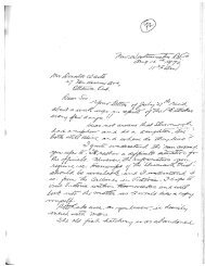
Some believe that the <strong>Jackson</strong> letter is legitimate while<br />
others believe that it was a hoax perpetrated by the<br />
early media in an attempt to increase newspaper sales<br />
by adding to the rumors surrounding <strong>Slumach</strong>. Skeptics<br />
that disagree with the authenticity of <strong>Jackson</strong>’s letter<br />
argue the point that if there is a canyon one and one<br />
half miles in length containing a creek full of gold, why<br />
has it not been found by one of the suspected tens of<br />
thousands who have searched for it for the better part<br />
of a century One must take into consideration that the<br />
letter was written from memory by a dying man without<br />
the assistance of any topographical maps. A letter<br />
written under these conditions is not very likely to be<br />
anywhere near as accurate as most who try and follow<br />
the directions outlined in it would hope it to be.<br />
<strong>Jackson</strong> died during a time period when an influenza<br />
epidemic was taking more lives than all other illnesses<br />
combined. It is most probable that he was suffering<br />
from influenza when he wrote his letter. It is not uncommon<br />
for a person with any type of terminal illness<br />
to also deteriorate mentally. Fevers are characteristic of<br />
virtually all illnesses which when left unchecked or are<br />
untreatable ultimately cause hallucinations of varying<br />
degrees of intensity. <strong>Jackson</strong>’s deteriorating health undoubtedly<br />
affected his memory which would account<br />
for the elusive and somewhat distorted directions given<br />
in his letter. With fading memory <strong>Jackson</strong> provided<br />
what he believed to be sufficient information and directions<br />
for the recipient of his letter to follow and find the<br />
location of his rich placer discovery. I am confident that<br />
the interpretation of the following points alone will offer<br />
consideration of the accuracy of the directions given<br />
in the letter under the suspected circumstances.<br />
<strong>Jackson</strong> specifically stated that the water in the creek<br />
was almost white. He would not have used this term<br />
lightly as a general reference. Almost every creek in the<br />
search region flows down very steep inclines producing<br />
white water. His description is very specific and was<br />
intended to identify the specific location of the creek.<br />
Secondly, <strong>Jackson</strong> writes that the location is a two or<br />
three day hike from the lake and it may take a year or<br />
more to find. In addition to giving the approximate<br />
distance from the lake, which does put the location<br />
somewhere in the Stave Glacier region, he is likely trying<br />
to say that the location is under a blanket of snow<br />
and ice that does not necessarily melt sufficiently each<br />
and every year to expose the creek.<br />
Thirdly, <strong>Jackson</strong> unmistakably places an extremely high<br />
value on a tent shaped rock. Not only because he buried<br />
part of his gold there but also because it is a significant<br />
directional indicator to the location of the gold bearing<br />
creek itself.<br />
I have seen a dozen or so tent shaped rocks within the<br />
general search area. Some of these tent shaped rocks are<br />
as large as modern houses. The only location that I am<br />
aware of in the entire search area that contains any rock<br />
that is suitable enough to fit <strong>Jackson</strong>’s description is<br />
indeed very distinct.<br />
The location of what I refer to as the “<strong>Jackson</strong> rock” is of<br />
interest to at least three independent search parties that<br />
I am aware of. The location was initially provided to me<br />
by two prospectors who had searched the surrounding<br />
area several times throughout the years. They claim to<br />
have located the “<strong>Jackson</strong> rock” by following the directions<br />
given on what they identified as a very old crude<br />
map drawn on a deer hide. The two prospectors were<br />
convinced that the deer hide map had been drawn by<br />
<strong>Jackson</strong> himself.<br />
Unfortunately the existence of the map could not be<br />
confirmed. The one prospector no longer had possession<br />
of the hide map. He claimed that it had either been<br />
lost or destroyed by his former spouse during a family<br />
break-up years prior to our meeting. The prospectors<br />
were continuing their search based on memory. This is<br />
the only piece of indirect information that suggests at<br />
a circumstantial level that <strong>Jackson</strong> may have provided a<br />
crude map with his letter. The particular “<strong>Jackson</strong> rock”<br />
to which I refer is in fact huge. It sits alone on a bench<br />
not far from Iceworm Creek and definitely seems to be<br />
out of place in its surroundings. It is similar in appearance<br />
and somewhat larger than the Native “standing<br />
rock” west of Keremeos, B.C..<br />
The “<strong>Jackson</strong> rock” measures approximately 100 feet<br />
by 100 feet at the base by 70 feet in height. It has a<br />
slight overhang or lean in a southerly direction. On the<br />
ground a few feet out from the base but still just under<br />
the peak of the overhang are several very old fire pits<br />
spaced out to form the shape of a semi-circle or arch.<br />
At the base, on one side of the “<strong>Jackson</strong> rock” is an obviously<br />
old depression measuring approximately 4 feet by<br />
3 feet by 1 foot in depth. The depression is not a natural<br />
occurrence. The ground cover that has re-established<br />
itself over the depression suggests that the hole had<br />
been dug many decades earlier. About 30 feet to one<br />
side of the “<strong>Jackson</strong> rock” are two slabs of rock leaning<br />
together that definitely give appearance of a pup-tent.<br />
These slabs measure approximately 8 feet by 8 feet in<br />
length by 5 feet in height. One can actually crawl inside<br />
Copyright © 2002 Robert W. Nicholson


