Yala - Caves & Caving in Thailand - Shepton Mallet Caving Club
Yala - Caves & Caving in Thailand - Shepton Mallet Caving Club
Yala - Caves & Caving in Thailand - Shepton Mallet Caving Club

You also want an ePaper? Increase the reach of your titles
YUMPU automatically turns print PDFs into web optimized ePapers that Google loves.
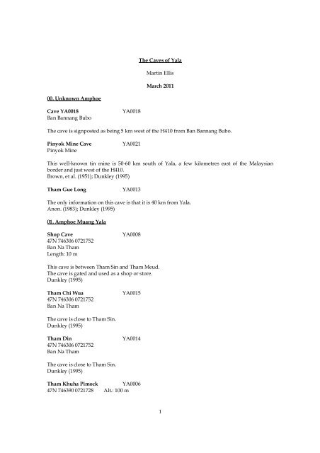
The <strong>Caves</strong> of <strong>Yala</strong><br />
Mart<strong>in</strong> Ellis<br />
March 2011<br />
00. Unknown Amphoe<br />
Cave YA0018<br />
Ban Bannang Bubo<br />
YA0018<br />
The cave is signposted as be<strong>in</strong>g 5 km west of the H410 from Ban Bannang Bubo.<br />
P<strong>in</strong>yok M<strong>in</strong>e Cave<br />
P<strong>in</strong>yok M<strong>in</strong>e<br />
YA0021<br />
This well-known t<strong>in</strong> m<strong>in</strong>e is 50-60 km south of <strong>Yala</strong>, a few kilometres east of the Malaysian<br />
border and just west of the H410.<br />
Brown, et al. (1951); Dunkley (1995)<br />
Tham Gue Long<br />
YA0013<br />
The only <strong>in</strong>formation on this cave is that it is 40 km from <strong>Yala</strong>.<br />
Anon. (1983); Dunkley (1995)<br />
01. Amphoe Muang <strong>Yala</strong><br />
Shop Cave<br />
47N 746306 0721752<br />
Ban Na Tham<br />
Length: 10 m<br />
YA0008<br />
This cave is between Tham S<strong>in</strong> and Tham Meud.<br />
The cave is gated and used as a shop or store.<br />
Dunkley (1995)<br />
Tham Chi Wua<br />
47N 746306 0721752<br />
Ban Na Tham<br />
YA0015<br />
The cave is close to Tham S<strong>in</strong>.<br />
Dunkley (1995)<br />
Tham D<strong>in</strong><br />
47N 746306 0721752<br />
Ban Na Tham<br />
YA0014<br />
The cave is close to Tham S<strong>in</strong>.<br />
Dunkley (1995)<br />
Tham Khuha Pimock<br />
47N 746390 0721728<br />
YA0006<br />
Alt.: 100 m<br />
1
Wat Khuha Pimock, Ban Na Tham<br />
Length: 40 m VR: 2 m<br />
Leave <strong>Yala</strong> head<strong>in</strong>g west <strong>in</strong> the direction of Yaha and go as far as the village of Ban Na Tham. At<br />
the exit from the village, after a km post (km 7) take on the left a small road which leads south.<br />
Less than 500 m from there, enter on the left the gate to a monastery and follow an alley which<br />
goes towards the cliffs of a small limestone massif. From here a stairway climbs as far as the cave<br />
entrance which opens midway up the cliff and where there is a spectacular sanctuary guardian<br />
about 6 m high which was built <strong>in</strong> 1949 AD and called Chao Khao.<br />
A small entrance gives access to a big chamber (25 m x 35 m x 25 m) which is feebly lit by an<br />
open<strong>in</strong>g <strong>in</strong> the roof. This chamber is called Tham Pha Non and it does not lead to any passages.<br />
This is one of the most significant archaeological and Buddhist sites <strong>in</strong> southern <strong>Thailand</strong> and has<br />
probably been occupied s<strong>in</strong>ce about 750 AD. There are rows of seated Buddhas, <strong>in</strong>clud<strong>in</strong>g one 5<br />
m high. The <strong>in</strong>ner part of the cave is dom<strong>in</strong>ated by a 20 m long recl<strong>in</strong><strong>in</strong>g Buddha (Phra<br />
Phutthasaiyat). This highly venerated image probably dates to the Srivichaya (Pen<strong>in</strong>sular) era<br />
and was restored dur<strong>in</strong>g the Uthong period.<br />
The first visit by speleologists was by the APS <strong>in</strong> 1987.<br />
Deharveng, et al. (1988); Dunkley (1995); Price (2001)<br />
Tham Lamphao Thong† YA0035<br />
47N 744000 0722679<br />
Tham Lamphao Thong Priest’s Camp Site, Ban Thams<strong>in</strong><br />
Tham Lamphao Thong Priest's Camp Site is just north of the junction between the H409 and<br />
H4089 at Ban Thams<strong>in</strong>.<br />
Tham Mae Nang Montho YA0039<br />
ถ้ําแมนางมณโฑ<br />
Wat Khuha Pimock, Ban Na Tham<br />
The cave is near Tham Khuha Pimock.<br />
Inside the cave are large connect<strong>in</strong>g chambers that are mostly dark. In one chamber there is a<br />
large stalagmite <strong>in</strong> the shape of a meditat<strong>in</strong>g woman which gives the cave its name.<br />
Tham Meud<br />
YA0007<br />
47N 746575 0721544 Alt.: 100 m<br />
Ban Na Tham<br />
Length: 1,000 m<br />
Other names: Gua G'lap<br />
At the foot of the stairs to Tham Khuha Pimock follow the base of the massif towards the southeast.<br />
After 200 m, hav<strong>in</strong>g passed a small sanctuary cavity, one f<strong>in</strong>ds the entrance to Tham Meud<br />
just above the water level.<br />
Tham Meud is a show cave formed on two levels approximately 2 and 10m above the level of the<br />
surround<strong>in</strong>g countryside and is partly lit by electricity. Three entrances lead to the lower section<br />
which is a level walk<strong>in</strong>g passage about 3-4 m high for 275 m and gradually narrow<strong>in</strong>g as you<br />
progress <strong>in</strong>wards. About 150 m from the entrance a higher level beg<strong>in</strong>s with a large chamber<br />
about 40 m wide and up to 20 m high from which passages with muddy rimstone pools lead back<br />
towards the cliff face. The cave has not been fully explored and has good prospects for further<br />
discoveries.<br />
The cave is the type locality for the amblypygi Stygophrynus cerberus Simon, 1901. The mite<br />
Siamacarus dalgeri Leclerc, 1989 has also been collected <strong>in</strong> the cave.<br />
2
The first recorded scientific visit to the cave was by the Skeet Expedition <strong>in</strong> 1899-1900. The next<br />
know visit was by members of the 1987 APS expedition.<br />
Deharveng, et al. (1988); Dunkley (1995); Harvey (2003); Leclerc (1989)<br />
Tham Mun To<br />
YA0005<br />
47N 746753 0723020 Alt.: 180 m<br />
Ban Na Tham<br />
Length: 300 m VR: 50 m<br />
Other names: Tham Khun To<br />
Take the road to from <strong>Yala</strong> to Yaha as you would for Tham Khuha Pimock. After pass<strong>in</strong>g the<br />
turn<strong>in</strong>g for Tham Sam Pao To there is a brick and concrete embankment on the right of the road<br />
at the foot of the massif. Beh<strong>in</strong>d this part of the road there is the start of a track which ascends<br />
steeply with hairp<strong>in</strong>s up the side of the cliff. It leads to a quarry at the top of the limestone massif.<br />
Just before arriv<strong>in</strong>g with<strong>in</strong> sight of the quarry one f<strong>in</strong>ds on the right of the road a large dol<strong>in</strong>e<br />
with dense vegetation. By descend<strong>in</strong>g the shattered boulders <strong>in</strong>to the dol<strong>in</strong>e one f<strong>in</strong>ds at the<br />
bottom the start of a small path which after a few detours <strong>in</strong> the vegetation leads to the ma<strong>in</strong><br />
entrance.<br />
A 20 m wide by 30 m high entrance leads to a large passage conta<strong>in</strong><strong>in</strong>g a chamber 50 m <strong>in</strong><br />
diameter and 50 m high. Further <strong>in</strong> is a still larger shaft from which several side passages lead<br />
off, one to a third large shaft. The cave appears to have been extensively looted for pottery, etc.<br />
The cave was explored by the APS expedition <strong>in</strong> 1987.<br />
Deharveng, et al. (1988); Dunkley (1995)<br />
Tham Phab Khien Fa Panang<br />
47N 756541 0720598<br />
YA0009<br />
The cave is between Sateng Nok and Budi, to the east of Sateng.<br />
There are 500 year old cave pa<strong>in</strong>t<strong>in</strong>gs <strong>in</strong> the cave.<br />
Dunkley (1995)<br />
Tham Sam Pao Thong YA0004<br />
47N 747120 0723390 Alt.: 120 m<br />
Tha Sap<br />
Length: 300 m<br />
Other names: Tham Sam Pao To<br />
The cave is <strong>in</strong> moo 1 Tha Sap. Take the road to Yaha as if go<strong>in</strong>g to Tham Khuha Pimak, but before<br />
Ban Na Tham, at about 5 km from <strong>Yala</strong>, take a track which starts on the right just before a<br />
limestone massif, From here it is 200 m to the entrance to the cave which one reaches via a few<br />
steps to the foot of the cliffs.<br />
The two large ma<strong>in</strong> passages are partly electrically lit, while the side passages were not explored.<br />
There is also a higher level just <strong>in</strong>side the entrance conta<strong>in</strong><strong>in</strong>g a model boat.<br />
The cave has an extensive fauna and is the type locality for the mite Siamacarus dalgeri Leclerc,<br />
1989.<br />
Tham Sam Pao Thong was explored and a basic survey carried out by the APS <strong>in</strong> 1987.<br />
Condé (1992b); Deharveng, et al. (1988); Dunkley (1995); Leclerc (1989)<br />
Tham S<strong>in</strong><br />
YA0001<br />
ถ้ําศิลป<br />
47N 747313 0721363 Alt.: 125 m<br />
Wat Khuha Pimock, Ban Na Tham<br />
3
Length: 30 m<br />
Other names: Tham Silpa, Gua Gambar<br />
From the monastery at Tham Khuha Pimock take towards the south-east the s<strong>in</strong>uous track which<br />
follows the foot of the massif and the marshes. After about 500 m the track jo<strong>in</strong>s a small road<br />
which leads on the left to a school. It is here that the keys to the cave are kept. As the French<br />
group were accompanied by the head monk and two representatives of the governor they had no<br />
problem <strong>in</strong> gett<strong>in</strong>g the keys. To get to the cave follow the road past the school for 250 m, as far as<br />
a turn<strong>in</strong>g on the left. From here a stairway climbs <strong>in</strong> the rocks as far as the entrance.<br />
The narrow entrance, on the side of the wall, opens <strong>in</strong>to an entrance passage which descends <strong>in</strong>to<br />
a high circular chamber which is partially lit by an open<strong>in</strong>g <strong>in</strong> the roof. At the bottom of this<br />
chamber an earth slope goes to a pitch which isn't deep below which the cave is seen to cont<strong>in</strong>ue.<br />
However, at the time of the French visit <strong>in</strong> 1987 the bamboo ladder was <strong>in</strong> a very poor state so the<br />
way on was not followed.<br />
The first chamber conta<strong>in</strong>s important 8th Century Pen<strong>in</strong>sula era Buddhist relief carv<strong>in</strong>gs on the<br />
walls. The cave is locked for conservation purposes.<br />
The cave was explored by the APS <strong>in</strong> 1987.<br />
Deharveng, et al. (1988); Dunkley (1995); Stephens (2000)<br />
Tham Suea<br />
47N 747128 0721547<br />
Ban Na Tham<br />
Length: 180 m<br />
YA0002<br />
Alt.: 100 m<br />
From Tham S<strong>in</strong> go towards Tham Khuha Pimock not by the road, but by a track along the base of<br />
the cliffs where there can be seen numerous open<strong>in</strong>gs. It is about 200 m from Tham S<strong>in</strong> that one<br />
f<strong>in</strong>ds the entrance to Tham Suea. Although quite wide the entrance is partly hidden by<br />
vegetation.<br />
The cave starts with a wide passage where the entrance porch occasionally serves as a hermitage.<br />
At the back of the entrance chamber a low passage turns right and ascends. After an oxbow on<br />
the left the cave opens <strong>in</strong>to a wide and high chamber that is well decorated. On the right there is a<br />
rift passage. This ends after 50 m at a big calcite flow which could be climbed to f<strong>in</strong>d any possible<br />
way on.<br />
The mite Siamacarus dalgeri Leclerc, 1989 was collected <strong>in</strong> the cave.<br />
The cave was explored and a basic survey conducted by the APS <strong>in</strong> 1987.<br />
Deharveng & Leclerc (1989); Deharveng, et al. (1988); Dunkley (1995); Leclerc (1989)<br />
Tham Wai Wua<br />
47N 746306 0721752<br />
Ban Na Tham<br />
YA0016<br />
The cave is close to Tham S<strong>in</strong>.<br />
Dunkley (1995)<br />
02. Amphoe Betong [Betung]<br />
Cave YA0030<br />
YA0030<br />
Wat Tham H<strong>in</strong>, Ban Gunung Chanong<br />
The cave is located close to the Malaysian border. From Betong town take the road to the old<br />
Malay border post immigration office, turn<strong>in</strong>g right at the blue sign to Ban Bukit Takro and<br />
4
proceed<strong>in</strong>g for 1.6 km to Ban Gunung Chanong. The cave is <strong>in</strong> the grounds of the temple on an<br />
isolated hill, Gunung Putib, at the foot of the steps up to Tham H<strong>in</strong>.<br />
There are three entrances <strong>in</strong>to a large chamber.<br />
Dunkley (1997)<br />
Gunung Chanong River Cave YA0027<br />
Ban Gunung Chanong<br />
Length: 25 m<br />
The cave is located close to the Malaysian border. From Betong town take the road to the old<br />
Malay border post immigration office, turn<strong>in</strong>g right at the blue sign to Ban Bukit Takro and<br />
proceed<strong>in</strong>g for 1.6 km to Ban Gunung Chanong. Walk over the bridge past a football field to the<br />
limestone hill on the right.<br />
About 25 m long and conta<strong>in</strong><strong>in</strong>g bats the cave is used by a Malay hermit. An upper passage can<br />
be reached by go<strong>in</strong>g through the cave and turn<strong>in</strong>g to the east.<br />
Dunkley (1997)<br />
Tham Gunung Chanong YA0028<br />
Wat Tham Gunung Chanong, Ban Gunung Chanong<br />
The cave is located close to the Malaysian border. From Betong town take the road to the old<br />
Malay border post immigration office, turn<strong>in</strong>g right at the blue sign to Ban Bukit Takro and<br />
proceed<strong>in</strong>g for 1.6 km to Ban Gunung Chanong.<br />
This is a small shr<strong>in</strong>e cave.<br />
Dunkley (1997)<br />
Tham H<strong>in</strong><br />
YA0028<br />
Wat Tham H<strong>in</strong>, Ban Gunung Chanong<br />
The cave is located close to the Malaysian border. From Betong town take the road to the old<br />
Malay border post immigration office, turn<strong>in</strong>g right at the blue sign to Ban Bukit Takro and<br />
proceed<strong>in</strong>g for 1.6 km to Ban Gunung Chanong. The entrance to the cave is <strong>in</strong> the grounds of the<br />
temple <strong>in</strong> an isolated hill, Gunung Putib. Many steps lead up to the cave.<br />
Dunkley (1997)<br />
Tham Rom Yen†<br />
YA0036<br />
47N 729815 0645242<br />
Tham Rom Yen Priest's Camp Site, Ban Bo Nam Ron<br />
The Tham Rom Yen Priest's Camp Site is <strong>in</strong> Ban Bo Nam Ron, 3.5 km north of the H410.<br />
03. Amphoe Ban Nang Sata [Benang Setar]<br />
Krachaeng Arch<br />
47N 744189 0687052<br />
Ban Ka Sod<br />
Length: 100 m<br />
YA0010<br />
The arch is 3 km south of the H410 at Ban Ka Sod, about 200 m downstream from the Tham<br />
Krachaeng resurgence.<br />
It is traversed by the Tham Krachaeng stream and is 20 m high and wide.<br />
Dunkley (1995); Fonta<strong>in</strong>e, et al. (2005); Price (2001)<br />
5
Meditation Cave<br />
47N 747441 0692900<br />
Ban Nang Sata<br />
Length: 150 m<br />
YA0020<br />
The entrance at the foot of the tower a short distance south of Tham Ratt.<br />
There is a small network of passages which are used for meditation and are partly electrically lit.<br />
Dunkley (1995)<br />
Resurgence YA0019<br />
47N 747441 0692900<br />
Ban Nang Sata<br />
YA0019<br />
The resurgence is between Tham Ratt and Meditation Cave.<br />
The ris<strong>in</strong>g is impenetrable.<br />
Tham Hma<br />
Length: 120 m<br />
YA0033<br />
The cave is beside the road.<br />
Price (2001)<br />
Tham Khao Thai†<br />
YA0034<br />
47N 740009 0686317<br />
Tham Khao Thai Priest's Camp Site, Ban Tang Ka Deng<br />
The Tham Khao Thai Priest's Camp Site is 2.5 km south of Ban Tang Ka Dang on the H410, near<br />
the Nam Tok Tham To Forest Park.<br />
Tham Krachaeng<br />
YA0017<br />
ถ้ํากรัแชง<br />
Resurgence: 47N 742708 0685510 Alt.: 120 m<br />
Ma<strong>in</strong> s<strong>in</strong>k: 47N 743028 0683513<br />
Khao Tham Krachaeng, Ban Than To<br />
Length: 5,633 m<br />
Tham Krachaeng is found to the south of the H410 road about 50 km south-west of <strong>Yala</strong>, near the<br />
village of Ban Than To which is halfway between <strong>Yala</strong> and Betong. The cave is <strong>in</strong> Khao Tham<br />
Krachaeng and the river s<strong>in</strong>k entrance, Tham Lod, is near the Ban Lang National Park. From the<br />
entrance to the park headquarters a track on the opposite side of the road, just south of the<br />
bridge, leads for 2 km to some houses. From this small village the limestone hill can be seen and<br />
is reached by a 10 m<strong>in</strong>ute walk downstream or through the cultivated land.<br />
The resurgence entrance, Tham Krachaeng, is reached by driv<strong>in</strong>g north from Ban Than To for 14<br />
km, through Ban Ka Sod to the 8.47 kilometre marker. Turn right here and follow the track for<br />
about 2 km. Where the track sw<strong>in</strong>gs left after some houses the hill can be seen on the right. The<br />
100 m long Krachaeng Arch Cave is seen immediately and the resurgence is found by walk<strong>in</strong>g<br />
upstream for a few m<strong>in</strong>utes.<br />
From the stream s<strong>in</strong>k at the Tham Lod entrance a very flood prone passage leads after 620 m to<br />
the ma<strong>in</strong> junction where a tributary stream comes <strong>in</strong> from the south. The water <strong>in</strong> this tributary is<br />
noticeably warmer. The ma<strong>in</strong> streamway is a ma<strong>in</strong>ly large, south to north trend<strong>in</strong>g passage. The<br />
floor is covered <strong>in</strong> sand and gravel and <strong>in</strong> some places the water is deep enough to swim.<br />
6
The Tham Krachaeng entrance is blocked by gours. A swim is necessary to get to the gours which<br />
can be climbed up and over to rega<strong>in</strong> the stream <strong>in</strong>side the cave. From here it is easy go<strong>in</strong>g <strong>in</strong> a<br />
generally straight passage to the first skylight. There is one side passage with a floor of mud filled<br />
gours to the west which becomes too small after 70 m. At the first skylight there are many guano<br />
covered boulders where it is easier to stay at water level to f<strong>in</strong>d the way through. The streamway<br />
then cont<strong>in</strong>ues south and then loops north. At the po<strong>in</strong>t where the loop turns north there is an<br />
<strong>in</strong>let com<strong>in</strong>g <strong>in</strong> from the south. This has been followed to where the passage splits <strong>in</strong>to a low<br />
crawl and a climb up that is draught<strong>in</strong>g.<br />
As the streamway heads north it reduces <strong>in</strong> size and the noise of the water <strong>in</strong>creases as it<br />
approaches a major boulder choke. An awkward climb up of 2 m leads to a squeeze and then the<br />
ma<strong>in</strong> choke. The choke of large white marble boulders is fairly solid and it is necessary to climb<br />
up through the choke. At the top of the choke there is a chamber filled with flood debris.<br />
On other side of the boulder choke the passage heads north for a short distance before loop<strong>in</strong>g<br />
back round to the south. After a few m<strong>in</strong>utes the junction with Tham Lod is reached. The<br />
distance from the resurgence entrance to this junction is 2.8 km.<br />
From the ma<strong>in</strong> junction the warm tributary stream which can be followed upstream and<br />
southwards for nearly 2 km pass<strong>in</strong>g a skylight after about 500 m to a boulder choke that has not<br />
yet been negotiated. Just before this term<strong>in</strong>al boulder choke there is a cold water <strong>in</strong>let from the<br />
east which has been surveyed for just over 100 m, but not completely explored. The source of the<br />
warm water <strong>in</strong>let is not known on the surface.<br />
The cave was first explored and surveyed by Liz Price and Malaysian cavers <strong>in</strong> August 1993 to<br />
5,516 m. A second expedition by Price and the Axbridge <strong>Cav<strong>in</strong>g</strong> Group <strong>in</strong> December 2000 was<br />
thwarted by flood<strong>in</strong>g after survey only another 117 m of an upstream <strong>in</strong>let.<br />
Dunkley (1995); Ellis (2009); Price (1994), (1995), (2001)<br />
Tham Krachaeng 3<br />
Ban Than To<br />
Length: 20 m<br />
YA0026<br />
This short cave is to the west of the Tham Krachaeng resurgence.<br />
Dunkley (1997)<br />
Tham Morakot<br />
Ban Than To<br />
Length: 40 m<br />
Other names: Emerald Cave<br />
YA0023<br />
The cave is between and to the west of Kracheng Arch and Tham Krachaeng.<br />
There are steps up to the entrance chamber which is used as a temple. A climb up to the back<br />
wall leads to a 20 m long passage.<br />
Dunkley (1997)<br />
Tham Muang Tang Kradung† YA0011<br />
47N 740084 0687338<br />
Ban Tham Muang Tang Kradung, Ban Tham Thalu<br />
The village is near the H4106 to the south of Ban Tham Thalu.<br />
Dunkley (1995)<br />
Tham Nan Kiaw<br />
Ban Than To<br />
YA0025<br />
7
Tham Nan Kiaw is to the south of Tham Morakot.<br />
This cave is said to connect to Tham Krachaeng via a pitch.<br />
Dunkley (1997)<br />
Tham Ratt<br />
YA0012<br />
47N 748906 0694453 Alt.: 180 m<br />
Ban Nang Sata<br />
Length: 150 m<br />
Other names: Tham Raet<br />
From <strong>Yala</strong> take the H4010 southwards as far as Ban Nang Sata (a distance of 41 km). In the village<br />
turn to the right onto the H4077 head<strong>in</strong>g towards Yaha. 2 km from the junction the road follows<br />
the small massif of Tham Ratt whose entrance can be seen from the road.<br />
Several Buddhas statues and a community of monks can be found <strong>in</strong> a labyr<strong>in</strong>th of electrically lit<br />
passages.<br />
A small impenetrable resurgence was found to the south of the cave.<br />
The site was recorded by the 1987 APS expedition.<br />
Deharveng, et al. (1988); Dunkley (1995)<br />
Tham Taloh<br />
Ban Tham Taloh<br />
YA0022<br />
The village is near Ban Bang Sata <strong>in</strong> the shelter of a semi-circle of towers.<br />
A cave near the village was used as a refuge by the negrito villagers <strong>in</strong> the 1960s.<br />
Dunkley (1995); Wavell (1964)<br />
Tham Thalu†<br />
47N 739602 0692104<br />
Ban Tham Thalu<br />
YA0032<br />
Upper Meditation Cave YA0024<br />
Ban Than To<br />
Length: 200 m VR: 100 m<br />
This is a very large cave above Tham Morakot.<br />
The huge entrance chamber slopes steeply upwards and two wooden ladders at the rear give<br />
access to a monk's quarters and another entrance respectively. There is at least 100 m elevation<br />
difference <strong>in</strong> the cave.<br />
Dunkley (1997)<br />
04. Amphoe Than To<br />
Tham Kasage<br />
47N 745123 0683350<br />
Than To<br />
YA0031<br />
The cave is 4 km north-east of Than To.<br />
05. Amphoe Yaha<br />
Tham Than Lot<br />
Ban Ta Loo, Patae<br />
YA0037<br />
8
The cave is <strong>in</strong> moo 9 Ban Ta Loo.<br />
It is an active, decorated cave with a floor of f<strong>in</strong>e sand.<br />
06. Amphoe Raman [Reman]<br />
No caves have been recorded <strong>in</strong> this amphoe.<br />
07. Amphoe Kabang [Kabae or Kabe]<br />
No caves have been recorded <strong>in</strong> this amphoe.<br />
08. Amphoe Krong P<strong>in</strong>ang [Kampung P<strong>in</strong>ang]<br />
Tham Ba To Koo<br />
Huai Krath<strong>in</strong>g<br />
YA0038<br />
This decorated limestone cave has a stream with bl<strong>in</strong>d fish.<br />
9
References<br />
Anon. (1983) Tourist Magaz<strong>in</strong>e May 1983 p51<br />
Brown, G.F.; Buravas, S.; et al. (1951) "Geologic Reconnaissance of the M<strong>in</strong>eral Resources of<br />
<strong>Thailand</strong>" US Geological Survey Bullet<strong>in</strong> No. 984 183pp also published <strong>in</strong> (1953) as Royal<br />
Department of M<strong>in</strong>es Geolological Survey Memoir No. 1, Bangkok<br />
Condé, Bruno (1992) "Un Palpigrades Enigmatique de Thaïlande avec une Breve Revue des<br />
Grandes Divisions de l'Ordre" Revue Suisse Zoologie Vol. 99 No. 4 p741-746<br />
Deharveng, Louis; Leclerc, Philippe (1989) "Recherches sur les Faunes Cavernicoles d'Asie du<br />
Sud-est" Mémoires de Biospéologie Vol. 16 No. 43 pp91-110<br />
Deharveng, Louis; et al. (1988) "Expéditions Thaï 87-Thaï 88" Association Pyrénéenne de<br />
Spéléologie, Toulouse ISBN 2-906273-02-3<br />
Dunkley, John Robert (1995) "The <strong>Caves</strong> of <strong>Thailand</strong>" Speleological Research Council, Sydney<br />
ISBN 0-9589253-9-9 124pp<br />
Dunkley, John Robert (1997) "The <strong>Caves</strong> of <strong>Thailand</strong> - Addendum 1995-97" Speleological<br />
Research Council, Sydney<br />
Ellis, Mart<strong>in</strong> (2009) “<strong>Thailand</strong>’s Top Twenty” <strong>Shepton</strong> <strong>Mallet</strong> <strong>Cav<strong>in</strong>g</strong> <strong>Club</strong> Journal Series 12 No. 4<br />
pp140-232<br />
Fonta<strong>in</strong>e, Henri; Salyapongse, Sirot; Suteethorn, Varavudh (2005) "Fossil Biodiversity In The<br />
Limestones of <strong>Thailand</strong>: A Cornucopia of Information About the History of Life" The Natural<br />
History Bullet<strong>in</strong> of the Siam Society Vol. 53 No. 1 pp30-70<br />
Harrvey, Mark S. (2003) "Catalogue of the Smaller Arachnid Orders of the World" CSIRO<br />
Publish<strong>in</strong>g, Coll<strong>in</strong>gwood, Victoria, 400pp<br />
Leclerc, Philippe (1989) "Considerations Paleogeographiques a Propos de la Decouverte en<br />
<strong>Thailand</strong>e d'Opilioacarians Nouveaux (Acari - Notostigmata)" Compte Rendu Des Seances de la<br />
Société de Biogeographie, Paris Vol. 65 No. 4 pp162-174<br />
Price, Liz (1994) "A River Cave In Southern <strong>Thailand</strong> - Tham Krachaeng" International Caver No.<br />
10 pp9-13<br />
Price, Liz (1995) "Tham Krachaeng System (Tham Krachaeng-Tham Lod), <strong>Thailand</strong>" Cerberus<br />
Spelaeological Society Journal Vol. 23 No. 4 pp81-83<br />
Price, Liz (2001) "<strong>Thailand</strong> 2000-2001" Cerberus Spelaeological Society Journal Vol. 26 No. 1 pp6-<br />
12<br />
Stephens, Harold (2000) "Return to Adventure Southast Asia: With Amaz<strong>in</strong>g <strong>Thailand</strong> as the<br />
Hub" Wolfenden, Miranda, California ISBN 09642521-6-3 ppxiv + 227<br />
Wavell, Stewart (1964) "The Naga K<strong>in</strong>g's Daughter" George Allen & Unw<strong>in</strong> Ltd., London 248pp<br />
10
Number Name Co-ord<strong>in</strong>ates Altitude Length VR<br />
YA0001 Tham S<strong>in</strong> 47N 747313 0721363 125 30<br />
YA0003 Tham Suea 47N 747128 0721547 100 180<br />
YA0004 Tham Sam Pao Thong 47N 474120 0723390 120 300<br />
YA0005 Tham Mun To 47N 746753 0723020 180 300 50<br />
YA0006 Tham Khuha Pimak 47N 746390 0721728 100 40 2<br />
YA0007 Tham Meud 47N 746575 0721544 100 1,000<br />
YA0008 Shop Cave 47N 746306 0721752 10<br />
YA0009 Tham Phab Khien Fa Panang 47N 756541 0720598<br />
YA0010 Krachaeng Arch 47N 744189 0687052 100<br />
YA0011 Tham Muang Tang Kradung 47N 740084 0687338<br />
YA0012 Tham Ratt 47N 748906 0694453 180 150<br />
YA0013 Tham Gue Long<br />
YA0014 Tham D<strong>in</strong> 47N 746306 0721752<br />
YA0015 Tham Chi Wua 47N 746306 0721752<br />
YA0016 Tham Wai Wua 47N 746306 0721752<br />
YA0017 Tham Krachaeng 47N 742708 0685510 120 5,633<br />
YA0018 Cave YA0018<br />
YA0019 Resurgence YA0019 47N 747441 0692900<br />
YA0020 Meditation Cave 47N 747441 0692900 150<br />
YA0021 P<strong>in</strong>yok M<strong>in</strong>e Cave<br />
YA0022 Tham Taloh<br />
YA0023 Tham Morakot 40<br />
YA0024 Upper Meditation Cave 200 100<br />
YA0025 Tham Nan Kiaw<br />
YA0026 Tham Krachaeng 3 20<br />
YA0027 Gunung Chanong River Cave 25<br />
YA0028 Tham Gunung Chanong<br />
YA0029 Tham H<strong>in</strong><br />
YA0030 Cave YA0030<br />
YA0031 Tham Kasage 47N 745123 0683350<br />
YA0032 Tham Thalu 47N 739602 0692104<br />
11
Number Name Co-ord<strong>in</strong>ates Altitude Length VR<br />
YA0033 Tham Hma 120<br />
YA0034 Tham Khao Thai 47N 740009 0686317<br />
YA0035 Tham Lamphao Thong 47N 744000 0722679<br />
YA0036 Tham Rom Yen 47N 729815 0645242<br />
YA0037<br />
YA0038<br />
YA0039<br />
Tham Than Lot<br />
Tham Ba To Koo<br />
Tham Mae Nang Montho<br />
12