

Conservation Plan Hughes Creek Landscape Zone - Strathbogie ...
Conservation Plan Hughes Creek Landscape Zone - Strathbogie ...
Conservation Plan Hughes Creek Landscape Zone - Strathbogie ...

Create successful ePaper yourself
Turn your PDF publications into a flip-book with our unique Google optimized e-Paper software.
Developed By:<br />
The Water and Biodiversity team, Department of Sustainability and Environment, for the Goulburn Broken<br />
Catchment Management Authority. Developed under the guidance of the Biodiversity Action <strong>Plan</strong>ning Steering<br />
Committee - comprising personnel from the Goulburn Broken Catchment Management Authority, Department of<br />
Primary Industries, Department of Sustainability and Environment and Trust for Nature (Vic).<br />
Bronwyn Merritt<br />
46 Aitken Street<br />
Alexandra Victoria 3714<br />
Phone: (03) 5772 0200<br />
Fax: (03) 5772 1361<br />
<strong>Hughes</strong><br />
Acknowledgments:<br />
<strong>Creek</strong> <strong>Landscape</strong> <strong>Zone</strong><br />
This project is funded as part of the Goulburn Broken Catchment Management Authority Regional Catchment<br />
Strategy in the Upper Goulburn Broken Catchment and is provided with support and funding from the Australian<br />
and Victorian Governments, through the Natural Heritage Trust. This project is delivered primarily through<br />
partnerships between the Goulburn Broken Catchment Management Authority, Department of Primary Industries,<br />
Department of Sustainability Biodiversity and Environment, Trust Action for Nature and <strong>Plan</strong>ning<br />
other community bodies. Personnel from<br />
these agencies provided generous support and advice during the development of this plan. We also thank<br />
numerous landholders, in the Landcare Upper groups, Goulburn Local Area <strong>Plan</strong>ning Broken Groups and other Catchment<br />
individuals, who also provided<br />
generous support advice, information and assistance wherever possible.<br />
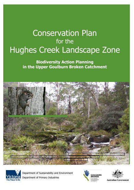
Front cover: <strong>Hughes</strong> <strong>Creek</strong> at Caveat. Photo: Janet Hagen<br />
Inset: Brush-tailed Phascogale (Phascogale tapoatafa tapoatafa). Photo Peter Robertson.<br />
Published & Printed By:<br />
Water and Biodiversity Group<br />
Department of Sustainability and Environment<br />
Alexandra (Draft January 2006)<br />
© Copyright State of Victoria 2005<br />
This publication is copyright. No part may be reproduced by any process except in accordance with the provisions<br />
of the Copyright Act 1968.<br />
Authorised by:<br />
Victorian Government<br />
1 Treasury Place<br />
Melbourne, Victoria<br />
3000 Australia<br />
ISSN To be requested<br />
Disclaimer<br />
<strong>Conservation</strong> <strong>Plan</strong><br />
for the<br />
This publication may be of assistance to you but the State of Victoria and its employees do not guarantee that<br />
the publication is without flaw of any kind or is wholly appropriate for your particular purposes and therefore<br />
disclaims all liability for any error, loss or other consequence which may arise from you relying on any information<br />
in this publication.<br />
For Further Information:<br />
For further information about Biodiversity Action <strong>Plan</strong>ning please visit the DPI website at www.dpi.vic.gov.au or<br />
the DSE website at www.dse.vic.gov.au or call the Customer Service Centre on 136 186. Or visit the Goulburn<br />
Broken Catchment Management Authority website at www.gbcma.vic.gov.au<br />
Department of Sustainability and Environment<br />
Department of Primary Industries<br />
1
EXECUTIVE SUMMARY<br />
The ultimate aim of Biodiversity Action <strong>Plan</strong>ning (BAP) is to achieve broad-scale conservation of<br />
native biodiversity. BAP identifies priorities for the conservation of native biodiversity, as part of the<br />
-<br />
process for translating ob<br />
Flora<br />
and Fauna Guarantee Act 1988 and provides the biodiversity action plan for Victoria).<br />
To translate objectives from state to regional, catchment and local landscape level, Victoria was first<br />
divided on a bioregional basis (bioregions) and then at a landscape level (landscape zones). The<br />
methodology used to develop the Land<br />
Biodiversity Action <strong>Plan</strong>ning in the Goulburn Broken Catchment (GBCMA 2004a). The Central Victorian<br />
Uplands and Highlands Northern Fall Bioregional <strong>Plan</strong>s and the <strong>Hughes</strong> <strong>Creek</strong> <strong>Landscape</strong> <strong>Zone</strong> plan<br />
outline biodiversity priorities at the bioregional level. This <strong>Hughes</strong> <strong>Creek</strong> <strong>Landscape</strong> <strong>Zone</strong> <strong>Conservation</strong><br />
<strong>Plan</strong> has been developed at the local (landscape) level and is intended to assist government agencies<br />
(primarily extension staff) and the community, to work in partnership towards achieving catchment<br />
targets, by setting priority areas for protection and enhancement of native biodiversity. This plan is<br />
also intended to enable biodiversity priorities, data and advice to be disseminated to other planning<br />
processes, landholders and agencies.<br />
The <strong>Hughes</strong> <strong>Creek</strong> <strong>Landscape</strong> <strong>Zone</strong> is located within the Goulburn Broken Catchment of Victoria.<br />
The <strong>Zone</strong>, 124,100 hectares in extent, is part of the Highlands Northern Fall and Central Victorian<br />
Uplands Bioregions. It is within the Local Government areas of <strong>Strathbogie</strong>, Mitchell and Murrindindi.<br />
Since European settlement much of the vegetation in the zone has been cleared, leaving a fragmented<br />
landscape, with many of the remnants that remain, being highly modified.<br />
Over 1,780 priority environmental sites have been identified within the <strong>Hughes</strong> <strong>Creek</strong> <strong>Landscape</strong><br />
<strong>Zone</strong>. The priority sites have been determined and ranked (low, medium, high or very high) based on<br />
factors such as, size, vegetation quality, Ecological Vegetation Class (EVC) conservation status,<br />
threatened species, landscape context and field survey results. These sites contain remnant vegetation<br />
and vary greatly in size from a stand of paddock trees, to areas of greater than one thousand hectares.<br />
Two important components in the Biodiversity Action <strong>Plan</strong>ning process, are the focal species<br />
approach and the Key Biodiversity Assets approach. The focal species approach uses the habitat<br />
requirements of a particular species, or a group of species, to define the attributes that must be<br />
present in a landscape, for these species to persist. Six focal species have been identified in the zone:<br />
Brush-tailed Phascogale (Phascogale tapoatafa tapoatafa), Long-nosed Bandicoot (Perameles nasuta),<br />
White-eared Honeyeater (Lichenostomus leucotis), Eastern Yellow Robin (Eopsaltria australis), Crested<br />
Shrike-tit (Falcunculus frontatus) and Diamond Firetail (Stagonopleura guttata).<br />
The Key Biodiversity Assets approach is a method of grouping biodiversity assets (ie. birds, animals<br />
and plants) that use the same type of habitat. Eight Key Biodiversity Assets were identified for the<br />
<strong>Hughes</strong> <strong>Creek</strong> <strong>Landscape</strong> <strong>Zone</strong>: Grassy Woodlands, Grassy Forests, Herb-rich Foothill Forests, Granitic<br />
Hills, Box Ironbark, Riparian Systems, Spring Soaks/Perched Bogs and Riverine Fish communities. The<br />
grouping of these assets will assist in targeting actions towards the very high value sites first.<br />
Management actions have been developed for the <strong>Hughes</strong> <strong>Creek</strong> <strong>Landscape</strong> <strong>Zone</strong>, based on the<br />
results of desktop analysis and field surveying. It is intended that government agencies (primarily<br />
extension staff) and the community will work together to implement these actions, for the benefit of<br />
biodiversity conservation in the <strong>Hughes</strong> <strong>Creek</strong> <strong>Landscape</strong> <strong>Zone</strong> and the wider area of the Goulburn<br />
Broken Catchment.<br />
2
CONTENTS<br />
PAGE<br />
EXECUTIVE SUMMARY 3<br />
CONTENTS 4<br />
1.0 BACKGROUND 5<br />
1.1 INTRODUCTION 5<br />
1.2 OBJECTIVES 5<br />
1.3 CONTEXT FOR THE DEVELOPMENT OF<br />
THE HUGHES CREEK CONSERVATION PLAN 6<br />
2.0 THE STUDY AREA 8<br />
2.1 LANDSCAPE 9<br />
2.2 VEGETATION 10<br />
2.3 SIGNIFICAN FLORA AND FAUNA 14<br />
2.3.1 FLORA 14<br />
2.3.2 FAUNA 15<br />
3.0 PREPARING A CONSERVATION PLAN 16<br />
3.1 METHODOLOGY 16<br />
4.0 IDNTIFYING PRIORITY SITES 18<br />
5.0 SUMMARY OF PRIORITY SITE SURVEYING 19<br />
5.1 VEGETATION QULAITY ASSESSMENTS 19<br />
5.2 BIRD SURVEYS 19<br />
5.3CONSERVATION THREATS 20<br />
6.0 CONSERVATION ASSETS 22<br />
6.1 FOCAL SPECIES 22<br />
6.2 KEY BIDIVERSITY ASSETS 24<br />
7.0 PRIORITY ACTIONS FOR KEY BIODIVERSITY ASSETS 28<br />
8.0 FURTHER INFORMATION 47<br />
9.0 LANDOWNER ASSISTANCE 48<br />
10.0 MONITORING 50<br />
11.0 REFERENCES 53<br />
12.0 ACKNOWLEDGEMENTS 55<br />
13.0 APPENDICES 57<br />
APPENDIX 1 VICTORIAN BIOREGIONS 58<br />
APPENDIX 2 VICTORIAN LANDSCAPE ZONES 59<br />
APPENDIX 3 GOULBURN BROKEN CATCHMENT TARGETS 60<br />
APPENDIX 4 THREATENED FLORA 61<br />
APPENDIX 5 THREATENED FAUNA 62<br />
APPENDIX 6 SITE PRIORITISATION METHOD 63<br />
APPENDIX 7 VEGETATION QUALITY ANALYSIS ASSESSMENT FORM 64<br />
APPENDIX 8 LANDSCAPE CONTEXT MODEL 65<br />
APPENDIX 9 VEGETATION QUALITY ASSESSMENT RESULTS 66<br />
APPENDIX 10 BIRD LIST 67<br />
APPENDIX 11 PRIORITY SITE INFORMATION (MAPPING) 68<br />
3
1.0 BACKGROUND<br />
1.1 INTRODUCTION<br />
Global<br />
Convention on<br />
Biological<br />
Diversity <strong>Plan</strong><br />
National Strategy<br />
for the<br />
<strong>Conservation</strong> of<br />
<br />
Biological<br />
Diversity<br />
<br />
Biodiversity<br />
Strategy<br />
Bioregional<br />
Strategic<br />
Overview<br />
<strong>Landscape</strong> <strong>Zone</strong><br />
<strong>Conservation</strong><br />
Action <strong>Plan</strong>s<br />
<strong>Hughes</strong> <strong>Creek</strong><br />
<strong>Landscape</strong> <strong>Zone</strong><br />
<strong>Conservation</strong> <strong>Plan</strong><br />
Site Management<br />
<strong>Plan</strong>s<br />
Biodiversity Action <strong>Plan</strong>ning 1 (BAP) is an initiative by the Victorian Government to<br />
identify priorities for the conservation of native biodiversity, as part of the<br />
(Crown 1997). In particular<br />
according to Platt & Lowe 2002, it aims to:<br />
Conserve native biodiversity by maintaining viable examples of the range of<br />
ecosystems that occur naturally in Victoria,<br />
Promote a more strategic and cost-effective expenditure of public funds for<br />
the protection, restoration and ongoing management of priority biodiversity<br />
sites, and<br />
Achieve community support for landscape planning for biodiversity and the<br />
conservation of strategic assets, particularly in rural landscapes.<br />
In order to achieve these aims, effective planning of actions for native<br />
biodiversity also requires detailed planning at a bioregional and landscape level.<br />
Therefore, Victoria was first divided on a bioregional basis (Appendix 1) and then<br />
at a landscape level (landscape zones) (Appendix 2). Figure 1 illustrates the<br />
Biodiversity Action <strong>Plan</strong>ning process and where the <strong>Hughes</strong> <strong>Creek</strong> <strong>Landscape</strong><br />
<strong>Zone</strong> <strong>Conservation</strong> <strong>Plan</strong> (highlighted in red) fits within a policy context.<br />
n Broken CMA <strong>Hughes</strong><br />
<strong>Creek</strong> Broken <strong>Zone</strong>s identify the broad priorities for biodiversity conservation in<br />
the region. They also provide the foundation for producing detailed plans, such<br />
. At<br />
the landscape level, this <strong>Hughes</strong> <strong>Creek</strong> <strong>Landscape</strong> <strong>Conservation</strong> <strong>Plan</strong> is intended<br />
to provide biodiversity conservation actions for the community to implement at a<br />
local level.<br />
Figure 1: BAP<br />
Process<br />
1.2 OBJECTIVES<br />
The <strong>Hughes</strong> <strong>Creek</strong> <strong>Landscape</strong> <strong>Zone</strong> <strong>Conservation</strong> <strong>Plan</strong> aims to translate regional and catchment plans<br />
and targets for biodiversity, to a local landscape level. This plan aims to ensure that private and public<br />
resources expended for conservation are targeted to priority sites, for priority actions. In this way,<br />
availab<br />
plan identifies 1787 priority sites, ranging across very high, high, medium or low value. The protection<br />
and management of these priority sites, is important for the conservation of flora and fauna in the local<br />
area. This plan is intended primarily for use by extension officers, as well as the community, to guide<br />
the strategic and coordinated management of conservation.<br />
Broadly, this plan details:<br />
The landscape, vegetation and significant flora and fauna of the area,<br />
<strong>Conservation</strong> objectives for the <strong>Hughes</strong> <strong>Creek</strong> <strong>Landscape</strong> <strong>Zone</strong>,<br />
Priority assets to be conserved, and the threats to these biodiversity values,<br />
Priority actions required to protect and restore the assets, and<br />
Further monitoring requirements for the zone (Robinson et al 2003).<br />
1 For further information on Biodiversity Action <strong>Plan</strong>ning visit Department of Sustainability and Environments website at www.dse.vic.gov.au<br />
4
1.3 CONTEXT FOR THE DEVELOPMENT OF THE HUGHES CREEK CONSERVATION<br />
PLAN<br />
The Goulburn Broken Regional Catchment Strategy (GBRCS) identifies a vision for biodiversity in the<br />
catchment. Th<br />
Governments and other agencies, to protect and enhance ecological processes and genetic diversity, to<br />
secure the future of native species of plants, animals and other organisms <br />
2003a p87). This <strong>Hughes</strong> <strong>Creek</strong> <strong>Landscape</strong> <strong>Conservation</strong> <strong>Plan</strong> is to assist in achieving this vision,<br />
through providing a strategic coordinated approach, for conservation of priority assets.<br />
The GBRCS also identifies targets and priorities for the catchment (refer to Appendix 3 for further<br />
detail). The following points are intended to provide a summary of the Goulburn Broken Regional<br />
Catchment Strategy targets and priorities for biodiversity conservation. For further information please<br />
refer to GBCMA 2003a.<br />
The Goulburn Broken Catchment Management Strategy identifies the following biodiversity resource<br />
condition targets for native vegetation in the catchment:<br />
1. Maintain the extent of all native vegetation types at 1999 levels in keeping <br />
<br />
2. Improve the quality of 90% of existing (2003) native vegetation by 10% by 2030,<br />
3. Increase the cover of all endangered and applicable vulnerable Ecological Vegetation Classes to at<br />
least 15% of their pre-European vegetation cover by 2030,<br />
4. Increase 2002 conservation status of 80% threatened flora and 60% threatened fauna by 2030,<br />
5. Maintain the extent of all wetland types at 2003 levels where the extent (area and number) has<br />
declined since European settlement, and<br />
6. Improve the condition of 70% of wetlands by 2030, using 2003 as the benchmark for condition<br />
(GBCMA 2003a p11).<br />
Priorities for action to conserve biodiversity in the Goulburn Broken are driven by the conservation<br />
significance of the biodiversity asset. Regional investments in biodiversity conservation in the Goulburn<br />
Broken Catchment are driven by the following goals (in order of priority):<br />
1. Protecting existing viable remnant habitats and the flora and fauna populations they contain (ie<br />
through reservation, covenants, management agreements, fencing and statutory planning),<br />
2. Enhancing the existing viable habitats that are degraded (management by controlling threats such<br />
as pest plants and animals, grazing, salinity, promotion of natural regeneration and/or revegetation<br />
with understorey), and<br />
Restoring under-represented biodiversity assets to their former extent by revegetation (to create<br />
corridors, buffers, patches of habitat) (GBCMA 2003a).<br />
It is intended that the actions outlined in this plan will complement the targets of the GBRCS and other<br />
<br />
Management A Framework for Action (NRE 2002a): Goulburn Broken Native Vegetation Management<br />
<strong>Plan</strong> (GBCMA 2000): and the Victorian River Health Strategy (NRE 2002b)). This plan is also intended<br />
to integrate such policies (eg. targets and legislative requirements) in to the one document, for use by<br />
local communities. For example, this plan incorporates aspects of legislation (eg. Action Statements<br />
prepared under the Flora and Fauna Guarantee Act 1988), in to recommended on-ground actions, for<br />
the conservation of threatened species and communities.<br />
The Biodiversity Action <strong>Plan</strong>ning (BAP) process uses <br />
<br />
abundance, diversity and interactions. BAP attempts to take a strategic approach to the conservation of<br />
threatened and declining species and vegetation types, by looking for opportunities to conserve groups<br />
of species in appropriate ecosystems (Platt & Lowe 2002). It is therefore intended that this South West<br />
<strong>Landscape</strong> <strong>Zone</strong> <strong>Conservation</strong> <strong>Plan</strong> will assist government agencies and the community, to work in<br />
<br />
protection and enhancement of native biodiversity.<br />
5
assists with identifying priority assets and methods of action, to protect or restore valuable assets,<br />
through voluntary extension principles. This document may be used by agencies and community<br />
groups, for informing existing projects and for strategic planning. However, it must be remembered<br />
that this <br />
of information, to keep it accurate and timely. The plan has therefore been developed as an adaptive<br />
plan, to enable management actions and information to be modified, in response to further information<br />
(eg monitoring).<br />
It is<br />
also intended that extension staff will utilise Geographical Information System (GIS) programs,<br />
databases and DSE/DPI staff, to fully identify and understand the BAP process and to provide further<br />
information to the community. Consultation and extension with relevant stakeholders, including<br />
agencies and community groups, was conducted (and will continue to occur) throughout the<br />
development and implementation of this plan. It is envisaged that this plan will be a valuable resource,<br />
for identifying priority biodiversity sites and initiating further conservation works in the <strong>Zone</strong>, and that<br />
at a later stage, will lead to further sites and projects being identified by interested individuals and<br />
groups.<br />
6
2.0 THE STUDY AREA<br />
Figure 2: The <strong>Hughes</strong> <strong>Creek</strong> <strong>Landscape</strong> <strong>Zone</strong><br />
7
2.1 LANDSCAPE<br />
The <strong>Hughes</strong> <strong>Creek</strong> <strong>Landscape</strong> <strong>Zone</strong> (figure 2a) covers an area of 124,100ha within the Goulburn<br />
Broken Catchment and contains both the Central Victorian Uplands and Highland Northern Fall<br />
Bioregions. <strong>Hughes</strong> <strong>Creek</strong> <strong>Landscape</strong> <strong>Zone</strong> falls within the Local Government areas of <strong>Strathbogie</strong>,<br />
Mitchell and Murrindindi. The majority of the <strong>Hughes</strong> <strong>Creek</strong> <strong>Landscape</strong> zone is on an undulating<br />
plateau. At the southern and south-eastern edge of the zone the plateaus undulating surface changes<br />
into escarpment sloping towards the Goulburn River floodplain. In the north and west of the zone the<br />
plateau slopes down to plains. <br />
plateau.<br />
The plateau is bounded to the north and west by the interface between the Central Victorian Uplands<br />
and the Victorian Riverina Bioregions. The southern and eastern boundary follows the edge of a portion<br />
of the Highlands - Northern Fall bioregion in the Switzerland Ranges. The Hume Highway is the only<br />
major regional artery and runs along the north-western edge of the zone (Ahern et al 2003).<br />
Private land covers 96% of the zone and of this over 83% has been cleared. This has resulted in not<br />
only a loss of habitat but also an inability for the landscape to sustain populations of flora and fauna.<br />
For example, many species may not be able to move across open farmland;; this prevents breeding<br />
between populations, which makes them vulnerable to random events such as disease that can wipe<br />
out sub-populations without replacement. Eventually, this results in decline and then extinction of<br />
species. Private land use is varied within the <strong>Hughes</strong> <strong>Creek</strong> <strong>Landscape</strong> <strong>Zone</strong> with the majority used for<br />
stock grazing.<br />
Public land covers 4% of the zone and mainly occurs along stream frontages, roadsides and 21<br />
reserves. <strong>Hughes</strong> <strong>Creek</strong> and its associated reserves are an obvious focus for protection and<br />
rehabilitation works in the zone as they contain remnants of several threatened Ecological Vegetation<br />
Classes (EVCs) including Valley Grassy Forest and Grassy Dry Forest. Numerous roadsides in this zone<br />
contain high conservation value habitat.<br />
Herb-rich Foothill Forest at the Caveat Bushland Reserve<br />
Photo: Bronwyn Merritt<br />
8
2.2 VEGETATION<br />
Ecological Vegetation Class (EVCs) is a vegetation classification system derived from groupings of<br />
vegetation communities based on floristic, structural and ecological functions. Mosaics (combinations of<br />
EVCs) are a mapping unit where the individual EVCs could not be separated at the scale of 1:100,000<br />
(Berwick, undated).<br />
Prior to European settlement, thirty-two EVCs 2 were known to have been present within the <strong>Hughes</strong><br />
<strong>Creek</strong> <strong>Landscape</strong> <strong>Zone</strong> (figure 3). The vegetation of <strong>Hughes</strong> <strong>Creek</strong> <strong>Landscape</strong> <strong>Zone</strong> was a mixture of<br />
herb-rich Foothill Forest, Grassy Forests, Grassy Woodlands, Box Ironbark, Granitic Hills, Riparian<br />
Forests and Perched Bogs. Herb-rich Foothill Forest is the dominant EVC in the <strong>Hughes</strong> <strong>Creek</strong> zone.<br />
The majority of the zone was covered with Herb-rich Foothill Forest, most of which has now been<br />
cleared but some large remnants occur at Caveat and west of Terip Terip.<br />
The grassy forests were dominated by Red Box Eucalyptus polyanthemos, Yellow Box E. melliodora,<br />
Red Stringybark E. macrohyncha, Long-leaf Box E. goniocalyx and Broad-leaf Peppermint E. dives with<br />
a range of understorey plants. Herb-rich Foothill Forests were dominated with Eurabbie Blue Gum E.<br />
globulua subsp. Bicostata, Messmate E. obliqua, Narrow-leaf Peppermint E. radiata, Candlebark E.<br />
rubida and Silver Wattle Acacia dealbata and Blackwood Acacia mearnsii. Box Ironbark Forests occurs<br />
along the western boundary of the zone and would have been dominated by Broad-leaf Peppermint,<br />
Long-leaf Box, Yellow Box, Red box and Red Ironbark E. tricarpa.<br />
Grassy Woodlands were abundant in the Central Victorian Uplands component of the zone,<br />
interspersed with Granitic Hills Woodland, Grassy Dry Forest and Valley Grassy Forest. However,<br />
Grassy Woodlands are now only represented in patches, the majority of which occur along the Hume<br />
Highway roadside reserve. All of the Grassy Woodland and Box Ironbark EVCs are considered<br />
endangered within the Goulburn Broken Catchment. The Grassy Forests Group (EVC Group 6, Tables<br />
1 & 2) are mostly considered vulnerable or depleted in the Central Victorian Highland Bioregion and<br />
least concern in the Highlands Northern Fall bioregion. Grassy Woodland communities were dominated<br />
by Grey Box Eucalyptus microcarpa, Yellow Box, Red Stringybark and White Box E. albens. Ground<br />
cover in these woodlands is comprised of grasses, sedges, lillies, orchids and herbs. Wattles provided<br />
an understorey. The stream-sides supported an overstorey of River Red Gum E. camaldulensis.<br />
The current extent of native vegetation in the <strong>Hughes</strong> <strong>Creek</strong> <strong>Zone</strong> has dramatically reduced since<br />
European settlement, largely due to clearing (Figure 3). Table 1, identifies the Pre 1750 EVCs in the<br />
<strong>Hughes</strong> <strong>Creek</strong> <strong>Landscape</strong> <strong>Zone</strong>, including their Bioregional <strong>Conservation</strong> Status and their current extent<br />
<br />
<br />
The Goulburn Broken Regional Catchment Strategy identifies goals and targets that have been set for<br />
the vegetation communities within the catchment. <br />
-Europea<br />
(GBCMA 2003a). The majority of EVCs within the <strong>Hughes</strong> <strong>Creek</strong> <strong>Landscape</strong> <strong>Zone</strong> are below the 15%<br />
<br />
Bioregional level (Ahern et al 2003).<br />
2 For further information on each EVC, refer to the Department of Sustainability and Environment website at www.dse.vic.gov.au<br />
9
Figure 3: Pre-European Native Vegetation Cover <strong>Hughes</strong> <strong>Creek</strong> <strong>Landscape</strong> <strong>Zone</strong><br />
10
Figure 4: Current extent of Native Vegetation Cover <strong>Hughes</strong> <strong>Creek</strong> <strong>Landscape</strong> <strong>Zone</strong><br />
11
Table 1: <strong>Hughes</strong> <strong>Creek</strong> <strong>Zone</strong> Ecological Vegetation Classes (pre-1750 and current)<br />
EVC Group<br />
EVC Number<br />
EVC Bioregional<br />
Cons. Status *<br />
EVC <strong>Zone</strong> Cons.<br />
Status<br />
EVC Name<br />
4 61 V E Box Ironbark Forest 6468 577 8.9 970.2<br />
4 72 V V Granitic Hills Woodland 3348 994 29 502.2<br />
4 244 V E Granitic Hills Woodland/Rocky Outcrop Shrubland/Herbland Mosaic 172 22 12 25.8<br />
4 245 V V Granitic Hills Woodland/Heathy Dry Forest Mosaic 12 0 0 1.8<br />
4 247 V E Box Ironbark Forest/Shrubby Granitic-outwash Grassy Woodland Mosaic 210 7 3 31.5<br />
5 80 E E Spring Soak Woodland 33 10 30 4.95<br />
5 175 E E Grassy Woodland 16529 556 3.5 2479.4<br />
5 254 E E Scrubby Granitic-outwash Grassy Woodland/Valley Grassy Forest Complex 152 7 4 22.8<br />
Pre 1750 Area<br />
(ha)<br />
Current Area<br />
(ha)<br />
% Current Cover<br />
15% pre-1750<br />
Target<br />
5 274 E E Shrubby Granitic outwash Grassy Woodland/Plains Grassy Woodland<br />
Complex<br />
51
2.3 SIGNIFICANT FLORA AND FAUNA<br />
2.3.1 Flora:<br />
Photo: Common Fringe Lily (Thysanotus<br />
tuberosus). Photo Bronwyn Merritt<br />
A range of native flora is found within the <strong>Hughes</strong><br />
<strong>Creek</strong> <strong>Landscape</strong> <strong>Zone</strong>. Some of the most common<br />
overstorey species includeRed Stringybark<br />
(Eucalyptus macrorhyncha), Yellow Box<br />
(Eucalyptus melliodora), Red Box (Eucalyptus<br />
polyanthemos), Blue Gum (Eucalyptus globulus),<br />
Messmate (Eucalyptus obliqua) and Narrow-leaf<br />
Peppermint (Eucalyptus radiata). The range of<br />
small trees and shrubs includes species such as,<br />
Mountain Beard-heath (Leucopogon hookeri),<br />
Sweet Busaria (Bursaria spinosa), Prickly Parrotpea<br />
(Dillwynia juniperina) and Slender Rice-flower<br />
(Pimelea linifolia). The zone also contains a range<br />
of groundcover plants including Wallaby-grass<br />
(Austrodanthonia spp), Black anther Flax-lilly<br />
(Dianella revouta), Kangaroo Grass (Themeda<br />
triandra), Common Wheat-grass (Elymus scaber)<br />
and Weeping Grass (Microlaena stipoides).<br />
There are 21 threatened plant species recorded within the <strong>Hughes</strong> <strong>Creek</strong> <strong>Landscape</strong> <strong>Zone</strong> (Ahern et al<br />
2003). These species are noted in Appendix 4, along with their threatened status, as per the Flora<br />
Information System, the State level (Flora and Fauna Guarantee Act (FFG Act) 1998) and the National<br />
level (Environment Protection and Biodiversity Act (EPBC) 1999) (Ahern et al 2003).<br />
Threatened plant species recorded in the <strong>Hughes</strong> <strong>Creek</strong> <strong>Landscape</strong> <strong>Zone</strong> include:<br />
‣ Deane's Wattle (Acacia deanei) (Rare in Victoria)<br />
‣ Hickory Wattle (Acacia penninervis var. penninervis) (Rare in Victoria)<br />
‣ Rough Twig-sedge (Baumea planifolia) (Status is poorly known in Victoria)<br />
‣ Tall Club-sedge (Bolboschoenus fluviatilis) (Status is poorly known in Victoria)<br />
‣ Weak Daisy (Brachyscome debilis s.s.) (Vulnerable in Victoria<br />
‣ Tiny Daisy (Brachyscome ptychocarpa) (Rare in Victoria)<br />
‣ Crimson Spider-orchid (Caladenia concolor) (Vulnerable across Australia, Endangered in Victoria)<br />
Examples of some locally significant species known to occur in the <strong>Hughes</strong> <strong>Creek</strong> <strong>Landscape</strong> <strong>Zone</strong> are:<br />
‣ Silver Banksia (Banksia marginata)<br />
‣ Drooping She-oak (Allocasuarina verticillata)<br />
‣ Black Sheoak (Allocasuarina littoralis)<br />
‣ Grass Trees (Xanthorrhoea australis)<br />
‣ Snow Gum (Eucalyptus pauciflora)<br />
‣ Ploughshears Wattle (Acacia gunni)<br />
‣ Woolly Wattle (Acacia lanigera)<br />
‣ Red Stemmed Wattle (Acacia rubida)<br />
‣ Heath Myrtle (micromyrtus ciliata)<br />
‣ Austral Ladies Tress Orchid (Spiranthes asutralia)<br />
‣ Acacia mitchelli)<br />
‣ Peach Heath (Lissanthe strigosa)<br />
‣ Common Fringe-Myrtle (Calytrix tetragona)<br />
13
2.3.2 Fauna:<br />
There are 20 threatened fauna species recorded in the <strong>Hughes</strong> <strong>Creek</strong> <strong>Zone</strong> (refer to Appendix 5 for<br />
species, their threatened status and relevant acts) (Ahern et al 2003).<br />
Examples of threatened woodland species recorded in the <strong>Hughes</strong> <strong>Creek</strong> <strong>Landscape</strong> <strong>Zone</strong> include:<br />
‣ Brown Toadlet (Pseudophryne bibronii) (Endangered in Victoria)<br />
‣ Brush-tailed Phascogale (Phascogale tapoatafa) (Vulnerable in Victoria)<br />
‣ Hooded Robin (Melanodryas cucullata) (Near threatened in Victoria)<br />
‣ Squirrel Glider (Petaurus norfolcensis) (Endangered in Victoria)<br />
Examples of threatened species recorded within the <strong>Hughes</strong> <strong>Creek</strong> <strong>Landscape</strong> <strong>Zone</strong>, predominantly<br />
associated with wetlands and waterways include:<br />
‣ Australasian Bittern (Botaurus poiciloptilus) (endangered in Victoria)<br />
‣ Australasian Shoveller (Anas rhynchotis) (vulnerable in Victoria),<br />
‣ Growling Grass Frog (Litoria raniformis) (Vulnerable across Australia, Endangered in Victoria)<br />
‣ Macquarie Perch (Macquaria australasica) (Endangered across Australia endangered in Victoria),<br />
‣ Nankeen Night Heron (Nycticorax caledonicus) (Near threatened in Victoria)<br />
‣ Trout Cod (Maccullochella macquariensis) (Endangered across Australia. critically endangered in<br />
Victoria)<br />
‣ River Blackfish (Gadopsis marmoratus) (Endangered in Victoria)<br />
Photo: River Blackfish (Gadopsis marmoratus). Photo: DNRE<br />
14
3.0 PREPARING A CONSERVATION PLAN<br />
3.1 METHODOLOGY<br />
Broken Biodiversity<br />
in prep.). This document provides the background<br />
information relating to BAP in the Goulburn Broken Catchment, and is designed to ensure consistency<br />
during the development of the plans.<br />
The methodology used to prepare this plan contained eight main elements. These were,<br />
1) Identification of conservation features and threatened species,<br />
2) Ground-truthing of potential BAP Sites,<br />
3) Field Surveying of BAP sites,<br />
4) Prioritisation of BAP sites,<br />
5) Generation of focal species List,<br />
6) Generation of Key Biodiversity Asset List,<br />
7) Development of actions for Key Biodiversity Assets, and<br />
8) <strong>Landscape</strong> Context Analysis.<br />
Step 1. Identification of <strong>Conservation</strong> Features and Threatened Species<br />
Features in the landscape that are of potential priority for conservation were identified, as well as flora<br />
and fauna species of conservation significance (eg. threatened under State or Commonwealth<br />
legislation). This involved desktop analysis of data (eg. literature review;; spatial data (eg EVC, trees<br />
cover, wetlands, flora and fauna records, aerials);; corporate databases (eg. Biosites, Victorian Fauna<br />
Display and Flora Information Systems);; local knowledge investigations;; and the <strong>Landscape</strong> Context<br />
Model (refer to Step 8). From this analysis, a series of sites likely to have conservation values and<br />
threatened species, were identified and mapped using GIS (CGDL 2005).<br />
Step 2. Ground-Truthing of Potential BAP Sites<br />
Involved surveying of the zone from the roadside, to compare desktop analysis data with the onground<br />
sites in regards to presence, type of vegetation and condition.<br />
Step 3. Field Survey BAP Sites<br />
<br />
in prep.). This prioritisation method is shown in Appendix 7. One hundred of the sites<br />
requiring ground-truthing were field surveyed (on-site or from the nearest public land). This involved:<br />
3.1) Bird surveys were undertaken in accordance with the Birds of Australia Atlas Search Methods (2-<br />
hectares, twenty minutes) (Birds Australia 2001).<br />
3.2) Vegetation Quality Assessment (VQA)(DSE 2004) Site-based habitat and landscape components<br />
were assessed against a pre-ing assessed<br />
(ie. box ironbark, herb-rich foothill forest, grassy woodlands) (Refer to Appendix 7).<br />
3.3) Threat Identification Whilst undertaking the Vegetation Quality Assessment, a list of threatening<br />
processes (ie. pest plants and animals) on the priority sites, were recorded.<br />
Step 4. Prioritise BAP Sites<br />
The 1787 sites were given a ranked value of very high (VH), high (H), medium (M) or low (L), based<br />
on a range of factors (conservation status of the EVC, presence of threatened species, size, VQA<br />
score). Sites not surveyed, were automatically given a ranked value (as per Appendix 6) to the lesser<br />
of the available options (until surveying occurs).<br />
15
Step 5. Generate Focal Species List<br />
The focal species approach (Lambeck 1997) uses the habitat requirements of a particular species, or<br />
group of species, to define the attributes that must be present in a landscape for these species to<br />
persist. For example, if a species that requires the largest remnant size is selected, then fulfilling the<br />
needs of that species may result in the conservation of all species, with smaller remnant size<br />
requirements. The factors used in this plan to select focal species were, remnant size and isolation<br />
distance (GBCMA in prep.).<br />
Step 6. Generate Key Biodiversity Asset List<br />
The identified environmental features, including flora and fauna species, were categorised into a series<br />
of 'nested' environmental assets. For example;; similar species or environmental features may be<br />
-lines or ecological vegetation classes.<br />
Step 7. Develop Actions for Key Biodiversity Assets<br />
This step involved the development of a list of actions aimed at protecting and enhancing the<br />
biodiversity values in the <strong>Zone</strong>, by reducing the identified threats for each key biodiversity asset (as<br />
determine in Step 6). Available information (eg. Actions for Biodiversity <strong>Conservation</strong> (ABC) database)<br />
(DSE 2005a) and the <strong>Hughes</strong> <strong>Creek</strong> <strong>Landscape</strong> <strong>Plan</strong> (Ahern et al 2003) were also used to compile the<br />
actions.<br />
Step 8. <strong>Landscape</strong> Context Analysis<br />
To achieve long-<br />
and total tree cover, to form a viable functioning landscape. The <strong>Landscape</strong> Context Model (LCM)<br />
(Ferwerder 2003) uses a model of "known habitat" (based on mapping for tree cover, wetland, and<br />
major watercourses) to identify large remnants, key remnant clusters and the key linkages between<br />
them. However, because of potential limitations of the input data, areas of conservation significance<br />
(particularly grasslands and sparse woodlands) may not be identified. Similarly, areas with minimal<br />
conservation significance may be included, because habitat quality data is not included in the model.<br />
However, the <strong>Landscape</strong> Context Model is useful as a background to BAP mapping, as it identifies<br />
areas that have the highest (or least) probability of containing additional sites, of conservation interest<br />
(as per Step 1). Therefore the model can be used to identify the areas of the landscape, that should be<br />
used to link and strengthen a network of conservation sites, and create a sustainable landscape. The<br />
model can also be used to further determine the major linkages between BAP sites. The <strong>Hughes</strong> <strong>Creek</strong><br />
<strong>Landscape</strong> <strong>Zone</strong> priority sites and <strong>Landscape</strong> Context overlay are shown in Appendix 8.<br />
16
4.0 IDENTIFYING PRIORITY SITES<br />
In the <strong>Hughes</strong> <strong>Creek</strong> <strong>Landscape</strong> <strong>Zone</strong> 1,787 sites have been identified as Biodiversity Action <strong>Plan</strong>ning<br />
priority sites for conservation management. These sites are termed BAP sites. They contain remnant<br />
vegetation and vary greatly from a stand of paddock trees, to large forested areas such as the Gobur<br />
Flora Reserve. One hundred of these BAP sites have been ground-truthed and surveyed. A summary of<br />
these results is provided in Section 5.0.<br />
In order to identify the BAP sites, each site was assigned a number that identifies its location and the<br />
associated data. This unique number has been calculated using the map-index (map reference)<br />
number (1:25,000 map) and a site number (eg. 1-1767). An example of the site identification<br />
numbering system (eg. how the site(s) are identified, using the site number system) is illustrated<br />
below (figure 5). An example of the data that is contained in the database (referred to as attribute<br />
table), for each BAP site is detailed below (figure 6). The location of all of the 1767 BAP sites (in map<br />
form) is available, by contacting DSE, Alexandra.<br />
Figure 5 An example of the site identified numbering system<br />
Site Number: 792623_1<br />
Biodiversity Asset Box Ironbark (Section 6.0)<br />
<strong>Conservation</strong> Status Very High<br />
Management Action Protect<br />
EVC 61 (Section 2.2)<br />
EVC status<br />
E (Endangered)<br />
Focal Species Diamond Firetail (Section 6.1)<br />
Threatened Spp Record Yes (Y) (and name included)<br />
Buffered for Focal Species No (N)<br />
Vegetation Quality Score 16/20 (Section 5.1)<br />
Management<br />
Private<br />
Threats<br />
Pest plants, land clearance<br />
Figure 6 An example of the data contained in the database (attribute table)<br />
17
5.0. SUMMARY OF PRIORITY SITE<br />
SURVEYING<br />
5.1. VEGETATION QUALITY ASSESSMENTS<br />
One hundred of the 1787 BAP sites were assessed based on habitat features of, 1) Large trees, 2)<br />
Canopy cover, 3) Understorey, 4) Weediness, 5) Recruitment, 6) Organic litter, 7) Logs and <strong>Landscape</strong><br />
Component Scores of, 8) Size, 9) Neighbourhood and 10) Core Area. They were scored out of a<br />
maximum score of 20 (intact habitat). An example of the assessment sheet is provided in Appendix 7.<br />
Graphical illustration of the results is also provided in Appendix 9.<br />
The sites in the <strong>Hughes</strong> <strong>Creek</strong> <strong>Landscape</strong> <strong>Zone</strong> scored between 4 and 17 (Appendix 10). The graphical<br />
results (Appendix 9) highlight some of the challenges for biodiversity conservation in the <strong>Hughes</strong> <strong>Creek</strong><br />
<strong>Zone</strong>. In summary, the assessments identified that:<br />
Only 10% of sites scored the highest for large trees (more than 7 large trees/ha)<br />
52% of the sites scored the highest for canopy cover (more than 50% cover)<br />
Only 5% of sites scored adequate understorey (more than 75% understorey cover and more than<br />
two forms)<br />
Only 14% of sites scored less than 25% weed cover<br />
Only 35% sites have adequate regeneration<br />
64% of sites have adequate organic litter covering the ground (more than 5% cover)<br />
Only 23% of sites have adequate number of logs (25m/ha)<br />
81% of sites surveyed were larger than 10 hectares and 20% between 2-10 hectares<br />
80% of sites had more than 50% vegetation cover in the surrounding landscape (to 1km radius)<br />
48% of sites were less than 1km from a block of native vegetation greater than 50-hectares.<br />
(Note: Sites were scored in relation to the Ecological Vegetation Class Benchmark. Refer to Appendix 7<br />
for further information on surveying).<br />
Over the entire zone, the surveys show that there is very little understorey or regeneration, a high<br />
percentage of pest plants, not enough fallen timber and a limited number of large trees. These habitat<br />
elements should be targeted within the zone.<br />
The VQA scores for each of the sites provide a valuable monitoring system that can be repeated over<br />
time. It is also intended that the remaining priority sites will also be assessed over time.<br />
5.2 BIRD SURVEYS<br />
One hundred of the 1,787 priority BAP sites had bird surveys completed. Fifty-five birds were recorded<br />
in the zone (Appendix 10). Information on birds located at each of the 100 sites is provided in<br />
Appendix 10. Note that surveys were restricted in season, timing and duration and the list is not<br />
intended to represent the entire population of birds in the <strong>Hughes</strong> <strong>Creek</strong> <strong>Zone</strong>.<br />
The two threatened birds recorded during the survey were the Diamond Firetail (Stagonopleura<br />
guttata) and Lathams Snipe (Gallinago hardwichii). A list of threatened fauna (including birds)<br />
recorded in the zone during these surveys, is shown in Appendix 5. Further information on threatened<br />
birds in the <strong>Hughes</strong> <strong>Creek</strong> <strong>Landscape</strong> <strong>Zone</strong> can also be obtained from the BAP site attribute table.<br />
18
5.3 CONSERVATION THREATS<br />
Whilst some of the identified threats (eg. land clearance, habitat fragmentation, changes in hydrology<br />
and salinity) are primarily a result of historical activities (eg. wide spread clearing), they continue to<br />
have impacts on the biodiversity in the zone.<br />
Land clearance, a key threatening process under the EPBC Act (1999) (Wierzbowski et al 2002)<br />
continues to be a threat to conservation values within the zone.<br />
Habitat fragmentation described as a potentially threatening process for fauna in Victoria under the<br />
FFG Act 1988 (Wierzbowski et al 2002), is usually the result of land clearance. A range of species such<br />
as the Brush-tailed Phascogale and Diamond Firetail are detrimentally affected by habitat<br />
fragmentation, as it affects their ability to source food and suitable habitat required for their survival.<br />
Habitat fragmentation also favours species such as Noisy Miners (Manorina melanocephala) (Simpson<br />
et al 1993). Elevated competition from these aggressive species threatens biodiversity in the area,<br />
by the exclusion of less aggressive species, such as the Diamond Firetail, from remnants.<br />
Changes in hydrology (eg. wetting/dry/flow regimes) are a threat for native vegetation, particularly<br />
for wetlands and perched bogs, which have evolved to function with the natural cycles of flood and<br />
drought. Alteration in natural flow regimes of rivers and streams is listed as a threat to Victorian<br />
waterways under the FFG Act 1988 (Wierzbowski et al 2002). A change in water regimes can<br />
dramatically alter wetland and waterway appearance and functioning, disrupt natural productivity<br />
cycles and cause changes in vegetation and habitat. This in turn affects fauna that rely on wetlands<br />
(ie. for resources and breeding) (Howell 2002).<br />
Damming and draining of perched bogs and spring soaks. Perched Bog and spring soak areas<br />
play a vital role in the hydrological cycle, having an important filtering effect, while also acting as<br />
sponges in the landscape, absorbing and holding water. These areas are at risk by cattle grazing,<br />
deliberate clearing, and dam creation, and are becoming increasingly rare.<br />
Inappropriate grazing by introduced and native animals affects biodiversity conservation, through<br />
soil compaction, removal of vegetation (ie. regeneration), changed nutrient levels in and around native<br />
vegetation, contributes to tree dieback, and results in competition for fodder by native animals and<br />
small mammals that require tussocky grass for shelter (Wilson et al 2004). A large number of isolated<br />
paddocks trees are stressed and showing signs of dieback (ie. dead limbs, loss of trunk bark and<br />
compacted soils around bases).<br />
The removal of fallen timber (or<br />
was evident along<br />
roadsides and within private<br />
remnants (see photograph below).<br />
Removal of fallen timber results in a<br />
loss of habitat, soil and fauna on<br />
which animals rely. Fallen timber<br />
provides shelter for regenerating<br />
seedlings. It also provides<br />
protection from fire and hollows for<br />
ground mammals, such as the<br />
Long-nosed Bandicoot and striped<br />
Legless Lizard, and a wide variety of<br />
smaller organisms that provide food<br />
for mammals and birds.<br />
Pest <strong>Plan</strong>ts (Weeds) are a major<br />
threat to biodiversity as they<br />
compete for space, light and<br />
Photo: Firewood Collection in remnant vegetation<br />
Photo: Rebecca Heard<br />
19
nutrients with native species. Invasion of native vegetation by environmental weeds is listed as a<br />
potentially threatening process under the FFG Act 1988 (Wierzbowski et al 2002). Some of the<br />
environmental weeds evident in the zone include Gorse (Ulex europaeus), Sweet Briar Rose (Rosa<br />
rubiginosa), Broom (Bromus spp.), Blackberry (Rubus spp.), Phalaris (Phalaris spp.<br />
(Echium plantagineum), Horehound (Marrubium vulgare), Peppercorns (Schinus molle), Boxthorn<br />
(Lycium ferocissimum), Bridal Creeper (Myrsiphyllum asparagoides), African Love-grass (Eragrostis<br />
curvula), Willows (Salix spp), Poplars (Poplar spp) and many more. Weeds are especially evident on<br />
roadsides, disturbance by machinery and vehicles spread weed seed and agricultural weeds invade<br />
remnants. Pest plants invading remnants also results from adjacent land practices (eg. agricultural<br />
weeds).<br />
Pest Animals are a major threat to the conservation values of the area. Predation of native wildlife by<br />
the cat (Felis catus) and Red Fox (Vulpes vulpes) are listed as potentially threatening processes under<br />
the FFG Act 1988 (Wierzbowski et al 2002). Species such as the Bush-stone Curlew are preyed upon by<br />
these introduced species. Whereas the European rabbit (Oryctolagus cuniculus) and European Hares<br />
(Lepus europaeus) compete for habitat, remove native vegetation and disturb soil structure.<br />
Salinity is a potential threat to the area as a result of high watertables (DSE 2005c). In 1996,<br />
watertable depths in the zone ranged from 0-1 metres (south-western areas) to more than 3 metres<br />
(in the surrounding areas) (CGDL 2005). Remnant vegetation on the lower-lying parts of the landscape<br />
is especially at risk from a rising watertable. Further loss of vegetation and biodiversity in the zone<br />
(especially in the southern sections) will degrade the capacity of the natural ecosystem to support<br />
essential landscape functions (DSE 2005c). If not managed appropriately, the uptake of irrigation in<br />
new areas, such as north of the Murray Valley Highway, is also a potential threat to biodiversity, as the<br />
majority of the remnant vegetation in the zone is contained in this area.<br />
Adjacent land use practices. Pasture improvement (such as sowing with Phalaris or application of<br />
fertilisers) and herbicide use, cropping, irrigation and plantations, are a threat to remnant vegetation.<br />
They can lead to the colonisation of areas by weeds, waterlogging of vegetation, high watertable<br />
depths, nutrient run-off and an increase in sediment input to rivers and streams (DPI 2005).<br />
Land Development and subdivision. As land becomes subdivided for development, property sizes<br />
become smaller leaving less space for native regeneration and increasing the risk of clearing areas of<br />
trees and grassland for housing. Increasing the population density can also affect hydrology by<br />
increasing the area of hard surfaces and water runoff. However, it should also be noted that small<br />
<br />
vegetation rather than engaging in primary production<br />
20
6.0 CONSERVATION ASSETS<br />
6.1 FOCAL SPECIES<br />
Research shows that different species have different types of responses to landscape change. The focal<br />
species approach therefore uses the habitat requirements of a particular species or group of species, to<br />
define the attributes that must be present in a landscape, for these species to persist. Broadly, the<br />
focal species are predicted to be the most sensitive species (in a given landscape) to a threat or<br />
ecological process. Such that, their conservation should also conserve other less-sensitive species<br />
found in the same vegetation type. Therefore, focal species are a way of defining and guiding targets<br />
(eg. patch size and connectivity) for our landscape restoration strategies (Lambeck 1997).<br />
Additional benefits of a focal species approach are that it allows for the monitoring of actions (eg. can<br />
undertake regular surveys to establish if focal species are becoming more common and using new<br />
sites). It also provides the community and organisations implementing on-ground works, with an<br />
<br />
enthusiasm for implementing works.<br />
The seven focal species identified in the <strong>Hughes</strong> <strong>Creek</strong> <strong>Zone</strong>, and their ecological requirements<br />
(thresholds 9 ) are identified below (Table 2). A definition of the ecological terms used include:<br />
‣ Minimum patch size (patch size threshold) refers to the minimum patch size of vegetation<br />
required, for the species to maintain viable populations,<br />
‣ Critical distance between habitat patches (isolation threshold) refers to the size of the gap<br />
in<br />
prep.),<br />
‣ Dispersal threshold refers to the distance (km) for which the species has been known to travel<br />
(eg. for breeding, migration), but generally does not on a daily basis,<br />
‣ Ecological Vegetation Class (EVC) the vegetation community that the species prefers, and<br />
‣ Other requirements identifies some other known requirements (not comprehensive) for the<br />
species to survive, or to inhabit an area.<br />
It is envisaged that community groups and agencies may target one, or a combination of, the focal<br />
species identified (Table 2), for planning and implementation of on-ground works in the <strong>Zone</strong>. The<br />
focal species are only a suggestion of species to focus on-ground works. Other species may also be the<br />
focus for on-ground works, given new information and community desire to implement works for<br />
another species. Keeping in mind that if we aim to cater for these species, we are also assisting a suite<br />
of species and working towards overall vegetation cover targets for the catchment.<br />
9 Thresholds refer to the point at which relatively rapid change occurs (eg loss of species). Therefore, these should be used as a minimum target only.<br />
21
Table 2: Focal Species and their Habitat Requirements <strong>Hughes</strong> <strong>Creek</strong> <strong>Zone</strong><br />
Brush-tailed Phascogale (Phascogale tapoatafa)<br />
Minimum patch size (threshold) >100 ha<br />
Critical distance between patches 10 km<br />
Dispersal threshold<br />
1.4 km<br />
Ecological Vegetation Class<br />
Grassy woodlands, Grassy forest BVT,<br />
Box Ironbark<br />
Some other requirements (general) Mature rough barked Trees;; good<br />
ground layer;; fallen timber and litter<br />
Long-nosed Bandicoot (Perameles nasuta)<br />
Minimum patch size (threshold)<br />
Critical distance between patches<br />
Dispersal threshold<br />
Ecological Vegetation Class<br />
3 ha<br />
400m<br />
Unknown<br />
Grassy Forests, Herb-rich Foothill<br />
Forest, Riparian Forests<br />
Dense ground or shrub cover<br />
Some other requirements (general)<br />
White-eared Honeyeater (Lichenostomus leucotis)<br />
Minimum patch size (threshold)<br />
Critical distance between patches<br />
Dispersal threshold<br />
Ecological Vegetation Class<br />
Some other requirements (general)<br />
Diamond Firetail (Stagonopleura guttata)<br />
Minimum patch size<br />
Critical distance between patches<br />
Dispersal threshold<br />
Ecological Vegetation Class<br />
Some other requirements (general)<br />
Eastern Yellow Robin (Eopsaltria australis)<br />
Minimum patch size<br />
Critical distance between patches<br />
Dispersal threshold<br />
Ecological Vegetation Class<br />
Some other requirements (general)<br />
Crested Shrike-tit (Falcunculus frontatus)<br />
Minimum patch size<br />
Critical distance between patches<br />
Dispersal threshold<br />
Ecological Vegetation Class<br />
Some other requirements (general)<br />
> 10 ha<br />
< 1 km<br />
2 km<br />
Riparian forests or woodlands, Grassy<br />
woodlands, Grassy forests, Herb-rich<br />
Foothill forest<br />
Fallen timber, dense understorey with<br />
Eucalypt species that have peeling<br />
bark, eg Manna Gum<br />
>10ha, not roadsides<br />
10km<br />
Plains Grassy Woodland/<strong>Creek</strong>line<br />
Grassy Woodlands<br />
Mobile seasonally, fox/cat control<br />
>5 ha<br />
< 1 km<br />
Unknown<br />
Grassy Forests, Herb-rich Foothill<br />
Forest, Riparian Systems<br />
Patches of shrubs or regeneration,<br />
good ground litter layer, fallen<br />
timber.<br />
> 5 ha<br />
6.2 KEY BIODIVERSITY ASSETS<br />
Biodiversity Action <strong>Plan</strong>ning (BAP) attempts to take a strategic approach toward the conservation of<br />
threatened and declining species and vegetation types, by looking for opportunities to conserve groups<br />
of species, in appropriate ecosystems.<br />
The identification of the appropriate biodiversity assets to focus conservation effort, is the most critical<br />
part of the BAP process. <br />
together the birds, animals and plants that utilise the same type of habitat. As per the focal species<br />
approach, by protecting these assets, we are conserving habitat for a suite of threatened species<br />
associated with that habitat. For example, by as a key biodiversity asset,<br />
it incorporates all of the species that live in, and use Grassy Woodlands, as well as the individual<br />
threatened species. Another benefit of this approach is that specific actions can be developed. (Section<br />
7.0) based on the requirements of each asset (eg. to counter threats and improve the status of the<br />
asset) <strong>Plan</strong>ning and implementation of on-ground works and actions that specifically target each of<br />
these assets, can then be undertaken (GBCMA in prep.)<br />
Eight key biodiversity assets have been identified for the <strong>Hughes</strong> <strong>Creek</strong> <strong>Landscape</strong> <strong>Zone</strong>. The 1787 BAP<br />
sites have been categorised according to the dominant asset type. For further information on each<br />
asset, along with threatened species examples, refer to Table 3.<br />
Photo: Long-nosed Bandicoot (Perameles nasuta). Photo Ian McCann<br />
23
Table 3: Key Biodiversity Assets - <strong>Hughes</strong> <strong>Creek</strong> <strong>Zone</strong><br />
Key biodiversity Assets<br />
(1) Grassy Woodlands<br />
Historically one of the dominant vegetation<br />
types in the landscape particularly on the west<br />
and north west slopes of the Highlands plateau<br />
to the Hume Highway. It is now the vegetation<br />
requiring the largest increase in extent with only<br />
3.5% remaining.<br />
(2) Grassy Forests<br />
Although some of the Grassy Forests Vegetation<br />
group remain relatively well represented such<br />
as Herb-rich Foothill Forest, in which 24%<br />
remains, other such as Valley Grassy Forest<br />
have been substantially cleared with 5.9%<br />
remaining.<br />
(3) Herb-rich Foothill Forests<br />
Herb-rich Foothill Forest was the dominant EVC<br />
in <strong>Hughes</strong> <strong>Creek</strong> <strong>Zone</strong>, with Damp Forest<br />
occurring in the moist gullies. For this reason it<br />
has been separated from Grassy Dry Forests to<br />
form an independent Key Biodiversity Group.<br />
The majority of this has been cleared although<br />
there are some large remnants near Caveat and<br />
Terip Terip.<br />
Locally significant species<br />
Fauna: Brush-tailed Phascogale, Swift Parrot,<br />
Hooded Robin, Regents Honeyeater, Squirrel Glider,<br />
Tree Goanna, Striped Legless Lizard.<br />
Flora: Narrow Goodenia, Flat Leaf Bush Pea, Rising<br />
Star Guinea Flower, Euroa Guinea Flower,<br />
EVCs: EVC Group 14 including Grassy Woodland<br />
(175), Plains Grassy Woodland (55) and various<br />
mosaics.<br />
Fauna: Brush-tailed Phascogale, Powerful Owl,<br />
Hooded Robin, Diamond Firetail, Square-tailed kite.<br />
Flora: Ausfields Wattle, Hickory Wattle, Narrow<br />
Goodenia, Cupped Bush Pea, Rough Twig Sedge,<br />
Crimson Spider Orchid, Slender Tick Trefoil,<br />
EVCs : Valley Grassy Forest (127), Grassy Dry Forest<br />
(22) and mosaics of <br />
Fauna: Brush-tailed Phascogale, Powerful Owl,<br />
Long-nosed Bandicoot, Painted Honeyeater, Hooded<br />
Robin, Speckled Warbler, Eastern Horseshoe Bat,<br />
Common Bent-wing Bat.<br />
Flora: Ausfields Wattle, Hairy Hop Bush, Yarra<br />
Gum, Silky Brown Top, Cupped Bush Pea, Crimson<br />
Spider Orchid<br />
EVCs Include Herb Rich Foothill Forest (23) and<br />
Damp Forest (29)<br />
(4) Granitic Hills<br />
Granitic Hills only cover a small area of the<br />
<strong>Hughes</strong> <strong>Creek</strong> <strong>Landscape</strong> <strong>Zone</strong>. They are unique<br />
areas that provide important habitat.<br />
(5) Box Ironbark<br />
Box Ironbark Vegetation occurs near the<br />
Western boundary of the zone, north of<br />
Seymour. It has been substantially cleared and<br />
is now in need of a large increase in its extent.<br />
(6) Riparian Systems<br />
Riparian systems especially <strong>Creek</strong>line Grassy<br />
Woodland has been drastically cleared with only<br />
1.3% of <strong>Creek</strong>line Grassy Woodland remaining,<br />
most of which is in a fragmented or degraded<br />
state.<br />
Riparian systems are highly significant habitat<br />
links. They provide habitat for a wide variety of<br />
species.<br />
Fauna: Speckled Warbler, Tree Goanna, Diamond<br />
Firetail, Hooded Robin, Cunninghams Skink.<br />
Flora: Deans Wattle, Hickory Wattle, Narrow<br />
Goodenia, Rye Beetle Grass<br />
EVCs include all Granitic Hills (72) EVCs and<br />
Mosaics.<br />
Fauna: Bush-stone Curlew, Hooded Robin, Speckled<br />
Warbler, Diamond Firetail, Brush-tailed Phascogale,<br />
Squirrel Glider, Tree Goanna.<br />
Flora: Buloke, Summer Fringe Sedge, Narrow<br />
Goodenia, Rising Star Guinea Flower, Large Fruit<br />
Fireweed, Yellow Star, Euroa Guinea Flower<br />
EVCs Box Ironbark (62) EVCs and Mosaics<br />
Fauna: Waterbirds, Long-nosed Bandicoot, Mountain<br />
Galaxias, Bluenose Cod, Macquarie Perch, River<br />
Blackfish, Growling Grass Frog.<br />
Flora: Green Top Sedge, Green Leek Orchid, White<br />
Lipped Spider Orchid.<br />
EVCs listed in Table 1, Group 9 and 15.<br />
24
(7) Spring soaks/ Perched Bogs<br />
Bogs and soaks play a vital role in the<br />
hydrological cycle, having an important filtering<br />
effect. They support a wide range of plant and<br />
animal species, including several threatened<br />
species.<br />
(8) Riverine Fish Community<br />
Fish species listed under the Flora & Fauna<br />
Guarantee 1988 and other significant fish<br />
Fauna: <br />
Flora: Green Leek Orchid, Sharp Midge Orchid,<br />
Golden Dodder, Small Spider Orchid,<br />
EVCs listed in table 1 and 2, Group 8.<br />
Fauna: Mountain Galaxias, Bluenose Cod,<br />
Macquarie Perch, River Blackfish.<br />
species.<br />
* The numbering of the Key Biodiversity Assets (1-8) is only intended to assist with the identification of<br />
the assets throughout the remainder of the report, not their priority ranking for conservation. Scientific<br />
names listed only once.<br />
25
Figure 7 Location of Key Biodiversity Assets <strong>Hughes</strong> <strong>Creek</strong> <strong>Landscape</strong> <strong>Zone</strong><br />
26
7.0 PRIORITY ACTIONS FOR KEY<br />
BIODIVERSITY ASSESTS<br />
Priority actions for the <strong>Hughes</strong> <strong>Creek</strong> <strong>Landscape</strong> <strong>Zone</strong> have been developed and grouped based on<br />
he key<br />
biodiversity assets were developed based on the following factors, (1) size/extent (2) condition and (3)<br />
landscape processes (eg. habitat connectivity, hydrological regimes). The condition (2) section was<br />
also further split in relation to; education/extension; on-ground works; threatened species; and pest<br />
plants and animals. For example; an action relating to the condition of a remnant, due to rabbits, can<br />
<br />
For each of the seven key biodiversity assets (1-7), the following pages identify:<br />
A) An introduction to the asset in the <strong>Hughes</strong> <strong>Creek</strong> <strong>Landscape</strong> <strong>Zone</strong>,<br />
B) Photographic exampfor the zone, and<br />
C) Proposed actions for each of the assets in the <strong>Zone</strong> (broader actions in Ahern et al 2003).<br />
It is proposed that the community and agencies in the <strong>Hughes</strong> <strong>Creek</strong> <strong>Zone</strong> investigate options for<br />
implementing these actions in to existing projects/policies. For example, BAP in each asset type, should<br />
be targeted in order of priority (Very High, High, Medium to Low) in relation to these actions (where<br />
applicable). This forms the basis of BAP, where the very high value sites, that require less cost for<br />
long-term protection, will provide the highest prospect for conservation (GBCMA in prep.).<br />
Note: The Flora and Fauna Guarantee Act 1988 <br />
and animal species, ecological communities and potentially threatening processes. Under the Act, an<br />
Action Statement must be prepared. Action Statements outline what is required for the species<br />
conservation. They are developed based on a rigorous legislative process (Acts of Parliament) and are<br />
<br />
<br />
(DSE 2005a).<br />
<strong>Hughes</strong> <strong>Creek</strong> and its associated riparian vegetation<br />
Photo: Bronwyn Merritt<br />
27
1) KEY BIODIVERSITY ASSET Grassy Woodlands<br />
1A) Introduction Grassy Woodlands:<br />
Grassy woodlands were one of the dominant vegetation type in the zone once covering 17.5% of the<br />
zone. It has since been substantially cleared, with only 3% remaining, and requires large increases in<br />
extent in order to sustain healthy populations of the fauna that rely on it (see Table 3). Grassy<br />
Woodlands occur on lower slopes of foothills and low rounded hills above plains and floodplains, at<br />
elevations of 150-500m, and 500-750mm annual rainfall. They are predominantly open grassy Box<br />
woodlands with a variety of grasses, including Kangaroo Grass, Red-leg Grass, Wallaby Grasses and<br />
Spear Grasses plus sedges, lilies, orchids and herbs. The overstorey usually consists of Box species<br />
(mainly Grey Box, or White Box with Yellow Box) and some River Red Gum, and Black Wattle in the<br />
rockier areas. The medium to low scattered shrub layer has characteristic species of local wattles<br />
(Golden Wattle, Hedge Wattle, Gold-dust Wattle), Drooping Cassinia and Sweet Bursaria.<br />
More than 97% of Grassy Woodlands in the Goulburn Broken Catchment have disappeared since<br />
European invasion. Over 81% of what remains is on private land. Many of the plants and animals that<br />
rely on this habitat are now also threatened, and some are extinct. Therefore, the support of private<br />
landholders is essential for the ongoing conservation of Grassy Woodlands. High value Grassy<br />
Woodlands in the zone include Kobyboyn Rd, Hume Highway Road reserve, Mansfield-Euroa Road,<br />
Creightons <strong>Creek</strong> Road, Longwood-Mansfield Road, Oak Valley Road and Upton Road<br />
The main threats affecting Grassy Woodlands in the zone, are land clearing, inappropriate grazing<br />
regimes, cleaning up and pest plants and animals. The actions identified below are intended to assist in<br />
the protection of the<br />
remaining Grassy<br />
Woodlands within the<br />
<strong>Hughes</strong> <strong>Creek</strong><br />
<strong>Landscape</strong> <strong>Zone</strong>.<br />
However, these<br />
actions are specific to<br />
the zone and are by<br />
no means<br />
comprehensive for the<br />
region. Other<br />
strategies (eg.<br />
<br />
Vegetation<br />
Management<br />
framework (DNRE<br />
2002)), provide a<br />
framework for net<br />
gain and are<br />
overarching strategies<br />
for the State and<br />
Goulburn Broken<br />
Catchment (DSE<br />
2005d).<br />
Photo: Grassy Woodlands A Key Biodiversity Asset - <strong>Hughes</strong> <strong>Creek</strong> <strong>Landscape</strong><br />
<strong>Zone</strong>. Photo Bronwyn Merritt<br />
1B) Photographic Example Grassy Woodlands:<br />
The Site (792421-12) pictured below is grassy woodland site is along the Longwood-Mansfield Road.<br />
This is a good example of grassy woodland as it has a diverse and largely intact structure. The site has<br />
<br />
narrow shape is under threat from weed invasion either from the road (hay carting trucks dropping<br />
seeds etc) or from adjoining farm land.<br />
28
1C) Actions Grassy Woodlands:<br />
Size/Extent:<br />
Create buffers, through revegetation, on freehold land abutting roadside remnants or<br />
reserves to widen the habitat.<br />
Increase connectivity to remnants and reserves such as Tallarook State Forest, Mt Piper,<br />
Tyaak, Monument Hill, High Camp and Broadford-Kerrisdale Reserves.<br />
Protect significant roadsides such as the Kobyboyn Rd, Hume Highway Road reserve,<br />
Mansfield-Euroa Road, Creightons <strong>Creek</strong> Road, Longwood-Mansfield Road, Oak Valley Road and<br />
Upton Road.<br />
Expand patch size and improve connectivity of isolated or partly disconnected patches<br />
Condition:<br />
Education/Extension<br />
Encourage landholders to increase the size of existing remnants, to establish new areas of<br />
indigenous species of trees and shrubs, and to retain or establish buffer zones of revegetation<br />
or unimproved, uncultivated pasture around woodland.<br />
Liase with Parks Victoria, DSE, committees of management and adjacent landholders,<br />
regarding the current management of the reserves.<br />
Encourage protection (fencing) of all remnants and manage grazing practices to benefit the<br />
grassy woodland (such as exclude all domestic grazing stock in remnants to allow plants to set<br />
seed and regenerate. Manage stock grazing to benefit the native vegetation once plants have<br />
set seed).<br />
Organise community education activities relating to the importance of Grassy Woodlands<br />
and associated flora and fauna species, specifically targeting high priority remnants in paddock<br />
environments.<br />
Further promote the benefits of protecting and enhancing remnant patches through extension<br />
and voluntary programs, such as Environmental Management Incentives.<br />
Encourage retention of fallen timber in privately owned sites and making sure that fallen<br />
timber is not removed illegally from public land.<br />
On-ground Works<br />
Minimise disturbance at high value sites at high value sites to prevent erosion and minimise<br />
weed invasion.<br />
Ensure clusters or individual specimens of large, hollow-bearing trees and dead standing trees<br />
are retained and protected throughout the zone.<br />
Enhance high value sites with shrubs and other species if regeneration has not occurred<br />
following fencing (eg. no existing seed source).<br />
Identify additional native grassland paddocks for protection and restoration, where artifact<br />
grasslands were once grassy forests.<br />
Threatened Species<br />
Install nest boxes where hollows are deficient to increase the number of nesting hollows for<br />
animals, such as the Brush-tailed Phascogale and Sugar Gliders.<br />
Pest <strong>Plan</strong>t and Animals<br />
Continue ongoing control of foxes and feral cats.<br />
Control regionally listed weeds and environmental weeds from sites<br />
Through the use of exclusion plots and monitoring, identify a healthy macropod population<br />
density and work to maintain this through culling<br />
<strong>Landscape</strong> Processes (ie. hydrological regime, habitat connectivity):<br />
Encourage adjacent landholders to revegetate adjacent to significant road reserves such as<br />
Kobyboyn Rd, Hume Highway Road reserve, Mansfield-Euroa Road, Creightons <strong>Creek</strong> Road,<br />
Longwood-Mansfield Road, Oak Valley Road and Upton Road. In order to widen and buffer<br />
them against weed invasion<br />
Identify and prioritise potential sites for habitat expansion and improved connectivity as<br />
identified by the landscape context model and maps provided in this document.<br />
29
2) KEY BIODIVERSITY ASSETS GRASSY FORESTS<br />
2A) Introduction Grassy Forests:<br />
Grassy Forests occur on hills, generally with very shallow soil, at elevations at 230-900m. Grassy<br />
Forests occur in protected aspects at low rainfall, and on steeper, north facing aspects at higher rainfall<br />
and altitude. These are typically open forests of Red Stringybark and Long-leaf Box at lower altitudes.<br />
Occasionally Blakleys Red Gum occurs. Broad-leaf Peppermint and Brittle Gum occur at higher<br />
altitudes. The shrub layer consists of few medium and low shrubs such as guinea-flowers, wattles and<br />
peas. The diverse grassy understorey occurs on more protected south-east slopes with species such as<br />
Silver-top Wallaby-grass, Grey Tussock-grass, Plume Grass, Common Wheat-grass and wallabygrasses.<br />
There is often sparse but diverse range of herbs, lilies and orchids.<br />
High value Grassy Forests in the zone include the Yarck, Gobur, Molesworth and Switzerland Reserves.<br />
Many plant and animal species rely on these forests and the ecological services they provide. More<br />
than 48% of Grassy Forests in the Goulburn Broken Catchment have disappeared since European<br />
invasion. It is important to protect the remaining area for the continued survival of the species that rely<br />
on it and for the ecological services these forests provide. Of the remaining area of Grassy Forest in<br />
the catchment, 38% occurs on private land. The support of private landholders is essential for the<br />
ongoing conservation of Grassy Forests (DSE 2005d).<br />
2B) Photographic Example Grassy Forests:<br />
Example of a Grassy Forest BAP Site of Good Condition <strong>Hughes</strong> <strong>Creek</strong> <strong>Zone</strong><br />
The site (802432-7) is a good example of a Grassy Dry Forest remnant with a diverse and largely intact<br />
structure. This site runs along the Euroa-Mansfield Road. It has a diverse understorey with good<br />
recruitment. There are also large hollow trees and some fallen timber. This site is under threat from<br />
the invasion of environmental weeds such as Watsonia and Blackberry.<br />
Photo: Grassy Forest A Key Biodiversity Asset <strong>Hughes</strong> <strong>Creek</strong> <strong>Landscape</strong> <strong>Zone</strong>.<br />
Photo Bronwyn Merritt<br />
30
2C) Actions Grassy Forests:<br />
Size/Extent:<br />
Increase the extent of existing remnants, by establishing new areas of indigenous species<br />
of trees and shrubs, and revegetate to establish buffer zones or unimproved, uncultivated<br />
pasture around grassy woodland.<br />
Protect and manage significant roadsides, such as Kobyboyn Rd, Longwood-Mansfield Road,<br />
Euroa-Mansfield Road, Forlonge Memorial Road, Highlands Road, Homewood Road, Coulsons<br />
Land and Lambing Gully Road.<br />
Encourage adjacent landholders to revegetate adjacent to these significant road reserves as a<br />
way of increasing the area of remnants and providing a buffer to weed invasion<br />
Condition:<br />
Education/Extension<br />
Encourage landholders to increase the size of existing remnants, to establish new areas of<br />
indigenous species of trees and shrubs, and to retain or establish buffer zones of revegetation<br />
or unimproved, uncultivated pasture around woodland.<br />
Liase with Parks Victoria, DSE, committees of management and adjacent landholders,<br />
regarding the current management of the reserves.<br />
Encourage protection (fencing) of all remnants and manage grazing practices to benefit<br />
Grassy Forests (such as exclude all domestic grazing stock in remnants to allow plants to set<br />
seed and regenerate. Manage stock grazing to benefit the native vegetation once plants have<br />
set seed).<br />
Organise community education activities relating to the importance of Grassy Forests and<br />
associated flora and fauna species, specifically targeting high priority remnants in paddock<br />
environments.<br />
Further promote the benefits of protecting and enhancing remnant patches through extension<br />
and voluntary programs, such as Environmental Management Incentives.<br />
Encourage retention of fallen timber in privately owned Grassy Dry forest Sites and making<br />
sure that fallen timber is not removed illegally from public land.<br />
On-ground Works<br />
Minimise disturbance at high value sites at high value sites to prevent erosion and minimise<br />
weed invasion.<br />
Ensure clusters or individual specimens of large, hollow-bearing trees and dead standing trees<br />
are retained and protected throughout the zone.<br />
Enhance high value sites with shrubs and other species if regeneration has not occurred<br />
following fencing (eg. no existing seed source).<br />
Identify additional native grassland paddocks for protection and restoration, where artifact<br />
grasslands were once grassy forests.<br />
Threatened Species<br />
Install nest boxes where hollows are deficient to increase the number of nesting hollows for<br />
animals, such as the Brush-tailed Phascogale and Sugar Gliders<br />
Pest <strong>Plan</strong>t and Animals<br />
Continue ongoing control of foxes and feral cats for the protection of threatened species<br />
and focal species such as brush-tailed Phascogales, Sugar Gliders Golden Whistlers and Hooded<br />
Robins.<br />
Control regionally listed weeds and environmental weeds form sites.<br />
Through the use of exclusion plots and monitoring, identify a healthy macropod population<br />
density and work to maintain this through culling<br />
<strong>Landscape</strong> Processes (ie. hydrological regime, habitat connectivity):<br />
Increase connectivity, by linking to other remnants, important reserves such as <strong>Hughes</strong><br />
<strong>Creek</strong> Flora Reserve, Mt Wombat Flora and Fauna Reserve, Euroa Bushland Reserve and<br />
Gooram Gooram Bushland Reserve<br />
Enhance linkages between remnant vegetation such as degraded roadsides, rail reserves and<br />
waterways.<br />
31
3) KEY BIODIVERSITY ASSET HERB-RICH FOOTHILL FOREST<br />
3A) Introduction Herb-Rich Foothill Forest:<br />
Herb-rich Foothill forest, is a medium to tall type of open forest which is usually found on easterly and<br />
southerly aspects of lower slopes and gullies. It occurs on relatively fertile, moderately well-drained<br />
soils and covers a wide range of geological types and in areas of moderate to high rainfall. The<br />
overstorey commonly consists of Narrow-<br />
The small tree layer of Silver Wattle occurs over a sparse to dense shrub layer including Prickly<br />
Currant-bush, Handsome Flat-pea, Hop Bitter-pea and Pink Bells. The understorey contains a high<br />
cover and diversity of herbs and grasses in the ground layer, such as Kidney-weed, Pennywort, Matrush,<br />
Austral Bear's-ears, Mountain Clematis, Weeping Grass, Common Tussock-grass, Common<br />
Hedgehog-grass and Common Wheat-grass. Austral Bracken may tend to dominate following frequent<br />
disturbance, particularly by fire and grazing (DSE 2005d).<br />
High value Herb-rich Foothill Forests in the zone include: Gobur, Yarck, Switzerland Ranges, Dropmore,<br />
Caveat, Molesworth and Ruffy Reserves.<br />
Many species rely on these forests and the ecological services that they provide. More than 36% of<br />
Herb-rich Foothill Forests in the Goulburn Broken Catchment have disappeared since European<br />
settlement. Of the remnant area, 21% occurs on private land. The support of private landholders is<br />
important for the ongoing conservation of Herb-rich Foothill Forests. Current threats include,<br />
inappropriate fire regimes, soil disturbance, weed invasion, pest animals, loss of tree and ground<br />
habitat, poor timing of stock grazing and overgrazing and a lack of native understorey and ground<br />
layer (DSE 2005d).<br />
3B) Photographic Example Herb-Rich Foothill Forest:<br />
Example of a Public Land BAP Site of Good Condition - <strong>Hughes</strong> <strong>Creek</strong> <strong>Zone</strong><br />
The site (802344-90)<br />
pictured below is part<br />
of the Caveat Nature<br />
Reserve and is a<br />
good example of<br />
Herb-rich Foothill<br />
Forest in the <strong>Hughes</strong><br />
<strong>Creek</strong> <strong>Landscape</strong><br />
zone. It has a diverse<br />
and relatively intact<br />
structure. There is<br />
some fallen timber<br />
and large hollow<br />
bearing trees.<br />
Weeds, such as<br />
Spear Thistle and<br />
Blackberry, are<br />
present but only in<br />
small areas.<br />
Photo: Herb-Rich Foothill Forest - a Key Biodiversity Asset - <strong>Hughes</strong> <strong>Creek</strong><br />
<strong>Landscape</strong> <strong>Zone</strong>. Photo Bronwyn Merritt<br />
32
3C) Actions Herb-Rich Foothill Forest:<br />
Size/Extent:<br />
Encourage landholders to increase the size of existing remnants, to establish new areas of<br />
indigenous species of trees and shrubs, and to retain or establish buffer zones of unimproved,<br />
uncultivated pasture around woodland.<br />
Work with VicRoads, local government and Landcare groups to protect significant roadsides,<br />
such as Wales, Homewoods, Magalore, <strong>Hughes</strong> <strong>Creek</strong>, Highlands Roads, Ruffy, Killeans Hill,<br />
Angle, Ruffy-Euroa, Longwood-Ruffy, Gum, Caveat-Dropmore, Dropmore-Molesworth Roads,<br />
Ghin Ghin Lane, Sinclairs Lane and Weibye Track.<br />
Condition:<br />
Education/Extension<br />
Encourage (eg. community education activities) landholders to leave fallen branches and large<br />
woody debris on the ground.<br />
Liase with Parks Victoria, DSE, committees of management and adjacent landholders, regarding<br />
the current management of the reserves and state forests.<br />
On-ground Works<br />
Maintain and improve condition of all identified high value sites by encouraging the<br />
retention of fallen timber and hollow bearing trees, and manage regionally listed weeds.<br />
Install nest boxes to provide hollows, where hollow bearing trees are deficient.<br />
Retain both live and dead hollow bearing trees, stags for Powerful.<br />
Ensure clusters or individual specimens of large, hollow-bearing trees and dead standing trees<br />
are retained and protected throughout the zone.<br />
Pest <strong>Plan</strong>t and Animals<br />
Continue active weed management throughout forest remnants, particularly around the<br />
perimeter to control encroachment from private land. Encourage adjacent landowners to<br />
participate in Weed Action Groups and Rabbit Action Groups.<br />
Active weed management to control and prevent weed infestation. Control small isolated<br />
infestations first. Burning weedy, open areas in autumn, could be an option (perhaps too risky at<br />
other times of the year for landholders). Soon after fire spot spray weedy grasses with species<br />
specific herbicide, avoiding native grasses.<br />
Minimise disturbance to reduce the risk of further weed invasion and revegetate or encourage<br />
regeneration of areas where weeds are removed.<br />
Implement control of foxes and feral cats for the protection of native animals with<br />
threatened and focal species sites (brush-tailed Phascogales, Sugar Gliders) being the highest<br />
priority.<br />
Threatened Species<br />
Install nest boxes where hollows are deficient to increase the number of nesting hollows for<br />
animals, such as the Brush-tailed Phascogale and Sugar Gliders<br />
<strong>Landscape</strong> Processes (ie. hydrological regime, habitat connectivity):<br />
Target drainage lines, freehold remnants and roadsides remnants for revegetation to enhance<br />
connectivity with forest blocks.<br />
Identify and prioritise potential sites for habitat expansion and improved connectivity, using<br />
the <strong>Landscape</strong> Context map as a guide.<br />
Important reserves to manage and restore include: Gobur, Yarck, Switzerland Ranges,<br />
Dropmore, Caveat, Molesworth and Ruffy Reserves. These reserves should be linked up to other<br />
vegetation and managed to protect and enhance their biodiversity value<br />
33
4) KEY BIODIVERSITY ASSET GRANITIC HILLS<br />
4A) Introduction Granitic Hills:<br />
Not surprisingly Granite Hill Woodland occurs on granite country with outcropping rocks and sandy to<br />
sandy-clay soils which typically have low water holding capacity. They occur at elevations between<br />
150-450m, with an annual rainfall of 400-750mm. Rocky Outcrop Shrubland / Herbland is often<br />
interspersed amongst this vegetation community. The low woodland overstorey is usually dominated<br />
-leaf Box. The dense shrub layer is<br />
often dominated by Common Fringe-myrtle and includes species such as Drooping Sheoak, Lightwood,<br />
Box-leaf Wattle and Varnish Wattle. White Cypress-pine can also be found in this vegetation<br />
community, usually in uncleared and fire sheltered rock areas. Ground layer species include Nodding<br />
Blue Lily, Austral Carrot, Raspwort, Cotton Fire-weed, Green Rock Fern and Austral Stonecrop.<br />
High value Granitic Hills in the <strong>Hughes</strong> <strong>Creek</strong> zone include: Tenneriffe, Big Hill, Euroa and Mt Wombat<br />
Reserves<br />
More than 56% of Granitic Hills Woodlands in the Goulburn Broken Catchment have disappeared since<br />
European invasion. Many of the plants and animals that rely on this habitat are now also threatened,<br />
and some are extinct. As 18% of the remaining Granite Hills Woodlands withing the Goulburn Broken<br />
Catchment is on private land, landowners should be encouraged to protect and revegetate remnants<br />
on their properties.<br />
4B) Photographic Example Granitic Hills:<br />
Example of a Riverine Woodland BAP Site of Good Condition <strong>Hughes</strong> <strong>Creek</strong> <strong>Zone</strong><br />
The site (802434-150) pictured below is in good condition with large areas of bare granitic rock and a<br />
diverse understorey of shrubs and grasses. There are some large trees and fallen timber. Grassy<br />
weeds are present but do not dominate the site.<br />
Photo: Granitic Hills A Key Biodiversity Asset <strong>Hughes</strong> <strong>Creek</strong> <strong>Landscape</strong> <strong>Zone</strong>.<br />
Photo Bronwyn Merritt<br />
34
4C) Actions Granitic Hills:<br />
Size/Extent:<br />
Encourage landholders to increase the size of existing remnants, to establish new areas of<br />
indigenous species of trees and shrubs, and to retain or revegetate to establish buffer zones or<br />
unimproved, uncultivated pasture around granite outcrops.<br />
Increase connectivity (through revegetation) by linking areas of remnant granitic hills<br />
vegetation.<br />
Condition:<br />
Education/Extension<br />
Encourage (eg. community education activities) landholders to leave all rocks, fallen branches<br />
and woody debris on the ground.<br />
Promote the benefits/uniqueness and management requirements of diverse granite country<br />
vegetation<br />
On-ground Works<br />
Maintain all rocks as structural habitat.<br />
Minimise disturbance at high value sites to prevent erosion and minimise weed invasion.<br />
Restore structural diversity by revegetating patches trees with indigenous shrubs and<br />
ground cover.<br />
Improve habitat quality by leaving fallen timber, logs and branches on the ground and by<br />
leaving dead trees standing as they provide hollows used by many wildlife species.<br />
Exclude grazing to protect remaining patches of trees and native vegetation and encourage<br />
regeneration.<br />
Encourage all landholders to protect sites for the long-term (e.g. covenants)<br />
Support landholders and community groups in the protection of all sites (e.g. Environmental<br />
Incentives, extension).<br />
Pest <strong>Plan</strong>ts and Animals<br />
Continue ongoing control of foxes and feral cats for the protection of threatened species and<br />
focal species such as Brush-tailed Phascogale, Sugar Gliders and Diamond Firetails.<br />
Undertake active weed control at all BAP sites.<br />
<strong>Landscape</strong> Processes (ie. hydrological regime, habitat connectivity):<br />
Link high value sites with roadsides. Investigate the linking sites by the creation of corridors<br />
between sites.<br />
Important reserves to enhance and manage include: Tenneriffe, Big Hill, Euroa and Mt<br />
Wombat Reserves should be linked up to other vegetation and managed to protect and enhance<br />
their biodiversity values<br />
35
5) KEY BIODIVERSITY ASSET BOX IRONBARK FORESTS<br />
5A) Introduction Box Ironbark Forests:<br />
Box Ironbark Forest are open forests that occur on low hills at altitudes between 150-230m, with an<br />
annual rainfall between 500-650mm. The skeletal sandy loam to clay loam soils are often gravelly, and<br />
are of low fertility with a poor moisture holding capacity. In the <strong>Hughes</strong> <strong>Creek</strong> <strong>Zone</strong> Box Ironbark<br />
forests occur in scattered sites to the west around Seymour. The overstorey is dominated by Red Box,<br />
Red Stringybark (Eucalyptus macrorhyncha), Long-leaf Box, and Yellow Box, Red Ironbark (E. tricarpa).<br />
The understorey is a scattered shrub layer which includes Golden Wattle, Spreading Wattle, Daphne<br />
Heath (Brachyloma daphnoides), Grey Everlasting (Ozothamnus obcordatus) and Sweet Bursaria<br />
(Bursaria spinosa). The sparse ground layer includes Wallaby Grasses, Spear Grasses, Red Anther<br />
Wallaby Grass (Joycea pallida), Black Anther Flax Lily (Dianella revoluta), Shiny Everlasting<br />
(Bracteantha viscosa) and Chocolate lily.<br />
Significant sites include the Bushland Reserve and Lighthorse Park near Seymour<br />
Over 60% of Box Ironbark Forests in the Goulburn Broken Catchment have disappeared since<br />
European invasion. Of the 40% that remain, most has been disturbed at some stage and is degraded.<br />
Many of the plants and animals that relied on this habitat are now also threatened, and some are<br />
extinct. Over 18% of the remaining Box Ironbark forests in the Goulburn Broken Catchment remain on<br />
private land. Therefore, the support of private landholders is essential for the ongoing conservation of<br />
Box Ironbark Forests (DSEd 2005). Many of the areas in the zone that once contained Box Ironbark<br />
forest have been cleared for agriculture. Other threats include Adjacent Land Use Practices, Grazing,<br />
Pest <strong>Plan</strong>ts and Pest Animals. The actions identified below are intended to assist in the protection of<br />
the remaining remnants within the zone. However, these actions are specific to the <strong>Hughes</strong> <strong>Creek</strong> <strong>Zone</strong><br />
and are by no means comprehensive for the region.<br />
5B) Photographic Example Box Ironbark Forests:<br />
Example of a Box Ironbark BAP Site in Good Condition <strong>Hughes</strong> <strong>Creek</strong> <strong>Zone</strong><br />
The site (792421-1)<br />
pictured below is both<br />
a Trust for Nature<br />
and Land for Wildlife<br />
site and is a good<br />
example of Box<br />
Ironbark vegetation<br />
in the <strong>Hughes</strong> <strong>Creek</strong><br />
<strong>Landscape</strong> zone. It<br />
has a diverse<br />
understorey with<br />
good recruitment.<br />
Nest boxes have been<br />
installed to increase<br />
the nesting sites<br />
available. There have<br />
been threatened flora<br />
and fauna species<br />
recorded in this site<br />
such as Euroa Guinea<br />
Flower, Narrow<br />
Goodenia, Hooded Photo: Box Ironbark Forest A Key Biodiversity Asset - <strong>Hughes</strong> <strong>Creek</strong> <strong>Landscape</strong><br />
Robin, Diamond<br />
<strong>Zone</strong>. Photo Bronwyn Merritt<br />
Firetail and Brush-tailed Phascogale.<br />
36
5C) Actions Box Ironbark Forests:<br />
Size/Extent:<br />
Encourage landholders to increase the size of existing remnants, to establish new areas of<br />
indigenous species of trees and shrubs, and to retain or establish buffer zones with revegetation<br />
or fence out and allow regeneration around Box Ironbark forest.<br />
Protect significant roadsides such as the Hume Highway, Back Mountain Roads and the<br />
Melbourne Albury Rail Reserve.<br />
Condition:<br />
Extension/Education<br />
Organise community education activities relating to the importance of Box Ironbark<br />
Forests and associated flora and fauna species, specifically targeting high priority remnants in<br />
paddock environments.<br />
Further promote the benefits of protecting and enhancing remnant patches through extension<br />
and voluntary programs, such as Environmental Management Incentives and Land for Wildlife.<br />
Encourage retention of fallen timber in privately owned Box Ironbark Forest sites.<br />
On-ground Works<br />
Maintain and improve condition of all identified high value sites by encouraging the<br />
retention of fallen timber and hollow bearing trees, and manage regionally listed weeds.<br />
Exclude all grazing to allow trees, shrubs and native ground cover regenerate.<br />
Restore structural diversity by revegetating degraded remnants with indigenous shrubs and<br />
ground cover, if regeneration has not occurred following fencing (eg. no existing seed source).<br />
Protect clusters or individual specimens of large, hollow-bearing trees are retained and<br />
protected throughout the zone.<br />
Leave any dead standing trees. Install nest boxes where natural hollows are in short supply<br />
to increase the number of nesting hollows for animals such as Brush-tailed Phascogales.<br />
Pest <strong>Plan</strong>t and Animals<br />
Minimise disturbance at high value sites to prevent erosion and minimise weed invasion.<br />
Continue ongoing control of foxes and feral cats for the protection of threatened species and<br />
focal species including Brush-tailed Phascogale, Sugar Gliders and Diamond Firetails.<br />
<strong>Landscape</strong> Processes (ie. hydrological regime, habitat connectivity):<br />
Increase connectivity to important reserves and remnants such as Seymour Bushland<br />
Reserve and Lighthorse Park.<br />
Identify and prioritise potential sites for habitat expansion and improved connectivity as<br />
identified by the landscape context model and maps provided in this document.<br />
37
6) KEY BIODIVERSITY ASSET RIPARIAN SYSTEMS<br />
6A) Introduction Riparian Systems:<br />
Riparian Systems, such as rivers, streams and creeks are the lifeblood upon which most of the other<br />
assets depend. Significant waterways in this zone, include <strong>Hughes</strong> <strong>Creek</strong>, Creightons <strong>Creek</strong>, Boundary<br />
<strong>Creek</strong>, Woolshed <strong>Creek</strong>, Emu Ponds <strong>Creek</strong>, Castle <strong>Creek</strong> and Seven <strong>Creek</strong>s and their associated riparian<br />
vegetation. These areas are of high conservation value as they provide essential corridors for species<br />
movement and provide habitat, food and shelter for a range of species. Waterways such as <strong>Hughes</strong><br />
<strong>Creek</strong> and Creightons <strong>Creek</strong> are classified as public land and are therefore managed by the<br />
Department of Sustainability and Environment (DSE) and/or the Goulburn Broken Catchment<br />
Management Authority (GBCMA).<br />
The <strong>Creek</strong>line Grassy Woodland occurs along the banks of the smaller ephemeral (seasonal) streams<br />
on the plains and lower slopes of the foothills at elevations of 100-200mm with an annual rainfall of<br />
400-700mm. These open woodlands are also dominated by River Red Gum. Manna Gums are also<br />
occasionally found on the lower slopes of the foothills. There is a medium open shrub layer of Silver<br />
Wattle and Blackwood. Seasonal innundation provides good moisture availability to fertile soils<br />
supporting ground layer of Common Tussock0-grass, Weeping Grass and Common Wheat Grass with<br />
rushes and sedges.<br />
Riparian Forest grows along river banks, the larger creeks and associated alluvial terraces in areas<br />
higher in the catchment with an annual rainfall of 900-1800mm. The overstorey forms a tall forest<br />
typically of Manna Gums, with a mixture of species such as Narrow Leaf Peppermint. Blackwoods,<br />
Silver Wattles, Tree Violet, Hazel Pomaderris (Pomaderris aspera) and Tree Lomatia (Lomatia fraseri)<br />
typically occur as a well developed secondary tree layer. The understorey is dominated by dense<br />
patches of Prickly Currant-bush (Comprosma quadrifida) with a ground layer rich in grasses, ferns and<br />
herbs.<br />
Significant sites include <strong>Hughes</strong>, Creightons, Boundary, Woolshed, Emu, Castle and Seven <strong>Creek</strong>s<br />
A number of other threats to riparian systems include land clearing, adjacent land use practices (eg.<br />
nutrient run-off), hydrological cycle changes and pest plants and animals. The actions identified below<br />
are intended to assist with the conservation of Waterways within the <strong>Hughes</strong> <strong>Creek</strong> <strong>Landscape</strong> <strong>Zone</strong>.<br />
However, these actions are specific to the zone and are by no means comprehensive for the region.<br />
Other strategies, such as the Victorian River Health Strategy (NRE 2002b) and the Draft GB River<br />
Health Strategy (GBCMA 2004b), provide a framework for managing and restoring rivers, streams and<br />
floodplains in Victoria and are overarching strategies for all areas.<br />
38
6B) Photographic Example Riparian Systems:<br />
Example of a Riparian System BAP Site in Good Condition <strong>Hughes</strong> <strong>Creek</strong> <strong>Zone</strong><br />
The site (792314-8) pictured below runs along the <strong>Hughes</strong> <strong>Creek</strong>. The site has a diverse and largely<br />
intact understorey. Some areas have weed infestations but they are generally located at picnic areas or<br />
locations that have been grazed. There are large hollow bearing trees and fallen timber. <strong>Hughes</strong><br />
<strong>Creek</strong> also forms an important link to other large remnants.<br />
Photo: Riparian Systems A Key Biodiversity Asset <strong>Hughes</strong> <strong>Creek</strong> <strong>Landscape</strong><br />
<strong>Zone</strong>. Photo Bronwyn Merritt<br />
6C) Actions Riparian Systems:<br />
Size/Extent:<br />
In consultation with GBCMA and adjacent landholders buffer creeks and rivers, revegetating or<br />
allowing regeneration, using waterway/environmental incentives or covenanting.<br />
Encourage direct seeding to increase cost efficiency and time of creating linkages between<br />
private remnants and waterways.<br />
Condition:<br />
Education/Extension<br />
Consult with licensees of waterways, to fence the creeklines, through waterway incentives and<br />
encourage the removal of stock, especially during set times to allow regeneration.<br />
Further promote the benefits of protecting and enhancing native vegetation in the in-stream<br />
and riparian environments and linking to private remnants, in extension and voluntary programs,<br />
such as Environmental Incentives.<br />
Encourage the planting of alternative timber supplies, to reduce firewood collection impact on<br />
roadsides, remnants and waterways.<br />
In consultation with Goulburn Broken CMA, develop habitat management plans for streamside<br />
on freehold, with particular emphasis upon protecting and expanding habitat nodes (eg<br />
creekline/roadside intersections).<br />
On-ground Works<br />
Establish off stream watering points for all affected sites on waterways, where required.<br />
39
Negotiate with landholders the fencing (and grazing exclusion) of unused roadsides and<br />
creeklines associated with their properties, and which contain remnants.<br />
Concentrate revegetation and weed control efforts in areas adjacent to streamside reserves.<br />
Encourage retention of fallen timber on all waterways and adjoining remnants.<br />
Manage recreational users of the area to reduce degradation of the area.<br />
Pest <strong>Plan</strong>t and Animals<br />
Continue ongoing control of foxes and feral cats for the protection of threatened species<br />
including Brush-tailed Phascogales, Sugar Gliders Golden Whistlers.<br />
Implement Trout (and other feral species) irradiation programs for the protection of fish species<br />
such as Mountain Galaxias, Bluenose Cod, MacQuarie Perch, River Blackfish and Growling Grass<br />
Frog<br />
Actively weed management to control and prevent infestation, especially Watsonia and<br />
Blackberry.<br />
<strong>Landscape</strong> Processes (ie. hydrological regime, habitat connectivity):<br />
Increase linkages between Mt Disappointment State Forest and Tallarook State Forest and<br />
Dabyminga <strong>Creek</strong>.<br />
Revegetate and link <strong>Hughes</strong>, Creightons, Boundary, Woolshed, Emu, Castle and Seven <strong>Creek</strong>s<br />
to other remnant vegetation.<br />
40
7) KEY BIODIVERSITY ASSET SPRING SOAKS/PERCHED BOGS<br />
7A) Introduction Spring Soaks/Perched Bogs:<br />
Spring-soak Woodlands are seasonal wetland communities commonly with plateaux and outwash<br />
slopes of granite. These springs support a range of vegetation types in a radial pattern around source<br />
of moisture. The wetter centre contains the taller sedges with species like Ground Fern surrounded by<br />
a shrubby or h-tree, with<br />
Golden Spray found on most intact sites. On the outer edge where it is moist, but would occasionally<br />
dry out, a variety of herbs and small sedges occur. Species such as Yellow Star, Small Mud-mat,<br />
Sundews and Common Bog-sedge occur. Perched bogs occur on all aspects on very gentle slopes<br />
above drainage lines or across hillsides between drainage lines on granitic massif plateau. They are<br />
moist year round, and very wet in winter. Soils are saturated sandy clay, which may be associated with<br />
an impermeable clay layer or a hydrological phenomenon creating a soak or spring effect. The<br />
scattered overstorey consists of Mountain Swamp Gum or Swamp Gum. This occurs over an almost<br />
impenetrable shrub layer, which is a dense thicket of one or a combination of Baeckea, Prickly Teatree,<br />
Ovens Wattle and Heath species. The sedge-rich ground layer of Saw-sedge, Rush, Common<br />
Woodrush and Spiny-headed Mat-rush.<br />
More than 81% of Spring Soak Woodlands and 23% of Perched Boggy Shrublands in the Goulburn<br />
Broken Catchment have disappeared since European invasion. Many of the plants and animals that rely<br />
on these habitats are now threatened or have become extinct. Much of the remnants now occur on<br />
private land and therefore landowner cooperation is essential for the long term protection of these key<br />
biodiversity assets. Current threats include, alteration of natural drainage regimes (particularly through<br />
damming and draining, grazing, lack of natural regeneration, ploughing and pugging, favouring weed<br />
species, weed invasion (particularly Paspalum and Phalaris), increases in nutrients.<br />
7B) Photographic Example Spring Soaks/Perched Bogs:<br />
Example of a Perched Bog BAP Site of Good Condition <strong>Hughes</strong> <strong>Creek</strong> <strong>Zone</strong><br />
Perched Bog A Key Biodiversity Asset - <strong>Hughes</strong> <strong>Creek</strong> <strong>Landscape</strong> <strong>Zone</strong><br />
Photo: Janet Hagen<br />
41
7C) Actions Spring Soaks/Perched Bogs:<br />
Size/Extent:<br />
Encourage landholders to protect existing remnants, to establish new areas of indigenous<br />
species of trees and shrubs, and to retain or establish buffer zones of unimproved, uncultivated<br />
pasture around spring soaks and perched bogs.<br />
Condition:<br />
Education/Extension<br />
Consult with licensees of waterways, to fence the creeklines, through waterway incentives and<br />
encourage the removal of stock, especially during set times to allow regeneration.<br />
On-ground Works<br />
Fencing is critical, not only the soak or bog but also a buffer around the site. Avoid stock<br />
access when soils are wet, to prevent pugging and in spring and early summer to allow flowering<br />
and seed-set of native plants.<br />
Retain or re-instate natural hydrology from pasture and link to other remnants<br />
Avoid disturbance to prevent pugging and weed invasion.<br />
Establish off stream watering points for all affected sites on waterways, where required.<br />
Negotiate with landholders the fencing (and grazing exclusion) of unused roadsides and<br />
creeklines associated with their properties, and which contain remnants.<br />
Concentrate revegetation and weed control efforts in areas adjacent to streamside reserves.<br />
Encourage retention of fallen timber on all waterways and adjoining remnants.<br />
Manage recreational users of the area to reduce degradation of the area.<br />
Revegetate around remnants to buffer from pasture and link to other remnants.<br />
Pest <strong>Plan</strong>t and Animals<br />
Control weeds, particularly blackberries using water-sensitive herbicide. Preclude chemical<br />
residue entering waterbodies.<br />
Continue ongoing control of foxes and feral cats for the protection of threatened species<br />
such as Lathams Snipe.<br />
Actively weed management to control and prevent infestation, especially Watsonia and<br />
Blackberry.<br />
42
8) KEY BIODIVERSITY ASSET RIVERINE FISH COMMUNITY<br />
8A) Introduction Riverine Fish Community:<br />
Within the <strong>Hughes</strong> <strong>Creek</strong> <strong>Zone</strong> the major species of importance to the Riverine Fish Community are<br />
Mountain Galaxias (Galaxias olidus), Trout Cod (Maccullochella macquariensis), Macquarie Perch<br />
(Macquaria australasia) and River Blackfish (Gadopsis marmoratus). These species have declined<br />
considerably since European invasion due to factors such as: Riparian Vegetation removal, in stream<br />
habitat removal, sedimentation, Toxins entering the water, altered flow regimes, barriers to fish<br />
passage and introduced species.<br />
Riparian vegetation acts as a buffer from surrounding activities and has continuos interactions with the<br />
stream. This riparian vegetation also contributes to the in stream habitat such as fallen logs, living<br />
roots, leaf matter which can shelter insects as a source of food for fish. The removal of this in stream<br />
habitat means that there is less shelter for fish, fewer plants to oxygenate the water and less habitat<br />
for food. Sedimentation can occur from runoff from farm dams, bare banks or dirt roads and can be<br />
lethal to fish and their eggs at high levels. Sediment can also blanket instream habitat and render it<br />
unusable for native fish.<br />
Toxins entering the water can either kill fish directly or can remove the oxygen available to fish.<br />
Altering the flow regimes of creeks and rivers can reduce the flow of water during breeding times,<br />
change the temperature and chemical composition of the water, and in some cases remove the<br />
environmental triggers such as flood events that initiate spawning. Dams and weirs can also act as<br />
barriers to fish passage can also prevent fish from reaching their breeding grounds and spawning.<br />
There are twelve species of introduced fish in Victorian waterways that either out compete or predate<br />
on native fish.<br />
8C) Actions Riverine Fish Community<br />
Condition:<br />
Identify the threatening processes at each of the sites where fish have been identified<br />
Conduct eradication programs for introduced fish species such as Carp, Trout (upper reaches)<br />
and Redfin (lower reaches) to remove the threats to Mountain Galaxias<br />
Identify sites for the release of native fingerlings<br />
Improve riparian vegetation, through revegetation and weed control to create habitat for<br />
both fish and their prey.<br />
Remove stock from grazing banks and put in off line watering troughs to reduce sedimentation<br />
Reinstate snags where they have been removed from creeks and rivers.<br />
Educate and manage recreational users of the waterways to be environmentally conscious.<br />
Identify important sections of waterways for known fish habitat and focus riparian protection and<br />
enhancement in these areas.<br />
Control erosion to reduce sediment instream and reduce the filling of instream deep holes and<br />
pools.<br />
Construct and Maintain fish ladders to restrict the movement of introduced fish species such<br />
as Trout.<br />
Implement Trout (and other feral species) irradiation programs for the protection of fish<br />
species such as Mountain Galaxias, Bluenose Cod, MacQuarie Perch, River Blackfish and Growling<br />
Grass Frog<br />
43
8B) Locations of Riverine Fish Communities and other threatened Fauna<br />
44
9) Locations threatened flora<br />
45
8.0 FURTHER INFORMATION <br />
PRIORITY SITES<br />
Priority Site Data:<br />
Information on the 1787 priority BAP sites within the <strong>Hughes</strong> <strong>Creek</strong> has been derived using the<br />
Geographical Information System - Arcview 3.3. It is intended that the priority site information and<br />
other information detailed in this plan, will allow groups and staff (ie. extension staff and community<br />
groups) to:<br />
Be pro-active in targeting sites<br />
Act as a basis for informed management of the site<br />
Provide a rationale for applying incentives<br />
Provide a tool for landholders and the wider community<br />
Provide a tool to show how a site fits into the wider landscape<br />
Provide a benchmark against which future improvements in management can be monitored<br />
How To Use The Data Provided:<br />
The data provided is intended for use by a range of organisational, agency and community groups, to<br />
assist with biodiversity conservation in the zone. It is particularly targeted towards agency extension<br />
officers. For example, it is anticipated that prior to or following a site visit, an extension officer will<br />
investigate the data associated with their site, such as:<br />
What is the Ecological Vegetation Class of the site<br />
How does the site fit in to the wider landscape<br />
Are there any management agreements or incentives for the site (ie. covenant, bush tender)<br />
Are there threatened or significant species recorded at the site or nearby<br />
What is the priority rating of the site and those near it (ie. Very high, high, medium or low)<br />
What is the overarching management recommendation for the site (ie. protect or restore)<br />
What are the actions recommended for the site (ie. pest plant management) (Negotiations need<br />
to occur to get the best possible outcome for all involved).<br />
What are the options available to the landholders to fulfil these actions (ie. fencing incentive)<br />
What are the options for joining the site to public land (ie. widening roadsides to provide a<br />
corridor/link)<br />
Using the <strong>Landscape</strong> Context Map (Appendix 8), determine where possible linkages (revegetation)<br />
may be of the most benefit think about the landscape, what we could do to help the area.<br />
It is also important to remember that sites with scattered trees are still a vital link in the landscape<br />
and especially in an area where much of the original vegetation has given way to agriculture.<br />
Officers need to determine on site, where the best possible linkages could occur, and often this<br />
should include scattered vegetation, as although they generally have not been identified as a site in<br />
this plan, they form an important element for providing links between the identified sites (especially<br />
trees with hollows).<br />
Keeping The Data Current:<br />
The data contained <br />
updating of information, to keep it accurate and timely. Therefore this plan is adaptive, to enable<br />
management actions and information to be modified in response to further information, including<br />
<br />
document. In order for the data and associated maps to remain as up to date and relevant as possible,<br />
it is important that site data continue to be added to the database. For example, the Department is not<br />
always aware of sightings of flora and fauna by individual landholders or community groups and there<br />
are still a number of sites that require Vegetation Quality Assessments and Bird Surveys.<br />
Further Information or To Provide Data:<br />
For clarification of information or to provide further data, please contact Water and Biodiversity Group,<br />
Department of Sustainability and Environment, Alexandra on (03) 5772 0200.<br />
46
9.0 LANDOWNER ASSISTANCE<br />
There is a range of assistance available to landholders in regards to planning for biodiversity<br />
conservation, and implementing works, on their properties. This section is designed to provide an<br />
overview of some of the property planning, management tools and incentives available to landholders<br />
and the community, within the Upper Goulburn Broken Region. Also included are some of the<br />
programs within the community that will benefit from the information provided in this plan.<br />
LOCAL AREA PLANS<br />
These <strong>Conservation</strong> <strong>Plan</strong>s will provide an extra<br />
resource for Local Area <strong>Plan</strong>ning groups, in<br />
relation to their Local Area <strong>Plan</strong>s. It can assist<br />
groups with both implementation and in the<br />
provision of further information for conducting<br />
biodiversity planning in their area.<br />
WHOLE FARM PLANS<br />
Protecting biodiversity on a farm is an<br />
important element when developing and<br />
implementing a Whole Farm <strong>Plan</strong>.<br />
Biodiversity Action <strong>Plan</strong>ning can inform the<br />
process and provide extra information for<br />
landowners.<br />
Advice and Information:<br />
Please contact your local Department of Primary Industries/Department of Sustainability and<br />
Environment Office, the Goulburn Broken Catchment Management Authority or the Upper Goulburn<br />
Landcare Network, for further information on biodiversity conservation. There are extension officers<br />
within these organisations who can provide advice on a range of aspects such as;; whole farm planning,<br />
irrigation design, ground water management, revegetation and protection of remnant vegetation,<br />
threatened species protection and best management practices.<br />
Incentives for On-Ground Works:<br />
There is a range of incentives available for landholders within the Upper Goulburn Broken Region for<br />
catchment works;; including:<br />
Environmental incentives to assist with the protection and/or enhancement of remnant vegetation,<br />
including wetlands and grasslands<br />
Whole Farm <strong>Plan</strong>ning, to assist with the development of Whole Farm <strong>Plan</strong>s<br />
Native Grasses Management, area available to fence areas of native grasses to allow strategic<br />
grazing management,<br />
For the above points, contact the Department of Primary Industries, Broadford. For more information<br />
on Grassland management, contact the Department of Primary Industries, Benalla.<br />
Waterways Incentives for on-ground works along rivers and creeks<br />
For the above point, contact the Goulburn Broken Catchment Management Authority, Yea<br />
Management Arrangements:<br />
Programs such as Carbon Tender, Bush Returns, EcoTender and Bush Broker, may provide incentives<br />
and advice, for long-term conservation management on properties. Contact the Goulburn Broken<br />
Catchment Management Authority, Yea or Benalla office for further information.<br />
Permanent Protection:<br />
A <strong>Conservation</strong> Covenant permanently protects sites for conservation. It may provide assistance for<br />
rate relief, tax concessions and incentives for the costs of on-ground works. Trust for Nature (Vic) is<br />
the managing organisation in regards to <strong>Conservation</strong> Covenants;; visit the website at www.tfn.org.au<br />
Other Assistance:<br />
<strong>Hughes</strong> <strong>Creek</strong> Catchment Collaborative Highlands Landcare , Whiteheads <strong>Creek</strong> landcare ,<br />
Upper <strong>Hughes</strong> <strong>Creek</strong> Landcare and <strong>Hughes</strong> <strong>Creek</strong> Landcare. Coordinator :Janet Hagen.<br />
Granite <strong>Creek</strong>s Project. - Burnt <strong>Creek</strong> Landcare , Longwood East Landcare , Creightons <strong>Creek</strong><br />
Landcare and Goram Valley Landcare. Coordinator :Sarah Challis<br />
47
Land for Wildlife a voluntary scheme aiming to encourage and assist landholders to protect and<br />
enhance biodiversity values on their properties. Managed by the Department of Sustainability and<br />
Environment for further information visit internet site at www.dse.vic.gov.au.<br />
Local Government (<strong>Strathbogie</strong>, Mitchell and Murrundindi) managing authority for native<br />
vegetation statutory planning requirements and managing authority for some of the Reserves<br />
mentioned in this plan.<br />
48
10.0 MONITORING<br />
Monitoring is a fundamental component of all management activities and an important tool, which can<br />
be used to enhance the knowledge of biodiversity assets and manage for their on-going protection<br />
(Robinson in prep.). The following table (Table 4) provides a basis for monitoring in <strong>Hughes</strong> <strong>Creek</strong><br />
<strong>Landscape</strong> <strong>Zone</strong>. Where possible, this information will feed in to the various Goulburn Broken<br />
Catchment monitoring programs. It identifies a general monitoring outline, including actions that may<br />
be conducted to determine progress towards achieving catchment biodiversity targets. It identifies the<br />
key biodiversity asset, key indicators for monitoring and the suggested frequency/intensity of<br />
monitoring.<br />
It is important to note that many of the monitoring activities listed below are already taking place,<br />
through a variety of mechanisms (eg. collection of data via local/catchment and Statewide databases<br />
and processes). Where existing mechanisms are already in place, they will continue to be used.<br />
However, there are other monitoring activities that are needed, to provide useful information and allow<br />
for accuracy assessment of the Catchments progress, towards meeting the Biodiversity Resource<br />
<br />
A wide variety of monitoring actions are listed below. However this does not result in a binding<br />
commitment of those organisations (eg. time or funding), to undertake all of the monitoring. Rather,<br />
this table is intended to be a source of ideas for agency staff and community groups (eg. community<br />
groups may be interested in conducting future surveys). Interested persons can contact the Goulburn<br />
Broken Catchment Management Authority, Yea, or the Department of Primary Industries and<br />
Department of Sustainability and Environment Offices, Alexandra, to discuss ideas and to ensure a<br />
coordinated approach (refer to Section 10.0 for contact information).<br />
Whilst Table 4 outlines monitoring actions, evaluation of the BAP process also needs to occur, to<br />
evaluate the effectiveness of the BAP process (eg. in engaging people and prioritising works). An<br />
evaluation plan is therefore being developed to provide an overarching evaluation process for BAP in<br />
the Goulburn Broken Catchment.<br />
49
Table 4. Monitoring <strong>Hughes</strong> <strong>Creek</strong> <strong>Landscape</strong> <strong>Zone</strong><br />
Key Biodiversity<br />
Asset<br />
Key indicators for monitoring<br />
Frequency/Intensity<br />
Grassy Forests See below<br />
Grassy Woodlands See below<br />
Herb-rich Foothill <br />
See below<br />
Forest<br />
Box Ironbark See below<br />
Granitic Hills<br />
Outcrops<br />
Riparian Systems<br />
Perched Bogs/<br />
Spring Soaks<br />
<br />
Trends in environmental flows and in-stream habitat condition (as measured by<br />
ISC)<br />
Trends in water quality Waterwatch program run through Goulburn Valley Water<br />
Authority and Local Landcare Groups.<br />
Monitor the trends in condition and functionality of riparian vegetation/stream<br />
frontages condition (resurveying of sites using VQA assessments;; area/number<br />
fenced;; area/number with restored flows)<br />
Surveying of mean habitat width of waterways in <strong>Zone</strong><br />
Overlay of on-ground works areas against this plans mapping data<br />
See below<br />
Five yearly* ISC assessments<br />
Once yearly as part of EPA monitoring: five<br />
yearly as part of ISC: at least 30 sites (GBCMA<br />
2004b)<br />
Every 5 years, 30 sites: part of ISC;; CAMS<br />
inputs<br />
Every 5 years, all sites (or in accordance with<br />
existing waterways monitoring), aerial<br />
photography<br />
Once yearly, all sites<br />
50
All Key<br />
Biodiversity sites<br />
Trends in vegetation condition (resurvey the 100 sites using VQA assessments)<br />
(this includes threats data)<br />
Trends in bird survey data (resurvey the 100 sites using bird survey method)<br />
Vegetation Quality Assessments, bird surveys and photographic point surveys at<br />
the remaining unsurveyed BAP sites<br />
Inclusion and surveying of up to date data and information (if any changes), or<br />
addition of sites (eg. if not already an identified site)<br />
Trends in Focal Species reporting/sightings (eg. population size, age distribution,<br />
frequency of records, number of birds/pairs recorded, habitat (eg number of<br />
sites/EVC), breeding success, recruitment)<br />
Monitoring of threatened species, against current records<br />
Undertake surveys for all of listed (threatened) species to establish baseline data<br />
on abundance and distribution in accordance with VROTPop procedures<br />
Subsequent assessments of selected populations (as per above threatened<br />
populations) to determine population trends<br />
Trends in connectivity and characteristics of sites within landscape (eg. size of<br />
remnants)<br />
Overlay of on-ground works areas against this plans mapping data to determine<br />
the number of incentives processed and implemented for priority sites for all Key<br />
Biodiversity Assets (private land only)<br />
Trends in plants of special concern (eg. undertake monitoring of River Swamp<br />
Wallaby-grass in the zone to further determine management requirements)<br />
Every 5 years - 30 sites<br />
Every 5 years 30 sites<br />
Within next 5 years, to allow monitoring of<br />
these sites (as outlined above)<br />
Once yearly, all new information;; all sites<br />
Initial survey throughout zone to establish<br />
baseline data on population size and structure,<br />
subsequent two-yearly as part of bioregional<br />
program: across the zone<br />
Every 2 years: across the zone<br />
Within next 5 years: across the zone<br />
Within next 5 years (subsequent to above<br />
action): across the zone<br />
Every 5 years;; aerial photography<br />
Once yearly, in accordance with incentive<br />
mapping and overlaying of on-ground works<br />
areas (as per above action)<br />
Once;; then as required<br />
51
11.0 REFERENCES<br />
Ahern, L.D., Lowe, K.W., Berwick, S., Robinson, D. & Handley, K. (2003b). Biodiversity Action <strong>Plan</strong>ning: landscape plans for<br />
the Goulburn Broken CMA- Shepparton Irrigation Region North <strong>Zone</strong>s. Department of Sustainability and Environment,<br />
Victoria.<br />
Berwick, S (2003b). Map Unit Descriptions of Lower Goulburn Broken (draft). State of Victoria, Melbourne.<br />
Birds Australia (2001). Bird Surveying Techniques. Available at: http://www.birdsaustralia.org.au.<br />
CGDL (2005). Corporate Geographical Database Library. State of Victoria, Melbourne.<br />
Crown (1997). State of Victoria, Melbourne.<br />
DPI (2003). Riverine Grassy Woodlands/Forest. State of Victoria, Melbourne. Available at: http://www.dpi.vic.gov.au.<br />
DPI (2005). Dairying for Tomorrow: Dairy Sat- The Guide. State of Victoria, Melbourne.<br />
DSE (2003). Barmah Forest Ramsar Site: Strategic Management <strong>Plan</strong>. State of Victoria, Melbourne.<br />
DSE (2004). Environmental Management in Agriculture: Worksheet Series 1-8. State of Victoria, Melbourne.<br />
DSE (2005a). Actions for Biodiversity <strong>Conservation</strong> Database (ABC). Department of Sustainability and Environment. State of<br />
Victoria, Melbourne.<br />
DSE & GBCMA (2005b). Asset Environmental Management <strong>Plan</strong>: Barmah Significant Ecological Asset- Draft: 23 March 2005.<br />
Department of Sustainability and Environment, Benalla and Goulburn Broken Catchment Management Authority,<br />
Shepparton.<br />
DSE (2005c). Murray-Darling Basin Salinity Management Strategy. State of Victoria, Melbourne.<br />
DSE (2005d). EVC information sheets. Available at: http://www.gbcma.vic.gov.au/default.aspID=157<br />
EA (2001). Directory of Important Australian Wetlands (3 rd ed.) Environment Australia. Available at: http://www.ea.gov.au.<br />
Ferwerder, F. (2003). <strong>Landscape</strong> Context Model. State of Victoria, Melbourne.<br />
GBCMA (2003a). Goulburn Broken Regional Catchment Strategy. Goulburn Broken Catchment Management Authority,<br />
Shepparton. Available at: http://www.gbcma.vic.gov.au.<br />
GBCMA (2004a), Developers Manual for Biodiversity Action <strong>Plan</strong>ning in the Goulburn Broken Catchment. Goulburn Broken<br />
Catchment Management Authority, Shepparton.<br />
GBCMA (2004b). Goulburn Broken River Health Strategy (draft). Goulburn Broken Catchment Management Authority,<br />
Shepparton. Available at: http://www.gbcma.vic.gov.au.<br />
Howell, M. (2002). Wetland Directions Paper for the Goulburn Broken Catchment. Goulburn Broken Catchment Management<br />
Authority, Shepparton. Available at: http://www.gbcma.vic.gov.au.<br />
52
Lambeck, R.J. (1997). <strong>Landscape</strong> planning for biodiversity conservation in agricultural regions. Biodviersity Technical paper<br />
No. 2. Commonwealth of Australia, Canberra.<br />
LCC (1983). Murray Valley Area Investigation Descriptive Report. Land <strong>Conservation</strong> Council, Victoria.<br />
LCC (1989). Rivers and Streams Special Investigation Proposed Recommendations. Land <strong>Conservation</strong> Council, Victoria.<br />
Lunt, I. (1998). Protecting our wonderful woodland remnants. Charles Sturt University, Thurgoona, NSW.<br />
MDBC (2002). The living Murray Restoring the health of the River Murray. Murray Darling Basin Commission, Canberra.<br />
Moira Shire Council (1998). Roadside Management <strong>Plan</strong> and Mapping of significant roadsides. Moira Shire Council, Cobram.<br />
epartment of Natural Resources and<br />
Environment, Victoria.<br />
NRE (2002b). Healthy rivers, healthy communities and regional growth: the Victorian River Health Strategy. Department of<br />
Natural Resources and Environment, Victoria.<br />
NRE (2002c). Protecting White cypress-pine and Buloke in the Shepparton Irrigation Region. Landcare Notes Series.<br />
Department of Natural Resources and Environment, State of Victoria, Melbourne. Available at www.dpi.vic.gov.au.<br />
NRE (2002d). Forest Management <strong>Plan</strong> for the Mid-Murray Forest Management Area. Department of Natural Resources and<br />
Environment, Victoria.<br />
NRE (2002e). Victorian Flora Site Database May 2002. Department of Natural Resources and Environment, Victoria.<br />
NRE (2002f). Atlas of Victorian Wildlife. March 2002. Department of Natural Resources and Environment, Victoria.<br />
Platt, S.J. (2002). How to plan wildlife landscapes: a guide for community organisations. State of Victoria, Melbourne.<br />
Platt, S.J. & Lowe, K.W. (2002). Biodiversity Action <strong>Plan</strong>ning: planning for native biodiversity at multiple scales catchment,<br />
bioregional, landscape, local. Department of Natural Resources and Environment, State of Victoria, Melbourne.<br />
Robinson, D. (undated). A monitoring, evaluation and reporting strategy for the Longwood Plains Biodiversity Project.<br />
Trust for Nature & Department of Sustainability and Environment, Benalla.<br />
<br />
Catchment. State of Victoria, Melbourne.<br />
Simpson, K., Day, N. & Trusler, P. (1993). Field Guide to the Birds of Australia (4 th ed.). Penguin Books, Ringwood,<br />
Australia.<br />
Weber, R & Ahern, L. (1992). Action Statement No 33 Flora and Fauna Guarantee Act 1988. Superb Parrot, Polytelis<br />
swainsonii. State of Victoria, Melbourne. Available from http://www.dse.vic.gov.au<br />
Wilson, J.A & Lowe, K.W. (2002). <strong>Plan</strong>ning for the conservation of native biodiversity within catchments using biophysical<br />
modelling. Department of Natural Resources and Environment, State of Victoria, Melbourne.<br />
Wierzbowski, P., Lowe, K.W., Handley, K, Berwick, S., Robinson, D. & Ahern, L.D. (2002). Biodiversity Action <strong>Plan</strong>ning:<br />
Strategic Overview for the Victorian Riverina Bioregion. Department of Natural Resources and Environment, State of<br />
Victoria, Melbourne.<br />
53
12.0 ACKNOWLEDGMENTS<br />
This project is funded as part of the Goulburn Broken Catchment Management Authority Regional<br />
Catchment Strategy, in the Upper Goulburn Broken Region and is provided with support and funding<br />
from the Australian and Victorian Governments. This project is delivered primarily through<br />
partnerships between the Goulburn Broken Catchment Management Authority (GBCMA), Department<br />
of Primary Industries (DPI), Department of Sustainability and Environment (DSE), Trust for Nature<br />
(Vic) (TfN) and other community bodies. Personnel from these agencies provided generous support<br />
and advice during the development of this plan.<br />
We also thank numerous Landholders, Landcare Groups, Local Area <strong>Plan</strong>ning Groups, Agency<br />
representatives and individuals, who provided generous support, advice, information and assistance.<br />
This included, guidance, technical knowledge, attendance at meetings, plan review, provision of<br />
literature and survey data, and property access.<br />
Thank-you also <br />
included under each photograph throughout the report.<br />
A special acknowledgment to all representatives (current and past) on the Goulburn Broken<br />
Biodiversity Action <strong>Plan</strong>ning (BAP) Steering Committee. This steering committee was established to<br />
oversee the BAP process and is responsible for the coordination of BAP, in the Goulburn Broken<br />
Catchment. The committee is comprised of personnel from a range of departmental organisations,<br />
including the GBCMA, DPI, DSE and TfN (Vic). Core committee members are detailed below, along<br />
with contributors to BAP in the Goulburn Broken (eg. meeting attendance, trial implementation, and<br />
<br />
not listed) and provided valuable comment.<br />
BAP Steering Committee Members:<br />
GBCMA - Barlow, Tim Manager, Biodiversity Programs, GBCMA (current)<br />
Brunt, Kate Biodiversity Projects Coordinator, GBCMA (current)<br />
Bell, Kate (as) Manager, Biodiversity Programs, GBCMA (past)<br />
DPI - Heard, Rebecca Native Biodiversity Coordinator, DPI (SIR) (current)<br />
Stothers, Kate Nature <strong>Conservation</strong> Coordinator, DPI (Dryland) (current)<br />
Williams, Lance <strong>Plan</strong>ning Officer, DPI (SIR) (past)<br />
Sislov, Alex Team Leader Enviroment Programe, DPI (SIR) (current)<br />
DSE - Merritt, Bronwyn Biodiversity <strong>Landscape</strong> <strong>Plan</strong> Project Officer (Upper) (past)<br />
Smith, Stephen Senior Flora and Fauna Officer, DSE (Upper) (current)<br />
Edmonds, Tobi Threatened Flora Projects Officer, DSE (Lower) (current)<br />
Wilson, (Dr) Jenny Biodiversity Projects Officer, DSE (Dryland) (current)<br />
Colbourne, Debbie (as) Flora and Fauna <strong>Plan</strong>ner, DSE (Dryland) (past)<br />
Sheahan, Mark (as) Biodiversity Team Leader, North East, DSE (past)<br />
TFN (Vic) - Robinson, (Dr) Doug Regional Manager, Goulburn Broken TfN (Vic) (current)<br />
Biodiversity Action <strong>Plan</strong>ning Contributors:<br />
Mitchell, Peter Links Officer, DPI (trial implementation)<br />
Olive, Cathy Links Officer, DPI (trial implementation)<br />
Weber, Rolf (as) Acting Biodiversity Team Leader, DSE<br />
Berwick, Sue (as) Flora and Fauna <strong>Plan</strong>ner, DSE (past)<br />
Mentiplay-Smith, Janice - Links Officer, DPI (current)<br />
Howell, Marion Links Officer<br />
55
13.0 APPENDICES<br />
56
APPENDIX 1 VICTORIAN BIOREGIONS<br />
Source: www.dse.vic.gov.au<br />
57
APPENDIX 2 VICTORIAN LANDSCAPE ZONES<br />
Source: www.dse.vic.gov.au<br />
58
APPENDIX 3 GOULBURN BROKEN CATCHMENT<br />
TARGETS<br />
This Appendix is intended to provide a summary of the Goulburn Broken Regional Catchment Strategy<br />
targets and priorities for biodiversity conservation. For further information please refer to GBCMA<br />
2003a.<br />
The Goulburn Broken Catchment Management Strategy identifies the following biodiversity resource<br />
condition targets for native vegetation in the catchment:<br />
7. <br />
<br />
8. Improve the quality of 90% of existing (2003) native vegetation by 10% by 2030,<br />
9. Increase the cover of all endangered and applicable vulnerable Ecological Vegetation Classes to at<br />
least 15% of their pre-European vegetation cover by 2030,<br />
10. Increase 2002 conservation status of 80% threatened flora and 60% threatened fauna by 2030,<br />
11. Maintain the extent of all wetland types at 2003 levels where the extent (area and number) has<br />
declined since European settlement, and<br />
12. Improve the condition of 70% of wetlands by 2030, using 2003 as the benchmark for condition<br />
(GBCMA 2003a p11).<br />
Priorities for action to conserve biodiversity in the Goulburn Broken are driven by the conservation<br />
significance of the biodiversity asset. Regional investments in biodiversity conservation in the<br />
Goulburn Broken Catchment are driven by the following goals (in order of priority):<br />
3. Protecting existing viable remnant habitats and the flora and fauna populations they contain (ie<br />
through reservation, covenants, management agreements, fencing and statutory planning),<br />
4. Enhancing the existing viable habitats that are degraded (management by controlling threats<br />
such as pest plants and animals, grazing, salinity, promotion of natural regeneration and/or<br />
revegetation with understorey), and<br />
5. Restoring under-represented biodiversity assets to their former extent by revegetation (to create<br />
corridors, buffers, patches of habitat) (GBCMA 2003a).<br />
59
APPENDIX 4 THREATENED FLORA<br />
List of threatened flora and their conservation status in the <strong>Hughes</strong> <strong>Creek</strong> <strong>Landscape</strong> <strong>Zone</strong><br />
(NRE 2002e). Table from FIS 2005.<br />
Latin Name<br />
Common Name<br />
Australian Status<br />
Victorian Status<br />
FFG Act#<br />
Recovery <strong>Plan</strong><br />
Action Statement<br />
BNA Unassessed<br />
Species No.<br />
Allocasuarina luehmannii Buloke L Un 5083<br />
Arachnorchis concolor Crimson Spider-orchid Vul e L 143 Un 74<br />
Pultenaea vrolandii Cupped Bush-pea r Un 3694<br />
Acacia deanei Deane's Wattle r Un 5083<br />
Hibbertia humifusa erigens Euroa Guinea-flower Vul v L Un 1513<br />
Pultenaea platyphylla Flat-leaf Bush-pea r Un 1367<br />
Cuscuta tasmanica Golden Dodder k Un 5083<br />
Prasophyllum lindleyanum Green Leek-orchid v X Un 894<br />
Carex chlorantha Green-top Sedge k Un 74<br />
Dodonaea boroniifolia Hairy Hop-bush r Un 74<br />
Acacia penninervis penninervis Hickory Wattle r Un 1513<br />
Senecio macrocarpus Large-fruit Fireweed Vul e L 68 Un 4347<br />
Goodenia macbarronii Narrow Goodenia Vul v L 72 Un 26<br />
Hibbertia humifusa<br />
Rising Star Guineaflower<br />
r Un 1670<br />
Baumea planifolia Rough Twig-sedge k Un 2865<br />
Tripogon loliiformis Rye Beetle-grass r Un 4425<br />
Corunastylis despectans Sharp Midge-orchid Un 74<br />
Eulalia aurea Silky Browntop r Un 74<br />
Desmodium varians Slender Tick-trefoil r Un 1670<br />
Fimbristylis aestivalis Summer Fringe-sedge k Un 2865<br />
Arachnorchis oenochila Wine-lipped Spiderorchid<br />
k Un 1087<br />
Eucalyptus yarraensis Yarra Gum v X Un 1513<br />
Hypoxis vaginata var.<br />
brevistigmata<br />
Yellow Star k Un 1326<br />
* Australian (denoted by capital letter) Status of Species: E= Endangered, V= Vulnerable (in order highest to lowest)<br />
* Victorian (denoted by lower case) Status of Species: e= endangered, v= vulnerable, r= rare k= poorly known<br />
* FFG (Flora Fauna Guarantee Act 1988) taxon: L= listed (individual species only - not if part of listed communities)<br />
* BNA (Bioregional Network Analysis) Assessment: Un = Unassessed. Ranking refers to the required response level for each<br />
taxon (determined through the occurrence of the species in the bioregion, in different land tenures, occurrence ranking, risk<br />
ranking and priority level).<br />
* Species Number: State identification number/code attributed to individual species.<br />
60
APPENDIX 5 THREATENED FAUNA<br />
List of threatened fauna and their conservation status in the <strong>Hughes</strong> <strong>Creek</strong> <strong>Landscape</strong> <strong>Zone</strong><br />
(NRE 2002f). Table from Ahern et al 2003.<br />
Latin Name<br />
Common Name<br />
Australian Status<br />
Victorian Status<br />
FFG Act#<br />
Recovery <strong>Plan</strong><br />
Action Statement<br />
BNA Unassessed<br />
Species No.<br />
Botaurus poiciloptilus Australasian Bittern EN Un 197<br />
Ninox connivens connivens Barking Owl EN L Un 246<br />
Falco subniger Black Falcon VU Un 238<br />
Coturnix ypsilophora australis Brown Quail NT Un 10<br />
Phascogale tapoatafa Brush-tailed<br />
VU L 79 1017<br />
tapoatafa<br />
Phascogale<br />
Burhinus grallarius Bush Stone-curlew EN L 78 Un 174<br />
Stagonopleura guttata Diamond Firetail VU Un 652<br />
Plegadis falcinellus Glossy Ibis NT Un 178<br />
Ardea alba Great Egret VU L Un 187<br />
Pteropus poliocephalus Grey-headed Flying- Vul VU Un 1280<br />
Litoria raniformis Growling Grass Frog Vul EN Un 3207<br />
Aythya australis Hardhead VU Un 215<br />
Melanodryas cucullata Hooded Robin NT Un 385<br />
cucullata<br />
Varanus varius Lace Goanna VU Un 2283<br />
Egretta garzetta nigripes Little Egret EN Un 185<br />
Macquaria australasica Macquarie Perch End EN L 4096<br />
Galaxias olidus Mountain Galaxias DD L Un 4036<br />
Biziura lobata Musk Duck VU Un 217<br />
Nycticorax caledonicus hillii Nankeen Night Heron NT Un 192<br />
Grantiella picta Painted Honeyeater VU L Un 598<br />
Phalacrocorax varius Pied Cormorant NT Un 99<br />
Ninox strenua Powerful Owl VU L 92 248<br />
Xanthomyza phrygia Regent Honeyeater End CR L Y 41 Un 603<br />
Gadopsis marmoratus River Blackfish CR 4127<br />
Platalea regia Royal Spoonbill VU Un 181<br />
Chthonicola sagittata Speckled Warbler VU Un 504<br />
Dasyurus maculatus Spot-tailed Quoll Vul EN L 15 Un 1008<br />
maculatus<br />
Lophoictinia isura Square-tailed Kite VU 230<br />
Petaurus norfolcensis Squirrel Glider EN L 166 Un 1137<br />
Lathamus discolor Swift Parrot End EN L Y 169 Un 309<br />
Maccullochella macquariensis Trout Cod End CR L Y 38 4093<br />
Ramphotyphlops proximus Woodland Blind Snake NT Un 2603<br />
* Australian Status of Species: End= Endangered, Vul= Vulnerable (in order highest ranking to lowest ranking)<br />
* Victorian Status of Species: CR= critically endangered, EN= endangered, VU= vulnerable<br />
* FFG (Flora Fauna Guarantee Act) taxa: L= listed (individual species only - not if part of listed communities)<br />
* BNA (Bioregional Network Analaysis) Assessment: Un = Unassessed<br />
* Species Number: State identification number/code attributed to individual species.<br />
61
APPENDIX 6 SITE PRIORITISATION METHOD<br />
To determine the conservation significance and the need for ground-truthing (surveying), sites were<br />
prioritised according to the following table (GBCMA in prep.). If ground-truthing was required and no<br />
survey was completed (eg. more than 100 sites required survey), the minimum priority status was<br />
applied. *LCM refers to the <strong>Landscape</strong> Context Model.<br />
<strong>Conservation</strong><br />
status of EVC<br />
Potential habitat<br />
within known dispersal<br />
range of threatened<br />
taxon or focal species,<br />
or within priority areas<br />
as identified by LCM*<br />
EVC<br />
Patch<br />
Size<br />
Ground-truthing<br />
required to confirm<br />
priority rank on<br />
basis of vegetation<br />
condition<br />
Priority<br />
Status:<br />
Very High,<br />
High,<br />
Medium,<br />
Low<br />
Endangered Y 40ha VH<br />
Vulnerable Y 40ha VH<br />
Rare Y 40ha VH<br />
Depleted Y 40ha VH<br />
Least Concern Y 40ha Ground-truthing needed H or VH<br />
62
APPENDIX 7 VEGETATION QUALITY ANALYSIS (VQA)<br />
ASSESSMENT FORM<br />
There are several survey forms for vegetation types in the <strong>Hughes</strong> <strong>Creek</strong> <strong>Landscape</strong> <strong>Zone</strong> (eg. grassy<br />
woodlands or forests). The example below is the dry forests sheet. Refer to DSE 2004 for further<br />
information on assessments. Recording of site information and other factors (eg. threatening<br />
processes) was also recorded at each of the surveyed sites.<br />
63
APPENDIX 8 LANDSCAPE CONTEXT MODEL<br />
The <strong>Landscape</strong> Context Model Mapping is now also contained on the BAP CD (Version 1, January<br />
2008)* or on the GBCMA website (www.gbcma.vic.gov.au). This mapping can be used in conjunction<br />
with the BAP mapping and this <strong>Conservation</strong> <strong>Plan</strong>.<br />
HUGHES CREEK LANDSCAPE ZONE LANDSCAPE CONTEXT MODEL<br />
* To obtain copies of the BAP CD (Version 1, January 2008), or for further information on BAP,<br />
please contact bap@gbcma.vic.gov.au OR the Biodiversity Action <strong>Plan</strong>ning Officer, Department of<br />
Sustainability and Environment (DSE) Benalla at Ph: (03) 57 611 611<br />
64
APPENDIX 9 VEGETATION QUALITY ASSESSMENT<br />
RESULTS<br />
Number of Large Trees<br />
Organic Litter<br />
No Large Trees Up to 7/ha More than 7/ha<br />
50%<br />
Canopy Cover<br />
Neighbourhood<br />
Less than 25% Between 25-50% More than 50%<br />
50% cover within 1km<br />
Understorey<br />
Core Area (area >50ha)<br />
Less than 10% 10-25%<br />
25-70% (50% diversity)<br />
>75% (>50 diversity)<br />
1km or more from 50ha<br />
APPENDIX 10 BIRD LIST<br />
List includes birds surveyed during 100 site (20 minute) surveys. It is not intended to represent the<br />
entire bird population in the <strong>Hughes</strong> <strong>Creek</strong> <strong>Landscape</strong> <strong>Zone</strong>.<br />
Common Name Scientific Name<br />
Australian Raven Corvus coronoides<br />
Black-faced Cuckooshrike<br />
Coracina<br />
novaehollandiae<br />
Brown Thornbill Acanthiza pusilla<br />
Brown Treecreeper Climacteris<br />
picumnus<br />
Crimson Rosella Platycercus elegans<br />
Diamond Firetail Stagonopleura bella<br />
Eastern Rosella Platycercus eximius<br />
Eastern Spinebill Acanthorhynchus<br />
tenuirostris<br />
Eastern Yellow Robin Eopsaltria australis<br />
Flame Robin<br />
Petroica phoenicea<br />
Galah<br />
Cacatua roseicapilla<br />
Gang Gang Cockatoo Callocephalon<br />
fimbriatum<br />
Grey Currawong Strepera versicolor<br />
Grey Fantail<br />
Rhipidura fuliginosa<br />
Grey Shrike-thrush Colluricincla<br />
harmonica<br />
Golden Whistler Pachycephala<br />
pectoralis<br />
Jacky Winter<br />
Microeca fascinans<br />
Laughing Kookaburra Dacelo<br />
novaeguineae<br />
Lathams Snipe Gallinago hardwickii<br />
Little Eagle<br />
Hieraaetus<br />
morphnoides<br />
Long-billed Corella Cacatua tenuirostris<br />
Magpie<br />
Gymnorhina tibicen<br />
Magpie Lark<br />
Grallina cyanoleua<br />
Maked Lapwing Vanellus miles<br />
New Holland Honeyeater Phylidonyris<br />
novaehollandiae<br />
Noisy Miner<br />
Manorina<br />
melanocephala<br />
Pacific Black Duck Anas superciliosa<br />
Pied Currawong Strepera graculina<br />
Red-browed Finch Neochmia<br />
temporalis<br />
Red-rumped Parrot Psephotus<br />
haematonotus<br />
Red Wattlebird Anthochaera<br />
carunculata<br />
Richards Pipit<br />
Anthus<br />
novaeseelandiae<br />
Rufous Whistler Pachycephala<br />
rufiventris<br />
Common Name<br />
Scarlet Robin<br />
Silvereye<br />
Spotted Pardalote<br />
Striated Pardalote<br />
Striated Thornbill<br />
Sulphur Crested<br />
Cockatoo<br />
Superb Fairy Wren<br />
Varied Sittella<br />
Scientific Name<br />
Petroica multicolor<br />
Zosterops lateralis<br />
Pardalotus punctatus<br />
Pardalotus striatus<br />
Acanthiza lineata<br />
Cacatua galerita<br />
Malurus cyaneus<br />
Daphoenositta<br />
chrysoptera<br />
Welcome Swallow Hirundo neoxena<br />
Wedge-tailed Eagle Aquila audax<br />
White-browed Scrubwren Sericornis frontalis<br />
White-eared Honeyeater Lichenostomus<br />
leucotis<br />
White-faced Heron Egretta<br />
novaehollandiae<br />
White-naped Honeyeater Melithreptus lunatus<br />
White-plumed<br />
Lichenostomus<br />
Honeyeater<br />
penicillatus<br />
White-throated<br />
Cormobates<br />
Treecreeper<br />
leucophaeus<br />
White-winged Chough Corcorax<br />
melanorhamphos<br />
Willie Wagtail<br />
Rhipidura leucophrys<br />
Wood Duck<br />
Chenonetta jubata<br />
Yellow-rumped Thornbill Acanthiza<br />
chrysorrhoa<br />
Yellow-tailed Black Calyptorhynchus<br />
Cockatoo<br />
funereus<br />
Yellow Thornbill Acanthiza nana<br />
66
APPENDIX 11 PRIORITY SITE INFORMATION<br />
(MAPPING):<br />
Mapping and accompanying information for sites is now contained on the<br />
BAP CD (Version 1, January 2008) or on the GBCMA website (www.gbcma.vic.gov.au). This mapping<br />
data is designed to be used in conjunction with this <strong>Conservation</strong> <strong>Plan</strong> to assist users to obtain further<br />
information on priority sites.<br />
HOW TO OBTAIN INFORMATION FROM THE BAP CD:<br />
1. Locate the availabl<br />
2. Click on the hyperlink relating to the <strong>Zone</strong> of interest under the <br />
<br />
3. This will lead to a map identifying priority BAP sites within the chosen <strong>Zone</strong>.<br />
4. On this map, locate the area/site of interest by clicking on the area.<br />
5. Zoom in or out to the areas/sites of interest, using the North, South, East, West arrows.<br />
6. Click on a BAP site to view the Attribute Table information for that site.<br />
7. Refer to the list of birds surveyed at each site (where available).<br />
8. An explanation of the data provided in the Attribute Table, is provided in the <br />
Definition<br />
9. For further information to assist with the identification of opportunities to link the BAP sites,<br />
<br />
<br />
10. To access the data via the Geographical Information System (GIS) (where available) select<br />
<br />
11. <br />
<br />
hyperlink and choosing the <strong>Landscape</strong> <strong>Zone</strong> of interest from the map of the Goulburn Broken Catchment.<br />
To obtain copies of the BAP CD (Version 1, January 2008), or for further information on BAP, please<br />
contact bap@gbcma.vic.gov.au OR the Biodiversity Action <strong>Plan</strong>ning Officer, Department of<br />
Sustainability and Environment (DSE) Benalla at Ph: (03) 57 611 611<br />
67