Aghnaskeagh 1 Interim Report - ASI Louth
Aghnaskeagh 1 Interim Report - ASI Louth
Aghnaskeagh 1 Interim Report - ASI Louth

Create successful ePaper yourself
Turn your PDF publications into a flip-book with our unique Google optimized e-Paper software.
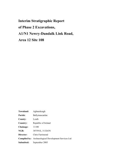
<strong>Interim</strong> Stratigraphic <strong>Report</strong><br />
of Phase 2 Excavations,<br />
A1/N1 Newry-Dundalk Link Road,<br />
Area 12 Site 108<br />
Townland: <strong>Aghnaskeagh</strong><br />
Parish: Ballymascanlan<br />
County: <strong>Louth</strong><br />
Country: Republic of Ireland<br />
Chainage: 11100<br />
NGR: 307591E, 313263N<br />
Director: Chris Farrimond<br />
Compiled by: Archaeological Development Services Ltd<br />
Submitted: September 2005
Archaeological Development Services Ltd<br />
Contents<br />
Figures..........................................................................................................................................................3<br />
Plates ............................................................................................................................................................3<br />
Abstract ........................................................................................................................................................4<br />
1 Description of the Site and Location .........................................................................................................5<br />
1.1 Introduction ........................................................................................................................................5<br />
1.2 Site description ...................................................................................................................................5<br />
1.2.1 Topography..................................................................................................................................5<br />
1.2.2 Geology .......................................................................................................................................6<br />
1.2.3 Archaeological and historical background ..................................................................................6<br />
2 A Description of the Works Carried Out.................................................................................................13<br />
2.1 Reason for the excavation.................................................................................................................13<br />
2.2 Excavation methods..........................................................................................................................13<br />
2.2.1 Phasing ......................................................................................................................................13<br />
2.2.2 Desk top study ...........................................................................................................................14<br />
2.2.3 Phase 1 archaeological testing...................................................................................................14<br />
2.2.4 Phase 2 archaeological excavations...........................................................................................15<br />
2.2.5 Health and safety documents.....................................................................................................16<br />
2.2.6 Staff involved ............................................................................................................................16<br />
3 Excavation Records-Phase 2 ...................................................................................................................16<br />
3.1 Results of the excavation..................................................................................................................17<br />
3.1.1 Features in the west ...................................................................................................................17<br />
3.1.2 Features in the east ....................................................................................................................18<br />
3.1.3 Features in the south..................................................................................................................18<br />
3.2 Summary ..........................................................................................................................................19<br />
4 Quantification of the Materials and Records...........................................................................................19<br />
4.1 Quantity of the record.......................................................................................................................19<br />
4.1.1 Context sheets............................................................................................................................19<br />
4.1.2 Miscellaneous written records...................................................................................................19<br />
5 Recommendations ...................................................................................................................................20<br />
5.1 Finds .................................................................................................................................................20<br />
5.2 Samples ............................................................................................................................................20<br />
5.2.1 Macrobotanical analysis ............................................................................................................20<br />
5.2.2 Microbotanical analyses: pollen and phytolith..........................................................................20<br />
Phase 2 Excavations, A1/N1 Newry-Dundalk Link Road, Area 12 Site 108 1
Archaeological Development Services Ltd<br />
5.2.3 Radiocarbon analysis.................................................................................................................21<br />
6 References ...............................................................................................................................................21<br />
Appendices .................................................................................................................................................23<br />
Appendix I Context list ..........................................................................................................................23<br />
Appendix II Finds...................................................................................................................................24<br />
Appendix III Samples.............................................................................................................................24<br />
Appendix IV Photo log...........................................................................................................................25<br />
Appendix V Site matrices.......................................................................................................................26<br />
Phase 2 Excavations, A1/N1 Newry-Dundalk Link Road, Area 12 Site 108 2
Archaeological Development Services Ltd<br />
Figures<br />
Fig. 1 Location of site.<br />
Fig. 2 Extract of RMP Map of <strong>Louth</strong>, Sheets 4.<br />
Fig. 3 Location of Area 12 on RMP Map of <strong>Louth</strong>, Sheet 4.<br />
Fig. 4 Plan showing southern stretch of Area 12 and Site 108.<br />
Fig. 5 Post excavation plan of the site (in progress)<br />
Fig. 6 Sections and profiles of the features (in progress).<br />
Plates<br />
Plate 1 ….<br />
Phase 2 Excavations, A1/N1 Newry-Dundalk Link Road, Area 12 Site 108 3
Archaeological Development Services Ltd<br />
Abstract<br />
<strong>Louth</strong> County Council, the Roads Service NI (Department for Regional Development) and the National<br />
Roads Authority are currently proposing a Road Scheme, the A1/N1 Newry-Dundalk Road. The route<br />
consists of 14.2km of 2-lane dual carriageway with 5.7km of associated link roads from Cloghoge<br />
roundabout, south of Newry to the Ballymascanlan interchange north of Dundalk. As part of the road<br />
development, a number of archaeological and historic sites were within the construction zone of the road<br />
scheme and were determined eligible for excavation before the construction began.<br />
Site 108 was Feature 8 discovered in the Phase 1 site testing; it consisted of a concentrated charcoal<br />
spread 0.66m by 0.80m. Following the Phase 2 surface stripping of the area, seven archaeological<br />
features were revealed. These consisted of three likely hearths that were clustered toward the west of the<br />
site; a second cluster of two probable hearths and a stakehole located approximately 8m to the east of<br />
the first group and approximately equidistant from both clusters (between and to the south) was another<br />
likely thermal feature. The close proximity, similar function and presence of flaked lithic artefacts in the<br />
three thermal features to the west of the site are indicates contemporaneity, as do the attributes of the<br />
second cluster to the east of the site.<br />
Phase 2 Excavations, A1/N1 Newry-Dundalk Link Road, Area 12 Site 108 4
Archaeological Development Services Ltd<br />
1 Description of the Site and Location<br />
1.1 Introduction<br />
The National Roads Authority (NRA) for the Republic of Ireland and Department for Regional<br />
Development (DRD) for Northern Ireland are the authorities in charge of the proposal to construct a new<br />
road between Newry and Dundalk. As part of the road works, Archaeological Development Services Ltd<br />
(ADS) was commissioned to perform an archaeological assessment along the proposed Link Road and to<br />
mitigate the impacts of any construction on archaeological resources. The following report details the<br />
results of the fieldwork at Site 108 that followed the recommendations of McConway and Lynch (2005)<br />
following the discovery in testing of Feature 8.<br />
The proposed scheme involves a 14 km route with 5.7 km of associated link roads (Fig. 1). Upgrading<br />
the key transport corridors and associated trunk road links will provide a strategic framework for<br />
infrastructure investment, improvement of public transport, future urban and economic development<br />
especially for large-scale sites to accommodate industry and commerce and assisting tourist travel around<br />
the region.<br />
This report describes the results of excavations carried out at Site 108 between June 2 and 10 2005 in<br />
advance of groundwork. The staff of ADS carried out archaeological work on behalf of the developers<br />
under the direction of Caroline Powell. This section of the project occurs in <strong>Aghnaskeagh</strong> Townland,<br />
Ballymascanlan Parish, Co. <strong>Louth</strong>; at National Grid Reference 307591E, 313263N (centre point),<br />
Ordnance Datum (OD) of approximately 72m and road scheme chainage 11100.<br />
1.2 Site description<br />
1.2.1 Topography<br />
The existing landscape character of the study area is a result of previous glacial, geological and human<br />
impacts (Figs 1, 2 and 3) 1 . The study area is contained within a mountainous backdrop known as the Ring<br />
of Gullion. Slieve Gullion defines the western extent of the study area and lies at the centre of the Ring of<br />
Gullion. To the north lies Camlough Mountain and Fathom Mountain. The eastern boundary is defined<br />
by the western edge of the Carlingford Mountains and specifically Black Mountain. The southern edge of<br />
the Ring of Gullion is contained within the study area and includes Feede Mountain and Slievenabolea.<br />
1<br />
This information has been taken directly from the A1/N1 Newry-Dundalk Link Road Environmental<br />
Statement/Environmental Impact Statement Non-Technical Summary prepared by RPS Ireland Environmental<br />
Sciences<br />
Phase 2 Excavations, A1/N1 Newry-Dundalk Link Road, Area 12 Site 108 5
Archaeological Development Services Ltd<br />
Between the mountains of the Ring lies a broad gently undulating agricultural landscape. South of Feede<br />
Mountain the study area levels off gently undulating to Dundalk Bay. This site was situated on<br />
pastureland with a slight southeast-facing slope around 150m west of the existing A1 (Figs 1-4).<br />
1.2.2 Geology<br />
Vaughan in Buckley and Sweetman (1991, 8-10) indicates that the he bedrock geology of the site area is<br />
composed of Silurian Greywacke. Silurian rocks were deposited in deep water in active tectonic zones.<br />
Each layer in the Silurian strata represents materials displaced and then redeposited by earthquakes,<br />
which would cause sediments to slump from the off shore slopes of the continental shelf that would then<br />
be deposited as a future greywacke bed.<br />
1.2.3 Archaeological and historical background<br />
The road follows a natural route way through mountainous terrain that may have been in use from the<br />
prehistoric period. There are numerous monuments (following) recorded near the route date from the<br />
Neolithic period to the 11 th Century AD (Buckley and Sweetman 1991).<br />
Previously known sites within 1km of the current site. A search of the “Archaeological Survey of<br />
County <strong>Louth</strong>” (Buckley and Sweetman 1991) and of the SMR shows that there are twelve known<br />
prehistoric and historic sites in the area. These include the following seventeen sites, listed by townland,<br />
the SMR number, the Buckley and Sweetman page number their reference number (1991) and the<br />
description (usually shortened) presented in Buckley and Sweetman (1991) (Fig. 3).<br />
SMR: LH004-008 (01), (02) (Buckley and Sweetman 1991: (01) 171 Survey No. 618; (02) 122<br />
Survey No. 321)<br />
Townland: Drumnasillagh<br />
Parish: Ballymascanlan<br />
Barony: Lower Dundalk<br />
County: <strong>Louth</strong><br />
Country: Republic of Ireland<br />
NGR: 307670E, 313830N<br />
Description: (01) Ringfort oval area (int. diams. 50m NNW-SSE, 29m WSW-ENE) enclosed by much<br />
altered and gasped bank (W 5m, H c. 1.1m). From NNE-E the bank is replaced by a<br />
modern stone wall. Original entrance not identifiable. No visible fosse. Souterrain [(02)<br />
below) in interior.<br />
NGR: 307670E, 313840N<br />
Description: (02) Souterrain situated in the interior of a ringfort [(01) above] (CLAJ 1909, 137-8).<br />
Now inaccessible.<br />
SMR: LH004-030 (01), (02) (Buckley and Sweetman 1991: (01) 158 Survey No. 546; (02) 100<br />
Survey No. 262)<br />
Phase 2 Excavations, A1/N1 Newry-Dundalk Link Road, Area 12 Site 108 6
Archaeological Development Services Ltd<br />
Townland:<br />
Parish:<br />
Barony:<br />
County:<br />
Country:<br />
NGR:<br />
Description:<br />
NGR:<br />
Description:<br />
<strong>Aghnaskeagh</strong><br />
Ballymascanlan<br />
Lower Dundalk<br />
<strong>Louth</strong><br />
Republic of Ireland<br />
307550E, 313300N<br />
(01) Ringfort oval area (int. diams. 44m NNW-SSE, 24m WSW-ENE) enclosed by<br />
earthen bank (W 5m, H 1.3m externally) with traces of stone facing. Souterrain [(02)<br />
below] in NW quadrant of interior.<br />
307330E, 313310N<br />
(02) Souterrain lintels showing on surface of interior of ringfort [(01) above] (CLAJ<br />
1908, 29)<br />
SMR: LH004-031 (01), (02) (Buckley and Sweetman 1991: (01) 158 Survey No. 547; (02) 100<br />
Survey No. 263)<br />
Townland: <strong>Aghnaskeagh</strong><br />
Parish: Ballymascanlan<br />
Barony: Lower Dundalk<br />
County: <strong>Louth</strong><br />
Country: Republic of Ireland<br />
NGR: 307300E, 313200N<br />
Description: (01) Ringfort circular area (diam. 32m) enclosed by earthen bank (W 6.5m, H 1.2m<br />
externally) and external fosse (W 7m) with traces of outer bank, obscured by later field<br />
boundaries. Remains of souterrain [(02) below] in SE quadrant of interior.<br />
NGR: 307300E, 313200N<br />
Description: (02) Souterrain situated in ringfort [(01) above]. Stone-lined depression, running E-W<br />
with slight turn to S at W end, located in SE quadrant of ringfort is probably the remains<br />
of a partially collapsed souterrain.<br />
SMR: LH004-032 (01), (02), (03) [Buckley and Sweetman 1991: Cairn 25, Survey No. 67; (01)<br />
is three tombs 25, Survey Nos 39-41; (02) 63, Survey No. 137; (03) 94 Survey No. 249]<br />
Townland: <strong>Aghnaskeagh</strong><br />
Parish: Ballymascanlan<br />
Barony: Lower Dundalk<br />
County: <strong>Louth</strong><br />
Country: Republic of Ireland<br />
NGR: 307550E, 313690N<br />
Description: Cairn ‘Cairn A’, excavated by E. E. Evans in 1934 (CLAJ 1935, 234-55).<br />
NGR: 307550E, 313690N<br />
Description: (01) Survey No. 39 is a Megalithic tomb: This monument was excavated in 1934 by E.E.<br />
Evans (CLAJ 1935, 234-55). It comprises an oval cairn (above) 17.5m long by 11m<br />
wide, orientated NNE-SSW incorporating a portal-tomb to the E and six Bronze Age<br />
cists to the W. The tomb, facing N, is represented by portal stones, each 2.7m high, and a<br />
back stone standing 2m to the S. The chamber area contained four pockets of cremated<br />
bone with some Neolithic and Bronze Age potsherds and a blue glass bead. The cists<br />
[No. (02) below] yielded cremations and food vessels. Evidence of iron smelting was<br />
recovered from a furnace area [No. (03) below] immediately N of the cairn.<br />
Survey No. 40 is a Megalithic tomb, which lies 40m to the S of No. 39 (above),<br />
excavated in 1935 by E. E. Evans (CLAJ 1937, 1-18). It comprises the remains of a cairn,<br />
15m long, orientated NNW-SSE and narrowing from about 8m wide at the S to 6m at the<br />
N. The cairn, revetted on the E and W with dry walling, incorporates four small<br />
Phase 2 Excavations, A1/N1 Newry-Dundalk Link Road, Area 12 Site 108 7
Archaeological Development Services Ltd<br />
chambers, two opening at the E and two at eh W. Although Evans considered that the<br />
NW chamber may have opened to the N, the morphological evidence indicates that it<br />
probably opened to the W. Finds from the chambers included cremated bone, Neolithic<br />
potsherds and flints, including two hollow scrapers. The chambers are clearly<br />
comparable to the subsidiary chambers found in court-tombs and hence the monument is<br />
assigned to that class; the finds are consistent with this view.<br />
Survey No. 41 A very ruined Megalithic tomb. The remains consist of two orthostats,<br />
2.4m apart and aligned WSW-ENE, with a large, horizontally laid stone set beside and<br />
perpendicular to one of the orthostats; the two latter stones are incorporated in a roadside<br />
fence. The OS field trace records that there was formerly ‘a large flat stone resting on 2<br />
others’ (6” sheet 4, revision 1862). The tomb must remain unclassified pending further<br />
investigation but interpretation as the remains of a large wedge-tomb would be consistent<br />
with the surviving stones.<br />
NGR: 307550E, 313690N<br />
Description: (02) Cists. Six short cists, aligned NW-SE, were found during excavations by E. E.<br />
Evans of Cairn A at <strong>Aghnaskeagh</strong>. These secondary burials, dating to the Bronze Age,<br />
were W and SW of the megalith (individual descriptions omitted).<br />
NGR:<br />
Description:<br />
307550E, 313690N<br />
(03) Iron working furnace. Excavated by E. E. Evans in 1934. At NE end of cairn [No.<br />
(01) above] was a primitive furnace, ‘stoke hole’ and flue used in iron working. The<br />
structure consisted of an unlined furnace, using fused clay as walling. This type of bowl<br />
furnace probably had courses of stone added as heightening. Extending from the bowl<br />
was a flue (L c. 2m, W c. 0.3m) roughly D-shaped in section. The door of the furnace<br />
faced SW, obviously to catch the prevailing wind, and led to a small ‘stoke hole’ and a<br />
paved pathway (L c. 1.7m) of granite slabs. The excavator has suggested that smelting<br />
took place at the mouth of Cist 3 [No. (02) above].<br />
SMR: LH004-033 (Buckley and Sweetman 1991: 25, Survey No. 40)<br />
Townland: <strong>Aghnaskeagh</strong><br />
Parish: Ballymascanlan<br />
Barony: Lower Dundalk<br />
County: <strong>Louth</strong><br />
Country: Republic of Ireland<br />
NGR: 307570E, 313650N<br />
Description: Court tomb: This monument, which lies 40m to the S of Survey No. 39 [LH004-032 (01)<br />
above] was excavated in 1935 by E. E. Evans (CLAJ 1937, 1-18). It comprises the<br />
remains of a cairn, 15m long orientated NNW-SSE, and a narrowing from about 8m wide<br />
at eh S to 6m at the N. The cairn, revetted on the E and W with dry walling, incorporates<br />
four small chambers, two opening at the E and two to the W. Although Evans considered<br />
that the NW chamber may have opened tot eh N, the morphological evidence indicates<br />
that it probably opened to the W. Finds from the chambers included cremated bone,<br />
Neolithic potsherds and flints, including two hollow scrapers. The chambers are clearly<br />
comparable to the subsidiary chambers found in court-tombs.<br />
SMR: LH004-034 (Buckley and Sweetman 1991: 171 Survey No. 617<br />
Townland: Drumnacarra<br />
Parish: Ballymascanlan<br />
Barony: Lower Dundalk<br />
County: <strong>Louth</strong><br />
Country: Republic of Ireland<br />
NGR: 308220E, 313590N<br />
Phase 2 Excavations, A1/N1 Newry-Dundalk Link Road, Area 12 Site 108 8
Archaeological Development Services Ltd<br />
Description: Ringfort subcircular area (int. dims. 26.5m N-S, 24m E-W) enclosed by earthen bank (W<br />
3.3m, H 0.9m) with internal and external stone facing. No visible trace of fosse. Entrance<br />
gap (W 5.6m) at SW.<br />
SMR: LH004-035 (Buckley and Sweetman 1991: 171, Survey No. 616)<br />
Townland: Drumnacarra<br />
Parish: Ballymascanlan<br />
Barony: Lower Dundalk<br />
County: <strong>Louth</strong><br />
Country: Republic of Ireland<br />
NGR: 308270E, 313360N<br />
Description: Ringfort subcircular area (int. dims. 35.5m N-S, 32.5m |E-W) enclosed by a bank (W<br />
5m, H 0.6m internally, 1.1m externally) with internal and external stone facings and a<br />
basal course of large stones. Probable entrance gap (W 1.5m) at ESE. No visible fosse.<br />
SMR: LH004-036 (Buckley and Sweetman 1991: 28, Survey No. 44)<br />
Townland: Drumnasillagh<br />
Parish: Ballymascanlan<br />
Barony: Lower Dundalk<br />
County: <strong>Louth</strong><br />
Country: Republic of Ireland<br />
NGR: 307950E, 313240N<br />
Description: Court tomb is incorporated in a roughly trapezoidal cairn some 30m long and 20m wide<br />
at the WSW, narrowing to 7.1m wide at the ESE. There is a well-defined court at the W<br />
leading to the gallery area, which is covered by cairn material. The court, 7.5m wide and<br />
6m deep, embraces almost three-quarters of a circle and is represented by 14 orthostats, 7<br />
at either side. Two large slabs lie at the inner end of the court. A single façade stone<br />
stands beyond the N arm of the court. Two kerb stones are exposed at the E end of the<br />
cairn and a field wall runs along its southern side.<br />
SMR: LH004-037 (Buckley and Sweetman 1991: 88, Survey No. 234)<br />
Townland: Drumnasillagh<br />
Parish: Ballymascanlan<br />
Barony: Lower Dundalk<br />
County: <strong>Louth</strong><br />
Country: Republic of Ireland<br />
NGR: 308080E, 313120N<br />
Description: Fulacht fiadh situated in a small swampy valley, between ridges of light soil to E and W.<br />
Immediately to E of mound is a small stream, probably the original source of water for<br />
the trough. The site consists of an irregularly shaped mound (max. dims. 15m by 9m, H<br />
0.6m) of burnt stone and charcoal with trough depression to E. To W and S are low<br />
irregular banks extending from the mound, comprised of mound material. However, their<br />
exact relationship to the mound is indeterminate.<br />
SMR: LH004-041 (Buckley and Sweetman 1991: 25, Survey No. 41)<br />
Townland: <strong>Aghnaskeagh</strong><br />
Parish: Ballymascanlan<br />
Barony: Lower Dundalk<br />
County: <strong>Louth</strong><br />
Country: Republic of Ireland<br />
NGR: 307490E, 312470N<br />
Phase 2 Excavations, A1/N1 Newry-Dundalk Link Road, Area 12 Site 108 9
Archaeological Development Services Ltd<br />
Description:<br />
Possible wedge tomb described as a Megalithic tomb. This tomb is very ruined. The<br />
remains consist of two orthostats, 2.4m apart and aligned WSW-ENE, with a large,<br />
horizontally laid stone set beside and perpendicular to one of the orthostats; the two latter<br />
stones are incorporated in a roadside fence. The OS field trace records that there was<br />
formerly ‘a large flat stone resting on 2 others’.<br />
SMR: LH004-042 (Buckley and Sweetman 1991: 75, Survey No. 179)<br />
Townland: <strong>Aghnaskeagh</strong><br />
Parish: Ballymascanlan<br />
Barony: Lower Dundalk<br />
County: <strong>Louth</strong><br />
Country: Republic of Ireland<br />
NGR: 307540E, 312450N<br />
Description: Standing stone: Formerly located a short distance SE of megalithic tomb (LH002-041).<br />
SMR: LH004-043 (01), (02) (Buckley and Sweetman 1991: (01) 195, Survey No. 760; (02)<br />
123, Survey No. 322)<br />
Townland: Drumnasillagh<br />
Parish: Ballymascanlan<br />
Barony: Lower Dundalk<br />
County: <strong>Louth</strong><br />
Country: Republic of Ireland<br />
NGR: 308180E, 312750N<br />
Description: (01) Enclosure polygonal enclosure (max. dims. 27m E-W, 26m N-S) Known locally as<br />
‘Jameson’s Fort’. May be modified ringfort. Souterrain [(02) below] in interior of<br />
enclosure.<br />
NGR: 308190E, 312740N<br />
Description: (02) Souterrain situated in enclosure [(01) above] and consisting of a section of passage<br />
(L 5.2m, W 1m, H 1.3m) running N-S.<br />
Sites known from the current project. Current work has identified seven archaeological sites within<br />
1km of this location (Figs 2 and 3). Positive results of trial pits excavations along the route were reported<br />
in 2005 (McConway and Lynch). These are:<br />
Site 104 was approximately 910m north of the current site; this site was composed of three areas of<br />
activity, termed the northwest, the middle-north and the east. In the northwest area, the archaeological<br />
remains appeared to represent repeated episodes of burning. Here the archaeology consisted of a<br />
posthole, two charcoal spreads and three pits. They were all discreet features as there were no<br />
stratigraphic links between any of the features to indicate either their chronology or contemporaneity.<br />
The three pit features would appear to be a series of hearths (Ó Baoill 2005).<br />
The area of the site designated middle-north contained a stratified sequence of archaeological deposits<br />
consisting of two deliberately scarped features in the natural associated with a large area of burning. It<br />
would appear that some sort of communal activity, either cooking or perhaps ritual, was taking place at<br />
Phase 2 Excavations, A1/N1 Newry-Dundalk Link Road, Area 12 Site 108 10
Archaeological Development Services Ltd<br />
this location. There appeared to be an effort to mask the burning activity by laying down various layers<br />
of redeposited natural on top of the charcoal within the cut. Later, the digging of a linear feature damaged<br />
the earlier features. This cut, both in orientation and dimensions, has all the appearance of an early<br />
medieval grave but no remains were recovered from its basal fill. However, attributes of the feature<br />
including the digging of the berm or ledge at its south side, the orientation of the feature, the presence of<br />
a cairn of stones that slumped into the main cut and the possible stone marker socket all suggest a burial.<br />
In the east area, there were two features, an irregularly shaped oblong cut and a circular pit. They were<br />
both discreet features, as there was no stratigraphic link between either of the features to illuminate either<br />
chronology or contemporaneity.<br />
The excavations found no evidence for a ‘ring ditch’ or ‘ploughed out barrow’, suggested from the Phase<br />
1 archaeological testing. However, there was evidence of small scale, multi-period activity across the<br />
site. The lack of artifacts retrieved from site hinders close preliminary dating of the features investigated.<br />
It is hoped that more information may be gained when the radiocarbon dates from the various samples<br />
taken are analysed.<br />
Site 105 (Turrell 2005a) was approximately 665m north of the current site. A this site a 20m by 20m area<br />
was stripped down to the stony subsoil to reveal two plough furrows, several shallow pits, perhaps the<br />
result of spade cultivation, and a linear feature, perhaps a ditch or possibly the result of mechanical<br />
ridging. All of these features had similar fills and some contained sherds of modern pottery. Some burnt<br />
areas, noted during the testing phase, proved to be no more than thin spreads of charcoal-rich topsoil.<br />
Site 106 (Powell 2005a) was approximately 625m north of the current site at this location Phase 1 testing<br />
revealed two potentially significant features. Feature 10 was a spread of charcoal flecked silty soil with<br />
stone inclusions, Feature 11 was 13m north of Feature 10 and consisted of a circular spread of ash and<br />
charcoal that continued into the northern baulk. In order to investigate the deposits an area measuring 20<br />
by 20m was stripped of topsoil after which several additional potentially significant features were<br />
exposed in plan. In the course of the excavation, twenty-seven contexts consisting of ten cuts and sixteen<br />
fills or deposits were investigated. All of the excavated features appear to be related to post medieval<br />
agriculture, these include a wall foundation, burnt tree bowls, agricultural furrows and a field drain.<br />
Phase 2 Excavations, A1/N1 Newry-Dundalk Link Road, Area 12 Site 108 11
Archaeological Development Services Ltd<br />
Site 107 (Powell 2005b) this site was approximately 570m north of the current site, it consisted of a thin<br />
spread and one large pit feature. Both are thought to have resulted from modern farming activities<br />
associated with an adjacent farmhouse.<br />
Site 109 consisted of a cluster of features found in testing that were located approximately 60m to the<br />
south of the current site (McConway and Lynch 2005). Feature 7 was the northernmost feature in the<br />
cluster, it consisted of two teardrop shaped spreads of charcoal flecked soil. These features lay beside one<br />
another and continued into the northern baulk. Feature 6 lay 25m to the southeast of Feature 7 and<br />
consisted of a spread of brown/grey silt; the eastern edge of this spread continued into the baulk. Feature<br />
5 lay 30m to the southwest of Feature 6 and consisted of a subcircular silty soil with charcoal inclusions.<br />
Feature 4 lay 40m to the west of Feature 5 and consisted of two apparently discreet spreads of charcoal.<br />
Feature 3 lay 20m south of feature 4 and was the southernmost feature in the cluster of Features 3 –7. It<br />
consisted of a roughly oval spread of charcoal flecked brown/grey soil.<br />
Site 110 this site is approximately 180m south of the current site, at this site test trenching had<br />
discovered a single feature (Feature 2 from testing). After clearing the feature measured 0.95m east to<br />
west by 0.60m north to south, it was dish-shaped in profile with a maximum depth in the centre of 0.08m.<br />
There was no cut per se as the feature consisting of a burnt patch of clay with charcoal inclusions. The<br />
excavated feature appears related to agricultural practice, in particular tree clearing.<br />
Site 111 this site is next to recorded monument (LH 004:041) a Megalithic Tomb approximately 780m<br />
south of the current site (Figs 3 and 4). Field 18/Feature 1 lay to the immediate north of a beech-lined<br />
avenue and in the immediate vicinity of a recorded monument, a ‘megalithic structure’. The area was<br />
noticeably stony underfoot and many larger boulders protruded through the dense grass cover.<br />
This feature consisted of a stony surface measuring approximately 30m north to south by 25m and was<br />
identified lying immediately under the topsoil and overlying subsoil. These stones were embedded within<br />
a friable mid brown/grey soil and appeared delineated with an interrupted kerb of larger boulders. Field<br />
18/Feature 1 has been interpreted as a collapsed cairn associated with the recorded megalithic tomb. It is<br />
likely, given local tradition that the area may also have been used as an infant burial ground.<br />
In the area to the immediate south of the beech lined avenue it was noted that large boulders protruded<br />
through the grass in the northwest corner of the field, although these may be associated with collapse<br />
from a stone field wall. Three areas of archaeological deposits were identified in Field 17.<br />
Phase 2 Excavations, A1/N1 Newry-Dundalk Link Road, Area 12 Site 108 12
Archaeological Development Services Ltd<br />
Field 17/Feature 1 consisted of an isolated spread of grey/brown silt, Field 17/Feature 2 was a roughly<br />
circular and measured 3.5m in diameter.<br />
Field 17/Feature 11 was a spread of black charcoal rich silt and burnt and heat shattered stone that was<br />
uncovered 75m to the southwest of Field 17/Feature 1. As uncovered, this deposit measured 3.5 by 2.5m<br />
and continued into both the northern and southern baulks. This deposit has been interpreted as being<br />
burnt mound or Fulachta Fiadh material.<br />
Field 17/Feature 3 was a circular feature that was uncovered around .27m east of Field 17/Feature 1 and<br />
lay within a small cluster of archaeological deposits. It consisted of a spread of orange/brown redeposited<br />
subsoil identified as Field 17/ Feature 4, which itself measured 3.3m in diameter. A fifth feature was<br />
identified within this cluster. F17/006 was an irregular feature consisting of charcoal rich black silt Field<br />
17/Feature 5, at least 5m east to west and continuing into the western baulk.<br />
2 A Description of the Works Carried Out<br />
2.1 Reason for the excavation<br />
The principal objectives of the Roads Service in implementing the scheme are to improve the conditions<br />
for road users by reducing journey times between the major commercial centres, together with an<br />
improvement in road safety. The specific objectives are:<br />
• To contribute to the improvement of the Regional Strategic Transport Network and major<br />
transport links with Great Britain and the Republic of Ireland;<br />
• To reduce vehicle operating times and costs;<br />
• To facilitate freight transport;<br />
• To improve road safety and improve pedestrian and cycle access and safety.<br />
2.2 Excavation methods<br />
2.2.1 Phasing<br />
The road works have been divided into 2 phases: Phase 1 included (a) the archaeological evaluation of<br />
known sites, possible sites and areas of archaeological potential and (b) the recording and evaluation of<br />
standing buildings/structures at identified locations. Phase 2, reported here, includes the resolution of any<br />
sites identified by the works.<br />
Phase 2 Excavations, A1/N1 Newry-Dundalk Link Road, Area 12 Site 108 13
Archaeological Development Services Ltd<br />
2.2.2 Desk top study<br />
A desktop study of archaeological and cultural heritage sites was reported in the Environmental Impact<br />
Statement for the project (RPS 2002a, 236; 2002b). A particular emphasis was paid to sites with 1km of<br />
what was then the proposed route alignment.<br />
2.2.3 Phase 1 archaeological testing<br />
Area 12 is in a zone of fertile soils within an archaeologically sensitive landscape in close vicinity to a<br />
number of known archaeological sites (Figs 2 and 3; Section 1.2.3). This area was considered to have<br />
high archaeological potential and was investigated and evaluated under Phase 1 of the Contract by means<br />
of test excavation. The Phase 1 report discusses the archaeological findings within Area 12, at<br />
Drumsillagh and <strong>Aghnaskeagh</strong> townlands, between chainages 10925-12150. Patricia Lynch carried out<br />
the testing under project sub number A002/003 from the 15 th through 26 th of November 2004<br />
(McConway and Lynch 2005).<br />
The purpose for and the methodology employed in the Phase I testing included:<br />
• To fully expose, investigate, record and resolve archaeological deposits uncovered in and all<br />
deposits associated with these.<br />
• A licenced director, a supervisor, two assistants and four general operatives carried out resolution<br />
of the archaeological features described above.<br />
• A 100 by 40m area was appropriately opened over the features under archaeological supervision<br />
to the latest archaeological horizon or to the upper surface of natural geology, whichever occurs<br />
first. The area will be manually cleaned and examined for further archaeological deposits.<br />
• All archaeological deposits were surveyed in to a site grid and in relation to their position on the<br />
road.<br />
• All deposits were recorded and investigated by methods appropriate to their nature and<br />
complexity using best archaeological practice.<br />
• Methods used included sectioning, planning and photographing the deposits, investigating the<br />
stratigraphic relationship with other deposits if appropriate, compiling a written record of the<br />
deposits via a context sheets<br />
Fieldwork at this location followed the recommendations of McConway and Lynch (2005) that resulted<br />
from the discovery in testing of Feature 8 that consisted of a concentrated charcoal spread 0.66 by 0.80m.<br />
As it was determined likely that additional subsurface archaeological deposits would be associated with<br />
the known features it was also recommended that an appropriate area around each feature be topsoil<br />
Phase 2 Excavations, A1/N1 Newry-Dundalk Link Road, Area 12 Site 108 14
Archaeological Development Services Ltd<br />
stripped. All features exposed from the stripping were to be fully investigated. If it became apparent that<br />
these features form part of a more extensive archaeological landscape then it was recommended that an<br />
appropriate area be opened up on plan in order to fully investigate and record any discovered features.<br />
2.2.4 Phase 2 archaeological excavations<br />
Recording strategy. Recording was by means of ‘best archaeological practise’ with the primary records<br />
of these excavations consisting of written and drawn records, photographs, survey data, finds and<br />
samples. The stratigraphic record was primarily made on context record sheets, of the standard type used<br />
by ADS. These are supplemented by information from the site daybook, photographs, notebooks, plans<br />
and sections. Field surveying equipment consisted of an Ashtech DGPS surveying suite, which allowed<br />
real-time data collection with horizontal accuracy of 0.005m +1ppm and vertical accuracy of 0.010m<br />
+2ppm.<br />
All Phase 2 archaeological excavations were carried out in accordance with the Specification for<br />
Archaeological Rescue Excavation on Known Sites document (ADS 2005). Field methods included:<br />
• An appropriately sized area around each of the deposits was fenced off and access to these areas<br />
by machinery and personnel denied until they have been resolved.<br />
• The removal of topsoil was by judicial use of a machine fitted with a toothless bucket under the<br />
constant supervision of a suitably qualified archaeologist.<br />
• All trenches were excavated to the latest archaeological horizon or to the upper surface of natural<br />
geology, whichever occurred first. If archaeological features were revealed these deposits were in<br />
the first instant, cordoned off using high visibility tape and access to these areas by machinery<br />
denied.<br />
• All deposits were hand investigated using methods appropriate to their composition, nature and<br />
date and time was allowed for the archaeologist to undertake the appropriate level of recording.<br />
• The level of recording depended on the nature and extent of the archaeological remains<br />
encountered. All deposits were recorded on plan (in relation to the site grid), photographed and if<br />
appropriate, their location surveyed in advance of hand excavation.<br />
• Excavation of deposits was carried out by sectioning using methods appropriate to their<br />
composition and nature.<br />
• Contexts were sampled for palaeobotanical material, radiocarbon dating, soil micromorphology,<br />
petrology, wood identification, etc.<br />
• All sections and cut features were photographed and drawn.<br />
Phase 2 Excavations, A1/N1 Newry-Dundalk Link Road, Area 12 Site 108 15
Archaeological Development Services Ltd<br />
• The position of all finds and samples were recorded in three-dimensions (when practicable) in<br />
relation to the site grid.<br />
• Sampling strategies depended upon the dimensions, make up and complexity of the<br />
archaeological remains encountered.<br />
• A day book was maintained where all archaeological features were recorded in writing utilizing<br />
ADS context sheets, scaled field illustrations and by both slide and digital photography.<br />
• All finds were logged according to context, bagged and catalogued.<br />
• A contract conservator was on call if necessary.<br />
• All finds are stored in our post excavation unit at Kells, Co. Meath and will ultimately be stored<br />
in whatever facility the State will provide.<br />
• Excavation or preservation by record was carried out on archaeological deposits that will be<br />
impacted on by the construction of the road scheme.<br />
2.2.5 Health and safety documents<br />
It is the policy of ADS to comply with the Health & Safety at Work Acts and the Construction Safety,<br />
Health & Welfare Regulations and to ensure so far as reasonably practicable the safety, health and<br />
welfare of all employees whilst at work, and to provide such information, training and supervision<br />
needed for this purpose. To comply with these acts and regulations the works were conducted following<br />
the procedures and principles laid out in the company health and safety document (ADS 2003). Special<br />
attention to health and safety will be paid in areas close to rivers, streams, woodland, marshy ground and<br />
overhead power lines. ADS can confirm that the excavation crews all hold a valid safe pass certificate.<br />
2.2.6 Staff involved<br />
The site director, Chris Farrimond (formerly with ADS) would like to acknowledge site supervisors<br />
James McKee and Deirdre Malone and site assistants Tara Clark, Caroline Cosgrove and Colm O’Brien.<br />
3 Excavation Records-Phase 2<br />
Testing in Area 12 was carried out under number A002/003. Eight areas of archaeological potential were<br />
identified. At this location, the test excavations revealed one feature that required further investigation<br />
(McConway and Lynch 2005). Feature 8 consisted of a concentrated charcoal spread 0.66 by 0.8m (Fig.<br />
5).<br />
Phase 2 Excavations, A1/N1 Newry-Dundalk Link Road, Area 12 Site 108 16
Archaeological Development Services Ltd<br />
3.1 Results of the excavation<br />
Following the clearing of the area surrounding the original Testing Feature 8 [now context (266)] a<br />
further seven features were discovered all within a 12 by 17m area. Three features were clustered in the<br />
west of the site (261), (262) and (266); three were in the northeast area of the topsoil stripped area (270),<br />
(272) and (273) and two were to the south (260) and (271) (Fig. 5).<br />
3.1.1 Features in the west<br />
In this area of the site there were three features interpreted as either burnt pits or hearths, each of these<br />
were within 2.20m of the other (Figs 5 and 6)<br />
Cut (261) was, irregular in plan, basin shaped in profile and likely vertically truncated. The feature<br />
measured 1.04 by 1.06 by 0.08m deep and contained two fills (254) and (275). Context (254) was the<br />
upper fill of the feature it consisted of a medium compacted, black/grey, silty clay with frequent charcoal<br />
flecking occasional burnt stone and two pieces of burnt flint (Appendix II). The lower fill (275) consisted<br />
of medium compacted, orange/grey, redeposited silty clay. The feature was interpreted as a shallow burnt<br />
pit or probable hearth<br />
Two metres to the southeast of hearth (261) was feature (262). The feature was nearly circular in plan;<br />
basin shaped in profile and appeared vertically truncated. The feature measured 1.02 by 1.22 by 0.22m<br />
deep and contained four fills (264), (253), (265) and (263). Fill (264) was modern disturbance deposited<br />
following the excavation of a recent, adjacent, water pipe. Context (253) was the in situ upper fill of the<br />
feature; it consisted of brown/black silty clay with frequent charcoal flecking. The middle in situ fill was<br />
Context (265) that consisted of light brown, sandy silty clay with occasional pockets of charcoal. The<br />
bottom fill of the feature was (263) that was black, charcoal rich silty clay with frequent lumps of<br />
charcoal and occasional small stones. This feature also likely functioned a hearth<br />
Cut (266) was located 1.5m to the east of hearth (261) and 1.10m north of Cut (262); this was Feature 8<br />
identified in the testing (McConway and Lynch 2005). The feature was oval in plan; basin shaped in<br />
profile and is likely vertically truncated. The hearth measured 1.00 by 1.20 by 0.25m deep and contained<br />
two fills (255) and (267). Context (255) is the upper fill of the feature; it consisted of brown/black, silty<br />
clay with frequent charcoal flecks, occasional small stones and a piece of worked flint (Appendix II).<br />
Beneath fill (255) was fill (267) that consisted of brown/black, silty clay with frequent [but less than<br />
(255) above] charcoal flecking. Under this, was a hard-compacted ‘indurated’ surface that consisted of<br />
burnt natural. The feature was thought to be is a second (or third perhaps) hearth in this area that<br />
Phase 2 Excavations, A1/N1 Newry-Dundalk Link Road, Area 12 Site 108 17
Archaeological Development Services Ltd<br />
These three features appear to be the vertically truncated remnants of hearths. The clustering of these<br />
features is an indication that they are likely contemporary or near contemporary and the presence of<br />
flaked lithic artefacts in the fills of these features [(261) and (266)] suggests a prehistoric date.<br />
3.1.2 Features in the east<br />
Within a 5 by 3m area, approximately 7m to the east of the above area, was an second set of three pit<br />
features that were clustered in a 5 by 2m area (Figs 5 and 6).<br />
Cut (270) was a shallow, circular, unburned pit with an uneven base that measured 0.60 by 0.50 by<br />
0.17m deep. The feature contained a single fill (257) that consisted of grey, silty clay. The function of<br />
this pit is unknown.<br />
Cut (272) was approximately 3m to the southwest of pit (270) it consisted of an oval pit with a concave,<br />
uneven, slightly burnt and mettled base. The feature measured 1.18 by 0.88 by 0.09m deep and contained<br />
a single fill (251). Fill (251) was grey/black clayey silt with very frequent charcoal flecks and lumps and<br />
very frequent medium sized angular stones, some of which were fire cracked. Below this fill, the natural<br />
showed evidence of burning. This was another likely hearth feature.<br />
Cut (273) was 1.8m northwest of feature (272) and 4.5m west of Cut (270). The feature measured 0.18m<br />
in diameter and was 0.14m deep; it contained a single fill (259) that consisted of loose, black, fine silty<br />
clay with frequent charcoal inclusions. The feature was interpreted as a stakehole.<br />
3.1.3 Features in the south<br />
Two features were excavated within the topsoil stripped area approximately 5m to the south of the two<br />
clusters described above. These were cuts (260) and (271) (Figs 4, 9 and 10)<br />
Cut (260) is a shallow pit that was circular in plan, had an undulating base and which measured 0.83 by<br />
0.86 by 0.10m deep. The feature contained one fill (250) that consisted of charcoal rich, medium<br />
compacted, black, silty clay with occasional small subangular stones. There was no evidence of in situ<br />
burning; the function of the feature is uncertain but the remains may represent a low temperature hearth<br />
or warming pit.<br />
Cut (271) was determined to be a stone socket; the feature contained a single fill (256).<br />
Phase 2 Excavations, A1/N1 Newry-Dundalk Link Road, Area 12 Site 108 18
Archaeological Development Services Ltd<br />
3.2 Summary<br />
Site 108 was Feature 8 discovered in the Phase 1 site testing, it consisted of a concentrated charcoal<br />
spread 0.66m by 0.80m (McConway and Lynch 2005). Following the Phase 2 surface stripping of the<br />
area, seven archaeological features were revealed. These consisted of three likely hearths that were<br />
clustered toward the west of the site; a second cluster of two probable hearths and a stakehole located<br />
approximately 8m to the east of the first group and approximately equidistant from both clusters<br />
(between and to the south) was another likely thermal feature. The close proximity, similar function and<br />
presence of flaked lithic artefacts in the three thermal features to the west of the site are indicates<br />
contemporaneity, as do the attributes of the second cluster to the east of the site.<br />
4 Quantification of the Materials and Records<br />
4.1 Quantity of the record<br />
The site archive comprises those items listed in Table 1:<br />
Table 1 Records Inventory<br />
Form<br />
Number (after voids)<br />
Context Sheets 27<br />
Photographs (Rolls) 22 frames on 4 rolls<br />
Sections and Plans 6 sections and 2 plans<br />
Finds 4<br />
Samples 2<br />
4.1.1 Context sheets<br />
Twenty-seven context sheets are archived at the ADS Dublin facility and are in queue for entry into the<br />
project database.<br />
4.1.2 Miscellaneous written records<br />
Site Diary/ Daybook (with supplementary notes and correspondence). Miscellaneous administrative notes<br />
and correspondence.<br />
4.1.3 Drawings<br />
Two plans and six sections.<br />
Phase 2 Excavations, A1/N1 Newry-Dundalk Link Road, Area 12 Site 108 19
Archaeological Development Services Ltd<br />
5 Recommendations<br />
5.1 Finds<br />
Three pieces of struck flint was recovered from the excavations (Appendix II). The artefacts will be<br />
analysed by the appropriate specialist. Should additional artefacts be recovered from the processed<br />
samples they will be analysed by the appropriate specialists.<br />
5.2 Samples<br />
5.2.1 Macrobotanical analysis<br />
The single best source of evidence for answering economic questions related to subsistence, fuel use and<br />
material culture is macrobotanical, that is, plant materials that can be seen with the naked eye. Such<br />
materials can be quantified and ultimately compared with other tangible aspects of an archaeological<br />
assemblage including information recovered through pollen and other microbotanical analyses. Burned<br />
macrobotanical materials are best recovered through flotation of a soil sample. In the case where unburnt<br />
materials are suspected in the sample, they can be picked from the overall sample before flotation. If the<br />
intent is for the recovered remains to be used for radiocarbon analysis then all botanical materials<br />
recovered from the samples should undergo species identification before such analysis.<br />
Both environmental samples will undergo macrobotanical analyses with materials saved for radiocarbon<br />
analyses.<br />
5.2.2 Microbotanical analyses: pollen and phytolith<br />
Several types of analyses of samples that are botanic in origin can yield information that is important to<br />
the understanding or confirmation of the function of a site or its features. At this site, materials for<br />
analyses can be recovered as sub samples from the two bulk soil samples (Appendix III).<br />
Pollen may be transported by wind and form part of a record of local and regional vegetation. Humans in<br />
the course of working with plants may also transport pollen more selectively. Pollen analysis can focus<br />
on interpretation of the past environment or also is a good tool for interpreting human exploitation of<br />
plants as foods, construction materials, or for a variety of utilitarian purposes. Pollen is surprisingly<br />
rugged and survives in sediments that many suppose would not be condusive to pollen preservation.<br />
Phytoliths are silica bodies accumulated by plants when soluble silica in the ground water is absorbed by<br />
the plant roots and is carried up to the plant via the vascular system. Evaporation and metabolism of this<br />
Phase 2 Excavations, A1/N1 Newry-Dundalk Link Road, Area 12 Site 108 20
Archaeological Development Services Ltd<br />
water result in precipitation of the silica in and around the cell walls in plants that accumulate silica.<br />
Phytoliths are usually introduced directly into the soils in which the plants decay. Transportation of<br />
phytoliths occurs primarily by animal consumption, man's gathering of plants or by erosion or<br />
transportation of the soil by wind, water or ice.<br />
5.2.3 Radiocarbon analysis<br />
The excavated features may form part of a more extensive archaeological landscape, in particular the<br />
clustering of features with similar functions (hearths), which indicates contemporaneity or near<br />
contemporaneity. The post excavation analyses should include the processing of the soil samples to<br />
recover charcoal for radiocarbon analysis of the two hearth features; the relatively isolated hearth (260),<br />
Sample and one of the hearths in the west cluster (261), Sample (Appendix III).<br />
6 References<br />
ADS<br />
2003 Archaeological Development Services Ltd Health and Safety Manual. Compiled by Fergus<br />
Cooney.<br />
2005 Archaeological Method Statements To facilitate Phase 2 works On the A1/N1 Newry – Dundalk<br />
Link Road Project Number A002/000, April 2005.<br />
Buckley, V. and P. Sweetman<br />
1991 Archaeological Survey of County <strong>Louth</strong>. The Office of Public Works, Dublin.<br />
<strong>Louth</strong> County Council<br />
1997 <strong>Louth</strong> County Development Plan. <strong>Louth</strong> County Council, Dundalk.<br />
McConway, L. and P. Lynch<br />
2005 A1/N1 Newry-Dundalk Link Road Volume 1 Archaeological Assessment Area 12. Archaeological<br />
Development Services Ltd for Department for Regional Development, Roads Service. Belfast.<br />
Ó Baoill, R.<br />
2005 Final <strong>Report</strong> of Excavations at the A1/N1 Newry to Dundalk Link Road Area 10, Site 104.<br />
Archaeological Development Services Ltd for Department for Regional Development, Roads<br />
Service. Belfast.<br />
Phase 2 Excavations, A1/N1 Newry-Dundalk Link Road, Area 12 Site 108 21
Archaeological Development Services Ltd<br />
Powell, C.<br />
2005a Final <strong>Report</strong> of Excavations at the A1/N1 Newry to Dundalk Link Road Area 10, Site 106.<br />
Archaeological Development Services Ltd for Department for Regional Development, Roads<br />
Service. Belfast.<br />
2005b Final <strong>Report</strong> of Excavations at the A1/N1 Newry to Dundalk Link Road Area 10, Site 107.<br />
Archaeological Development Services Ltd for Department for Regional Development, Roads<br />
Service. Belfast.<br />
2005c Final <strong>Report</strong> of Excavations at the A1/N1 Newry to Dundalk Link Road Area 12, Site 110.<br />
Archaeological Development Services Ltd for Department for Regional Development, Roads<br />
Service. Belfast.<br />
RPS Ireland Environmental Services (RPS)<br />
2002a A1/N1 Newry-Dundalk Link Road Environmental Statement Environmental Impact Statement,<br />
Volume 1 Main Text.<br />
2002b A1/N1 Newry-Dundalk Link Road Environmental Statement Environmental Impact Statement,<br />
Volume 2 Appendices.<br />
Turrell, S.<br />
2005 Final <strong>Report</strong> of Excavations at the A1/N1 Newry to Dundalk Link Road Area 10, Site 105.<br />
Archaeological Development Services Ltd for Department for Regional Development, Roads<br />
Service, Belfast.<br />
Phase 2 Excavations, A1/N1 Newry-Dundalk Link Road, Area 12 Site 108 22
Archaeological Development Services Ltd<br />
Appendices<br />
Appendix I Context list<br />
Context Type Description<br />
(250) Fill Charcoal rich fill of (260).<br />
(251) Fill Charcoal rich fill of (272).<br />
(252) Fill Charcoal rich fill of (260).<br />
(253) Fill Charcoal rich fill of (260).<br />
(254) Fill Charcoal rich fill of (269).<br />
(255) Fill Charcoal rich fill of (266).<br />
(256) Fill Stoney light grey upper fill of stone socket (271) (NAS).<br />
(257) Fill Upper fill of pit.<br />
(258) Fill Fill of pit.<br />
(259) Fill Fill of pit.<br />
(260) Cut Cut of shallow pit. Filled by (250).<br />
(261) Cut Cut of shallow pit. Filled by (254).<br />
(262) Cut Cut of pit.<br />
(263) Fill Fill of pit (262).<br />
(264) Fill Fill of pit (262).<br />
(265) Fill Fill of pit (262).<br />
(266) Cut Cut of pit. Filled by (255).<br />
(267) Fill Fill of pit (266).<br />
(268) Fill Fill of pit (266).<br />
(269) Cut Cut of small circular posthole.<br />
(270) Cut Cut with fill (257).<br />
(271) Cut Stone socket (NAS) filled by (256).<br />
(272) Cut Shallow pit with mettled base.<br />
(273) Cut Stakehole containing fill (259)<br />
(274) - Void<br />
(275) Fill Fill of pit (261).<br />
(276) Fill Fill of modern water pipe. NAS.<br />
Phase 2 Excavations, A1/N1 Newry-Dundalk Link Road, Area 12 Site 108 23
Archaeological Development Services Ltd<br />
Appendix II Finds<br />
Context Description<br />
(254) Two pieces of burnt flint from fill of hearth (261) feature.<br />
(255) Worked flint from hearth (266).<br />
(256) Pottery from stone socket (271) fill.<br />
Appendix III Samples<br />
Sample Number Context Description<br />
3 (250) Charcoal rich fill of shallow pit feature (260).<br />
4 (254) Fill from hearth (261), also contained 2 pieces of burnt flint.<br />
Phase 2 Excavations, A1/N1 Newry-Dundalk Link Road, Area 12 Site 108 24
Archaeological Development Services Ltd<br />
Appendix IV Photo log<br />
Roll Photo Description<br />
2 24 Pre excavation of (250) from the north.<br />
3 1 Pre excavation plan of (251). From the north.<br />
3 2 Pre excavation plan of (252). From the north.<br />
3 3 Pre excavation plan of (253). From the north.<br />
3 4 Pre excavation plan of (254). From the east.<br />
3 17 Pre excavation plan of (255). From the east.<br />
3 18 Pre excavation plan of (256). From the northeast.<br />
3 19 Pre excavation plan of (257). From the north.<br />
3 20 Pre excavation plan of (258). From the south.<br />
3 21 Pre excavation plan of (259). From the south.<br />
3 23 Section of hearth (260) showing fill (250). From the south.<br />
3 24 Mid excavation. Section of hearth (261) showing fills (254) and (275). From the<br />
northeast.<br />
4 7 Mid excavation. Section of hearth (262) showing fill (253), (264) and (265).<br />
4 16 Post excavation of hearth (262) looking west.<br />
4 20 Mid excavation. Section of hearth (266) with fills (255), (267) and (268). Looking<br />
southwest.<br />
4 21 Mid excavation. Section of hearth (266) with fills (255), (267) and (268). Looking<br />
southwest.<br />
5 2 Mid excavation of pit (272).<br />
5 3 Mid excavation. Section of shallow pit (270) with fill (257).<br />
5 4 Mid excavation. Section of shallow pit (270) with fill (257).<br />
5 5 Post excavation of pit (272).<br />
5 6 Stakehole (273).<br />
5 7 Hearth (261).<br />
Phase 2 Excavations, A1/N1 Newry-Dundalk Link Road, Area 12 Site 108 25
Archaeological Development Services Ltd<br />
Appendix V Site matrices<br />
In progress, or soon to be.<br />
Phase 2 Excavations, A1/N1 Newry-Dundalk Link Road, Area 12 Site 108 26
N<br />
Derry<br />
Belfast<br />
Sligo<br />
Galway<br />
Dublin<br />
Limerick<br />
Waterford<br />
Wexford<br />
Cork<br />
0 80kms<br />
Area 7<br />
Areas 8 & 9<br />
Area 10<br />
Area 12<br />
Area 13<br />
Area 14<br />
Area 15<br />
0 4km<br />
Fig. 1 Location plan for A1/N1.
N<br />
Derry<br />
N<br />
Belfast<br />
Sligo<br />
Galway<br />
Dublin<br />
Limerick<br />
Waterford<br />
Wexford<br />
Cork<br />
0 80kms<br />
Area 7<br />
Areas 8 & 9<br />
Area 10<br />
Area 12<br />
Area 13<br />
Area 14<br />
Area 15<br />
0 1km<br />
Fig. 2 Extract from RMP Maps of <strong>Louth</strong>, Sheets 1 & 4. A1/N1 in red. Scale as indicated.
N<br />
Areas 12<br />
SITE 108<br />
0 250m<br />
0 250m<br />
Fig. 3 Location of Area 12 and Site 108 on RMP Maps of <strong>Louth</strong>, Sheets 4. A1/N1 in red. Scale 1:10,000.
A<br />
SE<br />
254<br />
263<br />
253<br />
265<br />
262<br />
B<br />
NW<br />
0 50cm<br />
A<br />
West<br />
B<br />
East<br />
250<br />
260<br />
0 50cm<br />
A<br />
SE<br />
267 255<br />
266<br />
B<br />
NW<br />
0 50cm<br />
A<br />
NW<br />
257<br />
B<br />
SE<br />
270<br />
0 50cm<br />
A<br />
SW<br />
B<br />
NE<br />
256<br />
271<br />
0 25cm<br />
A<br />
NE<br />
B<br />
SW<br />
# # # # # # # # # #<br />
# #<br />
# #<br />
#<br />
254<br />
275<br />
261<br />
0 50cm<br />
A<br />
West<br />
#<br />
#<br />
#<br />
#<br />
251<br />
# #<br />
#<br />
# #<br />
#<br />
#<br />
#<br />
#<br />
#<br />
#<br />
Topsoil filled<br />
stone socket<br />
B<br />
East<br />
272<br />
0 25cm<br />
Fig. 6 Sections.