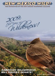
Special Mobile GIS Issue - New Mexico Wilderness Alliance
Special Mobile GIS Issue - New Mexico Wilderness Alliance
Special Mobile GIS Issue - New Mexico Wilderness Alliance

You also want an ePaper? Increase the reach of your titles
YUMPU automatically turns print PDFs into web optimized ePapers that Google loves.
mapping wilderness<br />
<strong>Wilderness</strong> Stewardship<br />
Challenge 2010 Field Log<br />
Or, How I Learned to Stop Worrying and Love the Mountain<br />
May 22, 2010<br />
<strong>Wilderness</strong> Stewardship<br />
Challenge Training<br />
The sun’s first rays tinted the Sandia peaks as we<br />
drove to the Santa Fe National Forest administrative<br />
office for our first training. Friendly Forest<br />
Service employees Sarah Naegele (Pecos/Las Vegas<br />
RD) and Nick Walendziak gave an introduction<br />
to the <strong>Wilderness</strong> Stewardship Challenge:<br />
USFS <strong>Wilderness</strong> Areas across the country have<br />
been challenged to meet baseline management<br />
conditions by 2014, the fiftieth anniversary of<br />
the <strong>Wilderness</strong> Act. This entails monitoring and<br />
inventory of human impacts, including dispersed<br />
camping. That’s where we come in!<br />
Sarah and Nick then gave<br />
us thorough instructions<br />
on performing the Forest<br />
Service “Rapid Campsite<br />
Assessment,” our primary<br />
task this field season in the<br />
Pecos, Latir, and Manzano<br />
<strong>Wilderness</strong> Areas. The assessment<br />
documents and<br />
measures dispersed camping<br />
impacts—the area affected<br />
in square feet, the<br />
degree of disturbance to<br />
natural ground cover, damage<br />
to trees, and so on.<br />
Next, we journeyed into<br />
the Pecos National Forest<br />
to practice using the GPS<br />
for campsite assessment in<br />
the field. Turns out, waiting<br />
to get satellites sometimes<br />
makes assessment less rapid!<br />
I experienced the aspen<br />
groves of the Pecos for the first time and learned<br />
to identify narrowleaf cottonwood. What a grand<br />
classroom!<br />
August 11, 2010<br />
First Hike in the Manzanos<br />
We held another training session at NMWA’s<br />
main office for new volunteers before embarking.<br />
Carpooled to the Red Canyon trailhead on<br />
the southeast side of the Manzanos. Part of our<br />
group took Ox Canyon Trail while <strong>New</strong> <strong>Mexico</strong><br />
Wild’s Craig Chapman, canine pal Kiddo, and I<br />
headed up the Spruce Springs trail. We’d hit the<br />
Crest trail and walk south, meeting at Red Canyon<br />
Trail before heading back down.<br />
The east side of the Manzanos was unbelievably<br />
lush and green. Our trail started in thick<br />
ponderosa forest—dark and cool at midmorning.<br />
Climbed up the steep east slope through<br />
ferns, wildflowers, and abundant mushrooms of<br />
all shapes and colors. No people. No campsites.<br />
Three quarters of the way up we reached a spur<br />
trail to Spruce Springs, decided to check it for<br />
traces of camping. Spruce Spring was gushing<br />
paula eastwood<br />
out of the mountainside into a riot of fresh green<br />
undergrowth, lit up by sunbeams through the giant<br />
pines standing guard around. No campsites.<br />
We had better luck when we hit the Crest<br />
Trail, where the ground flattens. Using the GPS<br />
was a little frightening at first. We used our cheat<br />
sheet to help us through the assessment. It felt<br />
good to take useful data, making our already enjoyable<br />
trip a purposeful one, too.<br />
Met the others in a sunny meadow at the<br />
Ox Canyon junction. The trail back down had<br />
turned into a river! Found a few more campsites<br />
just outside the <strong>Wilderness</strong> boundary and documented<br />
them for good measure. What a wet,<br />
wild day.<br />
September 11, 2010<br />
Met volunteers from the UNM <strong>Wilderness</strong> <strong>Alliance</strong>,<br />
led by UNMWA president John Kavanaugh—tackled<br />
the Crest Trail heading from<br />
Capilla Peak. My group walked south through<br />
an area that had been burned in 2008’s Trigo<br />
Fire. Oaks and locusts were sprouting back with<br />
a vengeance, totally obscuring the trail. Bloodied<br />
& torn, we finally reached an open area—a<br />
west-facing slope carpeted with bunchgrass and<br />
wildflowers. We imagined that some old fire<br />
rings up on the ridge were remnants of cattlemen’s<br />
camps. Our only encounter this trip was<br />
an adorably tiny horned lizard. Starting to really<br />
like these mountains!<br />
October 3, 2010<br />
Another excursion with UNM Wild volunteers,<br />
to the famed Fourth of July Canyon. Recent<br />
heavy rains added slippery roads to our adventure.<br />
Hiked up the Bosque Trail, a steep little<br />
jaunt threading through autumnal oaks and<br />
maples to the crest. Turned south, lost the trail,<br />
By Rachel Freund<br />
but found giant meadows and expansive groves<br />
of golden, quaking aspen (plus some old campsites,<br />
including a lean-to made of aspen logs!). As<br />
we traversed a narrow, craggy ridge, the thunder<br />
and lightning started. Scooted back down Trail<br />
Canyon over an undulating forest trail, chewing<br />
ponderosas’ sap and stopping to smell their butterscotch<br />
bark.<br />
November 14, 2010<br />
Joined members of the Mountainair hiking<br />
group (not a club) for a short sally up <strong>New</strong><br />
Canyon Trail. Snow on the ground obscured<br />
the trail and made hiking a little chilly for two<br />
of my companions, who’d worn their Vibram<br />
five-fingered shoes! Saw<br />
a bear’s paw print in the<br />
snow. Didn’t find any<br />
campsites but worked up<br />
quite an appetite—thankful<br />
for the great general<br />
store at the forest road<br />
turnoff in Manzano and for<br />
Carrizozo cider.<br />
December 5, 2010<br />
Ventured with a Mountainair<br />
hiker and another ABQ<br />
volunteer to the Kayser<br />
Mill Trail at the southern<br />
end of the Manzanos. This<br />
area, too, had been hit hard<br />
by fire. The trail itself suffered<br />
erosion, due to vegetation<br />
loss from the burn;<br />
trail signs were burned past<br />
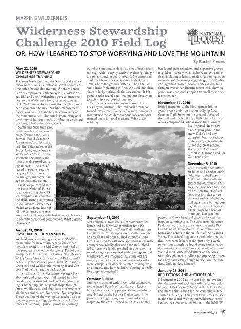
Sandia Crest legibility. The trail crossed<br />
a talus slope to a heap of<br />
mountain lion scat (suspected)<br />
and to a beautiful glade at the crest, a<br />
popular camping spot. The view from Manzano<br />
Peak was worth the extra climb: the entire Rio<br />
Grande basin, from Mount Taylor to the Ladrones,<br />
and across to the salt flats of the Estancia<br />
Valley. The visitor’s log on the peak informed us<br />
that there were hikers at the spot only a week<br />
prior—but though we found some campsites to<br />
document, there wasn’t another soul on the trail.<br />
We did meet some woodcutters on the forest<br />
road, though, in a trundling pickup being driven<br />
by a boy hardly big enough to peek out the window.<br />
Only in <strong>New</strong> <strong>Mexico</strong>?<br />
January 25, 2011<br />
Reflections and Anticipations<br />
I’ll remember 2010 as the year I fell in love with<br />
the Manzanos and took stewardship of our public<br />
land. I look forward to the 2011 field season<br />
and more volunteering for the <strong>Wilderness</strong> Stewardship<br />
Challenge. This year’s focus areas will be<br />
in the Sandia and Withington <strong>Wilderness</strong> areas—<br />
I encourage you to come join us in the field! <br />
www.nmwild.org 15