FIGHTING THE GOOD FIGHT - New Mexico Wilderness Alliance
FIGHTING THE GOOD FIGHT - New Mexico Wilderness Alliance
FIGHTING THE GOOD FIGHT - New Mexico Wilderness Alliance

Create successful ePaper yourself
Turn your PDF publications into a flip-book with our unique Google optimized e-Paper software.
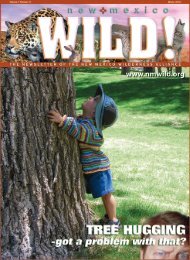
OTERO MESA HIKES!<br />
See Back Cover<br />
Spring 2005<br />
Albuquerque Area Hikes<br />
We will meet at 7:00am at the<br />
NMWA office parking lot prior to<br />
the hike to figure out the car pool<br />
situation (if you’re willing to drive,<br />
it is greatly appreciated). We’ll have<br />
you back in town by 6:30pm, likely<br />
much earlier. Driving time is less<br />
than 11⁄2 hours each way unless<br />
noted otherwise. Bring your own<br />
water, snacks, and lunch, and be<br />
prepared for all types of weather.<br />
Call Nathan <strong>New</strong>comer or Michael<br />
Scialdone at the ABQ office at 843-<br />
8696 for more info or the contact<br />
person listed for that hike.<br />
March 12th, 2005<br />
Chupadera <strong>Wilderness</strong>,<br />
Bosque del Apache<br />
Besides its great wetlands habitat,<br />
Bosque del Apache Wildlife Refuge<br />
has 3 little known <strong>Wilderness</strong><br />
Areas (see Page 4) that encompass<br />
the surrounding desert. We will<br />
either hike an established trail to<br />
Chupadera Mountain or explore<br />
cross-country the northern portions<br />
of the <strong>Wilderness</strong>.<br />
Contact: Michael Scialdone at 843-<br />
8696 for more info<br />
Distance: 10 miles round-trip<br />
Time: 4 to 6 hours round-trip plus<br />
driving time<br />
Elevation Range: 4,530 to 6,213 feet<br />
Difficulty: Moderate<br />
March 19th, 2005<br />
Contact Alberto Zavala in NMWA’s<br />
Las Cruces office for information<br />
on all the Las Cruces hikes. You can<br />
reach him at 505-527-9962<br />
April 23rd<br />
Fillmore Canyon- La Cueva<br />
This is a loop hike leaving from the<br />
Visitor’s Center at Dripping Springs<br />
Natural Area. We will hike southeast<br />
to the Dripping Springs Trail and<br />
follow the Crawford trail over to<br />
Fillmore Canyon. The tall waterfall<br />
in this canyon can be spectacular<br />
after snow in the winter or rain in the<br />
summer. La Cueva is an interesting<br />
archeological site dating back 7,000<br />
years. Interpretive signs also tell the<br />
story of a hermit that lived in the<br />
cave in the 1800’s.<br />
NOTE: There is a $3 fee per person<br />
at Dripping Springs Natural Area.<br />
Distance: 3.25 miles<br />
Low point: 5,450 feet<br />
High point: 5,850 feet<br />
Difficulty: Easy<br />
Volcano Hill <strong>Wilderness</strong><br />
Inventory Unit<br />
The Volcano Hill <strong>Wilderness</strong> Inventory<br />
Unit is just west of Albuquerque,<br />
with its namesake rising 500-feet<br />
from its surrounding basalt lava flow.<br />
Volcano Hill and its lava flow cap an<br />
escarpment that drops almost 1,000<br />
feet to grassy plains below. Volcano<br />
Hill erupted around 3 million years<br />
ago, spewing out basaltic lava flows<br />
that capped the 240-million-yearold<br />
Chinle formation. Expect to see<br />
red-rock country, tall prairie grasses,<br />
and signs of ancient civilization.<br />
Contact: Nathan <strong>New</strong>comer at 843-<br />
8696 for more info<br />
Length and Time to be determined<br />
by group on the day of the hike<br />
Difficulty: Easy to Moderate<br />
April 16th, 2005<br />
Ojito WSA (east side)<br />
We have done many hikes to Ojito,<br />
but none to the east side. This will<br />
be a moderate hike along a mesa<br />
on the eastern boundary. Nice views<br />
into Cabezon country, small cliffs<br />
and badlands, maybe some critters.<br />
Some minor off trail/scrambling<br />
possible. Drive: 120 miles RT (~1 hour<br />
each way). Could be warm, so bring<br />
water, boots, lunch and appropriate<br />
hiking gear.<br />
Contact: Rick Hurley at 299-8401 for<br />
more info.<br />
Distance: 8 miles round-trip<br />
Time: 4 to 6 hours round-trip plus<br />
driving time<br />
Elevation Gain: less than 1000 feet<br />
Difficulty: Moderate<br />
April 30th<br />
May 21st<br />
Ice Canyon-Dripping Springs<br />
This trail is well-defined and easy<br />
to follow all the way to Ice Canyon<br />
where Dripping Springs is located<br />
(1 3⁄4 mile). We’ll hope for recent<br />
rains that can turn the springs into<br />
a dramatic waterfall. Ruins remind<br />
one of the cultural activities that<br />
have taken place in this area. The<br />
interpretive signs do a good job in<br />
relating their history. The wildflowers<br />
can be spectacular here in the spring<br />
/ early summer.<br />
NOTE: There is a $3 fee per person at<br />
Dripping Springs Natural Area.<br />
Distance: 3.5 miles<br />
Spring 2005<br />
Las Cruces Area Hikes<br />
<strong>New</strong> <strong>Mexico</strong> WILD!<br />
Manzano Mountain <strong>Wilderness</strong><br />
Red Canyon / Spruce Spring Loop<br />
This loop trail begins at Red Canyon<br />
Campground and ascends through<br />
a drainage full of trees and cliff<br />
faces. It travels along a streambed<br />
for about 1.5 miles. Last year, this<br />
streambed was a nicely flowing<br />
river, complete with waterfalls. After<br />
leaving the canyon the trail pops<br />
onto a sloping plateau through<br />
large pine, fir, and eventually aspens.<br />
Great views are abundant at the<br />
top of Red Canyon Trail at Ocha<br />
Peak. The trail then travels northeast<br />
along the crest of the Manzano’s<br />
and then descends down Spruce<br />
Canyon. Long vistas are visible when<br />
going down the gentle slope of<br />
Spruce Canyon, which eventually<br />
brings you back to Red Canyon<br />
Campground. Depending on how<br />
much more snow the Manzano’s<br />
receive, the last leg of this hike may<br />
require waterproof boots.<br />
Contact Nathan <strong>New</strong>comer at 843-<br />
8696 for more info.<br />
Distance: 7.5 miles round-trip<br />
Time: 4 to 6 hours round-trip plus<br />
driving time<br />
Elevation Range: 7,960 to 10,003<br />
feet<br />
Difficulty: Moderate<br />
May 21st, 2005<br />
Low point: 5,650 feet<br />
High point: 6,250 feet<br />
Difficulty: Easy<br />
June 18<br />
Peña Blanca<br />
The hike heads northeast along a<br />
rough jeep trail that is more enjoyable<br />
to hike than drive. It is about 1 mile<br />
to the base of Peña Blanca, an<br />
outcrop in the southwest part of<br />
the Organ Mountains. We’ll explore<br />
the volcanic tuff outcroppings on<br />
the south and the east side and<br />
then climb up the moderately steep<br />
slope to the top. The caves found<br />
in the volcanic tuff formations at<br />
Magdalena Mountains<br />
Timber Peak Trail<br />
The Magdalena Mountains are<br />
rarely visited by hikers, yet they are<br />
only a little over an hour south of<br />
Albuquerque. The Timber Peak Trail<br />
offers dramatic panoramas that<br />
arguably top all others. In addition<br />
to endless horizons and solitude,<br />
the trail includes striking views of<br />
deep canyons within the Magdalena<br />
Mountain range. The trail also winds<br />
between open meadows and thick<br />
aspen forests.<br />
Contact: Nathan <strong>New</strong>comer at 843-<br />
8696 for more info<br />
Distance: 6 miles round-trip<br />
Time: 4 to 6 hours round-trip plus<br />
driving time<br />
Elevation Range: 9,800 to 10,300<br />
feet<br />
Difficulty: Moderate<br />
June 18th, 2005<br />
Mt. Taylor<br />
A hardy 1,800 feet of elevation gain in<br />
only 2.5 miles leads to the top of this<br />
extinct volcano just north of Grants,<br />
NM. The hike starts in pine forest<br />
and finishes with steep grassy slopes<br />
leading to the peak. Hopefully the<br />
rains will keep the forests open – last<br />
year’s attempt had to be moved to El<br />
Malpais.<br />
Contact: Michael Scialdone at 843-<br />
8696 for more info<br />
Distance: 10 miles round-trip<br />
Time: 2 to 4 hours round-trip plus<br />
driving time<br />
Elevation Range: 9,500 to 11,301<br />
feet<br />
Difficulty: Moderate to strenuous<br />
Peña Blanca have shown evidence<br />
of prehistoric human habitation.<br />
An archeological dig in one of the<br />
caves yielded corncobs dated to<br />
the period of the Mogollon culture<br />
is the earliest know cultivated corn<br />
in the US.<br />
Distance: 2.5 miles<br />
Low point: 4240 feet<br />
High point: 4720 feet<br />
Difficulty: Easy<br />
Page 15