Professional Memo - Toms River Township
Professional Memo - Toms River Township
Professional Memo - Toms River Township

Create successful ePaper yourself
Turn your PDF publications into a flip-book with our unique Google optimized e-Paper software.
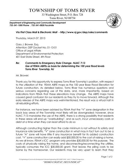
TOWNSHIP OF TOMS RIVER<br />
33 Washington Street, P.O. Box 728<br />
<strong>Toms</strong> <strong>River</strong>, NJ 08754<br />
Department of Engineering and Community Development<br />
732-341-1000 Phone . 732-341-0828 Facsimile<br />
Via First Class Mail & Electronic Mail - http://www.nj.gov/dep/rules/comments<br />
Thursday, March 07, 2013<br />
Gary J. Brower, Esq.<br />
Attention: DEP Docket No. 01-13-01<br />
Office of Legal Affairs<br />
Department of Environmental Protection<br />
401 East State Street, 4th Floor<br />
Re: Comments to Emergency Rule Change- NJAC 7:13<br />
Use of FEMA ABFEs as basis for determining the 100 year flood levels<br />
<strong>Toms</strong> <strong>River</strong> <strong>Township</strong>, NJ<br />
Mr. Brower:<br />
Thank you for this opportunity to express <strong>Toms</strong> <strong>River</strong> <strong>Township</strong>’s position, with respect<br />
to the utilization of the FEMA ABFE maps as the 100 year Base Flood Elevation for<br />
future construction. As detailed below, <strong>Toms</strong> <strong>River</strong> has numerous questions and<br />
serious concerns regarding use of this data, and, more importantly, based on<br />
indications from FEMA that these elevations may change, the ABFE maps have<br />
caused great confusion for our residents as they try to move forward. Although the<br />
early release of the ABFE maps was well-intentioned, the result was a virtual halt in<br />
all rebuilding efforts.<br />
For instance, we have been advised by FEMA that the “V” zone designation in the<br />
back bay areas of the <strong>Township</strong> most likely will be downgraded; however, since<br />
NJAC 7:13 mandates the use of the ABFE, there is a strong possibility that residents<br />
in these areas will end up “overbuilding”, and as such, incur unnecessary costs or<br />
debt at a time when they can least afford to do so<br />
Although constructing higher than the code minimum is not without its safety and<br />
insurance rate benefits, “V” zone construction in what may in fact turn out to be a<br />
future “A” zone will have little if any insurance benefit for its added construction<br />
cost. “V” zone construction can easily add $50,000.00 to the cost of raising a home.<br />
As we all know, FEMA’s ICC program only provides $30,000.00 for this purpose. The<br />
costs of physically raising the home, and disconnecting/reconnecting the utilities,<br />
typically consumes the ICC $30,000.00 grant. That leaves the piling costs to be<br />
borne by the homeowner. Our residents may be very upset to learn that they<br />
P:\Engineering & Community Development\General Engineering\2013\030713 RJC NJAC 7 13 Rule Change.docx<br />
“HOMO COGITAT, DEUS INDICAT”<br />
Page 1 of 3
To:<br />
Department of Environmental Protection<br />
Re: Comments to Emergency Rule Change- NJAC 7:13<br />
Date: Thursday, March 07, 2013<br />
incurred this cost for no reason once the anticipated, less stringent, FIRM maps are<br />
adopted.<br />
I have previously written to FEMA and expressed my concerns with the ABFE<br />
mapping. We met with FEMA representatives and have been advised by FEMA<br />
that their calculations are not complete, but that they believe the ABFE’s to be<br />
“conservative”.<br />
I cannot say for certain whether I agree with this in all areas, having not been able<br />
to review calculations that do not yet exist; however, based on what we have<br />
been advised thus far by FEMA that the conditions experienced from super storm<br />
Sandy, in our area exceeded a 200 year + event, it is difficult to explain to residents,<br />
whose homes survived the storm with little or no damage, that they still need to<br />
upgrade based on the ABFE mapping. This mapping is supposed to be based on a<br />
projected 100 year event.<br />
For more detail on my concerns, I would refer to my letter of December 19, 2012<br />
to Mr. Scott Duell of FEMA, but in general terms, we saw very little wave action in<br />
areas such as Green Island, Silverton and along the <strong>Toms</strong> <strong>River</strong>. My field<br />
observations lead me to believe that there may be some areas, specifically some<br />
select areas directly fronting the Bay where perhaps a V Zone designation may<br />
be appropriate, only if the elevation warrants, but that the V Zone designation<br />
should not continue inland too far. As of now, areas of Green Island and Silverton<br />
had little or no impact from wave action, yet, these areas are currently designated<br />
as V zones in the ABFE maps.<br />
Further, we would like to see the mapping revised to include more Hurricane Sandy<br />
High Water Marks as well as plotting homes that actually experienced wave action<br />
damage. This will help justify what areas need to be in the V zone in the final<br />
analysis.<br />
I think at this point it is premature to discuss the barrier island until the dune<br />
easement issue is resolved. If that project is able to move forward, I agree with<br />
what FEMA has informed us, in that the BFE elevations should drop if sufficient dune<br />
and enlarged beach elevation areas are constructed.<br />
In summation, I feel the ABFE should be used as an informal tool at this point only for<br />
residents and their design professionals. Based on the varying degree of their<br />
accuracy, residents should be allowed to consult with their design professional,<br />
insurance agent and based on their own experience with Superstorm Sandy, make<br />
their own design decisions, until such time as the FEMA modeling is accurately<br />
completed and gone through the review process.<br />
Page 2 of 3
To:<br />
Department of Environmental Protection<br />
Re: Comments to Emergency Rule Change- NJAC 7:13<br />
Date: Thursday, March 07, 2013<br />
My understanding of the normal FIRM approval process is such that all of the<br />
stakeholders have a chance to put forth their input. In some cases new data is<br />
presented and changes are made. The NJAC 7:13 emergency rule change<br />
bypassed all of that valuable scrutiny.<br />
If you have any questions or require additional information please do not hesitate<br />
to contact me.<br />
Very truly yours,<br />
/RJC<br />
_____________________________<br />
Robert J. Chankalian, PE, CME<br />
<strong>Township</strong> Engineer<br />
Cc:<br />
Mayor Thomas F. Kelaher<br />
<strong>Toms</strong> <strong>River</strong> <strong>Township</strong> Council<br />
Paul J. Shives, Business Administrator<br />
Louis Amoroso, Asst. Business Administrator<br />
Wendy A. Birkhead, Asst. <strong>Township</strong> Engineer<br />
Jay Lynch, PP, <strong>Township</strong> Planner<br />
Kenneth Fitzsimmons, Esq, <strong>Township</strong> Attorney<br />
Page 3 of 3