Engelhardt, Blake
Engelhardt, Blake
Engelhardt, Blake

Create successful ePaper yourself
Turn your PDF publications into a flip-book with our unique Google optimized e-Paper software.
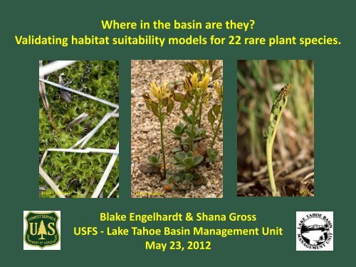
Where in the basin are they?<br />
Validating habitat suitability models for 22 rare plant species.<br />
Stuart Osbrack<br />
Steve Matson<br />
USFS<br />
<strong>Blake</strong> <strong>Engelhardt</strong> & Shana Gross<br />
USFS - Lake Tahoe Basin Management Unit<br />
May 23, 2012
Background<br />
National forests are tasked with:<br />
1) maintaining viable populations of TES species<br />
2) preventing degradation of suitable habitat<br />
What constitutes suitable habitat?<br />
How much of it occurs on the landscape and where is it?<br />
LTBMU<br />
25 sensitive botanical species<br />
(19 vascular plants, 4 bryophytes, 1 lichen, 1 fungi)<br />
2 candidate species: Rorippa subumbellata (Tahoe Yellowcress)<br />
Pinus albicaulis (Whitebark Pine)*<br />
*Warranted but precluded from listing under ESA, July 2011
Binary GIS Models<br />
• Species distribution predicted from environmental variables<br />
• Classify landscape: suitable vs. non-suitable<br />
• Model Builder: Boolean AND/OR analysis of various<br />
environmental data (GIS layers) to determine suitable<br />
habitat<br />
Products<br />
• Total area of suitable habitat<br />
• Spatial pattern/location of<br />
suitable habitat
-15 habitat models, cover 22 species total<br />
-known or likely to occur in Lake Tahoe basin<br />
Wet/Riparian<br />
Botrychium spp.<br />
Bruchia bolanderi*<br />
Epilobium howellii<br />
Meesia spp./Helodium blandowii<br />
Peltigera hydrothyria*<br />
USFS<br />
Upland/Forested<br />
Arabis rectissima v. simulans<br />
Arabis rigidissima v. demota<br />
Arabis tiehmii*<br />
J. Morefield<br />
Eriogonum umbellatum v. torreyanum*<br />
Hulsea brevifolia*<br />
Lewisia kelloggii*<br />
Alpine<br />
Draba asterophora v. asterophora<br />
Draba asterophora v. macrocarpa<br />
Draba-Union<br />
Lewisia longipetala<br />
USFS
Example: Lewisia longipetala<br />
General Criteria GIS Dataset Refined Criteria (AND)<br />
Northerly Aspect Aspect 0-90°, 270-360°<br />
High Elevation Elevation >8300 ft<br />
Subalpine & Alpine<br />
Communities<br />
Potential Natural<br />
Vegetation<br />
TSME, TSME-ABMA, Rocky,<br />
Scree-subalpine/alpine<br />
Granitic soils Geology Igneous intrusive, and<br />
extrusive, sedimentary
Botrychium spp.<br />
(Moonwort complex)<br />
Peltigera hydrotheria<br />
(Veined Water Lichen)<br />
Draba asterophora v. asterophora<br />
(Tahoe Draba)<br />
Lewisia kelloggii<br />
(Kellogg’s Lewisia)
ARRE<br />
ARRID<br />
ARTI<br />
BOTRY<br />
BRBO<br />
DRABA UNION<br />
DRASA<br />
DRASM<br />
EPHO<br />
ERUMT<br />
HUBR<br />
LEKE<br />
LELO<br />
MEESIA_HEBL<br />
PEHY<br />
Lake Tahoe Basin<br />
(hectares)<br />
Predicted Area of Suitable Habitat w/in Lake Tahoe Basin<br />
90000<br />
80000<br />
70000<br />
60000<br />
50000<br />
40000<br />
30000<br />
20000<br />
10000<br />
0<br />
(1 hectare = ~2.5 acres)
Field Validation<br />
• 500m x 500m grid<br />
• 100 randomly selected points<br />
• 15 excluded (private property)<br />
• 85 total points<br />
• Field visit: presence/absence<br />
of suitable habitat & species<br />
• 45 of 85 completed<br />
2009- 9 points<br />
2010- 4 points<br />
2011- 32 points<br />
2012- 40 points planned… any volunteers?!
45 Visited Points:<br />
Few points on North Shore<br />
All elevations<br />
All species
40 Remaining Points:<br />
Throughout the basin<br />
All elevations<br />
All species
Preliminary results:<br />
- 7 of 15 models had >90% accuracy<br />
- mostly over-prediction<br />
- all upland and alpine species<br />
Species<br />
% Sites<br />
Habitat<br />
Predicted<br />
% Model<br />
Agreement<br />
% Overpredict<br />
% Underpredict<br />
Habitat<br />
Arabis tiehmii 2.2 100 0 0 Upland<br />
Draba-Union 3.1 97 0 3 Alpine<br />
Draba asterophora v.<br />
macrocarpa<br />
Draba asterophora v.<br />
asterophora<br />
13.3 96 4 0 Alpine<br />
15.6 93 7 0 Alpine<br />
Lewisia longipetala 15.6 93 7 0 Alpine<br />
Arabis rigidissima v.<br />
demota<br />
Eriogonum umbellatum<br />
v. torreyanum<br />
57.8 91 9 0 Upland<br />
11.1 91 7 2 Upland
Preliminary results:<br />
- 4 of 15 models had 80-89% accuracy<br />
- all over-predict, some under-prediction<br />
- riparian and upland species<br />
Species<br />
% Sites<br />
Habitat<br />
Predicted<br />
% Model<br />
Agreement<br />
% Overpredict<br />
% Underpredict<br />
Habitat<br />
Botrychium spp. 86.7 89 11 0 Wet/Riparian<br />
Arabis rectissima v.<br />
simulans<br />
28.9 82 9 9 Upland<br />
Bruchia bolanderi 84.4 82 16 2 Wet/Riparian<br />
Hulsea brevifolia 62.2 80 20 0 Upland
Preliminary results:<br />
- 4 of 15 models had low (67-71%) accuracy<br />
- most over-predict AND under-predict<br />
- mostly riparian species<br />
- missing some mesic habitats<br />
Species<br />
Peltigera<br />
hydrothyria<br />
% Sites<br />
Habitat<br />
Predicted<br />
% Model<br />
Agreement<br />
% Overpredict<br />
% Underpredict<br />
Habitat<br />
57.8 71 20 9 Wet/Riparian<br />
Lewisia kelloggii 73.3 69 29 2 Upland<br />
Epilobium howellii 48.9 67 4 29 Wet/Riparian<br />
Meesia spp. &<br />
Helodium blandowii<br />
46.7 67 16 18 Wet/Riparian
What’s working…<br />
• Elevation, aspect, slope, high<br />
elevation forests<br />
(Draba, Lewisia)<br />
• Conifer/forest types- generalists<br />
(Arabis, Eriogonum)<br />
• Larger areas of meadow and riparian<br />
habitat<br />
D. Taylor
Scale<br />
• understory layers, ground cover (e.g. thick<br />
duff or bare ground)<br />
• vegetation layer- small patches of riparian<br />
vegetation, wet meadow, wet habitats<br />
• forest openings, canopy cover<br />
USFS<br />
USFS<br />
Other Challenges<br />
• substrate within perennial streams, dry<br />
gullies predicted as perennial streams<br />
• species not known from LTBMU- less<br />
information on suitable habitat<br />
• geologic restrictions
Detection of 8 new occurrences of 3 sensitive species:<br />
1. Botrychium crenulatum (BOCR2, BOCR3)<br />
(South Lake Tahoe & Zephyr Cove)<br />
2. Draba asterophora v. asterophora (DRASA 1p, 2n, 2o)<br />
(Job’s Sister & Heavenly Ski Area)<br />
3. Lewisia longipetala (LELO 4a, 4b, 4c)<br />
(Jack’s Peak)<br />
USFS<br />
USFS
Future Steps<br />
• Equal effort: under-prediction vs. over-prediction<br />
K. Morse<br />
• Functionality of the model vs. true suitable habitat<br />
detection<br />
• Goal: 80% accuracy<br />
• Pinus albicaulis: use TEUI layer? Existing Veg Map?<br />
Remaining points?<br />
• LIDAR & multispectral imagery? Maybe for trees<br />
but not herbaceous species<br />
K. Morse
Thanks to: Kurt Teuber, Kyle Christie, Cristina McKernan, Dionne Uzes,<br />
Sean Glantz, Diku Sherpa, Katie Heard, Mike Jennings<br />
USFS