o_19f217hfilbl1h8l1inm1bvblpu34.pdf

Create successful ePaper yourself
Turn your PDF publications into a flip-book with our unique Google optimized e-Paper software.
MORE PHOTOS OF FLOOD<br />
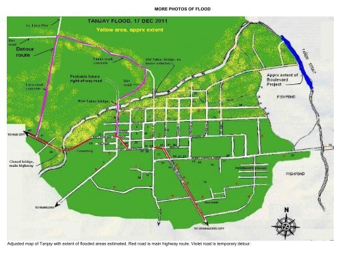
Adjusted map of Tanjay with extent of flooded areas estimated. Red road is main highway route. Violet road is temporary detour.
Main bridge at height of flood. Note embankment Later, water subsided but embankment eroded View from the eroded side of the bridge<br />
while steel beams and concrete pylons remain intact.<br />
Left, middle & right views of eroded side of bridge, Dec 19. Dept of Public Works personnel working to build back retaining wall and embankment.<br />
Down stream view from New Tabuc bridge, height of flood Same view after flood receded Up stream view of damage, Tabuc side
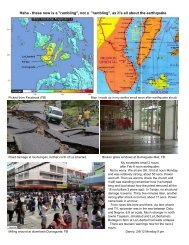
Downed concrete fence, subdivision along Tabuc road Downed portion of Serenity Cemetery side fence View from Old Tabuc bridge<br />
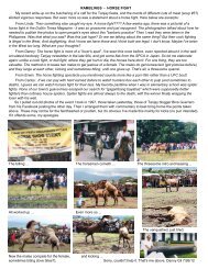
Below: Miscellaneous photos taken from Facebook posting of "Assenso Tanjay", probably different sources showing various scenes, described under each photo.<br />
Matangad Luca road Ilaud<br />
Untitled, but probably at Kasagingan Banica river, Dumaguete Dumaguete capitol<br />
Danny Gil (ferngil@aol.com), 19 Dec 2011