PBBI MapInfo Professional Version Comparison Chart - Tetrad
PBBI MapInfo Professional Version Comparison Chart - Tetrad
PBBI MapInfo Professional Version Comparison Chart - Tetrad

Create successful ePaper yourself
Turn your PDF publications into a flip-book with our unique Google optimized e-Paper software.
VERSION COMPARISON<br />
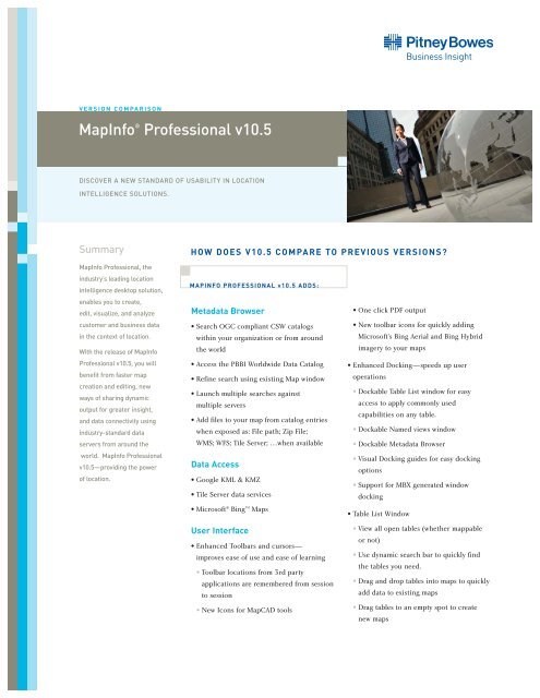
<strong>MapInfo</strong> ® <strong>Professional</strong> v10.5<br />
DISCOVER A NEW STANDARD OF USABILITY IN LOCATION<br />
INTELLIGENCE SOLUTIONS.<br />
Summary<br />
HOW DOES V10.5 COMPARE TO PREVIOUS VERSIONS?<br />
<strong>MapInfo</strong> <strong>Professional</strong>, the<br />
industry’s leading location<br />
intelligence desktop solution,<br />
enables you to create,<br />
edit, visualize, and analyze<br />
customer and business data<br />
in the context of location.<br />
With the release of <strong>MapInfo</strong><br />
<strong>Professional</strong> v10.5, you will<br />
benefit from faster map<br />
creation and editing, new<br />
ways of sharing dynamic<br />
output for greater insight,<br />
and data connectivity using<br />
industry-standard data<br />
servers from around the<br />
world. <strong>MapInfo</strong> <strong>Professional</strong><br />
v10.5—providing the power<br />
of location.<br />
MAPINFO PROFESSIONAL v10.5 ADDS:<br />
Metadata Browser<br />
• Search OGC compliant CSW catalogs<br />
within your organization or from around<br />
the world<br />
• Access the <strong>PBBI</strong> Worldwide Data Catalog<br />
• Refine search using existing Map window<br />
• Launch multiple searches against<br />
multiple servers<br />
• Add files to your map from catalog entries<br />
when exposed as: File path; Zip File;<br />
WMS; WFS; Tile Server; …when available<br />
Data Access<br />
• Google KML & KMZ<br />
• Tile Server data services<br />
• Microsoft ® Bing TM Maps<br />
User Interface<br />
• Enhanced Toolbars and cursors—<br />
improves ease of use and ease of learning<br />
• Toolbar locations from 3rd party<br />
applications are remembered from session<br />
to session<br />
• New Icons for MapCAD tools<br />
• One click PDF output<br />
• New toolbar icons for quickly adding<br />
Microsoft’s Bing Aerial and Bing Hybrid<br />
imagery to your maps<br />
• Enhanced Docking—speeds up user<br />
operations<br />
• Dockable Table List window for easy<br />
access to apply commonly used<br />
capabilities on any table.<br />
• Dockable Named views window<br />
• Dockable Metadata Browser<br />
• Visual Docking guides for easy docking<br />
options<br />
• Support for MBX generated window<br />
docking<br />
• Table List Window<br />
• View all open tables (whether mappable<br />
or not)<br />
• Use dynamic search bar to quickly find<br />
the tables you need.<br />
• Drag and drop tables into maps to quickly<br />
add data to existing maps<br />
• Drag tables to an empty spot to create<br />
new maps
VERSION COMPARISON<br />
<strong>MapInfo</strong> ® <strong>Professional</strong> v10.5<br />
• Right click on tables to: Select all,<br />
Export, View/Update Table Structure,<br />
Create Points, or Update a table’s<br />
column value<br />
• Select one or more tables to: Add to an<br />
existing map, create a new map, browse<br />
or close the tables at once<br />
• Use MapBasic to modify the menu and<br />
add or remove commands<br />
• Layer Control Improvements:<br />
• Right click to Browse table<br />
• Right click to Add style override<br />
• Right click to Add label override<br />
• Drag one or more style or label<br />
override from one layer to another<br />
• Drag style override from one<br />
map to another<br />
• Enhanced Named Views Utility<br />
• Added toolbar docking persistence<br />
support<br />
• Dockable named views window<br />
• Enhanced Sync Windows Utility—<br />
toolbar icon added for one click<br />
synchronization<br />
Better Looking Maps<br />
• Built-in worldwide Aerial and Hybrid<br />
imagery<br />
• Stacked style support (create new map<br />
object styles on the fly)<br />
• Multi-zoom style and label support<br />
for easier map creation and less cluttered<br />
layer control<br />
Output<br />
• Support for standard PDF<br />
• Support for layered PDF<br />
• Support for Geo-registered PDF<br />
• Support for PDF with attributes<br />
• Support for publishing maps to <strong>PBBI</strong><br />
web-mapping in the cloud<br />
MapBasic<br />
• Support for creating new Tile Server Table<br />
• Support for saving toolbar docking location<br />
• Support for multi-style and label override<br />
• Support for configuring/enhancing<br />
right-click context menu for Table List<br />
and Layer Control<br />
• Support for browsing table from Layer<br />
Control<br />
• Support for enabling custom dialog docking<br />
• Support for windows docking and persisting<br />
docked states for future sessions<br />
Supported Operating Systems<br />
Desktop Operating Systems:<br />
• Windows ® 7 Ultimate<br />
• Windows ® 7 Ultimate 64-bit with 32-bit<br />
compatibility mode<br />
• Windows ® Vista Ultimate SP1<br />
• Windows ® XP <strong>Professional</strong> SP3<br />
Server Operating Systems<br />
• Windows ® 2008 Server<br />
• Windows ® 2008 Server with Citrix ®<br />
XenApp 5.5 (this is the new name for<br />
Citrix ® Presentation Server)<br />
• Windows ® 2008 Server R2 64-bit with<br />
Citrix ® XenApp 6.0
<strong>MapInfo</strong> <strong>Professional</strong> v10.5's new configurable user interface.<br />
Enjoy streamlined access to common tasks, search industry-standard data catalogs and more.<br />
MAPINFO PROFESSIONAL v10.0 ADDED:<br />
EASE OF USE/USER INTERFACE<br />
• New Menu and ToolBars<br />
• New Layer Control<br />
• Modeless layer control<br />
• Interactive Style swatches<br />
• Multiple layers operations<br />
• Layers from different maps can be manipulated<br />
• Layer Control offers Pause/Resume option<br />
• Group Layers—Ability to add Group layers<br />
is available<br />
• Tool-tips show file path +name + zoom range<br />
DATA ACCESS<br />
• MS Office 2007 Support<br />
• MS SQL Server 2008 spatial read/write<br />
• PostGIS Read/Write<br />
ENHANCED ANALYSIS/NEW TOOLS<br />
• Calculate and append proportion overlap. Uses:<br />
• Retail: Ability to quickly calculate total<br />
population of a drive time based on proportional<br />
coverage of a another area with that data<br />
• Telco: Ability to quickly calculate any demographic<br />
value based on a coverage signal<br />
PROJECTIONS ADDED<br />
• Ministry of Transport of Quebec Coordinate<br />
Systems<br />
• Support for the Popular Visualization CRS/<br />
Mercator coordinate reference system used in<br />
Microsoft Virtual Earth and Google Maps<br />
• Added USNG—Ability to display, center the map<br />
or populate points in USNG coordinates<br />
MAPBASIC<br />
• Support for Microsoft Office 2007 Access and Excel<br />
• USNGToPoint(string)<br />
• PointToUSNG$(obj, datumid)<br />
• Create Adornment Statement<br />
• Set Adornment Statement<br />
• GroupLayerInfo function<br />
• LayerListInfo function<br />
• Enhanced Functions<br />
• WindowInfo( ) function<br />
• Server ConnectionNumber<br />
• Set Map statement
<strong>MapInfo</strong> ® <strong>Professional</strong> v10.5<br />
MAPINFO PROFESSIONAL v9.5 ADDED:<br />
UNITED STATES<br />
One Global View<br />
Troy, NY 12180<br />
1.800.327.8627<br />
pbbi.sales@pb.com<br />
www.pbinsight.com<br />
CANADA<br />
26 Wellington Street East<br />
Suite 500<br />
Toronto, ON M5E 1S2<br />
1.800.268.3282<br />
pbbi.canada.sales@pb.com<br />
www.pbinsight.ca<br />
EUROPE/UNITED KINGDOM<br />
Minton Place<br />
Victoria Street<br />
Windsor, Berkshire SL4 1EG<br />
+44.1753.848200<br />
pbbi.europe@pb.com<br />
www.pbinsight.co.uk<br />
ASIA PACIFIC/AUSTRALIA<br />
Level 7, 1 Elizabeth Plaza<br />
North Sydney NSW 2060<br />
+61.2.9437.6255<br />
pbbi.australia@pb.com<br />
pbbi.singapore@pb.com<br />
pbbi.china@pb.com<br />
www.pbinsight.com.au<br />
ADDITIONAL DEPLOYMENT CAPABILITIES<br />
• New Workgroup installation option allows multiple<br />
users to share user customizable files and symbols<br />
• Silent installation and product activation<br />
DATA ACCESS<br />
• Database Support—Oracle 11G<br />
• Improved performance with cached data through<br />
indexing both key and geometry columns<br />
• Efficient, progressive cache works on an additive<br />
basis, instead of rebuilding the cache<br />
• Default view option improves performance on<br />
initial opening of tables<br />
• Unlimited length for <strong>MapInfo</strong> <strong>Professional</strong> SQL<br />
expressions<br />
BETTER LOOKING MAPS<br />
• Curved labeling enhanced to support user<br />
controlled overhangs<br />
• Added automatic positioning of labels around<br />
points and centroids—results in more labels<br />
on the map<br />
• Support of additional image formats for custom<br />
symbols (GIF, JPG, TIF, PNG)<br />
• Support for sub-directory structure for<br />
custom symbols<br />
• New set of symbols of public sector assets added<br />
• Automatic smoothing of label text<br />
• Vector and label translucency<br />
• Automatic Anti-aliasing of lines and borders<br />
• Improved print engine, including a new<br />
printing method<br />
DATUM ENHANCEMENTS<br />
Sweden; Turkey; Croatia; France; Fiji; Egypt;<br />
Belgium; Finland; Ireland; Libya; Estonia;<br />
Netherlands; Germany; Romania<br />
MAPPING/DATA EDITING<br />
• New Comprehensive Data Editing Package,<br />
40 New Data Editing Functions with configurable<br />
button Pads<br />
• Suitable for creating geographic asset information<br />
such as: sewers or pipelines at fixed intervals from<br />
road or parcel boundaries, pipelines, cables or wires<br />
at fixed angles from a road<br />
• Attach text objects from a separate DXF/DWG<br />
imported layer into the associated sewer or<br />
pipeline layer<br />
• Line direction can easily be changed for the<br />
purposes of representing the direction of water flow<br />
• Columns containing coordinates, automatically<br />
build lines/polylines<br />
• Copy and paste styles from one object to another<br />
• Select objects by object style<br />
• And much more…<br />
EASE OF USE<br />
• Access layer operations from the right click<br />
menu including: View entire layer; Select all from<br />
layer; Make layer editable<br />
• Selected objects from the layer highlight the<br />
layer in Layer Control for easy layer finding<br />
• Modify table structure by dragging and<br />
dropping columns<br />
• Easy to use New Map Window dialog<br />
• Added grid lookup for color, line or pattern.<br />
• Vista/Windows-XP application look<br />
• Newly redesigned named views utility<br />
• Improved selection visualization via enhanced<br />
drawing mode<br />
PROGRAMMING ENHANCEMENTS<br />
Programming with .NET<br />
Support for .NET programmability: Design your GUI<br />
in .NET and run within <strong>MapInfo</strong> <strong>Professional</strong>; or<br />
Embed <strong>MapInfo</strong> <strong>Professional</strong> inside your .NET application.<br />
Write code in VB.NET or C# or any .NET<br />
compliant language<br />
NEW MAPBASIC FUNCTIONS<br />
• TableInfo()—Added definition to return CoordSys<br />
clause without bounds.<br />
• RasterTableInfo()—Returns information about a<br />
Raster or Grid Table<br />
• GridTableInfo()—Return information about a grid<br />
file. It will error if the table is not a grid.<br />
• ControlPointInfo()—Return information about<br />
control points for image tables.<br />
©2010 Pitney Bowes Software Inc. All rights reserved. 92459-US-1006<br />
Pitney Bowes Business Insight is a division of Pitney Bowes Software Inc.<br />
Pitney Bowes Business Insight, <strong>MapInfo</strong>, <strong>MapInfo</strong> <strong>Professional</strong> and MapBasic are trademarks<br />
of Pitney Bowes Software Inc. All other marks and trademarks are the property of their respective holders.