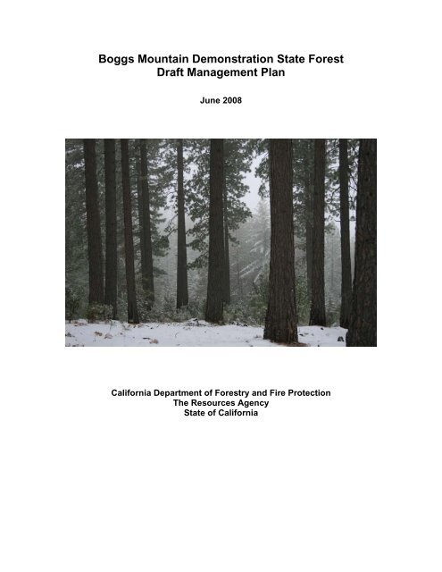
Boggs Mountain Demonstration State Forest Draft ... - Cal Fire
Boggs Mountain Demonstration State Forest Draft ... - Cal Fire
Boggs Mountain Demonstration State Forest Draft ... - Cal Fire

You also want an ePaper? Increase the reach of your titles
YUMPU automatically turns print PDFs into web optimized ePapers that Google loves.
<strong>Boggs</strong> <strong>Mountain</strong> <strong>Demonstration</strong> <strong>State</strong> <strong>Forest</strong><br />
<strong>Draft</strong> Management Plan<br />
June 2008<br />
<strong>Cal</strong>ifornia Department of <strong>Forest</strong>ry and <strong>Fire</strong> Protection<br />
The Resources Agency<br />
<strong>State</strong> of <strong>Cal</strong>ifornia
<strong>Boggs</strong> <strong>Mountain</strong> <strong>Demonstration</strong> <strong>State</strong> <strong>Forest</strong> <strong>Draft</strong> Management Plan, June 2008<br />
Table of Contents<br />
1. Introduction.................................................................................................................................. 4<br />
Management Objectives .............................................................................................................. 5<br />
History of <strong>Boggs</strong>........................................................................................................................... 6<br />
Purpose and Statutory Authority.................................................................................................. 8<br />
Purpose of the Management Plan............................................................................................ 8<br />
Statutory Authority.................................................................................................................... 9<br />
Local Ordinances and Zoning.................................................................................................... 11<br />
2. Current Management Situation................................................................................................. 12<br />
General Features ....................................................................................................................... 12<br />
Location.................................................................................................................................. 12<br />
Boundaries ............................................................................................................................. 13<br />
Topography ............................................................................................................................ 13<br />
Climate ................................................................................................................................... 13<br />
Area, Ownership Pattern, and Adjacent Ownerships............................................................. 13<br />
<strong>Forest</strong> Description...................................................................................................................... 14<br />
<strong>Forest</strong> Structure...................................................................................................................... 14<br />
<strong>Forest</strong> Types........................................................................................................................... 14<br />
Site Quality ............................................................................................................................. 15<br />
<strong>Forest</strong> Inventory and Growth.................................................................................................. 16<br />
Soils........................................................................................................................................ 16<br />
Geology .................................................................................................................................. 19<br />
Water Resources.................................................................................................................... 19<br />
Roads ..................................................................................................................................... 19<br />
Ground Cover......................................................................................................................... 22<br />
Economic Situation .................................................................................................................... 22<br />
Towns and communities......................................................................................................... 22<br />
Markets for forest products..................................................................................................... 23<br />
Transportation Facilities ......................................................................................................... 23<br />
3. Desired Future Conditions and Planned Management ............................................................. 24<br />
Desired Future Conditions ......................................................................................................... 24<br />
Silvicultural Methods .................................................................................................................. 25<br />
Reforestation .......................................................................................................................... 26<br />
Thinning.................................................................................................................................. 26<br />
Pruning ................................................................................................................................... 27<br />
Hardwood Management......................................................................................................... 27<br />
Brush Management ................................................................................................................ 27<br />
Fertilization ............................................................................................................................. 27<br />
<strong>Forest</strong> Management................................................................................................................... 27<br />
Sustainable Harvest Levels.................................................................................................... 28<br />
Harvest Cycles ....................................................................................................................... 30<br />
Timber Sales .......................................................................................................................... 30<br />
Harvesting Methods ............................................................................................................... 31<br />
Carbon Sequestration and Greenhouse Gas Emissions ....................................................... 31<br />
Fish, Wildlife and Plants............................................................................................................. 32<br />
Rare, Threatened or Endangered Species ............................................................................ 32<br />
Watershed and Fisheries ....................................................................................................... 33<br />
Recreation.................................................................................................................................. 35<br />
Archaeological Resources...................................................................................................... 36<br />
<strong>Forest</strong> Protection........................................................................................................................ 37<br />
Sanitation Cutting and Hazard Reduction .............................................................................. 37<br />
<strong>Fire</strong> Protection ........................................................................................................................ 37<br />
Insects and Disease ............................................................................................................... 38<br />
Other Management Factors ....................................................................................................... 39<br />
2
<strong>Boggs</strong> <strong>Mountain</strong> <strong>Demonstration</strong> <strong>State</strong> <strong>Forest</strong> <strong>Draft</strong> Management Plan, June 2008<br />
Law Enforcement ................................................................................................................... 39<br />
Acquisition and Exchange...................................................................................................... 40<br />
Chapter 4. Research and <strong>Demonstration</strong>..................................................................................... 41<br />
Research Program Objectives................................................................................................... 41<br />
Five-Year Strategic Plan for Research and <strong>Demonstration</strong>....................................................... 42<br />
Research Planning ................................................................................................................. 42<br />
Research Infrastructure.......................................................................................................... 42<br />
Applied <strong>Demonstration</strong> ........................................................................................................... 43<br />
Outreach................................................................................................................................. 44<br />
Conclusion.............................................................................................................................. 45<br />
Research Projects...................................................................................................................... 45<br />
Planned Projects .................................................................................................................... 45<br />
Ongoing Projects.................................................................................................................... 46<br />
Completed Projects ................................................................................................................ 46<br />
References .................................................................................................................................... 47<br />
Appendix I. Maps........................................................................................................................... 49<br />
Appendix II. Road Management Plan............................................................................................ 57<br />
Appendix III. <strong>Forest</strong> Resources Inventory ..................................................................................... 87<br />
Appendix IV. BMDSF General Management Practices for Controlling the Spread of Sudden Oak<br />
Disease.......................................................................................................................................... 89<br />
3
<strong>Boggs</strong> <strong>Mountain</strong> <strong>Demonstration</strong> <strong>State</strong> <strong>Forest</strong> <strong>Draft</strong> Management Plan, June 2008<br />
1. Introduction<br />
The <strong>Cal</strong>ifornia Department of <strong>Forest</strong>ry and <strong>Fire</strong> Protection (Department or CAL FIRE) manages<br />
approximately 71,000 acres of <strong>Demonstration</strong> <strong>State</strong> <strong>Forest</strong>s, on behalf of the public. <strong>Boggs</strong><br />
<strong>Mountain</strong> <strong>Demonstration</strong> <strong>State</strong> <strong>Forest</strong> (BMDSF) is a 3,493-acre mixed conifer forest located in<br />
Lake County between Clear Lake and <strong>Cal</strong>istoga (Figure 1).<br />
The majority of public wildlands in <strong>Cal</strong>ifornia are set aside as reserves and parks to preserve rare<br />
ecosystems and wild areas. <strong>Demonstration</strong> <strong>State</strong> <strong>Forest</strong>s, by contrast, are public lands that by<br />
legislative mandate have a unique and distinctly different purpose from parks and wilderness<br />
areas. <strong>Demonstration</strong> <strong>State</strong> <strong>Forest</strong>s are working landscapes that are mandated to conduct<br />
research, demonstration, and education on sustainable forestry practices using active forest<br />
management, including periodic timber harvests. Management of the <strong>Demonstration</strong> <strong>State</strong><br />
<strong>Forest</strong>s is required to protect values relating to recreation, watershed, wildlife, range and forage,<br />
fisheries, and aesthetic enjoyment.<br />
While still the number three timber-producing state in the nation, <strong>Cal</strong>ifornia is also home to a very<br />
large population with strong interests in environmental protection. Given the often controversial<br />
role of logging and timber production in <strong>Cal</strong>ifornia, the <strong>Demonstration</strong> <strong>State</strong> <strong>Forest</strong>s fill a unique<br />
niche to advance research, demonstration, and education on sustainable forestry practices. The<br />
<strong>Demonstration</strong> <strong>State</strong> <strong>Forest</strong>s fill an important role in helping maintain <strong>Cal</strong>ifornia’s leading role as<br />
an innovator in solutions to difficult resource management challenges.<br />
The concept of forest sustainability includes the sustainability of forest ecosystems, both<br />
terrestrial and aquatic. Important issues include stewardship of managed forest lands to maintain<br />
biodiversity and ecosystem functions. Maintaining biodiversity and ecosystem functions on private<br />
timberlands however, is not likely to succeed if it is not financially viable to implement them.<br />
Incentives for continued investment in forest land are needed to relieve economic pressures to<br />
convert to other land uses such as residential, with a higher and more immediate payoff. While<br />
these issues are in some ways beyond the scope of <strong>State</strong> <strong>Forest</strong> management, they also create<br />
an important area of research and demonstration for the <strong>Demonstration</strong> <strong>State</strong> <strong>Forest</strong>s, including<br />
BMDSF: testing a range of timber/ecosystem outputs for their economic and financial viability, as<br />
well as their environmental sustainability.<br />
<strong>Boggs</strong> <strong>Mountain</strong> <strong>Demonstration</strong> <strong>State</strong> <strong>Forest</strong> is a mixed conifer forest characteristics of the<br />
interior coast range. The entire <strong>Forest</strong> was logged just before transition to <strong>State</strong> ownership in<br />
1949. As a result, the <strong>Forest</strong> currently is dominated by densely stocked stands that are<br />
approximately 50-year old. Fuels treatment and enhancing forest productivity and health are<br />
cornerstones of the management of <strong>Boggs</strong> <strong>Mountain</strong>. Other important management goals include<br />
increasing the recreation potential of the <strong>Forest</strong>, and promoting research. The property is<br />
managed as a working forest which facilitates research and demonstrates diverse timber<br />
management practices to private timberland owners and the public at large. The forest will be<br />
managed over the long term for a dynamic mosaic of diverse forest structures and a high<br />
productive capacity. . This management approach aims to produce a sustainable harvest of high<br />
quality timber products, support biological diversity, and ensure opportunities for future forestry<br />
research. The knowledge gained from research and demonstration is shared with forest<br />
landowners and the public through a variety of outlets. Public use of the <strong>State</strong> <strong>Forest</strong> is<br />
encouraged so that visitors may experience a variety of outdoor recreational activities as well as<br />
educational opportunities. Having achieved a significant expansion of recreational facilities over<br />
the past 15 years, this plan proposes to maintain a rustic outdoor recreational experience within a<br />
working forest environment.<br />
4
<strong>Boggs</strong> <strong>Mountain</strong> <strong>Demonstration</strong> <strong>State</strong> <strong>Forest</strong> <strong>Draft</strong> Management Plan, June 2008<br />
The BMDSF management plan describes present conditions on the forest and outlines the<br />
direction that management will take in the future by establishing a desired future condition or<br />
target for management. This plan must be considered as a flexible guide and subject to<br />
modification because of the uncertainties of environmental, economical, and political changes.<br />
Revisions of the plan will be made periodically as needed and operating procedures will be<br />
modified to accommodate the changes.<br />
Management Objectives<br />
The primary <strong>State</strong> <strong>Forest</strong> management objective is two-fold: 1) achieve an active research and<br />
demonstration program and 2) achieve maximum sustained production of high quality timber<br />
products, while developing an all-aged forest with the widest possible diversity of forest<br />
structures. Specifically, detailed objectives are as follows:<br />
• Emphasize an ongoing experimental and demonstration program to improve timber<br />
production and management methods. Important research topics include fuel treatments<br />
and fire hazard reduction, forest regeneration, forest management and its effects on fuel<br />
loads and growth, vegetation management, best road management practices, and urban<br />
interface management. Encourage other research agencies to conduct forest resource<br />
studies.<br />
• Continue fire prevention and hazard reduction programs, including a prescribed burn<br />
program to reduce the fire hazard and maintain fuel breaks in critical areas to keep<br />
potential damage from wildfires to a minimum. Increase the resiliency of the <strong>Forest</strong> to<br />
catastrophic wildfires.<br />
• Maintain a continued timber sale program, which achieves sustained yield of all forest<br />
resources, including recreation, wildlife, timber, and water through the use of<br />
uneven-aged and intermediate silvicultural methods. Harvest timber under sustained<br />
yield management (PRC 4513). The methods and levels of harvest will permit<br />
continuous production of timber and achieve maximum sustained production of high<br />
quality timber products (PRC 4513) without degrading the productivity and health of the<br />
forest and while contributing to local employment and tax revenue.<br />
• Investigate and conduct timber stand improvement practices and young growth<br />
management to produce the best quality of forest products on a sustained basis. Explore<br />
the production and utilization of hardwoods and small “unmerchantable” biomass material<br />
from thinning operations.<br />
• Work toward maintaining the widest possible diversity of managed forest stands in<br />
different successional stages, in order to develop a laboratory of representative forest<br />
conditions for research. Seek opportunities to maintain or increase functional wildlife<br />
habitat within the planning watersheds.<br />
• Improve and maintain the forest road system through implementation of the road<br />
management plan.<br />
• Provide a multiple-use recreation experience through maintenance and improvement of<br />
existing recreational facilities. Provide for expansion of these facilities as resources<br />
permit and use justifies.<br />
• Maintain safe conditions for employees, visitors, and neighbors by identifying hazardous<br />
situations and eliminating the hazards where possible.<br />
5
<strong>Boggs</strong> <strong>Mountain</strong> <strong>Demonstration</strong> <strong>State</strong> <strong>Forest</strong> <strong>Draft</strong> Management Plan, June 2008<br />
• Maintain a law enforcement presence on the forest to preserve the peace and prevent<br />
ongoing vandalism of roads and facilities.<br />
• Continue an aggressive pest management program to prevent the spread of insects and<br />
disease in order to keep mortality at a minimum level. Harvest salvage material where<br />
feasible.<br />
History of <strong>Boggs</strong><br />
BMDSF was within the territory of one or more of the following Native American groups: the<br />
Eastern Pomo, Southeastern Pomo, Lake Miwok, Clear Lake Wappo, and Patwin. Since the crest<br />
of <strong>Boggs</strong> <strong>Mountain</strong> divides the Putah and Kelsey Creek watersheds and since <strong>Cal</strong>ifornia Native<br />
Americans often used watershed divides as territory boundaries, it is likely that more than one<br />
group controlled the area. Evidence shows that <strong>Boggs</strong> <strong>Mountain</strong> enjoyed some prehistoric use<br />
year-round with populations rising during the summer and fall months.<br />
Artifacts collected on BMDSF support the theory that the primary pre-historic activity on <strong>Boggs</strong><br />
<strong>Mountain</strong> was hunting. No known milling equipment has been found within the forest boundary.<br />
Archaeological research in the <strong>State</strong> <strong>Forest</strong> has revealed temporary camps, collecting stations,<br />
lithic workshops, and chipping stations. Also, a high projectile point to debitage ratio is found<br />
throughout the forest. Neither informal flaked stone tools nor any nonflaked expedient tools are<br />
present in the BMDSF collection.<br />
The majority of prehistoric archaeological sites and artifacts discovered on BMDSF belong to the<br />
Late Prehistoric Period (A.D. 500-1579) which appears to be the largest population density of<br />
indigenous people. This large population continued through the Proto-historic period, until the<br />
time of initial contact between the <strong>Cal</strong>ifornia Native Americans and the Europeans.<br />
During the Mexican period, trappers including Jedediah Smith and Ewing Young explored Clear<br />
Lake or its tributaries in the early 1830's. These visits were of little consequence on the Clear<br />
Lake Basin until Mariano Vallejo was granted 44,280 acres in June 1834. The first Mexican<br />
military penetration into Clear Lake country and what is now <strong>Boggs</strong> <strong>Mountain</strong> <strong>Demonstration</strong><br />
<strong>State</strong> <strong>Forest</strong> occurred during fights with the Wappo in 1835. When the <strong>Cal</strong>ifornios Cavalry killed<br />
over 200 attackers, Governor Figueroa forced a peace. The following April, in 1836, a second<br />
attack by 20 <strong>Cal</strong>ifornios and 100 Suisun Indians against the Wappo resulted in a peace treaty<br />
where 7 local chiefs agreed to live in peace. As a result of this treaty, Mariano's brother,<br />
Salvador Vallejo received a 71,000 acre land grant including <strong>Boggs</strong> <strong>Mountain</strong> <strong>Demonstration</strong><br />
<strong>State</strong> <strong>Forest</strong> area.<br />
With statehood in 1850, <strong>Cal</strong>ifornia became the 31st state in the Union and Napa became one of<br />
the original 27 <strong>Cal</strong>ifornia counties. Lilburn W. <strong>Boggs</strong>, ex-Governor of Missouri, and a successful<br />
merchant in Sonoma farmed the Napa Valley. Sometime before 1860 he purchased land in what<br />
is now Lake County. <strong>Boggs</strong>' son Henry C. bought a steam-powered sawmill in 1866 and later<br />
combined sawmill, gristmill, and planer. Located on the eastern margin of what is now <strong>Boggs</strong><br />
<strong>Mountain</strong> <strong>Demonstration</strong> <strong>State</strong> <strong>Forest</strong>, <strong>Boggs</strong>' Mill and <strong>Boggs</strong>' Lake operated until 1880. In 1878<br />
Henry C. <strong>Boggs</strong> bought a small lot near the head of Malo Creek, moving his sawmill there two<br />
years later. By 1884 Henry <strong>Boggs</strong> bought almost all the timberland within the present <strong>State</strong><br />
<strong>Forest</strong> boundaries. His son Lilburn H. <strong>Boggs</strong> served as manager in addition to his duties as Lake<br />
County Sheriff. The major road between Middletown and Clear Lake, now Highway 175, was<br />
called <strong>Boggs</strong>' Road in the early 1880's. Logging took place on most of what is now the <strong>State</strong><br />
<strong>Forest</strong>, with the heaviest cutting between 1882 and 1887. By 1898, the year of Henry C. <strong>Boggs</strong><br />
death, the Farmers Savings Bank under its president James W. <strong>Boggs</strong>, had acquired just about<br />
all the acreage presently incorporated by the <strong>State</strong> <strong>Forest</strong>.<br />
6
<strong>Boggs</strong> <strong>Mountain</strong> <strong>Demonstration</strong> <strong>State</strong> <strong>Forest</strong> <strong>Draft</strong> Management Plan, June 2008<br />
The property was subsequently owned by Hugh Davey then Jim McCauley. McCauley<br />
established a resort near the head of Kelsey Creek renaming it Camp <strong>Cal</strong>so. Jim McCauley died<br />
in 1941 and his heirs sold the timber rights to Setzer <strong>Forest</strong> Products. Most of the land use after<br />
<strong>Boggs</strong> was for cattle-grazing until 1947 when the then present owner, <strong>Cal</strong>so Company, sold the<br />
timber rights on 2700 acres to the Setzer <strong>Forest</strong> Products Company.<br />
The funds to purchase lands for <strong>State</strong> <strong>Forest</strong>s were made available by the 1947 legislature to<br />
implement the <strong>State</strong> <strong>Forest</strong> Purchase Act (PRC 4631). In December 1949, after Setzer had<br />
clearcut 2800+ acres, the <strong>State</strong> of <strong>Cal</strong>ifornia bought the timberland for $38,700 with the intention<br />
of creating a demonstration forest. The research concern at <strong>Boggs</strong> <strong>Mountain</strong> <strong>Demonstration</strong><br />
<strong>State</strong> <strong>Forest</strong> was the study of forest recovery from a completely cut over area. 3,432 acres of<br />
land and timber were acquired from the <strong>Cal</strong>so Company for $20,600. The remaining $18,100<br />
went to Setzer <strong>Forest</strong> Products Company. Setzer owned the merchantable timber on 2,731 acres<br />
of the tract. Setzer sold all the timber between 16 and 23 inches in diameter at breast height<br />
(DBH) (an estimated 6,100,000 board feet of timber) and one million board feet of thrifty seed<br />
trees between 23 and 29 inches DBH to the <strong>State</strong> for under terms of a precutting agreement. All<br />
other commercial timber was harvested in 1949 and 1950.<br />
Setzer completed logging their timber holdings in 1950. In 1954, Glenco <strong>Forest</strong> Products<br />
Company, successor in interest to Setzer <strong>Forest</strong> Products, quitclaimed its rights, title, and interest<br />
in the property to the <strong>State</strong> in accordance with the terms of the cutting agreement<br />
The status of the <strong>Forest</strong> at the time of purchase by the <strong>State</strong> was that of a recently cut-over forest<br />
from which all merchantable timber had been harvested except for scattered seed trees and<br />
patches of old-growth trees considered inaccessible at the time of purchase. Early <strong>State</strong><br />
occupancy of the <strong>Forest</strong> property was mainly for protective and custodial purposes. The Service<br />
<strong>Forest</strong>er assigned to the Region I Office in Santa Rosa did inventory and mapping, to a limited<br />
extent, during this period.<br />
In 1965, Cliff Fago, became the first permanent forest manager assigned to <strong>Boggs</strong> <strong>Mountain</strong><br />
<strong>State</strong> <strong>Forest</strong>. He completed the forest inventory, began experimental and demonstrational<br />
activity, and conducted the first timber sale in 1966. The timber harvesting was directed toward<br />
removal of the remaining old growth. The residual old growth was essentially removed from the<br />
<strong>Forest</strong> by 1976, and since then, cutting methods have been used that will result in a regulated,<br />
all-age forest. An active experimental and demonstrational program has developed during this<br />
period involving growth determination, disease control, better utilization methods, fertilization<br />
studies, and reforestation.<br />
Geothermal activity, particularly in the Cobb <strong>Mountain</strong> area, a few miles west of <strong>Boggs</strong> <strong>Mountain</strong>,<br />
caused an increase in the surrounding population in the 1980’s. Exploratory drilling occurred in<br />
the surrounding areas, including <strong>Boggs</strong> <strong>Mountain</strong> <strong>Demonstration</strong> <strong>State</strong> <strong>Forest</strong>, where Geothermal<br />
Kinetics, Inc. made an exploratory drilling to a depth of approximately 4,400 feet in July 1981. The<br />
drilling was abandoned, however, when geologic conditions indicated that a geothermal source<br />
would not be found at a depth that would make utilization feasible.<br />
No timber was cut on the <strong>Forest</strong> from the completion of logging in 1950 until 1967 when<br />
3,085,000 board feet of old growth was cut. A <strong>Forest</strong>-wide inventory was completed the same<br />
year which estimated the total gross timber volume after the 1967 cut at 31,465,000 board feet on<br />
3433 acres, 6,000,000 or more of which was old growth. The acquisition estimate apparently<br />
considerably under estimated the merchantable volume on the <strong>Forest</strong>. Most of the residual old<br />
growth was harvested from the <strong>Forest</strong> by 1976.<br />
Total area of the <strong>Forest</strong> at present is 3493 acres. Two land purchases have added to the forest<br />
land base. Thirty-one (31) acres were added to the <strong>Forest</strong> in 1972, when the Division of <strong>Forest</strong>ry<br />
acquired Lot 3, Sec. 6, T11N, R7W from the <strong>State</strong> Lands Commission for $5600. A 40+-acre<br />
7
<strong>Boggs</strong> <strong>Mountain</strong> <strong>Demonstration</strong> <strong>State</strong> <strong>Forest</strong> <strong>Draft</strong> Management Plan, June 2008<br />
parcel in the NW1/2SE 1/4, Sec. 35, T11N, R8W was purchased from the Voss family by the<br />
<strong>State</strong> of <strong>Cal</strong>ifornia in 1991. A portion of the <strong>Forest</strong> was sold in 1981, as a result of Assembly Bill<br />
476. 9.8 acres in SE1/, SE1/4 Sec. 3, T11N, R8W were sold to the Middletown Unified School<br />
District for $41,160.<br />
Purpose and Statutory Authority<br />
Purpose of the Management Plan<br />
The <strong>State</strong> <strong>Forest</strong>s have as their top priority the conducting of demonstrations, experiments, and<br />
public education; to disseminate the results of demonstrations and experiments and to manage<br />
timber for the maximum sustained yield of high quality forest products. Therefore, the <strong>State</strong><br />
<strong>Forest</strong> landbase is to be retained in timber production for research and demonstration purposes.<br />
Demonstrating useful timber management practices within the context of a working forest is the<br />
legislated charge for the <strong>State</strong> <strong>Forest</strong> system. This “working forest” concept enables <strong>State</strong><br />
<strong>Forest</strong>s to facilitate research needed to answer relevant questions concerning the maintenance of<br />
biodiversity on private timberlands. Research conducted within this context helps guide private<br />
landowners on how best to allocate funds to restoration efforts that will have the greatest<br />
likelihood of success.<br />
The <strong>Forest</strong> Management Plan directs the management of BMDSF for the next 10 to 15 years or<br />
until a subsequent plan or major revision is approved. The Plan and the projects undertaken also<br />
will be evaluated by the Board of <strong>Forest</strong>ry and <strong>Fire</strong> Protection every five years (Board Policy<br />
0351.10;). The Plan’s purposes are to guide the integrated use and protection of the <strong>Forest</strong>’s<br />
resources, to meet requirements of legislation and Board of <strong>Forest</strong>ry and <strong>Fire</strong> Protection (Board)<br />
policy, and to address local, regional, and statewide issues.<br />
The Public Resources Code (PRC) specifically addresses the management of <strong>State</strong> <strong>Forest</strong>s.<br />
PRC Section 4645 provides that the Department, in accordance with plans approved by the<br />
Board of <strong>Forest</strong>ry, shall manage <strong>State</strong> <strong>Forest</strong>s. PRC Section 4646 provides that the Director of<br />
the Department shall administer all the statutory requirements relating to <strong>State</strong> <strong>Forest</strong>s in<br />
accordance with policies adopted by the Board of <strong>Forest</strong>ry. Thus, management of the <strong>State</strong><br />
<strong>Forest</strong>s is a cooperative effort between the Department and the Board of <strong>Forest</strong>ry. Management<br />
which is inconsistent with policies of the Board of <strong>Forest</strong>ry violates these statutory provisions.<br />
The Legislature’s stated purpose in acquiring land for <strong>State</strong> <strong>Forest</strong> designation is multifaceted: to<br />
hold and reforest cutover timber lands, both young and old-growth timber, to demonstrate<br />
management of small areas (2000 acres or less) in timber counties where management of small<br />
areas needs investigation, demonstration and education, and for larger areas (up to 40,000<br />
acres) to demonstrate economical forest management (PRC Section 4631). PRC Section 4631.5<br />
states that it is in the public interest to retain the land base of <strong>State</strong> <strong>Forest</strong>s in timber production<br />
for research and demonstration purposes.<br />
The <strong>State</strong> <strong>Forest</strong> system was established to demonstrate how to make private timberlands “fully<br />
productive” (PRC 4631). BMDSF was acquired for the purpose of demonstration of economical<br />
forest management. Management is further defined by the Legislature as “...the handling of forest<br />
crop and forest soil so as to achieve maximum sustained production of high quality forest<br />
products while giving consideration to values relating to recreation, watershed, wildlife, range and<br />
forage, fisheries, and aesthetic enjoyment” (PRC 4639).<br />
Read as a whole, the statutory direction indicates that the management of BMDSF is primarily for<br />
sustainable timber production with the primary purpose of education and research relating to<br />
economical timber management. Specifically, the management plan for BMDSF must adhere to<br />
8
<strong>Boggs</strong> <strong>Mountain</strong> <strong>Demonstration</strong> <strong>State</strong> <strong>Forest</strong> <strong>Draft</strong> Management Plan, June 2008<br />
these goals. BMDSF must demonstrate sustainable timber production, and that timber production<br />
must be managed primarily to provide research and educational values. Within that broad<br />
statutory mandate, the management plan must adhere to policies and regulations developed by<br />
the Board of <strong>Forest</strong>ry.<br />
The <strong>State</strong> Board of <strong>Forest</strong>ry and <strong>Fire</strong> Protection sets policy for management of the <strong>State</strong> <strong>Forest</strong>s.<br />
This policy builds upon legislation, directing CAL FIRE to prepare detailed management plans<br />
and to conduct programs in timber management, recreation, demonstration, and research.<br />
Echoing the Legislature, the Board cites a large acreage of potentially productive timberland in<br />
<strong>Cal</strong>ifornia not producing satisfactory growth of young timber. To attain proper management, the<br />
Board states that there is a need to investigate, develop, and demonstrate new and improved<br />
forest management methods to timberland owners and the public. The <strong>State</strong> <strong>Forest</strong>s serve this<br />
purpose while contributing to the economic stability of local communities by providing high yields<br />
of forest products that help sustain local employment and create tax revenues.<br />
The Board of <strong>Forest</strong>ry forest management policies are defined in Chapter 0350 (0350-0351.10);<br />
these policies outline and guide management actions. Board policy 0351.3 establishes the<br />
primary purpose of the <strong>State</strong> <strong>Forest</strong> program to conduct innovative demonstrations, experiments,<br />
and education in forest management. Additionally, this article establishes timber production as<br />
the primary land use on BMDSF, while recognizing that recreation is a secondary but compatible<br />
land use.<br />
Statutory Authority<br />
BMDSF’s management direction derives directly from statutes, regulations, and policies set by<br />
the <strong>State</strong> Board of <strong>Forest</strong>ry and <strong>Fire</strong> Protection. Board policy describes <strong>Boggs</strong> <strong>Mountain</strong> and<br />
three of the other <strong>Demonstration</strong> <strong>State</strong> <strong>Forest</strong>s as “commercial timberland areas managed by<br />
professional foresters who conduct programs in timber management, recreation, demonstration,<br />
and investigation in conformance with detailed management plans,” (Board Policy 0351.1). More<br />
specifically, Board policy states that the primary purpose of BMDSF is to conduct innovative<br />
demonstrations, experiments, and education in forest management; that timber production will be<br />
the primary land use on BMDSF, and that recreation is recognized as a secondary but compatible<br />
land use on BMDSF (Board Policy 0351.2). Further noteworthy policy directions that guide<br />
BMDSF management include:<br />
• Research and demonstration projects will include silviculture, mensuration, logging<br />
methods, economics, hydrology, protection, and recreation. Research and demonstration<br />
projects will be directed to the needs of the general public, small forest landowners,<br />
timber operators, and the timber industry.<br />
• Conduct periodic field tours to exhibit <strong>State</strong> <strong>Forest</strong> activities and accomplishments to<br />
forest industry, small forest landowners, relevant public agencies and the general public,<br />
and disseminate information to these audiences.<br />
• Consult with and solicit the cooperation of the <strong>State</strong> universities and colleges, the USDA<br />
<strong>Forest</strong> Service, and other public and private agencies in conducting studies requiring<br />
special knowledge.<br />
The <strong>Boggs</strong> <strong>Mountain</strong> <strong>Demonstration</strong> <strong>State</strong> <strong>Forest</strong> was acquired under the authority of the <strong>State</strong><br />
<strong>Forest</strong> Purchase Act (PRC Section 4631) and from funds made available to implement this act<br />
provided by the 1947 Legislature. The legislative authority for the <strong>State</strong> <strong>Forest</strong> system is<br />
contained in Sections 4631-4664 of the PRC. Division 4, Part 2, Chapter 9 of the PRC sets forth<br />
the purposes and statutory conditions governing the acquisition and management of <strong>State</strong><br />
<strong>Forest</strong>s.<br />
9
<strong>Boggs</strong> <strong>Mountain</strong> <strong>Demonstration</strong> <strong>State</strong> <strong>Forest</strong> <strong>Draft</strong> Management Plan, June 2008<br />
Article I, Section 4631 of this chapter declares it "to be in the interest of the welfare of the people<br />
of the <strong>State</strong> of <strong>Cal</strong>ifornia and their industries and other activities involving the use of forest<br />
products, that desirable cut-over forest lands, including those having young and old timber<br />
growth, be made fully productive and that the holding and reforestation of such lands is a<br />
necessary measure predicated on waning supplies of original old-growth timber." The law<br />
declares it to be the policy of the <strong>State</strong> to acquire limited cut-over lands, to reforest them, and to<br />
demonstrate economical forest management.<br />
Management is defined in Article 2, Section 4639 as "the handling of forest crops and forest soils<br />
so as to achieve maximum sustained production of high quality forest products while giving<br />
consideration to values relating to recreation, watershed, wildlife, range and forage, fisheries, and<br />
aesthetic enjoyment.<br />
Article 3 of the same chapter authorizes the Department to manage, protect, and reforest <strong>State</strong><br />
<strong>Forest</strong>s. The Director of the Department is authorized to administer <strong>State</strong> <strong>Forest</strong> land, sell forest<br />
products, and deposit receipts with the <strong>State</strong> Treasurer. This article also authorizes the Board of<br />
<strong>Forest</strong>ry to establish rules and regulations in accordance with provisions of Chapter 4.5, Part I,<br />
Division 3, Title 2 of the Government Code for preservation, protection, and use of <strong>State</strong> <strong>Forest</strong>s.<br />
Part 2.5, Chapter 3, Section 4799.13 creates the <strong>Forest</strong> Resources Improvement Fund (FRIF) in<br />
the <strong>State</strong> Treasury. Receipts from <strong>State</strong> <strong>Forest</strong> sales are deposited into the <strong>Forest</strong> Resources<br />
Improvement Fund.<br />
Policy<br />
The Board of <strong>Forest</strong>ry and <strong>Fire</strong> Protection sets policy for management of the <strong>State</strong> <strong>Forest</strong>s. To<br />
attain proper management, the Board states that there is a need to investigate, develop, and<br />
demonstrate new and improved forest management methods to timberland owners and the<br />
public.<br />
Regulations and policies set by the Board and CDF guide management of all <strong>State</strong> <strong>Forest</strong>s.<br />
According to law and <strong>State</strong> Board of <strong>Forest</strong>ry policy, the primary purpose of the <strong>State</strong> <strong>Forest</strong><br />
program is to conduct innovative demonstrations, experiments, and education in forest<br />
management. Such projects are integrated into the production and harvesting of forest products<br />
whenever possible with due regard to conservation of soil, watershed, scenic, wildlife, and<br />
recreational values. Reasonable use of <strong>State</strong> <strong>Forest</strong>s for hunting, fishing, recreation, and<br />
camping is also permitted.<br />
10
<strong>Boggs</strong> <strong>Mountain</strong> <strong>Demonstration</strong> <strong>State</strong> <strong>Forest</strong> <strong>Draft</strong> Management Plan, June 2008<br />
Local Ordinances and Zoning<br />
In addition to compliance with the <strong>Forest</strong> Practice Rules applicable to the Northern <strong>Forest</strong> District,<br />
timber harvesting operations on BMDSF are subject to Lake County rules within areas designated<br />
as “Scenic Combining District” pursuant to Title 14 of the <strong>Cal</strong>ifornia Code of Regulations,<br />
Sections 945 through 945.5. Single-tree selection is required by the Lake County Rules in the<br />
Scenic Combining District. Where the general rules conflict with the Lake County Rules, the Lake<br />
County Rules shall apply.<br />
With the exception of the 40 acres of property acquired from Voss, BMDSF is zoned by Lake<br />
County as Timber Production Zone (TPZ), devoted to and used for growing and harvesting timber<br />
and compatible uses. Since its inclusion in 1991, the Voss addition has not been classified as<br />
TPZ.<br />
“Compatible use” is defined in the Timber Yield Tax law as any use which does not significantly<br />
detract from the use of the property for, or inhibit, growing and harvesting timber and shall<br />
include, but not be limited to the following, unless in a specific instance such use would be<br />
contrary to the preceding definition of compatible use:<br />
• Management for watershed.<br />
• Management for fish and wildlife habitat or hunting and fishing.<br />
• A use integrally related to the growing, harvesting, and processing of forest products,<br />
including but not limited to roads, log landings, and log storage areas.<br />
• The erection, construction, alteration, or maintenance of gas, electric, water, or<br />
communication transmission facilities.<br />
• Grazing.<br />
• A residence or other structure necessary for the management of land zones as<br />
timberland production.<br />
11
<strong>Boggs</strong> <strong>Mountain</strong> <strong>Demonstration</strong> <strong>State</strong> <strong>Forest</strong> <strong>Draft</strong> Management Plan, June 2008<br />
2. Current Management Situation<br />
General Features<br />
Location<br />
<strong>Boggs</strong> <strong>Mountain</strong> lies approximately 50 miles inland from the Pacific shoreline and 75 air miles<br />
north of San Francisco, on the summit separating the Clear Lake drainage to the north from<br />
Putah Creek drainage to the east. The community of Cobb is adjacent to BMDSF. It is six miles<br />
south of the southeast end of Clear Lake. Lakeport, the county seat of Lake County, is 30 miles<br />
to the northwest and Middletown is eight miles to the southeast.<br />
Fig.1. Location map of <strong>Boggs</strong> <strong>Mountain</strong> <strong>Demonstration</strong> <strong>State</strong> <strong>Forest</strong>.<br />
12
<strong>Boggs</strong> <strong>Mountain</strong> <strong>Demonstration</strong> <strong>State</strong> <strong>Forest</strong> <strong>Draft</strong> Management Plan, June 2008<br />
Boundaries<br />
BMDSF is a contiguous ownership located in southern Lake County within Townships 11 and 12<br />
North, Ranges 7 and 8 West on the Mount Diablo Base and Meridian. Legal subdivision lines<br />
form the boundaries. On the south and east sides of the <strong>Forest</strong>, the boundary generally follows<br />
the edges of the natural occurrence of timber. All boundaries of the <strong>Forest</strong> have been surveyed<br />
and established by licensed surveyors. The surveys are recorded and on file at the Lake County<br />
Courthouse. The property line has been established in the field with the posting of signs and tree<br />
marking.<br />
Topography<br />
The <strong>State</strong> <strong>Forest</strong> is a lava cap area about one mile wide by 3-1/2 miles long, forming a gently<br />
rolling summit with the sides breaking down into moderate to steep slopes. Practically the entire<br />
area is ideal for tractor logging. There are a few small areas of steep slopes and rock outcrops.<br />
<strong>Boggs</strong> <strong>Mountain</strong> lies at elevations from 2,360 feet to 3,750 feet above sea level. At 3,000 feet<br />
elevation the topography flattens out so that the top of the mountain resembles a plateau,<br />
dissected by several gulches. To the east and northeast, the mountaintop breaks very sharply to<br />
Big Canyon Creek, resulting in rather steep terrain in Section 6 and the northeast parts of<br />
Sections 1 and 7.<br />
On the west, the country slopes gently into the valley drained by the headwaters of Kelsey Creek<br />
at an elevation of about 2,500 feet. To the northeast, the <strong>Forest</strong> extends almost into the pass<br />
through which <strong>State</strong> Highway 175 crosses the <strong>Boggs</strong> <strong>Mountain</strong> range at an elevation of 3,000<br />
feet. Generally, the ground is smooth with little or no rock outcrops except on the steep slopes.<br />
There are four main creeks, which originate near the mountaintop. Mill Creek and Spikenard<br />
Creek flow down the north side, Houghton Creek flows down the west side, and Malo Creek flows<br />
down the east side.<br />
Climate<br />
The climate in the area of <strong>Boggs</strong> <strong>Mountain</strong> is typical of areas where pure ponderosa pine stands<br />
occur in <strong>Cal</strong>ifornia and particularly that of the ponderosa pine belt at the lower elevations along<br />
the western slope of the Sierra. Rainfall follows a Mediterranean climate pattern, with long, dry<br />
summers and heavy rainfall during the winters. Annual precipitation ranges from 22 inches to<br />
130 inches with an average of just over 65 inches (±20 inches). Some light snowfall occurs every<br />
winter but usually melts within a few days. Occasionally a 2 to 3 foot snowfall is experienced<br />
which remains on the ground for a month or more.<br />
Annual temperature ranges are considerably greater than those within the immediate areas of<br />
coastal influence. Temperature extremes are from a minimum of 15° F in winter to a maximum of<br />
105° F in summer.<br />
Area, Ownership Pattern, and Adjacent Ownerships<br />
Recorded acreage of the <strong>Forest</strong> is 3,493 acres. There are no private ownerships included within<br />
the <strong>Forest</strong> boundaries. The <strong>Forest</strong> has common boundaries with eight subdivisions and some 70<br />
private landowners. Most of the adjacent ownerships on the west side of the <strong>Forest</strong> have been<br />
developed for residential subdivisions. Because of the large numbers and the frequent turnover of<br />
owners, current ownership information will be periodically updated from the Lake County<br />
Assessor’s records. Larger less developed parcels are found adjacent to the northern and<br />
eastern boundaries of the forest. The undeveloped parcels are brushland or very extensively<br />
managed timberlands.<br />
13
<strong>Boggs</strong> <strong>Mountain</strong> <strong>Demonstration</strong> <strong>State</strong> <strong>Forest</strong> <strong>Draft</strong> Management Plan, June 2008<br />
<strong>Forest</strong> Description<br />
<strong>Forest</strong> Structure<br />
The current average age of BMDSF timber stands is 60 years, however the age classes are not<br />
evenly distributed. The predominant age of the younger trees is 50 years, as a result of the 1949-<br />
50 harvesting. The majority of the older trees are in the 85-90 year range. These trees were<br />
considered not merchantable during the 1949-50 harvest, and thus escaped harvest.<br />
The management direction on BMDSF is to emphasize uneven-aged management in order to<br />
create an all-aged forest structure, with stands containing a variety of age and size classes. The<br />
concept of stand age therefore becomes less relevant. Management of <strong>Boggs</strong> is directed at<br />
creating desired forest structures rather than a distribution of even-aged stands.<br />
<strong>Forest</strong> Types<br />
The <strong>Forest</strong> contains 3,313 acres of commercial timber type land and 180 acres of non-timberland.<br />
Nearly all of the forest land is well-stocked with predominantly conifer species. Conditions for<br />
natural regeneration after Setzer's 1947-1950 logging were very favorable and practically all of<br />
the areas left unstocked immediately after logging have since become stocked and support<br />
excellent stands of reproduction with ponderosa pine (Pinus ponderosa) as the predominant<br />
species.<br />
Three forest types are recognized on the <strong>Forest</strong>: ponderosa pine; ponderosa pine/Douglas-fir<br />
(Pseudotsuga menziesii) and Douglas-fir. Ponderosa pine dominates on the west slope and top<br />
of the mountain with about five percent sugar pine (Pinus lambertiana) included. The northeast<br />
slope of the mountain supports a ponderosa pine/Douglas-fir stand with various densities of<br />
ponderosa pine, sugar pine and Douglas-fir. A few small pockets of pure Douglas-fir occur on the<br />
lower slopes on the northeast side of the mountain. A very small patch of incense-cedar<br />
(Libocedrus decurrens) is located near the northeast corner of Section 12.<br />
In addition to conifers, hardwood species comprise 15 percent of the total basal area. The<br />
hardwood species present are black oak, white oak, canyon live oak, bay laurel, and madrone.<br />
Several patches of native brush species, MacNab cypress (Cupressus macnabiana), and<br />
hardwoods are located at lower elevations along the northeast boundary of the <strong>Forest</strong>.<br />
14
<strong>Boggs</strong> <strong>Mountain</strong> <strong>Demonstration</strong> <strong>State</strong> <strong>Forest</strong> <strong>Draft</strong> Management Plan, June 2008<br />
Figure 2. <strong>Forest</strong> vegetation types at <strong>Boggs</strong> <strong>Mountain</strong> DSF.<br />
Site Quality<br />
The average 50-year site index for the <strong>Forest</strong> is about 80 feet using Krumland and Eng (2005)<br />
site index equations. BMDSF will use Dunning's classification system for planning and <strong>Forest</strong><br />
Practice Rule compliance (stocking and leave standards). Beyond <strong>Forest</strong> Practice Rule<br />
compliance, the site classifications exist primarily to quantify the actual site index values into<br />
classes for evaluation and growth projection purposes. Growth projections for the <strong>Forest</strong> are<br />
based on the actual site index measurements in table 1 below.<br />
15
<strong>Boggs</strong> <strong>Mountain</strong> <strong>Demonstration</strong> <strong>State</strong> <strong>Forest</strong> <strong>Draft</strong> Management Plan, June 2008<br />
Table 1. Site Classes for BMDSF.<br />
Dunning Site Class 50-year Breast High Age<br />
Average Site Index (Krumland<br />
Percent of<br />
<strong>Forest</strong><br />
and Eng, 2005)<br />
IA 91 5<br />
I 83 84<br />
II 72 8<br />
III 46 3<br />
<strong>Forest</strong> Inventory and Growth<br />
Measurements of vegetation resources on <strong>Boggs</strong> <strong>Mountain</strong>, including timber volume and growth,<br />
are derived primarily from a system of plots referred to as the BMDSF Continuous <strong>Forest</strong><br />
Inventory (CFI). The CFI consists of a 17 chains by 17 chains grid of 114 permanent plots, 108 of<br />
the plots are on areas that support growth of commercial conifer species. Plots are measured<br />
every five years. The permanent CFI plots consist of a fixed 1/100-acre plot nestled in a 20 basal<br />
area factor variable plot. Trees over 4.5 feet tall and under 5 inches in diameter at breast height<br />
(DBH) are tallied by species in the 1/100 acre plots. All "In" trees in the variable plots are<br />
measured at breast height.<br />
The 1976 timber inventory measured the gross timber volume as 34,599,286 board feet on 3,464<br />
acres (9,988 bf/ac). The 2001 timber inventory measured the gross timber volume as 47,105,623<br />
board feet on 3,493 acres (13,485 bf/ac). Total current forest volume is measured at 51,911,602<br />
bf (14,862 bf/ac). Hardwood volume is 1,757,356 cubic feet. Volumes were calculated using<br />
volume equations developed for BMDSF by Pillsbury and Pryor (1991).<br />
Following the 1976 inventory, the annual board foot volume growth on the <strong>Forest</strong> was measured<br />
at 1,101,418 board feet, or 334 board feet per acre per year. Based on 1996 through 2006 CFI<br />
measurements, current forest growth is measured at 357 board feet per acre per year. These<br />
figures are considered to be highly accurate, as they are based on actual measurements and not<br />
a projection from yield tables.<br />
Soils<br />
The USDA Soil Conservation Service surveyed and mapped the soils on <strong>Boggs</strong> <strong>Mountain</strong> in the<br />
early 1980’s. Soil maps and descriptions are found in the 1989 publication “Soils Survey of Lake<br />
County.” The soils on <strong>Boggs</strong> <strong>Mountain</strong> are moderately deep to very deep, well-drained very<br />
gravelly loam and loam derived mainly from the <strong>Mountain</strong>'s lava cap of andesite, basalt, and<br />
dacite. Igneous rock derived Aiken and Collayomi soils are the <strong>Forest</strong>'s most productive soils.<br />
A limited amount of timber soils and most of the non-timber soils are derived from Great Valley<br />
formation sandstone or shale parent materials. Sanhedrin, Whispering, Speaker, and Marpa are<br />
lower site timber soils. Maymen, Estel, Snook, Hopland, Mayacoma, Millsholm, and Bressa soils<br />
are non-timber soils.<br />
16
<strong>Boggs</strong> <strong>Mountain</strong> <strong>Demonstration</strong> <strong>State</strong> <strong>Forest</strong> <strong>Draft</strong> Management Plan, June 2008<br />
Table 2. Soil Series on BMDSF.<br />
Soil Series<br />
No.<br />
Name<br />
Parent<br />
Material<br />
Slope<br />
Range<br />
(percent)<br />
Acres<br />
Dominant Vegetation<br />
126 Collayomi<br />
Complex<br />
127. Collayomi-Aiken-<br />
Whispering<br />
Complex<br />
128. Collayomi-Aiken-<br />
Whispering<br />
Complex<br />
129. Collayomi-<br />
Whispering<br />
Complex<br />
224. Speaker-Marpa-<br />
Sanhedrin<br />
Complex<br />
245. Whispering-<br />
Collayomi<br />
Complex<br />
Andesite,<br />
Basalt,<br />
Dacite<br />
50-75 71 Ponderosa pine,<br />
Black oak, Douglasfir,<br />
Sugar pine<br />
5-30 1917 Ponderosa pine,<br />
Black oak, Sugar<br />
pine, Douglas-fir<br />
" 30-50 712 Ponderosa pine,<br />
Black oak, Sugar<br />
pine, Douglas-fir<br />
" 30-50 437 Ponderosa pine,<br />
Black oak, Sugar<br />
pine, Douglas-fir<br />
Sandstone 30-50 106 Ponderosa pine,<br />
Douglas-fir, Black<br />
oak, Live oak<br />
Andesite,<br />
Basalt,<br />
Dacite<br />
Timber Soil Totals 3321<br />
168. Maymen-Estel-<br />
Snook Complex<br />
169. Maymen-Estel-<br />
Snook Complex<br />
173. Maymen-<br />
Hopland-<br />
Mayacama<br />
Association<br />
174. Maymen-<br />
Hopland-<br />
Mayacama<br />
Association<br />
175. Maymen-<br />
Millsholm-Bressa<br />
Complex<br />
177. Millsholm-Bressa<br />
Loams<br />
178. Millsholm-<br />
Bressa-Hopland<br />
Association<br />
50-75 78 Ponderosa pine,<br />
Black oak, Sugar pine<br />
Sandstone<br />
, Shale<br />
15-30 56 Chamise, Manzanita,<br />
Buckbrush<br />
" 30-75 21 Chamise, Manzanita,<br />
Buckbrush<br />
" 30-50 52 Chamise, Manzanita,<br />
Buckbrush, Black<br />
oak, Madrone, Live<br />
oak. Scattered<br />
Douglas-fir and<br />
Laurel<br />
" 50-75 5 Chamise, Manzanita,<br />
Buckbrush, Black<br />
oak, Madrone, Live<br />
oak. Scattered<br />
Douglas-fir and<br />
Laurel<br />
" 30-50 6 Chamise, Manzanita,<br />
Buckbrush,<br />
sometimes Blue oak<br />
" 30-50 5 Blue oak, Grass<br />
" 30-50 27 Blue oak, Grass<br />
NONTIMBER SOILS TOTAL 172<br />
17
<strong>Boggs</strong> <strong>Mountain</strong> <strong>Demonstration</strong> <strong>State</strong> <strong>Forest</strong> <strong>Draft</strong> Management Plan, June 2008<br />
Figure 3. Soils map of <strong>Boggs</strong> <strong>Mountain</strong>.<br />
18
<strong>Boggs</strong> <strong>Mountain</strong> <strong>Demonstration</strong> <strong>State</strong> <strong>Forest</strong> <strong>Draft</strong> Management Plan, June 2008<br />
Geology<br />
Geologically, BMDSF is complex. The <strong>State</strong> <strong>Forest</strong> is on a lava cap area about one mile wide by<br />
3.5 miles long, forming a gently rolling summit with the sides breaking down into moderate to<br />
steep slopes. There are a few small areas of steep slopes and rock outcrops. Volcanic rocks are<br />
exposed over much of the forest. Andesites and basalts are visible as outcrops and along roads<br />
over most of the upper elevation, with the lower slopes of the northwest portion having volcanic<br />
rocks cap sandstones and mudstones.<br />
Water Resources<br />
BMDSF is a part of the top of <strong>Boggs</strong> Ridge, which is mostly a dry ridge top that runs<br />
northwest/southeast separating Putah Creek and Kelsey Creek watersheds. <strong>Boggs</strong> <strong>Mountain</strong> is<br />
part of the headwaters for the Kelsey Creek and Putah Creek drainages. Kelsey Creek is in the<br />
Clear Lake watershed; Putah Creek is in the Lake Berryessa watershed. Drainages on the forest<br />
are first and second order with no fisheries resources. Several landowners use water that comes<br />
directly from BMDSF. Most of these are in the east side of the forest including Ettawa Springs<br />
and Harbin Hot Springs. BMDSF has at least one easement for BMDSF water.<br />
Surface water is uncommon on the forest. There are 3.8 miles of perennial streams; portions of<br />
Grouse Spring, Houghton, Malo and Spikenard Creeks. Three springs exist on the forest: Big<br />
Springs, Bluff Springs and Houghton Springs have been developed to fill fire suppression storage<br />
tanks.<br />
Table 3. Perennial streams on BMDSF.<br />
Big Springs Creek<br />
.50 mi.<br />
Grouse Spring Creek<br />
.25 mi.<br />
Houghton Creek<br />
.76 mi.<br />
Malo Creek<br />
.76 mi.<br />
Mill Creek<br />
.76 mi<br />
Spikenard Creek<br />
1.14 mi.<br />
TOTAL<br />
3.8 mi.<br />
Roads<br />
An access road system based on the original logging road network was established shortly after<br />
the <strong>Forest</strong> was acquired. Starting in 1965, major portions of the original road system were rebuilt<br />
improving grades, alignment, and drainage. Some short sections of new roads were constructed<br />
to avoid adverse grade problems. The 22 mile road system consists of 12 miles of primary, allweather<br />
roads and 10 miles of secondary seasonal roads. No further additions to the road system<br />
are planned. Existing roads will be improved or decommissioned as funds and opportunities<br />
arise.<br />
All roads on BMDSF that are no longer required for management and recreational purposes will<br />
be considered for abandonment. Roads to be abandoned will include user-generated roads,<br />
temporary roads, and roads to be permanently closed. User-generated roads are those that<br />
vehicles have made by not following a recognized BMDSF road and creating tracks for others to<br />
follow. Temporary roads can be defined as roads that are used for one or two years for timber<br />
sale activity and then abandoned. They may be reopened and reused in the next timber sale<br />
entry.<br />
19
<strong>Boggs</strong> <strong>Mountain</strong> <strong>Demonstration</strong> <strong>State</strong> <strong>Forest</strong> <strong>Draft</strong> Management Plan, June 2008<br />
Upgrading of the road network is essential for long term resource management, administrative<br />
access, fire control, and recreational purposes. Erosion control, watershed restoration, and road<br />
rehabilitation work will be accomplished by implementing the road management plan. A major<br />
goal of the plan is to establish a road system that is largely self-maintaining and/or requiring low<br />
levels of maintenance. A systematic approach to road management problems will be employed in<br />
order to identify, prioritize and cost-effectively treat current and future sediment sources on the<br />
<strong>Forest</strong>.<br />
20
<strong>Boggs</strong> <strong>Mountain</strong> <strong>Demonstration</strong> <strong>State</strong> <strong>Forest</strong> <strong>Draft</strong> Management Plan, June 2008<br />
Figure 4. Road system on <strong>Boggs</strong> <strong>Mountain</strong>.<br />
21
<strong>Boggs</strong> <strong>Mountain</strong> <strong>Demonstration</strong> <strong>State</strong> <strong>Forest</strong> <strong>Draft</strong> Management Plan, June 2008<br />
Ground Cover<br />
Within the forested areas, ground cover varies from pine needle litter to patches of shrubs typical<br />
of central and northern inland <strong>Cal</strong>ifornia foothill areas. Under the denser stands of timber, the<br />
ground is park-like and open with no undergrowth, then grades into sparse grass and dense<br />
brush in the more open stands.<br />
Areas that were unstocked following logging have since become a thick cover of predominantly<br />
ponderosa pine reproduction and/or brush. The brush patches are composed principally of<br />
Konocti manzanita (Arctostaphylos manzanita ssp. elegans), and Sonoma manzanita<br />
(Arctostaphylos canescens ssp. sonomensis). Ponderosa pine reproduction has forced its way up<br />
through the brush canopy in many of the brush patches.<br />
Konocti Manzanita (Arctostaphylos manzanita ssp. Elegans) and Sonoma Manzanita<br />
(Arctostaphylos canescens ssp. Sonomensis) are two rare species of manzanita identified during<br />
recent botanical surveys. These species are listed as CNPS 1B, but are considered locally<br />
common on <strong>Boggs</strong> <strong>Mountain</strong>. Considering the large population of these two Manzanita species<br />
found throughout the state forest, the proposed silvicultural methods, the use of existing landings,<br />
skid trails, and roads, and the lack of herbicide use it appears that no significant adverse impact<br />
to the population will occur.<br />
Economic Situation<br />
Towns and communities<br />
The <strong>Forest</strong> is located in the community of Cobb, which is about equidistant from Middletown,<br />
Kelseyville, and Lower Lake. These three towns are about 30 minutes driving time from the<br />
<strong>Forest</strong> over paved state highways. In recent years Middletown has become an affordable<br />
alternative to the high housing prices of Sonoma County. The urban areas of Santa Rosa and<br />
Ukiah are becoming too expensive causing people to move into the area because of the lower<br />
housing costs. Many of the residents of Middletown join the commuter traffic to Santa Rosa each<br />
morning.<br />
In the past and up until the early 1970’s the Cobb area was a major resort area. Since the early<br />
1970’s, Cobb’s resort industry has decreased to a small part of its past glory. Today most of the<br />
old resorts are owned by groups as conference centers or retreats and are not open to the<br />
general public. The <strong>Forest</strong> is surrounded by areas of intensive recreational use and though most<br />
summer resorts have declined in the vicinity, summer and year-round home construction and<br />
subdivision development in the area immediately surrounding BMDSF is continuing. This growth<br />
has translated into increased visitors to the forest.<br />
The demand for energy greatly accelerated the exploration for and development of the<br />
geothermal resource in Lake County in the 1980’s. The greatest development was in the Cobb<br />
<strong>Mountain</strong> area within a few miles of <strong>Boggs</strong> <strong>Mountain</strong>. <strong>Cal</strong>pine operates 19 plants on Cobb<br />
<strong>Mountain</strong>, known as “The Geysers,” with a generating capacity of 850 megawatts. The <strong>Forest</strong> is<br />
within a few miles of the Geyser’s geothermal field, which has been developed extensively since<br />
1976. The geothermal industry brought new economic prosperity to the Cobb area during the late<br />
1970’s and early 1980’s. During the 1980’s, as geothermal development leveled off, community<br />
growth continued because of relatively inexpensive land and housing.<br />
The population of Lake County has increased by almost 50 percent since 1986. Much of the<br />
increase is occurring in the southern county where <strong>Boggs</strong> <strong>Mountain</strong> is located. Subdivision<br />
22
<strong>Boggs</strong> <strong>Mountain</strong> <strong>Demonstration</strong> <strong>State</strong> <strong>Forest</strong> <strong>Draft</strong> Management Plan, June 2008<br />
development and home construction have increased the population pressures on commercial<br />
development, schools, demand for recreation, and increased demand for services. The<br />
population growth increased the demand for fuel wood from the <strong>State</strong> <strong>Forest</strong>. This demand is<br />
heightened by the relatively high heating fuel costs in Lake County which is not served by natural<br />
gas. Population growth and increased pressure for more services make the addition of staff at<br />
BMDSF desirable.<br />
Markets for forest products<br />
The Department currently offers the public and private commercial interests the opportunity to<br />
purchase minor forest products, subject to specific rules and constraints. At present, permits can<br />
be purchased for collection of products including salvage sawlogs, poles, split products, greenery<br />
(e.g. boughs, shrubs, and ferns), rocks, and firewood. Class I sale permits are issued for the<br />
collection of these minor forest products.<br />
The market for the sawlog timber was very limited when the first BMDSF timber sales were<br />
offered in 1967. Only one mill in Ukiah showed interest in the first sale and two mills, one in<br />
Ukiah and one in Marysville, bid on the second sale. With improving market conditions, sawlog<br />
timber has become very marketable with more mills and loggers showing interest in <strong>State</strong> <strong>Forest</strong><br />
timber sales. In addition to the sale of sawlogs, BMDSF staff is exploring the opportunities within<br />
the pole timber and biomass markets.<br />
Table 4. <strong>Forest</strong> products mills in <strong>Cal</strong>ifornia.<br />
Mill Location Distance in miles<br />
from BMDSF<br />
Unity <strong>Forest</strong> Products Yuba City 90<br />
Marysville <strong>Forest</strong> Products Marysville 92<br />
Harwood Products Branscomb 95<br />
Sierra Pacific Industries Richfield 115<br />
Sierra Pacific Industries Lincoln 117<br />
Sierra Pacific Industries Anderson 145<br />
Sierra Pacific Industries Camino 160<br />
Sierra Pacific Industries Shasta Lake City 165<br />
Sierra Pacific Industries Quincy 195<br />
Collins Pine Company Chester 205<br />
Shasta Green, Inc Burney 210<br />
Sierra Pacific Industries Burney 210<br />
Sierra Pacific Industries Chinese Camp 225<br />
Sierra Pacific Industries Standard 235<br />
Sierra Pacific Industries Susanville 235<br />
Transportation Facilities<br />
All markets are accessible by state highways. Highway 175 is adjacent to the northwestern<br />
boundary of the forest and within four miles of all of the <strong>State</strong> <strong>Forest</strong> roads. Major highway<br />
improvements have been made between 1965 and 2004 on <strong>State</strong> Highways 20 and 29, cutting<br />
the time and cost of hauling logs to the mills.<br />
23
<strong>Boggs</strong> <strong>Mountain</strong> <strong>Demonstration</strong> <strong>State</strong> <strong>Forest</strong> <strong>Draft</strong> Management Plan, June 2008<br />
3. Desired Future Conditions and Planned Management<br />
This section describes the planned management on <strong>Boggs</strong> <strong>Mountain</strong> over the next five to ten<br />
years. The goals for management of the <strong>Forest</strong> are described in terms of desired forest structural<br />
conditions. The management of <strong>Boggs</strong> is intended to balance sustained productivity with<br />
long-term biological productivity of the timberland and protection of public trust resources. The<br />
timber management program under this plan is expected to produce a sustainable harvest yield,<br />
maintaining the productive capacity of the soils in perpetuity. Harvest levels will support a<br />
financially viable timber management program in order to remain relevant as a research<br />
laboratory for sustainable forestry on private timberlands. Planned harvest yields reflect the need<br />
to maintain the widest possible range of forest conditions in order to accommodate potential<br />
future research studies.<br />
The cornerstones of planned management at <strong>Boggs</strong> <strong>Mountain</strong> are silvicultural methods aimed at<br />
fire hazard reduction through fuels treatment and other techniques, and maximization of forest<br />
health and productivity. Planned management will include primarily uneven-aged methods,<br />
although the full slate of silvicultural methods are available for research and management.<br />
Desired Future Conditions<br />
The overall goal is to maintain <strong>Boggs</strong> <strong>Mountain</strong> as a mid-seral forest type that is highly resistant<br />
to catastrophic wildfire. Early and late seral stands will be represented but overall the <strong>Forest</strong> will<br />
maintain the characteristics of a mid-seral forest. This goal is not discretionary, but rather follows<br />
directly from the research and demonstration mandate for <strong>Boggs</strong> <strong>Mountain</strong>. Rather than a park<br />
or reserve, the legislated mandate for the <strong>Forest</strong> is that of a working forest for demonstration and<br />
research purposes, serving a clientele of small to medium size land owners.<br />
<strong>Fire</strong> resilience will be managed through controlling levels of stocking by projects such as timber<br />
harvest, fuelbreaks, pre-commercial thinning and through fuel reduction projects such as<br />
controlled burning, chipping and biomass harvesting. An important criterion for the timing of<br />
commercial timber harvests will be to target areas that have dense stocking, with high amounts of<br />
ground litter and ladder fuels.<br />
In order to remain relevant as a research forest, <strong>Boggs</strong> <strong>Mountain</strong> aims to create and maintain a<br />
wide range of forest types, ages, size classes, successional stages, and structural characteristics.<br />
It is going to be very difficult to maintain pure stands of each of these characteristics on a <strong>Forest</strong><br />
the size of BMDSF. As a result, the approach will be to incorporate a continuum of types, age<br />
classes, successional stages, and structures mixed within stands across the <strong>Forest</strong> as far as<br />
possible.<br />
The concept of the fully regulated forest, with an approximately equal representation of all age<br />
and structure classes, averaging out to an overall mid-seral forest, lends itself well to the goal of<br />
maintaining as wide a range of forest conditions as possible to accommodate future research.<br />
This concept will be used as a guide in maintaining and cultivating the aggregate of individual<br />
stands on BMDSF.<br />
Stands will typically remain a mixture of conifer and hardwood species typical of the Ponderosa<br />
pine and Klamath mixed conifer type. The prevalent age class structure will be that of unevenaged<br />
stands, in which individual trees of a range of ages and size classes are present in the<br />
stands. Once the desired long-term forest structure conditions have been accomplished, it is<br />
anticipated that the oldest trees on the <strong>Forest</strong> will be about 100 years old.<br />
24
<strong>Boggs</strong> <strong>Mountain</strong> <strong>Demonstration</strong> <strong>State</strong> <strong>Forest</strong> <strong>Draft</strong> Management Plan, June 2008<br />
Based on field work and forest inventory data, stands were assessed for meeting the Board of<br />
<strong>Forest</strong>ry late-successional forest definition. Due to the fact that the <strong>Forest</strong> was largely clearcut at<br />
the time of transfer to <strong>State</strong> ownership, most stands on the <strong>Forest</strong> are currently 50-60 years old,<br />
and no late-successional stands currently exist on BMDSF. Some of the functional characteristics<br />
of late-successional stands, such as large down logs, large decadent trees, and snags exist in<br />
scattered stands throughout the <strong>Forest</strong>. These attributes will be retained and recruited wherever<br />
feasible. Such stands provide a valuable starting point for the recruitment of additional adjacent<br />
acreage to late successional conditions through management.<br />
Structural characteristics such as snags, downed woody debris, decadent trees, and irregular tree<br />
characteristics (large branches, irregular form, hollows) will be retained to a density where they<br />
do not pose a safety hazard, fire hazard, impede the establishment and growth of new trees on<br />
the site, or provide a source of pest and disease to infect nearby healthy trees. Recruitment of<br />
large diameter snags will be accomplished by leaving, where feasible, dead trees, large trees that<br />
show signs of poor vigor, stress, or disease. No treatments are planned to actively create snags<br />
by girdling or topping live trees, unless prescribed on individual research installations. A key<br />
component of late-successional forest stands are the decadent components, snags, and large<br />
down logs. Snags from the dominant and predominant members of the stand are preferred to<br />
later become down logs.<br />
Silvicultural Methods<br />
Silvicultural methods will be used that promote growth and regeneration in order to develop and<br />
maintain an all-aged forest composed of a mosaic of age and size classes consistent with the<br />
desired future forest structure conditions. Specific research projects may occasionally utilize<br />
unconventional methods that do not follow the general direction for silvicultural methods<br />
described below.<br />
Uneven-aged management will be the dominant forest management method at BMDSF.<br />
Currently the ponderosa pine, Douglas-fir and mixed conifer stands are made up of groups and<br />
aggregates of even-aged size classes resulting from the 1949 and 1950 harvesting just prior to<br />
transfer of ownership to the <strong>State</strong>. Special and Alternative silvicultural prescriptions will be used<br />
to a lesser extent, as required to develop a fully regulated all aged forest. Even-aged methods will<br />
be used in a minority of cases, where warranted by fire prevention concerns, pest and disease or<br />
regeneration difficulties. Specific research projects may also use even-aged methods. In most<br />
cases, even-aged harvests will be a green tree retention method, i.e. a significant amount of<br />
mature trees from the previous stand will be left on site to provide structural and habitat diversity,<br />
and to enhance regeneration of new trees. Although timber harvesting will focus on the removal<br />
of conifers, some hardwoods may also be removed to maintain natural relative site occupancy of<br />
hardwood to conifer species for this area. The majority of the timber harvesting will be conducted<br />
under the following regeneration methods:<br />
Selection (unevenaged): Under the selection method, trees are harvested individually or in small<br />
groups sized from .25 acres to a maximum of 2.5 acres. Single tree selection will be the primary<br />
prescription for the Douglas-fir and mixed conifer stands. Group selection will be used within the<br />
pine stands to avoid species conversion and to maintain species diversity. Openings will be<br />
created to obtain more pine regeneration rather than the more shade tolerant Douglas-fir which is<br />
favored by single tree selection. For purposes of natural regeneration, group openings shall retain<br />
at least one seed tree per acre greater than 18 inches DBH, with full crown and superior<br />
phenotype. Artificial regeneration may be used to supplement natural regeneration.<br />
Transition (unevenaged): The transition method will be used to develop an unevenaged stand<br />
from a stand that currently has an unbalanced irregular or evenaged structure. The transition<br />
method involves the removal of trees individually or in small groups from irregular or evenaged<br />
stands to create a balanced stand structure and to obtain natural reproduction. This method will<br />
25
<strong>Boggs</strong> <strong>Mountain</strong> <strong>Demonstration</strong> <strong>State</strong> <strong>Forest</strong> <strong>Draft</strong> Management Plan, June 2008<br />
be used no more than twice in order to increase stocking and improve the balance of age<br />
classes. The residual stand will be managed by the single-tree selection or group selection<br />
methods during future harvests.<br />
Commercial thinning (Intermediate): Commercial thinning is the removal of trees in a younggrowth<br />
stand to maintain or increase average stand diameter of the residual crop trees, promote<br />
timber growth, and/or improve forest health. The residual stand will consist primarily of dominant<br />
and codominant trees from the preharvest stand. The residual stand will be managed by the<br />
single-tree selection or group selection methods during future harvest.<br />
Sanitation-Salvage (Intermediate): Sanitation is the removal of insect attacked or diseased trees<br />
in order to maintain or improve the health of the stand. Salvage is the removal of only those trees<br />
which are dead, dying, or deteriorating due to damage from fire, wind, insects, disease, flood, or<br />
other injurious agents. Salvage provides for the economic recovery of trees prior to a total loss of<br />
their wood product value. Sanitation and salvage may be combined into a single operation.<br />
Rehabilitation of Understocked Areas (Special): The rehabilitation prescription will be used for the<br />
purposes of restoring and enhancing the productivity of commercial timberlands which do not<br />
meet the stocking standards defined in the <strong>Forest</strong> Practice Rules.<br />
Fuelbreak/Defensible Space (Special): Trees and other vegetation and fuels will be removed to<br />
create a shaded fuel break or defensible space in an area to reduce the potential for wildfires and<br />
the damage they might cause.<br />
Alternative Prescriptions: An alternative prescription will be included in a Timber Harvesting Plan<br />
(THP) when, in the judgment of the <strong>Forest</strong> Manager, an alternative regeneration method or<br />
intermediate treatment offers a more effective or more feasible way of achieving the objectives of<br />
the management plan than any of the standard silvicultural methods provided in the <strong>Forest</strong><br />
Practice Rules.<br />
Shelterwood (evenaged): The shelterwood regeneration method reproduces a stand via a series<br />
of harvests (preparatory, seed, and removal). The preparatory step is utilized to improve the<br />
crown development, seed production capacity, and wind firmness of designated seed trees. The<br />
seed step is utilized to promote natural reproduction from seed. The removal step is utilized<br />
when a fully stocked stand of reproduction has become established and this step includes the<br />
removal of the protective overstory trees. The shelterwood regeneration method is normally<br />
utilized when some shade canopy is considered desirable for the establishment of regeneration.<br />
Reforestation<br />
The viable sources of natural seed available on BMDSF provide for the successful establishment<br />
of seedlings from natural regeneration in most cases. A dense stand of reproduction has been<br />
established in nearly every opening since the property was purchased by the <strong>State</strong>. Planting for<br />
purposes of restocking or to supplement natural regeneration will be done when necessary.<br />
Planting for experimental and demonstrational purposes will be continued.<br />
Thinning<br />
Precommercial thinning guidelines are developed to accomplish the desired spacing of young<br />
growth stands on the forest for maximum diameter growth of future crop trees. The annual<br />
thinning goal is at least 15 acres per year with the conservation camp crews. Thinning operations<br />
are laid out and supervised by the forest staff. Priority thinning areas are on the most densely<br />
stocked areas of the <strong>Forest</strong>. Material developed from the precommercial thinning operations will<br />
be sold for firewood under a Class I timber sale permit, chipped, or piled and burned. Commercial<br />
thinning operations will be used under the THP process as an intermediate silvicultural treatment<br />
26
<strong>Boggs</strong> <strong>Mountain</strong> <strong>Demonstration</strong> <strong>State</strong> <strong>Forest</strong> <strong>Draft</strong> Management Plan, June 2008<br />
to promote growth and vigor of the residual stand. Material developed from commercial thinning<br />
operations will be sold for sawlogs, poles, and biomass as a Class III timber sale and sold as<br />
firewood under a Class I timber sale permit. The residual stand will be managed under the<br />
Selection or Group Selection silvicultural methods during subsequent harvests.<br />
Pruning<br />
Natural pruning occurs throughout the <strong>Forest</strong> due to the dense stocking of the timber stands.<br />
Mechanical pruning will only be used for purposes of reducing ladder fuels, research and<br />
demonstration.<br />
Hardwood Management<br />
Hardwoods on BMDSF are scattered and only occasionally occur in dense stands. Hardwoods on<br />
the <strong>Forest</strong> that are mixed with young conifers will be managed for their wildlife habitat and forest<br />
structure values. Hardwood management is directed toward wildlife habitat and the benefits<br />
derived from species diversification. The management goal for hardwoods is to maintain an<br />
evenly distributed basal area component in the ponderosa pine/Douglas-fir timber type at 15-20<br />
percent and increase it to approximately 5-10 percent in the ponderosa pine forest type.<br />
Brush Management<br />
Brush, primarily in the form of manzanita, coffeeberry and oak, cover several hundred acres of<br />
the <strong>Forest</strong> with and without intermingled conifers of varying sizes. Approximately 155 acres of<br />
brush type are on soils that are incapable of growing commercial timber. These lands are<br />
valuable for watershed protection and wildlife habitat, therefore conversion to grass or rangeland<br />
is not planned.<br />
On areas where brush occupies conifer soils in conjunction with or exclusive of conifers, various<br />
methods of brush management aimed at increasing regeneration and growth of conifer species<br />
will be initiated and will continue to be a major component of the <strong>Forest</strong>'s management and<br />
demonstration program. Consistent with protecting the native vegetation of BMDSF, herbicides<br />
shall only be used on BMDSF for the periodic control of invasive or noxious weeds.<br />
Fertilization<br />
The various aspects of forest fertilization to increase timber growth and yield have been<br />
investigated in the past. Investigations will be continued in the future as the opportunity arises.<br />
<strong>Forest</strong> Management<br />
The area of BMDSF stocked with coniferous trees (the timber land base) on BMDSF is 3,313<br />
acres. One hundred eighty acres is occupied by non-coniferous forest types, primarily early seral<br />
brush and hardwood species. These acres will be maintained over time to provide a continuous<br />
habitat for species that rely on early seral forest conditions and to provide research opportunities<br />
in early seral forest conditions.<br />
The current growth rate for all conifer stand types on BMDSF average 357 board feet per acre<br />
per year, or roughly one million board feet annually. Due to the large area covered by young<br />
trees, site specific growth rates in individual stands can vary significantly around the average. As<br />
stands grow to maturity over time, the growth rate is expected to increase significantly.<br />
In addition to conifers, hardwood species comprise 15 percent of the <strong>Forest</strong>s' basal total area.<br />
The hardwood species present are black oak, white oak, canyon live oak, bay laurel, and<br />
27
<strong>Boggs</strong> <strong>Mountain</strong> <strong>Demonstration</strong> <strong>State</strong> <strong>Forest</strong> <strong>Draft</strong> Management Plan, June 2008<br />
madrone. The average forest-wide volume of black oak, the major hardwood species, is<br />
estimated to be 1,023 cubic feet per acre. The relative site occupancy of hardwood species to<br />
conifers will not be reduced by timber management activities.<br />
Sustainable Harvest Levels<br />
The allowable cut is based upon the long term sustainability analysis in the BDSF Option A plan<br />
(<strong>Cal</strong>ifornia Department of <strong>Forest</strong>ry and <strong>Fire</strong> Protection 2008). The long-term sustained yield<br />
(LTSY) is 1.66 million board feet per year (475 board feet per acre per year). Current annual<br />
growth is 357 board feet per acre per year. The corresponding near term sustainable annual<br />
harvest level in the first decade is 770 thousand board feet per year (220 board feet per acre per<br />
year). This constitutes a harvest intensity of 1.5 percent of inventory. The potential unrestricted<br />
LTSY that can be realized if <strong>Boggs</strong> <strong>Mountain</strong> were to be managed for optimal sustainable timber<br />
production is 650 – 700 board feet per acre per year, depending on the silvicultural methods<br />
used.<br />
Planned harvests will be designed to increase stand growth and productivity by implementing<br />
optimal stocking and spacing configurations in individual stands. The annual harvest is less than<br />
the LTSY due to the constraints on forest management activities imposed by other forest values<br />
on BMDSF, and the fact that most of the stands on the <strong>Forest</strong> are still young and will accumulate<br />
significantly more growth as they mature. In addition to the constraints placed on the calculation<br />
of the long term sustained yield in the harvest schedule, there are also discretionary<br />
commitments to planned management practices for non-timber resources. These commitments<br />
are in large part discretionary management practices which are necessary to maintain a healthy<br />
managed forest ecosystem. They are also necessary to avoid foreclosing on future management<br />
options. A goal of BMDSF is to have an active research program, which in turn depends on a<br />
diverse mix of forest structures, from early to late seral.<br />
Management compartments have been established for the <strong>Forest</strong>. So that forest management<br />
and research projects will not be concentrated in any single large area, an effort will be made to<br />
implement projects in a systematic manner in these compartments, based on silvicultural and<br />
economic factors. Harvests will normally occur in one of the <strong>State</strong> <strong>Forest</strong>'s nine management<br />
units once every 18 years. Adjustments to the cutting cycle in specific units can occur if<br />
necessary due to disease, insects, fire, or new resource inventory data becoming available.<br />
The harvest limit includes salvage as well as green tree sales. Biomass harvesting will be<br />
conducted within the Highpoint and Starview Management Units approximately 10 years prior to<br />
standard commercial harvesting operations. Table five shows the planned near-term harvest<br />
schedule. It presents a current best estimate of the location of upcoming timber sales, prioritized<br />
by the need for stocking control, productivity improvement and fuels reduction. The schedule is<br />
subject to change due to budgets, staff, management priorities and natural events such as fire.<br />
Table 5. Planned near term harvest schedule.<br />
Harvest Year Management Unit Acres<br />
2009-10 Bluff Springs<br />
181<br />
Mill Creek<br />
20010-11 <strong>Cal</strong>upowee<br />
320<br />
High Point<br />
2012-13 Spikenard 250<br />
2014-15 Big Springs 220<br />
2016-17 Giffords 270<br />
2018-19 High Point 250<br />
2020-21 Starview 357<br />
2022-23 Pine Summit 371<br />
28
<strong>Boggs</strong> <strong>Mountain</strong> <strong>Demonstration</strong> <strong>State</strong> <strong>Forest</strong> <strong>Draft</strong> Management Plan, June 2008<br />
29
<strong>Boggs</strong> <strong>Mountain</strong> <strong>Demonstration</strong> <strong>State</strong> <strong>Forest</strong> <strong>Draft</strong> Management Plan, June 2008<br />
Harvest Cycles<br />
An 18-year cutting cycle is planned. Generally, the largest tree grown will be 32" DBH.<br />
Exceptions will be sugar pine, which will be grown to 36" DBH. Larger sugar pine will be retained<br />
since the species is still rapidly growing up to that size in this area and because cone crops are<br />
generally significantly heavier for larger trees.<br />
Timber Sales<br />
The <strong>State</strong> <strong>Forest</strong> plans for and schedules regular timber sales as directed by Board policy and<br />
existing management plans. <strong>Forest</strong> product sale transactions are broken into two categories<br />
based on size and/or value. These are Class I sales and Class III sales (an intermediate Class II<br />
category was discontinued in 1976). Class I sales are limited to no more than 100 thousand<br />
board feet in volume, and cannot exceed $10,000 in value. These sales tend to consist of salvage<br />
operations, power line right-of-way clearance, and other small lots of timber. Class I sales of<br />
other forest products have a limit of $10,000, and typically include firewood, split products, poles,<br />
greenery, and mushrooms. The Department of General Services exempts CAL FIRE from the<br />
requirements for competitive bidding for Class I sales, although these sales can be bid when it is<br />
appropriate. (For example, it may be desirable to use a bidding process to select a purchaser of a<br />
small sale when there are many people interested.)<br />
Class III Timber Sales:<br />
Class III sales cover the major timber sale program and are awarded through a competitive<br />
bidding process. Following <strong>Forest</strong> staff review of the management plan, a THP and sale contract<br />
are prepared. The sale is appraised and advertised. A prospectus for each sale is sent to<br />
potential purchasers, local logging contractors, and other interested parties. The sale is also listed<br />
on the <strong>Cal</strong>ifornia <strong>State</strong> Contracts Register website.<br />
An advertising period of four to five weeks is typically provided to allow purchasers and<br />
contractors ample time to evaluate the sale and the contract provisions. Sales usually have bid<br />
dates in late winter or early spring, which allows the contract to be awarded, approved, and<br />
operations to begin shortly after the end of the winter period. Sale contracts are valid for one to<br />
two operating seasons, depending on the complexity of the operation and how early in the year<br />
the sale is awarded.<br />
Administrative inspections work to ensure compliance with the timber sale contract. Inspections of<br />
the sale area are made at least bi-weekly and more often during critical or sensitive phases of<br />
operation. Additional administrative duties include monitoring harvesting progress and the request<br />
of stumpage payments on a timely basis.<br />
<strong>State</strong> <strong>Forest</strong> sale administrators do not double as CAL FIRE <strong>Forest</strong> Practice inspectors on the<br />
sales that they administer. Although sale administrators, as Registered Professional <strong>Forest</strong>ers<br />
and as CAL FIRE employees, have a duty to enforce the <strong>Forest</strong> Practice Act and Rules, there is<br />
potential of a perception of conflict of interest. It is important that there be oversight of Act, Rule<br />
and THP compliance by CAL FIRE inspectors that are not <strong>State</strong> <strong>Forest</strong> staff.<br />
The contract administrator’s responsibilities extend beyond the completion of timber harvesting,<br />
to include inspection and arrangement of maintenance of erosion control facilities during the<br />
maintenance period and ensuring that harvest units meet stocking requirements.<br />
Class I Timber Sales:<br />
Class I sales are limited to no more than 100 MBF in volume and cannot exceed $10,000 in<br />
value. They may or may not be awarded through a competitive bidding process. Following <strong>Forest</strong><br />
staff review of the management plan, a timber harvest document is prepared. In order to keep<br />
30
<strong>Boggs</strong> <strong>Mountain</strong> <strong>Demonstration</strong> <strong>State</strong> <strong>Forest</strong> <strong>Draft</strong> Management Plan, June 2008<br />
the small number of local loggers in business (and available for salvage sales) it may be in the<br />
<strong>State</strong>’s interest to award a Class I sale without a competitive bid.<br />
Logs may be purchased from the <strong>State</strong> <strong>Forest</strong>, subject to permit constraints and applicable state<br />
regulations. Payments are generally made on the basis of log volume removed from the <strong>State</strong><br />
<strong>Forest</strong>. The purchaser is responsible for paying all applicable yield and sales taxes. The removal<br />
of timber requires the purchaser to be in possession of a valid timber operator’s license. Prices<br />
for logs to be removed are subject to negotiation between the purchaser and the <strong>State</strong> <strong>Forest</strong><br />
manager. All timber operations are limited by the <strong>Forest</strong> Practice Rules and constraints<br />
established by the <strong>State</strong> <strong>Forest</strong> manager. Logging requires a THP approved by CAL FIRE.<br />
Typical <strong>State</strong> <strong>Forest</strong> constraints include provisions for protection zones for watercourses, slope<br />
limitations, wet weather restrictions, and pre-location of yarding and hauling facilities. Trees must<br />
not exhibit signs of active nests.<br />
Minor <strong>Forest</strong> Products:<br />
BMDSF offers the public and private commercial interests the opportunity to purchase minor<br />
forest products, subject to specific rules and constraints. Permits can be purchased for collection<br />
of products including salvage sawlogs, poles, split products, greenery (e.g. boughs, shrubs, and<br />
ferns), rocks, and firewood. Class I sale permits are issued for the collection of these minor forest<br />
products. Payment is made on an item or volume basis and the purchaser is responsible for<br />
payment of all applicable taxes.<br />
Harvesting Methods<br />
Tractor yarding is appropriate for BMDSF since over 95 percent of the timberland on the forest is<br />
under 50 percent slope and has an existing tractor road network in place from past harvesting<br />
operations. Rubber tired skidders, forwarders, and track laying equipment may be utilized over<br />
most of the forest. Areas with slopes over 65 percent are small and reachable with a tractor long<br />
line; however cable and/or helicopter yarding systems may be used when economically feasible.<br />
Horse logging has been done primarily for research and demonstration purposes and may be<br />
used again in the future.<br />
Carbon Sequestration and Greenhouse Gas Emissions<br />
In 2007 the <strong>State</strong> of <strong>Cal</strong>ifornia passed the Global Warming Solutions Act (AB 32), which set<br />
targets to reduce greenhouse gas emissions to 1990 levels by 2020 and 80 percent below 1990<br />
levels by 2050. The <strong>Cal</strong>ifornia Air Resources Board was tasked with obtaining compliance with<br />
the cap through regulatory and market approaches. Planning is currently underway and definitive<br />
decisions by the Board have not yet been taken, however, it appears that forests will play a<br />
significant role in non-regulated strategies to meet targets. This is anticipated to occur both as<br />
offsets within a cap and trade system and through voluntary measures.<br />
Recognized strategies to mitigate Greenhouse Gas Emissions (GHG emissions) and enhance<br />
terrestrial sequestration include reforestation, forest management, and fuels treatments to avoid<br />
catastrophic losses. BMDSF will contribute to the targets of AB 32 by increasing the resiliency of<br />
the <strong>Forest</strong> to catastrophic mortality by improving the general health of stands, pre-fire<br />
implementation of a shaded fuel break, and maintenance of firefighting infrastructure such as<br />
roads, signage, and water sources. The long-term carbon stocks of the <strong>Forest</strong> are projected to<br />
increase over time. For example, the Option A Plan projects that the timber inventory on the<br />
<strong>Forest</strong> will increase from 14,500 board feet per acre in 2008 to about 25,000 board feet per acre<br />
in 2108.<br />
<strong>Forest</strong> products produced from BMDSF will sequester carbon during their life cycle. We anticipate<br />
being able to significantly increase the level of carbon sequestration at <strong>Boggs</strong> <strong>Mountain</strong> by<br />
increasing the productivity and yield of the stands on the <strong>Forest</strong> using the silvicultural methods in<br />
31
<strong>Boggs</strong> <strong>Mountain</strong> <strong>Demonstration</strong> <strong>State</strong> <strong>Forest</strong> <strong>Draft</strong> Management Plan, June 2008<br />
this management plan. These silvicultural methods will also improve the resiliency of the <strong>Forest</strong> to<br />
catastrophic wildfire. Stand replacing wildfires usually release large amounts of carbon into<br />
theatmosphere and also greatly diminish the ability of whatever forest cover remains to sequester<br />
new carbon for many decades afterwards.<br />
Biomass fuels produced on the <strong>Forest</strong> also provide an opportunity to replace fossil fuels with an<br />
alternative energy source that is close to carbon neutral. The Department is exploring the<br />
potential for locating a bio-energy plant on or near the <strong>Forest</strong>.<br />
Fish, Wildlife and Plants<br />
Due regard will be given to the preservation of wildlife values. BMDSF has two <strong>Cal</strong>ifornia Wildlife<br />
Habitat Relationship (WHR) System habitat types; ponderosa pine and Douglas-fir. Brush or<br />
meadows cover approximately 2 percent of the total landbase. The ponderosa pine habitat type is<br />
mainly on the south and west slopes and the Douglas-fir habitat type is mainly on the north and<br />
east slopes.<br />
Hunting, urbanization, and resource extraction are obvious impacts to wildlife on the <strong>State</strong> <strong>Forest</strong>.<br />
Because of its easy access and its proximity to large urban areas, BMDSF is heavily used for<br />
hunting and target shooting. In addition to the hunting pressures, the <strong>Forest</strong> is bounded by high<br />
density subdivisions on its south and west sides, with the Loch Lomond rural residential area<br />
located across Big Canyon to the north.<br />
The <strong>Forest</strong> is open to hunting in accordance with <strong>State</strong> Fish and Game laws and Section 4656 of<br />
the PRC. Although the management of BMDSF has little control over hunting and urbanization<br />
pressures placed on wildlife and their habitat, it does have a responsibility to consider the<br />
maintenance and enhancement of biological diversity when proposing forest management<br />
projects. Biological diversity can be defined as the variety and variability of living organisms and<br />
the ecological complexes in which they occur. Biological diversity is an important ecosystem<br />
characteristic for a variety of ecological, economic, and aesthetic reasons. For snag recruitment,<br />
on case by case basis, trees larger than 40 inches DBH (currently 0.2 per acre on average) will<br />
be evaluated for retention based on aesthetic, wildlife, and genetic values.<br />
The development of BMDSF as true all-aged forest will provide for a more biologically diverse<br />
habitat than is found in the current predominantly young forest. The single tree selection, group<br />
selection, commercial thinning, and sanitation-salvage harvesting will improve the forest habitat<br />
by developing and maintaining a variety of crown levels, stand densities, and small openings in<br />
the <strong>Forest</strong>. Group selection openings will provide habitat for wildlife species that prefer and need<br />
edge cover. The openings themselves will provide feeding habitat for rodents and the predators<br />
that feed on the rodents. The multilevel forest canopy will provide habitat for the wildlife that lives<br />
in the various levels of the forest canopy. The variable crown canopy density will allow varying<br />
amounts of light to reach the forest floor which will determine the amount and types of vegetation<br />
which may grow on the forest floor and provide cover, food, and shelter for wildlife that utilizes the<br />
forest floor.<br />
Rare, Threatened or Endangered Species<br />
The BMDSF is type C spotted owl habitat (14 CCR 895.1). Spotted owls do not nest within<br />
BMDSF at this time, however a single transient owl has been located in the vicinity of Malo Creek<br />
on numerous occasions. Periodic owl surveys will be conducted by <strong>Forest</strong> staff in accordance<br />
with the US Fish and Wildlife Service (USFWS) approved protocol as described in “Guidelines for<br />
Surveying Proposed Management Activities that may Impact Northern Spotted Owls”.<br />
32
<strong>Boggs</strong> <strong>Mountain</strong> <strong>Demonstration</strong> <strong>State</strong> <strong>Forest</strong> <strong>Draft</strong> Management Plan, June 2008<br />
In order to satisfy the disclosure requirements of the <strong>Forest</strong> Practice Rules and CEQA, CAL FIRE<br />
has sought from USFWS technical assistance to the Northern Spotted Owl Guidelines. The<br />
purpose of the Guidelines is to ensure that THPs submitted within the range of the northern<br />
spotted owl will not likely result in take of this federally listed species. The management of <strong>Boggs</strong><br />
<strong>Mountain</strong> is aimed at creating mixed structure stands. These stands fit the habitat requirements of<br />
the northern spotted owl well.<br />
The Natural Diversity Data Base indicates that Rincon Ridge ceanothus (Ceanothus confuses)<br />
was identified and last seen in 1940, one+ mile northwest of the <strong>Forest</strong> along what is now <strong>State</strong><br />
Highway 175. Botanists working on the BMDSF fauna and flora assessment in 1991-92 (Baad,<br />
1992) have identified squaw carpet (Ceanothus prostratus) on the <strong>Forest</strong> but have not found<br />
Rincon Ridge ceanothus. If this species is present on BMDSF, the ground disturbance and<br />
openings in the forest canopy created by the timber harvest will improve its habitat by reducing<br />
competition and allowing more light to reach the forest floor.<br />
Two sensitive plant taxa were identified during the recent (2006) botanical surveys. Konocti<br />
manzanita (Arctostaphylos manzanita ssp. Elegans) and Sonoma manzanita (Arctostaphylos<br />
canescens ssp. sonomensis ) are listed as CNPS 1B species that could potentially be impacted<br />
by timber harvesting operations. Impacts to this species would primarily occur from construction<br />
of new skid trails. The established network of skid trails within the state forest shall be used<br />
wherever possible, in order to minimize potential impacts. Considering the large population of<br />
these two Manzanita species found throughout the state forest, the proposed silvicultural<br />
methods, the use of existing landings, skid trails, and roads, and the lack of herbicide use it<br />
appears that no significant adverse impact to the population will occur.<br />
Watershed and Fisheries<br />
BMDSF lies within four <strong>Cal</strong>water Planning Watersheds: Big Canyon Creek (5512.300105), Upper<br />
Kelsey Creek (5512.300103), Anderson Creek (5512.300101), and Hoodoo Creek<br />
(5512.300102). Protection of watershed values will be an integral part of the overall management<br />
of the <strong>Forest</strong> and will be directly correlated with silvicultural practices and logging standards<br />
pursuant to Section 4651 of the PRC and the <strong>Forest</strong> Practice Act.<br />
Upper Kelsey Creek, Anderson Creek, and Hoodoo Creek planning watersheds have been<br />
designated as within the Evolutionary Significant Unit (ESU) for Chinook salmon, Coho salmon,<br />
and steelhead trout within the FRAP <strong>Cal</strong>water mapping system. However, consultations with DFG<br />
personnel indicate that Timber Harvest Plans submitted within these watersheds may operate<br />
under the standard rules because of downstream barriers to Anadromous species.<br />
Table 6. Planning watersheds at <strong>Boggs</strong>.<br />
Planning Watershed/sub-watersheds Acres Percent of<br />
<strong>Forest</strong><br />
Upper Kelsey Creek Watershed 913 26<br />
Houghton Creek 506<br />
Jones Creek 241<br />
Kelsey Creek 166<br />
Anderson Creek Watershed 197 6<br />
Putah Creek 197<br />
Hoodoo Creek Watershed 213 6<br />
Harbin Creek 196<br />
Cockerell Creek 23<br />
Big Canyon Creek Watershed 2170 62<br />
Grouse Spring 197<br />
Malo Creek 459<br />
Mill Creek 449<br />
Big Canyon Creek 238<br />
33
<strong>Boggs</strong> <strong>Mountain</strong> <strong>Demonstration</strong> <strong>State</strong> <strong>Forest</strong> <strong>Draft</strong> Management Plan, June 2008<br />
Spikenard Creek 797<br />
Unnamed Tributaries 30<br />
There are no anadromous fisheries or fish-bearing watercourses within the <strong>Forest</strong> boundary,<br />
however the management of BMDSF recognizes that watercourses and associated riparian<br />
zones form a critical link between the terrestrial and aquatic environments, exerting a strong<br />
influence on the biological and physical processes that create and maintain aquatic habitats. In<br />
addition to providing important habitat elements for a variety of plants and animals, riparian<br />
vegetation provides shade that moderates stream water temperatures and contributes large<br />
woody debris (LWD) which influences the aquatic and terrestrial food web.<br />
Figure 6. Planning watersheds covering <strong>Boggs</strong> <strong>Mountain</strong>.<br />
34
<strong>Boggs</strong> <strong>Mountain</strong> <strong>Demonstration</strong> <strong>State</strong> <strong>Forest</strong> <strong>Draft</strong> Management Plan, June 2008<br />
Recreation<br />
Recreational opportunities found on BMDSF are informal, unsupervised, and diverse. Primary<br />
recreational activities include camping, picnicking, hiking, single-track mountain biking, driving,<br />
equestrian activities, target shooting, and hunting. <strong>Boggs</strong> does not collect any fees for<br />
recreational uses but does provide considerable public value to the visitors.<br />
35
<strong>Boggs</strong> <strong>Mountain</strong> <strong>Demonstration</strong> <strong>State</strong> <strong>Forest</strong> <strong>Draft</strong> Management Plan, June 2008<br />
BMDSF is open to the public all year, except for temporary area closures for public safety and the<br />
periodic closure of roads to motorized vehicles during wet weather. Although public use on the<br />
<strong>Forest</strong> has not diminished over time, priorities for implementing a recreation program have<br />
fluctuated with political goals and their resultant budgets. The management of BMDSF is directed<br />
toward the goal of integrating recreation management, forestry education, resource protection,<br />
and timber harvesting to demonstrate compatible use.<br />
The popularity of the trail system for walking, mountain biking, and horseback riding is a major<br />
factor in recreational use. BMDSF is used very much like a local park. The road system and easy<br />
access from Cobb, Whispering Pines, Hobergs, and Loch Lomond allows for extensive day use. It<br />
is estimated that day use comprises at least four times as many visitor-days as overnight<br />
camping. Day use is heaviest evenings and weekends. Peak visitor use periods tend to be two to<br />
three hours before the start and two to three hours after the end of the workday with another peak<br />
in usage occurring around 10 pm to 2 am. The typical recreational uses are walking dogs,<br />
horseback riding, walking, jogging, mountain biking, hunting, and camping. Trail use and firewood<br />
cutting appear to be the predominant public use of the forest.<br />
Camping is not the primary draw for recreationists on BMDSF since the campgrounds are<br />
generally not full even Labor Day weekend. In a survey conducted by Community Development<br />
by Design "camp overnight" was the third most frequent response in the case of Jackson<br />
<strong>Demonstration</strong> <strong>State</strong> <strong>Forest</strong> (60 percent) and <strong>Mountain</strong> Home <strong>Demonstration</strong> <strong>State</strong> <strong>Forest</strong> (71<br />
percent); it was 20th in the BMDSF results (only 28 percent). The number one reason for visiting<br />
BMDSF is the peaceful forest environment.<br />
Table 7. Recreational Carrying Capacities.<br />
Recreation Use<br />
Maximum Physical<br />
Current<br />
Sustainable<br />
Campgrounds (camper-days) 58,400 23,000<br />
Trails (hiker-days) 163,520 65,400<br />
In accordance with Board of <strong>Forest</strong>ry and <strong>Fire</strong> Protection policy, recreational facilities will<br />
generally be maintained to provide a rustic and informal experience. An estimate of recreational<br />
carrying capacity was developed as part of the management plan to guide the development of<br />
new campgrounds, picnic areas, and trails. There are several approaches to defining “carrying<br />
capacity.” Most approaches focus either on the maximum physical capability of the facilities or on<br />
the level of use that can be sustained without an unacceptable impact on the facilities and other<br />
resources. Both are shown in table 7. Future expansion of recreational facilities will depend on<br />
the level of staffing and funding available.<br />
Archaeological Resources<br />
BMDSF has had eleven separate archaeological field surveys including an extensive overview<br />
(Gerike and Stewart 1988) and a reconnaissance study and report by Dillon (consulting<br />
archaeologist, 1991). The entire forest has been covered during these studies.<br />
BMDSF’s cultural resources management procedures are based on CAL FIRE’s statewide<br />
Management Plan for Historic Buildings and Archaeological Sites (plan) (Foster and Thornton,<br />
2001) and its accompanying Environmental Impact Report (Foster and Sosa, 2001) which<br />
prescribe general measures for identifying, evaluating, and managing heritage resources on CAL<br />
FIRE lands statewide, including BMDSF.<br />
36
<strong>Boggs</strong> <strong>Mountain</strong> <strong>Demonstration</strong> <strong>State</strong> <strong>Forest</strong> <strong>Draft</strong> Management Plan, June 2008<br />
If any unrecorded sites are discovered during surveys or management activities, a CAL FIRE<br />
Archaeologist will be contacted to determine the appropriate protection measures.<br />
Archaeological surveys will be conducted by professional archaeologists or BMDSF staff who are<br />
trained to conduct archaeological surveys (Foster, 2006):<br />
1. The CAL FIRE Archaeologist will be contacted to evaluate any new activities within or<br />
immediately adjacent to recorded archaeological sites.<br />
2. On recorded sites that have been used as roads and landings and that will be used again as<br />
roads or landings, a surface survey will be made prior to, during, and after the area is used. If<br />
cultural materials are found on the site, a collection of the materials will be made. The collected<br />
material, if any, will be recorded and mapped, defining where it was collected, by whom, and<br />
when. The artifact(s) will be returned to this site after use or maintenance at the site is completed<br />
or the collected artifacts may be retained at the <strong>Forest</strong> Headquarters for protection and/or further<br />
study. Sites that have been heavily damaged in the past will be managed in this manner.<br />
3. Sites that have had minimal or no disturbance will be avoided. If use is necessary, the<br />
recommendations of the CAL FIRE Archaeologist will be followed.<br />
<strong>Forest</strong> Protection<br />
Sanitation Cutting and Hazard Reduction<br />
Each year since acquisition of the <strong>Forest</strong> by the <strong>State</strong>, some sanitation cutting and hazard<br />
reduction has been done on the property. This has consisted of cutting, bunching, and burning<br />
windfalls, felling snags, burning concentrations of bark and limbs at log landings, and insect<br />
control work.<br />
This type of work diminished somewhat after 1953, but increased again in 1976-77 due to<br />
increased mortality caused by bark beetles. Windfall in pole stands has materially decreased, old<br />
slash has either been reduced by weather or burning, and insect attacks in pole stands have<br />
tapered off and have been reduced by control work.<br />
BMDSF will continue to harvest dead, dying, and diseased trees through the exemption<br />
permitting process.<br />
<strong>Fire</strong> Protection<br />
The Sonoma-Lake-Napa (LNU) Unit Chief is responsible for fire protection in the <strong>State</strong> <strong>Forest</strong>.<br />
The South Lake County <strong>Fire</strong> Protection District and CAL FIRE provide local fire protection on and<br />
adjacent to the <strong>Forest</strong>. Initial attack can be provided by the CAL FIRE <strong>Boggs</strong> <strong>Mountain</strong> Helitack<br />
Base, which is located on the <strong>Forest</strong> property. Detection strategies include patrol, searching for<br />
evidence of fires, and patrol flights during extreme fire danger periods or after lightning storms.<br />
The Unit’s Emergency Command Center personnel routinely check the Automatic Lightning<br />
Detection System for possible strikes in the <strong>Forest</strong>. The period of high fire danger generally<br />
occurs between July and November, though this period may be extended by severe weather<br />
conditions.<br />
During periods of high fire danger, BMDSF will follow LNU’s Red Flag Alert Plan. The <strong>Forest</strong><br />
Manager coordinates with the Unit Duty Chief to determine necessary actions to be employed.<br />
The steps may include increasing patrols of the <strong>Forest</strong>, posting alert signs, providing more fire<br />
prevention information and awareness of current conditions to <strong>Forest</strong> visitors, and reducing<br />
activity in the <strong>Forest</strong> by closing specific areas.<br />
37
<strong>Boggs</strong> <strong>Mountain</strong> <strong>Demonstration</strong> <strong>State</strong> <strong>Forest</strong> <strong>Draft</strong> Management Plan, June 2008<br />
Pre-suppression fire protection activities will be conducted to ensure successful fire prevention<br />
and suppression. Shaded fuel breaks are being constructed along the entire 22 mile <strong>Forest</strong> road<br />
system by conservation camp crews. <strong>Forest</strong> fuels reduction through timber harvesting and<br />
stocking control, as well as brush and slash control will be ongoing programs which will<br />
supplement and eventually replace the fuel break system as the <strong>Forest</strong>'s main defense against<br />
wildfire. Prescribed fire will continue to be used on the <strong>Forest</strong>. <strong>Fire</strong> is a natural ecosystem<br />
process within the <strong>Forest</strong>. <strong>Fire</strong> exclusion over the long run is not possible and is generally not<br />
desirable in maintaining natural ecosystem processes. The use of prescribed fire can facilitate fire<br />
hazard reduction, silvicultural and habitat research, and ecosystem management research.<br />
The existing road system developed from the original logging road network provides adequate<br />
access for fire protection purposes. The major roads and trails in the <strong>Forest</strong> are maintained to<br />
provide access for fire protection purposes. Seven spring-fed water storage tanks with a total<br />
capacity of 54,000 gallons have been constructed on the <strong>Forest</strong> for fire protection and<br />
recreational use. Both the road system and the water storage tanks will require periodic<br />
maintenance for continued effective fire suppression.<br />
Potential ignition sources such as campfires and smoking are controlled on the <strong>Forest</strong>.<br />
Campfires are restricted to developed fire pits within campgrounds. Smoking is only allowed in<br />
areas sufficiently cleared of light fuels.<br />
Insects and Disease<br />
<strong>Forest</strong> pests such as insects, diseases, and vertebrates have long been established in<br />
<strong>Cal</strong>ifornia’s native timberlands. Populations of pests are dynamic and fluctuate in response to<br />
climatic and environmental changes such as drought, forest stocking, windthrow, fire, and other<br />
site disturbances. The effects of pests may reduce tree growth, affect species composition, or<br />
impact forest stocking. At the same time, other forest resources, such as wildlife habitat, may be<br />
impacted by the change in forest structure brought upon by excessive tree mortality.<br />
Various species of bark beetles, Ips sp. and Dendroctonus sp. in pine and Scolytus sp. in<br />
Douglas-fir are endemic pests on the <strong>Forest</strong>. Periodic short dry periods and longer droughts<br />
cause varying mortality increases. Disease is found throughout the <strong>Forest</strong>. Black Stain<br />
(Verticicladiella wagenerii) is found on Douglas-fir. Fomes root and butt rot (Fomes annosus) is<br />
common in Douglas-fir and pine. Dwarf mistletoe (Arceutholiurn campylopodum) is found on<br />
ponderosa pine in localized areas. <strong>State</strong> <strong>Forest</strong> staff monitor for early signs of forest pests or<br />
conditions that may lead to pest infestations. <strong>Forest</strong> pest management specialists will be used to<br />
train employees in forest pest recognition and management. BMDSF remains available for forest<br />
pest research opportunities to interested agencies, institutions, or organizations<br />
Measures taken to protect against infestations of insects and diseases on BMDSF will include the<br />
following:<br />
• Maintain a diverse species composition and favor resistant species during harvest<br />
operations, e.g. establish ponderosa pine in Douglas-fir Black Stain areas.<br />
• Promptly treat bark beetle brood material during timber sales. Treat all conifer stumps<br />
with borax to reduce the chance of new fomes root and butt rot infections.<br />
• Minimize injuries to residual trees during timber sales.<br />
• Harvest ponderosa pine with heavy mistletoe infection or with any mistletoe if it overtops<br />
smaller trees.<br />
• Promote vigorous growth through commercial and pre-commercial thinning.<br />
• Release stands from brush and hardwood competition.<br />
Sudden Oak Death:<br />
The <strong>Boggs</strong> <strong>Mountain</strong> <strong>Demonstration</strong> <strong>State</strong> <strong>Forest</strong> is located within Lake County, which has been<br />
declared a zone of infestation for Sudden Oak Death (SOD). Currently there is no indication that<br />
38
<strong>Boggs</strong> <strong>Mountain</strong> <strong>Demonstration</strong> <strong>State</strong> <strong>Forest</strong> <strong>Draft</strong> Management Plan, June 2008<br />
this pest is present on the <strong>Forest</strong>. The BMDSF General Management Practices for controlling the<br />
spread of SOD will be followed during THP preparation and prior to movement of merchantable<br />
material off site (see Appendix III).<br />
Table 8. Pests common to commercial species on BMDSF.<br />
Scientific Name Common Name Host<br />
Arceuthobuim campylopodum (dwarf mistletoe) PP<br />
Armillaria mellea (armillaria root disease) DF, PP,<br />
SP<br />
Dendroctonus brevicomis (western pine beetle) PP<br />
Dendroctonus ponderosae (mountain pine beetle) PP<br />
Dendroctonus pseudotsugae (Douglas-fir bark beetle) DF<br />
Dendroctonus valens (red turpentine beetle) PP, SP<br />
Endocronartium (Peridermium)<br />
(western gall rust)<br />
PP<br />
harknessii.<br />
Gymnosporangium libocedri. (incense-cedar rust) IC<br />
Heterobasidion annosum (annosus root disease) SP, PP<br />
Ips spp. (pine engraver beetle) PP<br />
Leptographium wageneri var.<br />
(black stain root disease)<br />
DF<br />
pseudotsugae<br />
Melanophila drummondi (flatheaded fir borer) DF<br />
Pseudohylesinus nebulosus (Douglas-fir pole beetle) DF<br />
Scolytus unispinosus (Douglas-fir engraver beetle) DF<br />
Phellinus pini (white pocket rot or red ring rot) PP, DF<br />
Phaeolus schweinitzii (schweinitzii root disease) SP, DF<br />
Other Management Factors<br />
Law Enforcement<br />
<strong>State</strong> law requires CAL FIRE to protect the <strong>State</strong> <strong>Forest</strong> “from damage and to preserve the peace<br />
therein.” The <strong>Forest</strong> Manager, <strong>Fire</strong> Prevention Battalion Chief, local CAL FIRE Battalion Chief,<br />
and <strong>Fire</strong> Prevention Captain work together to ensure that all relevant state laws are enforced.<br />
There are a number of laws that are specific to the <strong>State</strong> <strong>Forest</strong> system that address camping,<br />
campfire permits, noise, firearms use, firewood, rubbish dumping, smoking, and the protection of<br />
archeological features. <strong>Forest</strong> regulations and policies are posted on signs. The Department of<br />
Fish and Game wardens enforce fishing, hunting, and trapping laws.<br />
Off-road use by four-wheel drive vehicles and motorcycles has been on the increase for several<br />
years and has resulted in soil erosion in some areas and the destruction of native and planted<br />
seedlings. This use also poses a definite fire hazard by vehicles without spark arrestors, and in<br />
some cases without mufflers, being driven over forest litter in areas remote from access from the<br />
<strong>Forest</strong> roads. Efforts to block known off-road trails have met with only limited success.<br />
The cutting of green trees, the destruction of <strong>Forest</strong> roads and informational signs, and the<br />
dumping of garbage is a continuing problem that increased patrol and vigilance have not<br />
eliminated. The Lake County Sheriff’s office has made many arrests on BMDSF in the past ten<br />
years. CAL FIRE employs a <strong>Forest</strong> Manager and Assistant Manager who enforce state laws on<br />
39
<strong>Boggs</strong> <strong>Mountain</strong> <strong>Demonstration</strong> <strong>State</strong> <strong>Forest</strong> <strong>Draft</strong> Management Plan, June 2008<br />
the <strong>State</strong> <strong>Forest</strong> as part of his/her duties. Unit Prevention Officers also assist with law<br />
enforcement issues.<br />
Acquisition and Exchange<br />
There are timberland parcels adjacent to the <strong>Forest</strong>, which may be available for purchase in the<br />
future, prior to subdivision or rural residential development. The pressure to pass through<br />
BMDSF to home or cabin sites that are landlocked could be greatly reduced and future problems<br />
avoided if the state were to purchase these sites.<br />
PRC 4648 governs acquisition of forestland. Acquisition is made only upon the approval of the<br />
Director. Approval by the Director is based on satisfactory evidence presented to him by the<br />
Board of <strong>Forest</strong>ry and <strong>Fire</strong> Protection as to the suitability and desirability of lands under<br />
consideration for purchase for <strong>State</strong> <strong>Forest</strong> purposes. This suitability and desirability is<br />
predicated on, but not limited to, the land being:<br />
(a) Suited primarily to timber growing.<br />
(b) Representative of growing capacities not below the average for the timber region.<br />
(c) Favorably situated for multiple use and economical administration, management, and<br />
utilization.<br />
The Director cannot approve the acquisition of any lands unless the Board of Supervisors,<br />
following a public hearing, adopts a resolution recommending <strong>State</strong> acquisition. Notice of the<br />
hearing will be published pursuant to Section 6066 of the Government Code. The holding of a<br />
hearing is optional to the Board of Supervisors for areas of 2,000 acres or less. Upon approval of<br />
a purchase by the Director, the Department may negotiate for and consummate the purchase of<br />
the lands.<br />
40
<strong>Boggs</strong> <strong>Mountain</strong> <strong>Demonstration</strong> <strong>State</strong> <strong>Forest</strong> <strong>Draft</strong> Management Plan, June 2008<br />
Chapter 4. Research and <strong>Demonstration</strong><br />
The primary purpose of <strong>State</strong> <strong>Forest</strong>s is to research and demonstrate economical silvicultural<br />
practices and timber harvesting procedures that protect environmental values. Long-term studies<br />
are crucial to understanding the effects of forest management actions as well as the effects of<br />
broader changes in forest influences, such as global climate change. As a publicly-owned forest<br />
dedicated to research and demonstration, BMDSF provides an ideal venue for long-term<br />
research. Some research projects on BMDSF have been periodically monitored for decades.<br />
Ecologists used to focus on seral stages: pioneer through climax conditions. Once reaching a<br />
climax condition it was thought that stands of trees would always proceed in a steady-state small<br />
scale disturbance regime. This concept is now considered the exception for most ecosystems,<br />
with disturbance being the rule rather than the exception (Botkin 2006). The challenge now is to<br />
understand the disturbance regimes of the past and future to provide a productive outdoor<br />
laboratory for researchers. BMDSF’s management plan, with its mix of older and young forest<br />
structure goals, and utilization of a variety of unevenaged and evenaged silviculture techniques,<br />
is well suited for such studies.<br />
<strong>Forest</strong> stands at <strong>Boggs</strong> <strong>Mountain</strong>, if left unmanaged, are capable of growing to very dense, highly<br />
overstocked conditions. The primary risk of maintaining such dense stands is a greatly increased<br />
risk of wildfire. The growth and health of such overstocked stands is also greatly inhibited.<br />
Because access into, and travel through very dense stands becomes difficult, recreation is<br />
negatively affected. The important research questions facing <strong>Boggs</strong> <strong>Mountain</strong> can be posed as<br />
follows: how does forest management influence<br />
• <strong>Forest</strong> health and productivity<br />
• Growth and yield<br />
• <strong>Fire</strong> hazard such as fuel loads<br />
• <strong>Forest</strong> resiliency to wildfire<br />
• Wildlife habitat dynamics<br />
• The wildland-urban interface<br />
• Climate change and carbon sequestration potential of the <strong>Forest</strong><br />
Research Program Objectives<br />
1. All ongoing studies should be carried out to completion. Final reports will be written on<br />
these studies. Reports should be in the form of a <strong>Cal</strong>ifornia <strong>Forest</strong>ry Note whenever<br />
possible. Technical reports should be published in other journals when significant results<br />
are found. Follow up with researchers to ensure publication of results.<br />
2. Encourage the permanent staff to be alert for potential studies and initiate studies<br />
whenever possible. Seek advice from research institutions and forest managers on<br />
potential studies that could be conducted.<br />
3. Continue to utilize research funds and leverage professional contacts, <strong>Forest</strong> data,<br />
infrastructure (housing) and assistance with labor to encourage researchers to conduct<br />
their research on BMDSF.<br />
4. Give tours to groups or individuals to show projects being conducted.<br />
41
<strong>Boggs</strong> <strong>Mountain</strong> <strong>Demonstration</strong> <strong>State</strong> <strong>Forest</strong> <strong>Draft</strong> Management Plan, June 2008<br />
Five-Year Strategic Plan for Research and <strong>Demonstration</strong><br />
The goal of this plan is to build upon the current demonstration program by emphasizing research<br />
infrastructure, applied demonstration targeted towards small forest landowners and outreach.<br />
This plan identifies specific objectives to be accomplished within the next five years and resource<br />
requirements.<br />
Research Planning<br />
Research and demonstration on BMDSF typically takes two forms: a) projects initiated by CAL<br />
FIRE staff, either with or without outside researchers’ involvement, and b) research undertaken<br />
by outside researchers, typically universities. This latter type of research project usually arises<br />
when the <strong>Forest</strong> staff is approached by researchers looking for a place to locate their research<br />
installations, and is difficult to anticipate. Planning future research projects therefore involves both<br />
creating the necessary diverse forest structure conditions necessary to make the <strong>Forest</strong> an<br />
attractive location to do research, and planning research and demonstration projects initiated by<br />
CAL FIRE staff.<br />
The purpose of conducting demonstrational and experimental programs, either independently or<br />
in cooperation with other public agencies and educational institutions, is to gather and<br />
disseminate the information to forest landowners and the general public. To implement these<br />
programs has been the responsibility of the <strong>Forest</strong> Manager using the operating funds generally<br />
available for forest operations. To date, there has been one cooperative agreement with an<br />
outside agency to conduct a study. The advantages of a cooperative demonstration are the influx<br />
of additional expertise and a broader funding base.<br />
CAL FIRE funded research comes from revenues created by timber harvest or through external<br />
grants. The periodic timber sales on the forest can also incorporate demonstration and<br />
experiment projects by including research project tasks or costs in timber sale agreements to be<br />
charged against stumpage.<br />
Research Infrastructure<br />
A demonstration forest is also a research forest. Some projects are accomplished by simply<br />
observing the process and the outcome (strictly demonstration). Many others, however, require<br />
the rigors of the scientific process to further the state of knowledge about forest resources<br />
(research or experimental).<br />
Infrastructure is defined as the basic elements necessary to facilitate further activity. For this<br />
plan, research infrastructure includes researcher facilities, baseline data and information systems.<br />
Objective: Maintain the available barracks, including bunks and kitchen facilities, at BMDSF<br />
headquarters.<br />
This will be an ongoing function of BMDSF staff that will include routine maintenance, materials<br />
for minor building repairs, necessary supplies including propane, diesel, and cleaning supplies.<br />
Estimated cost is $5,000 annually.<br />
42
<strong>Boggs</strong> <strong>Mountain</strong> <strong>Demonstration</strong> <strong>State</strong> <strong>Forest</strong> <strong>Draft</strong> Management Plan, June 2008<br />
Objective: Collect, organize, and store data on tree and plant inventories; wildlife and fish<br />
inventories; and soil, geologic, meteorological, and watershed data so that it is available to<br />
researchers.<br />
An ongoing multi-resource terrestrial inventory is conducted on BMDSF, the Continuous <strong>Forest</strong><br />
Inventory (CFI). The CFI inventory was established in 1976 providing important long-term data on<br />
forest growth. It will be updated every five years. Significant BMDSF staff time is allocated to<br />
collecting and managing this data. The CFI inventory will be periodically reviewed for<br />
appropriateness and efficiency by BMDSF staff and <strong>State</strong> <strong>Forest</strong>s Biometrician and Research<br />
Coordinator. The possibility exists to expand both the intensity (number of plots) and the range of<br />
parameters being measured.<br />
At least one weather station will be installed on the <strong>Forest</strong>. Installation is dependent upon<br />
adequate research budget and staffing. Ongoing maintenance and data collection will be the<br />
responsibility of BMDSF. Estimated annual costs are $3,000 and the staff time of the BMDSF<br />
Research <strong>Forest</strong>er.<br />
Applied <strong>Demonstration</strong><br />
Objective: Demonstrate various means of applying group and single tree selection so that<br />
practical implementation issues and multi-resource implications may be examined.<br />
<strong>Demonstration</strong> areas that may also be used for research will be installed on BMDSF. As funding<br />
permits, two or more levels of residual stocking, for each silvicultural method, will be<br />
demonstrated. Records will be kept, by unit, pertaining to costs and other relevant parameters.<br />
Research targeted at regeneration units within group selection areas, or even-aged management<br />
areas where they occur, will be encouraged. This research will look at regeneration and<br />
herbaceous vegetation growth, methods of controlling competing vegetation, and possibly the use<br />
of fire and other mechanical means for site preparation.<br />
Objective: Demonstrate methods to inventory and update roads to reduce erosion.<br />
Continue to implement a road inventory and improvement program on BMDSF. Document<br />
projects to show before and after conditions, particularly regarding inside ditches and<br />
watercourse crossings. Records on costs will be retained, as will estimates of sediment savings<br />
derived from improvements.<br />
Applied <strong>Demonstration</strong> Costs: The selection silviculture demonstration project will require both<br />
BMDSF and Sacramento staff's time to initiate and track. It is not anticipated that any additional<br />
forest inventory plot work over and above the current CFI will be necessary. Depending on the<br />
applicability, costs for multi-disciplinary investigations could cost the Sacramento research fund<br />
up to $10,000 per year.<br />
The road improvement demonstration is part of an ongoing operational program started in 1998.<br />
BMDSF staff time requirements will increase due to information tracking requirements. Road<br />
improvement funds from Sacramento must be fully funded.<br />
These projects will result in BMDSF staff time requirements for outreach projects such as report<br />
writing, presentations, and tours.<br />
43
<strong>Boggs</strong> <strong>Mountain</strong> <strong>Demonstration</strong> <strong>State</strong> <strong>Forest</strong> <strong>Draft</strong> Management Plan, June 2008<br />
Outreach<br />
A strong outreach program to convey information and display results complements the<br />
investment in research and demonstration. Outreach is accomplished through papers, articles,<br />
presentations, tours, and the web.<br />
Objective: Research results from BMDSF are provided to customers. Each project will be<br />
evaluated as to the most appropriate outlet for dissemination. The following table provides some<br />
guidance.<br />
Table 9. Guidelines for publications.<br />
Type Outlet Criteria for Use Responsible Persons<br />
Peer Reviewed<br />
Scientific<br />
Journal<br />
Peer Reviewed<br />
Applied Journal<br />
Institution<br />
Specific Pub.<br />
(non-CAL FIRE)<br />
CAL FIRE<br />
Publication<br />
CAL FIRE<br />
Publication<br />
CAL FIRE<br />
Publication<br />
<strong>Forest</strong> Science, Canadian J.<br />
of <strong>Forest</strong>ry, J. of <strong>Forest</strong>ry,<br />
discipline specific journals<br />
such as the J. of Wildlife<br />
Mgmt.<br />
Western J. of Applied<br />
<strong>Forest</strong>ry<br />
Hilgardia (UC), General<br />
Technical Report (USDA<br />
For. Serv.)<br />
<strong>Cal</strong>ifornia <strong>Forest</strong>ry Note<br />
<strong>Cal</strong>ifornia <strong>Forest</strong>ry Report<br />
<strong>Cal</strong>ifornia <strong>Demonstration</strong><br />
<strong>State</strong> <strong>Forest</strong>s Newsletter<br />
Strongly encouraged for rigorous<br />
scientific studies, enforces<br />
objectivity and thorough review<br />
of methods<br />
Strongly encouraged for studies<br />
with direct field applicability<br />
Lengthy publications, publication<br />
not appropriate for other<br />
journals, but of high value<br />
Applied articles of six pages or<br />
less; may be a shorter summary<br />
of journal paper<br />
Applied articles of greater than<br />
six pages; may be a longer more<br />
detailed version of a journal<br />
paper<br />
Quarterly publication that<br />
includes research,<br />
demonstration, recreation, and<br />
other news<br />
Presentations Poster Presentations Appropriate at any stage of<br />
development for a project<br />
Presentations Oral Presentations May be conference or meeting<br />
presentation, strongly<br />
encouraged for critical research<br />
results<br />
Tour Educational May be conducted for any<br />
interest group including<br />
professionals, politicians, or<br />
students.<br />
Tour Workshop Usually directed towards natural<br />
resource professionals<br />
Web Site<br />
<strong>Cal</strong>ifornia <strong>Demonstration</strong><br />
<strong>State</strong> <strong>Forest</strong>s Web Site<br />
Part of the CAL FIRE web site,<br />
this will contain electronic copies<br />
or links to all relevant<br />
publications, posters, etc.<br />
Authors are responsible<br />
for writing and editing;<br />
some assistance from<br />
Sac. Pubs. Coordinator<br />
Same as above<br />
Same as above<br />
May be written either by<br />
author or Sac. Pubs.<br />
Coordinator; edited and<br />
published in Sac.<br />
Authors are responsible<br />
for writing; Sac. Pubs.<br />
Coordinator responsible<br />
for editing and publishing<br />
All state forests staff<br />
contribute articles, Sac.<br />
Pubs. Coordinator<br />
responsible for editing and<br />
publishing<br />
Author has primary<br />
responsibility with<br />
assistance from Sac.<br />
Author has primary<br />
responsibility with<br />
assistance from Sac.<br />
BMDSF staff has primary<br />
responsibility<br />
BMDSF staff has primary<br />
responsibility with<br />
assistance from author(s)<br />
if required<br />
Sac. Pubs. Coordinator<br />
has primary responsibility<br />
with assistance from<br />
BMDSF staff<br />
44
<strong>Boggs</strong> <strong>Mountain</strong> <strong>Demonstration</strong> <strong>State</strong> <strong>Forest</strong> <strong>Draft</strong> Management Plan, June 2008<br />
Objective: The public has access to information about the <strong>State</strong> <strong>Forest</strong> mission as well as past<br />
and current projects at BMDSF.<br />
This will be facilitated by the <strong>Cal</strong>ifornia <strong>Demonstration</strong> <strong>State</strong> <strong>Forest</strong>s web site, which will be<br />
housed at the CAL FIRE web site. The CAL FIRE publications will be posted to the web site and<br />
distributed to appropriate libraries in the <strong>State</strong>, as funding and staffing allows. The <strong>State</strong> <strong>Forest</strong>s<br />
Newsletter will report on projects and results.<br />
Outreach Costs: BMDSF staff time requirements for outreach will vary with the number of<br />
publications produced in-house and the number of tours and workshops put on. Editing of<br />
contracted publications by BMDSF staff also consumes staff time and will vary with the number<br />
and complexity of projects.<br />
Many of the outreach costs are borne over the entire <strong>Demonstration</strong> <strong>State</strong> <strong>Forest</strong>s system, such<br />
as the web site or newsletter. This assumes that the biometrician, research coordinator, and<br />
publications coordinator positions in Sacramento are fully staffed and that operating funds are<br />
available. At least $10,000 per year will be needed in Sacramento to fund publishing costs.<br />
Conclusion<br />
This five-year research and demonstration plan for BMDSF provides a direction for the continued<br />
success of BMDSF. Growth in demonstrations and experiments will result from the attention to<br />
research infrastructure and outreach. The specific demonstration projects outlined above will add<br />
significant value to current operational practices by using them as models for sustainable forest<br />
management.<br />
Research Projects<br />
Planned Projects<br />
A high priority for research is regenerating, increasing growth, and harvesting timber species in<br />
second growth ponderosa pine and ponderosa pine/Douglas-fir forests in the interior coastal<br />
range of <strong>Cal</strong>ifornia. The demonstration and experiment goals will be attained by management of<br />
timber and non-timber species of vegetation through traditional and new harvesting, thinning, and<br />
release practices.<br />
There is an abundance of biomass material available for harvest within BMDSF in the form of<br />
small, overcrowded, suppressed, dead and dying trees. The smaller trees are expensive to<br />
harvest and the markets for pulp and fuel for wood-burning energy facilities have steadily<br />
declined in <strong>Cal</strong>ifornia over the past decade. BMDSF will take an active role in exploring the<br />
economic feasibility of harvesting these low-value resources for stand improvement and fire<br />
hazard reduction.<br />
Climate change and carbon sequestration is an emerging fertile research area. Climate change,<br />
along with geological processes, has been shaping the range and genetic configuration of forests<br />
for millions of years. Scientists have modeled what may be near term alterations in climate, but<br />
there is a large degree of uncertainty. There is no significant environmental climate change<br />
impact related to management of BMDSF that can be predicted given the current state of<br />
scientific knowledge.<br />
Three strategies will be employed on BMDSF to address the uncertainty regarding climate<br />
change:<br />
45
<strong>Boggs</strong> <strong>Mountain</strong> <strong>Demonstration</strong> <strong>State</strong> <strong>Forest</strong> <strong>Draft</strong> Management Plan, June 2008<br />
• Keep the <strong>Forest</strong> healthy to maximize resilience to perturbations in moisture, temperature,<br />
pests, and storm events.<br />
• Monitor species abundance and health as part of a long-term monitoring strategy.<br />
• Develop partnerships, undertake and fund research.<br />
Relatively little is known about the potential for sequestering carbon in forests and how different<br />
management regimes can result in different amounts of carbon sequestered over long periods of<br />
time. BMDSF plans to install at least one such study to evaluate the carbon storage benefits of<br />
converting current brush dominated land to conifer forests, given sufficient budget and staffing.<br />
Ongoing Projects<br />
Growth and Mortality Plots - 1952/53 – CDF: Ten, 2 1/2-acre plots distributed throughout the<br />
<strong>Forest</strong> are measured every five growing seasons. Originally these plots were established on<br />
cutover areas to determine growth and mortality, especially to determine losses from insect attack<br />
following extensive logging in 1950/51. The distribution and the small number of the plots render<br />
them unsuitable for inventory purposes. The results given are for the plots only and cannot be<br />
projected to other areas of the forest with any degree of accuracy. The plots have been<br />
maintained in recent years because they offer a relatively long periodic growth record of several<br />
individual and groups of trees and because individual and groups of plots allow for useful learning<br />
settings for measuring exercises.<br />
Completed Projects<br />
Dogwood Control project -Terminated 1974.<br />
Fomes Annosus Stump Protection Studies (<strong>State</strong> <strong>Forest</strong> Note #39 1969).<br />
Pine Fertilization Test #1 (Final Report submitted 1973) .<br />
<strong>Demonstration</strong> Planting Project 1971 -Terminated 1974. Possible plantation release study site.<br />
Manzanita Control in a Ponderosa Pine Regeneration Area -Completed 1971.<br />
Competing Vegetation Study -Completed (<strong>Forest</strong> Note #49 -1972) .<br />
Yield Study, Even-aged Ponderosa Pine -Completed 1970.<br />
Chemical Control of Dwarf Mistletoe -Completed 1970.<br />
Cut Surface Hardwood Treatment "Herbicide Injection of Cull Hardwoods With a Tree Marking<br />
Paint Gun." -Completed 1971.<br />
Commercial <strong>Fire</strong>wood Harvesting Study -Completed (<strong>Forest</strong> Note #70 -1979)<br />
1972 Commercial Thinning Plot -Terminated 1982.<br />
Biomass Cutting Study -Completed 1982.<br />
1983 Horse Logging <strong>Demonstration</strong> -Completed 1983.<br />
Evaluation of <strong>Fire</strong> Management Decisions on the Urban-Wildland Interface -<br />
<strong>Boggs</strong> <strong>Mountain</strong> Nature Trail - 1987 - Cooperative CDF/Middletown Unified School District - Cobb<br />
<strong>Mountain</strong> School.<br />
CDF Funded: U.C. Berkeley - Researcher: Robert Martin. Completed -1988.<br />
Plant Succession, Planted Pine Seedlings, and Competing Vegetation in a Group Selection<br />
Cutting - 1989 - CDF Funding: Cooperative CDF/USFS Study - Researchers: Philip McDonald<br />
and Gary Fiddler, USDA Pacific Southwest <strong>Forest</strong> and Range Experiment Station. Completed-<br />
1993<br />
Prescribed <strong>Fire</strong> Effects in Douglas-fir and Extended Decision Analysis - CDF Funded: U.C.<br />
Berkeley - Researcher: Robert Martin. Completed-1991.<br />
Control of Western Dwarf Mistletoe with Ethephon (Floreltm) - 1988 - USFS/CDF - Researcher:<br />
Susan Frankel/Dave Adams. Completed-1993<br />
Variable Commercial Thinning Plots - 1983 - CDF. Completed- 1998<br />
46
<strong>Boggs</strong> <strong>Mountain</strong> <strong>Demonstration</strong> <strong>State</strong> <strong>Forest</strong> <strong>Draft</strong> Management Plan, June 2008<br />
References<br />
Baad, Mike. Plant and Wildlife Resources Inventory of <strong>Boggs</strong> <strong>Mountain</strong> <strong>Demonstration</strong> <strong>State</strong><br />
<strong>Forest</strong>, Lake County <strong>Cal</strong>ifornia; Report of Survey Conducted May 1991 - August 1992.<br />
Interagency Agreement No. 8CA16857, CDF and Department of Biological Sciences, CA <strong>State</strong><br />
University, Sacramento.<br />
Botkin, D. 2006. Studying life from a planetary perspective: the character of nature. Society of<br />
American <strong>Forest</strong>ers 86th National Convention, Pittsburg, PA, Society of American <strong>Forest</strong>ers.<br />
<strong>Cal</strong>ifornia Department of Fish and Game, 2008. <strong>Cal</strong>ifornia Natural Diversity Data Base.<br />
<strong>Cal</strong>ifornia Department of <strong>Forest</strong>ry and <strong>Fire</strong> Protection, 2008. Option A plan for <strong>Boggs</strong> <strong>Mountain</strong><br />
<strong>Demonstration</strong> <strong>State</strong> <strong>Forest</strong>.<br />
<strong>Cal</strong>ifornia Department of <strong>Forest</strong>ry and <strong>Fire</strong> Protection, 2003. La Tour <strong>Demonstration</strong> <strong>State</strong> <strong>Forest</strong><br />
Management Plan. <strong>Cal</strong>ifornia Department of <strong>Forest</strong>ry and <strong>Fire</strong> Protection, Redding, <strong>Cal</strong>ifornia.<br />
<strong>Cal</strong>ifornia Department of <strong>Forest</strong>ry and <strong>Fire</strong> Protection. 2008. LaTour <strong>Demonstration</strong> <strong>State</strong> <strong>Forest</strong><br />
2008 management plan update.<br />
Dillon, Brian D. History and Prehistory of <strong>Boggs</strong> <strong>Mountain</strong> <strong>Demonstration</strong> <strong>State</strong> <strong>Forest</strong>, Lake<br />
County, <strong>Cal</strong>ifornia Volume 1 & 2, May 1995. <strong>Cal</strong>ifornia Department of <strong>Forest</strong>ry and <strong>Fire</strong><br />
Protection. Contract Number 8CA16845<br />
Dunning, Duncan. 1942. A Site Classification for the Mixed-Conifer Selection <strong>Forest</strong>s of the<br />
Sierra Nevada. USDA <strong>Forest</strong> Service <strong>Cal</strong>ifornia <strong>Forest</strong> and Range Experiment Station, <strong>Forest</strong><br />
Research Note 28. 21 p.<br />
Foster, D. G. 2006. Archaeological review procedures for CDF Projects. <strong>Cal</strong>ifornia Department of<br />
<strong>Forest</strong>ry and <strong>Fire</strong> Protection, Sacramento, <strong>Cal</strong>ifornia.<br />
Foster, D. G. and M. V. Thornton. 2001. Management Plan for CDF’s Historic Buildings and<br />
Archaeological Sites. CDF Archaeological Reports Number 22.<br />
Foster, D. G. and M. Sosa. 2001. Environmental Impact Report Supporting the Management Plan<br />
for CDF’s Historic Buildings and Archaeological Sites. SCH #99021015, CDF Archaeological<br />
Reports Number 22<br />
Gerike and Stewart 1988. A <strong>Boggs</strong> <strong>Mountain</strong> <strong>Demonstration</strong> <strong>State</strong> <strong>Forest</strong> Prehistoric<br />
Archeological Overview. Sonoma <strong>State</strong> University Academic Foundation, Inc., Rohnert Park, CA.<br />
Krumland. B. and H. Eng, 2005. Site index systems for major young-growth forest and woodland<br />
species in northern <strong>Cal</strong>ifornia. <strong>Cal</strong>ifornia <strong>Forest</strong>ry Report No. 4. <strong>Cal</strong>ifornia Department of <strong>Forest</strong>ry<br />
and <strong>Fire</strong> Protection, Sacramento, <strong>Cal</strong>ifornia.<br />
Miles. S. R., and C. B. Goudey. 1997. Ecological subregions of <strong>Cal</strong>ifornia. R5-EM-TP-005. USDA<br />
<strong>Forest</strong> Service Pacific Southwest Region. San Francisco, <strong>Cal</strong>ifornia.<br />
Pillsbury, N.H. and R. Pryor (1991). Volume tables and equations for young growth softwood and<br />
hardwood species at <strong>Boggs</strong> <strong>Mountain</strong> <strong>Demonstration</strong> <strong>State</strong> <strong>Forest</strong>. <strong>Cal</strong>ifornia <strong>Forest</strong>ry Note No.<br />
106. <strong>Cal</strong>ifornia Department of <strong>Forest</strong>ry and <strong>Fire</strong> Protection, Sacramento, <strong>Cal</strong>ifornia.<br />
47
<strong>Boggs</strong> <strong>Mountain</strong> <strong>Demonstration</strong> <strong>State</strong> <strong>Forest</strong> <strong>Draft</strong> Management Plan, June 2008<br />
U.S. Department of Agiculture, Soil Conservation Service (USDA-SCS) and U.S. <strong>Forest</strong> Service,<br />
in cooperation with the University of <strong>Cal</strong>ifornia Agricultural Experiment Station. 1974. Soil survey<br />
of Lake County area, <strong>Cal</strong>ifornia.<br />
48
<strong>Boggs</strong> <strong>Mountain</strong> <strong>Demonstration</strong> <strong>State</strong> <strong>Forest</strong> <strong>Draft</strong> Management Plan, June 2008<br />
Appendix I. Maps<br />
49
<strong>Boggs</strong> <strong>Mountain</strong> <strong>Demonstration</strong> <strong>State</strong> <strong>Forest</strong> <strong>Draft</strong> Management Plan, June 2008<br />
50
<strong>Boggs</strong> <strong>Mountain</strong> <strong>Demonstration</strong> <strong>State</strong> <strong>Forest</strong> <strong>Draft</strong> Management Plan, June 2008<br />
51
<strong>Boggs</strong> <strong>Mountain</strong> <strong>Demonstration</strong> <strong>State</strong> <strong>Forest</strong> <strong>Draft</strong> Management Plan, June 2008<br />
52
<strong>Boggs</strong> <strong>Mountain</strong> <strong>Demonstration</strong> <strong>State</strong> <strong>Forest</strong> <strong>Draft</strong> Management Plan, June 2008<br />
53
<strong>Boggs</strong> <strong>Mountain</strong> <strong>Demonstration</strong> <strong>State</strong> <strong>Forest</strong> <strong>Draft</strong> Management Plan, June 2008<br />
54
<strong>Boggs</strong> <strong>Mountain</strong> <strong>Demonstration</strong> <strong>State</strong> <strong>Forest</strong> <strong>Draft</strong> Management Plan, June 2008<br />
55
<strong>Boggs</strong> <strong>Mountain</strong> <strong>Demonstration</strong> <strong>State</strong> <strong>Forest</strong> <strong>Draft</strong> Management Plan, June 2008<br />
56
<strong>Boggs</strong> <strong>Mountain</strong> <strong>Demonstration</strong> <strong>State</strong> <strong>Forest</strong> <strong>Draft</strong> Management Plan, June 2008<br />
Appendix II. Road Management Plan<br />
Introduction<br />
This road management plan involves erosion control, watershed restoration and road<br />
rehabilitation work on <strong>Boggs</strong> <strong>Mountain</strong> <strong>Demonstration</strong> <strong>State</strong> <strong>Forest</strong> (BMDSF) in Lake County, Ca.<br />
Upgrading of the road network is essential for long term resource management, administrative<br />
access, fire control and recreational purposes. A major goal of this plan is to establish a road<br />
system that is largely self-maintaining and/or requiring low levels of maintenance. Road<br />
upgrading will minimize fine sediment contributions to stream channels and reduce the risk of<br />
serious erosion and sediment yield when large magnitude storms occur. A variety of upgrade<br />
techniques such as culvert upsizing, converting ditched insloped roads to outsloped alignments<br />
and installing rolling dips as well as other treatments will be utilized throughout the road network.<br />
A systematic approach to road management problems was employed in order to identify,<br />
prioritize and cost-effectively treat current and future sediment sources on the forest.<br />
Road Survey<br />
To meet the objectives of the road management plan, an assessment of the road system was<br />
conducted. The assessment process included:<br />
1. Field inventories of potential sediment sources:<br />
• roads and landings<br />
• landslides and cut/fill failures<br />
• gullies and stream channels<br />
2. Development of site-specific treatment prescriptions<br />
3. Prioritization of sites for treatment<br />
The road survey was accomplished by identifying work sites beginning from the west end of all<br />
the roads with the exception of Roads 400 and 600. These were surveyed from the south end<br />
(Jct. Road 500) and proceeding north to the junction of Road 300. Sites (i.e. road sections) were<br />
located by noting the mileage (from west to east) on the road inventory data forms. All roadwork<br />
can be laid out using the standard engineering “station” method. A station is a 100-foot interval,<br />
measured along the centerline of the road. A station lath, or colorful flagging, will be installed on<br />
the cutbank along the road every 100 feet starting at the beginning of the road. An alternative to<br />
this method is to label colorful flagging at the beginning and end of a work site. This method can<br />
be accomplished using the mileage locators from the work site descriptions. It is recommended<br />
that work should proceed from the end of the road and work out (i.e., west to east). There are<br />
approx. 9 miles of inboard ditch on the road system. Of this, approx. 7.5 miles can be eliminated<br />
in the upgrade process.<br />
Techniques for Mechanical Erosion Control<br />
1. Road and Landing Ripping (RIP)<br />
Ripping is employed to thoroughly decompact and disaggregate a road or landing surface in<br />
order to improve infiltration and speed revegetation. On a road, it is employed from the outboard<br />
edge to and including the inboard ditch. Typical equipment used for ripping compacted road and<br />
landing surfaces include D-7 and D-8 size tractors with two or three hydraulically operated ripping<br />
or chisel shanks mounted on the rear. On roads, which are less well-compacted and not heavily<br />
surfaced with rock, graders or smaller tractors with chisel teeth mounted on their scraping blades<br />
can also be used for decompacting.<br />
57
<strong>Boggs</strong> <strong>Mountain</strong> <strong>Demonstration</strong> <strong>State</strong> <strong>Forest</strong> <strong>Draft</strong> Management Plan, June 2008<br />
Ripping is performed at all fill sites (including where outsloping occurs) prior to the application of<br />
fill, and to all road and landing surfaces whether they are to be cross road drained or outsloped.<br />
Road and landing surfaces should be ripped before any other treatment is applied. The ripping<br />
depth and the maximum spacing between adjacent ripper shank passes shall average 1.5 feet<br />
and spacing shall not exceed 2.0 feet.<br />
Inboard ditches are not to be ripped where cross road drains are prescribed, nor are the<br />
remaining benches ripped along reaches where Exported Outsloping (EOS) is to be performed. In<br />
addition, the surface of stream crossing fills and other road fills, which are to be completely<br />
excavated, need not be ripped if the fill is to be removed as a part of the rehabilitation treatment.<br />
In some cases, decompaction of these surfaces may make later excavations easier to<br />
accomplish.<br />
2. Cross Road Drains (XRD)<br />
A cross-road drain is a deeply cut ditch, excavated across a road surface, which drains the road<br />
bed and inboard ditch. Cross road drains are more substantial and deeper than conventional<br />
waterbars used to drain forest and ranch roads. Well constructed cross-road drains will often be<br />
deep enough to prevent vehicular access to an area. Cross-road drains are typically constructed<br />
(excavated) using a tractor, an hydraulic excavator or a backhoe.<br />
Spacing of cross-road drains is highly dependent on the permeability and erodibility of the soil,<br />
which is exposed on the road surface. Drains in stable, forested areas may be spaced<br />
approximately 200 feet apart when road grades are less than 6%, and roughly 100 feet apart<br />
when road grades exceed 6%. In areas of erodible, decomposed granitic soils, road surfaces<br />
shall be drained at intervals not exceeding 50 feet and more frequently if local soil conditions and<br />
road gradients dictate.<br />
Each cross-road drain shall be free draining for its entire length, and have a uniform grade<br />
approximately equivalent to the gradient of the ditch or adjacent road surface, which flows into the<br />
cross-road drain. The depth of the drain at its inlet side should equal the existing inboard ditch<br />
level, but shall never be less than 18 inches. In all cases, cross-road drains on ditched roads shall<br />
be deep enough to intercept all ditch flow.<br />
Spoil is placed, compacted and smoothed on the downhill side of the excavated drain as a berm.<br />
Compacted fill and spoil is also used to completely fill the ditch at the drain inlet (where the drain<br />
intercepts the inboard ditch) to prevent ditch flow from bypassing the structure’s inlet. Side-bank<br />
steepness along the drain should not exceed 50%. Existing inboard ditches are left undisturbed<br />
and free flowing to each drain.<br />
No more than 15% of the total excavated volume of each cross-road drain may be sidecast at the<br />
drain outlet (there is a tendency to sidecast more material when the drain is built by a tractor). In<br />
areas underlain by decomposed granitic soils or other highly erodible soil, or where the drain is to<br />
discharge in close proximity to a stream channel, sidecasting shall be avoided. This largely<br />
dictates the use excavators and backhoes.<br />
Cross-road drains shall not discharge onto the sideslopes of freshly excavated stream crossings,<br />
or onto long reaches of bare, unprotected slopes. On a site-specific basis, energy dissipation<br />
(rock armor, secured slash or other suitable materials) will be required to control erosion at the<br />
outlet of the cross-road drain.<br />
3. Waterbars<br />
A waterbar is a shallow ditch excavated at an angle across a road or trail to drain surface runoff.<br />
They are usually built on seasonal or temporary roads, which are to receive little or no traffic<br />
58
<strong>Boggs</strong> <strong>Mountain</strong> <strong>Demonstration</strong> <strong>State</strong> <strong>Forest</strong> <strong>Draft</strong> Management Plan, June 2008<br />
during the winter period. The waterbar should be extended to the cutbank to intercept all ditch<br />
flow and extend beyond the shoulder of the road. A berm must block and prevent ditch flow from<br />
continuing down the road during flood flows. The excavated waterbar should be skewed 30<br />
degrees to the ditch-line with the excavated material bermed on the downhill grade of the road.<br />
Water should always be discharged onto the downhill side on a stable slope protected by rip-rap<br />
or vegetation. The cross ditch depth and width must allow vehicle cross-over without destroying<br />
the function of the drain.<br />
4. Critical Dip (CD)<br />
Critical dips are broad swales excavated into the bed of the maintained road in order to eliminate<br />
the potential for stream diversion if the culvert plugs during a storm or flood. At stream crossings<br />
with a high diversion potential, floodwaters back up behind a plugged culvert, flow onto the road<br />
surface (or into the ditch) and flow down the road. In a crossing with no diversion potential,<br />
floodwaters emerging onto the road surface travel across the road prism and back into the<br />
channel on the lower side of the crossing potentially washing out the fill.<br />
Critical dips may be excavated over the top of the crossing, provided the culvert is deeper than<br />
the proposed excavation. If the culvert is located shallow in the crossing fill, the excavation for the<br />
critical dip may be made immediately down-road from the crossing site. The excavation work can<br />
typically be performed with a crawler tractor in 1 to 1.5 hours.<br />
5. Rolling Dip (RD)<br />
Rolling Dips are simply breaks in the grade of a road. They are sloped either into the ditch or to<br />
the outside of the road edge to drain and disperse road surface runoff. Rolling dips are installed in<br />
the roadbed as needed to drain the road surface and prevent rilling and surface erosion. They are<br />
most frequently used on outsloped roads.<br />
Excavation for a rolling dip typically begins 50 to 100 feet up-road from where the axis of the dip<br />
is planned. Material is progressively excavated from the roadbed, slightly steepening the grade<br />
until the axis is reached. This is the deepest part of the excavation, with the overall depth being<br />
determined by the slope of the road. The steeper the road, the deeper the dip will have to be in<br />
order to reverse grade. To effectively direct runoff to the side of the road, the axis of a rolling dip<br />
should be angled about 30 degrees to the road alignment. On the down-road side of the rolling<br />
dip axis, the road bed slope should actually rise slightly to ensure that runoff cannot continue<br />
down the road surface. This is called a “grade change”.<br />
The rise in grade is carried for about 10 to 20 feet before the road surface begins to fall again at<br />
its original slope. This transition from axis bottom, through rising grade, to original falling grade is<br />
achieved in a road distance of 15 to 30 feet. The rolling dip should be broad and shallow enough<br />
to permit low-boys, log trucks and other equipment to pass without slowing traffic excessively or<br />
causing them to scrape bottom.<br />
59
<strong>Boggs</strong> <strong>Mountain</strong> <strong>Demonstration</strong> <strong>State</strong> <strong>Forest</strong> <strong>Draft</strong> Management Plan, June 2008<br />
Figure 1.<br />
Table of Rolling Dip Dimensions<br />
Road grade<br />
(%)<br />
Upslope approach<br />
(distance from up-road<br />
start of rolling dip to<br />
trough)(ft)<br />
Reverse grade<br />
(distance from trough<br />
to crest)(ft)<br />
Depth below<br />
average road grade<br />
at discharge end of<br />
trough (ft)<br />
12 100 20-25 1.3 0.1<br />
Depth below average<br />
road grade at upslope<br />
end of trough (ft)<br />
6. Outsloping (OS)<br />
This treatment calls for the removal of unstable or excess sidecast material from the outer edge<br />
of a road prism and replacing this spoil locally on the adjacent, remaining road bench, or at<br />
another stable storage site. In road upgrading, excavated material can be used to build up the<br />
roadbed and convert an insloped, ditched road to an outsloped road.<br />
Conditions that might limit road outsloping include: steep road grades, winter use of an<br />
unsurfaced road and upslope runoff or excessive spring-flow from the cutbank or roadbed.<br />
However, roads, which are outsloped for much of their length, can be insloped to deal with local<br />
conditions. Outsloping is most frequently performed using a combination of crawler tractors and<br />
excavating machinery. Roads crossing moderate or gentle terrain can be outsloped with tractors<br />
alone. On steeper sites or where there are numerous trees along the alignment, hydraulic<br />
excavators are often the best tools for performing the outsloping work.<br />
Figure 2.<br />
Outsloping "pitch" for roads up to 8% grade<br />
Road grade<br />
Outslope "pitch" for unsurfaced Outslope "pitch" for surfaced roads<br />
roads<br />
8 1" per foot 11/4" per foot<br />
7. Storage Areas and FillsiteTreatment (FS)<br />
In most cases, stable fillsites with adequate capacity are within a bulldozer’s push distance from a<br />
worksite. Rock pits, wide, stable sections of road, ridges and landings are typical locations where<br />
fill can be stored.<br />
All fillsites shall be thoroughly ripped prior to importing and placing spoil material. The fill shall be<br />
placed first along the inside area (against the cutbank) and then extended outward from the<br />
60
<strong>Boggs</strong> <strong>Mountain</strong> <strong>Demonstration</strong> <strong>State</strong> <strong>Forest</strong> <strong>Draft</strong> Management Plan, June 2008<br />
cutbank to approximately 8 feet from the outboard edge of the road or landing. Fill thickness<br />
should grade down to not more than 3 feet along the outboard edge of the road to minimize the<br />
potential for mass movement. The fill shall be shaped conformably into the existing cutbank, not<br />
to exceed the height of the cutbank. The steepness of any finished fillsite shall not exceed 50%.<br />
The finished surface shall not trap or pond surface water and must encourage surface flow in the<br />
same direction as adjacent lands.<br />
8. Straw Mulching<br />
Straw from bales shall be spread evenly over a predesignated area at an application rate of 3000<br />
to 6000 lbs./acre, as specified in the field. At these application rates, the ground surface will be<br />
visible in no more than 5% of the mulched area. Covered areas should be 3 to 4 inches deep.<br />
• Straw shall be spread evenly at the designated rate and within the designated bare<br />
and/or disturbed areas.<br />
• Bailing wire shall be removed from the site and disposed of properly.<br />
• Straw shall be as free as possible from exotic seeds. Hay shall not be used unless<br />
otherwise specified.<br />
• Mulching shall be the last task performed on the work area, following any heavy<br />
equipment operations, seeding and fertilizer application.<br />
Heavy Equipment<br />
1. Bulldozers<br />
Bulldozers are best for moving large quantities of fill quickly, preliminary stream crossing<br />
excavations, rolling dips, recontouring rock pits and for final shaping of outsloped roads, landings<br />
and fillsites.<br />
2. Excavators<br />
Excavators are best for lifting fill on steep slopes, final shaping of stream channel bottoms and<br />
working in tight locations, such as between trees. Excavators have a 360-degree swing, enabling<br />
them to put the fill directly behind them, where another piece of equipment can get to it.<br />
3. Backhoes<br />
Backhoes are seldom used for excavating work, except for road maintenance activities such<br />
as replacing culverts. Their limited swing and reach, and low bucket capacity make them<br />
inefficient for large excavation sites. The major advantage of a backhoe is mobility and lowcost<br />
on small work sites.<br />
4. Dump Trucks<br />
Dump trucks are a costly but essential method to move fill longer distances. If fill needs to be<br />
moved further than 800 feet, trucks are usually more cost-effective than bulldozers. The use<br />
of 10 cubic-yard trucks is very common.<br />
61
<strong>Boggs</strong> <strong>Mountain</strong> <strong>Demonstration</strong> <strong>State</strong> <strong>Forest</strong> <strong>Draft</strong> Management Plan, June 2008<br />
Work Site Descriptions<br />
ROAD 100<br />
Mileage begins at the junction of Road 300(west) and proceeds eastward<br />
Site1: Mile 0.0 to 0.5 (2640 ft.)<br />
Priority: High<br />
This section of road is insloped with an outside berm and an inboard ditch. The most significant<br />
problems are the serious erosion that is occurring with the inboard ditch and surface erosion of<br />
the roadbed. Drainage structures from Road 300, which is upslope approximately 100-200 feet,<br />
are having a significant impact on the amount of concentrated runoff accumulating on this section<br />
of Road 100. As a result, the ditch relief culverts are overwhelmed and are highly susceptible to<br />
plugging. In some places the inboard ditch has eroded to 5 feet wide and 6 feet deep, while in<br />
other downslope locations, the inboard ditch has filled with fine sediment and is non-existent. The<br />
headwall for the culverts, in some cases, is non-existent or is badly degraded. The berm on the<br />
outside road edge channels surface runoff back onto the roadbed. Even where the road surface<br />
is level, crowned or slightly outsloped, the outside berm prevents free-flow drainage of the road<br />
surface. There are several waterbars that drain surface runoff, but the main problem is with the<br />
inboard ditch. Most of the sediment yield is dissipated on the downhill slopes, but a fair<br />
percentage is delivered to Mill Creek. Parent rock exposed first .05 miles of road and then at .15,<br />
.5-.7 miles. Inboard ditch is filled in and the berm deteriorating in some spots. Runoff flows<br />
downhill from culvert #4.<br />
Remedial treatments include:<br />
1. Outslope road surface<br />
2. Remove ditch relief culverts and replace with rolling dips or rocked fords<br />
3. Excavate outside berm and use spoil to fill inboard ditch<br />
4. Upgrade culvert #2 to 18” diameter or install rocked ford and armor outfall<br />
5. Retain inboard ditch, mile 0.7 to 0.75<br />
Site 2: Mile 0.75<br />
Priority: High<br />
Mill Creek Stream Crossing<br />
There are currently two 30” diameter culverts at this stream crossing with a headwall of approx. 5<br />
feet. A waterbar drains the overflow but does not direct the runoff back into the watercourse (High<br />
Diversion potential). Slope erosion into inboard ditch just past Mill Creek.<br />
Remedial treatments include:<br />
1. Replace and install larger culvert (diameter 72”, length 40 feet)<br />
2. Install Pipe Arch culvert (72” diam.)<br />
3. Increase headwall height<br />
4. Maintain vegetation control at inlet<br />
5. Install Trash Rack to prevent debris from plugging culverts<br />
6. Install Critical dip<br />
Site 3: Mile 0.75 to 1.2 (2376 ft.)<br />
This section of road is insloped with an outside berm and an inboard ditch. The berm on the<br />
outside road edge channels surface runoff back onto the roadbed. There are several waterbars<br />
that drain surface runoff, but the main problem is with the inboard ditch. The inboard ditch has<br />
62
<strong>Boggs</strong> <strong>Mountain</strong> <strong>Demonstration</strong> <strong>State</strong> <strong>Forest</strong> <strong>Draft</strong> Management Plan, June 2008<br />
failed in several locations due to sediment deposition and dense vegetation within the ditch. This<br />
has directed runoff onto the roadway and has led to some surface erosion. Ditch relief culverts<br />
and waterbars have been functioning properly in this section of road. Exposed rock at .9 and 1.1<br />
miles. Inboard ditch non-existent in some places. Tree growing over road at 1.15.<br />
Remedial treatments include:<br />
1. Outslope road surface<br />
2. Remove ditch relief culverts and replace with rolling dips or rocked fords<br />
3. Excavate outside berm and use spoil to fill inboard ditch<br />
Site 4: Mile 1.2 to 1.7 (2640 ft.)<br />
This section of road is insloped with an outside berm and an inboard ditch. Due to high rock<br />
content of roadway, there is minimal surface erosion occurring. Most of the ditch relief culverts in<br />
this reach of road were plugged or partially plugged. The waterbars in this section of road have<br />
been functioning properly. Exposed rock at 1.45-1.5, and 1.7 miles.<br />
Remedial treatments include:<br />
1. Outslope road surface<br />
2. Remove ditch relief culverts and replace with rolling dips or rocked fords<br />
3. Excavate outside berm and use spoil to fill inboard ditch<br />
Site 5: Mile 1.75 to 2.2 (2376 ft.)<br />
This section of road is insloped with an outside berm and an inboard ditch. Due to high rock<br />
content of roadway, there is minimal surface erosion occurring. Most of the ditch relief culverts in<br />
this reach of road were plugged or partially plugged. Exposed rock at 1.75-1.8, 1.9, 2.0, and 2.2<br />
miles.<br />
Remedial treatments include:<br />
1. Outslope road surface<br />
2. Remove ditch relief culverts and replace with rolling dips or rocked fords<br />
3. Excavate outside berm and use spoil to fill inboard ditch<br />
Site 6: Mile 2.3 to 2.7 (Jct. Rd. 300) East (2112 ft.)<br />
This section of road is insloped with an outside berm. There is minimal or no inboard ditch in this<br />
section. Existing waterbars are responsible for road surface drainage. There are no ditch relief<br />
culverts until the junction of Road 300. Berm on right side of road. Exposed rock most of the<br />
way, but especially around mile 2.4. Bad erosion near junction. Vegetation grown over road.<br />
Remedial treatments include:<br />
1. Outslope road surface<br />
2. Install rolling dips<br />
3. Excavate outside berm and smooth over road surface<br />
Site 7: Mile 2.7 to 3.15 (Big Spring) (2376 ft.)<br />
This section of road is currently outsloped, level or crowned with an outside berm. There is no<br />
inboard ditch and consequently no ditch relief culverts. Even though the road surface is level,<br />
crowned or slightly outsloped, the outside berm prevents free-flow drainage of the road surface.<br />
Existing waterbars are responsible for road surface drainage. Exposed rock at 2.8 miles.<br />
63
<strong>Boggs</strong> <strong>Mountain</strong> <strong>Demonstration</strong> <strong>State</strong> <strong>Forest</strong> <strong>Draft</strong> Management Plan, June 2008<br />
Remedial treatments include:<br />
1. Outslope road surface<br />
2. Excavate outside berm and smooth over road surface<br />
3. Install rolling dips<br />
Site 8: Mile 3.2 to 3.3 (End) (528 ft.)<br />
This section of road is insloped or crowned with an outside berm. There is moderate to heavy<br />
erosion occurring just past Big Spring due to an old road that delivers concentrated runoff directly<br />
onto the road surface of Road 100 (mile 3.2). A deep gully has formed in the old road due to the<br />
failure or lack of drainage structures. A waterbar on Road 100 partially drains this excess runoff,<br />
but the waterbar itself is heavily eroded. Drainage structures need to be installed on the old road<br />
to prevent the current erosion problem. There is no inboard ditch nor ditch relief culverts in this<br />
stretch of road. The outside berm prevents free-flow drainage of the road surface. Existing<br />
waterbars are responsible for road surface drainage. Major mud bogs in this section.<br />
Remedial treatments include:<br />
1. Outslope road surface<br />
2. Excavate outside berm and smooth over road surface<br />
3. Install rolling dips or rocked fords<br />
4. Install drainage structures on old road (i.e. waterbars, cross-road drains)<br />
ROAD 200<br />
Mileage begins at the junction of Road 300.<br />
Site1: Mile 0.0 to 0.15 (792 ft.)<br />
Priority: Medium<br />
This section of road is insloped with an outside berm and an inboard ditch. Ditch relief culverts<br />
have not been functioning properly in this section of road. These culverts are prone to plugging<br />
from rocks and debris carried by the inboard ditch. The road grade on this section of road is<br />
approximately 8%. Drainage structures such as waterbars will need to be maintained. Water<br />
bars seem to be working in this section of road.<br />
Remedial treatments include:<br />
1. Outslope road surface<br />
2. Remove ditch relief culverts and replace with rolling dips or rocked fords<br />
3. Excavate outside berm and use spoil to fill inboard ditch<br />
4. Rock surface<br />
5. Armor drainage outlets<br />
Site 2: Mile 0.15 to 0.3 (792 ft.)<br />
Priority: Medium<br />
This section of road is insloped with an outside berm and an inboard ditch. Fine sediment is being<br />
delivered to an adjacent watercourse, which parallels the road. Ditch relief culverts are prone to<br />
plugging from rocks and debris carried by the inboard ditch. The road grade on this section of<br />
road is approximately 4%. Exposed rock at .15 miles.<br />
Remedial treatments include:<br />
1. Retain insloped road prism<br />
2. Improve and armor inboard ditch<br />
64
<strong>Boggs</strong> <strong>Mountain</strong> <strong>Demonstration</strong> <strong>State</strong> <strong>Forest</strong> <strong>Draft</strong> Management Plan, June 2008<br />
3. Install rolling dips between ditch relief culverts<br />
4. Maintain CMP culverts<br />
5. Armor outfalls from culverts and rolling dips<br />
6. Rock surface<br />
Site 3: Mile 0.35 to 0.55 (1056 ft.)<br />
Priority: Medium<br />
This section of road is insloped with an outside berm and an inboard ditch. The berm on the<br />
outside road edge channels surface runoff back onto the roadbed. There are several waterbars<br />
that drain surface runoff. Ditch relief culverts and waterbars have not been functioning properly in<br />
this section of road. The road grade on this section is 9-10%. The road prism can be outsloped<br />
but waterbars will still need to be retained and improved. Exposed rock throughout.<br />
Remedial treatments include:<br />
1. Outslope road surface<br />
2. Excavate outside berm and use spoil to fill inboard ditch<br />
3. Rock surface<br />
4. Armor drainage outlets Maintain CMP culverts<br />
5. Armor outfalls from culverts and rolling dips<br />
Site 4: Mile 0.55 (Jct. Rd. 210) to 1.05 (2112 ft.)<br />
Priority: Medium<br />
This section of road is insloped with an outside berm. There is minimal or no inboard ditch in this<br />
section. Existing drainage structures are spaced too far apart to be effective. Roadbed has<br />
developed rills and ruts from surface erosion. Exposed rock at .75, .95 miles.<br />
Remedial treatments include:<br />
1. Outslope road surface<br />
2. Install rocked rolling dips<br />
3. Excavate outside berm and smooth over roadway<br />
4. Armor drainage outlets<br />
Site 5: Mile 1.05 to 1.25 (Jct. Rd. 500) (1056 ft.)<br />
Priority: High<br />
This section of road is insloped with an outside berm. The Inboard ditch is practically nonexistent.<br />
Existing drainage structures are spaced too far apart to be effective. Roadbed has<br />
developed rills and ruts from surface erosion. Rolling dip at the junction of Road 200-500 needs<br />
to be recontoured in order to accommodate large vehicles such as log trucks, transports and fire<br />
engines. Junction Road 220 at 1.0 miles. Lots of exposed rock.<br />
1. Remedial treatments include:<br />
2. Outslope road surface<br />
3. Install rolling dips or rocked fords<br />
4. Excavate outside berm and smooth over roadway<br />
5. Armor drainage outlets<br />
6. Recontour and rock existing rolling dip<br />
65
<strong>Boggs</strong> <strong>Mountain</strong> <strong>Demonstration</strong> <strong>State</strong> <strong>Forest</strong> <strong>Draft</strong> Management Plan, June 2008<br />
Road 210<br />
Mileage begins at top of ridge and proceeds south and east to junction of Road 200.<br />
Site 1: Mile 0.0 to 0.3 (1584 ft.)<br />
This section of road is insloped with an outside berm. There is no inboard ditch nor ditch relief<br />
culverts in this section. Existing drainage structures (waterbars) have failed due to winter use.<br />
Roadbed has developed rills and ruts from surface erosion. Some waterbars will need to be<br />
retained and repaired to adequately drain this stretch of road.<br />
Remedial treatments include:<br />
1. Outslope road surface<br />
2. Install rocked rolling dips<br />
3. Excavate outside berm and smooth over roadway<br />
4. Armor drainage outlets<br />
Site 2: Mile 0.3 to 0.5 (1056 ft.)<br />
This section of road is insloped with an outside berm with no inboard ditch. Existing waterbars are<br />
responsible for all road surface drainage. The road grade on this section is relatively flat, @ 0%<br />
slope. Exposed rock at .3 miles, major rill erosion at .5 miles, below landing. Ruts from vehicle<br />
tracks. Waterbars need to be installed and/or maintained.<br />
Remedial treatments include:<br />
1. Outslope road surface<br />
2. Excavate outside berm and smooth over roadway<br />
3. Armor drainage outlets<br />
4. Retain and improve existing drainage structures<br />
Site 3: Mile 0.55 to 0.8 (1320 ft.)<br />
This section of road is insloped with an outside berm with no inboard ditch. Existing waterbars are<br />
responsible for all road surface drainage. Road grade on this section is –17% going downhill from<br />
landing, and –10% below the rocky section. Major mud bog at mile .85 where road grade is flat.<br />
Numerous rocky sections and areas of exposed parent material at 0.7 mi. Waterbars need to be<br />
installed and/or maintained to provide adequate drainage.<br />
Remedial treatments include:<br />
1. Outslope road surface<br />
2. Replace existing waterbars with rolling dips<br />
3. Excavate outside berm and smooth over roadway<br />
4. Armor drainage outlets<br />
Site 4: Mile 0.9 to 1.0 (528 ft.)<br />
Priority: High<br />
This section of road is insloped with an outside berm with no inboard ditch. Existing waterbars are<br />
responsible for all road surface drainage. The road grade on this section is approximately 9%.<br />
No drainage outlets present.<br />
Remedial treatments include:<br />
1. Outslope road surface<br />
66
<strong>Boggs</strong> <strong>Mountain</strong> <strong>Demonstration</strong> <strong>State</strong> <strong>Forest</strong> <strong>Draft</strong> Management Plan, June 2008<br />
2. Excavate outside berm and smooth over roadway<br />
3. Armor drainage outlets<br />
4. Retain and improve existing drainage structures<br />
5. Rock surface<br />
6. Re-route road around this section<br />
Site 5: Mile 1.1 to 1.35 (Jct. Rd. 520) (3168 ft.)<br />
This section of road is insloped with an outside berm with no inboard ditch. Existing waterbars are<br />
responsible for all road surface drainage. Water is allowed to pool in low spots of road. From mile<br />
1.1 to 1.3, road may need to be built up to achieve adequate drainage. From mile 1.3 to 1.7, road<br />
can be outsloped. Tire ruts at 1.1 miles, exposed rock at 1.15. Waterbars need to be installed<br />
and/or maintained to provide adequate drainage.<br />
Remedial treatments include:<br />
1. Outslope road surface<br />
2. Excavate outside berm and smooth over roadway<br />
3. Install rolling dips<br />
4. Retain and improve existing drainage structures<br />
5. Rock surface<br />
Site 6: Mile 1.7 to 2.1 (End-Jct. Rd. 200) (2112 ft.)<br />
This section of road is insloped with an outside berm with no inboard ditch. Water is allowed to<br />
pool in low spots of road. Some ruts and rills have formed in several places along this stretch of<br />
road. Existing drainage structures are badly degraded or non-functioning. Road grades are 1-2%<br />
in this section of road.<br />
Remedial treatments include:<br />
1. Outslope road surface<br />
2. Excavate outside berm and smooth over roadway<br />
3. Install rolling dips<br />
4. Improve existing drainage structures<br />
5. Rock surface<br />
Road 220<br />
Mileage begins at Jct. of Road 200 (in campground) and proceeds east to Jct. Rd. 400.<br />
Site 1: Mile 0.0 to 0.5 (Jct. 200 to Jct. 400) (2640 ft.)<br />
Priority: Low<br />
This section of road is insloped with an outside berm with no inboard ditch. Some ruts and rills<br />
have formed in several places along this stretch of road. There are few drainage structures along<br />
most of this road. In some places, boulders are exposed from excessive surface erosion. One rill<br />
extends from mile 0.2 to 0.4. Road grades are 2-3% in this section of road. Entire road can be<br />
outsloped. Exposed rock, potholes throughout.<br />
Remedial treatments include:<br />
1. Outslope road surface<br />
2. Excavate outside berm and smooth over roadway<br />
3. Install rolling dips<br />
4. Improve existing drainage structures<br />
67
<strong>Boggs</strong> <strong>Mountain</strong> <strong>Demonstration</strong> <strong>State</strong> <strong>Forest</strong> <strong>Draft</strong> Management Plan, June 2008<br />
5. Rock surface<br />
ROAD 300<br />
Mileage begins from gate just past Bluff Spring and proceeds south and east to junction of Road<br />
100 at east end of forest.<br />
Site1: Mile 0.0 (gate) to 0.6 (Bluff Sp.) (3168 ft.)<br />
Priority: High<br />
This section of road is insloped with an outside berm and inboard ditch. The inboard ditch has<br />
failed in several locations due to sediment deposition and dense vegetation within the ditch. This<br />
has directed runoff onto the roadway and has led to surface erosion. The road grade in this<br />
section is approx. 3%. At mile 0.6, a natural dip in the road has pooled runoff due to lack of a<br />
drainage structure. A rolling dip should be installed here.<br />
Remedial treatments include:<br />
1. Outslope road surface<br />
2. Excavate outside berm and smooth over roadway<br />
3. Install rolling dips<br />
4. Improve existing drainage structures<br />
5. Rock surface<br />
Site 2: Mile 0.65 (Bluff Spring)<br />
Priority: High<br />
This is an active spring site that flows all year. The main problems occurring at this location is the<br />
plugging of the ditch relief culvert and the undermining of the roadbed. Just up-road from the<br />
culvert, the spring flows under the road creating an unstable sub-grade. The ditch relief culvert<br />
(12” diam.) is undersized and is prone to plugging from sediment and vegetation. At the outfall of<br />
the culvert, significant erosion has taken place to the fill surrounding the outlet. There is little or no<br />
armor here. The inboard ditch associated with this site is plugged with vegetation and commonly<br />
overflows onto the roadway during winter storms.<br />
Remedial treatments include:<br />
1. Clean and improve inboard ditch<br />
2. Upgrade culvert to 18” diam.<br />
3. Armor outfall of culvert<br />
4. Rock road surface<br />
Site 3: Mile 0.65 to 0.9 (1320 ft.)<br />
Priority: High<br />
This section of road is insloped with an outside berm and inboard ditch. Drainage structures<br />
(waterbars) have failed in this section and rills and gullies have formed in the roadway. The<br />
inboard ditch has failed in several locations due to sediment deposition and dense vegetation<br />
within the ditch. This has directed runoff onto the roadway and has led to surface erosion.<br />
Remedial treatments include:<br />
1. Outslope road surface<br />
2. Excavate outside berm and smooth over roadway<br />
3. Install rolling dips<br />
68
<strong>Boggs</strong> <strong>Mountain</strong> <strong>Demonstration</strong> <strong>State</strong> <strong>Forest</strong> <strong>Draft</strong> Management Plan, June 2008<br />
4. Improve existing drainage structures<br />
5. Rock surface<br />
Site 4: Mile 0.9 to 1.0 (Jct. Rd. 200) (528 ft.)<br />
Priority: High<br />
This section of road is insloped with an outside berm and inboard ditch. Concentrated runoff from<br />
this section of road has severely impacted Road 100, which is down slope approx. 100 feet.<br />
Outfalls from all drainage structures need to be armored and outflows need to be dissipated<br />
before reaching Road 100.<br />
Remedial treatments include:<br />
1. Outslope road surface<br />
2. Excavate outside berm and smooth over roadway<br />
3. Install rolling dips<br />
4. Improve existing drainage structures<br />
5. Armor outfalls<br />
6. Rock surface<br />
Site 5: Mile 0.0 (Jct. Rd. 200) to 0.4 (2112 ft.)<br />
*note: restart mileage from junction Rd. 200 heading east.<br />
This section of road is insloped with an outside berm and inboard ditch. The inboard ditch has<br />
failed in several locations due to sediment deposition and dense vegetation within the ditch. This<br />
has directed runoff onto the roadway and has led to surface erosion. Drainage structures<br />
(waterbars) have failed in this section and rills have formed in the roadway. Ditch relief culverts<br />
are prone to plugging and overflowing onto the roadway. There are numerous seeps (springs)<br />
emanating from the cutbank. Local “Mud boggers” have taken advantage of the extensively<br />
saturated conditions to further damage the road surface.<br />
Remedial treatments include:<br />
1. Outslope road surface<br />
2. Clean and improve inboard ditch<br />
3. Clean and maintain ditch relief culverts<br />
4. Excavate outside berm and smooth over roadway<br />
5. Install rolling dips<br />
6. Armor outfalls<br />
7. Rock surface<br />
8. Fill “Mud Bog” areas with 6-inch minus compacted shale rock.<br />
Site 6: Mile 0.42<br />
Upper Mill Creek<br />
Priority: High<br />
Problems here are very similar to the conditions at Bluff Spring. The inboard ditch associated with<br />
this site is plugged with vegetation and commonly overflows onto the roadway during winter<br />
storms. Leaks from a water tank just above the road have saturated the soil and moved into the<br />
roadbed. Additional runoff is concentrated from a hiking/biking trail (Jethro’s) which intersects the<br />
road where the spring activity occurs. Sediment is being delivered to the watercourse from the<br />
eroded recreational use trail and from the roadway.<br />
Remedial treatments include:<br />
1. Clean and improve inboard ditch<br />
69
<strong>Boggs</strong> <strong>Mountain</strong> <strong>Demonstration</strong> <strong>State</strong> <strong>Forest</strong> <strong>Draft</strong> Management Plan, June 2008<br />
2. Inslope road surface<br />
3. Clean and maintain ditch relief culverts<br />
4. Excavate outside berm and smooth over roadway<br />
5. Armor outfalls<br />
6. Rock surface<br />
7. Install drainage structures between road and water tank on recreational trail<br />
Site 7: Mile 1.2 to 1.85 (Jct. Rd. 400) (3432 ft.)<br />
Priority: High<br />
There has been significant erosion to the roadway in this section of road. The inboard ditch has<br />
failed or is non-existent. Runoff accumulates and flows down the roadway unimpeded. Drainage<br />
structures (waterbars) have failed in this section and rills and gullies have formed in the roadway.<br />
The road prism is incised and has the effect of a through-cut. Exposed large rocks and boulders<br />
are prevalent throughout this section of road. From mile 1.4 to 1.85, the inboard ditch has failed in<br />
several locations due to sediment deposition and dense vegetation within the ditch. This has<br />
directed runoff onto the roadway and has led to surface erosion. Exposed rock. No ditch or<br />
working waterbars.<br />
Remedial treatments include:<br />
1. Outslope or Crown road<br />
2. Install rolling dips or sharp-angled waterbars<br />
3. Excavate outside berm and smooth over roadway<br />
4. Armor outfalls<br />
5. Import fill to build up roadbed<br />
6. Rock surface<br />
Site 8: Mile 0.0 (Jct. Rd. 400) to 0.35 (1848 ft.)<br />
*note: restart mileage from junction of Road 400 and proceed eastward.<br />
This section of road is insloped with an outside berm and inboard ditch. The berm on the outside<br />
road edge channels surface runoff back onto the roadbed. Even where the road surface is level,<br />
crowned or slightly outsloped, the outside berm prevents free-flow drainage of the road surface.<br />
The inboard ditch has failed in several locations due to sediment deposition and dense vegetation<br />
within the ditch. This has directed runoff onto the roadway and has led to surface erosion. Where<br />
culverts for watercourses cross the road, the inboard ditch should be maintained adjacent to the<br />
stream crossing. Exposed rock.<br />
Remedial treatments include:<br />
1. Outslope or Crown road<br />
2. Install rolling dips<br />
3. Excavate outside berm and smooth over roadway<br />
4. Armor outfalls<br />
5. Rock surface<br />
Site 9: Mile 0.4 to 0.55 (792 ft.)<br />
Priority: High<br />
This section of road is insloped with an outside berm and inboard ditch. At mile 0.45, there is a<br />
cutbank failure approximately 15 feet wide, 40 feet long and 4-6 feet deep. The surface of the<br />
slide has vegetation approx. 5-10 years old covering a portion of the surface. There is no<br />
indication of recent activity, but adjacent cutbank soil may be unstable.<br />
Remedial treatments include:<br />
70
<strong>Boggs</strong> <strong>Mountain</strong> <strong>Demonstration</strong> <strong>State</strong> <strong>Forest</strong> <strong>Draft</strong> Management Plan, June 2008<br />
1. Outslope or Crown road<br />
2. Install rolling dips<br />
3. Excavate outside berm and smooth over roadway<br />
4. Armor outfalls<br />
5. Rock surface<br />
Site 10: Mile 0.55 to 0.7 (792 ft.)<br />
Priority: High<br />
This section of road is insloped with an outside berm and inboard ditch. Drainage structures<br />
(waterbars) have failed in this section and rills and gullies have formed in the roadway. Extensive<br />
gullies characterize this site. The soil type (Hugo) in this section of road appears to be Serpentine<br />
(Blue Goo). Winter use has exasperated the problem. Sediment is delivered to watercourses,<br />
which flow into Spikenard Creek. Exposed roots at .6 miles.<br />
Remedial treatments include:<br />
1. Outslope or Crown road<br />
2. Retain and improve inboard ditch (mile 0.6-0.7)<br />
3. Install rolling dips and waterbars<br />
4. Excavate outside berm and smooth over roadway<br />
5. Armor outfalls<br />
6. Rock surface<br />
Site 11: Mile 0.7 to 1.1 (End- Jct. Rd. 100) (2112 ft.)<br />
This section of road is insloped with an outside berm and inboard ditch. The inboard ditch has<br />
failed in several locations due to sediment deposition and dense vegetation within the ditch. This<br />
has directed runoff onto the roadway and has led to surface erosion. Exposed roots and bedrock<br />
at Junction of Road 600.<br />
Remedial treatments include:<br />
1. Outslope road<br />
2. Install rolling dips<br />
3. Excavate outside berm and smooth over roadway<br />
4. Armor outfalls<br />
5. Rock surface<br />
ROAD 400<br />
Mileage begins at the junction of Road 500 and proceeds north to junction of Road 300.<br />
Site 1: Mile 0.0 to 0.1 (528 ft.)<br />
Priority: Medium<br />
Roadway was constructed on a flat hill-slope and cannot be outsloped. Drainage structures<br />
(waterbars) have failed in this section and rills have formed in the roadway. The grade of this road<br />
is approx. 6-7%, which would make rolling dip installation difficult. Some exposed rock.<br />
Remedial treatments include:<br />
1. Slope or Crown roadbed<br />
2. Install rolling waterbars<br />
3. Install inboard ditch if necessary<br />
4. Excavate outside berm and smooth over roadway as much as possible<br />
5. Armor outfalls<br />
6. Rock surface<br />
71
<strong>Boggs</strong> <strong>Mountain</strong> <strong>Demonstration</strong> <strong>State</strong> <strong>Forest</strong> <strong>Draft</strong> Management Plan, June 2008<br />
Site 2: Mile 0.1 to 0.35 (1320 ft.)<br />
Priority: Medium<br />
This section of road is insloped with an outside berm and inboard ditch. There is little or no<br />
inboard ditch. Mud bog .2-.3 miles. Exposed rock at .2 miles. No waterbars or culverts.<br />
Remedial treatments include:<br />
1. Outslope or Crown road<br />
2. Install rolling dips<br />
3. Excavate outside berm and smooth over roadway<br />
4. Armor outfalls<br />
5. Fill “Mud Bog” areas with 6-inch minus compacted shale rock.<br />
Site 3: Mile 0.35 to 0.65 (Jct. Rd. 300) (1584 ft.)<br />
Priority: High<br />
This section of road is insloped with an outside berm and inboard ditch. Small landslide into ditch<br />
at .4 miles. Ditch plugged at .55 miles.<br />
Remedial treatments include:<br />
1. Outslope road<br />
2. Install rolling dips<br />
3. Excavate outside berm and smooth over roadway<br />
4. Armor outfalls<br />
ROAD 500<br />
High Priority Main Line Road<br />
Mileage begins at the end of the pavement (<strong>Forest</strong> Office) and proceeds southeast to the junction<br />
of Road 540.<br />
Site 1: Mile 0.0 to 0.25 (Jct. Rd. 520) (1320 ft.)<br />
Priority: High<br />
This section of road is insloped with an outside berm and inboard ditch. Although originally<br />
designed as an all-weather permanent rocked road, the running surface has eroded to native<br />
material or bedrock in many places with numerous potholes. At mile 0.1, there is an active spring<br />
on the cutbank and in the inboard ditch. The ditch and culvert at this location should be<br />
maintained. Outside berm is largely non-existent.<br />
Remedial treatments include:<br />
1. Outslope road<br />
2. Apply a 3 inch layer of 2 inch – minus crushed rock to the running surface.<br />
3. Install rocked rolling dips<br />
4. Excavate outside berm and smooth over roadway<br />
5. Armor outfalls<br />
6. Retain and improve inboard ditch at mile 0.1<br />
Site 2: Mile 0.25 (Jct. Rd. 520) to 0.9 (3432 ft.)<br />
Priority: High<br />
72
<strong>Boggs</strong> <strong>Mountain</strong> <strong>Demonstration</strong> <strong>State</strong> <strong>Forest</strong> <strong>Draft</strong> Management Plan, June 2008<br />
This section of road is insloped with an outside berm and inboard ditch. The inboard ditch in this<br />
section of road is heavily eroded due to excessive flow, insloped road and widely-spaced ditch<br />
relief culverts. Exposed rock at .3, .45-.5, .7, and .8 miles. Inboard ditch filled in at .45, nonexistent<br />
at .8-.9 miles.<br />
Remedial treatments include:<br />
1. Outslope road<br />
2. Apply a 3 inch layer of ¾ inch crushed rock to the running surface.<br />
3. Install rolling dips<br />
4. Excavate outside berm and smooth over roadway<br />
5. Armor outfalls<br />
Site 3: Mile 0.9 to Jct. Rd. 400 (1.25) (2640 ft.)<br />
Priority: High<br />
(section runs next to campground)<br />
Roadway was constructed on a flat hill-slope and cannot be outsloped. The berm on the outside<br />
road edge channels surface runoff back onto the roadbed. The inboard is heavily eroded due to<br />
excessive flow. There are no ditch relief culverts in this section and existing waterbars have failed<br />
or drain only surface runoff. The waterbars in this section need to extend into the inboard ditch.<br />
Some erosion by campground, exposed rock.<br />
Remedial treatments include:<br />
1. Crown or slope road surface<br />
2. Install rocked rolling dips and /or sharp-angled waterbars<br />
3. Extend waterbars to inboard ditch<br />
4. Armor inside ditch with rock<br />
5. Excavate outside berm and smooth over roadway<br />
6. Spot rock the running surface with 2 inch-minus crushed rock.<br />
Site 4: Mile 0.25 (Jct. Rd. 400) to 0.65 (Jct. Rd. 600) (2112 ft.)<br />
This section of road is insloped with an outside berm and inboard ditch. The inboard ditch has<br />
failed in several locations due to sediment deposition and dense vegetation within the ditch. This<br />
has directed runoff onto the roadway and has led to surface erosion.<br />
Remedial treatments include:<br />
1. Outslope road<br />
2. Spot rock the running surface with ¾ inch crushed rock.<br />
3. Install rolling dips<br />
4. Excavate outside berm and smooth over roadway<br />
5. Armor outfalls<br />
Site 5: Mile 0.65 (Jct. Rd. 600) to 1.7 (Jct. Rd. 540) (5544 ft.)<br />
This section of road is insloped with an outside berm and inboard ditch. Rills and numerous<br />
potholes exist in this section of road. Exposed rock at 2.7 miles.<br />
Remedial treatments include:<br />
1. Outslope road<br />
2. Spot rock the running surface with ¾ inch crushed rock.<br />
3. Install rolling dips<br />
4. Excavate outside berm and smooth over roadway<br />
5. Armor outfalls<br />
73
<strong>Boggs</strong> <strong>Mountain</strong> <strong>Demonstration</strong> <strong>State</strong> <strong>Forest</strong> <strong>Draft</strong> Management Plan, June 2008<br />
ROAD 501<br />
Mileage begins at the junction of Road 210 and proceeds south to junction of Road 500.<br />
Site 1: Mile 0.0 to 0.2 (1056 ft.)<br />
Priority: High<br />
This section of road is insloped with an outside berm. Drainage structures are mainly waterbars,<br />
which are degraded and only partially functional. Some rilling is occuring on road surface<br />
resulting in exposed rocks and roots. Water bars need to be maintained, especially at the .2 mile<br />
mark.<br />
Remedial treatments include:<br />
1. Outslope road<br />
2. Install rolling dips<br />
3. Excavate outside berm and smooth over roadway<br />
4. Armor outfalls<br />
Site 2: Mile 0.2 to 0.3 (528 ft.)<br />
Priority: High<br />
This section of road was constructed on a flat hillslope with no cross-grade. Waterbars are the<br />
drainage structures in place and are functioning properly; however, winter use has degraded the<br />
road bed. The road surface has low rock content, so erosion potential is high. The road grade in<br />
this section is approx. 1-2%. Road grade is nearly flat, some exposed rocks.<br />
Remedial treatments include:<br />
1. Crown or slope road surface<br />
2. Install sharp-angled rolling waterbars<br />
3. Armor waterbar outfalls with rock<br />
4. Excavate outside berm and smooth over roadway<br />
5. Rock surface<br />
6. Re-route road<br />
Site 3: 0.3 to 0.4 (528 ft.)<br />
Priority: High<br />
This section of road is insloped with an outside berm. There is no inboard ditch in this section.<br />
Existing waterbars are responsible for all road surface drainage. Road grade on this section is<br />
approx. 12%<br />
Remedial treatments include:<br />
1. Outslope road surface<br />
2. Replace existing waterbars with rolling dips<br />
3. Excavate outside berm and smooth over roadway<br />
4. Armor drainage outlets<br />
74
<strong>Boggs</strong> <strong>Mountain</strong> <strong>Demonstration</strong> <strong>State</strong> <strong>Forest</strong> <strong>Draft</strong> Management Plan, June 2008<br />
ROAD 520<br />
Mileage begins at the junction of Road 500 and proceeds north to junction of Road 200.<br />
Site 1: Mile 0.0 to 0.1 (528 ft.)<br />
Priority: High<br />
This section of road is insloped with an outside berm and inboard ditch. There has been<br />
significant erosion to the roadway in this section of road. The inboard ditch has failed in several<br />
locations due to sediment deposition and dense vegetation within the ditch. This has directed<br />
runoff onto the roadway and has led to surface erosion. Runoff accumulates and flows down the<br />
roadway unimpeded. Drainage structures (waterbars) have failed and rills and gullies have<br />
formed in the roadway. Exposed large rocks and boulders are prevalent throughout this section of<br />
road. Waterbars have been improved, but need to be maintained.<br />
Remedial treatments include:<br />
1. Outslope road surface<br />
2. Replace existing waterbars with rolling dips<br />
3. Excavate outside berm and smooth over roadway<br />
4. Armor drainage outlets<br />
5. Import fill to build up roadbed<br />
6. Rock surface<br />
Site 2: Mile 0.1 to 0.2 (Jct. Rd. 200) (528 ft.)<br />
Priority: High<br />
This section of road is insloped with an outside berm and no inboard ditch. The outside berm<br />
contains an excessive amount of material that could be re-incorporated back into the road<br />
running surface. Drainage structures are mainly waterbars, which are degraded and only partially<br />
functional. Exposed rock, and rilling on the road surface. Waterbars need to be regularly<br />
maintained.<br />
Remedial treatments include:<br />
1. Outslope road<br />
2. Install rolling dips and/or improve waterbars<br />
3. Excavate outside berm and smooth over roadway.<br />
4. Armor outfalls<br />
5. Rock surface<br />
ROAD 530<br />
Mileage begins at the junction of Road 500 and proceeds south to property boundary.<br />
Site 1: Mile 0.0 to 0.3 (1584 ft.)<br />
Priority: Low<br />
Roadway was constructed on a flat hill-slope and cannot be outsloped. Drainage structures<br />
(waterbars) are inadequate and runoff is allowed to pool on the roadbed.<br />
Remedial treatments include:<br />
1. Crown or slope road surface<br />
2. Install rolling dips or improve existing waterbars<br />
3. Excavate outside berm and smooth over roadway as much as possible<br />
75
<strong>Boggs</strong> <strong>Mountain</strong> <strong>Demonstration</strong> <strong>State</strong> <strong>Forest</strong> <strong>Draft</strong> Management Plan, June 2008<br />
4. Rock surface<br />
Site 2: Mile 0.3 to 0.45 (792 ft.)<br />
Priority: Low<br />
This section of road is insloped with an outside berm. Existing waterbars are not functioning and<br />
surface erosion is occurring. Rills and gullies have formed in the roadbed. Tree bent over road at<br />
.4 miles. Exposed rock and channels prevalent.<br />
Remedial treatments include:<br />
1. Outslope road<br />
2. Install rolling dips or improve existing waterbars<br />
3. Excavate outside berm and smooth over roadway as much as possible<br />
4. Armor outfalls and rock surface<br />
ROAD 540<br />
Mileage begins at junction of Road 500 and proceeds north to junction of Road 541.<br />
Site 1: Mile 0.0 to 0.25 (Jct. Rd. 541) (1320 ft.)<br />
Priority: Medium<br />
This section of road is insloped with an outside berm. The berm on the outside road edge<br />
channels surface runoff back onto the roadbed. There is no inboard ditch in this section. Existing<br />
waterbars are responsible for all road surface drainage. Rill and gully erosion down roadway,<br />
potholes at 0-.2 miles.<br />
Remedial treatments include:<br />
1. Outslope road from 0.0 to 0.1<br />
2. Crown road from 0.1 to 0.25<br />
3. Install rolling dips and/or improve waterbars<br />
4. Excavate outside berm and smooth over roadway<br />
5. Armor outfalls<br />
6. Rock surface<br />
ROAD 542<br />
Mileage begins at junction of Road 540 and proceeds along right fork looping to end at Road 540.<br />
Site1: Mile 0.0 to 1.0 (1.3) (5280 ft.)<br />
Priority: Low<br />
This section of road is insloped with an outside berm. Existing waterbars are responsible for all<br />
road surface drainage. Erosion, potholes, gullies and exposed rock throughout.<br />
Remedial treatments include:<br />
1. Outslope road<br />
2. Install rolling dips and/or improve waterbars<br />
3. Excavate outside berm and smooth over roadway<br />
4. Armor outfalls<br />
5. Rock surface<br />
76
<strong>Boggs</strong> <strong>Mountain</strong> <strong>Demonstration</strong> <strong>State</strong> <strong>Forest</strong> <strong>Draft</strong> Management Plan, June 2008<br />
ROAD 600<br />
Mileage begins at junction of Road 500 and proceeds north to junction of Road 300.<br />
Site 1: Mile 0.0 (Jct. Rd. 500) to 0.3 (1584 ft.)<br />
Priority: Medium<br />
Roadway was constructed on a flat hill-slope and cannot be outsloped. The inboard ditch is<br />
largely non-existent on this stretch of road. Drainage structures are mainly waterbars, which are<br />
degraded and only partially work. Therefore runoff onto the roadway has led to rill formation and<br />
potential gullies. The grade of this road is approx. 5-8%, which would make rolling dip installation<br />
difficult.<br />
Remedial treatments include:<br />
1. Slope or Crown roadbed<br />
2. Install rolling dips<br />
3. Install inboard ditch if necessary<br />
4. Excavate outside berm and smooth over roadway as much as possible<br />
5. Armor outfalls<br />
6. Rock surface<br />
Site 2: Mile 0.3 to 0.9 (3168 ft.)<br />
Priority: Medium<br />
This section of road is insloped with an outside berm with no inboard ditch. Existing waterbars are<br />
responsible for all road surface drainage. Very rocky. Waterbars should be up-graded.<br />
Remedial treatments include:<br />
1. Outslope road<br />
2. Install rolling dips and/or improve waterbars<br />
3. Excavate outside berm and smooth over roadway<br />
4. Armor outfalls<br />
5. Rock surface<br />
Site 3: Mile 0.9 to 1.2 (1056 ft.)<br />
Priority: Medium<br />
This section of road is insloped with an outside berm and no inboard ditch. Drainage structures<br />
(waterbars) have partially failed in this section and rills and gullies have formed in the roadway.<br />
There has been significant erosion to the roadway with extensive gullies characterizing this site.<br />
The soil type (Hugo) in this section of road appears to be decomposed granitic soils (Blue Goo).<br />
Winter use has exasperated the problem. Sediment delivery to a watercourse, which feeds Malo<br />
Creek, is a major problem in this section of road. Major mud bog at 1.2 miles. Some exposed<br />
rock, lots of loose rock. Waterbars should be up-graded.<br />
Remedial treatments include:<br />
1. Outslope or Crown roadbed<br />
2. Install rolling waterbars<br />
3. Install inboard ditch from mile 0.95 to 1.0 ( approx. 250 feet)<br />
4. Excavate outside berm and smooth over roadway as much as possible<br />
5. Armor outfalls<br />
6. Rock surface<br />
7. Fill “Mud Bog” area with 6-inch minus compacted shale rock.<br />
77
<strong>Boggs</strong> <strong>Mountain</strong> <strong>Demonstration</strong> <strong>State</strong> <strong>Forest</strong> <strong>Draft</strong> Management Plan, June 2008<br />
Site 4: Mile 1.2 to 1.4 (Jct. Rd. 300) (1056 ft.)<br />
This section of road is insloped with an outside berm with no inboard ditch. Existing waterbars are<br />
responsible for all road surface drainage. Gully erosion at junction of Road 300 and considerable<br />
amounts of exposed bedrock throughout.<br />
Remedial treatments include:<br />
1. Outslope road<br />
2. Install rolling dips<br />
3. Excavate outside berm and smooth over roadway as much as possible<br />
4. Armor outfalls<br />
5. Rock surface<br />
ROAD 610<br />
Mileage begins at junction of Road 600 and proceeds east to junction of Road 540.<br />
Site 1: Mile 0.0 to 0.55 (2904 ft.)<br />
Priority: Low<br />
This section of road is insloped with an outside berm and no inboard ditch. Drainage structures<br />
(waterbars) have partially failed in this section and rills and gullies have formed in the roadway.<br />
There has been significant erosion to the roadway in this section of road evidenced by exposed<br />
bedrock and tree roots.<br />
Remedial treatments include:<br />
1. Outslope road<br />
2. Install rolling dips and/or waterbars<br />
3. Excavate outside berm and smooth over roadway as much as possible<br />
4. Armor outfalls<br />
5. Rock surface<br />
Site 2: Mile 0.55 to 0.75(Jct. Rd. 540) (1056 ft.)<br />
Roadway was constructed on a flat hill-slope and cannot be outsloped. Drainage structures<br />
(waterbars) are inadequate and runoff is allowed to pool on the roadbed. Major mud boggs at<br />
end.<br />
Remedial treatments include:<br />
1. Crown or slope road surface<br />
2. Install rolling dips or improve existing waterbars<br />
3. Excavate outside berm and smooth over roadway as much as possible<br />
4. Rock surface<br />
5. Fill “Mud Bog” areas with 6-inch minus compacted shale rock.<br />
78
<strong>Boggs</strong> <strong>Mountain</strong> <strong>Demonstration</strong> <strong>State</strong> <strong>Forest</strong> <strong>Draft</strong> Management Plan, June 2008<br />
BMDSF Road Inventory Project<br />
Culvert Inventory<br />
and Status<br />
Road<br />
Mileage Culvert # Diameter<br />
(inches)<br />
Status<br />
Notes<br />
100 .05 1 18 OK<br />
.1 2 12 FIX culvert ok, heavy erosion to<br />
inboard ditch<br />
? 3 12 FIX excess runoff has created<br />
gully from outfall<br />
.4 4 24 FIX check culvert size, 1000' inside<br />
ditch<br />
.5 5 18 FIX vegetation at inlet may cause<br />
plugging, erosion downhill<br />
from culvert<br />
? 6 18 FIX plugged at outlet<br />
.75 7 30/30 FIX Mill Cr., check CMP size,<br />
overflow onto road, left culvert<br />
slightly plugged, clear veg at<br />
inlet<br />
.85 8 12 FIX outlet plugged<br />
(100%), inlet 65%<br />
.9 9 12 FIX outlet needs rock<br />
armor, plugged 20%<br />
1.0 10 36(12?) OK maintain vegetation control at<br />
inlet and outlet, outlet needs<br />
rock armor<br />
1.45 11 12 FIX not plugged,<br />
headwall built<br />
? 12 12 FIX culvert is plugged<br />
1.65 13 48 OK Spikenard Cr.<br />
headwall 8'<br />
14 12 FIX not plugged, inlet damaged<br />
(bent rim)<br />
15 12 OK clean inlet area-OK<br />
16 12 OK clean inlet area-OK,<br />
overflow washes<br />
over road, gully<br />
downhill<br />
17 12 FIX culvert is plugged 50% in +out<br />
2.5 18 12 FIX partially plugged (50% inlet)<br />
(75% outlet)<br />
2.55 19 18 FIX partially plugged (10%),<br />
erosion at outlet, major gullies<br />
2.65 20 36 OK Malo Cr., boulders at inlet may<br />
obstruct CMP<br />
21 24 FIX culvert is rusted through,<br />
erosion at outlet, Big Spring<br />
79
<strong>Boggs</strong> <strong>Mountain</strong> <strong>Demonstration</strong> <strong>State</strong> <strong>Forest</strong> <strong>Draft</strong> Management Plan, June 2008<br />
22 14 FIX Starting to rust, outlet<br />
damaged,<br />
200 .1 1 12 FIX outlet needs armor, 500' of<br />
inside ditch<br />
.15 2 12 FIX Overflow, ditch filled b4 inlet,<br />
inlet plugged 25%<br />
.2 3 12 OK high plugging potential, check<br />
periodically<br />
.3 4 12 FIX culvert exposed at outlet .<br />
300 3.45 1 18 OK high plugging potential, check<br />
periodically<br />
? 2 12 OK Bluff Sp., high plugging potential, erosion<br />
at outlet<br />
3.2 3 18 FIX outlet plugged w/sediment, no<br />
cmp slope<br />
3.0 4 36 FIX inlet partially plugged, culvert<br />
functioning ok<br />
? 5 18 FIX culvert partially plugged, inlet damaged<br />
(bent rim)<br />
? 6 12 FIX outlet plugged w/sediment,<br />
inlet ok<br />
? 7 12 FIX inlet damaged, outlet plugged<br />
w/sediment<br />
2.7 8 12 OK inlet damaged, erosion at outlet<br />
occurring, needs bigger<br />
culvert, water over road<br />
2.6 9 12 OK erosion to roadbed, exposed springs in<br />
cutbank<br />
10 30 OK inlet damaged, culvert<br />
functioning ok, upper mill<br />
creek.<br />
2.5 11 12 OK 400' of inside ditch and spring<br />
activity<br />
12 12 OK spring-fed area, needs<br />
headwall, CMP dented<br />
1.4 13 24 FIX inlet is partially plugged<br />
w/debris (slash)<br />
14 12 FIX inlet damaged, overflow onto<br />
roadbed<br />
1.4 15 12 FIX runoff is diverted across roadbed, stream<br />
crossing, needs headwall, inlet bent<br />
1.3 16 24 OK high plugging potential, check<br />
periodically<br />
1.1 17 24 FIX High plugging potential, check<br />
CMP size, needs h.w<br />
.675 18 14 FIX culvert rusted through, no<br />
headwall, overflow<br />
.45 19 18 FIX inlet is plugged, no armor at<br />
outlet, forming gully, inlet<br />
completely buried near road to<br />
rock quary<br />
.15 20 12 FIX culvert is plugged, inlet and<br />
outlet<br />
.1 21 12 OK overflow, check periodically for<br />
80
<strong>Boggs</strong> <strong>Mountain</strong> <strong>Demonstration</strong> <strong>State</strong> <strong>Forest</strong> <strong>Draft</strong> Management Plan, June 2008<br />
plugging<br />
400 .35 1 12 FIX culvert is plugged 75%in 95%out, runoff<br />
diverted onto roadbed, ditch filled, need<br />
headwall<br />
.375 2 12 FIX culvert is 50% plugged at outlet, needs<br />
armor, inlet needs h.w, ditch drains<br />
into road<br />
.4 3 12 FIX inlet is 10% plugged, needs h.w<br />
4 12 FIX Erosion above outlet, culvert is<br />
exposed, needs armor/h.w<br />
500 .1 1 18 FIX outlet partially plugged, inlet damaged,<br />
needs armor<br />
.15 2 12 FIX outlet plugged, inlet damaged, spring<br />
activity<br />
.25 3 12 FIX inlet damaged, outlet ok, some erosion<br />
.3 4 12 OK check periodically, inlet part plugged,<br />
damaged<br />
.35 5 18 FIX inlet needs h.w, out completely plugged<br />
.4 6 12 OK no armor at outlet, gully formed, needs<br />
h.w<br />
.5 7 12 OK no armor at outlet, gully formed, out<br />
damaged, part clogged<br />
.6 8 12 OK same as previous, in needs h.w<br />
.7 9 18 OK Erosion @inlet, out part plugged<br />
.8 10 18 OK Out 50% plug, needs armor<br />
1.05 11 12 FIX inlet damaged, part plugged, needs<br />
armor<br />
12 12 FIX culvert plugged w/sediment<br />
1.2 13 24 OK campground<br />
1.55 14 12 FIX culvert plugged w/sediment, damaged,<br />
needs armor<br />
1.85 15 12 FIX Out part plugged, damaged<br />
1.9 16 12 OK inlet damaged (rim bent down)<br />
2 17 12 OK inlet and outlet damaged (bent rims),<br />
needs armor<br />
18 12 FIX outlet is plugged<br />
19 12 OK functioning properly<br />
2.1 20 24 OK excessive vegetation at inlet and outlet<br />
2.35 21 18 OK functioning properly<br />
2.6 22 18 OK no armor at outlet, gully formed,<br />
shallow inboard ditch<br />
2.8 23 18 FIX Looks fine<br />
2.9 24 12 FIX Completely covered<br />
Total # of culverts:<br />
76<br />
81
<strong>Boggs</strong> <strong>Mountain</strong> <strong>Demonstration</strong> <strong>State</strong> <strong>Forest</strong> <strong>Draft</strong> Management Plan, June 2008<br />
Culvert Sizing Procedure for the 100-Year Storm<br />
The Rational Method of estimating flood discharge from small watersheds was used to determine<br />
the proper size diameter culvert for the drainages on <strong>Boggs</strong> <strong>Mountain</strong> <strong>Demonstration</strong> <strong>State</strong><br />
<strong>Forest</strong>. To calculate the size of culvert which would handle the 100-year storm flood flow, the<br />
volume of runoff which would occur at each stream crossing must first be estimated. The<br />
Rational Method is based on the equation: Q=CIA<br />
Where: Q= peak runoff at crossing (in cfs)<br />
C= runoff coefficient (percent runoff)<br />
I= uniform rate of rainfall intensity (inches/hour)<br />
A= drainage area (in acres)<br />
Information needed:<br />
A= area of watershed (acres)<br />
H= elevation difference between highest point in watershed and the crossing point (ft)<br />
L= length of channel in miles from the head of the watershed to the crossing point<br />
I= uniform rate of rainfall intensity. Obtained from precipitation frequency-duration data for<br />
local rain gages .<br />
C= runoff coefficient from table created by Rantz (1971)<br />
When selecting an “I” value, one must consider the travel time for the runoff to reach the crossing<br />
(Tc), and the precipitation conditions for the particular watershed. Time of concentration can be<br />
calculated using the formula: Tc=[11.9L 3 /H] 0.385<br />
Where: Tc= time of concentration (in hours)<br />
Once the time of concentration has been determined, then that value is used to determine which<br />
rainfall duration to use. For all of the calculations, a 10 minute duration was used. The runoff value<br />
for a 10-minute duration of a 100-year flood flow was obtained from rainfall depth duration frequency<br />
table for Clear Lake Highlands (.31), and then multiplied by six to get the hourly value (1.86). The<br />
runoff coefficient (C) used for all of the drainages at <strong>Boggs</strong> was 0.4. This is representative of<br />
woodland with a shallow impeding horizon.<br />
Once the volume of runoff was estimated for each of the crossings, the Culvert Capacity<br />
Nomograph was used to determine the needed culvert size that will accommodate the 100-year<br />
flood flow. The culvert entrance type for all of the crossings is Type 1, with a headwall. The<br />
headwater depth in diameters was calculated by dividing the distance from the road grade to the<br />
bottom of the culvert by the culvert size in feet. By drawing a line from the headwater depth (in<br />
diameters) through the discharge values (in cfs), one will be able to determine the needed culvert<br />
size (in inches).<br />
Lower Mill Creek:<br />
The crossing at Lower Mill Creek has two 30-inch “shotgun” culverts mounted in concrete<br />
measuring 4’ from the base of the culvert to the headwall, and 7’ to the road grade. The<br />
headwater depth is 2.8 culvert-diameters.<br />
A=152 acres L=3200 feet (.67 miles) H=680 feet<br />
Tc= [11.9(.67) 3 /680] .385 = .133 hours (7.96 minutes)<br />
82
<strong>Boggs</strong> <strong>Mountain</strong> <strong>Demonstration</strong> <strong>State</strong> <strong>Forest</strong> <strong>Draft</strong> Management Plan, June 2008<br />
Q= .4(1.86)152 = 113.1 cfs<br />
The suggested culvert size for Lower Mill Creek was determined to be 40”.<br />
Upper Mill Creek:<br />
The crossing at Upper Mill Creek has a 30” culvert, measures 2.5’ from the base of the culvert to<br />
the headwall, and 3.5’ to the road grade. The headwater depth is 1.4 culvert-diameters.<br />
A=114 acres L= 832 feet (.2 miles) H= 320 feet<br />
Tc= [11.9(.2) 3 /320] .385 = .044 hours (2.6 minutes)<br />
Q= .4(1.86)114<br />
= 84.8 cfs<br />
The suggested culvert size for Upper Mill Creek was determined to be 44”.<br />
Lower Spikenard Creek:<br />
The crossing at Lower Spikenard Creek has a 48” (4’) culvert, and measures 8’ from the base of<br />
the culvert to the headwall as well as to the road grade. The headwater depth is 2 culvertdiameters.<br />
A=248 acres L= 3980 feet (.75 miles) H=840 feet<br />
Tc= [11.9(.75) 3 /840] .385 = .139 hours (8.4 minutes)<br />
Q= .4(1.86)248<br />
= 184.5 cfs<br />
The suggested culvert size for Lower Spikenard Creek was determined to be 52”.<br />
83
<strong>Boggs</strong> <strong>Mountain</strong> <strong>Demonstration</strong> <strong>State</strong> <strong>Forest</strong> <strong>Draft</strong> Management Plan, June 2008<br />
Upper Spikenard Creek:<br />
The crossing at Upper Spikenard Creek has a 36” (3’) culvert, and measures 4’ from the base of<br />
the culvert to the headwall, and 5’ to the road grade. The headwater depth is 1.7 culvertdiameters.<br />
A=96 acres L= 1100 feet (.2 miles) H= 500 feet<br />
Tc= [11.9(.2) 3 /500] .385 = .037 hours (2.2 minutes)<br />
Q= .4(1.86)96<br />
= 71.4 cfs<br />
The suggested culvert size for Upper Spikenard Creek was determined to be 38”.<br />
Malo Creek:<br />
The crossing at Malo Creek has a 36” (3’) culvert, and measures 14’ from the base of the culvert<br />
to the headwall as well as to the road grade. The headwater depth is 4.7 culvert-diameters.<br />
A= 96 acres L=2484 feet (.47 miles) H= 460 feet<br />
Tc= [11.9(.47) 3 /460] .385 = .102 hours (6.1 minutes)<br />
Q= .4(1.86)96<br />
= 71.4 cfs<br />
The suggested culvert size for Malo Creek was determined to be 29”. Since the present culvert<br />
size is 36”, and there is a very high headwall, the crossing at Malo Creek is probably adequate to<br />
withstand the 100-year flood flow.<br />
Houghton Creek:<br />
The crossing at Houghton Creek has a 24” culvert (2’).<br />
A= 134 acres L= 1000 feet (.2 miles) H= 80 feet<br />
Tc= [11.9(.2) 3 /80] .385 = .07 hours (4.5 minutes)<br />
Q= .4(1.86)134<br />
= 99.7 cfs<br />
84
<strong>Boggs</strong> <strong>Mountain</strong> <strong>Demonstration</strong> <strong>State</strong> <strong>Forest</strong> <strong>Draft</strong> Management Plan, June 2008<br />
Designing Watercourse Crossings for Passage of the 100-Year Flood<br />
(Supplemental Information)<br />
Prepared by Pete Cafferata, CDF, and Dr. Michael Wopat, CGS<br />
April 11, 2006<br />
For small watersheds (less than 200 acres), one of the most common methods for sizing a culvert<br />
is to use the Rational Method (see Cafferata and others 2004 for a detailed description of this<br />
method). The Rational Method requires the following information:<br />
‣ Basin drainage area (acres)<br />
‣ Runoff coefficient<br />
‣ Rainfall Intensity (inches per hour) for the 100-year storm<br />
To obtain rainfall intensity data for a 100-year recurrence interval event for a short time period<br />
(typically 10 or 15 minutes), we recommend using the updated rainfall depth-duration-frequency<br />
data that is available on the Department of Water Resources “Climate” webpage at:<br />
http://www.climate.water.ca.gov/climate_data/<br />
To successfully use the information on this website, complete the following:<br />
‣ Prior to opening the website, open your Microsoft Excel program.<br />
‣ From the menu tool bar, click on Tools, then Macros, then Security.<br />
‣ Change the Security level (if necessary) from High to Moderate or Low.<br />
‣ Open the DWR website page (http://www.climate.water.ca.gov/climate_data/).<br />
‣ Scroll down on the page to the bottom; find the major heading labeled “Depth-Duration-<br />
Frequency.”<br />
‣ Click on “Rainfall Depth-Duration-Frequency Data (preliminary).”<br />
‣ Open the “CA Hydro Basins Map” pdf file and determine the zone where you are<br />
interested in finding data. For example, for the Mendocino County coast, the zone is<br />
F80. [note: you may have to “zoom in” to 125% to read the zone number]<br />
‣ Open the Station Index file for a complete list of stations.<br />
‣ At the “FTP Log On” screen, select “Anonymous” (ignore password request) and select<br />
“OK.” Station names are listed alphabetically. The table provides data on elevation,<br />
station latitude and longitude, county, and hydrologic zone (e.g., F80 is displayed in<br />
column F for the Fort Bragg station). While this can be helpful, the data will more useful<br />
when sorted by county, etc. [A short description of how to accomplish this is presented on<br />
the following page].<br />
‣ Open the folder labeled “Rain H DDF Hourly.”<br />
‣ Open the folder with the hourly rainfall data that corresponds to the zone where<br />
the crossing being designed is located (e.g., folder labeled “DDF HF for the F80 zone for<br />
the Mendocino coast).<br />
‣ Observe the Excel files for the stations with hourly data in this zone (e.g., DDF HF).<br />
Select the station closest to the crossing being designed.<br />
‣ For example, for the Mendocino coast, this might be Fort Bragg. Select the file<br />
labeled “F80H Fort Bragg 5N.”<br />
‣ Select “open.”<br />
‣ Enable macros if necessary (will be required if in step 3 above, you selected “moderate”<br />
for the security level in Excel).<br />
‣ Observe that the 10-minute duration, 100-year return-period rainfall for the Fort Bragg<br />
station is 0.53 inches. This equates to 3.18 inches per hour, which is the value required<br />
for the Rational Method.<br />
85
<strong>Boggs</strong> <strong>Mountain</strong> <strong>Demonstration</strong> <strong>State</strong> <strong>Forest</strong> <strong>Draft</strong> Management Plan, June 2008<br />
Detailed Information on How to Sort the Station Index File<br />
A Registered Professional <strong>Forest</strong>er working on a company ownership will likely be interested in<br />
rainfall data from one to several counties in <strong>Cal</strong>ifornia. We suggest the following procedure for<br />
quickly locating available stations within a given county:<br />
‣ Open the Station Index Excel file on the DWR Climate webpage, located under “Rainfall<br />
Depth-Duration-Frequency Data (preliminary).”<br />
‣ Save the Station Index file to your personal computer (must save it to be able to sort).<br />
‣ From the menu tool bar, select “Data” and click on “Sort.”<br />
‣ Highlight the entire spreadsheet, except the initial row displaying header information<br />
(4906 rows).<br />
‣ Sort by columns I (county [sort ascending]), L (latitude [sort descending]), and K<br />
(longitude [sort descending]) [or other desired attributes].<br />
‣ Save the revised file to your hard drive.<br />
The result of this sorting is a file in which the stations are sorted by county, and under each<br />
county, they are listed from north to south, and for any given latitude, from east to west. If you<br />
get the approximate latitude and longitude for the crossing site, then you can easily go to the<br />
correct county and identify the station(s) in that county that are closest to the crossing site. Note<br />
that not all of the stations in the index will have hourly depth-duration-frequency data. Then one<br />
can open the correct folder under Rain H DDF Hourly on the website and compare the available<br />
stations with hourly data in the county of interest to the list of stations from the Station Index file.<br />
Once the Station Index file is downloaded, saved, and sorted as above, the RPF can remove all<br />
of the stations that will not be needed. Also, if the RPF works in a specific area, the list of<br />
stations for that area (e.g., Trinity County) can be printed out for future reference so that one does<br />
not always have to open up the file – one can just look at the printed list and then go to the<br />
database on the web and get the data.<br />
86
<strong>Boggs</strong> <strong>Mountain</strong> <strong>Demonstration</strong> <strong>State</strong> <strong>Forest</strong> <strong>Draft</strong> Management Plan, June 2008<br />
Appendix III. <strong>Forest</strong> Resources Inventory<br />
<strong>Forest</strong> stand descriptors of BMDSF from 1991-2006 (trees 5 inches DBH and larger).<br />
Year<br />
Basal Area,<br />
% of Max SDI<br />
Trees per Acre Dq<br />
SDI<br />
Sq. ft. / acre<br />
(750)<br />
1991 90 93 20.8 302 40<br />
1996 102 100 21.3 338 45<br />
2001 112 106 21.9 375 50<br />
2006 117 103 22.5 380 51<br />
Stock Table:<br />
BMDSF gross per acre inventory volume by species, 2006.<br />
DBH DF PP SP IC Total<br />
12 264 318 36 0 618<br />
14 417 543 68 0 1,028<br />
16 469 617 48 0 1,133<br />
18 233 477 75 0 785<br />
20 403 684 80 0 1,167<br />
22 349 969 90 19 1,427<br />
24 231 734 48 0 1,013<br />
26 458 848 131 0 1,437<br />
28 358 963 117 0 1,438<br />
30 516 528 120 0 1,163<br />
32 114 731 130 0 975<br />
34 321 593 73 0 987<br />
36 283 297 114 0 694<br />
38 67 153 153 0 373<br />
40 171 0 79 0 250<br />
42 132 0 41 0 173<br />
44 35 0 0 0 35<br />
48 38 0 0 0 38<br />
56 83 0 0 0 83<br />
64 46 0 0 0 46<br />
Total 4,985 8,456 1,402 19 14,862<br />
87
<strong>Boggs</strong> <strong>Mountain</strong> <strong>Demonstration</strong> <strong>State</strong> <strong>Forest</strong> <strong>Draft</strong> Management Plan, June 2008<br />
Stand Table:<br />
Trees (Group A species) by DBH Class<br />
30<br />
Trees / acre<br />
25<br />
20<br />
15<br />
10<br />
5<br />
0<br />
6 8 10 12 14 16 18 20 22 24 26 28 30 32 34 36 38 40 42 44 48 56 64<br />
DBH Class<br />
Growth Data:<br />
Annual Growth of Merchantable Timber on BMDSF in Board-Feet.<br />
Year<br />
Gross Volume per Growth per<br />
Acre<br />
Acre/Year<br />
1991 10,163<br />
1996 11,822 332<br />
2001 13,486 333<br />
2006 14,500 357<br />
88
<strong>Boggs</strong> <strong>Mountain</strong> <strong>Demonstration</strong> <strong>State</strong> <strong>Forest</strong> <strong>Draft</strong> Management Plan, June 2008<br />
Appendix IV. BMDSF General Management Practices for<br />
Controlling the Spread of Sudden Oak Disease<br />
<strong>Boggs</strong> <strong>Mountain</strong> <strong>Demonstration</strong> <strong>State</strong> <strong>Forest</strong> is located within Lake County, which has been<br />
declared a zone of infestation for Sudden Oak Death (SOD). Currently there is no provision that<br />
allows moving any host material out-of-state under the federal regulations without removing all<br />
bark prior to shipment out-of-state. General Management Practices for operations where<br />
products do not move from the state are as follows:<br />
1. A "free-from" survey can be conducted and, if no infected hosts are found, no additional<br />
mitigations are required. If the survey is conducted it must be conducted by an RPF or other<br />
approved person that has attended training for survey and sampling, and is certified as an official<br />
sampler, and the plan must explain how the survey was conducted as explained in the training.<br />
The "free-from" certification and the approved harvest document explaining the survey process<br />
acts as the compliance agreement and the SOD mitigation measures.<br />
2. If a "free-from" survey is not conducted, all hosts are assumed to be infected and SOD<br />
mitigations as discussed below should be included in approved harvest documents and will be<br />
discussed during the on-site RPF-LTO meeting prior to commencement of timber operations (14<br />
CCR 1035.2). When a free-from survey has not been conducted, the following Management<br />
Practices will be incorporated into THPs prepared on BMDSF lands to prevent the spread or<br />
introduction of SOD:<br />
a. Commercial Harvest on a Regulated Site Where Infected Trees Are Not Being Harvested:<br />
i Regulations for movement of host material still apply even though logs are not removed from<br />
the site. Infected host material (especially foliage) could be picked-up on logging equipment and<br />
transferred to other sites. Mitigation measures to minimize the unintended movement of host<br />
material are required. <strong>Forest</strong> Staff or contractors will complete inspection of loads of logs and<br />
equipment leaving the site to ensure that no host material is being transported without a permit.<br />
This may require cleaning dirt or mud from the vehicle to remove host plant material embedded in<br />
the dirt or mud, depending on conditions when the timber harvest is conducted.<br />
ii If firewood from host material is being removed from the site for commercial or private<br />
use, a compliance agreement must be in place. The information as to where and what is being<br />
removed, how it will be transported, specifically where it will be moved to, and during what time<br />
period should be included in the harvest plan if the plan will act as the compliance agreement. If<br />
this information is not included in the plan, a separate compliance agreement will be necessary<br />
prior to movement of host material. In addition to the compliance agreement, contractors<br />
removing firewood on the <strong>Forest</strong> must still have the required firewood permit.<br />
b. Commercial Harvest On An Infested Site Where Infected Trees Will Be Harvested:<br />
i <strong>State</strong> and Federal regulations apply. Host material cannot leave the site except as authorized<br />
by the County Agricultural Commissioner and/or mitigation measures specified in the approved<br />
harvest document. Infected host material (especially foliage) and contaminated soil could be<br />
picked-up on logging equipment and transferred to other sites. Mitigation measures to minimize<br />
the unintended movement of host material are required. <strong>Forest</strong> staff or contractors will do<br />
inspection of loads of logs and equipment leaving the site to ensure that no host material is being<br />
transported without a permit. This may require cleaning dirt and<br />
mud from the vehicle to remove host plant material contained in the dirt or mud, depending on<br />
conditions when the timber harvest is conducted.<br />
89
<strong>Boggs</strong> <strong>Mountain</strong> <strong>Demonstration</strong> <strong>State</strong> <strong>Forest</strong> <strong>Draft</strong> Management Plan, June 2008<br />
ii If firewood from host material is being removed from the site for commercial or private use, a<br />
compliance agreement must be in place in addition to the required firewood permit. The<br />
information as to where and what is being removed, how it will be transported, specifically where<br />
it will be moved to, and during what time period, should be included in the harvest plan if the plan<br />
will act as the compliance agreement. If this information is not included in the plan, a separate<br />
compliance agreement will be necessary prior to movement of host material.<br />
iii In the regulated area, the collection of minor special forest products that are known host plants<br />
will be restricted to areas where the "free-from" protocol has been implemented, or where a<br />
compliance agreement is in place.<br />
3. Should SOD be identified on BMDSF lands, Management Practices to minimize the unintended<br />
movement of host material from infested areas include:<br />
a. The RPF will inform personnel that they are working in an SOD-infested area, unauthorized<br />
movement of plant material is prohibited, and the intent of the mitigation measures is to prevent<br />
disease spread (914 CCR 1035.2).<br />
b. If some sites in the general operating area are found to be disease-free of have a low<br />
incidence of disease, initiate and complete operations on these sites before moving to more<br />
heavily infested sites.<br />
c. To the extent practical, locate landings, log decks, logging roads, tractor roads, and other sites<br />
of equipment activity away from host plants, especially areas with disease symptoms.<br />
d. Route equipment away from host plants and trees, especially areas with disease symptoms.<br />
e. The equipment or vehicles must be inspected for host plant debris (leaves, twigs, and<br />
branches each time equipment or vehicles leave the site. Host plant debris must be removed<br />
from the equipment and vehicles prior to their departure. This applies to all equipment and<br />
vehicles associated with the operation, including logging equipment, log-hauling trucks, pick-up<br />
trucks, employee's personal vehicles, etc. An exception will be granted for equipment or vehicles<br />
that leave the site temporarily and will not be traveling to uninfested areas prior to their return.<br />
f. In addition to following <strong>Cal</strong>ifornia Department of Fish and Game (CDFG) drafting guidelines<br />
(intake mesh size, etc.), water should not be drafted from a watercourse in a SOD-infected<br />
drainage and used in an uninfested area. This is because sporangia from infected leaves (or<br />
minute parts of infected leaves), themselves in the watercourse, could be suctioned in the draft<br />
and transported to new areas. Infection could be possible if abatement over-spraying landed on<br />
susceptible hosts.<br />
4. Management Practices to minimize the unintended movement of soil and host material from<br />
infested areas (these practices are not specifically required for operations on infested sites, but<br />
the RPF must state and justify what practices will be used to minimize the unintended movement<br />
of infested host material):<br />
a. The SOD fungus resides in soil and duff in infested areas and soil/duff is therefore a potential<br />
carrier of the disease. The greatest threat of disease spread occurs when wet soil is present. Soil<br />
movement should be addressed.<br />
b. Because wet soil and mud will readily adhere to vehicles, equipment, and boots: conduct<br />
operations during the dry season; utilize paved and rocked roads and landings to the extent<br />
possible.<br />
c. After working in an infested area, remove or wash off accumulations of soil, mud, and organic<br />
debris from shoes, boots, vehicles and heavy equipment, etc. before traveling to an area that is<br />
90
<strong>Boggs</strong> <strong>Mountain</strong> <strong>Demonstration</strong> <strong>State</strong> <strong>Forest</strong> <strong>Draft</strong> Management Plan, June 2008<br />
not infested with SOD. Consider establishing an equipment power wash station. The station<br />
should be:<br />
Located within the generally infested area.<br />
Paved or rocked.<br />
Well-drained so that vehicles exiting the station do not become recontaminated by the wash<br />
water.<br />
Located where wash water and displaced soil does not have the potential to carry fines to a<br />
watercourse (see "Saturated Soil Conditions" in 14 CCR 895.1).<br />
d. Pay particular attention to sites where soil and organic debris may accumulate.<br />
91