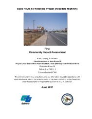
State Route 58 Widening Project - Bakersfield Freeways
State Route 58 Widening Project - Bakersfield Freeways
State Route 58 Widening Project - Bakersfield Freeways

You also want an ePaper? Increase the reach of your titles
YUMPU automatically turns print PDFs into web optimized ePapers that Google loves.
<strong>State</strong> <strong>Route</strong> <strong>58</strong> <strong>Widening</strong> <strong>Project</strong> (Rosedale Highway)<br />
BA<br />
Biological Assessment<br />
Rosedale Highway, <strong>Project</strong> Limits Extend from West of Allen Road to <strong>State</strong> <strong>Route</strong><br />
99Kern County, CA<br />
District 06-Kern-<strong>58</strong>- PM 46.1 to 51.7<br />
EA 0600000076<br />
September 22, 2011
For individuals with sensory disabilities, this document is available in Braille, large print, on<br />
audiocassette, or computer disk. To obtain a copy in one of these alternate formats, please call or<br />
write to Caltrans, Attn: Kirsten Helton, Senior Environmental Planner, District 6, 855 M Street,<br />
Suite 200, Fresno, California 93731; (559) 445-6282. Voice, or use the California Relay Service<br />
TTY number: (559) 488-4067.
Summary of Findings, Conclusions and Determinations<br />
Summary of Findings, Conclusions and Determinations<br />
The California Department of Transportation (Caltrans), in cooperation with the City<br />
of <strong>Bakersfield</strong> and the County of Kern, proposes to improve an approximate 5.6-mile<br />
segment of <strong>State</strong> <strong>Route</strong> (SR) <strong>58</strong>, locally known as Rosedale Highway. The project area<br />
is located within unincorporated Kern County and the City of <strong>Bakersfield</strong>; the limits<br />
extend from west of Allen Road to <strong>State</strong> <strong>Route</strong> (SR) 99.<br />
The proposed project would construct two new lanes between Allen Road and SR 99;<br />
this would result in a six lane roadway throughout the project limits (post mile [PM]<br />
46.1 to PM 51.7). Improvements would also include a grade separated rail crossing that<br />
would be constructed between Mohawk Street and Landco Drive. The bridge over<br />
Calloway Canal would be widened; however, the bridge over the Friant-Kern Canal<br />
would not be widened.<br />
The purpose of the proposed project is to improve east-west traffic flow on the local<br />
and regional transportation systems and to improve traffic operations within the<br />
corridor to accommodate planned growth.<br />
The proposed project is part of the Thomas Roads Improvement Program (TRIP),<br />
which includes 10 projects: six road improvement projects in the planning and<br />
environmental review phases, three road projects currently under construction<br />
(Westside Parkway, SR-178 at Fairfax Interchange and 7 th Standard Road) and one<br />
route adoption (West Beltway).<br />
The Biological Study Area (BSA) for the proposed project includes a 5.6-mile-long<br />
section of Rosedale Highway plus a 500-foot buffer area north and south of the<br />
roadway’s centerline.<br />
A list of special-status plant and animal species that have the potential to occur within<br />
a ten-mile query radius of the BSA was established by conducting a literature review<br />
of the United <strong>State</strong>s Fish and Wildlife Service (USFWS) online special-status species<br />
list, the California Department of Fish and Game (CDFG) California Natural Diversity<br />
Database (CNDDB) and the California Native Plant Society (CNPS) species list.<br />
Fourteen federally listed species have been evaluated for their potential to occur in the<br />
BSA. Of these species, the federally listed endangered San Joaquin kit fox (Vulpes<br />
macrotis mutica) has potential to occur in the BSA. The remaining thirteen species are<br />
not expected to occur in the BSA due to the lack of suitable habitat, because they were<br />
not observed during surveys, or because they are not known to occur in the immediate<br />
project vicinity.<br />
<strong>State</strong> <strong>Route</strong> <strong>58</strong> <strong>Widening</strong> <strong>Project</strong> Biological Assessment S-1
Summary of Findings, Conclusions and Determinations<br />
Vegetation mapping was conducted on March 21, 2007 by walking the BSA.<br />
Vegetation in the BSA consists of non-native grassland, developed/ornamental,<br />
ruderal/disturbed and open water/waterway.<br />
A survey for wildlife species was conducted on March 21, 2007 to document wildlife<br />
habitat and evaluate the BSA’s potential to support special-status wildlife species that<br />
are known or expected to occur in the BSA.<br />
Surveys for the kit fox, its dens and sign were conducted in May, June and July of<br />
2008. One individual kit fox, four potential kit fox dens and four kit fox signs (scat)<br />
were observed in the BSA.<br />
The proposed project would result in direct and indirect effects to the federally listed<br />
endangered San Joaquin kit fox:<br />
• Direct effects include the permanent loss of 1.21 acres of habitat for the San<br />
Joaquin kit fox (0.18 acre non-native grassland, 1.00 acre ruderal/disturbed, and<br />
0.03 acre open water/waterway) in the BSA that are considered suitable foraging<br />
and denning habitat for the kit fox. Permanent effects to habitat include the removal<br />
of habitat to accommodate the new roadbed, intersection improvements, and<br />
proposed new right-of-way (ROW) limits.<br />
• Temporary effects to habitat include temporary disturbance such as equipment and<br />
materials staging. The proposed project would temporarily affect 6.61 acres of<br />
habitat areas (3.25 acres of non-native grassland, 3.30 acres of ruderal/disturbed<br />
areas, and 0.06 acre of open water/waterway).<br />
• Direct effects would also include the permanent or temporary loss of one potential<br />
kit fox den within the alignment.<br />
• Indirect effects of project implementation may include the potential for an<br />
unintentional increase in vehicular strikes of kit foxes crossing the road. Other<br />
indirect effects could include habitat fragmentation, change in movement corridors,<br />
geographic isolation, and/or altered space use, all of which could result in disrupted<br />
social ecology, reduced fertility, pregnancy rates, prenatal survival, mortality, and<br />
reduced carrying capacity in the vicinity of the BSA.<br />
There is no critical habitat for San Joaquin kit fox within the BSA; therefore no critical<br />
habitat would be affected by the proposed project.<br />
S-2 <strong>State</strong> <strong>Route</strong> <strong>58</strong> <strong>Widening</strong> <strong>Project</strong> Biological Assessment
Summary of Findings, Conclusions and Determinations<br />
The following Avoidance and Minimization, and Mitigation Measures shall be<br />
implemented prior to project construction to reduce impacts to biological resources:<br />
• Construction activities will adhere to the standard construction and operational<br />
requirements as described in the USFWS Standardized Recommendations for<br />
Protection of the Endangered San Joaquin Kit Fox Prior to or During Ground<br />
Disturbance (USFWS 2011).<br />
• Pre-construction surveys for kit fox will be conducted prior to construction within<br />
the project footprint and temporary construction zone and a 200-foot buffer around<br />
these areas in accordance with USFWS guidelines (2011).<br />
• An employee education program shall be established and implemented prior to<br />
construction. The program shall include, at a minimum, kit fox identification, a<br />
description of suitable habitat for kit fox, and measures to implement in the event<br />
that kit fox is found during construction. The program shall be presented to all<br />
members of the construction crew prior to the start of project construction<br />
activities. All construction personnel are required to sign a form stating they took<br />
the class and understood the materials presented in the class.<br />
• Biological monitors shall regularly inspect the construction site to ensure the<br />
minimization measures are implemented throughout construction.<br />
• Road design modifications that would facilitate safe passage of kit fox and reduce<br />
vehicular-mortalities are proposed and will be evaluated for feasibility during final<br />
project design.<br />
• Compensatory mitigation for effects to non-native grassland, ruderal/disturbed,<br />
and open water/waterway will consist of the purchase of credits through the<br />
Metropolitan <strong>Bakersfield</strong> Habitat Conservation Plan (MBHCP).<br />
• Implementation of the Sump Habitat Program (currently under development),<br />
which includes installation of artificial dens in selected sumps, controlling<br />
vegetation in and around dens, increasing accessibility to sumps through<br />
fence/gate gaps, maintenance procedures to reduce the potential for effects to kit<br />
foxes, and post-construction monitoring of kit fox use of the sumps. The Wildlife<br />
Heritage Foundation, a non-profit land trust, will hold the endowments necessary<br />
to fully fund the Sump Habitat Program and will oversee the conservation<br />
easements.<br />
The project ‘may affect, likely to adversely affect’ the San Joaquin kit fox due to the<br />
direct and indirect impacts on this species resulting from project implementation.<br />
However, with the measures described above from the San Joaquin Kit Fox Effects<br />
Analysis, Mitigation Strategy, and Implementation Plan (Implementation Plan)<br />
<strong>State</strong> <strong>Route</strong> <strong>58</strong> <strong>Widening</strong> <strong>Project</strong> Biological Assessment S-3
Summary of Findings, Conclusions and Determinations<br />
(<strong>Bakersfield</strong> and Caltrans 2010), effects would be avoided and minimized to the extent<br />
practicable.<br />
S-4 <strong>State</strong> <strong>Route</strong> <strong>58</strong> <strong>Widening</strong> <strong>Project</strong> Biological Assessment
Table of Contents<br />
Table of Contents<br />
Chapter 1. Introduction ................................................................................................ 1<br />
1.1. <strong>Project</strong> History ........................................................................................... 1<br />
1.1.1. Purpose and Need ...................................................................................... 1<br />
1.1.1.1. <strong>Project</strong> Purpose .......................................................................................... 1<br />
1.1.1.2. <strong>Project</strong> Need .............................................................................................. 1<br />
1.2. <strong>Project</strong> Description .................................................................................... 1<br />
1.2.1. <strong>Project</strong> Phasing .......................................................................................... 7<br />
1.2.2. Avoidance and Minimization Measures .................................................... 7<br />
1.3. Summary of Consultation to Date ............................................................. 8<br />
1.4. Document Preparation History ................................................................ 10<br />
Chapter 2. Study Methods .......................................................................................... 11<br />
2.1. Listed and Proposed Species Potentially in the Biological Study Area .. 11<br />
2.2. Studies Required ...................................................................................... 13<br />
2.2.1. Literature Review .................................................................................... 13<br />
2.2.2. Vegetation Mapping ................................................................................ 13<br />
2.2.3. General Wildlife Surveys ........................................................................ 14<br />
2.2.4. Focused Surveys ...................................................................................... 14<br />
2.2.4.1. San Joaquin Kit Fox ................................................................................ 14<br />
2.3. Personnel and Survey Dates .................................................................... 15<br />
2.4. Agency Coordination and Professional Contacts .................................... 16<br />
2.5. Limitations That May Influence Results ................................................. 19<br />
Chapter 3. Results: Environmental Setting ................................................................ 21<br />
3.1. Description of Existing Biological and Physical Conditions ................... 21<br />
3.1.1. Study Area ............................................................................................... 21<br />
3.1.2. Physical Conditions ................................................................................. 21<br />
3.1.3. Biological Conditions in the BSA ........................................................... 25<br />
3.1.3.1. Vegetation Types ..................................................................................... 25<br />
3.1.3.2. Common Animal Species ........................................................................ 26<br />
Chapter 4. Results: Biological Resources, Discussion of Impacts and Mitigation .... 29<br />
4.1. Federally Listed or Proposed Animal Species Occurrences .................... 29<br />
4.1.1. Discussion of San Joaquin Kit Fox (Vulpes macrotis mutica) ................ 29<br />
4.1.1.1. Survey Results ......................................................................................... 31<br />
4.1.1.2. Critical Habitat ........................................................................................ 32<br />
4.1.1.3. Avoidance and Minimization Efforts ...................................................... 32<br />
4.1.1.4. <strong>Project</strong> Impacts ........................................................................................ 33<br />
4.1.1.5. Modifications to the <strong>Project</strong> to Mitigate Effects ...................................... 37<br />
4.1.1.6. Cumulative Effects (FESA)..................................................................... 42<br />
Chapter 5. Conclusions and Determination ............................................................... 45<br />
5.1. Conclusions ............................................................................................. 45<br />
5.2. Determination .......................................................................................... 45<br />
Chapter 6. References ................................................................................................ 47<br />
Appendix A Wildlife Species Observed in the BSA .................................................... 51<br />
<strong>State</strong> <strong>Route</strong> <strong>58</strong> <strong>Widening</strong> <strong>Project</strong> Biological Assessment<br />
i
List of Figures<br />
List of Figures<br />
1 Regional Vicinity ................................................................................................ 5<br />
2A–C <strong>Project</strong> Effects ..................................................................................................... 6<br />
3A–C Biological Study Area ....................................................................................... 23<br />
4 Local Vicinity ................................................................................................... 24<br />
ii<br />
<strong>State</strong> <strong>Route</strong> <strong>58</strong> <strong>Widening</strong> <strong>Project</strong> Biological Assessment
List of Tables<br />
List of Tables<br />
1 Listed, Proposed Species, and Critical Habiat Potentially Occuring or<br />
Known to Occur in the <strong>Project</strong> Area ................................................................. 11<br />
2 Vegetation Types and Other Areas Within the BSA ........................................ 25<br />
3 Habitat for San Joaquin Kit Fox That Would be Affected by Each<br />
Phase of Alternative A ...................................................................................... 35<br />
4 Ratios Required to Mitigate for Effects on San Joaquin Kit Fox Habitat ......... 41<br />
<strong>State</strong> <strong>Route</strong> <strong>58</strong> <strong>Widening</strong> <strong>Project</strong> Biological Assessment<br />
iii
List of Abbreviated Terms<br />
List of Abbreviated Terms<br />
A<br />
BA<br />
BO<br />
BMP<br />
BSA<br />
Caltrans<br />
CDFG<br />
CESA<br />
CNDDB<br />
CNPS<br />
ESA<br />
ESRP<br />
FE<br />
FED<br />
FESA<br />
FHWA<br />
FP<br />
FT<br />
GPS<br />
Implementation Plan<br />
MBGP<br />
MBHCP<br />
NFWF<br />
P<br />
PM<br />
ROW<br />
RWQCB<br />
SAFETAE-LU<br />
SE<br />
SJVR<br />
SR<br />
Absent<br />
Biological Assessment<br />
Biological Opinion<br />
Best Management Practices<br />
Biological Study Area<br />
California Department of Transportation<br />
California Department of Fish and Game<br />
California Endangered Species Act<br />
California Natural Diversity Database<br />
California Native Plant Society<br />
Endangered Species Act<br />
Endangered Species Recovery Program<br />
Federally listed endangered<br />
Final Environmental Document<br />
Federal Endangered Species Act<br />
Federal Highway Administration<br />
Fully Protected<br />
Federally listed threatened<br />
Geographic Positioning System<br />
San Joaquin Kit Fox Effects Analysis, Mitigation Strategy,<br />
and Implementation Plan<br />
Metropolitan <strong>Bakersfield</strong> General Plan<br />
Metropolitan <strong>Bakersfield</strong> Habitat Conservation Plan<br />
National Fish and Wildlife Foundation<br />
Present<br />
post mile<br />
right-of-way<br />
Regional Water Quality Control Board<br />
Safe, Accountable, Flexible, Efficient, Transportation<br />
Equity Act: A Legacy for Users<br />
<strong>State</strong>-listed endangered<br />
San Joaquin Valley Railroad<br />
<strong>State</strong> <strong>Route</strong><br />
iv<br />
<strong>State</strong> <strong>Route</strong> <strong>58</strong> <strong>Widening</strong> <strong>Project</strong> Biological Assessment
List of Abbreviated Terms<br />
SSC<br />
ST<br />
TRIP<br />
USACE<br />
USC<br />
USFWS<br />
USGS<br />
California Species of Special Concern<br />
<strong>State</strong>-listed threatened<br />
Thomas Roads Improvement Program<br />
U.S. Army Corps of Engineers<br />
U.S. Code<br />
U.S. Fish and Wildlife Service<br />
U.S. Geological Survey<br />
Rosedale Highway <strong>Widening</strong> Biological Assessment<br />
v
List of Abbreviated Terms<br />
This page intentionally left blank<br />
vi<br />
<strong>State</strong> <strong>Route</strong> <strong>58</strong> <strong>Widening</strong> <strong>Project</strong> Biological Assessment
Chapter 1.<br />
Introduction<br />
The purpose of this Biological Assessment (BA) is to provide technical information<br />
and to review the proposed project in sufficient detail to determine to what extent the<br />
proposed project may affect threatened, endangered, or proposed species. This BA is<br />
prepared in accordance with (1) legal requirements found in Section 7(a)(2) of the<br />
federal Endangered Species Act (FESA) (16 United <strong>State</strong>s Code [USC] 1536[c]) and<br />
(2) Federal Highway Administration (FHWA) and Caltrans regulations, policies, and<br />
guidance. The document presents technical information upon which later decisions<br />
regarding project effects are developed.<br />
1.1. <strong>Project</strong> History<br />
1.1.1. Purpose and Need<br />
1.1.1.1. <strong>Project</strong> Purpose<br />
The purpose of the proposed project is:<br />
• To reduce existing and future traffic congestion on <strong>State</strong> <strong>Route</strong> <strong>58</strong> between Allen<br />
Road and <strong>State</strong> <strong>Route</strong> 99 to improve local and regional east-west traffic flow.<br />
1.1.1.2. <strong>Project</strong> Need<br />
The proposed project is needed to serve existing and projected travel demand along<br />
the SR-<strong>58</strong> corridor. The project extends through the urban core area of metropolitan<br />
<strong>Bakersfield</strong>, where SR-<strong>58</strong> is used to access jobs and commercial uses within the City.<br />
The City of <strong>Bakersfield</strong> General Plan and the Kern County General Plan both assume<br />
SR-<strong>58</strong> as a six lane highway through the project study area. This portion of SR-<strong>58</strong> has<br />
traffic congestion, especially during the busiest times of the day. The project has also<br />
been identified in the Safe, Accountable, Flexible, Efficient, Transportation Equity<br />
Act: A Legacy for Users (SAFETEA-LU) legislation as part of the National Corridor<br />
Infrastructure Improvement Program (Section 1302 of the SAFETEA-LU).<br />
1.2. <strong>Project</strong> Description<br />
Caltrans, in cooperation with the City of <strong>Bakersfield</strong> and the County of Kern, proposes<br />
to improve an approximate 5.6-mile segment of SR-<strong>58</strong>, locally known as Rosedale<br />
<strong>State</strong> <strong>Route</strong> <strong>58</strong> <strong>Widening</strong> <strong>Project</strong> Biological Assessment 1
Chapter 1 Introduction<br />
Highway. The project area is located within unincorporated Kern County and the City<br />
of <strong>Bakersfield</strong> (Figure 1); the limits extend from west of Allen Road to SR 99(Figures<br />
2A–2C). One Build Alternative and the No Build Alternative have been evaluated.<br />
The City of <strong>Bakersfield</strong> is the lead agency pursuant to the California Environmental<br />
Quality Act and Caltrans is the lead agency for the National Environmental Policy<br />
Act.<br />
The proposed project is part of the TRIP, which includes 10 projects: six road<br />
improvement projects in the planning and environmental review phases, three road<br />
projects currently under construction (Westside Parkway, SR-178 at Fairfax<br />
Interchange and 7 th Standard Road) and one route adoption (West Beltway).<br />
Build Alternative<br />
The Build Alternative would construct two new lanes between Allen Road and SR 99.<br />
East of Gibson Street, the project would modify land striping and the median to<br />
transition to the existing lane configuration. This would result in a six lane roadway<br />
throughout the project limits (post miles 46.1 to 51.7). Cross streets may also be<br />
restriped at their intersections with SR- <strong>58</strong> to improve the traffic operations.<br />
Ultimate improvements would include a grade separated rail crossing that would be<br />
constructed between Mohawk Street and Landco Drive. As part of the first phase of<br />
improvements, the road would be widened to six lanes, the railroad gates would be<br />
installed, and 11-foot turnouts would be provided to allow trucks and busses to move<br />
outside traffic lanes. As part of the final phase of the project, a grade separated rail<br />
crossing (where the road would go over the railroad tracks) would be provided.<br />
The roadway would be designed to local (City and County) standards for the portion<br />
of the project between Allen Road and Mohawk Street. This is the portion of the<br />
project where Caltrans will relinquish the ROW to the local agencies. The standard<br />
cross-section for this portion of the roadway would be 110 feet. Between Mohawk<br />
Street and SR 99, the roadway would be designed to <strong>State</strong> standards. Property would<br />
need to be acquired for this alternative.<br />
Along with the roadway widening, there would also be the following changes along<br />
the roadway:<br />
• Traffic signals and signage would need to be relocated because the roadway would<br />
be wider.<br />
2 <strong>State</strong> <strong>Route</strong> <strong>58</strong> <strong>Widening</strong> <strong>Project</strong> Biological Assessment
Chapter 1 Introduction<br />
• Minor changes, such as restriping approach lanes to provide an additional turn lane<br />
on the side-street approaches to SR- <strong>58</strong>, would be constructed at the cross streets<br />
because SR- <strong>58</strong> would be wider.<br />
• Utilities and drainage facilities would be relocated because of the wider roadway,<br />
including above-ground utilities such as power poles, and storm drain inlets.<br />
• Existing landscaping1 and irrigation would be replaced in the median along the<br />
proposed project alignment if it is damaged by construction.<br />
The depth of construction for the SR-<strong>58</strong> widening is expected to be five feet or less in<br />
all locations except where new bridge columns are required (at the west crossing of<br />
the Calloway Canal and at the proposed overcrossing). In these locations, the<br />
maximum depth of ground disturbance is expected to be about 45 feet from pile<br />
driving (no major excavation).<br />
San Joaquin Valley Railroad Grade Separation<br />
The project proposes a grade separation over the San Joaquin Valley Railroad (rail line<br />
between Mohawk Street and Landco Drive). The proposed grade separation would be<br />
built on the current alignment for SR- <strong>58</strong>. A temporary route on the north side of the<br />
roadway would be provided during construction to maintain roadway function. In this<br />
location, additional ROW would be required. Borrow material would be required for<br />
the grade separation and would be environmentally cleared by the contractor.<br />
No Build Alternative<br />
The No Build Alternative would not provide any improvements to SR-<strong>58</strong>. Without the<br />
proposed widening, the No Build Alternative does not address congestion and traffic<br />
delays that could be expected as traffic volumes increase. Improvements that are<br />
planned for other roadways as part of separate projects would still be built.<br />
Figures 2A–2C show the footprint for the proposed project. All borrow, disposal,<br />
staging, access, and utility relocations would be within the footprint identified in these<br />
figures, or within nearby developed areas. Figures 2A–2C also show potential kit fox<br />
dens and other observations near the project area. Dust-, erosion-, and<br />
sediment-control measures will be developed at a later project design phase, but will<br />
follow standard Best Management Practices (BMPs). Specific construction equipment<br />
will also be determined at a later project design phase, but will follow standard<br />
construction techniques.<br />
1<br />
Due to concerns regarding San Joaquin kit fox crossing the road, any landscaping planted will be<br />
low-level (i.e., less than six inches) that does not require mowing.<br />
<strong>State</strong> <strong>Route</strong> <strong>58</strong> <strong>Widening</strong> <strong>Project</strong> Biological Assessment 3
Chapter 1 Introduction<br />
There are no interdependent or interrelated projects.<br />
4 <strong>State</strong> <strong>Route</strong> <strong>58</strong> <strong>Widening</strong> <strong>Project</strong> Biological Assessment
46<br />
Lost Hills<br />
33<br />
Delano<br />
McFarland<br />
43<br />
Wasco<br />
99<br />
Buttonwillow<br />
Rosedale<br />
<strong>58</strong><br />
155<br />
<strong>Project</strong> Location<br />
Kern River<br />
Kernville<br />
Lake<br />
Isabella<br />
Onyx<br />
Ridgecrest<br />
395<br />
Califor nia Aqueduct<br />
Tupman<br />
5<br />
BAKERSFIELD<br />
Arvin<br />
<strong>58</strong><br />
Keene<br />
14<br />
California City<br />
Taft<br />
Maricopa<br />
99<br />
Lebec<br />
Tehachapi<br />
Los An gel es A queduct<br />
Rosamond<br />
Mojave<br />
Edwards AFB<br />
Boron<br />
Kern<br />
N<br />
D:\<strong>Project</strong>s\HNTB\J006\Graphics\2010\ex_RV_BA_v002.ai<br />
(092211 JFG) R:\<strong>Project</strong>s\HNTB\J006\Graphics\2010\IS-EA\Fig1_RV.pdf<br />
Regional Vicinity<br />
<strong>State</strong> <strong>Route</strong> <strong>58</strong> (Rosedale Highway) <strong>Widening</strong> <strong>Project</strong><br />
PM 46.1 to PM 51.7<br />
D6-KER-<strong>58</strong><br />
EA 060F360<br />
Figure 1
Map Extent<br />
A<br />
B<br />
C<br />
ALLEN RD<br />
OLD FARM RD<br />
JEWETTA AV<br />
VERDUGO LN<br />
<strong>58</strong><br />
ROSEDALE HWY<br />
W JEWETTA AV<br />
Biological Study Area<br />
<strong>Project</strong> Impacts<br />
Grade Separation<br />
Species Location<br />
Kit Fox Observation<br />
Active Kit Fox Den<br />
D:\<strong>Project</strong>s\HNTB\J006\MXD\Ex_Impacts.mxd<br />
Temporary Impacts<br />
Potential Kit Fox Den<br />
Vegetation Types and other Areas Kit Fox Sign<br />
Non-native Grassland<br />
Developed/Ornamental<br />
Ruderal/Disturbed<br />
Open Water/Waterway<br />
(Rev 09-22-11 JFG) R:\<strong>Project</strong>s\HNTB\J006\Graphics\2010\BA\Fig2_<strong>Project</strong>_Effects.pdf<br />
800 400 0 800<br />
Feet<br />
Aerials flown 2006<br />
<strong>Project</strong> Effects<br />
<strong>State</strong> <strong>Route</strong> <strong>58</strong> (Rosedale Highway) <strong>Widening</strong> <strong>Project</strong><br />
PM 46.1 to PM 51.7<br />
D6-KER-<strong>58</strong><br />
EA 06-0F360<br />
Figure 2A
Map Extent<br />
A<br />
B<br />
C<br />
VERDUGO LN<br />
CALLOWAY DR<br />
MAIN PLAZA DR<br />
COFFEE RD<br />
Friant-Kern Canal<br />
Calloway Canal<br />
HENRY LN<br />
PATTON WY<br />
WEAR ST<br />
FRUITVALE AV<br />
Calloway Canal<br />
Emery Ditch<br />
Emery Ditch<br />
<strong>58</strong><br />
ROSEDALE HWY<br />
WEDDING LN<br />
Calloway Canal<br />
Biological Study Area<br />
<strong>Project</strong> Impacts<br />
Grade Separation<br />
Species Location<br />
Kit Fox Observation<br />
Active Kit Fox Den<br />
D:\<strong>Project</strong>s\HNTB\J006\MXD\Ex_Impacts.mxd<br />
Temporary Impacts<br />
Potential Kit Fox Den<br />
Vegetation Types and other Areas Kit Fox Sign<br />
Non-native Grassland<br />
Developed/Ornamental<br />
Ruderal/Disturbed<br />
Open Water/Waterway<br />
(Rev 09-22-11 JFG) R:\<strong>Project</strong>s\HNTB\J006\Graphics\2010\BA\Fig2_<strong>Project</strong>_Effects.pdf<br />
800 400 0 800<br />
Feet<br />
Aerials flown 2006<br />
<strong>Project</strong> Effects<br />
<strong>State</strong> <strong>Route</strong> <strong>58</strong> (Rosedale Highway) <strong>Widening</strong> <strong>Project</strong><br />
PM 46.1 to PM 51.7<br />
D6-KER-<strong>58</strong><br />
EA 06-0F360<br />
Figure 2B
Map Extent<br />
A<br />
B<br />
C<br />
FRUITVALE AV<br />
Emery Ditch<br />
WEAR ST<br />
Calloway Canal<br />
Emery Ditch<br />
MOHAWK ST<br />
LANDCO DR<br />
CASE ST<br />
GIBSON ST<br />
99<br />
Calloway Canal<br />
<strong>58</strong><br />
ROSEDALE HWY<br />
PARKER LN<br />
Kern River<br />
Biological Study Area<br />
<strong>Project</strong> Impacts<br />
Grade Separation<br />
Species Location<br />
Kit Fox Observation<br />
Active Kit Fox Den<br />
D:\<strong>Project</strong>s\HNTB\J006\MXD\Ex_Impacts.mxd<br />
Temporary Impacts<br />
Potential Kit Fox Den<br />
Vegetation Types and other Areas Kit Fox Sign<br />
Non-native Grassland<br />
Developed/Ornamental<br />
Ruderal/Disturbed<br />
Open Water/Waterway<br />
(Rev 09-22-11 JFG) R:\<strong>Project</strong>s\HNTB\J006\Graphics\2010\BA\Fig2_<strong>Project</strong>_Effects.pdf<br />
800 400 0 800<br />
Feet<br />
Aerials flown 2006<br />
<strong>Project</strong> Effects<br />
<strong>State</strong> <strong>Route</strong> <strong>58</strong> (Rosedale Highway) <strong>Widening</strong> <strong>Project</strong><br />
PM 46.1 to PM 51.7<br />
D6-KER-<strong>58</strong><br />
EA 06-0F360<br />
Figure 2C
Chapter 1 Introduction<br />
1.2.1. <strong>Project</strong> Phasing<br />
Construction is expected to be done in three phases. The first phase would be from<br />
Calloway Drive to SR 99. The second phase would be from Allen Road to Calloway<br />
Drive. Construction on the first two segments is expected to start in early 2014 and be<br />
completed in mid-2015. The grade separation at the San Joaquin Valley Railroad<br />
would be constructed as a final phase, with construction projected to start in 2025 and<br />
end in 2027. Construction for all phases is expected to be completed within this<br />
project’s 20-year horizon.<br />
The roadway would be open through all phases of construction. No detours are<br />
expected to be necessary. During construction of the grade-separation, a temporary<br />
route on the north side of the roadway would be provided during construction to allow<br />
traffic to continue to use SR-<strong>58</strong>. The temporary route would be located next to the<br />
roadway and would use property that would be bought as part of the project.<br />
Relocation/reconstruction of utilities and drainage facilities within the proposed ROW<br />
would include power poles, underground utilities, and storm drains. Utility relocations<br />
are expected to be accomplished without interrupting service. Drainage improvements<br />
would include installation of operational BMPs.<br />
1.2.2. Avoidance and Minimization Measures<br />
Standard Avoidance and Minimization Measures for the San Joaquin kit fox (such as<br />
pre-construction surveys, worker environmental awareness training, and construction<br />
monitoring) will be implemented. In addition to the standard Avoidance and<br />
Minimization Measures, the project proposes to incorporate structural design elements<br />
that are intended to facilitate safe kit fox crossing and to reduce the potential for<br />
unintentional vehicular strike. The structural design elements would include limited<br />
median height, low-level landscaping, avoidance of current movement corridors (i.e.,<br />
canals and railways), and warning signs. The proposed project would also avoid the<br />
use of fencing. These design elements will be addressed in more detail in<br />
Section 4.1.1.5. The specifics of these structural elements will be finalized during the<br />
project’s final design phase by the City of <strong>Bakersfield</strong> and Caltrans and submitted for<br />
review and approval by the USFWS.<br />
<strong>State</strong> <strong>Route</strong> <strong>58</strong> <strong>Widening</strong> <strong>Project</strong> Biological Assessment 7
Chapter 1 Introduction<br />
1.3. Summary of Consultation to Date<br />
During preparation of the Implementation Plan (<strong>Bakersfield</strong> and Caltrans 2010),<br />
Stephanie Coppeto, Leo Edson, and the City of <strong>Bakersfield</strong> consulted with the<br />
USFWS and the CDFG; Caltrans; Dr. Brian Cypher with the California <strong>State</strong><br />
University, Stanislaus Endangered Species Recovery Program (ESRP); and other<br />
environmental consultants with knowledge of the status and distribution of the San<br />
Joaquin kit fox in <strong>Bakersfield</strong>.<br />
Stephanie Coppeto, Leo Edson, and the City of <strong>Bakersfield</strong> coordinated with the<br />
USFWS, CDFG, and Caltrans on the approach for San Joaquin kit fox field surveys,<br />
potential project-specific and program-level effects of the TRIP, and mitigation<br />
options for project-specific and program-level effects.<br />
Stephanie Coppeto and Leo Edson worked closely with Dr. Brian Cypher, kit fox<br />
specialist with ESRP, to gather supplemental information about kit fox distribution,<br />
abundance, and ecology in metropolitan <strong>Bakersfield</strong>, including: known kit fox<br />
locations, reported observations, habitat associations of kit fox in <strong>Bakersfield</strong>, suitable<br />
kit fox habitat areas, and potential movement corridors. Dr. Cypher provided guidance<br />
throughout the development of field surveys, synthesis and interpretation of kit fox<br />
data for project-specific surveys, appropriate project-specific and program-level<br />
mitigation measures, and preparation of kit fox technical reports.<br />
Stephanie Coppeto and Leo Edson also sought input from various environmental<br />
consultants in <strong>Bakersfield</strong> with knowledge of the local San Joaquin kit fox population.<br />
Marcia Wolfe of MH Wolfe and Associates provided a general assessment of the kit fox<br />
distribution in central and north-eastern <strong>Bakersfield</strong>. Steven Pruett of Paul Pruett and<br />
Associates conducted field surveys with Stephanie Coppeto and provided information on<br />
suitability of project-specific habitat, kit fox den evaluation, and historical accounts of kit<br />
fox movement in project-specific study areas and throughout metropolitan <strong>Bakersfield</strong>.<br />
In 2007, the City and Caltrans authorized Stephanie Coppeto and Leo Edson to<br />
develop a conceptual strategy for San Joaquin kit fox to determine the potential effects<br />
of implementing the TRIP projects on kit fox and to evaluate mitigation options for<br />
such effects. USFWS and CDFG concur that a conceptual strategy was needed.<br />
USFWS requested cumulative and project-specific analyses of potential effects on kit<br />
fox to comply with Section 7 consultation for each TRIP project evaluated.<br />
8 <strong>State</strong> <strong>Route</strong> <strong>58</strong> <strong>Widening</strong> <strong>Project</strong> Biological Assessment
Chapter 1 Introduction<br />
In 2008, USFWS and CDFG concurred on methods proposed by Stephanie Coppeto<br />
and Leo Edson to develop the kit fox conceptual strategy: diurnal surveys for kit fox<br />
dens and signs, collaboration with Dr. Brian Cypher, and a project specific and<br />
cumulative approach to evaluating potential impacts on kit fox and efforts to avoid,<br />
minimize, and compensate for potential effects. USFWS, CDFG, Caltrans, Stephanie<br />
Coppeto and Leo Edson, and the City agreed to meet throughout the development of<br />
the conceptual strategy to ensure that it complies with the FESA and California<br />
Endangered Species Act (CESA). In July, 2008, CDFG, Caltrans, Stephanie Coppeto<br />
and Leo Edson, the City, Steven Pruett, and Dr. Brian Cypher toured various TRIP<br />
projects in <strong>Bakersfield</strong>. In August, 2008, Stephanie Coppeto and Leo Edson presented<br />
preliminary results of kit fox surveys. USFWS identified habitat connectivity and the<br />
maintenance of corridors connecting kit fox populations as a major issue facing kit fox<br />
in <strong>Bakersfield</strong>. Potential compensatory mitigation options were discussed, including<br />
culverts, refugia, and artificial kit fox dens.<br />
In 2009, USFWS and CDFG approved the San Joaquin Kit Fox Life History, Effects<br />
Analysis, and Conceptual Mitigation Strategy (City of <strong>Bakersfield</strong> and Caltrans 2009)<br />
that describes program-level impacts and conceptual program-level mitigation.<br />
USFWS and CDFG concurred that Caltrans should begin to develop a mitigation<br />
implementation plan of the conceptual approach.<br />
In 2010, USFWS and CDFG approved the Implementation Plan (City of <strong>Bakersfield</strong><br />
and Caltrans 2010). CDFG recommended that Caltrans seek a 2080.1 Consistency<br />
Determination for projects requiring a state Incidental Take Permit. USFWS and<br />
CDFG approved the standard Avoidance and Minimization Measures that would be<br />
described for the San Joaquin kit fox in BAs. USFWS and CDFG agreed that the letter<br />
from the MBHCP Trust Group to the City (dated August 3, 2010) approving eligible<br />
TRIP projects to participate in the fee payment program was valid for projects that are<br />
ready to build prior to MBHCP expiration in 2014 but asked that the City clarify that<br />
fees can be paid at higher than 1:1 ratios as required by USFWS. USFWS and CDFG<br />
approved the concept of the Sump Habitat Program to compensate for program-level<br />
effects.<br />
In 2011, based on agency consultation and the release of the Draft Biological Opinion<br />
for the Morning Drive/<strong>State</strong> <strong>Route</strong> 178 Interchange <strong>Project</strong>, a 3:1 mitigation ratio is<br />
identified for all permanent impacts and a 1.1:1 ratio is identified for all temporary<br />
impacts. Caltrans is no longer seeking an Incidental Take Permit or a Consistency<br />
Determination under CESA as it is now assumed that take of San Joaquin kit fox, as<br />
<strong>State</strong> <strong>Route</strong> <strong>58</strong> <strong>Widening</strong> <strong>Project</strong> Biological Assessment 9
Chapter 1 Introduction<br />
defined under CESA, can be avoided. Caltrans and the City have identified the<br />
Wildlife Heritage Foundation (WHF), a non-profit land trust, to hold endowments<br />
necessary to fully fund the Sump Habitat Program and conservation easement<br />
oversight. The USFWS also released an updated Recommendations for Protection of<br />
the Endangered San Joaquin Kit Fox Prior to or During Ground Disturbance<br />
(USFWS 2011).<br />
1.4. Document Preparation History<br />
This document was prepared based on the Implementation Plan (<strong>Bakersfield</strong> and<br />
Caltrans 2010). Information on the BSA was obtained from the <strong>State</strong> <strong>Route</strong> <strong>58</strong><br />
<strong>Widening</strong> <strong>Project</strong> (Rosedale Highway) Final Natural Environment Study (NES)<br />
(Caltrans 2011).<br />
10 <strong>State</strong> <strong>Route</strong> <strong>58</strong> <strong>Widening</strong> <strong>Project</strong> Biological Assessment
Chapter 2.<br />
Study Methods<br />
2.1. Listed and Proposed Species Potentially in the<br />
Biological Study Area<br />
Fourteen federally listed species are included on the species list provided by the<br />
USFWS for the proposed project (Table 1). Of these species, the San Joaquin kit fox<br />
has potential to occur in the BSA. The remaining species are not expected to occur in<br />
the BSA due to the lack of suitable habitat, because they were not observed during<br />
surveys, or because they are not known to occur in the immediate project vicinity.<br />
Table 1<br />
Listed, Proposed Species, and Critical Habiat Potentially Occuring or<br />
Known to Occur in the <strong>Project</strong> Area<br />
Common<br />
Name<br />
California<br />
jewelflower<br />
Kern mallow<br />
San Joaquin<br />
woolly-threads<br />
<strong>Bakersfield</strong><br />
cactus<br />
vernal pool<br />
fairy shrimp<br />
valley<br />
elderberry<br />
longhorn<br />
beetle<br />
delta smelt<br />
Scientific Name<br />
Caulanthus<br />
californicus<br />
Eremalche parryi<br />
ssp. kernensis [E.<br />
kernensis]<br />
Monolopia<br />
[Lembertia]<br />
congdonii<br />
Opuntiabasilaris<br />
var. treleasei<br />
Branchinecta<br />
lynchi<br />
Desmocerus<br />
californicus<br />
dimorphus<br />
Hypomesus<br />
transpacificus<br />
Status<br />
FE, SE<br />
FE<br />
FE<br />
FE, SE<br />
FT<br />
FT<br />
FT,<br />
ST<br />
General Habitat<br />
Description<br />
Saltbush scrub;<br />
pinyon and juniper<br />
woodland; valley and<br />
foothill grassland<br />
(sandy).<br />
Saltbush scrub; valley<br />
and foothill grassland.<br />
Saltbush scrub; valley<br />
and foothill grassland<br />
(sandy).<br />
Saltbush scrub;<br />
cismontane woodland;<br />
valley and foothill<br />
grassland (sandy or<br />
gravelly).<br />
Ephemeral freshwater<br />
habitats, such as<br />
vernal pools and<br />
swales.<br />
Associated with blue<br />
elderberry.<br />
Sacramento-San<br />
Joaquin Delta.<br />
Habitat<br />
Present/<br />
Absent<br />
A<br />
A<br />
A<br />
A<br />
A<br />
A<br />
A<br />
Rationale<br />
Not observed during<br />
focused plant<br />
surveys.<br />
Not observed during<br />
focused plant<br />
surveys.<br />
Not observed during<br />
focused plant<br />
surveys.<br />
Not observed during<br />
focused plant<br />
surveys.<br />
No suitable habitat;<br />
not expected to<br />
occur.<br />
No suitable habitat;<br />
not expected to<br />
occur.<br />
Outside known<br />
range; not expected<br />
to occur.<br />
<strong>State</strong> <strong>Route</strong> <strong>58</strong> <strong>Widening</strong> <strong>Project</strong> Biological Assessment 11
Chapter 2 Study Methods<br />
Table 1 (Continued)<br />
Listed, Proposed Species, and Critical Habiat Potentially Occuring or<br />
Known to Occur in the <strong>Project</strong> Area<br />
Common<br />
Name<br />
California redlegged<br />
frog<br />
blunt-nosed<br />
leopard lizard<br />
giant garter<br />
snake<br />
giant kangaroo<br />
rat<br />
Tipton<br />
kangaroo rat<br />
Buena Vista<br />
Lake shrew<br />
San Joaquin<br />
kit fox<br />
Scientific Name<br />
Rana [aurora]<br />
draytonii<br />
Gambelia sila<br />
Thamnophis gigas<br />
Dipodomys ingens<br />
Dipodomys<br />
nitratoides<br />
nitratoides<br />
Sorex ornatus<br />
relictus<br />
STATUS DESIGNATIONS<br />
A Absent<br />
P Present<br />
Vulpes macrotis<br />
mutica<br />
Status<br />
FT, SSC<br />
FE,<br />
SE/FP<br />
FT,<br />
ST<br />
FE,<br />
SE<br />
FE,<br />
SE<br />
FE, SSC<br />
FE,<br />
ST<br />
General Habitat<br />
Description<br />
Variety of aquatic<br />
habitats in forests,<br />
woodlands,<br />
grasslands, and<br />
streamsides with<br />
deep, still, or slowmoving<br />
water.<br />
Semiarid grasslands,<br />
alkali flats, and<br />
washes.<br />
Perennial fresh water<br />
with emergent wetland<br />
vegetation and<br />
basking sites.<br />
Slopes in grasslands<br />
and shrub<br />
communities.<br />
Alkali sink scrub and<br />
valley saltbush scrub<br />
with widely scattered<br />
shrubs.<br />
Wetlands with dense<br />
vegetation and an<br />
abundant layer of<br />
detritus.<br />
Valley sink scrub,<br />
saltbush scrub, upper<br />
Sonoran scrub,<br />
annual grasslands, oil<br />
fields, urban areas.<br />
Habitat<br />
Present/<br />
Absent<br />
A<br />
A<br />
A<br />
A<br />
A<br />
A<br />
P<br />
Rationale<br />
No suitable habitat;<br />
not expected to<br />
occur.<br />
No suitable habitat;<br />
not expected to<br />
occur.<br />
Outside current<br />
known range; not<br />
expected to occur.<br />
No suitable habitat;<br />
not expected to<br />
occur.<br />
No suitable habitat;<br />
not expected to<br />
occur.<br />
No suitable habitat;<br />
not expected to<br />
occur.<br />
Observed during<br />
2008 focused<br />
surveys.<br />
Federal Designations<br />
FE Listed by the federal government as an endangered species<br />
FT Listed by the federal government as a threatened species<br />
<strong>State</strong> Designations<br />
SE Listed as endangered by the <strong>State</strong> of California<br />
ST Listed as threatened by the <strong>State</strong> of California<br />
SSC Species of Special Concern<br />
FP Fully Protected<br />
12 <strong>State</strong> <strong>Route</strong> <strong>58</strong> <strong>Widening</strong> <strong>Project</strong> Biological Assessment
Chapter 2 Study Methods<br />
2.2. Studies Required<br />
2.2.1. Literature Review<br />
The BSA includes the current SR-<strong>58</strong> ROW and areas located 500 feet north and south<br />
of its centerline.<br />
Prior to conducting field surveys, a list of special-status plant and animal species that<br />
have potential to occur within a ten-mile query radius of the BSA was established by<br />
conducting a literature review. Literature reviewed included the CNPS’ Inventory of<br />
Rare and Endangered Vascular Plants of California (CNPS 2008), the CDFG’s<br />
CNDDB (CDFG 2008), and the USFWS List of Proposed, Threatened, and<br />
Endangered Species (USFWS 2008) for the U.S. Geologic Survey (USGS) 7.5-minute<br />
quadrangles of Famoso, Lamont, North of Oildale, Oil Center, Oildale, Rosedale, Rio<br />
Bravo, Tupman, Stevens, Gosford, and Wasco. The database searches were updated<br />
(CNPS 2010, CDFG 2010) when the NES was updated in 2010. The USFWS list was<br />
updated in March 2011 (USFWS 2011). The Western Rosedale Specific Plan (Kern<br />
County 1994), the Metropolitan <strong>Bakersfield</strong> General Plan (MBGP) (<strong>Bakersfield</strong> and<br />
Kern County 2002), the MBHCP, support documents (Thomas Reid Associates 1994,<br />
1991, and 1990), and the USFWS’s Recovery Plan for Upland Species of the San<br />
Joaquin Valley, California (USFWS 1998) were also reviewed.<br />
Other documentation that included information on biological resources in the BSA and<br />
in the general project vicinity were reviewed including: the 7 th Standard Road<br />
<strong>Widening</strong> Environmental Assessment/Initial Study with Proposed Mitigated Negative<br />
Declaration (Caltrans 2006), the Tier 2 Environmental Assessment/Final<br />
Environmental Impact Report for Westside Parkway (<strong>Bakersfield</strong> et al. 2006), the<br />
Kern County Waste Facilities Habitat Conservation Plan (Kern County Waste<br />
Management Department 1997), and the Kern Water Bank Authority Habitat<br />
Conservation Plan (Kern Water Bank Authority 1997).<br />
2.2.2. Vegetation Mapping<br />
Vegetation mapping was conducted on March 21, 2007 by walking the BSA, to<br />
describe the vegetation present in the BSA. All plant species observed were recorded<br />
in field notes. A list of species observed is included in Appendix A.<br />
<strong>State</strong> <strong>Route</strong> <strong>58</strong> <strong>Widening</strong> <strong>Project</strong> Biological Assessment 13
Chapter 2 Study Methods<br />
2.2.3. General Wildlife Surveys<br />
A general survey for wildlife species was conducted on March 21, 2007, to document<br />
wildlife habitat and evaluate the BSA’s potential to support special-status wildlife<br />
species that are known or expected to occur in the BSA. During the surveys, active<br />
searches for reptiles and amphibians were accomplished by systematically surveying<br />
appropriate habitat and included lifting, overturning, and carefully replacing rocks and<br />
debris. Birds were identified by visual and auditory recognition. Surveys for mammals<br />
were conducted during the day and included searching for and identifying diagnostic<br />
sign including scat, footprints, scratch-outs, dust bowls, burrows, and trails. Wildlife<br />
species that were observed were recorded in field notes. A list of species observed is<br />
located in Appendix A.<br />
2.2.4. Focused Surveys<br />
2.2.4.1. San Joaquin Kit Fox<br />
Existing data on the status and distribution of San Joaquin kit fox in the Metropolitan<br />
<strong>Bakersfield</strong> area were used to supplement field survey data and to evaluate the<br />
distribution of kit foxes in the TRIP kit fox study area. Existing kit fox data were<br />
compiled from CNDDB records; a report prepared by Bjurlin et al. (2005) on kit fox<br />
and urban roads; and the MBHCP’s San Joaquin kit fox database, which is maintained<br />
by the City of <strong>Bakersfield</strong> Planning Department. Data were compiled as described in<br />
Bjurlin et. al. (2005) to examine vehicular mortality locations from maps and activity<br />
areas from radio telemetry locations of collared foxes.<br />
Surveys for San Joaquin kit fox dens and sign were conducted in the BSA following a<br />
methodology established for the TRIP and approved by the USFWS and the CDFG as<br />
described in the Implementation Plan (Caltrans and City of <strong>Bakersfield</strong> 2010). The<br />
surveys for kit fox were conducted by wildlife biologists Stephanie Coppeto and Steve<br />
Pruett.<br />
The BSA was surveyed during two discrete survey sessions to maximize the potential<br />
for biologists to detect kit fox during both denning (session 1 – May 20, June 1 and<br />
17, July 7, 2008) and dispersal (session 2 – July 29 and 30, 2008) seasons. Surveys<br />
were conducted on all accessible parcels within the BSA where the property owner<br />
had granted access. In general, field surveys did not include residential property.<br />
14 <strong>State</strong> <strong>Route</strong> <strong>58</strong> <strong>Widening</strong> <strong>Project</strong> Biological Assessment
Chapter 2 Study Methods<br />
During surveys, biologists walked linear transects within the survey area; transects<br />
were separated by no more than 50 feet and included 100 percent visual coverage. At<br />
all times, biologists had maps that included locations of known kit fox dens, sightings,<br />
and activity areas as reported in the CNDDB, the MBHCP kit fox den database, and in<br />
Bjurlin et al.<br />
Kit fox data collected included potential dens, natal dens, sign, and kit fox<br />
observations. Kit fox dens were described as potential and natal according to<br />
descriptions provided in the USFWS Standardized Recommendations for Protection of<br />
the San Joaquin Kit Fox Prior to or During Ground Disturbance (USFWS 1999). All<br />
dens were further described in field notes by number of entrances, proximity to nearest<br />
road, potential for den to be located within the proposed new alignment, substrate, and<br />
surrounding habitat type. Kit fox data were recorded using a Global Positioning<br />
System (GPS) unit. Kit fox data categories are described below.<br />
Potential Den: A potential den is any subterranean hole that has entrances of<br />
appropriate dimensions for which available evidence is insufficient to conclude that it is<br />
being used or has been used by a kit fox (USFWS 1999). Dens were not described as<br />
having kit fox potential if there were signs of active use by squirrel (fresh scat, tracks)<br />
and/or if the biologist saw a squirrel using the den during the time of surveys. A<br />
potential den was further described as active if excavation appeared recent or recently<br />
maintained and/or included kit fox sign within approximately ten feet of the den.<br />
Natal Den: A natal den is any den used by kit foxes to whelp and/or rear their pups.<br />
Natal dens may be larger with more numerous entrances than dens occupied only by<br />
adults. These dens typically have more kit fox tracks, scat, and prey remains in the<br />
vicinity of the den, and may have a broader apron of matted dirt and/or vegetation at<br />
one or more entrances (USFWS 1999).<br />
Sign: Sign includes kit fox scat, track and prey remains.<br />
Observations: Observations are visual sightings of live or dead kit foxes within the<br />
BSA.<br />
2.3. Personnel and Survey Dates<br />
Botanist Pam De Vries conducted a general plant survey, a habitat assessment for<br />
special-status plant species, and vegetation mapping on March 21, 2007. Ecologist<br />
<strong>State</strong> <strong>Route</strong> <strong>58</strong> <strong>Widening</strong> <strong>Project</strong> Biological Assessment 15
Chapter 2 Study Methods<br />
Amber Oneal conducted a general wildlife survey and a habitat assessment for specialstatus<br />
wildlife species concurrently with vegetation mapping on March 21, 2007.<br />
Wildlife Biologists Stephanie Coppeto and Steve Pruett conducted kit fox den and<br />
sign surveys on May 20; June 1 and 17; and July 7, 29, and 30, 2008.<br />
2.4. Agency Coordination and Professional Contacts<br />
The following is a summary of consultation to date with USFWS and CDFG for the<br />
TRIP.<br />
November 20, 2007: The City and Caltrans agree to develop an<br />
Implementation Plan to determine the effects of the TRIP projects on the kit<br />
fox and to design avoidance, minimization, and mitigation measures for these<br />
effects. The USFWS and the CDFG concur that an Implementation Plan is<br />
needed. The USFWS requests cumulative and project specific analyses of<br />
potential effects on kit fox to comply with Section 7 consultation for each<br />
TRIP project evaluated.<br />
June 3, 2008: The USFWS and the CDFG concur on methods proposed to<br />
develop the Implementation Plan: diurnal surveys for kit fox dens and signs;<br />
collaboration with Dr. Brian Cypher; and a project-specific and cumulative<br />
approach to evaluating potential effects on kit fox and efforts to avoid,<br />
minimize, and mitigate for potential effects. The USFWS and the CDFG agree<br />
to meet throughout the development of the Implementation Plan to ensure that<br />
it complies with the FESA and the CESAand to participate in a visit to the<br />
various TRIP project sites in <strong>Bakersfield</strong>.<br />
July 8, 2008: The CDFG, Caltrans, Stephanie Coppeto, the City, Steve Pruett,<br />
and Dr. Brian Cypher tour various TRIP projects in <strong>Bakersfield</strong>.<br />
August 26, 2008: Stephanie Coppeto and Leo Edson present preliminary<br />
results of kit fox surveys. The USFWS identifies habitat connectivity and the<br />
maintenance of corridors connecting kit fox populations as a major issue facing<br />
kit fox in <strong>Bakersfield</strong>. Potential compensatory mitigation options are discussed,<br />
including culverts, refugia, and artificial kit fox dens.<br />
September 10, 2009: USFWS and CDFG approve the Draft TRIP San Joaquin<br />
Kit Fox Life History, Effects Analysis, and Conceptual Mitigation Strategy that<br />
16 <strong>State</strong> <strong>Route</strong> <strong>58</strong> <strong>Widening</strong> <strong>Project</strong> Biological Assessment
Chapter 2 Study Methods<br />
describes program-level impacts and conceptual program-level avoidance,<br />
minimization and mitigation measures. USFWS and CDFG concur that<br />
Caltrans will begin to develop a mitigation implementation plan of the<br />
conceptual approach.<br />
October 7, 2009: TRIP receives letter (81420-2008-TA-0368-29) from Peter<br />
Cross, Deputy Assistant Field Supervisor with USFWS, approving Draft TRIP<br />
San Joaquin Kit Fox Life History, Effects Analysis, and Conceptual Mitigation<br />
Strategy (<strong>Bakersfield</strong> and Caltrans 2009).<br />
March 11, 2010: USFWS and CDFG approve the Implementation Plan<br />
(<strong>Bakersfield</strong> and Caltrans 2010). CDFG recommends that Caltrans seek a<br />
2080.1 Consistency Determination for projects requiring a state Incidental<br />
Take Permit. USFWS and CDFG approve the Sump Habitat Program and<br />
request that the City, in coordination with Caltrans, establish long-term<br />
conservation assurances for the 19 sumps through conservation easements,<br />
endowment, and long-term management plan.<br />
May 5, 2010: Stephanie Coppeto and Leo Edson hold an informal<br />
teleconference with USFWS to discuss FESA compliance approach and<br />
schedule before the May 11, 2010 meeting in which Susan Jones and Jen<br />
Schofield will not attend. For compensatory mitigation, USFWS requests that<br />
the City submit a letter of commitment with each BA for the Sump Habitat<br />
Program.<br />
May 11, 2010: Caltrans will submit project BAs to USFWS and CDFG for<br />
concurrent review to expedite the CESA consultation process. The Sump<br />
Habitat Program would be discussed in the BAs but the requirements<br />
(easement application, management plan, and endowment) would not need to<br />
be met before construction of a road project. CDFG is willing to hold the<br />
conservation easement for the sumps, the City and Caltrans will identify an<br />
agency-approved endowment holder. The City and Caltrans consider<br />
identifying an alternative cumulative mitigation strategy in the event that the<br />
Sump Habitat Program is fiscally infeasible.<br />
July 14, 2010: Caltrans will submit the draft BA for SR-178/Morning Drive<br />
Interchange (another TRIP project) to CDFG for review and comment prior to<br />
submittal to USFWS to expedite the CESA process. USFWS and CDFG<br />
approve the standard Avoidance and Minimization Measures that would be<br />
<strong>State</strong> <strong>Route</strong> <strong>58</strong> <strong>Widening</strong> <strong>Project</strong> Biological Assessment 17
Chapter 2 Study Methods<br />
described for the San Joaquin kit fox in the BA. CDFG recommends that<br />
Caltrans and the City consider an alternative compensatory mitigation strategy<br />
to the MBHCP because of concerns about MBHCP expiration in 2014.<br />
USFWS and CDFG agreed that mitigation for cumulative effects (Sump<br />
Habitat Program) could be described generally in the BA to maintain flexibility<br />
while the program evolves, but that a chapter describing the cumulative<br />
mitigation framework that would later be finalized and included as chapter 3 in<br />
the Implementation Plan, be submitted as a separate, supporting document with<br />
the BA. CDFG requested that standard CESA requirements be included in the<br />
terms and conditions section of the Biological Opinion (BO) so that the BO<br />
complies with CESA.<br />
August 18, 2010: USFWS and CDFG agreed that the letter from the MBHCP<br />
Trust Group to the City (dated August 3, 2010) approving eligible TRIP projects<br />
to participate in the fee payment program was valid for projects that are ready to<br />
build prior to MBHCP expiration in 2014 but asked that the City clarify that fees<br />
can be paid at higher than 1:1 ratios as required by USFWS. The City suggests<br />
that long-term conservation assurances for the Sump Habitat Program<br />
(mitigation for cumulative effects) include National Fish and Wildlife<br />
Foundation (NFWF) as endowment holder, CDFG as conservation easement<br />
holder, and City as program manager. This arrangement will require review and<br />
approval by CDFG and USFWS as the Sump Habitat Program continues to be<br />
finalized. CDFG recommends that the Sump Habitat Program prioritize high<br />
and medium conservation priority sumps that are owned in fee by the City.<br />
January 2011: The USFWS released an updated Recommendations for<br />
Protection of the Endangered San Joaquin Kit Fox Prior to or During Ground<br />
Disturbance.<br />
May 11, 2011: Based on agency consultation and the release of the Draft<br />
Biological Opinion for the Morning Drive/<strong>State</strong> <strong>Route</strong> 178 Interchange<br />
<strong>Project</strong>, a 3:1 mitigation ratio is identified for all permanent impacts and a<br />
1.1:1 ratio is identified for all temporary impacts. Caltrans is no longer seeking<br />
an Incidental Take Permit (ITP) or a Consistency Determination under CESA<br />
as it is now assumed that take of San Joaquin kit fox, as defined under CESA,<br />
can be avoided. Caltrans and the City have identified the Wildlife Heritage<br />
Foundation (WHF), a non-profit land trust, to hold endowments necessary to<br />
fully fund the Sump Habitat Program and conservation easement oversight.<br />
18 <strong>State</strong> <strong>Route</strong> <strong>58</strong> <strong>Widening</strong> <strong>Project</strong> Biological Assessment
Chapter 2 Study Methods<br />
2.5. Limitations That May Influence Results<br />
Much of the open space adjacent to SR-<strong>58</strong> is private property or property belonging to<br />
other agencies; therefore, permission was required to conduct surveys on those<br />
properties. Access was granted for most areas with potential to support San Joaquin kit<br />
fox. Private property for which access was not granted was surveyed from the<br />
boundary of the property. In general, field surveys did not include residential property.<br />
The access limitations are not expected to affect the conclusions presented herein.<br />
Surveys for the San Joaquin kit fox did not follow the USFWS protocol for the<br />
species; however, the methodology used was coordinated with and approved by the<br />
USFWS and the CDFG. Surveys were conducted during both denning and dispersal<br />
seasons to maximize the potential for kit fox detection.<br />
<strong>State</strong> <strong>Route</strong> <strong>58</strong> <strong>Widening</strong> <strong>Project</strong> Biological Assessment 19
Chapter 2 Study Methods<br />
This page intentionally left blank<br />
20 <strong>State</strong> <strong>Route</strong> <strong>58</strong> <strong>Widening</strong> <strong>Project</strong> Biological Assessment
Chapter 3.<br />
Results: Environmental<br />
Setting<br />
3.1. Description of Existing Biological and Physical<br />
Conditions<br />
3.1.1. Study Area<br />
The BSA is located along SR-<strong>58</strong> in the City of <strong>Bakersfield</strong>, in Kern County,<br />
California. The BSA includes the current highway pavement and shoulders, ROW,<br />
and a buffer zone extending 500 feet north and south of it (Figures 3A–3C). The BSA<br />
is located in the western portion of the MBHCP on the USGS’s 7.5-minute Rosedale<br />
and Oildale quadrangles (Figure 4).<br />
Several watercourses are located within, or in proximity to, the BSA. The Kern River<br />
is located southeast of the BSA boundary, the Friant-Kern Canal crosses the BSA just<br />
east of Coffee Road, the Calloway Canal crosses the BSA at multiple locations in the<br />
eastern portion of the BSA, and Emery Ditch occurs north of SR-<strong>58</strong> just east of the<br />
Calloway Canal.<br />
Land uses in the BSA include commercial, industrial, and residential development as<br />
well as some undeveloped lots interspersed with the developed areas.<br />
3.1.2. Physical Conditions<br />
The BSA is located in the southern San Joaquin Valley, which is in the southernmost<br />
basin of the Great Central Valley of California. Topography in the BSA is generally<br />
flat with elevation ranges from approximately 365 to 400 feet above mean sea level.<br />
The SJVR crosses SR-<strong>58</strong> west of SR-99 at Landco Drive and again east of Allen<br />
Road.<br />
The following soil types are located within the BSA: Cajon loamy sand, Cajon sandy<br />
loam and Wasco sandy loam. None of these soils are considered to be hydric<br />
(Reed 1988).<br />
<strong>State</strong> <strong>Route</strong> <strong>58</strong> <strong>Widening</strong> <strong>Project</strong> Biological Assessment 21
Chapter 3 Results: Environmental Setting<br />
This page intentionally left blank<br />
22 <strong>State</strong> <strong>Route</strong> <strong>58</strong> <strong>Widening</strong> <strong>Project</strong> Biological Assessment
ALLEN RD<br />
OLD FARM RD<br />
JEWETTA AV<br />
VERDUGO LN<br />
<strong>58</strong><br />
ROSEDALE HWY<br />
W JEWETTA AV<br />
Map Extent<br />
D:\<strong>Project</strong>s\HNTB\J006\MXD\Ex_Bio_Study_Area.mxd<br />
Biological Study Area<br />
(Rev 12-20-10 JFG) R:\<strong>Project</strong>s\HNTB\J006\Graphics\2010\BA\Fig3_Bio_Study_Area.pdf<br />
A<br />
B<br />
C<br />
800 400 0 800<br />
Feet<br />
Aerials flown 2006<br />
Biological Study Area<br />
<strong>State</strong> <strong>Route</strong> <strong>58</strong> (Rosedale Highway) <strong>Widening</strong> <strong>Project</strong><br />
PM 46.1 to PM 51.7<br />
D6-KER-<strong>58</strong><br />
EA 06-0F360<br />
Figure 3A
Calloway Canal<br />
CALLOWAY DR<br />
MAIN PLAZA DR<br />
COFFEE RD<br />
Friant-Kern Canal<br />
HENRY LN<br />
PATTON WY<br />
WEAR ST<br />
FRUITVALE AV<br />
<strong>58</strong><br />
ROSEDALE HWY<br />
WEDDING LN<br />
Calloway Canal<br />
Map Extent<br />
D:\<strong>Project</strong>s\HNTB\J006\MXD\Ex_Bio_Study_Area.mxd<br />
Biological Study Area<br />
(Rev 12-20-10 JFG) R:\<strong>Project</strong>s\HNTB\J006\Graphics\2010\BA\Fig3_Bio_Study_Area.pdf<br />
A<br />
B<br />
C<br />
800 400 0 800<br />
Feet<br />
Aerials flown 2006<br />
Biological Study Area<br />
<strong>State</strong> <strong>Route</strong> <strong>58</strong> (Rosedale Highway) <strong>Widening</strong> <strong>Project</strong><br />
PM 46.1 to PM 51.7<br />
D6-KER-<strong>58</strong><br />
EA 06-0F360<br />
Figure 3B
Emery Ditch<br />
Calloway Canal<br />
Emery Ditch<br />
MOHAWK ST<br />
LANDCO DR<br />
CASE ST<br />
GIBSON ST<br />
99<br />
<strong>58</strong><br />
ROSEDALE HWY<br />
PARKER LN<br />
Kern River<br />
Map Extent<br />
D:\<strong>Project</strong>s\HNTB\J006\MXD\Ex_Bio_Study_Area.mxd<br />
Biological Study Area<br />
(Rev 12-20-10 JFG) R:\<strong>Project</strong>s\HNTB\J006\Graphics\2010\BA\Fig3_Bio_Study_Area.pdf<br />
A<br />
B<br />
C<br />
800 400 0 800<br />
Feet<br />
Aerials flown 2006<br />
Biological Study Area<br />
<strong>State</strong> <strong>Route</strong> <strong>58</strong> (Rosedale Highway) <strong>Widening</strong> <strong>Project</strong><br />
PM 46.1 to PM 51.7<br />
D6-KER-<strong>58</strong><br />
EA 06-0F360<br />
Figure 3C
Rosedale<br />
Stevens<br />
Oildale<br />
Gosford<br />
D:\<strong>Project</strong>s\HNTB\J006\MXD\Ex_LV_BA.mxd<br />
Biological Study Area<br />
Quad Boundary<br />
(Rev 092211 JFG) R:\<strong>Project</strong>s\HNTB\J006\Graphics\2010\BA\Fig4_LV_Quad.pdf<br />
2,000 1,000 0 2,000<br />
Feet<br />
USGS 7.5-minute quadrangles:<br />
Rosedale, Oildale, Stevens, Gosford<br />
Local Vicinity<br />
<strong>State</strong> <strong>Route</strong> <strong>58</strong> (Rosedale Highway) <strong>Widening</strong> <strong>Project</strong><br />
PM 46.1 to PM 51.7<br />
D6-KER-<strong>58</strong><br />
EA 06-0F360<br />
Figure 4
Chapter 3 Results: Environmental Setting<br />
3.1.3. Biological Conditions in the BSA<br />
3.1.3.1. Vegetation Types<br />
The following vegetation types occur in the BSA: non-native grassland, ruderal or<br />
disturbed, open water or waterways, and developed or ornamental (Table 2,<br />
Figures 2A–2C). This section describes each of the vegetation types and other areas<br />
observed in the BSA.<br />
Table 2<br />
Vegetation Types and Other Areas Within the BSA<br />
Vegetation Types and Other Areas<br />
Existing in<br />
BSA (Acres)<br />
Non-native Grassland 64.83<br />
Ruderal/Disturbed 54.91<br />
Open Water/Waterway* 9.29<br />
Developed/Ornamental 603.59<br />
Total 732.62<br />
* Open water/waterway is the mapping unit to describe areas<br />
potentially within the jurisdiction of the U.S. Army Corps of<br />
Engineers (USACE), the CDFG, and the Regional Water Quality<br />
Control Board (RWQCB), primarily the canals within the BSA.<br />
These areas are vegetated with non-native grassland vegetation.<br />
Non-native Grassland<br />
Non-native grassland is dominated by non-native annual grasses and both native and<br />
non-native herbs, including red brome (Bromus madritensis ssp. rubens), foxtail<br />
barley (Hordeum murinum), telegraph weed (Heterotheca grandiflora), red-stemmed<br />
filaree (Erodium cicutarium), and rancher’s fiddleneck (Amsinckia menziesii).<br />
Non-native grassland areas occur primarily in undeveloped lots interspersed with<br />
developed areas along SR-<strong>58</strong>. These areas match Holland’s (1986) description of<br />
non-native grassland.<br />
Ruderal/Disturbed<br />
Ruderal/disturbed areas consist of graded and regularly maintained areas such as dirt<br />
roads, active oil fields, and cleared roadsides. These areas are generally without<br />
vegetation or have a sparse cover of ornamental or weedy annual species.<br />
Open Water/Waterways<br />
Open water is present in the Friant-Kern Canal, a concrete-lined channel that bisects<br />
SR-<strong>58</strong> just east of Coffee Road. No vegetation was observed within the open water or<br />
<strong>State</strong> <strong>Route</strong> <strong>58</strong> <strong>Widening</strong> <strong>Project</strong> Biological Assessment 25
Chapter 3 Results: Environmental Setting<br />
the sides of the Friant-Kern Canal. The Friant-Kern Canal is potentially under the<br />
jurisdiction of the USACE, the CDFG and the RWQCB.<br />
Calloway Canal and Emery Ditch are waterways within the BSA that contain<br />
non-native grassland species similar to those described above for non-native<br />
grassland. No open water was observed in these waterways at the time of the survey.<br />
However, these areas have features, such as a discernable bed, bank or channel and an<br />
ordinary high water mark, that indicate they are potentially under the jurisdiction of<br />
the USACE, the CDFG and the RWQCB.<br />
Developed/Ornamental<br />
Developed/ornamental areas consist of residential and commercial developments,<br />
paved roadways, compacted road shoulders, railroad tracks, and ornamental plantings<br />
including maintained turf grass. Common plant species observed in these areas<br />
include oleander (Nerium oleander), American sweet gum (Liquidambar styraciflua),<br />
olive (Olea europaea), and Mexican fan palm (Washingtonia robusta).<br />
3.1.3.2. Common Animal Species<br />
Amphibians<br />
No amphibian species were observed during surveys. Amphibian species expected to<br />
occur in the BSA in the vicinity of the watercourses include the western toad (Bufo<br />
boreas), California treefrog (Pseudacris [Hyla] cadaverina), and Pacific treefrog<br />
(Pseudacris [Hyla] regilla).<br />
Reptiles<br />
The only reptile species observed in the BSA during the field surveys was the<br />
side-blotched lizard (Uta stansburiana). Other reptile species expected to occur in the<br />
BSA include western fence lizard (Sceloporus occidentalis), western whiptail<br />
(Aspidoscelis [Cnemidophorus] tigris), southern alligator lizard (Elgaria<br />
multicarinata), California whipsnake (Masticophis lateralis), and gopher snake<br />
(Pituophis catenifer).<br />
Birds<br />
Several resident bird species are expected to occur in the BSA, using the habitats<br />
throughout the year. Other species are present only during certain seasons. For<br />
example, the white-crowned sparrow (Zonotrichia leucophrys) is expected to occur in<br />
the BSA during the winter season and migrate north in the spring to breed during the<br />
summer.<br />
26 <strong>State</strong> <strong>Route</strong> <strong>58</strong> <strong>Widening</strong> <strong>Project</strong> Biological Assessment
Chapter 3 Results: Environmental Setting<br />
Resident bird species observed in the BSA during surveys include killdeer<br />
(Charadrius vociferous), rock pigeon (Columba livia), mourning dove (Zenaida<br />
macroura), Anna’s hummingbird (Calypte anna), western scrub-jay (Aphelocoma<br />
californica), American crow (Corvus brachyrhynchos), northern mockingbird (Mimus<br />
polyglottos), European starling (Sturnus vulgaris), house finch (Carpodacus<br />
mexicanus), and house sparrow (Passer domesticus).<br />
Migrant bird species observed in the BSA during surveys include Say’s phoebe<br />
(Sayornis saya), western kingbird (Tyrannus verticalis), northern rough-winged<br />
swallow (Stelgidopteryx serripennis), cliff swallow (Petrochelidon pyrrhonota), barn<br />
swallow (Hirundo rustica), yellow-rumped warbler (Dendroica coronata), and<br />
white-crowned sparrow.<br />
Raptor species observed in the BSA include red-tailed hawk (Buteo jamaicensis),<br />
American kestrel (Falco sparverius), great horned owl (Bubo virginianus), and<br />
burrowing owl (Athene cunicularia). These species forage in the BSA and may nest<br />
in the BSA.<br />
Mammals<br />
Mammals observed in the BSA include desert cottontail (Sylvilagus audubonii),<br />
black-tailed jackrabbit (Lepus californicus), California ground squirrel (Spermophilus<br />
beecheyi), striped skunk (Mephitis mephitis), coyote (Canis latrans), San Joaquin kit<br />
fox, and red fox (Vulpes vulpes). Rodents that may occur in the BSA include house<br />
mouse (Mus musculus) and Botta’s pocket gopher (Thomomys bottae). Medium- to<br />
large-sized mammals expected to occur in the BSA include Virginia opossum<br />
(Didelphis virginiana), common raccoon (Procyon lotor), and American badger<br />
(Taxidea taxus).<br />
Bats occur throughout most of Southern California and may use some areas of the<br />
BSA as foraging habitat, however, no bats or sign of bats were observed during<br />
surveys. Most of the bats that could potentially occur in the BSA are inactive during<br />
the winter and either hibernate or migrate, depending on the species. Cavities in trees<br />
and man-made structures (such as bridges and culverts) provide potential roosting<br />
opportunities for bat species. Common bat species that may occur in the BSA include<br />
big brown bat (Eptesicus fuscus), California myotis (Myotis californicus), Brazilian<br />
free-tailed bat (Tadarida brasiliensis), and western pipistrelle (Pipistrellus hesperus).<br />
<strong>State</strong> <strong>Route</strong> <strong>58</strong> <strong>Widening</strong> <strong>Project</strong> Biological Assessment 27
Chapter 3 Results: Environmental Setting<br />
Wildlife Movement<br />
The majority of the BSA consists of developed areas with only a few areas of open<br />
space such as non-native grassland and ruderal/disturbed areas interspersed.<br />
Development consists of high-density commercial and residential land uses, and is<br />
therefore expected to support very limited wildlife movement. Wildlife may disperse<br />
along the canals, railroad tracks, and along the road edges.<br />
28 <strong>State</strong> <strong>Route</strong> <strong>58</strong> <strong>Widening</strong> <strong>Project</strong> Biological Assessment
Chapter 4.<br />
Results: Biological<br />
Resources, Discussion of<br />
Impacts and Mitigation<br />
One federally listed species has potential to occur in the BSA: the San Joaquin kit<br />
fox. The following analysis covers background information on this species, the<br />
presence of this species in the BSA, Avoidance and Minimization Measures, project<br />
effects on the kit fox, compensatory mitigation, and cumulative effects of the TRIP<br />
projects.<br />
4.1. Federally Listed or Proposed Animal Species<br />
Occurrences<br />
4.1.1. Discussion of San Joaquin Kit Fox (Vulpes macrotis mutica)<br />
The San Joaquin kit fox is a federally listed endangered species and a <strong>State</strong>-listed<br />
threatened species. Kit foxes are primarily nocturnal, but can also be crepuscular or at<br />
times diurnal. Typically, they emerge at sunset to hunt prey such as kangaroo rats<br />
(Dipodomys sp.), black-tailed jackrabbits, desert cottontails, and California ground<br />
squirrels (Thomas Reid Associates 1994). San Joaquin kit foxes prefer open habitats<br />
such as grasslands and open scrubland (USFWS 1998). In the southernmost portion<br />
of their range, the kit fox is commonly associated with valley sink scrub, valley<br />
saltbush scrub, upper Sonoran subshrub scrub, and annual grassland (USFWS 1998).<br />
The species also inhabits grazed grasslands, petroleum fields, urban areas, and land<br />
adjacent to tilled or fallow fields (USFWS 1998). Kit foxes may also occasionally<br />
utilize agricultural lands, including croplands and orchards (Warrick et al. 2007),<br />
although areas that are routinely disturbed by agricultural practices have a limited<br />
capacity to support them.<br />
Kit foxes use dens throughout the year to rear pups, to avoid water loss and heat<br />
stress in summer, to minimize metabolic costs in winter, and to escape predation<br />
(USFWS 1998). While kit foxes prefer loose-textured soils for denning, they are<br />
found on virtually every soil type (<strong>Bakersfield</strong> and Caltrans 2010).<br />
The San Joaquin kit fox has historically occurred throughout most of the San Joaquin<br />
Valley from San Joaquin County in the north to Kern County in the south (USFWS<br />
<strong>State</strong> <strong>Route</strong> <strong>58</strong> <strong>Widening</strong> <strong>Project</strong> Biological Assessment 29
Chapter 4 Results: Biological Resources, Discussion of Impacts and Mitigation<br />
1998). The largest extant populations of kit foxes are in western Kern County in the<br />
vicinity of the Elk Hills and Buena Vista Valley and in the Carrizo Plain Natural Area<br />
in San Luis Obispo County (USFWS 1998).<br />
In <strong>Bakersfield</strong>, San Joaquin kit foxes have adapted to urban conditions and use<br />
anthropogenic habitats in which natural ecological processes are nonexistent or<br />
substantially altered (<strong>Bakersfield</strong> and Caltrans 2010). Kit fox populations in<br />
<strong>Bakersfield</strong> supplement their diet with anthropogenic foods such as refuse, pet food,<br />
and handouts; however, natural prey is an important part of their diet, especially for<br />
the pups (<strong>Bakersfield</strong> and Caltrans 2010). They appear to be relatively undisturbed by<br />
noise from traffic and human activity, as well as nighttime light typical of urban<br />
environments (<strong>Bakersfield</strong> and Caltrans 2010). Dens are found in a variety of urban<br />
areas, but are most commonly found in relatively open areas with low anthropogenic<br />
disturbance (<strong>Bakersfield</strong> and Caltrans 2010).<br />
Despite their apparent adaptations to urban environments, kit foxes in <strong>Bakersfield</strong> are<br />
concentrated around low-density industrial areas (e.g., oil fields, airport grounds,<br />
manufacturing facilities, shipping yards), undeveloped lands (e.g., vacant lots, fallow<br />
fields); storm water drainage basins (i.e., sumps), manicured open spaces (e.g., golf<br />
courses, parks, school campuses); and some larger commercial areas (e.g., office and<br />
retail facilities) (<strong>Bakersfield</strong> and Caltrans 2010). Kit foxes rarely use dense residential<br />
areas of <strong>Bakersfield</strong> where disturbance is frequent, since walls may inhibit<br />
movement, domestic dogs pose a survival threat, and few denning opportunities exist.<br />
A major effect on the kit fox in <strong>Bakersfield</strong> is the increase in barriers to movement as<br />
a result of development, which affects habitat connectivity and the maintenance of<br />
corridors connecting kit fox populations (<strong>Bakersfield</strong> and Caltrans 2010). Kit foxes<br />
have been found to move along, and also den in, linear habitat features like canals,<br />
railroad corridors, power line ROW, and the shoulders of some roads (<strong>Bakersfield</strong><br />
and Caltrans 2010).<br />
This species is known to occur within the City limits of <strong>Bakersfield</strong> and has been<br />
reported from multiple locations within one mile of the BSA (CDFG 2008, 2010).<br />
Existing information on kit fox distribution indicates that they have been found<br />
primarily in the central and eastern portions of SR-<strong>58</strong> between Rudd Avenue and<br />
SR-99 (<strong>Bakersfield</strong> and Caltrans 2010). Records from the CNDDB show kit foxes in<br />
the western portion of the BSA, between Renfro Road and Jewetta Avenue and in the<br />
low-density industrial lands in the eastern portion of the BSA between Coffee Road<br />
30 <strong>State</strong> <strong>Route</strong> <strong>58</strong> <strong>Widening</strong> <strong>Project</strong> Biological Assessment
Chapter 4 Results: Biological Resources, Discussion of Impacts and Mitigation<br />
and Landco Drive (CDFG 2008). Vehicle-related mortality of kit foxes has occurred<br />
on Coffee Road approximately 1,000 feet south of SR-<strong>58</strong> (<strong>Bakersfield</strong> and Caltrans<br />
2010). Kit foxes have been found throughout the low-density industrial lands between<br />
Coffee Road and SR-99 and have been seen crossing SR-<strong>58</strong> between these areas<br />
(Wolfe 2008).<br />
4.1.1.1. Survey Results<br />
Suitable foraging and denning habitat for this species is present in the BSA. This<br />
habitat includes non-native grassland, ruderal/disturbed areas, and open<br />
water/waterways 2 .<br />
The habitat with the highest potential to be suitable for denning and movement by<br />
San Joaquin kit fox includes the non-native grasslands and ruderal/disturbed areas<br />
associated with low-density industrial development and vacant lots; landscaped<br />
vegetation and open space under portable units associated with elementary school and<br />
low-density commercial areas; the SJVR and the Friant-Kern and Calloway canals<br />
that cross under SR-<strong>58</strong>.<br />
During focused surveys conducted in the spring/summer of 2008 one kit fox was<br />
observed immediately south of the BSA at Rosedale Middle School on the south side<br />
of SR-<strong>58</strong>, east of Allen Road and west of Old Farm Road.<br />
During focused surveys of the BSA for sign of kit fox, four potential San Joaquin kit<br />
fox dens and four instances of scat were observed in the BSA. One potential kit fox<br />
den and one instance of fresh kit fox scat were observed on the north side of SR-<strong>58</strong><br />
north of Rosedale Middle School. The second potential kit fox den was observed<br />
south of SR-<strong>58</strong> and west of Jewetta Avenue. Potential dens three and four and three<br />
locations with kit fox scat were observed in the eastern portion of the alignment just<br />
west of Mohawk Street.<br />
Kit foxes appear to be concentrated in the low-density industrial lands at the eastern<br />
portion of the BSA and dispersed throughout the vacant lots and Rosedale Middle<br />
School in the western portion of the BSA.<br />
2<br />
Open water/waterway is the mapping unit to describe areas potentially within the jurisdiction of<br />
the USACE, the CDFG, and the RWQCB, primarily the canals within the BSA. These areas are<br />
vegetated with non-native grassland vegetation.<br />
<strong>State</strong> <strong>Route</strong> <strong>58</strong> <strong>Widening</strong> <strong>Project</strong> Biological Assessment 31
Chapter 4 Results: Biological Resources, Discussion of Impacts and Mitigation<br />
4.1.1.2. Critical Habitat<br />
No Critical Habitat has been proposed or designated by the USFWS for the San<br />
Joaquin kit fox.<br />
4.1.1.3. Avoidance and Minimization Efforts<br />
Standard Avoidance and Minimization Measures<br />
This section describes standard Avoidance and Minimization Measures that will be<br />
implemented as part of the SR-<strong>58</strong> <strong>Widening</strong> <strong>Project</strong> to reduce potential adverse<br />
effects of project construction on the San Joaquin kit fox. The measures have been<br />
developed from standard recommendations described in the USFWS Standardized<br />
Recommendations for Protection of the Endangered San Joaquin Kit Fox Prior to or<br />
During Ground Disturbance (USFWS 2011). Caltrans, in coordination with the City<br />
of <strong>Bakersfield</strong>, will be responsible for implementation of these measures.<br />
• SJKF – 1 USFWS Standardized Construction and Operational Requirements<br />
Construction activities will adhere to the standard construction and operational<br />
requirements as described in the USFWS Standardized Recommendations for<br />
Protection of the Endangered San Joaquin Kit Fox Prior to or During Ground<br />
Disturbance (USFWS 2011).<br />
• SJKF – 2 Pre-activity Surveys<br />
Approximately 60 days before road construction, a USFWS- approved biologist will<br />
conduct a survey for kit fox dens within 200 feet of the construction footprint,<br />
including utility relocations. A letter report and map of known and potential kit fox<br />
dens will be submitted to USFWS.<br />
Pre-activity clearance surveys for kit fox will be repeated approximately two weeks<br />
(no sooner than 14 days and no longer than 30 days) before construction or after any<br />
delays in construction of over two weeks. Any new kit fox dens identified since<br />
completing the 60-day survey will be reported to USFWS in a letter report and map.<br />
If no new kit fox dens are identified, an internal record will be maintained that<br />
includes the survey date, designated biologist conducting the survey, and general<br />
survey findings. The records can be submitted to USFWS upon request.<br />
• SJKF – 3 Den Monitoring, Excavation, and Exclusion<br />
If dens or potential dens are detected within the project footprint during 60-day and/or<br />
two-week pre-activity clearance surveys, agency permission will be requested to<br />
32 <strong>State</strong> <strong>Route</strong> <strong>58</strong> <strong>Widening</strong> <strong>Project</strong> Biological Assessment
Chapter 4 Results: Biological Resources, Discussion of Impacts and Mitigation<br />
monitor and excavate dens that would be affected by the project. The biologist will<br />
monitor potential dens for three consecutive nights and submit monitoring results in a<br />
letter report to USFWS. The biologist will oversee the excavation of dens following<br />
approval by USFWS. Dens found within 200 feet of project construction but not<br />
affected by construction activities will be monitored and buffered from construction<br />
by an exclusion zone. The biologist will place flagged stakes in a 50-foot radius<br />
buffer around any potential or atypical den and will place a fence (e.g., untreated<br />
wood particle board, silt fencing, orange construction fencing, or other fencing<br />
approved by the USFWS as long as it has openings for ingress/egress of kit fox and<br />
keeps humans and equipment out) 100 feet from a known den; USFWS will be<br />
contacted if a natal den is found. The biologist will submit results of den excavation<br />
and exclusion in a letter report to USFWS.<br />
• SJKF – 4 Employee Education Program<br />
The biologist will conduct an employee education program for all construction crews<br />
before ground disturbing activities. The purpose of this training is to inform<br />
construction crew members of permit terms and conditions and the potential for kit<br />
fox to occur at a site and be affected by construction activities. The training will be<br />
repeated to all new crew members and annually to all crew members working in kit<br />
fox habitat. Following the training, crew members will sign an attendance sheet<br />
stating that they attended the training and understand the protection measures and<br />
construction restrictions. Training materials and records of attendees will be<br />
submitted to USFWS.<br />
• SJKF – 5 Construction Monitoring<br />
The biologist will monitor road construction activities once daily. The biologist will<br />
verify that construction complies with permit terms and conditions and construction<br />
and operation requirements described in USFWS Standardized Recommendations for<br />
the Protection of the Endangered San Joaquin Kit Fox Prior to or During Ground<br />
Disturbance (USFWS 2011). The biologist will maintain a log of daily monitoring<br />
notes that can be summarized and transmitted to USFWS at their request.<br />
4.1.1.4. <strong>Project</strong> Impacts<br />
The effects of the proposed project on San Joaquin kit fox are described as direct and<br />
indirect effects. As defined under ESA, direct effects are those caused by the<br />
proposed project and occur at the time of the project, and indirect effects are those<br />
that are caused by the proposed project and are later in time, but still are reasonably<br />
<strong>State</strong> <strong>Route</strong> <strong>58</strong> <strong>Widening</strong> <strong>Project</strong> Biological Assessment 33
Chapter 4 Results: Biological Resources, Discussion of Impacts and Mitigation<br />
certain to occur. <strong>Project</strong> direct effects are further differentiated by permanent and<br />
temporary effects. Temporary effects are not expected to extend beyond the period of<br />
project construction, and occur where the area that is affected will be restored to preproject<br />
conditions following project construction. Permanent effects include those<br />
that occur at the time of construction and remain following project completion, and<br />
occur when the area is permanently converted from one cover/habitat type to another.<br />
Direct Effects<br />
The proposed project could result in the direct permanent loss of approximately<br />
1.21 acre (0.18 acre non-native grassland, 1.00 acre ruderal/disturbed, and 0.03 acre<br />
open water/waterway) of kit fox habitat, which represent both potential foraging and<br />
denning habitat for this species, and temporary effects to approximately 6.61 acres<br />
(3.25 acres of non-native grassland, 3.30 acres of ruderal/disturbed areas, and<br />
0.06 acre of open water/waterway) of kit fox habitat. Direct, permanent effects<br />
include the removal of non-native grassland, ruderal/disturbed, and open<br />
water/waterways to accommodate the new roadbed, intersection improvements, and<br />
proposed new ROW limits. Direct temporary effects include disturbance during<br />
construction of the project to provide access and staging areas of the proposed<br />
project. Kit fox could forage and den in this habitat and the permanent loss and<br />
temporary disturbance of habitat could cause kit fox to move elsewhere in search of<br />
foraging and denning opportunities (Table 3).<br />
Of the dens identified in the BSA during 2008 surveys, one den is located within the<br />
project footprint and could be directly permanently eliminated during project<br />
construction. This estimate of den loss is based on those dens identified within the<br />
project footprints during 2008 surveys and could change if kit fox create additional<br />
dens or abandon dens in the project footprint, or if the footprint limits are extended or<br />
reduced. Loss of dens could result in kit fox displacement.<br />
Disturbances associated with the construction of the proposed project may also<br />
temporarily affect the San Joaquin kit fox. Kit foxes could be struck by construction<br />
equipment or other vehicles or become entrapped in dens during ground disturbing<br />
activities. Noise and light pollution during construction are considered direct effects<br />
as they may prevent kit foxes from foraging, mating, or rearing their young.<br />
34 <strong>State</strong> <strong>Route</strong> <strong>58</strong> <strong>Widening</strong> <strong>Project</strong> Biological Assessment
Chapter 4 Results: Biological Resources, Discussion of Impacts and Mitigation<br />
Vegetation Types<br />
Table 3<br />
Habitat a for San Joaquin Kit Fox That Would be Affected<br />
by the Proposed <strong>Project</strong><br />
Total<br />
Existing in<br />
the BSA<br />
(acres)<br />
Permanent<br />
Effect<br />
At-grade<br />
<strong>Widening</strong><br />
(acres)<br />
Permanent<br />
Effect<br />
Grade<br />
Separation at<br />
Landco Drive<br />
(acres)<br />
Temporary<br />
Effect Atgrade<br />
<strong>Widening</strong><br />
(acres)<br />
Temporary<br />
Effect<br />
Grade<br />
Separation at<br />
Landco Drive<br />
(acres)<br />
Total <strong>Project</strong><br />
Effect<br />
(acres)<br />
Non-native Grassland 64.83 0.16 0.02 3.17 0.08 3.43<br />
Ruderal/Disturbed 54.91 0.53 0.47 2.78 0.52 4.30<br />
Open Water/Waterways a, b 9.29 0.03 0.00 0.06 0.00 0.09<br />
a<br />
b<br />
c<br />
Total c 129.03 0.72 0.49 6.01 0.60 7.82<br />
This effect includes the widened portion of the bridge over Calloway Canal.<br />
Open water/waterway is the mapping unit to describe areas potentially within the jurisdiction of the USACE, the CDFG, and the RWQCB, primarily the<br />
canals within the BSA. These areas are vegetated with non-native grassland vegetation.<br />
Developed/ornamental areas that are surrounded by open space also present potential habitat opportunities for the San Joaquin kit fox; however, this<br />
habitat type has not been included in the table because the overall Developed/Ornamental vegetation type as mapped is characterized as primarily<br />
developed.<br />
<strong>State</strong> <strong>Route</strong> <strong>58</strong> <strong>Widening</strong> <strong>Project</strong> Biological Assessment 35
Chapter 4 Results: Biological Resources, Discussion of Impacts and Mitigation<br />
Indirect Effects<br />
Following project completion, there could be an unintentional increase in kit fox<br />
vehicle strike in the action area. Vehicular strike is the primary source of mortality<br />
among kit foxes in <strong>Bakersfield</strong> (Cypher 2000, Bjurlin et al. 2005) and has been found<br />
to occur most frequently where kit foxes are abundant, on major arterial roads with<br />
relatively high traffic volumes, and at intersections (Bjurlin et al. 2005). Currently,<br />
the San Joaquin kit fox is exposed to the traffic along SR-<strong>58</strong>. Crossing additional<br />
lanes may result in an increase in road kill mortality.<br />
The construction of the proposed project could result in the displacement of kit foxes<br />
and altered space use patterns, such as a change in habitat use or daily movement<br />
patterns, both of which could result in disrupted social ecology, reduced fertility,<br />
pregnancy rates, prenatal survival, mortality, and reduced carrying capacity in the<br />
vicinity of the BSA.<br />
Effects Determination<br />
Based on the analysis of the potential direct and indirect effects, it can be concluded<br />
that the proposed project ‘may affect, likely to adversely affect’ the San Joaquin kit<br />
fox.<br />
To reduce the potential for adverse effects on San Joaquin kit fox that could occur<br />
during ground disturbing activities, Caltrans is proposing to implement standard<br />
Avoidance and Minimization Measures that were described previously in<br />
Section 4.1.1.3. These measures include standard construction and operational<br />
requirements, pre-activity surveys, den monitoring, worker environmental awareness<br />
training, and construction monitoring that are in accordance with USFWS<br />
Standardized Recommendations for Protection of the Endangered San Joaquin Kit<br />
Fox Prior to or During Ground Disturbance (USFWS 2011) and are expected to<br />
avoid or substantially reduce the potential for adverse effects on kit fox such as den<br />
loss and disturbance during construction activities.<br />
Caltrans is also proposing to implement additional conservation measures beyond<br />
those described for the standard Avoidance and Minimization Measures that would<br />
further offset the potential adverse effects and also compensate for effects to habitat<br />
that would result from the proposed project. As described in the following section<br />
(4.1.1.5., see Onsite Mitigation through <strong>Project</strong> Design Modifications), Caltrans is<br />
proposing to incorporate elements into the road design that are intended to facilitate<br />
safe movement by kit foxes and substantially reduce adverse direct effects associated<br />
36 <strong>State</strong> <strong>Route</strong> <strong>58</strong> <strong>Widening</strong> <strong>Project</strong> Biological Assessment
Chapter 4 Results: Biological Resources, Discussion of Impacts and Mitigation<br />
with habitat fragmentation and reduced landscape connectivity and indirect effects<br />
associated with potential for vehicle strike. Caltrans is also proposing to compensate<br />
for habitat permanently lost and temporarily disturbed during ground disturbing<br />
activities by paying fees per requirements in the MBHCP. Compensation according to<br />
the MBHCP requirements would serve to enhance comparable kit fox foraging and<br />
denning habitat within the local MBHCP Plan area and at ratios requested by the<br />
USFWS and greater than those required by the MBHCP. Compensatory mitigation<br />
for habitat loss and disturbance is described below in Section 4.1.1.5. (see Offsite<br />
Mitigation for <strong>Project</strong>-specific Habitat Loss).<br />
Together, the standard construction-related Avoidance and Minimization Measures<br />
and additional conservation measures are expected to substantially reduce the<br />
potential for take and compensate for residual impacts. However, although the<br />
Avoidance and Minimization Measures would reduce potential for direct mortality of<br />
kit foxes related to construction, the proposed project would result in a small loss of<br />
occupied suitable habitat. Therefore, it is concluded that the proposed project ‘may<br />
affect, likely to adversely affect’ the San Joaquin kit fox.<br />
4.1.1.5. Modifications to the <strong>Project</strong> to Mitigate Effects<br />
Standard Avoidance and Minimization Measures will be in place during construction<br />
to avoid and minimize potential adverse effects on kit fox during project construction.<br />
In addition to these measures, mitigation will be implemented to compensate for postconstruction<br />
project-specific and program-level effects on kit fox and habitat loss.<br />
Onsite mitigation for project effects includes implementing project design<br />
modifications that are intended to reduce adverse effects on kit fox movement and<br />
potential for vehicle strike. Offsite mitigation for project effects involves<br />
compensating for the permanent and temporary loss of known kit fox habitat by<br />
participating in the MBHCP fee payment program. Offsite mitigation for programlevel<br />
effects resulting from construction of the six TRIP road improvement projects<br />
involves implementing the Sump Habitat Program, a long-term habitat conservation<br />
program for the urban kit fox population. Caltrans, in coordination with the City of<br />
<strong>Bakersfield</strong>, will be responsible for implementation of these measures.<br />
Onsite Mitigation through <strong>Project</strong> Design Modifications<br />
The following project design modifications are expected, when implemented<br />
together, to reduce the potential for adverse effects on kit fox. Stephanie Coppeto and<br />
Leo Edson met on two occasions in 2009 with project engineers, City of <strong>Bakersfield</strong>,<br />
and Caltrans to identify project design modifications that could be incorporated into<br />
<strong>State</strong> <strong>Route</strong> <strong>58</strong> <strong>Widening</strong> <strong>Project</strong> Biological Assessment 37
Chapter 4 Results: Biological Resources, Discussion of Impacts and Mitigation<br />
the design plans for SR-<strong>58</strong> <strong>Widening</strong>. Final project design modifications intended to<br />
reduce potential adverse effects on kit fox will be approved by USFWS during the<br />
final design phase.<br />
The primary objective of the project design modifications is to maintain opportunities<br />
for kit foxes to cross over the road surface while reducing the potential for an increase<br />
in vehicle strike. Limited research indicates that kit foxes infrequently use culverts to<br />
cross under a roadway, even when a culvert is present nearby; foxes tend to continue<br />
to cross over the roadway surface opportunistically (Cypher 2009). Therefore, project<br />
design modifications do not emphasize the creation of new culverts, especially when<br />
the project is not anticipated to disrupt a known movement corridor (e.g., canal and/or<br />
railway corridor). However, some use of culverts has been documented by ESRP, and<br />
use has increased with increasing culvert size (Cypher 2000). Because there are<br />
culverts in the project BSA and no data to suggest whether or not kit fox use these<br />
features, project design modifications recommend retaining existing culverts in the<br />
BSA to the extent feasible in the event that these passageways are used, or may be<br />
used in the future, by kit fox in the project area.<br />
• SJKF – 6 Fencing<br />
Fencing is not proposed for any portion of SR <strong>58</strong> <strong>Widening</strong> project ROW. If fencing<br />
is required during a later planning stage, permeable fencing will be installed. One or a<br />
combination of the following three design options may be adopted to provide kit fox<br />
with movement opportunities: elevating the bottom of the fence 5 inches above<br />
ground to allow unobstructed movement by kit foxes under the fence; installing<br />
ground-level 8-x-8-inch-wide gaps no more than 100 feet apart for the length of the<br />
fence, which would allow kit fox movement at regular intervals along the ROW; and<br />
installing fencing with a minimum mesh size of 3½ x 7 inches, preferably<br />
5 x 12 inches, which would allow unlimited movement by kit fox through the fence.<br />
Permeable fence design is expected to reduce the potential to disrupt north-south kit<br />
fox movement and habitat fragmentation in the project area, when implemented in<br />
conjunction with all project design modifications, by allowing unlimited kit fox<br />
movement.<br />
• SJKF – 7 Curbed Medians and Median Barriers<br />
Curbed medians are proposed as part of project design. The height of curbed medians<br />
will be no greater than 10 inches. Ten-inch curbed medians will remain un-vegetated<br />
38 <strong>State</strong> <strong>Route</strong> <strong>58</strong> <strong>Widening</strong> <strong>Project</strong> Biological Assessment
Chapter 4 Results: Biological Resources, Discussion of Impacts and Mitigation<br />
to prevent obstructing the visual field of kit foxes near the roadway. Curbed medians<br />
less than 10 inches in height and requiring landscaping will be planted with low level<br />
vegetation (i.e., less than 6 inches) and will not require mowing (see measure<br />
SJKF – 9).<br />
No median barriers are currently proposed; however, if taller median barriers are<br />
required in a later planning stage and for public safety, Caltrans-designed modified<br />
median barrier type 60/S will be used. Caltrans type 60/S design has been approved<br />
by USFWS (BO# 81420-2009-F-0752; USFWS 2009) and includes 9-inch radius<br />
openings (9 inch high x 18 inch wide half circle openings) spaced every 150 feet to<br />
allow passage by kit fox.<br />
Low-height curbed medians or gapped median barriers are expected to reduce the<br />
potential to disrupt north-south kit fox movement in the project area and reduce the<br />
potential for vehicle strike, when implemented in conjunction with all project design<br />
modifications, by allowing unlimited kit fox movement and providing kit fox with an<br />
unobstructed line of sight.<br />
• SJKF – 8 Maintain Open Movement Corridors<br />
Existing kit fox movement corridors along all canals and railroad would be preserved<br />
through the use of existing bridges. The toe-of-road fill and bridge support walls<br />
should be maintained and new walls designed, no less than 20 feet from the centerline<br />
of canal access roads and the centerline of railroads.<br />
• SJKF – 9 Landscaping<br />
<strong>Project</strong> landscaping will be designed to allow unobstructed visibility to kit fox and to<br />
provide opportunities for movement across the roadway. Curbed median and roadside<br />
landscaping will be planted in one of three alternative strategies: selecting plants that<br />
do not exceed 6 inches tall at maturity, maintaining vegetation height so that it does<br />
not exceed 6 inches and does not require mowing, and/or creating gaps no less than<br />
4 feet wide every 12 feet in areas landscaped with trees and shrubs.<br />
Low-height or gapped landscaping is expected to reduce the potential for vehicle<br />
strike, when implemented in conjunction with all project design modifications, by<br />
providing kit fox with an unobstructed line of sight.<br />
<strong>State</strong> <strong>Route</strong> <strong>58</strong> <strong>Widening</strong> <strong>Project</strong> Biological Assessment 39
Chapter 4 Results: Biological Resources, Discussion of Impacts and Mitigation<br />
• SJKF – 10 Warning Signs<br />
Warning signs alerting east- and west-bound drivers to potential kit fox presence are<br />
proposed on Rosedale Highway at several locations. Intersections under consideration<br />
include Rosedale Highway and Calloway Drive, Coffee Road, and Landco Drive. The<br />
need for and number of appropriate signage at intersections will continue to be<br />
evaluated as the project design advances. Signage proposed would follow FHWA<br />
(2003) guidelines or other guidelines recommended by Caltrans.<br />
Installation of a sign warning drivers of the potential for crossing kit foxes is expected<br />
to reduce the potential for vehicle strike.<br />
Offsite Mitigation for <strong>Project</strong>-Specific Habitat Loss<br />
Permanent and temporary loss of San Joaquin kit fox habitat resulting from<br />
construction of the proposed project will be mitigated by participating in the MBHCP<br />
fee payment program. Suitable kit fox habitat that will be affected by SR-<strong>58</strong><br />
<strong>Widening</strong> construction and mitigated through the MBHCP is comprised of non-native<br />
grassland, ruderal/disturbed, and open water/waterway. In accordance with prior<br />
direction from Peter Cross, Susan Jones, and Ellen McBride (USFWS) to Caltrans for<br />
habitat mitigation for Mohawk Street Extension (USFWS 2008), a TRIP project<br />
currently under construction in <strong>Bakersfield</strong> and mitigated through the MBHCP. Fees<br />
will be paid to the MBHCP Trust Group at a ratio of 3:1 for permanent impacts and<br />
1.1:1 for temporary impacts to all suitable San Joaquin kit fox habitat types. These<br />
ratios are based on recent agency consultation and the release of the Draft Biological<br />
Opinion for the Morning Drive/<strong>State</strong> <strong>Route</strong> 178 Interchange <strong>Project</strong>.<br />
• SJKF – 11 MBHCP Fee Payment<br />
The permanent loss of 1.21 acre of non-native grassland, ruderal/disturbed, and open<br />
water/waterway and the temporary disturbance of 6.61 acres of non-native grassland,<br />
ruderal/disturbed, and open water/waterway will be mitigated by participating in the<br />
MBHCP at agency-approved ratios. Sufficient funding would be paid to allow the<br />
MBHCP Trust Group to purchase of 10.90 acres of habitat (Table 4).<br />
40 <strong>State</strong> <strong>Route</strong> <strong>58</strong> <strong>Widening</strong> <strong>Project</strong> Biological Assessment
Chapter 4 Results: Biological Resources, Discussion of Impacts and Mitigation<br />
At-grade<br />
<strong>Widening</strong><br />
Grade<br />
Separation<br />
at Landco<br />
Drive<br />
Table 4<br />
San Joaquin Kit Fox Habitat Compensatory Mitigation Ratios,<br />
Anticipated Acreage of Effect, and Mitigation Acreage<br />
Habitat Type<br />
Affected<br />
Non-native<br />
grassland;<br />
Ruderal/Disturbed;<br />
Open wash/<br />
waterway a<br />
Non-native<br />
grassland;<br />
Ruderal/Disturbed;<br />
Open wash/<br />
waterway a<br />
Proposed<br />
Compensatory<br />
Mitigation Ratios<br />
Permanent:<br />
acquisition of<br />
habitat of similar or<br />
greater value at 3:1<br />
ratio. Temporary:<br />
acquisition of<br />
habitat of similar or<br />
greater value at<br />
1.1:1 ratio.<br />
Permanent:<br />
acquisition of<br />
habitat of similar or<br />
greater value at 3:1<br />
ratio. Temporary:<br />
acquisition of<br />
habitat of similar or<br />
greater value at<br />
1.1:1 ratio.<br />
Permanent<br />
<strong>Project</strong><br />
Effects<br />
(acres)<br />
Temporary<br />
<strong>Project</strong><br />
Effects<br />
(acres)<br />
Mitigation<br />
Required<br />
(acres)<br />
0.72 6.01 8.77<br />
0.49 0.60 2.13<br />
Total 1.21 6.61 10.90<br />
Source: USFWS 2008 (See Table 7 of Appendix A); Vegetation types have been changed to correspond to those<br />
mapped for the proposed project.<br />
a<br />
Open water/waterway is the mapping unit to describe areas potentially within the jurisdiction of the USACE, the<br />
CDFG, and the RWQCB, primarily the canals within the BSA. These areas are vegetated with non-native<br />
grassland vegetation.<br />
• SJKF – 12 Delineating Impact Acreages<br />
Prior to construction, the limits of permanent and temporary effects would be verified<br />
and mapped by habitat type within those limits. The map would be submitted for<br />
approval by USFWS before submittal to the City of <strong>Bakersfield</strong> Planning Department<br />
for fee payment.<br />
Mitigation for Program-Level Effects<br />
Caltrans, in coordination with the City of <strong>Bakersfield</strong>, is proposing to mitigate for<br />
program-level effects of construction of the six TRIP road improvement projects by<br />
implementing the Sump Habitat Program, which is intended to provide long-term<br />
habitat conservation for the urban kit fox population. The conservation goals of the<br />
program would be achieved by installing artificial dens in selected sumps, enhancing<br />
kit fox habitat by controlling vegetation in and around dens, increasing kit fox<br />
accessibility to sumps through fence/gate gaps, and reducing the potential for effects<br />
<strong>State</strong> <strong>Route</strong> <strong>58</strong> <strong>Widening</strong> <strong>Project</strong> Biological Assessment 41
Chapter 4 Results: Biological Resources, Discussion of Impacts and Mitigation<br />
to kit foxes associated with regular maintenance activities. The program is currently<br />
being developed with USFWS and CDFG. The conceptual framework for the<br />
program is described in Draft Thomas Roads Improvement Program Mitigation for<br />
Cumulative Effects to San Joaquin Kit Fox, a working version of the third chapter of<br />
the Implementation Plan (City of <strong>Bakersfield</strong> and Caltrans 2010). The program will<br />
continue to be refined through an ongoing collaborative, consultation process among<br />
Caltrans, City, USFWS, and CDFG. Caltrans and the City have taken necessary<br />
actions to begin developing the program by participating in four meetings with<br />
USFWS and CDFG on March 11, 2010, May 11, 2010, July 14, 2010, and August 18,<br />
2010 and the City has begun evaluating ownership of sumps with potential to be<br />
conserved as part of the program, calculated a preliminary estimate of anticipated<br />
program costs, and collected information from the resource agencies that would be<br />
required in a long-term management plan. Caltrans and the City have identified the<br />
Wildlife Heritage Foundation, a non-profit land trust, to hold endowments necessary<br />
to fully fund the Sump Habitat Program and conservation easement oversight.<br />
• SJKF – 13 Implement the Sump Habitat Program<br />
The final approved version of the Sump Habitat Program will be implemented within<br />
one year of the approval of the Final Environmental Document (FED) for the last of<br />
the six TRIP projects.<br />
4.1.1.6. Cumulative Effects (FESA)<br />
The action area for the cumulative effects analysis is the TRIP program area analyzed<br />
in the Implementation Plan (City and Caltrans 2010), which includes the BSAs for the<br />
six proposed TRIP projects.<br />
The proposed project is one of the ten TRIP projects. The cumulative effects of all ten<br />
TRIP projects include loss of kit fox habitat and kit fox dens, habitat fragmentation,<br />
and degradation, change in habitat use patterns, geographic isolation, change of<br />
movement patterns, and an increase in mortality associated with an unintentional<br />
increase in vehicle strike. Roadway expansion could bisect safe movement corridors,<br />
reducing the probability that kit foxes could safely move from one area of suitable<br />
habitat to another in search of denning and foraging habitat. Patches of undeveloped<br />
kit fox habitat, which are already highly fragmented in <strong>Bakersfield</strong>, could be<br />
sufficiently degraded by construction of new and expanded roadways that they would<br />
no longer function as suitable habitat. Habitat fragmentation and degradation could<br />
force kit foxes to use different areas for movement, denning and foraging, which<br />
42 <strong>State</strong> <strong>Route</strong> <strong>58</strong> <strong>Widening</strong> <strong>Project</strong> Biological Assessment
Chapter 4 Results: Biological Resources, Discussion of Impacts and Mitigation<br />
could result in greater exposure to potential predators and risk of collisions with<br />
vehicles and contribute to disrupted social ecology, reduced fertility, pregnancy rates,<br />
prenatal survival, mortality, and reduced carrying capacity in the BSA.<br />
Implementing the TRIP projects in combination with other future development could<br />
substantially impair north-south movement by kit foxes because most of the TRIP<br />
project alignments cross the study area in an east-west direction isolating kit fox<br />
populations on small parcels of land, some of which may be too small to support<br />
current population numbers, resulting in geographic isolation of populations in the<br />
north from populations in the south.<br />
Implementation of all ten of the TRIP projects could permanently or temporarily<br />
affect up to 24 potential and 8 presumed active kit fox dens, including 1 natal den.<br />
The direct removal of 7.82 acres of occupied suitable habitat and loss of one kit fox<br />
den would contribute to the cumulative loss of habitat/dens within the action area.<br />
While existing kit foxes would be expected to move to adjacent areas for foraging and<br />
denning, they would be moving into areas already occupied by kit fox individuals,<br />
thereby increasing the competition for foraging and denning habitat. Reproducing<br />
individuals would compete for dens and food resources and may not be able to<br />
produce as many offspring in areas of competition. Long-term, this could be expected<br />
to decrease the carrying capacity and overall abundance of kit foxes within the action<br />
area. Additionally, the proposed project could increase unintentional vehicle strikes,<br />
and loss of individuals could result in the loss of genetic diversity in the population.<br />
The maintenance of canal and railway corridors would maintain the movement<br />
corridors currently being used in the BSA, and would allow the exchange of<br />
individuals, and therefore, genetic exchange with other individuals in the action area.<br />
Therefore, the proposed project’s contribution to habitat fragmentation is expected to<br />
be limited. The purchase of 10.90 acres of occupied suitable habitat for contribution<br />
to the MBHCP Reserve, in combination with participation in the Sump Mitigation<br />
Program, would compensate for the proposed project’s contribution to the cumulative<br />
loss of habitat resulting from the TRIP program.<br />
<strong>State</strong> <strong>Route</strong> <strong>58</strong> <strong>Widening</strong> <strong>Project</strong> Biological Assessment 43
Chapter 4 Results: Biological Resources, Discussion of Impacts and Mitigation<br />
This page intentionally left blank<br />
44 <strong>State</strong> <strong>Route</strong> <strong>58</strong> <strong>Widening</strong> <strong>Project</strong> Biological Assessment
Chapter 5.<br />
Conclusions and<br />
Determination<br />
5.1. Conclusions<br />
The construction of the proposed project will result in the permanent loss of<br />
1.21 acres and the temporary loss of 6.61 acres of potential San Joaquin kit fox<br />
habitat. One potential kit fox den may be directly affected by project development.<br />
Direct mortality resulting from contact with construction equipment or other vehicles<br />
or entrapment within dens, pipes, or trenches may occur. Noise and light pollution<br />
may directly affect the kit fox.<br />
Indirect effects include the potential for unintentional increased vehicle strikes,<br />
habitat fragmentation, disruption in movement patterns, displacement of kit foxes and<br />
altered space use patterns that could result in disrupted social ecology, reduced<br />
fertility, pregnancy rates, prenatal survival, mortality, and reduced carrying capacity<br />
in the vicinity of the BSA.<br />
5.2. Determination<br />
Together the standard construction-related Avoidance and Minimization Measures<br />
and additional conservation measures are expected to substantially reduce the<br />
potential for take and compensate for residual effects. However, although Avoidance<br />
and Minimization Measures would reduce the potential for direct mortality of kit fox<br />
related to construction, the proposed project would result in a small loss of occupied<br />
suitable habitat. Therefore, the proposed project ‘may affect, likely to adversely affect’<br />
the San Joaquin kit fox.<br />
<strong>State</strong> <strong>Route</strong> <strong>58</strong> <strong>Widening</strong> <strong>Project</strong> Biological Assessment 45
Chapter 5 Conclusions and Determination<br />
This page intentionally left blank<br />
46 <strong>State</strong> <strong>Route</strong> <strong>58</strong> <strong>Widening</strong> <strong>Project</strong> Biological Assessment
Chapter 6.<br />
References<br />
<strong>Bakersfield</strong>, City of. 2008. MBHCP Kit Fox Den Database (GIS Database).<br />
<strong>Bakersfield</strong>, CA: the City.<br />
<strong>Bakersfield</strong>, City of and California Department of Transportation (<strong>Bakersfield</strong> and<br />
Caltrans) 2010. Thomas Roads Improvement Program: San Joaquin Kit Fox<br />
Life History, Effects Analysis, Mitigation Strategy, and Implementation Plan.<br />
(Implementation Plan) <strong>Bakersfield</strong> and Fresno, CA: the City and Caltrans,<br />
respectively.<br />
———. 2009. Thomas Roads Improvement Program: San Joaquin Kit Fox Life<br />
History, Effects Analysis, and Conceptual Mitigation Strategy. <strong>Bakersfield</strong> and<br />
Fresno, CA: the City and Caltrans, respectively.<br />
———. 2007 (November). Westside Parkway San Joaquin Kit Fox Study Final<br />
Report. <strong>Bakersfield</strong>, CA: the City.<br />
<strong>Bakersfield</strong>, City of, California Department of Transportation (Caltrans), and County<br />
of Kern (<strong>Bakersfield</strong> et al.). 2006. Tier II Environmental Assessment/Final<br />
Environmental Impact Report: Westside Parkway. <strong>Bakersfield</strong>, CA: the City,<br />
Caltrans, and the County of Kern.<br />
<strong>Bakersfield</strong>, City of and County of Kern. 2002 (December). Metropolitan <strong>Bakersfield</strong><br />
General Plan. <strong>Bakersfield</strong>, CA: the City.<br />
Bjurlin, C.D., B.L. Cypher, C.M. Wingert, and C.L. Van Horn Job. 2005 (July 10).<br />
Urban Roads and the Endangered San Joaquin Kit Fox (Prepared for<br />
California Department of Transportation). Fresno, CA: California <strong>State</strong><br />
University Stanislaus Endangered Species Recovery Program.<br />
California Department of Fish and Game (CDFG). 2010. California Natural Diversity<br />
Database. Records of Occurrence for U.S. Geologic Survey Gosford, Stevens,<br />
Tupman, Oildale, Rosedale, Rio Bravo, North of Oildale, Famoso, Wasco,<br />
Lamont, and Oil Center 7.5-minute quandrangles. Sacramento, CA: CDFG,<br />
Natural Heritage Division.<br />
<strong>State</strong> <strong>Route</strong> <strong>58</strong> <strong>Widening</strong> <strong>Project</strong> Biological Assessment 47
Chapter 6 References<br />
———. 2008. California Natural Diversity Database. Records of Occurrence for U.S.<br />
Geologic Survey Famoso, Lamont, North of Oildale, Oil Center, Oildale,<br />
Rosedale, Rio Bravo, Tupman, Stevens, Gosford, and Wasco. 7.5-minute<br />
topographical quandrangles. Sacramento, CA: CDFG, Natural Heritage<br />
Division.<br />
California Department of Transportation (Caltrans). 2010. Rosedale Highway<br />
<strong>Widening</strong> <strong>Project</strong> Final Natural Environment Study (prepared by BonTerra<br />
Consulting). Fresno, CA: the Department, District 6.<br />
———. 2006 (February). 7 th Standard Road <strong>Widening</strong> <strong>Project</strong> Environmental<br />
Assessment/Initial Study with Proposed Mitigated Negative Declaration.<br />
Fresno, CA: California Department of Transportation, District 6.<br />
———. 1998 (December). Final Natural Environment Study Tier I EIS for <strong>Route</strong><br />
Adoption On <strong>Route</strong> <strong>58</strong>, I 5 to SR 99. Fresno, CA: the Department, District 6.<br />
California Native Plant Society (CNPS). 2010. Electronic Inventory of Rare and<br />
Endangered Vascular Plants of California. Records of Occurrence for U.S.<br />
Geologic Survey Gosford, Stevens, Tupman, Oildale, Rosedale, Rio Bravo,<br />
North of Oildale, Famoso, Wasco, Lamont, and Oil Center 7.5-minute<br />
quadrangles. Sacramento, CA: CNPS. http://www.cnps.org/inventory.<br />
———. 2008. Electronic Inventory of Rare and Endangered Vascular Plants of<br />
California. Records of Occurrence for U.S. Geologic Survey Rio Bravo,<br />
Rosedale, Oildale, Tupman, Stevens, and Gosford 7.5-minute topographical<br />
quadrangles. Sacramento, CA: CNPS. http://www.cnps.org/inventory.<br />
Cypher, B.L. 2009. Personal communication regarding kit fox concentration areas,<br />
movement corridors, and potential mitigation for the conceptual strategy<br />
between Brian Cypher and Stephanie Coppeto (AECOM).<br />
Holland, R.F. 1986. Preliminary Descriptions of the Terrestrial Natural Communities<br />
of California. Sacramento, CA: CDFG, Non-game Heritage Program.<br />
Kern, County of. 1994. Western Rosedale Specific Plan. <strong>Bakersfield</strong>, CA: Kern<br />
County.<br />
Kern County Waste Management Department. 1997 (October). Kern County Waste<br />
Facilities Habitat Conservation Plan. <strong>Bakersfield</strong>, CA: Kern County Waste<br />
Management Department.<br />
48 <strong>State</strong> <strong>Route</strong> <strong>58</strong> <strong>Widening</strong> <strong>Project</strong> Biological Assessment
Chapter 6 References<br />
Kern Water Bank Authority. 1997. Kern Water Bank Authority Habitat Conservation<br />
Plan. <strong>Bakersfield</strong>, CA: Kern Water Bank Authority.<br />
Reed, P.B., Jr. 1988. National List of Plant Species That Occur In Wetlands: National<br />
Summary (Biological Report 88 [24]). Washington, D.C.: USFWS.<br />
Sawyer, J.O. and T. Keeler-Wolf. 1995. A Manual of California Vegetation.<br />
Sacramento, CA: CNPS.<br />
Thomas Reid Associates. 1994 (August 29). Metropolitan <strong>Bakersfield</strong> Habitat<br />
Conservation Plan and Final Environmental Impact Report (Chapter 4:<br />
Biological Resources). Palo Alto, CA: Thomas Reid Associates.<br />
———. 1991 (July). Metropolitan <strong>Bakersfield</strong> Habitat Conservation Plan<br />
Endangered Species Inventory in Support of the Conservation Plan. Palo Alto,<br />
CA: Thomas Reid Associates.<br />
———. 1990 (September). MBHCP Field Documentation for the Endangered Species<br />
Inventory in Support of the Habitat Conservation Plan. Palo Alto, CA:<br />
Thomas Reid Associates.<br />
United <strong>State</strong>s Fish and Wildlife Service (USFWS). 2008 (March 12). Species List for<br />
Rosedale Highway <strong>Widening</strong> <strong>Project</strong>. Sacramento, CA: U.S. Fish and Wildlife<br />
Service.<br />
———. 2011 (January). Standardized Recommendations for Protection of the<br />
Endangered San Joaquin Kit Fox Prior to or During Ground Disturbance.<br />
Sacramento, CA: USFWS.<br />
———. 1999 (June). Standardized Recommendations for Protection of the San<br />
Joaquin Kit Fox Prior to or During Ground Disturbance. Sacramento, CA:<br />
USFWS.<br />
———. 1998. Recovery Plan for Upland Species of the San Joaquin Valley,<br />
California. Portland, OR: USFWS, Region 1.<br />
Warrick, G.D., H.O. Clark, Jr., P.A. Kelly, D.F. Williams, and B.L. Cypher. 2007. Use<br />
of Agricultural Lands by San Joaquin Kit Foxes. Western North American<br />
Naturalist 67(2): 270-277.<br />
<strong>State</strong> <strong>Route</strong> <strong>58</strong> <strong>Widening</strong> <strong>Project</strong> Biological Assessment 49
Chapter 6 References<br />
Wolfe, M. 2008. Personal communication regarding general kit fox occurrence on<br />
East Rosedale Highway in the area of the Big West property between Marcia<br />
Wolfe (MH Wolfe and Associates) and Stephanie Coppeto (AECOM).<br />
50 <strong>State</strong> <strong>Route</strong> <strong>58</strong> <strong>Widening</strong> <strong>Project</strong> Biological Assessment
Appendix A Wildlife Species Observed in<br />
the BSA
Appendix A Wildlife Species Observed in the BSA<br />
WILDLIFE SPECIES OBSERVED<br />
IN THE BIOLOGICAL STUDY AREA<br />
Species<br />
Reptiles<br />
PHRYNOSOMATIDAE - ZEBRA-TAILED, FRINGE-TOED,<br />
SPINY, TREE, SIDE-BLOTCHED, AND HORNED LIZARDS<br />
Uta stansburiana<br />
side-blotched lizard<br />
Buteo jamaicensis<br />
red-tailed hawk<br />
Falco sparverius<br />
American kestrel<br />
Charadrius vociferus<br />
killdeer<br />
Pavo cristatus<br />
common peafowl *<br />
Gallus gallus<br />
domestic chicken *<br />
Columba livia<br />
rock pigeon *<br />
Zenaida macroura<br />
mourning dove<br />
Patagioenas fasciata<br />
band-tailed pigeon<br />
Bubo virginianus<br />
great horned owl<br />
Athene cunicularia<br />
burrowing owl<br />
Birds<br />
ACCIPITRIDAE - HAWKS<br />
FALCONIDAE - FALCONS<br />
CHARADRIIDAE - PLOVERS<br />
PHASIANIDAE - UPLAND FOWL<br />
COLUMBIDAE - PIGEONS & DOVES<br />
Calypte anna<br />
Anna's hummingbird<br />
STRIGIDAE - TRUE OWLS<br />
TROCHILIDAE - HUMMINGBIRDS<br />
TYRANNIDAE - TYRANT FLYCATCHERS<br />
Sayornis nigricans<br />
black phoebe<br />
Sayornis saya<br />
Say's phoebe<br />
Tyrannus verticalis<br />
western kingbird<br />
Lanius ludovicianus<br />
loggerhead shrike<br />
* introduced species<br />
LANIIDAE - SHRIKES<br />
<strong>State</strong> <strong>Route</strong> <strong>58</strong> <strong>Widening</strong> <strong>Project</strong> Biological Assessment A-1
Appendix A Wildlife Species Observed in the BSA<br />
WILDLIFE SPECIES OBSERVED<br />
IN THE BIOLOGICAL STUDY AREA<br />
(Continued)<br />
Species<br />
CORVIDAE - JAYS & CROWS<br />
Aphelocoma californica<br />
western scrub-jay<br />
Corvus brachyrhynchos<br />
American crow<br />
Eremophila alpestris<br />
horned lark<br />
ALAUDIDAE - LARKS<br />
HIRUNDINIDAE - SWALLOWS<br />
Stelgidopteryx serripennis<br />
northern rough-winged swallow<br />
Petrochelidon pyrrhonota<br />
cliff swallow<br />
Hirundo rustica<br />
barn swallow<br />
Turdus migratorius<br />
American robin<br />
TURDIDAE - THRUSHES & ROBINS<br />
Mimus polyglottos<br />
northern mockingbird<br />
Sturnus vulgaris<br />
European starling *<br />
Bombycilla cedrorum<br />
cedar waxwing<br />
Dendroica petechia<br />
yellow warbler<br />
Agelaius phoeniceus<br />
red-winged blackbird<br />
Sturnella neglecta<br />
western meadowlark<br />
Euphagus cyanocephalus<br />
Brewer’s blackbird<br />
Carpodacus mexicanus<br />
house finch<br />
MIMIDAE - THRASHERS<br />
STURNIDAE - STARLINGS<br />
BOMBYCILLIDAE - WAXWINGS<br />
PARULIDAE - WARBLERS<br />
ICTERIDAE - BLACKBIRDS<br />
FRINGILLIDAE - FINCHES<br />
PASSERIDAE - OLD WORLD SPARROWS<br />
Passer domesticus<br />
house sparrow *<br />
* introduced species<br />
A-2 <strong>State</strong> <strong>Route</strong> <strong>58</strong> <strong>Widening</strong> <strong>Project</strong> Biological Assessment
Appendix A Wildlife Species Observed in the BSA<br />
WILDLIFE SPECIES OBSERVED<br />
IN THE BIOLOGICAL STUDY AREA<br />
(Continued)<br />
Species<br />
Mammals<br />
LEPORIDAE - HARES & RABBITS<br />
Sylvilagus audubonii<br />
desert cottontail<br />
Lepus californicus<br />
black-tailed jackrabbit<br />
Spermophilus beecheyi<br />
California ground squirrel<br />
Vulpes macrotis mutica<br />
San Joaquin kit fox<br />
Canis lupus familiaris<br />
domestic dog<br />
Mephitis mephitis<br />
striped skunk<br />
Felis catus<br />
domestic cat<br />
* introduced species<br />
SCIURIDAE - SQUIRRELS<br />
CANIDAE - WOLVES & FOXES<br />
FELIDAE - CATS<br />
<strong>State</strong> <strong>Route</strong> <strong>58</strong> <strong>Widening</strong> <strong>Project</strong> Biological Assessment A-3