Van Zandt Dike Landslide.indd - Northwest Geological Society
Van Zandt Dike Landslide.indd - Northwest Geological Society
Van Zandt Dike Landslide.indd - Northwest Geological Society

Create successful ePaper yourself
Turn your PDF publications into a flip-book with our unique Google optimized e-Paper software.
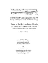
<strong>Northwest</strong> <strong>Geological</strong> <strong>Society</strong><br />
<strong>Society</strong> Field Trips in Pacific <strong>Northwest</strong> Geology<br />
The <strong>Van</strong> <strong>Zandt</strong> <strong>Dike</strong> <strong>Landslide</strong><br />
and a Medley of Other Mass-Movement Features in the<br />
Samish - South Nooksack Trough<br />
June 3, 2001<br />
Matthew J. Brunengo<br />
Geoengineers, Inc.<br />
7405 S.W. Bridgeport Rd<br />
Portland, OR 87224
This field trip guide has been re-formatted from<br />
the original document produced by the author.<br />
All the original text and illustrations are reproduced<br />
here, and nothing has been added to the<br />
document in this process. All figures and images<br />
are reproduced at the same size as in the original<br />
document.<br />
NWGS Field Guides are published by the<br />
<strong>Society</strong> with the permission of the authors,<br />
permission which is granted for personal use<br />
and educational purposes only. Commercial<br />
reproduction and sale of this material is prohibited.<br />
The NWGS assumes no responsibility for<br />
the accuracy of these guides, or for the author’s<br />
authority to extend permission for their use.<br />
Of particular note, some stops on these trips<br />
may be located on private property. Publication<br />
of this guide does not imply that public access<br />
has been granted to private property. If there<br />
is a possibility that the site might be on private<br />
property, you should assume that this is the case.<br />
Always ask permission before entering private<br />
property.
The <strong>Van</strong> <strong>Zandt</strong> <strong>Dike</strong> <strong>Landslide</strong><br />
and a Medley of Other Mass-Movement Features in the<br />
Samish - South Nooksack Trough<br />
Matthew J. Brunengo<br />
Introduction<br />
The day’s route goes north from Sedro-Woolley into Whatcom<br />
County. The main attraction is the large <strong>Van</strong> <strong>Zandt</strong> <strong>Dike</strong> landslide<br />
complex, a representative of a class of mega-landslides in this<br />
part of the North Cascades. We will spend most of the day walking<br />
and driving on this landslide, and talk about possible causes<br />
and mechanisms involved in such huge features, and the hazards<br />
and land-use ramifications associated with them.<br />
But we will also see (some at 55 mph and from a distance) and<br />
discuss a sampling of other kinds of mass movement, including<br />
smaller landslides and debris flows, sackung, and volcanic debris<br />
flows (lahars). Many of the younger features were triggered by<br />
big winter storms of recent decades, especially 1979, 1983, 1990,<br />
and 1995. In 1983, after a week of heavy rain and snowmelt, an<br />
intense downpour on the night of January 10-11 turned many<br />
babbling brooks into raging torrents. Roughly two dozen debris<br />
flows were triggered in western Whatcom and Skagit Counties<br />
between 4:30 and 8:00 am on the 11th (Gerstel and Brunengo,<br />
1994). November of 1990 brought two extraordinary rainstorms<br />
to northwest Washington, which together made it one of the<br />
wettest months on record; there were five major storms between<br />
November 1989 and April 1991. Debris torrents were triggered in<br />
many upland streams those winters, and flooding occurred several<br />
times in most of the rivers. Some of the effects are still apparent,<br />
including young floodplain erosion and deposition (now commonly<br />
occupied by young alder stands). The recent wet seasons<br />
since 1995 have also caused sliding and floods in some streams.<br />
You will see evidence of several of these processes through the<br />
day, and how they have been dealt with over the past years. In one<br />
stop, we will talk about the history of lahars flowing from Mount<br />
Baker down the forks of the Nooksack.<br />
Bedrock Geology<br />
In the North Cascades, uplift, structural deformation, and volcanism<br />
have created a complex mountain structure; hydroclimatic<br />
and geomorphic processes have carved it into an intricate landscape<br />
over a long history of erosion by mass wasting, water, and<br />
ice.<br />
The bedrock geology of northwest Washington is complicated,<br />
and this guide contains only a brief survey of the topics most<br />
relevant to the trip. More detailed information can be found in the<br />
field-trip guides of Tabor and others (1989) and Haugerud and<br />
others (1994); in papers by Cowan (1994), and Tabor (1994); and<br />
in the text accompanying the 1:100,000 compilation maps for the<br />
region (Tabor and others, 1988, 1994; Whetten and others,<br />
1988; Pessl and others, 1989). In particular, recent 7.5-minute<br />
quadrangle maps of the Deming—Kendall (Dragovich<br />
and others, 1997), and Sedro-Woolley North—Lyman (Dragovich<br />
and others, 1999, 2000) quads provides geologic<br />
maps at larger scales and more up-do-date bibliographies.<br />
This narrative is abstracted from these sources.<br />
The geologic story of the North Cascades can be divided<br />
into several phases, each having, significant consequences<br />
for the current landscape. In the earlier stages, bedrock<br />
materials were generated and deformed, building the foundations<br />
of the current range; the rocks and structures partly<br />
control current processes and forms, but little vestige of the<br />
early landscape remains. The terrain features we see today<br />
are more the products of events during later periods, which<br />
most influenced the common forms of the mountains and<br />
the distribution of surficial materials.<br />
The North Cascade Range is part of the Coast Belt collisional<br />
orogen, extending from southeast Alaska to western<br />
Washington. The Straight Creek—Fraser fault (a major<br />
N-S strike-slip break) and several NW-trending fault zones<br />
divide the range into major tectonic blocks, within which<br />
the rocks, tectonic styles, and metamorphic facies are fairly<br />
consistent. The western North Cascades and San Juan<br />
Islands constitute a regional melange, a zone of dominantly<br />
NE-dipping, SW-vergent imbricate thrust sheets. Submarine<br />
and arc volcanic rocks and associated clastic deposits, variably<br />
metamorphosed, ranging in age from early Paleozoic<br />
(possibly Precambrian) through early Cretaceous, have been<br />
juxtaposed in a stack of at least four imbricate nappes and a<br />
probable autochthon, all of which have undergone subsequent<br />
vertical and transcurrent fault¬ing. Crystalline rocks<br />
of the Cascades core, having significantly different character<br />
and history, lie east of Straight Creek fault.<br />
Thrusting, high-P metamorphism, and plutonic intrusion<br />
occurred in the Late Cretaceous (-100-80 Ma), during which<br />
plutonism, metamorphism, and deformation stitched the<br />
older terranes together. Widespread extension, translation,<br />
magmatism, and basin development during an Eocene event<br />
affected most of northwestern North America, including<br />
the Cascades orogen. The Oligocene to Holocene magmatic<br />
arc was superimposed on the whole package, and Pliocene<br />
to recent uplift and erosion brought the range to its current<br />
state.
The terranes west of the Straight Creek fault zone are divided<br />
into two major blocks by the NW- to WNW-trending Darrington-Devils<br />
Mountain fault zone (DDMfz), plus a melange<br />
belt within the fault zone. At the south end are the Western and<br />
Eastern Melange Belts (WEMB) of Mississippian(?) to lower<br />
Cretaceous rocks (including many low-P,T metamorphics). The<br />
Helena—Haystack melange (HHm) is a tectonic zone consisting<br />
of a wide variety of rocks in a serpentinite matrix. It is<br />
coincident with the DDMfz, a band of high-angle faults extending<br />
from E of Mount Vernon to a point SE of Darrington. Tabor<br />
(1994) believes that the HHm is a tectonic suture formed as the<br />
<strong>Northwest</strong> Cascades System was thrust over the WEMB; and<br />
that its assembly took place in the latest Cretaceous or early<br />
Tertiary (90-50 Ma), with subsequent strike-slip and dip-slip<br />
faulting.<br />
The <strong>Northwest</strong> Cascades system (NWCS) comprises the blocks<br />
north and east of the DDMfz (including the San Juan Islands,<br />
not discussed here). The NWCS is a tectonically imbricated<br />
stack, consisting of several nappes and an autochthon (Tabor<br />
and others, 1994). From structurally lowest to highest, they<br />
include:<br />
1) Harrison Lake terrane (autochthonous, mJr-eK):<br />
including Wells Creek Voles, Nooksack Grp.<br />
-} Excelsior thrust<br />
2) Excelsior nappe (Dev-Tr): including Chilliwack Grp,<br />
Cultus Fm.<br />
-} Sumas Mountain thrust<br />
3) Welker Peak nappe (Bell Pass melange, pDev?-K?):<br />
dominantly the Elbow Lake Fm (Brown and<br />
others, 1987), associated with a variety of smaller bodies,<br />
including Yellow Aster Complex, Twin<br />
Sisters Dunite and other ultramafics (e.g., on Sumas Mountain);<br />
parts(?) of the Vedder Complex;<br />
tonalite at Bowman Mountain.<br />
-> Shuksan thrust<br />
4) Shuksan nappe (Easton metamorphic suite): Jurassic<br />
submarine rocks that underwent early Cretaceous<br />
(pre-120 Ma) blueschist-facies (high-P, low-T) metamorphism:<br />
a. Shuksan Greenschist (and blueschist): MORB-type<br />
submarine basalt protolith (with some arc<br />
component?);<br />
b. Darrington Phyllite: sea-floor shale and minor sandstone<br />
protolith;<br />
c. Semischist and phyllite of Mount Josephine.<br />
Darrington Phyllite underlies the south half of the area we will<br />
traverse today; the semischist of Mount Josephine is exposed<br />
on Sumas Mountain.<br />
Late Cretaceous erogenic activity (overthrusting, metamorphism,<br />
and calc-alkaline plutonism) extended into the Paleocene<br />
and Eocene epochs. The area of the Cascade Range was<br />
strongly modified by a poorly-understood Eocene tectonic<br />
event, during which all the major faults in the region experienced<br />
significant motion; the Straight Creek fault underwent<br />
post-mid-Cretaceous offset estimated at 80-190 km.<br />
Eocene fluvial strata accumulated in rapidly subsiding basins<br />
in an active extensional strike-slip regime. Thick sections (up<br />
to 6000 m) of continental strata are found in several locations.<br />
Arkosic sandstone, silt-stone, conglomerate, and coal<br />
of the Chuckanut Formation crop out in one large tract across<br />
Whatcom County and several disconnected basins between<br />
Bellingham and Monte Cristo; these are probably remnants<br />
of a once-extensive fluvial deposit. The current outcrop area<br />
of Eocene sedimentary rocks in Whatcom, Skagit, and Snohomish<br />
counties is >3000 km2. Johnson (1991) identified six<br />
or seven members in the main belt, recording phases of deposition<br />
and/or deformation. To the south, sedimentary rocks<br />
included in the Barlow Pass, Swauk, and other Eocene units<br />
have long been recognized as preserved remnants of fluvial<br />
depositional basins. Evans and Ristow (1994) interpreted<br />
the southeastern belt rocks as showing an evolution from<br />
deposition in a broad basin (regional extension and subsidence),<br />
to progressive separation into smaller basins after the<br />
early-middle Eocene («50 Ma). The sandstones were strongly<br />
folded, on N- to NW-trending axes, by the late middle to late<br />
Eocene. Eocene K-Ar ages in the Cascades core record cooling<br />
by rapid unroofing of rocks that were deep and hot before<br />
the middle Eocene, implying uplift.<br />
Later (Pliocene to present?) uplift along the N-S Cascades<br />
trend raised the North Cascades several thousand meters,<br />
while erosion exposed rocks from deep in the crust. Magmatic<br />
activity in the North Cascades has continued through the<br />
Neogene, as illustrated by a long history of volcanism in the<br />
Mount Baker area, from Kulshan caldera (Hildreth, 1996),<br />
to the Black Buttes, to the present cone. Eruptions and sector<br />
collapse from Mount Baker have continued into relatively<br />
recent times. A flank collapse on the Roman Wall sent a huge<br />
debris flow down the Middle Nooksack about 6600 years<br />
ago; a more modest lahar was triggered in 1891 (Hyde and<br />
Crandell, 1975, 1978; see Dragovich and others, 1978).<br />
The geologic history and structure of the Cascades have great<br />
importance for current landforms. Figure 1 shows a digital<br />
shaded-relief map of the mountains of western Whatcom<br />
County. The orientations of rock units and faults affects<br />
ridge and valley forms and trends, such as the prominent N-S<br />
and NW-SE grain of the topography. The stratigraphic and<br />
structural juxtaposition of rock units influences the patterns<br />
of resistance to erosion, and thus the form of rock-based<br />
landforms. Resistant rock types (such as Eocene sandstones)<br />
stand highest in the landscape, holding up ridges and craggy<br />
peaks. Weaker types, such as some of the low-grade metamorphic<br />
rocks (e.g. phyllites) form lower mountains with<br />
gentler slopes, and some undergo gravitational sagging.<br />
Quaternary Geology<br />
Several periods of glaciation affected northwest Washington.<br />
The latest episode (Fraser glaciation) is the best understood,<br />
and had the greatest influence on present landforms, so is<br />
emphasized here (see Booth, 1987).
lower elevations, graded to lower ice-sheet heights and the<br />
levels of proglacial lakes and ice-marginal streams. In the<br />
north, land that had been depressed by the weight of ice<br />
was drowned by the rise of sea level: water (and glacialmarine<br />
drift) extended to (present) elevations of «30 m near<br />
Everett, and up to «150 m near the Canadian border (Dethier<br />
and others, 1995). Only when the isostatic recovery<br />
of the land had exceeded the rate of sea-level rise did the<br />
shoreline and valley bottoms of the Puget lowland emerge<br />
above salt water. A late-Pleistocene readvance or still-stand<br />
of continental ice (the Sumas stade) affected the Nooksack-<br />
Fraser delta, and possibly valleys of the Nooksack forks as<br />
well (Kovanen and Easterbrook, 1996).<br />
Figure 1. Shaded-relief image of part of western Whatcom County, from<br />
digital elevation data. Top of image at U.S.¬Canadian border (49 °N); bottom<br />
approx imates the Whatcom-Skagit county line. The <strong>Van</strong> <strong>Zandt</strong> <strong>Dike</strong> is<br />
left of center. (D.J. Miller, 1994)<br />
Alpine glaciers expanded as global climate deteriorated after about<br />
25 ka, until they reached their maximum extent about 18 ka and<br />
began to retreat. The Cordilleran ice sheet was growing in British<br />
Columbia at the same time. The Puget lobe built a platform of<br />
outwash sediment as it moved south, which remains as the great<br />
lowland fill (Booth, 1994). When the ice lobe spanned the distance<br />
between the Olympic and Cascade ranges, a proglacial lake was<br />
formed in the southern lowland; eventually the lacustrine sediments<br />
were over¬lain by prograding outwash. The region experienced<br />
maximum continental ice extent (Vashon stade) about 14-15 ka.<br />
Along the Cascades, the character of the Puget lobe margin varied<br />
from north to south. To the south, alpine glaciers had retreated, and<br />
the continental ice extended up the valleys. The ice sheet inundated<br />
the mountains from the Skagit Valley north, at maximum glaciation,<br />
with only the highest peaks peeking out. But during ice advance<br />
and retreat, water ponded in the ice-free parts of the northern<br />
valleys, and lacustrine and outwash sediments were deposited in<br />
and around them. At their highest levels the lakes drained partly<br />
by passing around the ice and through gaps in the mountains, but<br />
mainly(?) by subglacial pathways, where outflow contributed to the<br />
erosion of the Puget lowland terrain (Booth and Hallet, 1993).<br />
As continental ice wasted and then withdrew from the Puget basin,<br />
a sequence of glacial-margin channels and associated recessionalourwash<br />
deposits formed in the valleys and along the mountain<br />
front. The terraces associated with this period are at successively<br />
The period during and after the withdrawal of continental<br />
ice was a time of rapid erosion and sediment transport.<br />
During this so-called paraglacial period, valley-fill deposits<br />
were incised and excavated by streams as they reestablished<br />
their grades toward sea level across the loose,<br />
largely unvegetated landscape (Church and Ryder, 1972).<br />
The recently deglacierized hillslopes were also susceptible<br />
to rapid erosion, and mass wasting and surface erosion<br />
were probably significantly faster than before (under ice)<br />
or since (under vegetation). Some of the large landslides<br />
in the Cascades may have occurred during or immediately<br />
after deglaciation. In addition, eruptions of Glacier Peak<br />
(especially a major event about 11,250 years ago; Beget,<br />
1981, 1983) and Mount Baker (Hyde and Crandell, 1975,<br />
1978) sent large amounts of material as lahars down the<br />
Stillaguamish and Skagit valleys. The combination of<br />
paraglacial and volcanic sedimentation helped build the<br />
Skagit-Samish delta, filling around former islands that are<br />
now isolated hills in the flats.<br />
Alpine glaciers were also active in the North Cascades<br />
throughout the Quaternary. Judging from present conditions,<br />
glaciers can exist on the highest peaks and in northfacing<br />
cirques even through interglacial periods; about 750<br />
persist to this day. In colder intervals, alpine ice probably<br />
formed caps on the higher ridges and.extended into the valleys.<br />
Some advances of alpine ice probably also occurred<br />
during the Neoglacial periods of the Holocene, based on<br />
studies in the Snoqualmie, Yakima, and Wenatchee valleys,<br />
u-shaped valleys are found throughout the North Cascades.<br />
The Lower Skagit Valley<br />
Near Sedro-Woolley, -35 km from its mouth, the Skagit<br />
River passes from its E-W valley and into its delta. From<br />
high spots around town, one can see the flatlands extending<br />
more than 15 km west to Skagit Bay (see Figure 2). At<br />
the climax of Vashon glaciation, the top of the Cordilleran<br />
ice sheet was almost 1000 m above this point and extended<br />
east completely over the Cascade Range. In the lowlands to<br />
the west, under Whidbey and Camano Islands, Quaternary<br />
unconsolidated deposits (from multiple glacia-tions and<br />
interglacial intervals) reach thicknesses of w 1000 m. Since<br />
the last deglaciation, the Skagit delta complex was depos-
Figure 2. View west over the lower Skagit Valley and delta. (M.J. Brunengo, 1981)<br />
ited into the Puget estuary (which was up to ~60-90 m deeper<br />
here for a while, until isostatic rebound), filling around several<br />
bedrock and till islands that are now the hills within the delta.<br />
To the south in the distance, the hills of Devils Mountain are<br />
underlain by Cretaceous and early Tertiary rocks. The structural<br />
grain of the several WNW-trending faults (the Devils Mountain<br />
fault zone) and subparallel folds is reflected in the linearity<br />
of the ridges and valleys across these hills. The weaker strata<br />
and fault zones were gouged by water and ice into prominent<br />
grooves, many of which hold lakes or wet¬lands. These structural<br />
and topographic trends persist west toward Fidalgo and<br />
the San Juan Islands; and east toward Lake Cavanaugh and the<br />
Stillaguamish basin.<br />
The foothills and highlands were opened chiefly by loggers,<br />
first with hand saws and draft animals, later with steam tools<br />
and railroads. Dirt tracks were turned into railroads, and<br />
dozens of lumber, shingle, and tie mills were strung along the<br />
main railways. Logging locomotives climbed Devils Mountain<br />
and Cultus Mountain beginning in 1903, and the lower<br />
slopes were cut by the 1920s. The Skagit Mill Co sawmill<br />
(just E of Lyman) operated until 1936, and the railroads until<br />
1938. Soundview Pulp Co succeeded Lyman Timber; by the<br />
time the show was sold to Scott Paper (the immediate predeas<br />
well as farming and logging area.<br />
East of Day Creek, SW-dipping Chuckanut<br />
rocks are exposed around Cumberland<br />
Creek. This is the north end of a faultbounded<br />
block in which a syncline has<br />
formed in the Tertiary sandstones, squeezed<br />
between blocks of Shuksan (E) and Darrington<br />
(W) rocks. The Skagit Cumberland<br />
Coal Co mine was located along the creek:<br />
five prospect runnels were driven into the<br />
hillside, but the mine apparently never<br />
reached production. Iron-ore prospects and<br />
claims lie in the metamorphic rocks east of<br />
the creek.<br />
There are also small bodies of Chuckanut<br />
on the north side of the Skagit, at Bacus<br />
Hill and on the south edge of Lyman Hill<br />
(site of the Cokedale coal mine). Hamilton,<br />
on the north bank of the river, was settled<br />
in 1877; in the 1890s it was being touted<br />
as another Pittsburgh of the Pacific Slope<br />
because of the presence of coking coal<br />
(particularly from the Cokedale mine) and<br />
magnetite ore. Part of the town is being moved because of<br />
flood problems. Bacus Hill, to the NW, was the proposed site<br />
for the Skagit nuclear plant (Adair and others, 1989).<br />
Lyman Hill, NE of Sedro-Woolley, is underlain by Darrington<br />
Phyllite (discussed later). Lyman Pass, bet¬ween Lyman Hill<br />
and Mount Josephine, is another NW-trending slot, probably<br />
fault controlled, through which ice and water flowed<br />
from the South Nooksack valley into the Skagit. Due north of<br />
town, there is a major gap between Lyman Hill and Anderson<br />
Mountain, to the west. We will be driving though that gap,<br />
through the upper Samish valley and into the South Nooksack.<br />
The large massif SE is the Cultus Mountains. The west side<br />
is underlain mostly by Darrington Phyllite, the east side by<br />
slightly younger metaplutonic and metasedimentary rocks of<br />
the Helena-Haystack melange. It may be possible to see large<br />
landslides on the west side of Cultus: the most obvious is ~500<br />
m wide and 450 m high. There are many such features on Cultus<br />
and Haystack mountains, most of them situated along fault<br />
contacts and/or incised stream valleys. Miller and others (1985)<br />
speculated that many of these landslides occurred shortly after<br />
deglaciation.<br />
Just east of Cultus, the Day Creek valley is one of several NWtrending<br />
troughs holding late-glacial and re¬cessional sediments.<br />
It has a low divide (
cessor of Crown Pacific) in 1951, most of the logging rails were<br />
gone from the hillsides. The higher slopes of the region were cut<br />
in the 1960-’70s, using chain-saws, trucks, and cable-yarding<br />
equipment, after the rail lines were abandoned (mostly in the<br />
late 1920s-’30s). Some of the low-elevation plantations are now<br />
being harvested again.<br />
In its heyday around 1910, Sedro-Woolley had three sawmills,<br />
10 shingle mills, eight logging camps, and a population of about<br />
3000 (Erickson, 1994). The shell of the Skagit Steel & Iron<br />
Works plant, over the years a major manufacturer of logging<br />
equipment such as railroad locomotives, steam donkeys, saws<br />
and sawmill machinery, and yarding towers, lies at the curve<br />
of SR 20. The town was a crossroad for the railways of the<br />
region. The Seattle, Lake Shore & Eastern ran N-S; the Seattle<br />
& Northern, Fairhaven & Southern, and Puget Sound & Baker<br />
River railways all ran E-W in the valley; and many short logging<br />
railroads stretched from the hills to mills or log dumps<br />
(Thompson, 1989). Most of the major lines were eventually<br />
merged into the Northern Pacific, the Great Northern, or the<br />
Chicago, Milwaukee, St. Paul & Pacific (Milwaukee Road).<br />
We will travel north on State Route 9, which extends from<br />
Bothell to Sumas, usually in N-S—trending structural and<br />
glacial valleys east of the central Puget lowlands. Although a<br />
secondary road now, the SR 9 route is one of the oldest roads<br />
in western Washington. By 1859 the military road linking Fort<br />
Steilacoom, Seattle, and Bellingham passed this way. The route<br />
was utilized by the Seattle, Lake Shore & Eastern Rail¬road<br />
(SLS&E), built in 1890-91; tracks can be seen in places along<br />
the highway (the old railroad bridge is next to the current highway<br />
bridge across the Skagit River). The SLS&E was acquired<br />
in 1897 by the Seattle & International Railroad (S&I), which in<br />
turn was controlled by and ultimately (1901) absorbed into the<br />
Northern Pacific as its main line into British Columbia. The N-P<br />
eventually merged into Burlington Northern, and recently into<br />
the Burlington Northern—Santa Fe; trains still run on this line.<br />
Parts of the road route were straightened and improved to act as<br />
an alternate (to US 99 and 1-5) N-S road in the 1960s, and some<br />
stretches are currently being expanded to handle increasing<br />
suburban traffic.<br />
Road Log (in miles)<br />
0.0 Intersection SR 20 and SR 9 (N), east edge of Sedro-<br />
Woolley; drive north on SR 9. You are climbing the scarp of an<br />
extensive glacial-drift terrace at 50-100 m, made of or mantled<br />
by till, outwash, and glacial-marine drift (see Dragovich and<br />
others, 1999, 2000). The rolling surface is pierced by bedrock<br />
knobs such as Butler Hill, and fragmented by postglacial incision<br />
in the cut made by the Samish River (both to the, west).<br />
0.8 <strong>Northwest</strong> regional office of the Department of Natural<br />
Resources; maps and other information available during business<br />
hours.<br />
1.4 As the road turns slightly to the NE, get a view of the<br />
southwest (Hansen Creek) side of Lyman Hill<br />
(Darrington Phyllite, mantled with till in places).<br />
3.0 Attain the highest level on the terrace («100 m). A<br />
proglacial lake dammed by glaciers in the Nooksack trough<br />
probably spilled south through this gap; marine water rose<br />
slightly above this elevation and extended through the gap<br />
while this area was isostatically depressed at the end of the<br />
Fraser glaciation. Anderson Mountain (phyllite) to the left.<br />
4.5 Driving north, you get a better view of the valley<br />
between Anderson Mountain and Lyman Hill (on<br />
the south edge of Fig. 1, left of center). This is one of several<br />
N-S valleys that separate large blocks of Darrington Phyllite;<br />
others include the troughs occupied by Lyman Pass<br />
and the south ends of Lake Whatcom and Samish Lake.<br />
These breaks were undoubtedly expanded by glacial scour,<br />
subglacial flow, and fluvial action by outwash streams, but<br />
the ultimate reasons for their existence are unclear. Until<br />
recently, no one(?) had mapped any structures through the<br />
valleys, probably because the rocks give too few clues for<br />
proper stratigraphic identification of faults or folds. Dragovich<br />
and others (1999) mapped a concealed fault through this<br />
gap.<br />
Intermediate-grade metamorphic rocks constitute one of the<br />
widespread bad-actor units of the North Cascades. Darrington<br />
Phyllite (quartzose graphitic phyllite, with sericite,<br />
albite, muscovite, and chlorite; named for Darrington, in<br />
Shohomish County) is one of the most common, underlying<br />
most of the western hills between the Skagit and the Middle<br />
Nooksack. It is foliated, fissile, and jointed (Figure 3), and<br />
all of these discontinuities contribute to a general weakness<br />
that makes the rock susceptible to mass movement. Slopes<br />
underlain by phyllite fail by slump-earthflow, sackung,<br />
and slow rotation of individual blocks within a soil matrix<br />
(Thorsen, 1989). In general, these weaker rocks cannot hold<br />
high-relief slopes, and form more subdued topography than<br />
the stronger Chuckanut sandstones and some of the other<br />
pre-Tertiary rocks. The soils tend to be clayey, cohesive, and<br />
poorly permeable, so slopes have developed dense drainage<br />
networks; roads built on them must contend with high runoff<br />
rates and the possibility of gullying.<br />
Anderson Mountain and Lyman Hill are the sites of many<br />
sackung features (described by Thorsen, 1989), partly because<br />
they are bounded by broad structural-glacial valleys.<br />
As the combination of glacial and fluvial erosion removes<br />
material from their sides, the mechanically weak phyllite<br />
mountains sag toward the valleys. Identifiable features<br />
include bulging lower slopes, anti-slope scarps, and longitudinal<br />
cracks; there are many discontinuous troughs and<br />
uphill-facing scarps in the summit ridge of Lyman Hill (Figures<br />
4 and 5). These materials also seem to have a penchant<br />
for large earthflows. Although the erosion that triggered the<br />
sagging may occur mostly during glacial episodes, the masserosion<br />
processes persist to the present (although the relative<br />
rates are unknown).
5.6 As the bench narrows, the road drops over the scarp<br />
toward the Samish Valley bottom.<br />
5.9 Cross the railroad tracks (the old SLS&E route again).<br />
6.2 After driving north parallel to the tracks for about 0.3 mi,<br />
the highway veers NW around the alluvial fan built by<br />
Thunder Creek. The creek deposited the cone across the glacial<br />
bench, then incised it; the secondary fan on the valley<br />
floor has deflected the Samish River to the west, and helped<br />
form the ponded wetlands upstream.<br />
6.6 Samish River bridge. Most of the community of<br />
Prairie is located on the fan, which is out of the floodplain<br />
and thus relatively dry; the exposure to other hazards (debris<br />
flows) has been less apparent in the past.<br />
7.3 On the west side of the valley, the road rises and<br />
falls across several debris/alluvial fans. Note the clusters<br />
of farm buildings on each fan, and the small creeks that<br />
built them (although they are about 2-3 km long and fall<br />
900 m).<br />
A minor disaster occurred on the SE slopes of Anderson<br />
Mountain on 10 Jan 1923 (60 years to the day be¬fore a<br />
more recent episode). Three men were bringing a locomotive<br />
back from repairs in Sedro-Woolley. After leaving the<br />
main N-P line north of here, they were climbing toward<br />
the McCuish Logging Co camp in the pre-dawn darkness,<br />
and failed to notice that heavy rains and flows had washed<br />
out a long section of trestle. All three were killed in the<br />
30-m fall.<br />
7.6 Mills Creek, in view briefly on the opposite side of<br />
the valley, provides an illustration of the problems of lessobvious<br />
and infrequent geologic hazards.<br />
After a week of heavy rain and snowmelt, an intense<br />
downpour on the night of 10-11 January 1983 triggered<br />
about two dozen debris torrents in western Whatcom and<br />
Skagit counties early on the 11th (Gerstel and Bru-nengo,<br />
1994). Here, the buildings of the Hofmann veal farm were<br />
located on a low alluvial fan, out of the boggy soils of the<br />
Samish floodplain. However, a small landslide involving<br />
the fill of an orphaned forest road turned into a debris<br />
flow that scoured its way -2.5 km downstream and blew<br />
through the farm, killing Hans Hofrnann (the only human<br />
fatality that day) and about 200 calves. Figure 6 shows the<br />
path and deposit of the 1983 debris flow. Another torrent<br />
flowed down Mills Creek the following winter, causing<br />
more damage to the remaining buildings.<br />
Such processes had occurred in the region before; a lawsuit<br />
stemming from a 1979 torrent in Sygitowicz Creek (a<br />
Figure3. (top) Exposure of Darrington Phyllite, on Lyman Hill.<br />
(M. J. Brunengo, 1983)<br />
Figure 4. (middle) Sackung features in phyllite: linear trough and<br />
uphill-facing scarp, near the top of Lyman Hill. (M. J. Brunengo,<br />
1984)<br />
Figure 5. (bottom)Sackung features in phyllite: pond in linear<br />
trough, summit ridge of Lyman Hill. (M. J. Brunengo, 1984)
Figure 6. Track and deposit of the Mills Creek debris flow of 11 Jan 1983:<br />
source on Lyman Hill, flowed to Samish River (bottom); damage to Hofmann<br />
farm buildings. (Copyright R.R. Geppert, 1983)<br />
tributary of the South Nooksack, discussed later) was in process<br />
when the 1983 storm occurred. Of course, many other lawsuits<br />
followed the 1983 storm (ask GWT and MJB). But the 1983<br />
events spurred the beginning of some changes (although they<br />
took years) in hazard evaluation, forest-practices regulation,<br />
land-use planning, and road engineering.<br />
10.4 The former mill town of Wickersham was also built on<br />
a fan. It was site of the junction between the Northern Pacific<br />
(previously SLS&E) railway line in the valley and the N-P’s<br />
route to Lake Whatcom and Bellingham.<br />
If it is clear, the craggy, glaciated Twin Sisters, capping one<br />
of the largest dunite bodies in the world, may be visible at 2<br />
o’clock.<br />
worst mine disaster in state history. Although farming and<br />
timber production remain important land uses, recreational<br />
homes and the expanding suburbs now occupy much of the<br />
lower ground, especially by the lakes.<br />
Bellingham’s water supply also passes through this gap. Water<br />
is diverted from the Middle Fork Nooksack into a 17-km<br />
aqueduct (buried most of the way). The pipe ends at Mirror<br />
Lake, just west of here, where sediment is allowed to settle.<br />
The water then passes into and through Lake Whatcom and<br />
is collected at the far end. There are concerns over sediment<br />
from logging in the lake’s basin, as well as pollution from<br />
septic systems contributed by the basin’s growing population.<br />
11.1 On a fine day, you can view to the right (E) the north<br />
end of Lyman Hill, the wide valley between Lyman and Blue<br />
Mountain, the craggy Twin Sisters, and the top of Mount<br />
Baker.<br />
12.9 Saxon Rd. These flats form an indistinct divide<br />
between the Samish and Nooksack drainage basins. A small<br />
ditch to the east is either the head of the Samish (as on the<br />
1:100,000 map and streams catalogue), or flows north to the<br />
South Nooksack (as on the 7.5-minute topographic map).<br />
The divides probably shift around, as floods and deposition<br />
alter the loyalties of the small streams; ditching of farm fields<br />
has probably contributed to the changes. This may be an important<br />
issue, however, to anadromous fish: a salmon trying<br />
to return to a natal stream around here might have to choose<br />
between river mouths that are 25 km apart, and a run 45 km<br />
up the Samish or 78 km up the Nooksack. Since returning<br />
fish key onto the scent of a stream and the main stem into<br />
which it flows, it is unlikely that a Nooksack fish would find<br />
the scent should its tributary be diverted into the Samish (or<br />
vice versa) due to natural or man-made diversion. The end<br />
result would probably be a drop in salmonid production in<br />
the pirated stream, until enough straying occurs to reseed it.<br />
The South Nooksack River flows into the trough from the<br />
southeast. This segment is about 20 km upstream from the<br />
confluence with the north fork. The uppermost basin is underlain<br />
by dunite and other old rocks,but the reach immediately<br />
upstream has incised through phyllite hills. The river<br />
flows alternately on valley floors partly filled with drift and<br />
alluvium, and through narrow slots between the hills and/or<br />
terraces.<br />
10.9 Junction with Park Rd, leading to Lake Whatcom. The<br />
road and railroad (now a tourist line) pass through a narrow E-<br />
W gap between Anderson (S) and Stewart (N) mountains.<br />
In times past, lumber and coal were the prime products of this<br />
area. In the 1910s-’20s, the Wood-Knight Lumber Co mill stood<br />
at South Bay of Lake Whatcom, and there was a logging camp<br />
at Park. The Blue Canyon coal mine, at the SE end of the lake,<br />
operated from 1891-1919. It was the second most productive<br />
mine in the coal belt of Whatcom and Skagit counties (*250,000<br />
metric t), and gave its name to the Blue Canyon coal zone (base<br />
of the Chuckanut). An explosion in 1894 killed 23 men, the<br />
Gold was discovered in this river in 1860; by 1885, several<br />
hundred prospectors lived in the town of Livewood, near the<br />
mouth of Skookum Creek. Bloedel-Donovan Lumber Mills<br />
purchased much of the area in 1920, and logged until about<br />
1941. Their main rail line along the river led to >80 km of<br />
track up on the benchy phyllite slopes between Skookum<br />
Creek and the upper South Nooksack. Sediment originating<br />
from landslides and logging roads on the erodible soils<br />
produces high turbidity levels during the rainy months, and<br />
contributes to degradation of fish habitat.
13.8 Outcrops of Darrington Phyllite exposed in cuts on<br />
the left (W) side of the road, part of the south end of Stewart<br />
Mountain.<br />
13.8 Entering Acme, former site of a sawmill and a shingle<br />
mill, built on the fan of Jones Creek. You are at the base<br />
of Stewart Mountain; the contact between phyllite and the<br />
overlying sandstone angles down to the north, crossing the<br />
middle of the Jones Creek basin. (We will discuss the stability<br />
characteristics of Chuckanut rocks a bit later.) Jones Creek<br />
was struck by debris torrents in January 1983 and twice in<br />
November 1990.<br />
Slightly north is the basin of McCarty Creek. The phyllite-sandstone<br />
contact intersects the valley floor there, and<br />
the McCarty basin is underlain by the sandstone and related<br />
sedimentary rocks of the Chuckanut Formation. This creek<br />
also experienced debris flows in January 1983 and November<br />
1990. Evidence of torrent passage in the channel includes logjams,<br />
run-ups at channel bends, broad channel deposits, and<br />
nested terraces. A large landslide occurred in sandstone on the<br />
south slopes, probably during the 1990 storms. The landslide<br />
formed a dam, blocking the creek and impounding water and<br />
sediment. Fortunately for downstream residents, McCarty Creek<br />
was able to incise through the deposit along the left bank, prior<br />
to (potentially catastrophic) failure of the dam and generation of<br />
a dam-break flood.<br />
15.3 Slow down as you cross the South Nooksack River; turn<br />
right onto Mosquito Lake Rd just past the bridge.<br />
16.0 After crossing the valley floor, you begin to rise into the<br />
hills, through the gap between Blue Mountain and <strong>Van</strong> <strong>Zandt</strong><br />
<strong>Dike</strong>. On Figure 1, the <strong>Dike</strong> is the crudely arrowhead-shaped<br />
body (pointing north) near the center of the map.<br />
J.M. <strong>Van</strong> <strong>Zandt</strong> homesteaded west of the <strong>Dike</strong> in 1883; a post<br />
office was established there and given his name in 1892. The<br />
designation of the ridge as a “dike” is curious: it may have been<br />
so named because it seems to be a high barrier, blocking the<br />
rivers flowing west. (Perhaps the presence of Dutch and German<br />
settlers in the area had something to do with the name.) The<br />
<strong>Dike</strong> was first harvested beginning in the late 1800s, using steam<br />
donkeys and railroads. At one time logging supported five large<br />
mills in the South Nooksack valley between Acme and Deming.<br />
A fire in 1915 burned much of the forest (especially the north<br />
end), as well as several homesteads.<br />
17.2 Turn left onto the gravel road, entering the <strong>Van</strong> <strong>Zandt</strong><br />
block of state land (8560 ac), managed for timber production<br />
by the state Department of Natural Resources, under<br />
the <strong>Van</strong> <strong>Zandt</strong> block plan (WDNR, 1992).<br />
19.5 Turn off to the left on a logging spur, in a recent<br />
clearing with good views to the west. Near here (about at<br />
Tinling Creek), the road crosses the contact between phyllite<br />
(below and S) and sandstone (N).<br />
Stop 1. Slope processes in terrestrial sedimentary<br />
rocks.<br />
Fluvially-deposited feld-spathic sandstones (with lesser<br />
conglomerates, siltstones, and coal) of the Chuckanut<br />
Formation are preserved in a broad area extending from<br />
Bellingham Bay to Mount Baker. (The name was applied by<br />
Capt Henry Roeder in 1852 to Chuckanut Bay; it apparently<br />
means “long beach far from a narrow entrance” [Hitchman,<br />
1985].) The <strong>Dike</strong> is underlain by N- to NW-dipping strata<br />
of the Bellingham Bay member of Johnson (1985, 1991).<br />
Across the valley to the west, the north part of Stewart<br />
Mountain is made of Bellingham Bay and Padden member<br />
rocks (see Dragovich and others, 1997); the “Slide Mountain”<br />
massif to the northeast (visible from the next stop) is<br />
also Chuckanut Formation.<br />
The Chuckanut and related rocks are relatively strong, and<br />
typically form prominent ridges and steep slopes. (Glacial<br />
scour during the ice ages was responsible for some of the<br />
Figure 7. Debris slides—flows on slopes above Sygitowicz Creek:<br />
from 1979 and/or 1983 storm. (Copyright R.R. Geppert, 1983)
Figure 8. Track and deposit<br />
of the Sygitowicz Creek<br />
debris flow of 11 Jan 1983:<br />
source on Stewart Mountain,<br />
flowed to South Nooksack<br />
River (bottom). (Copyright<br />
R.R. Geppert, 1983)<br />
relief.) But they weather into sandy, low-cohesion soils with<br />
little internal strength, and storm-water tends to perch on the<br />
soil-bedrock surfaces. As a result of the combination of high<br />
relief, low cohesion, and abrupt strength and ground-water<br />
boundaries at the soil-rock interface, slopes on these rocks<br />
are highly susceptible to debris slides and flows. Harvesting<br />
of trees causes loss of the component of strength contributed<br />
by tree roots, which can be critical on marginally stable<br />
slopes (see Buchanan and Savigny, 1990). The attitude of<br />
bedding planes and joint surfaces also partly controls massmovement<br />
processes. Discontinuities in the rock, whether<br />
sandstone-shale contacts or joint openings, are major strength<br />
boundaries. Thus, the strength avail¬able to resist downslope<br />
stress varies depending on the orientation and steepness of the<br />
discontinuities. Soil and rock slides are more likely where the<br />
beds dip steeply parallel to the slope (dip-slopes); slab failures<br />
are relatively common in these rocks. On slopes crossing the<br />
beds (scarp-slopes and ribbed slopes, in the term of Fiksdal<br />
and Brunengo, 1981), debris slides also occur, but rock slides<br />
are apparently less common. Erosion by stream or wave action<br />
(or ice, during glaciations) can cause oversteepening, in<br />
which beds day¬light out of the slope; excavation for roads or<br />
buildings can have the same effect. Because of their manifest<br />
tendencies to cause trouble, slopes in terrestrial sandstones are<br />
often accorded special attention in planning and regulation.<br />
The valley of Sygitowicz Creek is directly west, on Stewart<br />
Mountain. Several slides on the steep tributary slopes caused<br />
a debris flow in January 1979, which damaged the Sygitowicz<br />
house, located near where the creek flowed out of the mountains.<br />
While a lawsuit over that event was in progress, the<br />
January 1983 storm caused further sliding and another debris<br />
flow. Figure 7 shows some of the slides; Figure 8 illustrates<br />
deposition across the gentle fan and floodplain, to the South<br />
Nooksack. Hundreds of individual landslides in that event fed<br />
torrents in at least 10 streams on Stewart Mountain, damaging<br />
several homes in the South Nooksack Valley and along Lake<br />
Whatcom.<br />
Rocks of the Chuckanut Formation are also susceptible to huge<br />
landslides, possibly as a result of seismic shaking; this subject<br />
will be discussed in the next few stops.<br />
21.0 Stockpile of phyllite boulders and dirt, near a junction<br />
(stay right). The materials are from the DNR’s McCoy Grade<br />
Pit, on the west side of Bowman Mountain (across the valley to<br />
the ESE). You may note that much of the road material on the<br />
<strong>Dike</strong> is phyllitic.<br />
21.1 Stay left on road DE-N-1000, as the more heavily-traveled<br />
DE-N-1600 swings to the right. Note the irregular topography,<br />
with small wetlands in places.<br />
22.7 New spur roads to the right and left; continue straight.<br />
23.0 Entering newer cuts on the left; note the lumpy topography.<br />
23.3 Approaching a blocked spur road on the left - park at<br />
the junction, or in wide spots to the south on the right. (The end<br />
of the main road is ~0.3 mi north; it’s possible to turn around<br />
there.)<br />
Stop 2. <strong>Van</strong> <strong>Zandt</strong> <strong>Dike</strong> landslide. This will be the starting<br />
point for a walk to the edge of the <strong>Van</strong> <strong>Zandt</strong> <strong>Dike</strong> landslide;<br />
those who wish to will walk down to the bottom, where the
vans will pick us up. Take appropriate clothes, water, etc. for<br />
a hike of ~2-5 km, with a drop of -500 m.<br />
Figure 9 is a topographic map of the area, with geologic<br />
mapping by Mary Raines, who studied the slide for a thesis<br />
at Western Washington University; Figure 10 shows sections<br />
across the slide and the valley. We are located near the end of<br />
the old road in the south part of section 10 (T 38 N, R 5 E),<br />
toward the north end of the relatively flat top of the <strong>Van</strong> <strong>Zandt</strong><br />
<strong>Dike</strong>. Some of the older timber stands in sec 10 (and down on<br />
the western face) are survivors of the 1915 fire, while others<br />
(the tight dog-hair) grew afterward.<br />
The DNR began trying to harvest trees in this part of the <strong>Dike</strong><br />
in about 1985. In 1986-87, Jerry Thorsen was assigned to<br />
evaluate the geologic, geomorphic, and stability characteristics<br />
of the <strong>Dike</strong> Dish sale area. His sketched drawing and section<br />
are included as Figures 11 and 12. No one was proposing<br />
harvest on the scarp face, but there was concern (among<br />
the neighbors at the bottom, especially) that logging on the<br />
plateau might cause hydrologic or strength changes that<br />
could contribute to instability on the steep slopes. This effort<br />
eventually led to landform mapping and instability-hazard<br />
rating for the entire <strong>Van</strong> <strong>Zandt</strong> block (WDNR, 1992). (A more<br />
detailed map of the slide will be examined on the site, and we<br />
will discuss the possible relationships between timber harvest<br />
and slope instability on the slopes.) Ultimately, the block plan<br />
began to be implemented in the late 1990s; the area here and<br />
to the west (Thousand Dishes unit 1) was cut in 1997 or 1998.<br />
Climb over the multiple tank-traps and head west on the catroad.<br />
It takes about 10 minutes to walk generally westward<br />
toward the edge of the <strong>Dike</strong> (~1 km; stay left at a couple of<br />
junctions). From the end of a track (next to a large slash pile),<br />
cut across to the treeline (by the low knoll, above the area<br />
marked Devil’s Slide on the map). While walking, you might<br />
get a view of the mountains to the northeast, or even Mount<br />
Baker.<br />
Note the terrain of the top of the <strong>Dike</strong>. Although pretty flat<br />
for the North Cascades, there are some interesting features up<br />
here. There are a series of discontinuous, NNW-SSE—trending<br />
low ridges, separated by shallow swales (some with boggy<br />
bottoms), rising generally to the NW. These seem to reflect<br />
the edges of NW-striking beds within the Chuckanut, where<br />
weaker layers were preferentially scoured out by glacial ice,<br />
leaving the more resistant strata standing out. Features such<br />
as these are quite prominent in other places in the region,<br />
especially on Chuckanut Mountain. Fiksdal and Brunengo<br />
(1981) called similar landforms on Slide Mountain (to the<br />
ME) “Chuckanut ribbed slopes” (in contrast to dip-slopes and<br />
scarp-slopes).<br />
As you approach the western edge, look for collapse features<br />
(initially subtle, becoming decidedly not-so-subtle). At the<br />
face, we should be near the right end of the sketch (Fig. 11).<br />
We will turn right (N) and walk along the edge for ~0.5 km,<br />
to the bight in the edge west of the next knoll.<br />
Figure 13 is a photo of the <strong>Van</strong> <strong>Zandt</strong> <strong>Dike</strong> and landslide<br />
from the west. The NW corner of the <strong>Dike</strong> collapsed toward<br />
the South Nooksack valley, sometime since the last glaciation.<br />
The scarp is ~5 km long and the deposit covers «15 km2.<br />
Except for the mapping of Thorsen and Raines, the slide has<br />
not yet been studied in great detail. Its age and dynamics are<br />
speculative, although hummocky deposits and blocks of fartraveled<br />
debris suggest catastrophic initiation and rapid movement<br />
(sturzstrom?), perhaps triggered by an earthquake. It is<br />
not even known whether the landslide dammed the Nooksack,<br />
but it seems likely. The orientation of the sandstone layers,<br />
and their interbed and joint discontinuities, probably affected<br />
the strength of the materials along the free face left by erosion.<br />
Two faults apparently intercept the northwestern corner<br />
of the <strong>Dike</strong> (see Dragovich and others, 1997), and these may<br />
have contributed by weakening some of the rocks.<br />
As you approach the western edge, look for collapse features<br />
(initially subtle, becoming decidedly not-so-subtle). At the<br />
face, we should be near the right end of the sketch (Fig. 11).<br />
We will turn right (N) and walk along the edge for -0.5 km, to<br />
the bight in the edge west of the next knoll.<br />
Figure 13 is a photo of the <strong>Van</strong> <strong>Zandt</strong> <strong>Dike</strong> and landslide<br />
from the west. The NW comer of the <strong>Dike</strong> collapsed toward<br />
the South Nooksack valley, sometime since the last glaciation.<br />
The scarp is ~5 km long and the deposit covers ~\5 km2.<br />
Except for the mapping of Thorsen and Raines, the slide has<br />
not yet been studied in great detail. Its age and dynamics are<br />
speculative, although hummocky deposits and blocks of fartraveled<br />
debris suggest catastrophic initiation and rapid movement<br />
(sturzstrom?), perhaps triggered by an earthquake. It is<br />
not even known whether the landslide dammed the Nooksack,<br />
but it seems likely. The orientation of the sandstone layers,<br />
and their interbed and joint discontinuities, probably affected<br />
the strength of the materials along the free face left by erosion.<br />
Two faults apparently intercept the northwestern corner<br />
of the <strong>Dike</strong> (see Dragovich and others, 1997), and these may<br />
have contributed by weakening some of the rocks.<br />
The headwall is now a complex feature, involving sagging,<br />
slab failure, rockfall, earthflow, and debris sliding (see Fig.<br />
11 and 12). Figures 14, 15, and 16 show some of the ground<br />
disruption around the top of the landslide scarp; Figure<br />
17 illustrates the effect on an ill-positioned tree (a natural<br />
strain-gauge?). Minor (relatively) bluffs, uphill-facing scarps,<br />
benches, and large cracks are exposed on the slopes, among<br />
earthflows, talus deposits, and slide tracks (of various ages<br />
and activity) (see Fig. 11 and 12).<br />
It is possible to get some appreciation for the activity occurring<br />
along this slope in a walk of about 2 km north along the<br />
edge, to the earthflow (large indentation in the NW corner of<br />
section 10). To see all of the features illustrated on the sketch<br />
and cross-section takes several hours. Most of us will hike<br />
down across the upper scarps and slopes, ending at the dirt<br />
road near the Vollmer home (east of the center of section 9).<br />
In the context of forest management, this landslide suggests
Figure 9. <strong>Van</strong> <strong>Zandt</strong> landslide complex and geologic map, near Deming, Washington; on USGS Deming 7.5 minute quad. (M.A. Raines)
Figure 10. Cross-section of the <strong>Van</strong> <strong>Zandt</strong> landslide: A-A’ (east-west, top), and B-B’ (SW-NE, bottom); see Fig. 9 for section locations. (M.A.<br />
Raines)
Figure 11. <strong>Van</strong> <strong>Zandt</strong> landslide complex: oblique field sketch of central headwall area. (G.W. Thorsen, 1987)<br />
several questions and issues. If you were asked about management<br />
of this slope, how would you respond? Would it be all right<br />
to cut these trees? Do root strength or hillslope hydrology have<br />
anything to do with these huge slides? There are old cat-tracks<br />
and stumps around - parts of this slope have been logged before,<br />
and most of it burned in 1915. Did past cutting have any effects?<br />
Would harvest aid fire prevention, and thus reduce the possibility<br />
of subsequent erosion? What is the hazard level for buildings<br />
below?<br />
If returning to the vehicles, walk back to the east (as long as you<br />
haven’t gone too far north, almost any route east will intercept<br />
either a road or the old skid trail.)<br />
The road log continues, for those driving to the pick-up point.<br />
25.2 Junction with road DE-N-1600.<br />
25.3 Rock-pile junction; stay left.<br />
26.8 Spur on right with good views to the west.<br />
29.1 Junction with Mosquito Lake Rd; turn right (W).<br />
Drive back down across the South Nooksack valley.<br />
30.8 Junction with SR 9; turn right (N).<br />
33.0 As you drive north, you get views of Stewart Mountain<br />
(W), the <strong>Van</strong> <strong>Zandt</strong> <strong>Dike</strong> (E), and Sumas Mountain (ahead).<br />
The south side of Sumas (in view) is underlain by folded and<br />
faulted Chuckanut sedimentary rocks, with several landslides.<br />
On the north and west sides, metamorphic rocks of the Excelsior<br />
and Welker Peak nappes are exposed, beneath discontinuous<br />
mantles of Tertiary sediments and glacial drift (Tabor<br />
and others, 1994; see Dragovich and others, 1997)<br />
.<br />
35.0 Begin to see the scarp of the <strong>Van</strong> <strong>Zandt</strong> <strong>Dike</strong> landslide,<br />
including patches of bare rock.<br />
As the highway swings to the right (entering the town of <strong>Van</strong><br />
<strong>Zandt</strong>), cross Black Slough, a parallel side-channel of the<br />
South Nooksack that collects drainage from the <strong>Dike</strong> face<br />
(from Tinling Creek north) and back-terrace wetlands of the
Figure 12. <strong>Van</strong> <strong>Zandt</strong> landslide complex: field section (see Fig. 11 for location). (G.W. Thorsen, 1986)<br />
floodplain. Streams like this are typically valuable fish habitat, if<br />
not too damaged by sedimentation or channelization.<br />
35.5<br />
Just past the <strong>Van</strong> <strong>Zandt</strong> Store and the railroad tracks, turn right<br />
on Potter Rd (around a barricade) and drive uphill (east) 0.6 mi<br />
to a T-junction at Linnell Rd. Turn left (N); then, in 0.1 mi, turn<br />
right (E) up Schorn Rd. In about 0.2 mi, the pavement ends;<br />
follow the gravel road that goes to the left (N). In about 0.4 mi,<br />
there is a Y-junction, with a horse pasture and barn ahead - take<br />
the right fork. Drive another 0.3 mi (generally uphill), to where<br />
the Vollmers’ driveway goes right; park in the overgrown dirt<br />
road on the left.<br />
37.1<br />
Stop 3. Middle of the <strong>Van</strong> <strong>Zandt</strong> <strong>Dike</strong> landslide. The Vollmers<br />
have kindly given us permis¬sion to pick up the NWGS hikers<br />
here. If not on an organized trip, please respect their property.<br />
The Vollmer property abuts the state-owned <strong>Van</strong> <strong>Zandt</strong> block to<br />
the east. Sneaking across the property line is a bulge (about 400<br />
m long by 200 m wide) mapped by Thorsen as a slump-earthflow.<br />
He noted that the last local adjustments seemed to have<br />
occurred in the 1940s, but steeper slopes uphill were freshly<br />
exposed as recently as 1975.<br />
Return to the vehicles, and retrace the route (dirt road, Schom<br />
Rd, Linnell Rd, Potter Rd) back down the hill.<br />
37.4 At the first junction (Clendenen place), a debris flow<br />
came through on 15 December 1999; its source was up on<br />
the face, just inside the SW corner of section 10 (N. Wolff<br />
and J. Grizzell, WDNR, pers. comm.). The torrent apparently<br />
jumped a bend in the channel, and flowed out through the<br />
horse-pasture. Although the horse has not offered an opinion,<br />
the human residents were pretty concerned.<br />
As you go down the hill, note the topography in this area (see<br />
also Fig. 9): parts are hummocky (original landslide?), and<br />
parts are smoother (subsequent deposits of talus from rockfalls,<br />
debris fans, alluvium, other processes?).<br />
39.1 Junction with SR 9 in the community of <strong>Van</strong> <strong>Zandt</strong>.<br />
The parking lot of the old store on the west<br />
side of the highway is a good spot from which to appreciate<br />
the southern part of the landslide scarp (perhaps<br />
while enjoying some post-hike refreshments).<br />
When the time is right - turn north onto SR 9. The highway<br />
goes north (along the quarter-section line), on low floodplain<br />
that seems to be ponded behind the landslide (see Fig. 9).
Figure 13. Oblique aerial view (to the east) of the <strong>Van</strong> <strong>Zandt</strong> <strong>Dike</strong>, landslide complex, and Nooksack River; Mount Baker and Twin Sisters on<br />
the horizon. (P.T. Pringle)<br />
Figure 14. VZD landslide headwall area: ground cracks.<br />
(MJ. Brunengo, 1993?)<br />
Figure 15. VZD landslide headwall area: ground cracks.<br />
(M.J. Brunengo, 1993?)
Figure 16. VZD land¬slide headwall<br />
area: ground cracks. (P. T. Pringle,<br />
1995)<br />
39.6 Just past where the highway turns to the NW, rum right<br />
onto a gravel road (heading NE). Rise onto the edge of the<br />
landslide deposit: note that the terrain here is rather hummocky,<br />
with small marshes in the low spots.<br />
39.8 Stop near the Olympic Pipe Line crossing; park in the<br />
best spot available.<br />
Stop 4. Hummocky deposit of VZD landslide. The gravel<br />
road has been cut along the edge of a hummock. Take a few<br />
minutes to check out the characteristics of the material (is it a<br />
diamicton? sandstone boulders? what’s the matrix?).<br />
Continue driving east ~0.25 mi to a turn-around point in a<br />
driveway; return west to the highway.<br />
40.5 Turn right (NW) onto SR 9; continue across the toe<br />
of the landslide. Although it’s hard to see through the vegetation,<br />
the South Nooksack is meandering north just to the left (as<br />
close as 150 m as you pass the cemetery; see Fig. 9 and 10).<br />
41.3 Watch for the junction with Rutsatz Rd - turn right. (If<br />
you cross the Nooksack bridge, you’ve gone too far.) This road<br />
generally follows the edge of the landslide, the top of a higher<br />
fluvial and/or ourwash terrace (lower terraces and floodplain to<br />
the left), and eventually skirts the edge of the bedrock of<br />
the north end of the <strong>Dike</strong>.<br />
42.2 As the road makes a near-90° curve to the left, we cross<br />
from the landslide edge to a terrace, mapped as Qso2 on<br />
Raines’ map (Fig. 9), and Sumas stade outwash (Qgos) by Dragovich<br />
and others (1997). Watch for the gravel pit on the right<br />
- note the well-sorted gravels.<br />
42.6 The road rises over a low hill. This was mapped as<br />
another piece of the landslide toe by Raines,<br />
interpreted as lying on top of the terrace deposits (see Fig. 10,<br />
section B-B’); this would allow dating of<br />
the <strong>Van</strong> <strong>Zandt</strong> <strong>Dike</strong> slide as younger than that terrace deposit.<br />
However, the map of Dragovich and others (1997) does not<br />
show a protuberance of the slide deposit in this area.<br />
43.0 The road hugs the edge of the <strong>Dike</strong>, as the floodplain<br />
of the North Nooksack occupies most of the narrow (about 1<br />
km wide) gap between the <strong>Dike</strong> and Sumas Mountain. Watch<br />
for outcrops of Chuckanut sandstone on the right (dips NNW,<br />
37-57°).<br />
As the road turns from NE to east, the terrace widens - but this<br />
terrace is on the Middle Fork Nooksack lahar.<br />
44.4 At the end of the paved road, park on the left (river<br />
side). We may look at the outcrops in the terrace scarp, or walk<br />
south oh the driveway.<br />
Stop 5. Middle Fork lahar. We are located off the NE corner<br />
of the <strong>Van</strong> <strong>Zandt</strong> <strong>Dike</strong>, along the Middle Fork of the Nooksack.<br />
Figure 18 is an aerial view of the valley, looking up toward its<br />
source on Mount Baker. This valley is mapped as a breached<br />
anticline, between the mountains of Chuckanut rocks between<br />
the forks of the Nooksack (E) and the <strong>Van</strong> <strong>Zandt</strong> <strong>Dike</strong> and<br />
Sumas Mountain (W). Here the Middle Fork (flowing north<br />
in this reach) joins the North Fork (flowing south) (confusing<br />
enough?). Large land¬slides and volcanic debris flows have<br />
affected the drainage and topography in this area.<br />
The Middle Fork lahar, the largest recorded from Mount<br />
Baker, was identified by Hyde and Crandell (1975, 1978),<br />
and described further by Kovanen (1996; Easterbrook and<br />
Kovanen, 1996) and Dragovich and others (1997). About 6600<br />
yr ago, sector collapse of the Roman Wall triggered a volcanic<br />
debris flow that traveled down the Middle Fork at least as far<br />
as Cedarville (or Nugents Corner), and perhaps all the way to<br />
Bellingham Bay. It was a clay-rich (cohesive) lahar, leaving<br />
large clasts in a silty-clayey matrix, mostly of Baker andesite.
Figure 18. Oblique aerial view (to<br />
the east) of the Middle Nooksack<br />
Valley (fore-ground and right), up<br />
to source on Mount Baker. Mountains<br />
in the center underlain by<br />
Chuckanut Formation rocks (note<br />
bedding indicators); Canyon Lake<br />
Creek basin (shaded) and fan on left<br />
side. (M. J. Brunengo, 1981)<br />
This terrace is the downstream end of the extensive lahar deposit,<br />
with variable thicknesses (3 to 25 m) of material. Perhaps<br />
the flow was constricted and ponded as it moved around the<br />
<strong>Dike</strong>; certainly much of the deposit has been removed downstream<br />
by the river. Wood (including large logs, some charred)<br />
yielded 14C ages of 6000 BP (Hyde and Crandell, 1978) and<br />
5650± 110 BP (Kovanen, 1996). In the same eruptive episode,<br />
a hydrovolcanic eruption and second collapse caused another<br />
lahar in the Middle Fork, which spilled into the Baker River<br />
valley as well.<br />
Figure 19, taken from Scott and others (2000), shows the extent<br />
of volcanic hazards around Mount Baker.<br />
Along the river, there are exposures of a Chuckanut-bearing<br />
diamicton overlain by two lahars (P. Pringle, pers. pomm.). The<br />
older diamicton has a date of about 6900 BP, and may have<br />
come from a large landslide and debris flow in Canyon Creek,<br />
downstream and across the Middle Fork (the shadowed valley<br />
on the left of Fig. 18). This basin has a landslide-dammed lake<br />
~5 km upstream. Very young radiocarbon dates (170± 100 and<br />
160± 100 BP) from snags in the lake suggest that the latest<br />
movement may have happened in the last century, perhaps as a<br />
result of the 1872 Chelan-North Cascades earthquake, but the<br />
slide complex is probably older (Pringle and others, 1998).<br />
Note also (if the weather and sun angle cooperate) the topography<br />
of the mountains to the east, underlain by Chuckanut<br />
rocks. Porter Creek (just upstream) experienced debris torrents<br />
in 1983 and 1990; aggradation during 1990 high flows plugged<br />
the bridge and forced the creek 25 m north over the road. We<br />
might also be able to see the snags on the upper slopes, remains<br />
of the Porter Creek fire(s) of the 1930s and late 1950s.<br />
Drive back (west) on Rutsatz Rd to the highway.<br />
48.3 Junction with SR 9 - turn right (N), cross the bridge,<br />
and watch for a turn-off (marked “rest area”) on the right.<br />
48.5 Pull into the old bridge approach (blocked by Jersey<br />
barriers near the entrance) and park. Walk up to the edge of<br />
the low bluff along the river; at this spot, you can get a partial<br />
view of the scarp of the VZD landslide, across the river to the<br />
east.<br />
Stop 6. Wrap-up. There are many large bedrock landslides in<br />
the western North Cascades, most dominantly in Chuckanut<br />
Formation rocks. The <strong>Van</strong> <strong>Zandt</strong> <strong>Dike</strong> landslide that we have<br />
just experienced is one of the largest. But there almost three<br />
dozen more Chuckanut mega-slides in the region (Fiksdal and<br />
Brunengo, 1980, 1981; Schmidt and Montgomery, 1995); Figure<br />
20 shows two of them. Geologists have lavished a bit of<br />
attention on these features over the past two decades, but the<br />
specific causes (or at least, the relative importance of several<br />
causes) are yet to be determined.<br />
In general, a landslide occurs when the forces of gravity<br />
overcome the strength of the materials on a slope. Leaving<br />
aside the possibility of sudden gravity storms, the required<br />
ingredients are a slope of some kind and some change in the<br />
relationship between stresses and strains, due to a decline in<br />
strength and/or some triggering event that serves to break the<br />
last bonds of internal friction and cohesion. There are plenty<br />
of slopes in the North Cascades, thanks to mountain uplift and<br />
erosion by water, ice, and mass wasting. The dynamic factors<br />
- strength reduction, weathering, storm or seismic triggers<br />
- are harder to unravel.<br />
UW scientists have developed sophisticated techniques of<br />
geomorphic analysis regarding large landslides. Dan Miller<br />
(1993, 1995) generated computer models that combine
Figure 19. Geographic features<br />
and volcanic-hazard zones<br />
around Mount Baker, especially<br />
in the Nooksack and Skagit<br />
basins. (Scott and others, 2000)<br />
stress-strength equations and GIS technology to investigate<br />
spatial variation in topography and rock properties. In relation<br />
to Chuckanut landslides, Kevin Schmidt (1994; Schmidt and<br />
Montgomery, 1995) collected topographic and rock-strength<br />
data and used them, along with physical models, to make<br />
inferences regarding the maximum topographic relief that can<br />
be sustained by various rock types. Using the mega-slides to<br />
indicate maximum relief (i.e., the landslides show that the<br />
maxima have been exceeded at those places), they found that<br />
conventional laboratory values of strength parameters overestimate<br />
the numbers back-calculated from maximum relief. In the<br />
case of the Chuckanut, the mountain-scale friction angle (cp) is<br />
about 17° for dip slopes and ~21 ° for anti-dip (scarp) slopes;<br />
corresponding cohesion values are -120 and 150 kPa, respectively.<br />
These are all well below the quantities that would be<br />
measured on intact rock samples, but similar to those obtained<br />
from1 the weakest interbed materials. Thus, rock mass strength<br />
at the mountain scale is less dependent on micro-scale material<br />
strength, and more controlled by the macro-discontinuities<br />
(joints, bedding, folds, faults). Their results indicate that topographic<br />
relief is determined by large-scale rock strength, as well<br />
as the interaction of uplift and incision.<br />
Long-term weathering, uplift, and incision can alter the balance<br />
of stress and strength toward slope movement, but there is usually<br />
some triggering event that provides the final push to initiate<br />
it. With small debris slides, it is typically a big storm that<br />
saturates the mantle and increases pore-water pressures, reducing<br />
the effective strength of the mass; we have seen examples<br />
from the storms of 1983 and 1990. For larger landslides,<br />
increased water input due to several months or years of abovenormal<br />
precipitation (or significant land-use changes) can be<br />
enough to initiate, accelerate, or reactivate a deep-seated slide.<br />
For these mega-slides, though, more serious triggers would<br />
seem to be required, if only because we don’t see them popping<br />
off in every big storm or run of wet winters.<br />
Schmidt and Montgomery (1995) also considered the role of<br />
triggers in large landslides, whether saturation (climatic) or<br />
seismic acceleration. Although they found that these reduced<br />
the threshold strengths, they did not conclude that either was<br />
responsible for the Chuckanut slides. Others have considered<br />
the role of earthquakes in triggering them. Engebretson and<br />
others (1995, 1996; also Kovanen and Easterbrook, 1996)<br />
noted the spatial coincidence of large landslides with a cluster<br />
of recorded earthquakes in this part of the North Cascades,<br />
especially the magnitude 5.2 Deming quake of 14 April 1990<br />
and its aftershocks. The Deming quake (epicenter just north<br />
of the hill north of us) and its aftershocks were shallow, about<br />
2.5-4 km deep, so the shaking was significant around here.<br />
Dragovich and others (1997) interpreted the seismic data to<br />
infer that the quakes occurred at or near the Chuckanut sandstone—Darrington<br />
phyllite contact, along the Macauley Creek<br />
thrust and its conjugate faults, all within about 3 km of here.<br />
They also noted the apparent correlation between seismicity<br />
and the large number of landslides in the area.
Figure 20. Aerial view of mega-slides in Chuckanut<br />
rocks: center and right (edge); Middle Nooksack at<br />
bottom right. (M. J. Brunengo, 1981)<br />
So earthquakes may be an important trigger for large landslides<br />
in the area. It would be helpful to know the dates of major<br />
slope movements, to determine if many slides occurred in a few<br />
distinct periods. So far, there are too few dates to know for sure.<br />
Engebretson and others (1996) reported limiting radiocarbon<br />
dates from the <strong>Van</strong> <strong>Zandt</strong> landslide, of 2700 and 2400 BP from<br />
buried forests, and 1600 BP on peat on the deposit. Pringle and<br />
others (1998) interpreted calibrated 14C dates, mostly from<br />
drowned snags in landslide-dammed lakes, around several slides<br />
in the North Cascades. From the Nooksack basin, some of these<br />
were:<br />
1) Church Mountain megaslide/sturzstrom, near Glacier:<br />
about 207 BC;<br />
2) Canyon Lake, east of Welcome: snags have 14C ages of<br />
160 and 170 BP, perhaps related to the<br />
1872 North Cascades earthquake; but part of an older, undated<br />
landslide complex;<br />
3) Racehorse Creek rock slide—debris avalanche, SE of<br />
Kendall: about 1981 BC; part reactivated<br />
in about 1950.<br />
This record is so far too scant to draw many conclusions,<br />
especially without a good history of earthquakes with which to<br />
compare them. One inference that seems justified is that not all<br />
such mega-slides occurred during and immediately following<br />
deglaciation: some may have happened then, but several have<br />
occurred during the past few millennia of the Holocene.<br />
Option: If there is time - walk west on the trail along the river,<br />
under the two bridges. If the water level is low, drop down to<br />
the gravel bars, and walk downstream to a point where you can<br />
see the confluence of the forks of the Nooksack. The North Fork<br />
carries more water and sediment (coarser as well?); although the<br />
North Fork is entering the South Fork’s structural trough, the latter<br />
has been pushed to the west side of the valley, and is flowing<br />
along the bluffs. The <strong>Van</strong> <strong>Zandt</strong> <strong>Dike</strong> landslide probably pushed<br />
the South Fork against Stewart Mountain, perhaps damming it<br />
for a while; at least, the slide deposit seems to have influenced<br />
the gradient of the South Fork, and thus its meandering,<br />
floodplain, etc. In early historic times, logjams extended<br />
at least 3 km up the South Nooksack from here (Sedell and<br />
Luchessa, 1981), and people could cross the river on them.<br />
This is the end of the guided trip. The junction of SR 9 with<br />
SR 542 (Mount Baker Highway) is about 0.4 mi north; turn<br />
left to go west to Bellingham.<br />
However, taking SR 9 south will allow you to see views of<br />
the South Nooksack Valley, the <strong>Van</strong> <strong>Zandt</strong> <strong>Dike</strong>, and other<br />
features from a different perspective (or things that the hikers<br />
may not have seen at all). It takes about 30 minutes to<br />
drive to Sedro-Woolley, 45 minutes to 1-5 at Burlington, and<br />
about 80 minutes to the Mukilteo exit from 1-5.<br />
Acknowledgements<br />
Most of my acquaintance with the region around the <strong>Van</strong><br />
<strong>Zandt</strong> <strong>Dike</strong> occurred during a mapping project for WDNR<br />
in 1979-81, after the 1983 storm, and then again in the<br />
early 1990s while preparing a GSA field trip. Jerry Thorsen<br />
(WDNR, ret.) already had years of study in the area notched<br />
in his belt by then, and continued to be a source of valuable<br />
information. Much of the information on the VZD slide presented<br />
here is based on his work. Mary Raines, Dan Miller,<br />
and Kevin Schmidt helped lead the 1994 GSA trip, and have<br />
been generous with their insights about the region. Pat Pringle<br />
has provided intelligence on the lahars and landslides<br />
of the area. Recent mapping by Joe Dragovich and colleagues<br />
has contributed new knowledge that has improved<br />
understanding of the area, and this guide. Local details were<br />
supplied by Jeff Grizzell, Noel Wolff, and Nancy Joseph (all<br />
of WDNR <strong>Northwest</strong> Region), and Sharon Digby (Whatcom<br />
Co). The Vollmers kindly granted permission for us to cross
their property. Illustrations for this guide were contributed by<br />
Rollie Geppert, Dan Miller, Pat Pringle, Mary Raines, and Jerry<br />
Thorsen.<br />
References<br />
Field trip guides<br />
Brunengo, M.J., D.J. Miller, K.M. Schmidt, L.E. Benda, B.D.<br />
Collins, G.R. Pess,M.A. Raines, and J.N. Thompson, 1994,<br />
Earth, water, trees, and fish — geomorphology and land-use<br />
problems in forested mountains of the Pacific <strong>Northwest</strong>:<br />
unpubl field trip guide, 1994 <strong>Geological</strong> <strong>Society</strong> of America<br />
annual meeting, Seattle<br />
Easterbrook, D.J., 1994, Stratigraphy and chronology of earlyto<br />
late-Pleistocene glacial and interglacial sediments in the<br />
Puget Lowland, Washington: p J1-J38 in D.A. Swanson and<br />
R.A. Haugerud, eds, Geologic field trips in the Pacific <strong>Northwest</strong>:<br />
1994 <strong>Geological</strong> <strong>Society</strong> of America annual meeting,<br />
Seattle<br />
Haugerud, R.A., E.H. Brown, R.W. Tabor, B.J. Kriens, and M.F.<br />
McGroder, 1994, Late Cretaceous and early Tertiary orogeny in<br />
the North Cascades: p 2E-1 to 2E-51 in D.A. Swanson and R.A.<br />
Haugerud, eds, Geologic field trips in the Pacific <strong>Northwest</strong>:<br />
1994 <strong>Geological</strong> <strong>Society</strong> of America annual meeting, Seattle<br />
Johnson, S.Y., 1985, Stratigraphy and sedimentology of the<br />
Eocene Chuckanut Formation on Bellingham Bay, Washington:<br />
in <strong>Geological</strong> <strong>Society</strong> of America, Cordilleran Section meeting,<br />
<strong>Van</strong>couver, B.C.; Field Trip 6<br />
Kovanen, D.J., and D.J. Easterbrook, 1996, Extensive readvance<br />
of late Pleistocene (Younger Dryas?) alpine glaciers in<br />
the Nooksack River valley, following retreat of the Cordilleran<br />
ice sheet, North Cascades, Washington: Friends of the Pleistocene,<br />
Pacific Coast Cell, Field Trip Guidebook, 74 p<br />
Tabor, R.W, R.H. Haugerud, E.H. Brown, R.S. Babcock, and<br />
R.B. Miller, 1989, Accreted terranes of the North Cascades<br />
Range, Washington: American Geophysical Union, 28th International<br />
<strong>Geological</strong> Congress, Field Trip Guidebook T307, ix +<br />
62 p<br />
Bedrock Geology<br />
Brown, E.H., and others, 1987, Geologic map of the <strong>Northwest</strong><br />
Cascades, Washington: <strong>Geological</strong> <strong>Society</strong> of America, Map<br />
and Chart MC-61, scale 1:100,000, 10 p<br />
Cowan, D.S., 1994, Alternative hypotheses for the mid-Cretaceous<br />
paleogeography of the western Cordillera: GSA Today, v<br />
4.7.181-186<br />
Dragovich, J.D., O.K. Norman, R.A. Haugerud, and P.T. Pringle,<br />
1997, Geologic map and interpreted geologic history of the<br />
Kendall and Deming 7.5-minute quadrangles, western Whatcom<br />
County, Washington: Washington Division of Geology and<br />
Earth Resources, Open File Report 97-2, 39 p<br />
Dragovich, J.D., P.T. Pringle, K. Parkinson, A. Dunn, and S.<br />
Kahle, 1997, Nooksack and Columbia Valley stratigraphy and<br />
cross sections, Kendall and Deming 7.5-minute quadrangles,<br />
western Whatcom County, Washington: Washington Division<br />
of Geology and Earth Resources, Open File Report 97-3, 39 p<br />
Dragovich, J.D., D.K. Norman, T.J. Lapen, and G. Anderson,<br />
1999, Geologic map of the Sedro-Woolley North and Lyman<br />
7.5-minute quadrangles, western Skagit County, Washington:<br />
Washington Division of Geology and Earth Resources, Open<br />
File Report 99-3, 37 p<br />
Dragovich, J.D., D.K. Norman, and G. Anderson, 2000,<br />
Interpreted geologic history of the Sedro-Woolley North and<br />
Lyman 7.5-minute quadrangles, western Skagit County, Washington:<br />
Washington Division of Geology and Earth Resources,<br />
Open File Report 2000-1, 71 p<br />
Evans, I.E., and R.J. Ristow Jr., 1994, Depositional history<br />
of the southeastern outcrop belt of the Chuckanut Formation:<br />
implications for the Darrington-Devil’s Mountain and Straight<br />
Creek fault zones, Washington (U.S.A.): Canadian Journal of<br />
Earth Sciences, v 31.1727-1743<br />
Johnson, S.Y., 1991, Sedimentation and tectonic setting of the<br />
Chuckanut Formation, northwest Wash¬ington: Washington<br />
Geology, v 19.4.12-13<br />
Misch, Peter, 1966, Tectonic evolution of the northern<br />
Cascades of Washington - a west-cordilleran case history: p<br />
101-148 in A symposium on the tectonic history and mineral<br />
deposits of the western Cordillera in British Columbia and<br />
neighbouring parts of the United States, <strong>Van</strong>couver, 1964: Canadian<br />
Institute of Mining and Metallurgy, Special Volume 8<br />
Tabor, R.W., 1994, Late Mesozoic and possible early Tertiary<br />
accretion in western Washington State: the Helena-Haystack<br />
melange and the Darrington-Devils Mountain fault zone: <strong>Geological</strong><br />
<strong>Society</strong> of America Bulletin, v 106.2.217-232<br />
Tabor, R.W, D.B. Booth, J.A. <strong>Van</strong>ce, A.B. Ford, and M.H.<br />
Ort, 1988, Preliminary geologic map of the Sauk River 30- by<br />
60-minute quadrangle, Washington: U.S. <strong>Geological</strong> Survey<br />
Open-File Map OF-88-692, 50 p,’scale 1:100,000<br />
Tabor, R.W, R.H. Haugerud, D.B. Booth, and E.H. Brown,<br />
1994, Preliminary geologic map of the Mount Baker 30- by<br />
60-minute quadrangle, Washington: U.S. <strong>Geological</strong> Survey<br />
Open File Report 94-403,43 p + app, scale 1:100,000<br />
Whetten, J.T., P.R. Carroll, H.D. Gower, E.H. Brown, and F.<br />
Pessl, Jr., 1988, Bedrock geologic map of the Port Townsend<br />
30- by 60-minute quadrangle, Puget Sound region, Washington:<br />
U.S. <strong>Geological</strong> Survey Miscellaneous Investigations<br />
Map 1-1198-G, scale 1:100,000
Quaternary Geology, Maps<br />
Booth, D.B., 1987, Timing and processes of deglaciation along<br />
the southern margin of the Cordilleran ice sheet: in W.F. Ruddiman,<br />
H.E. Wright, Jr., eds, North America and adjacent oceans<br />
during the last deglaciation: <strong>Geological</strong> <strong>Society</strong> of America,<br />
Geology of North America (DNAG), v K-3.71-90<br />
Booth, D.B., 1994, Glaciofluvial infilling and scour of the Puget<br />
Lowland, Washington, during ice-sheet glaciation: Geology, v<br />
22.8.695-698<br />
Booth, D.B., and B. Hallet, 1993, Channel networks carved by<br />
subglacial water: observations and recon¬struction in the eastern<br />
Puget Lowland of Washington: <strong>Geological</strong> <strong>Society</strong> of America<br />
Bulletin, v 105.5.671-683<br />
Dethier, D.P., F. Pessl, Jr., R.F. Keuler, M.A. Balzarini, and D.R<br />
Pevear, 1995, Late Wisconsinan glacioma-rine deposition and<br />
isostatic re-bound, northern Puget Lowland, Washington: <strong>Geological</strong><br />
<strong>Society</strong> of America Bulletin, v 107.11.1288-1303<br />
Dragovich, J.D., J.E. Zollweg, A.I. Qamar, and D.K. Norman,<br />
1997, Macauley Creek thrust, the 1990 5.2-magnitude Deming<br />
earthquake, and Quaternary geologic anomalies in the Deming<br />
area, western Whatcom County, Washington - Causes and effects?:<br />
Washington Geology, v 25.2.15-27<br />
Heller, P.L., and D.P. Dethier, 1981, Surficial and environmental<br />
geology of the lower Baker Valley, Skagit County, Washington:<br />
<strong>Northwest</strong> Science, v 55.2.145-155<br />
Pessl, Fred Jr., D.P. Dethier, D.B. Booth, and J.P. Minard, 1989,<br />
Surficial geologic map of the Port Townsend 30- by 60-minute<br />
quadrangle, Puget Sound region, Washington: U.S. <strong>Geological</strong><br />
Survey Miscellaneous Investigations Map I-1198-G, 13 p, scale<br />
1:100,000<br />
Thorson, R.M., 1989, Glacio-isostatic response of the Puget<br />
Sound area, Washington: <strong>Geological</strong> <strong>Society</strong> of America Bulletin,<br />
v 101.1163-1174<br />
Geomorphology, Volcanoes, Natural Hazards, Engineering<br />
Geology<br />
Adair, M.J., R.H. Talmage, T.W. Crosby, and S.M. Testa, 1989,<br />
Geology and seismicity of the Skagit nuclear power plant site:<br />
p 607-624, in R.W. Galster, chairman, Engineering geology in<br />
Washington: Washington Division of Geology and Earth Resources<br />
Bulletin 78<br />
Beget, J.E., 1981, Postglacial eruption history and volcanic<br />
hazards at Glacier Peak, Washington: unpubl Ph.D. dissertation,<br />
Univ of Washington, Seattle, 193 p<br />
Beget, J.E., 1983, Glacier Peak, Washington: a potentially hazardous<br />
Cascade volcano: Environmental Geology, v 5.2.83-92<br />
Benda, L., T.J. Beechie, R.C. Wissmar, and A. Johnson, 1992,<br />
Morphology and evolution of salmonid habitats in a recently<br />
deglaciated river basin, Washington state, USA: Canadian<br />
Journal of Fisheries and Aquatic Science, v 49.1246-1256<br />
Buchanan, Peter, and K.W. Savigny, 1990, Factors controlling<br />
debris avalanche initiation: Canadian Geotechnical Journal, v<br />
27.659-675<br />
Carpenter, M.R., 1993, The Church Mountain srurzstrom<br />
(megalandslide) near Glacier, Washington: unpubl MS thesis,<br />
Western Washington Univ, 71 p<br />
Church, Michael, and J.M. Ryder, 1972, Paraglacial sedimentation:<br />
a consideration of fluvial pro-cesses conditioned<br />
by glaciation: <strong>Geological</strong> <strong>Society</strong> of America Bulletin, v<br />
83.3059-3072<br />
Church, Michael, and O. Slaymaker, 1989, Disequilibrium<br />
of Holocene sediment yield in glaciated British Columbia:<br />
Nature, v 337.452-454<br />
Easterbrook, D.J., and D.J. Kovanen, 1996, Far-reaching mid-<br />
Holocene lahar from Mt. Baker in the Nooksack Valley of the<br />
North Cascades, WA [abstr]: <strong>Geological</strong> <strong>Society</strong> of America,<br />
Abstracts with Programs, v 28.5.64<br />
Engebretson, D.C., D.J. Easterbrook, and D.J. Kovanen, 1995,<br />
Relationship of very large, deep-seated, bedrock landslides<br />
and concentrated, shallow earthquakes [abstr]: <strong>Geological</strong><br />
<strong>Society</strong> of America, Abstracts with Programs, v 27.6.A-377<br />
Engebretson, D.C., D.J. Easterbrook, and D.J. Kovanen, 1996,<br />
Triggering of very large, deep-seated,<br />
bedrock landslides by concentrated, shallow earthquakes<br />
in the North cascades, WA [abstr]: <strong>Geological</strong> <strong>Society</strong> of<br />
America, Abstracts with Programs, v 28.5.64<br />
Fiksdal, A.J., and M.J. Brunengo, 1980, Forest Slope Stability<br />
Project, Phase I: Washington Department of Ecology, Technical<br />
Report 80-2a, 14 p<br />
Fiksdal, A.J., and M.J. Brunengo, 1981, Forest Slope Stability<br />
Project, Phase II: Washington Department of Ecology, Technical<br />
Report 81-14, 62 p<br />
Galster, R.W., H.A. Coombs, 1989, Cascade ice border dams:<br />
geologic setting: p 203-208, in R.W. Galster, chairman,<br />
Engineering geology in Washington: Washington Division of<br />
Geology and Earth Resources Bulletin 78<br />
Gerstel, W.J., and M.J. Brunengo, 1994, Mass wasting on the<br />
urban fringe: Washington Geology, v 22.2.11-17<br />
Heller, P.L., 1979a, Map showing landslides and relative slope<br />
stability of Quaternary deposits of the lower Skagit and Baker<br />
Valleys, North Cascades, Washington: U.S. <strong>Geological</strong> Survey<br />
Open-File Rept 79-963, 30p
Heller, P.L., 1979b, Map showing surficial geology of parts of<br />
the lower Skagit and Baker Valleys, North Cascades, Washington:<br />
U.S. <strong>Geological</strong> Survey Open-File Report 79-964, 16p<br />
Hener, r.L., i^si, small lanasnae types and controls in glacial<br />
deposits: lower Skagit River drainage, northern Cascade Range,<br />
Washington: Environmental Geology, v 3.221-22<br />
Hildreth, Wes, 1996, Kulshan caldera - a Quaternary subglacial<br />
caldera in the North Cascades, Washingto <strong>Geological</strong> <strong>Society</strong><br />
of America Bulletin, v 108.7.786-793<br />
Hyde, J.H., and D.R. Crandell, 1975, Origin and age of<br />
postglacial deposits and assessment of potential hazards from<br />
future eruptions of Mount Baker, Washington: U.S. <strong>Geological</strong><br />
Survey, Open-File Report 75-286, 22 p<br />
Hyde, J.H., and D.R. Crandell, 1978, Postglacial volcanic deposits<br />
at Mount Baker, Washington, and potential hazards from<br />
future eruptions: U.S. <strong>Geological</strong> Survey, Professional Paper<br />
1022-C, 17 p<br />
Jordan, Peter, and O. Slaymaker, 1991, Holocene sediment<br />
production in Lillooet River basin, British Columbia: a sediment<br />
budget approach: Geographic physique et Quaternaire, v<br />
45.1.45-57<br />
Kovanen, D.J., 1996, Extensive late-Pleistocene alpine glaciation<br />
in the Nooksack River Valley, North Cascades, Washington:<br />
unpubl MS thesis, Western Washington Univ, 186 p<br />
Miller, D.J., 1993, Topographically induced stress fields and<br />
patterns of bedrock fracturing: unpubl PhD dissertation, University<br />
of Washington, 286 p<br />
Miller, D.J., 1995, Coupling GIS with physical models to assess<br />
deep-seated landslide hazards: Environ¬mental and Engineering<br />
Geosciences, v 1.3.263-276<br />
Miller, R.D., S.A. Safioles, and F. Pessl, Jr., 1985, Map showing<br />
relative slope stability in the Port Town-send 30’ x 60’<br />
quadrangle, Puget Sound region, Washington: U.S. <strong>Geological</strong><br />
Survey Miscellaneous Investigations Map 1-1198-C, scale<br />
1:100,000<br />
Pringle, P.T., R.L. Schuster, and R.L. Logan, 1998, New radiocarbon<br />
ages of major landslides in the Cascade Range, Washington:<br />
Washington Geology, v 26.1.31-39; Errata: Washington<br />
Geology, v 26.2.69<br />
Schmidt, K.M., 1994, Mountain scale strength properties, deepseated<br />
landsliding, and relief limits: unpubl MS thesis, Univ of<br />
Washington, 166 p<br />
Schmidt, K.M., and D.R. Montgomery, 1995, Limits to relief:<br />
Science, v 270.617-620<br />
Scott, K.M., W. Hildreth, and C.A. Gardner, 2000, Mount<br />
Baker - living with an active volcano: U.S. <strong>Geological</strong> Survey,<br />
Fact Sheet 059-00,4 p<br />
Thorsen, G.W., 1989, <strong>Landslide</strong> provinces in Washington:<br />
p 71-89, in R.W. Galster, chairman, Engineering geology<br />
in Washington: Washington Division of Geology and Earth<br />
Resources Bulletin 78<br />
Thorsen, G.W., 1989, Splitting and sagging mountains: Washington<br />
Geologic Newsletter, v 17.4.3-13<br />
Turner, A.K., and R.L. Schuster, eds, 1996, <strong>Landslide</strong>s<br />
- Investigation and Mitigation: National Research Council,<br />
Transportation Research Board, Special Report 247, 675 p\<br />
Natural History, Vegetation, Regional History<br />
Agee, J.K., 1990, The historical role of fire in Pacific <strong>Northwest</strong><br />
forests: p 25-38, in J.D. Walstad, S.R. Radosevich, and<br />
D.V. Sandberg, eds., Natural and Prescribed Fire in Pacific<br />
<strong>Northwest</strong> Forests: Oregon State University Press, Corvallis<br />
Brubaker, L.B., 1991, Climate change and the origin of oldgrowth<br />
Douglas-fir forests in the Puget Lowland: p 17-24, in<br />
L.F. Ruggiero, K.B. Aubry, A.B. Carey, and M.H. Ruff, eds,<br />
Wildlife and vegetation of unmanaged Douglas-fir forests:<br />
U.S. Forest Service, General Technical Report PNW-GTR-<br />
285<br />
Erickson, K.A., 1994, Lumber Ghosts — A Travel Guide to<br />
the Historic Lumber Towns of the Pacific <strong>Northwest</strong>: Pruett<br />
Publishing Co, Boulder, Colorado, 132 p<br />
Franklin, J.F., and C.T. Dyrness, 1973, Natural vegetation of<br />
Oregon and Washington: U.S. Forest Service, General Technical<br />
Report PNW-8,417 p<br />
Gannett, Henry, 1902, The forests of Washington — a revision<br />
of estimates: U.S. <strong>Geological</strong> Survey, Professional Paper<br />
5, 38 p (including a map showing classification of lands, by<br />
G.H. Plummer, F.G. Plummer, and J.H. Rankine)<br />
Hitchman, Robert, 1985, Place Names of Washington: Washington<br />
State Historical <strong>Society</strong>, Tacoma, 340 p (with 1986<br />
addendum)<br />
Kruckeberg, A.R., 1991, The Natural History of Puget Sound<br />
Country: University of Washington Press, Seattle, 468 p<br />
Oliver, C.D., A.B. Adams, and R.J. Zasoski, 1985, Disturbance<br />
patterns and forest development in a recently deglaciated<br />
valley in the northwestern Cascade Range of Washington,<br />
U.S.A.: Canadian Journal of Forest Research, v 15.1.221-232<br />
Phillips, E.L., 1966, Washington climate for northeast Clallam,<br />
northeast Jefferson, Island, San Juan,Skagit, Snohomish,<br />
and Whatcom Counties: Washington State Univ, Coop Extension<br />
Service, EM 2626
Sedell, J.R., and K.J. Luchessa, 1981, Using the historical record<br />
as an aid to salmonid habitat enhancement: in Symposium on<br />
Acquisition and Utilization of Aquatic Habitat Inventory Information,<br />
Portland, Oreg; Western Division, American Fisheries<br />
<strong>Society</strong><br />
Swanson, F.J., J.F. Franklin, and J.R. Sedell, 1990, Landscape<br />
patterns, disturbance, and management in the Pacific <strong>Northwest</strong>,<br />
USA: p 191-213, in I.S. Zonneveld and R.T.T. Forman, eds,<br />
Changing Landscapes: An Ecological Perspective:-Springer-Verlag,<br />
New York, 286 p<br />
Thompson, D.B., 1989, Logging Railroads in Skagit County:<br />
<strong>Northwest</strong> Short Line, Seattle, 296 p<br />
Washington Dept. of Natural Resources, 1992, <strong>Van</strong> <strong>Zandt</strong> block<br />
plan: draft block plan, September 1992, 54 p + appendices<br />
Whitney, Stephen, 1985, Western forests: Audubon <strong>Society</strong> Nature<br />
Guide, Alfred A. Knopf, New York, 672 P