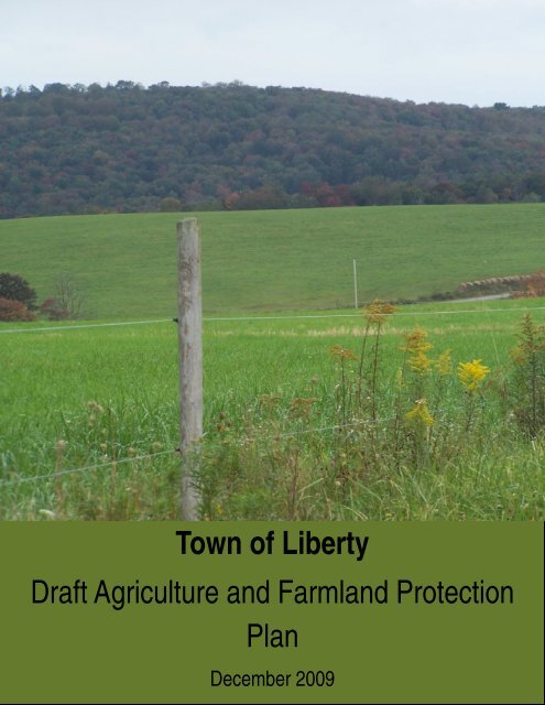
Agriculture and Farmland Protection Plan - Town of Liberty
Agriculture and Farmland Protection Plan - Town of Liberty
Agriculture and Farmland Protection Plan - Town of Liberty

You also want an ePaper? Increase the reach of your titles
YUMPU automatically turns print PDFs into web optimized ePapers that Google loves.
<strong>Town</strong> <strong>of</strong> <strong>Liberty</strong><br />
Draft <strong>Agriculture</strong> <strong>and</strong> Farml<strong>and</strong> <strong>Protection</strong><br />
<strong>Plan</strong><br />
December 2009
<strong>Town</strong> <strong>of</strong> <strong>Liberty</strong><br />
<strong>Agriculture</strong> <strong>and</strong> Farml<strong>and</strong> <strong>Protection</strong> <strong>Plan</strong><br />
Acknowledgements<br />
John E. Schmidt<br />
Clarence Barber<br />
Maurice Gerry<br />
Thomas Hasbrouck<br />
Lynn P. Killian<br />
Supervisor<br />
Councilman<br />
Councilman<br />
Councilman<br />
Councilwoman<br />
Farml<strong>and</strong> <strong>Protection</strong> <strong>Plan</strong> Committee<br />
David Biren Bethel<br />
Robert Blais Bethel<br />
Dean Farr<strong>and</strong> <strong>Liberty</strong><br />
Denise Frangipane Bethel<br />
Robert Franklin Bethel<br />
Nelson Hector <strong>Liberty</strong><br />
Willie Hughson Bethel<br />
Ray Kelly<br />
<strong>Liberty</strong><br />
Lynn Killian <strong>Liberty</strong><br />
Fred Michel Bethel<br />
Debbie Milling <strong>Liberty</strong><br />
Susan Runnels Bethel<br />
Wade Sauchuk <strong>Liberty</strong><br />
John Schmidt <strong>Liberty</strong><br />
Thomas Sprague <strong>Liberty</strong><br />
Peter Stettner <strong>Liberty</strong><br />
Heinrich Strauch <strong>Liberty</strong><br />
Daniel Sturm Bethel<br />
Dave Weiss <strong>Liberty</strong><br />
Ted Yeomans Bethel<br />
Jennifer Young Bethel<br />
Sullivan County Division <strong>of</strong> <strong>Plan</strong>ning <strong>and</strong> Environmental Management<br />
Luiz C. Aragon, Commissioner<br />
Jill Weyer, Chief <strong>Plan</strong>ner<br />
Paul Hahn, Agricultural Economic Development Specialist<br />
Jennifer Mall, Research Assistant<br />
i
<strong>Town</strong> <strong>of</strong> <strong>Liberty</strong><br />
<strong>Agriculture</strong> <strong>and</strong> Farml<strong>and</strong> <strong>Protection</strong> <strong>Plan</strong><br />
<strong>Plan</strong>ning Partners/Agricultural Stakeholders in Process<br />
Cornell Cooperative Extension <strong>of</strong> Sullivan County (Joe Walsh)<br />
Sullivan County Ag & Farml<strong>and</strong> <strong>Protection</strong> Board<br />
Sullivan County Soil & Water Conservation District (John Kline)<br />
Delaware Highl<strong>and</strong>s Conservancy (Sue Currier, Melinda Ketcham)<br />
Open Space Institute (Jennifer Grossman)<br />
Catskill Mountainkeeper (Wes Gillingham)<br />
<strong>Plan</strong>ning Consultants<br />
Nan Stolzenburg, AICP<br />
Don Meltz<br />
NYS <strong>Agriculture</strong> <strong>and</strong> Markets<br />
John Brennan<br />
<strong>Plan</strong>ning Intern<br />
Julie DiRoma, Open Space Institute<br />
This Agricultural <strong>and</strong> Farml<strong>and</strong> <strong>Protection</strong> <strong>Plan</strong> was developed with financial<br />
support from the <strong>Town</strong> <strong>of</strong> <strong>Liberty</strong> <strong>and</strong> the New York State Department <strong>of</strong><br />
<strong>Agriculture</strong> <strong>and</strong> markets through an agricultural <strong>and</strong> farml<strong>and</strong> protection<br />
planning grant <strong>and</strong> received with assistance from the Sullivan County<br />
Department <strong>of</strong> Grants Administration. The County Division <strong>of</strong> <strong>Plan</strong>ning <strong>and</strong><br />
Environmental Management provided staff support during the development<br />
<strong>of</strong> this plan.<br />
Also recognized are the contributions <strong>of</strong> former Sullivan County <strong>Plan</strong>ning<br />
Commissioner Dr. William J. Pammer, Jr., <strong>and</strong> former Sullivan County<br />
Department <strong>of</strong> Grants Administration staff members Julie Richmond <strong>and</strong> Joe<br />
Czajka.<br />
ii
<strong>Town</strong> <strong>of</strong> <strong>Liberty</strong><br />
<strong>Agriculture</strong> <strong>and</strong> Farml<strong>and</strong> <strong>Protection</strong> <strong>Plan</strong><br />
Acknowledgements .................................................................................. i<br />
Executive Summary ................................................................................ 1<br />
Introduction .......................................................................................... 4<br />
History <strong>of</strong> <strong>Agriculture</strong> <strong>Plan</strong>ning In New York ............................................. 4<br />
Overview <strong>of</strong> the <strong>Plan</strong>ning Process ........................................................... 5<br />
Definition <strong>of</strong> <strong>Agriculture</strong> ........................................................................ 8<br />
Status <strong>of</strong> Farming in <strong>Liberty</strong> .................................................................. 9<br />
Role <strong>of</strong> <strong>Agriculture</strong> in <strong>Liberty</strong> ............................................................... 10<br />
Vision <strong>and</strong> Goals .................................................................................. 13<br />
Strategies ........................................................................................... 16<br />
<strong>Town</strong> Initiatives ................................................................................. 16<br />
County Initiatives .............................................................................. 28<br />
State Initiatives ................................................................................. 30<br />
Recommended Strategies for L<strong>and</strong> Use ................................................. 32<br />
Implementation Steps ........................................................................... 40<br />
iii
<strong>Town</strong> <strong>of</strong> <strong>Liberty</strong><br />
<strong>Agriculture</strong> <strong>and</strong> Farml<strong>and</strong> <strong>Protection</strong> <strong>Plan</strong><br />
Appendix 1: Trends <strong>and</strong> Challenges Facing <strong>Agriculture</strong> .............................. 48<br />
1. Buildout Analysis ........................................................................... 48<br />
2. Strengths, Weaknesses, Opportunities, <strong>and</strong> Threats ............................ 50<br />
Appendix 2: Farms <strong>and</strong> Farm Resources .................................................. 54<br />
1. Farm Operations <strong>and</strong> Farml<strong>and</strong> ........................................................ 54<br />
2. Snapshot <strong>of</strong> <strong>Liberty</strong> Farms <strong>and</strong> Farml<strong>and</strong> Owners from Survey ............. 55<br />
3. Highlights <strong>of</strong> US Census <strong>of</strong> <strong>Agriculture</strong> by Zip Code ............................. 60<br />
4. County Trends ............................................................................... 62<br />
5. Ag Districts .................................................................................. 63<br />
6. Economic <strong>and</strong> Fiscal Conditions ........................................................ 63<br />
7. Prioritizing Farml<strong>and</strong> ...................................................................... 63<br />
Appendix 3: Housing <strong>and</strong> Demographic Trends ......................................... 67<br />
1. Housing <strong>and</strong> Development Trends .................................................... 67<br />
2. Demographic Trends ...................................................................... 70<br />
Appendix 4: <strong>Plan</strong>ning, L<strong>and</strong> Use Regulations <strong>and</strong> <strong>Agriculture</strong> ...................... 72<br />
1. <strong>Town</strong> Comprehensive <strong>Plan</strong> <strong>and</strong> <strong>Agriculture</strong> ........................................ 72<br />
2. County <strong>Plan</strong>s ................................................................................. 73<br />
3. Local L<strong>and</strong> Use Regulations ............................................................. 77<br />
Appendix 5: US <strong>Agriculture</strong> Census Zip Code Level Data ............................ 92<br />
Appendix 6. US Agricultural Census County Data ...................................... 98<br />
Appendix 7: Model Definitions .............................................................. 102<br />
Appendix 8: Maps .............................................................................. 106<br />
Appendix 9: Resources ........................................................................ 107<br />
Appendix 10. Farmer <strong>and</strong> Agri-business Surveys ..................................... 110<br />
iv
<strong>Town</strong> <strong>of</strong> <strong>Liberty</strong><br />
<strong>Agriculture</strong> <strong>and</strong> Farml<strong>and</strong> <strong>Protection</strong> <strong>Plan</strong><br />
List <strong>of</strong> Acronyms <strong>and</strong> Abbreviations Used in <strong>Plan</strong><br />
Ag – <strong>Agriculture</strong><br />
AFPB – <strong>Agriculture</strong> <strong>and</strong> Farml<strong>and</strong> <strong>Protection</strong> Board<br />
AG LDC – Agricultural Local Development Corporation<br />
AML – <strong>Agriculture</strong> <strong>and</strong> Markets Law<br />
BOCES – Board <strong>of</strong> Cooperative Education Services<br />
CAFO – Concentrated Animal Feeding Operation<br />
CCE – Cornell Cooperative Extension<br />
CSA – Community Supported <strong>Agriculture</strong><br />
DHC – Delaware Highl<strong>and</strong>s Conservancy<br />
FFA – Future Farmers <strong>of</strong> America<br />
IDA – Industrial Development Agency<br />
LDR – Lease <strong>of</strong> Development Rights<br />
LEED – Leaders in Energy <strong>and</strong> Environmental Design<br />
NYS DAM – New York State Department <strong>of</strong> <strong>Agriculture</strong> <strong>and</strong> Markets<br />
NYS DEC – New York State Department <strong>of</strong> Environmental Conservation<br />
NYSERDA – New York State Energy Research <strong>and</strong> Development Agency<br />
OSI – Open Space Institute<br />
PDR – Purchase <strong>of</strong> Development Rights<br />
SC – Sullivan County<br />
TDR – Transfer <strong>of</strong> Development Rights<br />
WAC - Watershed Agricultural Council –<br />
USDA – United States Department <strong>of</strong> <strong>Agriculture</strong><br />
v
<strong>Town</strong> <strong>of</strong> <strong>Liberty</strong><br />
<strong>Agriculture</strong> <strong>and</strong> Farml<strong>and</strong> <strong>Protection</strong> <strong>Plan</strong><br />
Executive Summary<br />
The <strong>Town</strong> <strong>of</strong> <strong>Liberty</strong> sought <strong>and</strong> received a grant from the<br />
New York State Department <strong>of</strong> <strong>Agriculture</strong> <strong>and</strong> Markets to<br />
develop a town-level plan to protect <strong>and</strong> enhance<br />
agriculture. The grant tasked the <strong>Town</strong> to locate farm<br />
areas that should be protected, look at the value <strong>of</strong><br />
farml<strong>and</strong> open space <strong>and</strong> the agricultural economy to the<br />
municipality, evaluate consequences <strong>of</strong> possible<br />
conversion, <strong>and</strong> describe activities, programs <strong>and</strong><br />
strategies to promote continued agricultural use. A local<br />
committee was established in cooperation with the <strong>Town</strong> <strong>of</strong><br />
Bethel to develop this <strong>Plan</strong>.<br />
This plan is designed to <strong>of</strong>fer the <strong>Town</strong> a toolbox <strong>of</strong> ideas<br />
<strong>and</strong> actions that can be implemented over time to improve<br />
agricultural opportunities in <strong>Liberty</strong>, preserve important<br />
farml<strong>and</strong>s, <strong>and</strong> maintain open l<strong>and</strong>s as part <strong>of</strong> the<br />
l<strong>and</strong>scape. Overall, the <strong>Agriculture</strong> <strong>and</strong> Farml<strong>and</strong><br />
<strong>Protection</strong> <strong>Plan</strong> will give the <strong>Town</strong>:<br />
o Additional leverage <strong>and</strong> success in receiving future<br />
State Aid;<br />
o Assistance to local l<strong>and</strong>owners who wish to participate<br />
in State or Federal purchase <strong>of</strong> development rights<br />
programs;<br />
o A framework for the <strong>Town</strong> <strong>and</strong> interested l<strong>and</strong>owners to<br />
promote farming <strong>and</strong> agri-tourism in town;<br />
o Tools the <strong>Town</strong> <strong>and</strong> <strong>Plan</strong>ning Board can use during<br />
project review to protect farms to the maximum extent<br />
practical;<br />
o A timetable for the <strong>Town</strong> to implement<br />
recommendations;<br />
o Policies to establish agriculture as a critical l<strong>and</strong> use in<br />
<strong>Town</strong>;<br />
o Opportunities to identify new farm operations;<br />
o Aid to help the <strong>Town</strong> maintain agriculture to promote<br />
healthy <strong>and</strong> local food.<br />
“Ag” or “ag<br />
operations” as<br />
used in this plan<br />
refers to<br />
agricultural<br />
operations, farms,<br />
<strong>and</strong> farming<br />
activities. “Agribusiness”<br />
refers<br />
to those<br />
businesses such<br />
as machinery<br />
dealers, seed<br />
dealers <strong>and</strong><br />
veterinarians that<br />
support<br />
agricultural<br />
operations.<br />
What is included in the <strong>Plan</strong>?<br />
1. Current status <strong>of</strong> farming: The <strong>Plan</strong> documents<br />
changes in farming over time <strong>and</strong> <strong>of</strong>fers information about<br />
Page 1
Draft <strong>Town</strong> <strong>of</strong> <strong>Liberty</strong> <strong>Agriculture</strong> <strong>and</strong><br />
Farml<strong>and</strong> <strong>Protection</strong> <strong>Plan</strong><br />
the economic <strong>and</strong> development pressures facing area<br />
farmers. The <strong>Plan</strong> presents a map showing priority<br />
farml<strong>and</strong>s so the town can target future programs to<br />
critical areas. A buildout analysis was done to illustrate<br />
the potential non-farm development capacity <strong>and</strong> building<br />
levels were analyzed to determine the conversion<br />
pressures on farml<strong>and</strong>. The <strong>Plan</strong> outlines issues facing<br />
farms including the milk price crisis, low pr<strong>of</strong>itability, <strong>and</strong><br />
high production costs. A lack <strong>of</strong> underst<strong>and</strong>ing by the<br />
general public about agriculture, lack <strong>of</strong> a next generation<br />
<strong>of</strong> farmers, <strong>and</strong> new housing development pressures are<br />
other serious issues facing farmers.<br />
2. Vision <strong>and</strong> Goals: The <strong>Plan</strong> establishes a long-range<br />
vision for agriculture in the <strong>Town</strong> that aspires for more<br />
pr<strong>of</strong>itable farms, more locally grown <strong>and</strong> supported foods,<br />
more involvement <strong>and</strong> underst<strong>and</strong>ing by the general public<br />
in agriculture, new l<strong>and</strong> use patterns that support farming<br />
<strong>and</strong> prevent sprawl, <strong>and</strong> new, diversified farms <strong>and</strong> agribusinesses.<br />
3. Strategies: The heart <strong>of</strong> the <strong>Plan</strong> is its comprehensive<br />
toolbox <strong>of</strong> potential actions that can be put to work to<br />
address the many issues facing agriculture. Over 70<br />
different ideas are presented in the <strong>Plan</strong>. A set <strong>of</strong><br />
foundation actions should be implemented immediately<br />
after adoption <strong>of</strong> the <strong>Plan</strong>. These strategies, including<br />
formation <strong>of</strong> an inter-municipal Agricultural<br />
Implementation Committee (<strong>Liberty</strong> <strong>and</strong> Bethel), are<br />
necessary to lay the foundation for success <strong>of</strong> future<br />
actions. The remaining strategies include economic<br />
development ideas, policy <strong>and</strong> regulation improvements,<br />
education <strong>and</strong> communication actions, <strong>and</strong> farml<strong>and</strong><br />
preservation strategies suggested at the <strong>Town</strong> level.<br />
Because the success <strong>of</strong> this effort is in part based on<br />
regional efforts, County <strong>and</strong> State level strategies are also<br />
<strong>of</strong>fered to support local initiatives. The <strong>Plan</strong> analyzes<br />
current l<strong>and</strong> use regulations <strong>and</strong> makes specific<br />
recommendations aimed to help make zoning <strong>and</strong><br />
subdivision laws more farm-friendly <strong>and</strong> supportive <strong>of</strong> ag<br />
businesses. In addition, new techniques such as transfer<br />
<strong>of</strong> development rights, conservation subdivisions, <strong>and</strong><br />
purchase or lease <strong>of</strong> development rights are suggested.<br />
Helping match farmers to l<strong>and</strong>owners who have farml<strong>and</strong>,<br />
Page 2
Draft <strong>Town</strong> <strong>of</strong> <strong>Liberty</strong> <strong>Agriculture</strong> <strong>and</strong><br />
Farml<strong>and</strong> <strong>Protection</strong> <strong>Plan</strong><br />
promoting agricultural entrepreneurs, <strong>and</strong> helping new<br />
farms <strong>and</strong> farm expansions are central concepts included<br />
in the economic development strategies.<br />
4. Implementing the <strong>Plan</strong>: All recommendations are<br />
included in a table to help the <strong>Town</strong> Board implement their<br />
plan. Each strategy has a priority, <strong>and</strong> agency or<br />
committee assigned to help with implementation.<br />
5. Role <strong>of</strong> <strong>Agriculture</strong> in town: The <strong>Plan</strong> discusses the<br />
important roles that agriculture plays in the <strong>Town</strong> <strong>of</strong><br />
<strong>Liberty</strong>, especially related to the economy, open space,<br />
rural character, <strong>and</strong> overall quality <strong>of</strong> life. The general<br />
public highly regards farms <strong>and</strong> how they contribute to the<br />
small town <strong>and</strong> rural character <strong>of</strong> the area. Farmers in<br />
particular, also recognize the important economic value <strong>of</strong><br />
farms.<br />
6. Farml<strong>and</strong> Prioritization: Criteria are established in<br />
the <strong>Plan</strong> to help prioritize agricultural l<strong>and</strong>s based on<br />
farml<strong>and</strong> soils, agricultural activities, <strong>and</strong> development<br />
pressures. The priority map included in the <strong>Plan</strong> identifies<br />
critical areas where farml<strong>and</strong> protection <strong>and</strong> enhancement<br />
programs should be targeted.<br />
Page 3
Draft <strong>Town</strong> <strong>of</strong> <strong>Liberty</strong> <strong>Agriculture</strong> <strong>and</strong><br />
Farml<strong>and</strong> <strong>Protection</strong> <strong>Plan</strong><br />
Introduction<br />
History <strong>of</strong> <strong>Agriculture</strong> <strong>Plan</strong>ning In New York<br />
New York State has had a long history <strong>of</strong> promoting <strong>and</strong><br />
planning for agriculture. In 1971, the State introduced<br />
agricultural districts through <strong>Agriculture</strong> <strong>and</strong> Markets Law<br />
25-aa. This program allows farmers to voluntarily commit<br />
l<strong>and</strong> in special areas called agricultural districts that<br />
encourage <strong>and</strong> protect commercial farming. In return,<br />
agricultural districts provide farmers with protections <strong>and</strong><br />
safeguards from outside intrusions (such as the right-t<strong>of</strong>arm).<br />
L<strong>and</strong>owners may also be eligible for agricultural<br />
assessments to reduce the tax burden on farml<strong>and</strong>s (both<br />
inside <strong>and</strong> outside <strong>of</strong> agricultural districts).<br />
In 1992, the State adopted the Agricultural <strong>Protection</strong> Act<br />
which strengthened farmers’ right-to-farm, placed greater<br />
scrutiny on state projects that could negatively impact<br />
agriculture, <strong>and</strong> authorized development <strong>of</strong> county<br />
farml<strong>and</strong> protection plans. Article 25-aaa <strong>of</strong> this act helps<br />
to sustain the farm economy <strong>and</strong> promotes local initiatives<br />
to protect agriculture <strong>and</strong> farml<strong>and</strong> in New York State.<br />
This section authorized the creation <strong>of</strong> county <strong>Agriculture</strong><br />
<strong>and</strong> Farml<strong>and</strong> <strong>Protection</strong> Boards (AFPB). These boards<br />
advise their county legislatures on actions that impact<br />
farms located in county agricultural districts. Sullivan<br />
County established their AFPB by legislative resolution in<br />
November <strong>of</strong> 1992.<br />
County <strong>Agriculture</strong> <strong>and</strong> Farml<strong>and</strong> <strong>Protection</strong> Boards are<br />
authorized to:<br />
Advise their county legislature about agricultural<br />
districts<br />
Review notice <strong>of</strong> intent filings<br />
Make recommendations about proposed actions<br />
involving government acquisition <strong>of</strong> farml<strong>and</strong> in<br />
agricultural districts<br />
Request review <strong>of</strong> state agency regulations that affect<br />
farm operations within an agricultural district<br />
Page 4
Draft <strong>Town</strong> <strong>of</strong> <strong>Liberty</strong> <strong>Agriculture</strong> <strong>and</strong><br />
Farml<strong>and</strong> <strong>Protection</strong> <strong>Plan</strong><br />
Review <strong>and</strong> endorse applications for New York<br />
Purchase <strong>of</strong> Development Rights (PDR) funding.<br />
New York State legislation modified the agricultural<br />
protection programs (Article 25-aaa) in 2006 to authorize<br />
local towns to develop agriculture <strong>and</strong> farml<strong>and</strong> protection<br />
plans (Section 324-a). The law requires that local plans<br />
include identification <strong>of</strong> l<strong>and</strong> areas proposed to be<br />
protected, analysis <strong>of</strong> those l<strong>and</strong>s related to their value to<br />
the agricultural economy <strong>and</strong> open space value,<br />
consequences <strong>of</strong> possible conversion, <strong>and</strong> level <strong>of</strong><br />
conversion pressure, <strong>and</strong> a description <strong>of</strong> actions intended<br />
to be used by the municipality to promote continued<br />
agricultural use. The State established a funding program<br />
to assist local municipalities with the development <strong>of</strong> these<br />
plans.<br />
Overview <strong>of</strong> the <strong>Plan</strong>ning Process<br />
The planning process in the <strong>Town</strong><br />
<strong>of</strong> <strong>Liberty</strong> was initiated in<br />
November 2007 when the<br />
Sullivan County Department <strong>of</strong><br />
Grants Administration, on behalf<br />
<strong>of</strong> the <strong>Town</strong>, submitted a grant<br />
proposal to the New York State<br />
Department <strong>of</strong> <strong>Agriculture</strong> <strong>and</strong><br />
Markets for funding to develop<br />
this plan. This funding was<br />
awarded in 2008 as a collaborative <strong>and</strong> joint planning<br />
process between the <strong>Town</strong> <strong>of</strong> <strong>Liberty</strong> <strong>and</strong> the <strong>Town</strong> <strong>of</strong><br />
Bethel. Throughout the process, the <strong>Town</strong> <strong>of</strong> <strong>Liberty</strong> has<br />
worked in partnership with the <strong>Town</strong> <strong>of</strong> Bethel by sharing a<br />
Steering Committee <strong>and</strong> implementing a completely<br />
integrated planning process. This was conducted with the<br />
underst<strong>and</strong>ing that the process would result in separate<br />
documents individualized to each town. In 2008, the <strong>Town</strong><br />
hired a planning consultant to assist in development <strong>of</strong> the<br />
plan. Work began in August 2008.<br />
<strong>Plan</strong>ning activities in the <strong>Town</strong> <strong>of</strong> <strong>Liberty</strong> included the<br />
following steps:<br />
Page 5
Draft <strong>Town</strong> <strong>of</strong> <strong>Liberty</strong> <strong>Agriculture</strong> <strong>and</strong><br />
Farml<strong>and</strong> <strong>Protection</strong> <strong>Plan</strong><br />
1. Documented the current conditions <strong>of</strong> farms <strong>and</strong><br />
farml<strong>and</strong> in <strong>Town</strong>. This included inventorying farms<br />
<strong>and</strong> farml<strong>and</strong>, developing a comprehensive set <strong>of</strong><br />
maps <strong>of</strong> farms, farml<strong>and</strong> <strong>and</strong> environmental conditions<br />
related to agriculture, <strong>and</strong> an analysis <strong>of</strong> this data.<br />
2. Identified public as well as farmer/farml<strong>and</strong> owner<br />
attitudes towards agriculture. This was done through a<br />
farmer/farml<strong>and</strong> owner survey, an agri-business<br />
survey, interviews <strong>of</strong> local organizations, <strong>and</strong><br />
interviews <strong>of</strong> local agri-businesses <strong>and</strong> restaurants.<br />
Also, during Fall <strong>of</strong> 2008, a public workshop <strong>and</strong> a<br />
farm focus group were held to identify issues, roles,<br />
<strong>and</strong> vision for the future <strong>of</strong> agriculture in <strong>Liberty</strong>.<br />
These meetings were jointly held with a similar<br />
planning effort in the <strong>Town</strong> <strong>of</strong> Bethel.<br />
3. Identified trends <strong>and</strong> issues facing agriculture. A<br />
buildout analysis was done to help <strong>Liberty</strong> underst<strong>and</strong><br />
the potential development capacity established by the<br />
current <strong>Town</strong> Zoning Law.<br />
4. Identified needs <strong>and</strong> opportunities <strong>and</strong> wrote a vision<br />
statement <strong>and</strong> a set <strong>of</strong> goals for agriculture.<br />
5. Developed specific strategies to help the <strong>Town</strong> reach<br />
their agricultural vision <strong>and</strong> goals.<br />
6. Developed a priority ranking system identifying<br />
locations that are critical to continuing agriculture in<br />
Lilberty.<br />
7. Developed a full plan document that meets the<br />
statutory requirements <strong>of</strong> Section 324-a <strong>of</strong> Article 25<br />
AAA <strong>of</strong> the New York State <strong>Agriculture</strong> <strong>and</strong> Markets<br />
Law.<br />
The following public input activities took place as part <strong>of</strong><br />
the planning process:<br />
1. Meeting with the agricultural stakeholders to explore<br />
strengths, weaknesses, <strong>and</strong> opportunities related to<br />
agriculture.<br />
Page 6
Draft <strong>Town</strong> <strong>of</strong> <strong>Liberty</strong> <strong>Agriculture</strong> <strong>and</strong><br />
Farml<strong>and</strong> <strong>Protection</strong> <strong>Plan</strong><br />
2. Conducted a Farm Focus Group meeting.<br />
3. Conducted one workshop with the general public.<br />
4. Conducted a survey <strong>of</strong> agri-businesses.<br />
5. Conducted a survey <strong>of</strong> farmers <strong>and</strong> farml<strong>and</strong> owners.<br />
6. Conducted personal in-depth interviews with<br />
representatives <strong>of</strong> the following groups, businesses,<br />
<strong>and</strong> agencies:<br />
1906 Restaurant<br />
C<strong>and</strong>y Cone<br />
Catskill Mountainkeeper<br />
SC Chamber <strong>of</strong> Commerce<br />
Cornell Cooperative Extension<br />
Farm Service Agency<br />
SC Farmers Market Association<br />
Friends Pub<br />
Harvest Festival at Bethel Woods<br />
Hudson Valley Regional Council<br />
L<strong>and</strong>er’s River Café<br />
Matthew’s on Main<br />
Michelangelo’s Restaurant<br />
Murphy’s Luncheonette<br />
Panther Rock<br />
Pizza Hut<br />
Rolling River Café<br />
Second to None<br />
The Cutting Garden<br />
The Inn in Callicoon<br />
The Old North Branch Inn<br />
<strong>Town</strong> <strong>of</strong> <strong>Liberty</strong> Chinatown, Inc.<br />
Vita’s Farm <strong>and</strong> Garden Market<br />
Watershed Agricultural Council<br />
Wingstreet<br />
Partnership for Economic Development<br />
Sullivan County <strong>Agriculture</strong> <strong>and</strong> Farml<strong>and</strong> <strong>Protection</strong><br />
Board<br />
Sullivan County Farm Bureau<br />
Sullivan County Industrial Development Agency<br />
Sullivan County Soil <strong>and</strong> Water Conservation District<br />
Page 7
Draft <strong>Town</strong> <strong>of</strong> <strong>Liberty</strong> <strong>Agriculture</strong> <strong>and</strong><br />
Farml<strong>and</strong> <strong>Protection</strong> <strong>Plan</strong><br />
Sullivan County Visitor’s Association<br />
7. Conducted a public meeting to present the plan <strong>and</strong><br />
hear comments from the public <strong>and</strong> farmers.<br />
Definition <strong>of</strong> <strong>Agriculture</strong><br />
<strong>Agriculture</strong> is defined <strong>and</strong> interpreted in different ways for<br />
different purposes. Defining agriculture to determine what<br />
operations or locations may be eligible for funding or<br />
incentive programs is an important function <strong>of</strong> this plan.<br />
<strong>Town</strong> l<strong>and</strong> use laws may define agriculture one way for<br />
determining what, where, <strong>and</strong> how agriculture is regulated<br />
through zoning. New York State defines agriculture from<br />
the perspective <strong>of</strong> the <strong>Agriculture</strong> <strong>and</strong> Markets Law related<br />
to the State Ag Districts <strong>and</strong> Ag Exemption programs.<br />
As a result <strong>of</strong> the farm <strong>and</strong> agri-business survey,<br />
interviews, public workshop <strong>and</strong> farm focus group<br />
meetings, the following broad definition <strong>of</strong> agriculture was<br />
developed to include a wide variety <strong>of</strong> agricultural<br />
operations:<br />
<strong>Agriculture</strong> includes equipment, processing facilities,<br />
on-farm buildings, manure processing <strong>and</strong> h<strong>and</strong>ling,<br />
<strong>and</strong> practices that contribute to the production,<br />
preparation, or selling <strong>of</strong> crops, livestock, <strong>and</strong> wood<br />
products, including commercial horse boarding<br />
operations <strong>and</strong> compost, mulch or other biomass<br />
operations. <strong>Agriculture</strong> is an activity that produces<br />
food, fiber, animal products, wood products, <strong>and</strong> other<br />
goods <strong>and</strong> services from the l<strong>and</strong> including but not<br />
limited to maple syrup, bee products, <strong>and</strong> Christmas<br />
trees. The <strong>Town</strong> <strong>of</strong> <strong>Liberty</strong> recognizes that there are<br />
different kinds <strong>of</strong> farms: hobby or subsistence farms<br />
that produce agricultural goods but whose intent may<br />
not be as a business, <strong>and</strong> production or commercial<br />
farms that operate with the intent to make a pr<strong>of</strong>it as a<br />
business. Both kinds <strong>of</strong> farms are working l<strong>and</strong>scapes<br />
that help maintain the rural character <strong>and</strong> the economy<br />
<strong>of</strong> the <strong>Town</strong>.<br />
Page 8
Draft <strong>Town</strong> <strong>of</strong> <strong>Liberty</strong> <strong>Agriculture</strong> <strong>and</strong><br />
Farml<strong>and</strong> <strong>Protection</strong> <strong>Plan</strong><br />
Status <strong>of</strong> Farming in <strong>Liberty</strong><br />
Appendix 1 <strong>and</strong> 2 <strong>of</strong>fer many details about farms <strong>and</strong> the<br />
farm economy in <strong>Liberty</strong>. A summary <strong>of</strong> this data points<br />
out several significant characteristics <strong>of</strong> farming in <strong>Town</strong>:<br />
o There are 7,270 acres <strong>of</strong> l<strong>and</strong> on 231 parcels farmed<br />
in <strong>Liberty</strong>. Of these, 115 are classified by the <strong>Town</strong><br />
Assessor as agricultural l<strong>and</strong> <strong>and</strong> the others are<br />
farml<strong>and</strong>s that are part <strong>of</strong> residential parcels.<br />
o There are 17,064 acres <strong>of</strong> l<strong>and</strong> within the designated<br />
NYS certified Ag District. Of that, 16,120 acres are<br />
farml<strong>and</strong>.<br />
o There are about 3,190 acres <strong>of</strong> prime farml<strong>and</strong> soils<br />
in <strong>Liberty</strong> <strong>of</strong> which 338 acres are farmed. There are<br />
also almost 27,747 acres <strong>of</strong> farml<strong>and</strong> soils <strong>of</strong><br />
statewide importance, <strong>of</strong> which 4,670 are farmed.<br />
o<br />
<strong>Liberty</strong> farms are dominated by hay <strong>and</strong> crops,<br />
dairy, poultry, cattle, <strong>and</strong> horses. All these major<br />
agricultural operations have decreased in number<br />
over the years.<br />
o There is a diversity <strong>of</strong> farming activities going on but<br />
these are at a much smaller scale in terms <strong>of</strong><br />
acreage. The average farm size however is 47<br />
acres.<br />
o Farms are supported<br />
by a great deal <strong>of</strong><br />
rented l<strong>and</strong> (about<br />
113 parcels) in<br />
<strong>Liberty</strong>. Farmers are<br />
concerned about the<br />
long-term availability<br />
<strong>of</strong> this l<strong>and</strong> for<br />
agriculture.<br />
o Most farms do not<br />
have products sold at local farmers markets.<br />
Page 9
Draft <strong>Town</strong> <strong>of</strong> <strong>Liberty</strong> <strong>Agriculture</strong> <strong>and</strong><br />
Farml<strong>and</strong> <strong>Protection</strong> <strong>Plan</strong><br />
o The number <strong>of</strong> farms supporting their owner as a<br />
principal occupation is increasing.<br />
o The majority <strong>of</strong> farms in <strong>Liberty</strong> are small income<br />
earners (less than $50,000).<br />
o Many farms have secondary operations for added<br />
income.<br />
o Farms in <strong>Liberty</strong> employ at least 103 people<br />
(according to survey participants). These farms add<br />
significant dollars to the local economy.<br />
o Sullivan County agri-businesses do not supply<br />
products <strong>and</strong> services to support all the needs <strong>of</strong><br />
town farmers <strong>and</strong> they must go out <strong>of</strong> the area for<br />
some.<br />
o The farm population is aging <strong>and</strong> there is concern<br />
about lack <strong>of</strong> a new generation <strong>of</strong> farmers to take<br />
over.<br />
o Since 2002, 11% <strong>of</strong> farms in the <strong>Liberty</strong> zip code<br />
areas have gone out <strong>of</strong> business. Between 1990 <strong>and</strong><br />
2008, <strong>Liberty</strong> population has decreased while the<br />
number <strong>of</strong> new homes have increased by 622 <strong>and</strong><br />
727 new lots have been created.<br />
Role <strong>of</strong> <strong>Agriculture</strong> in <strong>Liberty</strong><br />
In January 2008, the <strong>Town</strong> <strong>of</strong> <strong>Liberty</strong><br />
adopted a joint Comprehensive <strong>Plan</strong> with<br />
the Village <strong>of</strong> <strong>Liberty</strong>. Through that<br />
planning process, residents <strong>of</strong> <strong>Liberty</strong> have<br />
established the very important role<br />
agriculture plays in <strong>Liberty</strong>. The <strong>Plan</strong><br />
includes ten different goals including one<br />
specific to agriculture that seeks “to<br />
sustain, promote, <strong>and</strong> support active<br />
agricultural <strong>and</strong> forest l<strong>and</strong>”. The <strong>Liberty</strong><br />
<strong>Plan</strong> also recognizes agriculture’s<br />
importance to the economy <strong>of</strong> the area <strong>and</strong><br />
calls for increasing agricultural economic development <strong>and</strong><br />
Page 10
Draft <strong>Town</strong> <strong>of</strong> <strong>Liberty</strong> <strong>Agriculture</strong> <strong>and</strong><br />
Farml<strong>and</strong> <strong>Protection</strong> <strong>Plan</strong><br />
diversification <strong>of</strong> existing farms/cropl<strong>and</strong>s, preserving the<br />
critical mass <strong>of</strong> farms, protecting open spaces, <strong>and</strong><br />
encouraging the preservation <strong>of</strong> farml<strong>and</strong> especially within<br />
existing NYS Agricultural Districts. According to<br />
information from the public workshop, farm focus group,<br />
farmer/agri-business survey, <strong>and</strong> other data (Appendix 1),<br />
the following identifies the importance <strong>of</strong> agriculture in<br />
<strong>Liberty</strong> have been identified:<br />
Reasons Why <strong>Agriculture</strong> is Important to the <strong>Town</strong><br />
<strong>of</strong> <strong>Liberty</strong><br />
1. Farms contribute to the local economy through sales <strong>of</strong><br />
agricultural products <strong>and</strong> tourism. Since farms pay<br />
more in local taxes than they dem<strong>and</strong> in public services,<br />
agriculture helps maintain the fiscal health <strong>of</strong> the <strong>Town</strong>.<br />
Farms support other local businesses in the region <strong>and</strong><br />
there is a large multiplier effect <strong>of</strong> agriculture on the<br />
area’s economy.<br />
2. Farms add to the quality <strong>of</strong> life <strong>and</strong> are a foundation <strong>of</strong><br />
the County.<br />
3. Farms are working open spaces that enhance the<br />
diversity <strong>of</strong> the l<strong>and</strong>scape <strong>and</strong> contribute to the rural<br />
character in <strong>Liberty</strong>. Farms contribute to scenic views,<br />
<strong>and</strong> add to the beauty <strong>and</strong> culture <strong>of</strong> our <strong>Town</strong>.<br />
4. Farms will play an even more important role in the<br />
future as rising energy prices in the future will limit the<br />
distance food can come from. This will make local food<br />
sources critical.<br />
5. There is a growing recognition <strong>of</strong> the importance <strong>of</strong><br />
locally produced food from a safety <strong>and</strong> nutrition<br />
perspective.<br />
6. Residents like knowing farms are there <strong>and</strong> seeing farm<br />
animals.<br />
7. <strong>Agriculture</strong> plays an important role historically in the<br />
area.<br />
Page 11
Draft <strong>Town</strong> <strong>of</strong> <strong>Liberty</strong> <strong>Agriculture</strong> <strong>and</strong><br />
Farml<strong>and</strong> <strong>Protection</strong> <strong>Plan</strong><br />
8. Farms are important in continuing to attract visitors to<br />
the area.<br />
Page 12
Vision <strong>and</strong> Goals<br />
Draft <strong>Town</strong> <strong>of</strong> <strong>Liberty</strong> <strong>Agriculture</strong> <strong>and</strong><br />
Farml<strong>and</strong> <strong>Protection</strong> <strong>Plan</strong><br />
The following vision <strong>and</strong> goal statements<br />
capture the hopes <strong>and</strong> desires for<br />
agriculture in <strong>Liberty</strong>. These were<br />
developed by farmers <strong>and</strong> the general<br />
community through the farm focus group,<br />
community meetings, <strong>and</strong> farmer <strong>and</strong> agribusiness<br />
surveys conducted during the fall<br />
<strong>of</strong> 2008.<br />
o <strong>Agriculture</strong> becomes part <strong>of</strong><br />
everyone’s everyday existence.<br />
o <strong>Agriculture</strong> will be the pride <strong>of</strong> our<br />
county.<br />
o Farmers will have greater knowledge <strong>of</strong> l<strong>and</strong><br />
preservation opportunities.<br />
o Farms will be more pr<strong>of</strong>itable <strong>and</strong> will be the pillar <strong>of</strong><br />
local economy.<br />
o Farms will be viable <strong>and</strong> part <strong>of</strong> who we are.<br />
o Foods will be grown <strong>and</strong> processed locally.<br />
o More education about food <strong>and</strong> agriculture will be<br />
available to foster better connections to local farms.<br />
o Sustainable agricultural practices will be supported<br />
<strong>and</strong> encouraged.<br />
o The development pattern will be more concentration<br />
<strong>of</strong> density in the village surrounded by open space<br />
<strong>and</strong> farms.<br />
o There will be a diversified agricultural base <strong>and</strong><br />
farms will take advantage <strong>of</strong> agri-tourism<br />
opportunities.<br />
o There will be improved distribution <strong>of</strong> foods locally.<br />
o There will be more agri-businesses.<br />
o There will be more protected farml<strong>and</strong>.<br />
o Zoning <strong>and</strong> local policies will facilitate farms <strong>and</strong><br />
agri-businesses.<br />
Page 13
Draft <strong>Town</strong> <strong>of</strong> <strong>Liberty</strong> <strong>Agriculture</strong> <strong>and</strong><br />
Farml<strong>and</strong> <strong>Protection</strong> <strong>Plan</strong><br />
These sentiments were summarized <strong>and</strong> incorporated into<br />
a unified statement, below, that represents the vision for<br />
the future <strong>of</strong> agriculture in <strong>Liberty</strong>:<br />
Year 2020 Vision for <strong>Agriculture</strong> in <strong>Liberty</strong>:<br />
<strong>Agriculture</strong> is appreciated as working open space <strong>and</strong> for<br />
its intrinsic contribution to <strong>Liberty</strong>’s economy,<br />
environment, community character, health, history,<br />
culture, <strong>and</strong> quality <strong>of</strong> life. Our <strong>Town</strong> supports a wide<br />
diversity <strong>of</strong> pr<strong>of</strong>itable farms from niche farms <strong>and</strong><br />
horticulture, to traditional dairy <strong>and</strong> livestock farming<br />
operations. L<strong>and</strong>s remain available for active<br />
agriculture. More farmers capitalize on local <strong>and</strong><br />
regional markets <strong>and</strong> add value to their products. New<br />
<strong>and</strong> sustainable agri-business <strong>and</strong> agri-tourism<br />
investments in the area are promoted. Farmers <strong>and</strong><br />
farml<strong>and</strong> owners are supported in their efforts through<br />
ag-friendly l<strong>and</strong> use policies <strong>and</strong> regulations. <strong>Agriculture</strong><br />
in <strong>Liberty</strong> is firmly integrated into our everyday lives.<br />
Page 14
Goals<br />
Draft <strong>Town</strong> <strong>of</strong> <strong>Liberty</strong> <strong>Agriculture</strong> <strong>and</strong><br />
Farml<strong>and</strong> <strong>Protection</strong> <strong>Plan</strong><br />
o To enhance agriculture as an important economic<br />
contributor in the <strong>Town</strong> <strong>and</strong> promote agricultural<br />
diversity, viability, <strong>and</strong> pr<strong>of</strong>itability.<br />
o To increase community support, <strong>and</strong> awareness <strong>of</strong><br />
agriculture, <strong>and</strong> cultivate an appreciation <strong>of</strong> the<br />
many roles agriculture plays in our <strong>Town</strong>.<br />
o To implement <strong>and</strong> promote local policies <strong>and</strong><br />
programs that support <strong>and</strong> encourage a diversity <strong>of</strong><br />
viable farm operations.<br />
o To promote <strong>and</strong> preserve agriculture as working<br />
open space <strong>and</strong> a critical l<strong>and</strong> use that protects our<br />
<strong>Town</strong>’s rural character, scenic beauty, <strong>and</strong> quality <strong>of</strong><br />
life.<br />
o To preserve currently dormant but potentially<br />
valuable farml<strong>and</strong>s for future agricultural use.<br />
o To eliminate conflicts between farm operations <strong>and</strong><br />
other l<strong>and</strong> uses.<br />
o To promote woodlot management <strong>and</strong> preserve<br />
woodl<strong>and</strong>s for forest-related agricultural activities.<br />
Page 15
Strategies<br />
Draft <strong>Town</strong> <strong>of</strong> <strong>Liberty</strong> <strong>Agriculture</strong> <strong>and</strong><br />
Farml<strong>and</strong> <strong>Protection</strong> <strong>Plan</strong><br />
This section details a variety <strong>of</strong> actions that should be<br />
taken to implement this <strong>Plan</strong>. The actions are organized<br />
as local, county or state initiatives.<br />
Local initiatives are those that will be carried out by the<br />
<strong>Town</strong>. These are organized into two kinds – Foundation<br />
Actions <strong>and</strong> Strategic Actions. In order to be successful,<br />
the <strong>Town</strong> should concentrate its initial efforts to implement<br />
the foundation actions.<br />
Foundation actions are those that “set the stage” <strong>and</strong><br />
establish a solid foundation to enable other, more detailed<br />
actions to take place. The Foundation Actions, when<br />
implemented, establish the leadership <strong>and</strong> structure<br />
needed to effectively carry out the other more topicoriented<br />
actions. Strategic Actions are topic-oriented<br />
<strong>and</strong> are specific to meet one or more <strong>of</strong> the goals<br />
established in this plan.<br />
<strong>Town</strong> Initiatives<br />
1. Foundation Actions<br />
A. Formally adopt this <strong>Plan</strong> as a part <strong>of</strong> the <strong>Town</strong><br />
Comprehensive <strong>Plan</strong>. This could be as an appendix<br />
or addendum to the existing plan.<br />
B. Continue the inter-municipal cooperation <strong>and</strong><br />
regional planning efforts initiated with the creation <strong>of</strong><br />
this <strong>Plan</strong>. Create a formal inter-municipal agreement<br />
between at least the towns <strong>of</strong> Bethel <strong>and</strong> <strong>Liberty</strong> <strong>and</strong><br />
explore cooperation with adjacent towns to establish<br />
the leadership, scope <strong>of</strong> work, <strong>and</strong> procedures to<br />
implementing this plan.<br />
C. Establish an advisory Agricultural Implementation<br />
Committee <strong>and</strong> appoint members to represent<br />
farmers, open space, agri-business, <strong>and</strong> local<br />
government interests. This advisory committee<br />
should be an appointed, st<strong>and</strong>ing committee <strong>of</strong> the<br />
<strong>Town</strong> that is responsible for representing the farm<br />
Page 16
Draft <strong>Town</strong> <strong>of</strong> <strong>Liberty</strong> <strong>Agriculture</strong> <strong>and</strong><br />
Farml<strong>and</strong> <strong>Protection</strong> <strong>Plan</strong><br />
community, encouraging <strong>and</strong> promoting agriculturalbased<br />
economic opportunities, <strong>and</strong> preserving,<br />
revitalizing, <strong>and</strong> sustaining the <strong>Town</strong>’s agricultural<br />
businesses <strong>and</strong> l<strong>and</strong>. The <strong>Town</strong> Board should assign<br />
terms <strong>of</strong> service, establish a time table <strong>and</strong><br />
benchmarks for different actions as per this plan,<br />
establish a mission statement for the committee, <strong>and</strong><br />
outline expectations for the two boards will<br />
communicate with each other. This committee<br />
should be this <strong>Plan</strong>’s implementing body, <strong>and</strong> should<br />
report regularly to the <strong>Town</strong> Board. Ideally, this<br />
committee should be shared between at least the<br />
<strong>Town</strong> <strong>of</strong> <strong>Liberty</strong> <strong>and</strong> Bethel to assist<br />
both in implementing their plans. A<br />
multi-town committee could have<br />
sub-committees oriented to specific<br />
actions that may be needed for each<br />
<strong>Town</strong>. This Committee should<br />
coordinate <strong>and</strong> work closely with the<br />
County agricultural economic<br />
development staff. Of prime<br />
importance should be to promote<br />
small farms <strong>and</strong> dairy farms.<br />
D. Consider hiring a part time person to serve as staff<br />
to the agriculture implementation committee.<br />
Funding this staff person will be most feasible if the<br />
costs are shared by multiple towns. A multi-town<br />
<strong>Agriculture</strong> Implementation Committee facilitated by<br />
one staff person could be very effective.<br />
E. Aggressively advocate to Sullivan County (County<br />
Manager, Legislators <strong>and</strong> staff <strong>and</strong> the Agricultural<br />
<strong>and</strong> Farml<strong>and</strong> <strong>Protection</strong> Board) the critical need to<br />
fully implement the County <strong>Agriculture</strong> <strong>and</strong> Farml<strong>and</strong><br />
<strong>Protection</strong> <strong>Plan</strong>. Work to elevate the importance <strong>of</strong><br />
that <strong>Plan</strong> with Sullivan County <strong>of</strong>ficials.<br />
F. Aggressively advocate to New York State<br />
(Department <strong>of</strong> <strong>Agriculture</strong> <strong>and</strong> Markets, Legislators,<br />
<strong>and</strong> Governor) the critical need to implement the<br />
state-level actions identified in this <strong>Plan</strong>.<br />
Page 17
Draft <strong>Town</strong> <strong>of</strong> <strong>Liberty</strong> <strong>Agriculture</strong> <strong>and</strong><br />
Farml<strong>and</strong> <strong>Protection</strong> <strong>Plan</strong><br />
G. Seek funding for implementing this <strong>Plan</strong>. Funding<br />
sources, especially public-private opportunities to be<br />
explored include, but are not limited to:<br />
USDA: Has a variety <strong>of</strong> loans <strong>and</strong> grant programs<br />
including the Value-Added Producer Grant <strong>and</strong> the<br />
Rural Business Enterprise <strong>and</strong> Rural Business<br />
Opportunity programs.<br />
NYS DAM: Has a variety <strong>of</strong> loans <strong>and</strong> grant programs<br />
including the Agri-Tourism Project, Specialty Crop<br />
Block Grant, Farmers Market Grants, SARE<br />
Farmers/Grower Grant Program, Grow NY<br />
including Ag Research <strong>and</strong> Development Grants,<br />
Farml<strong>and</strong> Viability Grants, Enterprise Program,<br />
<strong>and</strong> Non-point Source Abatement <strong>and</strong> Control<br />
Grants.<br />
NYS DEC: Offers the Environmental Farm Assistance<br />
<strong>and</strong> Resource Management Program.<br />
NYS Office <strong>of</strong> Small Cities: Offers Community<br />
Development Block Grants.<br />
Sullivan County IDA – Has agriculturally oriented<br />
revolving loan funds, <strong>and</strong> the <strong>Agriculture</strong> Local<br />
Development Corporation that currently exists to<br />
provide incentives <strong>and</strong> tax benefits for new <strong>and</strong><br />
exp<strong>and</strong>ing agricultural businesses.<br />
NYSERDA: Offers Innovation in Ag Grants.<br />
Watershed Agricultural Council: Offers a variety <strong>of</strong><br />
programs including the Pure Catskills program,<br />
<strong>and</strong> funding for ag economic development <strong>and</strong><br />
farm improvements for those farms within the<br />
NYC Watershed.<br />
Other sources <strong>of</strong> funding to explore include but not<br />
limited to the Sullivan County Chamber <strong>of</strong><br />
Commerce, Sullivan County Partnership for<br />
Economic Development, <strong>and</strong> LEED Certification<br />
(for agricultural structures).<br />
H. Implement farm <strong>and</strong> farml<strong>and</strong> related strategies<br />
recommended in the <strong>Town</strong> Comprehensive <strong>Plan</strong>.<br />
Keep both the <strong>Town</strong> Comprehensive <strong>Plan</strong> <strong>and</strong> this<br />
Agricultural <strong>Plan</strong> updated by reviewing <strong>and</strong> updating<br />
as needed every five years.<br />
Page 18
Draft <strong>Town</strong> <strong>of</strong> <strong>Liberty</strong> <strong>Agriculture</strong> <strong>and</strong><br />
Farml<strong>and</strong> <strong>Protection</strong> <strong>Plan</strong><br />
I. Support programs, organizations, <strong>and</strong> agencies that<br />
assist farmers <strong>and</strong> farml<strong>and</strong> owners. These include<br />
but are not limited to Cornell Cooperative Extension<br />
<strong>of</strong> Sullivan County, the SC Soil <strong>and</strong> Water<br />
Conservation District, USDA Natural Resource<br />
Conservation Service, Sullivan County <strong>Plan</strong>ning <strong>and</strong><br />
Environmental Management, Sullivan County IDA,<br />
Sullivan County Agricultural Local Development<br />
Corporation (Ag LDC), Delaware Highl<strong>and</strong>s<br />
Conservancy, <strong>and</strong> Pure Catskills.<br />
J. Successful implementation will depend on a team<br />
approach. Coordinate implementation efforts with<br />
partners, including, but not limited to Cornell<br />
Cooperative Extension <strong>of</strong> Sullivan County, the SC<br />
Soil <strong>and</strong> Water Conservation District, USDA Natural<br />
Resource Service, SC Agricultural <strong>and</strong> Farml<strong>and</strong><br />
<strong>Protection</strong> Board, Open Space Institute, Delaware<br />
Highl<strong>and</strong>s Conservancy, Sullivan Alliance for<br />
Sustainable Development, the Rural Economic Area<br />
Partnership Zone, <strong>and</strong> the Catskill Mountainkeeper.<br />
K. Stress the importance <strong>of</strong> agriculture in all <strong>Town</strong><br />
functions. Use every opportunity to convey the<br />
importance <strong>of</strong> agriculture to the <strong>Town</strong> including<br />
implementing this <strong>Plan</strong> <strong>and</strong> using <strong>Town</strong> websites,<br />
newsletters, <strong>of</strong>fices, press releases, etc.<br />
2. Strategic Actions (Not in prioritized order)<br />
A. Topic: Economic Development<br />
(1) Provide information to farmers <strong>and</strong> farml<strong>and</strong><br />
owners regarding tax relief programs that are<br />
available. Maintain copies <strong>of</strong> brochures <strong>and</strong> other<br />
information in <strong>Town</strong> Hall on these programs as<br />
well as l<strong>and</strong> trusts, new farm marketing <strong>and</strong> startup<br />
information, etc.<br />
(2) Ensure that the <strong>Town</strong> Assessor, farmers <strong>and</strong><br />
farml<strong>and</strong> owners have up-to-date information on<br />
the tax relief programs <strong>and</strong> make this available to<br />
farmers.<br />
Page 19
Draft <strong>Town</strong> <strong>of</strong> <strong>Liberty</strong> <strong>Agriculture</strong> <strong>and</strong><br />
Farml<strong>and</strong> <strong>Protection</strong> <strong>Plan</strong><br />
(3) Work with the Sullivan County <strong>Agriculture</strong><br />
Economic Development Specialist to promote<br />
economic development programs including, but<br />
not limited to:<br />
a. agricultural cooperatives, especially for dairy,<br />
b. ag economic development zones,<br />
c. utilize the existing empire zone as available, to<br />
its maximum potential to promote agricultural<br />
cooperatives <strong>and</strong> other ag businesses. (As <strong>of</strong><br />
2004, agricultural cooperatives are eligible to<br />
be granted Empire Zone status, allowing them<br />
to receive current tax incentives for the<br />
creation <strong>and</strong> retention <strong>of</strong> new jobs.<br />
Agricultural cooperatives are comprised <strong>of</strong><br />
farmers located in a specific region <strong>of</strong> the<br />
State who organize to market a bulk<br />
agricultural commodity. A number <strong>of</strong> dairy<br />
cooperatives exist in New York State.)<br />
Businesses operating inside a zone are eligible<br />
for a range <strong>of</strong> tax benefits that are applied<br />
against new capital investments. Benefits<br />
include tax reduction credits, real property tax<br />
credits, sales tax exemptions, wage tax<br />
credits, <strong>and</strong> utility rate reductions, among<br />
others.<br />
(4) Promote agricultural entrepreneurship within the<br />
Sullivan County Partnership for Economic<br />
Development. Work with staff <strong>and</strong> their Board <strong>of</strong><br />
Directors to build awareness <strong>of</strong> agricultural<br />
businesses <strong>and</strong> the role they play in the economic<br />
health <strong>of</strong> Sullivan County. This already-developed<br />
<strong>and</strong> successful private/public economic<br />
development effort could be support agriculturally<br />
related businesses <strong>and</strong> farm operations as part <strong>of</strong><br />
their stated mission because they already have<br />
programmatic structures such as revolving loan<br />
funds in place. There is an opportunity to<br />
improve the status <strong>of</strong> agri-business in the region<br />
through this program.<br />
(5) Work with Sullivan County <strong>and</strong> exp<strong>and</strong> the<br />
Sullivan County Agri-Business Revolving Loan<br />
Page 20
Draft <strong>Town</strong> <strong>of</strong> <strong>Liberty</strong> <strong>Agriculture</strong> <strong>and</strong><br />
Farml<strong>and</strong> <strong>Protection</strong> <strong>Plan</strong><br />
Fund. This targets entrepreneurial, emerging <strong>and</strong><br />
exp<strong>and</strong>ing agri-businesses <strong>and</strong> is available to<br />
agri-businesses for establishment or expansion in<br />
Sullivan County. Review their definition <strong>of</strong> eligible<br />
agri-businesses <strong>and</strong> ensure that production<br />
agriculture, not just processing facilities are<br />
included so that it could be used to promote<br />
additional farming operations. The loan may be<br />
used to purchase capital goods, such as:<br />
o Inventory (including livestock)<br />
o Machinery <strong>and</strong> Equipment<br />
o Furniture<br />
o Fixtures <strong>and</strong> Signage<br />
o To make leasehold improvements<br />
directly related to needs <strong>of</strong> business <strong>and</strong><br />
working capital.<br />
(6) Work with Cornell Cooperative Extension to create<br />
a clearing house <strong>of</strong> information including<br />
websites, <strong>and</strong> educational materials that can be<br />
used to help new farming <strong>and</strong> agri-business startups.<br />
Tie this into existing extension efforts such<br />
as the new farm start-up program.<br />
a. Many materials have already been developed<br />
by a variety <strong>of</strong> agencies <strong>and</strong> organizations.<br />
These materials should be consolidated into a<br />
single “one-stop-shopping” as a small farm<br />
marketing <strong>and</strong> business development tool kit.<br />
See Appendix 9 for some resources.<br />
(7) Promote local br<strong>and</strong>ing <strong>and</strong> the “Pure Catskills”<br />
br<strong>and</strong>. The “Pure Catskills: Buy Fresh, Buy Local”<br />
<strong>and</strong> the “Made in the Sullivan County Catskills”<br />
are existing br<strong>and</strong>s that could be promoted <strong>and</strong><br />
more effectively utilized. However, evaluate if<br />
there are advantages to having an additional<br />
br<strong>and</strong> specific to agriculture. The <strong>Town</strong> should<br />
evaluate the effectiveness <strong>of</strong> these br<strong>and</strong>s <strong>and</strong><br />
consider developing an agricultural-based one if<br />
needed.<br />
(8) Inventory <strong>and</strong> develop a method to advertise all<br />
Page 21
Draft <strong>Town</strong> <strong>of</strong> <strong>Liberty</strong> <strong>Agriculture</strong> <strong>and</strong><br />
Farml<strong>and</strong> <strong>Protection</strong> <strong>Plan</strong><br />
farms in the <strong>Town</strong>. Consider the following ideas:<br />
a. Use the <strong>Town</strong> website as marketing for area<br />
farms with text <strong>and</strong> pictures that capture the<br />
agricultural character <strong>of</strong> the <strong>Town</strong>.<br />
b. Create a local regional farm inventory website<br />
that includes location, products, availability,<br />
prices, etc.<br />
c. Encourage farmers to become members <strong>of</strong><br />
Pure Catskills <strong>and</strong> increase the number <strong>of</strong><br />
farms in <strong>Town</strong> that are listed in the Sullivan<br />
County Catskills <strong>and</strong> Pure Catskills brochures.<br />
d. Work with local farms <strong>and</strong> encourage them to<br />
be listed in the New York MarketMaker<br />
website. This is an interactive mapping system<br />
that locates businesses <strong>and</strong> markets <strong>of</strong><br />
agricultural products in New York <strong>and</strong> provides<br />
a link between producers <strong>and</strong> consumers.<br />
(http://ny.marketmaker.uiuc.edu)<br />
e. Work with SCVA Create a map <strong>and</strong> guide<br />
showing farms <strong>and</strong> farm markets in the<br />
county.<br />
f. Organize farm tours, especially for local <strong>and</strong><br />
county elected <strong>of</strong>ficials.<br />
(9) Use the Grow NY <strong>and</strong> Pride <strong>of</strong> NY materials to<br />
promote fresh foods <strong>and</strong> agriculture. Provide<br />
restaurants <strong>and</strong> businesses that buy or sell local<br />
food products with promotion materials that<br />
advertise Sullivan County fresh, local foods. (See<br />
NYS Department <strong>of</strong> <strong>Agriculture</strong> <strong>and</strong> Markets<br />
website).<br />
(10) Work with Sullivan County <strong>and</strong> the Sullivan<br />
County IDA to finish development <strong>of</strong> the Southern<br />
Catskills Red Meat Processing Facility in <strong>Liberty</strong>.<br />
(11) Establish a program to encourage entry <strong>of</strong> young<br />
<strong>and</strong> new entrepreneurial farmers into agricultural<br />
Page 22
Draft <strong>Town</strong> <strong>of</strong> <strong>Liberty</strong> <strong>Agriculture</strong> <strong>and</strong><br />
Farml<strong>and</strong> <strong>Protection</strong> <strong>Plan</strong><br />
businesses. Consider the feasibility <strong>of</strong> using a<br />
Lease <strong>of</strong> Development Rights program (LDR<br />
Section (D) (4) below) for this purpose. An LDR<br />
could provide tax incentives for 10 years if<br />
farmers voluntarily agree to a term conservation<br />
easement <strong>and</strong> active farm operations for that time<br />
period.<br />
(12) Work with the Sullivan County IDA to enhance<br />
funding opportunities in the forms <strong>of</strong> loans, grants,<br />
<strong>and</strong> tax incentives directly for new farm, farm<br />
expansion, <strong>and</strong> agri-business development. Work to<br />
exp<strong>and</strong> the Ag Local Development Corporation that<br />
currently exists to provide incentives <strong>and</strong> tax<br />
benefits for new <strong>and</strong> exp<strong>and</strong>ing agricultural<br />
businesses. Promote agricultural business<br />
development in this agency so that the same<br />
incentives are given to farms <strong>and</strong> agri- businesses as<br />
other businesses. The <strong>Town</strong>, County, <strong>and</strong> other farm<br />
related organizations should work together to<br />
provide assistance to farmers in grant writing <strong>and</strong><br />
grant administration.<br />
(13) Explore the feasibility <strong>of</strong><br />
alternative<br />
agricultural<br />
opportunities such as aquaculture<br />
<strong>and</strong> a Kosher market in the<br />
region.<br />
(14) Partner with The Center for<br />
Workforce Development program,<br />
FFA, <strong>and</strong> establish a local intern<br />
program to help provide <strong>and</strong> train<br />
a skilled agricultural workforce.<br />
(15) Promote value-added farming, CSA’s, niche<br />
farming, <strong>and</strong> agri-tourism opportunities with<br />
l<strong>and</strong>owners <strong>and</strong> farmers. Use existing resources<br />
such as the Agricultural Marketing Resource<br />
Center (www.agmrc.org) <strong>and</strong> the Small Scale<br />
Food Entrepreneurship program<br />
(www.nysaes.cornell.edu) to help. See Appendix<br />
9 for a list <strong>of</strong> other resources that can assist in<br />
this.<br />
Page 23
Draft <strong>Town</strong> <strong>of</strong> <strong>Liberty</strong> <strong>Agriculture</strong> <strong>and</strong><br />
Farml<strong>and</strong> <strong>Protection</strong> <strong>Plan</strong><br />
(16) Work with Sullivan County to enable provision <strong>of</strong><br />
cable <strong>and</strong> high-speed internet access to all<br />
locations in the <strong>Town</strong>.<br />
(17) Facilitate formation <strong>of</strong> buying cooperatives so<br />
farmers can pool resources together for lower<br />
costs <strong>of</strong> products <strong>and</strong> machinery.<br />
(18) Help local value-added food producers explore<br />
for-rent community kitchens such as the Hudson<br />
Valley Food Works or other similar operations<br />
(http://hudsonvalleyfoodworks.org). The Hudson<br />
Valley Food Works is a facility that <strong>of</strong>fers six<br />
separate but contiguous production spaces for<br />
rent, including well-equipped commercial<br />
kitchens, bakery <strong>and</strong> bottling lines <strong>and</strong> cooled<br />
packaging areas. They accommodate special<br />
production needs, including USDA <strong>and</strong> Kosher <strong>and</strong><br />
have areas for shipping <strong>and</strong> receiving <strong>and</strong> secured<br />
spaces for dry storage, refrigeration <strong>and</strong> freezers.<br />
As the local need increases, consider developing,<br />
supporting, <strong>and</strong> marketing a similar multi-town or<br />
county-wide community kitchen.<br />
(19) Promote renewable energy such as solar, wind,<br />
<strong>and</strong> geothermal to take advantage <strong>of</strong> alternative<br />
energy options that will reduce energy costs <strong>of</strong><br />
farms.<br />
(20) Work with New York State Department <strong>of</strong><br />
Corrections to explore the feasibility <strong>of</strong> purchase<br />
<strong>of</strong> the bottling equipment from the prison for use<br />
by area dairies.<br />
B. Topic: Policies <strong>and</strong> Regulations<br />
(1) Develop a “farm-friendly” regulatory environment<br />
in <strong>Town</strong>. See Recommendations for L<strong>and</strong> Use, in<br />
Section D below.<br />
(2) Use NYS <strong>Town</strong> Law 271.11 <strong>and</strong> appoint a farmer<br />
to serve as a member <strong>of</strong> the <strong>Plan</strong>ning Board to<br />
ensure that the agricultural perspective is<br />
included in the planning process.<br />
Page 24
Draft <strong>Town</strong> <strong>of</strong> <strong>Liberty</strong> <strong>Agriculture</strong> <strong>and</strong><br />
Farml<strong>and</strong> <strong>Protection</strong> <strong>Plan</strong><br />
(3) Educate local realtors about the Ag Disclosure<br />
Notice <strong>and</strong> the critical role they play in informing<br />
new l<strong>and</strong> buyers about agricultural practices.<br />
(4) Develop a brochure that summarizes zoning <strong>and</strong><br />
other l<strong>and</strong> use requirements as they relate to<br />
farms <strong>and</strong> agricultural businesses <strong>and</strong> distribute<br />
to farmers <strong>and</strong> farml<strong>and</strong> owners.<br />
C. Topic: Education <strong>and</strong> Communication<br />
(1) Establish an education campaign to publicize the<br />
value <strong>of</strong> farming to the total community <strong>and</strong><br />
improve public underst<strong>and</strong>ing <strong>of</strong> farm practices.<br />
Concepts to concentrate on include the role <strong>of</strong><br />
agriculture in the community (aesthetic,<br />
environmental, recreational, <strong>and</strong> economic), <strong>and</strong><br />
the role agriculture plays in the broader open<br />
space <strong>of</strong> the community. Education needs to be<br />
three-pronged: for the general public, for local<br />
<strong>and</strong> county elected <strong>of</strong>ficials, <strong>and</strong> for farmers.<br />
Some ideas to consider include, but are not<br />
limited to:<br />
a. Work with the County to continue<br />
establishment <strong>of</strong> an Agricultural Visitors<br />
Center with a working farm as a learning<br />
center;<br />
b. Facilitate farm tours for the general public <strong>and</strong><br />
elected <strong>of</strong>ficials;<br />
c. Work with school districts that serve <strong>Town</strong><br />
residents <strong>and</strong> establish Farm-to-School,<br />
school-based gardens, <strong>and</strong> farm-based school<br />
trips;<br />
d. Support local farmers markets <strong>and</strong> events to<br />
promote farms. Encourage farmers to<br />
participate in the Farmer Day Parade or other<br />
local events;<br />
e. Include links on the <strong>Town</strong> website to local<br />
Page 25
Draft <strong>Town</strong> <strong>of</strong> <strong>Liberty</strong> <strong>Agriculture</strong> <strong>and</strong><br />
Farml<strong>and</strong> <strong>Protection</strong> <strong>Plan</strong><br />
farms <strong>and</strong> farm events;<br />
f. Create welcome packets for new residents with<br />
maps, coupons, <strong>and</strong> other farm-related<br />
promotional materials, including information<br />
about farm practices, the agricultural district<br />
law, the Ag Disclosure Statement, local<br />
regulations <strong>and</strong> plans, <strong>and</strong> right-to-farm laws.<br />
g. Work with Cornell Cooperative Extension <strong>and</strong><br />
other agencies <strong>and</strong> organizations to help<br />
farmers learn ways to promote positive<br />
farmer/non-farm neighbor relationships.<br />
h. Provide for training <strong>of</strong> the <strong>Plan</strong>ning Board in<br />
agricultural topics. This should count toward<br />
their required four hours <strong>of</strong> training.<br />
i. Promote youth education programs oriented to<br />
agriculture such as 4-H <strong>and</strong> FFA.<br />
j. Work with area farmers, Sullivan County<br />
Community College, <strong>and</strong> farm organizations to<br />
sponsor a college-level summer intern program<br />
with area farms.<br />
(2) Work with Cornell Cooperative Extension <strong>and</strong><br />
other agencies <strong>and</strong> organizations to coordinate a<br />
regularly held but informal farm focus group for<br />
<strong>Town</strong> farmers. Two or three times a year, invite<br />
farmers to the <strong>Town</strong> Hall for a lunch-time meeting<br />
to discuss farm-related issues <strong>and</strong> to provide<br />
information or training. If this is done at a <strong>Town</strong><br />
or bi-town scale, farmers might be more apt to<br />
take an hour to participate.<br />
(3) The agricultural community<br />
should have an increased voice<br />
as local businesses in the area<br />
chambers <strong>of</strong> commerce.<br />
Encourage the Sullivan County<br />
Chamber <strong>of</strong> Commerce, <strong>Liberty</strong><br />
Chamber <strong>of</strong> Commerce, the<br />
Bethel Local Development<br />
Page 26
Draft <strong>Town</strong> <strong>of</strong> <strong>Liberty</strong> <strong>Agriculture</strong> <strong>and</strong><br />
Farml<strong>and</strong> <strong>Protection</strong> <strong>Plan</strong><br />
Corporation (LDC), the <strong>Liberty</strong> LDC, <strong>and</strong> the<br />
Bethel Business Association to reach out <strong>and</strong><br />
recruit farms as members. Farmers should be<br />
informed about the benefits <strong>of</strong> Chamber<br />
membership.<br />
(4) Address gas drilling via educational programs <strong>and</strong><br />
materials designed to help people learn about the<br />
various options <strong>and</strong> issues related to it.<br />
D. Topic: Farml<strong>and</strong> Preservation<br />
(1) Support l<strong>and</strong>owners who desire to use<br />
conservation easements to protect their farml<strong>and</strong><br />
properties.<br />
(2) Establish a Purchase <strong>of</strong> Development Rights<br />
program (PDR). Use the prioritization map <strong>and</strong><br />
criteria from this <strong>Plan</strong> (Appendix 2 <strong>and</strong> 8) to direct<br />
funds to the critical farml<strong>and</strong>s first. L<strong>and</strong>s should<br />
be preserved with conservation easements.<br />
(3) Establish a Transfer <strong>of</strong> Developments Right<br />
Program (TDR). Ensure that preserved areas<br />
include high priority farml<strong>and</strong>s as shown on<br />
Farml<strong>and</strong> Priority Map (Appendix 2, 4, <strong>and</strong> 8).<br />
Receiving areas should be l<strong>and</strong>s in the RS district<br />
<strong>and</strong> areas closest to the Village <strong>of</strong> <strong>Liberty</strong>.<br />
Priority farml<strong>and</strong>s in the Receiving areas should<br />
be in the AC <strong>and</strong> RD districts.<br />
(4) Establish a Lease <strong>of</strong> Development Rights Program<br />
(LDR). Use the Priority Farml<strong>and</strong> Map to assist in<br />
determining critical locations to direct this<br />
program towards.<br />
(5) Use development density incentives to encourage<br />
preservation <strong>of</strong> important farml<strong>and</strong>s as identified<br />
on the Priority Farml<strong>and</strong> Map (Appendix 2 <strong>and</strong> 8)<br />
showing priority farml<strong>and</strong>s.<br />
(6) Connect l<strong>and</strong> sellers <strong>and</strong> buyers to promote<br />
available farml<strong>and</strong>s for sale or rent to other<br />
farmers. Develop a program modeled on the<br />
Page 27
Draft <strong>Town</strong> <strong>of</strong> <strong>Liberty</strong> <strong>Agriculture</strong> <strong>and</strong><br />
Farml<strong>and</strong> <strong>Protection</strong> <strong>Plan</strong><br />
Jefferson County “Come Farm with Us” program<br />
(www.comefarmwithus.com). Promote farml<strong>and</strong>s<br />
as potential niche farms to urban residents<br />
seeking a rural business opportunity.<br />
(7) Promote use <strong>of</strong> formal farml<strong>and</strong> rental<br />
agreements between farmers <strong>and</strong> farml<strong>and</strong><br />
owners to stabilize availability <strong>of</strong> rental l<strong>and</strong>s.<br />
(8) Use this plan’s farml<strong>and</strong> prioritization system for<br />
purposes <strong>of</strong> targeting PDR, TDR, LDR, incentive<br />
programs (mentioned above) <strong>and</strong> other farmrelated<br />
programs to the critical mass <strong>of</strong> farml<strong>and</strong><br />
in the <strong>Town</strong>. (See Farml<strong>and</strong> Prioritization for<br />
prioritization criteria <strong>and</strong> model in Appendix 2 <strong>and</strong><br />
8)).<br />
(9) Develop non-consumptive model leases (for<br />
example recreational leases <strong>and</strong> hunting leases)<br />
to promote maintenance <strong>of</strong> open l<strong>and</strong>s.<br />
County Initiatives<br />
(not in any priority order)<br />
(1) Promote <strong>and</strong> exp<strong>and</strong> the County IDA’s program to<br />
retain existing farms <strong>and</strong> exp<strong>and</strong> new farming <strong>and</strong><br />
agri-business opportunities. See also Key<br />
Strategies related to economic development (2<br />
(A) above).<br />
(2) Update the County <strong>Agriculture</strong> <strong>and</strong> Farml<strong>and</strong><br />
<strong>Protection</strong> <strong>Plan</strong> <strong>and</strong> commit to full implementation<br />
<strong>of</strong> it. Add more detail, time frames, <strong>and</strong> to-dochecklists<br />
to aid in implementation.<br />
(3) Facilitate more interaction between County<br />
legislators <strong>and</strong> the farming community.<br />
(4) Continue to fund the County agricultural economic<br />
development efforts.<br />
Page 28
Draft <strong>Town</strong> <strong>of</strong> <strong>Liberty</strong> <strong>Agriculture</strong> <strong>and</strong><br />
Farml<strong>and</strong> <strong>Protection</strong> <strong>Plan</strong><br />
(5) Support with staff, funding, <strong>and</strong><br />
leadership the various <strong>Town</strong> initiatives<br />
outlined in this <strong>Plan</strong>.<br />
(6) Direct IDA policies to target more than<br />
agricultural infrastructure <strong>and</strong><br />
processing, but farm retention <strong>and</strong><br />
expansion. Emphasizing dairy <strong>and</strong><br />
livestock farm initiatives is critical.<br />
(7) Reach out <strong>and</strong> ensure that the farmers<br />
<strong>and</strong> farml<strong>and</strong> owners are familiar with countylevel<br />
programs <strong>and</strong> opportunities. Provide<br />
additional information <strong>and</strong> training <strong>of</strong> local<br />
<strong>of</strong>ficials about the NYS Ag District Program, its<br />
purposes, <strong>and</strong> its requirements.<br />
(8) Evaluate the feasibility <strong>of</strong> developing a farmersupported,<br />
but county-facilitated farm produce<br />
distribution network that would aid moving farm<br />
products to restaurants, farm markets <strong>and</strong> other<br />
retail opportunities. Interviews for this <strong>Plan</strong><br />
indicated that some potential markets do not<br />
have easy access to local products.<br />
(9) Provide up-to-date county-based information on<br />
the cost/benefits <strong>of</strong> conservation easements that<br />
protect farml<strong>and</strong>.<br />
(10) Enhance presence <strong>of</strong> agriculture <strong>and</strong> locally grown<br />
products on the Sullivan County Visitors<br />
Association website. <strong>Agriculture</strong> should have a<br />
more prominent role in tourism. The website<br />
currently has opportunities for people to request<br />
brochures on county antiques, pottery, gayfriendly<br />
businesses, <strong>and</strong> historic sites, but nothing<br />
about agriculture. Some agricultural events <strong>and</strong><br />
businesses are included on the site, but not as<br />
many as included in the Made in the Sullivan<br />
County Catskills brochure.<br />
(11) Promote agricultural education at local schools<br />
<strong>and</strong> in the community colleges, <strong>and</strong> through youth<br />
programs such as 4-H.<br />
Page 29
Draft <strong>Town</strong> <strong>of</strong> <strong>Liberty</strong> <strong>Agriculture</strong> <strong>and</strong><br />
Farml<strong>and</strong> <strong>Protection</strong> <strong>Plan</strong><br />
(12) Develop <strong>and</strong> maintain an up-todate<br />
list <strong>of</strong> all farms in Sullivan<br />
County.<br />
State Initiatives<br />
(not in any priority order)<br />
(1) Provide additional incentives to<br />
l<strong>and</strong>owners who rent their l<strong>and</strong> for<br />
farml<strong>and</strong> to maintain the rented<br />
l<strong>and</strong> farm base.<br />
(2) Create additional funding streams to assist towns<br />
<strong>and</strong> counties to implement the Ag <strong>and</strong> Farml<strong>and</strong><br />
<strong>Protection</strong> <strong>Plan</strong>s the State has already sponsored.<br />
(3) Lower the gross sales limits a farmer needs in<br />
order to be eligible to receive ag assessments<br />
(currently $10,000 or more if 7 acres are farmed<br />
or $50,000 if less than 7 acres are farmed).<br />
(4) Increase the Farm to School initiatives.<br />
(5) Exp<strong>and</strong> local options for raising funds for PDR <strong>and</strong><br />
LDR programs including allowing for use <strong>of</strong> real<br />
estate transfer taxes.<br />
(6) Provide funding to reduce farm production costs<br />
through the use <strong>of</strong> on-farm methane digesters<br />
<strong>and</strong> solar or small wind facilities to reduce energy<br />
costs for farms.<br />
(7) Allow local governments to use the penalties that<br />
are collected when l<strong>and</strong> that has received ag<br />
assessments is taken out <strong>of</strong> production to be used<br />
for local PDR funding <strong>and</strong> other new farm<br />
incentives.<br />
(8) Create county by county information on cost <strong>of</strong><br />
services, cost/benefit analyses, economic<br />
multipliers, <strong>and</strong> fiscal impacts <strong>of</strong> l<strong>and</strong> conversion.<br />
Page 30
Draft <strong>Town</strong> <strong>of</strong> <strong>Liberty</strong> <strong>Agriculture</strong> <strong>and</strong><br />
Farml<strong>and</strong> <strong>Protection</strong> <strong>Plan</strong><br />
This information is important to help local<br />
governments underst<strong>and</strong> the implications <strong>of</strong> farms<br />
<strong>and</strong> farml<strong>and</strong> loss to their communities.<br />
(9) Develop mechanisms to help local communities<br />
bring their local planning to be more consistent<br />
with the NYS Ag Districts Program.<br />
(10) Provide additional information <strong>and</strong> training <strong>of</strong> local<br />
<strong>of</strong>ficials about the NYS Ag District Program, its<br />
purposes, <strong>and</strong> its requirements.<br />
(11) Provide a mechanism, possibly through Cornell<br />
Cooperative Extension, to provide specific<br />
business plan development <strong>and</strong> marketing<br />
support for direct sale, niche farming, <strong>and</strong> value<br />
added operations.<br />
(12) Change state level policies that require creation <strong>of</strong><br />
new jobs as part <strong>of</strong> the ranking criteria for<br />
economic development project proposals.<br />
(13) Provide more training for local <strong>of</strong>ficials using upto-date<br />
technology such as webinars on a variety<br />
<strong>of</strong> topics including:<br />
a. Valuation <strong>of</strong> farm properties (assessors)<br />
b. Provisions <strong>of</strong> NYS Ag District Law<br />
c. Operational details <strong>of</strong> farml<strong>and</strong> protection<br />
d. Farml<strong>and</strong> protection techniques for towns <strong>and</strong><br />
their attorneys.<br />
e. More tools <strong>and</strong> models for local leaders to help<br />
them effectively incorporate agriculture into<br />
their plans, codes <strong>and</strong> ordinances. Create a<br />
real toolbox that the average volunteer local<br />
<strong>of</strong>ficial can easily <strong>and</strong> readily adapt to their<br />
situation.<br />
(14) Initiate state level programs to plan for local<br />
“foodsheds” to ensure that New York can “feed<br />
itself” in the future.<br />
(15) Establish a “farm viewshed protection program”<br />
by providing for tax incentives to farmers who<br />
Page 31
Draft <strong>Town</strong> <strong>of</strong> <strong>Liberty</strong> <strong>Agriculture</strong> <strong>and</strong><br />
Farml<strong>and</strong> <strong>Protection</strong> <strong>Plan</strong><br />
maintain open farml<strong>and</strong> within public viewsheds.<br />
Recommended Strategies for L<strong>and</strong> Use 1<br />
A. Zoning Law (Section 84 <strong>of</strong> the <strong>Town</strong> Code)<br />
1. §84-4 Definitions. Update <strong>and</strong> add terms related to<br />
agriculture. Consider adding definitions for agriculture,<br />
farm, nurseries, agri-tourism, farm st<strong>and</strong>, open space,<br />
stable, horse boarding operation, riding academy, tree<br />
farm, nursery, intensive poultry <strong>and</strong> swine operations,<br />
on-farm meat processing, <strong>and</strong> agri-business. Consider<br />
adopting regulations similar to those established in NYS<br />
AML 25-aa related to riding stables. (See Appendix 7 for<br />
model definitions).<br />
2. Update the District Purpose Statement for the AC<br />
(<strong>Agriculture</strong>/Conservation) District (included in the<br />
proposed use table) to be consistent with that proposed<br />
in the <strong>Liberty</strong> Comprehensive <strong>Plan</strong> as follows: “This<br />
district is intended to encourage preservation <strong>of</strong><br />
agricultural l<strong>and</strong> <strong>and</strong> open space. Minimize residential<br />
development through protection <strong>of</strong> sensitive natural<br />
areas, viable farml<strong>and</strong>s <strong>and</strong> water resources. Ensuring<br />
these resources protect the rural character <strong>of</strong> the <strong>Town</strong><br />
<strong>and</strong> are used in ways which adapt to those limitations<br />
<strong>and</strong> do not threaten the health <strong>and</strong> safety.”<br />
3. §84-11—Ensure that there are no specific height<br />
restrictions for silo’s.<br />
4. §84-14. Evaluate <strong>and</strong> clarify requirements related to<br />
unattached accessory structures to exempt farm<br />
accessory uses outside the agricultural district from this<br />
section.<br />
5. §84-20 (G). Amend the size, dimension, <strong>and</strong><br />
manure/disposal regulations related to intensive use <strong>of</strong><br />
poultry <strong>and</strong> swine so that it does not restrict smaller<br />
1 See Appendix 4 <strong>of</strong> this plan for the full regulatory audit that<br />
provides the full explanation <strong>and</strong> rationale for these<br />
recommendations.<br />
Page 32
Draft <strong>Town</strong> <strong>of</strong> <strong>Liberty</strong> <strong>Agriculture</strong> <strong>and</strong><br />
Farml<strong>and</strong> <strong>Protection</strong> <strong>Plan</strong><br />
poultry <strong>and</strong> swine operations (See Appendix 4). A<br />
definition <strong>of</strong> these uses should be included in the use<br />
table. Consider referencing or using NYS DEC CAFO<br />
General Permit rules related to these uses. Also amend<br />
this to allow for small, on-farm meat processing as<br />
these may be desired to support agriculture in <strong>Liberty</strong>.<br />
6. §84-20 (H). <strong>Liberty</strong> should re-evaluate the needs for<br />
regulating horses <strong>and</strong> the keeping <strong>of</strong> animals <strong>and</strong> find<br />
language that would be both protective <strong>of</strong> non-farmers,<br />
but encouraging <strong>of</strong> these types <strong>of</strong> farm operations.<br />
7. §84-21, Cluster Development – update this entire<br />
section to <strong>of</strong>fer more guidance on designing an effective<br />
clustered development.<br />
a. Consider establishing criteria in the zoning that<br />
would authorize the <strong>Plan</strong>ning Board to require<br />
cluster/conservation subdivision design under certain<br />
circumstances to preserve critical farml<strong>and</strong>s.<br />
b. The section should state the percentage <strong>of</strong> l<strong>and</strong> to be<br />
permanently preserved as open space.<br />
c. The section should define open space <strong>and</strong> <strong>of</strong>fer<br />
st<strong>and</strong>ards as to what, where, <strong>and</strong> how this open<br />
space will be determined. Further, it should detail<br />
how the l<strong>and</strong> will be preserved, what uses will be<br />
Page 33
Draft <strong>Town</strong> <strong>of</strong> <strong>Liberty</strong> <strong>Agriculture</strong> <strong>and</strong><br />
Farml<strong>and</strong> <strong>Protection</strong> <strong>Plan</strong><br />
allowed on it, <strong>and</strong> what the ownership options are.<br />
d. <strong>Agriculture</strong> should be listed as a specifically allowed<br />
use on the preserved open space.<br />
e. De-emphasize active recreational uses <strong>of</strong> the open<br />
space such as golf courses.<br />
f. Offer incentives for clustering. This is usually in the<br />
form <strong>of</strong> a density bonus that <strong>of</strong>fers additional<br />
housing units in exchange for the use <strong>of</strong> the<br />
technique <strong>and</strong> permanent preservation <strong>of</strong> the l<strong>and</strong>.<br />
g. Incorporate conservation subdivision tools into the<br />
process. These clearly outline that the houses are<br />
designed around important environmental features<br />
to create meaningful open space.<br />
h. Allow for maximum flexibility in placement <strong>of</strong> new<br />
lots <strong>and</strong> area dimensions for them. Site conditions<br />
should dictate how big <strong>and</strong> where each <strong>of</strong> the new<br />
lots should be. Consider removing or changing the<br />
requirement that lot dimensions are ½ <strong>of</strong> what is<br />
required without clustering.<br />
i. Consider removing the requirement for central water<br />
<strong>and</strong> sewer for a clustered subdivision. Some effective<br />
design may be feasible without central water <strong>and</strong><br />
sewer.<br />
8. §84-27, Site <strong>Plan</strong> <strong>and</strong> Special Use Permits – update to<br />
ensure agriculture is considered during the design <strong>and</strong><br />
review <strong>of</strong> projects that require site plan <strong>and</strong> special use<br />
permits. Review the list <strong>of</strong> permitted uses in the AC<br />
District to ensure they are compatible long-term <strong>and</strong><br />
cumulatively with agriculture. Make sure all permitted<br />
uses are also defined.<br />
9. Density: Based on the Comprehensive <strong>Plan</strong> <strong>and</strong> the<br />
buildout analysis, consider reducing the overall capacity<br />
<strong>of</strong> development, especially in the AC district. Consider<br />
adopting the recommendations from the Comprehensive<br />
<strong>Plan</strong> in the proposed AC district (A 10 acre minimum lot<br />
size or a 3 acre minimum lot size with 50% open space<br />
Page 34
Draft <strong>Town</strong> <strong>of</strong> <strong>Liberty</strong> <strong>Agriculture</strong> <strong>and</strong><br />
Farml<strong>and</strong> <strong>Protection</strong> <strong>Plan</strong><br />
preserved if a conservation subdivision is developed).<br />
Other tools that could be considered by <strong>Liberty</strong> include:<br />
a. Use Average Lot Density: Do not require a minimum<br />
lot size, but instead rely on an average density to be<br />
attained over the entire parcel being developed.<br />
Minimum lot sizes can be as small as allowed by the<br />
Department <strong>of</strong> Health for septic systems or even<br />
smaller if sewers were provided for.<br />
b. Reduce Density Using a Sliding Scale: This technique<br />
sets a density <strong>of</strong> development based on the size <strong>of</strong><br />
the parcel to be divided. See sidebar, this page.<br />
c. Reduce Density by Using Net Acreage: This removes<br />
l<strong>and</strong>s on a parcel having certain characteristics such<br />
as wetl<strong>and</strong>s, open water, very steep slopes, or prime<br />
farml<strong>and</strong>s from being included in the calculation for<br />
how many new residential units the parcel is eligible<br />
for.<br />
Sliding scale zoning limits the<br />
number <strong>of</strong> times that a parent<br />
parcel (a parcel existing on the<br />
date <strong>of</strong> ordinance adoption)<br />
can be split, based on its size,<br />
Sliding scale zoning allows<br />
some non-farm residential<br />
development without special<br />
l<strong>and</strong> use or other reviews.<br />
Sliding scale zoning can be<br />
useful in agricultural areas<br />
where there are significant<br />
development pressures <strong>and</strong><br />
l<strong>and</strong> speculation. The use <strong>of</strong><br />
sliding scale zoning is most<br />
effective in areas where a wide<br />
range <strong>of</strong> parcel sizes exist <strong>and</strong><br />
non-farm<br />
residential<br />
development has already<br />
begun to occur.<br />
d. Reduce Density but give it back with Incentives: For<br />
conventional subdivision development with no open<br />
space protections, reduce the allowable density <strong>of</strong><br />
development compared to existing regulations. Offer<br />
a density bonus if the applicant proposes a clustered<br />
subdivision, participates in a Transfer <strong>of</strong><br />
Development Rights program, or otherwise protects<br />
agricultural l<strong>and</strong>s in <strong>Town</strong>. A density bonus process<br />
that <strong>of</strong>fer incentives for development could be added<br />
to zoning. Incentives could be <strong>of</strong>fered for use <strong>of</strong><br />
conservation easements, purchase <strong>and</strong> preservation<br />
<strong>of</strong> farml<strong>and</strong> <strong>of</strong>f-site, use <strong>of</strong> conservation<br />
subdivisions, use <strong>of</strong> clustered subdivisions, or a<br />
participation in a transfer <strong>of</strong> development rights<br />
program, for example.<br />
e. M<strong>and</strong>ate use <strong>of</strong> cluster/conservation subdivision for<br />
all subdivisions over 5 lots or at a minimum in<br />
appropriate areas <strong>of</strong> <strong>Town</strong>, or authorize the <strong>Plan</strong>ning<br />
Board to require such subdivisions for large<br />
developments if the environment or agriculture can<br />
be better protected than with a conventional<br />
subdivision. The criteria for this would be outlined in<br />
Page 35
Draft <strong>Town</strong> <strong>of</strong> <strong>Liberty</strong> <strong>Agriculture</strong> <strong>and</strong><br />
Farml<strong>and</strong> <strong>Protection</strong> <strong>Plan</strong><br />
the zoning.<br />
f. Initiate a Transfer <strong>of</strong> Development Rights (TDR)<br />
Program. This program should include the following<br />
concepts:<br />
1. A density bonus should be given when a TDR<br />
takes place. The TDR program should create a<br />
dem<strong>and</strong> for density bonuses.<br />
2. Receiving areas should have adequate<br />
infrastructure, be politically acceptable,<br />
compatible with existing development, <strong>and</strong> be<br />
clearly designated <strong>and</strong> in a location where<br />
developers perceive a market for higher density.<br />
Receiving areas should be in the R-2 districts near<br />
the Village <strong>of</strong> <strong>Liberty</strong>. To accommodate this<br />
growth, consider exp<strong>and</strong>ing the R-2 areas around<br />
the village where environmentally feasible.<br />
3. Sending areas must have strict regulations <strong>and</strong><br />
lower densities for TDR to work. Too high a<br />
density in the sending area will make the TDR<br />
option not favorable. Sending areas should be<br />
priority farml<strong>and</strong>s in the AC district.<br />
4. The TDR program should be as simple as possible<br />
<strong>and</strong> set up to give developer’s certainty in the<br />
planning <strong>and</strong> review process.<br />
5. Consider use <strong>of</strong> a TDR bank. This is an entity<br />
<strong>of</strong>ficially authorized by the community to buy,<br />
hold <strong>and</strong> resell TDRs. The bank can acquire TDRs<br />
from sending area l<strong>and</strong>owners who cannot find<br />
private buyers. It can establish <strong>and</strong> stabilize TDR<br />
prices, facilitate transactions, <strong>and</strong> market the<br />
program. Further, a TDR bank can create a<br />
revolving fund by buying TDRs, selling them, <strong>and</strong><br />
using the proceeds to buy more TDRs.<br />
Page 36
Draft <strong>Town</strong> <strong>of</strong> <strong>Liberty</strong> <strong>Agriculture</strong> <strong>and</strong><br />
Farml<strong>and</strong> <strong>Protection</strong> <strong>Plan</strong><br />
10. Zoning Districts. Consider adopting the proposed zoning<br />
map from the Comprehensive <strong>Plan</strong>. This entails<br />
including all NYS certified Agricultural Districts in the AC<br />
district, as well as some currently undeveloped<br />
woodl<strong>and</strong>s. Further consider exp<strong>and</strong>ing higher density<br />
districts <strong>and</strong> allowing smaller lots around the Village <strong>of</strong><br />
<strong>Liberty</strong>, hamlets, <strong>and</strong> other existing higher density<br />
areas to direct more development to these areas.<br />
11. Ensure that regulations related to hours <strong>of</strong> business<br />
operation, use <strong>of</strong> temporary signs, <strong>and</strong> parking<br />
requirements are reduced or do not apply for farms,<br />
especially season farm businesses.<br />
12. Add to the Use Table additional agri-businesses such as<br />
u-picks, CSAs, exp<strong>and</strong>ed road st<strong>and</strong>s, corn mazes, hay<br />
rides, pumpkin patches, seasonal events, school<br />
programs, weddings <strong>and</strong> parties, farm markets, dairy<br />
barns, bakeries, farm stores <strong>and</strong> restaurants, bed <strong>and</strong><br />
breakfasts, farm stays; Farm support businesses such<br />
as slaughterhouse, community kitchen; <strong>and</strong> Farmcompatible<br />
businesses.<br />
13. Add all NYS <strong>Agriculture</strong> <strong>and</strong> Markets Law requirements<br />
such as the Ag Data Statement.<br />
14. Add in all NYS State Environmental Quality Review Act<br />
(SEQRA) requirements. SEQRA also requires a review <strong>of</strong><br />
a projects impact on agriculture.<br />
15. Add in all NYS General Municipal Law requirements<br />
related to County Division <strong>of</strong> <strong>Plan</strong>ning <strong>and</strong><br />
Environmental Management review <strong>of</strong> certain projects.<br />
This may <strong>of</strong>fer additional insight into the regional<br />
impacts a proposed development might have on<br />
broader agricultural resources.<br />
16. Add rural design <strong>and</strong> layout st<strong>and</strong>ards for new<br />
residential uses proposed on or adjacent to farml<strong>and</strong>s<br />
to help guide the placement <strong>of</strong> new structures in ways<br />
that would be the most advantageous to continuing<br />
agriculture.<br />
Page 37
Draft <strong>Town</strong> <strong>of</strong> <strong>Liberty</strong> <strong>Agriculture</strong> <strong>and</strong><br />
Farml<strong>and</strong> <strong>Protection</strong> <strong>Plan</strong><br />
17. For proposed projects within the NYS Agricultural<br />
District requiring a special use permit or site plan<br />
approval, add an application submission requirement<br />
that active farml<strong>and</strong>s, prime farml<strong>and</strong> soils, <strong>and</strong> soils <strong>of</strong><br />
statewide importance be identified on the proposed<br />
parcel <strong>and</strong> within 500 feet on any adjacent parcel<br />
having these features. In this way, <strong>Liberty</strong> can more<br />
adequately review the impacts <strong>of</strong> the proposed project<br />
on agricultural resources.<br />
18. Add in a density bonus process to <strong>of</strong>fer incentives for<br />
development that preserves farml<strong>and</strong>. Incentives could<br />
be <strong>of</strong>fered for use <strong>of</strong> conservation subdivisions,<br />
clustered subdivisions, or a transfer <strong>of</strong> development<br />
rights program participation for example.<br />
19. Make sure that the mobile home law (Chapter 52)<br />
allows for use <strong>of</strong> mobile homes on agricultural<br />
operations for farm worker housing in a NYS certified<br />
Agricultural District.<br />
B. Subdivision Law<br />
1. Purposes: Amend this section to strengthen the<br />
emphasis on agriculture. Add in a reference to the<br />
comprehensive plan, which should be added in as well.<br />
2. Definitions. Define agricultural <strong>and</strong> farm-related terms<br />
to be the same as in the zoning law (See Appendix 7 for<br />
model definitions).<br />
3. Procedures: Amend to include requirement that the Ag<br />
Data Statement be part <strong>of</strong> the subdivision application<br />
<strong>and</strong> that the <strong>Plan</strong>ning Board shall use this statement to<br />
inform adjacent farm owners <strong>of</strong> a subdivision proposal.<br />
4. Plat Requirements: Strengthen by adding to the plat<br />
requirements the need to identify the zoning districts in<br />
which the subdivision is proposed, identification <strong>of</strong><br />
whether the parcel is in a NYS Ag District, <strong>and</strong><br />
identification <strong>of</strong> active farming uses on or adjacent to<br />
the parcel being subdivided. Consider also specifying<br />
identification <strong>of</strong> any prime farml<strong>and</strong> soils or soils <strong>of</strong><br />
statewide importance. Basic information about the<br />
Page 38
Draft <strong>Town</strong> <strong>of</strong> <strong>Liberty</strong> <strong>Agriculture</strong> <strong>and</strong><br />
Farml<strong>and</strong> <strong>Protection</strong> <strong>Plan</strong><br />
agricultural environment should be part <strong>of</strong> both the<br />
preliminary <strong>and</strong> final plats.<br />
5. To enhance the ability <strong>of</strong> <strong>Liberty</strong> to preserve effective<br />
open space <strong>and</strong> l<strong>and</strong>s for agricultural activities, consider<br />
eliminating the requirement that the <strong>Plan</strong>ning Board<br />
can’t require any more than 10% open space or 3 acres<br />
<strong>of</strong> preserved l<strong>and</strong>.<br />
6. Include a section on clustering/conservation subdivision<br />
procedures <strong>and</strong> st<strong>and</strong>ards. This should be consistent<br />
with the zoning requirements. The subdivision law<br />
should define the review process <strong>and</strong> administration <strong>of</strong><br />
these projects.<br />
7. Remove language in Section 130-21 that does not allow<br />
a waiver <strong>of</strong> depth or width <strong>of</strong> lot size for any cluster<br />
development as this may be an impediment to doing a<br />
well-designed clustered subdivision.<br />
8. Design St<strong>and</strong>ards: Include agriculture in all language<br />
where the law establishes the need to preserve natural<br />
features. <strong>Agriculture</strong> should be elevated to the same<br />
consideration. Further, subdivision language should<br />
specify that new subdivisions should be designed to<br />
have the least amount <strong>of</strong> interference with adjacent<br />
agricultural operations or those within the NYS Ag<br />
District. Add language so buffers would be required to<br />
be created by new subdivisions when adjacent to<br />
existing farm operations.<br />
Page 39
Implementation Steps<br />
<strong>Town</strong> <strong>of</strong> <strong>Liberty</strong><br />
<strong>Agriculture</strong> <strong>and</strong> Farml<strong>and</strong> <strong>Protection</strong> <strong>Plan</strong><br />
This section outlines an action plan to implement the <strong>Agriculture</strong> <strong>and</strong><br />
Farml<strong>and</strong> <strong>Protection</strong> <strong>Plan</strong>’s recommended strategies. Leadership from the<br />
<strong>Town</strong> Board is critical to put this plan into action. Although the <strong>Town</strong> Board<br />
has the ultimate responsibility in implementing this plan, they will need<br />
assistance from various boards, agencies, <strong>and</strong> organizations for specific<br />
strategies recommended in the plan.<br />
This plan calls for a variety <strong>of</strong> policy decisions, program initiation, regulatory<br />
changes, coordination with regional organizations <strong>and</strong> agencies, <strong>and</strong><br />
securing funding. The following schedule is a compilation <strong>of</strong> all the actions<br />
identified in this <strong>Plan</strong>. The action table does not detail each strategy<br />
contained in the <strong>Plan</strong>. Instead, it is a compilation <strong>of</strong> the actions suggested<br />
<strong>and</strong> presents a prioritization <strong>of</strong> major categories <strong>of</strong> work to be accomplished<br />
in <strong>Liberty</strong>. This Action <strong>Plan</strong> should not be a substitute for the details<br />
contained in the rest <strong>of</strong> the <strong>Plan</strong>.<br />
The table below provides a checklist <strong>of</strong> strategies <strong>and</strong> identifies the level <strong>of</strong><br />
priority each holds as well as staff, agencies <strong>and</strong> organizations who would be<br />
responsible for implementing that action, <strong>and</strong> the specific section in this plan<br />
where details about that action can be found.<br />
Key to Priorities<br />
The priorities listed in the table below are based on the following scale:<br />
_________________________________________________<br />
Initial Short Medium Long Ongoing<br />
Where<br />
Initial = Highest priority to be implemented immediately following plan<br />
adoption (Within the First Year).<br />
Short = High priority to be implemented within two years following plan<br />
adoption.<br />
Medium = Priority to be implemented within two to five years <strong>of</strong> adoption.<br />
Long= Important but not a critical priority, to be implemented within<br />
five to seven years following plan adoption.<br />
Ongoing= An action item that needs ongoing attention.<br />
Page 40
<strong>Town</strong> <strong>of</strong> <strong>Liberty</strong><br />
<strong>Agriculture</strong> <strong>and</strong> Farml<strong>and</strong> <strong>Protection</strong> <strong>Plan</strong><br />
Topic <strong>of</strong> Action<br />
Foundation<br />
Foundation<br />
Foundation<br />
Foundation<br />
Foundation<br />
Recommended Strategic Action<br />
Implementation<br />
Priority Responsibility <strong>Plan</strong> Reference<br />
Adopt the Ag <strong>Plan</strong> as an addendum to the <strong>Town</strong><br />
Comprehensive <strong>Plan</strong>. Initial <strong>Town</strong> Board Foundation Action A<br />
Continue inter‐municipal cooperation between<br />
<strong>Liberty</strong> <strong>and</strong> Bethel Initial/Ongoing <strong>Town</strong> Board Foundation Action B<br />
Establish an advisory Agricultural <strong>Plan</strong><br />
Implementation Committee Initial <strong>Town</strong> Board Foundation Action C<br />
Advocate implementation <strong>of</strong> the Sullivan County<br />
Ag <strong>and</strong> Farml<strong>and</strong> <strong>Protection</strong> <strong>Plan</strong> Initial/Ongoing <strong>Town</strong> Board Foundation Action E<br />
Advocate implementation <strong>of</strong> state‐level<br />
strategies with New York State Department <strong>of</strong><br />
<strong>Agriculture</strong> <strong>and</strong> Markets Initial/Ongoing <strong>Town</strong> Board Foundation Action F<br />
Ag Economic<br />
Development<br />
Provide information <strong>and</strong> training on tax relief<br />
programs<br />
Initial<br />
<strong>Town</strong> Board/Ag<br />
Committee/Assessor/<br />
NYSDAM<br />
Strategic Action (A) 1 <strong>and</strong><br />
2<br />
Foundation<br />
Seek funding <strong>and</strong> consider hiring part‐time<br />
person to serve as staff <strong>and</strong> implementation<br />
facilitator<br />
Short<br />
<strong>Town</strong> Board/Ag<br />
Committee<br />
Foundation Actions D <strong>and</strong><br />
G<br />
Ag Economic<br />
Development<br />
Ag Economic<br />
Development<br />
Policies <strong>and</strong><br />
Regulations<br />
Work with Sullivan County to establish ag<br />
economic development zones <strong>and</strong> enhance<br />
other IDA funding opportunities, exp<strong>and</strong> the<br />
Agri‐business Revolving Loan Fund, finish the<br />
Meat Processing Facility in <strong>Liberty</strong><br />
Enhance the role <strong>of</strong> agriculture in the Sullivan<br />
County Partnership for Economic Development<br />
programs<br />
Appoint farmer to serve on <strong>Plan</strong>ning board<br />
Short<br />
Short<br />
Ag Committee/IDA/<br />
County Ag Economic<br />
Development<br />
Strategic Action (A) 3, 6,<br />
11, 13 <strong>and</strong> County<br />
Initiatives 1 <strong>and</strong> 6<br />
Ag<br />
Committee/Sullivan<br />
County Partnership Strategic Action (A) 5<br />
Short <strong>Town</strong> Board Strategic Action (B) 2<br />
Page 41
Draft <strong>Town</strong> <strong>of</strong> <strong>Liberty</strong> <strong>Agriculture</strong> <strong>and</strong> Farml<strong>and</strong> <strong>Protection</strong> <strong>Plan</strong><br />
Topic <strong>of</strong> Action<br />
Education <strong>and</strong><br />
Communication<br />
Farml<strong>and</strong><br />
Preservation<br />
Farml<strong>and</strong><br />
Preservation<br />
County<br />
Initiative<br />
State Initiative<br />
State Initiative<br />
State Initiative<br />
State Initiative<br />
State Initiative<br />
Recommended Strategic Action<br />
Develop <strong>and</strong> disseminate educational materials<br />
on gas drilling to farmers <strong>and</strong> farml<strong>and</strong> owners<br />
Update zoning to include an incentive program<br />
in the form <strong>of</strong> density bonuses for farml<strong>and</strong><br />
protection<br />
Promote use <strong>of</strong> formal farml<strong>and</strong> rental<br />
agreements<br />
Enhance the role <strong>of</strong> agriculture on the Sullivan<br />
County Visitors Association website<br />
Implementation<br />
Priority Responsibility <strong>Plan</strong> Reference<br />
Short<br />
Short<br />
Short<br />
Short<br />
Sullivan County<br />
<strong>Plan</strong>ning Strategic Action (C ) 4<br />
Ag Committee/<br />
<strong>Plan</strong>ning Board/<br />
<strong>Town</strong> Board Strategic Action (D) 5<br />
Ag Committee/ <strong>Town</strong><br />
Assessor Strategic Action (D) 7<br />
Sullivan County<br />
Visitors Association County Initiative 10<br />
Develop new initiatives to encourage<br />
l<strong>and</strong>owners to maintain long term leases for<br />
farming Short NYSDAM State Initiative 1<br />
Create new funding streams to help towns<br />
implement ag plans; provide funding to reduce<br />
productions costs Short NYSDAM State Initiative 2, <strong>and</strong> 6<br />
Exp<strong>and</strong> local options for raising funds for PDR<br />
<strong>and</strong> LDR programs; Allow for local governments<br />
to use penalties collected for taking l<strong>and</strong> out <strong>of</strong><br />
production to be used for local PDR funding Short NYSDAM State Initiative 5 <strong>and</strong> 7<br />
Develop mechanisms to help towns bring local<br />
planning to be consistent with Ag Districts<br />
program Short NYSDAM State Initiative 9<br />
Change state policies that require economic<br />
development project proposals to be oriented to<br />
employment creation to better mesh with<br />
agriculture Short NYSDAM State Initiative 12<br />
Page 42
Draft <strong>Town</strong> <strong>of</strong> <strong>Liberty</strong> <strong>Agriculture</strong> <strong>and</strong> Farml<strong>and</strong> <strong>Protection</strong> <strong>Plan</strong><br />
Topic <strong>of</strong> Action<br />
Ag Economic<br />
Development<br />
Recommended Strategic Action<br />
Inventory <strong>and</strong> find ways to advertise all farms in<br />
<strong>Town</strong><br />
Implementation<br />
Priority Responsibility <strong>Plan</strong> Reference<br />
Short/Ongoing<br />
Ag<br />
Committee/Sullivan<br />
County <strong>Plan</strong>ning Strategic Action (A) 9<br />
Ag Economic<br />
Development<br />
Promote value‐added, Community Supported<br />
<strong>Agriculture</strong> (CSA), niche, <strong>and</strong> agri‐tourism<br />
farming opportunities<br />
Short/Ongoing<br />
Ag Committee/<br />
NYSDAM/ Cornell<br />
Cooperative<br />
Extension Strategic Action (A) 16<br />
Education <strong>and</strong><br />
Communication<br />
Establish an educational campaign to publicize<br />
value <strong>of</strong> farming to the total community <strong>and</strong><br />
improve public underst<strong>and</strong>ing <strong>of</strong> farm practices<br />
Short/Ongoing<br />
Ag Committee/<br />
Cornell Cooperative<br />
Extension/ NYSDAM/<br />
Open Space<br />
Institute/ DHC/<br />
SCSWCD Strategic Action (C ) 1<br />
Ag Economic<br />
Development<br />
Ag Economic<br />
Development<br />
Ag Economic<br />
Development<br />
Work with Cornell Cooperative Extension to<br />
create a clearing house <strong>of</strong> information for new<br />
farm startups <strong>and</strong> expansions<br />
Medium<br />
Ag<br />
Committee/Cornell<br />
Cooperative<br />
Extension Strategic Action (A) 7<br />
Establish programs to encourage entry <strong>of</strong> young<br />
<strong>and</strong> new entrepreneurial farmers into<br />
agriculture in <strong>Town</strong> Medium Ag Committee Strategic Action (A) 12<br />
Explore feasibility <strong>of</strong> alternative agricultural<br />
opportunities such as kosher markets <strong>and</strong><br />
aquaculture Medium Ag Committee Strategic Action (A) 14<br />
Page 43
Draft <strong>Town</strong> <strong>of</strong> <strong>Liberty</strong> <strong>Agriculture</strong> <strong>and</strong> Farml<strong>and</strong> <strong>Protection</strong> <strong>Plan</strong><br />
Topic <strong>of</strong> Action<br />
Recommended Strategic Action<br />
Implementation<br />
Priority Responsibility <strong>Plan</strong> Reference<br />
Ag Economic<br />
Development<br />
Ag Economic<br />
Development<br />
Ag Economic<br />
Development<br />
Partner with Future Farmers <strong>of</strong> America (FFA),<br />
<strong>and</strong> the Workforce Development Program to<br />
establish a local intern program for training<br />
skilled agricultural workers<br />
Work with Sullivan County to provide for highspeed<br />
internet <strong>and</strong> cable throughout <strong>Town</strong><br />
Medium<br />
Medium<br />
Ag Committee/FFA/<br />
Cornell Cooperative<br />
Extension/County<br />
Workforce<br />
Development<br />
Program Strategic Action (A) 15<br />
<strong>Town</strong> Board/Sullivan<br />
County Strategic Action (A) 17<br />
Explore creation <strong>of</strong> a for‐rent community kitchen<br />
to promote value‐added farming Medium Ag Committee Strategic Action (A) 19<br />
Policies <strong>and</strong><br />
Regulations<br />
Update zoning, subdivision, <strong>and</strong> site plan laws to<br />
be farm‐friendly<br />
Medium<br />
Ag Committee/<br />
<strong>Plan</strong>ning Board/<br />
<strong>Town</strong> Board Strategic Action (B) 1<br />
Policies <strong>and</strong><br />
Regulations<br />
Work with area realtors to educate them about<br />
the ag disclosure notice<br />
Medium<br />
Ag Committee/ Area<br />
Real Estate Agencies Strategic Action (B) 3<br />
Policies <strong>and</strong><br />
Regulations<br />
Develop brochure that summarizes zoning <strong>and</strong><br />
l<strong>and</strong> use requirements <strong>and</strong> disseminate to<br />
farmers <strong>and</strong> farml<strong>and</strong> owners<br />
Medium<br />
Ag Committee/<br />
<strong>Plan</strong>ning Board Strategic Action (B) 4<br />
Education <strong>and</strong><br />
Communication<br />
Work with the Sullivan County Chamber <strong>of</strong><br />
Commerce to increase farmer membership in<br />
the Chamber<br />
Medium<br />
Ag Committee/<br />
Sullivan County<br />
Chamber <strong>of</strong><br />
Commerce Strategic Action (C ) 3<br />
Farml<strong>and</strong><br />
Preservation<br />
Establish a Purchase <strong>of</strong> Development Rights<br />
(PDR) program: Use this plans prioritization<br />
model to identify priority parcels<br />
Medium<br />
Ag Committee/<br />
<strong>Plan</strong>ning Board/<br />
<strong>Town</strong> Board/ Open<br />
Space Institute/ DHC<br />
Strategic Action (D) 1, 2,<br />
<strong>and</strong> 8<br />
Farml<strong>and</strong><br />
Preservation<br />
Promote use <strong>of</strong> model leases for l<strong>and</strong>owners to<br />
use for recreation <strong>and</strong> hunting uses<br />
Medium<br />
Ag Committee/ <strong>Town</strong><br />
Assessor Strategic Action (D) 9<br />
Page 44
Draft <strong>Town</strong> <strong>of</strong> <strong>Liberty</strong> <strong>Agriculture</strong> <strong>and</strong> Farml<strong>and</strong> <strong>Protection</strong> <strong>Plan</strong><br />
Topic <strong>of</strong> Action<br />
County<br />
Initiative<br />
Recommended Strategic Action<br />
Explore a county‐wide distribution network to<br />
improve local business access to local farm<br />
products<br />
Implementation<br />
Priority Responsibility <strong>Plan</strong> Reference<br />
Medium<br />
Sullivan County<br />
<strong>Plan</strong>ning County Initiative 8<br />
County<br />
Initiative<br />
State Initiative<br />
State Initiative<br />
Education <strong>and</strong><br />
Communication<br />
State Initiative<br />
Conduct county study showing cost/benefits <strong>of</strong><br />
use <strong>of</strong> conservation easements on town budgets<br />
Medium<br />
NYSDAM/ Sullivan<br />
County <strong>Plan</strong>ning/<br />
DHC/ Open Space<br />
Institute<br />
County Initiative 9 <strong>and</strong><br />
State Initiative 8<br />
Change ag assessment rules to allow for more<br />
small farms to take advantage <strong>of</strong> the ag<br />
assessment program Medium NYSDAM State Initiative 3<br />
Initiate "foodshed" planning for long‐term<br />
sustainability in New York State Medium NYSDAM State Initiative 14<br />
Work with Cornell Cooperative Extension to<br />
coordinate <strong>and</strong> hold regular farm focus group<br />
meetings for <strong>Town</strong> farmers <strong>and</strong> farml<strong>and</strong><br />
owners.<br />
Medium/Ongoing<br />
Ag Committee/<br />
Cornell Cooperative<br />
Extension Strategic Action (C ) 2<br />
Support business plan development <strong>and</strong><br />
marketing support Medium/Ongoing NYSDAM State Initiative 11<br />
Farml<strong>and</strong><br />
Preservation<br />
Establish a Transfer <strong>of</strong> Development Rights (TDR)<br />
program: Use this plans prioritization model to<br />
identify sending <strong>and</strong> receiving parcels<br />
Medium/Long<br />
Ag Committee/<br />
<strong>Plan</strong>ning Board/<br />
<strong>Town</strong> Board/ Open<br />
Space Institute/ DHC<br />
Strategic Action (D) 3 <strong>and</strong><br />
8<br />
Farml<strong>and</strong><br />
Preservation<br />
Establish a Lease <strong>of</strong> Development Rights (LDR)<br />
program<br />
Medium/Long<br />
Ag Committee/<br />
<strong>Plan</strong>ning Board/<br />
<strong>Town</strong> Board/ Open<br />
Space Institute/ DHC Strategic Action (D) 4<br />
Page 45
Draft <strong>Town</strong> <strong>of</strong> <strong>Liberty</strong> <strong>Agriculture</strong> <strong>and</strong> Farml<strong>and</strong> <strong>Protection</strong> <strong>Plan</strong><br />
Topic <strong>of</strong> Action<br />
Recommended Strategic Action<br />
Implementation<br />
Priority Responsibility <strong>Plan</strong> Reference<br />
Ag Economic<br />
Development<br />
Farml<strong>and</strong><br />
Preservation<br />
State Initiative<br />
Foundation<br />
Ag Economic<br />
Development<br />
Ag Economic<br />
Development<br />
County<br />
Initiative<br />
County<br />
Initiative<br />
County<br />
Initiative<br />
Explore formation <strong>of</strong> local buying cooperatives<br />
to help farmers pool resources <strong>and</strong> keep<br />
productions costs down<br />
Develop a "Come Farm with Us" program to<br />
match buyers <strong>and</strong> sellers <strong>of</strong> farml<strong>and</strong> for farming<br />
Long<br />
Long<br />
Ag<br />
Committee/Cornell<br />
Cooperative<br />
Extension Strategic Action (A) 18<br />
Ag Committee/Local<br />
Real Estate Agents Strategic Action (D) 6<br />
Develop tax incentive program to encourage<br />
preservation <strong>of</strong> farms within viewsheds <strong>of</strong> State<br />
highways Long NYSDAM State Initiative 15<br />
Advocacy to NYS to implement state‐level<br />
initiatives, continue support <strong>of</strong> farm support<br />
agencies <strong>and</strong> organizations, incorporate<br />
agriculture into all <strong>Town</strong> functions<br />
Promote the "Pure Catskills" br<strong>and</strong> <strong>and</strong> consider<br />
establishing a new agriculturally‐based theme,<br />
use Grow NY <strong>and</strong> Pride <strong>of</strong> NY materials <strong>and</strong><br />
programs<br />
Promote alternative energy for farms<br />
Facilitate more interaction between County<br />
legislators, County Manager, <strong>and</strong> the farming<br />
community<br />
Continue funding <strong>of</strong> County agricultural<br />
economic development staff <strong>and</strong> programs <strong>and</strong><br />
continue staff <strong>and</strong> funding <strong>of</strong> ag programs as<br />
outlined in plan<br />
Create <strong>and</strong> maintain an inventory <strong>of</strong> farms in<br />
Sullivan County<br />
Ongoing<br />
Ongoing<br />
<strong>Town</strong> Board, Ag<br />
Committee<br />
Foundation Actions F, H, I<br />
<strong>and</strong> K<br />
Ag Committee/<br />
Cornell Cooperative<br />
Extension/ NYS Ag<br />
<strong>and</strong> Markets Strategic Action (A) 8, 10<br />
Ongoing Ag Committee Strategic Action (E) 1<br />
Ongoing<br />
Ongoing<br />
Ongoing<br />
Sullivan County<br />
<strong>Plan</strong>ning County Initiative 3<br />
Sullivan County<br />
<strong>Plan</strong>ning County Initiative 4 <strong>and</strong> 5<br />
Sullivan County<br />
<strong>Plan</strong>ning County Initiative 12<br />
Page 46
Draft <strong>Town</strong> <strong>of</strong> <strong>Liberty</strong> <strong>Agriculture</strong> <strong>and</strong> Farml<strong>and</strong> <strong>Protection</strong> <strong>Plan</strong><br />
Topic <strong>of</strong> Action<br />
County<br />
Initiative<br />
County<br />
Initiative<br />
State Initiative<br />
Recommended Strategic Action<br />
Promote agricultural education in schools <strong>and</strong><br />
colleges <strong>and</strong> support 4‐H.<br />
Educate farmers <strong>and</strong> farml<strong>and</strong> owners about<br />
county level programs that support agriculture<br />
Implementation<br />
Priority Responsibility <strong>Plan</strong> Reference<br />
Ongoing<br />
Ongoing<br />
Sullivan County<br />
<strong>Plan</strong>ning, Cornell<br />
Cooperative<br />
Extension County Initiative 11<br />
Sullivan County<br />
<strong>Plan</strong>ning County Initiative 7<br />
Provide information <strong>and</strong> training on Ag District<br />
programs, farm valuation, farml<strong>and</strong> protection<br />
techniques, models <strong>and</strong> tools for l<strong>and</strong> use<br />
planning Ongoing NYSDAM State Initiative 10 <strong>and</strong> 13<br />
Page 47
<strong>Town</strong> <strong>of</strong> <strong>Liberty</strong><br />
<strong>Agriculture</strong> <strong>and</strong> Farml<strong>and</strong> <strong>Protection</strong> <strong>Plan</strong><br />
Appendix 1: Trends <strong>and</strong> Challenges Facing<br />
<strong>Agriculture</strong><br />
1. Buildout Analysis<br />
A build-out analysis is an exercise designed to estimate the amount <strong>of</strong><br />
development that can possibly occur if all developable l<strong>and</strong> in a <strong>Town</strong>,<br />
Village, or County is built according to that municipality’s current l<strong>and</strong> use<br />
regulations. The buildout analysis applies current l<strong>and</strong> use regulations,<br />
considers environmental constraints that would limit development in certain<br />
areas, <strong>and</strong> calculates the total residential density allowed at full buildout <strong>of</strong><br />
the municipality. It does not predict when this would occur, at what rate it<br />
would occur, or where it would occur first. It only predicts the possible end<br />
result.<br />
The general process followed to calculate full buildout conditions is:<br />
o Identify areas that already have residential development <strong>and</strong> therefore<br />
would not allow new development.<br />
o Identify properties subject to conservation easements, or are owned<br />
by government entities not likely to allow development.<br />
o Identify areas in the <strong>Town</strong> having environmental constraints that<br />
would not support new residential development.<br />
o Calculate the amount <strong>of</strong> new residential development allowed by the<br />
current l<strong>and</strong> use regulations in the remaining undeveloped areas <strong>of</strong> the<br />
<strong>Town</strong>.<br />
A geographic information system (GIS) s<strong>of</strong>tware program is used to conduct<br />
the analysis. In essence, the analysis calculates the total l<strong>and</strong> base <strong>of</strong> the<br />
<strong>Town</strong>, subtracts all l<strong>and</strong>s having environmental constraints <strong>and</strong> completely<br />
built areas, <strong>and</strong> then applies the various development rules to calculate the<br />
number <strong>of</strong> allowable new residences. For purposes <strong>of</strong> this analysis, the<br />
buildout assumes that all new development would be single-family homes.<br />
Note that the results <strong>of</strong> all <strong>of</strong> these calculations are only estimates. The GIS<br />
layers used are not exact replicas <strong>of</strong> what is actually found in the real world,<br />
only representations <strong>of</strong> what is there. The processing <strong>of</strong> the data also<br />
introduces a certain amount <strong>of</strong> error, <strong>and</strong> can increase the inaccuracy <strong>of</strong> the<br />
data layers. The only way to get an accurate count <strong>of</strong> allowed residential<br />
uses on a particular property is to do an on-site survey <strong>of</strong> existing<br />
conditions.<br />
Page 48
Draft <strong>Town</strong> <strong>of</strong> <strong>Liberty</strong> <strong>Agriculture</strong> <strong>and</strong> Farml<strong>and</strong> <strong>Protection</strong> <strong>Plan</strong><br />
The following table summarizes the results <strong>of</strong> the Buildout analysis. See also<br />
Buildout Maps for illustrated results.<br />
Using the Current Minimum Lot Size Requirements<br />
Zoning District AC IC RD RH RS SC Totals<br />
Existing Residences 431 181 1,171 166 757 328 3,034<br />
Potential New Residences<br />
(No environmental<br />
constraints considered)<br />
Potential New Residences<br />
(Water, Wetl<strong>and</strong>s, <strong>and</strong><br />
Flood Hazards constraints<br />
considered)<br />
Potential New Residences<br />
(Water, Wetl<strong>and</strong>, 100 ft<br />
buffers <strong>of</strong> Water <strong>and</strong><br />
Wetl<strong>and</strong>s, <strong>and</strong> Flood<br />
Hazard constraints<br />
considered)<br />
Potential New Residences<br />
(All environmental<br />
constraints considered,<br />
including Slopes over<br />
15%)<br />
3,244 824 15,615 1,675 4,050 2,618 28,026<br />
3,079 776 14,955 1,622 3,858 2,418 26,708<br />
2,843 698 13,801 1,488 3,660 2,208 24,698<br />
2,025 433 9,913 1,062 2,650 1,425 17,508<br />
Zoning District Codes used in the table above:<br />
AC Agricultural Conservation IC Industrial Commercial<br />
RD Rural Development RH Resort Hotel<br />
RS Residential Settlement SC Service Commercial<br />
Page 49
Draft <strong>Town</strong> <strong>of</strong> <strong>Liberty</strong> <strong>Agriculture</strong> <strong>and</strong> Farml<strong>and</strong> <strong>Protection</strong> <strong>Plan</strong><br />
2. Strengths, Weaknesses, Opportunities, <strong>and</strong> Threats<br />
The following list <strong>of</strong> strengths, weaknesses, opportunities, <strong>and</strong> threats was<br />
developed from public, farmer, stakeholder, <strong>and</strong> committee member input.<br />
Analysis <strong>of</strong> trends, maps, <strong>and</strong> data also identified items.<br />
Agricultural Strengths: resources or capabilities that help agriculture<br />
be successful. (Those in Bold were ranked as the priority strengths <strong>of</strong><br />
agriculture in <strong>Liberty</strong> <strong>and</strong> Bethel from the farm focus group <strong>and</strong> public<br />
workshops)<br />
o<br />
o<br />
o<br />
o<br />
o<br />
o<br />
o<br />
o<br />
o<br />
o<br />
o<br />
o<br />
o<br />
o<br />
o<br />
o<br />
o<br />
o<br />
Farms provide natural beauty <strong>and</strong> open space, which also<br />
contributes to the tourism industry.<br />
Farms add significantly to the rural character <strong>of</strong> the area.<br />
Farms contribute to the quality <strong>of</strong> life in the area.<br />
Farms provide safe, local foods. There is a growing dem<strong>and</strong> for<br />
local, healthy food products. Prices for energy will limit distance<br />
food can come from in the future <strong>and</strong> our farms will be more<br />
important.<br />
Proximity to New York City provides additional markets for farm<br />
products.<br />
Educational programs for farmers, <strong>and</strong> about farming, are available<br />
through organizations such as the Sullivan County Chamber <strong>of</strong><br />
Commerce <strong>and</strong> the Sullivan County Partnership for Economic<br />
Development, Cornell Cooperative Extension’s, <strong>and</strong> the Farm Service<br />
Agency.<br />
Farmers markets, especially the Harvest Festival at Bethel Woods,<br />
attract people to the area, which also benefits other local businesses.<br />
Farms <strong>of</strong>fer fiscal benefits to the <strong>Town</strong> by not costing as much as<br />
residences need in terms <strong>of</strong> services.<br />
Farms protect water quality.<br />
Farms provide wildlife habitats.<br />
Innovative farming efforts are taking place.<br />
More value-added processes are being used.<br />
Various grants <strong>and</strong> programs exist to support farmers.<br />
There is a good market for niche farming.<br />
The area provides fertile soil <strong>and</strong> moderate weather that are supportive<br />
<strong>of</strong> agriculture.<br />
There are a diversity <strong>of</strong> farming opportunities available.<br />
There is a large multiplier effect on spending on food/products.<br />
There is a regional buy local campaign “Pure Catskills”.<br />
Page 50
Draft <strong>Town</strong> <strong>of</strong> <strong>Liberty</strong> <strong>Agriculture</strong> <strong>and</strong> Farml<strong>and</strong> <strong>Protection</strong> <strong>Plan</strong><br />
Agricultural Weaknesses: Internal deficiencies in resources or<br />
capabilities that hinder agriculture from being successful. (Those in<br />
Bold were ranked as the priority strengths <strong>of</strong> agriculture in <strong>Liberty</strong> <strong>and</strong><br />
Bethel from the farm focus group <strong>and</strong> public workshops)<br />
o<br />
o<br />
o<br />
o<br />
o<br />
o<br />
o<br />
o<br />
o<br />
o<br />
o<br />
o<br />
o<br />
o<br />
o<br />
o<br />
o<br />
o<br />
o<br />
o<br />
o<br />
o<br />
o<br />
o<br />
o<br />
o<br />
Taxes are high, costs are increasing for fuel, fertilizer, <strong>and</strong> feed;<br />
<strong>and</strong> farm pr<strong>of</strong>itability is low.<br />
Farm policy needs to be changed to support farmers <strong>and</strong> not the<br />
farm-industrial complex. A more holistic approach is needed.<br />
Cuts in funding.’<br />
Lack <strong>of</strong> an action plan that covers the whole food system.<br />
IDA <strong>and</strong> county agencies do not pay enough attention to<br />
agriculture <strong>and</strong> don’t promote these businesses like they do<br />
other kinds <strong>of</strong> businesses.<br />
Needs more year round availability <strong>of</strong> produce.<br />
There is a lack <strong>of</strong> education <strong>and</strong> underst<strong>and</strong>ing about agriculture<br />
on the part <strong>of</strong> non-farmers.<br />
There is a disconnect between home, schools <strong>and</strong> farms.<br />
There is no local processing (milk, community kitchen, <strong>and</strong><br />
slaughterhouse).<br />
Farmers markets need better advertising.<br />
There is competition for l<strong>and</strong> as non-farm development.<br />
About half <strong>of</strong> the farmers experience nuisance complaints about farm<br />
practices.<br />
Farmers do not take full advantage <strong>of</strong> educational programs <strong>of</strong>fered<br />
within the County.<br />
Farmers lack skills <strong>and</strong> time to establish <strong>and</strong> market value-added<br />
products.<br />
Farmers <strong>of</strong>ten don’t use formal rental agreements with l<strong>and</strong>owners <strong>and</strong><br />
this can cause problems in the future.<br />
Farmers can have difficulty getting their products to market.<br />
Farming is not recognized as the economic force that it should be within<br />
the <strong>Town</strong> <strong>and</strong> County.<br />
There are high expenses in starting a new farm.<br />
There is a lack <strong>of</strong> farmer control on dairy milk prices.<br />
There is a lack <strong>of</strong> skilled farm labor.<br />
People are not <strong>of</strong>ten aware that they can purchase certain products<br />
directly from farmers.<br />
Realtors are not using the Ag Disclosure Notice.<br />
Restaurants <strong>and</strong> ag specialty businesses have issues obtaining local<br />
products due to time <strong>and</strong> travel constraints.<br />
There is a lack <strong>of</strong> visibility <strong>of</strong> farmers with the general public.<br />
There is lack <strong>of</strong> high speed internet.<br />
There is poor communication, in all directions, between farmers,<br />
Page 51
Draft <strong>Town</strong> <strong>of</strong> <strong>Liberty</strong> <strong>Agriculture</strong> <strong>and</strong> Farml<strong>and</strong> <strong>Protection</strong> <strong>Plan</strong><br />
o<br />
o<br />
consumers, <strong>and</strong> support organizations.<br />
There is traffic <strong>and</strong> difficulty parking at the farmers markets.<br />
Zoning can impede farm business expansion <strong>and</strong> retail sale or direct<br />
sale <strong>of</strong> products.<br />
Agricultural Opportunities: External or outside factors that can affect<br />
agriculture in a positive way. (Not in any priority order)<br />
o<br />
o<br />
o<br />
o<br />
o<br />
o<br />
o<br />
o<br />
o<br />
o<br />
o<br />
o<br />
o<br />
o<br />
o<br />
o<br />
o<br />
o<br />
Build successful infrastructure to support the agricultural industry,<br />
including the creation <strong>of</strong> a slaughterhouse in the <strong>Town</strong> <strong>of</strong> <strong>Liberty</strong>.<br />
Develop local processing facilities, especially a community kitchen <strong>and</strong><br />
dairy processing.<br />
Consider starting a delivery co-op among local businesses to share<br />
responsibilities <strong>of</strong> traveling to pick up products.<br />
Create more opportunities for underutilized dairy farms.<br />
Create uniform signs throughout the County advertising that the <strong>Town</strong> is<br />
a farm community.<br />
Develop a central depository <strong>of</strong> information on l<strong>and</strong> rentals to help<br />
farmers <strong>and</strong> l<strong>and</strong>owners connect more easily.<br />
Develop a comprehensive guide that lists who is producing what, where,<br />
<strong>and</strong> when (possibly in the form <strong>of</strong> a monthly newsletter). Let local<br />
consumers know where they can go to buy products other than<br />
traditional produce.<br />
Develop a kosher market.<br />
Develop a workshop to inform farmers about all <strong>of</strong> the programs<br />
available to them.<br />
Develop large-scale community farms where new farmers can try out<br />
farming on an acre <strong>of</strong> l<strong>and</strong>.<br />
Develop programs for alternative energy (ex. converting cow waste to<br />
energy, which would also create another potential source <strong>of</strong> income for<br />
farmers).<br />
Educate farmers about <strong>Town</strong> zoning <strong>and</strong> regulations.<br />
Promote use <strong>of</strong> formal rental agreements.<br />
Help provide liability insurance for those doing agri-tourism businesses.<br />
Provide educational seminars on TDR <strong>and</strong> PDR, <strong>and</strong> implement these<br />
programs.<br />
Offer a subsidy for niche farmers <strong>and</strong> develop programs to help them<br />
market more effectively <strong>and</strong> cost efficiently.<br />
Reach out to l<strong>and</strong>owners with large lots to encourage them to allow<br />
their l<strong>and</strong> to be used for agriculture <strong>and</strong> promote farm/non-farm<br />
relations.<br />
Promote agriculture as the County’s best economic opportunity.<br />
Promote public awareness <strong>of</strong> <strong>and</strong> interest in local food.<br />
Page 52
Draft <strong>Town</strong> <strong>of</strong> <strong>Liberty</strong> <strong>Agriculture</strong> <strong>and</strong> Farml<strong>and</strong> <strong>Protection</strong> <strong>Plan</strong><br />
o<br />
o<br />
o<br />
o<br />
o<br />
o<br />
Promote the multiplier effect <strong>of</strong> agriculture <strong>and</strong> how it contributes to the<br />
viability <strong>of</strong> the area’s economy.<br />
Start aquaculture for fresh fish.<br />
Start more FFA programs <strong>and</strong> BOCES Animal Science programs in the<br />
County high schools in order to get kids interested in production<br />
agriculture.<br />
Take advantage <strong>of</strong> more direct marketing <strong>of</strong> products.<br />
Tax incentives could be developed for young farmers who are entering<br />
the agricultural business.<br />
Use existing programs like FFA <strong>and</strong> the Workforce Development<br />
Program to find interns <strong>and</strong> workers to deal with the labor issue.<br />
Agricultural Threats: External or outside factors that can affect<br />
agriculture in a negative way. (Not in any priority order)<br />
o<br />
o<br />
o<br />
o<br />
o<br />
o<br />
o<br />
o<br />
o<br />
Farmers are holding back to wait <strong>and</strong> see what happens with gas drilling<br />
before they pursue conservation easements for their properties.<br />
There is a much financial instability for dairy farming.<br />
Gas leasing can cause conversion <strong>of</strong> l<strong>and</strong> to non-farm owners.<br />
Speculators are buying up a lot <strong>of</strong> l<strong>and</strong> to lease to gas companies.<br />
Some feel gas drilling is a threat.<br />
There is a lack <strong>of</strong> next generation <strong>of</strong> farmers.<br />
There is a lack <strong>of</strong> zoning compatibility for mixed use <strong>and</strong> non-traditional<br />
farms.<br />
Rental l<strong>and</strong> is supporting agricultural operations but is controlled mostly<br />
by non-farmers.<br />
Second home creep <strong>and</strong> the enticement <strong>of</strong> high l<strong>and</strong> sale prices for nonfarm<br />
uses can lead to sale <strong>of</strong> farml<strong>and</strong>.<br />
The combination <strong>of</strong> l<strong>and</strong> price, the price <strong>of</strong> equipment, <strong>and</strong> access to a<br />
market are <strong>of</strong>ten too much for young farmers or transition farmers to<br />
deal with when starting up.<br />
Page 53
Draft <strong>Town</strong> <strong>of</strong> <strong>Liberty</strong> <strong>Agriculture</strong> <strong>and</strong> Farml<strong>and</strong> <strong>Protection</strong> <strong>Plan</strong><br />
Appendix 2: Farms <strong>and</strong> Farm Resources<br />
1. Farm Operations <strong>and</strong> Farml<strong>and</strong><br />
Feature<br />
Acres<br />
Productive Vacant L<strong>and</strong> (105) 2 554<br />
Poultry (111) 302<br />
Dairy (112) 901<br />
Cattle (113) 286<br />
Horse (117) 184<br />
Field Crops (120) 78<br />
Aquaculture (183) 18<br />
473 Commercial Class- Greenhouse 21<br />
Other Non-Farm class properties, but identified as<br />
4,927<br />
farml<strong>and</strong> through planning process<br />
Total Farml<strong>and</strong> Acres 7,270<br />
Number <strong>of</strong> parcels rented for farml<strong>and</strong> (estimate) ~113 parcels<br />
Average Size <strong>of</strong> Farm 47<br />
Farml<strong>and</strong> Soils<br />
Acres<br />
Prime Farml<strong>and</strong> in the <strong>Town</strong> 3,190<br />
Soils <strong>of</strong> Statewide Importance in the <strong>Town</strong> 27,747<br />
Prime Farml<strong>and</strong> Soils on farms 338<br />
Soils <strong>of</strong> statewide importance on farms 4,670<br />
2 The numbers in the parenthesis refer to the code assigned to l<strong>and</strong> uses by the <strong>Town</strong> Assessor.<br />
Page 54
Draft <strong>Town</strong> <strong>of</strong> <strong>Liberty</strong> <strong>Agriculture</strong> <strong>and</strong> Farml<strong>and</strong> <strong>Protection</strong> <strong>Plan</strong><br />
Farm Employment for Residents over 16 Years <strong>of</strong> Age<br />
1990 2000<br />
<strong>Liberty</strong><br />
Delaware<br />
Callicoon<br />
Bethel<br />
<strong>Liberty</strong><br />
Delaware<br />
Callicoon<br />
Bethel<br />
# with<br />
Farming,<br />
Fishing <strong>and</strong><br />
Forestry as<br />
Occupations<br />
# in<br />
Farming,<br />
Fishing <strong>and</strong><br />
Forestry<br />
Industry<br />
91 42 56 48 18 4 5 66<br />
92 56 52 31 44 56 28 95<br />
2. Snapshot <strong>of</strong> <strong>Liberty</strong> Farms <strong>and</strong> Farml<strong>and</strong> Owners from Survey<br />
Results <strong>of</strong> Survey<br />
During the Fall <strong>of</strong> 2008, all farmers <strong>and</strong> farml<strong>and</strong> owners in <strong>Town</strong> were<br />
included in a farm <strong>and</strong> agri-business survey. Twenty-two farm/farm<br />
l<strong>and</strong>owners responded. The results <strong>of</strong> this effort reflect a snapshot, or<br />
sample, <strong>of</strong> farm <strong>and</strong> farm operations in <strong>Town</strong>. A summary <strong>of</strong> the results are<br />
as follows:<br />
a. There are a wide variety <strong>of</strong> farms represented in the sample including:<br />
Type <strong>of</strong> Farm<br />
Number <strong>of</strong> Farms<br />
Dairy 5<br />
Livestock (including horses <strong>and</strong><br />
alpaca)<br />
8<br />
Horticulture 1<br />
Maple products 1<br />
Other (eggs, evergreens, beef, dairy<br />
replacements, horse boarding, 2<br />
nursery, hay)<br />
b. Some farms had secondary operations including agri-tourism, lumbering,<br />
lodging, alternative energy, <strong>and</strong> farm st<strong>and</strong>s.<br />
Page 55
Draft <strong>Town</strong> <strong>of</strong> <strong>Liberty</strong> <strong>Agriculture</strong> <strong>and</strong> Farml<strong>and</strong> <strong>Protection</strong> <strong>Plan</strong><br />
Buildings<br />
4%<br />
Use <strong>of</strong> Farml<strong>and</strong> Acres<br />
Idle<br />
2%<br />
Wooded<br />
30%<br />
Actively Farmed<br />
64%<br />
c. One farms sold goods or services at the Catskill Harvest farmers market.<br />
d. The 22 participants farm 3,520 acres <strong>of</strong> l<strong>and</strong> in <strong>Liberty</strong> – about half <strong>of</strong><br />
which is rented l<strong>and</strong>. The average size <strong>of</strong> owned l<strong>and</strong> was 110 acres <strong>and</strong> the<br />
average size <strong>of</strong> a rented parcel was 146 acres. About 63% <strong>of</strong> the farml<strong>and</strong><br />
inventoried was actively farmed, with the remaining acres being primarily<br />
woodl<strong>and</strong>. Less than 2% <strong>of</strong> the l<strong>and</strong> was considered idle.<br />
Farml<strong>and</strong> Owned <strong>and</strong> Rented by <strong>Liberty</strong> Survey Participants<br />
Total<br />
<strong>Town</strong> Acres Total Acres Rented<br />
Owned<br />
Bethel 0 0<br />
Callicoon<br />
0 0<br />
Delaware 0 0<br />
<strong>Liberty</strong> 1766 1754<br />
Total 1766 1754<br />
e. One hundred three (103) people were employed by the farms that<br />
participated in the survey. This included 82 full time workers, three part<br />
time workers, 13 seasonal full time <strong>and</strong> six part time seasonal workers.<br />
Page 56
Draft <strong>Town</strong> <strong>of</strong> <strong>Liberty</strong> <strong>Agriculture</strong> <strong>and</strong> Farml<strong>and</strong> <strong>Protection</strong> <strong>Plan</strong><br />
f. Farms typically support one household. Almost all farms have been in<br />
existence for a long time with farms being held an average <strong>of</strong> 49 years in the<br />
same family.<br />
g. A majority <strong>of</strong> farmers received agriculture assessments on their property<br />
<strong>and</strong> structures, participated in the STAR tax program, <strong>and</strong> were enrolled in a<br />
State certified Agricultural District. However, there was very little<br />
participation in the Sustainable <strong>Agriculture</strong> Research <strong>and</strong> Education program,<br />
IDA tax abatement, NYSERDA, or Watershed Ag Council programs.<br />
h. About 73% <strong>of</strong> participants buy supplies from within Sullivan County as<br />
shown below.<br />
Percent <strong>of</strong> Supplies <strong>and</strong> Materials Purchased<br />
Outside Sullivan County by Agri‐businesses<br />
12<br />
10<br />
8<br />
6<br />
4<br />
2<br />
0<br />
Draft <strong>Town</strong> <strong>of</strong> <strong>Liberty</strong> <strong>Agriculture</strong> <strong>and</strong> Farml<strong>and</strong> <strong>Protection</strong> <strong>Plan</strong><br />
their farm operation contributed over 75% <strong>of</strong> their net family income. Nine<br />
farms said that less than 25% <strong>of</strong> their net family income came from the<br />
agricultural operation.<br />
Gross Annual Sales (Number <strong>of</strong> Farms)<br />
6<br />
5<br />
4<br />
3<br />
2<br />
1<br />
0<br />
5<br />
4<br />
2<br />
3<br />
2<br />
$1 ‐ $9,999 $10,000 ‐<br />
$24,999<br />
$25,000 ‐<br />
$49,000<br />
$200,000 ‐<br />
$499,999<br />
>$500,000<br />
j. The farm population is an aging one. No participants were younger than<br />
34 years <strong>of</strong> age. Sixty percent <strong>of</strong> the participants were middle aged (35 to<br />
64 years, <strong>and</strong> 40% were over 65 years.<br />
Page 58
Draft <strong>Town</strong> <strong>of</strong> <strong>Liberty</strong> <strong>Agriculture</strong> <strong>and</strong> Farml<strong>and</strong> <strong>Protection</strong> <strong>Plan</strong><br />
Age <strong>of</strong> Participating Farmers or Farml<strong>and</strong><br />
Owners<br />
10<br />
8<br />
6<br />
4<br />
2<br />
0<br />
7<br />
8<br />
5<br />
35 to 55 years 55 to 64 years >65 years<br />
k. About 80% <strong>of</strong> the surveyed farmers have lived in Sullivan County for<br />
more than 20 years. All participants except two had at least a high school<br />
degree. About 27% have high school degrees, 9% have some college, <strong>and</strong><br />
45% have a college degree. Among the participants were four with a<br />
master’s degree.<br />
2. Agri-business Survey<br />
The agri-business survey went to businesses that support agriculture in the<br />
Sullivan County region. These included feed <strong>and</strong> seed dealers, machinery<br />
sales, equipment, insurance, legal, financial, <strong>and</strong> veterinary businesses.<br />
Most <strong>of</strong> these businesses were long-lived being in business an average <strong>of</strong> 67<br />
years. 71 seasonal workers (26 full time <strong>and</strong> 45 part time), <strong>and</strong> 374 year<br />
round (332 full time <strong>and</strong> 42 part time) are employed by these businesses.<br />
Even removing insurance, legal <strong>and</strong> financial businesses, all other agribusinesses<br />
employed 193 year round <strong>and</strong> 63 seasonal employees. The<br />
majority <strong>of</strong> businesses had gross sales over $100,000 as shown below.<br />
Forty-three percent had gross sales over $500,000. Taken together, these<br />
businesses contribute 1.3 million to over 10 million to the Sullivan County<br />
economy. These businesses are not totally supported from farms within the<br />
County however: only three businesses indicated that more than 75% <strong>of</strong><br />
their client base is from within the county <strong>and</strong> most (58%) said that less<br />
than 25% <strong>of</strong> their clients are within the county.<br />
Page 59
Draft <strong>Town</strong> <strong>of</strong> <strong>Liberty</strong> <strong>Agriculture</strong> <strong>and</strong> Farml<strong>and</strong> <strong>Protection</strong> <strong>Plan</strong><br />
Gross Annual Sales<br />
4.5<br />
4<br />
3.5<br />
Number <strong>of</strong> Farms<br />
3<br />
2.5<br />
2<br />
1.5<br />
1<br />
0.5<br />
0<br />
1‐$9,999 $10,000‐<br />
$24,999<br />
$25,000‐<br />
$49,999<br />
$200,000‐<br />
$499,999<br />
$500,000+<br />
3. Highlights <strong>of</strong> US Census <strong>of</strong> <strong>Agriculture</strong> by Zip Code<br />
Appendix 1 details data from the US Census <strong>of</strong> <strong>Agriculture</strong> by zip code (See<br />
Zip Code Map). This census is completed every five years.<br />
The following chart compares highlights <strong>of</strong> the 1997 to 2002 data:<br />
Page 60
Draft <strong>Town</strong> <strong>of</strong> <strong>Liberty</strong> <strong>Agriculture</strong> <strong>and</strong> Farml<strong>and</strong> <strong>Protection</strong> <strong>Plan</strong><br />
Between 1997 <strong>and</strong> 2007, several significant trends can be seen from the zip<br />
code data for the <strong>Liberty</strong> region. The data shows a slight increase in the<br />
number <strong>of</strong> farms, but those were mostly increases seen in small farms. The<br />
number <strong>of</strong> large farms was relatively stable. About the same number <strong>of</strong><br />
farmers consider farming their principal occupation <strong>and</strong> there were fewer<br />
farms with cattle/calves, beef <strong>and</strong> dairy but more doing cropl<strong>and</strong>. (It is<br />
important to note that the observed trend may be influenced by more<br />
farmers filling out the census from one year to the next.)<br />
Some other trends comparing 1997 to 2007 include the following:<br />
o There has been an increase in the number <strong>of</strong> farms raising sheep, but<br />
that was attributed to farms in the Livingston Manor zip code.<br />
o There has been a decrease in market value <strong>of</strong> products sold even<br />
though there are more farms.<br />
A look at changes in Bethel, <strong>Liberty</strong>, Callicoon, <strong>and</strong> Delaware towns <strong>of</strong>fers<br />
additional insight. Using US Census data <strong>and</strong> US AG Census Data (zip code<br />
level), the following table summarizes trends <strong>and</strong> changes:<br />
Page 61
Draft <strong>Town</strong> <strong>of</strong> <strong>Liberty</strong> <strong>Agriculture</strong> <strong>and</strong> Farml<strong>and</strong> <strong>Protection</strong> <strong>Plan</strong><br />
1990-2008<br />
Change in<br />
Population<br />
(number <strong>of</strong><br />
people<br />
1990-2000<br />
Change in<br />
Population<br />
(percent)<br />
2000-<br />
2008<br />
Change in<br />
Population<br />
(percent)<br />
#<br />
Residential<br />
Building<br />
Permits<br />
Issued<br />
1990-<br />
2008<br />
# Lots<br />
Created<br />
1990-<br />
2008<br />
Change<br />
in # <strong>of</strong><br />
Farms<br />
2002-<br />
2007<br />
Callicoon +92 +.99% +2% 326 458 -17%<br />
Delaware +166 +3.3% +2.9% 288 202 -19%<br />
Bethel +850 +18% +4.1% 869 732 No<br />
Change<br />
<strong>Liberty</strong><br />
(outside<br />
Village)<br />
-163 -0.7% -2.2% 622 727 -11%<br />
In <strong>Liberty</strong>, the population decreased by 163 people with a higher rate <strong>of</strong><br />
change (loss) between 2000 <strong>and</strong> 2008 than 1990 to 2000. At the same<br />
time, 622 new residences were built, 727 lots were created, <strong>and</strong> the number<br />
<strong>of</strong> farms decreased by about 11%. The <strong>Town</strong> <strong>of</strong> Bethel had the highest<br />
growth rate <strong>of</strong> the four towns, but no real change in the number <strong>of</strong> farms.<br />
4. County Trends<br />
Underst<strong>and</strong>ing the agricultural trends facing Sullivan County assists in<br />
identifying changes or issues that may be influencing farms in the <strong>Town</strong> <strong>of</strong><br />
<strong>Liberty</strong>. The following 1997 to 2007 highlights summarize the major trends<br />
agriculture is experiences in the County (See full data set in Appendix 2).<br />
Between 1997 <strong>and</strong> 2007 there were:<br />
o A decrease in acres farmed.<br />
o An increase in the number <strong>of</strong> farms.<br />
o An increase in the market value <strong>of</strong> farm l<strong>and</strong> <strong>and</strong> buildings.<br />
o A decrease in the number <strong>of</strong> very small farms, <strong>and</strong> increase in the<br />
medium sized farms (10 to 179 acres) <strong>and</strong> a decrease in larger farms.<br />
o A decrease in cropl<strong>and</strong> <strong>and</strong> harvested cropl<strong>and</strong>.<br />
o An increase in the market value <strong>of</strong> farm products.<br />
o An increase in the number <strong>of</strong> farms earning small amounts from the<br />
farm <strong>and</strong> a decrease in the number <strong>of</strong> farms earning larger amounts.<br />
o A decrease in the per farm net cash return.<br />
o A decrease in the number <strong>of</strong> farmers who farm as a principal<br />
occupation.<br />
Page 62
Draft <strong>Town</strong> <strong>of</strong> <strong>Liberty</strong> <strong>Agriculture</strong> <strong>and</strong> Farml<strong>and</strong> <strong>Protection</strong> <strong>Plan</strong><br />
o A decrease in the number <strong>of</strong> farms raising, <strong>and</strong> in the number <strong>of</strong><br />
cattle, calves, <strong>and</strong> cow animals.<br />
o A decrease in the acreage planted to corn <strong>and</strong> hay, <strong>and</strong> in orchards.<br />
o An increase in the number <strong>of</strong> farms <strong>and</strong> acreage planted to potatoes,<br />
sweet potatoes <strong>and</strong> vegetables.<br />
5. Ag Districts<br />
L<strong>and</strong> in a NY Certified Ag District<br />
Farml<strong>and</strong> in a NY Certified Ag District<br />
Number <strong>of</strong> farml<strong>and</strong> parcels in a NY Certified Ag<br />
District<br />
Total acreage in <strong>Town</strong><br />
17,064 acres<br />
6,120 acres<br />
115 parcels<br />
51,642 acres<br />
6. Economic <strong>and</strong> Fiscal Conditions<br />
PARCELS INCLUDED IN 2007 LIBERTY ASSESSMENT ROLL for<br />
AGRICULTURE<br />
Property<br />
Use Code<br />
Category Number<br />
<strong>of</strong><br />
Number <strong>of</strong><br />
Parcels<br />
Average<br />
Value ($)<br />
Total Market<br />
Value ($)<br />
Parcels With Ag.<br />
Exemption<br />
105 Productive 13 10 45,085 586,100<br />
Vacant L<strong>and</strong><br />
111 Poultry 5 5 226,720 1,133,600<br />
112 Dairy 5 5 202,580 1,012,900<br />
113 Cattle 3 3 139,400 418,200<br />
117 Horse 4 0 226,175 904,700<br />
120 Field Crops 2 0 90,700* 90,700*<br />
183 Aquaculture 1 0 92,100 92,100<br />
473 Commercial 3 2 NA NA<br />
Class-<br />
Greenhouse<br />
Other Nonfarm<br />
118 52 NA NA<br />
class<br />
Subtotal 154 77 1,022,760 4,238,300<br />
*Based on only one <strong>of</strong> the parcels. The other parcel had no assessed value<br />
available.<br />
7. Prioritizing Farml<strong>and</strong><br />
L<strong>and</strong> Evaluation <strong>and</strong> Site Assessment, also referred to as LESA, is a tool to<br />
help citizens <strong>and</strong> local <strong>of</strong>ficials to prioritize those l<strong>and</strong>s that should be<br />
Page 63
Draft <strong>Town</strong> <strong>of</strong> <strong>Liberty</strong> <strong>Agriculture</strong> <strong>and</strong> Farml<strong>and</strong> <strong>Protection</strong> <strong>Plan</strong><br />
protected from conversion to nonagricultural uses. LESA was developed by<br />
the United States Natural Resources Conservation Service, <strong>and</strong> is based on a<br />
technique developed in Orange County, NY in 1971 (the first place it was<br />
used in the United States.) LESA has a long history <strong>of</strong> use in New York, <strong>and</strong><br />
throughout the United States. It is basically a rating system designed with<br />
local conditions <strong>and</strong> needs in mind. It is a tool that can help local <strong>of</strong>ficials<br />
identify farml<strong>and</strong>s needing protection by taking into account soil quality <strong>and</strong><br />
other factors that affect agricultural practices.<br />
LESA is an analytical tool. It is not a regulatory program. LESA’s role in<br />
<strong>Liberty</strong> is to provide a systematic <strong>and</strong> objective procedure to rate <strong>and</strong> rank<br />
sites in order to help people make decisions on where to target farml<strong>and</strong><br />
protection programs. A LESA system can be useful to answer questions such<br />
as what l<strong>and</strong>s are most appropriate to designate for long-term continuation<br />
in agricultural uses, <strong>and</strong> which farms should be given the highest priority for<br />
purchase <strong>of</strong> development rights monies.<br />
Rating Farml<strong>and</strong>s <strong>and</strong> the Sullivan Farms for the Future Program<br />
LESA is a rating system. The LESA system combines soil quality factors with<br />
other factors that affect the importance <strong>of</strong> the site for continued agriculture.<br />
In order to provide an unbiased method <strong>of</strong> selecting properties for the<br />
Sullivan Farms for the Future Program, the Sullivan County Agricultural <strong>and</strong><br />
Farml<strong>and</strong> <strong>Protection</strong> Board has developed a ranking system modeled after<br />
the LESA ratings. The ranking system, based on a series <strong>of</strong> points per<br />
category, will enable the Agricultural <strong>and</strong> Farml<strong>and</strong> <strong>Protection</strong> Board to<br />
prioritize potential Sullivan Farms for the Future program properties based<br />
on their agricultural characteristics.<br />
The <strong>Town</strong> <strong>of</strong> <strong>Liberty</strong> adapted the Sullivan Farms for the Future rating system<br />
to develop a town-level model that identifies priority farml<strong>and</strong>s. The<br />
following table shows this ranking system <strong>and</strong> details how the <strong>Town</strong> adopted<br />
the Farms for the Future program in order to incorporate it into the GIS<br />
system assembled for this plan. See Farml<strong>and</strong> Prioritization Map (Appendix<br />
8) that illustrates results.<br />
Page 64
Draft <strong>Town</strong> <strong>of</strong> <strong>Liberty</strong> <strong>Agriculture</strong> <strong>and</strong> Farml<strong>and</strong> <strong>Protection</strong> <strong>Plan</strong><br />
Category Criteria Points <strong>Town</strong><br />
Modifications to<br />
the County LESA<br />
NYS Agricultural District<br />
Is the property within a NYS<br />
certified agricultural district<br />
Whole farm or conservation plan<br />
Does the property owner<br />
have a whole farm plan or a<br />
conservation plan in place?<br />
Prime Soils<br />
Must be in a NYS<br />
certified <strong>Agriculture</strong><br />
District<br />
Must have one <strong>of</strong><br />
these plans in place<br />
Same Criteria<br />
Same Criteria<br />
>80% <strong>of</strong> the farm 20 Eliminate >80%<br />
20<br />
15<br />
10<br />
60 - 79% <strong>of</strong> the farm 15<br />
40 - 59% <strong>of</strong> the farm 10<br />
20 – 39% <strong>of</strong> the farm 5<br />
Soils <strong>of</strong> statewide importance<br />
>80% <strong>of</strong> the farm 10 Eliminate >80%<br />
60 - 79% <strong>of</strong> the farm 7.5<br />
10<br />
40 - 59% <strong>of</strong> the farm 5<br />
7.5<br />
20 – 39% <strong>of</strong> the farm 2.5<br />
5<br />
Crop Yields<br />
20 – 50% above average 20 Same Criteria<br />
20% above average 10<br />
10% above average 5<br />
Soils highly suitable for development<br />
>=50% 10 Same Criteria<br />
25 – 50% 5<br />
State Road Frontage<br />
>5,000 feet 20 Same Criteria<br />
4,000 – 4,999 feet 15<br />
3,000 – 3,999 feet 10<br />
2,000 – 2,999 feet 5<br />
County Road Frontage<br />
>5,000 feet 10 Same Criteria<br />
4,000 – 4,999 feet 7.5<br />
3,000 – 3,999 feet 5<br />
2,000 – 2,999 feet 2.5<br />
<strong>Town</strong> Road Frontage<br />
>5,000 feet 5 Same Criteria<br />
4,000 – 4,999 feet 3.25<br />
3,000 – 3,999 feet 2.5<br />
2,000 – 2,999 feet 1.25<br />
Distance from hamlet or village (road)<br />
< 1 mile 10 Same Criteria<br />
1 – 3 miles 5<br />
Proximity to water <strong>and</strong> sewer<br />
Page 65
Draft <strong>Town</strong> <strong>of</strong> <strong>Liberty</strong> <strong>Agriculture</strong> <strong>and</strong> Farml<strong>and</strong> <strong>Protection</strong> <strong>Plan</strong><br />
Category Criteria Points <strong>Town</strong><br />
Modifications to<br />
the County LESA<br />
On site 20 Same Criteria<br />
> ¼ mile 15<br />
> ½ mile 10<br />
> 1 mile 5<br />
Significant natural resources<br />
Within a major watershed 20 Same Criteria<br />
Within or bordering Catskill<br />
20<br />
Park or Bashakill Preserve<br />
Multiple Ag enterprises 15 Same Criteria<br />
Historically significant 5 Use farms 100 years<br />
old, <strong>and</strong> 50 years old as<br />
criteria<br />
Formal estate or business plan<br />
Yes 25 Same Criteria<br />
Proximity to protected l<strong>and</strong><br />
Adjacent to permanently<br />
protected l<strong>and</strong><br />
Within 2 miles <strong>of</strong> protected<br />
l<strong>and</strong><br />
Within 2 to 5 miles <strong>of</strong><br />
protected l<strong>and</strong><br />
Proximity to viable agricultural l<strong>and</strong>s<br />
20 Same Criteria<br />
Measured contiguous<br />
farms instead <strong>of</strong><br />
distance from other<br />
farms<br />
> 10 farms within 3 miles 10 Shrink the radius to 1<br />
5 – 10 farms within 3 miles 5<br />
Simultaneous applications<br />
1 contiguous neighbor 10 Not used<br />
2 or more contiguous<br />
20<br />
neighbors<br />
Percent <strong>of</strong> property to be protected<br />
100% 10 Not used<br />
75 – 100% 5<br />
Acreage to be protected<br />
>500 acres 25 Eliminate the 500 acre<br />
criteria<br />
100 – 500 acres 20 Same Criteria<br />
50 – 99 acres 10<br />
< 50 acres 5<br />
10<br />
5<br />
mile<br />
Page 66
Draft <strong>Town</strong> <strong>of</strong> <strong>Liberty</strong> <strong>Agriculture</strong> <strong>and</strong> Farml<strong>and</strong> <strong>Protection</strong> <strong>Plan</strong><br />
Appendix 3: Housing <strong>and</strong> Demographic Trends<br />
1. Housing <strong>and</strong> Development Trends<br />
Year<br />
Residential<br />
Permits<br />
Miscellaneou<br />
s Permits<br />
Commercia<br />
l Permits<br />
Industria<br />
l Permits<br />
Tota<br />
l<br />
<strong>Town</strong> <strong>of</strong> <strong>Liberty</strong><br />
1990 5 35 1 0 41<br />
1991 60 75 9 2 146<br />
1992 55 103 6 0 164<br />
1993 32 66 2 1 101<br />
1994 25 88 6 0 119<br />
1995 29 64 5 0 98<br />
1996 36 80 12 0 128<br />
1997 34 69 5 0 108<br />
1998 42 160 0 0 202<br />
1999 41 NA NA NA 41<br />
2000 39 88 13 0 140<br />
2001 20 83 0 0 103<br />
2002 38 171 2 0 211<br />
2003 3 50 0 0 53<br />
2004 NA NA NA NA NA<br />
2005 48 66 12 0 126<br />
2006 28 39 5 1 73<br />
2007 63 82 7 0 152<br />
2008 24 19 0 1 44<br />
Total 622 1338 85 5 2045<br />
Village<br />
<strong>of</strong><br />
<strong>Liberty</strong><br />
for 1990<br />
to 2008 107 634 25 4 770<br />
In the past 18 years, 622 permits have been issued for new homes <strong>and</strong> 85<br />
for commercial operations in <strong>Liberty</strong>. Over the years there has been much<br />
variation in the number <strong>of</strong> new housing permits issued. The average<br />
number <strong>of</strong> new homes over the 18 year period was 35 per year. The<br />
building permit information indicates that the number <strong>of</strong> houses increased by<br />
359 units between 1990 <strong>and</strong> 1999. Between 2000 <strong>and</strong> 2006, an additional<br />
263 homes were built in <strong>Liberty</strong> (data is missing for one year during that<br />
time frame). Note that the majority <strong>of</strong> new residential development over the<br />
past 18 years has taken place in the <strong>Town</strong>, <strong>and</strong> not in the Village.<br />
Page 67
Draft <strong>Town</strong> <strong>of</strong> <strong>Liberty</strong> <strong>Agriculture</strong> <strong>and</strong> Farml<strong>and</strong> <strong>Protection</strong> <strong>Plan</strong><br />
Subdivision Plats <strong>and</strong> Lots, 1990 to 2009<br />
Number <strong>of</strong><br />
Number <strong>of</strong> Lots<br />
Year Subdivision Plats<br />
Created<br />
Filed<br />
1990<br />
1991<br />
1992<br />
1993<br />
1994<br />
1995<br />
1996<br />
1997<br />
1998<br />
1999<br />
23 207<br />
17 57<br />
15 52<br />
11 26<br />
13 40<br />
8 21<br />
10 41<br />
8 19<br />
7 20<br />
6 14<br />
Page 68
Draft <strong>Town</strong> <strong>of</strong> <strong>Liberty</strong> <strong>Agriculture</strong> <strong>and</strong> Farml<strong>and</strong> <strong>Protection</strong> <strong>Plan</strong><br />
Year<br />
Number <strong>of</strong><br />
Subdivision Plats<br />
Filed<br />
Number <strong>of</strong> Lots<br />
Created<br />
2000<br />
8 19<br />
2001<br />
16 NA<br />
2002<br />
2 4<br />
2003<br />
6 14<br />
2004<br />
4 8<br />
2005<br />
21 92<br />
2006<br />
12 85<br />
2007 NA NA<br />
2008 4 8<br />
Total 191 727<br />
Seven hundred twenty seven new lots were created between 1990 <strong>and</strong> 2008<br />
through 191 different subdivisions. As shown on the table below, most <strong>of</strong><br />
the subdivisions were minor subdivisions <strong>and</strong> four lots or less. Over this<br />
time frame, 24 subdivisions were major, <strong>and</strong> 10 <strong>of</strong> those were more than 11<br />
lots.<br />
Number <strong>of</strong> Lots Created Per Plat, 1990-2009<br />
Year Total Plats 1 - 4 Lots 5 - 10 Lots 11-49 50+<br />
1990<br />
1991<br />
1992<br />
1993<br />
1994<br />
1995<br />
1996<br />
1997<br />
23 19 2 1 1<br />
18 15 3 0 0<br />
16 14 1 1 0<br />
14 14 0 0 0<br />
14 12 2 0 0<br />
8 8 0 0 0<br />
11 10 0 1 0<br />
10 10 0 0 0<br />
Page 69
Draft <strong>Town</strong> <strong>of</strong> <strong>Liberty</strong> <strong>Agriculture</strong> <strong>and</strong> Farml<strong>and</strong> <strong>Protection</strong> <strong>Plan</strong><br />
Year Total Plats 1 - 4 Lots 5 - 10 Lots 11-49 50+<br />
1998<br />
8 7 1 0 0<br />
1999<br />
7 7 0 0 0<br />
2000<br />
9 9 0 0 0<br />
2001<br />
16<br />
2002<br />
2 2 0 0 0<br />
2003<br />
10 10 0 0 0<br />
2004<br />
6 5 1 0 0<br />
2005<br />
25 19 3 3 0<br />
2006<br />
14 10 1 3 0<br />
2007<br />
NA NA NA NA NA<br />
2008 4 4<br />
Total<br />
215 175 14 9 1<br />
2. Demographic Trends<br />
Total <strong>Town</strong> (including the Village <strong>of</strong> <strong>Liberty</strong>)<br />
Demographic 1990 2000<br />
Persons 9825 9632<br />
Households 3619 3711<br />
Employed residents over 16 years 8 7<br />
<strong>of</strong> age in agriculture, forestry,<br />
fisheries<br />
Housing Units 4966 5350<br />
Occupied housing units 3594 3711<br />
Vacant housing units 1372 1639 (plus<br />
893 listed as<br />
seasonal)<br />
Structures Built in Previous Decade 704 (1980’s) 506 (1990’s)<br />
Page 70
Draft <strong>Town</strong> <strong>of</strong> <strong>Liberty</strong> <strong>Agriculture</strong> <strong>and</strong> Farml<strong>and</strong> <strong>Protection</strong> <strong>Plan</strong><br />
<strong>Town</strong> Outside Village <strong>of</strong> <strong>Liberty</strong><br />
Demographic 1990 2000<br />
Persons 5697 5689<br />
Households 2012 2065<br />
Housing Units 3139 3251<br />
Occupied housing units 2021 2023<br />
Vacant housing units 1118 1228<br />
Structures Built in Previous Decade 539 417<br />
A comparison <strong>of</strong> the 1990 to 2000 census shows several significant trends<br />
that could affect agriculture in the <strong>Town</strong> <strong>of</strong> <strong>Liberty</strong>. <strong>Town</strong>-wide, population<br />
decreased. Most <strong>of</strong> this decrease was in the Village <strong>of</strong> <strong>Liberty</strong>. The <strong>Town</strong><br />
population level was basically the same from 1990 to 2000. At the same<br />
time, the number <strong>of</strong> households increased in both the <strong>Town</strong> <strong>and</strong> Village.<br />
Outside the Village, the number <strong>of</strong> households increased about 3% <strong>and</strong> the<br />
number <strong>of</strong> housing units increased by about 112 or 4%.<br />
Note that this Census data does not reflect the actual building going on in<br />
<strong>Town</strong>. The Building Permit data (above) <strong>of</strong>fers more accurate <strong>and</strong> up-todate<br />
information <strong>and</strong> shows 176 new homes built since 2000, <strong>and</strong> 359 units<br />
added in the 1990’s.<br />
Housing Characteristics<br />
1990 Total<br />
Housing Units<br />
2000 Total<br />
Housing Units<br />
Percent Change<br />
1990-2000<br />
Bethel 3,616 3,649 0.9%<br />
<strong>Liberty</strong> 4,966 5,350 7.5%<br />
Callicoon 1,648 1,797 9.0%<br />
Delaware 1,321 1,335 1.1%<br />
*data from US Census<br />
Page 71
Draft <strong>Town</strong> <strong>of</strong> <strong>Liberty</strong> <strong>Agriculture</strong> <strong>and</strong> Farml<strong>and</strong> <strong>Protection</strong> <strong>Plan</strong><br />
Appendix 4: <strong>Plan</strong>ning, L<strong>and</strong> Use Regulations<br />
<strong>and</strong> <strong>Agriculture</strong><br />
1. <strong>Town</strong> Comprehensive <strong>Plan</strong> <strong>and</strong> <strong>Agriculture</strong><br />
In January 2008, the <strong>Town</strong> <strong>of</strong> <strong>Liberty</strong> adopted a joint Comprehensive <strong>Plan</strong><br />
with the Village <strong>of</strong> <strong>Liberty</strong>. Through that planning process, residents <strong>of</strong><br />
<strong>Liberty</strong> have established the very important role agriculture plays in <strong>Liberty</strong>.<br />
The <strong>Plan</strong> includes ten different goals including one specific to agriculture that<br />
states “to sustain, promote, <strong>and</strong> support active agricultural <strong>and</strong> forest l<strong>and</strong>”.<br />
The <strong>Liberty</strong> <strong>Plan</strong> also recognizes agriculture’s importance to the economy <strong>of</strong><br />
the area <strong>and</strong> calls for increasing agricultural economic development <strong>and</strong><br />
diversification <strong>of</strong> existing farms/cropl<strong>and</strong>s, preserving the critical mass <strong>of</strong><br />
farms, protecting open spaces, <strong>and</strong> encouraging the preservation <strong>of</strong><br />
farml<strong>and</strong> especially within existing Agricultural Districts.<br />
In light <strong>of</strong> a recent increase in major subdivisions in <strong>Liberty</strong>, the plan states<br />
that “residents <strong>and</strong> local <strong>of</strong>ficials recognize that it makes most sense for<br />
development to occur near the existing hubs, the Village <strong>and</strong> hamlets, in<br />
order to conserve open space <strong>and</strong> natural resources; <strong>and</strong> to minimize<br />
government expenses by utilizing existing infrastructure.”<br />
The <strong>Plan</strong> establishes several agriculture-related tasks including:<br />
o Create a niche market for each farm through diversification <strong>and</strong><br />
innovative farming strategies.<br />
o Research opportunities to promote agri-tourism through the creation<br />
<strong>of</strong> a year-round farmers market, such as a produce transfer station,<br />
including marketing, processing <strong>and</strong> distribution/exportation<br />
opportunities.<br />
o Create an agricultural taskforce at the CDC level to ensure farml<strong>and</strong><br />
preservation.<br />
o Continue efforts in developing the Ag Industrial Park.<br />
o Zone for open space by requiring a minimum percentage <strong>of</strong> open<br />
space in specific zones.<br />
o Research <strong>and</strong> identify development practices such as conservation<br />
easements, TDR, PDR, deed restrictions <strong>and</strong> l<strong>and</strong> trusts.<br />
Page 72
Draft <strong>Town</strong> <strong>of</strong> <strong>Liberty</strong> <strong>Agriculture</strong> <strong>and</strong> Farml<strong>and</strong> <strong>Protection</strong> <strong>Plan</strong><br />
o Create an open space plan to identify tracts <strong>of</strong> l<strong>and</strong> that are currently<br />
open space.<br />
o Redefine district intent in zoning to promote desired l<strong>and</strong> use.<br />
o Develop high impact development checklist to assess <strong>and</strong> track the<br />
cumulative impacts <strong>of</strong> projects.<br />
2. County <strong>Plan</strong>s<br />
Sullivan County adopted a county-wide agricultural development <strong>and</strong><br />
farml<strong>and</strong> protection plan in 1999. This plan presents data <strong>and</strong> maps related<br />
to agriculture at that time, <strong>and</strong> <strong>of</strong>fers long-range goals, objectives <strong>and</strong><br />
strategies to support farming. Eight goals are established along with<br />
strategies aimed at seven different topic areas. These major topics are<br />
right-to-farm, farml<strong>and</strong> preservation, l<strong>and</strong> use planning, education <strong>and</strong><br />
public relations, taxation, economic development <strong>of</strong> agriculture, <strong>and</strong><br />
business, retirement <strong>and</strong> estate planning. The <strong>Plan</strong> also <strong>of</strong>fers an<br />
implementation schedule for the protection <strong>of</strong> agriculture in Sullivan County.<br />
In 2008, Sullivan County adopted a strategic plan, “Conserving Open Space<br />
<strong>and</strong> Managing Growth”. This plan identifies the County’s existing natural<br />
resources so that open space conservation can be focused in areas where it<br />
will have the greatest impact. It will serve as a “road map” for Sullivan<br />
County to protect <strong>and</strong> restore these resources. The document provides an<br />
overview <strong>of</strong> related plans, <strong>and</strong> establishes goals <strong>and</strong> strategies. Agricultural<br />
resources are a major category <strong>of</strong> open space established by the County in<br />
that plan. It establishes a goal <strong>of</strong> maintaining the County’s valuable farml<strong>and</strong><br />
in active agricultural use while creating <strong>and</strong> promoting l<strong>and</strong> use planning <strong>and</strong><br />
zoning incentives that counter the conversion <strong>of</strong> farml<strong>and</strong>. To accomplish<br />
this, the strategic plan establishes several strategies <strong>and</strong> specific actions as<br />
follows:<br />
o Secure priority areas by annually seeking Federal <strong>and</strong> State program<br />
Purchase <strong>of</strong> Development Rights (PDR) funding for selected parcels.<br />
o Leverage funding from private organizations to assist in County<br />
farml<strong>and</strong> protection goals.<br />
o Develop a local fund for purposes <strong>of</strong> acquiring agricultural conservation<br />
easements on a purchase or lease basis.<br />
Page 73
Draft <strong>Town</strong> <strong>of</strong> <strong>Liberty</strong> <strong>Agriculture</strong> <strong>and</strong> Farml<strong>and</strong> <strong>Protection</strong> <strong>Plan</strong><br />
o Structure a simple transfer <strong>of</strong> development rights (TDR) program <strong>and</strong><br />
broker it to prospective farmers <strong>and</strong> developers.<br />
o Develop planning <strong>and</strong> zoning programs that <strong>of</strong>fer incentives for<br />
agriculture conservation. Steps to accomplish this include developing<br />
a farm-friendly checklist for use by towns in evaluating l<strong>and</strong> use<br />
regulations for impacts on agriculture, crafting model language for use<br />
in local l<strong>and</strong> use regulations, <strong>and</strong> assisting l<strong>and</strong> owners with use <strong>of</strong><br />
conservation subdivision techniques.<br />
o Provide educational assistance <strong>and</strong> technical assistance to farmers in<br />
estate <strong>and</strong> retirement planning to facilitate farm transfers to younger<br />
generations.<br />
For agriculture, the County Strategic <strong>Plan</strong> prioritized l<strong>and</strong>s based on prime<br />
soils, statewide important soils, cropl<strong>and</strong>, locations <strong>of</strong> hamlets <strong>and</strong> villages,<br />
proximity to existing preserved farml<strong>and</strong>, proximity to farms already having<br />
PDR easements, <strong>and</strong> farms greater than 30 acres.<br />
The figure below shows two county agricultural priority areas: Priority Area<br />
#1 is concentrated in the towns <strong>of</strong> Callicoon, Delaware, Bethel, <strong>and</strong> <strong>Liberty</strong><br />
<strong>and</strong> which includes the area known as the “the Beechwoods”.<br />
A second priority area encompasses portions <strong>of</strong> the towns <strong>of</strong> Bethel, <strong>Liberty</strong>,<br />
Fallsburg <strong>and</strong> Neversink that have also historically been important farming<br />
areas. While there are fewer active farms than in the past, the area supports<br />
numerous working farms <strong>and</strong> inactive farms are <strong>of</strong>ten the targets for<br />
development.<br />
Page 74
Draft <strong>Town</strong> <strong>of</strong> <strong>Liberty</strong> <strong>Agriculture</strong> <strong>and</strong> Farml<strong>and</strong> <strong>Protection</strong> <strong>Plan</strong><br />
The Beechwoods is also significant in that it is an area named in the<br />
2009 Draft NYS Open Space <strong>Plan</strong> as a statewide area for agricultural<br />
conservation. The following excerpt describes this:<br />
New York State Open Space Conservation <strong>Plan</strong> (2009 Draft)<br />
In its 2009 Draft update to the New York State Open Space<br />
Conservation <strong>Plan</strong>, the DEC identifies the Upper Delaware<br />
Highl<strong>and</strong>s, which includes the project site, as a Regional Priority<br />
Conservation Project Area. As such, this area is eligible for funding<br />
from the State’s Environmental <strong>Protection</strong> Fund, <strong>and</strong> other State,<br />
federal <strong>and</strong> local funding sources. For these project areas, the <strong>Plan</strong><br />
advises that “a combination <strong>of</strong> State <strong>and</strong> local acquisition, l<strong>and</strong> use<br />
regulation, smart development decisions, l<strong>and</strong> owner incentives <strong>and</strong><br />
other conservation tools used in various combinations, will be<br />
needed to succeed in conserving these open space resources for<br />
the long term” (47). The <strong>Plan</strong> specifically addresses farml<strong>and</strong>s:<br />
• <strong>Agriculture</strong> is one <strong>of</strong> the leading economic sectors in Sullivan<br />
County’s Upper Delaware Highl<strong>and</strong>s Region, remaining equal to<br />
recreational tourism. Including poultry, dairy, livestock, horticulture<br />
<strong>and</strong> aquaculture, this agricultural industry produces more than $72<br />
million on 385 active farms covering more than 63,000 acres. To<br />
Page 75
Draft <strong>Town</strong> <strong>of</strong> <strong>Liberty</strong> <strong>Agriculture</strong> <strong>and</strong> Farml<strong>and</strong> <strong>Protection</strong> <strong>Plan</strong><br />
preserve important agricultural l<strong>and</strong>s not only furthers this<br />
economic base for this Catskill region but retains a rural community<br />
character <strong>and</strong> protects critical water <strong>and</strong> wildlife resources. The<br />
best soils in Sullivan County are predominantly located in the<br />
Beechwoods, an area that encompasses the <strong>Town</strong>s <strong>of</strong> Bethel,<br />
Callicoon, Cochecton <strong>and</strong> Delaware, <strong>and</strong> along the Delaware River.<br />
This has yielded the most dense concentration <strong>of</strong> active farming<br />
operations in the County <strong>and</strong> has been designated as Agricultural<br />
District One by the New York State Department <strong>of</strong> <strong>Agriculture</strong> <strong>and</strong><br />
Markets. The concentration <strong>of</strong> operations here is an asset to make<br />
local farms economically strong <strong>and</strong> culturally important. As such,<br />
particular focus should be placed on encouraging the continued use<br />
<strong>of</strong> farml<strong>and</strong> for agricultural production in this area by purchasing<br />
development rights on farml<strong>and</strong>, as well as in the neighboring<br />
towns <strong>of</strong> Fremont <strong>and</strong> Rockl<strong>and</strong>.<br />
The <strong>Plan</strong> recommends several actions to support working farms <strong>and</strong><br />
forests:<br />
• Help to build the capacity <strong>of</strong> municipal <strong>and</strong> nonpr<strong>of</strong>it partners<br />
working on farml<strong>and</strong> protection projects.<br />
• Support the work <strong>of</strong> municipalities to develop or update local<br />
Agricultural <strong>and</strong> Farml<strong>and</strong> <strong>Protection</strong> <strong>Plan</strong>s.<br />
• Support tax incentives or regulatory relief for forest-based<br />
industries.<br />
• Support technical assistance <strong>and</strong> financial support for new forest<br />
product development, industry modernization <strong>and</strong> new<br />
environmentally friendly technologies.<br />
• Improve skill-building initiatives within forest-based industries to<br />
improve competitiveness, safety <strong>and</strong> economic viability. Continue<br />
to support state, local government <strong>and</strong> non-pr<strong>of</strong>it acquisition <strong>of</strong> or<br />
easements on priority forest l<strong>and</strong>s<br />
Finally, the Sullivan 2020 <strong>Plan</strong> addresses farml<strong>and</strong> protection under the open<br />
space section <strong>and</strong> agricultural diversification under the economic<br />
development section. Sullivan 202 is a strategic plan that establishes a<br />
vision for the County. The Conserving Open Space <strong>and</strong> Managing Growth<br />
<strong>Plan</strong> (above) is a recommended action directly from the Sullivan 2020 <strong>Plan</strong>.<br />
Intermunicipal collaboration, regional coordination <strong>of</strong> zoning laws, strategies<br />
to promote environmental consciousness, <strong>and</strong> identification <strong>of</strong> effective<br />
Page 76
Draft <strong>Town</strong> <strong>of</strong> <strong>Liberty</strong> <strong>Agriculture</strong> <strong>and</strong> Farml<strong>and</strong> <strong>Protection</strong> <strong>Plan</strong><br />
solutions <strong>and</strong> actions plans are keystone features <strong>of</strong> the Sullivan 2020 <strong>and</strong><br />
agriculture plays a key role in helping meet Sullivan’s vision.<br />
3. Local L<strong>and</strong> Use Regulations<br />
General Description <strong>of</strong> Current Regulations<br />
The <strong>Town</strong> <strong>of</strong> <strong>Liberty</strong> has several local laws related to agriculture. These<br />
include zoning, subdivision, <strong>and</strong> a right to farm law. As a result <strong>of</strong> the<br />
adoption <strong>of</strong> the comprehensive plan, the zoning law is currently under<br />
review <strong>and</strong> revision.<br />
Current zoning establishes ten different zoning districts. A majority <strong>of</strong> the<br />
<strong>Town</strong> is included in the Agricultural Conservation or Rural Development<br />
district (see Zoning Map). In addition to special use <strong>and</strong> site plan review<br />
procedures, the zoning includes regulations for intensive poultry <strong>and</strong> swine<br />
operations, stables, riding academies, <strong>and</strong> keeping <strong>of</strong> animals. Zoning also<br />
allows for clustered subdivisions <strong>and</strong> <strong>Plan</strong>ned Unit Developments (PUD).<br />
Chapter 76 (Farming) adopted in 2006, establishes that farming is an<br />
“essential enterprise <strong>and</strong> important industry, which enhances the economic<br />
base, natural environmental <strong>and</strong> quality <strong>of</strong> life” in <strong>Liberty</strong>. This local law’s<br />
intent is to maintain <strong>and</strong> preserve the rural traditions <strong>and</strong> character <strong>of</strong> the<br />
<strong>Town</strong> <strong>and</strong> to permit agricultural practices to continue, exp<strong>and</strong>, <strong>and</strong> to<br />
promote conflict resolution. This Right-to-Farm law also defines a variety <strong>of</strong><br />
agriculture related terms <strong>and</strong> declares that agricultural practices shall not be<br />
public or private nuisances if conducted according to the criteria outlined in<br />
the law. It also includes a notification <strong>of</strong> real estate buyers as per State law<br />
Article 25-AA <strong>and</strong> establishes a dispute resolution process.<br />
A. Review <strong>of</strong> the Comprehensive <strong>Plan</strong><br />
1. The <strong>Plan</strong> was done recently <strong>and</strong> adopted in January 2008. It<br />
includes public input, demographic analysis <strong>and</strong> general discussion <strong>of</strong><br />
community resources. Some very positive specifics (summarized)<br />
from the plan related to agriculture include:<br />
a. Ag is included in one <strong>of</strong> 10 major goals.<br />
b. The plan adds a definition <strong>of</strong> agri-tourism, <strong>and</strong> has a section<br />
devoted to agricultural economic development.<br />
c. <strong>Agriculture</strong> (defined as “fields”) are included in the open space<br />
definition.<br />
d. The plan recognizes new forms <strong>of</strong> agriculture have been<br />
Page 77
Draft <strong>Town</strong> <strong>of</strong> <strong>Liberty</strong> <strong>Agriculture</strong> <strong>and</strong> Farml<strong>and</strong> <strong>Protection</strong> <strong>Plan</strong><br />
attracted to <strong>Liberty</strong>.<br />
e. The plan supports “smart growth” principles through recognizing<br />
the desire to direct development to existing “hubs” <strong>of</strong> village <strong>and</strong><br />
hamlets.<br />
f. It encourages the preservation <strong>of</strong> farml<strong>and</strong>, especially within<br />
agricultural districts.<br />
g. It promotes use <strong>of</strong> TDR, PDR, forest management, easements,<br />
deed restrictions, etc.<br />
h. It promotes establishing a set percentage <strong>of</strong> open space in<br />
subdivisions, evaluating cumulative impacts <strong>of</strong> development,<br />
improving zoning flexibility related to density <strong>and</strong> zone<br />
placement, <strong>and</strong> integration <strong>of</strong> “innovative design, l<strong>and</strong> use<br />
techniques <strong>and</strong> development st<strong>and</strong>ards” - all <strong>of</strong> which could<br />
serve to benefit agricultural l<strong>and</strong> uses.<br />
2. The objective <strong>of</strong> providing for the expansion <strong>of</strong> water <strong>and</strong> sewer to<br />
meet current <strong>and</strong> future needs may not be consistent with<br />
agriculture as these public infrastructures usually promote growth<br />
<strong>and</strong> are not generally conducive to long-term ag use. The longterm<br />
planning for infrastructure should include agriculture <strong>and</strong> be<br />
planned to avoid important ag areas so as not to promote high<br />
density growth.<br />
3. The background information included in the plan does not appear to<br />
include details, statistics or maps on the agricultural character <strong>of</strong><br />
the <strong>Town</strong>. This agricultural protection plan could therefore, be very<br />
helpful as a comprehensive plan addendum as this data is included<br />
herein.<br />
4. The proposed zoning map included in the plan exp<strong>and</strong>s the<br />
Agricultural Conservation district to include all <strong>of</strong> the l<strong>and</strong>s included<br />
in the NYS Agricultural District <strong>and</strong> much <strong>of</strong> the remaining<br />
undeveloped woodl<strong>and</strong>s. This proposed change is more protective<br />
<strong>of</strong> agriculture than existing zoning (see below).<br />
5. The <strong>Plan</strong> includes a Proposed Use Table for permitted <strong>and</strong> special<br />
uses in all the districts. It recommends updates to the District<br />
Intent Statements <strong>and</strong> <strong>of</strong>fers new development st<strong>and</strong>ards to meet<br />
those objectives. The proposed AC (Ag Conservation) district is<br />
clearly intended to encourage preservation <strong>of</strong> ag l<strong>and</strong> <strong>and</strong> open<br />
spaces <strong>and</strong> minimize residential development. The RD district<br />
intent is also updated <strong>and</strong> defined to provide a transition area<br />
between the AC <strong>and</strong> R-1 areas. The proposed use table is<br />
improved <strong>and</strong> includes most ag activities as permitted uses<br />
although some agri-businesses are allowed with special permits.<br />
Page 78
Draft <strong>Town</strong> <strong>of</strong> <strong>Liberty</strong> <strong>Agriculture</strong> <strong>and</strong> Farml<strong>and</strong> <strong>Protection</strong> <strong>Plan</strong><br />
The minimum lot size for the AC district is proposed at 10 acres<br />
with a 50% open space requirement. Density for a conservation<br />
subdivision is 3 acres with a 50% open space requirement. It also<br />
includes a package plant st<strong>and</strong>ard that requires a percentage <strong>of</strong><br />
open space based on size. (Without further text in the zoning law,<br />
it is unclear to me how this would work. I assume this means that<br />
when a package plant exists you can get a 2 acre lot with a<br />
minimum <strong>of</strong> 60% open space, etc.) The RD district sets a 3 acre<br />
minimum lot size <strong>and</strong> a 30% open space requirement, along with<br />
package plant/conservation subdivision lot sizes. These<br />
development st<strong>and</strong>ards, if adopted, set up a “reduce density, but<br />
give it back if effective open space designs are provided for”<br />
technique. It is unclear whether agricultural activities would be<br />
allowed on the preserved open space however. If the zoning text<br />
established agriculture as permitted uses on the open space, these<br />
st<strong>and</strong>ards <strong>and</strong> this technique could be very effective at promoting<br />
the goals <strong>of</strong> the district to preserve agriculture.<br />
B. Review <strong>of</strong> the Zoning Law<br />
1. §2 Purpose. This is adequate—it already includes the need to<br />
protect <strong>and</strong> promote agriculture.<br />
2. §4 Definitions. This section is recommended to be significantly<br />
updated. No agriculturally related terms are included in the<br />
definitions. There is no open space definition. It does include<br />
private <strong>and</strong> commercial stables however. Consider adding<br />
definitions for agriculture, farm, nurseries, agri-tourism, u-pick<br />
operations, etc. The definitions should include a wide variety <strong>of</strong> agrelated<br />
uses <strong>and</strong> terms. The Schedule <strong>of</strong> Use Tables at the back <strong>of</strong><br />
the zoning law lists many other agriculturally related uses that are<br />
not defined. Each l<strong>and</strong> use included in the table should be defined.<br />
3. §3 Definition for Stable, Commercial. This term defines a use<br />
having 5 or more horses as a commercial operation whether<br />
operated for pr<strong>of</strong>it or not. This seems restrictive <strong>and</strong> could prevent<br />
establishment <strong>of</strong> horse farms—whether for hobby or pr<strong>of</strong>it. It is<br />
unclear what the purpose <strong>of</strong> this restriction is, <strong>and</strong> as farms<br />
transition from dairy or livestock to other types <strong>of</strong> agriculture,<br />
horse raising <strong>and</strong> stables may become more <strong>of</strong> an important ag use<br />
in <strong>Liberty</strong>. It is recommended that this definition be changed <strong>and</strong><br />
allow stables <strong>of</strong> all sorts to be considered agriculture. Further, the<br />
<strong>Town</strong> can consider adopting the NYS rules about riding stables<br />
(those could be considered commercial uses).<br />
Page 79
Draft <strong>Town</strong> <strong>of</strong> <strong>Liberty</strong> <strong>Agriculture</strong> <strong>and</strong> Farml<strong>and</strong> <strong>Protection</strong> <strong>Plan</strong><br />
4. District Purpose Statements. These are included in the use table.<br />
The proposed use table in the <strong>Liberty</strong> Comprehensive <strong>Plan</strong> <strong>of</strong>fers a<br />
more effective statement <strong>of</strong> intent that is more oriented to<br />
agriculture in the AC district than currently exists. It is<br />
recommended the new statement be included in any zoning<br />
revision.<br />
5. §11—This limits the height <strong>of</strong> a silo to no more than 40% <strong>of</strong> the<br />
height regulation. Although upright silo’s are not used very<br />
frequently, the <strong>Town</strong> should evaluate if this height restriction would<br />
limit certain desired agricultural operations.<br />
6. §14—This regulates unattached accessory structures. Would this<br />
ever apply to barns <strong>and</strong> other necessary farm buildings? If so, this<br />
may be restrictive to some agricultural operations. Also, it requires<br />
a permit for accessory structures greater than 100 square feet <strong>and</strong><br />
signs greater than 10 square feet. If barns <strong>and</strong> machinery sheds<br />
are considered accessory structures, would this requirement be<br />
restrictive to farmers? This should be evaluated <strong>and</strong> clarified to<br />
exempt farm accessory uses.<br />
7. §20 (G) regulates intensive use <strong>of</strong> poultry <strong>and</strong> swine. A definition<br />
<strong>of</strong> these uses should be included in t he use table. This requires a<br />
minimum <strong>of</strong> 50 acres <strong>of</strong> l<strong>and</strong>, 200’ setbacks from property lines,<br />
<strong>and</strong> evaluation <strong>of</strong> manure <strong>and</strong> disposal plans. State CAFO rules do<br />
not establish acreage requirements. For the AC district, requiring 50<br />
acres for 100 hogs may be restrictive to smaller operations <strong>and</strong> if<br />
the intent <strong>of</strong> the district is agriculture, the <strong>Town</strong> should consider<br />
amending this. This section also includes a reference to manure<br />
storage <strong>and</strong> disposal plans as recommended by Cornell Cooperative<br />
Extension. The <strong>Town</strong> may want to also reference DEC CAFO General<br />
Permit rules as well since this is a more definitive set <strong>of</strong> guidelines.<br />
8. Section 20 (G) also says that chicken <strong>and</strong> meat processing plants<br />
shall be considered industrial enterprises <strong>and</strong> be regulated as such.<br />
However, processing plants are not defined so it is unclear if a very<br />
small processing facility would fall under this regulation or not.<br />
This might preclude small operations that may be very beneficial to<br />
<strong>Liberty</strong>.<br />
9. Section 20 (H) regulates stables, riding academy <strong>and</strong> keeping <strong>of</strong><br />
animals. This regulates size <strong>of</strong> parcel, number <strong>of</strong> horses allowed,<br />
Page 80
Draft <strong>Town</strong> <strong>of</strong> <strong>Liberty</strong> <strong>Agriculture</strong> <strong>and</strong> Farml<strong>and</strong> <strong>Protection</strong> <strong>Plan</strong><br />
size <strong>of</strong> structures, <strong>and</strong> setbacks for stables as well as keeping <strong>of</strong><br />
animals. Although it is important to ensure that adequate acreage<br />
exists for animals as well as to minimize issues with non-farm<br />
neighbors, this section is quite restrictive for both personal <strong>and</strong><br />
commercial horse uses. Outside the AC <strong>and</strong> RD districts, it limits<br />
keeping <strong>of</strong> other domestic animals to parcels at least 10 acres in<br />
size. There are no such restrictions in the AC <strong>and</strong> RD districts.<br />
Commercial stables <strong>and</strong> riding academies require a 10 acre parcel<br />
with 1 acre required for each horse in excess <strong>of</strong> 5. The restrictions<br />
on domestic animals outside the RD <strong>and</strong> AC districts are<br />
underst<strong>and</strong>able <strong>and</strong> acceptable. The size regulations on both<br />
acreage <strong>and</strong> structures for private stables seems very restrictive<br />
however <strong>and</strong> might serve to discourage private stables in the AC<br />
<strong>and</strong> RD districts. The <strong>Town</strong> should re-evaluate the needs for<br />
regulating horses <strong>and</strong> the keeping <strong>of</strong> animals <strong>and</strong> find language<br />
that would be both protective <strong>of</strong> non-farmers, but encouraging <strong>of</strong><br />
these types <strong>of</strong> farm operations.<br />
10. Section 21, Cluster Development. These are allowed in the AC,<br />
RD, RH <strong>and</strong> RS districts. The <strong>Plan</strong>ning Board can require clustering<br />
<strong>and</strong> the parcel must be 10 acres or larger. Cluster developments<br />
can only be for single family dwellings. Other dwelling types must<br />
follow the multi-family regulations. The law allows reduction <strong>of</strong> the<br />
lot size by 1/2 the normal size, but no less than 1 acre with on-site<br />
services <strong>and</strong> 7500 square feet where <strong>of</strong>f site services exist. These<br />
sizes may be appropriate when individual well <strong>and</strong> septic systems<br />
are required on-site. However, some large developments include<br />
their own on-site water <strong>and</strong> sewer systems that serve the entire<br />
development. Because these are still “on-site” facilities, such<br />
developments may still be required to have 1 acre minimum lot<br />
sizes. That would result in an ineffective clustered layout. It is<br />
recommended that “on-site” services be defined to include wells<br />
<strong>and</strong> septic systems on individual lots, <strong>and</strong> a definition be added for<br />
“community-level services” to include package plants for water <strong>and</strong><br />
sewer treatment designed to serve the entire development.<br />
Further, developments with on-site package plants <strong>and</strong> water<br />
should be allowed to cluster on much smaller lots.<br />
This section does not indicate how much <strong>of</strong> the parcel needs to be<br />
preserved as open space. It also requires that 50% <strong>of</strong> the common<br />
open space preserved is to be used for active recreation activities<br />
<strong>and</strong> specifically cannot include wetl<strong>and</strong>s, floodplains or steep<br />
slopes. It is recommended that the law be updated to specify a<br />
certain percentage <strong>of</strong> l<strong>and</strong> to be permanently preserved as open<br />
Page 81
Draft <strong>Town</strong> <strong>of</strong> <strong>Liberty</strong> <strong>Agriculture</strong> <strong>and</strong> Farml<strong>and</strong> <strong>Protection</strong> <strong>Plan</strong><br />
space. Most laws require 50% to be preserved. In this way, an<br />
effective mass <strong>of</strong> l<strong>and</strong> can be maintained for ecological functioning,<br />
rural character, or <strong>of</strong>fer enough space useful for agriculture. It is<br />
also recommended that the requirement that 50% <strong>of</strong> the preserved<br />
l<strong>and</strong> be used for active recreation be eliminated so as to promote<br />
agriculture <strong>and</strong> conservation uses. There are also no open space<br />
st<strong>and</strong>ards or criteria given to guide the proper identification <strong>of</strong><br />
l<strong>and</strong>s to be preserved. It is recommended that these be added to<br />
the language <strong>of</strong> this section.<br />
<strong>Liberty</strong> should update this entire section to <strong>of</strong>fer more guidance on<br />
clustered developments. The conservation subdivision technique<br />
(4-step process) should also be included to ensure effective design<br />
<strong>of</strong> the subdivision. Consider also making cluster/ conservation<br />
subdivision a m<strong>and</strong>atory technique for subdivisions over a certain<br />
size.<br />
Some issues that should be resolved in a zoning amendment<br />
include:<br />
a. The section should state the percentage <strong>of</strong> l<strong>and</strong> to be<br />
permanently preserved as open space.<br />
b. The section should define open space <strong>and</strong> <strong>of</strong>fer st<strong>and</strong>ards as to<br />
what, where, <strong>and</strong> how this open space will be determined.<br />
Further, it should detail how the l<strong>and</strong> will be preserved, what<br />
uses will be allowed on it, <strong>and</strong> what the ownership options are.<br />
c. <strong>Agriculture</strong> should be listed as a specifically allowed use on the<br />
preserved open space.<br />
d. De-emphasize active recreational uses <strong>of</strong> the open space such as<br />
golf courses.<br />
e. Offer incentives for clustering. This is usually in the form <strong>of</strong> a<br />
density bonus that <strong>of</strong>fers additional housing units in exchange<br />
for the use <strong>of</strong> the technique <strong>and</strong> permanent preservation <strong>of</strong> the<br />
l<strong>and</strong>.<br />
f. Incorporate conservation subdivision tools into the process.<br />
These clearly outline that the houses are designed around<br />
important environmental features to create meaningful open<br />
space.<br />
Page 82
Draft <strong>Town</strong> <strong>of</strong> <strong>Liberty</strong> <strong>Agriculture</strong> <strong>and</strong> Farml<strong>and</strong> <strong>Protection</strong> <strong>Plan</strong><br />
g. Allow for maximum flexibility in placement <strong>of</strong> new lots <strong>and</strong> area<br />
dimensions for them. Site conditions should dictate how big <strong>and</strong><br />
where each <strong>of</strong> the new lots should be. Consider removing or<br />
changing the requirement that lot dimensions are ½ <strong>of</strong> what is<br />
required without clustering.<br />
h. Some effective designs may be feasible without central water<br />
<strong>and</strong> sewer. Consider removing the requirement for central water<br />
<strong>and</strong> sewer for a clustered subdivision.<br />
11. Section 27, Site <strong>Plan</strong> <strong>and</strong> Special Use Permits. Neither <strong>of</strong> these<br />
processes includes agriculture as a consideration in the design <strong>and</strong><br />
review <strong>of</strong> projects requiring site plan <strong>and</strong> special use permits.<br />
Agricultural resources such as active fields, soils, location in a NYS<br />
Certified Ag District, <strong>and</strong> use <strong>of</strong> the Ag Data Statement should be<br />
part <strong>of</strong> the required application materials. Further, consideration <strong>of</strong><br />
the impact on agriculture, especially in the AC district should be<br />
added to ensure it becomes part <strong>of</strong> the <strong>Plan</strong>ning Board review. For<br />
instance, agriculture should be added to 27 (E)(9) as “The <strong>Plan</strong>ning<br />
Board should pay special attention to the impact <strong>of</strong> the project on<br />
agriculture in the district <strong>and</strong> mitigate negative impacts to the<br />
maximum extent.”<br />
12. Section 23, <strong>Plan</strong>ned Unit Development (PUD). This section<br />
adequately addresses the importance <strong>of</strong> preserving significant<br />
natural features as well as provides for recreation in protected open<br />
space areas within a PUD. However, there is no mention that<br />
agricultural uses may be equally important. It is suggested that this<br />
section be amended to include ag as resource to be protected on<br />
any preserved open space l<strong>and</strong>s within a PUD.<br />
The law <strong>of</strong>fers a density bonus based on the amount <strong>of</strong> open space<br />
preserved. This is an excellent concept. Currently however, a<br />
bonus is allowed for preserving up to 25% <strong>of</strong> the parcel without<br />
specifying the bottom number. If someone preserves 1%, is that<br />
eligible for a density bonus? It is recommended that the language<br />
be changed so that the first density bonus category is 10 to 25%<br />
instead <strong>of</strong>
Draft <strong>Town</strong> <strong>of</strong> <strong>Liberty</strong> <strong>Agriculture</strong> <strong>and</strong> Farml<strong>and</strong> <strong>Protection</strong> <strong>Plan</strong><br />
on the preserved portion <strong>of</strong> the parcel. There is nothing in the PUD<br />
law directing the <strong>Plan</strong>ning Board to evaluate the PUD’s impact on<br />
agriculture. Along with the Ag Data Statement, identification <strong>of</strong><br />
active agricultural l<strong>and</strong>s, farml<strong>and</strong> soils, <strong>and</strong> location <strong>of</strong> l<strong>and</strong> in<br />
relation to the Ag District should be part <strong>of</strong> the application materials<br />
for a PUD.<br />
13. Consider adding a requirement that new non-farm uses create a<br />
larger buffer when adjacent to active agricultural uses. It should be<br />
the new non-farm use that buffers, not require the farm to buffer<br />
itself.<br />
14. Use Table <strong>and</strong> Lot Dimensions<br />
a. Uses:<br />
1. The RS district requires a special use permit for vineyards,<br />
orchards or raising <strong>of</strong> crops. No other kinds <strong>of</strong> agriculture are<br />
allowed. However, there are some ag l<strong>and</strong>s in this district. It<br />
is not clear why the RS district extends to the area in the SW<br />
<strong>of</strong> the <strong>Town</strong> but these may be areas with opportunities for<br />
agriculture. It is also not clear why, in this part <strong>of</strong> <strong>Town</strong>, a<br />
special use permit is needed for vineyards, orchards, <strong>and</strong><br />
crops. This may be disadvantageous for promoting agriculture<br />
<strong>and</strong> this area may be suitable for smaller, niche farms beyond<br />
crops. Further, there is no definition <strong>of</strong> any <strong>of</strong> those ag<br />
terms.<br />
2. Clarify if farm st<strong>and</strong>s/farm markets <strong>and</strong> other ag-related<br />
businesses could go in the SC district. Would they be<br />
considered retail <strong>and</strong> service? If so, you should define these<br />
terms to clarify this.<br />
The IC district allows all forms <strong>of</strong> agriculture as a permitted<br />
use. Although this is acceptable, it seems unlikely that<br />
anything but agricultural processing facilities would develop in<br />
the IC district. Production agriculture will likely take place<br />
outside this corridor.<br />
a. <strong>Liberty</strong> may want to consider more emphasis on<br />
agricultural processing here rather than animal <strong>and</strong><br />
livestock production.<br />
b. All farming activities are allowed as a permitted use in the<br />
RD district <strong>and</strong> that is very farm-friendly. At the same<br />
time, <strong>of</strong>fices, restaurants, personal service, <strong>and</strong><br />
Page 84
Draft <strong>Town</strong> <strong>of</strong> <strong>Liberty</strong> <strong>Agriculture</strong> <strong>and</strong> Farml<strong>and</strong> <strong>Protection</strong> <strong>Plan</strong><br />
convenience retail are also allowed. The <strong>Town</strong> should<br />
review this use list to determine if these uses are<br />
compatible long-term <strong>and</strong> cumulatively with agriculture.<br />
Several agri-businesses are allowed with special use<br />
permits (farm equipment sales, stables <strong>and</strong> riding<br />
academy, feed <strong>and</strong> fertilizer businesses, for example <strong>and</strong><br />
no definitions are included to describe these uses. Single<br />
family clusters are allowed in the RD district but there are<br />
no definitions, st<strong>and</strong>ards, or procedures outlined.<br />
c. AC district adequately addresses ag uses: uses as listed<br />
allows for a variety <strong>of</strong> ag operations, <strong>and</strong> agri-businesses<br />
in the AC district.<br />
b. Density: The Buildout analysis shows that zoning creates a<br />
potential for 28,000 new homes (or 17,500 with all the<br />
environmental constraints removed from the density<br />
calculation). Up to 3,000 <strong>of</strong> these could be in the AC district <strong>and</strong><br />
about 15,000 could be in the RD district. Most farml<strong>and</strong>s are<br />
found within the AC district. The <strong>Town</strong> will need to evaluate<br />
whether this level <strong>of</strong> development is consistent with what they<br />
want for their community <strong>and</strong> whether agriculture can co-exist<br />
with this level <strong>of</strong> residential development. Long-term, it is<br />
unlikely that this level <strong>of</strong> development would sustain agricultural<br />
l<strong>and</strong> uses. As such, consider reducing the overall capacity <strong>of</strong><br />
development, especially in the AC district. The Comprehensive<br />
<strong>Plan</strong> already recommends reduction <strong>of</strong> density in the proposed<br />
AC district: A 10 acre minimum lot size or a 3 acre minimum lot<br />
size with 50% open space preserved if a conservation<br />
subdivision is developed. This is a very viable option for the<br />
<strong>Town</strong> to consider adopting. Other tools that could be considered<br />
by <strong>Liberty</strong> include:<br />
1. Use Average Lot Size Density: Do not require a minimum lot<br />
size, but instead rely on an average density to be attained<br />
over the entire parcel being developed. A 10-acre parcel may<br />
adequately reduce development pressures on farml<strong>and</strong>, but<br />
may also be very unaffordable for young <strong>and</strong> working<br />
families. Use <strong>of</strong> an average lot size however, is much more<br />
flexible, allows smaller lots to be created <strong>and</strong> leaving more<br />
opportunity for preservation <strong>of</strong> open space. While the cluster<br />
provisions <strong>of</strong> zoning will work best on major developments,<br />
use <strong>of</strong> average lot density will assist with preservation <strong>of</strong><br />
farml<strong>and</strong> <strong>and</strong> open space on smaller subdivisions as well.<br />
Page 85
Draft <strong>Town</strong> <strong>of</strong> <strong>Liberty</strong> <strong>Agriculture</strong> <strong>and</strong> Farml<strong>and</strong> <strong>Protection</strong> <strong>Plan</strong><br />
Minimum lot sizes can be as small as allowed by the<br />
Department <strong>of</strong> Health for septic systems.<br />
2. Reduce Density Using a Sliding Scale: This technique sets a<br />
density <strong>of</strong> development based on the size <strong>of</strong> the parcel to be<br />
divided. Smaller parcels get a higher density <strong>and</strong> larger<br />
parcels get a lower density. In this way, more growth is<br />
directed to those parcels already cut up <strong>and</strong> leaves a lower<br />
density on the larger parcels still farmed. At the same time,<br />
l<strong>and</strong>owners can subdivide their farml<strong>and</strong>s if necessary.<br />
3. Reduce Density by Using Net Acreage: This removes l<strong>and</strong>s on<br />
a parcel having certain characteristics such as wetl<strong>and</strong>s, open<br />
water, very steep slopes, etc. from being included in the<br />
calculation for how many units the parcel is eligible for. For<br />
instance, in the CD district a 100 acre parcel would be eligible<br />
for a maximum <strong>of</strong> 50 new lots using a gross acreage<br />
calculation. Using a net acreage calculation, the 100 acre<br />
parcel having 20 acres <strong>of</strong> environmental constraints would<br />
have 80 acres <strong>of</strong> l<strong>and</strong>, <strong>and</strong> would be eligible for 40 dwellings.<br />
4. Reduce Density but Give it back with Incentives: If someone<br />
wants to develop a conventional subdivision with no<br />
protections for open space or ag l<strong>and</strong>s, then the density is<br />
reduced. If however, they cluster, participate in a Transfer <strong>of</strong><br />
Development Rights program, or otherwise protect<br />
agricultural l<strong>and</strong>s, then they would be eligible for a density<br />
bonus. This would not necessarily reduce density in the <strong>Town</strong>,<br />
but would help meet other protection goals.<br />
5. Keep Density the Same as Now but Offer Incentives for Better<br />
Subdivision Design or Permanent Preservation <strong>of</strong> Farml<strong>and</strong>s:<br />
This would at least encourage better design <strong>and</strong> protection <strong>of</strong><br />
some farml<strong>and</strong>s. It would not reduce densities overall in the<br />
<strong>Town</strong>.<br />
6. M<strong>and</strong>ate cluster/conservation subdivision for major<br />
subdivisions: Currently, <strong>Liberty</strong> does not m<strong>and</strong>ate use <strong>of</strong><br />
clustering. However, m<strong>and</strong>atory use for all major subdivisions<br />
with the provision that the dedicated open space be oriented<br />
to farml<strong>and</strong> would direct growth to the more appropriate<br />
locations on the parcel. This would not change the density but<br />
re-direct it.<br />
Page 86
Draft <strong>Town</strong> <strong>of</strong> <strong>Liberty</strong> <strong>Agriculture</strong> <strong>and</strong> Farml<strong>and</strong> <strong>Protection</strong> <strong>Plan</strong><br />
7. Initiate a Transfer <strong>of</strong> Development Rights Program. This is a<br />
program that allows the development rights from one parcel<br />
to be transferred <strong>and</strong> built on another parcel. TDR’s can be<br />
complicated <strong>and</strong> the simplest method for the <strong>Town</strong> should be<br />
considered. However, it works best when<br />
o A dem<strong>and</strong> for density bonuses that could be obtained through a<br />
TDR program is created. If developers are satisfied with the<br />
density they get through zoning without buying TDR’s there is<br />
less chance for the program to be used. Sending areas must<br />
have strict regulations <strong>and</strong> densities. Too high a density in the<br />
sending area will make the TDR option not favorable. That<br />
means a very low density should be allowed in the “sending<br />
areas” <strong>and</strong> a higher density in the “receiving areas”.<br />
o Receiving areas should have adequate infrastructure, be<br />
politically acceptable, compatible with existing development, be<br />
clearly designated <strong>and</strong> in a location where developers perceive a<br />
market for higher density.<br />
o Voluntary TDR programs have not been found to be as<br />
successful as those that are m<strong>and</strong>ated. However, a<br />
voluntary program can work if it is advantageous for a<br />
developer to do so. Most successful programs do not allow<br />
developments to circumvent TDR requirements.<br />
o Develop a TDR program that is as simple as possible <strong>and</strong> give<br />
developers certainty in the planning <strong>and</strong> review process.<br />
o Consider a TDR bank. This is an entity <strong>of</strong>ficially authorized by the<br />
community to buy, hold <strong>and</strong> resell TDR’s. The bank can acquire<br />
TDRs from sending area l<strong>and</strong>owners who cannot find private<br />
buyers. It can establish <strong>and</strong> stabilize TDR prices, facilitate<br />
transactions, <strong>and</strong> market the program. Further, a TDR bank can<br />
create a revolving fund by buying TDRs, selling them, <strong>and</strong> using<br />
the proceeds to buy more TDRs.<br />
Page 87
Draft <strong>Town</strong> <strong>of</strong> <strong>Liberty</strong> <strong>Agriculture</strong> <strong>and</strong> Farml<strong>and</strong> <strong>Protection</strong> <strong>Plan</strong><br />
1. Sending areas should be priority farml<strong>and</strong>s in the AC<br />
district.<br />
2. Receiving areas should be in the R-2 districts <strong>and</strong> near the<br />
Village <strong>of</strong> <strong>Liberty</strong>.<br />
3. A density bonus could be given when a TDR takes place.<br />
15. Zoning Districts. Consider adopting the proposed zoning map from<br />
the Comprehensive <strong>Plan</strong>. This entails including all NYS certified<br />
Agricultural Districts in the AC district, as well as some currently<br />
undeveloped woodl<strong>and</strong>s. Further consider exp<strong>and</strong>ing higher density<br />
districts <strong>and</strong> allowing smaller lots around the Village <strong>of</strong> <strong>Liberty</strong>,<br />
hamlets, <strong>and</strong> other existing higher density areas to direct more<br />
development to these areas.<br />
C. Other Zoning Amendments to Consider that are Favorable<br />
Towards <strong>Agriculture</strong><br />
The zoning does not include the following. The <strong>Town</strong> should consider<br />
amending the zoning to include these in as added tools to maintain<br />
<strong>and</strong> promote farml<strong>and</strong> protection <strong>and</strong> farm operations in <strong>Liberty</strong>.<br />
16. Ensure that regulations related to hours <strong>of</strong> business operation, use<br />
<strong>of</strong> temporary signs, <strong>and</strong> parking requirements are reduced or do<br />
not apply for farms, especially season farm businesses.<br />
17. Add to the Use Table additional agri-businesses such as u-picks,<br />
CSAs, exp<strong>and</strong>ed road st<strong>and</strong>s, corn mazes, hay rides, pumpkin<br />
patches, seasonal events, school programs, weddings <strong>and</strong> parties,<br />
farm markets, dairy barns, bakeries, farm stores <strong>and</strong> restaurants,<br />
bed <strong>and</strong> breakfasts, farm stays; Farm support businesses such as<br />
slaughterhouse, community kitchen; <strong>and</strong> Farm-compatible<br />
businesses.<br />
18. Add all NYS <strong>Agriculture</strong> <strong>and</strong> Markets Law requirements such as the<br />
Ag Data Statement.<br />
19. Add in all NYS State Environmental Quality Review Act (SEQRA)<br />
requirements. SEQRA also requires a review <strong>of</strong> a projects impact on<br />
agriculture.<br />
20. Add in all NYS General Municipal Law requirements related to<br />
Page 88
Draft <strong>Town</strong> <strong>of</strong> <strong>Liberty</strong> <strong>Agriculture</strong> <strong>and</strong> Farml<strong>and</strong> <strong>Protection</strong> <strong>Plan</strong><br />
County <strong>Plan</strong>ning Board review <strong>of</strong> certain projects. This may <strong>of</strong>fer<br />
additional insight into the regional impacts a proposed development<br />
might have on broader agricultural resources.<br />
21. Add rural design <strong>and</strong> layout st<strong>and</strong>ards to help guide the placement<br />
<strong>of</strong> new structures in ways that would be the most advantageous to<br />
continuing agriculture.<br />
22. Add in to special use plan <strong>and</strong> site plan requirements the<br />
identification <strong>and</strong> location <strong>of</strong> critical farml<strong>and</strong>s, <strong>and</strong> farml<strong>and</strong> soils<br />
so that they can be considered as an important resource during the<br />
development review process.<br />
23. Add in a density bonus process to <strong>of</strong>fer incentives for development<br />
that preserves farml<strong>and</strong>. Incentives could be <strong>of</strong>fered for use <strong>of</strong><br />
conservation subdivisions, clustered subdivisions, or a transfer <strong>of</strong><br />
development rights program participation for example.<br />
D. Review <strong>of</strong> the Subdivision Law<br />
The <strong>Town</strong>’s subdivision law could be strengthened in relation to its<br />
review <strong>of</strong> <strong>and</strong> permitting <strong>of</strong> new subdivisions so as to maintain<br />
farml<strong>and</strong> to the maximum extent practical. These include the<br />
following:<br />
1. Purposes: There is no mention <strong>of</strong> agriculture or protecting <strong>and</strong><br />
maintaining agriculture in the purpose statement. Consider<br />
amending this to strengthen the emphasis on agriculture. There is<br />
also no reference to the comprehensive plan, which should be<br />
added in as well.<br />
2. Definitions. No agricultural or farm-related terms are defined. It<br />
defines Open Space adequately, but even this is not strongly<br />
oriented to having open space used for anything but “the use <strong>and</strong><br />
enjoyment <strong>of</strong> the residents <strong>of</strong> the development”. This may prevent<br />
future use as agriculture <strong>and</strong> may limit flexibility in how a<br />
subdivision could be set up to allow for farming.<br />
3. Procedures: do not reference Ag <strong>and</strong> Markets requirements for an<br />
Ag Data Statement. Not only should this be part <strong>of</strong> the subdivision<br />
application, the <strong>Plan</strong>ning Board should use this statement to inform<br />
farm owners <strong>of</strong> the subdivision proposal.<br />
Page 89
Draft <strong>Town</strong> <strong>of</strong> <strong>Liberty</strong> <strong>Agriculture</strong> <strong>and</strong> Farml<strong>and</strong> <strong>Protection</strong> <strong>Plan</strong><br />
4. <strong>Plan</strong> Requirements: The law could be strengthened by adding to the<br />
plat requirements the need to identify zoning districts, the ag data<br />
statement, identification <strong>of</strong> whether the parcel is in a NYS Ag<br />
District, <strong>and</strong> identification <strong>of</strong> active farming uses on or adjacent to<br />
the parcel being subdivided. There is no mention <strong>of</strong> agriculture in<br />
the application requirements. For example, it asks for “all existing<br />
structures <strong>and</strong> wooded areas within the area to be subdivided” be<br />
located on the plat, but does not include identification <strong>of</strong> farml<strong>and</strong>s.<br />
The law could also specify identification <strong>of</strong> any prime farml<strong>and</strong> soils<br />
or soils <strong>of</strong> statewide importance. It already asks for the types <strong>and</strong><br />
boundaries <strong>of</strong> soil types. Further identification <strong>of</strong> prime farml<strong>and</strong>s<br />
could be important to promote protection <strong>of</strong> these important soils.<br />
In order to fully evaluate a subdivision <strong>and</strong> its environmental <strong>and</strong><br />
agricultural impact (as required by SEQRA), the <strong>Town</strong> should have<br />
a comprehensive set <strong>of</strong> information. Basic information about the<br />
agricultural environment should be part <strong>of</strong> both the preliminary <strong>and</strong><br />
final plans.<br />
5. The laws indicate that the <strong>Plan</strong>ning Board can’t require any more<br />
than 10% open space or 3 acres. This is probably not adequate to<br />
preserve either effective open space or agricultural activities.<br />
6. There are no procedures or st<strong>and</strong>ards to allow for clustering.<br />
However, the zoning law allows for clustering—at the very least, in<br />
a PUD. In <strong>Liberty</strong>, use <strong>of</strong> clustering <strong>and</strong> conservation subdivisions<br />
could be a very important tool to protect open space <strong>and</strong> promote<br />
small scale agriculture. It is recommended that these techniques<br />
be included in both the zoning: Zoning would authorize use <strong>of</strong><br />
them, how <strong>and</strong> in what districts, <strong>and</strong> subdivision would outline the<br />
review process <strong>and</strong> administration. One concern is a statement in<br />
130-21 that does not allow a waiver <strong>of</strong> depth or width <strong>of</strong> lot size for<br />
any cluster development. This may be an impediment to doing a<br />
clustered subdivision.<br />
7. Design St<strong>and</strong>ards: There are opportunities to strengthen the law in<br />
relation to agriculture. For example, it establishes the need to<br />
preserve natural features, but does not mention agricultural<br />
resources. Farml<strong>and</strong> should be on par with other important natural<br />
resources in <strong>Liberty</strong>. There is no mention about laying out lots in a<br />
manner which has the least amount <strong>of</strong> interference with agricultural<br />
operations. Buffers should be required to be created by new<br />
subdivisions when adjacent to existing farm operations.<br />
Page 90
Draft <strong>Town</strong> <strong>of</strong> <strong>Liberty</strong> <strong>Agriculture</strong> <strong>and</strong> Farml<strong>and</strong> <strong>Protection</strong> <strong>Plan</strong><br />
E. Review <strong>of</strong> the Right to Farm Law<br />
Adopted in 2006, this law is excellent <strong>and</strong> appears to be up-to-date<br />
<strong>and</strong> comprehensive. It has excellent purpose statements <strong>and</strong><br />
definitions. The definitions included in this law could be used in both<br />
subdivision <strong>and</strong> zoning laws for consistency. It includes a good rightto-farm<br />
declaration, notification <strong>of</strong> real estate buyers, <strong>and</strong> dispute<br />
resolution.<br />
Page 91
<strong>Town</strong> <strong>of</strong> <strong>Liberty</strong><br />
<strong>Agriculture</strong> <strong>and</strong> Farml<strong>and</strong> <strong>Protection</strong> <strong>Plan</strong><br />
Appendix 5: US <strong>Agriculture</strong> Census Zip Code<br />
Level Data<br />
1. Description <strong>and</strong> Comparison <strong>of</strong> Farm Operations in <strong>Town</strong> <strong>of</strong> <strong>Liberty</strong> Zip<br />
Codes<br />
Farm Owner <strong>and</strong> Operator Characteristics in <strong>Liberty</strong> by Zip Code (small<br />
portions <strong>of</strong> Youngsville <strong>and</strong> Jeffersonville zip codes are also in <strong>Liberty</strong>, but not included<br />
below. White Sulphur Springs zip code 12787 is not included below as there were no farms<br />
reported in that area on any year <strong>of</strong> the US Ag Census.)<br />
ZIP <strong>Town</strong><br />
Full owners<br />
Part owners<br />
1997<br />
Tenants<br />
Operators living<br />
on the farm<br />
operated<br />
Operators by<br />
Principal<br />
Occupation<br />
farming<br />
12734 Ferndale 4 4 1 7 5<br />
12754 <strong>Liberty</strong> 8 1 0 9 6<br />
12768 Parksville 5 4 1 8 6<br />
12783 Swan Lake 6 8 0 12 9<br />
12758 Livingston Manor 13 11 0 17 9<br />
Totals 36 28 2 53 35<br />
2002<br />
12734 Ferndale * * 6 5<br />
12754 <strong>Liberty</strong> 9 * 9 9<br />
12768 Parksville 10 * 14 9<br />
12783 Swan Lake 7 * * 11 7<br />
12758 Livingston Manor 29 7 * 32 26<br />
Totals 55 7 * 72 56<br />
2007<br />
12734 Ferndale 3 6 1 7 6<br />
12754 <strong>Liberty</strong> 11 1 0 12 4<br />
12768 Parksville 11 3 0 14 3<br />
12783 Swan Lake 4 3 0 7 4<br />
12758 Livingston Manor 19 8 0 23 16<br />
Totals 48 21 1 63 33<br />
Page 92
<strong>Town</strong> <strong>of</strong> <strong>Liberty</strong><br />
<strong>Agriculture</strong> <strong>and</strong> Farml<strong>and</strong> <strong>Protection</strong> <strong>Plan</strong><br />
2. Type <strong>of</strong> Farms in <strong>Liberty</strong> Zip Codes<br />
Livestock Inventory on Farms in <strong>Liberty</strong> by Zip Code<br />
ZIP <strong>Town</strong><br />
Horses <strong>and</strong> ponies <strong>of</strong><br />
all ages sold total<br />
farms<br />
Horses <strong>and</strong> ponies <strong>of</strong><br />
all ages inventory<br />
total farms<br />
Hens & pullets laying<br />
age inventory total<br />
farms<br />
Sheep <strong>and</strong> lambs<br />
inventory total farms<br />
Hogs <strong>and</strong> pigs sold<br />
total farms<br />
Hogs <strong>and</strong> pigs<br />
inventory total farms<br />
Cattle <strong>and</strong> calves sold<br />
total farms<br />
Milk cow inventory<br />
total farms<br />
Beef cow inventory<br />
total farms<br />
Cattle <strong>and</strong> calves<br />
inventory total farms<br />
1997<br />
12734 Ferndale 2 2 0 2 0 0 0 0 2 1<br />
12754 <strong>Liberty</strong> 2 1 0 2 1 2 1 2 1 0<br />
12768 Parksville 4 4 0 6 0 0 0 0 4 2<br />
12783 Swan Lake 8 3 4 8 0 0 1 1 3 1<br />
16 13 3 1 4 3 1 2 8 1<br />
12758 Livingston<br />
Manor<br />
Totals 32 23 7 19 5 5 3 5 18 5<br />
2002<br />
12734 Ferndale * * * * *<br />
12754 <strong>Liberty</strong> 6 * 6 * * * * *<br />
12768 Parksville * * * * *<br />
12783 Swan Lake * * * * * 6<br />
12758 Livingston<br />
13 * 12 7 7 10 11 * *<br />
19<br />
Manor<br />
Totals 25 13 * 18 7 7 10 7 * 0<br />
2007<br />
12734 Ferndale 4 0 0 2 2 2 2 4 5 2<br />
Page 93
Draft <strong>Town</strong> <strong>of</strong> <strong>Liberty</strong> <strong>Agriculture</strong> <strong>and</strong> Farml<strong>and</strong> <strong>Protection</strong> <strong>Plan</strong><br />
12754 <strong>Liberty</strong> 3 3 0 3 2 2 2 4 5 3<br />
12768 Parksville 5 5 0 1 0 0 0 0 5 2<br />
12783 Swan Lake 5 3 3 4 0 0 0 0 3 2<br />
12758 Livingston<br />
Manor<br />
12 11 2 9 8 4 6 11 5 1<br />
Totals 29 22 5 19 12 8 10 19 23 10<br />
Source: US Agricultural Census. Note: 1997 Agricultural Census no data was available for zip codes in Hortonville (12746 or Kenoza Lake<br />
(12750).<br />
Cropl<strong>and</strong> Harvested in <strong>Liberty</strong> by Zip Codes<br />
ZIP <strong>Town</strong><br />
Cropl<strong>and</strong><br />
harvested total<br />
farms<br />
Cropl<strong>and</strong><br />
harvested 1 to 49<br />
acres<br />
Cropl<strong>and</strong><br />
harvested 50 to<br />
499 acres<br />
Cropl<strong>and</strong> used<br />
for pasture or<br />
grazing total<br />
farms<br />
Page 94<br />
Cropl<strong>and</strong> idle<br />
total farms<br />
Total woodl<strong>and</strong><br />
total farms<br />
Pasture <strong>and</strong><br />
rangel<strong>and</strong> other<br />
than cropl<strong>and</strong><br />
or woodl<strong>and</strong><br />
pastured total<br />
All other l<strong>and</strong><br />
total farms<br />
All other l<strong>and</strong><br />
100 acres or<br />
more<br />
1997<br />
12734 Ferndale 7 4 3 3 1 5 2 5 2<br />
12754 <strong>Liberty</strong> 8 5 3 2 2 7 5 6 0<br />
12768 Parksville 6 3 3 4 2 8 6 6 2<br />
12783 Swan Lake 11 3 7 9 1 7 5 9 0<br />
12758 Livingston<br />
22 8 14 12 1 17 4 1 0<br />
Manor<br />
Totals 24 23 17 19 7 28 22 27 4<br />
2002<br />
12734 Ferndale * * * * * * * *<br />
12754 <strong>Liberty</strong><br />
1<br />
5 * * * * 11 5<br />
0<br />
12768 Parksville<br />
1<br />
7 * * 6 * 11 *<br />
4<br />
12783 Swan Lake 5 * * 8 7 * 6 *<br />
12758 Livingston 26 16 10 13 * 27 12 1
Draft <strong>Town</strong> <strong>of</strong> <strong>Liberty</strong> <strong>Agriculture</strong> <strong>and</strong> Farml<strong>and</strong> <strong>Protection</strong> <strong>Plan</strong><br />
Manor 7<br />
19 1 1 15 * 11 6 9 *<br />
2007<br />
12734 Ferndale 8 3 5 1 0 3<br />
12754 <strong>Liberty</strong> 1 0 1 7 0 7<br />
12768 Parksville 6 5 1 2 0 10<br />
12783 Swan Lake 6 3 3 1 0 5<br />
12758 Livingston<br />
Manor 22 16 6 7 0 21<br />
Totals 43 27 16 18 0 46<br />
3. Farml<strong>and</strong> Acreage <strong>and</strong> Size <strong>of</strong> Farms in <strong>Town</strong> <strong>of</strong> <strong>Liberty</strong> Zip Codes<br />
ZIP <strong>Town</strong> Farms by size all<br />
farms<br />
Farms by size 1 to<br />
49 acres<br />
Farms by size 50 to<br />
999 acres<br />
1997<br />
12734 Ferndale 9 3 6<br />
12754 <strong>Liberty</strong> 9 3 6<br />
12768 Parksville 10 3 7<br />
12783 Swan Lake 14 2 12<br />
12758 Livingston Manor 24 6 18<br />
Totals 66 17 49<br />
2002<br />
12734 Ferndale 7 * *<br />
12754 <strong>Liberty</strong> 11 8 *<br />
12768 Parksville 14 * 11<br />
12783 Swan Lake 11 * 7<br />
12758 Livingston Manor 37 15 22<br />
Total 80 23 40<br />
2007<br />
12734 Ferndale 10 4 6<br />
Page 95
Draft <strong>Town</strong> <strong>of</strong> <strong>Liberty</strong> <strong>Agriculture</strong> <strong>and</strong> Farml<strong>and</strong> <strong>Protection</strong> <strong>Plan</strong><br />
12754 <strong>Liberty</strong> 12 8 4<br />
12768 Parksville 15 2 13<br />
12783 Swan Lake 7 2 5<br />
12758 Livingston Manor 27 5 22<br />
Total 71 24 50<br />
4. Market Value <strong>of</strong> Farms, Economic Trends in <strong>Town</strong> <strong>of</strong> <strong>Liberty</strong> Zip Codes<br />
1997 Market Value <strong>of</strong> All Agricultural Products in <strong>Liberty</strong> Zip Codes<br />
ZIP <strong>Town</strong> Market value <strong>of</strong><br />
agricultural<br />
products sold total<br />
farms<br />
Market value <strong>of</strong><br />
agricultural<br />
products sold less<br />
than $10000<br />
Market value <strong>of</strong><br />
agricultural<br />
products sold<br />
$10000 or more<br />
Market value <strong>of</strong><br />
agricultural<br />
products sold<br />
$10000 to $99999<br />
Market value <strong>of</strong><br />
agricultural<br />
products sold<br />
$100000 or more<br />
12734 Ferndale 9 6 3 0 3<br />
12754 <strong>Liberty</strong> 9 2 7 7 0<br />
12768 Parksville 10 7 3 3 0<br />
12783 Swan Lake 14 6 8 4 4<br />
12758 Livingston<br />
24 12 12 10 2<br />
Manor<br />
Totals 66 33 33 24 9<br />
Page 96
Draft <strong>Town</strong> <strong>of</strong> <strong>Liberty</strong> <strong>Agriculture</strong> <strong>and</strong> Farml<strong>and</strong> <strong>Protection</strong> <strong>Plan</strong><br />
2002 Market Value <strong>of</strong> All Agricultural Products in <strong>Liberty</strong> Zip Codes<br />
Total farms Less than<br />
$50,000<br />
$50,000 to<br />
$249,999<br />
$250,000 or more<br />
(farms)<br />
(farms) (farms)<br />
12734 Ferndale<br />
7 * *<br />
12754 <strong>Liberty</strong> 11 11<br />
12768 Parksville 14 14<br />
12783 Swan Lake 11 8 *<br />
12758 Livingston Manor 37 32 * *<br />
Totals 80 65 * *<br />
2007 Market Value <strong>of</strong> All Agricultural Products in <strong>Liberty</strong> Zip Codes<br />
Total farms Less than<br />
$50,000<br />
(farms)<br />
$50,000 to<br />
$249,999 (farms)<br />
$250,000 or more<br />
(farms)<br />
12734 Ferndale<br />
10 7 0 3<br />
12754 <strong>Liberty</strong> 12 12 0 0<br />
12768 Parksville 15 15 0 0<br />
12783 Swan Lake 7 4 0 3<br />
12758 Livingston Manor<br />
27 22 3 2<br />
Totals 71 60 3 8<br />
Page 97
Draft <strong>Town</strong> <strong>of</strong> <strong>Liberty</strong> <strong>Agriculture</strong> <strong>and</strong> Farml<strong>and</strong> <strong>Protection</strong> <strong>Plan</strong><br />
Appendix 6. US Agricultural Census County Data<br />
Census <strong>of</strong> <strong>Agriculture</strong>: Sullivan County 1997 2002 2,007 %<br />
Change<br />
Farms (number) 311 381 323 3.9<br />
L<strong>and</strong> in farms (acres) 58,067 63,614 50,443 -13.1<br />
L<strong>and</strong> in farms - average size <strong>of</strong> farm (acres) 187 167 156 -16.6<br />
L<strong>and</strong> in farms - median size <strong>of</strong> farm (acres) 116 106 100 -13.8<br />
Estimated market value <strong>of</strong> l<strong>and</strong> <strong>and</strong> buildings: average per 379,677 522,088 546,478 43.9<br />
farm (dollars)<br />
Estimated market value <strong>of</strong> l<strong>and</strong> <strong>and</strong> buildings: average per 1,861 2,798 3,493 87.7<br />
acre (dollars)<br />
Estimated market value <strong>of</strong> all machinery/equipment:aver per 62,091 72,534 81,001 30.5<br />
farm (dollars)<br />
Farms by size: 1 to 9 acres 27 27 19 -29.6<br />
Farms by size: 10 to 49 acres 50 107 81 62.0<br />
Farms by size: 50 to 179 acres 125 128 134 7.2<br />
Farms by size: 180 to 499 acres 83 92 66 -20.5<br />
Farms by size: 500 to 999 acres 23 19 19 -17.4<br />
Farms by size: 1,000 acres or more 3 8 4 33.3<br />
Total cropl<strong>and</strong> (farms) 279 322 274 -1.8<br />
Total cropl<strong>and</strong> (acres) 34,813 34,476 24,614 -29.3<br />
Total cropl<strong>and</strong>, harvested cropl<strong>and</strong> (farms) 261 274 236 -9.6<br />
Total cropl<strong>and</strong>, harvested cropl<strong>and</strong> (acres) 25,045 26,541 21,198 -15.4<br />
Irrigated l<strong>and</strong> (farms) 19 35 24 26.3<br />
Irrigated l<strong>and</strong> (acres) 109 293 75 -31.2<br />
Market value <strong>of</strong> agricultural products sold ($1,000) 23,364 37,753 42,117 80.3<br />
Page 98
Draft <strong>Town</strong> <strong>of</strong> <strong>Liberty</strong> <strong>Agriculture</strong> <strong>and</strong> Farml<strong>and</strong> <strong>Protection</strong> <strong>Plan</strong><br />
Census <strong>of</strong> <strong>Agriculture</strong>: Sullivan County 1997 2002 2,007 %<br />
Change<br />
Market value <strong>of</strong> agricultural products sold, average per farm 75,126 99,090 130,393 73.6<br />
(dollars)<br />
Market value <strong>of</strong> ag prod sold-crops, incl nursery <strong>and</strong><br />
2,117 2,690 2,088 -1.4<br />
greenhouse crops ($1,000)<br />
Market value <strong>of</strong> ag products sold - livestock, poultry, <strong>and</strong> their 21,247 35,064 40,029 88.4<br />
products ($1,000)<br />
Farms by value <strong>of</strong> sales: Less than $2,500 79 155 123 55.7<br />
Farms by value <strong>of</strong> sales: $2,500 to $4,999 38 40 30 -21.1<br />
Farms by value <strong>of</strong> sales: $5,000 to $9,999 39 34 26 -33.3<br />
Farms by value <strong>of</strong> sales: $10,000 to $24,999 54 43 62 14.8<br />
Farms by value <strong>of</strong> sales: $25,000 to $49,999 21 27 28 33.3<br />
Farms by value <strong>of</strong> sales: $50,000 to $99,999 28 32 16 -42.9<br />
Farms by value <strong>of</strong> sales: $100,000 or more 52 50 38 -26.9<br />
Total farm production expenses ($1,000) 19,833 26,504 40,529 104.4<br />
Total farm production expenses, average per farm (dollars) 63,162 69,383 125,477 98.7<br />
Net cash return from agricultural sales for the farm unit 314 382 323 2.9<br />
(farms)<br />
Net cash return from agricultural sales for the farm unit 2,775 12,280 2,747 -1.0<br />
($1,000)<br />
Net cash return from ag sales for fm unit (see text), average 8,838 32,146 8,504 -3.8<br />
per farm (dollars)<br />
Operators by principal occupation: Farming 194 243 164 -15.5<br />
Operators by principal occupation: Other 117 138 159 35.9<br />
Operators by days worked <strong>of</strong>f farm: Any 154 181 179 16.2<br />
Operators by days worked <strong>of</strong>f farm: 200 days or more 90 123 123 36.7<br />
Livestock <strong>and</strong> poultry: Cattle <strong>and</strong> calves inventory (farms) 160 155 119 -25.6<br />
Livestock <strong>and</strong> poultry: Cattle <strong>and</strong> calves inventory (number) 11,012 8,900 6,300 -42.8<br />
Beef cows (farms) 69 75 79 14.5<br />
Page 99
Draft <strong>Town</strong> <strong>of</strong> <strong>Liberty</strong> <strong>Agriculture</strong> <strong>and</strong> Farml<strong>and</strong> <strong>Protection</strong> <strong>Plan</strong><br />
Census <strong>of</strong> <strong>Agriculture</strong>: Sullivan County 1997 2002 2,007 %<br />
Change<br />
Beef cows (number) 1,082 875 1,215 12.3<br />
Milk cows (farms) 72 53 32 -55.6<br />
Milk cows (number) 4,505 3,948 2,272 -49.6<br />
Cattle <strong>and</strong> calves sold (farms) 158 109 89 -43.7<br />
Cattle <strong>and</strong> calves sold (number) 5,508 3,123 2,220 -59.7<br />
Hogs <strong>and</strong> pigs inventory (farms) 11 19 23 109.1<br />
Hogs <strong>and</strong> pigs inventory (number) 126 206 425 237.3<br />
Hogs <strong>and</strong> pigs sold (farms) 11 19 21 90.9<br />
Hogs <strong>and</strong> pigs sold (number) 182 227 525 188.5<br />
Sheep <strong>and</strong> lambs inventory (farms) 23 48 31 34.8<br />
Sheep <strong>and</strong> lambs inventory (number) 334 1,010 729 118.3<br />
Layers <strong>and</strong> pullets 13 weeks old <strong>and</strong> older inventory (farms) 31 65 64 106.5<br />
Layers <strong>and</strong> pullets 13 weeks old <strong>and</strong> older inventory (number) (D) (D) (D)<br />
Broilers <strong>and</strong> other meat-type chickens sold (farms) 11 15 13 18.2<br />
Broilers <strong>and</strong> other meat-type chickens sold (number) 1,208,33 2,542,33 1,528,51 26.5<br />
6<br />
8<br />
9<br />
Corn for grain or seed (farms) 8 6 3 -62.5<br />
Corn for grain or seed (acres) 693 670 (D)<br />
Corn for grain or seed (bushels) 69,580 26,627 (D)<br />
Corn for silage or green chop (farms) 52 30 21 -59.6<br />
Corn for silage or green chop (acres) 2,523 1,324 882 -65.0<br />
Corn for silage or green chop (tons, green) 27,579 11,970 14,451 -47.6<br />
Wheat for grain (farms) (N) 1<br />
Wheat for grain (acres) (N) (D)<br />
Wheat for grain (bushels) (N) (D)<br />
Barley for grain (farms) (N) 1<br />
Barley for grain (acres) (N) (D)<br />
Barley for grain (bushels) (N) (D)<br />
Page 100
Draft <strong>Town</strong> <strong>of</strong> <strong>Liberty</strong> <strong>Agriculture</strong> <strong>and</strong> Farml<strong>and</strong> <strong>Protection</strong> <strong>Plan</strong><br />
Census <strong>of</strong> <strong>Agriculture</strong>: Sullivan County 1997 2002 2,007 %<br />
Change<br />
Oats for grain (farms) 2 1 -50.0<br />
Oats for grain (acres) (D) (D)<br />
Oats for grain (bushels) (D) (D)<br />
Soybeans for beans (farms) (N) 2<br />
Soybeans for beans (acres) (N) (D)<br />
Soybeans for beans (bushels) (N) (D)<br />
Dry edible beans, excluding dry limas (farms) (N)<br />
Potatoes, excluding sweetpotatoes (farms) 6 12 100.0<br />
Potatoes, excluding sweetpotatoes (acres) 17 22 29.4<br />
Potatoes, excluding sweetpotatoes (hundredweight) 1,262 (N)<br />
Hay-alfalfa,other tame,small grain,wild,grass silage,green 210 186 -11.4<br />
chop,etc(farms)<br />
Hay-alfalfa,other tame,small grain,wild,grass silage,green 23,488 19,636 -16.4<br />
chop,etc(acres)<br />
Hay-alfal,oth tame,small grain,wild,grass silage,green<br />
38,529 35,056 -9.0<br />
chop,etc(tons,dry)<br />
Vegetables harvested for sale (farms) 25 31 24.0<br />
Vegetables harvested for sale (acres) 157 151 -3.8<br />
L<strong>and</strong> in orchards (farms) 13 9 -30.8<br />
L<strong>and</strong> in orchards (acres) 101 25 -75.2<br />
(D) Withheld to avoid disclosing data for individual farms.<br />
(N) Not available.<br />
Page 101
<strong>Town</strong> <strong>of</strong> <strong>Liberty</strong><br />
<strong>Agriculture</strong> <strong>and</strong> Farml<strong>and</strong> <strong>Protection</strong> <strong>Plan</strong><br />
Appendix 7: Model Definitions<br />
Definitions to Add:<br />
<strong>Agriculture</strong>: Any processing facilities, on-farm buildings, manure processing<br />
<strong>and</strong> h<strong>and</strong>ling, <strong>and</strong> practices that contribute to the production,<br />
preparation, or selling <strong>of</strong> crops, livestock, <strong>and</strong> wood products, including<br />
commercial horse boarding operations <strong>and</strong> compost, mulch or other<br />
biomass operations. <strong>Agriculture</strong> is an activity that produces food, fiber,<br />
animal products, wood products, <strong>and</strong> other goods <strong>and</strong> services from the<br />
l<strong>and</strong> including but not limited to maple syrup, bee products, <strong>and</strong><br />
Christmas trees.<br />
Ag Business: agricultural operations included, but not limited to u-<br />
picks, CSAs, exp<strong>and</strong>ed road st<strong>and</strong>s, corn mazes, hay rides,<br />
pumpkin patches, seasonal events, school programs, weddings <strong>and</strong><br />
parties, farm markets, dairy barns, bakeries, farm stores <strong>and</strong><br />
restaurants, bed <strong>and</strong> breakfasts, farm stays, <strong>and</strong> community<br />
kitchen.<br />
Agri-business: services <strong>and</strong> businesses that support agricultural<br />
operations including but not limited to veterinarians, seed <strong>and</strong><br />
fertilizer dealers, machinery dealers, <strong>and</strong> slaughterhouse.<br />
Agri-tourism: means activities conducted by a farmer on-farm for the<br />
enjoyment or education <strong>of</strong> the public, which primarily promote the sale,<br />
marketing, production, harvesting or use <strong>of</strong> the products <strong>of</strong> the farm <strong>and</strong><br />
enhance the public’s underst<strong>and</strong>ing <strong>and</strong> awareness <strong>of</strong> farming <strong>and</strong> farm<br />
life. Agri-tourism activities include, but are not limited to on-farm bed <strong>and</strong><br />
breakfasts, farm stay programs, u-pick operations, <strong>and</strong> pumpkin patches.<br />
Farm: Any location where agriculture activities take place.<br />
Farm Accessory Use or Structure: A use or structure located on a farm that<br />
is clearly incidental <strong>and</strong> subordinate to the principal activity <strong>of</strong> agriculture<br />
located on the same lot <strong>and</strong> in the same ownership.<br />
Farm St<strong>and</strong>: A structure whose principal use is the seasonal display <strong>and</strong> sale<br />
<strong>of</strong> agricultural products grown on the premises. A farm st<strong>and</strong> may also<br />
include a movable wagon or platform pulled by a truck or tractor <strong>and</strong><br />
placed in proximity to a roadway to attract potential customers.<br />
Page 102
Draft <strong>Town</strong> <strong>of</strong> <strong>Liberty</strong> <strong>Agriculture</strong> <strong>and</strong> Farml<strong>and</strong> <strong>Protection</strong> <strong>Plan</strong><br />
Farmer: Any person, organization, entity, association, partnership, limited<br />
liability company, or corporation engaged in agriculture, whether for<br />
pr<strong>of</strong>it or otherwise, including the cultivation <strong>of</strong> l<strong>and</strong>, the raising <strong>of</strong> crops,<br />
or the raising <strong>of</strong> livestock.<br />
Horse Boarding Operation: A commercial horse boarding operation provides<br />
care, housing, health, related services <strong>and</strong> training to animals kept on the<br />
premises or on other properties owned or leased by the farm operator.<br />
Riding <strong>and</strong> training activities, not open to the general public, that are<br />
directly related to <strong>and</strong> incidental to the boarding <strong>and</strong> raising <strong>of</strong> horses,<br />
including riding lessons for persons who own or have a long-term lease<br />
from the farm owner for the horse that is boarded at the farm <strong>and</strong> uses<br />
for such activities, are part <strong>of</strong> the farm operation. Riding academies <strong>and</strong><br />
horse racing operations are not deemed to be a horse boarding operation.<br />
Intensive Poultry <strong>and</strong> Swine Operation: An Animal Feeding Operation (AFO)<br />
as defined <strong>and</strong> regulated pursuant to ECL Section 17-0105(16) <strong>and</strong> is a<br />
CAFO. CAFOs are defined as follows:<br />
Large Concentrated Animal Feeding Operation (Large CAFO) means<br />
an Animal Feeding Operation (AFO) that stables or confines as many as or<br />
more than the numbers <strong>of</strong> animals specified in any <strong>of</strong> the following<br />
categories:<br />
a. 700 Mature Dairy Cows, whether milked or dry<br />
b. 1,000 Veal Calves<br />
c. 1,000 Cattle, other than mature dairy cows or veal calves (Cattle<br />
includes but is not limited to heifers, steers, bulls <strong>and</strong> cow/calf pairs)<br />
d. 2,500 Swine, each weighing 55 pounds or more<br />
e. 10,000 Swine, each weighing less than 55 pounds<br />
f. 500 Horses<br />
g. 10,000 Sheep or Lambs<br />
h. 55,000 Turkeys<br />
i. 30,000 Laying Hens or Broilers, if the AFO uses a liquid manure<br />
h<strong>and</strong>ling system<br />
j. 125,000 Chickens (other than laying hens),if the AFO uses other than a<br />
liquid manure h<strong>and</strong>ling system<br />
k. 82,000 Laying Hens, if the AFO uses other than a liquid manure<br />
h<strong>and</strong>ling system<br />
l. 30,000 Ducks, if the AFO uses other than a liquid manure h<strong>and</strong>ling<br />
system<br />
m. 5,000 Ducks, if the AFO uses a liquid manure h<strong>and</strong>ling system<br />
Page 103
Draft <strong>Town</strong> <strong>of</strong> <strong>Liberty</strong> <strong>Agriculture</strong> <strong>and</strong> Farml<strong>and</strong> <strong>Protection</strong> <strong>Plan</strong><br />
Medium Concentrated Animal Feeding Operation (Medium CAFO)<br />
means an Animal feeding Operation (AFO) that stables or confines the type<br />
<strong>and</strong> number <strong>of</strong> animals that fall within any <strong>of</strong> the following ranges:<br />
a. 200-699 Mature Dairy Cows, whether milked or dry<br />
b. 300-999 Veal Calves<br />
c. 300-999 Cattle, other than mature dairy cows or veal calves (Cattle<br />
includes but is not limited to heifers, steers, bulls <strong>and</strong> cow/calf pairs)<br />
d. 750-2,499 Swine, each weighing 55 pounds or more<br />
e. 3,000-9,999 Swine each weighing less than 55 pounds<br />
f. 150-499 Horses<br />
g. 3,000-9,999 Sheep or Lambs<br />
h. 16,500-54,999 Turkeys<br />
i. 9,000-29,999 Laying Hens or Broilers, if the AFO uses a liquid manure<br />
h<strong>and</strong>ing system<br />
j. 37,500-124,999 Chickens (other than laying hens), if the AFO uses<br />
other than a liquid manure h<strong>and</strong>ling system<br />
k. 25,000-81,999 Laying Hens, if the AFO uses other than liquid manure<br />
h<strong>and</strong>ling systems<br />
l. 10,000-29,999 Ducks, if the AFO uses other than a liquid manure<br />
h<strong>and</strong>ling system<br />
m. 1,500-4,999 Ducks, if the AFO uses a liquid manure h<strong>and</strong>ling system<br />
Small Concentrated Animal Feeding Operation (Small CAFO) means<br />
an Animal feeding Operation (AFO) that is designated by the Department <strong>of</strong><br />
Environmental Conservation as a CAFO or requests CAFO permit coverage<br />
<strong>and</strong> is not a Medium or Large CAFO. Small CAFOs must meet all <strong>of</strong> the<br />
medium CAFO regulatory requirements <strong>of</strong> this General Permit.<br />
Nursery: L<strong>and</strong> or greenhouses used to raise flowers, shrubs, <strong>and</strong> plants for<br />
sale.<br />
On-Farm Meat Processing: A structure for the slaughter <strong>and</strong> processing <strong>of</strong><br />
animals <strong>and</strong> fowl for food as per NYS <strong>Agriculture</strong> <strong>and</strong> Markets Law 5-A.<br />
Open Space: -- L<strong>and</strong> left in a natural state for conservation <strong>and</strong> agricultural<br />
purposes or for scenic purposes, devoted to the preservation <strong>of</strong> distinctive<br />
ecological, physical, visual, architectural, historic, geologic or botanic<br />
sites. It shall also mean l<strong>and</strong> left in a natural state <strong>and</strong> devoted to active<br />
or passive recreation. The term shall not include l<strong>and</strong> that is paved, used<br />
for the storage, parking or circulation <strong>of</strong> automobiles, or occupied by any<br />
structure except agricultural buildings.<br />
Riding Stable <strong>and</strong> Academy: A commercial establishment that <strong>of</strong>fers riding<br />
lessons to the general public <strong>and</strong> to individuals that do not own or have a<br />
Page 104
Draft <strong>Town</strong> <strong>of</strong> <strong>Liberty</strong> <strong>Agriculture</strong> <strong>and</strong> Farml<strong>and</strong> <strong>Protection</strong> <strong>Plan</strong><br />
long-term lease for the horse that is boarded <strong>and</strong> used at the facility for<br />
such riding.<br />
Tree Farm: A privately owned forest dedicated to producing renewable <strong>and</strong><br />
sustainable crops <strong>of</strong> forest products while protecting the soil, water,<br />
range, aesthetic, recreation, wood, fish <strong>and</strong> wildlife resources. A Certified<br />
Tree Farm must maintain st<strong>and</strong>ards set by the American Forest<br />
Foundation <strong>and</strong> is decertified if it fails to continue to meet the st<strong>and</strong>ards.<br />
Page 105
Draft <strong>Town</strong> <strong>of</strong> <strong>Liberty</strong> <strong>Agriculture</strong> <strong>and</strong> Farml<strong>and</strong> <strong>Protection</strong> <strong>Plan</strong><br />
Appendix 8: Maps<br />
Base Map<br />
Property Class<br />
Government Owned/Protected Properties<br />
Farm Locations<br />
New York State Agricultural Districts<br />
Farml<strong>and</strong> Soils<br />
Farml<strong>and</strong> Prioritization<br />
Buildout Analysis (various maps)<br />
Zoning<br />
Water <strong>and</strong> Sewer Districts<br />
Aerial Photo<br />
Page 106
Stump Pond Rd<br />
Tremper Rd<br />
Sh<strong>and</strong>elee Rd<br />
Matterhorn Trl<br />
Elk Point Rd<br />
Han<strong>of</strong>fee Dr<br />
Main St<br />
Castle Hi l Rd<br />
Harris Rd<br />
Su livan Ave<br />
Old Route 17<br />
Debruce Rd<br />
<strong>Agriculture</strong> Preservation <strong>Plan</strong><br />
<strong>Liberty</strong>, Sullivan County<br />
Wi lowemoc Rd<br />
Cooley Rd<br />
Parkston Rd<br />
Waldemere Rd<br />
Back Sh<strong>and</strong>elee Rd<br />
Main St<br />
W Lily Pond Rd<br />
Huber Rd<br />
Treyz Rd<br />
Temple Rd<br />
Sheryl L Davis Dr<br />
Breezy Hi l Rd<br />
Old Li ly Pond Rd<br />
Lily Pond Rd<br />
Mu len Rd<br />
Anderson Rd<br />
Cooley Mountain Rd<br />
Clearwater Estates Dr<br />
Pearl Lake Rd<br />
Flynn Rd<br />
Wards Rd<br />
Service Rd<br />
Lenape Lk Ext<br />
Cooley Rd<br />
Doughty Rd<br />
J Young Rd<br />
Kings Hwy<br />
Taylor Rd<br />
Fishman Rd<br />
Lenape Lake Rd<br />
Denman Ln<br />
Old Railroad Grade<br />
Short Ave<br />
Benton Ho low Rd<br />
Whitendale Rd<br />
Meyer Rd<br />
Golub Hi l Rd<br />
Okeefe Hi l Rd<br />
Golub Hi l Rd<br />
Snow Hi l Rd<br />
Martin Rd<br />
Budnick Rd<br />
Muthig Rd<br />
Cattail Rd<br />
Ha l Hi l Rd<br />
Kurpil Rd<br />
McPhi lips Ln<br />
Wilbur Klein Rd<br />
Werbin Rd<br />
Tanzman Rd<br />
Deer Run Rd<br />
Hardenburgh Rd<br />
Highview Acres<br />
Menges Rd<br />
Benton Rd<br />
Weiss Rd<br />
Pammer Rd<br />
Hubert Rd<br />
Cape Rd<br />
DeWitt Flats Rd<br />
Stump Pond Rd<br />
Bob<strong>and</strong> Rd<br />
JSpielmanRd<br />
Abplanalp Rd<br />
Baim Rd<br />
E Hi l Rd<br />
State Route 52<br />
Carl Spielman Rd<br />
East Hi l Rd<br />
JMengesRd<br />
Robertson Rd<br />
Menderis Rd<br />
Hector Rd<br />
E Hi l Rd<br />
Midway Rd<br />
Wi li Hi l Rd<br />
East Hi l Rd<br />
Briscoe Rd<br />
Cutler Rd<br />
Bennett Rd<br />
Hector Farm Ln<br />
Parks Rd<br />
Dessecker Rd<br />
Worden Ln<br />
Boyd Rd<br />
Schoolhouse Rd<br />
Cox Road A<br />
OldDahliaRd<br />
Torrens Ave<br />
Dahlia Rd<br />
White Sulphur Rd<br />
Mineral Springs Rd<br />
Cox Road B<br />
Stafford Rd<br />
Heinle Rd<br />
Fox Mountain Rd<br />
<strong>Town</strong>send Rd<br />
Shore Rd<br />
State Hwy 52<br />
Meadowmere Ln<br />
Scheibe Rd<br />
Old Loomis Rd<br />
Lake Marie Rd<br />
Corrigan Rd Chaffe Rd<br />
Corrigan Rd<br />
State Route 52 W<br />
Loomis Rd<br />
State Hwy 52<br />
Ke ly Bridge Rd<br />
Wood Ave<br />
Ruth Rd<br />
State Hwy 52<br />
Firemens Park Rd<br />
Blackfoot Trl<br />
Poolside Rd<br />
Lenape Rd<br />
Revonah Hi l Rd<br />
Vista Dr<br />
<strong>Liberty</strong> Rd<br />
Fairway Ave<br />
Lewis St<br />
Eagle Dr<br />
Timberwolf Rd<br />
West St<br />
Walnut Mountain Rd<br />
State Route 55<br />
Hersler Ave<br />
Ferndale Rd<br />
Yaun Ave<br />
Lake St<br />
Wi ley Ave<br />
Ferndale Loomis Rd<br />
Buckley St<br />
Champlin Ave<br />
Winthrop Ave<br />
Lincoln Pl<br />
Chestnut St<br />
Hope St<br />
NMainSt<br />
Barton Rd<br />
Parksvi le Rd<br />
Winslow Pl<br />
NEndAve<br />
Waw<strong>and</strong>a Ave<br />
State St<br />
Youngs Hi l Rd<br />
Grant St<br />
SMainSt<br />
Exit Rd<br />
Dwyer Ave<br />
Carrier St<br />
Cold Spring Rd<br />
Upper Ferndale Rd<br />
Mi l St<br />
State Hwy 17<br />
Neversink Rd<br />
Highview Acres<br />
Wi low Ln<br />
Old Montice lo Rd<br />
Ahrens Rd<br />
Clements Rd<br />
Twin Bridge Rd<br />
Aden Rd<br />
Muhlig Rd<br />
Airport Rd<br />
Sunset Lake Rd<br />
Hysana Rd<br />
Albion St<br />
Mahogany Ln<br />
Sprague Ave<br />
New St<br />
Clements St<br />
Jordan Ave<br />
Cora Ave<br />
Delaware Ave<br />
Cemetery Rd<br />
Hi lside Ave<br />
NMainSt<br />
Station Hill Rd<br />
Old Route 17<br />
Irving Ln<br />
Triangle Rd<br />
State Hwy 52<br />
Salem Ridge Cir<br />
State Route 52 E<br />
Weston Way<br />
Brookview Dr<br />
Community Ln<br />
State Route 52<br />
Lisa Ln<br />
Nature Lake Rd<br />
Marks Rd<br />
State Route 52 E<br />
Denman Rd<br />
Cross Rd<br />
Beech Ln<br />
Wade Rd<br />
Delmar Dr<br />
Reynolds Rd<br />
Hi ldale Rd<br />
State Route 52<br />
State Route 55<br />
Divine Corners Rd<br />
County Road 104<br />
Route 55<br />
State Hwy 52<br />
Boyd Rd<br />
Jim Stephenson Rd<br />
Perry Rd<br />
Brook Rd<br />
Hurd Rd<br />
Michel Rd<br />
Fairweather Rd<br />
Laird Rd<br />
Smith Rd<br />
Lyons Rd<br />
Stevenson Rd<br />
Map Date:<br />
10/20/2009<br />
McKay Rd<br />
Stalker Rd<br />
J K Mi lch Rd<br />
Silver Lake Rd<br />
Deppa Rd<br />
0 0.5 1 2 3 Miles<br />
Davis Rd<br />
Horseshoe Lake Rd<br />
Lake Dr<br />
Old Tacy Rd<br />
Hurd <strong>and</strong> Parks Rd<br />
Murphy Rd<br />
Soule Rd<br />
Somers Rd<br />
Mount Hope Rd<br />
Birch Ln<br />
Cohen <strong>and</strong> Cohen Rd<br />
Redwood Ln<br />
State Route 55<br />
Lake View Dr<br />
Post Rd<br />
Old White Lake Tpke<br />
Coral Ln<br />
Fulton Rd<br />
Lee Cole Rd<br />
Bushvi le Swan Lake Rd<br />
Devany Rd<br />
W Mongaup Rd<br />
Butrick Rd<br />
Swan Lake Rd<br />
LT Brender Hwy Lieutenant J G Brender Hwy<br />
Strong Rd<br />
Brooks Rd<br />
Stanton Corners Rd<br />
State Hwy 17<br />
Old Route 17<br />
Carr Rd<br />
Radcliff Rd<br />
Queen Mountain Rd<br />
Steiglitz Rd<br />
EMongaupRd<br />
Big Woods Rd<br />
<strong>Town</strong> Park Rd<br />
Huschke Rd<br />
Mongaup Rd<br />
Herner Rd<br />
Main St<br />
Base Map<br />
<strong>Town</strong> Boundaries<br />
Village Boundaries<br />
County Road 52<br />
County Boundary<br />
Property Boundaries<br />
Roads<br />
State Route<br />
County Road<br />
Local Road<br />
Other<br />
Water<br />
Streams
Stump Pond Rd<br />
Tremper Rd<br />
Sh<strong>and</strong>elee Rd<br />
Matterhorn Trl<br />
Elk Point Rd<br />
Han<strong>of</strong>fee Dr<br />
Main St<br />
Castle Hi l Rd<br />
Harris Rd<br />
Su livan Ave<br />
Old Route 17<br />
Debruce Rd<br />
<strong>Agriculture</strong> Preservation <strong>Plan</strong><br />
<strong>Liberty</strong>, Sullivan County<br />
Wi lowemoc Rd<br />
Cooley Rd<br />
Parkston Rd<br />
Waldemere Rd<br />
Back Sh<strong>and</strong>elee Rd<br />
Main St<br />
W Lily Pond Rd<br />
Huber Rd<br />
Treyz Rd<br />
Temple Rd<br />
Sheryl L Davis Dr<br />
Breezy Hi l Rd<br />
Old Li ly Pond Rd<br />
Lily Pond Rd<br />
Mu len Rd<br />
Anderson Rd<br />
Cooley Mountain Rd<br />
Clearwater Estates Dr<br />
Pearl Lake Rd<br />
Flynn Rd<br />
Wards Rd<br />
Service Rd<br />
Lenape Lk Ext<br />
Cooley Rd<br />
Doughty Rd<br />
J Young Rd<br />
Kings Hwy<br />
Taylor Rd<br />
Fishman Rd<br />
Lenape Lake Rd<br />
Denman Ln<br />
Old Railroad Grade<br />
Short Ave<br />
Benton Ho low Rd<br />
Whitendale Rd<br />
Meyer Rd<br />
Golub Hi l Rd<br />
Okeefe Hi l Rd<br />
Golub Hi l Rd<br />
Snow Hi l Rd<br />
Martin Rd<br />
Budnick Rd<br />
Muthig Rd<br />
Cattail Rd<br />
Ha l Hi l Rd<br />
Kurpil Rd<br />
McPhi lips Ln<br />
Wilbur Klein Rd<br />
Werbin Rd<br />
Tanzman Rd<br />
Deer Run Rd<br />
Hardenburgh Rd<br />
Highview Acres<br />
Menges Rd<br />
Benton Rd<br />
Weiss Rd<br />
Pammer Rd<br />
Hubert Rd<br />
Cape Rd<br />
DeWitt Flats Rd<br />
Stump Pond Rd<br />
Bob<strong>and</strong> Rd<br />
JSpielmanRd<br />
Abplanalp Rd<br />
Baim Rd<br />
E Hi l Rd<br />
State Route 52<br />
Carl Spielman Rd<br />
East Hi l Rd<br />
JMengesRd<br />
Robertson Rd<br />
Menderis Rd<br />
Hector Rd<br />
E Hi l Rd<br />
Midway Rd<br />
Wi li Hi l Rd<br />
East Hi l Rd<br />
Briscoe Rd<br />
Cutler Rd<br />
Bennett Rd<br />
Hector Farm Ln<br />
Parks Rd<br />
Dessecker Rd<br />
Worden Ln<br />
Boyd Rd<br />
Schoolhouse Rd<br />
Cox Road A<br />
OldDahliaRd<br />
Torrens Ave<br />
Dahlia Rd<br />
White Sulphur Rd<br />
Mineral Springs Rd<br />
Cox Road B<br />
Stafford Rd<br />
Heinle Rd<br />
Fox Mountain Rd<br />
<strong>Town</strong>send Rd<br />
Shore Rd<br />
State Hwy 52<br />
Meadowmere Ln<br />
Scheibe Rd<br />
Old Loomis Rd<br />
Lake Marie Rd<br />
Corrigan Rd Chaffe Rd<br />
Corrigan Rd<br />
State Route 52 W<br />
Loomis Rd<br />
State Hwy 52<br />
Ke ly Bridge Rd<br />
Wood Ave<br />
Ruth Rd<br />
State Hwy 52<br />
Firemens Park Rd<br />
Blackfoot Trl<br />
Poolside Rd<br />
Lenape Rd<br />
Revonah Hi l Rd<br />
Vista Dr<br />
<strong>Liberty</strong> Rd<br />
Fairway Ave<br />
Lewis St<br />
Eagle Dr<br />
Timberwolf Rd<br />
West St<br />
Walnut Mountain Rd<br />
State Route 55<br />
Hersler Ave<br />
Ferndale Rd<br />
Yaun Ave<br />
Lake St<br />
Wi ley Ave<br />
Ferndale Loomis Rd<br />
Buckley St<br />
Champlin Ave<br />
Winthrop Ave<br />
Lincoln Pl<br />
Chestnut St<br />
Hope St<br />
Albion St<br />
Mahogany Ln<br />
Sprague Ave<br />
NMainSt<br />
New St<br />
Clements St<br />
Barton Rd<br />
Parksvi le Rd<br />
NEndAve<br />
Winslow Pl<br />
Waw<strong>and</strong>a Ave<br />
State St<br />
Jordan Ave<br />
Youngs Hi l Rd<br />
Grant St<br />
Cora Ave<br />
Delaware Ave<br />
SMainSt<br />
Exit Rd<br />
Dwyer Ave<br />
Cemetery Rd<br />
Hi lside Ave<br />
Carrier St<br />
NMainSt<br />
Cold Spring Rd<br />
Upper Ferndale Rd<br />
Station Hill Rd<br />
Mi l St<br />
State Hwy 17<br />
Neversink Rd<br />
Highview Acres<br />
Wi low Ln<br />
Old Route 17<br />
Irving Ln<br />
Triangle Rd<br />
State Hwy 52<br />
Old Montice lo Rd<br />
Ahrens Rd<br />
Salem Ridge Cir<br />
Clements Rd<br />
State Route 52 E<br />
Weston Way<br />
Brookview Dr<br />
Twin Bridge Rd<br />
Aden Rd<br />
Community Ln<br />
Muhlig Rd<br />
Airport Rd<br />
State Route 52<br />
Sunset Lake Rd<br />
Nature Lake Rd<br />
Hysana Rd<br />
Lisa Ln<br />
Marks Rd<br />
State Route 52 E<br />
Denman Rd<br />
Cross Rd<br />
Beech Ln<br />
Wade Rd<br />
Delmar Dr<br />
Reynolds Rd<br />
Hi ldale Rd<br />
State Route 52<br />
State Route 55<br />
Divine Corners Rd<br />
County Road 104<br />
Route 55<br />
Property Class<br />
<strong>Town</strong> Boundaries<br />
Village Boundaries<br />
County Boundary<br />
Roads<br />
State Route<br />
County Road<br />
Local Road<br />
State Hwy 52<br />
Boyd Rd<br />
Jim Stephenson Rd<br />
Perry Rd<br />
Brook Rd<br />
Hurd Rd<br />
Michel Rd<br />
Fairweather Rd<br />
Laird Rd<br />
Smith Rd<br />
Lyons Rd<br />
Stevenson Rd<br />
Map Date:<br />
10/20/2009<br />
McKay Rd<br />
Stalker Rd<br />
J K Mi lch Rd<br />
Silver Lake Rd<br />
Deppa Rd<br />
0 0.5 1 2 3 Miles<br />
Davis Rd<br />
Horseshoe Lake Rd<br />
Lake Dr<br />
Old Tacy Rd<br />
Hurd <strong>and</strong> Parks Rd<br />
Murphy Rd<br />
Soule Rd<br />
Somers Rd<br />
Mount Hope Rd<br />
Birch Ln<br />
Cohen <strong>and</strong> Cohen Rd<br />
Redwood Ln<br />
State Route 55<br />
Lake View Dr<br />
Post Rd<br />
Old White Lake Tpke<br />
Coral Ln<br />
Fulton Rd<br />
Lee Cole Rd<br />
Bushvi le Swan Lake Rd<br />
Devany Rd<br />
W Mongaup Rd<br />
Butrick Rd<br />
Swan Lake Rd<br />
LT Brender Hwy Lieutenant J G Brender Hwy<br />
Strong Rd<br />
Brooks Rd<br />
Stanton Corners Rd<br />
State Hwy 17<br />
Old Route 17<br />
Carr Rd<br />
Radcliff Rd<br />
Queen Mountain Rd<br />
Steiglitz Rd<br />
EMongaupRd<br />
Big Woods Rd<br />
<strong>Town</strong> Park Rd<br />
Huschke Rd<br />
Mongaup Rd<br />
Herner Rd<br />
Other<br />
Water<br />
Streams<br />
Property Class<br />
Agricultural<br />
Residential<br />
Commercial<br />
Industrial<br />
Main St<br />
County Road 52<br />
Community Services<br />
Public Services<br />
Recreation <strong>and</strong> Entertainment<br />
Wild, Forested, Conservation L<strong>and</strong>s<br />
<strong>and</strong> Public Parks<br />
Vacant L<strong>and</strong><br />
Right <strong>of</strong> Way
Stump Pond Rd<br />
Tremper Rd<br />
Sh<strong>and</strong>elee Rd<br />
Matterhorn Trl<br />
Elk Point Rd<br />
Han<strong>of</strong>fee Dr<br />
Main St<br />
Castle Hi l Rd<br />
Harris Rd<br />
Su livan Ave<br />
Old Route 17<br />
Debruce Rd<br />
<strong>Agriculture</strong> Preservation <strong>Plan</strong><br />
<strong>Liberty</strong>, Sullivan County<br />
Wi lowemoc Rd<br />
Cooley Rd<br />
Parkston Rd<br />
Waldemere Rd<br />
Back Sh<strong>and</strong>elee Rd<br />
Main St<br />
W Lily Pond Rd<br />
Huber Rd<br />
Treyz Rd<br />
Temple Rd<br />
Sheryl L Davis Dr<br />
Breezy Hi l Rd<br />
Old Li ly Pond Rd<br />
Lily Pond Rd<br />
Mu len Rd<br />
Anderson Rd<br />
Cooley Mountain Rd<br />
Clearwater Estates Dr<br />
Pearl Lake Rd<br />
Flynn Rd<br />
Wards Rd<br />
Service Rd<br />
Lenape Lk Ext<br />
Cooley Rd<br />
Doughty Rd<br />
J Young Rd<br />
Kings Hwy<br />
Taylor Rd<br />
Fishman Rd<br />
Lenape Lake Rd<br />
Denman Ln<br />
Old Railroad Grade<br />
Short Ave<br />
Benton Ho low Rd<br />
Whitendale Rd<br />
Meyer Rd<br />
Golub Hi l Rd<br />
Okeefe Hi l Rd<br />
Golub Hi l Rd<br />
Snow Hi l Rd<br />
Martin Rd<br />
Budnick Rd<br />
Muthig Rd<br />
Cattail Rd<br />
Ha l Hi l Rd<br />
Kurpil Rd<br />
McPhi lips Ln<br />
Wilbur Klein Rd<br />
Werbin Rd<br />
Tanzman Rd<br />
Deer Run Rd<br />
Hardenburgh Rd<br />
Highview Acres<br />
Menges Rd<br />
Benton Rd<br />
Weiss Rd<br />
Pammer Rd<br />
Hubert Rd<br />
Cape Rd<br />
DeWitt Flats Rd<br />
Stump Pond Rd<br />
Bob<strong>and</strong> Rd<br />
JSpielmanRd<br />
Abplanalp Rd<br />
Baim Rd<br />
E Hi l Rd<br />
State Route 52<br />
Carl Spielman Rd<br />
East Hi l Rd<br />
JMengesRd<br />
Robertson Rd<br />
Menderis Rd<br />
Hector Rd<br />
E Hi l Rd<br />
Midway Rd<br />
Wi li Hi l Rd<br />
East Hi l Rd<br />
Briscoe Rd<br />
Cutler Rd<br />
Bennett Rd<br />
Hector Farm Ln<br />
Parks Rd<br />
Dessecker Rd<br />
Worden Ln<br />
Boyd Rd<br />
White Sulphur Rd<br />
Schoolhouse Rd<br />
Cox Road A<br />
OldDahliaRd<br />
Torrens Ave<br />
Cox Road B<br />
Stafford Rd<br />
Heinle Rd<br />
Dahlia Rd<br />
Mineral Springs Rd<br />
Fox Mountain Rd<br />
<strong>Town</strong>send Rd<br />
Shore Rd<br />
State Hwy 52<br />
Meadowmere Ln<br />
Scheibe Rd<br />
Old Loomis Rd<br />
Lake Marie Rd<br />
Corrigan Rd Chaffe Rd<br />
Corrigan Rd<br />
State Route 52 W<br />
Loomis Rd<br />
State Hwy 52<br />
Ke ly Bridge Rd<br />
Wood Ave<br />
Ruth Rd<br />
State Hwy 52<br />
Firemens Park Rd<br />
Blackfoot Trl<br />
Poolside Rd<br />
Lenape Rd<br />
Revonah Hi l Rd<br />
Vista Dr<br />
<strong>Liberty</strong> Rd<br />
Fairway Ave<br />
Lewis St<br />
Eagle Dr<br />
Timberwolf Rd<br />
West St<br />
Walnut Mountain Rd<br />
State Route 55<br />
Hersler Ave<br />
Ferndale Rd<br />
Yaun Ave<br />
Lake St<br />
Wi ley Ave<br />
Ferndale Loomis Rd<br />
Buckley St<br />
Champlin Ave<br />
Winthrop Ave<br />
Lincoln Pl<br />
Chestnut St<br />
Hope St<br />
Albion St<br />
Mahogany Ln<br />
Sprague Ave<br />
NMainSt<br />
New St<br />
Clements St<br />
Barton Rd<br />
Parksvi le Rd<br />
NEndAve<br />
Winslow Pl<br />
Waw<strong>and</strong>a Ave<br />
State St<br />
Jordan Ave<br />
Youngs Hi l Rd<br />
Grant St<br />
Cora Ave<br />
Delaware Ave<br />
SMainSt<br />
Exit Rd<br />
Dwyer Ave<br />
Cemetery Rd<br />
Hi lside Ave<br />
Carrier St<br />
NMainSt<br />
Cold Spring Rd<br />
Upper Ferndale Rd<br />
Station Hill Rd<br />
Mi l St<br />
State Hwy 17<br />
Neversink Rd<br />
Highview Acres<br />
Wi low Ln<br />
Old Route 17<br />
Irving Ln<br />
Triangle Rd<br />
State Hwy 52<br />
Old Montice lo Rd<br />
Ahrens Rd<br />
Salem Ridge Cir<br />
Clements Rd<br />
State Route 52 E<br />
Weston Way<br />
Brookview Dr<br />
Twin Bridge Rd<br />
Aden Rd<br />
Community Ln<br />
Muhlig Rd<br />
Airport Rd<br />
State Route 52<br />
Sunset Lake Rd<br />
Nature Lake Rd<br />
Hysana Rd<br />
Lisa Ln<br />
Marks Rd<br />
State Route 52 E<br />
Denman Rd<br />
Cross Rd<br />
Beech Ln<br />
Wade Rd<br />
Delmar Dr<br />
Reynolds Rd<br />
Hi ldale Rd<br />
State Route 52<br />
State Route 55<br />
Divine Corners Rd<br />
County Road 104<br />
Route 55<br />
Government Owned or<br />
other Protected Properties<br />
Roads<br />
<strong>Town</strong> Boundaries<br />
Village Boundaries<br />
County Boundary<br />
State Hwy 52<br />
Boyd Rd<br />
Jim Stephenson Rd<br />
Perry Rd<br />
Brook Rd<br />
Hurd Rd<br />
Michel Rd<br />
Fairweather Rd<br />
Laird Rd<br />
Smith Rd<br />
Lyons Rd<br />
Stevenson Rd<br />
Map Date:<br />
10/20/2009<br />
McKay Rd<br />
Stalker Rd<br />
J K Mi lch Rd<br />
Silver Lake Rd<br />
Deppa Rd<br />
0 0.5 1 2 3 Miles<br />
Davis Rd<br />
Horseshoe Lake Rd<br />
Lake Dr<br />
Old Tacy Rd<br />
Hurd <strong>and</strong> Parks Rd<br />
Murphy Rd<br />
Soule Rd<br />
Somers Rd<br />
Mount Hope Rd<br />
Birch Ln<br />
Cohen <strong>and</strong> Cohen Rd<br />
Redwood Ln<br />
State Route 55<br />
Lake View Dr<br />
Post Rd<br />
Old White Lake Tpke<br />
Coral Ln<br />
Fulton Rd<br />
Lee Cole Rd<br />
Bushvi le Swan Lake Rd<br />
Devany Rd<br />
W Mongaup Rd<br />
Butrick Rd<br />
Swan Lake Rd<br />
LT Brender Hwy Lieutenant J G Brender Hwy<br />
Strong Rd<br />
Brooks Rd<br />
Stanton Corners Rd<br />
State Hwy 17<br />
Old Route 17<br />
Carr Rd<br />
Radcliff Rd<br />
Queen Mountain Rd<br />
Steiglitz Rd<br />
EMongaupRd<br />
Big Woods Rd<br />
<strong>Town</strong> Park Rd<br />
Huschke Rd<br />
Mongaup Rd<br />
Herner Rd<br />
Main St<br />
State Route<br />
County Road<br />
Local Road<br />
Other<br />
Water<br />
Streams<br />
County Road 52<br />
Preserved Properties<br />
State Park<br />
State Owned<br />
Municipal Park<br />
<strong>Town</strong> Owned<br />
County Owned<br />
Hunting or Fishing Club<br />
(Private, not protected)<br />
Conservation Easements
Stump Pond Rd<br />
Tremper Rd<br />
Sh<strong>and</strong>elee Rd<br />
Matterhorn Trl<br />
Elk Point Rd<br />
Han<strong>of</strong>fee Dr<br />
Main St<br />
Castle Hi l Rd<br />
Harris Rd<br />
Su livan Ave<br />
Old Route 17<br />
Debruce Rd<br />
<strong>Agriculture</strong> Preservation <strong>Plan</strong><br />
<strong>Liberty</strong>, Sullivan County<br />
Wi lowemoc Rd<br />
Cooley Rd<br />
Parkston Rd<br />
Waldemere Rd<br />
Back Sh<strong>and</strong>elee Rd<br />
Main St<br />
W Lily Pond Rd<br />
Huber Rd<br />
Treyz Rd<br />
Temple Rd<br />
Sheryl L Davis Dr<br />
Breezy Hi l Rd<br />
Old Li ly Pond Rd<br />
Lily Pond Rd<br />
Mu len Rd<br />
Anderson Rd<br />
Cooley Mountain Rd<br />
Clearwater Estates Dr<br />
Pearl Lake Rd<br />
Flynn Rd<br />
Wards Rd<br />
Service Rd<br />
Lenape Lk Ext<br />
Cooley Rd<br />
Doughty Rd<br />
J Young Rd<br />
Kings Hwy<br />
Taylor Rd<br />
Fishman Rd<br />
Lenape Lake Rd<br />
Denman Ln<br />
Old Railroad Grade<br />
Short Ave<br />
Benton Ho low Rd<br />
Whitendale Rd<br />
Meyer Rd<br />
Golub Hi l Rd<br />
Okeefe Hi l Rd<br />
Golub Hi l Rd<br />
Snow Hi l Rd<br />
Martin Rd<br />
Budnick Rd<br />
Muthig Rd<br />
Cattail Rd<br />
Ha l Hi l Rd<br />
Kurpil Rd<br />
McPhi lips Ln<br />
Wilbur Klein Rd<br />
Werbin Rd<br />
Tanzman Rd<br />
Deer Run Rd<br />
Hardenburgh Rd<br />
Highview Acres<br />
Menges Rd<br />
Benton Rd<br />
Weiss Rd<br />
Pammer Rd<br />
Hubert Rd<br />
Cape Rd<br />
DeWitt Flats Rd<br />
Stump Pond Rd<br />
Bob<strong>and</strong> Rd<br />
JSpielmanRd<br />
Abplanalp Rd<br />
Baim Rd<br />
E Hi l Rd<br />
State Route 52<br />
Carl Spielman Rd<br />
East Hi l Rd<br />
JMengesRd<br />
Robertson Rd<br />
Menderis Rd<br />
Hector Rd<br />
E Hi l Rd<br />
Midway Rd<br />
Wi li Hi l Rd<br />
East Hi l Rd<br />
Briscoe Rd<br />
Cutler Rd<br />
Bennett Rd<br />
Hector Farm Ln<br />
Parks Rd<br />
Dessecker Rd<br />
Worden Ln<br />
Boyd Rd<br />
White Sulphur Rd<br />
Schoolhouse Rd<br />
Cox Road A<br />
OldDahliaRd<br />
Torrens Ave<br />
Cox Road B<br />
Stafford Rd<br />
Heinle Rd<br />
Dahlia Rd<br />
Mineral Springs Rd<br />
Fox Mountain Rd<br />
<strong>Town</strong>send Rd<br />
Shore Rd<br />
State Hwy 52<br />
Meadowmere Ln<br />
Scheibe Rd<br />
Old Loomis Rd<br />
Lake Marie Rd<br />
Corrigan Rd Chaffe Rd<br />
Corrigan Rd<br />
State Route 52 W<br />
Loomis Rd<br />
State Hwy 52<br />
Ke ly Bridge Rd<br />
Wood Ave<br />
Ruth Rd<br />
State Hwy 52<br />
Firemens Park Rd<br />
Blackfoot Trl<br />
Poolside Rd<br />
Lenape Rd<br />
Revonah Hi l Rd<br />
Vista Dr<br />
<strong>Liberty</strong> Rd<br />
Fairway Ave<br />
Lewis St<br />
Eagle Dr<br />
Timberwolf Rd<br />
West St<br />
Walnut Mountain Rd<br />
State Route 55<br />
Hersler Ave<br />
Ferndale Rd<br />
Yaun Ave<br />
Lake St<br />
Wi ley Ave<br />
Ferndale Loomis Rd<br />
Buckley St<br />
Champlin Ave<br />
Winthrop Ave<br />
Lincoln Pl<br />
Chestnut St<br />
Hope St<br />
Albion St<br />
Mahogany Ln<br />
Sprague Ave<br />
NMainSt<br />
New St<br />
Clements St<br />
Barton Rd<br />
Parksvi le Rd<br />
NEndAve<br />
Winslow Pl<br />
Waw<strong>and</strong>a Ave<br />
State St<br />
Jordan Ave<br />
Youngs Hi l Rd<br />
Grant St<br />
Cora Ave<br />
Delaware Ave<br />
SMainSt<br />
Exit Rd<br />
Dwyer Ave<br />
Cemetery Rd<br />
Hi lside Ave<br />
Carrier St<br />
NMainSt<br />
Cold Spring Rd<br />
Upper Ferndale Rd<br />
Station Hill Rd<br />
Mi l St<br />
State Hwy 17<br />
Neversink Rd<br />
Highview Acres<br />
Wi low Ln<br />
Old Route 17<br />
Irving Ln<br />
Triangle Rd<br />
State Hwy 52<br />
Old Montice lo Rd<br />
Ahrens Rd<br />
Salem Ridge Cir<br />
Clements Rd<br />
State Route 52 E<br />
Weston Way<br />
Brookview Dr<br />
Twin Bridge Rd<br />
Aden Rd<br />
Community Ln<br />
Muhlig Rd<br />
Airport Rd<br />
State Route 52<br />
Sunset Lake Rd<br />
Nature Lake Rd<br />
Hysana Rd<br />
Lisa Ln<br />
Marks Rd<br />
State Route 52 E<br />
Denman Rd<br />
Cross Rd<br />
Beech Ln<br />
Wade Rd<br />
Delmar Dr<br />
Reynolds Rd<br />
Hi ldale Rd<br />
State Route 52<br />
State Route 55<br />
Divine Corners Rd<br />
County Road 104<br />
Route 55<br />
Farm Locations<br />
State Hwy 52<br />
Boyd Rd<br />
Jim Stephenson Rd<br />
Perry Rd<br />
Brook Rd<br />
Hurd Rd<br />
Michel Rd<br />
Fairweather Rd<br />
Laird Rd<br />
Smith Rd<br />
Lyons Rd<br />
Stevenson Rd<br />
Map Date:<br />
10/20/2009<br />
McKay Rd<br />
Stalker Rd<br />
J K Mi lch Rd<br />
Silver Lake Rd<br />
Deppa Rd<br />
0 0.5 1 2 3 Miles<br />
Davis Rd<br />
Horseshoe Lake Rd<br />
Lake Dr<br />
Old Tacy Rd<br />
Hurd <strong>and</strong> Parks Rd<br />
Murphy Rd<br />
Soule Rd<br />
Somers Rd<br />
Mount Hope Rd<br />
Birch Ln<br />
Cohen <strong>and</strong> Cohen Rd<br />
Redwood Ln<br />
State Route 55<br />
Lake View Dr<br />
Post Rd<br />
Old White Lake Tpke<br />
Coral Ln<br />
Fulton Rd<br />
Lee Cole Rd<br />
Bushvi le Swan Lake Rd<br />
Devany Rd<br />
W Mongaup Rd<br />
Butrick Rd<br />
Swan Lake Rd<br />
LT Brender Hwy Lieutenant J G Brender Hwy<br />
Strong Rd<br />
Brooks Rd<br />
Stanton Corners Rd<br />
State Hwy 17<br />
Old Route 17<br />
Carr Rd<br />
Radcliff Rd<br />
Queen Mountain Rd<br />
Steiglitz Rd<br />
EMongaupRd<br />
Big Woods Rd<br />
<strong>Town</strong> Park Rd<br />
Huschke Rd<br />
Mongaup Rd<br />
Herner Rd<br />
<strong>Town</strong> Boundaries<br />
Village Boundaries<br />
County Boundary<br />
Property Boundaries<br />
Roads<br />
State Route<br />
Main St<br />
County Road<br />
Local Road<br />
Other<br />
Water<br />
Streams<br />
County Road 52<br />
Farmed Parcels<br />
Identified by Committee<br />
or Tax Parcel Data<br />
Identified by Aerial Photos
Stump Pond Rd<br />
Tremper Rd<br />
Sh<strong>and</strong>elee Rd<br />
Matterhorn Trl<br />
Elk Point Rd<br />
Han<strong>of</strong>fee Dr<br />
Main St<br />
Castle Hi l Rd<br />
Harris Rd<br />
Su livan Ave<br />
Old Route 17<br />
Debruce Rd<br />
<strong>Agriculture</strong> Preservation <strong>Plan</strong><br />
<strong>Liberty</strong>, Sullivan County<br />
Wi lowemoc Rd<br />
Cooley Rd<br />
Parkston Rd<br />
Waldemere Rd<br />
Back Sh<strong>and</strong>elee Rd<br />
Main St<br />
W Lily Pond Rd<br />
Huber Rd<br />
Treyz Rd<br />
Temple Rd<br />
Sheryl L Davis Dr<br />
Breezy Hi l Rd<br />
Old Li ly Pond Rd<br />
Lily Pond Rd<br />
Mu len Rd<br />
Anderson Rd<br />
Cooley Mountain Rd<br />
Clearwater Estates Dr<br />
Pearl Lake Rd<br />
Flynn Rd<br />
Wards Rd<br />
Service Rd<br />
Lenape Lk Ext<br />
Cooley Rd<br />
Doughty Rd<br />
J Young Rd<br />
Kings Hwy<br />
Taylor Rd<br />
Fishman Rd<br />
Lenape Lake Rd<br />
Denman Ln<br />
Old Railroad Grade<br />
Short Ave<br />
Benton Ho low Rd<br />
Whitendale Rd<br />
Meyer Rd<br />
Golub Hi l Rd<br />
Okeefe Hi l Rd<br />
Golub Hi l Rd<br />
Snow Hi l Rd<br />
Martin Rd<br />
Budnick Rd<br />
Muthig Rd<br />
Cattail Rd<br />
Ha l Hi l Rd<br />
Kurpil Rd<br />
McPhi lips Ln<br />
Wilbur Klein Rd<br />
Werbin Rd<br />
Tanzman Rd<br />
Deer Run Rd<br />
Hardenburgh Rd<br />
Highview Acres<br />
Menges Rd<br />
Benton Rd<br />
Weiss Rd<br />
Pammer Rd<br />
Hubert Rd<br />
Cape Rd<br />
DeWitt Flats Rd<br />
Stump Pond Rd<br />
Bob<strong>and</strong> Rd<br />
JSpielmanRd<br />
Abplanalp Rd<br />
Baim Rd<br />
E Hi l Rd<br />
State Route 52<br />
Carl Spielman Rd<br />
East Hi l Rd<br />
JMengesRd<br />
Robertson Rd<br />
Menderis Rd<br />
Hector Rd<br />
E Hi l Rd<br />
Midway Rd<br />
Wi li Hi l Rd<br />
East Hi l Rd<br />
Briscoe Rd<br />
Cutler Rd<br />
Bennett Rd<br />
Hector Farm Ln<br />
Parks Rd<br />
Dessecker Rd<br />
Worden Ln<br />
Boyd Rd<br />
Schoolhouse Rd<br />
Cox Road A<br />
OldDahliaRd<br />
Torrens Ave<br />
Dahlia Rd<br />
White Sulphur Rd<br />
Mineral Springs Rd<br />
Cox Road B<br />
Stafford Rd<br />
Heinle Rd<br />
Fox Mountain Rd<br />
<strong>Town</strong>send Rd<br />
Shore Rd<br />
State Hwy 52<br />
Meadowmere Ln<br />
Scheibe Rd<br />
Old Loomis Rd<br />
Lake Marie Rd<br />
Corrigan Rd Chaffe Rd<br />
Corrigan Rd<br />
State Route 52 W<br />
Loomis Rd<br />
State Hwy 52<br />
Ke ly Bridge Rd<br />
Wood Ave<br />
Ruth Rd<br />
State Hwy 52<br />
Firemens Park Rd<br />
Blackfoot Trl<br />
Poolside Rd<br />
Lenape Rd<br />
Revonah Hi l Rd<br />
Vista Dr<br />
<strong>Liberty</strong> Rd<br />
Fairway Ave<br />
Lewis St<br />
Eagle Dr<br />
Timberwolf Rd<br />
West St<br />
Walnut Mountain Rd<br />
State Route 55<br />
Hersler Ave<br />
Ferndale Rd<br />
Yaun Ave<br />
Lake St<br />
Wi ley Ave<br />
Ferndale Loomis Rd<br />
Buckley St<br />
Champlin Ave<br />
Winthrop Ave<br />
Lincoln Pl<br />
Chestnut St<br />
Hope St<br />
NMainSt<br />
Barton Rd<br />
Parksvi le Rd<br />
Winslow Pl<br />
NEndAve<br />
Waw<strong>and</strong>a Ave<br />
State St<br />
Youngs Hi l Rd<br />
Grant St<br />
SMainSt<br />
Exit Rd<br />
Dwyer Ave<br />
Carrier St<br />
Cold Spring Rd<br />
Upper Ferndale Rd<br />
Mi l St<br />
State Hwy 17<br />
Neversink Rd<br />
Highview Acres<br />
Wi low Ln<br />
Old Montice lo Rd<br />
Ahrens Rd<br />
Clements Rd<br />
Twin Bridge Rd<br />
Aden Rd<br />
Muhlig Rd<br />
Airport Rd<br />
Sunset Lake Rd<br />
Hysana Rd<br />
Albion St<br />
Mahogany Ln<br />
Sprague Ave<br />
New St<br />
Clements St<br />
Jordan Ave<br />
Cora Ave<br />
Delaware Ave<br />
Cemetery Rd<br />
Hi lside Ave<br />
NMainSt<br />
Station Hill Rd<br />
Old Route 17<br />
Irving Ln<br />
Triangle Rd<br />
State Hwy 52<br />
Salem Ridge Cir<br />
State Route 52 E<br />
Weston Way<br />
Brookview Dr<br />
Community Ln<br />
State Route 52<br />
Lisa Ln<br />
Nature Lake Rd<br />
Marks Rd<br />
State Route 52 E<br />
Denman Rd<br />
Cross Rd<br />
Beech Ln<br />
Wade Rd<br />
Delmar Dr<br />
Reynolds Rd<br />
Hi ldale Rd<br />
State Route 52<br />
State Route 55<br />
Divine Corners Rd<br />
County Road 104<br />
Route 55<br />
State Hwy 52<br />
Deppa Rd<br />
Birch Ln<br />
Redwood Ln<br />
State Route 55<br />
Agricultural Districts<br />
<strong>Town</strong> Boundaries<br />
Boyd Rd<br />
Jim Stephenson Rd<br />
Perry Rd<br />
Brook Rd<br />
Hurd Rd<br />
Michel Rd<br />
Fairweather Rd<br />
Laird Rd<br />
Smith Rd<br />
Lyons Rd<br />
Stevenson Rd<br />
Map Date:<br />
10/20/2009<br />
McKay Rd<br />
Stalker Rd<br />
J K Mi lch Rd<br />
0 0.5 1 2 3 Miles<br />
Silver Lake Rd<br />
Davis Rd<br />
Horseshoe Lake Rd<br />
Lake Dr<br />
Old Tacy Rd<br />
Hurd <strong>and</strong> Parks Rd<br />
Murphy Rd<br />
Soule Rd<br />
Somers Rd<br />
Mount Hope Rd<br />
Cohen <strong>and</strong> Cohen Rd<br />
Lake View Dr<br />
Post Rd<br />
Old White Lake Tpke<br />
Coral Ln<br />
Fulton Rd<br />
Lee Cole Rd<br />
Bushvi le Swan Lake Rd<br />
Devany Rd<br />
W Mongaup Rd<br />
Butrick Rd<br />
Swan Lake Rd<br />
LT Brender Hwy Lieutenant J G Brender Hwy<br />
Strong Rd<br />
Brooks Rd<br />
Stanton Corners Rd<br />
State Hwy 17<br />
Old Route 17<br />
Carr Rd<br />
Radcliff Rd<br />
Queen Mountain Rd<br />
Steiglitz Rd<br />
EMongaupRd<br />
Big Woods Rd<br />
<strong>Town</strong> Park Rd<br />
Huschke Rd<br />
Mongaup Rd<br />
Herner Rd<br />
Main St<br />
Roads<br />
Village Boundaries<br />
County Boundary<br />
Property Boundaries<br />
County Road 52<br />
State Route<br />
County Road<br />
Local Road<br />
Other<br />
Water<br />
Streams<br />
Farmed Parcels<br />
Agricultural Districts
Stump Pond Rd<br />
Tremper Rd<br />
Sh<strong>and</strong>elee Rd<br />
Matterhorn Trl<br />
Elk Point Rd<br />
Han<strong>of</strong>fee Dr<br />
Main St<br />
Castle Hi l Rd<br />
Harris Rd<br />
Su livan Ave<br />
Old Route 17<br />
Debruce Rd<br />
<strong>Agriculture</strong> Preservation <strong>Plan</strong><br />
<strong>Liberty</strong>, Sullivan County<br />
Wi lowemoc Rd<br />
Cooley Rd<br />
Parkston Rd<br />
Waldemere Rd<br />
Back Sh<strong>and</strong>elee Rd<br />
Main St<br />
W Lily Pond Rd<br />
Huber Rd<br />
Treyz Rd<br />
Temple Rd<br />
Sheryl L Davis Dr<br />
Breezy Hi l Rd<br />
Old Li ly Pond Rd<br />
Lily Pond Rd<br />
Mu len Rd<br />
Anderson Rd<br />
Cooley Mountain Rd<br />
Clearwater Estates Dr<br />
Pearl Lake Rd<br />
Flynn Rd<br />
Wards Rd<br />
Service Rd<br />
Lenape Lk Ext<br />
Cooley Rd<br />
Doughty Rd<br />
J Young Rd<br />
Kings Hwy<br />
Taylor Rd<br />
Fishman Rd<br />
Lenape Lake Rd<br />
Denman Ln<br />
Old Railroad Grade<br />
Short Ave<br />
Benton Ho low Rd<br />
Whitendale Rd<br />
Meyer Rd<br />
Golub Hi l Rd<br />
Okeefe Hi l Rd<br />
Golub Hi l Rd<br />
Snow Hi l Rd<br />
Martin Rd<br />
Budnick Rd<br />
Muthig Rd<br />
Cattail Rd<br />
Ha l Hi l Rd<br />
Kurpil Rd<br />
McPhi lips Ln<br />
Wilbur Klein Rd<br />
Werbin Rd<br />
Tanzman Rd<br />
Deer Run Rd<br />
Hardenburgh Rd<br />
Highview Acres<br />
Menges Rd<br />
Benton Rd<br />
Weiss Rd<br />
Pammer Rd<br />
Hubert Rd<br />
Cape Rd<br />
DeWitt Flats Rd<br />
Boyd Rd<br />
Perry Rd<br />
Stump Pond Rd<br />
Jim Stephenson Rd<br />
Bob<strong>and</strong> Rd<br />
JSpielmanRd<br />
Abplanalp Rd<br />
Baim Rd<br />
E Hi l Rd<br />
Brook Rd<br />
Hurd Rd<br />
State Route 52<br />
Carl Spielman Rd<br />
Michel Rd<br />
East Hi l Rd<br />
Laird Rd<br />
JMengesRd<br />
Fairweather Rd<br />
Smith Rd<br />
Robertson Rd<br />
Lyons Rd<br />
Menderis Rd<br />
Hector Rd<br />
Stevenson Rd<br />
E Hi l Rd<br />
McKay Rd<br />
Midway Rd<br />
Map Date:<br />
10/20/2009<br />
Wi li Hi l Rd<br />
Stalker Rd<br />
East Hi l Rd<br />
Briscoe Rd<br />
J K Mi lch Rd<br />
Silver Lake Rd<br />
Cutler Rd<br />
Deppa Rd<br />
Bennett Rd<br />
Hector Farm Ln<br />
Parks Rd<br />
Dessecker Rd<br />
Worden Ln<br />
White Sulphur Rd<br />
Cox Road A<br />
Davis Rd<br />
Stafford Rd<br />
0 0.5 1 2 3 Miles<br />
Boyd Rd<br />
Schoolhouse Rd<br />
OldDahliaRd<br />
Torrens Ave<br />
Horseshoe Lake Rd<br />
Lake Dr<br />
Cox Road B<br />
Heinle Rd<br />
Old Tacy Rd<br />
Dahlia Rd<br />
Mineral Springs Rd<br />
Fox Mountain Rd<br />
<strong>Town</strong>send Rd<br />
Hurd <strong>and</strong> Parks Rd<br />
Shore Rd<br />
Murphy Rd<br />
State Hwy 52<br />
Soule Rd<br />
Meadowmere Ln<br />
Somers Rd<br />
Mount Hope Rd<br />
Scheibe Rd<br />
Birch Ln<br />
Old Loomis Rd<br />
Cohen <strong>and</strong> Cohen Rd<br />
Lake Marie Rd<br />
Corrigan Rd Chaffe Rd<br />
Redwood Ln<br />
Corrigan Rd<br />
State Route 52 W<br />
Loomis Rd<br />
State Hwy 52<br />
Ke ly Bridge Rd<br />
State Route 55<br />
Lake View Dr<br />
Post Rd<br />
Wood Ave<br />
Old White Lake Tpke<br />
Ruth Rd<br />
State Hwy 52<br />
Coral Ln<br />
Fulton Rd<br />
Firemens Park Rd<br />
Blackfoot Trl<br />
Poolside Rd<br />
Lenape Rd<br />
Lee Cole Rd<br />
Bushvi le Swan Lake Rd<br />
Revonah Hi l Rd<br />
Devany Rd<br />
W Mongaup Rd<br />
Butrick Rd<br />
Vista Dr<br />
<strong>Liberty</strong> Rd<br />
Fairway Ave<br />
Lewis St<br />
Eagle Dr<br />
Timberwolf Rd<br />
West St<br />
Walnut Mountain Rd<br />
State Route 55<br />
Hersler Ave<br />
Ferndale Rd<br />
Yaun Ave<br />
Lake St<br />
Wi ley Ave<br />
Ferndale Loomis Rd<br />
Swan Lake Rd<br />
LT Brender Hwy Lieutenant J G Brender Hwy<br />
Buckley St<br />
Champlin Ave<br />
Lincoln Pl<br />
Chestnut St<br />
Strong Rd<br />
Winthrop Ave<br />
Hope St<br />
Albion St<br />
Mahogany Ln<br />
Sprague Ave<br />
NMainSt<br />
New St<br />
Clements St<br />
Barton Rd<br />
Parksvi le Rd<br />
NEndAve<br />
Winslow Pl<br />
Waw<strong>and</strong>a Ave<br />
State St<br />
Jordan Ave<br />
Youngs Hi l Rd<br />
Delaware Ave<br />
Grant St<br />
Cora Ave<br />
SMainSt<br />
Exit Rd<br />
Dwyer Ave<br />
Cemetery Rd<br />
Hi lside Ave<br />
Carrier St<br />
Brooks Rd<br />
NMainSt<br />
Cold Spring Rd<br />
Upper Ferndale Rd<br />
Station Hill Rd<br />
Mi l St<br />
State Hwy 17<br />
Neversink Rd<br />
Irving Ln<br />
Stanton Corners Rd<br />
Highview Acres<br />
Wi low Ln<br />
Old Route 17<br />
State Hwy 17<br />
Old Route 17<br />
Triangle Rd<br />
Carr Rd<br />
Radcliff Rd<br />
State Hwy 52<br />
Old Montice lo Rd<br />
Queen Mountain Rd<br />
Ahrens Rd<br />
Salem Ridge Cir<br />
Clements Rd<br />
State Route 52 E<br />
Weston Way<br />
Steiglitz Rd<br />
Brookview Dr<br />
Twin Bridge Rd<br />
EMongaupRd<br />
Big Woods Rd<br />
Aden Rd<br />
Community Ln<br />
<strong>Town</strong> Park Rd<br />
Muhlig Rd<br />
Airport Rd<br />
State Route 52<br />
Sunset Lake Rd<br />
Nature Lake Rd<br />
Hysana Rd<br />
Lisa Ln<br />
Huschke Rd<br />
Marks Rd<br />
Mongaup Rd<br />
State Route 52 E<br />
Denman Rd<br />
Herner Rd<br />
Cross Rd<br />
Beech Ln<br />
Wade Rd<br />
Delmar Dr<br />
Reynolds Rd<br />
Hi ldale Rd<br />
State Route 52<br />
State Route 55<br />
Main St<br />
Divine Corners Rd<br />
County Road 104<br />
County Road 52<br />
Route 55<br />
Farml<strong>and</strong> Soils<br />
<strong>Town</strong> Boundaries<br />
Village Boundaries<br />
County Boundary<br />
Property Boundaries<br />
Roads<br />
State Route<br />
County Road<br />
Local Road<br />
Other<br />
State Hwy 52<br />
Water<br />
Streams<br />
Farmed Parcels<br />
Farml<strong>and</strong> Soils<br />
All areas are prime farml<strong>and</strong><br />
Farml<strong>and</strong> <strong>of</strong> statewide importance<br />
Prime farml<strong>and</strong> if drained
Tremper Rd<br />
Sh<strong>and</strong>elee Rd<br />
Matterhorn Trl<br />
50.00<br />
Old Railroad Grade<br />
Han<strong>of</strong>fee Dr<br />
Main St<br />
Harris Rd<br />
Su livan Ave<br />
Old Route 17<br />
Debruce Rd<br />
<strong>Agriculture</strong> Preservation <strong>Plan</strong><br />
<strong>Liberty</strong>, Sullivan County<br />
Wi lowemoc Rd<br />
Cooley Rd<br />
Parkston Rd<br />
Waldemere Rd<br />
Back Sh<strong>and</strong>elee Rd<br />
Main St<br />
W Lily Pond Rd<br />
Huber Rd<br />
Treyz Rd<br />
47.50<br />
Temple Rd<br />
Sheryl L Davis Dr<br />
Breezy Hi l Rd<br />
Old Li ly Pond Rd<br />
Lily Pond Rd<br />
Mu len Rd<br />
Anderson Rd<br />
20.00<br />
Cooley Mountain Rd<br />
Clearwater Estates Dr<br />
Pearl Lake Rd<br />
Flynn Rd<br />
Wards Rd<br />
Service Rd<br />
Lenape Lk Ext<br />
Cooley Rd<br />
Doughty Rd<br />
J Young Rd<br />
Stump Pond Rd<br />
Kings Hwy<br />
25.00<br />
Taylor Rd<br />
25.00<br />
Fishman Rd<br />
37.50<br />
Denman Ln<br />
27.50<br />
25.00<br />
Short Ave<br />
Benton Ho low Rd<br />
Whitendale Rd<br />
Meyer Rd<br />
32.50<br />
Golub Hi l Rd<br />
Okeefe Hi l Rd<br />
Golub Hi l Rd<br />
Muthig Rd<br />
Hardenburgh Rd<br />
Menges Rd<br />
Cattail Rd<br />
27.50<br />
27.50<br />
20.00<br />
25.00<br />
Lenape Lake Rd<br />
Wilbur Klein Rd<br />
Elk Point Rd<br />
50.00<br />
40.00<br />
30.00<br />
32.50<br />
30.00<br />
40.00<br />
Ha l Hi l Rd<br />
Kurpil Rd<br />
Weiss Rd<br />
Martin Rd<br />
Highview Acres<br />
Budnick Rd<br />
Tanzman Rd<br />
Muhlig Rd<br />
28.25<br />
22.50<br />
26.25<br />
Deer Run Rd<br />
McPhi lips Ln<br />
Aden Rd<br />
Castle Hi l Rd<br />
28.25<br />
Pammer Rd<br />
Hubert Rd<br />
Cape Rd<br />
DeWitt Flats Rd<br />
Boyd Rd<br />
Perry Rd<br />
Stump Pond Rd<br />
Jim Stephenson Rd<br />
Bob<strong>and</strong> Rd<br />
JSpielmanRd<br />
Abplanalp Rd<br />
35.00<br />
Baim Rd<br />
E Hi l Rd<br />
Brook Rd<br />
Hurd Rd<br />
State Route 52<br />
Carl Spielman Rd<br />
Michel Rd<br />
East Hi l Rd<br />
Laird Rd<br />
JMengesRd<br />
40.00<br />
Fairweather Rd<br />
40.00<br />
27.50<br />
25.00<br />
30.00<br />
55.00<br />
30.00<br />
40.00<br />
Smith Rd<br />
36.25<br />
Wi li Hi l Rd<br />
Lyons Rd<br />
32.50<br />
Hector Rd<br />
37.50<br />
35.00<br />
Briscoe Rd<br />
Stevenson Rd<br />
E Hi l Rd<br />
McKay Rd<br />
Midway Rd<br />
45.00<br />
40.00<br />
40.00<br />
32.50<br />
Map Date:<br />
10/20/2009<br />
Stalker Rd<br />
31.25<br />
35.00<br />
East Hi l Rd<br />
57.50<br />
51.25<br />
37.50<br />
J K Mi lch Rd<br />
Silver Lake Rd<br />
55.00<br />
45.00<br />
41.25<br />
55.00<br />
Parks Rd<br />
45.00<br />
60.00<br />
65.00<br />
55.00<br />
46.25<br />
55.00<br />
30.00<br />
42.50<br />
Dessecker Rd<br />
57.50<br />
Worden Ln<br />
Cutler Rd<br />
30.00<br />
42.50<br />
46.25<br />
White Sulphur Rd<br />
47.50<br />
57.50<br />
30.00<br />
40.00<br />
OldDahliaRd<br />
55.00<br />
37.50<br />
Mineral Springs Rd<br />
Davis Rd<br />
Horseshoe Lake Rd<br />
Lake Dr<br />
State Hwy 52<br />
0 0.5 1 2 3 Miles<br />
Cox Road B<br />
36.25<br />
Old Tacy Rd<br />
Dahlia Rd<br />
37.50<br />
Heinle Rd<br />
55.00<br />
70.00<br />
Fox Mountain Rd<br />
35.00<br />
45.00<br />
56.25<br />
<strong>Town</strong>send Rd<br />
Hurd <strong>and</strong> Parks Rd<br />
32.50<br />
Shore Rd<br />
Murphy Rd<br />
25.00<br />
56.25<br />
State Hwy 52<br />
Soule Rd<br />
40.00<br />
40.00<br />
Scheibe Rd<br />
Meadowmere Ln<br />
Somers Rd<br />
Mount Hope Rd<br />
Birch Ln<br />
Old Loomis Rd<br />
50.00<br />
Cohen <strong>and</strong> Cohen Rd<br />
Lake Marie Rd<br />
Corrigan Rd Chaffe Rd<br />
Redwood Ln<br />
Corrigan Rd<br />
State Route 52 W<br />
Loomis Rd<br />
47.50<br />
Ke ly Bridge Rd<br />
State Route 55<br />
Lake View Dr<br />
Post Rd<br />
Wood Ave<br />
36.25<br />
32.50<br />
35.00<br />
Old White Lake Tpke<br />
Ruth Rd<br />
State Hwy 52<br />
Coral Ln<br />
Fulton Rd<br />
Firemens Park Rd<br />
Blackfoot Trl<br />
Poolside Rd<br />
Lenape Rd<br />
Lee Cole Rd<br />
Bushvi le Swan Lake Rd<br />
Revonah Hi l Rd<br />
Devany Rd<br />
W Mongaup Rd<br />
Butrick Rd<br />
Vista Dr<br />
<strong>Liberty</strong> Rd<br />
Fairway Ave<br />
Lewis St<br />
Eagle Dr<br />
Timberwolf Rd<br />
West St<br />
Walnut Mountain Rd<br />
State Route 55<br />
Hersler Ave<br />
Ferndale Rd<br />
Yaun Ave<br />
Lake St<br />
Wi ley Ave<br />
47.50<br />
Ferndale Loomis Rd<br />
Swan Lake Rd<br />
LT Brender Hwy Lieutenant J G Brender Hwy<br />
Buckley St<br />
Champlin Ave<br />
Lincoln Pl<br />
Chestnut St<br />
Strong Rd<br />
Winthrop Ave<br />
Hope St<br />
Albion St<br />
Mahogany Ln<br />
Sprague Ave<br />
NMainSt<br />
New St<br />
Clements St<br />
Barton Rd<br />
Parksvi le Rd<br />
NEndAve<br />
Winslow Pl<br />
Waw<strong>and</strong>a Ave<br />
State St<br />
Jordan Ave<br />
Youngs Hi l Rd<br />
Delaware Ave<br />
Grant St<br />
Cora Ave<br />
SMainSt<br />
Exit Rd<br />
Dwyer Ave<br />
Cemetery Rd<br />
Hi lside Ave<br />
Carrier St<br />
36.25<br />
35.00<br />
22.50<br />
NMainSt<br />
Cold Spring Rd<br />
Mi l St<br />
Upper Ferndale Rd<br />
Station Hill Rd<br />
Neversink Rd<br />
State Hwy 17<br />
50.00<br />
Irving Ln<br />
Highview Acres<br />
Wi low Ln<br />
Old Route 17<br />
State Hwy 17<br />
Old Route 17<br />
Triangle Rd<br />
50.00<br />
35.00<br />
45.00<br />
50.00<br />
40.00<br />
50.00<br />
35.00<br />
45.00<br />
47.50<br />
State Hwy 52<br />
60.00<br />
36.25<br />
40.00<br />
43.75<br />
37.50<br />
20.00<br />
Old Montice lo Rd<br />
Ahrens Rd<br />
Salem Ridge Cir<br />
Clements Rd<br />
State Route 52 E<br />
37.50<br />
Weston Way<br />
Steiglitz Rd<br />
50.00<br />
25.00<br />
Brookview Dr<br />
Community Ln<br />
Twin Bridge Rd<br />
Airport Rd<br />
State Route 52<br />
Sunset Lake Rd<br />
Hysana Rd<br />
Huschke Rd<br />
27.50<br />
25.00<br />
27.50<br />
Cannon Rd<br />
<strong>Town</strong> Park Rd<br />
Lisa Ln<br />
Nature Lake Rd<br />
Marks Rd<br />
Mongaup Rd<br />
State Route 52 E<br />
Denman Rd<br />
Herner Rd<br />
Cross Rd<br />
Beech Ln<br />
Wade Rd<br />
Delmar Dr<br />
Reynolds Rd<br />
Hi ldale Rd<br />
State Route 52<br />
State Route 55<br />
Main St<br />
Divine Corners Rd<br />
County Road 104<br />
County Road 52<br />
Route 55<br />
LESA Prioritization<br />
<strong>Town</strong> Boundaries<br />
Village Boundaries<br />
State Hwy 52<br />
County Boundary<br />
Property Boundaries<br />
Roads<br />
State Route<br />
County Road<br />
Local Road<br />
Other<br />
Water<br />
Streams<br />
LESA Score<br />
15.00 - 30.75<br />
31.25 - 36.25<br />
37.50 - 41.25<br />
42.50 - 48.25<br />
50.00 - 70.00
Sh<strong>and</strong>elee Rd<br />
Houghtaling Rd<br />
Lesquier Rd<br />
Hazel Rd<br />
Creamery Rd<br />
Driveway<br />
Hoag St<br />
River St<br />
Arts Blvd<br />
School St<br />
Ramp<br />
White Roe Lake Rd<br />
Ramp<br />
Skyline Dr<br />
Debruce Rd<br />
Tuttle Hill Rd<br />
Grooville Rd<br />
<strong>Agriculture</strong> Preservation <strong>Plan</strong><br />
<strong>Liberty</strong>, Sullivan County<br />
Cedar Ln<br />
Driveway<br />
Indian Ln<br />
Willowemoc Rd<br />
N Pond Dr<br />
Cooley Rd<br />
Woodard Rd<br />
Hunter Rd<br />
Wright St<br />
Parkston Rd<br />
Waldemere Rd<br />
4WD Road<br />
Back Sh<strong>and</strong>elee Rd<br />
Main St<br />
High St<br />
Treyz Rd<br />
Spring St<br />
Pearl St<br />
Dubois St<br />
Beaver Lake Rd<br />
Hunter Lake Rd<br />
Birch Ln<br />
Hunter Lake Dr<br />
Lake Dr<br />
Hunter Lake Camp Rd<br />
Elko Lake Dr<br />
Log Rd<br />
Conklin Hill Rd<br />
Old Route 17<br />
J Young Rd<br />
Huber Rd<br />
Kings Hwy<br />
Temple Rd<br />
Driveway<br />
Sheryl L Davis Dr<br />
Wards Rd<br />
Lenape Lk Ext<br />
Old <strong>Liberty</strong> Rd<br />
Smith-Foley Rd<br />
Ramp<br />
Ramp<br />
Finkle Rd<br />
Service Rd<br />
Breezy Hill Rd<br />
Taylor Rd<br />
Old Railroad Grade<br />
Pearl Lake Rd<br />
Short Ave<br />
Old Lilly Pond Rd<br />
Fishman Rd<br />
W Lily Pond Rd<br />
Lily Pond Rd<br />
Mullen Rd<br />
Anderson Rd<br />
Flynn Rd<br />
Doughty Rd<br />
Cooley Mountain Rd<br />
Driveway<br />
Smith Rd<br />
Han<strong>of</strong>ee Rd<br />
Aden Hill Rd<br />
Shields Rd<br />
Benton Hollow Rd<br />
Whitendale Rd<br />
Meyer Rd<br />
Golub Hill Rd<br />
Golub Hill Rd<br />
Okeefe Hill Rd<br />
Snow Hill Rd<br />
Main St<br />
Hall Hill Rd<br />
Kurpil Rd<br />
Martin Rd<br />
Budnick Rd<br />
Muthig Rd<br />
Kaplan Dr<br />
Concklin Rd<br />
Aden Rd<br />
Huson Rd<br />
Hubert Rd<br />
Perry Rd<br />
Stump Pond Rd<br />
Pammer Rd<br />
Cape Rd<br />
DeWitt Flats Rd<br />
State Route 52<br />
Bob<strong>and</strong> Rd<br />
Boyd Rd<br />
E Hill Rd<br />
JSpielmanRd<br />
Abplanalp Rd<br />
Jim Stephenson Rd<br />
Baim Rd<br />
Brook Rd<br />
Hurd Rd<br />
Hardenburgh Rd<br />
East Hill Rd<br />
Laird Rd<br />
Menges Rd<br />
Carl Spielman Rd<br />
Peter's Sawmill Rd<br />
Michel Rd<br />
Fairweather Rd<br />
Laymon Rd<br />
Driveway<br />
J Menges Rd<br />
Tremper Rd<br />
Cattail Rd<br />
Smith Rd<br />
Menderis Rd<br />
Midway Rd<br />
Robertson Rd<br />
Stevenson Rd<br />
Lyons Rd<br />
Hector Rd<br />
McKay Rd<br />
Willi Hill Rd<br />
Stalker Rd<br />
Draft Map Date:<br />
6/22/2009<br />
East Hill Rd<br />
Briscoe Rd<br />
J K Millch Rd<br />
Silver Lake Rd<br />
Deppa Rd<br />
Cutler Rd<br />
Lenape Lake Rd<br />
Parks Rd<br />
Bennett Rd<br />
Hector Farm Ln<br />
Dessecker Rd<br />
Worden Ln<br />
Gold Dan Rd<br />
White Sulphur Rd<br />
Cox Road A<br />
Stafford Rd<br />
Davis Rd<br />
Horseshoe Lake Rd<br />
Lake Dr<br />
Wilbur Klein Rd<br />
Heinle Rd<br />
Old Tacy Rd<br />
Dahlia Rd<br />
Mineral Springs Rd<br />
Cox Road B<br />
0 0.5 1 2 3 Miles<br />
Boyd Rd<br />
Benton Rd<br />
Schoolhouse Rd<br />
Torrens Ave<br />
Fox Mountain Rd<br />
State Hwy 52<br />
<strong>Town</strong>send Rd<br />
Hurd <strong>and</strong> Parks Rd<br />
Murphy Rd<br />
Elk Point Rd<br />
Driveway<br />
Shore Rd<br />
Mount Hope Rd<br />
Soule Rd<br />
Mt Morris Rd<br />
Scheibe Rd<br />
Meadowmere Ln<br />
Somers Rd<br />
Old Loomis Rd<br />
Mountain View Ln<br />
Chaffe Rd<br />
Corrigan Rd<br />
Redwood Ln<br />
Lake Marie Rd<br />
State Route 52 W<br />
Loomis Rd<br />
Kelly Bridge Rd<br />
Cohen <strong>and</strong> Cohen Rd<br />
Old White Lake Tpke<br />
State Route 55<br />
Corrigan Rd<br />
Edgewater Dr<br />
Post Rd<br />
Levene Way<br />
Lake View Dr<br />
Ruth Rd<br />
State Hwy 52<br />
Han<strong>of</strong>fee Dr<br />
Water Tower R O W<br />
W Mongaup Rd<br />
Fulton Rd<br />
Firemens Park Rd<br />
Frankie Ln<br />
Blackfoot Trl<br />
Lee Cole Rd<br />
Butrick Rd<br />
<strong>Liberty</strong> Rd<br />
Devany Rd<br />
Vista Dr<br />
Lenape Rd<br />
Lennon Rd<br />
Bushville Swan Lake Rd<br />
Long Dr<br />
Timberwolf Rd<br />
Eagle Dr<br />
Revonah Hill Rd<br />
Buckley St<br />
West St<br />
Chestnut St<br />
Lake St<br />
Ferndale Rd<br />
Swan Lake Rd<br />
LT Brender Hwy<br />
Yaun Ave<br />
Walnut Mountain Rd<br />
State Route 55<br />
NMainSt<br />
Barton Rd<br />
Ferndale Loomis Rd<br />
Lieutenant J G Brender Hwy<br />
Champlin Ave<br />
Lincoln Pl<br />
Albion St<br />
Mahogany Ln<br />
Strong Rd<br />
Kaempfer Ln<br />
Academy St<br />
Parksville Rd<br />
NEndAve Youngs Hill Rd<br />
Waw<strong>and</strong>a Ave<br />
Grant St<br />
Church St<br />
State St<br />
Jordan Ave<br />
Driveway<br />
Exit Rd<br />
Dwyer Ave<br />
SMainSt<br />
Highview Acres<br />
Ramp<br />
Cold Spring Rd<br />
Carrier St<br />
Upper Ferndale Rd<br />
Station Hill Rd<br />
Neversink Rd<br />
Brooks Rd<br />
Mill St<br />
Irving Ln<br />
Stanton Corners Rd<br />
Strong Rd<br />
Ramp<br />
Ramp<br />
Ramp<br />
Willow Ln<br />
Harris Rd<br />
Ramp<br />
Osterhout Ln<br />
State Hwy 17 State Hwy 17<br />
OldRoute17<br />
Ramp<br />
Triangle Rd<br />
Ramp<br />
Sullivan Ave<br />
Radcliff Rd<br />
Castle Hill Rd<br />
Ahrens Rd<br />
Old Monticello Rd<br />
Queen Mountain Rd<br />
Carr Rd<br />
Crestview Dr<br />
Salem Ridge Cir<br />
Clements Rd<br />
Grossinger Golf Crse<br />
Werbin Rd<br />
Weston Way<br />
Big Woods Rd<br />
Twin Bridge Rd<br />
Steiglitz Rd<br />
Community Ln<br />
E Mongaup Rd<br />
Sunset Lake Rd<br />
State Route 52<br />
Cannon Rd<br />
<strong>Town</strong> Park Rd<br />
Tanzman Rd<br />
Muhlig Rd<br />
Airport Rd<br />
Lisa Ln<br />
Nature Lake Rd<br />
Huschke Rd<br />
Marks Rd<br />
Hysana Rd<br />
Denman Rd<br />
Cross Rd<br />
Deer Run Rd<br />
State Route 55<br />
McIntosh Rd<br />
State Route 52 E<br />
Herner Rd<br />
Smith Rd<br />
Wade Rd<br />
Delmar Dr<br />
Krum Rd<br />
Mongaup Rd<br />
McPhillips Ln<br />
Burnt Ridge Rd<br />
Cemetery Rd<br />
Aberson Rd<br />
Meyerh<strong>of</strong>f Rd<br />
Grants Rd<br />
Kortright Rd<br />
Rose Ln<br />
Reynolds Rd<br />
Bradley Rd<br />
South Br<br />
Cord St<br />
Mitteer Rd<br />
State Route 52<br />
Edgewood Rd<br />
Lindholm Rd<br />
Bowers Rd<br />
Hilldale Rd<br />
Divine Corners Rd<br />
Bertholf Rd<br />
College Rd<br />
Labaugh Rd<br />
Karmel Rd<br />
Leroy Rd<br />
County Road 104<br />
Muthig Rd<br />
Route 55<br />
County Road 52<br />
Streams<br />
Railroad Ave 100 year Flood Hazards<br />
Columbia Dr<br />
Hill St<br />
Bowers Dr<br />
Main St<br />
Hope St<br />
Waldorf Ave<br />
Beckys Hill Rd<br />
Maplewood Ave<br />
Lower Vacation Blvd<br />
Loch Sheldrake Rd<br />
Gail Dr<br />
Westwood Dr<br />
Cole Rd<br />
Hasbrouck Rd<br />
State Hwy 52<br />
SEndAve<br />
Scarlet Ln<br />
Hazelins Dr<br />
<strong>Liberty</strong> Buildout<br />
Environmental Constraints<br />
<strong>Town</strong> Boundaries<br />
Village Boundaries<br />
Property Boundaries<br />
Roads<br />
State Route<br />
County Road<br />
<strong>Town</strong> Road<br />
Village Street<br />
Other<br />
Water<br />
Zimmerman Rd<br />
Mitchell Rd<br />
Lochmor Pkwy<br />
Brophy Rd<br />
100 Ft Buffer <strong>of</strong> Water & Streams<br />
100Ft Buffer <strong>of</strong> Wetl<strong>and</strong>s<br />
Slopes over 15%
Sh<strong>and</strong>elee Rd<br />
Houghtaling Rd<br />
Lesquier Rd<br />
Hazel Rd<br />
Creamery Rd<br />
Driveway<br />
Hoag St<br />
River St<br />
Arts Blvd<br />
School St<br />
Ramp<br />
White Roe Lake Rd<br />
Ramp<br />
Skyline Dr<br />
Debruce Rd<br />
Tuttle Hill Rd<br />
Grooville Rd<br />
<strong>Agriculture</strong> Preservation <strong>Plan</strong><br />
<strong>Liberty</strong>, Sullivan County<br />
Cedar Ln<br />
Driveway<br />
Indian Ln<br />
Willowemoc Rd<br />
N Pond Dr<br />
Cooley Rd<br />
Woodard Rd<br />
Hunter Rd<br />
Wright St<br />
Parkston Rd<br />
Waldemere Rd<br />
4WD Road<br />
Back Sh<strong>and</strong>elee Rd<br />
Main St<br />
High St<br />
Treyz Rd<br />
Spring St<br />
Pearl St<br />
Dubois St<br />
Beaver Lake Rd<br />
Hunter Lake Rd<br />
Birch Ln<br />
Hunter Lake Dr<br />
Lake Dr<br />
Hunter Lake Camp Rd<br />
Elko Lake Dr<br />
Log Rd<br />
Conklin Hill Rd<br />
Old Route 17<br />
J Young Rd<br />
Huber Rd<br />
Kings Hwy<br />
Temple Rd<br />
Driveway<br />
Sheryl L Davis Dr<br />
Wards Rd<br />
Lenape Lk Ext<br />
Old <strong>Liberty</strong> Rd<br />
Smith-Foley Rd<br />
Ramp<br />
Ramp<br />
Finkle Rd<br />
Service Rd<br />
Breezy Hill Rd<br />
Taylor Rd<br />
Old Railroad Grade<br />
Pearl Lake Rd<br />
Short Ave<br />
Old Lilly Pond Rd<br />
Fishman Rd<br />
W Lily Pond Rd<br />
Lily Pond Rd<br />
Mullen Rd<br />
Anderson Rd<br />
Flynn Rd<br />
Doughty Rd<br />
Cooley Mountain Rd<br />
Driveway<br />
Smith Rd<br />
Han<strong>of</strong>ee Rd<br />
Aden Hill Rd<br />
Shields Rd<br />
Benton Hollow Rd<br />
Whitendale Rd<br />
Meyer Rd<br />
Golub Hill Rd<br />
Golub Hill Rd<br />
Okeefe Hill Rd<br />
Snow Hill Rd<br />
Main St<br />
Hall Hill Rd<br />
Kurpil Rd<br />
Martin Rd<br />
Budnick Rd<br />
Muthig Rd<br />
Kaplan Dr<br />
Concklin Rd<br />
Aden Rd<br />
Huson Rd<br />
Hubert Rd<br />
Perry Rd<br />
Stump Pond Rd<br />
Pammer Rd<br />
Cape Rd<br />
DeWitt Flats Rd<br />
State Route 52<br />
Bob<strong>and</strong> Rd<br />
Boyd Rd<br />
E Hill Rd<br />
JSpielmanRd<br />
Abplanalp Rd<br />
Jim Stephenson Rd<br />
Baim Rd<br />
Brook Rd<br />
Hurd Rd<br />
Hardenburgh Rd<br />
East Hill Rd<br />
Laird Rd<br />
Menges Rd<br />
Carl Spielman Rd<br />
Peter's Sawmill Rd<br />
Michel Rd<br />
Fairweather Rd<br />
Laymon Rd<br />
Driveway<br />
J Menges Rd<br />
Tremper Rd<br />
Cattail Rd<br />
Smith Rd<br />
Menderis Rd<br />
Midway Rd<br />
Robertson Rd<br />
Stevenson Rd<br />
Lyons Rd<br />
Hector Rd<br />
McKay Rd<br />
Willi Hill Rd<br />
Stalker Rd<br />
Draft Map Date:<br />
6/22/2009<br />
East Hill Rd<br />
Briscoe Rd<br />
J K Millch Rd<br />
Silver Lake Rd<br />
Deppa Rd<br />
Cutler Rd<br />
Lenape Lake Rd<br />
Parks Rd<br />
Bennett Rd<br />
Hector Farm Ln<br />
Dessecker Rd<br />
Worden Ln<br />
Gold Dan Rd<br />
White Sulphur Rd<br />
Cox Road A<br />
Stafford Rd<br />
Davis Rd<br />
Horseshoe Lake Rd<br />
Lake Dr<br />
Wilbur Klein Rd<br />
Heinle Rd<br />
Old Tacy Rd<br />
Dahlia Rd<br />
Mineral Springs Rd<br />
Cox Road B<br />
0 0.5 1 2 3 Miles<br />
Boyd Rd<br />
Benton Rd<br />
Schoolhouse Rd<br />
Torrens Ave<br />
Fox Mountain Rd<br />
State Hwy 52<br />
<strong>Town</strong>send Rd<br />
Hurd <strong>and</strong> Parks Rd<br />
Murphy Rd<br />
Elk Point Rd<br />
Driveway<br />
Shore Rd<br />
Mount Hope Rd<br />
Soule Rd<br />
Mt Morris Rd<br />
Scheibe Rd<br />
Meadowmere Ln<br />
Somers Rd<br />
Old Loomis Rd<br />
Mountain View Ln<br />
Chaffe Rd<br />
Corrigan Rd<br />
Redwood Ln<br />
Lake Marie Rd<br />
State Route 52 W<br />
Loomis Rd<br />
Kelly Bridge Rd<br />
Cohen <strong>and</strong> Cohen Rd<br />
Old White Lake Tpke<br />
State Route 55<br />
Corrigan Rd<br />
Edgewater Dr<br />
Post Rd<br />
Levene Way<br />
Lake View Dr<br />
Ruth Rd<br />
State Hwy 52<br />
Han<strong>of</strong>fee Dr<br />
Water Tower R O W<br />
W Mongaup Rd<br />
Fulton Rd<br />
Firemens Park Rd<br />
Frankie Ln<br />
Blackfoot Trl<br />
Lee Cole Rd<br />
Butrick Rd<br />
<strong>Liberty</strong> Rd<br />
Devany Rd<br />
Vista Dr<br />
Lenape Rd<br />
Lennon Rd<br />
Bushville Swan Lake Rd<br />
Long Dr<br />
Timberwolf Rd<br />
Eagle Dr<br />
Revonah Hill Rd<br />
Buckley St<br />
West St<br />
Chestnut St<br />
Lake St<br />
Ferndale Rd<br />
Swan Lake Rd<br />
LT Brender Hwy<br />
Yaun Ave<br />
Walnut Mountain Rd<br />
State Route 55<br />
NMainSt<br />
Barton Rd<br />
Ferndale Loomis Rd<br />
Lieutenant J G Brender Hwy<br />
Champlin Ave<br />
Lincoln Pl<br />
Albion St<br />
Mahogany Ln<br />
Strong Rd<br />
Kaempfer Ln<br />
Academy St<br />
Parksville Rd<br />
NEndAve Youngs Hill Rd<br />
Waw<strong>and</strong>a Ave<br />
Grant St<br />
Church St<br />
State St<br />
Jordan Ave<br />
Driveway<br />
Exit Rd<br />
Dwyer Ave<br />
SMainSt<br />
Highview Acres<br />
Ramp<br />
Cold Spring Rd<br />
Carrier St<br />
Upper Ferndale Rd<br />
Station Hill Rd<br />
Neversink Rd<br />
Brooks Rd<br />
Mill St<br />
Irving Ln<br />
Stanton Corners Rd<br />
Strong Rd<br />
Ramp<br />
Ramp<br />
Ramp<br />
Willow Ln<br />
Harris Rd<br />
Ramp<br />
Osterhout Ln<br />
State Hwy 17 State Hwy 17<br />
OldRoute17<br />
Ramp<br />
Triangle Rd<br />
Ramp<br />
Sullivan Ave<br />
Radcliff Rd<br />
Castle Hill Rd<br />
Ahrens Rd<br />
Old Monticello Rd<br />
Queen Mountain Rd<br />
Carr Rd<br />
Crestview Dr<br />
Salem Ridge Cir<br />
Clements Rd<br />
Grossinger Golf Crse<br />
Werbin Rd<br />
Weston Way<br />
Big Woods Rd<br />
Twin Bridge Rd<br />
Steiglitz Rd<br />
Community Ln<br />
E Mongaup Rd<br />
Sunset Lake Rd<br />
State Route 52<br />
Cannon Rd<br />
<strong>Town</strong> Park Rd<br />
Tanzman Rd<br />
Muhlig Rd<br />
Airport Rd<br />
Lisa Ln<br />
Nature Lake Rd<br />
Huschke Rd<br />
Marks Rd<br />
Hysana Rd<br />
Denman Rd<br />
Cross Rd<br />
Deer Run Rd<br />
State Route 55<br />
McIntosh Rd<br />
State Route 52 E<br />
Herner Rd<br />
Smith Rd<br />
Wade Rd<br />
Delmar Dr<br />
Krum Rd<br />
Mongaup Rd<br />
McPhillips Ln<br />
Burnt Ridge Rd<br />
Cemetery Rd<br />
Aberson Rd<br />
Meyerh<strong>of</strong>f Rd<br />
Grants Rd<br />
Kortright Rd<br />
Rose Ln<br />
Reynolds Rd<br />
Bradley Rd<br />
South Br<br />
Cord St<br />
Mitteer Rd<br />
State Route 52<br />
Edgewood Rd<br />
Lindholm Rd<br />
Bowers Rd<br />
Hilldale Rd<br />
Divine Corners Rd<br />
Bertholf Rd<br />
College Rd<br />
Labaugh Rd<br />
Karmel Rd<br />
Leroy Rd<br />
County Road 104<br />
Muthig Rd<br />
Village Street<br />
Railroad Ave Other<br />
Columbia Dr<br />
Hill St<br />
Bowers Dr<br />
Main St<br />
Hope St<br />
Waldorf Ave<br />
Beckys Hill Rd<br />
Maplewood Ave<br />
Lower Vacation Blvd<br />
Route 55<br />
Loch Sheldrake Rd<br />
Gail Dr<br />
County Road 52<br />
Westwood Dr<br />
Cole Rd<br />
Hasbrouck Rd<br />
State Hwy 52<br />
SEndAve<br />
Scarlet Ln<br />
Hazelins Dr<br />
Zimmerman Rd<br />
<strong>Liberty</strong> Buildout<br />
Buildable Area<br />
<strong>Town</strong> Boundaries<br />
Village Boundaries<br />
Property Boundaries<br />
Roads<br />
State Route<br />
County Road<br />
<strong>Town</strong> Road<br />
Mitchell Rd<br />
Lochmor Pkwy<br />
Brophy Rd<br />
Water<br />
Streams<br />
Remaining Buildable Area
Sh<strong>and</strong>elee Rd<br />
Houghtaling Rd<br />
Lesquier Rd<br />
Hazel Rd<br />
Creamery Rd<br />
Driveway<br />
Hoag St<br />
River St<br />
Arts Blvd<br />
School St<br />
Ramp<br />
White Roe Lake Rd<br />
Ramp<br />
Skyline Dr<br />
Debruce Rd<br />
Tuttle Hill Rd<br />
Grooville Rd<br />
<strong>Agriculture</strong> Preservation <strong>Plan</strong><br />
<strong>Liberty</strong>, Sullivan County<br />
Cedar Ln<br />
Driveway<br />
Indian Ln<br />
Willowemoc Rd<br />
N Pond Dr<br />
Cooley Rd<br />
Woodard Rd<br />
Hunter Rd<br />
Wright St<br />
Parkston Rd<br />
Waldemere Rd<br />
4WD Road<br />
Back Sh<strong>and</strong>elee Rd<br />
Main St<br />
High St<br />
Treyz Rd<br />
Spring St<br />
Pearl St<br />
Dubois St<br />
Beaver Lake Rd<br />
Hunter Lake Rd<br />
Birch Ln<br />
Hunter Lake Dr<br />
Lake Dr<br />
Hunter Lake Camp Rd<br />
Elko Lake Dr<br />
Log Rd<br />
Conklin Hill Rd<br />
Old Route 17<br />
J Young Rd<br />
Huber Rd<br />
Kings Hwy<br />
Temple Rd<br />
Driveway<br />
Sheryl L Davis Dr<br />
Wards Rd<br />
Lenape Lk Ext<br />
Old <strong>Liberty</strong> Rd<br />
Smith-Foley Rd<br />
Ramp<br />
Ramp<br />
Finkle Rd<br />
Service Rd<br />
Breezy Hill Rd<br />
Taylor Rd<br />
Old Railroad Grade<br />
Pearl Lake Rd<br />
Short Ave<br />
Old Lilly Pond Rd<br />
Fishman Rd<br />
W Lily Pond Rd<br />
Lily Pond Rd<br />
Mullen Rd<br />
Anderson Rd<br />
Flynn Rd<br />
Doughty Rd<br />
Cooley Mountain Rd<br />
Driveway<br />
Smith Rd<br />
Han<strong>of</strong>ee Rd<br />
Aden Hill Rd<br />
Shields Rd<br />
Benton Hollow Rd<br />
Whitendale Rd<br />
Meyer Rd<br />
Golub Hill Rd<br />
Golub Hill Rd<br />
Okeefe Hill Rd<br />
Snow Hill Rd<br />
Main St<br />
Hall Hill Rd<br />
Kurpil Rd<br />
Martin Rd<br />
Budnick Rd<br />
Muthig Rd<br />
Kaplan Dr<br />
Concklin Rd<br />
Aden Rd<br />
Huson Rd<br />
Hubert Rd<br />
Perry Rd<br />
Stump Pond Rd<br />
Pammer Rd<br />
Cape Rd<br />
DeWitt Flats Rd<br />
State Route 52<br />
Bob<strong>and</strong> Rd<br />
Boyd Rd<br />
E Hill Rd<br />
JSpielmanRd<br />
Abplanalp Rd<br />
Jim Stephenson Rd<br />
Baim Rd<br />
Brook Rd<br />
Hurd Rd<br />
Hardenburgh Rd<br />
East Hill Rd<br />
Laird Rd<br />
Menges Rd<br />
Carl Spielman Rd<br />
Peter's Sawmill Rd<br />
Michel Rd<br />
Fairweather Rd<br />
Laymon Rd<br />
Driveway<br />
J Menges Rd<br />
Tremper Rd<br />
Cattail Rd<br />
Smith Rd<br />
Menderis Rd<br />
Midway Rd<br />
Robertson Rd<br />
Stevenson Rd<br />
Lyons Rd<br />
Hector Rd<br />
McKay Rd<br />
Willi Hill Rd<br />
Stalker Rd<br />
Draft Map Date:<br />
6/22/2009<br />
East Hill Rd<br />
Briscoe Rd<br />
J K Millch Rd<br />
Silver Lake Rd<br />
Deppa Rd<br />
Cutler Rd<br />
Lenape Lake Rd<br />
Parks Rd<br />
Bennett Rd<br />
Hector Farm Ln<br />
Dessecker Rd<br />
Worden Ln<br />
Gold Dan Rd<br />
White Sulphur Rd<br />
Cox Road A<br />
Stafford Rd<br />
Davis Rd<br />
Horseshoe Lake Rd<br />
Lake Dr<br />
Wilbur Klein Rd<br />
Heinle Rd<br />
Old Tacy Rd<br />
Dahlia Rd<br />
Mineral Springs Rd<br />
Cox Road B<br />
0 0.5 1 2 3 Miles<br />
Boyd Rd<br />
Benton Rd<br />
Schoolhouse Rd<br />
Torrens Ave<br />
Fox Mountain Rd<br />
State Hwy 52<br />
<strong>Town</strong>send Rd<br />
Hurd <strong>and</strong> Parks Rd<br />
Murphy Rd<br />
Elk Point Rd<br />
Driveway<br />
Shore Rd<br />
Mount Hope Rd<br />
Soule Rd<br />
Mt Morris Rd<br />
Scheibe Rd<br />
Meadowmere Ln<br />
Somers Rd<br />
Old Loomis Rd<br />
Cohen <strong>and</strong> Cohen Rd<br />
Mountain View Ln<br />
Chaffe Rd<br />
Corrigan Rd<br />
Redwood Ln<br />
Lake Marie Rd<br />
State Route 52 W<br />
State Route 55<br />
Corrigan Rd<br />
Loomis Rd<br />
Kelly Bridge Rd<br />
Edgewater Dr<br />
Post Rd<br />
Levene Way<br />
Old White Lake Tpke<br />
Lake View Dr<br />
Ruth Rd<br />
State Hwy 52<br />
Han<strong>of</strong>fee Dr<br />
Water Tower R O W<br />
W Mongaup Rd<br />
Fulton Rd<br />
Firemens Park Rd<br />
Frankie Ln<br />
Blackfoot Trl<br />
Lee Cole Rd<br />
Butrick Rd<br />
<strong>Liberty</strong> Rd<br />
Devany Rd<br />
Vista Dr<br />
Lenape Rd<br />
Lennon Rd<br />
Bushville Swan Lake Rd<br />
Long Dr<br />
Timberwolf Rd<br />
Eagle Dr<br />
Revonah Hill Rd<br />
Buckley St<br />
West St<br />
Chestnut St<br />
Lake St<br />
Ferndale Rd<br />
Swan Lake Rd<br />
LT Brender Hwy<br />
Yaun Ave<br />
Walnut Mountain Rd<br />
State Route 55<br />
NMainSt<br />
Barton Rd<br />
Ferndale Loomis Rd<br />
Lieutenant J G Brender Hwy<br />
Champlin Ave<br />
Lincoln Pl<br />
Albion St<br />
Mahogany Ln<br />
Strong Rd<br />
Kaempfer Ln<br />
Academy St<br />
NEndAve<br />
Parksville Rd<br />
Youngs Hill Rd<br />
Waw<strong>and</strong>a Ave<br />
Grant St<br />
Church St<br />
State St<br />
Jordan Ave<br />
Driveway<br />
Exit Rd<br />
Dwyer Ave<br />
SMainSt<br />
Highview Acres<br />
Ramp<br />
Cold Spring Rd<br />
Carrier St<br />
Upper Ferndale Rd<br />
Station Hill Rd<br />
Neversink Rd<br />
Brooks Rd<br />
Mill St<br />
Irving Ln<br />
Stanton Corners Rd<br />
Strong Rd<br />
Ramp<br />
Ramp<br />
Ramp<br />
Willow Ln<br />
Harris Rd<br />
Ramp<br />
Osterhout Ln<br />
State Hwy 17<br />
OldRoute17<br />
Ramp<br />
State Hwy 17<br />
Triangle Rd<br />
Ramp<br />
Sullivan Ave<br />
Radcliff Rd<br />
Castle Hill Rd<br />
Ahrens Rd<br />
Old Monticello Rd<br />
Queen Mountain Rd<br />
Carr Rd<br />
Crestview Dr<br />
Salem Ridge Cir<br />
Clements Rd<br />
Grossinger Golf Crse<br />
Werbin Rd<br />
Weston Way<br />
Big Woods Rd<br />
Twin Bridge Rd<br />
Steiglitz Rd<br />
Community Ln<br />
E Mongaup Rd<br />
Sunset Lake Rd<br />
State Route 52<br />
Cannon Rd<br />
<strong>Town</strong> Park Rd<br />
Tanzman Rd<br />
Muhlig Rd<br />
Airport Rd<br />
Lisa Ln<br />
Nature Lake Rd<br />
Huschke Rd<br />
Marks Rd<br />
Hysana Rd<br />
Denman Rd<br />
Cross Rd<br />
Deer Run Rd<br />
State Route 55<br />
McIntosh Rd<br />
State Route 52 E<br />
Herner Rd<br />
Smith Rd<br />
Wade Rd<br />
Delmar Dr<br />
Krum Rd<br />
Mongaup Rd<br />
McPhillips Ln<br />
Burnt Ridge Rd<br />
Cemetery Rd<br />
Aberson Rd<br />
Meyerh<strong>of</strong>f Rd<br />
Grants Rd<br />
Kortright Rd<br />
Rose Ln<br />
Reynolds Rd<br />
Bradley Rd<br />
South Br<br />
Cord St<br />
Mitteer Rd<br />
State Route 52<br />
Edgewood Rd<br />
Columbia Dr<br />
Hill St<br />
Bowers Dr<br />
Lindholm Rd<br />
Bowers Rd<br />
Main St<br />
Hilldale Rd<br />
Hope St<br />
Waldorf Ave<br />
Divine Corners Rd<br />
Bertholf Rd<br />
College Rd<br />
Labaugh Rd<br />
Karmel Rd<br />
Leroy Rd<br />
County Road 104<br />
Beckys Hill Rd<br />
Muthig Rd<br />
Maplewood Ave<br />
Lower Vacation Blvd<br />
Route 55<br />
Loch Sheldrake Rd<br />
Gail Dr<br />
County Road 52<br />
Westwood Dr<br />
Cole Rd<br />
Hasbrouck Rd<br />
State Hwy 52<br />
SEndAve<br />
Scarlet Ln<br />
Hazelins Dr<br />
Zimmerman Rd<br />
<strong>Liberty</strong> Buildout<br />
Potential New Residences<br />
(After removing Water constraints<br />
from the buildable area)<br />
<strong>Town</strong> Boundaries<br />
Mitchell Rd<br />
Lochmor Pkwy<br />
Village Boundaries Streams<br />
Property Boundaries Existing Residences<br />
Roads<br />
1Dot=1<br />
State Route<br />
Potential New Residences<br />
Railroad Ave<br />
1Dot=1<br />
County Road<br />
<strong>Town</strong> Road<br />
Village Street<br />
Other<br />
Water<br />
Brophy Rd
Sh<strong>and</strong>elee Rd<br />
Houghtaling Rd<br />
Lesquier Rd<br />
Hazel Rd<br />
Creamery Rd<br />
Driveway<br />
Hoag St<br />
River St<br />
Arts Blvd<br />
School St<br />
Ramp<br />
White Roe Lake Rd<br />
Ramp<br />
Skyline Dr<br />
Debruce Rd<br />
Tuttle Hill Rd<br />
Grooville Rd<br />
<strong>Agriculture</strong> Preservation <strong>Plan</strong><br />
<strong>Liberty</strong>, Sullivan County<br />
Cedar Ln<br />
Driveway<br />
Indian Ln<br />
Willowemoc Rd<br />
N Pond Dr<br />
Cooley Rd<br />
Woodard Rd<br />
Hunter Rd<br />
Wright St<br />
Parkston Rd<br />
Waldemere Rd<br />
4WD Road<br />
Back Sh<strong>and</strong>elee Rd<br />
Main St<br />
High St<br />
Treyz Rd<br />
Spring St<br />
Pearl St<br />
Dubois St<br />
Beaver Lake Rd<br />
Hunter Lake Rd<br />
Birch Ln<br />
Hunter Lake Dr<br />
Lake Dr<br />
Hunter Lake Camp Rd<br />
Elko Lake Dr<br />
Log Rd<br />
Conklin Hill Rd<br />
Old Route 17<br />
J Young Rd<br />
Huber Rd<br />
Kings Hwy<br />
Temple Rd<br />
Driveway<br />
Sheryl L Davis Dr<br />
Wards Rd<br />
Lenape Lk Ext<br />
Old <strong>Liberty</strong> Rd<br />
Smith-Foley Rd<br />
Ramp<br />
Ramp<br />
Finkle Rd<br />
Service Rd<br />
Breezy Hill Rd<br />
Taylor Rd<br />
Old Railroad Grade<br />
Pearl Lake Rd<br />
Short Ave<br />
Old Lilly Pond Rd<br />
Fishman Rd<br />
W Lily Pond Rd<br />
Lily Pond Rd<br />
Mullen Rd<br />
Anderson Rd<br />
Flynn Rd<br />
Doughty Rd<br />
Cooley Mountain Rd<br />
Driveway<br />
Smith Rd<br />
Han<strong>of</strong>ee Rd<br />
Aden Hill Rd<br />
Shields Rd<br />
Benton Hollow Rd<br />
Whitendale Rd<br />
Meyer Rd<br />
Golub Hill Rd<br />
Golub Hill Rd<br />
Okeefe Hill Rd<br />
Snow Hill Rd<br />
Main St<br />
Hall Hill Rd<br />
Kurpil Rd<br />
Martin Rd<br />
Budnick Rd<br />
Muthig Rd<br />
Kaplan Dr<br />
Concklin Rd<br />
Aden Rd<br />
Huson Rd<br />
Hubert Rd<br />
Perry Rd<br />
Stump Pond Rd<br />
Pammer Rd<br />
Cape Rd<br />
DeWitt Flats Rd<br />
State Route 52<br />
Bob<strong>and</strong> Rd<br />
Boyd Rd<br />
E Hill Rd<br />
JSpielmanRd<br />
Abplanalp Rd<br />
Jim Stephenson Rd<br />
Baim Rd<br />
Brook Rd<br />
Hurd Rd<br />
Hardenburgh Rd<br />
East Hill Rd<br />
Laird Rd<br />
Menges Rd<br />
Carl Spielman Rd<br />
Peter's Sawmill Rd<br />
Michel Rd<br />
Fairweather Rd<br />
Laymon Rd<br />
Driveway<br />
J Menges Rd<br />
Tremper Rd<br />
Cattail Rd<br />
Smith Rd<br />
Menderis Rd<br />
Midway Rd<br />
Robertson Rd<br />
Stevenson Rd<br />
Lyons Rd<br />
Hector Rd<br />
McKay Rd<br />
Willi Hill Rd<br />
Stalker Rd<br />
Draft Map Date:<br />
6/22/2009<br />
East Hill Rd<br />
Briscoe Rd<br />
J K Millch Rd<br />
Silver Lake Rd<br />
Deppa Rd<br />
Cutler Rd<br />
Lenape Lake Rd<br />
Parks Rd<br />
Bennett Rd<br />
Hector Farm Ln<br />
Dessecker Rd<br />
Worden Ln<br />
Gold Dan Rd<br />
White Sulphur Rd<br />
Cox Road A<br />
Stafford Rd<br />
Davis Rd<br />
Horseshoe Lake Rd<br />
Lake Dr<br />
Wilbur Klein Rd<br />
Heinle Rd<br />
Old Tacy Rd<br />
Dahlia Rd<br />
Mineral Springs Rd<br />
Cox Road B<br />
0 0.5 1 2 3 Miles<br />
Boyd Rd<br />
Benton Rd<br />
Schoolhouse Rd<br />
Torrens Ave<br />
Fox Mountain Rd<br />
State Hwy 52<br />
<strong>Town</strong>send Rd<br />
Hurd <strong>and</strong> Parks Rd<br />
Murphy Rd<br />
Elk Point Rd<br />
Driveway<br />
Shore Rd<br />
Mount Hope Rd<br />
Soule Rd<br />
Mt Morris Rd<br />
Scheibe Rd<br />
Meadowmere Ln<br />
Somers Rd<br />
Old Loomis Rd<br />
Mountain View Ln<br />
Chaffe Rd<br />
Corrigan Rd<br />
Redwood Ln<br />
Lake Marie Rd<br />
State Route 52 W<br />
Loomis Rd<br />
Kelly Bridge Rd<br />
Cohen <strong>and</strong> Cohen Rd<br />
Old White Lake Tpke<br />
State Route 55<br />
Corrigan Rd<br />
Edgewater Dr<br />
Post Rd<br />
Levene Way<br />
Lake View Dr<br />
Ruth Rd<br />
State Hwy 52<br />
Han<strong>of</strong>fee Dr<br />
Water Tower R O W<br />
W Mongaup Rd<br />
Fulton Rd<br />
Firemens Park Rd<br />
Frankie Ln<br />
Blackfoot Trl<br />
Lee Cole Rd<br />
Butrick Rd<br />
<strong>Liberty</strong> Rd<br />
Devany Rd<br />
Vista Dr<br />
Lenape Rd<br />
Lennon Rd<br />
Bushville Swan Lake Rd<br />
Long Dr<br />
Timberwolf Rd<br />
Eagle Dr<br />
Revonah Hill Rd<br />
Buckley St<br />
West St<br />
Chestnut St<br />
Lake St<br />
Ferndale Rd<br />
Swan Lake Rd<br />
LT Brender Hwy<br />
Yaun Ave<br />
Walnut Mountain Rd<br />
State Route 55<br />
NMainSt<br />
Barton Rd<br />
Ferndale Loomis Rd<br />
Lieutenant J G Brender Hwy<br />
Champlin Ave<br />
Lincoln Pl<br />
Albion St<br />
Mahogany Ln<br />
Strong Rd<br />
Kaempfer Ln<br />
Academy St<br />
Parksville Rd<br />
NEndAve Youngs Hill Rd<br />
Waw<strong>and</strong>a Ave<br />
Grant St<br />
Church St<br />
State St<br />
Jordan Ave<br />
Driveway<br />
Exit Rd<br />
Dwyer Ave<br />
SMainSt<br />
Highview Acres<br />
Ramp<br />
Cold Spring Rd<br />
Carrier St<br />
Upper Ferndale Rd<br />
Station Hill Rd<br />
Neversink Rd<br />
Brooks Rd<br />
Mill St<br />
Irving Ln<br />
Stanton Corners Rd<br />
Strong Rd<br />
Ramp<br />
Ramp<br />
Ramp<br />
Willow Ln<br />
Harris Rd<br />
Ramp<br />
Osterhout Ln<br />
State Hwy 17 State Hwy 17<br />
OldRoute17<br />
Ramp<br />
Triangle Rd<br />
Ramp<br />
Sullivan Ave<br />
Radcliff Rd<br />
Castle Hill Rd<br />
Ahrens Rd<br />
Old Monticello Rd<br />
Queen Mountain Rd<br />
Carr Rd<br />
Crestview Dr<br />
Salem Ridge Cir<br />
Clements Rd<br />
Grossinger Golf Crse<br />
Werbin Rd<br />
Weston Way<br />
Big Woods Rd<br />
Twin Bridge Rd<br />
Steiglitz Rd<br />
Community Ln<br />
E Mongaup Rd<br />
Sunset Lake Rd<br />
State Route 52<br />
Cannon Rd<br />
<strong>Town</strong> Park Rd<br />
Tanzman Rd<br />
Muhlig Rd<br />
Airport Rd<br />
Lisa Ln<br />
Nature Lake Rd<br />
Huschke Rd<br />
Marks Rd<br />
Hysana Rd<br />
Denman Rd<br />
Cross Rd<br />
Deer Run Rd<br />
State Route 55<br />
McIntosh Rd<br />
State Route 52 E<br />
Herner Rd<br />
Smith Rd<br />
Wade Rd<br />
Delmar Dr<br />
Krum Rd<br />
Mongaup Rd<br />
McPhillips Ln<br />
Burnt Ridge Rd<br />
Cemetery Rd<br />
Aberson Rd<br />
Meyerh<strong>of</strong>f Rd<br />
Grants Rd<br />
Kortright Rd<br />
Rose Ln<br />
Reynolds Rd<br />
Bradley Rd<br />
South Br<br />
Cord St<br />
Mitteer Rd<br />
State Route 52<br />
Edgewood Rd<br />
State Route<br />
Railroad Ave<br />
County Road<br />
Columbia Dr<br />
Hill St<br />
Bowers Dr<br />
Lindholm Rd<br />
Bowers Rd<br />
Main St<br />
Hilldale Rd<br />
Hope St<br />
Waldorf Ave<br />
Divine Corners Rd<br />
Bertholf Rd<br />
College Rd<br />
Labaugh Rd<br />
Karmel Rd<br />
Leroy Rd<br />
County Road 104<br />
Beckys Hill Rd<br />
Muthig Rd<br />
Maplewood Ave<br />
Lower Vacation Blvd<br />
Route 55<br />
Loch Sheldrake Rd<br />
Gail Dr<br />
County Road 52<br />
Westwood Dr<br />
Cole Rd<br />
Hasbrouck Rd<br />
State Hwy 52<br />
SEndAve<br />
Scarlet Ln<br />
Hazelins Dr<br />
Zimmerman Rd<br />
<strong>Liberty</strong> Buildout<br />
Potential New Residences<br />
(After removing All constraints<br />
from the buildable area)<br />
<strong>Town</strong> Boundaries<br />
Village Boundaries Streams<br />
Property Boundaries<br />
Roads<br />
<strong>Town</strong> Road<br />
Village Street<br />
Other<br />
Water<br />
Existing Residences<br />
Mitchell Rd<br />
Lochmor Pkwy<br />
Brophy Rd<br />
1Dot=1<br />
Potential New Residences<br />
1Dot=1
Sh<strong>and</strong>elee Rd<br />
Houghtaling Rd<br />
Lesquier Rd<br />
Hazel Rd<br />
Creamery Rd<br />
Driveway<br />
Hoag St<br />
River St<br />
Arts Blvd<br />
School St<br />
Ramp<br />
White Roe Lake Rd<br />
Ramp<br />
Skyline Dr<br />
Debruce Rd<br />
Tuttle Hill Rd<br />
Grooville Rd<br />
<strong>Agriculture</strong> Preservation <strong>Plan</strong><br />
<strong>Liberty</strong>, Sullivan County<br />
Cedar Ln<br />
Driveway<br />
Indian Ln<br />
Willowemoc Rd<br />
N Pond Dr<br />
Cooley Rd<br />
Woodard Rd<br />
Hunter Rd<br />
Wright St<br />
Parkston Rd<br />
Waldemere Rd<br />
4WD Road<br />
Back Sh<strong>and</strong>elee Rd<br />
Main St<br />
High St<br />
Treyz Rd<br />
Spring St<br />
Pearl St<br />
Dubois St<br />
Beaver Lake Rd<br />
Hunter Lake Rd<br />
Birch Ln<br />
Hunter Lake Dr<br />
Lake Dr<br />
Hunter Lake Camp Rd<br />
Elko Lake Dr<br />
Log Rd<br />
Conklin Hill Rd<br />
Old Route 17<br />
J Young Rd<br />
Huber Rd<br />
Kings Hwy<br />
Temple Rd<br />
Driveway<br />
Sheryl L Davis Dr<br />
Wards Rd<br />
Lenape Lk Ext<br />
Old <strong>Liberty</strong> Rd<br />
Smith-Foley Rd<br />
Ramp<br />
Ramp<br />
Finkle Rd<br />
Service Rd<br />
Breezy Hill Rd<br />
Taylor Rd<br />
Old Railroad Grade<br />
Pearl Lake Rd<br />
Short Ave<br />
Old Lilly Pond Rd<br />
Fishman Rd<br />
W Lily Pond Rd<br />
Lily Pond Rd<br />
Mullen Rd<br />
Anderson Rd<br />
Flynn Rd<br />
Doughty Rd<br />
Cooley Mountain Rd<br />
Driveway<br />
Smith Rd<br />
Han<strong>of</strong>ee Rd<br />
Aden Hill Rd<br />
Shields Rd<br />
Benton Hollow Rd<br />
Whitendale Rd<br />
Meyer Rd<br />
Golub Hill Rd<br />
Golub Hill Rd<br />
Okeefe Hill Rd<br />
Snow Hill Rd<br />
Main St<br />
Hall Hill Rd<br />
Kurpil Rd<br />
Martin Rd<br />
Budnick Rd<br />
Muthig Rd<br />
Kaplan Dr<br />
Concklin Rd<br />
Aden Rd<br />
Huson Rd<br />
Hubert Rd<br />
Perry Rd<br />
Stump Pond Rd<br />
Pammer Rd<br />
Cape Rd<br />
DeWitt Flats Rd<br />
State Route 52<br />
Bob<strong>and</strong> Rd<br />
Boyd Rd<br />
E Hill Rd<br />
JSpielmanRd<br />
Abplanalp Rd<br />
Jim Stephenson Rd<br />
Baim Rd<br />
Brook Rd<br />
Hurd Rd<br />
Hardenburgh Rd<br />
East Hill Rd<br />
Laird Rd<br />
Menges Rd<br />
Carl Spielman Rd<br />
Peter's Sawmill Rd<br />
Michel Rd<br />
Fairweather Rd<br />
Laymon Rd<br />
Driveway<br />
J Menges Rd<br />
Tremper Rd<br />
Cattail Rd<br />
Smith Rd<br />
Menderis Rd<br />
Midway Rd<br />
Robertson Rd<br />
Stevenson Rd<br />
Lyons Rd<br />
Hector Rd<br />
McKay Rd<br />
Willi Hill Rd<br />
Stalker Rd<br />
Draft Map Date:<br />
6/22/2009<br />
East Hill Rd<br />
Briscoe Rd<br />
J K Millch Rd<br />
Silver Lake Rd<br />
Deppa Rd<br />
Cutler Rd<br />
Lenape Lake Rd<br />
Parks Rd<br />
Bennett Rd<br />
Hector Farm Ln<br />
Dessecker Rd<br />
Worden Ln<br />
Gold Dan Rd<br />
White Sulphur Rd<br />
Cox Road A<br />
Stafford Rd<br />
Davis Rd<br />
Horseshoe Lake Rd<br />
Lake Dr<br />
Wilbur Klein Rd<br />
Heinle Rd<br />
Old Tacy Rd<br />
Dahlia Rd<br />
Mineral Springs Rd<br />
Cox Road B<br />
0 0.5 1 2 3 Miles<br />
Boyd Rd<br />
Benton Rd<br />
Schoolhouse Rd<br />
Torrens Ave<br />
Fox Mountain Rd<br />
State Hwy 52<br />
<strong>Town</strong>send Rd<br />
Hurd <strong>and</strong> Parks Rd<br />
Murphy Rd<br />
Elk Point Rd<br />
Driveway<br />
Shore Rd<br />
Mount Hope Rd<br />
Soule Rd<br />
Mt Morris Rd<br />
Somers Rd<br />
Scheibe Rd<br />
Meadowmere Ln<br />
Old Loomis Rd<br />
Mountain View Ln<br />
Chaffe Rd<br />
Corrigan Rd<br />
Redwood Ln<br />
Lake Marie Rd<br />
State Route 52 W<br />
Loomis Rd<br />
Kelly Bridge Rd<br />
Cohen <strong>and</strong> Cohen Rd<br />
Old White Lake Tpke<br />
State Route 55<br />
Corrigan Rd<br />
Edgewater Dr<br />
Post Rd<br />
Levene Way<br />
Lake View Dr<br />
Ruth Rd<br />
State Hwy 52<br />
Han<strong>of</strong>fee Dr<br />
Water Tower R O W<br />
W Mongaup Rd<br />
Fulton Rd<br />
Firemens Park Rd<br />
Frankie Ln<br />
Blackfoot Trl<br />
Lee Cole Rd<br />
Butrick Rd<br />
<strong>Liberty</strong> Rd<br />
Devany Rd<br />
Vista Dr<br />
Lenape Rd<br />
Lennon Rd<br />
Bushville Swan Lake Rd<br />
Long Dr<br />
Timberwolf Rd<br />
Eagle Dr<br />
Revonah Hill Rd<br />
Buckley St<br />
West St<br />
Chestnut St<br />
Lake St<br />
Ferndale Rd<br />
Swan Lake Rd<br />
LT Brender Hwy<br />
Yaun Ave<br />
Walnut Mountain Rd<br />
State Route 55<br />
NMainSt<br />
Barton Rd<br />
Ferndale Loomis Rd<br />
Lieutenant J G Brender Hwy<br />
Champlin Ave<br />
Lincoln Pl<br />
Albion St<br />
Mahogany Ln<br />
Strong Rd<br />
Kaempfer Ln<br />
Academy St<br />
Parksville Rd<br />
NEndAve Youngs Hill Rd<br />
Waw<strong>and</strong>a Ave<br />
Grant St<br />
Church St<br />
State St<br />
Jordan Ave<br />
Driveway<br />
Exit Rd<br />
Dwyer Ave<br />
SMainSt<br />
Highview Acres<br />
Ramp<br />
Cold Spring Rd<br />
Carrier St<br />
Upper Ferndale Rd<br />
Station Hill Rd<br />
Neversink Rd<br />
Brooks Rd<br />
Mill St<br />
Irving Ln<br />
Stanton Corners Rd<br />
Strong Rd<br />
Ramp<br />
Ramp<br />
Ramp<br />
Willow Ln<br />
Harris Rd<br />
Ramp<br />
Osterhout Ln<br />
State Hwy 17 State Hwy 17<br />
OldRoute17<br />
Ramp<br />
Triangle Rd<br />
Ramp<br />
Sullivan Ave<br />
Radcliff Rd<br />
Castle Hill Rd<br />
Ahrens Rd<br />
Old Monticello Rd<br />
Queen Mountain Rd<br />
Carr Rd<br />
Crestview Dr<br />
Salem Ridge Cir<br />
Clements Rd<br />
Grossinger Golf Crse<br />
Werbin Rd<br />
Weston Way<br />
Big Woods Rd<br />
Twin Bridge Rd<br />
Steiglitz Rd<br />
Community Ln<br />
E Mongaup Rd<br />
Sunset Lake Rd<br />
State Route 52<br />
Cannon Rd<br />
<strong>Town</strong> Park Rd<br />
Tanzman Rd<br />
Muhlig Rd<br />
Airport Rd<br />
Lisa Ln<br />
Nature Lake Rd<br />
Huschke Rd<br />
Marks Rd<br />
Hysana Rd<br />
Denman Rd<br />
Cross Rd<br />
Deer Run Rd<br />
State Route 55<br />
McIntosh Rd<br />
State Route 52 E<br />
Herner Rd<br />
Smith Rd<br />
Wade Rd<br />
Delmar Dr<br />
Krum Rd<br />
Mongaup Rd<br />
McPhillips Ln<br />
Burnt Ridge Rd<br />
Cemetery Rd<br />
Aberson Rd<br />
Meyerh<strong>of</strong>f Rd<br />
Grants Rd<br />
Kortright Rd<br />
Rose Ln<br />
Reynolds Rd<br />
Bradley Rd<br />
South Br<br />
Cord St<br />
Mitteer Rd<br />
State Route 52<br />
Edgewood Rd<br />
Lindholm Rd<br />
Bowers Rd<br />
Hilldale Rd<br />
Divine Corners Rd<br />
Bertholf Rd<br />
College Rd<br />
Labaugh Rd<br />
Karmel Rd<br />
Leroy Rd<br />
County Road 104<br />
Muthig Rd<br />
Route 55<br />
County Road 52<br />
Westwood Dr<br />
Cole Rd<br />
Hasbrouck Rd<br />
RH-ResortHotel-1acre,<br />
or 30,000 Sq. Ft.,<br />
or 20,000 Sq. Ft.<br />
Railroad Ave<br />
RS - Residential Settlement - 1 acre,<br />
or 30,000 Sq. Ft.,<br />
or 20,000 Sq. Ft.,<br />
or 10,000 Sq. Ft.<br />
Columbia Dr<br />
Hill St<br />
Bowers Dr<br />
Main St<br />
Hope St<br />
Waldorf Ave<br />
Beckys Hill Rd<br />
<strong>Liberty</strong> Buildout<br />
Zoning Districts<br />
<strong>Town</strong> Boundaries<br />
Village Boundaries<br />
Property Boundaries<br />
Roads<br />
State Route<br />
County Road<br />
<strong>Town</strong> Road<br />
Village Street<br />
Other<br />
Water<br />
Streams<br />
Maplewood Ave<br />
Lower Vacation Blvd<br />
Loch Sheldrake Rd<br />
Gail Dr<br />
State Hwy 52<br />
Zoning - <strong>Liberty</strong> (County)<br />
SEndAve<br />
Scarlet Ln<br />
Hazelins Dr<br />
Zimmerman Rd<br />
Mitchell Rd<br />
AC - Agricultural Conservation - 2 acre<br />
IC - Industrial Commercial - 1 acre<br />
Lochmor Pkwy<br />
RD - Rural Development - 60,000 Sq. Ft.<br />
Brophy Rd<br />
SC - Service Commercial - 10,000 Sq. Ft.
Stump Pond Rd<br />
Tremper Rd<br />
Sh<strong>and</strong>elee Rd<br />
Matterhorn Trl<br />
Elk Point Rd<br />
Han<strong>of</strong>fee Dr<br />
Main St<br />
Castle Hi l Rd<br />
Harris Rd<br />
Su livan Ave<br />
Old Route 17<br />
Debruce Rd<br />
<strong>Agriculture</strong> Preservation <strong>Plan</strong><br />
<strong>Liberty</strong>, Sullivan County<br />
Wi lowemoc Rd<br />
Cooley Rd<br />
Parkston Rd<br />
Waldemere Rd<br />
Back Sh<strong>and</strong>elee Rd<br />
Main St<br />
W Lily Pond Rd<br />
Huber Rd<br />
Treyz Rd<br />
Temple Rd<br />
Sheryl L Davis Dr<br />
Breezy Hi l Rd<br />
Old Li ly Pond Rd<br />
Lily Pond Rd<br />
Mu len Rd<br />
Anderson Rd<br />
Cooley Mountain Rd<br />
Clearwater Estates Dr<br />
Pearl Lake Rd<br />
Flynn Rd<br />
Wards Rd<br />
Service Rd<br />
Lenape Lk Ext<br />
Cooley Rd<br />
Doughty Rd<br />
J Young Rd<br />
Kings Hwy<br />
Taylor Rd<br />
Fishman Rd<br />
Lenape Lake Rd<br />
Denman Ln<br />
Old Railroad Grade<br />
Short Ave<br />
Benton Ho low Rd<br />
Whitendale Rd<br />
Meyer Rd<br />
Golub Hi l Rd<br />
Okeefe Hi l Rd<br />
Golub Hi l Rd<br />
Snow Hi l Rd<br />
Martin Rd<br />
Budnick Rd<br />
Muthig Rd<br />
Cattail Rd<br />
Ha l Hi l Rd<br />
Kurpil Rd<br />
McPhi lips Ln<br />
Wilbur Klein Rd<br />
Werbin Rd<br />
Tanzman Rd<br />
Deer Run Rd<br />
Hardenburgh Rd<br />
Highview Acres<br />
Menges Rd<br />
Benton Rd<br />
Weiss Rd<br />
Pammer Rd<br />
Hubert Rd<br />
Cape Rd<br />
DeWitt Flats Rd<br />
Stump Pond Rd<br />
Bob<strong>and</strong> Rd<br />
JSpielmanRd<br />
Abplanalp Rd<br />
Baim Rd<br />
E Hi l Rd<br />
State Route 52<br />
Carl Spielman Rd<br />
East Hi l Rd<br />
JMengesRd<br />
Robertson Rd<br />
Menderis Rd<br />
Hector Rd<br />
E Hi l Rd<br />
Midway Rd<br />
Wi li Hi l Rd<br />
East Hi l Rd<br />
Briscoe Rd<br />
Cutler Rd<br />
Deppa Rd<br />
Bennett Rd<br />
Hector Farm Ln<br />
Parks Rd<br />
Dessecker Rd<br />
Worden Ln<br />
Boyd Rd<br />
Schoolhouse Rd<br />
Cox Road A<br />
OldDahliaRd<br />
Torrens Ave<br />
Dahlia Rd<br />
White Sulphur Rd<br />
Mineral Springs Rd<br />
Cox Road B<br />
Stafford Rd<br />
Heinle Rd<br />
Fox Mountain Rd<br />
<strong>Town</strong>send Rd<br />
Shore Rd<br />
State Hwy 52<br />
Meadowmere Ln<br />
Scheibe Rd<br />
Birch Ln<br />
Old Loomis Rd<br />
Lake Marie Rd<br />
Corrigan Rd Chaffe Rd<br />
Redwood Ln<br />
Corrigan Rd<br />
State Route 52 W<br />
Loomis Rd<br />
State Hwy 52<br />
Ke ly Bridge Rd<br />
State Route 55<br />
Wood Ave<br />
Ruth Rd<br />
State Hwy 52<br />
Firemens Park Rd<br />
Blackfoot Trl<br />
Poolside Rd<br />
Lenape Rd<br />
Revonah Hi l Rd<br />
Vista Dr<br />
<strong>Liberty</strong> Rd<br />
Fairway Ave<br />
Lewis St<br />
Eagle Dr<br />
Timberwolf Rd<br />
West St<br />
Walnut Mountain Rd<br />
State Route 55<br />
Hersler Ave<br />
Ferndale Rd<br />
Yaun Ave<br />
Lake St<br />
Wi ley Ave<br />
Ferndale Loomis Rd<br />
Buckley St<br />
Champlin Ave<br />
Winthrop Ave<br />
Lincoln Pl<br />
Chestnut St<br />
Hope St<br />
Albion St<br />
Mahogany Ln<br />
Sprague Ave<br />
NMainSt<br />
New St<br />
Clements St<br />
Barton Rd<br />
Parksvi le Rd<br />
NEndAve<br />
Winslow Pl<br />
Waw<strong>and</strong>a Ave<br />
State St<br />
Jordan Ave<br />
Youngs Hi l Rd<br />
Grant St<br />
Cora Ave<br />
Delaware Ave<br />
SMainSt<br />
Exit Rd<br />
Dwyer Ave<br />
Cemetery Rd<br />
Hi lside Ave<br />
Carrier St<br />
NMainSt<br />
Cold Spring Rd<br />
Upper Ferndale Rd<br />
Station Hill Rd<br />
Mi l St<br />
State Hwy 17<br />
Neversink Rd<br />
Highview Acres<br />
Wi low Ln<br />
Old Route 17<br />
Irving Ln<br />
Triangle Rd<br />
State Hwy 52<br />
Old Montice lo Rd<br />
Ahrens Rd<br />
Salem Ridge Cir<br />
Clements Rd<br />
State Route 52 E<br />
Weston Way<br />
Brookview Dr<br />
Twin Bridge Rd<br />
Aden Rd<br />
Community Ln<br />
Muhlig Rd<br />
Airport Rd<br />
State Route 52<br />
Sunset Lake Rd<br />
Nature Lake Rd<br />
Hysana Rd<br />
Lisa Ln<br />
Marks Rd<br />
State Route 52 E<br />
Denman Rd<br />
Cross Rd<br />
Beech Ln<br />
Wade Rd<br />
Delmar Dr<br />
Reynolds Rd<br />
Hi ldale Rd<br />
State Route 52<br />
State Route 55<br />
Divine Corners Rd<br />
County Road 104<br />
Route 55<br />
Water<strong>and</strong>SewerDistricts<br />
<strong>Town</strong> Boundaries<br />
Village Boundaries<br />
County Boundary<br />
State Hwy 52<br />
Boyd Rd<br />
Jim Stephenson Rd<br />
Perry Rd<br />
Brook Rd<br />
Hurd Rd<br />
Michel Rd<br />
Fairweather Rd<br />
Laird Rd<br />
Smith Rd<br />
Lyons Rd<br />
Stevenson Rd<br />
Map Date:<br />
10/20/2009<br />
McKay Rd<br />
Stalker Rd<br />
J K Mi lch Rd<br />
0 0.5 1 2 3 Miles<br />
Silver Lake Rd<br />
Davis Rd<br />
Horseshoe Lake Rd<br />
Lake Dr<br />
Old Tacy Rd<br />
Hurd <strong>and</strong> Parks Rd<br />
Murphy Rd<br />
Soule Rd<br />
Somers Rd<br />
Mount Hope Rd<br />
Cohen <strong>and</strong> Cohen Rd<br />
Lake View Dr<br />
Post Rd<br />
Old White Lake Tpke<br />
Coral Ln<br />
Fulton Rd<br />
Lee Cole Rd<br />
Bushvi le Swan Lake Rd<br />
Devany Rd<br />
W Mongaup Rd<br />
Butrick Rd<br />
Swan Lake Rd<br />
LT Brender Hwy Lieutenant J G Brender Hwy<br />
Strong Rd<br />
Brooks Rd<br />
Stanton Corners Rd<br />
State Hwy 17<br />
Old Route 17<br />
Carr Rd<br />
Radcliff Rd<br />
Queen Mountain Rd<br />
Steiglitz Rd<br />
EMongaupRd<br />
Big Woods Rd<br />
<strong>Town</strong> Park Rd<br />
Huschke Rd<br />
Mongaup Rd<br />
Herner Rd<br />
Property Boundaries<br />
Roads<br />
State Route<br />
Main St<br />
County Road 52<br />
County Road<br />
Local Road<br />
Other<br />
Water<br />
Streams<br />
Farmed Parcels<br />
Water District - <strong>Town</strong><br />
Water District - Village<br />
Sewer District - <strong>Town</strong>
Stump Pond Rd<br />
Tremper Rd<br />
Sh<strong>and</strong>elee Rd<br />
Matterhorn Trl<br />
Elk Point Rd<br />
Han<strong>of</strong>fee Dr<br />
Main St<br />
Castle Hi l Rd<br />
Harris Rd<br />
Su livan Ave<br />
Old Route 17<br />
Debruce Rd<br />
<strong>Agriculture</strong> Preservation <strong>Plan</strong><br />
<strong>Liberty</strong>, Sullivan County<br />
Wi lowemoc Rd<br />
Cooley Rd<br />
Parkston Rd<br />
Waldemere Rd<br />
Back Sh<strong>and</strong>elee Rd<br />
Main St<br />
W Lily Pond Rd<br />
Huber Rd<br />
Treyz Rd<br />
Temple Rd<br />
Sheryl L Davis Dr<br />
Breezy Hi l Rd<br />
Old Li ly Pond Rd<br />
Lily Pond Rd<br />
Mu len Rd<br />
Anderson Rd<br />
Cooley Mountain Rd<br />
Clearwater Estates Dr<br />
Pearl Lake Rd<br />
Flynn Rd<br />
Wards Rd<br />
Service Rd<br />
Lenape Lk Ext<br />
Cooley Rd<br />
Doughty Rd<br />
J Young Rd<br />
Kings Hwy<br />
Taylor Rd<br />
Fishman Rd<br />
Lenape Lake Rd<br />
Denman Ln<br />
Old Railroad Grade<br />
Short Ave<br />
Benton Ho low Rd<br />
Whitendale Rd<br />
Meyer Rd<br />
Golub Hi l Rd<br />
Okeefe Hi l Rd<br />
Golub Hi l Rd<br />
Snow Hi l Rd<br />
Martin Rd<br />
Budnick Rd<br />
Muthig Rd<br />
Cattail Rd<br />
Ha l Hi l Rd<br />
Kurpil Rd<br />
McPhi lips Ln<br />
Wilbur Klein Rd<br />
Werbin Rd<br />
Tanzman Rd<br />
Deer Run Rd<br />
Hardenburgh Rd<br />
Highview Acres<br />
Menges Rd<br />
Benton Rd<br />
Weiss Rd<br />
Pammer Rd<br />
Hubert Rd<br />
Cape Rd<br />
DeWitt Flats Rd<br />
Stump Pond Rd<br />
Bob<strong>and</strong> Rd<br />
JSpielmanRd<br />
Abplanalp Rd<br />
Baim Rd<br />
E Hi l Rd<br />
State Route 52<br />
Carl Spielman Rd<br />
East Hi l Rd<br />
JMengesRd<br />
Robertson Rd<br />
Menderis Rd<br />
Hector Rd<br />
E Hi l Rd<br />
Midway Rd<br />
Wi li Hi l Rd<br />
East Hi l Rd<br />
Briscoe Rd<br />
Cutler Rd<br />
Bennett Rd<br />
Hector Farm Ln<br />
Parks Rd<br />
Dessecker Rd<br />
Worden Ln<br />
Boyd Rd<br />
Schoolhouse Rd<br />
Cox Road A<br />
OldDahliaRd<br />
Torrens Ave<br />
Dahlia Rd<br />
White Sulphur Rd<br />
Mineral Springs Rd<br />
Cox Road B<br />
Stafford Rd<br />
Heinle Rd<br />
Fox Mountain Rd<br />
<strong>Town</strong>send Rd<br />
Shore Rd<br />
State Hwy 52<br />
Meadowmere Ln<br />
Scheibe Rd<br />
Old Loomis Rd<br />
Lake Marie Rd<br />
Corrigan Rd Chaffe Rd<br />
Corrigan Rd<br />
State Route 52 W<br />
Loomis Rd<br />
State Hwy 52<br />
Ke ly Bridge Rd<br />
Wood Ave<br />
Ruth Rd<br />
State Hwy 52<br />
Firemens Park Rd<br />
Blackfoot Trl<br />
Poolside Rd<br />
Lenape Rd<br />
Revonah Hi l Rd<br />
Vista Dr<br />
<strong>Liberty</strong> Rd<br />
Fairway Ave<br />
Lewis St<br />
Eagle Dr<br />
Timberwolf Rd<br />
West St<br />
Walnut Mountain Rd<br />
State Route 55<br />
Hersler Ave<br />
Ferndale Rd<br />
Yaun Ave<br />
Lake St<br />
Wi ley Ave<br />
Ferndale Loomis Rd<br />
Buckley St<br />
Champlin Ave<br />
Winthrop Ave<br />
Lincoln Pl<br />
Chestnut St<br />
Hope St<br />
NMainSt<br />
Barton Rd<br />
Parksvi le Rd<br />
Winslow Pl<br />
NEndAve<br />
Waw<strong>and</strong>a Ave<br />
State St<br />
Youngs Hi l Rd<br />
Grant St<br />
SMainSt<br />
Exit Rd<br />
Dwyer Ave<br />
Carrier St<br />
Cold Spring Rd<br />
Upper Ferndale Rd<br />
Mi l St<br />
State Hwy 17<br />
Neversink Rd<br />
Highview Acres<br />
Wi low Ln<br />
Old Montice lo Rd<br />
Ahrens Rd<br />
Clements Rd<br />
Twin Bridge Rd<br />
Aden Rd<br />
Muhlig Rd<br />
Airport Rd<br />
Sunset Lake Rd<br />
Hysana Rd<br />
Albion St<br />
Mahogany Ln<br />
Sprague Ave<br />
New St<br />
Clements St<br />
Jordan Ave<br />
Cora Ave<br />
Delaware Ave<br />
Cemetery Rd<br />
Hi lside Ave<br />
NMainSt<br />
Station Hill Rd<br />
Old Route 17<br />
Irving Ln<br />
Triangle Rd<br />
State Hwy 52<br />
Salem Ridge Cir<br />
State Route 52 E<br />
Weston Way<br />
Brookview Dr<br />
Community Ln<br />
State Route 52<br />
Lisa Ln<br />
Nature Lake Rd<br />
Marks Rd<br />
State Route 52 E<br />
Denman Rd<br />
Cross Rd<br />
Beech Ln<br />
Wade Rd<br />
Delmar Dr<br />
Reynolds Rd<br />
Hi ldale Rd<br />
State Route 52<br />
State Route 55<br />
Divine Corners Rd<br />
County Road 104<br />
Route 55<br />
State Hwy 52<br />
Deppa Rd<br />
Birch Ln<br />
Redwood Ln<br />
State Route 55<br />
Boyd Rd<br />
Jim Stephenson Rd<br />
Perry Rd<br />
Brook Rd<br />
Hurd Rd<br />
Michel Rd<br />
Fairweather Rd<br />
Laird Rd<br />
Smith Rd<br />
Lyons Rd<br />
Stevenson Rd<br />
Map Date:<br />
10/20/2009<br />
McKay Rd<br />
Stalker Rd<br />
J K Mi lch Rd<br />
0 0.5 1 2 3 Miles<br />
Silver Lake Rd<br />
Davis Rd<br />
Horseshoe Lake Rd<br />
Lake Dr<br />
Old Tacy Rd<br />
Hurd <strong>and</strong> Parks Rd<br />
Murphy Rd<br />
Soule Rd<br />
Somers Rd<br />
Mount Hope Rd<br />
Cohen <strong>and</strong> Cohen Rd<br />
Lake View Dr<br />
Post Rd<br />
Old White Lake Tpke<br />
Coral Ln<br />
Fulton Rd<br />
Lee Cole Rd<br />
Bushvi le Swan Lake Rd<br />
Devany Rd<br />
W Mongaup Rd<br />
Butrick Rd<br />
Swan Lake Rd<br />
LT Brender Hwy Lieutenant J G Brender Hwy<br />
Strong Rd<br />
Brooks Rd<br />
Stanton Corners Rd<br />
State Hwy 17<br />
Old Route 17<br />
Carr Rd<br />
Radcliff Rd<br />
Queen Mountain Rd<br />
Steiglitz Rd<br />
EMongaupRd<br />
Big Woods Rd<br />
<strong>Town</strong> Park Rd<br />
Huschke Rd<br />
Mongaup Rd<br />
Herner Rd<br />
Main St<br />
Aerial Photos 2004<br />
County Road 52<br />
<strong>Town</strong> Boundaries<br />
Village Boundaries<br />
Property Boundaries<br />
Roads<br />
State Route<br />
County Road<br />
Local Road<br />
Other
Draft <strong>Town</strong> <strong>of</strong> <strong>Liberty</strong> <strong>Agriculture</strong> <strong>and</strong> Farml<strong>and</strong> <strong>Protection</strong> <strong>Plan</strong><br />
Appendix 9: Resources<br />
There are many resources available through federal, state, county,<br />
<strong>and</strong> private agencies. The following is a partial list <strong>of</strong> organizations<br />
<strong>and</strong> agencies that provide information, assistance, funding, or other<br />
support for farming <strong>and</strong> agriculture related activities. Many <strong>of</strong> the<br />
organizations listed below have multiple programs that are available,<br />
<strong>and</strong> each website should be thoroughly explored. The following are<br />
resources that may be most relevant to farms in Sullivan County:<br />
Agricultural Marketing Resource Center (www.agmrc.org)<br />
Come Farm With Us In Jefferson County (www.comefarmwithus.com)<br />
Cornell Center For Food Entrepreneurship At The New York State Food<br />
Venture Center (www.nysaes.cornell.edu/cecfe) see also A<br />
Technical Guide For Food Ventures:<br />
www.nysaes.cornell.edu/necfe/pubs/booklet.html)<br />
Cornell Community And Rural Development Institute Toolbox:<br />
(www.cdtoolbox.net)<br />
Cornell Community And Rural Development Institute (CaRDI):<br />
www.cardi.cornell.edu/<br />
Cornell Cooperative Extension in Sullivan County: www.sullivancce.org<br />
Cornell Small Farms Program (www.smallfarms.cornell.edu)<br />
Cornell Cooperative Extension: www.cce.cornell.edu<br />
Delaware Highl<strong>and</strong>s Conservancy: www.delawarehighl<strong>and</strong>s.org<br />
Environmental <strong>Protection</strong> Agency: www.epa.gov<br />
Federal Grants: www.grants.gov<br />
Market Maker (Food Industry Linking Agricultural Markets)<br />
(www.bational.marketmaker.uiuc.edu). The New York Market Maker<br />
is (www.marketmaker.uiuc.edu)<br />
National Sustainable <strong>Agriculture</strong> Information Service:<br />
Page 107
Draft <strong>Town</strong> <strong>of</strong> <strong>Liberty</strong> <strong>Agriculture</strong> <strong>and</strong> Farml<strong>and</strong> <strong>Protection</strong> <strong>Plan</strong><br />
www.attrancat.org/field.html<br />
New Engl<strong>and</strong> Small Farm Institute: Http://www.smallfarm.org<br />
New York Agricultural Innovation Center (www.nyaic.org)<br />
New York State Department <strong>of</strong> <strong>Agriculture</strong> <strong>and</strong> Markets<br />
(Http://www.agmkt.state.ny.us) <strong>and</strong><br />
(http://www.agmkt.state.ny.us/RelatedLinks.html) <strong>and</strong><br />
New York City Watershed Agricultural Council: www.nycwatershed.org<br />
New York Farm Bureau: Http://www.nyfb.org/<br />
New York Farm to Fork (www.nyfarmt<strong>of</strong>ork.org)<br />
New York Farm Viability Institute (www.nyfvi.org)<br />
New York Farmlink: www.nyfarmlink.org<br />
New York State Department Of <strong>Agriculture</strong> And Markets:<br />
www.agmkt.state.ny.us<br />
New York State Energy Research <strong>and</strong> Development Authority<br />
(Nyserda):www.nyserda.org<br />
New York State Farmers’ Direct Marketing Association:<br />
www.nysfdma.com<br />
New York State Organic Resource Center:<br />
www.agmk.state.ny.us/ap/organic<br />
New York State Small Scale Food Processors Association:<br />
www.nyssfpa.com<br />
Northeast Organic Farming Association: www.n<strong>of</strong>a.org <strong>and</strong><br />
Northeast Organic Farming Association – New York: www.n<strong>of</strong>any.org<br />
Northern New York Agricultural Development: www.nnyagdev.org<br />
New York Farm Net: www.nyfarmnet.org<br />
Open Space Institute: www.osiny.org<br />
Page 108
Draft <strong>Town</strong> <strong>of</strong> <strong>Liberty</strong> <strong>Agriculture</strong> <strong>and</strong> Farml<strong>and</strong> <strong>Protection</strong> <strong>Plan</strong><br />
Organic Alliance: www.organic.org<br />
Small Business Administration: www.sba.gov/<br />
Small Cities Program - Community Development Block:<br />
www.nysmallcities.com<br />
Sullivan County Division <strong>of</strong> <strong>Plan</strong>ning And Environmental Management:<br />
www.sullivan.ny.us<br />
Sullivan County Soil <strong>and</strong> Water Conservation District (SWCD):<br />
www.sullivancountyswcd.com<br />
The Farmers’ Market Federation Of New York:<br />
www.nyfarmersmarket.com<br />
United States Department Of <strong>Agriculture</strong> (USDA): www.usda.gov<br />
University <strong>of</strong> Vermont’s Women’s Agricultural Network: uvm.edu/wagn<br />
USDA Farm Service Agency (FSA): www.fsa.usda.gov<br />
USDA Natural Resource Conservation Service: www.nrcs.usda.gov/ or<br />
in New York: www.ny.nrcs.usda.gov<br />
USDA Rural Business Programs: www.rurdev.usda.gov/rbs<br />
Value Added Producer Grant (Contact Is the Local Rural Development<br />
Office at 225 Dolson Ave. Suite 104, Middletown, NY 10940 At<br />
548-343-1872, X 4)<br />
Interns <strong>and</strong> internships may be located at a variety <strong>of</strong> web sites <strong>and</strong><br />
organizations, especially through universities that <strong>of</strong>fer agricultural<br />
programs. See also www.agcareers.com,<br />
www.attra.ncat.org/attra-pub/internships, or www.idealist.org.<br />
Page 109
Draft <strong>Town</strong> <strong>of</strong> <strong>Liberty</strong> <strong>Agriculture</strong> <strong>and</strong> Farml<strong>and</strong> <strong>Protection</strong> <strong>Plan</strong><br />
Appendix 10. Farmer <strong>and</strong> Agri-business<br />
Surveys<br />
Summary <strong>of</strong> <strong>Liberty</strong> Farmer Survey<br />
Q 1 <strong>and</strong> 2. There is a small variety <strong>of</strong> farms represented in the survey with<br />
the prevalent products being livestock (including horses <strong>and</strong> alpaca) <strong>and</strong><br />
dairy. Other farms were much less prevalent but included one<br />
horticulture, <strong>and</strong> one maple products farm. Secondary farming operations<br />
included logging, garden center, farm market, <strong>and</strong> fire wood.<br />
Q 3. One farm sold goods or services at farmers markets at the Catskill<br />
Harvest Farmers Market.<br />
Q4. Within <strong>Liberty</strong>, 1766 acres are owned by the farmers who participated in<br />
the survey <strong>and</strong> 1754 additional acres are rented. The average size <strong>of</strong><br />
owned l<strong>and</strong> is 110 acres <strong>and</strong> rented l<strong>and</strong>s average slightly larger (146<br />
acres).<br />
Q5. Participants categorized about 3452 acres <strong>of</strong> the total l<strong>and</strong> into<br />
farmsteads, actively farmed l<strong>and</strong>, wooded, idle, <strong>and</strong> rural residential<br />
acres. About 64% <strong>of</strong> the l<strong>and</strong> is actively farmed <strong>and</strong> 30% is wooded.<br />
Less than 2% is considered idle.<br />
Q6. Ninety seven people are employed by the farms that participated in the<br />
survey. This included 82 full time workers, 12 part time workers<br />
employed year-round, 3 full time seasonal <strong>and</strong> 6 part time seasonal<br />
workers.<br />
Q 7 – 9. These farms typically support one household. Almost all farms<br />
have been in existence for a long time: the average number <strong>of</strong> years the<br />
farmer owned the farm was 31, with an average <strong>of</strong> 49 years in the family.<br />
Q10. This question explored the level <strong>of</strong> support for various farml<strong>and</strong><br />
protection strategies. There was support for most <strong>of</strong> these techniques<br />
from most farmers. However, there was much less support for overlay<br />
zoning districts, <strong>and</strong> exclusive agricultural zones. Those techniques that<br />
were strongly supported by more than half the participants included farm<br />
friendly zoning, differential assessments, the Sullivan County Ag <strong>and</strong><br />
Farml<strong>and</strong> <strong>Protection</strong> <strong>Plan</strong>, <strong>and</strong> Loan programs. There were very few<br />
people who strongly opposed these techniques. Most were strongly<br />
supported to general support.<br />
Q11. The participants ranked the farml<strong>and</strong> protection strategies <strong>and</strong> in order,<br />
chose: farm friendly zoning, conservation subdivisions, purchase <strong>of</strong><br />
Page 110
Draft <strong>Town</strong> <strong>of</strong> <strong>Liberty</strong> <strong>Agriculture</strong> <strong>and</strong> Farml<strong>and</strong> <strong>Protection</strong> <strong>Plan</strong><br />
development rights, <strong>and</strong> differential assessments as preferred methods<br />
for the <strong>Town</strong> to pursue.<br />
Q12. In order to ensure that agriculture is reviewed adequately by local<br />
planning boards, farmers felt there needed to be better education <strong>and</strong><br />
more communication between the board <strong>and</strong> farms.<br />
Q13. A majority <strong>of</strong> farmers participated in ag value assessments on their<br />
property <strong>and</strong> structures, the STAR tax program, <strong>and</strong> were enrolled in a<br />
State certified Agricultural District. There was very little participation (3<br />
maximum) in the Sustainable <strong>Agriculture</strong> Research <strong>and</strong> Education<br />
program, IDA tax abatement programs, NYSERDA programs, <strong>and</strong><br />
Watershed Ag Council programs.<br />
Q14. Farmers were asked to identify what their challenges were. Top<br />
challenges included property taxes, machinery costs, <strong>and</strong> fuel costs.<br />
Other challenging factors included availability <strong>of</strong> farm labor, l<strong>and</strong> prices,<br />
residential encroachment/nuisances, estate taxes, l<strong>and</strong> use regulations,<br />
access to adequate financing, <strong>and</strong> production costs. Factors that were not<br />
as challenging or not applicable to area farmers were availability <strong>of</strong> rental<br />
l<strong>and</strong>, rental costs, water availability, global climate change, access to<br />
marketing or business support, lack <strong>of</strong> local consumers, lack <strong>of</strong> diary<br />
processing <strong>and</strong> lack <strong>of</strong> a community kitchen.<br />
Q15. Farmers felt that property taxes, fuel costs, production costs, <strong>and</strong><br />
residential encroachments were the top challenges facing them<br />
personally.<br />
Q16. About 50% buy less than 25% <strong>of</strong> their supplies <strong>and</strong> equipment from<br />
within Sullivan County. Only one participant buys over 75% <strong>of</strong> their<br />
supplies locally. Three farms buy between 25% <strong>and</strong> 74% <strong>of</strong> their supplies<br />
locally.<br />
Q17 - 18. Sixteen farms answered these questions. Of these, 56% <strong>of</strong><br />
participants earn less than $25,000 in gross sales from their farming<br />
operations. Two famers considered their farm personal use only <strong>and</strong><br />
earned no income from it. About 31% (5 farms) earn over $200,000 in<br />
gross farm income. Nine or about 56% (16 farmers answered this<br />
question) consider their farm to contribute less than 25% <strong>of</strong> their family<br />
net income. Four farms considered themselves to have the farm<br />
contribute greater than 75% <strong>of</strong> their family net income.<br />
Q19. Most farmers indicated they were in Sullivan County because they had<br />
family roots <strong>and</strong> the farm was a family farm. Other factors that attracted<br />
people to the area included the beauty, open space, <strong>and</strong> proximity to<br />
markets – especially in New York City.<br />
Q20. There were mixed opinions about this question. Future trends in<br />
Page 111
Draft <strong>Town</strong> <strong>of</strong> <strong>Liberty</strong> <strong>Agriculture</strong> <strong>and</strong> Farml<strong>and</strong> <strong>Protection</strong> <strong>Plan</strong><br />
farming are felt to be either a smaller number <strong>of</strong> large farms, movement<br />
<strong>of</strong> farms out <strong>of</strong> Sullivan County, or a larger number <strong>of</strong> small operations.<br />
However, 7 felt there would be more diversification <strong>and</strong> two felt there<br />
would be no significant change.<br />
Q21. This question explored farmers’ future plans. <strong>Plan</strong>s included staying<br />
the same (9 farms), increasing sales (8), transferring farms to a family<br />
member (7), <strong>and</strong> increasing farm operations (6) were the most common<br />
strategies. Fewer were planning on selling to another farmer (2), or for<br />
non-farm purposes (5). For this most part, this question showed there<br />
are about half the farmers who plan on continuing <strong>and</strong> even increasing<br />
their operations. Seven plan on signing a gas lease over the next 5<br />
years.<br />
Q22. Farmers were very concerned (77%) or somewhat concerned about<br />
loss <strong>of</strong> farml<strong>and</strong> in town. Two participants were not very concerned <strong>and</strong><br />
one was not concerned at all. The reasons for this concern included loss<br />
<strong>of</strong> farml<strong>and</strong>s to overdevelopment, loss <strong>of</strong> ruralness, <strong>and</strong> loss <strong>of</strong> character<br />
(that is what attracted them in the first place).<br />
Q23 - 24. Slightly more farmers feel that there is no negative relationship<br />
with non-farmers. About 63% (<strong>of</strong> 16 who answered this question) do feel<br />
there are negative relationships. Most <strong>of</strong> the reasons given for the<br />
negative relationships revolved around the lack <strong>of</strong> awareness <strong>and</strong><br />
information non-farmers have about farming. To improve these<br />
relationships, farmers felt there needed to be more education <strong>of</strong> nonfarmers.<br />
Q25. Many more <strong>Liberty</strong> farmers feel that gas leasing will help agricultural<br />
activities (11 out <strong>of</strong> 17). 65% felt that it would help farmers <strong>and</strong> 4<br />
participants had no opinion. Reasons were that the added income would<br />
be very helpful to keep farmers going from an economic point <strong>of</strong> view.<br />
Q26. There were no young farmers that were included in the survey. One<br />
farmer was between the ages <strong>of</strong> 35 <strong>and</strong> 44. Six were between 45 <strong>and</strong> 54,<br />
5 between 55 <strong>and</strong> 64, <strong>and</strong> 8 were over 65 years.<br />
Q27. One participant has lived in Sullivan County for 6 to 10 years, 4<br />
between 11 <strong>and</strong> 20 years, <strong>and</strong> 76% have lived in Sullivan County for<br />
more than 20 years.<br />
Q28. All participants except two had at least a high school degree. Almost<br />
60% have some college or a college degree <strong>and</strong> 4 have a master’s<br />
degree.<br />
Q29. See notes on survey.<br />
Page 112
Draft <strong>Town</strong> <strong>of</strong> <strong>Liberty</strong> <strong>Agriculture</strong> <strong>and</strong> Farml<strong>and</strong> <strong>Protection</strong> <strong>Plan</strong><br />
What the Survey Tells Us<br />
o<br />
o<br />
o<br />
There are a wide variety <strong>of</strong> farms, but dominated by dairy <strong>and</strong> livestock.<br />
Many farmers have secondary operations that further diversify farming in<br />
the town.<br />
Not many farms participate in farmers markets – probably due to the<br />
nature <strong>of</strong> the farm.<br />
Some Delaware farmers actively own or rent farml<strong>and</strong> in surrounding<br />
towns to support their businesses. A small percentage <strong>of</strong> farmers have<br />
rental l<strong>and</strong>s not owned by the farmer out <strong>of</strong> the town. However, 67% rely<br />
on non-farmer owned/rented l<strong>and</strong>s within town. There is potential that<br />
this loss could be very negative on Callicoon farmers.<br />
o The239 farms who participated in the survey contribute to the<br />
employment <strong>of</strong> the area by employing a total <strong>of</strong> 60 people for at least<br />
part <strong>of</strong> the year. This is not an unsubstantial contribution to the economy.<br />
o<br />
Farms typically support one household <strong>and</strong> have mostly been in the<br />
family for many years. There is a lot <strong>of</strong> history <strong>and</strong> experience in the<br />
community as a result.<br />
o There is support for many ag protection methods. Overlay zoning<br />
techniques would probably not be acceptable. Programs that attracted<br />
new farmers, farm friendly zoning, PDR <strong>and</strong> use <strong>of</strong> conservation<br />
easements, <strong>and</strong> continued tax benefits for farming are all priority<br />
solutions. However, other innovative ideas do have support such as<br />
conservation subdivisions, TDR, ag enterprise zones, <strong>and</strong> even exclusive<br />
agricultural zones.<br />
o<br />
o<br />
o<br />
o<br />
Overall, participants felt that more education <strong>and</strong> awareness <strong>of</strong> the role<br />
agriculture plays in the town as well as the potential negative impacts to<br />
agriculture need more attention by the local planning board.<br />
Farmers are taking advantage <strong>of</strong> some <strong>of</strong> the tax programs, but not all.<br />
This might indicate the need for more education <strong>of</strong> the farmers about<br />
these programs.<br />
Taxes <strong>and</strong> operations costs (fuel, machinery, production) were among the<br />
top challenges <strong>of</strong> farmers. They feel that rental l<strong>and</strong> <strong>and</strong> its cost, water,<br />
<strong>and</strong> access to marketing <strong>and</strong> business support were not problems. Some<br />
farmers who concentrate on fresh produce felt that lack <strong>of</strong> local<br />
processing facilities were a challenge to them.<br />
Farmers are going out <strong>of</strong> the area to purchase many <strong>of</strong> their supplies <strong>and</strong><br />
equipment. This might indicate that not all services are available locally.<br />
Page 113
Draft <strong>Town</strong> <strong>of</strong> <strong>Liberty</strong> <strong>Agriculture</strong> <strong>and</strong> Farml<strong>and</strong> <strong>Protection</strong> <strong>Plan</strong><br />
It also may indicate that there may be business opportunities for some <strong>of</strong><br />
these services to be provided locally.<br />
o<br />
o<br />
o<br />
Unfortunately, the overall economic picture <strong>of</strong> Delaware farms is not<br />
strong, but is perhaps stronger than in Callicoon. About 50% <strong>of</strong> the<br />
farmers have small gross sales (less than $25,000) <strong>and</strong> many have their<br />
farms contributing less than 25% <strong>of</strong> their family income. That means that<br />
<strong>of</strong>f-farm income is required <strong>and</strong> that much <strong>of</strong> the farms in <strong>Town</strong> do not<br />
contributor to a large degree to the owners income. Compared to<br />
Callicoon however, there is more income generated from the farm in<br />
Delaware.<br />
Farmers feel that there will be a loss <strong>of</strong> farms resulting in fewer farms<br />
(some moving out <strong>of</strong> the county) <strong>and</strong> farml<strong>and</strong> being incorporated into<br />
other farms. This would result in fewer, but larger farms. They also feel<br />
that some farm diversification will occur. Even so, many farmers hope to<br />
increase their sales, increase their agricultural operations, <strong>and</strong> maintain<br />
the farms in their families. Three indicated that they would be selling all<br />
or part <strong>of</strong> their farm, but that means that most will be staying the same<br />
or attempting to exp<strong>and</strong>.<br />
There is concern about loss <strong>of</strong> farml<strong>and</strong> both from an economic point <strong>of</strong><br />
view as well as from a community character point <strong>of</strong> view. Increased<br />
development <strong>and</strong> continued loss <strong>of</strong> income were reasons why so many<br />
were concerned.<br />
o Some farmers are clearly having difficulties with their non-farm<br />
relationships. There are still many farmers who have not had that<br />
problem, but given that 44% do have issues, it is a problem that needs<br />
addressing. Education was the key tactic felt to improve relationships.<br />
o<br />
o<br />
Although there were mixed feelings about the role gas drilling can play in<br />
maintaining farms, slightly more people felt it would be good for farmers<br />
because they would earn additional income that could keep the farm<br />
going <strong>and</strong> the l<strong>and</strong> in agriculture. Some were clearly concerned about<br />
possible negative environmental impacts.<br />
The farming community is aging <strong>and</strong> that means that in the next decade<br />
or two, there might be significant changes in farm <strong>and</strong> l<strong>and</strong> ownership.<br />
Lack <strong>of</strong> young farmers is a potential large problem.<br />
About the Business Participants<br />
Analysis <strong>of</strong> Farm Business Survey<br />
A variety <strong>of</strong> ag-related <strong>and</strong> support businesses participated in the survey.<br />
These were mostly well-established businesses that have been around for<br />
many years. These 29 businesses provide jobs within Sullivan County to 332<br />
Page 114
Draft <strong>Town</strong> <strong>of</strong> <strong>Liberty</strong> <strong>Agriculture</strong> <strong>and</strong> Farml<strong>and</strong> <strong>Protection</strong> <strong>Plan</strong><br />
full time employees <strong>and</strong> 113 part time or seasonal employees. Gross sales<br />
contribute at least $8,784,999.00 to the economy. While not all <strong>of</strong> these<br />
businesses cater only to agriculture, the feed dealers, machinery sales <strong>and</strong><br />
repair, equipment, <strong>and</strong> almost all but one direct sale <strong>of</strong> farm products<br />
businesses grossed over $500,000 each.<br />
Most participants were aged between 35 <strong>and</strong> 49 years old. Most had lived in<br />
the county for more than 20 years (73%). Seventy percent had college<br />
degrees <strong>and</strong> four had some college but no degrees. About 35% said that<br />
their business coming from Sullivan County has decreased over the past 5<br />
years while 41% said it has stayed about the same. 21% said they have<br />
seen increases in local business. The businesses that saw increases were<br />
machinery sales <strong>and</strong> repair, equipment, direct sales <strong>of</strong> farm produce,<br />
financial, <strong>and</strong> a garden greenhouse business.<br />
It is obvious that these businesses do not rely totally on ag clients from<br />
within the county to support their businesses. Only 10% had more than<br />
74% <strong>of</strong> their business derived locally.<br />
Some Opinions<br />
There was general consensus that there would be a smaller number <strong>of</strong> farms<br />
in the county one way or another (either moving out or being absorbed into<br />
a bigger farm). About ½ felt that there were still opportunities for farm<br />
diversification.<br />
About 45% felt that drilling could help agriculture, but 24% felt it could<br />
impede it. Others had no opinion.<br />
Many <strong>of</strong> the businesses were optimistic about growing their business <strong>and</strong> <strong>of</strong><br />
the 29, only three said they would be decreasing their agricultural sales over<br />
the next 10 years.<br />
About 86% said they had some level <strong>of</strong> concern (very concerned or<br />
somewhat concerned) about loss <strong>of</strong> farml<strong>and</strong>. The three that indicated they<br />
were not very concerned included a pet feed company, equipment business<br />
<strong>and</strong> a roadside st<strong>and</strong> direct sale business.<br />
General Businesses Support for<br />
Farm friendly zoning<br />
Use <strong>of</strong> differential assessments<br />
Sullivan County Ag <strong>Plan</strong><br />
Loan Programs<br />
Growing new farmers<br />
PDR<br />
Conservation Easements<br />
Page 115
Draft <strong>Town</strong> <strong>of</strong> <strong>Liberty</strong> <strong>Agriculture</strong> <strong>and</strong> Farml<strong>and</strong> <strong>Protection</strong> <strong>Plan</strong><br />
General Lack <strong>of</strong> Businesses Support<br />
Use <strong>of</strong> exclusive agricultural zones<br />
Use <strong>of</strong> overlay zoning districts<br />
Strengths<br />
Rural Character <strong>of</strong> the area<br />
Scenery <strong>and</strong> beauty <strong>of</strong> the area<br />
Adequate access to financing for business<br />
Adequate access to marketing <strong>and</strong> business support<br />
Weaknesses<br />
Property taxes<br />
Fuel costs<br />
Availability <strong>of</strong> skilled labor<br />
Lack <strong>of</strong> local clients<br />
Machinery <strong>and</strong> production costs<br />
Loss <strong>of</strong> farms <strong>and</strong> farml<strong>and</strong> to housing growth could lead to loss <strong>of</strong> business<br />
Some concern about negative farm/non-farm interactions<br />
Opportunities<br />
Communication <strong>and</strong> education <strong>of</strong> non-farmers<br />
Use <strong>of</strong> larger lots<br />
More county support <strong>of</strong> farms<br />
Farm diversification<br />
More direct contact between farms <strong>and</strong> non-farmers<br />
Use <strong>of</strong> Ag Districts<br />
Decrease taxes<br />
Farm friendly zoning<br />
PDR<br />
Loan Programs<br />
Growing new farmers<br />
Page 116
FARMLAND PROTECTION PLAN SURVEY for FARMERS<br />
<strong>Agriculture</strong> is the #1 year-round business in Sullivan County. Because it is so important, several Sullivan County towns have<br />
partnered to develop agricultural enhancement plans. Callicoon together with Delaware, <strong>and</strong> Bethel together with <strong>Liberty</strong> have<br />
received funding from New York State to support development <strong>of</strong> these plans <strong>and</strong> have formed committees to start work. This<br />
survey is our first step toward a complete underst<strong>and</strong>ing <strong>of</strong> the many issues, concerns <strong>and</strong> opportunities related to agriculture.<br />
The committees will use this information <strong>and</strong> other public input to establish goals for the future <strong>of</strong> agriculture, so that the final<br />
plans can help towns better enhance <strong>and</strong> promote this valuable industry. You have been identified as a person involved with<br />
agriculture because you own l<strong>and</strong> with either an agricultural assessment or an agricultural exemption. We need your input in<br />
order to make this planning effort a success. This survey is completely anonymous. We hope you will take 15 minutes to<br />
complete it <strong>and</strong> return it to the Sullivan County Division <strong>of</strong> <strong>Plan</strong>ning <strong>and</strong> Environmental Management in the postage paid<br />
envelope by November 18, 2008. If you are no longer connected with agriculture in any way, please fill out the last page <strong>and</strong><br />
return. Thank you!<br />
1. What is your farm’s primary enterprise?<br />
(Please choose one <strong>and</strong> indicate type or other<br />
relevant details.)<br />
5 Dairy ________________________________<br />
8 Livestock __horses_______________________<br />
1 Horticulture ___________________________<br />
0 Christmas Trees ________________________<br />
0 Cash Crops ___________________________<br />
0 Vegetables ____________________________<br />
0 Fruits ________________________________<br />
0 Forestry ______________________________<br />
0 Beekeeping ____________________________<br />
1 Maple Products _________________________<br />
2 Other ________________________________<br />
2. What secondary farm <strong>and</strong> non-farm activities<br />
are you engaged in, to diversify your farm? (For<br />
example, farmst<strong>and</strong>s, lodging, alternative energy, agritourism,<br />
etc.)<br />
_logging, lumber,, garden center farm market, firewood__________________________________<br />
______________________________________<br />
4. Please list the number <strong>of</strong> parcels <strong>and</strong> the<br />
number <strong>of</strong> acres that you farm in each town,<br />
including both l<strong>and</strong> that you own <strong>and</strong> l<strong>and</strong> that<br />
you rent. Total/average/median<br />
Bethel<br />
Callicoon<br />
Delaware<br />
<strong>Liberty</strong><br />
<strong>Town</strong> Total Acres Owned Total Acres Rented<br />
1766/110/54 1754/146/75<br />
5. How many acres <strong>of</strong> your l<strong>and</strong> are used for each<br />
<strong>of</strong> the following? (Do not include l<strong>and</strong> that you rent.)<br />
Farmstead Complex (house, barns, roads, etc.):<br />
_133/9.5/3.5____ acres<br />
Actively farmed: 2195/138/44_____ acres<br />
Wooded: 1052/75/20_____ acres<br />
Open, idle l<strong>and</strong>: 61/12/6_____ acres<br />
Rural residence: 11/1.6/1_____ acres<br />
6. How many workers (including family) does<br />
your farm employ?<br />
______________________________________<br />
______________________________________<br />
______________________________________<br />
Year-Round<br />
Full-Time Workers 82/8.3 3/0.6<br />
Part-Time Workers 12/1.5 6/1.2<br />
Seasonal<br />
______________________________________<br />
3. Do you sell goods or services at local farmers<br />
markets? 1 Yes 16 No<br />
If so, which ones? ___Catskill H arvest_______<br />
_______________________________________<br />
7. How many households does your farm support?<br />
(Do not include hired help.) _1_________<br />
8. How many years have you owned your farm?<br />
_31/26_________<br />
9. How long has your l<strong>and</strong> been in farm<br />
production? _93/100________<br />
in your family?_49/30_________
10. Please rate your level <strong>of</strong> support for the following farml<strong>and</strong> protection strategies on a scale <strong>of</strong> 1 to 4,<br />
with1 being STRONGLY SUPPORT <strong>and</strong> 4 being STRONGLY OPPOSE (circle the appropriate number).<br />
STRONGLY<br />
SUPPORT<br />
A. Conservation Easements 4 7 3 1<br />
A legal document that restricts the use <strong>of</strong> l<strong>and</strong> to farming, open space, or wildlife habitat. A l<strong>and</strong>owner<br />
may voluntarily sell, lease, or donate an easement to a government agency or private l<strong>and</strong> trust <strong>and</strong><br />
as a result may be eligible for federal tax <strong>and</strong> NY property tax benefits.<br />
B. Purchase <strong>of</strong> Development Rights 5 7 1 1<br />
The voluntary sale <strong>of</strong> the rights to develop a piece <strong>of</strong> property by the l<strong>and</strong>owner to a government agency or l<strong>and</strong><br />
trust. The sale price is determined by an appraisal. The l<strong>and</strong> is permanently restricted to farming or open space.<br />
C. Transfer <strong>of</strong> Development Rights 5 5 2 1<br />
Property rights that are not used on the l<strong>and</strong> from which they come. These may be sold to be used on another<br />
designated site in a growth area in order to allow the farm or open space to remain undeveloped. It allows<br />
l<strong>and</strong>owners to receive the full equity <strong>of</strong> the property.<br />
D. Lease <strong>of</strong> Development Rights 6 4 3 0<br />
When the development rights <strong>of</strong> a property are leased to a municipality through a contractual agreement for<br />
a specified period <strong>of</strong> time in return for tax benefits or other monetary transaction. This results in l<strong>and</strong> being<br />
restricted to farming or open space for that specified time period.<br />
E. Farm Friendly Zoning 14 3 0 0<br />
Local regulations that do not restrict agricultural activities. Zoning laws that are farm friendly allow agriculture in<br />
more than one zoning district, simplify regulations <strong>and</strong> st<strong>and</strong>ards for farms <strong>and</strong> agricultural businesses, <strong>and</strong><br />
allow flexibility in agriculture related businesses on the farm.<br />
F. Conservation Subdivisions 8 4 1 1<br />
A development design technique that concentrates buildings on a portion <strong>of</strong> the site to allow the remaining l<strong>and</strong><br />
to be used for recreation, open space, or farming.<br />
G. Loan Programs 10 4 1 0<br />
Dedicated funding stream to disburse loan funds to farms <strong>and</strong> agricultural businesses to start new businesses,<br />
exp<strong>and</strong> operations <strong>and</strong>/or diversify.<br />
H. Differential Assessments 14 1 0 1<br />
When l<strong>and</strong> is assessed for tax purposes as farml<strong>and</strong>, it is based on its use-value for farming rather than on its<br />
“highest <strong>and</strong> best” use for potential development. New York State <strong>of</strong>fers an agricultural exemption program<br />
which lowers the assessment <strong>of</strong> l<strong>and</strong>s devoted to farming.<br />
I. Growing New Farmers 8 4 1 0<br />
Promotes <strong>and</strong> encourages new farmers to locate in the town by <strong>of</strong>fering information, incentives <strong>and</strong> programs to<br />
help them get started.<br />
J. Ag-Enterprise Zones 7 4 1 2<br />
Designated areas that satisfy income or employment criteria that benefit businesses. For example: 100%<br />
exemption from the General Excise Tax (GET), income tax credits, <strong>and</strong> exemptions from the GET for licensed<br />
contractors.<br />
K. Overlay Zoning District 3 5 3 2<br />
An area where certain additional requirements are superimposed upon a base zoning district or underlying district<br />
<strong>and</strong> where the requirements <strong>of</strong> the base or underlying district may or may not be altered.<br />
L. Exclusive Agricultural Zones 5 2 5 2<br />
Zoning districts that only allow agricultural uses <strong>and</strong> prohibit any other uses unless they are related to farm use.<br />
M. Sullivan County <strong>Agriculture</strong> & Farml<strong>and</strong> <strong>Protection</strong> <strong>Plan</strong> 11 5 0 0<br />
A plan created in 1999 to specifically address the development <strong>and</strong> preservation <strong>of</strong> farml<strong>and</strong> in Sullivan County.<br />
N. <strong>Town</strong> Comprehensive <strong>Plan</strong> 8 4 2 0<br />
A plan created at the town level that summarizes the current condition <strong>of</strong> the community, projects future needs,<br />
<strong>and</strong> develops general policy goals <strong>and</strong> objectives. The comprehensive plan is the legal basis for zoning <strong>and</strong> other<br />
l<strong>and</strong> use laws.<br />
O. Other please explain: _________________________________ 0 0 0 0<br />
STRONGLY<br />
OPPOSE<br />
11. Please list your top 3 strategies, either from the above list or others, that you feel the town should<br />
pursue to help keep farming viable.<br />
1. __e,f,b___________________ 2. __h,f,e_____________________ 3. _b,l,g_________________<br />
12. What information do you feel the local planning & zoning boards need to ensure that agriculture is<br />
considered during project review?
13. Which <strong>of</strong> the following programs do you currently participate in or have you taken advantage <strong>of</strong>?<br />
(Check all that apply.)<br />
10 Enrolled in a State certified Agricultural District 3 Watershed Agricultural Council Programs<br />
11 Agricultural Value Assessment on your property 9 School Tax Relief (STAR) Program<br />
9 Agricultural Exemptions on agricultural structures 2 Other:__________________________<br />
0 Sustainable <strong>Agriculture</strong> Research <strong>and</strong> Education (SARE) Programs 1None<br />
0 Industrial Development Agency (IDA) Agricultural Tax Abatement<br />
0 New York State Energy Research <strong>and</strong> Development Authority (NYSERDA) Programs<br />
14. Please rate the following challenges on a scale <strong>of</strong> 1 to 4 with1 being VERY CHALLENGING <strong>and</strong> 4<br />
being NOT CHALLENGING AT ALL to the future success <strong>of</strong> your farm (circle the appropriate number).<br />
VERY NOT CHALLENGING NOT<br />
CHALLENGING<br />
AT ALL APPLICABLE<br />
A. Availability <strong>of</strong> farm labor 6 6 1 1 2<br />
B. Property taxes 14 3 0 0 0<br />
C. L<strong>and</strong> prices 9 4 1 0 2<br />
D. Loss <strong>of</strong> productive farml<strong>and</strong> 5 6 1 2 1<br />
E. Rental costs 2 4 4 2 3<br />
F. Availability <strong>of</strong> rental l<strong>and</strong> 5 3 2 2 3<br />
G. Fuel cost 15 2 0 0 0<br />
H. Residential encroachment/ nuisance complaints 10 1 1 4 1<br />
I. Limited succession plans for the farm (few new farmers) 4 5 3 2 0<br />
J. Estate taxes 8 5 2 1 1<br />
K. Environmental regulations 7 4 3 2 0<br />
L. L<strong>and</strong> use regulations (zoning & permitting) 6 7 2 2 0<br />
M. Water availability (quality & quantity) 3 4 4 4 0<br />
N. Global climate change 2 6 4 2 2<br />
O. Access to adequate financing 6 5 2 2 1<br />
P. Access to agri-services 4 2 4 4 2<br />
Q. Access to marketing or business support 4 3 4 3 1<br />
R. Lack <strong>of</strong> local consumers/ clients 4 1 5 3 3<br />
S. Lack <strong>of</strong> processing facilities 6 4 2 2 2<br />
T. Lack <strong>of</strong> local dairy processing 3 2 3 4 3<br />
U. Lack <strong>of</strong> community kitchen 2 1 4 3 4<br />
V. Machinery costs 12 2 0 2 1<br />
W. Production costs 11 1 2 1 1<br />
X. Other: ____________________________________ 0 0 0 0 0<br />
15.Of the above challenges, what are the top three greatest challenges facing you individually?<br />
1. _b,__g, h______________ 2. _____________________ 3. _____________________<br />
16. What percentage <strong>of</strong> materials/ equipment/ supplies for your farm do you buy from outside the<br />
County?<br />
11 Less than 25% 2 25-49% 1 50-74% 1 75-100%<br />
17. What were your gross annual sales last year from your farm?<br />
2 $0 (personal use only) 2 $25,000 – $49,999 3 $200,000 – $499,999<br />
3 $1- $9,999 0 $50,000 – $99,999 2 $500,000 +<br />
4 $10,000 – $24,999 0 $100,000 – $199,999<br />
18. About how much <strong>of</strong> your net family income came from your farm last year?<br />
9 Less than 25% 3 25-49% 0 50-74% 4 75-100%<br />
19. What attracted you to farm in Sullivan County? Lived here, close to NYC market, family owned,<br />
family roots, been here all life, open space<br />
_____________________________________________________________________________________________
20. What trends do you see in agriculture in Sullivan County? (Please check all that apply.)<br />
10 A smaller number <strong>of</strong> large farms 9 Movement <strong>of</strong> farms out <strong>of</strong> Sullivan County<br />
7 Farm diversification 2 No significant change<br />
8 A larger number <strong>of</strong> small operations 1 Other:_More hobby farms<br />
21. Indicate which <strong>of</strong> the following you plan to do, <strong>and</strong> within which timeframe. (Check all that apply.)<br />
Within 1 year … 5 years …10 years or more<br />
Increase your farming operation 0 5 1<br />
Decrease your farming operation 0 1 4<br />
Diversify your farming operation 1 1 3<br />
Stay the same 4 4 1<br />
Sell all or a portion <strong>of</strong> your l<strong>and</strong> to another farmer for farm use 0 1 1<br />
Sell a portion <strong>of</strong> your l<strong>and</strong> for non-farm purposes 1 1 0<br />
Sell all <strong>of</strong> your l<strong>and</strong> for non-farm purposes 0 2 1<br />
Relocate <strong>and</strong> continue to farm elsewhere 0 0 1<br />
Transfer the farm to a family member 2 2 3<br />
Begin a farming operation on your l<strong>and</strong> 0 1 1<br />
Stop renting your l<strong>and</strong> for farm use 0 0 2<br />
Increase agricultural sales 4 2 2<br />
Decrease agricultural sales 0 1 1<br />
Eliminate agricultural sales 0 0 1<br />
Sign a gas lease 1 6 0<br />
Other, please explain: ___wind farming________________________ 1 0 0<br />
22. How concerned are you about the loss <strong>of</strong> farml<strong>and</strong> in your town?<br />
11 Very concerned 4 Somewhat concerned 2 Not very concerned 1 Not concerned at all<br />
Why? Overdevelopment, demise <strong>of</strong> agriculture, not enough pr<strong>of</strong>it, nut much open l<strong>and</strong> left__<br />
23. Do you feel there is a negative relationship between local farms <strong>and</strong> non-farm neighbors?<br />
6 Yes 10 No Why or why not? No problems—we all get along peacefully. Yes problems—people see<br />
it as a nuisance, people don’t like smell, people are uneducated about farming.<br />
24. What can be done to improve/strengthen the relationship between local farms <strong>and</strong> non-farm<br />
neighbors? Education <strong>and</strong> communication<br />
25. Do you think natural gas drilling will help or impede agriculture in your town?<br />
11 Help 2 Impede 4 No opinion<br />
Explain. More money to the farmer .<br />
26. How old are you?<br />
0 Under 25 6 45 - 54 4 65 - 74<br />
0 25 - 34 2 55 - 59 4 75 or older<br />
1 35 - 44 3 60 - 64<br />
27. How long have you lived in Sullivan County?<br />
0 5 years or less 1 6-10 years 4 11-20 years 16 more than 20 years<br />
28. What is the highest level <strong>of</strong> education you have completed?<br />
0 Less than 9th grade 2 Some college, no degree 4 Masters Degree<br />
2 9th to 12th grade, no diploma 3 Associates degree 0 Ph.D.<br />
6 High school graduate or GED 3 Bachelors degree<br />
29. Please provide any additional comments on preserving local farms <strong>and</strong> farml<strong>and</strong>s, below or on a<br />
separate sheet <strong>of</strong> paper. If you have comments specific to a particular town, please be sure to<br />
indicate the town’s name.
Other Comments Received<br />
strategies town should pursue to help keep farming viable: lower property tax <strong>and</strong> support Cornell Extension<br />
Noted on survey #21: Sign a gas lease‐‐ maybe.<br />
Question Marks (?) for 10 C (Transfer <strong>of</strong> Dev Rights) <strong>and</strong> K (Overlay Zoning District); Strategy for town to pursue:<br />
tax programs to support the farm community<br />
This is a vacation home for us. Please contact Bill Graby for this farm. He farms it. Thanks.<br />
<strong>Town</strong> <strong>of</strong> <strong>Liberty</strong> is entrenched with politics‐ the school district is rampant with unimaginative <strong>and</strong> high spending<br />
<strong>of</strong>ficers. (Noted on survey: #15 greatest challenges‐ taxes, taxes, taxes (but not specific))<br />
This was the Pintler dairy farm from 1820. We bought it in 1961 <strong>and</strong> we don't farm. Fields are used for hay <strong>and</strong><br />
David Weiss hays them. (Frances Simulinas, 1089 Briscoe Rd, Swan Lake, NY 12783‐5943)<br />
Noted on survey: #11 strategies for towns to pursue‐ (1) keep taxes down, (2) encourage young farmers, (3) give<br />
back to your community. #15 greatest challenges‐ (1) taxes (but not specifically noted), (3) finances (but not specific‐<br />
adequate financing or general state <strong>of</strong> finances?).<br />
Noted on survey: #11 (1) keep taxes low<br />
Noted on survey: #11 lower taxes, #15 (2) taxes (not specific)<br />
Noted on survey: #11 promote agritourism
FARMLAND PROTECTION SURVEY for AGRI-SERVICES<br />
<strong>Agriculture</strong> is the #1 year-round business in Sullivan County. Because it is so important, several Sullivan County towns<br />
have partnered to develop agricultural enhancement plans. Callicoon together with Delaware, <strong>and</strong> Bethel together with<br />
<strong>Liberty</strong> have received funding from New York State to support development <strong>of</strong> these plans <strong>and</strong> have formed<br />
committees to start work. This survey is our first step toward a complete underst<strong>and</strong>ing <strong>of</strong> the many issues, concerns<br />
<strong>and</strong> opportunities related to agriculture. The committees will use this information <strong>and</strong> other public input to establish<br />
goals for the future <strong>of</strong> agriculture, so that the final plans can help towns better enhance <strong>and</strong> promote this valuable<br />
industry. You have been identified as a person involved with agriculture because your business provides goods or<br />
services to farmers. We need your input in order to make this planning effort a success. This survey is<br />
completely anonymous. We hope you will take 15 minutes to complete it <strong>and</strong> return it to the Sullivan County<br />
Division <strong>of</strong> <strong>Plan</strong>ning <strong>and</strong> Environmental Management in the postage paid envelope by November 18, 2008. If you<br />
are no longer <strong>of</strong>fering goods or services to agriculture in any way, please answer any questions that are relevant to<br />
you, especially the last page, <strong>and</strong> return. Thank you!<br />
1. What type <strong>of</strong> business do you operate? (please check all that apply.) SEE NOTE<br />
1 Feed 0 Produce 4 Insurance<br />
0 Seed Dealer 0 Compost 2 Legal<br />
5 Machinery Sales <strong>and</strong> Repair 0 Agri-Chemical 3 Financial<br />
2 Equipment 0 Fertilizer Dealer 3 Veterinary<br />
4 Direct sale <strong>of</strong> farm products, please explain: _________________________________<br />
5 Other, please explain: _________________________________<br />
2. How many years have you operated your business? _36.5________<br />
3. What attracted you to operate your business in Sullivan County?<br />
______SEE NOTES__________________________________________________________________________<br />
4. How many workers (including family) does your business employ?<br />
Seasonal<br />
Year-Round<br />
Full-Time Workers 26 332<br />
Part-time Workers 45 42<br />
5. What were your gross annual sales last year from your business?<br />
1 $1- $9,999 1 $50,000 – $99,999<br />
0 $10,000 – $24,999 6 $100,000 – $199,999<br />
1 $25,000 – $49,999 3 $200,000 – $499,999<br />
15 $500,000 +<br />
6. What percentage <strong>of</strong> your client base is from the Sullivan County agricultural community?<br />
17 Less than 25% 3 25-49% 5 50-74% 3 75-100%<br />
7. Has this increased or decreased in the past 5 years?<br />
6 Increased 10 Decreased 12 Stayed the same
8. Please rate your level <strong>of</strong> support for the following farml<strong>and</strong> protection strategies on a scale <strong>of</strong> 1 to 4,<br />
with1 being STRONGLY SUPPORT <strong>and</strong> 4 being STRONGLY OPPOSE (circle the appropriate number).<br />
STRONGLY<br />
SUPPORT<br />
STRONGLY<br />
OPPOSE<br />
A. Conservation Easements 11 10 4 2<br />
A legal document that restricts the use <strong>of</strong> l<strong>and</strong> to farming, open space, or wildlife habitat. A l<strong>and</strong>owner<br />
may voluntarily sell, lease, or donate an easement to a government agency or private l<strong>and</strong> trust <strong>and</strong><br />
as a result may be eligible for federal tax <strong>and</strong> NY property tax benefits.<br />
B. Purchase <strong>of</strong> Development Rights 13 9 4 1<br />
The voluntary sale <strong>of</strong> the rights to develop a piece <strong>of</strong> property by the l<strong>and</strong>owner to a government agency or l<strong>and</strong><br />
trust. The sale price is determined by an appraisal. The l<strong>and</strong> is permanently restricted to farming or open space.<br />
C. Transfer <strong>of</strong> Development Rights 7 10 5 1<br />
Property rights that are not used on the l<strong>and</strong> from which they come. These may be sold to be used on another<br />
designated site in a growth area in order to allow the farm or open space to remain undeveloped. It allows<br />
l<strong>and</strong>owners to receive the full equity <strong>of</strong> the property.<br />
D. Lease <strong>of</strong> Development Rights 7 13 4 0<br />
When the development rights <strong>of</strong> a property are leased to a municipality through a contractual agreement for<br />
a specified period <strong>of</strong> time in return for tax benefits or other monetary transaction. This results in l<strong>and</strong> being<br />
restricted to farming or open space for that specified time period.<br />
E. Farm Friendly Zoning 21 3 2 0<br />
Local regulations that do not restrict agricultural activities. Zoning laws that are farm friendly allow agriculture in<br />
more than one zoning district, simplify regulations <strong>and</strong> st<strong>and</strong>ards for farms <strong>and</strong> agricultural businesses, <strong>and</strong><br />
allow flexibility in agriculture related businesses on the farm.<br />
F. Conservation Subdivisions 10 11 4 1<br />
A development design technique that concentrates buildings on a portion <strong>of</strong> the site to allow the remaining l<strong>and</strong><br />
to be used for recreation, open space, or farming.<br />
G. Loan Programs 15 6 4 0<br />
Dedicated funding stream to disburse loan funds to farms <strong>and</strong> agricultural businesses to start new businesses,<br />
exp<strong>and</strong> operations <strong>and</strong>/or diversify.<br />
H. Differential Assessments 17 6 1 1<br />
When l<strong>and</strong> is assessed for tax purposes as farml<strong>and</strong>, it is based on its use-value for farming rather than on its<br />
“highest <strong>and</strong> best” use for potential development. New York State <strong>of</strong>fers an agricultural exemption program<br />
which lowers the assessment <strong>of</strong> l<strong>and</strong>s devoted to farming.<br />
I. Growing New Farmers 16 8 1 1<br />
Promotes <strong>and</strong> encourages new farmers to locate in the town by <strong>of</strong>fering information, incentives <strong>and</strong> programs to<br />
help them get started.<br />
J. Ag-Enterprise Zones 8 11 4 0<br />
Designated areas that satisfy income or employment criteria that benefit businesses. For example: 100%<br />
exemption from the General Excise Tax (GET), income tax credits, <strong>and</strong> exemptions from the GET for licensed<br />
contractors.<br />
K. Overlay Zoning District 4 8 8 2<br />
An area where certain additional requirements are superimposed upon a base zoning district or underlying district<br />
<strong>and</strong> where the requirements <strong>of</strong> the base or underlying district may or may not be altered.<br />
L. Exclusive Agricultural Zones 7 9 5 3<br />
Zoning districts that only allow agricultural uses <strong>and</strong> prohibit any other uses unless they are related to farm use.<br />
M. Sullivan County <strong>Agriculture</strong> & Farml<strong>and</strong> <strong>Protection</strong> <strong>Plan</strong> 16 4 3 1<br />
A plan created in 1999 to specifically address the development <strong>and</strong> preservation <strong>of</strong> farml<strong>and</strong> in Sullivan County.<br />
N. <strong>Town</strong> Comprehensive <strong>Plan</strong> 10 13 3 1<br />
A plan created at the town level that summarizes the current condition <strong>of</strong> the community, projects future needs,<br />
<strong>and</strong> develops general policy goals <strong>and</strong> objectives. The comprehensive plan is the legal basis for zoning <strong>and</strong> other<br />
l<strong>and</strong> use laws.<br />
O. Other please explain: _________________________________ 2 0 0 0<br />
9. Please list your top 3 strategies, either from the above list or others, that you feel the town should<br />
pursue to help keep farming viable.<br />
E, B, G, H, I, L, N, A, F, O
10. Please rate the following challenges on a scale <strong>of</strong> 1 to 4 with1 being VERY CHALLENGING <strong>and</strong> 4<br />
being NOT CHALLENGING AT ALL to the future success <strong>of</strong> your business (circle the appropriate<br />
number).<br />
VERY<br />
NOT CHALLENGING NOT<br />
CHALLENGING<br />
AT ALL APPLICABLE<br />
A. Availability <strong>of</strong> skilled labor 10 10 4 2 1<br />
B. Property taxes 13 5 8 0 2<br />
C. Rental costs 4 7 6 2 8<br />
D. Fuel cost 12 11 2 0 2<br />
E. Access to adequate financing 3 4 13 4 4<br />
F. Access to marketing or business support 3 7 10 7 1<br />
G. Lack <strong>of</strong> local consumers/ clients 6 8 9 3 2<br />
H. Machinery costs 4 10 7 3 4<br />
I. Production costs 5 10 7 2 4<br />
J. Other: ____________________________________ 0 0 0 0 1<br />
K. Other: ____________________________________ 0 0 0 0 1<br />
11. Of the above challenges, what are the top three greatest challenges facing you as a businessperson?<br />
1. _____a,b,g,I,d,e_________________________<br />
2. _____b,a,f,d,e,g,i_________________________<br />
3. _____h,I,a,b,g_________________________<br />
12. Please identify which <strong>of</strong> the following you plan to do, <strong>and</strong> within which timeframe (please check all that<br />
apply).<br />
Within 1 year … 5 years …10 years or more<br />
Begin a new agri-service operation 0 1 2<br />
Increase your agri-service operation 6 3 0<br />
Decrease your agri-service operation 1 0 2<br />
Stay the same 8 3 2<br />
Transfer the business to a family member 0 3 2<br />
Increase agricultural sales 9 3 0<br />
Decrease agricultural sales 1 1 1<br />
Eliminate agricultural sales 0 1 0<br />
Sign a gas lease 4 1 1<br />
Other, please explain: ________________________ 1 0 1
13. What trends do you see in agriculture in Sullivan County? (Please check all that apply.)<br />
14 A smaller number <strong>of</strong> large farms 12 Movement <strong>of</strong> farms out <strong>of</strong> Sullivan County<br />
13 Farm diversification 2 No significant change<br />
11 A larger number <strong>of</strong> small operations 3 Other:__________________________<br />
14. How concerned are you about the loss <strong>of</strong> farml<strong>and</strong> in your town?<br />
14 Very concerned 11 Somewhat concerned 3 Not very concerned 0 Not concerned at all<br />
Why? _______________________________________________________________________________<br />
15. Do you feel there is a negative relationship between local farms <strong>and</strong> non-farm neighbors?<br />
11 Yes 15 No Why or why not? __________________________________________________________<br />
16. What can be done to improve/strengthen the relationship between local farms <strong>and</strong> non-farm<br />
neighbors?<br />
_____________________________________________________________________________________<br />
17. Do you think natural gas drilling will help or impede agriculture in your town?<br />
13 Help 7 Impede 9 No opinion<br />
Explain. _____________________________________________________________________________<br />
18. How old are you?<br />
0 Under 25 7 45 - 54 4 65 - 74<br />
0 25 - 34 6 55 - 59 1 75 or older<br />
8 35 - 44 1 60 - 64<br />
19. How long have you lived in Sullivan County?<br />
0 5 years or less 2 6-10 years 1 11-20 years 21 more than 20 years<br />
20. What is the highest level <strong>of</strong> education you have completed?<br />
0 Less than 9th grade 4 Some college, no degree 2 Masters Degree<br />
1 9th to 12th grade, no diploma 8 Associates degree 4 Ph.D.<br />
2 High school graduate or GED 6 Bachelors degree<br />
21. Please provide any additional comments on preserving local farms <strong>and</strong> farml<strong>and</strong>s, either below or<br />
on a separate sheet <strong>of</strong> paper. If you have comments specific to a particular town, please be sure to<br />
indicate the town’s name.