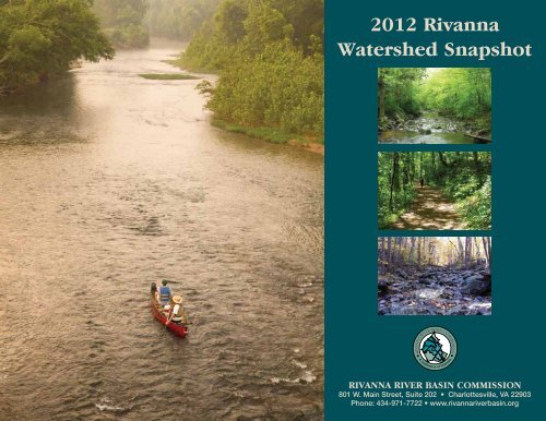
2012 Rivanna Watershed Snapshot - Rivanna River Basin ...
2012 Rivanna Watershed Snapshot - Rivanna River Basin ...
2012 Rivanna Watershed Snapshot - Rivanna River Basin ...

You also want an ePaper? Increase the reach of your titles
YUMPU automatically turns print PDFs into web optimized ePapers that Google loves.
<strong>2012</strong> <strong>Rivanna</strong><br />
<strong>Watershed</strong> <strong>Snapshot</strong><br />
<strong>Rivanna</strong> <strong>River</strong> <strong>Basin</strong> Commission<br />
801 W. Main Street, Suite 202 • Charlottesville, VA 22903<br />
Phone: 434-971-7722 • www.rivannariverbasin.org
Welcome to the <strong>Rivanna</strong> <strong>Watershed</strong><br />
The <strong>2012</strong> <strong>Rivanna</strong> <strong>Watershed</strong> <strong>Snapshot</strong> is a summary of the health and current<br />
conditions of the <strong>Rivanna</strong> <strong>River</strong> and its watershed.<br />
The <strong>Rivanna</strong> <strong>River</strong> drains 768 square miles of land from its headwaters in the Blue Ridge Mountains to<br />
its confluence with the James <strong>River</strong> at Columbia, Virginia. The <strong>Rivanna</strong> <strong>River</strong> is the largest tributary of the<br />
James <strong>River</strong> upstream of Richmond, Virginia.<br />
1<br />
The <strong>Rivanna</strong> <strong>Watershed</strong> is 1/80 the size of the entire Chesapeake Bay<br />
watershed. The James <strong>River</strong> is a major tributary of the Chesapeake<br />
Bay, which is considered the largest estuary in North America.<br />
There are 7 jurisdictions that have some or all of their land area within the <strong>Rivanna</strong> <strong>Watershed</strong>, including<br />
the counties of Albemarle, Fluvanna, and Greene and<br />
the City of Charlottesville. Nelson, Louisa, and Orange % of<br />
Square<br />
Jurisdiction in Jurisdiction Miles within<br />
counties together comprise less than 3% of the <strong>Rivanna</strong><br />
<strong>Watershed</strong><br />
<strong>Watershed</strong><br />
<strong>Watershed</strong>.<br />
100 Charlottesville 10<br />
The <strong>Rivanna</strong> <strong>River</strong> <strong>Basin</strong> Commission<br />
The <strong>Rivanna</strong> <strong>River</strong> <strong>Basin</strong> Commission (RRBC) was<br />
created with the vision that the river and its watershed<br />
can best be protected and conserved through regional<br />
cooperation and by seeking solutions across political<br />
boundaries. The RRBC members are the counties<br />
of Albemarle, Fluvanna, and Greene, the City of<br />
Charlottesville, and the Thomas Jefferson and Culpeper<br />
Soil and Water Conservation Districts.<br />
Resource management decisions are most effective<br />
when they are based on geography that is defined by<br />
natural systems, such as watersheds.<br />
68 Albemarle 494<br />
59 Greene 93<br />
51 Fluvanna 149<br />
3 Louisa 14<br />
2 Orange 7<br />
< 1 Nelson < 1<br />
What is a <strong>Watershed</strong>?<br />
A watershed is an area of land from which all<br />
water drains to a common waterway.<br />
Other terms used for a watershed are river<br />
basin or drainage basin.<br />
Look for me, Snappy the Snapping Turtle, for important information<br />
throughout this <strong>Snapshot</strong>. Snapping turtles are aquatic omnivores and<br />
help keep ponds and streams healthy. We are also one of the<br />
oldest living species, a true relic from the age of dinosaurs. For<br />
reasons not well understood, snapping turtles are declining<br />
in Virginia, so we have a lot at stake. A healthy and vital<br />
ecosystem serves all of us in the <strong>Rivanna</strong> <strong>Watershed</strong>.<br />
The <strong>Rivanna</strong> <strong>River</strong> joins the James <strong>River</strong> at Columbia, Virginia, about 50 miles upstream of Richmond.<br />
Photo/Mary Porter
Our <strong>Watershed</strong> is Unique<br />
The Nature Conservancy has identified the<br />
<strong>Rivanna</strong> <strong>Watershed</strong> as one of the finest<br />
remaining freshwater river and stream systems in<br />
the Piedmont of Virginia.<br />
The <strong>Rivanna</strong> <strong>Watershed</strong> has many unique features and important<br />
designations, including:<br />
• A higher percentage of healthy streams than most other areas in<br />
Virginia, according to Virginia Commonwealth University.<br />
• Designation of the <strong>Rivanna</strong> Corridor as an American Treasure by<br />
the National Trust for Historic Preservation and the White House<br />
Millennium Council’s Save America’s Treasures program.<br />
• Many headwater streams originating in National Park Service<br />
lands along the Blue Ridge Parkway and in Shenandoah National<br />
Park.<br />
• Designation of the Upper Doyles <strong>River</strong> as an Exceptional State<br />
Water, home to brook trout and other cold-water fish.<br />
• An elevation change of 3,400 feet, from 3,580 feet above sea level<br />
in the Blue Ridge Mountains to 180 feet at Columbia, Virginia.<br />
• Over 2,000 miles of permanent and seasonal streams.<br />
• Approximately 4,250 acres of wetlands including agricultural<br />
wetlands and ponds.<br />
• Forest cover in over 70% of the watershed.<br />
• Home to 11 species of freshwater mussels, including globally rare<br />
James spinymussel, Atlantic pigtoe, and green floater.<br />
• Approximately 165,700 people living in the watershed, with<br />
population densities at the subwatershed level ranging from 10 to<br />
1,685 persons per square mile.<br />
• Many groups and individuals passionate about the <strong>Rivanna</strong> <strong>River</strong><br />
working to protect the water and natural resources here.<br />
Many <strong>Rivanna</strong> headwaters begin on the eastern slopes<br />
of the Blue Ridge Mountains, the interface between the<br />
Appalachians and the Piedmont. Photo/Mary Porter<br />
There is habitat in several <strong>Rivanna</strong> headwater streams for<br />
the James spinymussel (Pleurobema collina), a globally<br />
rare and federally and state endangered species. Photo/<br />
USFWS<br />
The <strong>Rivanna</strong> becomes a classic Piedmont river as it<br />
winds past Carysbrook and through Fluvanna County.<br />
Photo/Mary Porter<br />
The wetlands in Greenbrier Park along Meadow Creek<br />
help absorb flood (high flow) waters and pollutants such<br />
as lawn fertilizer and oily wastes carried off nearby lawns<br />
and streets. Photo/City of Charlottesville<br />
The <strong>Rivanna</strong> Conservation Society<br />
The <strong>Rivanna</strong> Conservation Society (RCS) was created in 1990 with the mission to safeguard<br />
the ecological, recreational, historical, cultural, and scenic resources of the <strong>Rivanna</strong> <strong>River</strong> and<br />
its tributaries. RCS hosts river paddles, river clean-ups, public education, teacher and student<br />
education, and stream and watershed restoration projects. RCS works to keep the health and<br />
protection of the <strong>Rivanna</strong> <strong>River</strong> at the forefront of our community’s environmental agenda.<br />
Water is the most critical resource issue of our lifetime and our children’s lifetime. The health of our waters is the principal measure of how<br />
we live on the land. –Luna Leopold, Hydrologist<br />
2
Enjoying Our <strong>Watershed</strong><br />
§¨¦ 64<br />
Shenandoah National Park<br />
F<br />
G r e e n e<br />
Free Union<br />
!Ô<br />
!Ô<br />
!¡<br />
White Hall<br />
F<br />
Hollymead<br />
A l b e m a r l e<br />
!Ô<br />
Crozet<br />
!¡<br />
!¡<br />
FF<br />
Charlottesville<br />
F<br />
!Ô !¡ F<br />
FF<br />
!¡ !Ô !¡<br />
F<br />
F<br />
Lake Monticello<br />
!¡<br />
Batesville<br />
Legend<br />
!Ô<br />
F !¡<br />
F!Ô<br />
Streamside Trail<br />
Public Boat Access<br />
Significant Aquatic Resource<br />
Waterway<br />
<strong>Rivanna</strong> <strong>River</strong> <strong>Basin</strong><br />
Locality Boundary<br />
Shenandoah National Park<br />
!Ô<br />
F<br />
F<br />
!Ô<br />
Nortonsville<br />
F<br />
F F F<br />
F FF<br />
Stanardsville<br />
Ruckersville<br />
F<br />
F<br />
£¤ 29 £¤ 33 £¤ 15<br />
<strong>Rivanna</strong> <strong>River</strong><br />
Cunningham<br />
Palmyra<br />
F<br />
F<br />
F<br />
F<br />
F<br />
!Ô !¡ !Ô<br />
F l u v a n n a<br />
¯<br />
Fork Union<br />
Columbia<br />
!¡<br />
0 2 4 8 12 16<br />
Miles<br />
The <strong>Rivanna</strong> <strong>Watershed</strong> provides abundant opportunities for recreation and<br />
enjoying the outdoors.<br />
There are many opportunities for fishing, hiking,<br />
birdwatching, swimming, boating, and being in<br />
nature and close to water:<br />
• Over 170 miles of trails in the <strong>Rivanna</strong> <strong>Watershed</strong>,<br />
including the Fluvanna Heritage Trail and Rail Trail<br />
in Palmyra; Old Mills Trail in Albemarle; the <strong>Rivanna</strong><br />
Trail around Charlottesville; trails at Greene<br />
County Community Park; and headwater trails in<br />
Shenandoah National Park.<br />
• 9 public boat launches, including 5 state landings<br />
located directly on the <strong>Rivanna</strong> <strong>River</strong>, plus<br />
numerous spots along tributaries for launching<br />
kayaks and canoes.<br />
• The 38-mile <strong>Rivanna</strong> <strong>River</strong> Water Trail for paddling<br />
from from Darden Towe Park in Charlottesville to<br />
the James <strong>River</strong> at Columbia, with 2 camping sites<br />
along the way.<br />
• 12 miles of wild trout streams; 8 miles of stocked<br />
trout streams; and over 700 miles of perennially<br />
flowing streams.<br />
The removal of the Woolen Mills Dam in Charlottesville opened<br />
up fish passage for shad and other species, as well as new<br />
opportunities for recreation. Photo/Bill Emory<br />
There are fish species of ecological or<br />
economical importance (significant aquatic<br />
resources) in 65% of the <strong>Rivanna</strong> streams<br />
assessed by Virginia Commonwealth<br />
University in 2010. Brook trout,<br />
American eel, and smallmouth<br />
bass are among the 49 species<br />
of fish found in the watershed.<br />
3<br />
Trails and fire roads in Shenandoah National Park provide options<br />
for walking, hiking, and running. Photo/RRBC<br />
The lower <strong>Rivanna</strong> in Fluvanna County is broad and flat, with fishing<br />
holes, sandy beaches, and the remains of historic mill dams to<br />
explore. Photo/Mary Porter<br />
No special equipment is needed to enjoy a neighborhood<br />
stream. Photo/City of Charlottesville
Our Water Budget<br />
Just like a bank account balance, the relationship between<br />
water withdrawals, water discharges, and streamflow can be<br />
viewed as a “water budget.”<br />
We withdraw water from the <strong>Rivanna</strong><br />
<strong>Watershed</strong> for drinking and household<br />
needs, commercial and industrial uses,<br />
and irrigation for our crops and fields. Of all<br />
permitted water withdrawals in the <strong>Rivanna</strong><br />
<strong>Watershed</strong>:<br />
Million Gallons Per Day<br />
14<br />
13<br />
12<br />
11<br />
10<br />
9<br />
8<br />
7<br />
6<br />
Total Permitted Surface Water Withdrawals: (1984-2011)<br />
1984<br />
1985<br />
1986<br />
1987<br />
1988<br />
1989<br />
1990<br />
1991<br />
1992<br />
1993<br />
1994<br />
1995<br />
1996<br />
1997<br />
1998<br />
1999<br />
2000<br />
2001<br />
2002<br />
2003<br />
2004<br />
2005<br />
2006<br />
2007<br />
2008<br />
2009<br />
2010<br />
2011<br />
Water withdrawal permits in Virginia require maintaining<br />
“beneficial in stream flow” for fish and other aquatic<br />
resources. Photo/RRBC<br />
At Sugar Hollow Reservoir, the <strong>Rivanna</strong> Water and Sewer<br />
Authority (RWSA) releases water back to the Moormans<br />
<strong>River</strong> to match seasonal variations for the benefit of the<br />
downstream ecosystem. Photo/TJSWCD.<br />
How Much is a<br />
Million Gallons Per Day?<br />
One million gallons per day (MGD) is the<br />
equivalent of using the water from 1 ½<br />
Olympic-size swimming pools per day.<br />
• 97% to 99% is for public water supplies.<br />
• 1% to 3% is for agricultural operations and<br />
for irrigating golf courses.<br />
We put water back into the <strong>Rivanna</strong> <strong>River</strong><br />
primarily through discharges of treated<br />
waste from wastewater treatment plants,<br />
which are permitted by the Virginia Dept. of<br />
Environmental Quality (DEQ) and must meet<br />
water quality standards. For those of us with<br />
septic systems, our wastewater is treated<br />
before the liquid diffuses into surrounding<br />
soils. Water enters shallow and deep<br />
groundwater reserves, much of it eventually<br />
seeping back into streams.<br />
Stormwater runoff from rain and snow also<br />
finds its way to streams. Impervious surfaces<br />
(our roofs, driveways, sidewalks, parking<br />
lots, and roads) prevent the moisture from<br />
soaking into the ground and recharging the<br />
groundwater system.<br />
A healthy water budget balances human<br />
withdrawals and discharges and maintains<br />
streamflow levels needed to sustain<br />
aquatic life. Water conservation measures<br />
help ensure that there is the right amount of<br />
water flowing in area streams at the right time<br />
to support biological life and human needs.<br />
Permitted water usage during this period in the <strong>Rivanna</strong> <strong>Watershed</strong> has varied from<br />
almost 10 MGD to just over 13 MGD. Source/Annual Records (<strong>2012</strong>) from Virginia DEQ<br />
Million Gallons Per Day<br />
Healthy Waters, Water Consumption<br />
and Water Conservation<br />
The relationship between human water consumption, the level of<br />
water in streams, and stream health is affected by many factors,<br />
including precipitation patterns, water conservation (especially<br />
during dry periods), pumping of groundwater, and the amount of<br />
runoff generated by impervious surfaces. Wise use of our available<br />
resources can provide for our needs<br />
and those of aquatic and terrestrial living organisms.<br />
13<br />
12.5<br />
12<br />
11.5<br />
11<br />
10.5<br />
10<br />
9.5<br />
9<br />
8.5<br />
8<br />
Monthly Permitted Withdrawals and Discharges (2008)<br />
Discharges<br />
Withdrawals<br />
Jan Feb March April May June July Aug Sept Oct Nov Dec<br />
Monthly surface water permitted withdrawals and discharges are shown for a typical year<br />
in the <strong>Rivanna</strong> <strong>Watershed</strong>. Note how water withdrawals increase during summer months<br />
while at the same time, discharges from treatment plants tend to be less because water<br />
used for irrigation increases consumption, but the water is not returned to streams via the<br />
treatment plants. Data source: Virginia DEQ.<br />
4
Living in Our <strong>Watershed</strong><br />
§¨¦ 64<br />
Shenandoah National Park<br />
G r e e n e<br />
Nortonsville<br />
Free Union<br />
White Hall<br />
A l b e m a r l e<br />
Crozet<br />
Hollymead<br />
Charlottesville<br />
Ruckersville<br />
¯<br />
Stream health is related intimately to how<br />
we live on and use the land. As land use<br />
intensifies from rural to urban, stream health<br />
declines predictably.<br />
The 2011 StreamWatch Land Use Study predicts stream<br />
health based on the amount of forest and development<br />
in the surrounding area. The study finds:<br />
• Less forest and more impervious cover in the<br />
<strong>Watershed</strong> over time lead to unhealthy stream<br />
conditions.<br />
Impervious cover such as roads, parking lots, rooftops,<br />
and other hard surfaces strongly influence stream<br />
health. Photo/TJSWCD<br />
5<br />
Batesville<br />
Legend<br />
Forest (71.6%)<br />
Open Land (22.3%)<br />
Water (1.1%)<br />
Impervious (3.2%)<br />
Forest Harvest (0.6%)<br />
Orchard/Vineyard (0.4%)<br />
Bare Earth (0.5%)<br />
Golf Course (0.2%)<br />
Locality Boundary<br />
<strong>Rivanna</strong> <strong>River</strong> <strong>Basin</strong><br />
Shenandoah National Park<br />
<strong>Rivanna</strong> <strong>River</strong><br />
£¤ 29 £¤ 33 £¤ 15<br />
Lake Monticello<br />
Cunningham<br />
Palmyra<br />
F l u v a n n a<br />
Fork Union<br />
Columbia<br />
0 2 4 8 12 16<br />
Miles<br />
The 2009 <strong>Rivanna</strong> and Vicinity Map provides land use and land cover<br />
data to 1-meter resolution based on 2009 aerial imagery. RRBC,<br />
StreamWatch, and local government partners have used this imagery to<br />
analyze land use and to better understand and determine policies that<br />
could improve water quality in the <strong>Rivanna</strong> <strong>Watershed</strong>.<br />
• Unhealthy (impaired) streams have less aquatic life,<br />
more erosion along stream banks, and higher levels of<br />
various pollutants, including too much sediment.<br />
• Even relatively modest levels of land disturbance affect<br />
stream health.<br />
• More than half of the monitored semi-rural (or exurban)<br />
streams fail the biological water quality standard.<br />
• StreamWatch estimates that, within 20 years,<br />
increased development in non-urban areas could<br />
reduce the number of healthy streams by about 1/3.<br />
• Many of our <strong>Rivanna</strong> streams are “borderline” and can<br />
be restored to better water quality and maintained in a<br />
healthier condition.<br />
Impervious surfaces lead to higher stream flows which<br />
in turn cause more erosion along banks that are poorly<br />
stabilized. Photo/Center for <strong>Watershed</strong> Protection<br />
Downstream in Fluvanna County, the <strong>Rivanna</strong> <strong>River</strong><br />
swells with sediment-filled flow. Photo/Mary Porter<br />
An important aspect of watershed forest cover is the extent to<br />
which trees and vegetation are immediately adjacent to streams<br />
and rivers. A buffer densely vegetated with native trees and<br />
shrubs, 35 to 100 feet (or more) wide, can intercept runoff<br />
from adjacent lands and protect and stabilize stream banks.<br />
StreamWatch in the <strong>Rivanna</strong> <strong>Watershed</strong><br />
StreamWatch is the local stream monitoring non-profit that collects water<br />
quality data to support our community’s efforts to maintain and restore healthy<br />
waterways. StreamWatch collects and analyzes data with help from citizen<br />
volunteers and local professionals, and presents stream assessments and reports<br />
to partners, planners, managers, elected decision-makers, and the general public.
The Health of Our Waters<br />
§¨¦ 64<br />
Shenandoah National Park<br />
White Hall<br />
G r e e n e<br />
A l b e m a r l e<br />
Crozet<br />
Batesville<br />
Free Union<br />
õ<br />
Nortonsville<br />
õ<br />
Legend<br />
VA DEQ 2010 Assessment<br />
Unassessed Waterway (Black)<br />
Impaired Waterway (Red)<br />
Meets VA Standard (Blue)<br />
õ<br />
USGS Streamflow Station<br />
<strong>Rivanna</strong> <strong>River</strong> <strong>Basin</strong><br />
Locality Boundary<br />
Shenandoah National Park<br />
Stanardsville<br />
õ<br />
Hollymead<br />
Charlottesville<br />
Ruckersville<br />
<strong>Rivanna</strong> <strong>River</strong><br />
£¤ 29 £¤ 33 £¤ 15<br />
Lake Monticello<br />
Cunningham<br />
Palmyra<br />
õ<br />
F l u v a n n a<br />
Fork Union<br />
¯<br />
Columbia<br />
0 2 4 8 12 16<br />
Miles<br />
The Virginia DEQ has determined that 315 stream miles in the <strong>Rivanna</strong> do not<br />
meet Virginia water quality standards.<br />
The Virginia Department of Environmental Quality<br />
(DEQ) is responsible for assessing whether our<br />
waterbodies meet water quality standards, for<br />
one or more designated uses, such as fishing (the<br />
aquatic or biological standard) or swimming (the<br />
bacteria standard). Waterbodies that do not meet a<br />
designated use are listed as “impaired.”<br />
Based on draft <strong>2012</strong> data, Virginia DEQ reported:<br />
• 192 miles are impaired biologically (do not support<br />
aquatic life)<br />
• 123 miles are contaminated by bacteria (based on<br />
E.coli or fecal coliform indicators)<br />
Only half of the perennial streams in the <strong>Rivanna</strong><br />
<strong>Watershed</strong> have been assessed by DEQ. Many<br />
stream miles have more than one impairment.<br />
Based on StreamWatch’s data collected over 10<br />
years of monitoring in the <strong>Rivanna</strong>, about 70% of<br />
streams in the <strong>Rivanna</strong> <strong>Watershed</strong> are impaired for<br />
aquatic life.<br />
In addition to monitoring for the aquatic life<br />
standard, StreamWatch also monitors bacteria<br />
levels in the <strong>Watershed</strong>. Of the 13 monitoring sites<br />
in the <strong>Watershed</strong>, 7 are part of RCS’s Can You<br />
Swim Here? program that assesses public health<br />
concerns at popular swimming spots.<br />
The StreamWatch long-term monitoring program provides Virginia<br />
DEQ with significant amounts of high quality data that is used by<br />
DEQ to help assess water quality. Photo/StreamWatch<br />
The presence and types of macroinvertebrates (the larval stage of<br />
aquatic bugs) indicates the health of streams. Flathead mayflies<br />
(above) are generally found in cleaner waters. Photo/StreamWatch<br />
Ivy Creek is one of the many streams in the <strong>Rivanna</strong> <strong>Watershed</strong> that has<br />
too much sediment in the water after storms, reducing habitat for fish<br />
and other aquatic life. Photo/StreamWatch<br />
Excessive sediment (soil or dirt) is a major issue in the <strong>Rivanna</strong> <strong>Watershed</strong> because it smothers the<br />
aquatic life in the stream bed and reduces water quality. Sediment also fills up our reservoirs, reducing<br />
water storage capacity. Elevated levels of nutrients (phosphorus and nitrogen) lead to excessive<br />
growth of algae, decreased oxygen, reduced water clarity, and taste and odor problems in<br />
drinking water supplies. The U.S. Geological Survey (USGS) samples water quality at a gauge<br />
in Palmyra, Virginia, as part of the Chesapeake Bay monitoring network. Everything we<br />
do to improve local water quality will also help the James <strong>River</strong> and the Chesapeake Bay<br />
downstream from us.<br />
6
Protecting Our <strong>Watershed</strong><br />
7<br />
Shenandoah National Park<br />
G r e e n e<br />
Nortonsville<br />
Free Union<br />
Stanardsville<br />
Ruckersville<br />
¯<br />
Water quality and natural resources can be<br />
conserved and protected in many ways.<br />
Private landowners and a variety of agencies work to protect<br />
and conserve land in the <strong>Rivanna</strong> <strong>Watershed</strong>. Some land<br />
protection mechanisms are permanent, while others are<br />
temporary, or time-limited.<br />
§¨¦ 64<br />
White Hall<br />
A l b e m a r l e<br />
Crozet<br />
Batesville<br />
Hollymead<br />
Charlottesville<br />
£¤ 29 £¤ 33 £¤ 15<br />
Conservation easements are a wonderful tool for protecting<br />
land. They allow a landowner to give up certain rights (such<br />
as the right to further develop the property), while retaining<br />
others (the right to engage in agriculture, harvest timber, and<br />
build a limited number of structures).<br />
Protecting large tracts of forests benefits water<br />
quality and helps maintain habitat for wildlife.<br />
Photo/Mary Porter<br />
<strong>Rivanna</strong> <strong>River</strong><br />
Legend<br />
Federal Conservation Land<br />
State Conservation Land<br />
Local Conservation Land<br />
Non-Profit Conservation Land<br />
Private Conservation Easement<br />
Lake Monticello<br />
Cunningham<br />
Palmyra<br />
F l u v a n n a<br />
<strong>Rivanna</strong> <strong>Watershed</strong> Protection<br />
95,000 acres (20%) of the <strong>Rivanna</strong> <strong>Watershed</strong> has some form<br />
of protection or is under a conservation easement.<br />
A number of different entities manage or monitor these lands<br />
to assure the intended benefits are achieved.<br />
<strong>Rivanna</strong> <strong>River</strong> <strong>Basin</strong> Boundary<br />
Locality Boundary<br />
Shenandoah National Park<br />
Fork Union<br />
Columbia<br />
0 2 4 8 12 16<br />
Miles<br />
Protected lands in headwaters and along the <strong>Rivanna</strong> <strong>River</strong> are<br />
especially important. Source/Protected land records (<strong>2012</strong>) from Virginia<br />
Department of Conservation and Recreation (DCR).<br />
A 100-foot wide stream side forested buffer, or<br />
vegetated strip, can reduce 97% of sediment, 80%<br />
of nitrogen, and 77% of phosphorus from<br />
entering streams. Further analysis is<br />
required to ascertain the quantity and<br />
quality of the buffers located along<br />
<strong>Rivanna</strong> streams.<br />
Many individual landowners practice good forest and land<br />
stewardship that helps protect the <strong>Rivanna</strong> <strong>River</strong> and the<br />
<strong>Watershed</strong>.<br />
From 2002 to <strong>2012</strong>, the Thomas Jefferson and Culpeper<br />
Soil and Water Conservation Districts have worked with<br />
landowners in the <strong>Rivanna</strong> <strong>Watershed</strong> and<br />
• Installed over 125 miles of stream fencing to keep<br />
livestock out of streams.<br />
• Planted or protected an estimated 640 acres of stream<br />
side buffers on agricultural land.<br />
Private landowners with horse and cattle operations,<br />
pastures and row crops, vineyards, and other agricultural<br />
activities have many tools for protecting soil and water.<br />
Many management practices are partially subsidized by<br />
state and federal cost-share programs.<br />
Stream exclusion fencing helps keep farm animals<br />
out of streams, thus reducing nutrient runoff, bank<br />
erosion, and excessive sedimentation.<br />
Photo/TJSWCD<br />
Most easements include measures to protect water<br />
quality for the public benefit, such as stream buffers<br />
that keep livestock, soil, and nutrients out of the<br />
river. Photo/Mary Porter
Managing Our Resources<br />
Shenandoah National Park<br />
White Hall<br />
G r e e n e<br />
A l b e m a r l e<br />
Crozet<br />
Nortonsville<br />
Free Union<br />
Stanardsville<br />
Hollymead<br />
Ruckersville<br />
<strong>Rivanna</strong> <strong>River</strong><br />
¯<br />
£¤ 33 Charlottesville<br />
§¨¦ 64 Batesville<br />
£¤<br />
£¤ 15<br />
29 Lake Monticello<br />
Legend<br />
Cunningham<br />
! Urban Stormwater BMP<br />
Palmyra<br />
Urban Growth Areas<br />
Waterway<br />
F l u v a n n a<br />
<strong>Rivanna</strong> <strong>River</strong> <strong>Basin</strong><br />
County Boundary<br />
Fork Union<br />
Shenandoah National Park<br />
0 2 4 8 12 16<br />
Columbia<br />
Miles<br />
The plants on this green roof at the University of Virginia capture rainfall<br />
that would otherwise become stormwater runoff. The green roof also<br />
helps reduce heating and cooling needs. Photo/UVa<br />
-<br />
Management practices are being used<br />
across the <strong>Rivanna</strong> <strong>Watershed</strong> to treat<br />
runoff from urban and agricultural areas.<br />
Stormwater Best Management Practices<br />
Private landowners and the counties of Albemarle,<br />
Fluvanna, and Greene, the City of Charlottesville, and the<br />
University of Virginia together treat stormwater runoff<br />
from over 21,800 urban acres (4% of the watershed).<br />
Private landowners and local governments help reduce<br />
the impact of development projects on streams by:<br />
• Installing stormwater management practices at public<br />
sites wherever possible.<br />
• Encouraging private urban stormwater management<br />
practices through incentives and other financial tools.<br />
• Planting stream side buffers where possible and<br />
protecting and maintaining these buffers as land is<br />
developed.<br />
• Ensuring that streets and parking lots do not create<br />
impervious cover in excess of that needed for safe and<br />
orderly development.<br />
• Limiting construction on steep (or critical) slopes,<br />
especially adjacent to streams and creeks.<br />
• Steering higher density development to Urban<br />
Growth (or Development) Areas to help maintain rural<br />
character and protect natural resources.<br />
Pet Waste Management<br />
In Moores Creek and other urbanized watersheds, one of<br />
the main contributors to bacterial pollution is pet waste<br />
from dogs and cats. As our domesticated pet population<br />
grows, we need to manage pet waste properly<br />
if we want clean water.<br />
Greene County Community Park’s bioswale treats runoff<br />
from parking and playing fields. Native plantings ensure<br />
survivability during wet or hot and dry conditions.<br />
Photo/RRBC<br />
The rain garden at Smith Aquatic Center in Charlottesville<br />
treats parking lot and roof runoff. Photo/City of<br />
Charlottesville<br />
Virginia’s new stormwater regulations<br />
require local governments to develop<br />
enhanced local programs for<br />
reducing the quantity of<br />
stormwater and improving the<br />
treatment of stormwater<br />
before it is discharged to<br />
rivers and streams.<br />
8
The Future of Our <strong>Watershed</strong><br />
We are fortunate to live in the <strong>Rivanna</strong> <strong>Watershed</strong>, where many of our<br />
headwater streams are protected by National Park Service lands.<br />
We have ample opportunities for recreation and enjoyment along the <strong>Rivanna</strong> <strong>River</strong> and its streams.<br />
9<br />
We have a high percentage of streams with diverse habitat and fish species.<br />
Our local governments work to manage and protect our natural resources through innovative codes and<br />
ordinances and by setting an example of stewardship on public lands.<br />
Many landowners understand the ecological and economic importance of conserving land and water at<br />
home, on farms, and at businesses.<br />
Our Future<br />
The actions we take today to restore our<br />
impaired streams and to return our landscapes to<br />
healthy ecosystems will benefit our human and<br />
natural communities now and into the future.<br />
Elected officials, local government staff, and citizens join an educational<br />
tour of local stormwater projects to learn about new ways to manage<br />
stormwater (above, Crozet wetlands project). Photo/RRBC<br />
Stronger storms and longer periods of drought will require more robust<br />
and flexible water resource management. Photo/RRBC<br />
At the same time, over half of our assessed streams are degraded. Development results in more<br />
impervious surfaces that, if not properly managed, are damaging to our streams.<br />
We can improve the health of our watershed if we:<br />
Better Information to Support Better Policies<br />
We will make better decisions if we have better data on:<br />
• The health of all the streams in our watershed.<br />
• The location and density of stream side buffers.<br />
• The status of our groundwater resources and its<br />
projected level of use.<br />
• The impacts of emerging pollutants<br />
(pharmaceuticals, personal care products,<br />
and polyciclic aromatic hydrocarbons) on<br />
our streams.<br />
• The effectiveness of older, existing<br />
stormwater best management practices.<br />
• Improve stormwater management parcel-by-parcel, from fields, homes, and businesses,<br />
reducing damaging flows to our streams and increasing water resources for all.<br />
• Identify and protect the landscapes that best protect river and watershed health.<br />
• Improve forested stream buffers and systematically protect and restore these<br />
natural defense systems.<br />
• Use policies, incentives, and education to create a culture of watershed protection<br />
in our community.<br />
• Establish a water budget for all human and ecological needs and to inform water resource<br />
planning.<br />
• Monitor and plan for the impacts of changing weather patterns on our water resources<br />
and natural systems.<br />
• Develop tools for selecting the most effective and economical strategies for land<br />
and water conservation.<br />
• Continue to assess our progress with subsequent snapshots.<br />
A river is more than an amenity...It is a treasure. It offers a necessity of life that must be rationed among those who have power over it.<br />
–Oliver Wendell Holmes, Jr. (1841-1935), U.S. Supreme Court justice, New Jersey v. New York, 4 May 1931
A Roadmap and Tools for Working Together<br />
roadmap and decision support toolkit can help identify the most cost<br />
A effective and efficient strategies to guide our path forward.<br />
The <strong>Rivanna</strong> <strong>River</strong> <strong>Basin</strong> Commission is developing the <strong>Rivanna</strong> <strong>Watershed</strong> Action Plan and Toolkit<br />
for use by its member local governments, partners, stakeholders, and citizens to help inform and guide<br />
<strong>Rivanna</strong> protection and restoration. The planning process will build on the information in this <strong>Snapshot</strong><br />
and provide a road map and tools for guiding our work in the <strong>Rivanna</strong> <strong>Watershed</strong>.<br />
Working together, we can restore the <strong>Rivanna</strong> <strong>Watershed</strong> to support diverse habitats, provide the<br />
ecological services we rely on, and provide waters that are fishable and swimmable for all our citizens.<br />
RRBC thanks our partners for the collaborative support and information essential for completing<br />
the <strong>2012</strong> <strong>Rivanna</strong> <strong>Watershed</strong> <strong>Snapshot</strong>.<br />
RRBC Technical Advisory Committee<br />
Collaborative support from Albemarle, Greene, and Fluvanna Counties and the City of Charlottesville<br />
Culpeper Soil and Water Conservation District (www.culpeperswcd.org)<br />
James <strong>River</strong> Association (www.jamesriverassociation.org)<br />
<strong>Rivanna</strong> Conservation Society (www.rivannariver.org)<br />
<strong>Rivanna</strong> Water and Sewer Authority (www.rivanna.org)<br />
StreamWatch, Inc. (www.streamwatch.org)<br />
Thomas Jefferson Soil and Water Conservation District (www.tjswcd.org)<br />
Thomas Jefferson Planning District Commission (www.tjpdc.org)<br />
The Nature Conservancy in Virginia (www.nature.org/virginia)<br />
University of Virginia (www.ehs.virginia.edu/ehs)<br />
Funding and technical assistance were provided by<br />
National Fish and Wildlife Foundation’s Chesapeake Bay Stewardship Fund (www.nfwf.org/chesapeake)<br />
Center for <strong>Watershed</strong> Protection, Inc. (www.cwp.org)<br />
Preserving local farmlands can help protect water quality and maintain<br />
the rural character we value in the <strong>Rivanna</strong> <strong>Watershed</strong>.<br />
Photo/Greene County<br />
The RRBC Technical Advisory Committee considers strategies informed<br />
by credible science in order to make practical recommendations to the<br />
<strong>Rivanna</strong> <strong>River</strong> <strong>Basin</strong> Commission. Photo/RRBC<br />
Special Thanks<br />
RBBC gives a special thanks to those individuals who contributed RRBC start-up funding, which has been<br />
instrumental to the success of the early work of the Commission and for the completion of this project.<br />
Photography: Bill Emory (www.billemory.com), David Harp (www.chesapeakephotos.com)<br />
Cover photos: David Harp (left), Mary Porter (top right), RRBC (middle/bottom right)<br />
Back cover photo: David Harp<br />
Graphic Design: Down to Earth Design (www.d2edesign.com)<br />
Data sources, references, and methodology used for this <strong>Snapshot</strong> are in the <strong>2012</strong> <strong>Rivanna</strong> <strong>Watershed</strong><br />
<strong>Snapshot</strong> Technical Report available at www.rivannariverbasin.org.<br />
The long view from Carter’s Mountain to the Blue Ridge Mountains<br />
provides perspective and understanding of how the land has shaped<br />
our communities. Photo/RRBC<br />
10
The <strong>Rivanna</strong> <strong>River</strong> <strong>Basin</strong> Foundation has been created by the <strong>Rivanna</strong> <strong>River</strong> <strong>Basin</strong> Commission, in accordance with its mandate<br />
defined by the Virginia General Assembly. The Foundation accepts contributions and grants from private foundations and individuals<br />
who wish to invest in the activities of the <strong>Rivanna</strong> <strong>River</strong> <strong>Basin</strong> Commission and partner organizations working<br />
to protect, conserve, and restore the natural and water resources of the <strong>Rivanna</strong> <strong>Watershed</strong>.<br />
Please visit www.rivannariverfoundation.org for details on how you can contribute and participate.<br />
801 W. Main Street, Suite 202 • Charlottesville, VA 22903<br />
Phone: 434-971-7722 • Fax: 973-201-7722<br />
info@rivannariverbasin.org • www.rivannariverbasin.org