

Reservoirs-design-guidance-2011
Reservoirs-design-guidance-2011
Reservoirs-design-guidance-2011

You also want an ePaper? Increase the reach of your titles
YUMPU automatically turns print PDFs into web optimized ePapers that Google loves.
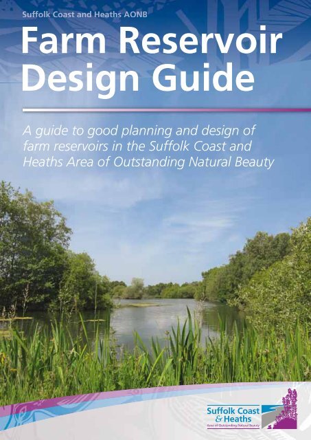
Farm Reservoir<br />
Design Guide<br />
A guide to good planning and <strong>design</strong> of<br />
farm reservoirs in the Suffolk Coast and<br />
Heaths Area of Outstanding Natural Beauty
Introduction<br />
The Suffolk Coast and Heaths Area of Outstanding Natural<br />
Beauty (AONB) has been <strong>design</strong>ated for its special, nationally<br />
important landscape qualities. Any development within the Area,<br />
including farm reservoirs, should respect its distinctive<br />
character and ought to contribute towards maintaining or<br />
enhancing that character. This guide describes what can be<br />
done to conserve and enhance the AONB. Most of the <strong>guidance</strong><br />
in this publication is voluntary but we hope that farmers and<br />
reservoir <strong>design</strong>ers will follow it when they can.<br />
The AONB is in one of the driest, most water-stressed parts of the UK and water<br />
conservation is high up the list of priorities for planners as well as farmers using<br />
irrigation. In such areas winter storage reservoirs are one of the best solutions for<br />
farmers. In the AONB, we would like to make sure that reservoir developments are<br />
<strong>design</strong>ed to safeguard the special character of the landscape, maintaining and<br />
enhancing wildlife as well as enabling the production of high-value cash crops.<br />
Careful thought about the siting, shape, <strong>design</strong> and landscaping of storage reservoirs<br />
will be of benefit in the planning process. Schemes that do not adequately understand<br />
and minimise their impact on landscape and wildlife and seek to enhance these, can be<br />
delayed by objections and revisions.<br />
This booklet explains how to mitigate the impact of a proposed farm reservoir on local<br />
landscape and wildlife. It also summarises the steps of the planning process. It is<br />
<strong>design</strong>ed for use in the Suffolk Coast and Heaths AONB, but it may also be relevant to<br />
other parts of the UK.<br />
Suffolk Coast and<br />
Heaths AONB nationally<br />
protected landscape.<br />
© Mike Page.<br />
2
Farm <strong>Reservoirs</strong><br />
The Suffolk Coast and Heaths Area of<br />
Outstanding Natural Beauty (AONB)<br />
A distinctive area …<br />
The Suffolk Coast and Heath AONB contains well defined landscape types such as Coastline<br />
and Coastal Valleys, River and Stream Valleys, Estuaries and the ‘Sandlings’ Plateau.<br />
Development proposals should reflect and enhance the character of these landscapes and<br />
the local distinctiveness of the area.<br />
The Suffolk Coast and Heaths is also important for its wildlife, with many internationally<br />
and nationally important habitats, including heathlands, reedbeds, grazing marshes and<br />
saline lagoons that are home to protected species. Farm reservoirs may impact on wildlife<br />
by altering habitat and drawing on vital water resources.<br />
Not least, the AONB hosts a thriving local economy and many businesses ground their success<br />
in the high environmental quality of the area. Development proposals that are well thought<br />
out and sympathetic are better for business and can benefit the protected landscape.<br />
As an aid to conserving and enhancing local<br />
character, the Suffolk Coast and Heaths Unit<br />
has published a set of ‘Landscape Character<br />
Guidelines’. This is a useful reference for<br />
anyone owning or managing land in the<br />
AONB (see page 18 for further details).<br />
Information on the wildlife of the AONB can<br />
be found in the Suffolk Coast and Heaths<br />
Natural Area Profile, published by Natural<br />
England (see page 18 for further details).<br />
Water abstraction from<br />
a river catchment may<br />
affect estuaries miles<br />
away: the availability of<br />
freshwater flows is<br />
thought to play an<br />
important role in<br />
mudflat ecology.<br />
Research by the<br />
Environment Agency has<br />
shown that reduced<br />
river flows may affect<br />
invertebrate food for<br />
estuarine species such<br />
as shelduck.<br />
3
Suffolk Coast and Heaths AONB<br />
Waveney<br />
District<br />
Suffolk Coastal District<br />
Ipswich<br />
Borough<br />
Babergh District<br />
Tendring District<br />
AONB<br />
Additional Project Area<br />
4
Farm <strong>Reservoirs</strong><br />
Design principles for farm reservoirs<br />
Farm reservoirs are a potentially intrusive addition to the landscape, but with suitable<br />
<strong>design</strong>, can enhance it and provide wildlife value as well as supply water for irrigation.<br />
Wildlife and landscape friendly features can be incorporated into reservoir <strong>design</strong> for a<br />
little extra cost, will gain ‘additionality’ in the planning process and may help to placate<br />
objectors amongst statutory consultees.<br />
Designing for the landscape<br />
From a landscape point of view, the most important impact of a new reservoir is its<br />
visibility. Different parts of the landscape are vulnerable in different ways:<br />
Landscape Element<br />
Sandlings Plateau<br />
Estuary Valley Sides<br />
Estuary Valley Floor and Coastal Valley<br />
Vulnerability<br />
Level areas with large vistas, meaning longdistance<br />
visibility.<br />
Visibility against skyline from within and<br />
along valley and from other side of estuary.<br />
Visibility from above, and against skyline<br />
from valley floor.<br />
There are ways to safeguard the distinctive quality of the local landscape and mitigate any<br />
negative impact. This will involve integrating the reservoir’s footprint and profile with the<br />
local topography, blending it in rather than trying to mask it by planting.<br />
The Landscape Character Assessment profile for the Suffolk Coast and Heaths provides a<br />
useful guide to the elements of local distinctiveness in the AONB (see ‘Further Information’<br />
on page 18 for more details).<br />
Sandlings open<br />
landscape<br />
5
Siting<br />
In the case of reservoirs that do not use a butyl or similar sheet liner, the availability of clay<br />
is likely to determine the general location of the reservoir. However, the specific location<br />
should be chosen to make the best use of pre-existing features, such as changes in<br />
landform and existing hedges, woods and trees. Field patterns and associated features can<br />
be very ancient and you should avoid disrupting them.<br />
The key principles are:<br />
•<br />
•<br />
•<br />
Avoid breaking the skyline: always site a reservoir away from the crest of a slope.<br />
Make use of landforms to help set the reservoir in its locality.<br />
Naturally, water bodies are more likely to be found in the lower parts of the landscape<br />
and a reservoir may sit more comfortably here.<br />
Take care when siting a reservoir on a floodplain. <strong>Reservoirs</strong> with large, raised banks may<br />
increase the risk of flooding downstream because their footprint deprives the floodplain of<br />
valuable storage capacity. <strong>Reservoirs</strong> which do not hold water above ground level and<br />
which have their excavated spoil removed from the floodplain have a neutral effect on<br />
floodwater storage, and so are more acceptable for planners. The Environment Agency<br />
may require a Flood Risk Assessment to ensure that the development does not increase<br />
flood risk.<br />
Take care to avoid Public Footpaths and other Public Rights of Way when siting a reservoir.<br />
Having to re-route Public Rights of Way will cause additional delays in the planning process.<br />
Pastoral valley<br />
scenery<br />
6
Farm <strong>Reservoirs</strong><br />
Shape and profiles<br />
From a water-holding point of view, a circular<br />
reservoir shape is most economical because it has a<br />
low bank / water volume ratio. A rectangular shape<br />
is worst, but cheapest to construct. From a<br />
landscape impact point of view, an irregular outline<br />
is best. It is rare to find straight lines in nature!<br />
Even if the internal shape of the reservoir is<br />
rectangular, the embankment can be irregular.<br />
The boundary outline can be modified as well as<br />
the angle of the slope and the profile of the crest.<br />
Gentle slopes, with angles no greater than 1 in 4,<br />
are less intrusive and also permit easy access for<br />
vegetation management. A hummocky surface<br />
may also re-create the natural curves of the<br />
landform and help the reservoir look less intrusive.<br />
If your project includes a ditch, consider a<br />
‘beaded ditch’ as this will have greater wildlife<br />
value. Use low clay bunds, logs or raise the bed<br />
of the ditch with gravel to create the ‘beads’.<br />
An irregular outline reservoir<br />
7
A curved or<br />
irregularly shaped<br />
margin can soften<br />
the shape of a<br />
lined reservoir.<br />
An embankment may<br />
harmonise with<br />
existing treelines.<br />
In locations where a high embankment is inappropriate, the reservoir needs to be overdeepened.<br />
The excess spoil can be used to contour the site, reducing slope angles, chamfering<br />
edges and creating wildlife features such as nesting banks and raised planting areas.<br />
Good fencing is<br />
essential to<br />
reservoir safety<br />
In cases where there is insufficient material for the embankment, your borrow pits may be<br />
landscaped for wildlife, to create ditches, ponds, boggy areas or south facing slopes that<br />
will greatly benefit invertebrates.<br />
Fencing<br />
If fencing is required to keep people and animals out of<br />
your reservoir, carefully consider where fencing can be<br />
located. If fencing is located off the crest there will be far<br />
less impact on the landscape. A fence sited half way up<br />
the embankment is more difficult for deer to jump. A<br />
suitable fence might be two metres high, with chicken<br />
wire at the bottom (dug into the ground and turned<br />
outwards to impede rabbits) and sheep netting above.<br />
8
Farm <strong>Reservoirs</strong><br />
Designing for wildlife<br />
The wildlife of the Suffolk Coast and Heaths is dependent on a mosaic of habitats, many<br />
of them developed through farming activity over hundreds, even thousands, of years. The<br />
Sandlings heaths, for example, have existed since at least the Iron Age, over 2,000 years<br />
ago. Farm reservoirs are just one more form of human development that alters existing<br />
habitat, but may also provide important new opportunities for plants and animals.<br />
The main principles to follow are:<br />
•<br />
•<br />
•<br />
Seek to link habitats together to allow wildlife to migrate through the area.<br />
Build on the typical habitats and species already found in the locality.<br />
Plan for the ongoing maintenance of the site as a wildlife habitat (a management plan<br />
for wildlife may be requested as part of gaining planning permission).<br />
Grassland and wildflower areas<br />
The embankment and its associated graded areas provide an opportunity to establish<br />
grassland habitat. Avoid using topsoil from the field, as it will be overfertile and likely to be<br />
colonised by aggressive weed species. By mixing topsoil and subsoil the fertility can be<br />
reduced, giving an opportunity to establish a lower maintenance grass and wildflower mix.<br />
Other wildlife-friendly options such as green hay, log piles (for amphibians, reptiles and<br />
invertebrates) or some areas left as rough grassland could also be considered. Contact<br />
your wildlife adviser for advice about soil conditions, suitable plant species and how to<br />
establish them.<br />
Any dells and hummocks created will vary the micro-climate and enable a wider range of<br />
species to thrive. Appropriate grading of the slopes will allow machinery to be used to<br />
help the establishment and maintenance of such areas, which are likely to benefit from<br />
annual or biannual cutting and removal of the cut material.<br />
New grassland<br />
established on a<br />
sandy embankment.<br />
9
Inside the reservoir<br />
<strong>Reservoirs</strong> lined with butyl or other sheeting have less<br />
wildlife value than those lined with clay because of<br />
their sterile, slippery lining. By contrast the banks of<br />
clay lined reservoirs can be colonised gradually by<br />
plants and animals.<br />
This marginal shelf is<br />
ready to receive reeds<br />
transplanted from<br />
ditches on the farm.<br />
A reservoir may be full for at least six months of the<br />
year, so it will benefit from marginal shelves and a lip<br />
or berm close to the maximum water level. The<br />
marginal zone should be as wide and as gently<br />
sloping as possible to allow the widest range of<br />
vegetation to colonise, which will in turn attract a wide range of invertebrates and<br />
amphibians. Reeds, sedges and other water plants from the local area can be introduced<br />
and will shield the banks from wave erosion. Ideally these marginal features will be<br />
supplied with water on a dripfeed bled off from the irrigation system, so that when the<br />
water level drops in the summer months the plants can survive. They should be sited on<br />
the northern to eastern quadrant of the reservoir to take full advantage of sunlight and to<br />
oppose the prevailing wind.<br />
When the water level falls, previously submerged banks are exposed. This ‘draw-down<br />
zone’ in a clay lined reservoir can make a significant contribution to wildlife value, as open<br />
areas are colonised by plants and insects and are exploited by birds. Gentler slopes are<br />
more easily colonised and the banks of the northern to eastern quadrant of the reservoir<br />
can be given a shallower profile and maybe even step terraces. You can vary the<br />
topography of the draw-down zone by creating bays and inlets, hummocks and hollows.<br />
Wandering Snail<br />
Lymnaea peregra may<br />
quickly colonise the<br />
draw-down zone of a<br />
reservoir.<br />
Water levels in the reservoir may well stay at a very low level for several months until they<br />
can be restored in winter. The temperature, chemistry and volume of this residual water<br />
may be adverse to aquatic<br />
life. A deep hole or ‘wildlife<br />
sump’ in the bottom of the<br />
reservoir below the<br />
abstraction level will provide<br />
a pool of cool water and a<br />
refuge for wildlife. However,<br />
you will need to make sure<br />
there is sufficient depth of<br />
clay to maintain such a hole.<br />
10
Farm <strong>Reservoirs</strong><br />
Islands<br />
Creating islands is one possibility for breaking up the blank expanse of water in a farm<br />
reservoir. Earth islands may not be a good idea because they reduce the water volume, can<br />
look unsightly, are subject to wave erosion and become less accessible when water levels drop.<br />
Anchored floating islands perhaps based on wooden rafts can be more attractive and useful<br />
for wildlife. Islands may encourage nesting birds, depending on the type of surface. Terns may<br />
be attracted to open areas with shingle; wild ducks will prefer areas of shrub or sedge.<br />
Pumping<br />
equipment<br />
Sheds and shelters will be needed to house<br />
pumping equipment and associated electrical<br />
installations. If possible, these could be<br />
incorporated within an existing farm complex<br />
or linked to existing hedges,shrubs and<br />
copses. Alternatively, they may be screened by<br />
planting suitable species of native trees and<br />
shrubs (of local provenance).<br />
Use native trees and<br />
shrubs to landscape<br />
installations.<br />
Hedges, trees and shrubs<br />
Pre-existing hedges, trees and shrubs are a precious resource when landscaping a<br />
farm reservoir. They can be supported with new planting to soften corners, to close<br />
up gaps and left-over field space, and to provide a structural link with the existing<br />
landscape. When choosing species and locations, look at what is already growing in<br />
the local area: similar species are likely to grow better and will retain local character.<br />
Avoid planting trees and shrubs in single lines (unless creating a hedge) as this is<br />
likely to draw the eye to the reservoir. The idea is to make your reservoir blend in<br />
with the landscape.<br />
Be very careful about planting trees and shrubs on the bank of the reservoir. They are<br />
likely to spread or topple over and rupture the bank with their root-plate. Never plant<br />
invasive, thirsty trees like alder, willow and poplar. If you must plant, only do it on the<br />
lowest 30% of the outer bank. You will need to make provision for regular mowing to<br />
prevent gradual colonisation of the bank. Specialist advice on what to plant and where<br />
to plant it is available from landscape and conservation advisers (see page 19 for details).<br />
11
Archaeology<br />
When considering a potential site for a reservoir, it is important to seek early information<br />
and advice about the archaeological interest in the area. Specific evidence about the<br />
location may be limited but that may not mean the site is not significant. As a first step<br />
there will be a need to assess the archaeological potential of the site, through a variety of<br />
techniques, such as desktop study or trial trenching. If significant archaeological remains<br />
are identified, you may have to find another site for the proposed reservoir, or undertake<br />
excavation that may add significantly to the cost of your project. (See page 19 for details<br />
of who to contact.)<br />
Associated features<br />
As part of your overall project, you may wish to consider positive management of associated<br />
landscape features such as ditches, hedges and ponds. Restoration or enhancement of these<br />
features for landscape and wildlife value can be undertaken as part of a package mitigating<br />
the impact of your proposals and help ensure that planning permission is granted. Site-specific<br />
advice is likely to be available (see page 19 for details).<br />
Planning your farm reservoir<br />
The following flow diagrams show the necessary steps in obtaining the main permissions to<br />
build a reservoir. The first step is checking with the Environment Agency that water resources<br />
are available for your project. In addition you may wish to seek <strong>guidance</strong> on specific topics<br />
such as landscape or archaeology from the relevant advisers (see page 19 for details)<br />
12
Farm <strong>Reservoirs</strong><br />
Reservoir Planning Process Chart – Environment Agency<br />
IDEA<br />
Contact Environment Agency about availability of water resources<br />
Yes, water available<br />
Maybe water available<br />
No, water not available<br />
For surface abstraction, applicant may be asked<br />
to carry out flow monitoring of proposed water<br />
source if Agency gauging station not present<br />
OK<br />
Not OK<br />
Make provisional<br />
application. EA starts<br />
consultation process<br />
Abandon plans or look at possibility of<br />
water trading within catchment<br />
OK<br />
Make formal application for Licence to abstract water under<br />
Water Resources Act. Allow 4 months for application to be<br />
processed, including further consultations
Reservoir Planning Process Chart – County Archaeologists<br />
IDEA<br />
Make EARLY pre-application contact with Archaeological Service<br />
Conservation Team regarding possible site(s) for proposed reservoir<br />
Yes<br />
Are significant archaeological<br />
features known to be present?<br />
Unknown<br />
Conservation Team assess archaeological potential and<br />
may recommend evaluation using one or more of the<br />
following techniques: desktop study, fieldwalking, trial<br />
trenching, geophysical survey and aerial survey.<br />
Developer funds evaluation.<br />
Significant remains<br />
identified on site<br />
No significant remains<br />
identified on site<br />
Assess significance of archaeological remains<br />
National significance<br />
and/or visual<br />
contribution to historic<br />
landscape<br />
Local/regional<br />
significance and/or no<br />
contribution to historic<br />
landscape<br />
Preservation<br />
in situ<br />
justified<br />
Advised by<br />
Conservation Team,<br />
developer funds<br />
excavation of<br />
archaeological features<br />
Choose another site<br />
Conservation Team make<br />
recommendations to Local<br />
Planning Authority<br />
Move forward with<br />
planning process<br />
14
Farm <strong>Reservoirs</strong><br />
Reservoir Planning Process Chart<br />
Local Authority Planning Department.<br />
Prepare project Scoping Document and contact local authority planners to decide what<br />
kind of Planning Application is needed for reservoir. Is Planning Permission required?<br />
Yes<br />
(Planning Permission required)<br />
Project needs Planning Permission and<br />
details are submitted<br />
Is an Environmental Impact Assessment<br />
(EIA) required? (e.g. near SSSI or SPA or<br />
in AONB). Ask Local Authority for<br />
Screening Opinion on need for EIA.<br />
No<br />
Project can be classed as Permitted<br />
Agricultural Development under GPDO<br />
1995, Schedule 2<br />
(Part 6, Agricultural Buildings and<br />
Operations), assuming proposal is carried<br />
out in accordance with details.<br />
(Note: ‘prior approval’ may be required –<br />
ask Local Authority Planners).<br />
EIA needed<br />
EIA not needed<br />
Request LA for Scoping Opinion (LA<br />
carries out statutory consultations to<br />
decide scope of EIA).<br />
Commission EIA.<br />
Prepare reservoir <strong>design</strong> with consultants,<br />
incorporating landscape assessment,<br />
habitat, wildlife and other factors into<br />
<strong>design</strong>. (Optional consultation, perhaps<br />
with AONB and planners).<br />
Prepare reservoir <strong>design</strong> with consultants,<br />
incorporating landscape assessment, habitat,<br />
wildlife and other factors into <strong>design</strong>.<br />
Fill out Prior Notification forms under<br />
GPDO 1995 and submit to LA planners.<br />
Submit Planning Application (with EIA if<br />
required) to LA planners.<br />
LA planners circulate details among<br />
statutory consultees (28-day period).<br />
Incorporate any necessary amendments into the <strong>design</strong>.<br />
Approval issued by LA planners.Receive planning permission (if needed).<br />
Satisfy any conditions required before work commences. Start work, making sure<br />
work proceeds in accordance with proposed details.<br />
15
Legislation affecting farm reservoirs<br />
A range of legislation is relevant to land owners wishing to construct farm reservoirs. The<br />
following is a summary, but is not intended as a comprehensive statement. You should<br />
find the text of the legislation on Government websites.<br />
The <strong>Reservoirs</strong> Act 1975<br />
The Act ensures the public safety of reservoirs that hold at least<br />
25,000 cubic metres of water above natural ground level.<br />
Affects: The <strong>design</strong> and engineering of farm reservoirs.<br />
Administered by: The Environment Agency and requires annual inspection.<br />
The Water Resources Act 1991<br />
The Water Act 2003<br />
This legislation provides a management framework for water resources, including<br />
abstraction licenses, impounding of water and drought orders and the placement of<br />
structures such as weirs and sluices.<br />
Flood Defence Consent: Under the terms of The Water Resources Act 1991 and the<br />
Anglian Region Land Drainage and Sea Defence Byelaws, the prior written consent of the<br />
Environment Agency is required for any proposed works or structures, in, under, over or<br />
within 9 metres of the top of the bank of any <strong>design</strong>ated ‘main river’.<br />
Affects: The ability of farmers to abstract and impound water resources.<br />
Administered by: The Environment Agency.<br />
The Flood and Water Management Act 2010<br />
This legislation aims to provide better, more comprehensive management of flood risk<br />
for people, homes and businesses. Defines large raised reservoirs as ‘structures capable<br />
of holding 10,000 cubic meters of water above the natural level of any part of the<br />
surrounding land’. Such structures need to be registered with the Environment Agency.<br />
Consideration will need to be given to the impact on people downstream in the event<br />
of a reservoir failing and a flood plan may be required. The implications of any<br />
emergency draw-down on the flood risk in receiving watercourses will need<br />
consideration.<br />
Affects: The ability of farmers to abstract and impound water resources.<br />
Administered by: The Environment Agency.<br />
The Land Drainage Act 1991<br />
This legislation provides a consenting mechanism for works affecting the flow of ordinary<br />
watercourses (drains, ditches and minor watercourses). This may include sluices, weirs,<br />
dams, culverts or diversions.<br />
Affects: The ability of farmers to set up flow control works to feed reservoirs or<br />
to divert/culvert drains, ditches and minor watercourses.<br />
Administered by: The Internal Drainage Board and/or the Environment Agency.<br />
16
Farm <strong>Reservoirs</strong><br />
The Countryside and Rights of Way Act 2000<br />
Building on earlier legislation, the Act has enhanced protection for<br />
Areas of Outstanding Natural Beauty in England and Wales, including<br />
the Suffolk Coast and Heaths.<br />
Affects: The impact of farm reservoirs on sensitive landscapes and<br />
biodiversity in the AONB.<br />
Administered by: Natural England.<br />
The Wildlife and Countryside Act 1981<br />
The Act is the primary legislation which protects animals, plants and certain habitats in the<br />
UK. It includes provision for <strong>design</strong>ating Sites of Special Scientific Interest.<br />
Affects: The impact of farm reservoirs on protected species and habitats.<br />
Administered by: Natural England.<br />
The Town and Country Planning Act 1990<br />
The Town and Country Planning (General Permitted Development) Order 1995<br />
The Town and Country Planning (Environmental Impact Assessment) Regulations 1999<br />
This legislation controls the planning of farm reservoirs under the planning control system and<br />
the system of General Permitted Agricultural Development rights.<br />
Affects: The planning and statutory consultation process involved in<br />
constructing farm reservoirs.<br />
• Most reservoirs will need planning permission.<br />
• <strong>Reservoirs</strong> in or impacting on environmentally sensitive sites will<br />
require Environmental Impact Assessments (under EU Directive<br />
85/337 Environmental Impact Assessment). Sensitive sites include<br />
SSSIs, SPAs, SACs, County Wildlife Sites.<br />
• A heritage asset assessment will be needed in line with Planning<br />
Policy Statement 5. This may involve desktop studies and field<br />
evaluation, followed by appropriate mitigation, which could involve<br />
preservation of the remains or further archaeological investigation.<br />
• The site of a planned reservoir may be affected by a Tree<br />
Preservation Order.<br />
Administered by: The local planning authority and statutory consultees, including<br />
Natural England and the County Archaeological Service.<br />
17
Further information<br />
Publications and online resources<br />
• Countryside Commission (1993): The Suffolk Coast and Heaths Landscape CCP406. A short introduction<br />
to the special qualities of the AONB and the perceived forces for change.<br />
See: www.snh.org.uk/wwo/sharinggoodpractice/CCI/cci/eastofengland/082.htm.<br />
• English Nature (1997): Suffolk Coast and Heaths Natural Area Profile NA49. This book explains the wildlife<br />
of the Area and the priorities for its conservation.<br />
See: www.naturalareas.naturalengland.org.uk/Science/natural/NA_Details.asp?NA_ID=49&S=&R=8<br />
• Environment Agency (2007): Living on the Edge. A Guide to the Rights and Responsibilities of Riverside<br />
Occupation. A booklet for people who own land or property alongside a river or other watercourse.<br />
Downloadable from http://publications.environment-agency.gov.uk/pdf/GEHO0407BMFL-e-e.pdf<br />
• Environment Agency (2008): The East Suffolk Catchment Abstraction Management Strategy. A book<br />
summarising and explaining water resource availability for the local catchment, including the AONB.<br />
Includes a CD of technical information.<br />
Can be obtained by emailing cams.angeastern@environment-agency.gov.uk or downloadable from<br />
http://www.environment-agency.gov.uk/cy/ymchwil/cynllunio/33550.aspx<br />
• Natural England (undated): Suffolk Coast and Heaths Joint Character Area Profile JCA82. A short guide to<br />
the landscape, settlement and land use of the Area.<br />
See: www.naturalengland.org.uk/Images/jca82_tcm6-5413.pdf<br />
• Stour and Orwell Estuaries Management Group. Online resources related to managing development and<br />
its impact on estuarine wildlife. See: www.suffolkcoastandheaths.org/text.asp?PageId=93.<br />
• Suffolk Coast and Heaths Management Plan (2008). Sets out public policy for managing the AONB.<br />
See: www.suffolkcoastandheaths.org/downloads.asp?PageId=161.<br />
• Suffolk Coast and Heaths AONB website, with news, information and contacts.<br />
See: www.suffolkcoastandheaths.org.uk/.<br />
• Suffolk Coast and Heaths Unit (2001): Landscape Character Guidelines for the Suffolk Coast and Heaths<br />
Area of Outstanding Natural Beauty. Includes Guidance Cards showing ideal priorities for conserving and<br />
enhancing the character of different facets of the landscape in the AONB.<br />
See: http://www.suffolkcoastandheaths.org/uploads/SCH%20Landscape%20guidelines.pdf<br />
• Suffolk Landscape Character Assessment: online maps of Suffolk’s landscape typology, including the AONB.<br />
See: www.suffolklandscape.org.uk.<br />
• Suffolk Wildlife Trust ‘Water for Wildlife’ project, includes information on species and farm advisory visits.<br />
See: http://85.158.158.143/ca/gi/water%20for%20wildlife.htm<br />
• ‘The Pond Book’ by P. Williams and others (Ponds Conservation Trust; 1999; ISBN 0-953797-10-4). A<br />
guide to the principles of managing and creating ponds, particularly in the countryside.<br />
See: www.pondconservation.org.uk/advice/Buythepondbook/<br />
• ‘Sandlands: The Suffolk Coast and Heaths’ by Tom Williamson (Windgather Press; 2005; ISBN 1-905119-<br />
02-X). An in-depth explanation of how the distinctive landscape of the Suffolk Sandlings has evolved over<br />
the centuries.<br />
• ‘Thinking About an Irrigation Reservoir?’ A guide to planning, <strong>design</strong>ing, constructing and commissioning<br />
a water storage reservoir (Environment Agency and Cranfield University).<br />
See: www.ukia.org/eabooklets/EA%20Reservoir%20booklet_final.pdf<br />
18
Farm <strong>Reservoirs</strong><br />
Organisations<br />
• Environment Agency: 08708 506506 / www.environment-agency.gov.uk<br />
• Local Authority Planning Departments<br />
• Babergh District Council : 01473 825858 / www.babergh.gov.uk<br />
• Suffolk Coastal District Council: 01394 444423 or 403 or 428 /<br />
www.suffolkcoastal.gov.uk<br />
• Waveney District Council: 01502 523024 (Lowestoft and northern parishes);<br />
01502 523020 (other parishes) / www.waveney.gov.uk<br />
• Natural England: 01284 762218 / www.natural-england.org.uk<br />
• Suffolk Archaeological Service: 08456 066067<br />
www.suffolk.gov.uk/Environment/Archaeology<br />
• Suffolk Coast and Heaths Unit: 01394 384948 / www.suffolkcoastandheaths.org<br />
• Suffolk FWAG: 01473 652800 / www.fwag.org.uk/contact<br />
• Suffolk Wildlife Trust: 01473 890089 / www.suffolkwildlife.co.uk<br />
Acknowledgements<br />
Many people have generously given their time, advice and comments towards making<br />
this booklet. We gratefully acknowledge receipt of assistance from the following:<br />
Will Akast, James Carr, Graham Robertson, Naomi Steele - Environment Agency<br />
The late Peter Berry - Babergh District Council<br />
Anne Westover, Steve Milligan, Martin Price - Suffolk Coastal District Council<br />
Sir Michael Bunbury - Naunton Hall Estate<br />
Graham Hall - Prime Irrigation Ltd.<br />
Andrew Hawes - Stephen Hawes Associates<br />
Michael Hyde-Parker - Natural England<br />
Sarah Poppy - Suffolk Archaeological Unit<br />
Messrs GH and JG Paul - Kirton Lodge Farm<br />
Tim Schofield - Suffolk FWAG<br />
Peter Youngs - East Suffolk Water Abstractors’ Group<br />
Tim Holt-Wilson<br />
The opinions and <strong>design</strong> guidelines in this booklet are purely the responsibility<br />
of the Suffolk Coast and Heaths Unit. If you wish to suggest any<br />
improvements or corrections please contact us at the address overleaf.<br />
19
© Suffolk Coast and Heaths Unit, 2010. Text, research and photographs by<br />
Tim Holt-Wilson unless otherwise specified. Reservoir diagram © Sue White MAAIS.<br />
Map based upon Ordnance Survey mapping on behalf of The Controller of Her Majesty’s<br />
Stationery Office © Crown Copyright - Suffolk County Licence LA 100023395.<br />
In partnership with:<br />
Suffolk Coast and Heaths AONB Unit<br />
Dock Lane, Melton, Woodbridge, Suffolk IP12 1PE<br />
Tel/Fax: 01394 384948 Mobile: 07850 212 486<br />
Email: schaonb@suffolk.gov.uk<br />
www.suffolkcoastandheaths.org