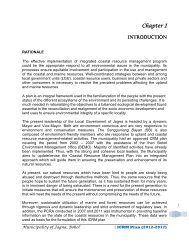
comprehensive disaster risk reduction and management plan - Jagna
comprehensive disaster risk reduction and management plan - Jagna
comprehensive disaster risk reduction and management plan - Jagna

Create successful ePaper yourself
Turn your PDF publications into a flip-book with our unique Google optimized e-Paper software.
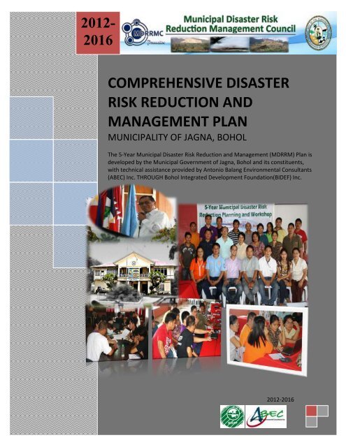
2012-<br />
2016<br />
COMPREHENSIVE DISASTER<br />
RISK REDUCTION AND<br />
MANAGEMENT PLAN<br />
MUNICIPALITY OF JAGNA, BOHOL<br />
The 5-Year Municipal Disaster Risk Reduction <strong>and</strong> Management (MDRRM) Plan is<br />
developed by the Municipal Government of <strong>Jagna</strong>, Bohol <strong>and</strong> its constituents,<br />
with technical assistance provided by Antonio Balang Environmental Consultants<br />
(ABEC) Inc. THROUGH Bohol Integrated Development Foundation(BIDEF) Inc.<br />
2012-2016
The 5-Year Municipal Disaster Risk Reduction <strong>and</strong> Management (MDRRM) Plan is developed by the Municipal Government of <strong>Jagna</strong>,<br />
Bohol <strong>and</strong> its constituents, with technical assistance provided Antonio Balang Environmental Consultants (ABEC) Inc. THROUGH<br />
Bohol Integrated Development Foundation (BIDEF) Inc.<br />
<strong>Jagna</strong>, Bohol Disaster Risk Reduction <strong>and</strong> Management Plan (2012 -2016) 2
TABLE OF CONTENTS<br />
PAGES<br />
4<br />
LIST OF TABLES 4<br />
LIST OF FIGURES 5<br />
ACKNOWLEDGMENT 6<br />
LIST OF ACRONYMS 7<br />
EXECUTIVE SUMMARY<br />
CHAPTERS CONTENTS PAGES<br />
CHAPTER I INTRODUCTION 10<br />
Rationale 11<br />
Planning Process 13<br />
Scope <strong>and</strong> Duration<br />
CHAPTER II<br />
CHAPTER III<br />
CHAPTER IV<br />
CHAPTER V<br />
DISASTERS AND HAZARD PROFILE<br />
Description of Municipality of <strong>Jagna</strong>, Bohol 13<br />
Type of hazards that frequently visited 15<br />
Community Risk Assessments results 21<br />
THE MUNICIPAL DISASTER RISK REDUCTION PLAN CONTENT AND THE<br />
FIVE YEAR FINANCIAL PROJECTION<br />
The Three Major Components of the Plan 31<br />
The MDRRM Fund Utilization Scenarios 33<br />
The Five Year MDRRM Plan Financial Projection 36<br />
THE FIVE- YEAR MUNICIPAL DISASTER RISK REDUCTION AND<br />
MANAGEMENT PLAN MATRIX<br />
The Disaster Prevention <strong>and</strong> Mitigation Program 37<br />
The DRR <strong>and</strong> Climate Change Adaptation Program 42<br />
Disaster Preparedness <strong>and</strong> Response Program 44<br />
Summary of Budget 47<br />
GENERAL IMPLEMENTING ARRANGEMENT<br />
Organizational Structure 48<br />
Task <strong>and</strong> Function <strong>and</strong> Departments Involve 49<br />
Institutional Working Arrangement 52<br />
General Monitoring <strong>and</strong> Evaluation Framework 53<br />
REFERENCES 54<br />
<strong>Jagna</strong>, Bohol Disaster Risk Reduction <strong>and</strong> Management Plan (2012 -2016) 3
LIST OF TABLES:<br />
Table Content Page Number<br />
1 Existing Surface Water of Municipality of <strong>Jagna</strong> 7<br />
2 Frequency <strong>and</strong> Occurrences of Flood in the Municipality of <strong>Jagna</strong> 16<br />
3 Result of Assessment of the 10 Barangays Susceptible to Flooding 16<br />
4 Result of Assessment of the 33 Barangays in the Municipality of <strong>Jagna</strong> 18<br />
5 Timeline of Disaster Happened in the Municipality of <strong>Jagna</strong>, Bohol 22<br />
6 Risk Assessment/ Ranking 24<br />
7 Vulnerability <strong>and</strong> Capacity Analysis 25<br />
8 Scenario 1: No Disaster happen for the Next Five Year 34<br />
9 Scenario 2: Disaster Happen Every Other Year of MDRRM Plan<br />
35<br />
Implementation<br />
10 Scenario 3: Disaster Happen Every Year of MDRRM Plan<br />
35<br />
Implementation<br />
11 Summary of Financial Resources Needed by MDRRM Plan 36<br />
12 Summary of Financial Resources Needed by MDRRM Plan per Program<br />
basis<br />
47<br />
LIST OF FIGURES:<br />
Figure Content Page Number<br />
1 Map of Bohol 10<br />
2 MDRRM Planning <strong>and</strong> Workshop Road Map 12<br />
3 <strong>Jagna</strong> Municipal Hall 13<br />
4 Rain Induced- L<strong>and</strong>slide Map 27<br />
5 Storm Surges Hazard Map 28<br />
6 Tsunami Hazard Map 29<br />
7 Liquefaction Hazard Map 30<br />
8 Multi-Hazard Map 31<br />
9 MDRRMO Organizational Structure 40<br />
<strong>Jagna</strong>, Bohol Disaster Risk Reduction <strong>and</strong> Management Plan (2012 -2016) 4
ACKNOWLEDGMENT<br />
We would like to give you a glimpse of behind the scenes to acknowledge the many individuals<br />
who played indispensable roles in the successful completion of the Municipal Disaster Risk<br />
Reduction <strong>and</strong> Management Plan of the Municipality of <strong>Jagna</strong>, Bohol:<br />
To Honorable Mayor Fortunato R. Abrenilla for his guidance, logistics <strong>and</strong> moral<br />
support;<br />
To the Honorable Sangguniang Bayan Members headed by Honorable Vice Mayor<br />
Exuperio C. Lloren for their guidance <strong>and</strong> support in legitimizing this <strong>plan</strong>;<br />
To Bohol Integrated Development Foundation (BIDEF) Incorporated for their<br />
invaluable contribution to the residents of <strong>Jagna</strong> in providing technical assistance in<br />
the formulation of this Plan;<br />
To the Municipal <strong>and</strong> Barangay Officials <strong>and</strong> to all LGU employees for their<br />
cooperation, coordination <strong>and</strong> unwavering support, who helped us, realize our<br />
goals;<br />
To the staff Municipal Disaster Risk Reduction <strong>and</strong> Management Office (MDRRMO)<br />
for providing the necessary information <strong>and</strong> data that helped us realizes the<br />
MDRRM Plan;<br />
And above all, to the Constituents of the Municipality of <strong>Jagna</strong>, Bohol who are in the<br />
frontlines of vulnerabilities when a hazards strikes; to whom this document is<br />
dedicated, for sharing to us their lives <strong>and</strong> shortcomings for the formulation of this<br />
Municipal Disaster Risk Reduction <strong>and</strong> Management Plans.<br />
- Municipal Disaster Risk Reduction <strong>and</strong> Management Council<br />
<strong>Jagna</strong>, Bohol Disaster Risk Reduction <strong>and</strong> Management Plan (2012 -2016) 5
LIST OF ACRONYMS<br />
ABEC Inc.<br />
ACDV<br />
BDRRMC<br />
BIDEF<br />
BFP<br />
CCA<br />
CP<br />
DENR-<br />
MGB<br />
DRR<br />
JEMRU<br />
HFA<br />
LDRRMC<br />
LDRRMF<br />
LDRRMO<br />
LGU<br />
MAO<br />
MDRRMC<br />
MDRRMO<br />
MDRRMP<br />
MENRO<br />
MSWDO<br />
NGO<br />
PDRRMF<br />
PO<br />
RA<br />
UNISDR<br />
Antonio Balang Environmental Consultants Incorporated<br />
Accredited Community Disaster Volunteer<br />
Barangay Disaster Risk Reduction <strong>and</strong> Management Council<br />
Bohol Integrated Development Program<br />
Bureau of Fire Protection<br />
Climate Change Adaptation<br />
Contingency Plan<br />
Department of Environment <strong>and</strong> Natural Resource- Mines <strong>and</strong><br />
Geosciences Bureau<br />
Disaster Risk Reduction<br />
<strong>Jagna</strong> Emergency Management <strong>and</strong> Rescue Unit<br />
Hyogo Framework of Action<br />
Local Disaster Risk Reduction <strong>and</strong> Management Council<br />
Local Disaster Risk Reduction <strong>and</strong> Management Fund<br />
Local Disaster Risk Reduction <strong>and</strong> Management Office<br />
Local Government Unit<br />
Municipal Agriculture office<br />
Municipal Disaster Risk Reduction <strong>and</strong> Management Council<br />
Municipal Disaster Risk Reduction <strong>and</strong> Management Office<br />
Municipal Disaster Risk Reduction <strong>and</strong> Management Plan<br />
Municipal Environment <strong>and</strong> Natural Resources office<br />
Municipal Social Welfare <strong>and</strong> Development Office<br />
Non-Government Organization<br />
Provincial Disaster Risk Reduction <strong>and</strong> Management Fund<br />
People’s Organization<br />
Republic Act<br />
United Nation International Strategy for Disaster Reduction<br />
<strong>Jagna</strong>, Bohol Disaster Risk Reduction <strong>and</strong> Management Plan (2012 -2016) 6
EXECUTIVE SUMMARY<br />
The municipality is located within the three (3) major rivers in Bohol: 1) Alejawan River is 69.28<br />
square kilometers or 39% of the total length of the river basin, The Alejawan River is the longest<br />
river in <strong>Jagna</strong> which has headwaters in the inl<strong>and</strong> mountainous portion <strong>and</strong> flows to the eastern<br />
part <strong>and</strong> drain directly to Mindanao Sea; 2) Manaba River is 12.52 square kilometers or 13% of the<br />
total length of the river basin <strong>and</strong>; 3) Inabanga River is 11.77 square kilometers or 1.89% of the<br />
total river basin. The river network system is moderately developed in the coastal area <strong>and</strong> well<br />
developed in the central portion of the town. But, in the northern inl<strong>and</strong> mountainous range, the<br />
river network system is poorly developed which indicates that in the northern upl<strong>and</strong> part of the<br />
municipality, most of the runoff can infiltrate into underground <strong>and</strong> form aquifers while in the<br />
central <strong>and</strong> coastal portion the water upstream is drained into the rivers <strong>and</strong> transported into the<br />
sea. The surface water runoff in the 3 major river basin in Alejawan, Manaba <strong>and</strong> Inabanga is<br />
(estimated to 792mm/yr/sq.m; 906mm/yr/sq.m; <strong>and</strong> 728mm/yr/sq.m respectively) within the<br />
municipal area is estimated to 204,854 cubic meter per day on the average which is sufficient to<br />
cover the projected water dem<strong>and</strong> of 9,925 cum/day for the irrigation.<br />
The Municipal Government of <strong>Jagna</strong> is also conserving <strong>and</strong> protecting the abundant water<br />
resources of the municipality. This prompted the LGU to enact the following: the Environment<br />
Code, the Coastal Resource Management Code, the Local Fishery Code <strong>and</strong> the Marine Protected<br />
Area Plans. Fish wardens <strong>and</strong> Bantay Dagat Task Forces have been organized <strong>and</strong> deputized for the<br />
enforcement of these codes. Certainly, enactment <strong>and</strong> implementation of these codes attributed<br />
to the garnering of <strong>Jagna</strong> of the award as Best LGU on SWM Enforcement <strong>and</strong> Implementation <strong>and</strong><br />
it becoming an appropriate learning site on SWM implementation in the province.<br />
Table 1: Existing Surface Water of Municipality of <strong>Jagna</strong><br />
SURFACE WATER LOCATION CLASSIFICATION<br />
Alejawan River Boundary of <strong>Jagna</strong> <strong>and</strong> Duero Public Water<br />
Balili Spring Balili Public Water<br />
Kinahugan Cabungaan Public Water<br />
Lonoy Spring Lonoy Public Water<br />
Odiong Odiong Public Water<br />
Lonoy Creek Lonoy Public Water<br />
Source: Municipal Engineer's Office LGU <strong>Jagna</strong> 2007<br />
Surface water in Lonoy is one of the major water sources of the town proper. The Tinubdan Spring<br />
in Lonoy is the main source of potable water drawn by gravity down to the water reservoirs located<br />
in Barangay Canukso, Cambugason <strong>and</strong> in Tejero. Other use of surface water is for the irrigation of<br />
the rice fields <strong>and</strong> farms in the barangay. The municipality may experience water scarcity especially<br />
during summer time or in season where there were only few rains. During this time there is a<br />
schedule of water service delivery in some areas like Canjulao <strong>and</strong> Can-upao. The water system<br />
<strong>Jagna</strong>, Bohol Disaster Risk Reduction <strong>and</strong> Management Plan (2012 -2016) 7
uses chlorine to purify water in the absence of filtration process to make it potable. Due to<br />
population <strong>and</strong> economic growth there is a need to protect <strong>and</strong> conserve the water resources.<br />
Coastal Resources. The Municipality of <strong>Jagna</strong> has a total of thirteen (13) coastal barangays with a<br />
coastline of 14 kilometers stretching from Barangay Can-uba to barangay Alejawan with rich<br />
coastal resources, mangroves, sea grasses, corals <strong>and</strong> beaches. It has a population of 10,628 or<br />
roughly 33% of the total population in the town living in the coastal zone as shown in Table Table 4.<br />
Among the known beaches of <strong>Jagna</strong> are Can-uba Beach, Bunga Mar Beach, Pangdan’s Paseo del<br />
Mar, Delilah’s Rock Resort, Batong-buhay Can-upao Beach <strong>and</strong> Alejawan Beach. Record shows that<br />
the municipality has 146 fish species belonging to 27 families, of which 2.83% are target fish<br />
species while 96.78% are non-target species. The target fishes are those mostly favored by fishers<br />
either for food of their own or for the market. The non-target fishes are those which are not<br />
targeted for food because of its small size, but sometimes targeted for aquarium fish trade for<br />
export due to colourful appearance. Damselfishes of family Pomacentridae <strong>and</strong> anthias of<br />
Anthiinae are the non-target species abundant in the area. Sea urchins (tujom) <strong>and</strong> sea stars,<br />
different species of oysters, crown of fish sea star, sea cucumbers <strong>and</strong> giant clams are among the<br />
invertebrates thriving in the area.<br />
Marine Protected Areas. The municipality had established nine (9) marine protected sanctuaries in<br />
coastal barangays of Can-uba, Ipil, Cantagay, Bunga Mar, Pangdan, Nausok, Tubod-Mar, Larapan<br />
<strong>and</strong> Naatang. The Coastal Law Enforcement Council is now operational in the protection <strong>and</strong><br />
<strong>management</strong> of the coastal resources in the municipality. Bantay Dagat Task Force <strong>and</strong> Fish<br />
Wardens are now operating in the coastal areas of the town, to apprehend illegal practices of the<br />
fisherfolks. They are supported with the units seaborne patrol facilities.<br />
Climate <strong>and</strong> Weather Pattern. <strong>Jagna</strong> falls under Type II climate classification described as having<br />
no pronounced dry season but with a very pronounced maximum rain period. Maximum rainfall is<br />
observed to occur on the months of August, September <strong>and</strong> October, even extending until<br />
December. Located along or very near the eastern coast, as characterized by areas under Type II<br />
classification, <strong>Jagna</strong> is prone to the northeast monsoon (amihan). Based on the results of the<br />
Coastal Resource Management (CRM) survey in March 2002, the northeast monsoon season is<br />
from October to May while the southeast monsoon (habagat) starts in June <strong>and</strong> ends in September.<br />
While the two most significant typhoons that visited the Municipality of <strong>Jagna</strong> are Typhoon Nitang<br />
in September 01, 1984 <strong>and</strong> Typhoon Ruping (Tropical Storm Mike) on November 30, 1990. These<br />
two super typhoons devastated the agriculture <strong>and</strong> fishery resources of the municipality as well as<br />
the houses <strong>and</strong> other infrastructure <strong>and</strong> lifeline services of the municipality. Aside from the direct<br />
effect of strong winds of the typhoon <strong>and</strong> big waves of the monsoon winds, it produces also ample<br />
amount of rainfalls to sea waters that causes floods <strong>and</strong> l<strong>and</strong>slide to low lying areas of the<br />
municipality. Intensity 7 earthquake hits the Municipality of <strong>Jagna</strong> twenty two years ago, this was<br />
resulted to the injury of an estimated 13 persons <strong>and</strong> the collapsed of church bell tower of the<br />
municipality.<br />
<strong>Jagna</strong>, Bohol Disaster Risk Reduction <strong>and</strong> Management Plan (2012 -2016) 8
The continued occurrences of these natural hazards increases the vulnerabilities of the<br />
communities that put them into an endless poverty situation due to damages of properties <strong>and</strong><br />
devastation to their livelihoods, <strong>and</strong> sometime leads to loss of life. Taking the opportunity that<br />
Disaster Risk Reduction is nowadays a global concerns particularly to the vulnerably municipalities<br />
like <strong>Jagna</strong>, the municipality started the process of conducting barangay based community <strong>risk</strong><br />
assessment, barangay DRRM <strong>plan</strong>ning <strong>and</strong> budgeting workshops <strong>and</strong> series of community<br />
awareness seminars on <strong>disaster</strong> <strong>risk</strong> <strong>reduction</strong> <strong>and</strong> climate change adaptation to generate support<br />
<strong>and</strong> encouragement among village officials <strong>and</strong> communities to formulate <strong>and</strong> implement the 5-<br />
Year Comprehensive Municipal Disaster Risk Reduction <strong>and</strong> Management Plan.<br />
The <strong>Jagna</strong> Municipal Disaster Risk Reduction <strong>and</strong> Management Plan will serve as a guide in the<br />
implementation a proactive Disaster <strong>risk</strong> <strong>reduction</strong> programs that emphasize the five pillars called:<br />
1) Governance by making <strong>disaster</strong> <strong>risk</strong> <strong>reduction</strong> a priority agenda for sustainable development; 2)<br />
Risk Assessment by improving <strong>risk</strong> information <strong>and</strong> early warning; 3) Knowledge <strong>and</strong> Education<br />
through building culture of safety <strong>and</strong> resiliency among vulnerable communities; 4) Vulnerability<br />
Reduction by reducing the <strong>risk</strong>s of Key sectors; <strong>and</strong> 5) Disaster Preparedness <strong>and</strong> Response for<br />
timely <strong>and</strong> effective response mechanism.<br />
<strong>Jagna</strong>, Bohol Disaster Risk Reduction <strong>and</strong> Management Plan (2012 -2016) 9
THE COMPREHENSIVE MUNICIPAL DISASTER RISK REDUCTION AND MANAGEMENT PLAN OF<br />
JAGNA, BOHOL<br />
I. INTRODUCTION:<br />
A. RATIONALE<br />
<strong>Jagna</strong> is situated along the southeastern coast of Bohol facing<br />
Mindanao Sea. It is located 63.2 kilometers from the capital city of<br />
Tagbilaran, bounded on the north by the municipality of Sierra<br />
Bullones, blue waters of <strong>Jagna</strong> Bay on the south, <strong>and</strong> the towns of<br />
Duero <strong>and</strong> Garcia Hern<strong>and</strong>ez on the east <strong>and</strong> west respectively. It<br />
has 33 barangays with a total l<strong>and</strong> area of 12,063 hectares.<br />
As a result of the process undertaken through the Barangay<br />
Development Planning through Participatory Rural Appraisal, the<br />
Municipality of <strong>Jagna</strong> is subdivided into three major categories.<br />
Figure 1: Map of Bohol<br />
The urban area of <strong>Jagna</strong>, appropriately called the Metro <strong>Jagna</strong> cluster is composed of the<br />
barangays of Bunga Mar, Can-upao, Looc, Pagina, Canjulao, Poblacion, Tejero <strong>and</strong> Pangdan. It<br />
covers a total l<strong>and</strong> area of 316.05 hectares equivalent to 2.62% of the total area of the municipality.<br />
The Coastal <strong>Jagna</strong> cluster is composed of barangays located along the coast fronting the <strong>Jagna</strong> Bay,<br />
other than those already classified as part of the Metro <strong>Jagna</strong>. It covers a total l<strong>and</strong> area of 747.04<br />
hectares or 6.19% <strong>and</strong> include Alejawan, Cantagay, Can-uba, Ipil, Larapan, Naatang, Nausok, ,<br />
Tubod Mar.<br />
Ninety one percent (91%) of the total l<strong>and</strong> area of <strong>Jagna</strong> is considered to comprise the Upl<strong>and</strong><br />
<strong>Jagna</strong> cluster. With a total alnd area of 10, 999.91 hectares, it covers the barangays of Balili, Boctol,<br />
Bunga Ilaya, Buyog, Cabungaan, Calabacita, Cambugason, Can-ipol, Cantuyoc, Faraon, Kinagbaan,<br />
Laca, Lonoy, Malbog, Mayana, Odiong <strong>and</strong> Tubod Monte.<br />
The municipality is predominantly comprised of steep hills <strong>and</strong> mountains. The coastal areas are<br />
normally flat, but less than a kilometer away from the shoreline, the slope changes from gently<br />
sloping to steep hills <strong>and</strong> mountains. 14.13% of the total l<strong>and</strong> area is classified as level or nearly<br />
level. 28.62% on the other h<strong>and</strong>, is gently sloping to moderately sloping. While the rest of the area<br />
comprising the remainder of the 57.25% is classified as hills to steep mountains. Based on the slope<br />
classification, those areas identified as moderately sloping to mountains are classified as public or<br />
forestl<strong>and</strong> areas. And for those level or gently sloping areas, they are classified as Alienable <strong>and</strong><br />
Disposable l<strong>and</strong>s. Forestl<strong>and</strong>s using this classification will cover 59.42% of the total l<strong>and</strong> area of the<br />
municipality.<br />
<strong>Jagna</strong>, Bohol Disaster Risk Reduction <strong>and</strong> Management Plan (2012 -2016) 10
Last May 27, 2010 Former President Gloria Macapagal Arroyo sign into law the Disaster Risk<br />
Reduction <strong>and</strong> Management Act of 2010 to amend the three decade Presidential Decree 1566 the<br />
old <strong>disaster</strong> <strong>management</strong> law of the Philippines. The RA 10121 institutionalizes the <strong>disaster</strong> <strong>risk</strong><br />
<strong>reduction</strong> <strong>and</strong> <strong>management</strong> system not only in the National Government but also to all local<br />
government units in the country. One of the important features of this new law is the<br />
<strong>comprehensive</strong> utilization of 5% calamity fund <strong>and</strong> now the <strong>disaster</strong> <strong>risk</strong> <strong>reduction</strong> <strong>and</strong><br />
<strong>management</strong> fund (DRRMF). It is very clear to us to all government units that 5% calamity fund<br />
before can only be used if there is a declaration of one area under the state of calamity. Based on<br />
the Section 21 of RA 10121, the 70% of LDRRM Fund can be used for pre <strong>disaster</strong> activities that can<br />
make the LGU’s more proactive in Disaster <strong>risk</strong> <strong>reduction</strong>.<br />
In order for the LGU to be efficient <strong>and</strong> effective in the Utilization of the LDRRM Fund the law<br />
requires them to formulate a <strong>comprehensive</strong> DRRM Plan as basis for the disbursement of the fund<br />
(Par. 1 of Sec. 21 of RA 10121).<br />
B. PLANNING PROCESS<br />
The primary goal of the MDRRM Plan is to improve the existing practices of the LGU on the <strong>disaster</strong><br />
<strong>risk</strong> <strong>reduction</strong> <strong>and</strong> <strong>management</strong> through better partnership <strong>and</strong> working relationships among the<br />
departments within the local government unit, civil society organization private sectors <strong>and</strong><br />
community <strong>disaster</strong> volunteers (CDV’s).<br />
Gender Responsive Municipality:<br />
The integration of gender <strong>and</strong> explicit consideration of development (social, economic, physical,<br />
cultural <strong>and</strong> political forces), determines how differently women <strong>and</strong> men participate in benefit<br />
from <strong>and</strong> control resources <strong>and</strong> activities. The combined gender-responsive <strong>and</strong> participatory<br />
approach in the entire <strong>plan</strong>ning <strong>and</strong> decision-making process from <strong>plan</strong> formulation/updating, <strong>plan</strong><br />
implementation <strong>and</strong> monitoring <strong>and</strong> evaluation is a manifestation of good governance that will<br />
bring us closer to our goal of having men <strong>and</strong> women equally contributing to <strong>and</strong> benefiting from<br />
development. The utilization of gender-responsive <strong>plan</strong>ning approach ensures or provides a<br />
mechanism for integrating sustainable indicators in <strong>plan</strong>ning.<br />
In the formulation of 5 Year MDRRM <strong>plan</strong>, there are four specific objectives that were agreed upon<br />
by the participants in order to attain a quality results <strong>and</strong> better guidelines in the formulation of<br />
the <strong>plan</strong>. And these are as follows:<br />
1. To Consolidate the BDRRM <strong>plan</strong>s of the BLGU as integral component of Comprehensive<br />
Municipal DRRM Plan<br />
2. To conduct Participatory Capacity <strong>and</strong> Vulnerability Assessment (PCVA) to be more objectives<br />
in the budget prioritization for the 70% of Local Disaster Risk Reduction <strong>and</strong> Management<br />
Fund.<br />
3. To consolidate the programs <strong>and</strong> project of the every department of the LGU related to DRR<br />
<strong>and</strong> allocate funds from LDRRM Fund.<br />
<strong>Jagna</strong>, Bohol Disaster Risk Reduction <strong>and</strong> Management Plan (2012 -2016) 11
4. To formulate the <strong>comprehensive</strong> DRRM Plan of the Municipality<br />
The 3-day MDRRM Planning <strong>and</strong> workshop is also a product of various strategies, activities <strong>and</strong><br />
processes that have been undertaken by the LGU through its Municipal Disaster Risk Reduction <strong>and</strong><br />
Management Council (MDRRMC).<br />
Below are the governance-driven strategies <strong>and</strong> evolutionary <strong>plan</strong>ning processes <strong>and</strong> activities, to<br />
wit:<br />
Barangay level:<br />
1. Through the Governance, Infrastructure, Food <strong>and</strong> Tourism (GIFT) Project of Bohol Integrated<br />
Development Foundation (BIDEF) Incorporated, they have provided technical assistance to the<br />
fifteen high <strong>risk</strong>s Barangays of <strong>Jagna</strong> in the formulation of Barangay DRRM Plan <strong>and</strong> the restructuring<br />
of their Barangay Disaster Risk Reduction <strong>and</strong> Management Committee (previously<br />
known as Barangay Disaster Coordinating Council). As of October 2011, all fifteen high <strong>risk</strong>s<br />
barangays was already completed their BDRRM <strong>plan</strong>s <strong>and</strong> restructuring/ re-organizing of<br />
BDRRMC.<br />
2. Community Emergency Drill has been <strong>plan</strong>ned to be conducted to the fifteen high <strong>risk</strong>s<br />
communities using the guidelines that have been written in their BDRRM <strong>plan</strong>s.<br />
Municipal Level:<br />
A three-day <strong>plan</strong>ning process was agreed upon by the MDRRMC to draft the municipal <strong>disaster</strong> <strong>risk</strong><br />
<strong>reduction</strong> <strong>and</strong> <strong>management</strong> <strong>plan</strong>. On the first day, the discussion on the salient provisions of RA<br />
10121 <strong>and</strong> the Basic Concept of DRR was provided, followed by the presentation of the results of<br />
community <strong>risk</strong> assessments made by the barangays who underwent BDRRM <strong>plan</strong>ning <strong>and</strong><br />
budgeting workshop with BIDEF. Consolidation of Municipal wide Risk Assessment <strong>and</strong> finalization<br />
of MDRRMO structure, review of financial capability of the LGU to fund MDRRM <strong>plan</strong> <strong>and</strong> the 5<br />
year MDRRM <strong>plan</strong>ning process on the second day. For the third day, was a continuation of the<br />
<strong>plan</strong>ning process <strong>and</strong> final financial projection for five year budgetary requirements was carried out<br />
to ensure the feasibility <strong>and</strong> efficiency that the <strong>plan</strong> is implementable by the LGU. (See Figure 4:<br />
MDRRM Planning <strong>and</strong> Workshop Road Map)<br />
Figure 2: MDRRM Planning <strong>and</strong> Workshop Road Map<br />
INPUT: Salient Provision<br />
of RA 10121 <strong>and</strong> DRRM<br />
Models<br />
Participatory Capacity <strong>and</strong><br />
Vulnerability Assessment<br />
(MDRRMC Perspective)<br />
Presentation of Community<br />
Risk Assessment <strong>and</strong> its Local<br />
Risk Patterns<br />
Legislation<br />
Comprehensive DRRM<br />
Planning<br />
Review of MDRRMC<br />
Structures<br />
<strong>Jagna</strong>, Bohol Disaster Risk Reduction <strong>and</strong> Management Plan (2012 -2016) 12
C. SCOPE AND DURATION<br />
The 5-year MDRRM Plan (2012 – 2016) focuses on the 5 core<br />
program namely; 1) Disaster Prevention Program which focuses<br />
on the physical <strong>and</strong> structural component of <strong>disaster</strong> <strong>risk</strong><br />
<strong>reduction</strong>, 2) Disaster Mitigation Program which discuss the<br />
knowledge <strong>management</strong>, social protection, public health,<br />
agriculture resiliency, early warning system, barangay digitized<br />
hazard mapping, networking <strong>and</strong> linkaging <strong>and</strong> the monitoring<br />
<strong>and</strong> evaluation of DRR <strong>plan</strong> <strong>and</strong> its implementation. And 3) the<br />
Disaster Preparedness <strong>and</strong> Response Program – the highlights of Figure 3: <strong>Jagna</strong> Municipal Hall<br />
this program is the organizing <strong>and</strong> accreditation of community <strong>disaster</strong> volunteers, relief stockpiling,<br />
emergency drills, <strong>and</strong> purchase of emergency response related equipments.<br />
The members of the MDRRMC shall be strengthened organizationally <strong>and</strong> technically to ensure<br />
their effectiveness in overseeing the MDRMM Plan of the municipality.<br />
For the meantime that LGU don’t have the financial capacity to appoint a regular MDRRM officer,<br />
the Municipal Planning <strong>and</strong> Development Coordinator (MPDC) will be designated as the DRRM<br />
Officer. He shall be organizationally <strong>and</strong> technically strengthened to h<strong>and</strong>le with all priority<br />
activities envisioned by the 5-year municipal DRRM Plan. A review of MPDC cum MDRRMO tasks,<br />
functions <strong>and</strong> responsibilities related to the implementation of DRRM <strong>plan</strong> shall be immediately<br />
made to iron out its effectiveness <strong>and</strong> efficiency in carrying out the tasks as <strong>disaster</strong> <strong>risk</strong> <strong>reduction</strong><br />
manager <strong>and</strong> to attain the “Zero Casualty” goal of the municipality.<br />
The Accredited Community Disaster Volunteers (ACDV’s) shall be properly organized <strong>and</strong><br />
eventually institutionalized through the close monitoring of Barangay Disaster Risk Reduction <strong>and</strong><br />
Management Committee (BDRRMC) with the technical assistance of MDRRMO.<br />
II.<br />
DISASTERS AND HAZARD PROFILE:<br />
A. Description of Municipality of <strong>Jagna</strong> Bohol<br />
<strong>Jagna</strong> is a 4th class municipality in the province of Bohol, Philippines. According to the 2000 census,<br />
it has a population of 30,643 people in 5,957 households.<br />
<strong>Jagna</strong> is a busy little town on the southern coast of Bohol, so busy, everyday is market day. Of<br />
interest to travellers is the church with its ceiling frescoes <strong>and</strong> the bats that sleep by the altar in the<br />
daytime; arguably the best cockpit on the isl<strong>and</strong>; the waterfall, a setting so lovely <strong>and</strong> accessible<br />
that photographers from Manila use it on occasion; <strong>and</strong> the double reef just off the shore.<br />
<strong>Jagna</strong>, Bohol Disaster Risk Reduction <strong>and</strong> Management Plan (2012 -2016) 13
The double reef is a protected zone <strong>and</strong> marked off by buoys so fishermen can't even go there. A<br />
retired ex-prosecutor, who has the power to arrest, has the welfare of the reef as his hobby so<br />
don't even think about dynamite fishing near <strong>Jagna</strong>.<br />
<strong>Jagna</strong> has a new market; the last one burned down in 1998 <strong>and</strong> the market has occupied the plaza<br />
ever since. Now that the new market is up, the plaza can finally be reclaimed, but that will take a<br />
bit of time since some of the merchants occupying the plaza don't have the money to move into<br />
the new market.<br />
Like Tagbilaran, <strong>Jagna</strong> is a port town. Ferries run daily to <strong>and</strong> from other isl<strong>and</strong>s but currently ferry<br />
transportation to Mindanao is only available to Butuan. The gorgeous isl<strong>and</strong> of Camiguin is visible<br />
from <strong>Jagna</strong> but only accessible by pumpboat.<br />
For places to stay, there are a few: some rooms by the port, the Garden cafe, but the pension<br />
house in Pangdan is the nicest.<br />
The municipality of <strong>Jagna</strong> has a total of 33 barangays that has been clustered into three; 1) Metro<br />
<strong>Jagna</strong> – covering 8 urban/coastal barangays 2) Coastal <strong>Jagna</strong> – which covers 14 coastal barangays<br />
<strong>and</strong> 3) Upl<strong>and</strong> <strong>Jagna</strong> – comprises of 17 upl<strong>and</strong> barangays. The total number of households reached<br />
5,957 <strong>and</strong> the average household size was 4.4 persons. In the year 2007, the total population of the<br />
municipality reaches to 32,034 (NSO 2007) covering the 0.61% growth rate.<br />
Biological Resources:<br />
Mangroves. Naturally grown mangroves of 400 st<strong>and</strong>s of Bakhaw (Rhizophora sp.) <strong>and</strong> 30 trunks of<br />
Pagatpat (Sonneratia alba) exist only along the coastline of Barangay Can-upao. Assessment results<br />
show that majority (70%) of the Bakhaw species are classified matured while the pagatpat species<br />
has more or less equal percentage of young <strong>and</strong> mature trees.<br />
Seagrass. Participatory coastal resource assessment results conducted by BEMO <strong>and</strong> CRMP TWG in<br />
April 2002 show that there are six (6) species of seagrasses in the coast of <strong>Jagna</strong>. Barangays Canuba<br />
<strong>and</strong> Naatang have substantial seagrass cover as well as Barangay Ipil, Can-upao <strong>and</strong> Pangdan.<br />
These seagrasses grow mostly on rocks <strong>and</strong> rocky surfaces.<br />
Estuaries. The municipality has five major estuaries. These are located in Barangays Alejawan,<br />
Pangdan, in barangay-boundaries of Pagina-Looc <strong>and</strong> Pagina-Poblacion, <strong>and</strong> in barangay Can-upao.<br />
Secondary small estuaries also exist in Barangays Poblacion, Larapan, Looc, Can-uba, Can-upao <strong>and</strong><br />
Naatang.<br />
Mineral Resources. The municipality of <strong>Jagna</strong> has rich potential sources in limestone deposit, a<br />
very important component for cement production, all of these areas are outside the timberl<strong>and</strong> or<br />
forestl<strong>and</strong> area. The most part of the municipality is covered by Sierra Bullones bedrock formation,<br />
which is capped by massive limestone strongly correlating with the barili formation of South<br />
<strong>Jagna</strong>, Bohol Disaster Risk Reduction <strong>and</strong> Management Plan (2012 -2016) 14
Central Cebu. In fact in previous years Barangay Malbog used to engage in quarrying of limestone<br />
for hollow block component production but due to the existing provincial law that prohibits any<br />
form of quarrying, the said practice has been stopped. Quarry of limestone in the area of Malbog<br />
<strong>and</strong> Laca generates income for the locality from the permit issued from the provincial government,<br />
as m<strong>and</strong>ated by the Local Government Code there will be share of 30% for the municipality <strong>and</strong><br />
40% for the barangay. The lot owners <strong>and</strong> the local people had benefited from this activity e.g.<br />
employment <strong>and</strong> among others. Another quarry site is located in barangay Boctol where<br />
serpentine mineral is extracted <strong>and</strong> mainly used by the Department of Public Works <strong>and</strong> Highway<br />
for the maintenance of roads.<br />
B. Type of hazards that frequently visited<br />
Monsoon Winds/Storm Surges:<br />
There are two types’ monsoon winds in the Philippines, the southwest monsoon (May-October) or<br />
known as the "Habagat" <strong>and</strong> the dry winds of the northeast monsoon (November-April) as the<br />
"Amihan". The Habagat season is characterized by cold <strong>and</strong> hot humid weather, frequent heavy<br />
rainfall <strong>and</strong> typhoons, <strong>and</strong> a prevailing wind from the west. The Amihan season is characterized by<br />
hot temperatures, little or no rainfall, <strong>and</strong> a prevailing wind from the east. These monsoon winds<br />
produce big waves that affects the livelihood of the fisherflok every yearspecially to those<br />
communities facing the sea like the Municipality of <strong>Jagna</strong>. According to the Community Risk<br />
Assessment (CRA) result of the <strong>Jagna</strong>, there are 13 coastal barangays in the muncipality dependent<br />
to fishing as their major source of livelihood that severely affected during the occurrences of this<br />
hazard every year.<br />
Typhoon:<br />
Like many coastal municipalities in the Philippines, the Municipality of <strong>Jagna</strong> is frequently visited by<br />
typhoons. The two strongest typhoons that hit the municipality are the Typhoon Nitang in 1984<br />
<strong>and</strong> Typhoon Ruping in 1990; these typhoons paralyzed the business operations <strong>and</strong> livelihood of<br />
the majority of the residents of <strong>Jagna</strong> for a week. 50-80 percent of the total houses of the 13<br />
coastal barangays were totally damaged <strong>and</strong> other infrastructures were partially damaged. The<br />
agricultural production was devastated that put the farmers into a miserable condition.<br />
Flooding/Flash Floods:<br />
Most flooding in the municipality of <strong>Jagna</strong> occurs on floodplains. These are natural water storage<br />
areas containing rivers or creeks that flow continuously or intermittently. Historically, the easy<br />
access to water the easy access to water <strong>and</strong> the rich diversity <strong>and</strong> fertility of the flood plains have<br />
always attracted by human settlements. Hence, with the ever-increasing human intervention in the<br />
upstream catchments, the downstream consequences <strong>and</strong> <strong>risk</strong>s increase. It is observed that the<br />
flood prone areas with state height of floods that range from 0.4 meters to 1.2 meters high during<br />
heavy rains, more so during high tides, are in the barangays of Looc (0.4m), Tejero (0.5m), Pagina<br />
(1m), Pondol, Poblacion (1m) <strong>and</strong> Bunga Mar (1.2m) see Table 8. Since flooding is a natural hazard<br />
<strong>Jagna</strong>, Bohol Disaster Risk Reduction <strong>and</strong> Management Plan (2012 -2016) 15
<strong>and</strong> it is affected annually by intensive tropical weather patterns which resulted to a very<br />
significant financial cost <strong>and</strong> personal hardship within the affected areas in the municipality. It is<br />
also often exacerbated by ignorant <strong>and</strong> negligent human intervention in the environment. Based<br />
on this information the LGU of <strong>Jagna</strong> can make better choices about residential environment <strong>and</strong><br />
business investment. Therefore l<strong>and</strong> use <strong>plan</strong>ning is recognized as being the best means of<br />
avoiding or minimizing future flooding problems that stress <strong>risk</strong> to life <strong>and</strong> property damage. Strict<br />
<strong>and</strong> uncompromising enforcement of strategies <strong>and</strong> controls to counter flooding is very vital.<br />
Table 2: Frequency <strong>and</strong> Occurrence of Flooding in the Municipality of <strong>Jagna</strong><br />
Barangay<br />
Annually<br />
Frequency Remarks (state<br />
Every 5<br />
years<br />
Every 10<br />
years<br />
Every 100<br />
years<br />
height of floods <strong>and</strong> other<br />
relevant information)<br />
Alejawan 0.60 m<br />
Bunga Mar 0.25 m<br />
Cabungaan 0.50 m<br />
Can-upao 0.50 m<br />
Looc 0.40 m<br />
Naatang 0.60 m<br />
Pagina 0.50 m<br />
Poblacion 0.50 m<br />
Tejero 0.25 m<br />
Source: MPDC LGU <strong>Jagna</strong> 2007<br />
Results of MGB Assessment to Flooding<br />
Based on result of the field geo-hazard survey conducted by the Mines <strong>and</strong> Geosciences Bureau<br />
(MGB-Region VII) in October 2-13, 2006, the Municipality of <strong>Jagna</strong> is vulnerable to flooding as<br />
shown in Table 9. There are eight (8) barangays that are susceptible to flooding which describes as<br />
to the type <strong>and</strong> the cause of the hazard.<br />
Table 3: Results of assessment of the ten (10) Barangays Susceptible to Flooding<br />
Barangay<br />
Bunga Mar<br />
Poblacion<br />
Type of<br />
Flooding<br />
Sheet<br />
flooding<br />
<strong>and</strong> riverine<br />
flooding<br />
Riverine<br />
Flooding<br />
Cause of<br />
Flooding/Remarks<br />
Poor drainage, water,<br />
coming from Bgys. Bunga<br />
Ilaya <strong>and</strong> Laca<br />
Flooding common during<br />
heavy rains aggravated<br />
during high tide when<br />
floodwaters are blocked by<br />
tidal waters, poor drainage<br />
Recommendations<br />
Provide adequate <strong>and</strong> appropriate<br />
drainage facilities, regulate/control<br />
development of upstream/<br />
catchment area<br />
Provide adequate <strong>and</strong> appropriate<br />
drainage facilities, regulate/control<br />
development of<br />
upstream/catchment area<br />
<strong>Jagna</strong>, Bohol Disaster Risk Reduction <strong>and</strong> Management Plan (2012 -2016) 16
Barangay<br />
Tejero<br />
Looc<br />
Pangdan<br />
Kinagbaan<br />
Type of<br />
Flooding<br />
Sheet <strong>and</strong><br />
Riverine<br />
Flooding<br />
Sheet<br />
Flooding<br />
Sheet <strong>and</strong><br />
Riverine<br />
Flooding<br />
Sheet <strong>and</strong><br />
Riverine<br />
Flooding<br />
Cambugason Riverine<br />
Flooding<br />
Lonoy<br />
Alejawan<br />
Riverine<br />
Flooding<br />
Riverine<br />
Flooding<br />
Source: MBG-7 Geo-hazard Assessment 2007<br />
Cause of<br />
Flooding/Remarks<br />
system.<br />
Flooding common during<br />
heavy rains up to 0.5 meter<br />
depth, aggravated during<br />
high tide when floodwaters<br />
are blocked by tidal waters,<br />
poor drainage system.<br />
Local flooding coming from<br />
rice paddies<br />
Local flooding at Purok 7,<br />
aggravated during high tide,<br />
poor drainage system<br />
Flooding at creek bounding<br />
with Bgy. Bunga Ilaya due to<br />
debris clogging the small<br />
culvert.<br />
Flood prone area near banks<br />
of Alejawan river, 3 houses<br />
located near the river bank<br />
Flood prone area near banks<br />
of Alejawan river, about 10<br />
houses located near the<br />
river bank<br />
Flood prone area near banks<br />
of Alejawan river. Flooding<br />
in the low-lying area near<br />
highway due to newly<br />
elevated highway with small<br />
existing circular culverts<br />
Recommendations<br />
Provide adequate <strong>and</strong> appropriate<br />
drainage facilities, regulate/control<br />
development of<br />
upstream/catchment area<br />
Provision of adequate drainage<br />
facilities<br />
Provision of adequate drainage<br />
facilities<br />
Change to bigger concrete box<br />
culvert<br />
Constant communication <strong>and</strong><br />
l<strong>and</strong>slide updates with upl<strong>and</strong><br />
Barangay Mayana. Evacuation of<br />
residents with houses near banks of<br />
Alejawan River during heavy <strong>and</strong><br />
continuous rains<br />
Constant communication <strong>and</strong><br />
l<strong>and</strong>slide updates with upl<strong>and</strong><br />
Barangay Mayana. Evacuation of<br />
residents with houses near banks of<br />
Alejawan River during heavy <strong>and</strong><br />
continuous rains<br />
Constant communication <strong>and</strong><br />
l<strong>and</strong>slide updates with upl<strong>and</strong><br />
Barangay Mayana. Evacuation of<br />
residents with houses near banks of<br />
Alejawan River during heavy <strong>and</strong><br />
continuous rains. Change to bigger<br />
culverts near highway to prevent<br />
flooding.<br />
L<strong>and</strong>slide:<br />
The Mines <strong>and</strong> Geosciences Bureau (MGB-Region VII) had conducted a rapid field geo-hazard<br />
assessment in the forty-eight (48) municipalities in the Province of Bohol Isl<strong>and</strong>. In October 2-13,<br />
<strong>Jagna</strong>, Bohol Disaster Risk Reduction <strong>and</strong> Management Plan (2012 -2016) 17
2006, the rapid field assessment in the municipality of <strong>Jagna</strong> was conducted which focused on<br />
barangays that are located on foot slopes, mid slopes <strong>and</strong> mountain ridges. Each barangay was<br />
rated on the following scale: a) low, b) moderate <strong>and</strong> c) high l<strong>and</strong>slide susceptibility as describe on<br />
Table 10.<br />
Table 4: Results of Assessments of the Thirty-Three (33) Barangays in the Municipality of <strong>Jagna</strong><br />
Barangay<br />
Mayana<br />
Mayana<br />
Calabacita<br />
Tubod<br />
Monte<br />
Boctol<br />
Balili<br />
Buyog<br />
Cantuyoc<br />
L<strong>and</strong>slide<br />
Susceptibility<br />
Rating<br />
High<br />
High<br />
High<br />
High<br />
High<br />
Moderate<br />
Moderate<br />
Moderate<br />
Recommendations<br />
Monitor progress of mass movement (e.g l<strong>and</strong>slide, tension<br />
cracks),develop an early warning device system, identify evacuation<br />
site, observe for rapid increase/decrease in Bangwalog/Alejawan<br />
river water levels, possibly accompanied by increased turbidity (soil<br />
content), observed saturated ground or seeps in areas that are not<br />
typically wet <strong>and</strong> constant communication <strong>and</strong> updates with nearby<br />
downslope barangays.<br />
Regular monitoring of progress of mass movement (l<strong>and</strong>slide <strong>and</strong><br />
tension cracks) especially during heavy <strong>and</strong> continuous rains at Bgy.<br />
Malbog proper, which have affected about 24 houses. Identify<br />
evacuation site if situation becomes serious.<br />
Monitor progress of mass movement (e.g. l<strong>and</strong>slide, tension cracks)<br />
at Sitio Katiwihan that has already affected 5 houses <strong>and</strong> at Sitios<br />
Ilawod <strong>and</strong> Napo. Residents are advised to vacate the affected areas<br />
during heavy <strong>and</strong> continuous rains.<br />
Monitor progress of mass movement (e.g. l<strong>and</strong>slide, tension cracks)<br />
at Sitio Kago-ko, Purok 2 <strong>and</strong> at Purok 1, develop an early warning<br />
device system <strong>and</strong> identify evacuation site.<br />
Monitor progress of mass movement (e.g. l<strong>and</strong>slide, tension<br />
cracks)near the boundaries of Bgy. Boctol <strong>and</strong> Mayana, within the<br />
limestone cliffs <strong>and</strong> forest zone, develop an early warning device<br />
system.<br />
Observe for presence of mass movement (e.g. l<strong>and</strong>slide, tension<br />
cracks), observe for saturated ground or seeps in areas that are not<br />
typically wet <strong>and</strong> constant communication <strong>and</strong> updates with nearby<br />
barangays.<br />
Observe for presence of mass movement (e.g. l<strong>and</strong>slide, tension<br />
cracks), observe for saturated ground or seeps in areas that are not<br />
typically wet <strong>and</strong> constant communication <strong>and</strong> updates with nearby<br />
barangays.<br />
Monitor progress of mass movement (e.g. l<strong>and</strong>slide, tension cracks)<br />
at road cut at Sitio Taytay especially during heavy <strong>and</strong> continuous<br />
rains.<br />
Odiong Moderate Observe for presence of mass movement (e.g l<strong>and</strong>slide, tension<br />
<strong>Jagna</strong>, Bohol Disaster Risk Reduction <strong>and</strong> Management Plan (2012 -2016) 18
Barangay<br />
L<strong>and</strong>slide<br />
Susceptibility<br />
Rating<br />
Recommendations<br />
cracks), observe for saturated ground or seeps in areas that are not<br />
typically wet <strong>and</strong> constant communication <strong>and</strong> updated with nearby<br />
barangays. Constant declogging of debris of spillway to prevent<br />
flooding.<br />
Alejawan Moderate<br />
Monitor progress of mass movement (e.g. l<strong>and</strong>slide, tension cracks)<br />
at roadcut near boundary with Bgy. Cambugason. Observe for rapid<br />
increase/decrease in water levels of Alejawan River, possibly<br />
accompanied by increased turbidity (soil content). Constant<br />
communication <strong>and</strong> l<strong>and</strong>slide updates with upl<strong>and</strong> Barangay<br />
Mayana.<br />
Canjulao Moderate<br />
Monitor progress of mass movement (e.g. l<strong>and</strong>slide, tension cracks)<br />
of inactive l<strong>and</strong>slide caused by quarry operation at Purok 3. Observe<br />
presence of mass movement (e.g. l<strong>and</strong>slide, tension cracks)<br />
Kinagbaan Moderate<br />
Monitor progress of inactive l<strong>and</strong>slide along barangay road at Sitio<br />
Tinakbasan. Observe for presence of mass movement (e.g l<strong>and</strong>slide,<br />
tension cracks)<br />
Bunga Mar Low<br />
Observe for presence of mass movements (e.g. l<strong>and</strong>slide, tension<br />
cracks)<br />
Lonoy<br />
Low<br />
Observe for presence of mass movements (e.g. l<strong>and</strong>slide, tension<br />
cracks) Observe for rapid increase/decrease in water levels of<br />
Alejawan River, possibly accompanied by increased turbidity (soil<br />
content). Constant communication <strong>and</strong> l<strong>and</strong>slide updates with<br />
upl<strong>and</strong> Barangay Mayana.<br />
Observe for presence of mass movements (e.g. l<strong>and</strong>slide, tension<br />
cracks) Observe for rapid increase/decrease in water levels of<br />
Cambugas<br />
Low Alejawan River, possibly accompanied by increased turbidity (soil<br />
on<br />
content). Constant communication <strong>and</strong> l<strong>and</strong>slide updates with<br />
upl<strong>and</strong> Barangay Mayana<br />
Can-ipol Low<br />
Observe for presence of mass movements (e.g. l<strong>and</strong>slide, tension<br />
cracks)<br />
Cabungaan Low<br />
Observe for presence of mass movements (e.g. l<strong>and</strong>slide, tension<br />
cracks) Observe for rapid increase/decrease in water levels of<br />
Alejawan River, possibly accompanied by increased turbidity (soil<br />
content). Constant communication <strong>and</strong> l<strong>and</strong>slide updates with<br />
upl<strong>and</strong> Barangay Mayana.<br />
Laca<br />
Low<br />
Observe for presence of mass movements (e.g. l<strong>and</strong>slide, tension<br />
cracks)<br />
Bunga Ilaya Low<br />
Observe for presence of mass movements<br />
(e.g. l<strong>and</strong>slide, tension cracks)<br />
Naatang Low Observe for presence of mass movements<br />
<strong>Jagna</strong>, Bohol Disaster Risk Reduction <strong>and</strong> Management Plan (2012 -2016) 19
Barangay<br />
Tubod Mar<br />
Larapan<br />
Nausok<br />
Pangdan<br />
Tejero<br />
Poblacion<br />
Looc<br />
Pagina<br />
Can-upao<br />
Cantagay<br />
Ipil<br />
Faraon<br />
Can-uba<br />
L<strong>and</strong>slide<br />
Susceptibility<br />
Rating<br />
Low<br />
Low<br />
Low<br />
Low<br />
Low<br />
Low<br />
Low<br />
Low<br />
Low<br />
Low<br />
Low<br />
Low<br />
Low<br />
Source: MBG-7 Geo-hazard Assessment 2007<br />
Earthquake <strong>and</strong> Tsunami:<br />
(e.g. l<strong>and</strong>slide, tension cracks)<br />
Recommendations<br />
Observe for presence of mass movements<br />
(e.g. l<strong>and</strong>slide, tension cracks)<br />
Observe for presence of mass movements<br />
(e.g. l<strong>and</strong>slide, tension cracks)<br />
Observe for presence of mass movements<br />
(e.g. l<strong>and</strong>slide, tension cracks)<br />
Observe for presence of mass movements<br />
(e.g. l<strong>and</strong>slide, tension cracks)<br />
Observe for presence of mass movements<br />
(e.g. l<strong>and</strong>slide, tension cracks)<br />
Observe for presence of mass movements<br />
(e.g. l<strong>and</strong>slide, tension cracks)<br />
Observe for presence of mass movements<br />
(e.g. l<strong>and</strong>slide, tension cracks)<br />
Observe for presence of mass movements<br />
(e.g. l<strong>and</strong>slide, tension cracks)<br />
Observe for presence of mass movements<br />
(e.g. l<strong>and</strong>slide, tension cracks)<br />
Observe for presence of mass movements<br />
(e.g. l<strong>and</strong>slide, tension cracks)<br />
Observe for presence of mass movements<br />
(e.g. l<strong>and</strong>slide, tension cracks)<br />
Observe for presence of mass movements<br />
(e.g. l<strong>and</strong>slide, tension cracks)<br />
Observe for presence of mass movements<br />
(e.g. l<strong>and</strong>slide, tension cracks)<br />
Minor <strong>and</strong> major fault lines are evident on the isl<strong>and</strong> as shown by terraced encarpments occurring<br />
in its southern <strong>and</strong> central parts. Earthquakes have been felt in the municipality but only an<br />
average of one perceptible shock is reported each year. As expected thirteen (13) barangays<br />
located in coastal zone are exposed to tsunami. These are located in Can-uba, Ipil, Cantagay, Bunga<br />
Mar, Bunga Ilaya, Can-upao, Looc, Poblacion (Pondol), Tejero, Pangdan, Alejawan <strong>and</strong> Naatang.<br />
<strong>Jagna</strong>, Bohol Disaster Risk Reduction <strong>and</strong> Management Plan (2012 -2016) 20
C. Community Risk Assessments results<br />
Below are the results of Community Risk Assessments made during the conduct of the<br />
Comprehensive DRR Planning workshop. The data <strong>and</strong> information below are based on the recall of<br />
memory on the gravity of hazard that they have experienced for the past 20-30 years. This is also<br />
their way of describing the <strong>risk</strong>s <strong>and</strong> vulnerability of the municipality when <strong>and</strong> if <strong>disaster</strong> strikes to<br />
its 33 barangays.<br />
TIMELINE:<br />
This tool has been used in community <strong>risk</strong> assessment to recall the severity of impact of every<br />
<strong>disaster</strong> that happens in the municipality for the past 20-30 years. This is very important for the<br />
community to undergo such activity to establish the worst case scenarios based on their actual<br />
experience in the past, so that they can now foresee its possible damages <strong>and</strong> the important things<br />
they need to do. Below are the results of timeline for the municipality of <strong>Jagna</strong>.<br />
<strong>Jagna</strong>, Bohol Disaster Risk Reduction <strong>and</strong> Management Plan (2012 -2016) 21
Table 5: Timeline of Disasters happened in the Municipality of <strong>Jagna</strong><br />
Klase sa<br />
Katalagman<br />
Typhoon<br />
“Nitang”<br />
<strong>Jagna</strong><br />
Earthquake<br />
Typhoon<br />
“Ruping”<br />
Storm Surge<br />
along coastal<br />
Brgys<br />
Sunog sa<br />
Merkado<br />
Mayana<br />
L<strong>and</strong>slide<br />
Heavy Rainfall<br />
that causes<br />
flashfloods<br />
Flashfloods<br />
in Looc-<br />
Pagina<br />
(overflow)<br />
Flooding in<br />
Brgy Canupao<br />
Believe that it<br />
is a “buhawe”<br />
waterspout in<br />
Mayana<br />
Unsang Tuiga<br />
September 1,<br />
1984<br />
February<br />
8,1990<br />
November<br />
30, 1990<br />
Habagat<br />
Seasons<br />
(1980-90s)<br />
May 17,<br />
1999<br />
July 11,<br />
2005<br />
March 16,<br />
2011<br />
August 30,<br />
2011<br />
September<br />
2, 2011<br />
October 11,<br />
2011<br />
Gikusgon<br />
(Impact <strong>and</strong><br />
Strength Signal No. 3<br />
Super typhoon<br />
Intensity 7<br />
Signal No.3<br />
Super<br />
typhoon<br />
High rise of<br />
sea level<br />
General<br />
alarm<br />
245 cubic<br />
meter per<br />
second<br />
Flow speed<br />
approximatel<br />
y 0.1 to 5 ft<br />
per second<br />
Flow<br />
speed<br />
approxima<br />
tely 0.5 to<br />
6 ft per<br />
second<br />
Flow speed<br />
approximat<br />
ely 0.5 to 6<br />
ft per<br />
second<br />
Flow speed<br />
approximately<br />
0.5 to 20 ft<br />
per second<br />
Nakalas nga<br />
Kinabuhi o<br />
naangol<br />
Est. 7 person<br />
injured/3 dead<br />
Est. 13 person<br />
injured<br />
Est. 5 person<br />
injured<br />
None wala none wala wala wala<br />
1 person<br />
missing<br />
Nangaguba o<br />
nadaut mga<br />
propredad<br />
BOHECO Office<br />
(now BFP),<br />
transformers,<br />
coco trees, fruit<br />
trees,<br />
Partial damage<br />
Alejawan<br />
Bridge <strong>and</strong><br />
cracks of<br />
buildings, pipes<br />
Fishing<br />
boats, coco<br />
trees, farms<br />
National<br />
roads, public<br />
building like<br />
Sanctuary<br />
Outpost,<br />
Tanod<br />
Outpost<br />
<strong>Jagna</strong> Public<br />
Market, DQ<br />
Lodge, DQ<br />
Hardware,<br />
(12)<br />
Residences,<br />
dump truck<br />
National<br />
road<br />
unpassable,<br />
69<br />
households<br />
Irrigation<br />
Canal<br />
Brgy<br />
Pagina 22<br />
HHs<br />
affected<br />
home<br />
appliances<br />
, personal<br />
belongings<br />
50 HHs<br />
Home<br />
appliances<br />
damage,<br />
backyard<br />
garden<br />
wash out<br />
Agricultural<br />
crops<br />
Naapektuhan<br />
nga<br />
infrastructura<br />
sa gobyerno<br />
ug pribado<br />
seawall of Pagina<br />
Collapse of<br />
Church Bell<br />
Tower/belfray,<br />
diversion of<br />
water sources<br />
Unpassable<br />
roads/electri<br />
c posts<br />
Coastal roads<br />
<strong>Jagna</strong> Public<br />
Market,<br />
Waterworks<br />
pipes,<br />
National<br />
roads,<br />
bridge,<br />
basketball<br />
court,<br />
BOHECO<br />
Post<br />
Irrigation<br />
facility/<br />
irrigation<br />
canal<br />
Brgy<br />
Pagina<br />
Bailey type<br />
Quezon<br />
bridge, sea<br />
walls<br />
Partial<br />
Damage<br />
Flood<br />
control at<br />
Can-upao-<br />
Bunga-Mar<br />
Bridge/ripra<br />
p<br />
Mini<br />
impounding<br />
dam, 3 HHs<br />
Damaged<br />
Kadaut sa<br />
Agrikultura<br />
33 barangays<br />
Kahumayan,<br />
kasagingan ug<br />
kaumahan,<br />
kahayupan,<br />
kalubihan<br />
50% of Rice<br />
paddies,<br />
agricultural<br />
farms<br />
Kakahoyan,<br />
kasagingan,<br />
farm l<strong>and</strong>s<br />
Minor<br />
damaged<br />
wala<br />
122 Farm<br />
owners<br />
kabasakan,<br />
kasagingan,<br />
kaumahan,<br />
Kalubihan<br />
Sitio Siling,<br />
Balili<br />
Kabasakan,<br />
vegetable<br />
gardens<br />
wala<br />
wala<br />
Agricultural<br />
l<strong>and</strong>s near the<br />
creeks
Kadaut sa<br />
Kalikupan<br />
Pagkatumbalukat<br />
sa mga<br />
kahoy<br />
Destruction of<br />
heritage<br />
buildings, roads<br />
& cemetery<br />
Fallen trees<br />
During high<br />
tides water<br />
reaches to<br />
inl<strong>and</strong><br />
Bush fire, air<br />
pollution<br />
Mass earth<br />
movement<br />
Diversion of<br />
waterways<br />
Damage<br />
backyard<br />
gardens<br />
Damage to<br />
<strong>plan</strong>ts <strong>and</strong><br />
vegetable<br />
garden<br />
Destroyed<br />
creeks,<br />
disturb flora<br />
<strong>and</strong> fauna<br />
Bana-bana<br />
nga kantidad<br />
sa kadaut<br />
(gawas sa<br />
nakalas nga<br />
kinabuhi)<br />
1,500,000 3,550,000 1,500,000 300,000 15,000,000 70,600,000 1,450,000 250,000 150,000 350,000<br />
<strong>Jagna</strong>, Bohol Disaster Risk Reduction <strong>and</strong> Management Plan (2012 -2016) 23
RISK RANKING:<br />
This is the matrix table that describes the effects of the hazards in the municipality based on the<br />
underlying factors that are present in the community. According to the MDRRMC the top four<br />
hazards that put the municipality in the high <strong>risk</strong> condition in terms of <strong>disaster</strong>s are 1) Monsoon<br />
Winds 2) Typhoons 3) El Nino <strong>and</strong> 4) Water Contamination.<br />
Table 6: Risk Assessment/Ranking<br />
TYPE OF<br />
HAZARDS LOW<br />
RISKS<br />
MEDIUM HIGH<br />
UNDERLYING FACTORS<br />
Flooding X Poor drainage systems<br />
Siltation in the river system that resulted to overflowing of river during rainy<br />
season<br />
There are barangays resides in the low lying areas (Pangdan, Bunga Mar, Tejero,<br />
Pagina, Looc, Can-upao), during high tide the sea water is already encroaching<br />
water ways<br />
There are houses built in the mouth of the river<br />
L<strong>and</strong>slide x There are barangays high <strong>risk</strong> to rain induced l<strong>and</strong>slide<br />
Prone to l<strong>and</strong>slide due to the karst charteristic of soil<br />
There are grass fires, quarrying <strong>and</strong> slash <strong>and</strong> burn activities in the upl<strong>and</strong> areas<br />
Presence of fault line<br />
Earthquake<br />
<strong>and</strong><br />
Tsunami<br />
X<br />
Presence of fault line in the municipality<br />
High possibility of Tsunami<br />
13 barangays are located in the coastal areas<br />
Fire X Congested houses are significant in Barangays of Pagina, Bunga Mar, Can-upao,<br />
Looc, Poblacion, Canjulao <strong>and</strong> Tejero<br />
Fire truck are not in good conditions<br />
Absence of Road Right of Way<br />
Lack of water supply<br />
Lack of Fire hydrants<br />
Fire station are lack of communication facilities <strong>and</strong> fire fighting equipments<br />
Most of the houses are made of light materials<br />
Most of the community are lack of awareness on fire safety<br />
Storm<br />
Surges/<br />
Monsoon<br />
Winds<br />
X<br />
13 coastal barangays are vulnerable to storm surges or monsoon winds<br />
The 8 kilometer national highway is vulnerable to damage due to strong waves<br />
during the occurrence of storm surges<br />
Lack of awareness <strong>and</strong> information among the communities about the ill effect of<br />
storm surges <strong>and</strong> monsoon winds<br />
Lack of sea walls that will prevent communities from strong waves<br />
Presence of damaged seawall in Barangay Pagina<br />
Lack of mangrove forest that will serve as barrier of strong waves.<br />
Typhoon X Most of the houses are made of light materials<br />
The Municipality of <strong>Jagna</strong> is facing Mindanao Sea<br />
Lack of mangrove forest that will protect the communities from strong winds<br />
Fishing <strong>and</strong> farming are the majr sources of livelihood of the community which are<br />
affected during the occurrences of typhoons
VULNERABILITY AND CAPACITY ANALYSIS:<br />
The table below describes the vulnerability of the community against the hazards that frequently<br />
visited the municipality <strong>and</strong> the capacity of the LGU <strong>and</strong> Community to resist the possible <strong>disaster</strong>s<br />
that may happen. The Vulnerability <strong>and</strong> Capacity Analysis is examining the three parameter 1)<br />
Physical <strong>and</strong> Material Aspect; 2) The Social <strong>and</strong> organizational Aspects <strong>and</strong> lastly 3) the Attitudinal<br />
<strong>and</strong> Motivational Aspects.<br />
Table 7: Vulnerability <strong>and</strong> Capacity Analysis<br />
Physical/Material<br />
Economic Activities:<br />
HAZARD ASPECT VULNERABILITY CAPACITY<br />
Fishermen/Farmers<br />
Microenterprises<br />
Infrastructure Services<br />
Human Capital<br />
Environmental Factors<br />
- Seasonal income; no alternative means<br />
of livelihood; easily affected by<br />
weather change<br />
- Many microenterprises are dependent<br />
on lending<br />
- Some inl<strong>and</strong> barangays are not<br />
readily accessible due to poor road<br />
condition<br />
- 2 upl<strong>and</strong> barangays do not have<br />
access to communication facilities<br />
- Persistence of infectious diseases <strong>and</strong><br />
lifestyle related diseases<br />
- Low rating of <strong>Jagna</strong> pupils in national<br />
assessments; Lack of training of<br />
teachers in <strong>disaster</strong> preparedness<br />
- Water is not potable; open water<br />
source prone to contamination,<br />
infiltration<br />
- Unsealed toilets<br />
- More trainings for JEMRU personnel<br />
<strong>and</strong> additional equipment;<br />
- Houses especially in upl<strong>and</strong><br />
barangays are made of light materials;<br />
Houses located near rivers <strong>and</strong><br />
waterways<br />
- Drainage system in metro <strong>Jagna</strong> is<br />
lacking; floods<br />
- Existence of malnourished kids<br />
- Barren mountains<br />
- Lack of water source<br />
- Karst type of soil prone to erosion,<br />
liquefaction<br />
- Prone to earthquake; presence of<br />
fault line<br />
- Typhoon, storm surge prone,<br />
- 6 barangays with communal<br />
irrigation system (Datag Tejero,<br />
Lonoy, Alejawan, Cabungaan,<br />
Cambugason <strong>and</strong> Boctol)<br />
- Some women managed<br />
microenterprises are LGU<br />
assisted<br />
- Provincial roads going to upl<strong>and</strong><br />
barangays are already paved;<br />
very accessible<br />
- 31 barangays are already<br />
connected<br />
- Presence of 2 RHUs to cater to<br />
health needs of all barangays; All<br />
barangay health stations are<br />
fully functional<br />
- 25 Public schools (elem <strong>and</strong><br />
high school) <strong>and</strong> 4 private<br />
schools; schools as evacuation<br />
centers<br />
- Presence of JEMRU<br />
- Supplemental feedings<br />
conducted; Philos Health’s<br />
Manna Pack<br />
- Identified hazard/<strong>risk</strong> areas<br />
- Very detailed GIS mapping<br />
<strong>Jagna</strong>, Bohol Disaster Risk Reduction <strong>and</strong> Management Plan (2012 -2016) 25
Social/Organizational<br />
Family Structure/Decision-making<br />
Leadership<br />
Motivational/Attitudinal<br />
- Many houses are built within the<br />
hazard /danger zones<br />
- L<strong>and</strong>slide prone<br />
- Conservative, gender biased in<br />
decision making<br />
- Imposition of decisions (lacking)<br />
- 5% appropriation is lacking to address<br />
vulnerabilities<br />
- Passivity (in the communities)<br />
- Lack of knowledge/awareness (in the<br />
communities)<br />
- Strong family ties<br />
- Coordination between executive<br />
<strong>and</strong> legislative<br />
- Strong LCE support of DRRMC<br />
- LGU <strong>and</strong> barangay officials are<br />
already knowledgeable in<br />
DRRM; Organized MDRRM,<br />
BDRRMC<br />
HAZARD MAPS:<br />
Before the actual conduct o 3- Day MDRR Planning <strong>and</strong> Budgeting Workshop of <strong>Jagna</strong>, the<br />
Municipality already conducted a GIS hazard mapping to all hazard prone areas in the municipality.<br />
Because of the technical capability of the Municipal Planning <strong>and</strong> Development Office of <strong>Jagna</strong> on<br />
GIS enabled mapping, all 33 barangays have been conducted a GPS survey to identify the specific<br />
hazard prone areas in the respective barangays. Below are the GIS Enabled hazard map of the<br />
Municipality<br />
<strong>Jagna</strong>, Bohol Disaster Risk Reduction <strong>and</strong> Management Plan (2012 -2016) 26
Figure 4: Rain Induced l<strong>and</strong>slide Map<br />
<strong>Jagna</strong>, Bohol Disaster Risk Reduction <strong>and</strong> Management Plan (2012 -2016) 27
Figure 5: Storm Surges Hazard Map<br />
<strong>Jagna</strong>, Bohol Disaster Risk Reduction <strong>and</strong> Management Plan (2012 -2016) 28
Figure 6: Tsunami Hazard Map<br />
<strong>Jagna</strong>, Bohol Disaster Risk Reduction <strong>and</strong> Management Plan (2012 -2016) 29
Figure 7: Liquefaction Hazard Map<br />
<strong>Jagna</strong>, Bohol Disaster Risk Reduction <strong>and</strong> Management Plan (2012 -2016) 30
Figure 8: Multi Hazard Map<br />
<strong>Jagna</strong>, Bohol Disaster Risk Reduction <strong>and</strong> Management Plan (2012 -2016) 31
III.<br />
THE MUNICIPAL DISASTER RISK REDUCTION PLAN CONTENT AND THE FIVE YEAR FINANCIAL<br />
PROJECTION<br />
I. THE THREE MAJOR COMPONENT:<br />
The five-year Comprehensive Disaster Risk Reduction <strong>and</strong> Management Plan of <strong>Jagna</strong>, Bohol<br />
consists of three major components namely; 1) Disaster Prevention <strong>and</strong> Mitigation Program 2)<br />
Disaster Risk Reduction <strong>and</strong> Climate Change Adaptation program, <strong>and</strong> 3) Disaster Preparedness <strong>and</strong><br />
Response. These three major components describe the five year priority programs <strong>and</strong> project of<br />
the LGU for <strong>disaster</strong> <strong>risk</strong> <strong>reduction</strong> <strong>and</strong> <strong>management</strong> that will be funded by the 70% of the 5% Local<br />
Disaster Risk Reduction <strong>and</strong> Management Fund (LDRRMF).<br />
This chapter will discuss how the three major components will address the vulnerability <strong>and</strong><br />
exposure of community against the hazards that regularly hit the municipality. Below is the<br />
summary of content of the three major components;<br />
Disaster Prevention <strong>and</strong> Mitigation Program<br />
The Disaster Prevention <strong>and</strong> Mitigation Program touches the physical component of <strong>disaster</strong> <strong>risk</strong><br />
<strong>reduction</strong> of the municipality the major project <strong>and</strong> activities for the next five years will be focused<br />
on following project:<br />
1) Physical Infrastructure <strong>and</strong> Engineering Support Project- The priorities under the Physical<br />
infrastructure project are the Construction of flood control near lowl<strong>and</strong> areas at BIT,<br />
Tejero <strong>and</strong> inventory of canals <strong>and</strong> water ways concentrated in Barangay Tejero, Poblacion<br />
<strong>and</strong> Can-upao for year 1 (2012) of implementation of this <strong>plan</strong>, Construction of flood<br />
control covered canal in Tejero, Municipal Building <strong>and</strong> Pondol Area in Can-upao on year<br />
2011 to 2015, <strong>and</strong> the annual de clogging of drainage <strong>and</strong> waterways.<br />
2) Knowledge Management Project – Under this project are the conduct of training needs<br />
assessment to capacitate communities <strong>and</strong> volunteers on Disaster Risk Reduction <strong>and</strong><br />
Climate Change Adaptation, Continuous research <strong>and</strong> study on vulnerability <strong>reduction</strong>,<br />
Information <strong>and</strong> Education Campaign to reduce pollution, dissemination of emergency<br />
hotlines, production of flyers for emergency <strong>management</strong> <strong>and</strong> the establishment of radio<br />
program on DRR <strong>and</strong> climate change adaptations.<br />
3) GIS Enabled Mapping Project - This project was designed to continue the effort of the<br />
municipality in the production of GIS enable map that will provide visual information to the<br />
general public on the hazards that exist in the municipality.<br />
4) Program Planning, Monitoring <strong>and</strong> Implementation – PIME plays an important role in these<br />
5 - year <strong>plan</strong> to track the development <strong>and</strong> progress of the municipality in the<br />
implementation of DRR <strong>and</strong> CCA Program.<br />
<strong>Jagna</strong>, Bohol Disaster Risk Reduction <strong>and</strong> Management Plan (2012 -2016) 32
5) Policy Advocacy Agenda – Policy <strong>and</strong> Advocacy Agenda of the municipality will determine<br />
the ability of the municipality to address the present vulnerabilities of the municipality in<br />
terms of direction setting <strong>and</strong> prioritization of its 5 year programs<br />
6) Planning Regime – This project will focus on the creation of hazard specific contingency<br />
<strong>plan</strong>s of the municipality to address loss of lives <strong>and</strong> damage to properties during <strong>disaster</strong>s.<br />
Disaster Risk Reduction <strong>and</strong> Climate Change Adaptation Program<br />
The key elements of Disaster Risk Reduction <strong>and</strong> Climate Change Adaption Program Program<br />
focuses on the Structural non-structural component of <strong>disaster</strong> <strong>risk</strong> <strong>reduction</strong> <strong>and</strong> climate change<br />
adapatation that will develop <strong>and</strong> enhance the resiliency of the community to <strong>disaster</strong>s. It is<br />
composed of 5 sub program <strong>and</strong> project namely; Integrated Coastal Resource Management (ICRM)<br />
Sustainability, Environmental Protection, Social Protection, Public Health <strong>and</strong> Agriculture<br />
Resiliency.<br />
Disaster Preparedness <strong>and</strong> Response:<br />
The objective of this program is to systematize the preparedness <strong>and</strong> responses of the LGU during<br />
<strong>disaster</strong> emergency situation of avoid loss of life <strong>and</strong> damage of property, agriculture infrastructure<br />
<strong>and</strong> other lifeline support system. Another thing is to develop a proactive measure in terms of<br />
providing assistance <strong>and</strong> support to affected communities on the event of <strong>disaster</strong> emergency. The<br />
activities <strong>and</strong> project under the Disaster Preparedness <strong>and</strong> Response Program are; 1) Organizing<br />
<strong>and</strong> Accreditations of Community Disaster Volunteers (CDV’s), 2) Capability Building of JEMRU,<br />
volunteers, responders <strong>and</strong> CDV’s, 3) Community Emergency Drill 4) Pro-active Relief Stockpiling; 5)<br />
Purchase of Disaster Response Equipments <strong>and</strong> its maintenance 6) Early Warning System <strong>and</strong> 7)<br />
Maintenance of Emergency Equipments<br />
II.<br />
THE MDRRM FUND UTILIZATION SCENARIOS<br />
Based on the Proposed Annual Budget of <strong>Jagna</strong>, Bohol, the 5% LDRRMF of the Municipality is<br />
amounting to Two Million, Nine Hundred Seventeen Thous<strong>and</strong>, Two Hundred Seventy Seven<br />
Pesos <strong>and</strong> Ninety Centavos (P 2,917,277.90). In order to come a realistic <strong>plan</strong> <strong>and</strong> conservative<br />
financial <strong>plan</strong> the MDRRMC established a three scenarios that will help them decide how much will<br />
be the cost- effective <strong>and</strong> efficient 5-year MDRRM Plan.<br />
No Disaster for the Next Five Year Scenario:<br />
The first scenario that they have formulated is the No Disaster Scenario for the Next Five Years. In<br />
this Scenario, it was projected that during the first year of implementation they have an amount of<br />
Two Million, Forty Thous<strong>and</strong>, Ninety Four Pesos <strong>and</strong> Fifty Three Centavos (P 2,040,094.53) as the<br />
<strong>Jagna</strong>, Bohol Disaster Risk Reduction <strong>and</strong> Management Plan (2012 -2016) 33
70% of Two Million, Nine Hundred Seventeen Thous<strong>and</strong>, Two Hundred Seventy Seven Pesos <strong>and</strong><br />
Ninety Centavos (P 2,917,277.90) as its DRR operation budget to implement their MDRRM Plan for<br />
the year 2011.<br />
But, for the next two to five years, the DRR Operational budget of the MDRRMO will be increased<br />
to Two Million, Nine Hundred Seventeen Thous<strong>and</strong>, Two Hundred Seventy Seven Pesos <strong>and</strong><br />
Ninety Centavos (P 2,917,277.90). Because the 30% that are intended for Quick Response Fund<br />
(QRF) of 5% LDRRM Fund amounting to Eight Hundred Seventy Five Thous<strong>and</strong>, One Hundred<br />
Eighty Three Pesos <strong>and</strong> Thirty Seven Centavos (P 875,183.37) will be put as a Special Trust Fund of<br />
the LGU, <strong>and</strong> will be added to the MDRRMO 70% DRR Operational fund annually. With this<br />
scenario, the 5 Year Total DRR operational budgets are amounting to Thirteen Million, Seven<br />
Hundred Nine Thous<strong>and</strong>, Two Hundred Five Pesos <strong>and</strong> Ninety Seven Centavos (P 13,709,205.97)<br />
(See Table 8: Scenario 1- No <strong>disaster</strong> Happen for the Next Five Year of Implementation)<br />
Table 8: Scenario 1-No Disaster Happen for the Next Five Years<br />
70% DRR<br />
YEAR 5% MDRRM Fund 30% QRF<br />
Operational Fund<br />
Special Trust<br />
Fund<br />
Total DRR<br />
Operational Fund<br />
2012 2,917,277.90 2,040,094.53 2,040,094.53<br />
2013 2,917,277.90 875,183.37 2,040,094.53 875,183.37 2,917,277.90<br />
2014 2,917,277.90 875,183.37 2,040,094.53 875,183.37 2,917,277.90<br />
2015 2,917,277.90 875,183.37 2,040,094.53 875,183.37 2,917,277.90<br />
2016 2,917,277.90 875,183.37 2,040,094.53 875,183.37 2,917,277.90<br />
Total DRR Operational Fund 13,709,205.97<br />
Disaster Happen Every other Year of MDRRM Plan Implementation Scenario<br />
The second scenario that DRRM Council has formulated is the state of Disaster that happens every<br />
other year of MDRRM <strong>plan</strong> implementation. In this Scenario, it was projected that for the first year,<br />
third year <strong>and</strong> fifth year of implementation they have an amount of Two Million, Forty Thous<strong>and</strong>,<br />
Ninety Four Pesos <strong>and</strong> Fifty Three Centavos (P 2,040,094.53) as the 70% Two Million, Nine<br />
Hundred Seventeen Thous<strong>and</strong>, Two Hundred Seventy Seven Pesos <strong>and</strong> Ninety Centavos (P<br />
2,917,277.90), as its DRR operation budget to implement their MDRRM Plan for the year 2012,<br />
2014 <strong>and</strong> 2016.<br />
The Two Million, Nine Hundred Seventeen Thous<strong>and</strong>, Two Hundred Seventy Seven Pesos <strong>and</strong><br />
Ninety Centavos (P 2,917,277.90) annual budget for Year 2 (2013) <strong>and</strong> 2015 was computed since<br />
the 30% QRF for the Year 2 <strong>and</strong> 4 was assumed to be utilized during the occurrences of <strong>disaster</strong> in<br />
these particular year (Year 2 <strong>and</strong> 4). The Two Million, Nine Hundred Seventeen Thous<strong>and</strong>, Two<br />
Hundred Seventy Seven Pesos <strong>and</strong> Ninety Centavos (P 2,917,277.90) Annual budget for Year 2 <strong>and</strong><br />
4 is the accumulation of Eight Hundred Seventy Five Thous<strong>and</strong>, One Hundred Eighty Three Pesos<br />
<strong>and</strong> Thirty Seven Centavos (P 875,183.37) 30% QRF of Year 1 <strong>and</strong> Year 3 as what have been<br />
assumed into this particular scenario.<br />
<strong>Jagna</strong>, Bohol Disaster Risk Reduction <strong>and</strong> Management Plan (2012 -2016) 34
With this scenario, the 5 Year Total DRR operational budgets is amounting to Eleven Million, Nine<br />
Hundred Fifty Four Thous<strong>and</strong> Eight Hundred Thirty Nine Pesos <strong>and</strong> Thirty Centavos (P<br />
11,954,839.30) (See Table 9: Scenario 2-Disaster Happen Every other Year of MDRRM Plan<br />
Implementation)<br />
Table 9: Scenario 2-Disaster Happen Every Other Year of DRRM Plan Implementation<br />
70% DRR Special Trust<br />
YEAR 5% MDRRM Fund 30% QRF<br />
Operational Fund Fund<br />
Total DRR<br />
Operational Fund<br />
2012 2,917,277.90 2,040,094.53 2,040,094.53<br />
2013 2,917,277.90 875,183.37 2,040,094.53 875,183.37 2,917,277.90<br />
2014 2,917,277.90 875,183.37 2,040,094.53 2,040,094.53<br />
2015 2,917,277.90 875,183.37 2,040,094.53 875,183.37 2,917,277.90<br />
2016 2,917,277.90 875,183.37 2,040,094.53 2,040,094.53<br />
Total DRR Operational Fund 11,954,839.30<br />
Disaster Happen Every Year of MDRRM Plan Implementation<br />
The third scenario that MDRRMC have formulated is Disaster Happens Every Year of MDRRM <strong>plan</strong><br />
implementation. In this particular scenario, the MDRRM Plan shall only have an amount of Two<br />
Million, Forty Thous<strong>and</strong>, Ninety Four Pesos <strong>and</strong> Fifty Three Centavos (P 2,040,094.53) as the 70%<br />
of Two Million, Nine Hundred Seventeen Thous<strong>and</strong>, Two Hundred Seventy Seven Pesos <strong>and</strong><br />
Ninety Centavos (P 2,917,277.90), as its DRR operation budget to implement their MDRRM Plan for<br />
the year 2011 to 2015. It was also projected in this scenario that the 30% QRF amounting to Eight<br />
Hundred Seventy Five Thous<strong>and</strong>, One Hundred Eighty Three Pesos <strong>and</strong> Thirty Seven Centavos (P<br />
875,183.37) shall be maximized on the occurrences of <strong>disaster</strong>s every year.<br />
With this scenario, the 5 Year Total DRR operational budgets is amounting to Ten Million, Two<br />
Hundred Thous<strong>and</strong>, Four Hundred Seventy Two Pesos <strong>and</strong> Sixty Five Centavos (P 10,200,472.65)<br />
(See Table 10: Scenario 3-Disaster Happen Every Year of MDRRM Plan Implementation)<br />
Table 10: Scenario 3-Disaster Happen Every Year of DRRM Plan Implementation<br />
70% DRR Special<br />
YEAR 5% MDRRM Fund 30% QRF<br />
Operational Fund Trust Fund<br />
Total DRR<br />
Operational Fund<br />
2012 2,917,277.90 2,040,094.53 2,040,094.53<br />
2013 2,917,277.90 875,183.37 2,040,094.53 2,040,094.53<br />
2014 2,917,277.90 875,183.37 2,040,094.53 2,040,094.53<br />
2015 2,917,277.90 875,183.37 2,040,094.53 2,040,094.53<br />
2016 2,917,277.90 875,183.37 2,040,094.53 2,040,094.53<br />
Total DRR Operational Fund 10,200,472.65<br />
<strong>Jagna</strong>, Bohol Disaster Risk Reduction <strong>and</strong> Management Plan (2012 -2016) 35
III.<br />
THE FIVE YEAR MDRRM PLAN FINANCIAL PROJECTION<br />
The Scenario Building made during the MDRRM Planning <strong>and</strong> Workshop helps a lot to the<br />
MDRRMC in terms of project prioritization <strong>and</strong> the effective <strong>and</strong> efficient utilization of their limited<br />
financial resources provided by the 5% LDRRM Fund.<br />
The 5-Year MDRRM Plan of the Municipality of <strong>Jagna</strong>, Bohol entails a total budget of Ten Million,<br />
Two Hundred Ninety Six Thous<strong>and</strong> Pesos (P 10,296,0000.00). And all these funding requirements<br />
will be sourced out from the 5% Local Disaster Risk Reduction <strong>and</strong> Management Fund (See Table<br />
11: Five Year Summary of Financial resources Needed by MDRRM Plan)<br />
Table 11: Five Year Summary of Financial Resources Needed by MDRRM Plan<br />
Year<br />
MDRRM Fund<br />
70% DRR<br />
Operational<br />
Fund<br />
30% Quick<br />
Response<br />
Fund<br />
Scernario 1:<br />
No <strong>disaster</strong><br />
Happen for the<br />
Next 5 Years<br />
Prevention<br />
<strong>and</strong><br />
Mitigation<br />
Climate<br />
Change<br />
Adaptation<br />
Preparedness<br />
<strong>and</strong> Response<br />
TOTAL<br />
DRR<br />
Budget<br />
Needed<br />
2012 2,917,277.90 2,040,094.53 875,183.37 2,040,094.53 280,000 632,000 902,000 1,814,000<br />
2013 2,917,277.90 2,040,094.53 875,183.37 2,917,277.90 834,000 1,582,000 1,000,000 3,416,000<br />
2014 2,917,277.90 2,040,094.53 875,183.37 2,917,277.90 800,000 1,582,000 1,000,000 3,382,000<br />
2015 2,917,277.90 2,040,094.53 875,183.37 2,917,277.90 200,000 582,000 300,000 1,082,000<br />
2016 2,917,277.90 2,040,094.53 875,183.37 2,917,277.90 0 542,000 60,000 602,000<br />
TOTAL 14,586,389.50 10,200,472.65 4,375,916.85 13,709,206.13 2,114,000 4,920,000 3,262,000 10,296,000<br />
This Financial Projection is very close to the Scenario One that has been computed by the MDRRMC<br />
above. This means that the 5-year MDRRM Plan of <strong>Jagna</strong>, Bohol is within the financial capability of<br />
the Municipality.<br />
The Next chapter is the matrix <strong>plan</strong> of the 5-Year MDRRM Plan of <strong>Jagna</strong> that composed of three<br />
major components. Chapter IV will provide the details on what specific project <strong>and</strong> activities that<br />
will be undertaken by MDRRMO using the corresponding budgetary requirements elaborated in<br />
this chapter.<br />
<strong>Jagna</strong>, Bohol Disaster Risk Reduction <strong>and</strong> Management Plan (2012 -2016) 36
IV.<br />
THE FIVE- YEAR MUNICIPAL DISASTER RISK REDUCTION AND MANAGEMENT PLAN MATRIX:<br />
PROGRAM/<br />
PROJECT<br />
ACTIVITIES<br />
TIME FRAME<br />
2012 2013 2014 2015 2016<br />
TOTAL<br />
BUDGET<br />
REQUIRED<br />
BUDGET<br />
SOURCES<br />
EXPECTED OUTPUT<br />
RESPONSIBLE<br />
AGENCY<br />
DISASTER PREVENTION <strong>and</strong> MITIGATION PROGRAM<br />
Physical<br />
Infrastructure<br />
<strong>and</strong><br />
Engineering<br />
Supports<br />
Construction of<br />
Flood Control near<br />
lowl<strong>and</strong> areas at<br />
BIT, Tejero<br />
Inventory of canals<br />
<strong>and</strong> waterways<br />
concentrated in the<br />
barangays of<br />
Tejero, Poblacion,<br />
Can-upao<br />
Continuous<br />
construction of<br />
Flood<br />
Control/covered<br />
canal near lowl<strong>and</strong><br />
areas at BIT,<br />
Tejero, Poblacion-<br />
Municipal Bldg. <strong>and</strong><br />
Pondol area, Canupao<br />
Continuous<br />
construction of<br />
Flood<br />
Control/covered<br />
canal near lowl<strong>and</strong><br />
areas at Tejero,<br />
Poblacion-<br />
Municipal Bldg. <strong>and</strong><br />
Pondol area, Canupao<br />
60,000 60,000 MDRRM<br />
Fund<br />
part of<br />
60,000<br />
400,000 400,000<br />
1st Quarter of 2012<br />
Partial of drainage<br />
starting Saksi going to<br />
BIT canal towards<br />
Pondol river (portion<br />
of BIT elementary will<br />
be covered); 2) partial<br />
construction of<br />
drainage system along<br />
side Capt. Goyo<br />
monument to Quezon<br />
St. going to Pagina-<br />
Calmayon Bridge<br />
600,000 600,000 2014 - Continuation of<br />
2013 projects;<br />
replacement of .30<br />
RCCP to .60 portion at<br />
Villacastin; diversion of<br />
run off water from<br />
Villacastin going to<br />
Borja road<br />
MEO<br />
MPDC, MEO,<br />
Barangay<br />
Officials<br />
<strong>Jagna</strong>, Bohol Disaster Risk Reduction <strong>and</strong> Management Plan (2012 -2016) 37
PROGRAM/<br />
PROJECT<br />
ACTIVITIES<br />
TIME FRAME<br />
2012 2013 2014 2015 2016<br />
TOTAL<br />
BUDGET<br />
REQUIRED<br />
BUDGET<br />
SOURCES<br />
EXPECTED OUTPUT<br />
RESPONSIBLE<br />
AGENCY<br />
Physical<br />
Infrastructure<br />
<strong>and</strong><br />
Engineering<br />
Supports<br />
Knowledge<br />
Management<br />
Continuous<br />
dredging,<br />
declogging of<br />
canals, waterways<br />
(annual)<br />
Continuous<br />
construction of<br />
Flood<br />
Control/covered<br />
canal near lowl<strong>and</strong><br />
areas at Tejero,<br />
Poblacion-<br />
Municipal Bldg. <strong>and</strong><br />
Pondol area, Canupao<br />
Conduct Training<br />
Needs Assessment<br />
(TNA)<br />
Continuing Studies<br />
<strong>and</strong> Research<br />
Information <strong>and</strong><br />
Education<br />
Campaign to<br />
reduce pollution<br />
thru schools,<br />
barangays<br />
400,000 200,000 600,000 MDRRM<br />
FUnd<br />
200,000 200,000 MDRRM<br />
Fund<br />
20,000 20,000 MDRRM<br />
Fund<br />
50,000 50,000 MDRRM<br />
Fund<br />
MDRRM<br />
Fund<br />
2013 - Declogging of<br />
national highway cross<br />
drainage from area of<br />
Tocles Abcede <strong>and</strong><br />
expansion;widening of<br />
canal, uprooting of<br />
nipa @ Genes Abrea<br />
area; uprooting of nipa<br />
@ Renato Acera's<br />
portion (Can-upao); all<br />
canals <strong>and</strong> waterways<br />
2015 - construction of<br />
canal @ Central<br />
School; <strong>and</strong> other<br />
waterways<br />
Jul-12<br />
Jul-12<br />
MDRRMO<br />
MDRRMO<br />
MDRRMO<br />
<strong>Jagna</strong>, Bohol Disaster Risk Reduction <strong>and</strong> Management Plan (2012 -2016) 38
PROGRAM/<br />
PROJECT<br />
ACTIVITIES<br />
TIME FRAME<br />
2012 2013 2014 2015 2016<br />
TOTAL<br />
BUDGET<br />
REQUIRED<br />
BUDGET<br />
SOURCES<br />
EXPECTED OUTPUT<br />
RESPONSIBLE<br />
AGENCY<br />
Knowledge<br />
Management<br />
GIS Enabled<br />
Mapping<br />
Program<br />
Planning,<br />
Monitoring<br />
<strong>and</strong><br />
Evaluation<br />
Dissemination of<br />
emergency hotline<br />
nos. to all<br />
barangays<br />
constituents<br />
Continuous<br />
updating of<br />
numbers<br />
Produce flyers for<br />
emergency contact<br />
number<br />
Establish radio<br />
program on climate<br />
change adaptation<br />
- enhance <strong>disaster</strong><br />
<strong>risk</strong>s maps using<br />
manifolds<br />
- Installation of<br />
REDAS Software<br />
- E-copy of hazard<br />
maps<br />
Develop database<br />
<strong>and</strong> information<br />
Conduct<br />
monitoring <strong>and</strong><br />
evaluation<br />
Establish filing<br />
system of <strong>disaster</strong><br />
related<br />
documentation <strong>and</strong><br />
data of assessment<br />
reports <strong>and</strong> others<br />
10,000.00<br />
30,000.00<br />
2,000 2,000<br />
10,000 MDRRM<br />
Fund<br />
2,000 32,000 MDRRM<br />
Fund<br />
5,000 5,000 10,000 MDRRM<br />
Fund<br />
45,000.00 20,000 65,000 MDRRM<br />
Fund<br />
10,000 5,000 15,000 MDRRM<br />
Fund<br />
5,000 5,000 MDRRM<br />
Fund<br />
10,000 10,000 MDRRM<br />
Fund<br />
May-12<br />
Sep-12<br />
May-12<br />
Apr-12<br />
Jun-12<br />
Mar-12<br />
BFP<br />
MDRRMO<br />
MDRRMO<br />
MDRRMO<br />
MDRRMO<br />
MDRRMO<br />
MDRRMO<br />
<strong>Jagna</strong>, Bohol Disaster Risk Reduction <strong>and</strong> Management Plan (2012 -2016) 39
PROGRAM/<br />
PROJECT<br />
ACTIVITIES<br />
TIME FRAME<br />
2012 2013 2014 2015 2016<br />
TOTAL<br />
BUDGET<br />
REQUIRED<br />
BUDGET<br />
SOURCES<br />
EXPECTED OUTPUT<br />
RESPONSIBLE<br />
AGENCY<br />
Networking,<br />
Linkaging <strong>and</strong><br />
DRR Support<br />
System<br />
Policy<br />
Advocacy<br />
Agenda<br />
Enact Ordinance<br />
creating MENRO<br />
Office <strong>and</strong> staff.<br />
x<br />
x<br />
MDRRM<br />
Fund<br />
MDRRM<br />
Fund<br />
Enact Ordinance to<br />
require graduating<br />
student to <strong>plan</strong>t<br />
trees as early as<br />
June as a<br />
requirement for<br />
graduation<br />
Enact ordinance<br />
requesting<br />
barangays to install<br />
fire hydrant<br />
terminal<br />
chargeable to<br />
portion of their 5%<br />
LDRRM Fund 5,000 MDRRMC<br />
Enact Ordinance<br />
prohibiting building<br />
construction along<br />
river creeks <strong>and</strong><br />
l<strong>and</strong>slide prone<br />
areas.<br />
Integrating<br />
DRRM/CCA into<br />
Local Planning<br />
System<br />
*<br />
CLUP/CDP/ELA/AIP<br />
x<br />
x<br />
MDRRM<br />
Fund<br />
MDRRMC<br />
MDRRMC<br />
<strong>Jagna</strong>, Bohol Disaster Risk Reduction <strong>and</strong> Management Plan (2012 -2016) 40
PROGRAM/<br />
PROJECT<br />
ACTIVITIES<br />
TIME FRAME<br />
2012 2013 2014 2015 2016<br />
TOTAL<br />
BUDGET<br />
REQUIRED<br />
BUDGET<br />
SOURCES<br />
EXPECTED OUTPUT<br />
RESPONSIBLE<br />
AGENCY<br />
Planning<br />
Regimes<br />
Use of GIS thematic<br />
maps in the<br />
analysis<br />
Strict<br />
implementation of<br />
pollution related<br />
ordinances.<br />
Strict enforcement<br />
of Ordinance Re:<br />
Illegal extraction of<br />
s<strong>and</strong> <strong>and</strong> gravel<br />
Formulate a<br />
Contingency Plan *<br />
L<strong>and</strong>slide Prone<br />
(Mayana)* Flood<br />
Prone ( Tejero)<br />
x<br />
x<br />
x<br />
30,000 MDRRM<br />
Fund<br />
Nov-12<br />
ISWM TWG<br />
MDRRMO<br />
MPDC/MDRRMO<br />
TOTAL 280,000 834,000 800,000 200,000 0 2,114,000<br />
<strong>Jagna</strong>, Bohol Disaster Risk Reduction <strong>and</strong> Management Plan (2012 -2016) 41
PROGRAM/<br />
PROJECT<br />
ACTIVITIES<br />
RISK REDUCTION AND CLIMATE CHANGE ADAPTATION PROGRAM<br />
ICRM<br />
Sustainability<br />
Environmental<br />
Protection<br />
TIME FRAME<br />
2012 2013 2014 2015 2016<br />
TOTAL<br />
BUDGET<br />
REQUIRED<br />
BUDGET<br />
SOURCES<br />
EXPECTED OUTPUT<br />
MPA maintenance 30,000 30,000 30,000 30,000 120,000 MDRRM<br />
Fund<br />
Replacement of lost<br />
marker buoys<br />
Construction of additional<br />
Guard House<br />
40,000 40,000 40,000 120,000 Additional Guard<br />
Houses constructed<br />
Monitoring <strong>and</strong><br />
assessment of MPAs<br />
15,000 15,000 15,000 15,000 60,000 Updated CRM<br />
assessment database<br />
River <strong>and</strong> Creeks Clean Up<br />
- Laca- Kinagbaan/ Bunga-<br />
Ilaya-Can upao-Bunga<br />
Mar/ Pangdan-Tejero/<br />
Cantuyoc-Canjulao-<br />
Pagina/ Malbog-Tubod<br />
Monte-Pagina<br />
Dregging <strong>and</strong> Declogging<br />
of Rivers <strong>and</strong> Estuaries:<br />
Bunga Mar/ Alejawan/<br />
Naatang/ Ipil/Kinagbaan/<br />
Pagina/ Canuba/<br />
Calabacita/ Looc<br />
Coastal <strong>and</strong> Underwater<br />
Clean up<br />
Exp<strong>and</strong> coverage of waste<br />
collection aside from<br />
Metro <strong>Jagna</strong> (Cantagay,<br />
Ipil, Can-uba, Nausok,<br />
Tubod Mar, Naatang <strong>and</strong><br />
Alejawan)<br />
Established/operationalize<br />
Barangay MRF/Transfer<br />
Station<br />
12,000 12,000 12,000 12,000 12,000 60,000 MDRRM<br />
Fund<br />
100,000 100,000 100,000 100,000 100,000 500,000<br />
Rivers, creeks <strong>and</strong><br />
waterways well<br />
maintained.<br />
12,000 12,000 12,000 12,000 48,000 15 Coastal Barangays<br />
<strong>and</strong> 8 MPAs<br />
3,000 3,000 3,000 3,000 12,000 MDRRM additional Coastal<br />
Fund Barangays covered<br />
by waste collection.<br />
MRF established in<br />
each Barangay<br />
covered by waste<br />
collection.<br />
RESPONSIBLE<br />
AGENCY<br />
Barangay<br />
Council/<br />
MDRRMC/O<br />
MEO<br />
ISWM/ TWG<br />
ISWM/ TWG<br />
<strong>Jagna</strong>, Bohol Disaster Risk Reduction <strong>and</strong> Management Plan (2012 -2016) 42
PROGRAM/<br />
PROJECT<br />
Environmental<br />
Protection<br />
ACTIVITIES<br />
Start 1st Phase of<br />
Proposed SLF<br />
Improve water<br />
threatment on the water<br />
supply<br />
Conduct of Tree Growing<br />
Activities in Tubod Monte,<br />
Pangdan, Naatang, Buyog<br />
& Can-upao (L<strong>and</strong> Prep,<br />
seedling transport, tree<br />
<strong>plan</strong>ting, safeguarding,<br />
cultivating, monitoring,<br />
etc.)<br />
Partnership with BISU on<br />
Forest Assessment &<br />
Biodiversity Protection &<br />
Awareness<br />
Conduct environmental<br />
forum with<br />
DENR,BEMO,BFAR<br />
personnel<br />
TIME FRAME<br />
2012 2013 2014 2015 2016<br />
TOTAL<br />
BUDGET<br />
REQUIRED<br />
BUDGET<br />
SOURCES<br />
EXPECTED OUTPUT<br />
1,000,000 1,000,000 2,000,000 Sanitary L<strong>and</strong>fill<br />
completed <strong>and</strong><br />
operational<br />
500,000 100,000 100,000 100,000 100,000 900,000 MDRRM<br />
Fund<br />
10,000 10,000 MDRRM<br />
Fund<br />
10,000 10,000 MDRRM<br />
Fund<br />
Public Health Medical mission 150,000 150,000 150,000 150,000 600,000 MDRRM<br />
Fund<br />
Supplemental feeding 30,000 30,000 30,000 30,000 120,000<br />
Agriculture<br />
Resiliency<br />
Parents' class 10,000 10,000 10,000 10,000 40,000<br />
Community Seed Banking<br />
(prime commodities)<br />
Livestock Protection <strong>and</strong><br />
Maintenance (Vaccin &<br />
Biologics)<br />
50,000 50,000 50,000 50,000 200,000 MDRRM<br />
Fund<br />
30,000 30,000 30,000 30,000 120,000 MDRRM<br />
Fund<br />
More areas <strong>plan</strong>ted<br />
to forest trees.<br />
Aug-12<br />
Oct-12<br />
Patients at the<br />
Barangays availed of<br />
medical services<br />
RESPONSIBLE<br />
AGENCY<br />
ME/ISWM/<br />
MO<br />
JWS<br />
Management<br />
MDRRMO<br />
MDRRMO<br />
MDDRMO<br />
TOTAL 632,000 1,582,000 1,582,000 582,000 542,000 4,920,000<br />
<strong>Jagna</strong>, Bohol Disaster Risk Reduction <strong>and</strong> Management Plan (2012 -2016) 43
PROGRAM/<br />
PROJECT<br />
ACTIVITIES<br />
TIME FRAME/BUDGET NEEDED<br />
2012 2013 2014 2015 2016<br />
TOTAL<br />
BUDGET<br />
REQUIRED<br />
BUDGET<br />
SOURCES<br />
EXPECTED<br />
OUTPUT<br />
RESPONSIBLE<br />
AGENCY<br />
DISASTER PREPAREDNESS AND RESPONSE PROGRAM<br />
Accreditation<br />
of<br />
Community<br />
Disaster<br />
Volunteers<br />
Capability<br />
Building<br />
Community<br />
Emergency<br />
Drill<br />
Relief (Food<br />
<strong>and</strong> Nonfood)<br />
Stockpiling<br />
<strong>and</strong> Financial<br />
aid to<br />
Disaster<br />
Victims<br />
Organize volunteers in<br />
times of Disaster<br />
Occurrences <strong>and</strong> Relief of<br />
Goods 30,000 30,000<br />
Expansion of volunteers to<br />
remaining 17 brgys. 50,000 50,000<br />
Capacity Building of First<br />
Aid Team( JEMRU),<br />
Response Team,<br />
Rehabilitation <strong>and</strong><br />
Recovery & Relief<br />
Operation Team 150,000 150,000<br />
Training for MDRRMC<br />
Team<br />
Task Force, Brgys Disaster<br />
Task Force, Volunteers 40,000 40,000 20,000 100,000<br />
Enhancement of training<br />
for first aid <strong>and</strong> response<br />
team (JEMRU) 40,000 40,000 80,000<br />
Conduct of Earthquake<br />
Drill (LGU/School/Public<br />
Market) 20,000 20,000 20,000 60,000<br />
Conduct Fire Drill <strong>and</strong><br />
Tsunami Drill (Municipal<br />
Building/ Public Market 15,000 15,000 15,000 45,000<br />
Financial Aid to Disaster<br />
Victims 150,000 70,000 70,000 290,000<br />
Purchase of truck (elf) 500,000 500,000<br />
Construction of Food<br />
Storage<br />
200,000 200,000<br />
MDRRM<br />
Fund<br />
MDRRM<br />
Fund<br />
MDRRM<br />
Fund<br />
MDRRM<br />
Fund<br />
MDRRM<br />
Fund<br />
MDRRM<br />
Fund<br />
Apr-12<br />
Nov-12<br />
Earthquake<br />
Drill Conduct<br />
in July 2012<br />
Fire Drill<br />
Conduct in<br />
July 2012<br />
MDRRMO<br />
JEMRU/ MDRRMO<br />
MDRRMO/ JEMRU<br />
MDRRMO/ JEMRU<br />
MDRRMO/ JEMRU<br />
MDRRMO/MDRRMC<br />
<strong>Jagna</strong>, Bohol Disaster Risk Reduction <strong>and</strong> Management Plan (2012 -2016) 44
PROGRAM/<br />
PROJECT<br />
ACTIVITIES<br />
TIME FRAME/BUDGET NEEDED<br />
2012 2013 2014 2015 2016<br />
TOTAL<br />
BUDGET<br />
REQUIRED<br />
BUDGET<br />
SOURCES<br />
EXPECTED<br />
OUTPUT<br />
RESPONSIBLE<br />
AGENCY<br />
Purchases of<br />
Disaster<br />
Emergency<br />
equipment,<br />
Supplies <strong>and</strong><br />
logistics<br />
Ready <strong>and</strong> functional<br />
heavy equipments for<br />
l<strong>and</strong>slide emergency<br />
clearing <strong>and</strong> safety of the<br />
people<br />
50,000 50,000 50,000 50,000 50,000 250,000<br />
purchase of equipment<br />
van (Mini-van)<br />
250,000 250,000<br />
Purchase of waterpump 30,000 30,000<br />
Purchase of two-way<br />
h<strong>and</strong>held radio<br />
60,000 40,000 100,000<br />
Purchase of portable<br />
generator for emergency<br />
lights use 45,000 45,000<br />
MDRRM<br />
Fund<br />
MDRRM<br />
Fund<br />
MDRRM<br />
Fund<br />
for rental<br />
Jul-12<br />
Aug-12<br />
Municipal<br />
Engineering<br />
MDRRMO<br />
MDRRMO<br />
purchase of Search light 35,000 25,000 10,000 10,000 80,000<br />
Activation of 3-digit<br />
HOTLINE No.s 20,000 20,000<br />
Purchase of base <strong>and</strong><br />
additional base radio 72,000 72,000<br />
Medical Supplies <strong>and</strong><br />
Rescue Equipments, Tools<br />
<strong>and</strong> Paraphernalia’s 80,000 80,000 80,000 240,000<br />
MDRRM<br />
Fund<br />
MDRRM<br />
Fund<br />
MDRRM<br />
Fund<br />
May-12<br />
Apr-12<br />
May-12<br />
MDRRMO<br />
MDRRMO<br />
MDRRMO<br />
Purchase of Jack Hammer 90,000 90,000<br />
Purchase of Chain Block (2<br />
tons) 40,000 40,000<br />
<strong>Jagna</strong>, Bohol Disaster Risk Reduction <strong>and</strong> Management Plan (2012 -2016) 45
PROGRAM/<br />
PROJECT<br />
ACTIVITIES<br />
TIME FRAME/BUDGET NEEDED<br />
2012 2013 2014 2015 2016<br />
TOTAL<br />
BUDGET<br />
REQUIRED<br />
BUDGET<br />
SOURCES<br />
EXPECTED<br />
OUTPUT<br />
RESPONSIBLE<br />
AGENCY<br />
Early<br />
Warning<br />
System<br />
Installation of Early<br />
Warning System<br />
* motor siren in metro<br />
<strong>Jagna</strong><br />
* rain gauge stations<br />
* high sea level indicator<br />
* flood marker for<br />
monitoring<br />
120,000 100,000 220,000<br />
Dialogue with<br />
Telecommunication<br />
Provider to augment<br />
cellular signals of Brgy<br />
Faraon, Canuba, Ipil, Canipol,<br />
Odiong, etc. 5,000 5,000<br />
MDRRM<br />
Fund<br />
MDRRM<br />
Fund<br />
Jun-12<br />
Feb-12<br />
MDRRMO<br />
MDRRMC/ Barangay<br />
Officials<br />
Maintenance<br />
of<br />
emergency<br />
equipments<br />
Prepare <strong>and</strong> install proper<br />
warning signages, caution<br />
signs, traffic signs 50,000 50,000<br />
Ambulance & MDRRMC<br />
motorcycle 75,000 20,000 95,000<br />
Gasoline & Poll Products 50,000 50,000 100,000<br />
Rapair <strong>and</strong> maintenance<br />
of Fire trucks 50,000 20,000 70,000<br />
MDRRM<br />
Fund<br />
MDRRM<br />
Fund<br />
Jul-12<br />
MDRRMO<br />
TOTAL 902,000 1,000,000 1,000,000 300,000 60,000 3,262,000<br />
<strong>Jagna</strong>, Bohol Disaster Risk Reduction <strong>and</strong> Management Plan (2012 -2016) 46
OVER ALL SUMMARY OF BUDGET<br />
Table 12: Five Year Summary of Financial Resources Needed by MDRRM Plan Per Program Basis<br />
PROGRAMS<br />
BUDGETARY REQUIREMENTS<br />
Internal Sources<br />
External Sources<br />
TOTAL BUDGET<br />
REQUIRED<br />
1. Disaster Prevention <strong>and</strong> Mitigation Program<br />
Physical Infrastructure <strong>and</strong> Engineering Supports 1,860,000 1,860,000<br />
Knowledge Management 124,000 124,000<br />
GIS Enabled Mapping 80,000 80,000<br />
Program Planning, Monitoring <strong>and</strong> Evaluation 15,000 15,000<br />
Networking, Linkaging <strong>and</strong> DRR Support System 0 0<br />
Policy Advocacy Agenda 5,000 5,000<br />
Planning Regimes 30,000 30,000<br />
SUB-TOTAL 2,114,000<br />
2. Risk Reduction <strong>and</strong> Climate Change Adaptation Program<br />
ICRM Sustainability 300,000 300,000<br />
Environmental Protection 3,540,000 3,540,000<br />
Social Protection 0 0<br />
Public Health 760,000 760,000<br />
Agriculture Resiliency 320,000 320,000<br />
SUB-TOTAL 4,920,000<br />
3. Disaster Preparedness <strong>and</strong> Response Program<br />
Accreditation of Community Disaster Volunteers 80,000 80,000<br />
Capability Building 330,000 330,000<br />
Community Emergency Drill 105,000 105,000<br />
Relief (Food <strong>and</strong> Non-food) Stockpiling <strong>and</strong><br />
Financial aid to Disaster Victims 990,000 990,000<br />
Purchases of Disaster Emergency equipment,<br />
Supplies <strong>and</strong> logistics 1,217,000 1,217,000<br />
Early Warning System 275,000 275,000<br />
Maintenance of emergency equipments’ 265,000 265,000<br />
SUB-TOTAL 3,262,000<br />
GRAND TOTAL 10,296,000 10,296,000<br />
<strong>Jagna</strong>, Bohol Disaster Risk Reduction <strong>and</strong> Management Plan (2012 -2016) 47
V. GENERAL IMPLEMENTING ARRANGEMENT:<br />
A. MDRRM OFFICE ORGANIZATIONAL STRUCTURE:<br />
MDRRMC<br />
(Chairperson Municipal<br />
Mayor)<br />
MDRRM Officer<br />
Administrative<br />
<strong>and</strong> Training<br />
Research <strong>and</strong><br />
Planning<br />
Operation <strong>and</strong><br />
Warning<br />
Early<br />
Warning<br />
Service<br />
(ABC/DILG)<br />
Damage<br />
Assessment<br />
<strong>and</strong> Needs<br />
Analysis<br />
(MAO)<br />
Rescue <strong>and</strong><br />
Evacuation<br />
Service<br />
(JEMRU/ BFP)<br />
Relief <strong>and</strong><br />
Rehabilitation<br />
Service<br />
(MSWDO)<br />
Medical<br />
<strong>and</strong> Health<br />
Service<br />
(MHO)<br />
Security<br />
<strong>and</strong> Police<br />
Service<br />
(PNP)<br />
Camp<br />
Management<br />
Service<br />
(DEPED)<br />
Figure 9: MDRRMO Organizational Structure<br />
<strong>Jagna</strong>, Bohol Disaster Risk Reduction <strong>and</strong> Management Plan (2012 -2016) 48
B. TASK, FUNCTION AND DEPARTMENTS INVOLVE:<br />
MDRRMC:<br />
The composition of <strong>Jagna</strong> Municipal Disaster Risk Reduction <strong>and</strong> Management Council<br />
are the following<br />
o Municipal Mayor as the Chairperson of the MDRRM Council<br />
o The Disaster Risk Reduction <strong>and</strong> Management Officer, Member,<br />
o The Local Planning <strong>and</strong> Development Officer, Member;<br />
o The Municipal Social Welfare <strong>and</strong> Development officer, Member;<br />
o The Municipal Health Officer, Member;<br />
o The Municipal Agriculture Officer, Member;<br />
o The Municipal Gender <strong>and</strong> Development Officer, Member;<br />
o The Municipal Engineer, Member;<br />
o The Municipal Budget Officer, Member;<br />
o The Division Head/Superintendent of Schools/District Supervisor of the DepED,<br />
Member;<br />
o Municipal Officer of the Department of Interior <strong>and</strong> Local Government, Member;<br />
o Municipal Chief of the Philippine National Police (PNP), Member;<br />
o Municipal Fire Marshall of the Bureau of Fire Protection (BFP), Member;<br />
o The President of the Association of Barangay Captains (ABC), Member;<br />
o Four (4) accredited CSOs (to be identified), Member; <strong>and</strong><br />
o One (1) private sector representative (to be identified), member.<br />
The <strong>Jagna</strong> Municipal Disaster Risk Reduction <strong>and</strong> Management Council shall have the<br />
following tasks <strong>and</strong> function:<br />
o Disaster Risk Reduction <strong>and</strong> Management policy recommendatory body to<br />
Sangguniang Bayan<br />
o Approve, monitor <strong>and</strong> evaluate the implementation of the LDRRMPs <strong>and</strong><br />
annually review, test <strong>and</strong> develop the <strong>plan</strong> consistent with other national <strong>and</strong><br />
local <strong>plan</strong>ning programs;<br />
o Ensure the integration of <strong>disaster</strong> <strong>risk</strong> <strong>reduction</strong> <strong>and</strong> climate change adaptation<br />
into local development <strong>plan</strong>s, programs <strong>and</strong> budgets as a strategy in sustainable<br />
development <strong>and</strong> poverty <strong>reduction</strong>;<br />
o Recommend the implementation of forced or pre-emptive evacuation of local<br />
residents, if necessary<br />
MDRRM Office:<br />
The MDRRMO shall compose of MDRRM Officer, Staff service team that will compose<br />
the following staff; 1) Administrative <strong>and</strong> Training, 2) Research <strong>and</strong> Planning <strong>and</strong> 3)<br />
Operation <strong>and</strong> Warning.<br />
Action Service Team will compose of the following:<br />
o Early Warning Service Headed by the ABC President<br />
<strong>Jagna</strong>, Bohol Disaster Risk Reduction <strong>and</strong> Management Plan (2012 -2016) 49
o Damage Assessment <strong>and</strong> Needs Analysis Headed by the Municipal Agriculture<br />
Officer <strong>and</strong> his/her department<br />
o Rescue <strong>and</strong> Evacuation Service Headed by JEMRU <strong>and</strong> Bureau of Fire Protection<br />
Chief<br />
o Relief <strong>and</strong> Rehabilitation Service Headed by Municipal Social Welfare <strong>and</strong><br />
Development officer <strong>and</strong> his/her department<br />
o Medical <strong>and</strong> Health Service Headed by Municipal Health Officer <strong>and</strong> his/her<br />
department<br />
o Security <strong>and</strong> Police Service Headed by the Local Chief of Police <strong>and</strong> the local PNP<br />
department, <strong>and</strong><br />
o Camp Management Service Headed by School Superintendent of the Local DepEd.<br />
The <strong>Jagna</strong> MDRRM Office, in coordination with concerned national <strong>and</strong> local agencies<br />
<strong>and</strong> instrumentalities, shall perform the following functions with impartiality, given the<br />
emerging challenges brought by <strong>disaster</strong>s of our times:<br />
o Design, program, <strong>and</strong> coordinate <strong>disaster</strong> <strong>risk</strong> <strong>reduction</strong> <strong>and</strong> <strong>management</strong><br />
activities consistent with the National Council's st<strong>and</strong>ards <strong>and</strong> guidelines;<br />
o Facilitate <strong>and</strong> support <strong>risk</strong> assessments <strong>and</strong> contingency <strong>plan</strong>ning activities at the<br />
barangay level;<br />
o Consolidate local <strong>disaster</strong> <strong>risk</strong> information which includes natural hazards,<br />
vulnerabilities, <strong>and</strong> climate change <strong>risk</strong>s, <strong>and</strong> maintain a local <strong>risk</strong> map;<br />
o Organize <strong>and</strong> conduct training, orientation, <strong>and</strong> knowledge <strong>management</strong><br />
activities on <strong>disaster</strong> <strong>risk</strong> <strong>reduction</strong> <strong>and</strong> <strong>management</strong> at the Barangay level;<br />
o Operate a multi-hazard early warning system, linked to <strong>disaster</strong> <strong>risk</strong> <strong>reduction</strong> to<br />
provide accurate <strong>and</strong> timely advice to national or local emergency response<br />
organizations <strong>and</strong> to the general public, through diverse mass media, particularly<br />
radio, l<strong>and</strong>line communications, <strong>and</strong> technologies for communication within<br />
rural communities;<br />
o Formulate <strong>and</strong> implement the <strong>Jagna</strong> <strong>comprehensive</strong> <strong>and</strong> integrated MDRRM Plan<br />
in accordance with the national, regional <strong>and</strong> provincial framework, <strong>and</strong> policies<br />
on <strong>disaster</strong> <strong>risk</strong> <strong>reduction</strong> in close coordination with the local development<br />
councils (LDCs);<br />
o Prepare <strong>and</strong> submit to the local sanggunian through the LDRRMC <strong>and</strong> the LDC<br />
the annual LDRRMO Plan <strong>and</strong> budget, the proposed programming of the LDRRM<br />
Fund, other dedicated <strong>disaster</strong> <strong>risk</strong> <strong>reduction</strong> <strong>and</strong> <strong>management</strong> resources, <strong>and</strong><br />
other regular funding source/s <strong>and</strong> budgetary support of the LDRRMO/BDRRMC;<br />
o Conduct continuous <strong>disaster</strong> monitoring <strong>and</strong> mobilize instrumentalities <strong>and</strong><br />
entities of the LGUs, CSOs, private groups <strong>and</strong> organized volunteers, to utilize<br />
their facilities <strong>and</strong> resources for the protection <strong>and</strong> preservation of life <strong>and</strong><br />
properties during emergencies in accordance with existing policies <strong>and</strong><br />
procedures;<br />
o Identify, assess <strong>and</strong> manage the hazards vulnerabilities <strong>and</strong> <strong>risk</strong>s that may occur<br />
in the 33 barangays of <strong>Jagna</strong>;<br />
o Disseminate information <strong>and</strong> raise public awareness about those hazards,<br />
vulnerabilities <strong>and</strong> <strong>risk</strong>s, their nature, effects, early warning signs <strong>and</strong> countermeasures;<br />
<strong>Jagna</strong>, Bohol Disaster Risk Reduction <strong>and</strong> Management Plan (2012 -2016) 50
o Identify <strong>and</strong> implement cost· effective <strong>risk</strong> <strong>reduction</strong> measures/strategies;<br />
o Maintain a database of human resource, equipment, directories, <strong>and</strong> location of<br />
critical infrastructures <strong>and</strong> their capacities such as hospitals <strong>and</strong> evacuation<br />
centers;<br />
o Develop, strengthen <strong>and</strong> operationalize mechanisms for partnership or<br />
networking with the private sector, CSOs, <strong>and</strong> volunteer groups;<br />
o Take all necessary steps on a continuing basis to maintain, provide, or arrange<br />
the provision of or to otherwise make available, suitably-trained <strong>and</strong> competent<br />
personnel for effective civil defense <strong>and</strong> <strong>disaster</strong> <strong>risk</strong> <strong>reduction</strong> <strong>and</strong> <strong>management</strong><br />
in the Municipality of San Francisco;<br />
o Organize, train, equip <strong>and</strong> supervise the <strong>Jagna</strong> Emergency Management <strong>and</strong><br />
Rescue Unit (JEMRU) <strong>and</strong> the ACDVs, ensuring that humanitarian aid workers are<br />
equipped with basic skills to assist mothers to breastfeed;<br />
o Respond to <strong>and</strong> manage the adverse effects of emergencies <strong>and</strong> carry out<br />
recovery activities in the affected area, ensuring that there is an efficient<br />
mechanism for immediate delivery of food, shelter <strong>and</strong> medical supplies for<br />
women <strong>and</strong> children, endeavor to create a special place where internallydisplaced<br />
mothers <strong>and</strong> children can find help with breastfeeding, feed <strong>and</strong> care<br />
for their babies <strong>and</strong> give support to each other;<br />
o Within the territorial jurisdiction of <strong>Jagna</strong>, Bohol, promote <strong>and</strong> raise public<br />
awareness of <strong>and</strong> compliance RA 10121 <strong>and</strong> legislative provisions relevant to the<br />
purpose of RA 10121;<br />
o Serve as the secretariat <strong>and</strong> executive arm of the MDRRMC;<br />
o Coordinate other <strong>disaster</strong> <strong>risk</strong> <strong>reduction</strong> <strong>and</strong> <strong>management</strong> activities;<br />
o Establish linkage/network with other LGUs for <strong>disaster</strong> <strong>risk</strong> <strong>reduction</strong> <strong>and</strong><br />
emergency response purposes;<br />
o Recommend through the MDRRMC the enactment of local ordinances consistent<br />
with the requirements of RA 10121;<br />
o Implement policies, approved <strong>plan</strong>s <strong>and</strong> programs of the LDRRMC consistent<br />
with the policies <strong>and</strong> guidelines laid down in RA10121;<br />
o Establish the <strong>Jagna</strong> Municipal Disaster Risk Reduction <strong>and</strong> Management<br />
Operations Center;<br />
o Prepare <strong>and</strong> submit, through the MDRRMC <strong>and</strong> the MDC, the report on the<br />
utilization of the LDRRM Fund <strong>and</strong> other dedicated <strong>disaster</strong> <strong>risk</strong> <strong>reduction</strong> <strong>and</strong><br />
<strong>management</strong> resources to the local Commission on Audit (COA) for internal audit<br />
for municipal level, copy furnished the regional director of the OCD <strong>and</strong> the Local<br />
Government Operations Officer of the DILG; <strong>and</strong><br />
o Act on other matters that may be authorized by the MDRRMC.<br />
<strong>Jagna</strong>, Bohol Disaster Risk Reduction <strong>and</strong> Management Plan (2012 -2016) 51
C. INSTITUTIONAL WORKING ARRANGEMENT<br />
- There shall be mutual cooperation among <strong>and</strong> between LDRRMO, other municipal<br />
department such MSWDO, MAO, Municipal Engineering Office, Municipal Health<br />
Office (MHO) MPDC, MENRO <strong>and</strong> among others, DepED, BDRRMC <strong>and</strong> Accredited<br />
Community Disaster Volunteers in the implementation of MDRRM Plan;<br />
- Quarterly Plans <strong>and</strong> monthly progress of MDRRM activities shall likewise be<br />
reported to the Municipal Council <strong>and</strong> other funding partners for information,<br />
technical <strong>and</strong> <strong>management</strong> guidance;<br />
- The MDRRMC shall actively participate in/support local policy proposals including<br />
discussions <strong>and</strong> decisions relative to formulation, amendment <strong>and</strong>/or modifications<br />
of local policies pertinent to local <strong>disaster</strong> <strong>risk</strong> <strong>reduction</strong> especially in three core<br />
programs namely; <strong>disaster</strong> prevention, mitigation <strong>and</strong> preparedness;<br />
Accountability for the regular reporting systems to the public <strong>and</strong> concerned officials<br />
belongs to the MDRRMO.<br />
<strong>Jagna</strong>, Bohol Disaster Risk Reduction <strong>and</strong> Management Plan (2012 -2016) 52
D. GENERAL MONITORING AND EVALUATION FRAMEWORK<br />
Monitoring <strong>and</strong> evaluation is the process of gathering, filing, accessing <strong>and</strong> analyzing<br />
information that will enable the Municipal Mayor as Disaster Risk Reduction <strong>and</strong><br />
Management Council Head to determine the progress of the implementation of the MDRRM<br />
Plan, <strong>and</strong> make timely decisions to ensure that progress is maintained according to<br />
schedules <strong>and</strong> targets.<br />
The public dissemination of the outputs of monitoring <strong>and</strong> evaluation activities enhances<br />
transparency in <strong>management</strong>.<br />
The MDRRMO shall be primarily responsible in carrying out monitoring <strong>and</strong> evaluation<br />
activities but whose work shall be reviewed by the Municipal Disaster Risk <strong>reduction</strong> <strong>and</strong><br />
Management as the overseeing body of the municipality for <strong>disaster</strong> <strong>risk</strong> <strong>reduction</strong> <strong>and</strong><br />
<strong>management</strong><br />
The MDRRMO shall submit a monthly, quarterly <strong>and</strong> an annual report to the MDRRMC <strong>and</strong><br />
to the Municipal Mayor informing them of the state of the implementation of the approved<br />
MDRRM program/projects for the period.<br />
<strong>Jagna</strong>, Bohol Disaster Risk Reduction <strong>and</strong> Management Plan (2012 -2016) 53
REFERENCE MATERIALS:<br />
The 2012 Annual Budget of <strong>Jagna</strong>, Bohol. Municipal Budget Officer File<br />
The 10 year Comprehensive L<strong>and</strong>-Use Plan of the Municipality of <strong>Jagna</strong><br />
RA 10121 Primer<br />
<strong>Jagna</strong>, Bohol Disaster Risk Reduction <strong>and</strong> Management Plan (2012 -2016) 54