Smart Ocean/Smart Industries Workshop - World Ocean Council
Smart Ocean/Smart Industries Workshop - World Ocean Council
Smart Ocean/Smart Industries Workshop - World Ocean Council

Create successful ePaper yourself
Turn your PDF publications into a flip-book with our unique Google optimized e-Paper software.
WORLD OCEAN COUNCIL<br />
The International Business Alliance for Corporate <strong>Ocean</strong> Responsibility<br />
<strong>Smart</strong> <strong>Ocean</strong>/<strong>Smart</strong> <strong>Industries</strong> <strong>Workshop</strong><br />
(UNESCO-IOC, Paris, 12-13 December 2011)<br />
REPORT<br />
1
INTRODUCTION<br />
The <strong>World</strong> <strong>Ocean</strong> <strong>Council</strong> (WOC) <strong>Smart</strong> <strong>Ocean</strong>/<strong>Smart</strong> <strong>Industries</strong> <strong>Workshop</strong>, (12-13 December, Paris)<br />
brought together more than 70 representatives from a range of ocean industries, along with<br />
representatives from government agencies, intergovernmental organizations and academic institutions<br />
involved in ocean and climate observations.<br />
The Intergovernmental <strong>Ocean</strong>ographic Commission (IOC) of the United Nations Education, Scientific<br />
and Cultural Organization (UNESCO) hosted the workshop at the IOC in Paris and provided invaluable<br />
support with logistics and other arrangements. The Management Committee of the Joint WMO/IOC<br />
Technical Commission for <strong>Ocean</strong>ography and Marine Meteorology (JCOMM) provided assistance by<br />
working with WOC to develop the workshop program and identify speakers, and were critical, active<br />
participants in the workshop.<br />
The WOC <strong>Smart</strong> <strong>Ocean</strong> / <strong>Smart</strong> <strong>Industries</strong> Working Group is co-chaired by A.P Moeller-Maersk and<br />
Transocean. A.P Moeller-Maersk provided additional financial support to make the workshop possible.<br />
The WOC Working Group and partners developed a vision and goal for the <strong>Smart</strong> <strong>Ocean</strong>/<strong>Smart</strong> <strong>Industries</strong><br />
concept, as well as objectives for the initial workshop and a workshop structure to deliver on its<br />
objectives:<br />
<strong>Smart</strong> <strong>Ocean</strong>/<strong>Smart</strong> <strong>Industries</strong> - Vision<br />
Leadership companies from a range of ocean industries are collaborating with the scientific<br />
community in the systematic, regular, sustained and integrated collection and reporting of<br />
standardized ocean and atmospheric data for input to operational and scientific programs that<br />
improve the safety and sustainability of commercial activities at sea and contribute to maintaining<br />
and improving ocean health.<br />
<strong>Smart</strong> <strong>Ocean</strong>/<strong>Smart</strong> <strong>Industries</strong> - Goal<br />
To establish a platform/portal that facilitates and coordinates efficient, cost effective scientific<br />
and ocean observing community collaboration with shipping and other ocean industries in the<br />
collecting of ocean and atmospheric information.<br />
<strong>Smart</strong> <strong>Ocean</strong>/<strong>Smart</strong> <strong>Industries</strong> <strong>Workshop</strong> Objectives<br />
<br />
<br />
<br />
Develop a common understanding between and across business and the scientific community on<br />
the scope, scale and intent of existing voluntary observation programs.<br />
Understand the key barriers to scaling up these programs up to an integrated global scale, e.g.<br />
human capacity, resource needs, structure, legal issues, etc.<br />
Develop the principles, define the high level resource needs and structure for a global program*<br />
and outline the roadmap and workplan for moving forward.<br />
[*Global program to facilitate, coordinate and scale up the efficient, cost effective ocean and<br />
atmospheric information collection by a growing number and range of vessels and platforms<br />
for ocean and weather/climate observations]<br />
<strong>Smart</strong> <strong>Ocean</strong>/<strong>Smart</strong> <strong>Industries</strong> <strong>Workshop</strong> Structure<br />
1. Presentations: Overview of voluntary observation programs and technology<br />
2
2. Presentations: Voluntary observation programs: Status, progress, and lessons learned for scaling<br />
up and cross-sectoral applications<br />
3. Breakout Groups: Parameters and technologies for multi-sectoral voluntary observations<br />
Group A: <strong>Ocean</strong> observation parameters and technology needs and opportunities for both<br />
vessels and platforms<br />
Group B: Marine atmosphere/ocean surface observation parameters and technology needs<br />
and opportunities for both vessels and platforms<br />
4. Discussion: Parameters and technologies for multi-sectoral voluntary observations<br />
5. Breakout Groups: Data considerations and institutional arrangements<br />
Group C: Data interoperability, communications, management and access<br />
Group D: Institutional and operational needs and options for a global multi-sectoral program<br />
6. Discussion: Data considerations and Institutional arrangements<br />
7. Closing Discussion: Developing the principles, roadmap and workplan<br />
This report presents a summary of the presentations, discussions and conclusions of the workshop.<br />
The complete presentations are available at http://www.oceancouncil.org/site/smart_ocean.php<br />
The appendices to this report contain the following information:<br />
Appendix 1 - Conference Program<br />
Appendix 2 - List of Participants<br />
Appendix 3 – Breakout Group Guidance and Questions<br />
Appendix 4 – Acronyms<br />
SUMMARIES OF PRESENTATIONS<br />
The presentations provided valuable context for the workshop, and identified specific data gaps and<br />
concrete suggestions for the Program. The presentations were categorized into four sections:<br />
I. Overview of Voluntary Observation Programs and Technology<br />
II. Voluntary Observation Programs: Status, Progress, and Lessons Learned for Scaling Up and<br />
Cross-Sectoral Applications<br />
III. Parameters and Technologies for Multi-Sectoral Voluntary Observations<br />
IV. Data Considerations and Institutional Arrangements<br />
To start the workshop, Wendy Watson-Wright, IOC Executive Secretary and Assistant Director General,<br />
UNESCO, provided a warm welcome to the group and supported the innovative collaboration between<br />
science and industry.<br />
I. Overview of Voluntary Observation Programs and Technology<br />
Eskild Sorensen, A.P. Moeller-Maersk<br />
Eskild Sorensen provided a welcome and introduced the group to Maersk’s interest in ocean and climate<br />
observations. With 16% of the shipping container business, Maersk has a critical need for good metocean<br />
data. In particular, Maersk wants to see:<br />
More structured and beneficial use of sensors on ships, to enhance understanding of the ocean for<br />
business expansion, environmental protection, and safety improvements;<br />
Global data sharing, so that all can benefit; and<br />
Strong coordination between science and industry in this Program.<br />
3
Paul Holthus, WOC<br />
Paul Holthus introduced the <strong>Smart</strong> <strong>Ocean</strong>/<strong>Smart</strong> <strong>Industries</strong> concept, as well as the workshop objectives<br />
and process. He noted that this Program will build on existing programs, so that the whole is greater than<br />
the sum of the parts.<br />
Albert Fischer, Global <strong>Ocean</strong> Observing System (GOOS) Project Office, IOC<br />
Albert Fischer discussed the science and management needs for voluntary ocean and climate<br />
observations. He described the fact that the GOOS already has a strong partnership with industry, focused<br />
on ship-based in situ measurements for climate and weather. Many of these voluntary industry<br />
observation programs are coordinated through JCOMM and Fischer briefly described some of these.<br />
Fischer noted that human impacts are having significant effects on the planet and that we are now in the<br />
“anthropocene” era where humans are generating fundamental changes in the ocean. Fischer suggested<br />
that the path to sustainability includes:<br />
Observations for building knowledge and early warning systems;<br />
Encouraging science-based policy;<br />
Action at all levels; and<br />
Progression toward a blue-green economy.<br />
Fischer stated that the current voluntary observations are incredibly important, but, in the future,<br />
additional observations are needed to provide better information for the ocean economy. These additional<br />
observations should include physical surface, subsurface, carbon, biogeochemical and ecosystem<br />
variables from growing number of platforms.<br />
Candyce Clark, National <strong>Ocean</strong>ic and Atmospheric Administration (NOAA) and JCOMM<br />
Candyce Clark provided an overview of JCOMM and the existing voluntary observation programs.<br />
JCOMM has three program focus areas:<br />
<br />
<br />
<br />
Services and forecast systems;<br />
Data management; and<br />
A coordinated network of in situ observations, through six existing observing programs.<br />
Some of the observing programs have a foundation that dates back to the Brussels Maritime Conference<br />
of 1853. The six programs are:<br />
1. Voluntary Observing Ships (VOS) - More than 3000 ships have been recruited by meteorological<br />
services to voluntarily weather observations for meteorological forecasts and for climate research.<br />
2. Ships of Opportunity Programme (SOOP) - A ship of opportunity network focused on expendable<br />
bathythermograph (XBT) measurements, with additional measurements, such as<br />
thermosalinograph (TSG), expendable conductivity,-temperature-depth (XCTD), conductivitytemperature-depth<br />
(CTD), acoustic Doppler current profiler (ADCP), partial pressure carbon<br />
dioxide (pCO2), and phytoplankton concentration.<br />
3. Data Buoy Cooperation Panel (DBCP) - 1250 surface drifting buoys and 400 moored buoys,<br />
providing measurements such as sea-surface temperature, surface current velocity, air<br />
temperature and wind speed and direction.<br />
4
4. Global Sea Level Observing System (GLOSS) - The main component of GLOSS is the 'Global<br />
Core Network' (GCN) of 289 sea level stations around the world for long term climate change<br />
and oceanographic sea level monitoring.<br />
5. Argo Profiling Float Array - a global array of 3,000 free-drifting profiling floats that measures the<br />
temperature and salinity of the upper 2000 m of the ocean.<br />
6. <strong>Ocean</strong>SITES - a worldwide system of long-term, deepwater reference stations measuring dozens<br />
of variables and monitoring the full depth of the ocean from air-sea interactions down to 5,000<br />
meters.<br />
Basic information on these programs can be found at http://www.jcomm.info. Additional information is<br />
available at http://www.jcommops.org (observations support center and data management).<br />
Clark pointed out that there is a general decline in in situ marine observations, most notably in the number<br />
Voluntary Observing Ships and in visual observations. Most observations tend to include the essential<br />
climate variables (sea surface temperature, sea level pressure, air temperature, wind speed, total<br />
cloudiness, relative humidity, and evaporation parameter). Clark suggested that the <strong>Smart</strong> <strong>Ocean</strong>/<strong>Smart</strong><br />
<strong>Industries</strong> Program address data gaps, facilitate a sustained system, improve current technologies, and<br />
help develop new technologies.<br />
Sarah North, UK Metrological Service<br />
Sarah North reported on the status of the VOS Scheme (http://www.bom.gov.au/jcomm/vos/), which<br />
currently numbers ~3300 recruited ships, although the number of actively reporting ships is ~2500. These<br />
ships provide vital data for use in weather and ocean forecast models. Depending on their suitability and<br />
areas of operation, they are recruited to different classes of participation and are increasingly being fitted<br />
with Automatic Weather Stations (AWS). On manually reporting ships, the coded observations are<br />
typically compiled and submitted by the officers at the main synoptic hours, whilst automated<br />
observations are usually submitted hourly. All VOS observations are shared over Global<br />
Telecommunications System (GTS) for use by all National Meteorological Services. In addition, the<br />
observational data are stored at Global Collecting Centers (in Edinburgh and Hamburg (see<br />
http://www.metoffice.gov.uk/weather/marine/observations/gathering_data/gcc.html and<br />
http://www.dwd.de/gcc). To support the VOS Scheme, participating meteorological services maintain a<br />
network of Port Meteorological Officers (PMOs) at key ports around the globe. PMOs collect delayed<br />
mode data, check the instrument calibrations and metadata, train officers in the correct observing<br />
practices and also collect delayed mode data that is stored in the electronic logbook software used by<br />
VOS. North stressed that it was important to continue to maintain and expand the traditional VOS<br />
network, whilst at the same time enhancing the use of automated system. Meteorological services have<br />
limited funding and resources to recruit new ships and to fit new, automated systems (which can cost a<br />
few thousand Euros) and to pay for transmission costs. Active shipowner support for the aims of the VOS<br />
Scheme is therefore essential to ensure its continued success. In addition to ships, many offshore<br />
installations (such as drilling offshore oil rigs , fixed oil and gas platforms, and floating<br />
production/storage units), also submit metocean data. In some cases, theses installations will be recruited<br />
in a similar fashion to the VOS. However, offshore installations are increasingly being fitted with<br />
sophisticated AWS providing high quality data. Meteorological services could therefore benefit from<br />
access to this high quality third-party data, which could provide vital input to forecast models, thereby<br />
helping to ensure safety at sea.<br />
North identified several important areas for improvement and opportunities for collaboration with the<br />
<strong>Smart</strong> <strong>Ocean</strong>/<strong>Smart</strong> <strong>Industries</strong> Program, such as:<br />
The development of generic design standards, which would help greatly when installing<br />
meteorological and oceanographic instrumentation to new or existing ships;<br />
5
The supply and calibration of meteorological instruments, such as digital barometers and acoustic<br />
anemometers;<br />
Assistance with data transmission methods and costs e.g. the use of email and compressed data<br />
transmissions to reduce costs;<br />
Improving quality by providing regular monitoring feedback on the quality of observations;<br />
Helping to encourage increased participation in the VOS program by volunteering suitable ships<br />
and by hosting AWS installations; and<br />
Supplying additional data sources to the National Meteorological Services and to the GTS e.g.,<br />
offshore installation data.<br />
II. Voluntary Observation Programs: Status, Progress, and Lessons Learned for Scaling Up and<br />
Cross-Sectoral Applications<br />
Joaquin Trinanes, NOAA<br />
Joaquin Trinanes discussed the SOOP. The mission of SOOP is to facilitate the international collaboration<br />
and interaction between the scientific and operational communities with the shipping industry, and to<br />
establish the standards of data acquisition, transmission, quality control, distribution, and archiving of<br />
XBT, TSG, and other underway data. To accomplish this, SOOP:<br />
Collects XBT and TSG observations;<br />
Closely collaborates with other observational programs (e.g., VOS, pCO2, ADCP, drifters,<br />
XCTDs, Argo, Continuous Plankton Recorder (CPR)…);<br />
Sets data management standards (e.g., ensures the transmission of data in real time from<br />
participating ships;<br />
Maintains close collaboration with the scientific community and shipping industry; and<br />
Closely collaborates with private industry (Lockheed Martin/Sippican, Sea-Bird Electronics…)<br />
The SOOP includes 50 global, science-based transects. Approximately 100 ships participate in the<br />
program with 19,000 deployments. SOOP also facilitates the creation of new observation technologies.<br />
Trinanes suggested that WOC collaborate with SOOP by:<br />
<br />
<br />
<br />
<br />
<br />
<br />
<br />
Helping fill gaps in observations;<br />
Facilitating the identification and utilization of existing shipping routes and encourage active<br />
participation of new shipping agencies in the High Density XBT Network;<br />
Providing support to recruit ships on recommended transects that SOOP has difficulty to recruit<br />
ships;<br />
Helping improve current technology;<br />
Providing support to develop improved technology of current instrumentation (e.g. wireless<br />
launchers);<br />
Helping develop new technology; and<br />
Working with SOOP engineers, provide expertise, and provide a link to engineering companies to<br />
develop, test, and implement new technologies to measure ocean parameters, as required by<br />
scientific community.<br />
Mathieu Belbeoch, JCOMM in situ Observing Platform Support Center (JCOMMOPS)<br />
Mathieu Belbeoch presented the Argo profiling float program, which uses robotic floats globally. The<br />
program provides data, such as temperature, salinity, nutrients, bio-optics and dissolved oxygen for the<br />
6
upper ocean. It also includes some ocean bottom sensors. Belbeoch discussed the data management of the<br />
program. In conclusion, Belbeoch noted:<br />
<br />
<br />
<br />
<br />
<br />
<br />
<br />
<br />
In the context of global economic pressure, Argo is doing well, because float lifetime is<br />
improving (but, some floats are getting older and will need replacement);<br />
<strong>Ocean</strong> access will remain a continuous challenge;<br />
The deployment of 800 floats per year is a challenge;<br />
Caution: piracy and the Law of the Sea;<br />
Cooperation with the WOC is required for ship time, in particular, in the Southern <strong>Ocean</strong>;<br />
The JCOMMOPS centre will make the link with WOC community to set up cooperative<br />
arrangements;<br />
There is room for a dedicated “ship logistics coordinator” (2012); and<br />
Are there any resources available through WOC?<br />
Pierre Blouch, Meteo-France<br />
Pierre Blouch discussed the DBCP, which is a joint effort of the IOC and the WMO. The DBCP is an<br />
international program coordinating the use of autonomous data buoys to observe atmospheric and<br />
oceanographic conditions, over ocean areas where few other measurements are taken.<br />
The 1250 data buoys, deployed by voluntary commercial ships and research vessels, measure:<br />
<br />
<br />
<br />
<br />
<br />
<br />
<br />
Air pressure,<br />
Sea surface temperature,<br />
<strong>Ocean</strong> current velocity,<br />
Wind velocity<br />
Air temperature and humidity,<br />
Wave characteristics, and<br />
Sea surface salinity.<br />
The observations are relayed by satellite and are used immediately to improve forecasts and therefore<br />
increase marine safety. Delayed mode data are also used for the validation of satellite measurements and<br />
for climatology. Blouch noted that the drifting buoys have a 18-month lifetime, which could be improved.<br />
Blouch said that additional ships are needed for additional deployments to maintain the network. The<br />
buoys are pre-packaged for easy, underway deployment.<br />
Mario Tamburri, Alliance for Coastal Technologies (ACT)<br />
Mario Tamburri discussed the ACT and provided an overview of ocean observing technologies. ACT<br />
provides the following services:<br />
<br />
<br />
<br />
A third-party testbed for evaluating a wide-variety of technologies;<br />
A forum for capacity and consensus building (e.g., through workshops); and<br />
An information clearinghouse for environmental technologies.<br />
One of ACT’s 40 workshops focused on integrated sensor systems for vessels of opportunity. The goals<br />
of the 2006 workshop were to identify current state of technology and uses, limitations and ways to<br />
overcome them, and future directions. Participants included technology users, technology manufacturers<br />
and shipping representatives. In 2006, the current state of technology included:<br />
<br />
Several groups were using integrated sensor system packages on vessels of opportunity;<br />
7
The majority of the packages were developed by researchers for specific purposes;<br />
The advantages of these packages included: high spatial and temporal resolution, high availability<br />
of platforms , system is protected against harsh environment, biofouling can be more easily<br />
prevented, low running costs, no power restrictions, and easier maintenance<br />
The limitations were: data limited to the vessel route, no depth profiles, installation/retrofitting<br />
(e.g., hull penetrations), and bubbles.<br />
The recommendations of the workshop were to work with operators with real-time data to improve<br />
efficiency and safety, provide outreach and education on the benefits of the observations, publish in peerreviewed<br />
journals, encourage the acceptance of integrated sensor systems within the broader community,<br />
and standardizing technologies and interfaces.<br />
Tamburri also described the Maritime Environmental Resource Center, which:<br />
Evaluates the mechanical and biological evaluations of ballast water treatment systems –<br />
laboratory, land-based, and shipboard;<br />
Assesses the economics of ballast water regulations and management approaches; and<br />
Facilitates the development and adoption of green ship technologies.<br />
Ian Boyd, Saint Andrews University<br />
Ian Boyd described the International Quiet <strong>Ocean</strong> Experiment, which has the objective to create a global<br />
program of research to understand the effects of sound on marine life. The problem is that there are many<br />
anthropogenic sources of sound that have frequencies within the hearing range of many species of marine<br />
life. Boyd noted it is important to understand the effects and consequences of marine sound on marine<br />
life. This understanding can help mitigate economic impacts, as well as marine life impacts. Boyd noted<br />
that the work program will include: ocean observations, data management and communications,<br />
soundscape modeling, understanding trends in anthropogenic sound, regional experiments, engagement<br />
with industry and the public, and understanding economic impacts.<br />
Nazeeh Shaheen, L3 MariPro<br />
Nazeeh Shaheen described L3 MariPro and cabled observatories and platforms. For over 50 years, L3<br />
MariPro has undertaken 60+ projects related to cabled, undersea sensor systems. He described several<br />
existing, mature cabled observatories, including Monterey Accelerated Research System (MARS) and<br />
Neptune Canada, as well as the <strong>Ocean</strong> Observatories Initiative and its Regional Scale Nodes. Shaheen<br />
noted that the cable technology is well-suited to address the long-term, real-time, stable, secure, and<br />
expandable environmental monitoring requirements of oil and gas platforms.<br />
Tom Rossby, University of Rhode Island<br />
Tom Rossby described the <strong>Ocean</strong>Scope effort. The <strong>Ocean</strong>Scope Working Group is a joint effort of<br />
Scientific Committee on <strong>Ocean</strong>ic Research (SCOR) and the International Association for the Physical<br />
Sciences of the <strong>Ocean</strong>s (IAPSO) to establish a science-industry partnership to outfit commercial vessels<br />
with automatic sensor systems to provide an integrated approach to monitoring the global ocean water<br />
column. The approach will include:<br />
A coordinated partnership with industry;<br />
Standardized methods and technologies;<br />
Economies of scale essential to reduce costs; and<br />
Building upon, and providing a framework for, coordinating existing activities.<br />
8
<strong>Ocean</strong>Scope will:<br />
Coordinate the installation and operation of instrumentation on a fleet of commercial vessels;<br />
Optimize present technologies for commercial vessel use (standardized, automated, reliable); and<br />
Facilitate the development of next-generation ocean water column measurement technologies.<br />
Rossby described some current ideas and challenges. In conclusion he noted:<br />
The need to sort out bubble constraints and optimization strategies;<br />
The obvious advantages of integrated sampling;<br />
The need to agree and prioritize new and existing technologies for merchant marine use; and<br />
The importance of the ocean observing community and industry collectively making the case for<br />
sustained ocean observation.<br />
David Hydes, University of Southampton, National <strong>Ocean</strong>ography Centre and Maciej Telszewski,<br />
International <strong>Ocean</strong> Carbon Coordination Project (IOCCP)<br />
David Hydes discussed ocean carbon flux observations by the IOCCP and the Integrated Carbon<br />
Observation System (ICOS) projects. The IOCCP is a project of the IOC, that promotes the development<br />
of a global network of ocean carbon observations through technical coordination and communications<br />
services, international agreements on standards and methods, and advocacy and links to the global<br />
observing systems. Hydes described some of the pCO2 systems in use, as well as the Swire [Trust] NOCS<br />
<strong>Ocean</strong> Monitoring System (SNOMS) on a Chinese commercial vessel, the MV Pacific Celebes. Hydes<br />
offered some lessons learned through the project:<br />
Ship routes are limited and can change;<br />
Obtaining ship access can be challenging (many parties involved);<br />
Costs limit the expansion of the monitoring programs, particularly, since these programs are<br />
funded by national governments;<br />
IOCCP, with ICOS, will encourage closer collaboration with WOC and its partners.<br />
Wilhelm Petersen, Helmholtz-Zentrum Geesthacht, Institute of Coastal Research/Operational Systems<br />
Wilhelm Petersen presented on the status of FerryBox activities in Europe. The idea of FerryBox is to use<br />
ferries and other vessels with fixed routes to help provide data on water quality.<br />
The advantages of the program include:<br />
Cost-effectiveness;<br />
Easier maintenance;<br />
No energy limitations;<br />
More effective antifouling measures;<br />
Long-term reliable data;<br />
“Friendly” environment for the system;<br />
Inline sensors;<br />
Possibility to operate new developed (less robust) sensors;<br />
Transboundary nature;<br />
Maturity;<br />
Expandability;<br />
Coordination with JCOMM Ships Observation Team (SOT); and<br />
High resolution of data in space and time.<br />
The limitations of the program include:<br />
9
Data are limited to the transect;<br />
Depth profiles are not available;<br />
Ships are voluntary and their FerryBox activities might be driven by specific research needs; and<br />
Small market for designing additional instruments.<br />
Petersen described the standard FerryBox system and provided an overview of the activities in Europe<br />
(www.ferrybox.org). He discussed as an example the integration of the system in the coastal observatory<br />
COSYNA (Coastal Observation System for Northern and Arctic Seas) in the German Bight in the North<br />
Sea. He also described the Joint European Research Infrastructure Network for Coastal Observatories<br />
(JERICO), which started in May, 2011, to coordinate existing, operational European coastal<br />
observatories. The future of the FerryBox program includes:<br />
coordination and harmonization through JERICO and My<strong>Ocean</strong>;<br />
<br />
<br />
expansion to include more biological and chemical parameters; and<br />
data management (free and open access, common vocabulary and quality control flags, and a<br />
common database).<br />
Rich Pruitt, Royal Caribbean Cruise Lines (RCCL) and Peter Ortner, University of Miami<br />
Rich Pruitt and Peter Ortner described the Royal Caribbean Cruise Lines’ Explorer of the Seas project,<br />
the <strong>Ocean</strong>Scope testbed with the project, and industry and science perspectives. The Explorer of the Seas<br />
cruise ship has provided voluntary observations since 2000. In Phase One, the project included a<br />
continual shipboard technical presence, research ship instruments/control locations, a manual or operatordependent<br />
system, lectures and tours for guests, and a shipboard lab. Over 200 scientific publications<br />
have used data (e.g., climate change and ocean current data) from this ship to date. Now in Phase Two,<br />
the project is serving as a prototype-testbed for <strong>Ocean</strong>Scope. The testbed will improve Phase One to<br />
include: visitations in port only as needed, automated or remotely-operated next-generation technology,<br />
automated passenger/bridge display systems, and optimized instrument and control locations. During<br />
Phase Two, two additional RCL cruise ships are to be equipped. Installation upon the Oasis Class, Allure<br />
of the Seas has already been initiated.<br />
Pruitt provided the industry perspective on the project. He noted that:<br />
The project is an important component of RCL’s commitment to sound science and informing the<br />
regulatory environment;<br />
RCL’s business depends on a healthy ocean;<br />
Industry involvement in science is critical to understanding issues, such as climate change, ocean<br />
acidification, etc.;<br />
Access to sound science helps improve operational efficiencies; and<br />
Relationships between science, non-governmental organizations, and industry can facilitate<br />
synergies in other work.<br />
Ortner provided the science perspective. He described the use of Explorer of the Seas data to help<br />
calibrate satellite data, to provide a better understanding of CO2 sequestration in the ocean and ocean<br />
acidification, and to better understand currents. Ortner also described the lessons learned from the project:<br />
There are operating implications to take into consideration, such as route changes (have modular<br />
systems) and very precise arrival and departure times;<br />
Personal relationships with the crew are necessary (in particular, the engineering personnel);<br />
Ship networks have advantages, such as communication for instrument testing;<br />
Automation is very cost-effective;<br />
Single points-of-contact are important on both sides; and<br />
The locations of instruments are specific to each vessel.<br />
10
Martin Edwards, Sir Alistair Hardy Foundation for <strong>Ocean</strong> Science (SAHFOS) [Presented by Peter<br />
Ortner, University of Miami]<br />
Peter Ortner also presented Martin Edwards’ talk on the Continuous Plankton Recorder (CPR) survey.<br />
This is the longest running marine biological survey, initiated in 1931, in cooperation with the shipping<br />
industry. Five million nautical miles have been towed for 200,000 plankton samples. Ortner noted that,<br />
although the survey is aimed at plankton, valuable distribution information has also been collected on<br />
micro-plastics in the ocean environment, marine climate change impacts, marine biodiversity and invasive<br />
species, marine ecosystem and environmental health, ocean acidification, and fish stock recruitment.<br />
Ortner noted that there is a current effort to globally coordinate all CPR activities and that it provides a<br />
foundation for ships of opportunity programs. Lessons learned from this program include:<br />
The importance of consistent methodology and quality assurance;<br />
The importance of inclusion in the scientific literature; and<br />
The need to co-evolve with marine policy as management needs change.<br />
Goulven Prud'Homme, nke Instrumentation<br />
Goulven Prud’Homme presented on RECOPESCA Instrumentation, a tool for sustainable fishing and<br />
environmental surveys, which is being used voluntarily on fishing vessels. The tool is intended to<br />
complement log books, be used on different voluntary fishing vessels using different fishing vessels, be<br />
automated, and be low-stress to the fishermen. Prud’Homme described the different sensors installed as<br />
components of the system.<br />
Magnus Jonsson, <strong>Ocean</strong>Search<br />
Magnus Jonsson described <strong>Ocean</strong>Search, an initiative to demonstrate crowdsourcing of data from<br />
individual vessels. He described that many individuals have mobile devices and are downloading apps<br />
that allow them to provide accurate data in real-time. The apps also allow for important data visualization<br />
or translating the data to information, and then, to a story. Jonsoon provided an example of storytelling<br />
from data generated by tagged marine life. He also noted that this approach can create new interest groups<br />
and new dialogue. Jonsson described the <strong>Ocean</strong>Search Project, which currently involves one sailing<br />
vessel providing data, but which can be part of a larger community of data providers and storytellers.<br />
<strong>Ocean</strong>search progress can be followed at http://www.oceansearch.org.<br />
III. Parameters and Technologies for Multi-Sectoral Voluntary Observations<br />
Mathieu Belbeoch, JCOMMOPS<br />
Mathieu Belbeoch discussed the JCOMMOPS as a case study of network technical coordination and data<br />
management. He noted that global programs are funded nationally and identified Points-of-Contact for<br />
this WOC Program as IOC, WMO, GCOOS, and JCOMM. JCOMMOPS supports the DBCP, Argo, SOT,<br />
and <strong>Ocean</strong>Sites on a day-to-day basis. Data access is free and operational (real-time and monthly).<br />
JCOMMOPS aims to:<br />
<br />
<br />
<br />
<br />
<br />
Monitor and evaluate the performance of the networks;<br />
Assist in planning, implementing, and operating the observing systems;<br />
Act as a clearinghouse and focal point;<br />
Assist in data distribution; and<br />
Develop synergies between observing systems.<br />
11
Belbeoch presented examples of different JCOMMOPS products and services. He concluded by noting<br />
that the programs are funding-limited and, although the programs are valued, additional marketing of their<br />
value could help achieve necessary funding. In this way, WOC could help.<br />
IV. Data Considerations and Institutional Arrangements<br />
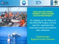
David Vousden, Agulhas and Somali Currents Large Marine Ecosystem<br />
David Vousden presented on the Agulhas and Somali Currents Large Marine Ecosystem (ASCLME)<br />
project in the Western Indian <strong>Ocean</strong> as an example of coordinating user needs and opportunities. The<br />
project includes nine countries and has a five-and-a-half-year timeline. The project includes geographic<br />
areas for which there are significant data gaps, particularly for baseline data. Additional support in these<br />
areas would be extremely helpful, and shipping lines often cross the areas. In addition, oil and gas<br />
activities are also becoming more prominent in this region and could help with data. The following data<br />
are essential from these gap areas:<br />
Any and all ocean-atmospheric data;<br />
Sea surface temperatures and temperature profiles at depth;<br />
CTD profiles;<br />
pH;<br />
Current speed and direction;<br />
Plankton types and abundance;<br />
Bathymetry and seabed mapping; and<br />
Fish stock data.<br />
Vousden noted that an alliance with industry partners would afford industry multiple benefits:<br />
‘Weight-of-Evidence” data and predictive modeling (valuable for long-term planning for tourism,<br />
reviewing shipping routes, fish stock migrations, etc.);<br />
reliable information on current speed and velocities, seasonal alterations in seawater density,<br />
weather data, and seasonal current/wind direction;<br />
direct engagement of industry into the monitoring and data collection process; and<br />
involvement of industry “on the team” for proposed regulatory procedures.<br />
The ASCLME already has funding for administration and organizing equipment. Additionally, the<br />
ASCLME is finalizing an agreement with the Western Indian <strong>Ocean</strong> Alliance and is viewed by UN as a<br />
possible pilot project for this kind of collaborative initiative.<br />
RESULTS OF BREAKOUT GROUP AND SUMMARY DISCUSSIONS<br />
The bulk of the workshop discussions on the development of the Program took place during the four<br />
breakout groups and the plenary discussions at which the summary of the breakout group discussions<br />
were presented. Appendix 3 contains the guidance materials that were provided to the breakout groups.<br />
Group A. <strong>Ocean</strong> observation parameters and technology needs and opportunities for both vessels<br />
and platforms<br />
The group reviewed and reiterated the Core Variables that need to be considered by the program.<br />
The Global Climate Observing System (GCOS) Essential Climate Variables for the subsurface ocean are:<br />
Temperature, salinity, current, nutrients, carbon dioxide partial pressure, ocean acidity, oxygen,<br />
tracers<br />
12
The US Integrated <strong>Ocean</strong> Observing System (IOOS) provides a regional example of 26 Core Variables<br />
that have been adopted:<br />
Acidity, bathymetry, bottom character, colored dissolved organic matter, contaminants, dissolved<br />
nutrients, dissolved oxygen, fish abundance, fish species, heat flux, ice distribution, ocean color,<br />
optical properties, partial pressure of CO2, pathogens, phytoplankton species, salinity, sea level,<br />
stream flow, surface currents, surface waves, temperature, total suspended matter, wind speed and<br />
direction, zooplankton abundance, and zooplankton species<br />
The group considered the opportunities and challenges posed by the similarities and differences of the<br />
range of vessels and platforms that could engage in the Program:<br />
Different types of merchant vessels, e.g. containers, tankers, cruise ships;<br />
Different types of vessels more broadly, e.g. ferries, fishing vessels, offshore oil/gas exploration<br />
vessels, offshore oil/gas service vessels, offshore wind energy service vessels, cable laying/repair<br />
vessels, etc.;<br />
The operational characteristics of different vessel types, i.e. regularity of routes, etc.;<br />
Vessels vs. platforms, e.g. power supply, space constraints, etc.; and<br />
Coastal waters vs. offshore, open ocean, e.g. legal obstacles monitoring within the EEZ.<br />
Key points that emerged from the opportunities and challenges related to the range of vessels and<br />
platforms include:<br />
The need to develop simple menu of options for industry consideration;<br />
This menu could be a shortlist, e.g. a feasibility-based menu, of variables to measure and consider<br />
for multiple platform options;<br />
Among the components of the menu:<br />
o Physical variable measurements are feasible now<br />
o Biogeochemical variable measurements have a mix of feasibility issues<br />
o Biological/ecosystem variable measurements are less developed but are very important<br />
The shortlist must also include and ingrate consideration of the measurement technologies<br />
o Those available for immediate use<br />
o Those that are a priority for research and development<br />
A comprehensive system for coordinated voluntary observations will also need to address the<br />
needs for:<br />
o A standard ship and platform interface<br />
o A standard science payload interface<br />
The need for a protected central repository of ship and platform information to facilitate<br />
prioritizing their involvement in observations.<br />
The group also noted that the structures for linking the science community and industry may appear too<br />
complex to the ocean business community. For example, JCOMM provides one of the key coordinating<br />
mechanisms for ocean observations, but is addresses primarily physical oceanography. There is no<br />
JCOMM equivalent for other variables, such as biodiversity, biology, and ecology. IOC/GOOS and the<br />
new GOOS Steering Committee may help address this need for a more comprehensive focal point for<br />
science and industry interaction regarding ocean observations.<br />
To implement the actions needed, the group recommended:<br />
Developing a small joint industry/science group to develop the rationale and compelling case to<br />
industry for expanding their involvement in the observing system.<br />
This business case for observations should address:<br />
o The feasibility of scaling up the kinds and levels of industry observations<br />
o The impact of greater industry observations<br />
13
o The end use of observation data<br />
o The value to industry in saving lives, protecting property, improving environmental<br />
stewardship, etc.<br />
Establishing a technical group to define interface requirements for platforms and payloads,<br />
ensuring that the group builds on and takes advantage of existing programs and structures, such as<br />
<strong>Ocean</strong>Scope, JCOMM Components, FerryBox, etc.<br />
Group B. Marine atmosphere/ocean surface observation parameters and technology needs and<br />
opportunities for both vessels and platforms<br />
The group reviewed the types of vessels and platforms that might be involved in voluntary observations:<br />
Type<br />
Remarks<br />
Bulk carriers<br />
Container carriers<br />
Cruise ships<br />
Fishing boats<br />
Leisure vessels<br />
Navy ships<br />
Oil rigs<br />
Racing yachts<br />
Research ships<br />
Tankers, gas carriers,<br />
Chemical carriers<br />
Training ships<br />
Good conventional ships; <strong>World</strong>wide trading: good for filing data sparse<br />
areas<br />
Regular routes; Installation of more Automatic Weather Station (S-AWS)<br />
desirable; Good candidates for CO 2 observations<br />
Co-operation needs to be extended, particularly in sparsely-traveled areas<br />
(e.g., Arctic, Antarctic); Installation of S-AWS desirable; Make contact<br />
with cruise ship associations, e.g. International Association of Antarctic<br />
Tour Operators (IAATO), Cruise Line Industry Association (CLIA)<br />
Reluctance of fishing vessels to identify their location, but could be<br />
valuable for filling data sparse areas e.g., West of Ireland<br />
Crowdsourcing projects possible<br />
Problems with confidentiality of positions<br />
Good platforms often with high quality data. However, data often not<br />
available onto the GTS, especially from oil and gas platforms outside<br />
northern hemisphere, e.g., Gulf of Guinea. Raw Global Positioning System<br />
(GPS) data could potentially also be used for atmospheric water column<br />
content.<br />
<strong>Ocean</strong>oScientific experience has shown the potential for equipping yachts<br />
sailing in data sparse areas with automatic weather stations<br />
Very useful for to testing new or non-conventional measurement systems,<br />
e.g., prototype new sensors, expensive sensors, etc.<br />
Good potential VOS but often operating without Port Met Officer coverage;<br />
security problems when operating in piracy areas; Intrinsic safety problems<br />
if fitted with AWS;<br />
Not very active in observations, due to long periods in port and high<br />
turnover in staff<br />
14
The group also reviewed the types of weather and climate observation systems currently used on ships<br />
recruited to the VOS Scheme and rated them from the least complex (one asterisk) to the most complex<br />
(five asterisks), including:<br />
Conventional VOS (proposed new Ancillary VOS class) *<br />
Conventional VOS (Auxiliary/Supplementary class) **<br />
Conventional VOS (Selected class) ***<br />
Conventional VOS (VOSClim AWS class) ****<br />
Autonomous S-AWS (Supplementary AWS class) **<br />
Integrated S-AWS (Selected AWS class) ****<br />
Integrated S-AWS (VOSClim AWS class) *****<br />
The group rated the different levels of complexity involved in each type of VOS recruitment, and the<br />
consequent level of shipowner support that might be needed (see asterisks above). For more complex<br />
systems -- a fully integrated AWS systems reporting VOS Climate quality data -- the sensors may need to<br />
be integrated with the ships systems (e.g., connections to the ship’s gyro compass for wind direction and<br />
cabling to the engine room for sea temperature measurements) and a computer input would also be<br />
needed on the bridge to allow the observers to manually input the visually observed elements. By<br />
contrast, attention was also drawn to the newly proposed Ancillary class of VOS where the shipowner<br />
would assume responsibility for supplying and maintaining the calibration of the meteorological<br />
instruments and ensuring that the data quality is monitored on a regular basis.<br />
The group identified the main standards and tools for voluntary weather and climate observations<br />
including the following:<br />
WMO Guide on Instruments and Observation Practices (available online as WMO Pub. No 8)<br />
http://www.wmo.int/pages/prog/www/IMOP/publications/CIMO-Guide/CIMO_Guide-<br />
7th_Edition-2008.html<br />
TurboWin Logbook Software (freely available on the Web at http://www.knmi.nl/turbowin/ and<br />
now used on the majority of the national VOS fleets)<br />
Generic Design Standards proposed by JCOMM/SOT/VOS (it was noted that WOC could help<br />
develop and promote these)<br />
EUMETNET Surface Marine Program (E-SURFMAR) S-AWS Technical Specifications<br />
(developed by E-SURFMAR to encourage a uniform AWS design for use by its members –<br />
tender to be issued soon)<br />
WMO Manual No 306 on the Global Telecommunication System<br />
http://www.wmo.int/pages/prog/www/ois/Operational_Information/Publications/WMO_386/WM<br />
O_386_Vol_I_2009_en.pdf (to faciliatate the flow of real time observation data to WMO<br />
members in a timely, reliable and cost effective way)<br />
WMO Publication No 47 - International List of Selected, Supplementary and Auxiliary Ships<br />
(http://www.wmo.int/pages/prog/www/ois/pub47/pub47-home.htm) and the associated E-<br />
SURFMAR Metadata database (available at http://esurfmar.meteo.fr/doc/vosmetadata/ )<br />
The VOS and VOSClim Websites (http://www.bom.gov.au/jcomm/vos/ and<br />
http://lwf.ncdc.noaa.gov/oa/climate/vosclim/vosclim.html)<br />
The Quality Control Monitoring Tools available on the Web (e.g. from Meteo-France at<br />
http://www.meteo.shom.fr/qctools/ and from the Met Office at<br />
http://research.metoffice.gov.uk/research/nwp/observations/monitoring/index.html)<br />
A number of key issues were identified for the WOC to consider in moving forward with the Program,<br />
including the need to:<br />
Focus on data sparse areas, e.g., polar regions, noting that cruise ships are increasingly visiting these<br />
regions; and<br />
15
Consider the use of AIS to transmit weather information in coastal regions, and the potential for an<br />
interface between AIS and S-AWS to collect and transmit report the observations, noting that<br />
suitable data formats already exist and have been circulated by IMO.<br />
The group discussed what incentives and actions might best enhance and expand the VOS fleet involved<br />
in weather and climate observations. Industry interests in promoting the company brand may play an<br />
important role in this. It would be useful to determine if incentives measures exist or could be developed,<br />
e.g.in relation to insurance or tax deductions for companies that participate in observation or<br />
environmental efforts.<br />
It was recognized that the WOC could play a helpful role in extending the dialogue between shipping/Oil<br />
& Gas companies and the meteorological services. In developing the Program, it may, for instance, be<br />
valuable for the WOC to contact IACS, ICS or trade associations, and other industry bodies to help<br />
promote the observation initiatives being developed by JCOMM.<br />
In developing suggestions for the way forward, the group recommended that:<br />
That JCOMM/SOT is a key partner for WOC in working to scale up industry weather and climate<br />
observation efforts;<br />
The majority of the technologies needed for vessel or platform involvement in marine atmosphere<br />
/ ocean surface observations are currently available;<br />
The differences between vessels and offshore platforms are less than between some types of<br />
vessels, e.g., a fishing boat and a container ship would be used differently for voluntary<br />
observations;<br />
The minimum level of vessel or platform involvement in observations should be conventional<br />
manually reporting VOS (Ancillary or Selected class) and/or Autonomous S-AWS<br />
(Supplementary AWS class) installed onboard;<br />
The option that lends itself best to retrofitting vessels or platforms is the Autonomous S-AWS;<br />
The option that should be considered for new builds is the Integrated S-AWS, because it will be<br />
easier to agree and approve the design plans and necessary cabling before the ship is built;<br />
One of the operational and financial challenges that will need to be overcome by vessels and<br />
platforms in order to scale up observations will be the cost of the data transmissions. The use of<br />
email and compressed data formats will help to reduce transmission costs; and<br />
Research and development opportunities for scaling up industry observations includes the<br />
potential use of AIS for weather messages and for interfacing to S-AWS systems, (and the<br />
associated data collection mechanisms ashore to allow the AIS derived data to be distributed on<br />
the Global Telecommunication System).<br />
Group C. Data interoperability, communications, management and access<br />
Data Interoperability<br />
Data Interoperability includes many topics, such as command and control, format, access to data, etc. In<br />
considering these data issues, the group noted that various observations programs collect different data,<br />
maintain different databases and establish different data flows and standards, e.g. Argos, SOOP, JCOMM,<br />
IOC, Maritime Environmental Resource Center (MERC), Listening to the Deep <strong>Ocean</strong> Environment<br />
(LIDO), IOCCP, JERICO, <strong>Ocean</strong> Observatories Initiative (OOI)/Regional Scale Node (RSN), FerryBox,<br />
etc.<br />
It will be essential for the WOC program to ensure it is not reinventing the wheel. Industry participants<br />
emphasized the need to keep things as simple as possible, e.g. having a single point of contact for a<br />
16
company to interact with on data issues. Overall the group stressed that it is important for participants in<br />
voluntary programs to think about what the system is to do first and then look to existing systems to see if<br />
they will provide the result.<br />
In the overall review of addressing the data situation, the fundamental aspects included the need to:<br />
Fill data gaps;<br />
Share data freely and openly;<br />
Identify a common vocabulary and standard quality control;<br />
Adopt or establish minimal data requirements;<br />
Identify and assess current data efforts;<br />
Analyze and identify user requirements and then provide the observations that respond to those<br />
needs;<br />
Provide users with access to data products, and not just data;<br />
The group discussed how the WOC Program can work with ship and platform owners to be part of the<br />
solution so that the data will help interested companies address data issues, such as by:<br />
Using ship and platform centric data standards;<br />
Companies considering what their existing instrument and operational ship data can provide the<br />
scientist, e.g. is such data is reliable, can it pass peer-review, what is needed to make it useful to<br />
science?; and<br />
Being aware of important operational constraints, such as the need control of transmission of data<br />
in some circumstances, e.g. due to radio silence in high-risk areas.<br />
A substantial portion of the discussion focused on the need for science to be able to trust the data resulting<br />
from voluntary observations. There is a critical need for metadata to understand the source of the data,<br />
calibration details, etc. This includes the following considerations:<br />
<br />
<br />
<br />
<br />
<br />
<br />
<br />
<br />
Instruments must be registered;<br />
Metadata should include the basic elements identified through existing collaborations, like<br />
Quality Assurance of Real-Time <strong>Ocean</strong>ographic Data (QARTOD), QARTOD to Open Geospatial<br />
Consortium (OGC) Standards (Q2O), OOI, IOOS principles, OGC standards, System of Industry<br />
Metocean data for the Offshore and Research Communities (SIMORC), Marine Metadata<br />
Interoperability (MMI), International <strong>Council</strong> for Science (ICSU), etc.;<br />
Metadata must include data provenance information;<br />
The focus should be on high-reliability and automatic systems to help ensure data quality and<br />
reduce data variability;<br />
It is important to participate in existing programs and use existing structures and processes<br />
There are metadata standards for physical and metrological data, as well as for biological data<br />
(e.g., <strong>Ocean</strong> Biogeographic Information System (OBIS), Census for Marine Life);<br />
GTS provides a source of information for data and metadata for weather related information; and<br />
It will be important to reconcile the differences in requirements and criteria for data collection<br />
that may exist between metadata standards and company standards.<br />
The group identified different options for dealing with databases and voluntary observations more<br />
broadly, including considerations of:<br />
A standard interface to variety of existing databases;<br />
A common database;<br />
The importance of leveraging existing international standards;<br />
Operational oceanographic readiness is in place for simpler physical data sets, but is not ready for<br />
more complex data; and<br />
17
Marine and oceanographic data is less consolidated and there is program-by-program access<br />
through the internet.<br />
Data Communications<br />
The group also discussed data communications, noting the following important aspects of transmitting<br />
data:<br />
The needs for standards for data communication;<br />
Data communication differs depending on the type of vessel or platform;<br />
There are different methods of communicating data within the vessel or platform, e.g. email, File<br />
Transfer Protocol (FTP), Secure FTP, satellite, cable, etc.; and<br />
Data communications even vary per vessel, depending on the ship location, e.g. at dock or at sea.<br />
Data transmission reflects that different user groups require different timelines. Operational users need<br />
data as close to real time as possible. Scientists may not be as concerned about having data in real time.<br />
Ship or platform operator needs depend on the kind of data and its use.<br />
The logistics and costs of data transmission are a significant concern:<br />
The additional power on different kinds of vessels and platforms needs to be taken into<br />
consideration;<br />
The needs to transmit large amounts of data, noting that small amounts of real-time data can be<br />
transmitted as bursts to keep costs low;<br />
Determining who pays for communications costs and the level of use of existing ship or platform<br />
systems is important;<br />
Identifying the priority of variables can influence the logistics and costs, e.g. does data need to be<br />
sent in real time or not, what is the sampling period and frequency of measurements?;<br />
Need to communicate back to the instruments, as there are many remote options available now.<br />
A number of related technology and technical needs were identified, including:<br />
Increasing the relatively short life cycle of some technology, e.g., 18 month drifting buoys;<br />
Improving current technology and facilitating the development of new, needed technologies;<br />
Addressing space limitations for technology installation, e.g. possible micro- and nanotechnology<br />
development options;<br />
Identifying optimization strategies for data communication;<br />
Facilitating integrated sampling schemes;<br />
Facilitating technical training; and<br />
Facilitating the automation of observations and data communication.<br />
Data Management and Access<br />
In discussing data management and access in relation to ocean and weather/climate observations, the<br />
group highlighted that a 5-year vision would be to have one or two sites as a common portal for data<br />
access. This could include consideration of a data archiving center for all relevant programs, noting that<br />
Open Access data services are currently available via OGC.<br />
The group considered the need for a common Data Management System, which engenders important<br />
questions concerning:<br />
Who owns the data;<br />
Who the responsibility for managing the data; and<br />
How are the requirements of stakeholders met<br />
18
Group D. Institutional and operational needs and options for a global multi-sectoral program<br />
In the short term the group felt there was the need for:<br />
A “declaration“, i.e. a strong concise statement of need for scaling up industry involvement in<br />
ocean and atmosphere observation and monitoring;<br />
A directory of the key programs and contact persons related to voluntary ocean observations, e.g.<br />
a “ yellow-pages“ of the programs and coordinators, such as JCOMM-SOT, GOOS, IOCCP,<br />
LIDO; and<br />
A joint science/industry steering committee be formed, e.g. with six from the science community<br />
and six from industry (from different sectors).<br />
In the medium term, the steering committee should:<br />
Work with WOC to further develop and raise awareness of the Program; and<br />
Develop the value proposition to communicate to industry and encourage their participation.<br />
For the medium term, the group emphasized that:<br />
WOC continue to serve as a key communication pathway to industry and encourage leadership<br />
companies to set the example and encourage more industry involvement in voluntary<br />
observations; and<br />
Scientists and companies develop closer relationships and work to ensure that companies can see<br />
the value in the ocean and weather/climate observations.<br />
In the medium term, the steering committee should:<br />
Develop “plug-and-play“ systems based on clear articulation of the scientific requirements and<br />
performance standards;<br />
Integrate biodiversity, biological parameters and larger organisms into the observing systems<br />
Explore Law of the Sea issues and the advocacy needed to move towards an expanded set of<br />
measurements that are open access, including from Exclusive Economic Zones (EEZs); and<br />
Continue to undertake communications to sell the concept and promote its achievements.<br />
Over the longer term, the WOC, the Program and its steering committee should:<br />
Work to convince governments of need for “space agency equivalents“ for ocean observations;<br />
and<br />
Engage and coordinate the role of industry as a key player in making this happen<br />
Additional areas of consideration in the Program development and implementation came up during the<br />
plenary discussion after the breakout groups.<br />
The Program should address the following needs and opportunities:<br />
- Organization and Coordination<br />
Help science and industry engage together in advancing voluntary observations;<br />
Provide a single point of contact for both science and industry;<br />
Help provide more structure to the observations being made; and<br />
Help find an approach to address route changes in ships to maintain observation schemes.<br />
- Outreach and Communications<br />
Make the benefits of voluntary observations very clear and articulate these benefits; and<br />
Work with science and industry to improve the “story telling” to better communicate the value<br />
and benefits of voluntary observations.<br />
19
- Legal<br />
Help clarify who has liability for equipment and data.<br />
- Resources<br />
Help identify the funding needed for nearly all ocean and weather/climate observation programs.<br />
Principles, Roadmap and Workplan<br />
The closing session of the workshop addressed the overall principles for the WOC <strong>Smart</strong> <strong>Ocean</strong> / <strong>Smart</strong><br />
<strong>Industries</strong> Program (the “Program”), the general direction, structures and process to advance the Program<br />
development and the specific next steps to be taken in the first half of 2012.<br />
Principles for the WOC <strong>Smart</strong> <strong>Ocean</strong> / <strong>Smart</strong> <strong>Industries</strong> Program<br />
The workshop participants considered a set of draft principles that had been developed by the WOC<br />
Working Group and also emerged during the workshop. The principles could be used to guide the<br />
development and implementation of the Program. The draft Principles for the Program are presented here<br />
as a working version that will be further reviewed and refined by the <strong>Smart</strong> <strong>Ocean</strong> / <strong>Smart</strong> <strong>Industries</strong><br />
Steering Committee.<br />
These principles are designed to establish a framework for the WOC to develop and implement a global<br />
program to facilitate, coordinate and scale up the efficient, cost effective ocean and atmospheric<br />
information collection by a growing number and range of vessels, platforms, pipelines and cables for<br />
ocean and weather/climate observations, and to foster and guide WOC efforts to engage with scientific,<br />
government, operational and other partners.<br />
1. Clear Value Proposition / Accessible<br />
The Program's value should be clearly articulated to companies that may wish to become<br />
involved, including the "win-win" results that can be achieved for industry and for science.<br />
The Program should ensure data is accessible and leveraged for decision-making in participating<br />
companies, and should make it easy for companies to get involved and for expanding industry<br />
participation, indicating the points of engagement for industry<br />
The data needs to be operational and available, as much as possible in real-time, with a clear path<br />
to the data and the operational information that data feed into.<br />
Over the longer term, information needs to be accessible for supporting environmental<br />
stewardship and sage and responsible company operations and be mutually beneficial to all<br />
participants.<br />
2. Inclusive, Integrated and building on existing efforts<br />
The Program should seek and ensure effective participation of key stakeholders.<br />
Within the private sector, in addition to those with the vessels and platforms, this includes<br />
operators, sensor manufacturers, and value-added information generators.<br />
Outside of the private sector, this includes key inter-governmental organizations, government<br />
agencies, academic institutions and NGOs active in ocean and weather/climate observations.<br />
The Program should include operational observations and science/research observations.<br />
The Program should recognize, engage, learn from and build on existing voluntary observation<br />
organizations, programs and efforts in science, government and industry, taking advantage of<br />
energetic communities and leaders and working with them to promote best practices.<br />
3. Global in Scope / Simple in design<br />
The Program needs to be scalable to ensure global coverage.<br />
20
Regional/pilot level efforts will be important, but these need to consider how they can bring<br />
benefit to the global scale by defining how to scale up regional/pilot efforts and widen the scope<br />
in the future projects.<br />
The Program needs to be focused and simple to ensure efficient, successful delivery of results that<br />
contribute to achieving clear near-term and longer-term goals and actions.<br />
The Program should be designed so that companies can begin participating in data collection and<br />
transmission of the kind, level and cost of observations they are able to most readily support, with<br />
the opportunity to “scale up” to a more extensive involvement as they have interest and ability.<br />
It is important to understand the kind of data that is needed, the gaps between different kinds of<br />
studies, and that several layers of data could be accepted.<br />
4. Quality Focused / Standardized<br />
The Program should aspire to, and converge on, a common set of requirements for ensuring high<br />
quality and real time data collection.<br />
Standards for data and metadata need to be established and implemented to ensure quality,<br />
promotion of best practices with documented quality levels, building on existing standards and<br />
methods for ocean data collection and industry standards for operations.<br />
It is important to have quality standards that make the data gathering flexible and useful, but<br />
quality standards need to be balanced with considerations of what becomes too expensive to<br />
collect or too heavy to transmit.<br />
Companies, scientists, non-governmental organizations (NGOs) and governments should be using<br />
the same data to make decisions, to create convergence and collaboration, thereby supporting<br />
making decisions on best possible grounds.<br />
5. Research and Development<br />
The Program should foster and facilitate research and development of more efficient and effective<br />
methods, instruments, and practices for voluntary observations, e.g. in relation to the cost, size,<br />
installation, maintenance of equipment.<br />
The Program should foster the expansion of observations into areas not adequately addressed, e.g.<br />
biological parameters, sound, acidification.<br />
6. Effective Governance / Transparency<br />
The Program needs to operate according to clear and established governance protocols and<br />
procedures.<br />
The Program design, planning and implementation need to be clear and undertaken in a<br />
transparent manner.<br />
7. Compliance<br />
The Program should be designed, planned and implemented to comply with all relevant national<br />
and international law, including the relevant international conventions, e.g. the UN Convention<br />
on the Law of the Sea (CBD) and other international agreements.<br />
Roadmap<br />
The workshop participants discussed the structures and process for advancing the Program development.<br />
Working Group<br />
Participant discussion focused on the development of a small joint industry/science working group that<br />
could build on the interest and momentum generated by the workshop.<br />
21
Terms of Reference<br />
The initially proposed terms of reference for joint industry/science Working Group are as to:<br />
1. Define the value proposition for expanding the role and scale of ocean industry participation in<br />
ocean and weather/climate observations, including the feasibility and the impact of increased<br />
industry efforts.<br />
2. Develop the scientific and operational rationale for expanding the role and scale of industry<br />
participation in observations.<br />
3. Define the “menu of options” and interface requirements for platforms (both mobile and fixed)<br />
and payloads (attended or not), such as power, mass, footprint, expendables, maintenance, flow,<br />
placement, telemetry, etc.<br />
4. Explore and explain the principles and practice of open data access and the telemetry issues.<br />
Membership<br />
The discussion also resulted in suggestions for the size and composition of the Working Group.<br />
Size<br />
The Working Group should consist of about twelve representatives.<br />
Composition<br />
The Working Group should consist of both industry and science representatives.<br />
Industry representation in the Working Group:<br />
Six representatives of WOC, with consideration of:<br />
o Giving priority to the companies that have provided leadership and support to the <strong>Smart</strong><br />
<strong>Ocean</strong>/<strong>Smart</strong> <strong>Industries</strong> initiative to date<br />
o Including a mix of company and association representatives<br />
o Including a mix of sectors, i.e. both vessels and platforms<br />
o To be identified by WOC in consultation with the WOC Board, the WOC <strong>Smart</strong> <strong>Ocean</strong>/<strong>Smart</strong><br />
<strong>Industries</strong> Working Group and the overall WOC membership<br />
Science representation in the Working Group:<br />
Six representatives of the key groups and programs:<br />
o With balance of scientific disciplines<br />
o Dealing with both operational / sustained and research observations<br />
o Drawing from existing efforts by GOOS, JCOMM (SOT and DBCP), SCOR (<strong>Ocean</strong>Scope),<br />
IOCCP (CarbonVOS)<br />
o To be identified by IOC in consultation with the agencies and programs mentioned above<br />
Secretariat:<br />
The workshop agreed that the WOC and IOC are well positioned to serve as an informal “secretariat” to<br />
the joint industry/science Working Group.<br />
Advisory Group<br />
The workshop also agreed that an Advisory Group should be established to create the opportunity for<br />
input from a broader range of interested parties:<br />
22
Within the private sector, the Advisory Group should include those with vessels and platforms, as<br />
well as vessel and platform operators, sensor manufacturers, value-added information generators,<br />
and other relevant sectors.<br />
Outside of the private sector, the Advisory Group should include key inter-governmental<br />
organizations, government agencies, academic institutions and NGOs active in ocean and<br />
weather/climate observations.<br />
The Working Group will develop more detailed recommendations for the size, composition, structure and<br />
processes of the Advisory Group.<br />
Workplan<br />
Working Group:<br />
Membership to be determined within three months, i.e., by 10 March 2012<br />
First meeting to be held within six months, i.e., by 10 June 2012<br />
There are a number of opportunities for the Working Group to meet in the near future and to present and<br />
promote the <strong>Smart</strong> <strong>Ocean</strong> / <strong>Smart</strong> <strong>Industries</strong> Program.<br />
23
Appendix 1: Program<br />
MONDAY 12 DEC<br />
Session 1 Introductory Plenary<br />
0900-1030 Overview of Voluntary Observation Programs and Technology<br />
Chair Paul Holthus, <strong>World</strong> <strong>Ocean</strong> <strong>Council</strong><br />
0830-0900 Registration<br />
0900-0910 Welcome<br />
- Wendy Watson-Wright, IOC Executive Secretary and Assistant Director General,<br />
UNESCO<br />
0910-0920 Welcome and introduction to Maersk interest in ocean and climate observations<br />
- Eskild Sorensen, A.P. Moeller-Maersk<br />
0920-0930 Overview of <strong>Smart</strong> <strong>Ocean</strong>/<strong>Smart</strong> <strong>Industries</strong> concept and workshop objectives and process<br />
- Paul Holthus, <strong>World</strong> <strong>Ocean</strong> <strong>Council</strong><br />
0930-0950 The scientific need for voluntary ocean and climate observations, including results from<br />
key contributions of ships and platforms, gaps, future plans<br />
- Albert Fischer, IOC<br />
0950-1010 Overview of voluntary observation programs and coordinating structures - oceans<br />
- Albert Fischer, IOC and Candyce Clark, JCOMM<br />
1010-1030 The Voluntary Observing Ship Scheme (VOS), including shipborne Automated Weather<br />
Stations (AWS) and coordinating structures<br />
- Sarah North, UK Met Service<br />
1030-1050 ~ BREAK ~<br />
Session 2 Voluntary Observation Programs:<br />
1050-1230 Status, progress, and lessons learned for scaling up and cross-sectoral applications<br />
Chair Craig McLean, NOAA<br />
1050-1110 Ship of Opportunity Program (SOOP) - oceanographic measurements<br />
- Joaquin Trinanes, NOAA<br />
1110-1125 Argo profiling float program<br />
- Mathieu Belbeoch, JCOMMOPS<br />
1125-1140 Data Buoy Cooperation Panel (DCBP)<br />
- Pierre Blouch, Meteo-France<br />
1140-1200 Overview of ocean observation technology and sensors<br />
- Mario Tamburri, Alliance for Coastal Technologies<br />
1200-1215 <strong>Ocean</strong> observations and sound in the marine environment<br />
- Ian Boyd, Saint Andrews University<br />
1215-1230 Cabled observatories and platforms<br />
- Nazeeh Shaheen, L3 MariPro<br />
1230-1350 ~ LUNCH ~<br />
Session 3 Voluntary Observation Programs (continued)<br />
1350-1550 Status, progress, and lessons learned for scaling up and cross-sectoral applications<br />
Chair Francois Leroy, Liquid Robotics<br />
1350-1410 <strong>Ocean</strong>Scope<br />
- Tom Rossby, University of Rhode Island<br />
1410-1430 <strong>Ocean</strong> Carbon Flux Observations - IOCCP and ICOS<br />
- David Hydes, University of Southampton, National <strong>Ocean</strong>ography Centre and Maciej<br />
Telszewski, International <strong>Ocean</strong> Carbon Coordination Project (IOCCP)<br />
1430-1450 FerryBox<br />
- Willi Petersen, Institute of Coastal Research/Operational Systems<br />
24
1450-1505 Royal Caribbean Cruise Lines: Next Generation Ships of Opportunity Program<br />
- Rich Pruitt, Royal Caribbean Cruises and Peter Ortner, University of Miami<br />
1505-1520 Continuous Plankton Recorder<br />
- Martin Edwards, Sir Alistair Hardy Foundation for <strong>Ocean</strong> Science (SAHFOS)<br />
[Presented by Peter Ortner, University of Miami]<br />
1520-1535 Collecting data from fishing vessels and operations<br />
- Goulven Prud’Homme, nke Instrumentation<br />
1535-1550 Crowdsourcing data from individual vessels<br />
- Magnus Jonsson, <strong>Ocean</strong>Search<br />
1550-1610 ~ BREAK ~<br />
Session 4<br />
1610-1800<br />
Breakout Groups:<br />
Parameters and technologies for multi-sectoral voluntary observations<br />
Group A<br />
<strong>Ocean</strong> observation parameters and technology needs and opportunities for both vessels and<br />
platforms<br />
- Chair: Eric Lindstrom, NASA<br />
- Rapporteur: Albert Fischer, IOC<br />
Group B<br />
Marine atmosphere/ocean surface observation parameters and technology needs and<br />
opportunities for both vessels and platforms<br />
- Chair: Sarah North, UK Met Service<br />
- Rapporteur: Pierre Blouch, Meteo-France<br />
1830-2030 RECEPTION<br />
- At UNESCO (details to be provided at the workshop)<br />
SESSION<br />
5<br />
0900-1030<br />
TUESDAY 13 DEC<br />
Discussion:<br />
Parameters and technologies for multi-sectoral voluntary observations<br />
Chair Candyce Clark, NOAA<br />
0900-0930 Report back from breakout groups A and B<br />
0930-1010 Discussion on parameters and technologies for scaling up and coordinating multi-sectoral<br />
voluntary observation efforts<br />
1010-1030 Network technical coordination and data management: JCOMMOPS case study and lessons<br />
learned for developing the <strong>Smart</strong> <strong>Ocean</strong>/<strong>Smart</strong> <strong>Industries</strong> program<br />
- Mathieu Belbeoch, JCOMMOPS<br />
1030-1100 ~ BREAK ~<br />
SESSION<br />
6<br />
1100-1230<br />
Breakout Groups:<br />
Data considerations and Institutional arrangements<br />
Group C<br />
Data interoperability, communications, management and access<br />
- Chair: Claire de Grasse, <strong>Ocean</strong>s Network Canada<br />
- Rapporteur: Mathieu Belbeoch, JCOMMOPS<br />
25
Group D<br />
Institutional and operational needs and options for a global multi-sectoral program<br />
- Chair: Anne Walls, BP<br />
- Rapporteur: Doug Wallace, Halifax Marine Research Institute<br />
1230-1400 ~ LUNCH ~<br />
Session 7 Discussion:<br />
1400-1530 Data considerations and Institutional arrangements<br />
Chair Ru Morrison, Northeastern Regional Association of Coastal <strong>Ocean</strong> Observing Systems<br />
1400-1430 Report back from breakout groups C and D<br />
1430-1510 Discussion on data considerations and institutional arrangements for scaling up and<br />
coordinating multi-sectoral industry observation efforts<br />
1510-1530 Coordinating with user needs and opportunities: Large Marine Ecosystem case study<br />
- David Vousden, Agulhas and Somali Currents LME<br />
1530-1600 ~ BREAK ~<br />
Session 8 Closing Plenary:<br />
1600-1730 Developing the Principles, Roadmap and Workplan<br />
Chair Gary Dinn, PanGeo Subsea<br />
Rapporteur Stephanie Watson, <strong>World</strong> <strong>Ocean</strong> <strong>Council</strong><br />
1600-1620 Principles for the global <strong>Smart</strong> <strong>Ocean</strong>/<strong>Smart</strong> <strong>Industries</strong> program<br />
Moderator: Albert Fischer, IOC<br />
1620-1700 Roadmap for developing the global <strong>Smart</strong> <strong>Ocean</strong>/<strong>Smart</strong> <strong>Industries</strong> program<br />
Moderator: Eric Lindstrom, NASA<br />
1700-1730 Workplan for developing the global <strong>Smart</strong> <strong>Ocean</strong>/<strong>Smart</strong> <strong>Industries</strong> program<br />
Moderator: Paul Holthus, <strong>World</strong> <strong>Ocean</strong> <strong>Council</strong><br />
CLOSE OF WORKSHOP<br />
26
Appendix 2: List of Participants<br />
Mohamed Adjou University of Copenhagen Postdoc in <strong>Ocean</strong>ography<br />
Constantine Alexander Global <strong>Ocean</strong>s Director Business Operations – Europe<br />
Dan Angelescu ESIEE Paris Professor<br />
Mathieu Belbeoch JCOMMOPS (IOC/WMO) Coordinator<br />
Ulrike Bernitt IFM-GEOMAR Coordinator<br />
Pierre Blouch EUMETNET E-SURFMAR Programme Manager<br />
Tobias Boehme -4H- JENA Engineering GmbH Scientific Project Manager Marine<br />
Technology<br />
Candyce Clark WMO-IOC Joint Technical<br />
Commission for <strong>Ocean</strong>ography<br />
and Marine Meteorology<br />
Observations Programme Area<br />
Coordinator<br />
Jim Costopulos Global <strong>Ocean</strong>s CEO<br />
Claire de Grasse <strong>Ocean</strong> Networks Canada ICT Business Development Officer<br />
Yves Dégrés nke instrumentation Instrumentation director<br />
Gary Dinn PanGeo Subsea Vice President<br />
Denis Diverrès IRD – Institute for Research<br />
and Development<br />
Okuku Ediang Nigerian Meteorological<br />
Agency, Marine Division<br />
Technical coordinator for Salinity and<br />
pCO 2 measurements on VOS<br />
Assistant Chief Marine Meterologist<br />
Remi Estival TOTAL S.A. Metocean data engineer<br />
Albert Fischer UNESCO IOC Programme Specialist, Technical<br />
Secretary of OOPC<br />
James Fishwick Plymouth Marine Laboratory Bio-optical oceanographer, Western<br />
English Channel Observatory Dr.<br />
Yves Gouriou IRD – Institut de Recherche<br />
pour le Développement<br />
Director of IRD technical unit IMAGO<br />
Michael Boer -4H- JENA Engineering GmbH Divisional Director Marine<br />
Technology<br />
Ian Boyd St Andrews Professor<br />
Mariemarguerite<br />
Bourbigot Pôle Mer Bretagne Project Manager<br />
Richard Burt Chelsea Technologies Group Director<br />
Ltd<br />
Patrick Callahan Maersk Line, Limited Director, HSSEQ<br />
Patrick Halpin Duke University Professor<br />
Hans- Hansen MacArtney Underwater Sales Manager – <strong>Ocean</strong> Science<br />
Jørgen<br />
Technology Group<br />
Aatos Heikkinen Eniram Ltd Research manager<br />
Paul Holthus <strong>World</strong> <strong>Ocean</strong> <strong>Council</strong> Executive Director<br />
27
David Hydes National <strong>Ocean</strong>ography Centre<br />
Southampton UK<br />
Doctor<br />
Magnus Jonsson Interactive Institute Senior Production Manager<br />
Chris Karman IMARES Manager Business Development<br />
Martin Kramp <strong>Ocean</strong>oScientific Programme Manager<br />
Isabelle Lambert CGGVeritas Vice President, Environment,<br />
Sustainable Development and Social<br />
Responsibility<br />
Oliver Legge University of East Anglia, UK Marine Carbon Observations<br />
Coordinator<br />
Jean-<br />
François<br />
Leprince-<br />
Ringuet<br />
ROSS (Association<br />
RESEARCH-<br />
OCEANOSCIENTIFIC-<br />
SPORT)<br />
President<br />
Francois Leroy Liquid Robotics Senior Vice President<br />
Eric Lindstrom NASA Headquarters Physical <strong>Ocean</strong>ography Program<br />
Scientist<br />
Olivier Louf CGGVeritas Vice President, Sustainable<br />
Development and Social<br />
Responsibility<br />
Bev MacKenzie Institute of Marine Engineering,<br />
Science and Technology<br />
(IMarEST)<br />
Said Mazaheri Iranian National Institute for<br />
<strong>Ocean</strong>ography<br />
Senior Technical Manager<br />
Assistant Professor, Head of <strong>Ocean</strong><br />
Engineering and Technology Research<br />
Center<br />
Craig McLean NOAA Acting Administrator, OAR<br />
Maurice Meehan Maersk Tankers Sustainability and Performance<br />
Manager<br />
Stephanie Moffatt Zodiac Maritime Agencies Ltd Environmental Executive<br />
Dave Monahan Guiding Committee of the Past Chairman<br />
General Bathymetric Chart of<br />
the <strong>Ocean</strong>s (GEBCO)<br />
Ru Morrison NERACOOS, US National Executive Director, Vice-Chair<br />
Federation of Regional<br />
Associations of Coastal and<br />
<strong>Ocean</strong> Observing<br />
Sarah North UK Met Office Marine Networks Manager<br />
Lauren Ordway Royal Caribbean Cruises Ltd Sustainability Analyst<br />
Peter Ortner University of Miami<br />
Director<br />
/RSMAS/CIMAS<br />
Jeanne Pagnan Twin Dolphins Vice President<br />
Wilhelm Petersen Helmholtz-Zentrum Geestacht,<br />
Institute of Coastal<br />
Dep. Head / Dr.<br />
Research/Operational Systems<br />
Glen Pezzoli Scripps Institution of<br />
<strong>Ocean</strong>ography<br />
Manager, Ship of Opportunity<br />
Program<br />
28
Niall Phelan UNEP <strong>World</strong> Conservation<br />
Monitoring Center (WCMC)<br />
Senior Programme Officer<br />
Benoît Pirenne <strong>Ocean</strong> Networks Canada Associate Director, IT<br />
Goulven Prud’homme nke instrumentation Sale Manager<br />
Rich Pruitt Royal Caribbean Cruises Ltd Associate Vice President,<br />
Environmental Compliance &<br />
Maritime Safety<br />
Valerie<br />
Quiniou-<br />
Ramus<br />
TOTAL S.A.<br />
Metocean Specialist, head of Surveys<br />
department<br />
Gilles Reverdin CNRS/INSU/LOCEAN Director of Research<br />
Thomas Rossby SCOR/URI Professor<br />
Sophie Seeyave Partnership for Observation of Scientific Coordinator<br />
the Global <strong>Ocean</strong>s (POGO)<br />
Liz Selig Conservation International Conservation Scientist<br />
Nazeeh Shaheen L3 MariPro Director, Business Development,<br />
<strong>Ocean</strong> Observing Systems<br />
Denise<br />
Smythe-<br />
Wright<br />
National <strong>Ocean</strong>ography Centre<br />
Research Scientist<br />
Eskild Sorensen A.P. Moller-Maersk A/S Maersk Lines, Environmental Manager<br />
Janet Sprintall Scripps Institution of<br />
Research <strong>Ocean</strong>ographer<br />
<strong>Ocean</strong>ography, U.C. San Deigo<br />
Darryl Symonds Teledyne RD Instruments Director of Marine Measurements<br />
Product Lines<br />
Mario Tamburri University of Maryland, Center Director<br />
for Environmental Science,<br />
Chesapeake Biological<br />
Lab/Maritime Environmental<br />
Resource Center<br />
Kathy Tedesco UNESCO IOC Director, International <strong>Ocean</strong> Carbon<br />
Coordination Project (IOCCP)<br />
Gunnar Tietze International Maritime Pavilion Director<br />
Joaquin Trinanes U. Santiago/U. Miami/NOAA Assistant Professor<br />
Jon Upton Shell Global Solutions BV Senior Metocean Engineer<br />
Fabienne Vallee Science Park Brest Iroise Head of International Cooperation<br />
David Vousden UNDP GEF ASCLME Project Regional Director<br />
Doug Wallace Halifax Marine Research Science Director<br />
Institute<br />
Anne Walls BP Group Marine Biologist<br />
Stephanie Watson <strong>World</strong> <strong>Ocean</strong> <strong>Council</strong> <strong>Smart</strong> <strong>Ocean</strong>/<strong>Smart</strong> <strong>Industries</strong><br />
initiative assistant<br />
Wendy<br />
Watson-<br />
Wright<br />
UNESCO IOC<br />
IOC Executive Secretary and Assistant<br />
Director General<br />
Christoph Werner Reederei Blue Star GmbH Director, Nautical Fleet Management<br />
29
Sandra Werner ExxonMobil Upstream<br />
Research Company<br />
Werenfrid Wimmer National <strong>Ocean</strong>ography Centre,<br />
Southampton<br />
Research Engineer<br />
ISAR project scientist<br />
30
Appendix 3: Breakout Group Guidance and Questions<br />
Breakout Group Guidance<br />
The Breakout Group sessions are to enable a more focused discussion on 4 major aspects of developing a<br />
global program to facilitate, coordinate and scale up the efficient, cost effective ocean and atmospheric<br />
information collection by a growing number and range of vessels and platforms for ocean and<br />
weather/climate observations:<br />
A. <strong>Ocean</strong> Observation Parameters and Technology Needs and Opportunities for Both Vessels and<br />
Platforms<br />
B. Marine Atmosphere/<strong>Ocean</strong> Surface Observation Parameters and Technology Needs and<br />
Opportunities for Both Vessels and Platforms<br />
C. Data Interoperability, Communications, Management and Access<br />
D. Institutional And Operational Needs and Options for a Global Multi-Sectoral Program<br />
Overall, the Breakout Group participants are asked to:<br />
Focus on practical outputs and guidance to assist the WOC in the development of the <strong>Smart</strong><br />
<strong>Ocean</strong>/<strong>Smart</strong> <strong>Industries</strong> program.<br />
Provide constructive input to developing the common ground and agenda for moving forward<br />
with the program.<br />
Consider the phased development of the program over both the short-term (1-2 years) and longterm<br />
(5-10+ years).<br />
Consider the spatial scope and geographic phasing of the program.<br />
Avoid overly detailed discussion or promotion of specific instruments, technologies, projects or<br />
companies.<br />
The vision of a comprehensive, multi-industry observations program presents opportunities and<br />
challenges due to the range of vessels and platforms that could engage in the program. The Breakout<br />
Group participants are asked to consider the opportunities and challenges posed by the similarities and<br />
differences of:<br />
<br />
<br />
<br />
<br />
<br />
Different types of merchant vessels, e.g. containers, tankers, cruise ships.<br />
Different types of vessels more broadly, e.g. ferries, fishing vessels, offshore oil/gas exploration<br />
vessels, offshore oil/gas service vessels, offshore wind energy service vessels, cable laying/repair<br />
vessels, etc.<br />
The operational characteristics of different vessel types, i.e. regularity of routes, etc.<br />
Vessels vs. platforms, e.g. power supply, space constraints, etc.<br />
Coastal waters vs. offshore, open ocean<br />
Each Breakout Group session will be guided by a Chair. The major areas of discussion and outputs will<br />
be synthesized by a Rapporteur. The Chair will present the results of the discussions in plenary for<br />
discussion by the overall workshop.<br />
Group A<br />
OCEAN OBSERVATION PARAMETERS AND TECHNOLOGY<br />
NEEDS AND OPPORTUNITIES FOR BOTH VESSELS AND PLATFORMS<br />
Chair: Eric Lindstrom, NASA<br />
Rapporteur: Albert Fischer, IOC<br />
31
Suggested questions for discussion:<br />
What are the core, baseline parameters for a minimum level of vessel or platform involvement in<br />
ocean observations?<br />
What is the “menu” of options for scaling up participation in observations?<br />
What are the options that lend themselves best to retrofitting vessels or platforms?<br />
What are the options that should be considered for design and newbuilds?<br />
What are the technologies needed for each of the above and are they currently available?<br />
What are the key similarities (and differences) between vessels and platforms that create<br />
opportunities (and challenges) for synergies?<br />
What are the R&D priorities for advancing a program to scale up observations, e.g.<br />
instrumentation development?<br />
What are the main operational impacts and challenges that will need to be overcome by different<br />
vessel types and platforms in order to scale up observations?<br />
Group B<br />
MARINE ATMOSPHERE/OCEAN SURFACE OBSERVATION PARAMETERS AND<br />
TECHNOLOGY<br />
NEEDS AND OPPORTUNITIES FOR BOTH VESSELS AND PLATFORMS<br />
Chair: Sarah North, UK Met Service<br />
Rapporteur: Pierre Blouch, Meteo-France<br />
Suggested questions for discussion:<br />
What are the core, baseline parameters for a minimum level of vessel or platform involvement in<br />
marine atmosphere/ocean surface observations?<br />
What is the “menu” of options for scaling up participation in observations?<br />
What are the options that lend themselves best to retrofitting vessels or platforms?<br />
What are the options that should be considered for design and newbuilds?<br />
What are the technologies needed for each of the above and are they currently available?<br />
What are the key similarities (and differences) between vessels and platforms that create<br />
opportunities (and challenges) for synergies?<br />
What are the R&D priorities for advancing a program to scale up observations, e.g.<br />
instrumentation development?<br />
What are the main operational impacts and challenges that will need to be overcome by different<br />
vessel types and platforms in order to scale up observations?<br />
32
Group C<br />
DATA INTEROPERABILITY, COMMUNICATIONS, MANAGEMENT AND ACCESS<br />
Chair: Claire de Grasse, <strong>Ocean</strong>s Network Canada<br />
Rapporteur: Mathieu Belbeoch, JCOMMOPS<br />
<br />
<br />
<br />
<br />
<br />
What are the key aspects of data interoperability that need to be addressed in scaling up the<br />
number and kinds of vessels and platforms involved in observations?<br />
What are the communications needs for transmission of data from a wider range of vessels and<br />
platforms?<br />
Are the current systems, protocols and capacity for data management and access appropriate and<br />
sufficient?<br />
If not, what are the priorities for improving the situation?<br />
How should the Law of the Sea/legal issues re data from observations be addressed?<br />
Group D<br />
INSTITUTIONAL AND OPERATIONAL NEEDS AND OPTIONS<br />
FOR A GLOBAL MULTI-SECTORAL PROGRAM<br />
Chair: Gary Dinn, PanGeo Subsea<br />
Rapporteur: Doug Wallace, Halifax Marine Research Institute<br />
<br />
<br />
<br />
<br />
<br />
<br />
What kinds of institutional arrangements are needed for a global multi-sectoral program of<br />
voluntary observations?<br />
How can the WOC best develop these arrangements?<br />
What kind of interaction should the WOC develop with the key existing governmental, intergovernmental<br />
and scientific institutions?<br />
What are the operational needs to implement a global multi-sectoral program?<br />
How can the WOC best meet these needs?<br />
What are the resources required to develop the required institutional and operational needs for a<br />
global multi-sectoral program?<br />
33
Appendix 4: Acronyms<br />
ADCP – Acoustic Doppler Current Profiler<br />
AIS – Automatic Identification System<br />
ASCLME - Agulhas and Somali Currents Large Marine Ecosystem<br />
AWS – Automated Weather Station<br />
CLIA - Cruise Lines International Association<br />
CTD - Conductivity-Temperature-Depth<br />
CPR – Continuous Plankton Recorder<br />
DBCP – Data Buoy Cooperation Panel<br />
E-SURFMAR - EUMETNET Surface Marine Observation Program<br />
EEZ - Exclusive Economic Zone<br />
GCOS – Global Climate Observing System<br />
GCN – Global Core Network<br />
GLOSS - Global Sea Level Observing System<br />
GOOS - Global <strong>Ocean</strong> Observng System<br />
GTS – Global Telecommunications System<br />
IAATO - International Association of Antarctic Tour Operators<br />
IAPSO - International Association for the Physical Sciences of the <strong>Ocean</strong>s<br />
ICOS - Integrated Carbon Observation System<br />
ICSU - International <strong>Council</strong> for Science<br />
IOC - Intergovernmental <strong>Ocean</strong>ographic Commission<br />
IOCCP - International <strong>Ocean</strong> Carbon Coordination Project<br />
IOOS – U.S. Integrated <strong>Ocean</strong> Observing System<br />
JCOMM - Joint WMO/IOC Technical Commission for <strong>Ocean</strong>ography and Marine Meteorology<br />
JCOMMOPS - JCOMM in situ Observing Platform Support Center<br />
JERICO - Joint European Research Infrastructure Network for Coastal Observatories<br />
LIDO - Listening to the Deep <strong>Ocean</strong> Environment<br />
MARS - Monterey Accelerated Research System<br />
MMI – Marine Metadata Interoperability<br />
MERC – Maritime Environmental Resource Center<br />
NASA - US National Aeronautics and Space Agency<br />
NERACOOS - Northeastern Regional Association of Coastal <strong>Ocean</strong> Observing Systems<br />
NOAA - US National <strong>Ocean</strong>ic and Atmospheric Administration<br />
OBIS - <strong>Ocean</strong> Biogeographic Information System<br />
OGC – Open Geospatial Consortium<br />
OOI/RSN – <strong>Ocean</strong> Observatories Initiative/Regional Scale Nodes<br />
pCO2 – Partial Pressure Carbon Dioxide<br />
QARTOD – Quality Assurance for Real-Time <strong>Ocean</strong>ographic Data<br />
Q2O – QARTOD to Open Geospatial Consortium Standards<br />
RCCL – Royal Caribbean Cruise Lines<br />
SAHFOS - Sir Alistair Hardy Foundation for <strong>Ocean</strong> Science<br />
SCOR – Scientific Committee on <strong>Ocean</strong>ic Research<br />
SIMORC - System of Industry Metocean data for the Offshore and Research Communities<br />
SNOMS - Swire [Trust] NOCS <strong>Ocean</strong> Monitoring System<br />
SOOP – Ships of Opportunity Program<br />
SOT – Ships Observation Team<br />
S-AWS – Supplemental Automated Weather Station<br />
TSG - Thermosalinograph<br />
UNESCO - United Nations Education, Scientific and Cultural Organization<br />
34
VOS – Vessels of Opportunity<br />
VOSClim – Vessels of Opportunity Climate<br />
WMO - <strong>World</strong> Metrological Organization<br />
WOC - <strong>World</strong> <strong>Ocean</strong> <strong>Council</strong><br />
XBT – Expendable Bathythermograph<br />
XCTD - Expendable Conductivity-Temperature-Depth<br />
35