Mitchell Avenue Corridor Study (Download PDF) - City of St. Bernard
Mitchell Avenue Corridor Study (Download PDF) - City of St. Bernard
Mitchell Avenue Corridor Study (Download PDF) - City of St. Bernard

You also want an ePaper? Increase the reach of your titles
YUMPU automatically turns print PDFs into web optimized ePapers that Google loves.
ECONOMIC DEVELOPMENT WORKSHOP<br />
School <strong>of</strong> Planning<br />
College <strong>of</strong> Design, Architecture, Art, and Planning<br />
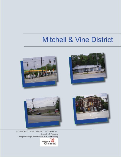
<strong>Mitchell</strong> & Vine District
ECONOMIC DEVELOPMENT WORKSHOP<br />
School <strong>of</strong> Planning<br />
College <strong>of</strong> Design, Architecture, Art, and Planning<br />
<strong>Mitchell</strong> & Vine District
<strong>St</strong>. <strong>Bernard</strong><br />
North Avondale<br />
ACKNOWLEDGMENTS<br />
Al Kanters<br />
Scott Merusi<br />
Peter Mallow<br />
Walter Moeller<br />
Charlene Morse<br />
Dr. Michael Romanos<br />
Jennifer Walke<br />
Margaret Wuerstle<br />
Amy Yosmali<br />
Tim Yosmali<br />
PARTICIPANTS<br />
Kiran Avadhanula<br />
Brian Backscheider<br />
Kimberly Bullerdick<br />
Jennifer Hackman<br />
Greg Meckstroth<br />
Nicol Thompson<br />
Sarah Wilson<br />
l 4 l<br />
School <strong>of</strong> Planning<br />
University <strong>of</strong> Cincinnati
<strong>St</strong>. <strong>Bernard</strong><br />
North Avondale<br />
CONTENT<br />
| Chapter 1 | Introduction 10<br />
subsection 1: Introduction 10<br />
subsection 2: Methodology 11<br />
subsection 3: Regional Context 11<br />
subsection 4: <strong>St</strong>akeholders 12<br />
subsection 5: Additional Development Efforts 13<br />
| Chapter 2 | Proposed Business District 15<br />
subsection 1: Traffic Pattern Analysis 15<br />
subsection 2: Physical Characteristic Inventory 16<br />
| Chapter 3 | Market Area Description and Analysis 19<br />
subsection 1: Neighborhood Business District 19<br />
subsection 2: Primary Market Area 20<br />
subsection 3: Demand Factors 24<br />
subsection 4: Supply Factors 34<br />
| Chapter 4 | Recommendations for the <strong>Mitchell</strong> & Vine<br />
District 42<br />
subsection 1: Introduction 42<br />
subsection 2: Developing a Marketing Niche 43<br />
School <strong>of</strong> Planning<br />
University <strong>of</strong> Cincinnati<br />
l 5 l
<strong>St</strong>. <strong>Bernard</strong><br />
North Avondale<br />
CONTENT Cont.<br />
subsection 3: Phases 48<br />
Conclusion 52<br />
References 55<br />
| Appendix A | Examples <strong>of</strong> Neighborhood Business<br />
District 56<br />
| Appendix B | Green Building 73<br />
| Appendix C | Crime Prevention Through Environmental<br />
Design 79<br />
l 6 l<br />
School <strong>of</strong> Planning<br />
University <strong>of</strong> Cincinnati
<strong>St</strong>. <strong>Bernard</strong><br />
North Avondale<br />
TABLES & FIGURES<br />
Figure 1: Location, Regional Attraction Centers and Traffic Flows 14<br />
Figure 2: ODOT Certified 2010 Traffic Counts 18<br />
Figure 3: Land Use Map 21<br />
Figure 4: Zoning Map 22<br />
Figure 5: PMA <strong>of</strong> the <strong>Mitchell</strong> & Vine District 23<br />
Figure 6: Map Showing Census Tracts within the 1 mile PMA 26<br />
Figure 7: Map Showing Census Tracts within the 2 mile PMA 27<br />
Figure 8: Map Showing Census Tracts within the 3 mile PMA 28<br />
Figure 9: Spenders and Savers as a Percentage <strong>of</strong> Total Population from<br />
1965 to 2025 30<br />
Figure 10: Commercial Locations within PMA <strong>of</strong> <strong>Mitchell</strong> & Vine District 38<br />
Figure 11: If Retailers Could Select Their Neighbors 41<br />
Figure 12: <strong>Mitchell</strong> & Vine Current Conditions 49<br />
Figure 13: Phase One <strong>of</strong> the <strong>Mitchell</strong> & Vine Business District 50<br />
Figure 14: Phase Two <strong>of</strong> the <strong>Mitchell</strong> & Vine Business District 51<br />
Figure 15: Phase Three <strong>of</strong> the <strong>Mitchell</strong> & Vine Business District 53<br />
Figure 16. 3500 Michigan <strong>Avenue</strong>-New Mixed Use Development with<br />
School <strong>of</strong> Planning<br />
University <strong>of</strong> Cincinnati<br />
l 7 l
<strong>St</strong>. <strong>Bernard</strong><br />
North Avondale<br />
TABLES & FIGURES cont.<br />
<strong>St</strong>reet Fronted Shops 56<br />
Figure 17: Hyde Park on a Sunday 57<br />
Figure 18: Hyde Park Parking Behind Commercial Retail Buildings 57<br />
Figure 19: O’Bryonville 58<br />
Figure 20: Traditional Neighborhood Elements in O’Bryonville 58<br />
Figure 21: Modern Architecture in O’Bryonville 59<br />
Figure 22: Shared Parking Behind District 59<br />
Figure 23: Auto-Oriented Development 60<br />
Figure 24: Blue Ash <strong>St</strong>reetscaping 60<br />
Figure 25: Buffers in Blue Ash 60<br />
Figure 26: DeSales Plaza 61<br />
Figure 27: Parking in DeSales 61<br />
Figure 28: DeSales Plaza 62<br />
Figure 29: Use <strong>of</strong> Brick Throughout Mt. Lookout 62<br />
Figure 30: Mixed Use in Mt. Lookout 63<br />
Figure 31: Modern Architecture in Mt. Lookout 63<br />
Figure 32: Commercial Tourist Zoning 64<br />
Figure 33: Building Placement 64<br />
Figure 34: Main<strong>St</strong>rasse Overlay Zone 65<br />
Figure 35: Layout <strong>of</strong> Biltmore Village 66<br />
Figure 36: Land Use Sub Areas 67<br />
Figure 37: <strong>St</strong>reet Tree Design in Biltmore Village 68<br />
Figure 38: University District 69<br />
l 8 l<br />
School <strong>of</strong> Planning<br />
University <strong>of</strong> Cincinnati
<strong>St</strong>. <strong>Bernard</strong><br />
North Avondale<br />
Figure 39: 15’ Sidewalks 70<br />
Figure 40: <strong>St</strong>reet Lighting 70<br />
Figure 41: Plaza 71<br />
Figure 42: Landscaped Buffers 71<br />
Figure 43: The Chicago <strong>City</strong> Hall Building with a Green Ro<strong>of</strong> 75<br />
Figure 44: Below grade parking with green space incorporated as a<br />
park on the top 76<br />
Table 1: Land Use Distribution in IMA 24<br />
Table 2: Census Tracts under each mile radius 25<br />
Table 3: Demographic Characteristics <strong>of</strong> the PMA 31<br />
Table 4: Expenditure Patterns by Age Group 31<br />
Table 5: Expenditure Patterns by Sex 32<br />
Table 6: Expenditure Patterns by Racial Composition 33<br />
Table 7: Expenditure Patterns by Household Income 34<br />
Table 8: Expenditure Patterns by Educational Attainment 35<br />
Table 9: Sales per Square Foot <strong>of</strong> Retail 35<br />
Table 10a: Potential Purchasing Power and Retail Demand by Category 36<br />
Table 10b: Potential Purchasing Power and Retail Demand by Category Cont. 37<br />
Table 11: Resident Consumer Patterns and Preferences 37<br />
Table 12: Selection <strong>of</strong> Potentially Competitive Spaces within One Mile <strong>of</strong><br />
<strong>Mitchell</strong> & Vine District 39<br />
Table 13: Retail Mix for <strong>Mitchell</strong> & Vine District by Level <strong>of</strong> Education 44<br />
School <strong>of</strong> Planning<br />
University <strong>of</strong> Cincinnati<br />
l 9 l
<strong>St</strong>. <strong>Bernard</strong><br />
North Avondale<br />
Chapter 1: Introduction<br />
The <strong>City</strong> <strong>of</strong> <strong>St</strong>. <strong>Bernard</strong> sits at a crossroads. The <strong>City</strong> has been<br />
well served by long time employers, including Procter & Gamble,<br />
Cognis Corporation, Cincinnati Specialties and Cincinnati Vulcan.<br />
These industries contribute to the tax base such that services in<br />
<strong>St</strong>. <strong>Bernard</strong> are excellent and city taxes are low. The <strong>City</strong> is quaint,<br />
walkable and and safe. However, in recent years the community has<br />
struggled to attract new residents. <strong>St</strong>. <strong>Bernard</strong> has experienced a<br />
declining population trend where both elderly and young families<br />
have been moving away (<strong>City</strong> <strong>of</strong> <strong>St</strong>. <strong>Bernard</strong> Economic Development<br />
<strong><strong>St</strong>udy</strong> 2007). A SWOT analysis conducted last year by <strong>St</strong>. <strong>Bernard</strong><br />
noted that there was no social or business center with a common<br />
plaza or square, no visibility for <strong>St</strong>. <strong>Bernard</strong>’s businesses and no<br />
planning for the future.<br />
The <strong>St</strong>. <strong>Bernard</strong> Community Improvement Corporation (CIC)<br />
was revitalized in October <strong>of</strong> 2007 in order to begin implementing<br />
strategic economic development initiatives. As one <strong>of</strong> its first efforts,<br />
the <strong>St</strong>. <strong>Bernard</strong> CIC commissioned an economic development<br />
study from the University <strong>of</strong> Cincinnati’s Community Planning<br />
Department, under the direction <strong>of</strong> Dr. Michael Romanos. Its<br />
purpose was to identify the neighborhood’s best opportunities<br />
for strategic development, based on an analysis <strong>of</strong> neighborhood<br />
conditions. These included location, transportation network,<br />
physical conditions, open space, social capital, housing, services and<br />
neighborhood walkability (<strong>St</strong>. <strong>Bernard</strong> Economic Development<br />
<strong><strong>St</strong>udy</strong> 2007). Understanding and analyzing these factors are critical<br />
steps to developing a factual basis on which to make strategic<br />
economic development decisions (McLean and Voytek 1992, 3).<br />
The 2007 <strong><strong>St</strong>udy</strong> strongly recommended that <strong>St</strong>. <strong>Bernard</strong> take<br />
advantage <strong>of</strong> its ideal location, proximity to institutions and its<br />
strong transportation systems (<strong>St</strong>. <strong>Bernard</strong> Economic <strong><strong>St</strong>udy</strong> 2007).<br />
The 2007 went on to characterize the current neighborhood<br />
business corridor as rapidly declining. Since then, the CIC has<br />
actively appropriated redevelopment opportunity sites as well as<br />
selected an infill development site which it intends to develop for<br />
senior housing (Merusi 2008). A feasibility study identified senior<br />
housing built according to leading environmental efficiency design<br />
standards as the prime opportunity for residential development.<br />
l 10 l<br />
In conjunction with this initiative, focus has been placed on<br />
enhancing the commercial viability <strong>of</strong> the neighborhood. The CIC<br />
has tasked itself with determining best location to take advantage<br />
School <strong>of</strong> Planning<br />
University <strong>of</strong> Cincinnati
<strong>of</strong> the neighborhood opportunities is to develop its gateways<br />
and locate development near them. The 2007 <strong><strong>St</strong>udy</strong> identified<br />
the southern portion <strong>of</strong> <strong>St</strong>. <strong>Bernard</strong>’s business corridor, from<br />
Orchard to Washington along Vine <strong>St</strong>reet, as the most potential<br />
for redevelopment. However, activity that has occurred after<br />
the release <strong>of</strong> the <strong><strong>St</strong>udy</strong> has identified a section south <strong>of</strong> that<br />
segment as having the most potential for redevelopment. This is<br />
the area marked by the intersection <strong>of</strong> <strong>Mitchell</strong> <strong>Avenue</strong> and Vine<br />
<strong>St</strong>reet. Traffic counts indicate that this intersection is the most<br />
traveled area in the vicinity. It is well positioned to capture visitors<br />
to the regional points <strong>of</strong> attraction mentioned above and daily<br />
commuters to area employers. As well, this location is able to<br />
serve the neighborhood <strong>of</strong> North Avondale. This is very important.<br />
Discussions that <strong>St</strong>. <strong>Bernard</strong> has held with leaders in North<br />
Avondale point to the need for a neighborhood business district<br />
that could serve it better than its currently designated business<br />
district (NANA Interview 2008). Finally, this district could serve<br />
the Clifton neighborhood, also in the <strong>City</strong> <strong>of</strong> Cincinnati. Based on<br />
this information, the CIC selected this area to pursue as a target<br />
location for a prospective business district.<br />
The purpose <strong>of</strong> this study then was to determine the feasibility<br />
<strong>of</strong> redeveloping an area located along the <strong>Mitchell</strong> <strong>Avenue</strong> and<br />
Vine <strong>St</strong>reet corridors, using the intersection <strong>of</strong> the two streets<br />
as its focal point. This proposed business district will primarily<br />
serve <strong>St</strong>. <strong>Bernard</strong> and North Avondale but will have the added<br />
benefit <strong>of</strong> capturing daytime visitors to the region. It also has the<br />
strongest potential for attracting customers to existing <strong>St</strong>. <strong>Bernard</strong><br />
businesses along the Vine <strong>St</strong>reet corridor. We will hereafter refer to<br />
the proposed business district as the “<strong>Mitchell</strong> & Vine District.”<br />
Methodology<br />
The study team began our work by walking and evaluating the<br />
physical conditions <strong>of</strong> the <strong>Mitchell</strong> & Vine District to get a sense<br />
for the strengths and weaknesses <strong>of</strong> the area itself. The conditions<br />
we looked at included building appearance, presence <strong>of</strong> garbage,<br />
occupancy, whether the building was used commercially or<br />
residentially, sidewalk conditions and availability <strong>of</strong> parking.<br />
These conditions were ranked from “good” to “deteriorated<br />
beyond repair.” During our evaluation, we noted where loitering<br />
occurred.<br />
Next we invited several persons involved in community<br />
development from <strong>St</strong>. <strong>Bernard</strong>, the city <strong>of</strong> Cincinnati and North<br />
Avondale to speak to our team about their visions and knowledge<br />
<strong>of</strong> the area. We also scheduled meetings with the Marketing Analyst<br />
who prepared <strong>St</strong>. <strong>Bernard</strong>’s study on senior housing in order to<br />
understand linkages between planned residential development<br />
and the <strong>Mitchell</strong> & Vine Distrct; and finally we met with an area<br />
developer to get an outside perspective <strong>of</strong> the area’s opportunities<br />
and challenges.<br />
Meanwhile, we performed an extensive literature review <strong>of</strong> similar,<br />
successful business districts in Cincinnati and around the country.<br />
We analyzed similarities <strong>of</strong> situation, aspects that we would seek<br />
to implement and aspects we would avoid. These case studies are<br />
included in the Appendices <strong>of</strong> this report. Also included in the<br />
Appendices are sections on Green Building and Crime Prevention<br />
School <strong>of</strong> Planning<br />
University <strong>of</strong> Cincinnati<br />
<strong>St</strong>. <strong>Bernard</strong><br />
North Avondale<br />
Through Environmental Design (CPTED) Green Building is<br />
recommended because <strong>of</strong> its cost savings and benefits to the<br />
environment. This is consistent with the findings <strong>of</strong> the senior<br />
housing study, which recommend that new projects be built to<br />
conserve energy and reduce environmental impacts. We believe<br />
that cost savings, if passed on, will appeal to certain segments <strong>of</strong><br />
consumers that <strong>St</strong>. <strong>Bernard</strong> can attract. We also note that Green<br />
Building signals sophistication and progress, which will appeal to<br />
highly educated consumers in the primary market area, so we<br />
recommend its use in the <strong>Mitchell</strong> & Vine District for this reason<br />
as well. In our research we found that residents have a marked<br />
concern about safety in the new district. The recommendation to<br />
Follow CPTED guidelines as the <strong>Mitchell</strong> & Vine District is built<br />
is aimed at helping to reduce real and perceived crime. Beyond<br />
these items, we also looked at the specific regulatory, zoning,<br />
institutional and policy environment in which the <strong>Mitchell</strong> & Vine<br />
District exists, and sought out best practices that might be used in<br />
the implementation stage.<br />
Our next step was to conduct a market analysis. As prescribed<br />
by Dunne & Lusch (2005), we looked at the population and/or<br />
household base to estimate the growth potential that would justify<br />
the proposed NBD. We researched consumer lifestyles, income<br />
potential, age, education status, occupation mix and race. We also<br />
have looked at the population <strong>of</strong> the nearby special markets in<br />
terms <strong>of</strong> daytime workers, students, and tourists, because <strong>of</strong> the<br />
proximity <strong>of</strong> zoo.<br />
Resident and business owner surveys provided by the <strong>St</strong>. <strong>Bernard</strong><br />
Community Improvement Corporation were included in our<br />
research as well. These pointed out specific opportunities and<br />
challenges for utilization <strong>of</strong> a new district.<br />
All <strong>of</strong> this primary and secondary research informed our design<br />
and business mix ideas, which we each expressed in individually<br />
produced site plans <strong>of</strong> the proposed <strong>Mitchell</strong> & Vine Business<br />
District. Individual ideas were reviewed and discussed by the team.<br />
Finally, select ideas were integrated into one master plan.<br />
The master plan in our Recommendations section is displayed<br />
in three phases. These illustrate in sequential order, the most<br />
immediately feasible plan, the intermediate plan and the final<br />
implementation. Each phase assumes implementation once success<br />
has been achieved at the phase prior to it. Depending on land<br />
acquisition rates, we assume that each phases will take from 1-10<br />
years to complete. Each phase provides a vision <strong>of</strong> the <strong>Mitchell</strong> &<br />
Vine District as a place where new residential, commercial, and<br />
open space exists together. It also provides a pedestrian friendly<br />
environment for anticipated increase in foot traffic. This will be<br />
accomplished by supporting physical connectivity and visual<br />
continuity throughout the area.<br />
Regional Context<br />
The <strong>Mitchell</strong> & Vine District is surrounded by the <strong>City</strong> <strong>of</strong> <strong>St</strong>.<br />
<strong>Bernard</strong> and the <strong>City</strong> <strong>of</strong> Cincinnati neighborhoods <strong>of</strong> Clifton,<br />
North Avondale and Elmwood Place. There is excellent access to<br />
uptown Cincinnati, downtown Cincinnati, the east and west sides<br />
<strong>of</strong> Cincinnati, and to Indiana (<strong>St</strong>. <strong>Bernard</strong> Economic <strong><strong>St</strong>udy</strong> 2007).<br />
l 11 l
<strong>St</strong>. <strong>Bernard</strong><br />
North Avondale<br />
The geographical extent <strong>of</strong> the proposed <strong>Mitchell</strong> & Vine District<br />
is defined by the Vine and <strong>Mitchell</strong> <strong>Avenue</strong> corridors bounded by<br />
the I-75 ramp along <strong>Mitchell</strong> <strong>Avenue</strong> to the west, Parkwood Place<br />
Lane <strong>of</strong>f <strong>of</strong> Vine <strong>St</strong>reet to the south, Roger Bacon High School<br />
<strong>St</strong>adium on <strong>Mitchell</strong> <strong>Avenue</strong> to the east and Bertus <strong>Avenue</strong> <strong>of</strong>f <strong>of</strong><br />
Vine street to the north.<br />
The <strong>Mitchell</strong> & Vine District is served primarily by Vine <strong>St</strong>reet,<br />
which runs north and south and connects <strong>St</strong>. <strong>Bernard</strong> to and<br />
uptown and downtown Cincinnati, and <strong>Mitchell</strong> <strong>Avenue</strong>, which<br />
travels from east to west through the area and connects <strong>St</strong>.<br />
<strong>Bernard</strong> to Interstate 75. As such, it is positioned as the northwest<br />
gateway to Xavier University, the Cincinnati VA Medical Center<br />
and the Cincinnati Zoo, all important institutions. The Cincinnati<br />
Zoo, in fact, is the #1 attraction in Cincinnati and one <strong>of</strong> the top<br />
five zoos in the nation according to a Zagat Survey (Cincinnati<br />
Zoo 2004). Vine <strong>St</strong>reet runs south through the <strong>Mitchell</strong> & Vine<br />
District to the second largest employment base in Cincinnati,<br />
Uptown, located within 3 miles. Uptown employers include the<br />
University <strong>of</strong> Cincinnati, Childrens Hospital Medical Center and<br />
University Hospital (Romanos et al 2006). <strong>Mitchell</strong> <strong>Avenue</strong> and<br />
Vine <strong>St</strong>reet, both major connectivity roads in Cincinnati, intersect<br />
at the focal point <strong>of</strong> this proposed business district. See Figure 1<br />
for a map showing the area.<br />
The <strong>Mitchell</strong> & Vine District will draw from the three neighborhoods<br />
that surround it:<br />
<strong>St</strong>. <strong>Bernard</strong><br />
<strong>St</strong>. <strong>Bernard</strong> is an appealing community located within the surrounding<br />
<strong>City</strong> <strong>of</strong> Cincinnati, OH and just west <strong>of</strong> the neighborhood <strong>of</strong><br />
North Avondale. Adding to its attractiveness, unlike many cities<br />
<strong>of</strong> today, children have the option <strong>of</strong> walking to school in a safe<br />
environment and the entire <strong>City</strong> itself is walkable and quaint.<br />
However, “<strong>St</strong>. <strong>Bernard</strong> is characterized by a declining population<br />
trend, with a clear predominance <strong>of</strong> the white population. This<br />
will likely have a negative impact on the community if this trend<br />
continues, as both the elderly and young families are moving out”<br />
(Romanos, 2007). And residents lack places that enhance the spirit<br />
<strong>of</strong> community, as for example a civic center (<strong>St</strong>. <strong>Bernard</strong> Economic<br />
Development <strong><strong>St</strong>udy</strong> 2007).<br />
The housing choices in <strong>St</strong>. <strong>Bernard</strong> vary, with a newly constructed<br />
development but mostly older homes that are affordable for<br />
several ranges <strong>of</strong> households. Key factors that make <strong>St</strong>. <strong>Bernard</strong><br />
a great location to be are the actively involved citizens and the<br />
institutions and services provided. Both public and parochial<br />
schools are located in the area and <strong>St</strong>. <strong>Bernard</strong> <strong>of</strong>fers an Aquatics<br />
Center, Fitness Center, Dial-a-Ride, and several green spaces for<br />
outdoor recreation or leisure.<br />
The neighborhood <strong>of</strong> North Avondale is located to the east <strong>of</strong><br />
the city <strong>of</strong> <strong>St</strong>. <strong>Bernard</strong> within the large <strong>City</strong> <strong>of</strong> Cincinnati. One<br />
key component that makes the neighborhood successful is the<br />
existence <strong>of</strong> the North Avondale Neighborhood Association<br />
(NANA). The organization meets monthly to discuss issues and<br />
activities happening in and around North Avondale to maintain an<br />
involved sense <strong>of</strong> community in the neighborhood. North Avondale<br />
houses a variety <strong>of</strong> people, including “symphony musicians,<br />
politicians, artists, doctors, and lawyers” (Cincinnati Home, 2008).<br />
l 12 l<br />
The housing stock is mostly turn-<strong>of</strong>-the-century homes with<br />
large lawns surrounded by trees. This neighborhood also boasts a<br />
community center and parks with many nearby attractions mostly<br />
to the north, east, and south.<br />
Clifton<br />
The neighborhood <strong>of</strong> Clifton, located in the north central part<br />
<strong>of</strong> the <strong>City</strong> <strong>of</strong> Cincinnati is home to the many students attending<br />
the University <strong>of</strong> Cincinnati and its urban campus educating over<br />
36,000 students (University <strong>of</strong> Cincinnati, About UC). Several<br />
buses pass through this area, transporting students, travelers, and<br />
workers, as the University <strong>of</strong> Cincinnati is the largest employer in<br />
the region. Sizeable older homes, as well as many historic homes,<br />
exist here. The main shopping district in this neighborhood is the<br />
Ludlow <strong>Avenue</strong> Shopping and Dining District. Clifton is home<br />
to Burnet Woods Park, providing leisure activities for residents<br />
and students. Additional attractions in this area are the Clifton<br />
Cultural Arts Center, established in 2004 and the Clifton Branch<br />
<strong>of</strong> the Public Library <strong>of</strong> Cincinnati and Hamilton County.<br />
<strong>St</strong>akeholders<br />
For any development or revitalization project to be successful, it is<br />
pertinent to identify the key stakeholders in the project right from<br />
the start. In this report, the stakeholders have been broken down<br />
into two categories: cities and organizations.<br />
Cities<br />
There are two overarching stakeholders involved in this potential<br />
redevelopment project, the cities <strong>of</strong> Cincinnati and <strong>St</strong>. <strong>Bernard</strong>.<br />
The <strong>City</strong> <strong>of</strong> Cincinnati is currently the largest stakeholder in this<br />
project; three out <strong>of</strong> the four corners at the intersection <strong>of</strong> <strong>Mitchell</strong><br />
<strong>Avenue</strong> and Vine <strong>St</strong>reet are in Cincinnati’s jurisdiction. <strong>St</strong>. <strong>Bernard</strong><br />
currently owns the northeast corner <strong>of</strong> the intersection. Both<br />
cities have a vested interest in this corridor; the neighborhood <strong>of</strong><br />
North Avondale and the <strong>City</strong> <strong>of</strong> <strong>St</strong>. <strong>Bernard</strong> view <strong>Mitchell</strong> <strong>Avenue</strong><br />
as a gateway into their communities.<br />
Contributing to the primary stakeholders’ interest is Interstate<br />
75. With the large amounts <strong>of</strong> traffic that travel through the<br />
intersection south on Vine <strong>St</strong>reet to Uptown, Xavier and the Zoo,<br />
a significant market is generated, one that should be capitalized<br />
on daily. Likewise, Procter & Gamble has a research facility in <strong>St</strong>.<br />
<strong>Bernard</strong> that employs hundreds <strong>of</strong> workers; however, they are a<br />
highly underutilized resource in the market.<br />
With an interest in the intersection, both cities could potentially<br />
provide resources to make the neighborhood business district a<br />
reality. The <strong>City</strong> <strong>of</strong> Cincinnati has financial programs set up for<br />
their neighborhood associations that could be utilized for the<br />
development <strong>of</strong> the neighborhood business district.<br />
Another city that could potentially be a stakeholder in this<br />
development is Elmwood Place. Located just over one mile from<br />
the <strong>Mitchell</strong> <strong>Avenue</strong> and Vine <strong>St</strong>reet intersection, Elmwood Place<br />
currently has a shared school district with the <strong>City</strong> <strong>of</strong> <strong>St</strong>. <strong>Bernard</strong>.<br />
With numerous Elmwood Place residents in <strong>St</strong>. <strong>Bernard</strong> on a daily<br />
basis, whether its to conduct business or pick their children up<br />
from school, they are a potential stakeholder by providing the<br />
School <strong>of</strong> Planning<br />
University <strong>of</strong> Cincinnati
population necessary to support the business district.<br />
Organizations<br />
There are four main associations that can contribute to the<br />
success <strong>of</strong> the new neighborhood business district. They are the<br />
North Avondale Neighborhood Association, the North Avondale<br />
Business Association, the <strong>St</strong>. <strong>Bernard</strong> Community Improvement<br />
Corporation, and the Vine <strong>St</strong>reet Business Association. As<br />
mentioned above, North Avondale views the <strong>Mitchell</strong> <strong>Avenue</strong><br />
corridor as a gateway into their community; however, the current<br />
condition does not reflect positively on the community. The<br />
North Avondale Neighborhood Association (NANA) recognizes<br />
the need to develop this corridor. Through them, attention to the<br />
area <strong>of</strong> focus as well as funds could be solicited from the <strong>City</strong> <strong>of</strong><br />
Cincinnati. NANA can also help foster a sense <strong>of</strong> community by<br />
promoting the use <strong>of</strong> the new neighborhood business district.<br />
The two business associations are crucial stakeholders in the<br />
target area. The North Avondale Business Association (NABA),<br />
and the Vine <strong>St</strong>reet Business Association (VSBA) are two<br />
organizations that can help promote or solicit new businesses for<br />
the proposed business district. North Avondale’s current business<br />
district is along Reading Road; however, NABA feels that their<br />
business district would be better suited along <strong>Mitchell</strong> <strong>Avenue</strong><br />
since it is a primary entrance into the neighborhood. Likewise,<br />
the VSBA recognizes the necessity <strong>of</strong> drawing attention to their<br />
business district along Vine <strong>St</strong>reet. A successful business district<br />
at the intersection <strong>of</strong> <strong>Mitchell</strong> <strong>Avenue</strong> and Vine <strong>St</strong>reet, coupled<br />
with an attractive gateway, should lure customers further into<br />
<strong>St</strong>. <strong>Bernard</strong>. Both business associations acknowledge the need to<br />
develop a business district and foresee the potential benefits to<br />
their respective communities.<br />
<strong>St</strong>. <strong>Bernard</strong><br />
North Avondale<br />
950-space parking garage for use by Cincinnati Children’s Hospital<br />
Medical Center and additional mixed-use retail and <strong>of</strong>fice space.<br />
Rather than view this development as potential competition for<br />
the Vine/<strong>Mitchell</strong> business district, we believe the development<br />
will enhance the districts marketability by the potential to serve<br />
additional drive thru traffic supported by the new location <strong>of</strong> the<br />
Cincinnati Herald. We anticipate that the mixed-use retail planned<br />
for this project will primarily serve the daytime users <strong>of</strong> the Burnet<br />
<strong>Avenue</strong> <strong>Corridor</strong>.<br />
Another project close by is being implemented by Xavier<br />
University, the <strong>City</strong> <strong>of</strong> Cincinnati and the <strong>City</strong> <strong>of</strong> Norwood. “Xavier<br />
Square” will be a 20 acre residential/retail/<strong>of</strong>fice site. The Planned<br />
Development site will include student housing, affinity housing,<br />
stores, restaurants, commercial <strong>of</strong>fice space, a boutique hotel, a<br />
fitness center, student health center and university bookstore<br />
(Business Courier 2007). Again, the planned developments<br />
at Xavier Square are intended to target the Xavier student<br />
population, which is not a target <strong>of</strong> the proposed <strong>St</strong>. <strong>Bernard</strong> and<br />
North Avondale business district.<br />
Finally, the Cincinnati Zoo just broken ground on a new entrance<br />
and parking facility, which is located on Vine <strong>St</strong>reet. The relocated<br />
entrance underlines the strategic placement <strong>of</strong> <strong>St</strong>. <strong>Bernard</strong> as a<br />
gateway to the Zoo.<br />
The final stakeholder is the <strong>St</strong>. <strong>Bernard</strong> Community Improvement<br />
Corporation (CIC). The CIC is committed to the redevelopment<br />
<strong>of</strong> <strong>St</strong>. <strong>Bernard</strong> and is willing to do what it can to make that happen.<br />
As a not-for-pr<strong>of</strong>it organization, the CIC has more flexibility in<br />
the development <strong>of</strong> properties than that <strong>of</strong> the city <strong>of</strong> <strong>St</strong>. <strong>Bernard</strong>;<br />
this enables them to pursue and follow through more avenues <strong>of</strong><br />
opportunity. The CIC has already begun work on redeveloping<br />
Vine <strong>St</strong>reet and has identified the <strong>Mitchell</strong> <strong>Avenue</strong> and Vine <strong>St</strong>reet<br />
intersection as a critical entrance to the city <strong>of</strong> <strong>St</strong>. <strong>Bernard</strong>.<br />
All <strong>of</strong> the organizations discussed above see the importance <strong>of</strong><br />
this potential business district to their communities. With the<br />
support and dedication <strong>of</strong> these organizations, the argument for<br />
the business district becomes greater. Working in concert with<br />
each other is the first step in developing the district.<br />
Additional Development<br />
Efforts<br />
As a testament to the marketability <strong>of</strong> the targeted area, other<br />
developments have been occurring in proximity to the proposed<br />
neighborhood business development. Two miles from the proposed<br />
business district, a significant redevelopment project has broken<br />
ground along Burnet <strong>Avenue</strong>. It will include more than 60 units <strong>of</strong><br />
new housing, a 4,000-square foot home for the Cincinnati Herald, a<br />
School <strong>of</strong> Planning<br />
University <strong>of</strong> Cincinnati<br />
l 13 l
<strong>St</strong>. <strong>Bernard</strong><br />
North Avondale<br />
Figure 1: Location, Regional Attraction Centers and Traffic Flows<br />
Figure 1: Location, Regional Attraction Centers and Traffic Flows<br />
Surce: Author<br />
l 14 l<br />
School <strong>of</strong> Planning<br />
University <strong>of</strong> Cincinnati
<strong>St</strong>. <strong>Bernard</strong><br />
North Avondale<br />
Chapter 2: Proposed Business<br />
District<br />
Traffic Pattern Analysis<br />
Driving Environment<br />
The speed limit on the major roads in the <strong>Mitchell</strong> & Vine District<br />
is 35 mph. North <strong>of</strong> <strong>Mitchell</strong>, Vine <strong>St</strong>reet the speed limit drops<br />
to 25 mph, which is also the speed limit <strong>of</strong> the minor roads in<br />
the area. <strong>Mitchell</strong> <strong>Avenue</strong> and Vine <strong>St</strong>reet are both 4 lanes wide<br />
with a 2-way center left turn lane on the western arm <strong>of</strong> <strong>Mitchell</strong><br />
<strong>Avenue</strong>. While parking is permitted along most <strong>of</strong> the major roads,<br />
it is not permitted during the peak afternoon hours, 3-6 pm. The<br />
curve <strong>of</strong> <strong>Mitchell</strong> <strong>Avenue</strong> somewhat limits the sight distance <strong>of</strong> the<br />
intersection from both the eastbound and westbound approaches,<br />
but is not a significant contributor to intersection problems.<br />
Significant Traffic Movements<br />
As illustrated in Figure 2, AM traffic is dominated by vehicles<br />
traveling east from I-75 to south on Vine <strong>St</strong>reet towards the<br />
Uptown area, with 1020 vehicles performing this motion during<br />
the AM peak. A large number <strong>of</strong> vehicles, 520, also continue east<br />
on <strong>Mitchell</strong> <strong>Avenue</strong> through the Vine-<strong>Mitchell</strong> intersection. Traffic<br />
heading towards I-75 is also significant during the AM peak with<br />
590 vehicles turning left from Vine heading west on <strong>Mitchell</strong> and<br />
470 vehicles traveling west through intersection toward the<br />
interstate.<br />
Also shown in Figure 2 are the PM traffic peaks. Generally, there is<br />
a reverse <strong>of</strong> AM traffic. The dominant movement is the 950 vehicles<br />
traveling from north on Vine <strong>St</strong>reet to west on <strong>Mitchell</strong> <strong>Avenue</strong>.<br />
Also showing a reverse <strong>of</strong> the AM conditions, the westbound<br />
through movement along <strong>Mitchell</strong> <strong>Avenue</strong> carries 560 vehicles and<br />
510 vehicles travel from eastbound <strong>Mitchell</strong> to southbound Vine.<br />
Of note in the PM movement are the 430 vehicles traveling north<br />
through the <strong>Mitchell</strong>-Vine intersection on Vine which is double<br />
the reverse movement during AM peak travel (Source: ODOT<br />
Certified Traffic, 2007).<br />
School <strong>of</strong> Planning<br />
University <strong>of</strong> Cincinnati<br />
Public Transportation<br />
The <strong>Mitchell</strong> & Vine District is served by Metro, the Cincinnati<br />
regional bus service. The bus stops are widely used by two routes,<br />
l 15 l
<strong>St</strong>. <strong>Bernard</strong><br />
North Avondale<br />
47 and 78, which serve the intersection.<br />
Transportation Problems<br />
The most obvious problem with traffic in the <strong>Mitchell</strong> & Vine<br />
District is the lack <strong>of</strong> left hand turn capacity from northbound Vine<br />
onto westbound <strong>Mitchell</strong>. Traffic on Vine <strong>St</strong>reet can back up close<br />
to a mile during the PM peak. Also, no shoulder exists on most <strong>of</strong><br />
the roadways, causing significant traffic delays during accidents and<br />
creating dangerous conditions for bikers and pedestrians. While<br />
roads in the area do have sidewalks, there is little to no buffer<br />
between the sidewalks and the street, a dangerous and uninviting<br />
situation. Due to the lack <strong>of</strong> buffer, utility poles are placed in the<br />
sidewalk, further limiting the sidewalk’s usefulness.<br />
The geometry <strong>of</strong> the current intersection prevents left turns from<br />
southbound Vine to eastbound <strong>Mitchell</strong>. If permitted, this route<br />
would accommodate travelers in the area wishing to visit Xavier<br />
University and use I-71. It is likely that a new street connecting Vine<br />
and <strong>Mitchell</strong> would need to be created or the current intersection<br />
reconfigured if this problem is to be properly addressed.<br />
Busses and bus stops in the area also cause problems. Bus stops<br />
near intersections cause the blockage <strong>of</strong> one lane when busses are<br />
loading and unloading. This is particularly true at the <strong>Mitchell</strong>-Vine<br />
intersection which has high use bus stops. These bus stops do not<br />
have proper capacity and patrons <strong>of</strong>ten spill over into adjacent<br />
sidewalks and parking lots, creating an uninviting atmosphere and<br />
limiting the use <strong>of</strong> the sidewalks and parking lots.<br />
I-75 Reconstruction<br />
Currently, plans are underway to reconstruct I-75 through<br />
Cincinnati. The <strong>Mitchell</strong> <strong>Avenue</strong> interchange is part <strong>of</strong> the Mill<br />
Creek Expressway study which stretches from the Paddock Road<br />
interchange to the Western Hills viaduct interchange. The study is<br />
being implemented for the Ohio Department <strong>of</strong> Transportation<br />
(ODOT) by TranSystems Corporation.<br />
TranSystems recommends modifying the current standard diamond<br />
interchange to a tight urban diamond interchange. This will bring<br />
the on and <strong>of</strong>f ramps closer to the I-75 mainline and provide<br />
more storage space for cars exiting the highway. The changes<br />
will have little direct effect on <strong>Mitchell</strong> <strong>Avenue</strong> traffic and other<br />
transportation improvements are not planned for the immediate<br />
area, either by ODOT or the <strong>City</strong> <strong>of</strong> Cincinnati. While the new<br />
interchange should have little impact on the intersection, other<br />
parts <strong>of</strong> the I-75 rebuild could increase traffic in the intersection.<br />
It is possible that the Towne <strong>St</strong>reet exit will be closed; this could<br />
lead to higher levels <strong>of</strong> traffic through the intersection.<br />
Physical Characteristics<br />
Inventory<br />
<strong>Mitchell</strong> & Vine District<br />
From the I-75 interchange moving eastbound, <strong>Mitchell</strong> <strong>Avenue</strong><br />
intersects Vine <strong>St</strong>reet is and continues east into North Avondale.<br />
This intersection will be the heart <strong>of</strong> the <strong>Mitchell</strong> & Vine District.<br />
It contains properties that include various land uses such as:<br />
l 16 l<br />
commercial, commercial/garage, single-family, two-family, multifamily,<br />
and retail/apartment.<br />
There are 164 lots in the <strong>Mitchell</strong> Ave./Vine <strong>St</strong>. intersection and<br />
our study area. Ten properties or 6% are unoccupied by buildings.<br />
These areas are small parcels and either contain parking or are<br />
part <strong>of</strong> the property next to it. The buildings located on the<br />
remaining 154 occupied lots vary in their condition. 27% are in<br />
good condition, 42% are in fair condition, 19% are in deteriorated<br />
condition, and 5% are dilapidated beyond repair. Many <strong>of</strong> the<br />
houses along <strong>Mitchell</strong> <strong>Avenue</strong> need extensive repairs on ro<strong>of</strong>s,<br />
siding and have extensive trash on the backs <strong>of</strong> the property. Many<br />
<strong>of</strong> the along Vine <strong>St</strong>., heading into <strong>St</strong>. <strong>Bernard</strong>, are made <strong>of</strong> quality<br />
construction and made <strong>of</strong> brick.<br />
In evaluating the property conditions, we found that 35% were<br />
mowed and had some improvements made to the property, 38%<br />
were mowed but had little improvement made on the property,<br />
21% were unmowed and weedy, and 5% partially overgrown, and<br />
none <strong>of</strong> the properties were completely overgrown. Several <strong>of</strong><br />
these properties are rentals and have not been maintained by the<br />
landlord.<br />
Housing Conditions in <strong>St</strong>. <strong>Bernard</strong> and the<br />
<strong>City</strong> <strong>of</strong> Cincinnati<br />
In both <strong>St</strong>. <strong>Bernard</strong> and The <strong>City</strong> <strong>of</strong> Cincinnati, there is a mixture<br />
<strong>of</strong> housing types which allows a variety <strong>of</strong> income groups to live<br />
in the area (<strong>St</strong>. <strong>Bernard</strong> Planning Committee 1998, 98-100). Data<br />
from the U.S. Census Bureau (2007) show that most houses within<br />
a 1 mile area (which includes census tracts 258, 65, 68 and 70) are<br />
55.1% renter-occupied and 44.9% owner-occupied. This is a higher<br />
percentage <strong>of</strong> renters to owners than in Hamilton County, where<br />
59% <strong>of</strong> homes are owner occupied and 40.2% are rentals.<br />
The median age <strong>of</strong> the housing stock in <strong>St</strong>. <strong>Bernard</strong> and the <strong>City</strong> <strong>of</strong><br />
Cincinnati is 1943. Very few houses have been built after 1980 (5%<br />
<strong>of</strong> the total number). Renovations and improvements are needed<br />
for a significant number <strong>of</strong> the buildings to increase their value<br />
and, thus, make the neighborhood more attractive for people and<br />
businesses.<br />
Data provided by the U.S. Census Bureau (2007) show that the<br />
values <strong>of</strong> owner-occupied homes in <strong>St</strong>. <strong>Bernard</strong> are not very high.<br />
Median household values in <strong>St</strong>. <strong>Bernard</strong> start at $91,500 and go<br />
up to $161,500, and the median average household value is $114,<br />
950. Rents are also quite low in the combined census area. 17.9%<br />
<strong>of</strong> the rents are lower than $299, 61.3% are between $300 and<br />
$599, 15% are between $600 and $799, 3.6% are between $800<br />
and $999, while only 2% are higher than $1,000 per month. For<br />
3.4% <strong>of</strong> the housing units rented, no cash rents are required. Nine<br />
percent <strong>of</strong> housing units are vacant.<br />
The majority <strong>of</strong> the housing stock in the <strong>Mitchell</strong> & Vine District<br />
is older and its value is moderate for the area. Renovations and<br />
improvements are needed for a significant number <strong>of</strong> the buildings<br />
to increase their value and, thus, make the neighborhood more<br />
attractive for people and businesses. The services available to the<br />
neighborhood’s residents lack places that enhance the spirit <strong>of</strong><br />
community, as for example a civic center. These areas need to be<br />
School <strong>of</strong> Planning<br />
University <strong>of</strong> Cincinnati
considered as priorities in the revitalization proposals considered<br />
(<strong>St</strong>. <strong>Bernard</strong> Economic Development <strong><strong>St</strong>udy</strong> 2007, School <strong>of</strong><br />
Planning).<br />
<strong>St</strong>. <strong>Bernard</strong><br />
North Avondale<br />
As the plan to transform the <strong>Mitchell</strong>/Vine intersection into a<br />
neighborhood business district is executed, it will be important<br />
to make changes in physical nature <strong>of</strong> the area such as parking<br />
orientation, walkability, providing more green space, and proving<br />
more amenities. With large scale improvement projects planned<br />
for Xavier University to the east and the Cincinnati Zoo to the<br />
South, the time is right to develop this area into a commercial retail<br />
district. The <strong>Mitchell</strong>/Vine intersection is well traveled by outsiders<br />
and could also serve the local community. Nevertheless, to gain a<br />
more complete understanding <strong>of</strong> the needs <strong>of</strong> the neighborhood,<br />
this area will be examined within the context <strong>of</strong> overall market<br />
as a location for businesses; a market analysis <strong>of</strong> this area and the<br />
surrounding neighborhoods is discussed in Chapter 3.<br />
School <strong>of</strong> Planning<br />
University <strong>of</strong> Cincinnati<br />
l 17 l
<strong>St</strong>. <strong>Bernard</strong><br />
North Avondale<br />
Figure 2: ODOT Certified 2010 Traffic Counts<br />
Source: Ohio Department <strong>of</strong> Transportation 2007<br />
l 18 l<br />
School <strong>of</strong> Planning<br />
University <strong>of</strong> Cincinnati
<strong>St</strong>. <strong>Bernard</strong><br />
North Avondale<br />
Chapter 3: Market Area<br />
Description and Analysis<br />
Figure 3 outlines the boundary <strong>of</strong> the <strong>Mitchell</strong> & Vine District<br />
and presents its current land uses. The boundaries have been<br />
established based on discussions with the <strong>City</strong> <strong>of</strong> <strong>St</strong> <strong>Bernard</strong>, the<br />
North Avondale Business Association and Vine <strong>St</strong>reet Business<br />
Association. Figure 4 gives a broad outline <strong>of</strong> the zoning. A market<br />
analysis was performed to establish the district’s market area<br />
and feasibility. The gap between what the analysis shows is the<br />
potential and the current mix <strong>of</strong> retail illustrates the potential for<br />
the district.<br />
Neighborhood Business<br />
District<br />
The population served by a Neighborhood Business District<br />
(NBD) is driven by day-to-day convenience shopping activities<br />
for the populace <strong>of</strong> the immediate neighborhoods rather than<br />
specialty attractions like entertainment, big-box retails and anchor<br />
stores. Hence, the focus <strong>of</strong> this study is on the kind <strong>of</strong> goods and<br />
service typically found in NBDs. These include eating and drinking,<br />
entertainment, apparel, shoe and clothing accessories, furniture<br />
and home furnishings and accessories, electronics, and books. The<br />
International Council for Shopping Centers (ICSC) states that<br />
roughly half <strong>of</strong> centers are anchored by a supermarket and about<br />
a third have a drugstore as the anchor. A neighborhood center is<br />
usually a straight-line strip with no enclosed walkway or mall area<br />
and parking in the front or back. The NBD has anywhere between<br />
30,000 – 150,000 square feet <strong>of</strong> built up space spread over 3-15<br />
acres <strong>of</strong> land (ICSC 2006). Nevertheless, there are variances in<br />
the size <strong>of</strong> NBDs in various studies. A Community Center <strong>of</strong>fers<br />
a wider variety <strong>of</strong> goods than an NBD, and its size varies from<br />
100,000 – 350,000 square feet. Since this study focuses on serving<br />
two major neighborhoods (<strong>St</strong> <strong>Bernard</strong> and North Avondale) our<br />
analysis and recommendations merge the characteristics <strong>of</strong> both<br />
a Neighborhood Business District and a Community Center,<br />
although we refer to the <strong>Mitchell</strong> & Vine District as an NBD<br />
throughout this chapter.<br />
School <strong>of</strong> Planning<br />
University <strong>of</strong> Cincinnati<br />
l 19 l
<strong>St</strong>. <strong>Bernard</strong><br />
North Avondale<br />
Primary Market Area<br />
A primary market area (PMA) is the geographic area from which<br />
70 percent or more customers <strong>of</strong> a shopping center or area are<br />
drawn. The market area for any NBD is a function <strong>of</strong> its size, tenant<br />
make-up, accessibility, and the scale and tenancies <strong>of</strong> competing<br />
market areas. Therefore, market areas are dynamic. They tend to<br />
change as a function <strong>of</strong> the type and supply <strong>of</strong> competing shopping<br />
locations. As well, the time people are willing to spend traveling to<br />
a shopping or business location is a function <strong>of</strong> both the size <strong>of</strong><br />
the shopping areas and the relative uniqueness <strong>of</strong> the tenancies<br />
and environments at alternative destinations. Accessibility to the<br />
shopping area and the ease <strong>of</strong> getting in, about, and out <strong>of</strong> it also<br />
influence the market area. Uniqueness, attraction, and accessibility<br />
are not measured in the abstract, but are always relative to the<br />
specific competition in the region.<br />
For this study the PMA is defined as the 3 mile radius from the<br />
intersection at <strong>Mitchell</strong> <strong>Avenue</strong> and Vine <strong>St</strong>reet. This radius is<br />
derived from the ICSC literature (ICSC 2006, p 4). Businesses<br />
falling within the PMA will play a significant role in the success or<br />
failure <strong>of</strong> the <strong>Mitchell</strong> & Vine District. The neighborhoods falling<br />
under the PMA are: <strong>St</strong> <strong>Bernard</strong>, North Avondale, Avondale, Clifton,<br />
Winton Place, Winton Hills, Elmwood Place, Carthage, Bond Hill,<br />
Norwood, Paddock Hill, Evanston, Corryville, Walnut Hills, CUF,<br />
Camp Washington and Northside.<br />
The one mile radius from the intersection <strong>of</strong> Vine and <strong>Mitchell</strong><br />
<strong>Avenue</strong> is <strong>of</strong> great importance to the study and is deemed the<br />
Immediate Market Area (IMA). An IMA is significant because it falls<br />
within the walking distance <strong>of</strong> the neighborhood populace and<br />
hence the land uses have been studied in detail. Figure 5 illustrates<br />
the delineations <strong>of</strong> the PMA and IMA outlines the detailed land<br />
uses <strong>of</strong> the IMA and Table 1 gives the description <strong>of</strong> the land uses<br />
within the IMA.<br />
As evident from Table 1, the IMA is predominantly a residential<br />
neighborhood with 68.7% <strong>of</strong> the land under residential land use.<br />
Commercial and <strong>of</strong>fice buildings occupy 3.1% <strong>of</strong> the land and<br />
educational and institutional areas combined occupy about the<br />
same. Industries occupy nearly 4% <strong>of</strong> land and public services<br />
and utilities occupy 7.2%. There is little land under recreational<br />
uses (0.55%) but there is good amount <strong>of</strong> vacant land in the IMA<br />
(11.7%). This gives scope for development.<br />
Selection <strong>of</strong> Census Tracts for PMA<br />
Analysis<br />
The shapes <strong>of</strong> trading areas are affected by geography, highways,<br />
rivers, housing developments, and not by hypothetical circles<br />
researchers create. Hence, the task <strong>of</strong> defining the PMA for the<br />
<strong>Mitchell</strong> & Vine District was relatively difficult to achieve. Data that<br />
matched the exact extent <strong>of</strong> the 3 mile radius from <strong>Mitchell</strong> and<br />
Vine with similar units <strong>of</strong> measurement across key variables were<br />
not available. Hence this study used data primarily obtained from<br />
the census. Census tracts were used to obtain household data and<br />
zip codes were used to obtain commercial/business data. Trends<br />
<strong>of</strong> the Midwestern region as reported by the Census were used<br />
to approximate spending patterns.<br />
l 20 l<br />
Because <strong>of</strong> the multiplicity <strong>of</strong> jurisdictions and lack <strong>of</strong> uniform<br />
data collection procedures this study has several limitations. For<br />
instance census tracts and zip codes do not overlap exactly. As well,<br />
census tracts don’t fit exactly within the 3-mile circle drawn from<br />
the <strong>Mitchell</strong> and Vine intersection. This has, at times, led to overrepresentation<br />
or under-representation <strong>of</strong> variables used for the<br />
analysis. Caution has been exercised to analyze the data available<br />
consistently. There are, however, trade area overlaps, which can<br />
not be addressed by this study.<br />
Figures 6, 7 and 8 outline the one, two and three mile radii from<br />
the intersection and show the respective census tracts that are<br />
included. It is nearly impossible to secure accurate data for the<br />
IMA, since the census tracts in it comprise 10.3 sq. miles instead <strong>of</strong><br />
the 3.14 square miles that an IMA covers. Table 2 illustrates census<br />
tracts under each mile radius.<br />
Since the census tracts under the three mile radius cover more<br />
than the required area (39.3 sq. miles instead <strong>of</strong> 28.3) some <strong>of</strong> the<br />
tracts that have little or no area under the three mile radius and/<br />
or just peripherally touch the radius have been removed from the<br />
calculations. The tract numbers that have been excluded are: 14,<br />
15, 16, 17, 18, 50, 59, 62.01, 82.01, 84, 85.01, 86.01, 222 and 253.<br />
Hence the census tract numbers covered under the PMA are:<br />
19, 20, 21, 22, 23, 25, 26, 27, 28, 29, 30, 32, 33, 34, 35, 36, 37, 38, 39,<br />
40, 41, 42, 61, 62.02, 63, 64, 65, 66, 67, 68, 69, 70, 71, 72, 73, 74, 75,77,<br />
78, 79, 80, 81, 85.02, 252, 254.01, 254.02, 255, 256, 257 and 258.<br />
The total area under these tracts is 29.2 sq. miles which is very<br />
indicative <strong>of</strong> the required area <strong>of</strong> 28.3 sq. miles. All the calculations<br />
are based on these census tract numbers and henceforth<br />
designated as the PMA tracts.<br />
Demographics <strong>of</strong> the PMA Census Tracts<br />
The study is based on the data availability from the census and<br />
the consistency. There were certain variables <strong>of</strong> the demographics<br />
available for the latest year (2007 estimates) and certain were not.<br />
Hence to have uniformity Census 2000 data is taken as the base<br />
for the calculations.<br />
The population <strong>of</strong> PMA according to the 2000 census is 143,086<br />
with a population density <strong>of</strong> 4,899.80 people per square mile. Table<br />
3 gives an outline <strong>of</strong> the demographic characteristics <strong>of</strong> the PMA<br />
and compares it with the <strong>City</strong> <strong>of</strong> Cincinnati and Hamilton County.<br />
Excluding the population <strong>of</strong> <strong>St</strong> <strong>Bernard</strong> and portion <strong>of</strong> Norwood,<br />
almost a third <strong>of</strong> Cincinnati’s population is covered by the PMA.<br />
Although the sex ratio is the same in all the three jurisdictions the<br />
median age significantly differs.<br />
The racial composition <strong>of</strong> the PMA is also significantly different<br />
from the <strong>City</strong> <strong>of</strong> Cincinnati and Hamilton County. The educational<br />
attainment, remains almost the same in all the three regions as<br />
far as less than college education goes. An interesting observation<br />
in this context is that the population with a bachelors degree or<br />
higher (including masters, pr<strong>of</strong>essional degrees and PhDs) in the<br />
PMA(29.2%) is at least 2.5 percentage points higher than that <strong>of</strong><br />
the <strong>City</strong> and over 7 percentage points higher than the County.<br />
The median household income <strong>of</strong> the PMA (26,315) is far below<br />
School <strong>of</strong> Planning<br />
University <strong>of</strong> Cincinnati
<strong>St</strong>. <strong>Bernard</strong><br />
North Avondale<br />
Figure 3: Land Use Map<br />
Source: CAGIS 2008<br />
School <strong>of</strong> Planning<br />
University <strong>of</strong> Cincinnati<br />
l 21 l
<strong>St</strong>. <strong>Bernard</strong><br />
North Avondale<br />
Figure 4: Zoning Map<br />
Source: CAGIS 2008<br />
l 22 l<br />
School <strong>of</strong> Planning<br />
University <strong>of</strong> Cincinnati
<strong>St</strong>. <strong>Bernard</strong><br />
North Avondale<br />
Figure 5: PMA <strong>of</strong> the Mithcell & Vine Dsitrict<br />
School <strong>of</strong> Planning<br />
University <strong>of</strong> Cincinnati<br />
Source: CAGIS 2008<br />
l 23 l
<strong>St</strong>. <strong>Bernard</strong><br />
North Avondale<br />
l 24 l<br />
Table 1: Land Use Distribution in the IMA<br />
Land Use<br />
Number <strong>of</strong><br />
Parcels Percent<br />
Commercial 185 2.90%<br />
Office 15 0.23%<br />
Mixed Use 17 0.24%<br />
Single Family 3232 51.06%<br />
Two Family 711 11.25%<br />
Multi Family 380 6.00%<br />
Congregate<br />
Housing 8 0.13%<br />
Education 52 0.82%<br />
Institutional 142 2.20%<br />
Light Industrial 113 1.78%<br />
Heavy Industrial 141 2.21%<br />
Public Recreation 35 0.55%<br />
Public Services 404 6.38%<br />
Public Utilities 57 0.83%<br />
Vacant 741 11.71%<br />
Unknown 16 0.23%<br />
Not Applicable 92 1.48%<br />
Total 6341 100.00%<br />
Source: CAGIS 2008<br />
that <strong>of</strong> Cincinnati ($29,243) and Hamilton County ($40, 964). The<br />
population below $25,000 (49.8%) is significantly higher than that<br />
<strong>of</strong> Cincinnati (43.1%) and Hamilton County (30.2%). Incomes in the<br />
range <strong>of</strong> $25,000 - $50,000 are approximately the same (roughly<br />
28-29 percentage points). In the two other income categories<br />
$50,000 - $100,000 and $100,000 and above the PMA (16.8% &<br />
5.5%) is again significantly lower than that <strong>of</strong> the <strong>City</strong> (20.1% &<br />
7.5%) and the County (28.4% & 12.8%) respectively. It is hence<br />
<strong>of</strong> no surprise that the PMA has the higher poverty incidence<br />
(26.8%) as compared to Cincinnati (21.9%) and Hamilton County<br />
(11.8%).<br />
Demand Factors<br />
Estimated Retail Demand<br />
Retail demand is a product <strong>of</strong> a complex cultural geography<br />
determined by the demographics <strong>of</strong> the region, their consumption<br />
and work patterns. It is also contingent upon the leisure behavior<br />
<strong>of</strong> the populace. Demand potential can be calculated if we know<br />
the population and buyer behavior characteristics. It would<br />
comprise <strong>of</strong> household income, age pr<strong>of</strong>ile <strong>of</strong> the household<br />
(HH), HH composition and population density. The team analyzed<br />
demographic and income data to estimate the potential retail<br />
demand in terms <strong>of</strong> expenditure potential and the square footage<br />
the identified demand could support, given assumptions about<br />
required average sales per square foot <strong>of</strong> commercial space<br />
(Dunne & Lusch 2005).<br />
Retail demand was calculated from two sources: market area<br />
residents and workers. Potential retail demand from residents<br />
depends on the amount <strong>of</strong> disposable income within the market<br />
area. This data was obtained from consumer expenditure surveys<br />
conducted by the Bureau <strong>of</strong> Labor <strong>St</strong>atistics, which identifies the<br />
proportion <strong>of</strong> income spent on retail goods and services. The<br />
latest data available is from 2006 (BLS 2008).<br />
Given the fact that there are a number <strong>of</strong> free standing retail<br />
stores and retail pockets close to the <strong>Mitchell</strong> & Vine District, the<br />
district will not capture all <strong>of</strong> the demand generated by the PMA.<br />
It is important to carefully analyze the kinds <strong>of</strong> businesses that<br />
should be located in the proposed <strong>Mitchell</strong> & Vine District.<br />
Demand for a business district in an area is generally fixed by<br />
population characteristics. However, inability <strong>of</strong> existing retailers<br />
to satisfy consumer demand may lead to high levels <strong>of</strong> sales<br />
leakage from the area, as consumers travel to stores outside <strong>of</strong><br />
it to meet their demands. It is evident by looking at the supply<br />
and demand factors that most <strong>of</strong> the residents <strong>of</strong> <strong>St</strong> <strong>Bernard</strong> and<br />
North Avondale gravitate to other business districts in the vicinity.<br />
If successful, the proposed <strong>Mitchell</strong> & Vine District will capture<br />
much <strong>of</strong> this leakage as well as demand from residents who live<br />
outside the PMA. This will also occur if the employment base<br />
increases and a retail agglomeration becomes established.<br />
The proposal for the <strong>Mitchell</strong> & Vine District is based on<br />
conservative estimates <strong>of</strong> the current retail demands and the<br />
average HH incomes <strong>of</strong> residents within the PMA. This potential<br />
demand has been translated into the retail space requirements<br />
likely to meet it within our site proposals.<br />
Demand Matrices<br />
It is also possible to develop demand matrices for a business<br />
district by type <strong>of</strong> good according to select demographic<br />
factors. The reason for this is that there are significant spending<br />
differences amongst age groups, amongst races and between sexes.<br />
In additional to these, educational attainment provides a basis for<br />
earning as well as taste. Finally, disposable income determines the<br />
amount <strong>of</strong> money available to be spent on certain types <strong>of</strong> goods<br />
within the local economy. Therefore a demographic factor for<br />
the primary market area can be selected and spending patterns<br />
plus disposable income can be applied to determine demand for<br />
goods according to that factor. We selected spending patterns and<br />
the potential purchasing power (PPP) from the 2006 Bureau <strong>of</strong><br />
Labor <strong>St</strong>atistics’ Consumer Expenditure Survey. From this survey,<br />
we also studied the breakdown <strong>of</strong> spending patterns in the PMA<br />
according the five categories mentioned before: age, sex, income<br />
race and educational attainment. Using an assumption from Dunne<br />
& Lusch, we estimated that 30% <strong>of</strong> the total purchasing power<br />
in the PMA could be attributed to the immediate market area<br />
(IMA), and therefore available to the <strong>Mitchell</strong> & Vine District. The<br />
following matrices, then, estimate the potential for types <strong>of</strong> goods<br />
that could be <strong>of</strong>fered in the <strong>Mitchell</strong> & Vine District when holding<br />
for a specific demographic factor.<br />
The idea is not to use each matrix, but to decide which amongst<br />
them provides the best opportunities for the <strong>Mitchell</strong> & Vine<br />
School <strong>of</strong> Planning<br />
University <strong>of</strong> Cincinnati
<strong>St</strong>. <strong>Bernard</strong><br />
North Avondale<br />
Table 2: Census Tracts under each mile radius<br />
Radius Area to be Covered<br />
under each mile<br />
1 mile 3.1 sq. miles<br />
2 mile 12.5 sq. miles<br />
3 mile 28.3 sq. miles<br />
Census Tract<br />
numbers covered<br />
by each mile<br />
Actual Area<br />
under mile<br />
65, 68, 69, 70, 71,<br />
73, 80 and 258 10.3 sq. miles<br />
28, 29, 30, 32, 33,<br />
34, 35, 36, 38, 39,<br />
63, 64, 65, 66, 67,<br />
68, 69, 70, 71, 72,<br />
73, 74, 75, 78, 80,<br />
81, 255, 256, 257<br />
and 258 21.3 sq. miles<br />
14, 15, 16, 17, 18,<br />
19, 20, 21, 22, 23,<br />
25, 26, 27, 28, 29,<br />
30, 32, 33, 34, 35,<br />
36, 37, 38, 39, 40,<br />
41, 42, 50, 59, 61,<br />
62.01, 62.02, 63,<br />
64, 65, 66, 67, 68,<br />
69, 70, 71, 72, 73,<br />
74, 75,77, 78, 79,<br />
80, 81, 82.01, 84,<br />
85.01, 85.02,<br />
86.01, 222, 252,<br />
253, 254.01,<br />
254.02, 255, 256,<br />
257 and 258 39.3 sq. miles<br />
Census tract numbers in bold are the new additions with the additional mile<br />
Source: CAGIS 2008<br />
District. Some factors predict demand <strong>of</strong> over a million square<br />
feet <strong>of</strong> retail, and some suggest 300,000 – 500,000 square feet<br />
<strong>of</strong> retail demand. Regardless <strong>of</strong> the matrix selected as a guide,<br />
supply factors will determine the extent <strong>of</strong> the retail and the mix.<br />
The idea is to come up with a gross leasable area (in square feet)<br />
that can be used for rental space in the proposed <strong>Mitchell</strong> & Vine<br />
District.<br />
We explored each demographic factor by analyzing the typical<br />
products served by local or neighborhood business districts<br />
according to the American Newspaper Association and the<br />
International Council for Shopping Centers (ICSC). These<br />
include amount spent by the residents on: food at home (grocery<br />
expenses), food away from home (demand for restaurants and fast<br />
food), alcoholic beverages, housekeeping supplies, small appliances<br />
and miscellaneous housewares, and miscellaneous household<br />
equipment (which includes some hardware stores), gasoline and<br />
motor oil, vehicle maintenance and service, personal care products<br />
and services, and tobacco.<br />
School <strong>of</strong> Planning<br />
University <strong>of</strong> Cincinnati<br />
One national trend in spending patterns are important to keep in<br />
mind. Figure 9 shows the spending patters <strong>of</strong> Savers (age groups<br />
between 45 and 64 years) and Spenders (ages 20-44 years). The<br />
graph hints at a cautionary phase between 2008 and 2015 where<br />
spending is curtailed and savings increase. The recession signs <strong>of</strong><br />
early 2008 coupled with the sub-prime market crises may indicate<br />
a match to these extrapolations.<br />
Demand for the <strong>Mitchell</strong> & Vine District<br />
Age<br />
Table 4 shows the percentage <strong>of</strong> income spent on types <strong>of</strong> goods<br />
according to age group within the PMA <strong>of</strong> the <strong>Mitchell</strong> & Vine<br />
District.<br />
Using Age as the primary factor for demand <strong>of</strong> goods yields a<br />
retail demand estimate <strong>of</strong> $1,173,513,033 for the primary market<br />
area. But the presence <strong>of</strong> other commercial establishments in the<br />
PMA leads us to assume that only 30% <strong>of</strong> this potential purchasing<br />
l 25 l
<strong>St</strong>. <strong>Bernard</strong><br />
North Avondale<br />
Figure 6. Map Showing Census Tracts within the 1 Mile PMA<br />
Source: CAGIS 2008.<br />
l 26 l<br />
School <strong>of</strong> Planning<br />
University <strong>of</strong> Cincinnati
Figure 7. Map Showing Census Tracts within the 2 Mile PMA<br />
<strong>St</strong>. <strong>Bernard</strong><br />
North Avondale<br />
Source: CAGIS 2008<br />
School <strong>of</strong> Planning<br />
University <strong>of</strong> Cincinnati<br />
l 27 l
<strong>St</strong>. <strong>Bernard</strong><br />
North Avondale<br />
Figure 8. Map Showing the Census Tracts within the 3 Mile PMA<br />
Figure 8. Map Showing the Census Tracts within the 3 Mile P<br />
Source: CAGIS 2008<br />
l 28 l<br />
School <strong>of</strong> Planning<br />
University <strong>of</strong> Cincinnati
<strong>St</strong>. <strong>Bernard</strong><br />
North Avondale<br />
Table 3: Demographic Characteristics <strong>of</strong> the PMA<br />
MA<br />
Variable<br />
Primary<br />
Market<br />
Area <strong>City</strong> <strong>of</strong> Cincinnati Hamilton County<br />
Total population<br />
(#) 143,086 331,285 845,303<br />
Number <strong>of</strong> HHs<br />
(#) 61,373 148,095 346,790<br />
Average HH size<br />
(#) 2.33 2.24 2.44<br />
Males (#) 47.5 47.2 47.7<br />
Females (#) 52.5 52.8 52.3<br />
The median age <strong>of</strong><br />
the population<br />
(Years)<br />
31.4 (29.3<br />
for Males<br />
and 33.3 for<br />
Females) 32.1<br />
35.5 (33.7 for Males<br />
and 37.1 for<br />
Females)<br />
Race<br />
Whites (%) 44.8 53 72.4<br />
African Americans<br />
(%) 50.1 42.9 23.3<br />
Other races (%) 5.1 4.1 4.3<br />
Education (25+) %<br />
Less than High<br />
School 17.3 23.2 27.8<br />
High school<br />
graduate (includes<br />
equivalency) 27.8 25.8 27<br />
Some college 25.8 24.3 23.5<br />
Bachelor's degree 18.5 16.4 12.4<br />
Graduate or<br />
pr<strong>of</strong>essional degree 10.7 10.3 9.4<br />
Median HH income $26,315 $29,243 $40,964<br />
Less than $10,000 21.5 18 10.6<br />
$10,000 to $14,999 9.7 8.6 6.3<br />
$15,000 to $24,999 18.6 16.5 13.3<br />
$25,000 to $34,999 14 14.3 12.8<br />
$35,000 to $49,999 14 15 15.8<br />
$50,000 to $74,999 11.8 13.8 18.7<br />
$75,000 to $99,999 5 6.3 9.7<br />
$100,000 to<br />
$149,999 3.2 4.3 7.4<br />
$150,000 to<br />
$199,999 0.9 1.4 2.4<br />
$200,000 or more 1.4 1.8 3<br />
Below poverty<br />
level (1999 year,<br />
%) 26.8 21.9 11.8<br />
Source: US Census Bureau 2000<br />
School <strong>of</strong> Planning<br />
University <strong>of</strong> Cincinnati<br />
l 29 l
<strong>St</strong>. <strong>Bernard</strong><br />
North Avondale<br />
Figure 9. Spenders and Savers as a Percentage <strong>of</strong> Total Population from 1965 to 2025<br />
Source: Based on data from US Bureau <strong>of</strong> the Census, Population Paper Listings PPL 41, Current Population Reports P25-1130, US Census <strong>of</strong> Population (1970)<br />
volume 1, Part B, Census <strong>of</strong> Population (1980) volume 1, part B.<br />
power falls within the immediate market area (Dunne & Lusch<br />
2005). Therefore, demand <strong>of</strong> goods based on Age is approximately<br />
$ 350 million for the <strong>Mitchell</strong> & Vine District.<br />
Sex<br />
Males spend around 16.4% <strong>of</strong> their income on the select goods<br />
in Table 5 below, whereas females spend 17.8% <strong>of</strong> their income<br />
on the same. This difference is explained by the fact that women<br />
tend to spend more money on groceries, housekeeping supplies<br />
and personal care products than men. Even though females in<br />
the PMA earn less than males, $26,120 compared to $31,350,<br />
they contribute a higher percentage <strong>of</strong> income to household<br />
purchases.<br />
Multiplying male and female incomes by their respective expenditure<br />
rates produces a retail demand estimate <strong>of</strong> $699,781,989. Again,<br />
assuming that 30% <strong>of</strong> this potential purchasing power can be<br />
attributed to the immediate market area translates into a demand<br />
<strong>of</strong> approximately $210 million when basing demand on Sex.<br />
Race<br />
Whites in the PMA spend 17.8% <strong>of</strong> their income on the select<br />
goods in Table 6 below and African Americans spend 16.6% <strong>of</strong> their<br />
income on the same goods. Other races (predominantly Asian and<br />
Hispanics) spend around 16% <strong>of</strong> their incomes on these goods.<br />
African Americans are in the lowest earning category ($20,502 per<br />
year) followed by Other Races ($26,748), and Whites ($33,037).<br />
view <strong>of</strong> the purchasing power within a primary market area.<br />
Median income categories for these calculations have been taken<br />
from the Midwestern regions aggregates. While there might be<br />
slight variation <strong>of</strong> the actual ranges in the PMA, the figures are<br />
otherwise fairly representative.<br />
Multiplying the median <strong>of</strong> each income category by the respective<br />
expenditure percentages for each item produces a retail demand<br />
estimate <strong>of</strong> $396,640,399. The IMA makes up approximately $119<br />
million <strong>of</strong> this.<br />
Educational Attainment<br />
Education plays a very important role in determining spending<br />
patterns. Differences amongst categories mostly occurs in<br />
entertainment and lifestyle product choices, some <strong>of</strong> which are<br />
not supplied by typical NBDs. Therefore Table 8 below shows a<br />
similar trend as the household income matrix at the aggregate level.<br />
As incomes rise along with levels <strong>of</strong> education, the percentage <strong>of</strong><br />
income spent on these selected goods as a whole drops while the<br />
overall amount increases.<br />
Multiplying the median income <strong>of</strong> each category by the total<br />
potential expenditures produces retail demand estimate <strong>of</strong><br />
$836,929,901 for the PMA and approximately $ 251 million for<br />
the IMA.<br />
Multiplying the total household incomes <strong>of</strong> Whites, African<br />
Americans and Other Races by their respective expenditure<br />
percentages produces a retail demand estimate <strong>of</strong> $652,488,412.<br />
The expected demand for the <strong>Mitchell</strong> & Vine District is about<br />
$196 million.<br />
Income<br />
Looking at household income in Table 7 produces yet another<br />
l 30 l<br />
School <strong>of</strong> Planning<br />
University <strong>of</strong> Cincinnati
<strong>St</strong>. <strong>Bernard</strong><br />
North Avondale<br />
Table 4: Expenditure Patterns By Age Groups (2006)<br />
143,086<br />
Age/Variable Less<br />
than 25<br />
25-34 35-44 45-54 55-64 65 and<br />
over<br />
years<br />
% share in the 36.4 15 14 11 6.9 11.6<br />
PMA<br />
Income before $29,057 $57,208 $75,613 $77,043 $64,425 $37,982<br />
taxes<br />
Food at Home 6.9 6.7 7.2 7 6.9 7.6<br />
Food Away from<br />
Home<br />
Alcoholic<br />
beverages<br />
Housekeeping<br />
supplies<br />
0.7 0.61 0.56 0.57 0.51 0.47<br />
1.7 1.4 0.9 1.1 0.9 0.7<br />
1 1.1 1.3 1.3 1.5 1.6<br />
Small appliances 0.2 0.2 0.2 0.3 0.2 0.2<br />
Misc household<br />
items<br />
1.4 1.4 1.3 1.4 1.7 1.3<br />
Gas 0.58 0.49 0.46 0.47 0.45 0.39<br />
Auto Maintenance 1.4 1.3 1.3 1.5 1.6 1.4<br />
Drugs and<br />
medical supplies<br />
0.5 0.6 0.8 1.2 1.8 3<br />
Other 0.7 0.8 1 0.9 1.3 0.7<br />
entertainment<br />
supplies<br />
Personal care 1.2 1.1 1.2 1.2 1.2 1.4<br />
Tobacco 1 0.7 0.6 0.8 0.7 0.5<br />
Selected Goods<br />
Total<br />
Estimated Total<br />
Potential<br />
Expenditure on<br />
retail and services<br />
(in Million)<br />
17.28 16.4 16.82 17.74 18.76 19.26<br />
$261.50 $201 $255 $215 $119 $121<br />
Sources: U.S. Bureau <strong>of</strong> Labor <strong>St</strong>atistics Consumer Expenditure Survey 2006; U.S. Census<br />
Bureau<br />
School <strong>of</strong> Planning<br />
University <strong>of</strong> Cincinnati<br />
l 31 l
<strong>St</strong>. <strong>Bernard</strong><br />
North Avondale<br />
Table 5: Expenditure Patterns By Sex (2006)<br />
143,086<br />
Sex/Variable Male Female<br />
% share in the PMA 47.5 52.5<br />
Income before taxes $31,356 $26,120<br />
Food at Home 5.4 6.6<br />
Food Away from Home 0.62 0.43<br />
Alcoholic beverages 1.8 0.9<br />
Housekeeping supplies 0.8 1.5<br />
Small appliances and Misc<br />
house ware 0.2 0.3<br />
Misc household items 1.5 1.5<br />
Gas 0.5 0.4<br />
Auto Maintenance 1.7 1.3<br />
Drugs and medical supplies 1.1 2.1<br />
Other entertainment supplies 1.1 0.4<br />
Personal care 0.6 1.8<br />
Tobacco 1.1 0.6<br />
Selected Goods Total 16.42 17.83<br />
Estimated Total Potential<br />
Expenditure on retail and<br />
services (in Million)<br />
$350 $350<br />
Sources: U.S. Bureau <strong>of</strong> Labor <strong>St</strong>atistics Consumer<br />
Expenditure Survey 2006; U.S. Census Bureau<br />
Estimated Expenditure Potential by Retail<br />
Category<br />
As is evident from the demand matrices, all demographic factors<br />
point to potential for the <strong>Mitchell</strong> & Vine District. As illustrated by<br />
Tables 9 and 10a and b below, demand indicates that an additional<br />
500,000 to 1,000,000 square feet <strong>of</strong> typical neighborhood<br />
business district retail can be supported. Supply factors will help<br />
determine the exact extent <strong>of</strong> retail in the NBD. We will explore<br />
supply factors in the next chapter, however, it will be up to specific<br />
retailers to determine<br />
Based on the analysis and the detailed investigation into the<br />
spending patterns <strong>of</strong> the five broad categories and the strengths<br />
and opportunities <strong>of</strong> the surrounding neighborhoods, we have<br />
concluded that the Educational Attainment category is best suited<br />
to the recommendations. Hence, the calculations, retail mix,<br />
categories and the niche market identification will all be based on<br />
the Educational Attainment categories <strong>of</strong> the PMA.<br />
l 32 l<br />
School <strong>of</strong> Planning<br />
University <strong>of</strong> Cincinnati
<strong>St</strong>. <strong>Bernard</strong><br />
North Avondale<br />
Table 6: Expenditure Patterns By Racial Composition (2006)<br />
143,086<br />
Race/Variable White African Other Races<br />
American<br />
% share in the PMA 44.8 50.1 5.1<br />
Income before taxes 33,037 20,502 26,748<br />
Food at Home 6.9 8.1 7.8<br />
Food Away from Home 0.56 0.5 0.59<br />
Alcoholic beverages 1.1 0.6 0.7<br />
Housekeeping supplies 1.3 1.4 1.1<br />
Small appliances 0.2 0.1 0.2<br />
Misc household items 1.5 0.9 1.1<br />
Gas 0.46 0.5 0.46<br />
Auto Maintenance 1.4 1.3 1.3<br />
Drugs and medical supplies 1.4 0.9 0.8<br />
Other entertainment supplies 1.1 0.3 0.3<br />
Personal care 1.2 1.5 1.3<br />
Tobacco 0.7 0.5 0.3<br />
Selected Goods Total 17.82 16.6 15.95<br />
$377 $243 $31<br />
Estimated Total Potential Expenditure<br />
on retail and services (in Million)<br />
Sources: U.S. Bureau <strong>of</strong> Labor <strong>St</strong>atistics Consumer Expenditure Survey 2006; U.S. Census Bureau<br />
School <strong>of</strong> Planning<br />
University <strong>of</strong> Cincinnati<br />
l 33 l
<strong>St</strong>. <strong>Bernard</strong><br />
North Avondale<br />
Income/Variable<br />
Table 7: Expenditure Patterns By Household Income (2006)<br />
61,360<br />
Less $10,000 $15,000 $20,000 $30,000 $40,000<br />
than to to to to to<br />
10,000 $14,999 $19,999 $29,999 $39,999 $49,999<br />
$50,000<br />
to<br />
$69,999<br />
$70,000<br />
and<br />
above<br />
% share in the PMA 21.5 9.7 9.4 16.9 11.8 8.5 11.7 10.5<br />
Median Income<br />
before taxes $4,223 $12,551 $17,462 $24,905 $34,685 $44,620 $59,253 $125,688<br />
Food at Home 10.0 10.5 10.1 9 7.7 7.7 7.2 5.8<br />
Food Away from<br />
Home 0.59 0.46 0.47 0.53 0.56 0.57 0.58 0.55<br />
Alcoholic<br />
beverages 1.1 1 0.9 0.9 1.1 1.1 1 1<br />
Housekeeping<br />
supplies 1.9 1.4 1.5 1.4 1.3 1.3 1.3 1.2<br />
Small appliances 0.2 0.2 0.2 0.2 0.2 0.2 0.2 0.2<br />
Misc household<br />
items 1.1 1.3 1.2 1.1 1.2 1.5 1.4 1.5<br />
Gas 0.47 0.48 0.52 0.54 0.54 0.54 0.52 0.4<br />
Auto Maintenance 1.3 1.5 1.5 1.4 1.6 1.6 1.6 1.3<br />
Drugs and medical<br />
supplies 1.4 2.1 2.2 2.0 1.7 1.5 1.4 1.0<br />
Other entertainment<br />
supplies 0.5 0.2 0.6 0.4 0.5 0.8 0.8 1.2<br />
Personal care 1.2 1.2 1.4 1.2 1.3 1.2 1.3 1.2<br />
Tobacco 1.4 1.2 1.2 1.1 1.1 0.9 0.8 0.4<br />
Selected Goods<br />
Total<br />
Estimated Total<br />
Potential<br />
Expenditure on<br />
retail and services<br />
(in Million)<br />
21.16 21.54 21.79 19.77 18.8 18.91 18.1 15.75<br />
$12 $16 $22 $51 $47 $44 $77 $127.5<br />
Sources: U.S. Bureau <strong>of</strong> Labor <strong>St</strong>atistics Consumer Expenditure Survey 2006; U.S. Census Bureau<br />
l 34 l<br />
School <strong>of</strong> Planning<br />
University <strong>of</strong> Cincinnati
<strong>St</strong>. <strong>Bernard</strong><br />
North Avondale<br />
Table 8: Expenditure Patterns By Educational Attainment (2006)<br />
83,838<br />
Age/Variable<br />
Less<br />
than<br />
High<br />
School<br />
High school<br />
graduate<br />
(includes<br />
equivalency)<br />
Some<br />
college<br />
Bachelor's<br />
degree<br />
Graduate<br />
or<br />
pr<strong>of</strong>essional<br />
degree<br />
% share in the PMA 17.3 27.8 25.8 18.5 10.7<br />
Income before taxes 31,362 44,780 52,005 78,401 102,707<br />
Food at Home 9.9 8.3 7.4 5.9 5.4<br />
Food Away from Home 0.53 0.55 0.58 0.57 0.51<br />
Alcoholic beverages 0.7 0.9 1.1 1.1 1.1<br />
Housekeeping supplies 1.6 1.4 1.3 1.2 1.3<br />
Small appliances 0.2 0.2 0.3 0.2 0.2<br />
Misc household items 1 1.2 1.5 1.6 1.5<br />
Gas 0.55 0.54 0.5 0.39 0.33<br />
Auto Maintenance 1.4 1.4 1.5 1.5 1.3<br />
Drugs and medical supplies 1.7 1.5 1.2 1.1 1.1<br />
Other entertainment supplies 0.6 1 1 0.9 1.1<br />
Personal care 1.1 1.2 1.2 1.3 1.1<br />
Tobacco 1.4 1.1 0.8 0.3 0.2<br />
Selected Goods Total 20.68 19.29 18.38 16.06 15.14<br />
Estimated Total Potential<br />
Expenditure on retail and<br />
services (in Million)<br />
$94 $201 $207 $195 $139<br />
Sources: U.S. Bureau <strong>of</strong> Labor <strong>St</strong>atistics Consumer Expenditure Survey 2006; U.S. Census Bureau<br />
Table 9: Sales per Square Foot <strong>of</strong> Retail<br />
Kind <strong>of</strong> Retail Sales per Square Foot (in $)<br />
Grocery 347.1<br />
Food Service 257.3<br />
Liquor 254.1<br />
Other Retail 159.18<br />
Home Furnishings 159.66<br />
Hardware 143.3<br />
Gas <strong>St</strong>ations 136.31<br />
Automotive Service 186<br />
Drugs 404.8<br />
Home<br />
Appliances/Music 174.66<br />
Personal Services 239<br />
Tobacco 197<br />
Selected Goods Total 221.5<br />
Sources: Newspaper Association <strong>of</strong> America, International Council<br />
for Shopping Centers, Urban Land Institute<br />
School <strong>of</strong> Planning<br />
University <strong>of</strong> Cincinnati<br />
l 35 l
<strong>St</strong>. <strong>Bernard</strong><br />
North Avondale<br />
Table 10a: Potential Purchasing Power and Retail Demand by Category<br />
Items Sales per<br />
Square Foot<br />
($)<br />
PPP<br />
by Age<br />
in<br />
Millions<br />
Demand<br />
By Age<br />
in ’000 Sq. Ft<br />
PPP by Sex<br />
in Millions<br />
Demand<br />
by Sex<br />
in ’000 Sq. Ft<br />
PPP<br />
by Race<br />
in Millions<br />
in ’000 Sq. Ft<br />
Grocery 347.1 141.7 408 73.4 211 84.1 242<br />
Food Service 257.3 11.9 46 6.5 25 6.1 24<br />
Liquor 254.1 24 94 16.8 66 10 39<br />
Other Retail 159.18 25.1 158 13.9 88 15 95<br />
Home Furnishings 159.66 4.4 27 3 19 1.8 11<br />
Hardware 143.3 28.2 197 18.4 128 14.1 99<br />
Gas <strong>St</strong>ations 136.31 9.8 72 5.5 41 5.4 39<br />
Automotive Service 186 28.2 152 18.5 100 15.3 83<br />
Drugs 404.8 21.6 53 19.4 48 13.3 33<br />
Home Appliances/Music 174.66 17.7 101 9.4 54 8.4 48<br />
Personal Services 239 24.5 101 14.4 60 15 63<br />
Tobacco 197 15 76 10.5 54 6.8 34<br />
Selected Goods Total 221.5 352 1500 210 900 195.3 800<br />
Sources: U.S. Bureau <strong>of</strong> Labor <strong>St</strong>atistics Consumer Expenditure Survey 2006; U.S. Census Bureau<br />
Demand<br />
by Race<br />
l 36 l<br />
School <strong>of</strong> Planning<br />
University <strong>of</strong> Cincinnati
<strong>St</strong>. <strong>Bernard</strong><br />
North Avondale<br />
Table 10b: Potential Purchasing Power and Retail Demand by Category<br />
Items<br />
PPP<br />
by Income<br />
in Millions<br />
Demand<br />
by Income<br />
in ’000 Sq. Ft<br />
PPP<br />
by<br />
Education<br />
in Millions<br />
Demand<br />
by Education<br />
in ’000 Sq. Ft<br />
Grocery 48.5 140 101 291<br />
Food Service 3.6 14 7.9 30<br />
Liquor 6.7 26 14.5 57<br />
Other Retail 8.6 54 18.9 119<br />
Home Furnishings 1.3 8 3.2 20<br />
Hardware 9 63 20.1 141<br />
Gas <strong>St</strong>ations 3.1 23 6.4 47<br />
Automotive Service 9.6 51 20.4 110<br />
Drugs 9.4 23 18.1 45<br />
Home Appliances/Music 5.5 31 13.6 78<br />
Personal Services 8.2 34 17 71<br />
Tobacco 5.1 26 9.7 49<br />
Selected Goods Total 118.6 500 251 1000<br />
Sources: U.S. Bureau <strong>of</strong> Labor <strong>St</strong>atistics Consumer Expenditure Survey 2006; U.S. Census Bureau<br />
School <strong>of</strong> Planning<br />
University <strong>of</strong> Cincinnati<br />
l 37 l
<strong>St</strong>. <strong>Bernard</strong><br />
North Avondale<br />
Residential Survey<br />
136 people responded to the <strong>City</strong> <strong>of</strong> <strong>St</strong>. <strong>Bernard</strong>’s online survey<br />
<strong>of</strong> perceptions about the proposed business district at Vine and<br />
<strong>Mitchell</strong>. The majority <strong>of</strong> respondents were from North Avondale.<br />
About 15% <strong>of</strong> them were from <strong>St</strong>. <strong>Bernard</strong> and another 9% was<br />
from outside the area. Female respondents outnumbered men<br />
almost 3 to 1.<br />
Ages were broken down as follows:<br />
25-: 3<br />
26-34: 5<br />
35-44: 18<br />
45-54: 38<br />
55-64: 45<br />
65+: 26<br />
Willingness to Shop in New District<br />
106 respondents said they would shop in the new business district,<br />
whereas 44 said they would not (17 respondents answered both<br />
affirmatively and negatively and 6 respondents did not answer).<br />
Table 11 shows responses to some <strong>of</strong> the survey questions.<br />
Overall, 55% <strong>of</strong> all respondents travel through the proposed<br />
business district daily, and only 7% reported travel through the<br />
Vine/<strong>Mitchell</strong> intersection on a monthly basis. The percentage <strong>of</strong><br />
daily travelers was higher for respondents from <strong>St</strong>. <strong>Bernard</strong> and<br />
outside <strong>of</strong> the area (66% travel Vine/<strong>Mitchell</strong> daily).<br />
Most Visited <strong>St</strong>ores in <strong>St</strong>. <strong>Bernard</strong>:<br />
76 IGA<br />
74 Chili Restaurant<br />
43 Bargain <strong>St</strong>ore (Family Dollar/Dollar General)<br />
35 La Rosa’s<br />
33 Post Office (almost all responses from North Avondale)<br />
33 Wendy’s<br />
15 Library (almost all responses from North Avondale)<br />
15 Walgreens<br />
14 Shcerpie’s<br />
14 Subway<br />
11 UDF (no longer in existence)<br />
11 Shoe Repair<br />
8 Dry Cleaner (all responses from North Avondale)<br />
7 Hair/Barber<br />
7 Meiner’s<br />
Most Visits in Immediate Market Area:<br />
50 Kroger<br />
35 Walgreen’s<br />
34 IGA (split between Clifton and <strong>St</strong>. <strong>Bernard</strong> IGA)<br />
23 Esquire Theatre<br />
22 Rookwood Commons<br />
19 Chili restaurant<br />
19 Post Office<br />
16 Graeter’s<br />
12 LaRosa’s<br />
12 Library<br />
11 Ambar<br />
10 Dollar <strong>St</strong>ore<br />
9 Dewey’s Pizza<br />
6 Hardware <strong>St</strong>ore<br />
5 Scherpie’s<br />
4 Full Spectrum Health Center<br />
Preferred Neighborhoods<br />
When asked which business district the proposed area should<br />
most resemble, 36 people mentioned Clifton, 27 favored Hyde Park,<br />
14 referenced Oakley and 11 said Mt. Lookout. Other favorites<br />
included Northside, O’Bryonville, Mariemont and Asheville, North<br />
Carolina.<br />
In making these choices, most <strong>of</strong> the respondents from <strong>St</strong>. <strong>Bernard</strong><br />
linked their preferred business districts to the need for all aspects<br />
<strong>of</strong> a safe and clean environment: lighting, traffic, landscaping,<br />
pedestrian access and especially maintenance <strong>of</strong> these were<br />
mentioned several times. Some went further to mention variety<br />
<strong>of</strong> stores, but when specific brands were <strong>of</strong>fered there was a<br />
split regarding type. Some highlighted value/convenience retailers<br />
like Payless and Walgreen’s or basic restaurant chains such as<br />
Applebee’s or Fridays while others mentioned the locally owned,<br />
specialty clothing, accessories and grocery stores.<br />
For North Avondale respondents, the main quality <strong>of</strong> their most<br />
desirable business district was variety. Several respondents<br />
illustrated a strong dislike toward chain restaurants and a<br />
preference for independent and specialty shops such as yoga,<br />
Whole Foods. At the same time, many respondents did not want<br />
an “uppity” ambience (Hyde Park was mentioned as the epitome<br />
<strong>of</strong> uppity). C<strong>of</strong>fee shop/bakeries were mentioned a few times and<br />
some type <strong>of</strong> restaurant in the preferred district was mentioned<br />
many times.<br />
These respondents clearly mentioned convenience and parking<br />
as attraction factors. Concern over viability <strong>of</strong> such a district<br />
was discussed, because <strong>of</strong> traffic. Many respondents felt that the<br />
neighborhood feel they desire is not possible at the proposed<br />
location because <strong>of</strong> the noise, air pollution and danger that heavy<br />
traffic brings.<br />
Respondents from outside <strong>of</strong> both neighborhoods discussed<br />
cleanliness and specialized storefronts. Most referenced Hyde<br />
Park as their preferred neighborhood.<br />
l 38 l<br />
School <strong>of</strong> Planning<br />
University <strong>of</strong> Cincinnati
Table 11: Resident Consumer Patterns and Preferences<br />
North <strong>St</strong>.<br />
Category<br />
Avondale <strong>Bernard</strong> Other Total<br />
Daily Visit 51% 66% 66% 55%<br />
Chili<br />
Restaurant<br />
(18)<br />
Chili<br />
Restaurant<br />
Top <strong>St</strong>. <strong>Bernard</strong> Visited IGA (57)<br />
(8) IGA (76)<br />
Kroger<br />
Top Area <strong>St</strong>ore Visited Kroger IGA Kroger (50)<br />
Preferred Business Restaurant Restaurant Restaurant Restaurant<br />
Top Time <strong>of</strong> Day<br />
2nd Time <strong>of</strong> Day<br />
Top Concern<br />
Weekend<br />
Afternoon<br />
Weekday<br />
Afternoon<br />
Autounfriendly<br />
Source: <strong>St</strong>. <strong>Bernard</strong> and North Avondale Survey, 2008<br />
Weekend<br />
Afternoon<br />
Weekday<br />
Evening<br />
Safety –<br />
Criminal<br />
element<br />
Weekday<br />
Morning<br />
Weekday<br />
Afternoon<br />
Traffic<br />
congestion<br />
Weekend<br />
Afternoon<br />
Weekday<br />
Afternoon<br />
Overall<br />
safety<br />
<strong>St</strong>. <strong>Bernard</strong><br />
North Avondale<br />
Business Survey<br />
Twenty proprietors responded to a business survey conducted by<br />
the <strong>St</strong>. <strong>Bernard</strong> CIC in the Spring <strong>of</strong> 2008. A majority <strong>of</strong> respondents<br />
were sole proprietors <strong>of</strong> businesses in <strong>St</strong>. <strong>Bernard</strong> who had been<br />
in the <strong>City</strong> for an average <strong>of</strong> 24 years Notable exceptions were<br />
three businesses who started less than four years ago and four<br />
establishments whose beginnings went back for more than 40<br />
years. Respondents were asked about their business growth, plans<br />
for expansion, employees, customers, perceptions <strong>of</strong> the business<br />
district where they are located, perceptions about how certain<br />
factors help or hurt their businesses and their opinions about<br />
what types <strong>of</strong> businesses would best fit in the proposed business<br />
district.<br />
As to the nature <strong>of</strong> their customers, most responded that the<br />
significant portion <strong>of</strong> customers come from <strong>St</strong>. <strong>Bernard</strong>. However,<br />
a few trends were noticeable. Baxter Burial Vault, Chili Time and<br />
Dairy Queen reported that significant numbers <strong>of</strong> visitors came<br />
from within Cincinnati but outside <strong>of</strong> the immediate market area.<br />
The Dairy Queen and Chili Time also see significantly higher<br />
African American percentages and a variety <strong>of</strong> age groups than<br />
other businesses in <strong>St</strong>. <strong>Bernard</strong>. Meanwhile, two businesses<br />
responded that 100% <strong>of</strong> their clientele were white (the hair salon<br />
and the auto repair shop) and all <strong>of</strong> the banking and insurance<br />
respondents noted that 70% <strong>of</strong> their clientele was white. Although<br />
the number <strong>of</strong> respondents is too small to <strong>of</strong>fer quantitative<br />
reliability, further surveys could be used to substantiate what<br />
appears to be a need for minority-owned businesses specializing<br />
in personal and financial services.<br />
Business owners were split on what they felt the biggest challenges<br />
for the business district would be. Of those who responded to the<br />
open ended question, about half noted issues with the cleanliness<br />
and attractiveness and the other half took issue with vacancies.<br />
Crime and/or the perception <strong>of</strong> safety were mentioned by two<br />
owners. These corresponded closely to the challenges mentioned<br />
in their own locations. However, when asked from drop down<br />
menus about the impact <strong>of</strong> certain characteristics on the business<br />
district; the item that drew the most concern was safety.<br />
However, safety did not appear to conversely help business.<br />
Instead, when asked what helps their businesses, owners were apt<br />
to choose accessibility and over other factors including businesses<br />
nearby, parking, safety, attractiveness, upkeep <strong>of</strong> area and variety<br />
or quality <strong>of</strong> goods and services in the district. Attractiveness and<br />
upkeep were the second highest scoring factors.<br />
School <strong>of</strong> Planning<br />
University <strong>of</strong> Cincinnati<br />
l 39 l
<strong>St</strong>. <strong>Bernard</strong><br />
North Avondale<br />
SUPPLY FACTORS<br />
Current retail analysis<br />
Retail supply factors are determined by the availability <strong>of</strong> square feet<br />
per store and employee, store growth and quality <strong>of</strong> competition<br />
(Dunne & Lusch 2005).<br />
There are a number <strong>of</strong> free standing retails located in small pockets<br />
throughout the neighborhoods <strong>of</strong> <strong>St</strong> <strong>Bernard</strong>, Clifton and North<br />
Avondale, shown in Figure 10. To the south <strong>of</strong> the <strong>Mitchell</strong> and<br />
Vine intersection are deli shops, a convenience store, a grocery<br />
store and liquor stores. A Kroger is located less than .7 miles<br />
west <strong>of</strong> this intersection along with a McDonald’s, a Family Dollar<br />
store, a couple <strong>of</strong> car dealers and couple <strong>of</strong> other businesses. To<br />
the east <strong>of</strong> the intersection there are no major pockets <strong>of</strong> retail<br />
until one reaches Reading road. To the north <strong>of</strong> the intersection at<br />
the intersection <strong>of</strong> Bertus and Vine are some free standing retail<br />
including a wireless store and a, Dairy Queen. And within a five<br />
minute drive is Clifton’s sizable neighborhood business district<br />
along Ludlow <strong>Avenue</strong>. Table 12 lists the retail space available in the<br />
IMA. It includes key businesses in the one mile aerial distance.<br />
Saturation theory examines how the demand for goods and<br />
services <strong>of</strong> a potential trading area is being served by current retail<br />
establishments in comparison with other potential markets (Dunne<br />
& Lusch 2005). Retail store saturation is a condition where there<br />
are just enough store facilities for a given type <strong>of</strong> store to efficiently<br />
and satisfactorily serve the population while yielding a fair pr<strong>of</strong>it<br />
to the owners. Under-stored is a condition in a community where<br />
the number <strong>of</strong> stores in relation to households is relatively low so<br />
that engaging in retailing is an attractive economic endeavor and<br />
over-stored is a condition in a community where the number <strong>of</strong><br />
stores in relation to households is so large that engaging in retailing<br />
is usually unpr<strong>of</strong>itable or marginally pr<strong>of</strong>itable (Dunne & Lusch<br />
2005). Based on these definitions an Index <strong>of</strong> Retail Saturation<br />
(IRS) is calculated as IRS = (H X RE)/RF, where<br />
H is the number <strong>of</strong> households in the area;<br />
RE is the annual retail expenditures for a particular line <strong>of</strong> trade<br />
per household in the area;<br />
and RF is the square footage <strong>of</strong> retail facilities <strong>of</strong> a particular line<br />
<strong>of</strong> trade in the area (including square footage <strong>of</strong> the proposed<br />
store).<br />
The higher the Index <strong>of</strong> Retail Saturation, the lower the level<br />
<strong>of</strong> competition and higher the viability <strong>of</strong> the particular store/<br />
business. If the dollars per sq foot (IRS) needed to stay in business<br />
is less than what stores make in the area, there is likely to be room<br />
for the business, and vice versa.<br />
Factors <strong>of</strong> Business District Success<br />
Free standing retails are single tenant retail stores or a small<br />
cluster <strong>of</strong> retails located on the main corridors <strong>of</strong> a city. These<br />
can be as small as 2000 square feet or as large as 100,000 square<br />
l 40 l<br />
feet. There are several advantages <strong>of</strong> free standing retails: a lack <strong>of</strong><br />
direct competition, lower rents, and little or no need to invest in<br />
parking. These stores also have freedom in operations and hours<br />
and greater ability to modify facilities to suit individual needs.<br />
Nevertheless, there are several disadvantages: there is a lack <strong>of</strong><br />
drawing power from complementary stores and it is hard to<br />
attract customers for the initial visit. This normally leads to higher<br />
promotional/advertising costs and overall higher operating costs.<br />
These stores are difficult to site and many zoning laws restrict/<br />
discourage such retail sites (Dunne & Lusch 2005).<br />
Business districts counter free standing retail. The advantages <strong>of</strong><br />
business districts are: they take advantage <strong>of</strong> consumer traffic<br />
and in turn generate consumer traffic; common resources such<br />
as parking can be shared and if successful, a business district will<br />
<strong>of</strong>ten deliver a lower crime rate and a clean, neat environment<br />
with strong urban design elements all <strong>of</strong> which serve to further<br />
attract consumers. If there is access to highways and availability <strong>of</strong><br />
shared parking this also enhances the attraction <strong>of</strong> populace to<br />
the district. But these districts are not without their disadvantages.<br />
They can hold inflexible store hours, demand higher rents and<br />
thereby restrict the types <strong>of</strong> merchandise the retailer may sell<br />
pr<strong>of</strong>itably. There might be a tipping fee and/or membership<br />
requirements in the center’s merchant organization. There is a<br />
possibility <strong>of</strong> too much competition and dominance over smaller<br />
stores by anchor tenants which may <strong>of</strong>fer wider variety at lower<br />
prices. There are four configurations <strong>of</strong> business districts in the US.<br />
By order <strong>of</strong> size and geographic extent <strong>of</strong> the market the attract,<br />
they are neighborhood, community, regional and superregional<br />
centers/districts(Dunne & Lusch 2005). Because <strong>of</strong> its location, as<br />
well supply and demand factors, the <strong>Mitchell</strong> & Vine District can<br />
successfully contain aspects <strong>of</strong> both neighborhood and community<br />
business districts.<br />
Traffic flow and accessibility to stores both have significant impacts<br />
to the success <strong>of</strong> a business district. Therefore, the number and<br />
types <strong>of</strong> vehicles passing a location, congestion, accessibility <strong>of</strong><br />
major highway arteries and quality <strong>of</strong> access streets are all factors<br />
to business district feasibility. “Traffic” also includes pedestrians.<br />
Hence the number and type <strong>of</strong> pedestrians passing a location,<br />
availability <strong>of</strong> mass or public transportation, street congestion<br />
and the presence <strong>of</strong> physical barriers that affect businesses need<br />
to be considered. As previously mentioned, the high numbers <strong>of</strong><br />
vehicles passing through the <strong>Mitchell</strong> and Vine intersection, and<br />
the presence <strong>of</strong> major arterials suggest that the <strong>Mitchell</strong> & Vine<br />
District could be very successful; however, pedestrian accessibility<br />
requires improvement and traffic congestion will likely continue<br />
to be a challenge. We <strong>of</strong>fer suggestions in our site plan to address<br />
some <strong>of</strong> these issues through physical design.<br />
Another component to business district success is understanding<br />
retail competition. It is critical to analyze the number, types and<br />
locations <strong>of</strong> direct competitors as well as their relative strengths.<br />
The <strong>Mitchell</strong> & Vine District could then respond through marketing<br />
or joint promotion in order to compete effectively (Dunne &<br />
Lusch 2005). Refer to Table XX to review the amount <strong>of</strong> space<br />
that is already dedicated to typical neighborhood business district<br />
retail.<br />
School <strong>of</strong> Planning<br />
University <strong>of</strong> Cincinnati
<strong>St</strong>. <strong>Bernard</strong><br />
North Avondale<br />
Figure10: Commerical Locations within PMA <strong>of</strong> <strong>Mitchell</strong> & Vine District<br />
Source: CAGIS 2008<br />
School <strong>of</strong> Planning<br />
University <strong>of</strong> Cincinnati<br />
l 41 l
<strong>St</strong>. <strong>Bernard</strong><br />
North Avondale<br />
Table 12: Selection <strong>of</strong> Potentially Competitive Spaces within One Mile <strong>of</strong> <strong>Mitchell</strong> & Vine<br />
District<br />
Map<br />
Key/<br />
Distance<br />
to Site<br />
Type<br />
Name/<br />
Location<br />
Total Size<br />
<strong>of</strong> Retail<br />
(# Sq. Ft)<br />
Condition<br />
<strong>of</strong><br />
Occupancy<br />
Remarks<br />
Within<br />
1-mile<br />
Radius<br />
Source: Author<br />
Grocery<br />
Food Service<br />
Liquor<br />
Other Retail<br />
Kroger, IGA.<br />
and other<br />
grocery stores<br />
Chili Time,<br />
Subway,<br />
McDonalds etc<br />
33,500 Good IGA is not doing<br />
well<br />
4,000 Good Mostly fast food<br />
Local liquor<br />
stores<br />
2,000 Moderate Located .6 miles<br />
away<br />
Mom and pop 20,000 Moderate Includes small<br />
stores<br />
corner stores<br />
and thrift stores<br />
8 in total 5,000 Good Mostly in other<br />
NBDs<br />
Home<br />
Furnishings<br />
Hardware 3 in total 2,000 Good<br />
Gas <strong>St</strong>ations 6 in total 12,000 Good to<br />
moderate<br />
Automotive<br />
Service<br />
Drugs<br />
Home<br />
Appliances/Music<br />
Personal Services<br />
Tobacco<br />
Exist due to<br />
highway exits<br />
Because <strong>of</strong> the<br />
presence <strong>of</strong> car<br />
dealers<br />
15,000 Good Walgreens<br />
16 in total 28,000 Moderate<br />
to bad<br />
Also included<br />
in grocery<br />
stores<br />
Blockbuster,<br />
wireless stores<br />
etc<br />
Nails, salons,<br />
boutiques etc<br />
Included in<br />
grocery<br />
2,000 Good to<br />
moderate<br />
Minimal<br />
6,000 Moderate Sparsely<br />
distributed<br />
0000 Good None<br />
Note: Conditions are as follows:<br />
Good – adequate building space, parking availability, visibility and appearance and thriving business<br />
Moderate -- just building space, parking on street/or little <strong>of</strong>f street, moderate visibility and appearance and<br />
adequate business<br />
Bad – run down buildings, little or no parking, little or no visible business etc.<br />
<br />
l 42 l<br />
School <strong>of</strong> Planning<br />
University <strong>of</strong> Cincinnati
Figure11: If Retailers Could Select Their Neighbors<br />
Retailer<br />
Fast food restaurant<br />
Healthy food store<br />
Recycled merchandise<br />
Home improvement store<br />
Hardware store<br />
Zale’s Jewelry<br />
Record Giant<br />
Payless Shoes<br />
Long’s Drug <strong>St</strong>ore<br />
Cato Fashion<br />
Bennetton<br />
Nursery and Crafts<br />
<br />
Source: Dunn & Lusche 2005<br />
Next to<br />
Gas service station<br />
Fitness Center, Medical center<br />
Supercenter<br />
Supercenter<br />
Wholesale club, Supermarket<br />
Sears, JC Penny, Mervyn’s<br />
Wal-Mart; Kmart<br />
Supercenters, KinderCare<br />
TJMaxx, Kmart<br />
Kmart, Wal-Mart<br />
Nordstrom, Bloomingdale’s<br />
Toys R Us, Circuit <strong>City</strong><br />
<strong>St</strong>. <strong>Bernard</strong><br />
North Avondale<br />
<strong>St</strong>ore compatibility exists when two similar retail businesses<br />
locate next to or nearby each other and realize a sales volume<br />
greater than they would have achieved if they were located apart<br />
from each other (Dunne & Lusch 2005). <strong>St</strong>ore compatibility can<br />
be used to determine the best placement byretail type. Figure 11<br />
shows the compatibility <strong>of</strong> select stores.<br />
Many physical and qualitative characteristics <strong>of</strong> a business district<br />
impact its attractiveness and marketability, and should therefore<br />
be considered in the design stages <strong>of</strong> development. These include:<br />
the number <strong>of</strong> parking spaces available, distance <strong>of</strong> parking areas<br />
from businesses, ease <strong>of</strong> access for delivery, visibility from street,<br />
history, compatibility <strong>of</strong> neighboring stores, size and shape <strong>of</strong> lots,<br />
condition <strong>of</strong> existing buildings, ease <strong>of</strong> entrance and exit for traffic,<br />
ease <strong>of</strong> access for handicapped customers, restrictions on sign<br />
usage, building safety code restrictions and zoning (Dunne & Lusch<br />
2005).<br />
There are also cost factors that have not been examined as part <strong>of</strong><br />
this study but deserve attention at a later stage. These are: terms<br />
<strong>of</strong> lease/rental agreements, basic rent payments, length <strong>of</strong> lease,<br />
local taxes, operations and maintenance cost, restrictive clauses<br />
in lease, membership in local merchants association required and<br />
voluntary regulations by local merchants (Dunne & Lusch 2005).<br />
School <strong>of</strong> Planning<br />
University <strong>of</strong> Cincinnati<br />
l 43 l
<strong>St</strong>. <strong>Bernard</strong><br />
North Avondale<br />
Chapter 1<br />
Chapter 4: Recommendations<br />
for the <strong>Mitchell</strong> & Vine District<br />
Introduction<br />
It is evident from the above analysis that there are gaps between<br />
the demand and supply <strong>of</strong> retail in the IMA when comparing<br />
Tables 9 to 10 a and 10b and hence there is a good potential for<br />
the <strong>Mitchell</strong> & Vine District. As well, the <strong>Mitchell</strong> & Vine District<br />
would not only cater to the needs <strong>of</strong> the neighborhoods but also<br />
curtail the leakages in the current market. It would help bring in<br />
a sense <strong>of</strong> place, reduce crime and increase property values. The<br />
businesses will be benefitted from the influx <strong>of</strong> clientele and the<br />
local governments with tax revenues.<br />
This proposal is a win-win solution for the cities <strong>of</strong> <strong>St</strong> <strong>Bernard</strong> and<br />
Cincinnati. Nevertheless a number <strong>of</strong> issues pertaining to zoning,<br />
land uses, revenue sharing and other legal matters have to be<br />
resolved before anything can materialize. In order to set the stage<br />
for the redevelopment <strong>of</strong> the <strong>Mitchell</strong> & Vine District, several<br />
policy, regulatory and institutional changes need to occur. First,<br />
attention should be directed at code enforcement by all current<br />
jurisdictions that have authority over the extent <strong>of</strong> the district<br />
today. Code enforcement will ensure that properties are clean and<br />
safe, two aspects that are critical to ensure before investments can<br />
be expected to take place in the district. The city <strong>of</strong> Cincinnati has<br />
a program that, if not directly utilized, should be implemented in<br />
spirit by both jurisdictions. It is the Neighborhood Enhancement<br />
Program. In addition, we recommend another strategy to ensure<br />
that investment can be made into the district, changing the <strong>of</strong>ficial<br />
boundaries <strong>of</strong> North Avondale’s Neighborhood Business District,<br />
as recognized by the city <strong>of</strong> Cincinnati.<br />
l 44 l<br />
To enhance the character <strong>of</strong> the business district, several design<br />
guidelines can be implemented as a matter <strong>of</strong> policy to enable<br />
a redesign <strong>of</strong> the pedestrian network for enhanced safety and<br />
connectivity. This includes using landscaping materials to buffer and<br />
s<strong>of</strong>ten the streetscape, as well as to enhance the walkability from<br />
residential areas to the business district; designing the streetscape<br />
and buildings to be friendlier to pedestrians and designing<br />
new buildings to match to a human scale. To ensure mixed use<br />
development we recommend that the entire <strong>Mitchell</strong> & Vine<br />
District be zoned as a Planned Development in the appropriate<br />
jurisdictions, which include the city <strong>of</strong> Cincinnati and the city <strong>of</strong><br />
<strong>St</strong>. <strong>Bernard</strong>. Another implementation strategy we recommend is<br />
School <strong>of</strong> Planning<br />
University <strong>of</strong> Cincinnati
Chapter 1<br />
use <strong>of</strong> a Joint Economic Development District (JEDD). A JEDD<br />
allows economic development without changing the borders <strong>of</strong><br />
municipalities.<br />
In this section, we list our recommendations for the retail demand,<br />
market niche, land use strategies, policy recommendations and<br />
design guidelines for the <strong>Mitchell</strong> & Vine District. We propose<br />
a site plan that can be successfully realized in three phases. The<br />
purpose <strong>of</strong> a phased approach is to reduce risk. As well, the <strong>St</strong>.<br />
<strong>Bernard</strong> CIC is a motivated actor in the development <strong>of</strong> the<br />
<strong>Mitchell</strong> & Vine District. The phased approach takes advantage <strong>of</strong><br />
the area that is within the <strong>St</strong>. <strong>Bernard</strong> jurisdiction and which the <strong>St</strong>.<br />
<strong>Bernard</strong> CIC has already begun to gain site control. This indicates<br />
that successful redevelopment <strong>of</strong> the northeast corner <strong>of</strong> the<br />
proposed district is already in progress. Once successful, it will<br />
set the stage for continued redevelopment for the surrounding<br />
corners <strong>of</strong> the <strong>Mitchell</strong> & Vine District.<br />
Retail Demand<br />
Retail mix will be defined by the desires <strong>of</strong> the <strong>St</strong>. <strong>Bernard</strong> and<br />
North Avondale communities as well as the developers and<br />
investors these communities can attract for the project. The<br />
table below is based on taking an approach that aims to satisfy<br />
consumers based on an educational attainment segmentation <strong>of</strong> the<br />
consumer base as an example <strong>of</strong> the type <strong>of</strong> demand the research<br />
indicates for specific types <strong>of</strong> retail. Along with this quantitative<br />
recommendation, qualitative research indicates that food service<br />
retail is especially underserved in the primary market area. We<br />
note that sit down restaurants within a mile <strong>of</strong> the University<br />
<strong>of</strong> Cincinnati are lacking, especially those that include convenient<br />
parking.<br />
Developing a Marketing Niche<br />
Defining a distinct characteristic or trait can be an important step<br />
in creating a business district. A district niche, as described by<br />
the Local Initiative Support Corporation (LISC), is a specialized<br />
market segment, defined either by the product/services it <strong>of</strong>fers<br />
or its customer base (2007, 25). Defining a niche is one <strong>of</strong> the<br />
more difficult tasks when developing a business district. There are<br />
numerous questions that must be answered when determining<br />
the business mix <strong>of</strong> the district. The questions range in topics from<br />
what customer base the district will target to what kind <strong>of</strong> district<br />
it should be known as (Local Initiative Support Corporation 2007,<br />
25). LISC identifies a variety <strong>of</strong> product and consumer market<br />
niches that could be developed: entertainment district, restaurant<br />
row, clothing and apparel, college students, young pr<strong>of</strong>essionals<br />
and retirees (2007, 68). Before determining what the niche <strong>of</strong> the<br />
proposed business district should be, it is necessary to discuss the<br />
characteristics <strong>of</strong> <strong>St</strong>. <strong>Bernard</strong> and North Avondale.<br />
The two participating entities in this potential neighborhood<br />
business district have very distinct personalities. <strong>St</strong>. <strong>Bernard</strong> is a<br />
city rich with history and heritage. Established by the Germans in<br />
the l800s, <strong>St</strong>. <strong>Bernard</strong> evolved into a prosperous Catholic town<br />
when businesses such as Procter & Gamble and <strong>St</strong>. <strong>Bernard</strong><br />
Soap built in the city. Despite population decline over the years,<br />
<strong>St</strong>. <strong>Bernard</strong> has maintained its economic stability. It is one <strong>of</strong> the<br />
more financial stable communities in the area. The city is able<br />
School <strong>of</strong> Planning<br />
University <strong>of</strong> Cincinnati<br />
<strong>St</strong>. <strong>Bernard</strong><br />
North Avondale<br />
to provide its residents with high quality services such as police<br />
and fire and this attention given to its residents makes the city a<br />
desirable place to live.<br />
The feel <strong>of</strong> the neighborhoods also contributes to its personality.<br />
The grid-iron design <strong>of</strong> the streets and the medium density<br />
housing stocks provide a close-knit atmosphere throughout the<br />
city. The size <strong>of</strong> the city also contributes to this environment. Just<br />
over one square mile, <strong>St</strong>. <strong>Bernard</strong> is a walkable community. It has<br />
numerous services that it can capitalize on, such as two grocery<br />
stores, a prominent Catholic high school, many restaurants and<br />
three banking institutions along Vine <strong>St</strong>reet, the main corridor<br />
in the city. The ability to walk from place to place enhances the<br />
appeal <strong>of</strong> <strong>St</strong>. <strong>Bernard</strong>.<br />
The walkability <strong>of</strong> <strong>St</strong>. <strong>Bernard</strong> is one <strong>of</strong> its greatest assets. Scott<br />
Merusi <strong>of</strong> Merusi Partners, Inc. conducted market studies on<br />
senior housing and housing on the Phillips <strong>Avenue</strong> canal bed<br />
and found that <strong>St</strong>. <strong>Bernard</strong>’s walkability should taken advantage<br />
<strong>of</strong>. Merusi also found that <strong>St</strong>. <strong>Bernard</strong> is transforming into an<br />
older community. This population change should be captured. The<br />
number <strong>of</strong> services and amenities located within walking distance<br />
<strong>of</strong> the possible senior housing community is attractive. <strong>St</strong>. <strong>Bernard</strong>’s<br />
Dial-a-Ride program adds to the marketability <strong>of</strong> the city.<br />
There are certain characteristics <strong>of</strong> <strong>St</strong>. <strong>Bernard</strong> that could inform<br />
the niche <strong>of</strong> the <strong>Mitchell</strong> & Vine District. Much like the city mascot,<br />
the <strong>St</strong>. <strong>Bernard</strong> dog, residents prides themselves on loyalty and<br />
commitment. Many residents who responded to the resident<br />
survey said they prefer to support local businesses within <strong>St</strong>.<br />
<strong>Bernard</strong>. This was also evidenced by the fact that when asked<br />
what retailers they visited, responses from residents <strong>of</strong> <strong>St</strong>. <strong>Bernard</strong><br />
favored retailers in <strong>St</strong>. <strong>Bernard</strong>. A number <strong>of</strong> the local businesses<br />
have been in city for decades and continue to operate because <strong>of</strong><br />
this support. A primary example is the Dairy Queen located on<br />
southeast corner <strong>of</strong> Bertus and Vine <strong>St</strong>reet. The Dairy Queen has<br />
been in service in the same location for over thirty years; it has<br />
been a staple in the <strong>St</strong>. <strong>Bernard</strong> community. It is the commitment<br />
and loyalty <strong>of</strong> its residents that could develop into a potential<br />
niche for the <strong>Mitchell</strong> & Vine District.<br />
Like <strong>St</strong>. <strong>Bernard</strong>, North Avondale lacks a niche but has numerous<br />
qualities that the <strong>Mitchell</strong> & Vine district could take on as a niche.<br />
One such quality is appreciation <strong>of</strong> more highly specialized products<br />
with a nod to locally-owned or produced retail and services. As<br />
an upper-income, highly educated community, North Avondale<br />
residents appreciate the character <strong>of</strong> their neighborhood. Many<br />
North Avondale residents who responded to the resident survey<br />
used words like “character,” “variety” and “mix” most <strong>of</strong>ten when<br />
asked what they preferred in a business district, as opposed to <strong>St</strong>.<br />
<strong>Bernard</strong> residents who mentioned “clean” and “safe” more than<br />
any other qualities. North Avondale residents embrace the diverse<br />
makeup <strong>of</strong> their community by supporting the specialty stores that<br />
are reflective <strong>of</strong> these differences. This is evident as most North<br />
Avondale residents responded that although they have their own<br />
business district, they prefer to shop in Hyde Park, Clifton and<br />
Rookwood Commons because <strong>of</strong> the distinct specialty stores.<br />
Tim Yosmali, President <strong>of</strong> the North Avondale Neighborhood<br />
Association, explained that many residents would support locally<br />
l 45 l
<strong>St</strong>. <strong>Bernard</strong><br />
North Avondale<br />
l 46 l<br />
Table 13: Retail Mix for <strong>Mitchell</strong> & Vine District by Level <strong>of</strong> Education<br />
Kind <strong>of</strong> Retail Demand (in ‘000<br />
square feet)<br />
By Education<br />
Category<br />
Supply (in ‘000<br />
square feet)<br />
Net Demand (in<br />
‘000 square feet)<br />
Grocery 291 33.5 306.5<br />
Food Service 30 4 26<br />
Liquor 57 2 55<br />
Other Retail 119 20 99<br />
Home Furnishings 20 5 15<br />
Hardware 141 2 139<br />
Gas <strong>St</strong>ations 47 12 35<br />
Automotive<br />
110 28 82<br />
Service<br />
Drugs 45 15 30<br />
Home<br />
78 2 76<br />
Appliances/Music<br />
Personal Services 71 6 65<br />
Tobacco 49 included in<br />
grocery<br />
included in<br />
grocery<br />
Selected Goods<br />
1,058 129.5 930.5<br />
Total<br />
Sources: Compiled from the Market Analysis, Surveys, Niche market analysis and informal<br />
discussions with the North Avondale Neighborhood Association, North Avondale Business<br />
Association, Vine <strong>St</strong>reet Business Association and <strong>City</strong> <strong>of</strong> <strong>St</strong> <strong>Bernard</strong><br />
<br />
owned, specialized stores. This was reflected in the responses<br />
<strong>of</strong> North Avondale residents. The majority <strong>of</strong> respondents said<br />
that they would patronize specialty stores along <strong>Mitchell</strong> <strong>Avenue</strong>,<br />
should the business district be developed. Part <strong>of</strong> this support was<br />
because <strong>of</strong> convenience. Many North Avondale residents travel<br />
through the <strong>Mitchell</strong> <strong>Avenue</strong>/Vine <strong>St</strong>reet intersection on a daily<br />
basis, so a business district at this intersection would be easier to<br />
get to than those in Hyde Park or Norwood.<br />
Knowing the qualities <strong>of</strong> both communities, it is likely that a<br />
business district with a true neighborhood niche would be<br />
supported by both <strong>St</strong>. <strong>Bernard</strong> and North Avondale residents.<br />
As mentioned above, <strong>St</strong>. <strong>Bernard</strong> residents loyally support locally<br />
owned businesses whereas North Avondale residents prefer<br />
more specialized stores but like the idea <strong>of</strong> supporting locallyowned<br />
businesses. Because <strong>of</strong> obvious differences between the<br />
two communities regarding income levels, education and racial<br />
makeup, it is challenging to define a niche that speaks to both.<br />
However, there is need for convenient, quality products that speak<br />
to both communities. Simply being cognizant <strong>of</strong> the diversity <strong>of</strong><br />
needs could produce a niche for <strong>Mitchell</strong> & Vine that reflects an<br />
openness to diversity that is absent in many area neighborhood<br />
business districts. For example, the business surveys qualitatively<br />
illustrated a lack <strong>of</strong> minority-owned businesses, especially those<br />
providing personal services. <strong>St</strong>. <strong>Bernard</strong> has a strong German<br />
heritage and also appreciates value-based goods and services.<br />
Meanwhile, highly educated North Avondale residents prefer<br />
specialized goods and places that <strong>of</strong>fer diversity. As well, the<br />
city <strong>of</strong> <strong>St</strong>. <strong>Bernard</strong> expects to attract more active seniors to<br />
the neighborhood. A conglomeration <strong>of</strong> restaurants and stores<br />
that can meet these various needs would exemplify the shared<br />
niche between <strong>St</strong>. <strong>Bernard</strong> and North Avondale. Examples are an<br />
Applebee’s, iHop, eclectic art and cultural stores, a local hardware<br />
store.<br />
Regulatory <strong>St</strong>rategies<br />
Neighborhood Enhancement Program<br />
We recommend that the two communities <strong>of</strong> North Avondale<br />
and <strong>St</strong>. <strong>Bernard</strong>, along with the <strong>City</strong> <strong>of</strong> Cincinnati’s Development<br />
Opportunities Team for North Avondale, work together<br />
to implement a program similar to the city’s neighborhood<br />
enhancement program for the proposed district. The <strong>City</strong><br />
<strong>of</strong> Cincinnati’s Neighborhood Enhancement Program brings<br />
together city staff, neighborhood partners and volunteers to focus<br />
and integrate services and redevelopment efforts. The efforts are<br />
School <strong>of</strong> Planning<br />
University <strong>of</strong> Cincinnati
focused on building code enforcement, beautification, clean up<br />
and cooling down crime “hot spots” (<strong>City</strong> <strong>of</strong> Cincinnati 2008).<br />
Currently, the <strong>City</strong> <strong>of</strong> Cincinnati has designated the neighborhoods<br />
that will receive its Neighborhood Enhancement Program for<br />
2008. As well, the <strong>City</strong> <strong>of</strong> <strong>St</strong>. <strong>Bernard</strong> has not engaged in focused<br />
code enforcement. We recommend that <strong>St</strong>. <strong>Bernard</strong> and North<br />
Avondale consider implementing this strategy jointly as a first step<br />
to redevelopment in order to build awareness and support for<br />
the new business district and to signify to both communities that<br />
redevelopment has begun taking place.<br />
Zoning <strong>St</strong>rategies<br />
North Avondale Business District Boundary<br />
A jumpstart <strong>of</strong> the revitalization process may require a change to<br />
the location <strong>of</strong> the North Avondale neighborhood business district<br />
as recognized by the <strong>City</strong> <strong>of</strong> Cincinnati. This would allow the use<br />
<strong>of</strong> NBD Improvement Program (NBDIP) funds for revitalization<br />
programs like streetscapes, façade improvements, building<br />
renovations, signage, lighting and other projects. NBDIP funds are<br />
provided by the <strong>City</strong> <strong>of</strong> Cincinnati for business districts, however<br />
they are restricted for use by the designated neighborhood<br />
business district <strong>of</strong> each community. Currently, North Avondale’s<br />
business district, as recognized by the <strong>City</strong> <strong>of</strong> Cincinnati, is located<br />
at Glenwood <strong>Avenue</strong> (south) to Asmann (north), Reading Road to<br />
Asmann. (Neighborhood Business District Improvement Program<br />
2008).<br />
Planned Development Zoning<br />
A Planned Development Overlay District is recommended for<br />
the proposed district. Planned Development (PD) allows an area<br />
<strong>of</strong> land to be developed in accordance with a unified plan. Many<br />
zoning districts require separation <strong>of</strong> uses, specific lot sizes and<br />
setbacks. But a Planned Development allows for a mix <strong>of</strong> uses,<br />
especially commercial and residential, which is recommended for<br />
the <strong>Mitchell</strong> & Vine Distrct. A PD describes how the elements <strong>of</strong><br />
an entire site will fit together and fit into the surroundings. It<br />
allows buildings and lots to be spaced more flexibly and can be<br />
used to encourage clustering, preservation <strong>of</strong> natural features<br />
and common open space and community facilities. Without the<br />
PD overlay, many creative projects would require a number <strong>of</strong><br />
variances, (<strong>City</strong> <strong>of</strong> Norwood 2002).<br />
The <strong>City</strong> <strong>of</strong> Cincinnati allows for Planned Development Districts<br />
in Chapter 1429 <strong>of</strong> the Municipal Code. The specific purposes <strong>of</strong><br />
the PD Planned Development District are to:<br />
“(a) Establish a procedure for the development <strong>of</strong> land in order to<br />
allow for a more efficient and economic development <strong>of</strong> property<br />
than ordinarily permitted by conventional zoning and subdivision<br />
regulations.<br />
(b) Ensure orderly and thorough planning and review procedures<br />
that lead to quality design and development.<br />
(c) Encourage creativity in developments by allowing greater<br />
flexibility in access, light, open space and amenities.<br />
(d) Encourage common open space and provide for its<br />
maintenance.<br />
(e) Encourage the coordinated development <strong>of</strong> properties<br />
that might otherwise be developed individually, which may be a<br />
detriment to the surrounding neighborhoods and the developer.”<br />
School <strong>of</strong> Planning<br />
University <strong>of</strong> Cincinnati<br />
(<strong>City</strong> <strong>of</strong> Cincinnati 2008)<br />
<strong>St</strong>. <strong>Bernard</strong><br />
North Avondale<br />
We recommend that a planned development district be created<br />
for the area demarcated by the following intersections I-75 and<br />
<strong>Mitchell</strong> <strong>Avenue</strong>, the entrance <strong>of</strong> the Vine <strong>St</strong>reet Cemetery and<br />
Vine <strong>St</strong>reet, Leonard and <strong>Mitchell</strong> <strong>Avenue</strong>s, and Bertus and Vine<br />
<strong>St</strong>reets. To accomplish this, the city <strong>of</strong> Cincinnati will first establish<br />
a planned development overlay for the portion <strong>of</strong> the above<br />
area that falls within its boundaries. Then <strong>St</strong>. <strong>Bernard</strong> will need<br />
to establish matching PD zoning for the area that falls within <strong>St</strong>.<br />
<strong>Bernard</strong>.<br />
Similar planned development zoning was recently established<br />
between the <strong>City</strong> <strong>of</strong> Norwood and the <strong>City</strong> <strong>of</strong> Cincinnati for new<br />
developments planned at Xavier University (Peter Mallow 2008).<br />
Implementation<br />
Joint Economic Development Districts (JEDDs)<br />
An alternative tool for economic development is establishment<br />
<strong>of</strong> a Joint Economic Development District, also known as JEDD.<br />
Developed in the 1980s, the <strong>St</strong>ate <strong>of</strong> Ohio allowed the city <strong>of</strong><br />
Akron to enter a contract agreement with surrounding townships<br />
in an effort to halt the city’s annexation efforts. Initially Akron saw<br />
annexation as a way to increase their economic base. Unfortunately,<br />
the neighboring townships began to feel threatened especially if<br />
parts <strong>of</strong> its tax base were taken away. The answer was a JEDD.<br />
A JEDD allows for economic development without changing the<br />
borders <strong>of</strong> municipalities (Ohio Department <strong>of</strong> Development n.d.).<br />
The city would stop annexation in return for collecting income<br />
taxes in the zoned business districts zones; Akron would provide<br />
water and sewer services to the zone at its expense; residents<br />
could tap into the water and sewer lines at an attractive financial<br />
price without having to annex to the city; the township would<br />
collect property taxes from the businesses in the new zone; the<br />
township would provide basic services to the zone, such as fire<br />
and police; and the agreement would be long-term so long as<br />
Akron could recoup its investments (Plusquellic 2002, 191-192).<br />
Although JEDDs were initially limited to Summit County, the Ohio<br />
<strong>St</strong>ate Legislature voted the tool into the Ohio Revised Code in<br />
1990. Since then, over 20 JEDDs have been established around<br />
the state.<br />
Initially, the process <strong>of</strong> developing a JEDD was quite time consuming<br />
and tedious. Since then, the process has been streamlined. It<br />
currently takes at least 165 days to establish the contract (Ohio<br />
Department <strong>of</strong> Development n.d.). The final approval <strong>of</strong> the JEDD<br />
comes from the voters in the participating municipalities and<br />
townships. Depending on when the contract is established, it is<br />
likely that within six months, municipalities and townships can be<br />
well on their well towards economic development; however, this<br />
is contingent on how cooperating the participating parties are<br />
throughout the process.<br />
As an economic development tool, JEDDs are successful. JEDDs<br />
provide the two participating parties an opportunity to share<br />
revenues without compromising their independence. When<br />
discussing the possibility <strong>of</strong> a JEDD at the intersection <strong>of</strong> <strong>Mitchell</strong><br />
<strong>Avenue</strong> and Vine <strong>St</strong>reet, it should be considered in conjunction<br />
l 47 l
<strong>St</strong>. <strong>Bernard</strong><br />
North Avondale<br />
with an overlay zone or planned development. Any contingencies<br />
that would prevent a JEDD from taking place in the current<br />
location would be eliminated once an overlay zone or planned<br />
development is created. This enables both parties, the <strong>City</strong> <strong>of</strong><br />
Cincinnati and the <strong>City</strong> <strong>of</strong> <strong>St</strong>. <strong>Bernard</strong> to take advantage <strong>of</strong> the<br />
new businesses in the shared zone. Although modifications will<br />
have to be made to allow the JEDD to take place, the financial<br />
benefits <strong>of</strong> establishing a JEDD outweigh not implementing one.<br />
Thus the <strong>City</strong> <strong>of</strong> Cincinnati and <strong>City</strong> <strong>of</strong> <strong>St</strong>. <strong>Bernard</strong> would benefit<br />
greatly by exploring the option <strong>of</strong> a JEDD.<br />
Design Guidelines<br />
Good urban design principles and guidelines promote reinvestment<br />
by ensuring individual improvements serve a collective purpose<br />
<strong>of</strong> enhancing an area’s character. <strong>Corridor</strong>s without this type <strong>of</strong><br />
guidance have resulted in poor, underperforming uses that create<br />
a mixture <strong>of</strong> development types. Because <strong>of</strong> this, a place cannot<br />
properly develop its own unique character and an underutilization<br />
<strong>of</strong> urban property can occur. Guidelines should be accompanied<br />
with a review process by the community. This way, the community<br />
can shape what proposals developers and property owners put<br />
forward. Quality design strengthens the competitiveness <strong>of</strong> the<br />
district.<br />
Site Characteristics<br />
Development in the <strong>Mitchell</strong> & Vine District should be seen as<br />
common ground. This can be achieved by incorporating a mix <strong>of</strong><br />
uses as well as a mix <strong>of</strong> public and private space. The development<br />
should ensure quality design through use <strong>of</strong> quality materials and<br />
attention to detail.<br />
<strong>St</strong>reetscape/Pedestrian Environment<br />
Attention to the streetscape and pedestrian environment can<br />
create a distinctive public realm. This will be achieved through<br />
distinctive wayfinding signage and an artful streetscaping that<br />
conveys the personality and uniqueness <strong>of</strong> the district. <strong>St</strong>eps<br />
can be taken to transform the <strong>Mitchell</strong> & Vine District into<br />
a pedestrian friendly destination by attention to pedestrian<br />
circulation at crosswalks and creating buffers between sidewalks<br />
and streets. Wide sidewalks and large crosswalks (possibly with<br />
textured materials) to delineate space and make drivers aware <strong>of</strong><br />
pedestrian activity in the area are recommended. Parking behind<br />
buildings is preferred, with landscaping to make parking areas<br />
more aesthetically pleasing.<br />
As mentioned before it is important to create an inviting pedestrian<br />
environment to encourage activity in the business district.<br />
Establishments should be able to be enjoyed both day and night and<br />
enhanced with public art and innovative street decorum. Buildings<br />
should be inviting by <strong>of</strong>fering extensive visibility inside. The project<br />
should be strengthened by diverse economic opportunities.<br />
Opportunities include new jobs and entrepreneurial chances for<br />
residents, entertainment options to enhance the district, and infill<br />
housing and rehabilitation projects. The development should be<br />
<strong>of</strong> an appropriate density to encourage use. The neighborhood<br />
should be part <strong>of</strong> the community. Design <strong>of</strong> streetscape should<br />
encourage and include:<br />
• Open Spaces and Entrances<br />
l 48 l<br />
• Parking behind buildings with landscape buffering<br />
• Wide sidewalks and crosswalks that include use <strong>of</strong> textured<br />
materials to delineate them<br />
• 10’ wide walkway systems connecting parking lots to<br />
sidewalks fronting <strong>Mitchell</strong> and Vine.<br />
• 15’ wide sidewalks along <strong>Mitchell</strong> and Vine to allow for<br />
retail uses to spill onto the sidewalks and encourage<br />
walkability.<br />
• 15’ wide walkways along rear <strong>of</strong> buildings<br />
• Safety and security through CPTED design<br />
• Wayfinding<br />
• Pedestrian scale commercial lighting<br />
• Visible and interactive commercial buildings with street level<br />
windows<br />
• Clear delineation between commercial and residential areas<br />
• Landscaping that buffers streets from sidewalks and enhances<br />
the visual appeal <strong>of</strong> the district<br />
Entrances/Gateways<br />
Gateways create a visual focal point for the development. They<br />
provide an identifiable landmark or design element to differentiate<br />
this business district from others. Gateways should be inviting and<br />
encourage activity in the district.<br />
Human Activity<br />
As mentioned before it is important to create an inviting<br />
pedestrian environment to encourage activity in the business<br />
district. Establishments should be able to be enjoyed both day and<br />
night and enhanced with public art and innovative street decorum.<br />
Buildings should be inviting by <strong>of</strong>fering extensive visibility inside.<br />
The project should be strengthened by diverse economic<br />
opportunities. These include new jobs and entrepreneurial chances<br />
for residents, entertainment options to enhance the district, and<br />
infill housing and rehabilitation projects. The development should<br />
be <strong>of</strong> an appropriate density to encourage use.<br />
Location <strong>of</strong> Parking in Commercial Areas<br />
Attention should be given to the location <strong>of</strong> parking in the district.<br />
Parking should be easy to find and use but with minimal visual<br />
impact on development. This can be achieved by locating parking<br />
behind buildings, locating parking in one area to encourage<br />
pedestrian activity and through the use <strong>of</strong> parking decks where<br />
appropriate to consolidate the area required for parking.<br />
Building Characteristics<br />
Buildings in the district should make the district comfortable<br />
and convenient. This includes appropriate parking spaces,<br />
functional vehicle and pedestrian circulation systems and regular<br />
maintenance <strong>of</strong> the structures. The buildings should relate to the<br />
surrounding neighborhoods through design, materials, massing,<br />
scale and other aesthetics. Height, Bulk, and Scale should be<br />
kept to a human scale to promote pedestrian friendly activities.<br />
Architectural elements and materials should include modern<br />
textures with traditional style and transparency to enhance the<br />
pedestrian experience. Most entrances should be located behind<br />
the buildings with facades and fronts facing the street. Landscaping<br />
can be used to create an inviting, consistent district. Proper use<br />
<strong>of</strong> landscaping can help buffer pedestrian and vehicular activities,<br />
create a continuous look and feel to the district, and connect the<br />
district to surrounding areas by create a consistent aesthetic. The<br />
School <strong>of</strong> Planning<br />
University <strong>of</strong> Cincinnati
landscaping can also enhance the district by creating an inviting<br />
an inviting and functional pedestrian environment. Finally, buildings<br />
should be designed to have continuity with adjacent sites.<br />
Green Design<br />
In conjunction with recommendations by Merusi Partners, Inc, new<br />
projects in the <strong>Mitchell</strong> & Vine District should be built according<br />
to environmentally advanced standards. Green landscaping and<br />
streetscape design should coordinate with building materials<br />
and building design to produce a built environment that has low<br />
environmental impact and provides reduced energy savings for<br />
owners. See Appendix for a listing <strong>of</strong> green design standards.<br />
Research Findings from Case <strong>St</strong>udies<br />
Our team reviewed neighborhood business districts in the<br />
Greater Cincinnati area as well as other parts <strong>of</strong> the country.<br />
Certain features were incorporated into the site plan in the<br />
recommendations. Other aspects were used as features to avoid<br />
in the physical design ideas. Complete case studies are in Appendix<br />
A.<br />
Hyde Park<br />
Hyde Park has a lively, successful business district that illustrates<br />
good use <strong>of</strong> public space. Sidewalks are wide and allow for retail<br />
uses along the streets to spill over with outdoor dining. Buildings<br />
are built to the street with zero setback. A plaza in the middle<br />
<strong>of</strong> Erie <strong>Avenue</strong> contains a park, fountain and public seating. This<br />
supports public use <strong>of</strong> the area and thus, the square is lively. A new<br />
modern construction on a corner just outside <strong>of</strong> the square blends<br />
with more traditional styles, however, although the residences are<br />
fully occupied, the first floor retail space remains unleased.<br />
O’Bryonville<br />
O’Bryonville takes advantage <strong>of</strong> high income residents in its<br />
immediate market area. It has been stable, successful commercial<br />
district. It makes good use <strong>of</strong> traffic calming techniques and mixes<br />
modern and traditional architecture. It has a niche <strong>of</strong> providing<br />
specialized arts-oriented retail but incorporates basic services<br />
within the district as well.<br />
Blue Ash<br />
The <strong>City</strong> <strong>of</strong> Blue Ash is a northern suburb <strong>of</strong> Cincinnati. Entrances<br />
to the city from Ronald Reagan Highway are auto-friendly but<br />
landscaped and streetscaped to accommodate pedestrians. This<br />
treatment could be appropriate on <strong>Mitchell</strong> <strong>Avenue</strong>, just <strong>of</strong>f <strong>of</strong><br />
the I-75 exchange as a transitional element to the neighborhood<br />
business district.. However, this treatment is used extensively<br />
throughout Blue Ash, and thus there is no unified center. This is an<br />
example <strong>of</strong> what to avoid in redevelopment <strong>of</strong> the district.<br />
Mt. Lookout<br />
The successful integration <strong>of</strong> Mount Lookout Square into the<br />
neighborhood can be applied to the potential business district<br />
along <strong>Mitchell</strong> <strong>Avenue</strong>. The plan for mixed use development along<br />
<strong>Mitchell</strong> <strong>Avenue</strong> as well as Vine <strong>St</strong>reet can be disguised through a<br />
consistent design characteristic, just as it was in Mount Lookout.<br />
This is extremely important when traveling along <strong>Mitchell</strong><br />
<strong>Avenue</strong> into North Avondale and up Vine <strong>St</strong>reet into <strong>St</strong>. <strong>Bernard</strong>.<br />
The business district should transition into the neighborhoods<br />
School <strong>of</strong> Planning<br />
University <strong>of</strong> Cincinnati<br />
<strong>St</strong>. <strong>Bernard</strong><br />
North Avondale<br />
with ease and this is done with a façade design reflective <strong>of</strong> the<br />
neighborhood.<br />
DeSales Plaza<br />
DeSales Plaza is a development on the cusp <strong>of</strong> success. Intervention<br />
is taking place to make it a viable commercial district. The DeSales<br />
Plaza incorporates parking to the rear <strong>of</strong> the development with<br />
entranceways from the parking area.<br />
Mainstrasse<br />
The Mainstrasse district in Covington, Kentucky, is a good example<br />
<strong>of</strong> overlay zoning. <strong>City</strong> <strong>of</strong>ficials <strong>of</strong> Covington decided to promote<br />
the small area with a rich German background as a tourist<br />
attraction. They adopted an historic preservation zoning overlay<br />
which led to revitalization. It allowed for permitted uses, special<br />
permitted uses, accessory uses and conditional uses. The zoning<br />
overlay was later altered to allow for mixed use development in<br />
the area to help promote a more pedestrian atmosphere.<br />
Asheville, North Carolina<br />
Asheville has made it a priority to regulate the design <strong>of</strong> the<br />
historic district <strong>of</strong> Biltmore Village as its rich heritage provides a<br />
distinct area to attract residents and tourists. Attributed to such<br />
an attraction are the design guidelines that the <strong>City</strong> has taken on<br />
to maintain a certain character for the area. Everything is regulated<br />
in this district, including color, signs, rehabilitation, landscaping,<br />
lighting, and maintenance or changes to the exterior. This creates<br />
a distinctive, rich heritage which attracts residents and tourists.<br />
The Ohio <strong>St</strong>ate University<br />
The University District in Columbus, Ohio, created an Urban<br />
Design Overlay District to protect area’s architectural integrity,<br />
unify uses and ease development. A parking authority was also<br />
used to manage area facilities. Critical traffic circulation measures<br />
and enhancements to the street’s public realm were implemented<br />
to support pedestrian use, including pedestrian-scale lighting,<br />
pedestrian crossings, street trees and other streetscape<br />
improvements. There is also extensive use <strong>of</strong> stop lights, 15’<br />
wide sidewalks along main thoroughfares, outdoor café seating,<br />
pedestrian walkways, landscaped buffers, and on street parking in<br />
the University District.<br />
Figueroa <strong>Corridor</strong><br />
After a long decline along the Figueroa <strong>Corridor</strong>, a route<br />
connecting downtown Los Angeles to a cluster <strong>of</strong> museums and<br />
arenas known as Exposition Park, private businesses and the many<br />
public entities formed a partnership to create a nonpr<strong>of</strong>it business<br />
improvement district. In response to concerns over crime and<br />
cleanliness, a safety ambassador program and clean team were<br />
established. The Partnership also created a marketing team to<br />
create an identity for the area.<br />
After ten years <strong>of</strong> the Partnership, there has been sweeping<br />
successes in the area. The corridor was able to rebrand itself, shake<br />
its dilapidated image and reduce crime. To date, over $2 billion<br />
has been invested in the neighborhood. Community members<br />
describe the effects <strong>of</strong> clean streets that feel safer and encourage<br />
more pedestrian activities. Additionally, the marketing <strong>of</strong> the area<br />
has led to signage identifying the area, placards leading visitors on<br />
walking tours <strong>of</strong> significant landmarks and wayfinding signage to<br />
l 49 l
<strong>St</strong>. <strong>Bernard</strong><br />
North Avondale<br />
help visitors travel through the area.<br />
Phases<br />
It is practical to propose a phased approach to redevelopment <strong>of</strong><br />
the <strong>Mitchell</strong> & Vine District. This allows success to build in size and<br />
scope. It also allows positive economic results to occur without<br />
requiring control <strong>of</strong> the entire <strong>Mitchell</strong> & Vine District site. By<br />
focusing on this corner first, improvements can be made even<br />
before regulatory and zoning recommendations are fully established,<br />
such as Planned Development zoning, moving the boundary <strong>of</strong><br />
the North Avondale Business District, and/or establishing a Joint<br />
Economic Development District. These strategies should begin<br />
right away and move in concert with physical developments.<br />
There are certain actions we recommend be completed prior to<br />
major development. These include establishing design guidelines<br />
for the entire district. These should be developed cooperatively<br />
between the city <strong>of</strong> Cincinnati and <strong>St</strong>. <strong>Bernard</strong> as soon as possible,<br />
even though they will only be implemented in <strong>St</strong>. <strong>Bernard</strong> during<br />
Phase One. We also recommend code enforcement become a focus<br />
for the entire district right away. And we propose establishing a<br />
parking authority to manage the <strong>Mitchell</strong> & Vine District’s parking<br />
systems and to help fund parking areas as needed.<br />
Figure 12 is an image <strong>of</strong> <strong>Mitchell</strong> & Vine District land uses as they<br />
exist today. We would anticipate that each Phase <strong>of</strong> development<br />
could be completed within five years.<br />
Phase One<br />
Figure 13 illustrates Phase One. As was previously mentioned, the<br />
Northeast corner <strong>of</strong> the <strong>Mitchell</strong> & Vine intersection is already<br />
moving toward redevelopment, as the <strong>St</strong>. <strong>Bernard</strong> CIC has<br />
established significant site control in that corner .<br />
To improve auto and pedestrian traffic flows, we believe a<br />
connecting roadway needs to be established between Vine <strong>St</strong>reet<br />
and <strong>Mitchell</strong> <strong>Avenue</strong> which would more easily allow automobiles<br />
to travel west on <strong>Mitchell</strong>. Our site plan for Phase One calls for<br />
creating a right <strong>of</strong> way to extend Wuest to <strong>Mitchell</strong> across from<br />
the Roger Bacon <strong>St</strong>adium. Another approach might be to create<br />
a right <strong>of</strong> way from Wuest to Leonard <strong>Avenue</strong>. In addition to this<br />
right <strong>of</strong> way, Phase One incorporates an access street to parking<br />
area behind a two-story mixed use development flanking the<br />
northeast corner <strong>of</strong> <strong>Mitchell</strong> and Vine. This development might<br />
include first floor retail and second floor flex-space or living<br />
space. We envision entranceways and frontages to be aesthetically<br />
pleasing from both street side and parking areas, with emphasis<br />
on back entrances.<br />
Phase One also addresses the opportunity for a development<br />
on the west side <strong>of</strong> Walgreen’s, where parcels are currently for<br />
sale. Due to strong morning traffic counts that head west on<br />
<strong>Mitchell</strong> from the interstate, a drive through c<strong>of</strong>feehouse may be<br />
a good fit, or another auto-oriented commercial use. We would<br />
encourage use <strong>of</strong> the Walgreen’s existing curb cut to minimize<br />
traffic congestion.<br />
<strong>St</strong>reetscape improvements will need to coordinate with new<br />
l 50 l<br />
developments at a minimum. These improvements should include<br />
landscaping, pedestrian scale lighting and pedestrian-friendly<br />
walkways with widths as specified in the design guidelines. Once<br />
the North Avondale business district boundary is moved, we<br />
recommend that North Avondale apply for NBDIP funds for<br />
streetscape improvements along the southwest side <strong>of</strong> the <strong>Mitchell</strong><br />
and Vine intersection. The east side <strong>of</strong> Vine <strong>St</strong>reet and the north<br />
side <strong>of</strong> <strong>Mitchell</strong> <strong>Avenue</strong> are within <strong>St</strong>. <strong>Bernard</strong> and improvements<br />
would fall under its jurisdiction until a JEDD could be formed.<br />
We also recommend relocation <strong>of</strong> the bus stop at the corner <strong>of</strong><br />
<strong>Mitchell</strong> and Vine to a less busy area <strong>of</strong> district and renovation to<br />
make it friendlier to Metro users and less available for illegitimate<br />
uses.<br />
Phase Two<br />
Once Phase One is successful, risk <strong>of</strong> further development in<br />
the <strong>Mitchell</strong> & Vine District will be substantially reduced and<br />
investment will be easier to achieve. We would then propose<br />
Phase Two development. Phase Two development should be <strong>of</strong> an<br />
extent such that critical mass is accomplished which will ensure<br />
the longevity <strong>of</strong> the district and begin to enable a hierarchy <strong>of</strong><br />
use.<br />
Phase Two will concentrate on the southeast corner <strong>of</strong> <strong>Mitchell</strong><br />
and Vine (see Figure 14). This area has a high potential for<br />
development, as many <strong>of</strong> the current structures are for sale or<br />
owners are looking to sell. Further, the current physical conditions<br />
<strong>of</strong> these buildings discourage investment and concern residents<br />
<strong>of</strong> both <strong>St</strong>. <strong>Bernard</strong> and North Avondale, as they are viewed as<br />
contributing to the sense <strong>of</strong> crime and danger that pervade the<br />
area.<br />
Buildings targeted for Phase Two are not currently owned by a<br />
Community Improvement Corporation. Assemblage <strong>of</strong> such<br />
properties can be assisted through code enforcement, especially<br />
if the area is chosen to participate in the city <strong>of</strong> Cincinnati<br />
Neighborhood Enhancement Program.<br />
Phase Two further establishes the region as a community gateway<br />
that is a walkable, pedestrian-friendly place. On the southeast<br />
corner <strong>of</strong> <strong>Mitchell</strong> and Vine, the gradual development <strong>of</strong> a mixed<br />
use two story center will cater to street activity, have 0’ setbacks,<br />
and hide surface parking behind buildings. The second story can be<br />
used as flex space for first floor tenants, Roger Bacon High School<br />
art studios, or even apartments/condos. A parking lot access street<br />
to the far east <strong>of</strong> the development can double as an entrance to<br />
Roger Bacon <strong>St</strong>adium. Alternatively, parking behind commercial/<br />
<strong>of</strong>fice/mixed use buildings on southeast corner <strong>of</strong> <strong>Mitchell</strong> <strong>Avenue</strong><br />
could include access from E. <strong>Mitchell</strong> and Vine <strong>St</strong>reets.<br />
• Pathways connecting the high school to the side streets<br />
As in Phase One, walkway systems and sidewalks would be built<br />
according to design standards and to encourage street level<br />
activity. These would be wide enough to enable retail uses to<br />
spill onto sidewalks, which also encourages pedestrian activity.<br />
As well, enhancement <strong>of</strong> the appearance the streetscape through<br />
landscaping and lighting is encouraged.<br />
In Phase Two, retail uses that illustrate the niche <strong>of</strong> the <strong>Mitchell</strong><br />
School <strong>of</strong> Planning<br />
University <strong>of</strong> Cincinnati
<strong>St</strong>. <strong>Bernard</strong><br />
North Avondale<br />
Figure 12: <strong>Mitchell</strong> & Vine Current Conditions<br />
School <strong>of</strong> Planning<br />
University <strong>of</strong> Cincinnati<br />
Source: CAGIS 2008<br />
l 51 l
<strong>St</strong>. <strong>Bernard</strong><br />
North Avondale<br />
Figure 13: Phase One <strong>of</strong> the <strong>Mitchell</strong> & Vine Business District<br />
l 52 l<br />
School <strong>of</strong> Planning<br />
University <strong>of</strong> Cincinnati
<strong>St</strong>. <strong>Bernard</strong><br />
North Avondale<br />
Figure 14: Phase Two <strong>of</strong> the <strong>Mitchell</strong> & Vine Business District<br />
School <strong>of</strong> Planning<br />
University <strong>of</strong> Cincinnati<br />
l 53 l
<strong>St</strong>. <strong>Bernard</strong><br />
North Avondale<br />
& Vine District and incorporate locally-owned stores as much as<br />
possible will establish the character <strong>of</strong> the district. Development<br />
on both sides <strong>of</strong> East <strong>Mitchell</strong> attracts more pedestrian use from<br />
North Avondale.<br />
Phase Three<br />
As the market analysis has shown, additional development to<br />
Phase One and Phase Two is justifiable from the demand <strong>of</strong> the<br />
immediate market area, as well as demand created by fact that the<br />
<strong>Mitchell</strong> & Vine District are gateways to Xavier, UC, the Zoo and<br />
the VA Hospital. With the success <strong>of</strong> Phase One and Phase Two,<br />
the <strong>Mitchell</strong> & Vine District may fully capitalize on its location,<br />
and includes development that will add to daytime and evening<br />
demand. Phase Three extends development along West <strong>Mitchell</strong><br />
<strong>Avenue</strong> and throughout the northwest corner <strong>of</strong> the <strong>Mitchell</strong><br />
and Vine intersection. Again, property acquisition will depend on<br />
chosen regulatory, zoning and administrative strategies used.<br />
Residential and commercial development is incorporated along<br />
with commercial-mixed use. Adding to the appeal <strong>of</strong> this part <strong>of</strong><br />
the <strong>Mitchell</strong> & Vine District will be an underground, 250 space<br />
parking garage, accessed from Kessler <strong>Avenue</strong> close to the corner<br />
<strong>of</strong> Kessler and <strong>Mitchell</strong>. If an underground garage is not feasible,<br />
an alternatives is to provide a surface public parking lot for the<br />
northwest corner development, possibly behind the Holiday Inn.<br />
In Phase Three, shown in Figure 15, development is significant<br />
enough to warrant a large gateway feature at the northwest corner<br />
<strong>of</strong> <strong>Mitchell</strong> and Vine. Although a building is shown at this corner,<br />
an alternative is to open this corner to pedestrian activity, inviting<br />
visitors to the park behind the structures. Both the development<br />
on the northwest and northeast corners invite consumers to<br />
access the structures from the backs <strong>of</strong> the buildings. Significant<br />
landscaping and buffers should be installed to differentiate between<br />
the parks and surrounding residential properties.<br />
The Northeast corner <strong>of</strong> the district, with its proximity to I-75,<br />
access to parking and location on the pathway from Uptown and<br />
Xavier to I-75, may <strong>of</strong>fer the best opportunity for a chain-style<br />
restaurant, possibly with outdoor seating or some other type <strong>of</strong><br />
retail anchor for the district. The design should incorporate both<br />
old and new architectural elements.<br />
Numerous infill residential projects throughout Kessler <strong>Avenue</strong>,<br />
Kessler Place, and Wuest Road increase density in the area,<br />
something necessary for NBD support. This includes a residential<br />
cul-de-sac at the intersection <strong>of</strong> Wuest and Kessler <strong>Avenue</strong>, which<br />
could hold 8-12 homes. To support access for residents, Kessler<br />
<strong>Avenue</strong> should be widened between Wuest and Kessler Place to<br />
allow two-way traffic.<br />
Although mixed use commercial buildings are shown from <strong>Mitchell</strong><br />
<strong>Avenue</strong> to Wuest along Vine, the market will dictate whether there<br />
are other possibilities, such as dense multifamily housing or <strong>of</strong>fice<br />
uses.<br />
Along the Southwest corner <strong>of</strong> <strong>Mitchell</strong> and Vine a partnership<br />
with Vine <strong>St</strong>reet Hill Cemetery will need to be created to allow<br />
for development on cemetery property that fronts <strong>Mitchell</strong><br />
l 54 l<br />
<strong>Avenue</strong>. Potential Development includes a new <strong>of</strong>fice complex<br />
at intersection <strong>of</strong> <strong>Mitchell</strong> and I-75, allowing for high visibility<br />
along the Interstate. This complex will develop in line with market<br />
fluctuations and demands. Also, we envision development <strong>of</strong> autooriented<br />
commercial uses that have 0’ setbacks fronting <strong>Mitchell</strong><br />
and contain parking behind the structures. These one story uses<br />
are ideal for such restaurants as an Olive Garden or Outback<br />
<strong>St</strong>eakhouse. Creation <strong>of</strong> access road across from intersection <strong>of</strong><br />
Kessler <strong>Avenue</strong> and <strong>Mitchell</strong> will allow for access to rear parking<br />
behind <strong>of</strong>fice complex and auto-oriented commercial uses.<br />
Increased parking from the underground garage would allow the<br />
large surface lot along the northeast corner <strong>of</strong> <strong>Mitchell</strong> and Vine in<br />
Phase One to be replaced with a public park. Extension <strong>of</strong> Wuest<br />
Road to <strong>Mitchell</strong> <strong>Avenue</strong> could now be created. A new access road<br />
<strong>of</strong>f Wuest would connect to <strong>of</strong>f-street parking.<br />
One additional idea is a rotary that could be incorporated at<br />
the intersection <strong>of</strong> the Wuest and Vine where the extension is<br />
proposed. This idea was not included in the site plan, but might be<br />
feasible depending on traffic flow.<br />
With the introduction <strong>of</strong> Phase Three, pedestrian use would<br />
warrant new, perhaps decorative, crosswalks in the <strong>Mitchell</strong> & Vine<br />
District as well as wayfinding, trash receptacles, street furniture and<br />
artwork. Traffic calming measures might include curb extensions<br />
at intersection <strong>of</strong> <strong>Mitchell</strong> and Vine to allow for easier pedestrian<br />
crossing, and installation <strong>of</strong> a larger traffic median on southwest<br />
corner in front <strong>of</strong> Walgreen’s.<br />
To enhance connectivity along Vine <strong>St</strong>reet, particular attention<br />
could be given to the part <strong>of</strong> Vine <strong>St</strong>reet that fronts the <strong>St</strong>. John<br />
Cemetery. Improvements to the fence along with vegetative<br />
buffering could s<strong>of</strong>ten the pedestrian pathway from the center <strong>of</strong><br />
<strong>St</strong>. <strong>Bernard</strong> along Vine <strong>St</strong>reet to the <strong>Mitchell</strong> & Vine District. Trees<br />
lining Vine <strong>St</strong>reet beginning at Roger Bacon High School up to<br />
Orchard could do the same.<br />
Conclusion<br />
Due primarily to its location, demographics <strong>of</strong> the primary market<br />
area and other developments in its proximity, the <strong>Mitchell</strong> & Vine<br />
District is a location that has great potential for a successful<br />
neighborhood business district that caters to residents in North<br />
Avondale, residents in <strong>St</strong>. <strong>Bernard</strong> and to consumers who live<br />
outside <strong>of</strong> this immediate area. As opposed to alternatives to this<br />
location in the <strong>City</strong> <strong>of</strong> <strong>St</strong>. <strong>Bernard</strong>, the intersection at <strong>Mitchell</strong><br />
and Vine sees more traffic, is closer to regional attraction centers<br />
such as the Cincinnati Zoo, Xavier University, and the VA Hospital,<br />
and has the best access to major arterials and highways. This<br />
intersection is also conveniently located to a highly educated,<br />
discriminating consumer base. As such, opportunities to revitalize<br />
the area into an area that attracts visitors and residents alike to<br />
shop, play, eat and relax are compelling.<br />
Certain situational factors are compelling enough to recommend<br />
that the geographical extent <strong>of</strong> this revitalized district take into<br />
account land that is within the <strong>City</strong> <strong>of</strong> Cincinnati. Of the four<br />
corners that make up the intersection at <strong>Mitchell</strong> <strong>Avenue</strong> and Vine<br />
<strong>St</strong>reet, three <strong>of</strong> them are within Cincinnati. However, the challenges<br />
School <strong>of</strong> Planning<br />
University <strong>of</strong> Cincinnati
<strong>St</strong>. <strong>Bernard</strong><br />
North Avondale<br />
Figure 15: Phase Three <strong>of</strong> the <strong>Mitchell</strong> & Vine Business District<br />
School <strong>of</strong> Planning<br />
University <strong>of</strong> Cincinnati<br />
l 55 l
<strong>St</strong>. <strong>Bernard</strong><br />
North Avondale<br />
that face the area <strong>of</strong> the proposed <strong>Mitchell</strong> & Vine District don’t<br />
respect these boundaries. Vacancies, dilapidated buildings, building<br />
code violations, and loitering, all <strong>of</strong> which lends to an unsafe<br />
atmosphere. These conditions must be addressed before people<br />
will feel comfortable utilizing the district and large scale business<br />
investment can be expected.<br />
Fortunately, market supply and demand factors support public<br />
investments needed to prepare the <strong>Mitchell</strong> & Vine District<br />
for investment by business investments. A study <strong>of</strong> the primary<br />
market indicates that by almost any demographic factor, there is<br />
a mismatch between retail supply and retail demand. Our use <strong>of</strong><br />
educational attainment to qualify retail space recommendations<br />
was chosen because <strong>of</strong> its uniqueness compared to the region<br />
as a whole. Yet, estimates provided by looking at age, race or<br />
income factors also support an expansion <strong>of</strong> retail space in the<br />
area. Primary research indicated that the <strong>Mitchell</strong> & Vine District<br />
<strong>of</strong>fers accessibility and convenience as a strength that could be<br />
exploited, and that residents from the area could be expected to<br />
be supportive <strong>of</strong> locally-owned businesses. As well, walkability has<br />
been cited in previous reports as a particular strength.<br />
property owned by the <strong>St</strong>. <strong>Bernard</strong> CIC in the district indicates<br />
this area is ready for redevelopment sooner than the other<br />
three corners and b) a phased approach mitigates risk, success<br />
in the first phase will signal additional redevelopment according<br />
to market conditions. The plan makes use <strong>of</strong> good design aspects<br />
<strong>of</strong> neighborhood business district case studies and avoids less<br />
desirable aspects. Our hope and expectation is that completion<br />
<strong>of</strong> all three phases <strong>of</strong> the <strong>Mitchell</strong> & Vine District can occur within<br />
the next 15 years.<br />
However, issues <strong>of</strong> traffic and safety concerns are a particular<br />
weakness in the area. To address these issues, we recommend<br />
that the <strong>Mitchell</strong> & Vine District be designed in such a way as<br />
to minimize pedestrian contact with traffic and where contact is<br />
unavoidable, to increase pedestrian safety and comfort. Meanwhile,<br />
public and semi-public spaces such as building entrances, parking<br />
areas, parks and sidewalks can be designed to promote pedestrian<br />
activity through use <strong>of</strong> CPTED and design elements that increase<br />
attractiveness and ease <strong>of</strong> use. This is why, in our site plan, main<br />
entrances to pedestrians are away from the highly-traveled<br />
roadways, landscaping buffers are established between auto and<br />
pedestrian uses, buildings are set next to sidewalks, bus stations<br />
are moved and improved and pedestrian walkways are widened.<br />
Implementation <strong>of</strong> physical and usage changes in the <strong>Mitchell</strong> &<br />
Vine District will require regulatory, zoning and other strategies<br />
performed laterally by both <strong>St</strong>. <strong>Bernard</strong> and the <strong>City</strong> <strong>of</strong> Cincinnati.<br />
We recommend a neighborhood enhancement program similar<br />
to one the <strong>City</strong> <strong>of</strong> Cincinnati uses to beautify, increase safety and<br />
reduce crime in neighborhoods. This may have to be undertaken<br />
informally in order to be performed sooner rather than later.<br />
Zoning strategies include making a boundary change to the business<br />
district in North Avondale as recognized by the <strong>City</strong> <strong>of</strong> Cincinnati.<br />
This will enable resources to flow to the <strong>Mitchell</strong> & Vine District<br />
for streetscape and building renovations as well as non-physical<br />
programs needed to encourage development. Another zoning<br />
strategy recommendation is to create a planned development<br />
overlay district for the entire physical extent <strong>of</strong> the <strong>Mitchell</strong> &<br />
Vine District, showing how the elements <strong>of</strong> the entire site will fit<br />
together and fit into the surroundings. This overlay district will<br />
allow a mix <strong>of</strong> uses, more flexible building and lot placement and<br />
it can be used to encourage clustering, preservation <strong>of</strong> natural<br />
features and common open space and community facilities. Finally,<br />
a JEDD is recommended for the area to allow both municipalities<br />
to share resources and revenues.<br />
The site plan illustrates a phased approach to the completion <strong>of</strong><br />
the <strong>Mitchell</strong> & Vine District. This structure is used because a) the<br />
l 56 l<br />
School <strong>of</strong> Planning<br />
University <strong>of</strong> Cincinnati
References<br />
Business Courier. 2007. Xavier, Corporex plan mixed-use<br />
development. Latest News. 28 September 2007. Available on<br />
http://www.bizjournals.com/cincinnati/stories/2007/09/24/daily54.<br />
html?jst=s_cn_hl.<br />
Campus Partners. Campus Partners: South Campus Gateway.<br />
Internet; http://campuspartners.osu.edu/gateway/index.html.<br />
Accessed May 11 2008.<br />
Cincinnati Home: North Avondale. Internet Web-site. Accessed<br />
on May 30, 2008. http://www.cincinnatihome.org/neighborhoods/<br />
northavondale/nrthavon.htm<br />
Cincinnati Zoo. 2003. Visitors Guide. Available from http://www.<br />
cincinnatizoo.org/VisitorGuide/index/index.html<br />
<strong>City</strong> <strong>of</strong> <strong>St</strong>. <strong>Bernard</strong> Economic Development <strong><strong>St</strong>udy</strong>. 2007. University<br />
<strong>of</strong> Cincinnati Graduate Course.<br />
<strong>City</strong> <strong>of</strong> Cincinnati. 2008. Neighborhood Business District<br />
Improvement Program. Available at http://www.cincinnati-oh.gov/<br />
cdap/downloads/cdap_eps18429.pdf.<br />
<strong>City</strong> <strong>of</strong> Cincinnati. 2008. Municipal Code. Chapter 1429.<br />
Available at http://www.municode.com/resources/gateway.<br />
asp?pid=19996&sid=35.<br />
<strong>City</strong> <strong>of</strong> Columbus, Department <strong>of</strong> Development. Neighborhood<br />
Plans and Overlays. Internet; http://td.ci.columbus.oh.us/<br />
Bizdevelopment/PlanList/index.asp. Accessed May 11 2008.<br />
<strong>City</strong> <strong>of</strong> Columbus, Department <strong>of</strong> Development, Planning<br />
Division. The Urban Commercial Overlay. Internet; http://assets.<br />
columbus.gov/development/planning/UrbanCommercialOverlay.<br />
pdf. Accessed May 11 2008.<br />
<strong>St</strong>. <strong>Bernard</strong><br />
North Avondale<br />
Norwood, <strong>City</strong> <strong>of</strong>. 2007. Plans and Planning in Norwood. http://<br />
www.norwood-ohio.com/PUD.html<br />
Ohio Department <strong>of</strong> Development. n.d. “JEDD Summary.” http://<br />
www.odod.state.oh.us/JEDDSUMMARY.pdf. Accessed 8 May<br />
2008.<br />
Ohio Revised Code. 1995.<br />
Romanos, M. (editor) <strong>City</strong> <strong>of</strong> <strong>St</strong>. <strong>Bernard</strong> Economic Development<br />
<strong><strong>St</strong>udy</strong>. 2007. University <strong>of</strong> Cincinnati School <strong>of</strong> Planning (report).<br />
Plusquellic, Donald L. 2002. “Joint Economic Development<br />
Districts.” The New Public Management: Lessons from Innovating<br />
Governors and Mayors. Ed. Paul J. Andrisani, Simon Hakim, and E.S.<br />
Savas. Kluer Academic: Boston. 2002.<br />
<strong>St</strong>. <strong>Bernard</strong> Economic Development <strong><strong>St</strong>udy</strong>.<br />
Planning, DAAP, University <strong>of</strong> Cincinnati.<br />
2007. School <strong>of</strong><br />
U.S. Census Bureau. 2007. Database on-line. Available from U.S.<br />
Census Bureau, http://factfinder.census.gov. Accessed 21 February<br />
2007.<br />
Uchtman, Dennis. Interview by author. 19 May 2008.<br />
University <strong>of</strong> Cincinnati: About UC. Internet Web-site. Accessed<br />
on June 2, 2008. http://www.uc.edu/about/<br />
Whalen, P. 2007. Request For Qualifications: Downtown Master<br />
Plan RFQ-OED #2: An Urban Planning, Design, and Economic<br />
Development Plan for the <strong>City</strong> <strong>of</strong> Asheville, North Carolina.<br />
Asheville Downtown Commission.<br />
Covington, <strong>City</strong> <strong>of</strong>. “Article III – Commercial and Industrial Zones.”<br />
Covington Zoning Code. 15 November 2006. http://www.nkapc.<br />
org/zoning_pdf/covington/covart03.pdf. Accessed 19 May 2008.<br />
---. “Historic Preservation Overlay Zones.” http://www.covingtonky.<br />
com/index.asp?page=historic_preservation. 7 May 2008.<br />
Historic Resources Commission, 1988. Biltmore Village Historic<br />
District Design Guidelines: Books 1, 2, and 3. Asheville, NC.<br />
Hyde Park Business Council. A History <strong>of</strong> Hyde Park. Internet.<br />
Available from http://www.hydeparkcincinnati.org/. Accessed 22<br />
May 2008.<br />
Hyde Park. Images. Available from http://www.pbase.com/<br />
cincyimages/image/42012943 Accessed 1 June 2008.<br />
Johnson, Beth. Interview by author. 13 May 2008.<br />
Mallow, Peter. Interview conducted by <strong>St</strong>. <strong>Bernard</strong> CIC. 16 May<br />
2008.<br />
School <strong>of</strong> Planning<br />
University <strong>of</strong> Cincinnati<br />
l 57 l
<strong>St</strong>. <strong>Bernard</strong><br />
North Avondale<br />
Appendix A: Examples <strong>of</strong><br />
Neighborhood Business<br />
Districts<br />
Hyde Park<br />
O’Bryanville<br />
Blue Ash<br />
DeSales<br />
Mainstrasse<br />
Mt. Lookout Square<br />
University Village<br />
Figueroa<br />
Asheville<br />
l 58 l<br />
School <strong>of</strong> Planning<br />
University <strong>of</strong> Cincinnati
Hyde Park<br />
<strong>St</strong>. <strong>Bernard</strong><br />
North Avondale<br />
Figure 16. 3500 Michigan <strong>Avenue</strong>-New Mixed Use Development<br />
• New construction blended with older traditional style<br />
• Mixed use development<br />
• Wide sidewalks<br />
• Use <strong>of</strong> public space<br />
• Outdoor dining<br />
When several prominent businessmen pooled their own money to<br />
create a new Cincinnati community more than 100 years ago, the<br />
plan was to attract a high class <strong>of</strong> people to what the developers<br />
hoped would become an exclusive area. They would cultivate<br />
exclusivity by closely monitoring prospective residents, selling<br />
only to those they deemed suitable. Houses would be large and<br />
elaborate, businesses would be small and scarce and the community<br />
would mimic its namesake, the fashionable Hyde Park area <strong>of</strong> New<br />
York. That was in 1892. Today, the Cincinnati neighborhood <strong>of</strong><br />
Hyde Park still bears many <strong>of</strong> the qualities its founders fostered.<br />
It is an upscale area where stately, well-maintained homes with<br />
manicured lawns dot tree-lined streets. Prominent Cincinnatians<br />
- business and civic leaders, doctors, judges, the city manager, a<br />
county commissioner - continue to call Hyde Park home. Industry<br />
remains scarce, and retail outlets are, for the most part, limited<br />
to the exclusive shops that dominate Hyde Park Square (Hyde<br />
Park Neighborhood Council 2008). The square is a very inviting<br />
outdoor location for outdoor dining. Many upscale restaurants<br />
draw locals as well as those from the outside <strong>of</strong> the area.<br />
Combine those factors with Hyde Park’s low crime rate and its<br />
proximity to major arteries such as Interstate 71 and Columbia<br />
Parkway, and the east side neighborhood becomes an attractive<br />
location for single people and families, middle and upper class.<br />
Lining the streets around the square are banks, dry cleaners, salons,<br />
exclusive clothing shops and gourmet food stores. The area is in<br />
constant activity. People jog through the square, families walk the<br />
sidewalks with strollers and dozens <strong>of</strong> others come just to window<br />
shop. Another attractive aspect <strong>of</strong> Hyde Park is the stability <strong>of</strong> the<br />
neighborhood, where homeowners are almost guaranteed to turn<br />
a pr<strong>of</strong>it when they sell, real-estate agents say. In 1990, the median<br />
home value was $132,099, U.S. Census figures show. By 1994, the<br />
value was up to $156,675, and, in 1996, it was $164,927, according<br />
to data analyzed By Claritas, a demographic research company in<br />
Virginia (Hyde Park Neighborhood Council 2008).<br />
Source: Author 2008<br />
Figure 17: Hyde Park on a Sunday<br />
Source: www.cincyimages.com 2008<br />
Figure 18: Hyde Park Parking Behind Commercial Retail Buildings<br />
This neighborhood was chosen as a model because <strong>of</strong> its mixed use<br />
development, modern construction blended with traditional styles,<br />
and strong residential base. It has many people from several socioeconomic<br />
levels. The <strong>Mitchell</strong> <strong>Avenue</strong> and Vine <strong>St</strong>reet intersection<br />
could benefit from what we have learned in Hyde Park. Some <strong>of</strong><br />
the flaws <strong>of</strong> the Hyde Park is that there is not enough parking for<br />
those who drive to the area. It has slanted parking spaces in front<br />
<strong>of</strong> buildings as well as behind retail spaces. In our plans we tried<br />
to avoid this by locating parking in the back <strong>of</strong> commercial mixeduse<br />
buildings, but included a two- story parking structure so that<br />
parking is not an issue.<br />
Source: Author 2008<br />
School <strong>of</strong> Planning<br />
University <strong>of</strong> Cincinnati<br />
l 59 l
<strong>St</strong>. <strong>Bernard</strong><br />
North Avondale<br />
O’Bryonville<br />
• Traffic calming techniques: curb extensions and crosswalks<br />
• Differing building heights<br />
• New buildings that matches established urban fabric<br />
• Mix <strong>of</strong> upscale retail and basic services<br />
• Area parking behind storefronts with access from parking<br />
lot<br />
O’Bryonville is an urban neighborhood located west <strong>of</strong> the<br />
Uptown Cincinnati area. It is connected to Uptown by way <strong>of</strong><br />
Madison Road, which becomes Martin Luther King Road. The<br />
business district incorporates traffic calming techniques such as<br />
crosswalks, lights, streetscaping bumpouts (shown in Figure x<br />
below). O’Bryonville’s business district runs for three blocks along<br />
Madison Road and one block down Linwood <strong>Avenue</strong> toward Mt.<br />
Lookout. Both services such as drycleaning and highly specialized<br />
uses, such as a vintage poster store, are apparent in the district.<br />
Figures 20 and 21 illustrate the mix <strong>of</strong> new traditional looking<br />
elements that merge with existing structures to create the<br />
O’Bryonville character. The niche <strong>of</strong> the district is arts and culture,<br />
including wine shops, galleries, vintage poster stores and upscale<br />
gift shops. Mixed in with these are basic service storefronts such as<br />
Widmer’s drycleaning. Behind some <strong>of</strong> the storefronts are parking<br />
areas, including Figure 22, are shared parking.<br />
Figure 20: Traditional Neighborhood Elements in<br />
O’Bryonville<br />
Source: Author 2008<br />
Figure 21: Modern Architecture in O’Bryonville<br />
Figure 19: O’Bryonville<br />
Source: Author 2008<br />
Figure 22: Shared Parking Behind District<br />
Source: Author 2008<br />
Source: Author 2008<br />
l 60 l<br />
School <strong>of</strong> Planning<br />
University <strong>of</strong> Cincinnati
<strong>City</strong> <strong>of</strong> Blue Ash (Alternative for West <strong>Mitchell</strong>)<br />
Figure 23: Auto-Oriented Development<br />
<strong>St</strong>. <strong>Bernard</strong><br />
North Avondale<br />
• Auto-oriented streetscaping<br />
• <strong>St</strong>rong use <strong>of</strong> buffers while maintaining pedestrian access<br />
The <strong>City</strong> <strong>of</strong> Blue Ash is a northern suburb <strong>of</strong> Cincinnati. Entrances<br />
to the city from Ronald Reagan Highway are auto-friendly but<br />
landscaped and streetscaped to accommodate pedestrians. This<br />
treatment could be appropriate on <strong>Mitchell</strong> <strong>Avenue</strong>, just <strong>of</strong>f <strong>of</strong><br />
the I-75 exchange as a transitional element to the neighborhood<br />
business district. Unfortunately, this streetscape treatment is used<br />
pervasively throughout Blue Ash, and sense <strong>of</strong> place is lost due to<br />
the lack <strong>of</strong> a more dense center.<br />
Figure 25: Buffers in Blue Ash<br />
Source: Author 2008<br />
Source: Author 2008<br />
Figure 24: Blue Ash <strong>St</strong>reetscaping<br />
School <strong>of</strong> Planning<br />
University <strong>of</strong> Cincinnati<br />
Source: Author 2008<br />
l 61 l
<strong>St</strong>. <strong>Bernard</strong><br />
North Avondale<br />
De Sales<br />
Figure 27: Parking in DeSales<br />
• Modern architecture in historic area<br />
• Shops with apartments above (15 k commercial, 45k<br />
residential)<br />
• Plaza/Focal point on corner<br />
• View through plaza on corner<br />
• Parking deck behind<br />
• Development expanding along corridor<br />
The DeSales Plaza development in East Walnut Hills shows many<br />
<strong>of</strong> the design elements being recommended for the <strong>Mitchell</strong>-Vine<br />
intersection. The plaza features modern architecture in an area<br />
that has been defined by historical architecture such as the <strong>St</strong>.<br />
Francis DeSales Church and the San Marcos Apartment Building.<br />
Despite the modern architecture the building fits the scale <strong>of</strong> its<br />
surrounding. It features ground floor retail/<strong>of</strong>fice with three floors<br />
<strong>of</strong> apartments above, totaling about 45,000 sq. ft. <strong>of</strong> living space.<br />
The development has been very successful; there is currently a<br />
waiting list for the apartments. One <strong>of</strong> the key features <strong>of</strong> the<br />
plaza is a recessed focal point on the corner <strong>of</strong> the buildings. This<br />
creates a plaza space allowing for outside seating. It also features<br />
a passage way to pass from the front <strong>of</strong> the building to the back<br />
at the corner, creating a visually interesting, functional space.<br />
Lastly there is a small parking deck behind the structure. The deck<br />
features a lower level <strong>of</strong> parking for residents and an upper level <strong>of</strong><br />
parking for visitors using the natural slope <strong>of</strong> the land so that the<br />
upper parking level is at street level for pedestrians and the lower<br />
level is accessed at street level by automobiles.<br />
Source: Author 2008<br />
Figure 26: DeSales Plaza<br />
Source: Author 2008<br />
Figure 28: DeSales Plaza<br />
Source: Author 2008<br />
l 62 l<br />
School <strong>of</strong> Planning<br />
University <strong>of</strong> Cincinnati
Mount Lookout Square<br />
<strong>St</strong>. <strong>Bernard</strong><br />
North Avondale<br />
Figure 29: Use <strong>of</strong> Brick Throughout Mt. Lookout<br />
• Use <strong>of</strong> trees in streetscape<br />
• <strong>St</strong>rong linkage <strong>of</strong> business district to residential housing<br />
• Incorporation <strong>of</strong> traditional and modern architecture<br />
Mount Lookout Square is at the intersection <strong>of</strong> Delta and Linwood,<br />
Mount Lookout Square successfully incorporates a neighborhood<br />
feel into its business district. Many <strong>of</strong> the buildings along the square<br />
reflect the character <strong>of</strong> the surrounding residential streets. As in<br />
most <strong>of</strong> Mount Lookout, the buildings along the square include brick<br />
into the design. The consistent use <strong>of</strong> brick throughout the square<br />
camouflages the fact that many <strong>of</strong> the buildings are mixed-use, as<br />
seen in the images below. This uniform design feature successfully<br />
integrates the business district into the community. Likewise, the<br />
use <strong>of</strong> landscaping along the street frontage aesthetically enhances<br />
the neighborhood feel to the business district.<br />
The successful integration <strong>of</strong> Mount Lookout Square into the<br />
neighborhood can be applied to the potential business district<br />
along <strong>Mitchell</strong> <strong>Avenue</strong>. The plan for mixed use development along<br />
<strong>Mitchell</strong> <strong>Avenue</strong> as well as Vine <strong>St</strong>reet can be disguised through a<br />
consistent design characteristic, just as it was in Mount Lookout.<br />
This is extremely important when traveling along <strong>Mitchell</strong><br />
<strong>Avenue</strong> into North Avondale and up Vine <strong>St</strong>reet into <strong>St</strong>. <strong>Bernard</strong>.<br />
The business district should transition into the neighborhoods<br />
with ease and this is done with a façade design reflective <strong>of</strong> the<br />
neighborhood.<br />
Source: Author 2008<br />
Figure 30: Mixed Use in Mt. Lookout<br />
Source: Author 2008<br />
Figure 31: Modern Architecture in Mt. Lookout<br />
Source: Author 2008<br />
School <strong>of</strong> Planning<br />
University <strong>of</strong> Cincinnati<br />
l 63 l
<strong>St</strong>. <strong>Bernard</strong><br />
North Avondale<br />
Main<strong>St</strong>rasse Village, Covington, Kentucky<br />
Covington, Kentucky is the home to Main<strong>St</strong>rasse Village. Designated<br />
as a National Historic Register District in 1984, Main<strong>St</strong>rasse went<br />
through numerous changes to achieve that distinction. Prior to<br />
1979, the area now called Main<strong>St</strong>rasse was referred to as the<br />
Westside. In an attempt to revitalize the west side <strong>of</strong> Covington,<br />
city <strong>of</strong>ficials decided to promote the small area with a rich German<br />
background as a tourist attraction. It was then that Main<strong>St</strong>rasse<br />
came to be. However, the area along Main <strong>St</strong>reet and 6th <strong>St</strong>reet<br />
was not a designated business or entertainment district despite<br />
being zoned commercial 1 and 2. To legitimize the city’s efforts, a<br />
number <strong>of</strong> zoning changes took place.<br />
Figure 32: Commercial Tourist Zoning<br />
In 1984, Covington adopted a new zoning ordinance that catered<br />
to the Main<strong>St</strong>rasse area. Unlike the rest <strong>of</strong> the city’s zoning<br />
codes, the new tourist service commercial area, also entitled<br />
highway commercial 2 (HC-2) in the older zoning codes, allowed<br />
for permitted uses, special permitted uses, accessory uses and<br />
conditional uses (Uchtman 2008). The zoning for commercial<br />
tourist can be seen below.<br />
This new zoning allowed for mixed use development in the area<br />
to help promote a more pedestrian atmosphere. It also specified<br />
design regulations to complement the existing structure.<br />
In 2006, the zoning code was altered once again in the Main<strong>St</strong>rasse<br />
Source: “Article III – Commercial and Industrial Zones.” Covington Zoning Code. 2006.<br />
area; this time it was identify those uses which are characteristic<br />
<strong>of</strong> pedestrian or auto friendly. The city developed new suffixes to<br />
help delineate the various building placements and characteristics<br />
in the commercial districts (Uchtman 2008). With more focus on<br />
pedestrian-friendly neighborhoods, the city adopted a “P,” “M,” and<br />
“A” suffixes to describe the exact placement <strong>of</strong> the buildings in<br />
relation to the road. The placement <strong>of</strong> buildings alters the overall<br />
atmosphere in that area. Below are the descriptions for the<br />
suffixes.<br />
Since Main<strong>St</strong>rasse is designated as a Historic National Register<br />
District, it is currently under a Historic Preservation Overlay<br />
zone, as indicated by the illustration below, to preserve its historic<br />
character (Johnson 2008). The coordination <strong>of</strong> the historic<br />
preservation guidelines as well as the newly updated zoning code<br />
helps maintain the character and pedestrian orientation <strong>of</strong> the<br />
neighborhood. Main<strong>St</strong>rasse is known for its architectural heritage<br />
as well as its walkability. The zoning ordinances currently in place<br />
ensure that the neighborhood atmosphere is retained in all future<br />
developments.<br />
The adoption <strong>of</strong> auto and pedestrian friendly zoning is an issue that<br />
can be applicable in this study. The proposed recommendations<br />
call for various sections to be either auto-oriented or pedestrian<br />
friendly. Covington’s zoning code specifies classifications geared<br />
towards these orientations; the pedestrian friendly atmosphere in<br />
Main<strong>St</strong>rasse is evidence <strong>of</strong> how these classifications, as well as the<br />
tourist commercial zoning, can be utilized to develop an inviting<br />
setting. The implementation <strong>of</strong> new zoning designations can ensure<br />
that the pedestrian friendly atmosphere is maintained throughout<br />
the entire <strong>Mitchell</strong> <strong>Avenue</strong> corridor.<br />
Figure 33: Building Placement<br />
l 64 l<br />
Source: “Article III – Commercial and Industrial Zones.” Covington Zoning Code. 2006.<br />
School <strong>of</strong> Planning<br />
University <strong>of</strong> Cincinnati
Figure 34: Main<strong>St</strong>rasse Overlay Zone<br />
<strong>St</strong>. <strong>Bernard</strong><br />
North Avondale<br />
Source: “Historic Preservation Overlay Districts.” <strong>City</strong> <strong>of</strong> Covington, 2008.<br />
School <strong>of</strong> Planning<br />
University <strong>of</strong> Cincinnati<br />
l 65 l
<strong>St</strong>. <strong>Bernard</strong><br />
North Avondale<br />
Ashville, North Carolina<br />
Asheville, North Carolina has recently been publicized in the<br />
planning realm for its initiatives to downtown revitalization and<br />
efforts to improve the overall sense <strong>of</strong> place <strong>of</strong> the community. It<br />
is close the well known, Blue Ridge Parkway, which <strong>of</strong>fers travelers<br />
wonderful views to the natural terrain <strong>of</strong> the area, and Biltmore<br />
Estate, which boasts as America’s largest home. To highlight a few<br />
<strong>of</strong> the <strong>City</strong>’s accomplishments, since the year 2000, Asheville has<br />
been named “#8 Best Places to Live by the MSN/Sperlings Best<br />
Places, Top 25 Best Places to do Buiness by Forbes Magazine,<br />
#8 <strong>of</strong> the top 25 Arts Destinations by American <strong>St</strong>yle, and Top<br />
8 Great Walking towns by Where to Retire Magazine” (Whalen,<br />
2007) Asheville has begun many projects which target areas for<br />
redevelopment, including the downtown area, Broadway <strong>Corridor</strong>,<br />
Biltmore Village, Charlotte <strong>St</strong>reet, Hendersonville Road, Haywood<br />
Road, and the West End/Clingman area (Map A). The focus <strong>of</strong><br />
this case study will revolve around the Biltmore Village area in<br />
connection to their design and features.<br />
Features<br />
“Biltmore Village shown in Figure 18, originated as a planned<br />
mixed-use community in the English village tradition” (Historic<br />
Resources Commission). The village is a mixture <strong>of</strong> small<br />
shops, businesses, and homes. The village was designed to be in<br />
conjunction with the Biltmore Estate and contained features such<br />
as a church, rectory, parish house, <strong>of</strong>fice and depot. The main<br />
focus <strong>of</strong> the village centered around the view <strong>of</strong> the church, and<br />
Figure 35: Layout <strong>of</strong> Biltmore Village<br />
to highlight this feature, a plaza was built across from the church<br />
and the streets were constructed in a fan-like fashion, as shown<br />
below. As time passed since the construction <strong>of</strong> the village in the<br />
late 1800s, emphasis has been put on maintaining the integrity <strong>of</strong><br />
the cottages and public areas through restrictions on design and<br />
maintenance.<br />
Funding<br />
The funding listed below was created from a list <strong>of</strong> possible sources<br />
that were used to finance and maintain the village. It is not known<br />
exactly which funding options were successful and which were<br />
not, instead, the list is given as a guideline:<br />
• <strong>City</strong> <strong>of</strong> Asheville bond referendum – provides minucipal<br />
funds for the repaving <strong>of</strong> streets and typical replacement <strong>of</strong><br />
sidewalks and curbs in Biltmore Village<br />
• Individual property owners<br />
• Taxes from the 1990 property tax valuation for properties in<br />
Biltmore Village<br />
• Sales tax from retail businesses in the Village<br />
• Property taxes in the Village for Buncombe County<br />
• Tax money from the Biltmore Estate – largest in the county<br />
• Possible <strong>St</strong>ate legislative funds<br />
• Donations from private individuals<br />
• Donations from organizations and foundations<br />
• Possible tax assessment <strong>of</strong> fifty cents per one hundred dollars<br />
from Biltmore Village property owners<br />
• Economic Development Incentives Policy<br />
• Industrial Development Grant<br />
Source: Biltmore Village Historic District Guidelines, Book 1, Chapter 5<br />
l 66 l<br />
School <strong>of</strong> Planning<br />
University <strong>of</strong> Cincinnati
• Business Development Grant<br />
Design Guidelines<br />
Asheville has made it a priority to regulate the design <strong>of</strong> the<br />
historic district <strong>of</strong> Biltmore Village as its rich heritage provides a<br />
distinct area to attract residents and tourists. Attributed to such<br />
an attraction are the design guidelines that the <strong>City</strong> has taken<br />
on to maintain a certain character for the area. “All exterior<br />
changes, including renovation and new construction, are subject to<br />
design review in the Biltmore Village Historic District” (Historic<br />
Resources Commission, 1988). Everything is regulated in this<br />
district, including color, signs, rehabilitation, landscaping, lighting,<br />
and maintenance or changes to the exterior. Examples <strong>of</strong> the<br />
guidelines Biltmore Village has in place are listed below:<br />
Biltmore Village contains 4 sub-areas: Sub-Area 1 – High Density<br />
Commercial, Sub-Area 2 – High Density Highway Cottage, Sub-<br />
Area 3 – Historic Downtown Commercial, Sub-Area 4 – High<br />
Density Cottage, Sub-Area 5 – Historic Cottage District, and Sub-<br />
Area 6 – Institutional/Multi Unit Residential. Each sub-area has<br />
specific design elements and restrictions.<br />
Figure 36: Land Use Sub Areas<br />
<strong>St</strong>. <strong>Bernard</strong><br />
North Avondale<br />
COMMERCIAL CORE AREA<br />
Set-Backs<br />
1. Maintain the alignment <strong>of</strong> building fronts at the sidewalk<br />
edge.<br />
a. An exception is where a cottage type building exists in the<br />
Core Area and has a front yard.<br />
Entrance Orientation<br />
2. Maintain entrance orientation facing the street and sidewalk.<br />
a. Side or rear entrances should appear subordinate to the main<br />
entrance.<br />
<strong>St</strong>reet Trees<br />
3. Locate street trees in the historic planting line between the<br />
sidewalk and the street (this is important).<br />
Courts<br />
4. Locate courts and patios to side yards or in the rear where<br />
feasible.<br />
a. The are new elements in the Core and should appear<br />
subordinate to the historic context.<br />
Service Areas<br />
5. Screen service areas with fences or hedges.<br />
a. Consider clustering service areas for abutting properties to<br />
minimize the number or service area locations.<br />
Source: Biltmore Village Historic District Guidelines, Book 1, Chapter 5<br />
School <strong>of</strong> Planning<br />
University <strong>of</strong> Cincinnati<br />
l 67 l
<strong>St</strong>. <strong>Bernard</strong><br />
North Avondale<br />
LIGHTING<br />
6. Use the historic fixture design for street lighting.<br />
a. Information about the sources <strong>of</strong> light fixtures is available<br />
from the H.R.C.<br />
b. This applies to private and public utility installations.<br />
STREET TREES<br />
7. Maintain the line <strong>of</strong> street trees in the planting strip between<br />
the road and sidewalk.<br />
a. Trees should be planted in the historic spacing patterns as<br />
much as possible.<br />
b. Refer to the <strong>St</strong>reet Tree Planting Plan in Appendix B for the<br />
species designated in each block.<br />
THE PLAZA<br />
8. Minimize the visual impact <strong>of</strong> the parking area with textured<br />
paving.<br />
a. Use contrasting color and texture <strong>of</strong> paving to define parking<br />
stalls.<br />
b. Define the median with decorative paving<br />
9. Planting in the median is inappropriate in the Plaza.<br />
10. Maintain clear views to the Depot and the Church.<br />
PUBLIC SIGNS<br />
11. Use coordinated graphics throughout the Village.<br />
a. Use similar letter styles, color, and materials.<br />
b. Sign categories to be coordinated include:<br />
i. Information about services and businesses<br />
ii. Directions to major facilities<br />
iii. Regulation <strong>of</strong> traffic and parking<br />
COTTAGE AND MIXED USE AREAS<br />
Set-Backs<br />
12. Maintain the pattern and alignment <strong>of</strong> buildings established<br />
by the traditional set-backs from the street<br />
a. Most set-backs in the Cottage and Mixed Use Areas were<br />
10 feet (from the sidewalk).<br />
b. Additions and screened enclosures should be located behind<br />
the historic front yard area<br />
c. Guideline 1. Maintain the pattern and alignment <strong>of</strong> buildings<br />
established by the traditional set-backs from the street<br />
Entrance Orientation<br />
13. Maintain the traditional desighn vocabulary used for defining<br />
building entrances, which consists <strong>of</strong>:<br />
a. A porch, raised above grade, with steps. Many project out<br />
from the façade.<br />
b. Orientation to the street. Primary entrances face the street<br />
and are linked with a paved walk.<br />
Implementation strategies<br />
• phased development starting in 1995<br />
• public and private funding<br />
• originated as a village for Biltmore Estate and the <strong>City</strong> <strong>of</strong><br />
Asheville has maintained the character through design<br />
guidelines<br />
Lessons/Important Aspects<br />
Figure 37: <strong>St</strong>reet Tree Design in Biltmore Village<br />
l 68 l<br />
Source: Biltmore Village Historic District Guidelines, Book 1, Chapter 5<br />
School <strong>of</strong> Planning<br />
University <strong>of</strong> Cincinnati
Because <strong>of</strong> the link between Biltmore Village and the Biltmore<br />
Estate, Asheville was able to build upon an asset that began as its<br />
center and turned the <strong>City</strong> into a destination local. In order to<br />
maintain the integrity <strong>of</strong> the destinations <strong>of</strong> the Village and the<br />
Estate, strict design guidelines were drawn up and adhered to. If<br />
this were not the case, Asheville’s success might not be what it is<br />
today. Their dedication to maintaining a vision and a sense <strong>of</strong> place<br />
allowed the Biltmore Village to stand on its own two feet so that<br />
any changes that might come about in the future are streamlined<br />
into an easy process that preserves the original character.<br />
Ohio <strong>St</strong>ate South Campus Gateway<br />
Figure 38: University District<br />
<strong>St</strong>. <strong>Bernard</strong><br />
North Avondale<br />
Application to the <strong>Mitchell</strong>-Vine <strong>Corridor</strong>:<br />
• Use <strong>of</strong> an overlay district to unify uses and ease<br />
development<br />
• Creation <strong>of</strong> a parking authority to manage area facilities<br />
• Implementation <strong>of</strong> critical traffic circulation measures and<br />
enhancements to the street’s public realm with pedestrianscale<br />
lighting, pedestrian crossings, street trees and other<br />
streetscape improvements.<br />
• Extensive use <strong>of</strong> stop lights, 15’ wide sidewalks along main<br />
thoroughfares, outdoor café seating, pedestrian walkways,<br />
landscaped buffers, and on street parking.<br />
• Business relocation plan for displaced company’s.<br />
• Establishment <strong>of</strong> Urban Design Overlay District to protect<br />
area’s architectural integrity.<br />
The Ohio <strong>St</strong>ate University, in conjunction with the city <strong>of</strong><br />
Columbus, created Campus Partners for Community Urban<br />
Redevelopment in 1995 to lead the revitalization <strong>of</strong> the University<br />
District, a neighborhood surrounding the school. Campus Partners<br />
was incorporated as a non-pr<strong>of</strong>it organization to work with the<br />
city, community agencies, neighborhood leaders, and the university<br />
itself. Since then, Campus Partners has been involved in a number<br />
<strong>of</strong> initiatives to improve the University District, including the<br />
recently completed South Campus Gateway development.<br />
South Campus Gateway, located adjacent to The Ohio <strong>St</strong>ate<br />
University, has become a neighborhood within a neighborhood.<br />
With a mixture <strong>of</strong> restaurants, retail, <strong>of</strong>fices, and apartments, this<br />
development serves the nation’s largest collegiate market while<br />
drawing in customer’s from the Columbus Metropolitan region<br />
as well. Sitting on 7.5 acres <strong>of</strong> land around three city blocks,<br />
the $150 million development contains 225,000 square feet <strong>of</strong><br />
entertainment, retail, and restaurant space, 88,000 square feet <strong>of</strong><br />
<strong>of</strong>fice space, 184 apartments, and a 1,200-space parking garage.<br />
In 1998, in affiliation with Goody, Clancy & Associates, Campus<br />
Partners published A Plan for High <strong>St</strong>reet: Creating a 21st<br />
Century Main <strong>St</strong>reet. In this document were the following<br />
recommendations:<br />
• Adoption by the <strong>City</strong> <strong>of</strong> Columbus <strong>of</strong> development and design<br />
guidelines and a commercial zoning overlay for High <strong>St</strong>reet to<br />
protect and enhance its urban character.<br />
• Creation <strong>of</strong> a parking authority to manage the area’s parking<br />
as a system and to help with the funding <strong>of</strong> additional parking,<br />
as needed.<br />
• Formation <strong>of</strong> a business improvement district (known in Ohio<br />
as a special improvement district) to provide an enhanced<br />
level <strong>of</strong> essential maintenance, security, and marketing services<br />
School <strong>of</strong> Planning<br />
University <strong>of</strong> Cincinnati<br />
Source: Author 2008<br />
for property owners and businesses along High <strong>St</strong>reet.<br />
• Implementation <strong>of</strong> critical traffic circulation measures and<br />
enhancements to the street’s public realm with pedestrian-scale<br />
lighting, pedestrian crossings, street trees and other streetscape<br />
improvements.<br />
Based on these recommendations the Columbus <strong>City</strong> Council<br />
authorized the city administration to enter an economic<br />
development initiative with the Gateway Area Revitalization<br />
Initiative, a non-pr<strong>of</strong>it affiliate <strong>of</strong> Campus Partners. This agreement<br />
took Goody, Clancy & Associates recommendations and expanded<br />
upon them and included:<br />
• Specifics on property acquisition, relocation plans, public<br />
improvement financing, traffic measures, and neighborhood<br />
employment initiatives.<br />
• Ohio <strong>St</strong>ate University funded property acquisition by Campus<br />
Partners.<br />
• Business relocation plan for businesses displaced due to<br />
acquisitions.<br />
After a massive demolition <strong>of</strong> the area, Campus Partners worked<br />
out numerous financial deals which included:<br />
• The reception <strong>of</strong> $35 million in tax credit allocations under the<br />
New Markets Tax Credit (NMTC) program for construction<br />
<strong>of</strong> South Campus Gateway. This money allowed Campus<br />
Partners flexibility in their financial strategy and thus the<br />
development moved along at a steady pace without significant<br />
delay.<br />
• A deal with Columbus <strong>City</strong> Council to authorize funding for<br />
public improvements for the Gateway site and the surrounding<br />
neighborhood. The project included the installation and<br />
separation <strong>of</strong> storm and sanitary sewers, utility line burial,<br />
the replacement <strong>of</strong> a water main, and the widening <strong>of</strong> High<br />
<strong>St</strong>reet.<br />
l 69 l
<strong>St</strong>. <strong>Bernard</strong><br />
North Avondale<br />
Currently, the development is extremely pedestrian friendly<br />
because <strong>of</strong> the following elements:<br />
• The establishment <strong>of</strong> an Urban Commercial Overlay (UCO)<br />
for the region. The UCO regulates development in specifically<br />
designated areas to encourage pedestrian-oriented design<br />
standards such as retail display windows, reduced building<br />
setbacks, rear parking requirements, etc. The UCO standards<br />
require full compliance for new construction such as South<br />
Campus Gateway. Examples <strong>of</strong> pedestrian-oriented design<br />
can be seen in Figure 39 and Figure 40.<br />
• Extensive use <strong>of</strong> stop lights, 15’ wide sidewalks along main<br />
thoroughfares, outdoor café seating, pedestrian walkways,<br />
landscaped buffers, and on street parking. Figures 41 and 43<br />
exemplify these traits.<br />
Figueroa <strong>Corridor</strong>, Los Angeles, CA<br />
• Partnerships<br />
Location: The Figueroa <strong>Corridor</strong> connects downtown Los Angeles<br />
to Exposition Park near the University <strong>of</strong> Southern California.<br />
It is bounded to the north by the 10 Freeway, to the south<br />
by Exposition Park, Flower <strong>St</strong>reet to the east and Vermont<br />
<strong>Avenue</strong> to the west.<br />
Conditions Prior to Partnership: Prior to the creation <strong>of</strong> the<br />
partnership the Figueroa <strong>Corridor</strong> was in a state <strong>of</strong> disarray.<br />
Crime (and the perception <strong>of</strong> crime) and disorder led to<br />
significant declines for area stake holders, including local<br />
business, museums, USC and Orthopaedic Hospital.<br />
Figure 39: 15’ Sidewalks<br />
Source: Author 2008<br />
Figure 40: <strong>St</strong>reet Lighting<br />
Source: Author 2008<br />
l 70 l<br />
School <strong>of</strong> Planning<br />
University <strong>of</strong> Cincinnati
<strong>St</strong>. <strong>Bernard</strong><br />
North Avondale<br />
Figure 41: Plaza<br />
Source: Author 2008<br />
Figure 42: Landscaped Buffers<br />
Source: Author 2008<br />
School <strong>of</strong> Planning<br />
University <strong>of</strong> Cincinnati<br />
l 71 l
<strong>St</strong>. <strong>Bernard</strong><br />
North Avondale<br />
Creation <strong>of</strong> the Partnership: As a response to the The Figueroa<br />
<strong>Corridor</strong><br />
Partnership in Los Angeles provides an excellent example <strong>of</strong> the<br />
effect unified business owners can have on a declining business<br />
district. After a long decline along the Figueroa <strong>Corridor</strong>, a route<br />
connecting downtown Los Angeles to a cluster <strong>of</strong> museums<br />
and arenas known as Exposition Park, business owners created<br />
a partnership in 1998. The partnership included both private<br />
businesses and the many public entities in the area including the<br />
University <strong>of</strong> Southern California and Orthopaedic Hospital.<br />
The Partnership created a nonpr<strong>of</strong>it business improvement district<br />
where members paid a fee to fund three specific target areas<br />
<strong>of</strong> concern in the corridor. The target area was crime, and the<br />
perception <strong>of</strong> crime, in the corridor. In response to this concern,<br />
a safety ambassador program was created. The second target area<br />
was cleaning and removing graffiti along the corridor. This led to<br />
a clean team which was paid to keep the corridor clean. Finally,<br />
the Partnership created a marketing team to create an identity<br />
for the area.<br />
After ten years <strong>of</strong> the Partnership, there has been sweeping<br />
successes in the area. After the corridor was able to rebrand<br />
itself, shake its dilapidated image and reduce crime, development<br />
exploded. To date, over $2 billion has been invested in the<br />
neighborhood. Community members describe the effects <strong>of</strong> clean<br />
streets that feel safer and encourage more pedestrian activities.<br />
The boundaries <strong>of</strong> the <strong>Corridor</strong> have increased due to the desires<br />
<strong>of</strong> other local business owners who wanted to be part <strong>of</strong> the<br />
success. Additionally, the marketing <strong>of</strong> the area has led to signage<br />
identifying the area, placards leading visitors on walking tours <strong>of</strong><br />
significant landmarks and wayfinding signage to help visitors travel<br />
through the area.<br />
While the <strong>Mitchell</strong> <strong>Avenue</strong> <strong>Corridor</strong> lacks many <strong>of</strong> the cultural<br />
amenities <strong>of</strong> the Figueroa <strong>Corridor</strong>, the clear vision and unified<br />
goal <strong>of</strong> business in the partnership provide a solid structure and<br />
attainable goal for the area. Though $2 billion in investment is an<br />
unlikely goal, the <strong>Mitchell</strong> <strong>Avenue</strong> <strong>Corridor</strong> can take steps to make<br />
the area more attractive to developers. It is important first to<br />
recognize the power <strong>of</strong> partnership, next to establish clear target<br />
areas, and finally to implement strategies to mitigate these areas.<br />
l 72 l<br />
School <strong>of</strong> Planning<br />
University <strong>of</strong> Cincinnati
Appendix B: Green Building<br />
Green Building Literature Review<br />
High performance green buildings use whole-building to achieve<br />
energy, economic and environmental performance that is<br />
substantially better than the standard practice. A whole building,<br />
or integrated design approach considers site, energy, materials<br />
indoor air quality, natural resources, as well as their interrelation<br />
with one another. In this process a collaborative <strong>of</strong> architects,<br />
engineers, building or home owners, and specialists in indoor air<br />
quality, materials, and energy and water efficiency, utilize systems<br />
thinking to consider the building structure and systems holistically,<br />
examining how they best work together to save energy and<br />
reduce environmental impact. One example <strong>of</strong> systems thinking<br />
is to integrate a storm water management system to capture and<br />
reuse rainwater on surface and parking garages (Kibert 2005, 13).<br />
Sustainable construction techniques provide an ethical and<br />
practical response to issues <strong>of</strong> environmental impact and resource<br />
consumption. There are several factors included from the<br />
production <strong>of</strong> the products used in building, to the use <strong>of</strong> renewable<br />
resources for energy systems; recycling and reuse <strong>of</strong> energy and<br />
water, to integration solutions that minimize environmental impact<br />
and resource consumption (Kibert 2005, 8).<br />
“<strong>St</strong>udies show that an investment <strong>of</strong> just two percent <strong>of</strong> a<br />
construction budget in green building methods and materials can<br />
yield an estimated 20 percent savings in energy costs over the life<br />
<strong>of</strong> a structure. Resulting in substantial savings to building owners.”<br />
said Illinois Capital Development Board (CDB) Executive Director<br />
Jan Grimes (Illinois Government News Network 2007).<br />
Buildings consume 65 percent <strong>of</strong> our nation’s total electricity, emit<br />
30 percent <strong>of</strong> our total greenhouse gases, and account for nearly<br />
60 percent <strong>of</strong> total non-industrial waste in the United <strong>St</strong>ates<br />
(Illinois Government News Network 2007).<br />
The green techniques integrated into the <strong>Mitchell</strong> Ave./Vine <strong>St</strong>.<br />
project regarding energy conservation are building orientation,<br />
geothermal heating and cooling system, solar panels, wrapping<br />
the building envelope, no-water landscaping, and allergen-reducing<br />
ventilation and interior finishes.<br />
Incredible cost savings and environmental benefits can been<br />
achieved through green building water conservation strategies,<br />
such as on-site storm water and grey water capture/use/resuse,<br />
technology retr<strong>of</strong>its (on toilets, faucets, etc.), and the incorporation<br />
<strong>of</strong> native plant species that require less or no irrigation. <strong>St</strong>udies <strong>of</strong><br />
buildings applying for LEED certification indicate that most were<br />
able to reduce water use by at least 50% outdoors and by at least<br />
30% indoors (<strong>St</strong>ate Environmental Resource Center 2004).<br />
Daylighting design has a major impact on the form and orientation<br />
<strong>of</strong> buildings. First, the building and its openings — windows,<br />
skylights and ro<strong>of</strong> monitors — must be oriented to allow light to<br />
enter interior spaces, without causing glare or visual discomfort.<br />
As well, design for daylighting can constrain the depth <strong>of</strong> buildings,<br />
to allow natural light in most occupied spaces. This limitation can<br />
School <strong>of</strong> Planning<br />
University <strong>of</strong> Cincinnati<br />
<strong>St</strong>. <strong>Bernard</strong><br />
North Avondale<br />
be greatly eased by the use <strong>of</strong> light distribution strategies, such<br />
as light shelves and ceiling slopes, that extend the depth <strong>of</strong> daylit<br />
space (The <strong>City</strong> <strong>of</strong> Santa Monica 2007).<br />
Geothermal, or ground-source energy, takes advantage <strong>of</strong> the<br />
constant year-round underground temperature <strong>of</strong> about 55<br />
degrees Fahrenheit. Vertical pipe loops are buried about 300 feet<br />
underground and an antifreeze liquid is pumped through the pipes.<br />
In the summer, the liquid moves heat from the building into the<br />
ground. In the winter, it does the opposite. Heat pumps will<br />
be used in buildings in our project to maximize the heating and<br />
cooling transfer within the building. No estimates are available<br />
about the projected energy savings the project will experience<br />
with the geothermal system (Illinois Government News Network<br />
2007).<br />
Unlike solar control for cooling, using solar energy for service hot<br />
water (SHW) heating or electricity generation requires maximizing<br />
the exposure <strong>of</strong> collectors to the sun. This reduces the capital cost<br />
<strong>of</strong> these systems, which in the past has been relatively high. Those<br />
parts <strong>of</strong> the building that carry these systems should be shaped to<br />
collect solar energy efficiently (The <strong>City</strong> <strong>of</strong> Santa Monica 2007).<br />
Photovoltaic electricity generation is currently expensive, but<br />
costs are dropping rapidly. “Building-integrated” photovoltaic<br />
(BIPV) systems, which incorporate collectors into the ro<strong>of</strong>,<br />
walls and other building elements, are now entering the market,<br />
replacing conventional exterior finishes and reducing construction<br />
cost. Another trend is to use solar collectors as window shades<br />
— gaining two functions from the same elements. Ensuring that<br />
the building will be able to take advantage <strong>of</strong> free, renewable solar<br />
energy in the future, when capital costs will be lower, is a prudent<br />
strategy (The <strong>City</strong> <strong>of</strong> Santa Monica 2007).<br />
Effective solar control is an essential part <strong>of</strong> window design. For<br />
commercial buildings with high internal electrical loads, such as<br />
<strong>of</strong>fices or retail occupancies, reducing cooling loads and glare<br />
problems from windows, skylights and ro<strong>of</strong> monitors is a very<br />
effective energy conservation strategy. For buildings and spaces<br />
with low internal electrical loads, passive solar heating by admitting<br />
sun when heat is required must be balanced with blocking midday<br />
summer sun. Solar control is best accomplished with highperformance<br />
glazing or exterior solar controls such as overhangs<br />
or awnings, rather than with internal blinds. The design issue is to<br />
control solar gain without compromising daylighting or exterior<br />
views (The <strong>City</strong> <strong>of</strong> Santa Monica 2007).<br />
Many states have committed to pass legislation that requires any<br />
building, owned or operated in whole, or in part, by a state agency,<br />
be designed, constructed, renovated, and maintained in compliance<br />
with the LEED Green Building Rating System.<br />
To meet or exceed these regulations all construction and major<br />
renovation projects regardless <strong>of</strong> size will achieve the highest level<br />
<strong>of</strong> certification practicable within the project budget.<br />
a. A major renovation is defined as a project with a construction<br />
budget that equals 40% greater <strong>of</strong> the building’s current<br />
replacement cost.<br />
b. New buildings and major renovations < 10,000 square feet<br />
will meet the highest LEED standard practicable including<br />
those credits CDB requires as mandatory. Certification is not<br />
l 73 l
<strong>St</strong>. <strong>Bernard</strong><br />
North Avondale<br />
required.<br />
c. New buildings and major renovations ≥ 10,000 square<br />
feet will achieve LEED “Silver” Certification at a minimum<br />
including those credits CDB requires as mandatory. USGBC<br />
certification is required (Illinois Government News Network<br />
2007).<br />
Green Building Guidelines<br />
1.Siting and Building Location<br />
Solar Heating in Winter<br />
Orientate buildings so direct sun can be gained through southfacing<br />
windows, clerestory windows and ro<strong>of</strong> monitors is the<br />
most common method <strong>of</strong> passive solar heating. These should have<br />
access to direct sunlight between 10 am and 2 pm from November<br />
to March and should be equipped with control devices to avoid<br />
overheating at other times.<br />
Where site conditions permit:<br />
• Locate the building toward the north and east parts <strong>of</strong> the<br />
site for greatest wall and ro<strong>of</strong> exposure.<br />
• Orient the building with the long side east-west for highest<br />
winter gains and lowest summer gains. Southeast or southwest<br />
orientation can capitalize on morning or afternoon solar gains<br />
respectively without major losses in performance.<br />
Carefully analyze the building program to identify spaces and<br />
activities that benefit from passive solar heating. Locate spaces<br />
that require heating where they have direct access to winter sun<br />
and spaces that require cooling to face north or east.<br />
Use a sunpath diagram and shading masks, or simulation to assess<br />
potential shading on ro<strong>of</strong> areas and vertical southeast, south and<br />
southwest facing surfaces (The <strong>City</strong> <strong>of</strong> Santa Monica 2007).<br />
Cautions<br />
• Constrained urban sites make it more difficult to optimally<br />
locate buildings, and require greater care in building envelope<br />
design.<br />
• Building form and orientation only establish the potential<br />
exposure to the sun. The area and location <strong>of</strong> windows must<br />
also be carefully planned.<br />
2. Waste Reduction and Management<br />
Minimize use <strong>of</strong> resources and negative environmental impacts<br />
through careful reduction and management <strong>of</strong> wastes generated<br />
during the construction process and building occupancy.<br />
Required Performance Criteria<br />
A. Construction waste: Minimize waste generated from<br />
construction, renovation and demolition <strong>of</strong> buildings through<br />
detailing and specifications.<br />
B. Construction waste: Divert at least 70% (by weight) construction,<br />
demolition, and land clearing debris from landfill disposal.<br />
C. Operations waste: Reduce and recycle at least 50% <strong>of</strong> the<br />
waste generated during building operation. Provide dedicated<br />
recycling areas, processing and holding space, and reverse<br />
distribution space in the building (The <strong>City</strong> <strong>of</strong> Santa Monica<br />
2007).<br />
l 74 l<br />
3.Use Recycled-Content Products<br />
Many new and established construction products made with<br />
reprocessed waste materials are now available. Products with<br />
recycled content are “industry ready”, generally <strong>of</strong> equal or better<br />
quality, and usually require no special handling. Some products,<br />
such as outdoor lumber made with waste plastics and composite<br />
panels made with mineral waste and plastic, are uniquely suited to<br />
some applications, and have new uses that are still being explored<br />
(The <strong>City</strong> <strong>of</strong> Santa Monica 2007).<br />
4. Landscape Water Efficiency<br />
Intent<br />
Limit, or eliminate demand for municipal potable water or<br />
harvested groundwater (well water) used for maintaining plants<br />
and lawn areas.<br />
Required Performance Criteria<br />
A. Design and maintain landscape so that after a 2 year establishment<br />
period, the landscape uses 50% less municipal potable water or<br />
harvested ground water for irrigation than a base case landscape<br />
design. (Exception: annuals are exempt.) Any amount <strong>of</strong> siteharvested<br />
rainwater, storm water, or gray or waste water treated<br />
on site to tertiary standards may be used. The criteria may be met<br />
by any combination <strong>of</strong>: selection <strong>of</strong> native or low water use plants,<br />
use <strong>of</strong> alternatively sourced irrigation water as described, use <strong>of</strong><br />
high efficiency irrigation systems, or other strategies (The <strong>City</strong> <strong>of</strong><br />
Santa Monica 2007).<br />
4.1 Water Run<strong>of</strong>f Reduction<br />
The use <strong>of</strong> green ro<strong>of</strong>s in a parking structure to reduce water run<strong>of</strong>f<br />
The Chicago <strong>City</strong> Hall uses green ro<strong>of</strong> on top <strong>of</strong> a parking garage<br />
to create a park for city and area employees to enjoy.<br />
Intent: What would ordinarily be an impermeable paved surface,<br />
becomes usable, public green space. Adding a whole new dimension<br />
<strong>of</strong> livability, green ro<strong>of</strong>s act as the ‘pocket parks’ outside the<br />
shopping or housing district. These smaller private spaces allow<br />
for more intimate outdoor experiences than can be afforded in<br />
the large public parks or the enclosed greenhouse, creating more<br />
open space for the neighborhood (See Figure 43).<br />
Green Ro<strong>of</strong>s Benefit: Used in an underground parking garage<br />
to enhance buildings’ performance, green ro<strong>of</strong>s aid water<br />
consumption, energy usage, and livability. The ro<strong>of</strong> will be used<br />
in this area where high use makes them worthwhile and in areas<br />
where the sustainability benefits are worthwhile.<br />
Recommended Performance Criteria<br />
A. Non-ro<strong>of</strong> site surfaces:<br />
Provide at any combination <strong>of</strong> the following characteristics for<br />
50% <strong>of</strong> the site hardscape:<br />
-Surface is light colored/high albedo (reflectance is .30 or<br />
greater.)<br />
-Surface composed <strong>of</strong> an open-grid pavement system (less than<br />
50% impervious)<br />
Or<br />
-Place a minimum <strong>of</strong> 50% <strong>of</strong> parking spaces underground or in a<br />
structured parking facility.<br />
School <strong>of</strong> Planning<br />
University <strong>of</strong> Cincinnati
Figure 43: The Chicago <strong>City</strong> Hall Building with a Green Ro<strong>of</strong><br />
<strong>St</strong>. <strong>Bernard</strong><br />
North Avondale<br />
Source: Author 2008<br />
(The <strong>City</strong> <strong>of</strong> Santa Monica 2007).<br />
B. Ro<strong>of</strong> Surfaces:<br />
-Use ENERGY STAR Ro<strong>of</strong>-compliant, high-reflectance AND high<br />
emissivity ro<strong>of</strong>ing (initial reflectance <strong>of</strong> at least 0.65 and threeyear-aged<br />
reflectance <strong>of</strong> at least 0.5 when tested in accordance<br />
with ASTM #903 and emissivity <strong>of</strong> at least 0.9 when tested in<br />
accordance with ASTM 408) for a minimum <strong>of</strong> 75% <strong>of</strong> the ro<strong>of</strong><br />
surface.<br />
OR<br />
-Install a “green” (vegetated) ro<strong>of</strong> for at least 50% <strong>of</strong> the ro<strong>of</strong><br />
area.<br />
OR<br />
-The two options can be combined by the following formula: (high<br />
albedo ro<strong>of</strong> Area/.75) + (green ro<strong>of</strong> area/.5) is greater than or<br />
equal to total ro<strong>of</strong> area.<br />
Run<strong>of</strong>f from parking areas and vehicle lanes in particular contain<br />
a wide variety <strong>of</strong> contaminants, including lead, asbestos, oil, grease<br />
and gasoline. Biological and mechanical methods <strong>of</strong> treating these<br />
contaminants, and reducing the amount <strong>of</strong> stormwater carrying<br />
them into local rivers and streams (The <strong>City</strong> <strong>of</strong> Santa Monica).<br />
Green ro<strong>of</strong>s considerably slow the rate <strong>of</strong> storm water run<strong>of</strong>f,<br />
reducing the stress on the storm water treatment system<br />
implemented to help create green space. Instead <strong>of</strong> water<br />
accumulating during heavy downpours, green ro<strong>of</strong>s retain water<br />
and slowly allow it to trickle through substrate material before<br />
reaching the detention basins. Additionally, the green ro<strong>of</strong> and soil,<br />
in the case <strong>of</strong> the large towers, provide limited filtering before the<br />
water is released into the catchment system for use within the<br />
building (See Figure 44).<br />
Permeable Pavers<br />
Permeable pavers are used along pathways and in areas where<br />
parking densities are low. These pavers have small spaces between<br />
School <strong>of</strong> Planning<br />
University <strong>of</strong> Cincinnati<br />
them to allow water to return back to the soil, rather than into<br />
storm water sewers this allows water to filtrate back into the<br />
ground. Run<strong>of</strong>f is returned to on-site storm water treatment<br />
and used irrigation. Less run<strong>of</strong>f and more ground absorption<br />
means fewer overflows <strong>of</strong> streams and rivers (The <strong>City</strong> <strong>of</strong> Santa<br />
Monica).<br />
5.Energy Use Reduction by at Least 10%<br />
Intent<br />
Ensure annual energy costs are reduced by at least 10%, the law will<br />
require a 5% reduction in energy use in <strong>St</strong>ate Buildings, in Ohio by<br />
2011. Energy use reduction also results in lower greenhouse gas<br />
and other emissions from fossil fuel energy production (Energy<br />
Resource 2007).<br />
Required Performance Criteria<br />
Reduce design energy costs compared to the energy cost budget<br />
by at least 10% for regulated energy components. Comparative<br />
analysis is required for all buildings over 5,000 square feet that are<br />
heated. The required process is similar for all buildings but there is<br />
a different path to compliance for buildings less than 30,000 gross<br />
square feet (The <strong>City</strong> <strong>of</strong> Santa Monica 2007).<br />
Recommended Performance Criteria<br />
A. Legislation governing this guideline requires a 5% conservation<br />
<strong>of</strong> energy relative to the Ohio <strong>St</strong>ate Energy Code( Energy<br />
Resource 2007).<br />
Renewable and Distributed Energy Evaluation<br />
Intent: Encourage the consideration and use <strong>of</strong> renewable energy<br />
sources and cleaner forms <strong>of</strong> hydrogen and hydrocarbon-based<br />
distributed generation systems to reduce atmospheric pollution.<br />
This can provide a stimulus to the <strong>St</strong>ate’s economy through<br />
investments in local jobs and materials while reducing the <strong>St</strong>ate’s<br />
expenditures on imported fuel and power.<br />
l 75 l
<strong>St</strong>. <strong>Bernard</strong><br />
North Avondale<br />
Figure 44: Below grade parking with green space incorporated as<br />
a park on the top<br />
Source: Texas Medical Center 2005<br />
Required Performance Criteria<br />
1. During the Schematic Design phase, analyze at least two<br />
scenarios that include the environmental and economic impacts<br />
<strong>of</strong> supplying a percentage <strong>of</strong> the building’s total energy use with<br />
on-site or <strong>of</strong>f-site renewable or cleaner distributed generation<br />
systems. There is no required amount <strong>of</strong> renewable or distributed<br />
energy generation for buildings at this time.<br />
5.1 Photovoltaic Electricity Generation<br />
While the initial cost <strong>of</strong> photovoltaic (PV) electricity generation<br />
is currently high relative to purchased power, a small but growing<br />
number <strong>of</strong> building purchasers and tenants consider this a valuable<br />
feature – a visible commitment to renewable energy, and a<br />
marketing benefit.<br />
According to a study by the Sacramento Municipal Utility District,<br />
a four-kilowatt net-metered system (requiring no batteries)<br />
installed on a customer site would save $50 per month, for<br />
less than $24,000 capital cost. Prices for customer-installed PV<br />
collectors and electrical systems are projected to drop by 9% per<br />
year (The <strong>City</strong> <strong>of</strong> Santa Monica 2007).<br />
Customer-owned PV systems are rapidly becoming more<br />
economic for several reasons:<br />
• Growing mass production is being reflected in quickly falling<br />
costs.<br />
• PV collectors are increasingly integrated with building<br />
claddings, ro<strong>of</strong>s and canopies, replacing traditional finishes and<br />
their costs.<br />
• New codes, regulations and rates allow small systems to<br />
connect to the utility grid, eliminating the cost <strong>of</strong> batteries.<br />
l 76 l<br />
• Federal and state tax benefits and financial incentives are<br />
increasing in value and availability.<br />
Photovoltaics require unshaded access to the solar resource to<br />
perform optimally. This can be resolved by using PV collectors<br />
as window shades, or by locating collectors on ro<strong>of</strong>s or southfacing<br />
walls. If PV collectors are not installed initially, forethought<br />
in envelope and electrical design can greatly ease future PV<br />
installation, as costs drop (The <strong>City</strong> <strong>of</strong> Santa Monica 2007).<br />
5.2 Efficient Equipment and Appliances<br />
Intent: Reduce energy use associated with plug loads and process<br />
loads in buildings. These energy savings are in addition to those<br />
attributed to the building itself.<br />
Required Performance Criteria<br />
A. Select new equipment and appliances that meet ENERGY STAR<br />
criteria.<br />
5.3 Use <strong>of</strong> Geothermal Heating System<br />
Intent: Used to replace an electric furnace with a more efficient<br />
heating and cooling source. Geothermal, or ground-source,<br />
energy takes advantage <strong>of</strong> the constant year-round underground<br />
temperature <strong>of</strong> about 55 degrees Fahrenheit 70 percent <strong>of</strong> the<br />
energy used in a geothermal heat pump system is renewable energy<br />
from the ground. The earth’s constant temperature is what makes<br />
geothermal heat pumps one <strong>of</strong> the most efficient, comfortable,<br />
and quiet heating and cooling technologies available today. While<br />
they may be more costly to install initially than regular heat pumps,<br />
they can produce markedly lower energy bills - 30 percent to 40<br />
percent lower, according to estimates from the U.S. Environmental<br />
Protection Agency, who now includes geothermal heat pumps in<br />
School <strong>of</strong> Planning<br />
University <strong>of</strong> Cincinnati
the types <strong>of</strong> products rated in the Energy<strong>St</strong>ar® program. Because<br />
they are mechanically simple and outside parts <strong>of</strong> the system are<br />
below ground and protected from the weather, maintenance costs<br />
are <strong>of</strong>ten lower as well (California Energy Commission 2006).<br />
6.1 Quality Lighting<br />
Intent: Electric lighting should be designed to supplement and<br />
support the use <strong>of</strong> daylight as the primary source <strong>of</strong> light for visual<br />
tasks. The integrated design <strong>of</strong> artificial and natural light must also<br />
maintain these lighting quality characteristics and effects: tolerable<br />
glare, natural color rendering, and attractive illumination <strong>of</strong> people<br />
for social exchanges (The <strong>City</strong> <strong>of</strong> Santa Monica 2007).<br />
Required Performance Criteria<br />
A. The electric lighting design must be operable in multiple modes<br />
responsive to both daylight zones and differentiated uses<br />
within a given space such as separating controls for media<br />
projection areas from general task areas within a space.<br />
B. For general illumination in most space types, attain an average<br />
electrical illumination at the work plane <strong>of</strong> 35 to 50 footcandles.<br />
A minimum <strong>of</strong> 25 foot-candles is recommended at<br />
any point 3 ft or more from a wall.<br />
C. You may design closer to the minimum recommended values to<br />
reduce the connected load and conserve energy.<br />
D. Keep contrast ratios in the field <strong>of</strong> view within the space as<br />
seen from the task areas to no greater than 10:1<br />
Methods:<br />
F. At a minimum, conduct a point-by-point analysis <strong>of</strong> horizontal<br />
illumination levels at the work plane in each lighting mode for<br />
each space.<br />
G. Computer models should be used to analyze illumination levels<br />
on vertical planes when they have been defined as a task or<br />
work area (The <strong>City</strong> <strong>of</strong> Santa Monica 2007).<br />
6.2 Daylight<br />
Intent: Provide daylight for ambient illumination at levels and<br />
conditions known to produce physiological and psychological<br />
benefits.<br />
Required Performance Criteria<br />
A. At least 75% <strong>of</strong> the floor area <strong>of</strong> continuously occupied spaces in<br />
the building shall have a minimum daylight factor <strong>of</strong> 1% when<br />
measured without furniture and at 2’6” above the floor. This<br />
may be demonstrated using the Daylight Factor Calculator<br />
provided in the guidelines, through daylight simulation, or<br />
physical daylight modeling.<br />
B. In every continuously occupied space with daylight, not more<br />
than 15% <strong>of</strong> the floor area shall exceed a uniformity ratio <strong>of</strong><br />
10:1 when measured without furniture and at 2’6” above the<br />
floor.<br />
C. To be considered a good daylighting design, direct solar<br />
penetration must be controlled with fixed or operable shading<br />
devices and kept from falling on the work plane beyond 4 ft<br />
from the exterior walls during most operating hours.<br />
D. Automatic controls should be employed to turn <strong>of</strong>f or dim the<br />
electric lights when daylighting is available.<br />
Note: For spaces with daylight the Window to Floor Area Ratio<br />
(WFAR) should not need to exceed 25% in order to meet<br />
daylighting criteria listed here. Note that exceeding this<br />
WFAR may introduce excess energy use and possibly glare<br />
School <strong>of</strong> Planning<br />
University <strong>of</strong> Cincinnati<br />
(The <strong>City</strong> <strong>of</strong> Santa Monica 2007).<br />
<strong>St</strong>. <strong>Bernard</strong><br />
North Avondale<br />
Compliance Tools and Resources<br />
• For more advanced and refined analysis, using physical models<br />
is one very effective way to analyze daylighting performance<br />
<strong>of</strong> a building. Even the simplest foam core models will inform<br />
the design team about how the behavior <strong>of</strong> daylight changes<br />
as building parameters are varied.Such daylighting models can<br />
then be tested on site or under artificial sky conditions in a<br />
daylighting laboratory to determine daylight factors.<br />
• In addition, also for more advanced and refined analysis,<br />
computer analysis and simulation may be used to generate<br />
a daylighting solution. Some widely available programs are<br />
noted below. Usually, three-dimensional digital models are<br />
constructed using (CAD) computer-aided design s<strong>of</strong>tware<br />
that is then imported into the lighting s<strong>of</strong>tware (The <strong>City</strong> <strong>of</strong><br />
Santa Monica 2007).<br />
Sources:<br />
The Affordable Housing Design Advisors. 2007. Gallery <strong>of</strong> High<br />
Quality Affordable Housing- Green Building. Online. Available<br />
from Internet, http://www.designadvisor.org/frameset.<br />
html,accessed 8 May 2008.<br />
Calarusse, Crystal and Christopher Kloss. 2006. Ro<strong>of</strong>tops to Rivers:<br />
Green <strong>St</strong>rategies for Controlling <strong>St</strong>ormwater and Combined<br />
Sewer Overflows. Online. Available from the Internet,<br />
http://www.nrdc.org/water/pollution/ro<strong>of</strong>tops/ro<strong>of</strong>tops.pdf.<br />
Accessed 8 May 2008.<br />
California Energy Commission. 2006. Geothermal Heat<br />
Pumps. Online. Available from Internet, http://www.<br />
consumerenergycenter.org/home/heating_cooling/<br />
geothermal.html, Accessed 22 May 2008.<br />
The <strong>City</strong> <strong>of</strong> Cambridge, Department <strong>of</strong> Community Planning. Map<br />
<strong>of</strong> Trolley Square 2007. Online. Available from Internet, http://<br />
www.cambridgema.gov/~CDD/cp/zng/trolley/index.html,<br />
Accessed 8 May 2008.<br />
The <strong>City</strong> <strong>of</strong> Santa Monica. 2007. Santa Monica Green Building<br />
Program-Construction Management. Online. Available from<br />
Internet. http://greenbuildings.santamonica.org/construction/<br />
construction.html, Accessed 21 May 2008.<br />
The <strong>City</strong> <strong>of</strong> Santa Monica. 2007. Santa Monica Green Building<br />
Program-Design for Solar Heating. Online. Available from<br />
Internet. http://greenbuildings.santamonica.org/sitingandform/<br />
sitingandformssf3.html, Accessed 21May 2008.<br />
The <strong>City</strong> <strong>of</strong> Santa Monica. 2007. Santa Monica Green Building<br />
Program-Landscape Introduction. Online. Available from<br />
Internet. http://greenbuildings.santamonica.org/landscape/<br />
landscape.html, Accessed 21 May 2008.<br />
The <strong>City</strong> <strong>of</strong> Santa Monica. 2007. Santa Monica Green Building<br />
Program-Siting & Form. Online. Available from Internet.<br />
http://greenbuildings.santamonica.org/sitingandform/<br />
sitingandformintro.html, Accessed 21 May 2008.<br />
l 77 l
<strong>St</strong>. <strong>Bernard</strong><br />
North Avondale<br />
The <strong>City</strong> <strong>of</strong> Santa Monica. 2007. Santa Monica Green Building<br />
Program-Design for Solar Heating. Online. Available<br />
from Internet. http://greenbuildings.santa-monica.org/<br />
sitingandform<br />
/sitingandformssf3.html, Accessed 21 May 2008.<br />
Energy Resource. 2007, May 3. Ohio Plans to Reduce Government<br />
Building Energy Use by 5 Percent. Online. Available from<br />
Internet.<br />
http://findarticles.com/p/articles/mi_m5CNK/is_2007_May_3/<br />
ai_n25005087, Accessed 22 May 2008.<br />
Illinois Government News Network. 2007. Governor Blagojevich<br />
Announces Lincoln’s Tomb going Green Geothermal<br />
Heating and Cooling System to be Installed at Lincoln<br />
Tomb <strong>St</strong>ate Historic Site to Reduce Energy Usage, Increase<br />
Visitor Comfort. Online. Available from Internet, http://<br />
www.illinois.gov/PressReleases/ShowPressRelease.<br />
cfm?SubjectID=4&RecNum=6463, Accessed 14 May 2008.<br />
Kibert, Charles. 2005. Sustainable Construction: Green Building<br />
Design and Delivery. Hoboken: Wiley & Sons, Inc.<br />
Skidmore, Ownings & Merrill, LLP. 2005. Texas Medical Center<br />
<strong>St</strong>ormwater Management Guidelines: Comprehensive<br />
Site Design. Online. Available from http://www.texmedctr.<br />
tmc.edu/NR/rdonlyres/292FF18E-4D72-4B80-881F-<br />
6CD027251F52/0/<strong>St</strong>ormwaterMasterPlan2005.pdf, Accessed<br />
8 May 2008.<br />
<strong>St</strong>ate Environmental Resource Center. 2004. Green Building:<br />
Talking Points. Online. Available from Internet, http://www.<br />
serconline.org/grBldg/talking.html, Accessed 21 May 2008.<br />
l 78 l<br />
School <strong>of</strong> Planning<br />
University <strong>of</strong> Cincinnati
Appendix C: Crime Prevention<br />
Through Environmental<br />
Design (CPTED)<br />
<strong>St</strong>. <strong>Bernard</strong><br />
North Avondale<br />
Crime prevention is highly sought after in every locality but there<br />
is no clear solution to the problem. A recent trend in the Planning<br />
world Is Crime Prevention Through Environmental Planning, or<br />
CPTED. CPTED is a design concept which is directed primarily at<br />
keeping intruders under observation. Much like creating ‘defensible<br />
space’, CPTED looks at ways to utilize design features to increase<br />
the visibility <strong>of</strong> a building or area. Through this, those frequenting<br />
the area can monitor happenings in and around buildings and<br />
report inappropriate behavior if necessary.<br />
Fleissner & Heinzelmann noted the different roles that people can<br />
play in crime prevention. Those roles that police, citizens, and the<br />
government could take are summarized below:<br />
• Police can use foot patrol and working with community<br />
groups to strengthen citizens’ sense <strong>of</strong> security<br />
and solve neighborhood problems that contribute to<br />
crime and fear <strong>of</strong> crime.<br />
• Residents can work together to improve<br />
neighborhood appearance and deter criminals.<br />
• Government can use building codes and inspection<br />
power to increase environmental security and<br />
discourage drug use and other criminal activities.<br />
• Control traffic flow to reduce the use <strong>of</strong> streets by<br />
criminals and enhance neighborhood cohesion and resident<br />
interaction.<br />
• Engage in clean-up programs.<br />
• Prepare educational materials for building owners and<br />
managers to deal with problem tenants and enhance the<br />
livability and security <strong>of</strong> rental units.<br />
References<br />
Fleissner, D. & Heinzelmann, F. 1996. Crime Prevention Through<br />
Environmental Design and Community Policing - Series: NIJ<br />
Research in Action. Internet website. http://www.ncjrs.org/<br />
txtfiles/crimepre.txt. Accessed on 14 Mat 2008.<br />
School <strong>of</strong> Planning<br />
University <strong>of</strong> Cincinnati<br />
l 79 l