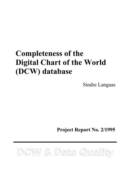
Completeness of the Digital Chart of the World (DCW ... - SpatialNews
Completeness of the Digital Chart of the World (DCW ... - SpatialNews
Completeness of the Digital Chart of the World (DCW ... - SpatialNews

Create successful ePaper yourself
Turn your PDF publications into a flip-book with our unique Google optimized e-Paper software.
<strong>Completeness</strong> <strong>of</strong> <strong>the</strong><br />
<strong>Digital</strong> <strong>Chart</strong> <strong>of</strong> <strong>the</strong> <strong>World</strong><br />
(<strong>DCW</strong>) database<br />
Sindre Langaas<br />
Project Report No. 2/1995
<strong>Completeness</strong> <strong>of</strong> <strong>the</strong><br />
<strong>Digital</strong> <strong>Chart</strong> <strong>of</strong> <strong>the</strong> <strong>World</strong> (<strong>DCW</strong>) database<br />
Sindre Langaas<br />
UNEP/GRID-Arendal - Stockholm Office<br />
c/o Dept. <strong>of</strong> Systems Ecology<br />
Stockholm University,<br />
S-106 91 Stockholm, Sweden<br />
E-mail: langaas@grida.no<br />
Project Report No. 2/1995<br />
UNEP/GRID-Arendal - Main <strong>of</strong>fice<br />
P.O.Box 1602 Myrene<br />
N-4801 Arendal, Norway<br />
http://www.grida.no<br />
Project:<br />
Issues <strong>of</strong> error, quality and integrity <strong>of</strong> digital geographical data: The<br />
case <strong>of</strong> <strong>the</strong> <strong>Digital</strong> <strong>Chart</strong> <strong>of</strong> <strong>the</strong> <strong>World</strong><br />
Funding sources:<br />
Norwegian Research Council, Project No. 31783/223<br />
UNEP/GRID-Arendal, Project No. 205026<br />
3
CONTENTS<br />
ABSTRACT............................................................................................................... 6<br />
1. INTRODUCTION................................................................................................. 8<br />
2. THE DIGITAL CHART OF THE WORLD...................................................... 10<br />
2.1 <strong>DCW</strong> DEVELOPMENT .......................................................................................... 10<br />
2.2 DATA ORGANISATION .......................................................................................... 11<br />
3. SPATIAL DATA STANDARDS AND DATA QUALITY COMPONENTS.... 12<br />
3.1 SPATIAL DATA STANDARDS .................................................................................. 12<br />
3.2 DATA QUALITY COMPONENTS .............................................................................. 13<br />
4. COMPLETENESS REPORTING AND MEASURING - TWO DIFFERENT<br />
PERSPECTIVES ................................................................................................ 17<br />
4.1 THE SDTS PERSPECTIVE ON COMPLETENESS........................................................ 17<br />
4.2 THE CEN/TC 287/WG02 PERSPECTIVE ON COMPLETENESS ................................. 19<br />
4.3 CHOICE OF COMPLETENESS REPORTING APPROACH............................................... 20<br />
5. SOURCE ON COMPLETENESS INFORMATION ABOUT THE<br />
ONC/<strong>DCW</strong>........................................................................................................... 21<br />
6. <strong>DCW</strong> DATA LAYER COMPLETENESS REPORTS ...................................... 23<br />
6.1 GENERAL INTRODUCTION..................................................................................... 23<br />
6.2 ONC USAGE........................................................................................................ 23<br />
6.3 ONC OVERALL QUALITY STANDARDS, DETAIL SELECTION AND DENSITY ........... 23<br />
6.4 COMPLETENESS INFORMATION ON INDIVIDUAL <strong>DCW</strong> LAYERS ............................ 25<br />
6.4.1 Political and Oceans layer............................................................................ 25<br />
6.4.2 Populated Place layer................................................................................... 28<br />
6.4.3 Railroad layer............................................................................................... 33<br />
6.4.5 Utility layer................................................................................................... 37<br />
6.4.6 Drainage layer.............................................................................................. 38<br />
6.4.7 Supplemental Drainage layer........................................................................ 46<br />
6.4.8 Hypsography layer........................................................................................ 47<br />
6.4.9 Hypsography Supplemental layer.................................................................. 49<br />
6.4.10 Land Cover layer ........................................................................................ 50<br />
6.4.11 Ocean Features layer.................................................................................. 56<br />
6.4.12 Physiography layer ..................................................................................... 59<br />
6.4.13 Aeronautical layer ...................................................................................... 61<br />
6.4.14 Cultural Landmark layer............................................................................. 62<br />
6.4.15 Transportation Structure layer.................................................................... 64<br />
6.4.16 Vegetation layer.......................................................................................... 67<br />
REFERENCES........................................................................................................ 68<br />
5
ABSTRACT<br />
The first version <strong>of</strong> <strong>the</strong> <strong>Digital</strong> <strong>Chart</strong> <strong>of</strong> <strong>the</strong> <strong>World</strong> was released in<br />
1992 in <strong>the</strong> Vector Product Format. Since <strong>the</strong>n this unique public<br />
domain global GIS database <strong>of</strong> 1.7 GB has been translated into most<br />
major GIS formats, and distributed to several thousand GIS users<br />
world-wide.<br />
Despite its usefulness, many users have discovered various types <strong>of</strong><br />
imperfections in several <strong>of</strong> <strong>the</strong> coverages in <strong>the</strong> 16 different <strong>the</strong>matic<br />
layers included in <strong>the</strong> <strong>DCW</strong> database.<br />
This report deals with <strong>the</strong> completeness quality aspect <strong>of</strong> <strong>the</strong> <strong>DCW</strong>.<br />
First, <strong>the</strong> meaning <strong>of</strong> this data quality characteristic is discussed from<br />
<strong>the</strong> perspectives <strong>of</strong> <strong>the</strong> US Spatial Data Transfer Standard (SDTS) and<br />
<strong>the</strong> European spatial data standard, <strong>the</strong> former under implementation<br />
and <strong>the</strong> latter currently under development.<br />
The major part <strong>of</strong> <strong>the</strong> report summarises completeness information<br />
found in a ‘grey’ military report :<br />
Defense Mapping Agency. 1987. Product specifications for<br />
Operational Navigation <strong>Chart</strong>s (Code: ONC) Scale 1:1,000,000.<br />
First edition 1981 and changes and amendments <strong>the</strong>reto.<br />
Product Specifications PS/1AB/120.<br />
using <strong>the</strong> SDTS definition <strong>of</strong> <strong>the</strong> completeness,<br />
The completeness information is structured in tables, usually two<br />
for each <strong>DCW</strong> coverage. One table presents additional definition<br />
information, <strong>the</strong> o<strong>the</strong>r includes selection criteria and o<strong>the</strong>r mapping<br />
rules. The selection criteria elaborated in various degrees <strong>of</strong> detail<br />
reflect <strong>the</strong> initial purposes <strong>of</strong> <strong>the</strong> Operational Navigation <strong>Chart</strong>s, which<br />
are <strong>the</strong> basis for <strong>the</strong> <strong>DCW</strong>. These were produced to support “medium<br />
altitude enroute navigation by dead reckoning visual pilotage, celestial,<br />
radar, and o<strong>the</strong>r electronic techniques” and “for operational planning,<br />
intelligence briefings, and preparation <strong>of</strong> visual cock-pit displays/ film<br />
strips essential to aerospace navigation <strong>of</strong> high-performance weapon<br />
systems.”<br />
6
1. INTRODUCTION<br />
The <strong>Digital</strong> <strong>Chart</strong> <strong>of</strong> <strong>the</strong> <strong>World</strong> (<strong>DCW</strong>) was released in 1992. It has since become an<br />
invaluable data source for GIS users world-wide concerned with regional, continental and<br />
global applications, and in many cases also on <strong>the</strong> national level. There are mainly two factors<br />
explaining this:<br />
l<br />
The <strong>DCW</strong> is a public domain database, readily available at a very low cost.<br />
In a period <strong>of</strong> increasing commercialisation and copy-right confinement in <strong>the</strong> use <strong>of</strong> GIS<br />
data <strong>the</strong> <strong>DCW</strong> has become a provocative exclamation mark!<br />
l<br />
The <strong>DCW</strong> is <strong>the</strong> most comprehensive and consistent cartographic database at <strong>the</strong> global<br />
scale at a scale <strong>of</strong> 1:1,000,000<br />
However, to many users' disappointments, <strong>the</strong> quality <strong>of</strong> <strong>the</strong> <strong>DCW</strong> data has not always<br />
met expectations. These, <strong>of</strong>ten vague, expectations have to a large extent been based upon<br />
limited and insufficient data quality information available for <strong>the</strong> <strong>DCW</strong> database. Complaints<br />
about <strong>the</strong> <strong>DCW</strong> data quality have <strong>of</strong>ten been centred upon positional accuracy, logical<br />
consistency and completeness issues. Please, refer to Smith (1995) on user experiences <strong>of</strong> <strong>the</strong><br />
<strong>DCW</strong>.<br />
This report addresses <strong>the</strong> issue <strong>of</strong> <strong>the</strong> data quality <strong>of</strong> <strong>the</strong> <strong>DCW</strong>. More specifically, <strong>the</strong><br />
report will focus upon <strong>the</strong> data quality characteristic completeness. The decision to focus upon<br />
this data quality indicator is mainly determined by <strong>the</strong> considerable resource demands required<br />
to perform quantitative assessments <strong>of</strong> positional accuracy and logical consistency tests for<br />
huge GIS databases, such as <strong>the</strong> <strong>DCW</strong>. <strong>Completeness</strong> can also be evaluated quantitatively,<br />
however, qualitative reports are also allowed (and recommended) in some standards. With <strong>the</strong><br />
availability <strong>of</strong> a truly ‘grey’ document providing highly relevant completeness information, this<br />
focus becomes logical.<br />
First, a very brief introduction to <strong>the</strong> <strong>Digital</strong> <strong>Chart</strong> <strong>of</strong> <strong>the</strong> <strong>World</strong> is given. Then, a small<br />
chapter deals with spatial data standards and <strong>the</strong>ir data quality components. The<br />
comprehension <strong>of</strong> completeness as defined and applied in <strong>the</strong> data quality portions <strong>of</strong> <strong>the</strong> US<br />
Spatial Data Transfer Standard (SDTS) and <strong>the</strong> European Standard under development under<br />
<strong>the</strong> framework <strong>of</strong> <strong>the</strong> European Committee <strong>of</strong> Standardisation (CEN) Technical Committee<br />
8
287 are briefly reviewed. The two standards apply <strong>the</strong> same concept. Yet, it is argued that <strong>the</strong><br />
two standards have different understanding <strong>of</strong> what this quality characteristic means and how<br />
to report or measure it.<br />
The major part <strong>of</strong> <strong>the</strong> report provides extensive completeness information on <strong>the</strong> <strong>DCW</strong><br />
data. In this report we apply <strong>the</strong> definitions and recommendations for quality reporting <strong>of</strong><br />
completeness taken from SDTS. We consider <strong>the</strong>se more suited for (<strong>the</strong>matic) cartographic<br />
databases such as <strong>the</strong> <strong>DCW</strong>. The completeness information is taken from <strong>the</strong> Defense Mapping<br />
Agency. 1987. Product specifications for Operational Navigation <strong>Chart</strong>s (Code: ONC) Scale<br />
1:1,000,000. First edition 1981 and changes and amendments <strong>the</strong>reto. Product Specifications<br />
PS/1AB/120. As <strong>the</strong> title announces, this document specifies how <strong>the</strong> Operational Navigation<br />
<strong>Chart</strong>s shall be elaborated. Of particular interest for users <strong>of</strong> <strong>the</strong> <strong>DCW</strong> are <strong>the</strong> parts elaborating<br />
selection criteria, density requirements, detailed definitions and o<strong>the</strong>r mapping rules.<br />
9
2. THE DIGITAL CHART OF THE WORLD<br />
2.1 <strong>DCW</strong> Development<br />
The development <strong>of</strong> <strong>the</strong> <strong>Digital</strong> <strong>Chart</strong> <strong>of</strong> <strong>the</strong> <strong>World</strong> is thoroughly described in DMA<br />
(1992a). For <strong>the</strong> sake <strong>of</strong> completeness a brief summary will be given here.<br />
The <strong>DCW</strong> was developed by Environmental Systems Research Institute (ESRI) on<br />
commission for <strong>the</strong> United States Defense Mapping Agency to support global scientific and<br />
military analysis. To indicate <strong>the</strong> size <strong>of</strong> <strong>the</strong> <strong>DCW</strong> project, it can be noted that around 200<br />
ESRI staff took part in <strong>the</strong> project, although several <strong>of</strong> <strong>the</strong>se were only part-time involved.<br />
During <strong>the</strong> production peak fifty personnel worked full time. It should be noted also, that <strong>the</strong><br />
main aim <strong>of</strong> <strong>the</strong> <strong>DCW</strong> project was to develop a generic, machine-independent format for GIS<br />
data that allows data prepared in accordance with it to be used by diverse s<strong>of</strong>tware systems.<br />
This format, <strong>the</strong> Vector Product Format, will be used for <strong>the</strong> vector data products developed<br />
by DMA in <strong>the</strong> future. The VPF format is documented in DMA (1992b). With <strong>the</strong><br />
simultaneous release <strong>of</strong> <strong>the</strong> unique global <strong>DCW</strong> database in <strong>the</strong> developed VPF format, <strong>the</strong><br />
intent by DMA was to get as many commercial s<strong>of</strong>tware vendors to develop conversion<br />
utilities to this specific format.<br />
The agencies that produce <strong>the</strong> Operational Navigation <strong>Chart</strong>s (ONC) map series: <strong>the</strong><br />
United States Defense Mapping Agency, <strong>the</strong> Australian Army Survey Directorate, <strong>the</strong><br />
Canadian Directorate <strong>of</strong> Geographic Operations, and <strong>the</strong> United Kingdom Military Survey all<br />
participated in <strong>the</strong> <strong>DCW</strong> development besides <strong>the</strong> ESRI staff. They were supported in <strong>the</strong><br />
<strong>DCW</strong> design process by more than forty participating agencies.<br />
The production procedures for <strong>the</strong> <strong>DCW</strong> database automation were developed during<br />
<strong>the</strong> design and prototyping phase. There some variation in <strong>the</strong> <strong>DCW</strong> production between<br />
layers, but in general <strong>the</strong> production process consisted <strong>of</strong> twelve steps:<br />
1. Photographic reproduction <strong>of</strong> negative separates<br />
2. Map preparation<br />
3. Scanning and digitising<br />
4. Basic processing and initial corrections<br />
5. Attribute assignment<br />
6. Annotation automation and final corrections<br />
7. Transformations and edge matching<br />
10
8. Tiling<br />
9. Conversion to VPF<br />
10. Premastering<br />
11. Mastering<br />
12. Packaging<br />
2.2 Data Organisation<br />
The <strong>Digital</strong> <strong>Chart</strong> <strong>of</strong> <strong>the</strong> <strong>World</strong> (<strong>DCW</strong>) is a comprehensive 1:1,000,000-scale<br />
vector basemap <strong>of</strong> <strong>the</strong> world. The database contains more than 1,500 megabytes <strong>of</strong> vector data<br />
and is organised into 17 <strong>the</strong>matic layers including one Data Quality layer. These layers are<br />
found in chapter 6. The source data were 276 charts in <strong>the</strong> Operational Navigation <strong>Chart</strong>s<br />
(ONC) and (for Antarctica) <strong>the</strong> Jet Navigation <strong>Chart</strong> (JNC) series (in scale 1:2,000,000). The<br />
Data Quality layer mainly comprise information on compilation and revision dates <strong>of</strong> <strong>the</strong><br />
various charts.<br />
The <strong>Digital</strong> <strong>Chart</strong> <strong>of</strong> <strong>the</strong> <strong>World</strong> (<strong>DCW</strong>) data are organised on a set <strong>of</strong> four CD-ROMs<br />
by geographic region. Each region is fur<strong>the</strong>r geographically sub-divided into 5 deg. x 5 deg.<br />
tiles for each <strong>of</strong> <strong>the</strong> 17 layers and <strong>the</strong>ir coverages.<br />
Besides <strong>the</strong> <strong>DCW</strong> as public domain data in <strong>the</strong> Vector Product Format (VPF), <strong>the</strong><br />
<strong>DCW</strong> DB has now been released by a large number <strong>of</strong> GIS s<strong>of</strong>tware vendors in <strong>the</strong>ir own<br />
propriety formats, such as ARC/INFO, MapInfo, Atlas and Intergraph formats.<br />
11
3. SPATIAL DATA STANDARDS AND DATA QUALITY<br />
COMPONENTS<br />
3.1 Spatial data standards<br />
The need for data quality descriptions to be associated with digital georeferenced data<br />
has steadily grown over <strong>the</strong> past decades. The reason for this increasingly recognised need can<br />
be explained by <strong>the</strong> possibilities to readily use digital spatial data initially created for one<br />
specific purpose (by means <strong>of</strong> one or more types <strong>of</strong> primary data, specific methods and rules)<br />
for completely different applications and also for combing several layers into quite complex<br />
spatial models. Therefore, to apply spatial data sets, frequently received from o<strong>the</strong>r data<br />
producers such as mapping agencies, with confidence, <strong>the</strong>re has been an increasing demand<br />
from <strong>the</strong> users to have data quality measures and reports attached to <strong>the</strong> georeferenced data.<br />
The producers <strong>the</strong>mselves have also understood <strong>the</strong> advantage <strong>of</strong> having an active relationship<br />
to <strong>the</strong> quality issues <strong>of</strong> <strong>the</strong> data being produced to be able to reduce <strong>the</strong> error sources in <strong>the</strong><br />
entire production process. Actually, <strong>the</strong> separation between spatial data producers and users<br />
are becoming more and more fuzzy as most users <strong>of</strong> spatial digital data also are producers,.<br />
For instance, those users who apply <strong>the</strong>ir input data in some analytical approach to derive a<br />
new GIS data set have inevitably become producers.<br />
Figure 1, initially developed by Veregin (1989), provides a graphical overview <strong>of</strong> <strong>the</strong><br />
hierarchy <strong>of</strong> needs for spatial data quality management.<br />
Strategies for data<br />
quality improvement<br />
Strategies for data<br />
quality management<br />
Data quality (or error) propagation<br />
modelling<br />
Data quality component<br />
characterisation and assessment<br />
Data quality component identification<br />
Figure 1. A hierarchy <strong>of</strong> needs for handling <strong>of</strong> spatial data quality.<br />
The caption text and concepts in this figure, based upon Veregin (1989), is modified<br />
according to more recent terminology.<br />
12
The identification <strong>of</strong> data quality component constitute <strong>the</strong> basis for all fur<strong>the</strong>r actions<br />
within this hierarchy. The identification <strong>of</strong> data quality components have stayed central in <strong>the</strong><br />
several developments <strong>of</strong> standards to facilitate transfer and use <strong>of</strong> spatial (i.e. cartographic and<br />
geographic) data (Moellering 1992). Most <strong>of</strong> <strong>the</strong>se standards include data quality components.<br />
Some major standardisation efforts are DIGEST, <strong>the</strong> transfer format including conceptual<br />
schema, transfer schemas and encodings, developed under <strong>the</strong> framework <strong>of</strong> <strong>the</strong> NATO<br />
defence co-operation, <strong>the</strong> US Spatial Data Transfer Standard (SDTS, Fegeas et al. 1992) and<br />
<strong>the</strong> European standard currently under <strong>the</strong> development by <strong>the</strong> European Committee for<br />
Standardisation (CEN) Technical Committee 287 (CEN/TC287/WG02 1995). These<br />
standards, although quite similar in many respects, have significant differences. This can be<br />
explained by <strong>the</strong> fact that <strong>the</strong>y have had <strong>the</strong>ir origin within different GIS producer and user<br />
communities. DIGEST obviously have had a bias towards military applications, SDTS have<br />
had <strong>the</strong> wider US GIS data community as its starting point and <strong>the</strong> European standard<br />
likewise.<br />
Generic issues concerning geographic information and spatial data handling have a<br />
global nature. Therefore, an international effort co-ordinated by <strong>the</strong> International Organisation<br />
<strong>of</strong> Standardisation (ISO) started in 1994 (Østensen 1995). The scope is defined as:<br />
This work aims to establish a structured set <strong>of</strong> standards for information concerning<br />
objects or phenomena that are directly or indirectly associated with a location relative<br />
to <strong>the</strong> Earth....<br />
This work has just recently started. We will <strong>the</strong>refore probably have to wait until<br />
sometime into <strong>the</strong> next millennia before this more universal standard with a data quality part,<br />
enters into force.<br />
3.2 Data quality components<br />
The data quality components defined by <strong>the</strong> various existing and planned standards<br />
vary. The current major standards, such as those mentioned earlier, have most quality<br />
components in common. Still, <strong>the</strong> definitions <strong>of</strong> <strong>the</strong> common quality components may vary, as<br />
well as <strong>the</strong> suggested means <strong>of</strong> reporting and measuring. Table 2.1 shows <strong>the</strong> data quality<br />
components in <strong>the</strong> US Spatial Data Transfer Standard (SDTS) and <strong>the</strong> European Standard<br />
13
(CEN/TC287). <strong>Completeness</strong> is one such data quality component included in both <strong>the</strong> SDTS<br />
and <strong>the</strong> ongoing development <strong>of</strong> a European standard.<br />
14
Table 3.1 An overview <strong>of</strong> <strong>the</strong> data quality structure and characteristics for <strong>the</strong> US Spatial<br />
Data Transfer Standard (SDTS) and <strong>the</strong> European Standard (CEN/TC287)<br />
A<br />
A<br />
US Spatial Data Transfer Standard (SDTS) A European Standard (CEN/TC287)<br />
A<br />
A<br />
A<br />
l Lineage<br />
A l Lineage<br />
A<br />
A<br />
A<br />
l Positional accuracy<br />
A l Usage<br />
A<br />
A<br />
l Attribute accuracy<br />
A l Quality parameters<br />
A<br />
A<br />
A<br />
l Logical consistency<br />
A § Primary Parameters<br />
A<br />
A<br />
l <strong>Completeness</strong><br />
A<br />
A<br />
ù Positional Accuracy<br />
A<br />
A<br />
A ù Thematic Accuracy<br />
A<br />
A<br />
A<br />
ù<br />
A<br />
Temporal Accuracy<br />
A<br />
A<br />
A ù <strong>Completeness</strong><br />
A<br />
A<br />
A<br />
A<br />
ù Logical Consistency<br />
A<br />
A<br />
A § Secondary Parameters<br />
A<br />
A<br />
A<br />
A ù Textual Fidelity<br />
A<br />
A<br />
A<br />
A<br />
The SDTS is currently being implemented by US federal spatial data producers. One<br />
main concern reported for those implementing SDTS is <strong>the</strong> question: What is a data set ? I.e.<br />
What shall be reported? Distinctions between 'databases', 'data sets', and 'data set members or<br />
extracts' are obscure. The judgement about reporting level in most cases will be determined by<br />
<strong>the</strong> priorities and resources available by <strong>the</strong> data producer.<br />
15
4. COMPLETENESS REPORTING AND MEASURING -<br />
TWO DIFFERENT PERSPECTIVES<br />
4.1 The SDTS perspective on completeness<br />
The section in <strong>the</strong> SDTS that outlines <strong>the</strong> completeness reporting specifies that<br />
information on <strong>the</strong> following issues shall be given (NIST 1992) :<br />
• Selection criteria<br />
• Definitions used<br />
• O<strong>the</strong>r relevant mapping rules<br />
• Deviations from standard geocoding <strong>of</strong> spatial entities<br />
SDTS fur<strong>the</strong>r states:<br />
"The report shall describe <strong>the</strong> relationship between <strong>the</strong> objects represented and <strong>the</strong><br />
abstract universe <strong>of</strong> all such objects. In particular, <strong>the</strong> report shall describe <strong>the</strong><br />
exhaustiveness <strong>of</strong> a set <strong>of</strong> features. Exhaustiveness concerns spatial and taxonomic<br />
(attribute) properties, both <strong>of</strong> which can be tested."<br />
Here <strong>the</strong> concept "abstract universe <strong>of</strong> all such objects" is a key concept which in each<br />
case needs an accurate definition to give <strong>the</strong> necessary information about <strong>the</strong> various<br />
completeness aspects.<br />
The completeness quality aspect is <strong>of</strong> particular relevance for <strong>DCW</strong>. The deduction <strong>of</strong><br />
<strong>the</strong> digital <strong>DCW</strong> was done from two analogue map series, <strong>the</strong> Operational Navigation <strong>Chart</strong>s<br />
(ONC) and <strong>the</strong> Jet Navigational <strong>Chart</strong>s (JNC); both with very specific <strong>the</strong>matic purposes, and<br />
both with a large number <strong>of</strong> rules for <strong>the</strong> making <strong>of</strong> <strong>the</strong> paper maps. In more general terms one<br />
can say that in <strong>the</strong> conventional production process for <strong>the</strong> making <strong>of</strong> most <strong>the</strong>matic analogue<br />
maps <strong>the</strong>re exist a wide range <strong>of</strong> selection criteria, specific definitions and o<strong>the</strong>r mapping rules<br />
that convey information about <strong>the</strong> suitability <strong>of</strong> <strong>the</strong> digitised version also for o<strong>the</strong>r purposes<br />
than <strong>the</strong> initial <strong>the</strong>matic one.<br />
<strong>Completeness</strong> reporting is <strong>of</strong> great value to potential users since it permits evaluation<br />
<strong>of</strong> <strong>the</strong> actual contents <strong>of</strong> <strong>the</strong> spatial database in question. It fur<strong>the</strong>r allows for determination <strong>of</strong><br />
<strong>the</strong> suitability <strong>of</strong> <strong>the</strong> data set, or any <strong>of</strong> its <strong>the</strong>mes, features or objects for a given application.<br />
The quality reporting ideally <strong>the</strong>refore should be assigned to various levels <strong>of</strong> <strong>the</strong> data set.<br />
SDTS distinguishes between <strong>the</strong> following levels:<br />
17
• Data set<br />
• Theme<br />
• Map<br />
• Feature/object<br />
• Element<br />
To clarify <strong>the</strong> difference between <strong>the</strong>se levels, an example will be given.<br />
An environmental researcher would like to use <strong>the</strong> <strong>DCW</strong> to quantify potential annual<br />
increase in methane (CH 4<br />
) releases from cranberry bogs in Nor<strong>the</strong>rn Finland under doubled<br />
atmospheric CO 2<br />
levels and associated temperature rise. Cranberry bog is one class or feature<br />
under <strong>the</strong> layer Land Cover in <strong>the</strong> <strong>DCW</strong>.<br />
<strong>Completeness</strong> descriptions on <strong>the</strong> entire data set level might be <strong>of</strong> limited relevance.<br />
However, <strong>the</strong> knowledge on <strong>the</strong> specific purposes <strong>of</strong> <strong>the</strong> ONC and JNC map series <strong>the</strong><br />
analogue basis for <strong>the</strong> <strong>DCW</strong>; (i) aerial navigation and military strategic planning obviously<br />
indicates that <strong>the</strong> information contained on cranberry bogs might be unsatisfactory.<br />
The next level <strong>of</strong> reporting is <strong>the</strong> <strong>the</strong>me level. Cranberry bog constitutes one class or<br />
features out <strong>of</strong> many in <strong>the</strong> <strong>the</strong>me (or layer) Land Cover <strong>of</strong> <strong>the</strong> <strong>DCW</strong>. A completeness<br />
description on <strong>the</strong> <strong>the</strong>me level, supposedly valid for <strong>the</strong> spatial extent <strong>of</strong> <strong>the</strong> entire data sets,<br />
<strong>the</strong>n will provide more detailed information about <strong>the</strong> suitability for annual methane emissions.<br />
The next level <strong>of</strong> reporting might be <strong>the</strong> feature/object level. If specific completeness<br />
information is available on <strong>the</strong> cranberry bogs per se, <strong>the</strong>n <strong>the</strong> researcher would be even better<br />
prepared to evaluate <strong>the</strong> suitability <strong>of</strong> <strong>the</strong> <strong>DCW</strong> for its planned application.<br />
Although not so relevant in this case, one might also find that completeness reporting<br />
down to <strong>the</strong> element level can be provided.<br />
Depending upon <strong>the</strong> spatial coverage <strong>of</strong> <strong>the</strong> data set in question, <strong>the</strong> completeness<br />
reporting on <strong>the</strong> four levels; (i) data set, (ii) <strong>the</strong>me, (iii) feature/object and (iv) element ideally<br />
should be provided for specific regions. Individual map sheets in <strong>the</strong> ONC or JNC charts are<br />
an obvious sub-division <strong>of</strong> <strong>the</strong> entire data set region into smaller specific regions for reporting.<br />
Evidently, completeness reporting on cranberry bogs on <strong>the</strong> feature/object level for those map<br />
sheets that cover nor<strong>the</strong>rn Finland would be <strong>the</strong> most specific and useful completeness<br />
reporting that could be provided.<br />
18
4.2 The CEN/TC 287/WG02 perspective on completeness<br />
In CEN/TC287/WG02 (1995) a quantitative approach is taken. <strong>Completeness</strong> is<br />
defined as<br />
'<strong>the</strong> difference between an actual data set and its specifications.'<br />
It is fur<strong>the</strong>r stated that completeness measures indicate how well <strong>the</strong> information<br />
reflects <strong>the</strong> content defined by <strong>the</strong> specification. The specification is <strong>of</strong> <strong>the</strong> so-called nominal<br />
ground (or abstract view <strong>of</strong> universe) which is defined as an idealised abstraction <strong>of</strong> reality<br />
forming <strong>the</strong> basis for specifications defining how a geographic data set or extract relates to<br />
reality. This means that ‘completeness’ is differently defined compared to <strong>the</strong> SDTS definition<br />
since <strong>the</strong> European standard <strong>the</strong>n presumes that <strong>the</strong> selection criteria, definitions used and<br />
o<strong>the</strong>r relevant mapping rules already are incorporated in <strong>the</strong> specification.<br />
Three possible measures are suggested to quantify completeness. These are omission,<br />
commission and coverage ratio, represented by <strong>the</strong> following metrics:<br />
• Percentage <strong>of</strong> data missing relative to specification,<br />
• Percentage <strong>of</strong> data present that is not in current specification <strong>of</strong> data set or extract,<br />
and<br />
• Occurrences <strong>of</strong> one variable per unit <strong>of</strong> ano<strong>the</strong>r.<br />
The CEN/TC287/WG02 assessment approach is more concise compared to SDTS.<br />
However, given its definition and recommended approaches <strong>of</strong> assessments, being solely<br />
quantitative, <strong>the</strong> precise specifications <strong>of</strong> <strong>the</strong> geographic data set examined or an extract <strong>of</strong> it<br />
defined as a subset <strong>of</strong> a geographic data set, limited by some criterion such as spatial extent,<br />
feature class, time given in quantitative terms are crucial for implementation. Fur<strong>the</strong>rmore,<br />
while <strong>the</strong> recommended approaches appear well suited for geographical data sets (or<br />
databases), <strong>the</strong>y are more difficult to implement for cartographical data sets.<br />
19
4.3 Choice <strong>of</strong> completeness reporting approach<br />
The <strong>DCW</strong> is a cartographical database derived (mainly) from <strong>the</strong> ONC charts. Due to<br />
this fact we find <strong>the</strong> SDTS recommended ways <strong>of</strong> completeness reporting more appropriate for<br />
<strong>the</strong> <strong>DCW</strong>. Fur<strong>the</strong>r, as stated in <strong>the</strong> Introduction chapter, <strong>the</strong> considerable resource demands<br />
required to perform quantitative assessments <strong>of</strong> positional accuracy and logical consistency<br />
tests for huge GIS databases, such as <strong>the</strong> <strong>DCW</strong>, effectively prevents comprehensive<br />
quantitative assessments.<br />
20
5. SOURCE ON COMPLETENESS INFORMATION ABOUT<br />
THE ONC/<strong>DCW</strong><br />
The major source for information on completeness aspects <strong>of</strong> <strong>the</strong> <strong>DCW</strong> is <strong>the</strong> "Product<br />
Specifications for Operational Navigation <strong>Chart</strong>s (Code: ONC) Scale 1:1,000,000, third<br />
edition December 1981 and amendments and changes <strong>the</strong>reto" (DMA 1987). As specified<br />
under its foreword:<br />
"The specifications are <strong>the</strong> basic instructions for <strong>the</strong> compilation, color separation and<br />
reproduction <strong>of</strong> One’s over major land masses <strong>of</strong> <strong>the</strong> world except conterminous USA,<br />
Alaska and Hawaii."<br />
"Conformance to <strong>the</strong>se specifications will ensure uniformity <strong>of</strong> treatment among all<br />
mapping and charting elements engaged in a coordinated production and maintenance<br />
program for <strong>the</strong>se charts."<br />
In <strong>the</strong> tables 6.1 - 6.32 we have structured and summarised <strong>the</strong> information on feature/<br />
object definitions, selection criteria and o<strong>the</strong>r mapping rules provided in DMA (1987). This<br />
information is much more comprehensive than <strong>the</strong> limited information provided in ESRI (1992)<br />
or DMA (1992b), at <strong>the</strong> hands <strong>of</strong> most <strong>DCW</strong> users. The tables follow <strong>the</strong> organisation <strong>of</strong> <strong>the</strong><br />
<strong>the</strong>mes (layers) in <strong>the</strong> <strong>DCW</strong>. This organisation is in many ways similar to <strong>the</strong> organisation<br />
found in DMA (1987). Still, several significant differences occur since <strong>the</strong> ONC is an analogue<br />
map (chart) series and <strong>the</strong> <strong>DCW</strong> is a digital representation <strong>of</strong> <strong>the</strong> ONC (and JNC). The <strong>DCW</strong><br />
data model is tailored to o<strong>the</strong>r needs and <strong>the</strong>refore structured differently.<br />
In <strong>the</strong> tables we have chosen to follow <strong>the</strong> structure <strong>of</strong> <strong>the</strong> ARC/INFO <strong>DCW</strong><br />
documentation as given in Part 3, layer descriptions, in ESRI (1992). This is very similar to <strong>the</strong><br />
data dictionary appendix provided in DMA (1992b)<br />
For each coverage under each layer generally two tables are provided; one giving<br />
additional definition information and ano<strong>the</strong>r giving selection and density criteria and o<strong>the</strong>r<br />
mapping rules.<br />
21
RE2.DOC
6. <strong>DCW</strong> DATA LAYER COMPLETENESS REPORTS<br />
6.1 General introduction<br />
This chapter includes information extracted from Defense Mapping Agency. 1987. Product<br />
specifications for Operational Navigation <strong>Chart</strong>s (Code: ONC) Scale 1:1,000,000. First edition<br />
January1981 and changes and amendments <strong>the</strong>reto. PS/1AB/120.<br />
We had great difficulties in tracking this truly grey document, which definitively includes much<br />
useful information for <strong>DCW</strong> users. Fur<strong>the</strong>rmore, <strong>the</strong> differences in <strong>the</strong> ways that <strong>the</strong> product<br />
specification for <strong>the</strong> ONC and <strong>the</strong> <strong>DCW</strong> are structured justify <strong>the</strong> extraction and structuring <strong>of</strong> relevant<br />
completeness information according to <strong>the</strong> <strong>DCW</strong> data model structure.<br />
6.2 ONC Usage<br />
DMA (1987) includes some information on <strong>the</strong> intended usage <strong>of</strong> <strong>the</strong> ONC charts. We<br />
<strong>the</strong>refore include <strong>the</strong> most relevant sections describing <strong>the</strong>se:<br />
“Purpose and Scope.<br />
The 1:1,000,000 scale Operational Navigation <strong>Chart</strong>s (ONC) Program provides aeronautical<br />
charts to support medium altitude enroute navigation by dead reckoning visual pilotage,<br />
celestial, radar, and o<strong>the</strong>r electronic techniques. In <strong>the</strong> absence <strong>of</strong> Tactical Pilot <strong>Chart</strong>s<br />
(TPC’s), <strong>the</strong>se charts should also satisfy <strong>the</strong> enroute visual/radar navigation requirements <strong>of</strong><br />
pilots/navigators flying low altitude operations (500 feet to 2000 feet above ground level).<br />
The ONC is also used for operational planning, intelligence briefings, and preparation <strong>of</strong><br />
visual cock-pit displays/ film strips essential to aerospace navigation <strong>of</strong> high-performance<br />
weapon systems.”<br />
6.3 ONC Overall Quality Standards, Detail Selection and Density<br />
DMA (1987) include both general and more feature specific guidelines regarding quality<br />
standards, detail selection and density. The two most relevant sections for <strong>the</strong> overall information on<br />
<strong>the</strong>se issues are included in <strong>the</strong>ir entirety.<br />
“103. Quality Standards<br />
A. Although specifications tend to be a concrete expression <strong>of</strong> design, <strong>the</strong>re are certain design<br />
features (particularly <strong>the</strong> selection and density <strong>of</strong> detail) which are sufficiently abstract as to<br />
preclude ma<strong>the</strong>matical analysis. In <strong>the</strong>se instances when a specification cannot be measured,<br />
certain criteria or design guidelines have been included to supplement <strong>the</strong> judgement <strong>of</strong> <strong>the</strong><br />
cartographer. An attempt has been made, however, to minimize <strong>the</strong> amount <strong>of</strong> interpretation<br />
necessary in following <strong>the</strong>se specifications.<br />
B. The compilation is <strong>the</strong> foundation <strong>of</strong> <strong>the</strong> chart. The published chart can be no more<br />
accurate than <strong>the</strong> compilation, nor can it contain more information than is incorporated in<br />
23
<strong>the</strong> compilation. A large part <strong>of</strong> <strong>the</strong> responsibility in preparing a satisfactory chart, <strong>the</strong>refore,<br />
rests squarely upon <strong>the</strong> compiler.<br />
..”<br />
“105. Detail selection and Density<br />
A. General<br />
Rigid rules to satisfy requirements in <strong>the</strong> selection and density <strong>of</strong> chart detail cannot be<br />
formulated in view <strong>of</strong> <strong>the</strong> multiple requirements. For this reason, <strong>the</strong> finished product may<br />
not necessarily represent optimum presentation <strong>of</strong> each chart feature; however, <strong>the</strong> selection<br />
criteria detailed in this section should serve as general guidance in achieving <strong>the</strong> best overall<br />
balance and relativity <strong>of</strong> <strong>the</strong> chart features portrayed. The compiler should bear in mind that<br />
aeronautical and vertical data are <strong>the</strong> most important information on this series <strong>of</strong> charts.<br />
B. Basic Selection Criteria<br />
1. The following basic rules governing <strong>the</strong> selection <strong>of</strong> detail should be kept in mind by <strong>the</strong><br />
compiler.<br />
a. A firm requirement exists to provide maximum density <strong>of</strong> ground features significant in<br />
VISUAL and RADAR low altitude-high speed navigation without impairing chart legibility.<br />
b. Features validly selected for portrayal in one area may well be inappropriate in ano<strong>the</strong>r<br />
area. In areas <strong>of</strong> sparse or moderate culture <strong>the</strong> lesser chart features assume extreme<br />
importance because <strong>of</strong> <strong>the</strong>ir checkpoint value. In congested areas <strong>the</strong>se same features would<br />
not been seen by <strong>the</strong> low altitude-high speed pilot and normally should not be shown.<br />
c. Cultural features that are so unique and outstanding that <strong>the</strong>y serve as a medium for<br />
instantaneous orientation <strong>of</strong> <strong>the</strong> chart to <strong>the</strong> ground shall be shown as landmark features.<br />
d. The visual outline <strong>of</strong> a populated place, in itself, is not necessarily landmark significant.<br />
Checkpoint features in <strong>the</strong> near vicinity are required to assure positive identification.<br />
e. Roads and railroads by <strong>the</strong>mselves are not necessarily significant to <strong>the</strong> low altitude-high<br />
speed pilot. Their identification value can be assured only by <strong>the</strong> inclusion <strong>of</strong> related features<br />
in <strong>the</strong> immediate vicinity which distinguish one from <strong>the</strong> o<strong>the</strong>r.<br />
f. When <strong>the</strong> maximum feasible density is exceeded, <strong>the</strong> order <strong>of</strong> elimination will be as follows:<br />
(1) Canal names, minor geographic names and small town names<br />
(2) Tracks and trails symbolized as secondary roads<br />
(3) Fingerling Streams<br />
(4) Single line streams<br />
(5) O<strong>the</strong>r secondary roads lacking identifying characteristics<br />
(6) Miscellaneous cultural features lacking visual or radar return value<br />
(7) Descriptive words used to clarify symbols<br />
...”<br />
24
6.4 <strong>Completeness</strong> information on individual <strong>DCW</strong> layers<br />
6.4.1 Political and Oceans layer<br />
Table 1. Coverage: PONET, Feature class: Line, Item: POLNTYPE - Additional definition information<br />
Code Item class / Definitions in ESRI (1992) Additional definition information in DMA (1987)<br />
1 International boundary, Dejure "De jure international boundaries separate sovereign states and are formally recognized by <strong>the</strong><br />
producing nation."<br />
2 International boundary, Defacto "De facto boundaries are those which exist in fact but are not recognized by <strong>the</strong> producing<br />
nation."<br />
3 Both 1 and 2 "In cases where a boundary is recognized by <strong>the</strong> producing nation ins<strong>of</strong>ar as one country is<br />
concerned (de jure) but is de facto ins<strong>of</strong>ar as <strong>the</strong> adjoining country is concerned, this<br />
boundary shall be portrayed by both <strong>the</strong> de jure and de facto boundary symbols."<br />
4 Administrative boundary, first order "Primary administrative boundaries demarcate states, provinces, or similar first-order<br />
administrative entities."<br />
5 Administrative boundary, second order No reference to "second order boundaries" is found. It is probably what is called Major<br />
administrative boundaries. "Major administrative boundaries are boundaries such as those<br />
dividing <strong>the</strong> territorial units <strong>of</strong> <strong>the</strong> United Kingdom"<br />
6 Treaty or occupancy line (demilitarised<br />
zones)<br />
"These boundaries designate treaty areas, divide administrative areas <strong>of</strong> occupation, show<br />
demilitarized zones and similar areas, and represent military demarcation lines."<br />
7 Coastal closure line (used to connect ocean<br />
shoreline across river mouths and glacier)<br />
8 Ocean demarcation line (used to separate<br />
oceanic sub-areas)<br />
9 Ice line (used to separate types <strong>of</strong> ice - see<br />
Figure 3-2 in ESRI (1992))<br />
10 Coastline Shorelines: "In tidal waters, shorelines shall be delineated as <strong>the</strong> outline <strong>of</strong> natural coastal<br />
features at mean high water except for mangrove, nipa and coastal marsh. In inland waters,<br />
shorelines shall be mapped to correspond to <strong>the</strong> normal stage <strong>of</strong> <strong>the</strong> water. This may differ<br />
from shorelines appearing on aerial photography which may have been taken during periods<br />
<strong>of</strong> flood or drought. The shoreline at normal state is usually marked by a line <strong>of</strong> permanent<br />
land vegetation"<br />
25
11 Ice/Water line<br />
12 Seawall<br />
13 International Date Line<br />
88 Connector (if needed)<br />
99 None or unknown ( used for module border)<br />
26
Table 2. Coverage: PONET, Feature class: Line, Item: POLNTYPE - Selection criteria and o<strong>the</strong>r mapping rules<br />
Code Item class / Definition in ESRI (1992) Selection criteria and o<strong>the</strong>r mapping rules in DMA (1987)<br />
1 International boundary, Dejure<br />
2 International boundary, Defacto<br />
3 Both 1 and 2<br />
4 Administrative boundary, first order "They shall be used only in Australia, Brazil, Canada, United States and <strong>the</strong> USSR."<br />
"Boundaries <strong>of</strong> small entities may be omitted if <strong>the</strong>y become confusing or tend to<br />
congest <strong>the</strong> chart."<br />
5 Administrative boundary, second order "Major administrative boundaries are boundaries such as those dividing <strong>the</strong> territorial<br />
units <strong>of</strong> United Kingdom"<br />
6 Treaty or occupancy line (demilitarised zones)<br />
7 Coastal closure line (used to connect ocean shoreline<br />
across river mouths and glacier)<br />
8 Ocean demarcation line (used to separate oceanic<br />
sub-areas)<br />
9 Ice line (used to separate types <strong>of</strong> ice - see Figure 3-2<br />
in ESRI (1992))<br />
10 Coastline<br />
11 Ice/Water line “..Where <strong>the</strong> glacier extends into ice or open water areas, <strong>the</strong> delineating line shall<br />
replace <strong>the</strong> shoreline.”<br />
12 Seawall “The coast line shall be omitted where it coincides with <strong>the</strong> sea wall symbol.”<br />
13 International Date Line<br />
88 Connector (if needed)<br />
99 None or unknown ( used for module border)<br />
27
6.4.2 Populated Place layer<br />
Table 3. Coverage: PPPOLY, Feature class: Polygon, Item: PPPYTYPE - Additional definition information<br />
Code Definition in ESRI (1992) Additional definition information in DMA (1987)<br />
1 Built-up area The term Populated Place is used throughout DMA (1987).<br />
"The term POPULATED PLACE is interpreted to include: cities, towns, villages,<br />
settlements, industrial and military areas, resort areas and communal farms.<br />
Populated places may vary in size from an extensive megalopolis to a small hamlet."<br />
"Classification <strong>of</strong> a city by population is <strong>of</strong> little significance in itself. The<br />
significance lies in a cities vertical build-up, mass, shape etc., and its association with<br />
related features in close proximity."<br />
2 Kampongs (Small villages or group <strong>of</strong> houses,<br />
especially in South-East Asia)<br />
9 None (Non-built up areas within built-up areas)<br />
28
Table 4. Coverage: PPPOLY, Feature class: Polygon, Item: PPPYTYPE - Selection criteria and o<strong>the</strong>r mapping rules<br />
Code Item class / Selection criteria and o<strong>the</strong>r mapping rules in DMA (1987)<br />
Definition in ESRI<br />
(1992)<br />
1 Built-up area "It must be emphasized that small towns and villages assume extreme importance in this series <strong>of</strong> charts. A pre-flight course is<br />
plotted along <strong>the</strong> route <strong>of</strong> least habitation in order to avoid detection. Therefore, omission <strong>of</strong> towns and villages in sparse<br />
cultural areas could conceivably compromise <strong>the</strong> mission through ground observer detection, and could disorient <strong>the</strong> pilot or<br />
navigator."<br />
"702. Density and Selection<br />
A. The following general rules are formulated to govern <strong>the</strong> selection <strong>of</strong> populated places.<br />
1. In areas where populated places are very numerous, a selection <strong>of</strong> cities, towns and villages shall be shown to a density<br />
commensurate with scale.<br />
2. In areas where populated places are generally sparse, cities, towns and villages shall be shown to a density comparable to <strong>the</strong><br />
density on a standard 1:500,000 scale map <strong>of</strong> <strong>the</strong> area.<br />
B. The compiler shall be guided by <strong>the</strong> following considerations when it is necessary to omit populated places in order to<br />
improve legibility or avoid congestion.<br />
1. Cities symbolized by an outline shall be portrayed short <strong>of</strong> over congestion.<br />
2. The smaller populated places, shown by symbol, shall be omitted in local areas when it tend to confuse, congest or deemphasize<br />
checkpoints <strong>of</strong> radar and visual significance based on <strong>the</strong> following concepts.<br />
a. The general outline <strong>of</strong> a concentrated area <strong>of</strong> villages and towns shall be retained. The "cluster" is significant. Individual<br />
villages within <strong>the</strong> cluster (unless distinctive) are not readily identified by a high speed pilot.<br />
b. Villages which, in <strong>the</strong> opinion <strong>of</strong> <strong>the</strong> compiler, have <strong>the</strong> least radar and visual significance in low altitude-high speed<br />
navigation may be omitted. I.e.: lack <strong>of</strong> building concentration, buildings obscured by vegetation, etc.<br />
c. In areas where <strong>the</strong> majority <strong>of</strong> cities are <strong>of</strong> sufficient size to warrant portrayal by <strong>the</strong>ir actual outline, <strong>the</strong> need for portrayal <strong>of</strong><br />
villages is considerably lessened. Conversely, where few outlined cities occur, <strong>the</strong> need to portray smaller populated places<br />
increases proportionally.<br />
1 Built-up area<br />
(cont’d)<br />
703. Classification<br />
A. The relative importance <strong>of</strong> populated places shall be determined from a regional aspect."<br />
"When adequate source material is available, all populated places which cover an area equivalent to a 1.5mm square or larger<br />
shall be shown by visual outline. " "Populated places smaller than an area equivalent to a 1.5mm should be shown by outline<br />
when <strong>the</strong> outlined area, because <strong>of</strong> unique shape, has checkpoint value. In <strong>the</strong>se instances <strong>the</strong> outlined area may be enlarged<br />
slightly in order to portray <strong>the</strong> feature adequately."<br />
"Certain areas <strong>of</strong> <strong>the</strong> world, such as portions <strong>of</strong> India, contain a dense rural population living in small villages or on individual<br />
farms in close proximity to one ano<strong>the</strong>r. When portrayal as cities, town or villages is not appropriate (due to poorly defined<br />
limits), <strong>the</strong>se populated places shall be labeled: "continuous habitations", "scattered buildings". etc."<br />
29
2 Kampongs (Small<br />
villages or group <strong>of</strong><br />
houses, especially<br />
in South-East Asia)<br />
9 None (Non-built up<br />
areas within builtup<br />
areas)<br />
"Kampongs portrayed on source material shall be shown on <strong>the</strong> chart when <strong>the</strong>y exceed 2.0mm minimum width and<br />
5.0mm minimum length or equivalent area at <strong>the</strong> scale <strong>of</strong> <strong>the</strong> chart.<br />
"Openings within city area shall be shown when <strong>the</strong>y are equivalent to a square 2.5mm at 1:1,000,000 scale."<br />
30
Table 5. Coverage: PPPOINT, Feature class: Point, Item: PPPTTYPE - Additional definition information<br />
Code Definition in ESRI (1992) Additional definition information in DMA (1987)<br />
1 Populated places (no sub-categories) "The term Populated Place is interpreted to include: cities, towns, villages,<br />
settlements, industrial and military areas, resort areas and communal farms.<br />
Populated places may vary in size from an extensive megalopolis to a small hamlet."<br />
"Classification <strong>of</strong> a city by population is <strong>of</strong> little significance in itself. The<br />
significance lies in a cities vertical build-up, mass, shape etc., and its association with<br />
related features in close proximity."<br />
2 Populated places (associated with place names in city<br />
tints)<br />
3 Villages, strategic, or landmark places in conjunction<br />
with marginal note.<br />
4 Kampongs (Small villages or group <strong>of</strong> houses,<br />
especially in South-East Asia)<br />
5 Circular village Not in ONC Product specifications, but found on ONC sheet G-4<br />
31
Table 6. Coverage: PPPOINT, Feature class: Point, Item: PPPTTYPE - Selection criteria and o<strong>the</strong>r mapping rules<br />
Code Definition in ESRI (1992) Selection criteria and o<strong>the</strong>r mapping rules in DMA (1987)<br />
1 Populated places (no sub-categories) See Item class Built-up area under Coverage PPPOLY<br />
2 Populated places (associated with place names in city<br />
tints)<br />
3 Villages, strategic, or landmark places in conjunction<br />
with marginal note.<br />
4 Kampongs (Small villages or group <strong>of</strong> houses, See Item class Kampong under Coverage PPPOLY<br />
especially in South-East Asia)<br />
5 Circular village<br />
32
6.4.3 Railroad layer<br />
Table 7. Coverage: RRLINE, Feature class: Line, Item: RRLNTYPE - Additional definition information<br />
Code Definition in ESRI (1992) Additional definition information in DMA (1987)<br />
1 Single railroad lines*. "..a railroad is any type <strong>of</strong> reasonably permanent road or way having rails which<br />
provide a track for trains <strong>of</strong> rolling stock, ei<strong>the</strong>r passenger or freight."<br />
2 Multiple railroad lines*<br />
*All railroads shown on <strong>the</strong> ONCs are included in<br />
<strong>the</strong>se categories, including lines annotated or<br />
symbolized as electric, in-street; in juxtaposition,<br />
non-operating, approximate alignment. existence<br />
doubtful, sidings and short spurs, overpass, and<br />
underpass<br />
3 Light railroads, including carlines, tramways and<br />
similar light-load-bearing railways<br />
8 Connectors<br />
“Double Track - Two parallel tracks <strong>of</strong> <strong>the</strong> same line, designed to carry trains in<br />
opposite directions.”<br />
“Multiple tracks - Three or more parallel tracks <strong>of</strong> <strong>the</strong> same line.”<br />
"Any type <strong>of</strong> permanent road or way which carries rails serving as a light passenger<br />
car track and connecting two or more urban areas. The cars, which can travel as<br />
single units, are self-propelled by electricity."<br />
33
Table 8. Coverage: RRLINE, Feature class: Line, Item: RRLNTYPE - Selection criteria and o<strong>the</strong>r mapping rules<br />
Code Definition in ESRI (1992) Selection criteria and o<strong>the</strong>r mapping rules in DMA (1987)<br />
1 Single railroad lines*. "All main line railroads shall be shown except where elimination is necessary in congested areas.<br />
All o<strong>the</strong>r railroads shall be portrayed to <strong>the</strong> maximum extent compatible with <strong>the</strong> scale <strong>of</strong> <strong>the</strong> chart<br />
and operational legibility requirements. In areas <strong>of</strong> congestion, preference should be given to<br />
display multiple track railroads over single lines and spurs. All railroads shall be shown in areas<br />
<strong>of</strong> sparse detail. In areas <strong>of</strong> very dense cultural detail, those operating railroads which would cause<br />
undue congestion, and thus negate operational requirements for a legible chart, shall not be shown.<br />
This includes nonoperating railroads, dismantled railroads , railroads with approximate alignment<br />
or whose existence is doubtful and those which: a. Lend little or no visual significance to <strong>the</strong><br />
overall pattern. b. Are considered unimportant in regard to visual prominence."<br />
2 Multiple railroad lines* See above.<br />
3 Light railroads, including carlines,<br />
tramways and similar light-load-bearing<br />
railways<br />
"Carlines (interurban and street), tramways and similar light-load-bearing railways shall not be<br />
shown except when considered significant as checkpoints in areas <strong>of</strong> sparse or moderate detail."<br />
8 Connectors<br />
*All railroads shown on <strong>the</strong> ONCs are included in <strong>the</strong>se categories, including lines annotated or symbolized as electric, in-street; in juxtaposition,<br />
non-operating, approximate alignment. existence doubtful, sidings and short spurs, overpass, and underpass 6.4.4 Road layer<br />
34
Table 9. Coverage: RDLINE, Feature class: Line, Item: RDLNTYPE - Additional definition information<br />
Code Definition in ESRI (1992) Additional definition information in DMA (1987)<br />
1 Dual lane (divided) roads*. "Dual line (divided) highways. Hard surface, all wea<strong>the</strong>r (primary) roads separated<br />
by a parkway, median or barrier between <strong>the</strong> two directions <strong>of</strong> travel."<br />
2 Primary or secondary roads*<br />
*Included in <strong>the</strong>se categories are roads symbolized or<br />
annotated on <strong>the</strong> ONCs as <strong>the</strong> following: under<br />
construction, approximate alignment, existence<br />
doubtful, railroad in road, and cloverleaf<br />
"Primary roads. Hard surface, all wea<strong>the</strong>r roads two or more lanes in width<br />
maintained for automobile traffic. Secondary roads. All o<strong>the</strong>r roads maintained for<br />
automobile traffic."<br />
3 Tracks, trails or footpaths Not in <strong>the</strong> ONC Product Specifications, but is present on some ONC sheets.<br />
8 Connectors (inserted by ESRI to connect breaks on<br />
<strong>the</strong> source maps).<br />
35
Table 10. Coverage: RDLINE, Feature class: Line, Item: RDLNTYPE - Selection criteria and o<strong>the</strong>r mapping rules<br />
Code Definition in ESRI (1992) Selection criteria and o<strong>the</strong>r mapping rules in DMA (1987)<br />
1 Dual lane (divided) roads*. Generally:<br />
"The number <strong>of</strong> roads to be shown in an area is dependent upon <strong>the</strong> number <strong>of</strong><br />
significant checkpoints available. Roads are shown for <strong>the</strong>ir radar as well as <strong>the</strong>ir<br />
visual value.<br />
In heavily populated areas roads should be selected which, in conjunction with o<strong>the</strong>r<br />
cultural and natural features, form a distinct configuration providing significant<br />
checkpoint identification.<br />
In open areas containing few checkpoints, <strong>the</strong> road pattern assumes a greater<br />
importance and additional roads shall be selected when <strong>the</strong>ir relationship with o<strong>the</strong>r<br />
roads serve as a visual checkpoint or as an aid in identifying a checkpoint."<br />
"Dual lane (divided) highways shall always be shown."<br />
2 Primary or secondary roads*<br />
*Included in <strong>the</strong>se categories are roads symbolized or<br />
annotated on <strong>the</strong> ONCs as <strong>the</strong> following: under<br />
construction, approximate alignment, existence<br />
doubtful, railroad in road, and cloverleaf<br />
"Primary roads shall be shown wherever space will permit, short <strong>of</strong> overcongestion."<br />
"When it is necessary to make a selection <strong>of</strong> primary roads in areas <strong>of</strong> dense cultural<br />
detail, those primary roads which form a distinct configuration, or provide a<br />
significant checkpoint in conjunction with distinctive natural or cultural detail in <strong>the</strong><br />
immediate vicinity shall be retained." "Secondary shall be shown when <strong>the</strong>y do not<br />
cause clutter. These roads assume significance in open areas containing few<br />
checkpoints or primary roads. Selection should be based on those which form a<br />
distinct configuration, or provide significant checkpoint in conjunction with<br />
distinctive natural or cultural detail in <strong>the</strong> immediate vicinity."<br />
3 Tracks, trails or footpaths "No routes will be classified as tracks or trails. Normally this category includes those<br />
routes that are not maintained for automobile traffic. If shown, <strong>the</strong>y will be classified<br />
as secondary."<br />
"Trails should normally be shown only in areas where few roads exist."<br />
8 Connectors (inserted by ESRI to connect breaks on<br />
<strong>the</strong> source maps).<br />
36
6.4.5 Utility layer<br />
Note: No additional definition information was found for Coverage: UTLINE, Feature class: Line, Item: UTLNTYPE<br />
Table 11. Coverage: UTLINE, Feature class: Line, Item: UTLNTYPE - Selection criteria and o<strong>the</strong>r mapping rules<br />
Code Definition in ESRI (1992) Selection criteria and o<strong>the</strong>r mapping rules in DMA (1987)<br />
1 Power transmission lines "Power transmission lines, because <strong>of</strong> <strong>the</strong>ir excellent radar return value, shall be<br />
shown on <strong>the</strong> chart to a density short <strong>of</strong> over-congestion in open areas. (Do not show<br />
in populated places)."<br />
2 Telephone or telegraph lines "Telephone and telegraph lines shall be shown only when found in open country for<br />
<strong>the</strong>ir landmark value."<br />
3 Above ground pipelines "Pipelines for gas, oil, etc., whe<strong>the</strong>r above or below ground, shall be shown and<br />
appropriately labeled only when <strong>the</strong>y serve as landmarks in areas <strong>of</strong> sparse or<br />
moderate culture. They shall be omitted in developed areas."<br />
"No effort should be made to show pipelines as continuous features; only landmark<br />
portions need be shown."<br />
4 Underground pipelines See above.<br />
37
6.4.6 Drainage layer<br />
Table 12. Coverage: DNNET, Feature class: Polygon, Item: DNPYTYPE - Additional definition information<br />
Code Definition in ESRI (1992) Additional definition information in DMA (1987)<br />
1 Perennial inland water. Includes perennial lakes and<br />
streams, unsurveyed perennial streams, all reservoirs,<br />
and navigable canals.<br />
“...The permanent or temporary nature <strong>of</strong> <strong>the</strong> water within <strong>the</strong> feature as lake, stream,<br />
swamp, well,, etc. dependent upon flow and depth, natural or man-made within <strong>the</strong><br />
feature establishes its classification within its type as PERENNIAL OR NON-<br />
PERENNIAL. A feature is normally PERENNIAL when it contains water<br />
throughout <strong>the</strong> major part <strong>of</strong> <strong>the</strong> each year. If it contains water for a lesser period it is<br />
considered NON-PERENNIAL. This latter category includes all features that may<br />
normally be found classified on source material as ei<strong>the</strong>r intermittent or dry.”<br />
“A navigable canal is one that is used by commercial craft operating in that specific<br />
2 Nonperennial inland water. Includes nonperennial and<br />
seasonally fluctuating lakes and streams, wadis,<br />
sabkhas, and abandoned navigable canals.<br />
area. “<br />
See above.<br />
"Non-Perennial Streams.<br />
This category includes all features normally classified on source material in such<br />
descriptive terms as "dry," "intermittent," "dry wash," "dry riverbed," "wadi,"<br />
"gulch," and "arroyo."<br />
"Wadi.<br />
A wadi is a natural channel or bed <strong>of</strong> a watercourse which is dry except in <strong>the</strong> rainy<br />
season. It is similar in appearance to a dry wash or dry riverbed."<br />
2 Nonperennial inland water. Includes nonperennial and<br />
seasonally fluctuating lakes and streams, wadis,<br />
sabkhas, and abandoned navigable canals.(cont’d)<br />
3 Wet sand. Includes wet sand and sand deposits in and<br />
along riverbeds.<br />
4 Snowfields, glaciers, ice fields, or ice caps.<br />
9 None (used for background and for islands within<br />
inland water)<br />
"Sebkhas.<br />
A sebkha is a natural depression whose bed may be covered with sand or mud. It is<br />
<strong>of</strong>ten salt encrustened and marshy after a rain. Depending upon <strong>the</strong> degree <strong>of</strong> wetness,<br />
it may contain more or less scattered marshlike growths. In aerial photography,<br />
sebkhas show up very clearly as depressions (with a definite outline), darker than <strong>the</strong><br />
surrounding sand."<br />
38
Table 13. Coverage: DNNET, Feature class: Polygon, Item: DNPYTYPE - Selection criteria and o<strong>the</strong>r mapping rules<br />
Code Definition in ESRI (1992) Selection criteria and o<strong>the</strong>r mapping rules in DMA (1987)<br />
1 Perennial inland water. Includes perennial lakes and<br />
streams, unsurveyed perennial streams, all reservoirs,<br />
and navigable canals.<br />
“All perennial lakes and reservoirs which can be shown by outline and tint at this<br />
scale shall normally be shown. In areas where lakes are a major characteristics <strong>of</strong> <strong>the</strong><br />
landscape such as Finland, Canada and Nor<strong>the</strong>rn Russia, it is permissible to omit <strong>the</strong><br />
less prominent , provided a representative pattern <strong>of</strong> <strong>the</strong> principal drainage features is<br />
retained.”<br />
"Streams measuring more than 0.4mm in overall width shall be shown as double line<br />
streams."<br />
“Canals shall be shown where <strong>the</strong>y will aid pilotage or are common to an area.”<br />
“In areas where <strong>the</strong> canals are too numerous to delineate, <strong>the</strong> symbol shall be omitted<br />
2 Nonperennial inland water. Includes nonperennial and<br />
seasonally fluctuating lakes and streams, wadis,<br />
sabkhas, and abandoned navigable canals.<br />
3 Wet sand. Includes wet sand and sand deposits in and<br />
along riverbeds.<br />
4 Snowfields, glaciers, ice fields, or ice caps.<br />
9 None (used for background and for islands within<br />
inland water)<br />
and <strong>the</strong> words “numerous canals” placed in <strong>the</strong> area.”<br />
“In arid countries non-perennial streams shall be shown wherever <strong>the</strong>y exist ins<strong>of</strong>ar<br />
as scale permits. Wherever, <strong>the</strong> perennial drainage is heavy, <strong>the</strong>ir importance is minor<br />
and only those whose size or configuration makes <strong>the</strong>m important landmarks shall be<br />
shown.”<br />
“Non-perennial streams which in flood measure 1.3mm or more in width shall be<br />
shown by <strong>the</strong> double line symbol and dot fill. “<br />
“Sand Deposits.<br />
Sand deposits in and along riverbeds shall be shown when information is available on<br />
source material.<br />
Wet Sand Areas.<br />
Areas <strong>of</strong> wet sand shall be shown when <strong>the</strong>y are <strong>of</strong> landmark significance, or<br />
necessary to preserve <strong>the</strong> characteristic pattern <strong>of</strong> an area, especially within and<br />
adjacent to desert areas.”<br />
40
Table 14. Coverage: DNNET, Feature class: Line, Item: DNLNTYPE - Additional definition information<br />
Code Definition in ESRI (1992) Additional definition information in DMA (1987)<br />
1 Streams, rivers, channelized rivers "A navigable canal is one that is used by commercial craft operating in that specific<br />
area."<br />
"Non-perennial streams include all features normally classified on source material in<br />
such descriptive terms as "dry," "intermittent," "dry wash," "dry riverbed," "wadi,"<br />
"gulch," and arroyo".<br />
2 Inland shorelines "302. Shorelines. ...<br />
F. Two tones <strong>of</strong> blue will be used to distinguish water areas identified as "Open<br />
Water" and "Inland Open Water".<br />
1. "Open Water" is defined as <strong>the</strong> limits (shorelines) <strong>of</strong> all coastal features at mean<br />
high water for oceans, seas and associated waters such as bays, gulfs, sounds, fjords,<br />
large estuaries, etc.<br />
2. "Inland Open Water is defined as all o<strong>the</strong>r bodies <strong>of</strong> open water".<br />
3 Wet sand limits<br />
4 Canals, aqueducts, flumes, penstocks, kanats, or<br />
similar features (clearly identified by annotation).<br />
"A conduit is an artificial channel carrying water for ei<strong>the</strong>r supply, drainage, or<br />
industrial purposes. Conduits include aqueducts, pipelines, irrigation ditches or<br />
canals, drainage ditches or canals, flumes, penstocks and similar features.<br />
"Kanats (underground irrigation systems with air vents)"<br />
5 Glacial limits "Glaciers cannot be accurately contoured since <strong>the</strong>y usually are slowly, but<br />
constantly, changing in shape.<br />
...<br />
The delineating line shall be omitted at <strong>the</strong> heads <strong>of</strong> glaciers where <strong>the</strong>y meet snow<br />
fields or ice fields. Where <strong>the</strong> glacier extends into ice or open water areas, <strong>the</strong><br />
delineating line shall replace <strong>the</strong> shoreline<br />
6 Snowfields, glaciers, or land ice to water ice or ocean<br />
limits<br />
7 Ice free limits (land/ice line)<br />
8 Connectors (used to separate inland water from open<br />
ocean or ocean ice). These lines were derived from<br />
<strong>the</strong> border between <strong>the</strong> shade for inland water (dark<br />
blue), and open ocean or ocean ice (light blue) on <strong>the</strong><br />
ONC sheets.<br />
"The open water tone will be extended inland as far as deemed necessary to achieve a<br />
butt-join to <strong>the</strong> "Inland Open Water" tone. (Generally where drainage line coalesce to<br />
a width <strong>of</strong> 2.5mm approximate.)"<br />
41
9 Tile boundary<br />
42
Table 15. Coverage: DNNET, Feature class: Line, Item: DNLNTYPE - Selection criteria and o<strong>the</strong>r mapping rules<br />
Code Definition in ESRI (1992) Selection criteria and o<strong>the</strong>r mapping rules in DMA (1987)<br />
1 Streams, rivers, channelized rivers "Perennial streams shall be shown, scale permitting. In well watered areas, it shall be<br />
permissible to omit <strong>the</strong> shorter and less important branches. In arid areas, it is<br />
important to include as much as much <strong>of</strong> <strong>the</strong> drainage pattern as possible."<br />
"Streams measuring more than 0.4mm in overall width shall be shown as double line<br />
streams."<br />
"In arid countries non-perennial streams shall be shown wherever <strong>the</strong>y exist ins<strong>of</strong>ar as<br />
scale permits. Wherever <strong>the</strong> perennial drainage is heavy, <strong>the</strong>ir importance is minor<br />
and only those whose size or configuration makes <strong>the</strong>m important landmarks, shall be<br />
shown."<br />
"Non-perennial streams which in flood measure 1.3mm or more in width shall be<br />
shown by <strong>the</strong> double line symbol and dot fill."<br />
2 Inland shorelines "The shoreline <strong>of</strong> a perennial lake or pond shall be mapped to correspond to <strong>the</strong><br />
normal stage <strong>of</strong> water as evidenced by reliable source data."<br />
"All perennial lakes and reservoirs which can be shown by outline and tint at this<br />
scale shall normally be shown. In areas where lakes are a major characteristics <strong>of</strong> <strong>the</strong><br />
landscape such as in Finland, Canada and Nor<strong>the</strong>rn Russia, it is permissible to omit<br />
<strong>the</strong> less prominent, provided a representative pattern <strong>of</strong> <strong>the</strong> principal drainage<br />
features is retained."<br />
"In areas where isolated groups <strong>of</strong> lakes or reservoirs occur which are significant<br />
because <strong>of</strong> <strong>the</strong>ir uniqueness in <strong>the</strong> area, as many as possible shall be shown including<br />
lakes or reservoirs symbolized as pin-points."<br />
3 Wet sand limits<br />
43
4 Canals, aqueducts, flumes, penstocks, kanats, or<br />
similar features (clearly identified by annotation).<br />
"Canals shall be shown where <strong>the</strong>y will aid pilotage or are common to an area.<br />
...In areas where <strong>the</strong> canals are too numerous to delineate, <strong>the</strong> symbol shall be omitted<br />
and <strong>the</strong> words "numerous canals" placed in <strong>the</strong> area."<br />
"The compiler shall show a representative pattern <strong>of</strong> main ditches and canals in an<br />
area, omitting <strong>the</strong> secondary ditches when not required to <strong>the</strong> show <strong>the</strong> character <strong>of</strong><br />
<strong>the</strong> area.”<br />
“In areas where ditches and canals are too numerous to delineate, <strong>the</strong> symbol shall be<br />
omitted and words “numerous ditches” <strong>of</strong> “numerous canals and ditches” placed in<br />
<strong>the</strong> area.”<br />
" Aqueducts and pipelines carrying water shall be symbolized alike. Only <strong>the</strong><br />
important trunk lines shall be shown; small feeder lines to houses or small villages<br />
shall generally be omitted. Only <strong>the</strong> most important shall be named.<br />
..<br />
It is a common practice in aqueduct construction to build a conduit <strong>of</strong> brick or<br />
concrete on or near <strong>the</strong> surface <strong>of</strong> <strong>the</strong> ground and to cover <strong>the</strong> structure with an earth<br />
fill which resembles in cross section. The levee like feature shall not be indicated. The<br />
buried aqueduct shall be indicated by a dashed line.”<br />
"Kanats shall be shown."<br />
"Flumes, penstocks and similar features shall be shown when <strong>the</strong>y are significant as<br />
landmarks in low altitude-high speed flight."<br />
5 Glacial limits<br />
6 Snowfields, glaciers, or land ice to water ice or ocean<br />
limits<br />
7 Ice free limits (land/ice line)<br />
8 Connectors (used to separate inland water from open<br />
ocean or ocean ice). These lines were derived from<br />
<strong>the</strong> border between <strong>the</strong> shade for inland water (dark<br />
blue), and open ocean or ocean ice (light blue) on <strong>the</strong><br />
ONC sheets.<br />
9 Tile boundary<br />
44
Note: No additional definition information was found for Coverage: DNPOINT, Feature class: Point, Item: DNPTYPE E<br />
Table 16. Coverage: DNPOINT, Feature class: Point, Item: DNPTYPE - Selection criteria and o<strong>the</strong>r mapping rules<br />
Code Definition in ESRI (1992) Selection criteria and o<strong>the</strong>r mapping rules in DMA (1987)<br />
1 Springs, wells, waterholes, or bores “Areas will be encountered containing features which are ei<strong>the</strong>r too numerous or too small<br />
to show to scale. Wells, springs and pin-point ponds fall in this category. No attempt should<br />
be made to show all <strong>the</strong>se features. Instead, a representative pattern <strong>of</strong> <strong>the</strong> symbols shall be<br />
added to cover <strong>the</strong> area, augmented where appropriate by a descriptive note as: “numerous<br />
small ponds,” “numerous small lakes,” etc.<br />
2 Small reservoir “Reservoirs and pools which are too small to be shown by actual outline may be shown by<br />
<strong>the</strong> located object symbol and labeled “reservoir””.<br />
3 Falls “Falls and rapids shall be shown in uncongested areas when <strong>the</strong>y have landmark value.<br />
Major falls and rapids shall always be shown. Label when necessary for clarity.”<br />
4 Rapids “Falls and rapids shall be shown in uncongested areas when <strong>the</strong>y have landmark value.<br />
Major falls and rapids shall always be shown. Label when necessary for clarity.”<br />
5 Locks “Passable Locks, Sluice Gates and Small Locks.<br />
Important or landmark locks and sluice gates shall be shown.”<br />
6 Dams “ 1. All dams shall be shown except for <strong>the</strong> smaller dams in congested areas built across<br />
single line streams.<br />
2. No distinction shall be made between masonry dams and earth dams or dams constructed<br />
<strong>of</strong> o<strong>the</strong>r material.<br />
3. Where exaggeration in length is necessary to show a small dam, <strong>the</strong> symbol shall be<br />
drawn 1.3mm long...”<br />
7 Sluice gate “Passable Locks, Sluice Gates and Small Locks.<br />
Important or landmark locks and sluice gates shall be shown.”<br />
45
6.4.7 Supplemental Drainage layer<br />
Note: No additional definition information was found for Coverage: DSPOINT, Feature class: Point, Item: DSPTYPE<br />
Table 17. Coverage: DSPOINT, Feature class: Point, Item: DSPTYPE - Selection criteria and o<strong>the</strong>r mapping rules<br />
Code Definition in ESRI (1992) Selection criteria and o<strong>the</strong>r mapping rules in DMA (1987)<br />
1 Small lakes “In areas where isolated groups <strong>of</strong> lakes or reservoirs occur which are significant<br />
because <strong>of</strong> <strong>the</strong>ir uniqueness in <strong>the</strong> area, as many as possible shall be shown including<br />
lakes or reservoirs symbolized as pin-points.”<br />
“Isolated small lakes and ponds too small to plot to scale shall normally be omitted.”<br />
2 Small islands within inland water areas "When an island is too small to show actual shape, it shall be shown by a solid dot.<br />
Where islands tend to coalesce, only <strong>the</strong> most prominent shall be shown. The small<br />
(pin-point) islands which coalesce with o<strong>the</strong>r island or <strong>the</strong> coastline shall be omitted."<br />
46
6.4.8 Hypsography layer<br />
Note: No particular definition information, selection criteria and o<strong>the</strong>r mapping rules were found that readily followed <strong>the</strong> <strong>DCW</strong> data organisation<br />
structure for:<br />
• Coverage: HYNET, Feature class: Polygon, Item: HYPYTYPE<br />
• Coverage: HYNET, Feature class: Line, Item: HYLNTYPE<br />
Table 18. Coverage: HYPOINT, Feature class: Point, Item: HYPTTYPE - Additional definition information<br />
Code Definition in ESRI (1992) Additional definition information in DMA (1987)<br />
1 Spot elevation "A spot elevation is a designed location with a numerical value indicating <strong>the</strong> vertical<br />
distance <strong>of</strong> that location above or below mean sea level<br />
2 Spot elevation, questionable elevation or doubtful<br />
location<br />
3 Elevation at <strong>the</strong> base <strong>of</strong> a tower<br />
4 Hydrographic elevation point<br />
47
Table 19. Coverage: HYPOINT, Feature class: Point, Item: HYPTTYPE - Selection criteria and o<strong>the</strong>r mapping rules<br />
Code Definition in ESRI (1992) Selection criteria and o<strong>the</strong>r mapping rules in DMA (1987)<br />
1 Spot elevation "An adequate pattern <strong>of</strong> spot elevations should be distributed throughout <strong>the</strong> various<br />
elevation levels including <strong>the</strong> highest points in each area and significant lower points.<br />
Both are required to allow for proper planning <strong>of</strong> low altitude mission"<br />
"Spot elevations shall not be shown indiscriminately on slopes, or in areas where <strong>the</strong>y<br />
cannot be readily identified with a topographic or cultural feature."<br />
"B. Selection and Density.<br />
1. Relatively level areas (4° slope or less). Show a minimum <strong>of</strong> two spot elevations<br />
per 30 x 30 mile area. Depict all isolated changes in elevation greater than 500 feet.<br />
2. Rolling hills. Show a minimum <strong>of</strong> one spot elevation per 30 x 30 mile area. The<br />
highest (peak or top) elevations will always be shown.<br />
3. Mountainous areas. A network <strong>of</strong> spot elevations will be shown along mountain<br />
ridges. Spot elevations depicting peaks (highest elevations) shall be shown at not less<br />
than 30 mile intervals."<br />
2 Spot elevation, questionable elevation or doubtful<br />
location<br />
3 Elevation at <strong>the</strong> base <strong>of</strong> a tower<br />
4 Hydrographic elevation point "Elevations <strong>of</strong> <strong>the</strong> larger lakes in <strong>the</strong> area shall be shown when this information is<br />
available. This should normally include all lakes that are 4 by 6 miles or larger and<br />
may include smaller lakes in order to retain a representative pattern <strong>of</strong> water surface<br />
elevations in an area devoid <strong>of</strong> large lakes.<br />
Stream elevations shall be shown in level areas that are inadequately portrayed by<br />
elevation or contour data. Elevations shall be shown only on <strong>the</strong> major drains in an<br />
area and <strong>the</strong>se should be no closer than 50 mile intervals."<br />
48
6.4.9 Hypsography Supplemental layer<br />
Note: No particular definition information, selection criteria and o<strong>the</strong>r mapping rules were found that readily followed <strong>the</strong> <strong>DCW</strong> data organisation<br />
structure for:<br />
• Coverage: HSLINE, Feature class: Line, Item: HSLNTYPE<br />
49
6.4.10 Land Cover layer<br />
Table 20. Coverage: LCPOLY, Feature class: Polygon, Item: LCPYTYPE - Additional definition information<br />
Code Definition in ESRI (1992) Additional definition information in DMA (1987)<br />
Agriculture/Extraction Features<br />
1 Rice fields *<br />
2 Cranberry bogs<br />
3 Cultivated areas, gardens<br />
4 Peat cuttings *<br />
5 Salt pans<br />
6 Fish ponds/hatcheries<br />
7 Quarries, strip mines, mine dumps, and blasting areas<br />
8 Oil/gas<br />
Surface cover features<br />
10 Lava flows<br />
11 Distorted surface areas "Distorted surface areas, i.e. rocky areas, stratified rock outcrop and lava"<br />
12 Unconsolidated materials, include <strong>the</strong> following kinds<br />
<strong>of</strong> areas:<br />
Glacial moraines<br />
Foreshore flats<br />
Sand or gravel areas<br />
Sand ridges<br />
Sand dunes<br />
13 Natural landmark areas<br />
14 Inundated areas<br />
15 Undifferentiated wetlands, including <strong>the</strong> following<br />
kinds <strong>of</strong> areas:<br />
Swamps, marshes and bogs<br />
Hummocks and ridges<br />
Mangroves and nipa<br />
Peat bogs<br />
Applies to layer in general<br />
Foreshore Flats:<br />
"Foreshore.<br />
The foreshore is defined as being that area between high water shoreline and <strong>the</strong> low<br />
water shoreline, or any area along <strong>the</strong> coast that covers at high tide and uncovers at<br />
low tide. The extent <strong>of</strong> <strong>the</strong> foreshore area will depend upon <strong>the</strong> amount <strong>of</strong> tidal<br />
fluctuation and <strong>the</strong> slope <strong>of</strong> <strong>the</strong> shore. In non-tidal waters, <strong>the</strong> horizontal extent <strong>of</strong> <strong>the</strong><br />
foreshore area is too small to plot even on a large scale chart."<br />
50
99 None (Uncoded areas, e.g., areas within lava flows<br />
that are not assigned ano<strong>the</strong>r land cover code<br />
51
Table 21. Coverage: LCPOLY, Feature class: Polygon, Item: LCPYTYPE - Selection criteria and o<strong>the</strong>r mapping rules<br />
Code Definition in ESRI (1992) Selection criteria and o<strong>the</strong>r mapping rules in DMA (1987)<br />
Agriculture/Extraction Features<br />
1 Rice fields * "Rice fields, cranberry bogs and "similar flooded areas" shall be shown only when <strong>the</strong>y are very<br />
unique or distinctive features in areas devoid <strong>of</strong> landmark detail"<br />
2 Cranberry bogs See above<br />
3 Cultivated areas, gardens "Unusual Landmark Areas.<br />
Sometimes in regions <strong>of</strong> sparse culture, generally devoid <strong>of</strong> landmarks, an area may exist which is so<br />
different in appearance from <strong>the</strong> surrounding terrain that it serves as an outstanding<br />
landmark.....Examples <strong>of</strong> such unique areas are:......; cultivated areas in located in extensive<br />
uncultivated areas."<br />
4 Peat cuttings * "Peat bogs shall be symbolized <strong>the</strong> same as swamps and marches except that <strong>the</strong>y shall be labeled<br />
"peat bog". Peat cuttings shall be indicated by <strong>the</strong> outline and labeled "peat cuttings" if <strong>the</strong>y are large<br />
enough to plot to scale."<br />
5 Salt pans "Features such as salt pans and salt evaporators, sewage disposal beds and filtration beds shall be<br />
shown where <strong>the</strong>y are considered significant as landmarks."<br />
6 Fish ponds/hatcheries "Fish Ponds and Hatcheries<br />
The outlines and major separations <strong>of</strong> <strong>the</strong>se features shall be drawn to scale or by a single line when<br />
too small to plot to scale. When all divisions cannot be shown, a selection shall be made <strong>of</strong> <strong>the</strong> major<br />
divisions to give a representative pattern <strong>of</strong> <strong>the</strong> area. These features shall be appropriately labeled<br />
when necessary for clarity."<br />
7 Quarries, strip mines, mine dumps,<br />
and blasting areas<br />
"The following "Area Relief Features", which are not indicated by contouring, shall be shown by<br />
appropriate symbolization wherever such area are considered important to area identification:<br />
....<br />
6. Quarries to scale<br />
7. Strip mines, mine dumps, and tailings to scale."<br />
8 Oil/gas "Unusual Landmark Areas.<br />
Sometimes in regions <strong>of</strong> sparse culture, generally devoid <strong>of</strong> landmarks, an area may exist which is so<br />
different in appearance from <strong>the</strong> surrounding terrain that it serves as an outstanding landmark.."<br />
Surface cover features<br />
52
10 Lava flows "The following "Area Relief Features", which are not indicated by contouring, shall be shown by<br />
appropriate symbolization wherever such area are considered important to area identification:<br />
....<br />
2. Lava flows."<br />
11 Distorted surface areas "The following "Area Relief Features", which are not indicated by contouring, shall be shown by<br />
appropriate symbolization wherever such area are considered important to area identification:<br />
....<br />
1. Distorted surface areas, i.e. rocky areas, stratified rock outcrop and lava"<br />
12 Unconsolidated materials, include<br />
<strong>the</strong> following kinds <strong>of</strong> areas:<br />
Glacial moraines<br />
Foreshore flats<br />
Sand or gravel areas<br />
Sand ridges<br />
Sand dunes<br />
Glacial moraines: "Glacial moraines shall be shown when <strong>the</strong>y have landmark value".<br />
Foreshore flats: "Foreshore Flats. Tidal flats (flats that cover and uncover with <strong>the</strong> tide) shall be<br />
shown when <strong>the</strong>y are large enough to plot to scale."<br />
Sand or gravel areas; Sand ridges; San dunes: "The following "Area Relief Features", which are not<br />
indicated by contouring, shall be shown by appropriate symbolization wherever such area are<br />
considered important to area identification:<br />
....<br />
3. Sand or gravel areas<br />
4. Sand ridges<br />
5. Sand dunes"<br />
13 Natural landmark areas "Unusual Landmark Areas.<br />
Sometimes in regions <strong>of</strong> sparse culture, generally devoid <strong>of</strong> landmarks, an area may exist which is so<br />
different in appearance from <strong>the</strong> surrounding terrain that it serves as an outstanding<br />
landmark.....Examples <strong>of</strong> such unique areas are: areas <strong>of</strong> stunted growth in deserts; areas <strong>of</strong> dark soil<br />
surrounded by light soil..."<br />
14 Inundated areas "Land Subject to Inundation.<br />
Areas that have become permanently and distinctively marked due to frequent inundation by floods<br />
shall be shown by <strong>the</strong> flood marked symbol without delineating boundaries. Areas <strong>of</strong> general floods<br />
and overflows or those that are so vast that <strong>the</strong>y have no significance shall not be shown."<br />
"Swamps and Marshes<br />
A. The compiler shall normally show all marshes and swamps which are equivalent to or exceed an<br />
area <strong>of</strong> 7.6mm (.3inch) square. Conversely, clearings in such areas <strong>of</strong> less than equivalent size shall<br />
usually be omitted.<br />
B. Marsh and vegetation shall be mapped separately in accordance with instructions for each.<br />
53
15 Undifferentiated wetlands, including<br />
<strong>the</strong> following kinds <strong>of</strong> areas:<br />
Swamps, marshes and bogs<br />
Hummocks and ridges<br />
Mangroves and nipa<br />
Peat bogs<br />
Applies to layer in general<br />
99 None (Uncoded areas, e.g., areas<br />
within lava flows that are not<br />
assigned ano<strong>the</strong>r land cover code<br />
C. No distinction shall be made between fresh and salt marshes.<br />
D. Land subject to inundation shall not be regarded as marshland.<br />
E. Marshes occurring within <strong>the</strong> limits <strong>of</strong> inland bodies <strong>of</strong> water shall be shown by <strong>the</strong> marsh symbol<br />
in <strong>the</strong> open water.<br />
F. Coastal marsh occurring in tidal waters differ from ordinary marsh in that it covers and uncovers<br />
with <strong>the</strong> tide. For purposes <strong>of</strong> mapping, it shall be regarded as a land feature ra<strong>the</strong>r than as a water<br />
feature even though it physically falls within <strong>the</strong> foreshore area. It shall be treated as ordinary marsh<br />
with <strong>the</strong> shoreline defining its seaside limits.<br />
G. Mangrove and nipa shall be shown with <strong>the</strong> swamp symbol and appropriately labeled. The wooded<br />
area symbolization shall be added when woods occur within <strong>the</strong> mangrove and nipa in those areas <strong>of</strong><br />
<strong>the</strong> world where vegetation is required.<br />
H. Peat bogs shall be symbolized <strong>the</strong> same as swamps and marshes except that <strong>the</strong>y shall be labeled<br />
"peat bog". Peat cuttings shall be indicated by outline and labeled "peat cuttings" if <strong>the</strong>y are large<br />
enough to plot to scale..<br />
I. Swamps and marshes occurring in <strong>the</strong> permafrost areas <strong>of</strong> <strong>the</strong> world shall not be shown with <strong>the</strong><br />
swamp symbol. The nature <strong>of</strong> <strong>the</strong> terrain shall merely be indicated by labelling, i.e., "tundra".<br />
54
Note: No particular definition information were found that readily followed <strong>the</strong> <strong>DCW</strong> data organisation structure for:<br />
Coverage: LCPOINT, Feature class: Polygon, Item: LCPTTYPE<br />
Table 22. Coverage: LCPOINT, Feature class: Polygon, Item: LCPTTYPE - Selection criteria and o<strong>the</strong>r mapping rules<br />
Code Definition in ESRI (1992) Selection criteria and o<strong>the</strong>r mapping rules in DMA (1987)<br />
1 Mines "A. Mining features such as open pit mines, quarries, strip mines, tailings, etc., shall<br />
be shown in <strong>the</strong> absence <strong>of</strong> more prominent landmark features. Where two or three<br />
mines are situated close toge<strong>the</strong>r a single symbol shall be sufficient to portray <strong>the</strong>m.<br />
B. Small strip mines, mine dumps and tailings that cannot be portrayed to scale as<br />
illustrated in <strong>the</strong> symbols appendix shall be shown by <strong>the</strong> square located object<br />
symbol and appropriate label.<br />
C. Mining features considered too small for visual significance may be omitted."<br />
2 Quarries, Strip mines, Mine dumps, and Blasting See above. Separation done by Annotation.<br />
areas.<br />
3 Miscellaneous land features (e.g., mountain names,<br />
caves, sink holes, basalt pinnacles)<br />
55
6.4.11 Ocean Features layer<br />
Table 23. Coverage: OFLINE, Feature class: Line, Item: OFLNTYPE - Additional definition information<br />
Code Definition in ESRI (1992) Additional definition information in DMA (1987)<br />
1 Miscellaneous ocean features<br />
2 Reefs “316. F. Reefs, Coral and Rocky Ledges.<br />
Reefs are any area <strong>of</strong> coral or rock that is awash at low tide.....”<br />
3 Maritime area limits<br />
56
Table 24. Coverage: OFLINE, Feature class: Line, Item: OFLNTYPE - Selection criteria and o<strong>the</strong>r mapping rules<br />
Code Definition in ESRI (1992) Selection criteria and o<strong>the</strong>r mapping rules in DMA (1987)<br />
1 Miscellaneous ocean features “316. J. Unusual Hydrographic Features.<br />
As a rule, objects below <strong>the</strong> surface <strong>of</strong> <strong>the</strong> water shall not be shown. In exceptional<br />
cases, however, a dashed line shall be used to delineate unusual submerged features<br />
such as shoals and reefs which are visible from <strong>the</strong> air. The use <strong>of</strong> this symbol is<br />
recommended for large water expanses where <strong>the</strong>y are <strong>of</strong>ten <strong>the</strong> only distinguishable<br />
features. Each feature shall be appropriately labeled. Extensive reefs below <strong>the</strong> low<br />
water datum may be shown for unusual under-water features.”<br />
“316. H. Sunken Rocks.<br />
A rock which is submerged at <strong>the</strong> sounding datum shall not be shown by <strong>the</strong> rock<br />
symbol. An isolated area <strong>of</strong> numerous submerged rocks which is visible from <strong>the</strong> air<br />
may be portrayed as an unusual under-water feature.”<br />
2 Reefs “...If <strong>the</strong> area <strong>of</strong> a reef or ledge is small or is generally submerged, <strong>the</strong> reef symbol<br />
shall be omitted and <strong>the</strong> rock symbol shall be used to symbolize actual protrusions.”<br />
See also above.<br />
3 Maritime area limits “316. K. Maritime Limits.<br />
The maritime limits <strong>of</strong> features below <strong>the</strong> low water line such as cable areas,<br />
anchorages, swept areas, dredge dumps, etc., shall normally not be shown.”<br />
57
Note:<br />
No particular definition information were found that readily followed <strong>the</strong> <strong>DCW</strong> data organisation structure for:<br />
Coverage: OFPOINT, Feature class: Point, Item: OFPTTYPE<br />
Table 25. Coverage: OFPOINT, Feature class: Point, Item: OFPTTYPE - Selection criteria and o<strong>the</strong>r mapping rules<br />
Code Definition in ESRI (1992) Selection criteria and o<strong>the</strong>r mapping rules in DMA (1987)<br />
1 Rocks, isolated or awash “316. G. Rocks, Bare or Awash.<br />
Rocks, bare or awash shall be individually symbolized. In congested areas only <strong>the</strong><br />
most prominent shall be shown. Very large rocks which are above mean water may<br />
be shown as islands. The elevation <strong>of</strong> prominent rocks shall be shown whenever this<br />
information is <strong>of</strong> sufficient importance.”<br />
2 Exposed wrecks “316. I. Wrecks<br />
Exposed or stranded wrecks having any portion <strong>of</strong> <strong>the</strong> hull exposed at <strong>the</strong> low water<br />
datum shall be shown if prominent enough to aid pilotage. The symbol shall be<br />
positioned to indicate direction and position <strong>of</strong> <strong>the</strong> wreck. Sunken wrecks shall not<br />
be shown.”<br />
58
6.4.12 Physiography layer<br />
Table 26. Coverage: PHLINE, Feature class: Line, Item: PHLNTYPE - Additional definition information<br />
Code Definition in ESRI (1992) Additional definition information in DMA (1987)<br />
1 Levees*, dikes*, and eskers<br />
2 Rock strata outcrops 410. Area Relief Features.<br />
A. The following “Area Relief Features”, which are not indicated by contouring, shall<br />
be shown by appropriate symbolization wherever such areas area considered<br />
important to area identification:<br />
1. Distorted surface areas, i.e.: rocky areas, stratified rock outcrop and lava.......”<br />
3 Escarpments, bluffs, cliffs, etc. * 1<br />
4 Faults<br />
5 Ice cliffs on land<br />
6 Crater<br />
* May be coincident with railroads or roads<br />
* 1 Coincide with elevation contour lines. Annotation distinguishes types <strong>of</strong> features.<br />
59
Table 27. Coverage: PHLINE, Feature class: Line, Item: PHLNTYPE - Selection criteria and o<strong>the</strong>r mapping rules<br />
Code Definition in ESRI (1992) Selection criteria and o<strong>the</strong>r mapping rules in DMA (1987)<br />
1 Levees*, dikes*, and eskers “413. Levees.<br />
Prominent levees shall be shown by symbol. and shall be named or labeled when<br />
clarification is necessary.”<br />
“414. D. Eskers.<br />
Prominent eskers hall be shown in <strong>the</strong> same manner as levees and labeled “Esker” .”<br />
2 Rock strata outcrops “410. Area Relief Features.<br />
A. The following “Area Relief Features”, which are not indicated by contouring, shall<br />
be shown by appropriate symbolization wherever such areas area considered<br />
important to area identification:<br />
1. Distorted surface areas, i.e.: rocky areas, stratified rock outcrop and lava.......”<br />
3 Escarpments, bluffs, cliffs, etc. * 1 “412. Escarpements, Bluffs, Cliffs, Depressions, Etc.<br />
Prominent features <strong>of</strong> this type shall be shown whenever <strong>the</strong>y occur because <strong>of</strong> <strong>the</strong>ir<br />
landmark significance.”<br />
4 Faults “414. Miscellaneous Relief Features.<br />
B. Fault Scarps.<br />
Fault Scarps shall be symbolized by a carrying contour, connecting contours on each<br />
side <strong>of</strong> <strong>the</strong> fault.”<br />
5 Ice cliffs on land “315.F. Ice Cliffs.<br />
Ice cliffs that are prominent landmark features shall be shown.”<br />
6 Crater “414. Miscellaneous Relief Features.<br />
A. Crater.<br />
Prominent volcanoes and craters shall be shown, especially in areas <strong>of</strong> sparse culture.<br />
In absence <strong>of</strong> lava flow, descriptive note “crater” shall be carried.”<br />
* May be coincident with railroads or roads<br />
* 1 Coincide with elevation contour lines. Annotation distinguishes types <strong>of</strong> features.<br />
60
6.4.13 Aeronautical layer<br />
The information provided in this layer was compiled using a combination <strong>of</strong> <strong>the</strong> ONCs and <strong>the</strong> U.S. Defense Mapping Agency <strong>Digital</strong><br />
Aeronautical Flight Information File (DAFIF) (DMA 1992a). The location <strong>of</strong> airports was retained from <strong>the</strong> ONCs . The information on <strong>the</strong> ONCs<br />
concerning air traffic control zones and vertical obstructions was not included in <strong>the</strong> final database except for airports in <strong>the</strong> former Eastern Bloc<br />
nations. Therefore, <strong>the</strong> completeness information found for <strong>the</strong> item types found in coverage AEPOINT, item AEPTTYPE, is derived from <strong>the</strong><br />
DAFIFs. However, when it concerns <strong>the</strong> overall selection rules, <strong>the</strong> DMA (1987) provides some information:<br />
“1103. Aerodromes (Airfields)<br />
A. Selection.<br />
1. Judgements and discretion should be applied in portraying airfields in congested areas based on:<br />
a. The number and significance <strong>of</strong> airfields in <strong>the</strong> area.<br />
b. Availability <strong>of</strong> o<strong>the</strong>r checkpoints in <strong>the</strong> area.<br />
2. All major aerodromes (Civil, Army, Navy, Air Force) shall be shown.<br />
3. If congestion results from plotting <strong>the</strong> position <strong>of</strong> all aerodromes, omissions may be made in <strong>the</strong> following order:<br />
a. Abandoned, closed or unusable aerodromes.<br />
b. Landing areas.<br />
c. Minor aerodromes (o<strong>the</strong>r than military).<br />
d. Minor aerodromes (military).<br />
4. Sea plane stations / anchorages are not required to be shown on this series.”<br />
61
6.4.14 Cultural Landmark layer<br />
This layer contain s information pertaining to manmade or general cultural features, o<strong>the</strong>r than transportation features, populated places,<br />
and utilities which are also manmade (DMA 1992b). These features are not well described in DMA (1987), nei<strong>the</strong>r additional definition<br />
information or selection criteria and o<strong>the</strong>r mapping rules. Still, when it concerns selection criteria <strong>the</strong>se features are mainly included for visual<br />
reference for air crews, and for <strong>the</strong>ir radar value. Due to this we have here chosen to limit ourselves to information related to <strong>the</strong> fairly limited<br />
items found in coverages CLPOLY and CLLINE. CLPOINT, includes a large number <strong>of</strong> features which, however, does not justify<br />
Note:<br />
No particular additional definition information were found that readily followed <strong>the</strong> <strong>DCW</strong> data organisation structure for:<br />
Coverage: CLPOLY, Feature class: Polygon, Item: CLPYLABEL<br />
Table 28. Coverage: CLPOLY, Feature class: Polygon, Item: CLPYLABEL - Selection criteria and o<strong>the</strong>r mapping rules<br />
Definition in ESRI (1992) Selection criteria and o<strong>the</strong>r mapping rules in DMA (1987)<br />
• Fort “908. B. Forts.<br />
1. Forts large enough to plot to scale (exceeding <strong>the</strong> equivalent 1.3mm .05 inch<br />
square) shall be shown with <strong>the</strong> wall symbol and properly identified.”<br />
• Racetracks “908. C. Stadiums, Outdoor Theatres, Race Tracks, Athletic Fields.<br />
The correct orientation <strong>of</strong> <strong>the</strong>se features should be retained when <strong>the</strong>y are plotted to<br />
chart scale.”<br />
• Athletic field “908. C. Stadiums, Outdoor Theatres, Race Tracks, Athletic Fields.<br />
The correct orientation <strong>of</strong> <strong>the</strong>se features should be retained when <strong>the</strong>y are plotted to<br />
chart scale.”<br />
• Area delimiting lines (label)<br />
• Structure o<strong>the</strong>r than building (label)<br />
62
Note:<br />
No particular additional definition information were found that readily followed <strong>the</strong> <strong>DCW</strong> data organisation structure for:<br />
Coverage: CLLINE, Feature class: Line, Item: CLLNLABEL<br />
Table 29. Coverage: CLLINE, Feature class: Line, Item: CLLNLABEL - Selection criteria and o<strong>the</strong>r mapping rules<br />
Definition in ESRI (1992) Selection criteria and o<strong>the</strong>r mapping rules in DMA (1987)<br />
• Weirs, jetties, and groynes “905. Dams and Similar Features.<br />
D. Weirs and Jetties..<br />
A weir, when used to dam water, shall be shown by <strong>the</strong> dam symbol. When used to trap fish in rivers or<br />
tidal waters or to divert water, a weir shall be symbolized similarly to a breakwater or jetty.”<br />
• Ramps “906. Harbor Structures.<br />
A. Prominent piers, breakwaters, wharfs, quays, ramps, patent slips, marine railways, dry dock and<br />
floating docks which project into <strong>the</strong> open water from <strong>the</strong> shoreline shall be shown conforming as nearly as<br />
possible to <strong>the</strong> actual shape <strong>of</strong> <strong>the</strong> object and labeled appropriately.”<br />
• Prominent fences “907. Prominent Walls, Trenches, Tank Traps, Fences<br />
These features shall be shown only when <strong>the</strong>y serve as outstanding landmarks across great expanses <strong>of</strong><br />
open country o<strong>the</strong>rwise devoid <strong>of</strong> cultural features. Labeling identifying walls, trenches and tank traps<br />
shall be added parallel to <strong>the</strong> symbol. Fences shall not be labeled.”<br />
• Piers, wharfs, quays See Ramps<br />
• Breakwaters See Ramps<br />
• Aerial cableways “908. G. Aerial Cableways, Ski Lifts, Conveyor Belts and Similar Features.<br />
Only those that have visual significance or that span valleys and canyons shall be shown.”<br />
• Walls, trenches, tank traps See Prominent fences<br />
• Dams “905. Dams and Similar Features.<br />
A. Dams.<br />
1. All dams shall be shown except for <strong>the</strong> smaller dams in congested areas built across single line streams<br />
and without an impounded reservoir.”<br />
“905. Dams and Similar Features.<br />
D. Weirs and Jetties..<br />
A weir, when used to dam water, shall be shown by <strong>the</strong> dam symbol...”<br />
63
6.4.15 Transportation Structure layer<br />
Table 30. Coverage: TSLINE, Feature class: Line, Item: TSLNTYPE - Additional definition information<br />
Code Definition in ESRI (1992) Additional definition information in DMA (1987)<br />
1 Snowsheds<br />
2 Bridges “607. Bridges and Viaducts<br />
A. Definitions.<br />
1. Bridge - A structure erected over a river, stream or open body <strong>of</strong> water to serve as a crossing for<br />
railroad, vehicular or foot traffic. Except for such types as pontoon bridges, some free clearance<br />
usually exists between <strong>the</strong> bridge floor and <strong>the</strong> surface <strong>of</strong> <strong>the</strong> water.<br />
2. Viaduct - A structure erected over a depression, valley or over areas <strong>of</strong> heavy cultural density,<br />
as city streets, to serve as a crossing for railroad or vehicular traffic. Free clearance exists between<br />
<strong>the</strong> viaduct floor and <strong>the</strong> surface <strong>of</strong> <strong>the</strong> ground. A short viaduct passing over only one or two<br />
features -- such as roads or railroads -- shall be interpreted to be an overpass. “<br />
3 Causeways “609. Causeways<br />
A. Definition.<br />
A causeway is a fill <strong>of</strong> dirt, rock and /or masonry erected across open water to serve as a crossing<br />
for roads or railroads. The features area usually long and, except for occasional openings to permit<br />
cross-passage <strong>of</strong> boats, are usually continuous.”<br />
4 Tunnels<br />
5 Ferries “611. Ferries<br />
B. A ferry shall be regarded as such only where it is an established feature regularly in operation<br />
for transporting traffic between two points on opposite sides <strong>of</strong> a stream, river, bay, sound or lake.<br />
<strong>the</strong> landings need not necessarily be directly opposite one ano<strong>the</strong>r.”<br />
6 Fords<br />
Table 31. Coverage: TSLINE, Feature class: Line, Item: TSLNTYPE - Selection criteria and o<strong>the</strong>r mapping rules<br />
Code Definition in ESRI (1992) Selection criteria and o<strong>the</strong>r mapping rules in DMA (1987)<br />
1 Snowsheds “604. Snow Sheds.<br />
A. Prominent railroad snow sheds shall be shown.”<br />
64
2 Bridges 607. Bridges and Viaducts<br />
B. Items To Be Portrayed.<br />
1. Where feasible, in uncongested areas, all bridges and viaducts 500 feet long and over shall be<br />
shown. Length may be slightly exaggerated in order to retain a minimum distance <strong>of</strong> 1.3mm (.05<br />
inch) between abutment ticks.<br />
...<br />
5. Footbridges shall be shown only in areas <strong>of</strong> very sparse detail.”<br />
3 Causeways<br />
4 Tunnels “610. Tunnels<br />
A. If possible, tunnels for roads and railroads shall be shown wherever <strong>the</strong>y exist.<br />
B. Tunnels less than 1.3mm (.05inch) in length shall be exaggerated and shown with lines<br />
1.3mm(.05inch) long between <strong>the</strong> tunnel entrance ticks. Longer tunnels shall be plotted to scale.”<br />
5 Ferries “611. Ferries<br />
A. Ferries capable <strong>of</strong> accommodating vehicular or railroad traffic shall only be shown in areas <strong>of</strong><br />
sparse detail (no congestion).”<br />
6 Fords “612. Fords.<br />
A. Fords for roads shall be shown only in areas <strong>of</strong> sparse detail.<br />
B. Fords across single line streams shall be indicated merely by labeling.<br />
C. Fords across double line streams shall be indicated by labeling and breaking <strong>the</strong> symbol <strong>of</strong> <strong>the</strong><br />
crossing feature at <strong>the</strong> shorelines.”<br />
65
Note:<br />
No particular additional definition information were found for coverage: CLLINE, Feature class: Line, Item: CLLNLABEL except what has already<br />
been included in Table 30 for Ccverage: TSLINE, Feature class: Line, Item: TSLNTYPE<br />
Table 32. Coverage: TSPOINT, Feature class: Point, Item: TSPTTYPE - Selection criteria and o<strong>the</strong>r mapping rules<br />
Code Definition in ESRI (1992) Selection criteria and o<strong>the</strong>r mapping rules in DMA (1987)<br />
1 Snowsheds See Table 31<br />
2 Bridges See Table 31<br />
3 Causeways See Table 31<br />
4 Tunnels See Table 31<br />
5 Ferries See Table 31<br />
6 Fords See Table 31 See Table 31<br />
7 Railroad yards “603. Railroad Yards<br />
A. Railroad yards are excellent radar checkpoints regardless <strong>of</strong> whe<strong>the</strong>r a roundhouse or o<strong>the</strong>r<br />
superstructure is present.<br />
B. All railroad yards shall be shown which exceed 2000 feet in length and 5 tracks in width. The<br />
correct shape <strong>of</strong> <strong>the</strong> yards shall be retained ins<strong>of</strong>ar as it is practical. No attempt should be made to<br />
show all tracks. Only <strong>the</strong> important switching lines shall be plotted. The remaining tracks shall be<br />
symbolized collectively but delineated in <strong>the</strong>ir correct direction.<br />
C. When necessary because <strong>of</strong> severe space limitations or o<strong>the</strong>r reasons, railroad yards may be<br />
shown by a solid square as indicated in Appendix 1, Symbolization.”<br />
8 Railroad stations “605. Railroad Stations<br />
A. Railroad stations shall be shown in areas <strong>of</strong> sparse culture. If a railroad station appears with a<br />
group <strong>of</strong> buildings, <strong>the</strong> buildings and station shall be indicated by <strong>the</strong> proper populated place<br />
symbol. In areas where railroads are <strong>the</strong> principal means <strong>of</strong> transportation, railroads stations assume<br />
a greater importance and consequently more shall be shown.”<br />
66
6.4.16 Vegetation layer<br />
This layer is only available for North America. It is not derived from <strong>the</strong> ONC charts. This coverage contains vegetation data that were<br />
vectorized from Advanced Very High Resolution Radiometer (AVHRR) raster satellite data. No completeness information is available.<br />
67
REFERENCES<br />
CEN/TC 287/WG02. 1995. Geographic Information - Data Description - Quality. Draft for<br />
discussion by Working Group 2 <strong>of</strong> CEN/TC287. 36 pages<br />
Clark, D.M. 1992. Basic data layers for resource analysis and evaluation. Discussion paper<br />
prepared for <strong>the</strong> CGIAR/NORAGRIC/UNEP Meeting on <strong>Digital</strong> Data requirements<br />
Defense Mapping Agency. 1987. Product specifications for Operational Navigation <strong>Chart</strong>s<br />
(Code: ONC) Scale 1:1,000,000. First edition 1981 and changes and amendments<br />
<strong>the</strong>reto. Defense Mapping Agency, Washington., D.C.<br />
Defense Mapping Agency. 1992a. Development <strong>of</strong> <strong>the</strong> <strong>Digital</strong> <strong>Chart</strong> <strong>of</strong> <strong>the</strong> <strong>World</strong>:<br />
Washington, D.C., U.S. Government Printing Office.<br />
Defense Mapping Agency. 1992b. Military specification <strong>Digital</strong> <strong>Chart</strong> <strong>of</strong> <strong>the</strong> <strong>World</strong> (<strong>DCW</strong>).<br />
MIL-D-89009. 204 pages.<br />
ESRI. 1992. The <strong>Digital</strong> <strong>Chart</strong> <strong>of</strong> <strong>the</strong> <strong>World</strong> for use with ARC/INFO ® Data Dictionary.<br />
ESRI, Redlands, CA.<br />
Fegeas, R.G., Cascio, J.L. and Lazar, R.A. 1992. An overview <strong>of</strong> FIPS 173, The Spatial<br />
Data Transfer Standard. Cartography and Geographic Information Systems, Vol.<br />
19, No. 5.<br />
G<strong>of</strong>f, E. 1994. Evaluation <strong>of</strong> <strong>Digital</strong> <strong>Chart</strong> <strong>of</strong> <strong>the</strong> <strong>World</strong> for Africa. Internal Note, GRID-<br />
Nairobi.<br />
Langaas, S. and H. Tveite. 1994. Project proposal: Issues <strong>of</strong> error, quality and integrity <strong>of</strong><br />
digital geographic data: The case <strong>of</strong> <strong>the</strong> <strong>Digital</strong> <strong>Chart</strong> <strong>of</strong> <strong>the</strong> <strong>World</strong>.<br />
URL http://ilm425.nlh.no/gis/dcw/dcw.html<br />
Langaas, S. and H. Tveite. 1995. To Characterise and Measure <strong>Completeness</strong> <strong>of</strong> Spatial<br />
Data: A Discussion Based on <strong>the</strong> <strong>Digital</strong> <strong>Chart</strong> <strong>of</strong> <strong>the</strong> <strong>World</strong> (<strong>DCW</strong>). Paper to be<br />
presented at ScanGIS’95, <strong>the</strong> Fifth Scandinavian Research Conference on GIS,<br />
Trondheim, Norway, June 12th - 14th, 1995.<br />
NIST (National Institute <strong>of</strong> Standards and Technology). 1992. Federal Information<br />
Processing Standard Publication 173 (Spatial Data Transfer Standard). US Dept. <strong>of</strong><br />
Commerce, 199 pages.<br />
Veregin, H. 1989. Error modeling for <strong>the</strong> map overlay operation. Chapter 1 in: M.<br />
Goodchild and S. Gopal (eds.), Accuracy <strong>of</strong> spatial databases, Taylor & Francis,<br />
pages 3 -18.<br />
Østensen, O. 1995. Global Geomatics Standardization: A Reality. Paper presented at<br />
ScanGIS’95, <strong>the</strong> Fifth Scandinavian Research Conference on GIS, Trondheim,<br />
Norway, June 12th - 14th, 1995.<br />
70