Rosslyn Briefing Book - Arlington Sites - Arlington County
Rosslyn Briefing Book - Arlington Sites - Arlington County
Rosslyn Briefing Book - Arlington Sites - Arlington County

You also want an ePaper? Increase the reach of your titles
YUMPU automatically turns print PDFs into web optimized ePapers that Google loves.
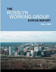
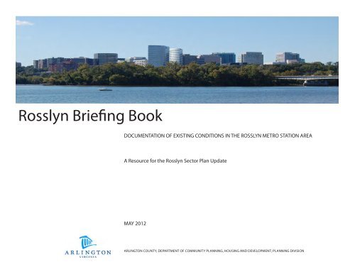
<strong>Rosslyn</strong> <strong>Briefing</strong> <strong>Book</strong><br />
DOCUMENTATION OF EXISTING CONDITIONS IN THE ROSSLYN METRO STATION AREA<br />
A Resource for the <strong>Rosslyn</strong> Sector Plan Update<br />
MAY 2012<br />
ARLINGTON COUNTY; DEPARTMENT OF COMMUNITY PLANNING, HOUSING AND DEVELOPMENT; PLANNING DIVISION
2<br />
ROSSLYN BRIEFING BOOK
TABLE OF CONTENTS<br />
Introduction..........................................................................................................................................................................4<br />
History of the Study Area............................................................................ ........................................................................5<br />
Current Conditions and Description of the Study Area...................................................................................................9<br />
Physical Conditions..............................................................................................................................................................9<br />
Transportation and Access.................................................................................................................................................16<br />
Parks and Open Space ......................................................................................................................................................21<br />
Land Use and Development...............................................................................................................................................23<br />
Demographics......................................................................................................................................................................31<br />
Economic and Market Data...............................................................................................................................................34<br />
Housing Characteristics.......................................................................................................................................................39<br />
rosslyn sector plan update<br />
Plans, Policies, and Laws Affecting the Study Area.........................................................................................................43<br />
Land Use Planning Overview..............................................................................................................................................43<br />
General Land Use Plan (GLUP)...........................................................................................................................................44<br />
GLUP History..........................................................................................................................................................................45<br />
Zoning....................................................................................................................................................................................52<br />
Transportation Overview.....................................................................................................................................................55<br />
Master Transportation Plan (MTP).......................................................................................................................................56<br />
Parks, Open Space, Public Art............................................................................................................................................60<br />
Public Space Master Plan...................................................................................................................................................60<br />
Public Arts Master Plan.........................................................................................................................................................62<br />
Neighborhood Planning .....................................................................................................................................................63<br />
Capital Projects....................................................................................................................................................................65<br />
Appendix...............................................................................................................................................................................66<br />
3
INTRODUCTION<br />
The <strong>Rosslyn</strong> Sector Plan Update (RSPU) will focus on a study area of approximately 300 acres<br />
surrounding the <strong>Rosslyn</strong> Metrorail Station in <strong>Arlington</strong>, Virginia (see Figure 1). The overall<br />
goal of the RSPU is to guide future public and private investment over the next 20 years in<br />
accordance with a refined vision for the <strong>Rosslyn</strong> Metro Station Area (RMSA), from this point<br />
forward referred to as <strong>Rosslyn</strong> or the RMSA.<br />
Figure 1: <strong>Rosslyn</strong> Sector Plan Update<br />
Study Area Map<br />
4<br />
The 1992 <strong>Rosslyn</strong> Station Area Plan Addendum established a vision of <strong>Rosslyn</strong> as a first class<br />
urban center and premier office district that is a vibrant place to live, work, and play. The<br />
end result will be a <strong>Rosslyn</strong> which:<br />
• Serves as a proud gateway into <strong>Arlington</strong> and the Commonwealth of Virginia.<br />
• Is a vibrant place to live and work with ample opportunities for shopping, recreation<br />
and cultural activities.<br />
• Is home to the regional and national headquarters of major corporations and is seen as<br />
one of the premier office locations in the country.<br />
• Has superior architecture and is an example of the best in urban design.<br />
• Is a place where people are comfortable with their surroundings and which serves as a<br />
great stage for human activities.<br />
Notable progress has been achieved over the past twenty years. Redevelopment of major<br />
projects from the 1960s and 1970s has added a new residential and hotel presence to <strong>Rosslyn</strong>’s<br />
core, enhanced the office market, and added a new vibrancy to street level retail in<br />
certain areas. Other changes, such as the opening of the Artisphere, early phases of the<br />
Esplanade project, deconstruction of the skywalk network, and the addition of three highspeed<br />
elevators to the <strong>Rosslyn</strong> Metro Station will also support future investment and growth.<br />
As a result of these successes, the RSPAU planning process will be carried out with dedication<br />
to the vision as well as the land use planning components set forth in the 1992 addendum.<br />
However, the focus will be to provide guidance for four specific problem areas:<br />
• A better urban design framework to create a <strong>Rosslyn</strong> that is a more attractive and<br />
functional place to be;<br />
• A more specific and deliberate building heights strategy to help the <strong>County</strong> prioritize<br />
its goals for <strong>Rosslyn</strong>’s skyline;<br />
• A refined multimodal transportation system consistent with current Master Transportation<br />
Plan policies to support the enhanced accessibility of <strong>Rosslyn</strong>’s residents, workers,<br />
and visitors, while providing rights-of-way that will accommodate <strong>Rosslyn</strong>’s future district<br />
energy needs; and<br />
• A more cohesive and functional parks and open space network to meet the recreational<br />
needs of <strong>Rosslyn</strong> while enhancing its public realm.<br />
This briefing book was developed to offer planning participants with a clear and detailed<br />
context from which the planning discussion will emerge. Offering a collection of historical<br />
background information, existing condition materials, and plans, policies, and laws, the<br />
briefing book may be read as a narrative document. However, it can also be viewed and<br />
used as an evolving reference guide, to be consulted and also built upon throughout the<br />
planning process.<br />
ROSSLYN BRIEFING BOOK
HISTORY OF THE STUDY AREA<br />
INTRODUCTION TO ROSSLYN<br />
The <strong>Rosslyn</strong> Metro Station Area (RMSA) lies across the Potomac River from Washington,<br />
D.C. and is considered a primary central business district of <strong>Arlington</strong><br />
<strong>County</strong>. <strong>Rosslyn</strong>’s boundaries include portions of the North <strong>Rosslyn</strong> and Radnor/<br />
Fort Myer Heights civic associations and the Colonial Village condominium. A<br />
key gateway to <strong>Arlington</strong> <strong>County</strong> since the 1840s, <strong>Rosslyn</strong> has long been a center<br />
of activity and commerce along the Potomac River. After the Civil War,<br />
<strong>Rosslyn</strong> was home to drinking establishments and a haven for gambling and<br />
vice. By the dawn of the 20th century, successful concerted efforts by local<br />
leaders and law enforcement to close illegal businesses significantly improved<br />
<strong>Rosslyn</strong>’s reputation.<br />
rosslyn sector plan update<br />
From 1896 to 1941, <strong>Rosslyn</strong> was a hub for an electric commuter rail service with<br />
connections to areas such as Alexandria, Mount Vernon, McLean and Great<br />
Falls. Around the 1930s an influx of government workers led to a dramatic rise<br />
in the <strong>County</strong>’s population, which increased demand on the existing housing<br />
market. This resulted in the construction of 176 Federal Housing Administrationsupported<br />
garden apartment communities throughout the <strong>County</strong>, including<br />
in <strong>Rosslyn</strong>.<br />
The <strong>Rosslyn</strong> Metro Station Area is centered around the <strong>Rosslyn</strong> Metro Station,<br />
a major hub of transportation activity on the Orange and Blue Metrorail lines.<br />
In the early 1960s, <strong>Rosslyn</strong> was home to an assortment of pawn shops, lumber<br />
yards, oil storage tanks, vacant lots and other marginal uses, as well as approximately<br />
2,500 housing units. At that time, <strong>Arlington</strong> <strong>County</strong> began applying innovative<br />
special exception site planning processes whereby private developers<br />
were allowed to develop at much greater densities than otherwise allowed, as<br />
long as they adhered to a <strong>County</strong>-approved master plan.<br />
The first Land Use Plan and site approval procedure for <strong>Rosslyn</strong> redevelopment<br />
was adopted in 1961. The 1977 <strong>Rosslyn</strong> Transit Area Study was completed 16<br />
years later.<br />
The <strong>Rosslyn</strong> Station Area Plan Addendum, adopted by the <strong>County</strong> Board in<br />
1992, outlines a strategy for a more functional, urban and livable place. In 1996,<br />
the Board adopted the “C-O-<strong>Rosslyn</strong>” zoning district, a new zoning classification<br />
to be used to implement the goals of the station area plan and addendum. The<br />
“C-O-<strong>Rosslyn</strong>” district allows the <strong>County</strong> Board to approve additional density<br />
up to a maximum of 10.0 FAR (floor area ratio) when it finds the development<br />
proposal offers important community benefits identified in approved plans for<br />
the area. This level of density is only allowed in the “<strong>Rosslyn</strong> Coordinated Redevelopment<br />
District” designated on the General Land Use Plan and for sites that<br />
are rezoned to “C-O-<strong>Rosslyn</strong>.”<br />
<strong>Rosslyn</strong>, Pre-1970s, View South from <strong>Rosslyn</strong> Circle<br />
Source: CPHD photo collection<br />
<strong>Rosslyn</strong>, Pre-1970s, View North Towards Key Bridge<br />
Source: CPHD photo collection<br />
5
HISTORY OF THE STUDY AREA<br />
KEY HISTORIC RESOURCES<br />
Since the 2006 adoption of the Historic Preservation Master Plan, the<br />
<strong>County</strong> has adopted a classification of historic resources <strong>County</strong>wide<br />
according to their historical and architectural significance. Known as <strong>Arlington</strong>’s<br />
Historic Resources Inventory, or HRI, the first phase of the project<br />
includes these three building types built prior to 1955: garden apartment<br />
style buildings and complexes; shopping centers; and individual commercial<br />
buildings.<br />
Twenty-three properties in the <strong>County</strong> are listed in the Essential category,<br />
which features those historic resources with the greatest historical architectural<br />
and/or visual prominence in our community. The Essential buildings<br />
give <strong>Arlington</strong> a genuine sense of place and illustrate how its built<br />
environment evolved during the early- to mid-20th century. In addition,<br />
the Essential buildings have the most remaining architectural fabric, the<br />
least extensive physical alterations, and distinguishing architectural and/<br />
or historical significance. Two properties listed as Essential in the HRI are<br />
located in <strong>Rosslyn</strong>.<br />
The Important Category, the second-highest ranking in the HRI, includes<br />
134 properties countywide. The Important properties help communicate<br />
and reinforce the architectural and historical character of <strong>Arlington</strong>.<br />
Nearly half of the Important properties are garden apartment buildings<br />
and/or complexes, which have continuously served the housing needs<br />
<strong>Rosslyn</strong> bird’s eye view, 1962<br />
Source: CPHD photo collection<br />
of <strong>Arlington</strong>ians for decades while maintaining their high quality building<br />
materials, architectural design, and urban planning principles. In total, 17<br />
properties in <strong>Rosslyn</strong> are listed as Important in the HRI.<br />
The third and fourth tier rankings in the HRI are the Notable and Minor categories.<br />
The 81 Notable properties do not have as much surviving historic<br />
context or integrity of materials than those in the higher-ranked categories.<br />
The 22 properties in the Minor category have undergone substantial<br />
exterior alterations over time and/or are not a distinctive example of their<br />
particular building type. An additional 35 properties have undergone<br />
such major alterations that they are no longer considered to be historic<br />
resources. In total, 8 properties in <strong>Rosslyn</strong> are listed as Notable in the HRI.<br />
Locations in <strong>Rosslyn</strong> of HRI-Listed Properties: Figure 2 presents the entire<br />
list of properties within <strong>Rosslyn</strong> that are included in the HRI Phase 1, as<br />
adopted in June 2011.<br />
More detailed information on the Historic Resources Inventory can be<br />
found online at:<br />
http://www.arlingtonva.us/departments/CPHD/ons/hp/page82412.aspx<br />
Additional background to the <strong>County</strong>’s Historic Preservation Program<br />
can be found at this website:<br />
http://www.arlingtonva.us/departments/CPHD/ons/CPHDOnsHistoricPreservation.aspx<br />
<strong>Rosslyn</strong>, 1965<br />
Source: CPHD photo collection<br />
ROSSLYN BRIEFING BOOK<br />
6
HISTORY OF THE STUDY AREA<br />
Property Name Address Construction<br />
Date<br />
Essential - Shopping Centers<br />
Colonial Village Shopping Center 1711-1731 Wilson Boulevard 1937<br />
Essential - Garden Apartments<br />
Colonial Village<br />
Figure 2. Properties in <strong>Rosslyn</strong> Listed in the <strong>Arlington</strong> <strong>County</strong> Historic Resources Inventory (Phase I)<br />
(portion of Colonial Village III that fronts Wilson Blvd, the eastern side<br />
of North Rhodes St, and Queens Lane is within the study area)<br />
Important - Garden Apartments<br />
Arlco Apartments 1423-1427 North Nash Street 1951-1952<br />
<strong>Arlington</strong> Towers (River Place)* 1011, 1021, 1111, 1121 <strong>Arlington</strong> Boulevard 1954-1955;<br />
Key Boulevard Apartments* 1537-1545 Key Boulevard 1942<br />
Rolfe Street Apartments* 1200-1218 North Rolfe Street 1942;<br />
Le-Mar Apartments* 1720-1726 North Quinn Street 1940<br />
Marlow Apartments (<strong>Rosslyn</strong> Heights)* 1220-1224 and 1300-1304 North Meade Street 1953<br />
Existing Status<br />
1936-1955 Local historic district, Virginia<br />
Landmarks Register, National<br />
Register<br />
rosslyn sector plan update<br />
Nalbert Apartments: 1301-1319 Fort Myer Drive 1950<br />
Pierce Queen Apartments 1600-1610 16th Street North, 1520 North Pierce Street, 1515 and 1521<br />
North Queen Street<br />
Queens Court Apartments* 1801-1805 North Quinn Street 1941<br />
Quinn Apartments 1410 North Quinn Street 1942/1952<br />
1942/1947 FMHN (Fort Myer Heights North)<br />
(full)<br />
Rahill Apartments 16th Street North, North Quinn Street, North Queen Street 1940-1942; FMHN (full on north half of block)<br />
Designation<br />
Stratford Courts 1336 North Ode Street 1943;<br />
Swansen Apartments 1601 North Rhodes Street, 1600 North Quinn Street 1942<br />
Taft Manor Apartments 2005 Fairfax Drive 1953-1954;<br />
The Virginian* 1500 <strong>Arlington</strong> Boulevard 1950<br />
Westmoreland Terrace* 1320-1322 Fort Myer Drive; 1301-1313 North Ode Street 1947;<br />
Important - Commercial Buildings<br />
Motel 50 (Inn of <strong>Rosslyn</strong>)* 1601 Fairfax Drive 1940<br />
(An asterisk (*) denotes that the property ranks within the top third of the important category)<br />
7
HISTORY OF THE STUDY AREA<br />
Figure 2. Properties in <strong>Rosslyn</strong> Listed in the <strong>Arlington</strong> <strong>County</strong> Historic Resources Inventory (Phase I), Cont’d<br />
Notable - Garden Apartments<br />
Briarcliff Manor (Marlaine) 1300-1304, 1318-1320, and 1301-1309 North Pierce Street 1942/1946-1947<br />
North Quinn Apartments 1210-1250 North Quinn Street, 1230 North Queen Street 1940-1946<br />
Parkview Manor Apartments 1310 North Meade Street 1954<br />
<strong>Rosslyn</strong> Ridge Apartments 1501 North Pierce Street 1954<br />
Sylvester 1516 North Rhodes Street (1800 16th Street North) 1942-1943<br />
Unnamed Apartment Complex 1235 North Quinn Street and 1220-1230 North Queen Street 1946<br />
Unnamed Low-Rise Apartment Building 1215-1217 North Quinn Street 1950<br />
Washington Vista (Carydale in Towne) 1545-1549 Colonial Terrace, Key Boulevard and North Nash Street 1954-1955<br />
(An asterisk (*) denotes that the property ranks within the top third of the important category)<br />
ROSSLYN BRIEFING BOOK<br />
8
physical conditions<br />
ROSSLYN EXISTING CONDITIONS<br />
rosslyn sector plan update<br />
Study Area Location and Regional Context<br />
The <strong>Rosslyn</strong> Metro Station Area (RMSA) is situated just across the Potomac<br />
River from Washington, D.C. on the Orange and Blue Metrorail lines. One<br />
of <strong>Arlington</strong> <strong>County</strong>’s premier commercial hubs, <strong>Rosslyn</strong>’s approximately<br />
300 acres host 7,200 residential units, 8.3 million square feet of office space<br />
2,100 hotel units, and 700,000 square feet of retail. There are also over<br />
1.3 million square feet of commercial and 963 residential units approved<br />
and under construction (<strong>Arlington</strong> <strong>County</strong> 2nd Quarter 2011 Development<br />
Tracking Report). <strong>Rosslyn</strong> is also home to myriad cultural resources and<br />
open space programming, including the Artisphere, the Spectrum Theatre,<br />
the <strong>Rosslyn</strong> Jazz Festival and <strong>Rosslyn</strong> Film Festival in Gateway Park, and the<br />
<strong>Rosslyn</strong> Farmer’s Market.<br />
<strong>Rosslyn</strong> serves as the eastern bookend of the well-known <strong>Rosslyn</strong>-Ballston<br />
Corridor, and it is a well traversed gateway between Washington, D.C.,<br />
<strong>Arlington</strong> <strong>County</strong>, and the Commonwealth of Virginia. At a regional level,<br />
<strong>Rosslyn</strong>’s vitality derives from its close-in location to the nation’s capital and<br />
accessibility via a network of regional and interstate highways, Metrorail<br />
service, and local and regional bus service.<br />
<strong>Rosslyn</strong> is bordered on the east by Interstate 66, the George Washington<br />
Memorial Parkway (and associated National Park Service property) and<br />
the Potomac River, which surrounds Theodore Roosevelt Island - accessible<br />
from the Mount Vernon Trail. The Courthouse Metro Station Area is situated<br />
to the west of <strong>Rosslyn</strong>. The <strong>Rosslyn</strong> to Courthouse Urban Design Study,<br />
adopted by the <strong>County</strong> Board in 2003, examined properties bound by<br />
Wilson and Clarendon Boulevards extending west of Pierce Street in <strong>Rosslyn</strong>.<br />
The property across <strong>Rosslyn</strong>’s southern boundaries comprises land<br />
associated with the Iwo Jima Memorial and Netherlands Carillon, <strong>Arlington</strong><br />
Cemetery, and Joint Base Myer-Henderson Hall. Finally, to the north of<br />
<strong>Rosslyn</strong> across the Potomac River sits Georgetown, while the North Highland<br />
neighborhood north of Interstate 66 is situated just northwest of <strong>Rosslyn</strong>.<br />
Geographic and Environmental Context<br />
As an densely developed urban area, <strong>Rosslyn</strong> is commonly described<br />
by attributes such as the transportation network and commercial and<br />
residential square footage. However, geographic and environmental<br />
characteristics should also be taken into consideration. A sample of these<br />
factors are identified in this overview.<br />
<strong>Rosslyn</strong>’s elevation levels ranges from 0 feet at the river to 175 at its highest<br />
points at locations in Radnor Fort Myer Heights and in Colonial Terrace.<br />
Interstate 66’s sunken elevation also produces grade changes that<br />
challenge the pedestrian mobility and ease of access from points near the<br />
river and Key Bridge moving westward toward the Metro Station and the<br />
more residential areas outside of the commercial core.<br />
Tree cover is another feature of <strong>Rosslyn</strong>’s environment that sets it apart<br />
from the <strong>County</strong>’s residential, low-density neighborhoods. As high density,<br />
commercial development has been built over the course of 50 years,<br />
many of <strong>Rosslyn</strong>’s sites have not benefited from standards for planting and<br />
preservation of trees now in place in new development projects. Within<br />
the 288-acre <strong>Rosslyn</strong> Metro Station Area, the tree canopy covers 62 acres,<br />
or almost 22 percent. However, within the smaller 65-acre commercial<br />
core, the <strong>Rosslyn</strong> Coordinated Redevelopment District (RCRD), there are<br />
only 3 acres of tree canopy (4 percent of the RCRD).<br />
<strong>Rosslyn</strong> is also home to three separate subwatersheds: <strong>Rosslyn</strong>, Colonial<br />
Village Branch, and Rocky Run. Proximity to the Potomac, high levels of<br />
impervious surface, and minimal tree cover make watershed management<br />
an important consideration in planning and new development.<br />
Property Ownership Patterns<br />
The RMSA includes parcels ranging in size from 1,850 square feet located in<br />
the Colonial Terrace neighborhood to over 100,000 square feet in locations<br />
including several condominium and apartment complexes and hotels,<br />
such as the Virginian Suites, Prospect House Condominiums, the Belvedere<br />
Condo, <strong>Rosslyn</strong> Heights and River Place. River Place is comprised of four<br />
separate parcels exceeding 100,000 square feet.<br />
Excluding the Waterview property located at 19th St and N Lynn St, the<br />
RCRD is comprised of parcels that are generally smaller is size, less than<br />
65,000 square feet. However, as depicted in Figure 9, a trend toward<br />
consolidation is emerging, as property owners such as JBG, Vornado/Gould,<br />
and Monday Properties control significant land area for development of<br />
residential and commercial projects.<br />
Civic and Community Services<br />
The <strong>Rosslyn</strong> community is supported by a range of civic and community<br />
services. Facilities include but are not limited to one fire station, the Wilson<br />
school property owned by <strong>Arlington</strong> Public Schools, three polling places,<br />
several churches and child care centers.<br />
9
(VA. 110)<br />
ROSSLYN EXISTING CONDITIONS<br />
physical conditions<br />
Figure 3: <strong>Rosslyn</strong><br />
Figure 4: <strong>Rosslyn</strong><br />
Metro Station Area<br />
2011 Aerial Photography<br />
Legend<br />
Metro Station<br />
<strong>Rosslyn</strong> Boundary<br />
Pursuant to Section 54.1-402 of the Code of Virginia,<br />
any determination of topography or contours, or any<br />
depiction of physical improvements, property lines or<br />
boundaries is for general information only and shall<br />
not be used for the design, modification, or<br />
construction of improvements to real property<br />
Potomac River or for flood plain determination.<br />
Map prepared by <strong>Arlington</strong> <strong>County</strong> GIS Mapping Center<br />
<strong>County</strong> Line Map © 2011 <strong>Arlington</strong> <strong>County</strong>, VA<br />
Printed: August 2011<br />
<strong>Rosslyn</strong> Metro<br />
1:4,800<br />
0 250 500<br />
125 Feet<br />
<strong>Arlington</strong> <strong>County</strong><br />
<strong>Rosslyn</strong><br />
GEORGE WASHINGTON MEMORIAL PKWY.<br />
21ST<br />
CLARENDON BLVD.<br />
N. TROY ST.<br />
N.<br />
SMYTH<br />
ST.<br />
20TH RD. N.<br />
N. TROY ST.<br />
ST. N.<br />
N. SCO<br />
N. TAFT ST.<br />
RD. N.<br />
TT<br />
N. ROLFE ST.<br />
N. RHODES ST.<br />
13TH ST. N.<br />
FAIRFAX DR.<br />
Legend<br />
ST.<br />
N. SCOTT ST.<br />
ST.<br />
N. QUEEN ST.<br />
N. Q U<br />
14 TH<br />
N. SCOTT<br />
<strong>Rosslyn</strong> Boundary<br />
<strong>County</strong> Line<br />
21ST RD. N.<br />
INN ST.<br />
N. ROLFE ST.<br />
22ND CT. N.<br />
21ST S<br />
N. SCOTT S T.<br />
QUEENS LANE<br />
WILSON<br />
N.<br />
22ND ST. N.<br />
ST. N.<br />
LEE HWY.<br />
CLARENDON<br />
16TH<br />
RHODES ST.<br />
FAIRFAX DR.<br />
N. ROLFE ST.<br />
T. N.<br />
N. QUINN ST.<br />
N. QUINN ST.<br />
N. QUINN ST.<br />
N.<br />
PIERCE<br />
ST.<br />
ST. N.<br />
N. QUEEN ST.<br />
N. QUEEN ST.<br />
12TH ST. N.<br />
WASHINGTON AVE.<br />
21ST CT. N.<br />
N. PIERCE CT.<br />
BLVD.<br />
BLVD.<br />
N. PIERCE ST.<br />
N. PIERCE ST.<br />
N. OAK CT.<br />
N. COLONIAL TERR ACE<br />
19TH ST. N.<br />
Pursuant to Section 54.1-402 of the Code of Virginia,<br />
any determination of topography or contours, or any<br />
depiction of physical improvements, property lines or<br />
boundaries is for general information only and shall<br />
not be used for the design, modification, or<br />
construction of improvements to real property<br />
or for flood plain determination.<br />
* Aerial Photography flown March 2011<br />
Map prepared by <strong>Arlington</strong> <strong>County</strong> GIS Mapping Center<br />
Map © 2012 <strong>Arlington</strong> <strong>County</strong>, VA<br />
Printed: April 2012<br />
N. ODE ST.<br />
SHERMAN RD.<br />
ST.<br />
N. ODE<br />
INTERSTATE 66<br />
LEE HWY.<br />
16TH RD. N.<br />
N. NASH ST.<br />
N. NASH ST.<br />
FAIRFAX DR.<br />
ARLINGTON BLVD.<br />
N. ODE ST.<br />
N. OAK ST.<br />
N. COLONIAL CT.<br />
KEY BLVD.<br />
18TH ST. N.<br />
14TH ST. N.<br />
FORT MYER D R.<br />
ST E WART RD.<br />
N. OA K ST.<br />
FENTON CIR.<br />
N. OAK ST.<br />
12TH ST. N.<br />
MARSHALL DR.<br />
FORT<br />
SERVICE ROAD<br />
MYER DR.<br />
17 T H<br />
MYER DR.<br />
14TH ST. N.<br />
N. NASH ST.<br />
FORT<br />
N. MEADE ST.<br />
N. MOORE ST.<br />
N. LYN N ST.<br />
ST. N.<br />
ORD & WEITZEL DR.<br />
µ<br />
1:4,800<br />
N. LYNN ST.<br />
L'ENFANT DR.<br />
0 250 500<br />
125 Feet<br />
19TH ST. N.<br />
N. KENT ST.<br />
N. ARLINGTON RIDGE RD.<br />
WILSON BLVD.<br />
(U.S. 50)<br />
MARSHALL DR.<br />
ROSSLYN BRIEFING BOOK<br />
10
75<br />
75<br />
75<br />
50<br />
50<br />
physical conditions<br />
ROSSLYN EXISTING CONDITIONS<br />
75<br />
50<br />
Figure 5:<br />
25<br />
<strong>Rosslyn</strong><br />
Topography<br />
Figure 6: <strong>Rosslyn</strong><br />
Watersheds and Streams<br />
100<br />
25<br />
0<br />
Spout Run<br />
Palisades<br />
75<br />
175<br />
125<br />
150<br />
50<br />
Colonial Village Branch<br />
<strong>Rosslyn</strong><br />
75<br />
75<br />
175<br />
175<br />
175<br />
150<br />
75<br />
175<br />
rosslyn sector plan update<br />
225<br />
200<br />
150<br />
2ft Hillshade from DEM<br />
Legend<br />
<strong>County</strong> Line<br />
Contour Lines<br />
225<br />
175<br />
200<br />
<strong>Rosslyn</strong> Boundary<br />
Potomac River<br />
175<br />
100<br />
Pursuant to Section 54.1-402 of the Code of Virginia,<br />
any determination of topography or contours, or any<br />
depiction of physical improvements, property lines or<br />
boundaries is for general information only and shall<br />
not be used for the design, modification, or<br />
construction of improvements to real property<br />
or for flood plain determination.<br />
Map prepared by <strong>Arlington</strong> <strong>County</strong> GIS Mapping Center<br />
Map © 2012 <strong>Arlington</strong> <strong>County</strong>, VA<br />
Printed: May 2012<br />
175<br />
100<br />
µ<br />
1:4,800<br />
0 240 480<br />
120 Feet<br />
50<br />
Rocky Run<br />
Legend<br />
Watersheds <strong>Rosslyn</strong> Boundary<br />
Culvert<br />
<strong>County</strong> Line<br />
Stream<br />
Potomac River<br />
Cemetery/Pentagon<br />
Pursuant to Section 54.1-402 of the Code of Virginia,<br />
any determination of topography or contours, or any<br />
depiction of physical improvements, property lines or<br />
boundaries is for general information only and shall<br />
not be used for the design, modification, or<br />
construction of improvements to real property<br />
or for flood plain determination.<br />
1:4,800<br />
Map prepared by <strong>Arlington</strong> <strong>County</strong> GIS Mapping Center<br />
Map © 2011 <strong>Arlington</strong> <strong>County</strong>, VA<br />
Printed: August 2011 0 240 480<br />
120 Feet<br />
11
ROSSLYN BRIEFING BOOK<br />
ROSSLYN EXISTING CONDITIONS<br />
physical conditions<br />
7:<br />
8:<br />
12
(VA. 110)<br />
(VA. 110)<br />
physical conditions<br />
ROSSLYN EXISTING CONDITIONS<br />
Figure 9:<br />
<strong>Rosslyn</strong><br />
Tax Parcel Area<br />
Figure <strong>Rosslyn</strong> 10: <strong>Rosslyn</strong><br />
Community Civic Infrastructure Facilities<br />
rosslyn sector plan update<br />
GEORGE WASHINGTON MEMORIAL PKWY.<br />
21ST<br />
CLARENDON BLVD.<br />
N. TROY ST.<br />
N.<br />
SMYTH<br />
ST.<br />
20TH RD. N.<br />
N. TROY ST.<br />
ST. N.<br />
N. SCO<br />
N. TAFT ST.<br />
RD. N.<br />
TT<br />
N. ROLFE ST.<br />
N. RHODES ST.<br />
ST.<br />
N. SCOTT ST.<br />
13TH ST. N.<br />
FAIRFAX DR.<br />
ST.<br />
N. QUEEN ST.<br />
N. Q U<br />
14 TH<br />
N. SCOTT<br />
21ST RD. N.<br />
INN ST.<br />
N. ROLFE ST.<br />
22ND CT. N.<br />
21ST S<br />
N. SCOTT S T.<br />
QUEENS LANE<br />
Legend<br />
Tax Parcel Area (Sq Ft)<br />
2 - 10,000<br />
10,001 - 35,000<br />
35,001 - 65,000<br />
65,001 - 100,000<br />
100,001 - 226,695<br />
WILSON<br />
N.<br />
22ND ST. N.<br />
ST. N.<br />
LEE HWY.<br />
CLARENDON<br />
16TH<br />
RHODES ST.<br />
FAIRFAX DR.<br />
N. ROLFE ST.<br />
<strong>Rosslyn</strong> Area<br />
<strong>County</strong> Line<br />
Potomac River<br />
T. N.<br />
N. QUINN ST.<br />
N. QUINN ST.<br />
N. QUINN ST.<br />
N.<br />
PIERCE<br />
ST.<br />
ST. N.<br />
N. QUEEN ST.<br />
N. QUEEN ST.<br />
12TH ST. N.<br />
WASHINGTON AVE.<br />
21ST CT. N.<br />
N. PIERCE CT.<br />
BLVD.<br />
BLVD.<br />
N. PIERCE ST.<br />
N. PIERCE ST.<br />
SHERMAN RD.<br />
N. OAK CT.<br />
N. COLONIAL TERR ACE<br />
19TH ST. N.<br />
N. ODE ST.<br />
ST.<br />
N. ODE<br />
INTERSTATE 66<br />
LEE HWY.<br />
16TH RD. N.<br />
N. NASH ST.<br />
N. NASH ST.<br />
FAIRFAX DR.<br />
ARLINGTON BLVD.<br />
N. ODE ST.<br />
N. OAK ST.<br />
N. COLONIAL CT.<br />
KEY BLVD.<br />
18TH ST. N.<br />
14TH ST. N.<br />
FORT MYER D R.<br />
ST E WART RD.<br />
Pursuant to Section 54.1-402 of the Code of Virginia,<br />
any determination of topography or contours, or any<br />
depiction of physical improvements, property lines or<br />
boundaries is for general information only and shall<br />
not be used for the design, modification, or<br />
construction of improvements to real property<br />
or for flood plain determination.<br />
Map prepared by <strong>Arlington</strong> <strong>County</strong> GIS Mapping Center<br />
Map © 2012 <strong>Arlington</strong> <strong>County</strong>, VA<br />
Printed: February 2012<br />
N. OA K ST.<br />
FENTON CIR.<br />
N. OAK ST.<br />
12TH ST. N.<br />
MARSHALL DR.<br />
FORT<br />
SERVICE ROAD<br />
MYER DR.<br />
17 T H<br />
MYER DR.<br />
14TH ST. N.<br />
N. NASH ST.<br />
FORT<br />
N. MEADE ST.<br />
N. MOORE ST.<br />
N. LYN N ST.<br />
ST. N.<br />
ORD & WEITZEL DR.<br />
N. LYNN ST.<br />
L'ENFANT DR.<br />
µ<br />
1:4,800<br />
0 250 500<br />
125 Feet<br />
19TH ST. N.<br />
N. KENT ST.<br />
N. ARLINGTON RIDGE RD.<br />
WILSON BLVD.<br />
(U.S. 50)<br />
MARSHALL DR.<br />
GEORGE WASHINGTON MEMORIAL PKWY.<br />
21ST<br />
CLARENDON BLVD.<br />
N. TROY ST.<br />
N.<br />
SMYTH<br />
ST.<br />
20TH RD. N.<br />
N. TROY ST.<br />
Plaza Library & <strong>Arlington</strong> Shop<br />
ST. N.<br />
N. SCO<br />
N. TAFT ST.<br />
RD. N.<br />
TT<br />
N. ROLFE ST.<br />
N. RHODES ST.<br />
13TH ST. N.<br />
FAIRFAX DR.<br />
Legend<br />
!®<br />
ñ<br />
"M<br />
¨<br />
Post Office<br />
ST.<br />
<strong>County</strong> Facility<br />
Metro Station<br />
Fire Station<br />
<strong>Rosslyn</strong><br />
N. SCOTT ST.<br />
ST.<br />
N. QUEEN ST.<br />
N. Q U<br />
14 TH<br />
N. SCOTT<br />
21ST RD. N.<br />
INN ST.<br />
N. ROLFE ST.<br />
22ND CT. N.<br />
21ST S<br />
N. SCOTT S T.<br />
QUEENS LANE<br />
WILSON<br />
N.<br />
22ND ST. N.<br />
ST. N.<br />
LEE HWY.<br />
CLARENDON<br />
16TH<br />
RHODES ST.<br />
FAIRFAX DR.<br />
N. ROLFE ST.<br />
T. N.<br />
N. QUINN ST.<br />
N. QUINN ST.<br />
N. QUINN ST.<br />
N.<br />
PIERCE<br />
ST.<br />
Wilson<br />
Senior<br />
Center<br />
ST. N.<br />
N. QUEEN ST.<br />
N. QUEEN ST.<br />
12TH ST. N.<br />
WASHINGTON AVE.<br />
21ST CT. N.<br />
N. PIERCE CT.<br />
BLVD.<br />
BLVD.<br />
N. PIERCE ST.<br />
N. PIERCE ST.<br />
SHERMAN RD.<br />
N. OAK CT.<br />
N. COLONIAL TERR ACE<br />
19TH ST. N.<br />
ñ<br />
N. ODE ST.<br />
ST.<br />
N. ODE<br />
INTERSTATE 66<br />
LEE HWY.<br />
16TH RD. N.<br />
N. NASH ST.<br />
N. NASH ST.<br />
FAIRFAX DR.<br />
ARLINGTON BLVD.<br />
N. ODE ST.<br />
N. OAK ST.<br />
N. COLONIAL CT.<br />
KEY BLVD.<br />
Polling Location<br />
18TH ST. N.<br />
¨<br />
Fire Station 10<br />
Argus House<br />
14TH ST. N.<br />
FORT MYER D R.<br />
ST E WART RD.<br />
ñ<br />
N. OA K ST.<br />
FENTON CIR.<br />
N. OAK ST.<br />
12TH ST. N.<br />
MARSHALL DR.<br />
FORT<br />
SERVICE ROAD<br />
MYER DR.<br />
17 T H<br />
MYER DR.<br />
14TH ST. N.<br />
N. NASH ST.<br />
FORT<br />
N. MEADE ST.<br />
N. MOORE ST.<br />
<strong>Rosslyn</strong> Metro<br />
"M<br />
N. LYN N ST.<br />
ST. N.<br />
ORD & WEITZEL DR.<br />
N. LYNN ST.<br />
L'ENFANT DR.<br />
µ<br />
Pursuant to Section 54.1-402 of the Code of Virginia,<br />
any determination of topography or contours, or any<br />
depiction of physical improvements, property lines or<br />
Boundary boundaries is for general information only and shall<br />
not be used for the design, modification, or<br />
Polling Places construction of improvements to real property<br />
or for flood plain determination.<br />
1:4,800<br />
Potomac River<br />
Map prepared by <strong>Arlington</strong> <strong>County</strong> GIS Mapping Center<br />
Map © 2012 <strong>Arlington</strong> <strong>County</strong>, VA<br />
0 125 250 500 Feet<br />
Printed: April 2012<br />
19TH ST. N.<br />
N. KENT ST.<br />
N. ARLINGTON RIDGE RD.<br />
<strong>Rosslyn</strong> Station<br />
Post Office !® ñ ARTISPHERE<br />
WILSON BLVD.<br />
(U.S. 50)<br />
MARSHALL DR.<br />
13
N. LYNN ST.<br />
JEFFERSON DAVIS HWY.<br />
ROSSLYN EXISTING CONDITIONS<br />
physical conditions<br />
Figure 11: X: <strong>Rosslyn</strong> Coordinated Redevelopment District<br />
Parcel Ownership<br />
Figure 12: X: <strong>Rosslyn</strong> Business Improvement District<br />
Boundary<br />
RCRD<br />
22ND CT. N.<br />
22ND ST. N.<br />
22ND ST. N.<br />
N. OAK ST.<br />
FO RT MYER DR.<br />
N. LYNN ST.<br />
RCRD<br />
Property Owner<br />
1200 Property Associates<br />
<strong>Arlington</strong> <strong>County</strong> Board<br />
Arl.Tmpl Utd Methodist Chrch<br />
Beacon Capital<br />
Bragg Ellen Estate<br />
Bristol Group<br />
Brookfield Office Properties<br />
Clover Companies<br />
Dittmar<br />
Dominion Virginia Power<br />
GPI Buchanan Wilson<br />
Glenborough<br />
JBG<br />
Lincoln Property<br />
Lynn Estates Property<br />
Marriott<br />
RCRD<br />
45 0 90 180 270<br />
Feet<br />
¯<br />
Monday Properties<br />
Multiple/Condo<br />
Penzance<br />
Snell Construction Corp<br />
Tishman Speyer<br />
Vornado/Gould<br />
Weissberg Corporation<br />
N. QUINN ST.<br />
N. QUINN ST.<br />
WILSON BLVD.<br />
N. QUINN ST.<br />
21ST ST. N.<br />
N. COLONIAL TERRACE<br />
VACATED<br />
STREET<br />
19TH ST. N.<br />
16TH ST. N. 16TH ST. N.<br />
N. QUINN ST.<br />
VACATED<br />
STREET<br />
N. QUEEN ST.<br />
Streets<br />
<strong>Rosslyn</strong> BID Boundary<br />
N. PEIRCE ST.<br />
N. PIERCE ST.<br />
N. ODE. ST.<br />
N. ODE ST.<br />
N. COLONIAL CT.<br />
N. OAK ST.<br />
N. COLONIAL TERRACE<br />
N. ODE ST.<br />
N. COLONIAL TERRACE<br />
18TH ST. N.<br />
16TH RD. N.<br />
N. OAK ST.<br />
CLARENDON BLV D.<br />
17TH ST. N.<br />
N. OAK ST.<br />
N. OAK ST.<br />
N. NASH ST.<br />
N. NASH ST.<br />
N. NASH ST.<br />
FORT MYER DR.<br />
FORT MYER DR. FORT MYER DR.<br />
N. NASH ST.<br />
Building Footprints<br />
Tax Parcels<br />
FORT MYER DR.<br />
20TH ST. N.<br />
FORT MYER DR.<br />
N. MOORE ST.<br />
N. MOORE ST.<br />
N. LYNN ST.<br />
N. LYNN ST.<br />
N. LYNN ST. N. LYNN ST.<br />
19TH ST. N.<br />
N. KENT ST.<br />
N. KENT ST.<br />
¯<br />
0 50 100 200 300<br />
Feet<br />
N. ARLINGTON RIDGE RD.<br />
ROSSLYN BRIEFING BOOK<br />
14
physical conditions<br />
ROSSLYN EXISTING CONDITIONS<br />
rosslyn sector plan update<br />
<strong>Rosslyn</strong> Coordinationed Redevelopment District (RCRD); View East from Pierce Street<br />
15
ROSSLYN EXISTING CONDITIONS<br />
transportation and access<br />
TRANSPORTATION AND ACCESS OVERVIEW<br />
The materials presented on the following pages<br />
and the <strong>Rosslyn</strong> Multimodal Transportation<br />
Study provide a comprehensive catalogue of<br />
the <strong>Rosslyn</strong> transportation and access system.<br />
<strong>Rosslyn</strong> is situated at the confluence of several<br />
major local and regional highway facilities<br />
including: Interstate Route 66, US, Route 29 (Lee<br />
Highway), US Route 50 (<strong>Arlington</strong> Boulevard),<br />
the George Washington Memorial Parkway,<br />
and the Wilson Boulevard/Clarendon Boulevard<br />
corridor. <strong>Rosslyn</strong> is one of the region’s major<br />
commercial hubs, serving as the gateway to<br />
Washington, DC and Northern Virginia. <strong>Rosslyn</strong> is<br />
also connected to Georgetown and downtown<br />
Washington, D.C. by the Metrorail system tunnel<br />
under the Potomac River, by the Key Bridge,<br />
and by the Theodore Roosevelt Bridge which<br />
carries both US Route 50 and Interstate Route<br />
66 across the Potomac River.<br />
<strong>Rosslyn</strong>’s impressive transportation connectivity<br />
is accommodated by a multi-layered<br />
transportation and access system comprised<br />
of local roads, interstates, and highways,<br />
pedestrian and cyclist network pathways,<br />
and mass transit facilities including the <strong>Rosslyn</strong><br />
Metrorail station, WMATA, ART, and private and<br />
commercial bus stops and routes.<br />
The following pages present maps and<br />
illustrations depicting various elements of<br />
<strong>Rosslyn</strong>’s transportation and access system.<br />
In addition, the recently completed <strong>Rosslyn</strong><br />
Multimodal Transportation Study was conducted<br />
to catalogue and review existing and planned<br />
transportation facilities, services and operations<br />
for <strong>Rosslyn</strong> over the next 20 years.<br />
The study catalogues and assesses the<br />
basic framework of the <strong>Rosslyn</strong> multimodal<br />
transportation system including: streets,<br />
public transportation, bicycle facilities,<br />
pedestrian facilities, parking and curb space<br />
management, and Transportation Demand<br />
Management (TDM), and identifies deficiencies<br />
along with opportunities for improvements to<br />
the system. Recommended improvements to<br />
<strong>Rosslyn</strong>’s transportation system are based on<br />
and consistent with <strong>Arlington</strong> <strong>County</strong>’s Master<br />
Transportation Plan. The study is intended to<br />
inform the transportation component of the<br />
new <strong>Rosslyn</strong> Sector Plan Update.<br />
17th Street N Bridge Looking North Up Fort Myer Drive<br />
<strong>Rosslyn</strong> Traffic Counts<br />
The streets that serve <strong>Rosslyn</strong> are subject to a wide<br />
range of travel demands over the course of a typical<br />
weekday. As <strong>Rosslyn</strong> is an employment center<br />
(approximately 35,000 jobs), a residential neighborhood<br />
(over 10,000 residents), and a primary visitor<br />
destination (more than 2,000 hotel rooms), it is the<br />
origin and destination of a lot of vehicular traffic. In<br />
addition to the locally generated traffic, some of<br />
<strong>Rosslyn</strong>’s streets also carry significant regional traffic<br />
that pass through the area on the way into or<br />
out of Washington, D.C.<br />
Figure 13:<br />
ROSSLYN BRIEFING BOOK<br />
16
(VA. 110)<br />
transportation and access<br />
ROSSLYN EXISTING CONDITIONS<br />
<strong>Arlington</strong> <strong>County</strong>, Virginia<br />
Figure 14: <strong>Rosslyn</strong><br />
Existing Traffic Circulation<br />
Existing in <strong>Rosslyn</strong> Street Network and Traffic Circulation<br />
KEY BRIDGE<br />
Figure 15:<br />
<strong>Rosslyn</strong><br />
Transit Map<br />
N. VEITCH ST.<br />
rosslyn sector plan update<br />
PKWY.<br />
21ST<br />
21ST ST. N.<br />
R D. N.<br />
20TH<br />
ST. N.<br />
19TH ST. N.<br />
N. VEITCH ST.<br />
N. COURTHOUSE RD.<br />
N. UHLE ST.<br />
N. UHLE<br />
ST.<br />
N. TROY<br />
14TH ST. N.<br />
12TH CT. N.<br />
ST.<br />
N. TAFT ST.<br />
21ST ST. N.<br />
(U.S. 29)<br />
KEY BLVD.<br />
GEORGE WASHINGTON MEMORIAL PKWY.<br />
â<br />
ßå<br />
15TH ST. N.<br />
N. COURTHOUSE RD.<br />
21ST<br />
CLARENDON BLVD.<br />
N. TROY ST.<br />
N.<br />
SMYTH<br />
ST.<br />
20TH RD. N.<br />
N. TROY ST.<br />
N. SCO<br />
â<br />
N. TAFT ST.<br />
ßå<br />
FAIRFAX DR.<br />
BL OX O N S T.<br />
RD. N.<br />
TT<br />
N. ROLFE ST.<br />
N. RHODES ST.<br />
ST.<br />
N. SCOTT ST.<br />
13TH ST. N.<br />
ST.<br />
N. QUEEN ST.<br />
N. Q U<br />
14 TH<br />
N. SCOTT<br />
21ST RD. N.<br />
INN ST.<br />
ßå<br />
ßå<br />
N. ROLFE ST.<br />
22ND CT. N.<br />
21ST S<br />
â<br />
N. SCOTT S T.<br />
QUEENS LANE<br />
CUSTER RD.<br />
â<br />
â<br />
ßå<br />
WILSON<br />
N.<br />
22ND ST. N.<br />
â<br />
ßå<br />
ß å<br />
â<br />
ßå å ß<br />
ßå å<br />
ßå<br />
ß<br />
ßå<br />
ßå<br />
ßå<br />
â<br />
ßå<br />
ßå<br />
ßå<br />
ßå<br />
ßå<br />
ßå<br />
ßå<br />
ßå<br />
ST. N.<br />
LEE HWY.<br />
CLARENDON<br />
16TH<br />
RHODES ST.<br />
FAIRFAX DR.<br />
N. ROLFE ST.<br />
JOHNSON LANE<br />
T. N.<br />
N. QUINN ST.<br />
N. QUINN ST.<br />
N. QUINN ST.<br />
N.<br />
PIERCE<br />
ST.<br />
ST. N.<br />
N. QUEEN ST.<br />
N. QUEEN ST.<br />
12TH ST. N.<br />
WASHINGTON AVE.<br />
GRANT AVE.<br />
Pursuant to Section 54.1-402 of the Code of Virginia, any determination of topography<br />
or contours, or any depiction of physical improvements, property lines or boundaries<br />
is for general information only and shall not be used for the design, modification, or<br />
construction of improvements to real property or for flood plain determination.<br />
Aerial Photography flown February 2009<br />
Map prepared by <strong>Arlington</strong> <strong>County</strong> GIS Mapping Center<br />
Produced and © July 2011<br />
21ST CT. N.<br />
N. PIERCE CT.<br />
â<br />
BLVD.<br />
â<br />
BLVD.<br />
N. PIERCE ST.<br />
N. PIERCE ST.<br />
N. OAK CT.<br />
N. COLONIAL TERR ACE<br />
19TH ST. N.<br />
N. ODE ST.<br />
SHERMAN RD.<br />
ST.<br />
N. ODE<br />
â<br />
INTERSTATE 66<br />
â<br />
â<br />
LEE HWY.<br />
â<br />
ßå<br />
16TH RD. N.<br />
N. NASH ST.<br />
ßå<br />
N. NASH ST.<br />
ßå<br />
ßå<br />
FAIRFAX DR.<br />
ARLINGTON BLVD.<br />
N. ODE ST.<br />
N. OAK ST.<br />
N. COLONIAL CT.<br />
KEY BLVD.<br />
18TH ST. N.<br />
14TH ST. N.<br />
FORT MYER D R.<br />
ST E WART RD.<br />
N. OA K ST.<br />
FENTON CIR.<br />
N. OAK ST.<br />
â<br />
FORT<br />
SERVICE ROAD<br />
12TH ST. N.<br />
MARSHALL DR.<br />
â<br />
MYER DR.<br />
17T H<br />
â<br />
MYER DR.<br />
ß å<br />
â<br />
â<br />
â<br />
ßå<br />
â<br />
ßå<br />
"M<br />
14TH ST. N.<br />
N. NASH ST.<br />
FORT<br />
ßå<br />
â<br />
N. LYNN ST.<br />
ßå<br />
N. MEADE ST.<br />
ORD & WEITZEL DR.<br />
MITCHELL DR.<br />
N. MOORE ST.<br />
ST. N.<br />
N. LYN N ST.<br />
L'ENFANT DR.<br />
ßå<br />
ßå<br />
19TH ST. N.<br />
ßå<br />
N. KENT ST.<br />
â<br />
N. ARLINGTON RIDGE RD.<br />
WILSON BLVD.<br />
(U.S. 50)<br />
MARSHALL DR.<br />
Legend<br />
LINCOLN DR.<br />
SHERMAN DR.<br />
ßå<br />
Travel Direction<br />
âßå<strong>Rosslyn</strong> Metro Station Area<br />
"M <strong>Rosslyn</strong> Metro Station<br />
0 650<br />
Feet<br />
(VA. 110)<br />
INT. 66<br />
/<br />
ORD & WEITZEL DR.<br />
GEORGE WASHINGTON<br />
4H EB<br />
Legend<br />
Metro Station<br />
Blue Line<br />
4B EB<br />
Orange Line<br />
Blue/Orange Line<br />
Orange Line<br />
3Y WB<br />
3A EB<br />
4A WB<br />
ART45S<br />
3B EB<br />
4H WB<br />
16Y EB<br />
ART Bus Stops<br />
ART Bus Routes<br />
WMATA Bus Stops<br />
WMATA Bus Route<br />
3B WB<br />
4B WB<br />
38B EB<br />
38B WB<br />
3A WB<br />
ART61B ART61A<br />
ART45N<br />
<strong>Rosslyn</strong> Boundary<br />
Potomac River<br />
<strong>County</strong> Line<br />
16Y WB<br />
3Y EB<br />
15K EB<br />
15K WB<br />
Pursuant to Section 54.1-402 of the Code of Virginia,<br />
any determination of topography or contours, or any<br />
depiction of physical improvements, property lines or<br />
boundaries is for general information only and shall<br />
not be used for the design, modification, or<br />
construction of improvements to real property<br />
or for flood plain determination.<br />
Map prepared by <strong>Arlington</strong> <strong>County</strong> GIS Mapping Center<br />
Map © 2011 <strong>Arlington</strong> <strong>County</strong>, VA<br />
Printed: August 2011<br />
3E EB<br />
ART61A<br />
3E WB<br />
4E 15L<br />
<strong>Rosslyn</strong> Metro<br />
4A EB<br />
ART61B<br />
5A WB<br />
5A EB<br />
1:4,800<br />
Blue-Orange Line<br />
0 250 500<br />
125 Feet<br />
Blue Line<br />
FORREST CIR.<br />
SCHLEY DR.<br />
N. WAYNE ST.<br />
ARLINGTO<br />
JACKSON AVE.<br />
MOORE LN.<br />
MCNAIR RD.<br />
MEMORIAL DR.<br />
17
(VA. 110)<br />
ROSSLYN EXISTING CONDITIONS<br />
transportation and access<br />
Figure 16: <strong>Rosslyn</strong><br />
Figure 17: <strong>Rosslyn</strong><br />
Existing Sidewalks<br />
Existing Bike Trails and Facilities<br />
21ST ST. N.<br />
GEORGE WASHINGTON MEMORIAL PKWY.<br />
21ST<br />
CLARENDON BLVD.<br />
N. TROY ST.<br />
N.<br />
SMYTH<br />
ST.<br />
20TH RD. N.<br />
N. TROY ST.<br />
ST. N.<br />
N. SCO<br />
N. TAFT ST.<br />
RD. N.<br />
TT<br />
N. ROLFE ST.<br />
N. RHODES ST.<br />
FAIRFAX DR.<br />
Legend<br />
ST.<br />
N. SCOTT ST.<br />
13TH ST. N.<br />
ST.<br />
N. QUEEN ST.<br />
N. Q U<br />
14 TH<br />
N. SCOTT<br />
Sidewalk Type: Aprons<br />
Sidewalks<br />
<strong>Rosslyn</strong> Boundary<br />
Potomac River<br />
21ST RD. N.<br />
INN ST.<br />
N. ROLFE ST.<br />
22ND CT. N.<br />
21ST S<br />
N. SCOTT S T.<br />
QUEENS LANE<br />
WILSON<br />
N.<br />
22ND ST. N.<br />
ST. N.<br />
LEE HWY.<br />
CLARENDON<br />
16TH<br />
RHODES ST.<br />
FAIRFAX DR.<br />
N. ROLFE ST.<br />
T. N.<br />
N. QUINN ST.<br />
N. QUINN ST.<br />
N. QUINN ST.<br />
N.<br />
PIERCE<br />
ST.<br />
ST. N.<br />
N. QUEEN ST.<br />
N. QUEEN ST.<br />
12TH ST. N.<br />
WASHINGTON AVE.<br />
GRANT AVE.<br />
21ST CT. N.<br />
N. PIERCE CT.<br />
BLVD.<br />
BLVD.<br />
N. PIERCE ST.<br />
N. PIERCE ST.<br />
N. OAK CT.<br />
N. COLONIAL TERR ACE<br />
19TH ST. N.<br />
Pursuant to Section 54.1-402 of the Code of Virginia,<br />
any determination of topography or contours, or any<br />
depiction of physical improvements, property lines or<br />
boundaries is for general information only and shall<br />
not be used for the design, modification, or<br />
construction of improvements to real property<br />
or for flood plain determination.<br />
Map prepared by <strong>Arlington</strong> <strong>County</strong> GIS Mapping Center<br />
Map © 2012 <strong>Arlington</strong> <strong>County</strong>, VA<br />
Printed: February 2012<br />
N. ODE ST.<br />
SHERMAN RD.<br />
ST.<br />
N. ODE<br />
INTERSTATE 66<br />
LEE HWY.<br />
16TH RD. N.<br />
N. NASH ST.<br />
N. NASH ST.<br />
FAIRFAX DR.<br />
ARLINGTON BLVD.<br />
N. ODE ST.<br />
N. OAK ST.<br />
N. COLONIAL CT.<br />
KEY BLVD.<br />
18TH ST. N.<br />
14TH ST. N.<br />
FORT MYER D R.<br />
ST E WART RD.<br />
N. OA K ST.<br />
FENTON CIR.<br />
N. OAK ST.<br />
12TH ST. N.<br />
MARSHALL DR.<br />
FORT<br />
SERVICE ROAD<br />
MYER DR.<br />
17 T H<br />
MYER DR.<br />
14TH ST. N.<br />
N. NASH ST.<br />
FORT<br />
N. MEADE ST.<br />
N. MOORE ST.<br />
N. LYN N ST.<br />
ST. N.<br />
ORD & WEITZEL DR.<br />
N. LYNN ST.<br />
L'ENFANT DR.<br />
µ<br />
1:4,800<br />
19TH ST. N.<br />
N. KENT ST.<br />
N. ARLINGTON RIDGE RD.<br />
WILSON BLVD.<br />
(U.S. 50)<br />
MARSHALL DR.<br />
LINCOLN DR.<br />
0 250 500<br />
125 Feet<br />
Legend<br />
Bike Network<br />
Suggested Route<br />
Marked Routes, Streets & Bike Lanes<br />
Off Street Trail<br />
Use Caution - Active Intersection<br />
Capital Bikeshare Stations<br />
Water Fountain<br />
Steep Hills<br />
Sidewalks<br />
<strong>Rosslyn</strong> Boundary<br />
<strong>County</strong> Line<br />
Water Fountain<br />
Pursuant to Section 54.1-402 of the Code of Virginia,<br />
any determination of topography or contours, or any<br />
depiction of physical improvements, property lines or<br />
boundaries is for general information only and shall<br />
not be used for the design, modification, or<br />
construction of improvements to real property<br />
or for flood plain determination.<br />
Map prepared by <strong>Arlington</strong> <strong>County</strong> GIS Mapping Center<br />
Map © 2011 <strong>Arlington</strong> <strong>County</strong>, VA<br />
Printed: August 2011<br />
1:4,800<br />
0 250 500<br />
125 Feet<br />
ROSSLYN BRIEFING BOOK<br />
18
N MOORE ST<br />
N<br />
N LYNN ST<br />
transportation and access<br />
ROSSLYN EXISTING CONDITIONS<br />
<strong>Arlington</strong> <strong>County</strong>, Virginia<br />
<strong>Rosslyn</strong><br />
Public Off-Street Parking<br />
22ND ST N<br />
N OAK CT<br />
Figure 18: <strong>Rosslyn</strong><br />
Public Off-Street Parking<br />
GEORGE WASHINGTON MEMORIAL PKWY<br />
GEORGE WASHINGTON MEMORIAL PKWY<br />
LYNN ST<br />
N PIERCE ST<br />
21ST CT N<br />
21ST ST N<br />
N PIERCE<br />
CT<br />
LEE HWY<br />
N OAK ST<br />
IA<br />
LEE HWY<br />
Key Bridge<br />
Marriott<br />
FORT<br />
DR<br />
MYER<br />
LEE HWY<br />
INTERSTATE 66<br />
INTERSTATE 66<br />
LEE HWY<br />
LEE HWY<br />
LEE HWY<br />
N LYNN ST<br />
N COLONIAL TER<br />
N COLONIAL CT<br />
N NASH ST<br />
IA<br />
<strong>Rosslyn</strong><br />
Gateway North<br />
Waterview<br />
IA<br />
19TH ST N<br />
N ODE ST<br />
rosslyn sector plan update<br />
Art Associates<br />
Bldgs<br />
1555 IA<br />
Wilson Blvd 1525<br />
Wilson Blvd<br />
IA<br />
IA<br />
IA<br />
IA<br />
1550 Wilson Blvd<br />
AM Bldg<br />
IA<br />
1530 Wilson Blvd<br />
IA IA<br />
1600 Wilson Blvd 1560 Wilson Blvd<br />
14TH ST N<br />
CLARENDON BLVD<br />
16TH ST N<br />
N QUEEN ST<br />
19TH ST N<br />
N QUEEN ST<br />
WILSON BLVD<br />
16TH ST N<br />
N PIERCE ST<br />
N PIERCE ST<br />
18TH ST N<br />
16TH ST N<br />
KEY BLVD<br />
N ODE ST<br />
N COLONIAL TER<br />
CLARENDON BLVD<br />
16TH RD N<br />
FAIRFAX DR<br />
Pursuant to Section 54.1-402 of the Code of Virginia, any determination of topography<br />
or contours, or any depiction of physical improvements, property lines or boundaries<br />
is for general information only and shall not be used for the design, modification, or<br />
construction of improvements to real property or for flood plain determination.<br />
Data provided DES Transportation 2004.<br />
Aerial Photography flown February 2009<br />
Map prepared by <strong>Arlington</strong> <strong>County</strong> GIS Mapping Center<br />
Produced and © July 2011<br />
14TH ST N<br />
FORT MYER DR<br />
N OAK ST<br />
1400 Key Blvd<br />
IA<br />
IA<br />
1401 Wilson Blvd<br />
17TH ST N<br />
N OAK ST<br />
ARLINGTON BLVD<br />
N OAK ST<br />
Hyatt Hotel<br />
IA<br />
Marriott<br />
Residence Inn<br />
N OAK ST<br />
N NASH ST<br />
N NASH ST<br />
IA<br />
Commonwealth<br />
Tower<br />
IA<br />
1616<br />
Ft Myer Dr<br />
IA<br />
1300 N<br />
17th ST<br />
IA<br />
ARLINGTON BLVD<br />
ARLINGTON BLVD<br />
N NASH ST<br />
1815<br />
N Ft Myer Dr<br />
IA<br />
"M<br />
<strong>Rosslyn</strong> Center<br />
FORT MYER DR<br />
IA<br />
Berkeley Bldg<br />
17TH ST N<br />
14TH ST N<br />
IA<br />
IA<br />
Park Place<br />
FAIRFAX DR<br />
Parking Garage<br />
Hours<br />
IA<br />
IA<br />
IA<br />
N MEADE ST<br />
N LYNN ST<br />
Monday to Friday - Daytime<br />
N LYNN ST<br />
IWO<br />
Plaza East<br />
IA<br />
IA<br />
IA<br />
1777 N Kent St<br />
Int'l Place<br />
1101<br />
Wilson Blvd<br />
IA<br />
<strong>Rosslyn</strong> Spectrum<br />
Theater<br />
WILSON BLVD<br />
Legend<br />
Monday to Friday - Days & Evenings<br />
Monday to Friday - Days & Evenings - Some Weekend<br />
<strong>Rosslyn</strong> Metro Station Area<br />
"M <strong>Rosslyn</strong> Metro Station<br />
JIMA MEMORIAL ACCESS ROAD<br />
0 375<br />
Feet<br />
N KENT<br />
ST<br />
N ARLINGTON RIDGE RD<br />
IA<br />
ROUTE<br />
/<br />
110<br />
ROUTE 110<br />
19
ROSSLYN EXISTING CONDITIONS<br />
parks and open space<br />
Parks and Open Space Overview<br />
The <strong>Rosslyn</strong> Metro Station Area offers a selection of parks and both public<br />
and privately-owned open space with public access. In addition, <strong>Rosslyn</strong><br />
is surrounded to the north, east, and west by federal land with open space<br />
zoning, namely Roosevelt Island, Iwo Jima Memorial, and <strong>Arlington</strong> National<br />
Cemetery. These areas are identified in Figure 19 and are as follows:<br />
Public Parks<br />
• Gateway Park 3 acres<br />
• <strong>Rosslyn</strong> Highlands Park 1.61 acres<br />
• Hillside Park 1.33 acres<br />
• Fort Myer Heights Park 0.16 acres<br />
• Dark Star Park 0.4 acres<br />
• Belvedere Park 0.1 acres<br />
• Rhodeside Green Park 0.1 acres<br />
<strong>County</strong> Parks on Privately Owned Land<br />
• Freedom Park<br />
• Crandall Mackey Park<br />
• Annie’s Park (permanently closed for Central Place construction)<br />
• Metro Park<br />
<strong>Arlington</strong> <strong>County</strong>’s public parks total to more than 7 acres of passive and<br />
Fort Myer Heights Park, 1400 Fort Myer Drive<br />
Dark Star Park, 1655 Fort Myer Drive<br />
recreational public space. Uses and activities at the public parks and private<br />
open spaces include arts and cultural programming, especially at<br />
Gateway Park which is home to events including the <strong>Rosslyn</strong> Jazz Festival<br />
and the <strong>Rosslyn</strong> Outdoor Film Festival; tot lots and other youth-oriented play<br />
areas at Fort Myer Heights and <strong>Rosslyn</strong> Highlands Park; passive and restive<br />
elements such as benches, ornamental gardens and landscaping and tree<br />
canopy preservation at parks such as Hillside Park, Rhodeside Green Park,<br />
Freedom Park, Dark Star Park, and Belvedere Park, and recreational facilities<br />
at <strong>Rosslyn</strong> Highlands Park (basketball) and Fort Myer Heights Park (basketball<br />
and volleyball).<br />
There are also a number of other public and privately-owned spaces, many<br />
of which are plazas and elevated terraces, which function as key elements<br />
of <strong>Rosslyn</strong>’s public realm. These include the following:<br />
• Key Boulevard Community Garden<br />
• Waterview Terrace<br />
• Bennet Park public terrace (elevated)<br />
• Bennett Park “alley” public space<br />
• Oak Street open space<br />
• Pedestrian easement at the Atrium<br />
• Pedestrian easement at The Gallery Apartments<br />
• Colonial Terrace Public staircase on Nash Street<br />
The impact and attractiveness of <strong>Rosslyn</strong>’s parks and open space is diminished<br />
by many challenges. Concerns have been identified such as poor<br />
access - often heightened by grade separation and intersections which<br />
ROSSLYN BRIEFING BOOK<br />
20
parks and open space<br />
ROSSLYN EXISTING CONDITIONS<br />
are difficult for pedestrians to navigate - particularly those located on the<br />
periphery of the RCRD, such as Dark Star Park, Gateway Park, and Freedom<br />
Park. Pedestrian access to the federal parks is also challenged by<br />
navigational issues including limited wayfaring signage and heavily used<br />
intersections and thruways. In contrast, there are also parks in which over<br />
exposure to urban elements and inadequate seating and amenities limits<br />
usage. Finally, the parks located outside of the RCRD in the residential<br />
areas enjoy high usage and high demand; however, there is a shortage<br />
of active recreational facilities such as ball fields, tennis courts, and basketball<br />
courts.<br />
rosslyn sector plan update<br />
Over the past twenty years, several changes and improvements have<br />
been implemented. The Artisphere offers welcome cultural events and<br />
activities, as well as connections to the elevated Freedom Park. Improvements<br />
to 19th and Kent Street have been completed, realigning the intersection<br />
with two new landscaped center islands and thus creating a more<br />
inviting connection to the northern entry point to Freedom Park.<br />
Looking ahead, the <strong>Rosslyn</strong> Metro Station elevator construction project<br />
has decommissioned Annie’s Park and limited usage at Crandall Mackey<br />
Park and Metro Park given the construction noise and related activities.<br />
All three of these parks will be replaced by the new Central Plaza to be<br />
built as part of JBG’s Central Place project.<br />
In addition, the N. Lynn Street Esplanade, from 19th Street N. to westbound<br />
Lee Highway will provide widened sidewalks, intersection improvements,<br />
upgraded traffic signals, on-street bike lanes, streetlights, signage and<br />
landscape areas. This project also incorporates Cliff Garten’s Corridor of<br />
Light public art elements (which will extend fully along N Lynn Street from<br />
the Meade Street Bridge to Gateway Park) at each of the four corners of<br />
Gateway Park, 1300 Lee Highway<br />
Freedom Park, N Lynn Street before Wilson Boulevard<br />
the I-66 bridge and will improve access to Gateway Park.<br />
The Lee Highway and Custis Trail improvements include bicycle and pedestrian<br />
facility upgrades along westbound Lee Highway (Route 29) between<br />
N. Oak Street and N. Lynn Street. Intersection improvements, lane<br />
reconfiguration, trail widening, curb extensions, wider curb ramps, signal<br />
modifications and increased trail separation are proposed.<br />
It is the goal of this planning process to build on these successes and<br />
identify new strategies to create a coordinated and connected park and<br />
open space network that will attract diverse users and support future development.<br />
In addition to the maps presented on the following page, images of existing<br />
parks and open space have also been compiled as a resource for the<br />
planning process.<br />
<strong>Rosslyn</strong> Highlands Park, 1529 Wilson Boulevard<br />
21
(VA. 110)<br />
(VA. 110)<br />
ROSSLYN EXISTING CONDITIONS<br />
parks and open space<br />
Figure 19: <strong>Rosslyn</strong><br />
Figure 20: <strong>Rosslyn</strong><br />
Parks and Public Spaces<br />
Civic Infrastructure<br />
GEORGE WASHINGTON MEMORIAL PKWY.<br />
DAWSON<br />
TERRACE<br />
COMM. CNTR.<br />
21ST<br />
N. TROY ST.<br />
N. SCO<br />
N. RHODES ST.<br />
CLARENDON BLVD.<br />
N.<br />
SMYTH<br />
ST.<br />
20TH RD. N.<br />
N. TROY ST.<br />
ST. N.<br />
N. TAFT ST.<br />
N. ROLFE<br />
RD. N.<br />
TT<br />
ST.<br />
N. SCOTT ST.<br />
13TH ST. N.<br />
FAIRFAX DR.<br />
Legend<br />
ST.<br />
Public Parks<br />
ST.<br />
N. QUEEN ST.<br />
N. Q U<br />
21ST RD. N.<br />
INN ST.<br />
N. SCOTT S T.<br />
QUEENS LANE<br />
14 TH<br />
N. SCOTT<br />
N. ROLFE ST.<br />
22ND CT. N.<br />
21ST S<br />
WILSON<br />
N.<br />
22ND ST. N.<br />
ST. N.<br />
16TH<br />
FAIRFAX DR.<br />
N. ROLFE ST.<br />
LEE HWY.<br />
CLARENDON<br />
RHODES ST.<br />
T. N.<br />
Privately Owned Land with Public Easement - Parks<br />
NVRPA (Northern Virginia Regional Park Authority)<br />
Fort Bennett<br />
Park and<br />
Palisades Trail<br />
N. QUINN ST.<br />
N. QUINN ST.<br />
N. QUINN ST.<br />
N.<br />
PIERCE<br />
ST.<br />
Rhodeside<br />
Green Park<br />
ST. N.<br />
WASHINGTON AVE.<br />
N. QUEEN ST.<br />
N. QUEEN ST.<br />
12TH ST. N.<br />
21ST CT. N.<br />
N. PIERCE CT.<br />
N. PIERCE ST.<br />
SHERMAN RD.<br />
N. OAK CT.<br />
N. COLONIAL TERR ACE<br />
19TH ST. N.<br />
N. ODE ST.<br />
BLVD.<br />
BLVD.<br />
N. ODE ST.<br />
N. OAK ST.<br />
14TH ST. N.<br />
FORT MYER D R.<br />
ST E WART RD.<br />
INTERSTATE 66<br />
LEE HWY.<br />
N. COLONIAL CT.<br />
KEY BLVD.<br />
Key Boulevard<br />
Community Garden<br />
Gardens<br />
School Property<br />
18TH ST. N.<br />
<strong>Rosslyn</strong><br />
Highlands<br />
Park<br />
N. PIERCE ST.<br />
ST.<br />
N. ODE<br />
16TH RD. N.<br />
Hillside<br />
Park<br />
N. NASH ST.<br />
N. OA K ST.<br />
FENTON CIR.<br />
N. NASH ST.<br />
N. OAK ST.<br />
Belvedere<br />
Park<br />
FAIRFAX DR.<br />
ARLINGTON BLVD.<br />
Fort Myer<br />
Heights Park<br />
SERVICE ROAD<br />
12TH ST. N.<br />
MARSHALL DR.<br />
FORT<br />
MYER DR.<br />
17 T H<br />
Gateway<br />
Park<br />
Crandall Mackey Park *<br />
Annie's Park *<br />
Pursuant to Section 54.1-402 of the Code of Virginia,<br />
any determination of topography or contours, or any<br />
depiction of physical improvements, property lines or<br />
boundaries is for general information only and shall<br />
not be used for the design, modification, or<br />
construction of improvements to real property<br />
or for flood plain determination.<br />
MYER DR.<br />
14TH ST. N.<br />
N. NASH ST.<br />
FORT<br />
N. MOORE ST.<br />
Metro Park *<br />
N. LYN N ST.<br />
Dark<br />
Star<br />
Park<br />
ST. N.<br />
N. MEADE ST.<br />
ORD & WEITZEL DR.<br />
N. LYNN ST.<br />
L'ENFANT DR.<br />
1:4,800<br />
Open Space Zoning<br />
Map prepared by <strong>Arlington</strong> <strong>County</strong> GIS Mapping Center<br />
Map © 2011 <strong>Arlington</strong> <strong>County</strong>, VA<br />
<strong>Rosslyn</strong> Boundary 0 125 250 500 Feet<br />
Printed: August 2011<br />
19TH ST. N.<br />
N. KENT ST.<br />
N. ARLINGTON RIDGE RD.<br />
Freedom Park<br />
WILSON BLVD.<br />
(U.S. 50)<br />
Marine Corps<br />
War Memorial<br />
- Iwo Jima<br />
(Federal Property)<br />
MARSHALL DR.<br />
GEORGE WASHINGTON MEMORIAL PKWY.<br />
21ST<br />
CLARENDON BLVD.<br />
N. TROY ST.<br />
N.<br />
SMYTH<br />
ST.<br />
20TH RD. N.<br />
N. TROY ST.<br />
Plaza Library & <strong>Arlington</strong> Shop<br />
ST. N.<br />
N. SCO<br />
N. TAFT ST.<br />
RD. N.<br />
TT<br />
N. ROLFE ST.<br />
N. RHODES ST.<br />
13TH ST. N.<br />
FAIRFAX DR.<br />
Legend<br />
!®<br />
ñ<br />
"M<br />
¨<br />
Post Office<br />
ST.<br />
<strong>County</strong> Facility<br />
Metro Station<br />
Fire Station<br />
<strong>Rosslyn</strong><br />
N. SCOTT ST.<br />
ST.<br />
N. QUEEN ST.<br />
N. Q U<br />
14 TH<br />
N. SCOTT<br />
21ST RD. N.<br />
INN ST.<br />
N. ROLFE ST.<br />
22ND CT. N.<br />
21ST S<br />
N. SCOTT S T.<br />
QUEENS LANE<br />
WILSON<br />
N.<br />
22ND ST. N.<br />
ST. N.<br />
LEE HWY.<br />
CLARENDON<br />
16TH<br />
RHODES ST.<br />
FAIRFAX DR.<br />
N. ROLFE ST.<br />
T. N.<br />
N. QUINN ST.<br />
N. QUINN ST.<br />
N. QUINN ST.<br />
N.<br />
PIERCE<br />
ST.<br />
Wilson<br />
Senior<br />
Center<br />
ST. N.<br />
N. QUEEN ST.<br />
N. QUEEN ST.<br />
12TH ST. N.<br />
WASHINGTON AVE.<br />
21ST CT. N.<br />
N. PIERCE CT.<br />
BLVD.<br />
BLVD.<br />
N. PIERCE ST.<br />
N. PIERCE ST.<br />
SHERMAN RD.<br />
N. OAK CT.<br />
N. COLONIAL TERR ACE<br />
19TH ST. N.<br />
ñ<br />
N. ODE ST.<br />
ST.<br />
N. ODE<br />
INTERSTATE 66<br />
LEE HWY.<br />
16TH RD. N.<br />
N. NASH ST.<br />
N. NASH ST.<br />
FAIRFAX DR.<br />
ARLINGTON BLVD.<br />
N. ODE ST.<br />
N. OAK ST.<br />
N. COLONIAL CT.<br />
KEY BLVD.<br />
Polling Location<br />
18TH ST. N.<br />
¨<br />
Fire Station 10<br />
Argus House<br />
14TH ST. N.<br />
FORT MYER D R.<br />
ST E WART RD.<br />
ñ<br />
N. OA K ST.<br />
FENTON CIR.<br />
N. OAK ST.<br />
12TH ST. N.<br />
MARSHALL DR.<br />
FORT<br />
SERVICE ROAD<br />
MYER DR.<br />
17 T H<br />
MYER DR.<br />
14TH ST. N.<br />
N. NASH ST.<br />
FORT<br />
N. MEADE ST.<br />
N. MOORE ST.<br />
<strong>Rosslyn</strong> Metro<br />
"M<br />
N. LYN N ST.<br />
ST. N.<br />
ORD & WEITZEL DR.<br />
N. LYNN ST.<br />
L'ENFANT DR.<br />
µ<br />
Pursuant to Section 54.1-402 of the Code of Virginia,<br />
any determination of topography or contours, or any<br />
depiction of physical improvements, property lines or<br />
Boundary boundaries is for general information only and shall<br />
not be used for the design, modification, or<br />
Polling Places construction of improvements to real property<br />
or for flood plain determination.<br />
1:4,800<br />
Potomac River<br />
Map prepared by <strong>Arlington</strong> <strong>County</strong> GIS Mapping Center<br />
Map © 2012 <strong>Arlington</strong> <strong>County</strong>, VA<br />
0 125 250 500 Feet<br />
Printed: April 2012<br />
19TH ST. N.<br />
N. KENT ST.<br />
N. ARLINGTON RIDGE RD.<br />
<strong>Rosslyn</strong> Station<br />
Post Office !® ñ ARTISPHERE<br />
WILSON BLVD.<br />
(U.S. 50)<br />
MARSHALL DR.<br />
ROSSLYN BRIEFING BOOK<br />
22<br />
* Parks to be replaced b y development
land use and development<br />
ROSSLYN EXISTING CONDITIONS<br />
Land Use and Development<br />
Known now as one of the largest professional and commercial districts<br />
in the region, <strong>Rosslyn</strong> has come a long way from its infamous past as a<br />
collection of pawnshops, warehouses, saloons, and other marginal land<br />
uses at the beginning of the 20th Century. Spurred by the growth of the<br />
federal government after WWII and newfound interest in <strong>Arlington</strong> real<br />
estate investment, <strong>Rosslyn</strong>’s older structures and industrial operations<br />
were rapidly replaced by a high-density office district beginning in the<br />
1960s. Interstate 66 completion and <strong>County</strong>-initiated growth around<br />
the Metrorail stations solidified <strong>Rosslyn</strong> as a regional office market with<br />
a surrounding neighborhood of garden-style and medium density<br />
residential apartment complexes, single family homes, and townhomes.<br />
The exhibits on these pages depict this history of development and<br />
land uses currently found in <strong>Rosslyn</strong>, with uses ranging from office, retail,<br />
hotels, condomium and apartment residential, educational uses, and<br />
many others. The Appendix provides a detailed breakdown of built and<br />
approved development projects from 1960 through the first quarter<br />
of 2011, identifying project square footage, General Land Use Plan<br />
(GLUP) Designation, project completion date, and the site area square<br />
footage.<br />
<strong>Rosslyn</strong> Development Pre-1960s to 2011<br />
The character of development in <strong>Rosslyn</strong> varies significantly from decade<br />
to decade. Prior to 1960, development in <strong>Rosslyn</strong> was primarily focused<br />
in the housing sector, resulting in almost 2,000 new units. After 1960, development<br />
transitioned sharply to the office sector, with 2.7 million square<br />
feet built over the course of only 10 years. The 1970s and 1980s also represent<br />
decades of strong development activity, with production in the office,<br />
retail, residential, and hotel sectors. However, construction of new office<br />
space continued to be dominant, spurred by demand outside of the traditional<br />
office markets in Washington, DC. In the 1990s, development slowed,<br />
with delivery of only a few new projects. However, during the real estate<br />
boom of the 2000s, <strong>Rosslyn</strong> experienced a resurgence of activity, with delivery<br />
of almost 1 million square feet of office space and renewed interest<br />
in the residential sector represented by production of 1,635 housing units.<br />
rosslyn sector plan update<br />
Figure 21: Completed <strong>Rosslyn</strong> Development (as of 12/31/2011)<br />
Pre‐1960s 60‐69 70‐79 80‐89 90‐99 00‐09 Total<br />
Office Sq. Ft. 23,000 2,743,683 947,617 3,507,128 179,622 967,871 8,368,921<br />
Retail Sq. Ft. 58,606 138,459 89,517 205,337 0 36,601 528,520<br />
Other Sq. Ft. 0 15,885 46,286 55,083 8,091 39,159 164,504<br />
Residential Units * 1,918 762 101 1,845 119 1,635 6,380<br />
Hotel Rooms 38 465 885 141 458 154 2,141<br />
Source: Community Planning, Housing and Development ‐ Planning Division: Planning, Research and Analysis Team (PRAT), April 2012.<br />
* Residential units tally does not reflect an exhaustive list. Only accounts for units in the Development Tracking database.<br />
23
N MOORE ST<br />
ROSSLYN EXISTING CONDITIONS land use and development<br />
1<br />
A<br />
N SCOTT ST<br />
3<br />
2<br />
6<br />
7<br />
C<br />
4<br />
5<br />
1<br />
N ROLFE ST<br />
CLARENDON BLVD<br />
N QUINN ST<br />
N QUINN ST<br />
2<br />
3<br />
4<br />
N QUEEN ST<br />
16th ST N<br />
14th ST N<br />
N QUINN ST<br />
19th ST N<br />
N QUEEN ST<br />
N ODE ST<br />
18th ST N<br />
LEE HWY<br />
N COLONIAL TER<br />
N COLONIAL CT<br />
KEY BLVD<br />
WILSON BLVD<br />
N PIERCE ST<br />
N PIERCE ST<br />
N OAK ST<br />
16th RD N<br />
ARLINGTON BLVD - RTE 50<br />
N ODE ST<br />
FORT MYER DR<br />
1<br />
N NASH ST<br />
FAIRFAX DR<br />
LEE HWY<br />
I-66<br />
10<br />
6<br />
9<br />
3 4 8 9<br />
11<br />
7<br />
10<br />
5<br />
12 1314 16<br />
18 21 25<br />
23<br />
11 13 19 26<br />
15 16 17 14 20 27<br />
12<br />
22<br />
19 20 17 24 28<br />
21 15<br />
29 30<br />
18<br />
18<br />
21 31<br />
26<br />
1 3<br />
28 29<br />
19<br />
8 24 22 25 27<br />
12<br />
2<br />
23<br />
9<br />
4<br />
20<br />
22<br />
24<br />
5<br />
7 8 10 11<br />
5<br />
23<br />
16<br />
17 18<br />
19<br />
6<br />
20<br />
21<br />
22<br />
13 14 15<br />
23<br />
24<br />
25<br />
26 28<br />
27 29<br />
N NASH ST<br />
N OAK ST<br />
2<br />
12th ST N<br />
FORT MYER DR<br />
WILSON BLVD<br />
12<br />
6 13<br />
7 14<br />
14th ST N<br />
8<br />
9 10<br />
11<br />
N NASH ST<br />
15<br />
16<br />
17<br />
N LYNN ST<br />
Figure 22<br />
19th ST N<br />
D<br />
N KENT ST<br />
B<br />
<strong>Rosslyn</strong><br />
Development Project<br />
Locations 1960 - 2011<br />
<strong>Rosslyn</strong><br />
Development Project<br />
1970 - 1979<br />
Locations 1960 - 2010<br />
1980 - 1989<br />
Metro Station<br />
1990 - 1999<br />
Approved Projects<br />
2000 - 2011<br />
1960 - 1969<br />
Under Construction<br />
1970 - 1979<br />
*<br />
1980Approved - 1989 Projects<br />
1990Other - 1999Projects<br />
2000Metro - 2010Station<br />
Under Construction<br />
Other Projects<br />
Feet<br />
0 350 700<br />
1" = 700'<br />
1960 - 1969<br />
Source: Development in the Metro Corridors, 1st Quarter 2011, Community Planning, Housing and<br />
Development - Planning Division: Planning, Research and Analysis Team (PRAT).<br />
ROSSLYN BRIEFING BOOK<br />
24<br />
Development in the Planning Corridors 2011 2 <strong>Rosslyn</strong> Area
land use and development<br />
ROSSLYN EXISTING CONDITIONS<br />
Figure 23: Recently Delivered Projects<br />
Turnberry Tower<br />
Address: 1881 North Nash St<br />
Project Details<br />
•Retail: 4,400 sf<br />
•Residential Units: 247<br />
Building Characteristics<br />
•Site Area: 56,700 sf<br />
•Building Height: 300<br />
•Number of Stories: 27<br />
•Parking Spaces: 514<br />
Approval Date: 06/26/2004<br />
Construction Start:<br />
12/11/2007<br />
Completion Date:<br />
09/09/2009<br />
/<br />
Land Use<br />
•GLUP Designation:<br />
High Residential<br />
•Zoning: C‐O<br />
<strong>Rosslyn</strong><br />
The Waterview<br />
Address: 1919 N Lynn St<br />
Approval Date: 05/18/2002<br />
Construction Start:<br />
03/31/2006<br />
Completion Date: 01/11/2008<br />
Project Details<br />
•Retail: 10,110 sf<br />
•Residential Units: 185<br />
•Office: 620,576 sf<br />
•Hotel Rooms: 140<br />
Building Characteristics<br />
•Site Area: 94,024 sf<br />
•Building Height: 300<br />
•Number of Stories: 28<br />
•Parking spaces: 901<br />
Land Use<br />
•GLUP Designation: High<br />
Office Apartment Hotel<br />
•Zoning: C‐O <strong>Rosslyn</strong><br />
rosslyn sector plan update<br />
Hilltop House 100<br />
Address: 1221 N Pierce St<br />
Completion Date:<br />
06/11/2009<br />
Project Details:<br />
Residential Units: 100<br />
Building Characteristics<br />
Site Area 17,914 sf<br />
Land Use<br />
•GLUP Designation: Medium<br />
Residential<br />
•Zoning: RA6‐15<br />
Source: Development Tracking Map, Community Planning, Housing and Development - Planning Division:<br />
Planning, Research and Analysis Team (PRAT).<br />
Parc <strong>Rosslyn</strong><br />
Address: 1513 N Pierce St<br />
Approval Date: 07/10/2004<br />
Construction Start:<br />
08/08/2007<br />
Completion Date:<br />
06/25/2008<br />
Project Details<br />
Residential Units: 238<br />
Land Use<br />
Building Characteristics<br />
•GLUP Designation: High –<br />
•Site Area 267,470 sf<br />
•Building Height: 132<br />
•Number of Stories: 15<br />
•Parking Spaces: 238<br />
Medium Residential<br />
•Zoning: RA4.8<br />
25
ROSSLYN EXISTING CONDITIONS<br />
land use and development<br />
Figure 24: Projects Under Construction<br />
26<br />
Contis Site ‐ <strong>Rosslyn</strong><br />
Address: 1776 Wilson Blvd<br />
Approval Date: 10/13/2007<br />
Project Details<br />
•Retail: 27,996 sf<br />
•Office: 108,753 sf<br />
Slate – <strong>Rosslyn</strong><br />
Commons II<br />
Address: 1500 Clarendon Blvd<br />
Approval Date: 06/17/2008<br />
/<br />
Project Details<br />
•Residential Units: 203<br />
Building Characteristics<br />
•Number of Stories: 5<br />
•Parking spaces: 231<br />
Land Use<br />
•GLUP Designation: Service<br />
Commercial<br />
•Zoning: C‐2<br />
Building Characteristics<br />
•Building Height: 128<br />
•Number of Stories: 12<br />
•Parking g spaces: 172<br />
Land Use<br />
•Zoning: RA4‐8<br />
Source: Development Tracking Map, Community Planning, Housing and Development - Planning Division: Planning,<br />
Research and Analysis Team (PRAT).<br />
1812 N Moore St<br />
Address: 1812 N Moore St<br />
Approval Date: 12/15/2007<br />
Project Details<br />
•Retail: 11,020 sf<br />
•Office: 569,739 sf<br />
•Other: 21,031 sf<br />
Sedona – <strong>Rosslyn</strong><br />
Commons I<br />
Address: 1500 Clarendon Blvd<br />
Approval Date: 06/17/2008<br />
/<br />
Project Details<br />
•Retail: 12,635 sf<br />
•Residential Units: 271<br />
Building Characteristics<br />
•Site Area: 60,179 sf<br />
•Building Height: 384<br />
•Number of Stories: 30<br />
•Parking spaces: 473<br />
Land Use<br />
•GLUP Designation: High<br />
Office Apartment Hotel<br />
•Zoning: C‐O <strong>Rosslyn</strong><br />
Building Characteristics<br />
•Building Height: 128<br />
•Number of Stories: 13<br />
•Parking spaces: 236<br />
Land Use<br />
•Zoning: RA4‐8<br />
ROSSLYN BRIEFING BOOK
land use and development<br />
ROSSLYN EXISTING CONDITIONS<br />
Figure 25: Projects Approved, Not Yet Under Construction<br />
Townhouses Along<br />
16 th Rd N<br />
Address: 1500 Clarendon Blvd<br />
Approval Date: 06/17/2008<br />
Project Details<br />
•Residential Units: 25<br />
Building Characteristics<br />
•Building Height: 51<br />
•Number of Stories: 4<br />
•Parking spaces: 55<br />
Land Use<br />
•Zoning: RA4‐8<br />
rosslyn sector plan update<br />
Source: Development Tracking Map, Community Planning, Housing and Development - Planning Division:<br />
Planning, Research and Analysis Team (PRAT).<br />
Central Place ‐<br />
<strong>Rosslyn</strong><br />
Address: 1801 N Lynn St<br />
Approval Date: 05/05/2007<br />
Project Details<br />
•Retail: 44,554 sf<br />
•Residential Units: 350<br />
•Office: 570,549 sf<br />
•Other: 9.072 sf<br />
Building Characteristics<br />
•Site Area: 86,595 sf<br />
•Building Height: 388<br />
•Number of Stories: 31<br />
•Parking spaces: 821<br />
Land Use<br />
•GLUP Designation: High<br />
Office Apartment Hotel<br />
•Zoning: C‐O <strong>Rosslyn</strong><br />
27
ROSSLYN EXISTING CONDITIONS<br />
land use and development<br />
DEVELOPMENT FORECAST<br />
As detailed in the development report from the 1960s through 2011<br />
presented on the previous pages, growth in <strong>Rosslyn</strong> over the past 50 years<br />
has produced over 8.3 million square feet of office space, 7,300 housing<br />
units, 2,100 hotel rooms and nearly 530,000 square feet in retail space.<br />
In addition, there is also another 165,000 square feet of building space<br />
attributable to other uses.<br />
Figure 26: Forecast Cumulative Development (Round 8.1) ‐ 2010 to 2040<br />
<strong>Rosslyn</strong> Metro Station Area<br />
Time Period Office Sq. Ft. Retail Sq. Ft. Hotel Rooms Residential Units Other Sq. Ft.<br />
2010 Base 8,377,300 528,500 2,100 7,300 164,500<br />
2040 13,482,600 770,100 2,900 10,200 102,700<br />
Looking to the future, the most current available development forecasts<br />
for <strong>Arlington</strong> <strong>County</strong> and <strong>Rosslyn</strong> in particular are reflected in the Round<br />
8.1 Forecast, expected to be adopted by the Metropolitan Washington<br />
Council of Governments (MWCOG) in Fall 2012. In <strong>Arlington</strong>, the forecasts<br />
are based largely on potential development capacity as envisioned in the<br />
General Land Use Plan (GLUP), sector plans and other small area plans, and<br />
assumptions related to the anticipated likely timing of when development<br />
may occur in different locations.<br />
In <strong>Rosslyn</strong>, the Round 8.1 Forecast reflects the development potential likely<br />
to be achieved on redeveloped sites according to the existing planning<br />
and zoning framework for <strong>Rosslyn</strong>. Namely, this assumes mixed-use<br />
development with densities of up to 10 FAR and building heights up to 300<br />
feet in the <strong>Rosslyn</strong> Coordinated Redevelopment District, consistent with the<br />
planning and zoning framework currently in place for <strong>Rosslyn</strong>’s core.<br />
This future development is anticipated to occur through redevelopment<br />
of several sites. Staff predictions of potential redevelopment sites are<br />
indicated on the map in Figure 27, based on factors including building age<br />
and lease and ownership information. The sites marked “A” and “C” are<br />
the subject of current site plan applications.<br />
2010 to 2040, Change 5,105,300 241,600 800 2,900 ‐61,800<br />
2010 to 2040, % Change 60.9% 45.7% 38.1% 39.7% ‐37.6%<br />
Source: Round 8.1 Forecasts, Community Planning, Housing and Development ‐ Planning Division: Planning, Research and Analysis Team<br />
(PRAT), April 2012. These forecasts have not been adopted by MWCOG.<br />
About the Round 8.1 Forecast<br />
Staff in the Planning Research and Analysis Team of the <strong>Arlington</strong><br />
<strong>County</strong> Department of Community Planning, Housing and<br />
Development completed the Round 8.1 Forecast in February<br />
2012 as a part of the MWCOG Coorporative Forecasting process.<br />
These forecasts include data from 2010 through 2040 in five year<br />
increments. It is expected that this forecast will be adopted by<br />
MWCOG in fall 2012.<br />
ROSSLYN BRIEFING BOOK<br />
The data from the forecast will be components of the MWCOG<br />
regional transportation model and the regional air quality analysis.<br />
<strong>County</strong> staff, elected officials, residents and the media also use<br />
<strong>Arlington</strong>’s forecast to help frame and understand future trends in<br />
L:\COMP\<strong>Rosslyn</strong>2012Addendum\<strong>Briefing</strong>_<strong>Book</strong>\<strong>Briefing</strong> <strong>Book</strong> documentation\4 ‐ Description fo the Study Area (Current Conditions)\Data for Ro<br />
Sector Plan the <strong>County</strong>.<br />
The Round 8.1 Forecasts portray growth according to the <strong>County</strong>’s<br />
GLUP with amendments through Fall 2011. Assumptions were<br />
developed based on small area plans and discussions with <strong>County</strong><br />
planners. The <strong>County</strong>’s Form Base Code along Columbia Pike,<br />
Clarendon Sector Plan, and Crystal City Sector Plan are examples<br />
of plans that are factored into the forecasting analysis.<br />
28
105<br />
95<br />
90<br />
90<br />
75<br />
65<br />
55<br />
70<br />
75<br />
45<br />
60<br />
land use and development<br />
ROSSLYN EXISTING CONDITIONS<br />
Figure 27: Anticipated Potential Redevelopment <strong>Sites</strong><br />
140<br />
125<br />
115<br />
70<br />
55<br />
65<br />
60<br />
15<br />
0 100 200 400 Feet<br />
J 1 inch = 100 feet<br />
135<br />
120<br />
100<br />
130<br />
110<br />
110<br />
115 100<br />
120<br />
80<br />
85<br />
75<br />
70<br />
65<br />
60<br />
35<br />
45<br />
Potential Redevelopment<br />
150<br />
155<br />
160<br />
J C B<br />
<strong>Rosslyn</strong><br />
Gateway<br />
Waterview<br />
60<br />
40<br />
170<br />
105<br />
1812 N.<br />
Moore St.<br />
25<br />
50<br />
20<br />
15<br />
rosslyn sector plan update<br />
175<br />
180<br />
175<br />
175<br />
170<br />
160<br />
175<br />
165<br />
E<br />
F<br />
150<br />
145<br />
D<br />
140<br />
135<br />
G<br />
140<br />
130<br />
140<br />
125<br />
130<br />
125<br />
95<br />
Central Place<br />
100<br />
H<br />
75<br />
90<br />
75<br />
80 85<br />
65 60<br />
40<br />
30<br />
35<br />
5 0<br />
80<br />
A<br />
10<br />
175<br />
85<br />
70 75<br />
<strong>Rosslyn</strong><br />
Plaza<br />
60<br />
In addition to projects under<br />
construction and approved<br />
already, staff has identified<br />
potential future redevelopment<br />
sites. These predications are<br />
based on factors including<br />
building age, lease and<br />
ownership information. <strong>Sites</strong><br />
“A” and “C” are the subject of<br />
current site plan proposals, or<br />
phased development site plan<br />
applications.<br />
55<br />
20<br />
25<br />
85<br />
50<br />
55<br />
55<br />
50<br />
45<br />
29
ROSSLYN EXISTING CONDITIONS<br />
land use and development<br />
28:<br />
Existing Building Heights in the RCRD<br />
Central<br />
Place<br />
1812 Residential<br />
N. Moore<br />
Street<br />
Central<br />
Place<br />
Office<br />
The current pattern of building heights in the center of <strong>Rosslyn</strong><br />
generally reflect two periods of development: projects built<br />
and approved before and after the mid-1990s. Since the<br />
1960s, most buildings in the RCRD had been approved under<br />
the “C-O” Zoning district. The current maximum heights under<br />
“C-O” are 153 feet for office and 180 feet for residential,<br />
which are largely reflected in many of the buildings existing in<br />
the RCRD. There are several exceptions to this rule, generally<br />
including buildings that were approved by the <strong>County</strong> Board<br />
with modifications to building height.<br />
However, in 1996, the <strong>Arlington</strong> <strong>County</strong> Zoning Ordinance<br />
was amended to include a new zoning district eligible for<br />
properties within the RCRD. Section 25B. “C-O <strong>Rosslyn</strong>” districts<br />
includes provisions that allow buildings to reach a maximum<br />
height of 300 feet, with additional height permitted in the two<br />
Cental Place blocks adjoining the Metro Station.<br />
The tallest buildings in the RCRD have mostly been built since<br />
1996, and under “C-O <strong>Rosslyn</strong>” zoning. Waterview, 1801 N.<br />
Lynn Street, and Turnberry Tower all reach 300 feet and are<br />
zoned “C-O <strong>Rosslyn</strong>”. 1000 and 1100 Wilson Blvd. also reach<br />
300 feet, although they were approved and built in the 1980s.<br />
Though not yet built, 1812 N. Moore and JBG’s Central Place<br />
approved site plans will include the tallest buildings in the<br />
RCRD, generally topping out at approximately 384 and 387<br />
feet, respectively.<br />
ROSSLYN BRIEFING BOOK<br />
30
demographics<br />
ROSSLYN EXISTING CONDITIONS<br />
Demographic Overview<br />
rosslyn sector plan update<br />
<strong>Rosslyn</strong>’s 7,200 housing units, 8.3 million square feet of office<br />
space, and 530,000 square feet of retail represent a<br />
dense urban community made up of 10,800 residents, 6,600<br />
households, and 34,200 workers. By 2040, development in<br />
<strong>Rosslyn</strong> will lead to an increase of more than 4,000 residents,<br />
2,600 households, and 24,400 workers by 2040.<br />
In 2010, <strong>Rosslyn</strong> represents 5.2% of the total <strong>Arlington</strong> population<br />
of 207,626 people. By 2040, <strong>Rosslyn</strong>’s population will<br />
represent 6 percent of the total <strong>Arlington</strong> population, reflecting<br />
the predicted ability that <strong>Rosslyn</strong> will have to provide<br />
for the <strong>County</strong>’s anticipated population growth.<br />
Between 2010 and 2040, <strong>Rosslyn</strong> will grow by 42 percent<br />
in population, 39 percent in households, and 71 percent<br />
in employment, over one percent growth in all three categories<br />
every year. <strong>Arlington</strong>’s population is predicted to<br />
grow by 22 percent, its households by 24 percent, and its<br />
employment by 33 percent.<br />
<strong>Rosslyn</strong>’s projected growth exceeds the pace of growth<br />
anticipated in the region and <strong>County</strong>, reflecting the predicted<br />
intense pace of redevelopment this area will experience<br />
over the next thirty years.<br />
N Lynn Street at Wilson Boulevard Looking North<br />
Figure 29: Round 8.1 Forecast ‐ 2010 to 2040<br />
<strong>Rosslyn</strong> Metro Station Area<br />
2010 2040<br />
<strong>Rosslyn</strong> <strong>Arlington</strong> Region* <strong>Rosslyn</strong> <strong>Arlington</strong> Region*<br />
Population 10,800 207,600 5,240,900 15,300 252,400 6,803,100<br />
Households 6,600 98,100 1,959,400 9,200 119,800 2,619,800<br />
Employment 34,200 223,300 3,175,900 58,600 308,400 4,511,200<br />
*Draft 8.1 cooperative forecast of the 1983 Metropolitan Statistical Area (MSA), March 14, 2012; region refers to Metropolitan<br />
Statistical Area District of Columbia, Northern Virginia, Suburban Maryland<br />
Source: Round 8.1 Forcasts, Community Planning, Housing and Development ‐ Planning Division: Planning, Research and Analysis<br />
Team (PRAT), April 2012. These forecasts have not been adopted by MWCOG.<br />
80%<br />
70%<br />
60%<br />
50%<br />
40%<br />
30%<br />
20%<br />
10%<br />
0%<br />
Figure 30: Population, Household, and Employment Growth<br />
42%<br />
22%<br />
30%<br />
39%<br />
22%<br />
34%<br />
71%<br />
42%<br />
38%<br />
Population Households Employment<br />
<strong>Rosslyn</strong><br />
<strong>Arlington</strong><br />
Region<br />
31
GEORGE WASHINGTON MEMORIAL PKWY.<br />
N.<br />
ST.<br />
N. OAK CT.<br />
ST.<br />
(VA. 110)<br />
ROSSLYN EXISTING CONDITIONS<br />
demographics<br />
32<br />
ROSSLYN Metro Station Area Demographics<br />
2010 Census (Summary File 1)<br />
The <strong>Rosslyn</strong> Metro Station Area (MSA) is the eastern anchor of the <strong>Rosslyn</strong>-Ballston (R-B) corridor and is<br />
situated across the Potomac River from Washington, D.C. In 1962, the <strong>Arlington</strong> <strong>County</strong> Board adopted the<br />
<strong>Rosslyn</strong> Plan which encouraged high density office, commercial, and residential development. In 1992 the<br />
<strong>Arlington</strong> <strong>County</strong> Board adopted the <strong>Rosslyn</strong> Station Area Plan Addendum with the goal to make <strong>Rosslyn</strong> a<br />
more functional, urban, and livable place. Today, the <strong>Rosslyn</strong> MSA is a mix of high-rise office and multi-family<br />
dwellings, townhomes and very few single family detached housing units.<br />
The 2010 Census data shows <strong>Rosslyn</strong> to be similar to the other MSAs in the R-B Corridor. The residents<br />
of the <strong>Rosslyn</strong> MSA are young and live in one and two person households. The <strong>Rosslyn</strong> MSA has the highest<br />
share of Asian residents living in the R-B Corridor.<br />
<strong>Rosslyn</strong><br />
<strong>Rosslyn</strong><br />
<strong>Arlington</strong><br />
Number Percent Number Percent<br />
TOTAL POPULATION 10,813 100.0% 207,627 100.0%<br />
Total Non‐Hispanic or Latino 9,634 89.1% 176,245 84.9%<br />
White alone 6,950 64.3% 132,961 64.0%<br />
Black or African‐American alone 489 4.5% 17,088 8.2%<br />
American Indian or Alaska Native alone 20 0.2% 394 0.2%<br />
Asian alone 1,809 16.7% 19,762 9.5%<br />
Native Hawaiian or Pacific Islander Alone 13 0.1% 133 0.1%<br />
Some other Race alone 35 0.3% 611 0.3%<br />
Two or more Races 318 2.9% 5,296 2.6%<br />
Total Hispanic or Latino 1,179 10.9% 31,382 15.1%<br />
Age Distribution<br />
Under 5 years 336 3.1% 11,782 5.7%<br />
5 to 17 years 353 3.3% 20,844 10.0%<br />
18 to 24 years 1,500 13.9% 20,315 9.8%<br />
25 to 34 years 4,418 40.9% 57,402 27.6%<br />
35 to 44 years 1,562 14.4% 32,868 15.8%<br />
45 to 54 years 1,021 9.4% 25,717 12.4%<br />
55 to 64 years 854 7.9% 20,645 9.9%<br />
65 to 74 years 514 4.8% 10,086 4.9%<br />
75 to 84 years 199 1.8% 5,153 2.5%<br />
85 years and over 56 0.5% 2,815 1.4%<br />
Sex<br />
Male 5,620 52.0% 103,501 49.8%<br />
Female 5,193 48.0% 104,126 50.2%<br />
Prepared by Department of Community Planning, Housing and Development, Planning Division: Planning Research and Analysis Team (August 2011)<br />
Census tracts: 101603, 101702, 101703<br />
21ST ST. N.<br />
KEY BLVD.<br />
INTERSTATE 66<br />
<strong>Rosslyn</strong><br />
<strong>Arlington</strong><br />
Number Percent Number Percent<br />
TOTAL HOUSEHOLDS 6,624 100.0% 98,050 100.0%<br />
LEE HWY.<br />
CLARENDON<br />
LEE HWY.<br />
WILSON BLVD.<br />
Household Type<br />
Family households: 1,732 26.1% 41,607 42.4%<br />
Husband‐wife family 1,359 20.5% 33,218 33.9%<br />
Other family: 373 5.6% 8,389 8.6%<br />
Male householder, no wife present 139 2.1% 2,623 2.7%<br />
Female householder, no husband present 234 3.5% 5,766 5.9%<br />
Nonfamily households: 4,892 73.9% 56,443 57.6%<br />
Householder living alone 3,539 53.4% 40,516 41.3%<br />
Householder not living alone 1,353 20.4% 15,927 16.2%<br />
Household Size<br />
1‐person household 3,539 53.4% 40,516 41.3%<br />
2‐person household 2,349 35.5% 31,738 32.4%<br />
3‐person household 482 7.3% 11,633 11.9%<br />
4‐person household 191 2.9% 8,793 9.0%<br />
5‐person household 40 0.6% 3,286 3.4%<br />
6‐person household 15 0.2% 1,203 1.2%<br />
7‐or‐more‐person household 8 0.1% 881 0.9%<br />
TOTAL HOUSING UNITS 7,260 100.0% 105,404 100.0%<br />
Occupied Housing Units 6,624 91.2% 98,050 93.0%<br />
Owner‐Occupied 1,890 26.0% 42,457 40.3%<br />
Renter‐Occupied 4,734 65.2% 55,593 52.7%<br />
Vacant Housing Units 636 8.8% 7,354 7.0%<br />
21ST<br />
CLARENDON BLVD.<br />
N. TROY ST.<br />
N.<br />
SMYTH<br />
ST.<br />
20TH RD. N.<br />
N. TROY ST.<br />
ST. N.<br />
SCO<br />
N. TAFT ST.<br />
RD. N.<br />
TT<br />
N. ROLFE ST.<br />
N. RHODES ST.<br />
ST.<br />
N. SCOTT ST.<br />
13TH ST. N.<br />
FAIRFAX DR.<br />
N. QUEEN ST.<br />
N. Q U<br />
14 T H<br />
N. SCOTT<br />
21ST RD. N.<br />
IN N ST.<br />
22ND CT. N.<br />
N. ROLFE ST.<br />
21ST S<br />
N. SC OT T S T.<br />
QUEENS LANE<br />
WILSON<br />
N.<br />
22ND ST. N.<br />
ST. N.<br />
16TH<br />
RHODES ST.<br />
FAIRFAX DR.<br />
N. RO LFE ST.<br />
T. N.<br />
N. QUINN ST.<br />
N. QUINN ST.<br />
N. QUINN ST.<br />
N.<br />
PIERCE<br />
ST.<br />
ST. N.<br />
N. QUEEN ST.<br />
N. QUEEN ST.<br />
12TH ST. N.<br />
WASHINGTON AVE.<br />
21ST CT. N.<br />
N. PIERCE CT.<br />
N. COLONIAL TERR ACE<br />
19TH ST. N.<br />
N. ODE ST.<br />
BLVD.<br />
BLVD.<br />
N. PIERCE ST.<br />
N. PIERCE ST.<br />
SHERMAN RD.<br />
N. ODE<br />
16TH RD. N.<br />
N. NASH ST.<br />
FAIRFAX DR.<br />
N. NASH ST.<br />
ARLINGTON BLVD.<br />
14TH ST. N.<br />
N. ODE ST.<br />
ST<br />
N. OAK ST.<br />
N. CO LONIAL CT.<br />
KEY BLVD.<br />
18TH ST. N.<br />
FO RT MYER D R.<br />
E WART RD.<br />
N. OA K ST.<br />
FENTON CIR.<br />
N. OAK ST.<br />
12TH ST. N.<br />
MARSHALL DR.<br />
FORT<br />
SERVICE ROAD<br />
MYER DR.<br />
17 T H<br />
MYER DR.<br />
14TH ST. N.<br />
N. NASH ST.<br />
FORT<br />
N. MEADE ST.<br />
N. MOOR E ST.<br />
ST. N.<br />
N. LYN N ST.<br />
ORD & WEITZEL DR.<br />
N. LYNN ST.<br />
L'ENFANT DR.<br />
19TH ST. N.<br />
N. KENT ST.<br />
(U.S. 50)<br />
N. ARLINGTON RIDGE RD.<br />
MARSHALL DR.<br />
(VA. 110)<br />
ROSSLYN BRIEFING BOOK
demographics<br />
ROSSLYN EXISTING CONDITIONS<br />
Figure 31<br />
Household Income<br />
<strong>Rosslyn</strong> (2010 Census Tracts: 101603, 101702, and 101703)<br />
2006‐2010 American Community Survey 5‐Year Estimate<br />
rosslyn sector plan update<br />
Estimate MOE CV Percent<br />
Total Households 5,564 311 3.4 100.0%<br />
Less than $10,000 309 121 23.8 5.6%<br />
$10,000 to $14,999 190 129 41.1 3.4%<br />
$15,000 to $19,999 303 184 37.0 5.4%<br />
$20,000 to $24,999 183 159 52.7 3.3%<br />
$25,000 to $29,999 149 88 35.9 2.7%<br />
$30,000 to $34,999 93 65 42.3 1.7%<br />
$35,000 to $39,999 101 67 40.0 1.8%<br />
$40,000 to $44,999 118 70 36.3 2.1%<br />
$45,000 to $49,999 93 69 45.4 1.7%<br />
$50,000 to $59,999 378 135 21.8 6.8%<br />
$60,000 to $74,999 593 186 19.0 10.7%<br />
$75,000 to $99,999 984 221 13.7 17.7%<br />
$100,000 to $124,999 720 188 15.9 12.9%<br />
$125,000 to $149,999 373 139 22.6 6.7%<br />
$150,000 to $199,999 471 166 21.4 8.5%<br />
$200,000 or more 506 131 15.7 9.1%<br />
Median mousehold income between $75,700 and $88,100<br />
MOE - Margin of Error<br />
Estimate MOE CV<br />
CV Median - coefficients Household of Income variation<br />
80,616 19,725 14.9<br />
Estimates tabulated by the <strong>Arlington</strong> <strong>County</strong> Planning Division, Planning, Research, and Analysis<br />
Team (PRAT).<br />
MOE = Margin of Error<br />
CV = Coefficient of Variation<br />
<strong>Rosslyn</strong> Household Income<br />
<strong>Rosslyn</strong>’s households demonstrate a broad distribution of income<br />
levels. The Department of Housing and Urban Development<br />
(HUD) has determined that the 2012 Washington Metropolitan<br />
region median income for a family of four is $107,500.<br />
<strong>Arlington</strong>’s 2011 median income is $103,900. With these regional<br />
and <strong>County</strong> level median incomes in mind, over 37 percent<br />
of the households in <strong>Rosslyn</strong> earn more than $100,000. Over 27<br />
percent of the households in <strong>Rosslyn</strong> earn less than $50,000.<br />
33
ROSSLYN EXISTING CONDITIONS<br />
economic and market data<br />
<strong>Rosslyn</strong>’s At Place Employment<br />
In addition to <strong>Rosslyn</strong>’s resident population,<br />
<strong>Rosslyn</strong>’s day time activity is largely fueled by<br />
at-place employment of 34,226 people, representing<br />
16 percent of <strong>Arlington</strong>’s total employee<br />
population. Working in sectors including<br />
but not limited to government, finance and<br />
insurance, professional and technical services,<br />
construction, hospitality, retail, and real estate,<br />
these employees are a key component of <strong>Rosslyn</strong>’s<br />
vibrancy.<br />
The 26 companies, organizations, and agencies<br />
occupying space equal to or exceeding 50,000<br />
square feet or more are listed here. This is only<br />
one segment of the workforce, represented in<br />
large part by government agencies, the hospitality<br />
sector, finance and insurance, and professional<br />
and technical services.<br />
As provided in Figure 32, <strong>Rosslyn</strong>’s at-place<br />
employment has historically supported healthy<br />
vacancy levels, steady at 6 percent throughout<br />
2008, 2009, and 2010. Relocation of several<br />
large government tenants in 2011 increased<br />
the vacancy rate to 9.7%. Average rental rates<br />
have also remained strong, weathering the<br />
economic recession with slight increases in average<br />
rental rates each year.<br />
Figure 32: <strong>Rosslyn</strong> Office Market Statistics (2008 ‐ 2011)<br />
Year 2008 (4Q) 2009 (4Q) 2010 (4Q) 2011 (2Q)<br />
Properties 45 45 45 45<br />
Inventory 8,915,129 8,915,129 8,915,129 8,915,129<br />
Occupied 8,379,287 8,299,109 8,379,694 8,052,573<br />
%Vacant 6.0% 6.9% 6.0% 9.7%<br />
SF Vacant 535,842 616,020 535,435 862,556<br />
Average Rental Rates $36.48 $37.69 $39.26 $40.16<br />
Source: <strong>Arlington</strong> Economic Development<br />
Figure 33: <strong>Rosslyn</strong> Major Office Tenants (2011)<br />
Tenant Address Square Footage<br />
The Corporate Executive Board Waterview Tower, 1919 N Lynn St 455,866<br />
Bureau of Diplomatic Security 1801 N Lynn St 343,311<br />
Federal Voting Assistance Program 1777 N Kent St 280,358<br />
U.S. Department of State 1800 N Kent St 236,984<br />
United States Postal Service 1735 N Lynn St 174,295<br />
Deloitte Waterview Tower, 1919 N Lynn St 166,736<br />
BAE Systems, Inc <strong>Arlington</strong> Tower, 1300 N 17th St 148,806<br />
The Boeing Company Key Bldg, 1200 Wilson Blvd 145,692<br />
FBR Capital Markets Corporation Potomac Tower, 1001 N 19th St 103,218<br />
ABC 7 News Channel 8 Twin Towers, 1100 Wilson Blvd 99,977<br />
US Department of State The Architect Building, 1400 Wilson Blvd 98,275<br />
Department of Labor Twin Towers, 1100 Wilson Blvd 91,000<br />
General Services Adminstration 1400 Key Blvd 85,864<br />
United States Trade and Development Agency <strong>Rosslyn</strong> Plaza Bldg E 77,901<br />
Courtyard by Marriott 1533 Clarendon Blvd 72,779<br />
Pepco Energy Services <strong>Arlington</strong> Tower, 1300 N 17th St 66,621<br />
American Psychiatric Association Twin Towers, 1100 Wilson Blvd 65,840<br />
Integrated Coast Guard Systems 1530 Wilson Blvd 64,658<br />
Residence Inn by Marriott 1651 N Oak St 64,354<br />
MCG Capital Corporation Twin Towers, 1100 Wilson Blvd 63,902<br />
Marriott Hotels and Resorts 1401 Lee Hwy 62,000<br />
Quality Inn 1501 <strong>Arlington</strong> Blvd 60,000<br />
The Argosy University 1550 Wilson Blvd 54,084<br />
BAE Systems, Inc 1101 Wilson Blvd 53,619<br />
<strong>Arlington</strong> <strong>County</strong> Board 1101 Wilson Blvd 53,000<br />
Best Western 1850 N Fort Myer Dr 50,000<br />
Source: <strong>Arlington</strong> Economic Development<br />
ROSSLYN BRIEFING BOOK<br />
34
economic and market data<br />
ROSSLYN EXISTING CONDITIONS<br />
<strong>Rosslyn</strong> Shopping & Services<br />
Figure 34: <strong>Rosslyn</strong> Shopping and Services Map<br />
<strong>Rosslyn</strong> has approximately 530,000 square feet<br />
of retail, with another 44,000 under construction.<br />
rosslyn sector plan update<br />
• 7-Eleven - 1625 Wilson Blvd<br />
• ABC Store - 1731 Wilson Blvd<br />
• Court Cleaners - 1560 Wilson Blvd<br />
• Elim Boutique - 1401 Wilson Blvd<br />
• Enterprise Rental Car - 1803 N Fort Myer Dr<br />
• Farmers Market & Lunchtime Concert Series<br />
- 1401 Wilson Blvd<br />
• The Gallery Market and Cafe - 1800 N Oak<br />
St<br />
• Holiday Inn <strong>Rosslyn</strong>, Gift Shop - 1900 N Fort<br />
Myer Dr<br />
• Hyatt <strong>Arlington</strong>, Gift Shop - 1325 Wilson Blvd<br />
• J’s Cookies - 1700 N Moore St<br />
• Key Bridge Marriott, Gift Shop - 1401 Lee<br />
Hwy<br />
• Key Cleaners - 1500 Wilson Blvd<br />
• Lee’s Lobby Shop & Newsstand - 1500 Wilson<br />
Blvd<br />
• LeVoyage - 1911 N Fort Myer Dr<br />
• M&J Jewelers - 1700 N Moore St<br />
• Malena Ladies Boutique - 1700 N Moore St<br />
• Metro Cleaners - 1700 N Moore St<br />
• Metro Dry Cleaners - 1911 N Fort Myer Dr<br />
• Mimi’s Card and Gift - 1700 N Moore St<br />
• River Place Market - 1117 <strong>Arlington</strong> Blvd<br />
• River Place Valet - 1115 <strong>Arlington</strong> Blvd<br />
• <strong>Rosslyn</strong> Mart & Cleaners - 1603 N Kent St<br />
• <strong>Rosslyn</strong> Metro Bazaar - 1700 N Moore St<br />
• <strong>Rosslyn</strong> Sunoco - 1830 N Fort Myer Dr<br />
• <strong>Rosslyn</strong> VIP Cleaners - 1401 Wilson Blvd<br />
• Safeway - 1525 Wilson Blvd<br />
• Seven Cleaners - 1735 North Lynn Street<br />
• Tanna’s Exxon Market & Car Wash - 1824<br />
Wilson Blvd<br />
• Tivoli Gourmet & Pastry Shop - 1700 N<br />
Moore St<br />
• Twin Towers Cleaners and Market - 1100<br />
Source: <strong>Rosslyn</strong> BID Website. <strong>Rosslyn</strong>va.org.<br />
Wilson Blvd<br />
• Twin Towers Florist - 1000 Wilson Blvd<br />
• United News Stand - 1700 N. Moore St.<br />
• Wilson Florist of <strong>Rosslyn</strong> - 1735 North Lynn Street<br />
• Wondermarket & Gifts - 1800 N. Kent St.<br />
Source: <strong>Rosslyn</strong> BID. <strong>Rosslyn</strong>va.org<br />
35
ROSSLYN EXISTING CONDITIONS<br />
economic and market data<br />
<strong>Rosslyn</strong> Dining<br />
Figure 35: <strong>Rosslyn</strong> Dining Map<br />
• Ahra Cafe’ and Sandwich Bar - 1100 Wilson<br />
Blvd<br />
• AllSpice Cafe & Catering - 1401 Wilson Blvd<br />
• Baja Fresh Mexican Grill - 1100 Wilson Blvd<br />
• Bean Good! The Coffee Pub - 1737 Wilson<br />
Blvd<br />
• The Bistro (Courtyard, <strong>Arlington</strong> <strong>Rosslyn</strong>) -<br />
1533 Clarendon Blvd.<br />
• the brown bag - 1735 N Lynn St<br />
• Café O2 - 1560 Wilson Boulevard<br />
• Café Asia - 1550 Wilson Blvd<br />
• Cafe Assorti - 1800 Wilson Blvd<br />
• China Garden Restaurant - 1100 Wilson<br />
Blvd<br />
• Chipotle Mexican Grill - 1735 North Lynn<br />
Street<br />
• Chop’t Creative Salad Company - 1735 N<br />
Lynn St<br />
• Cityhouse (Hyatt <strong>Arlington</strong>) - 1325 Wilson<br />
Blvd<br />
• Coffee Express - 1300 Wilson Blvd<br />
• Coffee Express - 1100 Wilson Blvd<br />
• Connexion (Key Bridge Marriott) - 1401 Lee<br />
Hwy<br />
• Continental Modern Pool Lounge - 1911 N<br />
Fort Myer Dr<br />
• Cosi - 1801 N Lynn St<br />
• Courtyard Café (Courtyard by Marriott) -<br />
1533 Clarendon Blvd<br />
• Culinaire Restaurant - 1820 N Fort Myer Dr<br />
• Delightful Food Court - 1911 N. Ft. Myer Dr.<br />
• Domaso (Hotel Palomar) - 1121 N 19th St<br />
• Domino’s Pizza - 1555 Wilson Blvd<br />
• Great Eatery - 1000 Wilson Blvd<br />
• Guajillo Restaurant - 1727 Wilson Blvd<br />
• l Radicchio - 1801 Clarendon Blvd<br />
• J’s Cookies - 1700 N Moore St<br />
• Jefferson Café - 1300 N 17th St<br />
• Jon’s Café - 1800 N Kent St<br />
• Kanpai Japanese Cuisine - 1401 Wilson<br />
Blvd<br />
Source: <strong>Rosslyn</strong> BID Website. <strong>Rosslyn</strong>va.org.<br />
• Key Bridge Terrace Bar (Hyatt <strong>Arlington</strong>) - 1401<br />
Wilson Blvd.<br />
• Key Bridge Terrace Lounge (Hyatt <strong>Arlington</strong>) -<br />
1325 Wilson Blvd<br />
• Le Petit Cafe - 1101 Wilson Blvd<br />
• Ledo Pizza - 1501 <strong>Arlington</strong> Blvd<br />
• Lynn Street Cafe - 1735 North Lynn Street<br />
• Manhattan Cafe - 1655 N Fort Myer Dr<br />
• McDonald’s - 1823 N Moore St<br />
• Mochaberry Coffee Shop - 1700 N Moore St<br />
• The Perfect Pita - 1735 N. Lynn St.<br />
• Pho 75 - 1721 Wilson Blvd.<br />
• PIOLA - 1550 Wilson Blvd<br />
• Potomac Perk (Holiday Inn) - 1900 N. Ft. Myer<br />
Dr.<br />
• Quarterdeck Restaurant - 1200 N Fort Myer<br />
ROSSLYN BRIEFING BOOK<br />
36
economic and market data<br />
ROSSLYN EXISTING CONDITIONS<br />
<strong>Rosslyn</strong> Dining List Continued<br />
rosslyn sector plan update<br />
• Quizno’s Classic Subs - 1555 Wilson Blvd<br />
• Quiznos - 1735 North Lynn Street<br />
• Ray’s Hell Burger - 1713 Wilson Blvd<br />
• Ray’s: To The Third - 1650 Wilson Blvd.<br />
• Red Hot & Blue - 1600 Wilson Blvd<br />
• Revival (Key Bridge Marriott) - 1401 Lee Hwy<br />
• <strong>Rosslyn</strong> Coffee and Deli - 1101 Wilson Blvd<br />
• <strong>Rosslyn</strong> Gourmet - 1611 N Kent St<br />
• Roti - 1501 Wilson Blvd<br />
• Ruby Tuesday - 1300 Wilson Blvd<br />
• Santa Fe Cafe - 1500 Wilson Blvd<br />
• Skywalk Cafe - 1700 N Moore St<br />
• Starbucks Coffee - 1501 N. 17th. St.<br />
• Starbucks Coffee - 1735 N Lynn St<br />
• Starbucks Coffee (Safeway) - 1525 Wilson Blvd<br />
• Subway of <strong>Rosslyn</strong> - 1401 Wilson Blvd<br />
• Tivoli Gourmet & Pastry Shop - 1700 N Moore St<br />
• Tivoli Restaurant (Closed) - 1700 N Moore St<br />
• Tomo Sushi - 1735 N Lynn St<br />
• Vantage Point (Holiday Inn) - 1900 Fort Myer Dr<br />
• Village Bistro - 1723 Wilson Blvd<br />
Source: <strong>Rosslyn</strong> BID. <strong>Rosslyn</strong>va.org<br />
37
ROSSLYN EXISTING CONDITIONS<br />
economic and market data<br />
Figure 36: <strong>Rosslyn</strong> Hotel Map<br />
Source: <strong>Rosslyn</strong> BID Website. <strong>Rosslyn</strong>va.org.<br />
Figure 37: <strong>Rosslyn</strong> Hotels (2011)<br />
Hotel Year Built No. Rooms Meeting Space (sf) Address<br />
Marriott Key Bridge 1959 584 10,189 1401 Lee Hwy<br />
Holiday Inn <strong>Rosslyn</strong> @ Key Bridge 1972 308 13,700 1900 Fort Myer Drive<br />
Hyatt <strong>Arlington</strong> @ Washington's Key Bridge 1976 302 6,025 1325 Wilson Blvd<br />
Virginian Suites 1950 262 1,200 1500 <strong>Arlington</strong> Blvd<br />
Residence Inn by Marriott <strong>Arlington</strong> at <strong>Rosslyn</strong> 1999 176 1,000 1635 North Oak Street<br />
Courtyard by Marriott <strong>Rosslyn</strong> 1990 162 1,275 1533 Clarendon Blvd<br />
Best Western <strong>Rosslyn</strong>/Iwo Jima 1975 141 1,066 1501 <strong>Arlington</strong> Blvd<br />
The Inn of <strong>Rosslyn</strong> 1957 38 ‐ 1601 Fairfax Drive<br />
Le Meridien 2007 155 2,500 1919 North Lynn Street<br />
Total 2,128 36,955<br />
Source: <strong>Arlington</strong> Economic Development<br />
ROSSLYN BRIEFING BOOK<br />
38
housing characteristics<br />
ROSSLYN EXISTING CONDITIONS<br />
<strong>Rosslyn</strong> Housing<br />
New Census data emerging from 2010 Census reports that the <strong>Rosslyn</strong> Metro<br />
Station Area includes 6,624 housing units, with a margin of error (MOE) of 456<br />
units. Of these 6,624 units, the large majority of these units are renter occupied,<br />
and 28.5%, or 1,890, of the units are owner occupied. This distribution of<br />
owner and renter occupied units is in contrast with the <strong>County</strong>, where there is<br />
a larger proportion of owner occupied units (43.3%).<br />
Many of these housing units were built before 1960, with a second wave occurring<br />
again in the 1980s. The aging housing stock in this area has created<br />
the conditions that are preparing the way for yet another wave of development<br />
now and through the rest of this decade.<br />
Figure 38<br />
Figure 39<br />
<strong>Rosslyn</strong> Affordable Housing Availability<br />
Of the 4,734 rental units, 472 units, or 10 percent, are committed affordable<br />
units. Although there is no public housing in <strong>Arlington</strong> <strong>County</strong>, there are several<br />
privately owned apartment complexes where rents are subsidized.<br />
rosslyn sector plan update<br />
The complexes identified on the following pages have some units built, acquired<br />
or renovated with public funds. As a result, they must set aside units<br />
specifically for low or moderate income households at varying levels of affordability.<br />
These complexes are all privately owned and operated. Some will<br />
maintain waiting lists, others might simply rent out affordable units as they become<br />
available.<br />
Queens Court Apartments, 1810 N Quinn Street<br />
39
ROSSLYN EXISTING CONDITIONS<br />
housing characteristics<br />
40:<br />
Roads<br />
Figure : Apartment Buildings in <strong>Rosslyn</strong> with Committed Affordable Units (2011)<br />
41<br />
Archstone <strong>Rosslyn</strong> 1800 N. Oak Street 22201 Elevator 38<br />
Bennett Park 1601 Clarendon Blvd. 22209 Elevator 14<br />
Key Boulevard Apartments 2111 N. Key Blvd. 22201 Garden 41<br />
Marbella Apartments 1301 N. Queen Street 22209 Garden 134<br />
Parc <strong>Rosslyn</strong> 1531 N. Pierce Street 22201 Elevator 101<br />
Pierce‐Queen Apartments 1600 N. 16 th Street 22201 Garden 50<br />
Queens Court Apartments 1801 N. Quinn Street 22209 Garden 39<br />
<strong>Rosslyn</strong> Commons 1500 Clarendon Blvd. 22209 Elevator 55<br />
Source: <strong>Arlington</strong> <strong>County</strong> Community Planning Housing and Development - Housing<br />
Division<br />
ROSSLYN BRIEFING BOOK<br />
40
historic properties<br />
ROSSLYN EXISTING CONDITIONS<br />
Colonial Village Shopping Center<br />
1713 - 1737 Willson Boulevard<br />
Quinn Apartments<br />
1410 N Quinn Street<br />
rosslyn sector plan update<br />
Taft Manor Apartments<br />
2005 Fairfax Drive<br />
Inn of <strong>Rosslyn</strong><br />
1601 <strong>Arlington</strong> Boulevard<br />
River Place<br />
1011, 1021,1111, and 1121 <strong>Arlington</strong> Boulevard<br />
41
ROSSLYN EXISTING CONDITIONS<br />
historic properties<br />
Westmoreland Terrace<br />
1320 Fort Myer Drive<br />
Marlow Apartments (<strong>Rosslyn</strong> Heights)<br />
1220 N Meade Street<br />
Carydale in Towne<br />
1545-1549 Colonial Terrace<br />
Nalbert Apartments<br />
1301 Fort Myer Drive<br />
Queens Court Apartments<br />
1801 N Quinn Street<br />
ROSSLYN BRIEFING BOOK<br />
42
land use planning overview<br />
PLANS, POLICIES, LAWS<br />
List of Plans, Policies, Resolutions, Laws, and Studies<br />
The following documents represent a compilation of laws; plans and policies that have been approved by the <strong>Arlington</strong> <strong>County</strong> Board; and studies that an be<br />
reviewed and downloaded from various <strong>Arlington</strong> <strong>County</strong> Department of Community Planning, Housing, and Development web pages:<br />
Laws<br />
• Zoning Ordinance (<strong>Arlington</strong> <strong>County</strong>)<br />
• Text:(http://www.arlingtonva.us/Departments/CPHD/planning/zoning/CPHDPlanningZoningOrdinanceCode.aspx)<br />
• Map:(http://magellan.co.arlington.va.us/Maps/Standard_Maps/Planning_Maps/Zoning_Map.pdf)<br />
• “Administrative Regulation 4.1 Governing the Submittal of Site Plans in <strong>Arlington</strong> <strong>County</strong> (Revised October 2009)”:<br />
http://www.arlingtonva.us/departments/CPHD/planning/applications/site_plans/pdfs/file31003.pdf<br />
Plans<br />
• General Land Use Plan (<strong>Arlington</strong> <strong>County</strong>)<br />
• Text:(http://www.arlingtonva.us/Departments/CPHD/planning/docs/CPHDPlanningDocsGLUP.aspx)<br />
• Map:(http://magellan.co.arlington.va.us/Maps/Standard_Maps/Planning_Maps/GLUP.pdf)<br />
• “<strong>Rosslyn</strong> Transit Station Area Study” (1977): http://www.arlingtonva.us/Departments/CPHD/planning/docs/CPHDPlanningDocsMain.aspx#rosslyn<br />
• “<strong>Rosslyn</strong> Station Area Plan Addendum” (1992):<br />
http://www.arlingtonva.us/Departments/CPHD/planning/docs/CPHDPlanningDocsMain.aspx#rosslyn_addendum<br />
rosslyn sector plan update<br />
Policies<br />
• “<strong>Arlington</strong> <strong>County</strong> Planning Process Summary”: http://www.arlingtonva.us/Departments/CPHD/planning/docs/CPHDPlanningDocsPlanningProcess.aspx<br />
<strong>County</strong> Board Resolutions<br />
• “1982 <strong>County</strong> Board Resolution of Concern Regarding Building Heights Related to the National Capital Mall Axis”:<br />
http://www.arlingtonva.us/departments/CPHD/planning/docs/pdf/file64317.pdf<br />
• “2002 <strong>County</strong> Board Resolution Governing Building Heights in <strong>Rosslyn</strong>”: http://www.arlingtonva.us/departments/CPHD/planning/docs/pdf/file64321.pdf<br />
• “2007 <strong>County</strong> Board Resolution on Urban Design Principles for <strong>Rosslyn</strong> Central Place”:<br />
http://www.arlingtonva.us/departments/CPHD/planning/docs/pdf/2007%20<strong>Rosslyn</strong>%20Heights%20Resolution.pdf<br />
Studies<br />
• “The <strong>Rosslyn</strong> Working Group: Status Report” (2005): http://www.co.arlington.va.us/Departments/CPHD/forums/rosslyn/RWG%20Status%20Report%205-4.pdf<br />
• “<strong>Rosslyn</strong> Building Heights Study” (2009-2010, unfinished): http://www.arlingtonva.us/departments/CPHD/planning/plan/<strong>Rosslyn</strong>_Building_Heights_Study.aspx<br />
43
ROSSLYN BRIEFING BOOK<br />
PLANS, POLICIES, AND, LAWS<br />
General Land Use Plan<br />
Figure 42: 2011 GLUP Map<br />
44
Residential<br />
Low<br />
Low<br />
Low-Medium<br />
Medium<br />
High-Medium<br />
High<br />
Commercial and Industrial<br />
Service Commercial<br />
General Commercial<br />
Service Industry<br />
Public and Semi-Public<br />
Office-Apartment-Hotel<br />
Mixed Use<br />
Public<br />
Semi-Public<br />
Government and<br />
Community Facilities<br />
Low<br />
Medium<br />
High<br />
Medium Density<br />
Mixed Use<br />
High-Medium<br />
Residential Mixed-Use<br />
Coordinated Mixed-Use<br />
Development District<br />
General Land Use Plan<br />
PLANS, POLICIES, AND, LAWS<br />
Figure 43: <strong>Rosslyn</strong><br />
General Land Use Plan<br />
<strong>Rosslyn</strong> GLUP Information<br />
The land use categories represented in <strong>Rosslyn</strong> are as follows:<br />
15<br />
1. High: Office-Apartment-Hotel<br />
2. Medium: Office-Apartment-Hotel<br />
3. High: Residential<br />
4. High-Medium: Residential<br />
5. Medium: Residential<br />
6. Low-Medium: Residential<br />
7. Public<br />
8. Service Commercial: Commercial and Industrial<br />
13<br />
13<br />
13<br />
<strong>Rosslyn</strong> Coordinated<br />
Redevelopment District<br />
The most prevalent categories are “high: office-apartment-hotel”, “medium:<br />
residential”, and “low-medium: residential”.<br />
The GLUP identifies three special planning areas within the <strong>Rosslyn</strong> Metro Station<br />
Area. Text from the GLUP identifying the provisions of these districts is as follows:<br />
<strong>Rosslyn</strong> Coordinated Redevelopment District<br />
rosslyn sector plan update<br />
Legend<br />
Special Planning Areas<br />
<strong>Rosslyn</strong> Boundary<br />
Potomac River<br />
<strong>County</strong> Line<br />
Fort Myer<br />
Heights North<br />
Special District<br />
Pursuant to Section 54.1-402 of the Code of Virginia,<br />
any determination of topography or contours, or any<br />
depiction of physical improvements, property lines or<br />
boundaries is for general information only and shall<br />
not be used for the design, modification, or<br />
construction of improvements to real property<br />
or for flood plain determination.<br />
Map prepared by <strong>Arlington</strong> <strong>County</strong> GIS Mapping Center<br />
Map © 2012 <strong>Arlington</strong> <strong>County</strong>, VA<br />
Printed: Feruary 2012<br />
13<br />
Radnor Heights<br />
East Special<br />
District<br />
17<br />
It is important to understand that General Land Use Plan (GLUP)<br />
data are an interpretation of the <strong>County</strong>’s official hard copy GLUP<br />
map and are especially general in nature. The <strong>County</strong> makes no<br />
representation that the data accurately represents the Official<br />
<strong>County</strong> GLUP and the GIS GLUP file is not a replacement of the<br />
<strong>County</strong>’s official hard copy GLUP map. As this agreement states<br />
below, the GLUP GIS file is not to be released to any third parties<br />
without the expressed consent of <strong>Arlington</strong> <strong>County</strong>’s GIS Mapping Center.<br />
µ<br />
1:4,800<br />
0 250 500<br />
125 Feet<br />
GLUP Legend<br />
On May 11, 1996 the <strong>County</strong> Board established the <strong>Rosslyn</strong> Coordinated Redevelopment<br />
District (RCRD).<br />
The purpose of this district is to encourage the physical and economic development<br />
of the <strong>Rosslyn</strong> area to maximize <strong>Rosslyn</strong>’s potential, over the next 25 years,<br />
to become a competitive first class urban center which exemplifies superior architecture<br />
and excellent urban design practice.<br />
This is envisioned to be achieved through the development of high quality<br />
mixed-use development at the core of <strong>Rosslyn</strong> including enhanced residential<br />
and hotel resources, and office buildings that are home to regional and national<br />
headquarters of major private/public corporations and institutions.<br />
Through the site plan special exception process, the RCRD allows, on sites designated<br />
“High” Office-Apartment-Hotel on the General Land Use Plan, a density<br />
of up to 3.8 floor area ratio (F.A.R.) for office/commercial uses and up to 4.8<br />
F.A.R. for hotel and residential uses. On sites designated “High” Residential the<br />
maximum density permitted is 4.8 F.A.R. for residential and 3.8 F.A.R. for hotel<br />
uses. This district also permits the rezoning of sites, located within its boundaries,<br />
to “C-O-<strong>Rosslyn</strong>,” <strong>Rosslyn</strong> Commercial Office Building, Retail, Hotel and Multiple-<br />
45
PLANS, POLICIES, AND, LAWS<br />
General Land Use Plan<br />
Family Dwelling Districts. However, the uses permitted on a particular site<br />
shall be limited to the uses permitted under the General Land Use Plan.<br />
The “C-O-<strong>Rosslyn</strong>” zoning district allows the <strong>County</strong> Board to approve additional<br />
building height and density when the <strong>County</strong> Board determines<br />
that the development proposal offers important community benefits<br />
identified in approved plans for the area and meets other special exception<br />
criteria of the Zoning Ordinance.<br />
trees and/or plant new trees and additional landscaping to minimize<br />
the potential impact of new development onto the existing parkland;<br />
• Site plan development should improve pedestrian access through<br />
the neighborhood through the provision of adequate sidewalks and<br />
walkways connecting the neighborhood and the federal monumental<br />
areas.<br />
Fort Myer Heights North Special District<br />
Within the RCRD, additional density and heights may be granted by the<br />
<strong>County</strong> Board, through the site plan process, for the provision of important<br />
community benefits and the development of a site in a manner consistent<br />
with the goals, objectives and design guidelines included in the <strong>Rosslyn</strong><br />
Station Area Plan Addendum, adopted by the <strong>County</strong> Board in January,<br />
1992, and other plans and policies adopted by the <strong>County</strong> Board for the<br />
area, which may include among others:<br />
• the development of a mixed-use project with a significant residential<br />
component;<br />
• the provision or enhancement of retail, restaurant and entertainment<br />
facilities in the center of <strong>Rosslyn</strong>;<br />
• the provision or enhancement of the pedestrian, vehicular and mass<br />
transit circulation system;<br />
• the provision of open space or other public facilities and/or amenities;<br />
• the creation of a “Central Place” and the “Esplanade” as envisioned<br />
in the <strong>Rosslyn</strong> Station Area Sector Plan Addendum; or<br />
• the provision of other community benefits.<br />
Radnor Heights East Special District<br />
In December, 1999, the <strong>County</strong> Board established the Radnor Heights East<br />
Special District. The purpose of this district is to recognize that the Radnor<br />
Heights East area is a distinct neighborhood where special planning<br />
and development policies are justified by its unique location on the main<br />
axis of the National Mall and its proximity to nationally significant federal<br />
monumental areas including the Iwo Jima Memorial and parkland, the<br />
<strong>Arlington</strong> National Cemetery and Fort Myer. The goals for this district are:<br />
• This area should be developed with a variety of housing types with<br />
high quality architecture;<br />
• Siting of new buildings should try to minimize, to the extent possible,<br />
the obstruction of views;<br />
• Building heights should be limited to 60 feet, exclusive of penthouses;<br />
• New development should preserve, to the extent possible, existing<br />
Fort Myer Heights North is a smaller scale, medium density residential community,<br />
separate and distinct from the adjacent core Metro Station Areas<br />
of <strong>Rosslyn</strong> and Courthouse. The purpose of this special district is to promote<br />
a strategic balance of preservation and redevelopment in order to<br />
achieve the community’s goals of preserving:<br />
• affordable housing<br />
• historic buildings<br />
• open space<br />
• mature trees<br />
• neighborhood scale<br />
The vision for Fort Myer Heights North emphasizes the preservation of its<br />
historic core, characterized by garden style apartments that are among<br />
the first multifamily buildings in <strong>Arlington</strong> <strong>County</strong>, while allowing a strategic<br />
blend of conservation and redevelopment along the southern edge<br />
of the district in order to achieve the other identified community goals<br />
through the special exception site plan process.<br />
In order to preserve the character of the neighborhood and its historic<br />
core along 16th Street North, a combination of regulations and incentives<br />
will be provided in the Conservation Area within the Fort Myer Heights<br />
North Special District. In this area, no additional density or height over<br />
what is allowed by-right will be permitted. In an effort to discourage additional<br />
by-right development that will further compromise the fabric of the<br />
neighborhood, incentives will be offered to promote the preservation of<br />
historic buildings, open space and existing affordable housing in the Conservation<br />
Area. Property owners of identified historic buildings located<br />
within the Conservation Area will be encouraged to preserve their buildings<br />
and the open space surrounding these buildings through the transfer<br />
of development rights. The Plan also encourages the transfer of development<br />
rights for affordable housing purposes. The regulations and incentives<br />
outlined for the Conservation Area will complement one another to<br />
help ensure that the scale and character of the neighborhood core are<br />
maintained and that both the preservation of historic buildings, with their<br />
ROSSLYN BRIEFING BOOK<br />
46
General Land Use Plan<br />
PLANS, POLICIES, AND, LAWS<br />
surrounding open space and mature trees, and the preservation of existing<br />
affordable housing are encouraged.<br />
When development of a site within the Revitalization Area of the Fort<br />
Myer Heights North Special District includes an application for site plan<br />
approval, the <strong>County</strong> Board may approve up to 3.24 FAR if the development<br />
proposal substantially furthers the intent of the goals and objectives<br />
of the Fort Myer Heights North Plan. Site plan projects will be expected to<br />
meet the goals in the Fort Myer Heights North Plan, including the provision<br />
of affordable housing, the preservation of historic buildings, the provision<br />
of open space and contributions to the tree canopy. Additional density<br />
obtained from the Conservation Area may be used in a site plan redevelopment<br />
project if the building height and site design recommendations<br />
outlined in this Plan are addressed.<br />
[Editor’s Note: Many of the <strong>Rosslyn</strong> properties listed in the HRI are located<br />
within the Fort Myer Heights North Special District.]<br />
Special Affordable Housing Protection District<br />
rosslyn sector plan update<br />
The following sites have been designated by the <strong>County</strong> Board as a SAH-<br />
PD in the <strong>Rosslyn</strong> area: Twin Oaks on May 24, 2000, WRIT <strong>Rosslyn</strong> Center on<br />
July 20, 2002, and <strong>Rosslyn</strong> Commons on June 17, 2008 (see Special Planning<br />
Areas for Metro Corridors for additional information on the SAHPD).<br />
47
PLANS, POLICIES, AND, LAWS<br />
General Land Use Plan<br />
<strong>Rosslyn</strong> GLUP History<br />
The <strong>Arlington</strong> <strong>County</strong> Board has endorsed a land use policy that concentrates high-density development within the Metro subway corridors and preserves<br />
lower-density residential areas throughout the <strong>County</strong>. This policy has evolved from an extensive citizen participation process. It is designed to ensure that<br />
<strong>Arlington</strong> is a balanced community of residential, recreational, educational, shopping and employment opportunities with good transportation supported<br />
by a strong tax base and effective use of public funds. The maps and descriptions below illustrate how the General Land Use Plan has changed since originally<br />
adopted in 1961.<br />
<strong>Rosslyn</strong> GLUP, 1961 <strong>Rosslyn</strong> GLUP, 1964 <strong>Rosslyn</strong> GLUP, 1966<br />
The 1961 Plan used a color keyed system of 13 land use categories, and designated<br />
several large areas requiring further study as “Undetermined Use.”<br />
In <strong>Rosslyn</strong>, the GLUP generally showed much of the area as “Apartments &<br />
Offices”, “ High-Medium Residential”, “Neighborhood Shopping” and “General<br />
Business”. In the 1964 GLUP, the Loop Road concept around the core<br />
of <strong>Rosslyn</strong> is depicted for the first time. Other changes in <strong>Rosslyn</strong> through the<br />
1966 GLUP are limited.<br />
ROSSLYN BRIEFING BOOK<br />
48
General Land Use Plan<br />
PLANS, POLICIES, AND, LAWS<br />
<strong>Rosslyn</strong> GLUP History<br />
rosslyn sector plan update<br />
<strong>Rosslyn</strong> GLUP, 1975<br />
<strong>Rosslyn</strong> GLUP, 1979<br />
In the 1970’s, the planning focus in <strong>Arlington</strong> shifted to the future development of the<br />
Metrorail transit corridors. In 1973, the <strong>County</strong> Board adopted a new legend for the<br />
General Land Use Plan that doubled the number of residential categories, decreased<br />
the number of commercial and industrial categories from five to three, introduced<br />
the “Office-Apartment-Hotel” heading, and revised the “Public” and “Semi-Public”<br />
designations. After much public discussion, the <strong>County</strong> Board adopted major land<br />
use changes for the <strong>Rosslyn</strong>-Ballston Corridor. (12/7/74). In comparison with the GLUP<br />
maps of the 1960s, the 1975 and 1979 GLUPs for <strong>Rosslyn</strong> show a slightly more refined<br />
pattern of land use designations. The <strong>Rosslyn</strong> Metro Station and Gateway Park appear<br />
on the GLUP for the first time, and the core area was primarily designated “High” Office-Apartment-Hotel.<br />
Previously undetermined areas around the periphery of <strong>Rosslyn</strong><br />
were designated with specific uses.<br />
49
PLANS, POLICIES, AND, LAWS<br />
General Land Use Plan<br />
<strong>Rosslyn</strong> GLUP History<br />
<strong>Rosslyn</strong> GLUP, 1983 <strong>Rosslyn</strong> GLUP, 1987<br />
Between 1979 and 1983, policy recommendations and land use changes were adopted for all of the <strong>Rosslyn</strong>-Ballston Corridor Metro Station Areas. Very few<br />
changes in land use designations were adopted for <strong>Rosslyn</strong> between 1979 and 1983. In 1986 the <strong>County</strong> Board adopted a new format for the General Land<br />
Use Plan, amending the legend and adding extensive text on planning policy, processes and special programs. Several changes in land use designations<br />
were adopted for <strong>Rosslyn</strong> between 1983 and 1987 indicated in the maps above. More specifically, several properties north and south of Wilson Boulevard<br />
east of N. Pierce Street were amended from “High Residential” to ““High” Office-Apartment-Hotel during this period.<br />
ROSSLYN BRIEFING BOOK<br />
50
Residential<br />
Low<br />
Low<br />
Low-Medium<br />
Medium<br />
High-Medium<br />
High<br />
Commercial and Industrial<br />
Service Commercial<br />
General Commercial<br />
Service Industry<br />
Public and Semi-Public<br />
Office-Apartment-Hotel<br />
Mixed Use<br />
Public<br />
Semi-Public<br />
Government and<br />
Community Facilities<br />
Low<br />
Medium<br />
High<br />
Medium Density<br />
Mixed Use<br />
High-Medium<br />
Residential Mixed-Use<br />
Coordinated Mixed-Use<br />
Development District<br />
General Land Use Plan<br />
PLANS, POLICIES, AND, LAWS<br />
<strong>Rosslyn</strong> GLUP History<br />
<strong>Rosslyn</strong><br />
General Land Use Plan<br />
<strong>Rosslyn</strong> Coordinated<br />
Redevelopment District<br />
Fort Myer<br />
Heights North<br />
Special District<br />
Radnor Heights<br />
East Special<br />
District<br />
GLUP Legend<br />
rosslyn sector plan update<br />
<strong>Rosslyn</strong> GLUP, 1996 <strong>Rosslyn</strong> GLUP, 2004 <strong>Rosslyn</strong> GLUP, 2011<br />
Legend<br />
Special Planning Areas<br />
<strong>Rosslyn</strong> Boundary<br />
Potomac River<br />
<strong>County</strong> Line<br />
Pursuant to Section 54.1-402 of the Code of Virginia,<br />
any determination of topography or contours, or any<br />
depiction of physical improvements, property lines or<br />
boundaries is for general information only and shall<br />
not be used for the design, modification, or<br />
construction of improvements to real property<br />
or for flood plain determination.<br />
Map prepared by <strong>Arlington</strong> <strong>County</strong> GIS Mapping Center<br />
Map © 2012 <strong>Arlington</strong> <strong>County</strong>, VA<br />
Printed: Feruary 2012<br />
It is important to understand that General Land Use Plan (GLUP)<br />
data are an interpretation of the <strong>County</strong>’s official hard copy GLUP<br />
map and are especially general in nature. The <strong>County</strong> makes no<br />
representation that the data accurately represents the Official<br />
<strong>County</strong> GLUP and the GIS GLUP file is not a replacement of the<br />
<strong>County</strong>’s official hard copy GLUP map. As this agreement states<br />
below, the GLUP GIS file is not to be released to any third parties<br />
without the expressed consent of <strong>Arlington</strong> <strong>County</strong>’s GIS Mapping Center.<br />
Several major changes to the GLUP map for <strong>Rosslyn</strong> took place since 1987. In the updated 1996 GLUP, the <strong>Rosslyn</strong> Coordinated Redevelopment District (created<br />
that same year) appears on the map along with Note 15. By 2004, several other special districts are added, including the Radnor Heights East Special<br />
District (Note 17). Finally, between 2004 and 2011, several additional amendments were adopted. The Fort Myer Heights North Special District was added to<br />
the GLUP, which falls within both <strong>Rosslyn</strong> and Courthouse. On the eastern Central Place block across Moore Street from the Metro Station, the extent of areas<br />
designated “High” Office-Apartment-Hotel and “Public” were revised, as part of the site plan approval for Site Plan 335 in May 2007.<br />
µ<br />
1:4,800<br />
0 125 250 500 Feet<br />
51
(VA. 110)<br />
PLANS, POLICIES, AND, LAWS<br />
zoning<br />
Summary of Zoning History for the Study Area<br />
There are over a dozen Zoning Districts in the <strong>Rosslyn</strong> Metro Station Area (RMSA)<br />
that affect the permitted use of land within the boundaries of the RMSA.<br />
Figure 44:<br />
<strong>Rosslyn</strong><br />
Zoning Map<br />
Ranging from Special District to Apartment Dwelling; Local Commercial Districts<br />
to a Hotel District, the RMSA has a wide variety of permitted land uses zoned for<br />
this area, that dictate the appearance and building size of structures within the<br />
District to ensure that the area establishes itself as the prominent focal point in<br />
<strong>Arlington</strong>.<br />
The following Zoning Districts are represented in the RMSA and are used to determine<br />
land use patterns.<br />
Commercial Office Building, Hotel & Multiple-Family Dwelling District (C-O): The<br />
purpose of this classification is to provide for limited office building land use […]<br />
to encourage rebuilding with high-rise office buildings, hotels, or multiple-family<br />
dwellings in the vicinity of Metrorail stations. Determination as to the appropriate<br />
mixtures of uses and densities shall be based on the general land use plan designation<br />
or approved plans for the area, characteristics of individual sites and the<br />
need for community facilities, open space and landscaped area, circulation and<br />
utilities.<br />
Commercial Office Building, Retail, Hotel and Multiple-Family Dwelling District<br />
(C-O <strong>Rosslyn</strong>): The purposed of this District is to encourage a mixed-used development<br />
of office, retail and service commercial, hotel and multiple-family dwelling<br />
uses within the RMSA and the area designated as the <strong>Rosslyn</strong> Coordinated<br />
Redevelopment District (RCRD) on the General Land Use Plan. The goals of this<br />
zoning classification are to create premier office space suitable for regional and<br />
national headquarters; provide hotels that expand and enhance hotel services<br />
for businesses, residents and visitors; to provide residential development that<br />
meets the housing goals and policies of <strong>Arlington</strong> <strong>County</strong>; to implement urban<br />
design, streetscape and open space plans and policies, including the Central<br />
Place, the Esplanade and other public facilities; to increase retail commercial<br />
services in the center of <strong>Rosslyn</strong> and to achieve superior architecture and the best<br />
in urban design practice.<br />
GEORGE WASHINGTON MEMORIAL PKWY.<br />
DAWSON<br />
TERRACE<br />
COMM. CNTR.<br />
21ST ST. N.<br />
21ST<br />
CLARENDON BLVD.<br />
N. TROY ST.<br />
N.<br />
SMYTH<br />
ST.<br />
20TH RD. N.<br />
N. TROY ST.<br />
ST. N.<br />
N. SCO<br />
DETENTION CNTR &<br />
COURT HOUSE<br />
N. TAFT ST.<br />
RD. N.<br />
TT<br />
N. ROLFE ST.<br />
N. RHODES ST.<br />
13TH ST. N.<br />
FAIRFAX DR.<br />
Legend<br />
<strong>Rosslyn</strong> Area<br />
ST.<br />
N. SCOTT ST.<br />
ST.<br />
N. QUEEN ST.<br />
N. Q U<br />
14 TH<br />
N. SCOTT<br />
21ST RD. N.<br />
INN ST.<br />
N. ROLFE ST.<br />
22ND CT. N.<br />
21ST S<br />
N. SCOTT S T.<br />
RA6-15<br />
QUEENS LANE<br />
WILSON<br />
N.<br />
22ND ST. N.<br />
C-2<br />
ST. N.<br />
LEE HWY.<br />
CLARENDON<br />
16TH<br />
RHODES ST.<br />
FAIRFAX DR.<br />
N. ROLFE ST.<br />
T. N.<br />
RA6-15<br />
C-2<br />
Zoning Boundary<br />
Historic District<br />
Open Space Zoning<br />
N. QUINN ST.<br />
N. QUINN ST.<br />
N. QUINN ST.<br />
N.<br />
PIERCE<br />
ST.<br />
RA8-18<br />
C-2<br />
C-O-2.5<br />
ST. N.<br />
N. QUEEN ST.<br />
N. QUEEN ST.<br />
12TH ST. N.<br />
WASHINGTON AVE.<br />
GRANT AVE.<br />
21ST CT. N.<br />
N. PIERCE CT.<br />
BLVD.<br />
BLVD.<br />
N. PIERCE ST.<br />
N. PIERCE ST.<br />
SHERMAN RD.<br />
N. OAK CT.<br />
N. COLONIAL TERR ACE<br />
19TH ST. N.<br />
WILSON<br />
CENTER<br />
S-3A<br />
RA6-15<br />
RA8-18<br />
C-1<br />
RA6-15<br />
N. ODE ST.<br />
ST.<br />
N. ODE<br />
INTERSTATE 66<br />
LEE HWY.<br />
16TH RD. N.<br />
N. NASH ST.<br />
N. NASH ST.<br />
FAIRFAX DR.<br />
ARLINGTON BLVD.<br />
N. ODE ST.<br />
N. OAK ST.<br />
N. COLONIAL CT.<br />
RA-H-3.2<br />
C-1-R<br />
<strong>County</strong> Building<br />
Potomac River<br />
<strong>County</strong> Line<br />
KEY BLVD.<br />
RA4.8<br />
18TH ST. N.<br />
FS #10<br />
C-2<br />
C-3<br />
RA-H-3.2<br />
14TH ST. N.<br />
FORT MYER D R.<br />
ST E WART RD.<br />
ARGUS<br />
HOUSE<br />
RA4.8<br />
RA-H<br />
N. OA K ST.<br />
FENTON CIR.<br />
N. OAK ST.<br />
12TH ST. N.<br />
MARSHALL DR.<br />
FORT<br />
SERVICE ROAD<br />
RA6-15<br />
C-O-2.5<br />
RA-H-3.2<br />
Pursuant to Section 54.1-402 of the Code of Virginia,<br />
any determination of topography or contours, or any<br />
depiction of physical improvements, property lines or<br />
boundaries is for general information only and shall<br />
not be used for the design, modification, or<br />
construction of improvements to real property<br />
or for flood plain determination.<br />
Map prepared by <strong>Arlington</strong> <strong>County</strong> GIS Mapping Center<br />
Map © 2011 <strong>Arlington</strong> <strong>County</strong>, VA<br />
Printed: August 2011<br />
ARLINGTON<br />
GATEWAY<br />
PARK<br />
MYER DR.<br />
ROSSLYN<br />
17 T H<br />
MYER DR.<br />
14TH ST. N.<br />
N. NASH ST.<br />
FORT<br />
C-O<br />
N. MEADE ST.<br />
N. MOORE ST.<br />
N. LYN N ST.<br />
ST. N.<br />
C-O-2.5<br />
ORD & WEITZEL DR.<br />
C-O-1.0<br />
N. LYNN ST.<br />
L'ENFANT DR.<br />
1:4,800<br />
S-3A<br />
C-O-ROSSLYN<br />
0 250 500<br />
125 Feet<br />
19TH ST. N.<br />
N. KENT ST.<br />
N. ARLINGTON RIDGE RD.<br />
ROSSLYN<br />
POSTAL STATION<br />
WILSON BLVD.<br />
(U.S. 50)<br />
IWO JIMA<br />
MEMORIAL<br />
MARSHALL DR.<br />
LINCOLN DR.<br />
C-O<br />
RA4.8<br />
C-O-2.5<br />
ROSSLYN BRIEFING BOOK<br />
52
zoning<br />
PLANS, POLICIES, AND, LAWS<br />
rosslyn sector plan update<br />
Commercial Office Building, Hotel and Apartment District (C-O-2.5): This<br />
District is to provide for limited office building land use and under appropriate<br />
conditions high-rise office building, hotel, commercial and/or<br />
apartment redevelopment within “Metro Transit Corridors” as designated<br />
by the <strong>County</strong> Board. Determination as to the actual types and densities<br />
of uses to be allowed will be based on the characteristics of individual<br />
sites in their neighborhood and on the need for community facilities, open<br />
and landscaped area, circulations and utilities.<br />
Local Commercial Districts (C-1): This District classification is to provide<br />
locations for low intensity development where retail and personal service<br />
uses predominate and where there is also limited opportunity for office<br />
uses and business service uses. This District should be located and developed<br />
as unified shopping center consisting primarily of small individual<br />
shops of a linear or cluster design. Furthermore, development…should<br />
result in commercial centers which are compatible with the surrounding<br />
development in terms of scale and character.<br />
Restricted Local Commercial Districts (C-1-R): This classification is to recognize<br />
existing pockets of commercial development in isolated locations<br />
throughout the <strong>County</strong> and to allow for continuation of these commercial<br />
areas primarily in personal services uses with limited opportunity for retail<br />
uses. This district is intended for limited application throughout the <strong>County</strong><br />
and generally should be restricted to areas which are currently developed<br />
in Commercial uses…due to their isolate locations in predominantly<br />
residential areas, should be limited with respect to expansion…in order to<br />
minimize the impacts on surrounding residential development.<br />
Service Commercial – Community Business Districts (C-2): The purpose<br />
of this classification is to provide locations for commercial development<br />
where the variety in retail, service and office uses is intended to serve a<br />
broad-based community. “C-2” Districts should be developed as linear<br />
commercial and be located primarily along principal arterial streets as<br />
designated in the Master Transportation Plan. The District designated “C-<br />
2” provides for an expanded range of uses, greater density and greater<br />
height than the “C-1” District classification.<br />
General Commercial Districts (C-3): This classification is to provide for the<br />
category of retail uses found in “C-1” and “C-2” classification and to provide<br />
for additional intensity of use, density and height. This zoning classification<br />
has height limit restrictions not to exceed seventy-five feet, except<br />
by site plan; floor area requirements that shall not exceed the number of<br />
square feet that results from compliance with the requirements states in<br />
the ordinance with no less than nine feet between floors.<br />
Apartment Dwelling Districts (RA8-18): This District is established to allow<br />
for all uses permitted in conjunction with uses permitted in the “RA14-26”<br />
District, as well as apartment houses or town houses. Other permitted uses<br />
include boardinghouses and rooming houses; tourist homes and convenience<br />
service areas. Building heights are limited to four stories or forty feet,<br />
but through site plan approval dwellings may be increased to a height not<br />
to exceed either eight stories or seventy-five feet.<br />
Multiple Family Dwelling Districts (RA4.8): This classification is to provide for<br />
multiple-family dwelling development at moderate densities and high-rise<br />
multiple-family dwelling redevelopment. To be eligible for this classification,<br />
a site shall be designated “high-medium” residential or other comparable<br />
designation on the general land use plan. Determination as to<br />
the actual types and densities of uses to be allowed will be based on the<br />
characteristics of individual sites in their neighborhood and on the need for<br />
community facilities, open and landscaped areas, circulation and utilities.<br />
Apartment Dwelling Districts (RA6-15): This district allows for all permitted<br />
land uses as set forth in the “RA8-18” Districts. Through site plan approval,<br />
town house and semi-detached dwelling units and existing one-family<br />
dwelling units may be permitted at densities up to those allowed under<br />
the General Land Use plan designation then applicable to the site, but not<br />
to exceed twenty-nine units per acre. When structures are proposed to be<br />
used for providing low or moderate income housing, the building can be<br />
enlarged and regulations can be modified, affecting the setback, yard,<br />
coverage, parking and/or density through use permit approval.<br />
Hotel District (RA-H): This district allows for all uses permitted and regulated<br />
in the “RA7-16” Districts. This includes apartment houses and hotels regulated<br />
with site plan approval by the <strong>County</strong> Board. Heights as permitted<br />
by the “RA7-16” District, but heights exceeding neither twelve stories nor<br />
one hundred twenty-five feet may be permitted by the <strong>County</strong> Board as<br />
a condition of site plan approval. Lot area shall have a minimum average<br />
width of two hundred feet and a minimum area of one hundred thousand<br />
square feet.<br />
Multiple-Family Dwelling & Hotel District (RA-H-3.2): This zoning district is to<br />
provide for multiple-family dwelling development at moderate densities<br />
and, under appropriate conditions, high-rise hotel and/or multiple-family<br />
dwelling redevelopment within “Metro Transit Corridors” as determined by<br />
the <strong>County</strong> Board. Mixture of use and densities shall be consistent with the<br />
53
PLANS, POLICIES, AND, LAWS<br />
zoning<br />
general land use plan or approved for plans for the area. Determinations<br />
as to the actual types and densities of uses to be allowed will be based<br />
on the characteristics of individual sites in their neighborhood and on the<br />
need for community facilities, open and landscaped areas, circulation<br />
and utilities.<br />
Special Districts (S-3A): The purpose of the Special District is to encourage<br />
the retention of certain properties in a relatively undeveloped state. Land<br />
so designated may included publicly or privately owned properties which<br />
have distinct and unique site advantages or other features so as to make<br />
them desirable to retain as active or passive recreation or for a scenic<br />
vista. Also Stream valley floodplains could be included in this district.<br />
ROSSLYN BRIEFING BOOK<br />
54
transportation overview<br />
PLANS, POLICIES, AND, LAWS<br />
List of Plans, Policies, and Studies<br />
The following documents can be reviewed and downloaded from various <strong>Arlington</strong> <strong>County</strong> Department of Environmental Services webpages:<br />
Master Transportation Plan (<strong>Arlington</strong> <strong>County</strong>) (MTP)<br />
http://www.arlingtonva.us/departments/EnvironmentalServices/dot/planning/mplan/mtp/MTP_Draft.aspx<br />
“<strong>Rosslyn</strong> Multimodal Transportation Study”<br />
http://www.arlingtonva.us/Departments/EnvironmentalServices/dot/planning/studies/EnvironmentalServicesStudy.aspx<br />
“<strong>Rosslyn</strong> Metrorail Station Access Improvement Project”<br />
http://www.arlingtonva.us/departments/EnvironmentalServices/dot/page66832.aspx<br />
“<strong>Rosslyn</strong> North Lynn Street Esplanade Project”<br />
http://www.arlingtonva.us/departments/EnvironmentalServices/cpe/capprojects/page63515.aspx<br />
“Meade Street Bridge Alternatives Study”<br />
http://www.arlingtonva.us/departments/EnvironmentalServices/dot/planning/Meade%20Street%20Bridge%20Alternatives%20Study.aspx<br />
“N Lynn Street Corridor of Light Study”<br />
http://www.arlingtonarts.org/Libraries/Documents/North_Lynn_Street_<strong>Book</strong>.sflb.ashx<br />
rosslyn sector plan update<br />
“WALK<strong>Arlington</strong> Report (2001)”<br />
http://www.walkarlington.com/tasks/sites/Walk/assets/File/walkarlington.pdf<br />
<br />
<br />
<br />
<br />
<br />
<br />
<br />
<br />
<br />
<br />
<br />
<br />
<br />
<br />
<br />
<br />
<br />
<br />
<br />
<br />
<br />
<br />
<br />
<br />
<br />
<br />
<br />
<br />
<br />
<br />
<br />
<br />
<br />
<br />
<br />
<br />
<br />
<br />
<br />
<br />
<br />
<br />
55
ROSSLYN BRIEFING BOOK<br />
PLANS, POLICIES, AND, LAWS<br />
Master Transportation Plan<br />
Figure 45: MTP Street Typology Map<br />
56
Master Transportation Plan<br />
PLANS, POLICIES, AND, LAWS<br />
<strong>Rosslyn</strong> Transit Network (MTP)<br />
Figure 46: Figure 47:<br />
<strong>Rosslyn</strong> Bike and Trail Network (MTP)<br />
rosslyn sector plan update<br />
Source: MTP<br />
Source: MTP<br />
57
PLANS, POLICIES, AND, LAWS<br />
Master Transportation Plan<br />
MTP Relevant Text<br />
Integrate Bicycling with All Other Modes of Transportation<br />
Policy 1 (1): Complete the walkway network with appropriately lit, ADAaccessible<br />
sidewalks along both sides of arterial streets and at least one<br />
side of neighborhood streets – plan for well-defined exceptions where<br />
sidewalks are expected to be omitted. Emphasize projects within priority<br />
pedestrian zones near schools, transit stops and commercial centers. Develop<br />
and evaluate criteria and use them, along with identified needs, to<br />
prioritize the funding of proposed construction and improvement projects.<br />
Pedestrian Element Existing Conditions - Physical Environment<br />
In past decades, pedestrian overpasses and underpasses were constructed<br />
in <strong>Rosslyn</strong>, Crystal City, and Ballston to establish systems of pedestrian<br />
travel ways that were removed from the street level.<br />
Pedestrians have found some of these facilities difficult to access; consequently,<br />
many persons prefer to walk and cross at the street level. In some<br />
cases the existence of dual pedestrian systems has harmed the viability<br />
of the primary system—which is at street level. Since the early 1990s the<br />
<strong>County</strong> has not created any new grade separated public walkways and<br />
has permitted the removal of undesired sections of the systems as costefficient<br />
opportunities have arisen. Upon review, some sections of these<br />
travel ways, such as certain bridges in the <strong>Rosslyn</strong> Skywalk system, have<br />
been deemed valuable and planned for retention.<br />
Policy 2 (2): Provide high-quality bicycling facilities as part of all street improvement<br />
projects.<br />
Use marked bicycle lanes or shared –use lane symbols (“sharrows”) on<br />
arterial streets that provide access to commercial centers, schools and<br />
government facilities.<br />
Implementation Actions<br />
a. Develop the bikeway network by installing proposed bike lanes, signed<br />
bike routes, and other bicycle facilities on arterial roadways and neighborhood<br />
principal roadways in conjunction with<br />
street/bridge improvements or as independent bicycle projects.<br />
b. Provide bikeways on new or existing streets in conjunction with major<br />
new development or redevelopment activities in Pentagon City, Crystal<br />
City, the Potomac Yard North and South<br />
Tracts, <strong>Rosslyn</strong>, and other areas.<br />
Continue to integrate bicycling with transit, walking, taxicab and high occupancy<br />
vehicle (HOV) travel modes to enable more direct integration.<br />
Policy 9 (3): Provide convenient, covered and secure bicycle parking at<br />
transit stations, schools, public facilities and commercial centers.<br />
Implementation Actions<br />
a. Coordinate with WMATA and private property owners to increase bicycle<br />
parking at Metrorail stations, initiate new bike/transit integration services,<br />
and manage existing services. The quality and quantity of bicycle<br />
parking should be upgraded at Metrorail stations, especially<br />
<strong>Rosslyn</strong>, Crystal City, Pentagon City, Ballston-MU, and Clarendon. Provide<br />
sufficient amounts of free parking that offers a high level of security and<br />
weather protection.<br />
b. Construct bicycle stations at a minimum of one of the following Metro<br />
stations - Ballston-MU, <strong>Rosslyn</strong>, East Falls Church and Pentagon City.<br />
Bicycling Conditions - General Safety<br />
On average, about 50 <strong>Arlington</strong> bicyclists are injured annually in crashes<br />
with motor vehicles (see Table A1). Bicycle fatalities, however, are quite<br />
rare (only one since 1986). The <strong>Rosslyn</strong> Circle area, where the Mount Vernon<br />
and Custis trails converge, remains the location with the highest frequency<br />
of bicycle crashes. While crash statistics show that, overall, <strong>Arlington</strong><br />
is a safe place for bicycling, the fear of interaction with motor vehicle<br />
traffic remains a primary reason why many people do not travel more<br />
often by bicycle.<br />
Bicyclists and Metrorail<br />
Bicyclists’ use of Metrorail stations was studied through a 2002 survey<br />
of Metrorail passengers conducted by WMATA. Additionally, <strong>Arlington</strong><br />
<strong>County</strong> staff conducted a survey of bicycle rack usage at select <strong>Arlington</strong><br />
Metrorail stations in 2005. WMATA found that, system-wide, 0.31 percent of<br />
passengers arrived at Metro stations by bicycle, which equated to about<br />
2,000 bike trips daily out of 650,000 daily Metrorail trips. <strong>Arlington</strong>’s 11 stations<br />
accounted for 245 of these trips, or 12 percent. In 2005 counts, the<br />
<strong>County</strong> found the greatest use of bicycle parking racks to be at the East<br />
Falls Church and Ballston stations at 89 and 47, respectively. Demand<br />
at several stations, including <strong>Rosslyn</strong>, Ballston and Crystal City, often exceeds<br />
the supply of available working racks. Currently, few of the racks<br />
ROSSLYN BRIEFING BOOK<br />
58
Master Transportation Plan<br />
PLANS, POLICIES, AND, LAWS<br />
are weather-protected.<br />
1-7 Metro Station Bike<br />
Parking Enhancement<br />
Enhance bicycle parking at the <strong>Rosslyn</strong>, Ballston, Clarendon, and Pentagon<br />
City Metro stations, including a bike station at the Ballston station.<br />
1-10 <strong>Rosslyn</strong> Circle Area<br />
Improvements – Street Level<br />
Make improvements recommended in the <strong>Rosslyn</strong> Circle Study, including<br />
widening the trail between Oak Street and Fort Myer Drive, and improvements<br />
at Fort Myer and N. Lynn Street. (<strong>Arlington</strong>, NPS, VDOT) (0.1 mile)<br />
Demand Management<br />
<strong>Arlington</strong>’s initial demand-management efforts began in the 1960s when<br />
site-plan development was initiated, and primarily focused on parking.<br />
The parking requirements for by-right office development were (and still<br />
are) geared toward virtually one parking space for each employee. The<br />
minimum parking requirement for office site plans in <strong>Rosslyn</strong> in the 1960s<br />
was set at a level to reflect the desired long-range share of HOV use, at<br />
a higher level than was typical at that time. Similarly, in the 1970s, the<br />
minimum parking requirement for a newly-established residential zoning<br />
category was set at a level lower than what was the rate of auto ownership<br />
at the time.<br />
2-19 Midterm TBD Iwo Jima Memorial Connection to the Theodore Roosevelt<br />
Bridge<br />
rosslyn sector plan update<br />
Include a connection from the Theodore Roosevelt Bridge to the Iwo Jima<br />
Memorial roadway in a<br />
reconstruction of the bridge. This connection would improve access to<br />
<strong>Rosslyn</strong> and the Fort Myer Heights neighborhood. (<strong>Arlington</strong>, DC, NPS) (0.9<br />
mile).<br />
2-25 Midterm TBD <strong>Rosslyn</strong> Circle Area Improvements – Tunnel<br />
Make area improvements consistent with the recommendations in the<br />
<strong>Rosslyn</strong> Circle Study,<br />
including the construction of a tunnel under Lynn Street near the intersection<br />
of Lee Highway.<br />
(<strong>Arlington</strong>, NPS, VDOT) (0.1 mile)<br />
3-7 Near Term N. Lynn Street Bicycle Lane<br />
Designate a bicycle lane along N. Lynn Street between Lee Highway at<br />
<strong>Rosslyn</strong> Circle and Fairfax Drive south of <strong>Arlington</strong> Boulevard. (0.5 mile)<br />
4-3 Near Term Transit Station Bicycle Parking<br />
Add or upgrade bicycle parking at transit stations and heavily used bus<br />
stops. Develop bicycle stations at the Ballston, Pentagon City, East Falls<br />
Church and/or <strong>Rosslyn</strong> Metro stations.<br />
59
PLANS, POLICIES, AND, LAWS<br />
parks, open space, public art<br />
Relevant Plans, Policies, and Laws<br />
The Public Spaces Master Plan (PSMP) is the planning document that<br />
identifies the major public space needs of the community. It is one of<br />
eight critical components of the <strong>County</strong>’s comprehensive plan. As a<br />
planning document, the themes and recommendations provide the<br />
framework to guide the stewardship of <strong>Arlington</strong>’s precious public<br />
spaces for future generations to enjoy. This master plan makes recommendations<br />
echoing the values and priorities that the community places<br />
on diverse leisure opportunities, while recognizing economic and resource<br />
constraints. Implementation of the recommendations is subject<br />
to the <strong>County</strong>’s future funding and resource allocations and priorities.<br />
The document also features appendices including but not limited to<br />
a Parks and Public Spaces Map, Public Spaces Inventory, and a list of<br />
Potential Public Space Acquisition <strong>Sites</strong>.<br />
The <strong>County</strong> is also guided by the Public Art Master Plan. Adopted by<br />
the <strong>County</strong> Board in 2004, it enriches the vision of the public art policy<br />
and establishes a strategy for selecting the art projects that will be<br />
commissioned. It details the priorities, areas and themes that should<br />
be considered as public art projects are developed, as well as a list of<br />
potential projects for the next five years.<br />
PUBLIC SPACES MASTER PLAN<br />
FinalPublicSpace2k6A.indd 1<br />
ADOPTED<br />
DECEMBER 10, 2005<br />
<strong>Arlington</strong>’s<br />
Public Spaces<br />
Where the<br />
Community<br />
Comes Together!<br />
1/26/06 11:23:14 AM<br />
ROSSLYN BRIEFING BOOK<br />
60
Public Spaces Master Plan<br />
PLANS, POLICIES, AND, LAWS<br />
Figure 48: Athletic Fields and Courts<br />
Potential Acquisition <strong>Sites</strong> in <strong>Rosslyn</strong><br />
1. National Park Service Maintenance<br />
Yard/VDOT Right-of-Way (1994 OSMP)<br />
Would establish a new open space on the east side of North Lynn<br />
Street near the Key Bridge entrance to Virginia.<br />
2. <strong>Rosslyn</strong> Highlands (1994 OSMP)<br />
rosslyn sector plan update<br />
Source: PSMP<br />
<strong>Arlington</strong>, Virginia 85<br />
Along the east side of North Quinn Street, from North 18th Street to<br />
Key Boulevard and east to the Atrium Complex adjacent to existing<br />
park land and the Wilson Center.<br />
61
PLANS, POLICIES, AND, LAWS<br />
Public Spaces Master Plan<br />
Relevant PSMP Text<br />
“Each of the sector and other plans for the <strong>County</strong>’s urban corridors and<br />
centers includes recommendations to increase the limited recreational<br />
opportunities, improve connections to and from public spaces, improve<br />
the overall appearance of public areas, and adjust the balance between<br />
open space and the built environment. Appendix I provides a summary of<br />
these recommendations.<br />
<strong>Rosslyn</strong> is a gateway into <strong>Arlington</strong> from Washington, D.C. via Key Bridge<br />
and Roosevelt Bridge, and the <strong>County</strong>’s most densely developed “downtown.”<br />
Gateway Park, which spans above I-66, is the largest park in the<br />
area. There are also several small centrally located urban plazas, <strong>Rosslyn</strong><br />
Highlands Park, which adjoins the fire station and Wilson School, and Hillside<br />
Park. Unfulfilled needs include enhanced entrances into the <strong>County</strong><br />
from Key Bridge and Roosevelt Bridge, a central public space at the <strong>Rosslyn</strong><br />
Metro station entrance and a boathouse along the Potomac River.<br />
The close proximity to National Park Service land, national memorials and<br />
the Capital also makes this a very special place regionally and nationally.<br />
Access to the National Park Service land and the Potomac River virtually<br />
doubles the amount of public space that <strong>Arlington</strong>ians can enjoy.”<br />
OBJECTIVE ONE: Balance Acquisition and Development of Public Spaces:<br />
Recommendation 1.4 – Focus on Planning for the <strong>Rosslyn</strong>-Ballston Corridor<br />
Continue to achieve major open space through fee simple acquisition or<br />
public access easements on privately owned land, with a focus on the<br />
civic plaza at Courthouse, public plaza at <strong>Rosslyn</strong> Central Place and expanding<br />
the park in the block surrounding Maury Park.”<br />
APPENDIX I ARLINGTON COUNTY SECTOR PLANS<br />
Summary Recommendations Related to Public Spaces<br />
The <strong>County</strong> has developed Sector Plans for various planning areas within<br />
<strong>Arlington</strong> <strong>County</strong>’s Metro corridors. Following are recommendations that<br />
relate specifically to Public Spaces.<br />
<strong>Rosslyn</strong> Station Area Plan Addendum<br />
• Create within Annie’s and Metro Park an open space of equivalent<br />
size as a Central Place, which would be located at the south end<br />
of the block bounded by North 19th Street, Wilson Boulevard, North<br />
Moore Street and North Lynn Street.<br />
• Increase the accessibility of Gateway Park, Theodore Roosevelt Island,<br />
<strong>Arlington</strong> Cemetery, and other open space and recreational<br />
assets.<br />
• Create an esplanade facing the riverfront, from North Lynn Street to<br />
Wilson Boulevard.<br />
• Amend the General Land Use Plan to show the properties between<br />
the Atrium project and Quinn Street and between North 18th Street<br />
and Key Boulevard and partially close North 18th Street for use as<br />
open space and to increase recreational opportunities.<br />
• Seek to acquire the National Park Service maintenance yard north of<br />
I-66.<br />
• Develop a long range plan for the use and development of Hillside<br />
Park to enhance the usability of the park, including acquisition of<br />
abutting properties.<br />
• Explore modifications to Gateway Park to maximize its use.<br />
• Create a more effective gateway at Key Bridge/Lee Highway/Gateway<br />
Park through additional landscaping and major public artwork<br />
within <strong>Rosslyn</strong> Circle and the lands to either side.<br />
• Acquire the open space out-parcels adjacent to Route 110 if safe access<br />
to these sites can be provided.<br />
• Expand the cultural, entertainment and recreational opportunities in<br />
<strong>Rosslyn</strong>. This could include a small performing arts facility, construction<br />
of a movie theater, opening of a branch library, art galleries or indoor<br />
recreational facilities.<br />
• Develop a public arts master plan for <strong>Rosslyn</strong> and encourage the installation<br />
of art works at appropriate locations.”<br />
ROSSLYN BRIEFING BOOK<br />
62
public art master plan<br />
PLANS, POLICIES, AND, LAWS<br />
Figure 49: Public Art Master Plan Long Term Projects<br />
<br />
<br />
<br />
<br />
<br />
<br />
<br />
<br />
<br />
<br />
<br />
<br />
<br />
<br />
<br />
<br />
<br />
<br />
<br />
<br />
<br />
<br />
<br />
<br />
<br />
<br />
<br />
<br />
<br />
<br />
<br />
<br />
<br />
<br />
rosslyn sector plan update<br />
<br />
<br />
<br />
<br />
<br />
<br />
<br />
<br />
<br />
<br />
<br />
<br />
<br />
<br />
<br />
<br />
<br />
<br />
<br />
<br />
<br />
<br />
<br />
<br />
<br />
<br />
<br />
<br />
<br />
<br />
<br />
<br />
<br />
<br />
<br />
<br />
<br />
<br />
<br />
<br />
<br />
<br />
<br />
<br />
<br />
<br />
63
PLANS, POLICIES, AND, LAWS<br />
neighborhoods<br />
Legend<br />
North<br />
Highlands<br />
Colonial<br />
Village<br />
Colonial Village<br />
North Highlands<br />
North <strong>Rosslyn</strong><br />
Radnor/Ft.Myer Heights<br />
<strong>Rosslyn</strong> Boundary<br />
<strong>County</strong> Line<br />
Figure 50: <strong>Rosslyn</strong><br />
Pursuant to Section 54.1-402 of the Code of Virginia,<br />
any determination of topography or contours, or any<br />
depiction of physical improvements, property lines or<br />
boundaries is for general information only and shall<br />
not be used for the design, modification, or<br />
construction of improvements to real property<br />
or for flood plain determination.<br />
* Aerial Photography flown February 2009<br />
Map prepared by <strong>Arlington</strong> <strong>County</strong> GIS Mapping Center<br />
Map © 2011 <strong>Arlington</strong> <strong>County</strong>, VA<br />
Printed: August 2011<br />
Civic Associations<br />
North<br />
<strong>Rosslyn</strong><br />
Radnor/Ft.Myer<br />
Heights<br />
1:4,800<br />
0 250 500<br />
125 Feet<br />
Neighborhood Planning Efforts<br />
<strong>Arlington</strong>’s neighborhoods are empowered to write their own neighborhood plans<br />
and compete for funding for neighborhood improvements through the Neighborhood<br />
Conservation program. Improvements include installation of sidewalks,<br />
curbs and gutters, streetlights, park improvements, neighborhood art, and beautification.<br />
Projects are based on written plans submitted to the <strong>County</strong> for review<br />
and acceptance.<br />
Each community in <strong>Arlington</strong> that participates in the Neighborhood Conservation<br />
Program has a Neighborhood Conservation Representative that serves as a liaison<br />
with county staff in the development of a neighborhood plan. The plan ultimately<br />
reflects the desires of the community as a whole.<br />
Within <strong>Rosslyn</strong>, there is one civic association that has written a neighborhood plan.<br />
Radnor/Ft. Myer Heights completed their plan in 2007. This Plan has among its goals<br />
the preservation of existing affordable units, the construction of new ones and the<br />
preservation of neighborhood character and historic buildings.<br />
Radnor/Ft. Myer Heights<br />
Neighborhood Conservation Plan 2007<br />
ROSSLYN BRIEFING BOOK<br />
64
capital projects<br />
PLANS, POLICIES, AND, LAWS<br />
rosslyn sector plan update<br />
<strong>County</strong> Projects in <strong>Rosslyn</strong><br />
Projects Under Construction<br />
1. <strong>Rosslyn</strong> Metro Station Access Improvements - This project establishes<br />
a new station entrance, while improving station access through installation<br />
of new high speed, high capacity elevators, a mezzanine<br />
and emergency stairs from the station to street level CIP Projects in<br />
Planning. For more information, visit the <strong>Rosslyn</strong> Metro Station Access<br />
Improvements webpage.<br />
2. Potomac Interceptor Sanitary Sewer - Construction to be completed<br />
by 10/11 and will increase wastewater capacity for <strong>Rosslyn</strong>, as well as<br />
provide surcharge relief<br />
Projects in Planning<br />
1. Four <strong>Rosslyn</strong> Station Bus Bays; improved with real-time information displays,<br />
shelters, benches and supervisor kiosks<br />
2. <strong>Rosslyn</strong> Esplanade project as a pedestrian and bicycle safety, traffic<br />
management and street beautification initiative. For more information,<br />
visit the project webpage.<br />
Rendering of Future <strong>Rosslyn</strong> Metro Station Entrance<br />
Projects in Planning Beyond the 6-year (and 10-year) CIP Cycle<br />
As the <strong>Rosslyn</strong> Station is currently at its peak hour throughput, at the system’s<br />
maximum design capacity of a train per every 135 seconds, there<br />
are no current needs for funds but the ongoing needs at WMATA and the<br />
need to potentially increase capacity at the <strong>Rosslyn</strong> Metro Station may<br />
impact future CIP cycles. Also beginning in 2012, the adopted <strong>County</strong> CIP<br />
will now have a 10-year planning horizon for capital projects and planned<br />
funding, as opposed to the 6-year horizon that has traditionally been used.<br />
Federal and State Projects in <strong>Rosslyn</strong><br />
In undertaking research for this document, <strong>Arlington</strong> <strong>County</strong> staff contacted<br />
representatives from organizations ranging from state to federal<br />
agencies and public utilities, to determine the status of preliminary and<br />
ongoing development activities occurring in the RCRD.<br />
After contacting organizations such as The National Capital Planning<br />
Commission, The Federal Aviation Administration, The National Park Service,<br />
The Virginia Department of Transportation and Dominion Virginia<br />
Power, staff has been able to determine that there are no proposed<br />
pending, or preliminary Capital development projects that would be affecting<br />
the RCRD in the near future.<br />
65
Appendix<br />
DEVELOPMENT IN THE METRO CORRIDORS, 1960 - 1st QUARTER 2011<br />
<strong>Rosslyn</strong><br />
Project<br />
No.<br />
Project Name<br />
Address<br />
Site Plan<br />
No. or By-<br />
Right<br />
Status<br />
Office GFA<br />
(sq. ft.)<br />
Retail GFA<br />
(sq. ft.)<br />
Other GFA<br />
(sq. ft.)<br />
Residential<br />
units<br />
Hotel<br />
rooms<br />
Approved<br />
Completed<br />
GLUP Designation<br />
Zoning District<br />
Site area<br />
(sq. ft.)<br />
Parking<br />
spaces<br />
A1<br />
Colonial Village I<br />
1903 KEY BLVD<br />
161<br />
Text34: C Text34: 0 Text34: 0 Text34: 0 Text34:36 Text34: 0<br />
1981<br />
Low-Medium Residential<br />
RA7-16<br />
191,100<br />
A2<br />
Colonial Village III<br />
1800 QUEENS LN<br />
161<br />
Text34: C Text34: 0 Text34: 0 Text34: 0 Text34: 172 Text34: 0<br />
1988<br />
Low-Medium Residential<br />
RA7-16<br />
295,000<br />
66<br />
A3<br />
A4<br />
A5<br />
A6<br />
A7<br />
A8<br />
A9<br />
A10<br />
A11<br />
A12<br />
A13<br />
A14<br />
A15<br />
A16<br />
Summit Village<br />
1870 N SCOTT ST<br />
Summit Village<br />
1851 N SCOTT ST<br />
Summit Village<br />
1804 N QUINN ST<br />
Exxon<br />
1824 WILSON BLVD<br />
1800 Wilson Blvd<br />
1800 WILSON BLVD<br />
1776 Wilson Blvd. (Contis<br />
Site)<br />
1716 WILSON BLVD<br />
Terrace Lofts<br />
1633 N COLONIAL TER<br />
North Colonial Terrace<br />
Townhomes<br />
1597 N COLONIAL TER<br />
Highgate<br />
1500 N COLONIAL TER<br />
<strong>Rosslyn</strong> Mews<br />
1810 N ODE ST<br />
Federal Ridge<br />
1523 N COLONIAL TER<br />
Colonial Heights<br />
1509 KEY BLVD<br />
Key Mews<br />
1604 KEY BLVD<br />
The Atrium<br />
1530 KEY BLVD<br />
161<br />
161<br />
161<br />
B-R<br />
371<br />
409<br />
B-R<br />
313<br />
272<br />
B-R<br />
B-R<br />
B-R<br />
B-R<br />
181<br />
Text34: C Text34: 0 Text34: 0 Text34: 0 Text34: 132 Text34: 0<br />
Text34: C Text34: 0 Text34: 0 Text34: 0 Text34:36 Text34: 0<br />
Text34: C Text34: 0 Text34: 0 Text34: 0 Text34: 198 Text34: 0<br />
Text34: C Text34: 0 Text34: 1,608 Text34: 0 Text34: 0 Text34: 0<br />
Source: Development in the Metro Corridors, 1st Quarter 2011, Community Planning, Housing and<br />
Development - Planning Division: Planning, Research and Analysis Team (PRAT).<br />
Development in the Planning Corridors 2011 3 <strong>Rosslyn</strong> Area<br />
1989<br />
1989<br />
1987<br />
1984<br />
Text34: C Text34: 0 Text34: 5,758 Text34: 0 Text34: 153 Text34: 0 2003<br />
2007<br />
Text34: A<br />
Low-Medium Residential<br />
RA7-16<br />
Low-Medium Residential<br />
RA7-16<br />
Low-Medium Residential<br />
RA7-16<br />
Service Commercial<br />
C-2<br />
Medium Office-Apartment-Hotel<br />
C-O-2.5<br />
Text34: 108,753 Text34: 27,996 Text34: 0 Text34: 0 Text34: 0 2007 Medium Office-Apartment-Hotel<br />
C-O-2.5<br />
Text34: C Text34: 0 Text34: 0 Text34: 0 Text34:34 Text34: 0<br />
2004<br />
Text34: C Text34: 0 Text34: 0 Text34: 0 Text34: 3 Text34: 0 1995<br />
1999<br />
Text34: C Text34: 0 Text34: 0 Text34: 0 Text34: 109 Text34: 0<br />
Text34: C Text34: 0 Text34: 0 Text34: 0 Text34:13 Text34: 0<br />
Text34: C Text34: 0 Text34: 0 Text34: 0 Text34:11 Text34: 0<br />
Text34: C Text34: 0 Text34: 0 Text34: 0 Text34: 7 Text34: 0<br />
Text34: C Text34: 0 Text34: 0 Text34: 0 Text34: 6 Text34: 0<br />
Text34: C Text34: 0 Text34: 0 Text34: 0 Text34: 357 Text34: 0<br />
1992<br />
1980<br />
1983<br />
1999<br />
1980<br />
1986<br />
Low-Medium Residential<br />
RA6-15<br />
Low-Medium Residential<br />
RA6-15<br />
Low-Medium Residential<br />
RA6-15<br />
Low-Medium Residential<br />
RA6-15<br />
Low-Medium Residential<br />
RA6-15<br />
Low-Medium Residential<br />
RA6-15<br />
Public<br />
RA6-15<br />
High-Medium Residential<br />
RA4.8<br />
133,680 *<br />
23,275 *<br />
138,098 417<br />
30,861 2<br />
62,190 191<br />
231<br />
36,927 38<br />
11,000<br />
218,294 139<br />
21,068 15<br />
12,515 13<br />
6,625 5<br />
12,600 8<br />
139,828 441<br />
ROSSLYN BRIEFING BOOK
APPENDIX<br />
DEVELOPMENT IN THE METRO CORRIDORS, 1960 - 1st QUARTER 2011<br />
ROSSLYN<br />
Project<br />
No.<br />
Project Name<br />
Address<br />
Site Plan<br />
No. or By-<br />
Right<br />
Status<br />
Office GFA<br />
(sq. ft.)<br />
Retail GFA<br />
(sq. ft.)<br />
Other GFA<br />
(sq. ft.)<br />
Residential<br />
units<br />
Hotel<br />
rooms<br />
Approved<br />
Completed<br />
GLUP Designation<br />
Zoning District<br />
Site area<br />
(sq. ft.)<br />
Parking<br />
spaces<br />
rosslyn sector plan update<br />
A17<br />
A18<br />
A19<br />
A20<br />
A21<br />
A22<br />
A23<br />
A24<br />
A25<br />
A26<br />
A27<br />
A28<br />
A29<br />
B1<br />
B2<br />
B3<br />
Archstone <strong>Rosslyn</strong><br />
1800 N OAK ST<br />
Woodmont-Wilson<br />
Elementary School<br />
1601 WILSON BLVD<br />
1555 Wilson<br />
1555 WILSON BLVD<br />
1525 Wilson Blvd.<br />
1525 WILSON BLVD<br />
Art Associates<br />
1515 WILSON BLVD<br />
1600 Wilson Blvd.<br />
1600 WILSON BLVD<br />
American Chiropractic<br />
Assoc.<br />
1701 CLARENDON BLVD<br />
Bennett Park<br />
1601CLARENDON BLVD<br />
Millcourt - 1560 Wilson<br />
Blvd.<br />
1560 WILSON BLVD<br />
1550 Wilson Blvd.<br />
1550 WILSON BLVD<br />
<strong>Rosslyn</strong> Courtyard Marriott<br />
Hotel<br />
1533 CLARENDON BLVD<br />
1530 Wilson Blvd.<br />
1530 WILSON BLVD<br />
A-M Building<br />
1500 WILSON BLVD<br />
Marriott Hotel Addition<br />
1401 LEE HWY<br />
Key Bridge Marriott<br />
1401 LEE HWY<br />
The Dakota<br />
1555 N COLONIAL TER<br />
341<br />
B-R<br />
B-R<br />
222<br />
67<br />
83<br />
227<br />
357<br />
219<br />
219<br />
219<br />
264<br />
41<br />
53<br />
53<br />
B-R<br />
Text34: C Text34: 0 Text34: 4,268 Text34: 0 Text34: 260 Text34: 0 2000<br />
2003<br />
Text34: C Text34: 0 Text34: 0 Text34: 39,159 Text34: 0 Text34: 0<br />
Text34: C<br />
Text34: C<br />
Text34: C<br />
Text34: C<br />
Text34: C<br />
Text34: 159,741 Text34: 0 Text34: 0 Text34: 0 Text34: 0<br />
Text34: 283,362 Text34: 31,234 Text34: 0 Text34: 0 Text34: 0<br />
Text34: 248,066 Text34: 8,700 Text34: 0 Text34: 0 Text34: 0<br />
Text34: 175,000 Text34: 7,700 Text34: 0 Text34: 0 Text34: 0<br />
Text34: 18,588 Text34: 0 Text34: 0 Text34: 0 Text34: 0<br />
High Residential<br />
RA-H-3.2<br />
67,548 363<br />
Source: Development in the Metro Corridors, 1st Quarter 2011, Community Planning, Housing and<br />
Development Development - Planning the Division: Planning Planning, Corridors Research 2011 and Analysis Team (PRAT). 4 <strong>Rosslyn</strong> Area<br />
2000<br />
1980<br />
1987<br />
1967<br />
1975<br />
1986<br />
Text34: C Text34: 0 Text34: 5,500 Text34: 0 Text34: 224 Text34: 0 2002<br />
2007<br />
Text34: C<br />
Text34: C<br />
Text34: 115,543 Text34: 0 Text34: 0 Text34: 0 Text34: 0<br />
Text34: 131,729 Text34: 0 Text34: 0 Text34: 0 Text34: 0<br />
Text34: C Text34: 0 Text34: 0 Text34: 0 Text34: 0 Text34: 162<br />
Text34: C<br />
Text34: C<br />
Text34: 179,622 Text34: 0 Text34: 0 Text34: 0 Text34: 0<br />
Text34: 220,172 Text34: 47,400 Text34: 0 Text34: 0 Text34: 0<br />
Text34: C Text34: 0 Text34: 0 Text34: 0 Text34: 0 Text34: 120<br />
Text34: C Text34: 0 Text34: 0 Text34: 0 Text34: 0 Text34: 465<br />
Text34: C Text34: 0 Text34: 0 Text34: 0 Text34:14 Text34: 0<br />
1986<br />
1984<br />
1990<br />
1990<br />
1971<br />
1990<br />
1964<br />
2002<br />
Public<br />
S-3A<br />
High Office-Apartment-Hotel<br />
C-3<br />
High Office-Apartment-Hotel<br />
C-O<br />
High Office-Apartment-Hotel<br />
C-O<br />
High Office-Apartment-Hotel<br />
C-O<br />
Medium Office-Apartment-Hotel<br />
C-O-2.5<br />
High Office-Apartment-Hotel<br />
C-O<br />
High Office-Apartment-Hotel<br />
C-O<br />
High Office-Apartment-Hotel<br />
C-O<br />
High Residential<br />
RA-H-3.2<br />
High Office-Apartment-Hotel<br />
C-O<br />
High Office-Apartment-Hotel<br />
C-O<br />
High-Medium Residential<br />
C-O-2.5<br />
High-Medium Residential<br />
C-O-2.5<br />
Low-Medium Residential<br />
RA6-15<br />
113,256<br />
21,650 485<br />
74,239 432<br />
63,179 233<br />
55,835 278<br />
19,650 47<br />
122,400 238<br />
32,410 *<br />
36,829 629<br />
26,200 *<br />
43,907 315<br />
50,074 286<br />
240,477 625<br />
* *<br />
13,861 26<br />
67
APPENDIX<br />
DEVELOPMENT IN THE METRO CORRIDORS, 1960 - 1st QUARTER 2011<br />
ROSSLYN<br />
Project<br />
No.<br />
Project Name<br />
Address<br />
Site Plan<br />
No. or By-<br />
Right<br />
Status<br />
Office GFA<br />
(sq. ft.)<br />
Retail GFA<br />
(sq. ft.)<br />
Other GFA<br />
(sq. ft.)<br />
Residential<br />
units<br />
Hotel<br />
rooms<br />
Approved<br />
Completed<br />
GLUP Designation<br />
Zoning District<br />
Site area<br />
(sq. ft.)<br />
Parking<br />
spaces<br />
68<br />
B4<br />
B5<br />
B6<br />
B7<br />
B8<br />
B9<br />
B10<br />
B11<br />
B12<br />
B13<br />
B14<br />
B15<br />
B16<br />
B17<br />
B18<br />
B19<br />
Holiday Inn <strong>Rosslyn</strong><br />
Westpark<br />
1900 FORT MYER DR<br />
Turnberry Tower<br />
1881 N NASH ST<br />
<strong>Rosslyn</strong> Bldg. (North)<br />
1911 FORT MYER DR<br />
<strong>Rosslyn</strong> Bldg. (South)<br />
1901 FORT MYER DR<br />
<strong>Rosslyn</strong> Bldg. (East)<br />
1901 N MOORE ST<br />
Waterview<br />
1919 N LYNN ST<br />
Potomac Tower Office<br />
1001 19TH ST N<br />
Nash Street Office Bldg.<br />
1400 KEY BLVD<br />
Oakhill<br />
1401 WILSON BLVD<br />
<strong>Arlington</strong> Temple United<br />
Meth. Church/Exxon<br />
1830 FT MEYER DR<br />
Ames Building<br />
1820 FORT MYER DR<br />
Hyatt Hotel<br />
1325 WILSON BLVD<br />
1812 N Moore St<br />
1812 N MOORE ST<br />
<strong>Rosslyn</strong> Center<br />
1700 N MOORE ST<br />
McDonald's<br />
1823 N MOORE ST<br />
Central Place<br />
1801 N MOORE ST<br />
79<br />
19<br />
54<br />
39<br />
66<br />
25<br />
241<br />
21<br />
7<br />
1<br />
92<br />
18<br />
94<br />
120<br />
335<br />
Text34: C Text34: 0 Text34: 0 Text34: 0 Text34: 0 Text34: 306<br />
Source: Development in the Metro Corridors, 1st Quarter 2011, Community Planning, Housing and<br />
Development - Planning Division: Planning, Research and Analysis Team (PRAT).<br />
Development in the Planning Corridors 2011 5 <strong>Rosslyn</strong> Area<br />
1972<br />
Text34: C Text34: 0 Text34: 4,400 Text34: 0 Text34: 248 Text34: 0 2004<br />
2009<br />
Text34: C<br />
Text34: C<br />
Text34: C<br />
Text34: C<br />
Text34: C<br />
Text34: C<br />
Text34: C<br />
Text34: 159,087 Text34: 25,000 Text34: 0 Text34: 0 Text34: 0<br />
Text34: 118,094 Text34: 0 Text34: 0 Text34: 0 Text34: 0<br />
Text34: 131,688 Text34: 28,000 Text34: 0 Text34: 0 Text34: 0<br />
1968<br />
1966<br />
1969<br />
Text34: 620,576 Text34: 10,110 Text34: 0 Text34: 133 Text34: 154 2002<br />
2008<br />
Text34: 252,193 Text34: 0 Text34: 0 Text34: 0 Text34: 0<br />
Text34: 161,936 Text34: 12,500 Text34: 0 Text34: 0 Text34: 0<br />
Text34: 203,772 Text34: 7,000 Text34: 0 Text34: 0 Text34: 0<br />
Text34: C Text34: 0 Text34: 1,134 Text34: 32,586 Text34: 0 Text34: 0<br />
Text34: C<br />
Text34: 164,198 Text34: 0 Text34: 0 Text34: 0 Text34: 0<br />
Text34: C Text34: 0 Text34: 0 Text34: 0 Text34: 0 Text34: 317<br />
Text34: A<br />
Text34: C<br />
1989<br />
1966<br />
1964<br />
1971<br />
1966<br />
1976<br />
High Residential<br />
C-O<br />
High Residential<br />
C-O-ROSS<br />
High Office-Apartment-Hotel<br />
C-O<br />
High Office-Apartment-Hotel<br />
C-O<br />
High Office-Apartment-Hotel<br />
C-O<br />
High Office-Apartment-Hotel<br />
C-O-ROSS<br />
High Office-Apartment-Hotel<br />
C-O-ROSS<br />
High Office-Apartment-Hotel<br />
C-O<br />
High Office-Apartment-Hotel<br />
C-O<br />
High Office-Apartment-Hotel<br />
C-O<br />
High Office-Apartment-Hotel<br />
C-O<br />
High Office-Apartment-Hotel<br />
C-O<br />
Text34: 569,739 Text34: 11,020 Text34: 21,031 Text34: 0 Text34: 0 2007 High Office-Apartment-Hotel<br />
C-O-ROSS<br />
Text34: 401,513 Text34: 45,629 Text34: 1,257 Text34: 0 Text34: 0<br />
Text34: C Text34: 0 Text34: 11,862 Text34: 0 Text34: 0 Text34: 0<br />
Text34: A<br />
1980<br />
1979<br />
High Office-Apartment-Hotel<br />
C-O-ROSS<br />
High Office-Apartment-Hotel<br />
C-O-ROSS<br />
Text34: 570,549 Text34: 44,554 Text34: 9,072 Text34: 350 Text34: 0 2007 High Office-Apartment-Hotel<br />
C-O-ROSS<br />
61,050 411<br />
56,700 378<br />
37,807 249<br />
28,908 189<br />
30,000 305<br />
94,204 901<br />
24,783 380<br />
34,926 198<br />
57,934 368<br />
16,293<br />
62,378 312<br />
35,736 284<br />
60,179 473<br />
22,099 463<br />
5,000 *<br />
86,595 821<br />
ROSSLYN BRIEFING BOOK
APPENDIX<br />
268 587 6 500<br />
rosslyn sector plan update<br />
Source: Development in the Metro Corridors, 1st Quarter 2011, Community Planning, Housing and<br />
Development - Planning Division: Planning, Research and Analysis Team (PRAT).<br />
69
APPENDIX<br />
DEVELOPMENT IN THE METRO CORRIDORS, 1960 - 1st QUARTER 2011<br />
ROSSLYN<br />
Project<br />
No.<br />
Project Name<br />
Address<br />
Site Plan<br />
No. or By-<br />
Right<br />
Status<br />
Office GFA<br />
(sq. ft.)<br />
Retail GFA<br />
(sq. ft.)<br />
Other GFA<br />
(sq. ft.)<br />
Residential<br />
units<br />
Hotel<br />
rooms<br />
Approved<br />
Completed<br />
GLUP Designation<br />
Zoning District<br />
Site area<br />
(sq. ft.)<br />
Parking<br />
spaces<br />
C6<br />
The Mercer Lofts<br />
1615 N QUEEN ST<br />
B-R<br />
Text34: C Text34: 0 Text34: 0 Text34: 0 Text34:34 Text34: 0<br />
2007<br />
Medium Residential<br />
RA6-15<br />
27,800 *<br />
C7<br />
Oakwood Apartments<br />
1550 CLARENDON BLVD<br />
210<br />
Text34: C Text34: 0 Text34: 0 Text34: 0 Text34: 184 Text34: 0<br />
1986<br />
High-Medium Residential<br />
RA4.8<br />
55,206 199<br />
C8<br />
C9<br />
C10<br />
C11<br />
C12<br />
C13<br />
C14<br />
C15<br />
C16<br />
C17<br />
C18<br />
C19<br />
C20<br />
Swansen Apartments<br />
1621 N ODE ST<br />
Slate (<strong>Rosslyn</strong> Commons,<br />
Building 2)<br />
1500 CLARENDON BLVD<br />
<strong>Rosslyn</strong> Commons -<br />
Townhouses<br />
1500 CLARENDON BLVD<br />
Sedona (<strong>Rosslyn</strong><br />
Commons, Building 1)<br />
1500 CLARENDON BLVD<br />
Starbucks<br />
1500 CLARENDON BLVD<br />
Parc <strong>Rosslyn</strong> (formerly<br />
<strong>Rosslyn</strong> Ridge II)<br />
1531 N PIERCE ST<br />
Best Western <strong>Rosslyn</strong>/Iwo<br />
Jima<br />
1501 ARLINGTON BLVD<br />
The Belvedere<br />
1600 N OAK ST<br />
Quinn Oaks<br />
1232 N QUINN ST<br />
The Weldon<br />
1730 ARLINGTON BLVD<br />
Quinn North Arms<br />
1221 N QUINN ST<br />
Lisa Court<br />
1610 ARLINGTON BLVD<br />
Lauren Apartments<br />
1220 N PIERCE ST<br />
B-R<br />
412<br />
412<br />
412<br />
B-R<br />
369<br />
233<br />
112<br />
B-R<br />
B-R<br />
B-R<br />
B-R<br />
B-R<br />
Text34: C Text34: 0 Text34: 0 Text34: 0 Text34:23 Text34: 0<br />
1965<br />
High-Medium Residential<br />
RA4.8<br />
Text34: A Text34: 0 Text34: 0 Text34: 0 Text34: 203 Text34: 0 2008 High-Medium Residential<br />
RA4.8<br />
Text34: A Text34: 0 Text34: 0 Text34: 0 Text34:25 Text34: 0 2008 High-Medium Residential<br />
RA4.8<br />
Text34: A Text34: 0 Text34: 12,635 Text34: 0 Text34: 271 Text34: 0 2008 High-Medium Residential<br />
RA4.8<br />
Text34: C Text34: 0 Text34: 1,180 Text34: 0 Text34: 0 Text34: 0<br />
1972<br />
Text34: C Text34: 0 Text34: 0 Text34: 0 Text34: 238 Text34: 0 2004<br />
2008<br />
Text34: C Text34: 0 Text34: 0 Text34: 0 Text34: 0 Text34: 141<br />
Text34: C Text34: 0 Text34: 0 Text34: 0 Text34: 525 Text34: 0<br />
Text34: C Text34: 0 Text34: 0 Text34: 0 Text34: 4 Text34: 0<br />
Text34: C Text34: 0 Text34: 0 Text34: 0 Text34:56 Text34: 0<br />
Text34: C Text34: 0 Text34: 0 Text34: 0 Text34:13 Text34: 0<br />
Text34: C Text34: 0 Text34: 0 Text34: 0 Text34: 6 Text34: 0<br />
Text34: C Text34: 0 Text34: 0 Text34: 0 Text34:51 Text34: 0<br />
1989<br />
1987<br />
1986<br />
1960<br />
1963<br />
1984<br />
1964<br />
High Office-Apartment-Hotel<br />
C-O<br />
High-Medium Residential<br />
RA4.8<br />
High-Medium Residential<br />
RA-H<br />
High-Medium Residential<br />
RA4.8<br />
Medium Residential<br />
RA6-15<br />
Medium Residential<br />
RA6-15<br />
Medium Residential<br />
RA6-15<br />
Medium Residential<br />
RA6-15<br />
Medium Residential<br />
RA6-15<br />
16,941 26<br />
172<br />
55<br />
236<br />
8,259 6<br />
267,470 238<br />
62,381 147<br />
218,688 566<br />
20,000 6<br />
48,575 67<br />
12,360 18<br />
10,463 8<br />
45,683 57<br />
ROSSLYN BRIEFING BOOK<br />
70<br />
Source: Development in the Metro Corridors, 1st Quarter 2011, Community Planning, Housing and<br />
Development in the Planning Corridors 2011 Development - Planning 7 Division: Planning, Research and Analysis Team (PRAT). <strong>Rosslyn</strong> Area
APPENDIX<br />
DEVELOPMENT IN THE METRO CORRIDORS, 1960 - 1st QUARTER 2011<br />
ROSSLYN<br />
Project<br />
No.<br />
Project Name<br />
Address<br />
Site Plan<br />
No. or By-<br />
Right<br />
Status<br />
Office GFA<br />
(sq. ft.)<br />
Retail GFA<br />
(sq. ft.)<br />
Other GFA<br />
(sq. ft.)<br />
Residential<br />
units<br />
Hotel<br />
rooms<br />
Approved<br />
Completed<br />
GLUP Designation<br />
Zoning District<br />
Site area<br />
(sq. ft.)<br />
Parking<br />
spaces<br />
C21<br />
1325 Pierce St. Apts.<br />
1325 N PIERCE ST<br />
B-R<br />
Text34: C Text34: 0 Text34: 0 Text34: 0 Text34:19 Text34: 0<br />
2006<br />
Medium Residential<br />
RA6-15<br />
17,120 *<br />
C22<br />
Gables 12 Twenty-One<br />
1221 N PIERCE ST<br />
B-R<br />
Text34: C Text34: 0 Text34: 0 Text34: 0 Text34: 132 Text34: 0<br />
2009<br />
Medium Residential<br />
RA6-15<br />
119,100<br />
C23<br />
The Virginian<br />
1500 ARLINGTON BLVD<br />
B-R<br />
Text34: C Text34: 0 Text34: 0 Text34: 0 Text34: 0 Text34: 262<br />
1979<br />
Medium Residential<br />
RA6-15<br />
199,057 220<br />
C24<br />
Robin Apartments<br />
1215 FORT MYER DR<br />
B-R<br />
Text34: C Text34: 0 Text34: 0 Text34: 0 Text34:62 Text34: 0<br />
1964<br />
Medium Residential<br />
RA6-15<br />
53,107 76<br />
C25<br />
Nicole Apartments<br />
1209 FORT MYER DR<br />
B-R<br />
Text34: C Text34: 0 Text34: 0 Text34: 0 Text34:16 Text34: 0<br />
1985<br />
Medium Residential<br />
RA6-15<br />
14,197 19<br />
C26<br />
Barbee House<br />
1530 12TH ST N<br />
B-R<br />
Text34: C Text34: 0 Text34: 0 Text34: 0 Text34:42 Text34: 0<br />
1966<br />
Medium Residential<br />
RA6-15<br />
24,085 45<br />
C27<br />
Heather Apartments<br />
1518 12TH ST N<br />
B-R<br />
Text34: C Text34: 0 Text34: 0 Text34: 0 Text34:13 Text34: 0<br />
1962<br />
Medium Residential<br />
RA6-15<br />
11,250 15<br />
rosslyn sector plan update<br />
C28<br />
C29<br />
D1<br />
D2<br />
D3<br />
D4<br />
D5<br />
D6<br />
D7<br />
D8<br />
1510 Condominium<br />
1510 12TH ST N<br />
Twelve Oak<br />
1500 12TH ST N<br />
Architect's Bldg.<br />
1400 WILSON BLVD<br />
Marriott Residence Inn<br />
1635 N OAK ST<br />
Commonwealth Bldg.<br />
1300 WILSON BLVD<br />
Noland Building<br />
1300 17TH ST N<br />
Xerox Building<br />
1616 FORT MYER DR<br />
Cavalier Apartments<br />
1415 N OAK ST<br />
The Weslie<br />
1401 N OAK ST<br />
Prospect House<br />
1200 N NASH ST<br />
B-R<br />
B-R<br />
4<br />
260<br />
24<br />
122<br />
85<br />
B-R<br />
134<br />
37<br />
Text34: C Text34: 0 Text34: 0 Text34: 0 Text34:40 Text34: 0<br />
Text34: C Text34: 0 Text34: 0 Text34: 0 Text34:16 Text34: 0<br />
Text34: C<br />
Text34: 117,754 Text34: 0 Text34: 0 Text34: 0 Text34: 0<br />
1972<br />
1963<br />
1966<br />
Text34: C Text34: 0 Text34: 0 Text34: 0 Text34: 0 Text34: 176 1990<br />
1999<br />
Text34: C<br />
Text34: C<br />
Text34: C<br />
Text34: 318,958 Text34: 16,500 Text34: 0 Text34: 0 Text34: 0<br />
Text34: 362,566 Text34: 18,700 Text34: 0 Text34: 0 Text34: 0<br />
Text34: 293,166 Text34: 0 Text34: 0 Text34: 0 Text34: 0<br />
Text34: C Text34: 0 Text34: 0 Text34: 0 Text34:22 Text34: 0<br />
Text34: C Text34: 0 Text34: 0 Text34: 0 Text34:42 Text34: 0<br />
Text34: C Text34: 0 Text34: 0 Text34: 0 Text34: 268 Text34: 0<br />
1968<br />
1980<br />
1975<br />
1964<br />
1981<br />
1964<br />
Medium Residential<br />
RA6-15<br />
Medium Residential<br />
RA6-15<br />
High Office-Apartment-Hotel<br />
C-O<br />
High Residential<br />
RA-H-3.2<br />
High Office-Apartment-Hotel<br />
C-O<br />
High Office-Apartment-Hotel<br />
C-O<br />
High Office-Apartment-Hotel<br />
C-O<br />
Medium Residential<br />
RA6-15<br />
Medium Residential<br />
RA6-15<br />
Medium Residential<br />
RA6-15<br />
26,250 45<br />
15,000 21<br />
36,226 253<br />
30,123 123<br />
81,387 466<br />
53,448 607<br />
58,796 486<br />
23,560 22<br />
51,500 102<br />
260,000 299<br />
Source: Development in the Metro Corridors, 1st Quarter 2011, Community Planning, Housing and<br />
Development - Planning Division: Planning, Research and Analysis Team (PRAT).<br />
Development in the Planning Corridors 2011 8 <strong>Rosslyn</strong> Area<br />
71
APPENDIX<br />
1<br />
ROSSLYN BRIEFING BOOK<br />
72<br />
Source: Development in the Metro Corridors, 1st Quarter 2011, Community Planning, Housing and<br />
Development - Planning Division: Planning, Research and Analysis Team (PRAT).