iSPHERE - Nautilus Marine Service GmbH
iSPHERE - Nautilus Marine Service GmbH
iSPHERE - Nautilus Marine Service GmbH

Create successful ePaper yourself
Turn your PDF publications into a flip-book with our unique Google optimized e-Paper software.
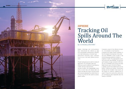
<strong>iSPHERE</strong> | Tracking Oil Spills Around The World<br />
<strong>iSPHERE</strong><br />
Tracking Oil<br />
Spills Around The<br />
World<br />
By: S. K. Woodbury, ACM, FCMOS i<br />
Modern technology and communications<br />
have revolutionized the collection of data<br />
from oceanographic drifting buoys. <strong>iSPHERE</strong>,<br />
an oil spill tracking buoy, is a proven high<br />
performance instrument which customers<br />
trust for use in the harsh offshore environment.<br />
Oil spill tracking buoys are used in a variety of<br />
applications. For contingency planning,<br />
drifters are used to calibrate oil spill trajectory<br />
models. During oil spill exercises,<br />
neutrally buoyant and biodegradable items<br />
such as wood chips and orange peels are<br />
used to simulate the oil spill. During an actual<br />
spill, buoys are deployed from either the air or<br />
a ship or rig. They are also used for oceanographic<br />
studies.<br />
Customers consist of the offshore oil industry<br />
– oil companies, oil spill response<br />
companies and supply vessel companies. In<br />
fact, the largest oil companies in the world<br />
rely upon <strong>iSPHERE</strong> to track oil spills in real<br />
time and develop predictions models on<br />
migration of spills. The oceanographic scientific<br />
community uses <strong>iSPHERE</strong> , as well as oil<br />
spill modelers. A major example in 2010 was<br />
the use of <strong>iSPHERE</strong> buoys during the Deep<br />
Water Horizon spill in the Gulf of Mexico.<br />
In addition, government departments such as<br />
NOAA, Fisheries and Oceans, Environment<br />
Canada and the Canadian Coast Guard use<br />
the product for tracking, modeling and research.<br />
Private firms around the world which<br />
are contracted as early responders also rely<br />
heavily on <strong>iSPHERE</strong>.
<strong>iSPHERE</strong> | Tracking Oil Spills Around The World<br />
Careful design of the buoy hull along with proper ballasting,<br />
to keep the buoy upright with the waterline<br />
at its equator, ensures good buoy performance in<br />
a variety of wind, wave and current conditions. The<br />
spherical shape and weight of the buoy have been<br />
precisely calibrated to ensure that the buoy drifts with<br />
the top layer of the ocean and mimics the motion of<br />
an oil slick.<br />
<strong>iSPHERE</strong>’s designer and manufacturer<br />
MetOcean Data Systems in partnership<br />
with Iridium Value added Reseller, JouBeh<br />
Technologies, has negotiated an exclusive<br />
drifter-lifetime Iridium pricing arrangement<br />
for the delivery of real time data.<br />
A significant feature of <strong>iSPHERE</strong> and one which separates<br />
it from its competition, is the use of the Iridium<br />
satellite network to transmit data from anywhere<br />
in the world within one minute. It is an efficient and<br />
low cost telemetry system and has completely revolutionized<br />
oil spill response. <strong>iSPHERE</strong>’s designer and<br />
manufacturer MetOcean Data Systems in partnership<br />
with Iridium Value added Reseller, JouBeh Technologies,<br />
has negotiated an exclusive drifter-lifetime Iridium<br />
pricing arrangement for the delivery of real time<br />
data. Several different pricing packages are available<br />
including a special pricing plan for emergency stand<br />
by service for oil spill response. This allows the companies<br />
to purchase a large number buoys and keep<br />
them on stand-by ready for immediate deployment.<br />
JouBeh also provides secure on-line web access to<br />
data processing, alarming, storage and mapping.<br />
Iridium is the largest commercial satellite constellation<br />
in the world. There are always at least three satellites<br />
overhead anywhere on the planet. Designed for<br />
use by the military, it is a very robust and dependable<br />
system. Today about 30 percent of Iridium’s business<br />
is the US Department of Defense which uses it for<br />
voice communications and GPS tracking data logistics.<br />
Unlike the ARGOS and GOES satellite systems,<br />
Iridium provides real time two-way communications<br />
to and from the remote device. This bidirectional communication<br />
ability allows the end user to select an<br />
on demand Iridium transmission interval according to<br />
operational requirements. Iridium messages can be<br />
routed to the customer’s ship, company headquarters,<br />
to a cellular phone such as a Blackberry, an Iridium<br />
handset or to any computer. It is a comprehensive<br />
and flexible system.<br />
Scientifically, <strong>iSPHERE</strong> behaves like a maximum leeward<br />
drift object in the water. The force of the wind<br />
against the exposed surface of the buoy causes it to<br />
move through the water in a generally downwind direction.<br />
The resultant motion of the buoy is made up<br />
of the leeway drift and the movement of the upper<br />
layer of the ocean caused by the surface currents.<br />
<strong>iSPHERE</strong> has been shown to drift in the direction of<br />
the oil slick closest to the ocean’s surface.<br />
James Dempsey is an oil spill response consultant<br />
and the president of Cormorant Ltd in St. John’s Newfoundland,<br />
a company which provides marine environmental<br />
services. He has used several generations of<br />
drift buoys over the past 25 years and is a strong supporter<br />
of the product. <strong>iSPHERE</strong> is a “reliable, Canadian<br />
made tool, which has the right combination of drift<br />
and windage to represent ocean surface conditions.<br />
There are not a lot of instruments that can do that.”<br />
Furthermore, he is most impressed that JouBeh has<br />
assumed the task of data collection, processing and<br />
quality control and makes the data available to its customers<br />
on the web from its in-house data centre. The<br />
data can be mapped to Google Earth.<br />
<strong>iSPHERE</strong> is a low cost expendable Lagrangian drifter<br />
with a state-of-the-art data acquisition system which<br />
collects real-time sea surface temperature data with<br />
an accurate thermistor as well as GPS positional data.<br />
The boy’s position is transmitted as part of the Iridium<br />
message. During critical operations the sampling rate<br />
can be increased to send vital data to the user. For<br />
example, transmissions every 30 minutes can be altered<br />
to every 15 minutes. It is user-friendly and easy<br />
for one person to operate. It is turned on by the removal<br />
of a magnet.<br />
<strong>iSPHERE</strong> is a low cost expendable<br />
Lagrangian drifter with a stateof-the-art<br />
data acquisition system<br />
which collects real-time sea surface<br />
temperature data with an accurate<br />
thermistor as well as GPS<br />
positional data.<br />
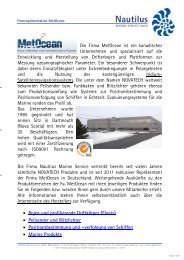
The buoy is designed by MetOcean Data Systems, a<br />
Canadian manufacturing and development firm based<br />
in Dartmouth, Nova Scotia. They are data collection<br />
and communication experts who are world leaders in<br />
the design and manufacture of air- and ship-deployed<br />
drifting buoys.<br />
References:<br />
Argosphere -<br />
http://www.metocean.com/product_sheet/argosphere.pdf<br />
Goodman, R.H., D. Simecek-Beatty and D.<br />
Hogkins, 1995. In: Proceedings 1995<br />
International Oil Spill Conference (Achieving and<br />
Maintaining Preparedness). February<br />
27 – March 2, 1995, Long Beach, California.<br />
American Petroleum Institute publication<br />
No. 4620. pp3-8.<br />
Iridium Satellite LLC<br />
http://www.iridium.com<br />
Iridium NEXT<br />
http://www.iridium.com/about/next.php<br />
JouBeh Technologies Inc.<br />
http://www.joubeh.com<br />
MetOcean Data Systems Inc.<br />
http://www.metocean.com<br />
Simecek-Beatty, D. W, J. Lehr, W.R. Johnson,<br />
and J.M. Price, 1997. Barge Buffalo 292:<br />
Observations of Satellite-Tracked Surface Drifter.<br />
1997 International Oil Spill Conference.<br />
Smith, P.C., 1992. Validation procedures for Oil<br />
Spill Trajectory Models, Canadian Technical Report<br />
of Hydrography and Ocean Sciences 140.<br />
Proceedings of Ocean Model Workshop, January<br />
14 – 17, 1992, Bedford Institute of Oceanography.<br />
iWoodbury Management Solutions Inc.,<br />
Halifax, NS