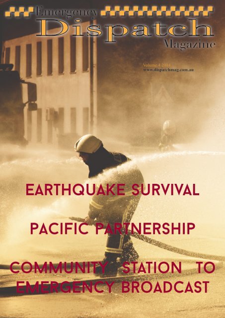
Emergency Dispatch Vol 4 2014

Create successful ePaper yourself
Turn your PDF publications into a flip-book with our unique Google optimized e-Paper software.
<strong>Vol</strong>ume.4 <strong>2014</strong><br />
www.dispatchmag.com.au<br />
Earthquake Survival<br />
pacific partnership<br />
Community Station To<br />
emergency Broadcast
Contents<br />
Australian Red Cross Role In Haiti Relief<br />
How Safe Is Your Home<br />
Floods,Foods & More Floods<br />
Airtanker Arrives In Victoria<br />
What Is A Fire whirl<br />
Severe Thunder Storms - Facts, Warnings & Protection<br />
Surviving A Tsunami<br />
The Australian Warning systems swings into operation<br />
Cyclone Hazards & Disasters<br />
Earthquake Survival<br />
Pacific Partnership<br />
Community Station To <strong>Emergency</strong> Broadcast<br />
Pg 2<br />
Pg5<br />
Pg6<br />
Pg8<br />
Pg9<br />
Pg10<br />
Pg14<br />
Pg16<br />
Pg18<br />
Pg20<br />
Pg22<br />
Pg24<br />
<strong>Emergency</strong> <strong>Dispatch</strong> Magazine does not promote itself<br />
as a charity or fund raising institution, nor solicit on<br />
behalf or charites and is no way financially supported by<br />
or associated with any government or similar institution.<br />
Copies will be circulated via to a database of interested<br />
parties including business, sponsors,community centres<br />
and small business organisations.<br />
A digital eMag version of this publication<br />
is available for view from the <strong>Emergency</strong><br />
<strong>Dispatch</strong> Magazine website. All infomation<br />
is published in the <strong>Emergency</strong> <strong>Dispatch</strong><br />
Magazine in good faith and whilst every effort<br />
is made to ensure that the publication is free<br />
of error and obmission, no responsibility<br />
or liability will be accepted by Searchlight<br />
Meadia Pty Ltd.<br />
Level 26<br />
44 Market Street<br />
Sydney NSW 2000<br />
ABN: 24 158 831 111<br />
Ph: 02 8252 0859<br />
Fax: 02 8458 5374<br />
Email: contact@dispatchmag.com.au<br />
Website: www.dispatchmag.com.au
AUSTRLIAN<br />
RED CROSS<br />
ROLE IN HAITI<br />
RELIEF<br />
2<br />
The impact of the 12 January earthquake off<br />
the coast of Haiti has left even veteran disaster<br />
responders stunned. The magnitude-7.3<br />
earthquake – the biggest to hit Haiti for 200 years<br />
may have left as many as 200,000 people dead<br />
and more than a million homeless.<br />
The quake leveled urban landscapes in parts<br />
of the country’s capital Port-au-Prince and<br />
surrounding suburbs and towns, leaving homes,<br />
businesses, banks, parks, marketplaces and<br />
schools in ruins.<br />
With an epicentre only 15 kilometres from Port-au<br />
Prince – hub of a centralised administration the<br />
earthquake struck at the heart of the country.<br />
It caused major damage to the seaport, airport<br />
and roads, destroyed parliament and ministry<br />
buildings, closed hospitals and crippled the city’s<br />
telecommunications, water and electricity<br />
supply.<br />
The devastation caused by the earthquake has<br />
generated one of the largest humanitarian<br />
responses ever carried out in a single country. For<br />
the global Red Cross network, currently playing<br />
a key role in the emergency response, it is fast<br />
becoming one of the largest and most complex<br />
operations in recent memory.<br />
Background on Haiti<br />
The earthquake compounded pre-existing<br />
difficult living conditions in Haiti. Ranked 149<br />
on the Human Development Index, 80 per cent<br />
of Haiti’s 8.7 million inhabitants were living in<br />
poverty prior to 12 January 2010, with half of the<br />
population subsisting on less than $1 a day.<br />
Alongside poverty, the country’s deeper<br />
problems included political and social instability<br />
with an economy in ruins, chronic unemployment,<br />
overwhelming challenges in health, as well<br />
as severe deforestation and environmental<br />
degradation that undermined farming, inflated<br />
food prices, and left the country vulnerable to<br />
flooding.<br />
As Tadateru Konoé, president of the International<br />
Federation of Red Cross and Red Crescent<br />
Societies (IFRC), observed of relief efforts in the<br />
aftermath of the earthquake: ‘We must confront<br />
a natural disaster that is not only one of the<br />
biggest of the past decade, but is affecting one<br />
of the very poorest countries in the world’. The<br />
Haiti earthquake left people in need of more than<br />
simple recovery.<br />
In the aftermath<br />
As part of its global approach to disaster<br />
preparedness and management, the Red Cross<br />
movement is led by its local society in a disaster<br />
zone. Local Red Cross staff and volunteers are<br />
usually already involved in relief efforts before<br />
international assistance arrives. They are familiar<br />
with the communities and context in which
3<br />
they are working and ensure that additional<br />
assistance is needed and appropriate. Only<br />
moments after the earthquake struck on 12<br />
January, Haitian Red Cross volunteers – many<br />
of whom were also left homeless and grieving,<br />
lost or missing loved ones – began to assess<br />
the impact and administer first aid to the injured.<br />
Prepositioned stores of relief items in Port-au-<br />
Prince provided an immediate source of aid to<br />
approximately 3,000 families. Items included<br />
blankets, hygiene kits, tarpaulins and containers<br />
for storing drinking water.<br />
A local contribution<br />
Australian Red Cross immediately offered its<br />
support and assistance as part of the global Red<br />
Cross response. Within hours of hearing news<br />
of the disaster, the organization established<br />
a national appeal through which Australians<br />
could contribute to Red Cross relief and recovery<br />
efforts. To date, more than $7 million has been<br />
donated by the Australian public, businesses<br />
and government. Australian aid workers, trained<br />
and experienced in disaster response, were<br />
immediately put on standby as Australian Red<br />
Cross awaited requests for resources from staff<br />
in the field.<br />
The first Australian Red Cross aid worker, a<br />
specialist in public health, travelled to Haiti six<br />
days after the earthquake. He complemented<br />
a team of Japanese Red Cross medical staff<br />
tending to the injured out of a temporary basic<br />
health care unit set up in a suburb outside Portau-Prince.<br />
Also pre-positioned were funds held by IFRC.<br />
Within hours of the earthquake, IFRC had released<br />
money from its disaster relief emergency<br />
fund to cover the purchase and transfer of<br />
additional relief supplies, including food and<br />
water from neighbouring Dominican Republic.<br />
An international appeal for funds to support<br />
response and recovery work soon followed.<br />
Key needs in the emergency relief phase<br />
included search and rescue, identification<br />
and management of dead bodies, medical<br />
assistance and the distribution of immediate<br />
relief items including food, clothing, water, shelter<br />
and sanitation. Shelter and sanitation continue to<br />
remain priorities.<br />
Since then, fourteen Australian aid workers have<br />
travelled to Haiti; eight nurses, a midwife, a GP<br />
and three experts in shelter and a public health<br />
specialist. The medical teams are working with<br />
colleagues from across the world in a German<br />
Red Cross field hospital. One shelter specialist<br />
has joined the committee of 26 organisations<br />
overseeing the coordination of shelter activities<br />
(Red Cross has taken on the role of lead<br />
organisation on shelter), while the other two have<br />
joined Finnish Red Cross workers erecting tents<br />
and tarpaulins in attempts to provide people with<br />
emergency shelter.<br />
Australian Red Cross has also contributed<br />
aid supplies, redirecting to Haiti a stock<br />
replenishment en route to its storage warehouse<br />
in Kuala Lumpur.
4<br />
Current focus<br />
Although the humanitarian situation continues to<br />
improveon a daily basis, it is clear there are major<br />
unmet needs, particularly in terms of shelter and<br />
sanitation.<br />
In the capital, tens of thousands of people are<br />
struggling in hundreds of makeshift camps. With<br />
the rainy season due to begin in May and the<br />
hurricane season in June, the situation is made<br />
more critical.<br />
While the delivery and distribution of tents and<br />
shelter materials is being sped up, with more than<br />
75 per cent of the displaced population having<br />
received shelter to date, the operation is severely<br />
constrained by the preexisting shortage of land<br />
for new settlement. Work continues with Haitian<br />
authorities to identify additional appropriate sites<br />
for displaced people.<br />
Of equal concern, Port-au-Prince was left without<br />
sanitation. So far more than 1200 latrines have<br />
been built in 20 different improvised camps,<br />
however more needs to be done before the rains<br />
hit.<br />
Aid workers are well aware that if conditions<br />
worsen, so too will the risk of potential epidemics<br />
of water-borne disease.<br />
Looking ahead<br />
The recovery process will take years – perhaps<br />
even a generation – however aid workers are<br />
looking at this response as a rare opportunity to<br />
effect large-scale change where it is desperately<br />
needed.<br />
Red Cross is committed to ensuring that Haiti’s<br />
devastated communities receive not only the<br />
help they need now, but the help they will need<br />
for a long while to come, with disaster response<br />
units now routinely including recovery experts<br />
to ensure community needs are understood<br />
and planned for. In addition, all work being<br />
undertaken by international aid workers is done<br />
in cooperation with Haitian Red Cross, with<br />
capacity development of the local society an<br />
ongoing focus for the global effort.<br />
Longer term planning of recovery activities is well<br />
underway and will form the base upon which<br />
work will be implemented in the future.
HOW SAFE IS YOUR<br />
HOME?<br />
DCS employees and volunteers are being<br />
encouraged to lead by example and sign up for<br />
a free QFRS Safehome fire safety check. QFRS’s<br />
flagship community relations program, Safehome<br />
is designed to protect lives and property by<br />
educating householders about the fire risks that<br />
can exist in their homes. The free service<br />
is available to all Queenslanders and involves<br />
a visit from QFRS firefighters, who will assist<br />
householders to conduct a fire and safety audit<br />
of their home or unit. Once the hazards are<br />
identified, the householder is given advice to<br />
reduce or eliminate the risks.<br />
As part of the service, firefighters will advise on<br />
safety issues including:<br />
• Effective positioning, installation and<br />
maintenance of smoke alarms;<br />
• Avoiding kitchen fires, which are the main<br />
source of home and unit fires in Queensland;<br />
• Safe storage of chemicals;<br />
• Using power boards and electrical<br />
appliances safely, and;<br />
• Reducing the fire load in, under and around<br />
dwellings.<br />
During the visit firefighters will also provide<br />
householders with a free Safehome kit which<br />
includes a safety checklist, a manual for drawing<br />
up a fire escape plan, and information about first<br />
aid and natural hazards such as storms, lightning<br />
and cyclones.<br />
Safehome visits take about 45 minutes, and can<br />
be arranged outside standard working hours.<br />
The program is proudly sponsored by NRMA<br />
Insurance.<br />
In areas serviced by volunteer rural firefighters,<br />
home visits may not be made. Instead, a<br />
Safehome kit, including a safety checklist, may<br />
be posted together with a Bushfire Preparedness<br />
Kit and a letter providing information about the<br />
nearest fire station.<br />
Assistant Commissioner Mark Roche, of QFRS<br />
Community Safety and Training, said the<br />
Safehome program helped householders identify<br />
and deal with potential domestic fire and safety<br />
hazards.<br />
‘Our homes are not immune to these hazards,<br />
and DCS staff are in an ideal position to take<br />
advantage of the Safehome visits and set an<br />
example for other members of the community to<br />
follow,’ Mark said. ‘We strongly encourage staff<br />
to make their own Safehome booking, and to<br />
recommend this free service to family members,<br />
friends and neighbours throughout Queensland.<br />
‘It doesn’t matter if the householder is an owneroccupier<br />
or a tenant, they can still arrange for a<br />
Safehome visit.’
6<br />
FLOODS, FOODS AND<br />
MORE FLOODS!<br />
March 2010 will go down in the history books as<br />
the time of one of the most extreme<br />
flooding events ever experienced in south-west<br />
Queensland.<br />
In early March a monsoonal low-pressure<br />
system caused prolonged heavy rainfall<br />
resulting in widespread flooding across the<br />
region, isolating communities and leaving more<br />
than 1000 homes and businesses inundated.<br />
The response effort coordinated by Local and<br />
District Disaster Management Groups assisted<br />
by EMQ’s State Disaster Coordination Centre<br />
was remarkable, involving hundreds of people<br />
working extended hours to ensure the safety of<br />
those affected.<br />
EMQ Acting Chief Officer Bruce Grady said this<br />
once-in-a-lifetime flooding event demonstrated<br />
the strong relationships between government<br />
agencies, local councils and members of the<br />
community.<br />
‘Local Disaster Management Groups in the<br />
affected areas were in force from day one<br />
preparing for the worst but hoping for the best,’<br />
Mr Grady said.<br />
‘Communities were warned of the potential<br />
impact and contingency plans were put in place<br />
to ensure ample support was provided during<br />
this time of need.<br />
The community resilience and spirit shone<br />
across each of the western towns, with everyone<br />
pooling together to care for evacuees and assist<br />
with sandbagging and clean up operations.<br />
‘EMQ continues to work together in conjunction<br />
with Local Disaster Management Groups to<br />
provide essential supplies to affected residents.’<br />
The 132 500 SES hotline received more than 950<br />
calls for assistance during the flooding event.<br />
The State Government declared a disaster<br />
situation for Charleville on 2 March after Bradleys<br />
Gully, a creek that runs through the
7<br />
town, rose significantly, breaking its banks and<br />
causing localised flooding. Shortly after, a disaster<br />
situation was also declared for the Murweh<br />
and Balonne Local Government areas.<br />
SES and QFRS personnel helped to evacuate<br />
people from their homes across both Charleville<br />
and Roma. Two-thirds of the town of Charleville<br />
experienced inundation and more than 500 people<br />
moved from their homes to higher ground.<br />
Many chose to take shelter at the showgrounds<br />
where an evacuation centre managed by the Red<br />
Cross was established.<br />
In Roma about 200 people relocated from their<br />
homes, while aircraft were tasked to rescue people<br />
from flooded outlying properties. In some<br />
cases, residents were stranded on the roofs of<br />
their homes. Medical evacuations took place and<br />
resupply operations were coordinated for the<br />
days that followed. Trucks, planes and helicopters<br />
stacked with food supplies streamed into the<br />
flooded towns.<br />
A taskforce of more than 100 SES volunteers was<br />
deployed from south-east Queensland to assist<br />
with both floodboat and clean up operations<br />
across the isolated communities.<br />
The QFRS deployed several Swiftwater Rescue<br />
personnel to St George, Roma and Charleville,<br />
while a Strike Team of 12 firefighters went to<br />
Charleville to assist with clean up operations<br />
that began with the nursing headquarters at the<br />
hospital. Upon arriving in Charleville, the team of<br />
12 firefighters witnessed the selfless community<br />
spirit first-hand. A local motel owner ripped up<br />
the wet<br />
carpet from the rooms, swept away debris and<br />
made up beds for them to sleep in, despite being<br />
knee-deep in floodwater just days before.<br />
The flood threat moved south to St George a few<br />
days later with a record peak of 14m predicted for<br />
the Balonne River on 6 March.<br />
<strong>Emergency</strong> services were ready for the threat,<br />
with preparations already in place to accommodate<br />
half of St George’s 3000 residents in an<br />
emergency shelter at the local showgrounds.<br />
More than 4000 sandbags were also flown in<br />
to St George before the surge. As the river rose<br />
evacuations began across the town, but on the<br />
day of the expected peak there was relief across<br />
the community as the Balonne River reached a<br />
record 13.5m causing no further<br />
inundation to homes.<br />
While the flood clean up will continue in the<br />
months to come, the deluge has had a positive<br />
effect. It has been many months since the state’s<br />
south-west west was clad in such a dark shade<br />
of green, with the rain filling dams and creating a<br />
silver lining for many farmers.
8<br />
AIRTANKER ARRIVES<br />
IN VICTORIA<br />
The first operational trial of the very large<br />
airtanker took place in Victoria this bush fire<br />
season.<br />
The VLAT was based at the Avalon Airport<br />
in Victoria from December 2009 and was<br />
available for operational use until March 2010. It<br />
is the first trial of the large water-bombing plane<br />
in Australia.<br />
The Bushfire CRC will evaluate the operational<br />
trial and will prepare a series of reports on the<br />
airtanker by mid 2010. The airtanker has the<br />
capacity to drop approximately 45,000 litres of<br />
water or 42,000 litres of fire retardant - up to five<br />
times the amount of the high-volume helicopters<br />
such as Elvis and Isabelle. Its volume is 15 times<br />
the amount of our largest fixedwing bombers.<br />
The plane can land, refuel, reload and be ready<br />
to take-off again in approximately 30 minutes,<br />
depending on circumstances. It is likely to have a<br />
minimum flying altitude of 300ft and its minimum<br />
speed is approximately 150 knots. CEO of the<br />
Bushfire CRC, Gary Morgan said the trial will<br />
assess the effectiveness of the VLAT in Australian<br />
conditions.<br />
“The Bushfire CRC will bring its broad expertise<br />
to the trial of this very large aircraft and will share<br />
the outcomes with firefighting agencies around<br />
Australia and internationally,” said Mr Morgan.<br />
The Bushfire CRC researchers are from the CSIRO<br />
and from Australian firefighting agencies,<br />
who will work closely with the U.S. aircraft crews.<br />
An S76 helicopter from Canada accompanied<br />
the researchers in their task. “This helicopter is a<br />
vital part of the trial because it has the speed and<br />
responsiveness to keep pace with the DC-10 and<br />
it is equipped with all the necessary monitoring<br />
equipment to ensure that each aerial drop can be<br />
properly assessed,” he said.<br />
Leased by the National Aerial Firefighting Centre<br />
(NAFC) and funded by the Victorian State<br />
Government, the DC-10 was the largest aircraft<br />
ever to be used in aerial firefighting in Australia.<br />
The airtanker can be used to build retardant lines<br />
in remote areas and to provide fire suppression<br />
on the flanks of bush fires. There has also been<br />
extensive trialling in non-operational situations<br />
in landscapes unique to Australia such as dense<br />
eucalyptus forest, grass fuels, flat terrain, hilly<br />
terrain and with a range of payloads (water,<br />
retardant).
WHAT<br />
IS A<br />
FIRE<br />
WHIRL?<br />
A fire whirl, also known as<br />
a fire devil or fire tornado,<br />
is a rare phenomenon in<br />
which a fire, under certain<br />
conditions (depending on<br />
air temperature and currents)<br />
acquires a vertical<br />
vorticity and forms a whirl,<br />
or tornado-like vertically<br />
oriented rotating column<br />
of air. Fire whirls may be<br />
whirlwinds separated from<br />
the flames, either within<br />
the burn area or outside it,<br />
or a vortex of flame, itself.<br />
A fire whirl can make the<br />
fire more dangerous as it<br />
encourages the fire to spot.
14<br />
SURVIVING A TSUNAMI<br />
Thai Police Patrol Boats prepare for impact. / Thailand 2004<br />
A tsunami is a series of fast, low and long ocean<br />
waves, that move out from a central area, due to<br />
a sudden disturbance of a large body of water.<br />
In the past, tsunami have been known as tidal<br />
waves but this is not correct as tsunami are not<br />
caused by tides.<br />
Tsunami (pronounced soo-nah-mee) is a<br />
Japanese word meaning ‘harbour wave’. It<br />
came from an old story about some Japanese<br />
fishermen who, when out in the deep ocean, did<br />
not notice a tsunami travelling underneath them.<br />
When they arrived back at port they found the<br />
harbour<br />
destroyed.<br />
In the deep ocean a tsunami can travel up to<br />
950km/hr, the speed of an aeroplane and may<br />
be less than one metre high. This is why the<br />
Japanese fishermen did not notice the tsunami<br />
in the deep ocean. Tsunami wavelengths are<br />
extremely long with hundreds of kilometres<br />
between wave crests in the deep ocean.<br />
movement of water allthe way to the sea floor.<br />
The most common cause of tsunami is large,<br />
undersea earthquakes that occur along the<br />
boundaries of the Earth’s tectonic plates. As<br />
the plates move, stress slowly builds up over<br />
hundreds, or even thousands, of years along<br />
geological structures known as faults.<br />
During an earthquake the stress along these<br />
faults can be released within a matter of seconds.<br />
This causes a sudden movement of the sea floor<br />
which disturbs the ocean above. The affected<br />
ocean then spreads out from the location of the<br />
earthquake as a tsunami.<br />
Although undersea earthquakes are the most<br />
common cause of tsunami, they can also be<br />
caused by volcanic eruptions, landslides and<br />
even asteroid impact in or near the ocean.<br />
As tsunami approach the coastline they slow<br />
down but do not lose energy. The back of the<br />
wave catches up with the front, causing the<br />
wave to grow in height – up to several metres. It<br />
is not so much this movement of water but the<br />
energy moving through it that makes tsunami so<br />
dangerous.<br />
Tsunami are different from normal waves you see<br />
at the beach. With a normal wind swell wave, it is<br />
only the water on top of the ocean that is moving.<br />
In contrast, the passage of tsunami involves the
15<br />
The natural warning<br />
signs of tsunami<br />
In Australia you will most likely receive an official<br />
tsunami warning. However, before a tsunami<br />
arrives you may, but not always, experience some<br />
natural warning signs.<br />
You may:<br />
• FEEL the earth shake. If you are near the<br />
ocean and you feel the ground shake, a strong<br />
earthquake may have occurred and possibly<br />
caused a tsunami. However, you may not feel<br />
the earth shake if the earthquake occurred a long<br />
way away.<br />
English school girl saves<br />
100 lives<br />
In December 2004, 10-year-old English<br />
schoolgirl, Tilly Smith was enjoying a family<br />
holiday on the coast of Thailand. On the<br />
morning of 26 December, her family were<br />
enjoying a walk on the beach when Tilly<br />
noticed the ocean drop dramatically. It then<br />
returned rapidly covered in froth, which she<br />
described as looking like the top of a beer. As<br />
the ocean moved quickly towards the beach,<br />
Tilly knew a tsunami was approaching having<br />
learned about tsunami in a geography lesson<br />
a couple of weeks earlier. She raised the alarm<br />
and the beach was cleared, saving 100 lives.<br />
• SEE the ocean drop. Before a tsunami arrives,<br />
the ocean level may (but not always) drop<br />
dramatically before returning as a wall of water.<br />
If you notice that the water is disappearing, tell<br />
your family and friends and prepare to move to<br />
higher ground.<br />
• HEAR an unusual roaring sound. If you hear a<br />
loud roaring sound from the ocean (a bit like an<br />
aeroplane or a train), tell your family and friends.<br />
This sound may be heard before a tsunami<br />
arrives.<br />
Will tsunami occur in Australia?<br />
While the risk from tsunami is lower in Australia<br />
than other parts of the world, tsunami do have<br />
an effect on our coastline. Even with relatively<br />
small tsunami, there could be strong waves, rips<br />
and currents and unusual sea levels that can be<br />
dangerous.<br />
On 17 July 2006, campers at Steep Point on the<br />
Western Australian coast were lucky to escape<br />
when a tsunami hit their campsite. It was strong<br />
enough to pick up their 4WD vehicle and move it<br />
10 metres up the beach.<br />
They were alerted to the tsunami by a loud roar<br />
from the ocean, which is one of the natural<br />
warning signs of tsunami.
16<br />
THE AuSTRALIAN<br />
TSuNAMI WARNING<br />
SYSTEM SWINGS<br />
INTO OPERATION<br />
Since the Indian Ocean Tsunami in December<br />
2004, a number of countries around the world,<br />
including Australia, have increased their efforts<br />
to monitor, plan and warn for tsunami. The<br />
Australian Government, through the Bureau of<br />
Meteorology (the Bureau), Geoscience Australia<br />
(GA), and the Attorney-General’s Department,<br />
(AGD) has been working with State and Territory<br />
governments and other relevant agencies to<br />
develop the Australian Tsunami Warning System<br />
(ATWS).<br />
Bondi Beach is closed due to Tsunami warning, which alot<br />
of people ignored, caused by the earthquake in Chile 2010<br />
in Australia’s security and has the real potential<br />
to save lives and infrastructure.<br />
The role of GA within the JATWC is to detect<br />
potentially tsunamigenic earthquakes in the<br />
Indian Ocean, Pacific Ocean and Southern Ocean,<br />
and advise the Bureau of this potential within 15<br />
minutes of the earthquake occurring. GA also<br />
undertake tsunami risk studies to assist local<br />
and State organisations in planning for tsunami<br />
events.<br />
The Joint Australian Tsunami Warning Centre<br />
(JATWC) is jointly operated by the Bureau and<br />
GA. Based in Melbourne and Canberra, it was<br />
established in July 2007 so that Australia has<br />
the independent capability to detect, monitor,<br />
verify and warn the community of the existence<br />
of tsunami in our region and possible threats to<br />
Australian coastal locations and offshore islands.<br />
The Bureau and GA are building on their combined<br />
expertise in the relevant science and technology<br />
areas including seismic and sea-level monitoring<br />
and a warning systems to provide 24/7 tsunami<br />
monitoring and analysis capacity for Australia.<br />
The centre boasts world class scientific<br />
technology with the expressed aim of providing<br />
the longest lead time of any potential tsunami<br />
threat. The major objective of the JATWC is to<br />
provide emergency managers with a minimum of<br />
90 minutes warning of a likely tsunami impact on<br />
Australia. The Centre is a long-term investment<br />
The Bureau’s role is to use its network of sealevel<br />
monitoring equipment including coastal<br />
sea-level gauges, deep-ocean tsunami detection<br />
buoys and tsunami computer models to confirm<br />
the existence of a tsunami and estimate its likely<br />
intensity at the Australian coast. The second<br />
part of the Bureau’s role is to issue the relevant<br />
tsunami warnings and bulletins for Australia<br />
(including islands and territories) as required.
Media organisations across Australia work with<br />
the Bureau to inform the public in case of a<br />
tsunami event. Tsunami bulletins and warning<br />
distribution lists are maintained at each of the<br />
Bureau’s State and Territory Regional Forecasting<br />
Centres.<br />
These distribution lists are used for both National<br />
JATWC Bulletins and Regional Warnings. In<br />
addition to the media, key agencies such as the<br />
State and Territory emergency services, local<br />
councils, port authorities and police are included<br />
on these dissemination lists. The bulletin and<br />
warning messages are also automatically<br />
uploaded to the Bureau’s website.<br />
GA operates an enhanced network of seismic<br />
stations nationally and has access to data from<br />
international monitoring networks. It advises the<br />
Bureau and AGD of the magnitude, location and<br />
characteristics of a seismic event which has the<br />
potential to generate a tsunami.<br />
Based on this seismic information from GA, as well<br />
as advisories from the Pacific Tsunami Warning<br />
Centre (PTWC) in Hawaii, and from neighbouring<br />
countries with tsunami detecting capacity, the<br />
Bureau runs a tsunami model to generate a first<br />
estimate of the tsunami size, arrival time and<br />
potential impact locations. They then verify the<br />
existence of a tsunami using information from an<br />
enhanced sea level monitoring network.<br />
The Bureau then promulgates advice and<br />
warnings on any possible tsunami threat to<br />
State emergency management services, media<br />
and the public. AGD liaises with the operations<br />
centres of affected State and Territory emergency<br />
management organisations and coordinates<br />
Federal assistance as required. AGD also has<br />
responsibility for improving public awareness<br />
and preparedness for tsunami in Australia.<br />
In order to assist the community, tsunami<br />
threat levels in regional tsunami warnings<br />
are categorised into three levels with required<br />
community responses. These have been<br />
determined in consultation with emergency<br />
management authorities. These threat levels<br />
will be specified for the same coastal areas<br />
that are used for routine Bureau Coastal Waters<br />
Forecasts, already known to marine users.<br />
NO THREAT<br />
An undersea earthquake has been detected,<br />
however it has not generated a tsunami or the<br />
tsunami poses no threat to Australia and its<br />
offshore territories.<br />
MARINE AND IMMEDIATE FORESHORE<br />
THREAT<br />
Warning of potentially dangerous waves, strong<br />
ocean currents in the marine environment and<br />
the possibility of only some localised overflow<br />
onto the immediate foreshore.<br />
LAND INUNDATION THREAT<br />
Warning for low-lying coastal areas of major<br />
land inundation, flooding, dangerous waves and<br />
strong ocean currents.<br />
When the main threat has passed or if a tsunami<br />
didn’t eventuate, the Bureau will issue a Tsunami<br />
Watch Cancellation or Tsunami Warning<br />
Cancellation. The relevant State or Territory<br />
emergency authority will inform the public when<br />
it is safe to return to the affected areas.<br />
For latest tsunami warnings call (130 0878 6264)<br />
or visit the Bureau of Meteorology website at<br />
www.bom.gov.au<br />
17
18<br />
Cyclone<br />
Hazards & Disasters<br />
Tropical cyclones are low pressure systems in<br />
the tropics that, in the southern hemisphere, have<br />
well-defined clockwise wind circulations with<br />
a region surrounding the centre with gale force<br />
winds.<br />
The gale force winds can extend hundreds<br />
of kilometres from the cyclone centre. If the<br />
sustained winds around the centre reach 119<br />
kilometres per hour, the system is called a<br />
severe tropical cyclone. These are referred to<br />
as hurricanes in North America and typhoons in<br />
Asia.<br />
Cyclone Season and Effects<br />
The tropical cyclone season in Australia<br />
extends from November to April. Cyclones<br />
generally affect coastal areas north of<br />
Perth along the Western Australia and Northern<br />
Territory coasts, most of the Queensland coast<br />
and occasionally the far northern New South<br />
Wales coast. The greatest threat lies north of the<br />
Tropic of Capricorn.<br />
FREQUENCY.<br />
Cyclones occur frequently in the southern<br />
hemisphere, with an average of 10 per year<br />
being tracked by the Bureau of Meteorology in<br />
the Australian region. Cyclones in the Indian and<br />
Pacific Oceans are also closely monitored in<br />
case they threaten Australian islands or nearby<br />
countries.<br />
SEVERITY CATEGORIES.<br />
The severity of tropical cyclones is described in<br />
terms of categories between 1 and 5 related to<br />
the zone of maximum winds. These range from<br />
Category 1 (strongest wind gusts less than 125<br />
km/h), through Category 2 (125–169 km/h),<br />
Category 3 (170–224 km/h), Category 4 (225–<br />
279 km/h), to Category 5 for the most severe<br />
cyclones (wind gusts more than 280 km/h).<br />
EFFECTS.<br />
Cyclones approach from the sea and bring<br />
torrential rains, extreme winds and sometimes<br />
storm surges. Damage varies widely depending<br />
on the path, but can include buildings, crops and<br />
boats at sea. Most deaths from cyclones occur<br />
as a result of drowning (both at sea and during<br />
floods), collapsed buildings, or debris which<br />
becomes lethal projectiles carried by the extreme<br />
winds.
19<br />
The Birth and Anatomy of a Cyclone<br />
Tropical cyclones derive their energy from warm<br />
tropical oceans and do not form unless the<br />
sea-surface temperature is above 26.5°C; once<br />
formed, they can persist over lower sea-surface<br />
temperatures. Tropical cyclones can persist for<br />
many days and may follow quite erratic paths.<br />
They usually dissipate over land or colder oceans.<br />
If conditions are right, an ordinary tropical<br />
depression, or low, can develop into a tropical<br />
cyclone. In the southern hemisphere, in a low<br />
the winds spiral in a clockwise direction towards<br />
its centre, where they rise and spill over in an<br />
outward flow at high altitude. Summer heat on<br />
the warm ocean evaporates water, creating a<br />
deep layer of moist air. The uplift of this moist air<br />
in the centre of a low cools it, causing the intense<br />
rain characteristic of tropical cyclones. Higher<br />
in the upper levels the rising air spirals outward,<br />
removing air faster than it flows in, resulting in a<br />
fall in barometric pressure.<br />
The Central ‘Eye’<br />
The circular eye or centre of a tropical cyclone<br />
is an area characterised by light winds and<br />
often byclear skies. Eye diameters are typically<br />
40 kilometres, but can range from under 10<br />
kilometres to over 100 kilometres. The eye is<br />
surrounded by a dense ring of cloud about 16<br />
kilometres high known as the eye wall which<br />
marks the belt of strongest winds and heaviest<br />
rainfall.<br />
Cyclone Behaviour and Warning Time<br />
Tropical cyclones in the Australian region have<br />
more erratic tracks than those in other parts of<br />
the world. Cyclones may exist for a few days,<br />
to over three weeks. They may move forward,<br />
double-back, stay motionless for periods or<br />
move in circles, and therefore need to be tracked<br />
carefully by weather observers. If they reach land,<br />
the friction of the earth and the loss of sustaining<br />
heat energy from the ocean cause cyclones to<br />
‘fill’ and drop most of their rain. Cyclones move<br />
at 15–25 kilometres per hour, so there is usually<br />
sufficient warning time to prepare for their onset.<br />
It is important for people in cyclone areas<br />
to remember that during the passage of the<br />
cyclone centre or eye there will be a temporary<br />
lull in the wind, but that this will soon be replaced<br />
by destructive winds from another direction.<br />
Key Points in the case of a Cyclone<br />
• Know your community cyclone plan, and how<br />
the cyclone warning system works<br />
• Have a portable radio and torch with spare<br />
batteries<br />
• Check your house is in good condition,<br />
particularly the roof, and trim tree branches<br />
clear of your house.<br />
• Clear property of loose items likely to cause<br />
damage in high winds.<br />
• Create an emergency kit of tinned food,<br />
water containers, emergency lighting, first aid<br />
kit, medicines, tape and plastic bags.<br />
• Listen to your local radio or TV for further<br />
warnings.<br />
• Board or tape windows, store loose articles<br />
inside, lock up pets, fill water containers, fuel<br />
car and place under cover.<br />
• Switch off electricity, gas etc.<br />
• Stay inside and shelter in strongest part of the<br />
house (e.g. bathroom or cellar)<br />
• Protect yourself with mattress, blankets etc.<br />
and anchor yourself to a strong fixture (such<br />
as water pipes) or get under a strong table.<br />
• Beware the calm ‘eye’. Remain indoors until<br />
advised that the cyclone has passed.<br />
• Don’t go outside until advised officially that<br />
the cyclone has passed.<br />
• Beware of fallen powerlines, damaged<br />
buildings, trees and flooded watercourses.
20<br />
Earthquake<br />
Survival<br />
Earthquakes are a shaking or trembling of the<br />
Earth’s crust caused by the release of huge<br />
stresses due to underground volcanic forces,<br />
the breaking of rock beneath the surface, or by<br />
sudden movement along an existing fault line.<br />
The latter type results from constant gradual<br />
movement of the tectonic plates that make up<br />
Earth’s crust, which causes stress to build up<br />
in rock layers. Small earthquakes sometimes<br />
result from human activity (e.g. filling of large<br />
reservoirs).<br />
Characteristics and Measurement<br />
Earthquakes are unpredictable and strike without<br />
warning. They range in strength from slight<br />
tremors to great shocks lasting from a few<br />
seconds to as long as five minutes. They can<br />
occur in a series over a period of several days.<br />
Energy released by (or magnitude of) an<br />
earthquake is recorded on a seismograph, using<br />
the Richter scale. This scale is open ended, as<br />
there is no upper limit to the amount of energy<br />
an earthquake might release. The most severe<br />
earthquakes so far have not exceeded 9.5 on<br />
this scale. It is not a simple arithmetic scale; for<br />
instance, a magnitude 7.0 earthquake creates<br />
10 times the ground motion of a magnitude 6.0<br />
earthquake and the total energy release is about<br />
30 times greater. This, in turn, is 30 times greater<br />
than a magnitude 5.0 earthquake and so on.<br />
Another scale used to describe earthquakes is<br />
the Modified Mercalli (MM). It rates the amount<br />
of shaking felt and damage caused (or intensity),<br />
and uses Roman numerals. On this scale,<br />
I is a barely detectable tremor, and XII is total<br />
damage.<br />
Causes of Injury & Damage<br />
Most earthquake casualties result from falling<br />
objects or debris when shocks damage or<br />
demolish buildings and other structures.<br />
Electricity and telephone lines, and gas, sewer<br />
and<br />
water mains can be damaged;<br />
landslides, ground displacement (faulting),<br />
subsidence and tsunamis may result, leaving<br />
many people dead, injured or homeless.<br />
Newcastle University Library / 1989
Australian Earthquakes<br />
Because of Australia’s geological position, we<br />
are prone to what seismologists call intra-plate<br />
earthquakes. These are different and less well<br />
understood than the more familiar plate-margin<br />
type, common in the USA, Indonesia, Papua New<br />
Guinea and New Zealand.<br />
In the last 80 years, 17 earthquakes in Australia<br />
have registered 6.0 or more on the Richter scale.<br />
This is about one every five years, compared to<br />
a world average of about 140 per year. Although<br />
the larger Australian earthquakes have caused<br />
significant damage, they are, on the whole, of<br />
much smaller strength than the world’s most<br />
damaging shocks.<br />
Until Newcastle’s December 1989 event, the<br />
damage bill attributed to earthquakes in Australia<br />
had been comparatively low.<br />
The geographically oldest western and central<br />
parts of Australia are most seismically-active.<br />
Compared with many other countries in our<br />
region, earthquake activity in Australia is low.<br />
Our most severe earthquakes usually occur in<br />
unpopulated regions but several have caused<br />
damage in built-up areas, mainly in Western<br />
Australia, South Australia and New South Wales.<br />
All states and territories have experienced<br />
earthquakes.<br />
Earthquake Survival & Damage<br />
Reduction<br />
Watch for Possible Warning Signs<br />
• Erratic animal behaviour—watch for frightened<br />
or confused pets running around, or a bird call<br />
not usually heard at night.<br />
• Ground-water levels, watch for sudden<br />
changes of water level in wells or artesian<br />
bores.<br />
During the Earthquake<br />
• Take cover under an internal door frame,<br />
sturdy table, bench or bed.<br />
• Keep away from windows, mirrors, chimneys,<br />
overhead fittings and tall furniture.<br />
• In high-rise buildings, stay clear of windows<br />
and outer walls. Get under a desk near a pillar<br />
or internal wall. Do not use elevators.<br />
• In crowded areas, do not rush for doors. Stay<br />
clear of roof and wall fittings.<br />
• If outside, keep well clear of buildings, walls,<br />
powerlines, trees etc.<br />
After the Earthquake<br />
• Check for injuries. Apply first aid. Do not move<br />
the seriously injured unless in danger.<br />
• Turn off electricity, gas and water. Check for<br />
gas/fuel leaks before lighting matches.<br />
• Be prepared for aftershocks. Evacuate if<br />
house is badly damaged.<br />
• D o not waste food and water, as supplies<br />
may be interrupted.<br />
• Listen to local radio and heed warnings and<br />
advice on damage and service disruptions.<br />
Salisbury, W.A. Earthquake 1968<br />
Know Your Local Earthquake Risk<br />
Ask your state or territory <strong>Emergency</strong> Service,<br />
council and insurance company for the following<br />
information.<br />
• Whether tremors or earthquakes have<br />
occurred in your area and what damage<br />
resulted.<br />
• Ask your local <strong>Emergency</strong> Service for a free<br />
pamphlet or poster showing Australia’s<br />
earthquake hazard zones.<br />
• Ask your council how to make your house<br />
safer, even in a slight-risk zone.<br />
• Check that your insurance covers earthquake<br />
damage.<br />
21
PACIFIC<br />
PARTNERSHIP<br />
Lieutenant Colonel Helen Murphy, Commander Australian National<br />
Command Element for Pacific Partnership on the wharf at<br />
Guam Naval Base with USNS Mercy in the background.<br />
The PACIFIC PARTNERSHIP campaign evolved<br />
from the unprecedented international disaster<br />
response for countries devastated during the<br />
2004 Asian tsunami.<br />
Follow up missions recognised the benefits derived<br />
from cooperation between national governments,<br />
militaries, international organizations, and nongovernmental<br />
organisations during disaster relief<br />
operations, as well as in civic assistance projects.<br />
In an effort to capitalise on the experiences<br />
and relationships formed during that tragic<br />
disaster, the concept of a recurring mission was<br />
established to:<br />
• Strengthen relationships with host, partner<br />
nations, and other partner organizations.<br />
• Build partner capacity to conduct peace,<br />
stability, and consequence management<br />
operations<br />
• Improve U.S. and Partner Humanitarian<br />
Assistance/ Disaster Relief capacity<br />
• Improve security cooperation among partner<br />
nations.<br />
Now in its sixth year, partner nations continue<br />
their mission to improve the lives of people in the<br />
Pacific region, as well as improve the capacities<br />
of nations and organisations to respond to<br />
disasters through recurring opportunities for<br />
cooperation and training.<br />
PACIFIC PARTNERSHIP 2010 seeks to build on the<br />
relationships established in previous PACIFIC<br />
PARTNERSHIP missions to deliver a variety<br />
of medical, dental, engineering, and veterinary<br />
projects in South East Asia and Oceania.<br />
The mission will be conducted from May to<br />
September 2010, visiting each host nation for a<br />
number of weeks.<br />
This year, PACIFIC PARTNERSHIP is scheduled to<br />
visit Vietnam, Cambodia, Indonesia, East Timor<br />
and Papua New Guinea. Specific locations within<br />
each country will be announced prior to arrival at<br />
that country.<br />
ADF Involvement<br />
• Three phases of 12 Australian Army Combat<br />
Engineers from 2rd Combat Engineer<br />
Regiment based in Brisbane.<br />
• Approximately 50 medical and dental<br />
personnel in three phases from all three<br />
services.<br />
• Heavy Landing Craft based at Cairns, HMA<br />
Ships Labuan, and Tarakan.<br />
• ADF Contingent Commander<br />
22
This year’s mission will be conducted from<br />
USNS Mercy . US Pacific Fleet sponsored<br />
PACIFIC PARTNERSHIP is an annual US Pacific<br />
Fleet sponsored training and readiness mission<br />
to perform humanitarian assistance in the US<br />
Pacific Command Area of Responsibility. The<br />
mission works by, with and through host and<br />
partner nations, non-governmental organisations<br />
and Government agencies.<br />
The PACIFIC PARTNERSHIP team will work with<br />
host nations on public health and preventive<br />
medicine, veterinary care, optometry and<br />
ophthalmology, dental, adult and paediatric<br />
medicine, medical subject matter expert<br />
exchange, immunizations, nutritional counselling,<br />
biomedical repair and medical environmental<br />
assessments.<br />
As requested by each host nation, PACIFIC<br />
PARTNERSHIP engineers will provide focused<br />
humanitarian civic assistance to include school<br />
and medical clinic repairs, water catchment<br />
system improvements and in Cambodia the<br />
establishment of three fresh water wells.<br />
Additionally, the engineering team will provide<br />
support to the medical and dental healthcare<br />
providers.<br />
PACIFIC PARTNERSHIP is truly a partnership with<br />
a multinational team and host nations working<br />
alongside each other to improve the lives of the<br />
people.<br />
23
Community Station<br />
To <strong>Emergency</strong><br />
Broadcast<br />
UGFM – Radio Murrindindi has become the<br />
first Australian community broadcaster to have<br />
official emergency broadcaster status.<br />
The station today signed a formal Memorandum<br />
of Understanding (MOU) for emergency<br />
broadcasting with the Victorian Government in<br />
a further bid to boost emergency messaging for<br />
communities in times of need.<br />
Minister for Police and <strong>Emergency</strong> Services Bob<br />
Cameron said this is one of a range of initiatives<br />
the government is undertaking to continue to<br />
improve the delivery of warnings to communities.<br />
“Under the new agreement, UGFM will break into<br />
programming to broadcast emergency warnings<br />
at the request of the emergency services,<br />
and move to continuous coverage in some<br />
circumstances,” Mr Cameron said.<br />
The Office of the <strong>Emergency</strong> Services<br />
Commissioner has written to all community<br />
broadcasters in Victoria, inviting them to enter<br />
into emergency broadcasting MOUs – subject to<br />
their capabilities. UGFM was the first community<br />
broadcaster to submit an application for official<br />
emergency broadcaster status.<br />
<strong>Emergency</strong> Services Commissioner Bruce<br />
Esplin said community broadcasters throughout<br />
Victoria have played an important role in keeping<br />
their communities informed about unfolding<br />
emergencies.<br />
the community by broadcasting emergency<br />
information to the community in February last year,<br />
and this agreement recognises and strengthens<br />
their work in emergency broadcasting,” Mr Esplin<br />
said.<br />
<strong>Emergency</strong> warnings are now distributed in<br />
Victoria via radio, TV, telephone and the Internet.<br />
The MOU is similar to the MOU in place between<br />
the emergency services, other commercial<br />
networks and ABC Local Radio in Victoria<br />
Bushfire Warnings & <strong>Emergency</strong> Life Threatening<br />
Information will be aired every 15 minutes.<br />
Bushfire Information & Incident Information will<br />
be aired every half hour or hourly depending on<br />
the threat level.<br />
All <strong>Emergency</strong> Warnings given will be relevant to<br />
UGFM’s listening area and surrounds.<br />
(Murrindindi, Mansfield, Mitchell, Strathbogie &<br />
Yarra Valley Shires)<br />
Remember in a life threatening situation or<br />
<strong>Emergency</strong> call 000 (if you see fire or flames).<br />
For information on a fire call the Victorian<br />
Bushfire Info Line on 1800 240 667<br />
In a Flood or Storm call 132500 for urgent SES<br />
assistance to life and property.<br />
“UGFM demonstrated their ability to help