General Plan - City of Yreka
General Plan - City of Yreka
General Plan - City of Yreka

You also want an ePaper? Increase the reach of your titles
YUMPU automatically turns print PDFs into web optimized ePapers that Google loves.
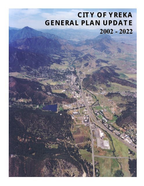
CITY OF YREKA<br />
GENERAL PLAN UPDATE<br />
2002 - 2022
CITY OF YREKA<br />
GENERAL PLAN<br />
2002 - 2022<br />
Adopted December 18, 2003<br />
<strong>City</strong> <strong>of</strong> <strong>Yreka</strong><br />
701 Fourth Street<br />
<strong>Yreka</strong>, California 96097
TABLE OF CONTENTS
TABLE OF CONTENTS<br />
i. INTRODUCTION....................................................................................................... i-1<br />
i.1 Physical Description & Location ................................................................ i-1<br />
Legal Basis and Requirements <strong>of</strong> the <strong>General</strong> <strong>Plan</strong>.........................................................i-1<br />
i.2 Requirements & Scope <strong>of</strong> the <strong>General</strong> <strong>Plan</strong> ............................................. i-2<br />
i.3 Use <strong>of</strong> the <strong>General</strong> <strong>Plan</strong> .............................................................................. i-2<br />
i.4 Vertical Consistency.................................................................................... i-3<br />
i.5 Background Report...................................................................................... i-3<br />
i.6 Special Studies ............................................................................................. i-3<br />
i.7 Timing ........................................................................................................... i-3<br />
i.8 Consistency Between the <strong>General</strong> <strong>Plan</strong> & Zoning Code......................... i-3<br />
Uses and Standards ................................................................................................................i-3<br />
Spatial Correlation .................................................................................................................i-4<br />
Timing........................................................................................................................................i-4<br />
i.9 <strong>General</strong> <strong>Plan</strong> Elements................................................................................ i-4<br />
Introduction.............................................................................................................................i-4<br />
Land Use...................................................................................................................................i-4<br />
Circulation................................................................................................................................i-4<br />
Housing .....................................................................................................................................i-5<br />
Open Space & Conservation................................................................................................i-5<br />
Noise .........................................................................................................................................i-5<br />
Public Health and Safety........................................................................................................i-5<br />
Public Facilities.........................................................................................................................i-5<br />
i.10 <strong>General</strong> <strong>Plan</strong> Implementation.................................................................... i-5<br />
i.11 <strong>General</strong> <strong>Plan</strong> Amendments ........................................................................ i-5<br />
1. LAND USE................................................................................................................. 1-1<br />
1.1 Introduction................................................................................................. 1-1<br />
Legal Basis & Requirements................................................................................................ 1-1<br />
1.2 Land Use Setting......................................................................................... 1-1<br />
<strong>Plan</strong>ning Boundaries ............................................................................................................. 1-2<br />
1.3 Population & Demographics...................................................................... 1-2<br />
Projected Population............................................................................................................ 1-4<br />
Projected Land Use Demands ........................................................................................... 1-4<br />
1.4 Land Use Designations............................................................................... 1-4<br />
Density & Intensity............................................................................................................... 1-4<br />
Floor Area Ratio................................................................................................................... 1-6<br />
Zoning Consistency.............................................................................................................. 1-6<br />
Determining Unit Yield ....................................................................................................... 1-6<br />
<strong>General</strong> <strong>Plan</strong> Buildout Calculation.................................................................................... 1-6<br />
Historic District..................................................................................................................1-12<br />
New Development.............................................................................................................1-12<br />
Building Form & Size..........................................................................................................1-12<br />
Landscaping ..........................................................................................................................1-12<br />
i
TABLE OF CONTENTS<br />
1.5 Economic Development........................................................................... 1-12<br />
State Marketing Efforts......................................................................................................1-14<br />
Goals & Programs...............................................................................................................1-15<br />
Land Use Guidelines Goals & Programs........................................................................1-15<br />
Residential Land Use Guidelines Goals & Programs...................................................1-19<br />
Commercial Land Use Guidelines Goals & Programs................................................1-20<br />
Industrial Land Use Guidelines Goals & Programs .....................................................1-20<br />
<strong>Yreka</strong> Creek/Trail System.................................................................................................1-21<br />
2. CIRCULATION......................................................................................................... 2-1<br />
2.1 Introduction................................................................................................. 2-1<br />
Legal Basis & Requirements................................................................................................ 2-1<br />
Overview................................................................................................................................ 2-1<br />
Regional Setting..................................................................................................................... 2-1<br />
Road Standards and Classifications................................................................................... 2-2<br />
2.2 Roadway Network ...................................................................................... 2-2<br />
Arterials.................................................................................................................................. 2-2<br />
Collectors............................................................................................................................... 2-2<br />
Significant Local Streets....................................................................................................... 2-3<br />
Industrial ................................................................................................................................. 2-3<br />
Commercial............................................................................................................................ 2-3<br />
Private ..................................................................................................................................... 2-4<br />
Level <strong>of</strong> Service ..................................................................................................................... 2-4<br />
Truck Transport ................................................................................................................... 2-7<br />
Circulation Goals & Programs........................................................................................... 2-8<br />
2.3 Roadway Improvement Standards..........................................................................2-9<br />
Background ............................................................................................................................ 2-9<br />
Street Layout Design ........................................................................................................... 2-9<br />
Parking..................................................................................................................................... 2-9<br />
Roadway Improvement Goals & Programs...................................................................2-11<br />
2.4 Pedestrian and Bicycle Circulation......................................................... 2-12<br />
Bicycle Circulation..............................................................................................................2-12<br />
Bicycle Pathway Circulations ...........................................................................................2-12<br />
Pedestrian and Bicycle Goals & Programs ....................................................................2-12<br />
2.5 Railroad...................................................................................................... 2-13<br />
Railroad Goals & Programs ..............................................................................................2-13<br />
Public Transit.......................................................................................................................2-15<br />
Public Transit Services.......................................................................................................2-15<br />
Public Transit Goals & Programs ....................................................................................2-15<br />
3. HOUSING.................................................................................................................. 3-1<br />
3.1 Introduction................................................................................................. 3-1<br />
Purpose ................................................................................................................................... 3-1<br />
Intent ....................................................................................................................................... 3-1<br />
ii
TABLE OF CONTENTS<br />
3.2 Community Pr<strong>of</strong>ile ..................................................................................... 3-1<br />
Area ........................................................................................................................................ 3-1<br />
Housing ................................................................................................................................... 3-2<br />
Household Characteristics ................................................................................................. 3-2<br />
3.3 Housing Assessment Needs....................................................................... 3-7<br />
Purpose ................................................................................................................................... 3-7<br />
Population Growth............................................................................................................... 3-7<br />
Employment Trends............................................................................................................. 3-9<br />
3.4 Housing Needs ............................................................................................ 3-9<br />
Regional Needs Allocation ................................................................................................. 3-9<br />
Rehabilitation and Replacement Needs.........................................................................3-11<br />
Special Needs.......................................................................................................................3-12<br />
Elderly Housing.........................................................................................................3-12<br />
Physically Handicapped-Disabled ..........................................................................3-12<br />
Farmworkers.............................................................................................................3-13<br />
Large Families............................................................................................................3-13<br />
Overcrowding .....................................................................................................................3-13<br />
Overpaying...........................................................................................................................3-14<br />
Single Parent Households .................................................................................................3-16<br />
Persons in Needs <strong>of</strong> Emergency Housing .....................................................................3-16<br />
Low Income Units at Risk <strong>of</strong> Conversion.....................................................................3-17<br />
3.5 Constraints ................................................................................................ 3-18<br />
Direct Costs – Land, Site Improvements, Construction...........................................3-18<br />
3.6 Government Constraints......................................................................... 3-20<br />
Land Use Controls .............................................................................................................3-20<br />
Building Code Requirement .............................................................................................3-28<br />
Historic District Regulations............................................................................................3-29<br />
Development Standards....................................................................................................3-29<br />
Housing for Disabled Persons .........................................................................................3-31<br />
Fees........................................................................................................................................3-32<br />
Permit Procedures and Processing.................................................................................3-34<br />
Energy Conservation..........................................................................................................3-34<br />
Local Governmental Constraints Summary..................................................................3-34<br />
3.7 Methods to Increase the Housing Supply............................................... 3-35<br />
Evaluation and Review <strong>of</strong> Previous Element.................................................................3-35<br />
Review and Update: Public Participation......................................................................3-38<br />
3.8 Goals and Objectives................................................................................ 3-40<br />
Policies ..................................................................................................................................3-42<br />
Appendix A, Housing Inventory......................................................................................3-47<br />
4. CONSERVATION, OPEN SPACE, PARKS AND RECREATION .................... 4-1<br />
4.1 Introduction................................................................................................. 4-1<br />
Legal Basis & Requirements................................................................................................ 4-1<br />
Overview................................................................................................................................ 4-1<br />
iii
TABLE OF CONTENTS<br />
4.2 Managed Resource Production ................................................................. 4-2<br />
Overview................................................................................................................................ 4-2<br />
Managed Resources Goals & Programs........................................................................... 4-2<br />
4.3 Mineral Resources....................................................................................... 4-2<br />
4.4 Agricultural and Timber Lands................................................................. 4-3<br />
4.5 Soil Resources ............................................................................................. 4-4<br />
4.6 Biological Resources................................................................................... 4-4<br />
Wildlife and Habitat Occurrence...................................................................................... 4-4<br />
Natural Drainage Channels ................................................................................................ 4-5<br />
Biological Resources Goals & Programs.......................................................................... 4-7<br />
4.7 Air Quality ................................................................................................... 4-7<br />
Air Quality Regulatory Authority ..................................................................................... 4-7<br />
Local Air Quality Management Authority....................................................................... 4-9<br />
Air Quality Standards Attainment Status for Siskiyou County .................................. 4-9<br />
Air Quality Standards Goals & Programs........................................................................ 4-9<br />
4.8 Natural Water Resources.......................................................................... 4-9<br />
Surface Water Quality......................................................................................................... 4-9<br />
Natural Water Resources Goals & Programs..............................................................4-10<br />
4.9 Open Space................................................................................................ 4-11<br />
Open Space Land................................................................................................................4-11<br />
Open Space Goals & Programs .......................................................................................4-11<br />
4.10 Parks and Recreation ............................................................................... 4-11<br />
Parks and Recreation.........................................................................................................4-11<br />
Parks and Recreation Goals & Programs ......................................................................4-12<br />
5. NOISE......................................................................................................................... 5-1<br />
5.1 Introduction................................................................................................. 5-1<br />
<strong>City</strong> Location ......................................................................................................................... 5-1<br />
Overview................................................................................................................................ 5-1<br />
Purpose <strong>of</strong> the Element....................................................................................................... 5-1<br />
Legal Basis and Requirement.............................................................................................. 5-1<br />
5.2 Acoustic Terminology................................................................................ 5-2<br />
5.3 Fundamentals <strong>of</strong> Noise............................................................................... 5-2<br />
5.4 Existing and Future Noise Environments ................................................ 5-5<br />
Overview................................................................................................................................ 5-5<br />
Roadways................................................................................................................................ 5-5<br />
Railroads ................................................................................................................................. 5-7<br />
Non-Transportation Noise Sources ..............................................................................5-11<br />
Airports.................................................................................................................................5-14<br />
Community Noise Survey.................................................................................................5-14<br />
Background on Criteria for Acceptable Noise Exposure..........................................5-18<br />
Noise Goals & Programs ..................................................................................................5-18<br />
Noise Element Policies......................................................................................................5-18<br />
iv
TABLE OF CONTENTS<br />
5.5 Noise Mitigation Options......................................................................... 5-22<br />
Use <strong>of</strong> Setbacks...................................................................................................................5-22<br />
Use <strong>of</strong> Barriers....................................................................................................................5-22<br />
Site Design............................................................................................................................5-25<br />
Building Design....................................................................................................................5-26<br />
Noise Reduction by Building Facades.............................................................................5-26<br />
Use <strong>of</strong> Vegetation...............................................................................................................5-27<br />
6. PUBLIC HEALTH AND SAFETY ......................................................................... 6-1<br />
6.1 Introduction................................................................................................. 6-1<br />
Legal Basis & Requirements................................................................................................ 6-1<br />
6.2 Emergency Preparedness .......................................................................... 6-1<br />
Siskiyou County Emergency Operations <strong>Plan</strong>................................................................ 6-1<br />
Coordination <strong>of</strong> Emergency Response Efforts............................................................... 6-1<br />
Evacuation Routes ................................................................................................................ 6-1<br />
Standardized Emergency Management System .............................................................. 6-2<br />
Local Organization ............................................................................................................... 6-2<br />
Emergency Preparedness Goals & Programs ................................................................. 6-2<br />
6.3 Flood Hazards ............................................................................................. 6-2<br />
Local Flooding........................................................................................................................ 6-2<br />
Regional Flooding.................................................................................................................. 6-2<br />
Flood Hazards Goals & Programs..................................................................................... 6-4<br />
6.4 Fire Protection............................................................................................ 6-4<br />
Fire Threat ............................................................................................................................. 6-4<br />
Response Time...................................................................................................................... 6-4<br />
Water Delivery System....................................................................................................... 6-5<br />
Fire Station Staffing/Equipment.......................................................................................... 6-5<br />
Fire Protection Goals & Programs.................................................................................... 6-5<br />
6.5 Police Protection ........................................................................................ 6-6<br />
Law Enforcement Staff......................................................................................................... 6-6<br />
Police Protection Goals & Programs................................................................................ 6-6<br />
6.6 Geologic Hazards........................................................................................ 6-6<br />
Seismic Hazards .................................................................................................................... 6-6<br />
Landslides ............................................................................................................................... 6-7<br />
Abandoned Mines................................................................................................................. 6-7<br />
Other Hazards ...................................................................................................................... 6-7<br />
Geologic Hazards Goals & Programs............................................................................... 6-7<br />
6.7 Hazardous Waste and Materials............................................................... 6-8<br />
Background ............................................................................................................................ 6-8<br />
Interstate 5 Transportation Related Hazards ................................................................ 6-8<br />
Hazardous Waste Goals & Programs .............................................................................. 6-9<br />
7. PUBLIC FACILITIES .............................................................................................. 7-1<br />
7.1 Introduction................................................................................................. 7-1<br />
Legal Basis & Requirements................................................................................................ 7-1<br />
v
TABLE OF CONTENTS<br />
7.2 <strong>General</strong> Infrastructure ............................................................................... 7-1<br />
Development Fees................................................................................................................ 7-1<br />
Public Facilities Goals & Programs.................................................................................... 7-2<br />
7.3 Schools ......................................................................................................... 7-2<br />
Schools Goals & Programs ................................................................................................. 7-3<br />
7.4 Library Facilities.......................................................................................... 7-3<br />
7.5 <strong>City</strong> Administration.................................................................................... 7-3<br />
7.6 Water Supply Facilities .............................................................................. 7-4<br />
Existing Water System Conditions................................................................................... 7-4<br />
Water Supply Goals & Programs...................................................................................... 7-4<br />
7.7 Wastewater Collection and Treatment................................................... 7-5<br />
Existing Wastewater System Conditions ........................................................................ 7-5<br />
Wastewater Collection and Treatment Goals & Programs........................................ 7-5<br />
7.8 Storm Drainage System............................................................................. 7-5<br />
Future Storm Water System Needs ................................................................................ 7-5<br />
Storm Drainage Systems Goals & Programs .................................................................. 7-6<br />
7.9 Solid Waste Collection and Disposal........................................................ 7-7<br />
Solid Waste Collection Goals & Programs..................................................................... 7-7<br />
GLOSSARY<br />
List <strong>of</strong> Tables<br />
Table 1-1 Existing Land Use .............................................................................................................. 1-1<br />
Table 1-2 Residential Land Use Designations................................................................................ 1-7<br />
Table 1-3 Non-Residential Land Use Designations...................................................................... 1-8<br />
Table 1-4 <strong>General</strong> <strong>Plan</strong> Designation and Zone District Consistency ...................................... 1-9<br />
Table 1-5 Buildout for the Total <strong>General</strong> <strong>Plan</strong>ning Area, by Land .........................................1-10<br />
Table 1-6 Buildout for the Total <strong>General</strong> <strong>Plan</strong>ning Area, by Population...............................1-10<br />
Table 1-7 Buildout for the Area within the <strong>City</strong> Limits, by Land............................................1-11<br />
Table 1-8 Buildout for the Area within the <strong>City</strong> Limits, by Population.................................1-11<br />
Table 2-1 Existing Roadway Classifications.................................................................................... 2-3<br />
Table 2-2 Road Classifications .......................................................................................................... 2-5<br />
Table 2-3 Level <strong>of</strong> Service (LOS) Definitions ................................................................................ 2-7<br />
Table 3-1 Population Characteristics .............................................................................................. 3-3<br />
Table 3-2 Ethnic Groups, <strong>City</strong> <strong>of</strong> <strong>Yreka</strong> ......................................................................................... 3-4<br />
Table 3-3 Housing, <strong>City</strong> <strong>of</strong> <strong>Yreka</strong>..................................................................................................... 3-4<br />
Table 3-4 Housing Characteristics, <strong>City</strong> <strong>of</strong> <strong>Yreka</strong>........................................................................ 3-5<br />
Table 3-5 Rental Housing Rates, <strong>City</strong> <strong>of</strong> <strong>Yreka</strong> ............................................................................ 3-5<br />
Table 3-6 Housing Value, <strong>City</strong> <strong>of</strong> <strong>Yreka</strong> ......................................................................................... 3-6<br />
Table 3-7 Population Growth & Households, <strong>City</strong> <strong>of</strong> <strong>Yreka</strong>..................................................... 3-8<br />
Table 3-8 Employment, <strong>City</strong> <strong>of</strong> <strong>Yreka</strong>............................................................................................. 3-8<br />
Table 3-9 Summary <strong>of</strong> 2003-2008 Regional Housing Needs ..................................................... 3-9<br />
Table 3-10 2000 Income Levels .......................................................................................................... 3-9<br />
vi
TABLE OF CONTENTS<br />
Table 3-11 Housing Spending Limits................................................................................................3-10<br />
Table 3-12 Estimated Housing Needs Based on Varying Growth Rates for the Period<br />
August 2003 throu June 30, 2008................................................................................3-11<br />
Table 3-13 Rent as Percent <strong>of</strong> Household Income ......................................................................3-14<br />
Table 3-14 Selected Mortgage and Homeowner Costs as Percent <strong>of</strong> Household<br />
Income ...............................................................................................................................3-15<br />
Table 3-15 Total Homeowner Households by Income Levels 1990 and 2000......................3-15<br />
Table 3-16 Assisted Multifamily Units .............................................................................................3-19<br />
Table 3-17 Single-Family Home Costs, Thirty-year Mortgage Fixed Rates for $60,000,<br />
$80,000 and $100,000 Loans........................................................................................3-20<br />
Table 3-18 Parcels with Water/Sewer /Availability......................................................................3-23<br />
Table 3-19 Vacant Land Available to Meet Regional Housing Need ........................................3-24<br />
Table 3-20 Uses Allowed in Various Zones...................................................................................3-24<br />
Table 3-21 Existing and Proposed <strong>City</strong> <strong>of</strong> <strong>Yreka</strong> Zoning Designations...................................3-27<br />
Table 3-22 Vacant Residential Land Use Acreage and Development Potential Based on<br />
Proposed Zoning.............................................................................................................3-28<br />
Table 3-23 <strong>City</strong> <strong>of</strong> <strong>Yreka</strong> Fees...........................................................................................................3-32<br />
Table 3-24 Building Permit Fees .......................................................................................................3-33<br />
Table 3-25 <strong>Plan</strong>ning Permit Fees Affecting Residential Development......................................3-33<br />
Table 3-26 Summary Quantified Housing Objective....................................................................3-46<br />
Table 4-1 <strong>Yreka</strong> <strong>Plan</strong>ning Area Soils Characteristics and Limitations...................................... 4-5<br />
Table 5-1 FHWA-RD-77-108 Highway Traffic Noise Prediction Model Data Inputs and<br />
Distances............................................................................................................................. 5-9<br />
Table 5-2 Railroad Noise Exposure as a Function <strong>of</strong> the Number <strong>of</strong> Daily Trains............5-12<br />
Table 5-3 Community Noise Measurement Survey Results ....................................................5-17<br />
Table 5-4 Noise Standards for New Uses Affected by Traffic and Railroad Noise............5-20<br />
Table 5-5 Noise Standards for New Uses Affected by Non-Transportation Noise ..........5-21<br />
Table 5-6 Requirements for Acoustical Analyses Prepared in <strong>Yreka</strong> ....................................5-24<br />
Table 6-1 100-Year Flood Event Flooding Areas.......................................................................... 6-4<br />
Table 7-1 School Enrollment Figures............................................................................................... 7-3<br />
vii
TABLE OF CONTENTS<br />
List <strong>of</strong> Figures<br />
Figure i-1 <strong>City</strong> <strong>of</strong> <strong>Yreka</strong> Locator Map ............................................................................................. i -2<br />
Figure 1-1 Boundary map.................................................................................................................... 1-3<br />
Figure 1-2 Land Use Map..................................................................................................................... 1-5<br />
Figure 1-3 Historic District Boundaries.........................................................................................1-13<br />
Figure 2-1 Typical Street Sections..................................................................................................... 2-6<br />
Figure 2-2 Circulation ........................................................................................................................2-10<br />
Figure 2-3 Pedestrian and Bicycle Routes......................................................................................2-14<br />
Figure 3-1 Vacant Residential Parcels.............................................................................................3-26<br />
Figure 4-1 Phlox Protected Areas..................................................................................................... 4-6<br />
Figure 4-2 <strong>Yreka</strong> Creek Greenway................................................................................................... 4-8<br />
Figure 6-1 Flood Area Map................................................................................................................. 6-3<br />
Noise Element Figures (Element adopted separately on August 19, 1998.)<br />
Figure 1 Typical A-Weighted Sound Levels <strong>of</strong> Common Noise Sources............................. 5-5<br />
Figure 2 Approximate <strong>City</strong> Limits ................................................................................................. 5-7<br />
Figure 3 Existing 60 dB Ldn Traffic Noise Contours ..............................................................5-10<br />
Figure 4 Measured Interstate 5 Traffic Noise Levels ..............................................................5-11<br />
Figure 5 Methodology from Predicting Distance Traffic Noise Contours for<br />
Arterial Traffic..................................................................................................................5-11<br />
Figure 6 Major Non-Transportation Noise Sources and Approximate Noise<br />
Contour Locations..........................................................................................................5-13<br />
Figure 7 Community Noise Survey Sites ...................................................................................5-16<br />
Figure 8 Measured Ambient Noise Levels, Turre Street .......................................................5-18<br />
Figure 9 Measured Ambient Noise Levels, Cedar Street.......................................................5-18<br />
viii
INTRODUCTION
i. INTRODUCTION<br />
i INTRODUCTION<br />
and “adopted” as the plan for the <strong>City</strong>. The document<br />
would be used daily by staff in recommending changes<br />
to the <strong>City</strong> and periodically reviewed. Although greatly<br />
simplified, the above explains both what the <strong>General</strong><br />
<strong>Plan</strong> is, and how it is used.<br />
The <strong>General</strong> <strong>Plan</strong> is referred to <strong>of</strong>ten by <strong>City</strong> <strong>of</strong>ficials,<br />
and by prospective developers. The document both<br />
explains what the community expects from new<br />
development, and where the development should occur.<br />
Goals in the <strong>General</strong> <strong>Plan</strong> help the Council in seeking<br />
grants and moving the community forward.<br />
i.1.<br />
Physical Description &<br />
Location<br />
i. Purpose..................................................................1<br />
i.1. Physical Description & Location....................1<br />
i.2.<br />
i.3.<br />
i.4.<br />
i.5.<br />
i.6.<br />
i.7.<br />
i.8.<br />
i.9.<br />
Requirements & Scope <strong>of</strong> the <strong>General</strong> <strong>Plan</strong><br />
.............................................................................2<br />
Use <strong>of</strong> the <strong>General</strong> <strong>Plan</strong>...................................2<br />
Vertical Consistency..........................................3<br />
Background Report...........................................3<br />
Special Studies.....................................................3<br />
Timing....................................................................3<br />
Consistency Between The <strong>General</strong> <strong>Plan</strong> &<br />
Zoning Code ...................................................3<br />
<strong>General</strong> <strong>Plan</strong> Elements......................................4<br />
i.10. <strong>General</strong> <strong>Plan</strong> Implementation.........................5<br />
i.11. <strong>General</strong> <strong>Plan</strong> Amendments..............................5<br />
i. Purpose<br />
Imagine that your role is to both know the<br />
expectations <strong>of</strong> <strong>City</strong> residents and explain them to<br />
people new to the community. How would you<br />
begin to organize current issues, or estimate future<br />
needs? One method is to divide issues into separate<br />
areas and write down basic “goals” with<br />
explanations. Once completed, the document<br />
would be reviewed by the community as a whole<br />
The <strong>City</strong> <strong>of</strong> <strong>Yreka</strong> is located in Siskiyou County in<br />
Northern California, and serves as the County seat.<br />
Located approximately 22 miles south <strong>of</strong> the California-<br />
Oregon border in the Shasta Valley, <strong>Yreka</strong> encompasses<br />
approximately 9.97 square miles and is situated along<br />
Interstate 5 (see Figure 0-1). The Bureau <strong>of</strong> Land<br />
Management (BLM) or private land surrounds the <strong>City</strong><br />
with the Shasta Valley to the east and the Kilgore Hills<br />
to the southeast. The population <strong>of</strong> Siskiyou County is<br />
approximately 44,301, with 7,290 residents within the<br />
<strong>City</strong> <strong>of</strong> <strong>Yreka</strong>.<br />
LEGAL BASIS & REQUIREMENTS OF THE GENERAL<br />
PLAN<br />
California state law requires that every city and county<br />
adopt a general plan to guide physical development <strong>of</strong><br />
the land within the jurisdictions' boundaries. The plan<br />
acts as a "constitution" for the <strong>City</strong> and establishes<br />
guidelines for land use and development. Since the<br />
general plan affects current and future generations,<br />
state law requires that the plan take a "long-term"<br />
perspective. Typically, general plans look 10 to 20 years<br />
into the future. This plan addresses planning through<br />
the year 2022.<br />
Page i-1
i. INTRODUCTION<br />
Figure i-1 - <strong>City</strong> <strong>of</strong> <strong>Yreka</strong> Locator Map<br />
The law requires that the plan be comprehensive,<br />
and that specific subjects or "elements" be<br />
addressed in the plan. The required elements<br />
include [65302(a) through (g)]:<br />
Comprehensive: The plan must coordinate all major<br />
components <strong>of</strong> the community's development,<br />
covering the entire incorporated area <strong>of</strong> the city, as<br />
well as any other land that bears relation to the city's<br />
planning. In addition, the plan must address the full<br />
range <strong>of</strong> issues associated with the city's physical<br />
development.<br />
<strong>General</strong>: Because it is long-range and comprehensive,<br />
the plan must be general in nature. The plan's purpose<br />
is to serve as a broad framework for detailed public<br />
and private development proposals.<br />
Internally Consistent: All parts <strong>of</strong> the plan (text,<br />
diagrams and figures in all elements) must be fully<br />
integrated and not conflict with each other.<br />
• land use<br />
• circulation<br />
• housing<br />
i.3. Use <strong>of</strong> the <strong>General</strong> <strong>Plan</strong><br />
• conservation The <strong>City</strong> <strong>of</strong> <strong>Yreka</strong> <strong>General</strong> <strong>Plan</strong> is intended to serve as<br />
• open space<br />
a tool to assist the <strong>City</strong> Council, <strong>Plan</strong>ning Commission,<br />
• noise<br />
staff and other commissions or committees in<br />
• safety<br />
formulating and implementing community guidelines<br />
and programs.<br />
State law also allows the local jurisdiction to<br />
include additional, or "optional," elements to<br />
address specific issues <strong>of</strong> concern, as well as<br />
combining the required and optional elements as<br />
deemed appropriate (65303). This <strong>General</strong> <strong>Plan</strong><br />
combines the Open Space and Conservation<br />
elements into a single element and adds a Public<br />
Facilities Element (65301).<br />
i.2.<br />
Requirements & Scope<br />
<strong>of</strong> the <strong>General</strong> <strong>Plan</strong><br />
In addition to addressing the mandatory planning<br />
topics, the <strong>General</strong> <strong>Plan</strong> must be:<br />
Long Range: The general plan is intended to be<br />
long-range to avoid incremental planning decisions<br />
which may occur over many years and may<br />
eventually conflict with each other. This <strong>General</strong><br />
<strong>Plan</strong> considers issues that may impact the <strong>City</strong><br />
throughout the next two decades.<br />
The <strong>General</strong> <strong>Plan</strong> has four main purposes:<br />
1. To enable the <strong>Plan</strong>ning Commission and <strong>City</strong><br />
Council to reach agreement on long-range<br />
development policies.<br />
2. To provide a basis for judging whether specific<br />
private development proposals and public projects<br />
are in harmony with <strong>City</strong> policies.<br />
3. To allow other public agencies and private<br />
developers to design projects that are consistent<br />
with <strong>City</strong> policies, or to seek changes in those<br />
policies through the process <strong>of</strong> amending the<br />
<strong>General</strong> <strong>Plan</strong>.<br />
4. Provide an agreement among different agencies<br />
for development in unincorporated portions <strong>of</strong><br />
the <strong>Plan</strong>ning Area.<br />
Page i-2
i. INTRODUCTION<br />
i.4. Vertical Consistency<br />
The <strong>General</strong> <strong>Plan</strong> provides the basis for all <strong>of</strong> the<br />
<strong>City</strong>'s regulations, policies and programs that relate<br />
to issues addressed in the plan. In addition to<br />
requiring that the plan be internally consistent, the<br />
State requires vertical consistency. This<br />
requirement means that the <strong>City</strong>'s zoning and<br />
subdivision ordinances, specific plans and<br />
redevelopment plans must all be consistent with<br />
the <strong>General</strong> <strong>Plan</strong>. In addition, all development<br />
approvals and public projects must be consistent<br />
with the <strong>General</strong> <strong>Plan</strong>.<br />
The State's <strong>General</strong> <strong>Plan</strong> Guidelines provide the<br />
following rule for defining consistency:<br />
"An action, program or project is consistent with<br />
the general plan if, considering all its aspects, it will<br />
further the objectives and policies <strong>of</strong> the general<br />
plan and not obstruct their attainment."<br />
This rule clarifies that consistency does not require<br />
all subsequent <strong>City</strong> actions to be specifically<br />
anticipated by the general plan. Because the <strong>Plan</strong> is<br />
both broad and long-range, there are many<br />
circumstances where future <strong>City</strong> actions will be<br />
addressed only briefly in the <strong>Plan</strong> and refined by<br />
subsequent action.<br />
information on the <strong>City</strong>, its facilities and needs. The<br />
background report is also considered the existing<br />
conditions section <strong>of</strong> the <strong>General</strong> <strong>Plan</strong> Environmental<br />
Impact Report.<br />
i.6. Special Studies<br />
The <strong>General</strong> <strong>Plan</strong> recommends preparation <strong>of</strong> special<br />
or subsequent studies necessary to fully implement the<br />
<strong>General</strong> <strong>Plan</strong>. Until adopted by the <strong>City</strong>, the <strong>City</strong>’s<br />
existing policies shall prevail.<br />
i.7. Timing<br />
It is expected that the <strong>City</strong> may undertake the actions<br />
set forth within the <strong>General</strong> <strong>Plan</strong> at any time in the<br />
next twenty years. The <strong>City</strong> will undertake each<br />
program as it deems necessary, and provided both staff<br />
and financial resources exist to complete each program.<br />
Suggested timing is included in appropriate programs<br />
but may be modified to meet resources and ability <strong>of</strong><br />
the <strong>City</strong>.<br />
i.8. Consistency Between The<br />
<strong>General</strong> <strong>Plan</strong> & Zoning<br />
Code<br />
The Zoning Ordinance is an important tool for<br />
implementing the <strong>General</strong> <strong>Plan</strong>. Requirements for<br />
consistency between the <strong>General</strong> <strong>Plan</strong> and zoning can<br />
be broken down into three aspects:<br />
Due to the complexity <strong>of</strong> the <strong>General</strong> <strong>Plan</strong>, and the<br />
need for flexibility, interpretations <strong>of</strong> the goals,<br />
objectives and programs may result in the<br />
appearance <strong>of</strong> conflicts. The <strong>City</strong> Council is the<br />
interpreter <strong>of</strong> the <strong>General</strong> <strong>Plan</strong>.<br />
i.5. Background Report<br />
A summary <strong>of</strong> existing conditions was prepared to<br />
help form the goals and programs <strong>of</strong> this <strong>General</strong><br />
<strong>Plan</strong>. Published as a separate document, the<br />
background report provides a wealth <strong>of</strong><br />
Page i-3<br />
USES AND STANDARDS<br />
The general plan's land use classifications are not as<br />
specific as zoning ordinance classifications. For example,<br />
the <strong>General</strong> <strong>Plan</strong> has three different categories for<br />
residential use, while the zoning ordinance is likely to<br />
have more. Multiple zoning districts may be consistent<br />
with a single general plan designation, as long as the<br />
densities and unit types allowed in each zoning district<br />
are also permitted in the relevant general plan<br />
designation.
i. INTRODUCTION<br />
SPATIAL CORRELATION<br />
The Zoning Map should reflect the general pattern<br />
<strong>of</strong> land use depicted on the Land Use Diagram.<br />
However, the two need not be identical.<br />
Boundaries <strong>of</strong> land use classifications depicted on<br />
the Land Use Diagram are generalized; zoning<br />
boundaries may be more precise and parcel specific.<br />
<strong>General</strong> <strong>Plan</strong> designations need not have immediate<br />
consistency with zoning.<br />
TIMING<br />
State law allows a "reasonable time" for reconciling<br />
any inconsistencies between the Zoning Ordinance<br />
and the general plan. The <strong>City</strong> anticipates that all<br />
zoning and general plan inconsistencies will be<br />
addressed within the five (5) years following<br />
adoption <strong>of</strong> the <strong>General</strong> <strong>Plan</strong>.<br />
i.9. <strong>General</strong> <strong>Plan</strong> Elements<br />
Each <strong>General</strong> <strong>Plan</strong> element contains: a brief<br />
discussion <strong>of</strong> the legal requirements; goals,<br />
objectives, policies and implementation programs to<br />
address required topics; and, narrative text as<br />
necessary to provide understanding <strong>of</strong> the issues<br />
addressed. The following terms apply within this<br />
<strong>General</strong> <strong>Plan</strong>:<br />
GOAL:<br />
An achievement toward which an effort is<br />
directed. The Goal states an ideal<br />
resolution <strong>of</strong> the issue under<br />
consideration.<br />
OBJECTIVE:<br />
A specific statement in the form <strong>of</strong> text or<br />
diagram that helps clarify and define the<br />
goal statement.<br />
PROGRAM:<br />
Programs are specific actions that are<br />
readily quantifiable and help move toward<br />
attainment <strong>of</strong> the goal.<br />
Each goal is numbered to allow easy reference when<br />
using the <strong>General</strong> <strong>Plan</strong>. The numbering system does not<br />
imply a ranking or priority <strong>of</strong> the goal(s) and<br />
program(s).<br />
While the topics that must be addressed within the<br />
general plan are clearly specified by State law, the<br />
organization <strong>of</strong> discussions is determined by each<br />
jurisdiction based upon the particular local conditions<br />
and issues <strong>of</strong> significance.<br />
Following are descriptions <strong>of</strong> the sections <strong>of</strong> the <strong>Yreka</strong><br />
<strong>General</strong> <strong>Plan</strong> and discussions <strong>of</strong> the topics, which are<br />
addressed within each section. In total, these sections<br />
address the most significant issues facing the <strong>City</strong> <strong>of</strong><br />
<strong>Yreka</strong> and satisfy the legal requirements <strong>of</strong> the general<br />
plan as defined by state law.<br />
INTRODUCTION<br />
This introduction provides a brief overview <strong>of</strong> the <strong>City</strong><br />
<strong>of</strong> <strong>Yreka</strong> and its physical setting. The requirements and<br />
structure <strong>of</strong> <strong>General</strong> <strong>Plan</strong>s are reviewed and a<br />
description <strong>of</strong> the format <strong>of</strong> this <strong>General</strong> <strong>Plan</strong> is<br />
provided.<br />
LAND USE<br />
The Land Use element provides guidance for the<br />
physical form <strong>of</strong> the community. A land use diagram<br />
identifies the existing and proposed land uses within the<br />
<strong>City</strong>. The land use diagram is supported by descriptions<br />
<strong>of</strong> allowed uses and development densities for each land<br />
use designation. Additionally, the land use diagram<br />
identifies those areas where the <strong>City</strong> anticipates growth<br />
in the future, with the intent <strong>of</strong> avoiding incompatible<br />
land use changes by neighboring agencies and<br />
jurisdictions.<br />
CIRCULATION<br />
The Circulation element provides a framework to guide<br />
Page i-4
i. INTRODUCTION<br />
transportation planning throughout the <strong>City</strong> and its<br />
planning area. The Circulation Element is<br />
coordinated and consistent with portions <strong>of</strong> the<br />
Land Use, Community Design Enhancement, Public<br />
Services and Facilities, and Safety Elements, which<br />
address topics directly related to circulation and<br />
transportation. Discussion topics include roadway<br />
network, road improvement standards guidelines,<br />
road maintenance, pedestrian and bicycle<br />
circulation, railroad, and public transit.<br />
HOUSING<br />
The Housing element is presently being revised to<br />
coincide with release <strong>of</strong> detailed economic<br />
information from the 2000 census and the<br />
statutory requirement to update the <strong>General</strong> <strong>Plan</strong><br />
by June 30, 2003. [Govt. Cd. §65588(e)(5)] This<br />
Housing element is presently being reviewed by the<br />
California Department <strong>of</strong> Housing and Community<br />
Development.<br />
OPEN SPACE & CONSERVATION<br />
Typically a broad ranging element, many Open<br />
Space and Conservation topics are addressed<br />
within other sections <strong>of</strong> the <strong>General</strong> <strong>Plan</strong>. This<br />
section addresses managed resource production<br />
(agriculture and mineral extraction), biological<br />
resources, air quality and water resources. A<br />
description <strong>of</strong> natural resources within the vicinity<br />
<strong>of</strong> the <strong>City</strong> is provided.<br />
NOISE<br />
The Noise element was prepared in 1998 and<br />
adopted by the <strong>City</strong>. The element was not revised<br />
as part <strong>of</strong> this general plan update.<br />
hazardous materials and waste management, and rail<br />
service related hazards.<br />
PUBLIC FACILITIES<br />
This element describes public services within the<br />
planning area.<br />
i.10. <strong>General</strong> <strong>Plan</strong><br />
Implementation<br />
The <strong>City</strong> <strong>of</strong> <strong>Yreka</strong> must meet a broad range <strong>of</strong><br />
challenges and obligations with limited financial<br />
resources. Many <strong>of</strong> the programs described within this<br />
<strong>General</strong> <strong>Plan</strong> address situations that have evolved over a<br />
number <strong>of</strong> years and will not be easily resolved.<br />
Since financial limitations are the primary constraint in<br />
addressing many <strong>of</strong> the issues that face the <strong>City</strong>, it is<br />
imperative that the <strong>City</strong> seek economically feasible<br />
strategies for implementing <strong>General</strong> <strong>Plan</strong> programs.<br />
Such strategies will include seeking funding assistance<br />
through state and federal grant programs. Some issues<br />
will be more easily resolved by working in conjunction<br />
with other local agencies to achieve mutual goals.<br />
i.11. <strong>General</strong> <strong>Plan</strong> Amendments<br />
State law provides for up to four amendments to the<br />
general plan each year. An amendment may include<br />
several “changes” to the general plan. The <strong>City</strong> <strong>of</strong> <strong>Yreka</strong><br />
may process general plan amendments every four (4)<br />
months, and may keep in reserve one (1) amendment<br />
to be used in case <strong>of</strong> a special project or need.<br />
Amendments to the <strong>General</strong> <strong>Plan</strong> require compliance<br />
with the Government Code and environmental laws<br />
before they can proceed.<br />
PUBLIC HEALTH AND SAFETY<br />
Issues discussed within the Public Health and Safety<br />
element include emergency preparedness, flood<br />
hazard, fire and police protection, geologic hazards,<br />
Page i-5
CHAPTER<br />
___1___<br />
LAND USE
I. LAND USE<br />
1. LAND USE<br />
resources, recreation and enjoyment <strong>of</strong> scenic<br />
beauty, education, public buildings and grounds,<br />
solid and liquid disposal facilities, and other<br />
categories <strong>of</strong> public and private uses <strong>of</strong> land. The<br />
land use element shall include a statement <strong>of</strong> the<br />
standards <strong>of</strong> population density and building<br />
intensity recommended for the various districts<br />
and other territory covered by the plan. The land<br />
use element shall identify areas covered by the<br />
plan which are subject to flooding and shall be<br />
reviewed annually with respect to those areas."<br />
The <strong>General</strong> <strong>Plan</strong> is also required to maintain<br />
consistency between individual elements.<br />
1.2. Land Use Setting<br />
1.1. Introduction ....................................................1<br />
1.2. Land Use Setting ............................................1<br />
1.3. Population & Demographics.......................2<br />
1.4. Land Use Designations .................................4<br />
1.5. Economic Development ............................12<br />
1.1. Introduction<br />
LEGAL BASIS & REQUIREMENTS<br />
California Government Code §65302(a) requires<br />
that the general plan include:<br />
"A land use element which designates the<br />
proposed general distribution and general<br />
location and extent <strong>of</strong> all uses <strong>of</strong> the land<br />
including land for housing, business, industry,<br />
open space, including agriculture, natural<br />
The <strong>City</strong> <strong>of</strong> <strong>Yreka</strong> is developed along the Interstate 5<br />
corridor stretching for nearly five (5) miles north and<br />
south and two (2) miles east and west. Approximately<br />
20 miles south <strong>of</strong> the California/Oregon border, <strong>Yreka</strong><br />
is located in northern Siskiyou County. (See Figure 0-I<br />
in Introduction) The <strong>City</strong> limits contain approximately<br />
ten (10) square miles, comprised <strong>of</strong> a variety <strong>of</strong> land<br />
uses. The largest <strong>of</strong> these is residential, which occupies<br />
approximately 26 percent <strong>of</strong> the land within the <strong>City</strong><br />
limits. (See Table 1-1 )<br />
Table 1-1 – Existing Land Use<br />
Land Use<br />
Acreage<br />
Residential 3,600<br />
Commercial 405<br />
Industrial 1,037<br />
Open Space 923<br />
Roads & Highway 419<br />
Total 6,384<br />
Source: <strong>Yreka</strong> GIS Project<br />
Page 1-1
I. LAND USE<br />
PLANNING BOUNDARIES<br />
In addition to the <strong>City</strong> Limits, there are several<br />
boundaries that affect the <strong>City</strong>. As shown on Figure<br />
1-1, the <strong>City</strong> has a Sphere <strong>of</strong> Influence, which is<br />
established by the Local Agency Formation<br />
Commission (LAFCO), and a Water Service<br />
Boundary, established by the State Water Resources<br />
Control Board. Various boundaries are established<br />
to define the level <strong>of</strong> authority <strong>of</strong> the local agency.<br />
These boundaries are used to define the “<strong>Plan</strong>ning<br />
Area” for the <strong>City</strong> within which a specific set <strong>of</strong><br />
goals, objectives and programs will apply. These<br />
boundary lines are seen as areas within which the<br />
<strong>City</strong> has the most influence. Activities outside <strong>of</strong><br />
these boundaries will impact the <strong>City</strong>, but are<br />
typically beyond the ability <strong>of</strong> the <strong>City</strong> to control.<br />
Within the city limits the city is the primary land<br />
use authority and is responsible for the review and<br />
approval <strong>of</strong> land use proposals. The <strong>General</strong> <strong>Plan</strong><br />
plays a pivotal role in this process by establishing<br />
guidelines for the <strong>Plan</strong>ning Commission and <strong>City</strong><br />
Council to use in reviewing all land use actions.<br />
The existing Sphere <strong>of</strong> Influence includes<br />
surrounding lands where the <strong>City</strong> may expand in<br />
the future and is as approved by LAFCO. Review<br />
and approval <strong>of</strong> land use proposals in the sphere<br />
rests with Siskiyou County. County decision<br />
makers will typically consider the <strong>General</strong> <strong>Plan</strong> <strong>of</strong><br />
the <strong>City</strong> when reviewing development proposals<br />
within the Sphere <strong>of</strong> Influence.<br />
The <strong>City</strong> receives its water from the Fall Creek<br />
Water Project, which is administered by the State<br />
Water Resources Control Board. With few<br />
exceptions, the <strong>City</strong> cannot use water from the Fall<br />
Creek Project outside <strong>of</strong> the established service<br />
area. Amendments to the service area can be made,<br />
and will be needed to accommodate future<br />
expansion <strong>of</strong> the <strong>City</strong>.<br />
This plan includes a future Sphere <strong>of</strong> Influence designed<br />
to make efficient use <strong>of</strong> existing utilities and provide a<br />
more logical service area. This future Sphere <strong>of</strong><br />
Influence may eventually constitute the <strong>City</strong> limits.<br />
For purposes <strong>of</strong> the <strong>General</strong> <strong>Plan</strong>, the <strong>City</strong> established a<br />
<strong>Plan</strong>ning Area that is depicted in Figure 1-1. The area is<br />
slightly larger than the Sphere <strong>of</strong> Influence and includes<br />
territory that will likely never be in the <strong>City</strong> Limits, but<br />
does have an affect on the <strong>City</strong>. The determination <strong>of</strong><br />
the planning area boundary was based on visible ridge<br />
line(s) surrounding the community. Because <strong>of</strong> the<br />
importance <strong>of</strong> the view from the <strong>City</strong>, the <strong>General</strong> <strong>Plan</strong><br />
requires the establishment <strong>of</strong> procedures for hillside<br />
development. Since much <strong>of</strong> the area is outside <strong>of</strong> the<br />
<strong>City</strong>, the <strong>City</strong> will need to coordinate hillside standards<br />
and ridge top protection with Siskiyou County.<br />
1.3. Population & Demographics<br />
Because residential land use comprises a significant<br />
portion <strong>of</strong> a city’s total land area, changes in population<br />
are typically used to estimate future land need. Over<br />
the past five (5) years, the <strong>City</strong> <strong>of</strong> <strong>Yreka</strong> has seen a<br />
gradual decline in the total population. This trend is also<br />
reflected in county-wide figures. Historically, the <strong>City</strong><br />
had between one and two percent average annual<br />
growth. The decline in population can be attributed to<br />
the reduction in area logging, and the closure <strong>of</strong> several<br />
industries in <strong>Yreka</strong>. The <strong>City</strong> believes that this downward<br />
trend has slowed, and that the <strong>City</strong> will begin to<br />
experience a gradual growth over the next twenty<br />
years.<br />
Page 1-2
I. LAND USE<br />
PROJECTED POPULATION<br />
For planning purposes, the <strong>City</strong>’s growth rate has<br />
been assumed to average between one and two<br />
percent per year. Since the general plan goals and<br />
programs are not based on population, the<br />
estimated population growth is only used as a gauge<br />
for land need within the <strong>City</strong> and not a series <strong>of</strong><br />
goals.<br />
Using a twenty year planning period for the<br />
<strong>General</strong> <strong>Plan</strong>, the <strong>City</strong> <strong>of</strong> <strong>Yreka</strong> could expect a<br />
population in 2022 <strong>of</strong> between 8,400 and 10,250. In<br />
order to support the increase <strong>of</strong> 1,500 to 3,300<br />
new residents, the <strong>City</strong> will need to provide<br />
adequate room for housing, jobs and recreation.<br />
PROJECTED LAND USE DEMANDS<br />
With the population as estimated, the <strong>City</strong> would<br />
be expected to need between 250 and 500 acres <strong>of</strong><br />
land available for development within the planning<br />
period. This would include sufficient land to ensure<br />
fair market prices. The Land Use Diagram shown in<br />
Figure 1-2 totals more land than may be needed<br />
within the planning period <strong>of</strong> twenty years,<br />
however not all <strong>of</strong> the land may be suitable for<br />
development.<br />
1.4. Land Use Designations<br />
The <strong>City</strong> <strong>of</strong> <strong>Yreka</strong> is comprised <strong>of</strong> different<br />
industries, businesses, home types, governmental<br />
and private <strong>of</strong>fices, schools, parks, etc. For planning<br />
purposes, similar activities are grouped into land<br />
use designations. By establishing a set <strong>of</strong><br />
development expectations for each land use<br />
designation, the <strong>City</strong> serves two purposes. First, by<br />
grouping similar land uses together, the <strong>City</strong> can<br />
plan for, and provide, sewer, water and other<br />
utilities more efficiently. Second, property owners<br />
know and understand what the <strong>City</strong> expects, and<br />
where growth is expected. State Law requires<br />
that the <strong>City</strong> establish the characteristics <strong>of</strong> each land<br />
use designation defined in the Land Use Element.<br />
The characteristic <strong>of</strong> each land use designation is<br />
expressed as a maximum “density” or “intensity” such as<br />
the total number <strong>of</strong> homes per acre <strong>of</strong> land, or the<br />
largest building commercial footprint that can be built<br />
on a parcel size. These factors are further refined in<br />
the <strong>City</strong>’s zoning ordinance which is used to regulate<br />
activities within each land use. <strong>General</strong>ly, the land use<br />
designations provide more flexibility than the<br />
corresponding zoning districts. Because the land use<br />
designation is more flexible than specific zone districts,<br />
several zone districts can be created within a single land<br />
use designation. For example, the Low Density<br />
Residential land use designation can include Residential<br />
Agriculture, R-1, Single Family Residential, and possibly<br />
some forms <strong>of</strong> R-2, Medium Density Residential. Also,<br />
with specialized <strong>Plan</strong>ned Unit Development zoning, a<br />
project-specific zone can be written within a Low<br />
Density Residential land use designation that allows<br />
different development types such as townhouses,<br />
condominiums, etc., using the broad density and<br />
intensity limitations <strong>of</strong> the land use designation.<br />
The <strong>City</strong> <strong>of</strong> <strong>Yreka</strong> has established eight (8) land use<br />
designations that are shown on the Land Use Map<br />
(Figure 1-2) and described in Table 1-2 and Table 1-3.<br />
DENSITY & INTENSITY<br />
<strong>General</strong> <strong>Plan</strong> law requires that the <strong>City</strong> establish a<br />
standard <strong>of</strong> population density and building intensity for<br />
each land use. Table 1-6 includes these standards as an<br />
estimate <strong>of</strong> persons per unit, units per acre and percent<br />
area <strong>of</strong> a parcel <strong>of</strong> land that the building can cover. The<br />
figure <strong>of</strong> three persons per housing unit is an estimate<br />
provided by the State Department <strong>of</strong> Finance, and is<br />
modified to reflect fewer persons per unit in duplex<br />
and apartment development.<br />
Page 1-4
December 18, 2003<br />
LAND USE MAP<br />
Figure 1-2<br />
Adopted, December 18, 2003, Resolution#2457<br />
Page 1-5
I. LAND USE<br />
Percentage <strong>of</strong> building coverage represents the<br />
amount <strong>of</strong> land that the building itself can cover.<br />
Residential development typically has a smaller<br />
building footprint relative to the size <strong>of</strong> the lot to<br />
allow for front, side and rear yards. Commercial<br />
development, particularly in the downtown area,<br />
can approach total lot coverage, with minimal or no<br />
yard or setbacks.<br />
FLOOR AREA RATIO<br />
The ratio <strong>of</strong> total building square footage to land<br />
area is considered the Floor Area Ratio (FAR). This<br />
FAR is used to evaluate parking and service needs<br />
for commercial development – typically <strong>of</strong>fice and<br />
retail. A 10,000 square foot building on a 10,000<br />
square foot lot is considered to have a FAR <strong>of</strong> 1.0.<br />
A 20,000 square foot building on the same lot<br />
would have a FAR <strong>of</strong> 2.0. The FAR differs from lot<br />
coverage in that a multi-story structure could meet<br />
the coverage restrictions yet provide more building<br />
square footage then “lot area”. By limiting the FAR,<br />
the <strong>City</strong> can prevent buildings that appear too large<br />
for the given parcel or surrounding neighborhood.<br />
ZONING CONSISTENCY<br />
The land use designations provide a broad<br />
description <strong>of</strong> the development expectations within<br />
the <strong>City</strong>. To implement these designations, and to<br />
provide more guidance for property owners, Table<br />
1-4 represents the probable zone district for each<br />
designation. Zoning is a legislative act and can be<br />
amended within the parameters established by the<br />
land use designation. This is what happens when the<br />
<strong>City</strong> establishes a <strong>Plan</strong>ned Unit Development Zone<br />
District for a specific project or changes one zone<br />
type for another such as R-2 for R-1.<br />
DETERMINING UNIT YIELD<br />
Several factors come into play when a landowner wants<br />
to calculate the maximum number <strong>of</strong> residential units<br />
that can be developed. In its undeveloped state, the<br />
property is usually described as gross acreage. Once the<br />
area required for streets and other public uses are<br />
removed, the remaining land is referred to as net<br />
acreage. The maximum units described in Table 1-6<br />
represent the maximum number <strong>of</strong> units that can be<br />
developed on gross acreage. The actual number <strong>of</strong> units<br />
is likely to be less due to the need for parking, setbacks,<br />
minimum lot sizes and other design criteria established<br />
in the zoning ordinance and subsequent documents.<br />
When calculating the maximum number <strong>of</strong> units, the<br />
city only considers whole units. As a result, a 20,000<br />
square foot high-density residential designated parcel<br />
could support 6.88 housing units at ~15 per acre. Since<br />
there are only six whole units, only six could be<br />
developed on the parcel. The applicable zone district<br />
may also reduce the number <strong>of</strong> dwelling units allowed<br />
per parcel.<br />
GENERAL PLAN BUILDOUT CALCULATION<br />
Using assumptions in the land use designations (Table 1-<br />
5 and Table 1-6) involving units and persons per acre,<br />
and non-residential building coverage, it is possible to<br />
calculate the total “buildout” <strong>of</strong> the <strong>General</strong> <strong>Plan</strong> Land<br />
Use Diagram. The buildout calculation is a theoretical<br />
maximum and is rarely if ever realized. By planning<br />
public facilities using these figures, the <strong>City</strong> can ensure<br />
that adequate capacity exists to serve the planning area.<br />
Page 1-6
I. LAND USE<br />
Table 1-2 - Residential Land Use Designations<br />
Land Use<br />
Persons/Unit<br />
Intensity<br />
Description <strong>of</strong> Typical Uses<br />
Designation<br />
Units/Acre<br />
RA Residential Agriculture ~ 3 per unit<br />
~ 2 per acre<br />
40% Large lot single family residential, either by<br />
design or by incorporation <strong>of</strong> previously<br />
developed county areas. Limited agricultural<br />
use due to higher residential density than<br />
conventional agriculture.<br />
LDR Low Density<br />
Residential<br />
MDR Medium Density<br />
Residential<br />
HDR High Density<br />
Residential<br />
~ 3 per unit<br />
~ 6 per acre<br />
~ 2 per unit<br />
~ 10 per acre<br />
~ 2 per unit<br />
~ 15 per acre<br />
40% Single-family development, found throughout<br />
much <strong>of</strong> the <strong>City</strong>. This designation could also<br />
allow single family attached, townhouses, etc.,<br />
with special zoning and design considerations.<br />
50% Usually used for duplexes, tri- and fourplex<br />
development, as well as smaller apartment<br />
buildings. This designation could also support<br />
garden apartments, townhouses.<br />
60% Conventional apartment or condominium<br />
development for larger numbers <strong>of</strong> units within<br />
a single project.<br />
~ = up to<br />
Page 1-7
I. LAND USE<br />
Table 1-3 – Non-Residential Land Use Designations<br />
Land Use<br />
FAR<br />
Intensity<br />
Description <strong>of</strong> Typical Uses<br />
Designation<br />
Floor Area<br />
Ratio<br />
HD Historic District 2.0 100% A combination <strong>of</strong> commercial and residential uses<br />
located within the historic core <strong>of</strong> the <strong>City</strong>. These<br />
uses have a set <strong>of</strong> development criteria designed to<br />
help encourage the preservation and enhancement<br />
<strong>of</strong> the historic structures and uses. More pedestrian<br />
than vehicle oriented, development in this area <strong>of</strong><br />
the <strong>City</strong> is <strong>of</strong>ten on smaller lots.<br />
GC <strong>General</strong><br />
Commercial<br />
.70 70% Typically this designation will have larger commercial<br />
buildings located on parcels that can accommodate<br />
parking. While some <strong>of</strong> the uses will support the<br />
Historic District, they are typically stand-alone and<br />
oriented more toward vehicles than pedestrians.<br />
I Industrial 1.5 60% Lumber mills, asphalt plants, manufacturers <strong>of</strong><br />
product designed predominantly for sale <strong>of</strong>f site.<br />
O Open Space
I. LAND USE<br />
Table 1-4 – <strong>General</strong> <strong>Plan</strong> Designation & Zone District Consistency<br />
Land Use Designation<br />
RA Residential Agriculture, < 3 R-A<br />
R-1<br />
LDR Low Density Residential, < 6 R-1<br />
R-2<br />
MDR Medium Density Residential, < 10 R-1<br />
R-2<br />
RPO<br />
HDR High Density Residential, < 15 R-1<br />
R-2<br />
R-3<br />
RPO<br />
HD Historic District R-1<br />
R-2<br />
RPO<br />
CPO<br />
C-1<br />
C-2<br />
GC <strong>General</strong> Commercial C-1<br />
C-2<br />
CH<br />
CPO<br />
I Industrial M-1<br />
M-2<br />
Possible Zone District<br />
Residential Agriculture<br />
Single Family Residential<br />
Single Family Residential<br />
Medium Density Residential<br />
Single Family Residential<br />
Medium Density Residential<br />
Residential/Pr<strong>of</strong>essional Office<br />
Single Family Residential<br />
Medium Density Residential<br />
High Density Residential<br />
Residential/Pr<strong>of</strong>essional Office<br />
Single Family Residential<br />
Medium Density Residential<br />
Residential Pr<strong>of</strong>essional Office<br />
Commercial Pr<strong>of</strong>essional Office<br />
Commercial Neighborhood<br />
Commercial Downtown<br />
Commercial Neighborhood<br />
Commercial Downtown<br />
Commercial Highway<br />
Commercial Pr<strong>of</strong>essional Office<br />
Light Industrial<br />
Heavy Industrial<br />
O Open Space RSC Recreation, School & Open Space<br />
Page 1-9
I. LAND USE<br />
Table 1-5 – Developed/Undeveloped Land for the Total <strong>General</strong> <strong>Plan</strong>ning Area<br />
<strong>General</strong> <strong>Plan</strong> Designation Acres Developed Underdeveloped 1<br />
RA, Residential Agriculture 2,367 101 2,266<br />
LDR, Low Density Residential 4,433 389 4,044<br />
MDR, Medium Density<br />
Residential<br />
182 72 110<br />
HDR, High Density Residential 290 167 123<br />
HD, Historic District 17 16 1<br />
GC, <strong>General</strong> Commercial 453 202 251<br />
I, Industrial 2,208 377 1,831<br />
O, Open Space 923 298 625<br />
Roads and Highways 2 513 513 0<br />
TOTAL 11,386 2,135 9,251<br />
1<br />
Area outside the <strong>City</strong> was considered underdeveloped. Parcels greater than five (5) acres were considered underdeveloped<br />
if containing only one house or otherwise not completely developed.<br />
2 Parcel coverage contains empty space that includes roads, alleys and Highway 5.<br />
Table 1- 6 - Buildout for the Total <strong>General</strong> <strong>Plan</strong>ning Area<br />
<strong>General</strong> <strong>Plan</strong> Designation<br />
Total<br />
Units/<br />
Total<br />
Persons/<br />
Estimated<br />
Acres<br />
Acre<br />
Units<br />
Unit<br />
Population 1<br />
RA, Residential Agriculture 2,367 2 4,734 3 14,202<br />
LDR, Low Density Residential 4,433 4 17,732 3 53,196<br />
MDR, Medium Density Residential 182 10 1,820 2 3,640<br />
HDR, High Density Residential 290 15 4,350 2 8,700<br />
TOTAL 11,386 28,636 79,738<br />
1<br />
Area outside the <strong>City</strong> was considered underdeveloped. Parcels greater than five (5) acres were considered<br />
underdeveloped if containing only one house or otherwise not completely developed.<br />
Page 1-10
I. LAND USE<br />
Table 1-7 – Developed/Undeveloped Land for the Area Within the <strong>City</strong> Limits<br />
<strong>General</strong> <strong>Plan</strong> Designation Acres Developed Underdeveloped<br />
RA, Residential Agriculture 846 100 746<br />
LDR, Low Density Residential 2,265 713 1,552<br />
MDR, Medium Density<br />
Residential<br />
182 72 110<br />
HDR, High Density Residential 290 167 123<br />
HD, Historic District 17 16 1<br />
GC, <strong>General</strong> Commercial 405 201 204<br />
I, Industrial 1,037 363 674<br />
O, Open Space 923 298 625<br />
Roads and Highways 1 419 441 0<br />
TOTAL 6,406 2,371 4,035<br />
1 Parcel coverage contains empty space that includes roads, alleys and Highway 5<br />
Table 1-8 – Buildout for the Area Within the <strong>City</strong> Limits<br />
<strong>General</strong> <strong>Plan</strong> Designation<br />
Total<br />
Units/<br />
Total<br />
Persons/<br />
Estimated<br />
Acres<br />
Acre<br />
Units<br />
Unit<br />
Population 1<br />
RA, Residential Agriculture 846 2 1,692 3 5,076<br />
LDR, Low Density Residential 2,265 4 9,060 3 27,180<br />
MDR, Medium Density Residential 182 10 1,820 2 3,640<br />
HDR, High Density Residential 290 15 4,350 2 8,700<br />
TOTAL 3,583 16,922 44,596<br />
1<br />
Area outside the <strong>City</strong> was considered underdeveloped. Parcels greater than five (5) acres were considered underdeveloped<br />
if containing only one house or otherwise not completely developed.<br />
Page 1-11
I. LAND USE<br />
emphasis will be placed on street presentation,<br />
landscaping and building form. Often, inexpensive<br />
improvements to the site plan and streetscape can<br />
make a dramatic change in how the project is viewed<br />
by the public.<br />
BUILDING FORM & SIZE<br />
Gateway to <strong>Yreka</strong>’s Historic District<br />
A building that is too large for the parcel, or out <strong>of</strong><br />
character for the surrounding buildings, is an eyesore<br />
for the community, and may negatively affect property<br />
values. The <strong>City</strong> must <strong>of</strong>ten balance the needs <strong>of</strong> the<br />
property owner, with the expectations <strong>of</strong> the<br />
surrounding landowners in permitting new buildings.<br />
The design guidelines developed as a result <strong>of</strong> this<br />
<strong>General</strong> <strong>Plan</strong> will include building form and size<br />
guidelines.<br />
HISTORIC DISTRICT<br />
Development in <strong>Yreka</strong>’s Historic District is influenced<br />
by a community desire to keep as much history as<br />
possible intact. While development will occur over<br />
time, it is the intent <strong>of</strong> the <strong>City</strong> that new construction<br />
will be consistent with the historic features currently<br />
in existence. This Land Use Element establishes a<br />
specific land use designation for the Historic District,<br />
which will be implemented through special zone<br />
districts. As shown in Figure 1-3, the Historic<br />
District is compact, and is the heart <strong>of</strong> the<br />
commercial center <strong>of</strong> the <strong>City</strong>. The <strong>City</strong> believes that<br />
the viability <strong>of</strong> the downtown as a commercial center<br />
is dependant upon keeping the ambiance <strong>of</strong> the<br />
Historic District.<br />
NEW DEVELOPMENT<br />
The Historic District has guidelines that address the<br />
form and scope <strong>of</strong> new development, however the<br />
<strong>City</strong> will need to develop project design expectations<br />
for all new development outside <strong>of</strong> the historic<br />
district. The design expectations will be clearly<br />
written, and will allow flexibility on the part <strong>of</strong> the<br />
developer while still forwarding <strong>City</strong> goals. Special<br />
LANDSCAPING<br />
In some areas <strong>of</strong> the community, buildings are<br />
surrounded by lush landscaping adding to both the<br />
building and neighborhood value. With the climate <strong>of</strong><br />
<strong>Yreka</strong>, shade trees and green space are welcome in<br />
summer and provide passive cooling. The design<br />
guidelines for new construction will include<br />
landscaping ratios, and may include incentives for<br />
landscaping to be along the public street.<br />
1.5. Economic Development<br />
<strong>Yreka</strong> is the County seat and has the largest<br />
population concentration in Siskiyou County.<br />
Traditionally this has allowed for more industrial and<br />
commercial growth, and prosperity. With the closure<br />
<strong>of</strong> lumber-oriented industries, the <strong>City</strong> has had to<br />
diversify its industry base in order to create jobs. The<br />
lack <strong>of</strong> significant growth over the past ten years<br />
shows that the <strong>City</strong> may need to do more to<br />
encourage new non-residential growth.<br />
Page 1-12
I. LAND USE<br />
Figure 1-3 - Historic District Boundaries<br />
Unfortunately, <strong>Yreka</strong> is not unique in this need, and acres. <strong>Yreka</strong> could reasonably claim up to one-half <strong>of</strong><br />
will need to compete with numerous small towns in that annual amount, but the absorption rate is so small<br />
northern California and Oregon.<br />
that a 5-10 acre development anywhere in the County<br />
could consume all <strong>of</strong> the absorption for several years.<br />
A market study commissioned by the <strong>City</strong> and The study recommends several ideas for promoting<br />
included in the Background Document for this new industrial and commercial growth which have been<br />
<strong>General</strong> <strong>Plan</strong> estimates the county-wide annual included in this <strong>General</strong> <strong>Plan</strong>.<br />
absorption <strong>of</strong> industrial land at approximately 2.0<br />
These include:<br />
Page 1-13
I. LAND USE<br />
q<br />
q<br />
q<br />
q<br />
Encourage developers to build speculative (non<br />
pre-leased) buildings. Prospects gravitate to<br />
existing facilities they can see and touch.<br />
The <strong>City</strong> can pre-permit a 10-20,000 square<br />
foot generic manufacturing facility or <strong>of</strong>fice<br />
building that can be built on a number <strong>of</strong><br />
available parcels. An architect, a prime<br />
contractor/builder, and a permit and building<br />
inspection team should be pre-arranged. The<br />
building should then be marketed as if real. The<br />
local team should be <strong>of</strong>fered to prospects. An<br />
option for multi-tenant use and future<br />
expansion will enhance flexibility.<br />
Local developers can <strong>of</strong>fer build-to-suits which<br />
can then be permitted and built in 90 days or<br />
less. A list <strong>of</strong> willing developers should be kept<br />
for promotional purposes. This is a slight<br />
advantage over competitors.<br />
Permit streamlining and a serious marketing<br />
commitment by the city is the best strategy.<br />
This is not a unique strategy, and will simply<br />
maintain <strong>Yreka</strong> at par with its neighbors.<br />
STATE MARKETING EFFORTS<br />
<strong>Yreka</strong> does not have the resources to employ a<br />
full-time marketing staff to “sell the <strong>City</strong>” to<br />
business prospects. The State <strong>of</strong> California has<br />
several resources that will aid the <strong>City</strong> in attracting<br />
new business, however there are also strategies to<br />
improve this effectiveness. These include:<br />
q<br />
Verify that Trade and Commerce marketing<br />
staff has information on the particulars <strong>of</strong> each<br />
available parcel. Invite staff to visit the city and<br />
q<br />
q<br />
q<br />
q<br />
q<br />
provide a site tour. Entertain them as if they were<br />
an industrial prospect.<br />
Talk to Trade and Commerce staff on a weekly or<br />
monthly basis. Consider supporting their marketing<br />
activities with funding and staff assistance whenever<br />
the opportunity arises. This includes attending<br />
cooperative trade shows in the target industries, or<br />
seeing EDC representatives attend. Remind Trade<br />
and Commerce staff that <strong>Yreka</strong> is seeking both its<br />
large and smaller prospects.<br />
Approach local industries that may be out <strong>of</strong> space<br />
in their current locations and may need to expand.<br />
Approach local real estate brokers with suitable<br />
marketing materials, and/or supporting the<br />
marketing efforts <strong>of</strong> local industrial landowners.<br />
Stress <strong>Yreka</strong>’s location near Highway 5, the labor<br />
pool within 50 miles, its midpoint between Redding<br />
and Medford, its amazing quality <strong>of</strong> life, and any cost<br />
advantages.<br />
Support erection <strong>of</strong> a new speculative building.<br />
Failing that, the city should pre-permit a standard<br />
manufacturing facility, making sure permit and<br />
building inspection processes are fully expedited<br />
and the user knows he/she is welcome. A new<br />
building should be erectable in 90 days.<br />
Page 1-14
I. LAND USE<br />
GOALS & PROGRAMS<br />
Please refer to the Introduction chapter <strong>of</strong> the<br />
<strong>General</strong> <strong>Plan</strong> for the definition and format <strong>of</strong> Goals,<br />
Objectives and Programs. In general, the objective<br />
helps to explain the intent <strong>of</strong> the Goal while the<br />
program indicates what action the <strong>City</strong><br />
contemplates to further the goal.<br />
may include condominiums, attached, semi-detached and<br />
similar housing.<br />
Goal LU.2 -- To ensure there is adequate land<br />
within the <strong>City</strong> for future development in a<br />
variety <strong>of</strong> types and styles.<br />
LAND USE GUIDELINES GOALS & PROGRAMS<br />
Goal LU.1 -- To maintain flexibility in land use<br />
designations and zone districts.<br />
Objective: Since there are many different<br />
combinations <strong>of</strong> development styles and types than<br />
is practical or possible to list in a single document, it<br />
is important that the <strong>City</strong>’s development standards<br />
remain flexible. The <strong>General</strong> <strong>Plan</strong> establishes broad<br />
development “parameters” within which both<br />
traditional and innovative projects can be<br />
developed.<br />
The objective <strong>of</strong> this goal is to support both<br />
provisions <strong>of</strong> the zoning ordinance designed to<br />
accommodate new development types and to<br />
encourage planned unit development projects.<br />
PROGRAM LU.1.A. Following the adoption <strong>of</strong> the<br />
<strong>General</strong> <strong>Plan</strong>, the <strong>City</strong> may amend its zoning code<br />
to consider including some <strong>of</strong> the following design<br />
elements: variable residential lot sizes and staggered<br />
setbacks, density sharing or reward for superb<br />
design, mixed housing and commercial, mixed single<br />
family and duplex, etc.<br />
Objective. The availability <strong>of</strong> land, which can be<br />
provided with sewer, water and other urban services,<br />
can ensure that land values are reasonable, and that the<br />
<strong>City</strong> can respond to both population and business needs.<br />
The objective <strong>of</strong> this goal is to ensure that the land use<br />
inventory is kept current and available, and that the <strong>City</strong><br />
proactively includes land within its boundaries as needed<br />
to support future development.<br />
PROGRAM LU.2.A. Following the adoption <strong>of</strong> the<br />
<strong>General</strong> <strong>Plan</strong>, the <strong>City</strong> shall meet with the Local Agency<br />
Formation Commission (LAFCO) to assess future<br />
needs <strong>of</strong> the <strong>City</strong>.<br />
PROGRAM LU.2.B. The <strong>City</strong> may initiate changes to the<br />
Sphere <strong>of</strong> Influence, Water Service Boundary, and any<br />
other urban service boundary, to affect an orderly<br />
growth <strong>of</strong> the community.<br />
PROGRAM LU.2.C. The <strong>City</strong> shall periodically review and<br />
amend its urban service boundaries.<br />
PROGRAM LU.2.D. The <strong>City</strong> shall provide a land use<br />
designation for all land within its Sphere <strong>of</strong> Influence,<br />
and may provide a designation for lands outside the<br />
Sphere <strong>of</strong> Influence, but that could have an impact on<br />
the future development <strong>of</strong> the <strong>City</strong>.<br />
PROGRAM LU.1.B. The <strong>City</strong> may establish standards<br />
that allow for both conventional and nonconventional<br />
single-family housing. The standards<br />
Page 1-15
I. LAND USE<br />
Goal LU.3 -- To ensure efficient development<br />
and the economical extension <strong>of</strong> urban<br />
services.<br />
Goal LU.4 -- To protect established<br />
neighborhoods, and enhance the sense <strong>of</strong><br />
community that is the <strong>City</strong> <strong>of</strong> <strong>Yreka</strong>.<br />
Objective. As a community grows there are <strong>of</strong>ten<br />
small parcels <strong>of</strong> land that are overlooked or under<br />
developed. These parcels can become community<br />
eyesores or assets, depending on how the various<br />
development codes deal with their unique<br />
problems. The objective <strong>of</strong> this goal is to<br />
encourage infill development, and to ensure that<br />
the development codes do not set standards that<br />
are impractical or unrealistic for these parcels.<br />
PROGRAM LU.3.A. The <strong>City</strong> shall maintain, and keep<br />
current, a list and map <strong>of</strong> vacant parcels less than<br />
five (5) acres in size that are substantially<br />
surrounded by development. The <strong>City</strong> may also<br />
include parcels that are partially developed but that<br />
could support significant additional development.<br />
PROGRAM LU.3.B. Following the adoption <strong>of</strong> the<br />
<strong>General</strong> <strong>Plan</strong>, the <strong>City</strong> shall review its zoning code<br />
to ensure that it allows flexibility when reviewing<br />
infill projects.<br />
PROGRAM LU.3.C. Following the adoption <strong>of</strong> the<br />
<strong>General</strong> <strong>Plan</strong>, the <strong>City</strong> shall determine the<br />
practicality <strong>of</strong> establishing streamlined development<br />
review procedures for development <strong>of</strong> infill parcels<br />
identified in Program LU.3.A.<br />
PROGRAM LU.3.D. The <strong>City</strong> shall discourage the<br />
extension <strong>of</strong> services outside <strong>of</strong> the <strong>City</strong> limits.<br />
Following adoption <strong>of</strong> the <strong>General</strong> <strong>Plan</strong>, the <strong>City</strong><br />
shall establish procedures for the review <strong>of</strong> such<br />
requests. Typical findings for extending services may<br />
be based on jobs, public health and safety, etc.<br />
Objective: A <strong>City</strong> is comprised <strong>of</strong> small neighborhoods<br />
that can be easily changed by a single development. In<br />
historically significant areas it is important that new<br />
development complement the existing architecture and<br />
uses. In some cases, dissimilar styles can be linked by<br />
similar land or streetscaping and unique signs. The<br />
objective <strong>of</strong> this goal is to support the <strong>City</strong>’s continuing<br />
effort to ensure that new development does not<br />
detract from historic character, and that the community<br />
as a whole is tied together through design.<br />
PROGRAM LU.4.A. The <strong>City</strong> shall continue to support its<br />
Historic District Landmarks Commission.<br />
PROGRAM LU.4.B. As permitted by available resources,<br />
the <strong>City</strong> shall encourage programs to protect, restore<br />
and enhance neighborhoods and historic structures.<br />
PROGRAM LU.4.C. The <strong>City</strong> shall review new projects to<br />
determine if the final design is compatible with the<br />
surrounding neighborhood.<br />
PROGRAM LU.4.D. Following the adoption <strong>of</strong> the<br />
<strong>General</strong> <strong>Plan</strong>, the <strong>City</strong> shall review its residential and<br />
non-residential development standards to ensure that<br />
they are clear and understandable.<br />
PROGRAM LU.4.E. Amend the Zoning Ordinance to<br />
create the buffer zone concept, using a specific zone<br />
designation for such use, or add setback provisions<br />
which would apply when sensitive uses (residential,<br />
schools, parks, churches, etc.) are proposed adjacent to<br />
agricultural and timber processing activities.<br />
Page 1-16
I. LAND USE<br />
PROGRAM LU.4.F. During all project reviews,<br />
significant trees and rock outcroppings should be<br />
protected to extent practical.<br />
applications for community projects that renovate or<br />
restore commercial and residential structures<br />
throughout the <strong>City</strong>.<br />
Goal LU.5 -- To protect established<br />
neighborhoods and enhance the quality <strong>of</strong> life<br />
in <strong>Yreka</strong>.<br />
PROGRAM LU.5.C. The <strong>City</strong> may sponsor events<br />
designed to increase the sense <strong>of</strong> community.<br />
PROGRAM LU.5.D. When reviewing requests for new<br />
development, the <strong>City</strong> shall require dedication <strong>of</strong><br />
appropriate rights <strong>of</strong> way or easements as needed to<br />
further the goals <strong>of</strong> the <strong>General</strong> <strong>Plan</strong>.<br />
PROGRAM LU.5.E. The <strong>City</strong> may establish a program to<br />
allow density transfers, or other incentives, for<br />
landowners to dedicate open space easements.<br />
PROGRAM LU.5.F. The <strong>City</strong> shall work with the<br />
Elementary and High School Districts to ensure that<br />
future needs <strong>of</strong> the Districts are addressed in the Land<br />
Use Element. These can include placement <strong>of</strong> new<br />
schools, support structures, trails, bus stops and other<br />
means to ensure safe routes to school.<br />
Established neighborhood in <strong>Yreka</strong><br />
Objective: The phrase “quality <strong>of</strong> life” is difficult<br />
to define in objective terms. For the purposes <strong>of</strong><br />
the <strong>General</strong> <strong>Plan</strong>, quality <strong>of</strong> life is used to describe<br />
those factors in <strong>Yreka</strong> that the <strong>City</strong> can influence.<br />
These include, parks and open space, attractive<br />
neighborhoods, public services, etc. Often the<br />
quality <strong>of</strong> life is an intangible, such as how a person<br />
“feels” about the community. The objective <strong>of</strong> this<br />
goal is to allow the <strong>City</strong> to respond to community<br />
requests for assistance, apply for grants, and work<br />
to ensure that important areas <strong>of</strong> the <strong>City</strong> are<br />
managed for the future.<br />
PROGRAM LU.5.A. The <strong>City</strong> shall work to establish<br />
trails and open space areas linking residential,<br />
school and commercial areas <strong>of</strong> the <strong>City</strong>.<br />
PROGRAM LU.5.G. The <strong>City</strong> may require buffers<br />
between dissimilar land uses, and between open space,<br />
sensitive environmental areas, sensitive biological<br />
resources, adjacent to streams and wetlands or<br />
agriculture and urban development. Buffers may include<br />
solid barriers, additional setbacks, redesign, or other<br />
means to either protect the resource indefinitely, or to<br />
protect it in the short-term until the appropriate time<br />
for development.<br />
PROGRAM LU.5.H. Following adoption <strong>of</strong> the <strong>General</strong><br />
<strong>Plan</strong>, the <strong>City</strong> shall review its program to remove blight<br />
and sub-standard buildings. The review shall investigate<br />
methods <strong>of</strong> improving property using grants, lowinterest<br />
loans and similar programs.<br />
PROGRAM LU.5.B. The <strong>City</strong> may support grant<br />
Page 1-17
I. LAND USE<br />
Goal LU.6 – To protect the unique views from<br />
<strong>Yreka</strong> <strong>of</strong> the surrounding mountains.<br />
q<br />
q<br />
q<br />
q<br />
Establishes grading and drainage standards for<br />
hillside projects.<br />
Establishes fire-safe zones and appropriate<br />
building materials.<br />
Advises on the appropriate colors, ro<strong>of</strong> shapes<br />
and landscaping.<br />
Provides recommendation on appropriate road<br />
design for both drainage and aesthetics.<br />
PROGRAM LU.6.B. Review Bureau <strong>of</strong> Land Management<br />
(BLM) and National Forest Service plans on nearby<br />
lands and coordinate issues with these agencies.<br />
PROGRAM LU.6.C. Consider views during project review<br />
and design, maintaining visual access whenever practical.<br />
PROGRAM LU.6.D. Coordinate development activity on<br />
View <strong>of</strong> <strong>Yreka</strong> and surrounding ridges<br />
private lands, outside <strong>of</strong> the <strong>City</strong> that are part <strong>of</strong> the<br />
<strong>Yreka</strong> view shed, with Siskiyou County as a function <strong>of</strong><br />
Objective: The ridgelines surrounding the<br />
the interagency review process, with the intent <strong>of</strong><br />
community help define <strong>Yreka</strong> and have been used in<br />
minimizing impact on the local view shed.<br />
this <strong>General</strong> <strong>Plan</strong> to help define the planning area<br />
for the <strong>City</strong>. These high points in the landscape are<br />
PROGRAM LU.6.E. The <strong>City</strong> may purchase or require, as<br />
<strong>of</strong>ten desired as home sites for the incredible views<br />
dedication during development requests, open space<br />
they can provide <strong>of</strong> the <strong>City</strong> and general area.<br />
easements for ridgelines and other scenic vistas.<br />
Unfortunately, development without consideration<br />
<strong>of</strong> the long-term view can degrade views from both<br />
the hilltops and the <strong>City</strong>. The objective <strong>of</strong> this goal<br />
Goal LU.7 – To encourage visitors to the <strong>City</strong> and<br />
is to help guide hillside development, and protect<br />
enhance the <strong>City</strong>’s presence as a community<br />
the integrity <strong>of</strong> the ridge tops. Because most <strong>of</strong><br />
along Interstate 5.<br />
the ridgelines are outside <strong>of</strong> the <strong>City</strong>, the <strong>City</strong> will<br />
need to work with Siskiyou County to help<br />
establish hillside development standards.<br />
Objective: The <strong>City</strong> <strong>of</strong> <strong>Yreka</strong> has an interesting history,<br />
outstanding examples <strong>of</strong> architecture, and a number <strong>of</strong><br />
PROGRAM LU.6.A. Following adoption <strong>of</strong> the<br />
activities to interest the traveling public. Further, for<br />
<strong>General</strong> <strong>Plan</strong>, the <strong>City</strong> shall prepare hillside<br />
many <strong>of</strong> the businesses in the <strong>City</strong>, tourists comprise a<br />
development standards that:<br />
significant portion <strong>of</strong> their business. The objective <strong>of</strong><br />
q<br />
q<br />
Protects the visual integrity <strong>of</strong> ridge tops this goal is to ensure that the <strong>General</strong> <strong>Plan</strong> reflects the<br />
within the planning area.<br />
role tourists’ play, and to encourage improvements that<br />
Advises on appropriate location(s) for homes will draw more visitors.<br />
on the hillside.<br />
Page 1-18
I. LAND USE<br />
PROGRAM LU.7.A. The <strong>City</strong> will consider amending<br />
its sign ordinance to permit “public art” with a<br />
theme that represents the historic nature <strong>of</strong> <strong>Yreka</strong>.<br />
RESIDENTIAL LAND USE GUIDELINES GOALS &<br />
PROGRAMS<br />
Goal LU.8 – To create neighborhoods that reflect<br />
the high quality <strong>of</strong> life in <strong>Yreka</strong><br />
Visitor friendly signage on Miner Street<br />
PROGRAM LU.7.B. The <strong>City</strong> will designate key<br />
intersections as Gateways to the <strong>City</strong>, and may<br />
allow community signage, public art, informational<br />
and promotional material, and other amenities to<br />
help the traveling public. The following<br />
intersections are considered Gateways:<br />
q<br />
State Route 3, at both the north and south<br />
interchanges with Interstate 5.<br />
q Miner Street interchange with Interstate 5.<br />
PROGRAM LU.7.C. The <strong>City</strong> may designate other<br />
intersections or areas as needed to meet this goal.<br />
PROGRAM LU.7.D. The <strong>City</strong> will work to update its<br />
sign ordinance.<br />
Objective: The <strong>City</strong> will need to evaluate several<br />
different types <strong>of</strong> housing as public taste changes, and as<br />
economic influences alter housing cost. The Land Use<br />
Element allows for a range <strong>of</strong> housing types from large<br />
ranches to apartment units. Regardless <strong>of</strong> housing size,<br />
each collection <strong>of</strong> units should represent a<br />
neighborhood as a part <strong>of</strong> the <strong>City</strong> <strong>of</strong> <strong>Yreka</strong>. Many <strong>of</strong><br />
the programs <strong>of</strong> the <strong>General</strong> <strong>Plan</strong> are designed to<br />
connect existing development with roads, trails, and<br />
consistent landscaping. The objective <strong>of</strong> this goal is to<br />
ensure that new development is also part <strong>of</strong> the whole,<br />
and that “design” is taken into account early in the<br />
project consideration process.<br />
PROGRAM LU.8.A. Following the adoption <strong>of</strong> the<br />
<strong>General</strong> <strong>Plan</strong>, the <strong>City</strong> shall develop and adopt<br />
subdivision design guidelines. These guidelines may<br />
include:<br />
q<br />
q<br />
q<br />
Hillside development criteria.<br />
Lot size averaging.<br />
Landscape and lighting standards.<br />
PROGRAM LU.8.B. Following the adoption <strong>of</strong> the<br />
<strong>General</strong> <strong>Plan</strong>, the <strong>City</strong> shall develop and adopt standards<br />
for the construction <strong>of</strong> multiple family housing. The<br />
standards may include:<br />
q<br />
q<br />
Shared open space.<br />
Buffers to adjacent uses such as single story next to<br />
single-family residential, solid fencing between nonresidential<br />
uses and apartments, parking lot<br />
screening, etc.<br />
Page 1-19
I. LAND USE<br />
Program LU.8.C. The <strong>City</strong> may amend its zoning<br />
ordinance to support a minimum square footage<br />
per unit, and multiple units per parcel size.<br />
Program LU.8.D. The <strong>City</strong> may restrict or prohibit<br />
residential development next to industrially<br />
designated or developed land to avoid conflict. The<br />
<strong>City</strong> may also increase setbacks to avoid conflict as<br />
a function <strong>of</strong> the development approval process.<br />
q<br />
q<br />
q<br />
q<br />
q<br />
q<br />
Have clearly stated design goals and theme.<br />
Be objectively measurable.<br />
Provide a series <strong>of</strong> design options for the project<br />
designer.<br />
Incorporate incentives for good design.<br />
Not unnecessarily delay the review process for<br />
projects.<br />
Apply to both new development and exterior<br />
remodel.<br />
PROGRAM LU.8.E. The <strong>City</strong> may allow duplex units<br />
on some corner lots in single-family residential<br />
areas.<br />
COMMERCIAL LAND USE GUIDELINES GOALS &<br />
PROGRAMS<br />
PROGRAM LU.9.B. When reviewing requests for<br />
commercial uses in residential neighborhoods, the <strong>City</strong><br />
shall ensure that the integrity <strong>of</strong> the neighborhood is<br />
not compromised.<br />
PROGRAM LU.9.C. The <strong>City</strong> shall promote renewal and<br />
retention <strong>of</strong> businesses within the <strong>City</strong>.<br />
Goal LU.9 – To support the expansion and<br />
retention <strong>of</strong> existing commercial<br />
establishments, and to encourage new<br />
commercial development in the <strong>City</strong>.<br />
PROGRAM LU.9.D. The <strong>City</strong> shall encourage businesses<br />
that support the Historic District and the downtown.<br />
INDUSTRIAL LAND USE GUIDELINES GOALS &<br />
PROGRAMS<br />
Objective: Much <strong>of</strong> the <strong>City</strong>’s discretionary funding,<br />
and a considerable amount <strong>of</strong> employment, come<br />
from commercial uses. The <strong>City</strong> has benefited from<br />
Interstate 5, and from being the County seat. The<br />
easiest way to increase commercial activity is to<br />
support those businesses already in the Community.<br />
The objective <strong>of</strong> this goal is to outline ways for the<br />
<strong>City</strong> to support the business community by<br />
streamlining development approval and working to<br />
obtain grants for needed infrastructure.<br />
PROGRAM LU.9.A. Following adoption <strong>of</strong> the<br />
<strong>General</strong> <strong>Plan</strong>, the <strong>City</strong> shall prepare and adopt<br />
design criteria for non-residential structures. The<br />
criteria may be based on the design concepts<br />
presented in the <strong>General</strong> <strong>Plan</strong> and should:<br />
Goal LU.10 – To promote economic growth<br />
within the <strong>City</strong> <strong>of</strong> <strong>Yreka</strong> to ensure employment<br />
opportunities and goods and services are<br />
available within the community.<br />
Objective: The <strong>City</strong> is in transition from a raw<br />
materials economy to a services and manufacturing<br />
economy. To help with this transition, the <strong>City</strong> will<br />
encourage the location <strong>of</strong> primary and support<br />
industries so that as much business as possible can be<br />
conducted within the <strong>City</strong>. The objective <strong>of</strong> this goal is<br />
to ensure that adequate area is provided for these<br />
businesses and that new growth does not impede the<br />
expansion, retention or operation <strong>of</strong> existing industry.<br />
Page 1-20
I. LAND USE<br />
PROGRAM LU.10.A. Avoid development which<br />
results in land use incompatibility. Specifically, avoid<br />
locating objectionable land uses within residential<br />
neighborhoods and protect areas designated for<br />
existing and future industrial uses from<br />
encroachment by sensitive uses.<br />
PROGRAM LU.10.B. The <strong>City</strong> shall periodically<br />
review the industrial and commercial land use<br />
designations to ensure that there is an adequate<br />
mix <strong>of</strong> parcel sizes, zoning and infrastructure to<br />
accommodate new development.<br />
PROGRAM LU.10.C. Following the adoption <strong>of</strong> the<br />
<strong>General</strong> <strong>Plan</strong>, the <strong>City</strong> shall prepare an inventory <strong>of</strong><br />
available vacant land, including residential and nonresidential<br />
sites. The inventory shall include<br />
information concerning availability <strong>of</strong> utilities,<br />
adjacent roadways, site characteristics and other<br />
information useful to potential developers<br />
hazards to city residents.<br />
PROGRAM LU.10.G. Following the adoption <strong>of</strong> the<br />
<strong>General</strong> <strong>Plan</strong>, the <strong>City</strong> shall prepare a Business<br />
Retention and Attraction <strong>Plan</strong> which:<br />
q<br />
q<br />
q<br />
q<br />
Defines incentives the <strong>City</strong> shall consider to attract<br />
desirable businesses to <strong>Yreka</strong>.<br />
Identifies staff assignments and responsibilities for<br />
attracting new businesses.<br />
Identifies the specific types <strong>of</strong> businesses which<br />
<strong>Yreka</strong> shall seek to attract.<br />
Defines projects which would be appropriate for<br />
funding through grant monies.<br />
PROGRAM LU.10.H. When reasonable and possible, the<br />
<strong>City</strong> shall pursue State and Federal funds for activities<br />
and infrastructure improvements, which will promote<br />
economic growth.<br />
PROGRAM LU.10.I. The <strong>City</strong> may coordinate economic<br />
development efforts with agencies and organizations<br />
promoting economic development in Siskiyou County.<br />
PROGRAM LU.10.D. The <strong>City</strong> shall periodically<br />
review the vacant land inventory to keep it current.<br />
The review may be timed to coincide with the<br />
annual review <strong>of</strong> the <strong>General</strong> <strong>Plan</strong>.<br />
PROGRAM LU.10.E. The <strong>City</strong> shall incorporate design<br />
buffers between potentially incompatible land uses<br />
and may restrict new uses from compromising<br />
existing businesses from operations.<br />
PROGRAM LU.10.F. The <strong>City</strong> will encourage land uses<br />
that do not harm the environment or pose safety<br />
YREKA CREEK/TRAIL SYSTEM<br />
By preserving the vegetation along the <strong>Yreka</strong> Creek and<br />
major tributaries, the <strong>City</strong> can have a positive effect on<br />
water quality entering the Creek from urban run<strong>of</strong>f.<br />
Vegetation helps to prevent debris and silt from<br />
entering the watercourses. A trail system adjacent to<br />
these natural drainages also helps the <strong>City</strong> to maintain<br />
the drainage by allowing access for maintenance<br />
personnel. Because this trail system can provide many<br />
benefits to the <strong>City</strong>, it is addressed in several <strong>of</strong> the<br />
general plan elements.<br />
Page 1-21
I. LAND USE<br />
Goal LU.11 - Protect and expand the Trail<br />
System along <strong>Yreka</strong> Creek and its Tributaries.<br />
status plant species is present before commencement<br />
<strong>of</strong> any ground disturbance activities.<br />
PROGRAM LU.11.B. Following the adoption <strong>of</strong> this<br />
<strong>General</strong> <strong>Plan</strong>, the <strong>City</strong> will prepare a trail master plan<br />
identifying the tributaries to <strong>Yreka</strong> Creek and areas<br />
suitable for trail construction.<br />
PROGRAM LU.11.C. The <strong>City</strong> may accept easements<br />
from adjacent property owners for eventual trail<br />
construction.<br />
PROGRAM LU.11.D. The <strong>City</strong> may seek grant funding<br />
from state, federal and private organizations for<br />
development <strong>of</strong> the trail system.<br />
PROGRAM LU.11.E. The <strong>City</strong> may establish a fee program<br />
for new construction to help fund the construction <strong>of</strong><br />
<strong>Yreka</strong> Creek<br />
the trail system, pay for easements and/or right <strong>of</strong> way,<br />
Objective: The community has begun the task <strong>of</strong> etc.<br />
protecting the <strong>Yreka</strong> Creek and constructing<br />
walkways and interpretive areas. This effort should PROGRAM LU.11.F. The <strong>City</strong> may permit development<br />
be supported and continued until the creek and <strong>of</strong>f-sets to help compensate adjacent property owners<br />
tributaries allow for pedestrian access and wetland for the loss <strong>of</strong> development area due to the increased<br />
habitat. The trail system can provide both setback along <strong>Yreka</strong> Creek or a major tributary.<br />
recreational and transportation benefits by linking<br />
commercial uses such as the downtown, to housing<br />
and employment centers. The objective <strong>of</strong> this goal Goal LU.12 – To protect and preserve the<br />
is help continue this community effort by ensuring historical resources <strong>of</strong> the <strong>City</strong> <strong>of</strong> <strong>Yreka</strong>.<br />
the areas along the creek and major tributaries are<br />
not developed to the extent that future trails are<br />
precluded.<br />
Objective: The <strong>City</strong> has taken significant steps in the<br />
past to protect its historic resources through the<br />
PROGRAM LU.11.A. The <strong>City</strong> may establish setbacks<br />
creation <strong>of</strong> a historic district. Such action is important<br />
or buffer zones for new development along <strong>Yreka</strong><br />
since history is an important part <strong>of</strong> <strong>Yreka</strong>’s character<br />
Creek and its major tributaries. The area <strong>of</strong><br />
and economy. Preservation <strong>of</strong> the historic resources<br />
setback may vary to permit inclusion <strong>of</strong> significant<br />
within the established historic district occurs through<br />
biological features and planting. Measures to<br />
the application <strong>of</strong> a separate review process and<br />
protect plant species should include the evaluation<br />
application <strong>of</strong> standards focused on preserving the<br />
<strong>of</strong> project sites to determine if habitat for special<br />
architectural style <strong>of</strong> the late 1800s and early 1900s. It<br />
is the objective <strong>of</strong> this goal to maintain this process<br />
Page 1-22
I. LAND USE<br />
and expand protection to other historic structures<br />
and archaeological resources that are located<br />
elsewhere in the community outside <strong>of</strong> the historic<br />
district.<br />
PROGRAM LU.12.A. An archaeological record search<br />
shall be required on all discretionary projects, on<br />
land not previously developed or approved for a<br />
parcel map or subdivision. This record shall be<br />
supplied by the applicant, to determine if there is<br />
the potential for archaeological resources on the<br />
project site. If the record search determines there<br />
is a high probability <strong>of</strong> such resources, an on-site<br />
investigation shall occur by a pr<strong>of</strong>essional approved<br />
by the <strong>City</strong>.<br />
PROGRAM LU.12.B. If during the course <strong>of</strong><br />
disturbance <strong>of</strong> a project site human remains are<br />
discovered, construction shall stop immediately and<br />
such find reported to the County Coroner. Work<br />
on the site with the potential for disturbing such<br />
remains shall not occur until authorized by the<br />
Coroner.<br />
PROGRAM LU.12.C. The exterior modification or<br />
demolition <strong>of</strong> any building located outside <strong>of</strong> the<br />
Historic District which was constructed prior to<br />
1910, shall not occur until it has been determined<br />
that such modification or demolition will not cause<br />
any significant impact to a historic resources.<br />
Goal LU.13 – To keep the <strong>General</strong> <strong>Plan</strong> current<br />
reflecting changes in public desires, changes in<br />
growth trends and applicable legislation.<br />
Objective: It is the purpose <strong>of</strong> this goal to make<br />
certain that significant fluctuations in growth beyond<br />
the range <strong>of</strong> projections <strong>of</strong> this <strong>Plan</strong>, do not outpace<br />
the <strong>City</strong>’s planned infrastructure, or result in growth<br />
impacts not anticipated in this <strong>Plan</strong>. The programs are<br />
designed to monitor growth trends and establish an<br />
early warning system, bringing the attention to the <strong>City</strong><br />
<strong>of</strong> the possible need to reevaluate the <strong>General</strong> <strong>Plan</strong> in<br />
advance <strong>of</strong> the 20 year update program.<br />
PROGRAM LU.13.A. As a means to keep the <strong>General</strong> <strong>Plan</strong><br />
as current as possible, it shall be updated any time the<br />
estimated population has increased 3.0 percent or<br />
greater for two consecutive years. This update would<br />
assess the growth trends and update those elements <strong>of</strong><br />
the <strong>General</strong> <strong>Plan</strong> which may no longer be effective due<br />
to the increase in growth not expected in the <strong>General</strong><br />
<strong>Plan</strong>.<br />
PROGRAM LU.13.B. To maintain a <strong>General</strong> <strong>Plan</strong> which has<br />
a minimum <strong>of</strong> ten years <strong>of</strong> life, an update should occur<br />
every ten years, preferably after data has been received<br />
from the ten year census. This update would provide<br />
for projections, goals and programs to extend the life<br />
<strong>of</strong> the <strong>General</strong> <strong>Plan</strong> an additional ten years.<br />
Page 1-23
CHAPTER<br />
___2___<br />
CIRCULATION
2. CIRCULATION<br />
2. CIRCULATION<br />
<strong>General</strong> <strong>Plan</strong>. Public utilities are addressed in the<br />
Public Facilities Element.<br />
I-5 overpass leading to Main Street<br />
2.1. Introduction......................................................1<br />
2.2. Roadway Network..........................................2<br />
2.3. Roadway Improvement Standards.............9<br />
2.4. Pedestrian and Bicycle Circulation.........12<br />
2.5. Railroad............................................................13<br />
2.1. Introduction<br />
LEGAL BASIS & REQUIREMENTS<br />
The legal requirements <strong>of</strong> the general plan<br />
circulation element are defined in Government<br />
Code Section 65302(b) as follows:<br />
OVERVIEW<br />
Interstate 5 is how most visitors and residents<br />
enter and leave the <strong>City</strong> <strong>of</strong> <strong>Yreka</strong>. The <strong>City</strong> has<br />
three primary entry points from Interstate 5 that<br />
are located at Moonlit Oaks Drive, Miner<br />
Street/Center Street and Montague Road. All three<br />
interchanges provide access to State Route 3 (SR 3)<br />
because Main Street is State Route 3. There are<br />
also several other connections to the <strong>City</strong> from<br />
County roads, most notably Oberlin to the east and<br />
Westside Road to the south and Greenhorn Road<br />
to the west.<br />
REGIONAL SETTING<br />
The <strong>City</strong> is located in northern Siskiyou County and<br />
is served by Interstate 5, State Routes 3 and 263,<br />
and A12 (Grenada) to State Highway 97 (See Figure<br />
1.1). Within the <strong>City</strong>, there are a number <strong>of</strong><br />
significant roadways, including Main Street, Oregon<br />
Street and Miner Street that provide internal<br />
circulation and connection to the Siskiyou County<br />
Roadway system. Within and around the <strong>City</strong> are<br />
numerous power, telephone and gas lines that<br />
provide public utilities.<br />
"[The general plan shall include] a<br />
circulation element consisting <strong>of</strong> the general <strong>Yreka</strong> is served by a variety <strong>of</strong> State and County<br />
location and extent <strong>of</strong> existing and roads with Interstate 5 being the most significant<br />
proposed major thoroughfares, highway affecting the <strong>City</strong>. Interstate 5, traversing<br />
transportation routes, terminals, and other in a north-south direction, bisects a portion <strong>of</strong> the<br />
public utilities and facilities, all correlated <strong>City</strong> and provides access to <strong>Yreka</strong> at the north,<br />
with the land use element <strong>of</strong> the plan." central and south interchanges. Interstate 5<br />
provides easy access to <strong>Yreka</strong>, the County seat for<br />
The Circulation Element provides a framework Siskiyou County, from both the north and south<br />
to guide transportation planning throughout the sections <strong>of</strong> the County. State Route 3, which<br />
<strong>City</strong> <strong>of</strong> <strong>Yreka</strong> and its sphere <strong>of</strong> influence. Goals provides access from Scott Valley to the southwest<br />
and programs provide direction for maintaining and from Montague to the east, traverses the full<br />
and improving <strong>Yreka</strong>'s transportation systems. length <strong>of</strong> <strong>Yreka</strong> following Main Street and Montague<br />
In addition, this element assesses the current Road. State Route 263 provides access to <strong>Yreka</strong><br />
circulation conditions in the area and analyzes from the Klamath River area and ends at its<br />
improvements to support new development intersection with SR 3 (Main Street) in <strong>Yreka</strong>.<br />
anticipated within the Land Use Element <strong>of</strong> the (Table 2-1)<br />
Page 2-1
2. CIRCULATION<br />
Significant Siskiyou County roads serving the<br />
<strong>Yreka</strong> area are: Old Highway 99 to the south,<br />
Oberlin Road to the east and <strong>Yreka</strong>/Ager Road<br />
to the northeast. Other County roads lie within<br />
the <strong>Plan</strong>ning Area but primarily serve local<br />
traffic and carry low volumes <strong>of</strong> traffic. (Table 2-<br />
1)<br />
Siskiyou County Local Transportation<br />
Commission (LTL) is in the process <strong>of</strong><br />
developing a regional transportation plan<br />
including a 5 to 20 year highway improvement<br />
schedule. <strong>Yreka</strong> is a member <strong>of</strong> the<br />
Commission and will participate in decisions<br />
affecting transportation improvements in the<br />
<strong>Plan</strong>ning area.<br />
ROAD STANDARDS AND CLASSIFICATIONS<br />
Roads are classified into different types<br />
depending on the type and amount <strong>of</strong> traffic<br />
they are designed to accommodate. Large<br />
roadways, handling high volumes <strong>of</strong> traffic need<br />
more right <strong>of</strong> way and larger intersections. The<br />
<strong>City</strong> <strong>of</strong> <strong>Yreka</strong> has three main road<br />
classifications: Arterial, Collector and Local,<br />
with many different variations <strong>of</strong> these major<br />
road types. Table 2-2 defines each road type<br />
and includes local, significant local, cul-de-sac<br />
and private streets. In many instances the<br />
difference between a road classification is<br />
subtle, amounting to the physical links that the<br />
road provides to other routes, or the types <strong>of</strong><br />
land use along the road.<br />
Figure 2-1 illustrates the typical right <strong>of</strong> way<br />
widths for each roadway classification. The<br />
widths should be considered a “typical” size,<br />
with a large range <strong>of</strong> width possible depending<br />
on topography, existing development and<br />
intersection needs.<br />
2.2. Roadway Network<br />
ARTERIALS<br />
State Route 3/Main Street serves as the main<br />
arterial north/south route through <strong>Yreka</strong>. In<br />
addition Interstate 5 parallels Main Street and<br />
provides service to both regional and local traffic.<br />
Main Street connects all three <strong>of</strong> <strong>Yreka</strong>'s I-5<br />
Interchanges, historic downtown, and the<br />
commercial areas at both the north and south end<br />
<strong>of</strong> the community. Because <strong>of</strong> its location and uses<br />
located along its length, it carries the heaviest traffic<br />
load. The width <strong>of</strong> this arterial varies from two to<br />
four lanes, with a continuous left turn lane on most<br />
<strong>of</strong> its length from Oberlin to Montague Roads.<br />
Oberlin Road carries moderately heavy traffic at a<br />
high speed and connects rural Siskiyou County east<br />
<strong>of</strong> <strong>Yreka</strong> with industrial and housing areas east <strong>of</strong> I-<br />
5. Additionally, the connections between Main<br />
Street and I-5 at the central and southern exits<br />
(Miner, Center and Moonlit Oaks) should be<br />
considered as arterial streets along with SR 263.<br />
(Table 2-1)<br />
COLLECTORS<br />
Collector streets include: North and South Oregon<br />
Street, Fairlane Road, Foothill Road, Westside<br />
Road, West Oberlin Road and Miner Street<br />
between Main Street and Gold Street. Tebbe Street<br />
between North Main Street and North Oregon<br />
Street and 4-H Way connecting South Oregon with<br />
South Main Street should also be considered as<br />
collectors. All <strong>of</strong> these collector streets carry a<br />
moderately heavy traffic volume, serving large areas<br />
with heavy traffic generators such as schools,<br />
businesses, <strong>of</strong>fices and industry. (Table 2-1)<br />
Page 2-2
2. CIRCULATION<br />
Table 2-1 - Existing Roadway Classifications<br />
Arterial Collector Significant Local Streets<br />
Main Street<br />
State Route #3<br />
State Route #263<br />
East Oberlin Road<br />
Freeway connections to Main Street<br />
Oregon Street<br />
Fairlane Road<br />
Foothill Drive<br />
Miner Street (East)<br />
Westside Road<br />
4-H Way<br />
Tebbe Way<br />
W. Oberlin Road<br />
Greenhorn Road<br />
Phillipe Lane<br />
Jackson Street<br />
French Street<br />
Moonlit Oaks Avenue<br />
Evergreen Lane<br />
Lane Street<br />
Miner Street<br />
Yama Street<br />
Lennox Street<br />
Knapp Street<br />
Shasta Avenue<br />
Discovery Street<br />
North Street<br />
Wetzel Way<br />
Terrace Drive<br />
Fairchild Street<br />
Lawrence Lane<br />
Fourth Street<br />
Campus Drive<br />
1<br />
All streets not listed in Table 2.1 are designated as Local<br />
SIGNIFICANT LOCAL STREETS<br />
Many <strong>of</strong> <strong>Yreka</strong>'s streets are considered to be<br />
significant local streets that are typically the<br />
shortest route to an arterial, collector, schools<br />
and businesses with few stops required. Traffic<br />
on these streets fall well below normal<br />
collector standards with volumes, which are<br />
expected to be less than 1500 vehicles per day.<br />
Typically these streets also have standard<br />
residential roadway widths. The east-west roads<br />
in this category are: Greenhorn Road, Lawrence<br />
Lane, Evergreen Lane, Jackson Street/French<br />
Street, Lane Street, Miner Street west <strong>of</strong> Gold<br />
Street, Yama Street, Lennox Street, and Knapp<br />
Street. Discovery Street, Fairchild Street and<br />
Shasta Avenue have similar vehicular carrying<br />
characteristics in a north-south direction. The<br />
eventual connection <strong>of</strong> Discovery to the<br />
northeast to North Main Street would also fall<br />
into this category, as would potential<br />
connections between Campus Drive and SR 3. All<br />
other streets not otherwise specified herein are<br />
considered to be local streets. (Table 2-1)<br />
INDUSTRIAL<br />
Phillipe Lane, Oberlin Road, Foothill Drive, Fairlane<br />
Road, Greenhorn Road and South Oregon Street<br />
between Payne Lane and 4-H Way represent roads<br />
that carry significant industrial traffic.<br />
COMMERCIAL<br />
Main Street, Miner Street, Broadway Street, South<br />
Oregon Street, Moonlit Oaks Avenue, Foothill<br />
Drive, Montague Road and Fort Jones Road<br />
represent those streets that serve most <strong>of</strong> <strong>Yreka</strong>'s<br />
commercial businesses.<br />
PRIVATE<br />
Developers occasionally request private streets in<br />
their projects in order to provide a different width<br />
or design matching that <strong>of</strong> the development.<br />
Page 2-3
2. CIRCULATION<br />
Unfortunately, despite the best intentions <strong>of</strong> the<br />
developer and homeowners, private roads are<br />
seldom maintained properly and typically fall<br />
into disrepair. Once owners are faced with the<br />
task and high cost <strong>of</strong> rebuilding a road that may<br />
have been built to a lower standard than a<br />
public street, they <strong>of</strong>ten request that the <strong>City</strong><br />
“accept the roadway” into the publicly<br />
maintained road system.<br />
Roadways must meet vigorous design, testing<br />
and construction standards before they can be<br />
accepted by the <strong>City</strong> into the publically<br />
maintained road system. Private roads seldom<br />
meet these standards. In order to avoid this<br />
conflict, the <strong>City</strong> may require that the travel<br />
way and parking areas <strong>of</strong> private roads be<br />
constructed to the same engineering standard<br />
as conventional public streets. This still allows<br />
flexibility in right <strong>of</strong> way width, whether there<br />
are sidewalks, etc., but protects both the<br />
residents and the <strong>City</strong> from future requests to<br />
accept a substandard roadway. Nothing in the<br />
<strong>General</strong> <strong>Plan</strong> or <strong>City</strong> codes is designed to<br />
restrict or prohibit private streets, only to<br />
ensure that design, rather than lower cost <strong>of</strong><br />
construction, is the goal <strong>of</strong> the private street.<br />
traffic service along a road or at an intersection.<br />
LOS ratings range from A through F, with LOS A, B<br />
and C indicating traffic can move relatively freely.<br />
LOS D describes conditions where delay is more<br />
noticeable and average traffic speeds are low. LOS E<br />
indicates significant delays and average speeds <strong>of</strong><br />
one-third the free flow speed or lower. LOS F is<br />
characterized by traffic flows at very low speeds<br />
(stop and go) and long delays (more than one<br />
minute). (Table 2-3)<br />
The Level <strong>of</strong> Service is used to evaluate how busy a<br />
street or intersection is, and to establish priorities<br />
for improvement. The level <strong>of</strong> service can also be<br />
used to determine whether the estimated traffic<br />
from a new project might overwhelm existing<br />
improvements. Most communities establish a level<br />
<strong>of</strong> service that reflects some <strong>of</strong> the impacts <strong>of</strong><br />
modern life—increased traffic. By establishing a<br />
threshold for the Level <strong>of</strong> Service at “C”, the <strong>City</strong> is<br />
ensuring that improvements to the roadways are<br />
“reasonable” and affordable.<br />
LEVEL OF SERVICE<br />
The Level <strong>of</strong> Service (LOS) is a measure <strong>of</strong><br />
Page 2-4
2. CIRCULATION<br />
Road Type<br />
Arterial<br />
Collector/<br />
Industrial<br />
Significant<br />
Local Street<br />
Local<br />
Cul-de-sac<br />
Private<br />
Definition<br />
Table 2-2 - <strong>City</strong> <strong>of</strong> <strong>Yreka</strong><br />
Road Classifications<br />
Arterial streets provide the major travel corridors through <strong>Yreka</strong>, linking Collector<br />
streets with regional roadways. Arterials connect with both Residential Local and<br />
Collector streets. Arterials are designed to carry the greatest traffic volumes. Right<br />
<strong>of</strong> Way requirements for Arterials range between 80 and 100 feet with 84 feet<br />
being typical.<br />
Collector streets provide a linkage between Local streets and Arterial streets.<br />
Collector streets serve a variety <strong>of</strong> functions, providing access to residential and<br />
non-residential properties and allowing movement to and from Local streets.<br />
Collectors carry light to moderate traffic volumes. Right <strong>of</strong> Way requirements for<br />
this type <strong>of</strong> street range between 60 and 80 feet with 64 feet being typical.<br />
Significant local streets are those streets that do not have high enough traffic<br />
volumes to be considered a collector, but are typically the shortest route to an<br />
arterial, collector, schools or businesses. These streets may have little to distinguish<br />
them from other Local Streets except fewer stop signs and controlled intersections.<br />
A few north-south streets have these characteristics, but have shorter lengths,<br />
making north-south trips in westerly <strong>Yreka</strong> more time consuming. Right <strong>of</strong> way for<br />
Significant Local Streets is typically 60 feet.<br />
Residential Local streets provide direct access to adjacent properties and are not<br />
intended to serve through traffic. Local streets provide access to Collector streets<br />
and carry low traffic volumes.<br />
Cul-de-sac streets are popular with homeowners for a variety <strong>of</strong> reasons, such as<br />
privacy and low traffic. With only one way in and out, the number <strong>of</strong> homes on the<br />
cul-de-sac is a safety concern for fire and police should evacuation be necessary.<br />
There are a number <strong>of</strong> design solutions that can address the access and safety issue,<br />
these include larger entries, emergency secondary access, design <strong>of</strong> homes, etc.<br />
Because topography and design differs in each project, the <strong>City</strong> will need review<br />
each project individually. The right <strong>of</strong> way width for a cul-de-sac is typically a 50-<br />
foot radius, although the width may be changed to meet safety or access concerns.<br />
Maximum length <strong>of</strong> a cul-de-sac is typically 600 feet.<br />
These roads are not owned or maintained by the <strong>City</strong>, and are usually part <strong>of</strong> a<br />
large development project. While these roads may be very low volume, in large<br />
projects they may be <strong>of</strong> any size as needed to meet traffic demand. Each road width<br />
is reviewed with the specific project requesting the roadway.<br />
Page 2-5
2. CIRCULATION<br />
Figure 2.1<br />
<strong>City</strong> <strong>of</strong> <strong>Yreka</strong><br />
Typical Street Sections<br />
U S P T2<br />
T1<br />
PL<br />
To Face Of Curb<br />
C L<br />
R<br />
Typical Street Sections<br />
Designation<br />
Arterial<br />
Collector/Industrial<br />
Significant Local Street<br />
Local & Cul-de-Sac<br />
Private<br />
R x 2<br />
84<br />
64<br />
60<br />
50<br />
34<br />
Distance in Feet<br />
R U S P T2 T1<br />
42<br />
32<br />
30<br />
25<br />
17<br />
3<br />
3<br />
5<br />
-<br />
-<br />
7<br />
7<br />
5<br />
5<br />
3<br />
8<br />
10<br />
8<br />
8<br />
4<br />
12<br />
12<br />
12<br />
12<br />
10<br />
12<br />
-<br />
-<br />
-<br />
-<br />
T1 - Travel Lane<br />
T2 - Travel Lane<br />
S - Sidewalk<br />
PL - Property Line<br />
U - Utility/Landscaping Area<br />
R - Street Half Width<br />
CL - Center Line <strong>of</strong> Right-<strong>of</strong>-Way<br />
The above are considered typical street sections, and may be modified as needed to meet the needs <strong>of</strong> the <strong>City</strong><br />
and the goals <strong>of</strong> the <strong>General</strong> <strong>Plan</strong>. The <strong>City</strong> may also create new street designations as needed to respond to<br />
individual project requests. The right <strong>of</strong> way may be widened in areas for a number <strong>of</strong> reasons including turn<br />
lanes, median islands, intersection improvements, bus turnouts, etc.<br />
Page 2-6
2. CIRCULATION<br />
Table 2-3 - LEVEL OF SERVICE [LOS] DEFINITIONS<br />
LOS<br />
A<br />
B<br />
C<br />
D<br />
E<br />
F<br />
Description<br />
Represents free flow. Excellent level <strong>of</strong> comfort, convenience and freedom to<br />
maneuver.<br />
Represents stable flow, but the presence <strong>of</strong> other road users in the traffic stream<br />
causes noticeable reductions <strong>of</strong> comfort, convenience, and freedom to maneuver.<br />
Represents stable flow, but marks the beginning <strong>of</strong> the range <strong>of</strong> flow in which<br />
operation <strong>of</strong> individual users becomes significantly affected by interactions with<br />
others in the traffic stream.<br />
Represents high density, but stable flow. Users experience severe restriction in<br />
speed and freedom to maneuver, with reduced levels <strong>of</strong> comfort and convenience.<br />
Represents operating conditions at or near the capacity level. All speeds are<br />
reduced to a low, but relatively uniform value. Freedom to maneuver is difficult,<br />
with users experiencing frustration and poor comfort and convenience. Unstable<br />
operations are frequent, where small increases or minor perturbations to the<br />
traffic flow can cause breakdown conditions.<br />
Represents traffic flows at low speeds (stop and go) and long delays (more than<br />
one minute) usually caused by a “downstream” obstruction, such as lane reduction<br />
or accident. Traffic may back up into “upstream” intersections.<br />
TRUCK TRANSPORT<br />
The large truck traffic in the region is typically<br />
limited to Interstate 5, State Routes, Oberlin<br />
Road, Fairlane Road and Phillipe Lane. There<br />
are three trucking firms, one large trucking firm<br />
located on South Oregon Street and Payne<br />
Lane that generates a significant amount <strong>of</strong><br />
traffic from that location to the south<br />
interchange with Interstate 5, a truck company,<br />
Peters, on Lucas <strong>of</strong>f Greenhorn Road and Mott<br />
Brothers or Mill Road. Greenhorn Road has a<br />
lot <strong>of</strong> truck traffic at times (spring/summer/fall)<br />
with hauling <strong>of</strong> aggregate to asphalt and<br />
concrete plants. Additionally, many trucks traveling<br />
I-5 pull <strong>of</strong>f the freeway at the south interchange to<br />
visit the food service businesses in that area. A<br />
truck stop is planned at the north interchange.<br />
Within the <strong>City</strong> <strong>of</strong> <strong>Yreka</strong> truck routes have only<br />
been designated by the State on Interstate 5, State<br />
Route 3/Main Street and State Route 263. While<br />
this permits heavy truck traffic through an area <strong>of</strong><br />
heavy commercial and tourist activity, it has not<br />
been a significant issue for the community.<br />
Page 2-7
2. CIRCULATION<br />
CIRCULATION GOALS & PROGRAMS<br />
PROGRAM CI.1.C. When practical, parking lot and<br />
service drives <strong>of</strong> adjacent commercial uses shall be<br />
designed to connect and allow traffic to travel from<br />
one commercial use to an adjacent one without<br />
using public streets.<br />
PROGRAM CI.1.D. Regional circulation planning shall<br />
be coordinated with Siskiyou County and the<br />
California Department <strong>of</strong> Transportation (Caltrans).<br />
Visually attractive building on Miner Street<br />
Goal CI.2. – To maintain a functional<br />
performance <strong>of</strong> roadways throughout the<br />
community at a Level <strong>of</strong> Service C or better.<br />
Goal CI.1 – Develop and maintain roadways<br />
in an orderly and visually attractive manner<br />
that enhances the community.<br />
Objective: Roadways are typically constructed<br />
in small increments over a period <strong>of</strong> time.<br />
Without careful consideration <strong>of</strong> the long-term<br />
needs <strong>of</strong> the community, roadways might not<br />
connect, or be designed to work with each<br />
other. The <strong>City</strong> must also consider the roadway<br />
network and work to make travel within the<br />
community as efficient as possible. The<br />
objective <strong>of</strong> this goal is to keep the largerpicture<br />
in focus when reviewing new roadways<br />
and improving the existing road network.<br />
PROGRAM CI.1.A. The <strong>City</strong> shall work to<br />
enhance the visual appearance <strong>of</strong> both<br />
pedestrian and non-vehicular routes.<br />
PROGRAM CI.1.B. Roadways within new<br />
development projects shall be designed to allow<br />
for the extension <strong>of</strong> major and minor collector<br />
roads and local streets to adjacent future<br />
development projects.<br />
Page 2-8<br />
Objective: Using the street level <strong>of</strong> service as a<br />
measurement for assessing traffic helps to balance<br />
the subjective perception <strong>of</strong> a road being busy or<br />
“grid locked” with an objective measurement.<br />
There are few roadways in <strong>Yreka</strong> that have Level <strong>of</strong><br />
Service (LOS) C, although some <strong>of</strong> the road<br />
segments may approach this level during peak times<br />
<strong>of</strong> the day. The objective <strong>of</strong> this goal is for LOS C<br />
to be the <strong>City</strong> minimum standard, and the design<br />
criteria for roadway improvements. Because funding<br />
improvements <strong>of</strong>ten takes time, the level <strong>of</strong> service<br />
may drop below LOS C while the <strong>City</strong> is arranging<br />
financing. A temporary drop in service is acceptable<br />
if a long-term solution is underway.<br />
PROGRAM CI.2.A. Following adoption <strong>of</strong> this<br />
<strong>General</strong> <strong>Plan</strong>, the <strong>City</strong> shall prepare, adopt and<br />
apply design standards for all classifications <strong>of</strong><br />
roadways within the <strong>City</strong>.<br />
PROGRAM CI.2.B. Following adoption <strong>of</strong> the<br />
<strong>General</strong> <strong>Plan</strong>, the <strong>City</strong> shall prepare a capital<br />
improvement program that identifies both roadways<br />
to be improved, and new roadways to be<br />
constructed.
2. CIRCULATION<br />
PROGRAM CI.2.C. The <strong>City</strong> shall periodically<br />
review traffic volumes to ensure that adequate<br />
levels <strong>of</strong> service are maintained.<br />
PROGRAM CI.2.D. Following adoption <strong>of</strong> the<br />
<strong>General</strong> <strong>Plan</strong>, the <strong>City</strong> shall adopt procedures<br />
to evaluate new projects and their potential<br />
impact on traffic.<br />
2.3. Roadway Improvement<br />
Standards<br />
Figure 2-1 represents the roadway designations<br />
and rights <strong>of</strong> way expected for newly created<br />
roads and improved roadways in <strong>Yreka</strong>. The<br />
rights <strong>of</strong> way are shown as a range, because<br />
existing impediments, such as buildings, trees,<br />
slope, etc., can result in a need to alter the right<br />
<strong>of</strong> way width. Usually, there is an additional five<br />
to ten feet beyond the “road” that is used for<br />
utilities, landscaping, lights, fire hydrants and<br />
similar improvements. By allowing the right <strong>of</strong><br />
way to be “flexible”, the <strong>City</strong> can best<br />
determine the amount <strong>of</strong> dedication required<br />
during new development, and the extent <strong>of</strong><br />
construction for existing road improvements.<br />
BACKGROUND<br />
Development standards are necessary to ensure<br />
roadway improvements within existing and<br />
future development meet the various needs <strong>of</strong><br />
the community. These standards provide for<br />
community character, sense <strong>of</strong> place and<br />
contribute to the functionality <strong>of</strong> the circulation<br />
system. <strong>General</strong> road layout, drainage facilities,<br />
sidewalks and parking provisions are important<br />
aspects <strong>of</strong> roadway design. Additionally,<br />
mechanisms are required to ensure that new<br />
development projects provide for required road<br />
improvements, both on-site and <strong>of</strong>f-site.<br />
STREET LAYOUT DESIGN<br />
Much <strong>of</strong> the <strong>City</strong>'s existing street system follows a<br />
modified grid approach, with a more irregular<br />
system resulting where terrain dictates the need for<br />
a curvilinear system to reduce street grades and<br />
slopes by following the natural contours. While the<br />
<strong>City</strong>'s traditional grid system allows for through<br />
movement and good connection between<br />
neighborhoods, the addition <strong>of</strong> a through northsouth<br />
“significant local street” in the western<br />
section <strong>of</strong> <strong>Yreka</strong> would improve traffic movement in<br />
that area. Figure 2-2 - Conceptual Street Layout<br />
depicts how the existing grid street pattern can be<br />
extended to new development.<br />
PARKING<br />
Adequate vehicle parking is required to support<br />
existing and future development within the <strong>City</strong>.<br />
The placement and type <strong>of</strong> parking must<br />
accommodate the needs <strong>of</strong> businesses who view<br />
parking as a marketing tool; pedestrians who can<br />
view parking as a barrier when it blocks walking<br />
paths; motorists who want to park as close to their<br />
destination as possible; and, residents who desire<br />
both on and <strong>of</strong>f street parking.<br />
Within all types <strong>of</strong> land uses, on-site parking is<br />
required to provide for the majority <strong>of</strong> the parking<br />
demand created by the use. Specific parking<br />
requirements are established by <strong>City</strong> Ordinances.<br />
Page 2-9
2. CIRCULATION<br />
Page 2-10
2. CIRCULATION<br />
ROADWAY IMPROVEMENT GOALS &<br />
PROGRAMS<br />
Goal CI.3. - Accomplishment <strong>of</strong> on-going<br />
maintenance <strong>of</strong> roadways in an efficient and<br />
cost effective manner.<br />
Objective: The roadway system is an essential<br />
component <strong>of</strong> the <strong>City</strong> infrastructure. All roads<br />
have a useful life that can be lengthened by<br />
appropriate maintenance, or shortened by a<br />
variety <strong>of</strong> factors. The objective <strong>of</strong> this goal is to<br />
help the <strong>City</strong> maintain its road network as<br />
efficiently as possible. Because <strong>of</strong> the nature <strong>of</strong><br />
how roadways are built, maintained and<br />
reconstructed, which roads should be “fixed” is<br />
not always intuitive. Occasionally fairly new roads<br />
must be maintained, while roads in poorer<br />
condition are left until sufficient funds are<br />
available to correct the problem.<br />
Program CI.3.A. The <strong>City</strong> shall establish a<br />
comprehensive and cost effective strategy for<br />
identification <strong>of</strong> road maintenance and<br />
improvement projects.<br />
Goal CI.4. - Ensure that circulation<br />
improvements are adequate to serve<br />
transportation demands <strong>of</strong> new development<br />
within <strong>Yreka</strong>.<br />
Objective: The objective <strong>of</strong> this goal is to ensure<br />
that new roadways are sized appropriately for<br />
both existing and reasonably expected future<br />
growth. New roads may be phased to address the<br />
new demand with final-width improvements<br />
deferred until demand or other construction<br />
warrants the improvement. The decision to defer<br />
any improvement is solely at the discretion <strong>of</strong> the<br />
<strong>City</strong>.<br />
PROGRAM CI.4.A. New development projects<br />
shall dedicate adequate rights-<strong>of</strong>-way to allow for<br />
construction <strong>of</strong> roadways as designated within<br />
this element.<br />
PROGRAM CI.4.B. New development shall<br />
generally conform to the alignments depicted in<br />
Figure 2-2 -Circulation.<br />
PROGRAM CI.4.C. The <strong>City</strong> may establish fees,<br />
assessment districts, reimbursement agreements<br />
or other mechanisms to either pay for or<br />
reimburse construction <strong>of</strong> roadways and roadway<br />
improvements.<br />
PROGRAM CI.4.D. New development shall<br />
provide adequate <strong>of</strong>f-street parking spaces to<br />
accommodate parking demands generated by the<br />
use.<br />
PROGRAM CI.4.E. Following adoption <strong>of</strong> the<br />
<strong>General</strong> <strong>Plan</strong>, the <strong>City</strong> shall establish and adopt<br />
construction standards for all roadways.<br />
PROGRAM CI.4.F. New development shall provide<br />
improvements as needed to avoid creating<br />
significant traffic impacts on streets surrounding<br />
the proposed project.<br />
Traffic impacts are considered significant if they<br />
result in traffic that exceeds the "Environmental<br />
Capacity" <strong>of</strong> Average Daily Trips (ADT) as<br />
defined below:<br />
Local:<br />
Collector:<br />
Arterial:<br />
Greater than 1,500 ADT<br />
Greater than 2,500 ADT<br />
Greater than 5,000 ADT<br />
Where existing traffic levels exceed the criteria<br />
above, an increase <strong>of</strong> greater than 10% over<br />
Page 2-11
2. CIRCULATION<br />
existing levels is considered a significant impact.<br />
PROGRAM CI.4.G. All travel surfaces on private<br />
roads within a residential development, or other<br />
development that is to be maintained with a<br />
property owners association, may be required be<br />
constructed to <strong>City</strong> <strong>of</strong> <strong>Yreka</strong> design standards.<br />
adjacent to the travel lanes with signage and a<br />
stripe on the pavement demarking the lane.<br />
Class III bicycle pathways are shared usage <strong>of</strong><br />
streets with no specific separation <strong>of</strong> different<br />
modes <strong>of</strong> traffic. Street signage is <strong>of</strong>ten used to<br />
designate a roadway as a bicycle route.<br />
2.4. Pedestrian and Bicycle<br />
Circulation<br />
The terrain and form <strong>of</strong> <strong>Yreka</strong> is favorable for<br />
bicycle and pedestrian circulation. Sidewalks exist<br />
on most streets, and most streets have sufficient<br />
width and low traffic volumes permitting their<br />
safe use by bicyclists. This section identifies<br />
strategies for improving non-vehicular<br />
transportation in the community.<br />
BICYCLE CIRCULATION<br />
Bicycle circulation in <strong>Yreka</strong> occurs naturally<br />
throughout the road system since traffic volumes<br />
on most streets are low. Fairlane Road is the only<br />
street with a designated bicycle route. For most<br />
<strong>of</strong> its length, this road is very wide and has<br />
marked lanes on both sides <strong>of</strong> the street. Other<br />
streets in the <strong>City</strong> have a designated area<br />
between the vehicle travel way and the edge <strong>of</strong><br />
pavement <strong>of</strong> sufficient width to accommodate<br />
bicyclists. These include South Main Street<br />
between Oberlin Road and the South Interchange;<br />
Montague Road from the North Interchange to<br />
the easterly <strong>City</strong> Limits; and Oberlin Road (south<br />
side) from Main Street to Yellow Hammer Street.<br />
BICYCLE PATHWAY CIRCULATIONS<br />
Class I bicycle pathways are fully separated from<br />
any traffic lanes, either in a setback landscaped<br />
corridor adjacent to the road, or in a totally<br />
separated corridor apart from the street.<br />
Class II bicycle pathways are within the right-<strong>of</strong>way<br />
<strong>of</strong> streets, usually collectors and arterials.<br />
The lanes are up to seven feet wide, located<br />
Page 2-12<br />
Figure 2-3- Pedestrian and Bicycle Routes, designates<br />
bicycle routes within the <strong>City</strong> which would<br />
provide the greatest benefits to bicyclists and<br />
pedestrians.<br />
PEDESTRIAN AND BICYCLE GOALS &<br />
PROGRAMS<br />
Goal CI.5. - Provide safe, convenient and<br />
attractive routes for pedestrians and<br />
bicyclists <strong>of</strong> all ages throughout <strong>Yreka</strong>.<br />
Objective: Safe sidewalks and bicycle paths<br />
encourage use, and provide an important means<br />
<strong>of</strong> transportation. The objective <strong>of</strong> this goal is to<br />
help the <strong>City</strong> encourage new pathways and<br />
routes.<br />
PROGRAM CI.5.A. The <strong>City</strong> should support efforts<br />
to develop a comprehensive bicycle route system<br />
within <strong>Yreka</strong>.<br />
PROGRAM CI.5.B. Pedestrian and bicycle<br />
improvements shall be prioritized in the following<br />
order:<br />
1. Projects which increase safety for children<br />
traveling to and from school.<br />
2. Projects which remove barriers to<br />
handicapped individuals.<br />
3. Projects which increase overall convenience<br />
and safety for pedestrians and bicyclists.<br />
PROGRAM CI.5.C. The <strong>City</strong> should actively pursue<br />
grant funding to plan and construct pedestrian and<br />
bicycle route improvements along <strong>Yreka</strong> Creek
2. CIRCULATION<br />
and its tributaries.<br />
PROGRAM CI.5.D. The <strong>City</strong> should ensure that the<br />
trail system provides connectivity between<br />
schools, shopping, housing and employment<br />
centers.<br />
PROGRAM CI.5.E. The <strong>City</strong> may require additional<br />
setback, or purchase right <strong>of</strong> way, to permit the<br />
construction <strong>of</strong> pedestrian and bicycle facilities.<br />
PROGRAM CI.5.F. The <strong>City</strong> may develop programs<br />
to help <strong>of</strong>fset the loss <strong>of</strong> land for development<br />
due to additional setback or easement through<br />
properties.<br />
PROGRAM CI.5.G. The <strong>City</strong> may require<br />
development to dedicate right <strong>of</strong> way and/or to<br />
construct pedestrian and bicycle facilities.<br />
2.5. Railroad<br />
The <strong>Yreka</strong> Western Railroad Steam Train<br />
originates at the <strong>Yreka</strong> Station and is an attraction<br />
for tourists. There are other railroad systems<br />
running through the <strong>City</strong> <strong>of</strong> <strong>Yreka</strong>.<br />
RAILROAD GOALS & PROGRAMS<br />
Goal CI.6. - Minimize the impacts <strong>of</strong> growth<br />
on the <strong>Yreka</strong> Western Railroad Steam Train.<br />
Objective: While a portion <strong>of</strong> the <strong>City</strong>’s<br />
industrial area has access to rail for shipping, the<br />
main rail line in the <strong>City</strong> serves the <strong>Yreka</strong><br />
Western Railroad. The steam train is a tourist<br />
attraction that has operated since 1989. As an<br />
attraction, the <strong>City</strong> will need to be sure that<br />
development along the rail route does not<br />
jeopardize the long-term use <strong>of</strong> the tracks. The<br />
objective <strong>of</strong> this goal is to establish the rail use as<br />
existing and primary, and provide the <strong>City</strong> with<br />
the means to assess how new development will<br />
affect the railroad.<br />
PROGRAM CI.6.A. Avoid locating land uses<br />
adjacent to the railroad tracks which will be<br />
sensitive to noise, vibration and/or hazards<br />
presented by train activity.<br />
PROGRAM CI.6.B. Pursue methods <strong>of</strong> visually<br />
screening the train corridor with vegetative<br />
barriers.<br />
<strong>Yreka</strong> Western Railroad Steam Train<br />
Page 2-13
2. CIRCULATION<br />
Page 2-14<br />
Figure 2-3 – Pedestrian and Bicycle Routes
2. CIRCULATION<br />
PUBLIC TRANSIT<br />
Public transit within <strong>Yreka</strong> and Siskiyou County is<br />
provided by Siskiyou Transit and <strong>General</strong> Express<br />
(STAGE) and serves the communities <strong>of</strong> the I-5<br />
corridor, and Scott Valley. Like most rural<br />
systems, it is limited by small populations and low<br />
ridership levels. While the <strong>City</strong> will pursue<br />
opportunities to improve the level <strong>of</strong> service <strong>of</strong><br />
public transit within the community, it will be<br />
difficult to significantly improve this situation in<br />
the near future.<br />
PUBLIC TRANSIT SERVICES<br />
Siskiyou Transit provides public transportation by<br />
bus to <strong>Yreka</strong> and Siskiyou County residents.<br />
Service is provided with numerous schedules for<br />
the communities along I-5 as well as other<br />
communities in Siskiyou County. The busses can<br />
accommodate bicycles, and some units are<br />
wheelchair accessible.<br />
The <strong>City</strong> also operates a Senior Bus<br />
Transportation Service with on-call and door-todoor<br />
service.<br />
PUBLIC TRANSIT GOALS & PROGRAMS<br />
accommodates the needs <strong>of</strong> public transit. This<br />
may be as simple as providing bus turnouts or<br />
shelters, or ensuring that access drives are<br />
adequate to serve the transit vehicles.<br />
PROGRAM CI.7.A. The <strong>City</strong> shall encourage the<br />
use <strong>of</strong> public transportation and will promote the<br />
expansion <strong>of</strong> such services within the community.<br />
PROGRAM CI.7.B. The <strong>City</strong> will maintain dialogue<br />
with Siskiyou Transit and <strong>General</strong> Express<br />
(STAGE), the College <strong>of</strong> the Siskiyous and<br />
neighboring communities to explore options for<br />
increasing public transit services.<br />
PROGRAM CI.7.C. The <strong>City</strong> will modify its project<br />
review process to include the Siskiyou Transit and<br />
<strong>General</strong> Express (STAGE) for larger projects, or<br />
projects in commercial and industrial areas.<br />
PROGRAM CI.7.D. When appropriate, the <strong>City</strong><br />
shall incorporate transit facilities, such as bus<br />
turnout, into new roadways and reconstructed<br />
roadways.<br />
PROGRAM CI.7.E. Continue to support programs<br />
such as the Senior Bus System.<br />
Goal CI.7. – Encourage and enhance public<br />
transit within <strong>Yreka</strong>.<br />
Objective: Public Transit provides an<br />
opportunity for efficient use <strong>of</strong> the roadways,<br />
reduces traffic and allows an affordable alternative<br />
to car ownership. Use <strong>of</strong> transit also helps<br />
protect air quality by reducing the number <strong>of</strong><br />
vehicles on the roadway. The objective <strong>of</strong> this<br />
goal is to ensure that new development<br />
Page 2-15
CHAPTER<br />
___3___<br />
HOUSING
3. HOUSING<br />
3. HOUSING ELEMENT<br />
Established neighborhood in <strong>Yreka</strong><br />
3.1. Introduction ......................................................... 1<br />
3.2. Community Pr<strong>of</strong>ile ............................................. 1<br />
3.3. Housing Assessment Needs............................. 7<br />
3.4. Housing Needs.................................................... 9<br />
3.5. Constraints......................................................... 18<br />
3.6. Governmental Constraints............................. 20<br />
3.7. Methods to Increase the Housing Supply ... 35<br />
3.8. Goals & Objectives........................................... 40<br />
3.1. INTRODUCTION<br />
PURPOSE<br />
The State Department <strong>of</strong> Housing and<br />
Community Development pursuant to Section<br />
65584 <strong>of</strong> the Government Code, establishes<br />
<strong>Yreka</strong>’s share <strong>of</strong> the regional housing needs, and<br />
has set the planning period for the Housing<br />
Element and its programs between January 1,<br />
2001 and June 30, 2008. The purpose <strong>of</strong> the<br />
Housing Element is to provide a documentation <strong>of</strong><br />
housing needs and the actions the <strong>City</strong> will take<br />
to meet the <strong>City</strong>'s identified housing needs. The<br />
Housing Element includes an analysis <strong>of</strong> housing<br />
characteristics and needs; a statement <strong>of</strong> goals and<br />
policies; and a schedule <strong>of</strong> programs and actions.<br />
INTENT<br />
The <strong>City</strong> <strong>of</strong> <strong>Yreka</strong> Housing Element describes<br />
housing needs and sets forth goals and<br />
implementation measures intended to address<br />
these housing needs. This document is an<br />
expression <strong>of</strong> local commitment to act in a<br />
progressive fashion to utilize the public and<br />
private resources <strong>of</strong> the community in response<br />
to the challenge <strong>of</strong> providing decent and<br />
affordable housing in a pleasant environment for<br />
all <strong>City</strong> residents.<br />
3.2 COMMUNITY PROFILE<br />
AREA<br />
The <strong>City</strong> <strong>of</strong> <strong>Yreka</strong> is located twenty-five miles<br />
from the Oregon border in the County <strong>of</strong><br />
Siskiyou. It straddles Interstate Highway 5 and is<br />
serviced by State Highways 3 and 263. It is a rural<br />
community and the County seat <strong>of</strong> Siskiyou<br />
County. <strong>Yreka</strong>’s population has grown slowly as<br />
shown on the following graph. 1 The <strong>City</strong> was<br />
founded with the discovery <strong>of</strong> gold in March 1851<br />
and during the eight to nine years <strong>of</strong> significant<br />
mining grew from 375 to more than 5,000<br />
persons 2 . Growth has been slow and steady over<br />
the years from 1980 at an average <strong>of</strong><br />
approximately one-half <strong>of</strong> one percent annually.<br />
The decline <strong>of</strong> the timber industry and lack <strong>of</strong> any<br />
replacement industry has been the principal cause<br />
for the slower rate <strong>of</strong> growth during the last<br />
decade. Low housing vacancy rates (1.5 percent<br />
8000<br />
6000<br />
4000<br />
2000<br />
0<br />
1970 1980 1990 2000<br />
7000<br />
6000<br />
5000<br />
Population: 1970: 5,400; 1980: 5,916; 1990: 6,948; 2000: 7,290<br />
1 Table QT-H4, Census 2000 Summary File 3 (SF3)<br />
2<br />
“Miner Street Historic District, <strong>Yreka</strong>, CA, A <strong>Plan</strong> for<br />
Preservation” by Western Regional Office <strong>of</strong> the National<br />
Trust for Historic Preservation, 1975.<br />
Page 3-1
3. HOUSING<br />
in apartments) 3 suggest the need for expanded<br />
housing units or types even with the slow<br />
population growth rate.<br />
HOUSING<br />
In 2000 there were 3,321 1 housing units in <strong>Yreka</strong><br />
as estimated by the U.S. Census. This was an<br />
increase <strong>of</strong> 219 units from the 1990 Census. This<br />
represents an average increase <strong>of</strong> approximately<br />
22 units per year for the last decade, as compared<br />
to 56 units per year between 1980 and 1990.<br />
(Table 3-3)<br />
The condition <strong>of</strong> housing is reflected in a housing<br />
conditions survey completed in 2002. The survey<br />
showed that forty-nine (49) units were in a<br />
deteriorating condition requiring painting; twenty<br />
five (25) units needed minor repairs; two (2) units<br />
required major repairs; and five (5) lots contained<br />
dilapidated outbuildings. This survey covered that<br />
portion <strong>of</strong> <strong>Yreka</strong> where residential buildings were<br />
typically thirty (30) years old or older. The survey<br />
did not include dwellings, mobile homes or trailers<br />
located in mobile home parks. The three main<br />
parks in <strong>Yreka</strong> contain a few dwellings, and if<br />
included in the survey, could increase the numbers<br />
noted above. This housing condition survey was a<br />
“windshield” survey. If a detailed house-by-house<br />
“walking” survey had been completed, more<br />
deterioration might have been discovered.<br />
The 2000 census estimates that approximately 46 4<br />
percent <strong>of</strong> units are thirty years or older. Of<br />
these units, 3.4 4 percent are vacant.<br />
Table 3-3 indicates that while the city population<br />
increased over the past three decades, the<br />
persons per household rate has declined steadily<br />
from 2.45 persons to 2.27. This trend suggests<br />
the aging <strong>of</strong> the community and the loss <strong>of</strong><br />
3 Table QT-H4, Table QT-H10 and Table QT-H5, Census 2000<br />
Summary File 3 (SF3)<br />
4 Tables QT-H4, QT-H5 Census 2000 Summary File 3 (SF3)<br />
younger families with children.<br />
Table 3-4 compares owner and rental<br />
characteristics between 1990 and year 2000. In<br />
1990, 62.3 percent <strong>of</strong> the total households were<br />
occupied by owners, and 37.7 percent were<br />
occupied by renters. In 2000 this changed to 57.7<br />
percent occupied by owners and 42.2 percent by<br />
renters. Similarly in 1990, 81.1 percent <strong>of</strong> the<br />
attached single-family dwellings were occupied by<br />
owners, and 18.9 percent where occupied by<br />
renters. In 2000, 77.4 percent <strong>of</strong> the single-family<br />
dwellings were occupied by owners, and 22.6<br />
percent were occupied by renters. This increase in<br />
the rental <strong>of</strong> single-family dwellings could in part<br />
be caused by the increased difficulty <strong>of</strong> younger<br />
families to afford the cost <strong>of</strong> owning a home.<br />
Table 3-4 further reveals that since 1990 the<br />
vacancy rate in detached housing has increased<br />
from 3.4 percent to 5.8 percent in 2000. At the<br />
same time vacancy rates in apartments (five or<br />
more attached) has dropped from 3.6 percent to<br />
1.5 percent. This is especially significant since<br />
choices in the marketplace are very limited.<br />
The number <strong>of</strong> dwelling units with lower rental<br />
rates has increased as shown in<br />
Table 3-5, apparently reflecting an increase in rent<br />
subsidies. Rental rates overall have increased<br />
significantly at the upper end, no doubt reflecting<br />
the increase in rental <strong>of</strong> detached single family<br />
dwellings. The median rent in 1990 was $278 5 .<br />
This increased to $465 in 2000 6 .<br />
HOUSEHOLD CHARACTERISTICS<br />
The majority <strong>of</strong> households in 1990 in the <strong>City</strong> <strong>of</strong><br />
<strong>Yreka</strong> were married couples (53 percent). In year<br />
2000 this dropped significantly to 43.8 percent 1 .<br />
This significant increase in unmarried households<br />
has increased the demand for housing, especially<br />
5 1990 Census<br />
6 Table QT-H12 Census 2000 Summary File 3 (SF3)<br />
Page 3-2
3. HOUSING<br />
apartments, and account in part for the continued<br />
decline in the household size. 18.3 1 percent <strong>of</strong> the<br />
total households are unmarried households with<br />
male heads, and 37.8 1 percent <strong>of</strong> the unmarried<br />
households are single female households. Thirtysix<br />
(36) 1 percent <strong>of</strong> the single female households<br />
are single women over the age <strong>of</strong> 65.<br />
Due in part to the limited expansion <strong>of</strong> new jobs<br />
in <strong>Yreka</strong>, the younger population is declining. As<br />
noted in Table 3-2, the 20-34 age group has<br />
declined nearly 18 percent since 1990, while the<br />
35-54 age group has increased 16.5 percent during<br />
the same period. The 55-64 age group increased<br />
21 percent since 1990. Also, as noted in the table,<br />
the senior population increased more modestly<br />
since 1990 at 6.5 percent.<br />
Table 3-2 reveals a modest change in the ethnic<br />
mix in <strong>Yreka</strong>. The non-white group increased<br />
from 573 in 1990 to 980 persons in 2000, or 13.4<br />
percent <strong>of</strong> the total population as compared to<br />
8.2 percent in 1990. If the Hispanic ethnic group<br />
is added to the non-white, the 2000 percentage <strong>of</strong><br />
non-white persons would be 18.2 percent.<br />
Table 3-6 displays the significant increase in<br />
housing value between 1990 and 2000. The 1990<br />
median value jumped from $66,400 to $96,600, a<br />
forty-five (45) percent increase. During this same<br />
period, median family income increased from<br />
$21,949 to $27,398, an increse <strong>of</strong> twenty-five (25)<br />
percent. Clearly, housing values increases are<br />
outpacing family income increases, adding further<br />
stress for families desiring to purchase affordable<br />
housing.<br />
Table 3-1<br />
Population Characteristics<br />
<strong>City</strong> <strong>of</strong> <strong>Yreka</strong><br />
AGE MALE FEMALE TOTAL TOTAL Percent<br />
Change<br />
1990-<br />
1990 2000 1990 2000 1990 Percent 1 2000 Percent 1 2000<br />
0 – 4 281 215 299 189 580 8.3 404 5.5 -30.3<br />
5 – 14 526 524 442 544 978 14.1 1,068 14.6 +9.2<br />
15 – 19 206 298 227 289 433 6.2 587 8.0 +35.6<br />
20 – 34 603 538 668 504 1,271 18.2 1,042 14.3 -18.0<br />
35 – 54 850 947 911 1,105 1,761 25.3 2,052 28.1 +16.5<br />
55 – 64 274 252 324 372 598 8.6 724 9.9 +21.0<br />
65+ 483 544 844 869 1,327 19.1 1,413 19.4 +6.5<br />
TOTAL 3,233 3,715 6,948 7,290 +4.9<br />
Source: Table QT-P1 Census 2000 Summary File 2 (SF2) 1990 data, February 1996 Housing Element<br />
(1) Percent <strong>of</strong> total population<br />
Page 3-3
3. HOUSING<br />
Table 3-2<br />
Ethnic Groups<br />
<strong>City</strong> <strong>of</strong> <strong>Yreka</strong><br />
TOTAL<br />
1990<br />
TOTAL<br />
2000<br />
White 6,435 6,310<br />
Hispanic (1) 241 (1) 349 (1)<br />
Black 105 35<br />
Indian 336 440<br />
Asian 46 133<br />
Two or more races N/A 243<br />
Native Hawaiian N/A 5<br />
Other 26 124<br />
TOTAL: 6,948 7,290<br />
Source: Table PT-P3 Census 2000 Summary File 1 (SF1), 1990 data, February 1996 Housing Element<br />
(1) Hispanic included as part <strong>of</strong> White total<br />
Table 3-3<br />
Housing<br />
<strong>City</strong> <strong>of</strong> <strong>Yreka</strong><br />
Total<br />
1980<br />
Total<br />
1990<br />
Total<br />
2000<br />
Total Population 5,916 6,948 7290<br />
Population Group quarters 162 128 220<br />
Population in households 5,754 6,820 7070<br />
Total Housing Units 2,535 3,102 3303<br />
Occupied 2,415 2,939 3114<br />
Vacant 121 163 189<br />
Persons per Household 2.45 2.32 2.27<br />
Source: Table DP-1 Census 2000 Summary File 2 (SF2), 1980 data, February 1996 Housing Element<br />
1990 data from 1990 Census “<strong>General</strong> Pr<strong>of</strong>ile for <strong>Yreka</strong>, California”<br />
Page 3-4
3. HOUSING<br />
Total (1)<br />
Table 3-4<br />
Housing Characteristics<br />
<strong>City</strong> <strong>of</strong> <strong>Yreka</strong><br />
Owner<br />
Occupied (2)<br />
Renter<br />
Occupied (2) Vacant (3)<br />
1990 2000 1990 2000 1990 2000 1990 2000<br />
1 Detached 2,084 2195 1,633 1,601 380 467 71 127<br />
1 Attached 114 141 31 18 83 123 0 0<br />
2 Attached 108 137 14 18 79 111 15 8<br />
3 or 4 Attached 124 148 0 0 115 127 9 21<br />
5 or more Attached 418 470 0 16 403 421 15 33<br />
Mobile Homes 229 230 153 164 33 47 43 19<br />
Other 25 0 0 0 15 0 10 0<br />
Source:<br />
(1) Table QT-H4 Census 2000 Summary File 3 (SF3) and 1996 Housing Element for 1990 data<br />
(2) Table QT-H10 Census 2000 Summary File 3 (SF3) and 1996 Housing Element for 1990 data<br />
(3) Table QT-H5 Census 2000 Summary File 3 (SF3) and 1996 Housing Element for 1990 data<br />
Table 3-5<br />
Rental Housing Rates<br />
<strong>City</strong> <strong>of</strong> <strong>Yreka</strong><br />
Rent<br />
Number <strong>of</strong> Households<br />
1990 2000<br />
$0 – 99 7 18<br />
$100 – $149 40 2<br />
$150 – $199 110 129<br />
$200 – $249 114 63<br />
$250 – $299 69 61<br />
$300 – $349 128 37<br />
$350 – $399 138 136<br />
$400 – $449 138 132<br />
$450 – $449 133 134<br />
$500 – $549 61 92<br />
$550 – $599 58 50<br />
$600 – $699 40 (1) 161<br />
$700 – $799 (1) 157<br />
$800 - $899 (1) 32<br />
$900 - $999 (1) 8<br />
$1000 + (1) 23<br />
No Cash Rent 46 51<br />
Median Rent $278 $465<br />
Source: Table QT-H12 Census 2000 Summary File 3 (SF3), and 1996 Housing Element for 1990 data.<br />
(1) In 1990 this was a $600 - $999 category with a total <strong>of</strong> 40 households in that range.<br />
Page 3-5
3. HOUSING<br />
Value<br />
Table 3-6<br />
Housing Value<br />
<strong>City</strong> <strong>of</strong> <strong>Yreka</strong><br />
Total<br />
1990<br />
Total<br />
2000<br />
Less than $15,000 6 2<br />
$15,000 - $19,999 6 0<br />
$20,000 – 24,999 0 8<br />
$25,000 - $29,999 33 0<br />
$30,000 - $34,999 0 0<br />
$35,000 - $39,999 29 0<br />
$40,000 - $49,999 194 22<br />
$50,000 - $59,999 373 82<br />
$60,000 - $69,999 (1) -- 168<br />
$70,000 - $79,999 (1) -- 184<br />
$75,000 - $99,999 (1) 345 --<br />
$80,000 - $89,999 (1) -- 184<br />
$90,000 - $99,999 (1) -- 183<br />
$100,000 - $124,999 137 278<br />
$125,000 - $149,999 52 116<br />
$150,000 - $174,999 33 136<br />
$175,000 - $199,999 6 98<br />
$200,000 - $249,999 12 65<br />
$250,000 - $299,999 5 11<br />
$300,000 - $399,999 0 0<br />
$400,000 - $499,999 0 0<br />
$500,000 or more 0 3<br />
Median Value $66,400 $96,600<br />
Source: Table HO-61 Census 1990 summary File 3, and Table QT-H14 Census 2000 Summary File 3<br />
(1) Direct comparison between 1990 and 2000 not possible since value ranges differ.<br />
Page 3-6
3. HOUSING<br />
3.3 HOUSING ASSESSMENT<br />
NEEDS<br />
PURPOSE<br />
The Housing Needs Assessment summarizes the<br />
specific types <strong>of</strong> needs for housing in the <strong>City</strong> <strong>of</strong><br />
<strong>Yreka</strong>. Data and housing issues are discussed and<br />
analyzed. Housing needs are quantified where<br />
possible. State Housing Law, Government Code<br />
Section 65583 (a) requires that the housing<br />
element include “an assessment <strong>of</strong> housing needs<br />
and an inventory <strong>of</strong> resources and constraints<br />
relevant to meeting <strong>of</strong> those needs.” The<br />
assessment and inventory shall include the<br />
following:<br />
• Analysis <strong>of</strong> population and employment trends<br />
and documentation <strong>of</strong> projections and a<br />
quantification <strong>of</strong> the locality’s existing and<br />
projected housing needs for all income levels.<br />
These needs shall include the city’s share <strong>of</strong><br />
the regional housing need in accordance with<br />
Section 65584.<br />
• Analysis and documentation <strong>of</strong> household<br />
characteristics, including level <strong>of</strong> payment<br />
compared to ability to pay, overcrowding and<br />
housing stock condition.<br />
• An inventory <strong>of</strong> land suitable for residential<br />
development, including vacant sites and sites<br />
having potential for redevelopment, and an<br />
analysis <strong>of</strong> the relationship <strong>of</strong> zoning and<br />
public facilities and services to these sites.<br />
• Analysis <strong>of</strong> potential and actual government<br />
constraints upon the maintenance,<br />
improvement, and development <strong>of</strong> housing for<br />
all income levels, including land use controls,<br />
building codes and their enforcement, site<br />
improvements, fees and other exactions, and<br />
local processing and permit requirements, if<br />
any, and efforts to remove governmental<br />
constraints that hinder <strong>Yreka</strong> from meeting its<br />
share <strong>of</strong> the regional housing need.<br />
• Analysis <strong>of</strong> potential and actual<br />
nongovernmental constraints upon the<br />
maintenance, improvement, or development <strong>of</strong><br />
Page 3-7<br />
housing for all income levels, including the<br />
availability <strong>of</strong> financing, the price <strong>of</strong> land, and<br />
the cost <strong>of</strong> construction.<br />
• Analysis <strong>of</strong> special housing needs, (such as<br />
handicapped, elderly, large families, farm<br />
workers, and families with female head <strong>of</strong><br />
household and persons needing emergency<br />
shelter).<br />
• Analysis <strong>of</strong> opportunities for energy<br />
conservation in residential development.<br />
• Analysis <strong>of</strong> existing assisted housing<br />
developments that are eligible to change from<br />
low-income housing during the next 10 years<br />
due to termination <strong>of</strong> subsidy contracts,<br />
mortgage prepayment, or expiration <strong>of</strong> use<br />
restriction.<br />
POPULATION GROWTH<br />
Table 3-7 displays city population growth trends.<br />
Between 1980 and 1990 growth increased by 17.4<br />
percent. Between 1990 and 2000, growth<br />
increased only by 4.9 percent for the decade, or<br />
approximately 0.5 percent annually. The slower<br />
growth believed to be the result <strong>of</strong> the decline <strong>of</strong><br />
the timber industry and the slow pace <strong>of</strong><br />
replacement employment or industry.<br />
The <strong>General</strong> <strong>Plan</strong> projects a population increase<br />
<strong>of</strong> 1110 to 2960 persons by the year 2021. This<br />
results in a 55 to 148 persons per year increase.<br />
Based on 2.27 persons per household, the annual<br />
housing needs from population increase will range<br />
from 24 to 65 units. The lower estimate is based<br />
on an average annual population increase <strong>of</strong> one<br />
(1) percent. Even this lower estimate is nearly<br />
double the actual growth rate experienced over<br />
the last decade. The higher rate projects an<br />
annual population increase <strong>of</strong> two (2) percent.<br />
Both estimates assume the growth rate will<br />
gradually increase as the employment base is<br />
gradually expanded.
3. HOUSING<br />
Year<br />
Persons<br />
Table 3-7<br />
Population Growth & Households<br />
<strong>City</strong> <strong>of</strong> <strong>Yreka</strong><br />
Persons per<br />
Household<br />
Households<br />
Housing<br />
Units<br />
Vacant<br />
Units<br />
1980 5,916 2.45 2,415 2,536 121<br />
1990 6,948 2.32 (3) 2,939 3,102 163<br />
2000 7,290 (1) 2.27 (1) 3,114 (1) 3,321 (2) 208 (2)<br />
Source: (1) Table DP-1 Census 2000 Summary File 2 (SF2)<br />
(2) Table QT-H4 Census 2000 Summary File 3 (SF3)<br />
(3) 1990 Census data<br />
1980 and 1990 data from 1996 Housing Element<br />
Table 3-8<br />
Employment<br />
<strong>City</strong> <strong>of</strong> <strong>Yreka</strong><br />
Industries<br />
Total<br />
1990<br />
Total<br />
2000<br />
Total, all industries 3,545 2,950<br />
Agriculture, Forestry and Fisheries 229 68<br />
Construction and Mining 172 139<br />
Manufacturing 446 151<br />
Transportation and Public Utilities 151 106<br />
Information 68 25<br />
Wholesale Trade 41 32<br />
Retail Trade 760 438<br />
Finance, Insurance and Real Estate 238 125<br />
Pr<strong>of</strong>essional, Scientific and Administration 278 250<br />
Education, Health and Social Services 597 771<br />
Accommodation, Food Services and Entertainment 62 342<br />
Other services (except public administration) 136 195<br />
Public Administration 367 308<br />
Government (1) (1) 819 (1)<br />
Federal (1) 217<br />
State (1) 85<br />
Local (1 517<br />
Source: Table QT-P29 Census 2000 Summary File 3 (SF3), U.S. Census Bureau for 1990 data StF3B File.<br />
(1) Government workers are included in above categories and separated here to show breakdown<br />
by level <strong>of</strong> government. Not available in 1990<br />
Page 3-8
3. HOUSING<br />
EMPLOYMENT TRENDS<br />
Employment for <strong>Yreka</strong> residents declined from<br />
3545 7 jobs in 1990 to 2950 8 jobs in 2000. This is<br />
a decline <strong>of</strong> 595 jobs, or 16.7 percent. While the<br />
exact reason for the decline cannot be<br />
documented, it is most likely the result <strong>of</strong> a<br />
significant decline in forestry and related<br />
manufacturing and services businesses since 1990.<br />
Significant drops were also shown in<br />
manufacturing, no doubt businesses supporting<br />
the forestry business, and significant retail decline,<br />
in part a reflection <strong>of</strong> the decline in forestry, but<br />
also changes in local shopping habits as Medford<br />
shopping options expanded significantly.<br />
Prospects for an early change in these trends are<br />
limited. While some job creating projects are<br />
anticipated in the near future, they are not <strong>of</strong> the<br />
scale to eliminate the deficiency created over the<br />
last ten years.<br />
Services and trade will <strong>of</strong>fer the largest number <strong>of</strong><br />
job opportunities, while wholesale trade is<br />
expected to drop. Depressed construction<br />
employment may continue to be affected by the<br />
sluggish economy. Jobs in government could<br />
decline as federal, state and local budgets are<br />
reduced.<br />
3.4 HOUSING NEEDS<br />
REGIONAL NEEDS ALLOCATION<br />
The number <strong>of</strong> the new units needed in the next<br />
eight years is but one element in the <strong>City</strong>’s<br />
housing needs. Special attention must also be<br />
focused on meeting the needs <strong>of</strong> low and<br />
moderate-income families. Government Code<br />
Section 65583 (a) requires that each city meet its<br />
fair share <strong>of</strong> the regional plan, identifying the<br />
number <strong>of</strong> households needed in the low and<br />
7 1996 Housing Element<br />
8 Table QT-P29 Census 2000 Summary File 3 (SF3)<br />
Page 3-9<br />
moderate-income categories.<br />
Table 3-9 below provides the State Department <strong>of</strong><br />
Housing and Community Development’s<br />
projected housing needs for <strong>Yreka</strong> for the<br />
Housing Element planning period. As noted, a<br />
total <strong>of</strong> 387 housing units for the eight-year<br />
planning period are projected, 158 <strong>of</strong> which fall in<br />
the very low and other low categories. This<br />
accounts for a total annual housing need <strong>of</strong> 48<br />
units, with 19 <strong>of</strong> those units being in the very low<br />
and other low-income category.<br />
Table 3-9<br />
Summary <strong>of</strong> 2003-2008 Regional<br />
Housing Needs<br />
Income<br />
Units Needed<br />
Very Low 95<br />
Other Low 63<br />
Moderate 58<br />
Above Average 171<br />
TOTAL: 387<br />
Source: Regional Housing Needs <strong>Plan</strong>, Dept. <strong>of</strong> Housing and<br />
Community Development, 2001.<br />
Table 3-10<br />
2000 Income Levels<br />
Very Low – 50% <strong>of</strong> Median Income<br />
$0 - $13,699<br />
Low – 50 – 80% <strong>of</strong> Median Income<br />
$13,700 – 21,918<br />
Moderate- 80 – 120% <strong>of</strong> Median Income<br />
$21,919 – 32,877<br />
Above Moderate- Over 120% <strong>of</strong> Median Income<br />
Over $32,877<br />
*Median Family Income in 2000 for <strong>Yreka</strong> was<br />
$27,398<br />
Source: State Department <strong>of</strong> Housing and Community<br />
Development, based on median income from Table QT-P32<br />
Census 2000 Summary File 3 (SF3)<br />
Spending limits can be established for very low to<br />
moderate income families by applying the
3. HOUSING<br />
standard for purchase <strong>of</strong> no more than three<br />
times annual gross income, and not more than 30<br />
percent <strong>of</strong> monthly income if renting. Table 3-11<br />
displays these limits. The constraints become<br />
apparent when the 2000 Census reports that<br />
<strong>Yreka</strong>’s median monthly rents are $465 9 and<br />
median home values are $96,600 10 . Applying this<br />
information to the limits in Table 3-10 defines the<br />
constraints, especially to lower income families.<br />
Table 3-11<br />
Housing Spending Limits<br />
Low income: $548/month or about a<br />
$100,000 mortgage<br />
Since few applicants would be debt free, these<br />
limits are most likely unrealistic for most very low<br />
and low-income applicants. The purchase limits<br />
noted in Table 3-11 would be more realistic given<br />
the likelihood <strong>of</strong> applicant debt.<br />
Based on current growth trends, the projections<br />
<strong>of</strong> Table 3-9 may not be realistic. For example,<br />
from January 1, 2001 through July 2003 the<br />
following residential units were constructed:<br />
Income<br />
Levels<br />
Rent Limit<br />
(1)<br />
Purchase Limit<br />
(2)<br />
Very Low $0-342 $41,097<br />
Low $343-548 $65,754<br />
Moderate $549-822 $98,631<br />
(1) Based on 30 percent <strong>of</strong> monthly income at upper end <strong>of</strong><br />
income range for renting.<br />
(2) Based on spending no more than three times annual income<br />
at upper end <strong>of</strong> the income range to purchase a house.<br />
On loan applications, banks actually apply a “debt<br />
to gross income standard”, where the debt<br />
including the proposed house payment should be<br />
thirty (30) percent or less. With good credit they<br />
may go higher, but forty (40) percent is considered<br />
to be the absolute limit. 11 Applying this standard<br />
to determine spending limits as noted in Table 3-<br />
11 is much more difficult since credit card debt,<br />
auto payments and other debts are simply not<br />
known, nor is there a reasonable standard to<br />
apply. Regardless, assuming an applicant only had<br />
the proposed house payment and had no other<br />
debt, using the thirty (30) percent standard, the<br />
maximum loan or purchasing limit would be as<br />
follows assuming a six (6) percent interest rate for<br />
mortgages<br />
Very low income: $342/month or about a<br />
$60,000 mortgage.<br />
9 Table QT-H12 Census 2000 Summary File 3 (SF3)<br />
10 Table QT-H14 Census 2000 Summary File 3 (SF3)<br />
11 Interview, Bank <strong>of</strong> America, <strong>Yreka</strong> Branch, 03/13/03<br />
Page 3-10<br />
Single family:<br />
Single family Karuk:<br />
Multiple family:<br />
Assisted Living<br />
Group Home<br />
21 units<br />
30 units<br />
5 units<br />
44 units,<br />
10 beds*<br />
* Units in group homes are not considered households by census<br />
definition.<br />
Of the above list, none <strong>of</strong> the units qualify as very<br />
low or low-income units except the Karuk<br />
housing, however being located on tribal lands,<br />
this housing cannot be used to satisfy <strong>Yreka</strong>’s<br />
share <strong>of</strong> the regional housing need. Based on the<br />
State’s projected need, a total <strong>of</strong> 158 low and very<br />
low income level housing units are still needed<br />
prior to June 30, 2008, or 31 affordable units per<br />
year during the last five years <strong>of</strong> the Housing<br />
Element planning period.<br />
The <strong>Yreka</strong> <strong>General</strong> <strong>Plan</strong> projects a population<br />
increase <strong>of</strong> one (1) percent to two (2) percent<br />
annually over the 20 year planning period. Given<br />
the historically slower 0.5 percent rate during the<br />
1990’s, these projections may be optimistic. Table<br />
3-12 projects the housing needs for each income<br />
level for the one (1) percent and two (2) percent<br />
rates, plus the last ten (10) year historic rate <strong>of</strong><br />
0.5 percent. The total housing need to June 30,<br />
2008 to accommodate these rates was then<br />
prorated over each income level at the same<br />
proportions used in Table 3-9. As noted in Table<br />
3-12, if either the 0.5 percent rate or 1 percent
3. HOUSING<br />
rate occurs, the actual housing need is well below<br />
the projected need provided by the State in Table<br />
3-9.<br />
In the last 31 months (January 1, 2001 thru July<br />
2003, as noted above, 56 units have been<br />
constructed. At 2.27 persons per household,<br />
population from this construction has increased<br />
approximately 51 persons annually or 0.7 percent<br />
per year. The State’s projected housing need <strong>of</strong> 72<br />
units per year (387 less 26 constructed, divided by<br />
five years), would require an annual population<br />
increase <strong>of</strong> 2.2 percent if constructed wholly <strong>of</strong><br />
new units. To meet the State’s projection, <strong>Yreka</strong>’s<br />
annual population would have to increase by over<br />
three times the current rate, which is highly<br />
unlikely.<br />
While the Karuk Housing Authority may<br />
construct another 30-45 units in the future, this<br />
level <strong>of</strong> development on an annual basis is not<br />
anticipated and as noted earlier would not qualify<br />
as housing to satisfy <strong>Yreka</strong>’s share <strong>of</strong> the regional<br />
housing need. Excluding the Karuk Housing, there<br />
were only 26 units <strong>of</strong> typical single family and<br />
multifamily construction during this same period.<br />
These 26 units generated population at a rate <strong>of</strong><br />
only 24 persons per year, for an annual growth<br />
rate <strong>of</strong> 0.3 percent. While this rate is probably<br />
too low for projection purposes, the 2.2 percent<br />
rate noted above, may also be too high, with the<br />
likely rate being nearer one (1) percent or lower<br />
over the next five years to June 30, 2008.<br />
planning period. The following table projects the<br />
housing need based on three growth rate<br />
assumptions.<br />
Table 3-12<br />
Estimated Housing Needs Based on<br />
Varying Growth Rates<br />
For the Period August 2003 thru June 30,<br />
2008<br />
Growth Rates<br />
Income<br />
Levels 0.5% 1% 2%<br />
Regional<br />
Housing<br />
Needs<br />
Very low 13 33 72 95<br />
Low 9 22 48 63<br />
Moderate 8 20 44 58<br />
Above 24 59 131 171<br />
Moderate<br />
Total Units 54 134 295 387<br />
Total Units<br />
Needed<br />
Annually<br />
11 27 59 72<br />
Note: The total units noted in the first three columns are in<br />
addition to the 26 units completed January 1, 2001 thru July<br />
2003. Further, the total unit need is determined by the following<br />
example: (Population 7290 x growth rate .005 = 36.45 x 5<br />
years =182.2 divided by average household size 2.27 = 80.2 less<br />
26 completed units.) Total units are divided by 5 years to obtain<br />
annual needs. The spread between very low, low, moderate, etc.,<br />
is consistent with the spread used in the Regional Housing Needs<br />
column.<br />
With a total <strong>of</strong> 26 qualifying units constructed<br />
between January 1, 2001 and September 30, 2002,<br />
361 units remain to be provided by June 30, 2008<br />
in accordance with Table 3-9. With the more<br />
likely one (1) percent rate (or slower) for the<br />
next five years, 134 units will be needed, or 27<br />
units per year. Short <strong>of</strong> a major growth<br />
experience, the two (2) percent rate is very<br />
unlikely to occur by the end <strong>of</strong> the June 30, 2008<br />
Page 3-11<br />
REHABILITATION AND REPLACEMENT<br />
NEEDS<br />
Because it will be difficult for the <strong>City</strong> to meet all<br />
<strong>of</strong> its housing needs with new construction alone,<br />
the <strong>City</strong> must encourage rehabilitation and<br />
replacement <strong>of</strong> those units in a state <strong>of</strong> disrepair.<br />
The <strong>City</strong>’s 2002 Housing Condition Survey<br />
indicates that 74 units were classified as<br />
deteriorating and in need <strong>of</strong> rehabilitation, and
3. HOUSING<br />
two (2) units as dilapidated and in need <strong>of</strong><br />
demolition and replacement. The survey did not<br />
include mobile home parks and was performed as<br />
a “windshield survey.” Inclusion <strong>of</strong> the mobile<br />
home parks and a closer inspection would likely<br />
raise these numbers.<br />
Houses in need <strong>of</strong> rehabilitation are generally<br />
defined as needing repairs in excess <strong>of</strong> $2000.<br />
This threshold exists to separate the homes in<br />
need <strong>of</strong> general maintenance from those that, if<br />
not repaired, run the risk <strong>of</strong> becoming so<br />
dilapidated they will need to be replaced, or<br />
worse removed from housing stock.<br />
Replacement housing are those units in such<br />
disrepair that the cost <strong>of</strong> rehabilitation is not<br />
economically feasible, and, therefore, the unit<br />
should be replaced. (A rule <strong>of</strong> thumb is that when<br />
the cost <strong>of</strong> repairs exceeds 50 percent <strong>of</strong> a unit's<br />
value, rehabilitation is not recommended). The<br />
Uniform Building Code has standards for<br />
delineating substandard housing.<br />
SPECIAL NEEDS<br />
There are some groups who need housing <strong>of</strong> a<br />
particular design. Elderly households may need<br />
smaller "efficiency units" with little maintenance to<br />
make independent living possible. The<br />
handicapped may need housing with wheelchair<br />
access. Larger families need additional rooms so<br />
that overcrowding does not occur.<br />
ELDERLY HOUSING<br />
The <strong>City</strong> <strong>of</strong> <strong>Yreka</strong> and surrounding environment is<br />
an attractive retirement area, and as a result there<br />
are many older persons living in the <strong>City</strong>. The<br />
2000 Census lists 19.4 percent (1,413 persons) 12<br />
<strong>of</strong> the population being 65 years or older. This<br />
percentage has been increased 0.4 percent 7 since<br />
the 1990 Census.<br />
Elderly residents own 673 12 housing units in <strong>Yreka</strong><br />
and rent 289 12 units. Typically, with fixed incomes<br />
below the median family income level, elderly<br />
residents pay more than 30 percent <strong>of</strong> their<br />
income for housing. Of the 962 12 households<br />
where the householder is 65 years or older, 107<br />
or 11.5 percent 12 are considered to be poverty<br />
level. The median income for single females 65<br />
and over is $12,476 7 . Applying 30 percent <strong>of</strong> the<br />
single female income to rent limits their rent<br />
payment to only $312 per month. Given land<br />
values and construction costs, it will be difficult<br />
for the market to construct units at this rent level<br />
without some form <strong>of</strong> subsidy.<br />
The Sierra Vista Retirement Center for seniors<br />
opened in 1997 with 30 units, <strong>of</strong>fering reduced<br />
rents for low-income seniors. The Meadowlark<br />
Assisted Living and Memory Care facility opened<br />
in 2002 with 44 units <strong>of</strong> varying levels <strong>of</strong> care<br />
provided, plus ten (10) memory care beds.<br />
Additionally, Crystal Glenn Mobile Home Park<br />
also opened in 2002 with 38 spaces for rent.<br />
While this would appeal to seniors and families as<br />
well, it is considered to be housing for moderateincome<br />
families since they would be paying an<br />
estimated $200 for monthly rent, plus the<br />
mortgage on the new mobile home, which could<br />
range from $300-$600 per month.<br />
(3) Table QT-P33 Census 2000 Summary File 3 (SF3)<br />
PHYSICALLY HANDICAPPED-DISABLED<br />
The 2000 census shows that approximately 999<br />
persons or 13.7 percent 13 <strong>of</strong> the <strong>City</strong>'s population<br />
is physically handicapped. Fifty (50) 13 percent <strong>of</strong><br />
the physically-handicapped are the elderly.<br />
Forty-two (42) 13 percent <strong>of</strong> those with handicaps<br />
12 Table QT-H10 Census 2000 Summary File 3 (SF3)<br />
Page 3-12<br />
13 Table QT-P21 Census 2000 Summary File 3 (SF3)
etween the age <strong>of</strong> 21-64 (including sensory,<br />
physical and mental) are employed. 8.1 13 percent<br />
<strong>of</strong> those between the age <strong>of</strong> 18-34 with these<br />
disabilities are enrolled in college, as compared to<br />
the enrollment <strong>of</strong> 19.4 13 percent <strong>of</strong> the same<br />
group with no disability.<br />
Those persons with physical handicaps typically<br />
live with others to obtain needed assistance, or<br />
live in a facility with easy wheelchair access and<br />
minimal required maintenance. While there is<br />
some topography, <strong>Yreka</strong>’s topography is gentle,<br />
making it easy to provide housing with wheelchair<br />
access. Further, the extensive sidewalk system in<br />
<strong>Yreka</strong> with ramps at corners permits those with<br />
some physical handicaps to move freely<br />
throughout much <strong>of</strong> the <strong>City</strong>.<br />
FARMWORKERS<br />
Farmworkers are defined as those households<br />
whose wage - earners make their living through<br />
seasonal agricultural work and who move with the<br />
seasons to different farming communities, or<br />
those who find tree planting jobs and who also<br />
move throughout the forested regions on a<br />
seasonal basis.<br />
The agricultural area in which the <strong>City</strong> <strong>of</strong> <strong>Yreka</strong> is<br />
centered is primarily a ranching area and does not<br />
hire seasonal farm workers. Silvicultural workers<br />
are found mostly in other Siskiyou County<br />
communities closer to planting sites, according to<br />
representatives <strong>of</strong> the Modoc Siskiyou<br />
Community Action Agency 14 . Therefore, there is<br />
no demand for seasonal or transient housing for<br />
agricultural or silvicultural related workers within<br />
the <strong>City</strong>. Permanent farm workers are paid wages<br />
similar to other semiskilled and skilled workers in<br />
the region and do not need to be considered<br />
separately. (1) The nearest area employing seasonal<br />
14<br />
February 1996 Housing Element<br />
Page 3-13<br />
3. HOUSING<br />
farm workers occurs in Eastern Siskiyou County.<br />
Macdoel, approximately 50 miles easterly <strong>of</strong> <strong>Yreka</strong>,<br />
is the nearest area where intensive farming<br />
activity occurs (where strawberry and potato<br />
crops are grown). Intensive farming <strong>of</strong> this nature<br />
does not occur commercially anywhere near<br />
<strong>Yreka</strong>. Soils in the <strong>Yreka</strong> area are considered to<br />
be too heavy for regular tillage, so they are used<br />
almost entirely for hay and pasture. Consequently,<br />
there is no local need for seasonal or transient<br />
farm worker housing in <strong>Yreka</strong>.<br />
Should there ever be a need for transient<br />
farmworker housing in <strong>Yreka</strong>, such use would be<br />
allowed in the R-2 and R-3 zones in duplexes,<br />
triplexes and fourplexes. Larger units would<br />
require a Conditional Use Permit in the R-2 and<br />
R-3 zones, and in the C-2 and C-H commercial<br />
zones. Permanent farmworker housing is allowed<br />
in all residential zones subject to the standards<br />
therein.<br />
LARGE FAMILIES<br />
There are 237 (1) households in the <strong>City</strong> <strong>of</strong> <strong>Yreka</strong><br />
<strong>of</strong> five or more persons. This is approximately 7.6<br />
percent <strong>of</strong> the household total. The census data<br />
shows that there were 199 (2) housing units with<br />
four or more bedrooms within the <strong>City</strong>. In 2000<br />
all 200 (3) <strong>of</strong> these larger units were occupied.<br />
Typically housing for larger families is provided as<br />
demanded by the market. Where such units are<br />
not affordable, overcrowding may occur as<br />
discussed below.<br />
(1) Table QT-H2 Census Summary File 1 (SF1)<br />
(2) Table QT-H4 Census Summary File 3 (SF3)<br />
(3) Table QT-H5 Census Summary File 3 (SF3)<br />
OVERCROWDING<br />
Overcrowding is a common measure <strong>of</strong><br />
determining whether families are adequately<br />
housed. The standard used to determine
3. HOUSING<br />
overcrowding is the number <strong>of</strong> persons per room.<br />
When this rate exceeds 1.01 persons per room,<br />
an overcrowded situation exists. It is assumed<br />
that living in a household in which this standard is<br />
exceeded may be harmful to the physical and<br />
mental well being <strong>of</strong> the family.<br />
The 1980 census indicated 43 housing units as<br />
being overcrowded in the <strong>City</strong>. The 1990 census<br />
indicated that 82 (1) units are overcrowded. In<br />
2000 this increased to 123 (2) units. Twenty-six<br />
(26) (2) were owner occupied and 97 (2) were renter<br />
occupied units. There were 28 (2) units having 1.51<br />
or more persons per room, suggesting an intense<br />
overcrowding in these cases. It is not clear by<br />
Census data if large families are crowded into<br />
small one-bedroom apartments, or if there are<br />
more rooms, but the families are simply large.<br />
(1) 1996 Housing Element<br />
(2) Table QT-H9 Census 2000 Summary File 3 (SF3)<br />
OVERPAYING<br />
The 1990 and 2000 Census figures show that a<br />
high percentage <strong>of</strong> households are paying more<br />
than the standard allocation for housing. (See<br />
Table 3-13 and Table 3-14)<br />
According to the 1990 census, 457 (1) <strong>of</strong> all lowincome<br />
renters were paying more than 30 percent<br />
<strong>of</strong> their income for housing. Of the low- income<br />
homeowners, 188 (1) homeowners with monthly<br />
mortgage payments were paying more than 30<br />
percent <strong>of</strong> their income for housing. In 2000 this<br />
situation was not as severe with 418 (2) low income<br />
renter households paying more than 30 percent <strong>of</strong><br />
their income for housing.<br />
Selected low income household expenses and<br />
monthly mortgage costs for homeowners<br />
exceeded 30 percent <strong>of</strong> household income for<br />
136 (3) households. Those owners without a<br />
mortgage, 41 (3) households, had selected monthly<br />
household costs still exceeding the 30 percent<br />
level.<br />
It is evident that the standard <strong>of</strong> equity, 30 percent<br />
<strong>of</strong> income as the guideline for renting or<br />
purchasing housing accommodations, will be<br />
difficult to achieve. With changing market<br />
conditions and potentially higher interest rates, a<br />
higher percent <strong>of</strong> income will be spent on housing.<br />
The 1990 Census placed the median rent at $370.<br />
This increased in 2000 to $465 (4) , an increase <strong>of</strong><br />
26 percent. For homeowners, the 1990 Census<br />
placed the median mortgage at $510. In 2000 this<br />
increased to $794 (3) , an increase <strong>of</strong> 55.6 percent.<br />
Higher rates sometimes encourage multiple<br />
families to share the same house to reduce<br />
individual rents. (See Table 3-17)<br />
(1) 1996 Housing Element<br />
(2) Table QT-H13 Census 2000 Summary File 3 (SF3)<br />
(3) Table QT-H15 Census 2000 Summary File 3 (SF3)<br />
(4) Table QT-H12 Census 2000 Summary File 3 (SF3<br />
As noted above in Table 3-13, rents continue to<br />
consume a growing part <strong>of</strong> the household income.<br />
This is especially true in the $20,000-$34,999<br />
category and for those in the $10,000-$19,999<br />
category where they are paying over 35 percent<br />
<strong>of</strong> their income for rent. Also, there is a noticeable<br />
increase in the number <strong>of</strong> persons renting in the<br />
“above moderate” income categories over<br />
$35,000.<br />
Page 3-14
Table 3-13<br />
Rent as Percent <strong>of</strong> Household Income<br />
3. HOUSING<br />
Income 0 – 19% 20 – 24% 25 – 29% 30 – 34% 35%+<br />
1990 2000 1990 2000 1990 2000 1990 2000 1990 2000<br />
3. HOUSING<br />
The most significant change noted in Table 3-14 is<br />
the 31 percent increase in number <strong>of</strong> households<br />
who spend 30 percent or more <strong>of</strong> their income<br />
for selected household and mortgage payments.<br />
In 1990 there were 239 households in this<br />
category. In 2000 this increased to 314.<br />
<strong>General</strong>ly, it can be concluded that mortgages are<br />
simply consuming a greater portion <strong>of</strong> the<br />
household income. Due to rising mortgage costs<br />
there are fewer homeowners in the lower income<br />
categories paying mortgages, and a significant<br />
increase in the homeowner households with<br />
incomes over $50,000.<br />
Table 3-15 reveals a decline in persons with lower<br />
incomes with mortgages and a significant increase<br />
in the number <strong>of</strong> persons with incomes over<br />
$50,000 with mortgages. There is also a noticeable<br />
decline in the total number <strong>of</strong> persons having<br />
mortgages, which could either be the result <strong>of</strong><br />
more seniors or retired persons paying cash for<br />
their home, or an increase in the number <strong>of</strong><br />
single-family dwellings being rented.<br />
SINGLE PARENT HOUSEHOLDS<br />
According to the 1990 census there were 381 (1)<br />
households with single parents with children. Of<br />
these, 332 (1) are female household headed and<br />
49 (1) are male. In 2000 there were 327 (2) femaleheaded<br />
households with children under 18. The<br />
male-headed household with child figure is not<br />
provided in the 2000 Census. However, the<br />
interpretation <strong>of</strong> data provided on total<br />
households and female households, leaves 82 (2)<br />
households remaining, which can be assumed to<br />
be male-headed households with children. If this<br />
is the case, this category has nearly doubled since<br />
1990. The quantity <strong>of</strong> single parent households<br />
causes a special problem in that these parents<br />
must work in order to support the family, and in<br />
many instances their jobs pay low wages. Also, day<br />
care for the children, which requires a large<br />
portion <strong>of</strong> their salary, must be arranged. These<br />
single parent households typically have less<br />
Page 3-16<br />
disposable income than some families earning the<br />
same amount <strong>of</strong> money. Additionally, their housing<br />
choices are very limited and most are probably<br />
paying more than 30 percent <strong>of</strong> their total income<br />
for housing.<br />
(1) 1996 Housing Element<br />
(2) Table QT-P1 Census 2000 Summary File 1 (SF1)<br />
PERSONS IN NEED OF EMERGENCY HOUSING<br />
Emergency housing needs are really brought about<br />
by the disasters <strong>of</strong> flooding, earthquakes, fire, etc.<br />
that require immediate housing <strong>of</strong> families. There<br />
has been no demand for emergency housing due<br />
to this type <strong>of</strong> catastrophe. Emergency housing<br />
needs do arise on occasion for some passing<br />
through the community.<br />
Information from Great Northern Corporation, a<br />
local nonpr<strong>of</strong>it organization which operates the<br />
Modoc Siskiyou Community Action Agency's<br />
homeless program, demonstrates that in the past<br />
there has been a limited need for temporary<br />
housing due to job loss, loss <strong>of</strong> rental, or<br />
household head desertion (1) . However the need<br />
for temporary housing for transients is a<br />
continuing one. This need is limited and is fulfilled<br />
as funds are available to some extent by Great<br />
Northern Corporation, the American Red Cross,<br />
Siskiyou County Welfare Department, the <strong>Yreka</strong><br />
Ministerial Association <strong>of</strong> Churches and <strong>City</strong> <strong>of</strong><br />
<strong>Yreka</strong>'s Transient Relief Fund Account. Further,<br />
during snowstorms, closed passes trap many<br />
travelers in <strong>Yreka</strong> overnight. When motels are<br />
filled, some <strong>of</strong> the local churches open up their<br />
facilities to house and feed stranded travelers.<br />
The Police Department estimates there are 5-10<br />
persons living along <strong>Yreka</strong> Creek during the<br />
summer months on a fairly regular basis, plus<br />
another five or so transients that are traveling<br />
through. The numbers drop dramatically during
the winter months. 15 It would be desirable to<br />
have temporary transient shelter available in<br />
<strong>Yreka</strong>.<br />
There is emergency housing available for battered<br />
spouses and victims <strong>of</strong> domestic violence through<br />
the Siskiyou Domestic Violence Center. While the<br />
available facilities are adequate for short-term<br />
needs, they have a need for more longer-term<br />
transitional housing. Grants have been explored<br />
by the center, however local costs to obtain a<br />
lease in advance <strong>of</strong> receiving a grant has hindered<br />
the process. 16 Efforts in the past to provide more<br />
emergency housing through a CDBG application<br />
for housing for battered spouses was rejected due<br />
to a determination there was inadequate need.<br />
Emergency shelters and transitional housing <strong>of</strong> any<br />
size is allowed in MR-3 zoning with a Conditional<br />
Use Permit. The proposed Zoning Ordinance<br />
update would change this to R-3 zoning, where<br />
approximately 141 acres are available for such<br />
uses. These uses would also be considered a<br />
single family use, allowed in all residential zones if<br />
the dwelling serves no more than 6 persons, or by<br />
Conditional Use Permit in M-1 (Industrial) and<br />
commercial zones.<br />
LOW INCOME UNITS AT RISK OF CONVERSION<br />
There are only a few remaining assisted housing<br />
projects in <strong>Yreka</strong>. Attempts were made in the past<br />
by the Rural California Housing Development<br />
Corporation (RCHDC) and Great Northern to<br />
purchase and rehabilitate the Pine Gardens<br />
Apartments, but workable financing could not be<br />
attained. In March <strong>of</strong> 1998, the <strong>City</strong> applied for a<br />
Community Development Block Grant <strong>of</strong><br />
$500,000 for the preservation and acquisition <strong>of</strong><br />
multifamily housing which was intended to fill the<br />
15 Pat Dirckson, <strong>Yreka</strong> Police Department<br />
16<br />
Linda Miles, Director, Siskiyou Domestic Center, per phone call<br />
March 12, 2003.<br />
Page 3-17<br />
3. HOUSING<br />
funding gap. However, on July 1, 1998 the <strong>City</strong> was<br />
advised by HCD that they had not been selected<br />
to receive the grant. Additionally, the tenants also<br />
attempted to seek a means to purchase the<br />
apartments, but were not successful.<br />
Consequently, the project now rents at market<br />
rates, but still accepts vouchers from those<br />
persons who resided in the apartments at the<br />
time <strong>of</strong> conversion. The <strong>City</strong>’s attempts to receive<br />
CDBG housing related grants also met with<br />
failure in 1995 and 1996.<br />
Of the remaining assisted projects, their 10-year<br />
commitments to maintain affordable housing is<br />
displayed in Table 3-16. Of these projects only<br />
Juniper Terrace is potentially at risk since it has<br />
met its time commitment. Great Northern also<br />
attempted to seek financing for the purchase <strong>of</strong><br />
the Juniper Terrace apartments. However, an<br />
agreement on the purchase price could not be<br />
reached. The RCHDC 17 believes this project is not<br />
at risk.<br />
The Siskiyou Valley Apartments, owned by<br />
CBM reaches a prepay date within the five years<br />
period following the 2003-2008 planning period<br />
for the Housing Element. In conversation with the<br />
owner’s representative, there is no intent at this<br />
time to make any changes. The <strong>City</strong> will maintain<br />
communication with the owner to determine if<br />
any action on the <strong>City</strong>’s part may be necessary to<br />
maintain rental affordability. (See Programs HE.<br />
2.G, HE.2.H and HE.2.I.) All other assisted<br />
housing projects have time commitments<br />
extending well beyond the planning period.<br />
Replacement <strong>of</strong> Pine Gardens (80 units) and<br />
Juniper Terrace (55 units) would be extremely<br />
expensive and potentially a questionable action.<br />
Given the small size <strong>of</strong> the <strong>City</strong> and slow growth<br />
rate at an estimated $30,000 to $50,000 per unit<br />
17<br />
Phone interview with Kevin Demers, 6/13/02
3. HOUSING<br />
to construct, it would require $4 to $6.75 million<br />
to replace these units. Further, adding this<br />
quantity <strong>of</strong> units to the existing market, while<br />
providing lower cost housing, could also materially<br />
affect the occupancy and financial stability <strong>of</strong> other<br />
apartment projects. Ideally, existing apartments<br />
should be converted to affordable housing. The<br />
likelihood <strong>of</strong> either action to occur is very<br />
remote.<br />
The Karuk Tribal Housing Authority has projected<br />
the development <strong>of</strong> 40 single-family units and 15<br />
senior units sometime in the next five years.<br />
However, as noted earlier, these units would not<br />
qualify as meeting part <strong>of</strong> <strong>Yreka</strong>’s share <strong>of</strong> the<br />
projected regional housing need. Two tax credit<br />
projects received <strong>Plan</strong>ning Commission approval<br />
in mid-2003, each with 61 two and three bedroom<br />
units, but funding has not yet been approved. No<br />
doubt only one <strong>of</strong> these projects will be approved<br />
this year. No other projects are known to be<br />
contemplated at this time.<br />
3.5 CONSTRAINTS<br />
Market constraints are financial factors affecting<br />
the availability <strong>of</strong> affordable housing. Specific<br />
financial factors contributing to the sale price or<br />
rental cost <strong>of</strong> housing in <strong>Yreka</strong> are as follows:<br />
DIRECT COSTS - LAND, SITE IMPROVEMENTS,<br />
CONSTRUCTION<br />
In the past the cost <strong>of</strong> residential land rose<br />
dramatically until approximately 1981, at which<br />
time demand became relatively non-existent due<br />
mostly to the local decline in the economy. From<br />
that date to the present, the situation has<br />
remained nearly the same with only minor<br />
occasional increases in demand. With<br />
approximately twelve (12) dwellings constructed<br />
on an annual basis, vacant lots have filled the need,<br />
however the inventory <strong>of</strong> available vacant lots is<br />
limited. The Humbug Hollow Subdivision <strong>of</strong><br />
Page 3-18<br />
fourteen (14) lots has been the only significant<br />
concentration <strong>of</strong> new housing in the last decade.<br />
These homes, a planned development, when first<br />
<strong>of</strong>fered on the market in 2000 were selling at<br />
$139,000. They consist <strong>of</strong> three-bedroom, twobath<br />
homes <strong>of</strong> approximately 1200 square feet<br />
with minimal maintenance.<br />
The cost <strong>of</strong> land is usually not a barrier compared<br />
to most <strong>of</strong> the State <strong>of</strong> California and the western<br />
slope <strong>of</strong> Oregon. Finished lots are available in<br />
<strong>Yreka</strong> for $30,000 - $50,000 based on ads and<br />
real estate brochures. The cost <strong>of</strong> site<br />
preparation, including clearing and shaping <strong>of</strong> pad,<br />
will vary depending on the site and topography <strong>of</strong><br />
the lot, with higher improvement costs on the<br />
steeper lots.<br />
Residential construction costs for more affordable<br />
homes would approximate $75-$85 (1) per square<br />
foot, while custom homes cost $110-$130 18 per<br />
square foot or more. This means that the<br />
construction cost for a small affordable threebedroom,<br />
two-bath, 1200 square foot house will<br />
approximate $90,000 to $102,000, or $120,000 to<br />
$150,000 with improved lot. .<br />
Further, there is little opportunity for the <strong>City</strong> to<br />
influence market constraints affecting the cost <strong>of</strong><br />
housing since most <strong>of</strong> these factors are<br />
established on a statewide or nationwide basis.<br />
18<br />
Phone conversation with Scott Kimball <strong>of</strong> Scott Kimball<br />
Construction, November 2002.
3. HOUSING<br />
Name<br />
Deer Creek Apts.<br />
1060 E. Deer Creek<br />
Way<br />
Juniper Terrace<br />
800 Jasper Way<br />
Siskiyou Valley Apts.<br />
409 Bruce Street<br />
Shadow Garden<br />
Apts.<br />
402 Turre Street<br />
Sierra Vista<br />
Retirement Center<br />
885 Sierra Vista Dr.<br />
Senior Citizens<br />
Home <strong>of</strong> <strong>Yreka</strong><br />
313 3rd Street<br />
Mortgage<br />
Prepay<br />
Date<br />
Table 3-16<br />
Assisted Multifamily Units (1)<br />
Number<br />
Of Units<br />
Units Per<br />
Acre<br />
Senior<br />
Units<br />
Family<br />
Units<br />
Funding<br />
Agency<br />
5/01/2023 36 12.0 36 0 HUD<br />
Sec. 8 (2)<br />
6/10/2000 55 9.06 50 5 USDA Rural<br />
Development (3)<br />
11/16/2009 36 15.25 10 26 USDA Rural<br />
Development (3)<br />
12/01/2018 46 15.08 6 40 HUD<br />
Sec. 8 (2)<br />
2037 30 11.95 30 0 HUD<br />
Prac.202<br />
Any 11 19.65 11 0 USDA Rural<br />
Time (3) Development (3)<br />
(1) The information regarding funding agency and prepay dates in this table has been provided primarily by HCD except where<br />
otherwise noted. Mortgage information could not be readily verified. Most respondents did not readily have this information, and in<br />
the case <strong>of</strong> USDA they could not release the information without the property owners approval.<br />
(2) Opt out dates for Section 8 are the same as the mortgage prepay date, based on calls to project managers.<br />
(3) USDA determination, Alturas <strong>of</strong>fice<br />
Page 3-19
3. HOUSING<br />
Table 3-17<br />
Single-Family Home Costs<br />
Thirty-Year Mortgage Fixed Rates For $60,000, $80,000 and $100,000 Loans<br />
Interest Rate $60,000 Loan $80,000 Loan $100,000 loan<br />
5% $322.09 $429.46 $536.82<br />
6% $359.73 $479.64 $599.55<br />
7% $399.18 $532.24 $655.30<br />
8% $440.26 $587.01 $733.76<br />
9% $482.77 $643.70 $804.62<br />
10% $526.54 $702.06 $877.57<br />
12% $614.17 $822.89 $1028.61<br />
Note: Add $70 to $100 additional per month to cover tax and insurance.<br />
Monthly payments in bold are those payments that would exceed 30 percent <strong>of</strong> a family’s income if they had the 2000<br />
median family income <strong>of</strong> $27,398<br />
3.6 GOVERNMENT CONSTRAINTS<br />
Government regulation, by trying to improve the<br />
equity <strong>of</strong> development in a community, can<br />
unintentionally raise the costs <strong>of</strong> development and<br />
cost <strong>of</strong> housing. Land use controls, building codes<br />
and their enforcement, Historic District<br />
regulation, site improvements, fees, and permit<br />
procedures and processing can add to<br />
development costs.<br />
LAND USE CONTROLS<br />
<strong>General</strong> <strong>Plan</strong> density limitations control the<br />
amount <strong>of</strong> development allowed on a given site,<br />
and may increase the cost <strong>of</strong> development. These<br />
density limitations vary by type <strong>of</strong> residential<br />
development as noted in Table 3-21.<br />
The lack <strong>of</strong> available and affordable housing is an<br />
impediment to economic growth. The existing<br />
low vacancy rate may be good for the person<br />
selling a residence, but this low vacancy rate<br />
increases housing values, making them more<br />
unreachable for low and moderate income<br />
persons. Further, the variety <strong>of</strong> available housing<br />
is restricted and is a detriment when new<br />
businesses explore <strong>Yreka</strong> as a place to relocate<br />
Page 3-20<br />
their business. Consequently, the <strong>City</strong> is sensitive<br />
to the need to provide expanded and affordable<br />
housing and has taken actions to expedite such<br />
development. For example, the Zoning Ordinance<br />
permits the placement <strong>of</strong> duplexes on corner lots<br />
in single-family subdivisions. Approximately 224<br />
acres <strong>of</strong> vacant land is zoned for multi-family<br />
development. Much <strong>of</strong> this land is adjacent to<br />
streets and utilities. Additionally, new project<br />
reviews are expedited through the use <strong>of</strong> recently<br />
updated land use information and GIS mapping<br />
which exists for the entire community.<br />
Although all residential developments must<br />
comply with the <strong>City</strong> <strong>of</strong> <strong>Yreka</strong>'s zoning regulations,<br />
there is adequate land with water, sewer and<br />
streets to easily accommodate all types <strong>of</strong><br />
development including affordable housing. (See<br />
Table 3-18)<br />
Much <strong>of</strong> the recent development has occurred as<br />
infill on vacant lots scattered throughout the <strong>City</strong>.<br />
The availability <strong>of</strong> developed vacant lots however<br />
is becoming quite limited. A large project located<br />
to the north and west <strong>of</strong> the <strong>Yreka</strong> High School<br />
contains 34 vacant recorded lots (Northview<br />
Estates) and a tentative map approved on over
3. HOUSING<br />
100 remaining acres. While this project would not<br />
be considered infill from the traditional sense, it<br />
does represent an area where considerable effort<br />
has occurred on the part <strong>of</strong> the owner to prepare<br />
this land for eventual development. In addition,<br />
approximately 40 acres <strong>of</strong> this project has been<br />
set aside for High Density Development and ten<br />
acres <strong>of</strong> Medium Density Development.<br />
A few R-3 zoned infill lots remain to be developed<br />
in <strong>Yreka</strong> along with a few scattered R-1 lots that<br />
have not developed either due to location, or<br />
property owners holding out for higher prices.<br />
Utility services are readily available on all <strong>of</strong> these<br />
scattered infill lots. <strong>General</strong> <strong>Plan</strong> policies continue<br />
to encourage infill development where such lands<br />
still exist. Clearly, as the community continues to<br />
grow, this form <strong>of</strong> development will decline as<br />
new parcel maps and subdivisions are provided to<br />
meet the housing expansion needs <strong>of</strong> the <strong>City</strong>.<br />
Due to geographical limitations (hills, drainage<br />
areas, etc.) some land is more expensive to<br />
develop. Regardless, adequate land with moderate<br />
grades is available for relatively low cost<br />
construction.<br />
As noted in Table 3-22 there is more than<br />
adequate vacant land available for development<br />
within the proposed zoning. The proposed zoning<br />
ordinance update is scheduled for hearing and<br />
adoption for Fall 2003. Since its adoption and the<br />
adoption <strong>of</strong> the Housing Element will occur in the<br />
same time period, much <strong>of</strong> the discussion herein<br />
relating to zoning refers to the proposed update<br />
instead <strong>of</strong> the existing ordinance. The vacant land<br />
without further annexation could accommodate<br />
969-1,522 single-family dwellings and 2738<br />
multifamily dwellings. This inventory <strong>of</strong> vacant land<br />
is sufficient to more than double the population <strong>of</strong><br />
<strong>Yreka</strong>. These vacant lands are noted on the Vacant<br />
Residential Land map, Figure 3-1.<br />
In Table 3-22 the potential development within<br />
proposed zoning is shown reflecting a capacity for<br />
a significant increase in both single family and<br />
multifamily development in the future, even when<br />
topographical constraints were incorporated.<br />
Hills on both the east and west sides <strong>of</strong> <strong>Yreka</strong> will<br />
restrict the housing yields attainable on sloping<br />
sites. To reflect these constraints, projected<br />
densities are lowered significantly on those lands<br />
where slopes are typically 20 percent or greater.<br />
In some instances the use <strong>of</strong> planned development<br />
techniques and clustering, could result in higher<br />
than projected densities on lands with<br />
topographic limitations. This potential however is<br />
difficult to estimate and is not shown on Table 3-<br />
22 projections.<br />
Topographic constraints affecting density yield<br />
occur as follows and are reflected in the projected<br />
yields in Table 3-22:<br />
• The vacant RA zone located north and east <strong>of</strong><br />
I-5 and State Hwy. 3 is severely limited by<br />
steep slopes and <strong>Yreka</strong> Phlox, a rare and<br />
endangered plant. It is estimated that this<br />
area and a small portion <strong>of</strong> RA land on steep<br />
slopes in southwest <strong>Yreka</strong>, account for<br />
approximately 450 acres <strong>of</strong> the 561 acres<br />
zoned RA. Density on this acreage is<br />
estimated to not exceed .20 units per acre (1<br />
unit on 5 acres.) While the remaining 111<br />
acres <strong>of</strong> RA zone have some slopes (typically<br />
less than an estimated at 5-20 percent), the<br />
potential yield on these lands could be .8 units<br />
per acre.<br />
• Vacant R-1 zones are located predominantly<br />
on the east and west sides <strong>of</strong> <strong>Yreka</strong>. The<br />
largest block <strong>of</strong> R-1 on the east side <strong>of</strong> I-5 and<br />
adjacent to the easterly <strong>City</strong> limits is<br />
estimated to contain 350 acres and is very<br />
steep, 30 percent and greater. Similarly, an<br />
estimated 300 acres scattered along the<br />
Page 3-21
3. HOUSING<br />
westerly <strong>City</strong> boundary also contains steep<br />
slopes, typically in excess <strong>of</strong> 20 percent.<br />
Density yield on this acreage is not expected<br />
to exceed .20 units per acre.<br />
• All remaining lands zoned for single or<br />
multifamily development is located on lands<br />
with slopes typically ranging from 0-15<br />
percent. The density yields on these lands will<br />
not be significantly affected by the topography.<br />
With the eventual adoption <strong>of</strong> the updated zoning<br />
ordinance and map, the MR-3 zones have been<br />
consolidated into the R-3 zone district. With this<br />
change 141 vacant acres will have the<br />
development potential <strong>of</strong> a maximum density <strong>of</strong><br />
15 units per acre, as compared to the current MR-<br />
3 zoning with 134 acres zoned MR-3-12,<br />
permitting a maximum <strong>of</strong> only twelve (12) units<br />
per acre. Future application <strong>of</strong> density bonus<br />
provisions will allow even greater densities if<br />
needed.<br />
As shown in Table 3-16, affordable housing has<br />
been developed at densities ranging from 9.06 to<br />
19.65 units per acre, or an average density for<br />
these projects <strong>of</strong> 13.8 units per acre.<br />
The 240 acres <strong>of</strong> multifamily vacant land is located<br />
in areas typically without topographic constraints<br />
(generally less than 10 percent slopes) and is the<br />
area where the low and very low income<br />
population would, be served. This acreage has the<br />
potential for 2738 apartment units. Moderate and<br />
above moderate income families would be most<br />
likely to find housing in the single family zoned<br />
land which has a potential for 969 to 1,522 units.<br />
Based on the Regional Housing Needs Projections<br />
for <strong>Yreka</strong>, adequate land is available to serve the<br />
need as shown in Tables 3-18 and 3-19.<br />
Public sewer and water service is readily available<br />
near most <strong>of</strong> the vacant lands identified on Table<br />
3-18. Water supply and sewage treatment is more<br />
than adequate to serve the projected growth for<br />
the next five years and well beyond. The <strong>City</strong><br />
water supply has a potential for 10.5 million<br />
gallons per day, yet the maximum usage during<br />
summer is approximately six million gallons per<br />
day. The wastewater treatment plant has a<br />
potential reserve <strong>of</strong> .4 million gallons, sufficient to<br />
handle an additional 3200 persons. This could be<br />
adequate to handle growth for up to twenty<br />
years.<br />
As noted in the above Table 3-18, there are a total<br />
<strong>of</strong> 108.84 acres <strong>of</strong> R-3 zoned lands with full sewer<br />
and water; 1.84 acres <strong>of</strong> R-2; and 90.88 acres <strong>of</strong> R-<br />
1 zoned lands. The Table does not include all <strong>of</strong><br />
the smaller vacant parcels which typically are<br />
surrounded by developed lots with readily<br />
available sewer and water service.<br />
The vacant lands identified in Table 3-18 with<br />
sewer and water readily available (in the street or<br />
abutting the property) could produce 1,834<br />
housing units as follows:<br />
C R-3 @ 13.8 units per acre = 1,502 units<br />
C R-2 @ 8 units per acre = 14 units<br />
C R-1 @ 3.5 units per acre = 318 units<br />
Total<br />
1,834 units<br />
Affordable housing is permitted in a variety <strong>of</strong><br />
residential zone districts. However, most<br />
affordable projects will occur in the R-3 zone<br />
since it permits higher densities and fits projects<br />
that are supported by government assistance. The<br />
small vacant multifamily parcels noted in Table<br />
3.18 (smallest .19 acres), is <strong>of</strong> sufficient size to<br />
accommodate a duplex with 1,200 square foot<br />
units and a two car garage each. Table 3-20 notes<br />
which zones permit these uses.<br />
Page 3-22
3. HOUSING<br />
Table 3-18<br />
Parcels With Water /Sewer Availability (5)<br />
APN Size (Acres) Water Sewer<br />
R-3 Zone Parcels (1)<br />
53-591-56 27.0 Y (3) Y<br />
53-642-14 8.0 (2) Y Y<br />
53-651-62 5.0 Y Y<br />
53-642-14 8.0 (2) N (4) N<br />
53-651-69 10.0 (2) Y Y<br />
53-711-10 30.0 (2) Y Y<br />
61-021-24 .19 Y Y<br />
61-021-26 .27 Y Y<br />
61-221-19 27.0 Y Y<br />
61-271-03 .58 Y Y<br />
61-341-03 .50 Y Y<br />
61-341-05 .30 Y Y<br />
Total R-3 Acres<br />
116.84 Acres<br />
R-2 Zoned Parcels (1)<br />
53-711-10 9.0 (2) Y N<br />
54-271-28 1.84 Y Y<br />
Total R-2 Acres<br />
10.84 Acres<br />
R-3 Zones Parcels (1)<br />
53-711-10 90.0 (2) Y N<br />
54-271-33 2.6 Y Y<br />
61-121-06 14.5 Y Y<br />
61-131-02 17.4 Y Y<br />
61-131-03 19.6 Y Y<br />
61-141-03 14.2 Y Y<br />
61-141-11 4.9 Y Y<br />
62-061-07 1.14 Y Y<br />
62-061-13 8.26 Y Y<br />
62-121-04 1.7 Y Y<br />
62-121-08 3.91 Y Y<br />
62-151-47-49 2.67 Y Y<br />
Total R-1 Acres 180.88<br />
(1) Proposed zoning (Expected to be adopted Fall 2003)<br />
(2) Portion <strong>of</strong> larger parcel<br />
(3) Y means yes, the service is available<br />
(4) N means no, the service is not readily available<br />
(5) Sample <strong>of</strong> most large parcels where sewer, water, and streets exist. Does not include all vacant parcels, especially a few smaller<br />
scattered parcels. A large quantity <strong>of</strong> vacant lands located on hillsides were not included in this inventory since they have access to few<br />
services, and when developed will not be considered affordable due to the higher costs required to develop such lands. This includes<br />
1,247.12 acres <strong>of</strong> R-1 and R-1-10,000; 88.16 acres <strong>of</strong> R-2; 24.06 acres <strong>of</strong> R-3: and 560 acres <strong>of</strong> R-A.<br />
Page 3-23
3. HOUSING<br />
Income<br />
Category<br />
Table 3-19<br />
Vacant Land Available to Meet Regional Housing Need (1)<br />
Units<br />
Needed (2)<br />
Acres<br />
Required (3)<br />
Existing<br />
Vacant<br />
Multifamily<br />
Acres<br />
Existing<br />
Vacant<br />
Single<br />
Family<br />
Acres<br />
Surplus<br />
Acres After<br />
Satisfying<br />
Regional<br />
Housing<br />
Need<br />
Very Low 95 11.45 240 228.55<br />
Other Low 63<br />
Moderate 58 65.4 1,988 1,922.6<br />
Above Average 171<br />
Total 387 81.4 1889.15<br />
(1) Vacant lands noted in this Table represent all vacant residential lands in the <strong>City</strong> regardless <strong>of</strong> whether they currently have sewer or<br />
water available.<br />
(2) Need is based on Regional Housing Need as provided by the Department <strong>of</strong> Housing and Community Development, 2001<br />
(3) Acres required are based on average density <strong>of</strong> approximately 13.8 units per acre for multifamily housing and 3.5 units per acre for<br />
single family housing. Higher densities are possible and would require less acreage.<br />
Table 3-20<br />
Uses Allowed in Various Zones<br />
Land Use Existing Zone Ordinance Proposed Zone Ordinance (1)<br />
Single Family<br />
R-1, R-4, R-5, R-1-10000, MR-1, MR- RA, R1, R2, R3, RPO<br />
10,000, MR-2, MR-3, MR-3-12, MR-<br />
3-16, MR-3-20, MR-1-MH, MRPO<br />
Second Dwelling All residential zones by CUP RA, R1, R2, R3, RPO by <strong>Plan</strong>ning<br />
Director<br />
Manufactured Housing All single family zones RA, R1, R2, R3, RPO<br />
Rooming Boarding House MR-3 by CUP None<br />
Mobile Home Parks MR-3 by CUP and MR1-MH R3 by CUP<br />
Multi-family<br />
MR-2, MR-3-12, MR-3-16, MR-3-20,<br />
MRPO, C2 by CUP<br />
R2 (2) , R3 (3) , RPO (3)<br />
(1) Adopted on February 19, 2004 by Ordinance #775.<br />
(2) Duplexes, triplexes and fourplexes only.<br />
(3) Duplexes, triplexes, and fourplexes, and multifamily over four units by CUP.<br />
Page 3-24
State law requires local jurisdictions to permit<br />
mobile/manufactured homes by right in all<br />
residential districts where single-family dwellings<br />
are permitted, subject only to those standards<br />
which are also applied to single family dwellings.<br />
The adoption <strong>of</strong> the updated <strong>General</strong> <strong>Plan</strong>, which<br />
occurred on February 19, 2004, revisions to the<br />
Zoning Ordinance are also proposed which will<br />
improve administration and public understanding<br />
through reorganization <strong>of</strong> the text. Additionally,<br />
improvements to housing related issues include,<br />
but are not limited to the following: density<br />
standards will be clarified; second dwelling<br />
standards will be consistent with state law along<br />
with provisions for group homes; and mobile<br />
homes will be allowed by use permit in the<br />
multiple family zone. Second dwelling permits<br />
will be issued by staff, subject to the standards and<br />
exceptions permitted by state law.<br />
As noted earlier, the actual population growth<br />
rate (.5 percent), and projected growth rate (1<br />
percent), fall substantially short <strong>of</strong> the 2.4 percent<br />
growth rate needed to meet the State’s remaining<br />
projected need for <strong>Yreka</strong> <strong>of</strong> 361 total housing<br />
units, or 72 per year. Based on the housing need<br />
projections <strong>of</strong> Table 3-12 at a one (1) percent<br />
projected growth rate, a total <strong>of</strong> 27 housing units<br />
will be needed annually. If these are all single<br />
family units at an average density <strong>of</strong> 3-4 units per<br />
acre, a total <strong>of</strong> 6-8 acres <strong>of</strong> vacant land would be<br />
absorbed annually, or 30-40 acres over the<br />
remaining life <strong>of</strong> this Housing Element. With an<br />
estimated 1,988 vacant acres available for single<br />
family development, the 30-40 acre demand would<br />
leave at least 1,948 acres available for single-family<br />
development.<br />
Should the 27 projected housing units needed at a<br />
(1) percent growth rate be provided totally as<br />
multi-family dwellings, approximately 2.25 acres<br />
per year would be needed to meet this demand at<br />
a twelve unit per acre density. This would require<br />
a total <strong>of</strong> eleven (11) acres during the remaining<br />
life <strong>of</strong> the Housing Element, leaving a vacant land<br />
inventory <strong>of</strong> 229 acres for multi-family<br />
development. Clearly, ample vacant land exists to<br />
meet the projected housing needs based on<br />
projected population growth. (13.8 units per acre<br />
Page 3-25<br />
3. HOUSING<br />
has been the average density in recent apartment<br />
development (Table 3-16). This lower density has<br />
occurred due to ample parking, and some open<br />
space and reasonable land costs). Even if growth<br />
should unexpectedly increase to the rate needed<br />
to meet the State’s projection, as noted in Table 3-<br />
19 ample vacant land would still exist. There is<br />
actually sufficient vacant land to more than double<br />
the population <strong>of</strong> <strong>Yreka</strong>.<br />
As noted in Figure 3-1, Vacant Lands Inventory<br />
map, the vacant land in <strong>Yreka</strong> is dispersed<br />
throughout the <strong>City</strong>. A check <strong>of</strong> assessor’s<br />
records reveals that this inventory <strong>of</strong> land is under<br />
the control <strong>of</strong> many landowners. No single<br />
person controls the inventory <strong>of</strong> vacant land. The<br />
map does not show underutilized lands. Some<br />
lands, especially in older neighborhoods, are<br />
developed with single family uses, but yet zoned<br />
for multifamily potential. Therefore an expanded<br />
development potential does exist but it has not<br />
been documented and included in the inventory<br />
since such a large quantity <strong>of</strong> vacant single and<br />
multifamily zoned lands are available to meet<br />
population growth and projected housing needs.<br />
As the vacant land inventory decreases, future<br />
updates <strong>of</strong> the Housing Element will need to<br />
explore this potential at a greater level.<br />
The vacant land acreages noted on Figure 3-1<br />
relate to the existing Zoning Ordinance. These<br />
numbers are converted below to correspond with<br />
the proposed Zoning Ordinance designations<br />
under consideration for adoption this fall.<br />
Vacant Residential land by Proposed Zoning class:<br />
R-1 1,428 Acres<br />
R-A<br />
560 Acres<br />
R-2 99 Acres<br />
R-3 141 Acres<br />
Total 2,228 Acres<br />
The proposed Zoning Ordinance (and the existing<br />
Zoning Ordinance) does not address density<br />
bonuses as provided in Section 65915 <strong>of</strong> the<br />
Government Code. Program HE.1.G has been<br />
included in this Element which will result in the<br />
amendment <strong>of</strong> the Zoning Ordinance, bringing this<br />
matter into compliance with the Government<br />
Code.
<strong>City</strong> <strong>of</strong> <strong>Yreka</strong><br />
Vacant Residential Parcels<br />
September 12, 2003<br />
Figure 3-1<br />
3-26
3. HOUSING<br />
Table 3-21<br />
Existing and Proposed <strong>City</strong> <strong>of</strong> <strong>Yreka</strong> Zoning Designations<br />
Zone<br />
Primary<br />
Allowed Uses<br />
Minimum<br />
Parcel Size<br />
Maximum Units<br />
Per Acre (4)<br />
Maximum Lot<br />
Coverage<br />
EXISTING ZONING<br />
R – 1, MR – 1 Single Family<br />
Residential<br />
MR – 1 –MH Single family,<br />
mobile/modular<br />
dwelling<br />
R – 1- 10 Single family<br />
MR – 1 – 10 dwelling<br />
7,000 sq. ft. 6 units per acre 40%<br />
7,000 sq. ft. 6 units per acre 40%<br />
10,000 sq. ft. 4 units per acre 40%<br />
MR – 2 Two family duplex 8,000 sq. ft. 10 units per acre 50%<br />
Three family 10,000 sq. ft. 12 units per acre 50%<br />
triplex<br />
Four family 12,000 sq. ft. 14.5 units per acre 50%<br />
fourplex<br />
MR-3/12 Multi-family units 14,000 sq. ft. 12 units per acre No limit set<br />
MR-3/16 Multi-family units 14,000 sq. ft. 16 units per acre No limit set<br />
MR-3/20 Multi-family units 14,000 sq. ft. 20 units per acre No limit set<br />
R – 4, MR – 4 Single family units 43,560 sq. ft. 1 unit per acre 40%<br />
and Agriculture<br />
MRPO<br />
Multi-family units 7,000-8,000 sq. ft. 10-14.5 units per 50-70%<br />
and Pr<strong>of</strong>essional<br />
acre<br />
Office<br />
PROPOSED ZONING (1)<br />
One acre 1 unit per acre 40%<br />
7000 sq. ft. 6 units per acre 40%<br />
8000 sq. ft. 10 units per acre 50%<br />
R-A<br />
Single family units<br />
and Agriculture (2)<br />
R-1 Single family<br />
units (3)<br />
R-2 Duplex/triplex &<br />
Fourplex units (3)<br />
R-3 Multi-family units (3) 14,000 sq. ft. 16 units per acre 75%<br />
RPO<br />
Multi-family units<br />
and <strong>of</strong>fices<br />
8000 sq. ft 10 units per acre 50-75%<br />
(1) Proposed zoning designations for the update to the Zoning Ordinance currently being considered.<br />
(2) Second dwellings allowed by <strong>Plan</strong>ning Director approval.<br />
(3) Second dwellings allowed by <strong>Plan</strong>ning Director approval and mobile home parks allowed by use permit.<br />
(4) Densities are not established in the existing zone ordinance, but are proposed in the new ordinance. Existing ordinance densities are<br />
estimated based on typical use and the minimum lot size requirement. In both instances, the densities shown represent the maximum<br />
allowed by the Zoning Ordinance, not actual experience which is typically lower.<br />
Page 3-27
3. HOUSING<br />
Table 3-22<br />
Vacant Residential Land Use Acreage<br />
And Development Potential Based on Proposed Zoning<br />
PROPOSED<br />
ZONING<br />
Acres<br />
Vacant (1)<br />
Standard<br />
Density (2)<br />
Density With<br />
Topographic<br />
Constraints (3)<br />
Total Potential<br />
Units<br />
Single Family 1,988 969-1,522<br />
R-A 110<br />
450<br />
R-1 180.88<br />
1,247.12<br />
.8<br />
3-4<br />
.2<br />
.2-.5<br />
88<br />
90<br />
542-720<br />
249-624<br />
Multifamily 240 2,738<br />
R-2 99 8 (4) 792<br />
R-3 141 13.8 (5) 1,946<br />
Total Residential,<br />
Proposed Zoning<br />
2,228 3,707-4,260<br />
(1) Vacant acreage for zone districts is generated from the GIS zone district map.<br />
(2) Maximum allowed density is reduced to reflect current trends and accommodate streets which can account for<br />
approximately 20 to 25 percent <strong>of</strong> land in subdivisions. Since multifamily sites will typically be developed as a single unit and<br />
will not require division into lots with street frontage, the density reduction only applies to single family developments, as a<br />
means to convert gross acreage to net developable acreage.<br />
(3) Standard density is lowered to reflect constraints <strong>of</strong> topography. Much <strong>of</strong> the available land for residential development is<br />
located on hillsides in either east or west <strong>Yreka</strong>.<br />
(4) Maximum density is 10 units per acre. However, duplexes have been popular in the past, resulting in a density much nearer<br />
8 units per acre.<br />
(5) This density is based on the average density <strong>of</strong> the “at risk” apartments (13.8 units per acre) listed in Table 3-16<br />
BUILDING CODE REQUIREMENT<br />
The <strong>City</strong> adopted the California Building Code for<br />
its code requirements and deviates from it only in<br />
the case <strong>of</strong> requirements for snow load where the<br />
<strong>City</strong> has a higher standard due to local conditions<br />
for ro<strong>of</strong>ing.<br />
Code enforcement typically occurs when the<br />
building inspector is processing other permits on<br />
the site, or when complaints are filed. The<br />
Building Department staff works with the County<br />
Health Department when the complaint appears<br />
to be a matter <strong>of</strong> both health and safety.<br />
Most complaints come from renters who have<br />
complaints against their landlord. The inspection<br />
Page 3-28<br />
may reveal building or health code violations that<br />
are then written up with a time line for correction<br />
and follow up inspections. If there are no code<br />
violations, but other non-code situations occur,<br />
the renter is given a question and answer sheet<br />
prepared by the California State Department <strong>of</strong><br />
Consumer Affairs, which helps to define the<br />
renters rights and options in the matter.<br />
Complaints in mobile home parks are referred to<br />
the enforcement section <strong>of</strong> the Department <strong>of</strong><br />
Housing and Community Development.<br />
The <strong>City</strong> adopted Ordinance #770 on June 5,<br />
2003, which establishes a process for abating<br />
public nuisances. The types <strong>of</strong> nuisances defined<br />
within the ordinance very from unsightly storage
and debris on a parcel, to elements <strong>of</strong> disrepair <strong>of</strong><br />
buildings. While this ordinance has not yet been<br />
used due to its recent adoption, it should be a<br />
good tool for the <strong>City</strong> in its efforts to maintain<br />
reasonable health and safety standards in<br />
residential neighborhoods.<br />
HISTORIC DISTRICT REGULATIONS<br />
The adoption <strong>of</strong> a Historic District in 1972 was<br />
for purpose <strong>of</strong> preservation and protection <strong>of</strong><br />
buildings and structures which reflect outstanding<br />
elements <strong>of</strong> the <strong>City</strong>'s cultural, artistic, social,<br />
political, architectural, and engineering heritage.<br />
Special permits and design review requirement are<br />
necessary within the Historical District, and<br />
project applications are reviewed by the Historic<br />
District and Landmarks Commission. No design<br />
review is required in the city outside <strong>of</strong> the<br />
Historic District for residential development.<br />
Regulations controlling demolition, new<br />
construction and improvements within the<br />
District may in some respects deter growth <strong>of</strong><br />
specific types <strong>of</strong> housing units. However, there is<br />
no evidence found to date to conclude the<br />
District regulations have impeded development.<br />
Interviews with area contractors in the past have<br />
found that rehabilitation <strong>of</strong> historic homes can be<br />
cost effective and still pr<strong>of</strong>itable for the<br />
contractors and that the historic district is not a<br />
hindrance to housing. 7<br />
DEVELOPMENT STANDARDS<br />
The <strong>City</strong>'s development standards require that<br />
every parcel front on a public street. Variations are<br />
allowed only in planned developments. Water and<br />
sewer connections are mandatory except in<br />
inaccessible areas. Off-site improvements may be<br />
required if utilities are not readily available. Off -<br />
street parking is required <strong>of</strong> all residential<br />
development because <strong>of</strong> the necessity for snow<br />
Page 3-29<br />
3. HOUSING<br />
removal and street maintenance. R-1 single family<br />
development requires one enclosed or covered<br />
parking space for each one-bedroom unit, and two<br />
enclosed spaces for two or more bedroom units.<br />
Duplexes, triplexes and four-plexes require one<br />
covered and one other space for each unit.<br />
Multiple units <strong>of</strong> five (5) or more require one and<br />
half parking spaces per unit. Set backs from the<br />
property lines in residential zones are 20 ft. from<br />
the front and rear <strong>of</strong> the lot and 10 ft from one<br />
side and 5 ft. from the other side, and 20 ft on<br />
corner lots. Height limits are set at 25 feet for<br />
single-family residences and 35 feet for multifamily<br />
residences. Lot coverage and density vary by<br />
zone district as shown on Table 3-21. The zoning<br />
standards noted in this paragraph and Table 3-21<br />
are the only standards affecting single and multiple<br />
family development. The <strong>City</strong> does not have a<br />
minimum unit size, floor area ratio, open space<br />
requirements, or other design criteria common in<br />
many communities, which could potentially be<br />
considered constraints to development.<br />
Subdivision design criteria for <strong>Yreka</strong> is<br />
summarized as follows (From Chapter 52 <strong>of</strong> <strong>City</strong><br />
Code):<br />
• Local Streets:<br />
Right <strong>of</strong> way: 50-70 feet, 60 foot typical<br />
Pavement width: 36 feet<br />
Curb, gutter and 4 foot sidewalk required<br />
• Minor Arterial:<br />
Right <strong>of</strong> way: 66-80 feet<br />
Pavement width: 40 feet<br />
Curb, gutter and 4 foot sidewalk required<br />
• Street lights required on public streets, but<br />
not within <strong>Plan</strong>ned Developments or on acre<br />
or larger lots.<br />
• Water, sewer and fire hydrants are to be<br />
provided as required by Director <strong>of</strong> Public<br />
Works.<br />
• Man holes: 460 foot spacing with 12”-30” pipe
3. HOUSING<br />
50 foot spacing with 33”-59” pipe.<br />
Curb, gutter, and a four foot sidewalk is<br />
required for any new building and/or<br />
improvement amounting to $12,000 or more<br />
value. Sidewalks are four foot minimum in<br />
residential districts (11.24.030, <strong>City</strong> Code).<br />
While all development improvements add to the<br />
cost <strong>of</strong> housing, the <strong>City</strong>'s experience<br />
demonstrates that these minimal standards are<br />
not a constraint to construction <strong>of</strong> affordable<br />
housing. Further, the <strong>City</strong>’s minimum standards<br />
are necessary to maintain a certain quality <strong>of</strong> life<br />
for the community.<br />
Multiple family dwellings (5 or more units) are<br />
permitted through the issuance <strong>of</strong> a Conditional<br />
Use Permit. While this process does require<br />
more effort on the part <strong>of</strong> the applicant then a<br />
permit approved by the staff, history has not<br />
shown this process to be a constraint to<br />
development <strong>of</strong> affordable housing. As reported<br />
by the <strong>Plan</strong>ning Director, “there have been four<br />
applications for multi-housing projects. The first<br />
two met with very little or no opposition, both<br />
were senior housing projects. The second two<br />
were low to moderate income projects <strong>of</strong> 61<br />
units each (approved summer <strong>of</strong> 2003). The<br />
neighborhood expressed opposition and concern<br />
regarding, noise, traffic, police protection, sufficient<br />
water pressure, and power supply. All <strong>of</strong> the<br />
issues were addressed and the <strong>Plan</strong>ning<br />
Commission approved both <strong>of</strong> the projects. None<br />
<strong>of</strong> the projects were required to reduce density, in<br />
fact both <strong>of</strong> the senior housing projects came<br />
back to add more units to their original proposal<br />
and the requests were approved. The <strong>City</strong> staff,<br />
<strong>Plan</strong>ning Commission and <strong>City</strong> Council are<br />
supportive <strong>of</strong> new housing projects, knowing<br />
additional housing would be helpful in attracting<br />
new business for the area. The Conditional Use<br />
Permit process is used mainly by the <strong>City</strong> as a<br />
Page 3-30<br />
means to review site location and environmental<br />
concerns.” (1)<br />
A Conditional Use Permit for multi-family housing<br />
is processed as a public hearing before <strong>Plan</strong>ning<br />
Commission, and requires hearing notification to<br />
property owners within 300 feet <strong>of</strong> the project.<br />
An environmental review (typically a negative<br />
declaration) is required and staff reviews the<br />
project for compliance with <strong>City</strong> and environment<br />
standards. There are no design standards,<br />
architectural review or other criteria applied<br />
except normal setbacks, building height, lot<br />
coverage, density and parking requirements. As<br />
noted above, the <strong>Plan</strong>ning Commission looks<br />
primarily for environmental concerns and normal<br />
public improvements (curb, gutter, sidewalk and<br />
drainage improvements as may be needed). The<br />
entire process from submittal to public hearing<br />
and project approval is typically about six weeks.<br />
Should a project be appealed to the <strong>City</strong> Council,<br />
another 3-4 weeks could be added to the<br />
processing time, but this has not occurred on the<br />
few projects processed in recent years.<br />
While on the surface the Conditional Use Permit<br />
process as an extra application step may seem to<br />
be a constraint, actual practice has shown that<br />
projects have not been denied, nor have projects<br />
been altered in a manner which would affect<br />
project feasibility. Since processing fees are low<br />
as shown herein, the only real constraint is the<br />
approximate six weeks required to process the<br />
application before the <strong>Plan</strong>ning Commission. This<br />
amount <strong>of</strong> processing time is very minimal and has<br />
no effect on either the cost or feasibility <strong>of</strong> an<br />
apartment project.<br />
(1) Memo from Pam Hayden, <strong>Plan</strong>ning Director, September 30,<br />
2003.
3. HOUSING<br />
HOUSING FOR DISABLED PERSONS<br />
Senate Bill SB520, adopted in 2001 added a<br />
requirement for Housing Elements to “analyze<br />
potential governmental constraints to the<br />
development, improvement and maintenance <strong>of</strong><br />
housing for persons with disabilities and to<br />
include a program to remove constraints to, or<br />
provide reasonable accommodations for housing<br />
designed for occupancy by, or with supportive<br />
services for persons with disabilities.” Typically,<br />
constraints if they exist, would occur in the<br />
application <strong>of</strong> local building and zoning codes. The<br />
following summarizes the applicable provisions <strong>of</strong><br />
<strong>Yreka</strong>’s Codes potentially affecting disabled<br />
persons.<br />
Zoning (Proposed Ordinance Under<br />
Consideration): The proposed ordinance allows<br />
all group homes with six or less persons in all<br />
residential zones by right without any specific<br />
standards other than those applied by the State<br />
licensing agency. Group homes with more than<br />
six individuals are allowed by Conditional Use<br />
Permit in most <strong>of</strong>fice, commercial and industrial<br />
zone districts. Specifically, the following are<br />
permitted by Conditional Use Permit: rest homes<br />
in the RPO, and C-H Districts; convalescent<br />
hospitals in the CPO, C-H and M-1 Districts;<br />
guest homes and rooming houses in the C-H and<br />
M-1 Districts; and hospitals in the RPO, C-H and<br />
M-1 Districts. All <strong>of</strong> <strong>Yreka</strong>’s group homes <strong>of</strong><br />
more than 6 persons are located in commercial<br />
zones. This standard does not appear to be a<br />
detriment to the development <strong>of</strong> such facilities.<br />
Most likely the greatest detriment is <strong>Yreka</strong>’s small<br />
population and slow economy.<br />
and safety and would not cause an unreasonable<br />
hardship. For rest homes, nursing homes,<br />
convalescent homes and homes for the aged the<br />
Zoning Ordinance requires one parking space for<br />
each employee, plus one space for each 4 beds. If<br />
the need could be demonstrated by the applicant,<br />
the <strong>Plan</strong>ning Commission could modify these<br />
standards pursuant to Section 16.54.140(B).<br />
Parking requirements for single-family dwellings<br />
are two spaces per unit, and one and half spaces<br />
per multifamily unit. The provisions <strong>of</strong> Sections<br />
16.54.140(B) could apply to these standards as<br />
well for disabled persons<br />
The Zoning Ordinance, Section 16.12.470<br />
provides a broad definition <strong>of</strong> “family” as follows:<br />
“Family means a group <strong>of</strong> individuals with a<br />
common bond by means <strong>of</strong> blood, marriage, or<br />
conscientiously established relations living<br />
together as a housekeeping unit sharing a dwelling<br />
unit.” The Ordinance occupancy standards<br />
comply with Fair Housing Laws since it does not<br />
restrict occupancy other than by this definition.<br />
Permit Processing: As noted above, group homes<br />
<strong>of</strong> over six persons can only be authorized by<br />
approval <strong>of</strong> a Conditional Use Permit. This<br />
process requires a public hearing and an<br />
environmental document, typically a Negative<br />
Declaration, as required by CEQA. This process<br />
is also required for multiple family dwellings <strong>of</strong><br />
over four units. There are no adopted standards<br />
to be automatically applied to group homes. Each<br />
application is reviewed on its merits, with the goal<br />
to ensure the project is consistent with the <strong>City</strong><br />
<strong>General</strong> <strong>Plan</strong> and will not have a negative impact<br />
on the neighborhood.<br />
While spacing between group homes could be a<br />
concern, this has not been a problem in <strong>Yreka</strong>.<br />
With a limited number <strong>of</strong> such homes, no<br />
standards for spacing exist either in the <strong>General</strong><br />
<strong>Plan</strong> or Zoning Ordinance.<br />
Parking standards for houses or group homes for<br />
the disabled can be modified through a parking<br />
waiver issued by the <strong>Plan</strong>ning Commission in<br />
accordance with Section 16.54.140 (B), when such<br />
a waiver is not detrimental to the public health<br />
Page 3-31<br />
Retr<strong>of</strong>itting existing houses to serve a disabled<br />
person with wider doorways and modifications to<br />
bathrooms for example, will typically require a<br />
building permit. Ramps typically do not require<br />
permits for residential use, but information is<br />
provided by the <strong>City</strong> to help the owner provide<br />
safe construction.<br />
The <strong>City</strong> has adopted the 2001 California Building<br />
Code and enforces all <strong>of</strong> the ADA requirements<br />
provided therein. Retr<strong>of</strong>itting existing buildings as
3. HOUSING<br />
well as the construction <strong>of</strong> new buildings must<br />
satisfy all <strong>of</strong> the 2001 Code requirements.<br />
Programs are provided herein to provide<br />
reasonable accommodation for handicapped and<br />
disabled individuals as required by California law.<br />
These programs (HE.4.C, HE.4.D, HE.4.E and<br />
HE.4.F) will lead to eventual authority for the <strong>City</strong><br />
to make minor modifications to existing Codes to<br />
accommodate the needs <strong>of</strong> the disabled; give high<br />
priority to processing applications <strong>of</strong> a disabled<br />
person; emphasize compliance with the Fair<br />
Housing Act; and provide information to disabled<br />
persons, noting the accommodations provided by<br />
the <strong>City</strong>.<br />
FEES<br />
Fees in the <strong>City</strong> are low and typically do not<br />
support the full cost <strong>of</strong> regulating development.<br />
The <strong>City</strong> has encouraged development and has<br />
intentionally maintained low fee schedules. The<br />
only significant fee other than the actual building<br />
permit fee, is the school fee <strong>of</strong> $2.05 per square<br />
foot. This is established by State law and the <strong>City</strong><br />
has no control over the fee. There are no park,<br />
traffic or other development impact fees applied<br />
to building permits typically required in most<br />
California cities.<br />
The following tables (Table 3-23, 3-24 and 3-25)<br />
summarizes the cost added to a residential<br />
project by fees. The examples include a 1200<br />
square foot home at $80 per square foot cost<br />
with a total value <strong>of</strong> $96,000 with the parcel<br />
created by a minor subdivision application, and a<br />
20 unit apartment project with an average unit<br />
size <strong>of</strong> 750 square feet, approved through the<br />
Conditional Use Permit process:<br />
Table 3-23<br />
<strong>City</strong> <strong>of</strong> <strong>Yreka</strong> Fees<br />
Single Family<br />
Multifamily<br />
<strong>Plan</strong>ning $ 300.00 (1) $ 215.00 (2)<br />
Building $ 862.25 $ 3737.00 (4)<br />
Water $ 25.00 $ 25.00<br />
School (3) $2460.00 $30,750.00<br />
Total Fees: $3647.25 $34,727.00<br />
(1) Includes Negative Declaration $95, Administrative fee $40,<br />
Public hearing $40, ¼ <strong>of</strong> minor subdivision fee $25, ¼ <strong>of</strong><br />
County review <strong>of</strong> parcel map $75, and ¼ <strong>of</strong> parcel map<br />
$25.<br />
(2) Includes Negative Declaration $95, Administrative fee $40,<br />
Public Hearing $40, Conditional Use Permit $40.<br />
(3) $2.05 per square foot<br />
(4) Assumes $35,000 cost per unit<br />
Based on the above, the fee cost per dwelling unit<br />
is:<br />
Single Family dwelling - $3647.25<br />
Multifamily dwelling - $1736.35<br />
The <strong>City</strong> imposed cost to development is<br />
$1187.25 for a single family dwelling (1.2 percent<br />
<strong>of</strong> the cost <strong>of</strong> a $96,000 dwelling), and $198.85<br />
per unit <strong>of</strong> a 20 unit apartment complex (or .6<br />
percent <strong>of</strong> the cost <strong>of</strong> a $35,000 apartment unit.)<br />
These <strong>City</strong> imposed fees are a relatively<br />
insignificant share <strong>of</strong> the total project cost, and<br />
should have little to no constraint on the<br />
development <strong>of</strong> affordable housing. The lack <strong>of</strong><br />
development impact fees further aid in keeping<br />
costs to a minimum.<br />
Page 3-32
3. HOUSING<br />
Table 3-24<br />
Building Permit Fees<br />
(Based on total building evaluation)<br />
Value<br />
Fee<br />
$1 to $500 $21<br />
$501 to $2,000 $21 for the first $500 plus<br />
$2.75 for each additional<br />
$100, or fraction there<strong>of</strong>, to<br />
and including $2,000.<br />
$2,001-$25,000 $62.25 for the first $2,000,<br />
plus $12.50 for each<br />
additional $1,000, or fraction<br />
there<strong>of</strong>, to and including<br />
$25,000.<br />
$25,001 – $50,000 $349.75 for first $25,000 plus<br />
$9.00 for each additional<br />
$1,000 or fraction there<strong>of</strong>, to<br />
and including $50,000.<br />
$50,001 –<br />
$100,000<br />
$574.75 for the first $50,000<br />
plus $6.25 for each additional<br />
$1,000 or fraction there<strong>of</strong>, to<br />
and including $100,000.<br />
$100,001-$500,000 $887.25 for the first<br />
$100,000 plus $5.00 for each<br />
additional $1,000 or fraction<br />
there<strong>of</strong>, to and including<br />
$500,000.<br />
$500,001-<br />
$1,000,000<br />
$2,887.25 for the first<br />
$500,000 plus $4.25 for each<br />
additional $1,000, or fraction<br />
there<strong>of</strong>, to and including<br />
$1,000,000.<br />
$1,000,001 and up $5,012.25 for the first<br />
$1,000,000 plus $2.75 for<br />
each additional $1,000 or<br />
fraction there<strong>of</strong>.<br />
Table 3-25<br />
<strong>Plan</strong>ning Permit Fees Affecting Residential<br />
Development (1)<br />
Initial Study and Checklist $50.00<br />
Negative Declaration $95.00<br />
Environmental Impact Report $125.00<br />
Filing Notice <strong>of</strong> Determination $25.00<br />
Annexation $500.00<br />
<strong>General</strong> <strong>Plan</strong> Amendment $500.00<br />
Historic District $25.00<br />
Rezone $200.00<br />
Use Permit $40.00<br />
Variance $200.00<br />
Lot Line Adjustment $70.00<br />
Lot Merger $70.00<br />
Minor Subdivision (4 or less $100.00<br />
lots)<br />
Major Subdivision (5 or more $100.00<br />
lots)<br />
Final Parcel Map, County $300.00<br />
Checks<br />
Parcel Map $100.00<br />
Administrative Filing Fee (2) $40.00<br />
Application with Public<br />
$40.00<br />
Hearing (3)<br />
(1) Fees adopted per Resolution No. 1969<br />
(2) Additional fee for administration added to each application.<br />
(3) Additional fee added to all applications requiring a public<br />
hearing.<br />
Page 3-33
3. HOUSING<br />
PERMIT PROCEDURES AND PROCESSING<br />
Although all local agencies are required to evaluate<br />
the effects on the environment <strong>of</strong> all development<br />
projects, the review is usually completed within a<br />
short time frame. Building permit processing time is<br />
minimal, one to two weeks for single family<br />
residential units and two to three weeks for<br />
multiple family residential units due to the few<br />
number <strong>of</strong> development projects.<br />
Being a small community with few complicated<br />
applications, the processing <strong>of</strong> residential planning<br />
applications occurs very expeditiously. Those<br />
projects which are categorically exempt from<br />
CEQA, when submitted prior to the end <strong>of</strong> the<br />
preceding month, are scheduled for the next<br />
<strong>Plan</strong>ning Commission meeting which occurs on the<br />
third Wednesday <strong>of</strong> the month. If a negative<br />
declaration or mitigated negative declaration is<br />
required due to the complexity <strong>of</strong> the project,<br />
typically 30 to 60 additional days are required to<br />
accommodate the extra time needed to prepare<br />
the environmental document and allow adequate<br />
time for circulation and hearing notification as<br />
required by law. Therefore, nearly all applications<br />
except those requiring a full Environmental Impact<br />
Report, are processed and heard by the <strong>Plan</strong>ning<br />
Commission within 30 to 90 days. These are the<br />
bare minimum times for application processing and<br />
nothing can be done to shorten the processing time<br />
given existing state laws for processing<br />
environmental documents.<br />
Single family, duplexes, triplexes, and fourplexes, are<br />
uses permitted by right in the applicable zone<br />
district and require only a couple <strong>of</strong> weeks to<br />
process in most instances. A Conditional Use<br />
Permit is required for multifamily structures (more<br />
than four). The Conditional Use Permit will<br />
typically require the preparation <strong>of</strong> an<br />
environmental document and a public hearing. As<br />
noted above, such applications will typically take 60<br />
Page 3-34<br />
to 90 days from submittal <strong>of</strong> a complete application<br />
to the <strong>Plan</strong>ning Commission public hearing. In most<br />
instances, the project would be approved at the first<br />
hearing. On occasion the project may be appealed<br />
to the <strong>City</strong> Council, which would add an additional<br />
20 to 30 days.<br />
ENERGY CONSERVATION<br />
As prices <strong>of</strong> gas and electricity rise, households<br />
are faced with increasingly unaffordable shelter<br />
costs. If the <strong>City</strong> is to address housing needs in<br />
the future and continue to maintain affordability<br />
<strong>of</strong> planned new units, increased energy self -<br />
sufficiency is necessary. Conservation and<br />
alternate energy sources should be promoted.<br />
Land use decisions on subdivisions maximizing<br />
southern exposure should be encouraged.<br />
Sunlight easements and solar heating will aid in<br />
keeping energy costs down.<br />
Pacific Power provides some energy cost <strong>of</strong>f-sets<br />
with their 15 percent discount Care Program for<br />
seniors and low income persons who qualify. For<br />
example, one or two person households with<br />
total monthly income <strong>of</strong> $1350 or less would<br />
qualify for the discount 19 . As family size increases<br />
so does the qualifying income level.<br />
LOCAL GOVERNMENTAL CONSTRAINTS<br />
SUMMARY<br />
No local governmental constraints have been<br />
identified by the <strong>City</strong> <strong>of</strong> <strong>Yreka</strong> which are not<br />
related to minimum community health and safety<br />
standards.<br />
19<br />
Phone conservation with Pacific Power representative, 4/16/02
3. HOUSING<br />
3.7 METHODS TO INCREASE<br />
THE HOUSING SUPPLY<br />
Through the use <strong>of</strong> its local powers, there are<br />
actions that the <strong>City</strong> can take to increase its<br />
supply <strong>of</strong> affordable housing units. However,<br />
without availability <strong>of</strong> local financing, providing<br />
additional affordable housing for <strong>Yreka</strong> residents<br />
will continue to be a problem. Home ownership<br />
for low to moderate-income residents is almost<br />
impossible. Federal Farmer's Home<br />
Administration and California Housing Finance<br />
first - time owner programs are the only avenues<br />
for this economic segment. These funds are<br />
becoming less and less available. The exclusion<br />
<strong>of</strong> low-income families from the single family<br />
home market increases pressure on the rental<br />
vacancy rates which in the <strong>City</strong> have<br />
continuously been below or near 5 percent,<br />
causing a rental housing shortage that further<br />
impacts affordable housing. Provision <strong>of</strong><br />
affordable housing is an objective that the <strong>City</strong><br />
cannot accomplish by itself.<br />
EVALUATION AND REVIEW OF PREVIOUS<br />
ELEMENT<br />
The <strong>City</strong> <strong>of</strong> <strong>Yreka</strong> <strong>Plan</strong>ning Commission reviews<br />
the Housing Element on an annual basis to<br />
determine the effectiveness <strong>of</strong> implementation<br />
<strong>of</strong> the Element. In general, the past element has<br />
been found to have mixed success. The <strong>City</strong> has<br />
found that it is at the whim <strong>of</strong> market forces<br />
which the <strong>City</strong> cannot influence. Even so, since<br />
1996, the adoption <strong>of</strong> the previous Housing<br />
Element, 60 low-income units have been<br />
constructed in two separate projects. One is<br />
HUD subsidized and the other is a Federally<br />
sponsored Indian housing project. Without<br />
these two federally subsidized projects, little<br />
would have been accomplished. While the Indian<br />
housing cannot be credited toward <strong>Yreka</strong>’s<br />
housing requirements, it does aid the local<br />
Page 3-35<br />
affordable housing market.<br />
Following is a review <strong>of</strong> the goals and policies <strong>of</strong><br />
the 1996 Housing Element and comments as to<br />
the effectiveness or lack there<strong>of</strong>.<br />
Goal I - It is the goal <strong>of</strong> the <strong>City</strong> <strong>of</strong> <strong>Yreka</strong> to<br />
provide a range <strong>of</strong> housing types and programs<br />
to enhance the <strong>City</strong>'s living environment and to<br />
provide housing for all economic segments.<br />
Policy 1. Review existing zoning and subdivision<br />
regulations and revise as necessary to provide<br />
for a variety <strong>of</strong> parcel sizes and housing types, as<br />
well as a proportional mixture <strong>of</strong> housing types<br />
within density limits.<br />
• The <strong>City</strong> is currently in the process <strong>of</strong><br />
updating it’s zoning ordinance as a part <strong>of</strong><br />
the <strong>General</strong> <strong>Plan</strong> update program which<br />
started in year 2000. It has been<br />
determined that both the existing ordinance<br />
and the pending new draft support this<br />
policy. Adoption <strong>of</strong> the new draft zoning<br />
ordinance is expected in late 2003. New<br />
Policy HE.1.7 and Program HE.1.E are<br />
added.<br />
Policy 2. Review the <strong>General</strong> <strong>Plan</strong> and zoning<br />
map on a regular basis to plan for the availability<br />
<strong>of</strong> suitable vacant land to accommodate a variety<br />
<strong>of</strong> housing types.<br />
• The <strong>City</strong> has reviewed the <strong>General</strong> <strong>Plan</strong> and<br />
Zoning map on a regular basis and finds<br />
available vacant land for a variety <strong>of</strong> housing<br />
options. Given slow development and ample<br />
zoning to double the size <strong>of</strong> the <strong>City</strong>,<br />
availability <strong>of</strong> land is not a problem at this<br />
time, nor is it expected in the foreseeable<br />
future. This is a worthwhile policy to be<br />
maintained in the updated Element.
3. HOUSING<br />
Policy 3. Promote plans and programs for well -<br />
designed lower income housing developments<br />
located in areas appropriate to the needs and<br />
desires <strong>of</strong> the population and convenient to<br />
public services.<br />
policy to be effective. New Program HE.1.C<br />
is more specific and more practical since it<br />
addresses the larger projects, should they<br />
occur, that typically have greater flexibility<br />
and therefore are better able to provide<br />
some affordable housing.<br />
• During the planning period only two lowincome<br />
projects have been developed in the<br />
<strong>City</strong>. One is a multiple story senior project<br />
<strong>of</strong> 30 units which is well designed and<br />
reasonably accessible to the business core <strong>of</strong><br />
the <strong>City</strong>. The other was a single-family<br />
project sponsored by the Karuk Indian<br />
Housing Authority. Since it was sponsored by<br />
the Indian Housing Authority on their lands,<br />
the <strong>City</strong> had little influence on the location,<br />
design or project concept, and it does not<br />
qualify as part <strong>of</strong> the projected regional<br />
housing need.<br />
• This policy will not be continued in the<br />
future. It is too general, and with the limited<br />
proposals for lower income projects in <strong>Yreka</strong>,<br />
little can be done to implement a policy <strong>of</strong><br />
this nature. Proposed new Program HE.1.B is<br />
more specific with practical actions that can<br />
reasonably be implemented by the <strong>City</strong>.<br />
Policy 4. Request that development proposals<br />
include consideration for housing programs.<br />
• For a development proposal to consider<br />
inclusion <strong>of</strong> affordable housing, the project<br />
must be <strong>of</strong> significant size to accommodate a<br />
variety <strong>of</strong> housing types. No projects have<br />
been submitted <strong>of</strong> sufficient size to<br />
accommodate a variety <strong>of</strong> housing styles and<br />
prices. To be practical, a project should have<br />
50 to 100 units to provide for affordable<br />
housing opportunities. At the current growth<br />
rate, projects are typically too small for this<br />
Page 3-36<br />
Policy 5. Make an effort to balance employment<br />
opportunities with the provision <strong>of</strong> housing,<br />
matching housing costs to wage levels.<br />
• Since few new jobs have occurred during the<br />
last planning period, this has not been an issue.<br />
Should a significant increase in employment<br />
occur in the <strong>City</strong> creating a demand for new<br />
housing, this policy may be desirable, however,<br />
there is little the <strong>City</strong> can actually do to<br />
effectuate this policy. This Policy will be deleted<br />
in the Housing Element Update, especially due<br />
to the limited number and size <strong>of</strong> projects<br />
reviewed.<br />
Goal 2 - It is the goal <strong>of</strong> the <strong>City</strong> <strong>of</strong> <strong>Yreka</strong> to<br />
improve the condition <strong>of</strong> the <strong>City</strong>'s existing housing<br />
stock so that safe and decent housing is available to<br />
all residents.<br />
Policy 1. Encourage rehabilitation <strong>of</strong> substandard<br />
residential units using State and Federal subsidies.<br />
To upgrade the 73 deteriorated structures in the<br />
<strong>City</strong>.<br />
• The <strong>City</strong>, prior to 1996 had enlisted the<br />
services <strong>of</strong> a regional housing nonpr<strong>of</strong>it<br />
corporation to assist in the preparation <strong>of</strong><br />
Community Development Block Grant<br />
Applications to improve the housing in the <strong>City</strong>.<br />
No applications have been approved. However<br />
the <strong>City</strong> believes that this effort should<br />
continue in the light the 2002 Housing<br />
Conditions survey. During the last planning
3. HOUSING<br />
period 8 houses have been rehabilitated<br />
privately. This Policy should continue and be<br />
aided by CDBG or other grants to aid<br />
rehabilitation.<br />
Policy 2. Continue to support the preservation <strong>of</strong><br />
historic and architecturally significant residential<br />
structures within the <strong>City</strong>.<br />
• The <strong>City</strong> has attempted to support the<br />
preservation <strong>of</strong> significant residences in the<br />
community. There is continued activity to<br />
rehabilitate older historic residences by some<br />
owners <strong>of</strong> such structures, however, the actual<br />
number is not documented. This is a good<br />
Policy and will be continued in the Housing<br />
Element update.<br />
Policy 3. Seek cooperation from local lending<br />
institutions for financing improvements to older<br />
structures.<br />
• The <strong>City</strong> has had limited success in influencing<br />
local lending institutions. This concept is good<br />
however, and will be maintained in the update.<br />
Policy 4. Participate in available housing<br />
rehabilitation programs. CDBG, RECD, and WX.<br />
• The <strong>City</strong> has applied for available housing<br />
rehabilitation programs in the mid-90’s,<br />
however, no applications have been approved.<br />
The <strong>City</strong> still maintains that this community<br />
needs to attempt to access State and Federal<br />
programs to benefit the residents with the<br />
opportunity for subsidized housing<br />
rehabilitation. This Policy duplicates Policy 1 in<br />
part, and has been combined into one Program,<br />
HE.1.B, in the update.<br />
Policy 5. Ensure that <strong>Yreka</strong>'s community character<br />
and housing quality are maintained through the<br />
Page 3-37<br />
development approval process.<br />
• The <strong>City</strong> has attempted to ensure character<br />
and quality while not impeding housing<br />
availability. Since most <strong>of</strong> the housing being<br />
constructed is not considered affordable<br />
housing, the quality <strong>of</strong> the new structures<br />
typically is equal to or better than the<br />
neighborhood in which they are constructed.<br />
The new Zoning Ordinance update will<br />
implement this Policy. The ordinance is<br />
scheduled for adoption in late 2003. Program<br />
HE.2.D continues this Policy, although modified<br />
to reflect the new ordinance.<br />
Goal 3 - It is the goal <strong>of</strong> the <strong>City</strong> <strong>of</strong> <strong>Yreka</strong> to assure<br />
that the quality, safety, and livability <strong>of</strong> the <strong>City</strong>'s<br />
housing stock be continually maintained or<br />
upgraded and that dilapidated housing which cannot<br />
be improved, be replaced.<br />
• This Goal and the policies are combined with<br />
those in Goal HE.2. This was done due to the<br />
similarity <strong>of</strong> the two goals.<br />
Policy 1. Continuous enforcement by the Building<br />
Department and other appropriate agencies <strong>of</strong> the<br />
Housing, Electrical; Plumbing, and Fire Prevention<br />
Codes, and Health and Safety regulations.<br />
• This policy has proven necessary to the <strong>City</strong> as<br />
a means to identify needed rehabilitation and<br />
obtain correction before serious dilapidations<br />
occurs. This Policy is continued as Program<br />
HE.2.E.<br />
Policy 2. Replacement <strong>of</strong> the 25 dilapidated<br />
residential units.<br />
• The <strong>City</strong> has seen the replacement or removal<br />
<strong>of</strong> 8 dilapidated units in the planning period.<br />
The actual location <strong>of</strong> these previously
3. HOUSING<br />
identified dilapidated units cannot be verified. It<br />
is not believed that this level <strong>of</strong> dilapidated units<br />
exist, unless mobile homes and motel units<br />
were included. The Policy is continued in a<br />
modified form in HE.2.A.<br />
Policy 3. Assist in maintaining low income<br />
affordability in currently subsidized housing units.<br />
• The Pine Gardens Apartments, 80 units, are<br />
no longer subsidized, but they do honor rental<br />
vouchers <strong>of</strong> those living there since the<br />
conversion. The Juniper Terrace Apartments is<br />
another project that could be converted, but<br />
has not taken any step at this time to do such.<br />
In both cases alternative financing has been<br />
researched, but nothing acceptable has been<br />
found to maintain the subsidy. A CDBG grant<br />
application to aid in the purchase <strong>of</strong> the Pine<br />
Gardens Apartments in 1996 was not<br />
approved. This Policy has been slightly<br />
modified and maintained as Program HE.2.G.<br />
HE.2.H and HE.2.I.<br />
Goal 4 - It is the goal <strong>of</strong> the <strong>City</strong> <strong>of</strong> <strong>Yreka</strong> to<br />
assure increase energy self - sufficiency through<br />
the use <strong>of</strong> energy conservation measures in all<br />
households, including low and moderate income<br />
housing.<br />
Policy 1. Promote the use <strong>of</strong> energy conservation<br />
measures in all housing, including low and<br />
moderate income housing.<br />
• The <strong>City</strong> has attempted to promote energy<br />
conservation by discussing conservation with<br />
all proposed developers. Uniform Building<br />
Code energy conservation standards also<br />
apply. This Policy is continued in the Housing<br />
Element update, but difficult to quantify.<br />
Policy 2. Promote opportunities for use <strong>of</strong> solar<br />
Page 3-38<br />
energy conservation measures in all housing<br />
through the use <strong>of</strong> State and Utility company<br />
weatherization programs.<br />
• Great Northern and Pacific Power have<br />
implemented weatherization programs in<br />
Siskiyou County. The actual number <strong>of</strong> homes<br />
receiving this benefit in <strong>Yreka</strong> is unknown.<br />
This Policy is continued in the update.<br />
Goal 5 - It is the goal <strong>of</strong> the <strong>City</strong> <strong>of</strong> <strong>Yreka</strong> to<br />
insure that all persons, regardless <strong>of</strong> race, sex,<br />
cultural origin, age marital status, or physical<br />
handicaps, are provided a choice <strong>of</strong> housing<br />
locations within the community.<br />
Policy 1. Work toward the elimination <strong>of</strong> all<br />
barriers that prevent a free choice in housing.<br />
• The <strong>City</strong> has the ability to provide a referral<br />
service to any persons who believe they have<br />
been discriminated against. However, in recent<br />
years no complaints have been filed. It is<br />
believed, based on lack <strong>of</strong> complaints, that this<br />
has not been a local issue. Regardless, this<br />
Policy will be retained and a new Program<br />
HE.4.B added.<br />
REVIEW AND UPDATE: PUBLIC<br />
PARTICIPATION<br />
In developing the <strong>General</strong> <strong>Plan</strong> Housing Element,<br />
the <strong>City</strong> sought public participation <strong>of</strong> all economic<br />
segments to assure that housing needs would be<br />
assessed. Housing needs and related issues were<br />
discussed at the <strong>Plan</strong>ning Commission and <strong>City</strong><br />
Council hearings on the <strong>General</strong> <strong>Plan</strong> and Housing<br />
Element. The Great Northern Corporation, Karuk<br />
Tribal Housing Authority, <strong>Yreka</strong> Area Agency on<br />
Aging, and Senior Citizens Outreach, Siskiyou<br />
County Board <strong>of</strong> Realtors, Siskiyou County<br />
Economic Development Council, local developers,<br />
owners <strong>of</strong> four affordable housing apartment
3. HOUSING<br />
complexes and other local, State and Federal<br />
agencies were advised <strong>of</strong> the housing element<br />
hearings and asked to provide input and assist the<br />
<strong>City</strong> in outreach to low income residents <strong>of</strong> the<br />
<strong>City</strong> <strong>of</strong> <strong>Yreka</strong> as well as all other residents. All<br />
known organizations that could possibly have an<br />
interest in housing were notified. Prior to these<br />
public hearings, workshops were held on the<br />
<strong>General</strong> <strong>Plan</strong>.<br />
Currently there has been very little public interest<br />
in the <strong>General</strong> <strong>Plan</strong> and Housing in <strong>Yreka</strong>. There<br />
are no local organizations focused on housing<br />
needs. This may be the result <strong>of</strong> the small size <strong>of</strong><br />
the community and its weak economy. There<br />
apparently are no local developers <strong>of</strong> sufficient size<br />
to take on an apartment project. Local house<br />
building contractors are all small operators, building<br />
a couple houses a year, sometimes struggling to<br />
find ample work during winter months to keep<br />
their small work crew busy. Large projects such as<br />
apartments or commercial buildings are typically<br />
constructed by contractors in Southern Oregon, or<br />
the Redding area. Local contractors apparently are<br />
sized for the steadier smaller projects and the<br />
shortened building season, and are too small to<br />
undertake the larger projects. <strong>Yreka</strong>’s few<br />
apartment projects have always been promoted by<br />
larger development organizations located in<br />
Oregon and larger communities <strong>of</strong> California.<br />
Their interest in <strong>Yreka</strong> only occurs when the<br />
Siskiyou County area increases as a priority for<br />
subsidized affordable housing, such as has been seen<br />
in the summer <strong>of</strong> 2003 when two tax credit<br />
projects were submitted for processing.<br />
Certainly as noted in this Element, <strong>Yreka</strong> has<br />
housing issues, not the least <strong>of</strong> which is a very low<br />
vacancy rate. But these local issues apparently<br />
have not sufficiently raised the interest <strong>of</strong> the<br />
affected population, or development community to<br />
the point <strong>of</strong> having interest in the <strong>General</strong> <strong>Plan</strong> or<br />
Page 3-39<br />
Housing Element. Consequently, it has been difficult<br />
to attain even a slight interest in local housing<br />
issues.<br />
It is the intent <strong>of</strong> the <strong>City</strong> to assure that the goals,<br />
measures, and specific housing programs in this<br />
document are pursued within the scheduled time<br />
plan and continue to be compatible with other<br />
elements <strong>of</strong> the <strong>General</strong> <strong>Plan</strong>. Annual review will<br />
urge participation by all economic segments in<br />
order to perpetuate a viable housing plan.<br />
The annual review by the Citizen's Advisory<br />
Committee, <strong>Plan</strong>ning Commission and <strong>City</strong> Council<br />
will contain the following information prepared by<br />
<strong>City</strong> staff:<br />
• An update <strong>of</strong> new residential building permits<br />
and certificate <strong>of</strong> occupancy by type and<br />
affordability.<br />
• An update <strong>of</strong> the inventory <strong>of</strong> <strong>Plan</strong>ning<br />
Commission approved projects.<br />
• The median income for the area published by<br />
the Federal Government.<br />
• Labor force data from the Employment<br />
Development Department.<br />
• Annual estimate <strong>of</strong> population as <strong>of</strong> January 1st<br />
by State Department <strong>of</strong> Finance.<br />
• Where available, prices <strong>of</strong> housing, including<br />
new, resale, and rental units.<br />
• Vacant land and zoning inventory.<br />
• Household information, including an estimated<br />
vacancy rate.<br />
• Review <strong>of</strong> Housing Element program<br />
statements for effectiveness in providing<br />
housing.<br />
A complete review <strong>of</strong> the Housing Element,<br />
including reassessment <strong>of</strong> goals, policies, and<br />
programs, will be conducted every five years. This<br />
review will include the Housing Element and how it<br />
impacts and is impacted by the various other<br />
elements <strong>of</strong> the <strong>General</strong> <strong>Plan</strong>. The <strong>City</strong> will
3. HOUSING<br />
continue to urge participation in the housing plan<br />
by all residents regardless <strong>of</strong> Race, Creed, Color or<br />
Socio-Economic status through public hearings and<br />
meetings. If any existing or new organization with a<br />
specific interest in housing surfaces, the <strong>City</strong> will<br />
invite them to participate in the annual Housing<br />
Element review with the <strong>Plan</strong>ning Commission, as a<br />
means to provide support for Housing Goals,<br />
possible support for completing programs identified<br />
in the Element, and potentially insight on the<br />
addition <strong>of</strong> new programs to be added in the next<br />
Housing Element update. (See Program HE.1.1)<br />
3.8 GOALS & OBJECTIVES<br />
Goal HE.1 - Provide a range <strong>of</strong> housing types<br />
and programs to enhance the <strong>City</strong>'s living<br />
environment and to provide housing for all<br />
economic segments.<br />
POLICIES<br />
1. Upon adoption <strong>of</strong> the updated <strong>General</strong> <strong>Plan</strong>,<br />
update the zoning ordinance ensuring that such<br />
regulations allow for a variety <strong>of</strong> parcel sizes<br />
and housing types, as well as a mixture <strong>of</strong><br />
housing types within established density limits.<br />
2. Review the <strong>General</strong> <strong>Plan</strong> and zoning map on an<br />
annual basis to determine the availability <strong>of</strong><br />
suitable vacant land to accommodate a variety<br />
<strong>of</strong> housing types. To reduce the impact that<br />
availability may have on the cost <strong>of</strong> vacant<br />
single-family and multi-family land, an adequate<br />
inventory <strong>of</strong> these lands shall be available at any<br />
time to serve 5 years <strong>of</strong> projected growth.<br />
3. Encourage plans and programs for well -<br />
designed lower income housing developments<br />
located in areas appropriate to the needs and<br />
desires <strong>of</strong> the population, and convenient to<br />
public services. Assisted housing for three and<br />
four bedroom apartments to alleviate<br />
overcrowding is encouraged.<br />
Page 3-40<br />
4. Encourage development proposals <strong>of</strong> 50 or<br />
more dwelling units to include affordable<br />
housing alternatives.<br />
5. To the extent practical, maintain low fees for<br />
affordable housing.<br />
6. Maintain availability <strong>of</strong> public sewer and water<br />
at or near lands which are vacant and could<br />
support affordable housing.<br />
7. Ensure the updated zoning ordinance will not<br />
have any unusual constraints on affordability <strong>of</strong><br />
housing and availability.<br />
8. Encourage development <strong>of</strong> housing shelter for<br />
transients.<br />
PROGRAM HE.1.A: Every year, as part <strong>of</strong> the annual<br />
Housing Element review the <strong>Plan</strong>ning Commission<br />
will review the <strong>General</strong> <strong>Plan</strong> for adequate vacant<br />
land to accommodate a variety <strong>of</strong> housing types. If<br />
a deficiency is found, steps shall be taken to change<br />
the <strong>General</strong> <strong>Plan</strong> and zoning as needed to increase<br />
the amount <strong>of</strong> available land. Have the inventory<br />
available to the public, especially the development<br />
community for their information and use.<br />
Responsible Department: <strong>Plan</strong>ning Department<br />
Financing : <strong>City</strong> <strong>General</strong> Fund<br />
Objectives: To provide adequate land for a<br />
variety <strong>of</strong> housing unit types and<br />
costs, and have inventory <strong>of</strong> sites<br />
available for use and reference by the<br />
development community.<br />
Time Frame: Annual review <strong>of</strong> zoning and land<br />
use in a written report delivered at a<br />
public meeting.<br />
PROGRAM HE.1.B: Upon submittal <strong>of</strong> residential<br />
development plans the <strong>City</strong> will encourage and<br />
support those plans which include lower income<br />
housing in areas appropriate to the needs and<br />
desires <strong>of</strong> the population it would house, and at the<br />
same time be convenient to public services.<br />
“Encourage and support” as used herein means:
3. HOUSING<br />
• Give priority to processing <strong>of</strong> affordable<br />
housing projects, taking them out <strong>of</strong> submittal<br />
sequence if necessary to receive an early<br />
hearing date;<br />
• Consider spreading development fee costs over<br />
a 3-5 year payment period to help reduce initial<br />
impact, at time <strong>of</strong> project review;<br />
• Allow phasing <strong>of</strong> infrastructure when ever<br />
possible at time <strong>of</strong> project review; and<br />
• Any other action on the part <strong>of</strong> the <strong>City</strong> which<br />
will help to keep development costs to<br />
minimum.<br />
• Provide density bonus or other concessions in<br />
accordance with Government Code 65915.<br />
Responsible Department: <strong>Plan</strong>ning Department<br />
Financing : Private and city<br />
Objectives: 158 new low and very low income<br />
units.<br />
Time Frame: 26 per year<br />
(Based on a more realistic population projection <strong>of</strong><br />
.75% per year, a total 70 units at 11-12 per year is<br />
more likely)<br />
PROGRAM HE.1.C: The <strong>City</strong> will encourage<br />
residential development proposals <strong>of</strong> 50 or more<br />
units to provide some affordable housing. At a<br />
minimum this might involve placing a duplex or two<br />
within the project site, or some alternative<br />
provision is made for affordable housing within the<br />
project or <strong>of</strong>f-site.<br />
Responsible Department: <strong>Plan</strong>ning Department<br />
Financing : Private development<br />
Objectives: Affordable Units<br />
Time Frame: Depends on timing <strong>of</strong> larger<br />
projects and improvement in local<br />
economy.<br />
PROGRAM HE.1.D: Encourage the development <strong>of</strong><br />
affordable housing by maintaining low fee<br />
requirements. When fee increases are necessary,<br />
Page 3-41<br />
whenever possible maintain lower fees for<br />
affordable housing.<br />
Responsible Department: <strong>City</strong> Manager and<br />
<strong>Plan</strong>ning Department<br />
Financing : <strong>City</strong> funds for staff work<br />
Grants for infrastructure<br />
Objectives: Keep development fees affordable,<br />
especially on affordable housing<br />
Time Frame: Update <strong>Plan</strong>ning Commission on<br />
fee schedule on a yearly basis<br />
PROGRAM HE.1.E: Review the effectiveness <strong>of</strong> the<br />
updated zoning ordinance and make revisions if it is<br />
found the ordinance is creating unusual constraints<br />
on affordability and housing availability.<br />
Responsible Department: <strong>Plan</strong>ning Department<br />
and <strong>Plan</strong>ning Commission<br />
Financing: <strong>City</strong> <strong>General</strong> Fund<br />
Objectives: Remove ordinance affordability and<br />
availability constraints<br />
Time Frame: Part <strong>of</strong> annual <strong>Plan</strong>ning Commission<br />
review <strong>of</strong> Housing Element<br />
PROGRAM HE.1.F: Amend the Zoning Ordinance<br />
regarding the provisions <strong>of</strong> Section 65589.5(d) and<br />
(f) <strong>of</strong> the Government Code, noting that housing<br />
projects for the very low, low, and moderate<br />
income persons cannot be denied or conditioned<br />
resulting in making the project infeasible unless one<br />
<strong>of</strong> the findings <strong>of</strong> Section 65589(d)1-6 can be made.<br />
Responsible Department: <strong>Plan</strong>ning Department<br />
and <strong>Plan</strong>ning Commission<br />
Financing: <strong>General</strong> Fund<br />
Objectives: Eliminate discrimination in review<br />
<strong>of</strong> affordable housing projects.<br />
Time Frame: Fall <strong>of</strong> 2004<br />
PROGRAM HE.1.G: Review Government Code<br />
Section requirements for density bonuses and make<br />
revisions to the Zoning Ordinance as necessary to<br />
comply, increasing the opportunity for affordable<br />
housing, and provide public handout regarding the<br />
density program to be available at <strong>City</strong> Hall.
3. HOUSING<br />
Responsible Department: <strong>Plan</strong>ning Department<br />
and <strong>Plan</strong>ning Commission<br />
Financing: <strong>City</strong> <strong>General</strong> Fund<br />
Objective: Bring Zoning Ordinance in<br />
compliance with Government<br />
Code requirements.<br />
Time Frame: Fall, year 2004<br />
PROGRAM HE.1.H: Encourage the construction <strong>of</strong><br />
transient housing for persons who typically reside<br />
along <strong>Yreka</strong> Creek, by public or non-pr<strong>of</strong>it entities.<br />
Responsible Department: <strong>City</strong> Manager and<br />
<strong>Plan</strong>ning Department<br />
Financing: CDBG or other grant funds<br />
Objective: Provide decent safe housing for<br />
transients, eliminating the need for<br />
them to reside along <strong>Yreka</strong> Creek.<br />
Time Frame: 2004-2006<br />
PROGRAM HE.1.I: Encourage the participation <strong>of</strong><br />
groups interested in housing in the annual <strong>Plan</strong>ning<br />
Commission review <strong>of</strong> the Housing Element. This<br />
will occur through public notice and normal<br />
contact and solicitation <strong>of</strong> participation with local<br />
agencies and interest groups.<br />
Responsible Department: <strong>Plan</strong>ning Department<br />
Financing: <strong>City</strong> funds for staff work<br />
Objective: To increase public input and<br />
support <strong>of</strong> the <strong>City</strong>’s housing<br />
programs.<br />
Time Frame: 2004-2008 (Annually)<br />
PROGRAM HE.1.J: Monitor the Conditional Use<br />
Permit process on multifamily applications to<br />
determine whether the process is a deterrent to<br />
construction <strong>of</strong> affordable multifamily housing.<br />
During the annual report to the <strong>Plan</strong>ning<br />
Commission, an assessment shall be made <strong>of</strong><br />
multifamily projects considered during the year. If<br />
it is determined that requiring Conditional Use<br />
Permit process is in fact acting as a deterrent to<br />
providing affordable housing, the <strong>City</strong> will<br />
reconsider its position on this matter and take the<br />
steps necessary to remove any constraints the<br />
process may be causing.<br />
Page 3-42<br />
Responsible Department: <strong>Plan</strong>ning Department<br />
and <strong>Plan</strong>ning Commission<br />
Financing: <strong>City</strong> funds for staff work<br />
Objective: To ensure that the Conditional Use<br />
Permit process is not a deterrent<br />
to the construction <strong>of</strong> affordable<br />
housing.<br />
Time Frame: 2004-2008 (Annually)<br />
Goal HE.2 - Assure that the quality, safety, and<br />
liveability <strong>of</strong> the <strong>City</strong>'s housing stock be<br />
continually maintained or upgraded and that<br />
dilapidated housing that cannot be improved,<br />
are replaced.<br />
POLICIES<br />
1. Encourage rehabilitation <strong>of</strong> the 76 deteriorating<br />
or substandard residential units using any<br />
available State and Federal subsidies and grants.<br />
2. Continue to support the preservation <strong>of</strong><br />
historic and architecturally significant residential<br />
structures within the <strong>City</strong>.<br />
3. Seek cooperation from local lending institutions<br />
for financing improvements to older structures.<br />
4. Insure that <strong>Yreka</strong>'s community character and<br />
housing quality are maintained through the<br />
development approval process.<br />
5. Continuous enforcement by the Building<br />
Department and other appropriate agencies <strong>of</strong><br />
the Housing, Electrical, Plumbing, and Fire<br />
Prevention Codes, and Health and Safety<br />
regulations.<br />
6. Assist in maintaining low income affordability in<br />
currently subsidized housing units.<br />
PROGRAM STATEMENT:<br />
PROGRAM HE.2.A: Continue the rehabilitation <strong>of</strong><br />
substandard residential units and removal and<br />
replacement <strong>of</strong> dilapidated units, using all available<br />
State and Federal subsidies and programs for the<br />
lower income residents for both owner and rental<br />
units.
3. HOUSING<br />
Responsible Department: <strong>City</strong> Manager and<br />
<strong>Plan</strong>ning Department<br />
Financing : CDBG, CHFA, HOME, low interest<br />
home equity loans <strong>of</strong>fered by the<br />
<strong>City</strong><br />
Objectives: Apply for funding for a minimum <strong>of</strong><br />
five (5) housing rehabilitations per<br />
year and removal <strong>of</strong> one dilapidated<br />
unit per year.<br />
Time Frame: Continuing effort annually<br />
PROGRAM HE.2.B: Continue to encourage<br />
rehabilitation <strong>of</strong> historic residential structures<br />
within the <strong>City</strong> and to assist in application<br />
procedures for inclusion on the historic register.<br />
Provide annual <strong>City</strong> recognition <strong>of</strong> well done<br />
rehabilitated historic dwellings.<br />
Responsible Department: <strong>Yreka</strong> Historic<br />
District and Landmarks<br />
Commission.<br />
Financing : <strong>City</strong> <strong>General</strong> Fund<br />
Objectives: Protect the <strong>City</strong>’s history through<br />
rehabilitation <strong>of</strong> historic dwellings.<br />
Time Frame: Continuous<br />
PROGRAM HE.2.C: Through meetings with local<br />
bank <strong>of</strong>ficials, encourage them to establish a<br />
revolving low interest loan fund to aid in the<br />
rehabilitation <strong>of</strong> <strong>Yreka</strong>’s housing.<br />
Responsible Department: <strong>City</strong> Manager<br />
Financing: <strong>City</strong> <strong>General</strong> Fund<br />
Objective: Increase the availability <strong>of</strong> low<br />
interest loans to improve existing<br />
housing stock.<br />
Time Frame: Meet with banks in 2004. If<br />
successful have funds available in<br />
2005.<br />
PROGRAM HE.2.D: Maintain community character<br />
Page 3-43<br />
through review <strong>of</strong> standards in the Zoning<br />
Ordinance for permitted uses which will help to<br />
insure compatibility with adjacent uses.<br />
Responsible Department: <strong>Plan</strong>ning Department<br />
and <strong>Plan</strong>ning Commission<br />
Financing: <strong>City</strong> <strong>General</strong> Fund<br />
Objectives: To insure that new development is<br />
compatible with adjacent uses.<br />
Time Frame: Annual <strong>Plan</strong>ning Commission<br />
review <strong>of</strong> Housing Element<br />
Program HE.2.E: Code enforcement by the<br />
<strong>City</strong>'s departments as a means to maintain safe and<br />
decent housing.<br />
Responsible Department: Building Department<br />
Financing : <strong>City</strong> <strong>General</strong> Fund<br />
Objectives: Code enforcement as a means to<br />
improve unsafe housing.<br />
Time Frame: Continuous<br />
PROGRAM HE.2.F: Periodic review by <strong>Plan</strong>ning<br />
Commission and <strong>City</strong> Council <strong>of</strong> residential areas<br />
needing improvements. This review could identify<br />
needed code enforcement, improved <strong>City</strong><br />
infrastructure, or the opportunity to obtain<br />
financing for improvements.<br />
Responsible Department: <strong>Plan</strong>ning Department<br />
Financing : <strong>City</strong> <strong>General</strong> Fund<br />
Objectives: Annual review<br />
Time Frame: Continuous<br />
PROGRAM HE.2.G: Maintain affordable units. The<br />
<strong>City</strong> will maintain a list <strong>of</strong> all non-pr<strong>of</strong>it<br />
organizations interested in the retention and<br />
construction <strong>of</strong> affordable housing. The <strong>City</strong> will<br />
respond to the property owner on any Federal or<br />
State notices including Notice <strong>of</strong> Intent to Pre-pay,<br />
owner <strong>Plan</strong>s <strong>of</strong> Action, or Opt-Out Notices, files on<br />
local projects. The <strong>City</strong> will meet with and assist
3. HOUSING<br />
those organizations desiring to maintain affordable<br />
housing in the <strong>City</strong>.<br />
Responsible Department: <strong>City</strong> Manager and<br />
<strong>City</strong> <strong>Plan</strong>ning Staff<br />
Financing : <strong>City</strong> <strong>General</strong> Fund<br />
Objectives: To assist regional nonpr<strong>of</strong>it groups<br />
seeking to purchase subsidized<br />
units and retain the low-income<br />
affordability <strong>of</strong> those units. Keep<br />
existing subsidized units affordable.<br />
Time Frame: As needed<br />
PROGRAM HE.2.H: Search for gap funding for<br />
projects that may be at risk during the course <strong>of</strong><br />
the planning period, including CBDG, California<br />
Housing Finance Agency, State HCD, etc.<br />
Responsible Department: <strong>City</strong> Manager<br />
Financing: Grants and/or loans<br />
Objectives: Find gap funding when necessary to<br />
help maintain “at risk” housing.<br />
Time Frame: 2008 at earliest<br />
PROGRAM HE.2.I: Identify and maintain a list <strong>of</strong><br />
qualified entities interested in participating in the<br />
<strong>of</strong>fer <strong>of</strong> Opportunity to Purchase and Right <strong>of</strong> First<br />
Refusal (Per Govt. Code 65863.11)<br />
Responsible Department: <strong>City</strong> Manager<br />
Financing: <strong>General</strong> Fund<br />
Objectives: To have responsible contacts for<br />
possible purchase available when<br />
notice is provided by an “at risk”<br />
project <strong>of</strong> possible prepayment.<br />
Time Frame: As needed<br />
Goal HE.3 – Assure an increase in energy self -<br />
sufficiency through the use <strong>of</strong> energy<br />
conservation measures in all households,<br />
including low and moderate income housing.<br />
POLICIES<br />
1. Promote the use <strong>of</strong> energy conservation<br />
measures in all housing, including low and<br />
Page 3-44<br />
moderate income.<br />
2. Promote opportunities for use <strong>of</strong> solar energy<br />
conservation measures in all housing through<br />
the use <strong>of</strong> State and Utility company<br />
weatherization programs.<br />
PROGRAM STATEMENTS<br />
PROGRAM HE.3.A: Promote the use <strong>of</strong> energy<br />
conservation measures in all housing through the<br />
use <strong>of</strong> public and private weatherization programs.<br />
Responsible Department: Building Department<br />
Financing : Private and Government funds<br />
Objectives: Reduce energy cost to residents<br />
Time Frame: Continuous<br />
PROGRAM HE.3.B: Review <strong>City</strong> policies and<br />
programs to encourage conservation <strong>of</strong> energy in<br />
design and housing rehabilitation.<br />
Responsible Department: Building Department<br />
Financing : <strong>General</strong> fund<br />
Objectives: Adoption <strong>of</strong> policies and programs<br />
supporting the Goal.<br />
Time Frame: 2004<br />
Goal HE.4 – Ensure that all persons, regardless<br />
<strong>of</strong> race, sex, cultural origin, age marital status,<br />
or physical handicaps, are provided a choice <strong>of</strong><br />
housing locations within the community.<br />
POLICIES<br />
1. Work toward the elimination <strong>of</strong> all barriers<br />
that prevent a free choice in housing.<br />
PROGRAM HE.4.A: The <strong>City</strong> will enforce applicable<br />
Federal and State laws on a continuous basis. The<br />
<strong>City</strong> will continue to refer those persons with<br />
housing discrimination complaints to the<br />
appropriate local, State, or Federal agency. The <strong>City</strong><br />
will obtain posters from the California Department
3. HOUSING<br />
<strong>of</strong> Fair Employment and Housing to be placed in<br />
<strong>City</strong> Hall and the public library and other public<br />
buildings to assist those with discrimination<br />
complaints.<br />
Responsible Department: <strong>City</strong> Manager<br />
Financing: <strong>City</strong> <strong>General</strong> Fund<br />
Objectives: Promote non - discrimination in<br />
housing throughout the <strong>City</strong> by<br />
dispersal <strong>of</strong> information<br />
Time Frame: Continuous.<br />
PROGRAM HE.4.B: Provide a referral service to<br />
those who handle complaints against discrimination.<br />
Such complaints are to be filed with the <strong>City</strong><br />
Manager.<br />
Responsible Department: <strong>City</strong> Manager<br />
Financing: <strong>City</strong> <strong>General</strong> Fund<br />
Objectives: Continue to provide referral as<br />
necessary.<br />
Time Frame: Continuous<br />
PROGRAM HE.4.C: Building permit processing and<br />
inspections for individuals with disabilities shall be<br />
given a high priority.<br />
Responsible Department: Building Department<br />
and <strong>Plan</strong>ning Departments<br />
Financing: <strong>General</strong> Fund<br />
Objectives: To assist the handicapped and<br />
disabled individuals, when making<br />
necessary housing modifications to<br />
accommodate their handicap or<br />
disability.<br />
Time Frame: As needed<br />
PROGRAM HE.4.D: Where possible, without<br />
creating liability for the <strong>City</strong> and not creating an<br />
impact on the neighborhood, the Zoning Ordinance<br />
and Building Codes will be amended giving the <strong>City</strong><br />
Manager authority to make minor modifications <strong>of</strong><br />
the Codes as may be desirable to accommodate the<br />
Page 3-45<br />
particular needs <strong>of</strong> the handicapped and disabled.<br />
Responsible Department: <strong>City</strong> Manager,<br />
<strong>Plan</strong>ning Department and <strong>Plan</strong>ning<br />
Commission<br />
Financing: <strong>General</strong> Fund<br />
Objectives: To accommodate those needs <strong>of</strong><br />
the handicapped and disabled which<br />
are minor in nature, but may<br />
otherwise conflict with Building and<br />
Zoning Codes.<br />
Timing: Fall 2004<br />
PROGRAM HE.4.E: Should it be determined that<br />
modifications noted in HE.4.D above are not minor,<br />
but significant and could have an impact on the<br />
neighborhood, and a Variance must be processed,<br />
the <strong>Plan</strong>ning Commission will be advised that they<br />
must balance the standard requirements for a<br />
Variance with the provisions <strong>of</strong> the Federal Fair<br />
Housing Act and the California Employment and<br />
Housing Act.<br />
Responsible Department: <strong>Plan</strong>ning Department<br />
and <strong>Plan</strong>ning Commission<br />
Financing; <strong>General</strong> Fund<br />
Objectives: Provide decision consistency with<br />
State and Federal law, assisting the<br />
disabled and handicapped to the<br />
extent possible within the limits <strong>of</strong><br />
law.<br />
Timing: When applications are submitted<br />
PROGRAM HE.4.F: To provide reasonable<br />
accommodation to the handicapped and disabled,<br />
upon applying for building permits, applicants will be<br />
given an information sheet which describes the<br />
accommodations noted in Programs HE.4.C,<br />
HE.4.D, and HE.4.D above, plus other<br />
accommodations already existing in <strong>City</strong> Codes,<br />
such as modification <strong>of</strong> parking (Section<br />
16.54.150(B) in proposed Zoning Ordinance
3. HOUSING<br />
update).<br />
Responsible Department: <strong>Plan</strong>ning and Building<br />
Departments<br />
Financing: <strong>General</strong> Fund<br />
Objectives: Make it readily available to disabled<br />
and handicapped individuals what<br />
accommodations may be available<br />
to help them in the permit process.<br />
Timing: Fall 2004<br />
Table 3-26<br />
Summary Quantified<br />
Housing Objective<br />
New Construction Units Rehabilitation Preservation <strong>of</strong> Affordability<br />
Very low income 95<br />
Low income 63 76 (total all three low 91 total very low and low incomes<br />
and moderate income<br />
categories)<br />
Moderate income 58 0<br />
Above moderate<br />
income<br />
171 0 0<br />
Page 3-46
3. HOUSING<br />
APPENDIX<br />
HOUSING INVENTORY<br />
On March 26 and 27, 2002, a “windshield” housing survey was completed for that portion <strong>of</strong> <strong>Yreka</strong> with<br />
houses typically 40 years old or older. The surveyed area is basically bounded by Blake and Pioneer<br />
Streets on the north; Fairchild Street and Shasta Avenue on the west; French and Jackson Streets on the<br />
south; and Foothill Drive on the east. The survey included portions <strong>of</strong> South Oregon and Fourth<br />
Streets south <strong>of</strong> the above described area, as well as the residential area south <strong>of</strong> Raymond Street<br />
between Main Street and the Interstate 5. Additionally, the older north and east area <strong>of</strong> the Campbell<br />
Tract was also surveyed. While some deteriorated housing exists outside <strong>of</strong> this study area, it is very<br />
limited and scattered and would fall into the less serious A and C categories noted below.<br />
The survey intended to identify housing and residential building sites where signs <strong>of</strong> deterioration were<br />
obvious. Specifically, houses and sites were noted when they fit one or more <strong>of</strong> the following criteria:<br />
A. Needs painting evidenced by peeling or extensive weathering. Everything else is adequate.<br />
B. Needs painting along with a minor repair such as new screens, shutters or siding is broken<br />
(minor), or some cosmetic feature is in bad state <strong>of</strong> disrepair.<br />
C. Junk in yard (debris, building materials, dismantled autos, no landscaping, etc.)<br />
D. Junky/dilapidated out buildings (in a bad state <strong>of</strong> disrepair)<br />
E. Major repairs needed…. foundation badly cracked, partly missing or sagging; ro<strong>of</strong> in disrepair or<br />
sagging; broken windows; sagging porch or other feature requiring major repair.<br />
It was observed that housing, even though aging within the study area, is generally in a good condition.<br />
Many houses are small, and even though they showed signs <strong>of</strong> aging, are reasonably maintained, some <strong>of</strong><br />
them very well maintained. Those houses showing signs <strong>of</strong> deterioration are typically scattered. While<br />
there are some clusters <strong>of</strong> houses meeting the above criteria, the clusters are small. A summary <strong>of</strong> the<br />
survey findings follow:<br />
A. Needs painting 49<br />
B. Needs minor repairs 25<br />
C. Excessive junk in yard 11<br />
D. Dilapidated out buildings 5<br />
E. Requires major repairs 2<br />
A survey <strong>of</strong> this type is subjective and would likely vary if taken by a different person. A conservative<br />
approach was taken. For example, the need for painting appeared obvious on many more buildings.<br />
What may be judged as a “need” for paint versus the “necessity” to paint to prevent deterioration,<br />
while in many instances is obvious, in others it is a fine line and depends on a judgment call <strong>of</strong> the<br />
surveyor. On many homes paint was faded, but not peeling. They were not included as needing paint.<br />
Additionally, many <strong>of</strong> the older homes have a hard asphalt shingle type <strong>of</strong> siding. These were frequently<br />
faded or showed signs <strong>of</strong> staining. Except in real bad cases, homes with these conditions were not<br />
considered to need painting.<br />
The most frequently observed situations needing minor repair were badly deteriorated ro<strong>of</strong> shingles and<br />
Page 3-47
3. HOUSING<br />
rotting fascia boards along the edge <strong>of</strong> ro<strong>of</strong>s. Other problems noted were broken siding and torn<br />
screens.<br />
Some observers may have been more critical on those properties having excessive junk in the yard.<br />
While only 11 have been identified, this category could have been viewed more critically and resulted in<br />
3 to 4 times the number actually recorded. Ideally, little or no junk should be viewable from the street.<br />
In Campbell Tract area for example, lots are larger and it was more common to have extra vehicles,<br />
recreation vehicles, firewood and other material in the yard. In this area it was only recorded when the<br />
accumulation stood out from the rest <strong>of</strong> the neighborhood. To some extent the same criteria was<br />
applied in the rest <strong>of</strong> the study area. However with smaller lots, it would take less accumulation to<br />
meet the criteria for excessive junk in the yard.<br />
Very few dilapidated out buildings were noted. This number would likely increase if rear yards were<br />
closely observed. Those noted in the survey were clearly visible from the street.<br />
Only two buildings fell into the category needing major repair. Both <strong>of</strong> these structures are small<br />
houses that have not been maintained, and should probably be demolished instead <strong>of</strong> repaired. The fact<br />
there were only two indicates that the housing supply in <strong>Yreka</strong> has been reasonably maintained over the<br />
years. This is one <strong>of</strong> the harder categories to judge. A house could look reasonably sound on the<br />
outside, but could have major structural, electrical, and plumbing problems that just are not readily<br />
noticed with a windshield survey. (Note: Since the survey was taken, one <strong>of</strong> these structures has been<br />
demolished.)<br />
It was interesting to note that two houses meeting the criteria for minor repairs due to bad ro<strong>of</strong>s,<br />
where in the process <strong>of</strong> having the entire ro<strong>of</strong> replaced. Additionally, one house with pealing paint was<br />
in the process <strong>of</strong> being repainted. Since work was in process, they were not included in the totals<br />
above.<br />
Note: Not included in the survey were three mobile home parks, two <strong>of</strong> which are located on Main<br />
Street, and the other on Sharps Road. Each <strong>of</strong> these parks have numerous old trailers, estimated to be<br />
20 to 40 years old that are in bad condition. Being trailers, (mostly old recreational vehicles), needed<br />
repairs are generally not practical.<br />
Page 3-48
CHAPTER<br />
___4___<br />
CONSERVATION, OPEN SPACE,<br />
PARKS AND RECREATION
4. CONSERVATION, OPEN SPACE, PARKS AND RECREATION<br />
4. CONSERVATION, OPEN<br />
SPACE, PARKS AND<br />
RECREATION<br />
Photo Courtesy Willy Onarheim<br />
View across Greenhorn Reservoir in Greenhorn Park.<br />
4.1. Introduction..........................................................1<br />
4.2. Managed Resource Production......................2<br />
4.3. Mineral Resources..............................................2<br />
4.4. Agricultural and Timber Lands.......................3<br />
4.5. Soil Resources......................................................4<br />
4.6. Biological Resources..........................................4<br />
4.7. Air Quality.............................................................7<br />
4.8. Natural Water Resources...............................9<br />
4.9. Open Space........................................................11<br />
4.10. Parks and Recreation......................................11<br />
4.1. Introduction<br />
LEGAL BASIS & REQUIREMENTS<br />
This Element combines the Open Space and<br />
Conservation Elements. Government Codes<br />
§65302(d) and §65302(e) requires that this<br />
element include:<br />
“A conservation element for the<br />
conservation, development, and utilization <strong>of</strong><br />
natural resources including water and its<br />
hydraulic force, forests, soils, rivers and other<br />
waters, harbors, fisheries, wildlife, minerals,<br />
and other natural resources.”<br />
Government Code §65560 requires that the<br />
general plan for open space include:<br />
“An open space element for the preservation<br />
<strong>of</strong> plant and animal life, including habitat for<br />
fish and wildlife; for the managed production<br />
<strong>of</strong> resources including forest lands, rangeland,<br />
agricultural lands and areas <strong>of</strong> economic<br />
importance for the production <strong>of</strong> food or<br />
fiber; for the enjoyment <strong>of</strong> outdoor<br />
recreation with access to scenic views,<br />
lakeshores, beaches, river and streams; and<br />
areas requiring special management <strong>of</strong><br />
hazardous or special conditions for the<br />
public’s health and safety.”<br />
The general plan is required to address various<br />
open space issues, including the preservation <strong>of</strong><br />
natural resources (fish and wildlife habitat),<br />
managed production <strong>of</strong> resources (food, fiber and<br />
mineral resources), outdoor recreation including<br />
areas <strong>of</strong> scenic, historic and cultural value, and<br />
open space for health and safety.<br />
OVERVIEW<br />
<strong>Yreka</strong> is a community surrounded by prominent<br />
visible natural resources <strong>of</strong> timber and agriculture,<br />
which over the years have supported economic<br />
development <strong>of</strong> the community, yet few natural<br />
resources are found within the <strong>City</strong> planning area.<br />
Mining, the initial reason the community was<br />
developed, has long disappeared. The scenic<br />
quality <strong>of</strong> the valley in which <strong>Yreka</strong> is located, the<br />
<strong>City</strong>’s gently sloping topography and natural<br />
drainages account for those significant resources<br />
still affecting the community. Conservation also<br />
includes the protection <strong>of</strong> air and water<br />
resources.<br />
Page 4-1
4. CONSERVATION, OPEN SPACE, PARKS AND RECREATION<br />
The intent <strong>of</strong> this element is not only to satisfy<br />
the requirements <strong>of</strong> applicable Government<br />
Codes, but also to <strong>of</strong>fer guidelines on how<br />
impacts to natural resources are addressed within<br />
<strong>Yreka</strong> and its planning area.<br />
4.2. Managed Resource<br />
Production<br />
OVERVIEW<br />
The primary managed resources in the rural area<br />
surrounding <strong>Yreka</strong> are timber and agricultural<br />
production. While these activities are on the<br />
periphery <strong>of</strong> community, neither <strong>of</strong> these<br />
activities significantly affects land use within the<br />
community. Historically mining was an important<br />
resource-related activity that resulted in the<br />
founding <strong>of</strong> the city. Now the activity is limited<br />
mostly to hobbyists.<br />
MANAGED RESOURCES GOALS & PROGRAMS<br />
Goal CO.1 – Recognize, promote and protect<br />
the natural resources within and near the<br />
<strong>City</strong>.<br />
Objective: As evidenced by the <strong>Yreka</strong> Creek<br />
Trail, the <strong>City</strong> can take advantage <strong>of</strong> natural<br />
drainage channels to enhance the community.<br />
These trails protect habitat and link the<br />
community to the surrounding countryside. The<br />
construction <strong>of</strong> trails along these routes help with<br />
maintenance and provides non-motorized<br />
circulation. This type <strong>of</strong> dual use turns the<br />
drainage necessity into an attractive asset. The<br />
objective <strong>of</strong> this goal is to recognize the need to<br />
protect and enhance these resources, and to<br />
integrate them into new development proposals.<br />
PROGRAM CO.1.A. Working with resource<br />
agencies, the <strong>City</strong> shall evaluate each natural<br />
drainage and stream to determine if a building and<br />
construction setback is appropriate.<br />
4.3. Mineral Resources<br />
Historically, gold mining was responsible for the<br />
establishment <strong>of</strong> the <strong>City</strong> <strong>of</strong> <strong>Yreka</strong>. Although<br />
some dredge milling still takes place on the Shasta<br />
and Klamath Rivers, as well as a small amount <strong>of</strong><br />
panning for gold, the resource is essentially<br />
depleted, and no longer plays a direct role in<br />
<strong>Yreka</strong>’s economy. Gold does provide a tourist<br />
draw to the <strong>City</strong> and the region for many amateur<br />
gold-seekers.<br />
The State Mining and Geology Board has the<br />
responsibility to inventory and classify mineral<br />
resources and could designate such mineral<br />
resources as having a “statewide” or “regional<br />
significance” and then the local agency must adopt<br />
a management plan for such identified resources.<br />
At this time there are no plans to assess local<br />
mineral resources for the study area or Siskiyou<br />
County before May 2006. (Background Report,<br />
page 5-2).<br />
Mining within <strong>Yreka</strong> would be subject to approval<br />
by the <strong>City</strong>, based upon the benefits and impacts<br />
to the <strong>City</strong>. Mining may occur on surrounding<br />
County land, but a Use Permit and Reclamation<br />
<strong>Plan</strong> is required.<br />
Given the lack <strong>of</strong> known commercial grade<br />
mineral deposits, impacts associated with largescale<br />
mining and the investment required to<br />
initiate operations, it is not likely that mining will<br />
be a significant industry within the planning area <strong>of</strong><br />
the <strong>City</strong> <strong>of</strong> <strong>Yreka</strong>.<br />
Goal CO.2 – To ensure responsible mining<br />
and natural resource.<br />
Objective: The <strong>City</strong> does not have commercially<br />
viable mineral resources within the <strong>City</strong> Limits,<br />
but may encounter resources within the planning<br />
area. Most <strong>of</strong> the resources that may affect <strong>Yreka</strong><br />
will be within the jurisdiction <strong>of</strong> Siskiyou County.<br />
The objective <strong>of</strong> this goal is to encourage a<br />
cooperative relationship with Siskiyou County in<br />
review and approval <strong>of</strong> future mining activities.<br />
Page 4-2
4. CONSERVATION, OPEN SPACE, PARKS AND RECREATION<br />
PROGRAM CO.2.A. Coordinate with Siskiyou<br />
County on the review <strong>of</strong> any extraction project<br />
proposed for location within or near <strong>Yreka</strong>’s<br />
<strong>Plan</strong>ning Area. Of particular concern will be<br />
screening views <strong>of</strong> the mining activity from the<br />
<strong>City</strong>.<br />
PROGRAM CO.2.B. No mineral, gas, or other<br />
natural resources extraction shall occur within<br />
the <strong>City</strong> limits <strong>of</strong> <strong>Yreka</strong> without prior review and<br />
approval <strong>of</strong> the activity by the <strong>City</strong> through the<br />
Conditional Use Permit process.<br />
PROGRAM CO.2.C. After the completion <strong>of</strong> the<br />
mineral resources study by the State Mining and<br />
Geology Board scheduled by May 2006 or later,<br />
the <strong>General</strong> <strong>Plan</strong> shall be updated to delineate<br />
local important mineral resource sites and add<br />
goals and programs as necessary to protect the<br />
resource.<br />
4.4. Agricultural and Timber<br />
Lands<br />
There are no lands being used for agricultural<br />
purposes within the <strong>City</strong> limits even though the<br />
soils covering much <strong>of</strong> the <strong>City</strong> are considered to<br />
be important agricultural soils when water is<br />
available. There are some lands within and<br />
adjacent to the <strong>Plan</strong>ning Area that support limited<br />
grazing and hay production. Such lands lie<br />
primarily to the south and east <strong>of</strong> the <strong>City</strong> and are<br />
identified on the Siskiyou County Important<br />
Farmland Map <strong>of</strong> 1998 as Farmlands <strong>of</strong> Local<br />
Importance. The County Board <strong>of</strong> Supervisors<br />
has determined that such identified land is <strong>of</strong><br />
importance to the local agricultural economy.<br />
Some agricultural preserves exist within the<br />
<strong>Plan</strong>ning Area on the east side, another adjacent<br />
to the <strong>Plan</strong>ning Area on the south.<br />
Primary crops cultivated in this area <strong>of</strong> Siskiyou<br />
County are alfalfa, hay and other grains for<br />
consumption by cattle raised in the County. Such<br />
agricultural lands, if protected by the County, will<br />
aid the local economy and also continue to be a<br />
source <strong>of</strong> open space and rural density<br />
development around the <strong>City</strong>. To date, Siskiyou<br />
County has not experienced the conversion <strong>of</strong><br />
farmland to urban uses, which is a matter <strong>of</strong><br />
concern in the State overall. Expansion <strong>of</strong> the<br />
<strong>City</strong> to the east and south may impact cattle<br />
pasture and agricultural lands.<br />
There are no timber lands within the <strong>Yreka</strong><br />
<strong>Plan</strong>ning Area; however, such lands exist on public<br />
lands to the west and south in full view <strong>of</strong> the<br />
<strong>City</strong>. This land plays an important role in the<br />
local economy and is an effective part <strong>of</strong> the<br />
<strong>City</strong>’s peripheral open space. Of particular<br />
concern is the view shed from the <strong>City</strong>, and the<br />
potential for this view to be degraded by<br />
extensive logging and land clearing. Since the<br />
forest lands are not within the <strong>City</strong> limits, the<br />
<strong>City</strong> will need to work closely with the California<br />
Department <strong>of</strong> Forestry and the Klamath National<br />
Forest as well as other agencies to help manage<br />
their view shed.<br />
Goal CO.3 – To ensure continued agriculture<br />
and timber uses in the <strong>Yreka</strong> <strong>Plan</strong>ning Area.<br />
Objective: New residential uses adjacent to<br />
agriculture and timber lands can reduce its<br />
productivity and increase the cost <strong>of</strong> farming<br />
because traditional farming methods may need to<br />
be altered due to the proximity <strong>of</strong> homes. While<br />
a certain amount <strong>of</strong> encroachment will occur as<br />
the <strong>City</strong> expands, the use <strong>of</strong> buffers and careful<br />
placement <strong>of</strong> new uses can protect the<br />
commercial viability <strong>of</strong> these lands as long as<br />
possible. The objective <strong>of</strong> this goal is to reduce<br />
the impact <strong>of</strong> urban uses on agricultural lands.<br />
Program CO.3.A. During the project review<br />
process, address the impacts <strong>of</strong> siting<br />
environmentally sensitive uses near areas where<br />
conflicts with agricultural or timber production<br />
activity may occur.<br />
PROGRAM CO.3.B. Maintain buffer zones around<br />
areas <strong>of</strong> existing and planned agricultural and<br />
timber processing activities. Do not permit<br />
sensitive uses to encroach within buffer zones.<br />
Such buffer zones may vary in width based upon<br />
existing and proposed uses, vegetation, and simply<br />
topography. The buffers may be permanent, or<br />
phased construction areas.<br />
Page 4-3
4. CONSERVATION, OPEN SPACE, PARKS AND RECREATION<br />
PROGRAM CO.3.C. The <strong>City</strong> will work with<br />
appropriate forest management agencies to help<br />
protect the view shed from the <strong>City</strong> in particular<br />
the view to the ridges around the <strong>City</strong> and<br />
<strong>Plan</strong>ning Area.<br />
PROGRAM CO.3.D. Those lands designated by<br />
Siskiyou County on the Important Farmland Map<br />
<strong>of</strong> 1998 as Farmlands <strong>of</strong> Local Importance, while<br />
lying within the <strong>Plan</strong>ning Area, should be<br />
preserved for agricultural purposes.<br />
PROGRAM CO.3.E. Those lands lying within the<br />
<strong>Yreka</strong> <strong>Plan</strong>ning Area, which are located within a<br />
Williamson Act Agricultural Preserve, shall not be<br />
annexed until such time the property is no longer<br />
under a Williamson Act contract.<br />
4.5. Soil Resources<br />
Most <strong>of</strong> <strong>Yreka</strong> is developed on alluvial soils and<br />
consist <strong>of</strong> gravelly, clay, and sandy loams.<br />
Typically these soils have moderate shrink-swell<br />
characteristics, have slight to moderate erosion<br />
hazard potential and contain slopes which range<br />
from 0-9 percent. Only the Salisbury gravely clay<br />
loam and Pit clay soils in the south central area <strong>of</strong><br />
the <strong>City</strong> is considered to have severe shrink-swell<br />
characteristics, which could affect construction<br />
practices.<br />
The fringe <strong>of</strong> the community lies nearer the<br />
mountains with soils with less depth and greater<br />
potential for erosion due to increased slopes<br />
which range from 10-50 percent. As the vacant<br />
lands within the older portions <strong>of</strong> the community<br />
become depleted, there is greater pressure to<br />
develop on these steeper slopes. The increased<br />
slope <strong>of</strong> these lands requires greater attention to<br />
the manner <strong>of</strong> construction that occurs,<br />
attempting to minimize the amount <strong>of</strong> soil that is<br />
disturbed.<br />
The following table summarizes the soil<br />
characteristics <strong>of</strong> the key soils present within the<br />
<strong>Yreka</strong> planning area. (Table 4-1)<br />
Some <strong>of</strong> the soils are classified as Class II and III<br />
soils for agricultural production capability.<br />
A Class II soil is considered to have moderate<br />
limitations that reduce the choice <strong>of</strong> plants or<br />
require moderate conservation practices. A Class<br />
III soil has severe limitations that reduce the<br />
choice <strong>of</strong> plants or that require special<br />
conservation practices, or both. Given these<br />
limitations and the extent <strong>of</strong> urban development<br />
that exists, little agricultural activity exists except<br />
in the southerly portion <strong>of</strong> the <strong>Plan</strong>ning Area.<br />
4.6. Biological Resources<br />
WILDLIFE AND HABITAT OCCURRENCE<br />
During the preparation <strong>of</strong> this <strong>General</strong> <strong>Plan</strong>, a<br />
search <strong>of</strong> the California Department <strong>of</strong> Fish and<br />
Game, Natural Heritage Division Natural<br />
Diversity Data Base (NDDB) was conducted.<br />
The detailed results <strong>of</strong> this data base search are<br />
contained within the Background Report <strong>of</strong> this<br />
<strong>General</strong> <strong>Plan</strong>.<br />
NDDB records are organized by geographic areas<br />
consistent with U.S.G.S. quad maps. A search <strong>of</strong><br />
the NDDB for <strong>Yreka</strong> identified the occurrence <strong>of</strong><br />
five species or communities <strong>of</strong> special concern.<br />
Within the <strong>City</strong> <strong>of</strong> <strong>Yreka</strong> the record search found<br />
two known locations <strong>of</strong> <strong>Yreka</strong> Phlox (Phlox<br />
hirsuta), an “endangered species” on both the<br />
federal and state lists (Figure 4-1), and the Coho<br />
Salmon (Oncorhynchus kisutch) in <strong>Yreka</strong> Creek,<br />
which is listed as “threatened” on the federal list<br />
and is a candidate for additional federal listing.<br />
<strong>Yreka</strong> Creek, from the confluence with<br />
Greenhorn Creek to the Shasta River, is a critical<br />
habitat for this species survival.<br />
This protected plant was found between I-5 and<br />
Juniper Drive at the northeastern end <strong>of</strong> the <strong>City</strong>.<br />
However, since detailed biological evaluations<br />
have generally not been conducted in and near<br />
<strong>Yreka</strong>, the lack <strong>of</strong> identified occurrences is not<br />
pro<strong>of</strong> <strong>of</strong> the absence <strong>of</strong> a protected species.<br />
Therefore, future urban development sites may<br />
require review by a qualified individual, to be<br />
approved by the <strong>City</strong>, to determine if protected<br />
habitat is present or suspected. If potential<br />
protected habitat is suspected, a biologist field<br />
survey may be required to determine whether<br />
protected plant species are present, and<br />
mitigation measures identified if protected species<br />
are found.<br />
Page 4-4
4. CONSERVATION, OPEN SPACE, PARKS AND RECREATION<br />
Table 4-1 - <strong>Yreka</strong> <strong>Plan</strong>ning Area Soils<br />
Characteristics and Limitations<br />
#140 Dotta loam<br />
2-9 % slopes<br />
Rooting<br />
Depth<br />
60”<br />
Shrink<br />
Swell<br />
Moderate<br />
Water-Erosion<br />
Potential<br />
Moderate<br />
#141 Dotta gravelly loam<br />
0-2% slopes<br />
60”<br />
Moderate<br />
Slight<br />
#143 Dubakella-Ipish complex<br />
5-30% slopes<br />
36”<br />
Moderate<br />
Moderate-High<br />
#145 Dumps (dredging<br />
material)<br />
……..<br />
……<br />
……<br />
#146 Duzel gravelly loam<br />
5-9% slopes<br />
20-40”<br />
Low-<br />
Moderate<br />
Moderate<br />
#206 Pit clay<br />
0-2% slopes<br />
60”<br />
Moderate-<br />
High<br />
Slight<br />
#213 Rock outcrop-Dubakella<br />
complex 30-50% slopes<br />
20-40”<br />
Moderate<br />
Moderate-High<br />
#219 Salisbury gravelly clay<br />
loam 0-5% slopes<br />
20-40”<br />
Moderate-<br />
High<br />
Slight<br />
#230 Stoner gravelly sandy loam<br />
2-5% slopes<br />
60”<br />
Low<br />
Slight<br />
#231 Stoner gravelly sandy loam<br />
5-15% slopes<br />
60”<br />
Low<br />
Moderate<br />
(Summarized from Soil Survey <strong>of</strong> Siskiyou County Prepared by United States Department <strong>of</strong> Agriculture and Soil<br />
Conservation Service)<br />
While most wildlife is limited in the <strong>Plan</strong>ning area,<br />
unique to <strong>Yreka</strong> is the presence <strong>of</strong> many deer.<br />
Herds roam much <strong>of</strong> western <strong>Yreka</strong>, having<br />
reasonably adapted to the urban environment,<br />
finding shelter on vacant lots and food on<br />
residential lots not protected with adequate<br />
fencing. (It is not uncommon to see deer casually<br />
walking on Miner Street in downtown <strong>Yreka</strong>).<br />
Easy access to the mountains to the west gives<br />
these herds a range <strong>of</strong> habitat options.<br />
NATURAL DRAINAGE CHANNELS<br />
Wildlife habitat exists along portions <strong>of</strong> the<br />
natural drainage ways within the <strong>City</strong>. In<br />
particular are <strong>Yreka</strong> Creek, Greenhorn Creek,<br />
Humbug Creek and Juniper Creek. While much <strong>of</strong><br />
this creek habitat is heavily urbanized, significant<br />
portions have light to heavy vegetation and are<br />
still left in a near natural condition.<br />
Page 4-5
Page 4-6
4. CONSERVATION, OPEN SPACE, PARKS AND RECREATION<br />
Drainage way management and incorporation <strong>of</strong><br />
drainage channels in future development presents<br />
a significant challenge to the <strong>City</strong>. While drainage<br />
channels present an opportunity to restore<br />
segments <strong>of</strong> natural habitat, the primary function<br />
<strong>of</strong> such channels is to convey storm run<strong>of</strong>f. As<br />
such, vegetation associated with habitat may<br />
conflict with the primary use <strong>of</strong> the channels.<br />
Concerns also center on the difficulty <strong>of</strong><br />
maintaining channels in an urban setting, primarily<br />
due to increased littering and refuse dumping in<br />
and near such channels.<br />
Future development adjacent to natural drainage<br />
ways should be required to incorporate the<br />
habitat into the project design.<br />
The <strong>Yreka</strong> Greenway project is an excellent<br />
example <strong>of</strong> how a drainage facility can function as<br />
a natural habitat, handle flood waters and provide<br />
for human use with the presence <strong>of</strong> trails and<br />
picnic facilities (Figure 4-2).<br />
BIOLOGICAL RESOURCES GOALS &<br />
PROGRAMS<br />
Goal CO.4 -- Minimize impacts to wildlife and<br />
wildlife habitat as new development occurs<br />
within<strong>Yreka</strong>.<br />
“threatened” on the federal list and is a candidate<br />
for additional federal listing, and has worked to<br />
ensure that development does not negatively<br />
affect this species. The objective <strong>of</strong> this goal is to<br />
ensure that subsequent development clearly<br />
addresses its potential affect on the environment.<br />
PROGRAM CO.4.A. Apply appropriate mitigation<br />
measures to development projects to minimize<br />
impacts to biological resources during and after<br />
construction.<br />
PROGRAM CO.4.B. Consider opportunities for<br />
habitat preservation and enhancement in<br />
conjunction with public facility projects,<br />
particularly storm drainage facilities.<br />
Construction activity involved in such<br />
preservation and enhancement shall be assessed<br />
to determine potential impacts on Coho salmon.<br />
PROGRAM CO.4.C. Applicants for new<br />
development proposals shall be responsible for<br />
costs related to determining the potential for<br />
occurrence <strong>of</strong> protected plant and wildlife species<br />
within the proposed project area. <strong>City</strong> staff shall<br />
make the determination on the degree <strong>of</strong> field<br />
investigation required based on the project’s<br />
location in relation to known occurrences.<br />
PROGRAM CO.4.D. If the presence <strong>of</strong> protected<br />
species is determined to be likely, the project<br />
applicant shall be responsible for all costs<br />
associated with investigating species presence and<br />
preparation <strong>of</strong> any required mitigation plans.<br />
4.7. Air Quality<br />
AIR QUALITY REGULATORY AUTHORITY<br />
<strong>Yreka</strong> Phlox<br />
Objective: The <strong>City</strong> contains two known<br />
locations <strong>of</strong> <strong>Yreka</strong> Phlox (Phlox hirsuta), an<br />
“endangered species” on both the federal and<br />
state lists, and Coho Salmon (Oncorhynchus<br />
kisutch) in <strong>Yreka</strong> Creek, which is listed as<br />
The federal Clean Air Act, adopted in 1970 and<br />
amended twice thereafter, established the<br />
framework for modern air pollution control. The<br />
Act directs the Environmental Protection Agency<br />
(EPA) to establish ambient air quality standards<br />
for six pollutants: ozone, carbon monoxide, lead,<br />
nitrogen, dioxide, particular matter (PM10) and<br />
sulfur dioxide. Acceptable levels for these<br />
pollutants are adopted as the National Ambient<br />
Air Quality Standards (NAAQS)<br />
Page 4-7
4. CONSERVATION, OPEN SPACE, PARKS AND RECREATION<br />
Figure 4-2<br />
Page 4-8
4. CONSERVATION, OPEN SPACE, PARKS AND RECREATION<br />
The federal Clean Air Act requires states to<br />
submit a State Implementation <strong>Plan</strong> (SIP) for areas<br />
that exceed the NAAQS (such areas are referred<br />
to as “non-attainment areas”). Failure to comply<br />
with requirements for preparing the SIP can result<br />
in denial <strong>of</strong> federal funding and permits for such<br />
improvements as highway construction and<br />
sewage treatment plants.<br />
LOCAL AIR QUALITY MANAGEMENT<br />
AUTHORITY<br />
The <strong>City</strong> <strong>of</strong> <strong>Yreka</strong> is located in a region identified<br />
as the Northeastern Plateau Air Basin which<br />
principally includes Siskiyou, Modoc and Lassen<br />
Counties. This larger air basin is divided into<br />
local air districts which are charged with the<br />
responsibility <strong>of</strong> implementing air quality<br />
programs. The local Air Quality District<br />
responsible for <strong>Yreka</strong> is the Siskiyou County Air<br />
Pollution Control District (SCAPCD).<br />
Within the SCAPCD, the primary source <strong>of</strong> air<br />
pollution is the motor vehicle. In response to this<br />
source <strong>of</strong> pollutants, the state legislature adopted<br />
the California Clean Air Act which requires local<br />
air districts to develop measures to reduce<br />
emissions from mobile sources. SCAPCD<br />
reviews land development projects as part <strong>of</strong><br />
their CEQA process to determine air quality<br />
impacts and then apply local rules as a means to<br />
mitigate air quality impacts from the project.<br />
AIR QUALITY STANDARDS ATTAINMENT<br />
STATUS FOR SISKIYOU COUNTY<br />
Air quality standards are set at both the state and<br />
federal levels <strong>of</strong> government. When the<br />
pollutants within an area are below the allowed<br />
standards, that area is considered to be in<br />
attainment with the standards.<br />
<strong>Yreka</strong> and Siskiyou County do not have significant<br />
air quality problems and is considered to have<br />
attained all Federal and State Air Quality<br />
Standards except PM10. PM10 is typically<br />
particulate matter from slash burning,<br />
woodstoves, and similar activities.<br />
AIR QUALITY STANDARDS GOALS &<br />
PROGRAMS<br />
Goal CO.5 Maintain and protect air quality<br />
within the <strong>City</strong> <strong>of</strong> <strong>Yreka</strong> at acceptable levels<br />
as defined by state and federal standards.<br />
Objective: Most <strong>of</strong> the air quality issues in<br />
Siskiyou County reflect the rural nature <strong>of</strong> the<br />
County and agricultural industry. The County is<br />
sparsely populated and is in compliance with most<br />
<strong>of</strong> the federal and state air quality standards. The<br />
one exception is PM10 that is usually from<br />
burning (either voluntary or forest fire) or dust<br />
from grading or plowing. The objective <strong>of</strong> this<br />
goal is to work with development to ensure that<br />
their contribution to this air quality problem is<br />
kept as low as possible.<br />
PROGRAM CO.5.A. Through the project review<br />
process, minimize adverse affects on the<br />
community <strong>of</strong> odor and emissions generated by<br />
industrial uses.<br />
PROGRAM CO.5.B. Work with the Siskiyou<br />
County Air Quality Management District in<br />
efforts to maintain air quality standards and to<br />
minimize air quality impacts associated with new<br />
development.<br />
4.8. Natural Water Resources<br />
The <strong>City</strong>’s primary natural water resource<br />
concern is that water discharged to drainage<br />
channels is <strong>of</strong> acceptable quality and does not<br />
reduce water quality downstream from <strong>Yreka</strong>.<br />
Discussion <strong>of</strong> water supply for domestic service is<br />
discussed in the Public Facilities Element <strong>of</strong> this<br />
<strong>General</strong> <strong>Plan</strong>.<br />
SURFACE WATER QUALITY<br />
Surface water quality is regulated by the North<br />
Coast Regional Water Quality Control Board,<br />
Region 1 (NCRWQCB). The NCRWQCB<br />
establishes water quality standards for surface<br />
water discharge within its Water Quality Control<br />
<strong>Plan</strong> (Basin <strong>Plan</strong>), Sacramento River Basin, 1996.<br />
Page 4-9
4. CONSERVATION, OPEN SPACE, PARKS AND RECREATION<br />
The <strong>City</strong> affects <strong>Yreka</strong> Creek as it releases the<br />
treated water into percolation ponds near Creek.<br />
This discharge method requires that the <strong>City</strong><br />
operate under a NCRWQCB discharge permit<br />
and the standards for the treated wastewater are<br />
quite rigorous. (See Background Report for<br />
detailed discussion on wastewater treatment)<br />
Another area where the <strong>City</strong> will seek to<br />
minimize impacts to surface water is the<br />
regulation <strong>of</strong> construction practices.<br />
Construction activities, particularly site grading,<br />
have the potential to cause erosion which can<br />
lead to siltation <strong>of</strong> waterways. New development<br />
projects will include measures designed to<br />
minimize erosion.<br />
Of concern is the expansion <strong>of</strong> the <strong>City</strong> onto<br />
steeper hillsides which usually results in the<br />
disturbance <strong>of</strong> more earth to accommodate roads<br />
and housing, resulting in exposure <strong>of</strong> cut and fill<br />
slopes to run<strong>of</strong>f and erosion. The requirement for<br />
larger lots with construction practices which<br />
readily fit the dwelling to natural terrain, along<br />
with good erosion control practices, can minimize<br />
negative impacts.<br />
NATURAL WATER RESOURCES GOALS &<br />
PROGRAMS<br />
Goal CO.6 Protect the quantity <strong>of</strong><br />
community water supplies and avoid<br />
degradation <strong>of</strong> water quality.<br />
Objective: Water quality is important to the<br />
community and the region as a whole. By taking<br />
measures during construction the <strong>City</strong> can<br />
minimize erosion <strong>of</strong> soil. The objective <strong>of</strong> this goal<br />
is to ensure that erosion control measures are<br />
considered early in the construction process and<br />
ensure that water quality impacts resulting from<br />
discharges into drainage channels are minimized.<br />
PROGRAM CO.6.A. Grading in hillside areas<br />
should be minimized by increasing minimum lot<br />
sizes and utilizing construction techniques which<br />
are readily adaptable to natural terrain, reducing<br />
the need to create level pads for dwellings.<br />
PROGRAM CO.6.B. Require applicants for new<br />
development projects to identify specific<br />
measures for minimizing project-related erosion<br />
and resulting siltation <strong>of</strong> drainage channels.<br />
Where such action may result in significant<br />
erosion or siltation in channels <strong>of</strong> the <strong>Yreka</strong><br />
Creek drainage basin, such erosion control<br />
measures must be consistent with National<br />
Marine Fisheries Service conservation and<br />
minimization requirements as a means to<br />
minimize impacts on Coho salmon.<br />
PROGRAM CO.6.C. A grading and erosion control<br />
plan shall be submitted with each tentative parcel<br />
and tentative subdivision map. Best management<br />
practices shall be incorporated in these plans as a<br />
means to minimize erosion impacts. Such maps<br />
should be referred to the Soil Conservation<br />
Service for comments and recommendations,<br />
prior to action by the <strong>City</strong>.<br />
PROGRAM CO.6.D. Review <strong>City</strong> Standards for<br />
drainage structures and adopt requirements for<br />
grease and sediment traps for roads and parking<br />
lots to improve water quality <strong>of</strong> urban run<strong>of</strong>f.<br />
PROGRAM CO.6.E. Require wells located on land<br />
annexed to the <strong>City</strong> and served by <strong>City</strong> water<br />
service to be properly abandoned in accordance<br />
with Siskiyou County Health Department<br />
guidelines.<br />
PROGRAM CO.6.F. Participate in local and<br />
regional discussions regarding whether<br />
exportation <strong>of</strong> local water supplies to agencies or<br />
jurisdictions outside <strong>of</strong> Siskiyou County should be<br />
allowed or discouraged.<br />
PROGRAM CO.6.G. Promote the use <strong>of</strong> water<br />
conserving landscape strategies, such as drip<br />
irrigation and drought tolerant plantings.<br />
PROGRAM CO.6.H. Investigate and implement as<br />
determined appropriate programs to supply<br />
information, services and equipment to<br />
homeowners and local businesses to conserve<br />
water resources within the <strong>City</strong>.<br />
PROGRAM CO.6.I. The <strong>City</strong> shall implement<br />
policies to protect vegetation along natural<br />
drainages.<br />
Page 4-10
4. CONSERVATION, OPEN SPACE, PARKS AND RECREATION<br />
4.9. Open Space<br />
The intent <strong>of</strong> this segment <strong>of</strong> the Element is to<br />
satisfy not only the requirements <strong>of</strong> applicable<br />
Government Codes, but also to <strong>of</strong>fer guidelines<br />
to potential developers on how impacts to<br />
resources are addressed within <strong>Yreka</strong>.<br />
OPEN SPACE LAND<br />
Open space land, as fined in the Government<br />
Code 65560, includes all uses <strong>of</strong> land which in<br />
some manner provide public recreation, scenic<br />
enjoyment, agricultural production, conservation,<br />
or use <strong>of</strong> natural resources and special uses which<br />
enhance the aesthetic appearance and livability <strong>of</strong><br />
the community. Open space lands include, but<br />
are not limited to, the following areas:<br />
q<br />
q<br />
q<br />
q<br />
q<br />
q<br />
q<br />
q<br />
q<br />
q<br />
q<br />
q<br />
q<br />
q<br />
Agricultural lands<br />
Natural resource lands<br />
Playlots and vest pocket parks<br />
Neighborhood parks<br />
District parks and large urban parks<br />
Regional Parks<br />
Special Areas<br />
Cemeteries<br />
Watersheds and ground water recharge land<br />
Reservoirs<br />
Stream channels and flood plains<br />
Scenic areas<br />
Wildlife habitats<br />
Public lands (BLM & NFS)<br />
Nearly all <strong>of</strong> the above are present in the <strong>Yreka</strong><br />
<strong>Plan</strong>ning area and add to the open space resource.<br />
The mountains which surround the <strong>Yreka</strong><br />
planning area and the abundance <strong>of</strong> vacant lands<br />
within and adjacent, are a significant open space<br />
feature <strong>of</strong> the community. Their presence<br />
provides scenic vistas throughout most <strong>of</strong> the<br />
community and enhances the feeling <strong>of</strong> openness.<br />
The <strong>City</strong> is active in development <strong>of</strong> parks adding<br />
to the open space and improving the residential<br />
quality <strong>of</strong> the community.<br />
The importance <strong>of</strong> open space increases as<br />
community population grows and the urban<br />
character becomes more predominant. Because<br />
the loss <strong>of</strong> open space is incremental and nearly<br />
invisible, it is important to identify future open<br />
space as early as possible. This helps assure that<br />
the open space is considered before significant<br />
development occurs rather than “missed” once it<br />
is gone.<br />
OPEN SPACE GOALS & PROGRAMS<br />
Goal CO.7 - Continue to expand acreage <strong>of</strong><br />
public open space as a means to maintain the<br />
rural character <strong>of</strong> <strong>Yreka</strong>.<br />
Objective: Open space and views are a way <strong>of</strong><br />
life in Siskiyou County. The objective <strong>of</strong> this goal<br />
is to encourage new development to reflect the<br />
openness <strong>of</strong> the region and to include open space<br />
in the design.<br />
PROGRAM CO.7.A. Encourage the use <strong>of</strong> <strong>Plan</strong>ned<br />
Developments wherein public and private open<br />
space lands (parks, drainage areas, wildlife<br />
habitats, etc.) are set aside for public benefit.<br />
PROGRAM CO.7.B. Consider the possibility <strong>of</strong><br />
acquiring view sensitive lands or open space<br />
easements for public open space or recreational<br />
use.<br />
4.10. Parks and Recreation<br />
Public parks, and the passive and active recreation<br />
opportunities they provide, are important<br />
contributors to a community’s quality <strong>of</strong> life. In<br />
addition, the Quimby Act (Section 66477)<br />
authorizes those cities and counties with a general<br />
plan to require dedication <strong>of</strong> parkland or<br />
recreational spaces, or the payment <strong>of</strong> in-lieu fees,<br />
as a condition <strong>of</strong> tentative subdivision map<br />
approval.<br />
PARKS AND RECREATION<br />
As defined in Table 6.1 <strong>of</strong> the <strong>General</strong> <strong>Plan</strong><br />
Background Report, the <strong>City</strong> now has 26.96 acres<br />
<strong>of</strong> neighborhood parks and recreation facilities<br />
and 400 acres in Greenhorn Park, a park which<br />
serves the region. Excluding Greenhorn Park, the<br />
<strong>City</strong> is providing 3.7 acres per thousand persons,<br />
which falls into the recognized standard <strong>of</strong> 3 to 5<br />
acres <strong>of</strong> parkland per thousand population.<br />
Page 4-11
4. CONSERVATION, OPEN SPACE, PARKS AND RECREATION<br />
Over the years the <strong>City</strong> has essentially “shifted”<br />
the duties <strong>of</strong> providing most recreational<br />
programs and activities to the local college,<br />
schools, YMCA, and private agencies. The <strong>City</strong><br />
co-facilitates recreational <strong>of</strong>fering by providing<br />
facilities and direction.<br />
Recreational opportunities for both youth and<br />
adults are varied in the <strong>City</strong> <strong>of</strong> <strong>Yreka</strong>. Between<br />
the <strong>City</strong>, schools, and private recreation in and<br />
around the community, there is a basic provision<br />
for programs and activities available to <strong>Yreka</strong>’s<br />
residents, especially those requiring user fees.<br />
Since the <strong>City</strong> is no longer providing recreational<br />
programs, those programs which are typically<br />
provided at little or no cost to youth and seniors<br />
are now almost non-existent. The recent<br />
removal <strong>of</strong> the unsafe small skateboard facility in<br />
Newton Park has added to this deficiency. Such<br />
facilities help to provide a recreational outlet for<br />
some <strong>of</strong> the <strong>City</strong>’s youth. In addition to replacing<br />
the skateboard facility, interest has been<br />
expressed within the community for a rollerskating<br />
rink, a year around aquatic facility and<br />
further improvements to Greenhorn Park.<br />
Bathrooms in all parks should also be updated to<br />
meet ADA standards.<br />
PARKS AND RECREATION GOALS &<br />
PROGRAMS<br />
PROGRAM CO.8.A. Require Quimby Fees on all<br />
residential subdivision projects, or dedication as<br />
appropriate.<br />
PROGRAM CO.8.B. Increase the effectiveness <strong>of</strong><br />
existing underdeveloped parks by adding<br />
additional facilities.<br />
PROGRAM CO.8.C. Provide neighborhood parks<br />
within easy walking distance <strong>of</strong> residential<br />
neighborhoods they are to serve, placing a<br />
priority on acquisition <strong>of</strong> those parks or adding<br />
improvements in those areas where recreation<br />
facilities are currently limited or non-existent.<br />
PROGRAM CO.8.D. Continue to provide and<br />
expand where appropriate, joint use with public<br />
schools.<br />
PROGRAM CO.8.E. Continue to provide user<br />
funded recreational programs for <strong>Yreka</strong> residents.<br />
PROGRAM CO.8.F. Continue to improve and add<br />
to the facilities <strong>of</strong> Greenhorn Park, expanding its<br />
use for both the <strong>City</strong> and area residents.<br />
Program CO.8.G. The <strong>City</strong> shall work to update<br />
park restroom facilities to meet ADA access.<br />
Program CO.8.H. Continue to encourage the use<br />
<strong>of</strong> trails to connect parks, schools, shopping and<br />
employment centers.<br />
Goal CO.8 - To provide a variety <strong>of</strong> parks and<br />
recreation facilities maintaining a level <strong>of</strong> one<br />
acre <strong>of</strong> park land for each 1,000 persons.<br />
Objective: In order for the <strong>City</strong> to keep pace<br />
with new development, new parks, trails<br />
improvements and amenities need to be shown<br />
on planning maps and reports. The objective <strong>of</strong><br />
this goal is to establish standards and provide for<br />
the future park improvements needed.<br />
Page 4-12
5. NOISE<br />
5. NOISE ELEMENT<br />
5.1. Introduction...............................................................1<br />
5.2. Acoustical Terminology...........................................2<br />
5.3. Fundamentals <strong>of</strong> Noise ............................................2<br />
5.4. Existing and Future Noise Environments.............4<br />
5.5. Noise Mitigation Options..................................... 22<br />
5.1. Introduction<br />
CITY LOCATION<br />
The <strong>City</strong> <strong>of</strong> <strong>Yreka</strong> is located in north-central<br />
California, approximately 17 miles south <strong>of</strong> the<br />
Oregon border. The <strong>City</strong> Limits are bisected by<br />
Interstate 5, which runs generally north and south<br />
through town and is the dominant noise source in<br />
the community.<br />
OVERVIEW<br />
In addition to Interstate 5, the ambient noise<br />
environment in <strong>Yreka</strong> is defined by local traffic on<br />
<strong>City</strong> streets, commercial and industrial uses,<br />
active recreation areas <strong>of</strong> parks and outdoor play<br />
areas <strong>of</strong> schools, auto racing events at the<br />
fairgrounds, and occasional railroad operations on<br />
the <strong>Yreka</strong> Western Railroad. There are no<br />
airports in the immediate vicinity <strong>of</strong> the <strong>City</strong> <strong>of</strong><br />
<strong>Yreka</strong>, although occasional commercial, military,<br />
and general aviation aircraft overflights <strong>of</strong> the <strong>City</strong><br />
occur. Because existing traffic volumes on <strong>City</strong><br />
streets are relatively low, the ambient noise<br />
environment in the residential areas <strong>of</strong> the <strong>City</strong> <strong>of</strong><br />
<strong>Yreka</strong>, which are somewhat distant from<br />
Interstate 5, is also low.<br />
PURPOSE OF THE NOISE ELEMENT<br />
The Noise Element <strong>of</strong> the <strong>City</strong> <strong>of</strong> <strong>Yreka</strong> <strong>General</strong><br />
<strong>Plan</strong> provides a basis for comprehensive local<br />
policies to control and abate environmental noise<br />
and to protect the citizens <strong>of</strong> <strong>Yreka</strong> from<br />
excessive noise exposure. The fundamental goals<br />
<strong>of</strong> the Noise Element are as follows:<br />
To provide sufficient information concerning<br />
the community noise environment so that<br />
noise may be effectively considered in the<br />
land use planning process.<br />
<br />
<br />
To develop strategies for abating excessive<br />
noise exposure through cost-effective<br />
mitigation measures in combination with<br />
appropriate zoning to avoid incompatible land<br />
uses.<br />
To protect those existing regions <strong>of</strong> the<br />
planning area whose noise environments are<br />
deemed acceptable and also those locations<br />
throughout the community deemed “noise<br />
sensitive”.<br />
To protect existing noise-producing<br />
commercial and industrial uses in the <strong>City</strong> <strong>of</strong><br />
<strong>Yreka</strong> from encroachment by noise-sensitive<br />
land uses.<br />
LEGAL BASIS & REQUIREMENTS<br />
The noise element requirements contained in<br />
California Government Code Section 65302(f) are<br />
summarized as follows:<br />
A noise element shall identify and appraise<br />
noise problems in the community. The noise<br />
element shall recognize the guidelines<br />
established by the Office <strong>of</strong> Noise Control in<br />
the State Department <strong>of</strong> Health Services and<br />
shall analyze and quantify, to the extent<br />
practicable, as determined by the legislative<br />
body, current and projected noise levels for<br />
all <strong>of</strong> the following sources:<br />
1. Highways and freeways.<br />
2. Primary arterials and major local streets.<br />
3. Passenger and freight railroad operations and<br />
ground rapid transit systems.<br />
4. Commercial, general aviation, heliport,<br />
helistop, and military airport operations,<br />
aircraft overflights, jet engine test stands, and<br />
all other ground facilities and maintenance<br />
functions related to airport operation.<br />
Page 5-1
5. NOISE<br />
5. Local industrial plants, including, but not<br />
limited to, railroad classification yards.<br />
6. Other ground stationary sources<br />
identified by local agencies as contributing<br />
to the community noise environment.<br />
Noise contours shall be shown for all <strong>of</strong> these<br />
sources and stated in terms <strong>of</strong> the day/night<br />
average level (Ldn) or other appropriate noise<br />
descriptors. The noise contours shall be<br />
prepared on the basis <strong>of</strong> noise monitoring or<br />
following generally accepted noise modeling<br />
techniques for the various sources identified<br />
above.<br />
<br />
The noise contours shall be used as a guide<br />
for establishing a pattern <strong>of</strong> land uses in the<br />
land use element that minimizes the exposure<br />
<strong>of</strong> community residents to excessive noise.<br />
The noise element shall include policies,<br />
implementation measures and possible<br />
solutions that address existing and<br />
foreseeable noise problems, if any.<br />
5.2. Acoustical Terminology<br />
Acoustics<br />
The science <strong>of</strong> sound.<br />
Decibel or dB Fundamental unit <strong>of</strong> sound,<br />
defined as ten times the<br />
logarithm <strong>of</strong> the ratio <strong>of</strong> the<br />
sound pressure squared over<br />
the reference pressure squared.<br />
CNEL<br />
Frequency<br />
Community Noise Equivalent<br />
Level. Defined as the 24-hour<br />
average noise level with noise<br />
occurring during evening hours<br />
(7 - 10 p.m.) weighted by a<br />
factor <strong>of</strong> three and nighttime<br />
hours weighted by a factor <strong>of</strong><br />
10 prior to averaging.<br />
The measure <strong>of</strong> the rapidity <strong>of</strong><br />
alterations <strong>of</strong> a periodic<br />
acoustic signal, expressed in<br />
cycles per second or Hertz.<br />
Ldn Day/Night Average Sound<br />
Level. Similar to CNEL but<br />
with no evening weighting.<br />
Ambient<br />
Noise<br />
Attenuation<br />
The distinctive acoustical<br />
characteristics <strong>of</strong> a given area<br />
consisting <strong>of</strong> all noise sources<br />
audible at that location. In<br />
many cases, the term ambient is<br />
used to describe an existing or<br />
pre-project condition such as<br />
the setting in an environmental<br />
noise study.<br />
The reduction <strong>of</strong> noise.<br />
Leq<br />
Lmax<br />
Loudness<br />
Equivalent or energy-averaged<br />
sound level.<br />
The highest root-mean-square<br />
(RMS) sound level measured<br />
over a given period <strong>of</strong> time.<br />
A subjective term for the<br />
sensation <strong>of</strong> the magnitude<br />
<strong>of</strong> sound.<br />
A-Weighting A frequency-response<br />
adjustment <strong>of</strong> a sound level<br />
meter that conditions the<br />
output signal to approximate<br />
human response.<br />
Noise<br />
Unwanted sound.<br />
5.3. Fundamentals <strong>of</strong> Noise<br />
Noise is <strong>of</strong>ten described as unwanted sound.<br />
Sound is defined as any pressure variation in air<br />
that the human ear can detect. If the pressure<br />
Page 5-2
5. NOISE<br />
variations occur frequently enough (at least 20<br />
times per second), they can be heard and hence<br />
are called sound. The number <strong>of</strong> pressure<br />
variations per second is called the frequency <strong>of</strong><br />
sound, and is expressed as cycles per second,<br />
called Hertz (Hz). Measuring sound directly in<br />
terms <strong>of</strong> pressure would require a very large and<br />
awkward range <strong>of</strong> numbers. To avoid this, the<br />
decibel scale was devised. The decibel scale uses<br />
the hearing threshold (20 micropascals), as a point<br />
<strong>of</strong> reference, defined as 0 dB. Other sound<br />
pressures are then compared to the reference<br />
pressure, and the logarithm is taken to keep the<br />
numbers in a practical range. The decibel scale<br />
allows a million-fold increase in pressure to be<br />
expressed as 120 dB. Another useful aspect <strong>of</strong> the<br />
decibel scale is that changes in levels (dB)<br />
correspond closely to human perception <strong>of</strong><br />
relative loudness. Figure 1 shows examples <strong>of</strong><br />
noise levels for several common noise sources<br />
and environments.<br />
The perceived loudness <strong>of</strong> sounds is dependent<br />
upon many factors, including sound pressure level<br />
and frequency content. However, within the<br />
usual range <strong>of</strong> environmental noise levels,<br />
perception <strong>of</strong> loudness is relatively predictable,<br />
and can be approximated by weighing the<br />
frequency response <strong>of</strong> a sound level meter by<br />
means <strong>of</strong> the standardized A-weighing network.<br />
There is a strong correlation between A-weighted<br />
sound levels (expressed as dBA) and community<br />
response to noise. For this reason, the A-<br />
weighted sound level has become the standard<br />
tool <strong>of</strong> environmental noise assessment. All noise<br />
levels reported in this document are in terms <strong>of</strong><br />
A-weighted levels.<br />
tool to measure the ambient noise level is the<br />
average, or equivalent, sound level (Leq), which<br />
corresponds to a steady-state A-weighted sound<br />
level containing the same total energy as a timevarying<br />
signal over a given time period (usually<br />
one hour). The Leq is the foundation <strong>of</strong> the<br />
composite noise descriptor, Ldn, and shows very<br />
good correlation with community response to<br />
noise.<br />
The Day-Night Average Level (Ldn) is based upon<br />
the average noise level over a 24-hour day, with a<br />
+10 decibel weighing applied to noise occurring<br />
during nighttime (10:00 p.m. to 7:00 a.m.) hours.<br />
The nighttime penalty is based upon the<br />
assumption that people react to nighttime noise<br />
exposures as though they were twice as loud as<br />
daytime exposures. Because Ldn represents a 24-<br />
hour average, it tends to disguise short-term<br />
variations in the noise environment.<br />
Noise in the community has <strong>of</strong>ten been cited as<br />
being a health problem, not in terms <strong>of</strong> actual<br />
physiological damages such as hearing impairment,<br />
but in terms <strong>of</strong> inhibiting general well-being and<br />
contributing to undue stress an annoyance. The<br />
health effects <strong>of</strong> noise in the community arise<br />
from interference with human activities such as<br />
sleep, speech, recreation and tasks demanding<br />
concentration or coordination. When community<br />
noise interferes with human activities or<br />
contributes to stress, public annoyance wit the<br />
noise source increases, the acceptability <strong>of</strong> the<br />
environment for people decreases. This decrease<br />
in acceptability and the threat to public well-being<br />
are the bases for land use planning policies<br />
preventing exposures to excessive community<br />
noise levels.<br />
Community noise is commonly described in terms<br />
<strong>of</strong> the “ambient” noise level, which is defined as<br />
the all-encompassing noise level associated with a<br />
given noise environment. A common statistical<br />
To control noise from fixed sources which have<br />
developed from processes other than zoning or<br />
land use planning, many jurisdictions have adopted<br />
community noise control ordinances. Such<br />
Page 5-3
5. NOISE<br />
ordinances are intended to abate noise nuisances<br />
and to control noise from existing sources. They<br />
may also be used as performance standards to<br />
judge the creation <strong>of</strong> a potential nuisance, or<br />
potential encroachment <strong>of</strong> sensitive uses upon<br />
noise-producing facilities. Community noise<br />
control ordinances are generally designed to<br />
resolve noise problems on a short-term basis<br />
(usually by means <strong>of</strong> hourly noise level criteria),<br />
rather than on the basis <strong>of</strong> 24-hour or annual<br />
cumulative noise exposures.<br />
In addition to the A-weighted noise level, other<br />
factors should be considered in establishing<br />
criteria for noise sensitive land uses. For example,<br />
sounds with noticeable tonal content such as<br />
whistles, horns, droning or high-pitched sounds<br />
may be more annoying than the A-weighted<br />
sound level alone suggests. Many noise standards<br />
apply a penalty, or correction, <strong>of</strong> 5 dBA to such<br />
sounds. The effects <strong>of</strong> unusual tonal content are<br />
generally more <strong>of</strong> a concern at nighttime, when<br />
residents may notice the sound in contrast to low<br />
levels <strong>of</strong> background noise.<br />
Because many rural residential areas experience<br />
very low noise levels, residents may express<br />
concern about the loss <strong>of</strong> "peace and quiet" due<br />
to the introduction <strong>of</strong> a sound which was not<br />
audible previously. In very quiet environments,<br />
the introduction <strong>of</strong> virtually any change in local<br />
activities will cause an increase in noise levels. A<br />
change in noise level and the loss <strong>of</strong> "peace and<br />
quiet" is the inevitable result <strong>of</strong> land use or<br />
activity changes in such areas. Audibility <strong>of</strong> a new<br />
noise source and/or increases in noise levels<br />
within recognized acceptable limits are not usually<br />
considered to be significant noise impacts, but<br />
these concerns should be addressed and<br />
considered in the planning and environmental<br />
review processes.<br />
5.4. Existing and Future Noise<br />
Environments<br />
OVERVIEW<br />
The <strong>City</strong> <strong>of</strong> <strong>Yreka</strong> <strong>City</strong> limits and <strong>General</strong> <strong>Plan</strong><br />
Noise Element study area are shown by Figure 2.<br />
The major noise sources in <strong>Yreka</strong> consist <strong>of</strong><br />
Interstate 5 and local traffic on <strong>City</strong> streets,<br />
commercial and industrial uses, active recreation<br />
areas <strong>of</strong> parks, outdoor play areas <strong>of</strong> schools,<br />
auto racing events at the fairgrounds, and<br />
occasional railroad operations on the <strong>Yreka</strong><br />
Western Railroad. Each <strong>of</strong> these noise sources is<br />
discussed individually below.<br />
ROADWAYS<br />
The Federal Highway Administration Highway<br />
Traffic Noise Prediction Model (FHWA-RD-77-<br />
108) with the Calveno vehicle noise emission<br />
curves was used to predict traffic noise levels<br />
within the <strong>Yreka</strong> <strong>City</strong> Limits. The FHWA Model<br />
is the traffic noise prediction model currently<br />
preferred by the Federal Highway Administration,<br />
the State <strong>of</strong> California Department <strong>of</strong><br />
Transportation (Caltrans), and most city and<br />
county governments, for use in traffic noise<br />
assessment. Although the FHWA Model is in the<br />
process <strong>of</strong> being updated by a more sophisticated<br />
traffic noise prediction model, the use <strong>of</strong> RD-77-<br />
108 is considered acceptable for the development<br />
<strong>of</strong> <strong>General</strong> <strong>Plan</strong> traffic noise predictions.<br />
Page 5-4
5. NOISE<br />
Figure 1<br />
Typical A-Weighted Sound Levels <strong>of</strong> Common Noise Sources<br />
Loudness Ratio Level<br />
A-Weighted Sound Level (dBA)<br />
128 130 Threshold <strong>of</strong> pain<br />
64 120 Jet aircraft take-<strong>of</strong>f at 100 feet<br />
32 110 Riveting machine at operators position<br />
16 100 Cut-<strong>of</strong>f saw at operators position<br />
8 90 Bulldozer at 50 feet<br />
4 80 Diesel locomotive at 300 feet<br />
2 70 Commercial jet aircraft interior during flight<br />
1 60 Normal conversation speech at 5-10 feet<br />
1/2 50 Open <strong>of</strong>fice background level<br />
1/4 40 Background level within a residence<br />
1/8 30 s<strong>of</strong>t whisper at 2 feet<br />
1/16 20 Interior <strong>of</strong> recording studio<br />
Page 5-5
5. NOISE<br />
Interstate 5, Highway 3 (Fort Jones Road, Main<br />
Street & Montague Road), and Highway 263<br />
Interstate 5 and Highway 3 are the two most<br />
heavily traveled roadways in the <strong>City</strong> <strong>of</strong> <strong>Yreka</strong>.<br />
The FHWA Model was used with traffic data<br />
obtained from published Caltrans traffic counts<br />
and BAC field surveys to develop Ldn contours<br />
for Interstate 5, Highway 3, and Highway 263<br />
within the <strong>City</strong> <strong>of</strong> <strong>Yreka</strong>. The FHWA Model<br />
input data for those roadways is provided<br />
inTable 1. The distances from the centerlines<br />
<strong>of</strong> the major roadways to the 60 and 65 dB Ldn<br />
contours are also summarized in Table 1, and<br />
the 60 dB Ldn contour locations for existing<br />
conditions on Interstate 5 are shown on Figure<br />
3. Figure 4 shows the results <strong>of</strong> continuous<br />
noise level measurements conducted adjacent<br />
to Interstate 5.<br />
Topography in the <strong>City</strong> <strong>of</strong> <strong>Yreka</strong> varies,<br />
sometimes alternating from flat to moderately<br />
hilly along relatively short roadway segments.<br />
Due to the topographic complexity <strong>of</strong> the <strong>City</strong><br />
<strong>of</strong> <strong>Yreka</strong>, it was not possible to evaluate the<br />
effects <strong>of</strong> topography on traffic noise within the<br />
framework <strong>of</strong> the <strong>General</strong> <strong>Plan</strong> Noise Element.<br />
Therefore, the contour distances presented in<br />
Table 1 and the Interstate 5 noise exposure<br />
contours shown on Figure 3 should be<br />
considered conservative estimates <strong>of</strong> traffic<br />
noise exposure, to be supplemented by a<br />
detailed and project-specific study as needed.<br />
Oberlin Road, Oregon Street, Phillipe Lane, Fairlane<br />
Road, Foothill Drive<br />
The data contained in Table 1, and the noise<br />
contours shown on Figure 3, are limited to<br />
existing Interstate 5, and Highway 3, and<br />
Highway 263, as this is the only comprehensive<br />
data available which describes existing traffic<br />
conditions in the <strong>City</strong> <strong>of</strong> <strong>Yreka</strong>. However, the<br />
roadways listed above are fairly major traffic<br />
arterials within the <strong>City</strong> <strong>of</strong> <strong>Yreka</strong>. As the<br />
circulation Element <strong>of</strong> the <strong>Yreka</strong> <strong>General</strong> <strong>Plan</strong> is<br />
updated, additional analysis <strong>of</strong> existing and<br />
projected future traffic noise levels within the<br />
<strong>City</strong> can and should be performed for these<br />
roadways. In the absence <strong>of</strong> existing and<br />
projected future traffic data for the major<br />
roadways in the <strong>City</strong> <strong>of</strong> <strong>Yreka</strong>, the distance to<br />
the 60 dB Ldn traffic noise contours for these<br />
roadways can be estimated using Figure 5.<br />
RAILROADS<br />
Railroad activity in the <strong>City</strong> <strong>of</strong> <strong>Yreka</strong> consists <strong>of</strong><br />
occasional freight and passenger operations on<br />
the <strong>Yreka</strong> Western Railroad (YWRR) tracks.<br />
The YWRR tracks generally follow Foothill<br />
Drive from the fairgrounds to the eastern <strong>City</strong><br />
limits, as shown on Figure 2.<br />
According to a representative <strong>of</strong> the YWRR,<br />
freight train activity on this line generally<br />
consists <strong>of</strong> one freight train per day, five days<br />
per week. These operations generally occur<br />
between the railroad depot and the lumber<br />
mills on the east side <strong>of</strong> the <strong>City</strong>. Passenger<br />
train activity on this line consists <strong>of</strong> one<br />
excursion train per day, Wednesday through<br />
Sunday, during summer months, and on<br />
weekends only during the month <strong>of</strong> September.<br />
In addition, there are reportedly 12 charter<br />
passenger trains per year. Passenger service on<br />
this line typically extends from the <strong>Yreka</strong> depot<br />
to the <strong>City</strong> <strong>of</strong> Montague to the east.<br />
Due to the low number <strong>of</strong> existing daily railroad<br />
operations on the YWRR, railroad noise<br />
generation in <strong>Yreka</strong> is not expected to exceed<br />
accepted land-use compatibility criteria at noisesensitive<br />
land uses in the <strong>City</strong>. It is recognized,<br />
however, that the use <strong>of</strong> the railroad warning<br />
horns at the roadway crossings results in brief<br />
periods <strong>of</strong> elevated noise levels in the proximity<br />
<strong>of</strong> the tracks.<br />
Page 5-6
Page 5-7<br />
5. NOISE
5. NOISE<br />
It is difficult to predict future railroad noise<br />
exposure in the <strong>City</strong> <strong>of</strong> <strong>Yreka</strong> without knowing<br />
if, or to what degree, railroad activity may<br />
change in the future. Table 2 was developed to<br />
estimate the distances to the 60 and 65 dB Ldn<br />
railroad noise contours for various numbers <strong>of</strong><br />
future daily trains in <strong>Yreka</strong>. The Table 2 data<br />
assume that, since this is a spur line, additional<br />
railroad operations in <strong>Yreka</strong> would primarily<br />
occur during daytime hours (7 am to 10 pm).<br />
The Table 2 data also assume a mean railroad<br />
sound exposure level (SEL) <strong>of</strong> 100 dB at a<br />
distance <strong>of</strong> 100 feet.<br />
NON-TRANSPORTATION NOISE SOURCES<br />
The production <strong>of</strong> noise is a result <strong>of</strong> many<br />
processes and activities, even when the best<br />
available noise control technology is applied.<br />
Noise exposures within industrial facilities are<br />
controlled by Federal and State employee health<br />
and safety regulations (OSHA), but exterior<br />
noise levels may exceed locally acceptable<br />
standards. Commercial, recreational and public<br />
service facility activities can also produce noise<br />
which affects adjacent sensitive land uses.<br />
From a land use planning perspective, fixedsource<br />
noise control issues focus upon two<br />
goals: to prevent the introduction <strong>of</strong> new noiseproducing<br />
uses in noise-sensitive areas, and to<br />
prevent encroachment <strong>of</strong> noise-sensitive uses<br />
upon existing noise-producing facilities. The<br />
first goal can be achieved by applying noise<br />
performance standards to proposed new noiseproducing<br />
uses. The second goal can be met by<br />
requiring that new noise-sensitive uses in<br />
proximity to noise-producing facilities include<br />
mitigation measures to ensure compliance with<br />
those noise performance standards.<br />
Descriptions <strong>of</strong> existing fixed noise sources in<br />
the <strong>City</strong> <strong>of</strong> <strong>Yreka</strong> are provided below. These<br />
uses are intended to be representative <strong>of</strong> the<br />
relative noise generation <strong>of</strong> such uses, and are<br />
intended to identify specific noise sources which<br />
should be considered in the review <strong>of</strong><br />
development proposals. Site specific noise<br />
analyses should be performed where noise<br />
sensitive land uses are proposed in proximity to<br />
these (or similar) noise sources, or where<br />
similar sources are proposed to be located near<br />
noise-sensitive land uses.<br />
Page 5-8
5. NOISE<br />
Table 5-1<br />
FHWA-RD-77-108 Highway Traffic Noise Prediction Model Data Inputs and Distances<br />
to 60 and 65 dB Ldn Contours<br />
<strong>City</strong> <strong>of</strong> <strong>Yreka</strong> Noise Element - Existing (1996) Conditions<br />
Segment Roadway<br />
Name<br />
Segment Description<br />
1 Interstate 5 Southern <strong>City</strong> Limits to Fairgrounds<br />
Exit<br />
ADT Day % Night<br />
%<br />
Truck Usage Distance to Ldn<br />
Contours, feet<br />
Med. Hvy. Speed 60 dB Ldn 65 dB Ldn<br />
15,100 77 23 5 24 65 870 404<br />
2 Fairgrounds Exit to Miner Street 14,800 77 23 5 26 65 888 412<br />
3 Miner Street to Highway 3 13,700 77 23 5 29 65 885 411<br />
4 North <strong>of</strong> Highway 3 13,000 77 23 5 31 65 881 409<br />
5 Highway 3 South <strong>City</strong> Limits to Southern I-5 13,000 83 17 1 2 50 238 110<br />
Access<br />
6 Southern I-5 Access to Oberlin Road 10,000 83 17 1 2 45 169 79<br />
7 Oberlin Road to Center Street 10,900 83 17 1 2 35 124 58<br />
8 Center Street to Junction 263 7,200 83 17 1 2 35 94 44<br />
9 Junction 263 to I-5 4,300 83 17 1 2 35 67 31<br />
10 I-5 to Ager Road 2,900 83 17 2 2 45 76 35<br />
11 Ager Road to Phillipe Road 2,800 83 17 2 2 55 102 47<br />
12 Highway 263 Highway 3 to Northern <strong>City</strong> Limits 2,000 83 17 2 3 55 86 40<br />
Source: Annual Average Daily Truck Traffic on the California State Highway System, Caltrans, October 1996<br />
Page 5-9
5. NOISE<br />
Page 5-10
5. NOISE<br />
Figure 4<br />
Measured Interstate 5 Traffic Noise Levels (150 feet from centerline)<br />
416 E. Lennox Street – May 6-7, 1998<br />
Figure 5<br />
Methodology from Predicting Distance Traffic Noise Contours for Arterial Traffic<br />
<strong>City</strong> <strong>of</strong> <strong>Yreka</strong> Noise Element<br />
Page 5-11
5. NOISE<br />
Table 5-2<br />
Railroad Noise Exposure as a Function <strong>of</strong> the Number <strong>of</strong> Daily Trains<br />
<strong>Yreka</strong> Noise Element<br />
Number <strong>of</strong> daily<br />
Trains<br />
1<br />
2<br />
3<br />
5<br />
7<br />
10<br />
Note:<br />
Ldn at 100 feet, dB<br />
Distance to 60 dB Ldn Noise<br />
Contours<br />
Without Horn With Horn Without Horn With Horn<br />
51<br />
54<br />
55<br />
58<br />
59<br />
61<br />
56<br />
59<br />
60<br />
63<br />
64<br />
66<br />
The predicted distances to the Ldn contours assume a mean railroad sound exposure level <strong>of</strong> 100 dB<br />
without horn usage and 105 dB with horn usage at a reference distance <strong>of</strong> 100 feet from the tracks and<br />
that all train operations occur during daytime hours.<br />
24<br />
38<br />
49<br />
69<br />
87<br />
110<br />
51<br />
81<br />
106<br />
150<br />
187<br />
237<br />
Page 5-12
Page 5-13<br />
5. NOISE
5. NOISE<br />
Shasta Forrest Products - 1423 Montague Road<br />
Operations at the Shasta Forrest Products<br />
facility consist <strong>of</strong> processing bark into<br />
landscape products.<br />
According to Mr. Steve Bradley <strong>of</strong> Shasta Forest<br />
Products, operations at this facility are seasonal,<br />
and normally occur between 7 am and 5:30 pm,<br />
five days per week, but the facility is not<br />
precluded from operating 24-hours per day.<br />
The most significant noise-producing equipment<br />
at this facility includes the main mill, which<br />
grinds and screens bark, a raw bark screen, and<br />
a re-grinder and screen. The plant generates<br />
approximately 13 truck trips on a typical day.<br />
Much <strong>of</strong> the raw bark material is provided by<br />
the Timber Products facility, which is located<br />
immediately south <strong>of</strong> the Shasta Forest<br />
Products site, but some material is trucked into<br />
the facility from other sources.<br />
Noise level measurements conducted in the<br />
vicinity <strong>of</strong> this facility indicate that plantgenerated<br />
noise levels vary, but are highest in<br />
the immediate vicinity <strong>of</strong> the milling equipment.<br />
The estimated location <strong>of</strong> the plant 50 dB<br />
average (Leq) noise contour is shown on Figure<br />
6. Mr. Bradley was unaware <strong>of</strong> any noise<br />
complaints associated with the operation <strong>of</strong> this<br />
facility, and there are currently no specific plans<br />
for expansion <strong>of</strong> this facility.<br />
Timber Products - 130 N. Phillipe Lane<br />
Operations at the Timber Products facility<br />
consist <strong>of</strong> the manufacture <strong>of</strong> s<strong>of</strong>t wood veneer<br />
and pulp chips. According to Mr. Pete Himmel<br />
<strong>of</strong> Timber Products, operations at this facility<br />
typically occur from 5 am to 6 pm, 7 days per<br />
week, but the plant is not precluded from 24-<br />
hour operations. The most significant noiseproducing<br />
equipment at this facility consists <strong>of</strong><br />
the outdoor chipper and log-moving equipment,<br />
as most <strong>of</strong> the plant equipment is housed<br />
indoors. The plant generates approximately 80<br />
truck trips on a typical day.<br />
Noise level measurements conducted in the<br />
vicinity <strong>of</strong> this facility indicate that plantgenerated<br />
noise levels vary, but are highest in<br />
the immediate vicinity <strong>of</strong> the chipping<br />
equipment. The estimated location <strong>of</strong> the plant<br />
50 dB average (Leq) noise contour is shown on<br />
Figure 6. Mr. Himmel was unaware <strong>of</strong> any noise<br />
complaints associated with the operation <strong>of</strong> this<br />
facility, and the plant is currently being<br />
expanded. The effects <strong>of</strong> the plant expansion<br />
on the ambient noise environment in the<br />
immediate plant vicinity are unknown.<br />
Hi-Ridge Lumber Company - 329 N. Phillipe Lane<br />
Operations at the Hi-Ridge facility consist <strong>of</strong> the<br />
production <strong>of</strong> various lumber products.<br />
According to Mr. Gerry Bendix <strong>of</strong> Hi-Ridge,<br />
operations at this facility typically occur from 6<br />
am to 3 pm, 5 days per week. The most<br />
significant noise-producing equipment at this<br />
facility consists <strong>of</strong> saws, planers, motors,<br />
forklifts, cranes and log loaders. The plant<br />
generates approximately 50 truck trips on a<br />
typical day. This facility also ships lumber<br />
products by rail.<br />
The Hi-Ridge Lumber Company was not in<br />
operation at the time the Noise-Element was<br />
being prepared. As a result, no noise<br />
measurements <strong>of</strong> the facility could be<br />
conducted. Based on the types <strong>of</strong> equipment<br />
used a this facility, the location <strong>of</strong> the plant 50<br />
dB average (Leq) noise contour was estimated<br />
and is shown on Figure 6. Mr. Bendix was<br />
unaware <strong>of</strong> any noise complaints associated<br />
with the operation <strong>of</strong> this facility, and the plant<br />
currently has no plans for expansion.<br />
Page 5-14
5. NOISE<br />
Auto Racing - Siskiyou County Fairgrounds<br />
According to Ms. Jackie Zediker <strong>of</strong> the<br />
Fairgrounds, auto racing at that location<br />
typically occurs every Saturday night from mid-<br />
April to through mid-September. The races<br />
take place on a 1/4 mile track between the<br />
hours <strong>of</strong> 6:30 pm and 11:00 pm. The distance<br />
to the 50 dB Leq noise contour for race events<br />
was estimated from BAC file data, and is shown<br />
on Figure 6.<br />
<strong>General</strong> Service Commercial & Light Industrial Uses<br />
Noise sources associated with service<br />
commercial uses such as automotive and truck<br />
repair facilities, wrecking yards, tire installation<br />
centers, car washes, loading docks, transfer<br />
stations, corporation yards, recycling centers,<br />
concrete ready-mix facilities, are found at<br />
various locations within the <strong>City</strong> <strong>of</strong> <strong>Yreka</strong>.<br />
Many <strong>of</strong> these sources are located on Main<br />
Street, Oregon Road, Oberlin Road, Foothill<br />
Drive and Fairlane Road. The noise emissions<br />
<strong>of</strong> these types <strong>of</strong> uses are dependant on many<br />
factors, and are therefore, difficult to quantify<br />
precisely. Nonetheless, noise generated by the<br />
these uses contributes to the ambient noise<br />
environment in the immediate vicinity <strong>of</strong> these<br />
uses, and should be considered where either<br />
new noise-sensitive uses are proposed nearby<br />
or where similar uses are proposed in existing<br />
residential areas.<br />
Parks and School Playing Fields<br />
There are several park and school uses within<br />
the <strong>City</strong> limits. These uses are spread<br />
throughout the <strong>City</strong>. Noise generated by these<br />
uses depends on the age and number <strong>of</strong> people<br />
utilizing the respective facility at a given time,<br />
and the types <strong>of</strong> activities they are engaged in.<br />
School playing field activities tend to generate<br />
more noise than those <strong>of</strong> neighborhood parks,<br />
as the intensity <strong>of</strong> school playground usage<br />
tends to be much higher. At a distance <strong>of</strong> 100<br />
feet from an elementary school playground<br />
being used by 100 students, average and<br />
maximum noise levels <strong>of</strong> 60 and 75 dB,<br />
respectively, can be expected. At organized<br />
events such as high-school football games with<br />
large crowds and public address systems, the<br />
noise generation is <strong>of</strong>ten significantly higher. As<br />
with service commercial uses, the noise<br />
generation <strong>of</strong> parks and school playing fields is<br />
variable.<br />
AIRPORTS<br />
The <strong>City</strong> <strong>of</strong> <strong>Yreka</strong> is separated from the Weed<br />
and Montague airports by considerable<br />
distances. Although occasional aircraft<br />
overflights <strong>of</strong> the <strong>City</strong> occur, the <strong>City</strong> <strong>of</strong> <strong>Yreka</strong><br />
is located well beyond the noise impact zones<br />
<strong>of</strong> these airports. As a result, the existing<br />
ambient noise environment <strong>of</strong> the <strong>City</strong> <strong>of</strong> <strong>Yreka</strong><br />
is not significantly influenced by aircraft noise.<br />
COMMUNITY NOISE SURVEY<br />
To quantify existing noise levels in the quieter<br />
parts <strong>of</strong> the <strong>City</strong> <strong>of</strong> <strong>Yreka</strong>, a community noise<br />
survey was performed at 8 locations in this <strong>City</strong><br />
which are removed from major noise sources.<br />
Two <strong>of</strong> the eight locations were monitored<br />
over a continuous 24-hour period, while the<br />
other six locations were each monitored for<br />
two 15-minute periods during daytime hours<br />
and one 15-minute period during nighttime<br />
hours. The community noise survey noise<br />
measurement locations are shown on Figure 7.<br />
The results <strong>of</strong> the community noise survey are<br />
provided in Table 3, and Figures 8 and 9 show<br />
the measurement results at the continuous<br />
monitoring sites.<br />
Page 5-15
5. NOISE<br />
Page 5-16
5. NOISE<br />
Table 5-3<br />
Community Noise Measurement Survey Results<br />
<strong>Yreka</strong> Noise Element - May 6-7, 1998<br />
Site Location Dates Time Leq Lmax Lmin Estimated Ldn Sources<br />
Period<br />
1 NW Corner <strong>of</strong> 5-6-98 Morning 56 76 26 55 Trucks - Phillipe, Oberlin,<br />
Phillipe & Oberlin 5-7-98 Afternoon 54 69 32 local traffic<br />
5-7-98 Nighttime 46 68 21<br />
2 Placer Street 5-6-98 Morning 46 61 30 48 Dogs, local & distant traffic<br />
North <strong>of</strong> Nugget 5-7-98 Afternoon 51 67 40<br />
5-7-98 Nighttime 31 44 24<br />
3 Corner <strong>of</strong> Laura 5-6-98 Morning 45 63 33 48 Hwy 3 & I-5 traffic, bird, frogs<br />
& Murray 5-7-98 Afternoon 49 68 36<br />
5-7-98 Nighttime 39 43 35<br />
4 Greenhorn Park 5-6-98 Morning 43 57 39 48 Commercial air blast, local traffic,<br />
5-7-98 Afternoon 45 58 39 birds, distant traffic<br />
5-7-98 Nighttime 41 55 33<br />
5 <strong>City</strong> Park: 5-6-98 Morning 55 68 42 53 Local traffic, children playing<br />
Gold & Miner 5-7-98 Afternoon 52 69 39<br />
5-7-98 Nighttime 39 49 31<br />
6 Juniper Drive 5-6-98 Morning 41 65 30 42 Distant highway 3 traffic, birds<br />
5-7-98 Afternoon 43 64 30<br />
5-7-98 Nighttime 32 41 27<br />
7 505 Turre Street 5-5/6-98 Daytime 45 67 39 51 Dogs, local traffic<br />
Nighttime 44 57 38<br />
Page 5-17
5. NOISE<br />
Figure 8<br />
Measured Ambient Noise Levels<br />
505 Turre Street, May 5-6, 1998<br />
Figure 9<br />
Measured Ambient Noise Levels<br />
908 Cedar Street – May 5-6, 1998<br />
Page 5-18
5. NOISE<br />
BACKGROUND ON CRITERIA FOR<br />
ACCEPTABLE NOISE EXPOSURE<br />
The State Office <strong>of</strong> <strong>Plan</strong>ning and Research<br />
(OPR) Noise Element Guidelines include<br />
recommended exterior and interior noise level<br />
standards for local jurisdictions to identify and<br />
prevent the creation <strong>of</strong> incompatible land uses<br />
due to noise. The OPR guidelines contain a land<br />
use compatibility table which describes the<br />
compatibility <strong>of</strong> different land uses with a range<br />
<strong>of</strong> environmental noise levels in terms <strong>of</strong> Ldn. A<br />
noise environment <strong>of</strong> 60 dB Ldn or less is<br />
considered to be normally acceptable for<br />
residential uses according to those guidelines.<br />
The U.S. Environmental Protection Agency<br />
(EPA) also <strong>of</strong>fers guidelines for community<br />
noise exposure in the publication “Information<br />
on the Levels <strong>of</strong> Environmental Noise Requisite<br />
to Protect Public Health and Welfare with an<br />
Adequate Margin <strong>of</strong> Safety”. These guidelines<br />
consider occupational noise exposure as well as<br />
noise exposure in the home. The “Levels<br />
Document” recognizes an exterior noise level<br />
<strong>of</strong> 55 dB Ldn as a goal to protect the public<br />
from hearing loss, activity interference, sleep<br />
disturbance and annoyance. The EPA notes,<br />
however, that this level is not a regulatory goal,<br />
but is a level defined by a negotiated scientific<br />
consensus without concern for economic and<br />
technological feasibility or the needs and desires<br />
<strong>of</strong> any particular community. The EPA and<br />
other Federal agencies have suggested land use<br />
compatibility guidelines which indicate that<br />
residential noise exposures <strong>of</strong> 55 to 65 dB Ldn<br />
are acceptable.<br />
adopted by various local jurisdictions. The mean<br />
daytime residential noise standard reported by<br />
the EPA is 57 dBA (Leq); the mean nighttime<br />
residential noise standard is 52 dBA (Leq).<br />
Other state laws and regulations regarding<br />
noise control are directed towards aircraft,<br />
motor vehicles and noise in general.<br />
The California Vehicle Code sets noise emission<br />
standards for new vehicles including autos,<br />
trucks, motorcycles and <strong>of</strong>f-road vehicles.<br />
Performance standards also apply to all vehicles<br />
operated on public streets and roadways.<br />
Section 216 <strong>of</strong> the Streets and Highways Code<br />
regulates traffic noise received at schools near<br />
freeways.<br />
NOISE GOALS & PROGRAMS<br />
Goal 1: To protect the existing and future<br />
citizens <strong>of</strong> <strong>Yreka</strong> from the harmful effects <strong>of</strong><br />
exposure to excessive noise. More specifically,<br />
to protect existing noise-sensitive land uses<br />
from new uses that would generate noise levels<br />
which are incompatible with those uses, and to<br />
discourage new noise-sensitive land uses from<br />
being developed near sources <strong>of</strong> high noise<br />
levels.<br />
Goal 2: To protect the economic base <strong>of</strong> <strong>Yreka</strong><br />
by preventing the encroachment <strong>of</strong> noisesensitive<br />
land uses into areas affected by<br />
existing noise-producing uses. More specifically,<br />
to recognize that noise is an inherent byproduct<br />
<strong>of</strong> many industrial processes and to<br />
prevent new noise-sensitive land uses from<br />
being developed in areas affected by existing<br />
industrial noise sources.<br />
The U.S. Environmental Protection Agency has Goal 3: To provide sufficient noise exposure<br />
also prepared a Model Community Noise information so that existing and potential future<br />
Control Ordinance, using Leq as the means <strong>of</strong> noise impacts may be effectively addressed in<br />
defining allowable residential noise level limits. the land use planning and project review<br />
The EPA model contains no specific processes.<br />
recommendations for local noise level<br />
standards, but reports a range <strong>of</strong> Leq values as<br />
Page 5-19
5. NOISE<br />
NOISE ELEMENT POLICIES<br />
Traffic and Railroad Noise Sources<br />
Policy 1: The interior and exterior noise level<br />
standards for noise-sensitive areas <strong>of</strong> new uses<br />
affected by traffic or railroad noise sources in<br />
the <strong>City</strong> <strong>of</strong> <strong>Yreka</strong> are shown by Table 4.<br />
Policy 2: Where the noise level standards <strong>of</strong><br />
Table 4 are predicted to be exceeded at new<br />
uses proposed within the <strong>City</strong> <strong>of</strong> <strong>Yreka</strong> which<br />
are affected by traffic or railroad noise,<br />
appropriate noise mitigation measures shall be<br />
included in the project design to reduce<br />
projected noise levels to a state <strong>of</strong> compliance<br />
with the Table 4 standards.<br />
Table 5-4<br />
Noise Standards for New Uses Affected by Traffic and Railroad Noise<br />
<strong>City</strong> <strong>of</strong> <strong>Yreka</strong> Noise Element<br />
New Land Use Outdoor Activity Area Interior - Ldn/Peak Hour Notes<br />
- Ldn<br />
Leq 1<br />
All Residential 60-65 45 2, 3, 4<br />
Transient Lodging 65 45 5<br />
Hospitals & Nursing<br />
60 45 6<br />
Homes<br />
Theaters & Auditoriums --- 35<br />
Churches, Meeting Halls,<br />
60 40<br />
Schools, Libraries, etc.<br />
Office Buildings 65 45 7<br />
Commercial Buildings 65 50 7<br />
Playgrounds, Parks, etc. 70 ---<br />
Industry 65 50 7<br />
Notes:<br />
1. For traffic noise within the <strong>City</strong> <strong>of</strong> <strong>Yreka</strong>, Ldn and peak-hour Leq values are estimated to be approximately similar. Interior noise level<br />
standards are applied within noise-sensitive areas <strong>of</strong> the various land uses, with windows and doors in the closed positions.<br />
2. Outdoor activity areas for single-family residential uses are defined as back yards. For large parcels or residences with no clearly<br />
defined outdoor activity area, the standard shall be applicable within a 100 foot radius <strong>of</strong> the residence.<br />
3. For multi-family residential uses, the exterior noise level standard shall be applied at the common outdoor recreation area, such as at<br />
pools, play areas or tennis courts. Where such areas are not provided, the standards shall be applied at individual patios and balconies<br />
<strong>of</strong> the development.<br />
4. Where it is not possible to reduce noise in outdoor activity areas to 60 dB Ldn or less using a practical application <strong>of</strong> the bestavailable<br />
noise reduction measures, an exterior noise level <strong>of</strong> up to 65 dB Ldn may be allowed provided that available exterior noise<br />
level reduction measures have been implemented and interior noise levels are in compliance with this table.<br />
5. Outdoor activity areas <strong>of</strong> transient lodging facilities include swimming pool and picnic areas.<br />
6. Hospitals are <strong>of</strong>ten noise-generating uses. The exterior noise level standards for hospitals are applicable only at clearly identified areas<br />
designated for outdoor relaxation by either hospital staff or patients.<br />
7. Only the exterior spaces <strong>of</strong> these uses designated for employee or customer relaxation have any degree <strong>of</strong> sensitivity to noise.<br />
Page 5-20
5. NOISE<br />
Policy 3: Assessment <strong>of</strong> traffic noise impacts<br />
within the <strong>City</strong> <strong>of</strong> <strong>Yreka</strong> should be based on<br />
projections <strong>of</strong> traffic volumes commensurate with<br />
cumulative buildout <strong>of</strong> the <strong>City</strong> <strong>of</strong> <strong>Yreka</strong>.<br />
Policy 4: If future railroad operations occur<br />
during nighttime hours (10 pm - 7 am), proposals<br />
for the development <strong>of</strong> new residential uses<br />
within 1000 feet <strong>of</strong> railroad grade crossings<br />
should address noise impacts in terms <strong>of</strong> the<br />
potential for sleep disturbance in addition to the<br />
Table 4 standards.<br />
Policy 5: If an acoustical analysis is required by<br />
the <strong>City</strong> <strong>of</strong> <strong>Yreka</strong> to assess compliance with the<br />
Cty’s Noise Element standards, it shall be<br />
prepared in accordance with Table 6.<br />
Non-Transportation Noise Sources<br />
Policy 6: The interior and exterior noise level<br />
standards for noise-sensitive areas <strong>of</strong> new uses<br />
affected by non-transportation noise sources in<br />
the <strong>City</strong> <strong>of</strong> <strong>Yreka</strong> are shown by Table 5.<br />
Table 5-5<br />
Noise Standards for New Uses Affected by Non-Transportation Noise<br />
<strong>City</strong> <strong>of</strong> <strong>Yreka</strong> Noise Element<br />
Outdoor Activity Area - Leq<br />
Interior - Leq<br />
New Land Use Daytime Nighttime Day & Night Notes<br />
All Residential 50 45 35 1, 2, 7<br />
Transient Lodging 55 --- 40 3<br />
Hospitals & Nursing 50 45 35 4<br />
Homes<br />
Theaters & Auditoriums --- --- 35<br />
Churches, Meeting Halls, 55 --- 40<br />
Schools, Libraries, etc.<br />
Office Buildings 55 --- 45 5, 6<br />
Commercial Buildings 55 --- 45 5, 6<br />
Playgrounds, Parks, etc. 65 --- --- 6<br />
Industry 65 65 50 5<br />
Page 5-21
5. NOISE<br />
Policy 7: The Table 5 standards are applied to<br />
both new noise-sensitive land uses and new noisegenerating<br />
uses, with the responsibility for noise<br />
mitigation placed on the new use. For example, if<br />
a developer proposed construction <strong>of</strong> a new<br />
apartment complex near an existing industry, the<br />
developer would be responsible for including<br />
appropriate noise mitigation in the project design<br />
to achieve compliance with the Table 5 standards<br />
at the apartments. Conversely, if a new industry<br />
was proposed near an existing apartment<br />
complex, the industry would be responsible for<br />
including appropriate noise mitigation in the<br />
project design to achieve compliance with the<br />
Table 5 standards at the existing apartment<br />
building.<br />
Policy 8: Where the noise level standards <strong>of</strong> Table<br />
5 are predicted to be exceeded at new uses<br />
proposed within the <strong>City</strong> <strong>of</strong> <strong>Yreka</strong> which are<br />
affected by or include non-transportation noise<br />
sources, appropriate noise mitigation measures<br />
shall be included in the project design to reduce<br />
projected noise levels to a state <strong>of</strong> compliance<br />
with the Table 5 standards.<br />
Construction Noise<br />
Policy 9: Noise associated with construction<br />
activities shall be exempt from the noise<br />
standards cited in Table 5.<br />
Policy 10: Construction activities shall be limited<br />
to the hours <strong>of</strong> 7 a.m. to 5 p.m. unless an<br />
exemption is received from the <strong>City</strong> to cover<br />
special circumstances.<br />
Policy 11: All internal combustion engines used in<br />
conjunction with construction activities shall be<br />
muffled according to the equipment<br />
manufacturers’ requirements.<br />
5.5. Noise Mitigation Options<br />
Any noise problem may be considered as being<br />
composed <strong>of</strong> three basic elements: the noise<br />
source, a transmission path, and a receiver. The<br />
appropriate acoustical treatment for a given<br />
project should consider the nature <strong>of</strong> the noise<br />
source and the sensitivity <strong>of</strong> the receiver. The<br />
problem should be defined in terms <strong>of</strong><br />
appropriate criteria (Ldn, Leq, or Lmax), the<br />
location <strong>of</strong> the sensitive receiver (inside or<br />
outside), and when the problem occurs (daytime<br />
or nighttime). Noise control techniques should<br />
then be selected to provide an acceptable noise<br />
environment for the receiving property while<br />
remaining consistent with local aesthetic<br />
standards and practical structural and economic<br />
limits. Fundamental noise control techniques<br />
include the following:<br />
USE OF SETBACKS<br />
Noise exposure may be reduced by increasing the<br />
distance between the noise source and receiving<br />
use. Setback areas can take the form <strong>of</strong> open<br />
space, frontage roads, recreational areas, storage<br />
yards, etc. The available noise attenuation from<br />
this technique is limited by the characteristics <strong>of</strong><br />
the noise source, but is generally about 4 to 6 dB<br />
per doubling <strong>of</strong> distance from the source.<br />
USE OF BARRIERS<br />
Shielding by barriers can be obtained by placing<br />
walls, berms or other structures, such as<br />
buildings, between the noise source and the<br />
receiver. The effectiveness <strong>of</strong> a barrier depends<br />
upon blocking line-<strong>of</strong>-sight between the source<br />
and receiver, and is improved with increasing the<br />
distance the sound must travel to pass over the<br />
barrier as compared to a straight line from source<br />
to receiver. The difference between the distance<br />
over a barrier and a straight line between source<br />
and receiver is called the "path length difference,"<br />
and is the basis for calculating barrier noise<br />
reduction.<br />
Page 5-22
5. NOISE<br />
Barrier effectiveness depends upon the relative<br />
heights <strong>of</strong> the source, barrier and receiver. In<br />
general, barriers are most effective when placed<br />
close to either the receiver or the source. An<br />
intermediate barrier location yields a smaller<br />
path-length-difference for a given increase in<br />
barrier height than does a location closer to<br />
either source or receiver.<br />
For maximum effectiveness, barriers must be<br />
continuous and relatively airtight along their<br />
length and height. To ensure that sound<br />
transmission through the barrier is insignificant,<br />
barrier mass should be about 4 lbs./square foot,<br />
although a lesser mass may be acceptable if the<br />
barrier material provides sufficient transmission<br />
loss. Satisfaction <strong>of</strong> the above criteria requires<br />
substantial and well-fitted barrier materials, placed<br />
to intercept line <strong>of</strong> sight to all significant noise<br />
sources. Earth, in the form <strong>of</strong> berms or the face<br />
<strong>of</strong> a depressed area, is also an effective barrier<br />
material.<br />
Transparent noise barriers may be employed, and<br />
have the advantage <strong>of</strong> being aesthetically pleasing<br />
in some environments. Transparent barrier<br />
materials such as laminated glass and<br />
polycarbonate provide adequate transmission loss<br />
for most highway noise control applications.<br />
Transparent barrier materials may be flammable,<br />
and may be easily abraded. Some materials may<br />
lose transparency upon extended exposure to<br />
sunlight. Maintaining aesthetic values requires<br />
that transparent barriers be washed on a regular<br />
basis. These properties <strong>of</strong> transparent barrier<br />
materials require that the feasibility <strong>of</strong> their use<br />
be considered on a case-by-case basis.<br />
Page 5-23
e<br />
Table 5-6<br />
Requirements for Acoustical Analyses Prepared in <strong>Yreka</strong><br />
An acoustical analysis prepared pursuant to the Noise Element shall:<br />
A. Be the responsibility <strong>of</strong> the applicant.<br />
B. Be prepared by qualified persons experienced in the fields <strong>of</strong> environmental noise assessment and<br />
architectural acoustics.<br />
C. Include representative noise level measurements with sufficient sampling periods and locations to<br />
adequately describe local conditions.<br />
D. Estimate existing and projected (cumulative <strong>City</strong> buildout) noise levels in terms <strong>of</strong> the Standards<br />
<strong>of</strong> Tables 4 and 5, and compare those levels to the adopted policies <strong>of</strong> the Noise Element.<br />
E. Recommend appropriate mitigation to achieve compliance with the adopted policies and<br />
standards <strong>of</strong> the Noise Element. Where the noise source in question consists <strong>of</strong> intermittent<br />
single events, the report must address the effects <strong>of</strong> maximum noise levels in sleeping rooms<br />
evaluating possible sleep disturbance.<br />
F. Estimate interior and exterior noise exposure after the prescribed mitigation measures have been<br />
implemented.<br />
G. Describe the post-project assessment program which could be used to evaluate the effectiveness<br />
<strong>of</strong> the proposed mitigation measures.<br />
Page 5-24
5. NOISE<br />
The attenuation provided by a barrier depends<br />
upon the frequency content <strong>of</strong> the source.<br />
<strong>General</strong>ly, higher frequencies are attenuated<br />
(reduced) more readily than lower frequencies.<br />
This results because a given barrier height is<br />
relatively large compared to the shorter<br />
wavelengths <strong>of</strong> high frequency sounds, while<br />
relatively small compared to the longer<br />
wavelengths <strong>of</strong> the frequency sounds. The<br />
effective center frequency for traffic noise is<br />
usually considered to be 550 Hz. Railroad<br />
engines, cars and horns emit noise with differing<br />
frequency content, so the effectiveness <strong>of</strong> a<br />
barrier will vary for each <strong>of</strong> these sources.<br />
Frequency analyses are necessary to properly<br />
calculate barrier effectiveness for noise from<br />
sources other than highway traffic.<br />
There are practical limits to the noise reduction<br />
provided by barriers. For highway traffic noise, a<br />
5 to 10 dB noise reduction may <strong>of</strong>ten be<br />
reasonably attained. A 15 dB noise reduction is<br />
sometimes possible, but a 20 dB noise reduction<br />
is extremely difficult to achieve. Barriers usually<br />
are provided in the form <strong>of</strong> walls, berms, or<br />
berm/wall combinations. The use <strong>of</strong> an earth<br />
berm in lieu <strong>of</strong> a solid wall may provide up to 3<br />
dB additional attenuation over that attained by a<br />
solid wall alone, due to the absorption provided<br />
by the earth. Berm/wall combinations <strong>of</strong>fer<br />
slightly better acoustical performance than solid<br />
walls, and are <strong>of</strong>ten preferred for aesthetic<br />
reasons.<br />
SITE DESIGN<br />
Buildings can be placed on a project site to shield<br />
other structures or areas, to remove them from<br />
noise-impacted areas, and to prevent an increase<br />
in noise level caused by reflections. The use <strong>of</strong><br />
one building to shield another can significantly<br />
reduce overall project noise control costs,<br />
particularly if the shielding structure is insensitive<br />
to noise. As an example, carports or garages can<br />
be used to form or complement a barrier<br />
shielding adjacent dwellings or an outdoor activity<br />
area. Similarly, one residential unit can be placed<br />
to shield another so that noise reduction<br />
measures are needed for only the building closest<br />
to the noise source. Placement <strong>of</strong> outdoor<br />
activity areas within the shielded portion <strong>of</strong> a<br />
building complex, such as a central courtyard, can<br />
be an effective method <strong>of</strong> providing a quiet<br />
retreat in an otherwise noisy environment. Patios<br />
or balconies should be placed on the side <strong>of</strong> a<br />
building opposite the noise source, and "wing<br />
walls" can be added to buildings or patios to help<br />
shield sensitive uses.<br />
Another option in site design is the placement <strong>of</strong><br />
relatively insensitive land uses, such as commercial<br />
or storage areas, between the noise source and a<br />
more sensitive portion <strong>of</strong> the project. Examples<br />
include development <strong>of</strong> a commercial strip along a<br />
busy arterial to block noise affecting a residential<br />
area, or providing recreational vehicle storage or<br />
travel trailer parking along the noise-impacted<br />
edge <strong>of</strong> a mobile home park. If existing<br />
topography or development adjacent to the<br />
project site provides some shielding, as in the<br />
case <strong>of</strong> an existing berm, knoll or building,<br />
sensitive structures or activity areas may be<br />
placed behind those features to reduce noise<br />
control costs.<br />
Site design should also guard against the creation<br />
<strong>of</strong> reflecting surfaces which may increase onsite<br />
noise levels. For example, two buildings placed at<br />
an angle facing a noise source may cause noise<br />
levels within that angle to increase by up to 3 dB.<br />
The open end <strong>of</strong> "U"-shaped buildings should<br />
point away from noise sources for the same<br />
reason. Landscaping walls or noise barriers<br />
located within a development may inadvertently<br />
reflect noise back to a noise-sensitive area unless<br />
Page 5-25
5. NOISE<br />
carefully located. Avoidance <strong>of</strong> these problems<br />
while attaining an aesthetic site design requires<br />
close coordination between local agencies, the<br />
project engineer and architect, and the noise<br />
consultant.<br />
BUILDING DESIGN<br />
When structures have been located to provide<br />
maximum noise reduction by barriers or site<br />
design, noise reduction measures may still be<br />
required to achieve an acceptable interior noise<br />
environment. The cost <strong>of</strong> such measures may be<br />
reduced by placement <strong>of</strong> interior dwelling unit<br />
features. For example, bedrooms, living rooms,<br />
family rooms and other noise-sensitive portions<br />
<strong>of</strong> a dwelling can be located on the side <strong>of</strong> the<br />
unit farthest from the noise source.<br />
Bathrooms, closets, stairwells and food<br />
preparation areas are relatively insensitive to<br />
exterior noise sources, and can be placed on the<br />
noisy side <strong>of</strong> a unit. When such techniques are<br />
employed, noise reduction requirements for the<br />
building facade can be significantly reduced,<br />
although the architect must take care to isolate<br />
the noise impacted areas by the use <strong>of</strong> partitions<br />
or doors.<br />
In some cases, external building facades can<br />
influence reflected noise levels affecting adjacent<br />
buildings. This is primarily a problem where highrise<br />
buildings are proposed, and the effect is most<br />
evident in urban areas, where an "urban canyon"<br />
may be created. Bell-shaped or irregular building<br />
facades and attention to the orientation <strong>of</strong> the<br />
building can reduce this effect.<br />
NOISE REDUCTION BY BUILDING FACADES<br />
When interior noise levels are <strong>of</strong> concern in a<br />
noisy environment, noise reduction may be<br />
obtained through acoustical design <strong>of</strong> building<br />
facades. Standard residential construction<br />
practices provide 10-15 dB noise reduction for<br />
building facades with open windows, and<br />
approximately 25 dB noise reduction when<br />
windows are closed. Thus a 25 dB exterior-tointerior<br />
noise reduction can be obtained by the<br />
requirement that building design include adequate<br />
ventilation systems, allowing windows on a noiseimpacted<br />
facade to remain closed under any<br />
weather condition.<br />
Where greater noise reduction is required,<br />
acoustical treatment <strong>of</strong> the building facade is<br />
necessary. Reduction <strong>of</strong> relative window area is<br />
the most effective control technique, followed by<br />
providing acoustical glazing (thicker glass or<br />
increased air space between panes) in low air<br />
infiltration rate frames, use <strong>of</strong> fixed (non-movable)<br />
acoustical glazing or the elimination <strong>of</strong> windows.<br />
Noise transmitted through walls can be reduced<br />
by increasing wall mass (using stucco or brick in<br />
lieu <strong>of</strong> wood siding), isolating wall members by<br />
the use <strong>of</strong> double- or staggered- stud walls, or<br />
mounting interior walls on resilient channels.<br />
Noise control for exterior doorways is provided<br />
by reducing door area, using solid-core doors,<br />
and by acoustically sealing door perimeters with<br />
suitable gaskets. Ro<strong>of</strong> treatments may include the<br />
use <strong>of</strong> plywood sheathing under ro<strong>of</strong>ing materials.<br />
Whichever noise control techniques are<br />
employed, it is essential that attention be given to<br />
installation <strong>of</strong> weatherstripping and caulking <strong>of</strong><br />
joints. Openings for attic or subfloor ventilation<br />
may also require acoustical treatment; tight-fitting<br />
fireplace dampers and glass doors may be needed<br />
in aircraft noise-impacted areas.<br />
Design <strong>of</strong> acoustical treatment for building facades<br />
should be based upon analysis <strong>of</strong> the level and<br />
frequency content <strong>of</strong> the noise source. The<br />
transmission loss <strong>of</strong> each building component<br />
Page 5-26
5. NOISE<br />
should be defined, and the composite noise<br />
reduction for the complete facade calculated,<br />
accounting for absorption in the receiving room.<br />
A one-third octave band analysis is a definitive<br />
method <strong>of</strong> calculating the A-weighted noise<br />
reduction <strong>of</strong> a facade.<br />
In summary, the effects <strong>of</strong> vegetation upon noise<br />
transmission are minor, and are primarily limited<br />
to increased absorption <strong>of</strong> high frequency sounds<br />
and to reducing adverse public reaction to the<br />
noise by providing aesthetic benefits.<br />
A common measure <strong>of</strong> transmission loss is the<br />
Sound Transmission Class (STC). STC ratings are<br />
not directly comparable to A-weighted noise<br />
reduction, and must be corrected for the spectral<br />
content <strong>of</strong> the noise source. Requirements for<br />
transmission loss analyses are outlined by Title 24<br />
<strong>of</strong> the California Code <strong>of</strong> Regulations.<br />
USE OF VEGETATION<br />
Trees and other vegetation are <strong>of</strong>ten thought to<br />
provide significant noise attenuation. However,<br />
approximately 100 feet <strong>of</strong> dense foliage (so that<br />
no visual path extends through the foliage) is<br />
required to achieve a 5 dB attenuation <strong>of</strong> traffic<br />
noise. Thus the use <strong>of</strong> vegetation as a noise<br />
barrier should not be considered a practical<br />
method <strong>of</strong> noise control unless large tracts <strong>of</strong><br />
dense foliage are part <strong>of</strong> the existing landscape.<br />
Vegetation can be used to acoustically "s<strong>of</strong>ten"<br />
intervening ground between a noise source and<br />
receiver, increasing ground absorption <strong>of</strong> sound<br />
and thus increasing the attenuation <strong>of</strong> sound with<br />
distance. <strong>Plan</strong>ting <strong>of</strong> trees and shrubs is also <strong>of</strong><br />
aesthetic and psychological value, and may reduce<br />
adverse public reaction to a noise source by<br />
removing the source from view, even though<br />
noise levels will be largely unaffected. It should be<br />
noted, however, that trees planted on the top <strong>of</strong><br />
a noise control berm can actually slightly degrade<br />
the acoustical performance <strong>of</strong> the barrier. This<br />
effect can occur when high frequency sounds are<br />
diffracted (bent) by foliage and directed<br />
downward over a barrier.<br />
Page 5-27
CHAPTER<br />
___6___<br />
PUBLIC HEALTH AND SAFETY
6. PUBLIC HEALTH AND SAFETY<br />
6. PUBLIC HEALTH &<br />
SAFETY<br />
6.2. Emergency Preparedness<br />
Responsibility for day-to-day emergency response<br />
falls to the <strong>Yreka</strong> Police and Fire Departments,<br />
which are first responders in emergency<br />
situations. Under more extreme general<br />
emergency conditions, other <strong>City</strong> Departments<br />
become involved, along with State, County and<br />
private agencies as needed.<br />
SISKIYOU COUNTY EMERGENCY OPERATIONS<br />
PLAN<br />
The Siskiyou County Emergency Operations <strong>Plan</strong><br />
(EOP) establishes procedures for responding to<br />
various emergency situations, including:<br />
<strong>City</strong> <strong>of</strong> <strong>Yreka</strong> Police Department<br />
6.1. Introduction........................................................1<br />
6.2. Emergency Preparedness...............................1<br />
6.3. Flood Hazards....................................................2<br />
6.4. Fire Protection...................................................4<br />
6.5. Police Protection..............................................6<br />
6.6. Geologic Hazards.............................................6<br />
6.7. Hazardous Waste and Materials.................8<br />
6.1. Introduction<br />
LEGAL BASIS AND REQUIREMENTS<br />
California State law (Government Code Section<br />
65302 (g) requires that a safety element be<br />
included within a general plan for:<br />
The protection <strong>of</strong> the community from any<br />
unreasonable risks associated with the effects<br />
<strong>of</strong> seismically induced surface rupture,<br />
ground shaking, ground failure, tsunami,<br />
seiche, and dam failure; slope instability<br />
leading to mudslides and landslides;<br />
subsidence and other geologic hazards<br />
known to the legislative body; flooding; wild<br />
land and urban fires.<br />
q<br />
q<br />
q<br />
q<br />
q<br />
q<br />
q<br />
q<br />
q<br />
Regional Flooding<br />
Nuclear Power <strong>Plan</strong>t Incident<br />
Volcanic Activity<br />
Tsunami/Seiche Waves<br />
Hazardous Materials Incident<br />
Nuclear Defense Emergency<br />
Dam Failure<br />
Approaching Wildland Fire<br />
Seismic Activity<br />
COORDINATION OF EMERGENCY RESPONSE<br />
EFFORTS<br />
The Siskiyou County EOP provides response<br />
guidelines for various potential emergencies. A<br />
local Incident Commander provides the<br />
coordination <strong>of</strong> response activities. The Incident<br />
Commander is established by statutory authority<br />
to act and has the ability to pay to mitigate the<br />
emergency. Usually an <strong>of</strong>ficer <strong>of</strong> the Siskiyou<br />
County Sheriff’s Department will be the Incident<br />
Commander on emergencies within and around<br />
<strong>Yreka</strong>. In situations where the Incident Command<br />
authority is shared, Incident Command is unified<br />
among those agencies with command authority.<br />
EVACUATION ROUTES<br />
The <strong>Yreka</strong> Fire and Police Departments maintain<br />
the evacuation routes for the <strong>City</strong>.<br />
In addition to these concerns, this element also<br />
addresses the issues <strong>of</strong> hazardous waste<br />
management, fire and police services. This section<br />
has been prepared in conformance with State law<br />
requirements.<br />
Page 6-1
6. PUBLIC HEALTH AND SAFETY<br />
STANDARDIZED EMERGENCY MANAGEMENT<br />
SYSTEM<br />
The Standardized Emergency Management System<br />
(SEMS) was established by the State in response<br />
to the Oakland Hills fires and in recognition that<br />
emergency response should be better<br />
coordinated. SEMS serves as an umbrella<br />
emergency management system, which<br />
coordinates the response <strong>of</strong> various agencies and<br />
jurisdictions. Participation on SEMS is required to<br />
assure reimbursement <strong>of</strong> expenses resulting from<br />
a State declared emergency. SEMS is the standard<br />
throughout the State <strong>of</strong> California.<br />
LOCAL ORGANIZATION<br />
The <strong>City</strong> <strong>of</strong> <strong>Yreka</strong> is located in the Operational<br />
Area <strong>of</strong> the Siskiyou County Office <strong>of</strong> Emergency<br />
Services. A standards emergency management<br />
system (SEMS) program is in place between the<br />
<strong>City</strong> and the Office <strong>of</strong> Emergency Services. A<br />
local emergency plan guides local response to<br />
emergencies and local emergency management is<br />
conducted under the direction <strong>of</strong> the <strong>City</strong> <strong>of</strong><br />
<strong>Yreka</strong> Police Department.<br />
EMERGENCY PREPAREDNESS GOALS &<br />
PROGRAMS<br />
Goal PH.1 –- Ensure that the <strong>City</strong> and<br />
involved local agencies are able to effectively<br />
respond to emergency situations, which may<br />
threaten the people or property <strong>of</strong> <strong>Yreka</strong>.<br />
Objective: The <strong>City</strong> needs to work with County,<br />
State and Federal agencies in times <strong>of</strong> crisis. The<br />
objective <strong>of</strong> this goal is to provide the <strong>City</strong> with<br />
policies supporting this cooperation and<br />
participation in emergency planning efforts.<br />
undertake the responsibility to educate the<br />
community on the need for emergency<br />
preparedness.<br />
6.3. Flood Hazards<br />
The natural drainage features which provide local<br />
flood control are discussed in detail within the<br />
Public Facilities section <strong>of</strong> the <strong>General</strong> <strong>Plan</strong>. Goals<br />
and policies <strong>of</strong> this section address the overall<br />
issues <strong>of</strong> flood related hazards. (Figure 6-1)<br />
LOCAL FLOODING<br />
According to the Federal Emergency Management<br />
Agency (FEMA) Flood Insurance Rate Maps (FIRM)<br />
for the <strong>City</strong> <strong>of</strong> <strong>Yreka</strong> (Panels 1-4), the potential for<br />
flooding exists along <strong>Yreka</strong> Creek, Greenhorn<br />
Creek, and Humbug Gulch. These maps, produced<br />
in 1981, distinguish areas within the <strong>City</strong> <strong>of</strong> <strong>Yreka</strong><br />
<strong>Plan</strong>ning Area where flooding would occur during<br />
both a 100-year and 500-year event. Table 6-1<br />
identifies the areas that would be flooded by a<br />
100-year flood event, according to the FIRM maps.<br />
The <strong>City</strong> <strong>of</strong> <strong>Yreka</strong> also experiences localized<br />
flooding during periods <strong>of</strong> intense rain on Main<br />
Street, Miner Street and Broadway. (Figure 6-1)<br />
REGIONAL FLOODING<br />
Greenhorn Dam Reservoir poses no real threat<br />
to <strong>Yreka</strong>. Even though it is a Class C earthfill dam,<br />
a breakage by any means would result in seepage<br />
rather than a complete collapse. There is a limited<br />
quantity <strong>of</strong> water impounded and <strong>Yreka</strong> Creek<br />
could accommodate the flow.<br />
The dams on the Klamath River do not pose a<br />
threat to <strong>Yreka</strong> as they are over 20 miles away<br />
with intervening topography.<br />
PROGRAM PH.1.A. The <strong>City</strong> shall continue to<br />
participate in emergency preparedness planning<br />
with Siskiyou County.<br />
PROGRAM PH.1.B. The <strong>City</strong> shall review<br />
procedures for local implementation <strong>of</strong> the<br />
County Emergency Operations <strong>Plan</strong> (EOP) and<br />
Page 6-2
Page 6-3<br />
6. PUBLIC HEALTH AND SAFETY
6. PUBLIC HEALTH AND SAFETY<br />
Table 6-1<br />
100-YEAR FLOOD EVENT FLOODING AREAS<br />
<strong>Yreka</strong> Creek<br />
Greenhorn<br />
Creek<br />
Humbug<br />
Gulch<br />
Southern portion <strong>of</strong> <strong>City</strong>, from<br />
<strong>City</strong> limits to West Oberlin<br />
Road.<br />
Wide area east <strong>of</strong> I-5 from<br />
Sharps Road to East Oberlin<br />
Road.<br />
Narrow area from I-5 through<br />
the middle and northern portions<br />
<strong>of</strong> the <strong>City</strong>.<br />
Area upland (west) <strong>of</strong><br />
Greenhorn. Reservoir<br />
Floodway closely following<br />
Greenhorn Creek to I-5.<br />
Narrow floodway (50–500 feet)<br />
from <strong>City</strong> Limits to Main Street.<br />
Broader floodway south <strong>of</strong> Lane<br />
Street.<br />
FLOOD HAZARDS GOALS & PROGRAMS<br />
GOAL PH.2 – Minimize the risk <strong>of</strong> personal<br />
injury and property damage resulting from<br />
flooding.<br />
Objective: Natural waterways are not only an<br />
amenity to the community but also a potential<br />
threat during times <strong>of</strong> flood. The <strong>City</strong> has<br />
adopted policies to help protect new<br />
development from the potential dangers <strong>of</strong><br />
flooding and the objective <strong>of</strong> this goal is to ensure<br />
those policies are clearly enumerated and provide<br />
support for the relevant ordinances that regulate<br />
development in and around a flood zone.<br />
PROGRAM PH.2.A. Develop flood control<br />
strategies and improvement plans for the <strong>City</strong> <strong>of</strong><br />
<strong>Yreka</strong>.<br />
PROGRAM PH.2.B. New development shall not be<br />
approved in areas which are subject to flooding<br />
without prior review and approval <strong>of</strong> plans for<br />
improvements which provide a minimum flood<br />
protection level equal to the 100-year storm<br />
event.<br />
Page 6-4<br />
PROGRAM PH.2.C. Development <strong>of</strong> structures<br />
must be in compliance with FEMA standards. All<br />
100-year flood hazards must be completely<br />
mitigated through proper design.<br />
PROGRAM PH.2.D. As stated in Policy LU-7.B<br />
(Public Facilities Element), all new residential<br />
development projects shall be designed to avoid<br />
increases in peak storm run<strong>of</strong>f levels entering the<br />
natural drainages in <strong>Yreka</strong>.<br />
PROGRAM PH.2.E. Provide adequate storm<br />
drainage improvements to prevent flooding in<br />
areas that are prone to flood hazards.<br />
6.4. Fire Protection<br />
The <strong>City</strong> <strong>of</strong> <strong>Yreka</strong> could experience a variety <strong>of</strong><br />
fire types. Reducing the potential for fire related<br />
injuries and property losses involves both the<br />
prevention <strong>of</strong> fires through community education<br />
and enforcement <strong>of</strong> the building and safety codes,<br />
and the ability to respond to fire related<br />
emergencies once they occur. Fire protection<br />
services within the <strong>City</strong> <strong>of</strong> <strong>Yreka</strong> are provided by<br />
the <strong>Yreka</strong> Volunteer Fire Department.<br />
FIRE THREAT<br />
The most likely fire threat within <strong>Yreka</strong> is the<br />
possibility <strong>of</strong> flue fires as a substantial number <strong>of</strong><br />
people heat their homes with wood stoves and<br />
fireplaces. Other likely fire threats include<br />
structural fires within a residence or small<br />
business, urban conflagration (multiple<br />
simultaneous structural fires), and wildland and<br />
vegetation fire on the perimeter <strong>of</strong> the <strong>City</strong>.<br />
According to the California Department <strong>of</strong><br />
Forestry and Fire Protection, no unique or<br />
significant fire hazards exist in the rural/urban<br />
interface between the <strong>City</strong> and surrounding open<br />
spaces.<br />
RESPONSE TIME<br />
Target response time for fire protection and<br />
emergency medical services are seven (7) minutes<br />
or less during the daylight hours and slightly<br />
longer at night.<br />
Response time to an emergency situation is also<br />
affected by adequate street access for emergency<br />
vehicles. Minimum standards for roadway widths
6. PUBLIC HEALTH AND SAFETY<br />
and design standards adopted by the <strong>City</strong> are<br />
provided in the Circulation Element <strong>of</strong> this<br />
<strong>General</strong> <strong>Plan</strong>.<br />
WATER DELIVERY SYSTEM<br />
Domestic water service facilities are discussed in<br />
detail within the Public Facilities Element <strong>of</strong> this<br />
<strong>General</strong> <strong>Plan</strong>. One <strong>of</strong> the reasons for the <strong>City</strong>’s<br />
excellent rating <strong>of</strong> four (4) with the ISO is the<br />
reliability and adequacy <strong>of</strong> the water supply and<br />
water pressure <strong>of</strong> the <strong>City</strong>’s fire hydrants.<br />
Pressure per hydrant ranges from 70 to 140<br />
pounds per square inch. Besides the <strong>City</strong>’s fire<br />
hydrants, there are five (5) water storage tanks<br />
for fire fighting purposes.<br />
FIRE STATION STAFFING/EQUIPMENT<br />
The <strong>Yreka</strong> Volunteer Fire Department consists <strong>of</strong><br />
a 33-member crew operating three (3) Class A<br />
pumps, one (1) Class B pump, one (1) Class C<br />
pump, one (1) 65-foot aerial platform, and one (1)<br />
utility rig. The volunteers also respond to<br />
emergency medical calls as well as fires.<br />
Projected needs for the Department include one<br />
to two paid personnel to handle fire prevention<br />
outreach and the paperwork necessary to satisfy<br />
State requirements. In addition, the Department<br />
would like to purchase a Rescue Unit and upgrade<br />
existing equipment.<br />
FIRE PROTECTION GOALS & PROGRAMS<br />
GOAL PH.3 -- Protect people and property<br />
within the <strong>City</strong> <strong>of</strong> <strong>Yreka</strong> against fire related<br />
loss and damage.<br />
Objective: With surrounding wildlands and<br />
forest, fire is a continual concern to the <strong>City</strong> <strong>of</strong><br />
<strong>Yreka</strong> and most <strong>of</strong> Siskiyou County. The policies<br />
included within this goal are designed to ensure<br />
cooperation with the California Department <strong>of</strong><br />
Forestry and other recommended efforts. The<br />
objective <strong>of</strong> this goal is to reduce the hazard to<br />
the <strong>City</strong> <strong>of</strong> <strong>Yreka</strong>.<br />
PROGRAM PH.3.A. Maintain current levels <strong>of</strong><br />
service for fire protection by continuing to<br />
require development projects to provide for<br />
and/or fund fire protection facilities, personnel,<br />
and operations and maintenance.<br />
PROGRAM PH.3.B. Require all new development<br />
projects to design public facility improvements to<br />
ensure that water volume and hydrant spacing are<br />
adequate to support efficient and effective fire<br />
suppression.<br />
PROGRAM PH.3.C. Strive to maintain, the <strong>City</strong>’s<br />
current Insurance Service Office (ISO) rating <strong>of</strong><br />
four (4).<br />
PROGRAM PH.3.D. Consider opportunities to<br />
improve the <strong>City</strong>’s ISO rating for the safety and<br />
economic benefits an improved rating would net<br />
the <strong>City</strong> and its residents.<br />
PROGRAM PH.3.E. Enforce the requirements <strong>of</strong><br />
Public Resources Code Sections 4290 and 4291<br />
on all development projects. This includes, but is<br />
not limited to, the following:<br />
q<br />
q<br />
q<br />
Maintain ro<strong>of</strong>s <strong>of</strong> structures free <strong>of</strong> vegetative<br />
growth.<br />
Remove any portion <strong>of</strong> trees growing within<br />
ten (10) feet <strong>of</strong> chimney/stovepipe outlets.<br />
Maintain screens over chimney/stovepipe<br />
outlets or other devices that burn any solid<br />
or liquid fuel.<br />
PROGRAM PH.3.F. Following the adoption <strong>of</strong> this<br />
<strong>General</strong> <strong>Plan</strong>, the <strong>City</strong> shall develop and adopt<br />
standards for fire suppression facilities, including<br />
water supply and distribution system standards,<br />
and fire hydrant spacing.<br />
Page 6-5
6. PUBLIC HEALTH AND SAFETY<br />
6.5. Police Protection<br />
This section discusses issues related to police<br />
protection within the community. These services<br />
are provided by the <strong>Yreka</strong> Police Department.<br />
LAW ENFORCEMENT STAFF<br />
Police protection services within the <strong>City</strong> <strong>of</strong> <strong>Yreka</strong><br />
are provided by the <strong>Yreka</strong> Police Department.<br />
There are currently thirty-four (34) employees in<br />
the Police Department (FY 2000-2001). Of these<br />
employees, fifteen (15) are sworn <strong>of</strong>ficers<br />
(including the Chief <strong>of</strong> Police), ten (10) are<br />
Department Reserves, and nine (9) are civilian<br />
employees. The fifteen sworn <strong>of</strong>ficers serve a<br />
current population (January 2001) <strong>of</strong> 7,200,<br />
resulting in approximately 480 persons per <strong>of</strong>ficer.<br />
The Department recently added two sworn<br />
<strong>of</strong>ficers to its force. The Department anticipates<br />
that the current police force will be adequate to<br />
provide police protection needs at the same level<br />
<strong>of</strong> service through the life <strong>of</strong> this <strong>General</strong> <strong>Plan</strong><br />
(through 2022) barring a large increase in<br />
population.<br />
POLICE PROTECTION GOALS & PROGRAMS<br />
GOAL PH.4 -- Ensure that police protection<br />
services in the <strong>City</strong> <strong>of</strong> <strong>Yreka</strong> are adequate to<br />
protect both people and property in the<br />
community.<br />
Objective: In addition to fire suppression, public<br />
safety needs to be considered as the community<br />
expands. Not only does population growth<br />
increase demand for public safety, but increase in<br />
geographic area can reduce response times and<br />
substantially increase the amount <strong>of</strong> area under<br />
patrol by the Police Department. So even though<br />
the <strong>City</strong>’s population may not change significantly<br />
if large areas are annexed or various areas<br />
constructed that increase the road miles the<br />
Police Department has to monitor, there can be a<br />
demand on police services. The objective <strong>of</strong> this<br />
goal is to ensure that those considerations are<br />
taken into account when approving development<br />
and when the <strong>City</strong> expands. The programs <strong>of</strong> this<br />
goal also support various police activities designed<br />
to reduce crime throughout the community.<br />
Page 6-6<br />
PROGRAM PH.4.A. Ensure that response time to<br />
police related emergencies are adequate for<br />
current and future demands for such services.<br />
PROGRAM PH.4.B. Promote a safe community<br />
through outreach and public education programs.<br />
PROGRAM PH.4.C. The <strong>City</strong> shall actively pursue<br />
programs to reduce existing and future levels <strong>of</strong><br />
crime, particularly vandalism and violent crimes.<br />
PROGRAM PH.4.D. The <strong>City</strong> shall continue to<br />
provide funds for police equipment and personnel,<br />
which will adequately protect the community<br />
from potential hazards.<br />
6.6. Geologic Hazards<br />
This section addresses seismic and geologic<br />
hazards, which could result in structural failures.<br />
SEISMIC HAZARDS<br />
Several faults are located in the <strong>Yreka</strong> area, as<br />
indicated by the Fault Activity Map <strong>of</strong> California.<br />
Some notable faults include the Greenhorn Fault<br />
north <strong>of</strong> the <strong>City</strong> and the Soap Creek Ridge Fault<br />
to the southwest. One small fault has been<br />
identified in the northwest section <strong>of</strong> the <strong>Plan</strong>ning<br />
Area near the Interstate 5-State Route 3 junction.<br />
None <strong>of</strong> these faults have shown evidence <strong>of</strong> any<br />
activity within the last 1.6 million years. The<br />
nearest recently active fault to the <strong>City</strong> is the<br />
Cedar Mountain Fault Zone, located<br />
approximately 35 miles east in the Mt. Hebron-<br />
Macdoel area. The Cedar Mountain Fault has<br />
shown evidence <strong>of</strong> activity within the last 10,000<br />
years.<br />
The Seismic Safety and Safety Element <strong>of</strong> the<br />
Siskiyou County <strong>General</strong> <strong>Plan</strong> states that over a<br />
120-year period, only nine or ten earthquakes<br />
capable <strong>of</strong> “considerable damage” have occurred.<br />
No deaths have been connected to these<br />
earthquakes, and reported building damage has<br />
never been more than minor. No known damage<br />
has resulted from an earthquake in the <strong>Yreka</strong> area.<br />
Nevertheless, the Uniform Building Code places<br />
the <strong>Yreka</strong> area in Seismic Zone 3, defined as an<br />
area <strong>of</strong> potentially major damage from<br />
earthquakes corresponding to intensity VII on the<br />
Modified Mercalli Scale.
6. PUBLIC HEALTH AND SAFETY<br />
LANDSLIDES<br />
The <strong>City</strong> <strong>of</strong> <strong>Yreka</strong> is located in a hilly region; thus,<br />
landslides are a possible concern. However, due<br />
to flat topography, little landslide potential exists<br />
in the area. The underlying geology in the region<br />
consists <strong>of</strong> stable bedrock material with little<br />
propensity to give way. The only area identified as<br />
having a potential landslide hazard is the Bureau <strong>of</strong><br />
Land Management (BLM) land northwest <strong>of</strong> the<br />
<strong>City</strong>.<br />
ABANDONED MINES<br />
Since the Gold Rush <strong>of</strong> 1849, tens <strong>of</strong> thousands <strong>of</strong><br />
mines have been dug in California. Many <strong>of</strong> these<br />
mines were immediately abandoned when<br />
insufficient minerals were found, others were<br />
abandoned later when poor economics <strong>of</strong> the<br />
commodity made mining unpr<strong>of</strong>itable, while still<br />
others were abandoned in 1942 after the issuance<br />
<strong>of</strong> War Production Board Order L-208. The result<br />
is that California’s landscape contains tens <strong>of</strong><br />
thousands <strong>of</strong> abandoned mine sites, many <strong>of</strong> which<br />
pose health, safety, or environmental hazards.<br />
The <strong>City</strong> <strong>of</strong> <strong>Yreka</strong> has several abandoned mines<br />
and shafts. A location map <strong>of</strong> cave-ins and<br />
expected location <strong>of</strong> shafts is available from the<br />
<strong>City</strong>. The <strong>City</strong> routinely informs building<br />
developers <strong>of</strong> the potential hazard from these<br />
shafts if they are working in known areas <strong>of</strong><br />
concern.<br />
OTHER HAZARDS<br />
LIQUEFACTION<br />
Liquefaction occurs when loose, saturated<br />
granular soil deposits lose their strength due to a<br />
sudden excess in water pressure. This buildup is<br />
induced by a seismic event. Liquefaction tends to<br />
occur in areas near water or within shallow<br />
groundwater. The <strong>City</strong>’s 1979 <strong>General</strong> <strong>Plan</strong> states<br />
that the soil types and general geology <strong>of</strong> <strong>Yreka</strong><br />
are not conducive to liquefaction.<br />
VOLCANIC HAZARDS<br />
The <strong>City</strong> <strong>of</strong> <strong>Yreka</strong> is on the edge <strong>of</strong> the<br />
volcanically active Cascade Mountain Range. Mt.<br />
Shasta, a volcano with a height <strong>of</strong> 14,612 feet, is<br />
located approximately 40 miles southeast <strong>of</strong> the<br />
<strong>City</strong>. Mt. Shasta has erupted on average once<br />
every 600 years for the past 4,500 years. The last<br />
known eruption occurred in 1786. Hazards<br />
associated with volcanic activity at Mt. Shasta<br />
include lava flows, pyroclastic flows, lava domes,<br />
tephra (ash and rocks deposited from the<br />
atmosphere) and mudflows. Because <strong>of</strong> the<br />
distance from Mt. Shasta, the <strong>City</strong> is not likely to<br />
experience most <strong>of</strong> these volcanic hazards.<br />
However, in the event <strong>of</strong> an eruption, ash may be<br />
deposited on the <strong>City</strong>. The amount <strong>of</strong> ash<br />
deposited would depend on the direction <strong>of</strong> the<br />
eruption and meteorological conditions.<br />
Smaller volcanic eruptions have occurred near the<br />
<strong>City</strong>. Approximately 380,000 years ago, an<br />
andesite eruption took place at a location<br />
approximately 10 miles southeast <strong>of</strong> the <strong>City</strong>. A<br />
basaltic andesite eruption occurred approximately<br />
15 miles east <strong>of</strong> the <strong>City</strong> about 50,000 years ago.<br />
GEOLOGIC HAZARDS GOALS & PROGRAMS<br />
GOAL PH.5 -- Minimize the threat <strong>of</strong> personal<br />
injury and property damage due to seismic<br />
and geologic hazards.<br />
Objective: Siskiyou County is a geologically<br />
active region with the most obvious feature being<br />
that <strong>of</strong> Mt. Shasta, a volcano. There are other<br />
geological hazards in mountain communities that<br />
are <strong>of</strong>ten overlooked during the preparation <strong>of</strong><br />
development plans. These include slope, and in<br />
<strong>Yreka</strong>, caves and old mining shafts. The objective<br />
<strong>of</strong> this goal is to ensure that adequate review and<br />
analysis for any development takes these factors<br />
into account and presents findings and reports<br />
designed to support the new development.<br />
PROGRAM PH.5.A. The <strong>City</strong> may require a soils<br />
report, prepared by a licensed soils engineer, for<br />
development projects within areas <strong>of</strong> identified<br />
soils limitations. Soils reports shall evaluate<br />
shrink/swell and liquefaction potential <strong>of</strong> sites and<br />
recommend measures to minimize unstable soil<br />
hazards.<br />
Page 6-7
6. PUBLIC HEALTH AND SAFETY<br />
PROGRAM PH.5.B. Before construction <strong>of</strong><br />
buildings three (3) stories or higher, probing for<br />
underground caverns shall be conducted.<br />
PROGRAM PH.5.C. Public buildings and areas <strong>of</strong><br />
mass assembly will be constructed so as to meet<br />
seismic safety standards. Owners <strong>of</strong> existing<br />
buildings are encouraged to pursue structural<br />
improvements to remedy seismic related hazards.<br />
PROGRAM PH.5.D. The <strong>City</strong> shall consider funding<br />
options to assist property owners with costs<br />
related to seismic safety structural improvements.<br />
PROGRAM PH.5.E. Make the location maps <strong>of</strong><br />
cave-ins and expected location <strong>of</strong> abandoned mine<br />
shafts available to development projects.<br />
Routinely inform building developers <strong>of</strong> the<br />
potential hazard from these shafts if they are<br />
working in known areas <strong>of</strong> concern.<br />
6.7. Hazardous Waste and<br />
Materials<br />
The Siskiyou County Household Hazardous<br />
Waste Element (HHWE), completed in 1997, sets<br />
programs and goals for the proper management <strong>of</strong><br />
household hazardous waste. In addition, the<br />
Siskiyou County Health Department has a list <strong>of</strong><br />
<strong>Yreka</strong> businesses that are State-regulated<br />
hazardous waste generators.<br />
BACKGROUND<br />
The Siskiyou County Household Hazardous<br />
Waste Element (HHWE) contains provisions for<br />
decreasing the generation <strong>of</strong> household hazardous<br />
wastes (HHW) in conjunction with increasing the<br />
percentage <strong>of</strong> HHW that is recycled or reused. In<br />
addition, the HHWE is designed to prevent the<br />
HHW from being disposed <strong>of</strong> at landfills or other<br />
improper locations, i.e., into sewer systems, storm<br />
drains, natural drainages, or the ground.<br />
As a part <strong>of</strong> this ongoing effort, Siskiyou County<br />
Department <strong>of</strong> Public Works implements periodic<br />
and mobile collection events as well as conducting<br />
monitoring and evaluation programs to determine<br />
if the goals <strong>of</strong> the HHWE are being achieved.<br />
The Siskiyou County Department <strong>of</strong> Public Health<br />
has on file a list <strong>of</strong> <strong>Yreka</strong> businesses that are State<br />
regulated hazardous waste generators.<br />
INTERSTATE 5 TRANSPORTATION RELATED<br />
HAZARDS<br />
The location <strong>of</strong> Interstate 5 through <strong>Yreka</strong> raises<br />
concerns <strong>of</strong> accidents with vehicles carrying<br />
hazardous materials. The Local Emergency<br />
<strong>Plan</strong>ning Committee <strong>of</strong> the State Office <strong>of</strong><br />
Emergency Services [OES] with the assistance <strong>of</strong><br />
the California Department <strong>of</strong> Forestry has been<br />
conducting a survey <strong>of</strong> the commodities being<br />
transported on I-5. This survey was based on the<br />
number <strong>of</strong> trucks, time <strong>of</strong> year and commodities<br />
passing through the Mott Road Weight Station and<br />
the Cottonwood Weight Station. Preliminary<br />
results <strong>of</strong> data taken at these stations have<br />
identified the following commodities being<br />
transported on I-5 as: 1) Flammable liquids (fuel,<br />
kerosene, paint) and 2) Acids (bulk industrial<br />
cleaning supplies and corrosives). It was<br />
determined that every two minutes a truck<br />
carrying hazardous materials passes through the<br />
weight stations. This survey, when complete, will<br />
include data on fixed facilities and railway.<br />
Hazardous materials such as LPG (flammable<br />
materials and corrosives) are routinely<br />
transported via railway and may also be <strong>of</strong><br />
concern to the <strong>City</strong>. This survey is available to the<br />
public as a public document.<br />
The transportation <strong>of</strong> Risk/Table 1 commodities<br />
(explosives, etc.) is regulated under Title 49 <strong>of</strong> the<br />
California Highway Patrol and CALTRANS<br />
regulations. These regulations include the<br />
amounts and time at which these commodities<br />
can be transported and control <strong>of</strong> designated<br />
areas where these commodities can stop.<br />
A Hazardous Materials Response Team, based out<br />
<strong>of</strong> Redding, California, with members in six<br />
counties, including Siskiyou County, with<br />
hazardous materials technicians and specialists are<br />
available in the <strong>City</strong> <strong>of</strong> <strong>Yreka</strong> to respond<br />
immediately to hazardous spills occurring on the<br />
I-5 corridor.<br />
Page 6-8
6. PUBLIC HEALTH AND SAFETY<br />
HAZARDOUS WASTE GOALS & PROGRAMS<br />
GOAL PH.6 -- Minimize the risk <strong>of</strong> personal<br />
injury, property damage, and environmental<br />
degradation resulting from the use, transport,<br />
disposal, and release/discharge <strong>of</strong> hazardous<br />
materials.<br />
Objective: The <strong>City</strong> <strong>of</strong> <strong>Yreka</strong> works with Siskiyou<br />
County Health Department to regulate hazardous<br />
waste within businesses in the community.<br />
Interstate 5 is a route that is known to allow the<br />
transportation <strong>of</strong> hazardous materials through the<br />
community. It is important that all <strong>of</strong> the public<br />
agencies work together to ensure that hazardous<br />
materials are handled properly and addressed<br />
properly in the event <strong>of</strong> an accident or spill. The<br />
objective <strong>of</strong> this goal is to provide the <strong>City</strong> with<br />
policy support for the existing close cooperation<br />
between the <strong>City</strong> and the County and these<br />
efforts.<br />
PROGRAM PH.6.A. The <strong>City</strong> supports the<br />
provisions <strong>of</strong> the Siskiyou County Household<br />
Hazardous Waste Element (HHWE).<br />
PROGRAM PH.6.B. Continue to coordinate<br />
hazardous waste management programs<br />
consistent with the Siskiyou County Household<br />
Hazardous Waste Element (HHWE) and the<br />
Siskiyou County Emergency Operations <strong>Plan</strong><br />
(EOP).<br />
PROGRAM PH.6.D. The transport <strong>of</strong> all hazardous<br />
substances and materials shall not be permitted<br />
on local streets and highways without the<br />
approval <strong>of</strong> the applicable State agency having<br />
permit issuing authority for such material<br />
transportation.<br />
PROGRAM PH.6.E. Any use or manufacture <strong>of</strong><br />
hazardous substances within one-quarter mile <strong>of</strong><br />
any existing or proposed school, shall only be<br />
permitted when authorized by a conditional use<br />
permit, with ample assurances that the students<br />
will not be placed in a hazardous environment.<br />
PROGRAM PH.6.F. As a means to address possible<br />
wildfire hazards on all discretionary projects on<br />
the periphery <strong>of</strong> the <strong>City</strong>, such applications shall<br />
be submitted to the California Department <strong>of</strong><br />
Forestry for recommendations and suggested<br />
mitigation measures to be added to project<br />
approvals.<br />
PROGRAM PH.6.G. All permits for new projects or<br />
major additions to existing uses that have the<br />
potential for using or containing hazardous<br />
substances or materials shall be reviewed by the<br />
Siskiyou County Health Department for<br />
compliance with applicable State and local<br />
regulations.<br />
PROGRAM PH.6.C. All permits for new projects or<br />
major additions to existing uses located on sites<br />
identified by the State as having or containing<br />
likely hazardous substances or materials shall be<br />
reviewed by the Siskiyou County Health<br />
Department for compliance with applicable State<br />
and local regulations.<br />
Page 6-9
CHAPTER<br />
___7___<br />
PUBLIC FACILITIES
7. PUBLIC FACILITIES<br />
7. PUBLIC FACILITIES<br />
Health and Safety Element. However, the facilities<br />
required to respond to these hazards, including<br />
domestic water and storm water conveyance<br />
systems, are discussed within this element.<br />
7.2. <strong>General</strong> Infrastructure<br />
A key premise <strong>of</strong> this <strong>General</strong> <strong>Plan</strong> is that growth<br />
should be guided by the ability <strong>of</strong> resources and<br />
services to sustain it. For Public Facilities, this<br />
means ensuring that new development does not<br />
create demands that cannot be met without<br />
diminishing the quality <strong>of</strong> services to current<br />
residents and businesses. The following goals and<br />
programs establish general requirements for the<br />
planning and financing <strong>of</strong> new facilities.<br />
<strong>City</strong> Hall and Council Chambers<br />
7.1. Introduction.................................................1<br />
7.2. <strong>General</strong> Infrastructure ..............................1<br />
7.3. Schools..........................................................2<br />
7.4. Library Facilities..........................................3<br />
7.5. <strong>City</strong> Administration ...................................3<br />
7.6. Water Supply Facilities..............................4<br />
7.7. Wastewater Collection and Treatment5<br />
7.8. Storm Drainage System ............................5<br />
7.9. Solid Waste Collection and Disposal....7<br />
7.1. Introduction<br />
LEGAL BASIS & REQUIREMENTS<br />
Various aspects <strong>of</strong> public facilities are<br />
considered within this element. While State law<br />
requires the <strong>General</strong> <strong>Plan</strong> to address domestic<br />
water service issues, requirements regarding<br />
other facilities are not clearly or specifically<br />
defined. State law encourages the local<br />
jurisdiction to include any other element, which<br />
it determines to be relevant to the jurisdiction<br />
(Government Code §65303). This element<br />
considers the range <strong>of</strong> public facilities that the<br />
<strong>City</strong> must provide to support existing and<br />
future land uses.<br />
DEVELOPMENT FEES<br />
The <strong>City</strong> <strong>of</strong> <strong>Yreka</strong> has historically been reluctant to<br />
prepare and adopt development impact fees in<br />
order to support economic growth. Many <strong>of</strong> the<br />
programs in this element require the <strong>City</strong> to<br />
evaluate long-term growth, prepare a master<br />
infrastructure plan to accommodate that growth,<br />
and suggest appropriate fees. The growth rate in<br />
<strong>Yreka</strong> is very slow (
7. PUBLIC FACILITIES<br />
PUBLIC FACILITIES GOALS & PROGRAMS<br />
Goal PF.1 Ensure that public facilities are<br />
designed to accommodate reasonable<br />
future need.<br />
Objective: Encourage an early discussion and<br />
allow the <strong>City</strong> to develop mechanisms to<br />
reimburse the private installation <strong>of</strong> oversized<br />
improvements. Often a public improvement can<br />
be built slightly larger at a substantial savings<br />
when compared to enlarging that same facility<br />
at a later date. This “over sizing” can be as<br />
simple as a slightly larger water or sewer line,<br />
or similar small materials increase. Because<br />
developers design and install many public<br />
improvements, it is important that any oversizing<br />
be discussed early in the project stage to<br />
avoid unnecessary changes in design. It is also<br />
important that the size <strong>of</strong> the infrastructure be<br />
clearly defined so that each project can<br />
contribute its fair share <strong>of</strong> responsibility for<br />
providing adequate services to the community.<br />
PROGRAM PF.1.A. All infrastructure costs<br />
necessary to serve new development projects<br />
shall be borne by the new development unless<br />
the <strong>City</strong> determines other means are available,<br />
or beneficial to the <strong>City</strong>.<br />
PROGRAM PF.1.B. Concurrent with<br />
development approvals, all public utilities,<br />
street, right <strong>of</strong> way, and easements must be<br />
identified and may be <strong>of</strong>fered for public<br />
dedication.<br />
PROGRAM PF.1.E. Following adoption <strong>of</strong> this <strong>General</strong><br />
<strong>Plan</strong>, facility master plans shall be prepared and/or<br />
updated for:<br />
q<br />
q<br />
q<br />
q<br />
Storm Drainage<br />
Water Supply and Distribution<br />
Wastewater Collection and Treatment<br />
Solid Waste<br />
PROGRAM PF.1.F. Following adoption <strong>of</strong> this <strong>General</strong><br />
<strong>Plan</strong>, establish procedures for requiring facilities to<br />
be designed and constructed to meet ultimate<br />
facility demands described within facility master<br />
plans.<br />
7.3. Schools<br />
Evergreen School<br />
The <strong>Yreka</strong> Union Elementary School District<br />
provides educational opportunities for local children<br />
in grades kindergarten through the eighth grade.<br />
The <strong>Yreka</strong> Union High School District provides<br />
these services to children in grades nine through<br />
twelve. The facilities’ locations, grade spans, and<br />
current and maximum enrollments are shown in<br />
Table 7.1 – School Enrollment Figures.<br />
PROGRAM PF.1.C. The <strong>City</strong> may enter into<br />
reimbursement agreements for facilities that are<br />
over sized at the time <strong>of</strong> construction.<br />
PROGRAM PF.1.D. Prior to approval <strong>of</strong> new<br />
development projects, applicants shall specify<br />
project-related demand for sewer, water, and<br />
electrical services and project approval shall be<br />
granted only after capacity to provide required<br />
services is confirmed by the <strong>City</strong>.<br />
Page 7-2
7. PUBLIC FACILITIES<br />
Table 7-1 - School Enrollment Figures<br />
School Enrollment Current Capacity<br />
Evergreen School<br />
416 Evergreen Lane, K-2 275 400<br />
Gold Street School<br />
321 Gold Street, 3-4 236 400<br />
Jackson Street School<br />
405 Jackson Street, 5-8 571 675<br />
<strong>Yreka</strong> Union High School<br />
400 Preece Way, 9-12<br />
SCHOOLS GOALS & PROGRAMS<br />
788 800<br />
GOAL PF.2 – Help the School Districts<br />
continue to <strong>of</strong>fer high quality educational<br />
services and facilities to local school<br />
children.<br />
Objective: For the <strong>City</strong> to continue its close<br />
cooperation with the School Districts in all<br />
aspects <strong>of</strong> facility planning, roads and parks. The<br />
<strong>City</strong> and the School Districts work together to<br />
meet the needs <strong>of</strong> the youngest area residents.<br />
PROGRAM PF.2.A. Support efforts by <strong>Yreka</strong><br />
Union Elementary School District (YUESD) and<br />
<strong>Yreka</strong> Union High School District (YUHSD) to<br />
maintain and improve educational facilities and<br />
services.<br />
PROGRAM PF.2.B. Support the School Districts’<br />
efforts to mitigate significant impacts <strong>of</strong> new<br />
projects on school facilities, consistent with<br />
State law.<br />
PROGRAM PF.2.C. Encourage the School<br />
Districts to provide educational facilities with<br />
sufficient permanent capacity to meet the needs<br />
<strong>of</strong> current and projected enrollment.<br />
Overall, enrollment at elementary schools in <strong>Yreka</strong><br />
has been in decline. In general, Siskiyou County’s<br />
population is stable and, although the schools are<br />
graduating substantial numbers <strong>of</strong> children, less are<br />
coming in to take their place. Even with the Class<br />
Size Reduction Act, elementary school capacity is<br />
expected to serve <strong>Yreka</strong>’s population through the<br />
life <strong>of</strong> this <strong>General</strong> <strong>Plan</strong>.<br />
The <strong>Yreka</strong> Union High School District has one <strong>of</strong><br />
the lowest student to teacher ratios in the State.<br />
Although Table 7.1 indicates that <strong>Yreka</strong> High School<br />
is near capacity, school <strong>of</strong>ficials are confident that<br />
their facilities will be able to serve <strong>Yreka</strong>’s High<br />
School population through the life <strong>of</strong> this <strong>General</strong><br />
<strong>Plan</strong> (through 2022).<br />
In addition to the public schools listed above, <strong>Yreka</strong><br />
has five Christian Education programs serving<br />
students in kindergarten through twelfth grades.<br />
College <strong>of</strong> the Siskiyous, a State community college,<br />
has a satellite campus at 2001 Campus Drive in<br />
<strong>Yreka</strong>. The main campus is located in Weed,<br />
approximately 28 miles south <strong>of</strong> <strong>Yreka</strong>.<br />
7.4. Library Facilities<br />
There is one public library serving the population <strong>of</strong><br />
<strong>Yreka</strong> – the <strong>Yreka</strong> branch <strong>of</strong> the Siskiyou County<br />
Library. It is open during the week, with Saturday<br />
service available during the school year only. The<br />
library is located on Fourth Street next to the <strong>City</strong><br />
Hall.<br />
7.5. <strong>City</strong> Administration<br />
The administration for the <strong>City</strong> is located in <strong>City</strong><br />
Hall at 701 Fourth Street. <strong>City</strong> Hall houses the<br />
Department <strong>of</strong> Public Works, the <strong>Plan</strong>ning<br />
Department, the <strong>of</strong>fice <strong>of</strong> the <strong>City</strong> Manager, the<br />
Building Department, and the Department <strong>of</strong> Parks<br />
and Recreation. <strong>City</strong> administrative staff consists <strong>of</strong><br />
twelve employees, excluding fire and police.<br />
Adjacent to the <strong>City</strong> Hall is the <strong>City</strong> Council<br />
Chamber.<br />
Page 7-3
7. PUBLIC FACILITIES<br />
7.6. Water Supply Facilities<br />
This section addresses issues related to<br />
domestic water service throughout the<br />
community, including ensuring that community<br />
water supplies will meet the needs <strong>of</strong> the<br />
community and that adequate facilities to treat<br />
and deliver domestic water are created if new<br />
development and urban expansion occur.<br />
WATER SUPPLY GOALS & PROGRAMS<br />
Goal PF.3 - Ensure an ample water supply for<br />
the <strong>City</strong> <strong>of</strong> <strong>Yreka</strong>.<br />
Objective: Continue to improve the efficiency <strong>of</strong><br />
the water treatment and distribution system and to<br />
promote expansion that serves both new growth<br />
and the water system as a whole. Water is essential<br />
to the continued prosperity <strong>of</strong> the <strong>City</strong>. The <strong>City</strong><br />
works hard to ensure that this valuable commodity<br />
is used efficiently through a comprehensive<br />
distribution and treatment system.<br />
PROGRAM PF.3.A. Ensure that water volume<br />
throughout the <strong>City</strong> is sufficient for emergency<br />
response and fire suppression demands.<br />
Fall Creek<br />
EXISTING WATER SYSTEM CONDITIONS<br />
Water supply for the <strong>City</strong> <strong>of</strong> <strong>Yreka</strong> is piped<br />
from the Fall Creek Pumping Station near<br />
Copco Lake (near the California-Oregon<br />
border) through a 24-inch pipe for 23 miles to<br />
<strong>Yreka</strong>. The water is filtered and chlorinated at<br />
the source and again at the Fall Creek<br />
Treatment <strong>Plan</strong>t just north <strong>of</strong> <strong>Yreka</strong> on Ager<br />
Road before entering the <strong>City</strong>. The water<br />
system is almost entirely gravity fed with five<br />
existing storage tanks. The <strong>City</strong> has a current<br />
winter usage <strong>of</strong> 1.0 million gallons a day, while<br />
summer usage can increase to 6.0 million<br />
gallons per day. Most <strong>of</strong> the system is looped,<br />
and adequate pressure is available through<br />
much <strong>of</strong> the <strong>City</strong>. (Please see the Public Health<br />
and Safety Element <strong>of</strong> this <strong>General</strong> <strong>Plan</strong> for a<br />
discussion <strong>of</strong> the water supply and fire<br />
suppression needs.) The <strong>City</strong>’s water service<br />
line is capable <strong>of</strong> up to 15 cubic feet per second<br />
<strong>of</strong> flow, which equates to a potential serviceability<br />
<strong>of</strong> 10.5 million gallons per day, which is<br />
more than adequate to meet the needs for the<br />
life <strong>of</strong> the <strong>General</strong> <strong>Plan</strong>.<br />
PROGRAM PF.3.B. Establish and collect appropriate<br />
development impact fees to finance new wells,<br />
pumps, mains, oversizing mains, treatment, storage<br />
and other water system improvements as needed to<br />
serve new development. Review and revise, as<br />
necessary, development fees for water service to<br />
ensure that fees are adequate and appropriate.<br />
PROGRAM PF.3.C. Prior to final project approval, the<br />
source <strong>of</strong> sufficient water supply to serve the<br />
domestic and fire protection needs <strong>of</strong> the project<br />
shall be verified as required by the <strong>City</strong>.<br />
PROGRAM PF.3.D. To the extent possible, new<br />
water systems shall be looped with dead-end water<br />
service lines.<br />
PROGRAM PF.3.E. Prepare and implement a Water<br />
Service Master <strong>Plan</strong>. The <strong>Plan</strong> should:<br />
q<br />
q<br />
q<br />
q<br />
Incorporate currently proposed water main<br />
improvements.<br />
Specify how water from the Fall Creek Pumping<br />
Station will be utilized.<br />
Identify standards <strong>of</strong> water availability (supply<br />
and storage) required for approval <strong>of</strong> new<br />
development.<br />
Specify design <strong>of</strong> water delivery systems to<br />
ensure adequate fire suppression flows.<br />
Page 7-4
7. PUBLIC FACILITIES<br />
7.7. Wastewater Collection<br />
and Treatment<br />
This section considers the entire system <strong>of</strong><br />
collection, treatment, and disposal facilities,<br />
which are required to process the wastewater<br />
generated by the community.<br />
EXISTING WASTEWATER SYSTEM<br />
CONDITIONS<br />
The <strong>City</strong>’s wastewater treatment facility is<br />
located between Highway 263 (North Main<br />
Street) and <strong>Yreka</strong> Creek approximately 600 feet<br />
north <strong>of</strong> the intersection <strong>of</strong> Montague Road<br />
(Highway 3) and Highway 263. The facility is<br />
designed to accommodate up to 1.3 million<br />
gallons per day (mgd) <strong>of</strong> average dry weather<br />
flow. Current average dry weather flow is<br />
between 0.7 and 0.9 million gallons per day.<br />
The treatment facility has been under repair and<br />
improvement to comply with State<br />
requirements. The collection system is also<br />
being studied to determine the most effective<br />
means <strong>of</strong> reducing stormwater inflow and<br />
groundwater infiltration. Resolution <strong>of</strong> these<br />
two issues is anticipated within the five years<br />
following adoption <strong>of</strong> this <strong>General</strong> <strong>Plan</strong>.<br />
Maintenance <strong>of</strong> the system will require constant<br />
vigilance and investment concurrent with<br />
growth and system demand.<br />
WASTEWATER COLLECTION AND<br />
TREATMENT GOALS & PROGRAMS<br />
GOAL PF.4. - Develop and properly maintain<br />
facilities to transport, treat, and discharge<br />
wastewater in a safe and sanitary manner.<br />
Objective: Provide the <strong>City</strong> with the means to<br />
ensure that the investment in system-wide<br />
improvements remains constant in terms <strong>of</strong><br />
growth demand and simple deterioration over<br />
time. Potable water and sanitary sewer are two<br />
<strong>of</strong> the major services provided by the <strong>City</strong> <strong>of</strong><br />
<strong>Yreka</strong>. The sewer system is in the process <strong>of</strong><br />
being upgraded to meet State requirements.<br />
PROGRAM PF4.A. Require that when a sewer line is<br />
within 600 feet <strong>of</strong> a septic tank, any new<br />
development must connect to the <strong>City</strong> sewer<br />
system.<br />
PROGRAM PF.4.B. Develop a Wastewater System<br />
Master <strong>Plan</strong> to identify immediate and future<br />
infrastructure needs, including plan to construct the<br />
improvements. The Master <strong>Plan</strong> should include<br />
specific measures to reduce rainfall and<br />
groundwater infiltration within the wastewater<br />
system, as well as appropriate development impact<br />
fees.<br />
7.8. Storm Drainage System<br />
The <strong>City</strong> <strong>of</strong> <strong>Yreka</strong> lacks a comprehensive storm<br />
drainage management system, but does have an<br />
informal policy <strong>of</strong> protecting natural drainages<br />
during construction. The <strong>City</strong> is traversed by a<br />
number <strong>of</strong> natural and man-made drainages. All <strong>of</strong><br />
these drainages eventually lead to <strong>Yreka</strong> Creek and<br />
flow north through the Shasta River and the<br />
Klamath River to the Pacific Ocean. Overall<br />
drainage in the <strong>City</strong> is adequate with only localized<br />
flooding during storm events.<br />
The <strong>City</strong> has standard development requirements<br />
that prevent increases in peak storm water flow<br />
from new development. As a result, all new<br />
development is either required to retain peak flow<br />
on-site, or demonstrate that the new development<br />
will not increase peak flow from current conditions.<br />
FUTURE STORM WATER SYSTEM NEEDS<br />
A Drainage Master <strong>Plan</strong> is needed to address the<br />
adverse effect that floodwater and drainage have on<br />
the stormdrain systems. The Master <strong>Plan</strong> should<br />
also provide standards for design <strong>of</strong> stormdrain<br />
infrastructure. The standards should include:<br />
minimum pipe sizes, drain inlet spacing, pipe<br />
materials, manhole spacing, pipeline alignment,<br />
rainfall intensity curves, rainfall return curves,<br />
rainfall return intervals, and other variables.<br />
The Master <strong>Plan</strong> should establish sizes and locations<br />
<strong>of</strong> all major improvements and a fee structure for all<br />
new development.<br />
Page 7-5
7. PUBLIC FACILITIES<br />
STORM DRAINAGE SYSTEMS GOALS &<br />
PROGRAMS<br />
GOAL PF.5 - Provide for the collection,<br />
transport, and discharge <strong>of</strong> stormwater in a<br />
safe manner and protect people and<br />
property from flooding.<br />
Objective: In addition to natural waterflow<br />
that moves within the community and poses a<br />
threat to development from flooding, the built<br />
environment, roads, streets, impervious areas<br />
such as parking lots and ro<strong>of</strong>tops, can increase<br />
the amount <strong>of</strong> stormwater that is generated by<br />
the community. Unless addressed correctly,<br />
the stormwater can overwhelm a natural<br />
drainage system and cause artificial flooding or<br />
flooding from man made sources rather than<br />
just mother nature. When this is compounded<br />
with the natural increase in flow due to storm<br />
event, there can be much greater flooding and<br />
potential property damage. The objective <strong>of</strong> this<br />
goal is to ensure that new development does<br />
not increase the natural flooding through<br />
inappropriate storm drainage design and to<br />
ensure that the quality <strong>of</strong> water than enters the<br />
natural waterways is not significantly degraded<br />
as a result <strong>of</strong> the urban development.<br />
PROGRAM PF.5.A. Restrict development in<br />
areas where significant drainage and flooding<br />
problems are known to exist until adequate<br />
drainage and/or flood control facilities can be<br />
provided.<br />
PROGRAM PF.5.B. New development shall<br />
provide flood retention facilities to avoid<br />
increasing peak storm run<strong>of</strong>f in drainage<br />
channels.<br />
PROGRAM PF.5.C. Work with the Regional Water<br />
Quality Control Board (RWQCB) to resolve<br />
drainage and flooding issues which result from<br />
discharging storm water into <strong>Yreka</strong> Creek.<br />
PROGRAM PF.5.D. Prepare a Drainage Master <strong>Plan</strong><br />
which:<br />
q Identifies National Pollutant Discharge<br />
Elimination System (NPDES) measures to treat<br />
stormwater prior to being discharged.<br />
q Identifies improvements to provide protection<br />
for a 100-year storm event.<br />
q Establishes storm drainage standards for<br />
underground conduits within all new<br />
development in the <strong>City</strong>.<br />
q Proposes guidelines for short-term and longterm<br />
storm drainage detention basins, including<br />
basin design and maintenance strategies.<br />
q Establishes requirements for building pad<br />
elevations in relation to curb elevations.<br />
PROGRAM PF.5.E. Establish, adopt and collect<br />
appropriate drainage impact fees to be charged for<br />
new development to fund drainage facilities<br />
described in the <strong>City</strong> Drainage Master <strong>Plan</strong>.<br />
PROGRAM PF.5.F. The Public Works Department<br />
and the <strong>Plan</strong>ning Department shall coordinate<br />
efforts for developing short-term and long-term<br />
flood protection strategies in consultation with the<br />
RWQCB.<br />
PROGRAM PF.5.G. To the extent feasible, all natural<br />
drainages should be protected and may be<br />
incorporated into the <strong>City</strong> drainage system.<br />
Vegetation along the drainages should be managed<br />
effectively to allow as much <strong>of</strong> the vegetation as<br />
possible to remain as habitat and filtration, while<br />
not impeding the drainage’s role in preventing<br />
localized flooding.<br />
Page 7-6
7. PUBLIC FACILITIES<br />
7.9. Solid Waste Collection<br />
and Disposal<br />
The <strong>City</strong> co-owns and operates a landfill site<br />
southeast <strong>of</strong> the <strong>City</strong> <strong>of</strong>f <strong>of</strong> Oberlin Road.<br />
Siskiyou County participates in the maintenance<br />
<strong>of</strong> this facility. The <strong>City</strong> has a franchise<br />
agreement with <strong>Yreka</strong> Transfer Company for<br />
solid waste collection and disposal within the<br />
<strong>City</strong> and the County <strong>of</strong>fers a drop box service.<br />
SOLID WASTE COLLECTION GOALS &<br />
PROGRAMS<br />
PROGRAM PF.6.A. Continue with efforts to achieve<br />
waste stream reduction goals established by the<br />
Integrated Solid Waste Management Act <strong>of</strong> 1989,<br />
and established by the 1997 Countywide Source<br />
Reduction and Recycling Element.<br />
PROGRAM PF.6.B. Continue to implement the<br />
Household Hazardous Waste Element (HHWE) to<br />
encourage proper management <strong>of</strong> household<br />
hazardous waste materials.<br />
PROGRAM PF.6.C. Continue to work with Siskiyou<br />
County Department <strong>of</strong> Public Works to implement<br />
periodic and mobile collection events.<br />
GOAL PF.6. -- Ensure that solid waste<br />
disposal and recycling services are<br />
adequate to meet the needs <strong>of</strong> current and<br />
future residents <strong>of</strong> the <strong>City</strong>.<br />
Objective: Provide the encouragement and<br />
support for recycling, diversion and source<br />
reduction. The <strong>City</strong> has a solid waste disposal<br />
facility that can accommodate growth<br />
throughout the period <strong>of</strong> the <strong>General</strong> <strong>Plan</strong>. The<br />
permitting and operating <strong>of</strong> a new landfill is so<br />
expensive that the <strong>City</strong> should continue with its<br />
recycling and diversion programs to further<br />
prolong the life <strong>of</strong> the landfill.<br />
Page 7-7
GLOSSARY<br />
THE CALIFORNIA GENERAL PLAN GLOSSARY<br />
Abbreviations<br />
AAQS Ambient Air Quality Standards<br />
ADA American Disabilities Act<br />
ADF Average Daily Flow<br />
ADT Average Daily Traffic<br />
ADW Average Dry Weather<br />
AF Acre-Feet<br />
ALUC Airport Land Use Commission<br />
ANSI American National Standards<br />
Institute<br />
APCD Air Pollution Control District<br />
BLM<br />
BMP<br />
BMR<br />
CAAQS<br />
CALOSHA<br />
Caltrans<br />
CARB<br />
CBD:<br />
CCAA<br />
CCRs<br />
CDF<br />
CDBG<br />
CDFG<br />
CDHS<br />
CDMG<br />
CDWR<br />
CEQA<br />
Bureau <strong>of</strong> Land Management<br />
Best Management Practices<br />
Below-market-rate dwelling unit<br />
California Ambient Air Quality<br />
Standards<br />
California Occupational Safety<br />
and Health Administration<br />
California Department <strong>of</strong><br />
Transportation<br />
California Air Resources Board<br />
Central Business District<br />
California Clean Air Act<br />
Conditions, Covenants, and<br />
Restrictions<br />
California Department <strong>of</strong><br />
Forestry<br />
Community Development Block<br />
Grant<br />
California Department <strong>of</strong> Fish and<br />
Game<br />
California Department <strong>of</strong> Health<br />
Services<br />
California Department <strong>of</strong> Mines<br />
and Geology<br />
California Department <strong>of</strong> Water<br />
Resources<br />
California Environmental Quality<br />
Act<br />
CESA<br />
CFD<br />
CFM<br />
CFR<br />
cfs<br />
CIP<br />
CNEL<br />
CNPS<br />
CO<br />
Corps<br />
CRWQCB<br />
CUP<br />
CWA<br />
dB<br />
dBA<br />
DOT<br />
DU<br />
DU/ac<br />
EDC<br />
EDU<br />
EIR<br />
EOP<br />
EPA<br />
FAR<br />
FEMA<br />
FESA<br />
FHWA<br />
FICON<br />
California Endangered Species Act<br />
A Mello-Roos Community<br />
Facilities District<br />
Cubic Feet per Minute<br />
Code <strong>of</strong> Federal Regulations<br />
cubic feet per second<br />
Capital Improvement Program<br />
Community Noise Equivalent<br />
Level<br />
California Native <strong>Plan</strong>t Society<br />
Carbon Monoxide<br />
Army Corps <strong>of</strong> Engineers<br />
California Regional Water Quality<br />
Control Board<br />
Conditional Use Permit<br />
Clean Water Act<br />
Decibel<br />
Decibel (A-weighted)<br />
Department <strong>of</strong> Transportation<br />
Dwelling Units<br />
Dwelling Unit per Acre<br />
Economic Development<br />
Commission<br />
Equivalent Dwelling Unit<br />
Environmental Impact Report<br />
Emergency Operations <strong>Plan</strong><br />
Environmental Protection Agency<br />
Floor Area Ratios<br />
Federal Emergency Management<br />
Agency<br />
Federal Endangered Species Act<br />
Federal Highway Administration<br />
Federal Interagency Committee<br />
on Noise<br />
1
GLOSSARY<br />
FIRM<br />
GC<br />
GMI<br />
GPD<br />
GPM<br />
HC<br />
HCD<br />
HD<br />
HDR<br />
HHW<br />
HHWE<br />
HUD<br />
I<br />
I/I<br />
ISO<br />
ITE<br />
Ldn<br />
Leq<br />
LAFCo<br />
LDN<br />
LDR<br />
LEQ<br />
LHA<br />
LMAX<br />
LOS<br />
LPG<br />
LS<br />
MBTA<br />
MDR<br />
MDF<br />
MFR<br />
MGD<br />
NAAQS<br />
NDDB<br />
NEHRP<br />
NEPA<br />
Federal Insurance Rating Maps<br />
<strong>General</strong> Commercial<br />
Gross Monthly Income<br />
Gallons Per Day<br />
Gallons Per Minute<br />
Heavy Commercial<br />
Housing and Community<br />
Development<br />
Historic District<br />
High Density Residential<br />
Household Hazardous Waste<br />
Household Hazardous Waste<br />
Element<br />
Housing and Urban Development<br />
Industrial<br />
Infiltration and Inflow<br />
Insurance Service Office<br />
Institute <strong>of</strong> Transportation<br />
Engineers<br />
Day and Night Average Sound<br />
Level<br />
Sound Energy Equivalent Level<br />
Local Agency Formation<br />
Commission<br />
Day/Night Average Sound Level<br />
Low Density Residential<br />
Average Hourly Noise Levels<br />
Local Housing Authority<br />
Maximum Hourly Noise Levels<br />
Level <strong>of</strong> Service<br />
Liquefied Petroleum Gas<br />
Less than Significant<br />
Migratory Bird Treaty Act<br />
Medium Density Residential<br />
Maximum Daily Flow<br />
Multi-Family Residential<br />
Million Gallons per Day<br />
National Ambient Air Quality<br />
Standards<br />
Natural Heritage Division Natural<br />
Diversity Data Base<br />
National Earthquake Hazards<br />
Reduction Program<br />
National Environmental Policy<br />
Act<br />
NFS National Forest Service<br />
NFIP National Flood Insurance<br />
Program<br />
NOX Nitrogen Oxides<br />
NOC Notice <strong>of</strong> Completion<br />
NOP Notice <strong>of</strong> Preparation<br />
NPDES National Pollutant Discharge<br />
Elimination System<br />
NCRWQCB North Coast Regional Water<br />
Quality Control Board, Region 1<br />
NSR New Source Review<br />
O<br />
O3<br />
OES<br />
OHWM<br />
OPR<br />
OS<br />
OSHA<br />
Open Space<br />
Ozone<br />
Office <strong>of</strong> Emergency Services<br />
Ordinary High Water Mark<br />
Office <strong>of</strong> <strong>Plan</strong>ning and Research,<br />
State <strong>of</strong> California<br />
Open Space<br />
Occupational Safety and Health<br />
Administration<br />
PM10 Particulate Matter less than 10<br />
microns in diameter<br />
PP&L Pacific Power<br />
PPM parts per million<br />
PO Pr<strong>of</strong>essional Office<br />
PSM Potentially Significant Impact<br />
unless Mitigated<br />
PUD <strong>Plan</strong>ned Unit Development<br />
PWW Peak Wet Weather<br />
RA Residential Agriculture<br />
R-1 Single Family Residential<br />
R-2 Medium Density Residential<br />
ROC Reactive Organic Compounds<br />
ROG Reactive Organic Gases<br />
RPO Residential/Office<br />
SCAPCD<br />
SCS<br />
Siskiyou County Air Pollution<br />
Control District<br />
Soil Conservation Service<br />
ii
GLOSSARY<br />
SEMS<br />
SIP<br />
SM<br />
SOX<br />
SR<br />
STAGE<br />
SU<br />
SWPPP<br />
TAC<br />
TC<br />
UBC<br />
UHC<br />
USFS<br />
USGS<br />
USFWS<br />
UST<br />
VMT<br />
YMCA<br />
Standardized Emergency<br />
Management System<br />
State Implementation <strong>Plan</strong><br />
Significant Impact<br />
Sulfur Dioxide<br />
State Route<br />
Siskiyou Transit and <strong>General</strong><br />
Express<br />
Significant and Unavoidable<br />
Impact<br />
Stormwater Pollution Prevention<br />
<strong>Plan</strong><br />
Toxic Air Contaminant<br />
Tourist Commercial<br />
Uniform Building Code<br />
Uniform Housing Code<br />
United States Forest Service<br />
United States Geographic Service<br />
United States Fish and Wildlife<br />
Service<br />
Underground Storage Tank<br />
Vehicle Miles Traveled<br />
Young Men’s Christian<br />
Association<br />
iii
GLOSSARY<br />
Acceptable Risk: A hazard that is deemed to be<br />
a tolerable exposure to danger given the<br />
expected benefits to be obtained. Different levels<br />
<strong>of</strong> acceptable risk may be assigned according to<br />
the potential danger and the criticalness <strong>of</strong> the<br />
threatened structure. The levels may range from<br />
“near zero” for nuclear plants and natural gas<br />
transmission lines to “moderate” for open-space,<br />
ranches and low-intensity warehouse uses.<br />
Access/Egress: The ability to enter a site from<br />
a roadway and exit a site onto a roadway by<br />
motorized vehicle.<br />
Acres, Gross: The entire acreage <strong>of</strong> a site. Most<br />
communities calculate gross acreage to the<br />
centerline <strong>of</strong> proposed bounding streets and to<br />
the edge <strong>of</strong> the right-<strong>of</strong>-way <strong>of</strong> existing or<br />
dedicated streets.<br />
Acres, Net: The portion <strong>of</strong> a site that can<br />
actually be built upon. The following generally are<br />
not included in the net acreage <strong>of</strong> a site: public or<br />
private road rights-<strong>of</strong>-way, public open-space, and<br />
flood ways.<br />
Active Solar System: A system that uses a<br />
mechanical device, such as pumps or fans run by<br />
electricity in addition to solar energy, to transport<br />
air or water between a solar collector and the<br />
interior <strong>of</strong> a building for heating or cooling. (See<br />
“Passive Solar System”)<br />
Adaptive Reuse: The conversion <strong>of</strong> obsolescent<br />
or historic buildings from their original or most<br />
recent use to a new use. For example, the<br />
conversion <strong>of</strong> former hospital or school buildings<br />
to residential use, or the conversion <strong>of</strong> an historic<br />
single-family home to <strong>of</strong>fice use.<br />
Adverse Impact: A negative consequence for<br />
the physical, social, or economic environment<br />
resulting from an action or project.<br />
Affordability Requirements: Provisions<br />
established by a public agency to require that a<br />
specific percentage <strong>of</strong> housing units in a project or<br />
development remain affordable to very low- and<br />
low-income households for a specified period.<br />
Affordable Housing: Housing capable <strong>of</strong> being<br />
purchased or rented by a household with very<br />
low, low, or moderate income, based on a<br />
household’s ability to make monthly payments<br />
necessary to obtain housing. “Affordable to lowand<br />
moderate-income households” means that at<br />
least 20 percent <strong>of</strong> the units in a development will<br />
be sold or rented to lower income households,<br />
and the remaining units to either lower or<br />
moderate income households. Housing units for<br />
lower income households must sell or rent for a<br />
monthly cost not greater than 30 percent <strong>of</strong> 60<br />
percent <strong>of</strong> area median income as periodically<br />
established by HCD. Housing units for moderate<br />
income must sell or rent for a monthly cost not<br />
greater than 30 percent <strong>of</strong> area median income.<br />
Agency: The governmental entity, department,<br />
<strong>of</strong>fice, or administrative unit responsible for<br />
carrying out regulations.<br />
Agricultural Preserve: Land designated for<br />
agriculture or conservation. (See “Williamson<br />
Act.”)<br />
Agriculture: Use <strong>of</strong> land for the production <strong>of</strong><br />
food and fiber, including the growing <strong>of</strong> crops<br />
and/or the grazing <strong>of</strong> animals on natural prime or<br />
improved pasture land.<br />
Agriculture-related Business: Feed mills,<br />
dairy supplies, poultry processing, creameries,<br />
auction yards, veterinarians and other businesses<br />
supporting local agriculture.<br />
Air Pollution: Concentrations <strong>of</strong> substances<br />
found in the atmosphere that exceed naturally<br />
occurring quantities and are undesirable or<br />
harmful in some way.<br />
Air Rights: The right granted by a property<br />
owner to a buyer to use space above an existing<br />
right-<strong>of</strong>-way or other site, usually for<br />
development.<br />
Airport-related Use: A use that supports<br />
airport operations including, but not limited to,<br />
aircraft repair and maintenance, flight instruction,<br />
and aircraft chartering.<br />
iv
GLOSSARY<br />
Alley: A narrow service way, either public or<br />
private, which provides a permanently reserved<br />
but secondary means <strong>of</strong> public access not<br />
intended for general traffic circulation. Alleys<br />
typically are located along rear property lines.<br />
Alluvial: Soils deposited by stream action.<br />
Alquist-Priolo Act, Seismic Hazard Zone:<br />
A seismic hazard zone designated by the State <strong>of</strong><br />
California within which specialized geologic<br />
investigations must be prepared prior to approval<br />
<strong>of</strong> certain new development.<br />
Ambient: Surrounding on all sides; used to<br />
describe measurements <strong>of</strong> existing conditions<br />
with respect to traffic, noise, air and other<br />
environments.<br />
Annex, v.: To incorporate a land area into an<br />
existing district or municipality, with a resulting<br />
change in the boundaries <strong>of</strong> the annexing<br />
jurisdiction.<br />
Apartment: (1) One or more rooms <strong>of</strong> a<br />
building used as a place to live, in a building<br />
containing at least one other unit used for the<br />
same purpose. (2) A separate suite, not owner<br />
occupied, which includes kitchen facilities and is<br />
designed for and rented as the home, residence,<br />
or sleeping place <strong>of</strong> one or more persons living as<br />
a single housekeeping unit.<br />
Approach Zone: The air space at each end <strong>of</strong> a<br />
landing strip that defines the glide path or<br />
approach path <strong>of</strong> an aircraft and which should be<br />
free from obstruction.<br />
Appropriate: An act, condition, or state that is<br />
considered suitable.<br />
Aquifer: An underground, water-bearing layer <strong>of</strong><br />
earth, porous rock, sand, or gravel, through which<br />
water can seep or be held in natural storage.<br />
Aquifers generally hold sufficient water to be used<br />
as a water supply.<br />
Arable: Land capable <strong>of</strong> being cultivated for<br />
farming.<br />
Archaeological: Relating to the material<br />
remains <strong>of</strong> past human life, culture, or activities.<br />
Architectural Control; Architectural<br />
Review: Regulations and procedures requiring<br />
the exterior design <strong>of</strong> structures to be suitable,<br />
harmonious, and in keeping with the general<br />
appearance, historic character, and/or style <strong>of</strong><br />
surrounding areas. A process used to exercise<br />
control over the design <strong>of</strong> buildings and their<br />
settings. (See “Design Review.”)<br />
Area; Area Median Income: As used in State<br />
<strong>of</strong> California housing law with respect to income<br />
eligibility limits established by the U.S.<br />
Department <strong>of</strong> Housing and Urban Development<br />
(HUD), “area” means metropolitan area or nonmetropolitan<br />
county. In non-metropolitan areas,<br />
the “area median income” is the higher <strong>of</strong> the<br />
county median family income or the statewide<br />
non-metropolitan median family income.<br />
Arterial: Medium-speed (30-40 mph), mediumcapacity<br />
(10,000-35,000 average daily trips)<br />
roadway that provides intra-community travel and<br />
access to the county-wide highway system.<br />
Access to community arterials should be provided<br />
at collector roads and local streets, but direct<br />
access from parcels to existing arterials is<br />
common.<br />
Assessment District: See “Benefit Assessment<br />
District.”<br />
Assisted Housing: <strong>General</strong>ly multi-family rental<br />
housing, but sometimes single-family ownership<br />
units, whose construction, financing, sales prices,<br />
or rents have been subsidized by federal, state, or<br />
local housing programs including, but not limited<br />
to Federal §8 (new construction, substantial<br />
rehabilitation, and loan management set-asides),<br />
Federal §s 213, 236, and 202, Federal §221(d)(3)<br />
(below-market interest rate program), Federal<br />
§101 (rent supplement assistance), CDBG, FmHA<br />
§515, multi-family mort-gage revenue bond<br />
programs, local redevelopment and in lieu fee<br />
programs, and units developed pursuant to local<br />
inclusionary housing and density bonus programs.<br />
By January 1, 1992, all California Housing<br />
Elements are required to address the<br />
v
GLOSSARY<br />
preservation or replacement <strong>of</strong> assisted housing<br />
that is eligible to change to market rate housing<br />
by 2002.<br />
Attainment: Compliance with State and federal<br />
ambient air quality standards within an air basin.<br />
(See “Non-attainment.”)<br />
Base Flood: In any given year, a 100-year flood<br />
that has a one percent likelihood <strong>of</strong> occurring,<br />
and is recognized as a standard for acceptable<br />
risk.<br />
Bed and ‘Breakfast: Usually a dwelling unit,<br />
but sometimes a small hotel, which provides<br />
lodging and breakfast for temporary overnight<br />
occupants, for compensation.<br />
Below-market-rate (BMR) Housing Unit: (1)<br />
Any housing unit specifically priced to be sold or<br />
rented to low- or moderate-income households<br />
for an amount less than the fair-market value <strong>of</strong><br />
the unit. Both the State <strong>of</strong> California and the U.S.<br />
Department <strong>of</strong> Housing and Urban Development<br />
set standards for determining which households<br />
qualify as “low income” or “moderate income.”<br />
(2) The financing <strong>of</strong> housing at less than prevailing<br />
interest rates.<br />
Benefit Assessment District: An area within a<br />
public agency’s boundaries that receives a special<br />
benefit from the construction <strong>of</strong> one or more<br />
public facilities. A Benefit Assessment District has<br />
no independent life; it is strictly a financing<br />
mechanism for providing public infrastructure as<br />
al-lowed under various statutes. Bonds may be<br />
issued to finance the improvements, subject to<br />
repayment by assessments charged against the<br />
benefiting properties. Creation <strong>of</strong> a Benefit<br />
Assessment District enables property owners in a<br />
specific area to cause the construction <strong>of</strong> public<br />
facilities or to maintain them (for example, a<br />
downtown, or the grounds and landscaping <strong>of</strong> a<br />
specific area) by contributing their fair share <strong>of</strong><br />
the construction and/or installation and operating<br />
costs.<br />
Bicycle Lane (Class II facility): A corridor<br />
expressly reserved for bicycles, existing on a<br />
street or roadway in addition to any lanes for use<br />
by motorized vehicles.<br />
Bicycle Path (Class I facility): A paved route<br />
not on a street or roadway and expressly<br />
reserved for bicycles traversing an otherwise<br />
unpaved area. Bicycle paths may parallel roads but<br />
typically are separated from them by landscaping.<br />
Bicycle Route (Class III facility): A facility<br />
shared with motorists and identified only by signs,<br />
a bicycle route has no pavement markings or lane<br />
stripes.<br />
Bikeways: A term that encompasses bicycle<br />
lanes, bicycle paths, and bicycle routes.<br />
Biotic Community: A group <strong>of</strong> living organisms<br />
characterized by a distinctive combination <strong>of</strong> both<br />
animal and plant species in a particular habitat.<br />
Blight: A condition <strong>of</strong> a site, structure, or area<br />
that may cause nearby buildings and/or areas to<br />
decline in attractiveness and/or utility. The<br />
Community Redevelopment Law (Health and<br />
Safety Code, Sections 33031 and 33032) contains<br />
a definition <strong>of</strong> blight used to determine eligibility<br />
<strong>of</strong> proposed redevelopment project areas.<br />
Blueline Stream: A watercourse shown as a<br />
blue line on a U.S. Geological Service topographic<br />
quadrangle map.<br />
Bond: An interest-bearing promise to pay a<br />
stipulated sum <strong>of</strong> money, with the principal<br />
amount due on a specific date. Funds raised<br />
through the sale <strong>of</strong> bonds can be used for various<br />
public purposes.<br />
Brownfield: An area with abandoned, idle, or<br />
under-used industrial and commercial facilities<br />
where expansion, re-development, or reuse is<br />
complicated by real or perceived environmental<br />
contamination. (See “Greenfield.”)<br />
Buffer Zone: An area <strong>of</strong> land separating two<br />
distinct land uses that acts to s<strong>of</strong>ten or mitigate<br />
the effects <strong>of</strong> one land use on<br />
the other.<br />
vi
GLOSSARY<br />
Building: Any structure used or intended for<br />
supporting or sheltering any use or occupancy.<br />
Building Height: The vertical distance from the<br />
average contact ground level <strong>of</strong> a building to the<br />
highest point <strong>of</strong> the coping <strong>of</strong> a flat ro<strong>of</strong> or to the<br />
deck line <strong>of</strong> a mansard ro<strong>of</strong> or to the mean height<br />
level between eaves and ridge for a gable, hip, or<br />
gambrel ro<strong>of</strong>. The exact definition varies by<br />
community. For example, in some communities<br />
building height is measured to the highest point <strong>of</strong><br />
the ro<strong>of</strong>, not including elevator and cooling<br />
towers.<br />
Buildout; Build-out: Development <strong>of</strong> land to its<br />
full potential or theoretical capacity as permitted<br />
under current or proposed planning or zoning<br />
designations. (See “Carrying Capacity (3)”)<br />
Business Services: A subcategory <strong>of</strong><br />
commercial land use that permits establishments<br />
primarily engaged in rendering services to other<br />
business establishments on a fee or contract basis,<br />
such as advertising and mailing; building<br />
maintenance; personnel and employment services;<br />
management and consulting services; protective<br />
services; equipment rental and leasing; photo<br />
finishing; copying and printing; travel; <strong>of</strong>fice supply;<br />
and similar services.<br />
Busway: A vehicular right-<strong>of</strong>-way or portion<br />
there<strong>of</strong>—<strong>of</strong>ten an exclusive lane—reserved<br />
exclusively for buses.<br />
California Environmental Quality Act<br />
(CEQA): A State law requiring State and local<br />
agencies to regulate activities with consideration<br />
for environmental protection. If a proposed<br />
activity has the potential for a significant adverse<br />
environmental impact, an Environmental Impact<br />
Report (EIR) must be prepared and certified as to<br />
its adequacy before taking action on the proposed<br />
project.<br />
California Housing Finance Agency<br />
(CHFA): A State agency, established by the<br />
Housing and Home Finance Act <strong>of</strong> 1975, which is<br />
authorized to sell revenue bonds and generate<br />
funds for the development, rehabilitation, and<br />
conservation <strong>of</strong> low-and moderate-income<br />
housing.<br />
Caltrans: California Department <strong>of</strong><br />
Transportation.<br />
Capital Improvements Program (CIP): A<br />
program established by a city or county<br />
government and reviewed by its planning<br />
commission, which schedules permanent<br />
improvements, usually for a minimum <strong>of</strong> five years<br />
in the future, to fit the projected fiscal capability<br />
<strong>of</strong> the local jurisdiction. The program generally is<br />
reviewed annually, for conformance to and<br />
consistency with the general plan.<br />
Carbon Dioxide: A colorless, odorless, nonpoisonous<br />
gas that is a normal part <strong>of</strong> the<br />
atmosphere.<br />
Carbon Monoxide: A colorless, odorless,<br />
highly poisonous gas produced by automobiles<br />
and other machines with internal combustion<br />
engines that imperfectly burn fossil fuels such as<br />
oil and gas.<br />
Carrying Capacity: Used in determining the<br />
potential <strong>of</strong> an area to absorb development: (1)<br />
The level <strong>of</strong> land use, human activity, or<br />
development for a specific area that can be<br />
accommodated permanently without an<br />
irreversible change in the quality <strong>of</strong> air, water,<br />
land, or plant and animal habitats. (2) The upper<br />
limits <strong>of</strong> development beyond which the quality <strong>of</strong><br />
human life, health, welfare, safety, or community<br />
character within an area will be impaired. (3) The<br />
maximum level <strong>of</strong> development allowable under<br />
current zoning. (See “Buildout.”)<br />
Census: The <strong>of</strong>ficial decennial enumeration <strong>of</strong><br />
the population conducted by the federal<br />
government.<br />
Central Business District (CBD): The major<br />
commercial downtown center <strong>of</strong> a community.<br />
<strong>General</strong> guidelines for delineating a downtown<br />
area are defined by the U.S. Census <strong>of</strong> Retail<br />
Trade, with specific boundaries being set by the<br />
local municipality.<br />
vii
GLOSSARY<br />
Channelization: (1) The straightening and/or<br />
deepening <strong>of</strong> a watercourse for purposes <strong>of</strong><br />
storm-run<strong>of</strong>f control or ease <strong>of</strong> navigation.<br />
Channelization <strong>of</strong>ten includes lining <strong>of</strong> stream<br />
banks with a retaining material such as concrete.<br />
(2) At the intersection <strong>of</strong> roadways, the<br />
directional separation <strong>of</strong> traffic lanes through the<br />
use <strong>of</strong> curbs or raised islands that limit the paths<br />
that vehicles may take through the intersection.<br />
Character: Special physical characteristics <strong>of</strong> a<br />
structure or area that set it apart from its<br />
surroundings and contribute to its individuality.<br />
Circulation Element: One <strong>of</strong> the seven Statemandated<br />
elements <strong>of</strong> a local general plan, it<br />
contains adopted goals, policies, and<br />
implementation programs for the planning and<br />
management <strong>of</strong> existing and proposed<br />
thoroughfares, transportation routes, and<br />
terminals, as well as local public utilities and<br />
facilities, all correlated with the land use element<br />
<strong>of</strong> the general plan.<br />
<strong>City</strong>: <strong>City</strong> with a capital “C” generally refers to<br />
the government or administration <strong>of</strong> a city. <strong>City</strong><br />
with a lower case “c” may mean any city or may<br />
refer to the geographical area <strong>of</strong> a city (e.g., the<br />
city bikeway system).<br />
Clear Zone: That section <strong>of</strong> an approach zone<br />
<strong>of</strong> an airport where the plane defining the glide<br />
path is 50 feet or less above the centerline <strong>of</strong> the<br />
runway. The clear zone ends where the height <strong>of</strong><br />
the glide path above ground level is above 50 feet.<br />
Land use under the clear zone is restricted.<br />
Clustered Development: Development in<br />
which a number <strong>of</strong> dwelling units are placed in<br />
closer proximity than usual, or are attached, with<br />
the purpose <strong>of</strong> retaining an open-space area.<br />
Collector: Relatively-low-speed (25-30 mph),<br />
relatively-low-volume (5,000-20,000 average daily<br />
trips) street that provides circulation within and<br />
between neighborhoods. Collectors usually serve<br />
short trips and are intended for collecting trips<br />
from local streets and distributing them to the<br />
arterial network.<br />
Commercial: A land use classification that<br />
permits facilities for the buying and selling <strong>of</strong><br />
commodities and services.<br />
Community Care Facility: Elderly housing<br />
licensed by the State Health and Welfare Agency,<br />
Department <strong>of</strong> Social Services, typically for<br />
residents who are frail and need supervision.<br />
Services normally include three meals daily,<br />
housekeeping, security and emergency response,<br />
a full activities program, supervision in the<br />
dispensing <strong>of</strong> medicine, personal services such as<br />
assistance in grooming and bathing, but no nursing<br />
care. Sometimes referred to as residential care or<br />
personal care. (See “Congregate Care.”)<br />
Community Child Care Agency: A nonpr<strong>of</strong>it<br />
agency established to organize community<br />
services for the development and improvement <strong>of</strong><br />
child are services.<br />
Community Development Block Grant<br />
(CDBG): A grant program administered by the<br />
U.S. Department <strong>of</strong> Housing and Urban<br />
Development (HUD) on a formula basis for<br />
entitlement communities, and by the State<br />
Department <strong>of</strong> Housing and Community<br />
Development (HCD) for non-entitled<br />
jurisdictions. This grant allots money to cities and<br />
counties for housing rehabilitation and community<br />
development, including public facilities and<br />
economic development.<br />
Community Facilities District: Under the<br />
Mello-Roos Community Facilities Act <strong>of</strong> 1982<br />
(§53311, et seq.), a legislative body may create<br />
within its jurisdiction a special tax district that can<br />
finance tax-exempt bonds for the planning, design,<br />
acquisition, construction, and/or operation <strong>of</strong><br />
public facilities, as well as public services for<br />
district residents. Special taxes levied solely within<br />
the district are used to repay the bonds.<br />
Community Noise Equivalent Level<br />
(CNEL): A 24-hour energy equivalent level<br />
derived from a variety <strong>of</strong> single-noise events, with<br />
weighting factors <strong>of</strong> 5 and 10 dBA applied to the<br />
evening (7 PM to 10 PM) and nighttime (10 PM to<br />
7 AM) periods, respectively, to allow for the<br />
greater sensitivity to noise during these hours.<br />
viii
GLOSSARY<br />
Community Park: Land with full public access<br />
intended to provide recreation opportunities<br />
beyond those supplied by neighborhood parks.<br />
Community parks are larger in scale than<br />
neighborhood parks but smaller than regional<br />
parks.<br />
Community Redevelopment Agency<br />
(CRA): A local agency created under California<br />
Redevelopment Law (Health & Safety Code<br />
§33000, et. seq.), or a local legislative body that<br />
has been elected to exercise the powers granted<br />
to such an agency, for the purpose <strong>of</strong> planning,<br />
developing, re-planning, redesigning, clearing,<br />
reconstructing, and/or re-habilitating all or part <strong>of</strong><br />
a specified area with residential, commercial,<br />
industrial, and/or public (including recreational)<br />
structures and facilities. The redevelopment<br />
agency’s plans must be compatible with adopted<br />
community general plans.<br />
Community Service District (CSD): A<br />
geographic subarea <strong>of</strong> a city or county used for<br />
the planning and delivery <strong>of</strong> parks, recreation, and<br />
other human services based on an assessment <strong>of</strong><br />
the service needs <strong>of</strong> the population in that<br />
subarea. The CSD is a taxation district with<br />
independent administration.<br />
Compatible: Capable <strong>of</strong> existing together<br />
without conflict or ill effects.<br />
Concurrency: Installation and operation <strong>of</strong><br />
facilities and services needed to meet the<br />
demands <strong>of</strong> new development simultaneous with<br />
the development.<br />
Condominium: A structure <strong>of</strong> two or more<br />
units, the interior spaces <strong>of</strong> which are individually<br />
owned; the balance <strong>of</strong> the property (both land<br />
and building) is owned in common by the owners<br />
<strong>of</strong> the individual units.<br />
Congestion Management <strong>Plan</strong> (CMP): A<br />
mechanism employing growth management<br />
techniques, including traffic level <strong>of</strong> service<br />
requirements, standards for public transit, trip<br />
reduction programs involving transportation<br />
systems management and jobs/ housing balance<br />
strategies, and capital improvement programming,<br />
for the purpose <strong>of</strong> controlling and/or reducing the<br />
cumulative regional traffic impacts <strong>of</strong><br />
development.<br />
Conservation: The management <strong>of</strong> natural<br />
resources to prevent waste, destruction, or<br />
neglect. The state mandates that a Conservation<br />
Element be included in the general plan.<br />
Conservation Element: One <strong>of</strong> the seven<br />
State-mandated elements <strong>of</strong> a local general plan, it<br />
contains adopted goals, policies, and<br />
implementation programs for the conservation,<br />
development, and use <strong>of</strong> natural resources<br />
including water and its hydraulic force, forests,<br />
soils, rivers and other waters, harbors, fisheries,<br />
wildlife, minerals, and other natural resources<br />
Consistency; Consistent With: Free from<br />
significant variation or contradiction. The various<br />
diagrams, text, goals, policies, and programs in the<br />
general plan must be consistent with each other,<br />
not contradictory or preferential. The term<br />
“consistent with” is used interchangeably with<br />
“conformity with.” The courts have held that the<br />
phrase “consistent with” means “agreement with;<br />
harmonious with.” Webster defines “conformity<br />
with” as meaning harmony, agreement when used<br />
with “with.” The term “conformity” means in<br />
harmony therewith or agreeable to (Sec 58 Ops.<br />
Cal. Atty. Gen. 21, 25 [1975]). California State<br />
law also requires that a general plan be internally<br />
consistent and also requires consistency between<br />
a general plan and implementation measures such<br />
as the zoning ordinance. As a general rule, an<br />
action program or project is consistent with the<br />
general plan if, considering all its aspects, it will<br />
further the objectives and policies <strong>of</strong> the general<br />
plan and not obstruct their attainment.<br />
Convenience Goods: Retail items generally<br />
necessary or desirable for everyday living, usually<br />
purchased at a convenient nearby location.<br />
Because these goods cost relatively little<br />
compared to income, they are <strong>of</strong>ten purchased<br />
without comparison shopping.<br />
Conveyance Tax: A tax imposed on the sale,<br />
lease, or transfer <strong>of</strong> real property.<br />
ix
GLOSSARY<br />
Covenants, Conditions, and Restrictions<br />
(CC&Rs): A term used to describe restrictive<br />
limitations that may be placed on property and its<br />
use, and which usually are made a condition <strong>of</strong><br />
holding title or lease.<br />
County: County with a capital “C” generally<br />
refers to the government or administration <strong>of</strong> a<br />
county. County with a lower case “c” may mean<br />
any county or may refer to the geographical area<br />
<strong>of</strong> a county (e.g., the county road system).<br />
Criterion: A standard upon which a judgment<br />
or decision may be based. (See “Standards”)<br />
Critical Facility: Facilities housing or serving<br />
many people, that are necessary in the event <strong>of</strong> an<br />
earthquake or flood, such as hospitals, fire, police,<br />
and emergency service facilities, utility “lifeline”<br />
facilities, such as water, electricity, and gas supply,<br />
sewage disposal, and communications and<br />
transportation facilities.<br />
Cul-de-sac: A short street or alley with only a<br />
single means <strong>of</strong> ingress and egress at one end and<br />
with a large turnaround at its other end.<br />
Cumulative Impact: As used in CEQA, the<br />
total impact resulting from the accumulated<br />
impacts <strong>of</strong> individual projects or programs over<br />
time. dB: Decibel; a unit used to express the<br />
relative intensity <strong>of</strong> a sound as it is heard by the<br />
human ear. See the noise element guidelines in<br />
Appendix A for a technical definition.<br />
dB: Decibel; a unit used to express the relative<br />
intensity <strong>of</strong> a sound as it is heard by the human<br />
ear.<br />
dBA: The “A-weighted” scale for measuring<br />
sound in decibels; weighs or reduces the effects <strong>of</strong><br />
low and high frequencies in order to simulate<br />
human hearing. Every increase <strong>of</strong> 10 dBA doubles<br />
the perceived loudness though the noise is<br />
actually ten times more intense.<br />
Dedication: The turning over by an owner or<br />
developer <strong>of</strong> private land for public use, and the<br />
acceptance <strong>of</strong> land for such use by the<br />
governmental agency having jurisdiction over the<br />
public function for which it will be used.<br />
Dedications for roads, parks, school sites, or<br />
other public uses <strong>of</strong>ten are made conditions for<br />
approval <strong>of</strong> a development by a city or county.<br />
Dedication, In lieu <strong>of</strong>: Cash payments that may<br />
be required <strong>of</strong> an owner or developer as a<br />
substitute for a dedication <strong>of</strong> land, usually<br />
calculated in dollars per lot, and referred to as in<br />
lieu fees or in lieu contributions.<br />
Defensible space: (1) In firefighting and<br />
prevention, a 30-foot area <strong>of</strong> non-combustible<br />
surfaces separating urban and wildland areas. (2)<br />
In urban areas, open-spaces, entry points, and<br />
pathways configured to provide maximum<br />
opportunities to rightful users and/or residents to<br />
defend themselves against intruders and criminal<br />
activity.<br />
Deficiency <strong>Plan</strong>: An action program for<br />
improving or preventing the deterioration <strong>of</strong> level<br />
<strong>of</strong> service on the Congestion Management Agency<br />
street and highway network.<br />
Density, Residential: The number <strong>of</strong><br />
permanent residential dwelling units per acre <strong>of</strong><br />
land. Densities specified in the <strong>General</strong> <strong>Plan</strong> may<br />
be expressed in units per gross acre or per net<br />
developable acre. (See “Acres, Gross,” and<br />
“Developable Acres, Net.”)<br />
Density Bonus: The allocation <strong>of</strong> development<br />
rights that allows a parcel to accommodate<br />
additional square footage or additional residential<br />
units beyond the maximum for which the parcel is<br />
zoned. Under Government Code Section 65915,<br />
a housing development that provides 20 per-cent<br />
<strong>of</strong> its units for lower income households, or ten<br />
percent <strong>of</strong> its units for very low-income<br />
households, or 50 percent <strong>of</strong> its units for seniors,<br />
is entitled to a density bonus and other<br />
concessions.<br />
Density, Employment: A measure <strong>of</strong> the<br />
number <strong>of</strong> employed persons per specific area<br />
(for example, employees/acre).<br />
Density Transfer: A way <strong>of</strong> retaining open-<br />
x
GLOSSARY<br />
space by concentrating densities—usually in<br />
compact areas adjacent to existing urbanization<br />
and utilities—while leaving unchanged historic,<br />
sensitive, or hazardous areas. In some<br />
jurisdictions, for example, developers can buy<br />
development rights <strong>of</strong> properties targeted for<br />
public open-space and transfer the additional<br />
density to the base number <strong>of</strong> units permitted in<br />
the zone in which they propose to develop. (See<br />
“Transfer <strong>of</strong> Development Rights.”)<br />
Design Review; Design Control: The<br />
comprehensive evaluation <strong>of</strong> a development and<br />
its impact on neighboring properties and the<br />
community as a whole, from the standpoint <strong>of</strong> site<br />
and landscape design, architecture, materials,<br />
colors, lighting, and signs, in accordance with a set<br />
<strong>of</strong> adopted criteria and standards. “Design<br />
Control” requires that certain specific things be<br />
done and that other things not be done. Design<br />
Control language is most <strong>of</strong>ten found within a<br />
zoning ordinance. “Design Review” usually refers<br />
to a system set up outside <strong>of</strong> the zoning<br />
ordinance, whereby projects are reviewed against<br />
certain standards and criteria by a specially<br />
established design review board or committee.<br />
(See “Architectural Control.”)<br />
Detachment: Withdrawal <strong>of</strong> territory from a<br />
special district or city; the reverse <strong>of</strong> annexation.<br />
Detention Dam/Basin/Pond: Dams may be<br />
classified according to the broad function they<br />
serve, such as storage, diversion, or detention.<br />
Detention dams are constructed to retard flood<br />
run<strong>of</strong>f and minimize the effect <strong>of</strong> sudden floods.<br />
Detention dams fall into two main types. In one<br />
type, the water is temporarily stored, and<br />
released through an outlet structure at a rate that<br />
will not exceed the carrying capacity <strong>of</strong> the<br />
channel downstream. Often, the basins are<br />
planted with grass and used for open-space or<br />
recreation in periods <strong>of</strong> dry weather. The other<br />
type, most <strong>of</strong>ten called a Retention Pond,<br />
allows for water to be held as long as possible and<br />
may or may not allow for the controlled release<br />
<strong>of</strong> water. In some cases, the water is allowed to<br />
seep into the permeable banks or gravel strata in<br />
the foundation. This latter type is sometimes<br />
called a Water-Spreading Dam or Dike<br />
because its main purpose is to recharge the<br />
underground water supply. Detention dams are<br />
also constructed to trap sediment. These are<br />
<strong>of</strong>ten called Debris Dams.<br />
Developable Acres, Net: The portion <strong>of</strong> a site<br />
that can be used for density calculations. Some<br />
communities calculate density based on gross<br />
acreage. Public or private road rights-<strong>of</strong>-way are<br />
not included in the net developable acreage <strong>of</strong> a<br />
site.<br />
Developable Land: Land that is suitable as a<br />
location for structures and that can be developed<br />
free <strong>of</strong> hazards to, and without disruption <strong>of</strong>, or<br />
significant impact on, natural resource areas.<br />
Developer: An individual who or business that<br />
prepares raw land for the construction <strong>of</strong><br />
buildings or causes to be built physical building<br />
space for use primarily by others; and in which<br />
the preparation <strong>of</strong> the land or the creation <strong>of</strong> the<br />
building space is in itself a business and ins not<br />
incidental to another business or activity.<br />
Development: The physical extension and/or<br />
construction <strong>of</strong> urban land uses. Development<br />
activities include: subdivision <strong>of</strong> land;<br />
construction or alteration <strong>of</strong> structures, roads,<br />
utilities, and other facilities; installation <strong>of</strong> septic<br />
systems; grading; deposit <strong>of</strong> refuse, debris, or fill<br />
materials; and clearing <strong>of</strong> natural vegetative cover<br />
(with the exception <strong>of</strong> agricultural activities).<br />
Routine repair and maintenance activities are<br />
exempted.<br />
Development Agreement: A legislativelyapproved<br />
con-tract between a jurisdiction and a<br />
person having legal or equitable interest in real<br />
property within the jurisdiction (California<br />
Government Code §65865 et. seq.) that “freezes”<br />
certain rules, regulations, and policies applicable<br />
to development <strong>of</strong> a property for a specified<br />
period <strong>of</strong> time, usually in exchange for certain<br />
concessions by the owner.<br />
Development Fee: See “Impact Fee.”<br />
Discourage: To advise or persuade to refrain<br />
from.<br />
xi
GLOSSARY<br />
Discretionary Decision: As used in CEQA, an<br />
action taken by a governmental agency that calls<br />
for the exercise <strong>of</strong> judgment in deciding whether<br />
to approve and/or how to carry out a project.<br />
District: (1) An area <strong>of</strong> a city or county that has<br />
a unique character identifiable as different from<br />
surrounding areas because <strong>of</strong> distinctive<br />
architecture, streets, geographic features, culture,<br />
landmarks, activities, or land uses. (2) A portion<br />
<strong>of</strong> the territory <strong>of</strong> a city or county within which<br />
uniform zoning regulations and requirements<br />
apply; a zone.<br />
Diversion: The direction <strong>of</strong> water in a stream<br />
away from its natural course (e.g., as in a<br />
diversion that removes water from a stream for<br />
human use).<br />
Duplex: A detached building under single<br />
ownership that is designed for occupation as the<br />
residence <strong>of</strong> two families living independently <strong>of</strong><br />
each other.<br />
Dwelling Unit: A room or group <strong>of</strong> rooms<br />
(including sleeping, eating, cooking, and sanitation<br />
facilities, but not more than one kitchen), that<br />
constitutes an independent housekeeping unit,<br />
occupied or intended for occupancy by one<br />
household on a long-term basis.<br />
Easement: Usually the right to use property<br />
owned by an-other for specific purposes or to<br />
gain access to another property. For example,<br />
utility companies <strong>of</strong>ten have easements on the<br />
private property <strong>of</strong> individuals to be able to install<br />
and maintain utility facilities.<br />
Easement, Conservation: A tool for acquiring<br />
open-space with less than full-fee purchase,<br />
whereby a public agency buys only certain specific<br />
rights from the land owner. These may be<br />
positive rights (providing the public with the<br />
opportunity to hunt, fish, hike, or ride over the<br />
land) or they may be restrictive rights (limiting the<br />
uses to which the land owner may devote the<br />
land in the future.)<br />
Easement, Scenic: A tool that allows a public<br />
agency to use an owner’s land for scenic<br />
enhancement, such as roadside landscaping or<br />
vista preservation.<br />
Ecology: The interrelationship <strong>of</strong> living things to<br />
one another and their environment, the study <strong>of</strong><br />
such interrelationships.<br />
Economic Base: Economic Base theory<br />
essentially holds that the structure <strong>of</strong> the<br />
economy is made up <strong>of</strong> two broad classes <strong>of</strong><br />
productive effort-basic activities that produce and<br />
distribute goods and services for export to firms<br />
and individuals outside a defined localized<br />
economic area, and nonbasic activities whose<br />
goods and services are consumed at tome within<br />
the boundaries <strong>of</strong> the local economic area.<br />
Viewed another way, basic activity exports goods<br />
and services and brings new dollars into the area;<br />
non-basic activity recirculates dollars within the<br />
area. This distinction holds that the reason for<br />
the growth <strong>of</strong> a particular region is its capacity to<br />
provide the means <strong>of</strong> payment for raw materials,<br />
food, services that the region cannot produce<br />
itself and also support the nonbasic activities that<br />
are principally local in productive scope and<br />
market area. (See “Industry, Basic” and “Industry,<br />
Non-Basic”)<br />
Economic Development Commission<br />
(EDC): An agency charged with seeking<br />
economic development projects and economic<br />
expansion at higher employment densities.<br />
Ecosystem: An interacting system formed by a<br />
biotic community and its physical environment.<br />
Elderly: Persons age 62 and older. (See<br />
“Seniors.”)<br />
Elderly Housing: Typically one- and twobedroom<br />
apartments or condominiums designed<br />
to meet the needs <strong>of</strong> persons 62 years <strong>of</strong> age and<br />
older or, if more than 150 units, persons 55 years<br />
<strong>of</strong> age and older, and restricted to occupancy by<br />
them.<br />
Emergency Shelter: A facility that provides<br />
immediate and short-term housing and<br />
supplemental services for the homeless. Shelters<br />
come in many sizes, but an optimum size is<br />
xii
GLOSSARY<br />
considered to be 20 to 40 beds. Supplemental<br />
services may include food, counseling, and access<br />
to other social pro-grams. (See “Transitional<br />
Housing.”)<br />
Eminent Domain: The right <strong>of</strong> a public entity<br />
to acquire private property for public use by<br />
condemnation and the payment <strong>of</strong> just<br />
compensation.<br />
Emission Standard: The maximum amount <strong>of</strong><br />
pollutant legally permitted to be discharged from<br />
a single source, either mobile or stationary.<br />
Encourage: To stimulate or foster a particular<br />
condition through direct or indirect action by the<br />
private sector or government agencies.<br />
Endangered Species: A species <strong>of</strong> animal or<br />
plant is considered to be endangered when its<br />
prospects for survival and reproduction are in<br />
immediate jeopardy from one or more<br />
causes.<br />
Enhance: To improve existing conditions by<br />
increasing the quantity <strong>of</strong> quality <strong>of</strong> beneficial uses<br />
or features.<br />
Environment: CEQA defines environment as<br />
“the physical conditions which exist within the<br />
area which will be affected by a proposed project,<br />
including land, air, water, mineral, flora, fauna,<br />
noise, and objects <strong>of</strong> historic or aesthetic<br />
significance.”<br />
Environmental Impact Report (EIR): A<br />
report required pursuant to the California<br />
Environmental Quality Act which assesses all the<br />
environmental characteristics <strong>of</strong> an area,<br />
determines what effects or impacts will result if<br />
the area is altered or disturbed by a proposed<br />
action, and identifies alternatives or other<br />
measures to avoid or reduce those impacts. (See<br />
“California Environmental Quality Act.”)<br />
Environmental Impact Statement (EIS):<br />
Under the National Environmental Policy Act, a<br />
statement on the effect <strong>of</strong> development proposals<br />
and other major actions that significantly affect<br />
the environment.<br />
Erosion: (1) The loosening and transportation <strong>of</strong><br />
rock and soil debris by wind, rain, or running<br />
water. (2) The gradual wearing away <strong>of</strong> the upper<br />
layers <strong>of</strong> earth.<br />
Exaction: A contribution or payment required as<br />
an authorized precondition for receiving a<br />
development permit; usually refers to mandatory<br />
dedication (or fee in lieu <strong>of</strong> dedication)<br />
requirements found in many subdivision<br />
regulations.<br />
Expansive Soils: Soils that swell when they<br />
absorb water and shrink as they dry.<br />
Expressway: A divided multi-lane major arterial<br />
street for through traffic with partial control <strong>of</strong><br />
access and with grade separations at major<br />
intersections.<br />
Exurban Area: The region that lies beyond a<br />
city and its suburbs.<br />
Fair Market Rent: The rent, including utility<br />
allowances, determined by the United States<br />
Department <strong>of</strong> Housing and Urban Development<br />
for purposes <strong>of</strong> administering the Section 8<br />
Existing Housing Program.<br />
Family: (1) Two or more persons related by<br />
birth, marriage, or adoption [U.S. Bureau <strong>of</strong> the<br />
Census]. (2) An individual or a group <strong>of</strong> persons<br />
living together who constitute a bona fide singlefamily<br />
housekeeping unit in a dwelling unit, not<br />
including a fraternity, sorority, club, or other<br />
group <strong>of</strong> persons occupying a hotel, lodging house<br />
or institution <strong>of</strong> any kind [California].<br />
Farmers Home Administration (FmHA): A<br />
federal agency providing loans and grants for<br />
improvement projects and low-income housing.<br />
Farmland: Refers to eight classifications <strong>of</strong> land<br />
mapped by the U.S. Department <strong>of</strong> Agriculture<br />
Soil Conservation Service. The five agricultural<br />
classifications defined below – except Grazing<br />
land – do not include publicly owned lands for<br />
which there is an adopted policy preventing<br />
agricultural use.<br />
xiii
GLOSSARY<br />
Prime Farmland: Land which has the best<br />
combination <strong>of</strong> physical and chemical<br />
characteristics for the production <strong>of</strong> crops. It<br />
has the soil quality, growing season, the<br />
moisture supply needed to produce sustained<br />
high yields <strong>of</strong> crops when treated and<br />
managed, including water management,<br />
according to current farming methods. Prime<br />
Farmland must have bee used for the<br />
production or irrigated crops within the last<br />
three years.<br />
Farmland <strong>of</strong> Statewide Importance:<br />
Land other than Prime Farmland which has a<br />
good combination <strong>of</strong> physical and chemical<br />
characteristics for the production <strong>of</strong> crops. It<br />
must have been used for the production <strong>of</strong><br />
irrigated crops within the last three years.<br />
Unique Farmland: Land which does not<br />
meet the criteria for Prime Farmland <strong>of</strong><br />
Statewide Importance, that is currently used<br />
for the production <strong>of</strong> specific high economic<br />
value crops. It has the special combination <strong>of</strong><br />
soil quality, location, growing season, and<br />
moisture supply needed to produce sustained<br />
high quality or high yields <strong>of</strong> a specific crop<br />
when treated and managed according to<br />
current farming methods. Examples <strong>of</strong> such<br />
crops may include oranges, olives, avocados,<br />
rice, grapes and cut flowers.<br />
Farmland <strong>of</strong> Local Importance: Land<br />
other than Prime Farmland, Farmland <strong>of</strong><br />
Statewide Importance, or Unique Farmland<br />
that is either currently producing crops, or<br />
that has the capability <strong>of</strong> production. This land<br />
may be important to the local economy due<br />
to its productivity.<br />
Grazing Land: Land on which the existing<br />
vegetation, whether grown naturally or<br />
through management, is suitable for grazing<br />
or browsing <strong>of</strong> livestock. This classification<br />
does not include land previously designated as<br />
Prime Farmland, Farmland <strong>of</strong> Statewide<br />
Importance, Unique Farmland, or Farmland <strong>of</strong><br />
Local Importance, and heavily brushed,<br />
timbered, excessively steep, or rocky lands<br />
which restrict the access and movement <strong>of</strong><br />
livestock.<br />
Fast-Food Restaurant: Any retail<br />
establishment intended primarily to provide<br />
short-order food services for on-site dining<br />
and/or take-out, including self-serve restaurants<br />
(excluding cafeterias where food is consumed on<br />
the premises), drive-in restaurants, and formula<br />
restaurants required by contract or other<br />
arrangement to <strong>of</strong>fer standardized menus,<br />
ingredients, and fast-food preparation.<br />
Fault: A fracture in the earth’s crust forming a<br />
boundary between rock masses that have shifted.<br />
Feasible: Capable <strong>of</strong> being accomplished in a<br />
successful manner within a reasonable time taking<br />
into account economic, environmental, social, and<br />
technological factors.<br />
Field Act: Legislation, passed after a 1933 Long<br />
Beach earthquake that collapsed a school, which<br />
established more stringent structural<br />
requirements and standards for construction <strong>of</strong><br />
schools than for other buildings.<br />
Finding(s): The result(s) <strong>of</strong> an investigation and<br />
the basis upon which decisions are made.<br />
Findings are used by government agents and<br />
bodies to justify action taken by the entity.<br />
Fire Hazard Zone: An area where, due to<br />
slope, fuel, weather, or other fire-related<br />
conditions, the potential loss <strong>of</strong> life and property<br />
from a fire necessitates special fire protection<br />
measures and planning before development<br />
occurs.<br />
Fire-resistive: Able to withstand specified<br />
temperatures for a certain period <strong>of</strong> time, such as<br />
a one-hour firewall, not firepro<strong>of</strong>.<br />
Fiscal Impact Analysis: A projection <strong>of</strong> the<br />
direct public costs and revenues resulting from<br />
population or employment change to the local<br />
jurisdiction(s) in which the change is taking place.<br />
Enables local governments to evaluate relative<br />
fiscal merits <strong>of</strong> general plans, specific plans, or<br />
projects.<br />
Flood, 100-Year: The magnitude <strong>of</strong> a flood<br />
expected to occur on the average every 100<br />
years, based on historical data. The 100-year<br />
flood has a 1/100, or one percent, chance <strong>of</strong><br />
xiv
GLOSSARY<br />
occurring in any given year.<br />
Flood Insurance Rate Map (FIRM): For each<br />
community, the <strong>of</strong>ficial map on which the Federal<br />
Insurance Administration has delineated areas <strong>of</strong><br />
special flood hazard and the risk premium zones<br />
applicable to that community.<br />
Flood Plain: The relatively level land area on<br />
either side <strong>of</strong> the banks <strong>of</strong> a stream regularly<br />
subject to flooding. That part <strong>of</strong> the floodplain<br />
subject to a one percent chance <strong>of</strong> flooding in any<br />
given year is designated as an “area <strong>of</strong> special<br />
flood hazard” by the Federal Insurance<br />
Administration.<br />
Flood Plain Fringe: All land between the<br />
floodway and the upper elevation <strong>of</strong> the 100-year<br />
flood.<br />
Floodway: The channel <strong>of</strong> a river or other<br />
watercourse and the adjacent land areas that<br />
must be reserved in order to discharge the “base<br />
flood” without cumulatively increasing the water<br />
surface elevation more than one foot. No<br />
development is allowed in floodways.<br />
Floor Area, Gross: The sum <strong>of</strong> the horizontal<br />
areas <strong>of</strong> the several floors <strong>of</strong> a building measured<br />
from the exterior face <strong>of</strong> exterior walls, or from<br />
the centerline <strong>of</strong> a wall separating two buildings,<br />
but not including any space where the floor-toceiling<br />
height is less than six feet. Some cities<br />
exclude specific kinds <strong>of</strong> space (e.g., elevator<br />
shafts, parking decks) from the calculation <strong>of</strong><br />
gross floor area.<br />
Floor Area Ratio (FAR): The gross floor area<br />
permitted on a site divided by the total net area<br />
<strong>of</strong> the site, expressed in decimals to one or two<br />
places. For example, on a site with 10,000 net sq.<br />
ft. <strong>of</strong> land area, a Floor Area Ratio <strong>of</strong> 1.0 will<br />
allow a maximum <strong>of</strong> 10,000 gross sq. ft. <strong>of</strong><br />
building floor area to be built. On the same site,<br />
an FAR <strong>of</strong> 1.5 would allow 15,000 sq. ft. <strong>of</strong> floor<br />
area; an FAR <strong>of</strong> 2.0 would allow 20,000 sq. ft.; and<br />
an FAR <strong>of</strong> 0.5 would allow only 5,000 sq. ft. Also<br />
commonly used in zoning, FARs typically are<br />
applied on a parcel-by-parcel basis as opposed to<br />
an average FAR for an entire land use or zoning<br />
district.<br />
Freeway: A high-speed, high-capacity, limitedaccess<br />
road serving regional and county-wide<br />
travel. Such roads are free <strong>of</strong> tolls, as contrasted<br />
with “turnpikes” or other “toll roads” now being<br />
introduced into Southern California. Freeways<br />
generally are used for long trips between major<br />
land use generators. At Level <strong>of</strong> Service “E,” they<br />
carry approximately 1,875 vehicles per lane per<br />
hour, in both directions. Major streets cross at a<br />
different grade level.<br />
Gateway: A point along a roadway entering a<br />
city or county at which a motorist gains a sense <strong>of</strong><br />
having left the environs and <strong>of</strong> having entered the<br />
city or county.<br />
Geologic Review: The analysis <strong>of</strong> geologic<br />
hazards, including all potential seismic hazards,<br />
surface ruptures, liquefaction, landsliding,<br />
mudsliding, and the potential for erosion and<br />
sedimentation.<br />
Geological: Pertaining to rock or solid matter.<br />
Goal: A general, overall, and ultimate purpose,<br />
aim, or end toward which the <strong>City</strong> or County will<br />
direct effort.<br />
Granny Flat: See “Second Unit.”<br />
Grasslands: Land reserved for pasturing or<br />
mowing, in which grasses are the predominant<br />
vegetation.<br />
Ground Failure: Ground movement or rupture<br />
caused by strong shaking during an earthquake.<br />
Includes landslide, lateral spreading, liquefaction,<br />
and subsidence.<br />
Ground Shaking: Ground movement resulting<br />
from the transmission <strong>of</strong> seismic waves during an<br />
earthquake.<br />
Groundwater: Water under the earth’s surface,<br />
<strong>of</strong>ten con-fined to aquifers capable <strong>of</strong> supplying<br />
wells and springs.<br />
xv
GLOSSARY<br />
Groundwater Recharge: The natural process<br />
<strong>of</strong> infiltration and percolation <strong>of</strong> rainwater from<br />
land areas or streams through permeable soils<br />
into water-holding rocks that provide<br />
underground storage (“aquifers”).<br />
Group Quarters: A residential living<br />
arrangement, other than the usual house,<br />
apartment, or mobile home, in which two or<br />
more unrelated persons share living quarters and<br />
cooking facilities. Institutional group quarters<br />
include nursing homes, orphanages, and prisons.<br />
Non-institutional group quarters include<br />
dormitories, shelters, and large boarding houses.<br />
Growth Management: The use by a<br />
community <strong>of</strong> a wide range <strong>of</strong> techniques in<br />
combination to determine the amount, type, and<br />
rate <strong>of</strong> development desired by the community<br />
and to channel that growth into designated areas.<br />
Growth management policies can be implemented<br />
through growth rates, zoning, capital<br />
improvement programs, public facilities<br />
ordinances, urban limit lines, standards for levels<br />
<strong>of</strong> service, and other programs. (See “Congestion<br />
Management <strong>Plan</strong>.”) Guideway: A roadway<br />
system that guides the vehicles using it as well as<br />
supporting them. The “monorail” is one such<br />
system. The most familiar and still most used<br />
guideway is the railroad. Most guideway transit<br />
systems make use <strong>of</strong> wayside electrical power for<br />
propulsion.<br />
Guidelines: <strong>General</strong> statements <strong>of</strong> policy<br />
direction around which specific details may be<br />
later established.<br />
Habitat: The physical location or type <strong>of</strong><br />
environment in which an organism or biological<br />
population lives or occurs.<br />
Handicapped: A person determined to have a<br />
physical impairment on mental disorder expected<br />
to be <strong>of</strong> long or indefinite duration. Many such<br />
impairments or disorders are <strong>of</strong> such a nature<br />
that a person’s ability to live independently can be<br />
improved by appropriate housing conditions.<br />
Hazardous Material: Any substance that,<br />
because <strong>of</strong> its quantity, concentration, or physical<br />
or chemical characteristics, poses a significant<br />
present or potential hazard to human health and<br />
safety or to the environment if released into the<br />
workplace or the environment. The term<br />
includes, but is not limited to, hazardous<br />
substances and hazardous wastes.<br />
High-Occupancy Structure: All pre-1935<br />
buildings with over 25 occupants, and all pre-1976<br />
buildings with over 100 occupants.<br />
High Occupancy Vehicle (HOV): Any vehicle<br />
other than a driver-only automobile (e.g., a<br />
vanpool, a bus, or two or more persons to a car).<br />
Hillsides: Land that has an average percent <strong>of</strong><br />
slope equal to or exceeding fifteen percent.<br />
Historic: A historic building or site is one that is<br />
noteworthy for its significance in local, state, or<br />
national history or culture, its architecture or<br />
design, or its works <strong>of</strong> art, memorabilia, or<br />
artifacts.<br />
Historic Preservation: The preservation <strong>of</strong><br />
historically significant structures and<br />
neighborhoods until such time as, and in order to<br />
facilitate, restoration and rehabilitation <strong>of</strong> the<br />
building(s) to a former condition.<br />
Home Occupation: A commercial activity<br />
conducted solely by the occupants <strong>of</strong> a particular<br />
dwelling unit in a manner incidential to residential<br />
occupancy.<br />
Hotel: A facility in which guest rooms or suites<br />
are <strong>of</strong>fered to the general public for lodging with<br />
or without meals and for compensation, and<br />
where no provision is made for cooking in any<br />
individual guest room or suite (See “Motel.”)<br />
Household: All those persons—related or<br />
unrelated—who occupy a single housing unit. (See<br />
“Family.”)<br />
Households, Number <strong>of</strong>: The count <strong>of</strong> all yearround<br />
housing units occupied by one or more<br />
persons. The concept <strong>of</strong> household is important<br />
because the formation <strong>of</strong> new households<br />
generates the demand for housing. Each new<br />
xvi
GLOSSARY<br />
household formed creates the need for one<br />
additional housing unit or requires that one<br />
existing housing unit be shared by two<br />
households. Thus, household formation can<br />
continue to take place even without an increase in<br />
population, thereby increasing the demand for<br />
housing.<br />
Housing and Community Development<br />
Department (HCD): The State agency that has<br />
principal responsibility for assessing, planning for,<br />
and assisting communities to meet the needs <strong>of</strong><br />
low- and moderate-income households.<br />
Housing and Urban Development, U.S.<br />
Department <strong>of</strong> (HUD): A cabinet-level<br />
department <strong>of</strong> the federal government that<br />
administers housing and community development<br />
programs.<br />
Housing Authority, Local (LHA): Local<br />
housing agency established in State law, subject to<br />
local activation and operation. Originally intended<br />
to manage certain federal subsidies, but vested<br />
with broad powers to develop and manage other<br />
forms <strong>of</strong> affordable housing.<br />
Housing Element: One <strong>of</strong> the seven Statemandated<br />
elements <strong>of</strong> a local general plan, it<br />
assesses the existing and projected housing needs<br />
<strong>of</strong> all economic segments <strong>of</strong> the community,<br />
identifies potential sites adequate to provide the<br />
amount and kind <strong>of</strong> housing needed, and contains<br />
adopted goals, policies and implementation<br />
programs for the preservation, improvement, and<br />
development <strong>of</strong> housing. Under State law,<br />
Housing Elements must be updated every five<br />
years.<br />
Housing Unit: The place <strong>of</strong> permanent or<br />
customary abode <strong>of</strong> a person or family. A housing<br />
unit may be a single-family dwelling, a multi-family<br />
dwelling, a condominium, a modular home, a<br />
mobile home, a cooperative, or any other<br />
residential unit considered real property under<br />
State law. A housing unit has, at least, cooking<br />
facilities, a bathroom, and a place to sleep. It also<br />
is a dwelling that cannot be moved without<br />
substantial damage or unreasonable cost. (See<br />
“Dwelling Unit,” “Family,” and “Household.”)<br />
Hydrocarbons: A family <strong>of</strong> compounds<br />
containing carbon and hydrogen in various<br />
combinations. They are emitted into the<br />
atmosphere from manufacturing, storage and<br />
handling, or combustion <strong>of</strong> petroleum products<br />
and through natural processes. Certain<br />
hydrocarbons interact with nitrogen oxides in the<br />
presence <strong>of</strong> intense sunlight to form<br />
photochemical air pollution.<br />
Impact: The effect <strong>of</strong> any direct man-made<br />
actions or indirect repercussions <strong>of</strong> man-made<br />
actions on existing physical, social, or economic<br />
conditions.<br />
Impact Fee: A fee, also called a development<br />
fee, levied on the developer <strong>of</strong> a project by a city,<br />
county, or other public agency as compensation<br />
for otherwise-unmitigated impacts the project will<br />
produce. Section 66000, et seq., specifies that<br />
development fees shall not exceed the estimated<br />
reasonable cost <strong>of</strong> providing the service for which<br />
the fee is charged. To lawfully impose a<br />
development fee, the public agency must verify its<br />
method <strong>of</strong> calculation and document proper<br />
restrictions on use <strong>of</strong> the fund.<br />
Impacted Areas: Census tracts where more<br />
than 50 percent <strong>of</strong> the dwelling units house lowand<br />
very low-income households.<br />
Impervious Surface: Surface through which<br />
water cannot penetrate, such as ro<strong>of</strong>, road,<br />
sidewalk, and paved parking lot. The amount <strong>of</strong><br />
impervious surface increases with development<br />
and establishes the need for drainage facilities to<br />
carry the increased run<strong>of</strong>f.<br />
Implementation: Actions, procedures,<br />
programs or techniques that carry out policies.<br />
Improvement: The addition <strong>of</strong> one or more<br />
structures or utilities on a parcel <strong>of</strong> land.<br />
Inclusionary Zoning: Provisions established by<br />
a public agency to require that a specific<br />
percentage <strong>of</strong> housing units in a project or<br />
development remain affordable to very low- and<br />
low- income households for a specified period.<br />
xvii
GLOSSARY<br />
Incorporation: Creation <strong>of</strong> a new city.<br />
Incubator Space: Retail or industrial space that<br />
is affordable to new, low-margin businesses.<br />
Industrial: The manufacture, production, and<br />
processing <strong>of</strong> consumer goods. Industrial is <strong>of</strong>ten<br />
divided into “heavy industrial” uses, such as<br />
construction yards, quarrying, and factories; and<br />
“light industrial” uses, such as research and<br />
development and less intensive warehousing and<br />
manufacturing.<br />
Infill Development: Development <strong>of</strong> vacant<br />
land (usually individual lots or left-over<br />
properties) within areas that are already largely<br />
developed.<br />
Infrastructure: Public services and facilities,<br />
such as sew-age-disposal systems, water-supply<br />
systems, other utility systems, and roads.<br />
In Lieu Fee: (See “Dedication, In lieu <strong>of</strong>.”)<br />
Institutional Uses: (1) Publicly or privately<br />
owned and operated activities such as hospitals,<br />
convalescent hospitals, intermediate care facilities,<br />
nursing homes, museums, and schools and<br />
colleges; (2) churches and other religious<br />
organizations; and (3) other non-pr<strong>of</strong>it activities<br />
<strong>of</strong> a welfare, educational, or philanthropic nature<br />
that cannot be considered residential,<br />
commercial, or industrial. (See “Public and Quasipublic<br />
Facilities.”)<br />
Inter-agency: Indicates cooperation between<br />
or among two or more discrete agencies in<br />
regard to a specific program.<br />
Intensity, Building: For residential uses, the<br />
actual number or the allowable range <strong>of</strong> dwelling<br />
units per net or gross acre. For non-residential<br />
uses, the actual or the maximum permitted floor<br />
area ratios (FARs).<br />
Inter-agency: Indicates cooperation between or<br />
among two or more discrete agencies in regard<br />
to a specific program.<br />
complete control over use <strong>of</strong> land, subject only to<br />
government land designed to <strong>of</strong>fset the impact <strong>of</strong><br />
employment on housing need within a<br />
community, whereby project approval is<br />
conditioned on the provision <strong>of</strong> housing units or<br />
the payment <strong>of</strong> an equivalent in-lieu fee. The<br />
linkage program must establish the cause-andeffect<br />
relationship between a new commercial or<br />
industrial development and the in-creased<br />
demand for housing.<br />
Issues: Important unsettled community matters<br />
or problems that are identified in a community’s<br />
general plan and dealt with by the plan’s goals,<br />
objectives, policies, plan proposals, and<br />
implementation programs.<br />
Landmark: (1) A building, site, object,<br />
structure, or significant tree, having historical,<br />
architectural, social, or cultural significance and<br />
marked for preservation by the local, state, or<br />
federal government. (2) A visually prominent or<br />
outstanding structure or natural feature that<br />
functions as a point <strong>of</strong> orientation or<br />
identification.<br />
Landscaping: <strong>Plan</strong>ting-including trees, shrubs,<br />
and ground covers-suitably designed, selected,<br />
installed, and maintained as to enhance a site or<br />
roadway permanently.<br />
Landslide: A general term for a falling mass <strong>of</strong><br />
soil or rocks.<br />
Land Use: The occupation or utilization <strong>of</strong> land<br />
or water area for any human activity or any<br />
purpose defined in the <strong>General</strong> <strong>Plan</strong>.<br />
Land Use Element: A required element <strong>of</strong> the<br />
<strong>General</strong> <strong>Plan</strong> that uses text and maps to designate<br />
the future use or reuse <strong>of</strong> land within a given<br />
jurisdiction’s planning area. The land use element<br />
serves as a guide to the structuring <strong>of</strong> zoning and<br />
subdivision controls, urban renewal and capital<br />
improvements programs, and to <strong>of</strong>ficial decisions<br />
regarding the distribution and intensity <strong>of</strong><br />
development and the location <strong>of</strong> public facilities<br />
and open space. (See “Mandatory Element.”)<br />
Interest, Fee: Entitles a land owner to exercise<br />
xviii
GLOSSARY<br />
Land Use Regulation: A term encompassing<br />
the regulation <strong>of</strong> land in general and <strong>of</strong>ten used to<br />
mean those regulations incorporated in the<br />
<strong>General</strong> <strong>Plan</strong>, as distinct from zoning regulations<br />
(which are more specific).<br />
Ldn: Day-Night Average Sound Level. The A-<br />
weighted average sound level for a given area<br />
(measured in decibels) during a 24-hour period<br />
with a 10 dB weighting applied to nighttime sound<br />
levels. The Ldn is approximately numerically<br />
equal to the CNEL for most environmental<br />
settings.<br />
Lease: A contractual agreement by which an<br />
owner <strong>of</strong> real property (the lessor) gives the right<br />
<strong>of</strong> possession to another (a lessee) for a specified<br />
period <strong>of</strong> time (term) and for a specified<br />
consideration (rent).<br />
Leq: The energy equivalent level, defined as the<br />
average sound level on the basis <strong>of</strong> sound energy<br />
(or sound pressure equared). The Leq is a<br />
“dosage” type measure and is the basis for the<br />
descriptors used in current standards, such as the<br />
24-hour CNEL used by the State <strong>of</strong> California.<br />
Level <strong>of</strong> Service (LOS): (1) A scale that<br />
measures the amount <strong>of</strong> traffic a roadway may be<br />
capable <strong>of</strong> handling on a roadway or at the<br />
intersection <strong>of</strong> roadways. Levels range from A to<br />
F, with A representing the highest level <strong>of</strong> service.<br />
(2) Some communities in California are<br />
developing standards for levels <strong>of</strong> service relating<br />
to municipal functions such as police, fire, and<br />
library service. These standards are incorporated<br />
in the <strong>General</strong> <strong>Plan</strong> or in separate “Level <strong>of</strong><br />
Service <strong>Plan</strong>s.”<br />
Liquefaction: The transformation <strong>of</strong> loose, wet<br />
soil from a solid to a liquid state, <strong>of</strong>ten as a result<br />
<strong>of</strong> ground shaking during an earthquake.<br />
Live-work Quarters: Buildings or spaces within<br />
buildings that are used jointly for commercial and<br />
residential purposes where the residential use <strong>of</strong><br />
the space is secondary or accessory to the<br />
primary use as a place <strong>of</strong> work.<br />
Local Agency Formation Commission<br />
(LAFCO): A five-or seven-member commission<br />
within each county that reviews and evaluates all<br />
proposals for formation <strong>of</strong> special districts,<br />
incorporation <strong>of</strong> cities, annexation to special<br />
districts or cities, consolidation <strong>of</strong> districts, and<br />
merger <strong>of</strong> districts with cities. Each county’s<br />
LAFCO is empowered to approve, disapprove, or<br />
conditionally approve such proposals. The<br />
LAFCO members generally include two county<br />
supervisors, two city council members, and one<br />
member representing the general public. Some<br />
LAFCOs include two representatives <strong>of</strong> special<br />
districts.<br />
Local Coastal Program (LCP): A combination<br />
<strong>of</strong> a local government’s land use plans, zoning<br />
ordinances, zoning district maps, and (within<br />
sensitive coastal resources areas) other<br />
implementing actions that together meet the local<br />
requirements <strong>of</strong>, and implement the provisions<br />
and policies <strong>of</strong>, the California Coastal Act <strong>of</strong> 1976.<br />
Local Coastal Program Land Use <strong>Plan</strong>: The<br />
relevant portion <strong>of</strong> a local government general<br />
plan or coastal element that details type, location,<br />
and intensity <strong>of</strong> land use, applicable resource<br />
protection and development policies, and, where<br />
necessary, implementation actions.<br />
Lot: See “Site.”<br />
Lot <strong>of</strong> Record: A lot that is part <strong>of</strong> a recorded<br />
subdivision or a parcel <strong>of</strong> land that has been<br />
recorded at the county recorder’s <strong>of</strong>fice<br />
containing property tax records.<br />
Low-income Household: A household with an<br />
annual in-come usually no greater than 80 percent<br />
<strong>of</strong> the area median family income adjusted by<br />
household size, as determined by a survey <strong>of</strong><br />
incomes conducted by a city or a county, or in<br />
the absence <strong>of</strong> such a survey, based on the latest<br />
available eligibility limits established by the U.S.<br />
Department <strong>of</strong> Housing and Urban Development<br />
(HUD) for the §8 housing program.<br />
Low-income Housing Tax Credits: Tax<br />
reductions provided by the federal and State<br />
governments for investors in housing for low-<br />
xix
GLOSSARY<br />
income households.<br />
L10: A statistical descriptor indicating peak noise<br />
levels—the sound level exceeded ten percent <strong>of</strong><br />
the time. It is a commonly used descriptor <strong>of</strong><br />
community noise, and has been used in Federal<br />
Highway Administration standards and the<br />
standards <strong>of</strong> some cities and counties.<br />
Maintain: To keep in an existing state. (See<br />
“Preserve, v”)<br />
Manufactured Housing: Residential structures<br />
that are constructed entirely in the factory, and<br />
which since June 15, 1976, have been regulated by<br />
the federal Manufactured Home Construction and<br />
Safety Standards Act <strong>of</strong> 1974 under the<br />
administration <strong>of</strong> the U.S. Department <strong>of</strong> Housing<br />
and Urban Development (HUD). (See “Mobile<br />
Home” and “Modular Unit.”)<br />
Marsh: Any area designated as marsh or swamp<br />
on the largest scale United States Geologic Survey<br />
topographic map most recently published. A<br />
marsh usually is an area periodically or<br />
permanently covered with shallow water, either<br />
fresh or saline.<br />
Mean Sea Level: The average altitude <strong>of</strong> the sea<br />
surface for all tidal stages.<br />
Median Strip: The dividing area, either paved or<br />
landscaped, between opposing lanes <strong>of</strong> traffic on a<br />
roadway.<br />
Mello-Roos Bonds: Locally issued bonds that<br />
are repaid by a special tax imposed on property<br />
owners within a “community facilities district”<br />
established by a governmental entity. The bond<br />
proceeds can be used for public improvements<br />
and for a limited number <strong>of</strong> services. Named after<br />
the program’s legislative authors.<br />
Mercalli Intensity Scale: A subjective measure<br />
<strong>of</strong> the observed effects (human reactions,<br />
structural damage, geologic effects) <strong>of</strong> an<br />
earthquake. Expressed in Roman numerals from I<br />
to XII.<br />
Microclimate: The climate <strong>of</strong> a small, distinct<br />
area, such as a city street or a building’s<br />
courtyard; can be favorably altered through<br />
functional landscaping, architecture, or other<br />
design features.<br />
Mineral Resource: Land on which known<br />
deposits <strong>of</strong> commercially viable mineral or<br />
aggregate deposits exist. This designation is<br />
applied to sites determined by the State Division<br />
<strong>of</strong> Mines and Geology as being a resource <strong>of</strong><br />
regional significance, and is intended to help<br />
maintain the quarrying operations and protect<br />
them from encroachment <strong>of</strong> incompatible land<br />
uses.<br />
Minimize, v: To reduce or lessen, but not<br />
necessarily to eliminate.<br />
Mining: The act or process <strong>of</strong> extracting<br />
resources, such as coal, oil, or minerals, from the<br />
earth.<br />
Ministerial (Administrative) Decision: An<br />
action taken by a governmental agency that<br />
follows established procedures and rules and does<br />
not call for the exercise <strong>of</strong> judgment in deciding<br />
whether to approve a project.<br />
Minipark: Small neighborhood park <strong>of</strong><br />
approximately one acre or less.<br />
Mitigate, v: To ameliorate, alleviate, or avoid to<br />
the extent reasonably feasible.<br />
Mixed-use: Properties on which various uses,<br />
such as <strong>of</strong>fice, commercial, institutional, and<br />
residential, are combined in a single building or on<br />
a single site in an integrated development project<br />
with significant functional interrelationships and a<br />
coherent physical design. A “single site” may<br />
include contiguous properties.<br />
Mobile Home: A structure, transportable in one<br />
or more sections, built on a permanent chassis<br />
and designed for use as a single-family dwelling<br />
unit and which (1) has a minimum <strong>of</strong> 400 square<br />
feet <strong>of</strong> living space; (2) has a minimum width in<br />
excess <strong>of</strong> 102 inches; (3) is connected to all<br />
available permanent utilities; and (4) is tied down<br />
(a) to a permanent foundation on a lot either<br />
xx
GLOSSARY<br />
owned or leased by the homeowner or (b) is set<br />
on piers, with wheels removed and skirted, in a<br />
mobile home park. (See “Manufactured Housing”<br />
and “Modular Unit”)<br />
Moderate-income Household: A household<br />
with an annual income between the lower income<br />
eligibility limits and 120 percent <strong>of</strong> the area<br />
median family income adjusted by household size,<br />
usually as established by the U.S. Department <strong>of</strong><br />
Housing and Urban Development (HUD) for the<br />
§8 housing program. (See “Area” and “Lowincome<br />
House-hold.”)<br />
Modular Unit: A factory-fabricated,<br />
transportable building or major component<br />
designed for use by itself or for incorporation<br />
with similar units on-site into a structure for<br />
residential, commercial, educational, or industrial<br />
use. Differs from mobile homes and manufactured<br />
housing by (in addition to lacking an integral<br />
chassis or permanent hitch to allow future<br />
movement) being subject to California housing<br />
law design standards. California standards are<br />
more restrictive than federal standards in some<br />
respects (e.g., plumbing and energy conservation).<br />
Also called Factory-built Housing and<br />
regulated by State law <strong>of</strong> that title. (See “Mobile<br />
Home” and “Manufactured Housing.”)<br />
Motel: (1) A hotel for motorists. (2) A facility in<br />
which guest rooms or suites are <strong>of</strong>fered to the<br />
general public for lodging with or without meals<br />
and for compensation, and where guest parking is<br />
provided in proximity to guest rooms. Quite<br />
<strong>of</strong>ten, provision is made for cooking in individual<br />
guest rooms or suites. (See “Hotel.”)<br />
Multiple Family Building: A detached building<br />
designed and used exclusively as a dwelling by<br />
three or more families occupying separate suites.<br />
Multiplier Effect: The recirculation <strong>of</strong> money<br />
through the economy multiplies its impact on jobs<br />
and income. For example, money paid as salaries<br />
to industrial and <strong>of</strong>fice workers is spent on<br />
housing, food, clothes and other locally-available<br />
goods and services. This spending creates jobs in<br />
housing construction, retail stores (e.g., grocery<br />
and drug stores) and pr<strong>of</strong>essional <strong>of</strong>fices. The<br />
wage paid to workers in those industries is again<br />
re-spent, creating still more jobs. Overall, one job<br />
in basic industry is estimated to create<br />
approximately one more job in non-basic<br />
industry.<br />
Municipal Services: Services traditionally<br />
provided by local government, including water<br />
and sewer, roads, parks, schools, and police and<br />
fire protection.<br />
Must: That which is mandatory.<br />
National Ambient Air Quality Standards:<br />
The prescribed level <strong>of</strong> pollutants in the outside<br />
air that cannot be exceeded legally during a<br />
specified time in a specified geographical area.<br />
National Environmental Policy Act<br />
(NEPA): An act passed in 1974 establishing<br />
federal legislation for national environmental<br />
policy, a council on environmental quality, and the<br />
requirements for environmental impact<br />
statements.<br />
National Flood Insurance Program: A<br />
federal program that authorizes the sale <strong>of</strong><br />
federally subsidized flood insurance in<br />
communities where such flood insurance is not<br />
available<br />
privately.<br />
National Historic Preservation Act: A 1966<br />
federal law that established a National Register <strong>of</strong><br />
Historic Places and the Advisory Council on<br />
Historic Preservation, and that authorized grantsin-aid<br />
for preserving historic properties.<br />
National Register <strong>of</strong> Historic Places: The<br />
<strong>of</strong>ficial list, established by the National Historic<br />
Preservation Act, <strong>of</strong> sites, districts, buildings,<br />
structures, and objects significant in the nation’s<br />
history or whose artistic or architectural value is<br />
unique.<br />
Natural State: The condition existing prior to<br />
development.<br />
Necessary: Essential or required.<br />
xxi
GLOSSARY<br />
Need: A condition requiring supply or relief.<br />
The <strong>City</strong> or County may act upon findings <strong>of</strong> need<br />
within or on behalf <strong>of</strong> the community.<br />
Neighborhood: A planning area commonly<br />
identified as such in a community’s planning<br />
documents, and by the individuals residing and<br />
working within the neighborhood.<br />
Documentation may include a map prepared for<br />
planning purposes, on which the names and<br />
boundaries <strong>of</strong> the neighborhood are shown.<br />
Neighborhood Park: <strong>City</strong>- or county-owned<br />
land intended to serve the recreation needs <strong>of</strong><br />
people living or working within one-half mile<br />
radius <strong>of</strong> the park.<br />
Neighborhood Unit: According to one widelyaccepted<br />
concept <strong>of</strong> planning, the neighborhood<br />
unit should be the basic building block <strong>of</strong> the city.<br />
It is based on the elementary school, with other<br />
community facilities located at its center and<br />
arterial streets at its perimeter. The distance from<br />
the school to the perimeter should be a<br />
comfortable walking distance for a school-age<br />
child; there would be no through traffic uses.<br />
Limited industrial or commercial would occur on<br />
the perimeter where arterials intersect. This was<br />
a model for American suburban development<br />
after World War II.<br />
Neotraditional Development: An approach to<br />
land use planning and urban design that promotes<br />
the building <strong>of</strong> neighborhoods with a mix <strong>of</strong> uses<br />
and housing types, architectural variety, a central<br />
public gathering place, interconnecting streets and<br />
alleys, and edges defined by greenbelts or<br />
boulevards. The basic goal is integration <strong>of</strong> the<br />
activities <strong>of</strong> potential residents with work,<br />
shopping, recreation, and transit all within walking<br />
distance.<br />
Nitrogen Oxide(s): A reddish brown gas that<br />
is a byproduct <strong>of</strong> combustion and ozone<br />
formation processes. Often referred to as NOX,<br />
this gas gives smog its “dirty air” appearance.<br />
Noise: Any sound that is undesirable because it<br />
interferes with speech and hearing, or is intense<br />
enough to damage hearing, or is otherwise<br />
annoying. Noise, simply, is “unwanted sound.”<br />
Noise Attenuation: Reduction <strong>of</strong> the level <strong>of</strong> a<br />
noise source using a substance, material, or<br />
surface, such as earth berms and/or solid<br />
concrete walls.<br />
Noise Contour: A line connecting points <strong>of</strong><br />
equal noise level as measured on the same scale.<br />
Noise levels greater than the 60 Ldn contour<br />
(measured in dBA) require noise attenuation in<br />
residential development.<br />
Non-attainment: The condition <strong>of</strong> not<br />
achieving a desired or required level <strong>of</strong><br />
performance. Frequently used in reference to air<br />
quality. (See “Attainment.”)<br />
Non-conforming Use: A use that was valid<br />
when brought into existence, but by subsequent<br />
regulation becomes no longer conforming. “Nonconforming<br />
use” is a generic term and includes (1)<br />
non-conforming structures (by virtue <strong>of</strong> size, type<br />
<strong>of</strong> construction, location on land, or proximity to<br />
other structures), (2) non-conforming use <strong>of</strong> a<br />
conforming building, (3) non-conforming use <strong>of</strong> a<br />
non-conforming building, and (4) non-conforming<br />
use <strong>of</strong> land. Thus, any use lawfully existing on any<br />
piece <strong>of</strong> property that is inconsistent with a new<br />
or amended general plan, and that in turn is a<br />
violation <strong>of</strong> a zoning ordinance amendment<br />
subsequently adopted in conformance with the<br />
general plan, will be a non-conforming use.<br />
Typically, non-con-forming uses are permitted to<br />
continue for a designated period <strong>of</strong> time, subject<br />
to certain restrictions.<br />
Notice (<strong>of</strong> Hearing): A legal document<br />
announcing the opportunity for the public to<br />
present their views to an <strong>of</strong>ficial representative or<br />
board <strong>of</strong> a public agency concerning an <strong>of</strong>ficial<br />
action pending before the agency.<br />
Office Use: The use <strong>of</strong> land by general business<br />
<strong>of</strong>fices, medical and pr<strong>of</strong>essional <strong>of</strong>fices,<br />
administrative or headquarters <strong>of</strong>fices for large<br />
wholesaling or manufacturing operations, and<br />
research and development.<br />
xxii
GLOSSARY<br />
Official County Scenic Highway: A segment<br />
<strong>of</strong> state high-way identified in the Master <strong>Plan</strong> <strong>of</strong><br />
State Highways Eligible for Official Scenic Highway<br />
Designation and designated by the Director <strong>of</strong> the<br />
Department <strong>of</strong> Transportation (Caltrans).<br />
Open Space Element: One <strong>of</strong> the seven Statemandated<br />
elements <strong>of</strong> a local general plan, it<br />
contains an inventory <strong>of</strong> privately and publicly<br />
owned open-space lands, and adopted goals,<br />
policies, and implementation programs for the<br />
preservation, protection, and management <strong>of</strong><br />
open space lands.<br />
Open-Space Land: Any parcel or area <strong>of</strong> land<br />
or water that is essentially unimproved and<br />
devoted to an open-space use for the purposes <strong>of</strong><br />
(1) the preservation <strong>of</strong> natural resources, (2) the<br />
managed production <strong>of</strong> resources, (3) outdoor<br />
recreation, or (4) public health and safety.<br />
Ordinance: A law or regulation set forth and<br />
adopted by a governmental authority, usually a<br />
city or county.<br />
Outdoor Advertising Structure: Any device<br />
used or in-tended to direct attention to a<br />
business, pr<strong>of</strong>ession, commodity, service, or<br />
entertainment conducted, sold, or <strong>of</strong>fered<br />
elsewhere than upon the lot where such device is<br />
located.<br />
Outdoor Recreation Use: A privately or<br />
publicly owned or operated use providing facilities<br />
for outdoor recreation activities.<br />
Outer Approach Zone: Airspace in which an<br />
air-traffic controller initiates radar monitoring for<br />
incoming flights approaching an airport.<br />
Overlay: A land use designation on the <strong>General</strong><br />
<strong>Plan</strong> Land Use Map, or a zoning designation on a<br />
zoning map, that modifies the basic underlying<br />
designation in some specific manner.<br />
Parcel: A lot in single ownership or under single<br />
control, usually considered a unit for purposes <strong>of</strong><br />
development.<br />
Park Land; Parkland: Land that is publicly<br />
owned or controlled for the purpose <strong>of</strong> providing<br />
parks, recreation, or open-space for public use.<br />
Parking, Shared: A public or private parking<br />
area used jointly by two or more uses.<br />
Parking Area, Public: An open area, excluding<br />
a street or other public way, used for the parking<br />
<strong>of</strong> automobiles and available to the public,<br />
whether for free or for compensation.<br />
Parking Management: An evolving TDM<br />
technique de-signed to obtain maximum<br />
utilization from a limited number <strong>of</strong> parking<br />
spaces. Can involve pricing and preferential<br />
treatment for HOVs, non-peak period users, and<br />
short-term users. (See “High Occupancy Vehicle”<br />
and “Transportation<br />
Demand Management.”)<br />
Parking Ratio: The number <strong>of</strong> parking spaces<br />
provided per 1,000 square <strong>of</strong> floor area, e.g., 2:1<br />
or “two per thousand.”<br />
Parking Space, Compact: A parking space<br />
(usually 7.5 feet wide by 16 feet long when<br />
perpendicular to a driveway or aisle) permitted in<br />
some localities on the assumption that many<br />
modern cars are significantly smaller, and require<br />
less room, than a standard automobile. A<br />
standard parking space, when perpendicular to a<br />
driveway or aisle, is usually 8.5 feet wide by 18<br />
feet long.<br />
Parks: Open-space lands whose primary purpose<br />
is recreation. (See “Open-Space Land,”<br />
“Community Park,” and “Neighborhood Park”)<br />
Parkway: An expressway or freeway designed<br />
for non-commercial traffic only; usually located<br />
within a strip <strong>of</strong> landscaped park or natural<br />
vegetation.<br />
Parkway Strip: A piece <strong>of</strong> land located between<br />
the rear <strong>of</strong> a curb and the front <strong>of</strong> a sidewalk,<br />
usually used for planting low ground cover and/or<br />
street trees, also known as “planter strip.”<br />
Peak House/Peak Period: For any given<br />
roadway, a daily period during which traffic<br />
xxiii
GLOSSARY<br />
volume is highest, usually occurring in the<br />
morning and evening commute periods. Where<br />
“F” Levels <strong>of</strong> Service are encountered, the “peak<br />
hour” may stretch into a “peak period” <strong>of</strong> several<br />
hours’ duration.<br />
Performance Standards: Zoning regulations<br />
that permit uses based on a particular set <strong>of</strong><br />
standards <strong>of</strong> operation rather than on particular<br />
type <strong>of</strong> use. Performance standards provide<br />
specific criteria limiting noise, air pollution,<br />
emissions, odors, vibration, dust, dirt, glare, heat,<br />
fire hazards, wastes, traffic impacts, and visual<br />
impact <strong>of</strong> a use.<br />
Picnic Area, Group: Two or more picnic<br />
tables reserved for use by 10 or more persons<br />
equipped with picnic tables, barbecue stands, and<br />
may be provided with a ro<strong>of</strong>ed shelter.<br />
<strong>Plan</strong> Line: A precise line that establishes future<br />
rights-<strong>of</strong>-way along any portion <strong>of</strong> an existing or<br />
proposed street or highway and which is depicted<br />
on a map showing the streets and lot line or lines<br />
and the proposed right-<strong>of</strong>-way lines, and the<br />
distance there<strong>of</strong> from the established centerline<br />
<strong>of</strong> the street or highway, or from existing or<br />
established property lines.<br />
<strong>Plan</strong>ned Community: A large-scale<br />
development whose essential features are a<br />
definable boundary; a consistent, but not<br />
necessarily uniform, character; overall control<br />
during the development process by a single<br />
development entity; private ownership <strong>of</strong><br />
recreation amenities; and enforcement <strong>of</strong><br />
covenants, conditions, and restrictions by a<br />
master community association.<br />
<strong>Plan</strong>ned Unit Development (PUD): A<br />
description <strong>of</strong> a proposed unified development,<br />
consisting at a minimum <strong>of</strong> a map and adopted<br />
ordinance setting forth the regulations governing,<br />
and the location and phasing <strong>of</strong> all proposed uses<br />
and improvements to be included in the<br />
development.<br />
<strong>Plan</strong>ning Area: The area directly addressed by<br />
the general plan. A city’s planning area typically<br />
encompasses the city limits and potentially<br />
annexable land within its sphere <strong>of</strong> influence.<br />
<strong>Plan</strong>ning Commission: A body, usually having<br />
five or seven members, created by a city or<br />
county in compliance with California law (§65100)<br />
which requires the assignment <strong>of</strong> the planning<br />
functions <strong>of</strong> the city or county to a planning<br />
department, planning commission, hearing<br />
<strong>of</strong>ficers, and/ or the legislative body itself, as<br />
deemed appropriate by the legislative body.<br />
Policy: A specific statement <strong>of</strong> principle or <strong>of</strong><br />
guiding actions that implies clear communication<br />
but is not mandatory. A general direction that a<br />
governmental agency sets to follow, in order to<br />
meet its goals and objectives before undertaking<br />
an action program. (See “Program.”)<br />
Pollutant: Any introduced gas, liquid, or solid<br />
that makes a resource unfit for its normal or<br />
usual purpose.<br />
Pollution: The presence <strong>of</strong> matter or energy<br />
whose nature, location, or quantity produces<br />
undesired environmental effects.<br />
Pollution, Non-Point: Sources for pollution<br />
that are less definable and usually cover broad<br />
areas <strong>of</strong> land, such as agricultural land with<br />
fertilizers that are carried from the land by run<strong>of</strong>f,<br />
or automobiles.<br />
Pollution, Point: In reference to water quality, a<br />
discrete source from which pollution is generated<br />
before it enters receiving waters, such as a sewer<br />
outfall, a smokestack, or an industrial waste pipe.<br />
Poverty Level: As used by the U.S. Census,<br />
families and unrelated individuals are classified as<br />
being above or below the poverty level based on<br />
a poverty index that provides a range <strong>of</strong> income<br />
cut<strong>of</strong>fs or “poverty thresholds” varying by size <strong>of</strong><br />
family, number <strong>of</strong> children, and age <strong>of</strong><br />
householder. The income cut<strong>of</strong>fs are updated<br />
each year to reflect the change in the Consumer<br />
Price Index.<br />
Preserve, n: An area in which beneficial uses in<br />
their present condition are protected; for<br />
example, a nature preserve or an agricultural<br />
xxiv
GLOSSARY<br />
preserve.<br />
Protect.”)<br />
(See “Agricultural Preserve and<br />
Preserve, v: To keep safe from destruction or<br />
decay; to maintain or keep intact. (See<br />
“Maintain.”)<br />
Principle: An assumption, fundamental rule, or<br />
doctrine that will guide general plan policies,<br />
proposals, standards, and implementation<br />
measures. The State Government Code (Section<br />
65302) requires that general plan s spell out the<br />
objectives, “principles,” standards, and proposals<br />
<strong>of</strong> the general plan. “Adjacent land uses should<br />
be compatible with one another” is an example <strong>of</strong><br />
a principle).<br />
Pr<strong>of</strong>essional Offices: A use providing<br />
pr<strong>of</strong>essional or consulting services in the fields <strong>of</strong><br />
law, medicine, architecture, design, engineering,<br />
accounting, and similar pr<strong>of</strong>essions, but no<br />
including financial institutions or real estate or<br />
insurance <strong>of</strong>fices.<br />
Prime Agricultural Land: (1) Land used<br />
actively in the production <strong>of</strong> food, fiber, or<br />
livestock. (2) All land which qualifies for rating as<br />
Class I or Class II in the Natural Resources<br />
Conservation Service land use compatibility<br />
classifications. (3) Land which qualifies for rating<br />
80 through 100 in the Storie Index Rating. (See<br />
“Storie Index.”)<br />
Prime Farmland: Land which has the best<br />
combination <strong>of</strong> physical and chemical<br />
characteristics for the production <strong>of</strong> crops. Prime<br />
Farmland must have been used for the production<br />
<strong>of</strong> irrigated crops within the last three years.<br />
Prime Farmland does not include publicly-owned<br />
lands for which there is an adopted policy<br />
preventing agricultural use.<br />
Private Road/Private Street: Privately owned<br />
(and usually privately maintained) motor vehicle<br />
access that is not dedicated as a public street.<br />
Typically the owner posts a sign indicating that<br />
the street is private property and limits traffic in<br />
some fashion. For density calculation purposes,<br />
some jurisdictions exclude private roads when<br />
establishing the total acreage <strong>of</strong> the site; however,<br />
aisles within and driveways serving private parking<br />
lots are not considered private roads.<br />
Program: An action, activity, or strategy carried<br />
out in response to adopted policy to achieve a<br />
specific goal or objective. Policies and programs<br />
establish the “who,” “how” and “when” for<br />
carrying out the “what” and “where” <strong>of</strong> goals and<br />
objectives.<br />
Pro Rata: Refers to the proportionate<br />
distribution <strong>of</strong> some-thing to something else or to<br />
some group, such as the cost <strong>of</strong> infrastructure<br />
improvements associated with new development<br />
apportioned to the users <strong>of</strong> the infrastructure on<br />
the basis <strong>of</strong> projected use.<br />
Protect, v: To maintain and preserve beneficial<br />
uses in their present condition as nearly as<br />
possible. (See “Enhance.”)<br />
Public and Quasi-public Facilities:<br />
Institutional, academic, governmental and<br />
community service uses, either owned publicly or<br />
operated by non-pr<strong>of</strong>it organizations, including<br />
private hospitals and cemeteries.<br />
Public Services: See “Municipal Services.”<br />
Ranchette: A single dwelling unit occupied by a<br />
non-farming household on a parcel <strong>of</strong> 2.5 to 20<br />
acres that has been subdivided from agricultural<br />
land.<br />
Rare or Endangered Species: A species <strong>of</strong><br />
animal or plant listed in: Sections 670.2 or 6705.,<br />
Title 14, California Administrative Code; or Title<br />
50, Code <strong>of</strong> Federal Regulations, Section 17.11 or<br />
Section 17.2 pursuant to the Federal Endangered<br />
Species Act designating species as rare,<br />
threatened, or endangered.<br />
Reclamation: The reuse <strong>of</strong> resources, usually<br />
those present in solid wastes or sewage.<br />
Recognize, v: To <strong>of</strong>ficially (or by <strong>of</strong>ficial action)<br />
identify or perceive a given situation.<br />
Recreation, Active: A type <strong>of</strong> recreation or<br />
activity that requires the use <strong>of</strong> organized play<br />
areas including, but not limited to, s<strong>of</strong>tball,<br />
xxv
GLOSSARY<br />
baseball, football and soccer fields, tennis and<br />
basketball courts and various forms <strong>of</strong> children’s<br />
play equipment.<br />
Recreation, Passive: Type <strong>of</strong> recreation or<br />
activity that does not require the use <strong>of</strong> organized<br />
play areas.<br />
Recycle, v: The process <strong>of</strong> extraction and reuse<br />
<strong>of</strong> materials from waste products.<br />
Reconstruction: As used in historic<br />
preservation, the process <strong>of</strong> reproducing by new<br />
construction the exact form and detail <strong>of</strong> a<br />
vanished structure, or part there<strong>of</strong>, as it appeared<br />
during a specific period <strong>of</strong> time. Reconstruction is<br />
<strong>of</strong>ten undertaken when the property to be<br />
reconstructed is essential for understanding and<br />
interpreting the value <strong>of</strong> a historic district and<br />
sufficient documentation exists to insure an exact<br />
reproduction <strong>of</strong> the original.<br />
Recreation, Active: A type <strong>of</strong> recreation or<br />
activity that requires the use <strong>of</strong> organized play<br />
areas including, but not limited to, s<strong>of</strong>tball,<br />
baseball, football and soccer fields, tennis and<br />
basketball courts and various forms <strong>of</strong> children’s<br />
play equipment.<br />
Recreation, Passive: Type <strong>of</strong> recreation or<br />
activity that does not require the use <strong>of</strong> organized<br />
play areas.<br />
Redevelop, v: To demolish existing buildings; or<br />
to increase the overall floor area existing on a<br />
property; or both; irrespective <strong>of</strong> whether a<br />
change occurs in land use.<br />
Regional: Pertaining to activities or economies at<br />
a scale greater than that <strong>of</strong> a single jurisdiction,<br />
and affecting a broad geographic area.<br />
Regional Housing Needs <strong>Plan</strong>/Share: A<br />
quantification by a COG or by HCD <strong>of</strong> existing<br />
and projected housing need, by household income<br />
group, for all localities within a region.<br />
Regional Park: A park typically 150-500 acres in<br />
size focusing on activities and natural features not<br />
included in most other types <strong>of</strong> parks and <strong>of</strong>ten<br />
based on a specific scenic or recreational<br />
opportunity.<br />
Regulation: A rule or order prescribed for<br />
managing government.<br />
Rehabilitation: The repair, preservation, and/or<br />
improvement <strong>of</strong> substandard housing.<br />
Residential: Land designated in the <strong>City</strong> or<br />
County <strong>General</strong> <strong>Plan</strong> and zoning ordinance for<br />
buildings consisting only <strong>of</strong> dwelling units. May be<br />
improved, vacant, or unimproved. (See “Dwelling<br />
Unit.”)<br />
Residential, Multiple Family: Usually three or<br />
more dwelling units on a single site, which may be<br />
in the same or separate buildings.<br />
Resources, Non-renewable: Refers to natural<br />
resources, such as fossil fuels and natural gas,<br />
which, once used, cannot be replaced and used<br />
again.<br />
Restore, v: To renew, rebuild, or reconstruct a<br />
former state.<br />
Restrict, v: To check, bound, or decrease the<br />
range, scope, or incidence <strong>of</strong> a particular<br />
condition.<br />
Retention Basin: (See Detention Basin/<br />
Detention Pool.”)<br />
Retr<strong>of</strong>it, v: To add materials and/or devices to<br />
an existing building or system to improve its<br />
operation, safety, or efficiency. Buildings have<br />
been retr<strong>of</strong>itted to use solar energy and to<br />
strengthen their ability to withstand earthquakes,<br />
for example.<br />
Rezoning: An amendment to the map and/or<br />
text <strong>of</strong> a zoning ordinance to effect a change in<br />
the nature, density, or intensity <strong>of</strong> uses allowed in<br />
a zoning district and/or on a designated parcel or<br />
land area.<br />
Richter Scale: A measure <strong>of</strong> the size or energy<br />
release <strong>of</strong> an earthquake at its source. The scale is<br />
logarithmic; the wave amplitude <strong>of</strong> each number<br />
xxvi
GLOSSARY<br />
on the scale is 10 times greater than that <strong>of</strong> the<br />
previous whole number.<br />
Rideshare: A travel mode other than driving<br />
alone, such as buses, rail transit, carpools and<br />
vanpools.<br />
Ridgeline: A line connecting the highest points<br />
along a ridge and separating drainage basins or<br />
small-scale drainage systems from one another.<br />
Right-<strong>of</strong>-way: A strip <strong>of</strong> land occupied or<br />
intended to be occupied by certain transportation<br />
and public use facilities, such as roads, railroads,<br />
and utility lines.<br />
Riparian Lands: Riparian lands are comprised <strong>of</strong><br />
the vegetative and wildlife areas adjacent to<br />
perennial and intermit-tent streams. Riparian<br />
areas are delineated by the existence <strong>of</strong> plant<br />
species normally found near freshwater.<br />
Risk: The danger or degree <strong>of</strong> hazard or<br />
potential loss.<br />
Run<strong>of</strong>f: That portion <strong>of</strong> rain or snow that does<br />
not percolate into the ground is discharged into<br />
streams instead.<br />
Safety Element: One <strong>of</strong> the seven Statemandated<br />
elements <strong>of</strong> a local general plan, it<br />
contains adopted goals, policies, and<br />
implementation programs for the protection <strong>of</strong><br />
the community from any unreasonable risks<br />
associated with seismic and geologic hazards,<br />
flooding, and wildland and urban fires. Many<br />
safety elements also incorporate a review <strong>of</strong><br />
police needs, objectives, facilities, and services.<br />
Sanitary Landfill: The controlled placement <strong>of</strong><br />
refuse within a limited area, followed by<br />
compaction and covering with a suitable thickness<br />
<strong>of</strong> earth and other containment material.<br />
Sanitary Sewer: A system <strong>of</strong> subterranean<br />
conduits that carries refuse liquids or waste<br />
matter to a plant where the sewage is treated, as<br />
contrasted with storm drainage systems (that<br />
carry surface water) and septic tanks or leech<br />
fields (that hold refuse liquids and waste matter<br />
on-site). (See “Septic System”)<br />
Scenic Highway Corridor: The area outside a<br />
highway right-<strong>of</strong>-way that is generally visible to<br />
persons traveling on the highway.<br />
Scenic Highway/Scenic Route: A highway,<br />
road, drive, or street that, in addition to its<br />
transportation function, provides opportunities<br />
for the enjoyment <strong>of</strong> natural and man-made scenic<br />
resources and access or direct views to areas or<br />
scenes <strong>of</strong> exceptional beauty or historic or<br />
cultural interest. The aesthetic values <strong>of</strong> scenic<br />
routes <strong>of</strong>ten are protected and enhanced by<br />
regulations governing the development <strong>of</strong><br />
property or the placement <strong>of</strong> outdoor advertising.<br />
Until the mid-1980s, general plans in California<br />
were required to include a Scenic Highways<br />
element.<br />
School District Lands: Properties owned by<br />
public school districts and used for educational,<br />
recreational, and administrative purposes.<br />
Second Unit: A self-contained living unit, either<br />
attached to or detached from, and in addition to,<br />
the primary residential unit on a single lot.<br />
“Granny Flat” is one type <strong>of</strong> second unit intended<br />
for the elderly.<br />
Section 8 Rental Assistance Program: A<br />
federal (HUD) rent-subsidy program that is one<br />
<strong>of</strong> the main sources <strong>of</strong> federal housing assistance<br />
for low-income households. The program<br />
operates by providing “housing assistance<br />
payments” to owners, developers, and public<br />
housing agencies to make up the difference<br />
between the “Fair Market Rent” <strong>of</strong> a unit (set by<br />
HUD) and the household’s contribution toward<br />
the rent, which is calculated at 30 percent <strong>of</strong> the<br />
household’s adjusted gross monthly income<br />
(GMI). “Section 8” includes programs for new<br />
construction, existing housing, and substantial or<br />
moderate housing rehabilitation.<br />
Seiche: An earthquake-generated wave in an<br />
enclosed body <strong>of</strong> water such as a lake, reservoir,<br />
or bay.<br />
xxvii
GLOSSARY<br />
Seismic: Caused by or subject to earthquakes or<br />
earth vibrations.<br />
Seniors: Persons age 62 and older. (See<br />
“Elderly.”)<br />
Senior Housing: See “Elderly Housing.”<br />
Septic System: A sewage-treatment system that<br />
includes a settling tank through which liquid<br />
sewage flows and in which solid sewage settles<br />
and is decomposed by bacteria in the absence <strong>of</strong><br />
oxygen. Septic systems are <strong>of</strong>ten used for<br />
individual-home waste disposal where an urban<br />
sewer system is not available. (See “Sanitary<br />
Sewer.”)<br />
Setback: The horizontal balance between the<br />
property line and any structure.<br />
Settlement: (1) The drop in elevation <strong>of</strong> a<br />
ground surface caused by settling or compacting.<br />
(2) The gradual downward movement <strong>of</strong> an<br />
engineered structure due to compaction.<br />
Differential settlement is uneven settlement,<br />
where one part <strong>of</strong> a structure settles more or at<br />
a different rate than another part.<br />
Shall: That which is obligatory or necessary.<br />
Shared Living: The occupancy <strong>of</strong> a dwelling<br />
unit by persons <strong>of</strong> more than one family in order<br />
to reduce housing expenses and provide social<br />
contact, mutual support, and assistance. Shared<br />
living facilities serving six or fewer persons are<br />
permitted in all residential districts by Section<br />
1566.3 <strong>of</strong> the California Health and Safety Code.<br />
Should: Signifies a directive to be honored if at<br />
all possible.<br />
Sign: Any representation (written or pictorial)<br />
used to convey information, or to identify,<br />
announce, or otherwise direct attention to a<br />
business, pr<strong>of</strong>ession, commodity, service, or<br />
entertainment, and placed on, suspended from, or<br />
in any way attached to, any structure, vehicle, or<br />
feature <strong>of</strong> the natural or manmade landscape.<br />
Significant Effect: A beneficial or detrimental<br />
impact on the environment. May include, but is<br />
not limited to, significant changes in an area’s air,<br />
water and land resources.<br />
Siltation: (1) The accumulating deposition <strong>of</strong><br />
eroded material. (2) The gradual filling in <strong>of</strong><br />
streams and other bodies <strong>of</strong> water with sand, silt,<br />
and clay.<br />
Single-Family Dwelling, Attached: A<br />
dwelling unit occupied or intended for occupancy<br />
by only one household that is structurally<br />
connected with at lease one other such dwelling<br />
unit. (See “Townhouse”)<br />
Single-Family Dwelling, Detached: A<br />
dwelling unit occupied or intended for occupancy<br />
by only one household that is structurally<br />
independent from any other such dwelling unit or<br />
structure intended for residential or other use.<br />
(See “Family.”)<br />
Single Room Occupancy (SRO): A single<br />
room, typically 80–250 square feet, with a sink<br />
and closet, but which requires the occupant to<br />
share a communal bathroom, shower, and<br />
kitchen.<br />
Site: A parcel <strong>of</strong> land used or intended for one<br />
use or a group <strong>of</strong> uses and having frontage on a<br />
public or an approved private street. A lot. (See<br />
“Lot.”)<br />
Slope: Land gradient described as the vertical<br />
rise divided by the horizontal run, and expressed<br />
in percent.<br />
Soil: The unconsolidated material on the<br />
immediate surface <strong>of</strong> the earth created by natural<br />
forces that serves as natural medium for growing<br />
land plants.<br />
Solar Access: The provision <strong>of</strong> direct sunlight to<br />
an area specified for solar energy collection when<br />
the sun’s azimuth is within 45 degrees <strong>of</strong> true<br />
south.<br />
Solar System, Active: A system using a<br />
mechanical device, such as a pump or a fan, and<br />
energy in addition to solar energy to transport a<br />
xxviii
GLOSSARY<br />
conductive medium (air or water) between a<br />
solar collector and the interior <strong>of</strong> a building for<br />
the purpose <strong>of</strong> heating or cooling.<br />
Solar System, Passive: A system that uses<br />
direct heat transfer from thermal mass instead <strong>of</strong><br />
mechanical power to distribute collected heat.<br />
Passive systems rely on building design and<br />
materials to collect and store heat and to create<br />
natural ventilation for cooling.<br />
Solid Waste: Any unwanted or discarded<br />
material that is not a liquid or gas. Includes<br />
organic wastes, paper products, metals, glass,<br />
plastics, cloth, brick, rock, soil, leather, rubber,<br />
yard wastes, and wood, but does not include<br />
sewage and hazardous materials. Organic wastes<br />
and paper products comprise about 75 percent <strong>of</strong><br />
typical urban solid waste.<br />
Specific <strong>Plan</strong>: A tool authorized by Government<br />
Code §65450 et seq. for the systematic<br />
implementation <strong>of</strong> the general plan for a defined<br />
portion <strong>of</strong> a community’s planning area. A specific<br />
plan must specify in detail the land uses, public<br />
and private facilities needed to support the land<br />
uses, phasing <strong>of</strong> development, standards for the<br />
conservation, development, and use <strong>of</strong> natural<br />
resources, and a program <strong>of</strong> implementation<br />
measures, including financing measures.<br />
Speed, Average: The sum <strong>of</strong> the speeds <strong>of</strong> the<br />
cars observed divided by the number <strong>of</strong> cars<br />
observed.<br />
Speed, Critical: The speed that is not<br />
exceeded by 85 percent <strong>of</strong> the car observed.<br />
Sphere <strong>of</strong> Influence: The probable physical<br />
boundaries and service area <strong>of</strong> a local agency, as<br />
determined by the Local Agency Formation<br />
Commission <strong>of</strong> the County.<br />
Standards: (1) A rule or measure establishing a<br />
level <strong>of</strong> quality or quantity that must be complied<br />
with or satisfied. Government Code §65302<br />
requires that general plans spell out the<br />
objectives, principles, “standards,” and proposals<br />
<strong>of</strong> the general plan. Examples <strong>of</strong> standards might<br />
include the number <strong>of</strong> acres <strong>of</strong> park land per<br />
1,000 population that the community will attempt<br />
to acquire and improve, or the “traffic Level <strong>of</strong><br />
Service” (LOS) that the plan hopes to attain. (2)<br />
Requirements in a zoning ordinance that govern<br />
building and development as distinguished from<br />
use restrictions—for example, site-design<br />
regulations such as lot area, height limit, frontage,<br />
landscaping, and floor area ratio.<br />
State Responsibility Areas: Areas <strong>of</strong> the state<br />
in which the financial responsibility for preventing<br />
and suppressing fires has been determined by the<br />
State Board <strong>of</strong> Forestry (pursuant to Public<br />
Resources Code §4125) to be primarily the<br />
responsibility <strong>of</strong> the State.<br />
Stock Cooperative Housing: Multiple-family<br />
ownership housing in which the occupant <strong>of</strong> a unit<br />
holds a share <strong>of</strong> stock in a corporation that owns<br />
the structure in which the unit is located.<br />
Storie Index: A numerical system (0–100) rating<br />
the degree to which a particular soil can grow<br />
plants or produce crops, based on four factors:<br />
soil pr<strong>of</strong>ile, surface texture, slope, and soil<br />
limitations. (See “Prime Agricultural Land.”)<br />
Stormwater Run<strong>of</strong>f: Surplus surface water<br />
generated by rainfall that does not seep into the<br />
earth but flows overland to flowing or stagnant<br />
bodes <strong>of</strong> water.<br />
Street Tree <strong>Plan</strong>: A comprehensive plan for all<br />
trees on public streets that sets goals for solar<br />
access, and standards for species selection,<br />
maintenance, and replacement criteria, and for<br />
planting trees in patterns that will define<br />
neighborhood character while avoiding monotony<br />
or maintenance problems.<br />
Streets, Local: See “Streets, Minor.” Streets,<br />
Major: The transportation network that includes<br />
a hierarchy <strong>of</strong> freeways, arterials, and collectors<br />
to service through traffic.<br />
Streets, Minor: Local streets not shown on the<br />
Circulation <strong>Plan</strong>, Map, or Diagram, whose primary<br />
intended purpose is to provide access to fronting<br />
properties.<br />
xxix
GLOSSARY<br />
Streets, Through: Streets that extend<br />
continuously between other major streets in the<br />
community.<br />
Structure: Anything constructed or erected that<br />
requires location on the ground (excluding<br />
swimming pools, fences, and walls used as fences).<br />
Subdivision: The division <strong>of</strong> a tract <strong>of</strong> land into<br />
defined lots, either improved or unimproved,<br />
which can be separately conveyed by sale or<br />
lease, and which can be altered or developed.<br />
“Subdivision” includes a condominium project as<br />
defined in §1350 <strong>of</strong> the California Civil Code and<br />
a community apartment project as defined in<br />
§11004 <strong>of</strong> the Business and Pr<strong>of</strong>essions Code.<br />
Subdivision Map Act: Section 66410 et seq. <strong>of</strong><br />
the California Government Code, this act vests in<br />
local legislative bodies the regulation and control<br />
<strong>of</strong> the design and improvement <strong>of</strong> subdivisions,<br />
including the requirement for tentative and final<br />
maps.<br />
Subregional: Pertaining to a portion <strong>of</strong> a region.<br />
Subsidence: The sudden sinking or gradual<br />
downward settling and compaction <strong>of</strong> soil and<br />
other surface material with little or no horizontal<br />
motion. Subsidence may be caused by a variety <strong>of</strong><br />
human and natural activity, including earthquakes.<br />
(See “Settlement”)<br />
Subsidize: To assist by payment <strong>of</strong> a sum <strong>of</strong><br />
money or by the granting <strong>of</strong> terms or favors that<br />
reduce the need for monetary expenditures.<br />
Housing subsidies may take the forms <strong>of</strong><br />
mortgage interest deductions or tax credits from<br />
federal and/or state income taxes, sale or lease at<br />
less than market value <strong>of</strong> land to be used for the<br />
construction <strong>of</strong> housing, payments to supplement<br />
a minimum affordable rent, and the like.<br />
Substandard Housing: Residential dwellings<br />
that, because <strong>of</strong> their physical condition, do not<br />
provide safe and sanitary housing.<br />
Substantial: Considerable in importance, value,<br />
degree, or amount.<br />
Sustainability: Community use <strong>of</strong> natural<br />
resources in a way that does not jeopardize the<br />
ability <strong>of</strong> future generations to live and prosper.<br />
Sustainable Development: Development that<br />
maintains or enhances economic opportunity and<br />
community well-being while protecting and<br />
restoring the natural environment upon which<br />
people and economies depend. Sustainable<br />
development meets the needs <strong>of</strong> the present<br />
without com-promising the ability <strong>of</strong> future<br />
generations to meet their own needs. (Source:<br />
Minnesota State Legislature)<br />
Target Areas: Specifically designated sections<br />
<strong>of</strong> the community where loans and grants are<br />
made to bring about a specific outcome, such as<br />
the rehabilitation <strong>of</strong> housing affordable by very<br />
low- and low-income households.<br />
Tax Increment: Additional tax revenues that<br />
result from increases in property values within a<br />
redevelopment area. State law permits the tax<br />
increment to be earmarked for redevelopment<br />
purposes but requires at least 20 percent to be<br />
used to increase and improve the community’s<br />
supply <strong>of</strong> very low- and low-income housing.<br />
Telecommuting: An arrangement in which a<br />
worker is at home or in a location other than the<br />
primary place <strong>of</strong> work, and communicates with<br />
the workplace and conducts work via wireless or<br />
telephone lines, using modems, fax machines, or<br />
other electronic devices in conjunction with<br />
computers.<br />
Topography: Configuration <strong>of</strong> a surface,<br />
including its relief and the position <strong>of</strong> natural and<br />
man-made features.<br />
Traffic Model: A mathematical representation <strong>of</strong><br />
traffic movement within an area or region based<br />
on observed relationships between the kind and<br />
intensity <strong>of</strong> development in specific areas. Many<br />
traffic models operate on the theory that trips are<br />
produced by persons living in residential areas and<br />
are attracted by various non-residential land uses.<br />
(See “Trip”)<br />
xxx
GLOSSARY<br />
Transfer <strong>of</strong> Development Rights: Also known<br />
as “Transfer <strong>of</strong> Development Credits,” a program<br />
that can relocate potential development from<br />
areas where proposed land use or environmental<br />
impacts are considered undesirable (the “donor”<br />
site) to another (“receiver”) site chosen on the<br />
basis <strong>of</strong> its ability to accommodate additional units<br />
<strong>of</strong> development beyond that for which it was<br />
zoned, with minimal environmental, social, and<br />
aesthetic impacts.<br />
Transit: The conveyance <strong>of</strong> persons or goods<br />
from one place to another by means <strong>of</strong> a local,<br />
public transportation system.<br />
Transit, Public: A system <strong>of</strong> regularly-scheduled<br />
buses and/ or trains available to the public on a<br />
fee-per-ride basis. Also called “Mass Transit.”<br />
Transit-dependent: Refers to persons unable<br />
to operate automobiles or other motorized<br />
vehicles, or those who do not own motorized<br />
vehicles. Transit-dependent citizens must rely on<br />
transit, paratransit, or owners <strong>of</strong> private vehicles<br />
for transportation. Transit-dependent citizens<br />
include the young, the handicapped, the elderly,<br />
the poor, and those with prior violations in motor<br />
vehicle laws.<br />
Transit-oriented Development (TOD): A<br />
mixed-use community within an average 2,000-<br />
foot walking distance <strong>of</strong> a transit stop and core<br />
commercial area. TODs mix residential, retail,<br />
<strong>of</strong>fice, and public uses in a walkable environment,<br />
making it convenient for residents and employees<br />
to travel by transit, bicycle, foot, or car.<br />
Transition Zone: Controlled airspace extending<br />
upward from 700 or more feet above the ground<br />
wherein procedures for aircraft approach have<br />
been designated. The transition zone lies closer to<br />
an airport than the outer approach zone and<br />
outside <strong>of</strong> the inner approach zone. (See<br />
“Approach Zone” and “Outer Approach Zone”)<br />
Transitional Housing: Shelter provided to the<br />
homeless for an extended period, <strong>of</strong>ten as long as<br />
18 months, and generally integrated with other<br />
social services and counseling programs to assist<br />
in the transition to self-sufficiency through the<br />
acquisition <strong>of</strong> a stable income and permanent<br />
housing. (See “Homeless” and “Emergency<br />
Shelter”)<br />
Transportation Demand Management<br />
(TDM): A strategy for reducing demand on the<br />
road system by reducing the number <strong>of</strong> vehicles<br />
using the roadways and/or increasing the number<br />
<strong>of</strong> persons per vehicle. TDM attempts to reduce<br />
the number <strong>of</strong> persons who drive alone on the<br />
roadway during the commute period and to<br />
increase the number in carpools, vanpools, buses<br />
and trains, walking, and biking. TDM can be an<br />
element <strong>of</strong> TSM (see below).<br />
Transportation Systems Management<br />
(TSM): A comprehensive strategy developed to<br />
address the problems caused by additional<br />
development, increasing trips, and a shortfall in<br />
transportation capacity. Transportation Systems<br />
Management focuses on more efficiently utilizing<br />
existing highway and transit systems rather than<br />
expanding them. TSM measures are characterized<br />
by their low cost and quick implementation time<br />
frame, such as computerized traffic signals,<br />
metered freeway ramps, and one-way streets.<br />
Trees, Heritage: Trees planted by a group <strong>of</strong><br />
citizens or by the <strong>City</strong> or County in<br />
commemoration <strong>of</strong> an event or in memory <strong>of</strong> a<br />
person figuring significantly in history.<br />
Trees, Landmark: Trees whose size, visual<br />
impact, or association with a historically significant<br />
structure or event have led the <strong>City</strong> or County to<br />
designate them as landmarks.<br />
Trees, Street: Trees strategically planted—<br />
usually in parkway strips, medians, or along<br />
streets—to enhance the visual quality <strong>of</strong> a street.<br />
Trip: A one-way journey that proceeds from an<br />
origin to a destination via a single mode <strong>of</strong><br />
transportation; the smallest unit <strong>of</strong> movement<br />
considered in transportation studies. Each trip has<br />
one “production end,” (or origin—<strong>of</strong>ten from<br />
home, but not always), and one “attraction end,”<br />
(destination). (See “Traffic Model.”)<br />
xxxi
GLOSSARY<br />
Trip Generation: The dynamics that account<br />
for people making trips in automobiles or by<br />
means <strong>of</strong> public transportation. Trip generation is<br />
the basis for estimating the level <strong>of</strong> use for a<br />
transportation system and the impact <strong>of</strong><br />
additional development or transportation facilities<br />
on an existing, local transportation system. Trip<br />
generations <strong>of</strong> households are correlated with<br />
destinations that attract household members for<br />
specific purposes.<br />
Truck Route: A path <strong>of</strong> circulation required for<br />
all vehicles exceeding set weight or axle limits, a<br />
truck route follows major arterials through<br />
commercial or industrial areas and avoids<br />
sensitive areas.<br />
Tsunami: A large ocean wave generated by an<br />
earthquake in or near the ocean.<br />
Undevelopable: Specific areas where<br />
topographic, geologic, and/or surficial soil<br />
conditions indicate a significant danger to future<br />
occupants and a liability to the <strong>City</strong> or County are<br />
designated as “undevelopable” by the <strong>City</strong> or<br />
County.<br />
Undue: Improper, or more than necessary.<br />
Uniform Building Code (UBC): A national,<br />
standard building code that sets forth minimum<br />
standards for construction.<br />
Uniform Housing Code (UHC): State housing<br />
regulations governing the condition <strong>of</strong> habitable<br />
structures with regard to health and safety<br />
standards, and which provide for the conservation<br />
and rehabilitation <strong>of</strong> housing in accordance with<br />
the Uniform Building Code (UBC).<br />
Urban: Of, relating to, characteristic <strong>of</strong>, or<br />
constituting a city. Urban areas are generally<br />
characterized by moderate and higher density<br />
residential development (i.e., three or more<br />
dwelling units per acre), commercial<br />
development, and industrial development, and the<br />
availability <strong>of</strong> public ser-vices required for that<br />
development, specifically central water and sewer,<br />
an extensive road network, public transit, and<br />
other such services (e.g., safety and emergency<br />
response). Development not providing such<br />
services may be “non-urban” or “rural.” (See<br />
“Urban Land Use.”) CEQA defines “urbanized<br />
area” as an area that has a population density <strong>of</strong><br />
at least 1,000 persons per square mile - (Public<br />
Resources Code §21080.14(b)).<br />
Urban Design: The attempt to give form, in<br />
terms <strong>of</strong> both beauty and function, to selected<br />
urban areas or to whole cities. Urban design is<br />
concerned with the location, mass, and design <strong>of</strong><br />
various urban components and combines<br />
elements <strong>of</strong> urban planning, architecture, and<br />
landscape architecture.<br />
Urban Growth Boundary: An <strong>of</strong>ficially<br />
adopted and mapped line dividing land to be<br />
developed from land to be protected for natural<br />
or rural uses. Urban growth boundaries are<br />
regulatory tools, <strong>of</strong>ten designated for long periods<br />
<strong>of</strong> time (20 or more years) to provide greater<br />
certainty for both development and conservation<br />
goals. (Source: Greenbelt Alliance). (Also called<br />
Urban Limit Line)<br />
Urban Land Use: Residential, commercial, or<br />
industrial land use in areas where urban services<br />
are available.<br />
Urban Reserve: An area outside <strong>of</strong> an urban<br />
service area but within an urban growth<br />
boundary, in which future development and<br />
extension <strong>of</strong> municipal services are contemplated<br />
but not imminent.<br />
Urban Service Area: (1) An area in which<br />
urban services will be provided and outside <strong>of</strong><br />
which such services will not be extended. (2)<br />
Developed, undeveloped, or agricultural land,<br />
either incorporated or unincorporated, within the<br />
sphere <strong>of</strong> influence <strong>of</strong> a city, which is served or<br />
will be served during the first five years <strong>of</strong> an<br />
adopted capital improvement program by urban<br />
facilities, utilities, and services. The boundary<br />
around an urban service area is called the “urban<br />
service area boundary” and is to be developed in<br />
cooperation with a city and adopted by a Local<br />
Agency Formation Commission Government<br />
Code §56080.<br />
xxxii
GLOSSARY<br />
Urban Services: Utilities (such as water, gas,<br />
electricity, and sewer) and public services (such as<br />
police, fire, schools, parks, and recreation)<br />
provided to an urbanized or urbanizing area<br />
Urban Sprawl: Haphazard growth or outward<br />
extension <strong>of</strong> a city resulting from uncontrolled or<br />
poorly managed development.<br />
Use: The purpose for which a lot <strong>of</strong> structure is<br />
or may be leased, occupied, maintained, arranged,<br />
designed, intended, constructed, erected, moved,<br />
altered, and/or enlarged in accordance with the<br />
<strong>City</strong> or County zoning ordinance and <strong>General</strong><br />
<strong>Plan</strong> land use designations.<br />
Use, Nonconforming: (See “Nonconforming<br />
Use.”)<br />
Utility Corridors: Rights-<strong>of</strong>-way or easements<br />
for utility lines on either publicly or privately<br />
owned property. (See “Right-<strong>of</strong>-way” or<br />
“Easement”)<br />
Vacant: Lands or buildings that are not actively<br />
used for any purpose.<br />
Variance: A departure from any provision <strong>of</strong><br />
the zoning requirements for a specific parcel,<br />
except use, without changing the zoning<br />
ordinance or the underlying zoning <strong>of</strong> the parcel.<br />
A variance usually is granted only upon<br />
demonstration <strong>of</strong> hardship based on the<br />
peculiarity <strong>of</strong> the property in relation to other<br />
properties in the same zone district.<br />
Vehicle-Miles Traveled (VMT): A key<br />
measure <strong>of</strong> overall street and highway use.<br />
Reducing VMT is <strong>of</strong>ten a major objective in efforts<br />
to reduce vehicular congestion and achieve<br />
regional air quality goals.<br />
Very Low-income Household: A household<br />
with an annual income usually no greater than 50<br />
percent <strong>of</strong> the area median family income<br />
adjusted by household size, as determined by a<br />
survey <strong>of</strong> incomes conducted by a city or a<br />
county, or in the absence <strong>of</strong> such a survey, based<br />
on the latest available eligibility limits established<br />
by the U.S. Department <strong>of</strong> Housing and Urban<br />
Development (HUD) for the §8 housing program.<br />
View Corridor: The line <strong>of</strong> sight – identified as<br />
to height, width, and distance – <strong>of</strong> an observer<br />
looking toward an object <strong>of</strong> significance to the<br />
community (e.g., ridgeline, river, historic building,<br />
etc.); the route that directs the viewers attention.<br />
Viewshed: The area within view from a defined<br />
observation point.<br />
Volume-to-Capacity Ratio: A measure <strong>of</strong> the<br />
operating capacity <strong>of</strong> a roadway or intersection, in<br />
terms <strong>of</strong> the number <strong>of</strong> vehicles passing through,<br />
divided by the number <strong>of</strong> vehicles that<br />
theoretically could pass through when the<br />
roadway or intersection is operating at its<br />
designed capacity. Abbreviated as “V/C.” At a V/C<br />
ratio <strong>of</strong> 1.0, the roadway or intersection is<br />
operating at capacity. If the ratio is less than 1.0,<br />
the traffic facility has additional capacity. Although<br />
ratios slightly greater than 1.0 are possible, it is<br />
more likely that the peak hour will elongate into a<br />
“peak period.” (See “Level <strong>of</strong> Service”)<br />
Warehousing Use: A use engaged in storage,<br />
wholesale, and distribution <strong>of</strong> manufactured<br />
products, supplies, and equipment, excluding bulk<br />
storage <strong>of</strong> materials that are inflammable or<br />
explosive or that present hazards or conditions<br />
commonly recognized as <strong>of</strong>fensive.<br />
Water-efficient Landscaping: Landscaping<br />
designed to minimize water use and maximize<br />
energy efficiency.<br />
Watercourse: Natural or once natural flowing<br />
(perennially or intermittently) water including<br />
rivers, streams, and creeks. Includes natural<br />
waterways that have been channelized, but does<br />
not include manmade channels, ditches, and<br />
underground drainage and sewage systems.<br />
Watershed: The total area above a given point<br />
on a watercourse that contributes water to its<br />
flow; the entire region drained by a waterway or<br />
watercourse that drains into a lake, or reservoir.<br />
Waterway: See “Watercourse.”<br />
xxxiii
GLOSSARY<br />
Wetlands: Transitional areas between terrestrial<br />
and aquatic systems where the water table is<br />
usually at or near the surface, or the land is<br />
covered by shallow water. Under a “unified”<br />
methodology now used by all federal agencies,<br />
wetlands are defined as “those areas meeting<br />
certain criteria for hydrology, vegetation, and<br />
soils.”<br />
Wildlife Refuge: An area maintained in a natural<br />
state for the preservation <strong>of</strong> both animal and<br />
plant life.<br />
Williamson Act: Known formally as the<br />
California Land Conservation Act <strong>of</strong> 1965, it was<br />
designed as an incentive to retain prime<br />
agricultural land and open-space in agricultural<br />
use, thereby slowing its conversion to urban and<br />
suburban development. The program entails a<br />
ten-year contract between the <strong>City</strong> or County<br />
and an owner <strong>of</strong> land whereby the land is taxed<br />
on the basis <strong>of</strong> its agricultural use rather than its<br />
market value. The land becomes subject to<br />
certain enforceable restrictions, and certain<br />
conditions need to be met prior to approval <strong>of</strong> an<br />
agreement.<br />
Woodlands: Lands covered with woods or<br />
trees.<br />
Zero Lot Line: A detached single family unit<br />
distinguished by the location <strong>of</strong> one exterior wall<br />
on a side property line.<br />
Zone, Combining: A special purpose zone that<br />
is superimposed over the regular zoning map.<br />
Combining zones are used for a variety <strong>of</strong><br />
purposes, such as airport compatibility, floodplain<br />
or wetlands protection, historic designation, or<br />
special parking regulations. Also called “overlay<br />
zone.”<br />
Zone, Interim: A zoning designation that<br />
temporarily reduces or freezes allowable<br />
development in an area until a permanent<br />
classification can be fixed; generally assigned<br />
during general plan preparation to provide a basis<br />
for permanent zoning.<br />
the area to be studied is divided into zones, with<br />
each zone treated as producing and attracting<br />
trips. The production <strong>of</strong> trips by a zone is based<br />
on the number <strong>of</strong> trips to or from work or<br />
shopping, or other trips produced per dwelling<br />
unit.<br />
Zoning: The division <strong>of</strong> a city or county by<br />
legislative regulations into areas, or zones, that<br />
specify allowable uses for real property and size<br />
restrictions for buildings within these areas; a<br />
program that implements policies <strong>of</strong> the <strong>General</strong><br />
<strong>Plan</strong>.<br />
Zoning District: A designated section <strong>of</strong> a city<br />
or county for which prescribed land use<br />
requirements and building and development<br />
standards are uniform.<br />
Zoning, Exclusionary: Development<br />
regulations that result in the exclusion <strong>of</strong> low- and<br />
moderate-income and/or minority families from a<br />
community.<br />
Zoning, Incentive: The awarding <strong>of</strong> bonus<br />
credits to a development in the form <strong>of</strong> allowing<br />
more intensive use <strong>of</strong> land if public benefits—such<br />
as preservation <strong>of</strong> greater than the minimum<br />
required open-space, provision for low- and<br />
moderate-income housing, or plans for public<br />
plazas and courts at ground level—are included in<br />
a project.<br />
Zoning, Inclusionary: Regulations that increase<br />
housing choice by providing the opportunity to<br />
construct more diverse and economical housing<br />
to meet the needs <strong>of</strong> low-and moderate-income<br />
families. Often such regulations require a<br />
minimum percentage <strong>of</strong> housing for low- and<br />
moderate-income households in new housing<br />
developments and in conversions <strong>of</strong> apartments<br />
to condominiums.<br />
Zone, Traffic: In a mathematical traffic model<br />
xxxiv