Shoreland Zoning Permit Application - Waterboro
Shoreland Zoning Permit Application - Waterboro
Shoreland Zoning Permit Application - Waterboro

You also want an ePaper? Increase the reach of your titles
YUMPU automatically turns print PDFs into web optimized ePapers that Google loves.
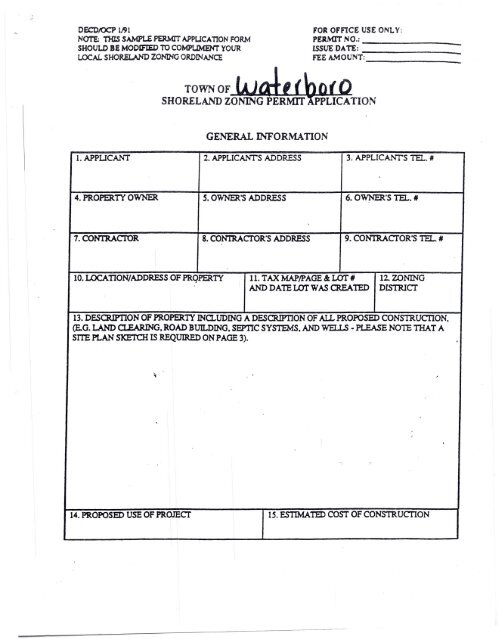
OECOIOCP 1..91<br />
NOTE: nas SAMPt..£ PERMIT APPUCA nON FORM<br />
SHOUU> BE MODIfIED TO COMPt.JMEllrr YOUR<br />
LOCAL SHOfW..ANO ZONING ORDINANCE<br />
FOR OFFlCE USE ONLY:<br />
PERMIT NO.:<br />
ISSUE DATE:<br />
FEE A.\10UNT:<br />
_<br />
_<br />
_<br />
GENERAL INFORMATION<br />
l.APPUCANT 2. APPLICANTS ADDRESS 3. APPLICANrS TEL. #<br />
4. PROPERlY OWNER S. OWNER'S ADDRESS 6. OVt'NER'S TEL. II<br />
7. CONTRAcroR 8. CONIRACTOR'S ADDRESS 9. CONT.RACTOR'S TEL. II<br />
10. LOCATION/ADDRESS OF PRqPER.TY 11. TAX MAPIPAGE & LOT 1# 12. ZONING<br />
AND DATE LOT WAS CREAlED ntsrarcr<br />
13. DESOUP'IlON OF PROPERIT INa..UDING A DESCRIPTION OF AIL PROPOSED CONS1RUCI10N,<br />
(E.G. LAND Cl.EARlNG. ROAD BUlLDING. SEPTIC SYSTEMS. AND WELLS - PLEASE NOTE nIAT A<br />
SITE PLAN SKETCH IS REQUIRED ON PAGE 3).<br />
~.<br />
14. PROPOSED USE OF PROJECT<br />
15.ESTIMAnD<br />
COST OF CONSTRUCTION
SI1 IW'" .!.Nn ANT> PR Jt"toKI Y TN'FORMATTON<br />
16. LOT AREA (SQ. Fr.) 17. FRONTAGE ON ROAD (FT.)<br />
18. SO. Fr. OF LOT TO BE COVERED BY<br />
NON-VEGETATED SURFAtES . •<br />
1~ ELEVATION ABOVE 100 YR. FLOOD<br />
;,<br />
20. FRONTAGE ON WATERBODY (FT.) 21. HEIGHT OF PROPOSED S1RUCTURE<br />
22. EXISTING USE OF PROPERTY 23_PROPOSED USE OF PROPERTY<br />
NOCe: Ouestions 24 & 25 applvonly to cxtlllUions of tIOrtions of existinll structures which are less than the required setback.<br />
24. A) TOTAL FLOOR AREA OF PORTION OF 25. A) TOTAL VOLUME OF PORTION OF<br />
STRUCTURE WHICH IS LESS THAN<br />
STRUCTURE WHICH IS LESS 11lAN<br />
REQUIRED SETBACK AS OF 1/1/89: REQUIRED SETBACK AS OF 1/1/89:<br />
SQ. FT.<br />
CUBIC FT.<br />
B) FLOOR AREA OF EXPANSIONS OF B) VOLUME OF EXPANSIONS OF PORTION<br />
PORTION OF STRUcrtJRE WHICH IS LESS OF S1'RUCI'URE WHICH IS LESS THAN<br />
TIiAN REQUIRED SETBACK FROM 1/1/89 REQUIRED SETBACK FROM 1/1/39 TO<br />
TO PRESENT:<br />
PRESENT:<br />
SQ. FT.<br />
CUBIC FT.<br />
C) FLOOR AREA OF PROPOSED EXPANSION C) VOLUME OF PROPOSED EXPANSION OF<br />
OF PORTION OF STRUCTURE WHICH IS<br />
PORTION OF STRUCTURE WIDCH IS LESS<br />
LESS THAN REQUIRED SETBACK:<br />
THAN REQUIRED SETBACK:<br />
..<br />
SQ. FT.<br />
CUBIC FT.<br />
D) % INCREASE OF FLOOR AREA OF D) % INCREASE OF VOLUME OF AClUAL<br />
xcruc, AND PROPOSED EXPANSIONS AND PROPOSED EXPANSIONS OF<br />
OF PORTION OF STRUCTURE WHICH IS PORTION OF STRUCIURE WHICH IS<br />
LESS THAN REQUIRED SETBACK SINCE LESS THAN REQUIRED SETBACK SJ;NCE<br />
1/1/89: 1/1/89:<br />
(% INCREASE = ~ X 100) (%INCREASE = ll±..C X 100)<br />
A<br />
A<br />
% %<br />
NOTE: IT IS IMPERATIVE TIiA TEACH MUNIOP ALITY DEFINE WHAT CONSTITUIES A STRUCTURE.<br />
FLOOR AREA. AND VOLUME AND APPLY 1110SE DEFINITIONS UNIFORMLY WHEN CALCULATING<br />
EXISTING AND PROPOSED SO. FT. AND CU. FT.<br />
Please use the following<br />
page to show how Sections<br />
24 and 25 were calculated.
24A) TOTAL FLOOR AREA<br />
EXISTING PRIOR TO 1989<br />
LENGTH x WIDTH<br />
x = -- -- --<br />
x =<br />
-- -- --<br />
x = -- -- --<br />
25A) TOTAL VOLUME<br />
EXISTING PRIOR TO 1989<br />
LENGTH x WIDTH x HEIGHT<br />
x x =<br />
-- --<br />
x x =<br />
-- -- --<br />
x x =<br />
-- -- --<br />
24B) TOTAL FLOOR AREA<br />
EXPANSION SINCE 1989<br />
LENGTH x WIDTH<br />
__ x __ = __<br />
__ x __ = __<br />
__ x __ = __<br />
25B) TOT AL VOLUME<br />
EXPANSION SINCE 1989<br />
LENGTH x WIDTII x HEIGHT<br />
x x =<br />
--<br />
x x =<br />
-- -- --<br />
x x =<br />
-- --<br />
24C) TOTAL FLOOR AREA<br />
PROPOSED EXPANSION<br />
LENGTH x WIDTH<br />
__ x = __<br />
--<br />
x<br />
-- =<br />
--<br />
__ x = __<br />
25C) TOTAL VOLUME<br />
PROPOSED EXPANSION<br />
LENGTH x WIDTH x HEIGHT .•<br />
x x = -- --<br />
x x = -- -- •.<br />
x x =<br />
-- --<br />
;<br />
'(<br />
24D) % INCREASE IN FLOOR AREA<br />
B+C<br />
A<br />
25D) % INCREASE IN VOLUME<br />
B+C<br />
A
7!w:;x U~ '-Ul"lS (;l;o(ksh.e.{J or s;m;/O/l -h {JfoviJf'<br />
a II r1-'l2. Cts t-t(.£ (YlJ> rrf s ·<br />
o<br />
..."'------- - ...••---- ---<br />
•
SITE PLAN<br />
PLEASE INCLUDE: LOT LINES; AREA TO BE CLEARED OF TREES AND OntER VEGET ATlON; THE<br />
EXAcr POSmON OF PROPOSED STRUCI1.JRES. INCLUDING DECKS. PORCHES. AND OUT<br />
Bun.DINGS WITH ACCURATE SETBACK DISTANCES FROM TIiE SHORELINE. SIDE AND REAR<br />
PROPERlY LINES; TIiELOCATlONOFPROPOSED 'tIELLS.SEPTIC SYSTEMS. AND DRlVEWAYS;<br />
AND AREAS AND AMOUNTS TO BE FILLED OR GRADED. IF THE PROPOSAL IS FOR THE<br />
EXPANSION OF AN EXISTING STRUCI'URE. PLEASE DISTINGUISH BE1WEEN THE EXISTING<br />
STRUCI1JRE AND THE PROPOSED EXPANSION.<br />
NOTE: FOR ALL PROJEcrs INVOLVING FILLING. GRADING. OR OTIlER SOn...DISTIJRBANCE YOU<br />
MUST PROVIDE A SOn...EROSION CONTROL PLAN DESCRIBING TIlE MEASURES TO BE TAKEN TO<br />
STABnJZE DISTIJRBED AREAS BEFORE, DURING AND AFTER CONSTRUCTION ,(See anached<br />
guidelines)<br />
~u~1 :'1<br />
-,<br />
~ ~<br />
SCALE:<br />
=<br />
FT.
ADDITION AL PERMITS, APPROVALS, AND/OR REVIEWS REQUIRED<br />
CHECK<br />
IF REQUIRED:<br />
o PLANNING BOARD REVIEW APPROVAL<br />
(e.g. Subdivision. Site Plan Review)<br />
o BOARD OF APPEALS REVIEW APPROY AI..<br />
o FLOOD HAZARD DEVELOPMENT PERMIT<br />
CJ EX1ER10R PLUMBING PERMIT<br />
(Approved HHE 200 <strong>Application</strong> Form)<br />
D· INrnRIOR PLUMBING PERMIT<br />
n DEP PERMIT (Site Location.<br />
Natural Resources Protection Act)<br />
o ARMY CORPS OF ENGINEERS PERMIT<br />
(e.g. Sec. 404 of Clean Waters Act)<br />
0TIiERS:<br />
0 _<br />
0 _<br />
0, _<br />
0 _<br />
N01E: APPLICANT IS ADVISED TO CONSULT WIm ras CODE ENFORCEMENT OFF1CER<br />
AND APPROPRIATE STAlE AND FEDERAL' AGENCIES TO DETERMINE WHETIfER .<br />
ADDmONAL PERMITS, APPROVALS, AND REVIEWS ARE REQUIRED .<br />
I CERTIFY lHAT AlL INFORMA nON GIVEN IN THIS APPLICATION IS ACCURATE. ALL<br />
PROPOSED USES SHALL BE IN CONFORMANCE Wl1H TInS APPLICATION AND<br />
1HE SHORELAND ZONING ORDINANCE.<br />
I AGREE TO FUTURE INSPECTIONS BY 1HE CODE ENFORCEMENT OFFICER AT<br />
REASONABLE HOURS.<br />
APPLICANTS SIGNATIJRE DATE<br />
AGENTS SIGNA TIJRE (if applicable) DATE
APPROV AL OR DENIAL OF APPLICATION<br />
(For om« Use Only)<br />
MAP _LOT,<br />
TIllS APPLICA nON IS: APPROVED DENIED<br />
IF DENIED, REASON FOR DENIAL:<br />
IF APPROVED. THE FOUOWING<br />
CONDITIONS ARE PRESCRIBED:<br />
NOTE: IN APPROVING A SHORELAND ZONING PERMIT. THE PROPOSED USE SHAU<br />
COMPLY WITII TIfE PURPOSES AND REQUIREMENTS OF THE SHORELAND ZONING<br />
ORDINANCE FOR ras TOWN OF .<br />
CODEENFORCENffiNTOAACER DAlE ,<br />
INSPECTION CHECK LIST<br />
0 Prior to Clearing and Excavatim<br />
PERMIT'<br />
I<br />
I<br />
I<br />
D<br />
Prior to Foundation Pour<br />
0 Prior to Final Landscaping<br />
FEE AMOUNT<br />
Cl<br />
Prior to Occupancy
GL1DELf.'iES FOR SOIL STABILrZATIO~<br />
Areas of disturbed soil, including but not limited to areas that are filled. graded. or otherwise disturbed<br />
during construction. must be stabilized according to the approved erosion control plan provided as pan of<br />
the permit application. or as modified by specific conditions of approval. The following guidelines provide<br />
guidance for the landowner to consider in preparing and executing the soil stabilization portion of the<br />
erosion control plan. The goals to be achieved by proper stabilization are the avoidance of accelerated soil<br />
erosion and sedimentation of water bodies.<br />
In General:<br />
1. Sterile soils such as sands and gravels should be covered with a minimum of 4 inches of compacted<br />
topsoil to provide a growth medium for vegetation.<br />
2. Disturbed areas which can be seeded between May 1 and September 15 should be prepared and<br />
seeded during that period. The best seeding dates are from May 1 to June 15. Mid-summer seeding<br />
will usually require significant watering.<br />
3. Disturbed areas which can not be seeded between May 1 and September 15 should be heavily<br />
mulched with hay, straw, or some other suitable material to keep them as stable as possible over the<br />
winter, and particularly during the spring runoff the fallowing year. Generally, one bale of hay for<br />
each 500 square feet of disturbed area provides a stabilizing mulch. For over-wintering, mulch must<br />
be tied down. as it is easily blown around on frozen ground. leaving areas of exposed soils. Mulched<br />
over-winter areas should be prepared and seeded the following spring as soon as conditions allow.<br />
4. Seeding preparation, in addition to providing topsoil or loam if the site is sterile. includes the<br />
application of lime and fertilizer, which should be lightly raked into the soil prior to seeding. After<br />
the area is seeded. it should be lightly watered and then mulched to protect the seed., keep the site<br />
stable and moist. and allow the seed to germinate and grow.<br />
S. Lime shoold be applied at a rate of approximately 138 pounds per lc()() square feet of area. This<br />
rate may vary depending on soil conditions, and it is recommended that soil be analyzed to determine<br />
specifically what additional nutrients are needed.<br />
6. Fertilizers should be a "quick release" low phosphorus mixture. They should be applied at 'a rate of<br />
approximately 18.4 pounds per 1cc() square feet. However, no more fertilizer than necessary should<br />
be added since any excess may be washed into the adjacent water body and conrribute to lower water<br />
quality. Fertilizers should never be applied before thunderstorms or before spring runoff.<br />
7. Minimize the areas of exposed soil during construction. and temporarily or permanently stabilize<br />
disturbed areas within one week of the time the area is actively worked. Runoff control features such<br />
as hay bales, silt fencing, and diversion ditching must be in place and functioning prior to the start of<br />
construction,
ACKNOWLEDGMENT OF SHORELAND ZONING BUFFER STANDARDS<br />
ThIS sheet provides notification of standards required by the <strong>Waterboro</strong> <strong>Shoreland</strong> <strong>Zoning</strong> Ordinance. B<br />
signing this form. the applicant acknowledges understanding of the standards and agrees to comply Wltl<br />
them and to notify all others associated with the proposed project of these restrictions. Violation of any <<br />
these standards will require the contractor(s) and/or landowner(s) to fully restore any site conditions not<br />
in compliance to their pre-construction condition and could possibly include violation fines or legal actior<br />
NOTE: This form summarizes key Ordinance provisions. Other restrictions and Maine OEP requirement<br />
may also apply. Approval of a OEP permit under the Natural Resources Protection Act does not<br />
supersede these standards which in some cases are more restrictive. See section 7 of the <strong>Zoning</strong><br />
Ordinance for information about which activities require a local permit from the code enforcement office.<br />
It is suggested that you contact the code enforcement office prior to doing anything within the shoreland<br />
zone. <strong>Shoreland</strong> zone regulations apply to all land areas within 250 feet of the normal high-water line of<br />
any great pond, river or the upland edge of a freshwater wetland, and within 100 feet of the normal highwater<br />
line of a stream.<br />
The following standards apply within the buffer area (within 100feet of the normal high water mark of all<br />
lakes, rivers, streams and wetlands. (See the official <strong>Shoreland</strong> <strong>Zoning</strong> Map for exact boundaries.)<br />
• Structures are not allowed within the buffer area. This prohibition includes storage buildings, boat<br />
houses, patios, decks, tents and any portion of a dock extending above the normal high water<br />
line.<br />
• One winding footpath of no more than six feet in width is allowed for each lot or for each 200 feet<br />
of shoreline frontage. Footpaths must be winding in order to provide opportunities for runoff to<br />
disperse into the buffer. They cannot be constructed so as to create a view corridor.<br />
• In the off-season, docks should be stacked on the footpath to avoid damage to buffer vegetation.<br />
• Fill cannot be brought into the buffer except for path construction or to re-vegetate bare ground as<br />
part of an approved re-vegetation plan.<br />
• Trees can be limbed on the lower one third of the tree.<br />
• Openings or view corridors in existence prior to January 1, 1989 can be maintained but not<br />
enlarged.<br />
'<br />
• No disturbance of the ground cover (including the duff and leaf iayer) or vegetation shall be<br />
caused within the buffer, or between the lake and a grandfathered or new structure. Equipment<br />
movement and excavation disturbance must be carefully controlled to avoid any impact on the<br />
buffer. For example, it is not legal to locate a foundation at the buffer limit if that placement will<br />
cause any disturbance within the buffer. The placement of silt fence at the buffer limit is intended<br />
to prevent this problem and satisfy state and local laws.<br />
• Openings that have "closed" with growth of woody vegetation cannot be "re-opened".<br />
• Grandfathered buildings within the buffer may be expanded if the expansions are no closer to the<br />
water body than the original structure. Such expansions of floor area and/or volume are. limited to<br />
30% of the floor area and volume in existence as of January 1, 1989. Planning Board review is<br />
required to obtain a permit to expand an existing structure that is within 100 feet of the waterbody.<br />
• Before any construction begins, pre-construction photos should be taken and a copy should be<br />
provided to the code enforcement office to be kept in the building file. Silt fence must be properly<br />
installed at the upland extent of the buffer area below any construction.<br />
• Clearing of vegetation within the strip of land 75 feet inland from the normal high-water line in a<br />
shoreland area zoned for resource protection abutting a pond is not allowed. Vegetation under<br />
three feet in height can not be removed or cut. Timber harvesting within 75 feet of a pond or<br />
stream is not allowed.<br />
• Clearing for development from 75-250 can be done selectively but no more than 40% of the total<br />
volume of trees four inches or more in diameter measured at 4 Yl feet above the ground can be<br />
removed on any lot within a ten year period.<br />
;:O,.=a.:,;:te:.,;..: Signature of Applicant: <strong>Permit</strong> #. _